JORDAO PROPERTY ± RIPARIAN IRRIGATED CROPLAND. $2,438,000 ($23,000/Acre)
|
|
|
- Milton Prosper Jennings
- 5 years ago
- Views:
Transcription
 Presented")
1 JORDAO PROPERTY ± RIPARIAN IRRIGATED CROPLAND Located at: 7505 Hogin Road Crows Landing, Stanislaus County, CA APN s & Offered for $2,438,000 ($23,000/Acre) Presented By: Edwards, Lien & Toso, Inc. CA BRE Corporate License # Agricultural Appraisers & Brokers 8408 N. Lander Avenue Hilmar, California (209)
2 LOCATION AND ACCESS Property is located 8 miles southwest of Turlock and 7.5 miles west of Hilmar at 7505 Hogin Road. It is physically situated at the northwest corner of August and Hogin Roads, Crows Landing, Stanislaus County, CA. Access to the subject property is via Hogin Road, which provides year round access. This road is paved with two lanes, and is county and state maintained with no curbs, gutters, or sidewalks. SIZE, SHAPE, TOPOGRAPHY AND ELEVATION Property is 106 assessed acres and is irregular in shape forming along the east bank of the San Joaquin River. Topography is generally level with an elevation estimated at ±55 feet above mean sea level, according to the official USGS map. Properties in the general vicinity are similar in comparison based on the provided USGS Topography map. UTILITIES AND SERVICES The property has typical rural utilities and services available. On-site utilities consist of electrical service provided by TID (Turlock Irrigated District) and telephone service provided by the local carrier. There are no urban sewers or water services available to the property. Police and fire protection are provided by county agencies. Garbage collection and propane services are available from various private companies. ZONING AND TRENDS Property is located in an area typically devoted to long-term agricultural use. The property is zoned for agricultural use and is not located within the sphere of influence of any city or rural community. The current zoning designation for the subject parcel is A This zoning provides for agricultural use with a 40-acre minimum parcel size. The current agricultural use of the subject property (as irrigated cropland) complies with the current zoning designation and general plan for Stanislaus County.
3 FEDERAL FLOOD HAZARD Property is located within Special Flood Hazard Zone A. This determination is according to the FEMA Federal Insurance Rate Map, Stanislaus County, Community Panel No C 0800 E, dated 9/26/2008 and Panel No C0770E, dated 9/26/2008. Special Flood Hazard Zone A is defined as areas subject to inundation by the 1% annual chance flood. No base flood elevations determined. Flood map is attached. SOIL DETAILS Soils found on the property were classified by the Natural Resources Conservation Service (NRCS) using the mapping tools found on the USDA s Web Soil Survey website. The property map noting specific soil locations throughout the subject property can be found within the attached sails maps and are shown in the following chart: ( ) % of PROPERTY MAP SYMBOL SOIL TYPE CAPABILITY UNIT 49% CsB Columbia soils, channeled, 0-8% slopes 3 30% TcA Temple loam, overwashed, slightly saline 0-1% slopes 2 21% TeA Temple silty clay, slightly saline, 0-1% slopes 3 Soil survey rates soils according to capability class. Capability classes show, in a general way, the suitability of soils for most kinds of crops. Soil capability classes are grouped by numbers 1 to 8, according to their limitations. As the number increases, it indicates progressively greater limitations and narrower choices for use. The Columbia series consists of very deep, moderately well drained soils, with medium runoff, moderately rapid permeability, formed in alluvium from mixed sources. These soils are on flood plains and natural levees and have slopes of 0 to 8 percent. These soils are used for irrigated hay, small grain, and orchard and row crops. The Temple series consists of (minimal) Humic Gley soils developed from stratified moderately coarse and moderately fine textured predominantly granitic alluvium. They occur on nearly level to depressional recently deposited floodplains under moisture living grass and herbaceous vegetation. General drainage is poor to somewhat poor (imperfect). Surface runoff is very slow; permeability is moderately slow to slow. Soils are subject to overflow during seasonal flood periods where not protected by levees. Generally high water tables are present. Where adequately drained and protected from overflow, these soils are productive and used mainly for grain, alfalfa, and cotton. Reference the Soils Map found in the Addendum, noting specific soil locations throughout the property. Detailed soil descriptions are retained in the appraisal office.
4 WATER SOURCE, DISTRIBUTION & COST Exclusive irrigation water source is riparian from the San Joaquin River. There are two river pumps on pontoons on the river, west of the levee, off the northwest corner of the property. Electric motors on the pump units are 30 & 50 HP. Pump units and the main pipeline are shared with the property to the east along the east side of Hogin Road. Irrigation water is flood distributed through concrete pipelines in which irrigation water is distributed through alfalfa valves. Estimated water costs are $75 per acre which includes all forms of depreciation, stand-by-charges and pumping costs. AGRICULTURAL PRESERVE DESCRIPTION According to Merced County, the subject parcel is enrolled in the Agricultural Preserve program (Williamson Act). DETAILS OF PRESENT LAND USE & PRODUCTIVITY Property consists of two assessor s tax parcels totaling 106 acres. Property is primarily devoted to irrigated field/row cropland. It is surrounded by similar use properties. For visual details refer to attached Aerial Plat Map. The observed land uses and reported productivity of the property acreage are detailed as follows: Acres Comments ± Net acres devoted to irrigated field/row cropland. ±5.00 Acreage located within or along the San Joaquin River. ± Total Assessed Acres *This information was obtained from sources that are deemed reliable but are in no way guaranteed by Edwards, Lien & Toso, Inc., its Brokers or Agents. Prospective Buyers should check all facts to their own Satisfaction. This offer is subject to prior sale, price change, and/or withdrawal from the market.

5 MARKET AREA LOCATION MAP SUBJECT
6 SUBJECT SUBJECT ASSESSOR'S PARCEL MAP

7 Riparian Area Yard SUBJECT AERIAL / PLAT MAP River Pumps SUBJECT


8 SUBJECT PHOTOGRAPHS Cropland and Levee River Pumps Typical View of San Joaquin River Frontage Typical View of Riparian Area Yard Area Typical View of Property Along Hogin Road

9 SOILS MAP SUBJECT

10 TOPOGRAPHY MAP SUBJECT

11 FEMA FLOOD MAP

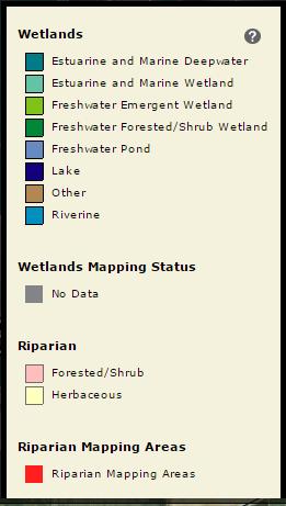
12 WETLANDS MAP SUBJECT
$795,000 ALL CASH or TERMS ACCEPTABLE TO SELLER
 30.40 Acres Devoted to Irrigated Cropland Located at: North Side of Ave. 1, Atwater, Merced County, CA Offered for $795,000 ALL CASH or TERMS ACCEPTABLE TO SELLER Presented By: Edwards, Lien & Toso, Inc.
$995,000 ALL CASH or TERMS ACCEPTABLE TO SELLER
 19.50 Acres Devoted to Almonds, Irrigated Cropland and Custom Residence Located at: 15314 El Capitan Way, Delhi, Merced County, CA 95315 Offered for $995,000 ALL CASH or TERMS ACCEPTABLE TO SELLER Presented
31.34 Acre Orchard Development Property w/ Walnut Huller & Small House (Land deep ripped 3x) Located: 37 Laurel Avenue, Yuba City Sutter County, CA
 Located: 37 Laurel Avenue, Yuba City Sutter County, CA") w/ Walnut Huller & Small House (Land deep ripped 3x) Located: 37 Laurel Avenue, Yuba City Sutter County, CA Offered At: $970,000 Exclusively presented by CA BRE Corporate License # 01527052 Agricultural
w/ Walnut Huller & Small House (Land deep ripped 3x) Located: 37 Laurel Avenue, Yuba City Sutter County, CA Offered At: $970,000 Exclusively presented by CA BRE Corporate License # 01527052 Agricultural
Acres Fresno County, California MATURE VINEYARD PROPERTY
 36.93 +- Acres Fresno County, California MATURE EXCLUSIVELY PRESENTED BY: Morris Garcia License 00834407 (559) 994-7453 Cell Sarah Donaldson License 01897016 (559) 479-6582 Cell 1959 Gateway Blvd. Suite
HEADQUARTERS WEST LTD.
 HEADQUARTERS WEST LTD. FARM, RANCH, AGRIBUSINESS REAL ESTATE SALES & SERVICES Offered For Sale STATE OF ARIZONA AGRICULTURAL LEASEHOLD INTEREST 3,480± Cropland Acres/5,100± Gross Acres Yuma Mesa, Yuma
Farmland for Sale. Bleckley County, Georgia. $1,002, Acres $2,650 per Acre
 Farmland for Sale Bleckley County, Georgia 2 Contents Property Fact Sheet... 3 Regional Map... 4 Local Map... 5 Aerial Map... 6 FSA - Farm 2044 Tract 859... 7 FSA - Farm 2044 Tract 613... 8 Farmland Utilization...
VI. SAFETY ELEMENT I. INTRODUCTION A. PURPOSE B. AUTHORITY. 1. Safety
 AB 162 and SB 1241 Amendment to the Safety Element New sections are underlined, deleted sections are shown as strikethrough and the denotes text remaining in place. VI. SAFETY ELEMENT I. INTRODUCTION A.
5,093± Acres fresno County, California $9,651,614
 5,093± Acres fresno County, $9,651,614 Presented Exclusively by: www.pearsonrealty.com CA BRE# 00020875 Property Aerial San Joaquin S Colorado Ave McMullen Grade 145 W Kamm Ave Helm S Lassen Ave Property
FOR SALE 2, /- Gross Acre Cattle Ranch in Tulare County
 FOR SALE 2,252.70 +/- Gross Acre Cattle Ranch in Tulare County Morgan Houchin 3430 Unicorn Road Bakersfield, CA 93308 Neither the Seller, nor makes any representations or warranties, either expressed or
(+/-) acres Chicot County, Arkansas
 acres Chicot County, Arkansas") offered for sale CHICOT LAND COMPANY FARMLAND TRACT 1 An agricultural and recreational investment opportunity. 945.91 (+/-) acres Chicot County, Arkansas offered by Licensed in Arkansas, Louisiana, Mississippi,
offered for sale CHICOT LAND COMPANY FARMLAND TRACT 1 An agricultural and recreational investment opportunity. 945.91 (+/-) acres Chicot County, Arkansas offered by Licensed in Arkansas, Louisiana, Mississippi,
FOR SALE. Hawkins Road North 78 / Vacaville, CA. 78 Acres / $1,650, Katleba Lane, Vacaville, CA APN s: & 030
 78 Acres / $1,650,000 6268 Katleba Lane, Vacaville, CA 95687 APN s: 0134-300-020 & 030 Property Highlights y Great Land Bank Opportunity y Prime Farmland in the Path of Growth PROPERTY y Within Solano
Foley Estate Farm. 80± Acres, Section 22 Grove Township Humboldt County, Iowa. August 27, 2015, 10:00 AM Humboldt County Fairgrounds Humboldt, Iowa
 Foley Estate Farm 80± Acres, Section 22 Grove Township Humboldt County, Iowa August 27, 2015, 10:00 AM Humboldt County Fairgrounds Humboldt, Iowa 1309 1 st Ave South, Suite 5 Fort Dodge, IA 50501-4954
78 ACRE GOODELL FARM East 2000N Road Kankakee IL Mark Goodwin Phone:
 78 ACRE GOODELL FARM For more information contact: 815-741-2226 mgoodwin@bigfarms.com County: Kankakee Township: Ganeer (North Part) Gross Land Area: 78 Acres Property Type: Vacant Farmland Possible Uses:
±86 ACRES OF LAND EL CENTRO ROAD & SAN JUAN SACRAMENTO, CA CONTACT US FOR SALE. SITE
 SACRAMENTO, CA 95834 SITE CONTACT US RANDY GRIMSMAN Senior Vice President Lic. 00857338 +1 916 446 8745 randall.grimsman@cbre.com www.cbre.com/randall.grimsman CBRE, Inc. 500 Capitol Mall, Suite 2400 Sacramento,
offered for sale UPPER RAFT CREEK RESERVE A recreational investment opportunity offered by
 offered for sale UPPER RAFT CREEK RESERVE A recreational investment opportunity 241.0 (+/-) total acres White County, Arkansas offered by Licensed in Arkansas, Louisiana, Mississippi, Tennessee and Texas
Foley Estate FARM ± Acres, Section 15 Grove Township Humboldt County, Iowa. August 27, 2015, 10:00 AM Humboldt County Fairgrounds Humboldt, Iowa
 Foley Estate FARM 176.7± Acres, Section 15 Grove Township Humboldt County, August 27, 2015, 10:00 AM Humboldt County Fairgrounds Humboldt, 1309 1 st Ave South, Suite 5 Fort Dodge, IA 50501-4954 Phone:
COUNTY OF SAN MATEO PLANNING AND BUILDING DEPARTMENT
 COUNTY OF SAN MATEO PLANNING AND BUILDING DEPARTMENT DATE: April 16, 2015 TO: FROM: Zoning Hearing Officer Planning Staff SUBJECT: Consideration of a Coastal Development Permit and Planned Agricultural
$3,200,000. Laguna Island Ranch ± acres. Exclusively Presented by:
 Sale Price: $3,200,000 Enjoy the best of both worlds; entertain in this elegant 5,675± square foot home after spending the day riding your favorite horses in this immaculate horse facility. The 40 acre
Address Southeast Quadrant of U.S. Highway 41 and Sumter Boulevard City. North Port State. FL Zip Code County
 SUBJECT AERIAL LOCATION LAND AREA THREE-YEAR OWNERSHIP HISTORY OF SUBJECT Address Southeast Quadrant of U.S. Highway 41 and Sumter Boulevard City North Port State FL Zip Code 34287 County Sarasota Nearest
center ridge ranch An agricultural and recreational investment opportunity.
 offered for sale center ridge ranch An agricultural and recreational investment opportunity. 891.0 (+/-) total acres Conway County, Arkansas offered by Licensed in Arkansas, Louisiana, Mississippi, Tennessee
LOCKHART AREA COUNTRY ESTATE SITE
 LOCKHART AREA COUNTRY ESTATE SITE (Scenic, End of Road Privacy, County Road Front, City Water, Fertile Soils, Views, Near SH 130) 150 ACRES CALDWELL COUNTY, TEXAS Ground Snapshots - Taken in May, 2011
Summary: Location: Property Details: Potato Crop in Pivot 1 Field
 Summary: There are 635 total acres of which 484 acres are pivot irrigated cropland with early priority water rights. The farm has been in a potato and grain rotation operated by the same tenant for over
PRICE REDUCED ± Acres Tulare County, California. CA BRE # Exclusively Presented ented By: Pearson Realty
 PRICE REDUCED Richgrove Farmland Opportunity 421.21± Acres Tulare County, California District & Well Water Quality Soils Tax Benefits Land Available to Plant Exclusively Presented ented By: Pearson Realty
DONLON REALTY. KEVIN H. DONLON Land Broker CA License PHONE (209) FAX (209)
 FAX (209)") The Adobe Valley Ranch is a 5,781 acre ranch located in the Mount Diablo Coastal Mountain Range in Western Stanislaus County, California on the south side of Del Puerto Canyon Road. The ranch has a rolling-to-steep
The Adobe Valley Ranch is a 5,781 acre ranch located in the Mount Diablo Coastal Mountain Range in Western Stanislaus County, California on the south side of Del Puerto Canyon Road. The ranch has a rolling-to-steep
3. What is the requested zoning for the property (including intensity designator)? RM1-45 Residential (Multi-Dwelling).
? RM1-45 Residential (Multi-Dwelling).") B. SUBJECT PROPERTY INFORMATION General location of subject property and address (if address has been assigned): Northside- 819 Stoddard St. Missoula, MT 59802 Legal Description - complete and unabbreviated:
B. SUBJECT PROPERTY INFORMATION General location of subject property and address (if address has been assigned): Northside- 819 Stoddard St. Missoula, MT 59802 Legal Description - complete and unabbreviated:
/- Acres Lincoln County, Minnesota. Pifer s LAND AUCTION. Wednesday, May 2, :00 a.m.
 342.33 +/- Acres Lincoln County, Minnesota LAND AUCTION Wednesday, May 2, 2018 11:00 a.m. AUCTION LOCATION: Senior Citizens Center - Taunton, MN Owner: Secured Lender Highly productive cropland in Lake
offered for sale BAPTIST HEALTH FARM An Agricultural and Recreational Investment Opportunity offered by
 offered for sale BAPTIST HEALTH FARM An Agricultural and Recreational Investment Opportunity 217 (+/-) Total Acres Jefferson County, Arkansas offered by Licensed in Arkansas, Louisiana, Mississippi, Tennessee
APPLICATION PROCESSING
 MAJOR SUBDIVISION 1810 E. HAZELTON AVENUE, STOCKTON CA 95205 BUSINESS PHONE: (209) 468-3121 BUSINESS HOURS: 8:00 A.M. TO 5:00 P.M..(Monday through Friday) APPLICATION PROCESSING STEPS STEP 1 STEP 2 CHECK
4. If any perennial surface water passes through or along the property lines of the acreage, a minimum of 200 feet or frontage should be required.
 b. Provide adequate acreage for appropriate productive use of rural residential land, such as small numbers of livestock, large gardens, etc. 3. Minimum of 200 feet of frontage on an improved county or
Lorraine Scheele Estate Donna Simon & Diane Piatz, Co-Personal Representatives. Auction Location Eagles Club 316 S. 2nd Street, Aberdeen, SD
 Lorraine Scheele Estate Donna Simon & Diane Piatz, Co-Personal Representatives Auction Location Eagles Club 316 S. 2nd Street, Aberdeen, SD Lot 1 Lot 1 Lot 2 Lot 2 Lot 3 Lot 3 Welcome We would like to
APPLICATION FOR IRRIGATION SERVICE ABANDONMENT AGREEMENT
 APPLICATION FOR IRRIGATION SERVICE ABANDONMENT AGREEMENT 1. Applicant s name 2. Landowner s name 3. Mailing Address Telephone # 4. Location of requested property :APN# Address: 5. When was the last time
FOR SALE /- Acres of Farmland & Almonds in Rosedale-Rio Bravo Water Storage District. Morgan Houchin. Tech Ag Financial Group, Inc.
 FOR SALE Morgan Houchin P.O. Box 98 Buttonwillow, CA 93206 Neither the Seller, nor makes any representations or warranties, either expressed or implied as to the accuracy or completeness of the enclosed.
SUBURBAN AND URBAN RESIDENTIAL LAND USE
 SUBURBAN AND URBAN RESIDENTIAL LAND USE GOAL 1 DISCOURAGE URBAN AND SUBURBAN DEVELOPMENT OUTSIDE INCORPORATED AREAS IN WHITMAN COUNTY, EXCEPT WITHIN DESIGNATED UNINCORPORATED COMMUNITIES, AND THOSE AREAS
292 West Beamer Street Woodland, CA (530) FAX (530)
 FAX (530)") - County of Yolo PLANNING AND PUBLIC WORKS DEPARTMENT John Bencomo DIRECTOR 292 West Beamer Street Woodland, CA 95695-2598 (530) 666-8775 FAX (530) 666-8728 www.yolocounty.org PLANNING COMMISSION STAFF
- County of Yolo PLANNING AND PUBLIC WORKS DEPARTMENT John Bencomo DIRECTOR 292 West Beamer Street Woodland, CA 95695-2598 (530) 666-8775 FAX (530) 666-8728 www.yolocounty.org PLANNING COMMISSION STAFF
199 ACRE AVERY LASALLE COUNTY FARM
 199 ACRE AVERY LASALLE COUNTY FARM For more information contact: 815-741-2226 mgoodwin@bigfarms.com County: LaSalle Township: Freedom Township Gross Land Area: 199 Total Acres Property Type: Class A Farmland
FOR SALE /- Gross Acres El Rancho Farms Property. Morgan Houchin Tech Ag Financial Group, Inc
 FOR SALE 817.34 +/- Gross Acres Morgan Houchin 3430 Unicorn Road Bakersfield, CA 93308 Neither the Seller, nor makes any representations or warranties, either expressed or implied as to the accuracy or
Mike Eliason, Owner Monday February 18 th 2019 Sale Time: 10:30 AM /- Acres, Lincoln County, SD Auctioneers: Joel R. Westra ,
 Mike Eliason, Owner Monday February 18 th 2019 Sale Time: 10:30 AM 187.99 +/- Acres, Lincoln County, SD Auctioneers: Joel R. Westra 605-310-6941, Pete Atkins 605-351-9847 Joel A. Westra 605-957-5222, Craig
CHAPTER 3 PRELIMINARY PLAT
 10-3-1 10-3-3 SECTION: CHAPTER 3 PRELIMINARY PLAT 10-3-1: Consultation 10-3-2: Filing 10-3-3: Requirements 10-3-4: Approval 10-3-5: Time Limitation 10-3-6: Grading Limitation 10-3-1: CONSULTATION: Each
TOWN OF HOLLIS, NEW HAMPSHIRE
 TOWN OF HOLLIS, NEW HAMPSHIRE BUILDOUT ANALYSIS NOVEMBER 20, 2001 Prepared by the NASHUA REGIONAL PLANNING COMMISSION TABLE OF CONTENTS I. INTRODUCTION...1 II. GOAL OF THE BUILDOUT ANALYSIS...1 III. METHODOLOGY...1
Preliminary Subdivision Application (Minor) (Three (3) lots or less)
 (Three (3) lots or less)") Gunnison City Offices www.gunnisoncity.org 38 West Center Gunnison, Utah 84634 (435) 528 7969 Date of Application: Preliminary Subdivision Application (Minor) (Three (3) lots or less) APPLICANT INFORMATION
Gunnison City Offices www.gunnisoncity.org 38 West Center Gunnison, Utah 84634 (435) 528 7969 Date of Application: Preliminary Subdivision Application (Minor) (Three (3) lots or less) APPLICANT INFORMATION
The City of Carlsbad Planning Division A REPORT TO THE PLANNING COMMISSION. Item No. P.C. AGENDA OF: March 16, 2011 Project Planner: Shannon Werneke
 The City of Carlsbad Planning Division A REPORT TO THE PLANNING COMMISSION Item No. 2 Application complete date: January 24, 2011 P.C. AGENDA OF: March 16, 2011 Project Planner: Shannon Werneke Project
FOR SALE /- Acres of Producing Pistachios in Semitropic Water Storage District. Morgan Houchin Tech Ag Financial Group, Inc.
 FOR SALE 81.34 +/- Acres of Producing Pistachios Morgan Houchin 3430 Unicorn Road Bakersfield, CA 93308 Neither the Seller, nor makes any representations or warranties, either expressed or implied as to
GOVERNMENT CODE SECTION GOVERNMENT CODE SECTION 65302
 GOVERNMENT CODE SECTION 65300 65300. Each planning agency shall prepare and the legislative body of each county and city shall adopt a comprehensive, long-term general plan for the physical development
APPLICATION PROCESSING. CHECK WITH STAFF - Development Services Staff will explain the requirements and procedures to you.
 PLANNED DEVELOPMENT ZONE 1810 E. HAZELTON AVENUE, STOCKTON CA 95205 BUSINESS PHONE: (209) 468-3121 Business Hours: 8:00 a.m. to 5:00 p.m. (Monday through Friday) STEP 1 STEP 2 FEE FORM DEED SERVICES APPLICATION
Preliminary Subdivision Application (Major) (Four (4) lots or more)
 (Four (4) lots or more)") Gunnison City Offices www.gunnisoncity.org 38 West Center Gunnison, Utah 84634 (435) 528 7969 Date of Application: Preliminary Subdivision Application (Major) (Four (4) lots or more) APPLICANT INFORMATION
Gunnison City Offices www.gunnisoncity.org 38 West Center Gunnison, Utah 84634 (435) 528 7969 Date of Application: Preliminary Subdivision Application (Major) (Four (4) lots or more) APPLICANT INFORMATION
FOR SALE /- Acres of SSJMUD Almonds and Open Farmland. Morgan Houchin Tech Ag Financial Group, Inc
 FOR SALE 117.44 +/- Acres of SSJMUD Morgan Houchin P.O. Box 98 Buttonwillow, CA 93206 Neither the Seller, nor makes any representations or warranties, either expressed or implied as to the accuracy or
FOR SALE 605 Industry Ave DISTRIBUTION WAREHOUSE FACILITY Asking $395,000
 FOR SALE 605 Industry Ave DISTRIBUTION WAREHOUSE FACILITY Asking $395,000 For Additional Information and To View the Property Please Contact Sandy Hoff - Office Phone 218-722-5556 shoff@fisalter.com AREA
PLANNED UNIT DEVELOPMENT & SUBDIVISION STAFF REPORT Date: September 15, 2016
 # 10 SUB2016-00089 PLANNED UNIT DEVELOPMENT & SUBDIVISION STAFF REPORT Date: September 15, 2016 NAME SUBDIVISION NAME LOCATION Lot 12 Laughlin Industrial Park Subdivision Lot 12 Laughlin Industrial Park
BILL JOHNSON & ASSOCIATES REAL ESTATE COMPANY WILL CO-BROKER IF BUYER IS ACCOMPANIED BY HIS OR HER AGENT AT ALL PROPERTY SHOWINGS
 WITTE ROAD RANCH For more information: Bill Johnson & Associates Real Estate Company 420 East Main, Bellville, Texas 77418 979-865-5969 281-463-3791 979-992-2636 www.bjre.com This 36.7820 acres is conveniently
APPLICATION PROCESSING STEPS
 LOT LINE ADJUSTMENT 1810 E. HAZELTON AVENUE, STOCKTON CA 95205 BUSINESS PHONE: (209) 468-3121 Business Hours: 8:00 a.m. to 5:00 p.m. (Monday through Friday) APPLICATION PROCESSING STEPS STEP 1 CHECK WITH
Umatilla County Department of Land Use Planning
 Umatilla County Department of Land Use Planning 216 SE 4 th ST, Pendleton, OR 97801, (541) 278-6252 PROCESSING TYPE I & III APPLICATIONS Land Division, Type I - IV Supplemental Application & Information
BANK OWNED. Southwest Dixon Specific Plan Land ±58.29 ACRES SWC West A Street & George Lane Dixon, CA CONTACT US PROPERTY HIGHLIGHTS
 FOR SALE Dixon, CA BANK OWNED PROPERTY HIGHLIGHTS DEVELOPMENT POTENTIAL POTENTIAL TREE GROUND CONTACT US KRIS RILEY +1 916 781 4861 Kris.riley@cbre.com Lic. 01290492 PETER NIXON +1 916 781 4819 peternixon@cbre.com
LAND AUCTION. Property Showing January 12, :00 PM to 3:00 PM On Tract 1
 LAND AUCTION 418.77+/- Acres Union County, South Dakota Offered in Four Tracts! Thursday, February 7, 2019 1:30 PM at the Jefferson Community Center, 309 South Railroad, Jefferson, South Dakota Highlight
ARTICLE 7 UTILITIES AND EASEMENTS
 7.1 PLACEMENT OF UTILITIES ARTICLE 7 UTILITIES AND EASEMENTS 7.1.1 All authorized public underground utilities shall be located within the right-of-way of a public street or within an easement designated
offered for sale TROTTER LANDS A Timberland and Recreational Investment Opportunity offered by
 offered for sale TROTTER LANDS A Timberland and Recreational Investment Opportunity 281.0 (+/-) Total Acres Jefferson County, Arkansas offered by Licensed in Arkansas, Louisiana, Mississippi, Tennessee
House, Buildings and 28 Acres m/l Keokuk County, IA. Underwood Property County Road V5G, Ollie, Iowa 52576
 ACREAGE FOR SALE House, Buildings and 28 Acres m/l Keokuk County, IA Underwood Property 28593 County Road V5G, Ollie, Iowa 52576 Property Information Location From Sigourney: 2 miles south on Hwy 149,
Urban Land. Overview 2.1
 Overview 2.1 This chapter contains the valuation procedures for determining the assessed value for residential and commercial land valued using the cost approach. SAMA s 2015 Cost Guide provides direction
APPLICATION FOR SUBDIVISION APPROVAL OF A SKETCH PLAN with checklist
 Prior to filing any application for SUBDIVISION approval, the applicant shall request in writing that the zoning administrator schedule a pre-submission conference. APPLICATION TO THE PLANNING BOARD TOWN
ALBA BEACH SUBDIVISION, RESUBDIVISION OF LOT 17
 ALBA BEACH SUBDIVISION, RESUBDIVISION OF LOT 17 Engineering Comments: FINAL PLAT COMMENTS (should be addressed prior to submitting the FINAL PLAT for acceptance and signature by the City Engineer): A.
Tracie & Dennis Jones Rezone, RZ
 / Planning and Zoning Staff Report Tracie & Dennis Jones Rezone, RZ2018-0014 Applicant: Tracie & Dennis Jones Staff: Deb Root, 454-7340 droot@canyonco.org Tax ID: R37886012 Current Zone: A (Agricultural)
Cox Ranch, 1,726 +/- Acres
 AG-LAND Investment Brokers 275 Sale Lane Red Bluff, CA 96080 530-529-4400 Fax 530-527-5042 Cox Ranch, 1,726 +/- Acres Paskenta, CA Tehama County, CA i AG-LAND INVESTMENT BROKERS 275 Sale Lane, Suite
COLUMBIA COUNTY LAND DEVELOPMENT SERVICES COURTHOUSE 230 STRAND ST. HELENS, OREGON (503) APPLICANT: Name:
 APPLICANT: Name:") COLUMBIA COUNTY LAND DEVELOPMENT SERVICES COURTHOUSE 230 STRAND ST. HELENS, OREGON 97051 (503) 397-1501 PARTITION General Information File No. APPLICANT: Name: Mailing address: City State Zip Code Phone
COLUMBIA COUNTY LAND DEVELOPMENT SERVICES COURTHOUSE 230 STRAND ST. HELENS, OREGON 97051 (503) 397-1501 PARTITION General Information File No. APPLICANT: Name: Mailing address: City State Zip Code Phone
direct Principal
 FARMLAND AVAILABLE FOR SALE ARVIN-EDISON OPEN LAND & CITRUS KERN COUNTY CA PROPERTY HIGHLIGHTS Open Ground and Mature Citrus Arvin-Edison Water District Quality Soils For More Information, Contact: MICHAEL
FORM Seven (7) copies of the completed application information forms (attached) which all owners must sign.
 copies of the completed application information forms (attached) which all owners must sign.") WILLIAMSON ACT CONTRACT CANCELLATION SAN JOAQUIN COUNTY COMMUNITY DEVELOPMENT DEPARTMENT 1810 E. HAZELTON AVENUE, STOCKTON CA 95205 BUSINESS PHONE: (209) 468-3121 Business Hours: 8:00 a.m. to 5:00 p.m.
WILLIAMSON ACT CONTRACT CANCELLATION SAN JOAQUIN COUNTY COMMUNITY DEVELOPMENT DEPARTMENT 1810 E. HAZELTON AVENUE, STOCKTON CA 95205 BUSINESS PHONE: (209) 468-3121 Business Hours: 8:00 a.m. to 5:00 p.m.
Planning Commission Preliminary Plan Hidden Lakes Estates Medina Township EXECUTIVE SUMMARY
 Planning Commission Preliminary Plan Hidden Lakes Estates Medina Township Meeting: January 2, 2019 App. No.: 105-2018-PP Applicant: Hidden Lake Medina, LLC Engineer: Cunningham & Associates, LLC Parcel
River Rock Estates Sketch Plan, a proposed major subdivision in S24, T35N R2W NMPM on County Rd 119 (PLN18-336)
") MEMORANDUM Archuleta County Development Services Planning Department 1122 HWY 84 P. O. Box 1507 Pagosa Springs, Colorado 81147 970-264-1390 Fax 970-264-3338 TO: Archuleta County Planning Commission FROM:
MEMORANDUM Archuleta County Development Services Planning Department 1122 HWY 84 P. O. Box 1507 Pagosa Springs, Colorado 81147 970-264-1390 Fax 970-264-3338 TO: Archuleta County Planning Commission FROM:
THE APPRAISAL OF REAL ESTATE 2 CANADIAN EDITION BUSI 330 CHAPTER 9
 THE APPRAISAL OF REAL ESTATE ND 2 ANADIAN EDITION BUSI 330 REVIEW NOTES by HUK DUNN HAPTER 9 opyright 2004 by the Real Estate Division and huck Dunn. All rights reserved. Review Notes: Land or Site Analysis
Old Thomasson Range, Chico, CA
 AG-LAND INVESTMENT BROKERS 275 Sale Lane, Suite 2 / P. O. Box 896 Red Bluff, CA 96080 530.529.4400 office / 530.527.5042 fax Old Thomasson Range, Chico, CA Property: Approximately 5,270 acres bordered
RENITA HURDSMAN BEAR RIVER STATE PARK LAND EXCHANGE PROPOSAL
 DETAILED ANALYSIS RENITA HURDSMAN BEAR RIVER STATE PARK LAND EXCHANGE PROPOSAL June 1, 2006 Prepared by the Office of State Lands and Investments Herschler Building, 3W 122 West 25 th Street Cheyenne,
APPLICATION SUBMITTAL REQUIREMENTS FOR Tentative Parcel or Subdivision Maps
 CITY OF EL CERRITO Community Development Department Planning and Building Division 10890 San Pablo Avenue, El Cerrito, CA 94530 (510) 215-4330 FA (510) 233-5401 planning@ci.el-cerrito.ca.us APPLICATION
80.83 Acres +/- Dale Township McLean County, Illinois
 LAND FOR SALE 80.83 Acres +/- Dale Township McLean County, Illinois OFFERED BY: 6 Heartland Dr. Suite A, P.O. Box 1607 Bloomington, IL 61702-1607 www.soycapitalag.com Craig R. Thompson, Broker (309) 665-0048
Hickory Ridge Residence & Farm An residential, agricultural, and recreational investment opportunity.
 offered for sale Hickory Ridge Residence & Farm An residential, agricultural, and recreational investment opportunity. 2,620 (+/-) square foot dwelling situated on 65 (+/-) acres of farmland Hickory Ridge,
190 AC LISBON TOWNSHIP FARM
 190 AC LISBON TOWNSHIP FARM 13900 Lisbon Road (NE corner of Lisbon Rd. & Bushnell School Rd. For more information contact: 815-741-2226 mgoodwin@bigfarms.com County: Kendall Township: Lisbon Gross Land
FOR SALE Historic Frank Lloyd Wright Service Station Asking $380,000 Own A Piece of History
 FOR SALE Historic Frank Lloyd Wright Service Station Asking $380,000 Own A Piece of History Opened 1956 For Additional Information and To View the Property Please Contact Sandy Hoff - Office Phone 218-722-5556
149(+/-) Acres. Prime Location Development Opportunity. Partially Completed. 260 Shepherd of the Hills Expressway Branson Mo
 Acres. Prime Location Development Opportunity. Partially Completed. 260 Shepherd of the Hills Expressway Branson Mo") Price Reduced!! 149(+/-) Acres Prime Location Development Opportunity Partially Completed 260 Shepherd of the Hills Expressway Branson Mo Attention Developers! Bank owned 149(+/-) acres in town! Partially
Price Reduced!! 149(+/-) Acres Prime Location Development Opportunity Partially Completed 260 Shepherd of the Hills Expressway Branson Mo Attention Developers! Bank owned 149(+/-) acres in town! Partially
GWINNETT COUNTY CSO CONSERVATION SUBDIVISION OVERLAY DISTRICT REQUIREMENTS
 GWINNETT COUNTY CSO CONSERVATION SUBDIVISION OVERLAY DISTRICT REQUIREMENTS Section 1316. CSO Conservation Subdivision Overlay District. 1. Purposes. The purposes of this overlay district are as follows:
We are pleased to present McTigue Family 40 ± Acres Prime Building Site, Farmland & Hunting/Rec. Mankato Township, Blue Earth County
 We are pleased to present McTigue Family 40 ± Acres Prime Building Site, Farmland & Hunting/Rec. Mankato Township, Blue Earth County PARCEL 1 PARCEL 2 PARCEL 3 = PARCELS 1+2 19821 584th Ave., Mankato,
COMMERCIAL LOTS WESTOVER TOWN CENTER NORTHWEST SAN ANTONIO, TEXAS
 COMMERCIAL LOTS WESTOVER TOWN CENTER NORTHWEST SAN ANTONIO, TEXAS LOCATION: SIZE/ INVESTMENT: FRONTAGE: The lots are located at the southeast quadrant of Highway 151 and Westover Hills Boulevard. See Lot
Farmland Sales Specialists
 Farmland Sales Specialists Setting the trend for how Real Estate is sold in the Midwest. www.barnesrealty.com 18156 Hwy 59 Mound City, MO 64470 (660) 442-3177 1711 Oregon Hiawatha, KS 66434 (785) 742-4580
Goodenow Rd. Farm. FOR SALE 180± acres Will Co., IL.
 FOR SALE 180± acres Will Co., IL 1 Property Description Size: 180± total tax acres, 175.38± FSA cropland acres Location: Legal: Appx. 3± mi. northeast of Beecher on Goodenow Road, west of Woodlawn Ave.
Concept Plan Project Narrative For 852 River Ranch Court
 Concept Plan Project Narrative For 852 River Ranch Court Date: January 5, 2016 Prepared by: Robert W. Jones II, P.E. Vortex Engineering, Inc. 2394 Patterson Rd., Ste 201 Grand Junction, CO 81505 970-245-9051
Property Information Package
 Property Information Package 1.641± Acres Zoned Commercial on Hwy 128 in Savannah, TN Selling in 2 Tracts (2) Aerial Map 1 Plat 2 Title Commitment 3 Traffic Info Station North of Property 6 Traffic Info
Beecher Farm. FOR SALE 121± acres Will Co., IL.
 FOR SALE 121± acres Will Co., IL 1 Property Description Boundary lines on maps are for illustration purposes only and should not to be used to define legal property lines Size: Location: Legal: Improvements:
Conditional Use Sketch Plan Application Non-Residential Zone
 For Office Use Only Fees received by: Date of submittal: Amount Paid: Receipt #: Initial Review, all of the required supporting materials have been provided: Sketch Plan Meeting Date: Conditional Use Sketch
SUBDIVISION, PLANNING APPROVAL, & REZONING STAFF REPORT Date: June 4, 2015
 SUBDIVISION, PLANNING APPROVAL, & REZONING STAFF REPORT Date: June 4, 2015 APPLICANT NAME SUBDIVISION NAME DEVELOPMENT NAME LOCATION Board of Water & Sewer Commissioners of the City of Mobile MAWSS MLK
~320 AC. SAN DIEGO CO. OCOTILLO WELLS, CA
 ~320 AC. SAN DIEGO CO. OCOTILLO WELLS, CA Motivated Seller LOCATION: The Property is situated in the Ocotillo Wells area of eastern-unincorporated-san-diego County, about a mile south of Hwy 78, at the
COMMERCIAL LOTS WESTOVER TOWN CENTER NORTHWEST SAN ANTONIO, TEXAS
 COMMERCIAL LOTS WESTOVER TOWN CENTER NORTHWEST SAN ANTONIO, TEXAS LOCATION: SIZE/ INVESTMENT: FRONTAGE: The lots are located at the southeast quadrant of Highway 151 and Westover Hills Boulevard. See Lot
WASCO COUNTY PRELIMINARY SUBDIVISION APPLICATION
 WASCO COUNTY PRELIMINARY SUBDIVISION APPLICATION DETAILED SPECIFIC WRITTEN REQUEST File Number: SDV- Number of Proposed Lots & their Dimensions: PRELIMINARY SUBDIVISION PLAN REQUIREMENTS The approval of
Martin, SD Butte County 9,031 Acres $14,100,000
 Martin, SD Butte County 9,031 Acres $14,100,000 This is an out standing farm property under excellent management and priced to sell. A partial purchase may be possible. Location: The Schelling WR Farm
BACKGROUND There are 23 flood control structures in the Upper Brushy Creek Water Control and Improvement District (District). See attached map.
. See attached map.") BACKGROUND There are 23 flood control structures in the Upper Brushy Creek Water Control and Improvement District (District). See attached map. The U.S Department of Agriculture - Natural Resources Conservation
BACKGROUND There are 23 flood control structures in the Upper Brushy Creek Water Control and Improvement District (District). See attached map. The U.S Department of Agriculture - Natural Resources Conservation
Timothy L. Woods, Broker. Contact our Ag Services team today!
 Farmland For Sale 73.760 +/- acres Section 13, T35N, R1E, LaSalle County, Illinois 4 miles SE of Mendota (approximate coordinates N 4009Rd @ N 3973 rd Rd) Contact our Ag Services team today! 309-664-8934
PROPERTY TAX BULLETIN NO. 20 (Published under Appropriation No ) Issued February 4, 2008; Replaces January 5, 2005
 Issued February 4, 2008; Replaces January 5, 2005") JOHN ELIAS BALDACCI GOVERNOR STATE OF MAINE MAINE REVENUE SERVICES PROPERTY TAX DIVISION PO BOX 9106 AUGUSTA, MAINE 04332-9106 ADMINISTRATIVE & FINANCIAL SERVICES RYAN LOW COMMISSIONER MAINE REVENUE SERVICES
JOHN ELIAS BALDACCI GOVERNOR STATE OF MAINE MAINE REVENUE SERVICES PROPERTY TAX DIVISION PO BOX 9106 AUGUSTA, MAINE 04332-9106 ADMINISTRATIVE & FINANCIAL SERVICES RYAN LOW COMMISSIONER MAINE REVENUE SERVICES
IA 72 +/- $864,000 NEW LISTING
 lake@okoboji@land 72 +/- Acres Dickinson County, IA $864,000 NEW LISTING National Land Realty 9902 S 148th Street Omaha, NE 68138 www.nationalland.com Ryan Schroeter Office: 402.932.5499 Cell: 402.699.4250
LAND AT ASTON-BY-STONE, STONE, STAFFORDSHIRE
 LAND AT ASTON-BY-STONE, STONE, STAFFORDSHIRE LAND AT ASTON-BY-STONE, STONE, STAFFORDSHIRE An excellent opportunity to purchase 289 acres of predominantly Grade 2 and 3 farmland, close to the A34 near Stone
COMMUNITY DEVELOPMENT DEPARTMENT 333 Broadalbin Street SW, P.O. Box 490 Albany, OR 97321
 COMMUNITY DEVELOPMENT DEPARTMENT 333 Broadalbin Street SW, P.O. Box 490 Albany, OR 97321 STAFF REPORT Application for Site Plan Review (SP-02-18) Residential Accessory Building Ph: 541-917-7550 Fax: 541-917-7598
LAND AUCTION.
 LAND AUCTION 919+/- Acre Farm Charles Mix County, South Dakota Offered in Eight Tracts! Friday, December 7, 2018 1:30 PM at the National Guard Armory Building 610 East SD Highway 46, Wagner, South Dakota
Property Information Packet
 Property Information Packet 106.83 Acres East Lake Rd. Newton, KS 67114 AUCTION THURSDAY, SEPTEMBER 17 TH AT 2:00 P.M. Copyright 2015 McCurdy Auction, LLC 12041 E. 13th Street North Wichita, Kansas 67206
+/- 1,700 ACRES in Plumerville, Arkansas
 +/- 1,700 ACRES in Plumerville, Arkansas About the Farm: This is a hard to find +/-1,700 acre grain farm located in the Arkansas River Valley. Currently the farm has 973.9 acres in cultivation along with
Group Sewer Only** 80 Ft Frontage* 20,000 Sq. Ft. (.46 acre) Minimum** 120 Ft Frontage* 20,000 Sq. Ft. (.46acre) Minimum** 150 Ft Frontage*
 Minimum** 120 Ft Frontage* 20,000 Sq. Ft. (.46acre) Minimum** 150 Ft Frontage*") Residential Lots Minimum Chart The minimum lot size of any minor subdivision where there is no public sewers shall be as shown below or as required by township zoning and/or the Tuscarawas General Health
Residential Lots Minimum Chart The minimum lot size of any minor subdivision where there is no public sewers shall be as shown below or as required by township zoning and/or the Tuscarawas General Health
FOR SALE FARMLAND AVAILABLE ACRES WHEELER RIDGE RD KERN COUNTY CA
 FARMLAND AVAILABLE FOR SALE WHEELER RIDGE RD KERN COUNTY CA PROPERTY HIGHLIGHTS Premium early ground Arvin-Edison Water District Available for permanant crop development Almonds, citrus, and vineyards