Mission Planning for a GPS Control Survey Using ESRI ArcMap. August 8, 2004 Mickie Warwick, PLS
|
|
|
- Rebecca Brooks
- 5 years ago
- Views:
Transcription


1 Mission Planning for a GPS Control Survey Using ESRI ArcMap August 8, 2004 Mickie Warwick, PLS
2 Using ArcMap for GPS Mission Planning Surveyors are not tapping into the benefits that can be derived from using GIS Many presentations aimed at bridging the gap show how survey data can be used to improve the accuracy of a GIS project This presentation will show how GIS was used to expedite a GPS Cadastral survey.


3 The Project The Project GLO notes for Pre-European Settlement ecological conditions Don Bragg, Forest Reseacher USDA Forest Service Geographic Coordinate Data Base (GCDB) Standards for the National Map and FGDC GCDB Standards for GPS Surveys
4 Standards and Guidelines for Cadastral Surveys Using Global Positioning System Methods May 9, 2001 United States Department of Agriculture Forest Service United States Department of Interior Bureau of Land Management
5 Local Accuracy Standards 95% Confidence Circle Less than 0.050m Application I. Cadastral Project Control Less than 0.100m II. Cadastral Measurements Local accuracy is a measure of the relative accuracies of the coordinates for a point with respect to adjacent points at the 95% confidence level.
6 Network Accuracy Standards 95% Confidence Circle Less than 0.100m Application I. Cadastral Project Control Less than 0.200m II. Cadastral Measurements The network accuracy shows the relationship of the cadastral survey relative to the National Spatial Reference System.
7 Standards and Guidelines for Cadastral Surveys Using Global Positioning System Methods Standards developed to provide guidance to Cadastral Surveyors in the use of carrier phase GPS technology to perform Public Land Survey System (PLSS) surveys on public lands Representatives of the U.S.D.A. Forest Service and the Bureau of Land Management jointly developed these standards and guidelines. They include other federal agencies, including the National Geodetic Survey, existing GPS control survey standards and guidelines, and opinions and reviews from other public and private land surveyors who use GPS for cadastral (boundary) surveys. Cadastral surveys are a critical part of the National Spatial Data Infrastructure. These standards and guidelines are in accordance with the accuracy reporting requirements of the Federal Geographic Data Committee's "Geospatial Positioning Accuracy Standards," July, 1997.
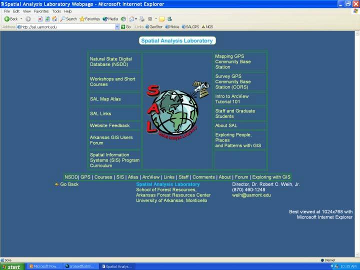
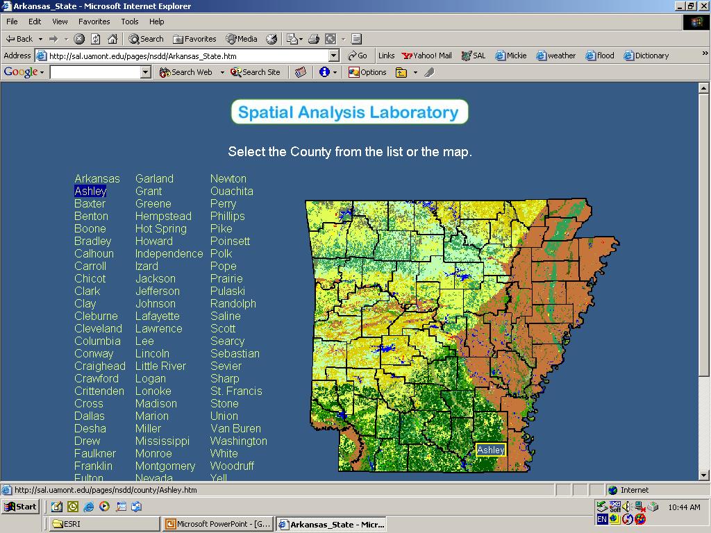
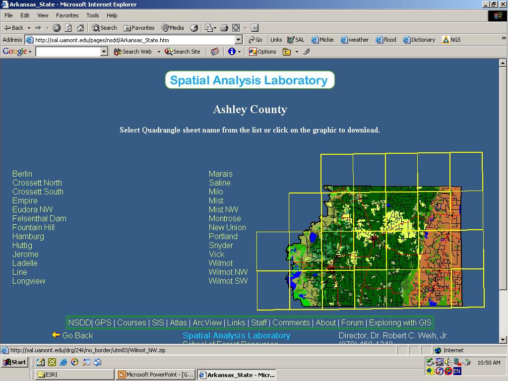
8 Gathering Basic Resources From the Spatial Analysis Lab at the University of Arkansas at Monticello USGS 7.5 minute quadrangle maps Color Infrared aerial photography
9

10
11
12
13 I. Cadastral Project Control Horizontal and Vertical Control Datasheets from the National Geodetic Survey Paper copies of the datasheets for use in the field Downloaded points in GIS format for the map and to import coordinates into Resource Grade GPS for Reconnaissance

14

15

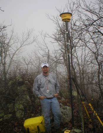
16 Checking for overhead cover
17 Fieldwork Requirement for at least two High Accuracy Reference Network (HARN) points - easy to find because the horizontal coordinates are really good Requirement for at least one vertical control monument in each quadrant of the job preferably just outside and surrounding the project area to help define the geoid

18

19
20 Planning the GPS Sessions Every point must be occupied at least twice with a percentage being observed three times redundancy (Cadastral Standards) Using existing or newly set monuments, the sessions are planned using GIS Computations are made to determine the number of sessions that will be necessary (Van Sickle GPS for Surveyors) The baseline vectors can be measured on the map to determine the approximate time of occupation on each point (Wolf & Ghilani Elementary Surveying textbook) Routes for each observer are determined and a schedule is made

21
22 SATURDAY MARCH 6, 2004 ASHLEY COUNTY OBSERVER SESSION 1 SESSION 2 SESSION 3 SESSION 4 SESSION 5 1. Bill Gagner 3H 3V 5V 7H 1H 2 Kevin Hicks 3V 6H 6H 5V 8H 3. Jason Beck 2H 4V 8H 6V 6V 4. James Barnett 5H 5H 4V 4H 9H 5. Mickie Warwick 7H 4H 5H 9H 1V START TIME 8:00 AM 9:45 AM 11:30 AM 2:00 PM 3:45 PM STOP TIME 9:00AM 10:45 AM 12:30 PM 3:00 PM 4:45 PM

23

24

25

26
27 II. Cadastral Measurements Data from corner cards at the State Surveyors Office Survey Plats from State Surveyors Office and County Courthouse Records at Potlatch Timber Company in Warren Records at Plum Creek Timber Company in Crossett Map from Arkansas Game and Fish Felsenthal Wildlife Management Area

28
29 Tnwp Range Section Index GCDB_Code Org._Surveyor Date_Org. PLS_No. Date_Set 5W 6 A-5 05W John Clark Jan. 28, 1840 Mar. 10, W 8 J-9 05W John Clark Jan. 26, 1840 Mar. 10, W 9 G-13 05W John Clark Jan. 23, 1840 Jan. 30, W 26 R-17 05W Andrew B Clark Jan. 4,1840 Nov. 6, W 26 V-21 05W John Clark Jan. 3, 1840 Sept. 15, W 3 E-17 06W A. Bowman Jan.11, 1841 Mar. 9, W 4 E-9 06W A. Bowman Jan. 14, 1841 May. 10, W 7 G-5 06W A. Bowman Jan. 27, 1841 Sept. 20, W 10 J-17 06W A. Bowman Jan. 10, 1841 Mar. 9, W 19 R-3 06W A. Bowman Jan. 15, 1841 July. 9, W 19 R-1 06W A. Bowman Jan. 15, 1841 July. 9, W 21 R-11 06W A. Bowman Jan. 13, 1841 Mar. 9, W 2 E-21 07W A. Bowman Feb. 28, 1841 May. 10, W 22 R-17 07W A. Bowman Mar. 1, 1841 May. 10, W 25 R-25 07W A. Bowman Feb. 27, 1841 July. 9, W 27 T-17 07W A. Bowman Mar. 1, 1841 April. 30, W 34 V-17 07W A. Bowman Mar. 1, 1841 May. 10, W 35 Z-19 07W N. Rightor Jan. 8, 1828 July. 9, W 1 C-25 08W N. Rightor Dec. 24, 1827 June. 12, W 5 E-7 08W A. Bowman May. 7, 1842 April. 30, W 18 L-5 08W A. Bowman May. 6, 1842 May. 20, W 2 E-21 08W A. Bowman April. 28,1842 Nov. 26, 1986
30

31
32 Conclusion The use of GIS significantly reduced the time it took to plan and execute a GPS survey to meet the Cadastral Standards for GPS and there was benefit added.
Cadastral Framework Standards
 Cadastral Framework Standards The goal of the Data Standards and Recommendations Committee is to provide recommendations and guidelines to Indiana GIS user communities to facilitate the collection, maintenance
Cadastral PLSS Stewardship December 2010 Updated December 2013
 Cadastral PLSS Stewardship December 2010 Updated December 2013 Compiled by Bob Ader, Ben Knott, and Nancy von Meyer for the FGDC Cadastral Subcommittee Table of Contents 1. Overview... 2 2. Underlying
Cadastral NSDI Reference Document
 Cadastral NSDI Reference Document Version 12 October 2012 FGDC Subcommittee for Cadastral Data Cadastral NSDI Reference Document Table of Contents 1. Purpose... 1 2. Business Applications... 1 3. Terminology
Charter: Surveyor. Objectives and Standards
 Objectives and Standards 1. Survey Operations To provide survey services as requested by County Officials and Departments. a. To respond in a timely manner to the Planning & Development Committee's instructions
General Instructions For Surveys and Plans Outside the Provincial Survey System
 May 15, 2018 General Instructions For Surveys and Plans Outside the Provincial Survey System NOTE: This document is a Controller of Surveys Policy manual to be used as a general guideline for the Legal
FGDC Cadastral Data Subcommittee. December 2008
 FGDC Cadastral Data Subcommittee Annotated Bibliography: Foundational Documents for Building a Cadastral National Prepared by David Stage and Nancy von Meyer for the FGDC Cadastral Data Subcommittee Annotated
State of Washington Project Luke Rogers, University of Washington March 2010
 State of Washington Project Luke Rogers, University of Washington March 2010 Rural Technology Initiative (RTI) developed an online tutorial on how to use the Washington State Parcel and Forestland Databases
Cadastral NSDI Reference Document July 2006
 Cadastral NSDI Reference Document July 2006 Purpose This document describes the Cadastral NSDI, its components and the public and private business processes that define the content. The Cadastral National
MnDOT Contract No Exhibit B. Scope of Work. Scope of Work
 MnDOT Contract No. 1032993 Contract General Description The purpose of this contract is to provide the State with the survey accurate re-establishment of designated Public Land Survey section boundaries
Bureau of Land Management MAPPS Federal Update Donald Buhler Cadastral, Lands, and Realty Management April 14, 2015
 Bureau of Land Management MAPPS Federal Update Donald Buhler Cadastral, Lands, and Realty Management April 14, 2015 Division of Cadastral, Lands and Realty Management 1 BLM Mission Manages 247 million
Cadastral and Right of Way Data Sharing
 Cadastral and Right of Way Data Sharing May 2010 TRS 1006 This Transportation Research Synthesis (TRS) provides summaries of recent research and implementation efforts on a topic of current interest. Online
FGDC SUBCOMMITTEE FOR CADASTRAL DATA. October 2004 Albuquerque, New Mexico Meeting
 FGDC SUBCOMMITTEE FOR CADASTRAL DATA October 2004 Albuquerque, New Mexico Meeting The National Spatial Data Infrastructure is the means to assemble geographic information that describes the arrangements
Land Tenure and Geospatial Data and Technology
 Land Tenure and Geospatial Data and Technology Ioana Bouvier E3/Land and Urban, USAID Senior Geospatial Analyst January 23, 2018 January 23, 2018 1 OUTLINE 1. Overview of geospatial data and technology
Presented by: Stewart Information International, Inc. Jack McKenna
 Presented by: Stewart Information International, Inc. Jack McKenna Held at the: 2007 ESRI Survey & Engineering GIS Summit San Diego Convention Center San Diego, California June 16-19, 2007 Integrating
Field surveying inspection using tablets
 Field surveying inspection using tablets Rami Farraj, Ahmad Sghyyer Survey of Israel, Lincoln 1, Tel-Aviv, Israel rami@mapi.gov.il ahmad@mapi.gov.il Key words: Field Surveying, Cadastre, Mapping Procedures
California-Specific Professional Land Surveyor Examination Test Plan
 General Definition of California Professional Land Surveying Practices: The practice of land surveying in the State of California consists of determining, establishing, reporting and mapping the positions,
PLSS as a Spatial Framework: A History of GCDB Steven L. Hope. Abstract. Background
 PLSS as a Spatial Framework: A History of GCDB Steven L. Hope Abstract The Bureau of Land Management (BLM) initiated the Geographic Coordinate Data Base (GCDB) project to digitally portray the Public Land
D DAVID PUBLISHING. Mass Valuation and the Implementation Necessity of GIS (Geographic Information System) in Albania
 in Albania") Journal of Civil Engineering and Architecture 9 (2015) 1506-1512 doi: 10.17265/1934-7359/2015.12.012 D DAVID PUBLISHING Mass Valuation and the Implementation Necessity of GIS (Geographic Elfrida Shehu
Journal of Civil Engineering and Architecture 9 (2015) 1506-1512 doi: 10.17265/1934-7359/2015.12.012 D DAVID PUBLISHING Mass Valuation and the Implementation Necessity of GIS (Geographic Elfrida Shehu
GPS For Land Surveyors By Jan Van Sickle
 GPS For Land Surveyors By Jan Van Sickle You might be aware that surveyors have been using GPS to do extremely precise surveys for years, fixing points with relative accuracy on the order of millimeters.
CFedS Outline Unit 1. Course 1: History, Records & Administrative Systems
 CFedS Outline Unit 1 Course 1: History, Records & Administrative Systems History of U.S. Surveying Historical Perspective Similarities in Surveying Seniority of Calls Lack of Standards A National Debt
Bureau of Land Management
 Bureau of Land Management MAPPS Federal Update Donald Buhler Cadastral, Lands, and Realty Management April 1, 2014 Division of Cadastral, Lands and Realty Management 1 BLM Mission Manages 247 million surface
New Developments in the Hellenic Cadastre
 New Developments in the Hellenic Cadastre Prof. M. Kavouras Vice-president Ktimatologio S.A. (Hellenic Cadastre) The Hellenic Cadastre Background The Hellenic National Cadastre Organizational and institutional
Theme Strategic Plan for Cadastral Theme
 Theme Strategic Plan for Cadastral Theme Bureau of Land Management Cadastral Survey Federal Geographic Data Committee (FGDC) 2017 2021 April 2017 - Progress and Update Cadastral Theme Implementation Plan
Use of data in Ukraine for sustainable economic growth. Oleksandr Maliuk State Service of Ukraine for Geodesy, Cartography and Cadastre
 Use of data in Ukraine for sustainable economic growth Oleksandr Maliuk State Service of Ukraine for Geodesy, Cartography and Cadastre Kehl, 2017 Content of the presentation Ukraine & StateGeoCadastre:
MARATHON COUNTY LAND INFORMATION OFFICE
 MARATHON COUNTY, WISCONSIN 2010-2014 MARATHON COUNTY LAND INFORMATION OFFICE TABLE OF CONTENTS I. EXECUTIVE S A Contact Information 2 B Participants in the Planning Process 2 C.Plan Summary 2 II. LAND
Reforming the Land Sector in Jamaica
 Silburn CLARKE and Llewelyn ALLEN, Jamaica Key words: tenure, cadastre, land reform, adjudication, public awareness, land titling, GPS, parcel mapping, traversing, land legislation, tenure regularisation,
Updated - A Report on the County of Arlington s Existing and Possible Urban Tree Canopy
 Updated - A Report on the County of Arlington s Existing and Possible Urban Tree Canopy Key Terms UTC: Urban tree canopy (UTC) is the layer of leaves, branches, and stems of trees that cover the ground
PREPARING SURVEY TENDER GIS DATABASE OUTCOMES
 PREPARING SURVEY TENDER SPECIFICATIONS FOR PROJECT GIS DATABASE OUTCOMES Presentation by Ian Harper GEODATA AUSTRALIA ESRI User Conference 2009 24 st July 2009 BACKGROUND GIS databases now provide a more
ARKANSAS DEPARTMENT OF TRANSPORTATION REQUEST FOR LETTERS OF INTEREST
 ARKANSAS DEPARTMENT OF TRANSPORTATION REQUEST FOR LETTERS OF INTEREST Notice is hereby given that the Arkansas Department of Transportation (Department) is seeking letters of interest from qualified consulting
Cadastral services and virtual office in e-cadastre
 Cadastral services and virtual office in e-cadastre Priit Kuus Estonian Land Board October 26, 2016 Coimbra Scope of data Cadastral parcels (as of September 2016) 674 383 cadastral parcels, i.e. 97,7 %
A Geocoded Cadastral Fabric as a Precondition for a Sustainable Land Management System
 A Geocoded Fabric as a Precondition for a Sustainable Land Management System Gottfried KONECNY, Germany; J.P. LAUZON, Canada; Abdul Salam MOHAMMED, India Key words: SDI,, Parcel Boundaries, GPS-GNSS, Land
F I N A L REPORT MEET ME AT THE CORNER A P R I L 2 5, : : R O T H S C H I L D, W I
 MEET ME AT THE CORNER UNCOVERING/DISCOVERING THE PUBLIC LAND SURVEY SYSTEM IN WISCONSIN A P R I L 2 5, 2 0 1 8 : : R O T H S C H I L D, W I F I N A L REPORT OVERVIEW A one-day forum entitled Meet Me at
THE XXV FIG INTERNATIONAL CONGRESS IN MALAYSIA Kuala Lumpur, Malaysia, June 2014 at Kuala Lumpur Convention Centre
 CALL FOR PAPERS TO THE XXV FIG INTERNATIONAL CONGRESS IN MALAYSIA Kuala Lumpur, Malaysia, 16 21 June 2014 at Kuala Lumpur Convention Centre Dear Friend and Colleague, It is our privilege and honour to
Geodetic Infrastructure in Samoa. FIG Pacific Small Islands Developing States Symposium September 2013, Suva, FIJI.
 Geodetic Infrastructure in Samoa. FIG Pacific Small Islands Developing States Symposium 18 20 September 2013, Suva, FIJI. FIG Commission 5 Position and Measurement United Nations Global Geospatial Information
Finding and Prioritizing Boundary Evidence
 Finding and Prioritizing Boundary Evidence THREE PHASES OF A RETRACEMENT SURVEY Collect and Analyze the Record Evidence Perform a Field Survey to Search for Evidence Referenced in the Record and Signs
CATALOGING, MONITORING AND MANAGING INVASIVE SPECIES ON POST LANDS. PSU Geog596A Capstone Proposal Dale Jantzen Dec 17, 2015
 CATALOGING, MONITORING AND MANAGING INVASIVE SPECIES ON POST LANDS PSU Geog596A Capstone Proposal Dale Jantzen Dec 17, 2015 PROJECT OUTLINE AND PURPOSE Define a particular need within a non-profit land
Section I General Information
 General Information Table of Contents A. Introduction... I-2 1. Purpose... I-2 2. Scope... I-2 3. Maintenance... I-3 4. Units... I-3 B. Public Relations... I-3 1. General Public... I-3 2. Property Owners...
Establishing Efficient Cadastral Surveying Plan in Accordance with Introducing World Geodetic Reference System in Korea
 Modern Environmental Science and Engineering (ISSN 2333-2581) December 2015, Volume 1, No. 6, pp. 299-303 Doi: 10.15341/mese(2333-2581)/06.01.2015/003 Academic Star Publishing Company, 2015 www.academicstar.us
2001, A GIS SJ,'ATIALODDESSY. James G. Donahue, L.S. PBS&J,Inc Alton Parkway Irvine, CA 92714
 POSTER SESSIONS 13 2001, A GIS SJ,'ATIALODDESSY James G. Donahue, L.S. PBS&J,Inc. 2501 Alton Parkway Irvine, CA 92714 Biographical Sketch James G. Donahue is a licensed land surveyor in private practice.
Participants of the Ministerial Meeting on Housing and Land Management on 8 October 2013 in Geneva
 Summary At its meeting on 2 April 2012, the Bureau of the Committee on Housing and Land Management of the United Nations Economic Commission for Europe agreed on the need for a Strategy for Sustainable
Fit-for Purpose Approaches to Land Administration
 Fit-for Purpose Approaches to Land Administration Brent Jones, PE, PLS Global Manager, Casastre/Land Records bjones@esri.com Land Administration GIS is the platform for land administration Land administration
ParcelMap BC Compiling a Parcel Fabric for the Province of British Columbia. Presented by: Ellen Styner (General Manager) and Wendy Amy (GIS Manager)
 and Wendy Amy (GIS Manager)") ParcelMap BC Compiling a Parcel Fabric for the Province of British Columbia Presented by: Ellen Styner (General Manager) and Wendy Amy (GIS Manager) Who is MNC? MNC is a geomatics engineering firm with
ParcelMap BC Compiling a Parcel Fabric for the Province of British Columbia Presented by: Ellen Styner (General Manager) and Wendy Amy (GIS Manager) Who is MNC? MNC is a geomatics engineering firm with
Demonstrate knowledge of, and extract, cadastral data from Landonline
 Page 1 of 5 Demonstrate knowledge of, and extract, cadastral data from Landonline Level 3 Credits 5 Purpose This unit standard is for people who are working in the surveying industry in jobs which involve
Standards of Practice for Surveying in the State of Alabama
 Standards of Practice for Surveying in the State of Alabama Effective January 1, 2017 RULE NO. 1.01 PURPOSE The purpose of these rules is to establish standards for the practice of surveying in the State
Rule 21 STANDARDS OF PRACTICE FOR SURVEYING
 Rule 21 STANDARDS OF PRACTICE FOR SURVEYING 21.1 Whenever a survey is performed, it shall comply with Section 73-13-71 (4) and Section 73-13- 73 and the Standards of Practice for Surveying in Mississippi
PROJECT INFORMATION DOCUMENT (PID) CONCEPT STAGE Report No.: AB3229 Project Name. Land Registry and Cadastre Modernization Project Region
 CONCEPT STAGE Report No.: AB3229 Project Name. Land Registry and Cadastre Modernization Project Region") PROJECT INFORMATION DOCUMENT (PID) CONCEPT STAGE Report No.: AB3229 Project Name Land Registry and Cadastre Modernization Project Region EUROPE AND CENTRAL ASIA Sector Central government administration
PROJECT INFORMATION DOCUMENT (PID) CONCEPT STAGE Report No.: AB3229 Project Name Land Registry and Cadastre Modernization Project Region EUROPE AND CENTRAL ASIA Sector Central government administration
Table of Contents. Introduction/Background 1. Project Introduction Background. Project Scope of Services 2. Project Overview Project Specifications
 Scott County GPS Corner Survey Request for Proposals March 12, 2007 Revised March 22, 2007 Project Scope of Services 5.b., p. 3. Table of Contents Introduction/Background 1 Project Introduction Background
The Use of Cadastral Information in Projects Financed by the EU: The Hellenic Cadastre
 The Use of Cadastral Information in Projects Financed by the EU: The Hellenic Cadastre Prof. D. Balodimos Vice-President of Ktimatologio S.A. (Hellenic Cadastre) Acknowledgements Dr. Panos Lolonis, Coordinator
June 1, 2017 BOARD MATTER H - 1 FINAL CONSIDERATION OF STATE TRUST LAND EXCHANGE
 June 1, 2017 BOARD MATTER H - 1 ACTION: AUTHORITY: FINAL CONSIDERATION OF STATE TRUST LAND EXCHANGE W.S. 36-1-107, 36-1-110, and 36-1-111; Board of Land Commissioners Rules and Regulations, Chapter 26,
Building Integrated Land Information Systems and Development of NSDI
 Stig JÖNSSON, Sweden Key words: Land administration, land information systems, property formation, spatial data infrastructure, Inspire, institutional cooperation SUMMARY Lantmäteriet the Swedish agency
Land Information Management: An Introduction With Special Reference To Cadastral Problems In Third World Countries By Peter F.
 Land Information Management: An Introduction With Special Reference To Cadastral Problems In Third World Countries By Peter F. Dale If searched for the ebook by Peter F. Dale Land Information Problems
ORDINANCE NO AN ORDINANCE ESTABLISHING A UNIFORM SYSTEM FOR STREET ADDRESSING IN EMERY COUNTY
 ORDINANCE NO. 21505 AN ORDINANCE ESTABLISHING A UNIFORM SYSTEM FOR STREET ADDRESSING IN EMERY COUNTY The County Commission of the County of Emery, State of Utah, being the Legislative Body of said county,
EXPANDING AVAILABILITY OF BROADBAND ACCESS AND ADOPTION
 Single point information Ilija Kepevski Agency for Electronic Communications Regional Conference for Europe EXPANDING AVAILABILITY OF BROADBAND ACCESS AND ADOPTION 28-29 September 2015 - Budva, Montenegro
Innovations in Education at Faculty ITC and within Land Administration Programme
 Innovations in Education at Faculty ITC and within Land Administration Programme Prof. Jaap Zevenbergen, Vice-Dean Education at Faculty ITC, Prof. Land Administration dr. Dimo Todorovski, Course Coordinator
Request for Proposal RFP
 STATE OF ALASKA Department of Natural Resources Request for Proposal RFP 10 180000041-1 TITLE: Land Survey for Juneau, Sitka, & Wrangell Areas for TLO PURPOSE: The Department of Natural Resources (DNR),
DUNA HOUSE BAROMETER. July month issue THE LATEST PROPERTY MARKET INFO FROM DUNA HOUSE NETWORK
 DUNA HOUSE BAROMETER 73. issue July month 2017 THE LATEST PROPERTY MARKET INFO FROM DUNA HOUSE NETWORK www.dh.hu PRIVACY POLICY Statistical information and estimates published in the Duna House Barometer
By: Barney I. S. Laseko Programme Coordinator Prime Minister s Office TANZANIA
 2014 CONFERENCE ON LAND POLICY IN AFRICA 11 14 NOVEMBER, 2014 Focussed Discussion VIII Converting from Manual Land Registration to GIS Enabled Land Information System Case of Sub Saharan Africa Tanzania
Section 821. PRESERVATION OF LAND MONUMENTS, CONTROL POINTS, AND PROPERTY CORNERS
 821.01 Section 821. PRESERVATION OF LAND MONUMENTS, CONTROL POINTS, AND PROPERTY CORNERS 821.01. Description. This work consists of preserving the corners and control points as shown on the plans, identified
REFORM OF LAND CADASTRE IN LITHUANIA
 REFORM OF LAND CADASTRE IN LITHUANIA Romualdas KASPERAVICIUS, Lithuania Key words: ABSTRACT Main aim for every Government is to create legal, financial and organisational circumstances for real property.
Marine Spatial Data Infrastructure (MSDI) & The Marine Cadastre Application. April 10, 2018
 & The Marine Cadastre Application. April 10, 2018") Marine Spatial Data Infrastructure (MSDI) & The Marine Cadastre Application April 10, 2018 A Collaborative Pilot Project Vision of CHS: A framework of geographic data, metadata, users and tools Intent
Marine Spatial Data Infrastructure (MSDI) & The Marine Cadastre Application April 10, 2018 A Collaborative Pilot Project Vision of CHS: A framework of geographic data, metadata, users and tools Intent
A Method For Building Legal Digital Cadastre Without Using Cadastral Measurements Field Book Data Is It Accurate Enough?
 A Method For Building Legal Digital Cadastre Without Using Cadastral Measurements Field Book Data Is It Jad JARROUSH, Dmitri BRICKMAN, Israel Key words: Digital Cadastre, Least Squares Cadastral Computations,
Surveyors Qualifications
 Surveyors Qualifications Præludium Surveyors Qualifications Lars Jansson, Director Lantmäteriet Henning Elmstrøm, President DdL 1 Agenda 1. Introduction 2. Basic framework conditions for cadastral systems
PCC Conference and Plenary Meeting "Data as a basis of the digital society March 2018, Sofia. Activity of the geodetic NGOs in Bulgaria
 PCC Conference and Plenary Meeting "Data as a basis of the digital society 13-15 March 2018, Sofia Activity of the geodetic NGOs in Bulgaria Union of Surveyors and Land Managers in Bulgaria Chamber of
STATE OF MONTANA CADASTRAL CORE DATA IMPACT REPORT. Author: Robert D. Stevens GIS Technician Intern
 STATE OF MONTANA CADASTRAL CORE DATA IMPACT REPORT Cadastral Core Data in Montana: The Cadastral Data Uses, Requirements of Core Data and the Benefits, Concerns, Risks, Problems and Issues Expressed by
Land Management and Cadastre a Symbiotic Interaction?
 Land Management and Cadastre a Symbiotic Interaction? Dr. Alexander Kohli, Switzerland geosuisse, Delegate to Commission 8, Sydney, Australia, TS 8E Law and Planning Agenda 1. Introduction and Motivation
RIM Spatial Data. Subhead for title slide
 RIM Spatial Data Subhead for title slide 1. GIS Data & Map Products 2. Spatial Data Accuracy Limitations 3. Application Phase: Map and Shapefile 4. More on Boundary Creation Considerations GIS Data & Map
NEW DEVELOPMENTS IN THE REAL PROPERTY REGISTER AND CADASTRE IN LITHUANIA
 NEW DEVELOPMENTS IN THE REAL PROPERTY REGISTER AND CADASTRE IN LITHUANIA Jaunius Grigas E-mail: jaunius.grigas@registrucentras.lt Verona, 2008 FUNCTIONS OF STATE ENTERPRISE CENTRE OF REGISTERS Registration
LAND FOR SALE $23, ±16 Acres in Hempstead County, AR. Hope School District. Recreational Opportunity. Old Washington Tract
 K INGWOOD FORESTRY SERVICES, INC. LISTING #4609 LAND FOR SALE Old Washington Tract ±16 Acres in County, AR Hope School District Recreational Opportunity $23,500.00 See this and other listings at www.kingwoodforestry.com
FUTURE VISION ON KOREAN CADASTRAL SURVEYING
 FUTURE VISION ON KOREAN CADASTRAL SURVEYING Myounwoo LEE, Vice President, Korea Cadastral Survey Corporation, Korea 1. INTRODUCTION Cadastral surveying, which contributes to secure the ownership of the
Contents Lists of Figures and Tables xi About the Author xiii Foreword xv Acknowledgments xvi Part I Introduction
 CHAPTER # Contents Lists of Figures and Tables... xi About the Author... xiii Foreword...xv Acknowledgments...xvi Part I Introduction... 1 1 Overview of Land Valuation Assignments and Adjustment Procedures...
Role of spatial planning in modern society
 Republic of Croatia State Geodetic Administration The Role of Cadastre in the Development of Regional and Local Planning Structure in Croatia Zdravko Cesarec and Željko Bačić 1 Role of spatial planning
A Radical Solution for the Cadastre Problem in Egypt Using Integrated GPS-GIS System
 A Radical Solution for the Cadastre Problem in Egypt Using Integrated GPS-GIS System Dr. Ehab NABIL NASSIF, Egypt Key words: ABSTRACT During the period 1897-1907 the cadastral surveying of Egypt was established.
Letters of Map Amendment- Out as Shown
 Letters of Map Amendment- Out as Shown While digital Flood Insurance Rate Maps (DFIRM s) have made it easier to determine if a structure (or building site) is in the special flood hazard area (SFHA), many
ParcelMap BC. Compiling a Parcel Fabric for the Province of British Columbia. WENDY AMY and ELLEN STYNER
 ParcelMap BC Compiling a Parcel Fabric for the Province of British Columbia WENDY AMY and ELLEN STYNER Who is MNC? Established in 1997, MNC is a geomatics engineering firm located in Calgary, Alberta.
The Contribution of Forest Owners Associations for the Forest Cadastre Implementation. João Gaspar Ana Navarro Ferreira PORTUGAL
 The Contribution of Forest Owners Associations for the Forest Cadastre Implementation João Gaspar Ana Navarro Ferreira PORTUGAL Motivation Lack of forestry cadastre; Unify all FOAs databases with common
Concerns about Methodology
 1979 NDSPLS ADMINISTRATIVE OFFICE PO Box 7370 Bismarck, ND 58507 Phone: 701-223-3184 E-mail: info@ndspls.org Website: www.ndspls.org North Dakota Industrial Commission Department of Mineral Resources Lynn
The Hellenic National Cadastre: An elemental institution for nurturing and promoting innovation in 3D geospatial data
 Hellenic National Cadastre: An elemental institution for nurturing and promoting innovation in 3D geospatial data Professor Byron Nakos President NATIONAL CADASTRE AND MAPPING AGENCY SA (NCMA SA) 288 Mesogion
Trimble Land Solutions -Transforming the way land
 Sanjeev Trehan Regional Manager - SAARC MARCH 2016 Trimble Land Solutions -Transforming the way land tenure is secured and land assets are managed. Government Opportunity Challenge Implementation of secure
Responsible and Innovative Land Administration
 Responsible and Innovative Land Administration An Example from Ethiopia 3 RD DECEMBER 2018 Outline A few words about NIRAS Fit-for-purpose: A low-tech disruptive approach? The REILA Project in Ethiopia
New Mexico Board of Licensure for Professional Engineers and Professional Surveyors
 New Mexico Board of Licensure for Professional Engineers and Professional Surveyors Title 12, Chapter 8, Part 2, New Mexico Administrative Code [12.8.2 NMAC] MINIMUM STANDARDS FOR SURVEYING IN NEW MEXICO
The Multipurpose Marine Cadastre A Tool for Planning & Decision Making in the Marine Environment
 The Multipurpose Marine Cadastre A Tool for Planning & Decision Making in the Marine Environment Christine Taylor Minerals Management Service (MMS) Brian Smith NOAA Coastal Services Center Maurice Hill
201 KAR 18:150. Standards of practice.
 201 KAR 18:150. Standards of practice. RELATES TO: KRS 322.290(1)(a), (2)(f) STATUTORY AUTHORITY: KRS 322.290(2)(f) NECESSITY, FUNCTION, AND CONFORMITY: KRS 322.290(1)(a) authorizes the board to administer
Rules for Cadastral Survey 2010
 Rules for Cadastral Survey 2010 LINZS65000 24 May 2010 www.linz.govt.nz Under section 49 of the Cadastral Survey Act 2002, I hereby make the Rules for Cadastral Survey 2010 These Rules are effective from
Private Land Conservation: Conservation Easements. Matt Singer Land Stewardship Manager
 Private Land Conservation: Conservation Easements Matt Singer Land Stewardship Manager Galveston Bay Foundation Mission: To preserve, protect, and enhance the natural resources of the Galveston Bay estuarine
NOTICE OF TIMBERLAND SALE HOWARD & POLK COUNTIES BID. County Line 160 Totaling approximately 160 acres, more or less
 NOTICE OF TIMBERLAND SALE HOWARD & POLK COUNTIES BID County Line 160 Totaling approximately 160 acres, more or less BIDS DUE: Thursday, May 18 th, 2017, 2:00 PM Davis DuBose Knight Forestry & Real Estate
Montana Land Title Association (MLTA) 2015 Spring Education Seminar ALTA/ACSM Land Title Surveys Speaker Outline Handout
 2015 Spring Education Seminar ALTA/ACSM Land Title Surveys Speaker Outline Handout") Montana Land Title Association (MLTA) 2015 Spring Education Seminar ALTA/ACSM Land Title Surveys Speaker Outline Handout A. What is an ALTA/ACSM Land Title Survey? a. Four different kinds of land title
Montana Land Title Association (MLTA) 2015 Spring Education Seminar ALTA/ACSM Land Title Surveys Speaker Outline Handout A. What is an ALTA/ACSM Land Title Survey? a. Four different kinds of land title
The Survey Data Model Technology A practical survey solution to generate all levels of spatial and e-governance outcomes.
 Land Governance in a Rapidly Changing Environment Annual World Bank Conference on Land and Poverty April 24 & 25, 2012 The Survey Data Model Technology A practical survey solution to generate all levels
The Boundary and the Effects of Cadastral Surveying in Cyprus
 The Boundary and the Effects of Cadastral Surveying in Cyprus Aristi Louca, Margarita Fani Surveyor Engineers, Cyprus Association of Rural and Surveying Engineers The History of Cyprus goes back 11000
3.11 East Japan Earthquake and Topics related to Land management. Masaru Kaidzu Ibaraki-ken EX-JICA Expert Association
 3.11 East Japan Earthquake and Topics related to Land management Masaru Kaidzu Ibaraki-ken EX-JICA Expert Association The 2011 off the Pacific coast of Tohoku Earthquake Date-Time: March 11, 2011 14:46
Land Use Study for Wheeler Estates
 Land Use Study for Wheeler Estates BOARD OF COUNTY COMMISSIONERS TRANSMITTAL HEARING TUESDAY, MARCH 26, 2019 HENDRY COUNTY COURTHOUSE LABELLE, FLORIDA 1 Wheeler Estates Study Area Approximately 1,933 acres
Implementation Status & Results Croatia Integrated Land Administration System Project (P122219)
") Public Disclosure Authorized Public Disclosure Authorized The World Bank Implementation Status & Results Croatia Integrated Land Administration System Project (P122219) Operation Name: Integrated Land
Public Disclosure Authorized Public Disclosure Authorized The World Bank Implementation Status & Results Croatia Integrated Land Administration System Project (P122219) Operation Name: Integrated Land
Progress Report on Green Paper. Dr. Paddy Prendergast. on behalf of the. IIS Commission on Land Registration
 Progress Report on Green Paper By Dr. Paddy Prendergast on behalf of the IIS Commission on Land Registration Paddy Prendergast - Chair Brendan Sweeny - Hempenstall Surveys Paul Corrigan - P Corrigan Associates
SE Michigan Residential Real Estate Recovery Are we there yet or is it over?
 SE Michigan Residential Real Estate Recovery Are we there yet or is it over? Changing View of Residential Transactions Changing View of Residential Transactions 2015 Short Sales 3% Leases Bank 11% Owned
GNSS NETWORKS & CADASTRE GNSS AND THE INTERSECTION OF GEODESY AND THE CADASTRE IN KINGDOM OF SAUDI ARABIA SUBJECT TO TALKS
 GNSS NETWORKS & CADASTRE GPS GALILEO GLONASS COMPASS (BEIDOU-2) GNSS AND THE INTERSECTION OF GEODESY AND THE CADASTRE IN KINGDOM OF SAUDI ARABIA 1 SUBJECT TO TALKS GNSS NETWORK From local to global datum
Impact Fee Advisory Committee September 6, 2011
 Impact Fee Advisory Committee September 6, 2011 Public Hearing Summary Comments Received During and After the Hearing Proposed Responses to Public Input Recommendation for Adoption of the Land Use Update
INDIAN INSTITUTE OF TECHNOLOGY ROORKEE. Presentation on REAL TIME CADASTRAL SURVEYING SOLUTION WITH A SPECIAL IMPHESIS TO MODERN GPS TECHNOLOGY.
 INDIAN INSTITUTE OF TECHNOLOGY ROORKEE Presentation on REAL TIME CADASTRAL SURVEYING SOLUTION WITH A SPECIAL IMPHESIS TO MODERN GPS TECHNOLOGY By: Prof. Kamal Jain, Dept. of Civil Engg. IIT-Roorkee AIM
COMPUTERIZED SYSTEM SUPPORTING DEVELOPMENT OF LAND MARKET IN GEORGIA
 COMPUTERIZED SYSTEM SUPPORTING DEVELOPMENT OF LAND MARKET IN GEORGIA S. G. TSIRAMUA, I. S. MELASHVILI Land Registration Unit of Government of Georgian, World Bank and IFAD Agriculture Development Project.
Land Surveys and Real Property Boundaries
 Land Surveys and Real Property Boundaries There are primarily 5 types of surveys performed on real property in the State of Indiana: Original, Retracement, Route, and Surveyor Location Report (SLR). Lenders
offered for sale North brushy creek reserve A recreational and timberland investment opportunity. offered by
 offered for sale North brushy creek reserve A recreational and timberland investment opportunity. 858.0 (+/-) total acres Fulton County, Arkansas offered by Licensed in Arkansas, Louisiana, Mississippi,
County Land Information Plan Wood County, Wisconsin
 - 2005 - County Land Information Plan Wood County, Wisconsin Prepared By: Wood County Planning and Zoning Office Wood County Planning & Zoning Committee (Advisory Committee of the Wood County Land Records