PREPARING SURVEY TENDER GIS DATABASE OUTCOMES
|
|
|
- Helen Byrd
- 5 years ago
- Views:
Transcription
1 PREPARING SURVEY TENDER SPECIFICATIONS FOR PROJECT GIS DATABASE OUTCOMES Presentation by Ian Harper GEODATA AUSTRALIA ESRI User Conference st July 2009
2 BACKGROUND GIS databases now provide a more powerful tool for: Storing and managing g data Data modelling, analysis etc Decision making SURVEY DATA IS AN IMPORTANT PART OF THE DATABASE
3 BACKGROUND Most survey data or the deliverables provided by surveyors will become part of a GIS database. Project documentation should ensure survey data deliverables maximise i data intelligence.
4 CONTENTS 1. Existing project survey deliverables 2. Future survey database deliverables from the Cadastral Editor process The Cadastral Fabric The Geodatabase 3. Survey Deliverables to a Project GIS Database 4. Case Studies
5 EXISTING PROJECT SURVEY DELIVERABLES Deliverables are project specific: Accuracy Feature representation (line types, etc) Presentation Database outcomes now need consideration of: Output data structure Data Interoperability
6 EXISTING SURVEY DELIVERABLES MAIN TYPES OF SURVEYS 1. GEODETIC CONTROL SURVEYS 2. FEATURE SURVEYS Topographic Features Infrastructure 3. CADASTRAL SURVEYS Boundary Definition Boundary Creation
7 EXISTING SURVEY DELIVERABLES GEODETIC CONTROL SURVEYS DELIVERABLES Coordinate list Imported into a database as points with fixed coordinates as attributes
8 EXISTING SURVEY DELIVERABLES FEATURE SURVEYS 1. Topographic 2. Features 3. Infrastructure DELIVERABLES Hard Copy Layered Cad files Imported into a database as a Cad feature dataset with or without intelligent attributes linked
9 EXISTING SURVEY DELIVERABLES CADASTRAL SURVEYS Surveys for title creation, lodged at title registry o hard copy plans Surveys of site boundary redefinition o Hard copy plans o Cad formats
10 CADASTRAL SURVEYS Survey and cadastral data is generally managed in survey coordinate geometry software and the outcomes imported into a GIS as a Cad layer. Cadastral features (parcels, etc) and property attributes t are then defined to benefit from the database environment. CADASTRAL EDITOR CHANGES THAT PROCESS
11 THE CADASTRAL EDITOR PROCESS A process first conceived in Australia 20 years ago by Dr Michael Elfick to apply survey accuracy to GIS cadastral databases. Released as CADASTRAL EDITOR - the cadastral management engine of Survey Analyst by ESRI in 2007.
12 THE CADASTRAL EDITOR PROCESS Survey Process with survey outcomes and GIS outcomes Developed for the management of a survey database with cadastral outcomes
13 THE CADASTRAL EDITOR PROCESS Survey measurement data becomes part of the geodatabase. The decision making process of surveyors on the spatial location of a cadastral boundary is automated.
14 THE CADASTRAL EDITOR PROCESS New technology thatt provides surveyors with a higher h level of survey data management. Creates a survey database where parcel attributes include: The original survey title measurements All the cadastral intelligence required for a land administration i ti system. Creates a CADASTRAL FABRIC The most accurate representation of the legal cadastre as it exists in the real world.
15 SURVEY DATA MODEL (SDM) PROCESSES 1. DATA ENTRY 2. PARCEL JOINING 3. ADJUSTMENT Each stage involves data checking and verification as would be expected with a: RIGOROUS SURVEY PROCESS
16 1. DATA ENTRY I. Manual data entry II. Highest rigour in outcomes Importing electronic survey data Efficient access to survey accurate databases III. Migrating existing cadastral database Quick way to build large database but spatially poor FLEXIBILITY
17 2. PARCEL JOINING After data entry the parcels are selectively l joined to the Survey Data Model (SDM) to force the outcome of a continuous fabric without overlaps or gaps. This process provides data checking by reporting on the quality of the fit of the new survey data into the existing model. (see NSW LPI pilot for checking electronically (see NSW LPI pilot for checking electronically lodged survey plans)
18 3. THE ADJUSTMENT The adjustment connects the SDM to the geodetic survey control and generates coordinates for the Cadastral Fabric. The adjustment t report provides the tool for troubleshooting the data for the highest h precision i in the fabric.
19 THE CADASTRAL EDITOR PROCESS 1. A Cadastral Fabric Database as the deliverable product 2. A tool for surveyors to efficiently i manage a project cadastral database
20 MAPASIA GIS CONFERENCE AUGUST 2008 Plenary Speakers Cadastre is the core of SDI (Prof Ian Williamson-Dept of Geomatics, University of Melbourne) Accuracy is a future issue technology must address and only RIGOROUS TOOLS ENSURE FIDELITY (Kaushik Chakraborty-Vice President-Asia Pacific, Leica Geosystems - Geospatial Imaging, India) Redundancy is a key factor in automation (Alexander Wiechert - Business Director, Microsoft Photogrammetry, Managing Director, Vexcel Imaging GmbH, Austria)
21 MAPASIA GIS CONFERENCE AUGUST 2008 Plenary Speakers Cadastre is the core of SDI (Prof Ian Williamson-Dept of Geomatics, University of Melbourne) Accuracy is a future issue technology must address and only RIGOROUS TOOLS ENSURE FIDELITY (Kaushik Chakraborty-Vice President-Asia Pacific, Leica Geosystems - Geospatial Imaging, India) Redundancy is a key factor in automation (Alexander Wiechert - Business Director, Microsoft Photogrammetry, Managing Director, Vexcel Imaging GmbH, Austria)
22 BENEFITS TO PROJECT SURVEYORS OF THE SURVEY DATABASE 1. Storage of survey and cadastral data 2. Management of cadastre 3. Project data management rules
23 1. Storage of survey and cadastral data Survey plans are currently used by surveyors to define the legal cadastre. They identify legal and cadastral attributes (Parcel number, plan number, areas, dimensions, easement locations etc.) and they reflect the previous surveyor s decision on the location of title boundaries on the ground. They also show extra survey information to support their (legal) decision and provide the registering authority ty with the evidence to guarantee a that title. t
24 SURVEY DATA STORED IN THE GEODATABASE Survey measurements to other cadastral marks Surveyed connections to coordinated Survey Control Marks Parcel Geometry CONTROL MARK COORDINATES
25 SURVEY DATA STORED IN THE GEODATABASE The extra survey information (outside parcel boundaries) in the database adjustment provides more expansive accurate data and redundancies for checking.
26 2. Management of cadastre Geodatabase rules: allow only specified users access to the amend the cadastral fabric. (preferably surveyors or experienced GIS professionals) allow one person at a time to amend a specific packet of cadastral data
27 2. Management of cadastre The level l of rigour in Cadastral Editor limits i its effectiveness to ideally adjusting smaller sections of a cadastral database. (<2000 parcels) For 1000 parcels there are approx 5,000 unknowns which require over 12,000,000, terms in the normal equations to be solved. This increases by the rate of the square of the number of parcels.
28 A MANAGEMENT ROLE FOR SURVEYORS The Survey Analyst / Cadastral Editor Process: 1. Holds the extents of a localised set of cadastre fixed (packet). 2. Extracts it from the geodatabase 3. Update and adjust. 4. Returns to the geodatabase 5. Records all adjustments to the cadastre to allow cadastre dependent layers to be moved accordingly
29 CADASTRAL EDITOR AS A TOOL FOR SURVEYORS CADASTRAL DATABASE MANAGEMENT Historical role undertaken by surveyors managing survey data. Recently, managing a cadastral database has generally become a GIS management role because adjusting databases has been a higher level mathematical process.
30 CADASTRAL FABRIC MANAGEMENT Survey Analyst / Cadastral Editor allows project surveyors or GIS professionals to better manage a cadastral database.
31 CADASTRAL FABRIC MANAGEMENT Once a Cadastral Fabric is created, there are high levels of efficiency in updating cadastral changes and precision within the geodatabase environment. All legal l cadastral attributes t become immediately available to geodatabase deliverables Land Titles, property reports, etc
32 3. Project data management Control The geodatabase allows better management of cadastral updates and versions. Control of authorized persons to amend the cadastre. More powerful tool for end users to validate cadastral model versions. REDUCTION IN LIABILITY FOR PROJECT MANAGEMENT
33 SURVEY DELIVERABLES TO A PROJECT GIS DATABASE 1. File Geodatabase 2. Cadastral Fabric 3. Metadata
34 1. File Geodatabase 1. Holds the complete cadastral fabric database ranging from a small project to a State or Federal government tdatabase. 2. Most efficient way to store and manage a database
35 2. Cadastral Fabric 1. Data entered manually for highest rigor 2. Survey data imported or cadastral databases migrated to a fabric for cost effective outcomes 3. Supply of adjustment reports, etc to validate fabric spatial quality
36 3. Metadata Data deliverables Data history available for all project users Currency of data amendment status
37 PROJECT MANAGEMENT ROLES Documentation defining i the survey and database deliverables should be prepared by persons experienced in the Survey Analyst and Cadastral Editor process. Experienced surveyors / engineers / GIS professionals understand what they require for their project, but may not recognise the efficiencies and outcomes of the CE process.
38 PROJECT MANAGEMENT ROLES Project managers or surveyors who are not familiar with Cadastral Editor process are uncertain that t the up front costs associated with creating a cadastral fabric for a project are sustainable. This may be valid if spatial precision and a future database is of no value.
39 PROJECT MANAGEMENT ROLES Project managers or surveyors who are not used to working in a database environment do not recognise the difference between CE and creating a survey data model in a survey coordinate geometry package and importing a cadastral cad layer into a GIS.
40 CASE STUDIES THE SYDNEY METRO PROJECT Preparation of tender documentation for a major underground rail project in Sydney, Australia 100 KM PIPELINE PROJECT Hunter Valley, NSW An extensive cadastral fabric created from various sources
41 SYDNEY CBD METRO PROJECT The Sydney ycbd Metro Project is a proposed 6km Metro rail tunnel and stations to be constructed under the CBD and inner suburbs. $ 4 Billion Budget In Dec 2008 the initial survey tender documentation was released.
42 SYDNEY CBD METRO PROJECT
43 SYDNEY CBD METRO PROJECT Deliverables from the initial survey tender: 1. Separate title to the tunnel stratum t and surface infrastructure 2. 3D modelling of all surface and sub-surface design constraints 3. A cadastral fabric of the route with all property attributes t forming a survey accurate foundation for the ongoing project GIS database NSW Lands Dept has supplied plans to the project on the basis the final cadastral fabric will be supplied to them (at no cost).
44 GLOUCESTER COAL SEAM GAS PROECT A natural gas project in the Hunter Valley of NSW needs the construction of a 100km pipeline to deliver the product. A file geodatabase cadastral fabric for the route was required for project planning, design and legal issues. The required spatial precision varied for different The required spatial precision varied for different sections of the route.
45 100 KM PIPELINE CADASTRAL MODEL CALCO SURVEYORS based in the town of Gloucester (Population 2,600) are the project contract surveyors with a total staff of 6. They do not use GIS. GEODATA AUSTRALIA assisted CALCO in the GEODATA AUSTRALIA assisted CALCO in the preparation of the survey deliverables.
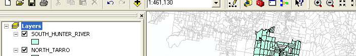
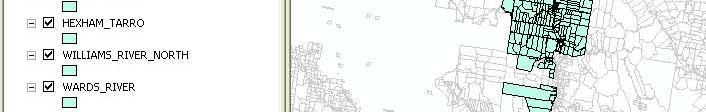
46 100 KM PIPELINE CADASTRAL MODEL The route passed through 5 Local Government Areas (Counties), and the jurisdictions of at least 6 separate service utilities. Most authorities had their own cadastral databases with varied formats and spatial precision.
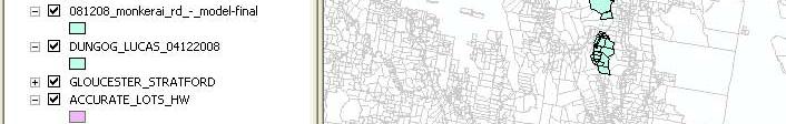
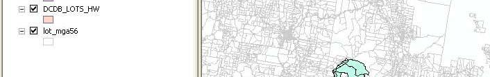
47 CADASTRAL FABRIC MODELS CREATED MODEL GLOUCESTER The existing Digitised Cadastral DataBase (DCDB) is utilised where no fabric model is shown NEWCASTLE
48 100 KM PIPELINE CADASTRAL MODEL Variable levels of precision: 1. Remote rural areas utilise existing cadastre 5-10m 2. Rural areas adjacent to boundaries Create cadastral fabric, update existing county fabric m 3. Urban & light industrial areas Create cadastral fabric & utilise survey accurate local water utility cadastre m
49 GLOUCESTER


50 NEWCASTLE GLOUCESTER SHIRE
51 GLOUCESTER SHIRE COUNCIL Pipeline upgrade The original cadastral fabric was created in In Dec 2008 the model was upgraded along the 10km route for a proposed pipeline. In several critical areas (rail and highway h crossings) no survey plans existed thus the existing fabric showed no information.


52 Possible pipeline route Boundaries along creeks defined Road and rail boundaries defined Electricity transmission line easement defined
53 GLOUCESTER SHIRE COUNCIL Pipeline upgrade CADASTRAL OUTCOMES The original cadastral fabric created in 2004 was provided by Gloucester Shire Council and used as the project database foundation. Several recent survey plans were added d to the model and 2 days GPS field work provided ground-truthing and survey information in areas where old plans or no survey information existed. The pipeline route and adjacent cadastral fabric was upgraded and returned to Council at no cost.
54 DEFINING PROJECT DELIVERABLES 1. PROJECT GEODATABASE 2. CADASTRAL FABRIC Areas nominated for specific levels of cadastral precision.
55 ACKNOWLEDGEMENTS Dr Michael Elfick Wallalong, NSW, AUSTRALIA Bryan Jones Sydney Metro Project - NSW, AUSTRALIA Gail Swan Glenn Wilcox, Ben Roberts, Julian Schneider Cathy Willis Program Development Manager E Plan Land and Property Information Division Department of Lands Gloucester Shire Council Stuart Galway Gloucester Coal Seam Project Gloucester, NSW, AUSTRALIA Julian Calver, Phil Bowden Calco Surveyors - Gloucester, NSW, AUSTRALIA Craig Sandy ESRI Australia - ACT
The Cadastral Modelling Future and The Land Surveyors Role
 The Cadastral Modelling Future and The Land Surveyors Role Ian Harper Geodata Australia ESRI Survey Summit July 2013 The Land Surveyors Future Role From Custodians of the Cadastre to Custodians of the
The New Technology of a Survey Data Model and Cadastral Fabric as the Foundation for a Future Land Administration System.
 The New Technology of a Survey Data Model and Cadastral Fabric as the Foundation for a Future Land Ian HARPER, Australia Key words: cadastral modelling, survey data model, Survey Accuracy, Cadastre 2014
The Survey Data Model Technology A practical survey solution to generate all levels of spatial and e-governance outcomes.
 Land Governance in a Rapidly Changing Environment Annual World Bank Conference on Land and Poverty April 24 & 25, 2012 The Survey Data Model Technology A practical survey solution to generate all levels
Shaping the Cadastral Infrastructure for a Digital Future
 DEPARTMENT OF LANDS PLANNING and the ENVIRONMENT Shaping the Cadastral Infrastructure for a Digital Future Craig Sandy Director Surveys Surveyor General Survey Branch NT Australia Digital Cadastral Databases
ParcelMap BC Compiling a Parcel Fabric for the Province of British Columbia. Presented by: Ellen Styner (General Manager) and Wendy Amy (GIS Manager)
 and Wendy Amy (GIS Manager)") ParcelMap BC Compiling a Parcel Fabric for the Province of British Columbia Presented by: Ellen Styner (General Manager) and Wendy Amy (GIS Manager) Who is MNC? MNC is a geomatics engineering firm with
ParcelMap BC Compiling a Parcel Fabric for the Province of British Columbia Presented by: Ellen Styner (General Manager) and Wendy Amy (GIS Manager) Who is MNC? MNC is a geomatics engineering firm with
A CADASTRAL GEODATA BASE FOR LAND ADMINISTRATION USING ARCGIS CADASTRAL FABRIC MODEL A CASE STUDY OF UWANI ENUGU, ENUGU STATE, NIGERIA
 A CADASTRAL GEODATA BASE FOR LAND ADMINISTRATION USING ARCGIS CADASTRAL FABRIC MODEL A CASE STUDY OF UWANI ENUGU, ENUGU STATE, NIGERIA BY Ndukwu, Raphael. Ike Department of Geoinformatics & Surveying University
COORDINATED CADASTRES - A KEY TO BUILDING FUTURE GIS
 Proceedings of the Regional Conference on Managing Geographic Information Systems for Success, Melbourne, 3-4 July, pp.60-69 (1996). COORDINATED CADASTRES - A KEY TO BUILDING FUTURE GIS Ian P.Williamson
A Geocoded Cadastral Fabric as a Precondition for a Sustainable Land Management System
 A Geocoded Fabric as a Precondition for a Sustainable Land Management System Gottfried KONECNY, Germany; J.P. LAUZON, Canada; Abdul Salam MOHAMMED, India Key words: SDI,, Parcel Boundaries, GPS-GNSS, Land
TOWARDS E-LAND ADMINISTRATION - ELECTRONIC PLANS OF SUBDIVISIONS IN VICTORIA
 TOWARDS E-LAND ADMINISTRATION - ELECTRONIC PLANS OF SUBDIVISIONS IN VICTORIA Mohsen Kalantari 1, Chris Lester 2, David R Boyle 3, Neil Coupar 4 1 eplan Coordinator 2 SPEAR Manager 3 Deputy Surveyor General
CADASTRE 2014: New Challenges and Direction
 CADASTRE 2014: New Challenges and Direction Anna KRELLE and Abbas RAJABIFARD, Australia Key words: Cadastre, Cadastre 2014, Land Administration SUMMARY Land and land related activities form part of the
DIGITAL CADASTRAL DATABASES : THE AUSTRALIAN EXPERIENCE
 Proceedings of AGI 97 Conference, Birmingham, UK DIGITAL CADASTRAL DATABASES : THE AUSTRALIAN EXPERIENCE Wolfgang Effenberg Division of information Technology La Trobe University Email: w.effenberg@bendigo.latrobe.edu.au
The Digital Cadastral Database and the Role of the Private Licensed Surveyors in Denmark
 IRISH INSTITUTE OF SURVEYORS, DUBLIN INSTITUTE OF TECHNOLOGY, 23 NOVEMBER 2005 PUBLISHED IN IIS NEWS, WINTHER 2006. The Digital Cadastral Database and the Role of the Private Licensed Surveyors in Denmark
RAPID ANALYTICS INTERACTIVE SCENARIO EXPLORER (RAISE) A tool for analysing and visualising land valuation in different development scenarios
 A tool for analysing and visualising land valuation in different development scenarios") RAPID ANALYTICS INTERACTIVE SCENARIO EXPLORER (RAISE) A tool for analysing and visualising land valuation in different development scenarios RAISE PROJECT COLLABORATION RAISE DATA DRIVEN APPROACH Rapid
RAPID ANALYTICS INTERACTIVE SCENARIO EXPLORER (RAISE) A tool for analysing and visualising land valuation in different development scenarios RAISE PROJECT COLLABORATION RAISE DATA DRIVEN APPROACH Rapid
Spatial Data Warehouse Ltd. Cadastral Mapping INITIATIVE 1: CADASTRAL MAPPING. Version Spatial Data Warehouse Ltd. & AltaLIS Ltd.
 Spatial Data Warehouse Ltd. Initiative 1: Cadastral Mapping INITIATIVE 1: CADASTRAL MAPPING 29 P3 The SDW/AltaLIS Model Background The Government of Alberta started a mapping program, the Municipal Integrated
The creation of a Survey Accurate Cadastral Map for surveyed areas in Trinidad & Tobago
 The creation of a Survey Accurate Cadastral Map for surveyed areas in Trinidad & Tobago Anesh Gopee, Keith Miller and Charisse Griffith Charles University of the West Indies Trinidad aneshtt@yahoo.com
ParcelMap BC. Compiling a Parcel Fabric for the Province of British Columbia. WENDY AMY and ELLEN STYNER
 ParcelMap BC Compiling a Parcel Fabric for the Province of British Columbia WENDY AMY and ELLEN STYNER Who is MNC? Established in 1997, MNC is a geomatics engineering firm located in Calgary, Alberta.
Incorporating Sustainable Development Objectives into ICT Enabled Land Administration Systems - Case Study Switzerland
 EXPERT GROUP MEETING ON INCORPORATING SUSTAINABLE DEVELOPMENT OBJECTIVES INTO ICT ENABLED LAND ADMINISTRATION SYSTEMS 9-11 November 2005, Centre for Spatial Data Infrastructures and Land Administration
A Vision for a Fully Digital Cadastral Survey System
 A Vision for a Fully Digital Cadastral Survey System Anselm HAANEN, Trent GULLIVER, New Zealand Key words: cadastral survey system, digital cadastre, survey plans SUMMARY Surveyors have traditionally prepared
An Overview of the eplan Journey with a Focus on the Victorian eplan 2025 Roadmap Dr Hamed Olfat
 An Overview of the eplan Journey with a Focus on the n eplan 2025 Roadmap Dr Hamed Olfat eplan Coordinator Land Use Chairman of Technical Committee ICSM eplan Working Group Outline eplan Overview ICSM
Building Integrated Land Information Systems and Development of NSDI
 Stig JÖNSSON, Sweden Key words: Land administration, land information systems, property formation, spatial data infrastructure, Inspire, institutional cooperation SUMMARY Lantmäteriet the Swedish agency
Unified Land Administration for a Better Spatial Infrastructure
 Unified Land Administration for a Better Spatial Infrastructure Gyula IVÁN Institute of Geodesy, Cartography & Remote Sensing FÖMI (HUNGARY) Open Symposium 30th Korean Cadastral Seminar & FIG Commission
Topographic Signs Important Context of 3D Cadastre
 STATE GEODETIC ADMINISTRATION Gruška 20,10 000 Zagreb, Croatia Delft University of Technology Faculty of Architecture and the Built Environment Department OTB GIS Technology Section Topographic Signs Important
Cadastral Framework Standards
 Cadastral Framework Standards The goal of the Data Standards and Recommendations Committee is to provide recommendations and guidelines to Indiana GIS user communities to facilitate the collection, maintenance
STATUS REPORT
 Working Group 3 Land Administration STATUS REPORT 2006-2009 2009 Prof Ian Williamson (Chair) Mr Ahmad Fauzi Nordin (Vice Chair) Assoc. Prof Abbas Rajabifard (Vice Chair) 18th UNRCC-AP Conference Bangkok
A New Vision on Cadastral Data Model
 Mohsen KALANTARI, Abbas RAJABIFARD, Jude WALLACE and Ian P. WILLIAMSON, Australia Key words: Land administration, cadastre, land parcel, legal property object, interoperability SUMMARY Land administration
Cadastral Re-Alignment: Water Corporation approach to spatial data shifting
 Cadastral Re-Alignment: Water Corporation approach to spatial data shifting David Bulfield, Team Leader Spatial Systems Team, Spatial Information Management, Water Corporation (Western Australia) Justin
Demonstrate knowledge of, and extract, cadastral data from Landonline
 Page 1 of 5 Demonstrate knowledge of, and extract, cadastral data from Landonline Level 3 Credits 5 Purpose This unit standard is for people who are working in the surveying industry in jobs which involve
Moving from a Successful to a Modern Cadastre in LAO PDR
 Moving from a Successful to a Modern Cadastre in LAO PDR Daniel CARTER (Australia) and Bounhom HEUANGSAVATH (Lao PDR) Key Words: cadastre; digital cadastre; land administration systems; South East Asia
Land Administration And Spatial Data Infrastructures
 Land Administration And Spatial Data Infrastructures Ian WILLIAMSON, Donald GRANT and Abbas RAJABIFARD Centre for SDIs and Land Administration Department of Geomatics University of Melbourne, Australia
LRIMS Cadastre Module
 LRIMS Cadastre Module User Requirements and Functionality (Seychelles Case Study) John Latham, NRL Renato Cumani, NRL Luigi Simeone, NRL Summary Background User Requirements Business Model Application
Country Report SWITZERLAND
 armasuisse Federal Office of Topography, swisstopo Country Report SWITZERLAND Dr. Daniel Steudler Swiss Annual Meeting 2013, FIG-Commission 7 22 October 2013, Yaoundé, Cameroon Basic Dimensions SWITZERLAND
Agenda Project Overview Project Objectives Registration Service Re-Engineering System Overview
 Agenda Project Overview Project Objectives Registration Service Re-Engineering System Overview Sydney, Australia, 11 16 April 2010 1 Project Overview Future Vision There is a vision within senior levels
Directorate of Survey and Mapping NAMIBIA. Cadastral Information System. Vehupisa Kasuko Tjatindi Surveyor Directorate of Survey and Mapping NAMIBIA
 Vehupisa Kasuko Tjatindi Directorate of Survey and Mapping NAMIBIA Tel: +64 61 965000 Directorate of Survey and Mapping NAMIBIA Cadastral Information System Introduction Over the past few decades cadastral
Bureau of Land Management MAPPS Federal Update Donald Buhler Cadastral, Lands, and Realty Management April 14, 2015
 Bureau of Land Management MAPPS Federal Update Donald Buhler Cadastral, Lands, and Realty Management April 14, 2015 Division of Cadastral, Lands and Realty Management 1 BLM Mission Manages 247 million
Re-engineering engineering the cadastre to support e-governmente
 Centre for SDIs and Land Administration Department of Geomatics Re-engineering engineering the cadastre to support e-governmente Ian Williamson UN sponsored Third Land Administration Forum, Tehran, 2009
Presented by: Stewart Information International, Inc. Jack McKenna
 Presented by: Stewart Information International, Inc. Jack McKenna Held at the: 2007 ESRI Survey & Engineering GIS Summit San Diego Convention Center San Diego, California June 16-19, 2007 Integrating
Meeting the Changing National Geospatial Information Needs. Palitha Udayakantha Surveyor General - Sri Lanka
 Meeting the Changing National Geospatial Information Needs Palitha Udayakantha Surveyor General - Sri Lanka Sri Lanka Location Latitude 5 55 10-9 50 6 North Longitude 79 31 19-81 52 36 East Area 65610
COUNTRY REPORT ON CADASTRE AND LAND REGISTRAION IN IRAN. By: Hamid Berenjkar, IRAN
 COUNTRY REPORT ON CADASTRE AND LAND REGISTRAION IN IRAN By: Hamid Berenjkar, IRAN Key words: Comprehensive Cadastre, Cadastre System, Cadastral Survey, Land Book, Iran ABSTRACT Land registration and cadastral
The Development of the Austrian Cadastre from Documentation to an Integrated Planning and Decision Support System
 The Development of the Austrian Cadastre from Documentation to an Integrated Planning and Decision Support System WPLA - Working Party on Land Administration 15-17 October 2014, Vienna, Austria Wernher
Cadastral Information System of Sofia
 Alexander LAZAROV and Hristo DECHEV, Bulgaria Key words: ABSTRACT A new Cadastre and Property Register Act (CPRA) was passed in April 2000, setting up rules for the maintenance of these two registers.
Cadastral Futures building a new vision for the nature and role of cadastres. XXIV FIG International Congress Sydney, April 11-15
 Cadastral Futures building a new vision for the nature and role of cadastres XXIV FIG International Congress Sydney, April 11-15 Rohan Bennett, Abbas Rajabifard, Mohsen Kalantari, Jude Wallace, Ian Williamson
Bureau of Land Management
 Bureau of Land Management MAPPS Federal Update Donald Buhler Cadastral, Lands, and Realty Management April 1, 2014 Division of Cadastral, Lands and Realty Management 1 BLM Mission Manages 247 million surface
3D DIGITAL CADASTRE JOURNEY IN VICTORIA, AUSTRALIA
 3D DIGITAL CADASTRE JOURNEY IN VICTORIA, AUSTRALIA D. Shojaei a, *, H. Olfat a, M. Briffa a, A. Rajabifard b a Land Use Victoria, Department of Environment, Land, Water & Planning, Level 18, 570 Bourke
Land Tenure and Geospatial Data and Technology
 Land Tenure and Geospatial Data and Technology Ioana Bouvier E3/Land and Urban, USAID Senior Geospatial Analyst January 23, 2018 January 23, 2018 1 OUTLINE 1. Overview of geospatial data and technology
SMITH LAND SURVEYORS COMPANY PROFILE MELBOURNE I GEELONG I SURF COAST I BELLARINE
 SMITH LAND SURVEYORS COMPANY PROFILE MELBOURNE I GEELONG I SURF COAST I BELLARINE Company Profile Smith Land Surveyors is a licensed survey and development consultancy company specialising in both cadastral
RAPID ANALYTICS INTERACTIVE SCENARIO EXPLORER (RAISE) A tool for analysing and visualising land valuation in different development scenarios
 A tool for analysing and visualising land valuation in different development scenarios") RAPID ANALYTICS INTERACTIVE SCENARIO EXPLORER (RAISE) A tool for analysing and visualising land valuation in different development scenarios RAISE PROJECT COLLABORATION RAISE DATA DRIVEN APPROACH Rapid
RAPID ANALYTICS INTERACTIVE SCENARIO EXPLORER (RAISE) A tool for analysing and visualising land valuation in different development scenarios RAISE PROJECT COLLABORATION RAISE DATA DRIVEN APPROACH Rapid
ArcCadastre Implementations within the Middle East
 ArcCadastre Implementations within the Middle East Kholoud Saad SALAMA, Egypt Key words: Cadastre, GIS, Survey, Data Conversion, Workflow SUMMARY In recent years, cadastre systems have developed from manual
2018 Assessment Roll Edit Guide for Parcel-Level Geographical Information System (GIS) Information
 Information") 2018 Assessment Roll Edit Guide for Parcel-Level Geographical Information System (GIS) Information Florida Department of Revenue Property Tax Oversight January 2, 2018 Intended Users This edit guide is
2018 Assessment Roll Edit Guide for Parcel-Level Geographical Information System (GIS) Information Florida Department of Revenue Property Tax Oversight January 2, 2018 Intended Users This edit guide is
From 2D representation of the buildings into cadastral maps towards 3D GIS applications and BIM a case study for Prishtina
 From 2D representation of the buildings into cadastral maps towards 3D GIS applications and BIM a case study for Prishtina This is a Peer Reviewed Paper Fisnik LOSHI, Kosovo Keywords: 3D cadastre, property
Functional system for cadastral plans
 , Republic of Macedonia Key words: Cadastre, Digital plans, Data, System SUMMARY The analysis shows that the real estate market in Republic of Macedonia grows daily. With the expansion of this market increases
Using GIS To Manage Surface Ownership and Right-Of-Way
 Using GIS To Manage Surface Ownership and Right-Of-Way Jeff Bute - Sr. Land Maintenance Rep. / GIS Analyst Jeff was formerly a Property Tax Right of Way and Claims field agent for the company. Now he uses
Overview of PCGIAP-WG3 and Spatially Enabled Government
 Working Group 3 3 rd Land Administration Forum Overview of and Spatially Enabled Government Abbas Rajabifard Vice Chair, Established in 2000 based on a Resolution from the 15th UNRCC-AP in Malaysia. With
PROJECT INFORMATION DOCUMENT (PID) CONCEPT STAGE Report No.: AB3229 Project Name. Land Registry and Cadastre Modernization Project Region
 CONCEPT STAGE Report No.: AB3229 Project Name. Land Registry and Cadastre Modernization Project Region") PROJECT INFORMATION DOCUMENT (PID) CONCEPT STAGE Report No.: AB3229 Project Name Land Registry and Cadastre Modernization Project Region EUROPE AND CENTRAL ASIA Sector Central government administration
PROJECT INFORMATION DOCUMENT (PID) CONCEPT STAGE Report No.: AB3229 Project Name Land Registry and Cadastre Modernization Project Region EUROPE AND CENTRAL ASIA Sector Central government administration
The New Swiss Law on Geoinformation and the Ordinance. on thecadastre on Public Law Restrictions (4064)
") on thecadastre on Public Law Restrictions (4064) 1. INTRODUCTION 2. STARTING CONDITIONS 3. TIME FRAME 4. RESULTs OF THE WORK 5. CONTENT OF THE ACT ON GEOINFORMATION 6. CADASTRE OF THE PUBLIC-RIGHT RESTRICTIONS
on thecadastre on Public Law Restrictions (4064) 1. INTRODUCTION 2. STARTING CONDITIONS 3. TIME FRAME 4. RESULTs OF THE WORK 5. CONTENT OF THE ACT ON GEOINFORMATION 6. CADASTRE OF THE PUBLIC-RIGHT RESTRICTIONS
Assessor. Mission Statement: Functions: Long Term Goals: Page 1 of 6
 Assessor Mission Statement: The mission of the Assessor s Office is to create accurate, equitable, and timely property tax assessments to fund public services; and to be a source of current, accurate property
STATE LAND AUDIT REPORT
 STATE LAND AUDIT REPORT 1 Presentation to the Portfolio Committee on Rural Development and Land Reform M514 Marks Building 30 March 2011 CHIEF SURVEYOR GENERAL Mr M RIBA Content 2 Background Project Objectives
Installation Boundary Mapping and the DoD Real Property Inventory Program
 Installation Boundary Mapping and the DoD Real Property Inventory Program 11 October 2007 SAME Mid-Atlantic Regional Conference Jeff Swallow Real Property History Real Property data reported to the Office
Cadastral NSDI Reference Document
 Cadastral NSDI Reference Document Version 12 October 2012 FGDC Subcommittee for Cadastral Data Cadastral NSDI Reference Document Table of Contents 1. Purpose... 1 2. Business Applications... 1 3. Terminology
Advances in Modern Land Administration Cadastre 2014 in the Year 2006
 Advances in Modern Land Administration Cadastre 2014 in the Year 2006 Winfried HAWERK, Germany Key words: E-Land Administration, IT renewal strategies SUMMARY FIG Commission 7 Working Group 7.3 deals with
GLOBAL GEOSPATIAL MANAGEMENT INFORMATION
 GLOBAL GEOSPATIAL MANAGEMENT INFORMATION SEOUL, KOREA 24 th to 26 th October 2011 COUNTRY REPORT - REPUBLIC OF BOTSWANA 1. INTRODUCTION 1.1. SOCIAL, ECONOMIC AND POLITICAL BACKGROUND Botswana attained
Institute of Cadastral Surveying (Inc) Post Box 12226, Beckenham, Christchurch, 8242 Phone: (03) Web:
 Post Box 12226, Beckenham, Christchurch, 8242 Phone: (03) Web:") Institute of Cadastral Surveying (Inc) Post Box 12226, Beckenham, Christchurch, 8242 Phone: (03) 686 9400 Email: sec@ics.org.nz Web: www.ics.org.nz 18 January 2018 Andrew Crisp Chief Executive Land Information
Institute of Cadastral Surveying (Inc) Post Box 12226, Beckenham, Christchurch, 8242 Phone: (03) 686 9400 Email: sec@ics.org.nz Web: www.ics.org.nz 18 January 2018 Andrew Crisp Chief Executive Land Information
The Challenge to Implement International Cadastral Models Case Finland 1
 The Challenge to Implement International Cadastral Models Case Finland 1 Tarja MYLLYMÄKI and Tarja PYKÄLÄ, Finland Key words: cadastre, modelling, LADM, INSPIRE SUMMARY Efforts are currently made to develop
FGDC SUBCOMMITTEE FOR CADASTRAL DATA. October 2004 Albuquerque, New Mexico Meeting
 FGDC SUBCOMMITTEE FOR CADASTRAL DATA October 2004 Albuquerque, New Mexico Meeting The National Spatial Data Infrastructure is the means to assemble geographic information that describes the arrangements
Land and Property Information in 3D
 Abbas RAJABIFARD, Mohsen KALANTARI and Ian WILLIAMSON, AUSTRALIA Key words: 3D Cadastre; Legislation; Land Administration, Land Development; Property SUMMARY People increasingly live in high density urban,
Land Information System for Revenue Planning, Estimates and Collection
 Land Information System for Revenue Planning, Estimates and Collection Hardi FADILLAH HAMZAH, Malaysia Key words: valuation, land revenues SUMMARY With the emerging trend of State Government implementing
City of Surrey s Digital Plan Submission Process
 City of Surrey s Digital Plan Submission Process Cadastral Update Karen Stewart, B.Tech. (GIS) Spatial Information Manager Peter Mueller, B.C.L.S., C.L.S. Survey Manager City of Surrey, British Columbia,
The Current Status and Ongoing Investigations of 2D and 3D Digital Cadastre (eplan) in Victoria, Australia
 in Victoria, Australia") The Current Status and Ongoing Investigations of 2D and 3D Digital Cadastre (eplan) in Victoria, Hamed Olfat Electronic Subdivisions Unit, Land Use Victoria, DELWP, Victoria, hamed.olfat@delwp.vic. gov.au
The Current Status and Ongoing Investigations of 2D and 3D Digital Cadastre (eplan) in Victoria, Hamed Olfat Electronic Subdivisions Unit, Land Use Victoria, DELWP, Victoria, hamed.olfat@delwp.vic. gov.au
Utility networks in Estonian Restrictions Information
 Utility networks in Estonian Restrictions Information System Mr. Priit Kuus Department of Land Cadastre priit.kuus@maaamet.ee +372 675 0843 Tallinn 2011 Restrictions: legal grounds The Constitution of
Germany on the way to a 4D-Cadastre
 Germany on the way to a 4D-Cadastre Dr. Jens Riecken (DVW Vicepresident), Ulrich Gruber, Dr. Markus Seifert (DVW WG Geoinformation) TS 9.1 4D Cadastre, Land Domain Models & Concepts 1 Content About my
Standardization in the Cadastral Domain. Sub Working Group 1: Legal Aspects
 Standardization in the Cadastral Domain Sub Working Group 1: Legal Aspects Framework 10 participants 8 countries 2 sessions Updates from the different countries (mainly as to the legal aspects of cadastre)
3D DIGITAL CADASTRE JOURNEY IN VICTORIA, AUSTRALIA. Dr Davood Shojaei, Land Use Victoria
 3D DIGITAL CADASTRE JOURNEY IN VICTORIA, AUSTRALIA Dr Davood Shojaei, Land Use Victoria Cadastral System in Victoria Land Use Victoria More than 3.5 million land parcels Population: more than 6.2 million
Opportunities for Surveyors in Modern Land Markets
 Opportunities for Surveyors in Modern Land Markets Ian WILLIAMSON, Australia Key words: Land administration, land market, cadastre SUMMARY A large component of the activities of the land surveyor, land
Recent Developments in Use and Dissemination of Geospatial Data in Germany - Example Lower Saxony
 Recent Developments in Use and Dissemination of Geospatial Data in Germany - Example Lower Saxony Conference Permanent Committee on Cadastre Lithuanian Presidency Vilnius, 22 October 2013 Peter Creuzer
Flood Hazard Modelling
 Flood Hazard Modelling Identification Information Dataset Name: Rapid Flood Hazard Model, Detailed Flood Hazard Model Dataset Abstract: The flood hazard model identifies areas that may be subject to flooding
Lessons for federated countries that have state land registries the Australian experience
 Lessons for federated countries that have state land registries the Australian experience Ian Williamson Centre for SDI and Land Administration Department Infrastructure Engineering University of Melbourne
GIS and Land Records Integration A PRIA White Paper
 110 Horizon Drive, Suite 210, Raleigh, NC 27615 919.459.2081 GIS and Land Records Integration A PRIA White Paper Adopted by the PRIA Board on December 20, 2017 www.pria.us/ GIS and Land Records Integration
Building a European Spatial Data Infrastructure: The Role of EuroGeographics
 Building a European Spatial Data Infrastructure: The Role of EuroGeographics Richard Kirwan President of EuroGeographics 1st Congress on Cadastre in the EU 1 Presentation overview EuroGeographics - the
LANDONLINE PRE-VALIDATION
 LANDONLINE PRE-VALIDATION ACCURACY RULE TESTS RUN DURING PRE-VALIDATION OF CADASTRAL SURVEY DATASETS Land Information New Zealand Customer Services May 2010 Version 4.0 Table of Contents Introduction...3
Chapter 9: 3D Visualisation as a Tool to Facilitate Managing Land and Properties
 Chapter 9: 3D Visualisation as a Tool to Facilitate Managing Land and Properties Davood Shojaei Overview The rapid population growth and decrease of natural resources have concerned decision makers about
The Multipurpose Hungarian Unified Land Registry System
 The Multipurpose Hungarian Unified Land Registry System András Osskó FIG Working Week Integrating Generation Stockholm, Sweden 14-19 June 2008 Republic of Hungary is located in Central Europe Neighbouring
A NOMINAL ASSET VALUE-BASED APPROACH FOR LAND READJUSTMENT AND ITS IMPLEMENTATION USING GEOGRAPHICAL INFORMATION SYSTEMS
 A NOMINAL ASSET VALUE-BASED APPROACH FOR LAND READJUSTMENT AND ITS IMPLEMENTATION USING GEOGRAPHICAL INFORMATION SYSTEMS by Tahsin YOMRALIOGLU B.Sc., M.Sc. A thesis submitted for the Degree of Doctor of
The Integration of CORS Networks and the Cadastre and its Application in NSW, Australia
 The Integration of CORS Networks and the Cadastre and its Application in NSW, Australia Jai REDDY, Australia Key words: digital cadastre, CORS, GNSS, cadastral system SUMMARY In many countries, CORS networks
Produce survey data for a cadastral dataset
 Page 1 of 5 Produce survey data for a cadastral dataset Level 6 Credits 10 Purpose This unit standard is for people who are working, in the surveying profession as a survey technician. People credited
Egyptian Nationwide Title Cadastre System
 Kholoud SAAD, Egypt Key words: Cadastre, Registration, Urban, Rural, National Cadastre, Automation, reengineering. SUMMARY With growing need for integrated information, Enterprise Solutions has become
A 3D Digital Cadastre for New Zealand by 2021: Leveraging the Current System and Modern Technology
 A 3D Digital Cadastre for New Zealand by 2021: Leveraging the Current System and Modern Technology Trent GULLIVER, Anselm HAANEN and Mark GOODIN, New Zealand Key words: 3D Cadastral System, 3D Cadastre,
Conservancy Mission. Leveraging GIS Technologies in Chesapeake Conservation and Restoration 10/17/2018
 Leveraging GIS Technologies in Chesapeake Conservation and Restoration Rachel Soobitsky Geospatial Project Manager Chesapeake Conservancy Conservation Innovation Center Kristin Kirkwood Executive Director
Developing Infrastructure Framework To Facilitate The Malaysia Multipurpose 3D Cadastre
 Developing Infrastructure Framework To Facilitate The Malaysia Multipurpose 3D Cadastre Sr Dr. Tan Liat Choon Sr Looi Kam Seng University of Technology Malaysia Department of Survey and mapping Malaysia
Our policy of providing clients a personal service has been rewarded by a wide and diverse client base with high-level repeat commissions.
 1.0 Introduction Datum Surveying Consultants has professional, technical resources, equipment, experience and training to undertake any type of Survey and Mapping project expediently. Since inception in
Information Memorandum
 Information Memorandum Frenchs Forest 67-75 Dareen Street 320-328 Warringah Road Agent - Stuart Bath 0416 207 215 INFORMATION Memorandum Sections 1 Executive Summary 2 About the property 3 Northern Beaches
State of Washington Project Luke Rogers, University of Washington March 2010
 State of Washington Project Luke Rogers, University of Washington March 2010 Rural Technology Initiative (RTI) developed an online tutorial on how to use the Washington State Parcel and Forestland Databases
Land Administration and Spatial Enablement Victoria s Experience. Chris McRae, Executive Director Land Victoria
 Land Administration and Spatial Enablement Victoria s Experience Chris McRae, Executive Director Land Victoria 4 th UN Land Administration Forum, October 2011 Outline About Land Victoria Land Victoria
GIS and Surveying: Impacts and Opportunities
 GIS and Surveying: Impacts and Opportunities Dr. Gary Jeffress, R.P.L.S. Professor of Geographic Information Science Geographic Information Science Program Department of Computing and Mathematical Sciences
80 Baptist Street Redfern NSW RP AUTOVAL Automated Valuation
 RP AUTOVAL Automated Valuation Prepared On February 203 PROPERTY DESCRIPTION ESTIMATED VALUE: Estimated Price Range: FSD* + - 5% $955,000 $80,000 - $,095,000 (Forecast Standard Deviation) This estimate
IT-SUPPORTED STATE-LAND MANAGEMENT IN A TRANSITIONAL ENVIRONMENT
 IT-SUPPORTED STATE-LAND MANAGEMENT IN A TRANSITIONAL ENVIRONMENT - Examples from Eastern Germany and Mongolia - TOPICS 1 S LAND INFORMATION SYSTEM History and main components IT-strategy and development
LIS a motivation for SDI initiative
 Eric Mwaikambo Ardhi University Dar es Salaam Tanzania Overview Status of LIS in Tanzania Relationship between SDI and LIS Spatial Standards LIS a motivation for SDI initiative Conclusion & Recommendations
The programme is implemented
 Surveying Property valuation and spatial data tools to assist in land restitution by Jaco de Kock, GISCOE Land and tenure reform in the South African government context are beyond talk and have received
CURRENT TREND IN GEOINFORMATION TECHNOLOGY INTRODUCTION
 CURRENT TREND IN GEOINFORMATION TECHNOLOGY STUDIES TOWARD THE DEVELOPMENT OF IMPLEMENTATION PLAN OF COORDINATED CADASTRAL SYSTEM FOR MALAYSIA Abd. Majid A. Kadir, Shahrum Ses, Ghazali Desa, Kamalludin
Cadastral Template Project
 Annual Meeting FIG-Commission 7 Clermont-Ferrand, France, 13 Sept. 2004 Cadastral Template Project Daniel Steudler Swiss Federal Directorate of Cadastral Surveying In cooperation with: Ian P. WILLIAMSON,
Designing for transparency and participation in the Hellenic Cadastral Project
 Designing for transparency and participation in the Hellenic Cadastral Project Dr. Dimitris Rokos Director of Planning and Investments, Hellenic National Cadastre and Mapping Agency S.A. Table of Contents
Information contained
 Government Information (Public Access) Act 2009 (GIPA Act) LPI Information Guide 1. Introduction and contents of this guide The Land and Property Information s (LPI) Information Guide tells you in general