Methodology for the Production and Updating of Agricultural Land Use/Cover Data Set
|
|
|
- Bartholomew Jordan
- 5 years ago
- Views:
Transcription

 Land Parcel Identification System (LPIS) Different Spatial References (Land Parcels) Different National Needs Possibility")
1 Methodology for the Production and Updating of Agricultural Land Use/Cover Data Set Halil Ibrahim INAN & Ismail DURSUN Erciyes University, Faculty of Engineering, Department of Geomatics Engineering Naam van de presentatie Agricultural Land Use/Cover Classification European Common Agricultural Policy (CAP) Integrated Administration and Control System (IACS) Land Parcel Identification System (LPIS) Different Spatial References (Land Parcels) Different National Needs Possibility of Data Share Different Land Use/Cover Classes Inan & Dursun 2

")


2 Study Area (approx ha total area) Three Rural Districts in Kayseri Provice Inan & Dursun 3 Boundary Delineation / Adjudication Fixed Boundaries Approach Inan & Dursun 4

 only the")
 Infertile Built-up Inan & Dursun 5 Land Use / Cover")
3 Land Use / Cover Classes Specified Classes Common Classification Planted (Agricultural) fruit orchards, olive groves, grapes etc. Protected (Agricultural) green house or other protecting cover Meadow (Agricultural) private land for animal grazing Special Classifications Fertile (Agricultural) only the ones in good condition Abandoned (Agricultural) fertile but not in good condition Non-Agricultural (Agricultural) Infertile Built-up Inan & Dursun 5 Land Use / Cover Classes Classification example Abondaned land Inan & Dursun 6
4 Land Use / Cover Classes Relation with CORINE Classes Land Use/Cover Class CORINE Equivalent (Level 2) Fertile 2.1.Arable land Planted 2.2. Permanent crops Protected --- Meadow 2.3. Pastures Abandoned --- NoneAgricultural --- Infertile 3.3. Open spaces with little or no vegetation Built-Up 1.1. Urban fabric 1.2. Industrial, commercial and transport units 1.3. Mine, dump and construction sites 1.4. Artificial non-agricultural vegetated areas Inan & Dursun 7 Land Use / Cover Classes Production Ortho Image Interpretation based on Fixed Boundaries Approach Scale of Interpretation 1/1000 Preserving original geometry of fixed boundary larger than 2 m Use of Two Different Data Sets ( ) Two Different Boundary Delineation / Adjudication Methods Without Cadastral Parcel Boundaries (Physical Blocks) With Cadastral Parcel Boundaries (Sub-Parcels) Inan & Dursun 8
")
 Inan")


5 Production (Sapmles from Karahoyuk) Physical Blocks (only Agricultural ones) Inan & Dursun 9 Production (Sapmles from Karahoyuk) Sub-Parcels (for all Cadastral Parcels) Inan & Dursun 10


 Physical")

6 Interpretation problem of Abandoned Land (in the case of Physical Blocks) Inan & Dursun 11 Production (in Elagoz) Physical Blocks (only Agricultural ones) Inan & Dursun 12
 Sub-Parcels")
")
 Physical")
")
7 Production (in Elagoz) Sub-Parcels (within all Cadastral Parcels) Inan & Dursun 13 Production (in Karahoyuk) Physical Blocks (only Agricultural ones) Inan & Dursun 14
")

")

8 Production (in Karahoyuk) Sub-Parcels (within all Cadastral Parcels) Inan & Dursun 15 Production (in Vatan) Physical Blocks (only Agricultural ones) Inan & Dursun 16
 Sub-Parcels")
")


9 Production (in Vatan) Sub-Parcels (within all Cadastral Parcels) Inan & Dursun 17 Production Classification of Physical Blocks in only two classes Inan & Dursun 18


10 Production Classification of Sub-Parcels all classes Inan & Dursun 19 Updating Procedures For Sub-Parcels Hierarchical topology between cadastral parcels and related subparcels must be preserved during maintenance/updating, Geometrical changes/updates on cadastral parcels should be traced and necessary sub-parcel updating should be carried out accordingly, Sub-parcel boundaries must not change seasonally/yearly, so they should be updated only they are changed, Changes of different sub-parcel boundaries representing different land use/cover class may occur differently, therefore different updating strategies for each land use/cover class should be developed. Edge detection algorithms may help for the detection of change in sub-parcel boundaries. Inan & Dursun 20
 Detecting")


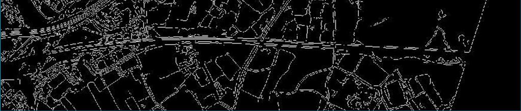
11 Updating Procedures (future work) Detecting boundaries with edge detection algorithms Inan & Dursun 21 Updating Procedures (future work) Detecting boundaries with edge detection algorithms Inan & Dursun 22
12 Results Important ones Fixed boundaries approach only works for agricultural fields, It is impossible to digitise all physical block boundaries using fixed boundaries approach, Incorporating CORINE land cover methodology for noneagricultural areas makes the implementation ineffective, However, using cadastral parcel boundaries makes the classification of all types of land (except for state lands not registered in the land registry and cadastre system) possible, For unregistered state lands, in combination with sub-parcels inside cadastral parcels, easily identifiable physical blocks may be defined outside cadastral parcels. For sustainability of such a data set, the methodology and the classification as well should be further refined to meet the needs of all related government or private bodies. Inan & Dursun 23 Thanks Erciyes University, Faculty of Engineering, Department of Geomatics Engineering Naam van de presentatie
Methodology for the Production and Updating of Agricultural Land Use/Cover Data Set
 Methodology for the Production and Updating of Agricultural Land Use/Cover Data Set Halil Ibrahim INAN and Ismail DURSUN, Turkey Key words: agriculture, land use/cover, classification, fixed boundary,
The European Common Agricultural Policy (CAP) after 1992
 after 1992") On the Level of Cooperation between Agricultural & Cadastral Parcel Registration Halil Ibrahim INAN (presenter) & Tahsin YOMRALIOGLU, Turkey Peter van OOSTEROM & Jaap ZEVENBERGEN, The Netherlands 1 OTB
On the Level of Cooperation between Agricultural & Cadastral Parcel Registration Halil Ibrahim INAN (presenter) & Tahsin YOMRALIOGLU, Turkey Peter van OOSTEROM & Jaap ZEVENBERGEN, The Netherlands 1 OTB
On the Level of Cooperation between Agricultural and Cadastral Parcel Registration
 On the Level of Cooperation between Agricultural and Cadastral Parcel Registration Halil Ibrahim INAN and Tahsin YOMRALIOGLU, Turkey; Peter van OOSTEROM and Jaap ZEVENBERGEN, the Netherlands Key words:
STANDARDIZATION OF PROPERTY QUALITIES
 STANDARDIZATION OF PROPERTY QUALITIES İsmail DURSUN, Turkey Key words: Land Registry, Cadastre, Property Quality, Property Type, Standardization, Land Use/Cover. SUMMARY Build a solid foundation is one
THE USE OF THE SPANISH CADASTRE FOR THE CONTROL AND MONITORING OF EU-CAP SUBSIDIES
 WPLA WORKSHOP Budapest THE USE OF THE SPANISH CADASTRE FOR THE CONTROL AND MONITORING OF EU-CAP SUBSIDIES INTRODUCTION The distribution of EU Agricultural Policy (CAP) subsidies has recently undergone
Developing Land Registry and Cadastre Base Data Model for Land Management Applications
 Developing Land Registry and Cadastre Base Data Model for Land Management Applications Arif Cagdas AYDINOGLU & Halil Ibrahim INAN Istanbul Technical University, Faculty of Civil Engineering, Department
THE PROS AND CONS OF BUILDING LICENSED OFFICES OF SURVEYING AND CADASTRE IN TURKEY
 THE PROS AND CONS OF BUILDING LICENSED OFFICES OF SURVEYING AND CADASTRE IN TURKEY Mustafa Hayri KESİKOĞLU and Erciyes University, Kayseri, Türkiye Table of contents An overview to the Turkish cadastre
Land Governance Monitoring
 University of Zagreb Faculty of Geodesy Land Governance Monitoring Proposal for pilot implementation in Croatia Final report Deliverable 4 7 June 2016 Contents Executive summary... 4 1 Introduction...
PREPARING SURVEY TENDER GIS DATABASE OUTCOMES
 PREPARING SURVEY TENDER SPECIFICATIONS FOR PROJECT GIS DATABASE OUTCOMES Presentation by Ian Harper GEODATA AUSTRALIA ESRI User Conference 2009 24 st July 2009 BACKGROUND GIS databases now provide a more
The Role of Cadastre in Agricultural Reform Applications of Turkey: Case Study of Trabzon Province
 The Role of Cadastre in Agricultural Reform Applications of Turkey: Case Study of Trabzon Province Halil Ibrahim INAN and Mehmet CETE, Turkey Key words: Cadastre, Agricultural Reform, National Registry
The Pros and Cons of Building Licensed Offices of Surveying and Cadastre in Turkey
 The Pros and Cons of Building Licensed Offices of Surveying and Cadastre in Turkey Mustafa Hayri KESİKOĞLU and Mehmet ÇETE, Turkey Key words: Land Registry, Cadastre, Licensed Offices of Surveying and
Agricultural Land Classification Guidelines
 Agricultural Land Classification Guidelines Per statute, only lands primarily used for bona fide agricultural purposes are eligible to receive an agricultural land classification. "Bona fide agricultural
By: Barney I. S. Laseko Programme Coordinator Prime Minister s Office TANZANIA
 2014 CONFERENCE ON LAND POLICY IN AFRICA 11 14 NOVEMBER, 2014 Focussed Discussion VIII Converting from Manual Land Registration to GIS Enabled Land Information System Case of Sub Saharan Africa Tanzania
Unified Land Administration for a Better Spatial Infrastructure
 Unified Land Administration for a Better Spatial Infrastructure Gyula IVÁN Institute of Geodesy, Cartography & Remote Sensing FÖMI (HUNGARY) Open Symposium 30th Korean Cadastral Seminar & FIG Commission
Support of Disaster Management by Land Administration and SDI
 Support of Disaster Management by Land Administration and SDI Key words: Spatial Data Infrastructure, Land Administration, GIS, Disaster Management SUMMARY Institute of Geodesy, Cartography and Remote
A Review and Perspective on Parcel Data Models for Urban Planning
 A Review and Perspective on Parcel Data Models for Urban Planning Yiqiang Ouyang Prof. Dr. Ilir Bejleri Department of Urban and Regional Planning University of Florida June 19-21, 2010 1 Content 1. Introduction
Commissioner s Standards for Classification of Real Estate as Devoted to Agricultural or Horticultural Use
 Commissioner s Standards for Classification of Real Estate as Devoted to Agricultural or Horticultural Use Kevin Schmidt Director, Office of Policy, Planning, and Research Virginia Department of Agriculture
Current Law Legislation for Land Consolidation in Turkey
 Legal Frameworks for Land Consolidation in Turkey Fatma Tüz Zehra GÜLSEVER Geodesy and Photogrammetry Engineer FYR Macedonia 19-21 June 2018 In Turkey due to inheritence law, agriculture land plots get
The Multi-Purpose Information System of Real Estates in the Czech Republic. Vladimíra ŽUFANOVÁ, Czech Republic
 The Multi-Purpose Information System of Real Estates in the Czech Republic Vladimíra ŽUFANOVÁ, Czech Republic Key words: Cadastre; Land management SUMMARY The Cadastre of Real Estate and Land administration,
Land administration in the agricultural sector under INSPIRE
 PCC workshop, Rome, 11 December 2008 1 Land administration in the agricultural sector under INSPIRE Wim DEVOS Agriculture Unit, JRC Ispra PCC workshop, Rome, 11 December 2008 2 Introduction: the legal
Surveying in Austria. Congress Maanmittauspäivät Seinäjoki, 20 th March 2014
 Surveying in Austria Congress Maanmittauspäivät Seinäjoki, 20 th March 2014 Topics Facts, figures Organisational issues of surveying Role of the BEV Products, services The Cadastre Surveying Education
The updated Degree of Urbanisation and its impact on the City list/layer
 The updated Degree of Urbanisation and its impact on the City list/layer Valeriya Angelova Eurostat Unit E4 NUAC meeting 10/05/2016, Brussels Content 1. The purpose of the update and related methodological
MASS REGISTRATION OF LAND PARCELS USING FIT-FOR-PURPOSE LAND ADMINISTRATION: PROCEDURES AND METHODS
 MASS REGISTRATION OF LAND PARCELS USING FIT-FOR-PURPOSE LAND ADMINISTRATION: PROCEDURES AND METHODS TAREK ZEIN Hansa Luftbild AG, Germany zein@hansaluftbild.de Paper prepared for presentation at the 2017
FIG-WB Forum on Land Administration
 FIG-WB Forum on Land Administration and Reform in Sub-Sahara Africa [Nigeria] [Peter O. Adeniyi] FIG WORKING WEEK, Abuja, NIGERIA 2013-6-10 MAY 2013 Statistic Country at a Glance Total population 162,470,737
1 dwelling unit/existing parcel with provisions for a guest house and additional quarters
 TABLE 1.3 Land Use Designations and Permissible Densities Land Use Density Additional Detail Maximum Land Coverage Land Use Residential Uses Density Additional Detail Maximum Land Coverage Single Family
Copernicus Sentinels the game changer?
 Setting the workshop scene OTSC-data in IACS and its Copernicus alternatives Philippe Loudjani, Wim Devos, Pavel Milenov, Guido Lemoine, Csaba Wirnhardt, Pär Åstrand JRC D5 MARS CAPland Inter-service brainstorming
Transparent Valuation as a Planning Support for Just Land Management System (LMS)
") Hrvoje TOMIĆ, Siniša MASTELIĆ IVIĆ, Miodrag ROIĆ, Croatia Transparent Valuation as a Planning Support for Just Land Management System (LMS) Contents Introduction Land management Real estate valuation The
Hrvoje TOMIĆ, Siniša MASTELIĆ IVIĆ, Miodrag ROIĆ, Croatia Transparent Valuation as a Planning Support for Just Land Management System (LMS) Contents Introduction Land management Real estate valuation The
Alternatives for Economic Boundary Determination in the Establishment of a Cadastral System. Paper to the FIG Working Week 2012 Rome, May 9, 2012
 Alternatives for Economic Boundary Determination in the Establishment of a Cadastral System Paper to the FIG Working Week 2012 Rome, May 9, 2012 by Gottfried Konecny Emeritus Professor Leibniz University
A Geocoded Cadastral Fabric as a Precondition for a Sustainable Land Management System
 A Geocoded Fabric as a Precondition for a Sustainable Land Management System Gottfried KONECNY, Germany; J.P. LAUZON, Canada; Abdul Salam MOHAMMED, India Key words: SDI,, Parcel Boundaries, GPS-GNSS, Land
Date: 15/01/30 Page: 1
 Formulas, Rules and Principles Subject: General Document Number 1.1.1 Summary This section describes how this Manual is to be used for the 2017 revaluation (January 1, 2017 to December 31, 2020). Regulated
Design and Determine 3D Cadastral Systems: A Case Study of Turkey Hicret GURSOY SURMENELI* and Mehmet ALKAN* (Turkey)
") Design and Determine 3D Cadastral Systems: A Case Study of Turkey Hicret GURSOY SURMENELI* and Mehmet ALKAN* (Turkey) *Yildiz Technical University, Civil Engineering Faculty, Department of Geomatics CONTENTS
Design and Determine 3D Cadastral Systems: A Case Study of Turkey Hicret GURSOY SURMENELI* and Mehmet ALKAN* (Turkey) *Yildiz Technical University, Civil Engineering Faculty, Department of Geomatics CONTENTS
The Challenge to Implement International Cadastral Models Case Finland 1
 The Challenge to Implement International Cadastral Models Case Finland 1 Tarja MYLLYMÄKI and Tarja PYKÄLÄ, Finland Key words: cadastre, modelling, LADM, INSPIRE SUMMARY Efforts are currently made to develop
Towards Kenya s Profile of the Land Administration Domain Model
 Department of Geospatial and Space Technology University of Nairobi Towards Kenya s Profile of the Land Administration Domain Model David N. Siriba and Jasper N. Mwenda dnsiriba, jnmwenda{@uonbi.ac.ke}
The Cooperative Enterprise in New York State
 The Cooperative Enterprise in New York State - 2017 Cornell University Cooperative Enterprise Program - Purpose Communicate value Communicate value of cooperative structured businesses located or doing
Extending limits of space. Geodetski zavod Celje
 Extending limits of space Geodetski zavod Celje Let us introduce International company based in Slovenia with 55 years of experience providing consulting and technical assistance services to public sector
A NOMINAL ASSET VALUE-BASED APPROACH FOR LAND READJUSTMENT AND ITS IMPLEMENTATION USING GEOGRAPHICAL INFORMATION SYSTEMS
 A NOMINAL ASSET VALUE-BASED APPROACH FOR LAND READJUSTMENT AND ITS IMPLEMENTATION USING GEOGRAPHICAL INFORMATION SYSTEMS by Tahsin YOMRALIOGLU B.Sc., M.Sc. A thesis submitted for the Degree of Doctor of
Comprehensive Plan 2030
 Introduction Land use, both existing and future, is the central element of a Comprehensive Plan. Previous chapters have discussed: Projected population growth. The quality housing available in the Township
An Opportunity for Change
 Land Registry s Digital Mapping Project A Driver for Change Dr Paddy Prendergast FIS Department of Spatial Information Sciences Dublin Institute of Technology, IRELAND An Opportunity for Change Existing
LCB File No. T ADOPTED TEMPORARY REGULATION OF THE NEVADA TAX COMMISSION
 LCB File No. T031-02 ADOPTED TEMPORARY REGULATION OF THE NEVADA TAX COMMISSION Filed with the Secretary of State on 12/12/2002 EXPLANATION Matter in italics is new; matter in brackets [omitted material]
A Method For Building Legal Digital Cadastre Without Using Cadastral Measurements Field Book Data Is It Accurate Enough?
 A Method For Building Legal Digital Cadastre Without Using Cadastral Measurements Field Book Data Is It Jad JARROUSH, Dmitri BRICKMAN, Israel Key words: Digital Cadastre, Least Squares Cadastral Computations,
Land Consolidation, Valuation and Cadastre
 Hülya DEMIR, Mehmet GÜR and Volkan CAGDAS, Turkey Key words: Land valuation, consolidation, land and agricultural reform. ABSTRACT In this paper, valuation studies in land consolidation, land and agricultural
Asset valuation. Advancing Methodology on Measuring Asset Ownership from a Gender Perspective
 Advancing Methodology on Measuring Asset Ownership from a Gender Perspective Asset valuation Workshop on the Production of Statistics on Asset Ownership from a Gender Perspective through Household Surveys
QUIET HILLS RANCH 3,871 + ACRES CONTACT:
 QUIET HILLS RANCH 3,871 + ACRES CONTACT: BILL WRIGHT or BILL QUINN SHASTA LAND SERVICES, INC. 358 Hartnell Avenue, Suite C Redding, CA 96002 (530) 221-8100 www.ranch-lands.com QUIET HILLS RANCH LOCATION:
Farmland Preservation Plan
 WELCOME! Farmland Preservation Plan Douglas County, WI Kickoff Steering Committee Meeting Amnicon Town Hall Tuesday, February 9, 2016 1:30 pm to 3:30 pm Source: http://www.loc.gov/item/fsa2000044046/pp/
Cadastral NSDI Reference Document
 Cadastral NSDI Reference Document Version 12 October 2012 FGDC Subcommittee for Cadastral Data Cadastral NSDI Reference Document Table of Contents 1. Purpose... 1 2. Business Applications... 1 3. Terminology
- the future tool to success
 From chaos to order... GIS in Land Consolidation - the future tool to success Experiences from Forest Land Consolidation in Sweden FAO Workshop in Santiago de Compostela 2009 Mats Backman Land Consolidation
e-cadastre and Photo-Interpretation Technologies
 UNECE- WPLA EFFICIENT AND TRANSPARENT LAND MANAGEMENT IN ECE COUNTRIES 4 March 2010 - Baku, Azerbaijan e-cadastre and Photo-Interpretation Technologies The Italian experience as an example of Good Practice
Metro Vancouver's 2011 Generalized Land Use by Municipality (Net Land Area - excluding dedicated road right-of-way and water bodies)
") METRO VANCOUVER Land Percent Share Land Use Category Area (ha) of METRO Total Agriculture 48,822 17.1% Airport/Airstrip 1,577 0.6% Cemetery 292 0.1% Commercial 2,980 1.0% Harvesting and Research 8,630
METRO VANCOUVER Land Percent Share Land Use Category Area (ha) of METRO Total Agriculture 48,822 17.1% Airport/Airstrip 1,577 0.6% Cemetery 292 0.1% Commercial 2,980 1.0% Harvesting and Research 8,630
LPIS quality inspection: EU requirements and methodology
 LPIS quality inspection: EU requirements and methodology DEVOS Wim, KAY Simon APRIL 2010 Revised from JRC 56130 (pdf) / D(2009)(11402) (pdf) / D(2009)(11164) (Word) The mission of the JRC-IPSC is to provide
Implementation of Permanent Easements and Associated Nutrient Load Reductions
 1 Minnesota Nutrient Reduction Strategy Agricultural Sector/BWSR RIM Program Measure Implementation of Permanent and Associated Nutrient Load Reductions Measure Background Visual Depiction The map in Figure
Jack McKenna, Director of Business Development, Africa and the Caribbean
 Presented at the FIG Working Week 2016, May 2-6, 2016 in Christchurch, New Zealand Jack McKenna, Director of Business Development, Africa and the Caribbean FIG WORKING WEEK 2016 Fit for Purpose Parcel
Indicate if land-based activity is primary source of income for owner or land user % ,45 TL He lives in. village..
 Public Disclosure Authorized Public Disclosure Authorized Public Disclosure Authorized Public Disclosure Authorized Social Audit Reporting Format on Land Acquisition I Social Impact Screening Format (for
Cadastre as a crucial component of SDI ensuring sustainable development
 Cadastre as a crucial component of SDI ensuring sustainable development L U D M I L A P I E T R Z A K, E L Z B I E T A B I E L E C K A F I G 2 0 1 5 W O R K I N G W E E K I N S O F I A, B U L G A R I A
NEVADA DEPARTMENT OF TAXATION Division of Local Government Services AGRICULTURAL LAND VALUES OPEN SPACE PROPERTY PROCEDURES BULLETIN NO.
 NEVADA DEPARTMENT OF TAXATION Division of Local Government Services 2014-15 AGRICULTURAL LAND VALUES OPEN SPACE PROPERTY PROCEDURES BULLETIN NO. 203 Division of Assessment Standards Bulletin No. 203 2014-15
FACTSHEET PRE-CONTRACTUAL ENQUIRIES
 FACTSHEET PRE-CONTRACTUAL ENQUIRIES This factsheet covers the recommended pre-contract enquiries for rural land Buyer beware Traditionally in land transactions the general rule has been caveat emptor,
DEVELOPMENT OF A GIS-BASED LAND REGISTRY SYSTEM
 DEVELOPMENT OF A GIS-BASED LAND REGISTRY SYSTEM *Vanum Govindu 1, Kidu Gebremedhin 2 and Desta Luel Tsegay 3 1 Department of GEOS for Natural Resource Management, Institute of Geo-Information and Earth
Sahmakum Teang Tnaut June 2012
 Sahmakum Teang Tnaut June 2012 Author: Wilfred Waters and Ket Mengcheang Editor: Nora Lindstrom Researchers: Ket Mengcheang, Tim Sreyleak, Say Chhay, Chum Makara With special thanks to the Boeung Kak community
Standardization in the Cadastral Domain. Sub Working Group 1: Legal Aspects
 Standardization in the Cadastral Domain Sub Working Group 1: Legal Aspects Framework 10 participants 8 countries 2 sessions Updates from the different countries (mainly as to the legal aspects of cadastre)
Cadastral Template 2003
 PCGIAP-Working Group 3 "Cadastre" FIG-Commission 7 "Cadastre and Land Management" Cadastral Template 2003 The establishment of a cadastral template is one of the objectives of Working Group 3 "Cadastre"
Hungarian Cadastre and its relation to LADM
 Hungarian Cadastre and its relation to LADM Gyula IVÁN CLGE General Assembly 22 March 2013, Budapest, HUNGARY Content Historical background Evolution of Cadastral modeling in Hungary LADM issues Conclusion
Cadastral Framework Standards
 Cadastral Framework Standards The goal of the Data Standards and Recommendations Committee is to provide recommendations and guidelines to Indiana GIS user communities to facilitate the collection, maintenance
Proposec Drc. en (Nc. 3LWñ ORDINANCE NO. BILL NO.
 ORDINANCE NO. BILL NO. A BILL FOR AN ORDINANCE AMENDING CHAPTER 5A, KAUA I COUNTY CODE 1987, AS AMENDED, RELATING TO REAL PROPERTY TAXES BE IT ORDAINED BY THE COUNCIL OF THE COUNTY OF KAUA I, STATE OF
ORDINANCE NO. BILL NO A BILL FOR AN ORDINANCE AMENDING CHAPTER 5A, KAUA I COUNTY CODE 1987, AS AMENDED, RELATING TO REAL PROPERTY TAXES
 ORDINANCE NO. BILL NO. 2546 A BILL FOR AN ORDINANCE AMENDING CHAPTER 5A, KAUA I COUNTY CODE 1987, AS AMENDED, RELATING TO REAL PROPERTY TAXES BE IT ORDAINED BY THE COUNCIL OF THE COUNTY OF KAUA I, STATE
Land Tenure and Geospatial Data and Technology
 Land Tenure and Geospatial Data and Technology Ioana Bouvier E3/Land and Urban, USAID Senior Geospatial Analyst January 23, 2018 January 23, 2018 1 OUTLINE 1. Overview of geospatial data and technology
The Verification of the Modernization of the Real Estate Cadastre in the Context of the Quality of Cadastral Data Case Study
 Environmental Engineering 10th International Conference eissn 2029-7092 / eisbn 978-609-476-044-0 Vilnius Gediminas Technical University Lithuania, 27 28 April 2017 Article ID: enviro.2017.218 http://enviro.vgtu.lt
CLGE Working for a Profession
 CLGE Working for a Profession 15. November 2017 Tallinn (ES) The public-private partnership in cadastre in Switzerland SWITZERLAND 41'290 km 2 8 million people 26 cantons ~2600 municipalities ~4.0 million
The LADM and the Continuum of Land Rights
 CheeHai TEO, Malaysia and Christiaan Lemmen, the Netherlands Key words: LADM, Continuum of Land Rights, Voluntary Guidelines, Spatial Enabled Societies SUMMARY The development of the Land Administration
The Survey Data Model Technology A practical survey solution to generate all levels of spatial and e-governance outcomes.
 Land Governance in a Rapidly Changing Environment Annual World Bank Conference on Land and Poverty April 24 & 25, 2012 The Survey Data Model Technology A practical survey solution to generate all levels
Galician Land Bank 10 years of experience with land banking
 Galician Land Bank 10 years of experience with land banking 9 th LANDNET International Workshop Budapest, 4 th of October 2017 Miguel Ángel Pérez Dubois Director General of Rural Development and AGADER.
Quality Improvement to Cadastral Information in Sweden
 Gunnar BLIXT, Sweden Key words: digital cadastre, quality, cadastral index map, real property register. SUMMARY Lantmäteriet is a governmental agency which gives support for creating an efficient and sustainable
XXIV FIG International Congress Facing the Challenges Building the Capacity. Sydney, Australia, April
 XXIV FIG International Congress Facing the Challenges Building the Capacity Sydney, Australia, 11 16 April 2010 IMPLEMENTATION AND CONCEPT OF PUBLIC AWERENESS COMMUNITY PARTICIPATION AND LAND MANAGEMENT
W B WEB E B S E S R E V R I V CE C S E S FO F R O R SU S R U V R E V Y E O Y R O S
 The Council of European Geodetic Surveyors Comité de Liaison des Géomètres Européens GEOWEB WEB SERVICES FOR SURVEYORS Hanover, Germany 10-14 October 2012 GEOWEB S.p.A. Geoweb S.p.A. was established in
March 26, Sutter County Planning Commission
 March 26, 2003 To: Re: Sutter County Planning Commission Agenda Item #12: Public hearing on Rezoning #03-04 to change the zoning classification of two parcels totaling 324+ acres from the AG (General Agricultural)
Rules and Regulations for Enforcement of the Farm, Forest, and Open Space Act
 STATE OF RHODE ISLAND AND PROVIDENCE PLANTATIONS DEPARTMENT OF ENVIRONMENTAL MANAGEMENT Rules and Regulations for Enforcement of the Farm, Forest, and Open Space Act July, 2002 AUTHORITY: These regulations
Cadastral Parcels in INSPIRE. Lisbon, 27 February 2013
 Cadastral Parcels in INSPIRE Lisbon, 27 February 2013 Dominique.laurent@ign.fr Plan INSPIRE context The modeling approach for theme Cadastral Parcels Implementation of INSPIRE theme Cadastral Parcels Context
Land Administration in Jordan
 Land Administration in Jordan Problems and Challenges Eng. Director of Registration Services Department of Lands & Survey q General information q Historical Background q Properties Initiation q Problems
Rural Land Market in Armenia: Formation Peculiarities and Development Trends
 Rural Land Market in Armenia: Formation Peculiarities and Development Trends Manuk Vardanyan Chairman of the state committee of the real property cadastre of the government of RA, Ph.D. Vahagn Grigoryan
Reliability of the Italian cadastral system data quality and improvement prospects
 Reliability of the Italian cadastral system data quality and improvement prospects Eng. Franco MAGGIO (Central Director for Cadastral, Cartographic and Land Registration Services) Eng. Arturo ANGELINI
Expropriation. Recommended Policy Wordings (full): Lao National Land Policy. Context. Policy. Standard of Public Purpose
: Lao National Land Policy. Context. Policy. Standard of Public Purpose") Expropriation Context Following from the goal of the National Land Policy, to promote and ensure a secure land tenure system that is transparent, effective, non-discriminative, equitable and just ; it
Expropriation Context Following from the goal of the National Land Policy, to promote and ensure a secure land tenure system that is transparent, effective, non-discriminative, equitable and just ; it
New Developments in the Hellenic Cadastre
 New Developments in the Hellenic Cadastre Prof. M. Kavouras Vice-president Ktimatologio S.A. (Hellenic Cadastre) The Hellenic Cadastre Background The Hellenic National Cadastre Organizational and institutional
ParcelMap BC Compiling a Parcel Fabric for the Province of British Columbia. Presented by: Ellen Styner (General Manager) and Wendy Amy (GIS Manager)
 and Wendy Amy (GIS Manager)") ParcelMap BC Compiling a Parcel Fabric for the Province of British Columbia Presented by: Ellen Styner (General Manager) and Wendy Amy (GIS Manager) Who is MNC? MNC is a geomatics engineering firm with
ParcelMap BC Compiling a Parcel Fabric for the Province of British Columbia Presented by: Ellen Styner (General Manager) and Wendy Amy (GIS Manager) Who is MNC? MNC is a geomatics engineering firm with
Object Oriented Unified Real Estate Registry for a Good Spatial Data Management
 Object Oriented Unified Real Estate Registry for a Good Spatial Data Management Gyula IVÁN Gábor SZABÓ Zoltán WENINGER Institute of Geodesy, Cartography and Remote Sensing (FÖMI), Hungary Workshop on e-governance,
The Cadastral Modelling Future and The Land Surveyors Role
 The Cadastral Modelling Future and The Land Surveyors Role Ian Harper Geodata Australia ESRI Survey Summit July 2013 The Land Surveyors Future Role From Custodians of the Cadastre to Custodians of the
Copernicus Land Monitoring Service (Pan- European and Local) in the Netherlands
 in the Netherlands") Copernicus Land Monitoring Service (Pan- European and Local) in the Netherlands Wageningen Environmental Research (WENR) activiteiten 13 Juni 2018, Gerard Hazeu Introduction Personal note and some terminology
Copernicus Land Monitoring Service (Pan- European and Local) in the Netherlands Wageningen Environmental Research (WENR) activiteiten 13 Juni 2018, Gerard Hazeu Introduction Personal note and some terminology
IMPLEMENTATION OF FLEXICADASTRE IN ZAMBIA
 IMPLEMENTATION OF FLEXICADASTRE IN ZAMBIA Presented by: Simon M. Mwalimu Head of Mining Cadastre and Secretary of The Mining Advisory Committee Mining Cadastre Office-Zambia 16 th February 2009 Part A
TO LET BY TENDER. Marton Scar Farm West Marton, Skipton, North Yorkshire & Land at Greenbank Farm East Marton, Skipton, North Yorkshire
 TO LET BY TENDER Marton Scar Farm West Marton, Skipton, North Yorkshire & Land at Greenbank Farm East Marton, Skipton, North Yorkshire A rare opportunity to rent part or the whole of a good quality grassland
SECTION 9.7: "AE-40" EXCLUSIVE AGRICULTURAL ZONE 40 ACRE MINIMUM (Added by Ord. No. 1946, effective )
") SECTION 9.7: "AE-40" EXCLUSIVE AGRICULTURAL ZONE 40 ACRE MINIMUM (Added by Ord. No. 1946, effective 8-12-76) PURPOSE A. The AE-40 Zone is an exclusive zone for intensive and extensive agricultural uses
SECTION 9.7: "AE-40" EXCLUSIVE AGRICULTURAL ZONE 40 ACRE MINIMUM (Added by Ord. No. 1946, effective 8-12-76) PURPOSE A. The AE-40 Zone is an exclusive zone for intensive and extensive agricultural uses
STAFF REPORT. Permit History:
 STAFF REPORT Application: Request to rezone property from General Agriculture (AG) to Suburban Residential (a) (R-2a) Applicant: Perry Puncochar Agenda Item: 4(g) Background Information: Proposal: The
PROPERTY TAX BULLETIN NO. 20 (Published under Appropriation No ) Issued February 4, 2008; Replaces January 5, 2005
 Issued February 4, 2008; Replaces January 5, 2005") JOHN ELIAS BALDACCI GOVERNOR STATE OF MAINE MAINE REVENUE SERVICES PROPERTY TAX DIVISION PO BOX 9106 AUGUSTA, MAINE 04332-9106 ADMINISTRATIVE & FINANCIAL SERVICES RYAN LOW COMMISSIONER MAINE REVENUE SERVICES
JOHN ELIAS BALDACCI GOVERNOR STATE OF MAINE MAINE REVENUE SERVICES PROPERTY TAX DIVISION PO BOX 9106 AUGUSTA, MAINE 04332-9106 ADMINISTRATIVE & FINANCIAL SERVICES RYAN LOW COMMISSIONER MAINE REVENUE SERVICES
REPORT TO COUNCIL. District. of Barriere. Re: Re- Application to Exclude Land from the Agricultural. Land Reserve (ALR) Barriere Paint and Body
 Barriere Paint and Body") District of Barriere REPORT TO COUNCIL Date: November 6, 2017 File: 530.20/Rpts To: Council From: CAO, Colleen Hannigan Re: Re- Application to Exclude Land from the Agricultural Land Reserve (ALR) Barriere
District of Barriere REPORT TO COUNCIL Date: November 6, 2017 File: 530.20/Rpts To: Council From: CAO, Colleen Hannigan Re: Re- Application to Exclude Land from the Agricultural Land Reserve (ALR) Barriere
Land policies and land reforms in China: current situation and lessons to be learned for the future Dr. Michael Klaus
 Land policies and land reforms in China: current situation and lessons to be learned for the future Dr. Michael Klaus Presentation at 6 th International Summer School 2014 - Comprehensive Land Policy -
National Spatial Data Infrastructure development in Republic of Macedonia
 National Spatial Data Infrastructure development in Republic of Macedonia Sonja Dimova, state advisor for geomatics AGENCY FOR REAL ESTATE CADASTRE September 6-th, 2017, Strasbourg AREC competence for
Visual On land Trash Assessment Protocol for Stormwater
 Visual On land Trash Assessment Protocol for Stormwater Version 1.0 DRAFT Prepared for: Santa Clara Valley Urban Runoff Pollution Prevention Program Alameda Countywide Clean Water Program Contra Costa
Land for Sale. Barton Farm, Alderminster, Warwickshire. Lot 1
 Land for Sale Barton Farm, Alderminster, Warwickshire Lot 1 Barton Farm, Alderminster, Warwickshire Building & Yard - Lot 1 www.sheldonbosleyknight.co.uk Lot 1 Lot 2 Agricultural Land & Buildings at Barton
The Digital Cadastral Database and the Role of the Private Licensed Surveyors in Denmark
 IRISH INSTITUTE OF SURVEYORS, DUBLIN INSTITUTE OF TECHNOLOGY, 23 NOVEMBER 2005 PUBLISHED IN IIS NEWS, WINTHER 2006. The Digital Cadastral Database and the Role of the Private Licensed Surveyors in Denmark
The ISO/TC 211 Land Administration Domain Model (LADM)
") Geographic information/geomatics The ISO/TC 211 Land Administration Domain Model (LADM) Harry Uitermark/Editor LADM Kadaster/ITC, The Netherlands International Organization for Standardization (ISO) A
Geographic information/geomatics The ISO/TC 211 Land Administration Domain Model (LADM) Harry Uitermark/Editor LADM Kadaster/ITC, The Netherlands International Organization for Standardization (ISO) A
Land Administration and Spatial Enablement Victoria s Experience. Chris McRae, Executive Director Land Victoria
 Land Administration and Spatial Enablement Victoria s Experience Chris McRae, Executive Director Land Victoria 4 th UN Land Administration Forum, October 2011 Outline About Land Victoria Land Victoria
INSPIRE Thematic Working. Cadastral parcels. September 2008
 INSPIRE Thematic Working Cadastral parcels September 2008 The INSPIRE context The INSPIRE Directive Its aim is to build the INfrastructure for Spatial InfoRmation in Europe The INSPIRE Directive has been
Towards LADM Country Cadastral Profile Case Poland
 Towards LADM Country Cadastral Profile Case Poland Jarosław BYDŁOSZ, Poland Key words: LADM, Country Profile, Cadastre, Poland SUMMARY The Geographic Information - Land Administration Domain Model was
Technology-driven solutions for the innovation of land administration and management
 Technology-driven solutions for the innovation of land administration and management Technology and economic growth - Studies*find link between technology innovation and national economic prosperity especially,