Extending limits of space. Geodetski zavod Celje
|
|
|
- Eustacia Butler
- 5 years ago
- Views:
Transcription

1 Extending limits of space Geodetski zavod Celje
2 Let us introduce International company based in Slovenia with 55 years of experience providing consulting and technical assistance services to public sector financed programmes. Specialist in spatial and rural development programming, implementation, monitoring and evaluation and in the provision of technical assistance for capacity building of national and local institutions promoting spatial, agricultural and rural development. The Company has managed numerous projects and programs in Slovenia and the Western Balkans.
3 Let us introduce One of the leading providers of technical assistance to many Ministries in Slovenia and within potential candidates and candidate countries in the Balkans. Leading contractor to the Slovenian Paying Agency for all IACS controls in Slovenia including Agri-Environmental measures, Cross-compliance, animal controls and all area based subsidies. Our flexsibility towards users and clients is a guarantee for sucessfull work.

4 Our most important clients and partners NATIONAL AND EUROPEAN AGENCIES: Geodetska uprava RS, Direkcija RS za ceste, Ministrstvo za okolje in prostor, Ministrstvo za kmetijstvo, gozdarstvo in prehrano, Ministrstvo za gospodarstvo, Agencija za kmetijske trge in razvoj podeželja, Geodetski inštitut, Fakulteta za gradbeništvo in geodezijo Ljubljana, Statistični urad RS, EUROSTAT, Geodetska uprava Crne gore, EC JRC, EC IPA... MUNICIPALITIES: MO Celje, Gorišnica, Kidričevo, Mozirje, Nazarje, Ljubno, Laško, Kozje, Ptuj, Podčetrtek... COMPANIES: Družba za avtoceste RS, Državna direkcija za ceste, Regionalna razvojna agencija Celje, Regionalna razvojna agencija Posavje, Geodetski zavod Slovenije, DFG Consluting, Ljubljanski urbanistični zavod, Elektro Celje,...
5 Advisory services We have in-house competence, skills and capacity within the areas of consultancy and training, IT support, development and implementation, establishment of the system, guidance and execution of registration in the field, data conversion Professionally trained specialists with experiences both domestically and abroad in the field of consultancy Know-how and development of quality assurance and quality consultancy Approach based on extensive collective expertise gained during many years of work in related works The most important features that make our approach distinctive are: o setting priorities, o workshops as part of the methodology development process, o capacity building, o day to day work with client, o study visits, o technical support and consultations, o pool of short term experts o backstopping o and regional experience


6 Control of agricultural subsidies For all 4 parts of control: - On the spot control (field inspection and CwRS) - Cross compliance - Agri Environmental measures - Animal wellfare GZC is the leading partner.

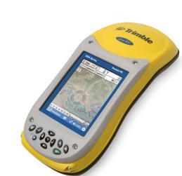

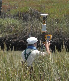


7 FIELD INSPECTION - control of areas and animals Equipment: laptop computer, printer, GPS reciever, digital camera Field work
 and rapid field")
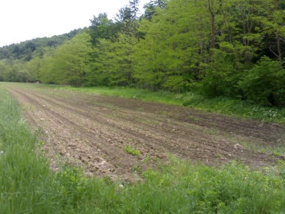
8 CONTROL WITH REMOTE SENSING (CwRS) Five sites for CwrRS, one with VHR +HR images - testisng automatic classification Ikonos and Quickbird VHR satellite images, SPOT 5 HR images Control is a combination of photo-interpretation (true-colour, false- colour) and rapid field visits.


9 CwRS pilot study Buyer: EC JRC One site in Croatia, one site in Macedonia GeoEye VHR satellite images, RapidEye HR images Extensive study on OTS controls in both candidate countries including delivery of technical and organizational recommendations for implementation of each method.
10 Land consolidation of agricultural land Land consolidation of agricultural land considers: Special conditions of land cultivation due to natural conditions and tradition Acts of local community Foreseen agricultural production Protection of natural and cultural heritage Foreseen effect of land consolidation We deliver full support to local communities in preparation of project documentation for accessing EU funds.

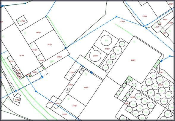
11 Land consolidations of built land Contractual land consolidation of built land new parcels are defined by development plan Outer boundary of land consolidation area Old parcel boundaries New parcel boundaries


12 Statistical services - collection of agri-environmental data - land use and land cover - crop estimation - real estate census - population and housing census


13 REAL-ESTATE AND SPATIAL DATA ACQUISITION Cadastre, transformations, digital land cadastre, new cadastre surveys Building cadastre, real estate census


14 Infrastructure asset management Accurate and up-to-date data about road network and infrastructure are basis for quality and coordinated realization of maintenance works and building of new infrastructure.


15 Services for local communities Economic development Spatial data supports community redevelopment that revitalizes the economic and environmental health of neighborhoods. Leading partner in preparation of conceptual and implementation design documentation and providing assistance to local community in assessing EU funds. Studies of developement strategies of bussines/industrial zones, with emphasize on spatial developement, support on marketing of space.

16 Services for local communities Urban and spatial development No matter how large or small your community, planners must deal with spatial information: parcel, zoning and land use data, addresses, transportation networks, and housing stock. Our services will help you reach your agency mission while doing more and spending less. Digitsalization and evaluation of spatial plans, connecting with other datasets Assisting local communities in adoption of spatial acts - support to process - technical execution - cartography - substantive support

17 Services for local communities Real estate data bases (land and buildings) analysis of existing situation data collection and evaluation simulations of various scenarios calculations of real estate values, taxation advisory services at preparation legislation bases


18 Services for local communities Public infrastructure analysis of existing situation data collection and evaluation calculation of values and preparation of amortization plans calculations of taxation for infrastructure advisory services at preparation of legislation


19 Terrestrial laser scanning FAST ACQUISITION OF HIGH QUALITY 3D SPATIAL DATA - Infrastructure surveys - Monitoring resources - Historical buildings and monuments - Topography surveys


20 Topography, cartography, land information systems Topographic database City maps, tourist maps 3D modeling
21 OTHER geodetic and Spatial related services Land cadastre measurements Photogrammetry Establishing basic coordinate system Horizontal, elevation and geometric grid surveys Geodetic technical measurements and control measurements Layouts of manufacturing lines in objects Layouts of construction profiles and calculating volumes Consulting and advising in real-estate transactions Court and other expertise services
USE OF REAL ESTATE DATABASES FOR MASS VALUATION IN SLOVENIA
 GEODETSKA UPRAVA REPUBLIKE SLOVENIJE MINISTRSTVO ZA INFRASTRUKTURO IN PROSTOR REPUBLIKA SLOVENIJA URAD ZA MNOŽIČNO VREDNOTENJE NEPREMIČNIN USE OF REAL ESTATE DATABASES FOR MASS VALUATION IN SLOVENIA UNECE
International funding projects in Republic Geodetic Authority
 International funding projects in Republic Geodetic Authority Serbia: Republic Geodetic Authority Workshop Exploring Funding Instruments for NMCA 7-8 November 2012 Republic Geodetic Authority Republic
PCC Conference and Plenary Meeting "Data as a basis of the digital society March 2018, Sofia. Activity of the geodetic NGOs in Bulgaria
 PCC Conference and Plenary Meeting "Data as a basis of the digital society 13-15 March 2018, Sofia Activity of the geodetic NGOs in Bulgaria Union of Surveyors and Land Managers in Bulgaria Chamber of
The Multipurpose Hungarian Unified Land Registry System
 The Multipurpose Hungarian Unified Land Registry System András Osskó FIG Working Week Integrating Generation Stockholm, Sweden 14-19 June 2008 Republic of Hungary is located in Central Europe Neighbouring
Procedures for the legalization and registration of buildings and building units Challenges and Problems Building cadastre in Slovenia
 Procedures for the legalization and registration of buildings and building units Challenges and Problems Building cadastre in Slovenia Edvard Mivšek M.Sc. Geodetic institut of Slovenija Pristina, 19 April
Results of Central European Land Knowledge Center (CELK) Activities
 Activities") Results of Central European Land Knowledge Center (CELK) Activities András OSSKÓ, Hungary Key words :CELK Center, Property Rights and Land Market Development, Networking, direct knowledge transfer SUMMARY
Results of Central European Land Knowledge Center (CELK) Activities András OSSKÓ, Hungary Key words :CELK Center, Property Rights and Land Market Development, Networking, direct knowledge transfer SUMMARY
Galicia 2009 Regional Workshop on Land Tenure and Land Consolidation. FAO s Experience with Land Development Instruments in Europe
 Galicia 2009 Regional Workshop on Land Tenure and Land Consolidation FAO s Experience with Land Development Instruments in Europe Santiago de Compostela Galicia 9-11 of February 2009 Richard Eberlin Land
Slovenian Experiences
 Slovenian Experiences An example from a transition country Milan Brajnik, B.Sc.Geod., Assistant Director milan.brajnik@geod-is.si Geodetic Institute of Slovenia 1000 Ljubljana, Jamova cesta 2 The Identity
LAND CADASTRE Today and Challanges for the future Damjan DOLER
 LAND CADASTRE Today and Challanges for the future Damjan DOLER Head of Real Estate Department Regional surveying office Celje Mariborska cesta 88, Celje, SLOVENIA 32nd Conference of Surveyin Authorities,
Aspect of preliminary activities in the function of supporting NSDI
 Sonja DIMOVA, Republic of Macedonia Key words: e-governance, geospatial data, NSDI, INSPIRE, metadata SUMMARY The successful establishment of the NSDI in the true sense of the word cannot be performed
ABSTRACT Land Administration System in Lithuania
 ABSTRACT Land Administration System in Lithuania 1. General introduction to the Lithuanian Land Administration System and State Enterprise Centre of Registers ( shortly SECR) Lithuania has established
Participants of the Ministerial Meeting on Housing and Land Management on 8 October 2013 in Geneva
 Summary At its meeting on 2 April 2012, the Bureau of the Committee on Housing and Land Management of the United Nations Economic Commission for Europe agreed on the need for a Strategy for Sustainable
PROJECT INFORMATION DOCUMENT (PID) CONCEPT STAGE Report No.: AB3229 Project Name. Land Registry and Cadastre Modernization Project Region
 CONCEPT STAGE Report No.: AB3229 Project Name. Land Registry and Cadastre Modernization Project Region") PROJECT INFORMATION DOCUMENT (PID) CONCEPT STAGE Report No.: AB3229 Project Name Land Registry and Cadastre Modernization Project Region EUROPE AND CENTRAL ASIA Sector Central government administration
PROJECT INFORMATION DOCUMENT (PID) CONCEPT STAGE Report No.: AB3229 Project Name Land Registry and Cadastre Modernization Project Region EUROPE AND CENTRAL ASIA Sector Central government administration
Cadastre: definitions
 Introduction New vision towards a multipurpose cadastral system to support land management in Morocco Moha EL-AYACHI, El Hassane SEMLALI, Mohamed ETTARID, Driss TAHIRI, Institut Agronomique et Vétérinaire
LAND CADASTRE AND BUILDING CADASTRE IN SLOVENIA: CURRENT SITUATION AND POTENTIAL OF 3D DATA
 3D Cadastres Organizational and Governmental Aspects LAND CADASTRE AND BUILDING CADASTRE IN SLOVENIA: CURRENT SITUATION AND POTENTIAL OF 3D DATA EMA POGORELČNIK AND MARINA KOROŠEC Surveying and Mapping
DATR towards e-land Administration in Hungary
 DATR towards e-land Administration in Hungary Gyula IVÁN-Gábor SZABÓ-Zoltán WENINGER-Piroska Zalaba Institute of Geodesy, Cartography and Remote Sensing, Budapest, HUNGARY XXIV. FIG Congress Facing the
Status and Perspectives of the Geodesy, Cartography and Cadastre Authority Availability of Geographic Information in Slovakia.
 Status and Perspectives of the Geodesy, Cartography and Cadastre Authority Availability of Geographic Information in Slovakia Hedviga Májovská Geodesy, Cartography and Cadastre Authority of the Slovak
Quality Improvement of the Real Estate Cadastre in Serbia
 , Serbia Key words: quality improvement, real estate information, quality assurance, Serbia SUMMARY The concept of cadastral modernization in the Republic of Serbia was defined in 1992, and it is being
THE USE OF THE SPANISH CADASTRE FOR THE CONTROL AND MONITORING OF EU-CAP SUBSIDIES
 WPLA WORKSHOP Budapest THE USE OF THE SPANISH CADASTRE FOR THE CONTROL AND MONITORING OF EU-CAP SUBSIDIES INTRODUCTION The distribution of EU Agricultural Policy (CAP) subsidies has recently undergone
Addressing Land Sector Opportunities with Geospatial Information in Nepal
 The 20th UNRCC-AP and the 4th UN-GGIM-AP 5-10 October 2015 Jeju Island, Republic of Korea Addressing Land Sector Opportunities with Geospatial Information in Nepal Krishna Raj BC Executive Director Land
INTEGRATED LAND ADMINISTRATION SYSTEM PROJECT PREPARATION (IBRD Advance no. P459-HR) TERMS OF REFERENCE
 TERMS OF REFERENCE") INTEGRATED LAND ADMINISTRATION SYSTEM PROJECT PREPARATION (IBRD Advance no. P459-HR) TERMS OF REFERENCE SERVICE PROVISION FOR THE SUPPORT TO THE NATIONAL SPATIAL DATA INFRASTRUCTURE (NSDI) DEVELOPMENT
INTEGRATED LAND ADMINISTRATION SYSTEM PROJECT PREPARATION (IBRD Advance no. P459-HR) TERMS OF REFERENCE SERVICE PROVISION FOR THE SUPPORT TO THE NATIONAL SPATIAL DATA INFRASTRUCTURE (NSDI) DEVELOPMENT
Improvement of Effectiveness Present Developments in Hungarian Land Administration
 Improvement of Effectiveness Present Developments in Hungarian Land Administration Gyula IVÁN and András OSSKÓ, Hungary Key words: Land Administration, Cadastre, Land Registry SUMMARY New Act on Surveying
Meeting the Changing National Geospatial Information Needs. Palitha Udayakantha Surveyor General - Sri Lanka
 Meeting the Changing National Geospatial Information Needs Palitha Udayakantha Surveyor General - Sri Lanka Sri Lanka Location Latitude 5 55 10-9 50 6 North Longitude 79 31 19-81 52 36 East Area 65610
Republic of Bulgaria
 Geodesy, Cartography and Cadastre Agency Republic of Bulgaria www.cadastre.bg 24. 01. 2018 г., гр. София The Cadastre Legislation in Bulgaria - historical reference 1908 г. The Cadastre Act The objective
GI support for land consolidation
 Problems GI support for land consolidation Bela MARKUS University of West Hungary College of Geoinformatics Technology??? Legislation Organization Financial Awareness Ill-structured process 2 Past Present
e-land Administration in Hungary
 e-land Administration in Hungary Piroska Zalaba senior counsellor, project manager Ministry of Agriculture and Rural Development Department of Lands and Mapping FIG SEMINAR Innsbruck, 2-4 June 2004 Land
Presented at the FIG Working Week 2017, May 29 - June 2, 2017 in Helsinki, Finland
 Presented at the FIG Working Week 2017, May 29 - June 2, 2017 in Helsinki, Finland Land Administration Success Story; Eastern Europe and Central Asia Dr. Mika-Petteri Törhönen Lead Land Administration
International Training Program (ITP) Coordinated Mentor Training Program
 Coordinated Mentor Training Program") Coordinated Mentor Training Program Presented at the FIG Congress 2018, May 6-11, 2018 in Istanbul, Turkey International Training Program (ITP) Paper no 9587: Peter Wasström, Head of International Services
Coordinated Mentor Training Program Presented at the FIG Congress 2018, May 6-11, 2018 in Istanbul, Turkey International Training Program (ITP) Paper no 9587: Peter Wasström, Head of International Services
Country report, HUNGARY
 Country report, HUNGARY Gyula IVÁN Institute of Geodesy, Cartography & Remote Sensing (FÖMI) HUNGARY FIG Commission 7 Annual Meeting 2009 12-16 October, 2009, Kuala Lumpur, Malaysia Institute of Geodesy,
BULGARIAN CADASTRE A GUARANTEE FOR THE OWNERSHIP RIGHTS IN IMMOVABLE PROPERTIES
 4 TH INTERNATIONAL CONFERENCE RECENT PROBLEMS IN GEODESY AND RELATED FIELDS WITH INTERNATIONAL IMPORTANCE February 28 - March 2, 2007, Inter Expo Centre, Sofia, Bulgaria BULGARIAN CADASTRE A GUARANTEE
New Developments in the Hellenic Cadastre
 New Developments in the Hellenic Cadastre Prof. M. Kavouras Vice-president Ktimatologio S.A. (Hellenic Cadastre) The Hellenic Cadastre Background The Hellenic National Cadastre Organizational and institutional
Slovenian State Projects in the Field of Real Estate Registration
 Božena LIPEJ, Slovenia Key words: real estate, land cadastre, land register, modernization. ABSTRACT The making of adequate real estate policies requires well-organized real estate records which are one
The Croatian Surveyor Guaranteeing Land Property
 Croatian Chamber of Chartered Geodetic Engineers Zagreb, Croatia www.hkoig.hr The Croatian Surveyor Guaranteeing Land Property Ph. D. Danko Markovinović The Cadastral Surveyor paving the Way to the Future
Unified Land Administration for a Better Spatial Infrastructure
 Unified Land Administration for a Better Spatial Infrastructure Gyula IVÁN Institute of Geodesy, Cartography & Remote Sensing FÖMI (HUNGARY) Open Symposium 30th Korean Cadastral Seminar & FIG Commission
PROJECT INFORMATION DOCUMENT (PID) APPRAISAL STAGE Report No.: PIDA Project Name. Region Country Sector(s) Theme(s)
 APPRAISAL STAGE Report No.: PIDA Project Name. Region Country Sector(s) Theme(s)") Public Disclosure Authorized Public Disclosure Authorized Public Disclosure Authorized Public Disclosure Authorized Project Name Region Country Sector(s) Theme(s) Lending Instrument Project ID Borrower(s)
Public Disclosure Authorized Public Disclosure Authorized Public Disclosure Authorized Public Disclosure Authorized Project Name Region Country Sector(s) Theme(s) Lending Instrument Project ID Borrower(s)
Recent development in land consolidation in Macedonia and land valuation issues
 Recent development in land consolidation in Macedonia and land valuation issues EMERALD(2008-2009)-Encouraging Macedonia s Endeavours to Rural Land Development and STIMERALD(2010-2012) Origin of Emerald
Designing for transparency and participation in the Hellenic Cadastral Project
 Designing for transparency and participation in the Hellenic Cadastral Project Dr. Dimitris Rokos Director of Planning and Investments, Hellenic National Cadastre and Mapping Agency S.A. Table of Contents
Demonstrate knowledge of, and extract, cadastral data from Landonline
 Page 1 of 5 Demonstrate knowledge of, and extract, cadastral data from Landonline Level 3 Credits 5 Purpose This unit standard is for people who are working in the surveying industry in jobs which involve
Copernicus Sentinels the game changer?
 Setting the workshop scene OTSC-data in IACS and its Copernicus alternatives Philippe Loudjani, Wim Devos, Pavel Milenov, Guido Lemoine, Csaba Wirnhardt, Pär Åstrand JRC D5 MARS CAPland Inter-service brainstorming
Use of data in Ukraine for sustainable economic growth. Oleksandr Maliuk State Service of Ukraine for Geodesy, Cartography and Cadastre
 Use of data in Ukraine for sustainable economic growth Oleksandr Maliuk State Service of Ukraine for Geodesy, Cartography and Cadastre Kehl, 2017 Content of the presentation Ukraine & StateGeoCadastre:
Alternatives for Economic Boundary Determination in the Establishment of a Cadastral System. Paper to the FIG Working Week 2012 Rome, May 9, 2012
 Alternatives for Economic Boundary Determination in the Establishment of a Cadastral System Paper to the FIG Working Week 2012 Rome, May 9, 2012 by Gottfried Konecny Emeritus Professor Leibniz University
Building a European Spatial Data Infrastructure: The Role of EuroGeographics
 Building a European Spatial Data Infrastructure: The Role of EuroGeographics Richard Kirwan President of EuroGeographics 1st Congress on Cadastre in the EU 1 Presentation overview EuroGeographics - the
PANAFRICA GEOINFORMATION SERVICES PLC ETHIOPIA
 PANAFRICA GEOINFORMATION SERVICES PLC ETHIOPIA Tenets PanafricaGIS is a technology-enthusiast company operated by experienced professionals in the field of geo-information. We believe a sustained and inclusive
Topographic Signs Important Context of 3D Cadastre
 STATE GEODETIC ADMINISTRATION Gruška 20,10 000 Zagreb, Croatia Delft University of Technology Faculty of Architecture and the Built Environment Department OTB GIS Technology Section Topographic Signs Important
Functional system for cadastral plans
 , Republic of Macedonia Key words: Cadastre, Digital plans, Data, System SUMMARY The analysis shows that the real estate market in Republic of Macedonia grows daily. With the expansion of this market increases
Croatian SDI: a Tool for Accelerated Development of the Geo-Conscious Society
 STATE GEODETIC ADMINISTRATION Croatian SDI: a Tool for Accelerated Development of the Geo-Conscious Society Prof.Dr.Sc. Željko Bačić, Mr.Sc. Ljerka Rašić FIG Working Week 2009 - Surveyors Key Role in Accelerated
National Spatial Data Infrastructure development in Republic of Macedonia
 National Spatial Data Infrastructure development in Republic of Macedonia Sonja Dimova, state advisor for geomatics AGENCY FOR REAL ESTATE CADASTRE September 6-th, 2017, Strasbourg AREC competence for
Annual Meeting 2006 SLOVENIA, BLED RASAS GOFMANAS JAUNIUS GRIGAS RIMANTAS RAMANAUSKAS KESTUTIS TRECIOKAS
 Annual Meeting 2006 SLOVENIA, BLED LAND ADMINISTRATION IN LITHUANIA RASAS GOFMANAS JAUNIUS GRIGAS RIMANTAS RAMANAUSKAS KESTUTIS TRECIOKAS ADMINISTRATIVE STRUCTURE OF LITHUANIA HISTORY OF LAND ADMINISTRATION
Development of e-land Administration in Sweden
 Development of e-land Administration in Sweden Roger EKMAN, Sweden Key words: e-land Administration, e-cadastre, delivery times, process development SUMMARY A characteristic of the Swedish cadastral procedure
Regional Cadastral Study Reforms in the Region
 UNECE WORKING PARTY ON LAND ADMINISTRATION Workshop on the Influence of Land Administration on People and Business Cavtat, Croatia 2-3 October 2008 Regional Cadastral Study Reforms in the Region Miodrag
THINK BIG do little. Start an avalanche
 1 Recent activities on land consolidation in Serbia Stevan Marosan, Mladen Soskic University of Belgrade, Faculty of Civil Engineering Department for Geodesy and Geoinformatics Zoran Knezevic Ministry
FIG-WB Forum on Land Administration and reform in Sub-Sahara Africa
 FIG-WB Forum on Land Administration and reform in Sub-Sahara Africa Chris Mnyanga Ministry of Lands UNITED REPUBLIC OF TANZANIA] FIG WORKING WEEK, Abuja, NIGERIA 2013-6-10 MAY 2013 Country at Glance UNITED
Implementing Norwegian funded projects with the State Geodetic Administration in Croatia
 Implementing Norwegian funded projects with the State Geodetic Administration in Croatia Fredrik Steiwer Managing Director Project Management and Mapping AS PMM? Project Management and Mapping AS (PMM)
Building Integrated Land Information Systems and Development of NSDI
 Stig JÖNSSON, Sweden Key words: Land administration, land information systems, property formation, spatial data infrastructure, Inspire, institutional cooperation SUMMARY Lantmäteriet the Swedish agency
DEVELOPMENT OF A STUDY OF IMPLEMENTATION OF THE CADASTRE OF BUILDINGS IN THE REPUBLIC OF CROATIA
 REPUBLIC OF CROATIA Ministry of Construction and Physical Planning State Geodetic Administration Gruška 20, 10000 ZAGREB, CROATIA Phone: +385-1-6165-404 Fax: +385-1-6165-484 Terms of Reference DEVELOPMENT
Cadastral Parcels in the context of INSPIRE
 Cadastral Parcels in the context of INSPIRE Gyula IVÁN Institute of Geodesy, Cartography & Remote Sensing, HUNGARY Open Symposium on Environment and Land Administration Big Works for the Defence of Territory
RWANDA NATURAL RESOURCES AUTHORITY Department of Lands and Mapping
 RWANDA NATURAL RESOURCES AUTHORITY Department of Lands and Mapping National Land Use and Development Master Plan Presentation to National Forum on Sustainable Urbanisation in Support of EDPRS 2 Eng. Didier
The Boundary and the Effects of Cadastral Surveying in Cyprus
 The Boundary and the Effects of Cadastral Surveying in Cyprus Aristi Louca, Margarita Fani Surveyor Engineers, Cyprus Association of Rural and Surveying Engineers The History of Cyprus goes back 11000
A Geocoded Cadastral Fabric as a Precondition for a Sustainable Land Management System
 A Geocoded Fabric as a Precondition for a Sustainable Land Management System Gottfried KONECNY, Germany; J.P. LAUZON, Canada; Abdul Salam MOHAMMED, India Key words: SDI,, Parcel Boundaries, GPS-GNSS, Land
South African Council for Town and Regional Planners
 TARIFF OF FEES South African Council for Town and Regional Planners PLEASE NOTE : THE TARIFF OF FEES WAS APPROVED BY THE COUNCIL CHAPTER 10 : TARIFF OF FEES 10.1 INTRODUCTION 10.1.1 General This tariff
Surveying in Austria. Congress Maanmittauspäivät Seinäjoki, 20 th March 2014
 Surveying in Austria Congress Maanmittauspäivät Seinäjoki, 20 th March 2014 Topics Facts, figures Organisational issues of surveying Role of the BEV Products, services The Cadastre Surveying Education
The Verification of the Modernization of the Real Estate Cadastre in the Context of the Quality of Cadastral Data Case Study
 Environmental Engineering 10th International Conference eissn 2029-7092 / eisbn 978-609-476-044-0 Vilnius Gediminas Technical University Lithuania, 27 28 April 2017 Article ID: enviro.2017.218 http://enviro.vgtu.lt
LAND ADMINISTRATION IN LITHUANIA: CHALLENGES AND PERSPECTIVES
 UNECE WPLA Workshop Influence of Land Administration on People and Business, Cavtat, Croatia, October 2-3, 2008 LAND ADMINISTRATION IN LITHUANIA: CHALLENGES AND PERSPECTIVES Kestutis Sabaliauskas, Director
Development of Cadastral Survey and Land Ownership Registration System in Mongolia
 Development of Cadastral Survey and Land Ownership Registration System in Mongolia M.Saandar,, Ph. D Vice President, the Mongolian Association of Surveying and Mapping, ( As National Member of FIG ) MonMap
EXPANDING AVAILABILITY OF BROADBAND ACCESS AND ADOPTION
 Single point information Ilija Kepevski Agency for Electronic Communications Regional Conference for Europe EXPANDING AVAILABILITY OF BROADBAND ACCESS AND ADOPTION 28-29 September 2015 - Budva, Montenegro
KHANALIBAYLI UNECE WPLA
 UNECE Working Party on Land Administration The role of the UNECE Working Party on Land Administration (WPLA) in the promotion and improvement of land administration and land management in the UNECE region
Cadastre in Addis Ababa. Status and future development
 Status and future development Dr.-Ing. Paul Hartfiel Mülheim, 1. Oct. 2010-1 - Addis Ababa Capital of Ethiopia Area population 540 km² > 3,200,000 (rapidly growing) 2,300,000 in 1994 > 22% of all urban
Challenges for the multi purpose cadastre
 Jens RIECKEN, Markus SEIFERT, Germany Key words: Multi purpose cadastre, 3d-cadastre, land use, SDI, solar cadastre SUMMARY Over the past 30 years, with the progress of information technologies the development
Curriculum Vitae for Fredrik Zetterquist
 Curriculum Vitae for Fredrik Zetterquist Date of birth: June 2, 1963 Nationality: Current position: Swedish CEO at Swedesurvey Key qualifications: Leadership As CEO for Swedesurvey (Sep 2012 ongoing) the
Experiences with land consolidation and land banking in Slovenia since 1991
 Experiences with land consolidation and land banking in Slovenia since 1991 Anka LISEC University of Ljubljana Faculty of Civil and Geodetic Engineering anka.lisec@fgg.uni-lj.si University of Ljubljana
Scheme of Service. for. Housing Officers
 REPUBLIC OF KENYA Scheme of Service for Housing Officers APPROVED BY THE PUBLIC SERVICE COMMISSION AND ISSUED BY THE PERMANENT SECRETARY MINISTRY OF STATE FOR PUBLIC SERVICE OFFICE OF THE PRIME MINISTER
Presented at the FIG Working Week 2016, May 2-6, 2016 in Christchurch, New Zealand
 Presented at the FIG Working Week 2016, May 2-6, 2016 in Christchurch, New Zealand The IMPULS Project Is a Project About Cooperation, Coordination, Transparency and Data Sharing A SDI project in the Western
Hungary is a landlocked, Central European country in the Carpathian Basin
 Brief Overview on Hungarian Land Administration MSc. György Domokos Hungarian Geodetic Surveying Liaison Group CLGE GA Hannover 12 13 October 2012 Hungary is a landlocked, Central European country in the
Consolidated Cadastre of Public Utility Infrastructure in Slovenia
 REPUBLIKA SLOVENIJA MINISTRSTVO A OKOLJE IN PROSTOR GEODETSKA UPRAVA REPUBLIKE SLOVENIJE Consolidated Cadastre of Public Utility Infrastructure in Slovenia Tomaž Petek agreb, 26.11.2015 Home of 2.010.000
COUNTY GOVERNMENT OF KIAMBU COUNTY PUBLIC SERVICE BOARD P.O BOX KIAMBU VACANCIES
 COUNTY GOVERNMENT OF KIAMBU COUNTY PUBLIC SERVICE BOARD P.O BOX 2362-00900 KIAMBU VACANCIES Kiambu County Public Service Board wishes to recruit competent and qualified persons to fill the following positions
STATE LAND AUDIT REPORT
 STATE LAND AUDIT REPORT 1 Presentation to the Portfolio Committee on Rural Development and Land Reform M514 Marks Building 30 March 2011 CHIEF SURVEYOR GENERAL Mr M RIBA Content 2 Background Project Objectives
1st Regional INSPIRE Forum 4th Croatian NSDI and INSPIRE Day
 1st Regional INSPIRE Forum 4th Croatian NSDI and INSPIRE Day State of Play EULIS Rik Wouters Managing Director EULIS Programme What is EULIS EULIS is renewed: LINE For who is EULIS? Why EULIS? Projects
10/2/2018. Fit for Purpose Continuum of rights -with GLTN UN Habitat Land Administration Domain Model Sharing of knowledge Network of Experts
 Thanks to FIG FIG Fit for Purpose Continuum of rights -with GLTN UN Habitat Land Administration Domain Model Sharing of knowledge Network of Experts 1 Norwegian support to projects abroad and the role
HIGHLAND SURVEYORS COMPANY PROFILE
 HIGHLAND SURVEYORS COMPANY PROFILE HIGHLAND SURVEYORS COMPANY PROFILE INTRODUCTION INTRODUCTION TO HIGHLAND SURVEYORS LIMITED Highland Surveyors Limited is a provider of quality mapping in the region.
Land Administration Developments in Rwanda
 Land Administration Developments in Rwanda Eugène RURANGWA Expert Group Meeting on secure land tenure new legal frameworks and tools UN-Gigiri, Nairobi, 10-12 November, 2004 Contents Somme figures about
LADM in the Republic of Croatia making and testing country profile
 STATE GEODETIC ADMINISTRATION Gruška 20,10 000 Zagreb, Croatia LADM in the Republic of Croatia making and testing country profile Nikola Vučić Danko Markovinović Blaženka Mičević CONTENTS INTRODUCTION
Land and Geographic Information, an Important Part of the Infrastructure in Sweden
 Land and Geographical Information Land and Geographic Information, an Important Part of the Infrastructure in Sweden Land and Geographic Information, an Important Part of the Infrastructure In Sweden Bo
COMPUTERIZED SYSTEM SUPPORTING DEVELOPMENT OF LAND MARKET IN GEORGIA
 COMPUTERIZED SYSTEM SUPPORTING DEVELOPMENT OF LAND MARKET IN GEORGIA S. G. TSIRAMUA, I. S. MELASHVILI Land Registration Unit of Government of Georgian, World Bank and IFAD Agriculture Development Project.
FIG Congress 2010 Facing the Challenges Building the Capacity Sydney, Australia, April
 Setting up the infrastructure for improving the development of Cadastre in Greece Dr. Dimitris ROKOS, Dr. Konstantinos KYRIAZIS and Dr. Panos LOLONIS KTIMATOLOGIO S.A. (Hellenic Cadastre) Source: wikipedia
Cadastral Information System of Sofia
 Alexander LAZAROV and Hristo DECHEV, Bulgaria Key words: ABSTRACT A new Cadastre and Property Register Act (CPRA) was passed in April 2000, setting up rules for the maintenance of these two registers.
Quality Improvement to Cadastral Information in Sweden
 Gunnar BLIXT, Sweden Key words: digital cadastre, quality, cadastral index map, real property register. SUMMARY Lantmäteriet is a governmental agency which gives support for creating an efficient and sustainable
Croatian NSDI - An example of AGISEE country web-page. Vlado Cetl and Miljenko Lapaine
 Croatian NSDI - An example of AGISEE country web-page Vlado Cetl and Miljenko Lapaine Introduction 2/18 Guidelines AGISSE Country Pages should provide an overview of the situation of SDIs in the countries
REFORM OF LAND CADASTRE IN LITHUANIA
 REFORM OF LAND CADASTRE IN LITHUANIA Romualdas KASPERAVICIUS, Lithuania Key words: ABSTRACT Main aim for every Government is to create legal, financial and organisational circumstances for real property.
INTEGRATED CADASTRAL SYSTEM PHASE III
 01.11 - INTEGRATED CADASTRAL SYSTEM PHASE III 1. BASIC INFORMATION 1.1 CRIS number: 2003/004-379/01.11 Twinning number: JH/01 1.2 Title: Integrated Cadastral System Phase III 1.3 Sector: Public Administration
Comparison of Modeling Property Transactions between. Greece and Sweden
 Comparison of Modeling Property Transactions between Koukopoulou Tina Aristotle University of Department of Cadastre, Photogrammetry and Cartography Greece and Sweden Comparison of Modelling Property Transactions
1.1.1 The Role of. the Architect
 1.1 The Architectural Profession 1.1.1 The Role of 1.1.1 the Architect Canadian Handbook of Practice for Architects 1.1.1 The Architect in Society Challenges and Opportunities for Architects in the 21st
Land Information System as new instrument for Land Administration: Case Examples. Mike Cheremshynskyi Consultant, Land Administration Expert
 Land Information System as new instrument for Land Administration: Case Examples Mike Cheremshynskyi Consultant, Land Administration Expert Background Growth of population and fast urbanization in many
Policy Issue Networks
 Stubkjær: Policy Issue Networks, 2004 1 of 8 Policy Issue Networks Erik Stubkjær Department of Development and Planning, Aalborg University, DK A Theoretical Base for Cadastral Development KTH, Stockholm,
Spatial Data Infrastructure in Sweden
 Spatial Data Infrastructure in Sweden Hans-Erik WIBERG, Sweden Key words: ABSTRACT Sweden was one of the first countries to address Data Infrastructure matters and have during several decades developed
Test and Implementation of DATR System in Hungary
 Test and Implementation of DATR System in Hungary, Hungary Key words: unified land registry, cadastral map, Hungary SUMMARY During the last years there has been an important development in the Hungarian
EVOLUTION TOWARDS THE DIGITAL LAND OFFICES
 EVOLUTION TOWARDS THE DIGITAL LAND OFFICES Szabolcs MIHÁLY, Piroska ZALABA Budapest, Hungary 1. INTRODUCTION 2. CURRENT STATUS OF THE UNIFORM LAND REGISTRATION 2.1. Management Features of the Hungarian
CADASTRAL WORKS in TURKEY AND GDLRC (TKGM)
") CADASTRAL WORKS in TURKEY AND GDLRC (TKGM) NOVEMBER 2011 SOME NUMBERS ABOUT TURKEY Area :783.600 Km 2 Population : 747 millions (2008) Number of land parcels : 555 millions Villages and quarters : 52.437
CADASTRAL WORKS in TURKEY AND GDLRC (TKGM) NOVEMBER 2011 SOME NUMBERS ABOUT TURKEY Area :783.600 Km 2 Population : 747 millions (2008) Number of land parcels : 555 millions Villages and quarters : 52.437
Prague Regional Workshop 2008
 Prague Regional Workshop 2008 Land Tenure and Land Consolidation Land Banks and Impact Assessment 23-25 June 2008 Ministry of Agriculture, Czech Republic Food and Agriculture Organization of the United
Land Administration Infrastructures for Sustainable Development
 The Global Challenges Land Administration Infrastructures for Sustainable Development Prof. Stig Enemark Department of Development and Planning Aalborg, University, Denmark INTERNATIONAL CONFERENCE ON
JOB DESCRIPTION MANAGEMENT EXCLUSION
 1. Position No. Various 2. Descriptive Working Title SENIOR DEVELOPMENT MANAGER JOB DESCRIPTION MANAGEMENT EXCLUSION 3. Present Classification Excluded Mgmt 4. Branch DEVELOPMENT AND ASSET 5. Department