City File: FLUM-52. City File FLUM-52 Page 1
|
|
|
- Arron Holland
- 5 years ago
- Views:
Transcription

1 Staff Report to the St. Petersburg Community Planning and Preservation Commission Prepared by the Planning & Development Services Department, Urban Planning & Historic Preservation Division For Public Hearing and Executive Action on November 13, 2018 at 2:00 p.m., in the City Council Chambers, City Hall, 175 Fifth Street North, St. Petersburg, Florida. According to Planning & Economic Development Department records, no Community Planning & Preservation Commission member resides or owns property located within 2,000 feet of the subject property. All other possible conflicts should be declared upon announcement of the item. City File: FLUM-52 This is a private application requesting the following: Amend the Future Land Use Map: From R/OS (Recreation/Open Space) to RL (Residential Low), or other less intensive use Amend the Official Zoning Map: From NSE (Neighborhood Suburban Estate) to NS-2 (Neighborhood Suburban), or other less intensive use The purpose of this proposed map amendment is to create single-family home sites located along fairway nos. 9, 10, and 18, as demonstrated on the attached map. CONTENTS Applicant Information Page 2 Site Description Page 2 Important Update Page 2 Zoning History Page 3 Staff Analysis Page 4 Relevant Considerations Page 7 Attachments Page 12 City File FLUM-52 Page 1
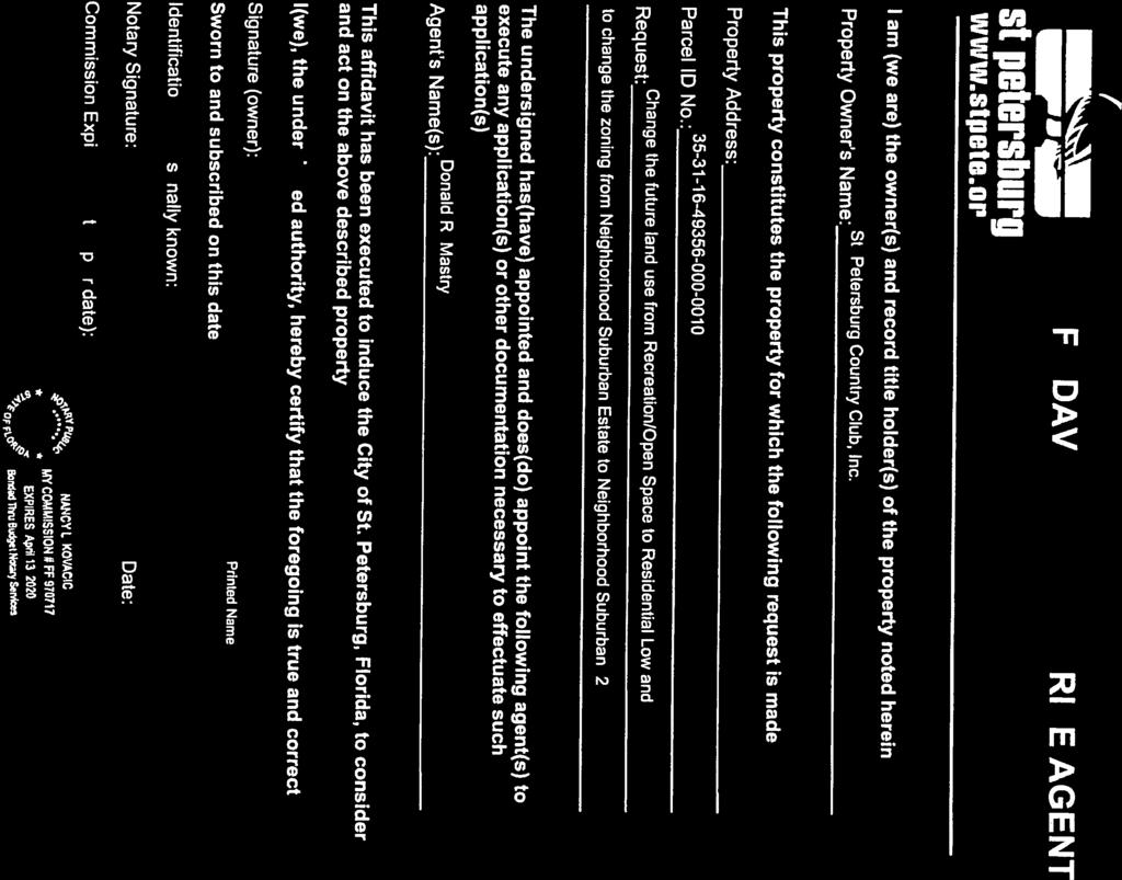
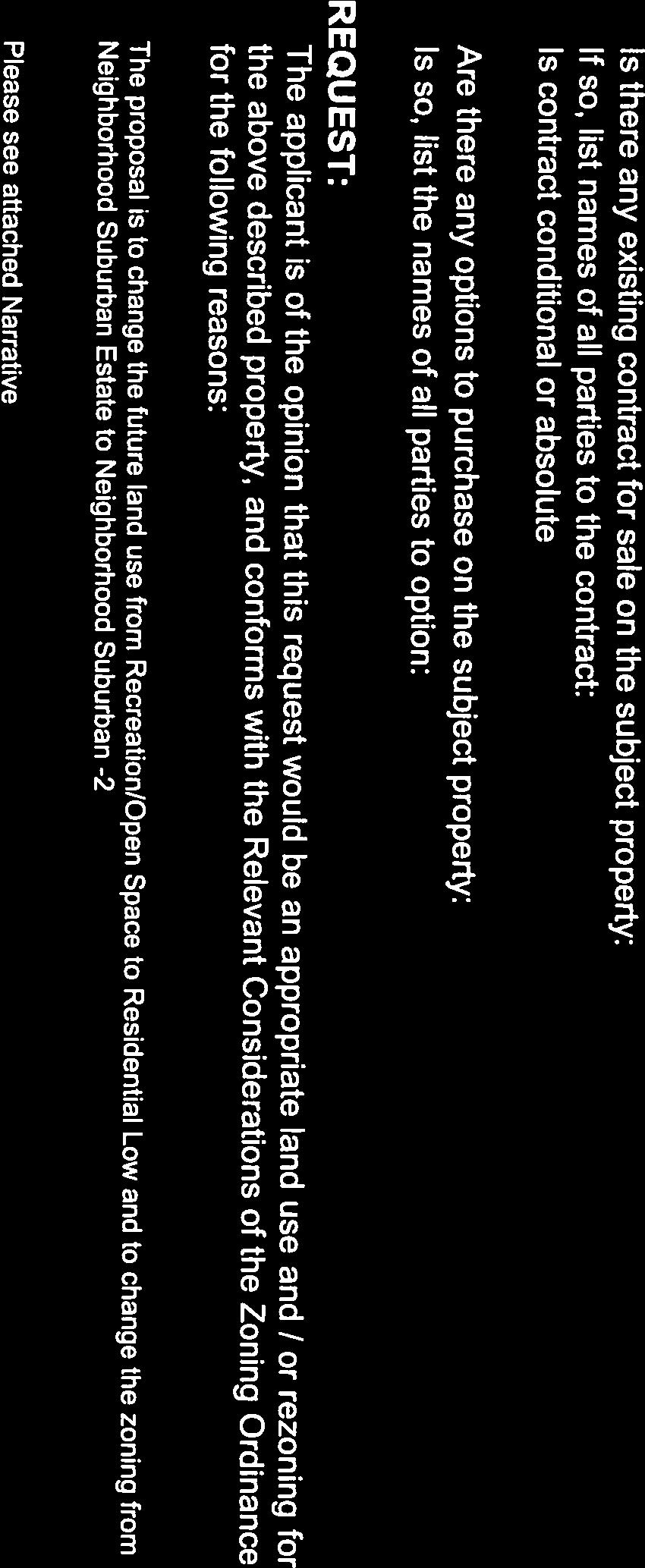
2 APPLICANT INFORMATION APPLICANT/OWNER: St. Petersburg Country Club, Inc Country Club Way So. St. Petersburg Florida AGENT: R. Donald Mastry 200 Central Avenue, Suite 1600 St. Petersburg, Florida SITE DESCRIPTION Street Address: Multiple sites Parcel ID Number: (Portion of parcel) General Description: Area A: acres, Fairway No. 9 Area B: acres, Fairway No. 10 Area C: acres, Fairway No. 10 Area D: acres, Fairway No. 18 Acreage: Zoning: Future Land Use: Approximately 4.1-acres, combined NSE (Neighborhood Suburban Estate) R/OS (Recreation / Open Space) Countywide Plan Map: R/OS (Recreation / Open Space) Existing Use: Surrounding Uses: The subject areas currently exist as open, green space along the perimeter of fairway nos. 9, 10, and 18. The subject area is surrounded by support facilities for the golf course, existing single-family residences, and Boyd Hill Nature Preserve. Neighborhood Assoc.: Lakewood Estates Civic Association Judy Ellis, President No Neighborhood Plan IMPORTANT UPDATE The following staff report has been updated to reflect amendments to the applicant s request. A public hearing was first conducted by the Community Planning and Preservation Commission ( CPPC ) on August 14, The CPPC made a finding of consistency with the Comprehensive Plan and recommended approval for Areas A, B, and C. The CPPC deferred action on Area D requesting that the applicant take into consideration concerns expressed by the opponents, including the Friends of Boyd Hill. On September 11, 2018, the applicant and a representative from the Friends of Boyd Hill noted an agreement had been reached between the two entities to relocate Area D from Country Club Way South to Fairway Avenue South. The applicant requested continuance of the public hearing to November 13, 2018, which was approved by the CPPC. The continuance was necessary to provide sufficient time for a survey of the relocated proposal. City File FLUM-52 Page 2
3 Original Proposal Area D acres Amended Proposal Area D acres Upon receipt of the updated application and amended Area D, City staff sent a notification letter and attachments to all 50 addresses on file. addresses were collected from any correspondence received during the processing of this application. ZONING HISTORY The NSE (Neighborhood Suburban Estate) zoning designation at each location has been in place since September 2007, following implementation of the City s Vision 2020 Plan, the City-wide rezoning and update of City Code, Chapter 16, Land Development Regulations (LDRs). The zoning at each location was historically single-family residential, as each location was previously zoned RS-100. The Future Land Use Map designation has been Recreation/Open Space since Similar request was approved in 2007 (Application No. PC-708). Development Potential Area A: Fairway No. 9, 53,856 square feet or acres: Current Zoning. Providing all other district regulations are met, the development potential for the subject area shall not exceed one (1) single-family house plus one accessory dwelling unit. Nonresidential development shall not exceed a floor area ratio of 0.20 or approximately 10,768 square feet. City File FLUM-52 Page 3
4 Proposed Zoning. Providing all other district regulations are met, the development potential of the subject area shall not exceed six (6) single-family houses. Accessory dwelling units are not allowed. Non-residential development shall not exceed a floor area ratio of 0.30 or approximately 16,156 square feet. Area B: Fairway No. 10, 18,349 square feet or acres: Current Zoning. The development potential for the subject area is zero (0) dwelling units and zero non-residential square footage. The proposed parcel does not meet the minimum lot requirement of 43,560 square feet or 1.0 acre. Proposed Zoning. Providing all other district regulations are met, the development potential of the subject area shall not exceed two (2) single-family houses. Accessory dwelling units are not allowed. Non-residential development shall not exceed a floor area ratio of 0.30 or approximately 5,505 square feet. Area C: Fairway No. 10, 35,574 square feet or acres: Current Zoning. The development potential for the subject area is zero (0) dwelling units and zero non-residential square footage. The proposed parcel does not meet the minimum lot requirement of 43,560 square feet or 1.0 acre. Proposed Zoning. Providing all other district regulations are met, the development potential of the subject area shall not exceed four (4) single-family houses. Accessory dwelling units are not allowed. Non-residential development shall not exceed a floor area ratio of 0.30 or approximately 10,672 square feet. Area D: Fairway No. 18, 70,772 square feet or acres: Current Zoning. Providing all other district regulations are met, the development potential for the subject area shall not exceed one (1) single-family house plus one accessory dwelling unit. Nonresidential development shall not exceed a floor area ratio of 0.20 or approximately 14,154 square feet. Proposed Zoning. Providing all other district regulations are met, the development potential of the subject area shall not exceed eight (8) single-family houses. Accessory dwelling units are not allowed. Non-residential development shall not exceed a floor area ratio of 0.30 or approximately 21,232 square feet. STAFF ANALYSIS The primary issues associated with this private-initiated application are consistency and compatibility of the requested designations with the established land use and zoning patterns and provision of adequate public services and facilities. As previously stated, this request is to amend the Future Land Use Map designation from R/OS (Recreation/Open Space) to RL (Residential Low) and the Official Zoning Map designation from NSE (Neighborhood Suburban Estate) to NS-2 (Neighborhood Suburban). The applicant has indicated that the subject area is to be subdivided into individual lots for the construction of single-family houses. City File FLUM-52 Page 4
5 Generally, the R/OS (Recreation/Open Space) future land use designation is reserved for, and assigned to, open space, parks and recreation facilities (golf courses and recreation centers) that may be publicly- or privately- owned. The RL (Residential Low) future land use designation is reserved for, and assigned to, low density residential areas such as Lakewood, Pinellas Point, Maximo, and Park Street locations. Maximum residential density is limited to five (5) units per acre. The Neighborhood Suburban (NS) zoning districts are reserved for, and assigned to, single-family residential neighborhoods of the suburban-style that is often characterized by single use development, horizontally-oriented architecture, front loading driveways and garages, relatively large lots and wide residential streets. The existing NSE (Neighborhood Suburban Estate) designation is the least dense of all the zoning districts permitting residential development, which is why the NSE designation is typically applied to all R/OS (Recreation/Open Space) parcels in the City. The proposed NS-2 (Neighborhood Suburban) designation permits a slightly higher density, but is consistent with the balance of the Lakewood Neighborhood that is similarly zoned NS-2 (Neighborhood Suburban). The Lakewood Neighborhood is uniquely defined with a golf course meandering throughout the neighborhood subdivision. Parcels in this area were originally platted as early as the 1920s with the majority of development occurring in the 1950s. While the applicant s request will reduce the size of the golf course property by 4.3 acres, this amendment will not negatively impact the single family character of the surrounding neighborhood. Consistency and Compatibility City staff has concluded that this request is consistent with the City s Comprehensive Plan, including: Policy LU3.6 which states that land planning should weigh heavily the established character of predominantly developed areas where changes of use or intensity of development are contemplated. The established character of the surrounding area is low-density, single-family residential development designated NS-2 (Neighborhood Suburban). Other applicable policies are outlined on page 7 of this staff report. Archaeological Survey A portion of Area D is an identified archaeological site. Originally surveyed in December 1986, a Florida Master Site File, Archaeological Site Form was filed with the State of Florida and recorded as 8Pi1208, Lake Maggiore. The archaeologist noted that the site was severely disturbed / destroyed. For this reason, the site is classified as a Sensitivity Level 3 archaeological site, meaning it is not eligible for landmark designation and includes no unique conditions or requirements for development. LEVEL OF SERVICE (LOS) IMPACT The Level of Service (LOS) impact section of this report concludes that the proposed rezoning will not alter the City s population or the population density pattern or have a negative effect upon the adopted LOS standards for public services and facilities including potable water, sanitary sewer, solid waste, traffic, mass transit, recreation, and stormwater management. City File FLUM-52 Page 5
6 SPECIAL NOTE ON CONCURRENCY Level of Service impacts are addressed further in this report. Approval of the requested Plan change and rezoning does not guarantee that the subject property will meet the requirements of concurrency at the time development permits are requested. Upon application for site plan review or development permits, a full concurrency review will be completed to determine whether or not the proposed development may proceed. The property owner will have to comply with all laws and ordinances in effect at the time development permits are requested. PUBLIC COMMENTS, AMENDED AS OF NOVEMBER 5, 2018 Public comments are attached and divided into two sets: 1) public comments received prior to the original public hearing and before amended Area D ; and 2) public comments received after submission of the updated application and amended Area D. The original public hearing included three (3) registered opponents who will continue to be recognized as such at the November 13, 2018 public hearing. The registered opponents include: 1. Enita Nina Berkheiser, 2231 Desoto Way So. 2. Philip Garrett, th Terrace So. 3. Helen Simon, 2120 Coronado Way So. As of this writing on November 5, 2018 public comments received following receipt and distribution of the amended Area D include: Support: 33 Opposed: 3, including letter from registered opponent, attached RECOMMENDATION Staff recommends APPROVAL on the basis that the request is consistent with the goals, objectives, and policies of the City's Comprehensive Plan, subject to the following condition(s): Amend the Future Land Use Map: From R/OS (Recreation / Open Space) to RL (Residential Low), or other less intensive use Amend the Official Zoning Map: From NSE (Neighborhood Suburban Estate) to NS-2 (Neighborhood Suburban), or other less intensive use City File FLUM-52 Page 6
7 RELEVANT CONSIDERATIONS ON AMENDMENTS TO OFFICIAL ZONING MAP a. Compliance of probable use with goals, objectives, policies and guidelines of the City's Comprehensive Plan. The following objectives and policies from the Land Use Element and Transportation Element are applicable: LU2 LU2.4 LU2.5 The Future Land Use Plan shall facilitate a compact urban development pattern that provides opportunities to more efficiently use and develop infrastructure, land and other resources and services by concentrating more intensive growth in activity centers and other appropriate areas. The City may permit an increase in land use intensity or density outside of activity centers where available infrastructure exists and surrounding uses are compatible. The Land Use Plan shall make the maximum use of available public facilities and minimize the need for new facilities by directing new development to infill and redevelopment locations where excess capacity is available. LU3.1.A.1 Residential Low (RL) - Allowing low density residential uses not to exceed 5.0 dwelling units per net acre; Residential equivalent uses not to exceed 3 beds per dwelling unit; non-residential uses allowed by the land development regulations up to floor area ratio of An ancillary non-residential use which exceeds three (3) acres, a transportation/utility use which exceeds three (3) acres, or an institutional use (except public educational facilities which are not subject to this threshold) which exceeds five (5) acres, whether alone or when added to existing contiguous like use(s), shall require a Future Land Use map amendment that shall include such use and all contiguous like uses. LU3.2 LU3.6 LU3.7 LU3.12 LU3.15 Development shall not exceed densities and intensities established within this Future Land Use Element except where allowed by the land development tregulations. Land planning should weigh heavily the established character of predominantly developed areas where changes of use or intensity of development are contemplated. Land use planning decisions shall include a review to determine whether existing Land Use Plan boundaries are logically drawn in relation to existing conditions and expected future conditions. Less intensive residential uses (less than 7.5 units per acre) shall continue as the predominant density in St. Petersburg. The Land Use Plan shall provide housing opportunity for a variety of households of various age, sex, race and income by providing a diversity of zoning categories with a range of densities and lot requirements. City File FLUM-52 Page 7
8 R3.1 Encourage the private sector to continue to provide recreational and cultural facilities and programs. b. Whether the proposed amendment would impact environmentally sensitive lands or areas which are documented habitat for listed species as defined by the Conservation Element of the Comprehensive Plan. There are no environmentally sensitive lands or areas which are documented habitat for listed species as defined by the Conservation Element of the Comprehensive Plan. c. Whether the proposed change would alter population or the population density pattern and thereby impact residential dwelling units. Based solely on land area, the difference in residential development potential is 19 dwelling units, thus the proposed changes will not significantly alter the City s population or the population density pattern and thereby impact residential dwelling units and/or public schools. Students are assigned to schools based on large concurrency service areas that contain a number of schools. Student capacities and enrollment are calculated and maintained based on these attendance areas. According to the most recent school district data, there is sufficient capacity for the school population in public schools in the City. All attendance areas are operating within the proposed level of service standard. d. Impact of the proposed amendment upon the following adopted levels of service (LOS) for public services and facilities including but not limited to: water, sewer, sanitation, traffic, mass transit, recreation, stormwater management. The following analysis indicates that the proposed change will not have a significant impact on the City's adopted levels of service for potable water, sanitary sewer, solid waste, traffic, mass transit, stormwater management and recreation. Should the requested land use change and rezoning for the subject 4.3 acres be approved, the City has sufficient capacity to serve the subject property. WATER Under the existing inter-local agreement with Tampa Bay Water (TBW), the region s local governments are required to project and submit, on or before February 1 of each year, the anticipated water demand for the following water year (October 1 through September 30). TBW is contractually obligated to meet the City s and other member government s water supply needs. The City s current potable water demand is approximately 28.4 million gallons per day (mgd). The City s adopted LOS standard for potable water is 125 gallons per capita per day, while the actual usage is estimated to be 80 gallons per capita per day. Therefore, there is excess water capacity to serve the amendment area. WASTEWATER The subject areas are served by the Southwest Water Reclamation Facility, which presently has excess average day capacity estimated to be 0.22 million gallons per day (MGD). The estimate is based on a permit capacity of 20 MGD and a calendar year 2016 daily average flow of MGD. Therefore, there is excess average daily sanitary sewer capacity to serve the amendment area. City File FLUM-52 Page 8
9 SOLID WASTE Solid waste collection is the responsibility of the City. Approval of this request will not affect the City's ability to provide collection services. Solid waste disposal is the responsibility of Pinellas County. The County currently receives and disposes of municipal solid waste, and construction and demolition debris, generated throughout Pinellas County. The Pinellas County Waste-to- Energy Plant and the Bridgeway Acres Sanitary Landfill are the responsibility of Pinellas County Utilities, Department of Solid Waste Operations; however, they are operated and maintained under contract by two private companies. The Waste-to-Energy Plant continues to operate below its design capacity of incinerating 930,750 tons of solid waste per year. The continuation of successful recycling efforts and the efficient operation of the Waste-to-Energy Plant have helped to extend the life span of Bridgeway Acres. The landfill has approximately 30 years remaining, based on current grading and disposal plans. Thus, there is excess solid waste capacity to serve the amendment area. TRAFFIC The subject areas have access to Country Club Way South and Fairway Avenue South, both of which are neighborhood collector roads maintained by the City of St. Petersburg. When exiting the Lakewood Neighborhood, these two roads connect to 31 st Street South and Dr. Martin Luther King Jr. Street South. According to the Forward Pinellas 2017 Level of Service Report, the level of service (LOS) for 31 st Street South is C ; the volume-capacity ratio for this road segment is 0.684, so there is spare capacity to accommodate new trips. The LOS for Dr. Martin Luther King Jr. Street South is C ; the volume-capacity ratio for this road segment is 0.385, so there is spare capacity to accommodate new trips. The statutory provisions for transportation concurrency were rescinded in In the absence of state imposed transportation concurrency management requirements, the Pinellas County Metropolitan Planning Organization (MPO) authorized a multi-jurisdictional task force to develop a countywide approach to manage the transportation impacts associated with development or redevelopment projects through local site plan review processes. The task force created the Pinellas County Mobility Plan, which was adopted by the MPO in September 2013, and called for the renaming the Transportation Impact Fee Ordinance as the Multimodal Impact Fee Ordinance, which became effective on May 1, On March 3, 2016 the St. Petersburg City Council approved amendments to the Future Land Use, Transportation, Capital Improvements and Intergovernmental Coordination elements of the Comprehensive Plan in order to ensure consistency with the countywide approach to managing transportation impacts associated with development or redevelopment projects. Policy T3.1 in the Transportation Element, which previously identified the LOS D standard for major roads in St. Petersburg, was revised to include policies that pertain to the implementation of the Pinellas County Mobility Management System. Transportation management plans, and in some cases traffic studies, are required for large development projects (51 new peak hour trips or more) that impact deficient roads, which are defined countywide as major roads operating at peak hour LOS E and F and/or volume-to-capacity (v/c) ratio 0.9 or greater without a mitigating improvement scheduled for construction within three years. The proposed rezoning is not located on a deficient road, so a transportation management plan or traffic study would not be required for a land development project on the subject areas. City File FLUM-52 Page 9
10 MASS TRANSIT The Citywide LOS for mass transit will not be affected. The subject areas are not located within 1/4 mile of an existing transit route. The closest PSTA local transit service is Route 20 providing service along Dr. Martin Luther King Jr. Street South with 60-minute headways. RECREATION The City's adopted LOS for recreation and open space is 9 acres per 1,000 population, the actual LOS City-wide is estimated to be 21.9 acres per 1,000 population. If approved, there will be no noticeable impact on the adopted LOS standard for recreation and open space. STORMWATER MANAGEMENT Prior to development of the subject property, site plan approval will be required. At that time, the stormwater management system for the site will be required to meet all City and SWFWMD stormwater management criteria. e. Appropriate and adequate land area sufficient for the use and reasonably anticipated operations and expansion. Upon application for site plan review or development permits, a full review will be conducted through the City s Engineering Department, Development Review Services Division, and Construction Services and Permitting Division to determine whether or not the proposed development may proceed. The property owner will have to comply with all laws and ordinances in effect at the time development permits are requested. f. The amount and availability of vacant land or land suitable for redevelopment shown for similar uses in the City or in contiguous areas. The applicant is proposing redevelopment of the subject areas for single-family houses, a land use that is consistent with existing, surrounding properties. g. Whether the proposed change is consistent with the established land use pattern. The proposed NS-2 and RL categories are contiguous with the same existing categories adjacent to the subject areas. h. Whether the existing district boundaries are logically drawn in relation to existing conditions on the property proposed for change. Existing district boundaries are logically drawn to reflect the existing, recreational purpose of the subject areas. City File FLUM-52 Page 10
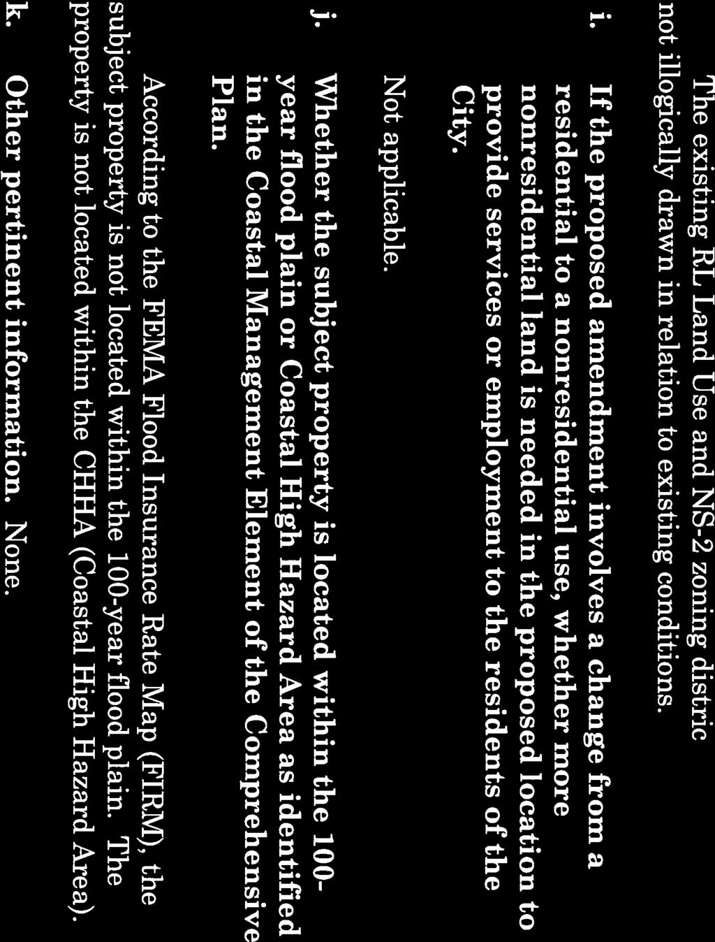
11 i. If the proposed amendment involves a change from a residential to a nonresidential use, whether more nonresidential land is needed in the proposed location to provide services or employment to the residents of the City. Not applicable. j. Whether the subject property is located within the 100-year flood plain or Coastal High Hazard Area as identified in the Coastal Management Element of the Comprehensive Plan. According to the FEMA Flood Insurance Rate Map (FIRM), the subject areas are not located in the 100-year flood plain, Hurricane Evacuation Zone, or Coastal High Hazard Area. k. Other pertinent facts. None. City File FLUM-52 Page 11
12 ATTACHMENT A UPDATED MAP SERIES INCLUDES AMENDED AREA D City File FLUM-52 Page 12
13 GREEN WAY S "AREA A" CO UN Y TR "AREA D" WA YS AR YS WA AZ UB TO O S AY W S CAESAR WAY S ALC LEX CA VE YA WA "AREA B" YS WA O IC CL O A S IR FA R CO D NA AY W S NI TA W AY S DE "AREA C" BO ALM CITY FILE FLUM-52 SCALE: 1" = 375' YS WA A I ER AERIAL SUBJECT AREA µ
14 GOLF COURSE SF V GOLF COURSE BOYD HILL NATURE PARK GREEN WAY S GOLF COURSE "AREA A" ST PETERSBURG COUNTRY CLUB CARDINAL WAY S SF SF CALEXICO WAY S V SF SF CORONADA WAY S SF TENNIS COURTS "AREA B" "AREA C" ALCAZAR WAY S "AREA D" SF CAESAR WAY S SF FAIRWAY AVE S COUNTRY CLUB WAY S GOLF COURSE GOLF COURSE DESOTO WAY SF CITY FILE FLUM-52 SF BONITA WAY S SF SF ALMERIA WAY S SF SF SF EXISTING SURROUNDING USES µ SUBJECT AREA SCALE: 1" = 375' V V
15 NS-2 NSE NSE GREEN WAY S "AREA A" NSE NSE P CARDINAL WAY S NS-2 NS-2 CALEXICO WAY S NS-2 NS-2 DESOTO WAY S CORONADA WAY S NS-2 "AREA C" NSE NS-2 "AREA B" BONITA WAY S ALCAZAR WAY S NS-2 CAESAR WAY S "AREA D" FAIRWAY AVE S COUNTRY CLUB WAY S NS-2 NSE NS-2 NS-2 ALMERIA WAY S CITY FILE From: NSE To: NS-2 µ (Neighborhood Suburban Estate) (Neighborhood Suburban-2) SUBJECT AREA SCALE: 1" = 375' FLUM-52 EXISTING ZONING
16 R/OS RL R/OS GREEN WAY S R/OS P R/OS "AREA A" CARDINAL WAY S RL RL CALEXICO WAY S RL RL DESOTO WAY S CORONADA WAY S RL R/OS RL "AREA C" "AREA B" BONITA WAY S ALCAZAR WAY S RL CAESAR WAY S "AREA D" FAIRWAY AVE S COUNTRY CLUB WAY S RL R/OS RL RL ALMERIA WAY S CITY FILE From: R/OS To: RL µ (Recreation/Open Space) (Residential Low) SUBJECT AREA SCALE: 1" = 375' FLUM-52 FUTURE LAND USE
17 RLM R/OS GREEN WAY S R/OS R/OS P R/OS "AREA A" CARDINAL WAY S RLM RLM CALEXICO WAY S RLM RLM DESOTO WAY S CORONADA WAY S RLM "AREA C" R/OS RLM "AREA B" BONITA WAY S ALCAZAR WAY S RLM CAESAR WAY S "AREA D" FAIRWAY AVE S COUNTRY CLUB WAY S RLM R/OS RLM RLM ALMERIA WAY S CITY FILE From: R/OS To: RLM µ (Recreation/Open Space) (Residential Low Medium) SUBJECT AREA SCALE: 1" = 375' FLUM-52 Countywide Plan Map
18 AREA A
19 AREA B AREA C
20 ORIGINAL AREA D OLD MAP _ SEE AMENDED SURVEY


21 AREA D
22 ATTACHMENT B PUBLIC COMMENTS RECEIVED SINCE AMENDED AREA D City File FLUM-52 Page 13
23 Derek Kilborn From: Sent: To: Subject: Follow Up Flag: Flag Status: Thursday, November 01, :18 PM Derek Kilborn I wish to register as an opponent in FLUM-52 Follow up Flagged TO: Derek Kilborn, Planning Manager, City of St. Petersburg FROM: Helen J. Simon, 2120 Coronada Way S., Lakewood Estates, St. Petersburg, FL. Dear Mr. Kilborn, In anticipation of the Community Planning and Preservation Commission hearing Nov. 13, 2018, I would like to register as an opponent to the St. Petersburg Country Club s proposal to move the location of the Area D land it wants rezoned from R/OS to RL in Lakewood Estates. I opposed the rezoning of all 4 lots A, B, C and D at the initial CPPC hearing on the matter on Aug. 14. Although the CPPC approved rezoning lots A, B and C, I still oppose rezoning all three of them as well as rezoning Area D, regardless of where it is. I oppose rezoning for housing ANY Country Club land that s currently zoned R/OS because it violates the City of St. Petersburg s Comprehensive Plan on many levels. It also fails to address the SPCC s long-term economic viability and sets a terrible precedent for the sale of ALL of its land if the Country Club collapses financially. Should that happen, the residents of Lakewood Estates will lose the large swaths of open space that give the neighborhood its special character and the entire City of St. Petersburg will lose an historic institution that made it a national golfing destination. HOW REZONING LOTS A, B, C and D VIOLATES ST. PETE S COMPREHENSIVE PLAN: Specifically, changing the zoning of these 4 parcels from R/OS violates the following sections of the Comprehensive Plan: Chapter 4, the Conservation Element, under C4.2, which says that The City shall maintain and seek to expand the City's inventory of green permeable open space so as to provide maximum area for shallow aquifer recharge and Stormwater filtration/percolation, oxygen production, visual buffer and wildlife habitat.... And Chapter 8, the Recreation and Open Space Element, under R1.4, which says that There will be no net loss of usable recreation and open space acreage as a result of land use plan changes and sale of parkland, or non-park uses.... Furthermore, neither the SPCC nor the Lakewood Estates Civic Association (LECA), which supports the Club s application, have consulted the approximately 1830 households in Lakewood on the re-zoning proposal. This directly contradicts the intent of the city s Comprehensive Plan, which states in Chapter 1, the General Introduction, 1.1 PURPOSE, that the plan is designed to: Address the concerns of the community related to growth management and the preservation of the City's character Rezoning and developing the 4 parcels also violate these other goals of the Comprehensive Plan outlined in 1.1 PURPOSE: Preserve and protect the resources of the community through the guidance of growth and redevelopment while continuing to provide quality services concurrent with the impacts of development (or redevelopment) 1
24 Not only will rezoning destroy part of the community s open spaces, but building up to 21 more homes under the new zoning will add more traffic, surface runoff, noise, sewage, noise, light pollution, etc. Protect and enrich the quality of life within the community The rezoning and subsequent development will DIMINISH the quality of life of Lakewood s residents. Ensure the consideration of long-range goals in the determination of short range decisions and actions This rezoning application is geared specifically to the short-term economic gains of ONE of the 1,830 property owners in Lakewood at the expense of the long-range goal of preserving existing open land for everyone else in the neighborhood and city. Promote a healthy, stable, and well-balanced economic atmosphere which, satisfies the goods and services needs of the community, promotes employment opportunities, and supports a strong and diverse economic base Approving this rezoning request leaves the hundreds of other property owners in Lakewood dependent on the economic fortunes of ONE property owner the St. Petersburg Country Club which, to add insult to injury, excludes the majority of Lakewood residents owing to its high cost. That does not constitute a strong and diverse economic base. THE SPCC s FALLING PROPERTY TAX BILL A PUBLIC SUBSIDY? The Country Club almost failed in 2011, the same year it defaulted on $54,000 of its property taxes. Country Club CEO Mike Kiernan recently told city officials the Club s situation has improved, but how can we be certain? Kiernan has also said the 4 parcels comprise the last acreage the SPCC has left to sell to pay its debts and make capital improvements. What will it do next time it needs money? If one looks at the SPCC s property taxes, it would appear that it has already received at least one public subsidy at the expense of the tax payers. According to the Pinellas County Property Appraiser s website, between 2011 and years in which the economy grew steadily -- the property taxes for the Country Club s land and its clubhouse DROPPED dramatically. The Property Appraiser s website shows that since 2011 the property taxes on the Country Club s land have dropped 13% -- from around $34,000 to $29,600, and on its building they ve fallen 17.5%, from roughly $24,000 to $19,500. In the same time frame, the assessed value of the clubhouse also dropped -- by 2.5% -- from around $948,000 to $925, and the value of the land increased only 3% from $1,350,000 to $1,400,000. Before ignoring their obligations to residents under the Comprehensive Plan and giving the SPCC another handout by approving its rezoning request, City officials should request full disclosure of the Country Club s finances. They must establish whether the SPCC is economically viable given declining golf playing and if not, make plans to protect the entire golf course from development in case the Country Club goes under. These are some of the questions the Country Club must answer: How many members does it have? Is that number up or down from 3 years ago? Is it making a profit and if so, how much? If not, for how long has it been losing money and how much? What is its 3-year net income forecast? How much debt does the Country Club have? To whom does it owe that money? What is the SPCC management doing to make the business more economically viable besides selling land? What is it doing to compete with newer, more modern country clubs? What is it doing to counter the national drop in golf playing that has forced thousands of golf courses around the country to close? 2
25 I trust that St. Petersburg officials will consider the information above and rule AGAINST the Country Club s rezoning application under FLUM-52. Respectfully, Helen J. Simon vtwriter@comcast.net (802)
26 ATTACHMENT C PUBLIC COMMENTS RECEIVED PRIOR TO AMENDED AREA D Comments received prior to amended Area D from the following agencies and individuals will be retained on record. Agencies Lakewood Estates Civic Association Friends of Boyd Hill Council of Neighborhood Associations ( C.O.N.A. ) Eckerd College: Collegium of Natural Sciences Sierra Club: Suncoast Group Lakewood United Church of Christ Heinrich Ecological Services Bok Tower Gardens Individuals 26 - Support 9 - Opposed City File FLUM-52 Page 14
27 ATTACHMENT D ARCHAEOLOGICAL SITE FORM City File FLUM-52 Page 15

28 c FlORIDA MASTER SITE FILE ARCHAEOLOGICAL SITE FORM STATE OF FLORIDA DEPARTMENT OF STATE Division of Archives, Hislory and Records Management AH6E SITE NUMBER SITE NAME: USGS QUAD: 8Pi1208 Lake Maggiore Paggajlle Beaeh COUNTY Pinellas NOTE: Please attach an 8 1 x 11 copy of the appropriate portion of the above map, with site location indicated. TOWMSHIP/RAMGE/SECTION: Township Range Section 32S jl6e 1 E1 Original El (ipdate NOTE: The figure to the left represents a regular section (1 square mile); please indicate the location of your site by placing an X in the appropriate portion of the section. lithe section is irregular or part of a land grant, please check below and disregard above instructions. El Irregular section El Land grant (name) UTM COORDINATES: Zone I Easting I Northlng NOTE: If you are unfamiliar with calculating UTM measurements, leave blank. FRESH WATER SOURCE nrnm ie DISTANCE TO WATER 30 m SE LOCAL VEGETATION pine, oak, palmetto TOPOGRAPHICAL SETflNG ridge slope PRESENT LAND USE golf course LOCAL INFORMANT (inc. private collections) John Baker ADDRESS th Ave. So. St. Petersburg, Fr, LOCAL INFORMANT (Inc. private collections) ADDRESS SURVEY DATE 12/86 OTHER MASTER SITE FILE NUMBERS RECORDER(S) (list principal investigator first) Robert J. AuRtin ADDRESS PROJECT NAME TYPE OF SITE (check one or more as appropriate): C] indeterminate 0 mound(s) O unknown o single artifact C] artifact scatter i lithic scatter C] midden(s) 0 shell midden(s) C] shell works Piper Archaeological Research. IncP.O. Bo 919. St. City of St. Petershura Survey NATIONAL REGISTER: Listed C] burial mound(s) 0 piatformitemple mound(s) Ccanai Dcanoe C] prehistoric earthworlcs 0 prehistoric cemetery O mission Determined Not Eligible Date O historic refuse o historic earthwodts O shell ring C] redeposited O houselhomesteed o military 0 historic cemetery 0 Determined Eligible Date Unaccessed T 7)I Date
 ED ED ED ED O preservation recommended REMARKS: o deterioration O development O borrowing ED logging C dredg ED agricuieureipiowing ED controlled o None by recorder C ci C fill ED phosphate mining")
29 DATE ADDRESS sheet(s).) ED ED ED ED O preservation recommended REMARKS: o deterioration O development O borrowing ED logging C dredg ED agricuieureipiowing ED controlled o None by recorder C ci C fill ED phosphate mining ED recreation REPOSITORY BIBLIOGRAPHIC DATA Baker Co11ction E severely thsturbedidestroyed ED recommended for further testing ED C tin road construction ED forest preparation or harvesting C site looting O dredginglditching Meters Feet ( gener& ED selective Max 3.7 Max 12 COLLECTION STRATEGY 0 Golf course ED previous archaeologicai excavations Mm 3.1 Mm 10 SITE SIZE (approx acreage) unwown SITE SIZE (est in sq meters) rink nown DEPTH OF CULTURAL DEPOSIT SITE DISTURBANCES TYPE OF INVESTIGATION FORM PREPARED BY AFFILIATION (FAS chapter, government agency, etc.): ED relatively undisturbed C minor o erosion 0 moderate ED major /25/87 Piper Archaeological Research, P. 0. Box 919. Pthiwt-i T 17 Robert J. Austin DEGREE OF SITE DESTRUCTION OPTIONAL NARRATIVE DESCRIPTION (If there Is no published report, provide a short description of the site on a OPTIONAL PHOTOGRAPHS OR SKETCHES OF DIAGNOSTIC OR UNIQUE ARTIFACTS (Please attach sep&ate separate sheet.) f swlace con Hon by informant 0 auger test ED unicnown I] test excavetion C none C C) extensive excavation ED remote sensing ED C) siovei test C coring 0 C residentiallcommerciai C bioturbation C miningmorrow pit C agricultural (if known) unknown ELEVATION DIAGNOSTIC ARTIFACTS [ llthics ED wood ED nonaoriginai ceramics ED plant remains ED worked bone ED metal ED human bonelburial(s) ED animal bon&unidentified bone ARTIFACTS (Check as many as apply): C aboriginal ceramics 0 worked shell C shell food remains ED glass o ml c. prehistoric (pieaae list) C precious metallcoin(s) ED misc. historic (please list) C leather ED brlckibldg materi Is ED pollen CULTURAL CLASSIFICATION CULTURAL PERIOD Unknown Prehistoric boriginal Florida Anthropologist format. O other human remains (e.g., hair) NOTE: Cite any reports referring specifically to this site. General background material need not be cited. Use o zoning THREATS TO SITE: ED transportation O vandalism
30 ATTACHMENT E UPDATED APPLICATION FOR AMENDED AREA D City File FLUM-52 Page 16


31
32


33

34

35

36

37

38

39

40

41
42

43
44
45
46
47 ATTACHMENT F ORIGINAL APPLICATION City File FLUM-52 Page 17
48


49


50


51

52


53


54

55


56


57


58

59

60
61
62

63


64
65

66
67


68 ORIGINAL AREA D OLD SURVEY _ SEE AMENDED SURVEY
City File ZM th Street North St. Petersburg, FL Central Avenue, Suite 1600 St. Petersburg, FL 33701
 Staff Report to the St. Petersburg Community Planning & Preservation Commission Prepared by the Planning & Development Services Department, Urban Planning and Historic Preservation Division For Public
INDIAN RIVER COUNTY, FLORIDA. The Honorable Members of the Planning and Zoning Commission DEPARTMENT HEAD CONCURRENCE
 Public Hearing Legislative INDIAN RIVER COUNTY, FLORIDA M E M O R A N D U M TO: The Honorable Members of the Planning and Zoning Commission DEPARTMENT HEAD CONCURRENCE Robert M. Keating, AICP; Community
FUTURE LAND USE. City of St. Augustine Comprehensive Plan EAR-Based Amendments
 FUTURE LAND USE City of St. Augustine Comprehensive Plan EAR-Based Amendments Future Land Use Element FLU Goal To create an environment within the City and adjacent areas in which its residents have the
CITY OF TARPON SPRINGS Staff Report May 16, 2017
 CITY OF TARPON SPRINGS Staff Report May 16, 2017 TO: FROM: HEARING DATES: SUBJECT: MAYOR & BOARD OF COMMISSIONERS PLANNING & ZONING DEPARTMENT MAY 15, 2017 (PLANNING & ZONING BOARD) JUNE 6, 2017 (BOC 1
Application to Amend the Bay County Zoning Map (Please type or print clearly)
") Application to Amend the Bay County Zoning Map (Please type or print clearly) File No.: Date Received: A) Applicant Information Owners Authorized name: agent: Mailing Mailing address: address: E-mail:
Application to Amend the Bay County Zoning Map (Please type or print clearly) File No.: Date Received: A) Applicant Information Owners Authorized name: agent: Mailing Mailing address: address: E-mail:
Marion County Board of County Commissioners
 Marion County Board of County Commissioners Date: 6/4/217 P&Z: 9/25/217 BCC Transmittal: 1/17/217 BCC Adopt: TBD Amendment No: 217-L6 Type of Application Large-Scale Comp Plan Amendment Request: Change
Planning Department Oconee County, Georgia
 Planning Department Oconee County, Georgia STAFF REPORT REZONE CASE #: 6985 DATE: October 31, 2016 STAFF REPORT BY: Andrew C. Stern, Planner APPLICANT NAME: Williams & Associates, Land Planners PC PROPERTY
CHAPTER Committee Substitute for Committee Substitute for Senate Bill No. 2188
 CHAPTER 2004-372 Committee Substitute for Committee Substitute for Senate Bill No. 2188 An act relating to land development; amending s. 197.502, F.S.; providing for the issuance of an escheatment tax
TREASURE COAST REGIONAL PLANNING COUNCIL M E M O R A N D U M
 TREASURE COAST REGIONAL PLANNING COUNCIL M E M O R A N D U M To: Council Members AGENDA ITEM 5F From: Date: Subject: Staff July 16, 2010 Council Meeting Local Government Comprehensive Plan Review Draft
Glades County Staff Report and Recommendation Unified Staff Report for Small Scale Plan Amendment and Rezoning
 Glades County Staff Report and Recommendation Unified Staff Report for Small Scale Plan Amendment and Rezoning CASE NUMBERS: COMP17-02 and RZ17-02 DATE of STAFF REPORT: May 1, 2017 CASE TYPE: Application
COMPREHENSIVE PLAN FUTURE LAND USE MAP AMENDMENT APPLICATION
 COUNTY STAFF DATA ONLY Date Received: Project No. CPA-20 - GADSDEN COUNTY DEPARTMENT OF PLANNING & COMMUNITY DEVELOPMENT 1-B East Jefferson Street, Post Office Box 1799, Quincy, FL 32353-1799 PLANNING
Land Use. Land Use Categories. Chart 5.1. Nepeuskun Existing Land Use Inventory. Overview
 Land Use State Comprehensive Planning Requirements for this Chapter A compilation of objectives, policies, goals, maps and programs to guide the future development and redevelopment of public and private
APPLICATION FOR A COMPREHENSIVE PLAN AMENDMENT
 APPLICATION FOR A COMPREHENSIVE PLAN AMENDMENT Community Development Department 9220 Bonita Beach Rd, Suite 111 Bonita Springs, FL 34135 Phone: 239 444 6150 Fax: 239 444 6140 I. APPLICANT/AGENT/OWNER INFORMATION
Kitsap County Department of Community Development
 Kitsap County Department of Community Development Staff Report and Recommendation Annual Comprehensive Plan Amendment Process for 2018 George s Corner LAMIRD Boundary Adjustment Report Date 7/16/2018 Hearing
This is a New Findings of Adequacy for a Recorded Plat (Plat Book 179, Page 131) LAND USE Vacant Effective Plan: Pompano Beach
 LAND USE Vacant Effective Plan: Pompano Beach") Page 1 of 11 Board of County Commissioners, Broward County, Florida Environmental Protection and Growth Management Department Planning and Development Management Division DEVELOPMENT REVIEW REPORT PROJECT
Page 1 of 11 Board of County Commissioners, Broward County, Florida Environmental Protection and Growth Management Department Planning and Development Management Division DEVELOPMENT REVIEW REPORT PROJECT
MEMORANDUM. Douglas Hutchens, Interim City Manag~ August 4, 2016 / Greg Rice, Director of Planning & Development
 Agenda Item: Meeting Date: PH-1 8/18/16 TO: THROUGH: DATE: FROM: SUBJECT: PRESENTER: RECOMMENDATION: BUDGET IMP ACT: PAST ACTION: NEXT ACTION: ATTACHMENTS: BACKGROUND: City Commission MEMORANDUM Douglas
ARTICLE XXI GENERAL SITE DEVELOPMENT PLAN REQUIREMENTS
 1 2 3 4 5 6 7 8 9 10 11 12 13 14 15 16 17 18 19 20 21 22 23 24 25 ARTICLE XXI GENERAL SITE DEVELOPMENT PLAN REQUIREMENTS Section 21.1 Purpose and Intent... 2 Section 21.2 Administrative Site Plan Review
Cobb County Community Development Agency Zoning Division 1150 Powder Springs St. Marietta, Georgia 30064
 Cobb County Community Development Agency Zoning Division 1150 Powder Springs St. Marietta, Georgia 30064 Case # Z-63 Public Hearing Dates: PC: 11-06-18 BOC: 11-20-18 SITE BACKGROUND Applicant: Loyd Development
REPORT OF THE PLANNING AND DEVELOPMENT DEPARTMENT FOR APPLICATION FOR REZONING ORDINANCE TO PLANNED UNIT DEVELOPMENT SEPTEMBER 22, 2016
 BEL REPORT OF THE PLANNING AND DEVELOPMENT DEPARTMENT FOR APPLICATION FOR REZONING ORDINANCE 2016-576 TO PLANNED UNIT DEVELOPMENT SEPTEMBER 22, 2016 The Planning and Development Department hereby forwards
MIDWAY CITY Municipal Code
 MIDWAY CITY Municipal Code TITLE 9 ANNEXATION CHAPTER 9.01 PURPOSE CHAPTER 9.02 GENERAL REQUIREMENTS CHAPTER 9.03 PROPERTY OWNER INITIATION OF ANNEXATION CHAPTER 9.04 PROCEDURES FOR CONSIDERATION OF PETITION
PINELLAS COUNTY COMPREHENSIVE PLAN
 PINELLAS COUNTY COMPREHENSIVE PLAN Future Land Use Map (FLUM) Category Descriptions and Rules Amended March 17, 2009 (Ordinance 09-17) Amended March 16, 2010 (Ordinance 10-18) Amended October 26, 2010
HOUSING ELEMENT GOALS, OBJECTIVES, & POLICIES
 HOUSING ELEMENT GOALS, OBJECTIVES, & POLICIES GOAL H-1: ENSURE THE PROVISION OF SAFE, AFFORDABLE, AND ADEQUATE HOUSING FOR ALL CURRENT AND FUTURE RESIDENTS OF WALTON COUNTY. Objective H-1.1: Develop a
CHAPTER 15: ENVIRONMENTAL REVIEW
 CHAPTER 15: ENVIRONMENTAL REVIEW CHAPTER PURPOSE & CONTENTS This chapter provides grantees with general information on environmental review. The chapter will provide an overview of the applicable regulations,
City of Largo, FL: Comprehensive Development Code Chapter 5: Land Use Classifications
 Section 5.1 Land Use Classification System 5.1.1 Relationship to State Growth Management Requirements Chapter 163 of the Florida Statutes provides enabling legislation for local governments to ensure that
EXHIBIT A. City of Corpus Christi Annexation Guidelines
 City of Corpus Christi Annexation Guidelines Purpose: The purpose of this document is to describe the City of Corpus Christi s Annexation Guidelines. The Annexation Guidelines provide the guidance and
PLANNING COMMISSION REPORT Regular Agenda - Public Hearing Item
 Z-14-00056 Item No. 1-1 PLANNING COMMISSION REPORT Regular Agenda - Public Hearing Item PC Staff Report 4/21/2014 ITEM NO. 1: RSO TO CN1;.126 ACRES; 512 & 514 LOCUST ST (DRG) Z-14-00056: Consider a request
REPORT OF THE PLANNING AND DEVELOPMENT DEPARTMENT FOR APPLICATION FOR REZONING ORDINANCE TO PLANNED UNIT DEVELOPMENT MAY 18, 2017
 BEL REPORT OF THE PLANNING AND DEVELOPMENT DEPARTMENT FOR APPLICATION FOR REZONING ORDINANCE 2016-805 TO PLANNED UNIT DEVELOPMENT MAY 18, 2017 The Planning and Development Department hereby forwards to
1 Chapter 4 FUTURE LAND USE ELEMENT Section 4.1. Background information. 4.1.A. Land use profile. Indiantown possesses a unique and valuable mix of ph
 1 Chapter 4 FUTURE LAND USE ELEMENT Section 4.1. Background information. 4.1.A. Land use profile. Indiantown possesses a unique and valuable mix of physical and man-made resources centered on the Okeechobee
Larimer County Planning Dept. Procedural Guide for 1041 PERMITS
 - Larimer County Planning Dept. Procedural Guide for 1041 PERMITS PLEASE NOTE: A PRE-APPLICATION CONFERENCE IS REQUIRED PRIOR TO SUBMITTING THIS APPLICATION. PURPOSE: State Statutes allow local governments
HOUSING ELEMENT GOALS, OBJECTIVES, AND POLICIES
 HOUSING ELEMENT GOALS, OBJECTIVES, AND POLICIES GOAL 1: To promote the preservation and development of high-quality, balanced, and diverse housing options for persons of all income levels throughout the
Gadsden County Planning Commission Agenda Report
 Gadsden County Planning Commission Agenda Report Date of Meeting: June 16, 2016 To: From: Subject: Honorable Chairperson and Members of the Planning Commission Allara Mills Gutcher, AICP, Planning & Community
H-POLICY 1: Preserve and improve existing neighborhoods. Ensure that Prince William County achieves new neighborhoods with a high quality of life.
 HOUSING Intent The intent of the Housing Plan is to provide a framework for providing for the housing needs of all residents of Prince William County. These needs are expressed in terms of quality, affordability,
FUTURE LAND USE ELEMENT
 FUTURE LAND USE ELEMENT GOAL: 2.1 A distribution of land uses throughout unincorporated Manatee County which limit urban sprawl, providing a predictable and functional urban form, encouraging development
The Countywide Rules. Amended through May 31, 2016
 The Countywide Rules Amended through May 31, 2016 The Countywide Rules This document prepared and maintained by in its capacity as the Pinellas Planning Council 310 Court Street Clearwater, Florida 33756-5137
PALM BEACH COUNTY PLANNING, ZONING AND BUILDING DEPARTMENT ZONING DIVISION
 PALM BEACH COUNTY PLANNING, ZONING AND BUILDING DEPARTMENT ZONING DIVISION Application No.: Z2003-094 Control No.: 2003-094 Petitioner: Mark A. & Susan L. Reinhold Owner: Mark A. & Susan L. Reinhold Agent:
STAFF REPORT. Permit Number: Porter. Kitsap County Board of Commissioners; Kitsap County Planning Commission
 STAFF REPORT Permit Number: 15 00461 Porter DATE: November 9, 2015 TO: FROM: Kitsap County Board of Commissioners; Kitsap County Planning Commission Katrina Knutson, AICP, Senior Planner, DCD and Jeff
8Land Use. The Land Use Plan consists of the following elements:
 8Land Use 1. Introduction The Land Use Plan consists of the following elements: 1. Introduction 2. Existing Conditions 3. Opportunities for Redevelopment 4. Land Use Projections 5. Future Land Use Policies
4. If any perennial surface water passes through or along the property lines of the acreage, a minimum of 200 feet or frontage should be required.
 b. Provide adequate acreage for appropriate productive use of rural residential land, such as small numbers of livestock, large gardens, etc. 3. Minimum of 200 feet of frontage on an improved county or
ORANGE BLOSSOM GARDENS PLANNED UNIT DEVELOPMENT PREPARED BY: COASTAL ENGINEERING CONSULTANTS, INC.
 ORANGE BLOSSOM GARDENS A PLANNED UNIT DEVELOPMENT PREPARED BY: COASTAL ENGINEERING CONSULTANTS, INC. REVISED OCTOBER 19, 1992 BY THE COLLIER COUNTY LONG RANGE PLANNING DEPARTMENT REVISED DECEMBER, 2008
O-I (Office-Institutional) and AG-1(Agricultural)
 and AG-1(Agricultural)") PROPERTY INFORMATION ADDRESS 3503 and 3505 Bethany Bend DISTRICT, LAND LOTS 2/1 973 and 974 OVERLAY DISTRICT State Route 9 PETITION NUMBERS EXISTING ZONING O-I (Office-Institutional) and AG-1(Agricultural)
PROPERTY INFORMATION ADDRESS 3503 and 3505 Bethany Bend DISTRICT, LAND LOTS 2/1 973 and 974 OVERLAY DISTRICT State Route 9 PETITION NUMBERS EXISTING ZONING O-I (Office-Institutional) and AG-1(Agricultural)
PUTNAM COUNTYCOMPREHENSIVE PLAN
 COMPREHENSIVE PLAN EXHIBIT AA COMPREHENSIVE PLAN A. Future Land Use Element Goals, Objectives, Policies This section proposed objectives and policies, which will assist Putnam County Commissioners and
Article Optional Method Requirements
 Article 59-6. Optional Method Requirements [DIV. 6.1. MPDU DEVELOPMENT IN RURAL RESIDENTIAL AND RESIDENTIAL ZONES Sec. 6.1.1. General Requirements... 6 2 Sec. 6.1.2. General Site and Building Type Mix...
CHAPTER 11: ENVIRONMENTAL REVIEW
 CHAPTER 11: ENVIRONMENTAL REVIEW CHAPTER PURPOSE & CONTENTS This chapter provides states with general information on environmental review. The chapter will provide an overview of the applicable regulations,
ATTACHMENT #1 SUMMARY CHART
 ATTACHMENT #1 SUMMARY CHART Item # Amendment To: Nature of Proposed Amendment PCM201801 PCM201802 PCM201803 PCM201804 LMA201802 LMA201803 LMA201804 PCT201801 PCT201802 PCT201803 FUTURE LAND USE MAP Parkway
Chapter 100 Planned Unit Development in Corvallis Urban Fringe
 100.100 Scope and Purpose. Chapter 100 Planned Unit Development in Corvallis Urban Fringe (1) All applications for land divisions in the Urban Residential (UR) and Flood Plain Agriculture (FPA) zones within
FUTURE LAND USE ELEMENT
 FUTURE LAND USE ELEMENT GOAL: 2.1 A distribution of land uses throughout unincorporated Manatee County which limit urban sprawl, providing a predictable and functional urban form, encouraging development
CHAPTER 3 PRELIMINARY PLAT
 10-3-1 10-3-3 SECTION: CHAPTER 3 PRELIMINARY PLAT 10-3-1: Consultation 10-3-2: Filing 10-3-3: Requirements 10-3-4: Approval 10-3-5: Time Limitation 10-3-6: Grading Limitation 10-3-1: CONSULTATION: Each
SUBURBAN AND URBAN RESIDENTIAL LAND USE
 SUBURBAN AND URBAN RESIDENTIAL LAND USE GOAL 1 DISCOURAGE URBAN AND SUBURBAN DEVELOPMENT OUTSIDE INCORPORATED AREAS IN WHITMAN COUNTY, EXCEPT WITHIN DESIGNATED UNINCORPORATED COMMUNITIES, AND THOSE AREAS
STAFF REPORT. Permit Number: Unlimited. Kitsap County Board of Commissioners; Kitsap County Planning Commission
 STAFF REPORT Permit Number: 15 00550 Unlimited DATE: March 2, 2016 TO: FROM: Kitsap County Board of Commissioners; Kitsap County Planning Commission Katrina Knutson, AICP, Senior Planner, DCD and Jeff
Appendix J - Planned Unit Development (PUD)
") Appendix J - Planned Unit Development (PUD) Intent and Purpose The purpose of the PUD is: 1. To provide development that is consistent with the Comprehensive Land Use Plan and promote the goals and objectives
Appendix J - Planned Unit Development (PUD) Intent and Purpose The purpose of the PUD is: 1. To provide development that is consistent with the Comprehensive Land Use Plan and promote the goals and objectives
Planning Department Oconee County, Georgia STAFF REPORT
 Planning Department Oconee County, Georgia STAFF REPORT REZONE CASE #: 7332 DATE: November 28, 2017 STAFF REPORT BY: Gabriel Quintas, Planner APPLICANT NAME: Smith Planning Group PROPERTY OWNER: John Hadden
STAFF REPORT. Permit Number: Lee. Kitsap County Board of Commissioners; Kitsap County Planning Commission
 STAFF REPORT Permit Number: 15 00689 Lee DATE: March 2, 2016 TO: FROM: Kitsap County Board of Commissioners; Kitsap County Planning Commission Katrina Knutson, AICP, Senior Planner, DCD and Jeff Arango,
Proposed 2.53 Acres Park Plan Designation: Regional Activity Center: See attached comments from the Planning Council.
 Page 1 of 17 Board of County Commissioners, Broward County, Florida Environmental Protection and Growth Management Department Planning and Development Management Division DEVELOPMENT REVIEW REPORT PROJECT
Town of Cary, North Carolina Rezoning Staff Report 14-REZ-20 Habitat for Humanity Evans Road Town Council Meeting October 16, 2014
 Town of Cary, North Carolina Rezoning Staff Report 14-REZ-20 Habitat for Humanity Evans Road Town Council Meeting October 16, 2014 REQUEST To amend the Town of Cary Official Zoning Map by rezoning 0.53
CONDITIONAL USE PERMIT Application Packet
 CONDITIONAL USE PERMIT Application Packet Community Development Department 1020 East Pioneer Road, Draper, UT 84020 (801) 576-6539 Fax (801) 576-6526 Dear Applicant, This application packet has been developed
MEMORANDUM. DATE: November 9, 2016 PC Agenda Item 3.B. Planning Commission Chair Thompson and Commissioners
 MEMORANDUM DATE: November 9, 2016 PC Agenda Item 3.B TO: FROM: SUBJECT: Planning Commission Chair Thompson and Commissioners Matthew Bachler, Senior Planner Planning Case #16-028 Public Hearing Required
To achieve growth, property development, redevelopment and an improved tax base in the cities and boroughs in the Lehigh Valley.
 Most growth in property valuation is in townships. Between 1991 and 2004, the assessed valuation of the townships in the Lehigh Valley increased by more than $2.8 billion, an increase of 41%. At the same
Plans shall be drawn at a readable scale, signed, and sealed by a Florida Registered Engineer. The application package shall include:
 CHAPTER 400. SECTION 403. PERMIT TYPES AND APPLICATIONS SITE DEVELOPMENT 403.3. Preliminary Site Plans (PSP) A. Intent and Purpose PSPs are used to identify existing site conditions and demonstrate general
Letter of Intent May 2017 (Revised November 2017)
") THE BEACH AT WOODMOOR LETTER OF INTENT MAY 2017 (REVISED NOVEMBER 2017) OWNER/APPLICANT: CONSULTANT: Lake Woodmoor Holdings LLC N.E.S. Inc. 1755 Telstar Drive, Suite 211 619 North Cascade Avenue Colorado
THE BEACH AT WOODMOOR LETTER OF INTENT MAY 2017 (REVISED NOVEMBER 2017) OWNER/APPLICANT: CONSULTANT: Lake Woodmoor Holdings LLC N.E.S. Inc. 1755 Telstar Drive, Suite 211 619 North Cascade Avenue Colorado
CHAPTER 2 VACANT AND REDEVELOPABLE LAND INVENTORY
 CHAPTER 2 VACANT AND REDEVELOPABLE LAND INVENTORY CHAPTER 2: VACANT AND REDEVELOPABLE LAND INVENTORY INTRODUCTION One of the initial tasks of the Regional Land Use Study was to evaluate whether there is
SECTION 1 INTRODUCTION TO THE PANAMA CITY BEACH COMPREHENSIVE GROWTH DEVELOPMENT PLAN
 1. PURPOSE SECTION 1 INTRODUCTION TO THE PANAMA CITY BEACH COMPREHENSIVE GROWTH DEVELOPMENT PLAN The purpose of the City of Panama City Beach's Comprehensive Growth Development Plan is to establish goals,
2016 FUTURE LAND USE ATLAS AMENDMENT APPLICATION. Palm Beach County Planning Division 2300 North Jog Road, WPB, FL 33411, (561)
") I. Amendment Data 2016 FUTURE LAND USE ATLAS AMENDMENT APPLICATION Palm Beach County Planning Division 2300 North Jog Road, WPB, FL 33411, (561) 233-5300 Round 18-B Intake Date August 4, 2017 Application
I. Amendment Data 2016 FUTURE LAND USE ATLAS AMENDMENT APPLICATION Palm Beach County Planning Division 2300 North Jog Road, WPB, FL 33411, (561) 233-5300 Round 18-B Intake Date August 4, 2017 Application
4.2 LAND USE INTRODUCTION
 4.2 LAND USE INTRODUCTION This section of the EIR addresses potential impacts from the Fresno County General Plan Update on land use in two general areas: land use compatibility and plan consistency. Under
10.2 ALBION AREA PLAN
 10.2 ALBION AREA PLAN Maple Ridge Official Community Plan Bylaw No. 7060-2014 Chapter 10, Page 5 10.2 ALBION AREA PLAN The following policies are adopted to guide development within the Albion urban area.
AGENDA ITEM SUMMARY GLADES COUNTY BOARD OF COUNTY COMMISSIONERS
 AGENDA ITEM SUMMARY GLADES COUNTY BOARD OF COUNTY COMMISSIONERS SUBJECT: Case Number COMP17-02, RFYC, LLC This is a Legislative Hearing. DEPARTMENT REQUEST: The Community Development Department requests
BARROW COUNTY, GEORGIA
 BARROW COUNTY, GEORGIA Application For Rezoning, Special Use, and Change in Conditions BARROW COUNTY DEPARTMENT OF PLANNING AND DEVELOPMENT 30 North Broad Street Winder, Georgia 30680 770-307-3034 APPLICATION
Plat/Site Plan Application
 Instructions Plat/Site Plan Application For your application to be officially accepted for processing, you must complete this application in full. The owner/agent certification must be signed and notarized
STAFF REPORT. Permit Number: Gonzalez. Kitsap County Board of Commissioners; Kitsap County Planning Commission
 STAFF REPORT Permit Number: 15 00657 Gonzalez DATE: March 2, 2016 TO: FROM: Kitsap County Board of Commissioners; Kitsap County Planning Commission Katrina Knutson, AICP, Senior Planner, DCD and Jeff Arango,
STAFF REPORT City of Ormond Beach Department of Planning
 STAFF REPORT City of Ormond Beach Department of Planning DATE: February 5, 2014 SUBJECT: 875 Sterthaus Drive, Ormond Renaissance Condominium, Comprehensive Plan Amendment over ten acres APPLICANT: Parker
Bylaw No , being "Official Community Plan Bylaw, 2016" Schedule "A" DRAFT
 Bylaw No. 2600-2016, being "Official Community Plan Bylaw, 2016" Schedule "A" Urban Structure + Growth Plan Urban Structure Land use and growth management are among the most powerful policy tools at the
Conditional Use Permit case no. CU 14-06: Bristol Village Partners, LLC
 PLANNING AND ZONING COMMISSION STAFF REPORT August 7, 2014 Conditional Use Permit case no. CU 14-06: Bristol Village Partners, LLC CASE DESCRIPTION: LOCATION: LEGAL DESCRIPTION: EXISTING LAND USE: ZONING:
AGENDA PLANNING AND ZONING BOARD CITY OF DEERFIELD BEACH, FLORIDA May 2, 2013
 AGENDA PLANNING AND ZONING BOARD CITY OF DEERFIELD BEACH, FLORIDA May 2, 2013 The following is the agenda of a regular meeting of the Planning and Zoning Board of the City of Deerfield Beach, a municipal
BEFORE THE HEARING EXAMINER FOR THURSTON COUNTY
 COUNTY COMMISSIONERS Cathy Wolfe District One Diane Oberquell District Two Robert N. Macleod District Three HEARING EXAMINER BEFORE THE HEARING EXAMINER FOR THURSTON COUNTY In the Matter of the Application
Staff Report: Date: Applicant: Property Identification: Acreage of Request: Current Zoning of Requested Area: Requested Action: Attached:
 Staff Report: Completed by Jeff Palmer Director of Planning & Zoning Date: November 7, 2018, Updated November 20, 2018 Applicant: Greg Smith, Oberer Land Developer agent for Ronald Montgomery ET AL Property
PALM BEACH COUNTY PLANNING, ZONING AND BUILDING DEPARTMENT ZONING DIVISION
 PALM BEACH COUNTY PLANNING, ZONING AND BUILDING DEPARTMENT ZONING DIVISION Application No.: CA-2012-00688 Control No.: 2011-00552 Applicant: Garry Bernardo Owners: Garry Bernardo Agent: Frogner Consulting,
A. ARTICLE 16 - STEEP SLOPE CONSERVATION DISTRICT
 1600. 1601.A. ARTICLE 16 - STEEP SLOPE CONSERVATION DISTRICT SECTION 1600 PURPOSE The purpose of this Article is to expand upon the Community Development Objectives associated with environmental protection
City of Sanibel. Planning Department STAFF REPORT
 City of Sanibel Planning Department STAFF REPORT Planning Commission Meeting: July 23, 2013 Planning Commission Agenda Item: No 7b. Application Number: 13-7438DP Applicant Name: Attorney Beverly Grady
GADSDEN COUNTY COMPREHENSIVE PLAN
 GADSDEN COUNTY COMPREHENSIVE PLAN 2015-2025 GADSDEN COUNTY BOARD OF COUNTY COMMISSIONERS Eric Hinson, District 1 Anthony O. Viegbesie, Phd., District 2 Gene Morgan, District 3 Brenda A. Holt, District
1. Future Land Use FLU6.6.8 Land uses within the Rural Service Area portion of the Wekiva Study Area shall be limited to very low and low intensity
 1. Future Land Use FLU6.6.8 Land uses within the Rural Service Area portion of the Wekiva Study Area shall be limited to very low and low intensity uses to the greatest extent possible. Existing land uses
Expiration of Transportation Certificate of Concurrency for Application for Minor or Major Development; Approval
 Page 1 of 12 CHAPTER 3. CONCURRENCY 3.00.00. GENERALLY 3.00.01. Purpose and Intent The purpose of this chapter is to describe the requirements and procedures necessary to implement the concurrency provisions
Planning and Building Department
 Page 1 of Report PB-83-13 TO: Development and Infrastructure Committee Planning and Building Department SUBJECT: OP & Rezoning 5001 Corporate Drive Appleby Gardens LJM Developers Report Number: PB-83-13
9. REZONING NO Vicinity of the northwest corner of 143 rd Street and Metcalf Avenue
 9. REZONING NO. 2002-15 Vicinity of the northwest corner of 143 rd Street and Metcalf Avenue 1. APPLICANT: Andrew Schlagel is the applicant for this request. 2. REQUESTED ACTION: The applicant is requesting
PLANNING COMMISSION REPORT Regular Agenda Public Hearing Item
 PC Staff Report 11/12/12 Item No. 2B- 1 PLANNING COMMISSION REPORT Regular Agenda Public Hearing Item ITEM NO. 2B: A TO GPI; 110 ACRES; E OF K-10 & N OF W 6 TH ST (MKM) : Consider a request to rezone approximately
Syracuse Zoning Administration City Hall Commons 201 East Washington Street Syracuse, New York 13202
 October 29, 2018 Syracuse Zoning Administration City Hall Commons 201 East Washington Street Syracuse, New York 13202 RE: Lot Alteration Application Proposed Dunkin Donuts 2083-2107 Park Street CHA Project
If projects are received at the counter to be submitted without prior draft review, the project will be deferred to the next meeting.
 5400 Butternut Drive East Syracuse, NY13057-8509 Phone: 315.446.3910 x3 Fax: 315.449.0620 Edward M.Michalenko, PhD. Supervisor Planning & Zoning Samuel C. Gordon, MLA, Director Welcome to the Town of DeWitt
Amendments to Chapter proposed by the Assembly Title 21 Committee
 Amendments to Chapter 21.04 proposed by the Assembly Title 21 Committee All page numbers refer to the S version. PZC recommended additions are underlined. PZC recommended deletions are in [BRACKETS AND
STAFF REPORT. Permit Number: Laurier Enterprises, Inc. Kitsap County Board of Commissioners; Kitsap County Planning Commission
 STAFF REPORT Permit Number: 15 00740 Laurier Enterprises, Inc. DATE: December 18, 2015 TO: FROM: Kitsap County Board of Commissioners; Kitsap County Planning Commission Katrina Knutson, AICP, Senior Planner,
PIN , Part 1, Plan SR-713 in Lot 2, Concession 5, Township of McKim (1096 Dublin Street, Sudbury)
") STAFF REPORT Applicant: Dalron Construction Limited Location: PIN 02124-0103, Part 1, Plan SR-713 in Lot 2, Concession 5, Township of McKim (1096 Dublin Street, Sudbury) Official Plan and Zoning By-law:
STAFF REPORT Applicant: Dalron Construction Limited Location: PIN 02124-0103, Part 1, Plan SR-713 in Lot 2, Concession 5, Township of McKim (1096 Dublin Street, Sudbury) Official Plan and Zoning By-law:
PLANNING REPORT. Lot 5, SDR Lot 6 and 7 Concession 3 Township of Normanby Municipality of West Grey County of Grey
 PLANNING REPORT Dwelling Surplus to a Farm Operation Official Plan and Zoning By-law Amendment and Consent to Sever Lot 5, SDR Lot 6 and 7 Concession 3 Township of Normanby Municipality of West Grey County
PALM BEACH COUNTY PLANNING, ZONING AND BUILDING DEPARTMENT ZONING DIVISION
 PALM BEACH COUNTY PLANNING, ZONING AND BUILDING DEPARTMENT ZONING DIVISION Application No.: Z-2014-01627 Application Name: Dazco Center Control No.: 2003-00040 Applicant: 4730 Hypoluxo LLC Owners: 4730
CHAPTER 10 Planned Unit Development Zoning Districts
 CHAPTER 10 Planned Unit Development Zoning Districts Section 10.1 Intent and Purpose The Planned Unit Development (PUD) districts are intended to offer design flexibility for projects that further the
This is a New Finding of Adequacy for a Recorded Plat (Plat Book 179, Page ) Replat: LAND USE Guard House Effective Plan: Davie.
 Replat: LAND USE Guard House Effective Plan: Davie.") Page 1 of 19 Board of County Commissioners, Broward County, Florida Environmental Protection and Growth Management Department Planning and Development Management Division DEVELOPMENT REVIEW REPORT PROJECT
Page 1 of 19 Board of County Commissioners, Broward County, Florida Environmental Protection and Growth Management Department Planning and Development Management Division DEVELOPMENT REVIEW REPORT PROJECT
The applicant is requesting to amend the note to allow for 18 townhouse units in lieu of the commercial use. The requested note reads as follows:
 Page 1 of 27 STAFF REPORT Davie 39 Street Addition 133-MP-83 A request to amend the plat note has been filed with the Planning and Redevelopment Division. This plat was approved by the County Commission
TRANSFERABLE DEVELOPMENT RIGHTS PROCESS GUIDE
 TRANSFERABLE DEVELOPMENT RIGHTS PROCESS GUIDE Clear Creek County Planning Department P.O. Box 2000 Georgetown, Colorado 80444 (303) 679-2436 - phone (303) 569-1103 - fax 1 PURPOSE: A Transfer of Development
Financial Impact Statement There are no immediate financial impacts associated with the adoption of this report.
 STAFF REPORT Planning and Development Department Subject: Application by RYC Property to rezone a portion of lands on John Murray Dr. and Megan Lynn Dr. from R2 to R3 and to enter into a Development Agreement
ARTICLE 14 PLANNED UNIT DEVELOPMENT (PUD) DISTRICT
 DISTRICT") ARTICLE 14 PLANNED UNIT DEVELOPMENT (PUD) DISTRICT Section 14.01 Intent. It is the intent of this Article to allow the use of the planned unit development (PUD) process, as authorized by the Michigan Zoning
ARTICLE 14 PLANNED UNIT DEVELOPMENT (PUD) DISTRICT Section 14.01 Intent. It is the intent of this Article to allow the use of the planned unit development (PUD) process, as authorized by the Michigan Zoning
City of Peachtree City. Annexation Review Process
 City of Peachtree City Annexation Review Process Page 1 Annexation Review Process Step One: Initial annexation information The following information is to be completed by the property owner and/ or their
ARTICLE VII. NONCONFORMITIES. Section 700. Purpose.
 ARTICLE VII. NONCONFORMITIES. Section 700. Purpose. The purpose of this chapter is to regulate and limit the development and continued existence of legal uses, structures, lots, and signs established either
STAFF REPORT. Permit Number: Laurier Enterprises, Inc. Kitsap County Board of Commissioners; Kitsap County Planning Commission
 STAFF REPORT Permit Number: 15 00740 Laurier Enterprises, Inc. DATE: November 9, 2015 TO: FROM: Kitsap County Board of Commissioners; Kitsap County Planning Commission Katrina Knutson, AICP, Senior Planner,
BY BOARD OF COUNTY COMMISSIONERS AN ACT TO BE ENTITLED
 BY BOARD OF COUNTY COMMISSIONERS ORDINANCE NO. AN ACT TO BE ENTITLED AN ORDINANCE AMENDING THE PASCO COUNTY LAND DEVELOPMENT CODE, ARTICLE 700, BY REPEALING EXISTING SECTION 702, ENVIRONMENTALLY SENSITIVE