Plan of Conservation & Development
|
|
|
- Thomasina Morgan
- 6 years ago
- Views:
Transcription

1 , Connecticut Plan of Conservation & Development Prepared by: The Committee and Clough, Harbour & Associates, LLP FINAL DRAFT: October 2005 ADOPTED: December 19, 2005 ENDORSED at TOWN MEETING: January 11, 2006 EFFECTIVE: February 7, 2006 Amended Effective
2 Plan of Conservation & Development- Town of Willington, CT Table of Contents Acknowledgements Cover Letter from PoCD Committee Table of Contents 1.0 Introduction 1.1 What is the? 1.2 Community Involvement in the Plan 2.0 Vision Statement 3.0 Existing Land Use & Zoning 3.1 Build-out Analysis 4.0 Plan Elements Residential Build-Out Analysis 4.1 Population and Housing Population and Housing Characteristics Population and Housing Trends Population and Housing Goals, Objectives and Recommendations 4.2 Transportation, Traffic & Infrastructure 4.3 Recreation Current Conditions Transportation, Traffic & Infrastructure Goals, Objectives and Recommendations Inventory of Existing Recreational Facilities Recreation Needs Recreation Goals, Objectives and Recommendations 4.4 Community & Educational Facilities Current Conditions Community & Educational Facilities Goals, Objectives and Recommendations 4.5 Natural Resources Current Conditions Natural Resources Goals, Objectives and Recommendations 4.6 Open Space Inventory of Existing Open Space Open Space Needs Open Space Goals, Objectives and Recommendations 4.7 Historic & Cultural Resources Current Conditions Historic & Cultural Resources Goals, Objectives and Recommendations 4.8 Economic Base/ Commercial & Industrial Development 5.0 Future Land Use Plan Current Conditions Existing Commercial and Industrial Development Economic Trends Economic Development Goals, Objectives and Recommendations 5.1 Consistency with State of Connecticut 5.2 Growth Management Strategies 5.3 Future Land Use Plan 6.0 Action Plan Page 1 of 2
3 Plan of Conservation & Development- Town of Willington, CT Table No. Charts and Tables: Residential Build-out Analysis Commercial/ Industrial Build-out Analysis Population- Past and Present- Town of Willington Age Characteristics of Willington Housing Types- Town of Willington Average Daily Traffic (ADT) Volumes for Select Locations Inventory of Existing Active Sports and Recreational Facilities Suggested Recreational Facility Development Standards Historic Enrollment Figures for Willington Students, Willington Schools-Current Capacity/Classroom Availability Based on Projected Enrollments Fire Protection and Emergency Response Facilities Protected Open Space in Willington Revenues and Expenditures 5.1 Land Uses from the Locational Guide Map of the State Conservation & Development Plan 6.1 Action Plan Map No. Map Exhibits: 1 Assessor s Use Classifications 2 Existing Land Use Map 3 Existing Zoning Map 4 Existing Transportation Map 5 Map of Town Facilities/ Utilities 6 Open Space & Recreation Map 7 Map of Natural Resources 8 Map of Drainage Basins and Aquifers 9 Map of Historic & Cultural Resources 10 Resources Affecting Future Land Use Appendices: Appendix 1 Appendix 2 Appendix 3 Appendix 4 Appendix 5 Appendix 6 Summary of Stakeholder Interviews Willington Study Circles Summary Report Community Workshops: Press Releases and Summaries of Discussion Draft Criteria for Open Space Preservation or for Establishing Land Protection Priorities (as prepared by the Conservation Commission of the Town of Willington) Websites Related to Topics Addressed by the Town of Willington s Plan of Conservation and Development Listing of Historic Structures or Sites Page 2 of 2
4 Acknowledgements The Committee of the Town of Willington wishes to acknowledge and thank the many town officials, town staff, and residents that contributed their knowledge and guidance in the preparation of this Plan - from the initial Stakeholder Interviews, the numerous Study Circles meetings, and all through the public outreach meetings. The Committee: Ralph H. Tulis, P.E., Chairman Diane Becker Kathleen K. Blessing Suzanne Chapman Kathleen Demers Bill Goodale Tess Gutowski Robert Lisiewski Richard E. Maloney Study Circles: John Patton Valerie Pelletier Roger Peloquin Allan St. Louis Gay A. St. Louis Robert Shabot Scott Trueb Susan Yorgensen, Town Planner The Committee is indebted to the Study Circles Resource Center (SCRC) for their assistance with the community participation process. The highly successful Study Circles workshops allowed people from diverse backgrounds and experiences to work together to understand each other's concerns and point of view, find common ground wherever possible, address and identify specific problems and opportunities, and propose possible solutions to the growth and development challenges that the community faces. In particular, the PoCD Committee would like to thank Patrick Scully, Deputy Director of the SCRC, and Amy Malick, Communications Director, for their assistance in tapping the wisdom and energy of the citizens of Willington and showing us how to work together to identify solutions for long-term change. Consultant: Clough, Harbour & Associates LLP Engineers, Surveyors, Planners and Landscape Architects 2139 Silas Deane Highway Rocky Hill, CT Rodney A. Bascom, P.E. Partner-in-Charge Steven R. Wilson, A.I.C.P., Associate Principal David V. Sousa, A.S.L.A, A.I.C.P - Senior Planner Jeannie Loewenstein, - Planner/ Research Analyst James R. Horton - Associate Principal/ Senior Programmer Analyst
5 1.0 Introduction 1.1 What is the? The (PoCD or Plan) is a tool to guide growth, policy, land use, development, and conservation decisions in the Town of Willington. The Plan is an advisory document that identifies the community s goals and provides a framework of policies, needs, actions and priorities. It is intended as a guide to residents, municipal boards and commissions, developers, and interest groups. It is also intended to provide information to decision-makers to promote efficient and coordinated development in Willington. The PoCD was prepared in accordance with the provisions of Section 8-23 of the Connecticut General Statutes which sets forth the minimum considerations of the Plan and requires that municipalities prepare, amend or adopt a Plan at least once every ten years. The PoCD is a comprehensive document that has broad significance in: setting long term and short term growth and preservation policies and helping the town find a balance between growth and preservation; increasing the community s understanding of its development capabilities and limitations and helping officials anticipate changes that are likely to occur within the next ten years; Page 1-1 What is the (PoCD)? Identifies community goals and guides the town s physical development while enhancing its character, protecting the natural resources and maintaining the financial stability of the Town. Assesses and analyzes demographic trends, economic base, land use, housing, community facilities, traffic, transportation, economic development, natural resources, open space, utilities, etc. Provides framework for revising land use regulations and to manage growth. Provides a plan of future land uses. Provides an action plan to implement the community s vision. Why must the PoCD be reviewed and updated? The predecessor plan to this PoCD was prepared in State of Connecticut requires update of the PoCD every 10 years. State bases consideration of funding proposals, in part, on updated PoCD. Increasing development pressures could challenge the Town s ability to offset potential impacts. helping officials evaluate specific development proposals to determine consistency with long term goals and visions of the community; helping to establish priorities for public works projects and other major capital investments (e.g. classroom construction and other town facilities). suggesting new tools to: identify and protect valuable natural, cultural and historic resources; help control growth; and, provide for appropriate levels of economic development.
6 While principally advisory, certain state and local land use actions must be consistent with the PoCD including the siting of State facilities and local zone changes. Further, the State bases consideration of many funding proposals, in part, on whether the action being funded is consistent with the PoCD. The Town of Willington, through the Committee (a special committee appointed by the Planning and Zoning Commission), engaged a wide cross-section of the community in the PoCD planning process so that the PoCD reflects residents concerns, needs and goals. The predecessor plan to this Plan of Conservation and Development was adopted in 1980 and was titled Town of Willington, CT- Plan of Development. Since then conditions and development pressures in the town and region have changed substantially. This updated PoCD not only considers contemporary conditions, but also reflects the residents current social, economic and aesthetic values and their vision for the future of the community. The planning effort to prepare this PoCD was deliberate and sequential. There were four basic steps in the process, each step was structured to answer fundamental questions: Step 1 - Fact Finding/ Define Major Issues: Where are we now? Step 2 Develop a Comprehensive Vision: Where do we want to be? Step 3 Future Land Use Plan/ Growth Management Strategies: How do we get there? Step 4 Prepare Implementation & Action Plan: Time for action! The organization of this report parallels this process (although with different enumeration). For example, Chapter 1.0 provides an overview and summary of major findings and also describes the community involvement process that helped the PoCD Committee and its consultant understand current sentiments and define major issues. The fact-finding and inventory of existing land use and zoning (as represented in Chapter 3.0) and the gauging of public sentiment helped the PoCD answer the question of Where are we now? The Vision Statement set forth in Chapter 2.0 was a direct outgrowth of the community participation process and answers the fundamental question of Where do we want to be? as a community. Page 1-2
7 Chapter 4.0 represents a comprehensive evaluation of the major elements that the Plan needs to consider including: 1. Population & Housing 2. Transportation, Traffic and Infrastructure 3. Recreation 4. Community and Educational Facilities 5. Natural Resources 6. Open Space 7. Historic and Cultural Resources 8. Economic Base/Commercial & Industrial Development For each of these elements or resources, a discussion is provided generally in the areas of: a) current conditions (i.e. characteristics, trends and needs); b) the community s goals and objectives for the future; and, c) recommendations or planning actions to achieve the goals and objectives. In addition, various maps depicting these elements or resources are provided throughout the report to better assess and understand their extent, value and influence as well as the interrelationships among the elements. The goals, recommendations and objectives represented in Chapter 4.0 form the basis of the Action Plan that is summarized and prioritized in Chapter 6.0. A thoughtful, balanced and detailed evaluation of all the elements or resources was required to develop the Future Land Use Plan provided in Chapter 5.0. The Future Land Use Plan maps the amount, intensity, and character of land use proposed for residential, industrial, and business and identifies future traffic facilities, community facilities, and parks and recreation. It also identifies lands that are best suited for preservation for the agricultural, open space, and/or conservation needs of the community. The Future Land Use Plan and growth management strategies presented in Chapter 5.0 combined with the Action Plan set forth in Chapter 6.0 effectively address the questions How do we get there? and What can we do to get started? Page 1-3


8 1.2 Community Involvement in the Plan The Planning and Zoning Commission and other elected officials determined that community involvement in the preparation of the PoCD was critical not only to its development but also to ensure that the Plan would be supported and implemented by the people of Willington and its boards and commissions. They organized and executed a community involvement process that was a collaborative effort involving nearly every segment of the community. A summary of that process is as follows: Page 1-4
9 The Establishment of the PoCD Committee This ad hoc Committee, which was comprised of representatives of town boards and committees, as well as members of the public, served as advisors to the entire PoCD update process. It oversaw the PoCD planning activities and consultant, chaired and administered the community workshops, critiqued the technical presentations or reports presented at the workshops, and provided input to the plan. Stakeholder Interviews The Town s consultant, (CHA), conducted oneon-one interviews with community stakeholders to obtain insight on issues that are critical to the growth, development and conservation of the Town. The individual stakeholders were identified by the PoCD Committee and represent interest groups or organizations that have special knowledge of town workings and/or are able to provide a unique perspective on matters that affect all residents. The results of the interviews were distilled and documented and served to inform the PoCD Committee as well as the participants of the Study Circles. A summary of the Stakeholder Interviews is provided in Appendix 1. Study Circles The cornerstone of the community participation process was the Study Circles program. Study Circles Resource Center (SCRC), agreed to help the Town initiate an effective process to elicit community response. The SCRC trained residents to facilitate a series of small group Study Circles on conservation and development topics. The main objectives of the Study Circles were: 1) to address and identify specific problems and opportunities in Willington, especially as they may relate to matters of conservation and development; 2) to work together to establish a common vision and to solve problems common to the community; and, 3) to enhance community participation in Town affairs. The Study Circles were highly successful. The findings of each Study Circle not only assisted the PoCD Committee in developing community consensus behind a Vision Statement that is the guiding principal of the PoCD but also became the basis of many of the goals, objectives and recommendations of the various elements of the PoCD. The final report of the Study Circles subcommittee is provided in Appendix 2. an independent, private, nonpartisan, nonprofit foundation whose mission is to advance deliberative democracy and improve the quality of life in the United States Page 1-5
10 Community Workshops The PoCD Committee, with assistance and facilitation by CHA, conducted a series of community workshops throughout the development of the PoCD. The workshops presented reports on the progress of the Plan for discussion and comments by the public and by Town boards. The initial workshops provided participants with information to assist the Committee in formulating the goals, objectives and recommendations of the Plan. Subsequent workshops introduced alternate strategies for implementation of the goals and objectives. Public input at these workshops assisted the PoCD Committee in identifying the community s conservation and development priorities and in determining which growth management strategies would work best in Willington. Public input was also instrumental in fine-tuning the Plan to create the PoCD Committee s final draft. The topics of the workshops were: Workshop No. 1 - Visioning Workshop No. 2 - Plan Goals and Objectives Workshop No. 3 - Action Plan/ Possible New Policies Workshop No. 4 - Draft Plan of Conservation & Development The press releases announcing the workshops as well as a summary of discussion are provided in Appendix 3. Town Meeting and Public Hearing Recent amendments to the State statute pertaining to the preparation and adoption of a require Planning and Zoning Commissions to submit the PoCD to the Town s legislative body for review, comment and endorsement and to hold at least one town meeting prior to the formal adoption of the PoCD. This town meeting is in addition to the public hearing which must be held by the Planning and Zoning Commission. The specific process by which the PoCD becomes adopted by the Planning and Zoning Commission and endorsed by the town s legislative body, as well as the opportunities for public comment, are schematically depicted on the following chart. Page 1-6
11 2.0 Vision Statement Prior to the establishment of specific goals and objectives, a community should have a picture of how it wants to look and function. This picture is referred to as the Town s Vision and is expressed in the Vision Statement. As a simple statement, the vision elucidates an overriding theme about what the community desires the Town to be in the future. The Plan of Conservation & Development (PoCD) is the vehicle with which the Town can implement this Vision. To prepare the Vision Statement, the PoCD Committee first conducted a visioning workshop in April of 2002 to solicit public input in a number of key topic areas. A series of draft mini-visions based on these key topic areas were developed. The Committee then carefully reviewed Stakeholders and Study Circles input (via the Stakeholder Interviews and Study Circles Forum report) to refine the draft minivisions and to ensure that they reflected prior public input. These mini-visions or potential vision statements were intently reviewed and discussed by the Committee in order to select the statement that it believes best portrays the Town s vision of the future. Following is the Vision Statement that the Committee crafted: Our Vision The Town of Willington is a community that seeks to preserve its rural character and open space and protect its natural, historic and agricultural resources. At the same time, the community recognizes the need to balance residential, commercial and industrial growth to accommodate the needs of its citizens and promote long-term fiscal stability. To achieve this vision and enhance the quality of life in Willington, the community must: balance conservation, preservation, growth, and development; encourage civic involvement and interaction among our residents as well as regional cooperation; create social, educational, recreational, agricultural, economic and housing opportunities; and, preserve and protect our environment. Many of the mini-visions or draft statements became goals or objectives for the PoCD Plan Elements. The goals and objectives, which are translated into action policies and programs, establish the framework for the implementation of the updated. Page 2-1
12 3.0 Existing Land Use & Zoning 3.1 Build-out Analysis An understanding of where new development can be accommodated, and to what extent, is important to effectively plan for growth in Willington. This understanding will help town officials and concerned citizens address such questions as: Is available land zoned appropriately to provide a balance between housing and new commercial or industrial development? Are valuable natural resource areas threatened by the current land use plan? What effect do physical constraints of the land and existing regulatory controls have on future development? Are the necessary public facilities available to accommodate future development? Is the road network suitable for the proposed development type or density? Is there adequate fire protection? Is there enough classroom space? Land is a precious and finite commodity. How land is developed today will have long term effects on each of the major elements of this including: 1) population and housing; 2) transportation, traffic and infrastructure; 3) recreation; 4) community and educational facilities; 5) natural resources; 6) open space; 7) historic and cultural resources; and, 8) economic base/commercial and industrial development. Future development will not only shape the physical character of town but will also affect the quality of life of all residents. Understanding how much development can be accommodated based on current zoning and general land characteristics is the first step in establishing a plan for future development. Once this is done, issues such as infrastructure limitations and natural resource protection can be considered and new growth can be properly planned. In conducting a build-out analysis, there are three important variables to consider including: 1) the total amount of vacant land; 2) the zoning restrictions imposed on that land; and, 3) the significant physical constraints of the land. To identify these variables, new mapping of town was developed and are included in this report. Maps that were particularly useful in the build-out analysis include: Map 1 - Assessor s Use Classifications : This map was used to identify vacant land along with an analysis of recent aerial photography of town. They provided a general understanding of the location and approximate size of undeveloped tracts. Map 3 - Existing Zoning Map : This map depicts the town s current zoning. The Town s Zoning and Subdivision regulations provided further information about requirements and restrictions to development (e.g. open space set-aside requirements, maximum coverage of sites by building and paving, etc.). Map 7 - Map of Natural Resources : This map reveals where significant physical constraints are located. These constraints include steep slopes, flood plains, and inland wetlands. Page 3-1
13 By putting these variables together and interpreting the results, we can begin to quantify the development potential of various categories of land use within Willington. Due to the large scale or general nature of the mapping, the quantities represented in the tables of residential and commercial/industrial build-out analyses that follow are general in nature; however, the methodology used is an appropriate and effective way to approximate development potential for planning purposes Residential Build-out Analysis: The specific process by which the Residential Build-out Analysis was conducted is a follows (the identification of data in columns refers to Table 3.1.1): 1. The town was broken down into five areas or tracts. The enumeration and limits of these tracts corresponds to the five census Block Groups or Census Tracts established by the U.S. Census Bureau. 2. Based on Map 1: Assessor s Use Classifications and on recent aerial photographs, the approximate area (acreage) of undeveloped or vacant residential zoned land was identified and tabulated within each tract. This established the Gross Area of Vacant Residential Zoned Land (column B). Excluded from this tabulation was any nonresidential land (commercial or industrial zones and town-owned parcels), protected open space (state park or forest land, significant tracts of town-owned and private, protected open space), as well as the UConn Forest. 3. While the acreage identified in step 2 is a general representation of the gross undeveloped land area, not all the land is developable. To calculate the developable vacant land area, constraints to development need to be considered. The physical constraints that most limit the development of housing include steep slopes, wetlands, and flood hazard zones. The approximate area of these constraints is tabulated in columns C and D and subtracted from the gross land area resulting in the Net Usable, Vacant Residential Zoned Land (column E). 4. While the net usable land area represents vacant residential land that can be developed for residential purposes, not all of that land can be utilized as house lots. Town regulations require that some of the land in new residential subdivisions be dedicated to public uses; specifically, for the rights-of-way to construct new streets and for the preservation of open space. For planning purposes, certain assumptions were made regarding the percentage of net usable land that would have to be set aside for these regulatory purposes (above and beyond the land already netted-out in step 3). The first assumption was that 6% of the net usable land would be required for the construction of roads and other infrastructure. This number was determined by a review of recently approved subdivisions and is consistent with state-wide planning standards. As discussed in section 4.6.2, current Zoning regulations of the Town of Willington require that developers set aside up to 15% of land area to be subdivided as protected open space. However, because some of this open space can be comprised of wetlands or steep Page 3-2
14 slopes which were netted out in step 3, this model assumes that only 7.5% of the net usable land area would be required to be set aside as protected open space. Columns F and G quantify these additional Land Use Reduction Factors. Column H calculates the Net Buildable land area of vacant, residential zoned land by subtracting the required set asides for road rights-of-way and protected open space from the Net Usable acreage. 5. The Net Buildable vacant residential zoned land area is then translated into additional dwelling units by dividing this net acreage by 1.85 acres (the required lot area of residential zone). The result is the Potential Additional Dwelling Units (see column J) that would result upon the full build-out of all vacant residential zoned land. 6. The last set of computations (columns K and L), and arguably the most vulnerable to errors inherent in the prediction of future trends, project what the future population of town would be upon the full build-out of residential land. This projection is based on the assumption that each future household would be occupied by 2.45 persons, the average number of people per Willington household according to Census Column L, therefore, calculates Potential Additional Population of the town by multiplying the Potential Additional Dwelling Units by 2.45 persons. Page 3-3
15 Page 3-4
16 A quick review of the Residential Build-out Analysis (Table 3.1.1) reveals the following: The gross area of vacant residential land in town is approximately 11,900 acres or 53% of the town s 22,500 acres of total land area. Physical development constraints (as defined in this analysis to include steep slopes of 15% or greater, 100 year floodplains and wetlands) comprise 45% of the gross area of vacant residential land. This is a significant percentage, reflecting Willington s numerous hills and ridgelines and intricate network of stream valleys and wetlands (see section 4.5.1). These constrained lands are more difficult and costly to develop; most of the more desirable land in town has already been developed. Approximately 6,500 acres (about 29% of the town s total land area) is vacant and usable and has the potential to accommodate future development of housing. Assuming an average lot size of 1.85 acres, approximately 3,049 additional dwelling units could be built in the town. This figure represents a 125% increase over the 2,429 dwelling units calculated during Census Assuming an average number of 2.45 persons per household and full build-out of all Net Buildable residential zoned land in town, the potential additional population is 7,470. Added to the Census 2000 population count of 5,959 persons, the future population of Willington is projected to be 13,429 persons Commercial/ Industrial Build-out Analysis Commercial and industrial development is an important aspect of community planning because it greatly influences the town s character, employment opportunities and fiscal health (see section 4.8). While regional, national and even global market factors are the primary determinant of the rate of economic growth and the regional locations where that growth will occur, the local planning process can influence the amount and quality of commercial and industrial development that a community is likely to attract or retain. The methodology used in the Commercial/Industrial Build-out Analysis (see Table 3.1.2) is very similar to that used in the residential build-out analysis except that the breakdown of land areas is by zoning district, not by census tract. The specific process was as follows (the identification of data in columns refers to Table 3.1.2): 1. Commercial/industrial parcels were organized under the two principal non-residential zoning districts: DI Designed Industrial, and DC Designed Commercial. 2. Based on Map 1 - Assessor s Use Classifications, and on recent aerial photographs, the approximate area (acreage) of undeveloped or vacant DI and DC zoned land was identified and tabulated. This established the Gross Area of Vacant Commercial and Industrial Zoned Land (see column B). 3. Similar to the residential build-out analysis, the acreage identified in step 2 is a general representation of the gross undeveloped land area, but not all the land is developable. To calculate the developable vacant land area, physical constraints to development (i.e. steep slopes, wetlands, and flood hazard zones) need to be considered. The approximate area of these constraints was tabulated in columns C Page 3-5
17 and D and subtracted from the gross land area resulting in the Net Usable, Vacant DI or DC Zoned Land (see column E). 4. While the net usable land area represents vacant commercial or industrial zoned land that can be developed, not all of that land can be utilized as building lots. Town regulations require that some of the land in new commercial and industrial subdivisions be dedicated to public uses; specifically, for the rights-of-way to construct new streets and for the preservation of open space. The same assumptions regarding the percentage of net usable land that would have to be set aside for these regulatory purposes (above and beyond the land already nettedout in step 3) used in the residential build-out analysis (see section 3.1.1) apply to this Commercial/Industrial Build-out Analysis. That is that 6% of the net usable land would be required for the construction of roads and other infrastructure and 7.5% of the net usable land area would be required to be set aside as protected open space. Columns F and G quantify these additional Land Use Reduction Factors. Column H calculates the Net Buildable land area of vacant, DI and DC zoned land by subtracting the required set asides for road rights-of-way and protected open space from the Net Usable acreage. 5. The Net Buildable vacant DI and DC zoned land area was then translated into additional square footage of non-residential development by applying a Floor Area Ratio (F.A.R.) to the net buildable acreage. F.A.R. is a factor customarily used by planners and is derived by dividing the total floor area that can be accommodated on a given site by the total or gross land area of that site). Industrial development of the type that is typical of existing development in Willington has an F.A.R. in the range of Office development typically has an F.A.R. of 0.25 to 0.30 with two stories. Retail development, usually on one level, typically results in an F.A.R. of 0.20 to Because higher F.A.R. s require multiple stories and/or structured parking, features that are cost prohibitive except in urban areas, it was determined that an overall F.A.R. of 0.20 would most likely anticipate the intensity of development for the remaining commercial and industrial land in Willington. However, the 0.20 F.A.R. is a ratio derived by dividing the total floor area of buildings by the gross land area of a site. The build-out model prepared for Willington nets out physically constrained lands as well as land needed to be set aside for roads and open space in order to consider Willington s unusually high percentage of land with development constraints. Given these conditions, it was determined that an F.A.R. of 0.35 or 35%, applied to the Net Buildable DI and DC zoned land, would more accurately predict the build-out potential of commercial and industrial development in Willington. The last set of computations (columns K and L), therefore, projects the full build-out or Potential Additional Floor Area of Commercial or Industrial Uses in Willington by multiplying the number of square feet of the Net Buildable Acres of vacant, currently DI or DC zoned land by the factor of Page 3-6
18 Page 3-7 Clough, Harbour and Associates LLP
19 A quick review of the Commercial/Industrial Build-out Analysis (Table 3.1.2) reveals the following: The gross area of vacant commercial or industrial zoned land in town is approximately 632 acres or 2.8% of the town s 22,500 acres of total land area. Physical development constraints (as defined in this analysis to include steep slopes of 15% or greater, wetlands and 100 year floodplains) comprise 48% of the gross area of vacant commercial or industrial zoned land. This is a significant percentage that greatly restricts the ability of this land to accommodate future development. Approximately 290 acres (about 1.3% of the town s total land area) is vacant and usable and has the potential to accommodate future development of commercial and industrial uses. Assuming a Floor Area Ratio (F.A.R.) of 35% applied to the net vacant, usable commercial and industrial zoned land in town, the town can expect that this land will accommodate approximately 4,420,000 gross square feet of additional commercial and industrial development. Most of this projected development (63%) would occur in the DI (Designed Industrial) zoned land Summary of Build-out Analysis The build-out projections represented in the preceding paragraphs are hypothetical. They serve as a guide to planning and land use decisions by town government, not as absolute predictions. Willington s development potential and population size can change if any one of three factors change: 1) zoning, 2) household size, or, 3) regulations affecting the suitability of land for development. For example, if Willington increases or decreases the allowed density in a zone, the number of dwelling units would necessarily change. If household size continues to decrease, the future population projection based on the projected number of dwelling units would increase at a lower rate. While steep slopes, floodplains and wetlands are defined and fairly static landscape features, they nonetheless represent variables in the build-out analysis. This is because a town s willingness to see such land used for development can change, resulting in more or less acreage available for development. For example, steep slopes, wetlands and floodplains pose significant challenges to development and are generally avoided by developers because of the additional costs associated with building in these areas (e.g. earth excavation, rock removal, road and septic septic system construction, etc.) and because of the lengthy regulatory process to obtain permits in these areas. However, pressure to make more land available to development, possibly because of future population growth or economic distress, or because of improved construction technologies, could result in the town relaxing restrictions on these physically constrained lands. Conversely, additional regulatory measures could be imposed by the town or the state that would further prohibit or restrict development of other land (e.g. Page 3-8
20 aquifer protection regulations). Consequently, the development projections herein are theoretical and are subject to change. The purpose of the build-out analysis is to estimate the potential development under existing zoning in order to compare it to existing levels of development and to anticipate future impacts, such as the capacity of Willington to serve this level of development and population with schools, roadways, utilities, and other public services. The analysis also allows Willington to determine whether it would prefer to increase, decrease, or maintain the proportion of land devoted to residential, commercial and industrial development or to increase or decrease allowed densities and other zoning or development standards. Such modifications may be desired to properly plan for growth, increase the tax base, and/or balance development with conservation and resource protection. What do these numbers mean and how should they be interpreted? Does this analysis verify that available or undeveloped land in town is zoned appropriately to provide a balance between housing and new commercial or industrial development? These are not easy questions to answer because of the complex interrelationships between conservation and development, preservation and growth, residential vs. commercial/industrial development, and the many variables involved. Therefore, this analysis may not provide answers to the subjective questions of how much development is appropriate but does provide a better understanding of whether current zoning provides for tax base diversity through nonresidential development. Non-residential development results in a net fiscal surplus for communities because this type of development typically pays more in real estate and personal property taxes then it requires in municipal services (e.g. police and fire protection, road maintenance, etc.). Conversely, residential development usually results in a net fiscal drain because these uses generally receive more in value of services than they provide in tax revenue. This is principally because most residences have children, making education the single largest expenditure in town (about 74% of the town s total expenditures in fiscal year were for local and Region 19 education). Therefore, it is advantageous for a town to diversify its tax base by accommodating commercial/industrial development to reduce the tax burden on residential properties. One important indicator of diversification of the tax base is the percentage of the town s Grand List that is comprised of commercial/industrial uses. Currently, approximately 12.8% of the Grand List in Willington is attributable to commercial and industrial uses. Given that the community, in general, is satisfied with the current mix of uses, both in terms of current physical development and makeup of the tax base, we can assume that the existing ratio of residential to commercial/industrial land uses is acceptable and that the future development of town should not result in commercial/industrial uses comprising less than 12.8% of the Grand List. How do we equate that 12.8% to a more usable ratio or measure? One way is to determine the existing ratio of residential-developed acreage to commercial/industrialdeveloped acreage or the existing ratio of the total number of residential units (dwelling units) to total commercial/industrial floor area. The PoCD Committee has determined that the latter approach would be a more workable barometer or ratio. The current area of floor space occupied by commercial/industrial uses in town is approximately 1,408,100 square feet. The current number of dwelling units in town is 2,429. Page 3-9
21 Therefore, total square footage of commercial/industrial floor space per dwelling unit is currently 580. A review of Tables and shows that upon the theoretical full buildout of vacant land in town (and assuming zoning does not change) there will be approximately 5,827,700 square feet of commercial/industrial floor space and 5,458 dwelling units. This results in 1,068 total square feet of commercial/industrial floor space per dwelling. This future build-out ratio is nearly twice as high as the current ratio. This does not necessarily mean that the percentage of the town s Grand List attributable to commercial/industrial properties will be twice as much as it is currently at full build-out since there are many other variables that need to be considered; however, it can be reasonably concluded that commercial/industrial properties will account for a greater percentage of the Grand List. Accordingly, due to the property tax burden factors discussed above, one can also conclude that the town s fiscal health will be better because the tax burden will continue to shift to commercial/industrial properties, lessening the percentage of town expenditures would have to be paid by residential property owners. From the above assessment and analysis, we can further conclude that, at the present time, there is no need for the town to proactively rezone land from residential uses to commercial/ industrial solely to provide a more stable or diversified tax base. However, the town should monitor whether commercial/industrial development is keeping pace with residential development in order to maintain the status quo on tax base diversification. It is important to keep in mind that the number of potential additional dwelling units and square footage of additional commercial and industrial development predicted in this analysis represent full build-out of vacant land. The likelihood of this full build-out scenario occurring within the foreseeable future is very slim. These projections, therefore, should be used as a point of reference and not as an expected scenario. Lastly, it must be noted that the projections of residential, commercial and industrial buildout are based on assumptions that are reasonably applied on a broad scale, but tend to be less reliable when applied to an individual tract of land or building site. Therefore, these development projections should not be construed as a guarantee of land developability and should not be used for any determination of real estate value. Page 3-10
22 4.0 Plan Elements 4.1 Population & Housing Population & Housing Characteristics The year 2000 population for the Town of Willington as reported by the U.S. Census Bureau was 5,959, a decrease of 20 people since the 1990 census. The Town experienced a 27% increase in population between 1980 and During the 1990's however the population peaked at 6,131 in 1998 and declined to less than its 1990 level by the year 2000 (Town/City Profile: Willington by Noreen Passardi, DOL). Information provided by the Connecticut Department of Economic and Community Development (DECD) indicated that the population dropped further to 5,770 in The projected population for the year 2006 is 5,695, representing a -0.26% growth rate for the years 2001 through Anticipated growth rates for the corresponding time period for Tolland County and the State of Connecticut are 0.43% and 0.30% respectively. Although in the last 10 years the Town has seen a slight decline in population, it is anticipated that overall the Town will see steady growth through the year The State of Connecticut Office of Policy and Management's (OPM) most recent projections are shown below: Table Population Past and Present - Town of Willington Year Population , , , , , , , , , ,400 Windham Regional Planning Agency OPM Projections 1995 Census Count Page 4-1
23 The table above depicts the steady and consistent growth of Willington s population between 1950 and 1990 and a slight decline of the population from 1990 to It also includes population projections through the year The Town should make use of updated projections as soon as they become available from the OPM Additionally, the DECD projects that Willington s population will continue to decline slightly through 2006 (approximately %). A comparison of the population trends in Willington to Tolland County and state wide for this same period indicates that the County is expected to grow slightly (.43%) during this same period while the state as a whole is predicted to see a modest gain in population (.30%). Based on recent trends and new housing permits issued since 1990, growth may be slower than the projections listed above. For these reasons, the Plan of Conservation and Development (PoCD) Committee has determined that OPM s projections require modification and a more reasonable projection of the Town s population is as follows: 6,200 total population by the year ,500 total population by the year 2010 Even the figures proposed by the PoCD Committee may be high since they represent a growth rate of over 9% for the period 2000 to Based on county and statewide predictions, growth will more realistically be in the area of 1 to 2% for the decade. The population was almost evenly divided between men and women in the year 2000 including 2,981 men and 2,978 women. The median age of residents is 33.6 years. The population between the ages of 20 and 64 was 4,116 or 69% of the population. This significant working age population makes the availability of good paying jobs within reasonable commuting distances an important consideration. Age characteristics of Willington's population are summarized in the table below: Table Age Characteristics - Town of Willington Age Number Percent Under 5 years , , Source: U.S. Census Bureau, 2000 Page 4-2
24 Town residents are well educated. Over 87% of the population over age 25 had a high school diploma. A significant group (nearly 60%) has also obtained some level of higher education. Educational attainment is an important indication of the quality of Town's labor force. Generally, higher educational attainment will result in higher paying jobs, which in turn has a beneficial impact on the economic health of the Town. These statistics compare favorably to the educational attainment of the State as a whole (DECD, Town Profiles). According to Census 2000, the average driving time to work is just over 27 minutes indicating that Willington's location is generally convenient to a variety of job opportunities. Unemployment is low in Willington, at approximately 2.8%. The majority of workers are employed in management or professional positions. Other occupations include service and sales; construction, extraction or maintenance; transportation, material moving and production; and farming fishing and forestry. Over 65% work in private industry and 23% work for some form of government. The remainder of the work force is self-employed. The 2000 median income for Willington households was $51,690 while the median family income was $70,684. The mean income was $65,377. For those who work in Town (residents or not) the average income in 2000 was $28,344 per individual representing a 35% increase between 1990 and The largest wage increase was found in the service sector (63.1) followed closely by manufacturing (61.5). Employment in the Town includes construction, retail, wholesale, services, manufacturing, local government and agriculture. A comparison of per capita income for the year 2001 indicates that the Town of Willington lags behind Tolland County and the State. The per capita income of Willington in 2001 was $25,727 while in the county it was $28,592 and for the state it was $32,317. Ethnicity is almost exclusively white. According to the DECD, Town Profiles (June 2002) approximately 96% of the population identified itself as white in the year 2001 as compared to 94% in the 2000 Census. Both sources identified small populations of black or African American, American Indian or Alaska native, Asian, or Native Hawaiian or Pacific Islander or Samoan residents. Willington's racial and ethnic distribution is similar to that of Tolland County in the year According to the 2000 Census, there were a total of 2,429 housing units in the Town of Willington, representing a net increase of 128 units since the 1990 Census. This represents a nominal increase of 4% over the last decade. As housing pressure is directly linked to population growth it is reasonable to expect a limited increase in housing stock during the last decade. The majority of the housing stock consists of single-family homes however over 20% of homes are multi-family units of 10 or more. There are very few vacant residential structures. Home ownership is approximately 65%. Fifty percent of the housing stock was built prior to The Table below identifies the various housing types within the community as of the year 2000 census. Page 4-3
25 Table Housing Type - Town of Willington Housing Type Number Percent of total 1-unit, detached 1, unit, attached units or 4 units to 9 units to 19 units or more units Mobile Home Source: U.S. Census Bureau, 2000 The median value of owner-occupied units based on the 2000 U.S. Census was $144,200. The median cost of owning a home (mortgage and other costs) in 2000 was $1,264 per month. In 1990, the median cost of owning a home was $1,012 per month. The year 2000 census indicated 13.8% of owners paying more than 35% of their monthly income in housing costs as compared to the approximately 20% of owners who paid 35% or more of their income in housing costs as in Sales data for the year 1994 (DECD, Connecticut Town Profiles ) indicates the average selling price of a home was $82,314 based on 129 sales. By the year 2000 the average selling price was $131,936 based on 69 sales and representing an increase in selling price of 60%. It would seem such a large increase in sales prices would result in a corresponding increase in the costs of owning a home. The decline in the monthly cost of home ownership could be a result of several factors including lower mortgage interest rates or the low number of sales indicating many people are remaining in lower cost existing homes rather than buying up". The low sales during this time period also correlate to the limited number of housing permits that have been issued over the last decade. Since 1996, 111 residential building permits have been issued by the Town. In 2001, 27 residential building permits were issued. For the first 6 months of 2002, 15 building permits have been issued. This represents a slow-down in the level of new housing construction from the 1970's when permits ranged from 20 to 52 annually. Median gross rent (includes rent and an estimate of fuel and utility costs if paid by renter) as reported in the 2000 census is $659 monthly. The largest numbers of renters (64.5%) pay between $500 and $749 monthly. Over 41% or renters pay more than 35% of their total income in rent payments. Median rent in 1990 was $644, representing minimal change over the decade. Likewise the percent of renters who paid more than 35% of their income to cover rent costs remained at 41%. Page 4-4
26 Much of the rental housing is located in approximately 14 apartment complexes located primarily in the southern portion of the Town. Many of these complexes cater to students attending the University of Connecticut Population and Housing Trends Census data as well as building permit data indicates that the Town of Willington will continue to grow although slowly. The 1995 projections as supplied by the OPM are high and more consideration should be given to the small reduction in population and limited increase in housing stock between 1990 and This slow growth is probably related to the lack of infrastructure in the Town (sewer and water). One of the goals of the Town is to maintain rural character and the lack of utilities in the Town certainly is one of the reasons that this rural character presently exists. Prohibiting utilities into areas that the Town determines should remain rural is an effective method to limit development pressure. Single-family homes are and will continue to be the preferred housing style although there appears to be a strong demand for rental units. As the vast majority of the Town is zoned for rural residential uses, it is anticipated that the majority of new development will be residential. Based on existing zoning, many homes will continue to be single family type located on lots of two acres or more. This could result in approximately 3,000 additional housing units (a 125% increase over the current number of housing units) if all available land were developed. Although this scenario is unlikely over the next 20 years, the Town should use this information to determine if this is the overall development pattern and intensity townspeople are seeking in the long term Population and Housing Goals, Objectives and Recommendations Objective A: Goal: Provide a blend of housing opportunities for existing and future residents in a range of values that considers the needs of older residents, young families, and those with disabilities. This housing would be available in a variety of settings through the provision of open space subdivisions, traditional subdivisions, and cluster or village style housing as well as opportunities for farms and rural housing as dictated by the overall land use plan, site conditions and available amenities. Encourage the development of housing types that meet the needs of older residents, young families, and those with disabilities. 1. Quantify existing housing stock to identify the various housing types currently available and the types that are limited or unavailable but the community deems desirable. Page 4-5
27 Objective B: 2. Review the existing regulations (zoning, subdivision) to determine if the housing options identified as desirable are provided for in the regulations. 3. Identify appropriate sites and incentives for the creation of housing options that are needed but not adequately provided by the marketplace (e.g. affordable housing for seniors and families). 4. Encourage housing opportunities for the elderly, those on limited incomes and those with disabilities that will allow residents to remain in the town despite their changing housing and care requirements. Provide incentives to developers/ groups/ individuals that provide this type of housing. 5. Willington must continue to move forward with the plan for senior housing. 6. The means to provide property tax and financial assistance for those elderly who desire to remain in their homes should be identified and offered. 7. Consider requiring that a percentage of homes in new subdivisions fall under the definition of affordable housing. Encourage the development of housing types that help to preserve the rural character of the Town of Willington and improve the quality of life of its residents. 1. Revise Open Space Subdivision regulations to clearly include forms of cluster development that help to preserve rural character by minimizing the apparent frequency of dwellings. 2. Incorporate the Open Space Subdivision Regulations, either by reference or by content, into our existing Subdivision Regulations. 3. Create incentives and appropriate regulations that guide the location and pattern of new housing in a manner that protects the character and resources of the community. 4. Consider conditions where common driveways and increased frontage distances should be required to help to reduce apparent frequency of dwellings, as well as minimize the destruction of existing stone walls along our roads. 5. Consider requirements to extend existing stone walls along new subdivision streets. 6. Common driveways, when permitted, must include the necessary legal language in the deeds and on the subdivision map(s) to ensure proper maintenance. 7. Consider the application of an upper limit on gross floor area of a percentage of homes in new subdivisions to minimize the overbuilding of McMansions. This limit should be tied to lot area, i.e. lots of 2 acres could limit gross floor area to 1500 SF, yet larger lots could be proportionately higher. This helps to keep dwelling size more in scale with the lot size, which in turn helps to maintain the rural character. Page 4-6
28 8. Consider revising the Subdivision Regulations to require that cluster or village style be considered first by potential developers for all or a portion of the parcel under consideration. Objective C: Review, update and enforce Town regulations and ordinances that protect property values and improve the quality of residential neighborhoods. 1. Protect existing and future residential developments from the impacts of incompatible uses. 2. Continue to invest in existing neighborhoods to maintain not only the appropriate levels of service to residents of existing housing stock, but to help protect the homeowners investment and encourage pride in their homes and neighborhoods. 3. Anticipate the possibility of abutting high-intensity uses when reviewing subdivisions. Make this part of the criteria for consideration of approval and ensure that permitted high-intensity uses provide adequate buffers and appropriate traffic mitigation measures. 4. Review and possibly tighten regulations on noise and light pollution. Page 4-7
29 4.2 Transportation, Traffic and Infrastructure Current Conditions Public Roads There are a total of approximately 80.0 miles of improved (paved) roads within the Town of Willington and 10.1 unimproved (dirt or gravel) roads; including: State Maintained Roads: Excluding Interstate 84 which traverses approximately 5.9 miles through the Town of Willington, the State of Connecticut Department of Transportation maintains approximately 19.2 miles of roadway in Willington. These state owned and maintained roads include State Route Numbers 32, 44, 74 and 320. This represents 24% of all improved roads in the Town of Willington. Town Maintained Improved (Paved) Roads: According to the Willington Department of Public Works, the Town of Willington owns and maintains approximately 60.8 miles of paved roads. This represents 76% of all improved roads in Willington. Town Maintained Unimproved (dirt or gravel) Roads: According to the Willington Department of Public Works, the Town of Willington owns and maintains approximately 10.1 miles of unpaved roads. The Willington Zoning Regulations currently classify public streets and roads in town into three categories: Principal State Route; Arterial/ Collector Local Street; and Minor Local Street. For state maintained roads, the Connecticut Department of Transportation (CTDOT) routinely installs automatic traffic data collectors that count the number of vehicles that travel on the road in order to determine the Average Daily Traffic (ADT) volumes. This data helps CTDOT determine whether traffic volumes are exceeding the design capacity of state roads and, if so, whether improvements are warranted to increase carrying capacity or to improve safety. The following table is a reporting of the ADT for select locations in the Town of Willington collected for two periods, 1980 and 1999 (the most recent data available from CTDOT). As shown in the table, ADT on Willington s main thoroughfares has increased considerably over this 19-year period. The mean increase of traffic at these selected locations is 69%. During approximately the same period of time, vehicle miles of travel (another metric that CTDOT uses to quantify usage of state roads) statewide, as reported by CTDOT increased approximately 57%. This increase is attributable to several trends including population increase, urban sprawl, significant increase in automobile ownership and the number of vehicles registered, and increased truck traffic. Not surprisingly, the greatest increases in ADT in Willington have occurred at locations near the interchanges of I-84, particularly at Exit 71 where the new TA Truck Stop and FedEx distribution center are located. Page 4-8
30 Table Average Daily Traffic (ADT) Volumes for Select Locations 1980 * *2 % Increase Between 1980 & 1999 Interstate 84: I-84 between Exits 69 and 70 27,900 47,600 71% I-84 between Exits 70 and 71 26,200 44,000 68% I-84 east of Exit 71 25,500 43,000 69% Route 32 (River Road): Rt. 32 at the Ellington/Willington town line 3,700 7,100 92% Rt. 32 btwn. Village Hill Rd. & westbound ramps of I-84 5,400 9,400 74% Rt. 32 at I-84 overpass, Exit 70 NA 8,700 Rt. 32 just south of I-84 east-bound ramps 3,900 5,300 36% Rt. 32 just north of its intersection with Rt. 74 3,800 NA Rt. 32 just south of Phelps Way, West Willington 2,800 5,200 86% Rt. 32 just north of Depot Road, West Willington 3,400 5,200 53% Rt. 32 at the Mansfield/Willington town line 4,400 6,100 39% Route 320 (Willington Hill Road/ Ruby Road): Rt. 320 just south of the I-84 westbound ramps 950 3, % Rt. 320 at the I-84 overpass at Exit 71 NA 3,900 Rt. 320 just south of its intersection with Turnpike Road NA 4,200 Rt. 320 just south of the I-84 east-bound ramps 800 6, % Rt. 320 just north of its intersection with Rt , % Rt. 320 just south of its intersection with Rt. 74 1,050 1,700 62% Rt. 320 just north of its intersection with Cisar Road 1,350 1,800 33% Rt. 320 at the Mansfield/Willington town line 2,500 3,700 48% Turnpike Road: just east of its intersection with Rt. 320 NA 1,100 Route 74 (Tolland Turnpike): Rt. 74 at the Tolland/Willington town line 3,900 8, % Rt. 74 just east of its intersection with Rt. 32 4,600 8,000 74% Rt. 74 just west of its intersection with Rt ,700 7,500 60% Rt. 74 between Ruby Rd. and Willington Hill Rd. (Rt. 320) NA 8,200 Rt. 74 between Jared Sparks Rd. and Old Farm Rd. 4,900 7,400 51% Rt. 74 just east of its intersection with Old Farms Rd. NA 6,700 Rt. 74 just west of its intersection with Moose Meadow Rd. 4,000 6,500 63% Rt. 74 at the Ashford/Willington town line 3,300 5,700 73% Route 44 (Boston Turnpike): Rt. 44 at the Mansfield/Willington town line 3,900 5,100 31% Rt. 44 at the Ashford/Willington town line 4,500 5,200 16% *1- Source: Town of Willington Plan of Development, 1980 *2- Source: Connecticut Department of Transportation Page 4-9
31 Another reason why Willington is experiencing a substantial increase in ADT on its thoroughfares, particularly at locations near the I-84 interchanges, is that residents are increasingly traveling longer distances to work. Most employed residents now travel to jobs located out-of-town. According to data from Census 2000 (US Census Bureau), the mean travel time to work for Willington workers is over 27 minutes and only about 10% of the town s 3,400 workers (age 16 or older) that commuted to work, use a carpool. According to the report CERC Town Profile 2003 by the Connecticut Economic Resource Center (CERC), a nonprofit company specializing in economic development and marketing, only 520 (16%) of the town s 3,344 employed residents travel to jobs located in Willington. The remaining 2,880 workers travel to jobs located out-of-town. The following table identifies the towns that Willington residents most commute to and the number of residents commuting to that town. Mansfield 704 Willington 520 Manchester 302 Hartford 299 Windham 196 Vernon 154 Tolland 119 East Hartford 103 Windsor 82 Other town 865 Railroads: The New England Central line (formerly the Central Vermont Railway) runs north-south through Willington in a route that is proximate to and parallel with Route 32 (River Road) and with the Willimantic River. The railroad is freight only, passenger service is no longer provided. Bicycle Routes: Refer to 4.3, Recreation. Public Utilities: Electric: Provider is Connecticut Light and Power (CL&P) Telephone: Provider is SBC/SNET (formerly Southern New England Telephone). There are two wireless towers in Town; one is located off Cosgrove Road and another is located behind the Willington Fire Department, Inc. #1, Station #1 at 426 River Road. Sanitary Sewers/ Sewer Treatment Plant: None. All residences and businesses in town rely on on-site septic disposal systems. Water: No municipal water services. Most residences and businesses in town rely on private wells. Page 4-10
32 Natural Gas: No gas distribution lines or high-pressure transmission lines exist in town. Storm water collection systems: The Town Department of Public Works is responsible for the maintenance of approximately 750 catch basins. Most of the basins are part of localized storm sewer systems that discharge directly to wetlands or watercourses; accordingly, there is a limited extent of storm water collection piping Transportation, Traffic and Infrastructure Goals, Objectives and Recommendations Goal: Provide safe and efficient transportation infrastructure within the Town of Willington that minimizes the impact of traffic on the Town s character and quality of life. Objective A: Promote a safe, attractive and efficient transportation network. Objective B: 1. Identify safety hazards and high accident areas to prioritize and schedule needed upgrades and improvements. 2. Study methods for traffic calming and pedestrian safety, such as crosswalks, sidewalks, landscaped medians and shared driveways, along developed portions of busy roads and neighborhood centers or commercial areas. Identify and require appropriate traffic calming and safety measures and implement them on a systematic basis. 3. Develop regulations regarding retail uses with drive-through windows. 4. Work with the State Department of Transportation (ConnDOT) to improve intersections of state and local roads. 5. Inventory and evaluate discontinued and unused roads and explore options to use the right-of-way of these roads for trails and/or bikeways. 6. Inform citizens about existing ridership programs available at low or no cost such as Dial-a-Ride and Volunteer Driver Program. Anticipate traffic impacts and plan ways to mitigate them. 1. Identify programs and incentives for reducing traffic and, in particular, singleoccupancy vehicle use (for example, park-and-ride lots, ride-sharing programs, bus routes, etc.). 2. Reduce the impact of truck traffic on the community through careful siting of any future truck generating enterprises. Page 4-11
33 Objective C: 3. Continue to maintain public roads on 5-year maintenance schedule. 4. Develop and maintain inventory of roads and associated assets. 5. Develop long-term local road and street re-building plans, schedules and budgets. 6. Develop maintenance standard procedures and maintenance schedules for each component of town-owned infrastructure systems (e.g. unpaved roads, fire hydrants or standpipes, dams on town lands, septic systems at town facilities, catch basins, street sweeping, cleaning of stormwater system outfall points, etc). Review and update Town standards for roads and related infrastructure and best management practices for their construction and maintenance to improve design and cost efficiencies and to provide for greater safety. 1. Review the P&Z classification of public roads in town and reconcile with Subdivision regulations so that road classifications are in keeping with current traffic patterns and volumes. 2. When replacing existing bridges or constructing new bridges in scenic areas, consider wooden structures. 3. Review and update the standard design specifications for town roads to incorporate best management practices of design and construction including stormwater management and reduction of storm water non-point discharges. * 4. Review the inspection/acceptance process for town roads constructed by developers to ensure that all new roads are constructed to meet all applicable requirements. 5. Consider requiring electric, telephone and cable TV utilities to be placed underground in new subdivisions or developments. 6. Future street lights to be energy efficient/ designed to reduce light pollution (i.e. unnecessary lighting of the sky). * Refer to discussion in section 4.5.1, Natural Resources Watersheds and Watercourses regarding storm water non-point discharges, the pollution associated with these discharges, and methods to mitigate potential impacts to natural resources. Page 4-12
34 4.3 Recreation Existing Recreational Facilities Recreational opportunities in the Town include lands available for recreational activities and recreational programs offered to residents. Existing Town-operated recreation programs include basketball, ice-skating, aerobics, volleyball, an over-30 basketball league, and Town-sponsored family trips and activities. There are also leagues run by the Recreation Commission, Soccer Commission, and the Baseball Commission. These leagues serve approximately 200 youths each. The majority of these sports leagues use school facilities for their activities. There is also a baseball facility with three baseball/softball fields, a dugout and concession stand located near the Town Offices. The Town is currently constructing a new park that will expand the number of outdoor sports and recreational facilities that are available to residents. It is located on an eight acre site on River Road near the commuter parking lot at Exit 70 of I-84. The park will have baseball, soccer, basketball, and volleyball sports fields or courts and a playscape. It is expected to be completed in Following is a table that lists all outdoor sports and recreational facilities in Willington by location, including the proposed facilities at the River Road site. Page 4-13
35 Bicycle Routes: According to the State of Connecticut Department of Transportation s (ConnDOT) 2002 Bicycle Map, there are two classifications of official bicycle routes within the Town of Willington: a Cross State Route and a Loop Ride Route. Both bicycle routes are routes that require sharing of the road with vehicles (i.e. the bike routes are not separate from vehicular roads). ConnDOT therefore cautions that it is recommended that only experienced cyclists use these routes for touring, and Connecticut s roads were not designed for bicycle touring, and it is important to note that any inclusion of a route on this map does not certify it to be a safe bicycling route. Use of these routes is at your own risk. The Cross State Route is State Route 32 (River Road) that traverses the length of Willington s west border from north to south. The Willington section represents a significant portion of this route that leads from the Massachusetts border in Stafford, CT to Norwich, CT where the route links up with other Cross State Routes. The Loop Ride Route through Willington is part of a 45 mile long suggested scenic tour ride termed the Northeast Connecticut Cowfields and Woods Ltd. It begins at Bigelow Hollow State Park in Union and travels on rural town roads and low volume state highways through the towns of Woodstock, Eastford, Chaplin, Mansfield and Ashford until it reaches the southeast corner of Willington at the intersection of Route 44 and Marsh Road. From there, the trail continues north through Willington on Marsh Road, Cowles Road, Parker Road and Moose Meadow Road before turning east and exiting Willington on Turnpike Road. The route then continues north into Ashford and Union until reaching the point of beginning. ConnDOT cautions, there are steep hills on this ride Recreation Needs To determine whether the Town provides adequate facilities for active recreation, a standards analysis was conducted to compare existing parks and recreational facilities to nationally recognized guidelines. Each standard should be evaluated with an understanding of the Town of Willington and its unique locational, cultural, demographic and socio-economic traits. A standard is not an absolute measure but a means to identify critical deficiencies or oversupply of any single type of facility or resource. Table entitled Suggested Recreational Facility Development Standards compiles and compares various state and national sports and recreation standards relative to Willington s specific population. These standards were compiled or derived from selected communities in North America. The sources of the standards include the "1983 Suggested Facility Development Standards by the National Recreation and Parks Association" (NRPA), the "Statewide Comprehensive Outdoor Recreation Plan 87-92" (SCORP), and the standards provided in the publication Time-Saver Standards for Landscape Architects. The table is organized into columns with two columns for each of the standard sources referenced above. The first column of each pair of columns identifies the number of units of recreation facility per a specific population level for each sport or recreational activity researched by the agency providing the standard. The second column applies that Page 4-14
36 rate of units per population to Willington s specific population. For example, under the line for Basketball, the facility standard determined by the NRPA is one basketball court per each 5,000 people; applied to Willington s population of 5,959, this results in 1.2 units (basketball courts) needed in Willington to meet the NRPA standard. Due to the variability of the standards among the three sources utilized in this report, it was determined that averaging the three would provide a logical "middle road". Thus, the last three columns of Table provides that average, compares it to the number of units currently existing in Willington to obtain the deficiency number shown in the last column. The deficiency is the number of units that Willington would have to build to meet this average of the three standards. The table infers that the Town, upon the completion of the new, River Road Park, will experience deficiencies in several outdoor sports and recreational facilities including: three tennis courts, one volleyball court, and one baseball diamond. It should be noted that this statistical ratio methodology of determining sports and recreational needs by comparing current supply with state and national standards is not the most accurate way to determine needs for several reasons, including: a) the standards used are old and have not been up-dated by the organizations cited; therefore, recent trends in sports demand are not represented (for example, soccer and skateboarding have greatly increased in popularity while tennis has waned; also, in the past decade, interest and participation in active sports and physical exercise has increased among most age groups); b) the standards do not factor regional preferences nor do they allow for consideration of socio-demographic variations in demand (e.g. sports and recreational demand in urban areas can be quite different than rural areas). A more accurate and appropriate approach is to determine needs utilizing the Level of Service (LOS) methodology or a community based systems approach. LOS is a way of determining needs by understanding local demand. Demand is determined by developing a rate of participation in a sport or recreational activity and applying that rate to the specific subgroup population in town that the sport or recreational activity will serve. The rate of participation is usually determined by analyzing local participation in organized sports and by conducting a survey of townspeople. The Town of Willington should consider commissioning a LOS needs analysis for sports and recreation before planning and constructing any new facilities. In this way, the Town can be assured that the type and number of facilities meets the specific preferences of Willington residents and unique needs of the community. The Town has already identified the need for an indoor, multi-purpose facility to be used for basketball, soccer, play groups, arts and crafts, and similar activities. Currently the Town has no facilities for these types of indoor activities. Page 4-15
37 Table Suggested Recreational Facility Development Standards Activity/ Facility No. of Units per Population per NRPA '83 Standards No. of Units Needed in Willington to Meet NRPA *1 No. of Units per Capita per SCORP 87/92 *3 Standards Units Needed in Willington to Meet SCORP Units per Population per Landscape Arch. Standards No. of Units Needed in Willington to Meet LAS No. of Units Provided in Willington *4 Units Needed to Meet Ave. of NRPA, SCORP, & LAS Deficiency (rounded to nearest whole number) Basketball 1 per 5, ,491 residents per court Tennis Volleyball 1 court per 2,000 1 court per 5, ,959 residents per court Baseball 1 per 5, ,491 residents/ diamond Lighted Baseball 1 per 30, plus 1 per 2, plus 1 per 2, per 2, plus 1 per 6, Indoor 3 Outdoor Indoor 0 Outdoor Little League BB 1 plus 1 per 4, Field Hockey 1 per 20, Football Soccer 1 per 20,000 1 per 10, ,229 residents per field 0.6 3,043 residents per field 1/4 Mi. Track 1 per 20,000 Softball 1 per 5, ,566 residents/ diamond 18 Hole Golf 1 per 50,000 Swimming Pool 1 per 20,000 * plus 1 per 8, plus 1 per 5, * plus 1 per 3, *1 Based on Willington population of approx. 5,959 in year *2 Pools should accommodate 3% to 5% of population at a time. *3 SCORP (Statewide Comprehensive Outdoor Recreation Plan '87-'92) standards based on averages for towns in Region. *4 Upon completion of the proposed River Road Park *5 Factors only partial utilization of the football field at E.O. Smith regional high school because the facility is utilized by residents of two other towns. Page 4-16
38 4.3.3 Recreation Goals, Objectives and Recommendations Goal: To provide active, passive and leisure recreational opportunities for citizens of all ages. Maintain existing facilities and plan for future recreational needs of the community. Objective A: Expand, improve and maximize utilization of existing recreational facilities and programs. Objective B: 1. Complete development of River Road Recreation Facility and look for other recreational uses for the site. 2. Build cooperation between the Conservation Commission, the Willington Youth, Family and Social Services and the Recreation Commission to utilize facilities at the Fenton-Ruby Park to their potential and to explore future needs. 3. Utilize regional recreational facilities to broaden the recreational opportunities available to our community (e.g. the University of Connecticut, Storrs and E.O. Smith regional high school). 4. Continue to work with the Willington Senior Center to provide various recreational programs to meet their needs. 5. Maintain current and future facilities by utilizing equipment and staff of the Public Works Department. Plan and provide for future recreational facilities. 1. Purchase or work jointly with the State Department of Environmental Protection (D.E.P.) to acquire use of parcel between the River Road Recreation Facility and Roaring Brook to gain access to the brook and to develop hiking trails along the brook Provide additional indoor recreation facility for multi-purpose use to meet future needs. 3. Identify safe biking routes in the community and utilize abandoned and unimproved roads to meet this need. 4. Work to develop additional access points to the Willimantic River for pedestrians, fishermen, and canoe/kayak launches in recognition that the river is a continuous, inter-town, recreational corridor. 1 As of December 2005 Willington now owns this parcel. Page 4-17
39 4.4 Community and Educational Facilities Current Conditions Educational Facilities- There are currently two schools located within the Town. The first is the Center School, which serves Pre-Kindergarten through Grade 3, and the second is Hall Memorial School for students in Grades 4 through 8. Center School, located at 12 Old Farms Road, was built in 1953, with additions in 1958 and It currently contains 20 classrooms. Hall Memorial School is located at 111 River Road (Route 32). It was constructed in and the original building contained six rooms. A major addition in the 1960 s added twelve classrooms; six more classrooms and a new gym were added in Through the years, existing rooms were partitioned off to create more classroom space to create the current total of 29 classrooms. The town s library, the Mary D. Edwards Community Library, is currently housed in the Hall Memorial School. The average class size at these schools is between 17 and 22 students per classroom. Prior to 1998, class sizes were in the mid to low twenties. The reduction has been a combined result of a reduction in the student population and the hiring of additional teaching staff. High school students from Willington attend E.O. Smith High School, which is located adjacent to the campus of the University of Connecticut in Mansfield. E. O. Smith is a regional high school (Regional District 19) for the towns of Willington, Ashford and Mansfield. In the early 1990 s, the Town was anticipating the need to expand the number of elementary school classrooms and had commissioned a School Feasibility Study. Consideration was given to the construction of a new school for grades K through 5 and utilizing Hall Memorial School for Grades 6 through 8. The Center School would be made available as a Town Office facility. However, the recent reduction in school enrollment has eliminated the pressure to provide additional classroom space, at least for the near future. The following Table tabulates school enrollment figures for the Town of Willington over the last four and one half decades. It shows that enrollment in grades Pre-K through 3 (Center School) has reduced from a high of 320 students in 1970 to the year 2000 enrollment of 242 students (a 24% decrease). Current enrollment ( school year) in grades Pre-K through 3 is 252 students, a negligible increase over During the same 30-year period, enrollment in grades 4 through 8 (Hall Memorial School) has shown a modest increase of 12 students; 354 students in 1970 and 366 students in 2000 (a 3% increase). Current enrollment ( school year) in grades 4 through 8 is 339 students, which represents a decrease of 27 students since year 2000 or 15 fewer students than enrolled at Hall Memorial School in State of Connecticut Department of Education projections for elementary school enrollments indicate that the student population will continue to decrease through at least Page 4-18
40 the school year when there are expected to be 490 students in grades Pre-K through 8. This projection represents an 18% decrease from the current combined enrollment of 594 students attending the Center and Hall Memorial schools. High School enrollment figures (Willington students attending E.O. Smith Regional High School) have increased nearly 28% between 1990 (240 students) and 2000 (306 students). However, current enrollment ( school year) for grades 9 through 12 has increased to 332 (a 8% increase since 2000). State of Connecticut Department of Education projections for high school enrollments indicate that student population will decrease through at least the school year when there are expected to be 285 students from Willington attending grades 9 through 12. Table Historical Enrollment Figures for Willington Students, Pre-K Kindergarten Grade Grade Grade Subtotal Center School Grade Grade Grade Grade Grade Subtotal Hall School Grade Grade Grade Grade Subtotal High School Breakdown by grades not available Total This data clearly indicates that the student population increase that town officials anticipated in the early 1990 s has not occurred and is not expected to occur over the next ten years. Consequently, the need for additional classroom space is not imminent. This assessment is also supported by data provided in table This table shows current student capacities of the town s two elementary schools and projects the availability of classrooms in the school year based on projected student enrollment figures developed by the State of Connecticut Department of Education. Page 4-19
41 Table Willington Schools Current Student Capacity / Classroom Availability Based on Projected Enrollments Current Conditions ( ) Current Capacity * Classroom Availability Based on Projected Enrollments (Year ) School Hall Memorial School Current Approx School Floor Area (Sq. feet) Current Number of Classrooms ** Current Student population ( ) 67, Current Average Number of Students per Classrooms Current Willington BoE Policy on Maximum Number of Students per Classroom Pre-K through Grade 2 = 25 maximum Grades 3 through 8 = 30 maximum Using Current Class Size as a Maximum Using Willington BoE Maximum Class Size Policy Center School 37, Number of Classrooms Needed (Using Current Average Class Size as the Maximum) Surplus or (Deficit) of Classrooms Number of Classrooms Needed (Using BoE Policy on Maximum Class Size) Surplus or (Deficit) of Classrooms PK K * Based on number of classrooms only; and assuming current ratio of 72% of Center School students in Grades PK-2. ** Not all classrooms are used for general instruction; some are used for special education or other specialized curricula; therefore, the average number of students per classroom is higher than the student population divided by the number of classrooms. Projected Enrollment (per State Board of Education) The table reveals that there will be a surplus of seven classrooms at the Center School and 14 classrooms at Hall Memorial School in the school year based on the current average density of 17 to 22 students per classroom. This data supports the findings of a June 1992 report prepared by the Willington School Building Committee which concluded that a new school building will not be needed in the immediate future. The Committee cautioned, however, that the possibility exists that enrollment growth could begin which would create classroom shortages sooner than anticipated. Since neither the Center School nor the Hall Memorial School have the land area necessary to support the construction of new classroom space and related core facilities (cafeteria, library, parking, playing fields, etc.), any significant construction of classrooms would have to occur in a new building. Because of the long timeframe required to acquire a suitable site and plan, design and construct a new school, the Willington School Building Committee advises town officials to begin identifying potential future school sites and initiating negotiations for the purchase of the most suitable site to ensure that an appropriate site is available when the need for a new school arises. While no additional classrooms are needed currently or in the near future, the Board of Education hopes that improvements to the two existing schools can be made including: conversion of the public library at the Hall Memorial School to educational space (this would require the construction of a new town library at another site, which is currently underway); parking and bus circulation improvements, especially at the Center School; Page 4-20
42 space for enhanced programs such as an auditorium, expanded gymnasium, and a music, art and science wing at the Hall Memorial School. The costs to educate students increased during the period through Monies to pay these additional costs can come from additional tax revenues or other revenues (fees) collected by the Town. If development (housing, business etc) is varied enough and the tax base is strong, taxes may remain relatively stable. If the population remains stagnant and is not offset by some growth in the non-residential sector, it will be necessary to raise taxes or fees to cover the rising cost of educating students. Likewise, if a large number of housing units are built in town and there is very little commercial growth, taxes will need to go up to pay for the education of the additional students. Emergency Services- Police protection for the Town of Willington is provided on a cooperative basis from the State of Connecticut State Police through Troop C stationed in the adjacent town of Tolland in very close proximity to the Willington border near Exit 69 off of I-84. As recently as the 1980 s, town constables supplemented the State Police. However, State regulations requiring extensive law enforcement training made it difficult for the Town to afford the costs of this additional service and for part-time, volunteer constables to find the time to undertake the training. Consequently, the Town decided to eliminate town constables. The Town of Willington has two fire departments that provide fire and ambulance services out of three stations. The following table summarizes these fire protection/emergency response facilities. The data was derived from a report titled Study of Emergency Services for the Town of Willington, CT, prepared by Field Service, Inc., Table Fire Protection and Emergency Response Facilities Company Station # and Location Year Constructed/ Building Size/Type Number of Bays Other Features Willington Hill Fire Department Station #49 24 Old Farms Road 1954 One story woodframed, masonryfaced building. Four bays (tight by current standards) Day room, offices, lavatory and large meeting room with kitchen that is also used for community functions. Willington Fire Department Inc. #1 Station #1 (Station 13) 426 River Road (Rt. 32) at intersection of Trask Rd ,400 sq. ft./ Modern metal-framed, metal-roofed, metalsided building. Four bays (one of which takes away from meeting/training area when used). Offices, meeting room and work area on apparatus floor. Willington Fire Department Inc. #1 Station #2 (Station 213) 143 River Road (Rt. 32) at intersection of Depot Rd. Originally constructed in 1948; reconstructed in 1960 One story brick and block construction Three bays (2 of which are too small for large apparatus; the 3 rd has height restriction and is tight on width) Small kitchen and common room Page 4-21
43 Each fire department has responsibility for approximately half of the town. Both departments also respond to medical emergencies, however, Emergency Medical Technicians (EMT s) and Medical Response Technicians (MRT s) are only staffed in the Willington Fire Department #1, Station 13. The fire departments are volunteer organizations; however, currently, paid personnel staff the ambulance during daytime hours because the number of qualified volunteers available is insufficient to provide adequate emergency medical coverage. The ambulance is staffed with two people, seven days a week from 5 a.m. to 5 p.m.; after hours service is provided by volunteers. Willington participates in the Tolland County Mutual Aid System, which provides assistance as needed. Willington utilizes the 911 emergency telephone service. A common radio frequency has been established between the fire departments, the town road crew, and the town office. According to the above-referenced study on emergency services for Willington, the fire protection and emergency medical response services are generally well-equipped and staffed to respond to the types of emergencies that occur in town; however, areas of shortfalls or deficiencies include: There are fire and medical calls that go unanswered by each department from time to time. Response districts do not put the closest or most appropriate resources on the scene first. The incident reporting system and financial reporting are not consistent among the departments and the fire marshal s office. There is a lack of coordination between the two fire departments regarding purchasing of equipment. There is a lack of active volunteers. In order to eliminate these deficiencies, meet the town s increasing demand for fire and medical emergency response, and modernize the departments, the authors of the study suggest that physical improvements as well as reorganization of the structure of the departments are required. The major findings and recommendations of the study include: More supervision and managing of the fire and emergency medical response departments may be necessary. Willington Fire Department Inc. #1, Station #1 (Station 13) needs expansion of office, meeting space, kitchen, lavatories/showers, storage and a modest bunk area. Willington Hill Fire Department, Station #49 needs expansion of office, kitchen, lavatories/showers, reconstruction of mechanical equipment area, storage and a modest bunk area. Page 4-22
44 The number and type of fire apparatus is normal for a town of Willington s size and is well-maintained; however, many pieces of equipment are reaching the end of their service life and will need to be replaced. The report contains several recommendations regarding the purchase of new equipment and the upgrade of fire and ambulance apparatus and vehicles. It also recommends better long-range capital planning. The chief recommendation of the study is to consolidate the two fire companies to create one fire department governed by a fire commission. This would provide numerous benefits including better dispatching, eliminating redundant operations, streamlining management and record keeping and building greater strength of staff. Whether or not the fire departments are consolidated, the study strongly suggests that the response districts be redefined to provide the quickest appropriate response. The study also emphasizes the need to attract and train new volunteer fire and ambulance members and retain existing volunteers. Emergency Medical Services are available at several nearby hospitals including: Rockville General Hospital at 31 Union Street (Rt. 74) in Vernon, CT Connecticut Children s Hospital at 282 Washington Street in Hartford, CT Saint Francis Hospital at 114 Woodland Street in Hartford, CT Day Kimball Hospital at 320 Pomfret Street (Rt. 44) in Putnam, CT Johnson Memorial Hospital at 201 Chestnut Hill Road in Stafford Springs, CT Windham Hospital at 112 Mansfield Street in Willimantic, CT Hartford Hospital at 80 Seymour Street in Hartford, CT Manchester Hospital, Manchester, CT The emergency/ambulance service uses Johnson Memorial Hospital, Rockville General Hospital, and Windham Memorial, depending on the location of the patient and the nature of the emergency. LifeStar emergency helicopter med-evac is a service available in Willington and is provided in association with Hartford Hospital. Community Facilities- Aside from the two elementary schools and three fire stations referenced in preceding sections of this report, following is a listing of town-owned and operated community facilities: Library: The Mary D. Edwards Public Library is located within the Hall Memorial School on River Road. The combined facility operates 6 days a week and maintains approximately 20,000 holdings with additional items available through inter-library loan. The Library plans to relocate to its own building, currently under construction on a 4.4 acre parcel located on Routes 320 and 74 that was recently donated to the Town. Substantial completion of the new Page 4-23
45 building is expected by early Summer 2006, and the Building Committee is hopeful that opening ceremonies will take place in the Fall of Town Hall located on the Town Green Town Offices, Old Farms Road School bus parking lot, Ruby Road Town Public Works Complex located on Hancock Road includes: Solid Waste Transfer Station Public Works Garage Animal Control Center Mid NEROC Household Chemical Waste Drop Off Center Community and Educational Facility Goals, Objectives and Recommendations Goal: Assess the need to support, fund and improve community and educational facilities and services so that they are responsive to the community s expected level of service and safety and continue to enhance the quality of life. Objective A: Expand, improve and maximize utilization of existing community and educational facilities. Objective B: 1. Conduct detailed building evaluations to determine the costs and best methods for maintaining existing town and school facilities for maximum utilization. 2. Review the needs of the school system and other town facilities to determine where or if the existing facilities can be expanded as necessary. 3. Evaluate approaches for maintaining existing facilities. (e.g. a combined buildings and grounds department). 4. Include the financial aspects of the above in the Capital Improvement Plan (C.I.P.). Plan and provide for future community and educational facilities. 1. Conduct a study to identify future facilities needs for the near and long term (15-20 years). Potential needs such as, a community center and/or teen center should be considered in addition to new senior housing that town boards are currently pursuing. 2. Identify lands that could serve these needs and make plans to acquire appropriate parcels from willing sellers to develop these facilities. 3. Develop recreation fields for high school athletics that will enhance community involvement and interaction with the regional school district. Page 4-24
46 4. Town lacks sufficient emergency shelter and should investigate providing at one or both elementary schools. Page 4-25
47 4.5 Natural Resources Current Conditions The identification and prioritization of the relative value of natural resources that exist in Willington is an important consideration in planning future development. This is because the protection of natural resources serves to preserve and enhance many functions critical to the environment and to the quality of life of residents. These functions include: surface water quality, groundwater and drinking water supplies; prime and important farmland soils, flood mitigation, wildlife habitats and the diversity of flora. In addition, the natural resources and physical setting of Willington greatly define its rural character. The following analysis of Willington s natural resources and environmental setting and the mapping depicting these natural resource features will assist in the development of a strategy to preserve and protect these important features as the Town continues to develop and prosper. Environmental Setting: The Town of Willington is located in the northeast section of Connecticut and consists primarily of forested lands including numerous stream systems and ponds. An overview of the Existing Land Use Map indicates that Willington is largely undeveloped. Aside from the large forested areas there are small areas of agricultural uses scattered throughout the Town including hay, pasture and other crops. Topography and Slopes: The topography of Willington is characterized by rounded hills and ridges interspersed with a myriad of small streams and ponds. Elevations in town range from a high of approximately 1,010 feet above sea level in the Nipmuck State Forest in the northeastern corner of town, to a low of approximately 320 feet above sea level at the Willimantic River in the southwestern corner of town. The portion of town north of Route 74 is very hilly with steep slopes. The southern portion of town is less hilly but is nonetheless complex due to its web-like array of wetlands interspersed by hills and ridges. The constraints created by this intricate network of steep slopes (slopes in excess of 15%; refer to discussion under Soil Resources ) and extensive wetlands result in a very limited amount of contiguous land that is suitable for development. Arguably, for this reason, the town has not been over-exploited by large-scale residential subdivisions. Most of the development that pre-dates the 1970 s was constructed on the limited level land that exists in the river and stream valleys of town, utilizing most of it. Subsequently, more recent development has been forced to use marginal land; i.e. land with relatively steep slopes and/or poor soils. Soil Resources: The area from the land surface to a depth of three to five feet comprises what is known as soil. Soil is not only important for agricultural purposes, it is also an important development consideration since soil supports roads, foundations, basements, drainage and septic systems associated with land development. In Willington, where both a well and a septic system must be accommodated on development sites, soil types Page 4-26
48 and characteristics greatly influence lot sizes and development patterns. Sites must be developed in a manner where effluent from the septic system will not contaminate the drinking water supply, of both the on-site well and wells on adjacent sites. Soils constraints include: Soils where bedrock is at or close to the surface or rocky soils: In these conditions there may not be sufficient overburden of soil to adequately treat septic waste; or, because possible cracks or fissures in the bedrock may allow septic waste to flow through the rock and into fresh water supplies further away. Steeply sloping soils: In areas with slopes greater than 15%, special precautions are required to minimize sedimentation and erosion. Also, steep slopes do not easily accommodate septic systems because uniform downward distribution of sewage effluent is difficult if not impossible to control. Unconsolidated materials and excessively drained soils: These are materials above the bedrock to within five feet of the surface and include clay, silt, sand and gravel, stones, boulders and organic materials, all mixed together (e.g. and stratified drift). These soils present a problem for septic system design because of their variability and because they provide excellent percolation. Septage percolates too rapidly without being renovated by filtration and bacterial action before reaching a water supply. Compact till or hardpan: These soils have a layer of compact, impervious soil within three feet of the surface that reduces water filtration. High groundwater tables and poorly drained soils: These soils retain water for more than one or two months of the year and create many problems for septic systems; in some cases making septic systems ineffective. These soils are commonly associated with wetland areas. Detailed information and mapping regarding the characteristics and extent of various soil types in Willington may be found in the report entitled Soil Survey, Tolland County, Connecticut by the Soil Conservation Service, U.S. Department of Agriculture. In general, the natural soil groups that occur in Willington include: Page 4-27 Terrace Soils- over sand and gravel Upland Soils- over friable glacial till Upland Soils- over compact glacial till Upland Soils- shallow to bedrock Flood Plain Soils Marsh and Swampy Soils Lake Terrace Soils- over silt and clay Sand and Gravel Resources: Many sand and gravel deposits in the Town are associated with stream systems and/or wetlands. For example alluvial/sand and gravel, gravel, and sand gravel deposits are found along the entire length of the Willimantic River. Similar types of deposits are also found adjacent to the Fenton River, Roaring Brook, and Conat
49 Brook. These stratified materials are important for both economic and environmental reasons. There are a number of sand and gravel operations currently operated in Town, which contribute to the Town's overall economy. The location of these types of soils (near waterbodies and wetlands) underscores the need to provide appropriate protections to these and adjacent resources. The protection of these types of soils is important for a variety of reasons. As these soils are a part of stream systems and wetlands they are an important part of the ecology of these systems. The removal of, or change in soil quality or content will alter/change the vegetative cover of these areas and impact wildlife. Additionally, limiting development on these types of soils in effect provides a buffer for the stream systems and wetlands, which protect water quality and limits the development of areas prone to flooding. The requirement that sand and gravel operations prepare and adhere to reclamation plans for their operations will assist in the protection of these resources. Floodplains: Floodplains are areas adjacent to rivers and streams that flood and pose a threat to life and property. Town and State regulations restrict development within floodplains in order to protect people and property from the effects of flooding and to preserve floodplains. Regulatory floodplain elevations at specific locations can be determined by reference to the Flood Insurance Rate Maps for the Town of Willington prepared by the Federal Emergency Management Agency (FEMA) of the Federal Insurance Administration. These maps are available for viewing at the Town Hall. Specific floodplain regulations for Willington are set forth in the Zoning Regulations and in Volume 7, page 182 of the Town Ordinances. Water Quality: The protection of surface waters and groundwater supplies is paramount because they are an essential natural resource and the sole source of drinking water in Willington. The Town of Willington and the State of Connecticut have implemented significant measures to identify, preserve and protect water quality including: stringent water supply and sanitary waste disposal regulations; Inland Wetlands regulations; Water Quality Standards and Criteria; and Groundwater Quality Within Stratified Drift Aquifers section of the Zoning Regulations of the Town of Willington. Additionally, town, State and federal governments have developed and codified interrelated regulations that govern the siting and construction of new structures and site improvements in order to minimize short and long-term impacts to surface waters. These regulations include sedimentation and erosion control regulations, storm water management regulations, water diversion restrictions, and regulations prohibiting or limiting the discharge of pollutants into surface or groundwater. These regulations require periodic review and updating in order that the related goals of protecting water quality and quantity, and preserving wetlands and aquatic habitats can be achieved so that our precious water resources can be enjoyed by future generations. Watersheds and Watercourses: A watershed or drainage basin is the land area from which water drains to a point of discharge. Two major watersheds exist in the Town of Willington. A ridgeline that bisects the town from north to south defines these watersheds. The eastern half of the town flows into the Fenton River that is tributary to the Natchaug River in Windham. This watershed is part of a public supply watershed since it flows to the Mansfield Hollow Reservoir in Windham. The reservoir is owned and operated by Windham Water Works and provides water for Willimantic. State Page 4-28
50 Health Department regulations and guidelines for watershed areas were drafted to exclude possible sources of pollution and encourage low-density development. However, specific restrictions on land use only apply to the lands that are owned by the public water supply company. Water from the western half of town flows to the Willimantic River and is not tributary to any public water supply watersheds. Both the Willimantic River and the Fenton/Natchaug Rivers are tributary to the Shetucket River; the confluence occurs in Windham just east of Willimantic center. The Shetucket River is part of the Thames River Basin which outlets to Long Island Sound in Groton/ New London, Connecticut. The protection of the Willimantic and Fenton rivers and all of the watercourses and water bodies tributary to them is important to protect water quality, maintain natural riparian habitats, control sedimentation and erosion, and restrict floatable debris and pollutants. The visual integrity of the Town s watercourses is also a concern. They are a source of pride and represent an aesthetic and recreational resource that enhances community character. The numerous rivers and streams of Willington also have strong links to the history and culture of the community. Pollution of these surface water resources is a concern of local government and citizens. Careful monitoring of point sources of water pollution (i.e. direct discharges from landfills or industrial plants) and enforcement of the provisions of the Clean Water Act are on-going tasks of state and local officials. However, most pollution in Willington comes from non-point sources in the form of polluted run-off. Polluted run-off occurs when water from rain runs over the land, especially paved surfaces, and carries with it contaminants from human activities. These contaminants include sediment, salt and sand from roads; petroleum products from vehicles; nitrogen rich animal wastes from farmyards; fertilizers, herbicides, and pesticides from farms, golf courses and residential lawns; detergents from car washing; and other toxins commonly used by homeowners and businesses. The body of knowledge regarding the source and treatment of non-point source pollutants is ever-increasing and best management practices to reduce these pollutants are being implemented by more and more communities. Examples of ways to reduce run-off and pre-treat it before it reaches surface waters include: reducing the extent of closed drainage systems that facilitate the flow of polluted water directly from paved surfaces to watercourses; using natural systems such as dry creeks, grass swales, constructed wetlands, vegetated or bio-engineered storm water detention basins that allow for the bio-uptake of pollutants; reduction of paved surfaces; the use of more porous pavements; subsurface groundwater recharge systems; rainwater harvesting (e.g. collecting rainwater in cisterns or rain gardens for later use in irrigation; and, increasing the buffer between development and surrounding wetlands or watercourses. The Town of Willington, through its Planning and Zoning and Inland Wetlands Commissions, has been cognizant of the threat that non-point source pollutants pose to the environment for some time and has implemented changes to its regulations to Page 4-29
51 mitigate the impacts; however, more can be done to further protect the Town s resources including changes to the town s subdivision regulations and road construction standards to reduce impervious surfacing, increase storm water detention/retention, and improve the quality of storm water that does reach wetlands and watercourses. The University of Connecticut has established the NEMO Program (Non-point Education for Municipal Officials) to provide detailed technical information about these best management practices and technical assistance to implement them. Much of this information, as well as contact information, are available on the NEMO website: Wetlands: Willington s landscape is characterized by an extensive and intricate network of wetlands that are associated with the numerous watercourses and waterbodies that exist throughout the town. In addition, the town has some unique and valuable wetland areas that support rare and endangered species including the large cedar swamp in the southern part of town, marshes, and natural bogs. The protection of these wetlands has been a priority of state and local government, as well as private conservation groups, because it has long been recognized that wetlands provide valuable and irreplaceable values and functions, including: Flood and Storm Control during storms and periods of heavy rain or spring snow melt, wetlands serve as natural reservoirs for excess water, slowing the movement of water through the watershed. Filling wetlands often results in increased flooding, both locally and far downstream. Erosion and Sedimentation Control wetlands vegetation helps to filter sediment by decreasing the water velocity. Suspended particles in storm water runoff settle in the wetland and do not enter stream channels, lakes and reservoirs. Wetlands also help prevent erosion of shorelines and valuable agricultural land by providing a buffer between wave or stream activity and adjacent lands. Water Quality Maintenance microorganisms in wetlands break down and use nutrients in stormwater runoff as the water filters through the wetlands. This natural filtration process can significantly reduce levels of natural and humaninduced pollution. Chemical processes in wetland soil also neutralize or immobilize chemicals and heavy metals. Water leaving a wetland is frequently cleaner than water entering the wetland. Artificially created wetlands are increasingly being considered for tertiary effluent treatment. Recharging Groundwater Supplies wetlands sometimes are helpful in recharging groundwater. This function is especially important where groundwater is the sole-source of drinking water or constitutes the major source of usable water. Discharging Groundwater wetlands also serve as groundwater discharge sites, thereby maintaining the quality and quantity of surface water supplies. Fish and Wildlife Habitats many species of fish and wildlife depend on wetlands for critical parts of their life cycle. By providing breeding, nesting, and feeding grounds and protective cover, wetlands are recognized as one of the most valuable habitats for wildlife. Page 4-30
52 Nutrient Production and Cycling wetlands are one of the most ecologically productive systems on earth, converting sunlight and nutrients into biomass. Wetlands also serve as filters for sediment and organic and chemical nutrients. These components are recycled in wetlands, where the nutrients are broken down and reentered in the food web. Recreation hiking, bird watching, hunting, fishing, trapping, boating, photography and camping are some of the recreational uses provided by wetlands. Open Space wetlands are often the only undeveloped areas along crowded riverfronts. In some areas, real estate near open space, such as wetlands, commands higher prices. Biological Diversity wetlands are important components of the landscape and contribute significantly to the town s overall biological diversity. Wetlands are habitat for rare and indigenous species of plants and animals and represent many unique communities. Aquifers: Protected aquifers in Willington are associated with the sand and gravel deposits, or stratified drift, that occur along the Willimantic River and the Fenton River. The Willimantic River aquifer, or groundwater recharge area, is a high-yield aquifer that is an important source of drinking water for thousands of people. These sources include: a) municipal wells (Tolland Water Department) located in well fields across the river in adjacent Tolland (known as the River Road Well Field), providing water to the public; b) wells constructed for private, single-family homes and private businesses; and, c) privately owned and operated community wells serving apartment complexes and other multi-family developments. The public well fields in Tolland are protected by State Statute (Section 22a-354a through 354bb) since they serve more than 1,000 people. The water recharge area associated with the Fenton River occurs in the southern reaches of the town. Water from this aquifer (known as the UConn-Fenton River Well Field) is utilized by the University of Connecticut through wells located in Mansfield. The entire aquifer area in Willington is protected under Section 17 of the Town of Willington Zoning Regulations. These regulations prohibit certain uses (such as those that store or handle products that have the potential to pollute the groundwater in the event of accidental discharge; e.g. petroleum products) from locating in the aquifer in order to minimize the potential for pollution of this important subterranean water supply. The State of Connecticut will likely soon adopt more stringent aquifer protection regulations. These regulations, if adopted, will be promulgated by State Statute that will require towns with aquifers to adopt land use regulations for areas within the aquifer that meet standards that are consistent with State regulations. Farmlands: Prime farmland is defined by the NCRS as "land that has the best combination of physical and chemical properties for producing food, feed, forage, fiber and oilseed crops, and is also available for these uses. Prime farmland has the soil quality, growing season and moisture content to economically produce these crops. Statewide, important farmland includes those soils that are nearly prime and are capable Page 4-31
53 of economically producing a high yield of crops. The identification of these farmland soils is an important first step in preserving them. Farmland soils for the Town of Willington have been mapped and included on Map #7. A review of this map shows that soils identified as Prime Farmland Soils or Statewide Important Farmland Soils are scattered throughout town and are relatively limited in area. The Windham Region Land Use Plan 2001, prepared by the Windham Region Council of Governments, recommends that active agriculture should be strongly encouraged for the strength and diversity that they add to the regional economy, to help make the region more self-sufficient in its food supply, and to preserve the rural landscape currently committed to agriculture. They suggest a variety of ways to achieve this, including the promotion of new and existing agricultural uses, promotion of historic tourism, preferential tax programs, and public acquisition of development rights to agricultural lands and other development rights transfer programs. Farmland in Willington might also fulfill a growing demand in the region for organically grown farm products such as vegetables, fruit, herbs and free-range meat products. Other forms of farming that are either successfully practiced in Willington or have the potential to be economically sustainable include forestry, Christmas tree farming, nurseries and hydroponic farming. Unique Environments: Wildlife habitats can include unfragmented blocks of forest; corridors that facilitate wildlife movement between unfragmented blocks such as wetland and watercourse corridors and utility corridors; and significant species habitats. The Natural Resources Map depicts nodes or bubbles that denote significant natural communities that are likely to support or provide habitat for species of special concern as defined by the CT Department of Environmental Protection (CTDEP). These include rare, endangered, threatened species, and species of special concern. The nodes depicted are from the CTDEP s inventory provided in the CT Natural Diversity Database. Priority wildlife habitats should be preserved and protected, preferably as dedicated or Protected Open Space Natural Resource Goals, Objectives and Recommendations Goal: Protect important natural and agricultural resources, which contribute to the diversity, rural character, economy and general health and welfare of the Town. Resources such as watercourses, wetlands, aquifers, watersheds, floodplains, forests, vernal pools, ridgelines, areas of unique natural beauty and viable farmland are recognized for their role in drinking water supply and quality, drainage, wildlife habitat, recreation, aesthetics, and food production. Page 4-32
54 Objective A: Identify and evaluate the quantity, quality and distribution of Willington s land, water, natural and cultural resources. Use this information to prioritize protection efforts through coordinated planning. 1. The Town should conduct a Natural Resource Inventory (NRI) to map out its land, water, natural and cultural resources as soon as possible. 2. The Conservation Commission should use the NRI to develop a Protected Open Space and Conservation Plan (POSCP) as soon as possible. 3. The NRI and POSCP will be available to other town commissions, town officials, and landowners, to help them make well-informed land use decisions. 4. The Town should work regionally to protect natural and cultural resources: a) Join the Quinebaug-Shetucket Rivers Valley National Heritage Corridor; b) Join a Regional Council of Governments; c) Collaborate with the Willimantic River Alliance and neighboring towns to develop the greenway along the Willimantic River; and d) Work with local natural resource protection agencies, groups and land trusts. Objective B: Protect ground and surface water quality related to domestic use, recreation, fish and wildlife habitat from potentially polluting land uses and other possible contamination. 1. Develop and implement specific goals and policies for water supply watershed protection based on Dept of Environmental Protection (DEP) recommendations and State regulations. 2. The Town should consider development impacts on a sub-watershed basis. 3. The Town should begin a detailed, site-by-site evaluation of wetland systems by watershed to quantify their functional value and prioritize protection efforts. 4. Continue to control runoff from new development through the use of storm water management. 5. Educate homeowners about strategies to minimize surface water runoff. 6. Encourage best management practices for the application of fertilizers and pesticides. 7. Conduct public education and outreach related to the management of wells, septic systems and underground storage tanks. 8. The Town should use best management practices for the application and removal of road sand and salt. 9. Encourage the establishment of protected vegetation buffers between any watercourse/wetland and any development or land disturbance to help filter/trap sediments and excess nutrients (e.g. limit clearing of native vegetation in wetland areas and stream corridors). Page 4-33
55 Objective C: 10. Expand water-based recreation opportunities as long as they are consistent with other resource protection requirements. Protect trees and conserve forested areas which: a) protect water and air quality; b) protect the health and diversity of our native wildlife populations; c) provide for passive recreational and educational opportunities; d) provide opportunity for sustainable forest-based industries; and, e) enhance Willington s rural character. Objective D: 1. Minimize wildlife habitat fragmentation. Encourage the preservation of travelways for wildlife by maintaining wide corridors and greenways of natural vegetation between islands of habitat, particularly those that link wetlands to undeveloped uplands. 2. Regulations should encourage the use of conservation-oriented development to minimize encroachment on existing forested areas, preserve important habitat located in buffers and wildlife corridors, and preserve trees and vegetation which contribute to aesthetic character. 3. Encourage mitigation for clear-cutting of trees on subdivisions and commercial areas. 4. Educate and encourage landowners, private forest managers, developers and the town to implement sustainable forest management and wildlife conservation practices. Preserve farmland and enhance commercially viable agricultural activities in town. 1. Continue to support Public Act 490, which allows for the assessment of farms, forests and open space land on the basis of its use rather than market value. 2. Utilize the State Dept. of Agriculture Purchase of Development Rights Program and supplemental funding from a town Open Space fund to work with willing farmland owners to permanently protect the most valuable and strategic farm parcels from development while keeping them in private ownership. 3. Promote and encourage sustainable and economically viable farming. 4. Foster the creation of community gardens. Page 4-34
56 4.6 Protected Open Space Inventory of Existing Protected Open Space Protected Open Space is comprised of state parkland and forests, town-owned open space, and private land trust property. By definition adopted by the Conservation Commission of the Town of Willington, Protected Open Space is land or water that is permanently preserved in either a near-natural or agricultural state that is absent from commercial or residential development and where any development would be limited to agricultural structures or passive recreational improvements such as trails, swimming or picnic areas. Protected Open Space in Willington areas are delineated on Map 6, Open Space and Recreation. Table summarizes the type and amount of public and private land that is preserved as Protected Open Space. Table Protected Open Space in Willington Acres State of Connecticut Lands Nipmuck State Forest Nye-Holman State Forest North Property (CFPA) 80.0 Subtotal 1,204.9 Town of Willington Town Green 1.7 Fenton-Ruby Park Drobney Sanctuary 79.0 Talmadge Property 28.0 DEP River Access at River Road 13.0 Subtotal Subdivision Open Space Fenton Bluffs (Balazs Road) 7.2 Twin Hills (Daleville School Road) 11.6 Laurel Estates (Laurel Drive) 3.1 Birch Wood (Luchon Road) 3.3 Brimwood East (Meadow Lane) 6.3 Pinecrest (Pinecrest Road) 10.4 Highland Acres (River Road) 4.6 Deer Run Estates (Ruby Road) 18.7 Subtotal 65.2 Private Land with Conservation Easements: Not included Private Land Trusts Joshua's Tract (Balazs Road) 2.0 Subtotal 2.0 Total 1,616.7 Protected Open Space as a % of All Land in Town = 7.2% Page 4-35
57 The largest area of State Forest within Willington is located in the northeast section of Town north of I-84. This area known as Nipmuck Forest is approximately 995 acres. There is another large area of State Forest located north of I-84 and east of Polster Road known as the Nye-Holman State Forest, it is approximately 130 acres. There are some smaller state holdings near River Road. The University of Connecticut controls an area of approximately 323 acres on both sides of Daleville Road near the southern Town boundary. It is known as the Moss Tract and is utilized by the University as forestland. Timber in this forest is harvested as part of the University s forestry program; the forest is not available to the public for passive recreation. This land is also not dedicated as open space or permanently protected from development; therefore, this 323 acre tract is not included in the tabulation of Protected Open Space in Willington. The Town owns approximately 345 acres of Protected Open Space, the largest of which are two contiguous parcels located near the intersection of Moose Meadow and Burma Roads. They are known as the Fenton-Ruby Park and Wildlife Preserve and the Drobney Santuary, the former was purchased by the Town of Willington in 1994 and the latter purchased in The two tracts are managed by the Willington Conservation Commission and contain about 302 acres of forests, grassy fields, marshes, and ponds. There are four miles of hiking trails in the park and sanctuary, which are restricted to walking only; no bicycles, horses, or motorized vehicles are allowed. Numerous smaller parcels are scattered throughout the Town. Refer to the Open Space and Recreation Map (Map 6) for the location of Protected Open Space within the Town of Willington. Based on Map 6, it can be seen that the vast majority of lands identified as farm, forest or open space is in the private realm and therefore is offered little protection from development. Protected Open Space in Willington (Town, State and privately owned) amounts to approximately 1,617 acres or 7.2% of the town s total land area. With approximately 5,959 residents, this figure results in 0.27 acres of Protected Open Space per capita in Willington or 3.69 persons per acre of open space. This number is slightly less than the average of 2.97 persons per acre of Protected Open Space for towns in the region but compares quite favorably to a year 2000 statewide average of 5.92 persons per acre of publicly and privately owned Protected Open Space according to the Statewide Comprehensive Outdoor Recreation Plan (SCORP) Open Space Needs While the town enjoys a relative abundance of open space, suburban sprawl has been approaching Willington and threatens to change the rural character that many residents cherish. Development pressures are ever increasing with many large tracts already sold to developers. This trend is likely to escalate since people are locating farther and farther Page 4-36
58 from urban areas, abetted by telecommuting and the decentralization of employment centers. Willington is situated within 20 miles of Hartford and has ready access to I-84, one of the principal interstates to Hartford that also connects Hartford and New York City to the Worcester and Boston metropolitan areas. Already, the neighboring town of Tolland has experienced intensive residential and commercial development and Willington is likely to be next to experience similar suburban sprawl. Open space, in adequate quantities and at appropriate locations, can help preserve the character of town and conserve important natural resources. It can also serve to protect water quality and enhance the quality of life by providing lands for passive recreation. Lastly, open space can provide economic benefits by improving property values. The protection of additional open space in Willington by purchase, conservation easements or other mechanisms, would reward the Town and its residents with these intangible benefits. The Town should first determine specific criteria for the purchase of additional open space so that lands that are protected will maximize these benefits. In general, open space that is contiguous or interconnected will create a system of greenways and wildlife corridors that provide greater environmental benefits (greater protection of watercourses and wetlands, protection of unique natural resources and habitats, etc.) and may also allow for an interconnected system of trails for passive recreation and to make the open space more accessible. Also, open space can serve to define the character of a development by providing buffers and protecting unique landforms or natural features, and preserve scenic vistas and areas of historic or cultural significance. In this way, the value of open space to residents and the positive impact on community character can be maximized; or stated another way, the proverbial sum of the parts can truly be greater than the whole. The establishment of criteria will help to prioritize land for open space protection. The Subdivision Regulations of the Town of Willington currently require that persons proposing to subdivide land for residential, commercial or industrial development provide up to 15% of the land area to be subdivided be dedicated as perpetual Protected Open Space. The land is usually deeded to the Town. In some cases, however, the Planning and Zoning Commission will obtain a conservation easement for Protected Open Space. The determination of whether Protected Open Space is deeded to the Town or whether a conservation easement is acquired is dependent upon the specific resources and values of the land to be protected and on the nature and quality of adjacent lands. The objectives in determining the size and location of the Protected Open Space parcel(s) are as follows: The conservation and protection of wildlife and natural or scenic resources including lakes, ponds, rivers, streams, stream belts, inland wetlands, aquifers, significant woodlands, ridges, ravines, ledge outcroppings, and other unusual physical features; the protection of historic or archeological sites; the expansion of existing open space and recreational areas and the meeting of neighborhood and/or community-wide recreational needs. Page 4-37
59 4.6.3 Open Space Goals, Objectives and Recommendations Goal: Protect important open space resources (including scenic vistas, areas of unique natural features, agricultural lands, important waterbodies and forest lands) that contribute to the character, aesthetics, economy and general health, safety and welfare of the community. Recognize that open space areas are also essential for their role in protecting natural resources and critical habitats for native plant and animal species. Objective: Provide for permanent protection of open space in Willington, giving priority to areas that hold the most important natural and cultural resources and are most important to preserving our rural character. The Town should establish a measurable goal for protecting open space (not necessarily direct acquisition) of between 15% to 24% of total land area of the town. 1. The Conservation Commission should develop a Protected Open Space and Conservation Plan (POSCP) which identifies priority areas for protection and recommends specific preservation measures. 2. The Town should aggressively pursue state and federal grant programs for assistance in purchasing open space. 3. The Town should increase funding for open space acquisition and purchase of development rights (PDR) program. 4. Zoning and subdivision regulations should encourage the use of creative open space site designs that support open space goals and protect natural resources. 5. The Town should educate private landowners about voluntary land protection measures. 6. The Town should encourage the preservation of aesthetic viewsheds and ridgelines. 7. The Town should seek opportunities to acquire additional land that is contiguous with the Fenton-Ruby Wildlife Preserve and other protected open space. 8. The Town should identify and establish greenways that link open space within Willington, as well as with adjoining communities. 9. In consideration of the open space designation under P.A. 490, established for tax relief, lot size should be limited to parcels in excess of five acres with buildable land area in excess of two acres. 10. The Town should work with the University of Connecticut to provide for the permanent protection of the 323 acres of forest known as the Moss Tract, located near the town s southern border. Page 4-38
60 4.7 Historic And Cultural Resources Current Conditions The historic and cultural resources of Willington represent important links to the town s past and provide a sense of identify and stability. Maintaining and preserving the architectural heritage of Willington is key to preserving Willington s rural New England character; a goal frequently cited by residents during the public outreach sessions for the preparation of this plan. The map of Historic and Cultural Resources identifies the location of 126 structures or sites of historic significance. All of these structures are over 100 years old and many are over 270 years old. These sites or structures are those identified by the Willington Historical Society, as published in A Glimpse of Willington s Past by Isabel B. Weigold and illustrated by Marion Doran, Included in this compilation of historic structures are 15 properties that are listed on the National Register of Historic Places. Nearly all of the properties listed on the National Register are situated on or near the Town Green, which make up the largest collection of historically significant properties in town. These properties or structures on or near the Green comprise the Willington Common Historic District. This historic district was established by town ordinance in 1981 (State enabling legislation for historic districts is set forth in State Statute, Section 7-147a) to protect the educational, economic, and general welfare of the Town of Willington through the preservation and protection of buildings and places of historic interest by the maintenance of such as landmarks in the history of architecture and of the Town of Willington, and through the development of appropriate settings for such buildings, places and districts. Predictably, other concentrations of historically significant properties exist in the historic village centers of Willington including Daleville, South Willington, West Willington, and East Willington. The historic structures in these village centers are not recognized or protected by a historic district Historic and Cultural Resource Goals, Objectives and Recommendations Goal: Foster the preservation and protection of the historic, archeologically and architecturally significant structures and sites, and areas of unique natural beauty that contribute to the character of Willington. Page 4-39
61 Objective A: Protect Willington s significant historical properties from destruction or architectural degradation, and preserve them for the education, enrichment and enjoyment of all its citizens. Objective B: 1. Establish an official inventory of the town s historic and architectural resources which can then be employed as a meaningful reference in conservation, preservation and development planning. Historic resources include homes, schools, churches, cemeteries, objects and older manufacturing sites, as well as the outbuildings, landscaping and spaces associated with them. Additional resources could include roadways and scenic vistas that are an integral part of their historic setting. The inventory should be reviewed and evaluated by the Historic District Commission and the Willington Historical Society. 2. Consider a demolition delay ordinance that provides a waiting period before granting a demolition permit for historic buildings, structures or parts thereof, that are 75 years old or more (see enabling legislation CGS (b), as amended). 3. Consider the establishment of a Village District (or districts) to appropriately sited areas of Willington (e.g. the South Willington Village area). See enabling legislation CGS 8-2j (PA and PA ), as amended. Refer to Section 5.2 of this report for more discussion on Village Districts. 4. Encourage the establishment of additional historic districts. 5. Encourage historic preservation through tax and zoning incentives for historic properties. 6. Encourage the registration of individual properties on the State and National Registers of Historic Places. Conserve the Town Green and its surroundings as a unique component of the town s culture and character. Objective C: 1. Identify on the town land records the homes that are within the Town Green s historic district. Encourage the preservation and maintenance of historic buildings, sites, landscaping, and cemeteries by public and private landowners, with particular emphasis on buildings near the Town Green. 1. Review and amend zoning and subdivision regulations to encourage the preservation and maintenance of historic buildings, sites, landscaping, and cemeteries by public and private landowners. 2. The Town should consider an ordinance and/or land use regulations, and/or incentives, to prevent removal of the old stone walls along the roadways. Page 4-40
62 Objective D: 3. Consider providing density bonus incentives and/or relief from bulk requirements (e.g. min. frontage, min. setback distances, etc.) to encourage subdividers of land adjacent to historic structures to site and construct buildings to be architecturally compatible to the existing historic building (i.e. of similar architectural style, scale, color and constructed of similar native or natural materials). 4. The Town should consider establishing a scenic road ordinance according to State Statue Section 7-149a, the State s "Scenic Roads Act. Work with the Willington Historic District Commission and the Willington Historic Society to promote educational programs to keep Willington s legacy alive for all its citizens. 1. Promote educational opportunities, festivals, celebrations, etc. relating to the history of the town. 2. Encourage the school district to include the town s history in the school curricula grades K Promote public awareness of the historic nature of Willington through walking tour brochures; historic neighborhood lecture series; systematic contact with owners of historic properties to assist in the preservation/conservation of these properties. Page 4-41
63 4.8 Economic Base/ Commercial and Industrial Development Current Conditions According to the U.S. Census Bureau (Census 2000), the 2000 median income for households in Willington was $51,690 while the median income for families was $70,684. The median income represents the midpoint; half of Town households or families make less than the median and half of Town households or families make more than the median. The median earnings for females were $36,310 and for males were $41,250 (Census 2000). For those who work in Town (residents or not) the average income in 2000 was $28,344 per worker (Town/city Profile: Willington by Noreen Passardi, DOL) while the average household income was $63,377 (Census 2000). It is difficult to compare these figures because households and families may include one to several adults contributing to the household income. It should be noted however, that wages to employees working in Town increased by 35% since The largest wage increases were felt in the areas of service (63.1%) and manufacturing (61.5%), although all sectors saw increases in wages during this time period. Employment available in the Town falls into the following categories: Agriculture, construction, manufacturing, transportation and utilities, wholesale trade, retail trade, services, state government, and local government. In 1997 the top five employers in Willington include FedEx, the TA Truck Stop, Willington Board of Education, Santilli's Gourmet Market, Cable Technology Inc., The Connecticut Department of Transportation (Maintenance Facility), Willington Pizza, and Village Springs Corporation. The number of jobs available in Willington increased from 648 to 784 between the 1990 and 2000 census. Although there was no growth in population in the 1990 s, the fact that there was growth in the employment sector is positive, particularly in regards to stabilizing the tax base. The addition of 136 jobs is quite significant in an area such as Willington that has a population of just under 6,000 people and a labor force of approximately 3,500 people. In addition, Willington s unemployment rate dropped form 3.8 to 1.5% during this time, which is extremely low. Continued job growth such as this, will however induce some growth in the housing market and thus increase population. Retail trade and the service industry dominated the new jobs created, accounting for 105 of the new jobs. New jobs were primarily the result of the new truck stop and associated businesses located off I-84 at Exit 71 which opened in 1996, and to a grouping of antique shops 2 located near the center of Town and a commercial center located on Tolland Turnpike that includes a grocery store, dry cleaner, bank, video store, liquor store, 2 Prior to the finalization of this document the Antique Shops and Interior Design shop had closed. Page 4-42
64 women's health center, pizza parlor and several physicians' offices 3. This increase in service jobs and decrease in manufacturing jobs over the last decade is similar to trends in the State and nation. Retail sales increased by more than four times the 1990 level to 49.1 million dollars in Other industry sectors that saw growth included State and local government and service. Although Willington added new jobs to its economy over the last decade, commercial and industrial development is fairly limited. Existing commercial facilities are principally located in West Willington center (Route 74) with sporadic commercial development occurring along River Road (Route 32) and a few commercial businesses located on Tolland Turnpike (Route 74). In addition, the new TA truck stop on Ruby Road (Route 320) mentioned above includes commercial services and a small hotel. Industrial development in town includes the mining and quarrying of earth products near the center of town, a water-bottling company and several small-scale industrial operations in South Willington, and the FedEx distribution center in the north end of town near Exit 71 of I-84. Willington is not a large provider of jobs, but its location is generally convenient to a variety of employment opportunities located outside of the Town. This is evidenced by the average driving time to work, which is just over 27 minutes. Unemployment is low in Willington, at approximately 1.5% (Census 2000). The majority of workers are employed in management or professional positions, which are generally available outside of Town. Other occupations of residents include service and sales; construction, extraction or maintenance; transportation, material moving and production; and farming fishing and forestry. Over 65% work in private industry and 23% work for some form of government. The remainder of the work force is self-employed. As part of the review of the general economic health of the Town, general fund revenues and expenditures for the period 1995 through 2001 were studied. These figures indicate steady increases in most categories in both revenues and expenditures during this period. Revenues from property taxes and intergovernmental revenues are the two largest revenue sources. Property tax revenues have increased approximately 18% during this 5- year period while intergovernmental revenues increased to a smaller degree by approximately 6%. The increase in property tax collections reflects both the increase in the value of taxable properties and the increase in the mill rates. According to the equalized grand list the taxable value of properties within the Town has risen from $296,791,446 to $394,262,848 between 1996 and Mill rates have risen from $18.85/1000 dollar assessed in 1996 to $27.25/1000 of assessed value in The largest increase occurred between 1997 and 1998 ($20.9 to $25.7/1000 of assessed value). Town expenditures range from general government (including public safety and public works) to education. Education and Regional School District 19 accounted for 3 At the time this document was finalized, the grocery store (Santilli s Market) and the video store closed their doors. The employment impact specific to these two business closings is unknown. Page 4-43
65 $5,799,743 and $2,861,499 in expenditures in the fiscal year , representing 74% of total expenditures for that fiscal year. School expenditures have risen during this time period although the number of students in the school system has not risen during this period. Expenditures have generally risen in most categories during this period with reductions in public safety, health and social services, and culture and recreation. Debt service has declined by nearly $150,000 since The fund balance for the general fund decreased a total of $89,248 for the fiscal year ending June 30, The fund balance as a percent of total expenditures for the year ending June 30, 2001 is 10.2%, which is consistent with the fund balance of prior years. The Town has successfully maintained an unreserved and undesignated Fund Balance of 7-10% of total expenditures to ensure stability of the tax structure and to provide emergency funds. A comparison of revenues and expenditures for the fiscal years through are included in Table below. Table Revenues and Expenditures Revenues Property taxes $7,158,444 $6,962,018 $6,359,421 $5,997,887 $5,690,894 $5,492,493 Intergovernmental $4,056,236 $3,931,937 $3,926,175 $3,940,452 $3,890,435 $3,882,039 Investment income $165,954 $141,092 $115,911 $120,438 $135,033 $131,988 Licenses, fees, & permits $159,422 $178,730 $137,216 $116,696 $ 13,200 $215,115 Misc. $72,747 $92,255 $78,147 $65,238 $61,200 $145,794 Transfers $ -0- $ -0- $ -0- $ -0- $ -0- $24,465 Total Rev. & transfers in 11,612,803 11,306,032 10,616,870 10,242,823 9,890,762 9,831,894 Expenditures General Government 639, , , , , ,588 Public Safety 361, , , , , ,993 Public Works 857, , , , , ,449 Health & Soc. Services 14,800 11,995 12,179 13,482 15,183 15,684 Social Services -0-5,100 12,083 22,469 28,828 29,580 Culture & Recreation 6,418 6,341 5,922 14,029 11,777 7,325 Education 5,799,743 5,503,631 5,329,876 5,123,785 4,843,321 4,746,697 Reg. School District 19 2,861,499 2,762,113 2,374,026 2,244,318 2,290,485 2,061,477 Other 217, , , , , ,693 Capital Outlay 145,664 85, ,153 86,941 86,010 65,168 Debt Service 501, , , , , ,279 Transfers Out 296, , , , , ,204 Total Exp. & transfers out 11,702,051 11,171,254 10,628,294 10,219,487 10,018,578 9,848,137 Operating Results (89,248) 234,778 (11,424) 23,336 (127,816) (16,243) Fund Balance (7/1) 5 1,279,996 1,145,218 1,156,642 1,133,306 1,261,122 1,277,365 Fund Balance (6/30) 6 1,190,748 1,279,996 1,145,218 1,156,642 1,133,306 1,261,122 4 Comprehensive Annual report ending 6/01 5 Start of fiscal year 6 End of fiscal year Page 4-44
66 4.8.2 Existing Commercial and Industrial Development As discussed in section 4.8.1, commercial development is principally located in West Willington center with sporadic commercial development occurring along River Road (Route 32) and a few commercial businesses located on Tolland Turnpike (Route 74). These commercial facilities include a small shopping plaza, convenience stores, restaurants, service stations, small retail establishments, kennels, banks, and other small service establishments. In addition, the new TA Truck Stop on Ruby Road (Route 320) includes commercial services and a small hotel that are available to the general public. Industrial development in town includes the mining and quarrying of earth products near the center of town, a water-bottling company and several small-scale industrial operations in South Willington, and the FedEx distribution center in the north end of town near Exit 71 of I-84. A review of the Existing Zoning Map (Map 3) and Assessor's Use Classifications (Map 1) was conducted to determine the availability of properly zoned lands for commercial and industrial development. This review indicated that there are approximately 470 acres of vacant industrial land (DI), the majority being located near I-84, Exit 71. Vacant commercially zoned land (DC) is in two general locations: near I-84, Exit 70 and near I- 84, Exit 71, totaling approximately 162 acres. A Build-out Analysis was conducted to determine the potential yield of development for these vacant commercial/industrial properties (see Section 3.1.2). The analysis indicates that currently zoned DI land available for development could yield nearly 2.8 million square feet of industrial use (square feet of industrial floor space) and that currently zoned DC land available for development could yield approximately 1.6 million square feet of commercial use (square feet of commercial floor space). Based on recent trends, it is unlikely that this level of development will occur over the next 20 years. There are, however, a number of steps the Town should take to ensure that the appropriate level of high quality, sustainable industrial development is properly located within the town. This includes evaluating the quality and location of existing industrial and commercial zoned lands to determine if they are viable. The location of the majority of lands at the I-84 interchange offers good access both for potential employees and for the movement of goods throughout the region and offers the most realistic opportunity for the extension of utilities necessary to attract this type of development Economic Trends Page 4-45
67 The Growth of the commercial/industrial tax base has been strong over the past several years (principally due to two large projects at the Exit 71 interchange of I-84 at Ruby Road, the TA Truck Stop and the FedEx facility). This has resulted in shifting the burden of a fairly significant portion of property taxes from residential properties to business properties. In 1999, the percentage of the real estate portion of the grand list paid by commercial and industrial properties (including business personal property tax) in Willington was 22%, which is significantly higher than comparable towns in the region. Town officials have been dedicated to keeping existing firms in Town while also keeping an eye out for new businesses. As a result, there is a variety of industries are a part of the Town s business sector. Employment is expected to remain steady in the short term, but the availability of prime commercial land provides opportunities for further economic growth. This prime commercial land has excellent access to I-84 and is strategically located near major cities and airports. The growth in the job sector although not large has been steady and has provided increased job opportunities for this small Town. The continuation of this manageable level of growth will provide jobs, continue to stabilize the tax base and promote residential growth. Residential growth has been virtually non-existent since However, residential land and housing is reasonably priced, making Willington attractive to individuals and families who work in or near the Town. The growth of job opportunities in Willington and nearby communities, coupled with a good school system and rural atmosphere, makes it reasonable to assume that Willington will grow both in population and in its economic base Economic Development Goals, Objectives and Recommendations Goal: Promote diverse economic development that provides goods and services, employment opportunities, and tax revenues in well-located commercial, office and industrial districts, compatible with the community s character and vision for the future. Objective A: Attract new economic development. 1. Revise and complete the inventory of available commercial/ industrial sites to create a database that state and regional economic development officials can utilize to promote the development of these sites or vacant facilities. 2. Identify partnerships and incentives available through federal, state, and local organizations that support both the existing and future business community. 3. Identify appropriate centers for economic and community development, and encourage suitable development in these locations by expedient rezoning as appropriate, considering the recommendations of item 4, below. (e.g. Areas adjacent Page 4-46
68 Objective B: to I-84 for a future industrial park and sites along Routes 32 and 44 for commercial/professional park). 4. Create a new Designed Development (DD) zoning district (similar to the Town s existing DD zones, see Section 12 of the Zoning Regulations) for business and office uses. This new zone would: a) allow for increased flexibility and control in the development of land; and, b) encourage attractive business environments that may also include complimentary uses (such as limited retail); to better meet the needs of residents and the marketplace and to promote economic development. 5. Produce a written How-To guide that explains the local land use permit and approval process. Establish a mechanism to help applicants work through the permit process. 6. Create an inviting business climate. 7. Actively recruit employers who have the potential to create stable employment. 8. Encourage restaurants, bed-and-breakfast type lodging, and small retail establishments to locate in appropriate areas. 9. Upgrade telecommunications infrastructure to better attract high-technology facilities. 10. The Town should consider adding a professional staff person(s) to promote economic development. Support existing businesses in Town. Objective C: 1. Support home-based businesses to help residents expand their economic opportunities without compromising the character of town s neighborhoods. 2. Support the efforts of local businesses to thrive in Willington. 3. Support the continuation of agriculture as an economic activity in Willington. Control or restrict commercial and industrial development that may not be compatible with the Town s rural character, especially large-scale retail development that may result in significant traffic impacts as well as fiscal, visual and environmental impacts. 1. Consider a square footage limit or maximum linear frontage for personal services and retail establishments. 2. Consider architectural design requirements that would reduce the perceived mass of any large commercial or industrial building (e.g. breaking up the lengths of walls visible from the street, varying building s height; providing recesses and windows to articulate the façade, etc.). Page 4-47
69 Table Inventory of Existing Active Sports and Recreational Facilities Park or Field Location Little League Baseball Baseball Softball Multi-use Fields (Soccer, Football**, Field Hockey) Basketball Tennis Volleyball Playscape Hiking, Crosscountry Skiing Field behind Town Offices 1* 1 1 Center School Hall Memorial School 1* Proposed Park at River Road (2006) Nipmuck Trail 1 Fenton-Ruby Wildlife Preserve 1 Total * Field is superimposed over another field (e.g. baseball outfield is part of soccer field). ** NFL Flag Football (not full contact football)
70 Table Willington Schools Current Student Capacity / Classroom Availability Based on Projected Enrollments School Current Approx School Floor Area (Sq. feet) Current Conditions ( ) Current Number of Classrooms ** Current Student population ( ) Current Average Number of Students per Classrooms Center School 37, Current Willington BoE Policy on Maximum Number of Students per Classroom Pre-K through Grade 2 = 25 maximum Grades 3 through 8 = 30 maximum Current Capacity * Using Current Class Size as a Maximum Using Willington BoE Maximum Class Size Policy Classroom Availability Based on Pro Enrollments (Year ) Projected Enrollment (per State Board of Education) Number of Classrooms Needed (Using Current Average Class Size as the Maximum) Surplus or (Deficit) of Classrooms Number of Classrooms Needed (Using BoE Policy on Maximum Class Size) PK K Hall Memorial School , * Based on number of classrooms only; and assuming current ratio of 72% of Center School students in Grades PK-2. ** Not all classrooms are used for general instruction; some are used for special education or other specialized curricula; therefore, the average number of students per classroom is higher than the student population divided by the number of classrooms.
71 5.0 Future Land Use Plan 5.1 Consistency with the Conservation and Development Policies Plan for the State of Connecticut The Conservation and Development Policies Plan for Connecticut, (State Conservation and Development Plan), is a statement of the growth, resource management and public investment policies for the State of Connecticut. The State Development Plan provides a policy and planning framework for the administrative and programmatic actions and capital and operational investment decisions of state government that influence the future growth and development of the state. The objective of the State Conservation and Development Plan is to guide a balanced response to human, environmental and economic needs in a manner which best suits the future of Connecticut. The State Conservation and Development Plan was established by the Connecticut General Assembly in accordance with Sections 16a-24 through 16a-33 of the Connecticut General Statutes. The General Assembly also required that towns take the State Conservation and Development Plan into consideration when formulating their own Plans of Development. For this reason, policies, goals and recommendations of the State Conservation and Development Plan for portions of the Plan most relevant to Willington are summarized below. Water Supply Goal: To effectively establish, protect, and manage sufficient high quality water supply sources, treatment facilities, and delivery systems to meet existing and future needs. Policies and strategies for attaining this goal include: Protect health by meeting or exceeding state and federal drinking water standards for water supplies by preventing degradation of water supply watersheds and water supply aquifers and by providing adequate levels of treatment. It is recommended that land uses within existing and potential water supply watersheds and water supply aquifers be compatible with and operate in accordance with appropriate preservation and protection management strategies. Intensive development should be guided away from water supply watersheds and water supply aquifers and the cumulative effects of incremental growth should be considered. There should be a comprehensive local evaluation of the municipal plan of development, existing land use, zoning and activities on water supply watersheds and water supply aquifers. Any existing or potential threats to water quality and what measures should be taken to improve protection should be determined. Protective measures should be developed for the entire watershed/water supply aquifer with the most stringent measures focused on critical areas which are those closest to a reservoir or diversion and its tributaries or a well field. Page 5-1
72 The proper siting, design, installation, operation and maintenance, repair and renovation of septic systems should be promoted so that they can function indefinitely and, thus, avoid pollution and eliminate the need for the installation of sewers on water supply watersheds. Encourage cluster-style development providing it is consistent with the carrying capacity of the land. Water Quality Management Goal: To maintain existing high quality waters and to restore and manage the waters of the state to a quality and quantity consistent with their use for water supply, water-based recreation, and for the protection and propagation of fish, shellfish and wildlife. To protect the public health and welfare and promote economic development and agriculture. Policies and strategies for attaining this goal include: Continue to improve the quality of ground and surface water through a combination of pollution prevention and pollution abatement practices. Promote best available control methods to non-point pollution sources including sludge and industrial waste disposal; highway, urban, silvicultural and agricultural runoff; and erosion from construction sites. Aggressively correct non-point sources of pollution through regulatory and nonregulatory methods, including best management practices. Utilize preventive measures, such as vegetative buffers, in the management of this type of pollution. Educate local decision-makers on how to deal adequately with non-point sources of pollution. Focus on the reduction of impervious surfaces, reduce blacktop and sidewalks, whenever feasible. Natural and Cultural Resources Goal: To enhance the quality of the physical, cultural and biological environment by conserving and preserving natural and cultural resources and ecological systems. Policies and strategies for attaining this goal include: Encourage the formation of greenways and acquisition or protection of contiguous tracts of open space for recreational and natural resource management purposes. Seek to achieve no net loss of wetland resources through development planning that avoids wetlands whenever possible, minimizes intrusion when it cannot be avoided, and mitigates unavoidable impacts through wetland enhancement or creation. Maintain the species diversity of Connecticut s flora and fauna. Maintain the long-term availability of mineral resources where extraction would be consistent with all environmental requirements. Prevent inappropriate development in flood plains. Page 5-2
73 Provide a wide variety of high quality outdoor recreational opportunities to all citizens, emphasizing activities that broaden understanding of and contact with the natural environment. Assess statewide needs for recreational resources and facilities. Develop management plans that maximize multiple uses of state-owned lands, and encourage collaborative ventures with municipal and private entities to provide, protect and manage recreation lands, emphasizing: a) statewide system of greenways that ties to urban areas, links existing regional trail systems and major open space holdings, and uses abandoned rail rights-of-way and other available corridors; b) new water-based recreation sites that are consistent with other resource protection requirements. Encourage management of natural resources that preserves the diversity of habitats and species and achieves sustainable yields of renewable resources. In particular, retain healthy, vigorous forestlands and achieve sustainable yields of forest resourcebased benefits through scientific management of these resources. Locational Guide Map The Locational Guide Map contained in the State Conservation and Development Plan graphically depicts where strategies, goals and policies of the Plan should be applied for the proper management of resources. The Guide Map identifies and delineates limits of the State Conservation and Development Plan s eight land categories or action areas of conservation and development priorities. The categorization of lands, together with each area s specific strategy, priority and guidelines, demonstrates where the goals and policies of the State Conservation and Development Plan should be applied. The Locational Guide Map designates lands in Willington as either: 1) Rural Community Centers; 2) Rural Lands; 3) Existing Preserved Open Space; 4) Preservation Areas; or, 5) Conservation Areas. The conservation and development strategies for each of these land use categories, as well as their priority, are outlined below. The categories of land uses identified in Willington are numbered 1 through 5. Page 5-3
74 Table 5.1 Land Uses from the Locational Guide Map of the State Conservation and Development Plan Development Land Use Category/Land Use/ Conservation & Development Strategy Priority Conservation Priority Urban Development Regional Centers (Not a category of land use applicable to Willington) 1 Highest Neighborhood Conservation Areas 2 (Not a category of land use applicable to Willington) Growth Areas 3 (Not a category of land use applicable to Willington) Rural Development 1) Rural Community Centers 4 Cluster in locally designated centers the relatively higher intensity land uses of residential, shopping, employment and public facilities and services occurring in rural communities. 2) Rural Lands 4 Discourage structural development forms and intensities which exceed on-site carrying capacity for water supply and sewage disposal and therefore cannot function on a permanent basis and are inconsistent with adjacent open rural character or conservation areas or which are more appropriately located in Rural Community Centers. Areas of Environmental Concern 3) Existing Preserved Open Space 1 Highest Support for permanent continuation as public or quasi-public open space, and discouragement of sale and structural development of such areas except as may be consistent with the open space functions served. 4) Preservation Areas 2 Foster the identification of significant resource, heritage, recreation, and hazardous areas of statewide significance and advocate their protection by public and quasi-public agencies in their planning and investment decisions. Avoid support of structural development except as directly consistent with the preservation values. 5) Conservation Areas 3 Plan and manage, for the long-term public benefit, the lands contributing to the state s need for food, fiber, water and other resources, open space, recreation and environmental quality and ensure that changes in use are compatible with the identified conservation values. (Excerpt from Conservation and Development Policies Plan for Connecticut, ; by the CT Office of Policy and Management) Willington s (PoCD), as set forth in the preceding chapters, was reviewed to determine its consistency with the State Conservation and Development Plan and Locational Guide Map. This review indicated that this PoCD is generally consistent with State Conservation and Development Plan and Map and that many of the State s policies and recommendations are echoed in this PoCD s goals, objectives and recommendations. Page 5-4
75 5.2 Growth Management Strategies Growth Management is a process by which a community develops the methods and means to control the type, location, and amount of land development (growth) in the community. The most common growth management tool is zoning. Zoning identifies distinct districts within which land use parameters are established for the type of use, density, and layout of development. In Willington, zoning also regulates earth excavation, signs, landscaping, parking, open space set-asides for new subdivisions, and sets performance standards for business and industry (e.g. limits on noise, odors, dust, wastewater discharges, etc). It also restricts certain construction activities or uses in environmentally sensitive or hazardous areas such as flood hazard zones, steep slopes and groundwater aquifers. All commercial and industrial uses and other high intensity development in Willington must be approved under the Special Permit/Special Exception requirements of the town s Zoning Regulations. This system of land use regulation permits the Planning and Zoning Commission to control the establishment of uses on a project-by-project or lot-by-lot basis. Uses permitted by special permit are listed in the Zoning Regulations under each zoning district heading. The process for granting a special permit is governed by the Connecticut General Statutes. Under State law, a public hearing must be conducted for all special permit applications, and such permit may only be granted if the proposal conforms to specific standards and criteria found in the zoning regulations to ensure that: 1) the character of the neighborhood in which the use is to be located will be protected; 2) the intensity of the proposed use is compatible with adjacent properties and will not negatively affect property values; 3) safeguards have been taken to protect from detrimental impacts, including traffic, visual and environmental impacts; 4) required public services are available to serve the proposed development; and, 5) the development will not negatively affect the health, safety and welfare of the general public. Zoning is a particularly effective growth management tool when it is adapted or modified in response to a community s. Because zoning regulates the specific land that can be utilized for residential development vs. land that can be used for commercial and industrial development, zoning directly affects the tax base of town as well as its physical development. Zone changes therefore, have the potential to significantly alter not only the fiscal health of town but also its future physical and visual character and the quality of life of its residents. As stated in the Vision Statement of this PoCD (refer to Section 2.0), one of the principal goals of the community is to balance conservation, preservation, growth, and development. As stated throughout this PoCD, the town needs to manage growth and development in order to preserve its rural character and open space and protect its natural, historic and agricultural resources (see first sentence of Vision Statement). Many of the goals, objectives and recommendations of Section 4.0 and the growth management strategies outlined below, identify various strategies and mechanisms to attain this balance. An important aspect of this balancing act (also as stated in the Vision Page 5-5
76 Statement), is that while balancing conservation, preservation, growth, and development the community recognizes the need to balance residential, commercial and industrial growth to accommodate the needs of its citizens and promote long-term fiscal stability. How does the community determine what the appropriate levels of development are to attain this delicate balance? What is an acceptable mix of growth, development and preservation? While there are many quantifiable indicators of conservation and development reported in this document (e.g. percentage of town acreage permanently protected as open space; percentage of town land developed for residential and commercial/industrial uses), determination of the ideal mix of uses may not be quantifiable. This is because the interrelationships between conservation and development, preservation and growth, residential vs. commercial/industrial development are complex and involve many variables. In addition, each resident has his/her own idea of appropriate patterns and intensities of development as well as his/her perception of what the character of town is and personal preference of what it should be in the future. That being said, certain statements regarding this balance, based on a review of public input during the Study Circles, Community Workshops and other forums of community involvement (refer to Section 1.2), can be made: Residents want to retain the small town, rural character of town; Future growth needs to be managed or controlled so as not to drastically change the character of town; Residents generally like the current patterns of development but recognize that future growth could ruin the town s green/pristine look; The current ratio of residential vs. commercial/industrial development is acceptable and has resulted in an appropriate diversification of tax base; and, The tax base could benefit by the expansion of commercial/industrial development provided that the development is appropriate and occurs in proper places, and does not result in sprawl or excessive impacts (e.g. traffic and environmental degradation). As discussed in Section (Summary of Build-Out Analysis), there appears to be an adequate amount of land zoned for commercial/industrial uses relative to the amount of land zoned for residential uses in order to at least maintain the current level of tax base diversification. However, the town should monitor whether commercial/industrial development is keeping pace with residential development in order to maintain the status quo on tax base diversification. Should residential development significantly outpace commercial/industrial development, then the town should investigate what market forces are causing the lag of economic development. The result of the investigations might indicate that currently zoned commercial/industrial land is inappropriately sited relative to highway access or does not have opportune characteristics for development, for example, and therefore the town should consider what measures, including rezoning of other, more developable land, might be undertaken to spur economic development activity. Page 5-6
77 While zoning is an important regulatory mechanism to control growth, there are other regulatory tools available to towns including subdivision regulations and various ordinances dealing with public health and safety. While these regulatory tools are essential to ensure orderly growth in a community, other growth management tools that rely on incentives and voluntary involvement by landowners are also available. Incentives and voluntary measures were suggested by many residents during the public outreach meetings for this PoCD as a way to control development and preserve resources of value to residents without burdening them with additional regulations. Some of these tools include easements, purchase of development rights, transfer of development rights and development guidelines in conjunction with community-supported plans. The following paragraphs provide a brief description of growth management that could be implemented through modifications to the town s regulatory zoning and other land use codes as well as more innovative growth management tools that could be adopted by the Town or that the Town could encourage by providing incentives to landowners or developers. Modifications to Existing Regulations: 1. Revise Subdivision Regulations to disallow all or part of land constrained by steep slopes and other marginally buildable land to be: a) included in the computation of minimum lot size; and, b) to be included in the required land area to be dedicated as open space in new subdivisions. a) Currently, Section 3.f.1) of Chapter 6 of the Subdivision Regulations does not allow land comprised of inland wetlands (soils classified as poorly or very poorly drained) to be used to meet the 40,000 square foot Minimum Buildable Area or minimum buildable rectangle but does not specifically disallow the uses of steep slopes. b) Currently, Chapter 3 of the Subdivision Regulations of the Town of Willington sets forth that the Planning and Zoning Commission (PZC) may require the dedication of appropriately located and sized (up to 15% of the total area to be subdivided) open space or recreation areas upon the subdivision of land. Open space worthy of dedication under this subdivision requirement includes areas left in their natural, undisturbed state; agricultural land for which development rights have been assigned or otherwise alienated in perpetuity; areas and facilities for non-commercial, non-profit recreation; and similar areas for wildlife habitat, passive and active recreation, groundwater recharge, scenic preservation, and the like. (See Section for discussion of the town s objectives in protecting open space). Chapter 8 of the Subdivision Regulations states that the PZC need not accept land (as dedicated open space) composed entirely or substantially of inland wetlands unless it considers such areas to have special habitat or other environmental value, however, it makes no mention of steep slopes. Ostensibly, the purpose of this provision is to recognize that wetlands, by Page 5-7
78 virtue of the requirements of the town s Inland Wetlands regulations, are protected from development and do not necessarily need to be protected further through the establishment of dedicated open space. While land comprised of steep slopes is not specifically protected by any town or state regulations or ordinances, it is less likely to be developed simply because of the additional costs required to construct roads, drives, homes and septic systems on them. Therefore, revising Subdivision regulations to disallow steep slopes as well as wetlands to be used to meet Minimum Buildable Area of lots or to be included in the required land area to be dedicated as open space by developers of subdivisions will provide for the protection of other land, equally valued as open space for the protection of natural resources (such as upland forests, wetland fringes, and river corridors) or to provide land for active or passive recreation. 2. Revise Open Space Subdivision Regulations (OSS) and related provisions of the Zoning Regulations of the Town of Willington to encourage or require the dedication of more protected open space, particularly open space that is not currently protected by other town regulations (e.g. lands other than wetlands, steep slopes); and to adopt more progressive, conservation-oriented subdivision requirements (e.g. permit denser clustering, narrower streets, less closed drainage in exchange for considerably more protected open space and better stormwater management). The Town might consider requiring developers to use OSS in certain, sensitive areas and/or on larger tracts of land. The adoption of more progressive OSS provisions combined with encouraging (or requiring) developers to utilize OSS planning and development would result in the preservation of considerably more open space than under the standard subdivision provisions and would greatly contribute to the preservation of Willington s rural character. The most open space that developers need to dedicate under the standard subdivision process in 15% of the total site area; under the current OSS process, approximately 35% of the site could be preserved as open space without any loss of building lots; if the town adopts more conservation-oriented provisions to its existing OSS regulations, as much as 45% of the site could be dedicated as open space, again, without reduction of the number of housing lots that could be constructed. Other advantages of more encouraging the use of OSS and/or adopting more progressive OSS provisions could include: Advantages to Owner or Developer: Could results in more lots (if bonus incentives are adopted that would allow additional lot(s) if developer provided more open space). Lower construction costs (less land clearing, less storm sewer construction). Potentially higher real estate values as a result of more protected open space, village character of development. Advantages to Town, neighboring property owners, and the environment: Less land impacted by construction. Page 5-8
79 Preserves frontage of existing town roads (protects rural character). Better preservation of streambelts, wetlands, etc. Much more dedicated open space (without need to purchase). More protected land available for passive recreation. 3. Discourage Strip Shopping Centers by tightening the Design Commercial (DC) zone provisions of the Designed Development Zones section of the Zoning Regulations of the Town of Willington. Strip shopping centers are characterized as densely situated, commercial development that occurs along highways and major thoroughfares. The planning and development of strip shopping centers is based on making the commercial uses as visible as possible from roads with high traffic volumes and as accessible as possible to the automobile. Many people consider this type of development pattern undesirable because it often results in traffic congestion, creates unsafe roads (due to frequent and confusing curb cuts, numerous conflicts between vehicles and pedestrians), and is visually unattractive (numerous signs, large areas of parking between street and buildings). These potentially negative aspects of strip shopping centers would detract from Willington s rural or village character. Model regulations that restrict or prohibit strip shopping centers have been developed by the Center for Rural Massachusetts ( and adopted by many Connecticut towns; these regulations typically include: Direct new development to areas in or immediately adjacent to existing villages or town centers, and design them to be consistent with historic densities and patterns. Encourage mixed-use development (e.g. ground floor retail with second story professional offices or residential) to diversify and strengthen the economic and social vitality of commercial areas. Control and restrict curb cuts along highways and major roads to provide for safer, more efficient traffic flows and, where appropriate, to improve pedestrian safety. Encourage sensible internal connections between adjacent commercial parcels to facilitate vehicular and pedestrian connections between stores and other uses without returning to the main roads. Reduce parking lot sizes by allowing shared parking among adjacent uses (where appropriate) and by reducing parking requirements where it can be demonstrated that adequate parking will be provided. Restrict the amount of parking allowed in front of buildings (place parking to the side or behind buildings) and require that buildings be situated closer to the road. Break up long, ground floor facades with two story buildings, recesses, windows, awnings or other features that provide visual interest and create a more traditional or village pattern of development. Page 5-9
80 4. Restrict or Prohibit Big-box Development by tightening the Designed Development Zones section of the Zoning Regulations to restrict or prohibit Bigbox development. Big-box stores range in size from 50,000 to 150,000 square feet, are almost always located on highly visible highways, are isolated from other stores and have vast parking areas. These traits assure that nearly everyone comes to the store by car thereby generating thousands of car trips each day. Consequently, big-box development often results in numerous impacts (including unintended secondary impacts) such as: traffic impacts; fiscal impacts (small retailers usually cannot compete and are forced out of business); land use and visual impacts (few sites are appropriate for this type of development and big-boxes may not be visually compatible with neighboring uses); and environmental impacts (associated with storm-water runoff from large parking lots and access roads and air quality impacts due to increased traffic). Some Connecticut communities, including the neighboring town of Tolland, have adopted provisions in their zoning regulations to restrict or prohibit big-boxes. These regulatory tools include: establish maximum square footages for retail buildings (to ensure that the scale of the retail development fits the scale of their community; establish design guidelines for large retail stores (to require that the architectural design of the building(s) fits the character of the community and provides for pedestrian-friendly site development, for example); set standards for the level of impacts that are acceptable to the community and require that developers prepare impact assessments to ensure that their development will not exceed those standards (e.g. fiscal, land use, traffic and environmental assessments). 5. Discourage or prohibit multi-family developments (apartments or condos) in areas outside of specific neighborhood village districts. 6. Improve Aquifer Protection Regulations by tightening Groundwater Quality (or Aquifer Protection) Zoning Regulations (Sec. 17) to further restrict development in these areas (maybe by increasing minimum lot size or non-build zones around wellheads that supply community drinking water). New Growth Management Strategies: 7. Prepare Residential Design Guidelines to better inform landowners or developers of residential subdivisions of the options that are available to protect natural features and preserve rural character of town, often while improving real estate values. Illustrated design guidelines complement the increased design flexibility allowed by conservation or Open Space subdivisions. No longer restricted to maximizing the number of two-acre boxes allowed by zoning s minimum lot size requirements, the designer of a subdivision can be more conscious of the natural features of the site and Page 5-10
81 the surrounding landscape. It is best for the community to provide guidance in this regard by describing what it values and what it seeks to protect. Illustrations make these guidelines more easily understood by developers, review boards, and the public. Design guidelines could include specific voluntary development strategies, for example: Developers should maintain existing trees to the maximum extent possible during the construction of homes (as opposed to clearing the entire site). Homes should be located away from rural highways and collectors, or be visually buffered from these roads; also, the use of common driveways should be encouraged to provide roadside buffers, reduce traffic hazards and protect the scenic character of rural roads. Discourage over hilltop development to preserve ridgeline and scenic vistas and preserve the town s rural character, for example. Low volume local roads (including new subdivision streets) should be designed as an alternative to the standard rural road to be more in context with their setting and more environmentally friendly (e.g. to reduce impervious surfacing, increase storm water detention/retention, and improve the quality of storm water that does reach wetlands and watercourses. Refer to Section for more information). Natural drainage ways, wildlife habitat areas, contours and landforms should be respected and disturbance to these areas minimized. 8. Institute Village District(s) that will allow for multi-uses and denser development in areas that would benefit from shared parking/lowered required parking in exchange for meeting design standards that would be consistent with Traditional Neighborhood Development and are sensitive to historical context of town or district. The Zoning Commission can establish Village Districts, following a public hearing, where it feels it is desirable. According to state statute (CGS 8-2j), the PZC could then regulate construction activities in Village Districts to protect the distinctive character, landscape and historic structures of such areas and to maintain and protect the character of the Village District. Village Districts could be established as an interim step prior to creation of a local historic district or they could also be established in areas that do not include historic structures, but that the community desires to see developed using traditional patterns of development. 9. Help Elderly Residents Stay in their Homes by initiating support and tax incentive programs for elderly residents (e.g. deferred tax payments or limit taxes to certain percentage of income and/or create programs to assist elderly residents to maintain or rehabilitate their homes) to encourage older residents to stay in town. Page 5-11
82 10. Preserve Farmland and Valuable Open Space: Important farmland and valuable Open Space (See Section 4.6) can be preserved without using outright purchase by initiating relatively new mechanisms: Purchase of Conservation Easements or Purchase of Development Rights (PDR). These mechanisms are available to towns and public or private land trusts to secure lands with high priority of open space or natural resource protection needs. Studies have shown that the preservation of farms and open space saves the town money in the long run because it reduces the tax burden that new residential subdivisions would create. A Conservation Easement is a voluntary legal agreement between the landowner and the town, or a third party such as a land trust, to protect land from development by permanently restricting the use and development of the property, thereby preserving its natural or manmade features. The legally binding agreement is filed with the Town Clerk in the same manner as a deed. The landowner retains ownership of the land, and all of the rights of ownership except the ability to develop the land. The specific restrictions are detailed in the easement agreement. The Purchase of Development Rights (PDR) is when a community purchases the right to develop a parcel and establishes a conservation easement on the land. The cost of PDR is calculated by determining the current appraised value of the property and its appraised value as open or agricultural land without development potential. The difference between these two numbers is the value of the development rights. There are several important steps to establishing an effective PDR program that will be supported by the community. They are: a) Establish protection goals for the community. Perhaps an acreage goal of permanently protected land such as farmland, forests or ridgelines. b) Identify and prioritize specific parcels for protection and develop protection strategies for each. c) Use a fiscal model to determine the cost of protecting significant parcels through the PDR as compared to the cost of not protecting these lands in terms of the provision of community services to potential future residences. Residents and their elected officials will want a clear idea of the costs and benefits of a PDR approach. A detailed analysis helps build support from members of the community who will ultimately be paying the bills. d) Establish a funding mechanism to implement the program including the identification of possible outside funding sources. 11. Initiate Neighborhood Master Plans or Concept Plans for potential economic development areas in order to obtain conceptual approval for new commercial or industrial development. The purpose of this advance planning is to attract prospective developers or business owners to invest and construct new facilities and give them more confidence that the project has the support of the town. This strategy will also allow residents that may be particularly affected by the development to express their concerns and work towards finding solutions so that they are less inclined to oppose proposals when they are formally submitted. Page 5-12
83 A neighborhood master plan would include detailed study of specific planning issues of proposed development and its relationships to adjacent residential areas. There are several suggested steps to develop a neighborhood master plan, including: Establish a Neighborhood Master Plan Committee consisting of neighborhood residents, business owners, and other neighborhood stakeholders. Conduct a series of public workshops where all are invited to participate. The workshops will allow the community to understand all issues, address concerns and provide focus on (and find solutions to) specific issues. Define the geographic extent of the neighborhood. Identify neighborhood opportunities and constraints and residents vision along with associated goals and objectives. Consider an appropriate mix of land uses, economic development opportunities, natural resource and open space conservation, recreation, and other uses valued by the community that would enhance the development, minimize development impacts and help the development fit in with the neighborhood or greater community. Make specific zoning recommendations including suggestions for building massing, architectural design, parking reduction, setbacks or buffers, pedestrian circulation, trails, traffic calming, etc. Prepare an action plan. 12. Implement Transfer of Development Rights (TDR): The Town could consider implementing a TDR program to protect farmland or valuable open space. A TDR Program uses real estate market activity to focus development in suitable locations while protecting valuable open space. To establish such a program, the town designates specific areas as sending zones. Sending zones are places that the community seeks to preserve. The town also establishes receiving zones. These are areas that are suitable for fairly high-density development. Through the TDR program, development rights are sent from the sending zone to the receiving zone through negotiations between the landowner (sending zone) and the developer (receiving zone). Land in the sending zone will therefore be protected while land in the receiving zone will be densely developed. (Note: TDR can also be accomplished through incentive zoning.) Page 5-13
84 5.3 Resource-Based Future Land Use Plan Most Future Land Use Plans prepared to meet the requirements of a Plan of Conservation and Development map the amount, intensity, and character of land use proposed for residential, industrial, and business; in effect, a future zoning map for the municipality. The goals, objectives and recommendations of each of the PoCD Plan Elements are considered in the identification of future land uses, or future zone changes so that conservation of lands that are best suited for preservation because of the presence of valuable natural or manmade resources (e.g. agriculture, open space, valuable natural resources and historical or cultural resources) are considered. The PoCD Committee of the Town of Willington decided to deviate slightly from this common approach to future land use planning in recognition of the fact that the Town is unique in: 1) the determination of how land is rezoned for non-single-family residential purposes 1 ; and, 2) the extent and quality of its natural, aesthetic, historical and cultural resources. This innovative approach to future land use planning is a very deliberate and objective, resource-based approach to conservation and development. Under this approach, future land use changes will be determined based on the merit of the change as measured against potential impacts that could result by the change. The impacts could be positive or negative, for example: Landowner A: A landowner desires to rezone her land from R-80 Residential to Design Commercial. Her land meets all of the criteria for a Design Development (see footnote 1, below) and is not comprised of lands that have considerable natural, historic or cultural resources. On balance, the intensive development of her property for economic uses will not only provide jobs but also needed services, is a positive impact. Therefore, the town s Planning and Zoning Commission sees that it is in the best interests of the residents of the Town of Willington to rezone her land from R-80 to DC. Landowner B: A land owner in another part of town also desires to rezone his land from R-80 Residential to Design Commercial. His land also meets all of the criteria for a Design Development; however, a significant area of the property is comprised of lands that have considerable natural, historic or cultural resources. 1 in Willington, more intensive land uses such as commercial, retail and industrial developments are allowed within a Design Development (DD) zone through provisions of the town s Zoning Regulations. These DD provisions are, in effect, floating zones that allow for the establishment of these uses in most areas of town provided that the applicant can demonstrate that the proposed use will not negatively affect adjacent lands and that: a) the size and intensity of the proposed use will be in harmony with and not detrimental to adjacent properties; b) the site will have adequate traffic and emergency access to public streets and that those streets have the capacity and characteristics to accommodate the increased traffic, c) the physical character of the land can support the storm and sanitary waster disposal and water supply needs of the development, d) there will be no overall impact on neighborhood property values; e) the development of the property will not negatively impact valuable historic or natural resources; f) the design of proposed buildings and site will preserve and enhance the town s historic and rural character; among other criteria and requirements. The purpose of the DD zones, therefore, is to provide for increased flexibility, balanced by increased control, in the development of land to provide needed public improvements (e.g. recreation, diverse forms of housing, shopping and services), improve the tax base, and provide employment opportunities while promoting and protecting the health and general welfare of residents, preserving natural resources and maintaining or enhancing the quality of the environment. Page 5-14
85 The Planning and Zoning Commission determines that, while the intensive development of his property for economic uses will improve the tax base and provide needed jobs and services, the zone change and subsequent development will have a negative impact on valuable natural, aesthetic and historical resources. Further, the ongoing operation of the use in proximity to the site s remaining resources will be detrimental to those resources as well as to downstream properties and other, off-site resources. On balance, the zone change would result in a net negative impact and the PZC denies it because it is not in the best interests of the community. In either of these examples, the more information that the landowner and the PZC have about the resources of the property in question, the better informed they would be about whether the uses proposed have merit, i.e. whether the proposed use would result in a net positive or net negative impact to the community. From the landowner s perspective, he or she could save time, effort and money if they knew in advance that a proposal would not meet the town s criteria for responsible or sustainable development (criteria embodied in the Town s current Design Development Zone and Special Permit regulations). From the PZC s perspective, they would be much better positioned to prescreen development proposals and/or alert property owners that the development of their land will require innovative measures to protect valuable resources. This resource-based future land use plan, therefore helps landowners, developers, landuse commissioners, and conservationists alike (and ultimately, all residents of the Town of Willington) by quantifying the developability of land in town. It provides a powerful and valuable planning tool to determine the highest and best use of land considering its physiographic limitations and the value of its natural resources. In this way, it can be used to: Understand the interrelationships and interdependencies of the town s natural systems. Generally identify which lands: -are better suited for intensive development to promote and encourage economic development; -should be acquired for open space preservation; or, -should only be developed with low-density or sustainable development practices. Encourage town land use boards and commissions to adopt more innovative strategies to preserve valuable lands while allowing landowners to benefit economically (see Section 5.2 Growth Management Strategies); possibly targeted to areas of town where there are greater concentrations of valuable resources; and, Better provide for the orderly development of town in a manner that is harmonious with the physical landscape and will not result in irreversible impacts to the town s many valuable resources. Page 5-15
86 How do we quantify the developability of land? The PoCD Committee has identified the following resources as the most important physical considerations in determining the appropriate intensity of development of land (listed in descending order of importance): 1. Aquifers 2. Inland Wetlands 3. Unique Natural Environments/Habitats 4. Streambelts (the proximity of land to streams and riverbanks, a distance of 100 feet from the highwater line of the watercourse) 5. Steep Slopes (greater than 15% gradient) 6. Floodplains 7. Prime or Important Farmland Soils Each of these resources was mapped 2 during the Inventory Phase of the preparation of this PoCD (refer to Section 4.0 Plan Elements). They were then transferred to the Future Land Use Plan (refer to Map 10) in order to prepare a composite view of the resources that most affect land use. In recognition that some of these resources have a greater impact on the degree to which land can or should be developed, or that some of these resources are more valuable from an environmental perspective (e.g. aquifers are important not only to preserve and protect pristine riverine environments, by virtue of their location within the town s major watersheds, they are also invaluable in protecting and providing sources of drinking water for thousands of people in the town and in the region), the PoCD Committee then assigned a relative value (or weighting factor) to each resource. This relative value is termed the Resource Value (RV), as follows: Resource Relative Resource Value (RV) Aquifers (A) 3.0 Inland Wetlands (IW) 3.0 Unique Natural Habitats (UH) 3.0 Streambelts or Riverways (SR) 2.0 Steep Slopes (SS) 2.0 Floodplains (FP) 1.0 Prime or Important Farmland Soils (PF) Note: the sources of mapping of these resources are considered quite general. These sources were developed for planning purposes, only. More detailed, site-intensive mapping would be required when assessing any one tract of land to determine a more accurate delineation of resources. Page 5-16
87 The weighting factor or Resource Value is on a scale of 1 to 3 where a value of 3 indicates that the resource has the highest value in terms of its importance as a determinant as to how sensitive land that contains that resource is to development impacts. To quantify the extent and value of any one resource on a tract of land, the Resource Area (RA, or the area of the site, in acres, that is comprised of a resource) is multiplied by the Resource Value (RV) of that resource. The resulting product is termed the Resource Factor (RF). A site that contains five acres of Aquifer will have a higher RF (5 ac. x 3 = 15) than a site that contains five acres of Floodplains (5 ac. x 1 = 5). It is apparent in a review of Map 10 that many tracts of land in town not only have more than one of these resources within its boundaries, but also have areas where one or more of these resources are superimposed over each other. Naturally, lands that have numerous resources within its borders, and especially lands that have overlapping resources, are more environmentally sensitive and arguably, are more worthy of preservation. To quantify this composite or cumulative value of multiple resources existing on the same tract of land, each Resource Factor (i.e. the product of the Resource Area x the Resource Value) for the tract is added together to obtain the Total of the Site s Resource Factors. This number is then divided by the total land area of the tract or site to derive the Land Conservation Ratio, or LCR. This ratio is a convenient way to compare the resource value of different size parcels of land (i.e. an apples-to-apples comparison of the land s environmental sensitivity or conservation value). An LCR can be calculated for any tract of land (whether a tract of land that represents a planning unit or an individual parcel identified on the Town s land records). The higher the LCR, the more environmentally sensitive it is or the less developable it is for intensive uses. Conversely, the lower the LCR, the less environmentally sensitive the land and the more developable it is for more intensive residential or commercial/industrial uses. How will these numbers be used? Resource-based land use planning could be used either: 1) for planning purposes in order to understand a particular area s developability; or, 2) as a future mechanism to modify land use regulations (e.g. Subdivision or Zoning Regulations). 1) For planning purposes, the Land Conservation Ratio (LCR) can inform many land use decisions including: a. Re-zoning decisions b. Open Space preservation and acquisition c. Determining where best to apply Growth Management Strategies Page 5-17
88 2) For future regulatory purposes 3, the LCR can be applied to moderate or temper development yields based on resource factors by applying it to standards allowed by Zoning regulations to reduce development densities. For example, the LCR (or a ratio that is the inverse of the LCR) could be applied to the number of housing units that are allowed on a tract of land per current Zoning regulations. In this way, the LCR could be used to increase housing density on land that does not contain high concentrations of valuable natural resources and decrease housing density on lands that contain high concentrations of valuable natural resources. A similar formula could be developed to temper development yields for commercial or industrial sites, possibly by applying the ratio to maximum floor area coverage as a percentage of the site. 3 Note: This discussion on use of the LCR as regulatory tool or regulatory mechanism to modify Subdivision or Zoning Regulations is not a specific proposal; rather, it is a very preliminary discussion on how resourcebased mapping and land-use planning can be used by the Town of Willington to moderate the intensity of development wherever it deems appropriate. The specific mechanism or formula to determine how regulations would be moderated will take much more effort to refine in order to assure that any proposal would be fair and equitable under all conditions or circumstances. Page 5-18
89 6.0 Action Plan As previously stated, this is an advisory document. It is intended to guide, but not dictate, local activities and to provide a framework for consistent decision-making with regard to conservation and development activities in Willington over the next 10 years. The goals, objectives and recommendations of this Plan are intended to reflect the overall consensus of what is best for Willington s residents, now and in the future. Many of the recommendations in this Plan can be implemented by the Planning and Zoning Commission through regulation amendments, application reviews and other means. The Commission, through State Statute, is the primary entity responsible for implementing the Plan s recommendations. Other recommendations require the cooperation of and actions by other Town boards and commissions such as the Board of Selectmen, Board of Finance, the Inland Wetlands Commission, the Conservation Commission and other agencies. However, the Plan must receive the support of town residents, and other individuals or special interest groups who advocate the orderly growth of Willington, if it is to be successfully realized. Implementation of the Plan is a gradual and continual process. While some recommendations can be carried out in a relatively short time-frame, up to 5 years, others are long-term in nature may not be attained for more than 5 years. Further, since some recommendations may involve additional study or the appropriation of fiscal resources, their implementation may also require a longer period of time. Table 6.1 is, in effect, a summary of all goals, objectives and recommendations of this PoCD. It indicates whether each of the recommendations or action items is short-term or long-term in nature. Further, it identifies or assigns the town boards, commissions, agencies or other public entities that are responsible for implementing each task, or support its implementation. These assignments occur in the last set of columns of the table. The column titled Primary Agency indicates the town board, commission or agency that is principally responsible for the implementation of that recommendation or action item. In some cases, the primary responsibility is shared by two boards, commissions or agencies. The last column titled Supporting or Advisory Agency or Group identifies the town boards, commissions, or agencies (and in a few cases regional public agencies) who are expected to support the implementation of the recommendation or action item or who should be consulted to advise its implementation. While the Action Plan serves as a convenient summary of the goals, objectives and recommendations of the PoCD, its principal value is as a guide that will help town officials, boards, groups and residents track progress of the PoCD and thus facilitate its implementation. Page 6-1
90 Table Action Plan Objectives Recommendation or Action (Note: The following are summaries or excerpts of the Recommendations or Action items contained in the text of the PoCD report) Short- Term Task Long- Term Task Primary Agency Supporting or Advisory Agency or Group 4.1 Population and Housing Goal: Provide a blend of housing opportunities for existing and future residents in a range of values that considers the needs of older residents, young families, and those with disabilities. This housing would be available in a variety of settings through the provision of open space subdivisions, traditional subdivisions, and cluster or village style housing as well as opportunities for farms and rural housing as dictated by the overall land use plan, site conditions and available amenities. Objective A: Encourage the development of housing types that meet the needs of older residents, young families, and those with disabilities. 1) Quantify and identify the various housing types available and the types that are limited but the community desires. PZC Assessor 2) Review existing zoning/subdivision regulations to determine if desirable housing options are provided for. PZC 3) Identify appropriate sites and incentives for the creation of needed housing options. PZC 4) Encourage housing opportunities for the elderly, those on limited incomes or with disabilities 5) Willington must continue to move forward with the plan for senior housing. HA PZC BOS/ HA WYFSS BOS/ HA WYFSS 6) The means to provide property tax and financial assistance for those elderly who desire to remain in their homes should be identified and offered. WYFSS 7) Consider requiring that a percentage of homes in new subdivisions fall under the definition of affordable housing. PZC BOS Revenue Collector Assessor Page 6-2 Clough, Harbour & Associates LLP Key: BI = Building Inspector; BOE = Board of Education; BOF = Board of Finance; BOS = Board of Selectmen; CA = Cemetery Association; CC = Conservation Commission; EDC = Economic Development Commission; EHHD = Eastern Highlands Health District; HA = Housing Authority; HDC = Historic District Commission; HS = Historical Society; IWWC = Inland Wetlands & Watercourses Commission; PW = Public Works Dept.; PZC = Planning & Zoning Commission; R 19 = Region #19 Board of Education; RC = Recreation Commission; WYFSS = Willington Youth, Family & Social Services; ZBA = Zoning Board of Appeals
91 Table Action Plan Objectives Recommendation or Action (Note: The following are summaries or excerpts of the Recommendations or Action items contained in the text of the PoCD report) Short- Term Task Long- Term Task Primary Agency Supporting or Advisory Agency or Group 4.1 Population and Housing (cont.) Objective B: Encourage the development of housing types that help to preserve the rural character of the Town of Willington and improve the quality of life of its residents. Objective C: Review, update and enforce Town regulations and ordinances that protect property values and improve the quality of residential neighborhoods. 1) Revise Open Space Subdivision regulations to help to preserve rural character PZC 2) Incorporate Open Space Subdivision Regulations into our existing Subdivision Regulations. PZC 3) Create incentives/appropriate regulations that guide the location and pattern of new housing to protect town character and resources. PZC 4) Consider common drives/ increased frontage to reduce apparent frequency of dwellings and to preserve stone walls. PZC 5) Consider requirements to extend existing stone walls along new subdivision streets. BOS PZC 6) Ensure proper maintenance of common driveways through deed provisions. PZC 7) Consider size limits on new homes to keep dwelling size more in scale with lot size and to help maintain rural character. PZC 8) Consider revising the Subdivision Regulations to require developers to consider cluster or village style subdivisions. PZC CC, IWWC BOS, PW CC, BOS IWWC, HHD CC IWWC CC HS CC IWWC 1) Protect existing and future residential developments from the impacts of incompatible uses. PZC ZBA 2) Continue to invest in existing neighborhoods to maintain levels of service, help protect homeowners investment BOS BOF 3) ensure that permitted high-intensity uses provide adequate buffers and appropriate traffic mitigation measures. PZC 4) Review and possibly tighten regulations on noise and light pollution. PZC Page 6-3 Clough, Harbour & Associates LLP Key: BI = Building Inspector; BOE = Board of Education; BOF = Board of Finance; BOS = Board of Selectmen; CA = Cemetery Association; CC = Conservation Commission; EDC = Economic Development Commission; EHHD = Eastern Highlands Health District; HA = Housing Authority; HDC = Historic District Commission; HS = Historical Society; IWWC = Inland Wetlands & Watercourses Commission; PW = Public Works Dept.; PZC = Planning & Zoning Commission; R 19 = Region #19 Board of Education; RC = Recreation Commission; WYFSS = Willington Youth, Family & Social Services; ZBA = Zoning Board of Appeals
92 Table Action Plan Objectives Recommendation or Action (Note: The following are summaries or excerpts of the Recommendations or Action items contained in the text of the PoCD report) Short- Term Task Long- Term Task Primary Agency Supporting or Advisory Agency or Group 4.2 Transportation, Traffic and Infrastructure Goal: Provide safe and efficient transportation infrastructure within the Town of Willington that minimizes the impact of traffic on the Town s character and quality of life. Objective A: Promote a safe, attractive and efficient transportation network. 1) Identify safety hazards and high accident areas to prioritize and schedule needed upgrades and improvements. BOS PW 2) Study methods for traffic calming and pedestrian safety. PZC 3) Develop regulations regarding retail uses with drive-through windows. PZC EDC 4) Work with the State Department of Transportation (ConnDOT) to improve intersections of state and local roads. BOS PW 5) Inventory and evaluate discontinued/unused roads and explore options to use these R.O.W. s for trails and/or bikeways. RC BOS, CC, PW 6) Inform citizens about existing ridership programs available at low or no cost PW WYFSS Page 6-4 Clough, Harbour & Associates LLP Key: BI = Building Inspector; BOE = Board of Education; BOF = Board of Finance; BOS = Board of Selectmen; CA = Cemetery Association; CC = Conservation Commission; EDC = Economic Development Commission; EHHD = Eastern Highlands Health District; HA = Housing Authority; HDC = Historic District Commission; HS = Historical Society; IWWC = Inland Wetlands & Watercourses Commission; PW = Public Works Dept.; PZC = Planning & Zoning Commission; R 19 = Region #19 Board of Education; RC = Recreation Commission; WYFSS = Willington Youth, Family & Social Services; ZBA = Zoning Board of Appeals
93 Table Action Plan Objectives Recommendation or Action (Note: The following are summaries or excerpts of the Recommendations or Action items contained in the text of the PoCD report) Short- Term Task Long- Term Task Primary Agency Supporting or Advisory Agency or Group 4.2 Transportation, Traffic and Infrastructure (cont.) Objective B: Anticipate traffic impacts and plan ways to mitigate them. Objective C: Review and update Town standards for roads and related infrastructure and best management practices for their construction and maintenance to improve design and cost efficiencies and to provide for greater safety. 1) Identify programs and incentives for reducing traffic. BOS PW 2) Reduce the impact of truck traffic through careful siting of any future truck generating enterprises. PZC 3) Continue to maintain public roads on 5-year maintenance schedule. 4) Develop and maintain inventory of roads and associated assets. PW BOS PW BOS 5) Develop long-term local road and street re-building plans, schedules and budgets. PW BOS 6) Develop maintenance procedures and schedules for each component of town-owned infrastructure systems PW BOS 1) Review P&Z classification of roads and reconcile with Subdivision regulations PZC 2) When replacing existing bridges or constructing new bridges in scenic areas, consider wooden structures. BOS PW 3) Review and update the standard design specifications for town roads BOS 4) Review the inspection/acceptance process for town roads PZC BOS 5) Consider requiring electric, telephone and cable TV utilities to be placed underground in new subdivisions or developments. PZC 6) Future street lights to be energy efficient/ designed to reduce light pollution. PZC BOS PW PZC Page 6-5 Clough, Harbour & Associates LLP Key: BI = Building Inspector; BOE = Board of Education; BOF = Board of Finance; BOS = Board of Selectmen; CA = Cemetery Association; CC = Conservation Commission; EDC = Economic Development Commission; EHHD = Eastern Highlands Health District; HA = Housing Authority; HDC = Historic District Commission; HS = Historical Society; IWWC = Inland Wetlands & Watercourses Commission; PW = Public Works Dept.; PZC = Planning & Zoning Commission; R 19 = Region #19 Board of Education; RC = Recreation Commission; WYFSS = Willington Youth, Family & Social Services; ZBA = Zoning Board of Appeals
94 Table Action Plan Objectives Recommendation or Action (Note: The following are summaries or excerpts of the Recommendations or Action items contained in the text of the PoCD report) Short- Term Task Long- Term Task Primary Agency Supporting or Advisory Agency or Group 4.3 Recreation Goal: To provide active, passive and leisure recreational opportunities for citizens of all ages. Maintain existing facilities and plan for future recreational needs of the community. Objective A: Expand, improve and maximize utilization of existing recreational facilities and programs. Objective B: Plan and provide for future recreational facilities. 1) Complete development of River Road Recreation Facility and look for other recreational uses for the site. RC 2) Build cooperation between town agencies to maximize use of facilities at Fenton-Ruby Park and to explore future needs. BOS 3) Utilize regional recreational facilities to broaden the recreational opportunities available to our community RC BOS BOF CC, RC WYFSS BOS, R-19 WYFSS 4) Continue to work with the Willington Senior Center to provide various recreational programs to meet their needs. WYFSS RC 5) Maintain current and future facilities by utilizing equipment and staff of the Public Works Department. PW BOS 1) Purchase or work with CTDEP to provide access between River Road Recreation Facility and Roaring Brook; and to provide hiking trails. BOS 2) Provide additional indoor recreation facility for multi-purpose use to meet future needs. RC BOS RC CC 3) Identify safe biking routes in the community and utilize abandoned and unimproved roads to meet this need. RC 4) Improve access to the Willimantic River for pedestrians, fishermen, and canoe/kayak launches CC BOS BOS PW CC Page 6-6 Clough, Harbour & Associates LLP Key: BI = Building Inspector; BOE = Board of Education; BOF = Board of Finance; BOS = Board of Selectmen; CA = Cemetery Association; CC = Conservation Commission; EDC = Economic Development Commission; EHHD = Eastern Highlands Health District; HA = Housing Authority; HDC = Historic District Commission; HS = Historical Society; IWWC = Inland Wetlands & Watercourses Commission; PW = Public Works Dept.; PZC = Planning & Zoning Commission; R 19 = Region #19 Board of Education; RC = Recreation Commission; WYFSS = Willington Youth, Family & Social Services; ZBA = Zoning Board of Appeals
95 Table Action Plan Objectives Recommendation or Action (Note: The following are summaries or excerpts of the Recommendations or Action items contained in the text of the PoCD report) Short- Term Task Long- Term Task Primary Agency Supporting or Advisory Agency or Group 4.4 Community and Educational Facilities Goals: Assess the need to support, fund and improve community and educational facilities and services so that they are responsive to the community s expected level of service and safety and continue to enhance the quality of life. Objective A: Expand, improve and maximize utilization of existing community and educational facilities. 1) determine the costs and best methods for maintaining existing town and school facilities for maximum utilization. BOS 2) Review the expansion needs of schools and other town facilities 3) Evaluate approaches for maintaining existing facilities. (e.g. a combined buildings and grounds department). BOE BOS BOS BOE PW, BOE BOF BOF PW 4) Include the financial aspects of the above in the Capital Improvement Plan (C.I.P.). BOS BOF Objective B: Plan and provide for future community and educational facilities. 1) Conduct a study to identify future facilities needs for the near and long term (15-20 years) BOS 2) Identify lands for future needs and make plans to acquire appropriate parcels from willing sellers BOS 3) Develop recreation fields for high school athletics to enhance community involvement with the regional school district. BOS 4) Town lacks sufficient emergency shelter and should investigate providing at one or both elementary schools. BOS BOF, BOE PW BOF, BOE PW R-19 RC BOE PW Page 6-7 Clough, Harbour & Associates LLP Key: BI = Building Inspector; BOE = Board of Education; BOF = Board of Finance; BOS = Board of Selectmen; CA = Cemetery Association; CC = Conservation Commission; EDC = Economic Development Commission; EHHD = Eastern Highlands Health District; HA = Housing Authority; HDC = Historic District Commission; HS = Historical Society; IWWC = Inland Wetlands & Watercourses Commission; PW = Public Works Dept.; PZC = Planning & Zoning Commission; R 19 = Region #19 Board of Education; RC = Recreation Commission; WYFSS = Willington Youth, Family & Social Services; ZBA = Zoning Board of Appeals
96 Table Action Plan Objectives Recommendation or Action (Note: The following are summaries or excerpts of the Recommendations or Action items contained in the text of the PoCD report) Short- Term Task Long- Term Task Primary Agency Supporting or Advisory Agency or Group 4.5 Natural Resources Goals: Protect important natural and agricultural resources, which contribute to the diversity, rural character, economy and general health and welfare of the Town. Resources such as watercourses, wetlands, aquifers, watersheds, floodplains, forests, vernal pools, ridgelines, areas of unique natural beauty and viable farmland are recognized for their role in drinking water supply and quality, drainage, wildlife habitat, recreation, aesthetics, and food production. Objective A: Identify and evaluate the quantity, quality and distribution of Willington s land, water, natural and cultural resources. Use this information to prioritize protection efforts through coordinated planning. Objective B: Protect ground and surface water quality related to domestic use, recreation, fish and wildlife habitat from potentially polluting land uses and other possible contamination. 1) conduct a Natural Resource Inventory (NRI) to map out the town s land, water, natural and cultural resources CC IWWC 2) use the NRI to develop a Protected Open Space and Conservation Plan (POSCP) as soon as possible. CC IWWC 3) Make the NRI and POSCP available to other town agencies and landowners to make well-informed land use decisions. CC IWWC PZC 4) The Town should work regionally to protect natural and cultural resources CC BOS 1) Develop and implement specific goals and policies for water supply watershed protection CC 2) The Town should consider development impacts on a sub-watershed basis. CC IWWC IWWC PZC 3) begin a detailed evaluation of wetland systems to quantify their functional value and prioritize protection efforts. CC IWWC 4) Continue to control runoff from new development through the use of storm water management. 5) Educate homeowners about strategies to minimize surface water runoff. CC IWWC PZC 6) Encourage best management practices for the application of fertilizers and pesticides. CC PZC CC PW Page 6-8 Clough, Harbour & Associates LLP Key: BI = Building Inspector; BOE = Board of Education; BOF = Board of Finance; BOS = Board of Selectmen; CA = Cemetery Association; CC = Conservation Commission; EDC = Economic Development Commission; EHHD = Eastern Highlands Health District; HA = Housing Authority; HDC = Historic District Commission; HS = Historical Society; IWWC = Inland Wetlands & Watercourses Commission; PW = Public Works Dept.; PZC = Planning & Zoning Commission; R 19 = Region #19 Board of Education; RC = Recreation Commission; WYFSS = Willington Youth, Family & Social Services; ZBA = Zoning Board of Appeals
97 Table Action Plan Objectives Recommendation or Action (Note: The following are summaries or excerpts of the Recommendations or Action items contained in the text of the PoCD report) Short- Term Task Long- Term Task Primary Agency Supporting or Advisory Agency or Group 4.5 Natural Resources (cont.) Objective B (cont.): Objective C: Protect trees and conserve forested areas Objective D: Preserve farmland and enhance commercially viable agricultural activities in town. 7) Educate the public about the management of wells, septic systems and underground storage tanks. CC EHHD 8) The Town should use best management practices for the application and removal of road sand and salt. PW 9) Encourage the establishment of protected vegetation buffers between wetlands and any development IWWC CC, IWWC BOS 10) Expand water-based recreation opportunities provided they are consistent with resource protection requirements. CC RC 1) Minimize wildlife habitat fragmentation. Encourage the preservation of wildlife corridors and greenways 2) encourage conservation-oriented development to minimize encroachment on forests/ preserve habitats IWWC PZC IWWC PZC CC PZC CC CC, BOS PW 3) Encourage mitigation for clear-cutting of trees on subdivisions and commercial areas. PZC CC 4) Educate and encourage landowners to sustainable forest management and wildlife conservation practices. CC BOS 1) Continue to support Public Act 490, which reduces property taxes on farms, forests and open space land BOS Assessor 2) Utilize state Purchase of Development Rights Program to CC BOF permanently protect valuable farms BOS 3) Promote and encourage sustainable and economically viable farming. CC PZC 4) Foster the creation of community gardens. CC CC, PZC WYFSS Page 6-9 Clough, Harbour & Associates LLP Key: BI = Building Inspector; BOE = Board of Education; BOF = Board of Finance; BOS = Board of Selectmen; CA = Cemetery Association; CC = Conservation Commission; EDC = Economic Development Commission; EHHD = Eastern Highlands Health District; HA = Housing Authority; HDC = Historic District Commission; HS = Historical Society; IWWC = Inland Wetlands & Watercourses Commission; PW = Public Works Dept.; PZC = Planning & Zoning Commission; R 19 = Region #19 Board of Education; RC = Recreation Commission; WYFSS = Willington Youth, Family & Social Services; ZBA = Zoning Board of Appeals
98 Table Action Plan Objectives Recommendation or Action (Note: The following are summaries or excerpts of the Recommendations or Action items contained in the text of the PoCD report) Short- Term Task Long- Term Task Primary Agency Supporting or Advisory Agency or Group 4.6 Open Space Goals: Protect important open space resources (including scenic vistas, areas of unique natural features, agricultural lands, important waterbodies & forest lands) that contribute to the character, aesthetics, economy & general health, safety & welfare of the community. Recognize that open space areas are also essential for their role in protecting natural resources & critical habitats for native plants & animals. Objective: Provide for permanent protection of open space in Willington, giving priority to areas that hold the most important natural and cultural resources and are most important to preserving our rural character. The Town should establish a measurable goal for protecting open space (not necessarily direct acquisition) of between 15% to 24% of total land area of the town. 1) develop a Protected Open Space & Conservation Plan (POSCP) CC IWWC PZC 2) The Town should aggressively pursue state and federal grant programs for assistance in purchasing open space. CC BOS 3) The Town should increase funding for open space acquisition and purchase of development rights BOS 4) regulations should encourage open space site designs to support open space goals/protect natural resources. PZC CC 5) The Town should educate private landowners about voluntary land protection measures. CC 6) The Town should encourage the preservation of aesthetic viewsheds and ridgelines. PZC CC 7) The Town should seek opportunities to acquire land contiguous with existing protected open space. BOS 8) Identify and establish greenways that link open space within Willington, as well as with adjoining communities. CC IWWC CC BOF PZC CC BOF 9) open space designation under P.A. 490 should be limited to parcels of 5+ ac. with buildable land area of 2+ ac. Assessor BOS 10) The Town should work with the UConn to provide for the permanent protection of the 323 acre Moss Tract. CC BOS Page 6-10 Clough, Harbour & Associates LLP Key: BI = Building Inspector; BOE = Board of Education; BOF = Board of Finance; BOS = Board of Selectmen; CA = Cemetery Association; CC = Conservation Commission; EDC = Economic Development Commission; EHHD = Eastern Highlands Health District; HA = Housing Authority; HDC = Historic District Commission; HS = Historical Society; IWWC = Inland Wetlands & Watercourses Commission; PW = Public Works Dept.; PZC = Planning & Zoning Commission; R 19 = Region #19 Board of Education; RC = Recreation Commission; WYFSS = Willington Youth, Family & Social Services; ZBA = Zoning Board of Appeals
99 Table Action Plan Objectives Recommendation or Action (Note: The following are summaries or excerpts of the Recommendations or Action items contained in the text of the PoCD report) Short- Term Task Long- Term Task Primary Agency Supporting or Advisory Agency or Group 4.7 Historic and Cultural Resources Goal: Foster the preservation and protection of the historic, archeologically and architecturally significant structures and sites, and areas of unique natural beauty that contribute to the character of Willington. Objective A: Protect Willington s significant historical properties from destruction or architectural degradation, and preserve them for the education, enrichment and enjoyment of all its citizens. Objective B: Conserve the Town Green and surroundings 1) Establish an official inventory of the town s historic and architectural resources HS 2) Consider a demolition delay ordinance for historic buildings that are 75 years old or more. HS BOS 3) Consider establishment of Village District(s) in appropriate areas of Willington (e.g. South Willington Village) PZC 4) Encourage the establishment of additional historic districts. 5) Encourage historic preservation through tax and zoning incentives for historic properties. HDC CA BI HS HDC HDC HS PZC BOS BOF, HS HDC 6) Encourage the registration of individual properties on the State and National Registers of Historic Places. HS HDC 1) Identify on the town land records the homes that are within the Town Green s historic district. HDC HS Page 6-11 Clough, Harbour & Associates LLP Key: BI = Building Inspector; BOE = Board of Education; BOF = Board of Finance; BOS = Board of Selectmen; CA = Cemetery Association; CC = Conservation Commission; EDC = Economic Development Commission; EHHD = Eastern Highlands Health District; HA = Housing Authority; HDC = Historic District Commission; HS = Historical Society; IWWC = Inland Wetlands & Watercourses Commission; PW = Public Works Dept.; PZC = Planning & Zoning Commission; R 19 = Region #19 Board of Education; RC = Recreation Commission; WYFSS = Willington Youth, Family & Social Services; ZBA = Zoning Board of Appeals
100 Table Action Plan Objectives Recommendation or Action (Note: The following are summaries or excerpts of the Recommendations or Action items contained in the text of the PoCD report) Short- Term Task Long- Term Task Primary Agency Supporting or Advisory Agency or Group 4.7 Historic and Cultural Resources (cont.) Objective C: Encourage the preservation and maintenance of historic buildings, sites, landscaping, and cemeteries by public and private landowners, with particular emphasis on buildings near the Town Green. 1) Review/amend zoning and subdivision regulations to encourage preservation/maintenance of historic buildings PZC 2) consider an ordinance and/or land use regulations, and/or incentives, to prevent removal of old stone walls along roads. PZC BOS 3) Consider incentives to encourage architectural compatibility between new subdivisions and adjacent historic buildings PZC HS, HDC CA 4) consider establishing a scenic road ordinance according to State Statue Section 7-149a, "Scenic Roads Act. BOS HS PW HS HDC Objective D: Work with the HDC and HS to promote educational programs to keep Willington s legacy alive for all its citizens. 1) Promote educational opportunities, festivals, celebrations, etc. relating to the history of the town. 2) Encourage the school district to include the town s history in the school curricula grades K-8. 3) Promote public awareness of the historic nature of Willington to assist preservation/conservation... HDC HS HDC HS HDC HS RC BOE RC Page 6-12 Clough, Harbour & Associates LLP Key: BI = Building Inspector; BOE = Board of Education; BOF = Board of Finance; BOS = Board of Selectmen; CA = Cemetery Association; CC = Conservation Commission; EDC = Economic Development Commission; EHHD = Eastern Highlands Health District; HA = Housing Authority; HDC = Historic District Commission; HS = Historical Society; IWWC = Inland Wetlands & Watercourses Commission; PW = Public Works Dept.; PZC = Planning & Zoning Commission; R 19 = Region #19 Board of Education; RC = Recreation Commission; WYFSS = Willington Youth, Family & Social Services; ZBA = Zoning Board of Appeals
101 Table Action Plan Objectives Recommendation or Action (Note: The following are summaries or excerpts of the Recommendations or Action items contained in the text of the PoCD report) Short- Term Task Long- Term Task Primary Agency Supporting or Advisory Agency or Group 4.8 Economic Base/ Commercial and Industrial Development Goal: Promote diverse economic development that provides goods and services, employment opportunities, and tax revenues in welllocated commercial, office and industrial districts, compatible with the community s character and vision for the future. Objective A: Attract new economic development. 1) create a database of available commercial/ industrial sites to promote development... EDC 2) Identify partnerships/incentives that support both the existing and future business community. EDC 3) Identify appropriate centers for economic and community development, & encourage suitable development in these locations by expedient rezoning as appropriate 4) Create a new Designed Development (DD) zoning district for business & offices uses to: a) allow for increased flexibility & control in the development of land; &, b) encourage attractive business environments that may also include complimentary uses; to better meet the needs of residents & the marketplace & to promote economic development. EDC PZC 5) Produce a How-To guide that explains the land use permit and approval process help applicants through the process. PZC EDC 6) Create an inviting business climate. EDC BOS 7) Recruit employers who have the potential to create stable employment. EDC BOS 8) Encourage restaurants, bed-and-breakfast type lodging, and small retail establishments to locate in appropriate areas. PZC EDC 9) Upgrade telecommunications infrastructure to better attract hightechnology facilities. EDC BOS 10) The Town should consider adding a professional staff person(s) to promote economic development. EDC BOS PZC EDC Page 6-13 Clough, Harbour & Associates LLP Key: BI = Building Inspector; BOE = Board of Education; BOF = Board of Finance; BOS = Board of Selectmen; CA = Cemetery Association; CC = Conservation Commission; EDC = Economic Development Commission; EHHD = Eastern Highlands Health District; HA = Housing Authority; HDC = Historic District Commission; HS = Historical Society; IWWC = Inland Wetlands & Watercourses Commission; PW = Public Works Dept.; PZC = Planning & Zoning Commission; R 19 = Region #19 Board of Education; RC = Recreation Commission; WYFSS = Willington Youth, Family & Social Services; ZBA = Zoning Board of Appeals
102 Table Action Plan Objectives Recommendation or Action (Note: The following are summaries or excerpts of the Recommendations or Action items contained in the text of the PoCD report) Short- Term Task Long- Term Task Primary Agency Supporting or Advisory Agency or Group 4.8 Economic Base/ Commercial and Industrial Development (cont.) Objective B: Support existing businesses in Town. Objective C: Control or restrict commercial & industrial development that may not be compatible with the Town s rural character, especially largescale retail development that may result in significant traffic impacts as well as fiscal, visual & environmental impacts. 1) Support home-based businesses to expand economic opportunities without compromising neighborhood character. EDC PZC 2) Support the efforts of local businesses to thrive in Willington. EDC 3) Support the continuation of agriculture as an economic activity in EDC Willington. 1) Consider a square footage limit or maximum linear frontage for personal services and retail establishments. PZC EDC 2) Consider architectural design requirements that would reduce the perceived mass of any large commercial or industrial building (e.g. breaking up the lengths of walls visible from the street, varying buildings height; providing recesses and windows to articulate the façade, etc.). PZC BOS PZC BOS PZC EDC Page 6-14 Clough, Harbour & Associates LLP Key: BI = Building Inspector; BOE = Board of Education; BOF = Board of Finance; BOS = Board of Selectmen; CA = Cemetery Association; CC = Conservation Commission; EDC = Economic Development Commission; EHHD = Eastern Highlands Health District; HA = Housing Authority; HDC = Historic District Commission; HS = Historical Society; IWWC = Inland Wetlands & Watercourses Commission; PW = Public Works Dept.; PZC = Planning & Zoning Commission; R 19 = Region #19 Board of Education; RC = Recreation Commission; WYFSS = Willington Youth, Family & Social Services; ZBA = Zoning Board of Appeals
103 Willington Appendix 1 - Summary of Stakeholder Interviews Themes from Stakeholder Interviews 1) Growth related development pressures have been negligible over the past ten years. This is due to a slight decrease in population (the town population dropped by 20 persons, or 0.3%, between 1990 and 2000) and a slow down in housing construction (building permits for housing during the 1990 s ranged from 12 to 25 units per year while building permits during the 1970 s ranged from 20 to 52 units per year). 2) Growth of the commercial/industrial tax base has been strong over the past several years (principally due to two large projects at the Exit 71 interchange of I-84 at Ruby Road the TA Truck Stop and the FedEx facility). This has resulted in shifting the burden of a fairly significant portion of property taxes from residential properties to business properties. In 1999 the percentage of the real estate portion of the grand list paid by commercial industrial properties in Willington was 22% which is significantly higher than comparable towns in the region. 3) Continued growth of business and industry is desired to improve the tax base, create jobs, and provide more choices for shopping and other conveniences; however, uncontrolled growth can be detrimental to the character of town. 4) Residential growth has impacts that need to be anticipated and avoided. The impacts include erosion of the tax base (generally, each house constructed results in a demand for schools and services that costs more than the taxes collected on that property), increased traffic, loss of open space, visual impacts to historic districts and rural roads and environmental impacts (storm water runoff, septic systems, etc.). 5) School enrollment in the past ten years has shown a steady decline in grades K through 3 and a slight increase in higher grades. State Department of Education enrollment projections for the year 2010 predict a fairly significant decrease. This has helped to minimize the need for the construction of new classrooms or the expansion of existing school facilities. 6) Senior Housing and a Senior Center have been identified as priority projects for the Town for several years. According to the 2000 census, the population of Willington is aging (ie. the median age is increasing). 7) Capital projects identified by stakeholders as needed over the next 10 to 20 years include senior housing, a senior center, a new or expanded fire station, a new library, a sports recreation facility (an indoor outdoor facility possibly combined with a teen center) and expanded elementary school facilities (an auditorium, a larger gym, and a music, art and science wing), and possible a new elementary school and high school in 15 to 20 years. Source of Information: The above themes were derived from the following notes titled Summary of Stakeholder Interviews. The Stakeholder Interviews were the first component of the Community Outreach for the preparation of the Willington PoCD. The firm of Clough, Harbour & Associates interviewed approximately 18 individuals in small group meetings. These stakeholders represent a cross-section of the community including elected officials, the business community, students, seniors, residents with and without children, local environmental and conservation groups, and social agencies. The stakeholders were asked pre-determined, open-ended questions about their views of the town and the direction they would like to see the town take in the future. These themes are recurring comments from these interviews, with some factual data added to provide a background on the issue.
104 Willington Appendix 1 - Summary of Stakeholder Interviews A. What do you like best about living in Willington? People People are nice Nice cross section of socio-economic groups within same area, on same street, a lot of different perspectives Can still do business with a hand shake Nice people: neighbors are not on top of each other Nice socio-economic mix of families, Strong families; close knit supportive good parent relations/ No extremes of socio-economic groups The town is small enough so that everyone knows everyone but not so small that people get in each others way. Rural Character We like the rural aspect and feeling of an older New England. Rural, small town Rural atmosphere Good recreational opportunities (proposed athletic fields) Rural area, roots are here. We like the open land such as the Town Green and other areas that have been unchanged. There is a historic flavor and historic clusters and buildings such as the Town Hall which used to be a button factory. It s a rural New England town which gives kids a sense of historical roots. There is a sense of home; if you go away, you can come home. It should stay that way. It s so easy to lose that flavor. Proximity to UConn The university brings people from the academic world into the community and makes a good mix of people. There are cultural opportunities such as concerts and sports events such as soccer and football games. There are mentoring and student programs. Proximity to UConn (sports, culture) Close to UConn Youth sports are strong in town Page 2 of 16 Clough, Harbour & Associates LLP
105 Willington Appendix 1 - Summary of Stakeholder Interviews Country Atmosphere We like the country atmosphere and the lack of city-type development. We like the Small Town atmosphere Its not too built up. There aren t too many businesses, or shopping centers or fast food. There is single family housing. The people are ordinary citizens and enjoy rural activities such as fishing and hunting. We like not being a bedroom town to Hartford. The Town has an individual character and reminds me of the late 1950 s. There fresh air and open spaces. Nice older homes date back into the 17 and 18 hundreds. The density is good; it s not overly populated. There is dedicated open space such as Fenton-Ruby Park and the Commons. The town is picturesque. These characteristics could change drastically. We need some change but it needs to be controlled. We need to be cautious about going forward. Small town atmosphere Small farms, large lots Like a large neighborhood in a big town Small town atmosphere, rural, quaint Small town rural atmosphere and amenities Proximity to Highways Proximity to Rt 84. There is handy access to Hartford, Boston and Providence. The Town is close to Rt 84, yet the highway doesn t run right through the middle of town. Access to highways Transportation/access to/from urban areas good town for commuters Close to highway, close to Boston & Hartford and close to services in Vernon Close to employment centers Affordable Good choice of land Taxes are low Reasonable land values/housing costs Good schools Good school system Strong support for schools No fancy school buildings, but strong support for education Quality of Life Few problems, quiet town (biggest problem is vandalism) Great place to live and work Solid town Page 3 of 16 Clough, Harbour & Associates LLP
106 Willington Appendix 1 - Summary of Stakeholder Interviews Government It s a fairly well run and organized town Good leadership Low tax rate Town has constructed nice road improvements recently Town is forward thinking; good programs in providing services to community Conveniences Good services now available in town (gas, groceries, services, available in town) Zoning We like the pattern of development. The zoning requirements of two acres for single family homes is good. The standard is high and favorably impacts the flavor of the Town. There are tastefully done subdivisions. Page 4 of 16 Clough, Harbour & Associates LLP
107 Willington Appendix 1 - Summary of Stakeholder Interviews B. What do you like least about Willington? Lack of Conveniences There is not enough shopping, retail. The town could use an area that can be developed with little shops. We don t want places like Wal-Marts. No big stores really close Lack of conveniences Politics Some division among townspeople on politics/growth Lost civility more divisiveness in politics, fewer people involved in town affairs Politics hinders good growth that is in the interests of the whole town Politics can get in the way of things Traffic/Roads Campgrounds generate noise and weekend traffic on rural roads Can t ride bikes or walk on local roads due to dangerous, speeding traffic Growth/Change Problems Good buildable land is a rare commodity in town must be careful about how it s used Balancing act between rights of land owners and impacts of business and industry. Traditions are being lost, but all change in town has not been bad People don t want to see change Too much Not in my backyard attitude people shouldn t attempt to stop growth for arbitrary reasons. Need to stand back and look at big picture Lack of interest in conservation; cumulative efforts will creep up and ruin the town s green/pristine look. Pattern of lack of awareness and action on environmental issues People want to see things stay as they are and don t want progress; don t want to see any changes Interactions Among People People don t know their neighbors any more More segregation among townspeople, too many limited agendas, not enough participation Not much diversity; need bigger variety of people to expose kids to real life experiences. It s a Small Town everyone knows your business Miscellaneous No simple way to get info to people (no media outlet) Nothing negative Page 5 of 16 Clough, Harbour & Associates LLP
108 Willington Appendix 1 - Summary of Stakeholder Interviews Lack of Recreation or Activities for Kids There are limited recreational opportunities for our children. The Recreation Department needs to be expanded. Once a small child does the soccer program, he has nothing to do. There is no Town pool. The Town used to own Hall pond; now we only lease it. There is a limited swimming season in summer months when college kids are hired as life guards. We need an indoor community pool. Other towns have a good recreation department and organize activities for the children such as ski trips. We have to drive out of the area for recreational opportunities. In Yukon there is only limited time for swimming. There are limited recreational facilities. There is only one full size soccer field at Hall School. There is one baseball diamond. No Little League can be held there because it s not regulation. For football, kids need to go out of Town. The soccer field is poorly maintained. Private citizens paint lines and perform routine maintenance. The Town s attention is not on children or recreation. More activities for kids are needed No place for teens; no activities for teens. Teens have to go to Mansfield for things to do. Inadequate Tax Base The Tax base needs industrial and commercial development. We have not attracted enough light industry and light businesses to certain areas. The Town s future development can t be all just residential homes. There needs to be development in proper places. This needs to be done proactively to protect pristine areas such as the Willimantic River. This can be done through a Zoning/Development Plan. Lack of Town Services There is no housing for the elderly. There is a lack of services Rubbish pickup Leaf pickup Better dog pound needed and response to calls The Town needs other recreational and cultural amenities and services. We don t like the way public resources are being managed including land and money. No golf course ever materialized. There is no Town Library There is no senior housing. Plans need to progress more quickly The school system needs enrichment. We need a full size gym. In the winter, groups cant get time in the gym. Page 6 of 16 Clough, Harbour & Associates LLP
109 Willington Appendix 1 - Summary of Stakeholder Interviews C. How would you describe the character of the Town of Willington? Rural Willington is a Small Rural Town People move here because it is a small town. People want their children to experience the country. Rural (not suburban) No sprawl Nice Heritage Willington is Old Yankee There are old families and old timers. Sometimes it s hard to change. Heritage long history Small Town Willington has Small Town values. Nice small town in state of flux Small town Not racist town..not ethically divisive Great place to raise children in community full of great people Willington is a New England country town. People are fairly friendly. The Town hasn t experienced a lot of growth in the last 20 years and has maintained that family-type of atmosphere. In a crisis people come together to help out. Small village that is close to cities but is very country in character. Page 7 of 16 Clough, Harbour & Associates LLP
110 Willington Appendix 1 - Summary of Stakeholder Interviews D. What do you see are the critical issues that Willington must address today to create a better community? Senior Issues Senior housing More funding is needed, fund raising Seniors need to be subsidized. Trips need to be subsidized like other Towns do. Seniors should get discounts at local establishments, restaurants, businesses. Senior housing needs to go forward. Attention to senior issues seems to be politically motivated as evidenced by the recent spurt. Senior housing has been talked about for more than 20 years. We need a Senior Center. The center needs to be in walking distance of senior housing Transportation for seniors is need. They need a van or bus. They should not need to dial Windham for transportation. We need more community volunteers. The school system needs to be involved. Get kids involved with the seniors. For example, send home economic kids to make lunch for seniors. Set up a grandmother/grandfather type program. Families and kids could adopt a grandmother/father and visit etc. The meals served at Town Hall need to be bigger and better Seniors need more services from professionals such as nurses and lecturers Senior issues should be handled by the seniors that were elected (officers) and should not be interfered with by outside agencies such as Community Council There should be a check-up system for seniors who are by themselves. Should be a callsystem to check on them. Occasionally, the Post Office will call if mail is not picked up. Snow plowing for Seniors Seniors Housing is important; currently seniors have to leave town to find housing Senior Center needed would free up town hall space for town business needs. Senior housing construction Transportation for seniors is lacking Library New library would free up needed space in Hall School Need free-standing library current library is too small, need more books, more resources, not enough computers or meeting rooms. Page 8 of 16 Clough, Harbour & Associates LLP
111 Willington Appendix 1 - Summary of Stakeholder Interviews Light Industrial/Commercial Tax Base Needed Residential development takes up a lot of space. Development needs to take places in locations and in the manner in which we want it to take place. Also we need businesses in town where residents can work. Need workers to be located in town so they can staff certain agencies. The Volunteer Fire Department may not be sustainable with local people. They need to work here to be available for emergencies. Economic development critical commercial development, not housing (corporate office would be nice). Economic development important to improve tax base but not necessarily to create jobs; employment is not a critical need because people accept that they have to commute, UConn is a big employer Attract more business to town be more receptive to accommodating new businesses Need balance between new business and sound management Provide employers more services to attract and retain business Tax reform at the State level is necessary so town can get more revenue for town services (other than just relying on property taxes). Conveniences Need to fill vacant space at Phelps Plaza Growth of Tolland (new subdivision) has helped the services maintain at Phelps Plaza Recreation The Town should develop more recreational facilities. We need baseball, soccer and hockey fields. Kids need somewhere to play Recreational opportunities (need more facilities) a park along Willimantic River would be nice. Town needs a good park for active recreation site. Recreational needs We need an athletic center. If you have children of different ages and gender, you are going all over the Town to drop kids off. We need a single site for the playfields with at least four fields. It could have a concession stand that could make a lot of money. Although soccer fields and baseball fields are being built in River Road Park, they won t be ready to 2004, since the National Guard is doing it for free. Provide recreational opportunities and services as described in other We need services for all groups seniors and children. The various groups need to recognize the needs of other groups. Not enough volunteers or money available for community and youth sports. Page 9 of 16 Clough, Harbour & Associates LLP
112 Willington Appendix 1 - Summary of Stakeholder Interviews Education system. We need to address what the teachers do and review school policies and procedures. Review the duties and roles of teachers. They are more like drill sergeants instead of teachers. We need to change the grade structure. It s not good to group elementary and junior high kids together, so that the fourth graders can see what the eighth graders are doing. The facilities are outdated and dangerous, such as slick floors. We need to determine who owns the equipment and who is responsible for it. There is not enough money in the School Budget. Private groups are doing the maintenance The school district is way behind in its sports program Schools: Currently, schools are close to capacity but student population has been level or in slight decline. The town has not constructed a new school in 50 years, no major additions in 20 years, but this could change quickly, high school population is at peak also. School construction will be needed in the future but student population is stable currently. There were 690 kids in K-8 in now there are 630 kids - state demographics shows decline in student population (need students before state reimbursement for school construction will occur) School system will need to be assessed because population is increasing, classrooms may get too crowded, will need new school site soon; no room for growth at Center School. An auditorium is needed at Hall School for middle school level music programs and concerts. A new wing for music, art, and a science lab is needed at Hall School. Need to improve educational system; schools do not prepare students as well as surrounding towns do. Zoning Approach to Zoning could be improved. Zoning is an important issue. It should be thought through. It won t be easy to impose a plan in a tight-knit community. Need to take care of how development is allowed. We have a nice balance of areas of historic districts and residential areas. We need to be careful about commercial development. If businesses are allowed along Rt 74, that will destroy the character of the Town. The Town Green needs to be retained. No spot zoning should be allowed. An example of bad development was the spot zoning on Village Hill Road to allow a laboratory. The zoning change opens that property for other commercial development of an undesirable type if he leaves. Zoning rules should be universally applied. Page 10 of 16 Clough, Harbour & Associates LLP
113 Willington Appendix 1 - Summary of Stakeholder Interviews Town Government Town Regulations should favor the conscientious home owner The bureaucracy is not home-owner friendly. It s hard to get a permit for some small home improvement like an gazebo or addition, yet some people have junk and cars in their front yard. There is poor code enforcement. Land values are dropping. People are not buying or building. There is not a lot of change. The low property values are due to a lack of services. A study could be done based on current census data to see what populations groups there are in the Town. Compare our needs and services to other Towns. Don t infringe on rights of landowners to develop property Commitment to Open Space Open space is the character of the Town. Zoning law and regulations that foster open space. Examples are set back requirements and cluster housing. Open space could also be purchased. We need a plan rather than making decisions on an ad hoc basis. Need to develop the town by area.. Look at areas and decide where different uses would be best located. For example, we don t want to use a pristine area for industry, use a brownfield instead. Care of Natural Resources We need to make sure that the Willimantic and Fenton Rivers stay healthy. Political system There are problems that need to be corrected Other Services There should be a Community Bulletin Board on the Commons. Town Activities and meetings could be posted. It should be open to everyone. The Old Town Hall is not capable of Handicapped Accessibility. Voting and other activities We need a better system for a food kitchen, collection of food cans and having a permanent place for serving meals. South Willington Village has septic problems (needs sewers) Fire Department needs better facility for storage of vehicles and equipment. Some town services would be nice Bridge replacement. Road maintenance Miscellaneous We are hostages to our heritage, nostalgia sometimes gets in way of objectivity Page 11 of 16 Clough, Harbour & Associates LLP
114 Willington Appendix 1 - Summary of Stakeholder Interviews E. How is growth changing Willington? Are the changes for the better of worse? Economic Development Economic development recently at Exit 70 has been good for the town Some growth needed for economic development. Recent industrial growth has been very good for tax base and has not had a negative impact. New TA Truck Stop & FedEx are the town s top two taxpayers and provide nice jobs (great place for high school kids to work) New, recent developments have added to the tax base New Truck Stop is causing more truck traffic; however, it has brought in money in the form of taxes and provides services, so on balance it is positive. Manageable Growth Most of the change has not been detrimental, except that traffic has increased a bit. It hasn t changed as much as other Towns have in the last 10 years. There are some visual intrusions like yellow lines on roads that go through the woods. Some good things that happened are that we capped the land fill and built the transfer station. The Town Hall building was remodeled. Very little growth that s what I like about Willington We like a small town feeling. We don t want to see apartments being built. There have been no new businesses which is good. New people are more likely families with older children. There are no large tracts of buildable land in town, which is good because it regulates development (i.e. restricts excessive development) Pace of growth has been manageable Changes are neutral Growth has been manageable..wouldn t want to see it grow faster. Big developments would kill town, keep large-lot zoning for residential. Two acre zoning was very good for town Traffic/Roads Traffic is heavy between 3:30 & 5:30 to and from Ashford, especially along especially along Route 74 and Turnpike Road. Truck and commuter traffic is heavy on weekends at Exit 70 due to travel on I-84 Page 12 of 16 Clough, Harbour & Associates LLP
115 Willington Appendix 1 - Summary of Stakeholder Interviews Miscellaneous Growth inevitable New big houses changes demographics of town PZC if fair; ask right questions and strike balance; looks at all sides. There is a contradiction in the growth of town; building permits for houses are up, but Kindergarten enrollment is down Real estate property values are high Affordable Housing Aging population, housing is less affordable for young families Moderate and affordable housing not possible with today s construction costs Need to develop 5 times as many condos than single family homes (to balance tax impacts) Senior Housing Senior housing is important will allow housing to be available for next generation Strong sentiment in town for senior housing Fire Department Town will need new facilities beyond 5 years: A new fire station will be needed in years since the fire station at Old Farms Road has no expansion area and needs better emergency facilities. Education E.O. Smith currently at maximum kids now, in 15 years a new High School will be needed the town will have to address whether to build its own high school or remain regional with a large high school. School population is fairly stable Schools are good and getting better Classes small, teachers good Growth Impacts There are large farms in NE corner that have nice buildable land if those owners develop 50 or more homes, there would be a big impact on town services and schools. Taxes can double if too many houses are built. Positive Growth Town has changed for the better. Now have grocery store, local dentist and doctor All local companies donate to town sports leagues and events like Willington Days. Page 13 of 16 Clough, Harbour & Associates LLP
116 Willington Appendix 1 - Summary of Stakeholder Interviews F. What should Willington be doing to prepare for the future?/ Your vision How you think the Town should function or look in 10 to 20 years. Traffic/Roads No public transportation need buses or commuter rail in the future to Vernon and other shopping and employment centers; especially for seniors who don t have cars. Traffic and speeding commuters are a problem, road are winding and dangerous. Traffic in vicinity of Hall School on Route 32 is dangerous to pedestrians and to people pulling in and out of parking lot too many cars speed past school. Growth Control We don t want undesirable businesses here such as tattoo parlors, bars, McDonalds, Walmart. A nice restaurant would be good, but no retail is needed. However, if a large company wants to locate here and provide jobs, that would be good. The company should be a large, quiet, respectable company that is well kept and attractive. Good examples are RPS, Leggo, and Insurance, distribution, design or manufacturing companies. Restrict big box stores and businesses to I-84 interchange areas (e.g. superstores, large traffic generators). Haphazard community growth is not good due to traffic impacts. Guide and direct growth There should be more design control.aesthetics and landscaping are important, continue to require these improvements. Having small farms is a nice thing to preserve to retain some of the rural character of town. Economic Development Small scale businesses that fit in with the community are good Commercial/Industrial land at I-84 interchanges is suitable for transportation/distribution related businesses market is not there for office parks or high-tech business parks. Potential growth areas for commercial/industrial: 400 acres zoned for commercial/ industrial at Exit 71 Possible commercial site on south side of town on polluted land formerly used for Wagon Shed Restaurant. It is off RT 44 at Ashford town line 300 acres acres in Willington. Would be good location for a high-tech or business park because of its proximity to UConn and the availability of high-speed fiber-optic data transmission in Rt 44. Land in vicinity of Emissions Testing Station and along RT 32 north of Willington Pizza and south of Phelps Plaza Willington Quarry in center of town, on RT 74 More Commercial/Industrial development needed restrict to areas along main roads; no factories but clean industry. Rt 32 from Exit 70 to Mansfield town line is the good location for new commercial/industrial development. Page 14 of 16 Clough, Harbour & Associates LLP
117 Willington Appendix 1 - Summary of Stakeholder Interviews Retain Rural Character A little town like Willington can do a good job of regulating growth and the way the community looks. We need to take pride in our American town. New buildings should have an historic look Old buildings should be maintained well with painting and upkeep Signs should be in character with the town. Retain present mix of residential and commercial. We have enough of restaurants, but having some small shops like Santilli s is an important convenience. Scale of Repko businesses at intersection of Rts. 74 & 32 is nice. Zoning Regulations are not conducive to large subdivisions Open space requirement is flawed because lots set aside are too small and scattered and takes land off of tax rolls PZC regulations should be streamlined to reduce burden in preparing plans and applications for new construction. Open Space/Rec. It would be nice to have a fund (that developers pay into) to buy land for future use by town (eg. school sites, parks).pzc allows fee in lieu of open space Ruby property, 80 acres recently purchased for passive recreation, open space. Town acquired land for active recreation at 32 & 84 (proposed ball fields) Continue excellent effort on open space protection. Rec. Dept Enlarged facilities, menu of activities Seniors Senior housing needed Planned Senior Housing and Library are important projects. Senior Housing The Town government should function better There should be better communication between townspeople and the people who work for the town. The people who are in Town buildings should realize that they are working for the town people and not just holding a job. They should have the spirit of giving more than what s called for. There is no room for political factors. We need better attendance at Selectman meetings and Town meetings The Town should come together more as a community. Not have the same people volunteering all the time. We need diversity in political/administrative positions. New faces are needed. Residents need to get involved. We need a more united town instead of people working against each other. We need to have a vision, not just run by the seat of their pants. Work towards improving the Town. People need to see things being done. Can t raise taxes first, but if things are being done, people will understand taxes being raised. Patton has done an incredible job looks to the future. Page 15 of 16 Clough, Harbour & Associates LLP
118 Willington Appendix 1 - Summary of Stakeholder Interviews Education/School In 10 years need to look at new school, no plans for K-8. Plan of Conservation & Development Plan update is important must be done well and followed through prepare action plan to get critical things done We have expectations that the Plan would address the future, a road map for what we would like to see, and how and what would be done to accomplish that. Also, the plan needs to be implemented, instead of being put on the shelf. People with administrative, regulatory authority should be prepared to follow through and adhere to the plans. Otherwise, we will be subject to the forces of economics and outside forces, and do things on an ad hoc basis. Reaction is done emotionally; the Plan is proactive, intellectual. It will be critical to pay attention to the plan. This is the only way to get all the stakeholders to participate in one plan and see that it s implemented. Misc. State Police Headquarters in Tolland on Rt 74 offers good police protection at no cost to town Meeting area for teens. We need things to keep kids in town. There s no place for kids to go. Don t want kids going to other areas for recreational or social needs. The Town should try to develop a small retail section that captures the historic flavor of the older buildings. The retail could be for people who live here and also bring in funds from outside people. These should be small retail shops, not a WalMart. Perhaps the Commons or Phelps Crossing is a good location. This would help the Town in terms of a Tax Base and development. Perhaps a Development Commission could be organized to oversee this. Hire the Appropriate Number of People Needed in the Public Works Department We are behind now in the upkeep of the present parks and facilities. We are always behind in snow removal, garbage pickup and leaf pick up. Update Equipment Right now there isn t a lot of growth. Not much change. Work Together as a Community It s important to have a community spirit instead of an individualistic viewpoint. There are no good meeting spots in town. The town needs a park with facilities for indoor recreation and active outdoor recreation. Town Green has historical value but is not used enough for events. The Town should have more events like Willington Days. Page 16 of 16 Clough, Harbour & Associates LLP
119 Appendix 2 Willington Study Circles Summary Report March 13, 2002 Overview The Study Circles were a series of small-group meetings that provided one of several opportunities for Willington residents to have a voice in the creation of the new Plan of Conservation and Development. A total of 12 facilitators and 76 participants met in 6 study circle groups during the months of January and February to discuss town issues related to growth and development. The participant group consisted of 37 males and 39 females. Data gathered from those who disclosed their age and marital status on the registration form indicated that participants ranged in age from 13 to 73 years old, with the majority being between years old and married. Most of the participants had lived in Willington for greater than 10 years. During the 4 week period, residents were able to share what they liked most about Willington, what their concerns were, as well as what they envisioned for the future. During the last session, each of the groups identified their priority ideas for action along with specific examples of how these action items might be implemented. The attached document summarizes the 11 Action Ideas and corresponding examples that residents identified. Some of the examples suggest steps that residents might take while working alone or in small groups, while many of examples suggest a collaborative citizen / town government approach. Residents who participated in the study circle process generally expressed strong satisfaction with the process and were hopeful that their action ideas and suggestions would have a three-fold impact to: 1) Assist the (PoCD) committee and the Planning and Zoning Commission (PZC) to develop and adopt a new plan that truly reflects citizen concerns and goals. 2) Assist our town officials and other board/commission members to identify town priorities for action. 3) Serve as a springboard for ongoing citizen participation and action. Study circle coordinators, Gay St. Louis and Kathy Demers are very grateful to Pat Scully and Amy Malick from Study Circles Resource Center in Pomfret for all of their technical support and guidance in this process. We would also like to thank the enthusiastic facilitators and study circle participants that made this process a reality. Please note: If anyone would like to comment on this summary report, please send comments in writing to Kathy Demers, 48 Mason Road, Willington, CT ( cdemers@mindspring.com). Your comments will be noted and promptly forwarded to the Plan of Conservation and Development Committee Chairperson, Ralph Tulis.
120 Willington Study Circles Summary Report March 2002 The following ACTION IDEAS were identified as priorities by the 6 study circles: 1 st Tier -Identified as a priority in at least 3 groups 1. Preserve rural character, open space, and agricultural / natural resources 2. Attract and encourage commercial / industrial business development to improve the tax base, but do it in a planned manner that has the least impact on land and surrounding rural community lifestyle. 3. Revisit the way we do planning and zoning. 2 nd Tier -Identified as a priority in at least 2 groups 4. Seek government grants to supplement local resources. 5. Promote citizen participation. 6. Improve Communication in town. Make it two-way communication between the town and residents. 7. Explore housing needs and related issues. 8. Create an inventory / review of available properties and resources for town needs such as recreation, education, open space, new business, etc. 3 rd Tier -Identified as a priority in at least one group 9. Improve regional communication and cooperation. 10. Enforce town regulations consistently. 11. Protect historic and cultural resources. 2
121 Willington Study Circles Summary Report March 2002 Suggested examples of how the Action Ideas might be implemented were identified by the 6 study circles and are listed below: 1 st Tier -Identified as a priority in at least 3 groups 1. Preserve rural character, open space, and agricultural / natural resources. Examples that were suggested include: Ensure that zoning regulations support this vision. Inventory land areas that are, or could be, designated as open space. Develop a conservation plan that earmarks certain land areas and natural resources for preservation or other specified use. Include line item in town budget for purchasing desirable land areas. Identify grants from the state/federal government, private foundations and other nonprofit organizations to purchase and preserve open space. Look into hiring a consultant to help with these issues. Educate citizens, especially large landowners, about conservation options such as easements. Provide incentives for landowners to donate or keep land as open space or agricultural (e.g., tax breaks). Implement cluster housing as a land conservation technique where appropriate. Make the town cleaner. Encourage citizens and/or groups to adopt a street. Have town sponsor clean-up days. Have town provide tools to help people with clean up. 2. Attract and encourage commercial / industrial business development to improve the tax base, but do it in a planned manner that has the least impact on land and surrounding rural community lifestyle. Examples that were suggested include: Create an inviting business climate. Work to attract desirable business. Use vacant facilities for high-tech and low-impact business development. Identify tracts of land /buildings appropriate for this type of development (e.g., old thread factory). Identify and eliminate regulations, policies and practices that act as disincentives for these types of businesses. Provide incentives (e.g., tax breaks, etc.). 3
122 Establish a balance or smart ratio between business development and land conservation/preservation of open space. Don t raise taxes, but earmark some business taxes for property preservation. (Note: Participants were not sure what a good balance or smart ratio would look like at this time.) Consider the pros and cons of having designated small business, commercial and industrial areas/districts versus spot zoning. 3. Revisit the way we do planning and zoning. Examples that were suggested include: Do a comprehensive review of land-use regulations. Be sure they adequately address development issues, such as large subdivisions, that have a huge impact on town resources and the tax base. Current zoning regulations inhibit business growth and may have deficiencies in regards to developing commercial and industrial business. Suggest forming a group of business people to analyze regulations and work with Planning and Zoning Commission (PZC) to advise them about what is needed to develop business. Regulations should be fair and reasonable. Be sure they do not take away the rights of the property owner. Produce a written how-to-guide that explains the process of land-use planning and how to work through the permit application / appeal process. Establish a position of ombudsman to help people work through the application and appeal process. Growth must be coordinated and planned. PZC is very busy with addressing zoning issues and may not have adequate time for planning. Discuss who in Willington should be responsible for planning. Consider idea of splitting off planning from zoning as a separate committee. 2 nd Tier -Identified as a priority in at least 2 groups 4. Seek government grants to supplement local resources. Examples that were suggested include: Establish a committee to review policies on seeking state grants. Identify grants from the state/federal government, private foundations and other nonprofit organizations to purchase and preserve open space, complete projects (e.g., recreational fields) and address the low-income/senior housing needs of the town. Town should hire a grant writer 4
123 5. Promote citizen participation. Examples that were suggested include: Develop a pool of citizen volunteers for town projects. Create more opportunities for citizen-driven approaches. For example: Develop a Willington think tank made up solely of regular citizens, without the influence of public officials, who could work on creative solutions and be an resource/advisory group to town officials, boards, etc. Organize more study circles so citizens can meet together to discuss specific issues of concern, in particular, open space and zoning regulations. Circles could work with commissions and boards to advise on policy issues. 6. Improve Communication in town. Make it two-way communication between the town and residents. Examples that were suggested include: Develop a town newsletter to get information out to residents. Use resident volunteers to help make it complete and impartial. Publish a town-government newsletter with a feedback column. Make the town web site interactive. Consider hiring a communication / information officer to improve town communication (e.g., update bulletin boards, town web site, etc.). This person might also function as a grant writer / study circle coordinator. Hold Question and Answer forums with town officials and candidates (for all boards). Develop Welcome Wagon process to get information to new residents. Consider creating a more responsive form of government as town progresses, (e.g., Town Manager). 7. Explore housing needs and related issues. Examples that were suggested include: Work on services for seniors (affordable housing, in-home supports, transportation so people can stay in their own homes) Accommodate / explore various housing alternatives such as cluster housing, co-housing, senior housing, etc. that will allow for growth and at the same time support the rural nature of the town. 5
124 8. Create an inventory / review of available properties and resources for town needs such as recreation, education, open space, new business, etc. Examples that were suggested include: Volunteers could be used to create the inventory. Town should target priority areas and resources for acquisition. 3 rd Tier -Identified as a priority in at least one group 9. Improve regional communication and cooperation. Examples that were suggested include: Work collectively with other towns, regional planning services and organizations to discuss common regional issues and to protect natural, historical and cultural resources (e.g., join the Quinebaug and Shetucket Rivers Valley National Heritage Corridor). Establish a liaison with area towns to address conservation and development issues. Collaborate with other towns / organizations to pursue state grants to fund desired projects. Re-establish links with the University of Connecticut to make better use of their recreational facilities. 10. Enforce town regulations consistently. Examples that were suggested include: Review how well regulations are being enforced, especially as they relate to leash laws, business-use regulations and regulations pertaining to unregistered vehicles. Residents should air concerns/complaints at meetings and write letters to appropriate officials. 11. Protect historic and cultural resources. An example that was suggested includes: Use grant funding. 6
125 The Town of Willington, Connecticut Appendix 3 Community Workshops: Press Releases & Summaries of Discussion
126
127
128
129
130
131
132
133
134
135
136
137
138
139
140
141
142
143
144 Conservation Commission Appendix 4 Draft Criteria for Open Space Preservation or for Establishing Land Protection Priorities The purpose for establishing criteria for setting priorities for Open Space preservation is as follows: To assist the Conservation Commission, the Planning and Zoning Commission and other town agencies or private groups involved in land preservation to objectively evaluate areas or parcels of land in the Town of Willington that are most important to preserve as Open Space. To assist the Planning and Zoning Commission in determining whether land offered as Open Space by developers to meet the open space set-aside requirements of the town s subdivision regulations is suitable, or whether it would be in the interests of the town to require the developer to pay a fee in lieu of open space. To help the town evaluate whether parcels that it may want to acquire are likely to be viewed favorably by the CTDEP in awarding matching grants. A. Open Space Value Values of the Site in Question 1. Linkages to other protected land (e.g. whether the property abuts or is proximate to existing protected lands and would therefore enhance the ecological or wildlife values of existing protected lands by expanding, connecting or buffering them or would allow for the creation of corridors for wildlife). B. Recreational Value 1. Passive recreational uses such as photography, nature studies, painting, bird watching, picnicking, hiking, cross-country skiing, fishing and non-motorized boating. 2. Shoreline for swimming, canoe/kayak access and fishing. 3. Contributes to passive recreation on adjacent lands. 4. Landmark, scenic, historic, cultural or archaeological significance. C. Cultural Value: Contains or protects sites of historic, cultural or archaeological significance. D. Natural Resources Value Provides for the preservation of natural resources, the protection of uncommon species, and/or educational or research opportunities in the following categories: 1. Forestry: protects or preserves timber growth, uncommon tree or plant species. 2. Fisheries: protects or preserves waterways or water bodies that are quality fish habitats. 3. Wildlife: protects or preserves large or unfragmented tract(s) of valuable wildlife habitat or wildlife corridor (that facilitate wildlife movement between unfragmented blocks such as Page 1 of 2
145 Conservation Commission wetland and watercourse corridors and utility rights-of-way) and/or provides for a diversity of habitats. 4. Significant Natural Features: (e.g. river, wetland, bog, unique geological features, etc.). 5. Rare Plant or Animal Species - Protects or preserves: a. rare species (state or federal endangered, threatened, or of special concern). b. significant declining species. c. uncommon natural community (see Thirteen of Connecticut s Most Imperiled Communities ). d. high-quality example of common natural community. e. important roosting or breeding area. E. Agricultural Value 1. Currently active agricultural lands (e.g., farm, orchard, vineyard, tree farm). 2. High percentage of prime soils or soils of agricultural importance. F. Value for Protecting Water Quality (that may or may not be an existing or potential source of water supply) 1. Buffers from existing development. 2. Buffer from proposed development. 3. Prevents erosion. 4. Prevents polluted runoff or provides opportunity for renovation of degraded stormwater. 5. Protects significant wetland/ floodplain. 6. Protects significant tributary stream. 7. Maintains high water quality and quantity for habitat of rare or declining aquatic or amphibious species. G. Value for Protecting Public Water Supply (existing or potential) 1. Protects wellheads, aquifer or drawdown area. 2. Protects land within Class I or II watershed area. 3. Protects land adjoining Class I or II watershed area. H. Scenic or Aesthetic Value 1. Easily visible to the general public from roads, waterways or land permanently open to the public; or, 2. Not generally visible to the public, but could be made accessible to the public if the land were protected and is of unusual scenic, historic, cultural or aesthetic value. Page 2 of 2
146 Appendix 5 Websites Related to Topics Addressed by the Town of Willington s Plan of Conservation and Development 1. Population and Housing - Map and Geographic Information Center of the University of Connecticut - The Planning Commissioners Journal's Planners Web provides a wide variety of resources for planning commissions and zoning boards, and for citizen and professional planners, on city and regional planning, zoning, land use, and environmental issues. - US Environmental Protection Agency s website on Smart Growth - The Smart Growth Network is a growing coalition of developers, planners, government officials, lending institutions, community development organizations, architects, environmentalists and community activists all stakeholders in the development process. The Smart Growth Network hopes to encourage more environmentally and fiscally responsible land use, growth and development. - The US Census Bureau 2. Transportation, Traffic & Infrastructure - American Association of State Highway & Transportation Officials (AASHTO) is a nonprofit, nonpartisan association representing highway and transportation departments in the 50 states. The mission of AASHTO is to advocate transportation policies, provide technical services, demonstrate the contributions of transportation and facilitate institutional change. - Official website of the Connecticut Department of Transportation - The Federal Highway Administration (FHWA) is a part of the U.S. Department of Transportation and is headquartered in Washington, D.C., with field offices across the United States. - A Practical Guide to Traffic Calming and neighborhood traffic management, including: International and US history, a toolbox of calming devices, measured results from traffic calming. - Scenic America is the only national organization dedicated solely to protecting natural beauty and distinctive community character. We believe that our country can grow and prosper without losing its beauty. 3. Recreation The Active Network, Inc. is a data, transaction and marketing services company for the participatory sports and recreation industry. Online and offline, the company delivers a comprehensive suite of services to both professionals and participants. - The Connecticut Forest and Park Association (CFPA) is a private, non-profit organization dedicated to the conservation and enhancement of Connecticut's natural resources, including its forests, parks, trails, wildlife and water. It is the oldest such organization in Connecticut, and one of the oldest in the nation. - The National Alliance for Youth Sports, a non-profit organization, was founded in 1981 as the National Youth Sport Coaches Association (NYSCA) with the mission of improving out-of-school sports for the more than 20 million youth participants under the age of The National Coalition for Promoting Physical Activity's mission is to unite the strengths of public, private, and industry efforts into collaborative partnerships that inspire and empower all Americans to lead more physically active lifestyles. Page 1 of 4 Prepared by Clough, Harbour & Associates LLP
147 Recreation (cont.) - The mission of the National Recreation and Park Association is: "To advance parks, recreation and environmental conservation efforts that enhance the quality of life for all people." - The President's Council on Physical Fitness and Sports (PCPFS) serves as a catalyst to promote, encourage and motivate Americans of all ages to become physically active and participate in sports. - A partnership among Federal land management agencies to provide an easy-to-use web site with information about all federal recreation areas. Recreation.gov allows you to search for recreation areas by state, by recreational activity, by agency, or by map. - SeniorNet is a nonprofit organization of computer-using adults, age 50 and older. SeniorNet's mission is to provide older adults education for and access to computer technologies to enhance their lives and enable them to share their knowledge and wisdom. 4. Community & Educational Facilities - The Committee on Architecture for Education (CAE) of the American Institute of Architects (AIA) is a large and active group of architects and allied professionals concerned with the quality and design of all types of educational, cultural, and recreational facilities. - Connecticut s Policy and Economic Council provides information, communication resources and innovation decision-making processes to citizens, community and business leaders, civic organizations and local governments in order to set priorities and help improve government performance. - Connecticut State Department of Education website - The Education Commission of the States (ECS) is a nonprofit, nonpartisan organization created to improve public education by facilitating the exchange of information, ideas and experiences among state policymakers and education leaders. - International City/County Management Association (CMA) is the professional and educational organization for chief appointed managers, administrators, and assistants in cities, towns, counties, and regional entities throughout the world. ICMA provides technical and management assistance, training, and information resources to its members and the local government community. - The National League of Cities is the oldest and largest national organization representing municipal governments throughout the United States. Working in partnership with 49 state municipal leagues, NLC serves as a national resource to and an advocate for the more than 18,000 cities, villages, and towns it represents. 5. Natural Resources - The Center for Land use Education and Research (CLEAR) at the University of Connecticut provides information, education and assistance to land use decision makers on how better to protect natural resources while accommodating economic growth. To achieve this goal, CLEAR conducts remote sensing research, develops landscape analysis tools and training, and delivers outreach education programs. - The Center for Watershed Protection - Official website of Connecticut Department of Environmental Protection - The Council on Environmental Quality is the state agency that monitors environmental trends in Connecticut and makes recommendations for improving state environmental policies. - The Natural Resources Conservation Service is a Federal agency that works in partnership with the American people to conserve and sustain our natural resources. - The Natural Resources Defense Council uses law, science, and the support of more than 400,000 members nationwide to protect the planet's wildlife and wild places and to ensure a safe and healthy environment for all living things. Page 2 of 4 Prepared by Clough, Harbour & Associates LLP
148 Natural Resources (cont.) - The Non-point Education for Municipal Officials project is associated with the University of Connecticut and is an educational program for local land use officials that addresses the relationship of land use to natural resource protection. - The Stormwater Manager's Resource Center - The Sustainable Community Network helps citizens develop innovative strategies can produce communities that are more environmentally sound, economically prosperous, and socially equitable. - Willimantic River Alliance is associated with the Rivers Alliance of Connecticut which is a statewide organization formed to protect and enhance Connecticut's rivers and streams by promoting sound river and watershed policies, uniting and strengthening the state's many river and watershed groups, and educating the public about the importance of river conservation. 6. Open Space - Connecticut s Farmland Preservation Program - The Conservation Fund forges partnerships to preserve our nation's outdoor heritage -- America's legacy of wildlife habitat, working landscapes and community open-space. - The Last Green Valley and the Green Valley Institute (GVI) exists to help Heritage Corridor communities, of eastern Connecticut and south central Massachusetts, and citizens sustain their environment and quality of life while growing their economies. The GVI was created through a formal partnership between the Quinebaug-Shetucket National Heritage Corridor and the University of Connecticut's College of Agriculture and Natural Resources. - Land conservation is central to the mission of the Trust for Public Land (TPL). Founded in 1972, the TPL is the only national nonprofit working exclusively to protect land for human enjoyment and well-being. TPL helps conserve land for recreation and spiritual nourishment and to improve the health and quality of life of American communities. 7. Historic & Cultural Resources - The Connecticut Historical Commission was established in 1955 to recognize and preserve the state's historical, architectural, and archaeological heritage. - The Connecticut Historical Society is a non-profit museum, library, and education center whose mission is to collect, preserve, and interpret the history of the diverse people - past and present - who have made Connecticut their home. The CHS believes that a familiarity with history can inspire individuals to learn from the experiences of others, find common ground with them, and aid everyone in making the informed decisions that are needed to shape a stronger society now and in the future. - The Connecticut Trust is dedicated to protecting and preserving the state's irreplaceable historic resources. The Trust protects the character and beauty of Connecticut's historic architecture, streetscapes, urban neighborhoods and country landscapes and provides technical assistance on topics including care of older homes, restoration contractors, zoning issues, and demolition threats. - The National Register of Historic Places - The National Trust for Historic Preservation, chartered by Congress in 1949, is a private, nonprofit organization dedicated to protecting the irreplaceable. It fights to save historic buildings and the neighborhoods and landscapes they anchor. Through education and advocacy, the National Trust is revitalizing communities across the country and challenges citizens to create sensible plans for the future. Page 3 of 4 Prepared by Clough, Harbour & Associates LLP
149 8. Economic Base/ Commercial & Industrial Development - The Connecticut Department of Economic and Community Development is the state's lead agency for the development and implementation of policies, strategies and programs all of which are designed to enhance Connecticut's communities and business and housing environments. - Connecticut Economic Resource Center (CERC) is a nonprofit company specializing in economic development and marketing for local, regional, state and utility economic development entities. - CERC SiteFinder is Connecticut's most comprehensive source of available commercial and industrial real estate properties. SiteFinder searches are provided free of charge to commercial brokers, state government, regional economic development organizations, cities and towns, chambers of commerce, public utilities, site selection consultants and company representatives. - Connecticut Rural Development Council serves as a forum to address a full range of issues, opportunities and potential solutions in rural towns and areas of Connecticut. The council's mission is to develop and implement strategies that can help improve employment opportunities, incomes and well-being of Connecticut's rural communities. - The Economic Development Administration (EDA), created by Congress in 1965, provides grants for infrastructure development, local capacity building, and business development to help communities alleviate conditions of substantial and persistent unemployment and underemployment in economically distressed areas and regions. The Lincoln Institute of Land Policy is a nonprofit and tax-exempt educational institution established in Its mission as a school is to study and teach land policy, including land economics and land taxation. - The New England Small Farm Institute is a private non-profit organization supporting beginning farmers and sustainable small scale agriculture throughout New England. - The Tolland County Chamber of Commerce General Government/ General Planning - The American Planning Association is a nonprofit public interest and research organization committed to urban, suburban, regional, and rural planning. APA and its professional institute, the American Institute of Certified Planners, advance the art and science of planning to meet the needs of people and society. The Connecticut Chapter of the American Planning Association (CCAPA) - Connecticut's official homepage - The FedWorld.gov web site is a gateway to government information. This site is managed by the National Technical Information Service (NTIS) as part of its information management mandate. - Known as the Planning Resource Directory, Cyburbia contains links to Web sites that contains information that is useful, interesting, and relevant to the planning, urbanism, architecture, landscape architecture, and other related professions. - The Windham Region Council of Governments (WINCOG) is one of fifteen regional planning organizations in Connecticut. It serves one of the state s five rural regions. Page 4 of 4 Prepared by Clough, Harbour & Associates LLP
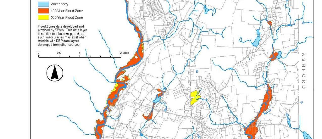
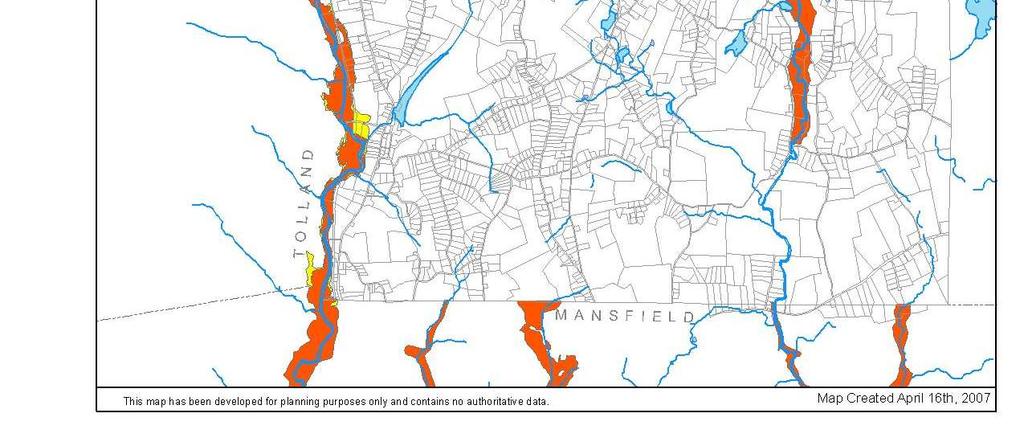
150
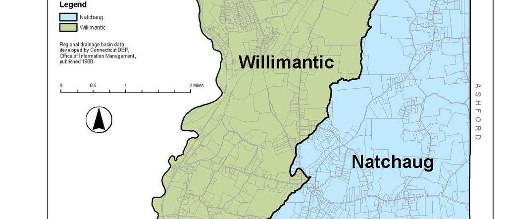
151

152
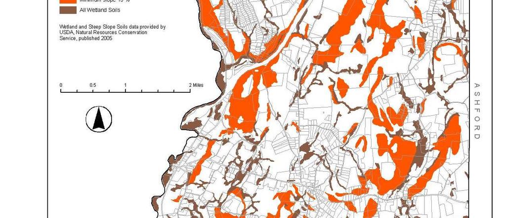
153

154

155

156

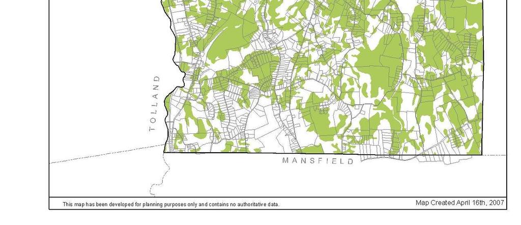
157
158
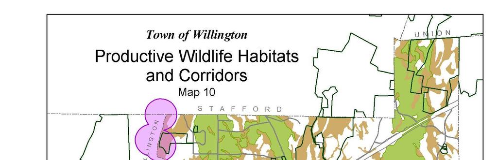
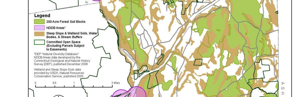


159

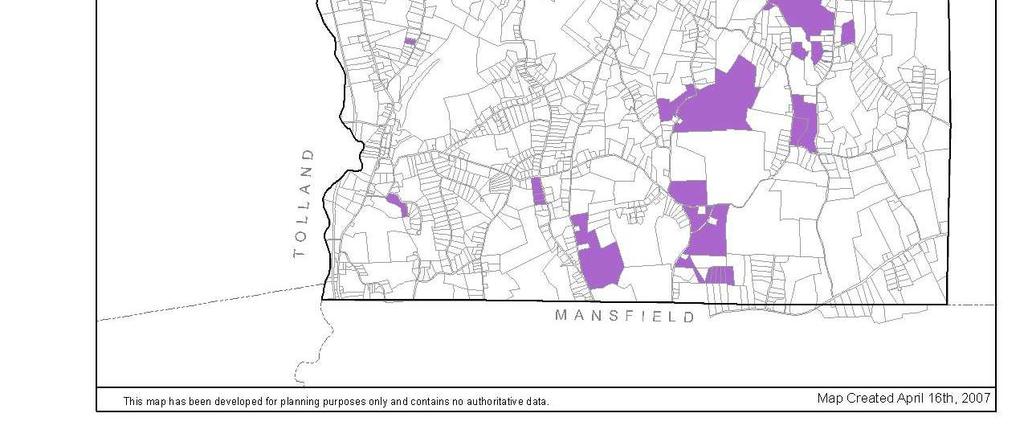
160

161


162


163
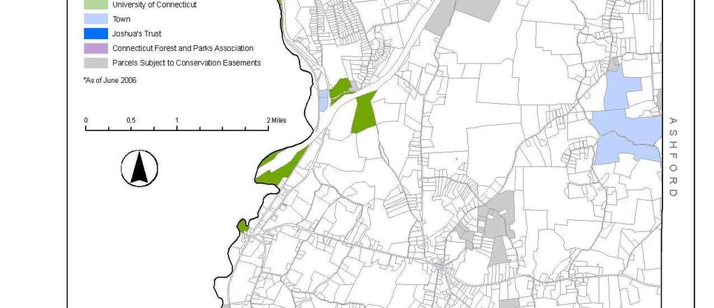
164

165
BUILD-OUT ANALYSIS GRANTHAM, NEW HAMPSHIRE
 BUILD-OUT ANALYSIS GRANTHAM, NEW HAMPSHIRE A Determination of the Maximum Amount of Future Residential Development Possible Under Current Land Use Regulations Prepared for the Town of Grantham by Upper
TOWN OF BROOKLINE, NEW HAMPSHIRE
 TOWN OF BROOKLINE, NEW HAMPSHIRE BUILDOUT ANALYSIS DECEMBER, 2003 Prepared by the Nashua Regional Planning Commission TABLE OF CONTENTS Introduction... 1 I. Methodology... 1 A. PARCEL REVIEW... 1 B. DEVELOPMENT
2014 Plan of Conservation and Development. Development Plan & Policies
 The Town of Hebron Section 3 2014 Plan of Conservation and Development Development Plan & Policies C. Residential Districts I. Residential Land Analysis This section of the plan uses the land use and vacant
2014 Plan of Conservation and Development
 The Town of Hebron Section 1 2014 Plan of Conservation and Development Community Profile Introduction (Final: 8/29/13) The Community Profile section of the Plan of Conservation and Development is intended
TOWN OF PELHAM, NEW HAMPSHIRE
 TOWN OF PELHAM, NEW HAMPSHIRE BUILDOUT ANALYSIS Prepared for the PELHAM CONSERVATION COMMISSION with the assistance of the NASHUA REGIONAL PLANNING COMMISSION TABLE OF CONTENTS I. INTRODUCTION...1 II.
Town of Prescott Valley 2013 Land Use Assumptions
 Town of Prescott Valley 2013 Land Use Assumptions Raftelis Financial Consultants, Inc. November 22, 2013 Table of Contents Purpose of this Report... 1 The Town of Prescott Valley... 2 Summary of Land Use
The Local Government Fiscal Impacts of Land Uses in Union County:
 The Local Government Fiscal Impacts of Land Uses in Union County: Revenue and Expenditure Streams by Land Use Category Jeffrey H. Dorfman and Bethany Lavigno Department of Agricultural & Applied Economics
Housing Characteristics
 CHAPTER 7 HOUSING The housing component of the comprehensive plan is intended to provide an analysis of housing conditions and need. This component contains a discussion of McCall s 1990 housing inventory
HOUSING ELEMENT Inventory Analysis
 HOUSING ELEMENT Inventory Analysis 2.100 INVENTORY Age of Housing Stock Table 2.25 shows when Plantation's housing stock was constructed. The latest available data with this kind of breakdown is 2010.
TASK 2 INITIAL REVIEW AND ANALYSIS U.S. 301/GALL BOULEVARD CORRIDOR FORM-BASED CODE
 TASK 2 INITIAL REVIEW AND ANALYSIS U.S. 301/GALL BOULEVARD CORRIDOR FORM-BASED CODE INTRODUCTION Using the framework established by the U.S. 301/Gall Boulevard Corridor Regulating Plan (Regulating Plan),
METROPOLITAN COUNCIL S FORECASTS METHODOLOGY
 METROPOLITAN COUNCIL S FORECASTS METHODOLOGY FEBRUARY 28, 2014 Metropolitan Council s Forecasts Methodology Long-range forecasts at Metropolitan Council are updated at least once per decade. Population,
Gold Beach Buildable Lands Analysis
 Gold Beach Buildable Lands Analysis Final Report Submitted to: City of Gold Beach Prepared by: Community Planning Workshop Community Service Center 1209 University of Oregon Eugene, OR 97403-1209 http://darkwing.uoregon.edu/~cpw
Burlington Unincorporated Community Plan
 Burlington Unincorporated Community Plan June 30, 2010 Meeting Page 1 of 24 Table of Contents (Page numbers to be inserted) I. Background a. Location and Community Description b. Planning of Unincorporated
Understanding the Cost to Provide Community Services in the Town of Holland, La Crosse County, Wisconsin
 Understanding the Cost to Provide Community Services in the Town of Holland, La Crosse County, Wisconsin Rebecca Roberts Land Use Specialist Center for Land Use Education and Karl Green Community Development
Pueblo Regional Development Plan, Addendum
 Pueblo Regional Development Plan, Addendum August 2014 Table of Contents Factual Foundation.1 Land Demand Analysis....1 Population Trends 2 Housing Trends..3 Employment Trends 4 Future Land Demand Summary.5
STAFF REPORT. Permit Number: Unlimited. Kitsap County Board of Commissioners; Kitsap County Planning Commission
 STAFF REPORT Permit Number: 15 00550 Unlimited DATE: March 2, 2016 TO: FROM: Kitsap County Board of Commissioners; Kitsap County Planning Commission Katrina Knutson, AICP, Senior Planner, DCD and Jeff
WELLSVILLE AFFORDABLE HOUSING PLAN
 WELLSVILLE AFFORDABLE HOUSING PLAN 2014 DRAFT 2.2 Wellsville: Affordable Housing Plan 2014 Page 2 DRAFT 2.2 Wellsville: Affordable Housing Plan 2014 Table of Contents Summary of Affordable Housing Conditions...
Land Use. Land Use Categories. Chart 5.1. Nepeuskun Existing Land Use Inventory. Overview
 Land Use State Comprehensive Planning Requirements for this Chapter A compilation of objectives, policies, goals, maps and programs to guide the future development and redevelopment of public and private
2005 COTTAGE GROVE BUILDABLE LANDS ANALYSIS UPDATE
 2005 COTTAGE GROVE BUILDABLE LANDS ANALYSIS UPDATE Adopted June 13, 2005 Prepared by Satre Associates, P.C. Planners, Landscape Architects and Environmental Specialists 132 East Broadway, Suite 536 Eugene,
PURPOSE OF STUDY. physical and social environments, as well as our political and economic institutions. As a commodity,
 PURPOSE OF STUDY Housing is one of the most important elements in our lives and our communities. Providing shelter and links to neighborhoods and larger communities, housing plays an essential part in
SJC Comprehensive Plan Update Housing Needs Assessment Briefing. County Council: October 16, 2017 Planning Commission: October 20, 2017
 SJC Comprehensive Plan Update 2036 Housing Needs Assessment Briefing County Council: October 16, 2017 Planning Commission: October 20, 2017 Overview GMA Housing Element Background Demographics Employment
8Land Use. The Land Use Plan consists of the following elements:
 8Land Use 1. Introduction The Land Use Plan consists of the following elements: 1. Introduction 2. Existing Conditions 3. Opportunities for Redevelopment 4. Land Use Projections 5. Future Land Use Policies
Summary of Findings & Recommendations
 Summary of Findings & Recommendations Minneapolis/St. Paul Region Mixed Income Housing Feasibility, Education and Action Project Background In 2015 and 2016, the Family Housing Fund and the Urban Land
CHAPTER 2 VACANT AND REDEVELOPABLE LAND INVENTORY
 CHAPTER 2 VACANT AND REDEVELOPABLE LAND INVENTORY CHAPTER 2: VACANT AND REDEVELOPABLE LAND INVENTORY INTRODUCTION One of the initial tasks of the Regional Land Use Study was to evaluate whether there is
HOUSING & RESIDENTIAL AREAS
 CHAPTER 10: HOUSING & RESIDENTIAL AREAS OVERVIEW With almost 90% of Ridgefield zoned for residential uses, the patterns and form of residential development can greatly affect Ridgefield s character. This
Eleven Tindall Road Middletown, New Jersey 07748
 MASTER PLAN REVISION TO THE HOUSING PLAN ELEMENT AND FAIR SHARE PLAN AMENDMENT MANALAPAN TOWNSHIP MONMOUTH COUNTY, NEW JERSEY NOVEMBER 24, 2008 REVISED APRIL 9, 2010 PREPARED FOR: MANALAPAN TOWNSHIP PLANNING
RESOLUTION NO ( R)
") RESOLUTION NO. 2013-06- 088 ( R) A RESOLUTION OF THE CITY COUNCIL OF THE CITY OF McKINNEY, TEXAS, APPROVING THE LAND USE ASSUMPTIONS FOR THE 2012-2013 ROADWAY IMPACT FEE UPDATE WHEREAS, per Texas Local
RESOLUTION NO. 2013-06- 088 ( R) A RESOLUTION OF THE CITY COUNCIL OF THE CITY OF McKINNEY, TEXAS, APPROVING THE LAND USE ASSUMPTIONS FOR THE 2012-2013 ROADWAY IMPACT FEE UPDATE WHEREAS, per Texas Local
CHAPTER 2: HOUSING. 2.1 Introduction. 2.2 Existing Housing Characteristics
 CHAPTER 2: HOUSING 2.1 Introduction Housing Characteristics are related to the social and economic conditions of a community s residents and are an important element of a comprehensive plan. Information
Table of Contents. Appendix...22
 Table Contents 1. Background 3 1.1 Purpose.3 1.2 Data Sources 3 1.3 Data Aggregation...4 1.4 Principles Methodology.. 5 2. Existing Population, Dwelling Units and Employment 6 2.1 Population.6 2.1.1 Distribution
City of Lonsdale Section Table of Contents
 City of Lonsdale City of Lonsdale Section Table of Contents Page Introduction Demographic Data Overview Population Estimates and Trends Population Projections Population by Age Household Estimates and
Town of Yucca Valley GENERAL PLAN 1
 Town of Yucca Valley GENERAL PLAN 1 This page intentionally left blank. 3 HOUSING ELEMENT The Housing Element is intended to guide residential development and preservation consistent with the overall values
HHLT Educational Forum: Conservation Subdivisions and the Open Space Overlay. February 5th 2018 Winter Hill
 HHLT Educational Forum: Conservation Subdivisions and the Open Space Overlay February 5th 2018 Winter Hill 1 Topics Covered SECTION I II III IV V TOPIC Comprehensive Plan Open Space Index Conservation
Document under Separate Cover Refer to LPS State of Housing
 Document under Separate Cover Refer to LPS5-17 216 State of Housing Contents Housing in Halton 1 Overview The Housing Continuum Halton s Housing Model 3 216 Income & Housing Costs 216 Indicator of Housing
Residential Capacity Estimate
 Residential Capacity Estimate Montgomery County Department of Park & Planning Research & Technology Center January 2005 Current plans allow 75,000 more housing units. by Matthew Greene, Research Planner
CITY OF MEDFORD COMPREHENSIVE PLAN BUILDABLE LAND INVENTORY
 CITY OF MEDFORD COMPREHENSIVE PLAN PREPARED BY CITY OF MEDFORD PLANNING DEPARTMENT 200 SOUTH IVY STREET MEDFORD, OREGON 97501 BIANCA PETROU, A.I.C.P., ACTING PLANNING DIRECTOR LONG RANGE PLANNING SECTION
Return on Investment Model
 THOMAS JEFFERSON PLANNING DISTRICT COMMISSION Return on Investment Model Last Updated 7/11/2013 The Thomas Jefferson Planning District Commission developed a Return on Investment model that calculates
Chapter 12 Changes Since This is just a brief and cursory comparison. More analysis will be done at a later date.
 Chapter 12 Changes Since 1986 This approach to Fiscal Analysis was first done in 1986 for the City of Anoka. It was the first of its kind and was recognized by the National Science Foundation (NSF). Geographic
How to Read a Real Estate Appraisal Report
 How to Read a Real Estate Appraisal Report Much of the private, corporate and public wealth of the world consists of real estate. The magnitude of this fundamental resource creates a need for informed
City of Astoria Comprehensive Plan URBAN GROWTH
 URBAN GROWTH CP.110 CP.110. Background Summary. Astoria has a population of 9,477 (2010 US Census). The total land area within the Urban Growth Boundary (UGB) is 3,474.2 acres with total land area of 4,450
Selected Paper prepared for presentation at the Southern Agricultural Economics Association s Annual Meetings Mobile, Alabama, February 4-7, 2007
 DYNAMICS OF LAND-USE CHANGE IN NORTH ALABAMA: IMPLICATIONS OF NEW RESIDENTIAL DEVELOPMENT James O. Bukenya Department of Agribusiness, Alabama A&M University P.O. Box 1042 Normal, AL 35762 Telephone: 256-372-5729
housing plan May 18, 2009
 housing plan May 18, 2009 Cherry Hill Township and Planning Board reserve the right to make further changes to this Housing Element & Fair Share Plan. The need or desirability of a change may arise from
TOWN OF HOLLIS, NEW HAMPSHIRE
 TOWN OF HOLLIS, NEW HAMPSHIRE BUILDOUT ANALYSIS NOVEMBER 20, 2001 Prepared by the NASHUA REGIONAL PLANNING COMMISSION TABLE OF CONTENTS I. INTRODUCTION...1 II. GOAL OF THE BUILDOUT ANALYSIS...1 III. METHODOLOGY...1
Comprehensive Plan /24/01
 IV The is a central component of the Comprehensive Plan. It is an extension of the general goals and policies of the community, as well as a reflection of previous development decisions and the physical
STAFF REPORT. Permit Number: Gonzalez. Kitsap County Board of Commissioners; Kitsap County Planning Commission
 STAFF REPORT Permit Number: 15 00657 Gonzalez DATE: March 2, 2016 TO: FROM: Kitsap County Board of Commissioners; Kitsap County Planning Commission Katrina Knutson, AICP, Senior Planner, DCD and Jeff Arango,
Affordable Housing Bonus Program. Public Questions and Answers - #2. January 26, 2016
 Affordable Housing Bonus Program Public Questions and Answers - #2 January 26, 2016 The following questions about the Affordable Housing Bonus Program were submitted by the public to the Planning Department
Appendix D HOUSING WORK GROUP REPORT JULY 10, 2002
 Appendix D HOUSING WORK GROUP REPORT JULY 10, 2002 Work Group Assignment At the 20/20 forum in April 2001, the community expressed a need for housing policies which will protect both the Town s social
Young-Adult Housing Demand Continues to Slide, But Young Homeowners Experience Vastly Improved Affordability
 Young-Adult Housing Demand Continues to Slide, But Young Homeowners Experience Vastly Improved Affordability September 3, 14 The bad news is that household formation and homeownership among young adults
2006 YEAR END HOUSING MONITORING AND SUBDIVISION STATUS REPORTS
 Town of Fort Erie Community & Development Services Our Focus: Your Future Prepared for: Council-in-Committee Report No.: CDS-022-07 Agenda Date: March 5, 2007 File No.: 350204/350308 Subject: 2006 YEAR
November An updated analysis of the overall housing needs of the City of Aberdeen. Prepared by: Community Partners Research, Inc.
 City of Aberdeen HOUSING STUDY UPDATE November 2010 An updated analysis of the overall housing needs of the City of Aberdeen Prepared by: Community Partners Research, Inc. nd 10865 32 Street North Lake
CHAPTER 7 HOUSING. Housing May
 CHAPTER 7 HOUSING Housing has been identified as an important or very important topic to be discussed within the master plan by 74% of the survey respondents in Shelburne and 65% of the respondents in
Housing Indicators in Tennessee
 Housing Indicators in l l l By Joe Speer, Megan Morgeson, Bettie Teasley and Ceagus Clark Introduction Looking at general housing-related indicators across the state of, substantial variation emerges but
PROPOSED FINDINGS OF FACT BENDER URBAN GROWTH BOUNDARY EXPANSION AND ANNEXATION REQUEST April 3, Background
 PROPOSED FINDINGS OF FACT BENDER URBAN GROWTH BOUNDARY EXPANSION AND ANNEXATION REQUEST April 3, 2016 Background The owners of TL300, 301, 302, 303, and 304, 3N1027BD - properties abutting the City Limits
Procedures Used to Calculate Property Taxes for Agricultural Land in Mississippi
 No. 1350 Information Sheet June 2018 Procedures Used to Calculate Property Taxes for Agricultural Land in Mississippi Stan R. Spurlock, Ian A. Munn, and James E. Henderson INTRODUCTION Agricultural land
We hope the trends provide additional perspective on your county s work. We know it provided valuable insight on the work we do here at Revenue.
 Date: March 6, 2018 To: County Assessors, Auditors, and Treasurers From: Jon Klockziem, Acting Director Subject: Property Tax Services Report The Property Tax Division of the is pleased to provide the
Final Report. City of Arvada, Colorado. Vauxmont/Cimarron Park ODP
 Final Report City of Arvada, Colorado Vauxmont/Cimarron Park ODP by Brian Lewandowski, MBA Leeds School of Business University of Colorado-Boulder Thomas G. Thibodeau, PhD Global Real Estate Capital Markets
AFFORDABLE WORKFORCE HOUSING REPORT OF THE WORKING GROUP Recommendations for our Region Approved February 22, 2006
 AFFORDABLE WORKFORCE HOUSING REPORT OF THE WORKING GROUP Recommendations for our Region Approved February 22, 2006 www.rrregion.org RAPPAHANNOCK RAPIDAN REGIONAL COMMISSION WORKFORCE HOUSING WORKING GROUP
Land Capacity Analysis
 Land Capacity Analysis City of Minneapolis Land Capacity Analysis June 2010 Submitted to: City of Minneapolis Community Planning & Economic Development Community Attributes tells data-rich stories about
COMPARISON OF THE LONG-TERM COST OF SHELTER ALLOWANCES AND NON-PROFIT HOUSING
 COMPARISON OF THE LONG-TERM COST OF SHELTER ALLOWANCES AND NON-PROFIT HOUSING Prepared for The Fair Rental Policy Organization of Ontario By Clayton Research Associates Limited October, 1993 EXECUTIVE
Town of Prospect PLAN OF CONSERVATION & DEVELOPMENT UPDATE
 Town of Prospect PLAN OF CONSERVATION & DEVELOPMENT UPDATE Effective February 1, 2014 PROSPECT 2013 PLAN OF CONSERVATION AND DEVELOPMENT UPDATE Prepared for: Town of Prospect Planning and Zoning Commission
STAFF REPORT. Permit Number: Lee. Kitsap County Board of Commissioners; Kitsap County Planning Commission
 STAFF REPORT Permit Number: 15 00689 Lee DATE: March 2, 2016 TO: FROM: Kitsap County Board of Commissioners; Kitsap County Planning Commission Katrina Knutson, AICP, Senior Planner, DCD and Jeff Arango,
HANSFORD ECONOMIC CONSULTING
 HANSFORD ECONOMIC CONSULTING Economic Assessment for Northlight Properties at Old Greenwood April 20, 2015 HEC Project #140150 TABLE OF CONTENTS SECTION Report Contact PAGE iii 1. Introduction and Summary
FINAL REPORT AN ANALYSIS OF SECONDARY ROAD MAINTENANCE PAYMENTS TO HENRICO AND ARLINGTON COUNTIES WITH THE DECEMBER 2001 UPDATE
 FINAL REPORT AN ANALYSIS OF SECONDARY ROAD MAINTENANCE PAYMENTS TO HENRICO AND ARLINGTON COUNTIES WITH THE DECEMBER 2001 UPDATE Robert A. Hanson, P.E. Senior Research Scientist Cherie A. Kyte Senior Research
APPENDIX A. Market Study Standards and Requirements
 APPENDIX A Market Study Standards and Requirements Section 42(m)(1)(A)(iii) of the IRS Code and Section IV(A)(2) of the 2018 Qualified Allocation Plan (QAP) require market studies for all low-income housing
City of Creswell DRAFT Residential Buildable Lands Inventory
 City of Creswell DRAFT Residential Buildable Lands Inventory REVISED DRAFT - AUGUST 2007 Creswell Residential Buildable Land Inventory Page 1 Creswell Residential Buildable Land Inventory Page 2 Table
Little Haiti Community Needs Assessment: Housing Market Analysis December 2015
 Little Haiti Community Needs Assessment: Housing Market Analysis December 2015 Prepared by: EXECUTIVE SUMMARY Background The Little Haiti Housing Needs Assessment provides a current market perspective
Myth Busting: The Truth About Multifamily Renters
 Myth Busting: The Truth About Multifamily Renters Multifamily Economics and Market Research With more and more Millennials entering the workforce and forming households, as well as foreclosed homeowners
NYC Land Acquisition Town Level Assessment 2017
 NYC Land Acquisition Town Level Assessment 2017 Delaware County Evaluation and Response Delaware County assessment of the NYC Land Acquisition Program and how potential future LAP acquisitions affect the
Chapter 4: Housing and Neighborhoods
 Chapter 4: Housing and Neighborhoods Introduction Medina is a growing community that provides a variety of housing types and neighborhood styles while protecting and enhancing the City s open spaces and
Housing Need in South Worcestershire. Malvern Hills District Council, Wychavon District Council and Worcester City Council. Final Report.
 Housing Need in South Worcestershire Malvern Hills District Council, Wychavon District Council and Worcester City Council Final Report Main Contact: Michael Bullock Email: michael.bullock@arc4.co.uk Telephone:
AFFIRMATIVELY FURTHERING FAIR HOUSING
 FINAL REGULATIONS AFFIRMATIVELY FURTHERING FAIR HOUSING Ed Gramlich (ed@nlihc.org) National Low Income Housing Coalition Modified, October 2015 INTRODUCTION On July 8, 2015, HUD released the long-awaited
METROPOLITAN COUNCIL S FORECASTS METHODOLOGY JUNE 14, 2017
 METROPOLITAN COUNCIL S FORECASTS METHODOLOGY JUNE 14, 2017 Metropolitan Council s Forecasts Methodology Long-range forecasts at Metropolitan Council are updated at least once per decade. Population, households
Housing Price Forecasts. Illinois and Chicago PMSA, October 2014
 Housing Price Forecasts Illinois and Chicago PMSA, October 2014 Presented To Illinois Association of Realtors From R E A L Regional Economics Applications Laboratory, Institute of Government and Public
Current Situation and Issues
 Handout 13: Impervious and Gross Area Charges The purpose of this handout is to frame the issues around the gross and impervious parcel area based charges. Current Situation and Issues Current Structure
FISCAL IMPACT ANALYSIS Proposed Abington Terrace Development Abington Township, Montgomery County
 FISCAL IMPACT ANALYSIS Proposed Abington Terrace Development Abington Township, Montgomery County November 9, 2018 Prepared for: BET Investments 200 Dryden Road, Suite 2000 Dresher, PA 19025 Prepared by:
We look forward to working with you to build on our collaboration and enhance our partnership on behalf of all Minnesotans.
 Date: February 27, 2017 To: County Assessors, Auditors, and Treasurers From: Cynthia Rowley, Director Property Tax Division Subject: Property Tax Services Report The Property Tax Division of the Minnesota
PIP practice note 1 planning assumptions. How to use this practice note. Planning assumptions. What are planning assumptions? Type.
 PIP PRACTICE NOTE 1 How to use this practice note This practice note has been prepared to support in the preparation or amending of planning assumptions within a priority infrastructure plan (PIP). It
RATE STUDY IMPACT FEES PARKS
 RATE STUDY FOR IMPACT FEES FOR PARKS CITY OF KENMORE, WASHINGTON May 15, 2001 TABLE OF CONTENTS Executive Summary................................................... 1 1. Statutory Basis and Methodology
TRANSFER OF DEVELOPMENT RIGHTS
 STEPS IN ESTABLISHING A TDR PROGRAM Adopting TDR legislation is but one small piece of the effort required to put an effective TDR program in place. The success of a TDR program depends ultimately on the
METHODOLOGY GUIDE VALUING MOTELS IN ONTARIO. Valuation Date: January 1, 2016
 METHODOLOGY GUIDE VALUING MOTELS IN ONTARIO Valuation Date: January 1, 2016 AUGUST 2016 August 22, 2016 The Municipal Property Assessment Corporation (MPAC) is responsible for accurately assessing and
Table of Contents. Title Page # Title Page # List of Tables ii 6.7 Rental Market - Townhome and Apart ment Rents
 RESIDENTIAL MONITORING REPORT 2013 Table of Contents Title Page # Title Page # List of Tables ii 6.7 Rental Market - Townhome and Apart ment Rents 21 List of Figures iii 7.0 Other Housing Demands and Trends
City of Bellingham Urban Growth Area - Land Supply Analysis Summary
 City of Bellingham Urban Growth Area - Land Supply Analysis Summary Population & Employment Growth Forecasts APPENDIX D, ATTACHMENT 3 The ECONorthwest Whatcom County Population & Economic Forecasts report
4. Parks and Recreation Fee Facility Needs and Cost Estimates Fee Calculation Nexus Findings 24
 TABLE OF CONTENTS CHAPTER PAGE 1. Introduction and Summary of Calculated Fees 1 1.1 Background and Study Objectives 1 1.2 Organization of the Report 2 1.3 Calculated Development Impact Fees 2 2. Fee Methodology
Market Trends Generated on 09/27/2018 Page 1 of Lorenzen Rd, Tracy, CA , San Joaquin County. Pricing Trends
 12 Lorenzen Rd, Tracy, CA 95304-8188, San Joaquin County Pricing Trends Median Sale Price to Current Value - Tax The percentage of properties that have increased or decreased in value based on the year
Assessment-To-Sales Ratio Study for Division III Equalization Funding: 1999 Project Summary. State of Delaware Office of the Budget
 Assessment-To-Sales Ratio Study for Division III Equalization Funding: 1999 Project Summary prepared for the State of Delaware Office of the Budget by Edward C. Ratledge Center for Applied Demography and
Kane County. Division of Transportation. Technical Specifications Manual for Road Improvement Impact Fees Under Kane County Ordinance #07-232
 Kane County Division of Transportation Technical Specifications Manual for Road Improvement Impact Fees Under Kane County Ordinance #07-232 Table of Contents Section 1: Introduction to the Impact Fee and
Tahoe Truckee Unified School District. Developer Fee Justification Study
 Tahoe Truckee Unified School District Developer Fee Justification Study October 2015 Developer Fee Justification Study TABLE OF CONTENTS EXECUTIVE SUMMARY... 1 INTRODUCTION... 2 AVAILABLE CAPACITY... 3
TOWN OF HINESBURG POLICE PROTECTION IMPACT FEE ANALYSIS. Prepared By. Michael J. Munson, Ph.D., FAICP
 TOWN OF HINESBURG POLICE PROTECTION IMPACT FEE ANALYSIS Prepared By Michael J. Munson, Ph.D., FAICP September 23, 2009 I. INTRODUCTION: The Town of Hinesburg, Vermont, has recently updated its Town Plan
The Impact of Using. Market-Value to Replacement-Cost. Ratios on Housing Insurance in Toledo Neighborhoods
 The Impact of Using Market-Value to Replacement-Cost Ratios on Housing Insurance in Toledo Neighborhoods February 12, 1999 Urban Affairs Center The University of Toledo Toledo, OH 43606-3390 Prepared by
CITY OF OWATONNA ASSESSMENT REPORT. Steele County Assessor s Department. William G. Effertz, SAMA Steele County Assessor
 2017 CITY OF OWATONNA ASSESSMENT REPORT Steele County Assessor s Department William G. Effertz, SAMA Steele County Assessor Tyler Diersen, AMA, Assistant County Assessor April 11, 2017 2017 Assessment
Existing Conditions: Economic Market Assessment
 Existing Conditions: Economic Market Assessment Introduction The US 24/40 Corridor Study examined existing conditions as they related to economic and commercial market assessments, existing land use, and
The Impact of Market Rate Vacancy Increases Eleven-Year Report
 The Impact of Market Rate Vacancy Increases Eleven-Year Report January 1, 1999 - December 31, 2009 Santa Monica Rent Control Board April 2010 TABLE OF CONTENTS Summary 1 Vacancy Decontrol s Effects on
Comparative Study on Affordable Housing Policies of Six Major Chinese Cities. Xiang Cai
 Comparative Study on Affordable Housing Policies of Six Major Chinese Cities Xiang Cai 1 Affordable Housing Policies of China's Six Major Chinese Cities Abstract: Affordable housing aims at providing low
Housing Market Update
 Housing Market Update March 2017 New Hampshire s Housing Market and Challenges Market Overview Dean J. Christon Executive Director, New Hampshire Housing Finance Authority New Hampshire s current housing
Crystal Falls Township Master Plan
 Crystal Falls Township Master Plan January 2003 Updated 2010 Township Officials Master Plan Update, 2010 Crystal Falls Township Iron County, Michigan Planning Commission Curtis Stebic, Chair Beverly Camp,
7224 Nall Ave Prairie Village, KS 66208
 Real Results - Income Package 10/20/2014 TABLE OF CONTENTS SUMMARY RISK Summary 3 RISC Index 4 Location 4 Population and Density 5 RISC Influences 5 House Value 6 Housing Profile 7 Crime 8 Public Schools
Land Preservation in the Highlands Region
 Land Preservation in the Highlands Region Prepared by the Highlands Water Protection and Planning Council - August 2010 The Highlands watersheds are the best in the State in respect to ease of collection,
EVALUATION AND APPRAISAL REPORT OF THE CITY OF FELLSMERE COMPREHENSIVE PLAN APPENDIX D HOUSING ELEMENT
 OBJECTIVE H-A-1: ALLOW AFFORDABLE HOUSING AND ADEQUATE SITES FOR VERY LOW, LOW, AND MODERATE INCOME HOUSING. The City projects the total need for very low, low, and moderate income-housing units for the
Results Population Characteristics of Highlands Region s Municipalities
 2-3. Potential Changes and Resources at Risk Population Growth Introduction Since human land use is one of the major factor shaping the Highlands region, a better understanding of trends in human population
410 Land Use Trends Comprehensive Plan Section 410
 411 410 Comprehensive Plan Section 410 In order to plan future land use, we must know how the land is used today. This section includes the following: Definition of analyzed land-use categories Summary
Our Focus: Your Future 2007 YEAR END HOUSING MONITORING AND SUBDIVISION STATUS REPORTS
 Town of Fort Erie Community & Development Services Our Focus: Your Future Prepared for Council-in-Committee Report No. CDS-011-08 Agenda Date February 4,2008 File No. 350204/350308 Subject 2007 YEAR END