Burlington Unincorporated Community Plan
|
|
|
- Pearl Jenkins
- 5 years ago
- Views:
Transcription


1 Burlington Unincorporated Community Plan June 30, 2010 Meeting Page 1 of 24
2 Table of Contents (Page numbers to be inserted) I. Background a. Location and Community Description b. Planning of Unincorporated Communities c. Plan Process II. III. IV. Land Use Planning a. Land Use and Zoning b. Changes to Zoning and Development Requirements c. Potential Growth Scenarios Public Facilities a. Septic Conditions b. Water System c. Transportation System Appendices Appendix 1. Zoning Code Appendix 2. Maps Map 1: Community Boundary Map 2: Land Use Map 3: Zoning Map 4: Zoning Overlay Map 5: Transportation Map 6: Range of Parcel Sizes (Acres) Appendix 3. Inventory/Data Table Appendix 4. Public Involvement and Process Appendix 5. April 20, 2010 Community Meeting Handouts PowerPoint Presentation Community Input Surveys and Written Comments June 30, 2010 Meeting Page 2 of 24


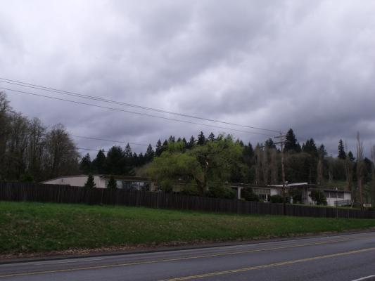
3 I. Background a. Location and Community Description Burlington is approximately 2.5 miles from the city of Portland, and is located along Highway 30. The community is comprised primarily of residential uses, with some commercial uses. Commercial uses include a tavern and a utility building for Qwest Communications. The community also includes the Native American Rehabilitation Association of the Northwest (NARA) Facility. There is no sewer service for the area. Provisions of water are available through the Burlington Water District. Fire protection is provided by the Scappoose Fire District. The elevation of the Burlington area ranges from close to sea level to 200 feet above sea level. Elevation rises severely from Highway 30 to the Burlington Northern Cornelius Pass line railroad tracks to the south, and more gently to the north. Property beyond the Burlington Northern Astoria line railroad tracks to the north and east is subject to flooding from high water levels in Multnomah Channel. b. Planning for Unincorporated Communities In December of 1994, the State of Oregon s Land Conservation Development Commission (LCDC) adopted Oregon Administrative Rule (OAR) Chapter 660, Division 22, or the Unincorporated Communities Rule ( the Rule ). The Rule provides a framework for counties to use in identifying and designating unincorporated communities outside established Urban Growth Boundaries (UGB), and establishes planning rules for unincorporated communities pertaining to development standards, allowed land uses and public facilities. New state rules affecting the Rural Center have been implemented since the County s last plan was prepared. These new regulations are referred to as the Unincorporated Communities Rule as discussed above. Due to the characteristics of the Burlington Rural Center area, county staff has determined that it should be designated as a Rural Community. Specific provisions for Rural June 30, 2010 Meeting Page 3 of 24
4 Communities require that counties adopt rural community zoning designations for the uses within the area. The type and extent of specific uses permitted are subject to provisions outlined in the Rule. Burlington was recognized as an unincorporated rural community in the Multnomah County Comprehensive Plan and was zoned Rural Center in The established Rural Center zoning district applied to approximately 30 acres in the Burlington Community. This zoning district is intended to encourage concentrations of rural residential development, together with limited local and tourist commercial uses, light industrial uses, and public service uses and centers such as churches, fire stations, schools, etc. The state Unincorporated Communities Rule (OAR ) requires counties to adopt land use and zoning measures specific to unincorporated communities in order to ensure that cumulative development in the communities will not: - Result in public health hazards or adverse environmental impacts that violate state or federal water quality regulations, or - Exceed the carrying capacity of the soil or of existing water supply resources and sewer services. The Unincorporated Communities Rule limits the types of land that can be included in an officially designated Unincorporated Community. Lands identified as exception areas (i.e., rural lands that are zoned for commercial, industrial or residential use, not farm or forest use) can be included if they have historically been considered part of the community. The land included must represent a contiguous concentration of commercial, industrial, public use, or residential land. Residential land to be included must be of a greater density than residential exception lands that are outside of identified Unincorporated Communities. Further, the designated community must have been identified in a county s acknowledged comprehensive plan as a rural community, service center, rural center, resort community, or similar term before the adoption of the Rule (October 28, 1994), or the community is listed in the Department of Land Conservation and Development s January 30, 1997 Survey of Oregon s Unincorporated Communities. Land zoned for farm or forest use may only be included in the Unincorporated Community if it is adjacent to exception lands included in the community boundary and was occupied on October 28, 1994 (the date of the Unincorporated Community Rule) by one or more of the following public uses: church, cemetery, school, park, playground, community center, fire station, museum, golf course, or utility facility. The Burlington Unincorporated Community is consistent with these requirements. The community boundary encircles a contiguous area of exception land, specifically properties that are currently zoned Rural Center. Additionally, the proposed boundary does not include any properties surrounding the area which are zoned Commercial Forest Use-2 (CFU-2), Commercial Forest Use-1 (CFU-1), or Multiple Use Agriculture-20 (MUA-20). c. Plan Process The county identified a process in completing the work for the Burlington Unincorporated Community Plan. The process included public outreach with a series of public meetings held in the June 30, 2010 Meeting Page 4 of 24
5 community, and distribution of a community survey to gather community input. The results of these meetings and community input are provided in the Appendices of this plan. As part of the planning effort, the following processes were undertaken: Identified the community boundary recognizing the extent of the established Rural Center zoning boundary Inventoried and analyzed data and information about the community related to the existing land uses, available public services, parcel sizes, and current plan policies and zoning regulations Reviewed the characteristics of the community and existing zoning regulations for consistency with the State Rule Staff conducted an introductory community meeting on April 27 th, 2010 where approximately 15 citizens attended. Other community meetings are scheduled for June and September, with a goal of adoption by the end of the calendar year. II. Land Use Planning a. Land Use In order to determine the appropriate designation for the Springdale area consistent with the Rule, county staff conducted a parcel-by-parcel inventory of the area. The inventory included an analysis of Assessor s Data, site visits, and inspections of aerial photographs. In addition, staff conducted an inventory and observation of area businesses. The findings from this inventory are illustrated in Maps 1, 2, and 6, which appears at the end of this report. Information on land uses are also provided in Table 1 below, which illustrates the types and acreage of land inventoried. Burlington is comprised of 40 parcels. A majority of the acreage is in Single Family Use, with a small number in commercial use or vacant land. Existing uses include 22 residences, and 3 commercial uses. Burlington Table 1 LANDUSE DESIGNATION Range of Parcel Sizes (Acres) Data Commercial SFR (Single Family Residence) Vacant Grand Total Total Acres 0.36 ac 3.69 ac 1.81 ac 5.86 ac Number of Parcels Total Acres ac ac Number of Parcels Total Acres Number of Parcels Total Acres * Number of Parcels *Doesn't include acreage in right-of-way Updated 4/22/10 June 30, 2010 Meeting Page 5 of 24
6 Land Use 1.81 acres, 8% 7.53 acres, 35% acres, 57% TOTAL COMMERCIAL TOTAL SINGLE FAMILY RESIDENCE TOTAL VACANT Chart 1: Land Use Acres and Percentages None of the parcels within the community boundary are in a farm or forest tax deferral program. A total of 37.7 acres is located within the identified community boundary, with acres of which is private property, minus the public right-of-way. A majority of the parcels are less than 2 acres, with the largest parcel being the NARA Facility parcel at acres. Most of the area, with the exception of the northern portion, is within the Burlington Subdivision, platted in 1909, with an average lot size at 8,000 square feet. This subdivision-extends west and south of the Burlington Northern Cornelius Pass line railroad tracks into commercial forest lands. Most of the subdivision located outside of the existing rural center boundary is under a single ownership. b. Zoning and Development Requirements Residential Uses The Rule identifies that county plans and regulations may permit any residential use and density as long as the density of residential development is greater than that of surrounding rural areas, and as long as it will not exceed the carrying capacity of the soil for waste disposal and of existing water supply resources. Residential uses are permitted outright in the current Rural Center (RC) zoning designation for the area. Under the zoning regulations the minimum lot size for new parcels or lots shall be one acre for lands inside the boundary of an acknowledged unincorporated community. For lands outside of an acknowledge unincorporated community the minimum lot size shall be two acres except for those properties within one mile of the Urban Growth Boundary and then the minimum lot size shall be as currently required in the Oregon Administrative Rules Chapter 660, Division 004 (20 acre minimum as of October 4, 2000). Dimensional requirements consist of front, side, and rear setback June 30, 2010 Meeting Page 6 of 24
7 requirements. Listed Conditional Uses include more intensive commercial and industrial uses require demonstration of adequate parcel size for approval. Commercial Uses The Unincorporated Community Rule sets restrictions on the size and type of commercial uses that counties may allow in unincorporated communities. Specifically, the rule allows new commercial uses that are: Authorized under Goals 3 (Agricultural Lands) or 4 (Forest Lands); Considered small-scale and low-impact; or Intended to serve the community and surrounding rural area or the travel needs of people passing through the area. In rural unincorporated communities, a commercial use is considered small-scale, low-impact if it takes place in a building or buildings not exceeding 4,000 square feet of floor space. Additionally, hotels and motels of up to 35 units may be authorized in any unincorporated community that is at least 10 miles from any urban growth boundary bordering Interstate Highway 5 and is served by a community sewer system. In this instance, the Burlington Community doesn t fit this criterion and therefore the zoning regulation will need be revised to not allow development of hotels and motels. Currently, the only commercial uses that are permitted outright in the Rural Center zone are farming and forestry uses and home occupations. Other uses are permitted only as a Review Use or Conditional Use. Listed Review Uses are limited to wholesale and retail sales of products raised or grown in the area, with the location and building standards subject to review and permits. Conditional Uses in the Rural Center zone include local stores, shops, offices, repair shops, restaurants, and gas stations. Industrial Uses Per the State guidelines for Rural Communities, permitted industrial uses include: Uses authorized under Goals 3 and 4; Expansion of a use existing on the date of this rule (December 5, 1994); Small-scale, low-impact uses; Uses that require proximity to rural resource, as defined in OAR (3)(a), such as geothermal wells, mineral or aggregate deposits, water reservoirs and natural features; or New uses that will not exceed the capacity of water and sewer service available to the site on the effective date of this rule, or, if such services are not available to the site, the capacity of the site itself to provide water and absorb sewage. Uses that are more intensive than those identified above may be allowed provided an analysis set forth in the comprehensive plan demonstrates, and land use regulations ensure: 1. That such uses are necessary to provide employment that does not exceed the total projected work force within the community and the surrounding rural area; 2. That such uses would not rely upon a work force employed by uses within urban growth boundaries; and June 30, 2010 Meeting Page 7 of 24
8 3. That the determination of the work force of the community and surrounding rural area considers the total industrial and commercial employment in the community and is coordinated with employment projections for nearby urban growth boundaries. Current county zoning permits light industrial activities as a Conditional Use. These uses should require no more than 20 daily employees and include uses such as wholesale distribution of bakery goods, photo processing, building maintenance, and automobile repair work. Uses may be expanded up to 40 daily employees when it is found that the use: 1. The proposed expansion is a result of normal growth of the existing use and not required as a result of diversification of the business; 2. The use provides a public benefit to the rural center by employing primarily persons who reside within the rural center or surrounding rural area, and this same employment pattern will continue with the proposed expansion; 3. The proposed expansion satisfies the applicable elements of Comprehensive Framework Plan Policies: No. 20 Arrangement of Land Uses; No. 30 Industrial Location (Isolated Light Industrial); No. 36 Transportation System Development Requirements; No. 37 Utilities; and No. 38 Facilities 4. The proposed expansion satisfies the Design Review provisions of County Code. c. Potential Growth Scenario Under the identified zoning regulations of Multnomah County Code for the Rural Center Zone the minimum lot size for new parcels or lots shall be one acre for lands inside the boundary of an acknowledged unincorporated community. For lands outside of an acknowledged unincorporated community the minimum lot size shall be two acres except for those properties within one mile of the Urban Growth Boundary and then the minimum lot size shall be as currently required in the Oregon Administrative Rules Chapter 660, Division 004 (20 acre minimum as of October 4, 2000). As an acknowledged unincorporated community, one parcel that could possibly be further divided to one acre lots has been identified as part of the land use inventory and analysis. Under this scenario the acres parcel could potentially be further divided into one acre lots for a potential of 10 additional lots, contingent on being able to meet county code requirements, including on-site septic requirements. III. Public Facilities OAR requires that unincorporated community plans assess the capacity of the local public facility infrastructure (i.e., sewer system or septic conditions, water, and transportation systems), and determine if they will be adequate to serve future growth anticipated or planned in the unincorporated community. If the public facilities are found to be inadequate to serve future growth, then the unincorporated plan must identify the improvements needed to accommodate the growth June 30, 2010 Meeting Page 8 of 24
9 and establish a procedure to limit growth in the community until the necessary public facility improvements have been made. a. Septic Conditions The Burlington area is not served by a community sewer district or system. All wastewater treatment in the area is accomplished through septic systems. The Rule requires counties to adopt public facilities plans for unincorporated communities with a population over 2,500. The current population of the area is significantly smaller than this; therefore this criterion does not apply. The Rule further requires that sewer and water community public facility plans are required in any of the following circumstances: Existing sewer or water facilities are insufficient for current needs, or are projected to become insufficient due to physical conditions, financial circumstances or changing state or federal standards; or The plan for the unincorporated community provides for an amount, type or density of additional growth or infill that cannot be adequately served with individual water or sanitary systems or by existing community facilities and services; or The community relies on groundwater and is within a groundwater limited or groundwater critical area as identified by the Oregon Department of Water Resources; or Land in the community has been declared a health hazard or has a history of failing septic systems or wells. The land use analysis conducted finds that a minimal number of lots could potentially be developed under the zoning standard of a one acre minimum lot size. All new parcels would have to be served with on-site septic and stormwater control systems. Two main factors will influence the growth potential of the area, one being the desire to develop the parcels, and the other being the ability to support an on-site septic system and control stormwater on-site. In considering these factors, the potential for additional growth may be limited. In taking a look at these factors, staff determined that a public facility plan is not needed for the Burlington Community. The size and location would require a costly system to serve a small number of lots in the area. Review of the area s carrying capacity is already being reviewed by the City of Portland Bureau of Development Services Site Development Office with the office being able to deny or approve building permits based on percolation tests and site inspections. County requirements currently address stormwater management, and the area is served by the Burlington Water District. In addition, the community vision established as part of the planning process is to maintain a rural area. The development of urban services, such as a sewer system, would be contrary to this vision. b. Water System The Burlington area is served by the Burlington Water District. Community input indicates no issues with the service. c. Transportation System June 30, 2010 Meeting Page 9 of 24
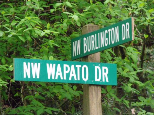
10 The Rule requires that county plans and land use regulations shall allow only those uses which are consistent with the identified function, capacity and level of service of transportation facilities serving the community, pursuant to OAR (1)(a) through (c), requiring that where an amendment to a functional plan, an acknowledged comprehensive plan, or a land use regulation would significantly affect an existing or planned transportation facility, the local government shall put in place measures as provided consistent with OAR (2) to assure that allowed land uses are consistent with the identified function, capacity, and performance standards (e.g. level of service, volume to capacity ratio, etc.) of the facility. As identified in the State Guidelines a plan or land use regulation amendment significantly affects a transportation facility if it would: (a) Change the functional classification of an existing or planned transportation facility (exclusive of correction of map errors in an adopted plan); (b) Change standards implementing a functional classification system; or (c) As measured at the end of the planning period identified in the adopted transportation system plan: (A) Allow land uses or levels of development that would result in types or levels of travel or access that are inconsistent with the functional classification of an existing or planned transportation facility; (B) Reduce the performance of an existing or planned transportation facility below the minimum acceptable performance standard identified in the TSP or comprehensive plan; or (C) Worsen the performance of an existing or planned transportation facility that is otherwise projected to perform below the minimum acceptable performance standard identified in the TSP or comprehensive plan. According to county policies and zoning regulations in place, and staff discussions with the Oregon Department of Transportation, and results from the community inventory and analysis, it is found that the Rural Community Plan for the Burlington Community will not affect the existing or planned transportation facilities. Roads in the area are adequate to accommodate existing and future traffic levels. State Highway 30 and Cornelius Pass Rd. provide major access to Burlington. The remaining roads in the area, Burlington, and Wapato provide access to homes and properties abutting them. Many "paper" roads, unbuilt and in some cases unbuildable, criss-cross the area. Burlington and Wapato are classified as Rural Local Roads and are addressed in the county policies. Highway 30 is addressed as part of the Oregon Highway Plan administered by the Oregon Department of Transportation (ODOT). Improvements to existing local streets and/or construction of new internal local streets to support specific developments could be required as part of a future subdivision approval process and would be addressed on a site-specific basis. June 30, 2010 Meeting Page 10 of 24
11 IV. Appendices Appendix 1: Zoning (Proposed zoning code to be attached) June 30, 2010 Meeting Page 11 of 24
12 Appendix 2: Maps Map 1: Community Boundary June 30, 2010 Meeting Page 12 of 24
13 Map 2: Land Use June 30, 2010 Meeting Page 13 of 24

14 Map 3: Zoning June 30, 2010 Meeting Page 14 of 24

15 Map 4: Zoning Overlay Map 5: Transportation June 30, 2010 Meeting Page 15 of 24
 June 30, 2010 Meeting Page")
16 Map 6: Range of Parcel Sizes (Acres) June 30, 2010 Meeting Page 16 of 24

17 June 30, 2010 Meeting Page 17 of 24
18 Inventory/Data Table RNO Parcel Size Class R COM R COM R SFR R SFR R SFR R SFR R COM R COM R VAC R VAC R SFR R SFR R SFR R VAC R VAC R VAC R VAC R VAC R SFR R VAC R VAC R SFR R SFR R SFR R SFR R VAC R SFR R SFR R VAC R VAC R VAC R SFR R SFR R SFR R SFR R SFR R SFR R SFR LANDUSE R SFR R COM SFR: Single Family Residence VAC: Vacant COM: Commercial June 30, 2010 Meeting Page 18 of 24
19 Public Involvement and Process Fliers Website June 30, 2010 Meeting Page 19 of 24
20 April 27, 2010 Community Meeting Handouts PowerPoint Presentation Community Input The April 27 th Community Meeting, included a staff presentation and a staff led Community Input Session. The staff facilitated Community Input Session involved a large group discussion with those in attendance. Staff posed the three questions below and initiated discussion and noted the feedback received during the input session. The information below reflects the community input received in response to the three questions asked by staff. Community Input Session Burlington Community Meeting April 27, 2010 Skyline Grange, 7-8:30pm 1. What aspects of the Burlington Community do you like? What is important to you? Preserve what s there. Preserve the community Like location and proximity to cities but still be in the county (rural) It s a walkable community Community feel Good water service Like the current density Feel safe Neighborhood 2. What issues are important to the Burlington Community? Why was the boundary set where it is? Can it be expanded to include lots currently outside of Rural Center zoning? Small lots Sewer and water service on small lots Want a place to live. Being able to replace home if destroyed. Septic regulations Concerned about being able to maintain current residence Make sure that we preserve the interest of the community while meeting state laws June 30, 2010 Meeting Page 20 of 24
21 METRO owns approximately 20 lots. METRO interested in expanding boundary. Current CFU zoning is restricting. METRO is interested in getting rid of smaller lots in their ownership. Being able to develop vacant lots with setback and septic requirements Would like a grocery store, gas station, restaurant in the community No TriMet bus service. Can we get service? Columbia County Riders Service? Commuting. Can we collaborate to establish service? Traffic congestion- commuters from Columbia County What about a commuter rail line? Difficult at times to get on Highway 30 We don t have enough room for services (grocery stores, etc.) Access to Highway 30 (safety) Burlington Avenue intersection to Highway 30- sight distance concerns Explore reduction of speed limit 3. What suggestions do you have for improving the Burlington Community? Look into expanding community boundary to recognize de facto community boundary. Smaller lots not currently in boundary. June 30, 2010 Meeting Page 21 of 24

22 Survey and Comment Letters Received June 30, 2010 Meeting Page 22 of 24


23 June 30, 2010 Meeting Page 23 of 24


24 June 30, 2010 Meeting Page 24 of 24
Multiple Use Forest District (MUF)
") This district is defined as Multiple Use Forest District with a minimum lot size of 20 acres. 11.15.2162 Purposes The purposes of the Multiple Use Forest District are to conserve and encourage the use
This district is defined as Multiple Use Forest District with a minimum lot size of 20 acres. 11.15.2162 Purposes The purposes of the Multiple Use Forest District are to conserve and encourage the use
HOOD RIVER COUNTY EXCEPTIONS DOCUMENT. (Amended 12/17/84)
") HOOD RIVER COUNTY EXCEPTIONS DOCUMENT 1984 (Amended 12/17/84) COUNTY EXCEPTIONS DOCUMENT The Hood River County Comprehensive Land Use Plan is the basic instrument used for County land use planning. It
HOOD RIVER COUNTY EXCEPTIONS DOCUMENT 1984 (Amended 12/17/84) COUNTY EXCEPTIONS DOCUMENT The Hood River County Comprehensive Land Use Plan is the basic instrument used for County land use planning. It
610 LAND DIVISIONS AND PROPERTY LINE ADJUSTMENTS OUTSIDE A UGB
 ARTICLE VI: LAND DIVISIONS AND PROPERTY LINE ADJUSTMENTS VI-21 610 LAND DIVISIONS AND PROPERTY LINE ADJUSTMENTS OUTSIDE A UGB 610-1 Property Line Adjustments (Property Line Relocation) A property line
Marion County RURAL UNINCORPORATED COMMUNITIES FINDINGS & ANALYSIS. PLANNING COMMISSION RECOMMENDATION June 1, 1999
 Marion County RURAL UNINCORPORATED COMMUNITIES FINDINGS & ANALYSIS PLANNING COMMISSION RECOMMENDATION June 1, 1999 BOARD OF COMMISSIONERS REVIEW AND DECISION December 13, 2000 The planning process leading
8Land Use. The Land Use Plan consists of the following elements:
 8Land Use 1. Introduction The Land Use Plan consists of the following elements: 1. Introduction 2. Existing Conditions 3. Opportunities for Redevelopment 4. Land Use Projections 5. Future Land Use Policies
CHAPTER URBAN TRANSITION - UT ZONE
 CHAPTER 16.13 URBAN TRANSITION - UT ZONE Section Title Page 16.13.000 Purpose 1 16.13.010 Uses 1 16.13.020 Conditional Uses 2 16.13.030 Conditional Use Criteria 3 16.13.040 Prohibited Uses 4 16.13.100
Multiple Use Agriculture (MUA-20)
") Multiple Use Agriculture (MUA-20) 11.15.2122 Purposes The purposes of the Multiple Use Agriculture District are to conserve those agricultural lands not suited to full-time commercial farming for diversified
Multiple Use Agriculture (MUA-20) 11.15.2122 Purposes The purposes of the Multiple Use Agriculture District are to conserve those agricultural lands not suited to full-time commercial farming for diversified
CITY OF MEDFORD COMPREHENSIVE PLAN BUILDABLE LAND INVENTORY
 CITY OF MEDFORD COMPREHENSIVE PLAN PREPARED BY CITY OF MEDFORD PLANNING DEPARTMENT 200 SOUTH IVY STREET MEDFORD, OREGON 97501 BIANCA PETROU, A.I.C.P., ACTING PLANNING DIRECTOR LONG RANGE PLANNING SECTION
REZONING APPLICATION INSTRUCTIONS
 REZONING APPLICATION INSTRUCTIONS All required information, as stated on the Rezoning Application Checklist, must be included to qualify as a complete application. Upon receipt, staff will review the application
STAFF REPORT. Community Development Director PO Box 4755 Beaverton, OR 97076
 STAFF REPORT HEARING DATE: July 7, 2010 TO: Planning Commission STAFF: Jana Fox, Assistant Planner PROPOSAL: Southeast Beaverton Office Commercial Zoning Map Amendment (ZMA2010-0006) LOCATION: The subject
CHAPTER 2 VACANT AND REDEVELOPABLE LAND INVENTORY
 CHAPTER 2 VACANT AND REDEVELOPABLE LAND INVENTORY CHAPTER 2: VACANT AND REDEVELOPABLE LAND INVENTORY INTRODUCTION One of the initial tasks of the Regional Land Use Study was to evaluate whether there is
CHAPTER 50 LAND USE ZONES ARTICLE 50 BASIC PROVISIONS
 CHAPTER 50 LAND USE ZONES ARTICLE 50 BASIC PROVISIONS 50.010 - PURPOSE The purposes of this chapter are to establish land use zones required to implement the goals and policies of the Klamath County Comprehensive
Chapter 210 CONDITIONAL USES
 Chapter 210 CONDITIONAL USES 210.01 Purpose 210.02 Authorization 210.03 Process Type 210.04 Determination of Major or Minor Conditional Use Review 210.05 Approval Criteria 210.06 Conditions of Approval
4.2 LAND USE INTRODUCTION
 4.2 LAND USE INTRODUCTION This section of the EIR addresses potential impacts from the Fresno County General Plan Update on land use in two general areas: land use compatibility and plan consistency. Under
Rule 80. Preservation of Primary Agricultural Soils Revised and approved by the Land Use Panel during its public meeting on January 31, 2006.
 Rule 80. Preservation of Primary Agricultural Soils Revised and approved by the Land Use Panel during its public meeting on January 31, 2006. (A) Purpose. In accordance with 10 V.S.A. Sections 6025(b)
Land Use. Land Use Categories. Chart 5.1. Nepeuskun Existing Land Use Inventory. Overview
 Land Use State Comprehensive Planning Requirements for this Chapter A compilation of objectives, policies, goals, maps and programs to guide the future development and redevelopment of public and private
PLANNING REPORT. Prepared for: John Spaleta 159 Delatre Street Woodstock Ontario N4S 6C2
 PLANNING REPORT County Official Plan Amendment and Zoning By-law Amendment to Permit a Seasonal Dwelling on an Existing Lot of Record with Access onto a Seasonally Maintained Road Parts of Lot 29, Concession
Bylaw No , being "Official Community Plan Bylaw, 2016" Schedule "A" DRAFT
 Bylaw No. 2600-2016, being "Official Community Plan Bylaw, 2016" Schedule "A" Urban Structure + Growth Plan Urban Structure Land use and growth management are among the most powerful policy tools at the
CHAPTER 3. APPLICATION REVIEW AND DECISION
 CHAPTER 3. APPLICATION REVIEW AND DECISION 3.1 LAND USE PERMITS/DECISIONS... 1 3.1.1 General Provisions... 1 A) Land Use Permits Required... 1 B) Effect of Approval... 1 C) Zoning Information Sheet...
Special Use Permit - Planned Unit Development Checklist. Property Address:
 Special Use Permit - Planned Unit Development Checklist Special Use Permit Number. Parcel Code/s #28-11- - - Property Address: Applicant: ARTICLE VIII Ordinance Reference - Section 8.1.2 Permit Procedures:
Planning Department Oconee County, Georgia
 Planning Department Oconee County, Georgia STAFF REPORT REZONE CASE #: 6985 DATE: October 31, 2016 STAFF REPORT BY: Andrew C. Stern, Planner APPLICANT NAME: Williams & Associates, Land Planners PC PROPERTY
Mohave County General Plan
 63 64 65 66 67 68 69 70 71 The Land Use Diagram is not the County's zoning map. 13 It is a guide to future land use patterns. Zoning and area plan designations may be more restrictive than the land use
City of Astoria Comprehensive Plan URBAN GROWTH
 URBAN GROWTH CP.110 CP.110. Background Summary. Astoria has a population of 9,477 (2010 US Census). The total land area within the Urban Growth Boundary (UGB) is 3,474.2 acres with total land area of 4,450
CITY OF LEBANON RUSSELL DRIVE AREA MIXED USE NEIGHBORHOOD CENTER FINAL IMPLEMENTATION PLAN
 CITY OF LEBANON RUSSELL DRIVE AREA MIXED USE NEIGHBORHOOD CENTER FINAL IMPLEMENTATION PLAN TGM Contract 2G-01 #22425 Deliverable 15.5 Prepared by: Satre Associates, P.C. Planners, Landscape Architects,
A. Existing Zoning i B. Proposed Boundary and Recommended Zoning ii
 TABLE OF CONTENTS MAPS. A. Existing Zoning i B. Proposed Boundary and Recommended Zoning ii CHAPTER I. BACKGROUND A. Location and Community Description 1 B. Project History 2 C. Plan Process 3 CHAPTER
STAFF REPORT. Permit Number: Porter. Kitsap County Board of Commissioners; Kitsap County Planning Commission
 STAFF REPORT Permit Number: 15 00461 Porter DATE: November 9, 2015 TO: FROM: Kitsap County Board of Commissioners; Kitsap County Planning Commission Katrina Knutson, AICP, Senior Planner, DCD and Jeff
WOODLAND AREA GENERAL PLAN URBAN DEVELOPMENT POLICY
 APPENDIX A WOODLAND AREA GENERAL PLAN URBAN DEVELOPMENT POLICY The following text indicates proposed amendments to the Woodland Area General Plan Urban Development Policy currently adopted and included
Marion County Board of County Commissioners
 Marion County Board of County Commissioners Date: 12/29/2015 P&Z: 12/28/2015 BCC: 1/12/2016 Item Number 160113Z Type of Application Rezoning Request From: A-1 (General Agriculture) To: PUD (Planned Unit
Area Affected MCC.2202 through.2230 shall apply to those lands designed RR on the Multnomah County Zoning Map.
 Rural Residential 11.15.2202 Purposes The purposes of the Rural Residential District are to provide areas for residential use for those persons who desire rural living environments; to provide standards
Kitsap County Department of Community Development
 Kitsap County Department of Community Development Staff Report and Recommendation Annual Comprehensive Plan Amendment Process for 2018 George s Corner LAMIRD Boundary Adjustment Report Date 7/16/2018 Hearing
Business Item Community Development Committee Item:
 Business Item Community Development Committee Item: 2008-124 C Meeting date: July 21, 2008 ADVISORY INFORMATION Date: May 21, 2008 Subject: Flexible Residential Development Ordinance Guidelines District(s),
13 Sectional Map Amendment
 13 Sectional Map Amendment Introduction This chapter reviews land use and zoning policies and practices in Prince George s County and presents the proposed zoning in the sectional map amendment (SMA) to
Land Use Survey Summer 2014
 Land Use Survey Summer 2014 North Ogden City, Utah Robert Scott, City Planner Travis Lund, Planning Intern Contents General Information... 1 Land Use Groups... 1 Urbanized Land Uses... 1 Residential...
FLATHEAD COUNTY PLANNING AND ZONING OFFICE WHITEFISH AREA ZONING DISTRICT REQUEST FOR ESTABLISHMENT OF A ZONING DISTRICT
 FLATHEAD COUNTY PLANNING AND ZONING OFFICE WHITEFISH AREA ZONING DISTRICT REQUEST FOR ESTABLISHMENT OF A ZONING DISTRICT STAFF REPORT #FZD-08-02 DECEMBER 1, 2008 A report to the Flathead County Planning
8/17/16 PC Meeting 1
 1 GENERAL INFORMATION OWNER/APPLICANT: Thomas Corff & Terry Moberly (1943 13 th St.) 19328 Towercrest Dr. Oregon City, OR 97045 Michael & Jill Parker (1983 13 th St.) 1708 Oak St. Lake Oswego, OR 97034
Glades County Staff Report and Recommendation Unified Staff Report for Small Scale Plan Amendment and Rezoning
 Glades County Staff Report and Recommendation Unified Staff Report for Small Scale Plan Amendment and Rezoning CASE NUMBERS: COMP17-02 and RZ17-02 DATE of STAFF REPORT: May 1, 2017 CASE TYPE: Application
Comprehensive Plan 2030
 Introduction Land use, both existing and future, is the central element of a Comprehensive Plan. Previous chapters have discussed: Projected population growth. The quality housing available in the Township
PLANNING FOR OUR FUTURE
 PLANNING FOR OUR FUTURE ELLSWORTH TOWNSHIP LAND USE AND POLICY PLAN The purpose of this Plan is to serve as a guide for the Township Trustees, Zoning Commission, Board of Zoning Appeals, developers, employers,
LAND USE Inventory and Analysis
 LAND USE Inventory and Analysis The land use section is one of the most important components of the comprehensive plan as it identifies the location and amount of land available and suitable for particular
Lane Code CHAPTER 10 CONTENTS
 Lane Code CHAPTER 10 CONTENTS AGRICULTURAL LAND DISTRICT (A-2) 10.107-05 Purpose. 10.107-10 Uses. 10.107-12 Review Process. 10.107-20 Land Division Requirements. 10.107-30 Land s. 10.107-40 Setback Requirements.
GOALS, OBJECTIVES, AND STRATEGIES
 GOALS, OBJECTIVES, AND STRATEGIES What follows is a series of goals, recommendations and actions that reflect the themes outlined in the Mineral Springs Vision Plan (incorporated into this document as
INDIAN RIVER COUNTY, FLORIDA. The Honorable Members of the Planning and Zoning Commission DEPARTMENT HEAD CONCURRENCE
 Public Hearing Legislative INDIAN RIVER COUNTY, FLORIDA M E M O R A N D U M TO: The Honorable Members of the Planning and Zoning Commission DEPARTMENT HEAD CONCURRENCE Robert M. Keating, AICP; Community
78th OREGON LEGISLATIVE ASSEMBLY Regular Session. House Bill 2510 SUMMARY
 th OREGON LEGISLATIVE ASSEMBLY--0 Regular Session Sponsored by Representative CLEM (Presession filed.) House Bill 0 SUMMARY The following summary is not prepared by the sponsors of the measure and is not
REPORT TO THE SHELBY COUNTY PLANNING COMMISSION From the Department of Development Services Planning Services. February 4, 2019
 REPORT TO THE SHELBY COUNTY PLANNING COMMISSION From the Department of Development Services Planning Services February 4, 2019 Case No. Request for Rezoning Approval From E-1 to E-2 SD This is a request
Staff Report. Planning Commission Public Hearing: October 17, 2007 Staff Recommendation: Denial
 COUNTY OF PRINCE WILLIAM 5 County Complex Court, Prince William, Virginia 22192-9201 PLANNING (703) 792-6830 Metro 631-1703, Ext. 6830 FAX (703) 792-4401 OFFICE Internet www.pwcgov.org Stephen K. Griffin,
Comprehensive Plan 2030
 Introduction The purpose of this chapter of the Comprehensive Plan is to accurately describe, in words and images, the goals and visions for the future of Clearfield, as determined by the people who live
PAPRlamird4-Lairds Corner
 PAPRlamird4-Lairds Corner Lamird Report This report provides the written record of local circumstances that explains how the Lairds Corner LAMIRD ( this lamird ) fits within the rural element goals of
Residential Project Convenience Facilities
 Standards for Specific Land Uses 35.42.220 E. Findings. The review authority shall approve a Land Use Permit in compliance with Subsection 35.82.110.E (Findings required for approval) or a Conditional
Metropolitan Planning Commission. DATE: April 5, 2016
 TO: FROM: Metropolitan Planning Commission MPC Staff DATE: April 5, 2016 SUBJECT: Petition of Nine Line Inc. Robert McCorkle, Agent PIN: 2-1034-01-002 380.5 Acres Aldermanic District: 5 (Shabazz) County
PROPOSED FINDINGS OF FACT BENDER URBAN GROWTH BOUNDARY EXPANSION AND ANNEXATION REQUEST April 3, Background
 PROPOSED FINDINGS OF FACT BENDER URBAN GROWTH BOUNDARY EXPANSION AND ANNEXATION REQUEST April 3, 2016 Background The owners of TL300, 301, 302, 303, and 304, 3N1027BD - properties abutting the City Limits
Staff Report PLANNING DIVISION COMMUNITY & ECONOMIC DEVELOPMENT. Alley Closure
 Staff Report PLANNING DIVISION COMMUNITY & ECONOMIC DEVELOPMENT To: From: Salt Lake City Planning Commission Doug Dansie, 801-535-6182, doug.dansie@slcgov.com Date: March 23, 2016 Re: PLNPCM2015-00941
Community Facilities (CF) Zone Residential; community centre; post office; bed and breakfast
 Zone Residential; community centre; post office; bed and breakfast") Applicant Land Owner Proposal Municipality of the County of Kings Report to the Centreville Area Advisory Committee Application to Amend the Zoning Map of the Land Use By-law (File 16-18) Date: Wednesday,
Applicant Land Owner Proposal Municipality of the County of Kings Report to the Centreville Area Advisory Committee Application to Amend the Zoning Map of the Land Use By-law (File 16-18) Date: Wednesday,
Buildable Lands Analysis within the Overall UGB Expansion Process
 CHAPTER 3. BUILDABLE LANDS ANALYSIS The buildable lands inventory is intended to identify lands that are available for development within the UGB. The inventory is sometimes characterized as supply of
CCC XXX Rural Neighborhood Conservation (NC)
") CCC 33.10.XXX Rural Neighborhood Conservation (NC) Purpose: Maintain low density rural residential areas and associated uses commonly found in rural areas consistent with the local character of the distinctive
CCC 33.10.XXX Rural Neighborhood Conservation (NC) Purpose: Maintain low density rural residential areas and associated uses commonly found in rural areas consistent with the local character of the distinctive
STAFF REPORT. Permit Number: Gonzalez. Kitsap County Board of Commissioners; Kitsap County Planning Commission
 STAFF REPORT Permit Number: 15 00657 Gonzalez DATE: March 2, 2016 TO: FROM: Kitsap County Board of Commissioners; Kitsap County Planning Commission Katrina Knutson, AICP, Senior Planner, DCD and Jeff Arango,
THE COMPREHENSIVE PLAN FOR JOSEPHINE COUNTY (October 2005)
") THE COMPREHENSIVE PLAN FOR JOSEPHINE COUNTY (October 2005) GOALS AND POLICIES GOAL I: TO PRESERVE AND MAINTAIN AGRICULTURAL LANDS AND THE RURAL CHARACTER OF JOSEPHINE COUNTY OVERVIEW: The rate of population
THE COMPREHENSIVE PLAN FOR JOSEPHINE COUNTY (October 2005) GOALS AND POLICIES GOAL I: TO PRESERVE AND MAINTAIN AGRICULTURAL LANDS AND THE RURAL CHARACTER OF JOSEPHINE COUNTY OVERVIEW: The rate of population
B. Subarea Provisions, including the Design Elements and Area of Special Concern and Potential Park/Open Space/Recreation Requirements;
 ARTICLE III: LAND USE DISTRICTS III-1 300 INTRODUCTION Article III of the Washington County Community Development Code consists of the primary and overlay districts which apply to the unincorporated areas
CHAPTER CC (COMMUNITY COMMERCIAL) ZONE
 ZONE") CHAPTER 17.143 CC (COMMUNITY COMMERCIAL) ZONE Section Title Page 17.143.010 Purpose 1 17.143.020 Permitted Uses 1 17.143.030 Conditional Uses 3 17.143.040 Approval Standards for Conditional Uses 3 17.143.050
CHAPTER 17.143 CC (COMMUNITY COMMERCIAL) ZONE Section Title Page 17.143.010 Purpose 1 17.143.020 Permitted Uses 1 17.143.030 Conditional Uses 3 17.143.040 Approval Standards for Conditional Uses 3 17.143.050
STAFF REPORT. Permit Number: Unlimited. Kitsap County Board of Commissioners; Kitsap County Planning Commission
 STAFF REPORT Permit Number: 15 00550 Unlimited DATE: March 2, 2016 TO: FROM: Kitsap County Board of Commissioners; Kitsap County Planning Commission Katrina Knutson, AICP, Senior Planner, DCD and Jeff
Section 2: Land Use Designations
 Section 2: Land Use Designations Introduction The purpose of a land use designation is to match the lands in a Plan Area to the goals, objectives and policies set out in the Official Community Plan. The
Marion County Board of County Commissioners
 Marion County Board of County Commissioners Date: 6/4/217 P&Z: 9/25/217 BCC Transmittal: 1/17/217 BCC Adopt: TBD Amendment No: 217-L6 Type of Application Large-Scale Comp Plan Amendment Request: Change
REZONING GUIDE. Zone Map Amendment (Rezoning) - Application. Rezoning Application Page 1 of 3. Return completed form to
 - Application. Rezoning Application Page 1 of 3. Return completed form to") COMMUNITY PLANNING & DEVELOPMENT REZONING GUIDE Rezoning Application Page 1 of 3 Zone Map Amendment (Rezoning) - Application PROPERTY OWNER INFORMATION* PROPERTY OWNER(S) REPRESENTATIVE** CHECK IF POINT
COMMUNITY PLANNING & DEVELOPMENT REZONING GUIDE Rezoning Application Page 1 of 3 Zone Map Amendment (Rezoning) - Application PROPERTY OWNER INFORMATION* PROPERTY OWNER(S) REPRESENTATIVE** CHECK IF POINT
COMMUNITY DEVELOPMENT DEPARTMENT 333 Broadalbin Street SW, P.O. Box 490 Albany, OR 97321
 COMMUNITY DEVELOPMENT DEPARTMENT 333 Broadalbin Street SW, P.O. Box 490 Albany, OR 97321 STAFF REPORT Application for Site Plan Review (SP-02-18) Residential Accessory Building Ph: 541-917-7550 Fax: 541-917-7598
Staff Report: Date: Applicant: Property Identification: Acreage of Request: Current Zoning of Requested Area: Requested Action: Attached:
 Staff Report: Completed by Jeff Palmer Director of Planning & Zoning Date: November 7, 2018, Updated November 20, 2018 Applicant: Greg Smith, Oberer Land Developer agent for Ronald Montgomery ET AL Property
STANDARDS FOR EVALUATING PROPOSALS
 STANDARDS FOR EVALUATING PROPOSALS Amended by Resolution No. 2011-1; February 2, 2011 Pursuant to Government Code Section 56375, Santa Cruz LAFCO has established standards for the evaluation of proposals.
STAFF REPORT. Permit Number: Lee. Kitsap County Board of Commissioners; Kitsap County Planning Commission
 STAFF REPORT Permit Number: 15 00689 Lee DATE: March 2, 2016 TO: FROM: Kitsap County Board of Commissioners; Kitsap County Planning Commission Katrina Knutson, AICP, Senior Planner, DCD and Jeff Arango,
COMMUNITY DEVELOPMENT. Staff Report. Site Plan Review. SP June 19, 2018
 COMMUNITY DEVELOPMENT 333 Broadalbin Street SW, PO Box 490, Albany, Oregon 97321-0144 BUILDING 541-917-7553 PLANNING 541-917-7550 Staff Report Site Plan Review SP-18-18 June 19, 2018 Summary On May 1,
PLANNING COMMISSION REPORT Regular Agenda Public Hearing Item
 PC Staff Report 11/12/12 Item No. 2B- 1 PLANNING COMMISSION REPORT Regular Agenda Public Hearing Item ITEM NO. 2B: A TO GPI; 110 ACRES; E OF K-10 & N OF W 6 TH ST (MKM) : Consider a request to rezone approximately
Staff Report: Date: Applicant: Property Identification: Acreage of Request: Current Zoning of Requested Area: Requested Action: Attached:
 Staff Report: Completed by Jeff Palmer Director of Planning & Zoning Date: November 7, 2018 Applicant: Greg Smith, Oberer Land Developer agent for Ronald Montgomery ET AL Property Identification: Frontage
Planning Commission Hearing Date: 2/21/2017 Board of County Commissioners Hearing Date: 3/8/2017
 COMMISSIONERS: DARRYL GLENN (PRESIDENT) MARK WALLER (PRESIDENT PRO TEMPORE) STAN VANDERWERF LONGINOS GONZALEZ PEGGY LITTLETON PLANNING AND COMMUNITY DEVELOPMENT DEPARTMENT CRAIG DOSSEY, EXECUTIVE DIRECTOR
CITY OF TARPON SPRINGS Staff Report May 16, 2017
 CITY OF TARPON SPRINGS Staff Report May 16, 2017 TO: FROM: HEARING DATES: SUBJECT: MAYOR & BOARD OF COMMISSIONERS PLANNING & ZONING DEPARTMENT MAY 15, 2017 (PLANNING & ZONING BOARD) JUNE 6, 2017 (BOC 1
MEMORANDUM Planning Commission Travis Parker, Planning Director DATE: April 4, 2018 Lakewood Zoning Amendments Housing and Mixed Use
 MEMORANDUM TO: FROM: Travis Parker, Planning Director DATE: April 4, 2018 SUBJECT: Lakewood Zoning Amendments Housing and Mixed Use In August 2017, the Lakewood Development Dialogue process began with
Housing Characteristics
 CHAPTER 7 HOUSING The housing component of the comprehensive plan is intended to provide an analysis of housing conditions and need. This component contains a discussion of McCall s 1990 housing inventory
A. Land Use Relationships
 Chapter 9 Land Use Plan A. Land Use Relationships Development patterns in Colleyville have evolved from basic agricultural and residential land uses, predominate during the early stages of Colleyville
Place Type Descriptions Vision 2037 Comprehensive Plan
 Place Type Descriptions Vision 2037 Comprehensive Plan The Vision 2037 Comprehensive Plan establishes a range of place types for Oxford, ranging from low intensity (limited development) Rural and Natural
Town of Prescott Valley 2013 Land Use Assumptions
 Town of Prescott Valley 2013 Land Use Assumptions Raftelis Financial Consultants, Inc. November 22, 2013 Table of Contents Purpose of this Report... 1 The Town of Prescott Valley... 2 Summary of Land Use
APPLICATION FOR SUBDIVISION APPROVAL OF A SKETCH PLAN with checklist
 Prior to filing any application for SUBDIVISION approval, the applicant shall request in writing that the zoning administrator schedule a pre-submission conference. APPLICATION TO THE PLANNING BOARD TOWN
A. Preserve natural resources as identified in the Comprehensive Plan.
 1370.08 Conservation Residential Overlay District. Subd. 1 Findings. The City finds that the lands and resources within the Conservation Residential Overlay District are a unique and valuable resource
3. FISCAL IMPACT ANALYSIS FISCAL IMPACT ANALYSIS 29
 3. FISCAL IMPACT ANALYSIS FISCAL IMPACT ANALYSIS 29 The purpose of fiscal impact analysis is to estimate the impact of a development or a land use change on the budgets of governmental units serving the
Mount Airy Planning Commission March 26, Staff Report
 Mount Airy Planning Commission March 26, 2018 Staff Report Special Exception Request Mixed Use Development in CC District Recommendation to Board of Appeals CASE MA-A-18-01 Applicant: Location: Zoning:
TREASURE COAST REGIONAL PLANNING COUNCIL M E M O R A N D U M
 TREASURE COAST REGIONAL PLANNING COUNCIL M E M O R A N D U M To: Council Members AGENDA ITEM 6A From: Date: Subject: Staff May 20, 2011 Council Meeting Local Government Comprehensive Plan Review Draft
French, Bruce. The applicant is requesting a zone change from Suburban to Rural Service Center.
 BONNER COUNTY PLANNING DEPARTMENT PLANNING AND ZONING COMMISSION STAFF REPORT FOR FEBRUARY 2, 2017 Project Name: French, Bruce File Number,Type: ZC358-16, Zone Change Request: The applicant is requesting
PUTNAM COUNTYCOMPREHENSIVE PLAN
 COMPREHENSIVE PLAN EXHIBIT AA COMPREHENSIVE PLAN A. Future Land Use Element Goals, Objectives, Policies This section proposed objectives and policies, which will assist Putnam County Commissioners and
Administration and Calculation of Servicing Agreement Fees and Development Levies
 Administration and Calculation of Servicing Agreement Fees and Development Levies Policy Title: Applies to: Reference # Administration and Calculation of Servicing Agreement Fees and City of Regina ###-XXX-##
FUTURE LAND USE. City of St. Augustine Comprehensive Plan EAR-Based Amendments
 FUTURE LAND USE City of St. Augustine Comprehensive Plan EAR-Based Amendments Future Land Use Element FLU Goal To create an environment within the City and adjacent areas in which its residents have the
Midwest City, Oklahoma Zoning Ordinance
 2010 Midwest City, Oklahoma Zoning Ordinance 9/2/2010 Table of Contents Section 1. General Provisions... 5 1.1. Citation... 5 1.2. Authority... 5 1.3. Purpose... 5 1.4. Nature and Application... 5 1.5.
City of Woodinville Washington State Boundary Review Board Notice of Intent Brown Annexation
 I. BACKGROUND/MAPS City of Woodinville A. Basic Information 1. The proposal known as the is located on the southwest corner of NE 171 st Street and 140 th Avenue NE within the City s Urban Growth Boundary.
1.0 REQUEST. SANTA BARBARA COUNTY ZONING ADMINISTRATOR Coastal Zone Staff Report for Vincent New Single-Family Dwelling & Septic System
 SANTA BARBARA COUNTY ZONING ADMINISTRATOR Coastal Zone Staff Report for Vincent New Single-Family Dwelling & Septic System Hearing Date: February 26, 2007 Supervisorial District: First Staff Report Date:
PLANNED UNIT DEVELOPMENT & SUBDIVISION STAFF REPORT Date: April 18, 2019
 PLANNED UNIT DEVELOPMENT & SUBDIVISION STAFF REPORT Date: April 18, 2019 DEVELOPMENT NAME SUBDIVISION NAME Springhill Village Subdivision Springhill Village Subdivision LOCATION 4350, 4354, 4356, 4358,
Settlement Pattern & Form with service costs analysis Preliminary Report
 Settlement Pattern & Form with service costs analysis Preliminary Report Prepared for Regional Planning Halifax Regional Municipality by Financial Services, HRM May 15, 2004 TABLE OF CONTENTS INTRODUCTION...
EXHIBIT B FINDINGS OF FACT BEND DEVELOPMENT CODE (BDC) UPDATE AMENDMENT PZ
 UPDATE AMENDMENT PZ") EXHIBIT B FINDINGS OF FACT BEND DEVELOPMENT CODE (BDC) UPDATE AMENDMENT PZ 18-0524 Procedural Findings Notice of the proposed amendments was provided to the Department of Land Conservation and Development
EXHIBIT B FINDINGS OF FACT BEND DEVELOPMENT CODE (BDC) UPDATE AMENDMENT PZ 18-0524 Procedural Findings Notice of the proposed amendments was provided to the Department of Land Conservation and Development
ARTICLE 3 ZONING DISTRICTS AND ZONING MAP. Table of Contents
 ARTICLE 3 ZONING DISTRICTS AND ZONING MAP Table of Contents 3-1 Establishment of Zoning Districts... 1 A. General Use Zoning Districts... 1 B. Conditional Zoning Districts... 3 C. Overlay Zoning Districts...
4. facilitate the construction of streets, utilities and public services in a more economical and efficient manner;
 PVPC MODEL BYLAW BY-RIGHT CLUSTER ZONING BYLAW Prepared by Pioneer Valley Planning Commission Revised: October 2001 1.00 Development 1.01 Development Allowed By Right Development in accordance with this
Washington County, Minnesota Ordinances
 Washington County, Minnesota Ordinances Ordinance No. 153 Text Amendment to the Washington County Development Code - Chapter One, Section 2 and Chapter Two, Part 1, Part 2, Part 3, of the Development Code
2005 COTTAGE GROVE BUILDABLE LANDS ANALYSIS UPDATE
 2005 COTTAGE GROVE BUILDABLE LANDS ANALYSIS UPDATE Adopted June 13, 2005 Prepared by Satre Associates, P.C. Planners, Landscape Architects and Environmental Specialists 132 East Broadway, Suite 536 Eugene,
PLANNING AND ZONING COMMISSION ZONE CHANGE
 PLANNING AND ZONING COMMISSION ZONE CHANGE DOÑA ANA COUNTY COMMUNITY DEVELOPMENT DEPARTMENT Doña Ana County Government Center 845 N. Motel Blvd. Las Cruces, New Mexico 88007 Telephone: (575) 647-7350 MEETING
OFFERING CIRCULAR Acres Rural Industrial Zone 6855 NW Cornelius-Schefflin Rd. Cornelius, Oregon. Presented by:
 OFFERING CIRCULAR 16.54 Acres Rural Industrial Zone 6855 NW Cornelius-Schefflin Rd. Cornelius, Oregon Presented by: The information contained in this offering circular was provided to Agri-Investment Services
** If your lot does not meet the requirements above, please read Sec below
 Sec. 13-1-60 Zoning District Dimensional Requirements. For the Zoning Dept To Issue a Land Use Permit The Following Dimensions are Required. Minimum Side and Rear Yards s Lakes Classification Minimum Class
Larimer County Planning Dept. Procedural Guide for 1041 PERMITS
 - Larimer County Planning Dept. Procedural Guide for 1041 PERMITS PLEASE NOTE: A PRE-APPLICATION CONFERENCE IS REQUIRED PRIOR TO SUBMITTING THIS APPLICATION. PURPOSE: State Statutes allow local governments
Glades County Staff Report and Recommendation REZONING
 Glades County Staff Report and Recommendation REZONING CASE NUMBER: RZ15-01 DATE: October 2, 2015 CASE TYPE: Application for Rezoning REQUEST: J.J. Wiggins Memorial Trust is requesting a rezoning of 22.1±