Cadastral Map Upgrading and Layers Harmonization for the Spatial Data Infrastructure in Friuli Venezia Giulia, Italy
|
|
|
- Esmond Charles
- 6 years ago
- Views:
Transcription


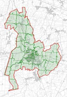
1 Cadastral Map Upgrading and Layers Harmonization for the Spatial Data Infrastructure in Friuli Venezia Giulia, Italy A. Beinat, F. Crosilla, E. Sossai M. Basso, R. Piuzzo 2 Summary - The cadastral mapping: an hub for spatial data connections - Problems related to the integration of the cadastral map in a large scale GIS - Reference system fragmentation - Map distortions - Approximated updating - Solutions developed for the spatial data infrastructure of the FVG Region - Fiducial Point network survey and adjustment - Cadastral map recomposition - Further developments 1

")

, distorted or unknown (")

; * The Italian cadastral map is mostly based on Cassini-Soldner")
2 Spatial Data Connection: the Key Role of the Cadastral Map 3 Hydrology Elevation Infrastructure Topography Networks Transportation + other Cadastre + Topography Real estate Land Register GIS screenshots courtesy of Comune di Tavagnacco (UD) Cadastre Urban plans Zoning + other Obstacles to the cadastral map integration in a l.s. GIS 4 Map metric defects incongruences Coordinate reference system fragmented ( historical reasons*), distorted or unknown ( digitization vectorization of original paper maps); Approximated or partial map updates; Map distortions and discontinuities ( technical reasons; age and deterioration of the original maps etc.); * The Italian cadastral map is mostly based on Cassini-Soldner (818 local and 32 wide CRS ), partly on Gauss-Boaga (few local CRS) 2
3 Background The cadastral mapping is owned and exclusively managed by the Agenzia del Territorio, the Italian Cadastre National Agency. Currently, the cadastral mapping fits the (internal) needs of the National Cadastre: a deep improvement therefore - is not urgent nor foreseen. But for many other e-government activities, particularly large scale GIS implementations at local level, the cadastral mapping is often inadequate due to its intrinsic characteristics and historical origins. These problems have to be solved at regional and local level, i.e. outside the cadastre. FVG Region initiatives 6 To integrate the cadastral map, GIS managers need to apply patches to their dbs. These solutions are often singular: not rigorous, not reproducible, difficult to maintain and to exchange ( different dbs are not interoperable). To achieve higher accuracy and interoperability for the Spatial Data Infrastructure of the public administration, the FVG Region signed in 2005 a three years agreement with the national Agenzia del Territorio to perform a general upgrade of the cadastral mapping: 1. Complete vectorisation and full updating of the cadastral raster maps; 2. Topographic re-adjustment of the whole regional fiducial network; 3. Cadastral map re-projection in Gauss-Boaga/Roma40 and UTM/ETRS89 CRS; Insiel Spa was charged of the cartographic activities with the scientific support of the University of Udine. 3

4 Topographic re-adjustment of the regional fiducial network Fixing the fiducial network: goals 8 The national network of the fiducial points (FP) was established in 1987, to guarantee a stable and reproducible point location in the cadastral reference frame. Most fiducial points coords. were estimated on the map and have poor accuracy. The cadastral norms ( Pregeo procedure), prescribe to locally constrain every updating topographic survey to the fiducial network, and to determine the mutual distances (no coords!) inside the fiducial polygon vertexes. A large amount of measures has been collected by AdT, that can be used to readjust and fix the FP coordinates. By fixing the FP network and inserting the Pregeo surveys in theory - a new and directly surveyed cadastral map could be obtained. Although incomplete in reality, this map can furnish correspondences and constraints to improve the geometrical precision of the current cartography (i.e. a frame on which to stretch the current cadastral mapping). 4
.")
![Legenda (90% 100%] PF Compensabili (70% 90%] PF Compensabili (50% 70%] PF Compensabili (0% 50%] PF Compensabili The FPs survey has been carried out by GPS + TS.](/docs-images/75/71839849/images/5-1.jpg "GPS: Postprocessed rapid static relative positioning, t session > 20 min, double base.")

5 Fixing the fiducial network: field surveys 9 An analysis (2004) proved > 90% FVG regional FP network was linked by Pregeo surveys. To successfully constrain and drive the fiducial point network adjustment, 10% of the regional FP were surveyed in the field (Of FP 3538 FP). Legenda (90% 100%] PF Compensabili (70% 90%] PF Compensabili (50% 70%] PF Compensabili (0% 50%] PF Compensabili The FPs survey has been carried out by GPS + TS. GPS: Postprocessed rapid static relative positioning, t session > 20 min, double base GPS vertices surveyed 722 FP in centre (20%) 2816 FP off centre (80%) Fixing the fiducial network: adjustment 10 The fiducial network adjustment was conceptually inspired to the photogrammetric block adjustment by independent models. A global iterative least squares similarity transformation to the various Pregeo fiducial polygons was applied. At each iteration the various fiducial polygons (A i ) are translated (t i ), rotated (T i ) and eventually scaled (c i ) to optimally fit all the other polygons (and the constraints) without anisotropic deformation. The procedure, derived from the Generalized Procrustes analysis, allows a robust estimate and the capability to model possible systematic effects by an isotropic scale factor. A1 A2 A3 m m T S = tr( ciaiti + jti ckaktk jtk) DiDk D j ( ciaiti + jti ckaktk jt k) = min i< k j= FP adjusted and fixed (87%) 5
6 Cadastral map re-projection in Gauss- Boaga/Roma40 and UTM/ETRS89 CRS Cadastral map recomposition: goals and strategies 12 Cadastral map recomposition aims to unify the cadastral reference system, to recover the original accuracy, and to restore the geometric continuity without gaps or overlaps between contiguous sheets. Among others researchers, UniUd developed two analytical solutions: - recomposition by sheets, for both raster and vector, performed by geometric transformations of the entire maps so to fit them in the cadastral datum and adapt each sheet with the others ( piecewise mosaicing); - recomposition by parcels, where the map sheet is first exploded in its elements (parcels and buildings), and then reassembled with further constraints and updates by means of a new adjustment of the individual geometric elements. The format, in this case is vector only ( tesserae mosaicing). For the upgrading of the cadastral map of the FVG Region, the adopted method was by sheets, because of the reduced timing and favourable cost-benefit analysis. The target was to achieve 1 2 meters agreement between the (1:2000) cadastral map and the (1:2000 equiv.) digital technical map of the FVG Region. 6


7 Cadastral map recomposition: piecewise approach The map recomposition refers again to the photogrammetric 2-d block adjustment by independent models, with some extensions. - The 2-d models are the map sheets. The block includes the sheets of a whole municipality. - Tie-points are corresponding points at the perimeter of two adjacent sheets; - Control points are map points matched to real world points (e.g. surveyed FP) or to other cartography The LS adjustment estimates the rigid, the similarity or the affine transformation parameters that simultaneously fit the various map sheets to each other and to the control network. x y T E v [ a b c d E N ] 0 0 x y 0 1 N x 0 0 = i v ki, ki, y ki, 13 Cadastral map recomposition: piecewise application The piecewise mosaicing method has been applied to align the cadastral map to the digital technical map of the FVG Region. The technical map provided the set of control points (correspondence points) for the LS piecewise adjustment. The technical map has a metrical quality higher than the cadastral map, but has different cartographic properties and contents. Hence, correspondence points between topography and cadastre have to be selected interactively, using GIS tools, while tie-points are extracted automatically. The cadastral map has been updated for all the 219 region municipalities, for a total of 9640 map sheets, on the basis of correspondence points and tie points. 7


8 15 Cadastral map recomposition: tools Control Points Selection File Foglio di CXF AUTOCAD Il programma suggerisce il es. CTRN Inserisco Dati suinuove posizione corrispondenze punti omologhi Foglio CTRN Seleziono Inserisco iil foglio punti CXF omologhi Aggiorno Registro la la trasformazione 16 Cadastral map recomposition: tools Tie Point Automatic Identification File di AUTOCAD vuoto Correspondences Importo Definisco Ricerca Importo il delle ilfoglio ilcontorno foglio corrispondenze di di riferimento di mobile ricerca 8


9 Cadastral map recomposition: results 17 Present activities 9


10 Cadastral map recomposition: piecewise general model A more general and rigorous method is under implementation. 1 step: The FP network is adjusted and the Pregeo surveys are automatically inserted into the fiducial frame; 2 step: Correspondences are directly set between the fiducial frame and the current sheets; control points are included; 3 step: LS block adj. is performed. Cadastral map recomposition: piecewise approach 20 Global adjustment 10


 or by a full remake of")
11 Further developments: cartographic continuum 21 Concluding The described interventions let the Region FVG to realign the cadastral map at 1-2 metre accuracy, sufficient for the interoperability and the needs of its large scale GIS. The solution is univocal and reproducible. It operates at local level, independently of the central db of AdT, and therefore it does not affect its content. Further accuracy can eventually be obtained by locally deforming the cadastral map ( law constraints, GIS limitations) or by a full remake of the cadastral map ( money, time). Thank-you 11
Reliability of the Italian cadastral system data quality and improvement prospects
 Reliability of the Italian cadastral system data quality and improvement prospects Eng. Franco MAGGIO (Central Director for Cadastral, Cartographic and Land Registration Services) Eng. Arturo ANGELINI
The Contribution of Forest Owners Associations for the Forest Cadastre Implementation. João Gaspar Ana Navarro Ferreira PORTUGAL
 The Contribution of Forest Owners Associations for the Forest Cadastre Implementation João Gaspar Ana Navarro Ferreira PORTUGAL Motivation Lack of forestry cadastre; Unify all FOAs databases with common
Aspect of preliminary activities in the function of supporting NSDI
 Sonja DIMOVA, Republic of Macedonia Key words: e-governance, geospatial data, NSDI, INSPIRE, metadata SUMMARY The successful establishment of the NSDI in the true sense of the word cannot be performed
Cadastral data, a case of role repositioning. Alberto Donis
 IL SISTEMA INFORMATIVO CATASTALE: UNA RISORSA PER LE POLITICHE DI GOVERNO DEL TERRITORIO II Sessione Il ruolo dell informazione catastale nel governo del territorio Cadastral data, a case of role repositioning
e-cadastre and Photo-Interpretation Technologies
 UNECE- WPLA EFFICIENT AND TRANSPARENT LAND MANAGEMENT IN ECE COUNTRIES 4 March 2010 - Baku, Azerbaijan e-cadastre and Photo-Interpretation Technologies The Italian experience as an example of Good Practice
Italian Cadastre and Real Estate Rights and Mortgages Registration System
 CLGE General Assembly Italian Cadastre and Real Estate Rights and Mortgages Registration System Franco Maggio Central Director Cartography, Cadastre and Real Estate Rights and Mortgages Registration System
The New Technology of a Survey Data Model and Cadastral Fabric as the Foundation for a Future Land Administration System.
 The New Technology of a Survey Data Model and Cadastral Fabric as the Foundation for a Future Land Ian HARPER, Australia Key words: cadastral modelling, survey data model, Survey Accuracy, Cadastre 2014
Problems and Solution Proposals in Integration of Cadastral Data into Geographical Information System (GIS) in Turkey
 in Turkey") Problems and Solution Proposals in Integration of Cadastral Data into Geographical Information System (GIS) in Turkey Gülgün OZKAN, S. Savas DURDURAN, Ali ERDI and Bilal GIRGIN, Turkey Key words: Cadastre,
Problems and Solution Proposals in Integration of Cadastral Data into Geographical Information System (GIS) in Turkey Gülgün OZKAN, S. Savas DURDURAN, Ali ERDI and Bilal GIRGIN, Turkey Key words: Cadastre,
Refinement of Cadastral Maps
 Acta Montanistica Slovaca Ročník 16(2011), číslo 4, 242-248 Refinement of Cadastral Maps Alena Berková 1 Making cadastral maps more precise The amended cadastral ordinance takes effect from 1.7. 2009.
Importance of a real estate cadastre as the basic, reference public register in the sustainable country development
 Importance of a real estate cadastre as the basic, reference public register in the sustainable country development Ludmiła PIETRZAK, POLAND Key words: cadastre, land and buildings register, public register,
Amalia Velasco Carlos Alonso Luis Virgos Fernando Serrano
 Inspire services of the Spanish Directorate General for Cadastre and its use to resolve an old problem of coordination between Spanish Cadastre and Land Registry. Amalia Velasco Carlos Alonso Luis Virgos
A Method For Building Legal Digital Cadastre Without Using Cadastral Measurements Field Book Data Is It Accurate Enough?
 A Method For Building Legal Digital Cadastre Without Using Cadastral Measurements Field Book Data Is It Jad JARROUSH, Dmitri BRICKMAN, Israel Key words: Digital Cadastre, Least Squares Cadastral Computations,
W B WEB E B S E S R E V R I V CE C S E S FO F R O R SU S R U V R E V Y E O Y R O S
 The Council of European Geodetic Surveyors Comité de Liaison des Géomètres Européens GEOWEB WEB SERVICES FOR SURVEYORS Hanover, Germany 10-14 October 2012 GEOWEB S.p.A. Geoweb S.p.A. was established in
Cadastre, innovation and tradition in taxation and real estate market
 Cadastre, innovation and tradition in taxation and real estate market relations and interactions in managing information on properties and owners elopmen Piermassimo Pavese Central Directorate for Cadastre,
GAUSSCAD A WEBGIS APPLICATION FOR COLLECTING CADASTRAL DATA
 M.M. Moise GaussCAD a WebGIS Application for Collecting Cadastral Data GAUSSCAD A WEBGIS APPLICATION FOR COLLECTING CADASTRAL DATA Mihai-Mircea MOISE, S.C. GAUSS S.R.L., mihai.moise@gauss.ro Abstract:
Establishing Efficient Cadastral Surveying Plan in Accordance with Introducing World Geodetic Reference System in Korea
 Modern Environmental Science and Engineering (ISSN 2333-2581) December 2015, Volume 1, No. 6, pp. 299-303 Doi: 10.15341/mese(2333-2581)/06.01.2015/003 Academic Star Publishing Company, 2015 www.academicstar.us
PROPOSAL FOR THE URBAN REAL ESTATE PROPERTY TAX MANAGEMENT DIAGNOSIS IN BRAZIL
 PROPOSAL FOR THE URBAN REAL ESTATE PROPERTY TAX MANAGEMENT DIAGNOSIS IN BRAZIL Marcos A. PELEGRINA and Lia BASTOS Maio de 2009 Geog. Marcos A.. Pelegrina, M.Engº 1 Geog. Marcos A.. Pelegrina, M.Engº 2
International funding projects in Republic Geodetic Authority
 International funding projects in Republic Geodetic Authority Serbia: Republic Geodetic Authority Workshop Exploring Funding Instruments for NMCA 7-8 November 2012 Republic Geodetic Authority Republic
Analytical Cadastre in Israel: Restoring Land Boundaries Based on Photogrammetric Tools
 Analytical Cadastre in Israel: Restoring Land Boundaries Based on Photogrammetric Tools Yohanan GAVISH and Prof. Yerach DOYTSHER, Israel Key words: analytical cadastre; photogrammetry; restoring land boundaries;
PROJECT INFORMATION DOCUMENT (PID) CONCEPT STAGE Report No.: AB3229 Project Name. Land Registry and Cadastre Modernization Project Region
 CONCEPT STAGE Report No.: AB3229 Project Name. Land Registry and Cadastre Modernization Project Region") PROJECT INFORMATION DOCUMENT (PID) CONCEPT STAGE Report No.: AB3229 Project Name Land Registry and Cadastre Modernization Project Region EUROPE AND CENTRAL ASIA Sector Central government administration
PROJECT INFORMATION DOCUMENT (PID) CONCEPT STAGE Report No.: AB3229 Project Name Land Registry and Cadastre Modernization Project Region EUROPE AND CENTRAL ASIA Sector Central government administration
LADM-based Crowdsourced 3D Cadastral Surveying Potential and Perspectives
 National Technical University Of Athens School of Rural and Surveying Engineering LADM-based Crowdsourced 3D Cadastral Surveying Potential and Perspectives Maria Gkeli, Surveying Engineer, PhD student
SCOPE OF PRESENTATION
 INTERNATIONAL SYMPOSIUM AND EXHIBITION ON GEOINFORMATION Global Trends: Geoinformation For The New Economy Studies Toward the Development of Implementation Plan Of Coordinated Cadastral System for Peninsular
Unified Land Administration for a Better Spatial Infrastructure
 Unified Land Administration for a Better Spatial Infrastructure Gyula IVÁN Institute of Geodesy, Cartography & Remote Sensing FÖMI (HUNGARY) Open Symposium 30th Korean Cadastral Seminar & FIG Commission
The Proposal of Cadastral Value Determination Based on Artificial Intelligence
 The Proposal of Cadastral Value Determination Based on Artificial Intelligence Jarosław BYDŁOSZ, Piotr CICHOCIŃSKI, Piotr PARZYCH, Poland Key words: neural network, artificial intelligence, cadastral value,
REGISTRATION OF PROPERTIES IN STRATA
 REGISTRATION OF PROPERTIES IN STRATA REPORT ON THE WORKING SESSIONS INTRODUCTION A cadastre is usually, and in most countries, a parcel-based, and up-to-date land information system containing records
CADASTRAL MAPS AND GIS FOR SUSTAINABLE ECONOMIC DEVELOPMENT OF KOSOVA
 1 Title: CADASTRAL MAPS AND GIS FOR SUSTAINABLE ECONOMIC DEVELOPMENT OF KOSOVA Name and surname: E-mail: Organization: Conference Theme: Prof. Dr. sc. Murat MEHA mmeha@yahoo.com Kosovo Cadastral Agency
The Boundary and the Effects of Cadastral Surveying in Cyprus
 The Boundary and the Effects of Cadastral Surveying in Cyprus Aristi Louca, Margarita Fani Surveyor Engineers, Cyprus Association of Rural and Surveying Engineers The History of Cyprus goes back 11000
The Digital Cadastral Database and the Role of the Private Licensed Surveyors in Denmark
 IRISH INSTITUTE OF SURVEYORS, DUBLIN INSTITUTE OF TECHNOLOGY, 23 NOVEMBER 2005 PUBLISHED IN IIS NEWS, WINTHER 2006. The Digital Cadastral Database and the Role of the Private Licensed Surveyors in Denmark
Land Tenure and Geospatial Data and Technology
 Land Tenure and Geospatial Data and Technology Ioana Bouvier E3/Land and Urban, USAID Senior Geospatial Analyst January 23, 2018 January 23, 2018 1 OUTLINE 1. Overview of geospatial data and technology
GIS & GPS Applications in Valuation/Appraisal Assessments
 GIS & GPS Applications in Valuation/Appraisal Assessments Simon ADCOCK, Australia Key words: GIS, GPS, mass assessments, 3-dimensional, modelling. SUMMARY The development of GIS and GPS systems has substantially
Presented by: Stewart Information International, Inc. Jack McKenna
 Presented by: Stewart Information International, Inc. Jack McKenna Held at the: 2007 ESRI Survey & Engineering GIS Summit San Diego Convention Center San Diego, California June 16-19, 2007 Integrating
A Geocoded Cadastral Fabric as a Precondition for a Sustainable Land Management System
 A Geocoded Fabric as a Precondition for a Sustainable Land Management System Gottfried KONECNY, Germany; J.P. LAUZON, Canada; Abdul Salam MOHAMMED, India Key words: SDI,, Parcel Boundaries, GPS-GNSS, Land
Quality Improvement to Cadastral Information in Sweden
 Gunnar BLIXT, Sweden Key words: digital cadastre, quality, cadastral index map, real property register. SUMMARY Lantmäteriet is a governmental agency which gives support for creating an efficient and sustainable
PREPARING SURVEY TENDER GIS DATABASE OUTCOMES
 PREPARING SURVEY TENDER SPECIFICATIONS FOR PROJECT GIS DATABASE OUTCOMES Presentation by Ian Harper GEODATA AUSTRALIA ESRI User Conference 2009 24 st July 2009 BACKGROUND GIS databases now provide a more
Our policy of providing clients a personal service has been rewarded by a wide and diverse client base with high-level repeat commissions.
 1.0 Introduction Datum Surveying Consultants has professional, technical resources, equipment, experience and training to undertake any type of Survey and Mapping project expediently. Since inception in
Experience in Innovative Technologies Application to Change Urban Space for Sustainable Territory Development
 IOP Conference Series: Materials Science and Engineering PAPER OPEN ACCESS Experience in Innovative Technologies Application to Change Urban Space for Sustainable Territory Development To cite this article:
Building a European Spatial Data Infrastructure: The Role of EuroGeographics
 Building a European Spatial Data Infrastructure: The Role of EuroGeographics Richard Kirwan President of EuroGeographics 1st Congress on Cadastre in the EU 1 Presentation overview EuroGeographics - the
LAND CADASTRE Today and Challanges for the future Damjan DOLER
 LAND CADASTRE Today and Challanges for the future Damjan DOLER Head of Real Estate Department Regional surveying office Celje Mariborska cesta 88, Celje, SLOVENIA 32nd Conference of Surveyin Authorities,
Theme II. Customers and Services NEW PROJECTS OF THE AGENZIA DEL TERRITORIO. Marco SELLERIE
 UNITED NATIONS ECONOMIC COMMISSION FOR EUROPE COMMITTEE ON HUMAN SETTLEMENTS WORKING PARTY ON LAND ADMINISTRATION Workshop "Customer - Co-operation - Services" Vienna, Austria 12-13 September 2002 Theme
Object Oriented Unified Real Estate Registry for a Good Spatial Data Management
 Object Oriented Unified Real Estate Registry for a Good Spatial Data Management Gyula IVÁN Gábor SZABÓ Zoltán WENINGER Institute of Geodesy, Cartography and Remote Sensing (FÖMI), Hungary Workshop on e-governance,
FIG Congress 2010 Facing the Challenges Building the Capacity Sydney, Australia, April
 Setting up the infrastructure for improving the development of Cadastre in Greece Dr. Dimitris ROKOS, Dr. Konstantinos KYRIAZIS and Dr. Panos LOLONIS KTIMATOLOGIO S.A. (Hellenic Cadastre) Source: wikipedia
Click to edit Master title style
 Click to edit Master title style Research and Development in Support of the Implementation of PRS92 Data Build-up up and Transformation of Cadastral Maps and Data from Different Local Plane Coordinate
Reporting Thailand Cadastral System in Cadastre 2014 Trends BY VUTTINAN UTESNAN. Rajamangala University of Technology Krungthep
 Reporting Thailand Cadastral System in Cadastre 2014 Trends BY VUTTINAN UTESNAN Rajamangala University of Technology Krungthep Faculty of Engineering, Bangkok, THAILAND Topics INTRODUCTION THAILAND CADASTRAL
Development of 3D Cadastre in Hungary
 Development of 3D Cadastre in Hungary András OSSKÓ Gyula IVÁN CLGE General Assembly 22 March 2013, Budapest, HUNGARY Content Introduction Problems in development of 3D cadastre and registration Hungarian
An Approach to Support Low Income Families Housing Needs in Developing Countries
 An Approach to Support Low Income Families Housing Needs in Developing Countries Tahsin YOMRALIOGLU and Recep NISANCI, Turkey Key words: Housing Policy, Land Readjustment, Nominal Asset Valuation. SUMMARY
Progress Report on Green Paper. Dr. Paddy Prendergast. on behalf of the. IIS Commission on Land Registration
 Progress Report on Green Paper By Dr. Paddy Prendergast on behalf of the IIS Commission on Land Registration Paddy Prendergast - Chair Brendan Sweeny - Hempenstall Surveys Paul Corrigan - P Corrigan Associates
Parcel Boundaries in the Czech Republic
 Parcel Boundaries in the Czech Republic CZECH REPUBLIC Jiri Rydval, Libor Tomandl Czech Office for Surveying, Mapping and Cadastre inhabitants - 10.3 million territory 78,865 km 2 2 Contents: 1. A parcel
A NOMINAL ASSET VALUE-BASED APPROACH FOR LAND READJUSTMENT AND ITS IMPLEMENTATION USING GEOGRAPHICAL INFORMATION SYSTEMS
 A NOMINAL ASSET VALUE-BASED APPROACH FOR LAND READJUSTMENT AND ITS IMPLEMENTATION USING GEOGRAPHICAL INFORMATION SYSTEMS by Tahsin YOMRALIOGLU B.Sc., M.Sc. A thesis submitted for the Degree of Doctor of
A Vision for a Fully Digital Cadastral Survey System
 A Vision for a Fully Digital Cadastral Survey System Anselm HAANEN, Trent GULLIVER, New Zealand Key words: cadastral survey system, digital cadastre, survey plans SUMMARY Surveyors have traditionally prepared
ParcelMap BC Compiling a Parcel Fabric for the Province of British Columbia. Presented by: Ellen Styner (General Manager) and Wendy Amy (GIS Manager)
 and Wendy Amy (GIS Manager)") ParcelMap BC Compiling a Parcel Fabric for the Province of British Columbia Presented by: Ellen Styner (General Manager) and Wendy Amy (GIS Manager) Who is MNC? MNC is a geomatics engineering firm with
ParcelMap BC Compiling a Parcel Fabric for the Province of British Columbia Presented by: Ellen Styner (General Manager) and Wendy Amy (GIS Manager) Who is MNC? MNC is a geomatics engineering firm with
Cube Land integration between land use and transportation
 Cube Land integration between land use and transportation T. Vorraa Director of International Operations, Citilabs Ltd., London, United Kingdom Abstract Cube Land is a member of the Cube transportation
Functional system for cadastral plans
 , Republic of Macedonia Key words: Cadastre, Digital plans, Data, System SUMMARY The analysis shows that the real estate market in Republic of Macedonia grows daily. With the expansion of this market increases
BULGARIAN CADASTRE A GUARANTEE FOR THE OWNERSHIP RIGHTS IN IMMOVABLE PROPERTIES
 4 TH INTERNATIONAL CONFERENCE RECENT PROBLEMS IN GEODESY AND RELATED FIELDS WITH INTERNATIONAL IMPORTANCE February 28 - March 2, 2007, Inter Expo Centre, Sofia, Bulgaria BULGARIAN CADASTRE A GUARANTEE
Cadastre 2020 a Vision for a Future Cadastral System in Poland
 Cadastre 2020 a Vision for a Future Cadastral System in Poland Wojciech Wilkowski, Marcin Karabin, Poland Key words: model of cadastre, cadastral system, land register SUMMARY The paper presents results
Role of spatial planning in modern society
 Republic of Croatia State Geodetic Administration The Role of Cadastre in the Development of Regional and Local Planning Structure in Croatia Zdravko Cesarec and Željko Bačić 1 Role of spatial planning
The Land Register System and the Process of Cartographical Numerical Cadastral Formation in the Province of Trento
 The Land Register System and the Process of Cartographical Numerical Cadastral Formation in the Province of Trento by Flavio MARGONARI, Italy Key words: catasto, catasto austriaco, libro fondiario, partita
TSO1C: Land Reforms. Commission 7
 TSO1C: Land Reforms. Commission 7 Development of & Implementation LIS. Building an effective Partnership to Reform Uganda s Land Administration (7320) Gasant Jacobs, Head: Business Development. Tax & Accounting
Introduction to Land Tenure Administration
 Introduction to Land Tenure Administration Karol Boudreaux Land Tenure & Resource Rights Practice Lead, The Cloudburst Group January 22, 2018 January 22, 2018 1 WHAT WE LL COVER Background and Definitions
Ordinance on Official Cadastral Surveying
 English is not an official language of the Swiss Confederation. This translation is provided for information purposes only and has no legal force. Ordinance on Official Cadastral Surveying 211.432.2 of
PROBLEMS IN REGISTRATION IN THE THIRD VERTICAL DIMENSION IN THE UNIFIED LAND REGISTRY IN HUNGARY, AND POSSIBLE SOLUTION
 3D Cadastres Technical and Legal Aspects II PROBLEMS IN REGISTRATION IN THE THIRD VERTICAL DIMENSION IN THE UNIFIED LAND REGISTRY IN HUNGARY, AND POSSIBLE SOLUTION ANDRÁS Osskó Budapest Land Office Hungary
Towards 3D Land Registry in Hungary
 Towards 3D Land Registry in Hungary Gyula IVÁN, András OSSKÓ, Hungary Keywords: Cadastre, Land Administration, Land Registry, 3D Cadastre, GIS SUMMARY New Act on Surveying and Mapping Activities, accepted
UTAH COUNCIL OF LAND SURVEYORS STANDARDS OF PRACTICE FOR BOUNDARY SURVEYS
 UTAH COUNCIL OF LAND SURVEYORS STANDARDS OF PRACTICE FOR BOUNDARY SURVEYS By the Utah Council of Land Surveyors Committee on Boundary Survey Standards Adopted by the Utah Council of Land Surveyors Executive
DIGITAL CADASTRAL MAP: A MULTIPURPOSE TOOL FOR SUSTAINABLE DEVELOPMENT
 DIGITAL CADASTRAL MAP: A MULTIPURPOSE TOOL FOR SUSTAINABLE DEVELOPMENT Moha ELAYACHI and Prof. El Hassane SEMLALI, Morocco Key words: cadastral information, digital cadastral map, design, implementation,
The Survey Data Model Technology A practical survey solution to generate all levels of spatial and e-governance outcomes.
 Land Governance in a Rapidly Changing Environment Annual World Bank Conference on Land and Poverty April 24 & 25, 2012 The Survey Data Model Technology A practical survey solution to generate all levels
The Challenge to Implement International Cadastral Models Case Finland 1
 The Challenge to Implement International Cadastral Models Case Finland 1 Tarja MYLLYMÄKI and Tarja PYKÄLÄ, Finland Key words: cadastre, modelling, LADM, INSPIRE SUMMARY Efforts are currently made to develop
Enhancements of the Cadastral System in Switzerland
 Enhancements of the Cadastral System in Switzerland «Cadastre of Public-Law Restrictions on Landownership» and «National Utility Cadastre» Christoph Käser Content 1. Cadastre of Public-Law Restrictions
250 CMR: BOARD OF REGISTRATION OF PROFESSIONAL ENGINEERS AND LAND SURVEYORS DRAFT FOR DISCUSSION PURPOSES ONLY
 250 CMR 6.00: LAND SURVEYING PROCEDURES AND STANDARDS Section 6.01: Elements Common to All Survey Works 6.02: Survey Works of Lines Affecting Property Rights All land surveying work is considered work
The Role of Geodesy in Modernization of Croatian Railways
 Igor POLJANAC, Rinaldo PAAR and Vlado CETL, Croatia Key words: railways, modernization, infrastructure, and geodesy. SUMMARY At the beginning of the 90-s in the last century the changes in the economic
Topographic Signs Important Context of 3D Cadastre
 STATE GEODETIC ADMINISTRATION Gruška 20,10 000 Zagreb, Croatia Delft University of Technology Faculty of Architecture and the Built Environment Department OTB GIS Technology Section Topographic Signs Important
The (Legal) Reliability of the Cadastre from the Perspective of the Czech Republic. Mgr. Martina Hercegová Ing. Karel Štencel
 Reliability of the Cadastre from the Perspective of the Czech Republic. Mgr. Martina Hercegová Ing. Karel Štencel") The (Legal) Reliability of the Cadastre from the Perspective of the Czech Republic Mgr. Martina Hercegová Ing. Karel Štencel PCC - Conference Vienna 20. 21. 11. 2018 Basic information about the CR Area:
The (Legal) Reliability of the Cadastre from the Perspective of the Czech Republic Mgr. Martina Hercegová Ing. Karel Štencel PCC - Conference Vienna 20. 21. 11. 2018 Basic information about the CR Area:
From Parcel to Global Cadastre: Challenges and Issues of the Post-Reform Quebec Cadastre. Elisabetta Genovese, Francis Roy
 From Parcel to Global Cadastre: Challenges and Issues of the Post-Reform Quebec Cadastre Elisabetta Genovese, Francis Roy Department of Geomatic Sciences, Laval University, Québec, Canada elisabetta.genovese@scg.ulaval.ca
CADASTRAL WORKS in TURKEY AND GDLRC (TKGM)
") CADASTRAL WORKS in TURKEY AND GDLRC (TKGM) NOVEMBER 2011 SOME NUMBERS ABOUT TURKEY Area :783.600 Km 2 Population : 747 millions (2008) Number of land parcels : 555 millions Villages and quarters : 52.437
CADASTRAL WORKS in TURKEY AND GDLRC (TKGM) NOVEMBER 2011 SOME NUMBERS ABOUT TURKEY Area :783.600 Km 2 Population : 747 millions (2008) Number of land parcels : 555 millions Villages and quarters : 52.437
Ministry of Mines, Industry and SME
 Republic of Senegal Ministry of Mines, Industry and SME User Conference 2010 08/02/2010 COPYRIGHT 2010. SPATIAL DIMENSION (PTY) LTD. A MINING CADASTRE IN SENEGAL: IMPLEMENTATION PROCESS AND ORGANIZATIONAL
Implementation of a New Survey Control Standard for New Zealand
 Nic DONNELLY and Matt AMOS, New Zealand Key words: Geodesy, Reference Systems, Datum Maintenance, Standards, Geodetic Networks SUMMARY In September 2009 Land Information New Zealand promulgated a new standard
Remarks on the land consolidation in the Czech Republic. Libor Cihal Central Land Office
 1 Remarks on the land consolidation in the Czech Republic Libor Cihal Central Land Office 1 Introduction The process of land consolidation is broadly effectuated in the Czech Republic. There is intensive
Ⅱ-2. The Resurvey Project
 Presenter : JANG, Bong-Bae MLTM Ministry of land,transport and Maritime Affairs KIM, Soon-Tae KCSC Korea Cadastral Survey Corp., JANG, Bong-Bae Ⅰ. INTRODUCTION The Korean modern cadastral system was established
CURRENT TREND IN GEOINFORMATION TECHNOLOGY INTRODUCTION
 CURRENT TREND IN GEOINFORMATION TECHNOLOGY STUDIES TOWARD THE DEVELOPMENT OF IMPLEMENTATION PLAN OF COORDINATED CADASTRAL SYSTEM FOR MALAYSIA Abd. Majid A. Kadir, Shahrum Ses, Ghazali Desa, Kamalludin
FIG-WB Forum on Land Administration
 FIG-WB Forum on Land Administration and Reform in Sub-Sahara Africa [Nigeria] [Peter O. Adeniyi] FIG WORKING WEEK, Abuja, NIGERIA 2013-6-10 MAY 2013 Statistic Country at a Glance Total population 162,470,737
CADASTRE 2014: New Challenges and Direction
 CADASTRE 2014: New Challenges and Direction Anna KRELLE and Abbas RAJABIFARD, Australia Key words: Cadastre, Cadastre 2014, Land Administration SUMMARY Land and land related activities form part of the
Hi-tech Survey Operation using Modern Technologies: Concept & Process Flow
 Hi-tech Survey Operation using Modern Technologies: Concept & Process Flow Presented by Sri Biswaranjan Rath Asst. Director,CLR Board of Revenue, Odisha Limitations of present system of surveying Survey
DIGITAL CADASTRAL DATABASES : THE AUSTRALIAN EXPERIENCE
 Proceedings of AGI 97 Conference, Birmingham, UK DIGITAL CADASTRAL DATABASES : THE AUSTRALIAN EXPERIENCE Wolfgang Effenberg Division of information Technology La Trobe University Email: w.effenberg@bendigo.latrobe.edu.au
Cadastral Parcels in the context of INSPIRE
 Cadastral Parcels in the context of INSPIRE Gyula IVÁN Institute of Geodesy, Cartography & Remote Sensing, HUNGARY Open Symposium on Environment and Land Administration Big Works for the Defence of Territory
Habitat Television Broadcast. Lorenzo Ciccarelli.
 Habitat Television Broadcast Lorenzo Ciccarelli STORIES_5 www.fondazionerenzopiano.org Involvement of the future users, responsiveness to the needs of the inhabitants and the innovative use of materials
Renovating Cadastral Map- An Indian Perspective
 Nirmalendu KUMAR, India Key words: land administration, quality model, renovation, harmonization SUMMARY The poor implementation of land administration in India has resulted in lot of court cases (Ravi
The cadastre of buildings' energy performance - The Case Study of the Regione Lombardia
 The cadastre of buildings' energy performance - The Case Study of the Regione Lombardia Massimiliano ROMAGNOLI, Italy Key words: Energy, Environment, Law, Building. SUMMARY As part of a series of national
Charter: Surveyor. Objectives and Standards
 Objectives and Standards 1. Survey Operations To provide survey services as requested by County Officials and Departments. a. To respond in a timely manner to the Planning & Development Committee's instructions
Fiscal Cadastral Reform and the Implementation of CAMA in Cape Town: financing transformation
 Fiscal Cadastral Reform and the Implementation of CAMA in Cape Town: financing transformation Jennifer WHITTAL, South Africa Mike BARRY, Canada Policies and Innovations Expert Group Meeting on Secure Land
Cadastral Re-Alignment: Water Corporation approach to spatial data shifting
 Cadastral Re-Alignment: Water Corporation approach to spatial data shifting David Bulfield, Team Leader Spatial Systems Team, Spatial Information Management, Water Corporation (Western Australia) Justin
Ownership Data in Cadastral Information System of Sofia (CIS Sofia) from the Available Cadastral Map
 from the Available Cadastral Map") Ownership Data in Cadastral Information System of Sofia (CIS Sofia) from the Available Cadastral Map Key words: ABSTRACT Lydmila LAZAROVA, Bulgaria CIS Sofia is created and maintained by GIS Sofia ltd,
Ownership Data in Cadastral Information System of Sofia (CIS Sofia) from the Available Cadastral Map Key words: ABSTRACT Lydmila LAZAROVA, Bulgaria CIS Sofia is created and maintained by GIS Sofia ltd,
General Instructions For Surveys and Plans Outside the Provincial Survey System
 May 15, 2018 General Instructions For Surveys and Plans Outside the Provincial Survey System NOTE: This document is a Controller of Surveys Policy manual to be used as a general guideline for the Legal
Map Modernization Modernization Program
 FEMA Map Modernization Program Presented to Maryland Association of Floodplain and Stormwater Managers October 27, 2005 Map Modernization Program Autorun.exe 2 Map Modernization Program Outline Map Mod
Test and Implementation of DATR System in Hungary
 Test and Implementation of DATR System in Hungary, Hungary Key words: unified land registry, cadastral map, Hungary SUMMARY During the last years there has been an important development in the Hungarian
EXPLORING OPTIONS FOR STANDARDISATION OF PROCESSES AND TRANSACTIONS IN LAND ADMINISTRATION
 EXPLORING OPTIONS FOR STANDARDISATION OF PROCESSES AND TRANSACTIONS IN LAND ADMINISTRATION CHRISTIAAN LEMMEN (1),(2), EVA-MARIA UNGER (2), PETER VAN OOSTEROM (3), MOHSEN KALANTARI (4) AND KEES DE ZEEUW
Information Quality - A Critical Success Factor How to make it all right!
 Information Quality - A Critical Success Factor How to make it all right! Anders Svensson, Sweden Key words: Cadastre, information quality, property information, property boundaries SUMMARY Sweden has
Introduction to ERDAS Imagine
 Course: Remote Sensing Basic Theory & Image Processing Methods 19-23 September 2011 Introduction to ERDAS Imagine Michiel Damen (damen@itc.nl) UNIVERSITY of TWENTE - Michiel Damen 1 Contents About ERDAS
Criteria for Appeals of Flood Insurance Rate Maps. November 30, 201 1
 Criteria for Appeals of Flood Insurance Rate Maps November 30, 201 1 This document outlines the criteria for appealing proposed changes in flood hazard information on Flood Insurance Rate Maps (FIRMS)
AREC responsibilities, data and registries and the way of their distribution
 Data as a basis of the digital society PCC, 13-15 March 2018, Sofia AREC responsibilities, data and registries and the way of their distribution Vlatko Dimovski Agency for Real Estate Cadastre (AREC) the
Cadastral survey - the best way of cadastre modernization Nikola VUČIĆ & Damir ŠANTEK, Croatia
 Presented at the FIG Congress 2018, May 6-11, 2018 in Istanbul, Turkey Cadastral survey - the best way of cadastre modernization Nikola VUČIĆ & Damir ŠANTEK, Croatia LAND ADMINISTRATION IN CROATIA Two
D DAVID PUBLISHING. Mass Valuation and the Implementation Necessity of GIS (Geographic Information System) in Albania
 in Albania") Journal of Civil Engineering and Architecture 9 (2015) 1506-1512 doi: 10.17265/1934-7359/2015.12.012 D DAVID PUBLISHING Mass Valuation and the Implementation Necessity of GIS (Geographic Elfrida Shehu
Journal of Civil Engineering and Architecture 9 (2015) 1506-1512 doi: 10.17265/1934-7359/2015.12.012 D DAVID PUBLISHING Mass Valuation and the Implementation Necessity of GIS (Geographic Elfrida Shehu
Bulgarian Housing. Status and Prospectives
 Bulgarian Housing. Status and Prospectives George Georgiev, PhD, Architect, Associate Professor Department of Architecture, New Bulgarian University E: gngeorgiev@nbu.bg W: www.nbu.bg Bulgaria brief Territory