Ministry of Mines, Industry and SME
|
|
|
- Suzanna Howard
- 6 years ago
- Views:
Transcription

1 Republic of Senegal Ministry of Mines, Industry and SME User Conference /02/2010 COPYRIGHT SPATIAL DIMENSION (PTY) LTD.

2 A MINING CADASTRE IN SENEGAL: IMPLEMENTATION PROCESS AND ORGANIZATIONAL ISSUES Ousmane CISSE Head of the Mineral Documentation & Mining Cadastre Centre
3 Content I. Background of the Project: How we worked before Legal & Regulatory Framework Overview of existing Institutions Statement of the Problem II. Implementation of Mining Cadastre CADMIN FLEXICADASTRE III. Conclusions: Strategic Issues to be considered in the development of Mining Cadastre
4 Background of the Project Legal & Regulatory Framework Mining Code: Law N of 23 November, 2003 Regulations (Decree) N of 17 May, 2004; Standard Mining Convention : reduction of transaction costs Mineral Laws & Regulations specify types of registers to be held up-to-date by the Mines Inspectorate. Register of new application Register of the granted titles Register of application related to the maintenance of the existing titles
5 Background of the Project Overview of existing Institutions Direction of Mines & Geology: management of the mining titles: Geology and Prospection Division: prospecting authorization & exploration permit; Minerals Economic Division: quarry exploitation authorization issuing and maintenance, exploitation permit and concessions; Regional Services: quarry exploitation application processes
6 Background of the Project Statement of the Problem Application processed manually Application processes: approximately 3 years year in 2004 to 2 up to 3 months in High transaction costs due to administrative procedures Coordinates proved to be incorrect Coordinates attached to various geographical reference systems (Geographic, UTM zone28, UTM zone30).
7 Implementation of Mining Cadastre Expected outcomes Implementation of Law and Regulations Reduce time to manage applications Guarantee transparency in granting mineral rights Ensure first come, first served is applied Manage obligations: fees, taxes, reports, etc. Guarantee full reviewing
8 Implementation of Mining Cadastre CADMIN Exhaustive inventory of the mining titles Graphic (mining perimeter) or alphanumeric (holder, substances ) information were collected, compiled and digitized Cross checking of several sources of information: Registers of the titles granted according to the type of title Excel tables compiling the various titles by area Data SIG under development for the prospecting permits Encoding of the data base Cadastral procedures were updated
9 Implementation of Mining Cadastre CADMIN Excel tables initially classified by area and type of titles were synthesized in a single table Titles numbered with a single identifier Before homogenizing the co-ordinates, the whole of perimeters was transcribed in a common geographical reference frame attached to a datum WGS84 The geographical coordinates: to be freed from the zones of projection UTM covering Senegal (zone 28 N and 29 N)
 Application")

10 CADMIN (Mining Titles Storage Room) Application Granted Title Renewals Incremental classification of the titles

11 CADMIN (Logical structure)

12 CADMIN (Mining Cadastre)

13 CADMIN Template


14 CADMIN Equipements Laser Printer Scanner Printer A0 Scanner Ethernet-Wifi PCs Serveur bi-processeur Server
 HR : GEOL&LAW (01) IT (1) GIS (2) DOC (1) New CDCM building Equipments Server PCs Plotter")
15 Implementation of Mining Cadastre Achievements Mineral Documentation & Mining Cadastre Centre (CDCM) HR : GEOL&LAW (01) IT (1) GIS (2) DOC (1) New CDCM building Equipments Server PCs Plotter Printers
16 CADMIN shortcoming Database Low performance Not facilitate administration: procedures exist but roles not assigned Recording of all existing licenses and all applications for licenses in registers and on maps not readily available for consultation Lack of historical data (e.g. payments, reports, etc.)
17 Implementation of Mining Cadastre FLEXICADASTRE: Implementation Path Business Trip at Dakar Review Mineral law and Regulations Identification of required business rules Manual workflow analysis Workflows modeled in FlexiCadastre Review existing data and systems Customisation of FlexiCadastre Hardware analysis
18 Implementation of Mining Cadastre FLEXICADASTRE Flexi training at Cape Town System roles with regard to Actions on Licenses Letter templates Workflows FlexiCadastre Demonstration Data Analysis and Import Methodology FlexiCadastre Customisation Flexi training at Dakar Customisation of reports and documents Training, documentation and support
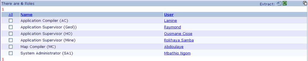
19 Roles

20 Implementation of Mining Cadastre
21 Implementation of Mining Cadastre Mining Cadastre Office not performing yet: Availability and accuracy of digital data Remote access to the FlexiCadastre Server: Network infrastructure at the Mining Cadastre Office & WAN connection to other offices Power supply and availability of a generator Mining cadastre business processes: all applications are still received at the Direction of Mines
22 Conclusions Strategic Issues to be considered in the development of Mining Cadastre: The security of mineral tenure issues and the transferability of mineral titles which carry an intrinsic economic value for investors are strongly related to and influenced by the procedures for the management of mining titles and cadastral systems. Mining presents a particular set of challenges in terms of land use. Therefore, understanding land tenure is central to strategies to establish mineral cadastre that promotes mining investments, environmental sustainability and equitable access to land;
23 Conclusions Strategic Issues to be considered in the development of Mining Cadastre: the availability of geo-scientific information, geographical location of surface and/or land ownership (access to land), and the quality of the mineral titles system become important requirements for mining investment decisions as well as key criteria for governments aiming at attracting and fostering investment and development in the national mineral resources
24 Q & A
IMPLEMENTATION OF FLEXICADASTRE IN ZAMBIA
 IMPLEMENTATION OF FLEXICADASTRE IN ZAMBIA Presented by: Simon M. Mwalimu Head of Mining Cadastre and Secretary of The Mining Advisory Committee Mining Cadastre Office-Zambia 16 th February 2009 Part A
PROJECT INFORMATION DOCUMENT (PID) CONCEPT STAGE Report No.: AB3229 Project Name. Land Registry and Cadastre Modernization Project Region
 CONCEPT STAGE Report No.: AB3229 Project Name. Land Registry and Cadastre Modernization Project Region") PROJECT INFORMATION DOCUMENT (PID) CONCEPT STAGE Report No.: AB3229 Project Name Land Registry and Cadastre Modernization Project Region EUROPE AND CENTRAL ASIA Sector Central government administration
PROJECT INFORMATION DOCUMENT (PID) CONCEPT STAGE Report No.: AB3229 Project Name Land Registry and Cadastre Modernization Project Region EUROPE AND CENTRAL ASIA Sector Central government administration
Land Administration and Spatial Enablement Victoria s Experience. Chris McRae, Executive Director Land Victoria
 Land Administration and Spatial Enablement Victoria s Experience Chris McRae, Executive Director Land Victoria 4 th UN Land Administration Forum, October 2011 Outline About Land Victoria Land Victoria
Support to Implementation of Multipurpose Cadastral Information system in Vietnam
 Support to Implementation of Multipurpose Cadastral Information system in Vietnam Lennart JOHANSSON and Per SÖRBOM, Sweden Key words: Land Registration, Land Information, Land Administration, SWOT analyse,
TSO1C: Land Reforms. Commission 7
 TSO1C: Land Reforms. Commission 7 Development of & Implementation LIS. Building an effective Partnership to Reform Uganda s Land Administration (7320) Gasant Jacobs, Head: Business Development. Tax & Accounting
Challenges for the multi purpose cadastre
 Jens RIECKEN, Markus SEIFERT, Germany Key words: Multi purpose cadastre, 3d-cadastre, land use, SDI, solar cadastre SUMMARY Over the past 30 years, with the progress of information technologies the development
D DAVID PUBLISHING. Mass Valuation and the Implementation Necessity of GIS (Geographic Information System) in Albania
 in Albania") Journal of Civil Engineering and Architecture 9 (2015) 1506-1512 doi: 10.17265/1934-7359/2015.12.012 D DAVID PUBLISHING Mass Valuation and the Implementation Necessity of GIS (Geographic Elfrida Shehu
Journal of Civil Engineering and Architecture 9 (2015) 1506-1512 doi: 10.17265/1934-7359/2015.12.012 D DAVID PUBLISHING Mass Valuation and the Implementation Necessity of GIS (Geographic Elfrida Shehu
Egyptian Nationwide Title Cadastre System
 Kholoud SAAD, Egypt Key words: Cadastre, Registration, Urban, Rural, National Cadastre, Automation, reengineering. SUMMARY With growing need for integrated information, Enterprise Solutions has become
Quality Improvement of the Real Estate Cadastre in Serbia
 , Serbia Key words: quality improvement, real estate information, quality assurance, Serbia SUMMARY The concept of cadastral modernization in the Republic of Serbia was defined in 1992, and it is being
STATE LAND AUDIT REPORT
 STATE LAND AUDIT REPORT 1 Presentation to the Portfolio Committee on Rural Development and Land Reform M514 Marks Building 30 March 2011 CHIEF SURVEYOR GENERAL Mr M RIBA Content 2 Background Project Objectives
LIS a motivation for SDI initiative
 Eric Mwaikambo Ardhi University Dar es Salaam Tanzania Overview Status of LIS in Tanzania Relationship between SDI and LIS Spatial Standards LIS a motivation for SDI initiative Conclusion & Recommendations
Scheme of Service. for. Housing Officers
 REPUBLIC OF KENYA Scheme of Service for Housing Officers APPROVED BY THE PUBLIC SERVICE COMMISSION AND ISSUED BY THE PERMANENT SECRETARY MINISTRY OF STATE FOR PUBLIC SERVICE OFFICE OF THE PRIME MINISTER
In Conversation with Charles Young Bringing Government Cadastres Online
 In Conversation with Charles Young Bringing Government Cadastres Online Spatial Dimension Background Founded in 1999 with 4 staff Currently 50 staff (business analysts, programmers, database specialists,
International funding projects in Republic Geodetic Authority
 International funding projects in Republic Geodetic Authority Serbia: Republic Geodetic Authority Workshop Exploring Funding Instruments for NMCA 7-8 November 2012 Republic Geodetic Authority Republic
TRANSPARENCY INTERNATIONAL SIERRA LEONE MINING PERMIT, LICENSE AND CONTRACT AWARD STAKEHOLDER ANALYSIS
 TRANSPARENCY INTERNATIONAL SIERRA LEONE MINING PERMIT, LICENSE AND CONTRACT AWARD ANALYSIS BACKGROUND For the success of the Mining for development Program both at national and international levels, it
Presented by: Stewart Information International, Inc. Jack McKenna
 Presented by: Stewart Information International, Inc. Jack McKenna Held at the: 2007 ESRI Survey & Engineering GIS Summit San Diego Convention Center San Diego, California June 16-19, 2007 Integrating
BY THE GRACE OF GOD ALMIGHTY MINISTER OF ENERGY AND MINERAL RESOURCES
 DEPARTMENT OF ENERGY AND MINERAL RESOURCES REPUBLIC OF INDONESIA REGULATION OF MINISTER OF ENERGY AND MINERAL RESOURCES NUMBER 02 YEAR 2009 CONCERNING GUIDANCE IN THE ASSIGNMENT OF GEOTHERMAL PRELIMINARY
e-land Administration in Hungary
 e-land Administration in Hungary Piroska Zalaba senior counsellor, project manager Ministry of Agriculture and Rural Development Department of Lands and Mapping FIG SEMINAR Innsbruck, 2-4 June 2004 Land
Mineral Resources Authority (MRA) FlexiCadastre Papua New Guinea
 FlexiCadastre Papua New Guinea") Mineral Resources Authority (MRA) FlexiCadastre Papua New Guinea Louie Kawale Mining Management System Administrator Margaret Aulda Senior Technical Assessment Officer Nancy Wafiwa Assessment Geologist
Mineral Resources Authority (MRA) FlexiCadastre Papua New Guinea Louie Kawale Mining Management System Administrator Margaret Aulda Senior Technical Assessment Officer Nancy Wafiwa Assessment Geologist
LRIMS Cadastre Module
 LRIMS Cadastre Module User Requirements and Functionality (Seychelles Case Study) John Latham, NRL Renato Cumani, NRL Luigi Simeone, NRL Summary Background User Requirements Business Model Application
University of Nairobi LAND INFORMATION SYSTEM FOR LAND MANAGEMENT IN KENYA. CASE STUDY: NAIROBI COUNTY, BURUBURU PHASE I ESTATE
 University of Nairobi LAND INFORMATION SYSTEM FOR LAND MANAGEMENT IN KENYA. CASE STUDY: NAIROBI COUNTY, BURUBURU PHASE I ESTATE BY Justus Amdavi F56/69371/2013 Supervisor: Mr Jasper Mwenda CONTENTS Introduction
FGDC Cadastral Data Subcommittee. December 2008
 FGDC Cadastral Data Subcommittee Annotated Bibliography: Foundational Documents for Building a Cadastral National Prepared by David Stage and Nancy von Meyer for the FGDC Cadastral Data Subcommittee Annotated
Papua New Guinea - FlexiCadastre Implementation
 Papua New Guinea - FlexiCadastre Implementation Outline 1. Papua New Guinea s Mineral Tenement System: -, Gretel Orake, Manager, Technical Assessment, Regulatory Operations Division 2. Introduction of
Land Information System as new instrument for Land Administration: Case Examples. Mike Cheremshynskyi Consultant, Land Administration Expert
 Land Information System as new instrument for Land Administration: Case Examples Mike Cheremshynskyi Consultant, Land Administration Expert Background Growth of population and fast urbanization in many
Cadastre in Addis Ababa. Status and future development
 Status and future development Dr.-Ing. Paul Hartfiel Mülheim, 1. Oct. 2010-1 - Addis Ababa Capital of Ethiopia Area population 540 km² > 3,200,000 (rapidly growing) 2,300,000 in 1994 > 22% of all urban
The Contribution of Forest Owners Associations for the Forest Cadastre Implementation. João Gaspar Ana Navarro Ferreira PORTUGAL
 The Contribution of Forest Owners Associations for the Forest Cadastre Implementation João Gaspar Ana Navarro Ferreira PORTUGAL Motivation Lack of forestry cadastre; Unify all FOAs databases with common
Participants of the Ministerial Meeting on Housing and Land Management on 8 October 2013 in Geneva
 Summary At its meeting on 2 April 2012, the Bureau of the Committee on Housing and Land Management of the United Nations Economic Commission for Europe agreed on the need for a Strategy for Sustainable
National Land Cadastre in Mozambique SiGIT as a lever to success
 in Mozambique SiGIT as a lever to success Marisa Balas EXI Lda MOZAMBIQUE Mozambique is located on the south eastern part of the African Continent Territory > than 800 000 km 2 in 11 provinces Population
Intangible Assets Web Site Costs
 SIC Interpretation 32 Intangible Assets Web Site Costs In March 2002 the International Accounting Standards Board issued SIC-32 Intangible Assets Web Site Costs, which had originally been developed by
The Survey Data Model Technology A practical survey solution to generate all levels of spatial and e-governance outcomes.
 Land Governance in a Rapidly Changing Environment Annual World Bank Conference on Land and Poverty April 24 & 25, 2012 The Survey Data Model Technology A practical survey solution to generate all levels
New Developments in the Hellenic Cadastre
 New Developments in the Hellenic Cadastre Prof. M. Kavouras Vice-president Ktimatologio S.A. (Hellenic Cadastre) The Hellenic Cadastre Background The Hellenic National Cadastre Organizational and institutional
Developing Infrastructure Framework To Facilitate The Malaysia Multipurpose 3D Cadastre
 Developing Infrastructure Framework To Facilitate The Malaysia Multipurpose 3D Cadastre Sr Dr. Tan Liat Choon Sr Looi Kam Seng University of Technology Malaysia Department of Survey and mapping Malaysia
LAW OF MONGOLIA ON MINERALS (REVISED) July 8, CHAPTER ONE General provisions
 July 8, CHAPTER ONE General provisions") LAW OF MONGOLIA ON MINERALS (REVISED) State Palace. Ulaanbaatar city July 8, 2006 CHAPTER ONE General provisions Article 1. Purpose of the Law 1.1. The purpose of this Law is to regulate the relations
LAW OF MONGOLIA ON MINERALS (REVISED) State Palace. Ulaanbaatar city July 8, 2006 CHAPTER ONE General provisions Article 1. Purpose of the Law 1.1. The purpose of this Law is to regulate the relations
TERMS OF REFERENCE FOR CONSULTANCY SERVICES TO PREPARE PROJECT DOCUMENT FOR CADASTRAL MAPPING IN THE GAMBIA
 Ministry of Lands and Regional Government United Nations Development Program UNDP April 2017 TERMS OF REFERENCE FOR CONSULTANCY SERVICES TO PREPARE PROJECT DOCUMENT FOR CADASTRAL MAPPING IN THE GAMBIA
Agenda. Introduction to participants First Meeting UN-GGIM - GROUP OF EXPERTS ON LAND ADMINISTRATION AND MANAGEMENT UN-GE-LAM
 First Meeting UN-GGIM - GROUP OF EXPERTS ON LAND ADMINISTRATION AND MANAGEMENT Kees de Zeeuw, The Netherlands Chair Mahashe Chaka, Lesotho Co-Chair Brent Jones, ESRI (USA) -Rapporteur Agenda Opening Introduction
Geoinformation Technologies in Land Management and Beyond: Case of Georgia
 Geoinformation Technologies in Land Management and Beyond: Case of Georgia Joseph SALUKVADZE Professor, Department of Human Geography, Co-team Leader, Cadastre and Land Register Project, Co-financed by
ABSTRACT Land Administration System in Lithuania
 ABSTRACT Land Administration System in Lithuania 1. General introduction to the Lithuanian Land Administration System and State Enterprise Centre of Registers ( shortly SECR) Lithuania has established
National Spatial Data Infrastructure development in Republic of Macedonia
 National Spatial Data Infrastructure development in Republic of Macedonia Sonja Dimova, state advisor for geomatics AGENCY FOR REAL ESTATE CADASTRE September 6-th, 2017, Strasbourg AREC competence for
Functional system for cadastral plans
 , Republic of Macedonia Key words: Cadastre, Digital plans, Data, System SUMMARY The analysis shows that the real estate market in Republic of Macedonia grows daily. With the expansion of this market increases
Ownership Data in Cadastral Information System of Sofia (CIS Sofia) from the Available Cadastral Map
 from the Available Cadastral Map") Ownership Data in Cadastral Information System of Sofia (CIS Sofia) from the Available Cadastral Map Key words: ABSTRACT Lydmila LAZAROVA, Bulgaria CIS Sofia is created and maintained by GIS Sofia ltd,
Ownership Data in Cadastral Information System of Sofia (CIS Sofia) from the Available Cadastral Map Key words: ABSTRACT Lydmila LAZAROVA, Bulgaria CIS Sofia is created and maintained by GIS Sofia ltd,
A CADASTRAL GEODATA BASE FOR LAND ADMINISTRATION USING ARCGIS CADASTRAL FABRIC MODEL A CASE STUDY OF UWANI ENUGU, ENUGU STATE, NIGERIA
 A CADASTRAL GEODATA BASE FOR LAND ADMINISTRATION USING ARCGIS CADASTRAL FABRIC MODEL A CASE STUDY OF UWANI ENUGU, ENUGU STATE, NIGERIA BY Ndukwu, Raphael. Ike Department of Geoinformatics & Surveying University
The Multipurpose Marine Cadastre A Tool for Planning & Decision Making in the Marine Environment
 The Multipurpose Marine Cadastre A Tool for Planning & Decision Making in the Marine Environment Christine Taylor Minerals Management Service (MMS) Brian Smith NOAA Coastal Services Center Maurice Hill
ASSESSMENT OF STATE AGENCIES WITH RESPONSIBILITIES FOR LANDS AND OTHER REAL PROPERTIES
 ASSESSMENT OF STATE AGENCIES WITH RESPONSIBILITIES FOR LANDS AND OTHER REAL PROPERTIES LAND ADMINISTRATION DIVISION MINISTRY OF AGRICULTURE, LAND AND MARINE RESOURCES Prepared for LAND USE POLICY AND ADMINISTRATION
DEVELOPMENT OF A STUDY OF IMPLEMENTATION OF THE CADASTRE OF BUILDINGS IN THE REPUBLIC OF CROATIA
 REPUBLIC OF CROATIA Ministry of Construction and Physical Planning State Geodetic Administration Gruška 20, 10000 ZAGREB, CROATIA Phone: +385-1-6165-404 Fax: +385-1-6165-484 Terms of Reference DEVELOPMENT
TAKARNET intranet for the land administration
 Paper presented at the FIG Commission 3 Annual Meeting and Seminar Budapest, Hungary, 1999 TAKARNET intranet for the land administration Piroska Zalaba Ministry of Agriculture and Regional Development
Centre for SDIs and Land Administration Department of Geomatics Spatial systems to support sustainable development
 Centre for SDIs and Land Administration Department of Geomatics MODERN CADASTER and LAND ADMINISTRATION تهران-مرداد 1386 2014 ..... 2 ماه Centre for SDIs and Land Administration Department of Geomatics
Qualification Snapshot CIH Level 3 Certificate in Housing Services (QCF)
") Qualification Snapshot CIH Certificate in Housing Services (QCF) The Chartered Institute of Housing (CIH) is an awarding organisation for national qualifications at levels 2, 3 and 4. CIH is the leading
Qualification Snapshot CIH Certificate in Housing Services (QCF) The Chartered Institute of Housing (CIH) is an awarding organisation for national qualifications at levels 2, 3 and 4. CIH is the leading
Integrated Safeguards Data Sheet (Initial)
") Public Disclosure Authorized Public Disclosure Authorized Public Disclosure Authorized Public Disclosure Authorized Integrated Safeguards Data Sheet (Initial) Section I - Basic Information Date Prepared/Updated:
Public Disclosure Authorized Public Disclosure Authorized Public Disclosure Authorized Public Disclosure Authorized Integrated Safeguards Data Sheet (Initial) Section I - Basic Information Date Prepared/Updated:
Aspect of preliminary activities in the function of supporting NSDI
 Sonja DIMOVA, Republic of Macedonia Key words: e-governance, geospatial data, NSDI, INSPIRE, metadata SUMMARY The successful establishment of the NSDI in the true sense of the word cannot be performed
BULGARIAN CADASTRE A GUARANTEE FOR THE OWNERSHIP RIGHTS IN IMMOVABLE PROPERTIES
 4 TH INTERNATIONAL CONFERENCE RECENT PROBLEMS IN GEODESY AND RELATED FIELDS WITH INTERNATIONAL IMPORTANCE February 28 - March 2, 2007, Inter Expo Centre, Sofia, Bulgaria BULGARIAN CADASTRE A GUARANTEE
Designing for transparency and participation in the Hellenic Cadastral Project
 Designing for transparency and participation in the Hellenic Cadastral Project Dr. Dimitris Rokos Director of Planning and Investments, Hellenic National Cadastre and Mapping Agency S.A. Table of Contents
Iranian Cadastre System. Nasrollah Jahangard Iran s Deeds and Properties Registration Organization I.R. of Iran 14 th PCGIAP, KL, Malaysia 2008
 Iranian Cadastre System Nasrollah Jahangard Iran s Deeds and Properties Registration Organization I.R. of Iran 14 th PCGIAP, KL, Malaysia 2008 General Information Europe Middle East Asia Africa Middle
Cadastral Framework Standards
 Cadastral Framework Standards The goal of the Data Standards and Recommendations Committee is to provide recommendations and guidelines to Indiana GIS user communities to facilitate the collection, maintenance
A Geocoded Cadastral Fabric as a Precondition for a Sustainable Land Management System
 A Geocoded Fabric as a Precondition for a Sustainable Land Management System Gottfried KONECNY, Germany; J.P. LAUZON, Canada; Abdul Salam MOHAMMED, India Key words: SDI,, Parcel Boundaries, GPS-GNSS, Land
LAND REGISTRATION SYSTEM OF THE REPUBLIC OF CROATIA
 "On the last day of the Creation God desired to crown His work, and thus created Kornati Islands out of tears, stars and breath." (George Bernard Shaw) LAND REGISTRATION SYSTEM OF THE REPUBLIC OF CROATIA
Standard Summary Project Fiche
 Standard Summary Project Fiche Project Number: SR9906.04 Title: Economic reform Sub-Programme: Policy Strengthening of the Geodesy, Cartography and Cadastre Authority of the Slovak Republic and implementation
Urban Management Land Information System UMLIS: Facing Urban Challenges through Efficient Revenue Collection
 Urban Management Land Information System UMLIS: Facing Urban Challenges through Efficient Revenue Collection Kofi YEBOAH, Ghana and Linda JOHANSSON, Sweden Key words: property taxation, local governance,
Public Lands Formal Disposition Application Process
 February 16, 2018 List of Documents and Webpages To access the AEP documents referenced in this schedule, search one of the following document titles at aep.alberta.ca Associated Dispositions, Access Roads
Croatian SDI: a Tool for Accelerated Development of the Geo-Conscious Society
 STATE GEODETIC ADMINISTRATION Croatian SDI: a Tool for Accelerated Development of the Geo-Conscious Society Prof.Dr.Sc. Željko Bačić, Mr.Sc. Ljerka Rašić FIG Working Week 2009 - Surveyors Key Role in Accelerated
ISSUES OF EFFICIENCY IN PUBLIC REAL ESTATE RESOURCES MANAGEMENT
 Alina Zrobek-Rozanska (MSC) Prof. Ryszard Zrobek University of Warmia and Mazury in Olsztyn, Poland rzrobek@uwm.edu.pl alina.zrobek@uwm.edu.pl ISSUES OF EFFICIENCY IN PUBLIC REAL ESTATE RESOURCES MANAGEMENT
Report and update from Working Group A on Core Data
 JOINT UN-GGIM: EUROPE ESS MEETING ON THE INTEGRATION OF STATISTICAL AND GEOSPATIAL INFORMATION LUXEMBOURG 31 MARCH 2017 Report and update from Working Group A on Core Data François Chirié, Dominique Laurent,
MASS REGISTRATION OF LAND PARCELS USING FIT-FOR-PURPOSE LAND ADMINISTRATION: PROCEDURES AND METHODS
 MASS REGISTRATION OF LAND PARCELS USING FIT-FOR-PURPOSE LAND ADMINISTRATION: PROCEDURES AND METHODS TAREK ZEIN Hansa Luftbild AG, Germany zein@hansaluftbild.de Paper prepared for presentation at the 2017
Developing a Performance Review Questionnaire for Hong Kong Cadastral Survey System
 Developing a Performance Review Questionnaire for Hong Kong Cadastral Survey System Haodong ZHANG and Conrad TANG, Hong Kong SAR, CHINA Key words: Fit-for-Purpose, Cadastral Surveying, Land Administration,
DOING BUSINESS Frederic Meunier EDBI Conference, Nairobi
 DOING BUSINESS 2016 Frederic Meunier EDBI Conference, Nairobi May 3 rd, 2016 How has the Registering Property indicator changed over time? Efficiency of land administration systems has always been measured:
Seventh Session of the United Nations Committee of Experts on Global Geospatial Information Management
 Report of the Forum P a g e 1 Seventh Session of the United Nations Committee of Experts on Global Geospatial Information Management Report of the Forum Secure Land Rights and Smart Cities - Making It
WPLA WORKSHOP Cadastral and real estate registration systems: Economic information for real estate markets in the UNECE region. Rome, 5-6 May 2011
 WPLA WORKSHOP Cadastral and real estate registration systems: Economic information for real estate markets in the UNECE region Rome, 5-6 May 2011 Marco Selleri Regional Director for Sicily 1 The Hadrian
STATUS REPORT
 Working Group 3 Land Administration STATUS REPORT 2006-2009 2009 Prof Ian Williamson (Chair) Mr Ahmad Fauzi Nordin (Vice Chair) Assoc. Prof Abbas Rajabifard (Vice Chair) 18th UNRCC-AP Conference Bangkok
1. *Does the document clearly specify the aims, objectives and scope of the proposed programme of archaeological work?
 Notes and Guidance This document provides curatorial advisors, archaeological practitioners and other interested parties with additional information and guidance on the standards and expectations for archaeological
IFRS 15 and IFRS 16 Webinar
 CPA Ireland Skillnet CPA Ireland Skillnet, is a training network that is funded by Skillnets, a state funded, enterprise led support body dedicated to the promotion and facilitation of training and up-skilling
COMPUTERIZED SYSTEM SUPPORTING DEVELOPMENT OF LAND MARKET IN GEORGIA
 COMPUTERIZED SYSTEM SUPPORTING DEVELOPMENT OF LAND MARKET IN GEORGIA S. G. TSIRAMUA, I. S. MELASHVILI Land Registration Unit of Government of Georgian, World Bank and IFAD Agriculture Development Project.
Cadastre: definitions
 Introduction New vision towards a multipurpose cadastral system to support land management in Morocco Moha EL-AYACHI, El Hassane SEMLALI, Mohamed ETTARID, Driss TAHIRI, Institut Agronomique et Vétérinaire
PROPERTY ASSESSMENT KNOWLEDGE
 A P E N DE UM NOUN A COLLECTION OF CONCISE BUT DETAILED INFORMATION ABOUT APPRAISAL AND APPRAISAL MANAGEMENT, ESPECIALLY IN THE PROPERTY ASSESSMENT INDUSTRY. PROPERTY ASSESSMENT KNOWLEDGE KNOWLEDGE AREAS
Land Management Procedures and Informal Constructions in Cyprus. Marilena Theodorou, Land Surveyor, Cyprus, Dr Chryssy Potsiou, Lecturer NTUA, Greece
 Land Management Procedures and Informal Constructions in Cyprus Marilena Theodorou, Land Surveyor, Cyprus, Dr Chryssy Potsiou, Lecturer NTUA, Greece FIG Working Week 2008 Integrating Generations Objectives
The principal tasks or competencies of the General Directorate of Cadastre are:
 4th Quality Conference 1/7 1) Title of the case. Spanish e Cadastre ( Virtual Office of Cadastre, or OVC). An open space for sustainable quality in cadastral data, working with land management administrations.
LAUNCH OF CADASTRAL TEMPLATE 2.0
 LAUNCH OF CADASTRAL TEMPLATE 2.0 Dr. Daniel Steudler Scientific Associate, swisstopo Prof. Abbas Rajabifard Director Centre for SDIs and Land Administration, Melbourne University FIG-Commission 7, Annual
PAPER ON THE MANAGEMENT OF SUSTAINABLE DELIVERY OF SECURED PROPERTY RIGHTS THROUGH EMPOWERNMENT AND CAPACITY BUILDING OF LOCAL GOVERNMENT AUTHORITIES
 PAPER ON THE MANAGEMENT OF SUSTAINABLE DELIVERY OF SECURED PROPERTY RIGHTS THROUGH EMPOWERNMENT AND CAPACITY BUILDING OF LOCAL GOVERNMENT AUTHORITIES PRESENTED AT: THE UNITED NATIONS AWARD PROGRAM HELD
What does Social Housing
 What does Social Housing Reform mean for Practitioners? Jennie Donald, Deputy Chief Executive, NIFHA Background 2011 Review of NI Housing Executive by PwC & mature conversation 2013 Social Housing Reform
Reporting Thailand Cadastral System in Cadastre 2014 Trends BY VUTTINAN UTESNAN. Rajamangala University of Technology Krungthep
 Reporting Thailand Cadastral System in Cadastre 2014 Trends BY VUTTINAN UTESNAN Rajamangala University of Technology Krungthep Faculty of Engineering, Bangkok, THAILAND Topics INTRODUCTION THAILAND CADASTRAL
NATIONAL PLANNING AUTHORITY. The Role of Surveyors in Achieving Uganda Vision 2040
 NATIONAL PLANNING AUTHORITY The Role of Surveyors in Achieving Uganda Vision 2040 Key Note Address By Dr. Joseph Muvawala Executive Director National Planning Authority At the Annual General Meeting and
COUNTRY REPORT ON CADASTRE AND LAND REGISTRAION IN IRAN. By: Hamid Berenjkar, IRAN
 COUNTRY REPORT ON CADASTRE AND LAND REGISTRAION IN IRAN By: Hamid Berenjkar, IRAN Key words: Comprehensive Cadastre, Cadastre System, Cadastral Survey, Land Book, Iran ABSTRACT Land registration and cadastral
Abandonment and Reclamation Policy for Inuit Owned Lands Qikiqtani Inuit Association - (Version 2.0)
") Abandonment and Reclamation Policy for Inuit Owned Lands Qikiqtani Inuit Association - (Version 2.0) 1.0 Introduction Article 19 of the Nunavut Land Claims Agreement establishes private ownership of selected
Abandonment and Reclamation Policy for Inuit Owned Lands Qikiqtani Inuit Association - (Version 2.0) 1.0 Introduction Article 19 of the Nunavut Land Claims Agreement establishes private ownership of selected
Spatial Data Infrastructure in Sweden
 Spatial Data Infrastructure in Sweden Hans-Erik WIBERG, Sweden Key words: ABSTRACT Sweden was one of the first countries to address Data Infrastructure matters and have during several decades developed
Barbados. Land. Governance. Assessment A N A L Y S I S
 Barbados Land Governance Assessment A N A L Y S I S Methodology - Activities Strengths widest participation across all spheres of land discipline. Through coverage of land administration and management.
Post-Apartheid Cities in Transformation for Social Justice and Sustainability
 Post-Apartheid Cities in Transformation for Social Justice and Sustainability Simphiwe E Mini (PhD) College of Agriculture and Environmental Sciences Department of Geography University of South Africa(UNISA)
Commission 7, Land Administration and IT. Paul van der Molen INTERNATIONAL INSTITUTE FOR GEO-INFORMATION SCIENCE AND EARTH OBSERVATION
 Commission 7, Land Administration and IT Paul van der Molen INTERNATIONAL INSTITUTE FOR GEO-INFORMATION SCIENCE AND EARTH OBSERVATION FIG Commission 7 on cadastre and land management Study Visits (e.g.
GLOBAL GEOSPATIAL MANAGEMENT INFORMATION
 GLOBAL GEOSPATIAL MANAGEMENT INFORMATION SEOUL, KOREA 24 th to 26 th October 2011 COUNTRY REPORT - REPUBLIC OF BOTSWANA 1. INTRODUCTION 1.1. SOCIAL, ECONOMIC AND POLITICAL BACKGROUND Botswana attained
The Continuous Cadastral Mapping Plan the Computerized Digital File of Cadastral Map in Korea - Focusing on the Accurative Continuous Cadastral Map -
 The Continuous Cadastral Mapping Plan the Computerized Digital File of Cadastral Map in Korea - Focusing on the Accurative Continuous Cadastral Map - KO Jeongseok, PARK Sungseok, SHIN Donghyun, Republic
PROCESSES IN CADASTRE: PROCESS MODEL FOR SERBIAN 3D CADASTRE
 UNIVERSITY IN NOVI SAD, SERBIA FACULTY OF TECHNICAL SCIENCES PROCESSES IN CADASTRE: PROCESS MODEL FOR SERBIAN 3D CADASTRE Dubravka SLADIĆ, Aleksandra RADULOVIĆ and Miro GOVEDARICA 6th International FIG
LAND CADASTRE Today and Challanges for the future Damjan DOLER
 LAND CADASTRE Today and Challanges for the future Damjan DOLER Head of Real Estate Department Regional surveying office Celje Mariborska cesta 88, Celje, SLOVENIA 32nd Conference of Surveyin Authorities,
Country Profile for the Cadastre of the Czech Republic Based on LADM
 Country Profile for the Cadastre of the Czech Republic Based on LADM Karel Janečka 1, Petr Souček 2 1 University of West Bohemia, Pilsen, Czech Republic 2 Czech Office for Surveying, Mapping and Cadastre,
3.1.b Helping local authorities to meet their strategic housing goals. 3.1.d Providing clear information for customers about options / choices
 Tenancy Policy 1 Introduction 1.1 This policy sets out a framework under which Notting Hill Housing Trust will let and manage homes following the introduction of the affordable rent product 2 Background
Urban-Rural Interrelationship for Sustainable Environment
 Urban-Rural Interrelationship for Sustainable Environment Marrakech 2-52 5 December 2003 Department of Lands and Survey - The Modernization Journey A Paper presented by Eng. Sameer Abbadi Surveying and
Field surveying inspection using tablets
 Field surveying inspection using tablets Rami Farraj, Ahmad Sghyyer Survey of Israel, Lincoln 1, Tel-Aviv, Israel rami@mapi.gov.il ahmad@mapi.gov.il Key words: Field Surveying, Cadastre, Mapping Procedures
The Achievement of the Mining Cadastre in Romania-Baia Mare Mining Area and Cadastre 2014 Vision
 The Achievement of the Mining Cadastre in Romania-Baia Mare Mining Area and Cadastre 2014 Vision Ovidiu ŞTEFAN, Gheorghe MT RADULESCU and Gabriel BĂDESCU, Romania Key words: Cadastre, land management,
Moving from a Successful to a Modern Cadastre in LAO PDR
 Moving from a Successful to a Modern Cadastre in LAO PDR Daniel CARTER (Australia) and Bounhom HEUANGSAVATH (Lao PDR) Key Words: cadastre; digital cadastre; land administration systems; South East Asia
Nassau County 2030 Comprehensive Plan. Housing Element (H) Goals, Objectives and Policies. Goal
 Goals, Objectives and Policies. Goal") (H) Goal Assist the private sector to provide and maintain an adequate inventory of decent, safe and sanitary housing in suitable neighborhoods at affordable costs to meet the need of the present and future
(H) Goal Assist the private sector to provide and maintain an adequate inventory of decent, safe and sanitary housing in suitable neighborhoods at affordable costs to meet the need of the present and future
Commission No : 5 RCBMS : OVERVIEW
 RFID-Based Cadastral Boundary Mark System (RCBMS Abdullah Hisam Omar Tajul Ariffin Musa Ivin Amri Musliman Siti Syukriah Khamdan Kamaludin Omar Universiti Teknologi Malaysia Email: abdullahhisham@utm.my
Housing Programme (Level 3) CIH L3 Housing Certificate NVQ L3 in Housing Functional Skills (L2 English and Maths) Information.
 CIH L3 Housing Certificate NVQ L3 in Housing Functional Skills (L2 English and Maths) Information.") Information Housing Programme (Level 3) CIH L3 Housing Certificate NVQ L3 in Housing Functional Skills (L2 English and Maths) An Introduction Contents Housing Programme: Level 3... 4 Introduction... 4
Information Housing Programme (Level 3) CIH L3 Housing Certificate NVQ L3 in Housing Functional Skills (L2 English and Maths) An Introduction Contents Housing Programme: Level 3... 4 Introduction... 4
PRESENTATION TO THE 2004 ANNUAL MEETING OF FIG COMMISSION 7. Apie van den Berg and James Mudau SOUTH AFRICA SEPTEMBER 2004
 PRESENTATION TO THE 2004 ANNUAL MEETING OF FIG COMMISSION 7 Apie van den Berg and James Mudau SOUTH AFRICA SEPTEMBER 2004 HISTORICAL OVERVIEW Pre 1994 Tenure Systems: Full ownership Permission to Occupy
The New Technology of a Survey Data Model and Cadastral Fabric as the Foundation for a Future Land Administration System.
 The New Technology of a Survey Data Model and Cadastral Fabric as the Foundation for a Future Land Ian HARPER, Australia Key words: cadastral modelling, survey data model, Survey Accuracy, Cadastre 2014