Map Modernization Modernization Program
|
|
|
- Stephen Nichols
- 5 years ago
- Views:
Transcription
1 FEMA Map Modernization Program Presented to Maryland Association of Floodplain and Stormwater Managers October 27, 2005
2 Map Modernization Program Autorun.exe 2
3 Map Modernization Program Outline Map Mod Goal and Objectives Map Service Center Stakeholder - Community Involvement DFIRM Production Process Mapping Information Platform (MIP) Multi-Year Flood Hazard Identification Plan (MHIP) 3
4 Map Modernization Program Map Mod Goal and Objectives 4

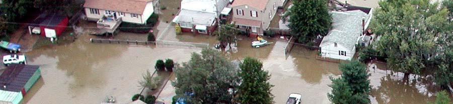

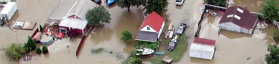
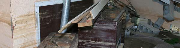
5 The Primary Goal of Flood Map Modernization.. Reduce the loss of life and property Hurricane Isabel September


6 Objectives of Flood Map Modernization Develop up-to-date flood hazard data for flood-prone areas nationwide Provide flood maps and data in digital format available through the Internet Fully integrate FEMA's community and state partners into the mapping process 6
7 More accurate and digitally available flood maps will. Increase awareness of flood hazards Support sound floodplain l management to guide new development away from flood hazard areas Provide for more accurate flood insurance determination ti and rating. 7
8 Benefits for State and Community Floodplain Managers Greater empowerment for local decision making High quality data for more informed planning Comprehensive approach to flood risks, land use, and growth management Facilitates compliance with regulations More informed and educated public 8
9 Benefits to Insurance Agents and Lenders More accurate maps lowering their risk Improves capability to understand and manage financial risk, and protect investments Provides an effective risk management and regulatory tool which enables better local decision-making Provides up-to-date information to make better- informed decisions and comply with regulations 9


10 Integrating FEMA s State and Local Mapping Partners into the process will. Help leverage erage local knowledge and capabilities, and increase local capabilities Maximize Federal/State/ Local resources Foster local ownership of the Digital Flood Insurance Rate Maps 10


11 Modernizing Flood Maps Using State-of-the-Art Mapping Technologies Facilitates DFIRM production and helps reduce processing time Makes map data more easily and widely available Allows for faster future revisions i and updates 11
12 Map Modernization Program A first important step in Map Modernization has already been taken. Map Service Center 12
13 Flood Maps are currently available on the Internet et Click Map Search 13
14 Flood Maps are currently available on the Internet Type in address Click Go 14
15 Flood Maps are currently available on the Internet System identifies Map Panel Click to view Panel 15
16 Flood Maps are currently available on the Internet Full Map Panel Click Make a FIRMette 16
17 Flood Maps are currently available on the Internet Position box for desired area Select file type desired 17
18 Flood Maps are currently available on the Internet FIRMette can be saved and printed FIRMette created 18


19 Flood Maps are currently available on the Internet Some important stats 65% of all MSC orders are now submitted through the website In FY 05 1 million unique visitors accessed the site and 800, FIRMettes were created or 19
20 Map Modernization Program Stakeholder - Community Involvement 20
21 Overview of the Mapping Process Flood Mapping Project Phases Pre-Scoping Data Review Scoping Data Acquisition iti & Hydrology Hydraulics Floodplain Mapping DFIRM Production Issue Preliminary i DFIRM & Community Comment Period Post Preliminary Processing OUTREACH - STAKEHOLDER INVOLEMENT Months, 24 Months Typical 21
22 Map Modernization Outreach A comprehensive, and interactive communication/outreach program Promote government agencies working as partners and opportunities for data sharing Promote overall NFIP Increase public awareness to improve an overall credibility and enable impacted stakeholders to have a positive experience with the Map Modernization 22


23 Map Modernization Stakeholders National & Multi-jurisdiction Community & Local 23
24 National & Multi-Jurisdictional Stakeholders FEMA Headquarters Staff FEMA Regional Office Staff DHS Congress Members State Officials County Officials Regional Planning Organizations Other Organizations (Soil & Water Districts, Zoning Districts, etc) Schools State t Legislators Land Developers & Building Associations Engineering Companies and Surveyors Insurance Companies and Agents Realtors Lending Institutions Flood Zone Determination Companies 24
25 Community and Local Stakeholders State Officials County & Municipal Officials Regional Planning Organizations Other Organizations (Soil & Water Districts, Zoning Districts, etc) Schools State Legislators Public Information Media Home Owners and Renters Business Owners Land Developers & Builder Associations Engineering Companies and Surveyors Insurance Companies and Agents Realtors Leading Institutions 25
26 Community and Local Stakeholders Why is this audience so special Building relationships with communities and local l groups is essential to the Map Modernization objectives. Provides an immediate interface with the communities that must adopt and utilize the hazard maps. Provide assistance in expanding involvement in Map Modernization and encourage NFIP participation as well. Local knowledge and participation crucial for success of program. 26
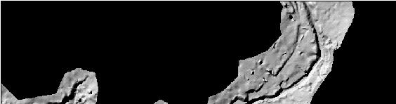
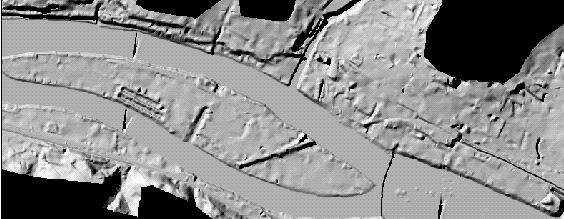
27 Key Outreach Opportunities During DFIRM Pre- to Post-Scoping Efforts Contact with local officials and stakeholders for exchange of information Keeping local officials informed of study findings Public awareness information provided Data collection When the preliminary DFIRM is released Starts the process for Public Meetings Presentation of Preliminary Flood Insurance Study and DFIRMs. 90-day appeal period Receipt and/or resolution of appeals 6 month compliance period adoption of DFIRM via ordinance 27
28 Map Modernization Program DFIRM Production 28
29 Overall Approach to DFIRM Efforts All DFIRMs are Countywide All flood elevations converted from NGVD29 to NAVD88 vertical datum Scope of study varies by County (funding driven) New H&H Study Limited Detailed Study Redelineation Automated Approximate H&H All effective LOMRs incorporated into DFIRMs
30 Overview of the Mapping Process Flood Mapping Project Phases Pre-Scoping Data Review Scoping Data Acquisition iti & Hydrology Hydraulics Floodplain Mapping DFIRM Production Issue Preliminary i DFIRM & Community Comment Period Post Preliminary Processing OUTREACH - STAKEHOLDER INVOLEMENT Months, 24 Months Typical 30
31 Overview of the Mapping Process Flood Mapping Project Phases Pre-Scoping Data Review Scoping Data Acquisition & Hydrology Hydraulics Floodplain Mapping DFIRM Production Issue Preliminary DFIRM & Community Comment Period Post Preliminary Processing Unmet Needs (Due to funding constraints) Maintenance/Update Needs Mapping Lifecycle 31
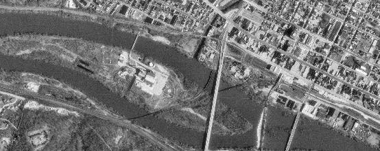
32 GIS technology allows for the combination of multiple data layers to create DFIRMs Special Flood Hazard Areas Land Ownership Transportation Surface Waters Boundaries Geodetic Control Elevation Aerial Imagery 32

33 Basic Components of a Flood Map Base + Topography + Flood Data = Digital FIRM 33
34 LiDAR Technology to Develop Accurate Ground Elevations for Flood Mapping Light Detection and Ranging (LiDAR) Airborne Laser System Fixed Wing Helicopter Potential for High Level accuracy (1 foot range) 34

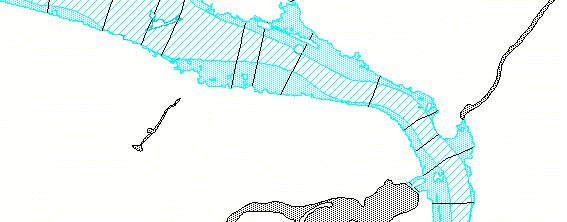
35 Modernized DFIRMs Vector Base Map DOQ/Raster Base Map 35
36 Cooperating Technical Partners (CTPs) CTPs are at both community and state t level l Support mapping efforts and provides funding for study (e.g., data) Takes ownership of entire re-mapping effort or portions of the efforts Leverage erage local resources rces and knowledge of the flood hazards 36
37 Maryland s Approach to Map Modernization Maryland is a FEMA Cooperating Technical Partner Maryland Department of the Environment (MDE) is the lead agency Maryland Department of Natural Resources is a State Partner Manages Geospatial Data Acquires LiDAR Data Other State Partners Supporting LiDAR and Data Development Maryland Emergency Management Agency Maryland State Geographic Information Committee Maryland Department of Transportation University of Maryland, Baltimore County Salisbury University Numerous Local Jurisdictions 37
38 Maryland s Approach to Map Modernization Develop LiDAR data statewide through partnerships Use automated technology to create live models and redelineate with LiDAR data Correct known modeling errors Incorporate LOMRs Correct discrepancies between old and new data Convert all Approximate Zone A to Limited Detail Studies with BFEs Take over maintenance including issuance of LOMCs House the data 38
39 Maryland s Approach to Map Modernization Status of LiDAR Data Development LiDAR Complete LiDAR In Production LiDAR Planned in
40 Maryland s Approach to Map Modernization First County DFIRMs to be produced by the State 40
41 Maryland s Approach to Map Modernization Stay tuned for more information regarding the State s Map Modernization Program. Presentation by Mark Flick later today 41
42 Map Modernization Program Mapping Information Platform (MIP) 42


43 Mapping Information Platform (MIP) Portal for FEMA Mapping Partners and Map Users Provides tools (e.g., DFIRM Tools, WISE) for DFIRM data development and mapping Tracks DFIRM work efforts to better manage tasks and budgets Allows for storage and distribution of GIS flood hazard data 43
44 Mapping Information Platform (MIP) - Map Viewer Layers currently available: Effective DFIRM (flood hazard Zones), Q3, other hazard layers, roads, corporate limits, imagery/base map. Future Layers: Preliminary DFIRMs, LOMCs, all DFIRM spatial layers and Metadata t files. 44


45 Mapping Information Platform (MIP) - Map Viewer Example 45
46 Map Modernization Program Multi-Year Flood Hazard Identification Plan (MHIP) 46
 Projected flood map update progress through FY- 2010 http://www.fema.gov/fhm/mh_main.")
47 Multi-Year Flood Hazard Identification Plan (MHIP) Collaborative 5-Year Road Map for Modernization of Flood Maps Studies primarily determined by claims paid, repetitive loss, data leveraged, growth factor, age of maps Contains flood hazard quality standards for DFIRM (Section 7) Projected flood map update progress through FY
48 Multi-Year Flood Hazard Identification Plan (MHIP) 48
49 Multi-Year Flood Hazard Identification Plan (MHIP) Map Production Funding Distribution FY 04 FY 08 FEMA Region III -- Less than 9% of National Budget 49
50 Multi-Year Flood Hazard Identification Plan (MHIP) The Big Picture 50
51 Multi-Year Flood Hazard Identification Plan (MHIP) Quality Standards for Each Risk Classes 1 Difference between the ground elevation (from topographic p data) and computed flood elevation. 51
52 Multi-Year Flood Hazard Identification Plan (MHIP) Section 7 Quality Standards DFIRMs that do not pass the standard will not be counted towards the Map Modernization goals Mapping partners will verify that DFIRMs meet the standards The NSP will conduct random audits 52
53 Multi-Year Flood Hazard Identification Plan (MHIP) main 53
54 Map Modernization Program LOMAs/LOMRs 54
55 Letters of Map Change (LOMCs) Even with modernized, up-to-date maps LOMCs will still be required Letters of Map Amendments (LOMAs) Letters of Map Revision Based on Fill (LOMR-Fs) Letters of Map Revision (LOMRs) Internet applications and processes being developed through the MIP e-loma will be available by the end of this year All LOMCs available on Web Stay Tuned for LOMC Presentation Later Today 55
56 Questions? 56
Criteria for Appeals of Flood Insurance Rate Maps. November 30, 201 1
 Criteria for Appeals of Flood Insurance Rate Maps November 30, 201 1 This document outlines the criteria for appealing proposed changes in flood hazard information on Flood Insurance Rate Maps (FIRMS)
What s New in FEMA Mapping?
 Discussion Topics What s New in FEMA Mapping? Eric Simmons September 6, 2018 FEMA Initiatives & Evolving Risk MAP FEMA s Flood Map Service Center National Flood Hazard Layer (NFHL) Draft NFHL and Changes
Map Modernization State Business Plan for Ohio January 2004 Attachment #2
 Map Modernization State Business Plan for Ohio January 2004 Attachment #2 FEDERAL EMERGENCY MANAGEMENT AGENCY COOPERATING TECHNICAL PARTNERS MEMORANDUM OF AGREEMENT AGREEMENT is made on April 22, 2003,
Final Report WI Flood Map Maintenance Project. Prepared For. The Wisconsin Department of Natural Resources Flood Map Maintenance Project
 Final Report WI Flood Map Maintenance Project Prepared For The Wisconsin Department of Natural Resources Flood Map Maintenance Project December 2007 TABLE OF CONTENTS INTRODUCTION 1 GIS DATA INVENTORY
MAP INDEX CHECKLIST NOTES:
 REVIEWING YOUR PRELIMINARY DFIRM PANELS AND FIS REPORT A GUIDE FOR COMMUNITY OFFICIALS When a Georgia community is presented with new Digital Flood Insurance Rate Map (DFIRM) panels, the State of Georgia,
Mingo County, WV Community Coordination Preliminary Flood Insurance Study and Flood Insurance Rate Map. Thursday, September 25, 2014
 Mingo County, WV Community Coordination Preliminary Flood Insurance Study and Flood Insurance Rate Map Thursday, September 25, 2014 Overview Preliminary Materials Preliminary FIS Report Digital Flood Insurance
FEMA Map Modernization in Oklahoma
 FEMA Map in Oklahoma Oklahoma Floodplain Management Association Tulsa, Oklahoma Jerry Clark, P.E., RMC VI September 18, 2007 Introduction Accurate information about risks is the first step in preventing
Letters of Map Amendment- Out as Shown
 Letters of Map Amendment- Out as Shown While digital Flood Insurance Rate Maps (DFIRM s) have made it easier to determine if a structure (or building site) is in the special flood hazard area (SFHA), many
National Flood Insurance Program (NFIP) MT-1 Presentation. David Mummert, Michael Baker Jr., Inc.
 MT-1 Presentation. David Mummert, Michael Baker Jr., Inc.") National Flood Insurance Program (NFIP) MT-1 Presentation David Mummert, Michael Baker Jr., Inc. MT-1 Letters of Map Change (LOMCs) LOMC Review By FEMA FEMA required to notify the applicant in writing
National Flood Insurance Program (NFIP) MT-1 Presentation David Mummert, Michael Baker Jr., Inc. MT-1 Letters of Map Change (LOMCs) LOMC Review By FEMA FEMA required to notify the applicant in writing
National Flood Insurance Program
 National Flood Insurance Program Base Flood Elevations in Zone A Streams Surveyor Training Presented by Thomas F. Smith, PE, PLS January 22, 2018 1 FEMA Region III Mitigation Division Floodplain Management
MT 1, MT 2, Elevation Certificates & the Role of Surveyors
 MT 1, MT 2, Elevation Certificates & the Role of Surveyors Rocky Mountain Surveyors Summit March 3, 2016 Floods are acts of God, but flood losses are largely acts of man. - Dr. Gilbert White the father
Letter of Map Change Fundamentals
 Letter of Map Change Fundamentals FEMA Region III National Flood Insurance Program Essentials and Best Practices Jana Green, CFM, RAMPP Topics of Discussion Why Apply for a Letter of Map Change (LOMC)?
The Strategic Plan can be viewed by clicking this link.
 What is the purpose of the Land Information Office? Many of Brown County's most basic services rely on accurate and up-to-date land information. Emergency response, resource conservation, infrastructure
Cadastral and Right of Way Data Sharing
 Cadastral and Right of Way Data Sharing May 2010 TRS 1006 This Transportation Research Synthesis (TRS) provides summaries of recent research and implementation efforts on a topic of current interest. Online
Federal Emergency Management Agency
 Page 1 of 3 Date: July 21, 2016 Case No.: 16-05-5203A LOMA COMMUNITY AND MAP PANEL INFORMATION COMMUNITY KEWAUNEE COUNTY, WISCONSIN (Unincorporated Areas) Federal Emergency Management Agency Washington,
FEMA POLICY: GUIDANCE ON THE USE OF AVAILABLE FLOOD HAZARD INFORMATION
 FEMA POLICY: GUIDANCE ON THE USE OF AVAILABLE FLOOD HAZARD INFORMATION FEMA Policy #104-008-2 BACKGROUND The policy is for FEMA Headquarters, Regional program staff, and for the Field Staff at the Joint
1/23/2017. Floodplain Update For Surveyors. Floodplain Updates For Surveyors. Sample FEMA Map with SFHA
 Floodplain Updates For Surveyors Ceil Strauss MN State Floodplain Manager February 9, 2017 Floodplain Update For Surveyors Finding FEMA Maps & Data Map / Data Updates & Status Other useful resources Letters
Chapter 5. Floodplain Management. 5.0 Introduction. 5.1 Douglas County Comprehensive Master Plan. 5.2 Floodplain Management and Regulation
 5.0 Introduction This chapter summarizes the County s rules and regulations regarding floodplain management and development. The requirements presented in this chapter should be used by the design engineer
Information contained
 Government Information (Public Access) Act 2009 (GIPA Act) LPI Information Guide 1. Introduction and contents of this guide The Land and Property Information s (LPI) Information Guide tells you in general
2018 Assessment Roll Edit Guide for Parcel-Level Geographical Information System (GIS) Information
 Information") 2018 Assessment Roll Edit Guide for Parcel-Level Geographical Information System (GIS) Information Florida Department of Revenue Property Tax Oversight January 2, 2018 Intended Users This edit guide is
2018 Assessment Roll Edit Guide for Parcel-Level Geographical Information System (GIS) Information Florida Department of Revenue Property Tax Oversight January 2, 2018 Intended Users This edit guide is
Residential Major Subdivision Review Checklist
 Residential Major Subdivision Review Checklist Plan Submittal Requirements: 2 full sets of stamped plans Electric submittal - all plans contained in a single PDF 3 full sets if commercial kitchen or dining
Chapter 5. Floodplain Management. 5.0 Introduction. 5.1 Floodplain Management and Regulation
 5.0 Introduction This chapter summarizes the Town s rules and regulations regarding floodplain management and development. The requirements presented in this chapter should be used by the design engineer
FGDC Cadastral Data Subcommittee. December 2008
 FGDC Cadastral Data Subcommittee Annotated Bibliography: Foundational Documents for Building a Cadastral National Prepared by David Stage and Nancy von Meyer for the FGDC Cadastral Data Subcommittee Annotated
APPRAISAL MANAGEMENT COMPANY
 APPRAISAL MANAGEMENT COMPANY STANDARDS OF GOOD PRACTICE IN APPRAISAL MANAGEMENT JANUARY 6, 2010 POST OFFICE BOX 1196 WEXFORD, PA 15090 (P) 724-934-1420 (F) 724-934-0057 (W) WWW.TAVMA.ORG APPRAISAL MANAGEMENT
LIS a motivation for SDI initiative
 Eric Mwaikambo Ardhi University Dar es Salaam Tanzania Overview Status of LIS in Tanzania Relationship between SDI and LIS Spatial Standards LIS a motivation for SDI initiative Conclusion & Recommendations
A Vision for a Fully Digital Cadastral Survey System
 A Vision for a Fully Digital Cadastral Survey System Anselm HAANEN, Trent GULLIVER, New Zealand Key words: cadastral survey system, digital cadastre, survey plans SUMMARY Surveyors have traditionally prepared
Collateral Underwriter Overview. National Association of REALTORS January 23, 2015
 Collateral Underwriter Overview National Association of REALTORS January 23, 2015 2014 Fannie Mae. Trademarks of Fannie Mae. Introduction to Collateral Underwriter I January 2015 What Is Collateral Underwriter?
Questions and Answers For Recorders About Land Records And GIS Integration
 2501 Aerial Center Parkway, Suite 103, Morrisville, NC 27560 877.997.7742 Questions and Answers For Recorders About Land Records And GIS Integration Adopted by the PRIA Board on March 15, 2011 http://www.pria.us
Use of data in Ukraine for sustainable economic growth. Oleksandr Maliuk State Service of Ukraine for Geodesy, Cartography and Cadastre
 Use of data in Ukraine for sustainable economic growth Oleksandr Maliuk State Service of Ukraine for Geodesy, Cartography and Cadastre Kehl, 2017 Content of the presentation Ukraine & StateGeoCadastre:
Digitalisation of the Real Property Rights Towards Spatially enabled E-Government
 Digitalisation of the Real Property Rights Towards Spatially enabled E-Government Lise Schroeder, Bent Hulegaard Jensen, Esben Munk Soerensen & Line Hvingel Istanbul, Turkey 25 june 201 Overview Introduction
California-Specific Professional Land Surveyor Examination Test Plan
 General Definition of California Professional Land Surveying Practices: The practice of land surveying in the State of California consists of determining, establishing, reporting and mapping the positions,
The Digital Cadastral Database and the Role of the Private Licensed Surveyors in Denmark
 IRISH INSTITUTE OF SURVEYORS, DUBLIN INSTITUTE OF TECHNOLOGY, 23 NOVEMBER 2005 PUBLISHED IN IIS NEWS, WINTHER 2006. The Digital Cadastral Database and the Role of the Private Licensed Surveyors in Denmark
Residential Minor Subdivision Review Checklist
 Residential Minor Subdivision Review Checklist Plan Submittal Requirements: 2 full sets of stamped plans Electric submittal - all plans contained in a single PDF 3 full sets if commercial kitchen or dining
250 CMR: BOARD OF REGISTRATION OF PROFESSIONAL ENGINEERS AND LAND SURVEYORS DRAFT FOR DISCUSSION PURPOSES ONLY
 250 CMR 6.00: LAND SURVEYING PROCEDURES AND STANDARDS Section 6.01: Elements Common to All Survey Works 6.02: Survey Works of Lines Affecting Property Rights All land surveying work is considered work
FGDC SUBCOMMITTEE FOR CADASTRAL DATA. October 2004 Albuquerque, New Mexico Meeting
 FGDC SUBCOMMITTEE FOR CADASTRAL DATA October 2004 Albuquerque, New Mexico Meeting The National Spatial Data Infrastructure is the means to assemble geographic information that describes the arrangements
Will County GIS Product Distribution Policy January, 2008
 Will County GIS Product Distribution Policy January, 2008 Background: The goal of this policy is to provide GIS products to users in a reasonable manner and to ensure that products released are of sufficient
National Spatial Data Infrastructure development in Republic of Macedonia
 National Spatial Data Infrastructure development in Republic of Macedonia Sonja Dimova, state advisor for geomatics AGENCY FOR REAL ESTATE CADASTRE September 6-th, 2017, Strasbourg AREC competence for
Bureau of Land Management
 Bureau of Land Management MAPPS Federal Update Donald Buhler Cadastral, Lands, and Realty Management April 1, 2014 Division of Cadastral, Lands and Realty Management 1 BLM Mission Manages 247 million surface
Egyptian Nationwide Title Cadastre System
 Kholoud SAAD, Egypt Key words: Cadastre, Registration, Urban, Rural, National Cadastre, Automation, reengineering. SUMMARY With growing need for integrated information, Enterprise Solutions has become
Installation Boundary Mapping and the DoD Real Property Inventory Program
 Installation Boundary Mapping and the DoD Real Property Inventory Program 11 October 2007 SAME Mid-Atlantic Regional Conference Jeff Swallow Real Property History Real Property data reported to the Office
Project Name: (Name as it appears in ESNAPS.) Spring Care Association
 Spring Care Association") Page 1 of 4 U.S. Department of Housing and Urban Development 451 Seventh Street, SW Washington, DC 20410 www.hud.gov espanol.hud.gov Environmental Review for Continuum of Care (CoC) Rental Assistance Project
Page 1 of 4 U.S. Department of Housing and Urban Development 451 Seventh Street, SW Washington, DC 20410 www.hud.gov espanol.hud.gov Environmental Review for Continuum of Care (CoC) Rental Assistance Project
Flood Hazard Modelling
 Flood Hazard Modelling Identification Information Dataset Name: Rapid Flood Hazard Model, Detailed Flood Hazard Model Dataset Abstract: The flood hazard model identifies areas that may be subject to flooding
GOVERNMENT. Case Study Ville de Trois Rivières streamlines property assessment
 GOVERNMENT Case Study Ville de Trois Rivières streamlines property assessment GIS-generated parcel basemap provides powerful visualization & analysis capabilities With a population of just over 130,000,
Cadastral NSDI Reference Document
 Cadastral NSDI Reference Document Version 12 October 2012 FGDC Subcommittee for Cadastral Data Cadastral NSDI Reference Document Table of Contents 1. Purpose... 1 2. Business Applications... 1 3. Terminology
BULGARIAN CADASTRE A GUARANTEE FOR THE OWNERSHIP RIGHTS IN IMMOVABLE PROPERTIES
 4 TH INTERNATIONAL CONFERENCE RECENT PROBLEMS IN GEODESY AND RELATED FIELDS WITH INTERNATIONAL IMPORTANCE February 28 - March 2, 2007, Inter Expo Centre, Sofia, Bulgaria BULGARIAN CADASTRE A GUARANTEE
Implementation Guidance for The Sustainable Growth and Agricultural Preservation Act of 2012 Senate Bill 236
 Implementation Guidance for The Sustainable Growth and Agricultural Preservation Act of 2012 Senate Bill 236 May 22, 2012 Version 1.0 Table of Contents 1. Executive Summary... 1 1.1 Bill Highlights...
Phase I Environmental Site Assessments for Corridors
 Phase I Environmental Site Assessments for Corridors Prepared by: Kimberly Perkins and Jill Biesma 1 Environmental Advisors and Engineers 19211 W. 64 th Terrace, Shawnee, KS 66218 (913) 599-4326 Goal Of
Directorate of Survey and Mapping NAMIBIA. Cadastral Information System. Vehupisa Kasuko Tjatindi Surveyor Directorate of Survey and Mapping NAMIBIA
 Vehupisa Kasuko Tjatindi Directorate of Survey and Mapping NAMIBIA Tel: +64 61 965000 Directorate of Survey and Mapping NAMIBIA Cadastral Information System Introduction Over the past few decades cadastral
Terms of Reference for the Regional Housing Affordability Strategy
 Terms of Reference for the Regional Housing Affordability Strategy Prepared by: CRD Regional Planning Services September, 2001 Purpose The Capital Region is one of the most expensive housing markets in
An Overview of the eplan Journey with a Focus on the Victorian eplan 2025 Roadmap Dr Hamed Olfat
 An Overview of the eplan Journey with a Focus on the n eplan 2025 Roadmap Dr Hamed Olfat eplan Coordinator Land Use Chairman of Technical Committee ICSM eplan Working Group Outline eplan Overview ICSM
Implementation Guidance. for. The Sustainable Growth and Agricultural Preservation Act of Senate Bill 236
 Implementation Guidance for The Sustainable Growth and Agricultural Preservation Act of 2012 Senate Bill 236 August 1, 2012 Version 2.0 Table of Contents 1. Executive Summary... 1 1.1 Bill Highlights...
Affordable Housing Audits
 Affordable Housing Audits City of Seattle Incentive Zoning for Affordable Housing Virginia Garcia, Seattle Office of City Auditor ALGA Regional Conference, Portland, OR October 3, 2018 Audits can be found
Key Registers in Finland and some views of Cadastre 2035
 Presented at the FIG Working Week 2016, May 2-6, 2016 in Christchurch, New Zealand Key Registers in Finland and some views of Cadastre 2035 FIG Working Week, Christchurch New Zealand May, the 3rd, 2016
2016 Fredericksburg Area Floodplain Management Workshop Tuesday, October 25, 2016
 2016 Fredericksburg Area Floodplain Management Workshop Tuesday, October 25, 2016 Charley Banks, CFM Department of Conservation And Recreation Division of Dam Safety & Floodplain Management Some Soapbox
HEC Software and FEMA Submittals
 HEC Software and FEMA Submittals EWRI Workshop HEC Users Conference Larry Voice Risk Analysis FEMA Region VI April 12, 2010 Overview Flood Hazard Analysis Overview of Map Changes Accepted Model List Guidance
The United States Mortgage Crisis and Cadastral Data. Donald Buhler, Bureau of Land Management. David Cowen, University of South Carolina
 The United States Mortgage Crisis and Cadastral Data Donald Buhler, Bureau of Land Management David Cowen, University of South Carolina What Have Americans Paid (and Maybe the Rest of the World) for Not
CITY OF CAMBRIDGE FLOODPLAIN MANAGEMENT CHAPTER 7 (GRADING, EROSION AND SEDIMENT CONTROL)
") CITY OF CAMBRIDGE FLOODPLAIN MANAGEMENT CHAPTER 7 (GRADING, EROSION AND SEDIMENT CONTROL) City of Cambridge, MD Floodplain Management Ordinance (Tidal): May, 2011 1 City of Cambridge, Maryland Floodplain
CITY OF CAMBRIDGE FLOODPLAIN MANAGEMENT CHAPTER 7 (GRADING, EROSION AND SEDIMENT CONTROL) City of Cambridge, MD Floodplain Management Ordinance (Tidal): May, 2011 1 City of Cambridge, Maryland Floodplain
Property Based Land Information Systems of Turkey
 Property Based Land Information Systems of Turkey Mehmet Fatih DİRİ, Bilgehan ÖZSOY, Ünsal ERGÜN, Turkey Key words: Cadaster, Land Registry, GIS, Property, TURKEY SUMMARY The property, addition to the
Marine Spatial Data Infrastructure (MSDI) & The Marine Cadastre Application. April 10, 2018
 & The Marine Cadastre Application. April 10, 2018") Marine Spatial Data Infrastructure (MSDI) & The Marine Cadastre Application April 10, 2018 A Collaborative Pilot Project Vision of CHS: A framework of geographic data, metadata, users and tools Intent
Marine Spatial Data Infrastructure (MSDI) & The Marine Cadastre Application April 10, 2018 A Collaborative Pilot Project Vision of CHS: A framework of geographic data, metadata, users and tools Intent
BEAVER COUNTY, PENNSYLVANIA
 VOLUME 3 OF 3 BEAVER COUNTY, PENNSYLVANIA (ALL JURISDICTIONS) Beaver County COMMUNITY NAME COMMUNITY NUMBER COMMUNITY NAME COMMUNITY NUMBER ALIQUIPPA, CITY OF 420101 AMBRIDGE, BOROUGH OF 420102 BADEN,
Automated Land Development Applications
 Automated Land Development Applications AGENDA Yarra Valley Water Land Development Process GIS Automation Business Rules Engine Automated Spatial Analysis Questions.Encourage GIS community to embrace GIS
Developing Mitigation Projects. Molly J. O Toole, P.E., D.WRE, CFM
 Developing Mitigation Projects Molly J. O Toole, P.E., D.WRE, CFM Mitigation Hazard mitigation is defined as any sustained action taken to reduce or eliminate long-term risk to life and property from a
The Development of the Austrian Cadastre from Documentation to an Integrated Planning and Decision Support System
 The Development of the Austrian Cadastre from Documentation to an Integrated Planning and Decision Support System WPLA - Working Party on Land Administration 15-17 October 2014, Vienna, Austria Wernher
Town of Yucca Valley GENERAL PLAN 1
 Town of Yucca Valley GENERAL PLAN 1 This page intentionally left blank. 3 HOUSING ELEMENT The Housing Element is intended to guide residential development and preservation consistent with the overall values
Modernizing Land Administration Systems
 Presented at the FIG Congress 2018, May 6-11, 2018 in Istanbul, Turkey Modernizing Land Administration Systems B r e n t J o n e s P E, PLS E s r i Land Administration Systems GIS is the Technology Platform
The Multipurpose Marine Cadastre A Tool for Planning & Decision Making in the Marine Environment
 The Multipurpose Marine Cadastre A Tool for Planning & Decision Making in the Marine Environment Christine Taylor Minerals Management Service (MMS) Brian Smith NOAA Coastal Services Center Maurice Hill
Floodplain Development Land Use Review
 PUBLIC WORKS - COMMUNITY DEVELOPMENT 333 Broadalbin Street SW, PO Box 490, Albany, Oregon 97321-0144 BUILDING 541-917-7553 PLANNING 541-917-7550 Floodplain Development Land Use Review Application Information
A Geocoded Cadastral Fabric as a Precondition for a Sustainable Land Management System
 A Geocoded Fabric as a Precondition for a Sustainable Land Management System Gottfried KONECNY, Germany; J.P. LAUZON, Canada; Abdul Salam MOHAMMED, India Key words: SDI,, Parcel Boundaries, GPS-GNSS, Land
Meeting the Changing National Geospatial Information Needs. Palitha Udayakantha Surveyor General - Sri Lanka
 Meeting the Changing National Geospatial Information Needs Palitha Udayakantha Surveyor General - Sri Lanka Sri Lanka Location Latitude 5 55 10-9 50 6 North Longitude 79 31 19-81 52 36 East Area 65610
Spatial Data Warehouse Ltd. Cadastral Mapping INITIATIVE 1: CADASTRAL MAPPING. Version Spatial Data Warehouse Ltd. & AltaLIS Ltd.
 Spatial Data Warehouse Ltd. Initiative 1: Cadastral Mapping INITIATIVE 1: CADASTRAL MAPPING 29 P3 The SDW/AltaLIS Model Background The Government of Alberta started a mapping program, the Municipal Integrated
GAUSSCAD A WEBGIS APPLICATION FOR COLLECTING CADASTRAL DATA
 M.M. Moise GaussCAD a WebGIS Application for Collecting Cadastral Data GAUSSCAD A WEBGIS APPLICATION FOR COLLECTING CADASTRAL DATA Mihai-Mircea MOISE, S.C. GAUSS S.R.L., mihai.moise@gauss.ro Abstract:
LIS Development Project and Measures Proposed to Enhance Trust in the Land Administration System in Uganda
 Project for Design, Supply, Installation and Implementation of the Land Information System and Securing of Land Records (DeSILISoR) LIS Development Project and Measures Proposed to Enhance Trust in the
IT-SUPPORTED STATE-LAND MANAGEMENT IN A TRANSITIONAL ENVIRONMENT
 IT-SUPPORTED STATE-LAND MANAGEMENT IN A TRANSITIONAL ENVIRONMENT - Examples from Eastern Germany and Mongolia - TOPICS 1 S LAND INFORMATION SYSTEM History and main components IT-strategy and development
Theme Strategic Plan for Cadastral Theme
 Theme Strategic Plan for Cadastral Theme Bureau of Land Management Cadastral Survey Federal Geographic Data Committee (FGDC) 2017 2021 April 2017 - Progress and Update Cadastral Theme Implementation Plan
GIS and Land Records Integration A PRIA White Paper
 110 Horizon Drive, Suite 210, Raleigh, NC 27615 919.459.2081 GIS and Land Records Integration A PRIA White Paper Adopted by the PRIA Board on December 20, 2017 www.pria.us/ GIS and Land Records Integration
The Promised Land in Sight Preliminary Issuance on a LAMP Study
 The Promised Land in Sight Preliminary Issuance on a LAMP Study Agenda Project Location: more levees than we can count! LLPT meetings Results Bottom Line Project Location 3 The Promised Land in Sight Preliminary
THE 2030 AGENDA, CITIES AND URBAN GOVERNANCE A CENTRAL ROLE FOR LAND AND GEOSPATIAL INFORMATION
 THE 2030 AGENDA, CITIES AND URBAN GOVERNANCE A CENTRAL ROLE FOR LAND AND GEOSPATIAL INFORMATION Abbas Rajabifard Immediate Past President and Executive Board Member, GSDI Association Director, Centre for
Floodplain Management: New York State Role
 Floodplain Management: New York State Role Establish development/building standards State building code Model local law for flood damage prevention Provide technical assistance to local communities/agencies
Building Integrated Land Information Systems and Development of NSDI
 Stig JÖNSSON, Sweden Key words: Land administration, land information systems, property formation, spatial data infrastructure, Inspire, institutional cooperation SUMMARY Lantmäteriet the Swedish agency
General Instructions For Surveys and Plans Outside the Provincial Survey System
 May 15, 2018 General Instructions For Surveys and Plans Outside the Provincial Survey System NOTE: This document is a Controller of Surveys Policy manual to be used as a general guideline for the Legal
Quality Improvement of the Real Estate Cadastre in Serbia
 , Serbia Key words: quality improvement, real estate information, quality assurance, Serbia SUMMARY The concept of cadastral modernization in the Republic of Serbia was defined in 1992, and it is being
Serbia Should Have Online Cadastre for Property Like Other Countries in the Region
 Serbia Should Have Online Cadastre for Property Like Other Countries in the Region Tamara Borovcanin USAID Business Enabling Project The online real estate registry allows citizens to quickly and easily
RPR Product Overview RPR National Property Data Sets Reporting Features... 3
 Table of Contents RPR Product Overview... 2 RPR National Property Data Sets... 3 Reporting Features... 3 Features only available with MLS/CIE data included in RPR... 4 Why Include MLS/CIE Data into RPR?...
ELEVATION CERTIFICATE
 ELEVATION CERTIFICATE IMPORTANT: In these spaces, copy the corresponding information from Section A. FOR INSURANCE COMPANY USE Building Street Address (including Apt., Unit, Suite, and/or Bldg. No.) or
Bureau of Land Management MAPPS Federal Update Donald Buhler Cadastral, Lands, and Realty Management April 14, 2015
 Bureau of Land Management MAPPS Federal Update Donald Buhler Cadastral, Lands, and Realty Management April 14, 2015 Division of Cadastral, Lands and Realty Management 1 BLM Mission Manages 247 million
Challenges for the multi purpose cadastre
 Jens RIECKEN, Markus SEIFERT, Germany Key words: Multi purpose cadastre, 3d-cadastre, land use, SDI, solar cadastre SUMMARY Over the past 30 years, with the progress of information technologies the development
PROPERTY ASSESSMENT KNOWLEDGE
 A P E N DE UM NOUN A COLLECTION OF CONCISE BUT DETAILED INFORMATION ABOUT APPRAISAL AND APPRAISAL MANAGEMENT, ESPECIALLY IN THE PROPERTY ASSESSMENT INDUSTRY. PROPERTY ASSESSMENT KNOWLEDGE KNOWLEDGE AREAS
Alberta Flood Hazard Identification Program
 Alberta Flood Hazard Identification Program Peter Onyshko, P.Eng., CFM River Forecast Section Alberta Environment and Parks November 5, 2015 Flood Hazard Identification Program Presentation Outline Introduction
Universal Geo-database Connector Interface Component (UG-CIC) For Virtual Web-base GIS Server Essential For Real Estate Industry Uses
 For Virtual Web-base GIS Server Essential For Real Estate Industry Uses") Universal Geo-database Connector Interface Component (UG-CIC) For Virtual Web-base GIS Server Essential For Real Estate Industry Uses Jad Jarroush & Dr. Kobi Zaid Zaid Orniv Group L.T.D Israel kobi_z@zaidorniv.co.il
Universal Geo-database Connector Interface Component (UG-CIC) For Virtual Web-base GIS Server Essential For Real Estate Industry Uses Jad Jarroush & Dr. Kobi Zaid Zaid Orniv Group L.T.D Israel kobi_z@zaidorniv.co.il
Cadastral PLSS Stewardship December 2010 Updated December 2013
 Cadastral PLSS Stewardship December 2010 Updated December 2013 Compiled by Bob Ader, Ben Knott, and Nancy von Meyer for the FGDC Cadastral Subcommittee Table of Contents 1. Overview... 2 2. Underlying
Software Architecture Context
 Software Architecture Context J. Scott Hawker/R.Kuehl p. 1 Some material Pearson Education Topics Contexts of software architecture The architecture influence cycle What is the role of a software architect?
GIS & GPS Applications in Valuation/Appraisal Assessments
 GIS & GPS Applications in Valuation/Appraisal Assessments Simon ADCOCK, Australia Key words: GIS, GPS, mass assessments, 3-dimensional, modelling. SUMMARY The development of GIS and GPS systems has substantially
Katrina Supplemental CDBG Funds. For. Long Term Workforce Housing. CDBG Disaster Recovery Program. Amendment 6 Partial Action Plan
 Katrina Supplemental CDBG Funds For Long Term Workforce Housing CDBG Disaster Recovery Program Amendment 6 Partial Action Plan Amendment 6 Partial Action Plan for Long Term Workforce Housing Overview This
TREASURER S DEPARTMENT
 TREASURER S DEPARTMENT ORGANIZATIONAL CHART COUNTY TREASURER ADMINISTRATION SERVICE TO PUBLIC SERVICE TO COUNTY DEPARTMENTS SERVICE TO COUNTY GOV T DEPARTMENT DESCRIPTION The Treasurer s Office is a mandated
Oxford Floodplain Management Ordinance
 Table of Contents SECTION 1.0 GENERAL PROVISIONS...1 1.1 Findings...1 1.2 Statutory Authorization...1 1.3 Statement of Purpose...1 1.4 Areas to Which These Regulations Apply...2 1.5 Basis for Establishing
The Role of the Swedish Land Information System
 The Role of the Swedish Land Information System In the Business Society Tommy Österberg Swedesurvey 1 SWEDEN 9 million inhabitants 450 000 sq. km 21 Counties 291 Municipalities 4.6 million properties in
LRIMS Cadastre Module
 LRIMS Cadastre Module User Requirements and Functionality (Seychelles Case Study) John Latham, NRL Renato Cumani, NRL Luigi Simeone, NRL Summary Background User Requirements Business Model Application
Land Administration and Spatial Enablement Victoria s Experience. Chris McRae, Executive Director Land Victoria
 Land Administration and Spatial Enablement Victoria s Experience Chris McRae, Executive Director Land Victoria 4 th UN Land Administration Forum, October 2011 Outline About Land Victoria Land Victoria
FLOOD HAZARD AREA LAND USE MANAGEMENT
 FLOOD HAZARD AREA LAND USE MANAGEMENT Introduction Guidance For Selection of Qualified Professionals and Preparation of Flood Hazard Assessment Reports This document is intended to provide guidance for
Role of Republic Geodetic Authority in the Serbian geo-sector
 Role of Republic Geodetic Authority in the Serbian geo-sector Republic Geodetic Authority, Serbia www.rgz.gov.rs EuroGeographics General Assembly 2014 Moldova, Chisinau, 28 th 30 th September 2014 The