Profile Definition for a. Standardized Cadastral Model
|
|
|
- Dylan Lewis
- 5 years ago
- Views:
Transcription
1 Profile Definition for a Standardized Cadastral Model Hugh Aste, Rick Nyarady & Greg Mulholland
2 Outline Our interest in the Core Cadastre Domain Model Identification of a practical need for this standard The Cadastral Feature Catalogue The usefulness of the Unified Modeling Language In a development environment For performing Gap Analyses Summary Slide 2
3 CARIS Interest in this Workshop CARIS identified as Standard for Digital Mapping in New Brunswick Develops first internet mapping product for SNB Development with SNB on their modernized Land Registry Present- Marketing Integrated Land Information System as CARIS LIN worldwide CARIS CPD Database driven cadastral maintenance solution Slide 3
4 Our Experience (the challenge) In many parts of the world the majority of the cadastre (where and how much), is held at the municipal level and tied to the fiscal cadastre; While the real property registry (who and how) is administered at the state level. Integration Challenge Between municipalities Integrating the cadastre to the land registration system Integrating integrated cadastral / land registration systems Slide 4
5 Core Cadastral Domain Model A simple, generic, standardized data model could encourage and support the flow of information relating land property between different government agencies, and in turn to the public. Components: Core Specialization or RealEstateObject Surveying Geometry/Topology Legal/Administrative Components in principle could be managed by separate organizations. Slide 5
6 Keeping an Eye on Standards Standards Open Geospatial Consortium ISO FGDC (Standard for United States) Core Cadastre Domain Model (COST and FIG) Slide 6
7 Working with the Standards CARIS HPD HPD- Data Model Object oriented design based on internationally adopted S-57 and DIGEST Standards Stores real world entities as objects having a Feature object component: descriptive information Spatial object component: positional information Object Feature Object ACRONYM Attributes Spatial Object Geometry Slide 7 Points Lines Areas Soundings

8 CARIS CPD Data Model Object oriented design based on internationally adopted????????????????????? standards Integrated the principles of Cadastre 2014 Stores real world entities as objects having a Feature object component: descriptive information Spatial object component: positional information Slide 8


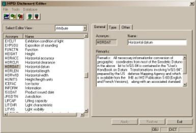
9 HPD Object Catalogue & Dictionary Includes an extensive object and attribute catalogue Based on IHO S-57 Standard Use the HPD S-57 Catalogue Browser for more information Users can customize the dictionary, including create new objects, attributes assign new values to attributes, and new attributes to objects Slide 9
10 Cadastral Feature Catalogue Is data schema for defining the content of a cadastre system that can be in either digital and/or analogue form. Its primary function is to provide a means of describing real world entities. To develop a description of each object class including a definition, a list of available attributes, ect. Attributes define a specific instance of the object class called an object. Slide 10
11 Example of a Class for a Parcel Column Class Acronym * Data Type * Aspect * Code * Attributes Definition References Remarks * Description Parcel CDPRCL Area RealEstateObject 44 CDPID$ (M), CDPART (M), CDPARN, CDPRL1, CDPIDA A Parcel is a single cadastral unit, which is the spatial extent of the past, present, and future rights and interests in real property. FGDC Cadastral Data Content Standard Version 1.3 Additional attributes may be added to support presentation of the object class and describe the administrative characteristics. Slide 11
12 Standard for Attribute Definition Column Attribute Acronym * Attribute Type * Code * Description References* Minimum Value* Maximum Value* Indication Example Remarks * Slide 12 Description Parcel ID CDPID$ Integer 32 The Parcel ID is the primary key, which identifies each record or occurrence in the Parcel entity. This is normally the system assigned number that manages record relationships internal to systems. FGDC Version No remarks
13 Attribute Parcel ID Assigner Column Attribute Acronym * Attribute Type * Code * Description References* Minimum Value* Description Parcel ID Assigner CDPIDA Enumerated 33 This is a designation for the agency, organization or jurisdiction that assigns and maintains the primary key. If possible, this designation should follow known naming standards, such as the Federal Information Processing System (FIPS) codes for jurisdictions. 0 Unknown 1 State Agency FGDC Version 1.3 Maximum Value* Indication Example Slide 13 Remarks * No remarks
14 Attribute- Parcel Name Column Attribute Acronym * Attribute Type * Code * Description References* Minimum Value* Description Parcel Name CDPARN Character 35 The Parcel Name is an identifying name or number for a Parcel. It may also be a project number or any other label for a parcel such as park name. FGDC Version 1.3 Maximum Value* Indication Example Remarks * Slide 14 No remarks
15 Attribute- Parcel Label Column Attribute Acronym * Attribute Type * Code * Description References* Minimum Value* Maximum Value* Indication Example Remarks * Slide 15 Description Parcel Labels CDPAL1 Character 36 Formerly Parcel Local Label. Local governments or other organizations may have a method or system for identifying and then applying a number for parcels. These numbers are often used for local administrative purposes. FGDC Version 1.3 CDPRL1 is considered the primary parcel identifier. If additional labels are required than extend the attribute list by adding CDPRL2, CDPRL3, etc.
16 Unified Modeling Language (UML) Development Perspective It helps a development team visualize specify, construct and document the structure and behavior of a system s architecture. Basis for UML is the Rational Unified Process Development is iterative Requirements are managed Use component based architectures Continuously verify software and system architectures. Control Change Visually model software and system architectures Slide 16
17 cd Feature Catalogue Profile Name Operation «SurevyingClass» CadastralSurveyPoint - CDASPL: SurveyPointLocation - CDASPG: SurveyPointCatagorization + «enumeration» Type() constraints {acronym = CDOSPT} {Point} Stereotype Attribute Constraint Data Dictionary Slide 17 Name Operation Activity «Attribute Class» SurveyPointCategorization - <1>IronPin: - <2>Nail: + Type() : char constraints {acronym = CDAGCB} Stero Type Attribute Constraints
18 UML for Gap Analysis UML offers advantages in performing gap analysis UML is a standardized process that helps remove ambiguities UML lends itself towards an iterative process Domain experts have a visual presentation of their existing model, which is much better than leafing through a document Modeling tools allow multi-models to coexist (cross-referencing power). Slide 18
19 Core Cadastral Domain Model Cadastral Feature Catalogue - Class Cadastral Feature Catalogue - Attribute Class «AttributeClass» ParcelID Slide 19 «RealEstateObject» Parcel - Area: float «RealEstateObject» PartitionParcel - Area: int «RealEstateObject» ApartmentComplex - ComplNum: oid 0..1 LocatedOn 2..* Serving 0..* «RealEstateObject» ServingParcel - «enumeration» SType: ParcelArea - CDPID$: ParcelID constraints {acronym = CDAREA} 1..* «RealEstateObject» Parcel - CDPID$(M): ParcelID - CDPART(M): ParcelType - CDPARN: ParcelName - CDPARL1: ParcelLabels - CDPIDA: ParcelIDAssigner ::Parcel - Area: float constraints {acronym = CDPRCL} 1..* ParcelLegalArea - CDPID$: ParcelID constraints {acronym = CDLARE} + Type() : int constraints {acronym = CDPID$} {Minimum Value = 1} «AttributeClass» ParcelIDAssigner - <0>Unknown: - <1>StateAgency: + «enumeration» Type() constraints {acronym = CDPIDA} «AttributeClass» ParcelType - <0>Unknown: - <1>Taxable: - <2>RightOfWay: - <3>Ownership: + «list» Type() constraints {acronym = CDPART} «AttributeClass» ParcelName + Type() : char constraints {acronym = CDPARN} «AttributeClass» ParcelLabels + Type() : char constraints {acronym = CDPAL1}


20 Slide 20 CARIS CPD
21 Summary UML provides a means for domain experts to contribute to discussions involving the development of a Core Cadastral Domain Model. Offers an effective methodology for comparing existing cadastres with the Core Cadastre Domain Model. Established early model, a significant contribution. Slide 21
22 Slide 22
23 Cadastre 2014 Will show the complete legal situation of land, including public rights and restrictions. The separation between maps and registers will be abolished Cadastral Mapping will be dead. Long live modeling Paper and pencil - Cadastre will be gone. Cadastre 2014 will be highly privatized. Cadastre 2014 will be cost recovering Slide 23
24 CARIS HPD Data Model Object oriented design based on internationally adopted S-57 and DIGEST Standards Stores real world entities as objects having a Feature object component: descriptive information Spatial object component: positional information Object Feature Object ACRONYM Attributes Spatial Object Geometry Points Lines Areas Soundings Slide 24
25 CARIS CPD Object oriented design based on internationally adopted????????????????????? standards Integrating the principles of Cadastre 2014 Stores real world entities as objects having a Feature object component: descriptive information Spatial object component: positional information Slide 25
Profile Definition for a Standardized Cadastral Model
 Hugh ASTKE, Canada Greg MULHOLLAND, Canada Rick NYARADY, Canada Key words: Cadastral Modeling, Profiles, Gap Analysis, Domain Experts SUMMARY The move towards a standardized cadastral domain model is a
A Review and Perspective on Parcel Data Models for Urban Planning
 A Review and Perspective on Parcel Data Models for Urban Planning Yiqiang Ouyang Prof. Dr. Ilir Bejleri Department of Urban and Regional Planning University of Florida June 19-21, 2010 1 Content 1. Introduction
Basic view. View of the report View of Cadastre 2014
 Basic view Standardized core cadastral domain model serves to: Avoid reinventing and reimplementing th same functionality again and again Enabel involved parties to communicate based on an shared ontology
A Complete, Free Solution for Cadastral Map Management
 A Complete, Free Solution for Cadastral Map Management Gyula IVÁN Institute of Geodesy, Cartography & Remote Sensing (FÖMI) HUNGARY FIG Commission 7, Annual Meeting 11-15 September 2008., Verona, ITALY
Preprint.
 http://www.diva-portal.org Preprint This is the submitted version of a paper presented at 10th EC GI & GIS Workshop, ESDI State of the Art, Warsaw, Poland, 23-25 June 2004. Citation for the original published
The European Common Agricultural Policy (CAP) after 1992
 after 1992") On the Level of Cooperation between Agricultural & Cadastral Parcel Registration Halil Ibrahim INAN (presenter) & Tahsin YOMRALIOGLU, Turkey Peter van OOSTEROM & Jaap ZEVENBERGEN, The Netherlands 1 OTB
On the Level of Cooperation between Agricultural & Cadastral Parcel Registration Halil Ibrahim INAN (presenter) & Tahsin YOMRALIOGLU, Turkey Peter van OOSTEROM & Jaap ZEVENBERGEN, The Netherlands 1 OTB
LADM-based Crowdsourced 3D Cadastral Surveying Potential and Perspectives
 National Technical University Of Athens School of Rural and Surveying Engineering LADM-based Crowdsourced 3D Cadastral Surveying Potential and Perspectives Maria Gkeli, Surveying Engineer, PhD student
The Challenge to Implement International Cadastral Models Case Finland 1
 The Challenge to Implement International Cadastral Models Case Finland 1 Tarja MYLLYMÄKI and Tarja PYKÄLÄ, Finland Key words: cadastre, modelling, LADM, INSPIRE SUMMARY Efforts are currently made to develop
Parcel Identifiers for Cadastral Core Data: Concepts and Issues
 Parcel Identifiers for Cadastral Core Data: Concepts and Issues Nancy von Meyer, Bob Ader, Zsolt Nagy, David Stage, Bill Ferguson, Katie Benson, Bob Johnson, Stu Kirkpatrick, Robert Stevens, Dan Mates
Towards LADM country cadastral profile case Poland
 Towards LADM country cadastral profile case Poland Jarosław Bydłosz Department of Geomatics Faculty of Mining Surveying and Environmental Engineering International FIG workshop on the Land Administration
CADASTRE 2014: New Challenges and Direction
 CADASTRE 2014: New Challenges and Direction Anna KRELLE and Abbas RAJABIFARD, Australia Key words: Cadastre, Cadastre 2014, Land Administration SUMMARY Land and land related activities form part of the
Country report, HUNGARY
 Country report, HUNGARY Gyula IVÁN Institute of Geodesy, Cartography & Remote Sensing (FÖMI) HUNGARY FIG Commission 7 Annual Meeting 2009 12-16 October, 2009, Kuala Lumpur, Malaysia Institute of Geodesy,
Egyptian Nationwide Title Cadastre System
 Kholoud SAAD, Egypt Key words: Cadastre, Registration, Urban, Rural, National Cadastre, Automation, reengineering. SUMMARY With growing need for integrated information, Enterprise Solutions has become
Standardization in the Cadastral Domain. Sub Working Group 1: Legal Aspects
 Standardization in the Cadastral Domain Sub Working Group 1: Legal Aspects Framework 10 participants 8 countries 2 sessions Updates from the different countries (mainly as to the legal aspects of cadastre)
Hungarian Cadastre and its relation to LADM
 Hungarian Cadastre and its relation to LADM Gyula IVÁN CLGE General Assembly 22 March 2013, Budapest, HUNGARY Content Historical background Evolution of Cadastral modeling in Hungary LADM issues Conclusion
Reporting Thailand Cadastral System in Cadastre 2014 Trends BY VUTTINAN UTESNAN. Rajamangala University of Technology Krungthep
 Reporting Thailand Cadastral System in Cadastre 2014 Trends BY VUTTINAN UTESNAN Rajamangala University of Technology Krungthep Faculty of Engineering, Bangkok, THAILAND Topics INTRODUCTION THAILAND CADASTRAL
A CADASTRAL GEODATA BASE FOR LAND ADMINISTRATION USING ARCGIS CADASTRAL FABRIC MODEL A CASE STUDY OF UWANI ENUGU, ENUGU STATE, NIGERIA
 A CADASTRAL GEODATA BASE FOR LAND ADMINISTRATION USING ARCGIS CADASTRAL FABRIC MODEL A CASE STUDY OF UWANI ENUGU, ENUGU STATE, NIGERIA BY Ndukwu, Raphael. Ike Department of Geoinformatics & Surveying University
2018 Assessment Roll Edit Guide for Parcel-Level Geographical Information System (GIS) Information
 Information") 2018 Assessment Roll Edit Guide for Parcel-Level Geographical Information System (GIS) Information Florida Department of Revenue Property Tax Oversight January 2, 2018 Intended Users This edit guide is
2018 Assessment Roll Edit Guide for Parcel-Level Geographical Information System (GIS) Information Florida Department of Revenue Property Tax Oversight January 2, 2018 Intended Users This edit guide is
Cadastral Framework Standards
 Cadastral Framework Standards The goal of the Data Standards and Recommendations Committee is to provide recommendations and guidelines to Indiana GIS user communities to facilitate the collection, maintenance
FGDC SUBCOMMITTEE FOR CADASTRAL DATA. October 2004 Albuquerque, New Mexico Meeting
 FGDC SUBCOMMITTEE FOR CADASTRAL DATA October 2004 Albuquerque, New Mexico Meeting The National Spatial Data Infrastructure is the means to assemble geographic information that describes the arrangements
Presented by: Stewart Information International, Inc. Jack McKenna
 Presented by: Stewart Information International, Inc. Jack McKenna Held at the: 2007 ESRI Survey & Engineering GIS Summit San Diego Convention Center San Diego, California June 16-19, 2007 Integrating
LAND ADMINISTRATION IN LITHUANIA: CHALLENGES AND PERSPECTIVES
 UNECE WPLA Workshop Influence of Land Administration on People and Business, Cavtat, Croatia, October 2-3, 2008 LAND ADMINISTRATION IN LITHUANIA: CHALLENGES AND PERSPECTIVES Kestutis Sabaliauskas, Director
LIS a motivation for SDI initiative
 Eric Mwaikambo Ardhi University Dar es Salaam Tanzania Overview Status of LIS in Tanzania Relationship between SDI and LIS Spatial Standards LIS a motivation for SDI initiative Conclusion & Recommendations
PROCESSES IN CADASTRE: PROCESS MODEL FOR SERBIAN 3D CADASTRE
 UNIVERSITY IN NOVI SAD, SERBIA FACULTY OF TECHNICAL SCIENCES PROCESSES IN CADASTRE: PROCESS MODEL FOR SERBIAN 3D CADASTRE Dubravka SLADIĆ, Aleksandra RADULOVIĆ and Miro GOVEDARICA 6th International FIG
Challenge to Implement International Cadastral Models Case Finland
 FIG Articleof the Month April 20 Challenge to Implement International Cadastral Models Case Finland Tarja Myllymäki and Tarja Pykälä 200-04-5 The topics are In European level INSPIRE Experiences, similarities,
Linking Land Registers and Other Official Registers in the Republic of Croatia based on LADM
 Linking Land Registers and Other Official Registers in the Republic of Croatia based on LADM Mario MAĐER, Hrvoje MATIJEVIĆ and Miodrag ROIĆ, Croatia Key words: official registers, land administration system,
Advances in Modern Land Administration Cadastre 2014 in the Year 2006
 Advances in Modern Land Administration Cadastre 2014 in the Year 2006 Winfried HAWERK, Germany Key words: E-Land Administration, IT renewal strategies SUMMARY FIG Commission 7 Working Group 7.3 deals with
Cadastre A Vision on Future Cadastral Systems
 Cadastre 2014 - A Vision on Future Cadastral Systems Jürg Kaufmann - 1 - CONTENTS ABOUT FIG ENVIRONMENT FOR THE DEVELOPMENT OF CADASTRE 2014 DEVELOPMENT OF CADASTRE 2014 PRINCIPLES OF CADASTRE 2014 EFFECTS
Challenges for the multi purpose cadastre
 Jens RIECKEN, Markus SEIFERT, Germany Key words: Multi purpose cadastre, 3d-cadastre, land use, SDI, solar cadastre SUMMARY Over the past 30 years, with the progress of information technologies the development
Aspect of preliminary activities in the function of supporting NSDI
 Sonja DIMOVA, Republic of Macedonia Key words: e-governance, geospatial data, NSDI, INSPIRE, metadata SUMMARY The successful establishment of the NSDI in the true sense of the word cannot be performed
Towards Kenya s Profile of the Land Administration Domain Model
 Department of Geospatial and Space Technology University of Nairobi Towards Kenya s Profile of the Land Administration Domain Model David N. Siriba and Jasper N. Mwenda dnsiriba, jnmwenda{@uonbi.ac.ke}
Digitalisation of the Real Property Rights Towards Spatially enabled E-Government
 Digitalisation of the Real Property Rights Towards Spatially enabled E-Government Lise Schroeder, Bent Hulegaard Jensen, Esben Munk Soerensen & Line Hvingel Istanbul, Turkey 25 june 201 Overview Introduction
Cadastral Systems IV
 Computers, Environment and Urban Systems 30 (2006) 523 528 www.elsevier.com/locate/compenvurbsys Editorial Cadastral Systems IV This is the fifth of a series of theme issues on Cadastral Systems in Computers,
Cadastral Parcels in INSPIRE. Lisbon, 27 February 2013
 Cadastral Parcels in INSPIRE Lisbon, 27 February 2013 Dominique.laurent@ign.fr Plan INSPIRE context The modeling approach for theme Cadastral Parcels Implementation of INSPIRE theme Cadastral Parcels Context
DATR towards e-land Administration in Hungary
 DATR towards e-land Administration in Hungary Gyula IVÁN-Gábor SZABÓ-Zoltán WENINGER-Piroska Zalaba Institute of Geodesy, Cartography and Remote Sensing, Budapest, HUNGARY XXIV. FIG Congress Facing the
Cadastral NSDI Reference Document
 Cadastral NSDI Reference Document Version 12 October 2012 FGDC Subcommittee for Cadastral Data Cadastral NSDI Reference Document Table of Contents 1. Purpose... 1 2. Business Applications... 1 3. Terminology
Spatial Representation of Condominium/Co-ownership - Comparison of Quebec and French Cadastral System based on LADM Specifications
 Spatial Representation of Condominium/Co-ownership - Comparison of Quebec and French Cadastral System based on LADM Specifications Dr. Jacynthe POULIOT, a.-g. Marc VASSEUR, Graduate student, INSA, Strasbourg,
TOWARDS E-LAND ADMINISTRATION - ELECTRONIC PLANS OF SUBDIVISIONS IN VICTORIA
 TOWARDS E-LAND ADMINISTRATION - ELECTRONIC PLANS OF SUBDIVISIONS IN VICTORIA Mohsen Kalantari 1, Chris Lester 2, David R Boyle 3, Neil Coupar 4 1 eplan Coordinator 2 SPEAR Manager 3 Deputy Surveyor General
Test and Implementation of DATR System in Hungary
 Test and Implementation of DATR System in Hungary, Hungary Key words: unified land registry, cadastral map, Hungary SUMMARY During the last years there has been an important development in the Hungarian
Towards LADM Country Cadastral Profile Case Poland
 Towards LADM Country Cadastral Profile Case Poland Jarosław BYDŁOSZ, Poland Key words: LADM, Country Profile, Cadastre, Poland SUMMARY The Geographic Information - Land Administration Domain Model was
The Digital Cadastral Database and the Role of the Private Licensed Surveyors in Denmark
 IRISH INSTITUTE OF SURVEYORS, DUBLIN INSTITUTE OF TECHNOLOGY, 23 NOVEMBER 2005 PUBLISHED IN IIS NEWS, WINTHER 2006. The Digital Cadastral Database and the Role of the Private Licensed Surveyors in Denmark
The New Technology of a Survey Data Model and Cadastral Fabric as the Foundation for a Future Land Administration System.
 The New Technology of a Survey Data Model and Cadastral Fabric as the Foundation for a Future Land Ian HARPER, Australia Key words: cadastral modelling, survey data model, Survey Accuracy, Cadastre 2014
Cadastral Template 2003
 PCGIAP-Working Group 3 "Cadastre" FIG-Commission 7 "Cadastre and Land Management" Cadastral Template 2003 The establishment of a cadastral template is one of the objectives of Working Group 3 "Cadastre"
Advanced Principles of 3D Cadastral Data Modelling. 2 nd International Workshop on 3D Cadastres 16 th 18 th November 2011
 Advanced Principles of 3D Cadastral Data Modelling 2 nd International Workshop on 3D Cadastres 16 th 18 th November 2011 Agenda Introduction to the project Drivers for land and property information in
FGDC Cadastral Data Subcommittee. December 2008
 FGDC Cadastral Data Subcommittee Annotated Bibliography: Foundational Documents for Building a Cadastral National Prepared by David Stage and Nancy von Meyer for the FGDC Cadastral Data Subcommittee Annotated
EduMapping + JobMapping
 EduMapping + JobMapping Frans Rip Centre for Geoinformation, Wageningen UR 18 April 2011 1. What is EduMapping? Present GI-course descriptions Toekomst: mèt etiket Assessment by teacher Course content
Development of 3D Cadastre in Hungary
 Development of 3D Cadastre in Hungary András OSSKÓ Gyula IVÁN CLGE General Assembly 22 March 2013, Budapest, HUNGARY Content Introduction Problems in development of 3D cadastre and registration Hungarian
Cadastral PLSS Stewardship December 2010 Updated December 2013
 Cadastral PLSS Stewardship December 2010 Updated December 2013 Compiled by Bob Ader, Ben Knott, and Nancy von Meyer for the FGDC Cadastral Subcommittee Table of Contents 1. Overview... 2 2. Underlying
Cadastral Data Content Standard - Rights and Interests
 Background Concepts Rights and Interests - Regulations and Restrictions In the Cadastral Data Content Standard Version 2 - June 30, 2014 A review of the content and background Nancy von Meyer Rights and
From LADM/STDM to a spatially enabled society: a vision for Harry UITERMARK, Peter VAN OOSTEROM, Jaap ZEVENBERGEN and Christiaan LEMMEN
 From LADM/STDM to a spatially enabled society: a vision for 2025 Harry UITERMARK, Peter VAN OOSTEROM, Jaap ZEVENBERGEN and Christiaan LEMMEN Introduction (1) Presentation is a coproduction Founding fathers
INSPIRE Thematic Working. Cadastral parcels. September 2008
 INSPIRE Thematic Working Cadastral parcels September 2008 The INSPIRE context The INSPIRE Directive Its aim is to build the INfrastructure for Spatial InfoRmation in Europe The INSPIRE Directive has been
Modelling Real Estate Business for Governance and Learning
 Modelling Real Estate Business for Governance and Learning Erik Stubkjær Aalborg University, Denmark FIG Workshop on e-governance, Knowledge Management and e-learning April 27-29 2006, Budapest, Hungary
Functional system for cadastral plans
 , Republic of Macedonia Key words: Cadastre, Digital plans, Data, System SUMMARY The analysis shows that the real estate market in Republic of Macedonia grows daily. With the expansion of this market increases
International Trends in Land Administration. Land Administration
 Bundesamt für Landestopographie Office fédéral de topographie Ufficio federale di topografia Uffizi federal da topografia International Trends in Daniel Steudler Swiss Federal Directorate of Cadastral
Object Oriented Unified Real Estate Registry for a Good Spatial Data Management
 Object Oriented Unified Real Estate Registry for a Good Spatial Data Management Gyula IVÁN Gábor SZABÓ Zoltán WENINGER Institute of Geodesy, Cartography and Remote Sensing (FÖMI), Hungary Workshop on e-governance,
Ownership Data in Cadastral Information System of Sofia (CIS Sofia) from the Available Cadastral Map
 from the Available Cadastral Map") Ownership Data in Cadastral Information System of Sofia (CIS Sofia) from the Available Cadastral Map Key words: ABSTRACT Lydmila LAZAROVA, Bulgaria CIS Sofia is created and maintained by GIS Sofia ltd,
Ownership Data in Cadastral Information System of Sofia (CIS Sofia) from the Available Cadastral Map Key words: ABSTRACT Lydmila LAZAROVA, Bulgaria CIS Sofia is created and maintained by GIS Sofia ltd,
REGISTRATION OF PROPERTIES IN STRATA
 REGISTRATION OF PROPERTIES IN STRATA REPORT ON THE WORKING SESSIONS INTRODUCTION A cadastre is usually, and in most countries, a parcel-based, and up-to-date land information system containing records
Linking the Land Information Systems in the Philippines Using the LADM as a Global Schema
 Linking the Land Information Systems in the Philippines Using the LADM as a Global Schema Romer Kristi ARANAS, Rhodora GONZALEZ and Louie Balicanta, Philippines Key words: Digital cadastre, e-governance,
Reliability of the Italian cadastral system data quality and improvement prospects
 Reliability of the Italian cadastral system data quality and improvement prospects Eng. Franco MAGGIO (Central Director for Cadastral, Cartographic and Land Registration Services) Eng. Arturo ANGELINI
Legal Aspects of 3D Property Rights, Restrictions and Responsibilities in Greece and Cyprus
 Legal Aspects of 3D Property Rights, Restrictions and Responsibilities in Greece and Cyprus Efi DIMOPOULOU, National Technical University of Athens, Greece and Elikkos ELIA, Cyprus Department of Lands
Land Markets and Land Rights in support of the Millennium Development Goals
 Land Markets and Land Rights in support of the Millennium Development Goals A Global Perspective Prof. Stig Enemark President Aalborg University, Denmark 3rd LAND ADMINISTRATION FORUM FOR THE ASIA AND
Cadastre: definitions
 Introduction New vision towards a multipurpose cadastral system to support land management in Morocco Moha EL-AYACHI, El Hassane SEMLALI, Mohamed ETTARID, Driss TAHIRI, Institut Agronomique et Vétérinaire
Scenic Nepal. Land Administration Systems. Outline of Presentation. Interests in land. Rights: Registration and security of tenure positions
 Scenic Nepal Land Administration Systems Managing Rights, Restrictions, and Responsibilities in Land Prof. Stig Enemark President Aalborg University, Denmark SURVEY DEPARTMENT KATHMANDU, NEPAL. 16 FEBRUARY
Support to Implementation of Multipurpose Cadastral Information system in Vietnam
 Support to Implementation of Multipurpose Cadastral Information system in Vietnam Lennart JOHANSSON and Per SÖRBOM, Sweden Key words: Land Registration, Land Information, Land Administration, SWOT analyse,
Generic land administration business. FAO Workshop Rome, November 18-19,
 Generic land administration business FAO Workshop Rome, ovember 18-19, 2010 18.11.2010 1 Objectives Agree about what is the core land administration business common to all countries Derive the corresponding
SOFTWARE ARCHITECTURE. Semester II (Computer Engineering) SUB CODE: MECE202. Evaluation Scheme L T P Total Credit Theory Mid Sem Exam
 SUB CODE: MECE202. Evaluation Scheme L T P Total Credit Theory Mid Sem Exam") TEACHING SCHEME (Credits and Hours): Teaching scheme SOFTWARE ARCHITECTURE Semester II (Computer Engineering) SUB CODE: MECE202 Total Evaluation Scheme L T P Total Credit Theory Mid Sem Exam CIA Pract.
TEACHING SCHEME (Credits and Hours): Teaching scheme SOFTWARE ARCHITECTURE Semester II (Computer Engineering) SUB CODE: MECE202 Total Evaluation Scheme L T P Total Credit Theory Mid Sem Exam CIA Pract.
Mandatory use of notaries becoming unnecessary?
 NORWEGIAN MAPPING AUTHORITY SPATIAL DATA FOR THE BENEFIT OF SOCIETY Mandatory use of notaries becoming unnecessary? Helge Onsrud Director Centre for Property Rights and Development NORWEGIAN MAPPING AUTHORITY
From LADM/STDM to a spatially enabled society: a vision for Harry UITERMARK, Peter VAN OOSTEROM, Jaap ZEVENBERGEN and Christiaan LEMMEN
 From LADM/STDM to a spatially enabled society: a vision for 2025 Harry UITERMARK, Peter VAN OOSTEROM, Jaap ZEVENBERGEN and Christiaan LEMMEN Introduction (1) Vision is a co-production Founding fathers
PROJECT INFORMATION DOCUMENT (PID) APPRAISAL STAGE Report No.: PIDA Project Name. Region Country Sector(s) Theme(s)
 APPRAISAL STAGE Report No.: PIDA Project Name. Region Country Sector(s) Theme(s)") Public Disclosure Authorized Public Disclosure Authorized Public Disclosure Authorized Public Disclosure Authorized Project Name Region Country Sector(s) Theme(s) Lending Instrument Project ID Borrower(s)
Public Disclosure Authorized Public Disclosure Authorized Public Disclosure Authorized Public Disclosure Authorized Project Name Region Country Sector(s) Theme(s) Lending Instrument Project ID Borrower(s)
LADM in the Republic of Croatia making and testing country profile
 STATE GEODETIC ADMINISTRATION Gruška 20,10 000 Zagreb, Croatia LADM in the Republic of Croatia making and testing country profile Nikola Vučić Danko Markovinović Blaženka Mičević CONTENTS INTRODUCTION
Country Report SWITZERLAND
 armasuisse Federal Office of Topography, swisstopo Country Report SWITZERLAND Dr. Daniel Steudler Swiss Annual Meeting 2013, FIG-Commission 7 22 October 2013, Yaoundé, Cameroon Basic Dimensions SWITZERLAND
From Measurement to Management
 From Measurement to Management The changing role of the land surveyors Prof. Stig Enemark Aalborg University, Denmark LAND MANAGEMENT AND HUMAN RIGHTS INTERNATIONAL SEMINAR, HØGSKOLEN I BERGEN, 8 9 SEPTEMBER
Cadastre as a crucial component of SDI ensuring sustainable development
 Cadastre as a crucial component of SDI ensuring sustainable development L U D M I L A P I E T R Z A K, E L Z B I E T A B I E L E C K A F I G 2 0 1 5 W O R K I N G W E E K I N S O F I A, B U L G A R I A
Department of Defense Real Property Inventory (RPI) Initiative
 Initiative") Department of Defense Real Property Inventory (RPI) Initiative Lora Muchmore Deputy Director Business Transformation Directorate ODUSD (Installations & Environment) July 19, 2004 What is Real Property
Department of Defense Real Property Inventory (RPI) Initiative Lora Muchmore Deputy Director Business Transformation Directorate ODUSD (Installations & Environment) July 19, 2004 What is Real Property
Mass appraisal Educational offerings and Designation Requirements. designations provide a portable measurement of your capabilities
 Mass appraisal Educational offerings and Designation Requirements designations provide a portable measurement of your capabilities WE are IAAO International Association of Assessing Officers We re a professional
From 2D representation of the buildings into cadastral maps towards 3D GIS applications and BIM a case study for Prishtina
 From 2D representation of the buildings into cadastral maps towards 3D GIS applications and BIM a case study for Prishtina This is a Peer Reviewed Paper Fisnik LOSHI, Kosovo Keywords: 3D cadastre, property
Greetings from Denmark. Property Rights, Restrictions and Responsibilities - A Global Land Management Perspective. Wonderful Copenhagen
 Property Rights, Restrictions and Responsibilities - A Global Land Management Perspective Greetings from Denmark 43,000 sq km Prof. Stig Enemark President Aalborg University, Denmark Aalborg Copenhagen
ABSTRACT Land Administration System in Lithuania
 ABSTRACT Land Administration System in Lithuania 1. General introduction to the Lithuanian Land Administration System and State Enterprise Centre of Registers ( shortly SECR) Lithuania has established
The Bathurst Declaration on Land Administration for Sustainable Development
 United Nations and International Federation of Surveyors The Bathurst Declaration on Land Administration for Sustainable Development The Story The cumulative evolution of society s land administration
Marine Spatial Data Infrastructure (MSDI) & The Marine Cadastre Application. April 10, 2018
 & The Marine Cadastre Application. April 10, 2018") Marine Spatial Data Infrastructure (MSDI) & The Marine Cadastre Application April 10, 2018 A Collaborative Pilot Project Vision of CHS: A framework of geographic data, metadata, users and tools Intent
Marine Spatial Data Infrastructure (MSDI) & The Marine Cadastre Application April 10, 2018 A Collaborative Pilot Project Vision of CHS: A framework of geographic data, metadata, users and tools Intent
Land Administration and Spatial Enablement Victoria s Experience. Chris McRae, Executive Director Land Victoria
 Land Administration and Spatial Enablement Victoria s Experience Chris McRae, Executive Director Land Victoria 4 th UN Land Administration Forum, October 2011 Outline About Land Victoria Land Victoria
A beautiful setting. The Evolving Role of Cadastral Systems in Support of Good Land Governance. Setting the scene
 The Evolving Role of Cadastral Systems in Support of Good Land Governance Prof. Stig Enemark President Aalborg University, Denmark THE DIGITAL CADASTRAL MAP FIG COMMISSION 7 OPEN SYMPOSIUM KARLOVY VARY,
The Danish Digital Cadastral Map A Tool for Land Management
 The Danish Digital Cadastral Map A Tool for Land Management Søren CHRISTENSEN, Denmark Key words: Digital cadastre, restrictions pertaining to public law, land management. ABSTRACT The establishments of
Developing Infrastructure Framework To Facilitate The Malaysia Multipurpose 3D Cadastre
 Developing Infrastructure Framework To Facilitate The Malaysia Multipurpose 3D Cadastre Sr Dr. Tan Liat Choon Sr Looi Kam Seng University of Technology Malaysia Department of Survey and mapping Malaysia
FINAL DOCUMENT. Global Harmonization Task Force. Title: Registration of Manufacturers and other Parties and Listing of Medical Devices
 FINAL DOCUMENT Global Harmonization Task Force Title: Registration of Manufacturers and other Parties and Listing of Medical Devices Authoring Group: Study Group 1 of the Global Harmonization Task Force
Cadastral NSDI Reference Document July 2006
 Cadastral NSDI Reference Document July 2006 Purpose This document describes the Cadastral NSDI, its components and the public and private business processes that define the content. The Cadastral National
LAND REGISTRATION SYSTEM OF THE REPUBLIC OF CROATIA
 "On the last day of the Creation God desired to crown His work, and thus created Kornati Islands out of tears, stars and breath." (George Bernard Shaw) LAND REGISTRATION SYSTEM OF THE REPUBLIC OF CROATIA
Copernicus Land Monitoring Service (Pan- European and Local) in the Netherlands
 in the Netherlands") Copernicus Land Monitoring Service (Pan- European and Local) in the Netherlands Wageningen Environmental Research (WENR) activiteiten 13 Juni 2018, Gerard Hazeu Introduction Personal note and some terminology
Copernicus Land Monitoring Service (Pan- European and Local) in the Netherlands Wageningen Environmental Research (WENR) activiteiten 13 Juni 2018, Gerard Hazeu Introduction Personal note and some terminology
Developing a Prototype Marine Cadastre for Chedabucto Bay, Nova Scotia
 Michael SUTHERLAND and Susan NICHOLS, Canada Keywords: Marine Cadastre; Marine Information System; Coastal Zone Management; Ocean Governance; Administration of Marine Spaces ABSTRACT The idea of a marine
Integrated Land Information System (ILIS) A Concept Paper
 A Concept Paper") Commissionerate of Survey, Settlements and Land Records Government of Andhra Pradesh Integrated Land Information System (ILIS) A Concept Paper 1 Introduction Land is the essence of human civilization.
Commissionerate of Survey, Settlements and Land Records Government of Andhra Pradesh Integrated Land Information System (ILIS) A Concept Paper 1 Introduction Land is the essence of human civilization.
Developments in the Standardisation of the Core Cadastral Domain Model
 Developments in the Standardisation of the Core Cadastral Domain Model Christiaan Lemmen, Paul vander Molen Kadaster and ITC, The Netherlands Peter van Osterom, Jaap Zevenbergen and Wilko Quak Delft University,
Procedures for the legalization and registration of buildings and building units Challenges and Problems Building cadastre in Slovenia
 Procedures for the legalization and registration of buildings and building units Challenges and Problems Building cadastre in Slovenia Edvard Mivšek M.Sc. Geodetic institut of Slovenija Pristina, 19 April
The Register of the Domain of the State, Cadastre 2014 and LADM
 The Register of the Domain of the State, Cadastre 2014 and LADM Bruno Gilbert, Christian Lord, Daniel Roberge Foncier Québec 29 e réunion ISO/TC 211 Québec, 4 novembre 2009 Presentation plan Context Modernization
Directorate of Survey and Mapping NAMIBIA. Cadastral Information System. Vehupisa Kasuko Tjatindi Surveyor Directorate of Survey and Mapping NAMIBIA
 Vehupisa Kasuko Tjatindi Directorate of Survey and Mapping NAMIBIA Tel: +64 61 965000 Directorate of Survey and Mapping NAMIBIA Cadastral Information System Introduction Over the past few decades cadastral
Cadastral Information System of Sofia
 Alexander LAZAROV and Hristo DECHEV, Bulgaria Key words: ABSTRACT A new Cadastre and Property Register Act (CPRA) was passed in April 2000, setting up rules for the maintenance of these two registers.
Key Registers in Finland and some views of Cadastre 2035
 Presented at the FIG Working Week 2016, May 2-6, 2016 in Christchurch, New Zealand Key Registers in Finland and some views of Cadastre 2035 FIG Working Week, Christchurch New Zealand May, the 3rd, 2016
FIG Working Week 2012 Knowing to manage the territory, protect the environment, evaluate the cultural heritage
 FIG Working Week 2012 Knowing to manage the territory, protect the environment, evaluate the cultural heritage Investigating the conformity between the Land Administration Domain Model (LADM) and the Vietnamese
A NOMINAL ASSET VALUE-BASED APPROACH FOR LAND READJUSTMENT AND ITS IMPLEMENTATION USING GEOGRAPHICAL INFORMATION SYSTEMS
 A NOMINAL ASSET VALUE-BASED APPROACH FOR LAND READJUSTMENT AND ITS IMPLEMENTATION USING GEOGRAPHICAL INFORMATION SYSTEMS by Tahsin YOMRALIOGLU B.Sc., M.Sc. A thesis submitted for the Degree of Doctor of
Integrated Safeguards Data Sheet (Initial)
") Public Disclosure Authorized Public Disclosure Authorized Public Disclosure Authorized Public Disclosure Authorized Integrated Safeguards Data Sheet (Initial) Section I - Basic Information Date Prepared/Updated:
Public Disclosure Authorized Public Disclosure Authorized Public Disclosure Authorized Public Disclosure Authorized Integrated Safeguards Data Sheet (Initial) Section I - Basic Information Date Prepared/Updated:
The ISO/TC 211 Land Administration Domain Model (LADM)
") Geographic information/geomatics The ISO/TC 211 Land Administration Domain Model (LADM) Harry Uitermark/Editor LADM Kadaster/ITC, The Netherlands International Organization for Standardization (ISO) A
Geographic information/geomatics The ISO/TC 211 Land Administration Domain Model (LADM) Harry Uitermark/Editor LADM Kadaster/ITC, The Netherlands International Organization for Standardization (ISO) A