From LADM/STDM to a spatially enabled society: a vision for Harry UITERMARK, Peter VAN OOSTEROM, Jaap ZEVENBERGEN and Christiaan LEMMEN
|
|
|
- Amos Chambers
- 6 years ago
- Views:
Transcription
1 From LADM/STDM to a spatially enabled society: a vision for 2025 Harry UITERMARK, Peter VAN OOSTEROM, Jaap ZEVENBERGEN and Christiaan LEMMEN
2 Introduction (1) Vision is a co-production Founding fathers of LADM: Christiaan Lemmen (ITC) Peter van Oosterom (Delft University of Technology) Jaap Zevenbergen (ITC). Why am I here? Editor of the LADM/ISO project team Dutch Cadastre (Geomatics background) Detached to ITC since 2008.

3 Introduction (2) ITC is a 60 years old educational institution ITC is a faculty of University of Twente (2010) ITC mission: Development of knowledge in geo-information science. ITC target group: Young professionals from developing countries. ITC is associated to the United Nations University (UNU) The School for Land Administration Studies.
 Gerard")
4 Introduction (3) Gerard Kuster
5 Introduction (4) LADM Draft International Standard: March 2010 Based on Cadastre 2014 International Standard (ISO 19152): expected in 2011 STDM Software tool, based on LADM Presented at FIG Conference April 2010 The continuous thread The push from (geo-)ict the pull from land governance Key word: Standardization
6 Introduction (5) The notion of a spatially enabled society Introduced by the Centre for SDI and Land Administration, Department of Geomatics, University of Melbourne, Australia All information is organized around location and available to everybody Comparable to OGC s mission: the integration of electronic location resources into commercial and institutional processes worldwide
7 Overview Vision Introduction. 2. Land Administration Domain Model (LADM). 3. STDM. 4. The push from geo-ict. 5. The pull from land governance. 6. Conclusion.
8 LADM (1) LA_Party LA_RRR LA_SpatialUnit LA_BAUnit Two objectives: 1. Model for building Land Administration systems. 2. Basis for communication (a Land Administration terminology). Design principles from Cadastre 2014 Five basic components: 1. Persons and organizations ( Parties ). 2. Rights, restrictions and responsibilities ( RRR ). 3. Parcels, buildings and networks ( Spatial Units ) 4. Surveying. 5. Geometry and Mapping.
9 LADM (2) LA_Party LA_RRR LA_SpatialUnit LA_BAUnit Flexible and extensible components: 1. Parties -> all kinds of groups: (e.g. families, tribes, co-operations or communities). 2. RRR -> all kinds of rights and social tenure relationships: Formal rights. Indigenous or customary rights. 3. Spatial units -> all kinds of representations: From text based to topology based spatial units. 4. Surveying -> all kinds of inputs: E.g. measuring tape, hand-held GPS or satellite images.
10 LADM (3) LA_Party LA_RRR LA_SpatialUnit LA_BAUnit Indonesia: Management of customary land is transferred to local government More than 400 districts LADM as standard with extensions +parties 2..* VersionedObject «featuretype» 0..1 LA_Party + extpid: Oid [0..1] + name: CharacterString [0..1] + pid: Oid + role: LA_PartyRoleType [0..*] + type: LA_PartyType +money-provider 0..* 0..* +conveyor 1..* 0..* 0..* LA_Restriction VersionedObject «featuretype» LA_Mortgage + amount: Currency [0..1] + interestrate: Float [0..1] + ranking: Integer + type: LA_MortgageType [0..1] +party rrr 0..* 0..* +source 1..* LA_Source +source «featuretype» 0..* LA_AdministrativeSource + availibilitystatus: LA_AvailabilityStatusType + purchaseprice: Currency [0..1] + text: MultiMediaType [0..1] + type: LA_AdministrativeSourceType +source 0..* +(ordered) +rrr 0..* LA_AdministrativeSourceType «CodeList» ID_AdministrativeSourceType + BiddingSummary + CourtDecision + Deed + LandCertificate + MortgageCertificate baunitasparty «featuretype» LA_RRR VersionedObject + description: CharacterString [0..1] + share: Rational [0..1] + sharecheck: Boolean [0..1] + timespec: ISO14825AnnD_Type [0..1] «featuretype» LA_Right + type: LA_RightType 0..* ID_Right + transactiontype +rrr +baunit 1..* +unit 1 0..* 0..1 VersionedObject «featuretype» LA_BAUnit + name: CharacterString [0..1] + type: LA_BAUnitType + uid: Oid A Land Right can be a collateral of one or more mortgages. The level of a particular land right in a mortage is indicated by ranking. Contrary, a mortgage may have one or more collaterals. «CodeList» ID_Righttype LA_RightType + Dispute + RightofApartementUnit(HakMilikSatuanRumahSusun) + RightofOccupancy + RightofOwnership(HakMilik) + RightofUse(HakPakai) + RighttoConstructBuilding(HakGunaBangunan) + RighttoCultivate(HakGunaUsaha) + RighttoManage(HakPengelolaan) + Usufrucht + Waqf(Wakaf) Source: Ketut Ary Sucaya, BPN, 2009

11 LADM (4) Canada Indian lands reconciliation project 80,000 cases completed in March 2010 LA_Party LA_RRR LA_SpatialUnit LA_BAUnit Source: Paul Egesborg, Natural Resources Canada, 2009
12 Overview Vision Introduction. 2. LADM. 3. Social Tenure Domain Model (STDM). 4. The push from geo-ict. 5. The pull form land governance. 6. Conclusion
13 STDM (1) Specialization of LADM Initiative of UN-HABITAT to support propoor land administration Focus on people land relationships Built with Open Source software ILWIS GIS and PostgreSQL/PostGIS database Motivation: urgent need for registration
14 STDM (2)

 Very high")

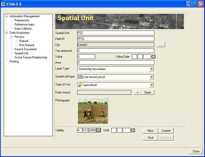
15 STDM (3) World Bank/UN-HABITAT field test Ethiopia (2009) Very high understanding of images Very participatory approach
16 Overview Vision Introduction. 2. LADM. 3. STDM. 4. The push from (geo-)ict. 5. The pull from land governance. 6. Conclusion.
17 The push from (geo-)ict (1) 1. More domain standards Domain sources maintained in a consistent manner. 2. Transparency of Land Administration processes Best practices and harmonization. 3. 3D (space) & 4D (time) registration 4D integrated space/time paradigm. 4. From registration system into design system Design of new spatial units in land management. 5. A whole range of new registrations New people spatial phenomena relationships.
18 The push from (geo-)ict (2) 6. Mobile applications Augmented reality, with precise positioning. 7. Monitoring applications Decision making in water and food provision. 8. International seamless registration An international coverage that fits. 9. Semantic web-based content All information in an unambiguous manner. 10.Faster and direct updating by actors Up-to-date and precise reference data.
19 Overview Vision Introduction. 2. LADM. 3. STDM. 4. The push from geo-ict. 5. The pull from land governance. 6. Conclusion.
20 The pull from land governance (1) Land governance: 1. Decisions regarding the access to land & use of land. 2. How are those decisions made and implemented? 3. Conflict reconciliation. Transparency as principle of good land governance: 1. A government that acts visible, understandable and predictable. 2. Citizens having access to information on policy and decision making processes.
21 The pull from land governance (2) Public restrictions A shift from private to public A shift from parcels to spatial units Spatial units with fuzzy and dynamic boundaries Web services with models of influence Public land In many countries not registered Gaps in registration will disappear Public sector Better information, better policy
22 Overview 1. Introduction. 2. LADM. 3. STDM. 4. The push from geo-ict. 5. The pull from land governance. 6. Conclusion.
23 Conclusion (1) Long-term vision: The push from (geo-)ict Strengthens the relationship between Land Administration and other public registers The pull from land governance Causes a substantial use of geo-referenced public sector land information In other words: both developments make the spatially enabled society happen
24 Conclusion (2) Short-term vision: LADM: an ISO standard in 2011 STDM: Massive registration of tenure relationships Via a participatory approach LADM + STDM: Standardized land information, worldwide Strong contributions to the spatially enabled society.
25 Thank you for your attention.
From LADM/STDM to a spatially enabled society: a vision for Harry UITERMARK, Peter VAN OOSTEROM, Jaap ZEVENBERGEN and Christiaan LEMMEN
 From LADM/STDM to a spatially enabled society: a vision for 2025 Harry UITERMARK, Peter VAN OOSTEROM, Jaap ZEVENBERGEN and Christiaan LEMMEN Introduction (1) Presentation is a coproduction Founding fathers
The ISO/TC 211 Land Administration Domain Model (LADM)
") Geographic information/geomatics The ISO/TC 211 Land Administration Domain Model (LADM) Harry Uitermark/Editor LADM Kadaster/ITC, The Netherlands International Organization for Standardization (ISO) A
Geographic information/geomatics The ISO/TC 211 Land Administration Domain Model (LADM) Harry Uitermark/Editor LADM Kadaster/ITC, The Netherlands International Organization for Standardization (ISO) A
The Road to a Standard Land Administration Domain Model, and
 The Road to a Standard Land Administration Domain Model, and Beyond Christiaan LEMMEN, Harry UITERMARK, Peter VAN OOSTEROM, Jaap ZEVENBERGEN, The Netherlands and Iain GREENWAY, United Kingdom Key words:
The Conceptual Architecture for 3D Cadastral Data Management based on Land Administration Domain Model (LADM)
") The Conceptual Architecture for 3D Cadastral Data Management based on Land Administration Domain Model (LADM) Sitarani Safitri *, Akhmad Riqqi, Albertus Deliar, Dini A. Norvyani 2 Remote Sensing and Geographic
The Conceptual Architecture for 3D Cadastral Data Management based on Land Administration Domain Model (LADM) Sitarani Safitri *, Akhmad Riqqi, Albertus Deliar, Dini A. Norvyani 2 Remote Sensing and Geographic
A new era: Dynamic Information Management
 A new era: Dynamic Information Management Professional and Institutional Developments Kees de Zeeuw MSc Director Kadaster International The Netherlands Affiliate member s perspective 45 affiliates from
Fit-For-Purpose Land Administration, Standards and Interoperability
 Fit-For-Purpose Land Administration, Standards and Interoperability Christiaan Lemmen Kadaster International University of Twente/ITC UN GGIM Seminar Effective Land Administration Deqing China September,
Linking the Land Information Systems in the Philippines Using the LADM as a Global Schema
 Linking the Land Information Systems in the Philippines Using the LADM as a Global Schema Romer Kristi ARANAS, Rhodora GONZALEZ and Louie Balicanta, Philippines Key words: Digital cadastre, e-governance,
LADM Implementation Prototype for 3D Cadastre Information System of Multi-Level Apartment in Indonesia
 LADM Implementation Prototype for 3D Cadastre Information System of Multi-Level Apartment in Indonesia Yanto Budisusanto Trias Aditya Rochmad Muryamto IDEA Limitations of land supply for infrastructure
FIG Working Week 2012 Knowing to manage the territory, protect the environment, evaluate the cultural heritage
 FIG Working Week 2012 Knowing to manage the territory, protect the environment, evaluate the cultural heritage Investigating the conformity between the Land Administration Domain Model (LADM) and the Vietnamese
Legal Aspects of 3D Property Rights, Restrictions and Responsibilities in Greece and Cyprus
 Legal Aspects of 3D Property Rights, Restrictions and Responsibilities in Greece and Cyprus Efi DIMOPOULOU, National Technical University of Athens, Greece and Elikkos ELIA, Cyprus Department of Lands
Standardization of the LADM Modelling of non-formal RRR
 Standardization of the LADM Modelling of non-formal RRR Jesper M. Paasch (Lantmäteriet), Peter van Oosterom (TU Delft), Christiaan Lemmen (Kadaster) and Jenny Paulsson (KTH Royal Institute of Technology)
The agenda for a Group of Experts on Land Administration and Management within the United Nations
 Presented at the FIG Working Week 2016, May 2-6, 2016 in Christchurch, New Zealand The agenda for a Group of Experts on Land Administration and Management within the United Nations Kees de Zeeuw, Kadaster
Towards LADM Country Cadastral Profile Case Poland
 Towards LADM Country Cadastral Profile Case Poland Jarosław BYDŁOSZ, Poland Key words: LADM, Country Profile, Cadastre, Poland SUMMARY The Geographic Information - Land Administration Domain Model was
EXPLORING OPTIONS FOR STANDARDISATION OF PROCESSES AND TRANSACTIONS IN LAND ADMINISTRATION
 EXPLORING OPTIONS FOR STANDARDISATION OF PROCESSES AND TRANSACTIONS IN LAND ADMINISTRATION CHRISTIAAN LEMMEN (1),(2), EVA-MARIA UNGER (2), PETER VAN OOSTEROM (3), MOHSEN KALANTARI (4) AND KEES DE ZEEUW
Low Cost Cadastral Data Aquisition?
 Low Cost Cadastral Data Aquisition? Jacobus Meijer and Christiaan Lemmen (Netherlands): 21 May 2011 Abstract Spatial Cadastral Data (Mapping) Participatory Development Some low cost approaches in cadastral
The LADM and the Continuum of Land Rights
 CheeHai TEO, Malaysia and Christiaan Lemmen, the Netherlands Key words: LADM, Continuum of Land Rights, Voluntary Guidelines, Spatial Enabled Societies SUMMARY The development of the Land Administration
Application of the Land Administration Domain Model to the City of Johannesburg Land Information System
 Application of the Land Administration Domain Model to the City of Johannesburg Land Information System Dinao Tjia 1,2, Serena Coetzee 2 1 City of Johannesburg, South Africa 2 Centre for Geoinformation
Land Markets and Land Rights in support of the Millennium Development Goals
 Land Markets and Land Rights in support of the Millennium Development Goals A Global Perspective Prof. Stig Enemark President Aalborg University, Denmark 3rd LAND ADMINISTRATION FORUM FOR THE ASIA AND
Towards LADM country cadastral profile case Poland
 Towards LADM country cadastral profile case Poland Jarosław Bydłosz Department of Geomatics Faculty of Mining Surveying and Environmental Engineering International FIG workshop on the Land Administration
Land Tools for Tenure Security for All
 Land Tools for Tenure Security for All PROF. JAAP ZEVENBERGEN UNIVERSITY OF TWENTE - ITC 1 ST JUNE 2017 HELSINKI, FINLAND GLOBAL LAND CHALLENGES 70 % Dealing with the affordability issue - how to modernize
Low Cost Cadastral Data Acquisition? ANNUAL WORLD BANK CONFERENCE ON LAND AND POVERTY World Bank - Washington DC April 23-26, 2012
 Low Cost Cadastral Data Acquisition? ANNUAL WORLD BANK CONFERENCE ON LAND AND POVERTY World Bank - Washington DC April 23-26, 2012 Christiaan Lemmen, Co Meijer, Jaap Zevenbergen, Rohan Bennett Abstract
Towards Malaysian LADM Country Profile for 2D and 3D Cadastral Registration System
 Towards Malaysian LADM Country Profile for 2D and 3D Cadastral Registration System Nur Amalina ZULKIFLI, Alias ABDUL RAHMAN, Hasan JAMIL, TENG Chee Hua, TAN Liat Choon, LOOI Kam Seng, CHAN Keat Lim, Malaysia
Developing 2D and 3D Cadastral Registration System based on LADM: illustrated with Malaysian Cases
 Developing 2D and 3D Cadastral Registration System based on LADM: illustrated with Malaysian Cases Nur Amalina ZULKIFLI, Alias ABDUL RAHMAN, Malaysia and Peter van OOSTEROM, the Netherlands SUMMARY This
Developing 2D and 3D Cadastral Registration System based on LADM: Illustrated with Malaysian cases
 Developing 2D and 3D Cadastral Registration System based on LADM: Illustrated with Malaysian cases Nur Amalina ZULKIFLI, Alias ABDUL RAHMAN, Malaysia Peter VAN OOSTEROM, The Netherlands Key words: LADM,
Serbian Profile of the Land Administration Domain Model
 Serbian Profile of the Land Administration Domain Model Aleksandra RADULOVIĆ, Dubravka SLADIĆ and Miro GOVEDARICA, Serbia Key words: Cadastre, Serbian Profile, LADM SUMMARY Since the data of cadastral
UN-HABITAT s Mission and Vision. Sustainable urban development Adequate shelter for all
 GLTN contributes to the implementation of pro poor land policies to achieve secure land rights for all www.gltn.net GLTN Secretariat, facilitated by PO Box 30030, Nairobi 00100, Kenya Tel: +254 20 762
as Experiment using the LADM
 as Experiment using the LADM Renzhong GUO, Shen YING, Lin LI, Ping LUO, PR China Peter VAN OOSTEROM, the Netherlands Key words: 3D Cadastre, Land Administration Model, Jurisdiction SUMMARY With the increasing
CADASTRE 2014: New Challenges and Direction
 CADASTRE 2014: New Challenges and Direction Anna KRELLE and Abbas RAJABIFARD, Australia Key words: Cadastre, Cadastre 2014, Land Administration SUMMARY Land and land related activities form part of the
Towards LADM Victoria country profile modelling the spatial information
 Towards LADM Victoria country profile modelling the spatial information Mohsen KALANTARI, Australia and Eftychia KALOGIANNI, Greece Key words: LADM, eplan, Australia, Victoria, Cadastre, Vicmap SUMMARY
Fit-For-Purpose what is it?
 FIG Commission 7 Annual Meeting 2016 Working Group 7.1 Fit-For-Purpose Land Administration Christiaan Lemmen October, 24th 2016 Coimbra, Portugal Fit-For-Purpose what is it? Fit-for-purpose: The systems
Greetings from Denmark. Property Rights, Restrictions and Responsibilities - A Global Land Management Perspective. Wonderful Copenhagen
 Property Rights, Restrictions and Responsibilities - A Global Land Management Perspective Greetings from Denmark 43,000 sq km Prof. Stig Enemark President Aalborg University, Denmark Aalborg Copenhagen
Click to edit Master title style
 Click to edit Master title style Modern Cadastre and Land Administration Session 5a. The toolbox approach Jude Wallace 2007 Click to edit Overview Master title style Objectives To understand the circumstances
GLTN LAND TOOLS -SOME EXAMPLES-
 GLTN LAND TOOLS -SOME EXAMPLES- Dr. Jaap Zevenbergen University of Twente What are GLTN Land Tools? GLTN considers that a tool is a practical method to achieve a defined objective in a particular context.
Presented by: Stewart Information International, Inc. Jack McKenna
 Presented by: Stewart Information International, Inc. Jack McKenna Held at the: 2007 ESRI Survey & Engineering GIS Summit San Diego Convention Center San Diego, California June 16-19, 2007 Integrating
An Overview of 3d Cadastre from a Physical Land Parcel and a Legal Property Object Perspective
 An Overview of 3d Cadastre from a Physical Land Parcel and a Legal Property Object Perspective Sudarshan KARKI, Kevin MCDOUGALL, Rod THOMPSON, Australia Key words: 3D Cadastre, property object, land parcel
Innovations in Education at Faculty ITC and within Land Administration Programme
 Innovations in Education at Faculty ITC and within Land Administration Programme Prof. Jaap Zevenbergen, Vice-Dean Education at Faculty ITC, Prof. Land Administration dr. Dimo Todorovski, Course Coordinator
LIS a motivation for SDI initiative
 Eric Mwaikambo Ardhi University Dar es Salaam Tanzania Overview Status of LIS in Tanzania Relationship between SDI and LIS Spatial Standards LIS a motivation for SDI initiative Conclusion & Recommendations
THE NEED FOR APPROACHES AND TECHNOLOGY OF TOMORROW
 THE NEED FOR APPROACHES AND TECHNOLOGY OF TOMORROW KEES DE ZEEUW, CHRISTIAAN LEMMEN and BERNY KERSTEN Cadastre, Land Registry and Mapping Agency - Kadaster, The Netherlands Kees.dezeeuw@kadaster.nl Paper
BOOSTING THE REGISTRATION OF LAND RIGHTS IN STEP WITH THE SUSTAINABLE DEVELOPMENT GOALS
 BOOSTING THE REGISTRATION OF LAND RIGHTS IN STEP WITH THE SUSTAINABLE DEVELOPMENT GOALS KEES DE ZEEUW Cadastre, Land Registry and Mapping Agency - Kadaster, The Netherlands Kees.dezeeuw@kadaster.nl CHRISTIAAN
Commission 7 Cadastre and Land Administration. Work Plan
 Commission 7 Cadastre and Land Administration Work Plan 2011 2014 Appendix to item 17.7 1. Title Cadastre and Land Administration 2. Terms of Reference Commission 7 deals with land administration and land
UN-GGIM Expert Group on Land Administration and Management Expert Group Meeting, Delft, The Netherlands 14 & 15 March, 2017
 UN-GGIM Expert Group on Land Administration and Management Expert Group Meeting, Delft, The Netherlands 14 & 15 March, 2017 BACKGROUND DOCUMENT The Delft Expert Group Meeting This two-day meeting of the
A Geocoded Cadastral Fabric as a Precondition for a Sustainable Land Management System
 A Geocoded Fabric as a Precondition for a Sustainable Land Management System Gottfried KONECNY, Germany; J.P. LAUZON, Canada; Abdul Salam MOHAMMED, India Key words: SDI,, Parcel Boundaries, GPS-GNSS, Land
Hungarian Cadastre and its relation to LADM
 Hungarian Cadastre and its relation to LADM Gyula IVÁN CLGE General Assembly 22 March 2013, Budapest, HUNGARY Content Historical background Evolution of Cadastral modeling in Hungary LADM issues Conclusion
Good Land Governance for the 2030 Agenda
 Good Land Governance for the 2030 Agenda Addis Ababa, Ethiopia 20-22 April, 2014 Role of Geospatial Information in Good Land Policy and Governance Oumar Sylla UN-Habitat/GLTN oumar.sylla@unhabitat.org
Presented at the FIG Congress 2018, May 6-11, 2018 in Istanbul, Turkey
 Presented at the FIG Congress 2018, May 6-11, 2018 in Istanbul, Turkey 5 Bibliometric Analysis of Articles Presented Under Commission 7: A Case of the 25th Fig Congress in Malaysia in 2014 Zeynel Abidin
Agenda. Clarissa Augustinus, UN-HABITAT and Christiaan Lemmen and Peter van Oosterom, The Netherlands 15. Billion people URBAN 60%
 Social Tenure Domain Model (STDM) Requirements from the perspective of Pro-Poor Land Management Clarissa Augustinus, Chief, Land and Tenure Section, UN-HABITAT Christiaan Lemmen, ITC/Kadaster, The Netherlands
Utilizing 3D Building and 3D Cadastre Geometries for Better Valuation of Existing Real Estate
 Utilizing 3D Building and 3D Cadastre Geometries for Better Valuation of Existing Real Estate Umit ISIKDAG Beykent U., Turkey Mike HORHAMMER Oracle, USA Sisi ZLATANOVA, Peter VAN OOSTEROM TU Delft, The
Developments in the Standardisation of the Core Cadastral Domain Model
 Developments in the Standardisation of the Core Cadastral Domain Model Christiaan Lemmen, Paul vander Molen Kadaster and ITC, The Netherlands Peter van Osterom, Jaap Zevenbergen and Wilko Quak Delft University,
Land Tenure and Geospatial Data and Technology
 Land Tenure and Geospatial Data and Technology Ioana Bouvier E3/Land and Urban, USAID Senior Geospatial Analyst January 23, 2018 January 23, 2018 1 OUTLINE 1. Overview of geospatial data and technology
Linking Land Registers and Other Official Registers in the Republic of Croatia based on LADM
 Linking Land Registers and Other Official Registers in the Republic of Croatia based on LADM Mario MAĐER, Hrvoje MATIJEVIĆ and Miodrag ROIĆ, Croatia Key words: official registers, land administration system,
3D Strata Objects Registration for Malaysia within the LADM Framework
 Nur Amalina ZULKIFLI, Alias ABDUL RAHMAN, Malaysia and Peter VAN OOSTEROM, the Netherlands Key words: Strata Registration, Modelling, LADM SUMMARY This paper discusses 3D objects registration and modelling
Commission 7, Land Administration and IT. Paul van der Molen INTERNATIONAL INSTITUTE FOR GEO-INFORMATION SCIENCE AND EARTH OBSERVATION
 Commission 7, Land Administration and IT Paul van der Molen INTERNATIONAL INSTITUTE FOR GEO-INFORMATION SCIENCE AND EARTH OBSERVATION FIG Commission 7 on cadastre and land management Study Visits (e.g.
DETERMINING SPATIO-TEMPORAL CADASTRAL DATA REQUIREMENT FOR INFRASTRUCTURE OF LADM FOR TURKEY
 DETERMINING SPATIO-TEMPORAL CADASTRAL DATA REQUIREMENT FOR INFRASTRUCTURE OF LADM FOR TURKEY M. Alkan a, *, Z. A. Polat a a Department of Geomatics, Faculty of Civil Engineering, Yildiz Technical University,
Land Administration as a Cornerstone in the Global Spatial Information Infrastructure
 Land Administration as a Cornerstone in the Global Spatial Information Infrastructure Peter van Oosterom 1, Arco Groothedde 2, Christiaan Lemmen 3, Paul van der Molen 4, and Harry Uitermark 5 1 TU Delft,
The Social Tenure Domain Model STDM-Online
 Land and Poverty Conference 2016 Scaling up Responsible Land Governance 14-18 March, 2016 Washington, DC The Social Tenure Domain Model STDM-Online Arnulf Christl: metaspatial Cyprian Celebalo: UN Habitat
Rohan Bennett (PhD) Jaap Zevenbergen (Prof.)
 Jaap Zevenbergen (Prof.)") Developing an integrated conceptual model to understand land governance continuum Berhanu K. Alemie (PhD) Rohan Bennett (PhD) Jaap Zevenbergen (Prof.) Presentation outline Background Research objective
Developing an integrated conceptual model to understand land governance continuum Berhanu K. Alemie (PhD) Rohan Bennett (PhD) Jaap Zevenbergen (Prof.) Presentation outline Background Research objective
Expert Group Meeting 9-11 November 2005 Geomatics The University of Melbourne Centre for Spatial Data Infrastructures and Land Administration
 Incorporating Sustainable Development Objectives into ICT Enabled Land Administration Systems Australia s International Science Linkages Program Expert Group Meeting 9-11 November 2005 Geomatics The University
ITC, ENSCHEDE, THE NETHERLANDS. Gateway to international knowledge exchange focusing on capacity building and institutional development
 ITC, ENSCHEDE, THE NETHERLANDS Gateway to international knowledge exchange focusing on capacity building and institutional development FACULTY ITC UNIVERSITY OF TWENTE In 2010 ITC became a faculty of the
WHAT IS AN APPROPRIATE CADASTRAL SYSTEM IN AFRICA?
 WHAT IS AN APPROPRIATE CADASTRAL SYSTEM IN AFRICA? Tommy ÖSTERBERG, Sweden Key words: ABSTRACT The following discussion is based on my experiences from working with cadastral issues in some African countries
Scenic Nepal. Land Administration Systems. Outline of Presentation. Interests in land. Rights: Registration and security of tenure positions
 Scenic Nepal Land Administration Systems Managing Rights, Restrictions, and Responsibilities in Land Prof. Stig Enemark President Aalborg University, Denmark SURVEY DEPARTMENT KATHMANDU, NEPAL. 16 FEBRUARY
Country Profile for the Cadastre of the Czech Republic Based on LADM
 Karel JANEČKA and Petr SOUČEK, Czech Republic Key words: Country profile, LADM, GeoInfoStrategy SUMMARY In 2014 the New Civil Code entered into force in the Czech Republic. This Act addresses several aspects
Challenges in technology, society and policy - how they influence Cadastre and Land Management
 Challenges in technology, society and policy - how they influence Cadastre and Land Management Gyula IVÁN, Hungary Key words: Cadastre, Land Administration, GIS SUMMARY During the last years there has
THE CONTINUUM OF LAND RIGHTS
 THE CONTINUUM OF LAND RIGHTS Clarissa Augustinus, GLTN/UN-Habitat FIG Working Week, Sophia, Bulgaria, 17-21 June 2015 THE CONTINUUM OF LAND RIGHTS APPROACH Recognising, Recording, Administering a variety
Legal framework and organisation of 3D cadastre
 3D Cadastre Modelling in Russia G2G10/RF/9/1 Report Work Package 1 Legal framework and organisation of 3D cadastre Version 1.0 (18 oct 11) Auteurs Hendrik Ploeger & Peter van Oosterom Page: 2 Report summary
Centre for SDIs and Land Administration Department of Geomatics Spatial systems to support sustainable development
 Centre for SDIs and Land Administration Department of Geomatics MODERN CADASTER and LAND ADMINISTRATION تهران-مرداد 1386 2014 ..... 2 ماه Centre for SDIs and Land Administration Department of Geomatics
Spatial Data Infrastructure for knowledge sharing
 , THE NETHERLANDS Key words: SDI, knowledge sharing, people profit planet, Kadaster, system of key registers, good governance, e-government, spatially enabled society, GIDEON SUMMARY Today s global challenges
From 2D representation of the buildings into cadastral maps towards 3D GIS applications and BIM a case study for Prishtina
 From 2D representation of the buildings into cadastral maps towards 3D GIS applications and BIM a case study for Prishtina This is a Peer Reviewed Paper Fisnik LOSHI, Kosovo Keywords: 3D cadastre, property
Challenges for the multi purpose cadastre
 Jens RIECKEN, Markus SEIFERT, Germany Key words: Multi purpose cadastre, 3d-cadastre, land use, SDI, solar cadastre SUMMARY Over the past 30 years, with the progress of information technologies the development
Social Tenure Domain Model Requirements from the Perspective of Pro-Poor Land Management
 Social Tenure Domain Model Requirements from the Perspective of Pro-Poor Land Management Clarissa AUGUSTINUS, Kenya, Christiaan LEMMEN and Peter VAN OOSTEROM, The Netherlands Key words: Core Cadastral
A New Vision on Cadastral Data Model
 Mohsen KALANTARI, Abbas RAJABIFARD, Jude WALLACE and Ian P. WILLIAMSON, Australia Key words: Land administration, cadastre, land parcel, legal property object, interoperability SUMMARY Land administration
Basic view. View of the report View of Cadastre 2014
 Basic view Standardized core cadastral domain model serves to: Avoid reinventing and reimplementing th same functionality again and again Enabel involved parties to communicate based on an shared ontology
The New Technology of a Survey Data Model and Cadastral Fabric as the Foundation for a Future Land Administration System.
 The New Technology of a Survey Data Model and Cadastral Fabric as the Foundation for a Future Land Ian HARPER, Australia Key words: cadastral modelling, survey data model, Survey Accuracy, Cadastre 2014
Country report, HUNGARY
 Country report, HUNGARY Gyula IVÁN Institute of Geodesy, Cartography & Remote Sensing (FÖMI) HUNGARY FIG Commission 7 Annual Meeting 2009 12-16 October, 2009, Kuala Lumpur, Malaysia Institute of Geodesy,
A beautiful setting. The Evolving Role of Cadastral Systems in Support of Good Land Governance. Setting the scene
 The Evolving Role of Cadastral Systems in Support of Good Land Governance Prof. Stig Enemark President Aalborg University, Denmark THE DIGITAL CADASTRAL MAP FIG COMMISSION 7 OPEN SYMPOSIUM KARLOVY VARY,
Digitalisation of the Real Property Rights Towards Spatially enabled E-Government
 Digitalisation of the Real Property Rights Towards Spatially enabled E-Government Lise Schroeder, Bent Hulegaard Jensen, Esben Munk Soerensen & Line Hvingel Istanbul, Turkey 25 june 201 Overview Introduction
Marine Spatial Data Infrastructure (MSDI) & The Marine Cadastre Application. April 10, 2018
 & The Marine Cadastre Application. April 10, 2018") Marine Spatial Data Infrastructure (MSDI) & The Marine Cadastre Application April 10, 2018 A Collaborative Pilot Project Vision of CHS: A framework of geographic data, metadata, users and tools Intent
Marine Spatial Data Infrastructure (MSDI) & The Marine Cadastre Application April 10, 2018 A Collaborative Pilot Project Vision of CHS: A framework of geographic data, metadata, users and tools Intent
Spatially Enabled Society Role of the Cadastre
 armasuisse Bundesamt für Landestopografie swisstopo Swiss Federal Directorate for Cadastral Surveying Spatially Enabled Society Role of the Cadastre XXIV FIG International Congress 2010 FIG-Task Force
Advanced Principles of 3D Cadastral Data Modelling. 2 nd International Workshop on 3D Cadastres 16 th 18 th November 2011
 Advanced Principles of 3D Cadastral Data Modelling 2 nd International Workshop on 3D Cadastres 16 th 18 th November 2011 Agenda Introduction to the project Drivers for land and property information in
A LADM-based temporal cadastral information system for modelling of easement rights A case study of Turkey
 Survey Review ISSN: 0039-6265 (Print) 1752-2706 (Online) Journal homepage: http://www.tandfonline.com/loi/ysre20 A LADM-based temporal cadastral information system for modelling of easement s A case study
REGISTRATION OF PROPERTIES IN STRATA
 REGISTRATION OF PROPERTIES IN STRATA REPORT ON THE WORKING SESSIONS INTRODUCTION A cadastre is usually, and in most countries, a parcel-based, and up-to-date land information system containing records
Seventh Session of the United Nations Committee of Experts on Global Geospatial Information Management
 Report of the Forum P a g e 1 Seventh Session of the United Nations Committee of Experts on Global Geospatial Information Management Report of the Forum Secure Land Rights and Smart Cities - Making It
Lessons for federated countries that have state land registries the Australian experience
 Lessons for federated countries that have state land registries the Australian experience Ian Williamson Centre for SDI and Land Administration Department Infrastructure Engineering University of Melbourne
Chapter 9: 3D Visualisation as a Tool to Facilitate Managing Land and Properties
 Chapter 9: 3D Visualisation as a Tool to Facilitate Managing Land and Properties Davood Shojaei Overview The rapid population growth and decrease of natural resources have concerned decision makers about
Agenda. Introduction to participants First Meeting UN-GGIM - GROUP OF EXPERTS ON LAND ADMINISTRATION AND MANAGEMENT UN-GE-LAM
 First Meeting UN-GGIM - GROUP OF EXPERTS ON LAND ADMINISTRATION AND MANAGEMENT Kees de Zeeuw, The Netherlands Chair Mahashe Chaka, Lesotho Co-Chair Brent Jones, ESRI (USA) -Rapporteur Agenda Opening Introduction
Cadastral Systems Re-engineering in Urban Zimbabwe
 Cadastral Systems Re-engineering in Urban Zimbabwe Edward Kurwakumire 1, Shelter Kuzhazha 2 1 Geomatics Department, Tshwane University of Technology, Pretoria, South Africa, KurwakumireE@tut.ac.za 2 Gems
GLTN Tools and Approaches in Support of Land Policy Implementation in Africa
 GLTN Tools and Approaches in Support of Land Policy Implementation in Africa Jamal Browne (UN-Habitat), Jaap Zevenbergen (ITC), Danilo Antonio (UN-Habitat), Solomon Haile (UN-Habitat) Land Policy Development
Sustainable Land Management based on Fast Approach Cadastral Documentation
 Sustainable Land Management based on Fast Approach Cadastral Documentation Dr. Alexander Kohli, Vice-President SWISS LAND MANAGEMENT FOUNDATION Agenda 1. Basic Principles of Data Modeling in a Spatially
The European Common Agricultural Policy (CAP) after 1992
 after 1992") On the Level of Cooperation between Agricultural & Cadastral Parcel Registration Halil Ibrahim INAN (presenter) & Tahsin YOMRALIOGLU, Turkey Peter van OOSTEROM & Jaap ZEVENBERGEN, The Netherlands 1 OTB
On the Level of Cooperation between Agricultural & Cadastral Parcel Registration Halil Ibrahim INAN (presenter) & Tahsin YOMRALIOGLU, Turkey Peter van OOSTEROM & Jaap ZEVENBERGEN, The Netherlands 1 OTB
Implementation of Fit for Purpose Land Administration in Nepal, in a post disaster context.
 Implementation of Fit for Purpose Land Administration in Nepal, in a post disaster context. Paula Dijkstra, Raja Ram Chhatkuli, Danilo Antonio, Eva-Maria Unger, Chrit Lemmen Wondimagegm Tesfaye, Shristee
Spatial Enablement and the Response to Climate Change and the Millennium Development Goals
 Spatial Enablement and the Response to Climate Change and the Millennium Development Goals Prof. Stig Enemark President Aalborg University, Denmark 18th UNITED NATIONS REGIONAL CARTOGRAPHIS CONFERENCE
From Measurement to Management
 From Measurement to Management The changing role of the land surveyors Prof. Stig Enemark Aalborg University, Denmark LAND MANAGEMENT AND HUMAN RIGHTS INTERNATIONAL SEMINAR, HØGSKOLEN I BERGEN, 8 9 SEPTEMBER
Model driven architecture engineered land administration in conformance with international standards illustrated with the Hellenic Cadastre
 Psomadaki et al. Open Geospatial Data, Software and Standards (2016) 1:3 DOI 10.1186/s40965-016-0002-3 ORIGINAL ARTICLE Open Access Model driven architecture engineered land administration in conformance
Incorporating Sustainable Development Objectives into ICT Enabled Land Administration Systems - Case Study Switzerland
 EXPERT GROUP MEETING ON INCORPORATING SUSTAINABLE DEVELOPMENT OBJECTIVES INTO ICT ENABLED LAND ADMINISTRATION SYSTEMS 9-11 November 2005, Centre for Spatial Data Infrastructures and Land Administration
The Requirements for Point Cadastres
 Robert ANTWI, Ghana; Rohan BENNETT, Walter DE VRIES, Chistiaan LEMMEN, Co Meijer; The Netherlands Key words: point cadastres; single point cadastre; land administration SUMMARY This paper reintroduces
STATUS REPORT
 Working Group 3 Land Administration STATUS REPORT 2006-2009 2009 Prof Ian Williamson (Chair) Mr Ahmad Fauzi Nordin (Vice Chair) Assoc. Prof Abbas Rajabifard (Vice Chair) 18th UNRCC-AP Conference Bangkok
Modernizing Natural Resource Management in Minnesota. Alex PILIPTCHAK, USA
 Alex PILIPTCHAK, USA Key words: Land administration domain model (LADM), Minnesota Department of Natural Resources (MN DNR) SUMMARY Thomson Reuters is currently in the final stages of implementing a modern
THINKING OUTSIDE THE TRIANGLE TAKING ADVANTAGE OF MODERN LAND MARKETS. Ian Williamson
 THINKING OUTSIDE THE TRIANGLE TAKING ADVANTAGE OF MODERN LAND MARKETS Ian Williamson Professor of Surveying and Land Information Head, Department of Geomatics Director, Centre for Spatial Data Infrastructures
Cadastral Records in Serbian Land Administration
 Cadastral Records in Serbian Land Administration Dubravka SLADIĆ, Aleksandra RADULOVIĆ and Miro GOVEDARICA, University of Novi Sad, Faculty of Technical Sciences, Serbia Key words: Cadastral Data, Land
The Challenge to Implement International Cadastral Models Case Finland 1
 The Challenge to Implement International Cadastral Models Case Finland 1 Tarja MYLLYMÄKI and Tarja PYKÄLÄ, Finland Key words: cadastre, modelling, LADM, INSPIRE SUMMARY Efforts are currently made to develop
Spatial Representation of Condominium/Co-ownership - Comparison of Quebec and French Cadastral System based on LADM Specifications
 Spatial Representation of Condominium/Co-ownership - Comparison of Quebec and French Cadastral System based on LADM Specifications Dr. Jacynthe POULIOT, a.-g. Marc VASSEUR, Graduate student, INSA, Strasbourg,