CadastralparcelsforINSPIRE. Jiří Poláček
|
|
|
- Bonnie Thompson
- 5 years ago
- Views:
Transcription


1 CadastralparcelsforINSPIRE Jiří Poláček
2 What sto come Digitization of cadastral maps in the Czech republic Workflow Description of services Challenges to be solved Implementation topics to be addressed KEN INSPIRE workshop - Prague Stránka 2

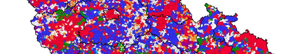


3 Digitization of cadastral maps 86 % KEN INSPIRE workshop - Prague Stránka 3


4 Workflow -INSPIRE Source Viewing Cadastre INSPIRE Viewing and download services KEN INSPIRE workshop - Prague Stránka 4
 buidings(2011) Conversion to the proposed")
 Arcs, circles, Result we are able to meet requirements without changing")

5 Testingdata specifications COSMC took part in testing data specification as LMO cadastral parcel theme( ) buidings(2011) Conversion to the proposed INSPIRE data format has been implemented Challenges: Topology Accuracy(point to line) Arcs, circles, Result we are able to meet requirements without changing source data structure, but we cannot use the productional database to run the network services Final solution Publication database KEN INSPIRE workshop - Prague Stránka 5
6 WMS forcadastralmaps INSPIRE May free viewing services Experience with operational run of Viewing Cadastre application Conclusions: Implementation of WMS for cadastral maps WMS used to introduce maps into Viewing Cadastre Application Exchange format as a source of data Launched in March KEN INSPIRE workshop - Prague Stránka 6


7 HarmonizedviewserviceforCadastral Parcels Started in May 9, 2011 Free of charge, no registration is required Data are updated ONLINE, we support GetFeatureInfo Layers CP.CadastralParcel(parcel polygons, labels of parcels) up to a scale of 1:20000 CP.CadastralParcel: returns CP.CadastralBoundary(parcel boundaries) up to a scale of 1:20 - name of cadastral zoning, parcel number, CP.CadastralZoning(boundaries and names of cadastral zoning) - parcel area,. up to a scale of 1: KEN INSPIRE workshop - Prague Stránka 7
8 Downloadservices Started in June 28, 2012 Free of charge, no registration is required Data are available in GML Data are harmonized by INSPIRE Data Specification on Cadastral Parcels version Two versions: direct access, WFS 2.0 pre-defined datasets, GML KEN INSPIRE workshop - Prague Stránka 8
9 Direct accessdownloadservice Data are updated online Supported functions: GetCapabilities, DescribeFeatureType, ListStoredQueries, DescribeStoredQueries GetFeatureby OGC standard version Numerous coordinate systems supported. Mostly used - national system (EPSG 5514) and ETRS 89 (EPSG 4258) KEN INSPIRE workshop - Prague Stránka 9
10 WFS limitationsetc. Limitations of WFS: layers CadastralBoundariesand CadastralParcels the query is limited to the area to one square kilometer (1 km2) and elements. layer CadastralZoning-the query is limited to the area to 400 square kilometers (400 km2) and 500 elements. Functionality: Getting data from area - specified rectangle (BBOX) Gettingspecific parcel -by parcel id (PAR_ID) Storedqueries: GetZoning searches for cadastral units by name. GetParcel searches for parcel by parcel number. GetChangedZonings searches for changed cadastral units GetNeighbourParcel search of neighbourowing parcels KEN INSPIRE workshop - Prague Stránka 10
11 Pre-defineddatasets Changed cadastral units are updated once a day. For each cadastral unit and supported coordinate system is generated a single file. Supported coordinate systems for generated files: The National system - S-JTSK Krovak East North (EPSG 5514), The European system - ETRS 89 (EPSG 4258), KEN INSPIRE workshop - Prague Stránka 11
 IP addresses (thous.")

12 WMS averagemonthlydemandsper year 700,0 600,0 500,0 400,0 300,0 visits (tis.) IP addresses (thous.) data amount (GB) 200,0 100,0 0, KEN INSPIRE workshop - Prague Stránka 12
13 WMS for cadastral maps(with raster and othes layers) Why 2 WMS (both harmonised and nonharmonized)? INSPIRE Parcel theme WMS (parcels in the vector form) Visit of Bavarian Delegation Stránka 13
14 Changes in Parcel theme Implementationtopics every working day we register a change in 6% of cadastral units (800 cadastral units from 13,000) Digitization 4 cadastral units daily totally changed Rules are sometimes too academical : GetFeaturelimitationin WFS isnecessary, but there is no way howto provided itin a machinereadable form commonfilterin WFS 2.0. enablesanyresult=0 SQL query Query runs on the parcel boundary table (full join) KEN INSPIRE workshop - Prague Stránka 14
15 Thankyouforyourattention KEN INSPIRE workshop - Prague Stránka 15
INSPIRE implementation as a link between egovernment and environmental purposes
 INSPIRE implementation as a link between egovernment and environmental purposes Jiří Poláček Czech Office for Surveying, Mapping and Cadastre (ČÚZK) Agenda Role of ČÚZK branch in the INSPIRE implementation.
INSPIRE implementation as a link between egovernment and environmental purposes
 INSPIRE implementation as a link between egovernment and environmental purposes Jiří Poláček Czech Office for Surveying, Mapping and Cadastre (ČÚZK) What s to Come Role of ČÚZK branch in the INSPIRE implementation.
The (Legal) Reliability of the Cadastre from the Perspective of the Czech Republic. Mgr. Martina Hercegová Ing. Karel Štencel
 Reliability of the Cadastre from the Perspective of the Czech Republic. Mgr. Martina Hercegová Ing. Karel Štencel") The (Legal) Reliability of the Cadastre from the Perspective of the Czech Republic Mgr. Martina Hercegová Ing. Karel Štencel PCC - Conference Vienna 20. 21. 11. 2018 Basic information about the CR Area:
The (Legal) Reliability of the Cadastre from the Perspective of the Czech Republic Mgr. Martina Hercegová Ing. Karel Štencel PCC - Conference Vienna 20. 21. 11. 2018 Basic information about the CR Area:
Recent Developments in Use and Dissemination of Geospatial Data in Germany - Example Lower Saxony
 Recent Developments in Use and Dissemination of Geospatial Data in Germany - Example Lower Saxony Conference Permanent Committee on Cadastre Lithuanian Presidency Vilnius, 22 October 2013 Peter Creuzer
INSPIRE, GDPR and the Czech Real Estate Cadastre. Jiří Poláček Czech Office for Surveying, Mapping and Cadastre (ČÚZK)
") INSPIRE, GDPR and the Czech Real Estate Cadastre Jiří Poláček Czech Office for Surveying, Mapping and Cadastre (ČÚZK) Agenda GDPR principles Source data information systems and workflow GDPR and INSPIRE
INSPIRE, GDPR and the Czech Real Estate Cadastre Jiří Poláček Czech Office for Surveying, Mapping and Cadastre (ČÚZK) Agenda GDPR principles Source data information systems and workflow GDPR and INSPIRE
Amalia Velasco Carlos Alonso Luis Virgos Fernando Serrano
 Inspire services of the Spanish Directorate General for Cadastre and its use to resolve an old problem of coordination between Spanish Cadastre and Land Registry. Amalia Velasco Carlos Alonso Luis Virgos
Advances in Modern Land Administration Cadastre 2014 in the Year 2006
 Advances in Modern Land Administration Cadastre 2014 in the Year 2006 Winfried HAWERK, Germany Key words: E-Land Administration, IT renewal strategies SUMMARY FIG Commission 7 Working Group 7.3 deals with
The Challenge to Implement International Cadastral Models Case Finland 1
 The Challenge to Implement International Cadastral Models Case Finland 1 Tarja MYLLYMÄKI and Tarja PYKÄLÄ, Finland Key words: cadastre, modelling, LADM, INSPIRE SUMMARY Efforts are currently made to develop
New Danish e-cadastre and its role in the Danish e-government
 New Danish e-cadastre and its role in the Danish e-government PCC Budapest 2011 Pia Dahl Højgaard, pdh@kms.dk Cadastre and Legal Authority, National Survey and Mapping, Denmark The danish context Neighbours
Functional system for cadastral plans
 , Republic of Macedonia Key words: Cadastre, Digital plans, Data, System SUMMARY The analysis shows that the real estate market in Republic of Macedonia grows daily. With the expansion of this market increases
A Complete, Free Solution for Cadastral Map Management
 A Complete, Free Solution for Cadastral Map Management Gyula IVÁN Institute of Geodesy, Cartography & Remote Sensing (FÖMI) HUNGARY FIG Commission 7, Annual Meeting 11-15 September 2008., Verona, ITALY
GAUSSCAD A WEBGIS APPLICATION FOR COLLECTING CADASTRAL DATA
 M.M. Moise GaussCAD a WebGIS Application for Collecting Cadastral Data GAUSSCAD A WEBGIS APPLICATION FOR COLLECTING CADASTRAL DATA Mihai-Mircea MOISE, S.C. GAUSS S.R.L., mihai.moise@gauss.ro Abstract:
Cadastral services and virtual office in e-cadastre
 Cadastral services and virtual office in e-cadastre Priit Kuus Estonian Land Board October 26, 2016 Coimbra Scope of data Cadastral parcels (as of September 2016) 674 383 cadastral parcels, i.e. 97,7 %
CFPB Implementation of Parcels Provision in HMDA Under Dodd-Frank
 CFPB Implementation of Parcels Provision in HMDA Under Dodd-Frank Land ownership is the foundation of the financial, legal, and real estate systems in our society Parcel Data vs. Census Data + Census data
Recent development in Land Administration in the Czech Republic
 Recent development in Land Administration in the Czech Republic Contribution to discussion prepared by the Czech delegation 5th session of UNECE WPLA Item 3 of agenda Geneva, 19-20 November 2007 Czech
DOWNLOAD ATOM SERVICES Cadastral Parcel (CP) Addresses (AD) Buildings (BU)
 Addresses (AD) Buildings (BU)") DOWNLOAD ATOM SERVICES Cadastral Parcel (CP) Addresses (AD) Buildings (BU) Version 1.0 July 2016 1 1 Description of ATOM Services... 3 2 Metadatos de los servicios... 3 3 Download ATOM services technical
DOWNLOAD ATOM SERVICES Cadastral Parcel (CP) Addresses (AD) Buildings (BU) Version 1.0 July 2016 1 1 Description of ATOM Services... 3 2 Metadatos de los servicios... 3 3 Download ATOM services technical
INSPIRE Thematic Working. Cadastral parcels. September 2008
 INSPIRE Thematic Working Cadastral parcels September 2008 The INSPIRE context The INSPIRE Directive Its aim is to build the INfrastructure for Spatial InfoRmation in Europe The INSPIRE Directive has been
AREC responsibilities, data and registries and the way of their distribution
 Data as a basis of the digital society PCC, 13-15 March 2018, Sofia AREC responsibilities, data and registries and the way of their distribution Vlatko Dimovski Agency for Real Estate Cadastre (AREC) the
Test and Implementation of DATR System in Hungary
 Test and Implementation of DATR System in Hungary, Hungary Key words: unified land registry, cadastral map, Hungary SUMMARY During the last years there has been an important development in the Hungarian
Country report, HUNGARY
 Country report, HUNGARY Gyula IVÁN Institute of Geodesy, Cartography & Remote Sensing (FÖMI) HUNGARY FIG Commission 7 Annual Meeting 2009 12-16 October, 2009, Kuala Lumpur, Malaysia Institute of Geodesy,
Role of National CLR Systems in the ELF-Cadastre Project. Amalia Velasco Martín-Varés Dirección General del Catastro. Spain
 Bratislava 2016 Role of National CLR Systems in the ELF-Cadastre Project Amalia Velasco Martín-Varés Dirección General del Catastro. Spain Bratislava 2016 Role of National CLR Systems in the ELF-Cadastre
Challenges for the multi purpose cadastre
 Jens RIECKEN, Markus SEIFERT, Germany Key words: Multi purpose cadastre, 3d-cadastre, land use, SDI, solar cadastre SUMMARY Over the past 30 years, with the progress of information technologies the development
Cadastral data services in Estonia
 Cadastral data services in Estonia Mr. Priit Kuus Department of Land Cadastre priit.kuus@maaamet.ee +372 675 0843 Ventspils 2013 Cadastre today Land Cadastre Act Adopted on 12 Oct.1994, since then amended
Hungarian Cadastre and its relation to LADM
 Hungarian Cadastre and its relation to LADM Gyula IVÁN CLGE General Assembly 22 March 2013, Budapest, HUNGARY Content Historical background Evolution of Cadastral modeling in Hungary LADM issues Conclusion
Progress Report on Green Paper. Dr. Paddy Prendergast. on behalf of the. IIS Commission on Land Registration
 Progress Report on Green Paper By Dr. Paddy Prendergast on behalf of the IIS Commission on Land Registration Paddy Prendergast - Chair Brendan Sweeny - Hempenstall Surveys Paul Corrigan - P Corrigan Associates
Cadastral Parcels in INSPIRE. Lisbon, 27 February 2013
 Cadastral Parcels in INSPIRE Lisbon, 27 February 2013 Dominique.laurent@ign.fr Plan INSPIRE context The modeling approach for theme Cadastral Parcels Implementation of INSPIRE theme Cadastral Parcels Context
Refinement of Cadastral Maps
 Acta Montanistica Slovaca Ročník 16(2011), číslo 4, 242-248 Refinement of Cadastral Maps Alena Berková 1 Making cadastral maps more precise The amended cadastral ordinance takes effect from 1.7. 2009.
Estonian e-cadastre as basis for efficient land management
 Estonian e-cadastre as basis for efficient land management Priit Kuus Estonian Land Board November 14, 2017 Tallinn Scope of data Cadastral parcels (as of October 2017) 693 026 cadastral parcels, i.e.
Status and Perspectives of the Geodesy, Cartography and Cadastre Authority Availability of Geographic Information in Slovakia.
 Status and Perspectives of the Geodesy, Cartography and Cadastre Authority Availability of Geographic Information in Slovakia Hedviga Májovská Geodesy, Cartography and Cadastre Authority of the Slovak
Challenge to Implement International Cadastral Models Case Finland
 FIG Articleof the Month April 20 Challenge to Implement International Cadastral Models Case Finland Tarja Myllymäki and Tarja Pykälä 200-04-5 The topics are In European level INSPIRE Experiences, similarities,
The Land Information System
 Country report News from the Cadastre in Finland Ari Tella 24.10.2016 FIG Commission 7 Annual Meeting, Coimbra Portugal The Land Information System NLS 2010 Land 2013 Maintenance Information Service Customers
Unified Land Administration for a Better Spatial Infrastructure
 Unified Land Administration for a Better Spatial Infrastructure Gyula IVÁN Institute of Geodesy, Cartography & Remote Sensing FÖMI (HUNGARY) Open Symposium 30th Korean Cadastral Seminar & FIG Commission
Cadastral Parcels in the context of INSPIRE
 Cadastral Parcels in the context of INSPIRE Gyula IVÁN Institute of Geodesy, Cartography & Remote Sensing, HUNGARY Open Symposium on Environment and Land Administration Big Works for the Defence of Territory
Parcel Identifiers for Cadastral Core Data: Concepts and Issues
 Parcel Identifiers for Cadastral Core Data: Concepts and Issues Nancy von Meyer, Bob Ader, Zsolt Nagy, David Stage, Bill Ferguson, Katie Benson, Bob Johnson, Stu Kirkpatrick, Robert Stevens, Dan Mates
REGISTRATION OF PROPERTIES IN STRATA
 REGISTRATION OF PROPERTIES IN STRATA REPORT ON THE WORKING SESSIONS INTRODUCTION A cadastre is usually, and in most countries, a parcel-based, and up-to-date land information system containing records
Latest Developments in Spanish Cadastral Services to citizens and administrations
 Latest Developments in Spanish Cadastral Services to citizens and administrations Amalia Velasco Martín-Varés, Coordinadora de Relaciones Internacionales Dirección General del Catastro 1/68 Leitmotiv of
The Development Strategy for Cadastre and Land Register in Finland
 1 2 The Development Strategy for and Land in Finland Arvo Kokkonen Ministry of Agriculture and Forestry Facts and figures of Finland - land area 304 530 km² - water area 33 615 km² - total area 338 195
Cadastral Information System of Sofia
 Alexander LAZAROV and Hristo DECHEV, Bulgaria Key words: ABSTRACT A new Cadastre and Property Register Act (CPRA) was passed in April 2000, setting up rules for the maintenance of these two registers.
Parcel Boundaries in the Czech Republic
 Parcel Boundaries in the Czech Republic CZECH REPUBLIC Jiri Rydval, Libor Tomandl Czech Office for Surveying, Mapping and Cadastre inhabitants - 10.3 million territory 78,865 km 2 2 Contents: 1. A parcel
A NOMINAL ASSET VALUE-BASED APPROACH FOR LAND READJUSTMENT AND ITS IMPLEMENTATION USING GEOGRAPHICAL INFORMATION SYSTEMS
 A NOMINAL ASSET VALUE-BASED APPROACH FOR LAND READJUSTMENT AND ITS IMPLEMENTATION USING GEOGRAPHICAL INFORMATION SYSTEMS by Tahsin YOMRALIOGLU B.Sc., M.Sc. A thesis submitted for the Degree of Doctor of
Demonstrate knowledge of, and extract, cadastral data from Landonline
 Page 1 of 5 Demonstrate knowledge of, and extract, cadastral data from Landonline Level 3 Credits 5 Purpose This unit standard is for people who are working in the surveying industry in jobs which involve
The French geoportal for Spatial plan (Géo-portail de l urbanisme): a spin-off of INSPIRE?
: a spin-off of INSPIRE?") The French geoportal for Spatial plan (Géo-portail de l urbanisme): a spin-off of INSPIRE? François Salgé - 1 - Content What is the Géoportail de l urbanisme Challenges for continuous and distributed updating
The French geoportal for Spatial plan (Géo-portail de l urbanisme): a spin-off of INSPIRE? François Salgé - 1 - Content What is the Géoportail de l urbanisme Challenges for continuous and distributed updating
LADM in the Republic of Croatia making and testing country profile
 STATE GEODETIC ADMINISTRATION Gruška 20,10 000 Zagreb, Croatia LADM in the Republic of Croatia making and testing country profile Nikola Vučić Danko Markovinović Blaženka Mičević CONTENTS INTRODUCTION
LIS a motivation for SDI initiative
 Eric Mwaikambo Ardhi University Dar es Salaam Tanzania Overview Status of LIS in Tanzania Relationship between SDI and LIS Spatial Standards LIS a motivation for SDI initiative Conclusion & Recommendations
Development of 3D Cadastre in Hungary
 Development of 3D Cadastre in Hungary András OSSKÓ Gyula IVÁN CLGE General Assembly 22 March 2013, Budapest, HUNGARY Content Introduction Problems in development of 3D cadastre and registration Hungarian
Ownership Data in Cadastral Information System of Sofia (CIS Sofia) from the Available Cadastral Map
 from the Available Cadastral Map") Ownership Data in Cadastral Information System of Sofia (CIS Sofia) from the Available Cadastral Map Key words: ABSTRACT Lydmila LAZAROVA, Bulgaria CIS Sofia is created and maintained by GIS Sofia ltd,
Ownership Data in Cadastral Information System of Sofia (CIS Sofia) from the Available Cadastral Map Key words: ABSTRACT Lydmila LAZAROVA, Bulgaria CIS Sofia is created and maintained by GIS Sofia ltd,
ParcelMap BC Compiling a Parcel Fabric for the Province of British Columbia. Presented by: Ellen Styner (General Manager) and Wendy Amy (GIS Manager)
 and Wendy Amy (GIS Manager)") ParcelMap BC Compiling a Parcel Fabric for the Province of British Columbia Presented by: Ellen Styner (General Manager) and Wendy Amy (GIS Manager) Who is MNC? MNC is a geomatics engineering firm with
ParcelMap BC Compiling a Parcel Fabric for the Province of British Columbia Presented by: Ellen Styner (General Manager) and Wendy Amy (GIS Manager) Who is MNC? MNC is a geomatics engineering firm with
Land Registers Interconnection Gabriel Sima European Commission, DG Justice and Consumers
 Land Registers Interconnection Gabriel Sima European Commission, DG Justice and Consumers Contents Context LRI Project status System implementation National establishments for land registration Electronic
A CADASTRAL GEODATA BASE FOR LAND ADMINISTRATION USING ARCGIS CADASTRAL FABRIC MODEL A CASE STUDY OF UWANI ENUGU, ENUGU STATE, NIGERIA
 A CADASTRAL GEODATA BASE FOR LAND ADMINISTRATION USING ARCGIS CADASTRAL FABRIC MODEL A CASE STUDY OF UWANI ENUGU, ENUGU STATE, NIGERIA BY Ndukwu, Raphael. Ike Department of Geoinformatics & Surveying University
Reliability of the Italian cadastral system data quality and improvement prospects
 Reliability of the Italian cadastral system data quality and improvement prospects Eng. Franco MAGGIO (Central Director for Cadastral, Cartographic and Land Registration Services) Eng. Arturo ANGELINI
Future Perspectives for a Multifunctional use of The Digital Cadastral Map in the Public Sector of Denmark
 Future Perspectives for a Multifunctional use of The Digital Cadastral Map in the Public Sector of Denmark Lars Erik STORGAARD and Marianne BENGTSON, Denmark Key words: Enterprise architecture, SOA, Organizational
Utility networks in Estonian Restrictions Information
 Utility networks in Estonian Restrictions Information System Mr. Priit Kuus Department of Land Cadastre priit.kuus@maaamet.ee +372 675 0843 Tallinn 2011 Restrictions: legal grounds The Constitution of
Serbia Should Have Online Cadastre for Property Like Other Countries in the Region
 Serbia Should Have Online Cadastre for Property Like Other Countries in the Region Tamara Borovcanin USAID Business Enabling Project The online real estate registry allows citizens to quickly and easily
Cadastre and Land Registration in Europe
 Annex A: Questionnaire 2007 for Information Resource Cadastre and Land Registration in Europe Introduction This questionnaire is based on the EuroGeographics vision document 'Cadastre and Land Registration
Towards LADM country cadastral profile case Poland
 Towards LADM country cadastral profile case Poland Jarosław Bydłosz Department of Geomatics Faculty of Mining Surveying and Environmental Engineering International FIG workshop on the Land Administration
Generic land administration business. FAO Workshop Rome, November 18-19,
 Generic land administration business FAO Workshop Rome, ovember 18-19, 2010 18.11.2010 1 Objectives Agree about what is the core land administration business common to all countries Derive the corresponding
The Multipurpose Hungarian Unified Land Registry System
 The Multipurpose Hungarian Unified Land Registry System András Osskó FIG Working Week Integrating Generation Stockholm, Sweden 14-19 June 2008 Republic of Hungary is located in Central Europe Neighbouring
Preprint.
 http://www.diva-portal.org Preprint This is the submitted version of a paper presented at 10th EC GI & GIS Workshop, ESDI State of the Art, Warsaw, Poland, 23-25 June 2004. Citation for the original published
Cadastre and Other Public Registers: Multipurpose Cadastre or Distributed Land Information System?
 Cadastre and Other Public Registers: Multipurpose Cadastre or Distributed Land Information System? Ivan PESL, Czech Republic Key words: Cadastre, Land Registry, Property, Taxes, Land Use, Territorial Planning,
KCA ORGANIZATION GOVERNMENT OF KOSOVA MINSTRY OF PUBLIC SERVICES GOVERNMENT OF KOSOVA MINSTRY OF PUBLIC SERVICES
 Development of Cadastre and Land Management in Kosovo Prof. Dr. sc. Murat Meha, chief executive Hyzri Llabjani-Cadastral Expert * Hajzer Bublaku-Lawyer FIG Working Week 2004 in Athens, Greece, May 22-27,
International funding projects in Republic Geodetic Authority
 International funding projects in Republic Geodetic Authority Serbia: Republic Geodetic Authority Workshop Exploring Funding Instruments for NMCA 7-8 November 2012 Republic Geodetic Authority Republic
FIG Congress 2010 Facing the Challenges Building the Capacity Sydney, Australia, April
 Setting up the infrastructure for improving the development of Cadastre in Greece Dr. Dimitris ROKOS, Dr. Konstantinos KYRIAZIS and Dr. Panos LOLONIS KTIMATOLOGIO S.A. (Hellenic Cadastre) Source: wikipedia
First Nations Land Registry
 First Nations Land Registry Making Sense of the ILRS Steven Patterson, Sitka Geomatics Inc. www.sitkageo.com Land Titles a brief history Land titles were traditionally managed within the community, and
ParcelMap BC. Compiling a Parcel Fabric for the Province of British Columbia. WENDY AMY and ELLEN STYNER
 ParcelMap BC Compiling a Parcel Fabric for the Province of British Columbia WENDY AMY and ELLEN STYNER Who is MNC? Established in 1997, MNC is a geomatics engineering firm located in Calgary, Alberta.
Object Oriented Unified Real Estate Registry for a Good Spatial Data Management
 Object Oriented Unified Real Estate Registry for a Good Spatial Data Management Gyula IVÁN Gábor SZABÓ Zoltán WENINGER Institute of Geodesy, Cartography and Remote Sensing (FÖMI), Hungary Workshop on e-governance,
Results of Central European Land Knowledge Center (CELK) Activities
 Activities") Results of Central European Land Knowledge Center (CELK) Activities András OSSKÓ, Hungary Key words :CELK Center, Property Rights and Land Market Development, Networking, direct knowledge transfer SUMMARY
Results of Central European Land Knowledge Center (CELK) Activities András OSSKÓ, Hungary Key words :CELK Center, Property Rights and Land Market Development, Networking, direct knowledge transfer SUMMARY
Report and update from Working Group A on Core Data
 JOINT UN-GGIM: EUROPE ESS MEETING ON THE INTEGRATION OF STATISTICAL AND GEOSPATIAL INFORMATION LUXEMBOURG 31 MARCH 2017 Report and update from Working Group A on Core Data François Chirié, Dominique Laurent,
Building a European Spatial Data Infrastructure: The Role of EuroGeographics
 Building a European Spatial Data Infrastructure: The Role of EuroGeographics Richard Kirwan President of EuroGeographics 1st Congress on Cadastre in the EU 1 Presentation overview EuroGeographics - the
Modern Real Estate Cadastre as Part of Geodata Infrastructure in Korea and Germany
 0pen Symposium 30th Korean Cadastral Seminar & Commission 7 Annual Meeting 2007 Good practice in Cadastre and Land registry Modern Real Estate Cadastre as Part of Geodata Infrastructure in Korea and Germany
Cadastre and Land Registration A System currently experiencing modernization in ROMANIA
 NATIONAL AGENCY FOR CADASTRE AND LAND REGISTRATION Mihai BUSUIOC Cadastre and Land Registration A System currently experiencing modernization in Agenda Historical Background Institutional organization
City of Surrey s Digital Plan Submission Process
 City of Surrey s Digital Plan Submission Process Cadastral Update Karen Stewart, B.Tech. (GIS) Spatial Information Manager Peter Mueller, B.C.L.S., C.L.S. Survey Manager City of Surrey, British Columbia,
Spatial Data Warehouse Ltd. Cadastral Mapping INITIATIVE 1: CADASTRAL MAPPING. Version Spatial Data Warehouse Ltd. & AltaLIS Ltd.
 Spatial Data Warehouse Ltd. Initiative 1: Cadastral Mapping INITIATIVE 1: CADASTRAL MAPPING 29 P3 The SDW/AltaLIS Model Background The Government of Alberta started a mapping program, the Municipal Integrated
Public private collaboration model in the cadastral workflow in Denmark
 Public private collaboration model in the cadastral workflow in Denmark Jakob HØJGAARD-GERAAE, Denmark Key words: Cadastre, digital cadastre, e-governance, history, land management SUMMARY The structure
Germany on the way to a 4D-Cadastre
 Germany on the way to a 4D-Cadastre Dr. Jens Riecken (DVW Vicepresident), Ulrich Gruber, Dr. Markus Seifert (DVW WG Geoinformation) TS 9.1 4D Cadastre, Land Domain Models & Concepts 1 Content About my
Use of data in Ukraine for sustainable economic growth. Oleksandr Maliuk State Service of Ukraine for Geodesy, Cartography and Cadastre
 Use of data in Ukraine for sustainable economic growth Oleksandr Maliuk State Service of Ukraine for Geodesy, Cartography and Cadastre Kehl, 2017 Content of the presentation Ukraine & StateGeoCadastre:
Mandatory use of notaries becoming unnecessary?
 NORWEGIAN MAPPING AUTHORITY SPATIAL DATA FOR THE BENEFIT OF SOCIETY Mandatory use of notaries becoming unnecessary? Helge Onsrud Director Centre for Property Rights and Development NORWEGIAN MAPPING AUTHORITY
Croatian SDI: a Tool for Accelerated Development of the Geo-Conscious Society
 STATE GEODETIC ADMINISTRATION Croatian SDI: a Tool for Accelerated Development of the Geo-Conscious Society Prof.Dr.Sc. Željko Bačić, Mr.Sc. Ljerka Rašić FIG Working Week 2009 - Surveyors Key Role in Accelerated
Spatial Data Infrastructure in Sweden
 Spatial Data Infrastructure in Sweden Hans-Erik WIBERG, Sweden Key words: ABSTRACT Sweden was one of the first countries to address Data Infrastructure matters and have during several decades developed
Cadastral PLSS Stewardship December 2010 Updated December 2013
 Cadastral PLSS Stewardship December 2010 Updated December 2013 Compiled by Bob Ader, Ben Knott, and Nancy von Meyer for the FGDC Cadastral Subcommittee Table of Contents 1. Overview... 2 2. Underlying
New Technology for Cadastral Systems. Brent Jones, PE, PLS
 New Technology for Cadastral Systems Brent Jones, PE, PLS Benefits of Good Land Administration Key to addressing global challenges.. Secure Tenure Equitable Land and Property Taxation Support for Government
Strengths and Weaknesses of the Czech Cadastral System: An Analysis of Present System
 Strengths and Weaknesses of the Czech Cadastral System: An Analysis of Present System Jiri RYDVAL, Vaclav SLABOCH and Libor TOMANDL, Czech Republic Key words: Czech Republic, Cadastre, Historical Turnovers,
COOPERATION BETWEEN PUBLIC AND PRIVATE SECTOR - PROJECT OF DIGITALIZATION OF THE CADASTRAL MAPS IN THE CZECH REPUBLIC
 COOPERATION BETWEEN PUBLIC AND PRIVATE SECTOR - PROJECT OF DIGITALIZATION OF THE CADASTRAL MAPS IN THE CZECH REPUBLIC Keywords: Cadastre of Real Estate, Czech Office for Surveying, Mapping and Cadastre
Who we are? MIS GIS. Cadastral Data Management System in Turkey. View from MIS. View from GIS. Dr. Emin Bank MIS? GIS? IT?
 Cadastral Data Management System in Turkey Dr. Emin Bank ebank@islem.com.tr Who we are?? View from? Or? View from Nowadays and are getting closer fastly 1 Viewing from is changing Viewing from is changing
Presented by: Stewart Information International, Inc. Jack McKenna
 Presented by: Stewart Information International, Inc. Jack McKenna Held at the: 2007 ESRI Survey & Engineering GIS Summit San Diego Convention Center San Diego, California June 16-19, 2007 Integrating
INTEGRATED LAND ADMINISTRATION SYSTEM PROJECT PREPARATION (IBRD Advance no. P459-HR) TERMS OF REFERENCE
 TERMS OF REFERENCE") INTEGRATED LAND ADMINISTRATION SYSTEM PROJECT PREPARATION (IBRD Advance no. P459-HR) TERMS OF REFERENCE SERVICE PROVISION FOR THE SUPPORT TO THE NATIONAL SPATIAL DATA INFRASTRUCTURE (NSDI) DEVELOPMENT
INTEGRATED LAND ADMINISTRATION SYSTEM PROJECT PREPARATION (IBRD Advance no. P459-HR) TERMS OF REFERENCE SERVICE PROVISION FOR THE SUPPORT TO THE NATIONAL SPATIAL DATA INFRASTRUCTURE (NSDI) DEVELOPMENT
Digitalisation of the Real Property Rights Towards Spatially enabled E-Government
 Digitalisation of the Real Property Rights Towards Spatially enabled E-Government Lise Schroeder, Bent Hulegaard Jensen, Esben Munk Soerensen & Line Hvingel Istanbul, Turkey 25 june 201 Overview Introduction
Implementation Status & Results Croatia Integrated Land Administration System Project (P122219)
") Public Disclosure Authorized Public Disclosure Authorized The World Bank Implementation Status & Results Croatia Integrated Land Administration System Project (P122219) Operation Name: Integrated Land
Public Disclosure Authorized Public Disclosure Authorized The World Bank Implementation Status & Results Croatia Integrated Land Administration System Project (P122219) Operation Name: Integrated Land
Integrated Land Information Services in Hungarian Land Administration
 , Hungary Key words: key words, theme, etc. SUMMARY The Unified Hungarian Land Registry, in which cadastral mapping and land registry belong to the same organization (Land Office Network), has been operating
The impact of the INSPIRE Directive on the turnover of ownership of agricultural real estate - case study of Poland
 The impact of the INSPIRE Directive on the turnover of ownership of agricultural real estate - case study of Poland Anna Klimach, Agnieszka Dawidowicz, Ryszard Źróbek University of Warmia and Mazury in
Quality Improvement of the Real Estate Cadastre in Serbia
 , Serbia Key words: quality improvement, real estate information, quality assurance, Serbia SUMMARY The concept of cadastral modernization in the Republic of Serbia was defined in 1992, and it is being
Annex D (informative) Correspondence between INSPIRE and national levels for CadastralZonings 2
 Correspondence between INSPIRE and national levels for CadastralZonings 2") Contents Annex D (informative) Correspondence between INSPIRE and national levels for CadastralZonings 2 Annex E (informative) Land Administration Domain odel (ISO19152) 4 What LAD is about? 4 What is
Contents Annex D (informative) Correspondence between INSPIRE and national levels for CadastralZonings 2 Annex E (informative) Land Administration Domain odel (ISO19152) 4 What LAD is about? 4 What is
STATE LAND AUDIT REPORT
 STATE LAND AUDIT REPORT 1 Presentation to the Portfolio Committee on Rural Development and Land Reform M514 Marks Building 30 March 2011 CHIEF SURVEYOR GENERAL Mr M RIBA Content 2 Background Project Objectives
Comparables Sales Price (Old Version)
") Chapter 486 Comparables Sales Price (Old Version) Introduction Appraisers often estimate the market value (current sales price) of a subject property from a group of comparable properties that have recently
Chapter 486 Comparables Sales Price (Old Version) Introduction Appraisers often estimate the market value (current sales price) of a subject property from a group of comparable properties that have recently
Theme II. Customers and Services NEW PROJECTS OF THE AGENZIA DEL TERRITORIO. Marco SELLERIE
 UNITED NATIONS ECONOMIC COMMISSION FOR EUROPE COMMITTEE ON HUMAN SETTLEMENTS WORKING PARTY ON LAND ADMINISTRATION Workshop "Customer - Co-operation - Services" Vienna, Austria 12-13 September 2002 Theme
Dmytro Makarenko / Pavlo Shevchenko State Service of Ukraine for Geodesy, Cartography and Cadastre/State Land CadastreCentre.
 Development of cadastral system in Ukraine: blockchaininitiatives Dmytro Makarenko / Pavlo Shevchenko State Service of Ukraine for Geodesy, Cartography and Cadastre/State Land CadastreCentre Vienna 2017
Moving Towards a Fully Operational 3D Digital Cadastre: Victoria, Australia
 Moving Towards a Fully Operational 3D Digital Cadastre: Victoria, Australia Davood Shojaei, Hamed Olfat, Mohsen Kalantari, Mark Briffa, Abbas Rajabifard The University of Melbourne www.mcg.org.au Limitations
State of the Art Modern Mapping Systems for Ireland
 Paul BRENT, Greg McDERMOTT and Fred FINCH, Ireland Key Words: Registry, Project, Ireland SUMMARY In 2005, the Irish Land Registry (ILR) embarked on a major programme to update the mapping systems which
Hungary is a landlocked, Central European country in the Carpathian Basin
 Brief Overview on Hungarian Land Administration MSc. György Domokos Hungarian Geodetic Surveying Liaison Group CLGE GA Hannover 12 13 October 2012 Hungary is a landlocked, Central European country in the
QUESTIONNAIRE. 1. Authorizing statute(s) citation West Virginia Code and 11-1C-4(d)
 citation West Virginia Code and 11-1C-4(d)") QUESTIONNAIRE (Please include a copy of this form with each filing of your rule: Notice of Public Hearing or Comment Period; Proposed Rule, and if needed, Emergency and Modified Rule.) DATE: 6/8/15 TO:
QUESTIONNAIRE (Please include a copy of this form with each filing of your rule: Notice of Public Hearing or Comment Period; Proposed Rule, and if needed, Emergency and Modified Rule.) DATE: 6/8/15 TO:
BULGARIAN CADASTRE A GUARANTEE FOR THE OWNERSHIP RIGHTS IN IMMOVABLE PROPERTIES
 4 TH INTERNATIONAL CONFERENCE RECENT PROBLEMS IN GEODESY AND RELATED FIELDS WITH INTERNATIONAL IMPORTANCE February 28 - March 2, 2007, Inter Expo Centre, Sofia, Bulgaria BULGARIAN CADASTRE A GUARANTEE