COMMUNITY REDEVELOPMENT AGENCY AGENDA November 26, :00 PM COMMISSION CHAMBERS 2401 SE MONTEREY ROAD, STUART, FL 34996
|
|
|
- Cuthbert Hunt
- 5 years ago
- Views:
Transcription

1 COMMUNITY REDEVELOPMENT AGENCY AGENDA November 26, :00 PM COMMISSION CHAMBERS 2401 SE MONTEREY ROAD, STUART, FL CALL TO ORDER 2. APPROVAL OF MINUTES October 22, COMMENTS A. Public B. Members C. Staff 4. PRESENTATIONS A. CRA th Quarter Report Alice Bojanowski, Project Manager, Office of Community Development Action requested: Hear the presentation and provide direction as necessary 5. OLD BUSINESS A. The CRAs and the Comprehensive Growth Management Plan - Irene Szedlmayer, Senior Planner, Growth Management Department Action requested: Hear the presentation and provide direction as necessary B. Land Development Regulations/CRA Code Project Update - Dana Little, Urban Design Director, Treasure Coast Regional Planning Council Action requested: Hear the presentation and provide direction as necessary 6. NEW BUSINESS A. Building Opportunity! Susan Kores, Manager, Office of Community Development Action requested: Hear the presentation and provide direction as necessary B. Rio Infill Sewer Project Susan Kores, Manager, Office of Community Development Action requested: Hear the presentation and move to approve staff recommendation 7. COMMENTS A. Public B. Members C. Staff Members & Term Expiration Craig Bauzenberger, Indiantown NAC December 31, 2018 Michael Banas, Hobe Sound NAC December 31, 2018 Catherine Winters, Port Salerno NAC December 31, 2019 Cindy Hall, Jensen Beach NAC December 31, 2020 Mark Palazzo, Old Palm City NAC December 31, 2020 Saadia Tsaftarides, Golden Gate NAC December 31, 2020 Richard Zurich, Rio NAC December 31, 2020 Staff George Stokus, Assistant County Administrator Susan Kores, Manager, Office of Community Development Alice Bojanowski, Project Manager, Office of Community Development Jordan Pastorius, Project Manager, Office of Community Development Kimberly McLaughlin, Administrative Specialist, Office of Community Development 1 of 62
2 October 22, 2018 COMMUNITY REDEVELOPMENT AGENCY - MINUTES 3:00 p.m. COMMISSION CHAMBERS 2401 SE MONTEREY ROAD, STUART, FLORIDA PRESENT Chairperson... Richard Zurich Vice Chairperson.Saadia Tsaftarides Members... Catherine Winters... Cindy Hall... Mike Banas Mark Palazzo ABSENT... Craig Bauzenberger STAFF PRESENT Manager, Office of Community Development... Susan Kores Project Manager, Office of Community Development... Alice Bojanowski Assistant County, Attorney, Legal... Elizabeth Lenihan Sr. Financial Analyst Stephanie Merle * Indicates a motion ** Indicates a vote *** For the record comment 1. CALL TO ORDER The meeting was called to order at 3:00 pm by Chairman Rick Zurich. 2. CONSENT AGENDA A. Approval of Minutes: October 22, 2018 * S. Tsaftarides motioned to approve the Minutes as presented. ** C. Hall seconded and the motion carried UNANIMOUSLY. 3. COMMENTS A. Public - J. Preast, Rio Civic Club My husband and I participate in the Adopt-A-Road Program at Savannah and Dixie Hwy. We felt much safer doing this now that we have the sidewalks. Thank you to the CRA for completing this project. o R. Zurich - It was Public Works who completed the section from the railroad to Savannah Rd. Thank you to them as well. B. Members - M. Palazzo we held an open meeting for Charlie Leighton Park and due to the efforts of Susan and the team, we had an overflow crowd attend and then the entire rowing team and their trophy s walked in and it was even more of an overflow turn out. Thank you and great job to staff. - C. Winters it was a pleasure to attend the event at the Geoffrey Smith Gallery sponsored by the Arts Council and Treasure Coast Builder s Association. Also thank you for the electronic sign for our last Port Salerno NAC meeting. We had a great turn out. o C. Hall can we have that for Jensen Beach as well? - S. Tsaftarides Golden Gate had a cleanup recently. It wasn t a good turnout. I sent letters to all of the homesteaded property owners and I feel like that worked. If you drive around the neighborhood it s cleaner and looks very nice. - M. Banas My family participates in the Adopt-A-Road program. It doesn t take long to do this, around 40 minutes. We adopted Hercules to Saturn. - R. Zurich Rio NAC is the proud owner of property, the Special Forces building. C. Staff Nothing to report 4. PRESENTATIONS A. CRA Project Update Susan Kores, Manager, Office of Community Development, gave an update on the current capital projects in all six CRAs. Comments/Questions 2 of 62
3 Community Development Agency October 22, S. Tsaftarides the FDOT and Dixie Hwy project; Kensington Street is the end of the CRA; I thought that is where the project would end? o Staff will follow up. 5. NEW BUSINESS A. Capital Improvement Project (CIP) Amendments S. Kores will be coming to each NAC in the next few months with CIP projects for The CIP projects will come to the CRA Board in February and then to the BOCC for approval. Today I am presenting 3 CIP sheet amendments. 1. Mapp Road Towncenter CIP Sheet we are not asking for more money but to enhance the scope. We are looking to build two small plazas, putting in some amenities; lighting, benches, trash receptacles, etc. - M. Palazzo gave a brief overview of the project to connect Mapp Road and the Ripple project as far as design elements to be added, this will also include Charlie Leighton Park. MOTION - MOVED * M. Palazzo moved to approve staff s recommendation to enhance the Mapp Rd. Towncenter project CIP sheet. ** C. Winters seconded and the motion carried UNANIMOUSLY. 2. Banner Lake/Pettway CIP Sheet the Pettway neighborhood has requested that the previous traffic calming method be removed. They are called chicanes which mimic an S curve. Per Public Works and the Sheriff s department, they have done just the opposite. The neighborhood has asked that we get rid of this and make the road straight again, adding three cross walks of which two will be raised and added signage. We are asking that we add $50,000 of unallocated carry over funds and designated it to this project which already has $100,000 in the CIP sheet. MOTION - MOVED * M. Banas moved to approve staff s recommendation to add $50,000 in unallocated funds to the Banner/Pettway CIP sheet. ** C. Hall seconded and the motion carried UNANIMOUSLY. 3. CRA Code Amendments CIP Sheet The last step for this project is to get it on its way. We now need to add funding to the CIP sheet to pay the POs. - R. Zurich this will be reallocating funds to the FY19 CIP sheet. MOTION - MOVED * M. Pallazo moved to approve staff s recommendation to add funding to the Land Development Regulation Code Update CIP sheet. ** M. Banas seconded and the motion carried UNANIMOUSLY. 6. OLD BUSINESS A. Capital Improvement Project Amendments S. Kores presented the Board with an updated meeting schedule for 2019 for informational purposes only. 7. STAFF UPDATE S. Kores presented the Board with updates from the Office of Community Development. 1. Opportunity Zone event we are working on an event with the Business Development Board and the Economic Council to follow up last s event, Vision to Implementation. We are looking at mid-march. It will focus on Builders, Bankers, Brokers, Designers, Construction and Developers along with highlighting the Opportunity Zone and available properties in the CRA. 2. Susan Kores, Jordan Pastorius and Alice Bojanowski will attend the FRA conference next week 3. The next Board meeting will be on November 26 th so Happy Thanksgiving to all of you. 4. Reminder that the Ripple opening will be on November 30 th at the Courthouse Cultural Center from 5:30-7:30 pm. 7. COMMENTS A. Public - J. Preast I am inquiring about the Stephen Blasko Home out in Palm City. I am interviewing Mabel Witham. What is the Palm City NAC s plan for the house? 3 of 62 Page 2 of 3
4 Community Development Agency October 22, 2018 o o o o o o o o o M. Palazzo the NAC has asked about getting historic designation for the home and what we learned is that it s just an old house and nothing ca be done with it. If someone knows otherwise that would be great. Part of our plan was to reposition and designate it for something. We are working on a courtyard area and will need to do something with the house. J. Preast do you know how old the house is? S. Kores it meets the over 50 year s requirement. We have spoken to people in the county and there s nothing about it that we could get any designation. J. Preast I know it s been moved and that is a drawback but that doesn t mean that within our Historic Preservation Board, that we can t move forward locally we just can t go higher to the national registry. S. Kores can we meet next week? General Services indicated that it would take a huge amount of funds to ring it up to code and they cannot undertake that and the Old Palm City does not have the funds either. We are working to understand how we acquired the home. J. Preast we need to discuss what will be done. M. Palazzo if we can find historic value that would be great. S. Kores it is in very poor shape. M. Palazzo it would need to be moved no matter what we do. B. Members - S. Tsaftarides the historic marker will be installed on Tuesday. We will put off the celebration until November. The Sewall Art Society will host a walk through on Colorado Avenue on November 10 th from 5-9 pm. Each business will feature an artist. - M. Banas where are we on the Banner Lake improvements. The neighborhood wants more traffic calming. o S. Kores we will look at more funds in the CIPs for The Sheriff and the Public Works department indicate there is not a need. C. Staff Nothing to report 8. ADJOURN meeting adjourned at 3:46 pm. * M. Banas motioned to adjourn. ** M. Palazzo seconded and the motion carried UNANIMOUSLY. Recorded and Prepared by: Kim McLaughlin, Administrative Specialist Date Richard Zurich, Chairperson Date Page 3 of 3 4 of 62
5 ITEM 4A COMMUNTY REDEVELOPMENT AGENCY AGENDA ITEM November 26, 2018 PREPARED BY: TITLE: Alice Bojanowski, Project Manager, Office of Community Development CRA FY th Quarter Report EXECUTIVE SUMMARY: Estimated time: 10 minutes. The Martin County Community Redevelopment Agency is requested to review the 4th Quarter Report for FY This is presented by staff to apprise the Agency of ongoing efforts. ISSUES: NA LEGAL SUFFICIENCY REVIEW: NA RECOMMENDED ACTION: Move that the Community Redevelopment Agency receive the quarterly report and provide direction, as needed. ITEM 4A 5 of 62


6 MARTIN COUNTY COMMUNITY REDEVELOPMENT AGENCY OFFICE OF COMMUNITY DEVELOPMENT FY 2018: 4 TH QUARTER REPORT JULY AUGUST SEPTEMBER Golden Gate Hobe Sound Jensen Beach Palm City Port Salerno Rio 6 of 62
7 CRA WIDE CRA Issues worked on over summer months: Extension of CRAs for 10 more years. CRA LDRs = Land Development Regulations Glitch Bills for all CRA areas are done and approved. 7 of 62
8 CRA TRAINING CRA Information brought to the NAC: Legislative Priorities Kloee Ciuperger Code Compliance John Colando and Rachel Spradley Health & Human Services Dawn Cobb and Emily Durham Glitch Bill LDR Codes update Irene Szedlmayer 8 of 62


9 GOLDEN GATE Septic to Sewer Continued Coordination with MC Utilities for Sewer Golden Gate Building Planters, Landscaping and Plaque installation complete Street Lights FPL to replace remaining street lights with LEDs 9 of 62


10 HOBE SOUND Gomez Affordable Housing and Bridge Road Town Center ROW donations are completed Roadway design is underway Coordinating with FPL and SMRU 10 of 62


11 JENSEN BEACH Parking Innovations Church Street on-street parking concept designs underway In-Fill Sewer Identified properties in need Proposed sewer easement for Cherry Terrace Sidewalk Maintenance Collaborated with Public Works to reach businesses affected by the construction 11 of 62


12 PALM CITY Ripple Eco-Art Project Received conceptual design Held Community Engagement Pot Luck on September 22nd Mapp Road Town Center Received all as-built surveys from Phase I Collected additional surveys working towards 60% plans Charlie Leighton Park Community engagement with Parks and Recreation New Business - Ribbon Cutting Etling Orthodontics on July 10 th 12 of 62


13 PORT SALERNO Infrastructure Water line extension proposed along Salerno Road Street Lights FPL swap high pressure sodium vapor streetlights with LEDs Parking solutions Conceptual design for the reorganization of Park Drive/ Seaward corridor 13 of 62


14 RIO Martin Ave Roundabout Mosaic Tiles Completed Landscaping installed Sidewalk Connections Finished around curve by the railroad tracks Public Works finished to Savannah Road Rio Town Center Private party currently under contract 14 of 62

15 THANK YOU! 15 of 62
16 ITEM 5A COMMUNITY REDEVELOPMENT AGENCY AGENDA ITEM November 26, 2018 PREPARED BY: TITLE: Irene Szedlmayer, Senior Planner, Growth Management Depart. The CRAs and the Comprehensive Growth Management Plan EXECUTIVE SUMMARY: Estimated time: 20 minutes. Irene Szedlmayer, Senior Planner, Growth Management Department, will review Martin County Comprehensive Growth Management Plan (CGMP) policies which may make it more difficult to fully realize CGMP Goals 4.2 and 4.3. and the vision for the CRAs of compact, complete, convivial, and walkable neighborhoods in the CRAs. BACKGROUND/RELATED STRATEGIC GOAL: At the June 26, 2017 CRA Board meeting, Nicki van Vonno, AICP, Growth Management Director, and Ms. Szedlmayer presented to the CRA Board regarding the CRA Glitch Bill project, an effort to eliminate ambiguity and inconsistency in the CRA zoning codes (Article 3, Division 6, Land Development Regulations). That project is now complete. The zoning codes applicable in all 6 CRAs were amended. At the June 2017 meeting, Ms. van Vonno also distributed to the CRA Board a document identifying all CGMP policies that reference the CRAs. Ms. van Vonno explained that there may be some CGMP policies, whether specific to the CRAs or generally applicable county-wide, that impede realization of the CRA vision. Then, in December 2017, in the context of considering the first of the CRA Glitch bills, the Board of County Commissioners adopted Resolution , which initiated amendments of the CGMP to strengthen Goals, Policies and Objectives that encourage in-fill development and redevelopment in the Community Redevelopment Areas. Resolution and the Nov. 30, 2017 staff report and its attachments are included with this agenda item. LEGAL SUFFICIENCY REVIEW: N/A RECOMMENDED ACTION: N/A Move that the Agency provide input and direction, as necessary. FISCAL IMPACT: N/A DOCUMENTS REQUIRING ACTION: N/A ITEM 5A 16 of 62

17 MARTIN COUNTY, FLORIDA Comprehensive Planning Division { Martin County s Community Redevelopment Areas and Comprehensive Growth Management Plan Goals, Policies and Objectives Staff Irene A. Szedlmayer, AICP, Senior Planner Nicki van Vonno, AICP, Growth Management Director Date of this Report November 30, 2017 A. Introduction During its consideration of proposed amendments to Article 3, Division 6, Section , Port Salerno Redevelopment Overlay District, on November 28, 2017, the Board of County Commissioners directed staff to prepare an agenda item addressing the role of the Martin County Comprehensive Growth Management Plan in the County s Community Redevelopment Areas for the the December 12, 2017 Board meeting. Martin County has three primary tools available to it to encourage investment and infill development in the seven Community Redevelopment Areas: (1) the Land Development Regulations; (2) the Comprehensive Growth Management Plan; and (3) installation of water, wastewater and stormwater infrastructure. While staff believes the Glitch Bill work is essential, several caveats are appropriate. First, no code is perfect and the proposed amendments contained in the Glitch Bill do not resolve all issues evident in the code. Staff anticipates additional amendments will be brought forward as each Community Redevelopment Area reviews and updates its Redevelopment Plan and as the community has time to more thoroughly vet some of the additional issues. The work on the glitch bill amendments to the LDRs will be completed by the end of next summer. Investment in basic urban infrastructure, such as drinking water distribution lines, public wastewater collection lines, and stormwater collection and treatment is needed. The cost of planning and installing public utility lines is too great to be absorbed by smaller-scale, in-fill development projects and the opportunity costs are perceived to be too great for any one individual or a small group of individuals to devote the time and effort necessary to organize the community to petition for the County to install the lines and assess the property owners. Also, the amount of land required to provide necessary stormwater detention and treatment is excessive for small scale-infill development, and the expense of more sophisticated underground collection and treatment is considered too high to be 17 of 62
18 absorbed by a small project. Community stormwater collection, detention and treatment solutions are needed and could be designed to also provide needed community open-space. Included with this agenda item are this staff report, a document entitled CGMP Policies that Reference the Community Redevelopment Areas, a document entitled MC CGMP reference to Impact Fees in Goals, Objectives and Policies, and public comment received. The CGMP Objectives and Policies intended to encourage investment and redevelopment in the CRAs are primarily found in Chapter 4, Future Land Use, specifically Goal 4.2 and Goal 4.3. Goal 4.2 and Goal 4.3 are found on pages 4 and 5 in CGMP Policies that reference the Community Redevelopment Areas (a document initially prepared for the Community Redevelopment Agency in June 2017 which is included with this agenda item). Some CGMP policies, while intended to achieve laudable county-wide goals and objectives, when implemented within the CRAs may make it more difficult to achieve the vision of the CRAs economically and socially vibrant, compact, mixed-use town centers surrounded by sustainable, pleasant, compact, walkable, residential neighborhoods. Some Comprehensive Plan policies may be based on a more suburban, automobile-dependent development pattern where different uses are strictly separated. Some of the policies that may make realization of the full potential of the CRAs less likely are briefly explored in this memo. This is an opportune time to consider these issues. The Community Redevelopment Agency is finalizing revisions to the Martin County Community Redevelopment Plan, which was adopted in That work will be followed by updates to each of the individual redevelopment plans for each community redevelopment area, guided by the principles established in the County plan. Perhaps more importantly, Martin County is moving forward with a septic-to-sewer program with emphasis on the older neighborhoods within the CRAs. Finally, staff is engaged with the Neighborhood Advisory Committees to complete the glitch bills. The work on the Redevelopment Plans, the careful review and calibration of some Comprehensive Plan policies, and the update of the codes will help the CRA attract the private investment that can help facilitate the septic-to-sewer conversion. 1. The design of the Mixed-Use Future Land Use Overlay. The Mixed-Use Future Land Use Overlay provides benefits only to mixed-use development projects. For single-use projects, the policies and standards of the underlying future land use designation remain in place. Mixed-Use development within a Mixed-Use Future Land Use Overlay is permitted to have 80% lot coverage and is required to provide only 20% open space, the same standard that applies to the General Commercial Future Land Use. Unlike the General Commercial FLU, in mixed-use projects in a CRA, impervious areas may be credited toward the required open space if designated as community gathering spaces such as plazas, esplanades, or covered gathering spaces. Finally, mixed-use projects, 18 of 62


19 in a mixed-use overlay, may satisfy the 20% open space requirement by providing the equivalent in cash or land in another part of the CRA. For single-use development in the Mixed-Use Overlays, CGMP policies regarding permitted uses and development standards such as minimum lot area, minimum open space, maximum building coverage and maximum building height remain in effect. While these neighborhoods were identified as in need of redevelopment, there are no incentives for single-use investment. For example, within the 15-acre Salerno Road Mixed-Use Future Land Use Overlay, a small scale commercial use such as a barber shop, coffee shop, or insurance brokers office is limited to just 0.8 acres (lilac). The remaining 14+ acres has a residential or mobile home future land use and commercial uses are not allowed. Figure 1. Salerno Road CRA Zoning and Mixed-Use Future Land Use Overlay Figure 2. Cove Road CRA Zoning and Mixed-Use Future Land Use Overlay 19 of 62
20 In the Cove Road Zoning and Mixed-Use Overlay, within the Medium Density Future Land Use (red) a small 4-unit or 6-unit apartment house would be required to provide 50% open space, the same minimum amount of open space required in residential developments throughout Martin County. Requiring residential development located within a CRA Zoning and Mixed Use Future Land Use Overlay to provide the same percentage of open space as the outlying residential neighborhoods is an obstacle to creating compact, walkable town centers. Additionally, residential development that is a component of a mixed-use project in the Mixed-Use Future Land Use Overlay is permitted up to 15 dwelling units per acre, but a single-use residential project located in the Medium Density Future Land Use is limited to 8 dwelling units per acre, unless affordable housing is provided, in which case, the maximum possible density increases to 10 dwelling units per acre. Table 1. CGMP Development Standards by Future Land Use Designation Future Land Use Designation Minimum Lot Area Minimum Open Space Maximum Building Coverage Maximum Building Height Estate Density, Low Density, Medium Density, High Density Varies, depending on zoning district 50% N/A 40 ft./ 4 stories (per CGMP; Commercial Office/Residential Limited Commercial Waterfront Commercial General Commercial Mixed-Use project in a Mixed-Use Overlay 10,000 40% 40% 30 ft. 10,000 30% 50% 30 ft. 10,000 30% 50% 10,000 20% 60% none 20% 80% water related- 30 ft.; water dependent- 40 ft. 40 feet/ 4 stories 35 feet/ 3 stories Source: CGMP Policies 4.3, 4.13A.7, and 4.13A.8 20 of 62
21 It may be worth exploring whether the CRA Mixed-Use Future Land Use Overlays can be re-calibrated to function like the CRA Zoning Overlays in that they supersede the underlying future land use. A mix of uses would be permitted anywhere in the Overlay, subject to careful design and performance standards. If the Mixed-Use Future Land Use Overlays functioned like the CRA Zoning Overlays, a mix of uses could develop naturally, incrementally, over time. 2. Mixed-Use Development Projects versus a Mixed-use Neighborhood. As described in the first section, the CGMP policies designed to encourage the development of walkable, compact, mixed-use neighborhoods are available only to mixed-use projects, not to all development within the Mixed-Use Future Land Use Overlays. Whereas, CGMP Objective 4.3A. is to encourage, but not mandate, mixed uses in designated CRAs, CGMP Policies 4.3A.3., 4.3A.4., 4.3A.9., 4.3A.10. are limited to mixed-use projects. The vision for the CRA Mixed-Use Overlays is a vibrant, walkable neighborhood. Vibrant, walkable neighborhoods do not require every project to be mixed-use. Staff recalls that the original draft of these policies was not limited in this fashion. By limiting the regulatory incentives to mixed-use projects, one practical effect is that smaller-scale developers with access to smaller amounts of capital are less able to participate. 3. Density Transition The County s density transition policies are designed to protect existing residential neighborhoods from residential development with excessive density and intensity on adjacent land. However, in the CRAs, the goal of compact, walkable, traditional neighborhood development in some cases requires increased density and intensity. It may be possible to accommodate this policy on large tracts of land, but within the CRAs, most of the remaining undeveloped parcels are small. It is nearly impossible to comply with the density transition policy and provide any increase in density or intensity on the land. Compliance with this policy drives fundamental planning determinations. Sometimes a plan designed to comply with density transition is less advantageous to the community overall. Policy 2.1A.3 reads, in relevant part, as follows: In areas of residential development, project design shall ensure that comparable density and dwelling unit types are planned for the area of the project abutting existing residential development. For purposes of this policy, abutting property is the same as "adjacent," "immediately adjacent" or "adjoining" property and shall refer to property with a shared property line or to properties separated only by right of ways or easements. Properties separated by an existing road with a minimum 30 foot right of way shall not be considered abutting. 21 of 62
22 (1) Projects directly adjacent to lands used or designated for higher density may be given maximum density. (2) Projects immediately adjacent to lands used or designated for lower density use should be given less than maximum density and shall provide for reduced density next to the existing lower density residential area. (3) Within the urban service districts where lot sizes in the existing residential development are two acres or less and density is more than 1 unit per 2 acres, the following shall apply: For projects abutting a residential development of lesser density, a density transition zone of comparable density and compatible dwelling unit types, shall be established in the new project for a depth from the shared property line that is equivalent to the depth of the first tier of the adjoining development's lower density. (Ex. - the depth of the first block of single family lots.)... Policy 2.1A.3, is virtually identical to Policy 4.1F.1, F.2. and F.3, which read as follows: Policy 4.1F.1. Projects directly adjacent to lands used or designated for higher intensity use may be given maximum density. Policy 4.1F.2. Projects immediately adjacent to lands used or designated for lower density use should be given less than maximum density. (1) In all such cases the project with higher density shall provide for reduced density next to the existing lower density residential area. (2) Within the urban service districts where lot sizes in the existing residential development are two acres or less and density is more than 1 unit per 2 acres, the following shall apply: For the residential portion of said project abutting the existing development or area of lesser density, a density transition zone of comparable density and compatible dwelling unit types shall be established in the new project for a depth from the shared property line that is equivalent to the depth of the first tier of the adjoining development's lower density (i.e., the depth of the first block of singlefamily lots). Policy 4.1F.3. The following criteria shall be met when applying Policy 4.1F.2. (1) For purposes of this policy, abutting property is the same as "adjacent" or "adjoining" or "immediately adjacent" property and shall refer to property with a shared property line regardless of easements on the abutting properties. Properties separated by an existing road with a minimum 30 foot right of way shall not be considered abutting. 22 of 62
23 (2) Lands outside the urban service district, agricultural property and residential lots 2 acres or larger shall be protected by buffers and by 4.1F.2. but the tiering Policy in 4.1F.2. (2) shall not apply.... This policy applies regardless of the underlying future land use designation and zoning. Because one goal of the CRAs is to increase density, while also creating a highly desirable streetscape, it may be advisable to consider the suitability of the density transition policy within the Community Redevelopment Areas and whether other ways to protect the quality of existing residential development may be more appropriate and effective. Existing Policies in Chapter 6, the Housing Element, suggest some other methods that can protect existing neighborhoods: Policy 6.1B.3. Protection of existing neighborhoods. The County shall promote the use of innovative site planning, landscaping, and other buffering devices to protect existing neighborhoods. Housing needs shall be satisfied by encouraging preservation of the existing housing stock and by revitalizing declining neighborhoods through measures such as rehabilitation, public investments in infrastructure, and fair and equitable development regulations. Policy 6.1B.5. Buffering existing neighborhoods. Where intensity transition areas cannot be physically accommodated, the County shall investigate performance zoning concepts that provide a physical buffer or a combination of use separation and landscape planting. Buffering between land uses may take the form of: (1) Physical barriers, such as berms, hedges or other landscape cover; walls or fences aesthetically designed for screening purposes; or indigenous densely vegetated open space. (2) A transitional use between the incompatible uses providing for low intensity office development or live-work units separating retail commercial centers and residential developments. (3) Buffers for mixed use within community redevelopment areas as set forth in the Future Land Use Element of the CGMP. 4. Upland Preservation Requirements Pursuant to Policy 9.1G.5., all development must preserve least 25 percent of the existing upland native habitat on the site. Additionally, it is the best habitat that must be preserved. Implementation of this policy has created obstacles to the street and pedestrian interconnectivity desired in the CRAs. Policy 9.1G.9, allows mixed-use projects in the Mixed-Use Overlay, to pay cash in lieu of preserving on-site habitat. 23 of 62
24 For the Hobe Sound CRA, the recent purchase by the County of the Hamm parcel provides an ideal opportunity to implement the transfer of small upland habitat preservation requirements to a sustainable community-scale Preserve Area. However, as described in the first section, the transfer option is not available to single use projects. Additionally, the off-site location of the substitute preserve area must be located within the CRA. For some CRAs, that may be an impossible parameter to meet. Finally, 25% of the upland native habitat on an in-fill parcel may be so small that it may consistute native upland habitat in name more than in function. This reality was acknowledged by the Board with the adoption of Resolutions and Resolution in March 2017, providing different ongoing management requirements for previously established upland preserve areas not meeting current locational and width requirements. Exploration regarding why and how upland habitat preservation can be achieved within Zoning and Mixed Use Overlays within the CRAs, or within the CRAs generally, may lead to more efficient and effective policies. 5. Impact fees Impact fees are a cornerstone of the County s commitment to ensure that development pays for itself and that existing residents and businesses are not burdened with additional costs created by new development. Impact fees are defined on the County website as a charge on new development to pay for the construction or expansion of off-site capital improvements (roads, public buildings, etc.) that are necessitated by and benefit the new development. Impact fees are referenced in no fewer than fourteen Comprehensive Plan policies. (See, Impact Fees in the Comprehensive Growth Management Plan included in this agenda item. Nonetheless, impact fees can be a sizable expense ($13,677 for a single-family dwelling ranging from 1,101 square feet to 2,300 square feet) and when applied to a redevelopment project that changes one use to another can stifle an otherwise desirable change of use in an existing building in the CRAs or can come as a surprise to the developer. Martin County has received comments from the Florida Department of Transportation to the proposed Evaluation and Appraisal Report-based Comprehensive Plan Amendments. FDOT said this with regard to impact fees: The County should consider adding policies under Objective 4.2A, Objective 4.2C, and Objective 4.3A to provide a reduction in impact fees or local access fees to promote redevelopment within community redevelopment areas and brownfields, consistent with Section (5)(f), F.S. An Interlocal Agreement between the County and the City of Stuart provides discounted County impact fees for some County services and reductions on County 24 of 62
25 impact fees charged within the City of Stuart s Community Redevelopment Area. The County has also adopted policies that allow the payment of impact fees to be deferred for affordable housing units. Because the impact fees for roads are the largest single impact fee, because a goal of the CRAs is to create compact, walkable communities, and because redevelopment of existing structures in the CRAs would benefit the County fiscally by creating higher taxable value in an already developed area, it may be appropriate to explore whether a reduction in impact fees might be appropriate for development within the CRAs. 6. Shoreline protection Six of Martin County s seven CRAs are waterfront communities. Hobe Sound, Jensen Beach, Port Salerno, Rio and Old Palm City are located on the much cherished waterways of Martin County the Indian River Lagoon or the St. Lucie River. Indiantown has 3 miles of frontage on the Okeechobee Waterway. Only Golden Gate is landlocked (even it has a small shoreline on West Lake.) While the waterfronts in Hobe Sound, Rio, and Old Palm City are largely residential, some access is provided via public parks. In Jensen Beach and Port Salerno access to the waterfront is a major attraction to visitors and investors, as well as to residents and business-owners. The waterfront is an essential component of the communities history and character. Many people do not own boats and their access to the water may be limited to eating at a restaurant with a scenic water view or strolling along public walkways. The seventy-five foot shoreline protection zone for any new development, established by CGMP Policy 2.2C.9., will make it more difficult to redevelopment some in-fill lots with hardened shorelines, in the CRAs. The exceptions to the 75-ft. shoreline protection zone are for lots of one-acre or less, existing as of April 1, 1982, the SPZ is reduced to 25 feet. Existing structures can be replaced, notwithstanding the SPZ. Non-residential lots of more than one acre are subject to a 50-ft. SPZ. There are exceptions for development such as boat ramps, docks and elevated walkways. There are no exceptions for waterfront restaurants in a CRA. Two parcels of vacant land in the Port Salerno CRA, affected by the 75-foot SPZ, are illustrated here: 25 of 62


26 The location of the planned Rio Town Center, in the Rio CRA, which could not have been approved if a then available exception to the 75- foot SPZ was not available. That exception is no longer available. 26 of 62
27 7. Article 10 Development Review There is no exception to full compliance with Article 10 Development Review for small commercial or mixed-use developments. Redevelopment can occur pursuant to a building permit, rather than an Article 10 Development Review, only if the new use will not increase the impact on public facilities or generate more than 5% additional vehicle trips or 15 peak hour trips. This exception to Art. 10 Development Review is not available if the building has been unoccupied for 2 years. It might be worthwhile to explore how commercial or mixed-use projects, up to a certain specified size, located on platted lots of record, might proceed pursuant to a building permit while at the same sufficiently protecting the public interest in adequate stormwater and other necessary infrastructure. The requirement for Article 10 site plan review adds tens of thousands of dollars and months of review to the cost of a project and renders some small scale projects infeasible. 8. Urban Infrastructure Significant Tax Increment Financing, along with other County funds and Community Development Block Grant funds, have provided for installation of basic infrastructure within the CRAs, including regional stormwater plans and projects, installation of wastewater infrastructure including lift stations, main transmission lines and collection lines. However, available TIF revenue falls far short of the investment needed to provide regional water, wastewater treatment and stormwater systems. Two CRAs Hobe Sound and Indiantown are not located within the Martin County Utility Service District. The 2018 County CIP identifies millions of dollars planned to be invested in neighborhood restoration within CRA neighborhoods along with septic-to-sewer conversion. However, currently, septic-to-sewer conversion for only the Golden Gate and Old Palm City CRAs is proposed within the timeframe to appear on the County CIP. Continued exploration of the plans, timetables, and financing for installation of regional water lines and wastewater lines is needed. 27 of 62
28 CGMP POLICIES THAT REFERENCE THE COMMUNITY REDEVELOPMENT AREAS Growth Management Department June 26, 2017 Updated on Nov. 29, 2017 to include edits proposed by the 2017 EAR-based CPAs 28 of 62
29 GCMP policies that reference the Community Redevelopment Areas Numerous Comprehensive Growth Management Plan Goals, Objectives and Policies reference the Community Redevelopment Areas (CRAs) and the Mixed-Use Future Land Use Overlays, which exist only within the CRAs. Additionally, the CRAs are referenced in some background material. Chapters 1, 2, 4, 6, 8, 9, 10, 13, 14, and 17 all include policies or background information specific to the CRAs. Policies in Chapter 4-Land Use describe the type of compact, walkable, mixed-use development to be encouraged, but not mandated, in the Mixed-Use Overlays. The policies in other chapters provide alternative methods by which county-wide policies can be met within the CRAs with the intent of providing additional flexibility. Chapter 1 Preamble Section 1.7.C. Residential capacity calculations. Residential capacity represents the capacity for residential development within each of the urban service districts to meet the projected population needs for the 15 year planning period. The calculation of residential capacity within each of the urban service districts shall include: (1) Vacant property that allows residential use according to the Future Land Use Map. The maximum allowable density shall be used in calculating the number of available units on vacant acreage. For the purpose of this calculation, the maximum allowable density for wetlands shall be one-half the density of a given future land use designation. (2) Subdivided single family and duplex lots. The following lot types shall be included in the residential capacity calculation: (a) Vacant single family or duplex lots of record as of 1982 developed prior to the County's tracking of development approvals. (b) Vacant single family or duplex lots of record platted after (3) Potential for residential development in Mixed Use Overlays. (4) Excess vacant housing not in use by permanent or seasonal residents. Excess vacant housing is a vacancy rate higher than 3% of the number of housing units in actual use. American Community Survey Data shall be used as source data between the Decennial Census years. (5) The eastern Urban Service District and the Indiantown Urban Service District shall be considered separately. Chapter 2 - Overall Goals and Definitions Policy 2.1A.3. In areas of residential development, project design shall ensure that comparable density and dwelling unit types are planned for the area of the project abutting existing residential development. For purposes of this policy, abutting property is the same as "adjacent," "immediately adjacent" or "adjoining" property and shall refer to property with a shared property line or to properties separated only by right of ways or easements. Properties separated by an existing road with a minimum 30 foot right of way shall not be considered abutting. Page 1 of of 62
30 Definitions (1) Projects directly adjacent to lands used or designated for higher density may be given maximum density. (2) Projects immediately adjacent to lands used or designated for lower density use should be given less than maximum density and shall provide for reduced density next to the existing lower density residential area. (3) Within the urban service districts where lot sizes in the existing residential development are two acres or less and density is more than 1 unit per 2 acres, the following shall apply: For projects abutting a residential development of lesser density, a density transition zone of comparable density and compatible dwelling unit types, shall be established in the new project for a depth from the shared property line that is equivalent to the depth of the first tier of the adjoining development's lower density. (Ex. - the depth of the first block of single family lots.) (4) Where the tiering Policy 4.1 F.2.(1) and (2) applies, there shall be no requirement to construct residential units within the applicable area of the proposed development. However, if the area is left vacant, no other construction shall be allowed except for underground utilities, sidewalks, swales, stormwater ponds, and dry retention areas. (5) A mixed use development containing residential units within a Mixed Use Overlay shall not be required to have a residential structure on that part of the project abutting existing development or area of lesser density within the Mixed Use Overlay. Buffers shall be as provided in Policy 4.3A.7. Commercial core areas (CCA): Historical community centers where retail and service businesses have agglomerated and the existing and planned principal arterial intersections where community-sized and larger shopping centers are being established. Community Redevelopment Area (CRA): A slum or blighted area, or an area with a shortage of housing that is affordable to residents of low or moderate income, including the elderly; or a coastal and tourist area that is deteriorating and economically distressed due to outdated building density patterns, inadequate transportation and parking facilities, faulty lot layout or inadequate street layout; or a combination thereof; and designated by the governing body as appropriate for community redevelopment. Community Redevelopment Areas shall be designated on the Future Land Use Map. Chapter 4 - Future Land Use Element Section 4.2 Analysis of Land Use Features 4.2.A. Land use issues. (9) Residential capacity determination Residential supply calculations. Residential capacity represents the supply for residential development within the two urban service districts to meet the projected Page 2 of of 62
31 population demand for residential units in the 15 year planning period. The calculation of residential supply within the urban service districts shall include: 1. Vacant property that allows residential use according to the Future Land Use Map. The maximum allowable density shall be used in calculating the number of available units on vacant acreage. For the purpose of this calculation, the maximum allowable density for wetlands shall be one-half the density of a given future land use designation. 2. Subdivided single family and duplex lots. The following lot types shall be included in the residential capacity calculation: (a) Vacant single family or duplex lots of record as of 1982 developed prior to the County's tracking of development approvals. (b) Vacant single family or duplex lots of record platted after Potential for residential development in Mixed Use Overlays. 4. Excess vacant housing not in use by permanent or seasonal residents. Excess vacant housing is a vacancy rate higher than 3% of the housing in actual use. 5. The eastern Urban Service District and the Indiantown Urban Service District shall considered separately. Objective 4.1F. Density allocations and intensity. All projects must comply with the provisions of the concurrency management system (Goal 4.1) to assure all required services are available. In considering density allocation in site plan approvals, the County shall consider the following: Policy 4.1F.1. Projects directly adjacent to lands used or designated for higher intensity use may be given maximum density. Policy 4.1F.2. Projects immediately adjacent to lands used or designated for lower density use should be given less than maximum density. (1) In all such cases the project with higher density shall provide for reduced density next to the existing lower density residential area. (2) Within the urban service districts where lot sizes in the existing residential development are two acres or less and density is more than 1 unit per 2 acres, the following shall apply: For the residential portion of said project abutting the existing development or area of lesser density, a density transition zone of comparable density and compatible dwelling unit types shall be established in the new project for a depth from the shared property line that is equivalent to the depth of the first tier of the adjoining development's lower density (i.e., the depth of the first block of singlefamily lots). Policy 4.1F.3. The following criteria shall be met when applying Policy 4.1F (5) Residential structures within a Mixed Use Overlay. A mixed use development containing residential units within a Mixed Use Overlay shall not be required to Page 3 of of 62
32 have a residential structure on that part of the project abutting existing development or area of lesser density within the Mixed Use Overlay. Buffers shall be as provided in Policy 4.3A.7. Goal 4.2. To alleviate the negative impacts of inadequate public facilities and services and substandard structures for affected areas in the County. Objective 4.2A. To continue to assist areas in need of redevelopment. Policy 4.2A.1. Mechanisms for attracting private investment. Using fiscally sound means, the County shall investigate and establish mechanisms for attracting private investment into redevelopment activities. Policy 4.2A.2. Requirements for redevelopment plans. At a minimum, redevelopment plans, activities and regulations shall: (1) Be consistent with policies set forth in this Plan, including statutory condemnation and eminent domain provisions; (2) Be coordinated with the availability of the following public facilities and services at the levels of service adopted in the CGMP: transportation, potable water, sanitary sewer, drainage and aquifer recharge, solid waste and recreation; (3) Address the impacts of redevelopment activities on the natural systems and historic resources of Martin County; (4) Provide for the visual continuity of designated redevelopment areas through application of sound principles of architectural design and landscaping. Policy 4.2A.3. Amendments supporting redevelopment. In conjunction with the continuing efforts of the Affordable Housing Advisory Committee, as well as objectives and policies established in the Housing Element, the County shall periodically consider amendments to the CGMP and/or Land Development Regulations regarding mechanisms to address areas in need of redevelopment and renewal and the provision of affordable housing. Objective 4.2B. To encourage redevelopment through the designation of CRAs. Policy 4.2B.1. Creation of community redevelopment areas. All CRAs shall be created in accordance with the provisions of F.S. Chapter 163, Part III. Policy 4.2B.2. Location of community redevelopment areas. CRAs shall not be established outside the Primary Urban Service District. Policy 4.2B.3. Resources to aid redevelopment. Martin County shall continue to provide technical, planning and financial resources to aid the residents and landowners with redevelopment and in-fill development. Policy 4.2B.4. Designation of community redevelopment areas. Martin County has designated the following CRAs in unincorporated Martin County: Jensen Beach, Port Salerno, Hobe Sound, Rio, Golden Gate, Old Palm City and Indiantown. These specific Page 4 of of 62
33 geographic areas are identified in the community redevelopment plan for each area, which were adopted by the Board of County Commissioners as of June 2003, and are designated on the FLUM. Any new CRAs or any changes to CRA boundaries shall require an amendment to the CGMP and to the FLUM. Policy 4.2B.5. Analysis of land use impacts. Any Plan amendment and/or FLUM amendment that expands the boundary of a CRA or creates a new CRA must contain an analysis of the impacts of potential land use changes. Since designation of a CRA allows mixed use under certain conditions, there must be data and analysis supporting the conclusion that the potential impacts of the CRA creation or expansion are consistent with the CGMP. The analysis shall include review of the availability and adequacy of public facilities and the level of service necessary to support mixed use as well as potential fiscal impacts, land use impacts and land use need relative to population. Policy 4.2B.6. Priority for capital improvements in CRAs. In developing its Capital Improvement Plan and as provided in the Capital Improvements Element, Martin County shall give priority to capital projects identified in adopted community redevelopment plans that provide infrastructure improvements in designated CRAs. Policy 4.2B.7. Consistency of land use policies. Land use policies for CRAs or portions of them in a Coastal High-Hazard Area shall be consistent with all CGMP policies regulating construction in such areas. Objective 4.2C. To encourage redevelopment by designating brownfields and pursuing public/private partnerships to redevelop designated sites. Policy 4.2C.1. Establishment of brownfields. Brownfield areas shall be established in accordance with applicable federal and state regulations. Policy 4.2C.2. Inventory of brownfields. Martin County shall inventory potential brownfield sites. Policy 4.2C.3. Funding for brownfield redevelopment. Martin County shall seek federal and state funding to clean up and redevelop brownfields. Objective 4.2D. To continue to provide a public education program to inform potentially eligible lower-income households and neighborhoods about housing assistance. Policy 4.2D.1. Brownfield Program. At a minimum, the program shall: (1) Monitor housing assistance and related programs and determine which areas could be eligible for such programs; (2) Provide public workshops to ensure that residents in eligible areas are aware of the availability of such assistance and the procedures for obtaining it. Goal 4.3. To provide opportunities for mixed residential and nonresidential uses, including Traditional Neighborhood Development. The goal of allowing mixed use in specified areas of CRAs and in Traditional Neighborhood Development is to: Page 5 of of 62
34 Encourage redevelopment and in-fill; Provide for livable urban areas that mitigate the impacts of mixing uses; Provide a coordinated system of recreation and open space; Provide for pedestrian-friendly communities that reduce dependence on the automobile; Reduce infrastructure needs by integrating and sharing parking, drainage and other public facilities; Meet the needs of neighborhood residents; Provide residents with a variety of housing choices. Objective 4.3A. To encourage, but not mandate, mixed use in designated CRAs as described in Policies 4.3A.1 through 4.3A.9. Mixed-use projects shall contain a mix of uses in close proximity to each other and shall be planned as a unified, complementary whole to reduce transportation and other infrastructure impacts. The mix of uses in each project shall be pedestrian oriented and neighborhood friendly. Mixed-use projects may contain both nonresidential and residential components. The nonresidential component shall be made up of commercial or light industrial uses, which shall include a use from one or more of the following: Commercial Office/Residential (COR), Limited Commercial (LC), General Commercial (GC) and compatible Industrial consistent with the requirements of this objective. The residential component is important to encourage residents to live, work and shop in the same neighborhood. Mixed-use projects shall be functionally integrated to encourage shared vehicular and pedestrian access and parking areas. The mix of uses may include residential, institutional, retail, office, recreation and open space and other appropriate uses as determined by the Board of County Commissioners. Policy 4.3A.1. Mixed-use development in CRAs. Martin County shall allow mixed-use development in the CRA areas listed in Policy 4.2B.4., as follows: (1) In a Mixed Use Overlay (MUO) area(s) developed for designated CRAs, as described in Policy 4.2B.4., and as designated on the FLUM. (2) Outside of an MUO in the following land uses: (a) COR as described in Policy 4.13A.8.(1); (b) LC as described in Policy 4.13A.8.(2); (c) GC as described in Policy 4.13A.8.(3). Mixed-use development in these land use categories shall remain consistent with the nonresidential use and intensity requirements in each of these land use designations (see Goal 4.13) except that residential use shall be allowed. Residential densities shall be consistent with the mixed-use densities described in this section (Objective 4.3A). Policy 4.3A.2. Provisions for mixed-use projects in Land Development Regulations. Martin County's Land Development Regulations include provisions for mixed-use projects to implement the Mixed Use Overlay in the seven CRAs designated in Policy 4.2B.4., and provide for mixed use in Commercial Office/Residential, Limited Commercial and General Commercial in the seven designated CRAs outside the Mixed Use Overlay. Page 6 of of 62
35 Policy 4.3A.3. Requirements for mixed-used projects. All mixed-use projects in the designated CRAs must meet the following requirements, which shall be further delineated in the Land Development Regulations. (1) Constructed residential densities shall range from 2 units to 15 units per acre. (2) When the result of this calculation is a number that ends in 0.5 or higher, the total unit count shall be rounded up. When calculating the number of units in a mixeduse project on lot sizes of one-half acre or less, units of 800 or fewer square feet shall be counted as one half of a unit. When calculating the number of units in a mixed-use project on lot sizes greater than one-half acre, units of 800 or fewer square feet shall be counted as half a unit if at least 50 percent of the units are restricted to affordable housing, meeting the requirements of Policy 6.1D.5. All mixed-use projects, regardless of size, shall be allowed at least one residential unit. (3) Permitted uses shall be mutually supportive and compatible with the scale of neighborhood development. Clustered living, working, shopping and other activities shall serve the local population and help to create self-contained neighborhoods. (4) Highway-dependent retail and wholesale commercial with a regional market, highimpact industrial uses and other uses incompatible with a residential mixed-use neighborhood shall not be allowed. (5) Projects shall be designed primarily for pedestrians and only secondarily for cars. Drive-through businesses shall not be allowed. Pedestrian circulation systems shall assure ties to adjacent commercial and mixed-use areas as well as the surrounding residential community. (6) Urban design techniques that avoid a "sea of parking" and large parking areas in front of buildings shall be required. Policy 4.3A.4. Requirements for projects inside Mixed Use Overlay in CRAs. All mixeduse projects in an MUO in any of the seven designated CRAs shall meet the following requirements, which shall be further delineated in the Land Development Regulations: (1) A Mixed Use Overlay shall cover the area in the urbanized core of the CRA where conversion to mixed use is allowed to encourage redevelopment. (2) All land use designations in the Mixed Use Overlay areas shall allow mixed use regardless of the underlying land use designations. The nonresidential component of a mixed-use project in an MUO shall include a use from one or more of the following: Commercial Office/Residential, Limited Commercial, General Commercial and compatible Industrial consistent with the requirements of Objective 4.3A. (3) A mixed-use project located on a parcel designated Waterfront Commercial on the FLUM in an MUO may satisfy its required nonresidential component with nonresidential Waterfront Commercial uses. Boundaries shall be shown on the FLUM. New mixed-use overlay areas or changes in boundaries of existing mixeduse overlay areas can be made only by FLUM amendment, which shall assess the impacts of conversion to mixed use. Page 7 of of 62
36 (4) Maximum building coverage shall be 100 percent. (5) Building heights may range from one to three stories with a maximum of 35 feet. Floors devoted to parking shall count toward the maximum number of stories. (6) A Mixed Use Overlay shall have between 20 percent and 75 percent residential use based on the total building square footage. Policy 4.3A.5. Requirements for projects outside Mixed Use Overlay in CRAs. Projects outside a Mixed Use Overlay and in any of the seven designated CRAs shall meet the following requirements, which shall be further delineated in the Land Development Regulations. (1) Mixed use shall be allowed only on land designated for Commercial Office/Residential, Limited Commercial and General Commercial. (2) Land use limitations shall remain consistent with the limitations of the underlying land use except that residential development shall be encouraged as part of any mixed-use development. Densities shall be consistent with the mixed use densities of Policy 4.3A.3. (3) Mixed-use projects shall have between 20 percent and 75 percent residential use based on the total building square footage of the project. Policy 4.3A.6. Consistency with redevelopment plan. Maximum density and intensity of use are not guaranteed by right. Density and intensity must be consistent with the community redevelopment plan for the area and Goal 4.3, as well as with the redevelopment overlay districts, Land Development Regulations and infrastructure limitations. Policy 4.3A.7. Buffers in CRAs. Buffers for mixed use in CRAs shall be as follows: (1) Buffers and land use transitions internal to a mixed-use project are exempt from policies that require density and use transitions and physical buffers inappropriate for compact mixed-use development including: Objective 4.9E; Policy 4.13A.7.(5)(d); Policy 4.13A.8.(1)(a); Policy 4.13A.8.(3); Objective 4.1F and Objective 4.9D. Land Development Regulations shall require urban design techniques, use control and other strategies for resolving the impacts of mixing different uses in close proximity. These shall include performance standards with specific requirements. (2) To encourage redevelopment, mixed-use projects that are entirely within an MUO, regardless of adjacent land use, shall require no buffers beyond those required in the Community Redevelopment Plan and the redevelopment overlay district. Ultimate conversion and redevelopment consistent with the community redevelopment plan and the redevelopment overlay district will provide for longterm compatibility of adjacent uses. (3) Mixed-use projects in an MUO that abut the boundary of an MUO shall have special provisions for buffers. Where the mixed-use project is adjacent to existing uses of lesser intensity outside the MUO, buffers shall protect those uses from adverse impacts. In this situation, mixed-use projects at the edge of the MUO shall be exempt from the density allocation requirements of Objective 4.1F. Page 8 of of 62
37 Policy 4.3A.8. Expedited review in CRAs. By December 2011 Martin County's Land Development Regulations shall incorporate provisions for expedited review of redevelopment and in-fill projects in designated CRAs. Policy 4.3A.9. Open space requirements. For mixed-use projects in an MUO area, the minimum open space shall be 20 percent. The maximum building coverage may be 100 percent if alternative compliance measures are used to comply with minimum open space requirements. All other Plan requirements must be met. Policy 4.3A.10. Alternative compliance for mixed-use projects in a Mixed Use Overlay of a CRA. Mixed-use projects in an MUO of one of the seven designated CRAs may provide an off-site alternative to the minimum 20 percent on-site open space requirement to meet community-wide goals for open space and recreational activities. Mixed-use projects in an MUO shall have no open space requirements, provided the applicant contributes, through either cash or land, off-site open space identified in the specific community redevelopment plan for that CRA area. Whether through prior purchase by the CRA and cash donation to cover the cost or through land donation, the off-site parcel must be in place and in public ownership at the time of final site plan approval or of any earlier approvals allowing site clearing. Existing public conservation areas may not be used as an alternative for on-site compliance unless they were purchased specifically for the purpose of meeting this policy. Policy 4.3A.11. Indiantown CRA. A review of the Indiantown CRA Plan shall be completed and presented to the BOCC by December 31, The CGMP shall be amended to incorporate objectives and policies that reflect the Indiantown CRA Plan and the findings of the review. The review shall include analysis of the residential capacity within the Indiantown Urban Service Districts. The proposed Comprehensive Plan amendment shall be presented to the BOCC by April 30, The County s EAR based amendments are currently being reviewed by state and regional agencies. On November 28, 2017, FDOT ed its Agency comments on Martin County s EAR based amendments. Among the comments is this one that is directly relevant to a discussion of impact fees and Community Redevelopment Areas: The County should consider adding policies under Objective 4.2A, Objective 4.2C, and Objective 4.3A 1 to provide a reduction in impact fees or local access fees to promote redevelopment within community redevelopment areas and brownfields, consistent with Section (5)(f), F.S. Goal To allocate land uses as indicated on the Year 2025 Land Use Map to provide for compatibility with existing development, consistency with the Capital Improvements Element, protection of natural resources and implementation of the adopted LOS standards. Objective 4.13A. To revise the Land Development Regulations as necessary to implement policies for land use allocation. 1 These are policies within the Future Land Use Element of the Plan Page 9 of of 62
38 Policy 4.13A.7. Residential development. The FLUM allocates urban residential density based on population trends; housing needs; and past trends in the character, magnitude and distribution of residential land consumption patterns. Consistent with the goals, objectives and policies of the CGMP, including the need to provide and maintain quality residential environments, it also preserves unique land and water resources and plans for fiscal conservancy. (1) General policies for all urban Residential development:... (e) In mixed-use projects developed in accordance with Objective 4.3A, and in affordable housing consistent with Policy 6.1D.5., impervious areas may be credited toward the required open space if designated as community gathering spaces such as plazas, esplanades, covered gathering spaces, etc. (f) The following Residential future land use designations may be a part of a mixed-use project, as allowed by policies under Goal 4.3 in any of the mixed-use overlays found in the seven CRAs designated in Policy 4.2B.4. Residential densities for a mixed-use project in a mixed use overlay shall be as provided in Goal 4.3. (2) Residential Estate densities (up to two units per acre). (3) Low Density Residential development (up to five units per acre). (4) Medium Density Residential development. (up to eight units per acre). (5) High Density Residential development. (up to ten units per acre). Chapter 6- Housing Element Goal 6.1. To provide a diverse housing stock adequate to serve the needs of current and future populations of Martin County, consistent with the desired development character of the County as set forth in this Plan. Objective 6.1A. To provide for monitoring of population and housing trends, and the appropriate planning to meet housing needs. Policy 6.1A.1. Population and housing trends. The County shall monitor and evaluate population and housing trends annually. The County shall maintain current population and housing information databases and track shifts in character and distribution of population, new housing starts, housing costs, and redevelopment activity. Chapter 8 - Coastal Management Element Section Existing Conditions 8.2.A. Land use. The Atlantic shoreline of Martin County consists of two barrier islands: the southern end of Hutchinson Island, extending from the north border of the County approximately Page 10 of of 62
39 seven miles south to the St. Lucie Inlet, and the northern end of Jupiter Island, extending from the St. Lucie Inlet approximately 14 miles south to the south border of the County. The predominant land use along the shoreline is residential. While the water enhances land use, it is important to leave sufficient land for uses that are water-dependent, water-related, in a Community Redevelopment Area, or in a preferred marina siting location. Commercial and sport fishing and seasonal residents (tourism) are extremely important to the Martin County economy. In many instances, only redevelopment will allow water-dependent and water-related uses to recapture the shoreline from the more successful competition of residential land use. The shoreline has a finite capacity, and balancing competing uses for waterfront property can be extremely difficult. Chapter 9- Conservation and Open Space Element Goal 9.1. To effectively manage, conserve and preserve the natural resources of Martin County air, water, soils, habitat, fisheries and wildlife, and especially the St. Lucie Estuary and the Indian River Lagoon giving consideration to an equitable balance of public and private property rights. Objective 9.1A. To ensure that air quality in Martin County continues to meet or surpass National Ambient Air Quality Standards for all pollutants measured by the FDEP. Policy 9.1A.1. Road improvement program. Martin County shall ensure that traffic flows smoothly to minimize vehicle emissions in order to maintain or enhance air quality. The County therefore shall (1) implement the Capital Improvements Road Program and other necessary road projects and (2) require that new development and redevelopment projects construct needed road improvements concurrent with the traffic impact of the development. Road improvements needed to mitigate a project's impacts shall be listed as a condition of development approval and shall be included on the development timetable. Objective 9.1G. Natural systems. To protect and preserve the many functions and values of wetland and upland natural systems, including flood control, groundwater aquifer recharge and wildlife habitat. Policy 9.1G.4. Buffer zones and performance criteria for wetlands. The following buffer zone provisions and performance criteria for wetland areas identified in Policy 9.1G.2 must be met. These provisions and criteria shall continue to be implemented through the Land Development Regulations. (2) Performance criteria for wetland areas:... (g) Waivers and exceptions. The following exceptions to Policy 9.1G.4.(1), buffer zone provisions, are allowed: 1) For lots of record (April 1, 1982) with an area of one acre or less with wetlands that abut or connect to the estuaries or their navigable tributaries, the wetland buffer shall be reduced to 25 feet. The buffer shall not require Page 11 of of 62
40 additional construction setbacks from the buffer area. However, required zoning setbacks from property boundaries shall remain applicable. Erosion control devices shall be installed and maintained throughout the duration of any construction activities adjacent to the wetland buffer. The wetland buffer shall not be subject to a preserve area management plan (PAMP) unless a PAMP has already been established pursuant to a development order, prior to August 13, a. Native upland and wetland vegetation in the wetland and wetland buffer shall be maintained. If no native vegetation exists within this zone, there is no requirement to replant with this material. Invasive exotic vegetation shall be removed from the wetland and wetland buffer as part of any permit approval on the property. b.... 2) Single-family residential lots of record on plats approved after April 1, 1982 may be developed in accordance with the regulations (wetland buffer, setback, and performance criteria) in effect at the time that the plat was approved. 3) Existing permitted structures within a wetland buffer zone may be maintained, rebuilt or reconstructed within the existing foot prints. 4) For residential lots of record (as of April 1, 1982) with an area of more than one acre but not more than two acres, with wetlands that abut or connect to the estuaries or their navigable tributaries, the wetland buffer zone may be reduced to less than 75 feet but shall not be reduced to less than 25 feet for either primary or accessory structures. New principal structures on lots shall maintain a wetland buffer zone equal to or greater than the average wetland buffer and shoreline protections zone of the nearest principal residences on adjacent lots. The average shoreline protection zone of the nearest principal residences on adjacent lots shall be determined by measuring from the point of each of the existing principal residences nearest to mean high water. Native wetland and upland vegetation in the wetland and wetland buffer shall be maintained and the 25-foot buffer shall be exceeded if the lot size is large enough to allow it and the larger buffer zone conforms to the neighborhood pattern. If no native vegetation exists within this zone, there is no requirement to replant with this material. Invasive exotic vegetation Page 12 of of 62
41 shall be removed from the wetland and wetland buffer as part of any permit approval in the property. 5) For a lot of record as of April 1, 1982, to reduce the buffer to isolated wetlands, to provide reasonable use. Policy 9.1G.9. Alternative compliance for mixed-use projects within the Mixed Use Overlay of a designated CRA. For lots of record as of February 20, 1990, that are located within the Mixed Use Overlay of one of the seven designated CRAs, compliance other than on-site preservation may be allowed to meet the goals for preserving upland native habitat. Off-site preservation of upland native habitat may be substituted where the following standards are met: (1) Special habitat is not present on site; (2) The off-site habitat shall be the same size, type and habitat value as the native upland habitat on-site and shall be located within the CRA; (3) The off-site preserve area shall be part of a sustainable preserve system planned for the CRA; (4) The applicant either pays the full cash value of the offsite preserve or donates land that is part of a planned CRA preserve system; (5) Whether through prior purchase by the CRA and cash donation to cover its cost or through land donation, the offsite parcel is in place and in public ownership at the time of final site plan approval or any earlier approvals that allow site clearing. Existing public conservation areas must not be used as an alternative for on-site compliance unless they were purchased specifically for the purpose of meeting this policy. Chapter 10 - Sanitary Sewer Services Element Section Background Information A Introduction... Within the County's seven Community Redevelopment Areas (CRAs), there are areas that meet the criteria for high prioritization for capital investment for the extension of regional sewer facilities. The County Community Development Department and the County Utilities Department have prepared preliminary draft utility plans for each CRA. These preliminary draft plans identify needed gravity collection lines, force mains and lift stations needed to provide regional sewage facilities to the CRAs. Preliminary cost estimates have also been prepared. Page 13 of of 62
42 Chapter 13- Drainage and Natural Groundwater Aquifer Protection Element Goal To protect and improve the quantity and quality of Martin County's groundwater and surface water resources. Objective 13.1E. To reduce the adverse environmental impacts of overdrainage and restore presently impacted affected areas. Policy 13.1E.8. Stormwater needs in community redevelopment areas. The County shall review the stormwater needs of the mixed use projects in community redevelopment areas and shall provide exceptions or alternative compliance measures for these areas in the Land Development Regulations. Any exceptions shall assure that other properties do not flood and that the timing, quantity and quality of stormwater runoff has no potentially negative impacts on the St. Lucie River or other receiving bodies. Where offsite water management facilities are used they must be in place and functioning prior to the issuance of a building permit. Chapter 14 - Capital Improvements Element Goal To use sound fiscal policies to provide adequate public facilities concurrent with, or prior to, development in order to achieve and maintain adopted standards for levels of service and to exceed the adopted standards, when possible, and to promote policies of the Comprehensive Growth Management Plan that are cost-effective in terms of capital improvement needs and programming. Objective 14.1A. To establish standards for levels of service for each type of public facility, to determine what capital improvements are needed in order to achieve and maintain the standards for existing and future populations, and to repair or replace existing public facilities. Policy 14.1A.10. Criteria for evaluation of capital improvements. Capital improvements within a type of public facility are to be evaluated on the following criteria and considered in the order of priority listed below. Any revenue source that cannot be used for a high-priority facility will be used beginning with the highest priority for which the revenue can legally be expended.... (5) New or expanded facilities that provide the adopted levels of service for new development and redevelopment during the next 10 fiscal years, as updated by the annual review of this Element. The County may acquire land or right-of-way in advance of the need to develop a facility for new development. The location of facilities constructed pursuant to this subsection shall conform to the Future Land Use Element, and specific project locations shall serve projected growth areas within the allowable land use categories. In the event that the planned capacity of public facilities is insufficient to serve all applicants for development orders, the capital improvements will be scheduled in the following priority order to serve: (a) Previously approved orders permitting redevelopment; (b) Previously approved orders permitting new development; Page 14 of of 62
43 (c) New orders permitting redevelopment; and (d) New orders permitting new development. (6) New or expanded public facilities that are contained in a Community Redevelopment Plan and scheduled in the next five years. Chapter 17 Public Schools Facilities Element Section 17.6 School Siting The Martin County School Board, the City of Stuart and the Martin County Board of County Commissioners have agreed to the procedural processes and the substantive evaluation criteria to be followed in selecting a site for a new school. The matrices of criteria to be used for the siting of future elementary, middle and high schools are set forth in full in the 2008 Interlocal Agreement for School Facilities Planning and Siting. The types of factors to be considered in choosing the location of a new school include the following: walkability - the percentage of students who live within 2 miles, the quality of the sidewalks; and posted speed limits on the roadway networks; complementary uses proximity of parks, athletic facilities, and libraries, and similar facilities, after-school employment and additional educational opportunities for high school students; and the potential to co-locate school and other public facilities; sustainable community design - inclusion within a private or public plan, proximity to population centers, ability to maintain student diversity; opportunity for adaptive re-use, adequate land area; environmental and hydrological - presence or absence of wetlands; functional hydrology; impact to native upland habitat; and, infrastructure and efficiency availability and proximity of water and wastewater lines, stormwater capacity, and arterial roadways Page 15 of of 62
44 Impact Fees in the Comprehensive Growth Management Plan (as proposed to be edited by the 2017 EAR-based Plan Amendments) I. Chapter 2 - Overall Goals and Definitions Goal 2.3. Martin County shall promote orderly and balanced economic growth while protecting natural resources, enhancing the quality of life in Martin County, and providing prudent fiscal management. Objective 2.3D. Martin County shall coordinate with and support the county's public schools as an incentive to business creation, expansion, and relocation. Policy 2.3D.3. Impact fees shall be kept current to avoid school overcrowding. Goal 2.4. Prudent fiscal management shall be a primary goal in all County actions and in all development approvals. Objective 2.4A. Martin County shall limit local tax burdens while funding facilities and services needed to maintain the quality of life and support services necessary for growth. Policy 2.4A.1. New development shall pay the cost of the facilities it requires. Impact fees, enterprise fund user charges, connection fees, and other user fees paid by new development shall be reviewed every two years to ensure that provision of capital improvements needed to address the impact of future development will not increase ad valorem tax rates. Policy 2.4A.2. Impact fees shall be designed to make sure that there is a rational nexus between the fees collected and the impact of the project paving the fees. Fees collected for a category of public facilities must be expended for those kinds of facilities. Policy 2.4A.4. The County shall not waive impact fees for any project. Where a super-majority of the county commission determines that a public purpose is being served, the commission may pay impact fees with other county revenues. 44 of 62
45 II. Chapter 3 - Intergovernmental Coordination Element Goal 3.1. To establish processes to ensure coordination of the adopted CGMP with the comprehensive plans of the incorporated municipalities, adjacent counties, TCRPC and the State; and with the plans of the Martin County School Board and other units of local government and state and federal agencies that provide services but do not have regulatory authority over the use of land. Objective 3.1H. To coordinate, on an ongoing basis, the implementation of the CGMP with the plans of the Martin County School Board; City of Stuart; Towns of Sewall's Point, Jupiter Island and Ocean Breeze Park; City of Port St. Lucie; Village of Tequesta; and the counties of Palm Beach, St. Lucie and Okeechobee. Policy 3.1H.4. Coordination on review of School Impact Fee Ordinance. Martin County and the Martin County School Board shall coordinate a biennial review of the School Impact Fee Ordinance to ensure that new developments bear their proportionate share of the cost of providing new school facilities. Objective 3.1J. In collaboration with the municipalities and the Martin County School Board, to coordinate the planning and location of proposed sites for educational facilities and review of site plans and off-site impacts. Policy 3.1J.5. School Board provision of Capital Improvement Plan. Each fiscal year, the School Board shall submit to the Martin County Growth Management Department an approved, updated, financially feasible five-year Capital Improvement Plan. Martin County shall incorporate this School Board Capital Improvement Plan into the Martin County Capital Improvements Element/Capital Improvement Plan. Martin County shall use this information to update school impact fees, when necessary. III. Chapter 4 Land Use Goal 4.7. To regulate urban sprawl by directing growth in a timely and efficient manner to areas with urban public facilities and services, where they are programmed to be available, at the levels of service adopted in this Plan. Objective 4.7D. To assure that facilities and services are provided equitably to support urban and rural development. Where deficiencies are found, they 45 of 62
46 shall be satisfied through equitable fiscal contributions prior to issuing permits for such development. Policy 4.7D.3. Responsibility for expanded capital facilities. The development shall bear the full cost of providing the new or expanded capital facilities required by it. Impact fees and dedication requirements are preferred methods of regulating land development to ensure that it bears a proportionate share of the cost of capital facilities needed by the development and to promote and protect the public health, safety and general welfare. Development approvals requiring dedications of land, capital improvements or equitable contributions of fees, or any combination of them, shall be granted appropriate credit for such dedications, capital improvements or equitable contributions at the time the impact fee is collected. [One use of impact fee in Ag-Tech policies is excluded as having no applicability beyond land with the Ag-Tech Future land Use designation.] IV. Chapter 5 Transportation Element Goal 5.2. To develop, operate and maintain an efficient and cost-effective roadway network that provides for ease of mobility and meets the adopted LOS standards. Objective 5.2A. To ensure that no roadways in Martin County operate at a level of service lower than the standard established in Policy 5.2A.1. Policy 5.2A.3. Apply a transportation impact fee. All development shall be subject to the applicable transportation impact fee. Impact fees shall continue to be utilized, as appropriate, on state and County transportation networks to make capacity improvements needed to accommodate new development. Policy 5.2A.4. Provide impact fee credit for improvements not siterelated. Developments requiring site plan approval shall be required to dedicate sufficient rights-of-way to meet the minimum widths set forth in Policy 5.2C.2. These developments may be required to construct roadway improvements, not site-related, to meet projected State/County transportation needs. Any roadway construction and/or right-of-way dedication required by a development order and implemented by a developer, other than site-related improvements, shall be credited against road impact fees in accordance with Article 6 of the Land Development Regulations. 46 of 62
47 V. Chapter 6 - Housing Element Goal 6.1. To provide a diverse housing stock adequate to serve the needs of current and future populations of Martin County, consistent with the desired development character of the County as set forth in this Plan. Objective 6.1D. To provide adequate and affordable housing for extremly low, very low, low, moderate, and workforce income households, including households with special housing needs, such as rural, farm worker and the elderly. Policy 6.1D.3. Pursue innovative programs and concepts. The Affordable Housing Advisory Committee shall continue to investigate innovative concepts that facilitate the development or rehabilitation of affordable housing. Concepts to be investigated may include:... (2) The development of criteria whereby impact fees could be paid by the County for very low income housing developments.... VI. Chapter 7 Recreation Element Goal 7.1. To provide ample high quality and diverse recreational opportunities for the citizens of Martin County and its visitors in a cost-efficient manner. Objective 7.1C. To coordinate public and private entities to meet recreation demands. Policy 7.1C.2. Credits for beaches. There shall be no credits against beach recreation impact fees. VII. Chapter 9 Conservation and Open Space Goal 9.1. To effectively manage, conserve and preserve the natural resources of Martin County air, water, soils, habitat, fisheries and wildlife, and especially the St. Lucie Estuary and the Indian River Lagoon giving consideration to an equitable balance of public and private property rights. Objective 9.1J. To pursue an aggressive program to identify, preserve and provide appropriate public access to areas of natural beauty and scenic importance. 47 of 62
48 Policy 9.1J.9. Funding open space landscaping and maintenance. The County shall continue to investigate various funding sources, such as user fees, impact fees and volunteer programs, to finance the costs of implementing these policies. IX. Chapter 14 Capital Improvements Goal To use sound fiscal policies to provide adequate public facilities concurrent with, or prior to, development in order to achieve and maintain adopted standards for levels of service and to exceed the adopted standards, when possible, and to promote policies of the Comprehensive Growth Management Plan that are cost-effective in terms of capital improvement needs and programming. Objective 14.1B. To provide needed public facilities that are within the ability of the County to fund from County revenues, development's proportionate share contributions and grants or gifts from other sources. Policy 14.1B.2. Existing and future development to pay for facilities. Both existing and future development shall pay for the costs of needed public facilities.... (2) Future development: (a) Future development shall pay for the full cost of the capital improvements needed to address the impact of such development. Future development's proportion of the cost of capital improvements needed to address the impact of such development shall be determined, in part, by the local government's impact fee ordinances and supporting studies, and it may include credits for other payments by future development. Impact fees, enterprise fund user charges, connection fees and other user fees paid by new development shall be reviewed every two years to assure that provision of capital improvements needed to address the impact of future development will not increase ad valorem tax rates. Upon completion of construction, future development becomes present development, and it shall contribute to paying the costs of the replacement of obsolete or worn-out facilities. The County will allocate the cost of new public facilities on the basis of the benefits received by existing and future residents so that current residents will not subsidize an urban sprawl pattern of new development. 48 of 62
49 (b) Future development's payments may take the form of voluntary contributions for the benefit of any public facility, impact fees, capacity fees, dedications of land, provision of public facilities and future payments of user fees, special assessments and taxes. Future development shall not pay impact fees for the portion of any capital improvement that reduces or eliminates existing deficiencies. Policy 14.1C.5. Criteria for determining capacity of facilities for development orders. The County shall determine the capacity of category A and category C public facilities for preliminary development orders according to Policy 14.1C.4.: (1) The applicant may request a determination of such capacity as part of the review and approval of the preliminary development order, provided that: (a) The determination that such capacity is available shall apply only to specific uses, densities and intensities based on information provided by the applicant and included in the development order; and (b) The determination that such capacity is available shall be valid for development that is completed within a period of time: 1) Not to exceed two years; or 2) Up to a maximum of five years, as approved by the County, provided that the period of time is explicitly set forth in a binding development agreement as authorized by Florida Statutes, in any other development agreement acceptable to Martin County or in a certificate of adequate public facilities reservation. In addition, the applicant must provide one or more of the following assurances for each applicable mandatory public facility, acceptable to the County in form and amount, to guarantee the applicant's pro rata share of the County's financial obligation for public facilities that are constructed by the County or the applicant for the benefit of the subject property: a) Performance bond; b) Irrevocable letter of credit; c) Prepayment of impact fees; 49 of 62
50 d) Prepayment of capacity (i.e., prepayment of capacity connection charges); or 3) Up to a maximum of 10 years, as approved by the County, for Permit Ready Industrial Developments as defined in Chapter 2, provided that the period of time is explicitly set forth in a binding development agreement as authorized by Florida Statutes, in any other development agreement acceptable to Martin County or in a certificate of adequate public facilities reservation. Category A impact fees shall be paid no later than at the time of building permit issuance and shall be determined according to the impact fee schedule in effect at the time of the payment. If by the end of the 10-year period the applicant or their successors in title have not paid all Category A impact fees, the development order shall automatically expire and the certificate of public facilities reservation shall be void. There shall be no extension of time for development orders or certificates of public facilities reservation under this subsection. Section Implementation 14.5.D. Programs to ensure implementation. The following programs ensure that the goals, objectives and policies established in this Capital Improvements Element will be achieved or exceeded. (1) Review of applications for development orders.... (2) Impact fees. Impact fee ordinances shall require the same standard for the level of service as is required by Policies 14.1A.2. through 14.1A.5., and may include standards for other facility types not addressed under these policies. All impact fee ordinances shall be revised at a minimum of every two years. (3) Annual budget.... (4) Capital Improvements Plan.... (5) Update of Capital Improvements Element.... (6) Concurrency implementation and monitoring system.... X. Chapter 15 Economic Element Goal To promote education and workforce development opportunities. 50 of 62
51 Objective 15.4C. Martin County shall coordinate with and support the county's public schools as an incentive to business creation, expansion, and relocation. Policy 15.4C.3. Impact fees shall be kept current to avoid school overcrowding. XI. Chapter 16 Arts, Culture and Historic Preservation Element Goal To endeavor to identify funding sources and allocate funding to promote art, culture and history in the community, aimed at enhancing the quality of life and the economic base of business, tourism and manufacturing. Objective 16.3A. To foster economic growth through greater availability of cultural, arts and similar community-supported facilities and programs. Policy 16.3A.3. Impact fees for arts. Whenever the impact fee process is being reviewed, the County shall consider the inclusion of impact fees or impact fee credits for arts facilities. XII. Chapter 17 Public School Facilities Objective 17.1B. To ensure adequate capacity is available to accommodate projected development at the adopted Level of Service (LOS). Policy 17.1B.3.: Upon receipt of a completed public school impact form for a final site plan which includes residential units, the School District shall provide the local governments with a School Concurrency Review Report that states whether or not adequate school capacity exists for the proposed development, based on the Interlocal Agreement and this Element. The School Concurrency Report shall include the following information:... (2) The available school capacity, by type of school and relevant CSA. The available school capacity, by type of school and CSA is calculated by subtracting from the total permanent and temporary capacities, the following:... (c) The demand on school facilities created by the proposed development shall be projected at the county-wide student generation rates specified in the School District's latest Educational Impact Fee report. 51 of 62
52 These Comprehensive Growth Management Plan chapters make no reference to impact fees: Chapter 8 Coastal Management Element Chapter 10 Sanitary Sewer Services Element Chapter 11 Potable Water Services Element Chapter 12 Solid and hazardous Waste Element Chapter 13 Drainage and Natural Groundwater Aquifer Recharge Element The current schedule of Martin County Impact Fees is attached. 52 of 62
53 Figure 6.1 Martin County Impact Fees Effective June 20, 2016 Land Use Unit Roads Residential: Public Buildings Law Fire Rescue Parks Conservation / Open Space Libraries Subtotal Adm Fee (1.5%) Total Impact Fees 800 FT² & Under Dwelling $2, $ $ $ $1, $540 $439 $5, $79.88 $5, to 1,100 Dwelling $2, $ $ $ $1, $579 $471 $5, $87.58 $5, ,101 to 2,300 Dwelling $2, $ $ $ $1, $661 $537 $7, $ $8, ,301 & Over Dwelling $4, $ $ $ $2, $755 $614 $10, $ $10, Non-Residential: Hotel/Motel Room $2, $ $ $ $1, $654 $4, $70.89 $4, RV Park Lot $1, $ $ $89.00 $ $491 $2, $44.22 $2, Nursing Home 1000 s.f. $ $ $ $ $266 $1, $23.74 $1, ACLF 1000 s.f. $ $ $ $86.94 $266 $ $12.88 $ Medical Office 1000 s.f. $5, $ $ $ $6, $92.71 $6, Bank Walk In 1000 s.f. $6, $ $ $80.00 $7, $ $7, Bank w/drive In 1000 s.f. $6, $ $ $80.00 $7, $ $8, Office Under 100,000 FT² 1000 s.f. $2, $ $ $80.00 $2, $43.03 $2, Office 100,000 to 199,999 FT² 1000 s.f. $2, $ $ $80.00 $2, $44.15 $2, Office 200,000 to 399,999 FT² 1000 s.f. $2, $ $ $80.00 $2, $44.43 $3, Office 400,000 TO 599,999 FT² 1000 s.f. $2, $ $ $80.00 $3, $46.88 $3, of 62
54 Land Use Unit Roads Public Buildings Law Fire Rescue Parks Conservation / Open Space Libraries Subtotal Adm Fee (1.5%) Office 600,000 TO 799,999 FT² 1000 s.f. $2, $ $ $80.00 $3, $46.24 $3, Office 800,000 TO 999,999 FT² 1000 s.f. $2, $ $ $80.00 $3, $45.84 $3, Office 1,000,000 Ft 2 or Larger 1000 s.f. $2, $ $ $80.00 $3, $45.25 $3, Manufacturing 1000 s.f. $1, $ $ $12.00 $1, $20.20 $1, Warehouse 1000 s.f. $1, $98.36 $85.78 $12.00 $1, $22.65 $1, Mini-Warehouse 1000 s.f. $ $9.93 $ $12.00 $1, $15.35 $1, Gen. Industrial 1000 s.f. $1, $ $ $12.00 $2, $33.13 $2, Retail Under 50,000 FT² 1000 s.f. $4, $ $ $ $5, $79.89 $5, Retail 50,000 to 99,999 FT² 1000 s.f. $4, $ $ $ $6, $95.83 $6, Retail 100,000 to 199,999 FT² 1000 s.f. $5, $ $ $ $6, $ $6, Retail 200,000 to 399,999 FT² 1000 s.f. $5, $ $ $ $7, $ $7, Retail 400,000 TO 599,999 FT² 1000 s.f. $6, $ $ $ $7, $ $7, Retail 600,000 TO 799,999 FT² 1000 s.f. $6, $ $ $ $8, $ $8, Retail 800,000 TO 999,999 FT² 1000 s.f. $7, $ $ $ $9, $ $9, Retail 1,000,000 Ft 2 or Larger 1000 s.f. $7, $ $ $ $8, $ $8, Gasoline/Service Station Fuel Pstn $3, $76.94 $ $ $4, $65.93 $4, Auto Sales & Repair 1000 s.f. $7, $ $ $92.00 $8, $ $8, Total Impact Fees 54 of 62
55 Land Use Unit Roads Public Buildings Law Fire Rescue Parks Conservation / Open Space Libraries Subtotal Adm Fee (1.5%) Total Impact Fees Restaurant 1000 s.f. $10, $ $2, $ $14, $ $14, Fast Food Restaurant 1000 s.f. $15, $2, $2, $ $21, $ $21, Car Wash 1000 s.f. $9, $ $1, $92.00 $11, $ $11, Convenience Store w/o Gas 1000 s.f. $13, $ $1, $1, $16, $ $17, Convenience Store w/gas 1000 s.f. $15, $ $1, $1, $19, $ $19, Pharmacy w/drive Thru 1000 s.f. $1, $ $ $ $2, $39.17 $2, Golf Course Hole $8, $ $1, $ $10, $ $10, Racquet Club 1000 s.f. $3, $ $ $ $4, $64.20 $4, Parks Acre $ $66.05 $58.21 $36.00 $ $10.31 $ Tennis Court Court $7, $ $99.00 $ $7, $ $7, Marina Slip $ $7.45 $ $18.00 $ $13.90 $ Boat Storage Slip $ $7.45 $47.80 $18.00 $ $3.36 $ Post Office 1000 s.f. $4, $ $ $ $5, $82.07 $5, Library 1000 s.f. $4, $ $ $ $6, $94.25 $6, Day Care Center 1000 s.f. $2, $ $ $ $3, $55.69 $3, Hospital 1000 s.f. $2, $ $ $ $3, $51.32 $3, House of Worship 1000 s.f. $1, $ $ $ $1, $27.27 $1, Movie Theatre 1000 s.f. $10, $49.64 $4, $ $15, $ $15, Elem School 1000 s.f. $1, $ $ $ $2, $42.36 $2, Middle School 1000 s.f. $1, $ $ $ $2, $40.13 $2, High School 1000 s.f. $1, $ $ $ $2, $40.36 $2, Fitness Center 1000 s.f. $4, $ $1, $ $7, $ $7, See also School Impact Fee Schedule below. 55 of 62
56 SCHOOL IMPACT FEE SCHEDULE Dwelling Unit Size* Cost Per Unit Cost Per Unit (square feet) Martin Downs** 800 and under $3, $ ,100 $5, $ ,101 2,300 $5, $ ,301 and over $5, $ *Size is based on living area. Detached living area will be included in total living area unless is constitutes a separate dwelling unit. Guest houses do not constitute a separate dwelling unit (School Impact fees only). **Fees reduced to offset land dedication. Supplementary Agreement recorded at O.R. Book 584, Page of 62

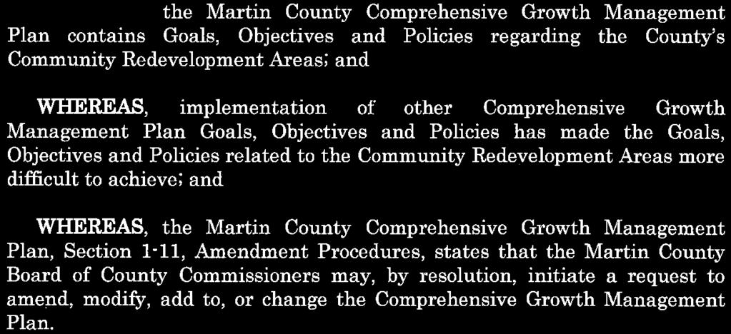
57 57 of 62


58 58 of 62
59 ITEM 5B COMMUNITY REDEVELOPMENT AGENCY AGENDA ITEM November 26, 2018 PREPARED BY: TITLE: Susan Kores, Manager, Office of Community Development Land Development Regulations/CRA Code Project Update EXECUTIVE SUMMARY: Estimated time: 15 minutes. Treasure Coast Regional Planning Council (TCRPC) has been contracted to amend the land development regulations in each of our six Community Redevelopment Areas (CRAs). This project began in August 2018 and two CRA areas, Jensen Beach and Rio, are currently in the works. This presentation is an update on where we are in the process, and includes an overview of the schedule moving forward. BACKGROUND/RELATED STRATEGIC GOAL: The Community Redevelopment Land Development Regulations and Zoning Overlay Districts contain ambiguities and standards that need revision to assist redevelopment in the CRAs. LEGAL SUFFICIENCY REVIEW: N/A RECOMMENDED ACTION: N/A Move that the CRA hear the presentation and provide direction, as necessary. FISCAL IMPACT: N/A DOCUMENTS REQUIRING ACTION: N/A ITEM 5B 59 of 62
60 ITEM 6A COMMUNITY REDEVELOPMENT AGENCY AGENDA ITEM November 26, 2018 PREPARED BY: TITLE: Susan Kores, Manager, Office of Community Development Building Opportunity! EXECUTIVE SUMMARY: Estimated time: 5 minutes. The Economic Council of Martin County (EC), the Martin County Business Development Board (BDB), and others, are sponsoring an event to further the mission and vision of the Community Redevelopment Agency (CRA). Last spring, the CRA was part of an event called Vision to Implementation. In 2019 we are planning an event called Building Opportunity! This occasion will focus on those sectors of the community - investors, builders, developers, bankers, realtors and property owners - that need to know about, and take advantage of, all the opportunities our CRA areas offer. The event will be held on Thursday, March 28, 2019 at the Indian Riverside Park Pavilion from 4:00 pm 6:00 pm. The program will look something like the following: Opening & Welcome Presentations: Benefits of Building in a CRA - Opportunity Zone, Incentives, Infrastructure, Codes, etc. Making the Right Decision through Land Use Economics Joe Minnicozzi, Urban 3, LLC One ambassador from each sector (investor, builder, broker, banker) to talk about what role they can play in increasing opportunity in the redevelopment areas. ISSUES: N/A LEGAL SUFFICIENCY REVIEW: N/A RECOMMENDED ACTION: Recommend that the Agency provide feedback, suggestions and direction as necessary. FISCAL IMPACT: N/A DOCUMENTS REQUIRING ACTION: N/A ITEM 6A 60 of 62
61 ITEM 6B COMMUNITY REDEVELOPMENT AGENCY AGENDA ITEM November 26, 2018 PREPARED BY: TITLE: Susan Kores, Manager, Office of Community Development Rio Infill Sewer Project EXECUTIVE SUMMARY: Estimated time: 10 minutes. The RIO CRA area has a Capital Improvement Project sheet (CIP) that allows for water and sewer infrastructure construction. The goal of this CIP is to activate and encourage redevelopment by providing this infrastructure if possible. Staff proposes to install approximately 2,400 feet of force main sewer pipe, (2 and 3 ) down Hillcrest Lane and Sago Drive off Dixie Hwy. This project will not require road reconstruction because the sewer force main will go along the sides of the road and will be installed via directional drill. This project will provide sewer access to 35 lots. Once the mains are installed, the fees for individual homes to connect would be borne by the existing and/or new homeowners. Included in this calculation is the vacant area that fronts Dixie, in between both Sago and Hillcrest, called Hillcrest Bluff. The property owner is currently working with Growth Management to split the property into 10 lots for sale to prospective buyers. Total design and installation time is approximately 3 months. The collaboration would consist of the owner of Hillcrest Bluff covering some design and engineering costs, MC Utilities covering the permitting costs and the CRA covering the installation of the sewer pipe. Hillcrest Bluff is exactly the type of opportunity we seek, giving the CRA the ability to leverage TIF funds in a collaborative effort to effect redevelopment. ISSUES: N/A LEGAL SUFFICIENCY REVIEW: N/A RECOMMENDED ACTION: Move that the Agency approve the project as presented. FISCAL IMPACT: Approximately $75,000 TIF funds. ITEM 6B 61 of 62


62 62 of 62
MARTIN COUNTY, FLORIDA INTER-OFFICE MEMORANDUM
 MARTIN COUNTY, FLORIDA INTER-OFFICE MEMORANDUM www.martin.fl.us 2401 SE Monterey Road, Stuart, Florida 34996 This document may be reproduced upon request in an alternative format by contacting the County
LOCAL PLANNING AGENCY MEETING Martin County Commission Chambers 2401 S.E. Monterey Road Stuart, Florida MEETING MINUTES- February 21, 2019
 This document may be reproduced upon request in an alternative format by contacting the Martin County ADA Coordinator at (772) 320-3131, the County Administration Office (772) 288-5400, Florida Relay 711,
EVALUATION AND APPRAISAL REPORT OF THE CITY OF FELLSMERE COMPREHENSIVE PLAN APPENDIX D HOUSING ELEMENT
 OBJECTIVE H-A-1: ALLOW AFFORDABLE HOUSING AND ADEQUATE SITES FOR VERY LOW, LOW, AND MODERATE INCOME HOUSING. The City projects the total need for very low, low, and moderate income-housing units for the
TREASURE COAST REGIONAL PLANNING COUNCIL M E M O R A N D U M
 TREASURE COAST REGIONAL PLANNING COUNCIL M E M O R A N D U M To: Council Members AGENDA ITEM 6A From: Date: Subject: Staff May 20, 2011 Council Meeting Local Government Comprehensive Plan Review Draft
LOCAL PLANNING AGENCY MEETING Martin County Commissioner Chambers 2401 S.E. Monterey Road Stuart, Florida MEETING MINUTES- November 5, 2015
 LOCAL PLANNING AGENCY MEETING Martin County Commissioner Chambers 2401 S.E. Monterey Road Stuart, Florida 34996 MEETING MINUTES- November 5, 2015 Present: Chairman Jim Moir Vice Chairperson Crystal Lucas
TREASURE COAST REGIONAL PLANNING COUNCIL M E M O R A N D U M. To: Regional Planning Council Members AGENDA ITEM 5J
 TREASURE COAST REGIONAL PLANNING COUNCIL M E M O R A N D U M To: Regional Planning Council Members AGENDA ITEM 5J From: Date: Subject: Staff June 19, 2009 Regional Planning Council Meeting Local Government
THE REDEVELOPMENT PLAN
 PAGE 37 THE REDEVELOPMENT PLAN FUTURE LAND USE The Silver Terrace Redevelopment Area is currently designated as Redevelopment Area #4 on the City of Delray Beach Future Land Use Map (FLUM). This designation
FUTURE LAND USE. City of St. Augustine Comprehensive Plan EAR-Based Amendments
 FUTURE LAND USE City of St. Augustine Comprehensive Plan EAR-Based Amendments Future Land Use Element FLU Goal To create an environment within the City and adjacent areas in which its residents have the
TREASURE COAST REGIONAL PLANNING COUNCIL M E M O R A N D U M. To: Council Members AGENDA ITEM 9D
 TREASURE COAST REGIONAL PLANNING COUNCIL M E M O R A N D U M To: Council Members AGENDA ITEM 9D From: Date: Subject: Staff May 15, 2015 Council Meeting Local Government Comprehensive Plan Review Draft
INDIAN RIVER COUNTY, FLORIDA. The Honorable Members of the Planning and Zoning Commission DEPARTMENT HEAD CONCURRENCE
 Public Hearing Legislative INDIAN RIVER COUNTY, FLORIDA M E M O R A N D U M TO: The Honorable Members of the Planning and Zoning Commission DEPARTMENT HEAD CONCURRENCE Robert M. Keating, AICP; Community
TREASURE COAST REGIONAL PLANNING COUNCIL M E M O R A N D U M
 TREASURE COAST REGIONAL PLANNING COUNCIL M E M O R A N D U M To: Council Members AGENDA ITEM 5F From: Date: Subject: Staff July 16, 2010 Council Meeting Local Government Comprehensive Plan Review Draft
SECTION 1 INTRODUCTION TO THE PANAMA CITY BEACH COMPREHENSIVE GROWTH DEVELOPMENT PLAN
 1. PURPOSE SECTION 1 INTRODUCTION TO THE PANAMA CITY BEACH COMPREHENSIVE GROWTH DEVELOPMENT PLAN The purpose of the City of Panama City Beach's Comprehensive Growth Development Plan is to establish goals,
CHAPTER Committee Substitute for Committee Substitute for Senate Bill No. 2188
 CHAPTER 2004-372 Committee Substitute for Committee Substitute for Senate Bill No. 2188 An act relating to land development; amending s. 197.502, F.S.; providing for the issuance of an escheatment tax
Cover Letter with Narrative Statement
 Cover Letter with Narrative Statement March 31, 2017 rev July 27, 2017 RE: Rushton Pointe Residential Planned Unit Development Application for Public Hearing for RPUD Rezone PL2015 000 0306 Mr. Eric Johnson,
Downtown Development Focus Area: I. Existing Conditions
 Downtown Development Focus Area: I. Existing Conditions The Downtown Development Focus Area is situated along Route 1, south of the train tracks, except for the existing Unilever property. It extends west
HOUSING ELEMENT GOALS, OBJECTIVES, AND POLICIES
 HOUSING ELEMENT GOALS, OBJECTIVES, AND POLICIES GOAL 1: To promote the preservation and development of high-quality, balanced, and diverse housing options for persons of all income levels throughout the
HOUSING ELEMENT OF THE CITY OF PEMBROKE PINES COMPREHENSIVE PLAN ADOPTION DOCUMENT
 HOUSING ELEMENT OF THE CITY OF PEMBROKE PINES COMPREHENSIVE PLAN RULES 9J-5.010, FAC City of Pembroke Pines, Florida ADOPTION DOCUMENT HOUSING ELEMENT HOUSING ELEMENT ADOPTION DOCUMENT VI. GOALS, OBJECTIVES
Planning Department Oconee County, Georgia
 Planning Department Oconee County, Georgia STAFF REPORT REZONE CASE #: 6985 DATE: October 31, 2016 STAFF REPORT BY: Andrew C. Stern, Planner APPLICANT NAME: Williams & Associates, Land Planners PC PROPERTY
Place Type Descriptions Vision 2037 Comprehensive Plan
 Place Type Descriptions Vision 2037 Comprehensive Plan The Vision 2037 Comprehensive Plan establishes a range of place types for Oxford, ranging from low intensity (limited development) Rural and Natural
Barbara County Housing Element. Table 5.1 Proposed Draft Housing Element Goals, Policies and Programs
 Table 5.1 Proposed Draft Housing Element Goals, Policies and Programs Goal 1: Enhance the Diversity, Quantity, and Quality of the Housing Supply Policy 1.1: Promote new housing opportunities adjacent to
THE GROVE GOLF CLUB PLAT
 { MARTIN COUNTY, FLORIDA DEVELOPMENT REVIEW STAFF REPORT A. Application Information THE GROVE GOLF CLUB PLAT Applicant: Hobe Sound Equestrian, LLC Property Owner: Becker B-14 Grove, Ltd Agent for the Applicant:
TEMPORARY CRA PROMOTIONAL SIGN PERMIT
 Martin County Growth Management Department Zoning Review 2401 S. E. Monterey Road, Stuart, FL 34996 Promotional Sign Application 772-288-5495 www.martin.fl.us Martin County, Florida Growth Management Department
1 Chapter 4 FUTURE LAND USE ELEMENT Section 4.1. Background information. 4.1.A. Land use profile. Indiantown possesses a unique and valuable mix of ph
 1 Chapter 4 FUTURE LAND USE ELEMENT Section 4.1. Background information. 4.1.A. Land use profile. Indiantown possesses a unique and valuable mix of physical and man-made resources centered on the Okeechobee
2018 RESIDENTIAL CAPACITY AND VACANT LAND ANALYSIS. Martin County Board of County Commissioners
 2018 RESIDENTIAL CAPACITY AND VACANT LAND ANALYSIS Martin County Board of County Commissioners Approved February 13, 2018 INTRODUCTION Objective 4.1D of the Martin County Comprehensive Growth Management
TREASURE COAST REGIONAL PLANNING COUNCIL M E M O R A N D U M. February 19, 2010 Regional Planning Council Meeting
 TREASURE COAST REGIONAL PLANNING COUNCIL M E M O R A N D U M To: Council Members AGENDA ITEM 5G From: Date: Subject: Staff February 19, 2010 Regional Planning Council Meeting Local Government Comprehensive
PALM BEACH COUNTY PLANNING, ZONING AND BUILDING DEPARTMENT ZONING DIVISION
 PALM BEACH COUNTY PLANNING, ZONING AND BUILDING DEPARTMENT ZONING DIVISION Application No.: CA-2012-00688 Control No.: 2011-00552 Applicant: Garry Bernardo Owners: Garry Bernardo Agent: Frogner Consulting,
PERMITTED USES: Within the MX-1 Mixed Use Neighborhood District the following uses are permitted:
 6.25 MX-1 - MIXED USE NEIGHBORHOOD 6.25.1 INTENT: The purpose of the MX-1 Mixed Use Neighborhood District is to accommodate the development of a wide-range of residential and compatible non-residential
CHAPTER 2 VACANT AND REDEVELOPABLE LAND INVENTORY
 CHAPTER 2 VACANT AND REDEVELOPABLE LAND INVENTORY CHAPTER 2: VACANT AND REDEVELOPABLE LAND INVENTORY INTRODUCTION One of the initial tasks of the Regional Land Use Study was to evaluate whether there is
Conservation Easement Stewardship
 Conservation Easements are effective tools to preserve significant natural, historical or cultural resources. Conservation Easement Stewardship Level of Service Standards March 2013 The mission of the
PALM BEACH COUNTY PLANNING, ZONING AND BUILDING DEPARTMENT ZONING DIVISION
 PALM BEACH COUNTY PLANNING, ZONING AND BUILDING DEPARTMENT ZONING DIVISION Application No.: Z-2016-00663 Application Name: Autism School Control No.: 2014-00133 Applicant: Dayna2, LLC Owners: Dayna2, LLC
Glades County Staff Report and Recommendation Unified Staff Report for Small Scale Plan Amendment and Rezoning
 Glades County Staff Report and Recommendation Unified Staff Report for Small Scale Plan Amendment and Rezoning CASE NUMBERS: COMP17-02 and RZ17-02 DATE of STAFF REPORT: May 1, 2017 CASE TYPE: Application
Nassau County Department of Planning & Economic Opportunity Nassau Place Yulee, Florida 32097
 Nassau County Department of Planning & Economic Opportunity 96161 Nassau Place Yulee, Florida 32097 APPLICATION AND INSTRUCTIONS FOR FUTURE LAND USE MAP AMENDMENT (TEN (10) ACRES OR MORE) NOTICE: Florida
COMPREHENSIVE PLAN FUTURE LAND USE MAP AMENDMENT APPLICATION
 COUNTY STAFF DATA ONLY Date Received: Project No. CPA-20 - GADSDEN COUNTY DEPARTMENT OF PLANNING & COMMUNITY DEVELOPMENT 1-B East Jefferson Street, Post Office Box 1799, Quincy, FL 32353-1799 PLANNING
REPORT OF THE PLANNING AND DEVELOPMENT DEPARTMENT FOR APPLICATION FOR REZONING ORDINANCE TO PLANNED UNIT DEVELOPMENT MAY 18, 2017
 BEL REPORT OF THE PLANNING AND DEVELOPMENT DEPARTMENT FOR APPLICATION FOR REZONING ORDINANCE 2016-805 TO PLANNED UNIT DEVELOPMENT MAY 18, 2017 The Planning and Development Department hereby forwards to
Town Centre Community Improvement Plan
 2012 Town Centre Community Improvement Plan City of Greater Sudbury Growth and Development Department 1.0 PLAN BACKGROUND 1.1 Introduction The following Community Improvement Plan (CIP) has been prepared
Be linked by an internal circulation system (i.e., walkways, streets, etc.) to other structures within the IPUD;
 to other structures within the IPUD;") 2. HALIFAX ACTIVITY CENTER A. DESCRIPTIONS OF FUTURE LAND USE DESIGNATIONS Each of the future land use designations specified by Phase I of the Halifax Activity Center Plan, and the relationship of these
2. HALIFAX ACTIVITY CENTER A. DESCRIPTIONS OF FUTURE LAND USE DESIGNATIONS Each of the future land use designations specified by Phase I of the Halifax Activity Center Plan, and the relationship of these
Town of Yucca Valley GENERAL PLAN 1
 Town of Yucca Valley GENERAL PLAN 1 This page intentionally left blank. 3 HOUSING ELEMENT The Housing Element is intended to guide residential development and preservation consistent with the overall values
APPENDIX D: DEFINITIONS
 D APPENDIX D: DEFINITIONS Terms used throughout the 2040 Comprehensive Plan should be interpreted using the definitions provided in this appendix. For interpretation of any term not defined, defer to the
Mayport Village Community Redevelopment Area Community Workshop #1 Marine Science Education Center February 12, 2015
 Mayport Village Community Redevelopment Area Community Workshop #1 Marine Science Education Center February 12, 2015 Team Introductions Project Overview and Goals CRA and TIF 101 Role of CAC and TAC Mayport
HOUSING ELEMENT GOALS, OBJECTIVES, & POLICIES
 HOUSING ELEMENT GOALS, OBJECTIVES, & POLICIES GOAL H-1: ENSURE THE PROVISION OF SAFE, AFFORDABLE, AND ADEQUATE HOUSING FOR ALL CURRENT AND FUTURE RESIDENTS OF WALTON COUNTY. Objective H-1.1: Develop a
Land Use. Existing Land Use
 8 Land Use 8.1 Land Use Chapter Purpose and Contents This element includes a brief summary of existing land use conditions and trends followed by a series of goals, objectives, and recommendations to guide
HOUSING ELEMENT I. GOALS, OBJECTIVES AND POLICIES
 HOUSING ELEMENT I. GOALS, OBJECTIVES AND POLICIES GOAL 1: IN ORDER TO ACHIEVE A BALANCED HOUSING SUPPLY (AND A BALANCED POPULATION AND ECONOMIC BASE), EVERY EFFORT SHOULD BE MADE TO PROVIDE A BROAD RANGE
TREASURE COAST REGIONAL PLANNING COUNCIL M E M O R A N D U M. To: Council Members AGENDA ITEM 10A
 TREASURE COAST REGIONAL PLANNING COUNCIL M E M O R A N D U M To: Council Members AGENDA ITEM 10A From: Date: Subject: Staff April 20, 2007 Council Meeting Local Government Comprehensive Plan Review Draft
NOTICE OF MEETING AND AGENDA FOR THE PLANNING COMMISSION OF SPRINGVILLE, UTAH... JANUARY 23, 2018
 NOTICE OF MEETING AND AGENDA FOR THE PLANNING COMMISSION OF SPRINGVILLE, UTAH............................ JANUARY 23, 2018 Notice is hereby given that the Planning Commission will hold a public meeting
Bylaw No , being "Official Community Plan Bylaw, 2016" Schedule "A" DRAFT
 Bylaw No. 2600-2016, being "Official Community Plan Bylaw, 2016" Schedule "A" Urban Structure + Growth Plan Urban Structure Land use and growth management are among the most powerful policy tools at the
ORDINANCE NO. 15- Regulations (LDR) which would further the codification of TOD regulations that
 which would further the codification of TOD regulations that") 1 1 1 1 1 1 1 0 1 0 1 ORDINANCE NO. 1- AN ORDINANCE OF THE CITY OF BOYNTON BEACH, FLORIDA AMENDING THE LAND DEVELOPMENT REGULATIONS, CHAPTER 1, ARTICLE II, DEFINITIONS; CHAPTER, ARTICLE III, SECTION 1,
1 1 1 1 1 1 1 0 1 0 1 ORDINANCE NO. 1- AN ORDINANCE OF THE CITY OF BOYNTON BEACH, FLORIDA AMENDING THE LAND DEVELOPMENT REGULATIONS, CHAPTER 1, ARTICLE II, DEFINITIONS; CHAPTER, ARTICLE III, SECTION 1,
Chapter 100 Planned Unit Development in Corvallis Urban Fringe
 100.100 Scope and Purpose. Chapter 100 Planned Unit Development in Corvallis Urban Fringe (1) All applications for land divisions in the Urban Residential (UR) and Flood Plain Agriculture (FPA) zones within
City of Coral Gables Planning and Zoning Staff Report
 City of Coral Gables Planning and Zoning Staff Report Applicant: Application: Public Hearing: Date & Time: Location: City of Coral Gables Zoning Code Text Amendment Giralda Plaza Overlay District Planning
Marion County Board of County Commissioners
 Marion County Board of County Commissioners Date: 6/4/217 P&Z: 9/25/217 BCC Transmittal: 1/17/217 BCC Adopt: TBD Amendment No: 217-L6 Type of Application Large-Scale Comp Plan Amendment Request: Change
REPORT OF THE PLANNING AND DEVELOPMENT DEPARTMENT FOR APPLICATION FOR REZONING ORDINANCE TO PLANNED UNIT DEVELOPMENT SEPTEMBER 22, 2016
 BEL REPORT OF THE PLANNING AND DEVELOPMENT DEPARTMENT FOR APPLICATION FOR REZONING ORDINANCE 2016-576 TO PLANNED UNIT DEVELOPMENT SEPTEMBER 22, 2016 The Planning and Development Department hereby forwards
CONCURRENCY MANAGEMENT SYSTEM ELEMENT
 CONCURRENCY MANAGEMENT SYSTEM ELEMENT TOWN OF HOWEY-IN-THE-HILLS LAKE COUNTY, FLORIDA ADOPTED ON OCTOBER 11, 2010 CONCURRENCY MANAGEMENT SYSTEM ELEMENT TABLE OF CONTENTS A. OVERVIEW OF THE CONCURRENCY
Appendix A: Guide to Zoning Categories Prince George's County, Maryland
 Appendix A: Guide to Zoning Categories Prince George's County, Maryland RESIDENTIAL ZONES 1 Updated November 2010 R-O-S: Reserved Open Space - Provides for permanent maintenance of certain areas of land
CITY OF ALBERT LEA PLANNING COMMISSION ADVISORY BOARD
 CITY OF ALBERT LEA PLANNING COMMISSION ADVISORY BOARD 9/1/2015, 5:30 p.m. City Council Chambers AGENDA A. CALL TO ORDER AND ROLL CALL B. APPROVAL OF THE AGENDA C. APPROVAL OF MINUTES 1. PC Minutes from
The Corporation of the District of Central Saanich
 The Corporation of the District of Central Saanich COMMITTEE OF THE WHOLE REPORT For the Committee of the Whole meeting on November 28, 2016 To: Patrick Robins Chief Administrative Officer File: From:
Kitsap County Department of Community Development
 Kitsap County Department of Community Development Staff Report and Recommendation Annual Comprehensive Plan Amendment Process for 2018 George s Corner LAMIRD Boundary Adjustment Report Date 7/16/2018 Hearing
Financial Impact Statement There are no immediate financial impacts associated with the adoption of this report.
 STAFF REPORT Planning and Development Department Subject: Application by RYC Property to rezone a portion of lands on John Murray Dr. and Megan Lynn Dr. from R2 to R3 and to enter into a Development Agreement
Article 04 Single Family Residential Districts
 Article 04 Article 04 Section 04.01 Intent (a) R1A Residence District. The R1A Single Family Residential District is established to include areas of low density single-family residences and limited agricultural
HOUSING ELEMENT. 3. group and foster home construction. 1. increase the supply of new affordable housing with: a regional housing trust fund;
 Goal 8.0. Facilitate an adequate supply of decent, safe, and sanitary housing in suitable neighborhoods, including housing for special needs populations; available in a range of housing types, architectural
ARTICLE 3: Zone Districts
 ARTICLE 3: Zone Districts... 3-1 17.3.1: General...3-1 17.3.1.1: Purpose and Intent... 3-1 17.3.2: Districts and Maps...3-1 17.3.2.1: Applicability... 3-1 17.3.2.2: Creation of Districts... 3-1 17.3.2.3:
PUTNAM COUNTYCOMPREHENSIVE PLAN
 COMPREHENSIVE PLAN EXHIBIT AA COMPREHENSIVE PLAN A. Future Land Use Element Goals, Objectives, Policies This section proposed objectives and policies, which will assist Putnam County Commissioners and
FINAL DRAFT 12/1/16, Rev. to 7/18/17
 FINAL DRAFT 12/1/16, Rev. to 7/18/17 (As Adopted 8/8/17 Effective 9/1/17) SHELTON PLANNING AND ZONING COMMISSION Proposed Amendments to Zoning Regulations I. Amend Section 23 PERMITTED USES by inserting
Future Land Use Element
 Summary of changes to the Goals, Objectives and Policies This element was updated to include the changes recommended in the 2006/2007 EAR and to reorganize the chapter to bring the land use classification
PALM BEACH COUNTY PLANNING, ZONING AND BUILDING DEPARTMENT ZONING DIVISION
 PALM BEACH COUNTY PLANNING, ZONING AND BUILDING DEPARTMENT ZONING DIVISION Application No.: Z2003-094 Control No.: 2003-094 Petitioner: Mark A. & Susan L. Reinhold Owner: Mark A. & Susan L. Reinhold Agent:
ARTICLE 23 CONDOMINIUM STANDARDS
 ARTICLE 23 CONDOMINIUM STANDARDS Section 23.01 Intent. The intent of this Article is to provide regulatory standards for condominiums and site condominiums similar to those required for projects developed
CPC CA 3 SUMMARY
 CPC-2009-3955-CA 2 CONTENTS Summary Staff Report Conclusion 3 4 7 Appendix A: Draft Ordinance A-1 Attachments: 1. Land Use Findings 2. Environmental Clearance 1-1 2-1 CPC-2009-3955-CA 3 SUMMARY Since its
MINUTES OF THE TOWN OF LADY LAKE REGULAR PLANNING AND ZONING BOARD MEETING LADY LAKE, FLORIDA. May 8, :30 p.m.
 MINUTES OF THE TOWN OF LADY LAKE REGULAR PLANNING AND ZONING BOARD MEETING LADY LAKE, FLORIDA May 8, 2017 5:30 p.m. The Planning and Zoning Board Meeting was held in the Town Hall Commission Chambers at
EXHIBIT A. City of Corpus Christi Annexation Guidelines
 City of Corpus Christi Annexation Guidelines Purpose: The purpose of this document is to describe the City of Corpus Christi s Annexation Guidelines. The Annexation Guidelines provide the guidance and
The URD II Plan, for example, drafted in 1991 recognized both the need and opportunity for affordable housing development stating on page 49:
 PROPOSAL TO MISSOULA REDEVELOPMENT AGENCY FOR AFFORDABLE HOUSING PROGRAM The lack of inventory and inaccessibility to affordable housing in Missoula are longrecognized and well-documented problems. Too
City of Winnipeg Housing Policy Implementation Plan
 The City of Winnipeg s updated housing policy is aligned around four major priorities. These priorities are highlighted below: 1. Targeted Development - Encourage new housing development that: a. Creates
Planning and Development Services Department
 Planning and Development Services Department M E M O R A N D U M TO: Planning and Zoning Commission THROUGH: Mark Satterlee, AICP, Planning & Development Services Director Leslie Olson, AICP, Planning
AN ORDINANCE OF THE NAPA COUNTY BOARD OF SUPERVISORS, APPROVING THE DEVELOPMENT AGREEMENT BETWEEN NAPA COUNTY AND NAPA REDEVELOPMENT PARTNERS, LLC
 ORDINANCE NO. AN ORDINANCE OF THE NAPA COUNTY BOARD OF SUPERVISORS, APPROVING THE DEVELOPMENT AGREEMENT BETWEEN NAPA COUNTY AND NAPA REDEVELOPMENT PARTNERS, LLC WHEREAS, to strengthen the public planning
Community Advisory Committee (CAC) Meeting #7 West Anaheim Youth Center May 26, 2016
 Meeting #7 West Anaheim Youth Center May 26, 2016") Community Advisory Committee (CAC) Meeting #7 West Anaheim Youth Center May 26, 2016 1 Project Team City: David Belmer Planning and Building Director Jonathan Borrego, AICP Planning Services Manager Gustavo
Community Advisory Committee (CAC) Meeting #7 West Anaheim Youth Center May 26, 2016 1 Project Team City: David Belmer Planning and Building Director Jonathan Borrego, AICP Planning Services Manager Gustavo
PIN , Part 1, Plan SR-713 in Lot 2, Concession 5, Township of McKim (1096 Dublin Street, Sudbury)
") STAFF REPORT Applicant: Dalron Construction Limited Location: PIN 02124-0103, Part 1, Plan SR-713 in Lot 2, Concession 5, Township of McKim (1096 Dublin Street, Sudbury) Official Plan and Zoning By-law:
STAFF REPORT Applicant: Dalron Construction Limited Location: PIN 02124-0103, Part 1, Plan SR-713 in Lot 2, Concession 5, Township of McKim (1096 Dublin Street, Sudbury) Official Plan and Zoning By-law:
PREPARED BY TREASURE COAST REGIONAL PLANNING COUNCIL
 PREPARED BY TREASURE COAST REGIONAL PLANNING COUNCIL OCTOBER 12, 2017 What is a Community Redevelopment Agency? Definition of a CRA: A dependent special district in which any future increases in property
2011 AICP Review Course
 2011 AICP Review Course March 2011 Alex Dambach, AICP, PP Director of Policy, Planning, and Development City of East Orange Exam Content A. Strategic planning/visioning B. Goal setting C. Research methods
Nassau County 2030 Comprehensive Plan. Housing Element (H) Goals, Objectives and Policies. Goal
 Goals, Objectives and Policies. Goal") (H) Goal Assist the private sector to provide and maintain an adequate inventory of decent, safe and sanitary housing in suitable neighborhoods at affordable costs to meet the need of the present and future
(H) Goal Assist the private sector to provide and maintain an adequate inventory of decent, safe and sanitary housing in suitable neighborhoods at affordable costs to meet the need of the present and future
The Zoning Committee voted 4-2 to APPROVE this petition.
 Rezoning Petition 2016-T001 Zoning Committee Recommendation August 9, 2016 REQUEST SUMMARY OF PETITION PETITIONER AGENT/REPRESENTATIVE COMMUNITY MEETING STATEMENT OF CONSISTENCY Text amendment to Sections
ARTICLE B ZONING DISTRICTS
 ARTICLE B ZONING DISTRICTS Sec. 8-3021 Established. In order to protect the character of existing neighborhoods; to prevent excessive density of population in areas which are not adequately served with
TOOELE COUNTY LAND USE ORDINANCE CHAPTER 31 Page 1
 CHAPTER 31 PLANNED COMMUNITY ZONE (P-C) Section 31-1 Definitions. 31-2 Purpose. 31-3 Land use districts. 31-4 P-C zone area minimum requirements. 31-5 Permitted uses. 31-6 Conditional uses. 31-7 Planning
Burlington Unincorporated Community Plan
 Burlington Unincorporated Community Plan June 30, 2010 Meeting Page 1 of 24 Table of Contents (Page numbers to be inserted) I. Background a. Location and Community Description b. Planning of Unincorporated
TREASURE COAST REGIONAL PLANNING COUNCIL M E M O R A N D U M. To: Regional Planning Council Members AGENDA ITEM 5D
 TREASURE COAST REGIONAL PLANNING COUNCIL M E M O R A N D U M To: Regional Planning Council Members AGENDA ITEM 5D From: Date: Subject: Staff March 20, 2009 Regional Planning Council Meeting Local Government
Planning Department Oconee County, Georgia STAFF REPORT
 Planning Department Oconee County, Georgia STAFF REPORT REZONE CASE #: 7332 DATE: November 28, 2017 STAFF REPORT BY: Gabriel Quintas, Planner APPLICANT NAME: Smith Planning Group PROPERTY OWNER: John Hadden
PALM BEACH COUNTY PLANNING, ZONING AND BUILDING DEPARTMENT ZONING DIVISION
 PALM BEACH COUNTY PLANNING, ZONING AND BUILDING DEPARTMENT ZONING DIVISION Application No.: Z-2014-01627 Application Name: Dazco Center Control No.: 2003-00040 Applicant: 4730 Hypoluxo LLC Owners: 4730
31, Township 29 South, Range 25 East, Polk County, Florida, as depicted by the Land Use Plan attached
 ORDINANCE NO. 2013-04 AN ORDINANCE AMENDING THE ZONING MAP OF THE CITY OF BARTOW, FLORIDA, REZONING APPROXIMATELY 2. 2 ACRES OF LAND OWNED BY BALA3I OF POLK COUNTY, LLC AND LOCATED IN SECTION 31, TOWNSHIP
SUBMITTAL REQUIREMENTS: The number indicates the number of copies for submittal (if applicable).
.") Office Use Only Preliminary Long Plat Long Subdivision Applicant Checklist PLANNING, COMMUNITY, & ECONOMIC DEVELOPMENT DEPARTMENT PRELIMINARY LONG PLAT LONG SUBDIVISION CHECKLIST Mailing Address: P.O.
Office Use Only Preliminary Long Plat Long Subdivision Applicant Checklist PLANNING, COMMUNITY, & ECONOMIC DEVELOPMENT DEPARTMENT PRELIMINARY LONG PLAT LONG SUBDIVISION CHECKLIST Mailing Address: P.O.
Staff Report: Date: Applicant: Property Identification: Acreage of Request: Current Zoning of Requested Area: Requested Action: Attached:
 Staff Report: Completed by Jeff Palmer Director of Planning & Zoning Date: November 7, 2018, Updated November 20, 2018 Applicant: Greg Smith, Oberer Land Developer agent for Ronald Montgomery ET AL Property
PALM BEACH COUNTY PLANNING, ZONING AND BUILDING DEPARTMENT ZONING DIVISION
 PALM BEACH COUNTY PLANNING, ZONING AND BUILDING DEPARTMENT ZONING DIVISION Application No.: W-2014-00288 Application Name: O Reilly Auto Parts Control No.: 2013-00286 Applicant: Hutton Growth Blue Sky
THE GROVE GOLF CLUB PLAT
 { MARTIN COUNTY, FLORIDA DEVELOPMENT REVIEW STAFF REPORT A. Application Information THE GROVE GOLF CLUB PLAT Applicant: Hobe Sound Equestrian, LLC Property Owner: Becker B-14 Grove, Ltd Agent for the Applicant:
Article Optional Method Requirements
 Article 59-6. Optional Method Requirements [DIV. 6.1. MPDU DEVELOPMENT IN RURAL RESIDENTIAL AND RESIDENTIAL ZONES Sec. 6.1.1. General Requirements... 6 2 Sec. 6.1.2. General Site and Building Type Mix...
STAFF PRESENT: Community Development Director: Nathan Crane Secretary: Dorinda King
 1 0 1 0 1 Highland City Planning Commission April, The regular meeting of the Highland City Planning Commission was called to order by Planning Commission Chair, Christopher Kemp, at :00 p.m. on April,.
Rule 80. Preservation of Primary Agricultural Soils Revised and approved by the Land Use Panel during its public meeting on January 31, 2006.
 Rule 80. Preservation of Primary Agricultural Soils Revised and approved by the Land Use Panel during its public meeting on January 31, 2006. (A) Purpose. In accordance with 10 V.S.A. Sections 6025(b)
Chairman and Members of the Planning and Development Committee. Thomas S. Mokrzycki, Commissioner of Planning and Building
 Exhibit 1 Port Credit DATE: TO: FROM: SUBJECT: Chairman and Members of the Planning and Development Committee Thomas S. Mokrzycki, Commissioner of Planning and Building Proposed Heritage Conservation District
Downtown & East Town CRA Expansion Plan City of Eustis
 Downtown & East Town CRA Expansion Plan City of Eustis May 2018 Contents 1 Introduction... 1 CRA Overview/History... 1 2 Existing Conditions... 2 Downtown & East Town Community Redevelopment Area Expansion...
Housing Characteristics
 CHAPTER 7 HOUSING The housing component of the comprehensive plan is intended to provide an analysis of housing conditions and need. This component contains a discussion of McCall s 1990 housing inventory
To: Ogunquit Planning Board From: Lee Jay Feldman, Director of Planning Date: April 18, 2018 Re: Senior/Affordable Multi-Family Housing Assessment
 To: Ogunquit Planning Board From: Lee Jay Feldman, Director of Planning Date: April 18, 2018 Re: Senior/Affordable Multi-Family Housing Assessment I. Introduction The Planning Board held a workshop on
ARTICLE 12 PLANNED UNIT DEVELOPMENT DISTRICTS (PUDS) Sec Intent CHARTER TOWNSHIP OF BRIGHTON ZONING ORDINANCE
 Sec Intent CHARTER TOWNSHIP OF BRIGHTON ZONING ORDINANCE") ARTICLE 12 PLANNED UNIT DEVELOPMENT DISTRICTS (PUDS) Sec. 12-01 Intent 1 2 (a) The intent of this Article is to permit the coordinated development on larger sites, protect significant natural features
ARTICLE 12 PLANNED UNIT DEVELOPMENT DISTRICTS (PUDS) Sec. 12-01 Intent 1 2 (a) The intent of this Article is to permit the coordinated development on larger sites, protect significant natural features
Cobb County Community Development Agency Zoning Division 1150 Powder Springs St. Marietta, Georgia 30064
 Cobb County Community Development Agency Zoning Division 1150 Powder Springs St. Marietta, Georgia 30064 Case # Z-63 Public Hearing Dates: PC: 11-06-18 BOC: 11-20-18 SITE BACKGROUND Applicant: Loyd Development
AGENDA SUMMARY EUREKA CITY COUNCIL
 AGENDA SUMMARY EUREKA CITY COUNCIL TITLE: Crowley Site Local Coastal Program Amendment DEPARTMENT: Development Services PREPARED BY: Kristen M. Goetz, Senior Planner PRESENTED FOR: Action Information only
RIO TOWN CENTER (F/K/A STUART HARBOR) Revised Major Master and Phasing, Phase 1 Final Site Plan
 Revised Major Master and Phasing, Phase 1 Final Site Plan") { MARTIN COUNTY, FLORIDA DEVELOPMENT REVIEW STAFF REPORT A. Application Information RIO TOWN CENTER (F/K/A STUART HARBOR) Revised Major Master and Phasing, Phase 1 Final Site Plan Applicant: Istar Financial
{ MARTIN COUNTY, FLORIDA DEVELOPMENT REVIEW STAFF REPORT A. Application Information RIO TOWN CENTER (F/K/A STUART HARBOR) Revised Major Master and Phasing, Phase 1 Final Site Plan Applicant: Istar Financial
City of Tarpon Springs, Florida STAFF REPORT
 City of Tarpon Springs, Florida STAFF REPORT July 17, 2018 TO: FROM: PLANNING AND ZONING BOARD MAYOR AND BOARD OF COMMISSIONERS PLANNING AND ZONING DEPARTMENT HEARING DATES: JULY 16, 2018 (PLANNING & ZONING