Appendix A. Land Capacity Analysis Methodology. Unincorporated Kitsap County. City of Bainbridge Island. City of Bremerton.
|
|
|
- Bonnie Baldwin
- 5 years ago
- Views:
Transcription
1 Appendix A Land Capacity Analysis Methodology Unincorporated Kitsap County City of Bainbridge Island City of Bremerton City of Poulsbo 1
2 KITSAP COUNTY 2005 UPDATED LAND CAPACITY ANALYSIS (ULCA) Prepared For: Kitsap County Department of Community Development Prepared By: Mark Personius, AICP, Growth Management Consultant Kitsap County Geographic Information Systems, Cindy Read David Nash October 2005
3 ACKNOWLEDGEMENTS KITSAP COUNTY COMMISSIONERS Chris Endresen, Chair, District 1 North Kitsap Jan Angel, District 2 South Kitsap Patty Lent, District 3 Central Kitsap KITSAP COUNTY DEPARTMENT OF COMMUNITY DEVELOPMENT Cindy Baker, Director Cindy Read, GIS Analyst Dave Nash, GIS Analyst KITSAP COUNTY PLANNING COMMISSION REPRESENTING NORTH KITSAP: John S. Ahl Deborah Deb J. Flynn Thomas E. Nevins REPRESENTING CENTRAL KITSAP: Dean Jenniges Frank Mahaffay John Taylor REPRESENTING SOUTH KITSAP: Lary Coppola Michael A. Gustavson Monty Mahan ULCA Citizens Advisory Group William Palmer Edie Berghoff Richard Brown Fred Depee Tom Donnelly Art Castle Betsy Cooper Sara Currow Byron Harris Vivian Henderson Chris Hugo Joanne Long-Woods Jeff McCormick Tom Nevins Ron Ross Doug Skrobut 1
4 URBAN LANDS Introduction This document illustrates the rationale and assumptions used for determining the current residential and commercial/industrial capacity of urban and rural zoned lands in Kitsap County. The actual land capacity analysis worksheets with reported outcomes for all parcels were prepared by Kitsap County GIS. The purpose of the Updated Land Capacity Analysis (ULCA) is to establish an objective approach by which to determine the current supply of land and how much population and development Kitsap County can expect to accommodate under current zoning and development regulations in the existing rural lands and urban growth areas (UGAs). Analysis of UGA land capacity is required by the Growth Management Act (GMA) in two different sections of the Act: 1) RCW 36.70A.130(3) requires it as a part of a County s Comprehensive Plan 10-year update when expanding UGAs to accommodate additional population allocations; and 2) RCW 36.70A.215(3)(a), the so-called Buildable Lands provision, requires a determination of whether there is sufficient suitable land to accommodate the county-wide population projection. The Kitsap County Countywide Planning Policies (CPPs) provide further guidance on how land capacity analyses should be implemented by the County and its cities as a part of their respective on-going growth management planning efforts in Element B. Urban Growth Areas, Policy 1 Land Capacity Analysis Program: a. The County and the Cities shall maintain a Land Capacity Analysis Program to monitor land supply and trends for residential, commercial, and industrial lands to determine the success of implementation of their respective comprehensive plans. This Program is intended to fulfill the state requirement for a Buildable Lands Program. b. The County and the Cities shall participate in the Land Capacity Analysis using a consistent methodology for review and evaluation. c. The County and the Cities shall develop strategies from the Land Capacity Analysis to efficiently use the available capacity of residential, commercial and industrial uses within Urban Growth Areas, reducing the need to expand the urban growth boundaries. d. The County and Cities shall establish procedures for resolving inconsistencies in collection and analysis of land capacity data. In the event a resolution cannot be achieved, the Kitsap Regional Coordinating Council shall be a forum to review and if possible facilitate any disputes between parties. 2
5 The County was also in the process of developing new and updated subarea plans for several UGAs during the development of the ULCA. The ULCA provided updated capacity analysis for those efforts in South Kitsap, Port Orchard, Kingston and Silverdale consistent with the CPPs Element B. UGAs, Policy 2.h.(i-iii). Staff also provided ULCA framework updates to each of the citizen advisory committees for their respective subarea planning efforts. Kitsap County examined four different optional approaches as a part of the Urban Lands ULCA development process. These included review and evaluation of the rationale used in two previous GMA-related land capacity analysis efforts in the County the 1998 Comprehensive Plan and the 2002 Buildable Lands Report as well as two new alternative approaches developed in concert with a public involvement program to solicit input from interested individuals and stakeholders in the process. An additional privateinitiated alternative land capacity analysis performed by a local real estate company was also evaluated. Public Involvement Process The County established a Citizen Advisory Group (or CAG) comprised of interested citizens, developers, builders, realtors, local residents and growth management advocates to help develop the Updated Land Capacity Analysis. The CAG also included staff from the County and local municipalities who provided technical advice and expertise in the development of the ULCA. The CAG met intensely over a period of 7 months to develop and evaluate the alternative approaches. The final CAG recommendations with a focus on incorporating a heightened sense of reality to the land capacity analysis were made to staff in early The staff then prepared a draft recommended ULCA framework that incorporated many of the CAG recommendations. The draft ULCA framework was presented to the Kitsap County Planning Commission in early The Planning Commission reviewed the ULCA alternative approaches and recommended selection of a preferred ULCA framework that was presented to the Kitsap Board of County Commissioners (Board) and the Kitsap Regional Coordinating Council (KRCC). After significant review and evaluation by the Board and the KRCC and subsequent public input, the Board of County Commissioners (Board) recommended a preferred Urban Residential Lands ULCA methodology on April 25, That preferred approach is presented in this document. It also provides the basis for the subsequent Urban Commercial/Industrial Lands and Rural Lands ULCA presented herein. A chronology of public involvement steps during development of the ULCA is presented in the following table. 3
6 ULCA Public Involvement Program Chronology Public Meeting Date Topic Citizen Advisory Group September 29, 2004 Land Capacity Analysis Overview Citizen Advisory Group October 6, 2004 Critical Area Reduction Factors Citizen Advisory Group October 13, 2004 Underutilized Lands and Redevelopment Constraints Citizen Advisory Group October 20, 2004 Public Purpose Lands Reduction Factors and Sewer Service Constraints Citizen Advisory Group October 27, 2004 Sewer Service Constraints Citizen Advisory Group November 3, 2004 ULCA Alternative Approaches Citizen Advisory Group November 10, 2004 Water Service Constraints Citizen Advisory Group November 17, 2004 Unavailable Land Factors & Alternative ULCA Approaches Citizen Advisory Group December 15, 2004 Sewer Service Constraints, Underutilized Lands and Unavailable Lands Reduction Factors Planning Commission January 11, 2005 ULCA Briefing Board January 12, 2005 ULCA Update briefing KRCC Board January 13, 2005 ULCA Briefing & Discussion Citizen Advisory Group January 19, 2005 Sewer Service Constraints and Wetlands Reduction Factors Citizen Advisory Group January 26, 2005 Preliminary ULCA UGA Outcomes & Discussion of Rural Lands and Commercial/Industrial ULCA KRCC Board February 1, 2005 ULCA Briefing & Discussion Planning Commission February 8, 2005 ULCA Review Citizen Advisory Group February 9, 2005 Draft CAG-recommended ULCA Framework KRCC Planning Directors February 10, 2005 ULCA Briefing & Discussion Board February 16, 2005 ULCA Update briefing Kingston Subarea CAC February 22, 2005 ULCA Briefing & Discussion Silverdale Subarea CAC February 24, 2005 ULCA Briefing & Discussion KRCC Board March 1, 2005 ULCA Briefing & Discussion Port Orchard Subarea CAC March 2, 2005 ULCA Briefing & Discussion KRCC Planning Directors March 10, 2005 ULCA Briefing & Discussion Board March 21, 2005 ULCA Work Study Board April 11, 2005 ULCA Work Study Planning Commission April 12, 2005 ULCA Public Hearing/Recommendation Board April 18, 2005 ULCA Work Study Board April 25, 2005 ULCA Public Hearing/Final Framework Recommendation Kitsap Commercial Real Estate Brokers August 10, 2005 Commercial/Industrial ULCA Briefing 4
7 Applicability Land capacity analysis is an inexact science and jurisdictions have discretion in choosing their methodology but its assumptions should be based on best available data and actual conditions to the maximum extent practical. Assumptions made about particular factors affecting development are often subject to debate or interpretation 1. Lively CAG meetings provided ample opportunity for such discussions to occur. Where assumptions are made as a part of the preferred ULCA rationale, consideration was given to alternative viewpoints and the evaluation of those issues is documented to the extent practical and applicable in this paper. Detailed discussion of alternative approaches, background information and rationale regarding particular land capacity factors are contained in the footnotes in this paper. The preferred ULCA approach outlines a step-by-step process by which the land supply is analyzed and reduction factors applied to gross acres of land in particular zones in order to eliminate lands presumed to be unbuildable for the purposes of accommodating additional housing and employment (e.g., lands needed for public purposes, environmentally sensitive or critical areas, land held off the real estate market, etc.). Ultimately the ULCA derives the number of net acres available for development in each respective zone and converts those net acres into available capacity for new housing units, population and commercial/industrial development. 1 Assumptions made in the 2005 preferred ULCA approach are documented in the text and/or footnotes accompanying the step-by-step methodology. However, there are also several significant criteria or factors that were discussed and not included in the preferred approach. The most significant of those are documented here. The impact of CC&Rs (Covenants, Conditions & Restrictions) on land capacity is not included in the preferred methodology. These are private deed restrictions that often preclude further subdivision of platted lots even if allowed by zoning. They are not enforceable by cities or counties. If they had been utilized, the net effect would likely be to reduce existing development capacity. Accessory Dwelling Units (ADUs) are not included in the analysis. These are small Mother-in-Law units allowed on parcels with existing homes. ADUs typically only account for 1%-2% of total housing stock, so they are not considered to have a significant impact on total housing capacity in most communities. If they had been utilized, the net effect would be to increase existing development capacity. Consideration of Concurrency-Restricted Roadways was not utilized in the land capacity analysis. These are. areas potentially subject to development restriction due to inadequate existing or anticipated future roadway capacity. If utilized, the net effect would potentially reduce existing development capacity. 5
8 Urban Residential Lands ULCA Approach This section illustrates the rationale and assumptions used in the preliminary updated land capacity analysis (ULCA) for urban residential zoned lands in Kitsap County. It is intended as a guide to understanding the background and rationale for assumptions made in determining the current residential capacity of the Urban Growth Areas (UGAs) in Kitsap County. The actual residential land capacity analysis worksheets with reported outcomes for all UGAs were prepared by Kitsap County GIS. The urban residential zones and their minimum dwelling unit densities included in the Urban Lands ULCA include: Urban Restricted (1 DU/Acre) Urban Low (5 DUs/Acre) Urban Medium (10 DUs/Acre) Urban High (18 DUs/Acre) Urban Village Center 2 The rationale and assumptions for the Urban Residential land capacity analysis were reviewed and recommended by the Kitsap County Board of Commissioners on April 25, The Urban Residential ULCA seeks to identify both vacant and underutilized lands in the inventory. The methodologies for the vacant and underutilized residential land capacity analyses are each presented separately. Reduction factors applied in the analysis are indicated by the symbol (-). The summary totals of vacant and underutilized urban residential lands by zone for the unincorporated UGAs based on this approach is illustrated in Table 1.1. Detailed individual unincorporated UGA housing capacity analysis is contained in Appendix A. 2 The Urban Village Center (UVC) zone is a mixed use commercial/residential zone found only in the Kingston UGA. It requires a more complex set of assumptions to determine vacant land capacity since both residential and commercial use capacity have to be estimated on the same parcel. Vacant parcels can only be geo-coded once meaning that they can only be identified (i.e., mapped) in the GIS database in one category of land use as either vacant residential or vacant commercial. Since the ULCA applies some reduction factors on a site-specific basis (e.g., critical areas) this prevents double counting the capacity of the zone. The zoning code specifies a maximum residential density of 18 dwelling units per acre in the UVC zone. There is no minimum residential density specified. For purposes of the ULCA all vacant UVC zoned parcels are evaluated for capacity purposes in the residential ULCA at the maximum density assuming coverage of one-half of the parcel. Therefore no vacant UVC acres are identified in the Kingston UGA commercial/industrial ULCA outcome worksheets. Nevertheless some commercial capacity remains on the other one-half of those same vacant net acres. See footnotes on the Kingston UGA Commercial/Industrial Vacant Lands Worksheet in the Appendix of this report for the specific estimate of vacant UVC zoned land that is assumed to remain available for commercial development but is unaccounted for due to geo-coding protocols. Underutilized UVC parcels, on the other hand, can be classified as either residential or commercial based on their current use Assessors code. Therefore, no split zoning assumptions are needed to calculate capacity. Residential capacity is calculated consistent with all other zones assuming a minimum density (10 units per acre is the assumed minimum density for purposes of the ULCA) applied to all remaining net acres of underutilized UVC acres in current (singlefamily) residential use. Similarly, underutilized UVC lands in current non-residential use are accounted for in the commercial/industrial ULCA. 6
9 VACANT LANDS METHODOLOGY Step 1: Identify All Vacant Parcels Zoned for Residential Use The first step is to identify all vacant parcels (Assessors Code 9100) in each of the five urban residential zones. This step is further refined by eliminating all vacant tax-exempt and current use tax parcels within these zones 3. The result can be considered the inventory of gross acres for all vacant urban residential zoned lands in the respective UGAs 4. Step 2: Identify Critical Areas Affecting Vacant Parcels Zoned Residential (-) The second step measures critical areas ordinance (CAO) impacts on all vacant urban residential parcels identified in the first step. First it identifies unencumbered acres (i.e., acres of vacant residential zoned parcels without CAO coverage or impact). Then it identifies the acres with CAO coverage and estimates the net impact of those critical areas on the parcel s development potential by deducting the portions of the affected parcels assumed to be unavailable for development due to the provisions of the CAO. These calculations are based on the CAO reduction factor assumptions recommended by the Board for use in the Urban Residential ULCA on April 25, The vast majority of parcels enrolled in current use are in rural and resource land designated areas of the county. However, there are some located within UGAs. The ULCA assumes that those parcels voluntarily enrolled in the current use program that nonetheless have an urban residential zone designation are not likely to develop or redevelop to minimum urban standards during the planning period. And so those parcels are removed from the urban land supply. There are several reasons for this: First, the current use designation is a technique whereby we can actually identify owner intent not to develop property. Whether that remains the case for the next twenty years is, of course, unknown. But at least for the present and in the case of open space general lands at least for ten years we have some measurable means to identify property owners who do not intend to develop; Secondly, properties enrolled in the program must meet strict criteria for enrollment to ensure that the open space benefit is reflective of actual parcel characteristics. Many of these parcels are already characterized by the presence of critical areas that significantly impair their development potential, such as stream buffers, steep slopes and wildlife habitat areas or have conservation easements recorded on them that preclude further development even if they were not enrolled in the current use program. Both the agricultural and timber open space programs have strict economic criteria that parcels must meet demonstrating that they are indeed producing income from the current agricultural or timber use. This precludes derelict properties being included in the program as a holding zone until considered ripe for development. 4 There is no minimum lot size exclusion applied to vacant lands. All vacant residentially zoned parcels regardless of size or location within the UGA are included in the residential land supply, except for tax-exempt and current use tax parcels. 5 The recommended methodology assumes adopted CAO definitions and buffers for streams, wetlands, floodplains and geologic hazard areas. Stream buffers are per the current adopted CAO and include the 200 foot HMP buffers on salmon-bearing streams. Wetlands are mapped in the GIS database but are not classified by type. Therefore, an average 75 wetland buffer is used based on recommendations from the Kitsap County DCD wetland biologist for NWI wetlands that are not classified in the database. This is based on review of delineated wetlands identified on preliminary plats from where most unclassified wetlands were determined to be Type 2 (100 foot buffer) and Type 3 (50 foot buffer) wetlands. Some areas of CAO-encumbered parcels will be unbuildable due to environmental constraints. 7
10 Step 3: Identify Vacant Residential Zoned Lands that are Sewer Constrained (-) This step recognizes the sewer constraint approach recommended by the Board for use in the Urban Residential ULCA. Such a constraint analysis is authorized by state buildable lands guidelines, but does not appear to have been implemented by any other jurisdictions to date 6. The application of a sewer constraint is intended to acknowledge that due to the unique topography of the County, some small, low density (hence relatively low value) residential zoned lots in fragmented ownership located in close proximity to critical areas and steep slopes may be unfeasible to develop at urban densities when located at significant distances from existing sewer mains 7. However, the County s adopted CAO allows for buffers and portions of critical areas outside of open water to be included in the density calculation for a particular parcel (i.e., density transfer from the CAO-encumbered portions of parcels outside of open water areas is allowed). It is presumed that developers seeking to maximize their return-oninvestment will utilize this policy to the maximum extent practicable. Even though all CAO buffers may allow for some development potential (for purposes of avoiding takings and to allow for reasonable uses), it is clearly the practical intent of the CAO to discourage, if not prevent development altogether, within the buffers. Studies of approved plats in Snohomish County, noted in the Kitsap County 1998 Comp Plan, indicated, on average, that 60% of density was lost on CAO-encumbered plats. The County s wetlands are mapped primarily on the basis of the National Wetlands Inventory (NWI). The NWI utilizes aerial photography to identify wetlands which often fails to adequately identify forested wetlands. This typically means that the NWI data undercounts wetland acres, especially where forested wetlands are prevalent. However, according to Kitsap County GIS analysis, soil types associated with forested wetlands lie mostly in the rural areas of the county. The developed areas of the UGAs actually contain the most accurately mapped wetlands data in the county based on surveyed wetlands from pending and approved plats. Consequently, for the purposes of the 2005 ULCA, an additional (unaccounted for) wetland factor is not recommended. However, the overall recommended approach utilizes a 75% density reduction figure for CAO-encumbered acreage from the minimum zone density to account both for some unaccounted for wetlands and density transfer from the buffer areas to other portions of parcels intended for development. The impact of areas of geologic concern (AOCs) which comprise slopes less 30% with unstable or highly erodable soils, slopes less than 15% with springs or groundwater present, etc., were also evaluated. The AOCs are buildable under the CAO but their site characteristics present challenges to development which often results in developments avoiding these areas altogether or resulting in loss of density to the overall site. The recommended ULCA methodology utilizes a 50% density reduction factor on the AOCs. 6 The Washington Department of Community, Trade and Economic Development (CTED), Buildable Lands Program Guidelines notes that land assumed to not have water and sewer infrastructure available within the 20-year planning period should be deducted from the buildable land supply and that all assumptions should be well documented. In addition, both Snohomish County and King County recognized that such constraints should be incorporated in their Buildable Lands Program methodologies. The King County Buildable Lands Program, Reference Guide II: Land Supply Inventory, report specifically pointed out that an additional and optional step in the land inventory analysis is to deduct from the inventory land for which the provision of basic utility services (e.g., sewer and water) is judged to be infeasible or otherwise very unlikely within the planning horizon. Although it appears that no jurisdictions in King County actually took that step in their buildable lands analysis. It appears that no other county subject to the buildable lands requirements of the GMA had included an infrastructure constraint factor in their land capacity analyses. 7 The ULCA Citizen Advisory Group (CAG) discussed addition of an infrastructure constraint reduction factor in the 2005 ULCA to more accurately address the issue of development infeasibility on small lots due to lack of efficient sewer access. In instituting such a factor for consideration, the CAG discussed and evaluated overall infrastructure constraints in the County s UGAs (e.g., prevalence of small lots which are less efficient to develop, sewer and water service constraints based on remaining vacant lands site location related to availability of infrastructure or impact of topography and critical areas that makes development of these sites infeasible due to the cost of providing expensive pump stations, utility extensions having to cross or avoid critical areas, and the constraint associated with developer extension and ULID financing mechanisms, etc.). 8
11 Sewer service constraint criteria examined several different parameters including: 1) distance from sewer main; 2) size of parcel; and 3) zoning density as surrogate variables to assess development feasibility based on lack of sewer availability or the excessive cost of extending sewer at developer expense to reach undeveloped or re-developable lots, given distance, topography, critical area, and small lot size constraints 8. The recommended sewer constraint reduction factor analysis is applied to all urban residential zones except the urban restricted zone. 9 The sewer service constraint formula includes application of a tiered set of (%) reduction factors based on distance of the parcel from the sewer main and the zoning density of the property in each UGA. The percentage reduction factor applies to the actual acreage of particular affected parcels not to parcels in total. The CAG took testimony from all the sanitary sewer service providers in the UGAs as to capacity and their 6-year and 20-year facility and conveyance improvement plans. The sewer providers all indicated that they had adequate treatment capacity for the 20-year planning period but the issue of concern about the ability to accommodate new growth was conveyance of sewage. The only existing viable mechanisms to extend sewer mains into currently unsewered areas of the UGAs to accommodate growth is through ULID formation or by developer extension. The former of which is extremely difficult to do in areas of fragmented land ownership (often the case in areas with a prevalence of small lots) and the latter of which is often infeasible, according to testimony from developers, due to the lack of remaining large vacant parcels in the UGAs where sufficient density is available to make sewer extension feasible based on development economies-of-scale. 8 Staff and the CAG prepared and evaluated numerous options for measuring sewer constraint based on available GIS data. Consensus was that the selected option that included tiered reduction factors based on zoning and distance of the parcel from the sewer main best utilized the existing data and was the most reflective of actual constraint, insofar as the ULCA can accurately assess without site-specific parcel analysis. The recommended methodology is designed to reflect the impact of lack of sewer on otherwise buildable lands while acknowledging: the need to plan for a 20-year land supply; the presumption that as land values increase over the planning period, sewer extension will become more feasible; and consideration of reasonable measures that could be taken to increase feasibility of sewer extension within the current UGAs (e.g., upzoning, public subsidy of sewer construction, etc.). A ground truthing exercise was incorporated in the analysis that included average cost assumptions to construct sewers as a means to better define the actual sewer feasibility threshold based on real world data in the current UGAs. The average cost assumptions for sewer and pump station construction were based on actual developer experience and were reviewed by the Kitsap County Department of Public Works. The ground truthing analysis incorporated parcel size as a third component of the feasibility analysis. The analysis identified the various parcel sizes needed in each respective residential zone (based on distance from the closest sewer main in 500 foot intervals) in order to maintain the feasibility threshold of developing and sewering 20 lots at a distance of at least 2500 feet from the closest existing sewer main. Minimum parcel sizes needed to maintain feasibility are reduced equally by 25% for each of the four 500-foot intervals (i.e., ¼ reduction in minimum parcel size needed to maintain feasibility for each of the four subsequent 500 foot distance from sewer main intervals in each zone from feet). There is no minimum parcel size constraint applied if the parcel is less than 500 feet from an existing sewer main. 9 The recommended approach removes the Urban Restricted (UR) zone parcels from the sewer constraint analysis since at the minimum density of 1 du/acre in the UR zone, no sewer is required. Sewer would only be required to achieve the maximum 5 du/acre density allowed in the zone. The ULCA assumes the minimum density in each zone. 9
12 Sewer Constraint Reduction Factors (%) Applied to Parcel Acreage in Existing UGAs based on Distance of Parcel from Sewer Main in each Residential Zone Urban Low Zone 0% = less than 500 feet 20%= %= %= %= >2500 Urban Medium Zone 0% = less than 500 feet 15%= %= %= %= >2500 Urban High Zone 0% = less than 500 feet 10%= %= %= %= >2500 Vacant acres in the three urban residential zones noted above, remaining to this point in the inventory, that meet the criteria identified in this step are removed from the supply of land considered buildable to this point in the land capacity analysis. Step 4: Identify Vacant Residential Lands that are Water Constrained (-) Consistent with the recommendation of the Board on April 25, 2005 this reduction factor is not applied to either the Urban Residential or Urban Commercial/Industrial land capacity analyses 10. In the accompanying ULCA worksheets prepared by GIS staff, the reader will observe that this step is labeled as not applicable in the land capacity analysis. Step 5: Identify Vacant Residential Lands Needed for Future Roads & Rights-of-Way (-) This step identifies urban residential zoned vacant lands remaining in the inventory to this point that are likely to be needed for future roads and/or as dedicated rights-of-way. This step is based on the 20% Roads/R-O-W reduction factor recommended by the Board for use in the Urban Residential ULCA on April 25, Analysis of public water constraints focused on water purveyors ability to provide fire flow, water rights and water supply availability based on the 20 year planning period. Evaluation indicated that no development constraint was likely at the present time based on current and anticipated water availability based on review of the Kitsap County Coordinated Water System Plan. Although fire flow and water availability remain constraints to achieving higher urban densities within the UGAs, uncertainty about water issues means that no measurable development constraints are identified at the present time in terms of land capacity 11 This is based on discussions with development review engineers at the Department of Public Works, experience of local developers with recent plats, and discussions among CAG members based on the needs of new development and future road rights-of-way in the UGAs. 10
13 Step 6: Identify Vacant Residential Lands Needed for Future Public & Quasi-Public Facilities (-) This step identifies urban residential zoned vacant lands remaining in the inventory to this point that are likely to be needed for future public and quasi-public facilities. These include needs for regional public facilities such as schools, parks, stormwater treatment facilities, utilities and transmission facilities as well as internal lands within new development devoted to similar purposes. It also includes quasi-public land needs for facilities such as churches, community centers, clubhouses and fraternal organizations, etc. that could occupy lands otherwise intended for residential development. A 15% Public Facilities reduction factor was recommended by the Board for use in the Urban Residential ULCA on April 25, Step 7: Identify Vacant Residential Lands Likely to be Unavailable for Development (-) This step seeks to identify urban residential zoned vacant lands remaining in the inventory to this point that are likely to be unavailable for development over the planning period due to legal constraints or factors related to landowner intent (e.g., property owners who withhold land from sale, property subject to legal encumbrances, easements that preclude development, etc.). These calculations are based on a 5% reduction factor applied to vacant lands as recommended by the Board for use in the Urban Residential ULCA on April 25, Step 8: Report Remaining Net Acres of Vacant Residential Zoned Parcels Available for Development This step calculates the remaining supply of vacant land (in net acres) able to accommodate new residential development in each urban residential zone within the applicable UGAs after all the preceding reduction factors have been accounted for in Steps Maintains the same 15% reduction factor for public purpose lands used in the 2002 Buildable Lands Report. 13 This is a significantly smaller reduction factor than was applied in the 1998 Comprehensive Plan land capacity analysis since new sewer infrastructure-constraint and larger defined critical area reduction factors are incorporated in the 2005 ULCA. This should more accurately reflect lands deducted from the land supply solely for market reasons or due to landowner intent which is the sole intent of this reduction factor. 11
14 Step 9: Calculate Total Housing Unit and Population Holding Capacity for each Residential Zone by UGA This is the last step in the vacant urban residential lands analysis. This step first calculates the total new housing unit capacity in each zone by multiplying the net remaining vacant acres in each zone by the minimum density allowed in each zone. Total population capacity for each zone and UGA is then derived by multiplying the housing unit capacity in each zone by the average household size for applicable single-family and multi-family zones. UNDERUTILIZED LANDS METHODOLOGY Step 1: Identify All Developed but Underutilized Residential Parcels The first step is to identify all developed but underutilized residential parcels in each of the five urban residential zones. Underutilized parcels are identified as all developed residential parcels with the ability to accommodate at least one additional housing unit under existing zoning (based on a comparison of parcel size, zoning density and the number of existing units on the parcel). This step excludes all tax-exempt parcels, all shoreline parcels less than one acre and all otherwise underutilized parcels that are 0.5 acres or smaller in size The CAG agreed to maintain the basic 1998 Comp Plan methodology of defining underutilized parcels with a few exceptions (noted below) aimed at getting a more accurate assessment of truly underutilized lands. The CAG discussed and agreed to exclude small shoreline parcels since the County s residential developed shorelines were almost exclusively platted and the potential for redevelopment (where density increase was potential) was negated by the high land and improvement values (i.e., redevelopment was occurring on shoreline lots but not in a manner that increased density on existing parcels, it merely replaced one home with another, usually larger structure). The CAG also discussed increasing the minimum parcel size threshold for consideration as underutilized from 0.5 acre to 2.5 and even 5 acres due to the development feasibility constraints placed on small parcels. However, the group decided this was inappropriately large and excluded too many potentially redevelopable albeit small parcels. The ½ acre exclusion only applies to underutilized parcels (parcels that already have a home on them but are large enough to accommodate at least one additional home). The Urban Low Zone (5-9 units per acre) is the predominant residential zone in all UGAs. In the Urban Low zone, the minimum lot area needed to accommodate one unit at the minimum zoning code-mandated density of 5 units/acre is approximately 1/5 acre (or 2/10 th acre). Therefore to accommodate an additional unit (assuming the parcel already has one home on it occupying 1/5 th of an acre) one would need, at a theoretical minimum, a parcel at least 2/5 th of an acre in size (or 4/10 th acre). Even to reach this theoretical minimum size, the existing home would have to be situated on the lot in such a way that would allow for a new home to be built and still meet all required setbacks, utility and driveway access conditions. As well as any private covenants, codes and restrictions that might restrict further subdivision or blockage of existing views. These in situ issues typically have a dampening effect on further subdivision of small parcels. This is why the ½ acre exclusion is applied because ½ acre parcels with a home already on them are almost exclusively located in the Urban Low zone and are not expected to accommodate a significant amount of future urban growth. Existing dwelling units on underutilized parcels will be removed in the final step prior to calculation of net available dwelling unit capacity for each UGA. This will prevent any potential for double-counting density on underutilized parcels. 12
15 Step 2: Identify Underutilized Residential Parcels that are Likely to Redevelop (-) The second step is to identify underutilized lands (from Step 1) that are likely to redevelop over the course of the planning period. This is done by evaluating the residential parcel size-to-density ratio and the existing assessed home value on the parcel. This step attempts to identify residential parcels of land within an Urban Growth Area (UGA) that: 1. Are larger than minimum zoning size 2. Contain building improvements, and 3. Have re-development potential Minimum zoning size indicates the lot area necessary to accommodate additional development at the minimum density in each particular zone where a home already exists on the parcel. In the Urban Low Zone, for example, the minimum density is 5 dwelling units per acre (approx. 1/5 th acre per unit), therefore the minimum parcel zoning size necessary to accommodate at least one additional unit is at least 2/5 th acre (i.e., 1/5 th acre each for the existing home and the potential new dwelling unit). For purposes of the capacity analysis the zoning size figure is estimated to be approximately one-half (0.5) acre for the Urban Low Zone. It is of course correspondingly different for the Urban Medium and Urban High residential zones based on their respective minimum densities. Determining which existing residential parcels are likely to redevelop is based on two factors: the value of existing building improvements (based on the median assessed home value within each UGA); and the size of the parcel 15. This particular approach does not take into account the value of the land or the age of the home already existing on the parcel in determining which lands are likely to redevelop 16. However, it adds an additional large parcel size screen to recognize that especially large parcels (based on zoning) within the UGAs may have redevelopment potential regardless of the value of the existing home This factor seeks to differentiate between all underutilized lands (identified in the previous step) from those underutilized lands with the most potential to redevelop over the next 20 years. These are lands identified as underutilized but due to the value and age of the existing building improvements, size of the parcel, or layout of existing development on the site, are not likely to redevelop over the course of the planning period. A general rule of thumb regarding redevelopment analysis indicates that between 20%-80% of relatively lower value underutilized lands can be expected to further subdivide, depending on local market conditions. This set of criteria does not include examination of redevelopment constraint based on the availability or feasibility of infrastructure needed for urban development (e.g., sewer and water). See infrastructure constraint criteria discussion in previous section. 16 Empirical studies in other areas indicate that improvement value is generally a more accurate indicator of redevelopment potential than land value for residential development. The age of the existing home on the parcel was reviewed and evaluated during development of the ULCA the idea being that recent home construction (e.g., homes built in the last 10 years) would be less likely to be redeveloped during the next 20 years. However, this screen was not recommended for inclusion in the final methodology. 17 This step assigns assessed improvement value thresholds to underutilized parcels based on an appropriate value (based on standard variation from the median home values in each UGA rather than arbitrary assumed home value thresholds) cross-referenced to parcel size. The general idea is that the more expensive the improvements already on the property the less likely the parcel is to redevelop during the planning period. 13
16 Redevelopment potential is assumed to not exist if the parcel size is less than 2.5 X (times) the minimum zoning size 18. Between 2.5 and 4X zoning size, redevelopment potential is assumed to not exist unless the assessed value of the onsite buildings are less than one-half (0.5X) the assessed median home value in that UGA. Between 4X and 5X zoning size, the building value must be less than median home value in the particular UGA for the parcel to have redevelopment potential. Between 5X-10X zoning size, the value of the home must be less than 1.5X median home value in the UGA for the parcel to have redevelopment potential. If the parcel is greater than 10X zoning size, then redevelopment is assumed likely regardless of existing home value on the parcel. For example, in the Urban Low Zone, if median UGA home value is $100,000, redevelopment potential would be calculated on the following basis: Building Value Parcel Size Redevelopment Potential? Less than 2.5 X zoning size (0.5 acre X 2.5= 1.25 acre) No parcel must be at least 1.25 acres to have redevelopment potential Less than $50,000 Between 2.5 X and 4X zoning Yes size (1.25-<2 acres) More than $50,000 Between 2.5 X and 4X zoning No size (1.25-<2 acres) Between $50,000 and Between 4 X and 5X zoning Yes $100,000 size (2-2.5 acres) More than $100,000 Between 4 X and 5X zoning No size (2-2.5 acres) Between $100,000 and Between 5X and 10X zoning Yes $150,000 size (>2.5 acre-<5 acres) Greater than $150,000 Between 5X and 10X zoning No size (>2.5 acre-<5 acres) Greater than 10 X zoning size (0.5 acre X 10= 5 acres) Yes parcels 5 acres or larger likely to subdivide regardless of existing home value 18 The first step in this analysis was to identify developed parcels that could accommodate additional dwelling units based on adopted zoning and size of parcel. The Kitsap County 2002 Buildable Lands Report utilized an existing/zoned density ratio of 2 (i.e., the allowed density is more than twice the existing parcel density) as a first step to identify the likelihood of underutilized parcels actually being redeveloped. This ratio provides an indicator of subdivision potential that is fundamental to redevelopment. However, the King County Buildable Lands Program, Reference Guide II: Land Supply Inventory report, noted that a threshold of 2 is probably, for many jurisdictions, overly inclusive of parcels that have little realistic subdivision potential over the remainder of the planning horizon. The infill potential of many parcels between 2 and 3 times the minimum lot size is hindered by numerous factors, such as the position of the existing house on the lot and parcel shape. A recommended threshold ratio of between 2.5 and 3 will, in most cases, provide a more realistic estimate of the number of single-family parcels with infill potential. Therefore, the 2005 Kitsap County ULCA increases the minimum underutilized parcel size threshold to 2.5X current zoning. 14
17 Underutilized parcels identified in Step 1 of the ULCA that meet the criteria identified in Step 2 are the parcels considered to have potential for redevelopment over the 20-year timeframe. The worksheets calculate an estimate of the gross acres of underutilized parcels considered likely to redevelop over the course of the planning period in each of the respective UGAs. Step 3: Identify Critical Areas Affecting Underutilized Residential Parcels Likely to Redevelop(-) This step measures critical areas ordinance (CAO) impacts on all underutilized urban residential parcels identified in Step 2. First it identifies unencumbered acres (i.e., acres of underutilized urban residential zoned parcels without CAO coverage or impact). Then it identifies the acres with CAO coverage and estimates the net impact of those critical areas on the parcel s development potential by deducting the portions of the affected parcels assumed to be unavailable for redevelopment due to the provisions of the CAO. These calculations are based on the CAO reduction factor assumptions recommended by the Board for use in the Urban Residential ULCA on April 25, Step 4: Identify Parcels Likely to Redevelop that are Sewer Constrained (-) This step recognizes the sewer constraint approach recommended by the Board for use in the Urban Residential ULCA. The application of a sewer constraint acknowledges that due to the unique topography of the County, some small, low density (hence relatively low value) residential zoned lots in fragmented ownership located in close proximity to critical areas and steep slopes may be unfeasible to develop at urban densities when located at significant distances from existing sewer mains. See discussion of how the criteria were developed and are applied in the previous Vacant Land section. Step 5: Identify Parcels Likely to Redevelop that are Water Constrained (-) The water constraint reduction factor is not recommended for use in the Urban Residential ULCA. In the accompanying ULCA worksheets prepared by GIS staff, the reader will observe that this step is labeled as not applicable in the analysis. Refer to the rationale for the applicability of this reduction factor in the Vacant Land section previously discussed. 15
18 Step 6: Identify Land Needed for Future Roads and Rights-of-Way (-) This step identifies urban residential zoned underutilized lands remaining in the inventory to this point that are likely to be needed for future roads and/or as dedicated rights-ofway. These calculations are based on the 20% Roads/R-O-W reduction factor recommended by the Board for use in the Urban Residential ULCA on April 25, Step 7: Identify Land Needed for Future Public & Quasi-Public Facilities (-) This step identifies urban residential zoned underutilized lands remaining in the inventory to this point that are likely to be needed for future public and quasi-public facilities such as parks, utilities, stormwater management facilities, schools, churches, etc. Meaning that lands devoted to these uses will not otherwise be available for residential development. These calculations are based on the same (15%) Public Facilities reduction factor recommended by the Board for use on vacant lands in the Urban Residential ULCA on April 25, Step 8: Identify Land Likely to be Unavailable for Redevelopment (-) This step seeks to identify urban residential zoned underutilized lands remaining in the inventory to this point that are likely to be unavailable for development over the planning period due to legal constraints or factors related to landowner intent (e.g., property owners who withhold land from sale, property subject to legal encumbrances, easements that preclude development, etc.). These calculations are based on the 15% reduction factor recommended by the Board for use on underutilized lands in the Urban Residential ULCA on April 25, Step 9: Report Remaining Net Acres of Underutilized Residential Zoned Parcels Available for Redevelopment This step calculates the remaining supply of underutilized land (in net acres) able to accommodate new residential development within the applicable UGAs after all the preceding reduction factors have been accounted for in Steps Unavailable lands factors are typically higher for underutilized lands than vacant lands (i.e., in general, a vacant parcel is more likely to develop than an underutilized parcel is to redevelop). 16
19 Step 10: Calculate Total Housing Unit and Population Holding Capacity for each Residential Zone by UGA This is the last step in the underutilized urban residential lands analysis. This step first calculates the total new housing unit capacity in each zone by multiplying the net remaining underutilized acres in each zone available for development by the minimum density allowed in each zone. Total population capacity for each zone and UGA is then derived by multiplying the housing unit capacity in each zone by the average household size for applicable single-family and multi-family zones. 17
20 Urban Commercial/Industrial (C/I) Lands (ULCA) Approach This section illustrates the rationale and assumptions used in the preliminary updated land capacity analysis (ULCA) for urban commercial and industrial (C/I) zoned lands in Kitsap County. It is intended as a guide to understanding the background and rationale for assumptions made (including alternative assumptions in some cases) in the methodology for determining the current supply (inventory) of commercial and industrial (C/I) lands in Kitsap County. The actual land capacity analysis worksheets with reported outcomes for all urban commercial and industrial zoned parcels were prepared by Kitsap County GIS. The overall structure of the C/I ULCA generally follows the same approach used in the Urban Residential land capacity analysis and recommended by the Kitsap County Board of Commissioners on April 25, However, the C/I methodology differs from the urban residential analysis approach in some ways necessary to address the unique nature of commercial/industrial lands. The urban commercial/industrial zones included in the Urban Lands ULCA include: Highway Tourist Commercial Neighborhood Commercial Urban Commercial Urban Village Center Regional Commercial Business Park Business Center Industrial Similar to the Urban Residential ULCA, the C/I approach seeks to identify both vacant and underutilized lands in the inventory. The approaches for the vacant and underutilized C/I land capacity analyses are each presented separately. Reduction factors applied in the analysis are indicated by the symbol (-). The summary totals of vacant and underutilized urban commercial/industrial lands by zone for the unincorporated UGAs based on this approach is illustrated in Table 1.2. Detailed individual unincorporated UGA commercial/industrial land capacity analysis results are contained in Appendix A. 18
21 VACANT LANDS METHODOLOGY Step 1: Identify All Vacant Parcels Zoned Commercial or Industrial The first step is to identify all vacant parcels (Assessors Tax Code 9100) in each of the commercial/industrial zones 20. This step is further refined by eliminating all vacant taxexempt parcels within these zones. The result can be considered the inventory of gross acres for all vacant urban C/I zoned lands in the respective UGAs. Step 2: Identify Critical Areas Affecting Vacant Parcels Zoned Commercial/Industrial (-) The second step measures critical areas ordinance (CAO) impacts on all vacant C/I parcels identified in the first step. First it identifies unencumbered acres (i.e., acres of vacant C/I zoned parcels without CAO coverage or impact). Then it identifies the acres with CAO coverage and estimates the net impact of those critical areas on the parcel s development potential by deducting the portions of the affected parcels assumed to be unavailable for development due to the provisions of the CAO. These calculations are based on the same CAO reduction factor assumptions recommended by the BoCC for use in the Urban Residential ULCA on April 25, Step 3: Identify Vacant C/I Lands that are Sewer Constrained (-) This step was intended to recognize the same sewer constraint approach recommended by the Board for use in the Urban Residential ULCA. However, upon analysis of C/I zoned parcels, this approach appeared problematic for several reasons. First many of the characteristics noted for its application to the Urban Residential ULCA are not present in regards to commercial/industrial zoned parcels namely, that small, low density (hence relatively low value) residential zoned lots in fragmented ownership located in close proximity to critical areas and steep slopes were considered likely to be unfeasible to develop at urban densities when located at significant distances from existing sewer mains. Most of the C/I parcels are more concentrated, of higher value and located in closer proximity to existing sewer mains than the more prevalent residential parcels. Second, during GIS analysis, very few C/I parcels were actually found at distances from existing sewer mains that would have triggered the sewer constraint reduction factors recommended by the Board in the urban residential portion of the ULCA. Of those parcels that were, most were already developed C/I parcels with existing uses that do not require sanitary sewer service for their operation (e.g., warehouses, storage, etc.). Hence the need for sewer extension in these areas is not considered as critical a requirement to foster development (or redevelopment) of existing C/I lands. 20 See Footnote #2 for explanation of how C/I land capacity is calculated in the ULCA for parcels in the Urban Village Center (UVC) zone. 19
22 Therefore, the sewer constraint reduction factor is not recommended for use in the Urban C/I ULCA. In the accompanying ULCA worksheets prepared by GIS staff, the reader will observe that this step is labeled as not applicable in the C/I analysis worksheets. Step 4: Identify Vacant C/I Lands that are Water Constrained (-) Consistent with the recommendation of the Board on April 25, 2005 this reduction factor is not applied to either the Urban Residential or Urban C/I land capacity analyses. In the accompanying ULCA worksheets prepared by GIS staff, the reader will observe that this step is labeled as not applicable in the land capacity analysis. Step 5: Identify Vacant C/I Lands Needed for Future Roads and Rights-of-Way (-) This step identifies C/I zoned vacant lands remaining in the inventory to this point that are likely to be needed for future roads and/or as dedicated rights-of-way. These calculations are based on the same (20%) Roads/R-O-W reduction factor recommended by the Board for use in the Urban Residential ULCA on April 25, Step 6: Identify Vacant C/I Lands Needed for Future Public & Quasi-Public Facilities (-) This step identifies C/I zoned vacant lands remaining in the inventory to this point that are likely to be needed for future public and quasi-public facilities such as parks, utilities including stormwater management facilities, schools, churches, etc. Meaning that lands devoted to these uses will not otherwise be available for C/I development. These calculations are based on the same (15%) Public Facilities reduction factor recommended by the Board for use in the Urban Residential ULCA on April 25, Two alternatives for the Roads/R-O-W reduction factor were developed and evaluated by staff. The first option was the same 20% reduction factor applied to the Urban Residential ULCA. The second option applied a smaller 10% reduction factor based on the rationale that most of the land needed for new roads or roadway lanes in the UGAs will have already been accounted for in the aforementioned Urban Residential ULCA (20%) Road/R-O-W reduction factor since most but certainly not all of the demand for new roads will likely come from new residential rather than new commercial development. Those new lanes needed exclusively for commercial development should consume commensurately less land (especially considering that at least some underutilized C/I lands may already have adequate roadway access). However off-street parking requirements for C/I uses typically require more land be set-aside for onsite parking than is needed for public rights-of-way (compared to residential uses). For this reason, the recommended Urban C/I ULCA approach maintains the same 20% road reduction factor as the Urban Residential ULCA. Staff made presentation of these alternatives and evaluated their applicability with the Kitsap County Commercial Real Estate Brokers Group on August 10, After review and discussion, the commercial real estate professionals also suggested maintaining the 20% figure to account for greater parking, truck turning and storage requirements of C/I development which result in less land area being available to accommodate actual building square footage. 22 Two alternatives for the Public Facilities reduction factor were also developed and evaluated by staff. The first option was the same 15% reduction factor applied to the Urban Residential ULCA. The second option applied a smaller 10% reduction factor based on the rationale that most of the land needed for new public and quasi-public facilities in the UGAs will have already been accounted for in the aforementioned Urban Residential ULCA (15%) Public Facilities reduction factor since most but not all of the demand for new public facilities will likely come from new residential not new commercial development. However, owing to the lack of public or regional stormwater treatment 20
23 Step 7: Identify Vacant C/I Lands Likely to be Unavailable for Development (-) This step seeks to identify C/I zoned vacant lands remaining in the inventory to this point that are likely to be unavailable for development over the planning period due to legal constraints or factors related to landowner intent (e.g., property owners who withhold land from sale, property subject to legal encumbrances, easements that preclude development, etc.). This step applies the same 5% reduction factor recommended by the Board for use in the Urban Residential ULCA on April 25, 2005 for vacant lands. Step 8: Report Remaining Net Acres of Vacant C/I Zoned Parcels Available for Development This is the final step in the C/I ULCA methodology. It calculates the remaining supply of vacant land (in net acres) able to accommodate new commercial and industrial development within the applicable UGAs after all the preceding reduction factors have been accounted for in Steps 2-7. UNDERUTILIZED LANDS METHODOLOGY Step 1: Identify All Developed Parcels Zoned Commercial or Industrial The first step is to identify all developed parcels in each of the six commercial/industrial zones. This step is then refined by eliminating: 1) all unavailable developed parcels in the non-residential zones essentially multifamily residential units, mobile home parks, streets and rights-of-way and current use tax parcels within these zones; and 2) all developed tax-exempt parcels within these zones. facilities in the County, all stormwater treatment must be provided on-site. The increased impervious surfaces associated with C/I development (e.g., for off-street parking) means that more land is usually required to be set-aside for on-site stormwater treatment (compared to residential uses). For this reason, the recommended Urban C/I ULCA approach maintains the same 15% public facilities reduction factor as the Urban Residential ULCA. Staff made presentation of these alternatives and evaluated their applicability with the Kitsap County Commercial Real Estate Brokers Group on August 10, After review and discussion, the commercial real estate professionals also suggested maintaining the 15% figure to account for greater land area needed for stormwater treatment, setbacks and buffer requirements of C/I development which result in less land area being available to accommodate actual building square footage. 21
24 Step 2: Identify Developed Parcels Zoned Commercial or Industrial that are Likely to Redevelop (-) The second step is to identify already developed lands (from Step 1) that are likely to redevelop over the course of the planning period. This is done by examining the relationship between a parcel s improvement (i.e., building) value and its land value. The primary assumption is that a developed C/I parcel is considered to be underutilized when the parcel s improvement value is less than its corresponding land value (i.e., the land is worth more than the buildings on it). Put another way, developed parcels are most often considered underutilized when the improvement-to-land value ratio is less than 1.0. Most communities use improvement-to-land value ratios generally ranging from 0.25 to 1.5 to identify redevelopment opportunities among non-residential parcels, depending on local market conditions and characteristics 23. In this C/I approach, parcels with improvement to land value ratios greater than 0.5 are deducted from the C/I inventory identified in Step 1 leaving an estimate of the gross acres of developed C/I parcels considered underutilized or likely to redevelop over the course of the planning period in each of the respective UGAs. Step 3: Identify Critical Areas Affecting C/I Developed Parcels Likely to Redevelop(-) This step measures critical areas ordinance (CAO) impacts on all underutilized C/I parcels identified in Step 2. First it identifies unencumbered acres (i.e., acres of vacant C/I zoned parcels without CAO coverage or impact). Then it identifies the acres with CAO coverage and estimates the net impact of those critical areas on the parcel s development potential by deducting the portions of the affected parcels assumed to be unavailable for redevelopment due to the provisions of the CAO. These calculations are 23 Kitsap County used a 1.0 improvement-to-land value ratio threshold to identify underutilized C/I lands in the 2002 Buildable Lands Report. King County, however, noted in its Buildable Lands methodology that [a] threshold of 0.5 has historically been most widely adopted by King County jurisdictions (although significant variation exists within the county). Unfortunately, there is little empirical evidence to support one universal ratio in determining redevelopment potential. King County notes that the 0.5 improvement to land value ratio figure is based more on professional judgment rather than data analysis. In theory, the ratio reflects the potential profitability of more intensive uses of a site relative to the revenue-generating potential of the existing use. The widely acknowledged professional judgment is that, in general, as the improvement-to-land value ratio decreases, the confidence of predicting potential redevelopment in most communities increases. Staff review of preliminary C/I methodology included discussion of situations where a high revenue-generating business that would otherwise appear to be underutilized based purely on a 1.0 improvementto-land value ratio would, in reality, not be likely to redevelop owing to its presumed profitability. Individual business revenues are private information. However the Washington State Department of Revenue (DOR) does track retail sales by business type but these records are typically collated and published at the Standard Industrial Classification (SIC) code level. Again, for privacy reasons, individual business sales tax records are not published by DOR. So we cannot directly connect state sales tax revenue to C/I parcels in the Kitsap County Assessors database. As an alternative, however, the improvement-to-land value ratio can be adjusted downward to account for or acknowledge such situations where relatively low building value but high revenue generating businesses are discounted from the inventory of available C/I lands assumed likely to redevelop over the course of the planning period. The C/I ULCA uses a threshold improvement-to-land value ratio of 0.5 (rather than 1.0) to identify underutilized C/I lands. The 0.5 ratio is the same used by the majority of King County jurisdictions in their land capacity analyses. Staff discussed this approach with the Kitsap County Commercial Real Estate Brokers Group on August 10, After review and discussion, the commercial real estate professionals concurred with using the 0.5 improvement-to-land value ratio to more accurately identify underutilized C/I lands in the ULCA. 22
25 based on the same CAO reduction factor assumptions recommended by the Board for use in the Urban Residential ULCA on April 25, Step 4: Identify Parcels Likely to Redevelop that are Sewer Constrained (-) The sewer constraint reduction factor is not recommended for use in the Urban C/I ULCA. In the accompanying ULCA worksheets prepared by GIS staff, the reader will observe that this step is labeled as not applicable in the C/I analysis. Refer to the rationale for the applicability of this reduction factor in the Vacant Land section previously discussed. Step 5: Identify Parcels Likely to Redevelop that are Water Constrained (-) The water constraint reduction factor is not recommended for use in the Urban C/I ULCA. In the accompanying ULCA worksheets prepared by GIS staff, the reader will observe that this step is labeled as not applicable in the C/I analysis. Refer to the rationale for the applicability of this reduction factor in the Vacant Land approach previously discussed. Step 6: Identify Land Needed for Future Roads and Rights-of-Way (-) This step identifies C/I zoned underutilized lands remaining in the inventory to this point that are likely to be needed for future roads and/or as dedicated rights-of-way. This step utilizes the same (20%) Roads/R-O-W reduction factor recommended by the Board for use in the Urban Residential ULCA on April 25, Step 7: Identify Land Needed for Future Public and Quasi-Public Facilities (-) This step identifies C/I zoned underutilized lands remaining in the inventory to this point that are likely to be needed for future public and quasi-public facilities such as parks, utilities including stormwater management facilities, schools, churches, etc. Meaning that lands devoted to these uses will not otherwise be available for C/I development. This step utilizes the same (15%) Public Facilities reduction factor recommended by the Board for use in the Urban Residential ULCA on April 25, Step 8: Identify Land Likely to be Unavailable for Redevelopment (-) This step seeks to identify C/I zoned underutilized lands remaining in the inventory to this point that are likely to be unavailable for development over the planning period due to legal constraints or factors related to landowner intent (e.g., property owners who withhold land from sale, property subject to legal encumbrances, easements that preclude development, etc.). 23
26 This step applies the same 15% reduction factor recommended by the Board for use in the Urban Residential ULCA on April 25, 2005 for underutilized lands. Step 9: Report Remaining Net Acres of Underutilized C/I Zoned Parcels Available for Redevelopment This is the final step in the C/I ULCA methodology. It calculates the remaining supply of underutilized land (in net acres) able to accommodate new commercial and industrial development within the applicable UGAs after all the preceding reduction factors have been accounted for in Steps
27 Comparison of 2005 ULCA to Previous Land Capacity Analysis Approaches The attached summary tables compares the major criteria, assumptions and rationale used in the 2005 Urban Residential and Urban Commercial/Industrial ULCA s with those used in the 1998 Kitsap County Comprehensive Plan Land Capacity Analysis and the 2002 Buildable Lands Report. 25
28 URBAN RESIDENTIAL LANDS LAND CAPACITY ANALYSIS CRITERIA COMPARISON OF APPROACHES TO DEFINING LAND CAPACITY ANALYSIS CRITERIA Updated Land Capacity Analysis (2005) Buildable Lands Report (2002) Comprehensive Plan (1998) Vacant Land GIS-identified parcels with the Kitsap County Assessor Property Tax Code The code is used specifically to denote undeveloped land. Underutilized Land All residential parcels with ability to accommodate at least one additional dwelling unit under the current adopted zoning. o o Excludes all shoreline parcels less than one acre Excludes underutilized parcels 0.5 acre and less o o Excludes all shoreline parcels Excludes underutilized parcels 0.5 acre and less o o Includes all shoreline parcels Excludes underutilized parcels 0.5 acre and less 26
29 LAND CAPACITY ANALYSIS CRITERIA COMPARISON OF APPROACHES TO DEFINING LAND CAPACITY ANALYSIS CRITERIA Updated Land Capacity Analysis (2005) Buildable Lands Report Comprehensive Plan (2002) (1998) Identify Underutilized Lands Likely to Redevelop Residential properties are evaluated based on two factors: the parcel size-to-density ratio and the building improvement value compared to the specific UGA median building improvement value. Residential properties are evaluated based on two factors: the parcel size-to-density ratio and a fixed building improvement value. Assumed 20% reduction factor applied uniformly to underutilized lands in all UGAs If parcel is less than 2.5x zoning size, it is assumed that it will not redevelop If parcel is between 2.5x and 4x zoning size, it will only redevelop if building value is less than 50% of the median home value in that UGA If parcel is 4x-5x zoning size it will only redevelop if building value is less than the UGA median home value If parcel is 5x-10x zoning size it will only redevelop if building value is less than 1.5x UGA median home value If the parcel is >10x zoning size, it will redevelop regardless of building value. If parcel is less than 2x zoning size, it is assumed that it will not redevelop. If parcel is 2x zoning size, it will only redevelop if building value is $100,000 or less. If parcel is 3x-4x zoning size, it will only redevelop if building value is $250,000 or less. If parcel is >5x zoning size, it only redevelop is building value is $500,000 or less. Redevelopment won t occur if building value is greater than $500,000 27
30 LAND CAPACITY ANALYSIS CRITERIA COMPARISON OF APPROACHES TO DEFINING LAND CAPACITY ANALYSIS CRITERIA Updated Land Capacity Analysis (2005) Buildable Lands Report Comprehensive Plan (2002) (1998) Critical Areas Actual by UGA. Actual by UGA. GIS-identified actual gross acreage + buffers by UGA according to adopted CAO standards Assumed 75% density loss on wetland and stream buffer affected portions of parcels Assume 50% density loss on areas of geologic concern affected portions of parcels. GIS-identified actual gross acreage + buffers by UGA according to adopted CAO standards Assumed 50% density loss on all CAO-affected parcels Assumed 15% of land remaining in the inventory in each UGA to this point to be impacted by critical areas Assumed 50% density loss on affected acreage 28
31 LAND CAPACITY ANALYSIS CRITERIA COMPARISON OF APPROACHES TO DEFINING LAND CAPACITY ANALYSIS CRITERIA Updated Land Capacity Analysis (2005) Buildable Lands Report Comprehensive Plan (2002) (1998) Sewer Constrained Lands GIS-application of tiered set of (%) acreage reduction factors based on distance of the parcel from the closest sewer main and the zoning. No Reduction Factor Applied No Reduction Factor Applied Urban Low Zone 0% = less than 500 feet 20%= %= %= %= >2500 Urban Medium Zone 0% = less than 500 feet 15%= %= %= %= >2500 Urban High Zone 0% = less than 500 feet 10%= %= %= %= >
32 LAND CAPACITY ANALYSIS CRITERIA COMPARISON OF APPROACHES TO DEFINING LAND CAPACITY ANALYSIS CRITERIA Updated Land Capacity Analysis (2005) Buildable Lands Report Comprehensive Plan (2002) (1998) Water Constrained Lands No Reduction Factor Applied Future Roads/ROW 20% of acreage remaining to this point in the inventory assumed to be needed for future roads/row 17% of acreage remaining to this point in the inventory assumed to be needed for future roads/row 17% of acreage remaining to this point in the inventory assumed to be needed for future roads/row Future Public Facilities 15% of acreage remaining to this point in the inventory assumed to be needed for future public facilities Unavailable Lands Vacant o 5% of acreage remaining in the vacant land inventory to this point is removed to account for lands likely to be held off the market o No Reduction Factor Applied o 15% of acreage remaining in the vacant land inventory to this point is removed to account for lands likely to be held off the market Underutilized o 15% of acreage remaining in the underutilized land inventory to this point is removed to account for lands likely to be held off the market o No Reduction Factor Applied o 30% of acreage remaining in the underutilized land inventory to this point is removed to account for lands likely to be held off the market 30
33 URBAN COMMERCIAL/INDUSTRIAL LANDS LAND CAPACITY ANALYSIS CRITERIA COMPARISON OF APPROACHES TO DEFINING LAND CAPACITY ANALYSIS CRITERIA Updated Land Capacity Analysis (2005) Buildable Lands Report (2002) Comprehensive Plan (1998) Vacant Land GIS-identified parcels with the Kitsap County Assessor Property Tax Code The code is used specifically to denote undeveloped land. Identify Developed Commercial/Industrial (C/I) Parcels Considered Underutilized & Likely to Redevelop Identify developed commercial/industrial parcels in each C/I zone: o o Excluding all unavailable developed parcels (i.e., C/I zoned parcels Assessors coded as multifamily units, mobile home parks, or streets and ROW; and Excluding current use tax parcels and tax-exempt parcels in all C/I zones Identify developed commercial/industrial parcels in each C/I zone: o o Excluding all unavailable developed parcels (i.e., C/I zoned parcels Assessors coded as multifamily units, mobile home parks, or streets and ROW; and Excluding tax-exempt parcels in all C/I zones NA No analysis of underutilized C/I lands appears to have been included in the 1998 Comprehensive Plan land capacity analysis All remaining developed C/I parcels with an improvement-toland value ratio less than 0.5 are considered underutilized and likely to redevelop All remaining developed C/I parcels with an improvement-toland value ratio less than 1.0 are considered underutilized and likely to redevelop 31
34 LAND CAPACITY ANALYSIS CRITERIA COMPARISON OF APPROACHES TO DEFINING LAND CAPACITY ANALYSIS CRITERIA Updated Land Capacity Analysis (2005) Buildable Lands Report Comprehensive Plan (2002) (1998) Critical Areas Actual by UGA. Actual by UGA. GIS-identified actual gross acreage + buffers by UGA according to adopted CAO standards Assumed 75% density loss on wetland and stream buffer affected portions of parcels Assume 50% density loss on areas of geologic concern affected portions of parcels. GIS-identified actual gross acreage + buffers by UGA according to adopted CAO standards Assumed 50% density loss on all CAO-affected parcels Assumed 15% of land remaining in the inventory in each UGA to this point to be impacted by critical areas Assumed 50% density loss on affected acreage 32
35 LAND CAPACITY ANALYSIS CRITERIA COMPARISON OF APPROACHES TO DEFINING LAND CAPACITY ANALYSIS CRITERIA Updated Land Capacity Analysis (2005) Buildable Lands Report (2002) Comprehensive Plan (1998) Sewer Constrained Lands No Reduction Factor Applied Water Constrained Lands No Reduction Factor Applied Future Roads/ROW Future Public Facilities 20% of acreage remaining to this point in the inventory assumed to be needed for future roads/row 15% of acreage remaining to this point in the inventory assumed to be needed for future public facilities 17% of acreage remaining to this point in the inventory assumed to be needed for future roads/row 17% of acreage remaining to this point in the inventory assumed to be needed for future roads/row Unavailable Lands Vacant o 5% of acreage remaining in the vacant land inventory to this point is removed to account for lands likely to be held off the market o No Reduction Factor Applied o 15% of acreage remaining in the vacant land inventory to this point is removed to account for lands likely to be held off the market Underutilized o 15% of acreage remaining in the underutilized land inventory to this point is removed to account for lands likely to be held off the market o No Reduction Factor Applied o NA. No analysis of underutilized C/I lands appears to have been included in the 1998 Comprehensive Plan land capacity analysis 33
36 RURAL LANDS This section illustrates the rationale and assumptions used for determining the current residential capacity of rural and resource land zoned lands in Kitsap County. The actual land capacity analysis worksheets with reported outcomes for all rural zoned parcels were prepared by Kitsap County GIS. The assumptions and rationale used for the Rural Lands ULCA are consistent with those utilized in the 2002 Buildable Lands Report for determining rural land capacity. Due to the very low residential densities and relatively large parcel sizes in rural areas, the overall structure of the Rural Lands ULCA is less complex and more straightforward than that prepared for the Urban Lands ULCA analysis. Parcel size and zoning in the rural areas are the prime determinant of density. In most cases in rural zones unlike urban zones the stated residential density is both a minimum and a maximum. The Rural Lands ULCA approach only identifies vacant land capacity since rural residential density is limited to one single-family unit per parcel it is not necessary to identify underutilized lands. Furthermore the use of reduction factors as applied in the Urban Lands analysis are not necessary here since densities in the rural areas are based on gross (not net) parcel size. As an example, even if a rural residential parcel were nonconforming to the zoning meaning that it was smaller than the minimum parcel size required by the zone and were completely covered by critical areas, the County s nonconforming parcel use regulations and reasonable use exceptions in the Critical Areas Ordinance would still likely allow for the minimum density development allowed under the applicable zone. The Rural Lands ULCA is based on a parcel method analysis meaning capacity is determined by first identifying all rural parcels by zone, then determining whether there is additional capacity based on the parcel size comparison to allowed zoning density. Non-conforming parcel capacity is identified first based on parcel size class, then as existing parcel size increases and begins to exceed the minimum zoned parcel size (i.e., conforming zoned parcels), density is calculated based on how many new parcels could be created by subdivision (assuming one new unit of residential capacity per parcel). Additional assumptions affecting the Rural Lands ULCA include: 1) accessory dwelling units are not considered in this approach (same assumption as used in the Urban Lands ULCA); 2) clustering provisions in the Rural Wooded zone are not considered (since these regulations are currently being re-evaluated per order from the Western Washington Growth Management Hearings Board); and 3) Resource land residential capacity Forest and Mineral Resource designated parcels are included in the Rural Lands analysis (Kitsap County has no designated agricultural lands of long-term commercial significance). 34
37 The rural and resource land zones and their stated residential densities included in the Rural Lands ULCA include: Rural Residential (1 DU/5 Acres) Rural Protection (1 DU/10 Acres) Rural Wooded (1 DU/20 Acres) Forest Resource Lands (1 DU/40 Acres) Mineral Resource Lands (1 DU/20 Acres) Urban Reserve (1 DU/10 Acres) The four-step approach for the rural residential land capacity analysis is presented below. Rural and Resource Land (ULCA) Approach Step 1: Identify All Rural and Resource Land Zoned Parcels by Size The first step is to identify all parcels in their respective zones. Parcels in each zone are then classified by size. Parcel size ranges are developed in order from smallest to largest to identify the range of non-conforming parcels (i.e., those parcels which are of insufficient size to further subdivide) and conforming parcels (i.e., those parcels which are large enough to further subdivide) in each respective zone. Step 2: Identify the Use of Parcels in Each Zone The second step identifies the range of parcels by type of existing use. All parcels are classified as either: Vacant (undeveloped), Developed, Underutilized (developed but large enough to further subdivide), Current use tax parcels, Miscellaneous non-residential uses, or Tax-exempt. Vacant parcels are coded as vacant in the Assessors parcel database. Developed parcels are those with an existing dwelling unit that are of insufficient size to further subdivide (i.e., they are not able to accommodate any additional residential density). Underutilized parcels are those with an existing dwelling unit that are of sufficient size to further subdivide. Miscellaneous non-residential use parcels are those with an Assessors code indicating it is in public use or subject to an easement preventing further development. Current Use/Exempt parcels are those either enrolled in the current use tax program or in tax-exempt status. 35
38 Step 3: Calculate Residential Capacity in each Zone for Conforming and Nonconforming Parcels The ULCA methodology calculates residential capacity in each rural zone by adding the sum of the total vacant parcels and underutilized parcels (including current use parcels due to their prevalence in the rural areas) for each parcel size class in each zone. These are the parcels considered available for development. All other parcel types, including developed, miscellaneous non-residential use, tax-exempt and developed current use tax parcels within these zones are not considered available for development and are excluded from the residential capacity calculation. The result is the inventory of all undeveloped rural zoned parcels in each respective parcel size class by zone. For non-conforming parcel size classes (and conforming parcels unable to further subdivide), housing unit capacity is assigned at the rate of one dwelling unit per undeveloped parcel. For conforming parcel size classes larger than 2X the minimum density zoned parcel size, the housing unit capacity is derived by dividing the total acres of undeveloped parcels by the minimum zone density (indicating the resulting capacity of the larger parcels to further subdivide and accommodate additional density). Step 4: Report the Total Number, Gross Acres, and Housing Unit Capacity of Undeveloped Parcels Available for Development by Rural and Resource Land Zone This is the final step in the Rural Lands ULCA methodology. It calculates the total residential capacity in each zone by summarizing the undeveloped parcel housing capacity derived by both the (non-conforming) parcel-count method and the (conforming) acreage method for each parcel size class range. Population capacity is then derived by multiplying the total dwelling unit capacity figure in each zone by the County s average household size. The summary total of the 2005 rural residential land capacity analysis (excluding residential LAMIRDs) is shown in Table 1.3. Detailed rural and resource land housing capacity analysis results pertaining to the range of parcel sizes by rural zone and identification of conforming and non-conforming parcels are contained in Appendix A. Rural Commercial/Industrial Zoned Land (ULCA) Approach The rationale and assumptions used for determining the supply of rural commercial/industrial lands are the same as those used for the Urban Lands Commercial/Industrial ULCA. The summary total of the 2005 rural commercial/industrial land capacity analysis is shown in Table
39 Limited Areas of More Intense Rural Development (LAMIRD) Land Capacity Analysis Approach There are three residential LAMIRDs designated according to RCW 36.70A.070(5)(d) in Kitsap County: 1) Manchester; 2) Suquamish; and 3) Port Gamble. Georges Corner is the fourth LAMIRD in the County but it is comprised exclusively of commercial lands and is included in the Rural Commercial/Industrial land capacity analysis in Table 1.3. LAMIRDS by their definition contain higher density zoned residential lands than their surrounding (non-lamird) rural zones. Subarea Plans have been adopted by the County for each of the three LAMIRD communities which spell out the particular minimum density standards allowed in each zone. Many of these LAMIRDS constitute the legacy of small historic settlements from the late 19 th or early 20 th centuries. They almost always contain antiquated or very small lots that do not meet modern minimum lot size planning requirements. Lot consolidation is required in most instances for small non-conforming contiguous parcels in common ownership in order to meet the minimum lot sizes specified by the Subarea plans. However, for lots legally created prior to adoption of the particular Subarea Plan (and not in common ownership), residential density is assigned at the rate of one dwelling unit per lot. For conforming vacant parcels in each LAMIRD residential zone, dwelling unit capacity is calculated by dividing the amount of vacant residentially zoned acres by the minimum developable lot size designated in the applicable Subarea Plan and/or Zone. For nonconforming parcels (those smaller than the minimum lot size established in the Subarea Plan), housing unit capacity is assigned at the rate of one dwelling unit per undeveloped parcel subject to particular development restrictions on non-conforming contiguous lots in common ownership as specified in each particular Subarea Plan. GIS analysis compared cadastral ownership with parcel size characteristics to determine nonconforming contiguous lots in common ownership for each LAMIRD. Lot consolidation estimates were made for the affected parcels as required by the particular LAMIRD Subarea Plan to determine the probable housing unit capacity. Underutilized parcels are either: 1) developed conforming residential parcels at least 2X the minimum lot size; or 2) developed (conforming or non-conforming) parcels that have a Kitsap County Assessor property class which indicates potential for redevelopment or more intense rural development based on the applicable zoning designation. For example, parcels in residential zones with current uses such as sheds, garages, mobile homes, cabins, etc. are identified and analyzed for their ability to accommodate additional dwelling units based on the adopted minimum lot size in each LAMIRD zone. The summary total of the 2005 LAMIRD residential land capacity analysis is shown in Table 1.4. Detailed housing capacity analysis results for each LAMIRD, including the particular minimum lot size requirements and non-conforming lot standards and development restrictions for each applicable zone are contained in Appendix A. 37
40 Appendix A A-1 Unincorporated Urban Growth Area Residential Land Capacity Analysis (Detailed) A-2 Unincorporated UGA Commercial/Industrial Land Capacity Analysis (Detailed) A-3 Unincorporated Rural and Resource Land Residential Land Capacity Analysis (Detailed) A-4 Residential LAMIRD Land Capacity Analysis (Detailed) 38
41 Appendix A-1 Unincorporated Urban Growth Area Residential Land Capacity Analysis (Detailed) 39
42 Table 1.1 VACANT Kitsap County Unincorporated Urban Growth Areas (UGA) Residential Land Capacity Analysis 2005 UNDERUTILIZED Urban Low (5 Du/Ac) Urban Medium (10 Du/Ac) Urban High (19 Du/Ac) Urban Restricted (1 Du/Ac) Urban Village Center (Up to 18 Du/Ac) Vacant Total Urban Low (5 Du/Ac) Urban Medium (10 Du/Ac) Urban High (19 Du/Ac) Urban Restricted (1 Du/Ac) Urban Village Center (Up to 18 Du/Ac) Bremerton East Net Developable Acres Dwelling Unit Capacity pph 2.5 pph 1.8 pph 2.5 pph 1.8 pph 2.5 pph 2.5 pph 1.8 pph 2.5 pph 1.8 pph Population Capacity ,254 Bremerton West Net Developable Acres Dwelling Unit Capacity pph 2.5 pph 1.8 pph 2.5 pph 1.8 pph 2.5 pph 2.5 pph 1.8 pph 2.5 pph 1.8 pph Population Capacity Underutilized Total Total by Row Central Kitsap Net Developable Acres Dwelling Unit Capacity , pph 2.5 pph 1.8 pph 2.5 pph 1.8 pph 2.5 pph 2.5 pph 1.8 pph 2.5 pph 1.8 pph Population Capacity 1, ,369 2, ,435 4,804 Kingston Net Developable Acres Dwelling Unit Capacity pph 2.5 pph 1.8 pph 2.5 pph 1.8 pph 2.5 pph 2.5 pph 1.8 pph 2.5 pph 1.8 pph Population Capacity Port Orchard Net Developable Acres Dwelling Unit Capacity pph 2.5 pph 1.8 pph 2.5 pph 1.8 pph 2.5 pph 2.5 pph 1.8 pph 2.5 pph 1.8 pph Population Capacity , ,090 Silverdale Net Developable Acres Dwelling Unit Capacity , pph 2.5 pph 1.8 pph 2.5 pph 1.8 pph 2.5 pph 2.5 pph 1.8 pph 2.5 pph 1.8 pph Population Capacity 1, ,939 1, ,421 3,360 Total* Vacant Underutilized Net Developable Acres , Dwelling Unit Capacity 2, ,932 1, ,333 5, pph 2.5 pph 1.8 pph 2.5 pph 1.8 pph 2.5 pph 2.5 pph 1.8 pph 2.5 pph 1.8 pph Population Capacity 5, ,111 4, ,765 12,876 *See South Kitsap UGA/ULID#6 adopted Sub-Area Plan Net Developable acres are calculated using the approved for Summary Land Capacity Analysis - December 8, 2003 Updated Land Capacity Analysis as approved by the *See Draft Sub-Area Plan/DSEIS for detailed Land Capacity Board of County Commissioners, April 2005 Analysis by zone within the South Kitsap UGA/ULID#6 - October 26, 2001 G:\DCD\Data\ULCA\ULCA Totals\UGA Residential September, 2005
43 Appendix A-2 Unincorporated UGA Commercial/Industrial Land Capacity Analysis (Detailed) 40
44 Table 1.2 Kitsap County Unincorporated Urban Growth Areas (UGA) Commercial/Industrial Land Capacity Analysis 2005 Highway Tourist Commercial Neighborhood Commercial Urban Commercial VACANT Regional Commercial Business Park Business Center Industrial Urban Village Center Vacant Total Highway Neighborhood Tourist Commercial Commercial Urban Commercial UNDERUTILIZED Bremerton East Net Developable Acres Bremerton West Net Developable Acres Central Kitsap Net Developable Acres Kingston Port Orchard Silverdale Net Developable Acres Net Developable Acres Net Developable Acres Regional Commercial Business Park Business Center Industrial Urban Village Center Underutilized Total Total by Row Gorst Net Developable Acres SK Industrial Park (SKIA) Net Developable Acres Total* VACANT UNDERUTILIZED Net Developable Acres , *See South Kitsap UGA/ULID#6 adopted Sub-Area Plan Net Developable acres are calculated using the approved for Summary Land Capacity Analysis - December 8, 2003 Updated Land Capacity Analysis as approved by the *See Draft Sub-Area Plan/DSEIS for detailed Land Capacity Board of County Commissioners, April 2005 Analysis by zone within the South Kitsap UGA/ULID#6 - October 26, 2001 Vacant Urban Village Center (UVC) zoned parcels in the Kingston UGA are unaccounted for on this sheet due to geo-coding protocols in the GIS database. However, UVC zoned vacant lands in the Kingston UGA have an estimated commercial land capacity of 0.8 net acres (50% of the 1.6 net available vacant acres calculated in the residential ULCA). See the ULCA Report for further explanation. G:\DCD\Data\ULCA\ULCA Totals\UGA Commercial September, 2005
45 Appendix A-3 Unincorporated Rural and Resource Land Residential Land Capacity Analysis (Detailed) 41
46 Unincorporated Residential Rural Lands Capacity Analysis VACANT Parcels Parcels of 1 acres or less Parcels greater than 1 acre to 2.5 acres Parcels greater than 2.5 acres to 4.99 acres Parcels from 5.00 acres to 9.99 acres Parcels from acres to acres Parcels from acres to acres Parcels from acres to acres Parcels greater than and equal to acres Total by row Vacant Dwelling Unit Capacity by row Rural Residential (1 DU/5 Ac) Non-Conforming Conforming Conforming - Subdividable 2.5 pph Parcels Acreage Rural Protection (1 DU/10 Ac) Non-Conforming Conforming Conforming - Subdividable 2.5 pph Parcels Acreage Rural Wooded (1 DU/20 Ac) Non-Conforming Conforming Conforming - Subdividable 2.5 pph Parcels Acreage Forest Resource Lands (1 DU/40 Ac) Non-Conforming Conforming Conforming - Subdividable 2.5 pph Parcels Acreage Mineral Resource Lands (1 DU/20 Ac) Non-Conforming Conforming Conforming - Subdividable 2.5 pph Parcels Acreage Urban Reserve (1 DU/10 Ac) Non-Conforming Conforming Conforming - Subdividable 2.5 pph Parcels Acreage Vacant Parcels 2.5 pph Parcels Acreage Developed/Underutilized Parcels Parcels of 1 acres or less Parcels greater than 1 acre to 2.5 acres Parcels greater than 2.5 acres to 4.99 acres Parcels from 5.00 acres to 9.99 acres Parcels from acres to acres Parcels from acres to acres Parcels from acres to acres Parcels greater than and equal to acres Total by Row Underutilized Dwelling Unit Capacity by row Subdividable acres (/) zoning (-) existing Rural Residential (1 DU/5 Ac) Non-coforming Conforming Conforming - Subdividable 2.5 pph dwelling units Parcels Acreage Subdividable acres (/) zoning (-) existing Rural Protection (1 DU/10 Ac) Non-coforming Conforming Conforming - Subdividable 2.5 pph dwelling units Parcels Acreage Subdividable acres (/) zoning (-) existing Rural Wooded (1 DU/20 Ac) Non-coforming Conforming Conforming - Subdividable 2.5 pph dwelling units Parcels Acreage Forest Resource Lands (1 DU/40 Ac) Non-coforming Conforming Conforming - Subdividable Subdividable acres (/) zoning (-) existing dwelling units 2.5 pph Parcels Acreage Subdividable acres (/) zoning (-) existing Mineral Resource Lands (1 DU/20 Ac) Non-coforming Conforming Conforming - Subdividable 2.5 pph dwelling units Parcels Acreage Subdividable acres (/) zoning (-) existing Urban Reserve (1 DU/10 Ac) Non-coforming Conforming Conforming - Subdividable 2.5 pph dwelling units Parcels Acreage Underutilized Parcels Parcels Acreage Non-conforming Parcels (1 unit per parcel) Conforming Parcel (1 unit per parcel) Subdividable Parcels (Acreage divided by allowed dwelling units per acre) Dwelling unit capacity is based on the current adopted zoning Total Vacant Population Capacity Total Underutilized Population Capacity G:\DCD\Data\ULCA\UCLA Totals\Rural Lands Detail
47 Appendix A-4 Residential LAMIRD Land Capacity Analysis (Detailed) 42
48 Manchester Limited Area of More Intense Rural Development (LAMIRD) Land Capacity Analysis Residential Lands Underutlized Dwelling unit capacity calculation: Acres divided by minimum lot size by zone - minus existing units Manchester Village Low Residential Platted Lot.20 acres Non-Platted Lot.25 acres Manchester Village Residential Platted Lot.20 acres Non-Platted Lot.25 acres Total by Row Redevelopable Parcels Acres Dwelling Unit Capacity Underutilized Parcels Total Acres Dwelling Unit Capacity Total (Underutilized) Vacant Non Conforming capacity calculation: Dwelling units = number of parcels Conforming parcel capacity calculations: Acres divided by minimum lot size by zone Platted Lot.20 acres Non-Platted Lot.25 acres Platted Lot.20 acres Non-Platted Lot.25 acres Total by Row Non Conforming Parcels Acres Dwelling Unit Capacity Conforming Parcels Acres Dwelling Unit Capacity Vacant Parcels Total Acres Dwelling Unit Capacity Total (Vacant) Total Number of Parcels Total Acres Dwelling Unit Capacity Total Table Z-2. Lot Requirements and Setbacks for MVR and MVLR Zones MVR MVLR Minimum Developable Lot Size.25 acres (10,890 sq ft).25 acres (10,890 sq ft) (the smallest size existing lots may be to be developed)* Minimum Divisible Lot Size.25 acres (10,890 sq ft).50 acres (21,780 sq ft) (the smallest size in which parcels can w/ Clustering.25 acres be divided after the adoption of the Plan) (10,890 sq ft) Minimum Lot Width 60 feet 60 feet Minimum Lot Depth 60 feet 60 feet Frontyard Setback 20 feet 20 feet Sideyard Setback 5 feet 5 feet Rearyard Setback 5 feet 5 feet *Nonconforming Lots exceptions Lots currently exist within the Manchester Village that do not meet the minimum requirements of these residential zones. These lots are considered nonconforming and are addressed as follows: Nonconforming Lots in Single Ownership. If a single lot of record, legally created before the adoption of the Manchester Community Plan, is less than 8,712 square feet in size or does not meet dimensional requirements of its zone, said lot may be occupied by any use permitted within its zone subject to all other requirements of this Plan. Nonconforming Lots in Common Ownership. If there are contiguous lots of record held in common ownership, each legally created before adoption of the Manchester Community Plan, and one or more of these lots is less than 8,712 square feet in size or does not meet the dimensional requirements of its zone, said lots shall be combined to meet these minimum lot requirements. After the adoption of this Plan, lots sold and taken out of common ownership will not be eligible for the single ownership regulations of this Plan. *Manchester Community Plan Kitsap County Department of Community Development March 18, 2002 G:\DCD\Data\ULCA\ULCA Totals\LAMIRD September, 2005
49 Suquamish Limited Area of More Intense Rural Development (LAMIRD) Land Capacity Analysis Residential Lands Underutlized Dwelling unit capacity calculation: Acres divided by minimum lot size by zone - minus existing units Suquamish Village Low Residential Platted Lot.10 acres Non-Platted Lot.50 acres Suquamish Village Residential Platted Lot.08 acres Non-Platted Lot.50 acres Total by Row Redevelopable Parcels Acres Dwelling Unit Capacity Underutilized Parcels Total Acres Dwelling Unit Capacity Total (Underutilized) Vacant Non Conforming capacity calculation: Dwelling units = number of parcels Conforming parcel capacity calculations: Acres divided by minimum lot size by zone Platted Lot.10 acres Non-Platted Lot.50 acres Platted Lot.08 acres Non-Platted Lot.50 acres Total by Row Non Conforming Parcels Acres Dwelling Unit Capacity Conforming Parcels Acres Dwelling Unit Capacity Vacant Parcels Total Acres Dwelling Unit Capacity Total (Vacant) Total Number of Parcels Total Acres Dwelling Unit Capacity Total Suquamish Rural Village SVLR SVR Minimum Developable Lot Size 4,500 sq ft 3,600 sq ft (the smallest size existing lots may be to.10 acres.08 acres be developed)* Minimum Divisible Lot Size 21,780 sq ft 21,780 sq ft.50 acres.50 acres (the smallest size in which parcels can be divided after the adoption of the Plan) Minimum Lot Width 50 feet 40 feet Minimum Lot Depth 90 feet 75 feet Frontyard Setback 20 feet 20 feet Sideyard Setback 5 feet 5 feet Rearyard Setback 5 feet 5 feet *Nonconforming Lots exceptions Nonconforming lots in single ownership If a single lot of record, which was legally created, is smaller in total square footage than that required in this plan, or if the dimensions of the lot are less than required, said lot may be occupied by any use permitted within the zone subject to all other requirements of this plan. Nonconforming contiguous lots in common ownership If there are contiguous lots of record held in common ownership, and each of the lots was legally created, and one or more of the lots is smaller in total square footage than required by this plan, or the dimensions of one or more of them are less than required, said lots shall be combined to meet the minimum lot requirements for size and dimension. Suquamish Rural Village Subarea Plan April 19, 1999 G:\DCD\Data\ULCA\ULCA Totals\LAMIRD September, 2005
50 Port Gamble Limited Area of More Intense Rural Development (LAMIRD) Land Capacity Analysis Residential Lands Underutlized Dwelling unit capacity calculation: Acres divided by minimum lot size by zone - minus existing units Rural Historic Town Residential Acres < Du/Ac Acres >= Du/Ac Rural Historic Town Waterfront Acres < Du/Ac Acres >= Du/Ac Total by Row Redevelopable Parcels Acres Dwelling Unit Capacity Underutilized Parcels Total Acres Dwelling Unit Capacity Total (Underutilized) Acres < Du/Ac Acres >= Du/Ac Acres < Du/Ac Acres >= Du/Ac Total by Row Vacant Parcel capacity calculations: Vacant Parcels Acres divided by minimum lot Acres size by zone Dwelling Unit Capacity Vacant Parcels Total Acres Dwelling Unit Capacity Total (Vacant) Total Number of Parcels Total Acres Dwelling Unit Capacity Total B.050 Density. RHTR Zone: Residential development no greater than 2.5 units per acre. Total acreage in the zone is approximately acres. The cemetery is estimated at approximately 1.33 acres. The maximum number of dwelling units allowed in the zone, therefore, will be calculated based on the acreage determined for the zone following a survey establishing the exact area, less acreage dedicated to county or state right-of-way. Residential lot size minimums and maximums apply as set forth in Section B.055. RHTW Zone: Residential mixed-use development no greater than 2.5 residential units per acre is allowed. Waterfront development is not subject to an intensity or floor area ratio limit, but structure size for certain uses is limited as noted in Table B.040. Total acreage for the zone is approximately acres, with developable acreage limited by shoreline setbacks and the bluff area. (Ord. 236 (1999) 2 (part), 1999) B.055 Lot size. A.In the RHTR zone, the following regulations apply to any development proposing densities in excess of one dwelling unit per five acres. 1.Minimum lot size: 3,500 square feet; 2.Maximum lot size: 7,500 square feet; 3.Excess area from acreage used to support proposed densities but not devoted to residential lots and public improvements such as streets and alleys shall be permanently dedicated and reserved for community open space, park land, and similar uses. B.For developments proposing densities in the RHTR zone no greater than one dwelling unit per five acres, the minimum and maximum lot sizes noted above shall not apply, except that existing dwelling units shall be allocated lot area between 3,500 and 7,500 square feet. New proposals may then proceed using the five-acre lot requirements of Section for the rural residential (RR) zone. All other provisions of this chapter will continue in effect. (Ord. 236 (1999) 2 (part), 1999) G:\DCD\Data\ULCA\ULCA Totals\LAMIRD September, 2005
51 CITY OF BAINBRIDGE ISLAND

52 City of Bainbridge Island PLANNING & COMMUNITY DEVELOPMENT MEMORANDUM TO: FROM: Larry Frazier, AICP, Planning Director Libby Hudson, Senior Planner DATE: June 27, 2005 RE: Population Allocation for the Year Preliminary Report Phase I: Research and Analysis 2025 Population Allocation Study This project will result in amending our Comprehensive Plan with two main goals in mind: A. Plan for and accommodate the City of Bainbridge Island growth projections for the 2025 population growth allocation; and B. Address the GMA Central Hearings Board Ruling regarding urban densities. The study is designed in three parts: Phase I includes the preliminary analysis of the existing Comprehensive Plan in terms of the growth strategy and the new growth projections to determine whether areas of the Plan are not sufficient to accommodate the anticipated twenty-year population growth to the year 2025; Phase II includes development of alternative growth strategies that will accommodate the 2025 population estimate and address the Growth Management Act, Central Hearings Board Ruling regarding urban densities. This phase includes interfacing with the Winslow Tomorrow Project and involving public input on the alternative strategies and selecting a preferred alternative to accommodate the growth; Phase III is the implementation phase of the project and would include a detailed analysis of the selected alternative and the associated infrastructure needed to support the growth scenario, such as sufficient sewer, water and transportation facilities. This phase would include infrastructure analysis, environmental review, and the processing of necessary amendments to the Comprehensive Plan to accomplish the adoption of the selected alternative. Phase I of the 2025 Population Allocation Study Research and Analysis This phase of the project includes a preliminary analysis of the new 2025 population growth allocation using the existing growth strategy of our Comprehensive Plan, which is to provide for 50% of the new growth to the Winslow Study Area (with half of that, or 25% of the total Island growth, being targeted for the Mixed Use Town Center); 5% to the Neighborhood Service Centers (Lynwood Center, Island Center and Rolling Bay); and the remainder of the new growth to the rest of the Island. 1
53 The City of Bainbridge Island population projection for the year 2025 is 28,660 people. Our Island population for the year 2004 is estimated to be 21,760. This means that under the Growth Management Act, the growth strategies in our Comprehensive Plan must accommodate an additional 6,900 people in the next 20 years. Population Estimates Population Population Difference 6, Population Growth Figures by Area 50% to Winslow Master Plan Study Area 3,450 5% to Neighbor Service Centers (NSC) % Area Outside of Winslow and NSC 3,105 (remainder of Island single-family residential) Capacity Analysis The capacity analysis answers the following question: Does the City have the capacity to accommodate the new growth projections under the existing growth strategy and existing zoning? This question is broken down into the three growth target areas as outlined in the Comprehensive Plan, A) the residential areas outside of Winslow and the Neighborhood Service Centers, B) Winslow and the Mixed Use Town Center/High School Road Districts, and C) the Neighborhood Service Centers. A. Outside Winslow and Neighborhood Service Center - Population Growth Allocation of 3,105 by the Year 2025 The following questions guided the capacity analysis: What is the current population? What residential land remains undeveloped or underdeveloped? Staff analyzed the undeveloped land to determine the additional residential development capacity that exists within the various zoning districts of the area outside of Winslow and the NSC. Assuming an additional population of 3,105 needs to be accommodated, at a standard singlefamily housing size of 2.5 people per household, a total of 1,242 new dwelling units are needed. Population Growth for Area Outside of Winslow and NSC Standard Household Size for a Single-Family Residential Unit Necessary Units to Accommodate Estimated Growth for Area Outside Winslow and NSC 3,105 New Residents 2.5 People 1,242 dwelling Units This preliminary analysis indicates that the existing undeveloped land outside of Winslow and the NSC can easily accommodate the new growth allocation for this area, even after discounting for wetland density calculations on those properties that are affected by existing wetland areas. The following table compares how many new units could be accommodated in each of the zones under the current Critical Areas Ordinance (CAO), and how this number would be affected if density calculations on wetlands are permitted under the revised CAO. (This issue is currently being considered by the City Council.) (Please note that once it became apparent that the existing undeveloped land provided surplus development capacity, staff did not evaluate other types of land, for example, under-developed land.) 2
54 Zoning Outside Winslow and Neighborhood Service Center Vacant Land Only Potential Units Under Current CAO Regulations Potential Units If Wetland Density Is Allowed R R R R-4.3 (Bill Point) 3 3 R Total B. Winslow Master Plan Study Area and the Mixed Use Town Center - Projected Population Growth of 3,450 by the Year 2025 The following questions guided the capacity analysis: Winslow: (The current growth strategy anticipated a growth capacity for Winslow of 1,827 units through the year 2012.) What is the current estimated 2004 population for Winslow? What land is currently vacant in Winslow, by district? What property might convert to a higher density? Under the Comprehensive Plan, 50% of the anticipated population growth is targeted to the Winslow Master Plan Study Area. Half of that amount, or 1,725 new residents, is to be concentrated in the Mixed Use Town Center and High School Road Districts (MUTC/HSR). The other half, another 1,725 new residents, is directed to the Winslow Study area outside of the MUTC/HSR. To estimate how much new development potential could be accommodated in the Winslow Study area outside of the MUTC/HSR, staff assumed that all vacant land in the multifamily zones would develop at full density; all vacant parcels in the single-family zones would develop at full density (unless otherwise encumbered by critical areas), and that larger parcels in the single-family zones would subdivide at full potential (unless encumbered by critical areas.) The following table shows the potential number of new units and corresponding population that could be accommodated in the subject area. The assumed household size is 1.7 persons per multifamily residence and 2.5 persons per single-family residence. Winslow Master Plan Study Area Outside of Mixed Use Town Center Population Growth Allocation ( ): 1,725 New Residents Type of Units Units Estimated Population Single-Family Residence Multifamily Total 581 1,230 This preliminary analysis shows that of the 1,725 new residents targeted for this area, approximately 1,230 could be accommodated under existing zoning. This leaves a shortfall of approximately 500 new residents. Accommodating this additional growth would require approximately 200 additional new single-family residential units, or approximately 295 new 3
55 multifamily units, or some combination thereof. These additional units cannot be accommodated under existing zoning. Mixed Use Town Center/High School Road Districts (MUTC/HSR) As stated above, the 2025 population allocation for this area is 25% of the projected total Island growth, or 1,725 new residents. All the units in this area are multifamily, and are therefore provided with an average household size of 1.7 persons per unit. An estimated 1,015 new units will be needed in the MUTC/HSR to accommodate the population growth allocation through Population Growth for MUTC/HSR Standard Household Size for a Multifamily Residential Unit Necessary Units to Accommodate the Estimated Growth for MUTC/HSR 1,725 New Residents 1.7 People 1,015 Dwelling Units To determine the additional multifamily units and associated population growth that can be accommodated in the MUTC/HSR, staff first reviewed the multifamily and mixed use projects in process. There are currently 440 new residential units that have not yet been occupied, but are in the application, permitting and construction phase. (Some of these are part of major projects, such as Harbor Square 180 units, Island Crossing 60 units, and Madison Square North 30 units.) Staff also reviewed the undeveloped and under-developed land in the MUTC/HCR that would be likely to develop or redevelop with multifamily residences. Based on this review, staff estimates that there is the potential for approximately 593 additional multifamily units in the MUTC/HSR. That brings the total number to 1,033 new multifamily units. To estimate the development and redevelopment potential of properties, staff assumed that most future projects would include residential development at a minimum density equal to the base density of the district, and that certain parcels would develop at higher than base density, in accordance with surrounding development patterns. This assumption does not account for the possibility that some properties might develop below base density or others might develop as strictly commercial developments. Therefore, staff advises that the estimated 1,033 new multifamily units would marginally provide for the projected population increase. Estimated Multifamily Units in the MUTC Multifamily Units in 440 Units 748 New Residents Process Multifamily Units Likely 593 Units 1008 New Residents to be built Total Estimated Units 1,033 Units 1,756 New Residents There are several large relatively undeveloped parcels that contribute a significant portion of the estimated units. Two parcels provide about 43% of this growth: A parcel to the north of Harbor Square, which provides approximately 180 units (assuming development density at the same rate as Harbor Square); and the former John Nelson Park, which provides an additional 75 units (assuming development density at the same rate as the Winery project.) The rest of the development potential comes primarily from redevelopment of parcels that are presently occupied with single-family residences or from parcels with older commercial buildings (about 74 parcels.) 4
56 Since floor area ratio (FAR) is used to determine the allowed square footage of residential development in the Mixed Use Town Center and High School Road Districts, the number of units achieved in the future is dependent on the square footage of the units being developed. For this reason, staff has completed a study that assesses the size of multifamily units recently developed within Winslow to determine an average square footage size for multifamily development as high, medium and low unit sizes. Low = <800 sq. ft. Medium = sq. ft. High = >1200 sq. ft. This study can help convert FAR to a likely multifamily unit number as projected for the future residential development in the Mixed Use Town Center. The high, medium and low unit sizes can be used in future modeling to project growth potential in the MUTC/HSR. The study is attached for your information. Please note that no new population was assigned to the Winslow Way Commercial area (Madison to Ericksen). This area provides for mixed-use development and could accommodate additional residential units to add to the potential; however, this preliminary study assumed that no new residential development would occur in this area. Another issue that has been identified in this preliminary study is the difficulty in determining how the area located along Ericksen Avenue might redevelop in the next twenty years, due to the special characteristics of this area. Many of the properties are small in size and are greatly impacted by the environmental constraints of the adjacent Winslow Ravine. In addition, several of the properties located along this street are developed with small residences that are potentially historic structures as identified by the City s historic resource inventory. Another consideration in redevelopment for this area is the concern for transportation, including the opening of the Ericksen/Hildebrand connection. Further study is needed to obtain a more accurate picture of how this area might redevelop under the Plan. C. Neighborhood Service Centers - Projected Population Growth of 345 by the Year 2025 The following questions guided the capacity analysis: What land area is included in these neighborhood service areas? What is the current population of the NSC? What land remains undeveloped? The number of potential residential units that could be accommodated in the three Neighborhood Service Center areas (Lynwood Center, Island Center, and Rolling Bay) is highly dependent on the definition of what land area is included in the analysis. For Lynwood Center, the area was defined through the Lynwood Center Special Planning Area. The Island Center Special Planning Area process has been put on hold, in part so that it can be re-examined in the context of the 2025 population analysis. Therefore, only the land zoned NSC was included in this analysis. Rolling Bay has not been processed as a Special Planning Area, and therefore is also defined as only the area with NSC zoning. Lynwood Center The Lynwood Commons project has the potential for an additional 30 units of multifamily. The R-5 zoning area, located within the Special Planning Area boundaries, has the potential for 70 single-family residences. The plans for the Serenity House property could 5
57 add to the amount of multifamily potential in the area. Wetlands located within the subject area and west of the Lynwood Center Road will reduce the potential for development. There are eleven vacant parcels that could produce one single-family residence per parcel. It should be noted that the four parcels west of Lynwood Commons are applying for a Comprehensive Plan amendment for increased density. Island Center NSC The potential to accommodate additional population depends on the definition of land area. If it includes only land zoned as NSC, very little, if any, residential development can be expected. Lack of sewer service limits the density of development in this area. Rolling Bay One vacant 2-acre parcel could be used for mixed-use development, but without sewer, growth potential is limited. It s likely that this parcel will develop at a density similar to the parcel to the north and produce 4 single-family residences. The rest of the NSC parcels are developed and would be unlikely to redevelop without sewer service. The following table shows the potential number of new units and corresponding population that could be accommodated in the Neighborhood Service Center areas. The assumed household size is 1.7 persons per multifamily residence and 2.5 persons per single-family residence. Neighborhood Service Centers Single-Family Units/Additional Population Multifamily Units/Additional Population Rolling Bay 4 units = 10 new residents 0 Lynwood 81 units = 202 new residents 30 units = 51 new residents Island Center 0 0 Total 85 units = 212 new residents 30 units = 51 new residents The 2025 population growth allocation for the three Neighborhood Service Centers is 345 new residents. The above preliminary analysis shows that under current zoning, the NSCs could provide a total of 115 new units, accommodating approximately 263 new residents. Therefore, the shortfall in the NSCs is 82 new residents, which would require 33 new single-family residences, or 48 new multifamily residences, or some combination thereof. These units cannot be accommodated by existing zoning. Conclusion This preliminary study indicates that the existing growth strategy of our Comprehensive Plan is adequate to accommodate the additional growth expected in the next twenty years for the area located outside of Winslow Master Plan Study Area, which is targeted for 45% of the new growth, but adjustments to the Plan are necessary to accommodate the additional growth in the Winslow Master Plan Study Area and the three Neighborhood Service Areas. The area located within the Winslow Master Plan Study Area and outside of the MUTC/High School Rd. districts has the greatest shortfall, needing to accommodate an additional population of approximately 500 people to meet the 2025 growth projection for this area. In addition, although the preliminary analysis indicates that the MUTC/ High School Rd. districts can marginally accommodate the anticipated growth, the analysis includes assumptions that may not occur in the future, presuming that most properties will develop with a residential component (except for properties located along Winslow Way) and that the residential densities will be similar to adjacent densities or at the base density, both of which may not be the case with future development. 6
58 The analysis also indicates that the three Neighborhood Service Centers cannot accommodate the full anticipated growth, needing to accommodate an additional population of 82 people. If not served by a sewer system, these NSC areas cannot easily accommodate additional growth. Further geographical definition of what constitutes the Neighborhood Service Centers (especially Island Center and Rolling Bay) is needed to address the capacity for these areas. The properties situated along Ericksen Avenue also warrant additional study and analysis to determine development potential since these properties 1) are relatively small; 2) are affected by the environmental constraints of the Winslow Ravine; 3) include potentially historic structures; and 4) are affected by transportation concerns. The table below summarizes the preliminary analysis contained in this report. Comprehensive Plan Growth Target Area Area Outside of Winslow Master Plan Study Area and NSC Winslow Master Plan Study Area This Study Area includes: Outside MUTC/ HSR 2025 Population Allocation for Area 45% of Growth Allocation or 3,105 people 50% of Growth Allocation, or 3,450 people 25% of Growth or 1,725 people Capacity to Accommodate Population Growth Surplus/Shortfall of Comprehensive Plan 5,630 people Surplus of 2,525 people 2,986 people 1,230 people Shortfall of 464 people Shortfall of 495 people MUTC/ HSR Neighborhood Service Centers (NSC) 25% of Growth or 1,725 people 5% of the Growth Allocation, or 345 people 1,756 people 263 people Surplus of 31 people Shortfall of 82 people Please feel free to contact us if you have questions about this preliminary analysis, or you would like further information. 7
59 ASSUMPTIONS FOR DETERMINING POTENTIAL DWELLING UNITS The assumptions focused on four different areas on the Island: 1. Open Space Residential Areas (OSR) [Island-wide areas that are not in the Neighborhood Services Centers or the Winslow Study Area] 2. Winslow Study Area (WSA) [not including the Mixed Use Town Center and the High School Road Districts] 3. Mixed Use Town Center and the High School Road Districts (MUTC) 4. Neighborhood Service Centers (NSC) General Assumptions 1. The population growth for the year 2025 is based on the growth projection provided to and approved by the Kitsap Regional Coordinating Council. 2. The 2000 population is derived from the 2000 US Census data. Based on this census data, population estimates are provided to the Office of Financial Management (OFM) for approval every year. The population for the year 2005 is based on these OFM estimates. A. Bainbridge Island Population for the year 2000 = 20,308 Bainbridge Island Population Estimate for 2005 = 22,200 B. Winslow Study Area population for the year 2000 Mixed Use Town Center/High School Road Districts 1,178 Area outside MUTC/HSR 3,368 Total population for Winslow Study Area 4,846 Winslow Study Area Population Growth from 2000 to 2005 Mixed Use Town Center/High School Road Districts 294 Area outside MUTC/HSR 606 Total population growth for Winslow Study Area 900 Winslow Study Area 2005 Population Mixed Use Town Center/High School Road Districts 1,472 Area outside MUTC/HSR 3,974 Total population for Winslow Study Area 5, Household size for single family residential development is assumed to be 2.5 persons per house. Household size for multifamily residential is assumed to be 1.7 persons per house. APPENDIX A - Assumptions 1
60 1. Open Space Residential Areas (OSR) [Island-wide areas that are not in the Neighborhood Services Centers or the Winslow Study Area] A. The OSR areas were evaluated using the County Assessor s land use information to determine the number of parcels that are undeveloped. B. Areas with very small parcels, such as Fletcher Bay, were reviewed to determine if more than one parcel was associated with a house. If two parcels were associated with one house and one was actually listed as vacant, the status of that parcel was changed to developed. C. All remaining vacant parcels were assigned at least one dwelling unit potential. Parcels large enough to be subdivided using the current zoning were assumed to yield as many parcels as allowed by the zoning and the corresponding potential dwelling units were included. D. Only vacant land was evaluated. An evaluation of under-developed land was not necessary since it was apparent that there are more than enough potential dwelling units available to meet the 2025 population growth allocated to this area. E. The Bainbridge Island study determining dwelling unit potential for the Island differs from the Kitsap County Updated Land Use Capacity Analysis (ULCA) in that Kitsap County looked at various methods of assessing vacant land and considered redevelopment or underutilization of land, while the Bainbridge study reviewed only vacant land in the OSR areas of the Island. 2. Winslow Study Area [not including the Mixed Use Town Center and the High School Road Districts (MUTC)] This area includes both multi-family zoning and single family residential zoning. Unlike the approach used in the OSR areas, under-developed parcels were considered in the Winslow Study Area (as well as in the areas described in sections 3 and 4 below). A. Wing Point Golf Course Area, current density ranges from 2 to 3.5 dwelling units to the acre (du/ac) Mainly newer housing; lots are primarily divided to the size allowed by current zoning. The following assumptions were used for this area: 1) The golf course will not be converted to housing. 2) All vacant lots that are subdivided will be developed to the base density potential. 3) Vacant or under-developed parcels large enough to be subdivided using the current zoning were assumed to yield as many parcels as allowed by the zoning and the corresponding potential dwelling units were included. APPENDIX A - Assumptions 2
61 B. East of Grand Avenue, current density ranges from 2 to 8 du/ac Mainly shoreline parcels with high bank. Older subdivisions are located east of Grand Avenue down to the shoreline. The current average size of these lots is about 2 acres. Some of these parcels located east of Grand Avenue have been subdivided to create two lots. The following assumptions were used for this area: 1) About one half of the longer lots east of Grand Avenue will subdivide into two parcels in the next 20 years. 2) All the vacant lots will be developed. C. West of MUTC, current density ranges from 2.9 to 4.3 du/ac Most of this area has been subdivided to the current zoning density. There are two large parcels (one in the R-2.9 district that is 8.9 acres and one in the R-4.3 district that is 4.6 acres). The following assumptions were used for this area: 1) All lots will be developed to full density potential under the current zoning. 2) The two large undeveloped parcels will develop to full density potential under current zoning. D. Multi-Family Zoning, current density ranges from 8 to 14 du/ac Limited areas east of Grow Avenue and east of Madison Avenue, North of High School Road. East of Grow Avenue, north of Winslow Way, current density ranges from 8 to 14 du/ac The following assumptions were used for this area: 1) All vacant parcels will develop to full density potential. 2) The U.S. Navy property will develop to full density potential. (Note: the total is reduced to reflect the loss of existing units.) 3) Property at the northwest corner of Grow and Wyatt Way is now owned by a developer and will likely be redeveloped at a density of 14 du/ac. The property includes seven parcels totaling approximately 2.83 acres in size and will likely yield 39 additional units. East of Madison, north of High School Road, current density ranges from 8 to 14 du/ac The following assumptions were used for this area: 1) Two parcels with total area of 18.4 acres in size, located south of the Sakai Village, have been issued development permits at five units per acre (the parcels are zoned R-8, but there is a large wetland on the eastern portion of the parcels). This project will yield 93 dwelling units. 2) A third large parcel, 13.3 acres in size, also located south of the Sakai Village properties will likely redevelop to a density similar to the Sakai Village properties, at a density of 8 du/ac. APPENDIX A - Assumptions 3
62 3. Mixed Use Town Center and the High School Road Districts (MUTC) The following assumptions were used for this area: A. There are seven overlay districts in this area. All development in these districts is controlled by floor area ratio (FAR). Each overlay district has different floor area ratios. Density bonuses are also available in each district, allowing for an increase in FAR. This makes it much more difficult to assign a number of units to a parcel as it is not possible to know what FAR may be used and the size of the units developed. In addition, development in these districts may be a mix of residential and commercial, or strictly commercial without a residential component, making it difficult to predict future development. As part of the process of estimating the number of units, a study of recent multi-family developments was conducted to learn what size units were being developed. The study examined 367 recent multi-family dwelling units and determined that the average size was 1,300 square feet, with a range of unit sizes between 700 square feet and 2,300 square feet. Since there was a wide range of unit sizes and relatively unpredictable development options for this area, the assumption used was that vacant or under-developed properties would develop at a density similar to recent surrounding development, including use of density bonuses. For example, the five acre parcel located in the Ferry District north of the Harbor Square project (5 acres in size, developed with 180 units at a density of 36 du/ac), was assumed to develop at the same density as the Harbor Square property; and the property located in the Gateway District north of the Vineyard project (former John Nelson Park property, 4.88 acres in size), was assumed to develop at the same density as the Vineyard property (15.5 units per acre). B. No housing was allocated for properties located in the High School Road II District as it was determined that the proximity to Highway 305 and the retail lumber yard were deterrents to residential development. C. Determining development potential on Ericksen Avenue south of Wyatt Way was challenging. This area has many historic houses and the footprint of new buildings is restricted to assure compatibility with the historic character of the neighborhood, which will affect redevelopment potential. The Ericksen Cottage project was used as the assumption model for density in this area. The presence of the Ravine located along the eastern edge of this district may also impact future development. (Note: A more extensive study of this area is needed.) D. This study assumes that no new residential development will occur in the Winslow Way Commercial area (along Winslow Way, between Madison Avenue and Ericksen Avenue.) APPENDIX A - Assumptions 4
63 4. Neighborhood Service Centers (NSC) A. Lynwood Center - The expected development is based on the Lynwood Center Special Planning Area plan that was developed in 1997 for this Neighborhood Service Center. B. Island Center All areas zoned as NSC are developed and little additional potential for providing additional residential development is available. In addition, since sewer is not available in this area there is low redevelopment potential for additional residential units. C. Rolling Bay The lack of public sewer availability impacts development in this area. There is one parcel located at the northwest corner of Valley and Sunrise that is zoned NSC and largely undeveloped with only a convenience store. If this parcel were to redevelop, it is assumed that it would be with a commercial use, rather than a residential use, since sewer is not available. Another 2.1 acre parcel directly to the north may develop similarly to the adjacent 2.9 acre parcel which produced six homesites (R-2). All developed parcels are unlikely to redevelop in the next 20 years as the buildings were constructed fairly recently or are occupied by a well established use. APPENDIX A - Assumptions 5
64 CITY OF BREMERTON
 Methodology This is to document the methodology the City of Bremerton proposes for updating the Urban Land Capacity Analysis (ULCA) for those territories located within the City of Bremerton")
65 DEPARTMENT OF COMMUNITY DEVELOPMENT MEMORANDUM To: Mark Personius, Growth Management Consultant From: Geoffrey Wentlandt, City Planner Date: January 9, 2006 Re: 2006 Urban Land Capacity Analysis (ULCA) Methodology This is to document the methodology the City of Bremerton proposes for updating the Urban Land Capacity Analysis (ULCA) for those territories located within the City of Bremerton City Limits. General Approach As an overview, the City of Bremerton relies on the structure of the ULCA methodology as outlined in the document Kitsap County 2005 Updated Land Capacity Analysis (ULCA) dated October However, there are several elements that the City of Bremerton adjusts for estimating land capacity based on conditions within City Limits that differ substantially from those under Kitsap County jurisdiction. For purposes of summarizing these differences points where Bremerton s proposed approach deviates substantively from the County are summarized below. A step-by-step summary of Bremerton s proposed methods follows later in the memo. 1. Underutilized Lot Sizes in Low Density Residential Designation: Bremerton proposes to determine underutilized lots in the LDR zone differently from Kitsap County. In Bremerton a smaller lot size threshold for determining potentially underutilized lots is proposed. The County uses a lot size of 1.25 acres as a base threshold for determining potentially subdividable lots. Bremerton has an already compact urban form where many urban lots of much smaller size can (and based on recent evidence are) subdividing to add additional units. Therefore Bremerton s threshold for potentially underutilized lots is derived by taking the mid-range 1 minimum lot size allowed in the City s 5 to 10 Unit Per Acre LDR designation (5,000 SF), and multiplying by 2.5, to arrive at a threshold underutilized minimum lot size of 12,500 SF. This 12,500 threshold is appropriate for Bremerton, because subdivision of lots 1 The City of Bremerton s Low Density Residential zone allows for infill density between 5 and 10 units per acre. A calculation of neighborhood average lot area determines what density (and minimum lot size) within this range is allowable. The middle minimum lot size within this range is 5,000 SF.
66 as small as 4,300 SF is encouraged in established neighborhoods in the City, and because the City has a large number of relatively low-value single family homes that are subject to full replacement. The City, like the County, will use an additional building value screen to select out those lots greater than 12,500SF with high structure values that are unlikely to redevelop or subdivide. This additional property value screen is intended to capture high value waterfront homes, and other luxury homes, where property owners have made substantial investments in their single family houses and are unlikely to split off new lots. This figure was arrived at by taking the approximate median assessed value of single family home structure in Bremerton ($118,000 in 2006) and multiplying by 2.75, to arrive at an assessed home value screen of $324,000. If a home is assessed in 2006 with a structure value greater than $324,000 it will not be included as an underutilized lot, regardless of lot size. 2. Underutilized Lots and Development Capacity in Center Designations: The 2004 Bremerton Comprehensive Plan designated 6 Center locations, planned to accommodate all of the City s new mixed use and multifamily development, and roughly half of it s population growth over the next 20 years. These Centers are programmed for high densities and a thorough mix of commercial and residential uses. It is difficult to determine on a parcel-by-parcel basis with GIS which parcels are underutilized, since as the county notes, a parcel can only be geocoded once, and therefore it is challenging to systematically account for separate development capacities of commercial and residential on the same parcel. Secondly, due to generous upzoning of lands within Centers it is the case that nearly all parcels in Centers have substantially underutilized development capacities that the market is only starting to make use of at the time of this report. Because of these factors, the City proposes using more of a macro approach to estimating development capacity in Centers. This is based on the assumption that, at the time of this update, a negligible amount of land in Centers has been developed to full capacity per the Comprehensive Plan. The City will take the net developable area of all lands within Centers (Neighborhood, District, and the Downtown Regional Center), and apply a blanket target density and commercial GSF allocation, which are assigned per the Comprehensive Plan and allowed by current zoning. Target densities and commercial GSF allocations are at different levels for the City s Neighborhood Center, District Center, and Downtown Regional Center designations. After arriving at a maximum development capacity, substantial market reduction factors are applied to each resultant total to account for the lag time during which the market will not realize full development capacity. In centers, market reduction factors are calibrated to account for the relative market viability of the centers based on observed development trends. To demonstrate that this proposed macro ULCA approach for Centers is no less accurate than a parcel-by-parcel GIS approach, the City attaches Appendix A to this Memo. Appendix A applies an appropriate parcel-by-parcel analysis method for one representative Center (The Downtown Regional Center) and compares the results to the proposed City of Bremerton approach. Findings demonstrate that the parcel-by-parcel approach and the Page 2
67 proposed approach yield the same results. STEP BY STEP METHODS LOW DENSITY RESIDENTIAL (LDR) This summarizes the method proposed for the LDR designation. As noted above several elements are different from the ULCA proposed for use by Kitsap County. Vacant Lands Methodology (LDR) Note that several steps from the County ULCA are not included, since they are not necessary in Bremerton. No water or sewer constraint factors are applied, and no land unavailability factor is applied. 1. Identify all vacant LDR parcels with County Assessor Code Identify Critical Areas: A Critical Areas reduction will be applied only to those large undeveloped tracts of land in Bremerton including the West Hills area and the Port Blakely area at the City s outer fringe. It is assumed that the remainder of parcels within the core of the City of Bremerton are already within a highly urban setting, so they have been previously altered or are mitigated with urban infrastructure. Critical areas reductions for large parcels will be based on maximum CAO buffers per the Bremerton CAO. 3. Vacant Residential Lands Needed for Future ROW: A 20% Right of Way deduction is used as consistent with Kitsap County. 4. Vacant Residential Lands Needed for Future Public and Quasi Public Facilities: A 15% facilities reduction factor is used as consistent with Kitsap County. 5. Report Remaining Net Acres: As consistent with Kitsap County. 6. Calculate Total Housing Unit and Population Holding Capacity: Apply an average buildout density of 7.5 Units / Acre (mid range of the City s LDR designation), and average household size as consistent with Kitsap County. Underutilized Lands Methodology (LDR) Note that several steps from the County ULCA are not included, since they are not necessary in Bremerton. No water or sewer constraint factors are applied, and no land unavailability factor is applied. 1. Identify developed underutilized parcels. Parcels with area of 12,500 SF or greater and having one single family home shall be considered underutilized. (See discussion in General Approach above.) Page 3
68 2. Identify Underutilized Parcels that are Likely to Redevelop: Screen out all parcels having home structures with 2006 Assessed value of $324,000 or greater. (See discussion in General Approach above.) 3. Identify Critical Areas: A Critical Areas reduction will be applied only to those large undeveloped tracts of land in Bremerton including the West Hills area and the Port Blakely area at the City s outer fringe. It is assumed that the remainder of parcels within the core of the City of Bremerton are already within a highly urban setting, so they have been previously altered or are mitigated with urban infrastructure. Critical areas reductions for large parcels will be based on maximum CAO buffers per the Bremerton CAO. 4. Vacant Residential Lands Needed for Future ROW: A 20% Right of Way deduction is used as consistent with Kitsap County. 5. Vacant Residential Lands Needed for Future Public and Quasi Public Facilities: A 15% facilities reduction factor is used as consistent with Kitsap County. 6. Report Remaining Net Acres: As consistent with Kitsap County. 7. Calculate Total Housing Unit and Population Holding Capacity: Apply an average buildout density of 7.5 Units / Acre (mid range of the City s LDR designation), and average household size as consistent with Kitsap County. STEP BY STEP METHODS CENTER DESIGNATED AREAS This summarizes the method proposed for estimating urban land capacity in Bremerton s neighborhood, district and downtown regional, center designations. As noted above in General Approach this differs from Kitsap County. 1. Determine Base Net Land Area in Center: Aggregate net area of all parcels within the Neighborhood, District, or Downtown Regional Center. 2. Apply General Non-Buildable Factor: Apply a blanket 15% reduction to account for future ROW areas, future public and quasi public facilities, and undevelopable terrain. (Note: These factors are consolidated and reduced because Center locations generally have all infrastructure, roadways and facilities already in place.) 3. Calculate Total Housing Unit and Population Holding Capacity: Apply an overall housing unit density factor as consistent with the City of Bremerton Comprehensive Plan as follows: a. Neighborhood Centers: Apply housing density factor of 20 Units / Acre Page 4
69 b. District Centers: Apply housing density factor of 20 Units / Acre. c. Downtown Regional Center: Apply housing density factor of 40 Units / Acre. 4. Calculate Total Commercial Development Capacity: Apply an overall commercial development capacity as follows: a. Neighborhood Centers: Neighborhood Center Commercial Acreage estimated at 30% of Base Net Land Areas as consistent with Bremerton Comprehensive Plan. Then apply a factor of 10,000 GSF commercial per available Commercial acre of land. Note: Commercial includes both retail and office uses. b. District Centers: District Center Commercial Acreage estimated at 40% of Base Net Land Area as consistent with Bremerton Comprehensive Plan. Then apply a factor of 10,000 GSF commercial space per available Commercial acre of land. Note: Commercial includes both retail and office uses. c. Downtown Regional Center: DRC Commercial Acreage estimated at 100% of Base Net Land Area. This assumes that Commercial space is included as a full buildout of ground levels of buildings in the Downtown Regional Center as consistent with the Comprehensive Plan and zoning standards. Then apply a factor of 10,000 GSF commercial space per available commercial acre of land. 5. Apply Market Reduction Factor: Bremerton s methods assume that essentially all parcels within Center locations are underutilized. This is based on the fact that a negligible amount of parcels are developed to full capacity. There are however a number of existing uses in some centers. The interim period during which these uses will continue in their current configurations is accounted for by a market factor. A percentage market factor deduction is applied to both the Residential Development Capacity and the Commercial Development Capacity totals for each Center. This factor is an estimated percentage of development capacity that can be reasonably expected within a 20 year planning horizon. Some centers have shown greater market momentum than others, and so the factors are adjusted accordingly. These factors are as consistent with the 2004 Bremerton Comprehensive Plan. a. Downtown Regional Center: -50% Market Factor b. Charleston District Center: -80% Market Factor c. Wheaton / Riddell District Center: -50% Market Factor d. Wheaton / Sheridan District Center: -70% Market Factor e. West Park Opportunty Site: -10% Market Factor f. Manette Neighborhood Center: -60% Market Factor Page 5
70 g. Perry Avenue Neighborhood Center: -80% Market Factor h. Sylvan / Pine Neighborhood Center: -90% Market Factor i. Haddon Park Neighborhood Center: -90% Market Factor SINGLE PURPOSE COMMERCIAL / INDUSTRIAL AREAS In single purpose commercial and industrial lands Bremerton s methods for calculating capacity are the same as those used by the County with minor modifications not to include the Sewer or Water constraint factors since these are not applicable in Bremerton. Page 6
71 DRAFT ATTACHMENT A To August 31, 2006 DCD MEMORANDUM ON 2006 ULCA DEMONSTRATION OF COMPARABLE METHODOLOGY This attachment demonstrates the parity of outcomes between the methodology Bremerton proposes for calculating urban land capacity in Centers, and a more detailed parcel-based approach similar to that of the County ULCA. Bremerton supplies this comparison because it proposes using a macro approach to calculating urban land capacity in its Center locations. Bremerton s Centers contain existing developments, but the City maintains that despite existing development, the majority of parcels in Centers are underutilized because development is far below the scale and intensity of allowable and prescribed targets. Further, prescribed and allowable zoning in Center locations is for a thorough mix of uses, which is difficult to quantify using the County s standard methodology. Bremerton understands that it may be important to demonstrate how the proposed macro approach is as reliable and accurate as a more detailed parcel based approach. To do so, Bremerton supplies a comparison of development capacity outcomes for the Downtown Regional Center using the two different methods in this Attachment A. CITY OF BREMERTON PROPOSED APPROACH The proposed approach for Center locations is documented in full in the body of this memorandum. Bremerton proposes taking a net total of available lands within the Center as a whole, and applying a blanket undevelopable percentage of 15%, and then applies blanket commercial and residential development density/capacity targets as consistent with the Comprehensive Plan and existing zoning regulations. The blanket targets are buildout estimates, that are accurate when applied wholistically to centers. The capacity targets are based on empirical evidence from other observed buildouts of Centers. In the example the Downtown Regional Center (DRC) is assumed to have an overall buildout of 40 units per net acre, and a commercial buildout of 12,500 SF of retail per available net acre of commercial land. Then a 50% market factor is applied to this maximum potential buildout amount. This factor is consistent with the market viability factor assigned to the downtown regional center at the time of the comprehensive plan. Detailed figures on the urban land capacity outcome based on the proposed Bremerton approach are included in Table 2. The area of the DRC is depicted in Figure 1. COMPARISON / PARCEL-BY-PARCEL APPROACH To provide a comparison, a parcel by parcel approach similar to the County ULCA is constructed for the downtown regional center. For the comparison approach Bremerton used the following steps. Residential Capacity: Comparison Approach Detailed figures on the application of this approach for residential are included in Table /08/2006
72 DRAFT 1. Identify all parcels greater than 5,000 SF as those lots having adequate size for redevelopment. Note that while development capacity for units is calculated per each lot, lots of 5,000 SF or more may be aggregated into single developments and the unit totals will hold true. 2. Screen out those lots already having 5 or more residential units, since existing development to this density is not underutilized and is not likely to redevelop. (Remaining parcels are those identified in Figure 2 for the DRC. Note that no critical areas factor, right of way factor, public facilities factor is necessary because this is an area that has been highly urbanized for more than 100 years and all infrastructure and streets are already in place.) 3. Take 60% of the parcel area as a developable footprint for residential structures at the second story and above as consistent with zoning regulations, and space allocations for light and air penetration. The assumption is that, as consistent with Bremerton zoning rules for the DRC, buildings will have upper story residential above or mixed with commercial space. 4. Multiply the footprint by 4 stories, since an average of 4 stories of residential above commercial will be built in the DRC as consistent with zoning rules. 5. Divide buildable residential GSF by an allocation of 2,000 GSF per unit to arrive at a unit total. This allocation builds in an extra 67% of GSF per unit to account for building circulation and unoccupied space, over an actual average unit size of 1,200 SF as consistent with observed building trends in this area. 6. Apply a 50% market factor as consistent with the Comprehensive Plan. 7. Note that for the DRC a lower than usual number of persons per household (2.2) is used to estimate population, since it is anticipated that the demographics in the DRC will be smaller household sizes than is typical in Kitsap (2.48). Commercial Capacity: Comparison Approach A separate and simultaneous analysis must be conducted on DRC parcels to identify commercial capacity, since anticipated development in the DRC is entirely mixed use. Steps taken for the appropriate parcel-by-parcel approach are outlined below. Detailed figures on the application of this approach for commercial are included in Table Identify all parcels greater than 5,000 SF as those lots having adequate size for redevelopment. Note that while development capacity for GSF is calculated per each lot, lots of 5,000 SF or more may be aggregated into single developments and the GSF totals will hold true. 2. Screen out all parcels within this set already having existing and operating commercial uses, since those lots will not be adding any additional or new commercial space beyond what exists. (Remaining parcels are those identified in Figure 3 for the DRC. Note that no critical areas factor, right of way factor, public facilities factor is necessary because this is an area that has been highly urbanized for more than 100 years and all infrastructure and streets are already in place.) 3. Apply a 75% percentage of parcel SF as the effective building footprint size for the first level of mixed use structures. This is consistent with Bremerton zoning rules. 4. Apply a 50% market factor as consistent with the Comprehensive Plan and expectations of market viability over a 20 year period. 2 9/08/2006
73 DRAFT OUTCOME OF COMPARISON Table 1 below summarizes the overall outcome of the comparison between the City of Bremerton proposed approach and an appropriate parcel-by-parcel approach. The comparison finds that the two methods produce very similar results. By the proposed approach, a residential urban land capacity of 1,925 Units is estimated for the DRC. This is within 2% of the residential urban land capacity arrived at by the parcel-by-parcel approach of 1,882 Units. For commercial, the total GSF of space anticipated by the proposed City of Bremerton approach is roughly 601K GSF for the DRC, which is roughly 4% less than the 627K GSF arrived at by the parcel-by-parcel approach. In summary the City of Bremerton s proposed approach to calculate urban land capacity for Center districts is accurate and appropriate for the purposes of the 2006 ULCA update. TABLE 1 Comparison of Outcomes for 2006 ULCA Update City of Bremerton Proposed Approach vs. Parcel by Parcel Approach As Applied to the Bremerton Downtown Regional Center Parcel by Parcel Approach Proposed Approach Percent Difference Commercial Capacity 627, ,568 4% Residential Capacity 1,882 1,925-2% TABLE 2 - (Table 2.a Attached Hereto has full list of included parcels.) Comparison of Outcomes for 2006 ULCA Update Summary of Residential & Commercial Land Capacity Per Bremreton Proposed Approach Base Developable Land Area of Center 96 1 Housing Units 3,850 2 GSF Commercial 1,203,136 3 Market Factor 50% 4 Housing Units After Factor 1,925 GSF Commercial After Factor 601,568 Notes 1 Includes 15% Blanket deduction for undevelopable areas. 2 Estimated at average buildout density of 40 DU / Acre. 3 Estimated at average buildout standard of 12,500 GSF comm. Per acre. 4 Consistent with Bremerton Comp. Plan and expectations. 3 9/08/2006
74 DRAFT TABLE 3 - (Table 3.a Attached Hereto has full list of included parcels.) Comparison of Outcomes for 2006 ULCA Update Summary of Residential Land Capacity in Downtown Regional Center Per Appropriate Parcel by Parcel Approach Subtotal Developable Residential SF 7,529,986 1 Developable Residential Units Total 3,765 2 Market Factor 50% 3 Developable Units After Factor 1,882 4 Projected Population 4,141 5 Notes 1 60% of site area footprint x 4 stories of residential on average. 2 GSF converted to 2,000 SF, which includes allowance for ciruclation and common space. 3 Market factor as consistent with Comp. Plan applied. 4 Residential land capacity in Center. 5 Converted to population at 2.2 persons per unit to account for smaller family sizes in downtown. Note that downtown residential capacity is greater than that projected in Comp. Plan. TABLE 4 - (Table 4.a Attached Hereto has full list of included parcels.) Comparison of Outcomes for 2006 ULCA Update Summary of Commercial Land Capacity In Downtown Regional Center Per Appropriate Parcel by Parcel Approach Subtotal Commercial Site Area 1,672,598 1 Total Developable Commercial GSF 1,254,448 2 Market Factor 50% 3 Commercial Capacity After Factor 627,224 Notes 1 Total parcel area for commercial infill development on first level. 2 75% of parcel area available for commercial buildout at ground level. 3 Market factor as consistent with Comp. Plan. 4 9/08/2006

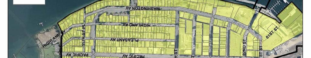
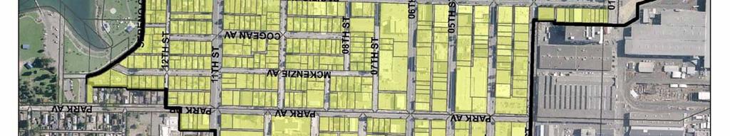

75 DRAFT 5 9/08/2006


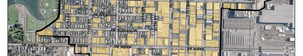
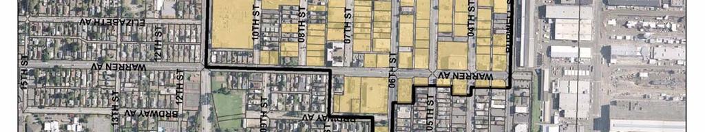
76 DRAFT 6 9/08/2006


77 DRAFT 7 9/08/2006
Procedures For Collecting and Monitoring Data
 DRAFT Kitsap County Buildable Lands Program Procedures For Collecting and Monitoring Data Page 1 12/1/05 Introduction This procedures report is intended to provide guidelines for Kitsap County and its
Kitsap County Department of Community Development 619 Division Street, MS-36 Port Orchard, WA 98366
 Kitsap County Department of Community Development 619 Division Street, MS-36 Port Orchard, WA 98366 ACKNOWLEDGEMENTS Kitsap County Board of Commissioners District 1 Robert Gelder District 2 Charlotte Garrido
City of Bellingham Urban Growth Area - Land Supply Analysis Summary
 City of Bellingham Urban Growth Area - Land Supply Analysis Summary Population & Employment Growth Forecasts APPENDIX D, ATTACHMENT 3 The ECONorthwest Whatcom County Population & Economic Forecasts report
STAFF REPORT. Permit Number: Porter. Kitsap County Board of Commissioners; Kitsap County Planning Commission
 STAFF REPORT Permit Number: 15 00461 Porter DATE: November 9, 2015 TO: FROM: Kitsap County Board of Commissioners; Kitsap County Planning Commission Katrina Knutson, AICP, Senior Planner, DCD and Jeff
STAFF REPORT. Permit Number: Lee. Kitsap County Board of Commissioners; Kitsap County Planning Commission
 STAFF REPORT Permit Number: 15 00689 Lee DATE: March 2, 2016 TO: FROM: Kitsap County Board of Commissioners; Kitsap County Planning Commission Katrina Knutson, AICP, Senior Planner, DCD and Jeff Arango,
STAFF REPORT. Permit Number: Unlimited. Kitsap County Board of Commissioners; Kitsap County Planning Commission
 STAFF REPORT Permit Number: 15 00550 Unlimited DATE: March 2, 2016 TO: FROM: Kitsap County Board of Commissioners; Kitsap County Planning Commission Katrina Knutson, AICP, Senior Planner, DCD and Jeff
STAFF REPORT. Permit Number: Garland. Kitsap County Board of Commissioners; Kitsap County Planning Commission
 STAFF REPORT Permit Number: 15 00686 Garland DATE: February 25, 2016 TO: FROM: Kitsap County Board of Commissioners; Kitsap County Planning Commission Katrina Knutson, AICP, Senior Planner, DCD and Jeff
CHAPTER 2 VACANT AND REDEVELOPABLE LAND INVENTORY
 CHAPTER 2 VACANT AND REDEVELOPABLE LAND INVENTORY CHAPTER 2: VACANT AND REDEVELOPABLE LAND INVENTORY INTRODUCTION One of the initial tasks of the Regional Land Use Study was to evaluate whether there is
Kitsap County Department of Community Development
 Kitsap County Department of Community Development Staff Report and Recommendation Annual Comprehensive Plan Amendment Process for 2018 George s Corner LAMIRD Boundary Adjustment Report Date 7/16/2018 Hearing
Open Space Model Ordinance
 Open Space Model Ordinance Section I. Background Open space development has numerous environmental and community benefits, including: 1) Reduces the impervious cover in a development. Impervious cover
CITY OF MEDFORD COMPREHENSIVE PLAN BUILDABLE LAND INVENTORY
 CITY OF MEDFORD COMPREHENSIVE PLAN PREPARED BY CITY OF MEDFORD PLANNING DEPARTMENT 200 SOUTH IVY STREET MEDFORD, OREGON 97501 BIANCA PETROU, A.I.C.P., ACTING PLANNING DIRECTOR LONG RANGE PLANNING SECTION
Buildable Lands Analysis within the Overall UGB Expansion Process
 CHAPTER 3. BUILDABLE LANDS ANALYSIS The buildable lands inventory is intended to identify lands that are available for development within the UGB. The inventory is sometimes characterized as supply of
MASTER INTERLOCAL AGREEMENT FOR GROWTH MANAGEMENT ACT IMPLEMENTATION IN YAKIMA COUNTY TABLE OF CONTENTS
 MASTER INTERLOCAL AGREEMENT FOR GROWTH MANAGEMENT ACT IMPLEMENTATION IN YAKIMA COUNTY TABLE OF CONTENTS I. PREAMBLE A. Purpose... 1 B. Background... 2 II. AGREEMENT A. Parties to Agreement... 3 B. Authority...
HHLT Educational Forum: Conservation Subdivisions and the Open Space Overlay. February 5th 2018 Winter Hill
 HHLT Educational Forum: Conservation Subdivisions and the Open Space Overlay February 5th 2018 Winter Hill 1 Topics Covered SECTION I II III IV V TOPIC Comprehensive Plan Open Space Index Conservation
MEMORANDUM. Critical Areas Ordinance Density Requirements
 COUNTY COMMISSIONERS Creating Solutions for Our Future Cathy Wolfe District One Sandra Romero District Two Karen Valenzuela District Three PLANNING DEPARTMENT Scott Clark Director MEMORANDUM TO: FROM:
Kitsap County Department of Community Development
 Kitsap County Department of Community Development Staff Report and Recommendation Annual Comprehensive Plan Amendment Process for 2018 Public Facility Designations and Park Classifications Update Report
STAFF REPORT. Permit Number: Gonzalez. Kitsap County Board of Commissioners; Kitsap County Planning Commission
 STAFF REPORT Permit Number: 15 00657 Gonzalez DATE: March 2, 2016 TO: FROM: Kitsap County Board of Commissioners; Kitsap County Planning Commission Katrina Knutson, AICP, Senior Planner, DCD and Jeff Arango,
STAFF REPORT. Permit Number: DJM Construction. Kitsap County Board of Commissioners; Kitsap County Planning Commission
 STAFF REPORT Permit Number: 15 00378 DJM Construction DATE: November 9, 2015 TO: FROM: Kitsap County Board of Commissioners; Kitsap County Planning Commission Katrina Knutson, AICP, Senior Planner, DCD
STAFF REPORT. Permit Number: Laurier Enterprises, Inc. Kitsap County Board of Commissioners; Kitsap County Planning Commission
 STAFF REPORT Permit Number: 15 00740 Laurier Enterprises, Inc. DATE: December 18, 2015 TO: FROM: Kitsap County Board of Commissioners; Kitsap County Planning Commission Katrina Knutson, AICP, Senior Planner,
BUILD-OUT ANALYSIS GRANTHAM, NEW HAMPSHIRE
 BUILD-OUT ANALYSIS GRANTHAM, NEW HAMPSHIRE A Determination of the Maximum Amount of Future Residential Development Possible Under Current Land Use Regulations Prepared for the Town of Grantham by Upper
TOWN OF BROOKLINE, NEW HAMPSHIRE
 TOWN OF BROOKLINE, NEW HAMPSHIRE BUILDOUT ANALYSIS DECEMBER, 2003 Prepared by the Nashua Regional Planning Commission TABLE OF CONTENTS Introduction... 1 I. Methodology... 1 A. PARCEL REVIEW... 1 B. DEVELOPMENT
Rule 80. Preservation of Primary Agricultural Soils Revised and approved by the Land Use Panel during its public meeting on January 31, 2006.
 Rule 80. Preservation of Primary Agricultural Soils Revised and approved by the Land Use Panel during its public meeting on January 31, 2006. (A) Purpose. In accordance with 10 V.S.A. Sections 6025(b)
STAFF REPORT. Permit Number: Laurier Enterprises, Inc. Kitsap County Board of Commissioners; Kitsap County Planning Commission
 STAFF REPORT Permit Number: 15 00740 Laurier Enterprises, Inc. DATE: November 9, 2015 TO: FROM: Kitsap County Board of Commissioners; Kitsap County Planning Commission Katrina Knutson, AICP, Senior Planner,
MIDWAY CITY Municipal Code
 MIDWAY CITY Municipal Code TITLE 9 ANNEXATION CHAPTER 9.01 PURPOSE CHAPTER 9.02 GENERAL REQUIREMENTS CHAPTER 9.03 PROPERTY OWNER INITIATION OF ANNEXATION CHAPTER 9.04 PROCEDURES FOR CONSIDERATION OF PETITION
4.2 LAND USE INTRODUCTION
 4.2 LAND USE INTRODUCTION This section of the EIR addresses potential impacts from the Fresno County General Plan Update on land use in two general areas: land use compatibility and plan consistency. Under
Analysis of Infill Development Potential Under the Green Line TOD Ordinance
 Analysis of Infill Development Potential Under the Green Line TOD Ordinance Prepared for the Los Angeles County Second Supervisorial District Office and the Department of Regional Planning Solimar Research
A TDR Program for Naples. May 11, 2007
 ATTACHMENT G A TDR Program for Naples May 11, 2007 Introduction This paper is intended to supplement and expand upon the Draft TDR Program Framework authored by Solimar in February 2007. 1 The Framework
Gold Beach Buildable Lands Analysis
 Gold Beach Buildable Lands Analysis Final Report Submitted to: City of Gold Beach Prepared by: Community Planning Workshop Community Service Center 1209 University of Oregon Eugene, OR 97403-1209 http://darkwing.uoregon.edu/~cpw
Staff Report: Date: Applicant: Property Identification: Acreage of Request: Current Zoning of Requested Area: Requested Action: Attached:
 Staff Report: Completed by Jeff Palmer Director of Planning & Zoning Date: November 7, 2018, Updated November 20, 2018 Applicant: Greg Smith, Oberer Land Developer agent for Ronald Montgomery ET AL Property
8Land Use. The Land Use Plan consists of the following elements:
 8Land Use 1. Introduction The Land Use Plan consists of the following elements: 1. Introduction 2. Existing Conditions 3. Opportunities for Redevelopment 4. Land Use Projections 5. Future Land Use Policies
CHAPTER Committee Substitute for Committee Substitute for Senate Bill No. 2188
 CHAPTER 2004-372 Committee Substitute for Committee Substitute for Senate Bill No. 2188 An act relating to land development; amending s. 197.502, F.S.; providing for the issuance of an escheatment tax
Chapter 100 Planned Unit Development in Corvallis Urban Fringe
 100.100 Scope and Purpose. Chapter 100 Planned Unit Development in Corvallis Urban Fringe (1) All applications for land divisions in the Urban Residential (UR) and Flood Plain Agriculture (FPA) zones within
PROJECT SCORING GUIDANCE. Introduction: National Proiect Selection:
 FOREST LEGACY PROGRAM PROJECT SCORING GUIDANCE Introduction: This document provides guidance to the National Review Panel on how to score individual Forest Legacy Program (FLP) projects, including additional
Implementation Guidance. for. The Sustainable Growth and Agricultural Preservation Act of Senate Bill 236
 Implementation Guidance for The Sustainable Growth and Agricultural Preservation Act of 2012 Senate Bill 236 August 1, 2012 Version 2.0 Table of Contents 1. Executive Summary... 1 1.1 Bill Highlights...
Comprehensive Plan /24/01
 IV The is a central component of the Comprehensive Plan. It is an extension of the general goals and policies of the community, as well as a reflection of previous development decisions and the physical
BOUNDARY LINE ADJUSTMENT
 DEPARTMENT OF COMMUNITY DEVELOPMENT 621 Sheridan Street, Port Townsend, WA 98368 Tel: 360.379.4450 Fax: 360.379.4451 Web: www.co.jefferson.wa.us/communitydevelopment E-mail: dcd@co.jefferson.wa.us BOUNDARY
Implementation Guidance for The Sustainable Growth and Agricultural Preservation Act of 2012 Senate Bill 236
 Implementation Guidance for The Sustainable Growth and Agricultural Preservation Act of 2012 Senate Bill 236 May 22, 2012 Version 1.0 Table of Contents 1. Executive Summary... 1 1.1 Bill Highlights...
PAPRlamird5-Four Seasons
 PAPRlamird5-Four Seasons Lamird Report This report provides the written record of local circumstances that explains how the 4 Seasons LAMIRD ( this lamird ) fits within the rural element goals of the Growth
Land Use. Land Use Categories. Chart 5.1. Nepeuskun Existing Land Use Inventory. Overview
 Land Use State Comprehensive Planning Requirements for this Chapter A compilation of objectives, policies, goals, maps and programs to guide the future development and redevelopment of public and private
Yakima County Public Services Department Planning Division
 Yakima County Public Services Department Planning Division Yakima County s 2017 Review of its UGAs and Permitted Densities (as required by the Growth Management Act) Urban Growth Area for City of Zillah
ARLINGTON COUNTY, VIRGINIA. County Board Agenda Item Meeting of June 17, 2017
 ARLINGTON COUNTY, VIRGINIA County Board Agenda Item Meeting of June 17, 2017 DATE: June 9, 2017 SUBJECT: Request to authorize advertisement of public hearings by the Planning Commission and County Board
TOWN OF PELHAM, NEW HAMPSHIRE
 TOWN OF PELHAM, NEW HAMPSHIRE BUILDOUT ANALYSIS Prepared for the PELHAM CONSERVATION COMMISSION with the assistance of the NASHUA REGIONAL PLANNING COMMISSION TABLE OF CONTENTS I. INTRODUCTION...1 II.
TRANSFER OF DEVELOPMENT RIGHTS
 STEPS IN ESTABLISHING A TDR PROGRAM Adopting TDR legislation is but one small piece of the effort required to put an effective TDR program in place. The success of a TDR program depends ultimately on the
2014 Plan of Conservation and Development. Development Plan & Policies
 The Town of Hebron Section 3 2014 Plan of Conservation and Development Development Plan & Policies C. Residential Districts I. Residential Land Analysis This section of the plan uses the land use and vacant
SECTION 16. "PUD" PLANNED UNIT DEVELOPMENT OVERLAY DISTRICT
 SECTION 6. "PUD" PLANNED UNIT DEVELOPMENT OVERLAY DISTRICT Subsection. Purpose. This district is established to achieve the coordinated integration of land parcels and large commercial and retail establishments
City of Astoria Comprehensive Plan URBAN GROWTH
 URBAN GROWTH CP.110 CP.110. Background Summary. Astoria has a population of 9,477 (2010 US Census). The total land area within the Urban Growth Boundary (UGB) is 3,474.2 acres with total land area of 4,450
NYC Land Acquisition Town Level Assessment 2017
 NYC Land Acquisition Town Level Assessment 2017 Delaware County Evaluation and Response Delaware County assessment of the NYC Land Acquisition Program and how potential future LAP acquisitions affect the
Purpose: Regulations:
 Administrative Procedures for the Designation and Refinement Of Chesapeake Bay Preservation Area Boundaries Guidance on the Chesapeake Bay Preservation Area Designation and Management Regulations September,
Final Draft Ordinance: Matrix
 1. # Topic Title And Description Dry Sewer olicy Use table footnote 48 revised to include a reference to exemptions in K 17.460.0. Allow properties within an Urban Growth Area, that are too far from sewer,
Business Item Community Development Committee Item:
 Business Item Community Development Committee Item: 2008-124 C Meeting date: July 21, 2008 ADVISORY INFORMATION Date: May 21, 2008 Subject: Flexible Residential Development Ordinance Guidelines District(s),
CODE UPDATE: REASONABLE MEASURES Verbal and Written Testimony for August 8, 2016 Public Hearing
 CODE UPDATE: REASONABLE MEASURES Verbal and Written Testimony for August 8, 2016 Public Hearing Numerical Total Issue per Issue Number of Testimony Dry Sewer 1 4 Commitment to Incentives 6 4, 5, 6, 7,
Burlington Unincorporated Community Plan
 Burlington Unincorporated Community Plan June 30, 2010 Meeting Page 1 of 24 Table of Contents (Page numbers to be inserted) I. Background a. Location and Community Description b. Planning of Unincorporated
General Development Plan Background Report on Agricultural Land Preservation
 General Development Plan 2008 Background Report on Agricultural Land Preservation February 2008 I. Introduction Anne Arundel County has been an agricultural community for over 350 years, beginning with
SECTION I AMENDMENT REPORT BROWARD COUNTY LAND USE PLAN TEXT PROPOSED AMENDMENT PCT BrowardNext Corrective Amendments RECOMMENDATIONS/ACTIONS
 SECTION I AMENDMENT REPORT BROWARD COUNTY LAND USE PLAN TEXT PROPOSED AMENDMENT PCT 18-1 BrowardNext Corrective Amendments RECOMMENDATIONS/ACTIONS DATE I Planning Council Staff Transmittal Recommendation
Permit Number: Edwards Mountain View Meadows
 Notes and comments on 2016 Comp Plan Tom Nevins - Nov 24, 2015 These notes are being prepared prior to any public comment review, public hearing input, or Planning Commission discussion. These are initial
Georgia Conservation Tax Credit Program Frequently Asked Questions
 Georgia Conservation Tax Credit Program Frequently Asked Questions What are the minimum requirements for eligibility under the Georgia Conservation Tax Credit Program (GCTCP)? Individual and corporate
ALC Bylaw Reviews. A Guide for Local Governments
 2018 ALC Bylaw Reviews A Guide for Local Governments ALC Bylaw Reviews A Guide for Local Governments This version published on: August 14, 2018 Published by: Agricultural Land Commission #201-4940 Canada
STAFF REPORT And INFORMATION FOR THE HEARING EXAMINER
 KITSAP COUNTY DEPARTMENT OF COMMUNITY DEVELOPMENT 614 DIVISION STREET MS-36, PORT ORCHARD WASHINGTON 98366-4682 Louisa Garbo, Director (360) 337-7181 FAX (360) 337-4925 HOME PAGE - www.kitsapgov.com/dcd/
Appendix J - Planned Unit Development (PUD)
") Appendix J - Planned Unit Development (PUD) Intent and Purpose The purpose of the PUD is: 1. To provide development that is consistent with the Comprehensive Land Use Plan and promote the goals and objectives
Appendix J - Planned Unit Development (PUD) Intent and Purpose The purpose of the PUD is: 1. To provide development that is consistent with the Comprehensive Land Use Plan and promote the goals and objectives
RESIDENTIAL AND RECREATIONAL
 Energy, Mines & Resources Land Management Branch 320-300 Main Street Whitehorse, Yukon Y1A 2B5 667-5215 Fax 667-3214 www.emr.gov.yk.ca RESIDENTIAL AND RECREATIONAL Lot Enlargement Policy OBJECTIVE To facilitate
PIP practice note 1 planning assumptions. How to use this practice note. Planning assumptions. What are planning assumptions? Type.
 PIP PRACTICE NOTE 1 How to use this practice note This practice note has been prepared to support in the preparation or amending of planning assumptions within a priority infrastructure plan (PIP). It
Attachment A First Submittal JAZB Safety Zones A and B
 Attachment A First Submittal JAZB Safety Zones A and B Attachment B Second Submittal JAZB Safety Zones A and B Attachment C Flying Cloud Airport (FCM) Draft Airport Zoning Ordinance Social and Economic
9. REZONING NO Vicinity of the northwest corner of 143 rd Street and Metcalf Avenue
 9. REZONING NO. 2002-15 Vicinity of the northwest corner of 143 rd Street and Metcalf Avenue 1. APPLICANT: Andrew Schlagel is the applicant for this request. 2. REQUESTED ACTION: The applicant is requesting
4. If any perennial surface water passes through or along the property lines of the acreage, a minimum of 200 feet or frontage should be required.
 b. Provide adequate acreage for appropriate productive use of rural residential land, such as small numbers of livestock, large gardens, etc. 3. Minimum of 200 feet of frontage on an improved county or
A.3. ARTICLE 7 PLAN REQUIREMENTS FOR MINOR SUBDIVISION AND/OR LAND DEVELOPMENT
 700. 701.A.3. ARTICLE 7 PLAN REQUIREMENTS FOR MINOR SUBDIVISION AND/OR LAND DEVELOPMENT SECTION 700 PURPOSE The purpose of this Article is to set forth a streamlined set of Plan Requirements for minor
TASK 2 INITIAL REVIEW AND ANALYSIS U.S. 301/GALL BOULEVARD CORRIDOR FORM-BASED CODE
 TASK 2 INITIAL REVIEW AND ANALYSIS U.S. 301/GALL BOULEVARD CORRIDOR FORM-BASED CODE INTRODUCTION Using the framework established by the U.S. 301/Gall Boulevard Corridor Regulating Plan (Regulating Plan),
BUTTE LOCAL AGENCY FORMATION COMMISSION (LAFCO) EXECUTIVE OFFICER S REPORT. LAFCo File City of Chico Extension of Services 1212 Glenwood Avenue
 EXECUTIVE OFFICER S REPORT. LAFCo File City of Chico Extension of Services 1212 Glenwood Avenue") Agenda Item 4.3 BUTTE LOCAL AGENCY FORMATION COMMISSION (LAFCO) EXECUTIVE OFFICER S REPORT TO: FROM: SUBJECT: Local Agency Formation Commission Stephen Lucas, Executive Officer LAFCo File 19-05 City of
Agenda Item 4.3 BUTTE LOCAL AGENCY FORMATION COMMISSION (LAFCO) EXECUTIVE OFFICER S REPORT TO: FROM: SUBJECT: Local Agency Formation Commission Stephen Lucas, Executive Officer LAFCo File 19-05 City of
13 Sectional Map Amendment
 13 Sectional Map Amendment Introduction This chapter reviews land use and zoning policies and practices in Prince George s County and presents the proposed zoning in the sectional map amendment (SMA) to
INDIAN RIVER COUNTY, FLORIDA. The Honorable Members of the Planning and Zoning Commission DEPARTMENT HEAD CONCURRENCE
 Public Hearing Legislative INDIAN RIVER COUNTY, FLORIDA M E M O R A N D U M TO: The Honorable Members of the Planning and Zoning Commission DEPARTMENT HEAD CONCURRENCE Robert M. Keating, AICP; Community
METHODOLOGY GUIDE VALUING LANDS IN TRANSITION IN ONTARIO. Valuation Date: January 1, 2016
 METHODOLOGY GUIDE VALUING LANDS IN TRANSITION IN ONTARIO Valuation Date: January 1, 2016 August 2017 August 22, 2017 The Municipal Property Assessment Corporation (MPAC) is responsible for accurately assessing
DRAFT FOR PUBLIC HEARING (rev. March, 2016)
") Chapter 200. ZONING Article VI. Conservation/Cluster Subdivisions 200-45. Intent and Purpose These provisions are intended to: A. Guide the future growth and development of the community consistent with
Chapter 200. ZONING Article VI. Conservation/Cluster Subdivisions 200-45. Intent and Purpose These provisions are intended to: A. Guide the future growth and development of the community consistent with
BUTTE LOCAL AGENCY FORMATION COMMISSION (LAFCO) EXECUTIVE OFFICER S REPORT. LAFCo File City of Chico Extension of Services 716 Oak Lawn Avenue
 EXECUTIVE OFFICER S REPORT. LAFCo File City of Chico Extension of Services 716 Oak Lawn Avenue") Agenda Item 4.4 BUTTE LOCAL AGENCY FORMATION COMMISSION (LAFCO) EXECUTIVE OFFICER S REPORT TO: FROM: SUBJECT: Local Agency Formation Commission Stephen Betts, Deputy Executive Officer LAFCo File 15-21
Agenda Item 4.4 BUTTE LOCAL AGENCY FORMATION COMMISSION (LAFCO) EXECUTIVE OFFICER S REPORT TO: FROM: SUBJECT: Local Agency Formation Commission Stephen Betts, Deputy Executive Officer LAFCo File 15-21
Guide to Preliminary Plans
 Guide to Preliminary Plans Introduction The Douglas County is committed to providing open, transparent application processes to the public. This Guide is provided to assist anyone interested in the procedures
Staff Report to the Clallam County Planning Commission March 2, 2004 Page 1
 March 2, 2004 Page 1 Comprehensive Plan and Zoning Map Amendment REZ2003-00001, Staff Report Clallam County Department of Community Development January 27, 2004 Prepared by the Clallam County Department
Town of. River Falls. Land Use Element Vierbicher Associates, Inc
 Town of River Falls 2005 Vierbicher Associates, Inc Contents Contents s. 66.1001(2)(h) Wis. Stats................................................. ii Introduction................................................................
Model Zoning and County Benchmark
 INTRODUCTION This report consists of a series of report cards for the municipalities covered by the Westchester Fair and Affordable Housing Settlement. Each report card assesses the municipality on the
Town of Falmouth s Four Step Design Process for Subdivisions in the Resource Conservation Zoning Overlay District
 Town of Falmouth s Four Step Design Process for Subdivisions in the Resource Conservation Zoning Overlay District All subdivisions shall be designed in accordance with the following four-step process.
BUTTE LOCAL AGENCY FORMATION COMMISSION (LAFCO) EXECUTIVE OFFICER S REPORT. LAFCo File City of Chico Extension of Services 16 Mayfair Drive
 EXECUTIVE OFFICER S REPORT. LAFCo File City of Chico Extension of Services 16 Mayfair Drive") Agenda Item 4.2 BUTTE LOCAL AGENCY FORMATION COMMISSION (LAFCO) EXECUTIVE OFFICER S REPORT TO: FROM: SUBJECT: Local Agency Formation Commission Stephen Lucas, Executive Officer LAFCo File 19-03 DATE: December
Agenda Item 4.2 BUTTE LOCAL AGENCY FORMATION COMMISSION (LAFCO) EXECUTIVE OFFICER S REPORT TO: FROM: SUBJECT: Local Agency Formation Commission Stephen Lucas, Executive Officer LAFCo File 19-03 DATE: December
How to Read a Real Estate Appraisal Report
 How to Read a Real Estate Appraisal Report Much of the private, corporate and public wealth of the world consists of real estate. The magnitude of this fundamental resource creates a need for informed
COUNTY OF SAN MATEO Inter-Departmental Correspondence Planning and Building. Steve Monowitz, Community Development Director
 COUNTY OF SAN MATEO Inter-Departmental Correspondence Planning and Building Date: December 2, 2016 Board Meeting Date: January 10, 2017 Special Notice / Hearing: Newspaper Notice Vote Required: Majority
AB 1397 HOUSING ELEMENT LAW SITE IDENTIFICATION STRENGTHENED OVERVIEW
 AB 1397 HOUSING ELEMENT LAW SITE IDENTIFICATION STRENGTHENED OVERVIEW The 2017 California legislative session yielded a housing package of 15 bills that significantly increased both the available financing
ARTICLE 5 MINOR SUBDIVISION/LAND DEVELOPMENT
 ARTICLE 5 MINOR SUBDIVISION/LAND DEVELOPMENT SECTION 501 ONLY FINAL PLAN REQUIRED The classification of a proposed subdivision as a "Minor Subdivision" shall only require the submission, review and approval
Commissioner Cole moved, seconded by Commissioner Fagernes to approve the minutes for February 21, Motion carried.
 MINUTES - Regular Meeting Wednesday, March 7, 2001 County Courthouse Complex 2000 Lakeridge Drive SW Building 1 - Room 152 Olympia, Washington 98502 1. Call to Order The meeting was called to order at
GENERAL DESCRIPTION STAFF RECOMMENDATION IMPLEMENTATION REQUIREMENTS
 Application No.: 891418 Applicant: AREA-WIDE MAP AMENDMENT Rezone two parcels from Moderate Density Single Family (MSF) to Neighborhood Center (NC) and Employment Center (EC). Charles Bitton GENERAL DESCRIPTION
Chapter Planned Residential Development Overlay
 Chapter 19.29 Planned Residential Development Overlay Sections 010 Purpose 020 Scope 030 Definitions 030 Minimum Size 040 Allowable Uses 050 Minimum Development Standards 060 Density Bonus 070 Open Space
Return on Investment Model
 THOMAS JEFFERSON PLANNING DISTRICT COMMISSION Return on Investment Model Last Updated 7/11/2013 The Thomas Jefferson Planning District Commission developed a Return on Investment model that calculates
ARTICLE FIVE FINAL DRAFT
 ARTICLE FIVE 021218 FINAL DRAFT Sec. 503.6 Open Space Preservation Option Open Space Preservation Option Open Space Preservation developments may be approved in the AR, R-1, R-2 and R-3 zoning districts,
Staff Report: Date: Applicant: Property Identification: Acreage of Request: Current Zoning of Requested Area: Requested Action: Attached:
 Staff Report: Completed by Jeff Palmer Director of Planning & Zoning Date: November 7, 2018 Applicant: Greg Smith, Oberer Land Developer agent for Ronald Montgomery ET AL Property Identification: Frontage
PLANNED UNIT DEVELOPMENTS (Ordinance No.: 3036, 12/3/07; Repealed & Replaced by Ordinance No.: 4166, 10/15/12)
") 159.62 PLANNED UNIT DEVELOPMENTS (Ordinance No.: 3036, 12/3/07; Repealed & Replaced by Ordinance No.: 4166, 10/15/12) A. PURPOSE 1. General. The Planned Unit Development (PUD) approach provides the flexibility
159.62 PLANNED UNIT DEVELOPMENTS (Ordinance No.: 3036, 12/3/07; Repealed & Replaced by Ordinance No.: 4166, 10/15/12) A. PURPOSE 1. General. The Planned Unit Development (PUD) approach provides the flexibility
Dr af t Sant a Bar b ar a Count y Housing Elem ent
 6. LAND INVENTORY AND QUANTIFIED OBJECTIVE I n t r o d u c t i o n This chapter includes two important components of the Housing Element: (1) the land inventory and analysis, and (2) the quantified objective
Corporate Services Planning and Economic Development. Memorandum
 Corporate Services Planning and Economic Development Memorandum TO: FROM: Committee of the Whole Paul Freeman, Chief Planner DATE: June 21, 2018 RE: York Region C omments on Draft Provinci al Guidance
Conservation Design Subdivisions
 Conservation Design Subdivisions An excerpt from the Rules and Regulations Governing Division of Land in Sheridan County, Wyoming, November 5, 2010 Sheridan County Public Works Department 224 S. Main Street
Our Focus: Your Future 2007 YEAR END HOUSING MONITORING AND SUBDIVISION STATUS REPORTS
 Town of Fort Erie Community & Development Services Our Focus: Your Future Prepared for Council-in-Committee Report No. CDS-011-08 Agenda Date February 4,2008 File No. 350204/350308 Subject 2007 YEAR END
SUBMITTAL REQUIREMENTS: The number indicates the number of copies for submittal (if applicable).
.") Office Use Only Preliminary Long Plat Long Subdivision Applicant Checklist PLANNING, COMMUNITY, & ECONOMIC DEVELOPMENT DEPARTMENT FINAL LONG PLAT LONG SUBDIVISION CHECKLIST Mailing Address: P.O. Box 547,
Office Use Only Preliminary Long Plat Long Subdivision Applicant Checklist PLANNING, COMMUNITY, & ECONOMIC DEVELOPMENT DEPARTMENT FINAL LONG PLAT LONG SUBDIVISION CHECKLIST Mailing Address: P.O. Box 547,
INCENTIVE POLICY FOR AFFORDABLE HOUSING
 INCENTIVE POLICY FOR AFFORDABLE HOUSING PREPARED BY: CITY OF FLAGSTAFF S HOUSING SECTION COMMUNITY DEVELOPMENT DIVISION OCTOBER 2009 2 1 1 W e s t A s p e n A v e. t e l e p h o n e : 9 2 8. 7 7 9. 7 6
Conceptual Scheme SE W4
 December 2012 1. PURPOSE 1.1. The purpose of a Conceptual Scheme (CS) is as follows: a) To provide a framework for the subsequent subdivision and/or development of land within the Country Residential Policy
HOUSING ELEMENT GOALS, OBJECTIVES, AND POLICIES
 HOUSING ELEMENT GOALS, OBJECTIVES, AND POLICIES GOAL 1: To promote the preservation and development of high-quality, balanced, and diverse housing options for persons of all income levels throughout the
L. LAND USE. Page L-1
 L. LAND USE 1. Purpose This section discusses current and likely future land use patterns in Orland. An understanding of land use trends is very important in determining Orland's ability to absorb future
SUBURBAN AND URBAN RESIDENTIAL LAND USE
 SUBURBAN AND URBAN RESIDENTIAL LAND USE GOAL 1 DISCOURAGE URBAN AND SUBURBAN DEVELOPMENT OUTSIDE INCORPORATED AREAS IN WHITMAN COUNTY, EXCEPT WITHIN DESIGNATED UNINCORPORATED COMMUNITIES, AND THOSE AREAS
Thurston County Planning Department BOARD OF COUNTY COMMISSIONERS PUBLIC HEARING DRAFT AMENDMENTS TO THE CRITICAL AREAS REGULATIONS. Chapter 24.
 Thurston County Planning Department BOARD OF COUNTY COMMISSIONERS PUBLIC HEARING DRAFT AMENDMENTS TO THE CRITICAL AREAS REGULATIONS Chapter 24.01 GENERAL PROVISIONS Chapter 24.01 6/4/2012 GENERAL PROVISIONS