PLANNING & ZONING CO~ISSION AGENDA PEBRUARY18, L-ta:c»o. T&xt-.'So 17B
|
|
|
- Michael Bennett
- 5 years ago
- Views:
Transcription

1 PLANNNG & ZONNG COSSON AGENDA PEBRUARY18, L-ta:c»o. T&xt-.'So 17B
2 CTY OF LAREDO PLANNNG AND WNNG COMMSSON NOTCE OF MEETNG The City of Laredo Planning and Zoning Commission will convene in regnlar session open to the public at 6:00p.m on Wednesday, February 18, 2015 in the City Council Chambers at City Hal 1110 Houston Street, Laredo, Texas to consider the fullowing:. CALL TO ORDER. H. V. ROLL CALL PLEDGE OF ALLEGANCE CONSDER APPROVAL OF MNUTES OF A. Regular meeting of February 5, 2015 V. CHARMAN AND DRECTORS REPORT AND COMMUNCATONS V. ELECTON OF OFFCERS VH. PUBLC HEARNG AND RECOMMENDATON OF THE FOLLOWNG ZONE CHANGES A. Amending the Zoning Ordinance (Map) of the City of Laredo by rezoning Lot 3A, Block l, Encino Plaza Unit 2A, located at 1211 East Del Mar Boulevard, from B-3 (Community Business District) to B-4 (Highway Commercial District). District V- Cm. Roque Vela, Jr. B. Amending the Zoning Ordinance (Map) of the City of Laredo by rezoning Lot 1, Block 1, Jacaman Ranch Subdivision Unit V, located at 6402 N. Bartlett Avenue, fromb-1 (Limited Commercial District) to B-3 (Community Business District). District V- Cm. Roque Vela, Jr. C. Amending the Zoning Ordinance (Map) of the City of Laredo by rezoning the West 2/3 of Lot 8, Block 876, Eastern Division, located at 2701 N. Meadow Avenue, from R-3 (Mixed Residential District) to B-3 (Community Business District). District KV- Cm. Juan Narvaez D. Amending the Zoning Ordinance (Map) of the City of Laredo by authorizing a Special Use Permit for a restaurant selling alcohol on Lots and 3, Block 367, Western Division, located at 1802 Santa Ursula Avenue. District V- Cm. Roberto Balli Page
3 E. Amending Ordinance of the CityofLaredo authorizing a Conditional Use Permit for a kiosk/food stand by adding a meat market to the existing grocery store on Lot 12, Block 446, Eastern Division, located at 202 W. San Carlos Street. District V- Cm. Juan Narvaez F. Amending the Zoning Ordinance (Map) of the City of Laredo by rezoning Lot 2, Block 2, Martinez Business Park Subdivision Unit, located at 6703 McPherson Road, from B-3 (Community Business District) to B-4 (Highway Commercial District). District V- Cm. Roque Vela, Jr. V. CONSDERATON OF PRELMNARY PLAT AND REPLATS A. Rodolfo Garza Commercial Plat, located west ofhwy. 83 and north ofriverhill Loop. District H - Cm. Alejandro "Alex" Perez B. Martinez Plat, located south offm 1472 and east oflron Mine Rd. District V X. CONSDERATON OF FNAL PLATS AND REPLATS A. Replat oflot 7A & 7B, Block 1, Los Altos Subdivision, located east oflos Altos Dr. and north of Enlace Rd. B. R.H. Billboard Plat# 3, located south ofhwy. 359 and west ofcuatro Vientos Rd. District - Cm. Rudy Gonzalez, Jr. C. Replat of Lot la, Block 1, Vista Dorada Phase, located north ofhwy. 359 and east of Bob Bullock Loop. District - Cm Esteban Rangel X. ADJOURNMENT THS NOTCE WAS POSTED AT THE MUNCPAL GOVERNMENT OFFCES, ll 0 HOUSTON STREET, LAREDO, TEXAS, AT A PLACE CONVENENT AND READLY ACCESSBLE TO THE PUBLC AT ALL TMES. SAD NOTCE WAS POSTED ON FRDAY, FEBRUARY 13, 2015 BY 6:00P.M. %?;;3(2 1,)Nathan R. Bratton J: 0 - Director of Planning City Secretary Page2
4 CTY OF LAREDO PLANNNG AND ZONNG COMMSSON MNUTES OF TilE PLANNNG AND ZONNG MEETNG OF FEBRUARY 5, 2015 The City of Laredo Planning and Zoning Co=ission convened in regular session open to the public at 6:00p.m. on Thursday February 5, 2015, in the City Council Chambers at City Hall, 1110 Houston Street, considered the following: Present: Abse!!llt: Edward Castillo gnacio Alaniz Javier Compean Jesse Gonzalez Mike Barron Erasmo Villarreal Miguel De La Fuente LuxSandra Guerra Staff: Nathan R. Bratton Martha Bernal Susana Ramos Fernando Morales Renee LaFerriere Alejandrina Sanchez Captain Ruben Dominguez (Fire Dept.) Othen: Francisco Rodriguez Arturo Arce Edward Ochoa. CAJLJL TO OlliDER Cm. Castillo called the meeting to order at 6:03 p.m. t ROLL CAJLJL Susana Ramos, Plarming Staff, called roll to verify that a quorum did exist. m. PLEDGE OF ALLEGANCE V. CONSDER APPROVAL OF MNUTES OF A. Regular meeting of December 18, 2014 B. Regular meeting of January 15, 2015 C. Special meeting of January 21, 2015 Minutes of the P & Z Meeting of February 5, 2015 Page 1
5 Cm. Compean made a motion to approve all minutes subject to revising the January 21"' to 12:00 noon instead of 6:00p.m. Second: n Favor: Opposed: Abstained: Cm. Compean Motion carried unanimously V. CHARMAN AND DRECTORS REPORT AND COMMUNCATONS There was nothing to report. V. ELECTON OF OFFCERS Cm. Gonzalez made a motion to table the item due to lack of no full quorum. Second: n Favor: Opposed: Abstained: Cm. Compean Motion carried unanimously VU. PllilllLC HEARJNG AND RECOMMENDATON OJF THE FOLLOWNG ZONE ClHlANGJE A. Amemllillllg tlille Zoning Orlfuimmce (Map) ofthe Cilty of Laredo by autlillmrizing a Coni!llitiollllal Use Permit for a bus terminal Ollll Lot 2 and! L11t 3 alllld tlille west 3/41of L11t 41, Bl11elk 12«1, Westem Divisi11n, located! at 8141 Holl!stmm Street. District VU C!lllll. Robert11 BW!i After reading the item and having no objections, the chairman opened the public hearing. Francisco Rodriguez, owner, spoke in favor of the proposed Conditional Use Permit. Cm. Barron made a motion to!lli!!j)rl!lve the proposed Conditional Use Permit. Second: n Favor: Opposed: Abstained: Cm. Gonzalez Motion carried unanimously Vlll. PUBLC HEARNG AND CONSDERATON OF A PRELMNARY REPLAT A. Replat of Lot 5A-7A, Block23 and Lot 6A-8A, Block25, Lakeside Subdivision, Phase 13, located east of Lake Powell Dr. and north of Lake Victoria Rd. District V-Cm. Roque Vela, Jr. After reading the item and having no objections, the chairman opened the public hearing. Arturo Arce, Mftiia Engineering, concurred with all comment. Minutes of the P & Z Meeting of February 5, 2015 Page 2
6 Cm. Gonzalez made a motion to close the public hearing and approve the item subject to comments and a notice to the developer as presented. 1. Revise the owner's signature block to reflect no new dedication of streets, drains and easements. 2. Provide any pertinent plat notes from the previously recorded plat. 3. Provide the lot widths at the setback line in accordance to Section (2) ofthe Laredo Land Development Code. 4. Provide a plat note stating, "The setback lines indicated on the plat shall be for reference only. The official setback line shall be determined based on the current zoning district in accordance to Section of the Laredo Land Development Code." Notice to the Developer: 1. Only the utility easements within the plat boundaries are subject to change prior to plat recordation, due to revisions by the utility companies. Second: n Favor: Opposed: Abstained: Cm. Compean Motion carried unanimously X. CONSDEAA'UON OF lp!lmlllimjnary PLA'll' AND REJPJLA'll'S A. Emitla!l"cm<il!e!l"ll SunMiv:fisimn, Pbmse 2, lllcatedl west 111fFM aumdlllll!lrth llfbilb Bunlll!!clk ll!!oii]. District VJ[J[ Edward Ochoa, Gilpin Engineering, concurred with comments. Cm. Alaniz made a motion to!llj!ll!!ll"llve the item subject to comments and a notice to the developer.. Show and label the building setbacks. Also provide a plat note stating "The setback lines indicated on the plat shall be for reference only. The official setback shall be determined based on the current zoning district in accordance to Section of the Laredo Land Development Code." 2. Show and label the size of the utility easements. Also identify Lot 3 as a drainage easement. 3. Delete plat note #1 and 3. Also access onto FM 1472 and Bob Bullock Loop is subject to review and approval by the Texas Department of Transportation. Also provide a plat note stating such approval is restricted to a shared curb cut, adjacent property owner shall be required to sign on the plat. 4. All improvements as Per Subdivision Ordinance. Notice to the Developer:. Only the utility easements within the plat boundaries are subject to change prior to plat recordation, due to revisions by the utility companies. Second: n Favor: Opposed: Cm. Compean 7 0 Minutes of the P & Z Meeting of February 5, 2015 Page 3
7 Abstained: 0 Motion carried unanimously B. Embarcadero Subdivision, Phase 4, located west offfi 35 and north of Bob Bullock Loop. District V. Edward Ochoa, Gilpin Engineering, concurred with comments. Cm. Compean made a motion to approve the item subject to comments and a notice to the developer. 1. Show and label the building setbacks. Also provide a plat note stating "The setback lines indicated on the plat shall be for reference only. The official setback line shall be determined based on the current zoning district in accordance to Section of the Laredo Land Development Code." 2. Show and label the size of the utility easements. 3. Delete plat note #1 and 3. Also access 4. All improvements as Per Subdivision Ordinance. Notice to the Developer: 1. Only the utility easements within the plat boundaries are subject to change prior to plat recordation, due to revisions by the utility companies. Second: n Favor: Opposed: Abstained: Cm. Alaniz Motion carried unanimously C. ReJP'!tr oflait 1A-3A, Block 3, A!]llltem SllbdlivisioiDJ, locatredl south of A!]llterro Blvd!. mmll west «<f River Bmmk Dr. District Vlili Staff revised comment #2 to revise as followed: Cm. Compean made a motion to aj!!j!!rove the item subject comments and a notice to the developer as amended. 1. Provide a plat note stating "The setback lines indicated on the plat shall be for reference only. The official setback line shall be determined based on the current zoning district in accordance to Section of the Laredo Land Development Code." 2. Provide any pertinent plat notes from the previously recorded plat, to include the prohibition of access from Soubirous Rd. Also provide a secondary means of access to Lot 3A from River Bank Dr. to aliga with Mesealere Dr. in enler the proposed! shared access of Lot la and 2A in order to provide alleviation of congestion on Aquero Blvd as that is the only means of ingress/egress to the subdivision. 3. Revise plat note #1 to clarify purpose of the replat. Notice to the Developer: 1. Only the utility easements within the plat boundaries are subject to change prior to plat recordation, due to revisions by the utility companies. Minutes ofthe P & Z Meeting of February 5, 2015 Page 4
8 Second: n Favor: Opposed: Abstained: Cm. Gonzalez Motion carried unanimously D. Replat of Lot 3A-1, 3A-2, Block 1, North Town Professional Plaza, located north of University Blvd. and west ofrocio Dr. District V-Cm. Roqne Vela, Jr. Staff stated applicant requested to table the item time uncertain. Cm. Barron made a motion to table the time uncertain. Second: n Favor: Opposed: Abstained: Cm. Villarreal Motion carried unanimously E. Doggett Commercial Plat, locatei!ll north of Bob Bullock Loop ani!ll west offm District VliJ Cm. Villarreal made a motion to appmve the item subject to comments and a notice to the developer.. Show and label the building setbacks. Also, provide a plat note stating "The setback lines indicated on the plat shall be for reference only. The official setback line shall be determined based on the current zoning district in accordance to Section of the Laredo Land Development Code." 2. Show and label the size of the utility easements. 3. Access onto FM 1472 is subject to review and approval by the Texas Department of Transportation. Also provide a plat note stating such approval. f approval is restricted to a shared curb cut, adjacent property owner shall be required to sing on the plat. 4. All improvements as Per Subdivision Ordinance. Notice to the Developer: 1. Only the utility easements within the plat boundaries are subject to change prior to plat recordation, due to revisions by the utility companies Second: n Favor: Opposed: Abstained: Cm. Alaniz Motion carried unanimously X. CONSDERATON OF A FNAL PLAT A. Las Misiones Subdivision, Unit V, located east o1fthe proposed Las Misiones Blvd. and south of Toribio Dr. District 11-Cm. Esteban Rangel Cm. Villarreal made a motion to approve the item. Second: Cm. Gonzalez Minutes of the P & Z Meeting of February 5, 2015 Page 5
9 n Favor: Opposed: Abstained: Motion carried unanimously X. ADJOURNMENT Cm. Gonzalez made a motion to adjourn the meeting at 6:35p.m. Second: n Favor: Opposed: Abstained: Cm. Compean Motion carried unanimously (!vj 7-;V Nathan R. Bratton, Director Planning & Zoning Department Eduardo A. Castillo, Chairman Planning & Zoning Commission Minutes of the P & Z Meeting of February 5, 2015 Page 6
10 PLANNNG & ZONNG COMMUNCATON Date: SUBJECT: PUBLC HEARNG AND RECOMMENDATON OF AN ORDNANCE Amending the Zoning Ordinance (Map) of the City of Laredo by rezoning Lot 3A, Block, Encino 2/18/15 Plaza Unit 2A, located at 1211 Del Mar Boulevard, from B-3 (Community Business District) to B-4 (Highway Commercial District). tem VLA DistrictV ZC nitiated by: Staff source: S.A.E.P. LLC, Owner Horacia A. de Leon, Jr., Asst. City Manager Steve A. Whitworth, Owner/ Applicant Nathan R. Bratton, Planning Director Prior action: None. BACKGROUND Council District: V- The Honorable Roque Vela Proposed use: Commercial (retail shell lease building). Site: The site currently includes a project under construction. Surrounding land uses: North of the property are Eden Park Plaza, Wendy's and Valero Gas Station/Convenience, McDonald's, and HEB Store. East of the property across McPherson Road are Exxon/Speedy Stop, Commercial Building (five suites), KFC, Burger King, Danny's Restaurant, Commercial Building (seven suites), Rudy's Restaura11t, and Discount Tire. South of the property are family Medicine Center, Nee! Title Corporation and Commerce Bank a project under construction and some vacant land. Abutting the property are Bank of America to the east, Walgreens to the south and Arby's to the west. West of the property is a residential district (Low and Medium Density Residential). C mprehelllsive Jl>l!m: The Future Land Use Map recognizes this area as Light Commercial. Tnmsportatimll Plan: The Long Range Thoroughfare Plan identifies Del Mar Boulevard as a Modified Major Arterial and McPherson Road as a Major Arterial. The Plan does not identify Eden Lane (north of the property, Merlin Road (east of the property) nor Welby Cmrrt (south of the property). Letters sent til) surrmmdin2 Jl)mperty!)Wll.ers: 12 fu Favor: 0 Opposed: 0 STAFF COMMENTS The proposed zone change is not appropriate at this location. The B-3 zoning has been established, and introducing a B-4 district may create nuisances, such as noise and traffic congestion, that will negatively impact the quality of life in the neighborhood. Staff does not support the proposed zone change for the following reasons: 1. The proposed zone change may introduce more intense uses than those currently existing in the surrounding, well established light commercial and residential neighborhood. Uses allowable in a B-4 district could potentially have a negative impact on the quality and character of the neighborhood. More intense and possible less desirable B-4 uses include such uses as shooting range (indoor), bar, nightclub, cantina, saloon, amusement redemption machine establishment, amusement services (outdoor), petroleum sales (wholesale), alcoholic beverage storage and distribution, scrap/waste recycle collection, automobile saleswholesale, auto body repair, recreational vehicle parking lot, auto paint shop, auto muffler shop, major appliances sales (outdoor), mobile home dealer/sales only, truck/heavy equipment driving school, etc. Continued... P&Z COMMSSON RECOMMENDATON: STAFF RECOMMENDATON: The P & Z Commission, in a_to_ vote, recommended Staff does not support the proposed zone of the zone change. change. Page 1 of 2
11 PLANNNG & ZONNG COMMUNCATON STAFF COMMENTS CONTNUED.. 2.The proposed zone change is not appropriate at this location, because is not compatible with the Comprehensive Plan's designation as Light Commercial. 3. The proposed district is not compatible with the existing zoning along this section of Del Mar Boulevard or McPherson Road. This is a stable, homogenous light commercial district with no trending toward more intense uses. MPACT ANALYSS B-4 (Highway Commercial District): The purpose of the B-4 District (Highway Commercial District) is to provide for those businesses and services serving a regional area which are to be located primarily along principal (major) arterial streets or the freeway, as classified in the Transportation Plan of the City of Laredo. t is intended for this zoning classification to exist primarily along principal arterial streets or the freeway and to impose site development regulations to ensure adequate access of all uses within this classification. s this change cmtrary 1» the established land use pattern? Yes. The proposed property is located west of McPherson Road and south of Del Mar Boulevard which is entirely a light commercial along McPherson Road and nortb across Del Mar Boulevard. Wmllldl this change create an isolated zoning district lllllnelated till smrrllmmding «llistricts? No, there are existing B-4 districts east of the property along McPherson Road, however tbe predominant uses west of McPherson Road are light commercial uses and they abut a residential district. Willi cl11mge mdversely imdlllunce living Cllmllitions i" the neighborl!il!lod? Yes, the area is already a commercial corridor with heavy traffic that could increase noise and traffic in the neighborhood. Alre there sull»stamntial JJ"easons why the pmperty cammt be used iu acct»rdance with existing zoning? No. The existing B-3 (Community Business District) allows for commercial uses. Page 2 of 2
12 '16\0!/ 7518 US 71}1_0 kil,, ZONNG MAP 1 inch= 100 teet Date: 1/28/ E DEL MAHlllfD CCUNCHL DiSTRCT 5 ZC"27-2!!15 R:ZONE FROM B<l (COMMUNTY!lUSNS!l DSTRCT) TO 84 (HGHWAY COMMERCAl. DSTRCT) Qs.u.P. (SPECAL USE PERMTS) EJc.U.P. (CONDTONAL USE PERMTS) EJs.U.P.&C,U.P.
 TO B4 (HGHWAY COMMERCAL")
13 ZONNG OVERVEW 1 inch = 500 feel Date: 1/28/ E DEL MAHLD COUNCL DSTRCT 5 ZC REZONE FROM B<l (COMMUNTY BUSNESS DSTRCT) TO B4 (HGHWAY COMMERCAL DSTRCT)

14 '\ Low Density Residential 101 \i, L: 1119 G' o. FUTURE LAND USE MAP 1211 EDElMAR BlVD 1 inch = 100 feel COUNCL DSTRCT 5 Date: 1/28/2015 ZC-27-::1!015 REZON!: FROM 'll! (COMMUNTY BUSNESS DSTRCT) ro fw H!CilHWA'' C:OMMERCAl DSTRCT)


15 1 inch = 1 oo feet Date: 1/28/2015 COUNCL DSTRCT 5 ZC REZON:: FROM S3(1COMMJNT'f BUSNESS DSTRCT) T!Cl B4(H!GHWA11' COMMERCAL DSTRCT)
16 '-"'':5--../). J J0. CC (\,. _:"""'0 ";--re-f-- "' ;;zj:a,\] 1 inch = 1 00 feel Dale: 1/28/2015!:J!Jioi l!. [liti T > Z ONE 181<'J i OM\!J\il1nf 1811lJiNE Dlmli:::T}J 10 l!ll4 llr!hwv C liijmjer::!!. [J!'!TRCT) Qs.u.P. ( USE PERMTS) Qc.U.P. (CONDTONAL USE F":RMTS) E'Js.U.P. 8, C.U.P.
17 ""., 1200 "' L: 1-A "' "" "" "" "' "' 1202 L: 1-D 0 0 D r-1 i ' 1 L..J ' 1.21'1 L3J:" 1201 L:4A 0 D 200' NOTFCATON 1 inch = 1 00 feel Date: 1/28/ E DE!.!AH!LV!l CCJUNC!.liSTRCT 5 ZC REZONE FROM O!<liCOMUNTY BUSNESS DSTRCT) T B4 (HGHWAY COMMERCAl.!:liSTRicT)
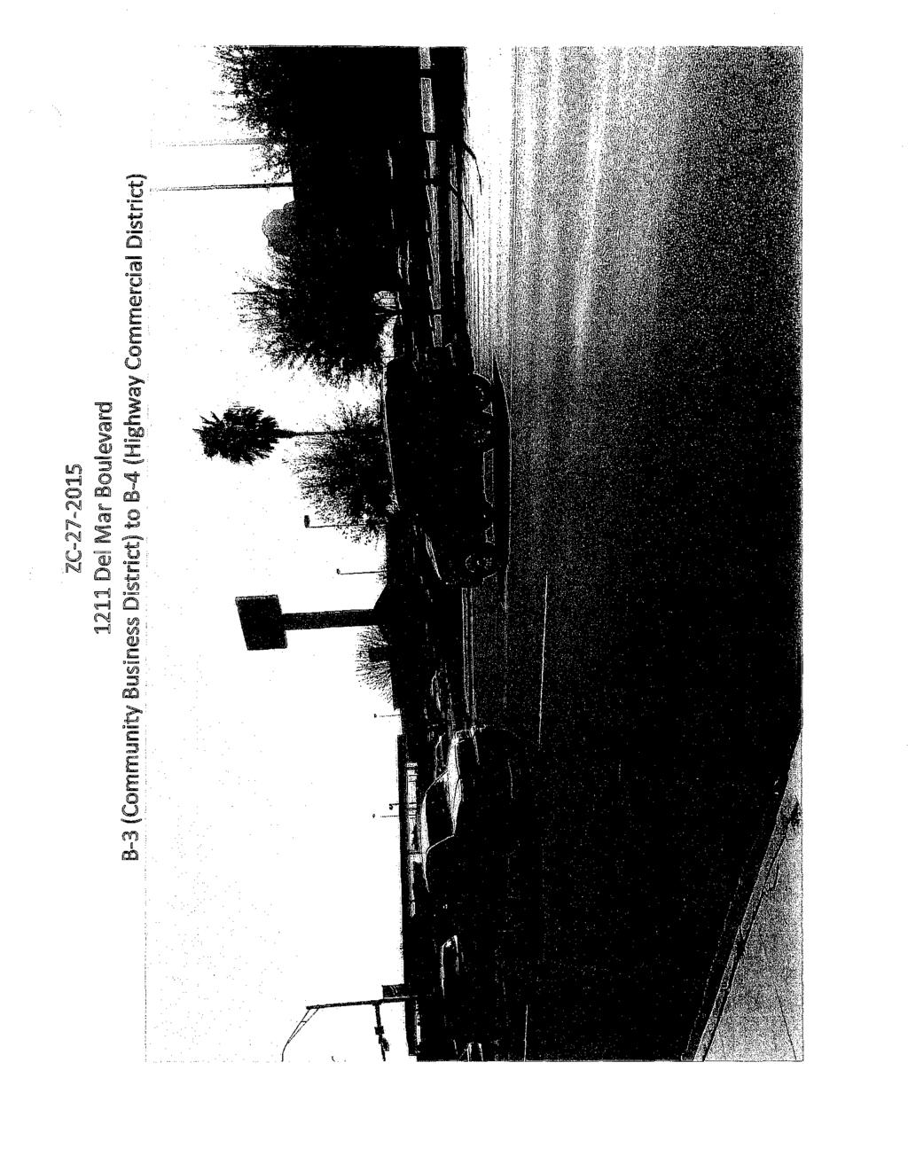
18 Z:C Dei Mar Boulevard B-3JC<JmiTLtni!y Busines District to -4 (Highway Commercial District) :,'W//l.lJ'UrC'lr:riu::_,.,-,,----:;: r
19
20 lc Dei Mar Boulevard B-3 (Community Business Dstrkt) to B-4 (Highway Commercial District)
21 Z:C De Mar Boulevard B-3 (Cgmmunity Bu:5ines:5 District) to B-4 (Highway Commercial District)
 -- ----- - ---------- ----------.")
22 lc21201s 1211 Dei Mar Boulevard B3 (Community Business District) to B4 (Highway Commercial District) ''"
 to B-4 (H\"'\"''.")
23 ZC Del Mar Boulevard B-3 (Community Business District) to B-4 (H"'"''.'"" Commercial District) ,-- -- A-!i-
24 Z:C: 7' Del Mar Boulevard B3 (Community Business District) to B4 (Highway Commercial District) '
25 PLANNNG & ZONNG COMMUNCATON Date: 2/18/15 SUBJECT: PUBLC HEARNG AND RECOMMENDATON OF AN ORDNANCE Amending the Zoning Ordinance (Map) of the City of Laredo by rezoning Lot 1, Block 1, Jacarnan Ranch Subdivision Unit V, located at 6402 N. Bartlett Avenue, from B-1 (Limited Commercial District) to B-3 (Community Business District). tem V.B District V nitiated by: Encarnacion Guerra, owner Jorge L. Rodriguez, Applicant Prior action: None BACKGROUND Council District: V- The Honorable Roque Vela, Jr. Proposed use: Commercial ZC Staff source: Horacio De Leon, Asst. City Manager Nathan R. Bratton, Planning Director Site: Guerra Communications, Time Warner, Wacky World Party House, nstyle Hair Center and Remax Real Estate. Surri!U!lldlfumg lalilldl 111ses: North of the site are Lifeline Ambulance, Da Vinci Hall, GDM Primary Home Care, fiesta Adult Day Care, and Bartlett Apartments. South of the site are Reinhart Plaza, Rock Fitness and Women of Rock. West of the site are North Village Apartments, and North Village Condos, Pro Mega Signs, and PB-Pro Builder nc. East of the site is Summerwind Subdivision, a single-family residential neighborhood and vacant land. Comprellnensive Plan: The future Land Use Map recognizes this area as Light Commercial and Medium Density Residential. 'frallsportmltiimn Plall: The Long Range Thoroughfare Plan identifies Jacarnan Road and Bartlett Avenue as Major Collectors. 'fhe Thoroughfare Plan does not identify Saldana A venue, southwest of the property. Letters sent to surmundin: property owners: 35 KnFavor: 0 Opposed: 0 STAFF COMMENTS Staff supports the request for the following reasons: 1. The proposed zone change is compatible with the Comprehensive Plan's designation as Light Commercial. 2. The proposed district is compatible with the existing zones and uses along this section of Jacarnan Road. This area is following a trend of primarily light commercial and residential development. 3. The property meets the location criteria for a B-3 district to be located along minor or principal arterials. P&Z COMMSSON RECOMMENDATON: STAFF RECOMMENDATON: The P & Z Commission, in a to vote, recommended of the Staff supports the proposed zone change. zone change. Page of2
26 PLANNNG & ZONNG COMMUNCATON MPACT ANALYSS B-3 (Highway Commercial District): The purpose of the B-3 District (Community Business District) is to provide for those businesses and services serving a trade area larger than a neighborhood, but smaller than the entire city and located primarily along minor or principal arterial streets, as classified in the Transportation Plan of the City of Laredo. t is intended for this zoning classification to exist primarily abutting minor or principal arterial streets while preserving established residential neighborhoods along such streets s this change contrary to the established land use pattern? No, the established land use pattern is primarily residential and light commercial in nature. Would this change create an isolated zoning district unrelated to surrounding districts? No, there is an existing B-3 district abutting the property to the north and across Jacaman Road to the south. Will change adversely intllmmce living conditions in the neighborhood!? Yes, a B-3 district may introduce more intense uses to the neighborhood. Are tlbtere sujjstal!ntiall reasons wlbty the J!lll:'ill TO 83 {COMMUNTY BUSNESS DSTRCT)")
28 ZONNG OVERVEW 1 inch = 500 feet Date: 2/4/ N BARTLETT AVE COUNCL DSTRCT 5 ZC REZONE FROM B1 (JMTED COMMERCAL DSTRCT) TO 83 {COMMUNTY BUSNESS DSTRCT)
 TO 83 (COMMUNTY BUSNESS")
29 AERAL MAP 1 inch = 1 00 feet Date: 2/4/ N BARTLETT AVE COUNCL DSTRCT 5 ZC REZONE FROM 81 (LMTED COMMERCAL DSTRCT) TO 83 (COMMUNTY BUSNESS DSTRCT)
 TO")
30 Medium Density Residential 1602 L: 1A m Density esidential 6620 L: 1 L:9 Low ResiMntial 112 L:7 110 L:6 Low Resiifential 106 L:4E L:6 115 L:5 113 L:4 -c 111 z L:3 ll,. < L:2 0,.. o. 107 L: L:4D C L: 4A L:4B v::y FUTURE LAND USE MAP 6402 N BARTLET AVE 1 inch = 100 feet COUNCL DSTRCT 5 Date: ZC qq,og; ;zr REZONE FROM B1 (LMTED COMMERCAl DSTRCT) TO B3 (COMMUNTY BUSNESS DSTRCT)
31 1602 L:1A 6620 L: L:3 1-. lll: ;cc ;o., -c '"' "o J: U... = 116 L:9 114 L:8 112 L:7 110 L:6 108 L:5 106 L:4E... c z Ul o. 117 L:6 115.L:5 113 L:4 111 L:3 109 L:2 107 L: L:4D 102 L:4C 105-C L: B L: 4A 105:11 L: 3: (6\1614 \!:!)' 1-D... _ --- JOAMN RD ao ,.,. - J L: L: L:3 ZONNG MAP 1 inch = 100 feet Date: 2/4/ N BARTLETT AVE COUNCL DSTRCT 5 ZC REZONE FROM 81 (LMTED COMMERCAL DSTRCT) TO 83 (COMMUNTY BUSNESS DSTRCT) [js.u.p. (SPECAL USE PERMTS) []c.u.p. (CONDTONAL USE PERMTS) :] S.U.P. & C.U.P.
32 "=-.., 1 1 "" L: _/_ _.. _.,_-_. ></,-_ x < -://:, - /[L. OM) 1:i., "' :> <:..... "'.. "" &! :;[!; = " 11'2 L 7'<> ' \ 110 L:6 108 L:5 \!... c z,. "'..:: 0 '!:!.. o. 10 L: "/8402/,- 'l>f _./ L:4B 105-B L:4A 1 ' 0 200' NOTFCATON 1 inch = 100 feet Date: 2/4/ i\lllatlet AJE COUNCil O!STH<:HCT 5 ZC ;; REZONE FROM!l1 (LiMTE!) COMMERCAL DSTRCT) TO 83 (COMMUNTY BUSNESS DSTRCT)

33 ZC N Bartlett Avenue c:triirtl to B-3 (Community Business District)

34 ZC
 to B-3")
35 --,-,,---,-,0-- ZC N Bartlett Avenue Limited Commercial District) to B-3

36 ZC
37 PLANNNG & ZONNG COMMUNCATON Date: SUBJECT: PUBLC HEARNG AND RECOMMENDATON OF AN ORDNANCE 2/18/15 Amending the Zoning Ordinance (Map) of the City of Laredo by rezoning the West 2/3 of Lot 8, Block 876, Eastern Division, located at 2701 N. Meadow Avenue, from R-3 (Mixed tem Residential District) to B-3 (Community Business District). ZC V. C. nitiated by: Staff source: Jesus Agustin Reyes, owner Horacio De Leon, Asst. City Manager Eric E. Wickstrom, applicant Nathan R. Bratton, Planning Director Prior action: None BACKGROUND Council District: V- The Honorable Juan Narvaez Proposed use: restaurant Site: single-family residential structure Surmuntdlillllg Band uses: North of the site are single-family residential uses, a tattoo shop and Linda Hair Style. East of the site are single-family residential uses and manufactured homes. South of the site are single-family residential uses, vacant commercial structures and El Zarape Restaurant. West of the site are PG Auto Sales, single-family residential uses and City of Laredo water tanks. OllmprellnensivelP'lallll: The Future Land Use Map recognizes this area as High Density Residential. Transpillrtatiolll lp'ba111: The Long Range Thoroughfare Plan identifies Meadow Avenue as a Major Collector. Letters sent to surrllllllllltdlillllg prlllpertty illwlllllli"s: 32 n Favor: 0 Opposed: 0 S'fAFF COMMEN'fS Staff does not support the request for the following reasons: 1. The proposed use is not compatible with the established residential neighborhood. 2. The property is too small to support uses permitted in a B-3 District including parking requirements. 3. A B-l District or Conditional Use Permit may be more appropriate options given parking issues and size of!ot. P&Z COMMSSON RECOMMENDATON: The P & Z Commission, in a to vote, recommended of the zone change. STAFF RECOMMENDATON: Staff does not support the proposed zone change. Page 1 of2
38 PLANNNG & ZONNG COMMUNCATON MPACT ANALYSS B-3 (Community Business District): The purpose of the B-3 District is to provide for those businesses and services serving a trade area larger than a neighborhood, but smaller than the entire city and located primarily along minor or principal arterial streets, as classified in the Transportation Plan of the City of Laredo. t is intended for this zoning classification to exist primarily abutting minor or principal arterial streets while preserving established residential neighborhoods along such streets. s this change contrary to the established land use pattern? Yes, the established land use pattern is primarily residential and light commercial in nature. Would this change create an isolated zoning district unrelated to surrounding districts? Yes, there are no other B-3 districts in the immediate vicinity. Will change adversely influence living conditions in the neighborhood? Yes, the proposed district may introduce more intense uses into the adjacent residences. Are there substantial reasons why the property cammt be used inn accord with e:rlsoog zomrng'l' Yes, the current district only allows for residential uses. Page2 of2

 z N ::l 0.")
39 ,9S'SS i!y Y1010Nill'f N... w : iii:"' 0 -- c Ulo -"' <( w Co'> :;; -'"' -c.) z N ::l "' 0


40 """"'""""- """",_ """".._ ;-J&JRNEotl:T ' L1 L:2 L: L: 12 L: 11 L: L:4 & L:9 L: L: L:7 s:r ss&s&,: _ 1601 L: 1 & L 12 & 11 ZONNG MAP 1 inch= 116feet Date: 1/26/ N MEADOW AVE COUNCL DSTRCT 4 ZC REZONE FROM R3 (MXED RESDENTAL DSTRCT) TO B3 (COMMUNTY BUSNESS DSTRCT) Qs.U P. (SPECAL USE PERMTS) Qc.U.P. (CONDTONAL USE PERMTS) 13Js,U.P & C U.P
 TO 83 (COMMUNTY BUSNESS")
41 AERAL MAP 1 inch= 116feet Date: 1/26/ N MEADOW AVE COUNCL DSTRCT 4 ZC REZONE FROM R3 (MXED RESDENTAL DSTRCT) TO 83 (COMMUNTY BUSNESS DSTRCT)
 to B-3 (Community Business")
42 ZC N Meadow Ave, R-3 (Mixed Residential District) to B-3 (Community Business District) ' "
 to B-3")
43 ZC N Meadow Ave. R-3 (Mixed Residential District) to B-3 (Community Business District)
 to B-3 (Community Business")
44 ZC N Meadow Ave, R-3 (Mixed Residential District) to B-3 (Community Business District)

45 ' 2 -{7'7..! L: 3 & L:7 L:6 L: 58 L: SA 'Sf' ' e 1'4 - -== L:2 L: L:3 L:4 u 7751 & L: & L: L:5 L:6 "' F= -< - Sf 1417 L: & L:2 L:3 L:4 jne! 1416 L: & L:7 L:6 L5.. -, =-,_.,.-=,- Qt: \!!!,. ' TEWART ST 55.56' 200' NOTFCATON 1 inch= 116 feet Date: 1/26/ ; "' ll :> c a: :::1 0 :::E... > ll z )' \ '\..? (:. L: L: L( ',\)),. oa '/ <f?#'.. rrtl!9",' - L: L: L: ;,: r---- u L: 12 L: 11 L: 10 L:9 L: \.,p. ' ' " L: 1 L:2 L: L: 12 L: 11 L: 10 ', N MEADOW AVE COUNCL DSTRCT 4 ZC-23,2015 \ j835).,.. " 151" L:4&5 ' L:9 L:B. ' j L 7 Jr. :;;t-"1', L: R L:7 l_ L:3.. - J L:4B &2 L""'i / J " "" L:8 L:8-7 L:7 L: L:5 L: l===- -==- =r6- -@:, "'... - '... L: 12 & 1 & L: &10 _!,..;.g_b,.ll,... 7 ' J "'.... "' E KEARNEY ST 55,56'... :::. ' }/ f ' 41'3 -.:'.::;_=k "' "'-f - 'Cf'' "' ;.e ,._,"( / v l701 = =''""'"'""" L: c \ 1:1'"' c \ z: tc. L: 1-2 L: 3A L: 38 ll f4 L: 1 L:2 L:3 L:4 :>,.;;,, c... 2 l! ie4o 1 Q 1604 z X L:8 ll :::E 2701 & z L:B L: 7 L: L:8 L: E PRCE ST 55.56' v=- :: z:..; "' -- L6 ls-r 16, '[..,... '1"1' M!-5 - : L:3 a -- "" '1 1605, ::"\;.., "' !!' L:<l' L:5 L: L: L:6. L: 1 & 2 L:4& 5 2&3 "' "" -- "/ L:7 rir#rt -! -,. -0.\ ' 1(( 1. '602 L: 12 & 11!ani L: 10 L:9 L:8 L: 12 -' sf REZONE FROM R3 (MXED RESDENTAL DSTRCT) TO 83 (COMMUNTY BUSNESS DSTRCT) ' 1704 L: 11 / L: 10 L:9 L:8.,
46 PLANNNG AND ZONNG COMMUNCATON Date: SUBJECT: PUBLC HEARNG AND RECOMMENDATON OF AN ORDNANCE 2/18114 Amending the Zoning Ordinance {Map) of the City of Laredo by authorizing a Special Use Permit for a restaurant selling alcohol on Lots 1 and 3, Block 367, Western Division, located tem at 1802 Santa Ursula Avenue. ZC V. D. nitiated by: Staff source: Ana Maria So sa, owner Horacio De Leon, Asst. City Manager Manuel R. Batista, applicant Nathan R. Bratton, Planning Director Prior action: None BACKGROUND Council District: V - The Honorable Roberto Balli Proposed use: Restaurant selling alcohol Site: The site is occupied by Camitas El Asadero Surrm11ndlmg land uses: North of the site are single-family residences, La Paisana Restaurant, La Mexicana Restaurant, and Popeyes. South of the site are single-family residences, a vacant commercial structure, Johnny Gregory Motorcycles and Vidal Used Cars. East of the site is nterstate 35. West of the site are single-family residential uses, H&R Block, La Reynera bakery, Guajardo Management, PDAT investments, Zurnba, Cucas, Rubio Electric, Finas, City Radiator and Ramirez Tire. Comprei!Jieusinll'lallll: The Comprehensive Plan identifies this area as Light Commercial. 'fr:ll!llllsnmrt:mti@llllll'l:mllll: The Long Range Thoroughfare Plan identifies Santa Ursula Avenue as a Freeway. Letters sent till surrl!luni!llinll: property owners: 27 nfavor: 0 Opposed: 0 STAFF COMMENTS A Special Use Permit (SUP) is used for those types of uses that warrant individual attention on a case by case basis and should not be categorized in a zoning district. A Special Use Permit is basically an overlay on top of the existing zoning designation and can be limited in many respects such as time, fencing, setbacks, landscaping, etc. P&Z COMMSSON RECOMMENDATON: The P & Z Commission, in a to vote, recommended of the Special Use Permit. (Continued on next page...) STAFF RECOMMENDATON: Staff supports the proposed Special Use Permit. Page 1 of2
47 PLANNNG AND ZONNG COMMUNCATON taffcomments (cont.) Staff supports the request of the proposed SUP at this location for the following reasons: 1. The proposed SUP is in conformance with the Comprehensive Plan's designation as Light Commercial. 2. The proposed use as a restaurant serving alcohol is compatible with the existing zones and uses in this section of Santa Ursula Avenue. Should the Commission recommend approval of the proposed SUP, staff suggests the following conditions:. The Special Use Permit is issued to Ana Maria Sosa and Manuel R. Batista, and is non-transferable. 2. The Special Use Permit is restricted to the site plan, Exhibit "A", which is made part hereoffor all purposes. 3. The Special Use Permit is restricted to the activities described in the letter, Exhibit "B", which is made part hereof for all purposes. 4. The establishment must malce provisions to keep litter to a minimum, and to keep it from blowing onto adjacent streets and properties. 5. Signage shall be consistent with the City's Sign Ordinance and TABC rule or regulation. 6. Off-street parking shall be provided in accordance with the City of Laredo Land Development Code. 7. There shall be no ground vibrations created or sustained on the site which are perceptible without instruments at any point on any property adjoining the subject property. 8. At all times the restaurant is open to the public for business, it shall continually maintain and serve food from its full service menu. 9. The restaurant shall not exceed the "Occupant Load" as set forth in the Certificate of Occupancy with Occupant Load. 10. The restaurant shall, during all hours of operation, maintain, free from obstruction or impediment to full instant use in the case of fire or other emergency, all exit accesses, exits or exit discharges. 11. The restaurant shall undergo an annual Fire nspection. 12. All permits, licenses, certifications and inspections required by the codes and ordinances of the City of Laredo shall be kept up to date and current including but not limited to Food Manager License (annual), Food handler's Permit (annual), and Certificate of Occupancy with Occupant Load, Occupant Load being the approved capacity of a building or portion thereof. 13. Landscaping of property shall be provided in accordance with the City of Laredo Land Development Code. 14. Lighting of property shall be screened to avoid adverse impact on adjacent residential neighborhoods. 15. Owner shall comply with Building, Health, Life and Safety, and all applicable codes and regulations as required. 16. No outdoor activities will be permitted. 17. Outdoor music is prohibited. Page 2 of2
48 L: , 1M 1819 L: L: L: L: L:4 912 L:2 &4 920 L:2 M L: 10 L: L: L: L: : L:2 ZONNG MAP 1 inch = 100 feet Date: lass! L: L: L:9 0.. "' 1818 L: 7 :> cc 0 Q 1814 a: L:5 z "" a: U ll -"" 1808 L:3 z 1802 L1 u2o L: L: L:5 iio6 L: L:i ' CiARZA ST so 1802 SANTA URSULA COUNCL DSTRCT 8 ZC N ' 1907 L: L: L:8 181'5 L L: L 2 H19 L L: L: L: L L:9 '"'" i. L: L:4 L: 1 &2 ' 1M\ L:1 L:2 SANCHEZ Sf!ill' 11!!!!\!s-=&o--.e L: ::> L: 5 oil: oil: r: ::1 N 67J L:3 1-- "' a: ::! ;! z '7 oil: (» "' Q.. ld ui.. ; 1802! '... cc !!it L:2 in "' U..tn,Q -rn L:4 ; 1716!C_ & -- a: ll 'U 11!: ar2l L:4A 1714 L: L:8 L:8 & 10 & "-tsanchez ST L:8 617 L:8 L l.. L:8 ll,;, ;g 1817 ii L:6 :> « L:6 z...u i!!- --- APPLCATON FOR S.U.P. (SPECAL USE PERMT) TO RESTAURANT SERVNG ALCOHOL iii iii: 1809 Q L:4 z iii: L: L:2 L:2 i QARZA ST 55.56' lg\ L:8 L: L: L: L:4B 620 L:2 Qs.U.P. (SPECAL USE PERMTS) E.Jc_u.p (CONDTONAL USE PERMTS) 13Js.U p_ &C. UP
49 J S/Y_-'7 ;/P ' "'<\ "<\ ' ' " "i. { (j i ' ' /.. "' ; V).!! ',ii 'li
50 ' Narrative Description January 16,2015, Manuel Batista owner of El Asadero Restaurant verified that am. applying for special use permit to serve Alcohol. The restaurant located at 1802 Santa Ursula is opened from 7:00am to 11:00 pm Monday thru Sunday. We have parking space for 22 cars. And we operate with 5 to 7 employees, we are now operating as!family Restaurant. Thank you for your cooperation. Manuel R.Batista
 TO RESTAURANT SERVNG ALCOHOL")
51 AERAL MAP 1 inch = 1 00 feet Date: 1/28/ SANTA URSULA COUNCL DSTRCT 8 ZC APPLCATON FOR S.U.P. (SPECAL USE PERMT) TO RESTAURANT SERVNG ALCOHOL
 TO RESTAURANT SERVNG ALCOHOL")
52 L: 1 & 2 SANCHE:!: ST!iO' 1805 L:4 920 L: L: L:10 L:10.. ::: '!ti... ;( ;... ll!.. 0., 0., ll... is i2... f! ;,.. ll :> c 0 iil c Q - z c GARZA ST 55.56' FUTURE LANDUSE MAP 1 inch = 100 feet Date: 1/28/ SANTA URSULA COUNCL DSTRCT 8 ZC APPLCATON FOR S.U.P. (SPECAL USE PERMT) TO RESTAURANT SERVNG ALCOHOL
 for a restaurant selling alcohol.")
53 ZC Santa Ursula Ave. Request for a S.U.P. (Special Use Permit) for a restaurant selling alcohol.
 for a restaurant selling alcohol.")
54 ZC Santa Ursula Ave. Request for a S.U.P. (Special Use Permit) for a restaurant selling alcohol.
55 1901 L:2 < F "lotn _.,. """ L:1& _ 1805 L:4 920 L: L: L:B 912 L:2 &4 SANCHEZ Sf toll' ', ' ' \ 618 L: 2 SANCHEZ ST ss.s \ \ \ 1812 L5-v'f ' 1'802 L:.3.. ll :> c 0 iil c Cl z.. c 620 L: L: L:4 617 L:8 GARZA ST ss.s&' 1719 L: L: L: L: ' NOTFCATON 1 inch = 100 feet Date: 1/28/ SANTA URSULA COUNCL DSTRCT 8 ZC APPliCATON FOR S.U.P. (SPECAL USE PERMT) TO RESTAURANT SERVNG ALCOHOL
56 PLANNNG AND ZONNG COMMUNCATON. Date: 2118/15 tem V. E. SUBJECT: PUBLC HEARNG AND RECOMMENDATON OF AN ORDNANCE Amending Ordinance of the City of Laredo authorizing a Conditional Use Permit for a kiosk/food stand by adding a meat market to the existing grocery store on Lot 12, Block 446, Eastern Division, located at 202 W. San Carlos Street. ZC nitiated by: Ralph A. and Maria C. Hase Prior action: None BACKGROUND Staff source: Nathan R. Bratton, Planning Director Horacio De Leon, Assistant City Manager Council District: V-Juan Narvaez Proposed use: The addition of a meat market to the existing grocery store with kiosk/food stand Site: The site is currently La Tiendita Grocery Store. Surrounding land uses: The land north of the site includes single-family residences, manufactured homes, and apartments. To the east of the site are single-family residences. South of the site are apartments, single family residences and manufactured homes. To the west of the site are single family residences, Templo El Buen Pastor, and manufactured homes. To the east of the site are single family residences and manufactured homes. Comprehensive Pblllll: The Future Land Use Map recognizes this area as High Density Residential. "frmlllspmiatimn Jl>lam: The Long Range Thoroughfare Plan does not identify San Carlos Street!Lettern sent to slllrromndlilllli!: property owners: 33 n Favor: 0 Opposed: 0 STAFF COMMENTS The Laredo Laud Development Code (Section 24.63: Permitted Uses) meat markets in zones A-E, CBD, B-1, B-3, B-4, M-1, M-2 and MXD. This property is currently zoned R-2. The applicant is applying for a Conditional Use Permit. Section (A) (2): Conditional Use Permit Application Submittal Criteria states that "Applications for properties currently zoned, A-G, RS, R-1, R A, R-lMH or RSM, may only seek conditional use status for those uses permitted by zones RS, R-1, R-A, R-lMH, RSM, R-2, R-3, R-0, or B-1, of higher intensity." Staff supports the amendment of the existing CUP at this location for the following reasmns:. The proposed use is compatible with the existing grocery store use. P&Z COMMSSON RECOMMENDATON: The P & Z Commission, in a to vote, recommended of the Conditional Use Permit. Page 1 of 1 STAFF RECOMMENDATON: Staff snpports the proposed Conditional Use Permit.
57 PLANNNG AND ZONNG COMMUNCATON STAFF COMMENTS (CONTNUED) MPACT ANALYSS: s this CUP contrary to the established land use pattern? Yes. The established land use pattern is single-family residential in nature. Would this CUP create an isolated zoning district use unrelated to surrounding districts? Yes, the surrounding zoning is R-3. Will issuance of a CUP adversely influence living conditions iu the neighborhood? No, the amendment is compatible with the existing grocery store use. Are there substantial reasons why the property cannot be used in accord with existing zoning? Yes, the existing zoning only allows for single-family residential uses. Staff suggests the following conditions: 1. The C.U.P. shall be issued to Deyanira Villarreal and Ralph A. Hase, and is nontransferable. 2. The C.U.P. is restricted to the activities describe in letter, Exhibit "A", which is made part hereof for all pmposes. 3. The C.U.P. is restricted to the site plan, Exhibit "B", which is made part hereoffor all purposes. 4. Signage is limited to that allowed in an R-3 District. 5. A seven (7) foot opaque fence shall be provided abutting residential zones. 6. No outdoor sitting area is permitted. 7. No outdoor music is permitted. 8. No outdoor activities are permitted. Page 2 of 1
 TO 2006-0-019 Qs.U.P. (SPECAL USE PERMTS) [Jc.")
58 J......; ll :> c u.. z ll c :>.. "!.. ll "' :>... c... ll z 0 Q u ::E W SAN C:AR.O$ ST ss.sc; ZONNG MAP 1 inch = 66 feet Date: 1/26/2015 ZC AMENDMENT TO C.U.P. (CONDTONAL USE PERMT) TO Qs.U.P. (SPECAL USE PERMTS) [Jc.u.P. (CONDTONAL USE PERMTS) [3ls.UP.&CU.P.
59 La Tiendita Groceries illf Business Operation for Meat Market and Kiosk The Company La Tiendita Groceries is established as a limited liability company owned by its founder. The store will be managed and directed by Deyanira Villarreal, a business owner with experience in business/sales. Overview La Tiendita Groceries, is a startup convenience store which will be launching a meat market and kiosk in the coming year. The meat market will sell a wide menu of meats to customers including medium- and low-income residents in the Laredo area. Hours of operation: Monday - Sunday 8:00am to 10:00 pm. The number of employees will be limited to two-three people. The number of vehicles is estimated to be 2-3 on the property. Meat Market Ji>rmllucts and Service La Tiendita Groceries will provide basic meat options to customers interested in buying meat along with all of their grocery and food needs, and not traveling far from their home. The store will sell a wide range of beef, poultry, and fresh pork. Upon request, the store will sell other specially requested items as well. The products will be purchased from suppliers within a 200 to 300 mile radius ofthe store to maintain product freshness. Products will be purchased as whole animals and butchered in the store by a trained butcher. Proposed Activities for Kiosk: The kitchen will provide hot and cold food/beverages in a convenient and time-efficient way. t will provide its customers the ability to drive up and order offering an option to fast-food using the most logical and accessible method approved by city regulations. La Tiendita Groceries Kiosk will be managed and directed by Deyanira Villarreal, business owner. Hours of Operation: Monday- Sunday 7:30am to 1:00pm. The number of employees will be limited to one person. tua'd- ]}Jri,... /j u A.[!t/1 Exhibit A
60 EXSTNG BULDNG 1,800 SQ. FT w w 0 f-- UJ _j _j w z 0 0 u 2 ElC!SllNG ASPHALT PAVNG w > 0 "' w u w STE PLAN SCALEo NOT SCALE. EXT DRVEWAY SAN CARLOS ST. LEGAL DESCRPTON ADDRESS: # 202 W. San Carlos LOTo BLOCK: SUBDMSON: Exlu.Dit B

61 AERAL MAP 1 inch = 66 feet Date: 1/26/ W SAN CARLOSE COUNCL DSTRCT 4 ZC AMENDMENT TO C.U.P. (CONDTONAL USE PERMT) TO
 :::> Cl Ql z :s 0 <0 w <OCO a: :::>.<: 1- c.l!l \".")
62 ,95'55 iilll'f '1'1a1NOG:)W,9S"SS!11\'f 'fi:)n!11'fl\ w... g "' 1-0 -"' <C "" >-o "" 0 "'"' z c..t <C..JN "' s: (30 zn "' ::> 0 "' 0 (L <( ::!!: w rj) :::> Cl Ql z :s 0 <0 w <OCO a: :::>.<: 1- c.l!l ".. :::> - "' LL o
63 :J 17.5 f- M.f T;JJ. L:7 'MW :r:: " L:4 L:3 \442! 303 L:2 ll,.. l9 J. k3:::12-t-:3:'04 L:10 L:11 200' NOTFCATON 1 inch = 100 feet Date: L: 5,-,Au l"li'<l: 4018 L: 1 s L:12....,;.. ll :!!i u z ll... Oil! :> 209 L:6! \ 220 L:7.h,_ F' 0 L: J!j&.e l<"" 104 L:6 L:B L:5 L: L:6 102 W1Jfit l:if-1: -. ::t ' :!,.---L L:8 ef ' 202 w SAN CAR LOSE COUNCL DSTRCT 4 ZC L:4 208 L:9 ; 217 L:3 206 L: L:2 204 {.j W SAN CAR!.OS Sf!!5.511" t ' H ' " 205 ' L:3 209 '207 ). L:5 L">l. 203 L:2 1441" L: 1 '2132. t:.:i'2 201 L: L:8 L:9 L:10 L:11 L:12 - ==--= -'='"-""-'""- '-'' ""' 7 -'- -..;..c o ' " J,=-1,;:., ---! \ 111 L:4 \ \ 105 L: L:2 L: :'\f--l---+--l 120 t: 7 =.# - H L: 8 L: 9 L: 10 L: 11 -r----- ""f" t:;f --- ; ,,, ," 115 L:6.1!:5 L:4 120 L:7 120 L:8 115 L:3 AMENDMENT TO C.U.'. (CONDTONAL USE 'ERMin TO L: 2 L: 1.. "! 101 L:8 = 101 ll L:6 :> oc( > lu a: 4111 fli L: 7!Z 0 :::E 102 L: 7,jf 10 L: L: L: 8 L: 8 &9 -""" E SAN CARLOS n 55.56" L:6 L: L:7 ;.;JJr: 104 L 8,!2. "iis e0 11

64 ZC W. San Carlos St. Amendment to C.U.P. (Conditional Use Permit)

65 ZC W. San Carlos St. Amendment to C.U.P. (Conditional Use Permit) /

66 ZC W. San Carlos St.
67 PLANNNG & ZONNG COMMUNCATON Date: SUBJECT: PUBLC HEARNG AND RECOMMENDATON OF AN ORDNANCE 02/18/15 Amending the Zoning Ordinance (Map) of the City of Laredo by rezoning Lot 2, Block 2, Martine Business Park Subdivision Unit, located at 6703 McPherson Road, from B-3 tem V. F. (Community Business District) to B-4 (Highway Commercial District). ZC nitiated by: Judy G. Alexander, applicant Alex-Mart, L.P., owner Staff source: Horacio De Leon, Asst. City Manager Nathan R. Bratton, Planning Director Prior action: None BACKGROUND Council District: V- The Honorable Roque Vela, Jr. Proposed! use: Commercial Site: Vacant commercial building Si!T!lllliUfiing landl111ses: North of the site are Royal Carwash, a vacant commercial building and Texas Community Bank. West of the site are a vacant lot, single-family residential uses, a vacant commercial building and a Pump and Shop. South of the site is Church's and La Roca Restaurant. East of the site is Vaqueros and Joe Jackson North Funeral Home. Ollmprehensive Plan: The Future Land Use Map recognizes this area as Light Commercial. Trransportatimn Plan: The Long Range Thoroughfare Plan identifies McPherson Road as a Major Arterial. STAFF COMMENTS Staff does not support the request for the following reasons: nfavor: 0 Opposed: 0 l. This area is located near an already heavily congested intersection. 2. The proposed district may introduce more intense uses not compatible with the neighborhood in close proximity. 3. The property may not be able to support the parking requirements of uses allowed in a B-4 district. P&Z COMMSSON RECOMMENDATON: The P & Z Commission, in a to vote, recommended of the zone change. STAFF RECOMMENDATON: Staff does not support the proposed zone change. Page 1 of2
68 PLANNNG & ZONNG COMMUNCATON MP ACT ANALYSS B-4 (Highway Commercial District): The purpose of the B-4 District (Highway Commercial District) is to provide for those businesses and services serving a regional area which are to be located primarily along principal (major) arterial streets or the freeway, as classified in the Transportation Plan of the City of Laredo. t is intended for this zoning classification to exist primarily along principal arterial streets or the freeway and to impose site development regulations to ensure adequate access of all uses within this classification. s this change contrary to the established land use pattern? Yes, the established land use pattern primarily consists of light commercial uses. Would this change create an isolated zoning district unrelated! to surrounding districts? No, there are existing B-4 districts to the east and south of the property. Will change adversely influence living conditions in the neighborhood? Yes, it may introduce uses not compatible with the nearby residential neighborhood. Are there substamtiiad reasons wlbiy tlbie property cam not be used nm accord with existing zoning? No, the existing zone only allows for sufficient commercial uses. Page2 of2
 TO 84 (HGHWAY COMMERCAL DSTRCT) Qs.u_p_ (SPE")
69 6608 l: L: L:3 ZONNG MAP 1 inch = 100 feet Date: 1/28/ MCPHERSON RD COUNCL DSTRCT 5 ZC REZONE FROM 83 (COMMUNTY BUSNESS DSTRCT) TO 84 (HGHWAY COMMERCAL DSTRCT) Qs.u_p_ (SPECAL USE PERMTS) [Jc.U.P. (CONDTONAL USE PERMTS) 131s.U.'. & C.U.P
 TO 64 (HGHWAY commercal")
70 1 inch = 100 feet Date: 1/28/ MCPHERSON RD COUNCL DSTRCT 5 ZC REZONE FROM B3 {COMMUNTY BUSNESS DSTRCT) TO 64 (HGHWAY commercal DSTRCT)

71 6604 L: 16. Light Corllrl1ercial 1 inch = 100 feet Date: 1/28/ MCPHERSON RD COUNCL DSTRCT 5 ZC REZONE FROM 83 (COMMUNTY BUSNESS DSTRCT) TO El4 (HGHWAY COMMERCAL DSTRCT)
 to B-4 (Highway")
72 ZC McPherson Rd. B-3 (Community Business District) to B-4 (Highway Commercial District).
 to B-4 (Highway")
73 ZC McPherson Rd. B-3 (Community Business District) to B-4 (Highway Commercial District).
 to B-4 (Highway")
74 ZC McPherson Rd. B-3 (Community Business District) to B-4 (Highway Commercial District).
75 6602 L: 1 i 67_0-3 L:2 >f:r!l L,.,,, 1406 L: 3A 200' NOTFCATON 1 inch = 100 feet Date: 1/28/ MCPHERSON RD COUNCL DSTRCT 5 ZC REZONE FROM B3 (COMMUNTY BUSNESS DSTRCT) TO B4 (HGHWAY COMMERCAL DSTRCT)
76 Planning & Zoning Commission Communication AGENDA TEM: V-A DATE: 02/18/15 APPLCANT: Rodolfo Garza ENGNEER: PEUA Consulting LLC. REQUEST: Preliminary consideration of the Rodolfo Garza Commercial Plat. The intent is commercial. STE: This 1.69 acre tract is located west ofhwy. 83 and northofriverhill Loop. The zoning for this 2 lot development is B-4. This tract is located in District - Cm. Alejandro "Alex" Perez. PROPOSED ACTON: APPROVE SUBJECT TO THE FOLLOWNG COMMENTS: 1. Show and label the building setbacks. Also provide a plat note stating "The setback lines indicated on the plat shall be for reference only. The official setback line shall be determined based on the current zoning district in accordance to Section of the Laredo Land Development Code." 2. Show and label the size of the utility easements. 3. All easements, building setbacks, and lot and block numbers from platted tracts located adjacent to the proposed plat need to be identified and shown in dashed lines with a volume and page number. 4. Access onto Hwy. 83 is subject to review and approval by the Texas Department of Transportation. Also provide a plat note stating such approval. 5. Update the owner's signature block to remove any dedicatory language. 6. All improvements as Per Subdivision Ordinance. Notice to the Developer: 1. Only the utility easements within the plat boundaries are subject to change prior to plat recordation, due to revisions by the utility companies.
77 !111'00 :54100 llil 0 0 tlooo \...,. \\ '--J 4!100 FRJ.! '
78 RcdolfoGatza Laredo, Texas CBRTJFCA TE OF OWNER STA'lEOJilEXAS CO\NfYOFWE!B, u..-ofthol&ild<bo""""ddo!&s,lle"'il>"'---lnlh<c;ty ComnyofWoblJ.Te=...,...,.;,.rulmrihod"'-.hm!Jy-tho=<oU..pu\lliof«ovoroJl-dmics,...,,.awlpoblicplaooolhm>uo...,.rorlhopurposeood"'="n STATilOJTEXAS COUNl'YOJWE!B B<llr!<mo.thoO'hotily.,thi:ichy Tm!nm<o""'tobethop:<l"' whooo=io;5ubs<tibo4<ol!!elbrogcillgfmimm<ni.<d,.,... od.!<dto=lhath<""""'""tho... forlhop_...<d -lfletoio!uoll Wl1'NESS Mi'HAN!ANDS Al. THS_ 01' Zl5. LEGAL OESC:RFTON RODOLFO GARZA COMMERCAL Ploldaotes ll>ratnlelflaiic<liii:eiawg U991l018(ealted 1.70,_.indccd),rn<m>Cltless,aul:af J "" Pioz P<m:ion 35, Al>..lrwrt 546, and R.E. Rai"" Slll"ey 2149, Allsttacl 594, Weill> C:o1mt, Tooo!s beinll ow af """'1' C canveyed 1<1 Paul Garza, Jr. by Kyle Ervin. Jr., eta!, by deed feooj'ded in vlmne 349, pages 30U!, of tho Webb Comll:f Deed R=lniBs; said 1.69!11ln tral:l aisd boing lha properly OOUVa;l'ed to R<niD!fi> Clanaa:n Smldra Garza by Wamnty o.d dmed Fob. S, 2014, and,_,nled in vobttne 3575, page> , at: tile Webb Court! Officio! Publio llocctds and ia mono partiguiarty <Bsoribed bymo!e5and bounds as llolw: a rnnnng or;a)i inoh diarnoter st.elr cd found beidg lha solrth>wst corner of Lois la, Blcok, Rivetbill Coliiiiii:n:iol Sllbdivision, Unit XV, a Sllbdivislon in lht City of Laredo, per fcj'al,_,nled in volume 27, poge21, aflht Wcllb Cotmty, T,..., plat <CCOtds, fbrlile PLACE OF l!eolnnno and llll1llmw!cotnerherofl NOTARYPUBJC N AND FOR WEBB COUNY. TEXAS LEN HOLDER CERTFCATE., MVCOMM!SSON!X'RSS Tln.ru\Y!sl<mmapbli<rebylll'l""""lllliiW!pt<!Jytho...-..,o:l-bc!mtbis_chyof., STAT>OJTEXAS COUNl'YOFWl!S lhence, North 8!1" S9 '03" EO>!, Vlilh lho oolllh lidc of saki Lot la, beiag!he north Uno botcof, a distanl>oof {1 ft. to am inoll steelmd set, beiglbo S<ll<llll;..toomerat:Lc!A, ll>rth= llllrthtaool"""""h.,.,oo; THENCE, Solrth 22' OT 28" W...r, with lha W<!<l ri.itlll of way or U.S. higir;vlly No. 113 {o/l<la Zopam hlgbwey- 225'!l.O.W.), botngtbe = line h.,.,.,r,adislonce of 198.!12 ft. 1<1 am, inohdternmrsteol rod s.t,f<ll"lhesj'!lheastcctnmhoreof; THENCE, SOlllb 88' 55" 20" West, wltht bo narlb lino of J.C. Th!llino n.ct recorded in volwn<1 400, pages 9103, oftbo Webb Comll:f D<!ed Reoc:ds, boidg tluo owh lino horoof, at paoli fenoe po91otb!giirninljaf ol!ain llilkfenoo, andata!al dls!ancaof36uo ft. 1<1 m<ta!fencopo<tinplal:o, fbr tlleiohwes!cqfll rj=f; nmnce, Nonh 03' 21' 41' W&St, wi!h f'c1co along the= line afloll, Block, Rlvcrhlll40DO Soulh Zljlata Plat, in volume 26, page 113, of the Webb COllllly P!atReconls, behli lite west J!ne be=f, adiststwe of ft. to!he PLACE OF BEGNNNG, aod OO!llinio within llwe mo1a ond btnmds 1.699ncreafland, mom or leso. NOlES:. SDEWALKS, DRVEWAYS AND TREES WTL BE NSTALLBD ATTlfll TME OP SSUANCE OF BULDNG PERMTS N ACCORDANCE WTH THE LAREDO LAND DEVELOPMENT CODE. 2. ALL CURB CUTS SHALL COMPLY WTH "111E TRANSPORTATON ELBMBNT OP THE CrrY OF LAREDO COMPREHENSVE PLAN... Belnidlllzis: But iiio <>flat A,B!ook 1,1UWJbll! Commorclnl Subd., U.oitXVH (S (12' 07' 28" W) (FNANCAL NSTTUTON) [(nawotomo<obothop<mmwhosc..,...;.oubs<o"bod!otho"""soillll"""""""'<d"""-"'"'"h>t""=""'"tho...,forthcpl"p""'<doo--th=l!!oxp:=ooltcdill!h:"'''.,;y!mertdl!t<d. WTNESSMYHANDANDSEA.<ll'OFFCEllUS_DAYOF., NaTA.Y'BLlC CERTFCATE OP ENGNEBR. STATEOJTEXAll COUN'YOFWEBB MYCOMML'!SON!X'ES l,o=cwlllo,oro!;im«dl'nlfl=ssumo!illlhosttttorr.-,"""1y""'pop«,_-m b:onddopl.,tolho-of=mlol!.,._,..,,,,,:cd_anlldmln!g>hy<rut;onllto!hobeltofllij' ""'Qdgolhi!pl"'""""""""'llllofllii>subiiMsion-..."""'!'W11Hl>ol'llrimarolh<ll!lliY!lrveboon g=!<tl!lylhiipiillmlqoflhocily. CD PLAT SCAlE: 1' = 100' PLAT APPROVAL-CT'l BNGNBER. '... """""""""'"- lbavc<yiomdllll<pl<l<do=mpo:llyiogoo-j:nlifto:lis proj!wb'eua c:.-.lliajllc.oo=cgillo,l'ro"""l<mliie!;in=n"o.9sq!l.!odo!l!<ddoo. Mlhtho!Jisl mri<o:ldso!ooil Clld!lovtj;)OlldiJtoo>lowilhlhoMo!M<<m.O-oflhoc;tyof'l..cedo, -ROOELORivmA, P.E.RP.L.S. CT'iNGNE!!ll. ATil'STMENT OF PLANNNG COMMSSON Al'PRDVAL NAlHANR. B!ATON, UNNlNGOilUlCTOR.CTV OF VJ!EDO, TEXAS lli!iijj! 'ON0112"'l2l1RCNROD ST2"12JRONROD EX!STNGPROPERTYSOUN:ARY EXSlWGRGHT-<lF-WAY UNE EXSTNGRlGHT-<lF WAYCENER LNE OOSTNBPO'EUVLOTUNE SilNG Bllll.DlNB 5miO.Cit WNE : -===-= ElCU!TlNGL/TUT\'EASB.!Em"Ll EXSTNGORAlNAGS<ASEM&NTUNE P\OPOSED PR!l!>SRTYBOUWARY PR!lFOSED RGHT-<lF-WAYUS 'ROFOSEDRGHT O&<.WVCENlERJNC PRO'OSEPROPCRTYLOTLNE - PROPOSED tmllt'iease\entune 'RCPOSED BULDNGSEBACKUNO UTUTYCONDUSOESGW\T!ON UTLm'!RAWAGE EASEMENT OESGWTON UTlUTYEASSMENT lleilignaoon f<ujjlngsetbackoesgnaton, SSTNGSANTARYSEWa!LlNE --> - S<STNGWATERW!E CERTFCATE OP COUNTY CLERK STATEOFTEXAS COUNiYOFWEB CERTPCA TE OP SURVEYOR STA'!EOF'i'BXAS COUN'YOFWE!B PLANNlNO COMMSSON APPROVAL C!=kGf!hoCmm<yCourtill<nMbrWobb Olomy, r...,m h«<<ly=ijjtb<ltllo tmegolq!mtruon..,dt!t<ltho_deyof 21lt5w!lhduo«rtiiicatooflll\llimt!clllion"""lll«<<>f,.,nlinmyoffiooon!ho_deyof 21SO_<J"clo<l:.m.ii\Vo!..,.PS"l ) ollh="""-"' said Co-. WTNESS M'{JiAN])A.wSEA. TiltS _DA YOF- 21lU. '----al'ro!llilotlllltands""'")'<<rill!hostahloft<m<,ll><drj«rtll\'fhmddo(o!k"""""""""""' lilld-jopll<dbymiioblai""""!'oflhol"'!llortyllllll=mdorlll'l""lllo"""""'thlill!tooorofm,_""""" lh<rolmwillbol"''llo:yplaoedlo!damy"'j'...,;""- -Cl3 c_
79 Planning & Zoning Commission Communication AGENDA TEM: V-B DATE: 02/18/15 APPLCANT: Eduardo R. Martinez ENGNEER: Seca Engineering Co. REQUEST: Preliminary consideration of the Martinez Plat. The intent is commercial. STE: This 5.10 acre tract is located south offm 1472 and east of ron Mine Rd. The zoning for a portion of this one lot development is AG. This tract is located in District V. A zone change may be required for the intended use. PROPOSED ACTON: APPROVE SUBJECT TO THE FOLLOWNG COMMENTS: 1. Revise plat note # 4 to read, "The setback lines indicated on the plat shall be for reference only. The official setback line shall be determined based on the current zoning district in accordance to Section of the Laredo Land Development Code." 2. Show and label the size of the utility easements. 3. All improvements as Per Subdivision Ordinance. Notice to the Developer: 1. Only the utility easements within the plat boundaries are subject to change prior to plat recordation, due to revisions by the utility companies. 2. This plat shall require approval by the Webb County Commissioner's Court prior to recordation.
80 . / -l.jr\ \ \. ' \ -: ::. \..r {..'- ' ( y. :' ,.., --

81 ALBERTO SOLS JR. VOL 171, FGS O.P.R.W.C.T. CERTP.CATE OF OWNER STATE OF TEXAS CODtt'Y OF wnbb!, EDUARDO ROBERTO MAR'ilNEZ. ffle-unarsigned DW!nl of the land ShOWll on lhla PLAT, and destgrmtad llen3ln as LOT 1,SLOCK 1, MARTNE PlAT in lha City of La!do, Webb County, Texlm, and whose namele aubllclibad harelo, haraby dadlcl!le the uaefurtha pubucfu!m!r, lila&mionts. thereon s11trwn furtha purpcoo and )Cns!dmalion lllereln axpred. By: Eduanlo Roberto Martinez ' a.- S'l'ATEO'TEXAS: COUNTY OF WEBB; WTNESS MY HAND Al\10 SEAL OF OFFCE THS DAY OF, LEGAL DESCRPTON for" TRAer OF LAND contallling 5,10 ac:rell,do'e ijriss A ltact of land containing 5.10 nc:res, mdre ar less, siluated in Porcion 10, Ab.rtmct 280, TClttU!$ S1111ohoz, Original Omnteo, partly witltin 1he limits of tho City of Laredo in We!.> County, Tll.'<llll, this 5,10 A= trm:t is a part of1het certain tract of lft!ld ll)led to CJnlllln 130.;\4 acre;;, more or less, and described indeed dated Februmy 4, 1960,11S recorded in Volwne 28{1, Pages 401).4(12, Web Cotmty Deed Records, locoted south offlid D Market Road 1472 (Mines Road), this 5,10 llc1 trsct is ont of a lra<:t of land idlll!lilied as thewest6s.27 OO:!s of the aforemeationed acre tract whicb. is situotod solllh of the Mineo Road convs} ed to Alberto Solis, Jr. by Juliana 0. Ditu: by Deed dnted April!, 1987, as recorded in V!llume 1234, Pages 58-59, Webb CouniY Real Property Records, this 5,10 acres, more or less, being more particillarly desbed by metes and bounds as fcllo"':s: COMMENCNG 111 afomd \-1 iron rod at!he southwest comer of!his tract, same bein on!he common line between Porcion l(l, Abslmcl 281), TClttU!$ Sam:hez. Ori!linnl Orl!llt and Porcion, Abslmol 279. Tomns Sanc:hez, Original Grlllltee, and a CJmmon oomerofthis tmcl and the remaining pmtion of the Alberto Solis, Jr. tract, as recorded in Volwne 171, Pages , Deed Recoids of Webb County, Texas, and the PONT Oll' BEGNNNG of this tmct of land containing 5.10 acres, more or less, the most soulhwestedy comer henoof; THENCE,. N 22 19'1l7"W, olons1he colllllloil boundbjy of this tract md the Alberto Solis, Jr. remaining tract, a dimnceofl.d83.83 ft. lo afotmd o 8" Slee! PosL same being on the olllb right-of""<!y Jim, off!lf!lllo Markel Road 1472 (Miwls Road) md the northeast comer of a remaining portion ofd e said Alberto Solis Jr. Jct. tile northwest ooonterhereof; NOTARY PU!L!C CEB'l'FCATE OF ENGNEER STATROFTEXAS COUNTY Oil WEBB 1 Ha!W)r oert!fv lhal properomg!n&brtnpcono!darallon has been given t;h!s PLATDihe mallern of streets, lots, dlilllllijia, l.'r.l'tilr, sawrancl SJpurt<mao""" layold; aod 1o lha b..ato1 my ltrrowl&da!hla PLAT oqnlurmoll>all raquirombnls DftlleSubdlvls!on On:linBFtW, exceplfcrlhol!!lvmlar=sthatmoyhevaba"" by!ha Planning Commission DflhiCity. Hu!JllS!ca R!lgistellld Profe.ssional En:gin:!sr TNo.l32079 "'" STATEOFTEXAS COUTYOFWEB, tha und81slgned Reglslemd PD!! Land SUM)OJ'tn tha St!!ol oftaxas, lmebycatlifytretthla PLAT rs ln.le and corredlll\d was prep fnlm an actual GU!Va)' of lim pmpartymadaurnlrmysupllll'lilon oo!he grnurntlhttl thacmllr monurn<mtssrnw.t tronunwd bg prcp2dy p!aaed undarmysupwvlol!jn. HuauSeca Ragfs\ellld Profassloralland Swwynr T&l!l!!lll!o.&1113 THENCE, N 68"13'13"'E, ooalinuin& along 'aid solllh righl-of-way line, adislane of ft. to a found 3" Steel Post, same being a oommon cmnor ofthi tmct and northeast oomorofthe remaining portion oftha snid Alberto Solis Jr. trru:t, lhe nmtheast comerlu!reof TBENrn, S 22 19'07"' E, along1he ccmmon bo!ddazy of this tract and the Mid Alberto Selia. Jr. teiwlining 1racts,. a distance of,ob.os ft. to a set., iron rod, same bei& on the lll!!wllille tween said Porcion D md Porcion 11, the southeast ccmer hereof, THENCE, S 67"42'JJw. along 9aid oommon lim! bmvetr PorciDn 10 ft!ld Porcion 11, a dislan of2d5.31 feet 1D the PONT OF BEGNNNG ofthis tract ofhmd containing 5.10 acres, mme or lo:ss: Pl..4T APPROV A.t -ROAD & BRJJJGE SUPBlllNTBNDENT STATE OF''EXAS COUNTY OF WEBB Hav@ l'a\l\$wtid lha PGt and =mpaoyi"ll consb'ucti(lll plsns of MARTNEZ PLAT ss prepsrotl by HUGO SECA, L!cemsd Pn>fSGional Engi""'r No. f.10d71, 111td Sunraysd lly liugo SECAd P/'Ofe$$!onal Land Surwym No CD, dated lila_ dsy of 15,! lha last rev!sed on tha _day of 15. l:l<ceptfilt any...war apaoilic&lly81hl>riz!d bytha Webb Ccunly C<Jmmlsslonam Ccuot, hava round lham n compllanc:ewllh tha WebbCDnly Subdivision RaJllations and Webb County SubdMlliDn Rui3S foj"reoidorrtlal Davelopmant JOSE LUS ROCRGUEZ RDe.d 11r. Erld,ge SUperintendant PU'lf APPROV.A!l.. COUNTJ! ENGlNEEJ1 STAmOFTE:r-.AS COUNTYOFWEBB Hava M>OMilllha Plat and scccitj)anying conl!lruetlon plans ofrv'.artnez PLAT.,. p111pared by HUGO SECJ\, Ucansad P<DfilssiO!lal Eotglr\BSl' No. P..1CC71, liiu SUJVayad by HUGO SECA ra!l Le!lli: SUMiyorNo. 111!11a!Hl, dated the_ day D1 201S, with lll.e laatl'e>llsed dale 011!m _day o1 15. ExcaptforanyyiBM;r paclffcally author!md by the Webb County Commlsslonm CoUll, havi!foundthem ;,. compliance wllh 11m Wellb Coonly SLibdMolan Raglllallonaand the Webb County Modal Rulaa for Resldsntlal c..wropmant. LUS PEREZ-<3AWA County EngTn...,. LOCA110N MAP RESTRJcnONS. CONDmONS AND NOTeS: SCALE: 1"=2000' 1.- MARTNEZ PLAT S B!NJ PLATT!D AS lton.!d!n11al PROPERlY, TEREFORE THS TRACT S PROHBTTED AGANST ANY RES!DENTtAL U81! UlmL SUCH nme AS T S REPlATTEt.ACCO!UlAMC!WTH THE PROVlilONS OF (li!apterj!a2, SUBCHAPT!R B, TEXAS LOCAL GOVE!RMENT CODE, THE MODEl. RULES ADOPTED UNDER SECTOH OF THE TEXAS WATER CODE, AND AMENDED THERETO. NO RESDEMJALSTRUsnJRE MAV BE PlACED OR ERECTED ON ntis TRAC'UNLE5S REP1ATT&D AS REQURED 1!1'1' THS RESTRCTON UrmTATOM AND APPROVED BVT! GO\ERNG BODY OR BODES HAVNiiJURSDCTON OVER THE TRACT. 2 SDEWALKS, DRVEWAYS AND TREES WLLS! NSYALL!D AT TH! SliUAitC&: OF THE BULDNG! Plmi\DT N ACCRDANCEWTH THE.AREiDO LAND DEELOP!\!EN.TCODE. 3.- ACCESS TO MNES ROAD { F.li'l. HGHWAY 1472} S SUSJECTTO REVEW AND APPROVAL BVTETe>tAS DEPAUMENT OF TRANSFOJUATON. 4. ALl. SE113ACKS SHALL CONFORM TO SEcnON Z4.77.i "DMEiiiS!OW. STANDARDS" OFTHS LAltEilO land DEVa.oP/lENTCODE, UNLESS ' OTifERWJSa SHOWN HEREON. a.- avgraphcau.vplo'mngi,us PARCEL WASD2T!lll'.NED NOTTC BE \'!THN A 1011YEAR FREQUENCY FLOOD ZONE AS P5R FLOOD NSURANCE RATe MAFS FOR WEBS COUmY, mtas COTUN!lV PANa NO C1D15C WTH AN EFFECllVE DAni OF APRL 02,2llOS. COMMSS10NERSC07llll1 &PRiGYAL STA'E OFTEXAS COUNTii'OFWEBB We h""'byo:alfifylhatthls Pia deoignaladas lha ; MARTNEZ PLAT, was SPJOV&d by tho Webb Ccunly Commlsslanom CoWen lha D&y ol 15, and may bstrrad a the Pial mlloflt9 oiweilb Couni'J byth9 Wel!b County Clsrll. PLA.T APPROAL- CTY ENGNBER! have 111vf6W6d this PlAT end accompanying oomllnrc!tcn dnmings idarrtffid as PLAT Df LOT 1, BLOCK 1, MARTNEZ PLAT, prvpmud by SECA Engineerina LL.C., R<lgfslared POfea!ilD1181 Englner No. F-1(1(171, end dated tile day of 2015wilhfualaslreviSd data , and ltavefcund ll16111ln oompuancewllh the SUildM rcn On:!tnl!llce oflhacityuflmedo, Tel<all. ROGEUO RVERA, P.E., RP.LS. City Engineer CERTFCATE OF COUN'l'Jl a.jerc Fllad end Recardad at_o'cla<:l<_m. oulha dayof STATE OF TEXAS> COUNTY OF WEBB> COUNTY CLERK W:BBCOUNTY, TEXAS, M;rrgiB R. lbrurn,clark of the Cotmly <:curtin and for Webb County do hell!bycarllfy that the lbregolna (n1311\!mbnl<laled lhe del)' cf wllh ta cel!llicata cf aulhenucallon was msd For moon;! in my omoe on the _diiy uf 2016, at_o'clocltm.involume paga(s) ufthemapreoon:l5ofsaidcuw!y. PLAT APPROVAL- COllN'lf'Jl PUlVNNG DlliPAR'l'MEJJT &TATE OJ.'l'EXAS COUNrYOFWEHD lttave "'vl8w!d this PGt and Hoaompal)yilllJ dela of MARTN=<! PLAT dated 1hll_dayul ;.o15 \'Mil!ha!aSAlY! sddsleanlhs_dayof 15 ptfor""l'walverspedl!oallyau1ho!lzsd by the Webb Coi!DVCommisslcnaiS Cowl, hs'e foundlhem ll> be n oompliancewllhthewebb County SubdM&lan Ragulallnns, The Webb Cllunty Model SUbdMalon Rulas for Residential Davelopme. and lha Vlallb Cll\llllyRcod Damaga p"""',on ollfsr. Tills PBtwaa recommendeclfilrflllpowll bylha Webb County flannlng an,;,czy bcallf en lhe <tayor RHONDA M. TFFN C.M, unly Plamlng Dlret:lor Nolice!! hajbby givlln lhstlha Cc<llliyofWebb dcoo; nm a.. uany ol<tigatlcns, now or n lhefuma, tc furnish any $1!ntl01ii oifat:illles1oany landuftualed wifhln lhissubdivil!n n o:mneclfonv.11h waler, Sanllaly SB'.'el', StreatUgi!W, Fin:! Probn:licn, Garllag! Cclleollon or <lthsrfacii!hoo OJ'SSJVcee. TOO only ""Y<:ea1D be 'Umlshsd by Webb County, whll ouoh area rs oul:sld&lha Umil>; cfany lnoorporullod City or 1101 <ltheri'asesullji!coc!y CUrOl eslllllho!lzad byst.m law,!bcca pro!ecllcn in anoea \\'llfdn lllejullsdldlon ll the Sllartfl'& Departmant. Motica D fwlherglven!hat no ro!<dsrue <bdlcatatl for pubouse offilrlhe usa for owners, ])U<dloaem. orolhar peroons da.bing ll> llfilhls property, CeesS1o!h1sTmoltmm F.M aa matter between!he lndmdllol owner, or uroh... or.lilldlha Slale!loj18rtmentofHighwaye End Public Transportation Ulldarlts!U!aB srut RegulatiOil!iasll> ermtw, oonstructioo ccst.. andlha ""l!llabu!y oiaocasa. HON. TANO E. TJERNA Webb County Judge PLANNNG COMMSSlON APPROVAL Thla PLAT cf LOT 1 BLOCK 1, MARTNEZ PLAT., lus boon sullmiltad!ll and ttmsld"""d by lha Pl!lllntng Corrunlsskm aflha CJ ol Laretict, Texas, e:nd!$hereby apptovlld by such Commission on th& dayaf 201a COUNTYCLER< WEBB COUNTY, 1EXAS ATESTMENTOF PLANNOG COMMSSON APPROVAL Tile City Dfl.arado PlanrOng Cllmml&Sion approved the ftitng fur recon:l uflhls PlAT ctl LOT 1 BLOCK 1, MARTNEZ SUEDMS!ON, ala publl msatll\ll held on theay _ ctl 16. The mlnules of said meallng refficisuch appn:wal. CERTFCATE OF HEALTH DEPAR'l"MENT TATEOFTEXAB COUNTY OF WEBB This Plat of: MARJlNEZ PLAT submihad by crbatlalf Dfthuwnarhas baeneubmlttedtoand conslde"'d llytha City cflamdo Heolth Daaltmantwhlch harabycarlillealha oonslrucl!cn and cpamlicncfp!wal<!...,ge dlspoaaj faclliuss ( Saptrc TsnkS)Wim{&)) nwel all requlnoments fdoh!beamae dlspoaol. Theownero1!hls Flat for MARTNEZ PlAT has obtelnad a perm/ li(:lilnse (No. 131!0) DopeTR!aSchfacUity. Pill!lll No. do, SS\Jed by the City of l-aredo Hl!allh Departrnontand Llconsa ""--- dalad!:;o;\1911 ytlte City c!lamdo Heel!h DepartmsnL n lhs Gvanllhalan aprg>j6d mlllllc!pal Willig& dlspeal aystem s ek!ndsd tu v.11hln a!l1ihon a.yl<l!, lha bur. GWJm", pun::llaaer,ll!sseeormnl8rv.ill ba raqul111d lnlloili!b:ttolhatsyutem. HON. FRANK SCARA'FA Commlasimr Preclm:t 1 HON. JOHN GALO CoJlllllisslnner Pn!olncl3 HON. ROBAURA "WAW" TJERNA Ccmmlsslon9r P111olnet 2 HON. JAME CANALES Cllmmfssloner Prednet 4 EDUARDO A. CASTLLO CHARMAN Cal" NATHAN BRATTON, Dlraotor Planning & Zoning Dept!CTOR F. GONZALEZ, M.D., M.P.H., DRECTOR City oflaradtl Health Oapertment Attested y: HON. MARGE RAMREZ BARRA Webb ColmiV Clerk
82 Planning & Zoning Commission Communication AGENDA TEM: X-A DATE: 02/18/15 APPLCANT: Ramiro Macias, Alexis ENGNEER: TEC Engineers & Consultants, Aguirre & Juan Macias nc. REQUEST: Final consideration of the Replat of Lot 7 A & 7B, Block, Los Altos Subdivision. The intent is residential. The purpose of the replat is to legally subdivide one lot into two lots. STE: This 0.44 acre tract is located east of Los Altos Dr. and north of Enlace Rd. This property is located outside the city limits but inside the city of Laredo's ETJ (Extra Territorial Jurisdiction). PREVOUS COMMSSON ACTON: This item was granted preliminary plat approval by the Planning & Zoning Commission on 11/ PROPOSED ACTON: APPROVAL
83 :_ ' ' '. L.,,.,... 'i hro,. r H].._,...
 STATE Of TDAS f WEBB COUNTY CE:RTFCAT ' OF OWNER: ----==----------'--L--- ''1")
84 l "i - "''"' w l , z.-t.--,.1 APDXATELY A D!SlHACE OF ll,&llli.s9 ft. FKW ORG/W. C:O!NER OF 1111/GNA!. Sl!ll'o'D' ANTONO TR WNO, O!GHAL GRANTEE, A9Sl'ACT f678 '"'"! AS PLATTED LOT 7, BlOCK 1, los AlTOS SUBDVSON, AS PER DEED RECORDED N VOL 3194, PAGES (WEBB COUNTY DEED RECORDS) STATE Of TDAS f WEBB COUNTY CE:RTFCAT ' OF OWNER: ----== '--L--- ''1 MACAS JR, OWNER DATE NORTH SCALE; 1'= 1aa LOT AREA TABLE LOT ELDCK AREA,.,. ', ' 00T01 = '"' =.:: fo' M "" REPLATOF REPlATLOT7, BLOCK 1, LOS ALTOS SUBDVSON, NTO lots 7-A & 7-8, BLOCK 1, LOS A. TOS SUBDVSON CTY OF LAREDO, WEBB COUNTY, TEXAS. CRTF"CAT STATE OF TEXAS: COUNTY OF WEBB: OF ENGN!ZER. LEGAL DESCRPTON LOT 7, BLOCK 1 LOS ALTOS SUBDVSON, HEREBY CERTFY THAT PROPER ENGNEERNG CONSDERATON HAS BEEN GVEN THS REP.AT TO THE MATTERS OF WATER, SEWER SERVCES, APPURTENANCES AND DRANAGE LAYOUT; AND TO THE BEST OF MY KNOWLEDGE THS P.AT CONFORMS TO All REQUREMENTS OF THE SUBDNSON ORDNANCE, EXCEPT FOR THOSE VARANCES THAT MAY HAVE BEEN GRANTED BY THE PLANNNG COMMSSON OF THE CTY OF.AREDO AND WEBB COUN1Y COMMSSONERS COURT. RODOLFO A. TORRES, P.E. No. B49DO-TEXAS PLANNNG COMMSSON APPROVAL c=: ::r= - = AlE A D.4342 Acre tract out of Porofon 32, Ramlro Macias Jr., Alexis AgufrrtJ, and Ju11n Uatdas, Original Grantee, Abstract. 3116, Las Altos SubdiVsion as per Plat Recorded n Vol, 4, Page 52 af the Webb County Texas Plot Records. This Acre Tract is more portloulorly described by metes and bounds as follows: Commencing crt a found K:'' iron rod at the Northwest comer of Lot 7, Block 1, Los Altos Subdivision; Thence; s 89" 57' 21" E, along the Nor1h line of this tract a distance of ft. Thence; s 01" 2D' 22" E, along the East line of this tract a distance of ft. Thence; N 89" 57' 21" W, along the South line of this tract, a distance of ft. to a set %'' ron rod for the Southwest corner hereof; Thence; N 01" 20' 22" W, along the West ROW ilne of Las Altos Dr. a distance of ft. to the Point of Beginning and o set 1/2" iron rod for the Northwest comer of a tract of land oontainlng acres mora or less. ATT STM NT OF PLANNNG COMMSSON APPROVAL PLAT-APPROVAL CTY NG/N R CROcG=EUO=R=wc=.=P=.o=.=.=.Pc.L=.sc '-OATE-- CTY ENGNEER - - r--- f:: f::f:: THS P.AT OF REPLAT OF' LOTS 7-A & 7-B, BlOCK 1, LOS ALTOS SUSDMSON PLAT, HAS BEEN SUBMTED TO AND CONSDERED BY THE PlANNNG COMMSSON OF' THE CTY OF-!.AREOO, TEXAS, AND S HEREBY APPROVED BY SUCH COMMSSON ON _ DAY OF EDUARDO A. CASTLLO, Chainnon THE CTY OF LAREDO PlANNNG COMMSSON APPROVED THE FLNG FOR RECORD OF THS P.AT AT A PUBLC MEETNG HELD ON 1liE DAY OF THE MNUTES OF SAD MEETNG REFLECT SUCH APPROVAL. NATHAN R. BRATTON DRECTOR OF PlANNNG DEPARTMENT CTY OF laredo, TEXAS _; ;_ DATE CERTFCATE OF HEALTH DEPARTAMENT STATE OF TEXAS: COUNTY OF WEBB: ; ;_ OAlE GENERAL NOlES: TE 11..,. - LOCATON MAP 0 1- All CURB CUTS SHALL COMPLY WTH THE TRANSPORTATON ELEMENT OF' THE CTY OF LAREDO COMPREHENSVE PLAN. 2- THE PURPOSE OF' THS REPLAT S TO CREATE TWO LOTS OUT OF LOT 7 BLOCK 1, LOS ALTOS SUBDVSON. 3- THS REPLAT DOES NOT ATlEMPT TO ALTER, AMEND OR REMOVE ANY CONVENANTS OR RESTRCTONS. P.AT NOTES & RESTRCTONS 1- NO MORE THAN ONE SNGLE FAMLY DETACHED DWELUNG SHALL BE LOCATED ON EACH LOT. 2- WATER DSTRBUTON AND SEWER SERVCE TO THESE LOTS WLL BE PROVDED BY CTY OF laredo..3- THE PURPOSE OF THS REP.AT S TO CREATE TWO LOTS OUT Of LOT 7, BLOCK NO SDEWALKS ARE REQURED BY THS REP.AT. 5.- ACCESS TO THESE PROPERTES S PROVDED BY AN EXSTNG PUBUC ROAD (LOS ALTOS OR.) ClrRTFCATE OF ENGNEER l - ll at:al.e,.,.200t STAT Of TEXAS WEBB J, A flus AG!!BBf' THE UNDERSGNED OWNER OF THE land SHOWN ON THS REPlAT, AND DESGNATED HEREN AS: RffU QE lq1$ H & 7-A E!QC!f 1 qos.tlym 5'18000SQN fw N THE CTY OF LAREDO, COUNJY OF WEBB, TEXAS, AND WHOSE NAME JS SUBSCRBED HERETO. HEREBY DEDCATE TO THE USE OF THE PUBUC FOREVER ALL EASEMEN1S AND PUBUC PLACES THEREON SHOWN FOR THE PURPOSE AND CONSDERATON THEREN EXPRESSED '--L--- ALEXJS AGURRE, OWNER STATE OF TEXAS: COUNTY Of WEBB:, DAVlQ RARRfRA THE UNDERSGNED REGSTERED PROFESSONAL!.AND SURVEYOR N THE STATE Of TEXAS, HEREBY CERTFY THAT THS REP.AT S TRUE AND WAS PREPARED FROM AN ACTUAL SURVEY OF THE PROPERT'f MADE UNDER MY SUPERVSON, ON THE GROUND. DAVD BARRERA, R.P.LS. No. 52B6 THS PLAT DESGNATED AS!WUT QE &M 7:&,fz 1-1 R!QCK Xo - $ljsdmson pur. WEBB COUNTY, TEXAS, SUBMTTED BY OR BEHALF, OF THE OWNER(S) HAS BEEN CONSDERED BY THE CTY OF.AREDO HfALTH DEPARTMENT. THE APPROVAl" FOR l'h/s'-subdvson-wh/ch WLl -RECEVE WATER AND SEWER ,... SERVCES FROM CfD' Qf LARg!Q S VALD ONLY AS LONG AS All PREMSES ARE CONNECTED TO THESE SYSTEMS N COMPLANCE WTH EXSTNG.AWS AND REGULATONS. NOTCE S HEREBY GVEN THAT PURSUANT TO SECTON 10(C), WEBB COUNTY ON-STE SEWAGE FACU1Y ORDER, NO ON-SHE SEWAGE FACUTY SYSTEM(S) MAY BE CONSlRUCTED OR NSTALLED WTHN THS SUBDVSON SNCE EACH LOT S WTHN JOO FEET" OF' AN ORGANZED SEWER SYSTEM. DR. HECTOR F. GONZALEZ, M.D., M.P.H. DRECTOR CTY OF t.aredo HE"ALTH DEPARTAMENT,f J. OATE STATE OF TEXAS: COUNTY OF WEBB: HEREBY CERTFY THAT THAT PROPER ENGNEERNG CONSDERATON HAS BEEN GVEN TO THS P!.AT REGARDNG ALL MATTERS OF' STREETS, LOTS. WATER, SEWER, DRANAGE,!.AYOUT AND APPURTENANCES; AND TO THE BEST OF MY KNOWLEDGE THS PlAT CONFORM TO ALL THE REQUREMENTS OF THE SUBDVSON R GU.ATONS, MODEL SUBDVSON RULES, CHAPTER 2.32, SUBCHAPTER 8, TEXAS LOCAL GOVERNMENT CODE. THE PRVATE SEWAGE FACLTY ORDER, AND THE FLOOD DAMAGE PREVENTON ORDER OF THE COUN1Y OF WEBB, EXCEPT FOR THOSE VARANCES THAT MAY HAVE BEEN SPECFCALLY GRANTED BY MAJORTY VOTE Of THE WEBB COUN1Y COMMSSONERS COURT. COMMSSON!rRS COURT APPROVAL PLAT APPROVAL - COUNTY PLANNNG DPARTMENT RODOLFO A. TORRES, P.E. No. S4900 TEXAS ----s Al- -c-:::-:=::-::=: '--'--- JUAN MACAS, OWNER STATE' OF TEXAS WEBB COUNTY DATE BEFORE ME, THE UNDERSGNED AUTHORTY, ON THS DAY PERSONALLY APPEARED RAM!BQ MACAS,/B A fxs AGURRE.!!JAN WCfA!i KNOWN TO ME TO BE THE PERSON WHOSE NAME S SUBSCRBED TO THE FOREGONG NSTRUMENT AND ACKNOWLEDGED TO ME THAT HE EXECUTED THE SAME FOR THE PURPOSES AND CONSDERATON THEREN STATED. GVEN MY HAND AND SEAL OF' OFFCE THS --- DAY OF, 2DW, STATE OF TEXAS: COUNTY OF WEBB: WE HEREBY CERTFY THAT lhs PLAT, OESGNATEO AS THE: RfP A QE QD 7-A & 7-B Rl QC!( 'i gs AflQS WBQMijiQN p! AT WAS APF'ROVEO BY THE WEBB COUNTY COMMSSONERS COURT ON THE DAY OF 2015, AND MAY BE FLED N THE PLAT RECORDS OF WEBB COUNTY BY THE WEBB COUNTY CLERK. NOTCE S HEREBY GVEN THAT THE COUNTY OF WEBB DOES NOT ASSUME ANY OBLGATONS, NOW OR N THE FUTURE, TO FURNSH ANY SERVCES OR FACLiliES TO ANY LANOS STUATED WTHN THS SUBOVSJON N CONNECllON WllH WATER. SANTARY SEWER, STREET UGHTS FRE f'rotecton, GARBAGE COu.ECTON OR OTHER FACL!T1ES OR SERVCES. THE ONLY SERVCES TO BE FURNSHED BY WEBB COUNTY, WHLE SUCH AREA S OUTSDE THE UMTS OF ANY NCORPORA"ED CTY OR NOT OTHERWSE SUBJECT TO CTY CON1ROL AS AUTHORZED BY STATE LAW, ARE STREETS AND STORM DRANAGE MANTENANCE AND REPAR AfTER FNAL ACCEPTANCE BY THE COUNTY ROAD AND BRDGE SUF'ERNTENOENT, S POLCE PROTECTON N AREAS WTHN THE JURSDCTON OF THE SHERFF'S OEPARlMENT. HON. FRANK SCARAFFA COMMSSONER PRECNCT 1 HON. JOHN C. GALO COMMSSONER PRECNCT 3 HON. TANO E. T1JERNA WEBB COUNTY JUDGE HON. ROSAURA WAW" TJERNA COMMSSONER PRECNCT 2 HON. JAME CANALES COMMSSONER PRECNCT 4 HAVE REVEWED THS P.AT AND ACCOMPANYNG DATA OF REPU! OF om!:a..j: Z::a,.LSHa: fo!illpqmljlqn put DATED THE DAY OF -EX-C-EPf_F_O_R grj -BY-TH-lWEBO: coumv"'"co"mmsson Rs COURT, HAVE FOUND THEM TO SE N COMF'UANCE WTH THE WEBS COUNlY SUBDVSON REGULATONS. THE WEBB GOUNlY MODEL SUBDMSO RULES, ANO THE WEBB COUNTY FLOOD DAMAGE PREVENTON ORDER. THS P.AT WAS RECOMMENDED FOR APPROVAL BY THE WEBB COUNTY PlANNNG ADVSORY BOARD ON THE- DAY OF 2015, CONTNGENT UPON COMPUANCE WTH WEBB COUNTY'S SUBDMSON REGULATONS FOR STREET &: DRANAGE MPROVEMEfln"S. RHONDA M. TFFN, CFM COUNTY PLANNNG DRECTOR FLOODPlAN ADMNSTRATOR STATE OF "EXAS: COUNTY OF' WEBB: PLAT APPROVAL - DATE COUNTY ENGNEER CRTF"CA TE OF" COUNTY CLERK STATE OF TEXAS: COUNTY OF WEE!B: HON. MARGE RAMREZ BARRA COUtJY CLERK, WEBB COUNTY, TEXAS PLAT APPROVAL - DEP(Jf'( ROAD & BRDGE SUPERNTENDENT NOTARY PUBUC N AND FOR THE WEBB COUNTY, TEX4S MY COMMSSON XPR.,_ ATTESTED BY: HON. MARGE RAMREZ BARRA WEBB COUNTY CLERK LUS PEREZ GARCA ll, P.. C.F.M. WEBB COUNTY ENGNEER DAlE JOSE LUS RODRGUEZ ROAD &: BRDGE SUPERNTENDENT DATE OWNER: r.tt/ah'' AlDS AGU!Rll 216 los ALms OR. TEC ENGJNEERS & REPLATOF RFPJ AT OF OT 7 Rl nr.l< 1 () A Tn RO\!Jn!\1
85 Planning & Zoning Commission Communication AGENDA TEM: X-B DATE: 02/18/15 APPLCANT: Robert David Hachar ENGNEER: Howland Surveying & Engineering Co. REQUEST: Final reconsideration of the R.H. Billboard Plat # 3. The intent is commercial. The pose of the reconsideration is to increase the acreage from.08 to.10 acres. STE: This.10 acre tract is located south ofhwy. 359 and west ofcuatro Vientos Rd. The zoning for this one lot development is B-3. This tract is located in District Cm. Rudy Gonzalez Jr. PREVOUS COMMSSON ACTON: This item was initially granted final plat approval by the Plarming & Zoning Commission on 11/06/14. PROPOSED ACTON: APPROVAL

86 r\ _.<l,... >O \ 'OAK ---( p! \.L ljso \, Z FFRN ElEMENTARY \ \ _r"j i./ ) 5 j.l!,,,. li: ;;; '.;., OR

87 LEGAL DESCRPTON 0.10 ACRE TRACT SUMMERS FAMLY PARTNERSHP ACRE TRACT VOL 2052, PGS W.C.D.R. T. A TRACT OF LAND CONTANNG 0.10 ACRES 4,224 S.F.) 8 or Leo siw6d duy,trf: p 0 ulfr1 e;utfjfnf.tfj(ly A<fRgR. containin% acres, recorded in Volume 2052, Poes , Deed Records sd n/6'llo';x'1-'u 0.10 acre trod of lend eing more particularly COMMENCNG at o found concrete monument being on the west right of way line of Cuotro Vientos Rood, this point being the south point of a curve having o radius of feet. THENCE, N06'33'02''W a distance of FEET to the east comer of this tract, also, being on intersection of the west right of way of Cuotro Vientos Rd. and the south right of way of Bob Bullock Loop (Loop 20) for the TRUE PONT OF BEGNNNG; \ \ SUMMERS FAMLY PARTNERSHP \ ACRE TRACT VOL. 2052, PGS W.C.DR.T. P.O.C. FD. CONC. MONUMENT / DETAL: N. T.S. THENCE, TRUE PONT OF BEGNNNG, being on a Curve having o radius of FEET and o chord of S 24'29'51" W FEET; THENCE, along said curve, an arc length of FEET to o set W' iron rod with Howland cop for the southeast corner hereof; THENCE, N 7744'25" W, a distance of FEEr to a set.12" iron rod with Howland cop for on exterior comer hereof; THENCE, N 43"01'01 W, o distance of FEET to o set n iron rod with Howland cop for the northeast comer hereof; THENCE, N 46'58'59n E, o distance of FEET to o set )2" iron rod with Howland cop and being on o point on the south right-of-way of "Loop 20" for the north northeast corner hereof; THENCE, S 43'01'01" E, o distance of FEET to the TRUE PONT OF..._ 8EG!NNNG and containing acres of land, more or tess ,/ ' ! / / A - W/ HOWLAND CAP SET 1/2" RON ROD \ W/ HOWLAND CAP,, \ \ '..._ ' SET 1/2 RON ROD. - LNE TABLE "' ' SET 1/2u RON ROD / W/ HOWLAND CAty / / Lf SEARNG DSTANCE L1 N 77'44'25" W 29.35' L2 N 4301'01" W 45.00' L3 N 46'56'59 E 75.00' L4 S 43'01'01" E 45.00' \ \ \ Basis of Bearing: GPS NAD8.3 Texas State Planes, South Zone, US Foot STATE OF TEXAS: COUNlY OF' WEBB; CERTF1CATE OF ENGNEER, HEREBY CERTFY THAT PR<lPER ENGNNG CONSDERATON HAS BE N GVEN THS PlAT TO THE MATERS OF STR El'$, LOlS, WATER, SEWER AND PU!TENANCES AND DRANAGE LAYOUT; MilO TO THE EEST OF MY KNOWlEDGE THS PLAT CONFORMS 10 AlL THE REQUREMENTS OF THE SUBOMSON ORONANCE, EXC PT FOR THOSE VARANCES THAT MAY HAVE BEEN GRANTED BY THE PLANNNG COMMSSON OF THE CllY. PURSUANT TO SECTON 16.J43 OF THE TEXAS WATER CODE, WATER AND SANTARY SEWER MPRQVEME>ll'$ ARE 1>/0T REQURED. THE land SHOWN ON THE FORGONG PLAT DENTFED HEREN P8 R.H. BillBOARD PLAT #3, ONLY FOR THE PURPOSE or ERECTNG A BLLBOARD SGN. NO PERSONNEL WLL BE ON STE EJ(CEPT FOR MANTENANCE WORK. RCARDO M. VL.JRREAL No l8 STAT OF TXASl COUNTY OF WEBBl CERTFCATE OF SURVEYOR, THE UNDERSGNED. A REG6TE!;EO PROFESSONAL LAND SURVEYOR N THE STATE OF TEXAS. HEREBY CERTFY THAT THS PLAT S TRUE AND WAS PREPARED fllijm AN ACTUAL SURVEY OF THE PROPERTY MADE UNDER MY SUPERVSON, ON THE GROUND, THA.T TilE CORNER MONUMENTS SHOWN THEREON WHERE FOUND OR WLL EE PROPERLY PLACED UNDER M'Y SUPERVSON. RCARDO M. VlUARREAL, R.P.LS. No PLAT-APPROVAL CTY ENGNEER HAVE REVEWED TillS PLAT AND ACCOMPANYNG CONSTRUCllON DR\MNGS DENTFED!>S R.H. BillBOARD PLAT (}3 CJY Of lareco, TEXAS, PARED BY RCARDO M. VLLARREAL, REGJSTE!iEO PROFE$10NAL ENGNEER. No. 1D1:l"DB AND DATED THE_ DAY OF 2015, AND HAVE FOUNO THEM N COMPUANCE WT-l THE SU8DMSON ORDNANCE OF THE CJY OF LAREDO, TEXAS. 1 1s,!c;";:o;;;:::''cii,:l OWNER: SUMMERS FAMLY PARTNERSHP 3.) LOT 1 SULD A ELLBOARD., ELOC!< AN. laredo 120 CANTEBURY TX, curodor ADVERTSNG AND NO 4.) ACCESS TO LOT, BLOCK 1. FROM CUATRD VOOOS RO. S SUBJro TO APPROVAL fllom THE TEX/JS DEPARTMENT OF lransportaton. it oo "' <.> [/] 0 o,- g " " " R X';! "' 0 " -. -lr;;,rl-.:::.t:!- CURVE TABLE C/J CHORO ARC LENGTH C1 5 24'29'51" W 63.08' 63.15' RAOUS ' ROGEUO RiVERA, P.E. CJY ENGNEER PlANNNG COMMSSON APPROVAL STATE OF TEXAS; COUNTY OF WEBBl CERTFCATE OF OWNER, CARR<lU. E. SUMMERS JR. OWNER Or THE land SHOWN ON THS PLAT, AND DESTED HEREN /ls R.H. BlllBOAAD PLAT /}3, N THE CllY OF laredo, COUtffi' OF WEBB, lexas, AND WHOSE NAME S SJBSCRBED HERTO, HE!lBY DEDCATE TO TE USE OF THE PUBUC FOR VE!l AlL STREETS. DRANS, EASEMENTS AND PUB.C PlACES THERON SHOWN FOR THE PURPOSE ANO CONSDERATON THERCJN EXPRESSED. CARROLL E. SUMMERS,,JR STATE OF TEXAS: COUNTY OF WEBBl E FORE ME, THE UNDERSGNED AUTHORJY, ON THS OAY PERSONALLY APPEARED ''''''""="''"'"""''mtiirn"'"'""'""''"""'"'""""""'irr'cm""'o :0 BMEE ; fe SAME FOR THE PURPOSES AND CONSDERATON THEREN srated. GVEN MY HAND AND SEAL OF OffiCE THS DAY OF, NOTARY PUBUC N AND FOR THE WEEB COUNTY, TEXAS MY COMMSSON EXPRES LEN HOLDER CERTFCATE THS SUBDVSON Mill' S MEREBY APPROVED AND ACCEPTED 8Y THE.EN HOLOEil. '" ---DAY OF'-., Tin FNANCAL NSDTUTON STATE Of ldcas: COUCTY Of WEBB: /ls AN ACT AND DEE() OF BEP'ORE ME, THE UNDERSGNED AUTHORJY, ON THS DAY PERSONALLY APPEARED, KNOWN TO ME TO BE THE PERSON WHOSE NAME S SUBSClliBED TO THE FORGONG NSTRUMENT AND ACKNOWLEDGED TO ME THAT ME EXECUTED THE SAME FOR THE PURPOSES AND CONSDERATON THEREN STATED. GWEN MY HAND AND SE'AL OF OffiCE THS DAY Ot NOTARY PUBUC N AND FOR THE WEEB COUNlY. TEXAS MY COMMSSlON EXPRES:' THS PLAT OF R.H. BLLBOARD PlAT {}3 CTY OF laredo, TEXAS HAS 8 EN SUBMTED TO AND CONSDERED fff'f THE PLANNNG COMMSS!ON OF 1HE CJY OF.AREOO. TEXAS, AND S HEREBY APPRO\EO BY SUCH COMMSSON ON THE OAY OF rouartjo A. c"==,=---,,-"""''" ATTESTMENT OF PlANNNG COMMSSON APPROVAL THE CTY OF laredo PLANNNG COMMSSlON APPR<lVED THE FlUNG rdr RECORD OF THS PLAT AT A PUE!UC MttllNG HELD ON THE DAY OF' W15, TilE MNUTES Of SAD MEEnNG REFlECT SUC-1 APPROVAL STATE OF TEXAS: COUNTY OF WE:BBl NATHAN R ERATTON DR CTOR OF PLANNNG CTY OF laredo, TEXAS -f_/_ MT. MARGE R. BARRA. ClERK OF THE COUNTY COURT N AND FOR fhe WEBB COUNlY, DO HEREBY CERnFY THAT THE FORGONG NSTRUMENT DATED THE -- DAY Of WTH TS CERfiO\TE OF AJTlfENTlCATON WAS FLED for RECORD N MY OFFCE ON lhe _ ElAY OF 201 S. AT_O'CLOCK _.M. N VOLUME -- PAGE(S) F THE MAP RECORDS OF SAD COUNTY. DEPUTY COUNTY Cl.ERX YEBE COUNTY. TEXAS...- -loo(- -10Afi-
88 Planning & Zoning Commission Communication AGENDA TEM: X-C DATE: 02/18/15 APPLCANT: Jorge 0. Gutierrez ENGNEER: Civil Engiueering Consultants REQUEST: Fiual consideration of the Replat of Lot A, Block 1, Vista Dorada Phase. The intent is multi-family residential. STE: This 3.55 acre tract is located north ofhwy. 359 and east of Bob Bullock Loop. The zoniug for this one lot replat is M-1. This tract is located in District - Cm. Esteban Rangel. PREVOUS COMMSSON ACTON: This item was granted prelimiuary plat approval by the Planning & Zoning Commission on 11/20/14. PROPOSED ACTON: APPROVAL

89 J -- \.t<' _/ ---- " :" " ' \ \ -' lllsd. \ Z FFRN ELEMENTARY ' ' \. oo(\ \ \, CA. _r"j i/.... ' " \frpp, (. icalle PO \ NLLQST;.. "., :c 0 cr 1- <( :::> u.. '\_ \,; "
.23 878 3s S1\"e,. W.C.P.R. 4 84.33 - S..R. BLOCK 1 SCALE 1\"=100' L.OT1,elOCK1, USD STJDENT ACTMTY COMP.S<JEDUCA110N.oU SUPPORTCENTERP.A.T V0'-.21.PGS.4344. W.C)ui.R., ' 1,- 1 SCALE 1\".")
90 ":oom- o.r.w.c.,,,, r 15'Ul1UTYEASEMENT JORSE 0. GUTERREZ AND TOMAS... ZAGURRE _, JR M:RE VOL.193!1,PGS.2D-23, W.C.P.R., 1 F..R, ++- :;:.M>Ofi-PS [1'65 SQUARE FOOT y<jl.1939.pgs.2[) s S1"e,. W.C.P.R S..R. BLOCK 1 SCALE 1"=100' L.OT1,elOCK1, USD STJDENT ACTMTY COMP.S<JEDUCA110N.oU SUPPORTCENTERP.A.T V0'-.21.PGS W.C)ui.R., ' 1,- 1 SCALE 1".. 100' LOT1,8E.OCK1. USD STUDENT ACTMTY C<lMPl.E(rEi)UCATOWU. SJPPORT CETER PLAT VOl.21,PGs,4J-.44, W.C.M.R l ' it- LOCATON MAP E PLTO;o!Tif'E :49 PM STM D!AWN8Y A.R. '"'" CHECKED BY J.P. AAGUJNDEGU OEL CO. VOL.e55,PGS.2. W,C.R.P.R ARCl.UNCEGU OL CO. VOl. SS5, PGS. 29:1496, W.C.R.P.R. NOTES 1. THE NTENT OF THS REPlATS TO MOVE THE EXSTNG PROPERTY LNE OF LOT 1. BLOCK 1, VSTADORADA, PHASE 1115 FEET TO THE NORTH AND EXTEND THE EXSTNG 16 FOOT UTLTY EASEMENT AND UTLTY ACCESS EASEMENT TO TliE PROPOSED NORTH PROPERTY LNE. 3BESTATESANO 4e HO..DNSB. LTD. REAANOER OF 9!l ACRE TRACT OF LAND VOL. los. PGB , W.C.O.R. 3BESTATESANO 4<0 HOWNGB. LTD. REMNOER OF 99ACRETRACT wo VOL. 100, PG5. <lis. W.C.O.R. 2. THS PLAT DOES NOT ATEMPT TO ALTER, AMEND, OR REMOVE ANY COVENANTS OR RESTRCTONS. 3. SDEWALKS, DRVEWAYS AND TREES WLl. BE NSTALLED AT THE TME OF SSUANCE OF THE 81.JWNG PERMTS N ACCORDANCE WTH THE LAREDO LAND DEVELOPMENT CODE.! i -,, SEf RON RODS SHOWN HEREON ARE CAPPED WTH PLASTC SURVEY CAPS MARKED "CEC". 5. THE SETBACK LNES NDCATED ON THE PLAT SHALL BE FOR REFERENCE ONLY. THE OFFCAL SETBACK LNE SHALL BE DETERMNED LEGEND BASED ON THE CURRENT ZONNG DSTRCT N ACCORDANCE TO SECTON OF THE LAREDO LAND DEVELOPMENT CODE BOlJ!HlA!lYUt!E PROPEmYLmES 6. LOT 1A, BLOCK 1 SHALL RECEVE RUNOFF WATER FROM LOT 2, BLOCK 1, BUil.DlSETBACK VSTA DORADA, PHASE U l/tutvfas1ment[u.e.) cmelue 7. ANY ACCESS OFF HWY 359 SHALl. BE APPROVED BYTxDOT PROR TO CONSTRUCTON R.O.W.UHES G1171R FllUC112'1R\lRllD QSR ST112'1CNRllD o Cfll COJlCRE"E"MQNU.ET UA!i, UTillTYACCESSEASE.ENT '.O.B. POTOFBEGNNNG LEGAL DESCRPTON AS PU!l.T!!ll Om! VS"'TA l!liom!lia, lf>hasc HU, L!Ul'li 11&2,!D.CCK ',W!ill!.. 3!11, P'G. 32, \flls'fi' DDJA!i}, lfi'hasc. LQ"'r 11, BLOCK 11, V(Q)J., :!l'll, G,:!l2, M.R.W.C."'r. VSTA DORAOA, " PHASE ll. LOT 1A, BLOCK 1 M.W..'W'.C:f'. Ollll M UMP'L 1iii"EW 13,916$ $(Q)l!JARliE F!lll!ll"'r "''RACT, R!ECQalElt!l nn VOl!., 1J913,!ii'GS, 2ij.23 AW!tlll ANliiJJNifili..A'TEDl15,9165 SlQJJARE.FCO'' 1l'RA!:T, OOCC!llRED UN Vl!llll... W.C.P'.R. BENG A TRACT OF LAND CONTANNG 3.55 ACRES, MORE OR LESS, 3.39 ACRES BENG ALL OF LOT 1, 11939, B"GS. 2023!l!M'il!) BLOCK 1, OF VSTA DORADA, PHASE ll, RECORDED N VOLUriiE 31, PAGE 32, WEBB COUNTY MAP CERTFCATE OF OWNER RECORDS, AND A TRACT OFLANO CONTANNG 0.16 ACRES, MORE OR LESS, BENG OUT OF A 'M.C.B",R. VS'lJ'A W@JM.[JlA, F'HASE UU,!.O'i 11. SWCK 11 ACRE TRACT, RECORDED N VOLUME 19:19, PAGES 20-23, WEBB COUNTY DEED RECORDS, StruATED ON LiEN HOLDER CERTFCATE PORCON 31, ABSTRACT 3116 JOSE TREVNO ORGNAL ORANTE:, THS 3.65 ACRE TRACT OF LAND PLAT APPROVAL CTY ENGNEER BENG fore PARTCULARLY DESCRSEO AS FOLLOWS; STATE OF TEXAS COUNTY OF WEBB. JORGE 0. GUTERREZ THE UNDERSGNED OWNER OF THE LAND SHOWN ON THS REPLAT, AND DESGNATED HEREN AS REPLATOF VSTA DORAOA PHASE LOT 1 BLOCK 1 ONTO VSJA DORADA PHASE LOT 1A BLOCK 1 N THE CTY OF LAREDO, COUNTY OF WEBB. TEXAS, AND WHOSE NAME S SUBSCRBED HERETO, HEREBY DEDCATE TO THE USE OF THE PUBUC FOREVER, ALL EASEMENTS THEREON SHOWN, FOR THE PURPOSE AND CONSDERATON THEREN EXPRESSED. OWNER STATE OF TEXAS COUNTY OF WEBB OATE BEFORE ME. THE UNDERSGNED AUTHORTY, ON THS DAY PERSONALLY APPEARED "E"oo 0 c 0 R"""'"'oTOOH 0,=,o R 0 GO=N"G"'"'NSTNUJMD\Tg ERSON EXECUTED THE SAME FOR THE PURPOSES AND CONSDERATON THEREN STATED. i WTNESS MY HAND AND SEAL THS DAY OF 201_. NOTARY PUBLC N AND FOR WEBB COUNTY, TEXAS!,"' MY COMMSSON EXPRES: " CERTFCATE OF OWNER STATE OF TEXAS COUNTY OF WEBB l, TOMAS L ZAGURRE JR. THE UNDERSGNED OWNER OF THE LAND SHOWN ON THS REPLAT, 0 AND DESGNA1ED HEREN AS REPLAT OF VSTA DORADA PHASE ll LOT 1 BLOCK 1 ONTO VSTA DORADA PHASE LOT 1A BLOCK 1lN THE CTY OF LAREDO. COUNTY OF WEBB, TEXAS, AND! ] WHOSE NAME S SUBSCRBED HERETO. HEREBY DEDCATE TO THE USE OF THE PUBUC FOREVER. ALL EASEMENTS THEREON SHOWN. FOR THE PURPOSE AND CONSD:RATON THEREN EXPRESSED. OWNER c OATE 6iiB 7: * '""0 R 0,"'M 0 E;;, TH='-,OCNOOO'R' 0 i 0 G 0 Ne"' AUTHORlTY, ON THS DAY PERSONALLY APPEARED i! -;; 0. KNOWN TO ME TO BE THE PERSON WHOSE NAME S :EHO%E/RRGf:sEg:irEDHE PERSON WTNm MY "ANOANO SEAL T"" DAY OF' o1_. t NOTARY PUBLC N AND FOR WEBB COUNTY, TEXAS MY COMMSSON EXPRES: THS PlAT S HEREBY APPROVED AND ACCEPTED BY THE LEN HOLDER ON THS OM OF 201_. BY: o:======== TTLE: ASANACTANDDEEDOF' F-NA"N"C'.CMO.N,OTrrrrunnnvo"N, STATE OF TEXAS COUNTY OF BEFORE ME, THE UNDERSGNED AUTHORTY, ON THS DAY PERSONAU. Y APPEARED,,c,""c"R>"''"'"'o""T"'o""TO<e'"eo'"R'-GO=NrnGC""'NJ: zk6 :: RSON EXECUTED THE SAME FOR THE PURPOSES AND CONSDERATON THEREN STATED. WTNESS MY HAND AND SEAL THS DAY OF _. NOTARY PUBLC N AND FOR-----COUNTY, MY COMMSSON EXPRES: CERTFCATE OF ENG\!EER STATE OF TEXAS COUNTY OF WEBB l, JEFFREY G. PUlG A REGSTERED PROFESSONAL ENGNEER N THE STATE OF TEXAS, HEREBY CERTFY THAT PROPER ENGNEERNG CONSDERATON HAS BEEN GVEN THS PLAT TO THE MATERS OF STREETS, LOTS, WATER, SEWER AND APPURTENANCES AND DRANAGE LAYOUT; AND TO THE BEST OF MY KNOWLEDGE THS PLAT CONFORMS TO AU. REQUREMENTS OF THE SUBDVSON ORDNANCE, EXCEPT FOR THOSE VARANCES THAT MAY HAVE BEN GRANTED BY THE PLANNNG COMMSSON OF THE CTY. JEFFREY G. PUlG, P.E. #a6352 CERTFCATE OF SURVEYOR STATE OF TEXAS COUNTY OF WEBB OAT', JEFFREY G PUG A REGSTERED PROFESSONAL LAND SURVEYOR N THE STATE OF TEXAS, HEREBY CERTFY THAT THS REPLAT S TRUE AND CORRECT AND WAS PREPARED BY AN ACTUAL SURVEY OF THE PROPERTY MADE UNDER MY SUPERVSON. ON THE GROUND. THAT THE CORNER MONUMENTS SHOWN THEREON WERE FOUND OR WLl. BE PROPERLY PLACED UNDER MY SUPERVSON. JEFFREY G. PUG. R.P.L.S. #a961 OATE HAVE REVEWED THS REPLATOF VSTA DORADA PHASE LOT 1 BLOCK 1 ONTO VSTA OORAOA PHASE LOT 1A BLOCK 1, PREPARED BY JEFFREY G. PUG, P.E. No, 86352, AND DATED THE DAY OF 201 WTH THE LAST REVSON DATE ON AND HAVE FOUND THEM N COMPLANCE WTH THE SUBDVSON ORDNANCE OF THE CTY OF LAREDO, TEXAS. RDGEUO RVERA, P.E. CTY ENGNEER PLANNNG COMMSSON APPROVAL OATE THS RE"LATOF REPLAT OF VSTA DDRADA PHASE ll LOT 1 BLOCK 1 ONTO VSTA OORAOA PHASE ll LOT 1A BLOCK 1 HAS BEEN SUBMTTEOTO AND CONSDERED BY THE PLANNNG COMMSSON OF THE CTY OF LAREDO, TEXAS, AND S HEREBY APPROVED BY SUCH COMMSSON ON THE DAY OF 201_. EDUARDO A. CASTLLO CHARMAN OATE ATTEST.ENT OF PLANNNG COMMSSON APPROVAL THE CTY OF LAREDO PLANNNG COMMSSON APPROVED THE FlUNG FOR RECORD OF THS REP!AT AT A PUBUC MEETNG HELD ON THE DAY OF 201_. THE MNUTES OF SAD MEETNG REFLECT SUCH APPROVAL. NATHAN R. BRATON DRECTOR OF PLANNNG CTY OF LAREDO, TEXAS CERTFCATE OF COUNTY CLERK STATE OF TEXAS COUNTY OF WEBB, CLERK OF THE COUNTY COURT N AND FOR WEBB COUNTY. TEXAS, 00 HEREBY CERTFY THAT THE FOREGONG NSTRUMENT DATED THE DAY OF ORi',coo"'ROo> 201_, WTH THE CERTFCATE OF AUTHENTCATON WAS FLED OF N MY OFFCE ON THE DAY OF 201_AT O'CLOCK_.M.N VOLUME_ PAGE(S) OFTHE MAP RECORDS OF SAD COUNTY. WTNESS MY HAND AND SEAL THS DAY OF' _. COUNTY CLERK WEBB COUNTY, TEXAS DEPUTY OWNER: JORGEO. GUnERREZ TOMAS L ZAGURRE, JR MATAMOROS ST. LAREDO. TEXAS BEGNNNG AT A FOUND 112"lRON ROD ATTH'!SOUTHWESTCORNER OF LOT 2, BLOCK 1. OF VSTA DORADA. PHASE ll. RECORDED N VOLUME 31, PAGE 32, MAP RECORDS OF WE8B COUNTY TEXAS, BENG A PONT ON THE NORTH RGHT-OF-WAY LNE OF HGHWAY 359: THENCE, THENCE, THENCE, THENCE, THENCE, THENCE, THENCE, THENCE, N 78' 37' 35" W, ALONG SAD RGHT-OF-WAY LNE A DSTANCE OF FEET TO A CONCRETE MONUMENT AT THE SOUTHEAST CORNER OF LOT 1. BLOCK 1 OF HACHAR BLLBOARD, PLAT NO.2, RECORDED N VOLUME 28, PAGE 27. MAP RECORDS OF WEBB COUNTY TEXAS, BENG AN EXTEROR CORNER AND PONT OF OEFl.ECTON TO THE RGHT HEREOF; N 11'14' 53" E, ALONG THE EASTPROERTY LNE OF SAD LOT 1, BLOCK 1, OF HACHAR Blll.BOARD. PLAT NO.2, A DlSTANC'! OF FEET TO SET 112" RON ROD AT THE NORTHEAST CORNER OF SAD LOT 1, BLOCK 1, OF HACHAR Blll.BOARD, PLAT NO. 2.. BENG AN NTEROR CORNER AND PONT OF DEFLECTON TO THE LEFT HERf"OF: N 78' 36' 54n W. ALONG THE NORTH PROPERTY LNE OF SAD LOT 1. BLOCK 1. OF HACHAR BLLBOARD, PLAT NO.2, A DSTANCE OF FEET TO SET 112" RON ROD AT THE; NORTHWEST CORNER OF SAD LOT 1. BLOCK 1, OF HACHAR Blll.BOARD, PLAT NO. 2, AND A PONT ON THE EAST PROPERTY LNE OF ARGlllNDEGU OL CO RECORDED N VOLUME 6S5, PAGE 292, REAL PROPERTY RECORDS OF WEBB COUNTY TEXAS, BENG AN EXTEROR CORNERANO PONT OF DEFLECTON TO THE RGHT HEREOF; N 00" 29' 19" W. ALONG THE EAST PRO'>ERTY LNE OF SAD AAGUND::GU OL CO AT A DSTANCE OF FEEf A FOUND 1/2""1ROtll ROD BENG THE NORTHWEST CORNER OF SAD LOT 1, BLOCK 1, OF VSTA DORADA, PHASE ll, AND CONTNUNG FOR A TOTAL DSTANCE OF FEET TO A SET 112" RON ROD, BENG THE NORTHWEST CORNER AND PONT OF DEFLECTON TO THE RGHT HEREOF: 8 78" 35' 51H E, A DSTANCE OF FEET TO A SET 112" RON ROD BENG THE NORTHEAST CORNER AND PONT OF DEFLECTON TO THE RGHT HEREOF: S 011' 30' 59" E, A DSTANCE OF FEET AT A DSTANCE OF FEET A FOUND 112" RON ROD, BENG THE NORTHEAST CORNER OF SAD LOT 1, BLOCK 1. OF VSTA DORADA, PHASE, AND CONTNUNG FOR A TOTAL DSTANCE OF FEET TO A FOUND 112" RON ROD, BENG AN EXTEROR CORNER AND PONT OF DEFLECTON TO THE RGHT HEREOF; N 78' 37' 31" W, ALONG THE NORTH BOUNDARY UNE OF LOT 1, BLOCK 1, OF VSTA :lorada, PHASE, RECORDED N VOLUME 30, PAGE 88. MAP RECORDS OF WEBB COUNTY TEXAS, AT A DSTANCE OF FEET TOA FOUND 1/2" RON ROD AT THE NORTHWEST CORNER OF SAD LOT 1, BLOCK 1 VSTA DORAOA, PHASE l, AND THE NORTHEAST CORNER OF SAD LOT 2, BLOCK 1. OF VSTA DORAOA, PHASE, AND CONTNUNG FOR A TOTAL DSTANCE OF FEET, TO A FOUND 112'1RON ROO, BENG AN NTEROR C:lRNERAND PONT OF DEFLECTON TO THE LEFT HEREOF, S 011'29'40" E. A DSTANCE OF FEET TO THE PONT OF BEGNNNG, AND CONTANNG 3.55ACRES OF LAND. MORE DR LESS. ENGNEWSUR!n'OR: JEFFREY G. PUG. P.E., R.P.LS. CML ENGNEERNG CONSULTANTS 9652 McPHERSON RD. SUTE 700 LAREDO, TEXAS (966) SCALE N FEET ' 1 SHEET,! 1 OF 1
CITY OF LAREDO PLANNING AND ZONING COMMISSION
 CITY OF LAREDO PLANNING AND ZONING COMMISSION MINUTES OF THE PLANNING AND ZONING MEETING OF FEBRUARY 15, 2017 The City of Laredo Planning and Zoning Commission convened in special session open to the public
PLANNING & ZONING COMMISSION AGENDA: JUNE 16,2016
 PLANNNG & ZONNG COMMSSON AGENDA: JUNE 16,2016 CTY OF LAREDO PLANNNG AND ZONNG COMMSSON NOTCE OF MEETNG THURSDAY. JUNE 16. 2016 DSABLTY ACCESS STATEMENT Persons with disabilities who plan to attend this
PLANNING AND ZONING COMMISSION
 PLANNNG AND ZONNG COMMSSON NOTCE OF PUBLC MEETNG City of Laredo City Hall City Council Chambers 1ll0 Houston Street Laredo, Texas September 1, 2016 6:00p.m. AMENDED MEETNG AGENDA. CALL TO ORDER.. V. ROLL
PLANNING AND ZONING COMMISSION MARCH 28, 2018 CITY HALL S COUNCIL 5:00 P.M.
 PLANNING AND ZONING COMMISSION MARCH 28, 2018 CITY HALL S COUNCIL CHAMBERS @ 5:00 P.M. P&Z PRESENT P&Z ABSENT STAFF PRESENT GUESTS PRESENT Ned Sheats Julio Cerda Jaime Acevedo Carlos Chapa John R. Guerra
PLANNING & ZONING CO:tviMISSION. AGENDA: MARCii 17, 2016
 PLANNNG & ZONNG CO:tviMSSON AGENDA: MARCii 17, 2016 CTY OF LAREDO PLANNNG AND ZONNG COMMSSON NOTCE OF MEETNG The City of Laredo Planning and Zoning Commission will convene in regular session open to the
CITY OF LAREDO PLANNING AND ZONING COMMISSION NOTICE OF MEETING
 CTY OF LAREDO PLANNNG AND ZONNG COMMSSON NOTCE OF MEETNG The City of Laredo Planning and Zoning Commission will convene in special session open to the public at 6:00p.m. on Wednesday, February 17, 2016
AGENDA ITEM: VIII-A DATE: 04/06/17 APPLICANT: AR Sanchez, Jr. ENGINEER: Crane Engineering REQUEST: Review and consideration of the Southern Developmen
 AGENDA ITEM: VIII-A DATE: 04/06/17 APPLICANT: AR Sanchez, Jr. ENGINEER: Crane Engineering REQUEST: Review and consideration of the Southern Development Subdivision Master Plan. The intent is residential
PLANNING AND ZONING COMMISSION
 PLANNING AND ZONING COMMISSION NOTICE OF PUBLIC MEETING City of Laredo City Hall City Council Chambers 1110 Houston Street Laredo, Texas September 20, 2018 6:00 p.m. MEETING AGENDA 1. CALL TO ORDER - :.
PLANNING & ZONING ~--~OMMI 10N--~ AGENDA OCTOBER 17,2013
 PLANNNG & ZONNG ~--~OMM 10N--~ AGENDA OCTOBER 17,2013 (As Amended) CTY OF LAREDO PLANNNG AND ZONNG COMMSSON NOTCE OF MEETNG The City of Laredo Planning and Zoning Commission will convene in regular session
MEMORANDUM. TERESA McCLISH, COMMUNITY DEVELOPMENT DIRECTOR
 MEMORANDUM TO: CTY COUNCL ~v FROM: BY: SUBJECT: TERESA McCLSH, COMMUNTY DEVELOPMENT DRECTOR ALEEN NYGAARD, ASSSTANT PLANNER CONSDERATON OF ADOPTON OF ORDNANCE APPROVNG DEVELOPMENT CODE AMENDMENT 13-001;
Regular Meeting and Public Hearing of the Zoning Subcommittee
 Regular Meeting and Public Hearing of the Zoning Subcommittee Tuesday, September 05, 2017 7:00 PM Council Chambers, City Hall, 2nd Floor, 27 West Main Street, New Britain, Connecticut NOTICE - The Common
ACTION FORM BRYAN CITY COUNCIL
 ACTION FORM BRYAN CITY COUNCIL DATE OF COUNCIL MEETING: July 8, 2014 DATE SUBMITTED: June 17, 2014 DEPARTMENT OF ORIGIN: Development Services SUBMITTED BY: Maggie Dalton MEETING TYPE: CLASSIFICATION: ORDINANCE:
CITY OF CEDAR HILL CITY COUNCIL AGENDA ITEM
 Public Hearing #2 Agenda Date: September 9, 2014 CITY OF CEDAR HILL CITY COUNCIL AGENDA ITEM Agenda Item Wording: Case No. 2014-26 CONDUCT A PUBLIC HEARING and consider a request for Conditional Use Permit
AAAA. Planning and Zoning Staff Report Lake Shore Land Holdings, LLC CU-PH Analysis
 AAAA Planning and Zoning Staff Report Lake Shore Land Holdings, LLC CU-PH2016-28 Hearing Date: April 21, 2016 Development Services Department Applicant: BRS Architects/Cindy Huebert Staff: Kyle McCormick,
City of Valdosta Land Development Regulations
 Chapter 206 Section 206-1 Base Zoning Districts Standards for Uses, Structures, and Property Development (B) (C) Principal Uses and Structures. Principal uses and structures permitted in each base zoning
CITY OF LAREDO SPECIAL CITY COUNCIL MEETING
 CITY OF LAREDO SPECIAL CITY COUNCIL MEETING A-2014-SC-01 CITY COUNCIL CHAMBERS 1110 HOUSTON STREET LAREDO, TEXAS 78040 MAY 27, 2014 12:00 NOON DISABILITY ACCESS STATEMENT Persons with disabilities who
PLANNING AND ZONING COMMISSION PRE-MEETING CITY COUNCIL CONFERENCE ROOM 757 North Galloway Avenue October 9, :30 P.M. Pre-Meeting Agenda
 PLANNING AND ZONING COMMISSION PRE-MEETING CITY COUNCIL CONFERENCE ROOM 757 North Galloway Avenue October 9, 2017-6:30 P.M. Pre-Meeting Agenda I. Administer the Oath of Office to the newly appointed members.
EXHIBIT F RESOLUTION NO.
 RESOLUTION NO. A RESOLUTION OF THE PLANNING BOARD OF THE CITY OF BURBANK TO APPROVE PROJECT NO. 17-0001385 FOR A CONDITIONAL USE PERMIT AMENDMENT AND AMENDING PROJECT NUMBER 2005-112 APPROVED UNDER RESOLUTION
M-- I NUTES GLYNN COUNTY PLANNING COMMISSION OCTOBER 5, :00 A.M. Wayne Stewart, Chairman Georgia DeSain Glenda Jones Jack Kite Richard Parker
 M-- NUTES GLYNN COUNTY PLANNNG COMMSSON OCTOBER 5, 1993 9:00 A.M. PRESENT: ABSENT: ALSO PRESENT: STAFF PRESENT: Wayne Stewart, Chairman Georgia DeSain Glenda Jones Jack Kite Richard Parker ra Moore Lee
7. CONSIDERATION OF THE FOLLOWING PRELIMINARY PLATS AND PRELIMINARY REPLATS:
 A. Review and reconsideration of the Eleden Subdivision Master Plan. The intent is residential and commercial. The purpose of this revision is to create two phases out of one phase and to remove the extension
PLANNING COMMISSION STAFF REPORT
 PLANNING COMMISSION STAFF REPORT West Capitol Hill Zoning Map Amendment Petition No. PLNPCM2011-00665 Located approximately at 548 W 300 North Street, 543 W 400 North Street, and 375 N 500 West Street
PLANNING AND ZONING COMMISSION NOVEMBER 16, 2016 CITY HALL S COUNCIL 5:00 P.M.
 PLANNING AND ZONING COMMISSION NOVEMBER 16, 2016 CITY HALL S COUNCIL CHAMBERS @ 5:00 P.M. P&Z PRESENT P&Z ABSENT STAFF PRESENT GUESTS PRESENT Ned Sheats Marisela Marin Jaime Acevedo Olaguer Bauza John
THE AREA PLAN COMMISSION OF ST. JOSEPH COUNTY, IN AGENDA
 THE AREA PLAN COMMISSION OF ST. JOSEPH COUNTY, IN AGENDA Tuesday, January 17, 2017 Fourth-Floor Council Chambers 3:30 p.m. County-City Building, South Bend, IN EXECUTIVE SESSION: A. Election of Officers
VILLAGE OF DOWNERS GROVE PLAN COMMISSION VILLAGE HALL COUNCIL CHAMBERS 801 BURLINGTON AVENUE. June 2, :00 p.m. AGENDA
 VILLAGE OF DOWNERS GROVE PLAN COMMISSION VILLAGE HALL COUNCIL CHAMBERS 801 BURLINGTON AVENUE June 2, 2014 7:00 p.m. AGENDA 1. Call to Order 2. Roll Call a. Pledge of Allegiance 3. Approval of Minutes April
PLANNING & ZONING CONIMISSION AGENDA JUNE19, 2014
 PLANNNG & ZONNG CONMSSON AGENDA JUNE19, 214 CTY 1'.AREilO PLANNNG AN> ZONNG COMMSSON NOTC 1' MimTNG The City of Laredo Planning and Zoning Commission will convene in regular session open to the public
July 18, 2017 Planning & Zoning Meeting 6:30 p.m.
 July 18, 2017 Planning & Zoning Meeting 6:30 p.m. Date: July 18, 2017 PLANNING AND ZONING MEETING ATTENDANCE LIST Commissioners Position Present Absent R.G. Reeder Bill Bonham Greg Smith Leslie Boudwin
PLANNING AND ZONING COMMISSION FEBRUARY 28, 2018 CITY HALL S COUNCIL 5:00 P.M.
 PLANNING AND ZONING COMMISSION FEBRUARY 28, 2018 CITY HALL S COUNCIL CHAMBERS @ 5:00 P.M. P&Z PRESENT P&Z ABSENT STAFF PRESENT GUESTS PRESENT Ned Sheats Diana Izaguirre Jaime Acevedo Javier Flores Jaime
PLANNING AND ZONING COMMISSION NOTICE OF PUBLIC MEETING
 PLANNING AND ZONING COMMISSION NOTICE OF PUBLIC MEETING City of Laredo City Hall City Council Chambers 1110 Houston Street Laredo, Texas October 18, 2018 6:00 p.m. MEETING AGENDA 1. CALL TO ORDER 2. ROLL
Preliminary report for a mixed beverage late hours alcoholic beverage special use permit. Recommendation
 Shenandoah Planning and Zoning Commission AGENDA REPORT Meeting Date: December 18, 2012 Item Number: Public Works & Community Development Department: Prepared By: Erik Smith Budgeted Amount: Date Prepared:
Conditional Use Permit case no. CU 14-06: Bristol Village Partners, LLC
 PLANNING AND ZONING COMMISSION STAFF REPORT August 7, 2014 Conditional Use Permit case no. CU 14-06: Bristol Village Partners, LLC CASE DESCRIPTION: LOCATION: LEGAL DESCRIPTION: EXISTING LAND USE: ZONING:
THE AREA PLAN COMMISSION OF ST. JOSEPH COUNTY, IN AGENDA
 THE AREA PLAN COMMISSION OF ST. JOSEPH COUNTY, IN AGENDA Tuesday, June 20, 2017 Fourth-Floor Council Chambers 3:30 p.m. County-City Building, South Bend, IN PUBLIC HEARINGS: 1. Rezonings: A. A combined
CHAPTER COMMERCIAL ZONING DISTRICTS
 CHAPTER 27.10 - COMMERCIAL ZONING DISTRICTS 27.10.010 - Purpose of Chapter This Chapter lists the land uses that may be allowed within the commercial zoning districts established by Section 27.04.020 (Zoning
PLANNING & ZONING COMMISSION. September 8, Minutes. Bruce Bixby Robert Calk Mike Dunnahoo Joy Ellinger Clint Rosenbaum
 PLANNING & ZONING COMMISSION Minutes Members Present: Members Absent: Staff Present: Others Present: Fred Famble Bruce Bixby Robert Calk Mike Dunnahoo Joy Ellinger Clint Rosenbaum Tim McClarty Ben Bryner,
TOWN OF FARMINGTON ZONING BOARD OF APPEALS AREA VARIANCE FINDINGS AND DECISION
 TOWN OF FARMINGTON ZONING BOARD OF APPEALS AREA VARIANCE FINDINGS AND DECISION APPLICANT: Indus Hospitality Group File: ZB #0701-17 950 Panorama Trail S. Zoning District: GB General Business and MTOD Rochester,
Farming & Livestock related activities Y Y Y Y Y Y. Commercial Type Animal Facility Y Y Y
 ( = Permitted) TABLE A PERMITTED USES B DISTRICT MU MU2 CC MH/ RV Agricultural Uses (Light) Agricultural Uses (Heavy) Residential Uses Recreational and Institutional Uses RM R C LI MI HI A Farming & Livestock
PALM BEACH COUNTY PLANNING, ZONING AND BUILDING DEPARTMENT ZONING DIVISION ZONING COMMISSION VARIANCE STAFF REPORT 06/05/2014
 PALM BEACH COUNTY PLANNING, ZONING AND BUILDING DEPARTMENT ZONING DIVISION ZONING COMMISSION VARIANCE STAFF REPORT 06/05/2014 APPLICATION NO. ZV-2013-03120 CODE SECTION REQUIRED PROPOSED VARIANCE (V1)
CITY OF PALMDALE COUNTY OF LOS ANGELES, CALIFORNIA RESOLUTION NO. CC
 CITY OF PALMDALE COUNTY OF LOS ANGELES, CALIFORNIA RESOLUTION NO. CC 2011-118 A RESOLUTION OF THE CITY COUNCIL OF THE CITY OF PALMDALE, CALIFORNIA, UPHOLDING THE PLANNING COMMISSION APPROVAL OF CONDITIONAL
Betty Jefferson, Vice Chairman Rick Keeler Bonney Ramsey Melissa Ballard Jim Phillips Erik Barnard
 A regular meeting of the Planning & Zoning Commission of the City of Waxahachie was held on Tuesday, at 7:00 p.m. in the Council Chamber at 401 S. Rogers, Waxahachie, Texas. Members Present: Others Present:
MINUTES PLANNING AND ZONING COMMISSION REGULAR SESSION NOVEMBER 21, 2016
 MINUTES PLANNING AND ZONING COMMISSION REGULAR SESSION NOVEMBER 21, 2016 The Planning and Zoning Commission of the City of Granbury convened in regular session on Monday, November 21, 2016 at Granbury
RESOLUTION NO. PC 18-14
 RESOLUTION NO. PC 18-14 A RESOLUTION OF THE PLANNING COMMISSION OF THE CITY OF DUARTE APPROVING CONDITIONAL USE PERMIT 18-02, FOR THE USE AND OPERATION OF AN INDOOR PLAY SPACE, LOCATED AT 1040 HUNTINGTON
PA Conditional Use Permit for Kumon Learning Center at 1027 San Pablo Ave.
 TO: FROM: SUBJECT: ALBANY PLANNING & ZONING COMMISSION ANNE HERSCH, AICP, CITY PLANNER PA 15-001Conditional Use Permit for Kumon Learning Center at 1027 San Pablo Ave. DATE: January 28, 2015 Property Owner
PLANNING COMMISSION REPORT REGULAR AGENDA. PC Staff Report 08/25/10 ITEM NO 6: PRELIMINARY PLAT; HALLMARK ADDITION; ACRES; 151 MCDONALD DR (MKM)
") PP-6-6-10 Item No. 6-1 PLANNING COMMISSION REPORT REGULAR AGENDA PC Staff Report 08/25/10 ITEM NO 6: PRELIMINARY PLAT; HALLMARK ADDITION; 5.252 ACRES; 151 MCDONALD DR (MKM) PP-6-6-10: Consider a Preliminary
PP-6-6-10 Item No. 6-1 PLANNING COMMISSION REPORT REGULAR AGENDA PC Staff Report 08/25/10 ITEM NO 6: PRELIMINARY PLAT; HALLMARK ADDITION; 5.252 ACRES; 151 MCDONALD DR (MKM) PP-6-6-10: Consider a Preliminary
Glades County Staff Report and Recommendation REZONING
 Glades County Staff Report and Recommendation REZONING CASE NUMBER: RZ15-01 DATE: October 2, 2015 CASE TYPE: Application for Rezoning REQUEST: J.J. Wiggins Memorial Trust is requesting a rezoning of 22.1±
M E M O R A N D U M. Meeting Date: May 1, Item No. H-4. Steve Polasek, Interim City Manager. David Hawkins, Senior Planner
 M E M O R A N D U M Meeting Date: May 1, 2012 Item No. H-4 To: From: Subject: Steve Polasek, Interim City Manager David Hawkins, Senior Planner PUBLIC HEARING: Consider an ordinance approving a planned
PLANNING COMMISSION REPORT Regular Agenda - Public Hearing Item
 Z-14-00056 Item No. 1-1 PLANNING COMMISSION REPORT Regular Agenda - Public Hearing Item PC Staff Report 4/21/2014 ITEM NO. 1: RSO TO CN1;.126 ACRES; 512 & 514 LOCUST ST (DRG) Z-14-00056: Consider a request
95 Merchant Drive Unit B1, D&E Montrose, Colorado 81401
 95 Merchant Drive Unit B1, D&E 81401 COMMERCIAL LEASE INFORMATION PACKET John Renfrow * Joey Huskey Renfrow Realty Member of: www.rmcbrokers.com Page 1 Executive Summary Large Upstairs Office Space or
Paul D. Ralph, BES, RPP, MCIP, Commissioner, Development Services Department
 Public Report To: From: Report Number: Development Services Committee Paul D. Ralph, BES, RPP, MCIP, Commissioner, Development Services Department DS-16-50 Date of Report: April 14, 2016 Date of Meeting:
PLANNING & ZONING COMMISSION. May 7th, Minutes
 PLANNING & ZONING COMMISSION Minutes Members Present: Members Absent: Staff Present: Bruce Bixby Pam Yungblut Tim McClarty David Todd Fred Famble Gary Glenn Clint Rosenbaum Jon James, Director of Planning
REZONING FROM SINGLE FAMILY RESIDENTIAL (3.1 UNITS TO THE ACRE) (R-1-D) TO PLANNED MOBILITY 0.25 (PM-0.25)
 (R-1-D) TO PLANNED MOBILITY 0.25 (PM-0.25)") Page2 PM - 0.25 Zoning District Ordinance AM-12-09/12-92500009 REZONING FROM SINGLE FAMILY RESIDENTIAL (3.1 UNITS TO THE ACRE) (R-1-D) TO PLANNED MOBILITY 0.25 (PM-0.25) The Property is currently designated
Page2 PM - 0.25 Zoning District Ordinance AM-12-09/12-92500009 REZONING FROM SINGLE FAMILY RESIDENTIAL (3.1 UNITS TO THE ACRE) (R-1-D) TO PLANNED MOBILITY 0.25 (PM-0.25) The Property is currently designated
Chapter CC COMMUNITY COMMERCIAL ZONES REGULATIONS
 Effective April 14, 2011 Chapter 17.35 CC COMMUNITY COMMERCIAL ZONES REGULATIONS SECTIONS: 17.35.010 Title, Intent, and Description 17.35.020 Required Design Review Process 17.35.030 Permitted and Conditionally
Tyrone Planning Commission Agenda May 24, :00 PM
 Tyrone Planning Commission Agenda May 24, 2018 7:00 PM Planning Commission I. Call to Order Jeff Duncan Chairman II. Approval of Agenda David Nebergall Vice-Chairman Carl Schouw Commissioner Dia Hunter
PALM BEACH COUNTY PLANNING, ZONING AND BUILDING DEPARTMENT ZONING DIVISION
 PALM BEACH COUNTY PLANNING, ZONING AND BUILDING DEPARTMENT ZONING DIVISION Application No.: Z-2014-01627 Application Name: Dazco Center Control No.: 2003-00040 Applicant: 4730 Hypoluxo LLC Owners: 4730
PLANNING & ZONING COMMISSION. July 6, Minutes. Bruce Bixby Robert Calk Mike Dunnahoo Joy Ellinger Clint Rosenbaum
 PLANNING & ZONING COMMISSION Minutes Members Present: Members Absent: Staff Present: Tim McClarty ~ Vice-Chairman Bruce Bixby Robert Calk Mike Dunnahoo Joy Ellinger Clint Rosenbaum Fred Famble ~ Chairman
A G E N D A. Administrative Review Board City Council Chambers 800 Municipal Drive, Farmington, NM February 9, 2017 at 6:00 p.m.
 A G E N D A Administrative Review Board City Council Chambers 800 Municipal Drive, Farmington, NM February 9, 2017 at 6:00 p.m. Item No. 1 Call Meeting to Order Page 2 Approval of the Agenda 3 Approval
Topic Source Proposed Revision Hearing authority for Churches. Planning Commission Staff
 REVISION SHEET Recommended Changes to the August 2014 Second Public Review Draft of the Zoning Code September 22, 2014 Page 1 of 10 Zoning Code Section Table 3.1 Public, Civic and Institutional Uses A.
Planning Commission Agenda Item
 Planning Commission Agenda Item TO: THRU: FROM: Chair Glasgow and Members of the Planning Commission Anna Pehoushek Assistant Community Development Director Vidal F. Márquez Assistant Planner SUBJECT PUBLIC
City of San Juan Capistrano Supplemental Agenda Report
 City of San Juan Capistrano Supplemental Agenda Report TO: FROM: DATE: SUBJECT: Planning Commission Development Services Department... / Submitted by: Charles View, Development Services Dire ct~.. J,J._
TOWN OF ORO VALLEY PLANNING & ZONING COMMISSION MEETING DATE: December 6, 2011
 PLANNING & ZONING COMMISSION MEETING DATE: December 6, 2011 TO: FROM: SUBJECT: PLANNING & ZONING COMMISSION Matt Michels, Senior Planner mmichels@orovalleyaz.gov; tel. 229-4822 Public Hearing: Rancho de
MINUTES JOINT MEETING LINCOLN COUNTY and SIOUX FALLS PLANNING COMMISSIONS 7:00 pm August 10, 2011
 MINUTES JOINT MEETING LINCOLN COUNTY and SIOUX FALLS PLANNING COMMISSIONS 7:00 pm August 10, 2011 Commissioners Room - Lincoln County Court House A joint meeting of the Lincoln County and Sioux Falls Planning
Land Use, Transportation, and Infrastructure Committee of the Denver City Council FROM: Scott Robinson, Senior City Planner DATE: March 22, 2018 RE:
 Community Planning and Development Planning Services 201 W. Colfax Ave., Dept. 205 Denver, CO 80202 p: 720.865.2915 f: 720.865.3052 www.denvergov.org/cpd TO: Land Use, Transportation, and Infrastructure
PLANNING COMMISSION Minutes
 MEETING DATE: Monday January 22, 2018 MEETING TIME: 6:00 PM MEETING LOCATION: City Council Chambers, 448 E. First Street, Suite 190, Salida, CO Present: Mandelkorn, Follet, Denning, Thomas, Farrell, Bomer,
RECOMMENDATION REPORT
 DEPARTMENT OF CITY PLANNING RECOMMENDATION REPORT City Planning Commission Date: August 27, 2009 Time: After 8:30 AM Place: City Hall 200 North Spring Street Los Angeles, CA 90012 Public Hearing: Completed
Residential Patio Covers & Carport Permit Submittal Checklist
 Residential Patio Covers & Carport Permit Submittal Checklist Applications for construction of Patio Covers and Carports are reviewed by the Building and nspection Services Division and Planning Division
City of Sachse, Texas Page 1
 City of Sachse, Texas Meeting Agenda 3815 Sachse Road, Building B Sachse, TX 75048 Planning & Zoning Commission Monday, September 24, 2018 6:30 PM Council Chambers Conference Room / Council Chambers To
Glades County Staff Report and Recommendation Unified Staff Report for Small Scale Plan Amendment and Rezoning
 Glades County Staff Report and Recommendation Unified Staff Report for Small Scale Plan Amendment and Rezoning CASE NUMBERS: COMP17-02 and RZ17-02 DATE of STAFF REPORT: May 1, 2017 CASE TYPE: Application
PC Staff Report 11/18/2013 Z Item No. 1-1
 Z-13-00401 Item No. 1-1 PLANNING COMMISSION REPORT Regular Agenda - Public Hearing Item PC Staff Report 11/18/2013 ITEM NO. 1: Z-13-00401 IG (General Industrial) District TO CS (Strip Commercial) District;
Dennis & Donna Blanchard, Agent. Dennis & Donna Blanchard/Disbrow Builders, Inc.
 Nassau County Growth Management Department 96161 Nassau Place Yulee, FL 32097 (904) 491-7328 (904) 491-3611 FAX Date of Hearing: March 3, 2015 Public Hearing Number: R15-001 BOARD MEMBERS Thomas Ford (Chairman)
MINUTES OF THE TOWN OF LADY LAKE REGULAR PLANNING AND ZONING BOARD MEETING LADY LAKE, FLORIDA. May 8, :30 p.m.
 MINUTES OF THE TOWN OF LADY LAKE REGULAR PLANNING AND ZONING BOARD MEETING LADY LAKE, FLORIDA May 8, 2017 5:30 p.m. The Planning and Zoning Board Meeting was held in the Town Hall Commission Chambers at
Chair Barron, Vice-Chair Brittingham, Commissioner Keith, and Commissioner Rush. Mathew Evans, Community Development Director
 City of Calimesa SPECIAL MEETING OF THE PLANNING COMMISSION AGENDA Monday, January 27, 2014 6:00 P.M. Norton Younglove Multi-Purpose Senior Center 908 Park Avenue, Calimesa, CA 92320 CALL TO ORDER: ROLL
2. MINUTES OF PREVIOUS MEETINGS a. Approval of October 15, 2014 Plan Commission Meeting Minutes*
 Meeting: Plan Commission Place: 1293 Washington Ave, Cedarburg Date/Time: January 21, 2015 / 7:00PM Web Page: www.town.cedarburg.wi.us Posted: January 16, 2015 Chairman Dave Valentine Town Administrator
NOTICE OF PUBLIC HEARINGS CITY OF LIVE OAK, CALIFORNIA
 NOTICE OF PUBLIC HEARINGS CITY OF LIVE OAK, CALIFORNIA NOTICE IS HEREBY GIVEN that public hearings by the Live Oak City Council will be held to receive public comments at 7:00 PM on Wednesday, December
PLANNING AND ZONING COMMISSION MARCH 19, :30 P.M. PLANNING AND ZONING MEMBERS PRESENT Chair Derek Martin COMMISSIONERS:
 PLANNING AND ZONING COMMISSION MARCH 19, 2012 5:30 P.M. PLANNING AND ZONING MEMBERS PRESENT Chair Derek Martin COMMISSIONERS: Chris Magaña Greg Rhoads Mike Pilkington David Jones Will Sears James Staats
Town of Cary, North Carolina Rezoning Staff Report 14-REZ-31 Cary Park PDD Amendment (Waterford II) Town Council Meeting January 15, 2015
 Town Council Meeting January 15, 2015") Town of Cary, North Carolina Rezoning Staff Report 14-REZ-31 Cary Park PDD Amendment (Waterford II) Town Council Meeting January 15, 2015 REQUEST To amend the Town of Cary Official Zoning Map by amending
Town of Cary, North Carolina Rezoning Staff Report 14-REZ-31 Cary Park PDD Amendment (Waterford II) Town Council Meeting January 15, 2015 REQUEST To amend the Town of Cary Official Zoning Map by amending
RC ; Reclassification The Garrison at Stafford Proffer Amendment (formerly Stafford Village Center)
") Board of Supervisors Robert Bob Thomas, Jr., Chairman Laura A. Sellers, Vice Chairman Meg Bohmke Jack R. Cavalier Wendy E. Maurer Paul V. Milde, III Gary F. Snellings Anthony J. Romanello, ICMA CM County
Board of Supervisors Robert Bob Thomas, Jr., Chairman Laura A. Sellers, Vice Chairman Meg Bohmke Jack R. Cavalier Wendy E. Maurer Paul V. Milde, III Gary F. Snellings Anthony J. Romanello, ICMA CM County
PREDEVELOPMENT PLAN REVIEW OF A 90-UNIT RESIDENTIAL CARE FACILITY AT 995 SOUTH FAIR OAKS AVENUE (ARLINGTON REGENCY PARK SENIOR LIVING)
") Agenda Report TO: FROM: SUBJECT: Honorable Mayor and Cty Councl Plannng & Communty Development Department PREDEVELOPMENT PLAN REVEW OF A 90-UNT RESDENTAL CARE FACLTY AT 995 SOUTH FAR OAKS AVENUE (ARLNGTON
Agenda Report TO: FROM: SUBJECT: Honorable Mayor and Cty Councl Plannng & Communty Development Department PREDEVELOPMENT PLAN REVEW OF A 90-UNT RESDENTAL CARE FACLTY AT 995 SOUTH FAR OAKS AVENUE (ARLNGTON
Residential Deck Permit Submittal Checklist
 Residential Deck Permit Submittal Checklist Applications for construction of Residential Decks are reviewed by the Building and nspection Services Division and Planning Division for compliance with applicable
MINUTES OF THE JOINT MEETING MINNEHAHA COUNTY & SIOUX FALLS PLANNING COMMISSIONS June 22, 2015
 MINUTES OF THE JOINT MEETING MINNEHAHA COUNTY & SIOUX FALLS PLANNING COMMISSIONS June 22, 2015 A joint meeting of the County and City Planning Commissions was held on June 22, 2015 at 7:00 p.m. in the
ZONING BOARD OF ADJUSTMENTS (ZBOA) MEETING AGENDA
 MEETING AGENDA") ZONING BOARD OF ADJUSTMENTS (ZBOA) MEETING AGENDA Notice is hereby given of a Regular Meeting of the La Porte Zoning Board of Adjustments to be held on Thursday, April 27, 2017 at 6:00 p.m. at City Hall
ZONING BOARD OF ADJUSTMENTS (ZBOA) MEETING AGENDA Notice is hereby given of a Regular Meeting of the La Porte Zoning Board of Adjustments to be held on Thursday, April 27, 2017 at 6:00 p.m. at City Hall
LEMOORE PLANNING COMMISSION Regular Meeting AGENDA Lemoore Council Chamber 429 C Street. May 14, :00 p.m.
 LEMOORE PLANNING COMMISSION Regular Meeting AGENDA Lemoore Council Chamber 429 C Street May 14, 2018 7:00 p.m. 1. Pledge of Allegiance 2. Call to Order and Roll Call 3. Public Comment This time is reserved
CHAPTER COMMERCIAL AND INDUSTRIAL ZONING DISTRICTS
 Commercial and Industrial Zoning Districts 106.26.010 CHAPTER 106.26 - COMMERCIAL AND INDUSTRIAL ZONING DISTRICTS COMMERCIAL AND INDUSTRIAL ZONING DISTRICTS Sections: 106.26.010 - Purpose 106.26.020 -
RS9 LB-S RSQ-S RS9 RS9 DOCKET: W2822 PROPOSED ZONING: LB EXISTING ZONING: RS-9. PETITIONER: J&J Properties of W-S, LLC, for property owned by Same
 HAYMOUNT ST RS9 IP DOCKET: W2822 PROPOSED ZONING: LB POPE RD CLEMMONSVILLE RD EXISTING ZONING: RS-9 RSQ-S LB-S OLD SALISBURY RD WINSTON-SALEM ZONING FORSYTH COUNTY ZONING PETITIONER: J&J Properties of
Councillor Ted Parks Councillor Bart Dyrland Councillor Winson Elgersma Donna Mae Roth Councillor Helen McLean (alternate)
") MNUTES OF THE REGULAR MEETNG OF THE MUNCPAL PLANNNG COMMSSON OF THE TOWN OF SYLVAN LAKE, HELD N THE COUNCL CHAMBERS, ON MONDAY, SEPTEMBER 20,2004 AT 7:00P.M. PRESENT: ABSENT: Councillor Ted Parks Councillor
MNUTES OF THE REGULAR MEETNG OF THE MUNCPAL PLANNNG COMMSSON OF THE TOWN OF SYLVAN LAKE, HELD N THE COUNCL CHAMBERS, ON MONDAY, SEPTEMBER 20,2004 AT 7:00P.M. PRESENT: ABSENT: Councillor Ted Parks Councillor
TC- Districts TC-1 TC-2 Standards Key: = Permitted = Subject to Special Use Review RESIDENTIAL USES Single-family detached, semi-detached or endrow,
 Sec. 8-3216. Traditional Commercial Districts (TC-). (1) Purpose. (a) Traditional Commercial Neighborhood (TC-1). The TC-1 District is intended to ensure the vibrancy of historic mixed use neighborhoods
CITY OF RIFLE PLANNING COMMISSION SPECIAL MEETING
 CITY OF RIFLE PLANNING COMMISSION SPECIAL MEETING June 26, 2018 Rifle City Hall Council Chambers 6:00 PM Workshop General Updates Regular Meeting 7:00 PM Convene Regular Planning Commission Meeting 7:01
Action Recommendation: Budget Impact:
 City of Fayetteville Staff Review Form 2018-0477 Legistar File ID 9/18/2018 City Council Meeting Date - Agenda Item Only N/A for Non-Agenda Item Garner Stoll Submitted By 8/28/2018 Submitted Date Action
VILLAGE OF DOWNERS GROVE PLAN COMMISSION VILLAGE HALL COUNCIL CHAMBERS 801 BURLINGTON AVENUE. January 7, :00 p.m. AGENDA
 VILLAGE OF DOWNERS GROVE PLAN COMMISSION VILLAGE HALL COUNCIL CHAMBERS 801 BURLINGTON AVENUE January 7, 2019 7:00 p.m. 1. Call to Order AGENDA 2. Roll Call a. Pledge of Allegiance 3. Approval of Minutes
31, Township 29 South, Range 25 East, Polk County, Florida, as depicted by the Land Use Plan attached
 ORDINANCE NO. 2013-04 AN ORDINANCE AMENDING THE ZONING MAP OF THE CITY OF BARTOW, FLORIDA, REZONING APPROXIMATELY 2. 2 ACRES OF LAND OWNED BY BALA3I OF POLK COUNTY, LLC AND LOCATED IN SECTION 31, TOWNSHIP
SECTION 6. RESIDENTIAL DISTRICTS
 SECTION 6. RESIDENTIAL DISTRICTS 6.1 RESIDENTIAL DISTRICTS PURPOSE 6.2 PERMITTED AND CONDITIONAL USES 6.3 LOT AND BUILDING BULK REGULATIONS 6.4 GENERAL STANDARDS OF APPLICABILITY 6.1 RESIDENTIAL DISTRICTS
Marion County Board of County Commissioners
 Marion County Board of County Commissioners Date: 12/2/2015 P&Z: 11/30/2015 BCC: 12/16/2015 Item Number 151210SU Type of Application Special Use Permit Request To establish a Clay Electric Co-Operative
ARTICLE IV: DEVELOPMENT STANDARDS
 ARTICLE IV: DEVELOPMENT STANDARDS IV-53 409 PRIVATE STREETS A private street means any way that provides ingress to, or egress from, property by means of vehicles or other means, or that provides travel
Betty Jefferson, Vice Chairman Rick Keeler Bonney Ramsey Jim Phillips Rodney Bell
 A regular meeting of the Planning & Zoning Commission of the City of Waxahachie was held on Tuesday, at 7:00 p.m. in the Council Chamber at 401 S. Rogers, Waxahachie, Texas. Members Present: Members Absent:
SUBJECT: CUP ; Conditional Use Permit - Telegraph Road Vehicle Sales / Storage
 2 Board of Supervisors Robert Bob Thomas, Jr., Chairman Laura A. Sellers, Vice Chairman Meg Bohmke Jack R. Cavalier Wendy E. Maurer Paul V. Milde, III Gary F. Snellings August 24, 2016 Anthony J. Romanello,
Town Center South End Development Area District
 175.28 ESTABLISHMENT OF DISTRICTS. In order to carry out the purpose and intent of this chapter, the area of the is hereby divided into eighteen (18) Zoning District Classifications and one overlay zoning
CITY OF RAYTOWN Request for Board Action
 CITY OF RAYTOWN Request for Board Action Date: April 23, 2013 Bill No. 6316-13 To: Mayor and Board of Aldermen Section No: XIII From: John Benson, Director of Development and Public Affairs Department
PLANNING COMMISSION REPORT Regular Agenda Public Hearing Item
 PC Staff Report 11/12/12 Item No. 2B- 1 PLANNING COMMISSION REPORT Regular Agenda Public Hearing Item ITEM NO. 2B: A TO GPI; 110 ACRES; E OF K-10 & N OF W 6 TH ST (MKM) : Consider a request to rezone approximately
Planning and Zoning Commission STAFF REPORT
 TO: FROM: Planning and Zoning Commission STAFF REPORT CASA GRANDE PLANNING AND ZONING COMMISSION James Gagliardi, AICP, City Planner MEETING DATE: September 1, 2016 REQUEST AGENDA # Request by Marshall
Meeting Announcement and Agenda Mt. Pleasant Zoning Board of Appeals. Wednesday, April 25, :00 p.m. City Hall Commission Chamber
 Meeting Announcement and Agenda Mt. Pleasant Zoning Board of Appeals Wednesday, April 25, 2018-7:00 p.m. City Hall Commission Chamber I. Roll Call: Assmann, Berkshire, Friedrich, Orlik, Raisanen, White
ACTION FORM BRYAN CITY COUNCIL
 ACTION FORM BRYAN CITY COUNCIL DATE OF COUNCIL MEETING: July 28, 2015 DATE SUBMITTED: June 24, 2015 DEPARTMENT OF ORIGIN: Development Services SUBMITTED BY: Matthew Hilgemeier MEETING TYPE: CLASSIFICATION:
City of Huntington Beach Community Development Department STAFF REPORT
 City of Huntington Beach Community Development Department STAFF REPORT TO: Planning Commission FROM: Scott Hess, AICP, Director of Community Development BY: Jessica Bui, Assistant Planner DATE: June 28,
ZONING AMENDMENT & SUBDIVISION STAFF REPORT Date: March 1, 2018
 #13 SUB-000406-2018 & ZON-000407-2018 ZONING AMENDMENT & SUBDIVISION STAFF REPORT Date: March 1, 2018 NAME SUBDIVISION NAME LOCATION Creekside @ Kooiman Dairy Creekside @ Kooiman Dairy Subdivision (South