LENOX TOWNSHIP MACOMB COUNTY, MI
|
|
|
- Joanna May
- 6 years ago
- Views:
Transcription

1 LENOX TOWNSHIP MACOMB COUNTY, MI MASTER PLAN UPDATE 2016 Assisted by:
2 ACKNOWLEDGEMENTS Lenox Township Planning Commission Chuck Stremersch, Chair Julie Zelenak-Cox, Vice-Chair Karen Turchi, Secretary Shirley Shephard-Hunter Jerome Gennette Lenox Township Board Ronald J. Trombly, Supervisor Jodi Kethe, Clerk Karon J. Ottenbacher, Treasurer Karen Turchi, Trustee Christopher Boyd, Trustee Citizens of Lenox Township Clearzoning, Inc. 2 CONTENTS LENOX TOWNSHIP MASTER PLAN UPDATE 2016
3 CONTENTS 1. INTRODUCTION 2. COMMUNITY PROFILE 3. GOALS & OBJECTIVES 4. LAND USE PLAN 5. IMPLEMENTATION 6. APPENDIX TOWNSHIP CHARACTER & SETTING DEMOGRAPHICS HOUSING ECONOMICS PUBLIC SERVICES PUBLIC INPUT UPDATED GOALS & OBJECTIVES FUTURE LAND USE MAP FUTURE LAND USE PLAN WETLANDS PLAN IMPLEMENTATION STRATEGIES COMPLETE STREETS ZONING PLAN LENOX TOWNSHIP MASTER PLAN UPDATE 2016 CONTENTS 3

4 4 CONTENTS LENOX TOWNSHIP MASTER PLAN UPDATE 2016
5 INTRODUCTION INTRODUCTION
6 Community Introduction Implementation Land Use Plan Introduc on This 2016 Master Plan update confirms the direc on of the township s 2004 Master Plan, and reassesses the plan s vision and direc on in the context of current demographic data and updated informa on about exis ng condi ons. The Lenox Township Master Plan offers an opportunity to direct new development in the Township through the establishment of goals, objec ves, strategies, and plans. The Master Plan is comprehensive, providing for future land use, housing, preserva on, and transporta on in a coordinated fashion. It is a clear statement of community goals and objec ves that establishes a vision of the future, and includes plans to achieve the vision. In addi on, the Plan promotes a land use pa ern that is consistent with the community s goals. The informa on and concepts presented in the Master Plan are used by the Planning Commission and Township Board to guide local decisions regarding public and private uses of land and the provision of public facili es and services. The Master Plan, however, is a living set of policies, strategies and plans to enhance and improve a community over a long planning horizon. While the Zoning Ordinance and Zoning Map regulate current and proposed land use, it is the Master Plan, its maps, and policy statements that will guide land use decision making for the next ten to twenty years. Why Prepare a Master Plan? Per the Michigan Planning Enabling Act of 2008, A local unit of government may adopt, amend, and implement a master plan as provided in this act. In addi on, the Michigan Zoning Enabling Act of 2006 requires that the zoning ordinance be based upon a plan designed to promote the public health, safety, and general welfare. Zoning is a regulatory mechanism for controlling the classifica on and regula on of land use. It has the force of law. The Master Plan is not an ordinance, does not change the zoning of anyone s property, and does not have the force of law. It is a set of policies, strategies and plans to enhance and improve the community over a long range planning horizon. While the Zoning Ordinance and Zoning Map regulate current land use, the Master Plan and its maps and policy statements are intended to guide future land use decision making. The Master Plan is the community s vision, while the Zoning Ordinance governs the path to that vision. With a Master Plan in place, zoning decisions consistent with the Plan and Ordinance are presumed by the courts to be valid. Appendix 6 CONTENTS LENOX TOWNSHIP MASTER PLAN UPDATE 2016


7 Loca on of Lenox Township Introduction Community Loca on of the Village of New Haven Land Use Plan Implementation Appendix LENOX TOWNSHIP MASTER PLAN UPDATE 2016 CONTENTS 7
8 Land Use Plan Community Introduction Inten onally Blank Appendix Implementation 8 CONTENTS LENOX TOWNSHIP MASTER PLAN UPDATE 2016

9 COMMUNITY PROFILE TOWNSHIP CHARACTER & SETTING DEMOGRAPHICS HOUSING ECONOMICS

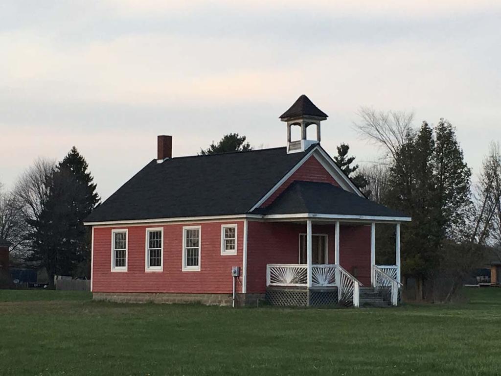
10 Community Introduction A. TOWNSHIP CHARACTER AND REGIONAL SETTING Lenox Township is located in northern Macomb County, Michigan. Commercial and industrial development in the in the Township is concentrated in the Village of New Haven, the 26 Mile Road corridor and Gra ot Avenue corridor. Most of the Township is rural in character, with farms and open space interwoven with large lot homes. Over 9,000 acres are under cul va on in the Township, making agriculture the single largest surface land use. The neighboring Townships of Ray, Armada, and Richmond, all in Macomb County, and Casco, in St. Clair County, are also largely rural. The City of Richmond to the north is rela vely dense and has slowly annexed por ons of the Township s northeastern corner over the past several decades. To the south, Chesterfield Township has seen a major influx of suburban development over the past 20 years, and it is an cipated that this development will ul mately advance up the Gra ot corridor into Lenox Township. The Village of New Haven is located en rely within Lenox and includes most of the Township s densest housing development within its boundaries. Roughly 45 percent of Township residents live within New Haven. Land Use Plan Implementation Appendix The Village of New Haven is located en rely within Lenox Township and is home to many Township residents. 10 CONTENTS LENOX TOWNSHIP MASTER PLAN UPDATE 2016


11 Top to bo om: Wetzel State Recrea on Area covers 900 acres in the township s southwest corner; Macomb Correc onal Facility has a capacity of 1416 inmates; the Methane Recovery & Power Genera on Facility at Pine Tree Acres landfill generates enough power to supply 19,000 homes. Open Space Lenox Township has a great deal of permanent open space, distributed throughout the Township. Wetzel State Recrea on Area is located in the southwestern corner of the Township, and Lenox has numerous natural and created wetlands set aside for permanent conserva on. Lenox Township also is home to two golf courses Land Use Challenges The Township is also home to several land uses that pose challenges for nearby development, including an inac ve landfill, the ac ve Pine Tree Acres landfill, which includes a gas power sta on, and the Macomb Correc onal Facility. The effects these uses have on surrounding land are a major considera on for planning in the eastern half of the Township. Access Lenox Township is not directly served by public transit, though a shu le service is operated by Richmond Lenox EMS in coopera on with the Suburban Mobility Authority for Regional Transporta on (SMART). Interstate 94 passes through the southeastern por on of the Township, providing quick regional access for residents. Gra ot Avenue is a major regional road origina ng in Detroit and con nuing on to St. Clair County; this corridor is home to a great deal of commercial ac vity in communi es to the south, such as Chesterfield Township. Introduction Community Land Use Plan Implementation Appendix LENOX TOWNSHIP MASTER PLAN UPDATE 2016 CONTENTS 11
12 Community Introduction Appendix Implementation Land Use Plan B. DEMOGRAPHIC PROFILE Popula on & Households From 2000 to 2010, Michigan lost popula on. While the most well known loss occurred in the state s largest ci es, many rural communi es and small ci es also lost residents. Lenox and the other rural townships of northern Macomb County located in the major transporta on corridors along Gra ot and M 53 grew modestly. A er growing at an excep onally fast pace during the 1990s, the Township s popula on grew modestly in the 2000s and slowed further a er One major cause for the slowdown a er 2010 was the 2008 economic crisis, which weakened housing markets and for several years hampered the outward growth of urban development in most parts of the country % Change % Change As of 2015, Lenox Township outside of the Village of New Haven had an es mated 1,821 housing units, 6.5 percent of which were vacant. The Township s 1,701 occupied housing units had an average household size of 2.66 people, slightly higher than the na onwide average of 2.62 and the Michigan average of 2.52 (both figures are Census Bureau es mates as of 2014). 49 percent of households in the Township included children. Average household size has been declining in the United States since the late 20th century. One of the ramifica ons of this trend is that communi es that do not increase the number of available housing units tend to lose popula on over me as household size declines. Lenox Township has land available for further housing development. Comparison to Neighboring Communi es 2014 % Change Avg # New Residents Avg # New Residents ,069 5, % 5, % 5, % Source: US Census and American Community Survey Lenox Township Total Popula on Avg # New Residents Surrounding communi es have experienced a variety of popula on trends. St. Clair County communi es generally have lost popula on since 2000; some have seen their growth in the 1990s completely reversed. Meanwhile, nearby ci es and villages in Macomb County have nearly all experienced greater popula on growth since 2000 than they did during the 1990s. Chesterfield and Macomb Townships con nued to grow rapidly, though rates of growth have slowed from their peaks. 12 CONTENTS LENOX TOWNSHIP MASTER PLAN UPDATE 2016
13 Projected Popula on Popula on, Lenox Township & Adjacent Communi es Community % Change % Change Lenox Twp 3,069 5, % 5, % Armada 1,548 1, % 1, % Armada Twp. 2,943 3, % 3, % Casco Twp. 4,552 4, % 4, % Chesterfield Twp. 25,905 37, % 43, % Columbus Twp. 3,241 4, % 4, % Ira Twp. 5,581 6, % 5, % Macomb Twp. 22,714 50, % 79, % New Bal more 5,798 7, % 12, % New Haven 2,335 3, % 4, % Ray Twp. 3,230 3, % 3, % Richmond 4,141 4, % 5, % Richmond Twp. 2,528 3, % 3, % Macomb County 717, , % 840, % Source: US Census and American Community Survey SEMCOG projects a 2040 popula on for the Township of 6,948, or an average of roughly 40 new residents per year between now and then. Note that popula on figures for the Township do not include the Village of New Haven. SEMCOG 2040 Popula on Projec ons for Lenox Township & New Haven Lenox Township 5,901 6,948 Village of New Haven 4,844 5,535 Total 10,745 12,483 Source: US Census and American Community Survey (Projected) Introduction Community Land Use Plan Implementation Appendix LENOX TOWNSHIP MASTER PLAN UPDATE 2016 CONTENTS 13
14 Introduction Community Changes in Popula on Age Distribu on When we look at change in popula on by age group in Lenox, we see a general aging trend. This reflects larger changes in the popula on occurring all across the United States and has implica ons for land use. An aging popula on will have different needs in terms of housing, mobility, and available services. Diversifying available housing types and improving walkability within the community are two ways the Township might address the changing age composi on of its people. As the popula on con nues to age, the Township could also poten ally provide addi onal senior oriented services, building on the offerings of the exis ng senior center. Lenox Township Popula on by Age, Age Group % Change Under % % Land Use Plan % % % % % % % % % % Implementation % % % % % % Total 5,362 5, % Appendix Median Age Source: US Census and American Community Survey 14 CONTENTS LENOX TOWNSHIP MASTER PLAN UPDATE 2016

15 Housing 97 percent of Lenox Township's dwelling units are detached single family homes or manufactured housing units. The Township has nearly no a ached or mul family housing. While single family homes should be expected to dominate the market in a rural community, the lack of other op ons means that individuals living in the Township, including seniors and empty nesters, who are looking to downsize or move to housing that requires less maintenance are likely to leave the community to find it. Addi onally, young adults seeking smaller units or rentals proximal to ameni es will buy or rent elsewhere. 83 percent of Lenox Township housing units are owner occupied, a much higher rate than the na on and state as a whole. While this has posi ve implica ons people are invested in the community it can also make the Township vulnerable to shi s in the housing market such as the one that occurred in the late 2000s. From 2006 to 2011, the worst years of the recent housing crisis, Lenox Township experienced a net decline in the number of housing units every year. As of the end of 2015, the Township s ll had fewer housing units than it did in 2005, though the number began to rebound slightly in Moving forward, the Township should consider ways to maintain its rural character while adding a modest amount of alterna ve housing types to its housing mix. This would provide op ons for current and poten al residents and help improve the Township's economic resiliency in the event of future mes of economic difficulty. Introduction Community Land Use Plan Implementation Appendix Most of the Township s housing stock is single family detached homes. LENOX TOWNSHIP MASTER PLAN UPDATE 2016 CONTENTS 15
16 Community Introduction Land Use Plan Economics Roughly 800 jobs are located within Lenox Township. Nearly half of these jobs are in the Retail Trade sector. Other major employment sectors in the Township are Wholesale Trade, Transporta on, Warehousing and U li es; Manufacturing; Leisure and Hospitality; and Natural Resources, Mining and Construc on. Outside of several large employers, jobs are spread primarily across small employers. Fully a quarter of those who work in Lenox township also live in the Township, while most other live in nearby communi es. Chesterfield Township is the only community where more Lenox Township residents are employed. Lenox Township not employed in Chesterfield or Lenox mostly commute to other Macomb County communi es. Detroit is the only non Macomb County municipality in the top ten of employment loca ons for township residents. 86 percent of township residents commute to work alone by car, while eleven percent carpool. Very few Township residents work from home or walk to work. The average commute me for residents in 2010 was 26 minutes, a decrease from 33 minutes in In 2010, median household income in the Township was $61,230, a 17.4 percent decline from 2000 when adjusted for infla on. This decrease was due to the 2008 economic crisis and largely mirrors decreases seen elsewhere. Lenox Township s median household income is higher than that of Michigan as a whole. Transporta on as deficient. One of these is completely closed. SEMCOG s survey of road condi ons for rated the condi on of 33 percent of the Township s lane miles as poor, and none of the Township s lane miles as good. The rest of the Township s lane miles were rated fair. The survey also classified two of the Township s 17 bridges Lenox Township has seen a slow but steady increase in traffic accidents over the last several years, though the severity of accidents in the Township has not shown a corresponding increase. Nearly half of crashes in the Township involve a single vehicle and nearly a quarter involve deer. 26 percent are caused by lane departures (these categories can overlap). Appendix Implementation 16 CONTENTS LENOX TOWNSHIP MASTER PLAN UPDATE 2016

17 Public Services and Facili es Lenox Township provides numerous services to its residents. Community Services The Lenox Township Senior Center offers a mee ng place and programming for senior ci zens living in the Township. The Lenox Township Library, located in the Village of New Haven, also offers programmed events and provides youth ac vi es and tutoring services. Lenox Township Community Center and Park offers an array of recrea onal opportuni es, including a pavilion, playground, and playing fields. Educa on Lenox Township is divided among four school districts: Anchor Bay School District, Armada Area Schools, New Haven Community Schools, and Richmond Community Schools. Introduction Community Emergency Services Owned jointly by Lenox and Richmond Townships, Richmond Lenox EMS provides services to an area encompassing the whole Township and all or por ons of several neighboring communi es from three sta ons, one of which is located in Lenox Township on Gra ot Avenue. The department also coordinates with SMART to provide daily shu le service to Gra ot and 23 Mile. The Lenox Fire Department has two sta ons in the Township. Police services are provided by the Macomb County Sheriff. Land Use Plan Implementation Appendix Richmond Lenox EMS and the Lenox Township Fire Department share a facility on Gra ot Avenue. LENOX TOWNSHIP MASTER PLAN UPDATE 2016 CONTENTS 17
18 Community Introduction Trash and Recycling Waste Management operates the Pinetree Acres landfill in the Township and is also the services provider for recycling and waste removal in the Township. Water and Sewer Service The Township has an agreement with the Detroit Water and Sewerage Department and Board of Water Commissioners to provide water to several areas of the Township, including the Gra ot, 26 Mile, and 32 Mile corridors, as well as most of the eastern por on of the Township. The Township also has an agreement in place with Macomb County and neighboring communi es regarding its allocated capacity for sanitary sewer service. The Township s Water and Sewer Master Plans each address the same areas of the Township, as shown on the maps that appear on the following pages. Much of the Township s western half is not included in the master plans for water and sewer. One func onal result of this is that this por on of the Township is likely to remain rural in character, as larger lots will s ll be necessary to accommodate wells and sep c fields. Land Use Plan Appendix Implementation Source: US Census and American Community Survey 18 CONTENTS LENOX TOWNSHIP MASTER PLAN UPDATE 2016

19 Introduction Community Land Use Plan Implementation Appendix 19 CONTENTS LENOX TOWNSHIP MASTER PLAN UPDATE 2016

20 Appendix Implementation Land Use Plan Community Introduction 20 CONTENTS LENOX TOWNSHIP MASTER PLAN UPDATE 2016

21 GOALS & OBJECTIVES PUBLIC INPUT UPDATED GOALS & OBJECTIVES
22 Community Introduction Appendix Implementation Land Use Plan Public Input During the prepara on of this Master Plan, the Township sought input from the community in two ways: a survey was developed and administered online, with printed versions available at the Township Hall and Library, and phone interviews with stakeholders and professionals engaged in relevant fields were held to gather informa on relevant to the future land use categories on the map and other planning issues. Survey The survey gathered 105 responses. Reponses are summarized below. Presented with a choice between the status quo, opening a great deal more land to development, and trying to balance rural preserva on in the Township s western half with greater development in the Gra ot corridor, 55 percent of respondents favored a balance of preserva on and targeted development. Very few respondents were open to the idea of allowing more intense development to spread throughout the Township. In fact the most selected answer to the ques on, Which of the following approaches would have a posi ve impact on the Township s future growth and development? Check all that apply, the most selected answer, by two thirds of respondents, was, Preserve and protect sensi ve natural areas to improve quality of life in the Township. Other answers that were selected by more than half of respondents were, Cooperate with the landfill to reduce adverse impacts and iden fy long range reuse op ons, and, Ensure that future non residen al development is heavily screened from residen al areas with landscaping and respects natural features. Clearly, Township residents value the rural character of the place where they live. An open ended ques on asking residents what they most valued about living in the Township obtained answers that almost universally cited open space, a slower pace, country living, and rural atmosphere as favorite a ributes of the community. Respondents were evenly split on whether or not the Township needed a shopping district, with many in the no column no ng the Township s proximity to heavily developed areas. Some respondents who answered yes thought that smaller scale op ons would be best, while others noted a need to revitalize exis ng development. 77 percent of respondents were opposed to expanded a ached housing op ons in the Township. 60 percent an cipated remaining in their current homes over the next ten to twenty years. Twenty percent an cipated downsizing, while 15 percent an cipated adding on to their current homes or buying a larger one. In general, few respondents an cipated moving into planned communi es, a ached units, or other more urban style areas. A small majority of respondents was interested in seeing development that offered more jobs 22 CONTENTS LENOX TOWNSHIP MASTER PLAN UPDATE 2016
23 within the Township. Open ended comments on this ques on generally leaned toward a desire form more high paying, professional jobs and consistent employment, rather than low wage or retail employment. Three quarters of respondents were in general agreement that the Gra ot corridor is poten ally a good loca on for an educa onal facility, and many of those respondents noted that a trade school might be the most appropriate op on. In general, respondents felt that such a facility might provide local employment as well as a place for people to acquire skills. In general, respondents highly valued open space and wanted to see the Township s natural features and open spaces preserved. Interviews Introduction Community Interviews were conducted in order to gain insight into the Township s poten al for development. In general, interviewees felt that, while development was spreading rapidly toward the township in 2008, the economic crisis delayed the arrival of major development for some me. The Township does not have water and sewer capacity to serve the en re Township, but does have ample capacity to serve the eastern third and the 26 Mile and 32 Mile corridors. Transit is not planned to reach Lenox Township at this me. The engineer for Chesterfield Township noted that there has been li le interest in developing north of 23 Mile in the Gra ot corridor. Private developers noted that there has been very li le interest in industrially zoned property just south of 26 Mile, and that the M 53 corridor seemed to be ge ng more ac vity in this regard than the Gra ot corridor. The government rela ons director for Waste Management, the operator of Pine Tree Acres Landfill, reported that the landfill has 20 to 25 years of remaining capacity at an cipated levels of intake. Were the landfill to close a er that period, a 30 year monitoring period would begin. The landfill s energy plant generates 22 mw of power, enough to power 17,000 homes daily. He noted that landfills commonly coexist with industrial uses, and that post closure, landfills can be repurposed for outdoor recrea onal uses. Representa ves for Oakland University and Macomb Community College were interviewed to gage the likelihood that another educa onal facility will open in northern Macomb County in the foreseeable future. Oakland University has offered specialized classes, workshops, and seminars at New Haven High School and may consider expanding this program. Macomb Community College has no plans to add a facility to the area in the next decade but did indicate a desire to explore opportuni es in advanced agriculture techniques, organic farming, food incubators, and a farm implement mechanics. The College would be willing to pursue low cost opportuni es that address unmet needs, if they could be shown to be financially tenable. Land Use Plan Implementation Appendix LENOX TOWNSHIP MASTER PLAN UPDATE 2016 CONTENTS 23
24 Introduction Community A community s Master Plan presents, through text, maps, and illustrations, a picture of what the Township intends to achieve in the next 10 to 20 years. Long range land use planning requires a policy basis to help guide future growth and development, and assist local officials to make difficult development decisions in a consistent and thoughtful manner. The goals and objectives that follow are predicated on public input, changes that have occurred in the Township since the development of the last Master Plan, and likely future trends in development within the Township. These proposed goals and objectives are intended to result in a specific quality and character for the community. These statements provide the basis for more detailed policies or strategies intended to allow the Township to implement its long range plan. Goals are general statements about the quality and character of the community that are not very easily quantified or measured. Goals must be translated into measurable objectives that can be prioritized and pursued by implementing specific strategies, as outlined in the implementation chapter of this plan. Land Use Plan Goals and of the 2004 Master Plan The Goals and of this Master Plan Update largely reflect the goals and objectives of the 2004 plan. They have been reorganized and streamlined to facilitate the development of an updated implementation strategy, and also reflect some of the changes in the Township s development environment since COMMUNITY CHARACTER/AGRICULTURE & NATURAL FEATURE PRESERVATION A. GOAL: Establish a balance between encouraging new development and preserving the natural features and rural character of the Township Implementation Objective: Objective: Retain the natural, rural character of Lenox Township that originally attracted many of its residents, with special emphasis on enabling the preservation of agriculture and open space in the western sections. Incorporate natural features and resources into development plans for new residential neighborhoods, parks and recreation facilities, as well as non residential land uses. Objective: Manage the amount of land that can be used for wetland mitigation projects in different parts of the Township. Appendix Objective: Direct major development to sections of the Township served by utilities and pursue zoning regulations that lead to slow, thoughtful growth that is compatible with agriculture in other areas. 24 CONTENTS LENOX TOWNSHIP MASTER PLAN UPDATE 2016
25 Objective: Preserve the Township s remaining natural areas, including woodlands, wetlands, flood plains, stream corridors and wildlife habitat. B. GOAL: Ensure that portions of the Township where major development is permitted to occur are planned and zoned to avoid an unplanned or haphazard pattern. Objective: Objective: Pursue a Town Center that consolidates civic, cultural, shopping and entertainment facilities in a unified development. Review Township regulations to ensure that they support the broad goal of maintaining Township character, even where more intense development occurs. 2. RESIDENTIAL DEVELOPMENT A. GOAL: Provide for the housing needs of the Township s existing and future residents in a manner that promotes the long term stability and quality of the community s neighborhoods and housing stock. Objective: Objective: Objective: Provide affordable housing opportunities that include detached single family homes, and attached units in a variety of configurations as alternatives to leased land communities. Encourage all residential areas to reflect the rural character of the Township. Enable development of denser housing types in areas where municipal sewer and water services exist or are planned, including various types of housing for seniors. 3. COMMERCIAL AND INDUSTRIAL DEVELOPMENT/TAX & EMPLOYMENT BASE See also: Goal 1.B. A. GOAL: Continue to build a balanced tax base by providing opportunities for high value, high technology industrial, office, and research uses that offer employment, and produce more revenue than retail and residential uses while demanding less in municipal services. Objective: Objective: Objective: Ensure that zoning provides land commensurate with potential demand for these uses. These zoning classifications should reflect the availability of utilities. Identify land suitable for the development of planned industrial, office, or research parks. Improve the appearance of existing industrial and commercial areas. Introduction Community Land Use Plan Implementation Appendix LENOX TOWNSHIP MASTER PLAN UPDATE 2016 CONTENTS 25
26 Introduction B. GOAL: Ensure that new commercial, office, and industrial development is compatible with residences, agriculture, and natural resources. Objective: Prevent the traffic impact of industrial development from reducing the level of service on Township thoroughfares below that which is acceptable and desirable. Community Objective: Objective: Objective: Identify emerging neighborhood areas that are not well served by existing concentrations of shops and services and plan for neighborhood commercial areas that are proportional to the need for services. Promote industrial development design that is sensitive to potential impacts on adjoining or nearby residential areas and natural features. Develop screening and setback standards that protect residences and sensitive or significant natural features. Land Use Plan 4. INFRASTRUCTURE & PUBLIC SERVICES A. GOAL: Maintain and improve the Township s network of county roads to accommodate anticipated traffic at an acceptable level of service, and in a safe, efficient manner. Objective: Work with the Macomb County Department of Roads and individual developers to implement safety and capacity improvements consistent with the anticipated impact of all major new developments. B. GOAL: Provide public services and utilities at a level and cost appropriate to planned growth and development. Objective: Objective: Properly time utility extensions so that development pays its fair share of the cost. Provide police, fire protection, and emergency medical services that adequately meet the Township s current and future needs. Implementation Objective: Do not allow public facilities to intrude upon or preempt the natural environment. Appendix 26 CONTENTS LENOX TOWNSHIP MASTER PLAN UPDATE 2016

27 LAND USE PLAN FUTURE LAND USE MAP FUTURE LAND USE PLAN WETLANDS PLAN
28 Community Introduction Appendix Implementation Land Use Plan The Future Land Use Plan is a guiding document intended to document the goals and inten ons of the Township regarding land use and future development. Future decisions regarding the Township zoning ordinance and map will reference the framework provided by this plan. Overall Concepts and Factors to Consider The amount of land to be devoted to a given use is determined with the help of criteria that help guide decisions. Exis ng land use within the community and region, roads, soils, topography, economic poten al, and changes in the community and region s popula on and demographic characteris cs all inform the placement and acreage afforded to different land uses. The future land use maps that follow offer two possible visions for the future development of land in the Township. Future Land Use Concept A is largely carried forward from the 2004 Master Plan, with adjustments in response to changes in markets and condi ons on the ground. Future Land Use Concept B includes many of the same ideas as Concept A in a different configura on, including moving the mixed use Town Center concept to the west side of Gra ot Avenue in an effort to more strongly integrate it with the municipal center and create a connec on to the Village of New Haven. The agricultural campus concept is also expanded in Concept B. Both maps include the Township s inventory of created wetlands in their open space designa on. LAND USE CATEGORIES The following descrip ons outline the intent of the land use categories on the maps. Items in dark green are new to this update. Open Space This category is planned to preserve open space in the Township and acknowledge that land within floodplains and created wetlands will not be developed. Other func ons of the category are to establish the special character of the area along the Salt River from the Village limits to 29 Mile Road and to iden fy certain areas to remain as open space in order to buffer surrounding areas from high intensity land uses. Exis ng natural features included in this category effec vely screen the landfill from Gra ot Avenue and should be maintained in order to preserve the Township s rural character. The valuable natural stream corridors and flood plain areas along the Township s western edge are also included in this land use designa on. The Township may also encourage the maintenance of designated open space by transferring residen al density to other proper es within the Township. Under this approach, the open space area would be rezoned to an appropriate, low density residen al classifica on. Based on a conceptual development plan for the site, the residen al density could be transferred to other Township residen al property in return for the permanent preserva on of open space or recrea onal uses on the designated lands. 28 CONTENTS LENOX TOWNSHIP MASTER PLAN UPDATE 2016

29 Introduction Community Land Use Plan Implementation Appendix MAP 1 29 CONTENTS LENOX TOWNSHIP MASTER PLAN UPDATE 2016
30 Rural Preserva on Low Density Residen al Light Industrial Introduction This category is intended to accommodate primarily agricultural land uses, farm dwellings, and non farm dwellings that are in keeping with the rural and agricultural character. Residen al development at densi es of This category accommodates residen al development at units per acre and is located primarily east of the railroad. These densi es can provide a transi on from rural preserva on areas to the more intensive This category iden fies sites for typical light manufacturing, assembly, prototype development, and similar uses in the se ng of a modern, Class A industrial park and is intended to provide employment, a balanced tax no more than 0.2 to 0.5 units per acre is an cipated in areas planned for uses along the Gra ot corridor and other areas served by u li es. Use of base, and a first ring transi on around the Pine Tree Acres landfill. Community Rural Preserva on. A large por on of the Township (roughly half) is planned for Rural Preserva on. Maintaining the rural views from the roadside, is also extremely important in these areas, in order to preserve the Township s rural character even as low intensity development occurs. The Township has adopted a Purchase of Development Rights (PDR) ordinance and is contribu ng to the farmland preserva on efforts of the Macomb Agricultural PDR Commi ee. Ac ve farms west of the Grand Trunk Western Railroad should be maintained to the maximum extent the residen al open space development op on is encouraged in order to preserve natural features and rural character. Moderate Density Residen al This category abuts more intensive, non residen al uses in many loca ons and encourages more intensive, subdivision style single family development at densi es of 4.0 to 6.0 units per acre. High Density Residen al Research & Development Campus This category is intended to provide signature sites for the office, engineering, and product development func ons of major corpora ons. These areas would become a future employment center for professional and technical personnel. Intensive Impact This category iden fies uses that do not relate well to nearby residen al Implementation Land Use Plan feasible. Lenox Township s efforts to maintain its rural character and ac ve farmland are consistent with the County wide effort seeking to iden fy ac ve farms that could qualify for matching purchase of development right funds through Part 362 of the Natural Resources and Environmental Protec on Act, Act 451 of 1994 as amended. The Macomb PDR program has iden fied criteria for the selec on of qualifying candidates for the PDR program. Criteria include but are not limited to the presence of ac ve farming and the size of the property. The scoring system favors larger farm sizes. Individual property owners who are interested in preserving their property as farmland may apply for the PDR program through the Township and must demonstrate compliance with the established scoring system. Applica ons will be reviewed and ranked by the Macomb PDR selec on commi ee. Local support for agri entertainment uses such as hay rides and cornfield mazes, as well as roadside produce stands can help support and maintain the Township s exis ng agricultural opera ons. Entrepreneurial efforts such as specialty farm markets that offer a limited array of products produced elsewhere in conjunc on with goods grown on site should be This category provides sites for development at densi es of 6.0 or more units per acre, including apartments and townhomes, in areas planned for public sewer and water service. Mobile Home Park This category includes the exis ng Quail Run Mobile Home Park and the Millstone Pond property at the southeast corner of the Township. Planned Neighborhood This category provides for mixed use developments, to be planned and reviewed as a single project in order to achieve high quality, coordinated development. Projects may include residen al and related local commercial, office and quasi public uses. Office Center This category accommodates local office uses, including medical and dental, that are likely to be in higher demand as the Gra ot corridor con nues to develop. Office Warehouse uses, including the Pine tree Acres landfill, Macomb Correc onal Facility, a closed landfill, and the gas compressor sta on. These uses have impacts similar to heavy industry and are planned to be buffered from neighboring uses by extensive open space. Because Lenox Township has almost 500 acres devoted to a variety of exis ng Intensive Impact areas, the Land Use Plan proposes no new heavy industry. Recrea on This category includes land designated for recrea on purposes, such as the Wetzel State Park and Oakridge Golf Course. Addi onal recrea on areas could be located adjacent to the landfill as a buffer for planned residen al uses, via a Transfer of Development Rights program. Government Center This is the loca on of the Township s administra ve offices and park and could accommodate future district court offices, a branch library, expanded sheriff sta on, or other similar uses. The Government Center is intended to func on as an integral element of the Town Center. Public Service Appendix considered and encouraged. Direct marke ng techniques such as farmers markets, pick your own farms, roadside stands, subscrip on farming or community supported agriculture (CSA), and catalog sales can strengthen the connec on between local farm opera ons and their communi es. Sales and Distribu on Services including those with fully enclosed warehousing may be located within this land use category. Proposed uses must be designed to provide a transi on or buffer between the landfill and residen al or agricultural development. This category includes Township services such as the Fire Department, Department of Public Works, and Lenox Richmond Emergency Medical Services. The Public Services category is also used to designate individual sites, such as Fire Sta on #2. 30 CONTENTS LENOX TOWNSHIP MASTER PLAN UPDATE 2016
31 Local Business This category iden fies key loca ons for convenience businesses such as drug stores, florists, beauty salons, and small markets. These uses are planned in small concentra ons rather that long commercial strips. Highway Business Planned Highway Business areas are intended for land intensive, individual users that require highway exposure. A campus like se ng of well landscaped, individual businesses is the goal. Uses could include hotels, fast food, convenience stores, gas sta ons, vehicle dealerships, and larger retail. U lity This category iden fies property planned for u lity purposes and includes the exis ng Richmond sewage treatment plant north of 31 Mile Road. Educa onal Campus / Skills Center This area would serve as the loca on of a college or university satellite campus, par cularly one with an engineering, technology oriented, or high value organic agriculture program. The planned educa onal campus is located between 30 Mile Road and the Government Center. Its proximity to the R&D campus is intended to place future university research programs near poten al sources of employment for those enrolled in the programs. The skills center component would target large scale agricultural and construc on equipment repair, maintenance training, and similar highly technical fields. This concept is par ally rooted in conversa ons with focus group par cipants represen ng local colleges and universi es. Agricultural Campus The 200 acres due west of the Macomb Correc onal Facility is iden fied as an Agricultural Campus. This area is proposed as a major expansion of Michigan s Prison Grow program for the Maumee Lake Plain and Huron ecoregions. The Macomb Correc onal Facility is already involved in the Prison Grow program, producing nursery stock for reforesta on and similar efforts at state parks and recrea on areas. This program could poten ally be expanded to serve other public park systems in the region. Since 2006, the Michigan Department of Correc ons has also worked to incorporate locally grown produce into their prison cafeterias through the Buy Michigan First ini a ve. By combining Prison Grow with the Buy Michigan First ini a ve, and expanding it west of the prison in coopera on with local growers, prisoners could learn valuable hor culture skills that may assist them with finding work a er they are released. Beneficiaries could include the prison system, state parks and recrea on areas, local park programs, local farmers, and the people of Michigan. Providing prisoners with marketable skills may help reduce recidivism rates. Town Center The Town Center is intended as the future mixed use center of the Township, incorpora ng retail, cultural and governmental uses with the Township s highest density residen al development. The Town Center land use category encourages the development of con guous tracts of land as a single planned center of mixed use ac vity. The Town Center will serve the needs of nearby neighborhoods as well as the comparison shopping needs of the en re Corridor. Entertainment uses such as movie theaters and signature restaurants should be encouraged in this area. High density residen al use, as an element of a mixed use project, may also be appropriate at key loca ons within the Town Center. The Town Center Retail Core may accommodate live work units or other crea ve approaches to residen al development, including lo style apartments. Town Center mixed use development is intended to provide the residen al popula on necessary to encourage pedestrian ac vity and round the clock vitality. Pedestrian linkages and public open spaces should be carefully incorporated within the Town Center to provide access to the Township s Government Center. The plan iden fies 21 acres for a poten al town center. Introduction Community Land Use Plan Implementation Appendix LENOX TOWNSHIP MASTER PLAN UPDATE 2016 CONTENTS 31
32 Community Introduction Appendix Implementation Land Use Plan Table 4.1 Acreage of Future Land Use Categories Acreage and Build Out Land Use Approximate Acres Table 4.1 shows the approximate total acreage Rural Preserva on 13,272 devoted to each of the land use categories on the Low Density Residen al 2,254 Future Land Use map. More than half of the land in Medium Density Residen al 775 the Township is devoted to Rural Preserva on, High Density Residen al 288 where residen al development is envisioned to be Mobile Home Park 193 no greater than 0.5 units per acre (i.e. residen al Planned Neighborhood 231 lots would be a minimum of two acres). In certain Local Business 239 parts of the Township, lots would have to be larger Highway Business 133 than this in order to accommodate soil condi ons Office Center 32 and preserve the water table for residen al wells. Office Warehouse 114 In all likelihood, agriculture will con nue to occupy the balance of this land for many decades into the Research & Development 223 future. Light Industrial 527 Intensive Impact 532 The build out analysis in Table 4.2 is an es mate of Agricultural Campus 152 the number of housing units that could be built in Educa onal Campus 68 each of the residen al future land use categories, Government Center 34 based on the approximate acreage devoted to that Town Center 230 category, assuming that each of these areas is built Recrea on 1,183 out to its maximum capacity. While build out to Open Space 2,023 maximum capacity is unlikely to occur, this figure is Public Service 39 useful for u lity planning. U lity 20 Assuming no change in average household size in the Township, maximum built out would add approximately 60,000 residents to the Township s popula on, which is roughly akin to what occurred in the middle townships of Macomb County from the 1970s through the early 2000s. Table 4.2 Residen al Build Out Analysis Land Use Category Units Per Acre Approximate Acres Maximum Build Out Rural Preserva on ,272 2,654 6,636 units Low Density Residen al 1 4 2,254 2,254 9,016 units Medium Density Residen al ,100 4,650 units High Density Residen al ,728 2,880 units 9,736 23,182 total units WETLANDS PLAN In the interim between Master Plan updates, Lenox Township was the site of several wetland mi ga on projects. These projects are intended to compensate for the loss of wetlands during development through the crea on of new wetlands that offset the lost acreage. The long term implica ons of wetland mi ga on in the Township are mixed. While such projects ensure the preserva on of some open space and in some cases provide natural feature ameni es that can be enjoyed by residents, the administra on of these projects can reduce Township revenue in the long term. Most wetland mi ga on sites are established as conserva on easements and are ul mately administered by non profit organiza ons, thus removing them from the Township tax rolls. The Township wishes to accommodate future wetland mi ga on projects. However, it is also in the interest of the Township to ensure that this use does not become too dominant in any par cular part of the community. In order to determine the best course forward, the Township studied exis ng wetlands as part of this master plan update. Table 4.3 illustrates the amount of land in the Township currently devoted to wetland mi ga on as well as the amount of land occupied by natural wetlands. Table 4.5 (on the following pages) iden fies wetlands in each sec on of the Township, as well as by watershed. Table 4.3 Total Wetland Area in Lenox Township, 2016 Total Township Area (excluding the Village of New Haven) 20,160 acres 100 % Total Area of Naturally Occurring Wetlands 2,400 acres 12% Total Area of Created Wetlands 817 acres 4% Total Area of All Wetlands 3,217 acres 16%* * Includes some minor overlap In order to limit the Township s inventory of created wetlands to a level that permits new projects but does not permit an overabundance, the following framework for a created wetland ordinance is established: The Township will establish a maximum allowable area of wetlands for the Township as a whole, in each of its two watersheds and in each sec on of the Township. Considering that future development will likely be concentrated in the Belle River watershed, the Planning Commission iden fied the limits in Table 4.4 as appropriate: Table 4.4 Proposed Limits on Wetland Area A wetland ordinance could provide Wetlands as a percent of total Township land area 18% the Planning Commission with the Wetlands as a percent of Bell River watershed 12% ability to waive any of these limits for Wetlands as a percent of Clinton River watershed 18% created wetland projects that Wetlands as a percent of individual sec on area 18% mi gate wetland loss within the Township. 32 CONTENTS LENOX TOWNSHIP MASTER PLAN UPDATE 2016
33 Introduction Community Land Use Plan Implementation Appendix MAP 2 33 CONTENTS LENOX TOWNSHIP MASTER PLAN UPDATE 2016
34 Table 4.5 Acres of Natural and Created Wetlands in Lenox Township (Including New Haven), by Sec on and by Watershed Community Introduction Appendix Implementation Land Use Plan Acres Natural Wetland Acres % Natural Wetlands Created Wetland Acres % Created Wetlands Created and Natural Wetland Overlap Acreage Total Wetland Acres % of Sec on that is Wetlands Sec on % % % Sec on % % % Sec on % % % Sec on % % % Sec on % % % Sec on % % % Sec on % % % Sec on % % % Sec on % % % Sec on % % % Sec on % % % Sec on % % % Sec on % % % Sec on % % % Sec on % % % Sec on % % % Sec on % % % Sec on % % % Sec on % % % Sec on % % % Sec on % % % Sec on % % % Sec on % % % Sec on % % % Sec on % % % Sec on % % % Sec on % % % Sec on % % % Sec on % % % Sec on % % % Sec on % % % Sec on % % % Sec on % % % Sec on % % % Sec on % % % Sec on % % % Totals* 24,890 2, % % , Belle River Watershed 13,533 1, % % , % Clinton River Watershed 11,375 1, % % , % Totals* 24,908 2, % % , * Discrepancy in total acreage is due to differences in geographic informa on system databases. Total acreage of Lenox Township, including New Haven, is 24,905 acres. 34 CONTENTS LENOX TOWNSHIP MASTER PLAN UPDATE 2016

35 IMPLEMENTATION IMPLEMENTATION STRATEGIES COMPLETE STREETS ZONING PLAN
36 Community Introduction Implementation Land Use Plan Objec ve Strategy Priority Timeframe COMMUNITY CHARACTER/AGRICULTURE & NATURAL FEATURE PRESERVATION Goal A: Establish a balance between encouraging new development and preserving the natural features and rural character of the Township. Retain the natural, rural character of Lenox Township that originally a racted many of its residents, with special emphasis on enabling the preserva on of agriculture and open space in the western sec ons. Incorporate natural features and resources into development plans for new residen al neighborhoods, parks and recrea on facili es, as well as non residen al land uses. Preserve the Township s remaining natural areas, including woodlands, wetlands, flood plains, stream corridors and wildlife habitat. Iden fy, map, and protect important viewsheds, natural features, and historic resources (such as silos, barns, and original farmsteads) around the Township and promote their preserva on and integra on into new development during the development review and approval process. Support the Macomb Agricultural Purchase of Development Rights Commi ee in its efforts to promote purchase of development rights within the County. Provide open space, nature reserves, and wildlife corridors as features of Township parks development. Zoning Ordinance: Review Sec on 334 Open Space Preserva on and Sec on 335 Planned Unit Development of the Zoning Ordinance to ensure that they provide adequate protec on for iden fied resources and require the type of screening that will preserve rural character within the Township. Consider requiring open space preserva on in developments over a certain size. Develop wildlife corridor standards for new projects. Consider ways to link preserved open space to Township paths and recrea on assets. Permit transfer of residen al densi es where the transfer preserves resources. Establish setbacks or buffer zones around wetlands and creek edges. Review Sec on 331 Tree and Woodlands Protec on and update as necessary. Maintain low development densi es and allow clustering of home sites in agricultural districts in order to prevent encroachment on agriculture. Appendix Manage the amount of land that can be used for wetland mi ga on projects in different parts of the Township. Use the Wetlands Plan contained in this Master Plan update as the basis for the crea on of a new wetland ordinance. 36 CONTENTS LENOX TOWNSHIP MASTER PLAN UPDATE 2016
37 Objec ve Strategy Priority Timeframe COMMUNITY CHARACTER/AGRICULTURE & NATURAL FEATURE PRESERVATION Goal A: Establish a balance between encouraging new development and preserving the natural features and rural character of the Township. Direct major development to sec ons of the Township served by u li es and pursue zoning regula ons that lead to slow, though ul growth that is compa ble with agriculture in other areas. Align zoning that permits more intensive development with areas where sewer, water, adequate road access, or other infrastructure is presently available or planned. Evaluate uses permi ed in the Zoning Ordinance to ensure that only those compa ble with agriculture are allowed in agricultural zones. Evaluate loca ons of prime agricultural land and locate zoning for commercial, industrial and higher density residen al uses elsewhere.. Amend the permi ed uses in the AG district to accommodate farm diversifica on and support entrepreneurial agriculture. Goal B: Ensure that portions of the Township where major development is permitted to occur are planned and zoned to avoid an unplanned or haphazard pattern. Introduction Community Review Township regula ons to ensure that they support the broad goal of maintaining Township character, even where more intense development occurs. Pursue a Town Center that consolidates civic, cultural, shopping and entertainment facili es in a unified development. Conduct a synop c survey of the Township to determine the types of design elements that could be required to reflect exis ng development in new development. Develop design guidelines that carry rural character into new developments. Conduct a residen al and commercial market study to determine areas of need. Develop a Town Center Plan to iden fy the preferred loca on and characteris cs of the Township Center; incorporate the findings of the market study. Encourage an effec ve mix of business and entertainment uses through the establishment of a Downtown Development Authority, Principal Shopping District, or similar program. Pursue the con nued enhancement of the Township Civic Center by expanding recrea onal assets and improving connec vity to other sites. Work with the Macomb County Department of Roads, SMART, and developers to provide a transporta on network appropriate to the needs of a vibrant Township ac vity center. Land Use Plan Implementation Appendix LENOX TOWNSHIP MASTER PLAN UPDATE 2016 CONTENTS 37
38 Introduction Objec ve Strategy Priority Timeframe RESIDENTIAL DEVELOPMENT Goal A: Provide for the housing needs of the Township s exis ng and future residents in a manner that promotes the long term stability and quality of the community s neighborhoods and housing stock. Community Provide affordable housing opportuni es that include detached single family homes, and a ached units in a variety of configura ons as alterna ves to leased land communi es. Enable development of denser housing types in areas where municipal sewer and water services exist or are planned, including various types of housing for seniors. Evaluate whether the Zoning Ordinance embraces unique, state of the art forms of owner occupied housing. Promote residen al projects that help young, first me homebuyers and mature, re red residents to stay in Lenox Township when their housing needs change. Evaluate the Township s Zoning Ordinance and Map to determine whether residen al zoning categories and loca ons are consistent with the availability of services and infrastructure. Require large minimum lot sizes or low average densi es in the country areas of the Township where u lity services are not planned. Land Use Plan Encourage all residen al areas to reflect the rural character of the Township. Enforce land division regula ons that provide design standards, local review, and approval requirements for all property splits. Require residen al developments to preserve the natural features of each site, such as woodlands, wetlands, and natural drainage facili es. Iden fy historical homes within the Township so that efforts can be made to preserve them. Appendix Implementation 38 CONTENTS LENOX TOWNSHIP MASTER PLAN UPDATE 2016
39 Objec ve Strategy Priority Timeframe COMMERCIAL AND INDUSTRIAL DEVELOPMENT/TAX & EMPLOYMENT BASE Goal A: Con nue to build a balanced tax base by providing opportuni es for high value, high technology industrial, office, and research uses that offer employment, and produce more revenue than retail and residen al uses while demanding less in municipal services. Ensure that zoning provides land commensurate with poten al demand for these uses. These zoning classifica ons should reflect the availability of u li es. Create a new zoning district that permits a mix of office, retail and residen al uses with design standards and criteria that will achieve the desired character for this corridor. Evaluate the Zoning Ordinance to review the characteris cs and amount of retail development permi ed throughout the corridor. Introduction Community Iden fy land suitable for the development of planned industrial, office, or research parks. Evaluate how and where the zoning ordinance permits industrial, research, and office uses and adjust as necessary to ensure that a modern mix is permi ed in appropriate places. Promote the development of planned industrial/ research/office parks that facilitate modern uses while respec ng the rural se ng. Land Use Plan Implementation Appendix LENOX TOWNSHIP MASTER PLAN UPDATE 2016 CONTENTS 39
40 Introduction Objec ve Strategy Priority Timeframe COMMERCIAL AND INDUSTRIAL DEVELOPMENT/TAX & EMPLOYMENT BASE Goal B: Ensure that new commercial, office, and industrial development is compa ble with residences, agriculture, and natural resources. Community Prevent the traffic impact of industrial development from reducing the level of service on Township thoroughfares below that which is acceptable and desirable. Plan for industrial development in corridors designed to handle employee and shipping/receiving traffic. Ensure proper connec ons between industrial service roads and the regional highway network, avoiding routes adjoining residen al neighborhoods. Land Use Plan Iden fy emerging neighborhood areas that are not well served by exis ng concentra ons of shops and services and plan for neighborhood commercial areas that are propor onal to the need for services. Promote industrial development design that is sensi ve to poten al impacts on adjoining or nearby residen al areas and natural features. Promote planned commercial concentra ons as the corridor s inherent form, rather than a con nuous strip of disconnected individual sites and mixed businesses. Review applica ons for rezoning based on demonstrated need for new shops and services in neighborhoods that are under served. Plan for u lity extensions that open the door to Class A industrial park development in place of haphazard development of sca ered sites. Implementation Appendix Develop screening and setback standards that protect residences and sensi ve or significant natural features. Improve the appearance of exis ng industrial and commercial areas. Discourage residen al development adjacent to industrial zones to minimize conflicts between incompa ble uses. Require appropriate screening of industrial ac vi es to protect residen al character. Zone for transi onal uses or open space between industrial parks and residen al neighborhoods. Discourage the construc on of pole barns as principal industrial and commercial buildings. Encourage increased use of landscaping and sensi ve site design. Consider requiring deten on basins to be designed to mimic natural forms. 40 CONTENTS LENOX TOWNSHIP MASTER PLAN UPDATE 2016
41 Objec ve Strategy Priority Timeframe INFRASTRUCTURE & PUBLIC SERVICES Goal A: Maintain and improve the Township s network of county roads to accommodate an cipated traffic at an acceptable level of service, and in a safe, efficient manner. Work with the Macomb County Department of Roads and individual developers to implement safety and capacity improvements consistent with the an cipated impact of all major new developments. Iden fy roads that have projected volumes or func onal classifica ons that jus fy paving, as well as those that should remain gravel. Establish traffic impact analysis thresholds, and requirements for traffic study content, as site plan standards in the Zoning Ordinance. When development impacts are shown to reduce safety or level of service beyond acceptable standards, implement capacity and safety improvements as a Introduction Community Goal B: Provide public services and u li es at a level and cost appropriate to planned growth and development. Provide police, fire protec on, and emergency medical services that adequately meet the Township s current and future needs. Properly me u lity extensions so that development pays its fair share of the cost. Do not allow public facili es to intrude upon or preempt the natural environment. Provide facili es and services consistent with the needs of the planned popula on. Follow the most cost effec ve path when providing facili es and services. Concentrate u lity services in areas where growth is most likely in order to reduce the cost of extensions. Time development approvals to coincide with the logical extension of the Township s u lity systems. Require developments to bear their fair share of system costs, such as providing adequate on site storage for storm water, or extending sewer and water mains to the next abu ng property line. Ensure the availability of adequate u lity services to support the crea on of a vibrant township ac vity center. Encourage public u li es to locate their major transmission lines within exis ng u lity and transporta on corridors. Land Use Plan Implementation Appendix LENOX TOWNSHIP MASTER PLAN UPDATE 2016 CONTENTS 41
42 Introduction Community ZONING PLAN The Zoning Plan shows how the Township s long range land use plan will be implemented through changes to the Zoning Ordinance and map. The table at right shows how the land uses of the Future Land Use map generally align with the township s exis ng zoning districts. Several new districts will be needed over the long term. The text below outlines and priori zes Zoning Ordinance amendments. Table 5.1 compares the land use categories of the Future Land Use map. While several land use categories are noted as having no equivalent, certain of these do not need a corresponding Table 5.1 Comparison of Exis ng Zoning Districts and Future Land Use Categories Future Land Use Category Zoning District Open Space No direct equivalent/fp Floodplain and landscaping standards offer some equivalency Land Use Plan Rural Preserva on AG Agricultural District Recrea on REC Recrea on District Agricultural Campus No direct equivalent/ag District Low Density Residen al (1 4/acre) Medium Density Residen al (4 6/acre) High Density Residen al (6+/acre) Mobile Home Park RL Low Density Residen al (One Family) District RM Medium Density Residen al (One Family) District RH High Density Residen al (Mul ple Family) District MH Mobile Home Park One Family District Town Center No equivalent Local Business CN Commercial Neighborhood & CC Community Commercial Districts Implementation Appendix Highway Business Planned Neighborhood Government Center Public Service Office Center Office Warehouse Research & Development Campus Educa onal Campus/Skills Center Light Industrial U lity Intensive Impact CG General Commercial District No equivalent/pud op on could be used No equivalent No equivalent OS Office Service District OTW Office Technology Warehouse District No equivalent No equivalent IR Industrial Restricted District No equivalent IC Industrial Controlled District 42 CONTENTS LENOX TOWNSHIP MASTER PLAN UPDATE 2016
43 category in the Zoning Ordinance. In par cular, Government Center, Public Service, U lity, Agricultural Campus, and Educa onal Campus/Skills Center are all land uses that can be covered as special uses in other districts, with appropriate condi ons (such as proximity to Gra ot Avenue). The goals of the Open Space category can likewise be accomplished largely through development regula ons such as landscaping standards. The three categories that may require the development of new districts in order to achieve their goals are Town Center, Planned Neighborhood, and Research & Development Campus. Of these three, the last two could be fit into the current framework of the ordinance, using the Planned Unit Development op on and the regula ons of the IR district, respec vely. Town Center requires a different type of district permi ng mixed uses and possibly some elements of a formbased code. Introduction Community This chapter of the master plan calls for numerous text amendments to the zoning ordinance, collected below: Review Sec on 334 Open Space Preserva on and Sec on 335 Planned Unit Development of the Zoning Ordinance to ensure that they provide adequate protec on for iden fied resources and require the type of screening that will preserve rural character within the Township. Consider requiring open space preserva on in developments over a certain size. Develop wildlife corridor standards for new projects. Consider ways to link preserved open space to Township paths and recrea on assets. Permit transfer of residen al densi es where the transfer preserves resources. Establish setbacks or buffer zones around wetlands and creek edges. Review Sec on 331 Tree and Woodlands Protec on and update as necessary. Evaluate uses permi ed in the Zoning Ordinance to ensure that only those compa ble with agriculture are allowed in agricultural zones. Amend the permi ed uses in the AG district to accommodate farm diversifica on and support entrepreneurial agriculture. Develop design guidelines that carry rural character into new developments. Evaluate whether the Zoning Ordinance embraces unique, state of the art forms of ownership housing types. Evaluate how and where the zoning ordinance permits industrial, research, and office uses and adjust as necessary to ensure that a modern mix is permi ed in appropriate places. Require appropriate screening of industrial ac vi es to protect residen al character. Consider requiring deten on basins to be designed to mimic natural forms. Establish traffic impact analysis thresholds, and requirements for traffic study content, as site plan standards in the Zoning Ordinance. Finally, it will be important to conduct a thorough review of the Township Zoning Map in order to ensure alignment of districts with the Township s goals and infrastructure. Land Use Plan Implementation Appendix LENOX TOWNSHIP MASTER PLAN UPDATE 2016 CONTENTS 43
44 Introduction COMPLETE STREETS PLAN Complete Streets is a term used to describe a transporta on network that includes accommoda on for vehicles, pedestrians, cyclists, and other legal users. Complete Streets provide transporta on choices, allowing people to move about their communi es safely and easily. Traffic Safety Community Appendix Implementation Land Use Plan According to SEMCOG, from 2011 to 2015 there were 797 total vehicle crashes in the Township (159.4 annually, or one every 2.3 days on average), 9 of which were fatal (1.1 percent) and 184 of which led to injuries (23 percent). 385 of these, nearly 50 percent, were single vehicle accidents. Three accidents involved pedestrians, and two involved bicyclists. 189 crashes (24 percent) involved deer. Because of the township s generally rural character, the occasion for conflict between automobiles and other human users is rela vely rare. The Township does, however, have higher than average crash fatality and injury rates, due in part to the high speeds of travel on rural roads. The Township also has a much higher rate of single vehicle crashes than the SEMCOG region as a whole (48.3 percent versus 18.4 percent) Mobility Apart from the Richmond Lenox EMS shu le service, Lenox Township is not served by public transporta on. According to the five year es mates of the U.S. Census Bureau, in 2014, approximately 198 households in the Township, 116 of which were in the village, did not have reliable access to a vehicle. Providing non motorized transporta on op ons for members of these households is important. Complete Streets in the Township The Township s development pa ern, generally featuring long, straight paved thoroughfares under the jurisdic on of the Macomb County Road Commission, smaller secondary paved roads in neighborhoods, and gravel connector roads, does not strongly support conven onal Complete Streets measures such as sidewalks and bicycle lanes. The length of the roads, narrowness of paved areas, presence of swales immediately adjacent to the roadway, low density of development, and low traffic volumes all present physical, market, and financial barriers to this type of infrastructure. Gra ot Avenue s wide shoulders offer perhaps the best physical space for bicycling, though the road s high speeds are not conducive to sharing facili es between motorized and non motorized users. Complete Streets implementa on in the township at present will consist largely of developing guidelines for future development, pushing to make connec ons to the regional trail network, and building awareness in motorists that they are expected to share the road with other users. 44 CONTENTS LENOX TOWNSHIP MASTER PLAN UPDATE 2016
45 The township should work with the Macomb County Road Commission and the Michigan Deer Crash Coali on to inves gate measures that can be taken to decrease poten al conflicts on roads in the Township. Addi onal signage warning about the presence of deer could increase driver cau on. Establishing recognized bike routes marked with signs could also focus bicycle travel onto the most appropriate roads. Macomb County Non Motorized Plan The Macomb County Non Motorized Plan calls for numerous non motorized facili es in Lenox Township. The majority are eight to ten foot trails, including trails along County Line, Omo, and Forest, and running parallel to 28 and 29 Mile Roads. The plan further calls for undefined facili es on the por on of Omo north of 28 Mile, along 27 Mile west of New Haven, and along Forest leading into Richmond. The last of these would provide a connec on to the Macomb Orchard Trail. A planned path along Gra ot ends at New Haven Road. Introduction Community A characteris c road in Lenox Township. Land Use Plan Implementation Appendix LENOX TOWNSHIP MASTER PLAN UPDATE 2016 CONTENTS 45
46 Community Introduction Land Use Plan Complete Streets Strategy The township s goal is to provide safe, efficient and well maintained roadways that accommodate all modes of transporta on throughout the township. These Complete Streets implementa on strategies offer several methods for working toward this goal. Objec ve Strategy Priority Timeframe Determine how best to apply Complete Streets principles in different areas of the Township. Ensure equal access for all users in new developments. Plan for the long term accommoda on of all road users. Iden fy road types and develop a set of standards for non motorized accommoda ons on each type. Near term Develop Complete Streets guidelines for new Near term developments. Develop guidelines for the rebuilding of existing roadways in a manner that accommodates all Mid term users and modes. Set traffic volume thresholds for the addition of paved shoulders, shared lane markings, bike Mid tolanes, off street paths, lighted crossings, and Long term other non motorized accommodations. conflicts on Township roads. Decrease the poten al for Increase safety on Township roads for bicyclists. Work with the Macomb County Road Commission and Michigan Deer Crash Coali on to improve warning signage for large animals. Establish bike routes marked with signs to focus bicycle travel onto the most appropriate roads. Study the best routes for a connec on between Establish a Macomb Orchard the trail and the Township Government Center; Trail link. consider routes to connect to New Haven. Near term Mid term Near term Implementation Develop greenway corridors. Study the most feasible routes for future greenway corridors, considering connections to other non motorized facilities. Establish a public engagement process to study routes and secure buy in from owners whose property falls along potential routes. Mid term Mid term Appendix 46 CONTENTS LENOX TOWNSHIP MASTER PLAN UPDATE 2016

47 APPENDIX NOTICES RESOLUTIONS OF ADOPTION SUPPLEMENTAL MAPS
8Land Use. The Land Use Plan consists of the following elements:
 8Land Use 1. Introduction The Land Use Plan consists of the following elements: 1. Introduction 2. Existing Conditions 3. Opportunities for Redevelopment 4. Land Use Projections 5. Future Land Use Policies
Comprehensive Plan 2030
 Introduction Land use, both existing and future, is the central element of a Comprehensive Plan. Previous chapters have discussed: Projected population growth. The quality housing available in the Township
Appendix A: Guide to Zoning Categories Prince George's County, Maryland
 Appendix A: Guide to Zoning Categories Prince George's County, Maryland RESIDENTIAL ZONES 1 Updated November 2010 R-O-S: Reserved Open Space - Provides for permanent maintenance of certain areas of land
Village WASHINGTON TOWNSHIP MASTER PLAN SYNTHESIS. Page 197
 Village P l a n WASHINGTON TOWNSHIP MASTER PLAN SYNTHESIS Page 197 SECTION 11.0 MASTER PLAN SYNTHESIS INTRODUCTION The proposals presented in the various plans result in a graphic synthesis: The Land Use
L. LAND USE. Page L-1
 L. LAND USE 1. Purpose This section discusses current and likely future land use patterns in Orland. An understanding of land use trends is very important in determining Orland's ability to absorb future
Implementation. Approved Master Plan and SMA for Henson Creek-South Potomac 103
 Implementation Approved Master Plan and SMA for Henson Creek-South Potomac 103 104 Approved Master Plan and SMA for Henson Creek-South Potomac Sectional Map Amendment The land use recommendations in the
2014 Plan of Conservation and Development
 The Town of Hebron Section 1 2014 Plan of Conservation and Development Community Profile Introduction (Final: 8/29/13) The Community Profile section of the Plan of Conservation and Development is intended
Appendix D HOUSING WORK GROUP REPORT JULY 10, 2002
 Appendix D HOUSING WORK GROUP REPORT JULY 10, 2002 Work Group Assignment At the 20/20 forum in April 2001, the community expressed a need for housing policies which will protect both the Town s social
Comprehensive Plan /24/01
 IV The is a central component of the Comprehensive Plan. It is an extension of the general goals and policies of the community, as well as a reflection of previous development decisions and the physical
Town of. River Falls. Land Use Element Vierbicher Associates, Inc
 Town of River Falls 2005 Vierbicher Associates, Inc Contents Contents s. 66.1001(2)(h) Wis. Stats................................................. ii Introduction................................................................
CASS COUNTY MASTER PLAN July 1, Appendix C LAND USE
 Appendix C LAND USE Introduction Existing land use and development patterns in Cass County are important considerations in the development of policies addressing future growth and land use. Existing land
Land Use. Land Use Categories. Chart 5.1. Nepeuskun Existing Land Use Inventory. Overview
 Land Use State Comprehensive Planning Requirements for this Chapter A compilation of objectives, policies, goals, maps and programs to guide the future development and redevelopment of public and private
A. Land Use Relationships
 Chapter 9 Land Use Plan A. Land Use Relationships Development patterns in Colleyville have evolved from basic agricultural and residential land uses, predominate during the early stages of Colleyville
Existing Land Use. Typical densities for single-family detached residential development in Cumberland County: 1
 Existing Land Use A description of existing land use in Cumberland County is fundamental to understanding the character of the County and its development related issues. Economic factors, development trends,
GOALS, OBJECTIVES, AND STRATEGIES
 GOALS, OBJECTIVES, AND STRATEGIES What follows is a series of goals, recommendations and actions that reflect the themes outlined in the Mineral Springs Vision Plan (incorporated into this document as
P o p u l a t i o n, L a n d U s e, a n d Z o n i n g
 P o p u l a t i o n, L a n d U s e, a n d Z o n i n g The Town of Upper Marlboro is located only 15 miles southeast of the District of Columbia, in the central portion of Prince George s County in the
DIVISION 1 PURPOSE OF DISTRICTS
 ARTICLE 2 ZONING DISTRICTS AND MAP DIVISION 1 PURPOSE OF DISTRICTS Section 2.101 Zoning Districts. For the purpose of this Ordinance, the City of Richmond is hereby divided into districts as follows: DISTRICT
CHAPTER 2 VACANT AND REDEVELOPABLE LAND INVENTORY
 CHAPTER 2 VACANT AND REDEVELOPABLE LAND INVENTORY CHAPTER 2: VACANT AND REDEVELOPABLE LAND INVENTORY INTRODUCTION One of the initial tasks of the Regional Land Use Study was to evaluate whether there is
resilient grand haven Charter Township
 resilient grand haven Charter Township Grand Haven Charter Township 2016 Master Plan executive summary This plan was prepared by the Land Information Access Association (LIAA) as part of the Resilient
Mohave County General Plan
 63 64 65 66 67 68 69 70 71 The Land Use Diagram is not the County's zoning map. 13 It is a guide to future land use patterns. Zoning and area plan designations may be more restrictive than the land use
LAND USE. As such, the Township has estasblished the following statement of objectives for future development within its borders:
 LAND USE When creating a land use plan, a municipality should consider a process which firsts determines future population figures, whether growth or decline, and its targeted areas within the municipal
SPECIFIC RESPONSES TO AREA COMMISSION OPPOSITION :
 SPECIFIC RESPONSES TO AREA COMMISSION OPPOSITION 3-14-19: Area Commission reasons for opposition in black APPLICANT S RESPONSE IN RED. The comprehensive planning and design of stream restoration efforts
410 Land Use Trends Comprehensive Plan Section 410
 411 410 Comprehensive Plan Section 410 In order to plan future land use, we must know how the land is used today. This section includes the following: Definition of analyzed land-use categories Summary
PLANNING FOR OUR FUTURE
 PLANNING FOR OUR FUTURE ELLSWORTH TOWNSHIP LAND USE AND POLICY PLAN The purpose of this Plan is to serve as a guide for the Township Trustees, Zoning Commission, Board of Zoning Appeals, developers, employers,
Please contact the Policy Planning Division with any feedback or ques ons,
 2Q 18 DATE PUBLISHED: April 20, 2018 April 1, 2018 - June 30, 2018 QUARTERLY HOUSING & POPULATION REPORT CITY DEVELOPMENT DEPARTMENT SUMMARY: The total popula on es mate at the end of the second quarter
EXHIBIT 1 PROJECT DESCRIPTION AND DESCRIPTION OF REQUESTED AREA VARIANCES REDEVELOPMENT OF 201 ELLICOTT STREET
 EXHIBIT 1 PROJECT DESCRIPTION AND DESCRIPTION OF REQUESTED AREA VARIANCES REDEVELOPMENT OF 201 ELLICOTT STREET I. PROJECT DESCRIPTION: Ciminelli Real Estate Corporation (the Applicant ) is seeking area
Table of Contents. Appendix...22
 Table Contents 1. Background 3 1.1 Purpose.3 1.2 Data Sources 3 1.3 Data Aggregation...4 1.4 Principles Methodology.. 5 2. Existing Population, Dwelling Units and Employment 6 2.1 Population.6 2.1.1 Distribution
2014 Plan of Conservation and Development. Development Plan & Policies
 The Town of Hebron Section 3 2014 Plan of Conservation and Development Development Plan & Policies C. Residential Districts I. Residential Land Analysis This section of the plan uses the land use and vacant
PLANNING COMMISSION REPORT Regular Agenda Public Hearing Item
 PC Staff Report 11/12/12 Item No. 2B- 1 PLANNING COMMISSION REPORT Regular Agenda Public Hearing Item ITEM NO. 2B: A TO GPI; 110 ACRES; E OF K-10 & N OF W 6 TH ST (MKM) : Consider a request to rezone approximately
Land Use Survey Summer 2014
 Land Use Survey Summer 2014 North Ogden City, Utah Robert Scott, City Planner Travis Lund, Planning Intern Contents General Information... 1 Land Use Groups... 1 Urbanized Land Uses... 1 Residential...
Bylaw No , being "Official Community Plan Bylaw, 2016" Schedule "A" DRAFT
 Bylaw No. 2600-2016, being "Official Community Plan Bylaw, 2016" Schedule "A" Urban Structure + Growth Plan Urban Structure Land use and growth management are among the most powerful policy tools at the
Burlington Unincorporated Community Plan
 Burlington Unincorporated Community Plan June 30, 2010 Meeting Page 1 of 24 Table of Contents (Page numbers to be inserted) I. Background a. Location and Community Description b. Planning of Unincorporated
Staff Report: Date: Applicant: Property Identification: Acreage of Request: Current Zoning of Requested Area: Requested Action: Attached:
 Staff Report: Completed by Jeff Palmer Director of Planning & Zoning Date: November 7, 2018 Applicant: Greg Smith, Oberer Land Developer agent for Ronald Montgomery ET AL Property Identification: Frontage
Crystal Falls Township Master Plan
 Crystal Falls Township Master Plan January 2003 Updated 2010 Township Officials Master Plan Update, 2010 Crystal Falls Township Iron County, Michigan Planning Commission Curtis Stebic, Chair Beverly Camp,
OPEN SPACE & RECREATION PLAN
 OPEN SPACE & RECREATION PLAN HOPEWELL TOWNSHIP Cumberland County, New Jersey Prepared by: Hopewell Township Environmental Commission Final October 2011 (THIS PAGE INTENTIONALLY LEFT BLANK) PUBLIC MEETINGS
INDIAN RIVER COUNTY, FLORIDA. The Honorable Members of the Planning and Zoning Commission DEPARTMENT HEAD CONCURRENCE
 Public Hearing Legislative INDIAN RIVER COUNTY, FLORIDA M E M O R A N D U M TO: The Honorable Members of the Planning and Zoning Commission DEPARTMENT HEAD CONCURRENCE Robert M. Keating, AICP; Community
4.2 LAND USE INTRODUCTION
 4.2 LAND USE INTRODUCTION This section of the EIR addresses potential impacts from the Fresno County General Plan Update on land use in two general areas: land use compatibility and plan consistency. Under
HOUSING ELEMENT GOALS, OBJECTIVES, AND POLICIES
 HOUSING ELEMENT GOALS, OBJECTIVES, AND POLICIES GOAL 1: To promote the preservation and development of high-quality, balanced, and diverse housing options for persons of all income levels throughout the
4. Parks and Recreation Fee Facility Needs and Cost Estimates Fee Calculation Nexus Findings 24
 TABLE OF CONTENTS CHAPTER PAGE 1. Introduction and Summary of Calculated Fees 1 1.1 Background and Study Objectives 1 1.2 Organization of the Report 2 1.3 Calculated Development Impact Fees 2 2. Fee Methodology
Special Use Permit - Planned Unit Development Checklist. Property Address:
 Special Use Permit - Planned Unit Development Checklist Special Use Permit Number. Parcel Code/s #28-11- - - Property Address: Applicant: ARTICLE VIII Ordinance Reference - Section 8.1.2 Permit Procedures:
Staff Report: Date: Applicant: Property Identification: Acreage of Request: Current Zoning of Requested Area: Requested Action: Attached:
 Staff Report: Completed by Jeff Palmer Director of Planning & Zoning Date: November 7, 2018, Updated November 20, 2018 Applicant: Greg Smith, Oberer Land Developer agent for Ronald Montgomery ET AL Property
Comprehensive Plan 2030
 Introduction The purpose of this chapter of the Comprehensive Plan is to accurately describe, in words and images, the goals and visions for the future of Clearfield, as determined by the people who live
TASK 2 INITIAL REVIEW AND ANALYSIS U.S. 301/GALL BOULEVARD CORRIDOR FORM-BASED CODE
 TASK 2 INITIAL REVIEW AND ANALYSIS U.S. 301/GALL BOULEVARD CORRIDOR FORM-BASED CODE INTRODUCTION Using the framework established by the U.S. 301/Gall Boulevard Corridor Regulating Plan (Regulating Plan),
PC Staff Report 11/18/2013 Z Item No. 1-1
 Z-13-00401 Item No. 1-1 PLANNING COMMISSION REPORT Regular Agenda - Public Hearing Item PC Staff Report 11/18/2013 ITEM NO. 1: Z-13-00401 IG (General Industrial) District TO CS (Strip Commercial) District;
Planning Department Oconee County, Georgia
 Planning Department Oconee County, Georgia STAFF REPORT REZONE CASE #: 6985 DATE: October 31, 2016 STAFF REPORT BY: Andrew C. Stern, Planner APPLICANT NAME: Williams & Associates, Land Planners PC PROPERTY
An effort of the Community Design Assistance Center, Virginia Tech
 of a b r i d g e d Contribu ng authors: Jill Schlehr Kosack, Kim Steika, Terri Fisher, Dus n Akers, and Kathryn Shackleford. An effort of the Community Design Assistance Center, Virginia Tech C o m m u
STAFF REPORT. Permit Number: Porter. Kitsap County Board of Commissioners; Kitsap County Planning Commission
 STAFF REPORT Permit Number: 15 00461 Porter DATE: November 9, 2015 TO: FROM: Kitsap County Board of Commissioners; Kitsap County Planning Commission Katrina Knutson, AICP, Senior Planner, DCD and Jeff
Midwest City, Oklahoma Zoning Ordinance
 2010 Midwest City, Oklahoma Zoning Ordinance 9/2/2010 Table of Contents Section 1. General Provisions... 5 1.1. Citation... 5 1.2. Authority... 5 1.3. Purpose... 5 1.4. Nature and Application... 5 1.5.
What Permits Does My Project Require?
 P T U P A P 97 North Penryn Road, Manheim, PA 17545 www.penntwplanco.org 717 665 4508 (p) 717 665 4105 (f) What Permits Does My Project Require? S C S The following are general rules as to when certain
4.2 RESIDENTIAL ZONING DISTRICTS
 4.2 RESIDENTIAL ZONING DISTRICTS A. Purpose: To define regulations and standards for each residential zoning district in the City. The following sections identify uses, regulations, and performance standards
CIH Chief Execu-ves & Leaders Conference. How can housing diversify its income streams?
 CIH Chief Execu-ves & Leaders Conference How can housing diversify its income streams? Background and context Soho Housing A small affordable housing business of 800 homes Established in 1970 s by local
SHOVEL READY. Kyle Adams Phone: Mobile: E mail:
 N Downtown Madison Property Name: North Mendota Energy and Technology Park Kennedy Dr Highway 113 SITE 57 Acres West River Road SHOVEL READY RAIL RAIL Loca on:, (10 minutes north of Madison, WI) Property
2016 SWANA EXCELLENCE AWARD ENTRY
 2016 SWANA EXCELLENCE AWARD ENTRY Category: Education Program Entrant Organization: BC Housing Title of Entry: Tenant Engagement on Sustainability, Focusing on Waste Reduction and Diversion Contact: Magda
UNDERSTANDING THE TAX BASE CONSEQUENCES OF LOCAL ECONOMIC DEVELOPMENT PROGRAMS
 UNDERSTANDING THE TAX BASE CONSEQUENCES OF LOCAL ECONOMIC DEVELOPMENT PROGRAMS Richard K. Gsottschneider, CRE President RKG Associates, Inc. 277 Mast Rd. Durham, NH 03824 603-868-5513 It is generally accepted
Town of Prescott Valley 2013 Land Use Assumptions
 Town of Prescott Valley 2013 Land Use Assumptions Raftelis Financial Consultants, Inc. November 22, 2013 Table of Contents Purpose of this Report... 1 The Town of Prescott Valley... 2 Summary of Land Use
HOUSING ELEMENT Inventory Analysis
 HOUSING ELEMENT Inventory Analysis 2.100 INVENTORY Age of Housing Stock Table 2.25 shows when Plantation's housing stock was constructed. The latest available data with this kind of breakdown is 2010.
City of Valdosta Land Development Regulations
 Chapter 206 Section 206-1 Base Zoning Districts Standards for Uses, Structures, and Property Development (B) (C) Principal Uses and Structures. Principal uses and structures permitted in each base zoning
GENERAL DESCRIPTION STAFF RECOMMENDATION IMPLEMENTATION REQUIREMENTS
 Application No.: 891418 Applicant: AREA-WIDE MAP AMENDMENT Rezone two parcels from Moderate Density Single Family (MSF) to Neighborhood Center (NC) and Employment Center (EC). Charles Bitton GENERAL DESCRIPTION
CHAPTER 4: MODERATE INCOME HOUSING ELEMENT
 The Utah Municipal Code, -9a-()(a)(iii) requires that all cities adopt a Plan for Moderate Income Housing as part of their General Plan. Section -9a-() of the Utah Municipal Code, outlines that this Plan
Town of Yucca Valley GENERAL PLAN 1
 Town of Yucca Valley GENERAL PLAN 1 This page intentionally left blank. 3 HOUSING ELEMENT The Housing Element is intended to guide residential development and preservation consistent with the overall values
Planning Justification Report
 Planning Justification Report, Township of Puslinch FARHI HOLDINGS CORPORATION Updated January 27, 2017 Zelinka Priamo Ltd. Page i TABLE OF CONTENTS Page No. 1.0 1.1 1.2 1.3 2.0 2.1 2.2 2.3 2.4 2.5 3.0
To achieve growth, property development, redevelopment and an improved tax base in the cities and boroughs in the Lehigh Valley.
 Most growth in property valuation is in townships. Between 1991 and 2004, the assessed valuation of the townships in the Lehigh Valley increased by more than $2.8 billion, an increase of 41%. At the same
Analysis of Infill Development Potential Under the Green Line TOD Ordinance
 Analysis of Infill Development Potential Under the Green Line TOD Ordinance Prepared for the Los Angeles County Second Supervisorial District Office and the Department of Regional Planning Solimar Research
ARTICLE B ZONING DISTRICTS
 ARTICLE B ZONING DISTRICTS Sec. 8-3021 Established. In order to protect the character of existing neighborhoods; to prevent excessive density of population in areas which are not adequately served with
POPULATION FORECASTS
 POPULATION FORECASTS Between 2015 and 2045, the total population is projected to increase by 373,125 residents to reach 2.2 million. Some areas will see major increases, while other areas will see very
LAND USE. Land Cover. Current Land Use
 LAND USE Land Cover To begin the process at a more general level, land cover information was assembled to identify general patterns of developed/undeveloped areas. The data used to present this information
Primary Districts Established 4
 4.1 GENERAL PURPOSE SECTION 4 PRIMARY DISTRICTS ESTABLISHED The Town of Waxhaw, North Carolina is hereby divided into PRIMARY ZONING DISTRICTS as designated herein and as shown on the Official Zoning Map.
Town of Windham. Planning Department 8 School Road Windham, ME Voice ext. 2 Fax
 Town of Windham Planning Department 8 School Road Windham, ME 04062 Voice 207.894.5960 ext. 2 Fax 207.892.1916 Comprehensive Plan Review Team #15 RSU Superintendents Office Building, 1 st Floor Conference
Generic Environmental Impact Statement. Build-Out Analysis. City of Buffalo, New York. Prepared by:
 Generic Environmental Impact Statement Build-Out Analysis City of Buffalo, New York 2015 Prepared by: TABLE OF CONTENTS 1.0 INTRODUCTION 1 2.0 METHODOLOGY 2 3.0 EXISTING LAND USE 3 4.0 EXISTING ZONING
STAFF REPORT. Permit Number: Lee. Kitsap County Board of Commissioners; Kitsap County Planning Commission
 STAFF REPORT Permit Number: 15 00689 Lee DATE: March 2, 2016 TO: FROM: Kitsap County Board of Commissioners; Kitsap County Planning Commission Katrina Knutson, AICP, Senior Planner, DCD and Jeff Arango,
PLANNING COMMISSION WILLIAMSBURG, VIRGINIA WORK SESSION AGENDA Wednesday, May 23, 2012
 PLANNING COMMISSION WILLIAMSBURG, VIRGINIA WORK SESSION AGENDA Wednesday, May 23, 2012 The meeting will be called to order in the third floor Conference Room (Room 310), Williamsburg Municipal Building,
STAFF REPORT. Permit Number: Unlimited. Kitsap County Board of Commissioners; Kitsap County Planning Commission
 STAFF REPORT Permit Number: 15 00550 Unlimited DATE: March 2, 2016 TO: FROM: Kitsap County Board of Commissioners; Kitsap County Planning Commission Katrina Knutson, AICP, Senior Planner, DCD and Jeff
NEWSLETTER COMMUNAL LIVING
 NEWSLETTER MAR. 2019 COMMUNAL LIVING Sustainable communities are fast coming under intense focus internationally; attention is now being placed on managing eco-systems of how people, buildings, and the
PLANNING COMMISSION REPORT Regular Agenda - Public Hearing Item
 Z-14-00056 Item No. 1-1 PLANNING COMMISSION REPORT Regular Agenda - Public Hearing Item PC Staff Report 4/21/2014 ITEM NO. 1: RSO TO CN1;.126 ACRES; 512 & 514 LOCUST ST (DRG) Z-14-00056: Consider a request
MONTGOMERY COUNTY RENTAL HOUSING STUDY. NEIGHBORHOOD ASSESSMENT June 2016
 MONTGOMERY COUNTY RENTAL HOUSING STUDY NEIGHBORHOOD ASSESSMENT June 2016 AGENDA Model Neighborhood Presentation Neighborhood Discussion Timeline Discussion Next Steps 2 WORK COMPLETED Socioeconomic Analysis
PLANNED UNIT DEVELOPMENT STAFF REPORT Date: October 19, 2017
 PLANNED UNIT DEVELOPMENT STAFF REPORT Date: October 19, 2017 DEVELOPMENT NAME LOCATION Custom Boat Storage 3975 Demetropolis Road (East side of Demetropolis Road, 0.2± miles South of Halls Mill Road.)
Comprehensive Plan Amendment #PLN , Reserve at Cannon Branch (Coles Magisterial District)
") COUNTY OF PRINCE WILLIAM 5 County Complex Court, Prince William, Virginia 22192-9201 PLANNING (703) 792-7615 FAX (703) 792-4758 OFFICE Internet www.pwcgov.org Christopher M. Price, AICP Director of Planning
COUNTY OF PRINCE WILLIAM 5 County Complex Court, Prince William, Virginia 22192-9201 PLANNING (703) 792-7615 FAX (703) 792-4758 OFFICE Internet www.pwcgov.org Christopher M. Price, AICP Director of Planning
Chapter Four Growth in the Next 20 years
 Chapter Four Growth in the Next 20 years Although the city of Fargo has pushed to the limits planned for in the original growth plan, the city still has substantial amounts of land available for growth.
UrbanFootprint Place Types. Urban Mixed Use. Urban Residential. Urban Commercial. Residential 1% SF Large Lot 0%
 Urban Mixed Use Residential 18% SF Large Lot 0% Employment 16% SF Small Lot 0% Mixed Use 45% Townhome 0% Open Space/Civic 21% MultiFamily 100% Intersections per mi 2 200 Office 80% Average Floors 23 Retail
LAND USE ASSUMPTIONS REPORT POTENTIAL FUTURE DEVELOPMENT WEST WHITELAND TOWNSHIP, CHESTER COUNTY, PA
 LAND USE ASSUMPTIONS REPORT POTENTIAL FUTURE DEVELOPMENT WEST WHITELAND TOWNSHIP, CHESTER COUNTY, PA Adopted June 17, 2015 by Township Resolution No. 2015-30 Prepared by Theurkauf Design & Planning, LLC
PURPOSE OF STUDY. physical and social environments, as well as our political and economic institutions. As a commodity,
 PURPOSE OF STUDY Housing is one of the most important elements in our lives and our communities. Providing shelter and links to neighborhoods and larger communities, housing plays an essential part in
Niagara Label 2018 Expansion
 Sec on I: Applicant Background Informa on Niagara Label 2018 Expansion Applicant Informa on - Company Receiving Benefit Project Name Niagara Label 2018 Expansion Applicant Name Niagara Label / 12715 Lewis
City of Peachtree City. Annexation Review Process
 City of Peachtree City Annexation Review Process Page 1 Annexation Review Process Step One: Initial annexation information The following information is to be completed by the property owner and/ or their
Addressing the Impact of Housing for Virginia s Economy
 Addressing the Impact of Housing for Virginia s Economy A REPORT FOR VIRGINIA S HOUSING POLICY ADVISORY COUNCIL NOVEMBER 2017 Appendix Report 2: Housing the Commonwealth's Future Workforce 2014-2024 Jeannette
Chapter 1107: Zoning Districts
 Chapter 1107: Zoning Districts 1107.01 Establishment of Zoning Districts (a) Districts Established In order to carry out the purpose of this code, the City is hereby divided into the zoning districts established
SECTION 3. Housing. Appendix A LAND USE DEFINITIONS
 SECTION 3 Housing A Appendix A LAND USE DEFINITIONS A-2 Housing Commission Attachment B Appendix A Land Use Definitions INTRODUCTION The Land Use Map (Figure A-1) of Community Vision 2040 illustrates the
STAFF REPORT. Permit Number: Gonzalez. Kitsap County Board of Commissioners; Kitsap County Planning Commission
 STAFF REPORT Permit Number: 15 00657 Gonzalez DATE: March 2, 2016 TO: FROM: Kitsap County Board of Commissioners; Kitsap County Planning Commission Katrina Knutson, AICP, Senior Planner, DCD and Jeff Arango,
APPENDIX C CHARACTERISTICS OF THE ENERGIZE PHOENIX CORRIDOR
 APPENDIX C CHARACTERISTICS OF THE ENERGIZE PHOENIX CORRIDOR BACKGROUND ON RESIDENTIAL AND COMMERCIAL BUILDINGS IN THE EP CORRIDOR The 10-mile EP corridor (Figure G1) is a highly diverse, mixed-use L-shaped
LAND USE Inventory and Analysis
 LAND USE Inventory and Analysis The land use section is one of the most important components of the comprehensive plan as it identifies the location and amount of land available and suitable for particular
REQUEST STAFF RECOMMENDATION. On April 26, 2012, Signature Books Inc., represented by Dave Richards, submitted petitions for the following amendments:
 PLANNING COMMISSION STAFF REPORT Signature Books Zoning Map Amendment and an Amendment to the North Temple Area Plan Petitions PLNPCM2012-00254 PLNPCM2012-00255 July 11, 2012 Planning Division Department
Land Use. Existing Land Use
 8 Land Use 8.1 Land Use Chapter Purpose and Contents This element includes a brief summary of existing land use conditions and trends followed by a series of goals, objectives, and recommendations to guide
4.11 POPULATION AND HOUSING
 4.11 POPULATION AND HOUSING INTRODUCTION This section of the Draft Environmental Report (Draft EIR; DEIR) describes the current population and demographic characteristics and housing and employment conditions
2.0 LAND USE FRAMEWORK
 Land Use Framework 2.0 LAND USE FRAMEWORK FOLSOM BOULEVARD 2.1 LAND USE OVERVIEW The proposed land uses for Easton Place offer local and regional employment, shopping, and entertainment, highlighting the
WATERLOO TOWNSHIP MASTER PLAN
 WATERLOO TOWNSHIP MASTER PLAN Draft for Distribution January 17, 2017 WATERLOO TOWNSHIP JACKSON COUNTY, MICHIGAN i WATERLOO TOWNSHIP MASTER PLAN Adopted XXXXXXXXXXXX Prepared by the Waterloo Township Planning
Arch-Laclede s Landing Station
 Arch-Laclede s Landing Station This station profile describes existing conditions around the Arch-Laclede s Landing MetroLink Station. This is one of a set of profiles for each of the MetroLink System
Village of Perry Zoning Ordinance Update Draft Diagnostic Report
 Village of Perry Zoning Ordinance Update Draft Diagnostic Report Background The Village of Perry began work on a new comprehensive plan in 2014. After a year of committee meetings and public outreach,
CHURCH STREET UNITED METHODIST CHURCH
 CHURCH STREET UNITED METHODIST CHURCH DESIGN REVIEW COA APPLICATION MASTER PLAN GOALS & SITE PLAN MASTER PLAN Church Street United Methodist Church (CSUMC), designed by the New York firm of John Russell
Marion County Board of County Commissioners
 Marion County Board of County Commissioners Date: 6/4/217 P&Z: 9/25/217 BCC Transmittal: 1/17/217 BCC Adopt: TBD Amendment No: 217-L6 Type of Application Large-Scale Comp Plan Amendment Request: Change
13 Sectional Map Amendment
 13 Sectional Map Amendment Introduction This chapter reviews land use and zoning policies and practices in Prince George s County and presents the proposed zoning in the sectional map amendment (SMA) to
Chapter 100 Planned Unit Development in Corvallis Urban Fringe
 100.100 Scope and Purpose. Chapter 100 Planned Unit Development in Corvallis Urban Fringe (1) All applications for land divisions in the Urban Residential (UR) and Flood Plain Agriculture (FPA) zones within