LAND USE. Land Cover. Current Land Use
|
|
|
- Charla O’Brien’
- 5 years ago
- Views:
Transcription
1 LAND USE Land Cover To begin the process at a more general level, land cover information was assembled to identify general patterns of developed/undeveloped areas. The data used to present this information originated from the Ohio Department of Natural Resources in These areas are represented on Map 5-1. While this information may be outdated, it is the most current available in this form. Current Land Use The following table shows various land uses in the Village broken down by usage, acreage, and percentages. Current land uses in Galena, according to the Delaware County Auditor, are represented visually on Map 5-2. Current Village Land Uses Land Use Calculation for Village of Galena 2009 Land Use Acreage Percentage Single Family % Multi Family % Commercial % Industrial % Institution % Agricultural % Agricultural Vacant Land % Residential Vacant Land % Commercial Vacant Land % Industrial Vacant Land % Park / Golf Courses / Open Space % Rivers/Streams/Lakes/Ponds % Road/Rail Right of Way % Total 1, % Master Plan of 2010 Page 5-1
2 Current Zoning The Village of Galena has enacted a Zoning Resolution that regulates land uses by zoning districts and defines minimum development standards. Galena's Zoning Resolution was updated on October 24, 2001 and includes four residential districts, three commercial districts and two industrial districts. Galena's Zoning Resolution includes the following districts which are shown on Map 5-3. Farm Residence District (FR-I) The Farm Residence District is intended to provide for the use of appropriate lands for continued agricultural purposes and to permit construction of low-density single-family residences so that the basically rural character of these areas may be preserved and maintained within the corporate limits. The permitted residential density is one density unit for each acre of land (l DU/AC). Low-Density Residence District (R-2) The Low-Density Residence District is intended to provide areas for single family, suburbantype residential development at low density. These areas provide space for new residential development of a suburban character on land which is served with central water and sewer. Central water and sewer are required and the permitted residential density is one unit for each 20,000 square feet of lot area, which equates to approximately 2.17 density units for each acre of land (2.17 DU/AC). Medium-Density Residence District (R-3) The Medium-Density Residence District is intended to permit a diversity of residential plans including single and/or multi-family units carved out of small tracts served by central sewer and water systems. Central water and sewer are required and the permitted residential density is one unit for each 10,000 square feet of lot area, which equates to approximately 4.36 density units for each acre of land (4.36 DU/AC). Planned Residence District (PRD) The Planned Residence District is intended to promote the variety and flexibility of land development for residential purposes while preserving and enhancing the health, safety and general welfare of the residents of the Village. Central water and sewer are required and the permitted residential density is up to 8 units per acre (8 DU/AC), subject to a range of open space and site design considerations. Neighborhood Office District (C-I) This district is intended to provide for the development of neighborhood-oriented office facilities, which are small, pleasant, safe, and convenient to the neighborhood. Master Plan of 2010 Page 5-2
3 Neighborhood Commercial District (C-2) This commercial district is intended to encourage the development of small neighborhood shopping areas, which are pleasant, safe, and convenient to the neighborhood, yet not designed to serve the broader Big Walnut community. Planned Commercial and Office District (PC) This district is intended to provide employment, goods, and services opportunities for a balanced economy within the Village. This promotes a variety and flexibility of land development for commercial purposes necessary to meet current demands while preserving and enhancing the health, safety, and general welfare of the residents of Galena. Industrial District (I) This district is intended to provide jobs and a tax base for residents. Industry permitted in this district include wholesale businesses, warehouse or storage activities, manufacturing, service or repair activities, business offices, and research facilities. Planned Industrial District (PI) This district provides reasonable conditions under which well-planned industrial areas can develop for the greatest benefit of Galena and so that the health, safety and general welfare of all residents may be preserved. Berkshire Township Zoning It should be noted that while land may be annexed into the municipality, the land is still within Berkshire Township. Berkshire Township property taxes are still collected and Berkshire Township Zoning districts still apply until the land is rezoned to a Village of Galena zoning district. The common zoning classifications for most of the annexed land are Agricultural and Farm Residential Districts. Agricultural District (A-1) The Agricultural District is for agricultural and undeveloped land in the township where the conservation of farmland and natural resources is important, the residents wish to retain a farm atmosphere with very large lots, or where urban use of the land cannot be achieved because of the lack of urban services, most importantly centralized sanitary sewer. The principal permitted uses are agriculture, farm dwellings, and large residential lots. The maximum density is one dwelling unit per 5 acres. The intent of these Agricultural District Regulations is to protect farmland, lands in current agricultural use valuation, prime agricultural soils, and open land from the intrusion and premature development of urban uses not performing a function necessary to the agricultural use of the land or meeting the social, cultural or economic growth needs of the township. Because Master Plan of 2010 Page 5-3
4 land in the Agricultural District is the most subject to being placed in another Zoning District as growth of the township occurs, such changes should be made with due concern to the protection of established uses. Berkshire Twp. Zoning Code and amendments 03/17/ Farm Residential District (FR-1) The Farm Residence District is a low-density rural residential zoning district primarily intended for areas of the township without sanitary sewer service where land is to be subdivided into large residential lots. The minimum lot size is 1.95 acres when land is not served by centralized sewer and on-site sewage disposal systems are to be utilized. In those cases where centralized sewer service is available, minimum lot size is one acre. Current Buildings & Uses The following offers a breakdown of buildings and how they are used within the Village. The Village also developed an Area-wide Water Quality Management Plan (AWQMP) to show potential sewer service areas. The buildings and uses in these areas are also detailed below. Map 5-4 shows Galena s Area-Wide Water Quality Management Planning Areas. Category Number Residential (Single Family) 267 Residential (Duplex) 5 Residential (Rental Apartments) 1 Residential (Mobile Homes) 1 Commercial (Neighborhood/Reg. Shopping Center) 5 Commercial (Office) 2 Commercial (Other) 12 Industrial (Heavy) 4 Agriculture 3 Exempt, Utility 8 Buildings & Uses in the Original AWQMP (Minus Village of Galena) Category Number Residential (Single Family) 182 Residential (Duplex) 0 Residential (Rental Apartments) 0 Residential (Mobile Homes) 0 Commercial (Neighborhood/Reg. Shopping Center) 0 Commercial (Office) 0 Commercial (Other) 3 Industrial (Heavy) 0 Agriculture 18 Exempt, Utility 0 Master Plan of 2010 Page 5-4
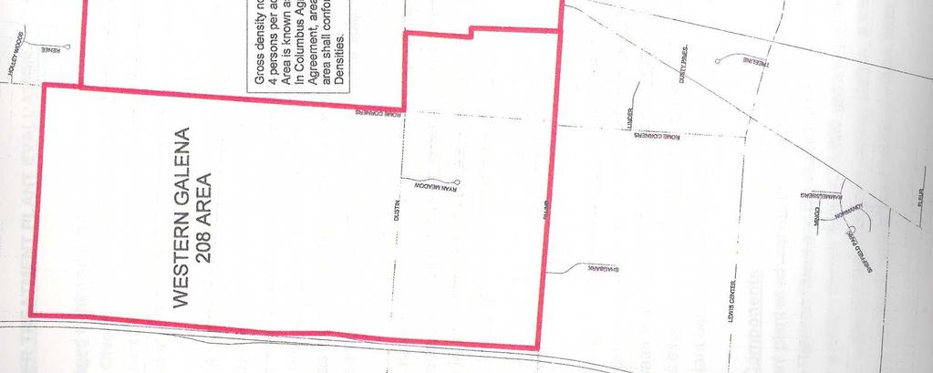
5 Buildings & Uses in all AWQMP Areas (Original, Western & Southern, but minus the Village) Category Number Residential (Single Family) 660 Residential (Duplex) 5 Residential (Rental Apartments) 1 Residential (Mobile Homes) 2 Commercial (Neighborhood/Reg. Shopping Center) 5 Commercial (Office) 2 Commercial (Other) 15 Industrial (Heavy) 4 Agriculture 29 Exempt, Utility 9 In the early 2000s, there was substantial development in Galena, especially in terms of residential development. According to December 2002 data from the Delaware County Auditor, there were 161 homes in Galena at that time. This was actually 29 more homes than counted in the 2000 Census. As shown previously, Galena now has 267 homes according to this same source. Nearly all new development on a local, county, state, and national level halted after the recession began in With economic improvements, development growth is expected to continue into the future with available developable land being consumed. It is estimated that this developable land is broken down as follows: Acres Developable Land in Galena 335 Developable Land in all AWQM Areas 2,780 Total Developable Area 2,383 In Delaware County s Sewer Master Plan Update 2005 and Galena s Area-wide Water Quality Management Plan, a sewer service agreement is in place with the City of Columbus. The agreement prescribes an overall gross density of four persons per acre (approximately 1.25 units per acre) for Drainage Area 2A as shown on Map 5-5. Master Plan of 2010 Page 5-5
6 Sunbury Rd Village of Galena Land Use Chapter 5 Map 5-1 S Galena Rd State Route 3 S Old 3C Hwy Alexander Rd H e a th e rm e r e D r State Route 3 N Walnut St Holmes St High St Harrison St Melimare Dr Joe Walker Rd Vans Valley Rd Hawking Dr Dustin Rd l le y R d V a n s Va Trenton Rd Dustin Rd W Columbus St Hoover Reservoir W Land Cover Village of Galena, Delaware County, Ohio N S E Feet Scale: 1" = 1,500' Prepared By Delaware County Regional Planning Commission ( ) Source: ODNR Data to 1997 Land Cover 1997 Transportations Residential: Farmsteads Residential: Single Family Residential: Multi Family Residential: Mobile Homes Commercial & Services Industrial Institutions Utilities Recreations Agricultural Transitional Water Wetlands Undeveloped Forest & Shrub Undeveloped: Quarries, Pits Undeveloped: Junkyards, Landfill Undeveloped: Urban Areas Master Plan of 2010 Page 5-6
7 Sunbury Rd Village of Galena Land Use Chapter 5 Map 5-2 S Galena Rd State Route 3 S Old 3C Hwy Alexander Rd H ea th e rm e r e D r State Route 3 N Walnut St Holmes St High St Harrison St Melimare Dr Joe Walker Rd Vans Valley Rd Trenton Rd Hawking Dr Dustin Rd l e y R d l V a n s Va Dustin Rd W Columbus St Hoover Reservoir W Existing Land Use Village of Galena, Delaware County, Ohio N S E Feet Scale: 1" = 1,500' Prepared By Delaware County Regional Planning Commission ( ) Source: Delaware County DALIS (Auditor designation) Village of Galena Road Centerlines Rivers/Lakes Ponds Streams Property Lines Existing Land Use 2009 Single Family Multi Family Commercial Industrial Institution Agricultural Agricultural Vacant Land Residential Vacant Land Commercial Vacant Land Industrial Vacant Land Park/Golf Courses/Open Space Rivers/Streams/Lakes/Ponds Road/Rail Right of Way Map 5-3 Master Plan of 2010 Page 5-7

8 Master Plan of 2010 Page 5-8


9 Map 5-4 Master Plan of 2010 Page 5-9

10 Map 5-5 Master Plan of 2010 Page 5-10
8Land Use. The Land Use Plan consists of the following elements:
 8Land Use 1. Introduction The Land Use Plan consists of the following elements: 1. Introduction 2. Existing Conditions 3. Opportunities for Redevelopment 4. Land Use Projections 5. Future Land Use Policies
Existing Land Use. Typical densities for single-family detached residential development in Cumberland County: 1
 Existing Land Use A description of existing land use in Cumberland County is fundamental to understanding the character of the County and its development related issues. Economic factors, development trends,
2018 RESIDENTIAL CAPACITY AND VACANT LAND ANALYSIS. Martin County Board of County Commissioners
 2018 RESIDENTIAL CAPACITY AND VACANT LAND ANALYSIS Martin County Board of County Commissioners Approved February 13, 2018 INTRODUCTION Objective 4.1D of the Martin County Comprehensive Growth Management
CASS COUNTY MASTER PLAN July 1, Appendix C LAND USE
 Appendix C LAND USE Introduction Existing land use and development patterns in Cass County are important considerations in the development of policies addressing future growth and land use. Existing land
Comprehensive Plan 2030
 Introduction Land use, both existing and future, is the central element of a Comprehensive Plan. Previous chapters have discussed: Projected population growth. The quality housing available in the Township
PLANNING FOR OUR FUTURE
 PLANNING FOR OUR FUTURE ELLSWORTH TOWNSHIP LAND USE AND POLICY PLAN The purpose of this Plan is to serve as a guide for the Township Trustees, Zoning Commission, Board of Zoning Appeals, developers, employers,
Metropolitan Planning Commission. DATE: April 5, 2016
 TO: FROM: Metropolitan Planning Commission MPC Staff DATE: April 5, 2016 SUBJECT: Petition of Nine Line Inc. Robert McCorkle, Agent PIN: 2-1034-01-002 380.5 Acres Aldermanic District: 5 (Shabazz) County
LAND USE. As such, the Township has estasblished the following statement of objectives for future development within its borders:
 LAND USE When creating a land use plan, a municipality should consider a process which firsts determines future population figures, whether growth or decline, and its targeted areas within the municipal
Chapter 2: Existing Land Use
 Chapter 2: Existing Land Use Existing Land Use An inventory of existing land use describes existing patterns of development. The inventory provides useful information to calculate the ultimate population
Planning Justification Report
 Planning Justification Report, Township of Puslinch FARHI HOLDINGS CORPORATION Updated January 27, 2017 Zelinka Priamo Ltd. Page i TABLE OF CONTENTS Page No. 1.0 1.1 1.2 1.3 2.0 2.1 2.2 2.3 2.4 2.5 3.0
4. facilitate the construction of streets, utilities and public services in a more economical and efficient manner;
 PVPC MODEL BYLAW BY-RIGHT CLUSTER ZONING BYLAW Prepared by Pioneer Valley Planning Commission Revised: October 2001 1.00 Development 1.01 Development Allowed By Right Development in accordance with this
MAP , MAP , and MAP
 MEMORANDUM CITY AND BOROUGH OF JUNEAU 155 S. Seward Street, Juneau, AK 99801 DATE: September 30, 2004 TO: FROM: FILE NO: Planning Commission Nathan Bishop, Planner Community Development Department MAP2004-00003,
Amendment to the Zoning and Subdivision Ordinances; Consider Repeal Cluster Development Standards
 2 Board of Supervisors Meg Bohmke, Chairman Gary F. Snellings, Vice Chairman Jack R. Cavalier Thomas C. Coen L. Mark Dudenhefer Wendy E. Maurer Cindy C. Shelton February 28, 2018 Thomas C. Foley County
COUNTY OF LINCOLN, NORTH CAROLINA
 COUNTY OF LINCOLN, NORTH CAROLINA 302 NORTH ACADEMY STREET, SUITE A, LINCOLNTON, NORTH CAROLINA 28092 PLANNING AND INSPECTIONS DEPARTMENT 704-736-8440 OFFICE 704-732-9010 FAX To: George Wood County Manager
Future Land Use Categories & Nodes December 23, Future Land Use Categories
 Future Land Use Categories & Nodes December 23, 2015 A note regarding nodes: Descriptions for nodes are located in the general recommendations handout. Node locations are set in part by the Auburn Interactive
Staff Report: Date: Applicant: Property Identification: Acreage of Request: Current Zoning of Requested Area: Requested Action: Attached:
 Staff Report: Completed by Jeff Palmer Director of Planning & Zoning Date: November 7, 2018 Applicant: Greg Smith, Oberer Land Developer agent for Ronald Montgomery ET AL Property Identification: Frontage
L. LAND USE. Page L-1
 L. LAND USE 1. Purpose This section discusses current and likely future land use patterns in Orland. An understanding of land use trends is very important in determining Orland's ability to absorb future
Village WASHINGTON TOWNSHIP MASTER PLAN SYNTHESIS. Page 197
 Village P l a n WASHINGTON TOWNSHIP MASTER PLAN SYNTHESIS Page 197 SECTION 11.0 MASTER PLAN SYNTHESIS INTRODUCTION The proposals presented in the various plans result in a graphic synthesis: The Land Use
Staff Report: Date: Applicant: Property Identification: Acreage of Request: Current Zoning of Requested Area: Requested Action: Attached:
 Staff Report: Completed by Jeff Palmer Director of Planning & Zoning Date: November 7, 2018, Updated November 20, 2018 Applicant: Greg Smith, Oberer Land Developer agent for Ronald Montgomery ET AL Property
A. Location. A MRD District may be permitted throughout the County provided it meets the standards established herein.
 752. Multi-Residential District (MRD) The Multi-Residential (MRD) District is intended to provide opportunities for rural, suburban and urban density mixed-residential developments consistent with the
ZONING CLASSIFICATION SUMMARY SHEET
 Growth and Resource Management Planning and Development Services 123 West Indiana Avenue Room 202 DeLand, Florida 32720-4253 Telephone (386) 943-7059 Fax (386) 626-6570 www.volusia.org ZONING CLASSIFICATION
Land Use. Existing Land Use
 8 Land Use 8.1 Land Use Chapter Purpose and Contents This element includes a brief summary of existing land use conditions and trends followed by a series of goals, objectives, and recommendations to guide
Mohave County General Plan
 63 64 65 66 67 68 69 70 71 The Land Use Diagram is not the County's zoning map. 13 It is a guide to future land use patterns. Zoning and area plan designations may be more restrictive than the land use
Special Use Permit - Planned Unit Development Checklist. Property Address:
 Special Use Permit - Planned Unit Development Checklist Special Use Permit Number. Parcel Code/s #28-11- - - Property Address: Applicant: ARTICLE VIII Ordinance Reference - Section 8.1.2 Permit Procedures:
410 Land Use Trends Comprehensive Plan Section 410
 411 410 Comprehensive Plan Section 410 In order to plan future land use, we must know how the land is used today. This section includes the following: Definition of analyzed land-use categories Summary
FINAL DRAFT 12/1/16, Rev. to 7/18/17
 FINAL DRAFT 12/1/16, Rev. to 7/18/17 (As Adopted 8/8/17 Effective 9/1/17) SHELTON PLANNING AND ZONING COMMISSION Proposed Amendments to Zoning Regulations I. Amend Section 23 PERMITTED USES by inserting
LAND USE Inventory and Analysis
 LAND USE Inventory and Analysis The land use section is one of the most important components of the comprehensive plan as it identifies the location and amount of land available and suitable for particular
CITY OF KELOWNA BYLAW NO
 SUMMARY: The Development Cost Charge Bylaw sets out the charges imposed for roads, water, sanitary sewer, drainage and public park when subdividing or constructing, altering or extending a building, pursuant
PC Staff Report 11/18/2013 Z Item No. 1-1
 Z-13-00401 Item No. 1-1 PLANNING COMMISSION REPORT Regular Agenda - Public Hearing Item PC Staff Report 11/18/2013 ITEM NO. 1: Z-13-00401 IG (General Industrial) District TO CS (Strip Commercial) District;
PLANNING COMMISSION REPORT Regular Agenda Public Hearing Item
 PC Staff Report 11/12/12 Item No. 2B- 1 PLANNING COMMISSION REPORT Regular Agenda Public Hearing Item ITEM NO. 2B: A TO GPI; 110 ACRES; E OF K-10 & N OF W 6 TH ST (MKM) : Consider a request to rezone approximately
Urban Land Use. Unit 4 GEO22F PB
 Urban Land Use Unit 4 GEO22F PB Important Concepts Land Value Land in Canada is either privately owned by individuals or organizations, or it belongs to the government (crown land). The value of land is
LEVY COUNTY VACANT LAND 01/01/2016
 LISTED at: MARKET VALUE- SUBMIT OFFER ARMEL REAL ESTATE, INC. 1101 MIRANDA LN. SUITE 131 KISSIMMEE, FL 34741 407-509-3812 1 Property Type: Vacant Land - Large Acreage Address: NW US HWY 19/98 & NW CR 347
Planning Department Oconee County, Georgia
 Planning Department Oconee County, Georgia STAFF REPORT REZONE CASE #: 6985 DATE: October 31, 2016 STAFF REPORT BY: Andrew C. Stern, Planner APPLICANT NAME: Williams & Associates, Land Planners PC PROPERTY
CHAPTER 50 LAND USE ZONES ARTICLE 50 BASIC PROVISIONS
 CHAPTER 50 LAND USE ZONES ARTICLE 50 BASIC PROVISIONS 50.010 - PURPOSE The purposes of this chapter are to establish land use zones required to implement the goals and policies of the Klamath County Comprehensive
Article XII. R-1 Agricultural-Low Density Residential District
 Article XII R-1 Agricultural-Low Density Residential District Section 1200. Declaration of Legislative Intent In expansion of the Declaration of Legislative Intent and Statement of Community Development
** If your lot does not meet the requirements above, please read Sec below
 Sec. 13-1-60 Zoning District Dimensional Requirements. For the Zoning Dept To Issue a Land Use Permit The Following Dimensions are Required. Minimum Side and Rear Yards s Lakes Classification Minimum Class
Town of. River Falls. Land Use Element Vierbicher Associates, Inc
 Town of River Falls 2005 Vierbicher Associates, Inc Contents Contents s. 66.1001(2)(h) Wis. Stats................................................. ii Introduction................................................................
Highland Green Estates Neighbourhood Area Structure Plan
 Highland Green Estates Neighbourhood Area Structure Plan Original Outline Plan approved by Council: March 10, 1997 Outline Plan amended by Council: March 24, 1997 Converted to a Neighbourhood Area Structure
LAND USE INTRODUCTION EXISTING CONDITIONS
 INTRODUCTION This chapter describes land use in the Lemon Creek area using maps and data that show designations of all properties by the 2013 Comprehensive Plan, zoning code, and locations of developed
STAFF REPORT. Permit History:
 STAFF REPORT Application: Request to rezone property from General Agriculture (AG) to Suburban Residential (a) (R-2a) Applicant: Perry Puncochar Agenda Item: 4(g) Background Information: Proposal: The
Comprehensive Plan 2030
 Introduction The purpose of this chapter of the Comprehensive Plan is to accurately describe, in words and images, the goals and visions for the future of Clearfield, as determined by the people who live
Jefferson County. Case RZ. Presenter: Alan Tiefenbach. Planning and Zoning Division
 Green Gables Official Development Plan Case 11-119319RZ Presenter: Alan Tiefenbach Proposal Rezone from Agricultural-Two (A-2) to Planned Development (PD) 225,000 square feet of commercial uses, including
Department of Planning & Development VILLAGE OF SOMERS REZONING PROCEDURES
 VILLAGE OF SOMERS Department of Planning & Development May 2015 VILLAGE OF SOMERS REZONING PROCEDURES 1. Contact the Kenosha County Department of Planning & Development and check with staff to determine
RC ; Reclassification The Garrison at Stafford Proffer Amendment (formerly Stafford Village Center)
") Board of Supervisors Robert Bob Thomas, Jr., Chairman Laura A. Sellers, Vice Chairman Meg Bohmke Jack R. Cavalier Wendy E. Maurer Paul V. Milde, III Gary F. Snellings Anthony J. Romanello, ICMA CM County
Board of Supervisors Robert Bob Thomas, Jr., Chairman Laura A. Sellers, Vice Chairman Meg Bohmke Jack R. Cavalier Wendy E. Maurer Paul V. Milde, III Gary F. Snellings Anthony J. Romanello, ICMA CM County
CITY OF PITT MEADOWS DEVELOPMENT COST CHARGE IMPOSITION
 Bylaw No. 2382 and amendments thereto CONSOLIDATED FOR CONVENIENCE ONLY This is a consolidation of the bylaws listed below. The amending bylaws have been consolidated with the original bylaws for convenience
STAFF REPORT. Permit Number: Unlimited. Kitsap County Board of Commissioners; Kitsap County Planning Commission
 STAFF REPORT Permit Number: 15 00550 Unlimited DATE: March 2, 2016 TO: FROM: Kitsap County Board of Commissioners; Kitsap County Planning Commission Katrina Knutson, AICP, Senior Planner, DCD and Jeff
REZONING APPLICATION INSTRUCTIONS
 REZONING APPLICATION INSTRUCTIONS All required information, as stated on the Rezoning Application Checklist, must be included to qualify as a complete application. Upon receipt, staff will review the application
YOUNG AMERICA TOWNSHIP Draft Policy Chapter
 YOUNG AMERICA TOWNSHIP Draft Policy Chapter Produced by CARVER COUNTY Planning and Water Management Department Government Center, Administration Building 600 East 4th Street, Chaska, MN 55318 TOWNSHIP
Article Floating Zone Requirements
 Division 5.1. In General Article 59-5. Floating Zone Requirements Section 5.1.1. Zone Categories There are 4 categories of Floating zones: A. Residential Floating zones (Division 5.2); B. Commercial/Residential
SHOHOLA TOWNSHIP PIKE COUNTY, PENNSYLVANIA
 SHOHOLA TOWNSHIP PIKE COUNTY, PENNSYLVANIA ORDINANCE NO. 56 AN ORDINANCE AMENDING THE SHOHOLA TOWNSHIP ZONING ORDINANCE OF 1999 TO: L ITEM 1 - ADD DEFINITIONS...1 L ITEM 2 - REVISE UPPER DELAWARE OVERLAY
FUTURE LAND USE. City of St. Augustine Comprehensive Plan EAR-Based Amendments
 FUTURE LAND USE City of St. Augustine Comprehensive Plan EAR-Based Amendments Future Land Use Element FLU Goal To create an environment within the City and adjacent areas in which its residents have the
ADMINISTRATORS REPORT - MAY 16, 2018.PDF
 1. Agenda Documents: COUNCIL AGENDA - MAY 16, 2018.PDF 2. Administrator's Report Documents: ADMINISTRATORS REPORT - MAY 16, 2018.PDF 3. Engineer's Report Documents: ENGINEERS REPORT - MAY 16, 2018.PDF
Land Use. Land Use Categories. Chart 5.1. Nepeuskun Existing Land Use Inventory. Overview
 Land Use State Comprehensive Planning Requirements for this Chapter A compilation of objectives, policies, goals, maps and programs to guide the future development and redevelopment of public and private
2016 CERTIFIED TOTALS CHW - Choctaw Water
 Property Count: 12,438 ARB Approved Totals 1/20/2017 12:09:29PM Land Homesite: 99,668,342 Non Homesite: 64,937,168 Ag Market: 381,361,089 Timber Market: 0 Total Land (+) 545,966,599 Improvement Homesite:
4. If any perennial surface water passes through or along the property lines of the acreage, a minimum of 200 feet or frontage should be required.
 b. Provide adequate acreage for appropriate productive use of rural residential land, such as small numbers of livestock, large gardens, etc. 3. Minimum of 200 feet of frontage on an improved county or
DIVISION 1 PURPOSE OF DISTRICTS
 ARTICLE 2 ZONING DISTRICTS AND MAP DIVISION 1 PURPOSE OF DISTRICTS Section 2.101 Zoning Districts. For the purpose of this Ordinance, the City of Richmond is hereby divided into districts as follows: DISTRICT
PLANNING COMMISSION REPORT Regular Agenda - Public Hearing Item
 Z-15-00469 Item No. 6A- 1 PLANNING COMMISSION REPORT Regular Agenda - Public Hearing Item PC Staff Report 11/16/15 ITEM NO. 6A GPI, RM12, & RS40 TO RM12; 14.756 ACRES; 5200 & 5300 CLINTON PKWY (SLD) Z-15-00469:
ALBEMARLE COUNTY CODE CHAPTER 18. ZONING SECTION 10. RURAL AREAS DISTRICT, RA
 CHAPTER 18. ZONING SECTION 10. RURAL AREAS DISTRICT, RA Sections: 10.1 Intent, where permitted. 10.2 Permitted uses. 10.2.1 By right. 10.2.2 By special use permit. 10.3 Application of regulations for development
2014 Plan of Conservation and Development. Development Plan & Policies
 The Town of Hebron Section 3 2014 Plan of Conservation and Development Development Plan & Policies C. Residential Districts I. Residential Land Analysis This section of the plan uses the land use and vacant
Understanding the Cost to Provide Community Services in the Town of Holland, La Crosse County, Wisconsin
 Understanding the Cost to Provide Community Services in the Town of Holland, La Crosse County, Wisconsin Rebecca Roberts Land Use Specialist Center for Land Use Education and Karl Green Community Development
WACONIA TOWNSHIP Draft Policy Chapter
 WACONIA TOWNSHIP Draft Policy Chapter Produced by CARVER COUNTY Planning and Water Management Department Government Center, Administration Building 600 East 4th Street, Chaska, MN 55318 TOWNSHIP OVERVIEW
Village of Galena ZONING AND PLANNING COMMISSION
 Village of Galena ZONING AND PLANNING COMMISSION MINUTES OF THE MEETING OF APRIL 17, 2013 The Zoning and Planning Commission of the Village of Galena met on Wednesday April 17, 2013 in the Council Chambers
Chapter 2 Land Use. State of Land Use
 Ch2 6/21/2016 1 Chapter 2 Land Use The responsibility of a municipality to manage and regulate land use is rooted in its need to protect the health, safety, and welfare of local citizens. Although only
City of Astoria Comprehensive Plan URBAN GROWTH
 URBAN GROWTH CP.110 CP.110. Background Summary. Astoria has a population of 9,477 (2010 US Census). The total land area within the Urban Growth Boundary (UGB) is 3,474.2 acres with total land area of 4,450
Gadsden County Planning Commission Agenda Report
 Gadsden County Planning Commission Agenda Report Date of Meeting: June 16, 2016 To: From: Subject: Honorable Chairperson and Members of the Planning Commission Allara Mills Gutcher, AICP, Planning & Community
Article 10. R-S Rural Single Family Residential District
 Article 10. R-S Rural Single Family Residential District Section 10.01 Purpose and Intent Section 10.02 Permitted Land Uses Section 10.03 Land Uses Permitted by Condition Section 10.04 Height, Yard, and
ARTICLE 15 - PLANNED UNIT DEVELOPMENT
 Section 15.1 - Intent. ARTICLE 15 - PLANNED UNIT DEVELOPMENT A PUD, or Planned Unit Development, is not a District per se, but rather a set of standards that may be applied to a development type. The Planned
LAND USE. General Plan Update Working Paper January In this Working Paper. Page
 General Plan Update Working Paper January 2008 In this Working Paper Page Introduction... LU-1 Distribution of Existing Land Uses... LU-1 Current General Plan Designations... LU-5 Westover Field Airport
Attachment A First Submittal JAZB Safety Zones A and B
 Attachment A First Submittal JAZB Safety Zones A and B Attachment B Second Submittal JAZB Safety Zones A and B Attachment C Flying Cloud Airport (FCM) Draft Airport Zoning Ordinance Social and Economic
REZONING STAFF REPORT Case: Jay Sikes, Mgr. of Planning Services Phone: (910) Fax: (910)
 Fax: (910)") REZONING Case: 15-67 Jay Sikes, Mgr. of Planning Services jsikes@harnett.org Phone: (910) 893-7525 Fax: (910) 814-8278 Planning Board: April 6, 2015 County Commissioners: April 20, 2015 Requesting a Rezoning
REZONING Case: 15-67 Jay Sikes, Mgr. of Planning Services jsikes@harnett.org Phone: (910) 893-7525 Fax: (910) 814-8278 Planning Board: April 6, 2015 County Commissioners: April 20, 2015 Requesting a Rezoning
Staff Report. Planning Commission Public Hearing: October 17, 2007 Staff Recommendation: Denial
 COUNTY OF PRINCE WILLIAM 5 County Complex Court, Prince William, Virginia 22192-9201 PLANNING (703) 792-6830 Metro 631-1703, Ext. 6830 FAX (703) 792-4401 OFFICE Internet www.pwcgov.org Stephen K. Griffin,
Rule 80. Preservation of Primary Agricultural Soils Revised and approved by the Land Use Panel during its public meeting on January 31, 2006.
 Rule 80. Preservation of Primary Agricultural Soils Revised and approved by the Land Use Panel during its public meeting on January 31, 2006. (A) Purpose. In accordance with 10 V.S.A. Sections 6025(b)
ARTICLE V AGRICULTURAL PRESERVATION AND RURAL RESIDENTIAL DISTRICT
 ARTICLE V AP AGRICULTURAL PRESERVATION AND RURAL RESIDENTIAL DISTRICT Section 500. PURPOSE It is the purpose of the AP, Agricultural Preservation and Rural Residential District, to foster the preservation
Residential Project Convenience Facilities
 Standards for Specific Land Uses 35.42.220 E. Findings. The review authority shall approve a Land Use Permit in compliance with Subsection 35.82.110.E (Findings required for approval) or a Conditional
MPC STAFF REPORT REZONING MAP AMENDMENT ALDERMANIC DISTRICT 1 COUNTY COMMISSION DISTRICT 5 April 3, 2013 MPC FILE NUMBER.
 MPC STAFF REPORT REZONING MAP AMENDMENT ALDERMANIC DISTRICT 1 COUNTY COMMISSION DISTRICT 5 April 3, 2013 MPC FILE NUMBER. 13-000929-ZA REZONING SUMMARY Report Status Initial Report Petitioner/Property
ARTICLE B ZONING DISTRICTS
 ARTICLE B ZONING DISTRICTS Sec. 8-3021 Established. In order to protect the character of existing neighborhoods; to prevent excessive density of population in areas which are not adequately served with
Planning Commission Preliminary Plan Hidden Lakes Estates Medina Township EXECUTIVE SUMMARY
 Planning Commission Preliminary Plan Hidden Lakes Estates Medina Township Meeting: January 2, 2019 App. No.: 105-2018-PP Applicant: Hidden Lake Medina, LLC Engineer: Cunningham & Associates, LLC Parcel
CITY OF DURHAM DURHAM COUNTY NORTH CAROLINA. Zoning Map Change Report. RR Existing Zoning. Rural Rural Density Residential Site Characteristics
 CITY OF DURHAM DURHAM COUNTY NORTH CAROLINA Zoning Map Change Report Meeting Date: February 26, 2007 Reference Name Arrowhead () Jurisdiction County Proposed Zoning RR Existing Zoning RS-20 Request Proposed
City of Peachtree City. Annexation Review Process
 City of Peachtree City Annexation Review Process Page 1 Annexation Review Process Step One: Initial annexation information The following information is to be completed by the property owner and/ or their
PLANNED RESIDENTIAL DEVELOPMENT (PRD)
") PLANNED RESIDENTIAL DEVELOPMENT SECTION 10. PLANNED RESIDENTIAL DEVELOPMENT (PRD) 10.1 Purpose Planned Residential Development allows by special permit from the Board an alternative pattern of residential
PLANNED RESIDENTIAL DEVELOPMENT SECTION 10. PLANNED RESIDENTIAL DEVELOPMENT (PRD) 10.1 Purpose Planned Residential Development allows by special permit from the Board an alternative pattern of residential
LAND USE PLANNING. General Discussion. Objectives
 GOAL 2: LAND USE PLANNING General Discussion To establish a land use planning process for the County as a basis for all decisions and actions related to use of land and to ensure an adequate factual base
Article Optional Method Requirements
 Article 59-6. Optional Method Requirements [DIV. 6.1. MPDU DEVELOPMENT IN RURAL RESIDENTIAL AND RESIDENTIAL ZONES Sec. 6.1.1. General Requirements... 6 2 Sec. 6.1.2. General Site and Building Type Mix...
ARTICLE 3: Zone Districts
 ARTICLE 3: Zone Districts... 3-1 17.3.1: General...3-1 17.3.1.1: Purpose and Intent... 3-1 17.3.2: Districts and Maps...3-1 17.3.2.1: Applicability... 3-1 17.3.2.2: Creation of Districts... 3-1 17.3.2.3:
301. Zoning Districts. C-D A-1 R-1 R-V B-1 I-1
 301. Zoning Districts. The Township is divided into the districts set forth by this chapter and as shown by the district boundaries on the Official Zoning District Map. The zoning districts are: C-D Conservation
Metro Vancouver's 2011 Generalized Land Use by Municipality (Net Land Area - excluding dedicated road right-of-way and water bodies)
") METRO VANCOUVER Land Percent Share Land Use Category Area (ha) of METRO Total Agriculture 48,822 17.1% Airport/Airstrip 1,577 0.6% Cemetery 292 0.1% Commercial 2,980 1.0% Harvesting and Research 8,630
METRO VANCOUVER Land Percent Share Land Use Category Area (ha) of METRO Total Agriculture 48,822 17.1% Airport/Airstrip 1,577 0.6% Cemetery 292 0.1% Commercial 2,980 1.0% Harvesting and Research 8,630
DATE: October 22, 2008 FILE NO.: H
 REFERRAL Development Services Department Agricultural Land Commission Application DATE: October 22, 2008 FILE NO.: H-08-01133.000 FROM: RE: E. Riechert, Planner Referral from Regional District Okanagan-Similkameen
LAND USE. Doubling Land Use Survey Montgomery County, Pennsylvania. Montgomery County Data: Major Growth Trends between
 Montgomery County Data: LAND USE 2015 Land Use Survey Montgomery County, Pennsylvania Doubling of area of all residential categories combined between 1970 and 2015. Every five years the Montgomery County
Official Community Plan (OCP) LAND USE HANDBOOK
 LAND USE HANDBOOK") Official Community Plan (OCP) LAND USE HANDBOOK APRIL 2018 1 Land use designations are one of the key implementation tools for achieving the growth strategy and managing development in the city. They establish
Official Community Plan (OCP) LAND USE HANDBOOK APRIL 2018 1 Land use designations are one of the key implementation tools for achieving the growth strategy and managing development in the city. They establish
NYC Land Acquisition Town Level Assessment 2017
 NYC Land Acquisition Town Level Assessment 2017 Delaware County Evaluation and Response Delaware County assessment of the NYC Land Acquisition Program and how potential future LAP acquisitions affect the
Comprehensive Plan 2015 to 2030 STATE OF LAND USE
 Chapter 2 Land Use The responsibility of a municipality to manage and regulate land use is rooted in its need to protect the health, safety, and welfare of local citizens. Although only acting as one section
PAPRlamird4-Lairds Corner
 PAPRlamird4-Lairds Corner Lamird Report This report provides the written record of local circumstances that explains how the Lairds Corner LAMIRD ( this lamird ) fits within the rural element goals of
Urban Planning and Land Use
 Urban Planning and Land Use 701 North 7 th Street, Room 423 Phone: (913) 573-5750 Kansas City, Kansas 66101 Fax: (913) 573-5796 Email: planninginfo@wycokck.org www.wycokck.org/planning To: From: City Planning
HOOD RIVER COUNTY EXCEPTIONS DOCUMENT. (Amended 12/17/84)
") HOOD RIVER COUNTY EXCEPTIONS DOCUMENT 1984 (Amended 12/17/84) COUNTY EXCEPTIONS DOCUMENT The Hood River County Comprehensive Land Use Plan is the basic instrument used for County land use planning. It
HOOD RIVER COUNTY EXCEPTIONS DOCUMENT 1984 (Amended 12/17/84) COUNTY EXCEPTIONS DOCUMENT The Hood River County Comprehensive Land Use Plan is the basic instrument used for County land use planning. It
2. Second dwellings and medical hardships per Article 10.
 Article 7: Zoning Districts and Zoning Map Section 135: NON-URBAN ZONING DISTRICT (NU) A. Purpose The intent of this district is to allow agricultural, recreational, wildlife, forestry, open space, farming
ARTICLE 1 Development Code Applicability
 CITY OF GRASS VALLEY MUNICIPAL CODE - TITLE 17 - DEVELOPMENT CODE ARTICLE 1 Development Code Applicability Chapter 17.10 - Purpose and Applicability of Development Code... 1-3 17.10.010 - Purposes of the
CITY OF SANTA ROSA COMMUNITY DEVELOPMENT DEPARTMENT STAFF REPORT FOR PLANNING COMMISSION SEPTEMBER 10, 2015 APPLICANT FILE NUMBER MJP
 ITEM NO. 9 CITY OF SANTA ROSA COMMUNITY DEVELOPMENT DEPARTMENT STAFF REPORT FOR PLANNING COMMISSION SEPTEMBER 10, 2015 PROJECT TITLE Yogurt Time Center ADDRESS/LOCATION 3093 Marlow Road ASSESSOR S PARCEL
a. It is the intent of these regulations to encourage the preservation of natural resources and facilitate orderly growth in the County.
 Part V Transfer of Development Rights Section 246. 1. Intent a. It is the intent of these regulations to encourage the preservation of natural resources and facilitate orderly growth in the County. b.
Title 6 - Local Government Provisions Applicable to Special Purpose Districts and Other Political Subdivisions
 Title 6 - Local Government Provisions Applicable to Special Purpose Districts and Other Political Subdivisions CHAPTER 29. SOUTH CAROLINA LOCAL GOVERNMENT COMPREHENSIVE PLANNING ENABLING ACT OF 1994 1994
Planning Commission Application Summary
 Planning Commission Application Summary Project Name: Creekside Estates Zone Change and Land Use Amendment Address: 571 West 11400 South Current Zoning: RA1 Hearing Date: July 14, 2016 Summary of Request
FOR SALE Land /- Acres Potential Cannabis Cultivation Opportunity $4,500,000
 FOR SALE Land - 20.04+/- Acres Potential Cannabis Cultivation Opportunity $4,500,000 27821 Dutcher Creek Rd. Cloverdale, CA 95425 Broker: William M. Severi, CCIM, CPM BRE No.: 01000344 Cell Phone: 707-291-2722