MULTIFAMILY PAST, PRESENT AND FUTURE RESEARCH. City of Phoenix Water Services Department
|
|
|
- Derick Simpson
- 6 years ago
- Views:
Transcription

1 MULTIFAMILY PAST, PRESENT AND FUTURE RESEARCH City of Phoenix Water Services Department
2 Overview 1. Background 2. Research a. Past b. Present c. Future
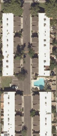


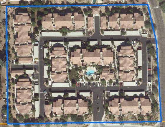
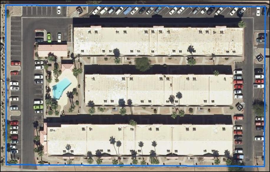
3 Multifamily Developments
4 Multifamily Unit Size 3,000 Recent (Post 1998) City of Phoenix Multifamily Developments By Average Size of Units in Square Feet 2,500 2,000 1,500 Traditional Multifamily Size 1,
5 Multifamily Fixtures 30 Recent (Post 1998) City of Phoenix Multifamily Developments By Average Number of Fixture Units Expected Single Family Count Old Expected MF Count
 Retirement")
 Brookedale Central Senior Living")
6 Potential Multifamily Subsectors ICI sectors have similar end use characteristics Hospitality (extended stay) Retirement Communities Timeshare Dormitories Correctional Facilities Mixed-use (residential/retail) Brookedale Central Senior Living Extended Stay America
7 Previous Research 2008 Hazen and Sawyer Demand management plan update Goals: Begin to disaggregate sector Characterize presence and efficiency of end uses quantify curtailment potential Method: mail survey Site level data Water use matched to properties using address and customer characteristics Attempted to match landscape meters to properties 2014 BBC/Keen ICI Phoenix research initiative Goal: Assessing structural changes in demand property characteristics Method: GIS Water use spatially join to parcel Enhanced data with Hazen and Sawyer site level data

8 BBC/Keen Estimating Indoor Use Indoor Use = g/u/d Majority of water use indoor Major indoor uses Toilets, showers, faucets Clothes washers In-unit laundry, common area, no laundry facilities


9 BBC/Keen Estimating Outdoor Use Outdoor use = g/u/d, less than ¼ total use 125 developments (98% had irrigable landscape, 78% at least one pool Lower water use than single family shared common area Not all properties have dedicated irrigation meters Variation of landscape types within and among developments


10 Developed landscape categories based on City s single family landscape classification Source: BBC/Keen Independent Multifamily Report
11 Gallons per unit per day BBC/Keen Overall Trends 300 Average water use for sample properties, Year Source: Keen Independent Calculations
12 Current Research Multifamily Inventory Creating a more expansive multifamily inventory (5+ unit developments) Data Acquisition Multiple sources Maricopa County Database COP water consumption COP water meter shapefile Maricopa County Parcel shapefile Using aerial imagery to identify pools and cooling towers Data Complexity Multiple sources different structures and formats Association between parcels, water meters and multifamily developments
 similar")
13 Inventory Creation Data Complexity One to one relationship (meter to parcel/development) similar single family

14 Inventory Creation Data Complexity Many to one relationship (meter to parcel/development)

15 Inventory Creation Data Complexity Many to many relationship (meter to parcel)
16 Current Research Overcoming Data Obstacles Identifying and correcting the locations of incorrectly placed water meters in GIS Layer Applying spatial analysis to more accurately associate multifamily developments with water meters and property characteristics Creating multifamily developments from Maricopa County parcel shapefile Spatial selection of all water meters which fall into multifamily development polygons
17 Inventory Database 1348 multifamily development polygons (5+ unit complexes) Database includes: Building characteristics Water consumption data Unit counts for each multifamily development Presence of pools (using GIS/assessor data) Presence of cooling towers (using GIS) Total Number Polygons (PUC ) Total Number Parcels Unit Count Water Meter Count Properties (Polygons) 1,348 1, ,683 4,319
18 Number of Apartment Complexes Top-down Data Analysis 400 Multifamily Developments (5+ units) by Build Year Build Year
19 Number of Apartment Complexes Top-down Data Analysis Distribution of Multifamily Developments (5+ units) by unit count Units
20 Gallons Per Day/Unit Water Use Trend Comparison Water Use for Multifamily Development (5+ units) City of Phoenix BBC/Keen (sample) Year
21 Future Research Include site specific data for bottom-up analysis Site visits/audits occupancy rates, number of residents, types of fixtures, amenities (pools, laundry, etc.) Datalogging Differentiate fixture types landscape characteristics landscape classification Imagery analysis/coding system Expand inventory for multifamily subsectors Refine water demand forecasts


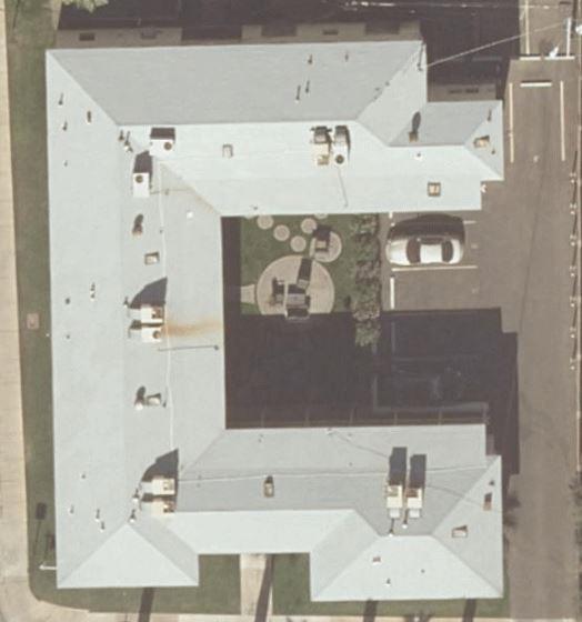
22 Landscape Variation of landscape within multifamily developments


23 Projected End Uses and Average Use
24 MULTIFAMILY Past, Present and Future Research Jamie Campbell City of Phoenix Water Services Department
Water Use in the Multi family Housing Sector. Jack C. Kiefer, Ph.D. Lisa R. Krentz
 Water Use in the Multi family Housing Sector Jack C. Kiefer, Ph.D. Lisa R. Krentz Presentation Overview Background on WRF 4554 Data sources Water use comparisons Examples of modeling variability in water
2.2 Future Demand Projection Methodology
 SECTION 2 Water Demands Water demands were developed for existing and future conditions based on parcel-level land use information and water meter billing data. CH2M HILL worked extensively with Town of
Return on Investment Model
 THOMAS JEFFERSON PLANNING DISTRICT COMMISSION Return on Investment Model Last Updated 7/11/2013 The Thomas Jefferson Planning District Commission developed a Return on Investment model that calculates
Relationship Between Building Permits, Housing Starts, and Housing Completions
 Relationship Between Building Permits, Housing Starts, and Housing Completions We are frequently asked why the building permits, housing starts, and housing completions series do not match over time, both
METROPOLITAN NORTH GEORGIA WATER PLANNING DISTRICT CONSERVATION PRICING GUIDANCE JANUARY 2014
 INTRODUCTION METROPOLITAN NORTH GEORGIA WATER PLANNING DISTRICT CONSERVATION PRICING GUIDANCE JANUARY 2014 All water systems in the Metropolitan North Georgia Water Planning District (Metro Water District)
Employing a GIS-based Approach to Developing. Student Generation Rates
 Employing a GIS-based Approach to Developing Presented by: Elisabeth Schuck, AICP Tindale-Oliver & Associates, Inc. Overview of Presentation 1 2 3 Demand Component Overview Traditional SGR Approach GIS
2018 Assessment Roll Edit Guide for Parcel-Level Geographical Information System (GIS) Information
 Information") 2018 Assessment Roll Edit Guide for Parcel-Level Geographical Information System (GIS) Information Florida Department of Revenue Property Tax Oversight January 2, 2018 Intended Users This edit guide is
2018 Assessment Roll Edit Guide for Parcel-Level Geographical Information System (GIS) Information Florida Department of Revenue Property Tax Oversight January 2, 2018 Intended Users This edit guide is
Residential Building Stock Assessment (RBSA)for Multi-Family Housing
for Multi-Family Housing") Residential Building Stock Assessment (RBSA)for Multi-Family Housing Tom Eckman & Massoud Jourabchi September 10, 2013 1 The Chances of Making A Better Decision Increase With Accurate Data Council s load
Residential Building Stock Assessment (RBSA)for Multi-Family Housing Tom Eckman & Massoud Jourabchi September 10, 2013 1 The Chances of Making A Better Decision Increase With Accurate Data Council s load
Customer Classifications and Allocation Policies
 City of San Juan Capistrano Customer Classifications and Allocation Policies Effective July 1, 2014 Overview: How the City Calculates Monthly Allocations Residential Lot Size and House Size For all single
ANALYSIS OF WATER USE PATTERNS IN MULTI- FAMILY RESIDENCES FINAL REPORT
 ANALYSIS OF WATER USE PATTERNS IN MULTI- FAMILY RESIDENCES FINAL REPORT OCTOBER 2008 Prepared for; Irvine Ranch Water District 15600 Sand Canyon Ave PO Box 57000 Irvine, CA 92619-7000 Prepared by: William
South Park County Sanitation District
 For accessibility assistance with this document, please contact Sonoma County Water Agency Community and Government Affairs department at (707)526-5370, Fax to (707)544-6123 or through the California Relay
Advancing Methodology on Measuring Asset Ownership from a Gender Perspective
 Advancing Methodology on Measuring Asset Ownership from a Gender Perspective Workshop on the Production of Statistics on Asset Ownership from a Gender Perspective through Household Surveys Tbilisi, Georgia,
MULTIFAMILY PROPERTY MANAGERS
 Suite TM MULTIFAMILY PROPERTY MANAGERS Move Your Business Forward REAL-TIME INFORMATION TO OPTIMIZE YOUR RENTS AND OCCUPANCIES 3,000 multifamily owners and property management firms use CoStar because
A Brief Overview of H-GAC s Regional Growth Forecast Methodology
 A Brief Overview of H-GAC s Regional Growth Forecast Methodology -Houston-Galveston Area Council Email: forecast@h-gac.com Data updated; November 8, 2017 Introduction H-GAC releases an updated forecast
New Models for Property Data Verification and Valuation
 New Models for Property Data Verification and Valuation for 2006 IAAO Councils and Sections Joint Seminar May 9-11, 2006 Charleston, South Carolina Presented by George Donatello, CMS Principal Consultant
Future Land Use Allocation Model (FLUAM) Methodology
 Methodology") Future Land Use Allocation Model (FLUAM) Methodology For: Lake/Sumter MPO By: Data Transfer Solutions (DTS) 3680 Avalon Park Blvd E, Suite 200 Orlando, FL 32828 Phone: 407-382 382-5222 Fax: 407-382 382-5420
Future Land Use Allocation Model (FLUAM) Methodology For: Lake/Sumter MPO By: Data Transfer Solutions (DTS) 3680 Avalon Park Blvd E, Suite 200 Orlando, FL 32828 Phone: 407-382 382-5222 Fax: 407-382 382-5420
Town of North Topsail Beach
 Town of North Topsail Beach Build-Out and Non-Conforming Lot Study In Coordination with The Eastern Carolina Council of Governments February 2010 Introduction The Town of North Topsail Beach has conducted
Presented by: Stewart Information International, Inc. Jack McKenna
 Presented by: Stewart Information International, Inc. Jack McKenna Held at the: 2007 ESRI Survey & Engineering GIS Summit San Diego Convention Center San Diego, California June 16-19, 2007 Integrating
SQUAW VALLEY PUBLIC SERVICE DISTRICT
 EXHIBIT # F-3 15 pages SQUAW VALLEY PUBLIC SERVICE DISTRICT Financial Projections The Village at Squaw Project DATE: September 30, 2014 TO: FROM: SUBJECT: District Board Members Tom Campbell, Finance /
October 1, 2011 thru December 31, 2011 Performance Report
 Grantee: State of Illinois Grant: B-11-DN-17-0001 October 1, 2011 thru December 31, 2011 Performance Report 1 Grant Number: B-11-DN-17-0001 Grantee Name: State of Illinois Grant Amount: Estimated PI/RL
Asset valuation. Advancing Methodology on Measuring Asset Ownership from a Gender Perspective
 Advancing Methodology on Measuring Asset Ownership from a Gender Perspective Asset valuation Workshop on the Production of Statistics on Asset Ownership from a Gender Perspective through Household Surveys
Updated - A Report on the County of Arlington s Existing and Possible Urban Tree Canopy
 Updated - A Report on the County of Arlington s Existing and Possible Urban Tree Canopy Key Terms UTC: Urban tree canopy (UTC) is the layer of leaves, branches, and stems of trees that cover the ground
July 1, 2018 thru September 30, 2018 Performance Report
 Grantee: Grant: Illinois B-11-DN-17-0001 July 1, 2018 thru September 30, 2018 Performance Report 1 Grant Number: B-11-DN-17-0001 Grantee Name: Illinois Grant Award Amount: $5,000,000.00 LOCCS Authorized
MAJESTIC PALMS 1920 N 32ND ST PHOENIX, AZ Danny Lee Vice President Investment Advisor
 MAJESTIC PALMS 1920 N 32ND ST PHOENIX, AZ 85008 Danny Lee Vice President Investment Advisor 480.425.5522 danny.lee@svn.com Property Summary OFFERING SUMMARY Sale Price: Number Of Units: Proforma Cap Rate:
2019 DC Study External Stakeholder Committee Minutes
 Date / Time: October 10 th, 2017 1:30pm 3:30pm Location: Committee Room #1, 2 nd Floor City Hall 2019 DC Study External Stakeholder Committee Minutes Attended: George Kotsifas (Chair), Lois Langdon, Sandy
2458 E Ivy St, Mesa, AZ 85213
 U S M R e a l 390 - R o a d B ( 4, 615 - SELLER'S REPORT P r e s e n t e d b y Richard Park REALTOR Arizona Real Estate License: SA027366000 W o rk : ( 602 ) 5384 F a x : R i c k @ R i c h a rd P a rk
HOLLEY NAVARRE WATER SYSTEM, INC. IMPACT FEE POLICIES, PROCEDURES & CALCULATIONS
 HOLLEY NAVARRE WATER SYSTEM, INC. IMPACT FEE POLICIES, PROCEDURES & CALCULATIONS EFFECTIVE: AUGUST 4, 2017 REVISED: NOVEMBER 9, 2017 8574 Turkey Bluff Road, Navarre, FL 32566 Phone: (850) 939 2427 Fax:
Assessing Affordable Housing Need A Practical Toolkit. Jenni Easton, AICP Nick Fedorek
 Assessing Affordable Housing Need A Practical Toolkit Jenni Easton, AICP Nick Fedorek Research questions: What should communities know about their housing markets? What can various types of analysis tell
Rental Housing Finance Survey* *and a few observations about gubment data. Rich Levy US Census Bureau Washington, DC April 2014
 Rental Housing Finance Survey* *and a few observations about gubment data Rich Levy US Census Bureau Washington, DC April 2014 1 Gubment CYB The views expressed here do not necessarily reflect those of
RIM Spatial Data. Subhead for title slide
 RIM Spatial Data Subhead for title slide 1. GIS Data & Map Products 2. Spatial Data Accuracy Limitations 3. Application Phase: Map and Shapefile 4. More on Boundary Creation Considerations GIS Data & Map
Nonresidential construction activity in the Twin Cities region was robust in 2013
 1 Recent Nonresidential Construction Activity in the Twin Cities Region March 2015 Key Findings After bottoming out in 2010, nonresidential construction activity in the Twin Cities region is once again
Additional Guidance for Residential Properties
 Additional Guidance for Residential Properties This document provides additional details on how to benchmark residential properties in ENERGY STAR Portfolio Manager and includes information about the specific
WRF Webcast. Water Use in the Multi-family Housing Sector
 WRF Webcast Water Use in the Multi-family Housing Sector February 1, 2018 No part of this presentation may be copied, reproduced, or otherwise utilized without permission. Webcast Agenda Introductions
Chesapeake Bay Program Indicator Analysis and Methods Document Protected Lands Updated September 2016 (Data current through 2015_16)
") 1 Chesapeake Bay Program Indicator Analysis and Methods Document Protected Lands Updated September 2016 (Data current through 2015_16) Indicator Title: Protected Lands Relevant Outcome(s): Protected Lands
1 Chesapeake Bay Program Indicator Analysis and Methods Document Protected Lands Updated September 2016 (Data current through 2015_16) Indicator Title: Protected Lands Relevant Outcome(s): Protected Lands
The New Technology of a Survey Data Model and Cadastral Fabric as the Foundation for a Future Land Administration System.
 The New Technology of a Survey Data Model and Cadastral Fabric as the Foundation for a Future Land Ian HARPER, Australia Key words: cadastral modelling, survey data model, Survey Accuracy, Cadastre 2014
STATE UNIVERSITY of NEW YORK PROJECT CAPITALIZATION FORM (PCF) INSTRUCTIONS
 INSTRUCTIONS") The Project Capitalization Form should be used for all capital projects on State University (SUNY) capital assets where design and construction costs are $100,000 or greater, and for all building and land
The Project Capitalization Form should be used for all capital projects on State University (SUNY) capital assets where design and construction costs are $100,000 or greater, and for all building and land
CHAPTER 2 VACANT AND REDEVELOPABLE LAND INVENTORY
 CHAPTER 2 VACANT AND REDEVELOPABLE LAND INVENTORY CHAPTER 2: VACANT AND REDEVELOPABLE LAND INVENTORY INTRODUCTION One of the initial tasks of the Regional Land Use Study was to evaluate whether there is
WATERFIX STRATA PROVIDES SAVINGS FOR CUSTOMERS IN HI-RISE TOWERS
 WATERFIX STRATA PROVIDES SAVINGS FOR CUSTOMERS IN HI-RISE TOWERS Andre Boerema Sydney Water, Sydney, NSW, Australia KEYWORDS Water Efficiency, leak repairs, cost savings, hi-rise, performance contracting,
Land Details. Bridging the Gap between Assessor Acres and GIS Acres
 Land Details Bridging the Gap between Assessor Acres and GIS Acres What are Assessor Acres? It is a legally agreed upon approximation of size Applies to larger parcels Has deep historical roots. Thomas
5. PROPERTY VALUES. In this section, we focus on the economic impact that AMDimpaired
 5. PROPERTY VALUES In this section, we focus on the economic impact that AMDimpaired streams have on residential property prices. AMD lends itself particularly well to property value analysis because its
General Market Analysis and Highest & Best Use. Learning Objectives
 General Market Analysis and Highest & Best Use Learning Objectives Module & Title Module 1 Real Estate Markets and Analysis Module 2 Types and Levels of Market Analysis Module 3 The Six-Step Process and
Economic Development Action Plan
 Economic Development Action Plan Summary of Vision Profiles Waterfront City Center Entertainment Cultural High Density Comparable Vision Concepts Miami Beach North Beach 1-10 stories (along Collins Ave)
Using Geographical Information Systems to Enhance Public Finance Analyses
 Using Geographical Information Systems to Enhance Public Finance Analyses Presented by: Bob Wallace, P.E., AICP November 5, 2009 Presentation Overview 1 2 3 4 Introduction 2008 Recap New Application: GIS
Suite TM SERVICE PROVIDERS. Move Your Business Forward
 Suite TM SERVICE PROVIDERS Move Your Business Forward ALL THE TOOLS YOU NEED TO ACCESS THE COMMERCIAL REAL ESTATE WORLD Nearly 5,000 service providers choose CoStar because, as the industry s largest research
TROUBLESHOOTING YOUR CAMA DATA WITH GIS
 Chad Rupert Office of Information Technology Outreach Services (ITOS) University of Georgia Athens, GA 30602-5418 Ph: 706-542-5308 Email: rupert@itos.uga.edu Jimmy Nolan Office of Information Technology
A Review and Perspective on Parcel Data Models for Urban Planning
 A Review and Perspective on Parcel Data Models for Urban Planning Yiqiang Ouyang Prof. Dr. Ilir Bejleri Department of Urban and Regional Planning University of Florida June 19-21, 2010 1 Content 1. Introduction
Water and Wastewater Submetering Addendum SAMPLE
 Water and Wastewater Submetering Addendum Date of Lease: (when the lease is filled out) 1. Addendum. This is an addendum to the TAA Lease Contract for Apt. No. in the Apartments in OR the house, duplex,
City of Bellingham Urban Growth Area - Land Supply Analysis Summary
 City of Bellingham Urban Growth Area - Land Supply Analysis Summary Population & Employment Growth Forecasts APPENDIX D, ATTACHMENT 3 The ECONorthwest Whatcom County Population & Economic Forecasts report
Economic Effects of the New Housing Industry in the Sacramento Region
 Economic Effects of the New Housing Industry in the Sacramento Region 2016 RESEARCH REPORT, KEY FINDINGS BACKGROUND This Research Study, conducted by New Economics & Advisory, evaluates the impacts of
Appendix A2 Methodology for Estimating Employment Capacity in MD NCSGRE Aug 2012 Page 1
 Appendix A2 Methodology for Estimating Employment Capacity in MD NCSGRE Aug 2012 Page 1 Preinkert Field House College Park, Maryland 20742 P: 301.405.6283 F: 301.314.5639 http://www.smartgrowth.umd.edu
Existing Land Use. Typical densities for single-family detached residential development in Cumberland County: 1
 Existing Land Use A description of existing land use in Cumberland County is fundamental to understanding the character of the County and its development related issues. Economic factors, development trends,
DUCHARME PROPERTY REVENUE, BULK DATA & ASSET REGISTER SUPPORT ARE YOUR PROPERTY & REVENUE DATA COMPLETE AND ACCURATE?
 DUCHARME PROPERTY REVENUE, BULK DATA & ASSET REGISTER SUPPORT ARE YOUR PROPERTY & REVENUE DATA COMPLETE AND ACCURATE? Ducharme provides specialist public sector support and training in financial management,
Development and Updates of Protected Lands Databases in the US (PAD-US, NCED, CARL)
") Development and Updates of Protected Lands Databases in the US (PAD-US, NCED, CARL) Robb Macleod, National GIS Coordinator at Ducks Unlimited rmacleod@ducks.org 734-623-2004 Overview 1. What is the NCED,
Development and Updates of Protected Lands Databases in the US (PAD-US, NCED, CARL) Robb Macleod, National GIS Coordinator at Ducks Unlimited rmacleod@ducks.org 734-623-2004 Overview 1. What is the NCED,
Trend (span) Last 4-6 Months (3-month period)
 Last 4-6 Months (3-month period)") Local Market Conditions: Summary The Local Market Conditions tables summarize trends and statistics in the local market: the area around the subject property that was searched for comps in the Sales Comparison
Local Market Conditions: Summary The Local Market Conditions tables summarize trends and statistics in the local market: the area around the subject property that was searched for comps in the Sales Comparison
RULE 24 - CALCULATION OF WATER USE CAPACITY AND CAPACITY FEES A. RESIDENTIAL CALCULATION OF WATER USE CAPACITY
 RULE 24 - CALCULATION OF WATER USE CAPACITY AND CAPACITY FEES A. RESIDENTIAL CALCULATION OF WATER USE CAPACITY Residential Water Use Capacity shall be calculated using a fixture unit methodology whereby
(340) (866)
 (866)") JOY STANLEY Island Dreams Real Estate Broker - Owner, CRS, ABR, RSPS JULY 2015 Dear Friends, Email: IslandDreamsVI@Gmail.Com (340) 998-9651 (866) 669-0933 Hope you have a wonderful July 4th as we celebrate
JOY STANLEY Island Dreams Real Estate Broker - Owner, CRS, ABR, RSPS JULY 2015 Dear Friends, Email: IslandDreamsVI@Gmail.Com (340) 998-9651 (866) 669-0933 Hope you have a wonderful July 4th as we celebrate
Table 4b-1. City of Bremerton Building Permits CITY OF BREMERTON: NEW UNITS Type
 City of Bremerton Growth from 2006-2012 OFM City of Bremerton Population Estimate Highlights The City of Bremerton had a 2006 population of 36,202 The City of Bremerton had a 2012 population of 39,650
Mississauga Residential Multiple Unit Directory
 Dec 2010 Mississauga Residential Multiple Unit Directory December 2010 Introduction The Mississauga Residential Multiple Unit Directory, December 2010, includes information on development that is built,
Barry Farm Phase 1 Design Workshop Excel Academy Public Charter School June 20, 2017
 Phase 1 Design Workshop Excel Academy Public Charter School June 20, 2017 Design Team Fitness Center Planning & Design Workshop Meeting Agenda Relocation and Return Updates Master Plan Refresher Phase
Oak Cliff Gateway District PD 468
 Oak Cliff Gateway District PD 468 August 21, 2014 2013 Authorized Hearing Authorized Hearing September, 2013 September 12, 2013 City Plan Commission expanded boundaries to represent current Oak Cliff Gateway
CoStar Commercial Repeat Sales Indices (CCRSI)
") CoStar Commercial Repeat Sales Indices (CCRSI) Copyright 2011 CoStar Group, Inc. All Rights Reserved. This news release includes "forward-looking statements" including, without limitation, statements regarding
CoStar Commercial Repeat Sales Indices (CCRSI) Copyright 2011 CoStar Group, Inc. All Rights Reserved. This news release includes "forward-looking statements" including, without limitation, statements regarding
Table of Contents. Appendix...22
 Table Contents 1. Background 3 1.1 Purpose.3 1.2 Data Sources 3 1.3 Data Aggregation...4 1.4 Principles Methodology.. 5 2. Existing Population, Dwelling Units and Employment 6 2.1 Population.6 2.1.1 Distribution
GASB 34 Compliance. Retrospective Valuation of ODOT Infrastructure. A Proposed Approach
 GASB 34 Compliance Retrospective Valuation of ODOT Infrastructure A Proposed Approach ODOT s GASB 34 compliance effort consists of primarily two processes: 1. Retrospective reporting and 2. Prospective
2005 COTTAGE GROVE BUILDABLE LANDS ANALYSIS UPDATE
 2005 COTTAGE GROVE BUILDABLE LANDS ANALYSIS UPDATE Adopted June 13, 2005 Prepared by Satre Associates, P.C. Planners, Landscape Architects and Environmental Specialists 132 East Broadway, Suite 536 Eugene,
The Added Value of Geospatial Information in Disaster and Risk Management: A Case Study on the 2009 Flooding in Namibia
 The Added Value of Geospatial Information in Disaster and Risk Management: A Case Study on the 2009 Flooding in Namibia Summary Tessa Anne Belinfante, M.Sc. VU University Amsterdam Objective and Approach
Condominium Conversions in. Determinants
 Condominium Conversions in San Francisco: GIS Analysis of Determinants by J. M. Pogodzinski, Economics Department and Urban and Regional Planning Department, San Jose State University Alicia T. Parker,
Download Presentation
 Condominium Conversions in San Francisco: GIS Analysis of Determinants by J. M. Pogodzinski, Economics Department and Urban and Regional Planning Department, San Jose State University Alicia T. Parker,
Is there a conspicuous consumption effect in Bucharest housing market?
 Is there a conspicuous consumption effect in Bucharest housing market? Costin CIORA * Abstract: Real estate market could have significant difference between the behavior of buyers and sellers. The recent
FGDC Cadastral Data Subcommittee. December 2008
 FGDC Cadastral Data Subcommittee Annotated Bibliography: Foundational Documents for Building a Cadastral National Prepared by David Stage and Nancy von Meyer for the FGDC Cadastral Data Subcommittee Annotated
Course Mass Appraisal Practices and Procedures
 Course 331 - Mass Appraisal Practices and Procedures Course Description This course is designed to build on the subject matter covered in Course 300 Fundamentals of Mass Appraisal and prepare the student
GENERAL PROVISIONS
 Santa Fe 14-8.1 GENERAL PROVISIONS (Ord. No. 2011-37 10) (A) Purpose The purposes of Article 14-8 are to: (1) provide proper standards that ensure a high quality appearance of the Santa Fe area and promote
City of Surrey s Digital Plan Submission Process
 City of Surrey s Digital Plan Submission Process Cadastral Update Karen Stewart, B.Tech. (GIS) Spatial Information Manager Peter Mueller, B.C.L.S., C.L.S. Survey Manager City of Surrey, British Columbia,
Annual (2013) Review of the Surrey Official Community Plan
 Review of the Surrey Official Community Plan") CORPORATE REPORT NO: R118 COUNCIL DATE: JUNE 23, 2014 REGULAR COUNCIL TO: Mayor & Council DATE: June 23, 2014 FROM: General Manager, Planning and Development FILE: 6440-01 SUBJECT: Annual (2013) Review
CORPORATE REPORT NO: R118 COUNCIL DATE: JUNE 23, 2014 REGULAR COUNCIL TO: Mayor & Council DATE: June 23, 2014 FROM: General Manager, Planning and Development FILE: 6440-01 SUBJECT: Annual (2013) Review
Questions and Answers to the RFP for Professional Property Management Bid
 Questions and Answers to the RFP for Professional Property Management Bid Will UCDHS please provide a list of all UCDHS locations subject to this RFP? A list of all lease properties will be provided. Successful
Capturing the Geographic Value of Living in 3-D3. Boulder County Assessor s s Office
 Capturing the Geographic Value of Living in 3-D3 Boulder County Assessor s s Office Introduction 2 In the city of Boulder, 25 of 37 plats in 2007 were for condos Condominiums are popping up all over Boulder
BARNSTABLE COUNTY HOME CONSORTIUM UNDERWRITING ANALYSIS OF FUNDING REQUEST
 BARNSTABLE COUNTY HOME CONSORTIUM UNDERWRITING ANALYSIS OF FUNDING REQUEST APPLICANT/SPONSOR: Dakota Partners PROJECT NAME/ADDRESS: Village Green- Phase II 770 Independence Drive- Hyannis HOME $ REQUESTED:
FISCAL IMPACT ANALYSIS Proposed Abington Terrace Development Abington Township, Montgomery County
 FISCAL IMPACT ANALYSIS Proposed Abington Terrace Development Abington Township, Montgomery County November 9, 2018 Prepared for: BET Investments 200 Dryden Road, Suite 2000 Dresher, PA 19025 Prepared by:
FLOOR AREA REPORT GUIDE
 June 2, 2018 1 Document No. 3511600 1 FLOOR AREA REPORT and FLOOR AREA REFERENCE MODEL - INTRODUCTION A FLOOR AREA REPORT ( FAR ) is required by the BUILDING DEPARTMENT to confirm zoning compliance for
Demonstration Properties for the TAUREAN Residential Valuation System
 Demonstration Properties for the TAUREAN Residential Valuation System Taurean has provided a set of four sample subject properties to demonstrate many of the valuation system s features and capabilities.
Parks & Recreation Impact Fee Update
 Board of County Commissioners Parks & Recreation Impact Fee Update January 9, 2018 Presentation Overview Purpose and Background Calculation of Impact Fees Findings of Technical Study Ordinance Review Public
Town of Gilford, New Hampshire
 Town of Gilford, New Hampshire Technical Report: Build-Out Analysis Prepared by: Lakes Region Planning Commission 3 Main Street, Suite 3 Meredith, NH 03253 August 2003 Funding for this report was provided,
A. K. Alexandridis University of Kent. D. Karlis Athens University of Economics and Business. D. Papastamos Eurobank Property Services S.A.
 Real Estate Valuation And Forecasting In Nonhomogeneous Markets: A Case Study In Greece During The Financial Crisis A. K. Alexandridis University of Kent D. Karlis Athens University of Economics and Business.
MISSOULA DOWNTOWN BUILDING & BUSINESS INVENTORY
 MISSOULA DOWNTOWN BUILDING & BUSINESS INVENTORY February 3, 2012 PURPOSE A building-by-building tracking system for Downtown commercial space A foundation for identifying: - retail categories - market
Installation Boundary Mapping and the DoD Real Property Inventory Program
 Installation Boundary Mapping and the DoD Real Property Inventory Program 11 October 2007 SAME Mid-Atlantic Regional Conference Jeff Swallow Real Property History Real Property data reported to the Office
2012 Multifamily Market Research Energy and Water Survey INSTRUCTIONAL BOOKLET
 2012 Multifamily Market Research Energy and Water Survey INSTRUCTIONAL BOOKLET TABLE OF CONTENTS Portfolio Manager Information... 3 Portfolio Manager Sharing Instructions... 3 Energy and Water Data Submission
ENVIRONMENT CANTERBURY S WEB-BASED CONTAMINATED LAND INFORMATION TRANSFER SYSTEM
 ENVIRONMENT CANTERBURY S WEB-BASED CONTAMINATED LAND INFORMATION TRANSFER SYSTEM Davina McNickel 1, Helen Davies 2, Vincent Salomon 2 1 Environment Canterbury, PO Box 345, Christchurch. Telephone: 03 365
Gold Beach Buildable Lands Analysis
 Gold Beach Buildable Lands Analysis Final Report Submitted to: City of Gold Beach Prepared by: Community Planning Workshop Community Service Center 1209 University of Oregon Eugene, OR 97403-1209 http://darkwing.uoregon.edu/~cpw
REAL ESTATE MARKET OVERVIEW 1 st Half of 2015
 REAL ESTATE MARKET OVERVIEW 1 st Half of 2015 With Comparisons to the 2 nd Half of 2014 September 4, 2015 Prepared for: First Bank of Wyoming Prepared by: Ken Markert, AICP MMI Planning 2319 Davidson Ave.
MonthlyStatistics OCTOBER 2018
 MonthlyStatistics OCTOBER 2018 FOR IMMEDIATE RELEASE November 1, 2018 Prices Continue Rising Despite Moderating Sales NANAIMO, BC Sales of single-family homes in October were 11 per cent higher than in
MonthlyStatistics AUGUST 2018
 MonthlyStatistics AUGUST 2018 FOR IMMEDIATE RELEASE September 4, 2018 Sales Bounce Back Slightly From July But Still Lower Than in 2017 NANAIMO, BC Sales of single-family homes in August were seven per
Technical Description of the Freddie Mac House Price Index
 Technical Description of the Freddie Mac House Price Index 1. Introduction Freddie Mac publishes the monthly index values of the Freddie Mac House Price Index (FMHPI SM ) each quarter. Index values are
>The Finishing Touches
 >The Finishing Touches BUILDING FEATURES development in the King West district of Toronto expansive double-glazed windows throughout exterior and entrance doorways to each suite misting area adjacent to
Kaua i General Plan Update Technical Study
 Kaua i General Plan Update Technical Study Land Use Buildout Analysis Submitted to: County of Kaua i Planning Department Prepared by May 2015 Introduction Executive Summary The purpose of this technical
1519 Tower Grove Ave: Request for Tax Abatement. Site Address: 1519 Tower Grove Avenue. Request: Tax Abatement. Company Name: Pier Property Group
 Site Address: 1519 Tower Grove Avenue Request: Tax Abatement Company Name: Pier Property Group Contact Person(s): Michael Hamburg Company Owners / Principals: Michael Hamburg Project Information History
Pecos County Appraisal District. Chief Appraiser: Sam Calderon III
 Pecos County Appraisal District Chief Appraiser: Sam Calderon III Meet Your Appraiser Staff Agenda The goals and objectives of this presentation is to provide Property Owner s an overview of PCAD s Appraisal
Project Summary Housing Affordability Data for CLF Equity Atlas 2.0
 Project Summary Housing Affordability Data for CLF Equity Atlas 2.0 1. Scope The scope of this project is limited to the portion of the Equity Atlas that measures the housing affordability in the tri-county
The Newsletter of the Maine Chapter IAAO SPRING Covering Maine Assessing FROM THE EDITOR:
 Covering Maine Assessing The Newsletter of the Maine Chapter IAAO SPRING 2013 FROM THE EDITOR: Maine chapter iaao SPRING 2013 By Kyle Avila, CMA I use GIS daily for explaining valuations to taxpayers in
MonthlyStatistics OCTOBER 2017
 MonthlyStatistics OCTOBER 2017 FOR IMMEDIATE RELEASE November 1, 2017 Buyer Demand and Low Inventory Driving Brisk Housing Market NANAIMO, BC The Vancouver Island Real Estate Board (VIREB) reports that
For Sale - ±3.36 Acre Multi-Family Land $841,000 Zoned R Units Per Acre Camelback East, Phoenix
 8655 E. Via De Ventura, Ste# G-200 Scottsdale, AZ 85258 480 922 2433 Ph 480 922 2434 Fax For Sale - ±3.36 Acre Multi-Family Land $841,000 Zoned R-3 14+ Units Per Acre Camelback East, Phoenix 1849 & 2015
Attached are most of our responses to the WSA scope questions and a pdf of the attachments referenced in the responses.
 Alejandro Huerta RE: Crossroads Hollywood Project WSA 1 message Madonna Marcelo Wed, May 4, 2016 at 5:16 PM To: "Hwang, Jin" ,