OUTLINE OF PRESENTATION
|
|
|
- Lynn Flowers
- 5 years ago
- Views:
Transcription
1 LAND REGISTRATION USING AERIAL PHOTOGRAPH IN NAMIBIA COSTS AND LESSONS Donatha Kapitango Ministry of Lands and Resettlement Marcel Meijs German Development Agency OUTLINE OF PRESENTATION 1. Introduction 2. Communal Land in Namibia 3. Communal Land Registration 4. Lessons Learnt 7. Improving the site survey 8. Improving the registration of land rights 9. Roadmap 10. Challenges 2
 Population: 2 Million HIV infected: ca 20% Climate: Savanna and Dessert Independence: 1990 GDP: $10.72 billion (2007 est.")

2 NAMIBIA Size: 825 thousand km 2 (1.5x France, 1/11 of USA) Population: 2 Million HIV infected: ca 20% Climate: Savanna and Dessert Independence: 1990 GDP: $10.72 billion (2007 est.) Main Exports: diamonds, uranium, (copper, gold, zinc, lead), cattle, fish, tourism About half of the population depends on subsistence agriculture for its livelihood One of the world s most unequal income distributions 3 POPULATION DISTRIBUTION High density in the north, ca 50% of population Due to favorable agricultural climate Ca. 76% of the communal land rights will be allocated in the Northern part 4

3 ADMINISTRATIVE LAND UNITS In Namibia, land is divided into three administrative units: commercial land (44%) communal land (36%) state land (20%) 5 THE LAND ISSUE IN NAMIBIA Access to land is believed to be one of the most pressing social, political and economical issue Until independence, virtually all commercial land was owned by white farmers. 44% of land owned by 6% of population There is a growing pressure on communal areas due to population growth and fencing of large areas. Laws were put in place to tackle the above issues, but... 6
4 COMMUNAL LAND REFORM ACT Communal Land Reform Act (CLRA) was formulated to ensure a proper management of communal land The Act transfers the responsibility to administer and allocate land rights in communal areas to Communal Land Boards and Traditional Authorities The CLRA required that any person, should apply for recognition and registration of his/her customary land right before 1 March ROLE OF MLR IN COMMUNAL LAND REGISTRATION MLR is the prime administrator of Communal Land Assists the CLBs by providing: Secretaries of the CLBs Secure keeping of the (land registration) records Surveying of communal land parcels Diagrams and certificates for land rights Financial and logistical support 8
5 STEPS INVOLVED IN REGISTRATION Applicant fills application form Applicant requests a letter of consent from the local headman Applicant supplies application to the TA TA approves or disapproves and sends it to the CLB CLB/MLR verifies the application, including a (GPS) site survey CLB ratifies or rejects application, registers and communicates results back to the TA TA, communicates to the applicant who pays on receipt of his certificate 9 IMPROVING THE SITE SURVEY Lessons learnt after 5 years of site survey 1389 land parcels registered Lack of communication Average of 5 parcels could be mapped by one team a day Therefore A faster way to register parcels needed to be found A new method should also ensure that fewer mistakes will be made Part of the work needs to be outsourced 10
6 AERIAL PHOTOS FOR SURVEYING Availability of 2007 Full color digital Aerial Orthophotos with a 1m resolution for the North Easier and faster if features are visible What you see is what you get (wysiwyg) Community participation Better suitable for systematic survey Can be shown on survey diagrams Area can be checked in the field Multi-purpose 11 What you see is what you get (wysiwyg) 12

7 13 RESULTS AERIAL PHOTOS 5x faster then GPS Less prone for errors then GPS Communities are better involved 14
8 COSTS Activity Direct cost in Nr. Of days (team of 2) Total cost in GPS survey Million Aerial Survey 0.4 million Million Aerial Photos + Quick bird (1.7) million Million The cost for a field team is estimated at 150 Quickbird images not covered cost 2.1 million 15 IMPROVING THE REGISTRATION OF LAND RIGHTS Lessons learnt No uniform register used Inaccessibility of information Incomplete registration All outputs were made manual Therefore a Land administration system needed to enable Easy information retrieval Incorporate a unique parcel identifier Secure storage 16
9 METHODS USED TO IMPROVE THE LAND ADMINISTRATION A new system named Namibian Communal Land Administration System (NCLAS) was developed Similar to the Communal Deeds and Cadastre The NCLAS consists of two parts Communal Deeds, MS Access Communal Cadastre, ArcGIS Geodatabase New Unique Parcel Identifier (UPI) Creation of output automated Certificates and diagrams Register and index 17 Namibian Communal Land Administration System NCLAS Application form Aerial photos Communal Deeds UPI MLR/CLB verification Approval or Rejection Communal Cadastre GPS Coordinates -Topography as : -Oshanas -Roads -Rivers -Town area -Commercial area -Land Use Plans -Development Plans -Legal borders (Region, constituency, etc. -Etc. 18

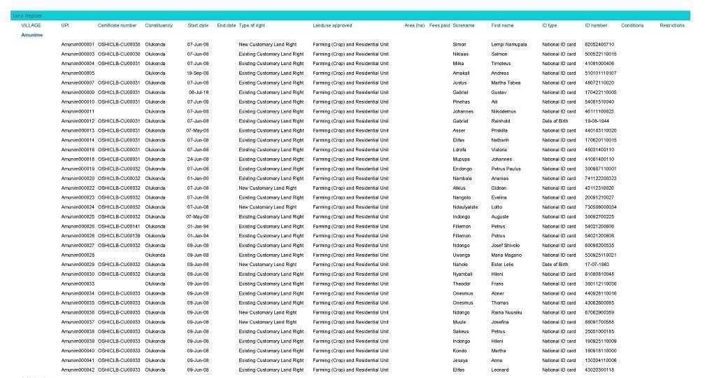
10 NCLAS OUTPUTS 19 NCLAS OUTPUTS 20
11 NCLAS OUTPUTS 21 CONCLUSIONS ON NCLAS Faster then the old process Quality of output is better Uniform Data is now entered in a proper database Data is Accessible and secured 22
12 ROADMAP Register all (ca ) existing land rights before Orthophotos and Quickbird Project management team Outsourcing Communication campaign NCLAS Central database developed Maintenance structure 23 CHALLENGES The process of creating Awareness about the new law To register all applications for existing land rights Limited human and financial resources Maintenance of the databases and IT infrastructure Amending the law to accommodate regional differences Transferring more responsibilities to lower authorities Getting the right people at the right places 24


13 Thank you for your attention Time for questions
Land Registration using aerial photography in Namibia: Costs and lessons
 Land Registration using aerial photography in Namibia: Costs and lessons By Marcel G.J. Meijs, Donatha Kapitango and Richard Witmer 1 Summary Since 2003 the Ministry of Lands and Resettlement (MLR), together
DRAFT OUTLINE MANUAL FOR COMMUNAL LAND ADMINISTRATION IN NAMIBIA
 DRAFT OUTLINE MANUAL FOR COMMUNAL LAND ADMINISTRATION IN NAMIBIA 1. INTRODUCTION...3 2. ALLOCATION AND ENDORSEMENT OF COMMUNAL LAND RIGHTS...3 2.1 ALLOCATION OF LAND RIGHTS... 3 2.1.1 Guidelines for completion
Communal Land Support (CLS) Sub-activity Procedures, Operations and Systems Report
 Sub-activity Procedures, Operations and Systems Report") Communal Land Support (CLS) Sub-activity Procedures, Operations and Systems Report Commissioned by the Millennium Challenge Account Namibia with funding from The Millennium Challenge Corporation 1. LIST
Communal Land Support (CLS) Sub-activity Procedures, Operations and Systems Report Commissioned by the Millennium Challenge Account Namibia with funding from The Millennium Challenge Corporation 1. LIST
Directorate of Survey and Mapping NAMIBIA. Cadastral Information System. Vehupisa Kasuko Tjatindi Surveyor Directorate of Survey and Mapping NAMIBIA
 Vehupisa Kasuko Tjatindi Directorate of Survey and Mapping NAMIBIA Tel: +64 61 965000 Directorate of Survey and Mapping NAMIBIA Cadastral Information System Introduction Over the past few decades cadastral
Land Administration Developments in Rwanda
 Land Administration Developments in Rwanda Eugène RURANGWA Expert Group Meeting on secure land tenure new legal frameworks and tools UN-Gigiri, Nairobi, 10-12 November, 2004 Contents Somme figures about
LAND REFORM IN MALAWI
 LAND REFORM IN MALAWI Presented at the Annual Meeting for FIG Commission 7 In Pretoria, South Africa, Held From 4 th 8 th November, 2002 by Daniel O. C. Gondwe 1.0 BACKGROUND Malawi is a landlocked country
LADM-based Crowdsourced 3D Cadastral Surveying Potential and Perspectives
 National Technical University Of Athens School of Rural and Surveying Engineering LADM-based Crowdsourced 3D Cadastral Surveying Potential and Perspectives Maria Gkeli, Surveying Engineer, PhD student
LAND REFORM IN NAMIBIA. By Karim Owolabi & Harry Tjipueja Ministry of Lands, Resettlement & Rehabilitation Windhoek, Namibia
 LAND REFORM IN NAMIBIA By Karim Owolabi & Harry Tjipueja Ministry of Lands, Resettlement & Rehabilitation Windhoek, Namibia CONTENTS Introduction A Bit of History Land Tenure System in Namibia The Land
Alternatives for Economic Boundary Determination in the Establishment of a Cadastral System. Paper to the FIG Working Week 2012 Rome, May 9, 2012
 Alternatives for Economic Boundary Determination in the Establishment of a Cadastral System Paper to the FIG Working Week 2012 Rome, May 9, 2012 by Gottfried Konecny Emeritus Professor Leibniz University
LAND ADMINISTRATION DEVELOPMENTS IN RWANDA
 LAND ADMINISTRATION DEVELOPMENTS IN RWANDA, Rwanda Key words : Land tenure security, land registration, land rights, land commissions. SUMMARY : The new Rwandan land policy consider appropriate land administration
Low Cost Titling in Africa
 Low Cost Titling in Africa Land Tenure Regularisation in Rwanda Presentation to the World Bank Annual Land Conference, Washington DC April 26-27, 2010 National Land Centre, Ministry of Environment and
THE APPLICATION OF GIS AND LIS Solutions and Experiences in East Africa. Lenny Kivuti
 Using GIS and LIS for Planning Sustainable Development Bepic Group CHOGM, Malta 2005 THE APPLICATION OF GIS AND LIS Solutions and Experiences in East Africa Lenny Kivuti 21 November, 2005 Presented by
TSO1C: Land Reforms. Commission 7
 TSO1C: Land Reforms. Commission 7 Development of & Implementation LIS. Building an effective Partnership to Reform Uganda s Land Administration (7320) Gasant Jacobs, Head: Business Development. Tax & Accounting
Land Reform Development in Rwanda. Kagera TAMP Lessons learnt. Workshop - Entebbe, Nov.2005
 Land Reform Development in Rwanda Kagera TAMP Lessons learnt. Workshop - Entebbe, 23 30 Nov.2005 Some figures about Rwanda Area : 26,338 km 2 Population:8,128,553 million Physical density:321inhab/ km
Land policies and land reforms in China: current situation and lessons to be learned for the future Dr. Michael Klaus
 Land policies and land reforms in China: current situation and lessons to be learned for the future Dr. Michael Klaus Presentation at 6 th International Summer School 2014 - Comprehensive Land Policy -
NATIONAL LAND POLICY ON AGRICULTURE DEVELOPMENT
 NATIONAL LAND POLICY ON AGRICULTURE DEVELOPMENT Prepared by: J.M.Kami Director of Land Use Coordination and Policy Presented by: NATIONAL LAND USE PLANNING COMMISSION Towards a New National Land Policy
GLOBAL GEOSPATIAL MANAGEMENT INFORMATION
 GLOBAL GEOSPATIAL MANAGEMENT INFORMATION SEOUL, KOREA 24 th to 26 th October 2011 COUNTRY REPORT - REPUBLIC OF BOTSWANA 1. INTRODUCTION 1.1. SOCIAL, ECONOMIC AND POLITICAL BACKGROUND Botswana attained
FIG/FAO International Seminar on State and Public Land Management
 FIG/FAO International Seminar on State and Public Land Management State Land Distribution for the Poor: State Land Identification, Mapping, Classification and Registration By Dr. Sareth Boramy Deputy General
Designing for transparency and participation in the Hellenic Cadastral Project
 Designing for transparency and participation in the Hellenic Cadastral Project Dr. Dimitris Rokos Director of Planning and Investments, Hellenic National Cadastre and Mapping Agency S.A. Table of Contents
Use of data in Ukraine for sustainable economic growth. Oleksandr Maliuk State Service of Ukraine for Geodesy, Cartography and Cadastre
 Use of data in Ukraine for sustainable economic growth Oleksandr Maliuk State Service of Ukraine for Geodesy, Cartography and Cadastre Kehl, 2017 Content of the presentation Ukraine & StateGeoCadastre:
Unified Land Administration for a Better Spatial Infrastructure
 Unified Land Administration for a Better Spatial Infrastructure Gyula IVÁN Institute of Geodesy, Cartography & Remote Sensing FÖMI (HUNGARY) Open Symposium 30th Korean Cadastral Seminar & FIG Commission
Technology-driven solutions for the innovation of land administration and management
 Technology-driven solutions for the innovation of land administration and management Technology and economic growth - Studies*find link between technology innovation and national economic prosperity especially,
NEW DEVELOPMENTS IN THE REAL PROPERTY REGISTER AND CADASTRE IN LITHUANIA
 NEW DEVELOPMENTS IN THE REAL PROPERTY REGISTER AND CADASTRE IN LITHUANIA Jaunius Grigas E-mail: jaunius.grigas@registrucentras.lt Verona, 2008 FUNCTIONS OF STATE ENTERPRISE CENTRE OF REGISTERS Registration
A Geocoded Cadastral Fabric as a Precondition for a Sustainable Land Management System
 A Geocoded Fabric as a Precondition for a Sustainable Land Management System Gottfried KONECNY, Germany; J.P. LAUZON, Canada; Abdul Salam MOHAMMED, India Key words: SDI,, Parcel Boundaries, GPS-GNSS, Land
Applying a Community-Based Approach to Tenure Reform: Experiences from Northern Mozambique
 Applying a Community-Based Approach to Tenure Reform: Experiences from Northern Mozambique Lasse Krantz, PhD University of Gothenburg, Sweden WeEffect/SACAU Conference on Land Tenure Security, 22 nd to
BULGARIAN CADASTRE A GUARANTEE FOR THE OWNERSHIP RIGHTS IN IMMOVABLE PROPERTIES
 4 TH INTERNATIONAL CONFERENCE RECENT PROBLEMS IN GEODESY AND RELATED FIELDS WITH INTERNATIONAL IMPORTANCE February 28 - March 2, 2007, Inter Expo Centre, Sofia, Bulgaria BULGARIAN CADASTRE A GUARANTEE
Responsible and Innovative Land Administration
 Responsible and Innovative Land Administration An Example from Ethiopia 3 RD DECEMBER 2018 Outline A few words about NIRAS Fit-for-purpose: A low-tech disruptive approach? The REILA Project in Ethiopia
RWANDA NATURAL RESOURCES AUTHORITY Department of Lands and Mapping
 RWANDA NATURAL RESOURCES AUTHORITY Department of Lands and Mapping National Land Use and Development Master Plan Presentation to National Forum on Sustainable Urbanisation in Support of EDPRS 2 Eng. Didier
New Developments in the Hellenic Cadastre
 New Developments in the Hellenic Cadastre Prof. M. Kavouras Vice-president Ktimatologio S.A. (Hellenic Cadastre) The Hellenic Cadastre Background The Hellenic National Cadastre Organizational and institutional
Bureau of Land Management MAPPS Federal Update Donald Buhler Cadastral, Lands, and Realty Management April 14, 2015
 Bureau of Land Management MAPPS Federal Update Donald Buhler Cadastral, Lands, and Realty Management April 14, 2015 Division of Cadastral, Lands and Realty Management 1 BLM Mission Manages 247 million
LIS a motivation for SDI initiative
 Eric Mwaikambo Ardhi University Dar es Salaam Tanzania Overview Status of LIS in Tanzania Relationship between SDI and LIS Spatial Standards LIS a motivation for SDI initiative Conclusion & Recommendations
MASS REGISTRATION OF LAND PARCELS USING FIT-FOR-PURPOSE LAND ADMINISTRATION: PROCEDURES AND METHODS
 MASS REGISTRATION OF LAND PARCELS USING FIT-FOR-PURPOSE LAND ADMINISTRATION: PROCEDURES AND METHODS TAREK ZEIN Hansa Luftbild AG, Germany zein@hansaluftbild.de Paper prepared for presentation at the 2017
EXPANDING AVAILABILITY OF BROADBAND ACCESS AND ADOPTION
 Single point information Ilija Kepevski Agency for Electronic Communications Regional Conference for Europe EXPANDING AVAILABILITY OF BROADBAND ACCESS AND ADOPTION 28-29 September 2015 - Budva, Montenegro
Systematic Land Regularization in Lesotho
 Systematic Land Regularization in Lesotho Jakob Riise Ian Corker Jan van Bennekom-Minnema Key words: Systematic Land Regularization First Registration Rights Adjudication General Boundary Survey Cadastre
LAND ADMINISTRATION REFORM IN GHANA DR W.ODAME LARBI PROJECT DIRECTOR GHANA LAND ADMINISTRATION PROJECT
 LAND ADMINISTRATION REFORM IN GHANA DR W.ODAME LARBI PROJECT DIRECTOR GHANA LAND ADMINISTRATION PROJECT 1 OUTLINE Background Long Term Objectives of the LAP Objectives of Phase 1 of LAP The Components
PAPER ON THE MANAGEMENT OF SUSTAINABLE DELIVERY OF SECURED PROPERTY RIGHTS THROUGH EMPOWERNMENT AND CAPACITY BUILDING OF LOCAL GOVERNMENT AUTHORITIES
 PAPER ON THE MANAGEMENT OF SUSTAINABLE DELIVERY OF SECURED PROPERTY RIGHTS THROUGH EMPOWERNMENT AND CAPACITY BUILDING OF LOCAL GOVERNMENT AUTHORITIES PRESENTED AT: THE UNITED NATIONS AWARD PROGRAM HELD
The Contribution of Forest Owners Associations for the Forest Cadastre Implementation. João Gaspar Ana Navarro Ferreira PORTUGAL
 The Contribution of Forest Owners Associations for the Forest Cadastre Implementation João Gaspar Ana Navarro Ferreira PORTUGAL Motivation Lack of forestry cadastre; Unify all FOAs databases with common
Development of Cadastral Survey and Land Ownership Registration System in Mongolia
 Development of Cadastral Survey and Land Ownership Registration System in Mongolia M.Saandar,, Ph. D Vice President, the Mongolian Association of Surveying and Mapping, ( As National Member of FIG ) MonMap
THINK BIG do little. Start an avalanche
 1 Recent activities on land consolidation in Serbia Stevan Marosan, Mladen Soskic University of Belgrade, Faculty of Civil Engineering Department for Geodesy and Geoinformatics Zoran Knezevic Ministry
STREAMLINING LAND ADMINISTRATION AND GOVERNANCE IN CROSS RIVER STATE, NIGERIA by Engr. Bassey Oqua, Chiemeka Ngwu, Nigel Edmead & Frank Pichel
 STREAMLINING LAND ADMINISTRATION AND GOVERNANCE IN CROSS RIVER STATE, NIGERIA by Engr. Bassey Oqua, Chiemeka Ngwu, Nigel Edmead & Frank Pichel FIG Working Week, Abuja, May 6 th 10 th 2013 Environment for
Low Cost Cadastral Data Aquisition?
 Low Cost Cadastral Data Aquisition? Jacobus Meijer and Christiaan Lemmen (Netherlands): 21 May 2011 Abstract Spatial Cadastral Data (Mapping) Participatory Development Some low cost approaches in cadastral
The Fit- for-purpose Concept
 The Fit- for-purpose Concept Building Spatial Frameworks for Sustainable Land Governance in Sub-Sahara Africa Prof. Stig Enemark Honorary President Aalborg University, Denmark LAND POLICIES AND LAND GOVERNANCE,
LAND TENURE IN ASIA AND THE PACIFIC CHALLENGES, OPPORTUNITIES AND WAY FORWARD
 LAND TENURE IN ASIA AND THE PACIFIC CHALLENGES, OPPORTUNITIES AND WAY FORWARD Workshop on Land Administration and Management 20th United Nations Regional Cartographic Conference for Asia and the Pacific
Implementing Innovative Land Tenure Tools In East-Africa: SWOT-Analysis Of Land Governance
 Presented at the FIG Working Week 2017, May 29 - June 2, 2017 in Helsinki, Finland Implementing Innovative Land Tenure Tools In East-Africa: SWOT-Analysis Of Land Governance Ine BUNTINX, Joep CROMPVOETS,
ABSTRACT Land Administration System in Lithuania
 ABSTRACT Land Administration System in Lithuania 1. General introduction to the Lithuanian Land Administration System and State Enterprise Centre of Registers ( shortly SECR) Lithuania has established
Addressing Land Sector Opportunities with Geospatial Information in Nepal
 The 20th UNRCC-AP and the 4th UN-GGIM-AP 5-10 October 2015 Jeju Island, Republic of Korea Addressing Land Sector Opportunities with Geospatial Information in Nepal Krishna Raj BC Executive Director Land
SECTOR PUBLIC CADASTRES AND REGISTERS MARKET PARTICIPANTS
 E-SERVICES TO CITIZENS, GOVERNMENT AND BUSINESSES. LITHUANIA EXPERIENCE Arvydas Bagdonavičius State Enterprise Centre of Registers Arvydas.Bagdonavicius@registrucentras.lt REGISTERS AND IS MANAGED BY THE
International Workshop Land Banking/Land Funds as an Instrument for Improved Land Management for CEEC and CIS March 2004 Tonder,, Denmark
 MINISTRY OF AGRICULTURE AND FORESTRY SOFIA, BULGARIA International Workshop Land Banking/Land Funds as an Instrument for Improved Land Management for CEEC and CIS 17-20 March 2004 Tonder,, Denmark BULGARIAN
Ownership Data in Cadastral Information System of Sofia (CIS Sofia) from the Available Cadastral Map
 from the Available Cadastral Map") Ownership Data in Cadastral Information System of Sofia (CIS Sofia) from the Available Cadastral Map Key words: ABSTRACT Lydmila LAZAROVA, Bulgaria CIS Sofia is created and maintained by GIS Sofia ltd,
Ownership Data in Cadastral Information System of Sofia (CIS Sofia) from the Available Cadastral Map Key words: ABSTRACT Lydmila LAZAROVA, Bulgaria CIS Sofia is created and maintained by GIS Sofia ltd,
Cloud GIS Real Estate Management, Appraisal and Development Service USING ESRIs ARCGIS SERVER
 Cloud GIS Real Estate Management, Appraisal and Development Service USING ESRIs ARCGIS SERVER INFODIM: Was founded on 1992 and is internationally certified as a GIS company from D&B Dun & Bradstreet Global
Egyptian Nationwide Title Cadastre System
 Kholoud SAAD, Egypt Key words: Cadastre, Registration, Urban, Rural, National Cadastre, Automation, reengineering. SUMMARY With growing need for integrated information, Enterprise Solutions has become
PROJECT INFORMATION DOCUMENT (PID) APPRAISAL STAGE Report No.: PIDA Project Name. Region Country Sector(s) Theme(s)
 APPRAISAL STAGE Report No.: PIDA Project Name. Region Country Sector(s) Theme(s)") Public Disclosure Authorized Public Disclosure Authorized Public Disclosure Authorized Public Disclosure Authorized Project Name Region Country Sector(s) Theme(s) Lending Instrument Project ID Borrower(s)
Public Disclosure Authorized Public Disclosure Authorized Public Disclosure Authorized Public Disclosure Authorized Project Name Region Country Sector(s) Theme(s) Lending Instrument Project ID Borrower(s)
LAND REGISTRATION SYSTEM OF THE REPUBLIC OF CROATIA
 "On the last day of the Creation God desired to crown His work, and thus created Kornati Islands out of tears, stars and breath." (George Bernard Shaw) LAND REGISTRATION SYSTEM OF THE REPUBLIC OF CROATIA
Commission 7, Land Administration and IT. Paul van der Molen INTERNATIONAL INSTITUTE FOR GEO-INFORMATION SCIENCE AND EARTH OBSERVATION
 Commission 7, Land Administration and IT Paul van der Molen INTERNATIONAL INSTITUTE FOR GEO-INFORMATION SCIENCE AND EARTH OBSERVATION FIG Commission 7 on cadastre and land management Study Visits (e.g.
A CADASTRAL GEODATA BASE FOR LAND ADMINISTRATION USING ARCGIS CADASTRAL FABRIC MODEL A CASE STUDY OF UWANI ENUGU, ENUGU STATE, NIGERIA
 A CADASTRAL GEODATA BASE FOR LAND ADMINISTRATION USING ARCGIS CADASTRAL FABRIC MODEL A CASE STUDY OF UWANI ENUGU, ENUGU STATE, NIGERIA BY Ndukwu, Raphael. Ike Department of Geoinformatics & Surveying University
LIS Development Project and Measures Proposed to Enhance Trust in the Land Administration System in Uganda
 Project for Design, Supply, Installation and Implementation of the Land Information System and Securing of Land Records (DeSILISoR) LIS Development Project and Measures Proposed to Enhance Trust in the
GOVERNMENT OF KOSOVA MINSTRY OF PUBLIC SERVICES KOSOVO CADASTRAL AGENCY
 LAND CONSOLIDATION IN CREATION OF CADASTRAL MODEL AND ITS INFLUENSE IN ECONOMY DEVELOPMENT OF KOSOVA Prof. Dr. sc. Murat Meha Dip. eng. Qemail Kadiri E-mail: mmeha@yahoo.com WORKSHOP ORGANIZED BY FAO ON
FIG-WB Forum on Land Administration
 FIG-WB Forum on Land Administration and Reform in Sub-Sahara Africa [Nigeria] [Peter O. Adeniyi] FIG WORKING WEEK, Abuja, NIGERIA 2013-6-10 MAY 2013 Statistic Country at a Glance Total population 162,470,737
DECREE GENERAL PROVISIONS
 THE GOVERNMENT ------- SOCIALIST REPUBLIC OF VIET NAM Independence - Freedom Happiness --------------- No: 44/2014/ND-CP Hanoi, May 15, 2014 DECREE REGULATIONS ON LAND PRICES Pursuant to Law on Government
Republic of Bulgaria
 Geodesy, Cartography and Cadastre Agency Republic of Bulgaria www.cadastre.bg 24. 01. 2018 г., гр. София The Cadastre Legislation in Bulgaria - historical reference 1908 г. The Cadastre Act The objective
The Journey to 100% Electronic Survey. Land Information New Zealand. August 2009
 The Journey to 100% Electronic Survey and Title Lodgement Land Information New Zealand August 2009 Land Information New Zealand Established 1996 Titles, Survey, Geodetic, Electoral 12 locations 500 staff
GAUSSCAD A WEBGIS APPLICATION FOR COLLECTING CADASTRAL DATA
 M.M. Moise GaussCAD a WebGIS Application for Collecting Cadastral Data GAUSSCAD A WEBGIS APPLICATION FOR COLLECTING CADASTRAL DATA Mihai-Mircea MOISE, S.C. GAUSS S.R.L., mihai.moise@gauss.ro Abstract:
China: Case of Chengdu
 Exploring an Integrated Rural and Urban Development in China: Case of Chengdu Qin-Daihong, Deputy Director Committee for Balanced Rural-Urban Development, Chengdu Introduction of Chengdu Chengdu, located
REFORM OF LAND CADASTRE IN LITHUANIA
 REFORM OF LAND CADASTRE IN LITHUANIA Romualdas KASPERAVICIUS, Lithuania Key words: ABSTRACT Main aim for every Government is to create legal, financial and organisational circumstances for real property.
TIME IS NOW FOR SPATIAL AND LAND USE PLANNING AND RE-BUILDING THE LAND ADMINISTRATION SYSTEM IN ZIMBABWE
 TIME IS NOW FOR SPATIAL AND LAND USE PLANNING AND RE-BUILDING THE LAND ADMINISTRATION SYSTEM IN ZIMBABWE BY MANDIVAMBA RUKUNI INTRODUCTION In this 10 th of 12 articles I focus on the need to rebuild the
Arlington County, Virginia. Internal Audit of the Real Estate Assessment Appeals Process Calendar Year Ended December 31, 2014
 Arlington County, Virginia Internal Audit of the Real Estate Assessment Appeals Process Calendar Year Ended December 31, 2014 Table of Contents Transmittal Letter... 1 Executive Summary... 2-9 Background...
COMPUTERIZED SYSTEM SUPPORTING DEVELOPMENT OF LAND MARKET IN GEORGIA
 COMPUTERIZED SYSTEM SUPPORTING DEVELOPMENT OF LAND MARKET IN GEORGIA S. G. TSIRAMUA, I. S. MELASHVILI Land Registration Unit of Government of Georgian, World Bank and IFAD Agriculture Development Project.
 Apostolos Arvanitis, Associate Professor Asterios Asteriadis, Rural - Surveying Engineer Thomai Sotireli, Rural - Surveying Engineer Aristotle University School of Rular and Surveying Engineering Department
Assessor. Mission Statement: Functions: Long Term Goals: Page 1 of 6
 Assessor Mission Statement: The mission of the Assessor s Office is to create accurate, equitable, and timely property tax assessments to fund public services; and to be a source of current, accurate property
Information Quality - A Critical Success Factor How to make it all right!
 Information Quality - A Critical Success Factor How to make it all right! Anders Svensson, Sweden Key words: Cadastre, information quality, property information, property boundaries SUMMARY Sweden has
FIG Congress 2010 Facing the Challenges Building the Capacity Sydney, Australia, April
 Setting up the infrastructure for improving the development of Cadastre in Greece Dr. Dimitris ROKOS, Dr. Konstantinos KYRIAZIS and Dr. Panos LOLONIS KTIMATOLOGIO S.A. (Hellenic Cadastre) Source: wikipedia
Experiences with land consolidation and land banking in Slovenia since 1991
 Experiences with land consolidation and land banking in Slovenia since 1991 Anka LISEC University of Ljubljana Faculty of Civil and Geodetic Engineering anka.lisec@fgg.uni-lj.si University of Ljubljana
The Proposal of Cadastral Value Determination Based on Artificial Intelligence
 The Proposal of Cadastral Value Determination Based on Artificial Intelligence Jarosław BYDŁOSZ, Piotr CICHOCIŃSKI, Piotr PARZYCH, Poland Key words: neural network, artificial intelligence, cadastral value,
Land surveying is probably the (second) oldest profession in the world
 oldest profession in the world") Land Surveying and Land Management in an International Perspective Prof Stig Enemark Honorary President Aalborg University, Denmark CADASTRE IN A DIGITAL WORLD NORDIC AND GLOBAL PRESPECTIVES INTERNATIONAL
Land Surveying and Land Management in an International Perspective Prof Stig Enemark Honorary President Aalborg University, Denmark CADASTRE IN A DIGITAL WORLD NORDIC AND GLOBAL PRESPECTIVES INTERNATIONAL
A beautiful setting. The Evolving Role of Cadastral Systems in Support of Good Land Governance. Setting the scene
 The Evolving Role of Cadastral Systems in Support of Good Land Governance Prof. Stig Enemark President Aalborg University, Denmark THE DIGITAL CADASTRAL MAP FIG COMMISSION 7 OPEN SYMPOSIUM KARLOVY VARY,
Land Information System for Revenue Planning, Estimates and Collection
 Land Information System for Revenue Planning, Estimates and Collection Hardi FADILLAH HAMZAH, Malaysia Key words: valuation, land revenues SUMMARY With the emerging trend of State Government implementing
Annual Meeting of FIG commission 7 (Cadastre and Land Management) Open Symposium on Environment and Land Administration
 Open Symposium on Environment and Land Administration") Annual Meeting of FIG commission 7 (Cadastre and Land Management) Open Symposium on Environment and Land Administration Systematic Land Titling in Cambodia is the component 3 of the Land Management and
Annual Meeting of FIG commission 7 (Cadastre and Land Management) Open Symposium on Environment and Land Administration Systematic Land Titling in Cambodia is the component 3 of the Land Management and
Regional Cadastral Study Reforms in the Region
 UNECE WORKING PARTY ON LAND ADMINISTRATION Workshop on the Influence of Land Administration on People and Business Cavtat, Croatia 2-3 October 2008 Regional Cadastral Study Reforms in the Region Miodrag
Establishing a Land policy reform and GPS Technology implementation in Burkina Faso
 Annual World Bank Conference on Land and Poverty 2013 Establishing a Land policy reform and GPS Technology implementation in Burkina Faso Presentation made by Moha EL-AYACHI, IAV Hassan 2, Morocco Paper
Croatian SDI: a Tool for Accelerated Development of the Geo-Conscious Society
 STATE GEODETIC ADMINISTRATION Croatian SDI: a Tool for Accelerated Development of the Geo-Conscious Society Prof.Dr.Sc. Željko Bačić, Mr.Sc. Ljerka Rašić FIG Working Week 2009 - Surveyors Key Role in Accelerated
Expropriation. Recommended Policy Wordings (full): Lao National Land Policy. Context. Policy. Standard of Public Purpose
: Lao National Land Policy. Context. Policy. Standard of Public Purpose") Expropriation Context Following from the goal of the National Land Policy, to promote and ensure a secure land tenure system that is transparent, effective, non-discriminative, equitable and just ; it
Expropriation Context Following from the goal of the National Land Policy, to promote and ensure a secure land tenure system that is transparent, effective, non-discriminative, equitable and just ; it
Agricultural land market in Latvia
 Agricultural land market in Latvia State Land Service of the Republic of Latvia Real Estate Valuation Board Rita Petersone Inese Zarina Julia Lebedinska General information Total area ~ 64,600 km2 Population
XXV FIG CONGRESS KUALA LUMPUR, MALAYSIA, JUNE 2014.
 XXV FIG CONGRESS KUALA LUMPUR, MALAYSIA, 16-21 JUNE. THEME: ENGAGING THE CHALLENGES, ENHANCING THE RELEVANCE THE DILEMMA Malaysia, 16 21 OF June RESTRUCTURING THE LAND GOVERNANCE SYSTEM IN NIGERIA BY UKAEJIOFO,
Systematic Land Information Management (SLIM)
") Systematic Land Information Management (SLIM) By Mr. Jukka Nieminen Jaakko Pöyry Infra Soil and Water Ltd. Expert Group Meeting on Secure Land Tenure: New Legal Frameworks and Tools Nairobi 12 November
Systematic Land Information Management (SLIM) By Mr. Jukka Nieminen Jaakko Pöyry Infra Soil and Water Ltd. Expert Group Meeting on Secure Land Tenure: New Legal Frameworks and Tools Nairobi 12 November
Parcel Boundaries in the Czech Republic
 Parcel Boundaries in the Czech Republic CZECH REPUBLIC Jiri Rydval, Libor Tomandl Czech Office for Surveying, Mapping and Cadastre inhabitants - 10.3 million territory 78,865 km 2 2 Contents: 1. A parcel
FEE SCHEDULE Effective 1/1/2013
 FEE SCHEDULE Effective 1/1/2013 Annexation and Detachment (City fee) $300 (no tax) Annexation Petition Review Fee - Wisconsin Department of Administration (WDOA) ( 16.53(4) Wis. Stats. for annexations
Land Administration System in Russian Federation
 Sergey VOLKOV, Russia Key words: land administration, market economy, land management, land resources. SUMMARY Principle source of economic and social development of Russian Federation in XXI century will
Property Registration: from the Marathon run to Flash operation as effect of ICT and BPR
 Property Registration: from the Marathon run to Flash operation as effect of ICT and BPR Tradition meets Innovation Conference 200 Years of Austrian Cadastre AKADIS b.v. Vienna 5-6 Oct. 2017 A.A. Kwitowski
E fficient L and A dministr ation E ncour ages P r oper ty M ar k ets. surveying companies at Project commencement. Key Messages
 Secur ing Pr oper ty R ights and I ncr easing R eal E state Pr oductivity in F Y R M acedonia Victoria Stanley, Denis Boskovski and Samantha De Martino Key Messages Before 2005, FYR Macedonia did not have
Land Administration and Management in Nepal" Krishna Raj B.C. Joint Secretary Ministry of Land Reform and Management Nepal
 Land Administration and Management in Nepal" Krishna Raj B.C. Joint Secretary Ministry of Land Reform and Management Nepal Presentation Outline Country Context Current Situation Available Infrastructure
Introduction to Land Tenure Administration
 Introduction to Land Tenure Administration Karol Boudreaux Land Tenure & Resource Rights Practice Lead, The Cloudburst Group January 22, 2018 January 22, 2018 1 WHAT WE LL COVER Background and Definitions
LAND ADMINISTRATION IN CANADA HISTORICAL WISDOM AND MODERN CHALLENGES IN QUEBEC LAND ADMINISTRATION: FROM PAPER CADASTRAL MAPS TO ON-LINE SERVICES
 HISTORICAL WISDOM AND MODERN CHALLENGES IN QUEBEC LAND ADMINISTRATION: FROM PAPER CADASTRAL MAPS TO ON-LINE SERVICES Francis ROY P rof e s s or D é p. Sciences g é omatiques FIG Working Week Sofia, Bulgaria
The New Technology of a Survey Data Model and Cadastral Fabric as the Foundation for a Future Land Administration System.
 The New Technology of a Survey Data Model and Cadastral Fabric as the Foundation for a Future Land Ian HARPER, Australia Key words: cadastral modelling, survey data model, Survey Accuracy, Cadastre 2014
LRIMS Cadastre Module
 LRIMS Cadastre Module User Requirements and Functionality (Seychelles Case Study) John Latham, NRL Renato Cumani, NRL Luigi Simeone, NRL Summary Background User Requirements Business Model Application
National Land Use Policy
 Government of the Republic of the Union of Myanmar National Land Use Policy (6 th Draft) 2015, May CONTENT Sr. Content Page 1. Introduction 1-2 2. Part-I Objectives and Basic Principles Chapter-I Objectives
From Measurement to Management
 From Measurement to Management The changing role of the land surveyors Prof. Stig Enemark Aalborg University, Denmark LAND MANAGEMENT AND HUMAN RIGHTS INTERNATIONAL SEMINAR, HØGSKOLEN I BERGEN, 8 9 SEPTEMBER
Information System of Electronic Cadastre Registration of Lands in Azerbaijan
 The State Committee on Property Issues of the Republic of Azerbaijan Information System of Electronic Cadastre Registration of Lands in Azerbaijan Chıngız Tanırverdiyev-chief engineer Cadastre and Land
University of Nairobi LAND INFORMATION SYSTEM FOR LAND MANAGEMENT IN KENYA. CASE STUDY: NAIROBI COUNTY, BURUBURU PHASE I ESTATE
 University of Nairobi LAND INFORMATION SYSTEM FOR LAND MANAGEMENT IN KENYA. CASE STUDY: NAIROBI COUNTY, BURUBURU PHASE I ESTATE BY Justus Amdavi F56/69371/2013 Supervisor: Mr Jasper Mwenda CONTENTS Introduction
Tenancy Sustainability. Helping to provide targeted support to tenants through Welfare Reform
 Tenancy Sustainability Helping to provide targeted support to tenants through Welfare Reform The welfare reform challenge Under Welfare Reform, changes to the UK s benefit system have led to increased
Land Administration Infrastructures for Sustainable Development
 The Global Challenges Land Administration Infrastructures for Sustainable Development Prof. Stig Enemark Department of Development and Planning Aalborg, University, Denmark INTERNATIONAL CONFERENCE ON