Upgrading and Land Titling in Informal Settlements. Manica City
|
|
|
- Darren Sutton
- 5 years ago
- Views:
Transcription
1 Expert Group Meeting on secure land tenure: 'new legal frameworks and tools' November , UNGigiri in Nairobi, Kenya Upgrading and Land Titling in Informal Settlements Manica City MANICA PROVINCE, CENTRAL REGION -MOZAMBIQUE the great importance of the PSM true color quickbird satellite image as a cartographic document Carlos T. G. Trindade for the paper please ask ctgtrindade@yahoo.com
2 intervention area Josina Machel neighbourhood, ManicaCity. support German Co-operation for Development (GTZ) Municipality ofrome (Italian Cooperation) technical assistance Faculty of Architecture and Physical Planning Eduardo MondlaneUniversity (Maputo)
3 main objectives of this participatory planning experience confirmation of land tenure rights to the inhabitants of informal settlements. regulate the land use and provide basic infrastructures.


4 a background to this settlements also known as spontaneous, unauthorized, slums, illegal settlements, etc. q almost 80% of urban inhabitants of Mozambique are living in the informal settlements of towns and cities. q individual residences with raw brick or cement block walls and thatch or zinc roofs.


5 the main problems there is always lack of basic urban facilities such as roads, drainage or piped water. the erosion: example of the consequence of uncontrolled urbanization that pose a threat to the existence of inhabitants due to the serious damages caused to the environment.
6 specificobjectives to issue any legal title of effective land tenure to inhabitants in order to give them great encourage improving their own dwellings. assure, case by case, the minimum access requirement, by constructing either pedestrian ways or compacted soil roads, essential for vehicular traffic in case of emergency and to facilitate the future construction of other basic infrastructures. the urban planning, in case of informal settlements, does not involve big development projects, but to improve living conditions in these settlements with minimum interventions. (Tribillon, 1993).
7 Because of the doubts the Municipality could have about the rights of land use in those settlements, the Faculty of Architecture and Physical Planning of the Eduardo Mondlane University was invited to elaborate a juridical report about the land questionin those settlements
8 An approach to the Land Law Lei de Terras (Law 19/97 of 01/10/97) General Principles In Mozambique the land is a property of the Government and it can not be sold or, in any other way, acquired by the user, mortgaged or used as lien (Art: 3), but: q the Right of Land Use and Exploitation Direito de Uso e Aproveitamento (DUAT) can be transmitted by inheritance (Nº 1, Art: 16); q the titular of DUAT can transmit the infrastructures, constructions and benefits, through public deed preceded by a Governmental Authorization. (Nº 2, Art: 16); q In the case of urban buildings, with the transmission of the building, is also transmitted the DUAT (Nº4, Art: 16);
9 An approach to the Land Law Lei de Terras (Law 19/97 of 01/10/97) one of the main DUAT acquisition ways Occupation by national single people who, with good faith, be using the land for at least ten years (line b, Art: 12);
10 An approach to the Land Law Lei de Terras (Law 19/97 of 01/10/97) The Request authorization process first phase -where is emitted a provisory authorization autorização provisória with a maximum duration of five years for national people and two years for foreign people (Nº 1 and 2, Art: 25); second phase -comprises a definite authorization and the emission of the title (Art: 26);
11 An approach to the Land Law Lei de Terras (Law 19/97 of 01/10/97) The competence of the Municipality of Manicaand the application of the Land Law Regulation Regulamento dalei de Terras (Decree 66/98 of 08/12/98) accordingthis regulation: when necessary or requested, the areas that are comprised with the right of land use and exploitation acquired by good faith occupation can be identified and registered in the National Land Cadastre Cadastro Nacional de Terras (Nº3, Art: 10); it is understood that this process has to be conducted through the Municipality Cadastre Service;
12 An approach to the Land Law Lei de Terras (Law 19/97 of 01/10/97) The competence of the Municipality of Manicaand the application of the Land Law Regulation Regulamento dalei de Terras (Decree 66/98 of 08/12/98) accordingthis regulation: The demarcation, is a part process to the right acquired by good faith, where after being emitted the provisory authorization the Cadastre Services will notify the solicitant the necessity to make the demarcation (Nº 1 and 2, Art: 34, having also reference of Art: 30.)
13 An approach to the Land Law Lei de Terras (Law 19/97 of 01/10/97) The competence of the Municipality of Manicaand the application of the Land Law Regulation Regulamento dalei de Terras (Decree 66/98 of 08/12/98) in this ambit: the inhabitants have the conditions predisposed: customary practices, occupation by good faith for at least ten years, provisory authorization with no immediate necessity of demarcation; there are minimum conditions for the attribution of DUAT, that would start since the emission of the provisory authorization, that in reality, it would be a form of confirmation comprovação (Article 15); the residents have the right of land use independently of the type of authorization or recognition made by the Government.
14 another discussed hypothesis(main objectives) The possibility to begin a dialogue between the Municipality and the residents recognizing it s existence, giving enough time to reflect on the most adequate form of titling; communicate each of the occupiers through a letter, as the objective to value and confirm the survey and registration made, with data about: the name of the occupier, lot number, total surface, number of buildings, type of the construction material used for each building and also a note of prohibition referring to eventual new constructions, changes and/or enlargement, with no previous solicitation.
15 another discussed hypothesis(main advantages) The beginning of a dialogue between the Municipality and the residents, recognizing that they exist; The implicit recognition of the occupation, obliging the Municipality to feel the necessity finding the solutions to the problem; To give enough time to choose among the different possible alternatives for the titling.
 occupation license")

16 what kind of documents before emission of the title Manica Nacala (north of Mozambique) occupation license given in the ambit of the block mapping and legalization of occupations in semiurbanized zones parceled between 1975/85.
 subsequently")

17 existent imagery initially aerial photograph (1985) subsequently satellite Image QuickBird Sub-meter 0.6m PSM true color (March, 2003)
18 first mapping a brief low-cost survey of the areacarried out by the local technicians using an aerial photograph dated 1985 where the situation was evaluated, identified the priority actions and prepared an initial register of land tenure; in this quick survey data of about 800 lots were collected; the survey had the participation of 15 local volunteers.
; data processing results in")

19 first mapping results rustic mapping of plots (real estates limits); data processing results in GIS (geographic information system); compiling of data collected during the fieldwork, for each plot.
20 data Updating with Satellite Image This image enabled us in a very short time and at limited costs, to get a credible cartographic base in order to prepare a simplified register of informal occupation. The image has been used without any geometric correction that would enable us to compare and correct the rustic mapping based on 1985 aerial photograph; Initially, the image was treated using basic software, such as PhotoShop, and later it was inserted in the software AutodeskMAP, with the purpose of producing an approximate cartographic restitution; The result was printed as a map, used to identify the priority actions and, when enlarged in adequate size (for example: 1:500), used for fieldwork.


21 the results using the Satellite Image approximate restitution and delimitation of lots (supported by the field work)


22 the results using the Satellite Image the survey of existent constructions,mapping the blocks, adjusting the lots wherever it is necessary and improving the public streets.
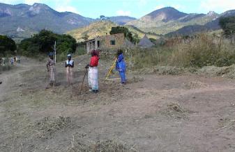


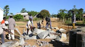
23 the participation of the local community

24 the possible urban design (obtained results) vehicular traffic pedestrian ways lots redesigned areas to maintain for public use previously identified transfering houses located in inappropriate places, such as under the power line and in steep slopes areas
25 conclusions the intervention would play the role of a pilot project; the project would be easily replicated under the situations of many other Mozambican cities and towns, because it is manageable at the local level, and it has lower costs, if compared with those usually planned in analogous projects; if this planning exercise achieves at all its expected results the experience can be considered as an methodology for managing urban growth and transformation processes that will link the plan to its implementation. that s why...
26 we are proposing to extend the methodology, where is included also the use of satellite imagery that can be ordered now orthorectified (ikonos and quickbird) and stereopairs for photogrametry scope (ikonos)
 using IKONOS 2003 PSM true color 1,0m")
27 city of Tete, center of Mozambique (UN-HABITAT cities alliance ) using IKONOS 2003 PSM true color 1,0m resolution
 using high resolution 2000")
28 city of Chókwè, south of Mozambique (UN-HABITAT cities alliance ) using high resolution 2000 Ortophotos
 usingquickbird Sub-meter 2004 PSM true color0.")
29 city of Catandica, center of Mozambique German Co-operation for Development (GTZ) usingquickbird Sub-meter 2004 PSM true color0.6m resolution
30 Kanimambo Obrigado Thank you
LAND MARKET IN URBAN ÁREAS
 LAND MARKET IN URBAN ÁREAS By Janete Paula de Assulai Jurist Maputo, 23rd November 2001 The aim of this work is to bring up the land market issue in urban areas. For that, although this phenomenon is being
National Land Cadastre in Mozambique SiGIT as a lever to success
 in Mozambique SiGIT as a lever to success Marisa Balas EXI Lda MOZAMBIQUE Mozambique is located on the south eastern part of the African Continent Territory > than 800 000 km 2 in 11 provinces Population
The Contribution of Forest Owners Associations for the Forest Cadastre Implementation. João Gaspar Ana Navarro Ferreira PORTUGAL
 The Contribution of Forest Owners Associations for the Forest Cadastre Implementation João Gaspar Ana Navarro Ferreira PORTUGAL Motivation Lack of forestry cadastre; Unify all FOAs databases with common
Rapid Urbanization What can land surveyors do? Paul van der MOLEN. % (millions) % Rural ,974 3, ,
 % Rural ,974 3, ,") Rapid Urbanization What can land surveyors do? Paul van der MOLEN What is it all about? population World Urban % Rural % (millions) (millions) (millions) 2011 6,974 3,632 52.1 3,341 47.9 2050 9,306 6,252
Rapid Urbanization What can land surveyors do? Paul van der MOLEN What is it all about? population World Urban % Rural % (millions) (millions) (millions) 2011 6,974 3,632 52.1 3,341 47.9 2050 9,306 6,252
MASS REGISTRATION OF LAND PARCELS USING FIT-FOR-PURPOSE LAND ADMINISTRATION: PROCEDURES AND METHODS
 MASS REGISTRATION OF LAND PARCELS USING FIT-FOR-PURPOSE LAND ADMINISTRATION: PROCEDURES AND METHODS TAREK ZEIN Hansa Luftbild AG, Germany zein@hansaluftbild.de Paper prepared for presentation at the 2017
Good Land Governance for the 2030 Agenda
 Good Land Governance for the 2030 Agenda Addis Ababa, Ethiopia 20-22 April, 2014 Role of Geospatial Information in Good Land Policy and Governance Oumar Sylla UN-Habitat/GLTN oumar.sylla@unhabitat.org
FIG-WB Forum on Land Administration
 FIG-WB Forum on Land Administration and Reform in Sub-Sahara Africa [Nigeria] [Peter O. Adeniyi] FIG WORKING WEEK, Abuja, NIGERIA 2013-6-10 MAY 2013 Statistic Country at a Glance Total population 162,470,737
Post-War Urban Land Markets in Luanda, Angola
 Post-War Urban Land Markets in Luanda, Angola Presented by Development Workshop Angola To the World Bank Conference on Land and Poverty Washington 23 to 26 th April 2012 Post Conflict Urban Challenges
Alternatives for Economic Boundary Determination in the Establishment of a Cadastral System. Paper to the FIG Working Week 2012 Rome, May 9, 2012
 Alternatives for Economic Boundary Determination in the Establishment of a Cadastral System Paper to the FIG Working Week 2012 Rome, May 9, 2012 by Gottfried Konecny Emeritus Professor Leibniz University
Creation Land Administration in Formal and Informal Environment. FIG Commission 7 Working Group 1
 Creation Land Administration in Formal and Informal Environment András OSSKÓ, Hungary Key words: land administration, informal land tenure, customary tenure, sustainable Development. SUMMARY FIG Commission
A Geocoded Cadastral Fabric as a Precondition for a Sustainable Land Management System
 A Geocoded Fabric as a Precondition for a Sustainable Land Management System Gottfried KONECNY, Germany; J.P. LAUZON, Canada; Abdul Salam MOHAMMED, India Key words: SDI,, Parcel Boundaries, GPS-GNSS, Land
WHAT IS AN APPROPRIATE CADASTRAL SYSTEM IN AFRICA?
 WHAT IS AN APPROPRIATE CADASTRAL SYSTEM IN AFRICA? Tommy ÖSTERBERG, Sweden Key words: ABSTRACT The following discussion is based on my experiences from working with cadastral issues in some African countries
Fit-For-Purpose Land Administration: Guiding Principles FACILITATED BY:
 Fit-For-Purpose Land Administration: Guiding Principles 1. GLTN overview - GLTN BRIEFING AND PROGRAMME 2. Geospatial Data - Sustainable Development - 3. Fit-for-purpose Land Administration Guiding Principles
Low Cost Titling in Africa
 Low Cost Titling in Africa Land Tenure Regularisation in Rwanda Presentation to the World Bank Annual Land Conference, Washington DC April 26-27, 2010 National Land Centre, Ministry of Environment and
LOW-COST LAND INFORMATION SYSTEM FOR SUSTAINABLE URBAN DEVELOPMENT
 Presented at the FIG Congress 2018, May 6-11, 2018 in Istanbul, Turkey LOW-COST LAND INFORMATION SYSTEM FOR SUSTAINABLE URBAN DEVELOPMENT Case Examples in Kenya and Zambia Presented by John Gitau Land
Malawi: Lilongwe (Chinsapo & Mtandire)
") Urban Land Market Study How the poor access, hold and trade land Malawi: Lilongwe (Chinsapo & Mtandire) March 2013 Contents 1. Purpose of the study 2. Methodology 3. Background 4. Key findings 5. Conclusions
Urban Land Market Study How the poor access, hold and trade land Malawi: Lilongwe (Chinsapo & Mtandire) March 2013 Contents 1. Purpose of the study 2. Methodology 3. Background 4. Key findings 5. Conclusions
Quality Improvement of the Real Estate Cadastre in Serbia
 , Serbia Key words: quality improvement, real estate information, quality assurance, Serbia SUMMARY The concept of cadastral modernization in the Republic of Serbia was defined in 1992, and it is being
The development of a GIS for an informal settlement. Benita NORDIN, Swedesurvey AB
 Benita NORDIN, Swedesurvey AB Key words: GIS, informal settlement, land tenure, adjudication SUMMARY The purpose of the paper is to try to show examples of the use of GIS as one of the tools for solving
Quality Improvement to Cadastral Information in Sweden
 Gunnar BLIXT, Sweden Key words: digital cadastre, quality, cadastral index map, real property register. SUMMARY Lantmäteriet is a governmental agency which gives support for creating an efficient and sustainable
Shared Objectives and Partnerships in land management and administration BURKINA FASO
 Shared Objectives and Partnerships in land management and administration BURKINA FASO Abdoulaye BELEM Institut Géographique du Burkina +226 25 32 48 23/24 www.igb.bf dg@igb.bf In collaboration with Paul
Cadastral Template 2003
 PCGIAP-Working Group 3 "Cadastre" FIG-Commission 7 "Cadastre and Land Management" Cadastral Template 2003 The establishment of a cadastral template is one of the objectives of Working Group 3 "Cadastre"
By: Barney I. S. Laseko Programme Coordinator Prime Minister s Office TANZANIA
 2014 CONFERENCE ON LAND POLICY IN AFRICA 11 14 NOVEMBER, 2014 Focussed Discussion VIII Converting from Manual Land Registration to GIS Enabled Land Information System Case of Sub Saharan Africa Tanzania
THE APPLICATION OF GIS AND LIS Solutions and Experiences in East Africa. Lenny Kivuti
 Using GIS and LIS for Planning Sustainable Development Bepic Group CHOGM, Malta 2005 THE APPLICATION OF GIS AND LIS Solutions and Experiences in East Africa Lenny Kivuti 21 November, 2005 Presented by
DEMOCRATIC REPUBLIC OF EAST TIMOR MINISTRY OF JUSTICE
 DEMOCRATIC REPUBLIC OF EAST TIMOR MINISTRY OF JUSTICE Alterations in the first version of the Bill for a Special Regimen for Definition of Ownership of Immovable Property (Lei de Terras) (Land Law) The
Development of Cadastral Survey and Land Ownership Registration System in Mongolia
 Development of Cadastral Survey and Land Ownership Registration System in Mongolia M.Saandar,, Ph. D Vice President, the Mongolian Association of Surveying and Mapping, ( As National Member of FIG ) MonMap
From Measurement to Management
 From Measurement to Management The changing role of the land surveyors Prof. Stig Enemark Aalborg University, Denmark LAND MANAGEMENT AND HUMAN RIGHTS INTERNATIONAL SEMINAR, HØGSKOLEN I BERGEN, 8 9 SEPTEMBER
GLTN LAND TOOLS -SOME EXAMPLES-
 GLTN LAND TOOLS -SOME EXAMPLES- Dr. Jaap Zevenbergen University of Twente What are GLTN Land Tools? GLTN considers that a tool is a practical method to achieve a defined objective in a particular context.
The Fit- for-purpose Concept
 The Fit- for-purpose Concept Building Spatial Frameworks for Sustainable Land Governance in Sub-Sahara Africa Prof. Stig Enemark Honorary President Aalborg University, Denmark LAND POLICIES AND LAND GOVERNANCE,
FIG-WB Forum on Land Administration and reform in Sub-Sahara Africa
 FIG-WB Forum on Land Administration and reform in Sub-Sahara Africa Chris Mnyanga Ministry of Lands UNITED REPUBLIC OF TANZANIA] FIG WORKING WEEK, Abuja, NIGERIA 2013-6-10 MAY 2013 Country at Glance UNITED
Cadastral Information System of Sofia
 Alexander LAZAROV and Hristo DECHEV, Bulgaria Key words: ABSTRACT A new Cadastre and Property Register Act (CPRA) was passed in April 2000, setting up rules for the maintenance of these two registers.
TIMOR-LESTE EXPROPRIATIONS LEGAL FRAMEWORK APPROVED
 TIMOR-LESTE EXPROPRIATIONS LEGAL FRAMEWORK APPROVED INTRODUCTION After approximately 8 years of discussions, the Timor-Leste Parliament recently approved the Country s Expropriations Law (the Law ) by
Systematic Land Information Management (SLIM)
") Systematic Land Information Management (SLIM) By Mr. Jukka Nieminen Jaakko Pöyry Infra Soil and Water Ltd. Expert Group Meeting on Secure Land Tenure: New Legal Frameworks and Tools Nairobi 12 November
Systematic Land Information Management (SLIM) By Mr. Jukka Nieminen Jaakko Pöyry Infra Soil and Water Ltd. Expert Group Meeting on Secure Land Tenure: New Legal Frameworks and Tools Nairobi 12 November
National Land Use Policy
 Government of the Republic of the Union of Myanmar National Land Use Policy (6 th Draft) 2015, May CONTENT Sr. Content Page 1. Introduction 1-2 2. Part-I Objectives and Basic Principles Chapter-I Objectives
Amalia Velasco Carlos Alonso Luis Virgos Fernando Serrano
 Inspire services of the Spanish Directorate General for Cadastre and its use to resolve an old problem of coordination between Spanish Cadastre and Land Registry. Amalia Velasco Carlos Alonso Luis Virgos
University of Nairobi LAND INFORMATION SYSTEM FOR LAND MANAGEMENT IN KENYA. CASE STUDY: NAIROBI COUNTY, BURUBURU PHASE I ESTATE
 University of Nairobi LAND INFORMATION SYSTEM FOR LAND MANAGEMENT IN KENYA. CASE STUDY: NAIROBI COUNTY, BURUBURU PHASE I ESTATE BY Justus Amdavi F56/69371/2013 Supervisor: Mr Jasper Mwenda CONTENTS Introduction
Land Tools for Tenure Security for All
 Land Tools for Tenure Security for All PROF. JAAP ZEVENBERGEN UNIVERSITY OF TWENTE - ITC 1 ST JUNE 2017 HELSINKI, FINLAND GLOBAL LAND CHALLENGES 70 % Dealing with the affordability issue - how to modernize
Commission 7, Land Administration and IT. Paul van der Molen INTERNATIONAL INSTITUTE FOR GEO-INFORMATION SCIENCE AND EARTH OBSERVATION
 Commission 7, Land Administration and IT Paul van der Molen INTERNATIONAL INSTITUTE FOR GEO-INFORMATION SCIENCE AND EARTH OBSERVATION FIG Commission 7 on cadastre and land management Study Visits (e.g.
Key Concepts, Approaches and Tools for Strengthening Land Tenure Security
 Key Concepts, Approaches and Tools for Strengthening Land Tenure Security Dr. Samuel Mabikke Land & GLTN Unit / UN-Habitat Urban CSO Cluster Learning Exchange on Strengthening Land Tenure Security for
PROPOSAL FOR THE URBAN REAL ESTATE PROPERTY TAX MANAGEMENT DIAGNOSIS IN BRAZIL
 PROPOSAL FOR THE URBAN REAL ESTATE PROPERTY TAX MANAGEMENT DIAGNOSIS IN BRAZIL Marcos A. PELEGRINA and Lia BASTOS Maio de 2009 Geog. Marcos A.. Pelegrina, M.Engº 1 Geog. Marcos A.. Pelegrina, M.Engº 2
Fiscal Cadastral Reform and the Implementation of CAMA in Cape Town: financing transformation
 Fiscal Cadastral Reform and the Implementation of CAMA in Cape Town: financing transformation Jennifer WHITTAL, South Africa Mike BARRY, Canada Policies and Innovations Expert Group Meeting on Secure Land
Flexible tenure. 1 Global Innovation assessment - Human Cities Coalition
 Flexible tenure Decision making process: Explore to develop new mechanisms to better integrate community needs into existing city development/housing plans, in particular plans around development of new
PREPARATION FOR LAND CONSOLIDATION IN LITHUANIA. Vilma Daugaliene National Land Service under the Ministry of Agriculture
 PREPARATION FOR LAND CONSOLIDATION IN LITHUANIA Vilma Daugaliene National Land Service under the Ministry of Agriculture Symposium on Modern Land Consolidation Volvic (Clermont-Ferrand), France, September
Mini-Thesis Siam University (International Master of Business Administration), Bangkok, Thailand 2015 CHAPTER IV
, Bangkok, Thailand 2015 CHAPTER IV") CHAPTER IV 4. Land Issues: 4.1 Land Ownership: In Vietnam, land cannot be owned either by individuals or by entities, whether they are Vietnamese or foreign. The Constitution provides that land is owned
CHAPTER IV 4. Land Issues: 4.1 Land Ownership: In Vietnam, land cannot be owned either by individuals or by entities, whether they are Vietnamese or foreign. The Constitution provides that land is owned
Decree on State Land Lease or Concession
 Lao People s Democratic Republic Peace Independence Democracy Unity Prosperity ~~~~~~~~~~~~~ Prime Minister s Office No. 135/PM VCC, Date 25/05/2009 Decree on State Land Lease or Concession - Pursuant
Low Cost Cadastral Data Acquisition? ANNUAL WORLD BANK CONFERENCE ON LAND AND POVERTY World Bank - Washington DC April 23-26, 2012
 Low Cost Cadastral Data Acquisition? ANNUAL WORLD BANK CONFERENCE ON LAND AND POVERTY World Bank - Washington DC April 23-26, 2012 Christiaan Lemmen, Co Meijer, Jaap Zevenbergen, Rohan Bennett Abstract
Reporting Thailand Cadastral System in Cadastre 2014 Trends BY VUTTINAN UTESNAN. Rajamangala University of Technology Krungthep
 Reporting Thailand Cadastral System in Cadastre 2014 Trends BY VUTTINAN UTESNAN Rajamangala University of Technology Krungthep Faculty of Engineering, Bangkok, THAILAND Topics INTRODUCTION THAILAND CADASTRAL
COUNTY GOVERNMENT OF LAMU Department of Land, Physical Planning, Infrastructure & Urban Development
 1 COUNTY GOVERNMENT OF LAMU Department of Land, Physical Planning, Infrastructure & Urban Development TERMS OF REFERENCE FOR OUTSOURCING OF CONSULTANCY SERVICES FOR SURVEY & REGULARIZATION OF KATSAIKAIKAIRU
Theme II. Customers and Services NEW PROJECTS OF THE AGENZIA DEL TERRITORIO. Marco SELLERIE
 UNITED NATIONS ECONOMIC COMMISSION FOR EUROPE COMMITTEE ON HUMAN SETTLEMENTS WORKING PARTY ON LAND ADMINISTRATION Workshop "Customer - Co-operation - Services" Vienna, Austria 12-13 September 2002 Theme
INDIAN INSTITUTE OF TECHNOLOGY ROORKEE. Presentation on REAL TIME CADASTRAL SURVEYING SOLUTION WITH A SPECIAL IMPHESIS TO MODERN GPS TECHNOLOGY.
 INDIAN INSTITUTE OF TECHNOLOGY ROORKEE Presentation on REAL TIME CADASTRAL SURVEYING SOLUTION WITH A SPECIAL IMPHESIS TO MODERN GPS TECHNOLOGY By: Prof. Kamal Jain, Dept. of Civil Engg. IIT-Roorkee AIM
Policy, Legal and Institutional Assessment Framework
 Policy, Legal and Institutional Assessment Framework Large-Scale Land Acquisition for Agricultural Production Mozambique Simon Norfolk Draft 25 May 2009 (10 September 2009) ACRONYMS ANE CBNRM CENACARTA
Land Tenure and Geospatial Data and Technology
 Land Tenure and Geospatial Data and Technology Ioana Bouvier E3/Land and Urban, USAID Senior Geospatial Analyst January 23, 2018 January 23, 2018 1 OUTLINE 1. Overview of geospatial data and technology
Establishment of a land market in Ukraine: current state and prospects
 Establishment of a land market in Ukraine: current state and prospects More than 25 years have passed since the adoption of the first resolution of the Verkhovna Rada On Land Reform. Despite such a long
Land Tenure and Land Management Issues for REDD Preparation in Guyana: Framing the Agenda for Policy Discussion
 Land Tenure and Land Management Issues for REDD Preparation in Guyana: Framing the Agenda for Policy Discussion Malcolm D. Childress Sr. Land Administration Specialist The World Bank Paper prepared for
UNPLANNED URBAN DEVELOPMENT
 National Technical University of Athens School of Rural and Surveying Engineering UNPLANNED URBAN DEVELOPMENT Chryssy A Potsiou, Lecturer NTUA chryssyp@survey.ntua.gr UNECE WPLA WORKSHOP EFFECTIVE AND
LAND TENURE IN ASIA AND THE PACIFIC CHALLENGES, OPPORTUNITIES AND WAY FORWARD
 LAND TENURE IN ASIA AND THE PACIFIC CHALLENGES, OPPORTUNITIES AND WAY FORWARD Workshop on Land Administration and Management 20th United Nations Regional Cartographic Conference for Asia and the Pacific
Hi-tech Survey Operation using Modern Technologies: Concept & Process Flow
 Hi-tech Survey Operation using Modern Technologies: Concept & Process Flow Presented by Sri Biswaranjan Rath Asst. Director,CLR Board of Revenue, Odisha Limitations of present system of surveying Survey
GLTN Tools and Approaches in Support of Land Policy Implementation in Africa
 GLTN Tools and Approaches in Support of Land Policy Implementation in Africa Jamal Browne (UN-Habitat), Jaap Zevenbergen (ITC), Danilo Antonio (UN-Habitat), Solomon Haile (UN-Habitat) Land Policy Development
Recent development in land consolidation in Macedonia and land valuation issues
 Recent development in land consolidation in Macedonia and land valuation issues EMERALD(2008-2009)-Encouraging Macedonia s Endeavours to Rural Land Development and STIMERALD(2010-2012) Origin of Emerald
Spatially Enabled Society Role of the Cadastre
 armasuisse Bundesamt für Landestopografie swisstopo Swiss Federal Directorate for Cadastral Surveying Spatially Enabled Society Role of the Cadastre XXIV FIG International Congress 2010 FIG-Task Force
In search of land laws that protect the rights of forest peoples in the Democratic Republic of Congo
 Executive Summary In search of land laws that protect the rights of forest peoples in the Democratic Republic of Congo October 2014 Part of the under the canopy series INTRODUCTION The aim of this study
Implementation of Fit for Purpose Land Administration in Nepal, in a post disaster context.
 Implementation of Fit for Purpose Land Administration in Nepal, in a post disaster context. Paula Dijkstra, Raja Ram Chhatkuli, Danilo Antonio, Eva-Maria Unger, Chrit Lemmen Wondimagegm Tesfaye, Shristee
Land Management Procedures and Informal Constructions in Cyprus. Marilena Theodorou, Land Surveyor, Cyprus, Dr Chryssy Potsiou, Lecturer NTUA, Greece
 Land Management Procedures and Informal Constructions in Cyprus Marilena Theodorou, Land Surveyor, Cyprus, Dr Chryssy Potsiou, Lecturer NTUA, Greece FIG Working Week 2008 Integrating Generations Objectives
Mark Napier, Remy Sietchiping, Caroline Kihato, Rob McGaffin ANNUAL WORLD BANK CONFERENCE ON LAND AND POVERTY
 Mark Napier, Remy Sietchiping, Caroline Kihato, Rob McGaffin ANNUAL WORLD BANK CONFERENCE ON LAND AND POVERTY RES4: Addressing the urban challenge: Are there promising examples in Africa? Tuesday, April
Conservancy Mission. Leveraging GIS Technologies in Chesapeake Conservation and Restoration 10/17/2018
 Leveraging GIS Technologies in Chesapeake Conservation and Restoration Rachel Soobitsky Geospatial Project Manager Chesapeake Conservancy Conservation Innovation Center Kristin Kirkwood Executive Director
REPORT 2014/050 INTERNAL AUDIT DIVISION. Audit of United Nations Human Settlements Programme operations in Sri Lanka
 INTERNAL AUDIT DIVISION REPORT 2014/050 Audit of United Nations Human Settlements Programme operations in Sri Lanka Overall results relating to the effective and efficient implementation of the UN-Habitat
ABSTRACT Land Administration System in Lithuania
 ABSTRACT Land Administration System in Lithuania 1. General introduction to the Lithuanian Land Administration System and State Enterprise Centre of Registers ( shortly SECR) Lithuania has established
Low Cost Cadastral Data Aquisition?
 Low Cost Cadastral Data Aquisition? Jacobus Meijer and Christiaan Lemmen (Netherlands): 21 May 2011 Abstract Spatial Cadastral Data (Mapping) Participatory Development Some low cost approaches in cadastral
Ignition for Fit For Purpose Land Administration in Nepal
 Presented at the FIG Working Week 2017, May 29 - June 2, 2017 in Helsinki, Finland Ignition for Fit For Purpose Land Administration in Nepal Paula Dijkstra (Netherlands), David Mitchell, Rohan Bennett
Interviewer. Notes on the back of page (s) Gender Hamlet RT & RW
 Gender Hamlet RT & RW") Key Informant Interview: Land Tenure Writer Interviewer Inputed by Checked by (in the database) Original or copy O C File Name Checked by (in the field) Notes on the back of page (s) Y N Copied? Respondent
Key Informant Interview: Land Tenure Writer Interviewer Inputed by Checked by (in the database) Original or copy O C File Name Checked by (in the field) Notes on the back of page (s) Y N Copied? Respondent
ADDRESSING THE CHALLENGES OF DOING REAL ESTATE BUSINESS IN MOZAMBIQUE. a deep dive look into tax efficiencies, risk mitigation & legal framework
 ADDRESSING THE CHALLENGES OF DOING REAL ESTATE BUSINESS IN MOZAMBIQUE a deep dive look into tax efficiencies, risk mitigation & legal framework 1. Mozambique s legal framework and land use regulations
LAND REFORM AND POVERTY ALLEVIATION IN MOZAMBIQUE PAPER FOR THE SOUTHERN AFRICAN REGIONAL POVERTY NETWORK, HUMAN SCIENCES RESEARCH COUNCIL
 LAND REFORM AND POVERTY ALLEVIATION IN MOZAMBIQUE PAPER FOR THE SOUTHERN AFRICAN REGIONAL POVERTY NETWORK, HUMAN SCIENCES RESEARCH COUNCIL Simon Norfolk (simon.norfolk@teledata.mz) Harold Liversage (harold_liversage@teledata.mz)
New Developments in the Hellenic Cadastre
 New Developments in the Hellenic Cadastre Prof. M. Kavouras Vice-president Ktimatologio S.A. (Hellenic Cadastre) The Hellenic Cadastre Background The Hellenic National Cadastre Organizational and institutional
AN OVERVIEW OF LAND TOOLS IN SUB- SAHARAN AFRICA: PAST, PRESENT AND FUTURE
 AN OVERVIEW OF LAND TOOLS IN SUB- SAHARAN AFRICA: PAST, PRESENT AND FUTURE BY CLARISSA AUGUSTINUS CHIEF, LAND AND TENURE SECTION UNHABITAT Nairobi, 11-11-2004 WHY UN-HABITAT HAS CO-SPONSORED THIS EGM UN-HABITAT
Introduction to Land Tenure Administration
 Introduction to Land Tenure Administration Karol Boudreaux Land Tenure & Resource Rights Practice Lead, The Cloudburst Group January 22, 2018 January 22, 2018 1 WHAT WE LL COVER Background and Definitions
Use of data in Ukraine for sustainable economic growth. Oleksandr Maliuk State Service of Ukraine for Geodesy, Cartography and Cadastre
 Use of data in Ukraine for sustainable economic growth Oleksandr Maliuk State Service of Ukraine for Geodesy, Cartography and Cadastre Kehl, 2017 Content of the presentation Ukraine & StateGeoCadastre:
1. *Does the document clearly specify the aims, objectives and scope of the proposed programme of archaeological work?
 Notes and Guidance This document provides curatorial advisors, archaeological practitioners and other interested parties with additional information and guidance on the standards and expectations for archaeological
INTRODUCTION. Regulation of GI as stated in the Law of Indonesia No. 4 of 2011 about
 FRANKO JHONER, SH As Speaker at Geospatial World Forum 2014, Legal Drafter at The Indonesian Geospatial Information Agency (Badan Informasi Geospasial, Republik Indonesia) Geneva - Switzerland TITLE: PERMISSION
LAND ISSUES AND GEO-INFORMATION: RESPONDING POST DISASTER EARTHQUAKES IN NEPAL
 LAND ISSUES AND GEO-INFORMATION: RESPONDING POST DISASTER EARTHQUAKES IN NEPAL ARBIND MAN TULADHAR FACULTY OF GEO-INFORMATION SCIENCE AND EARTH OBSERVATION (ITC), UNIVERSITY OF TWENTE, THE NETHERLANDS,
How Swaziland Is Upgrading Its Slums
 Public Disclosure Authorized Public Disclosure Authorized Public Disclosure Authorized Public Disclosure Authorized How Swaziland Is Upgrading Its Slums CIVIS chose to profile this example from Swaziland
National Technical University of Athens School of Rural and Surveying Engineering
 National Technical University of Athens School of Rural and Surveying Engineering INFORMAL SETTLEMENTS REAL ESTATE MARKET NEED FOR GOOD LAND ADMINISTRATION AND PLANNING FIG COM3, UNECE CHLM & WPLA JOINT
Valuation Methodology of Unregistered Properties in East Africa
 FIG KL 2014 Valuation Methodology of Unregistered Properties in East Africa James Kavanagh MRICS John Tracey-White FRICS Valuation Methodology of Unregistered Properties in East Africa Origin of the Study
EXCELLENCE IN SURVEYING AWARD,
 EXECUTIVE SUMMARY Cottrell Cameron & Steen Surveys Pty Ltd is a private, survey company registered with the Surveyors Board of Queensland and an accredited surveyor with the Department of Natural Resources
The future development of Post War Single-Family Housing Estates in Germany
 At the crossroads: The future development of Post War Single-Family Housing Estates in Germany Andrea Berndgen-Kaiser, Dipl.-Ing. Architect, Research Institute for Regional and Urban Development London,
LRIMS Cadastre Module
 LRIMS Cadastre Module User Requirements and Functionality (Seychelles Case Study) John Latham, NRL Renato Cumani, NRL Luigi Simeone, NRL Summary Background User Requirements Business Model Application
Land Information System as new instrument for Land Administration: Case Examples. Mike Cheremshynskyi Consultant, Land Administration Expert
 Land Information System as new instrument for Land Administration: Case Examples Mike Cheremshynskyi Consultant, Land Administration Expert Background Growth of population and fast urbanization in many
Improving Land Governance in River Senegal Valley Context, Issues and Challenges
 Improving Governance in River Senegal Valley Context, Issues and Challenges Key words: Decentralized Management, Senegal, Cadastre, Registration SUMMARY After presenting economic social and demographic
Land Markets and Land Rights in support of the Millennium Development Goals
 Land Markets and Land Rights in support of the Millennium Development Goals A Global Perspective Prof. Stig Enemark President Aalborg University, Denmark 3rd LAND ADMINISTRATION FORUM FOR THE ASIA AND
The New Technology of a Survey Data Model and Cadastral Fabric as the Foundation for a Future Land Administration System.
 The New Technology of a Survey Data Model and Cadastral Fabric as the Foundation for a Future Land Ian HARPER, Australia Key words: cadastral modelling, survey data model, Survey Accuracy, Cadastre 2014
Preprint.
 http://www.diva-portal.org Preprint This is the submitted version of a paper presented at 10th EC GI & GIS Workshop, ESDI State of the Art, Warsaw, Poland, 23-25 June 2004. Citation for the original published
OUTLINE OF PRESENTATION
 LAND REGISTRATION USING AERIAL PHOTOGRAPH IN NAMIBIA COSTS AND LESSONS Donatha Kapitango Ministry of Lands and Resettlement Marcel Meijs German Development Agency OUTLINE OF PRESENTATION 1. Introduction
LAND ADMINISTRATION DEVELOPMENTS IN RWANDA
 LAND ADMINISTRATION DEVELOPMENTS IN RWANDA, Rwanda Key words : Land tenure security, land registration, land rights, land commissions. SUMMARY : The new Rwandan land policy consider appropriate land administration
SECURITY OF TENURE - BEST PRACTICES - Regional Seminar on Secure Tenure Safari Park Hotel, Nairobi June 2003
 SECURITY OF TENURE - BEST PRACTICES - Regional Seminar on Secure Tenure Safari Park Hotel, Nairobi 12-13 June 2003 2 SECURITY OF TENURE: BEST PRACTICES 1. Introduction Various definitions of secure tenure
The importance of changes in land surveyors education
 András OSSKÓ Key words: land administration, roles of land surveyors, extended education, lifelong learning SUMMARY It s a world wide experience, especially in developed countries that the interest in
Mozambique INTRODUCTION. Anna Knox and Christopher Tanner
 LESSON 3 LAND LAW PROVIDES THE FOUNDATION FOR SUPPORT OF PARTNERSHIPS 1 JANUARY 2011 Mozambique 1424 Fourth Avenue, Suite 300 Seattle, WA 98101 P 206.528.5880 F 206.528.5881 www.landesa.org Lesson 3: A
REPORT ON UN-HABITAT ACTIVITIES REGARDING INDIGENOUS ISSUES
 REPORT ON UN-HABITAT ACTIVITIES REGARDING INDIGENOUS ISSUES Submitted to the Tenth Session of the Permanent Forum on Indigenous Issues 16-27 May 2011, United Nations, New York Executive summary UN-HABITAT
DECREE GENERAL PROVISIONS DETAILED REGULATIONS ON COMPENSATION, SUPPORT, AND RESETTLEMENT UPON LAND EXPROPRIATION BY THE STATE
 THE GOVERNMENT -------- SOCIALIST REPUBLIC OF VIETNAM Independence Freedom - Happiness ---------------- No.: 47/2014/NĐ-CP Hanoi, May 15, 2014 DECREE REGULATIONS ON COMPENSATION, SUPPORT, AND RESETTLEMENT
Land consolidation and rural development in Serbia
 1 Land consolidation and rural development in Serbia Stevan Marosan University of Belgrade, Faculty of Civil Engineering, Department for Geodesy and Geoinformatics Maja Trajkovic Ministry of Finance Vladan
PROJECT INFORMATION DOCUMENT (PID) CONCEPT STAGE Report No.: AB3229 Project Name. Land Registry and Cadastre Modernization Project Region
 CONCEPT STAGE Report No.: AB3229 Project Name. Land Registry and Cadastre Modernization Project Region") PROJECT INFORMATION DOCUMENT (PID) CONCEPT STAGE Report No.: AB3229 Project Name Land Registry and Cadastre Modernization Project Region EUROPE AND CENTRAL ASIA Sector Central government administration
PROJECT INFORMATION DOCUMENT (PID) CONCEPT STAGE Report No.: AB3229 Project Name Land Registry and Cadastre Modernization Project Region EUROPE AND CENTRAL ASIA Sector Central government administration
Advancing Women s Rights through Housing Cooperative Model
 A Presentation By Mary Mathenge, CEO National Cooperative Housing Union (NACHU), Kenya ICA HOUSING Conference 2nd November 2013 Cape Town, South Africa Advancing Women s Rights through Housing Cooperative
The Characteristics of Land Readjustment Systems in Japan, Thailand, and Mongolia and an Evaluation of the Applicability to Developing Countries
 ISCP2014 Hanoi, Vietnam Proceedings of International Symposium on City Planning 2014 The Characteristics of Land Readjustment Systems in Japan, Thailand, and Mongolia and an Evaluation of the Applicability