Low Cost Cadastral Data Acquisition? ANNUAL WORLD BANK CONFERENCE ON LAND AND POVERTY World Bank - Washington DC April 23-26, 2012
|
|
|
- Hugh Washington
- 6 years ago
- Views:
Transcription


1 Low Cost Cadastral Data Acquisition? ANNUAL WORLD BANK CONFERENCE ON LAND AND POVERTY World Bank - Washington DC April 23-26, 2012 Christiaan Lemmen, Co Meijer, Jaap Zevenbergen, Rohan Bennett
2 Abstract Spatial Cadastral Data Participatory Fit for purpose? Some low cost approaches Both geo-data as administrative data Overview based on experiences
3 Experiences / Examples: Satellite image - Ethiopia Ortho photo - Namibia GPS, ortho photo - Lesotho Ortho photo - Rwanda Test of digital pen - Rwanda Guinea Bissau - Google Maps images, point Cadastre Some other experiences / tests Remarks

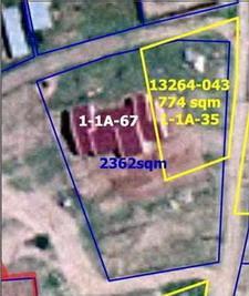
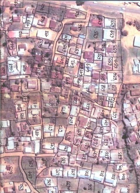
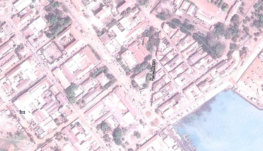
4 Example 1: Satellite Images Ethiopia World Bank Study
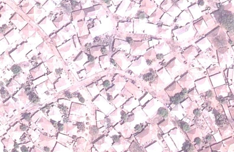
5 Example 2: Namibia Digital ortho photo Land Registration of the Customary Land Rights in Communal Areas 4 pilots EU Ministry of Lands and Resettlement GTZ (GiZ)
6
7
8
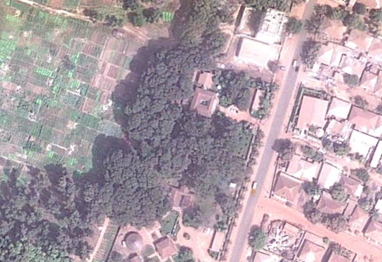
9 Example 3 Lesotho Digital ortho photo, hand helds, rovers etc. MCC MCA-Lesotho Lesotho Land Administration Authority Land Equity International (LEI)

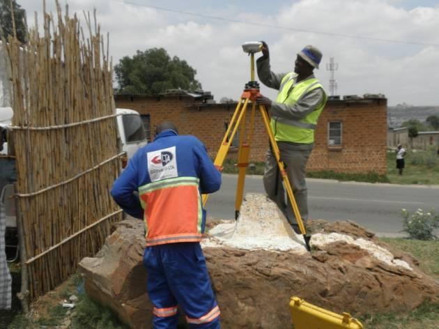
10 Example 3 Lesotho GPS

11 Example 3 Lesotho
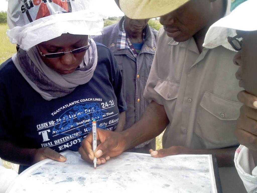
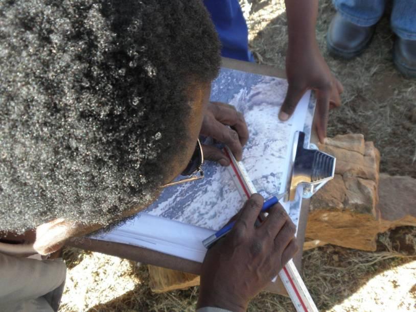
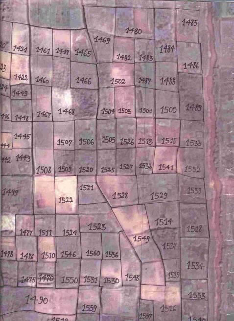
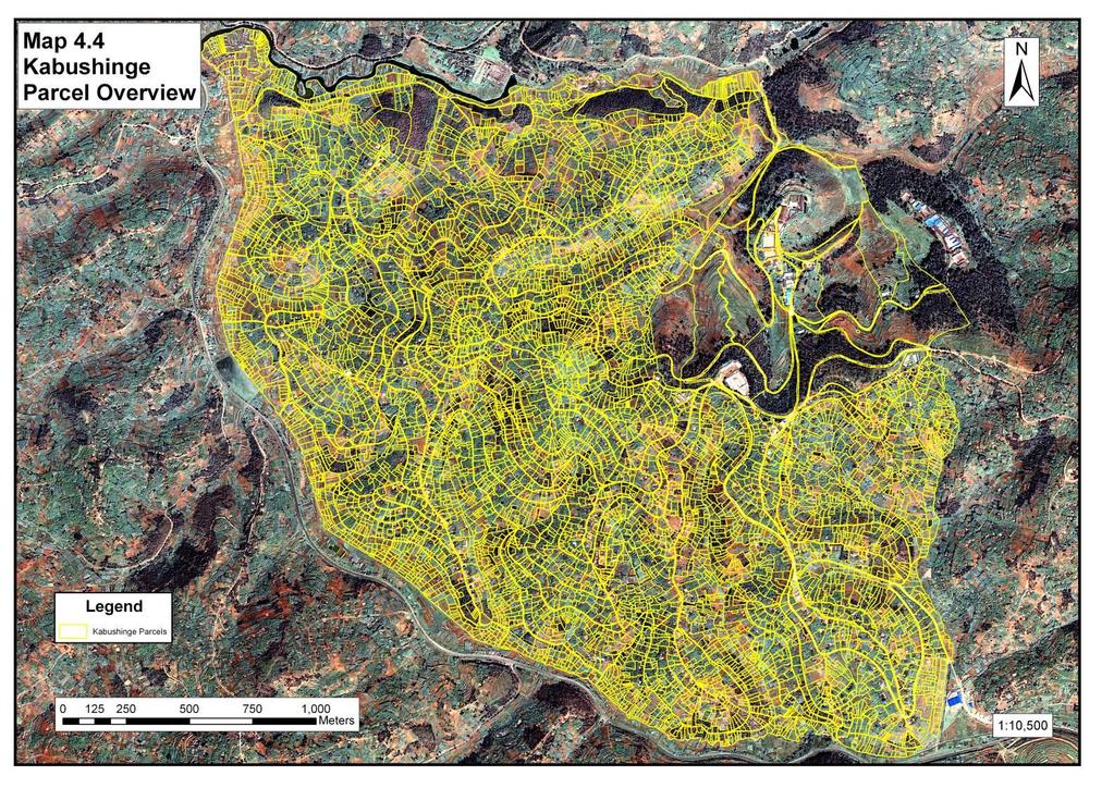
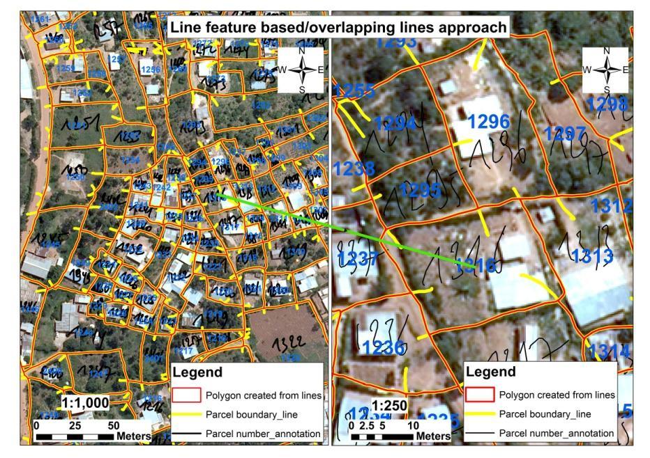
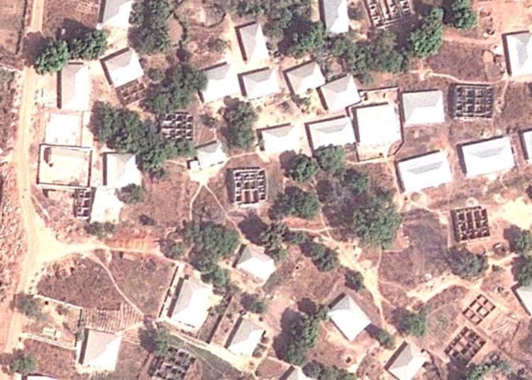
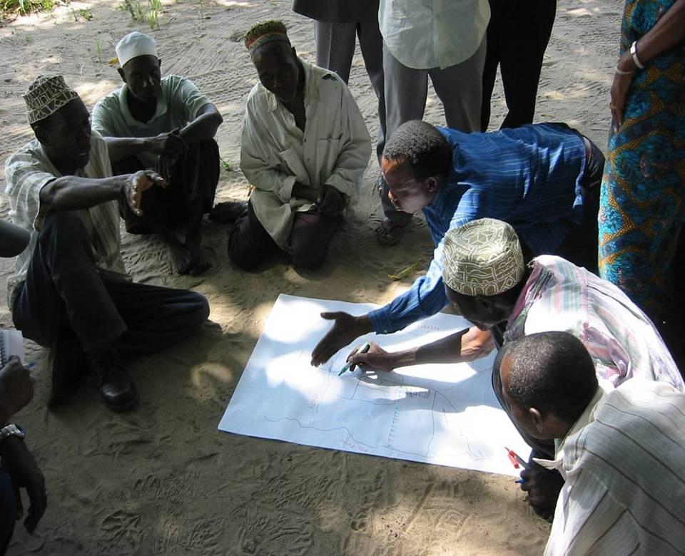
12 Example 4: Rwanda Land Tenure Regularisation project Satellite image and ortho photo based data acquisition Drawing boundaries in the field by pencil Post processing by: Scanning field sheets Geo-referencing Vectorising boundaries


13 Example 7 DFID National Land Centre, HTSPE
14
15
16
17
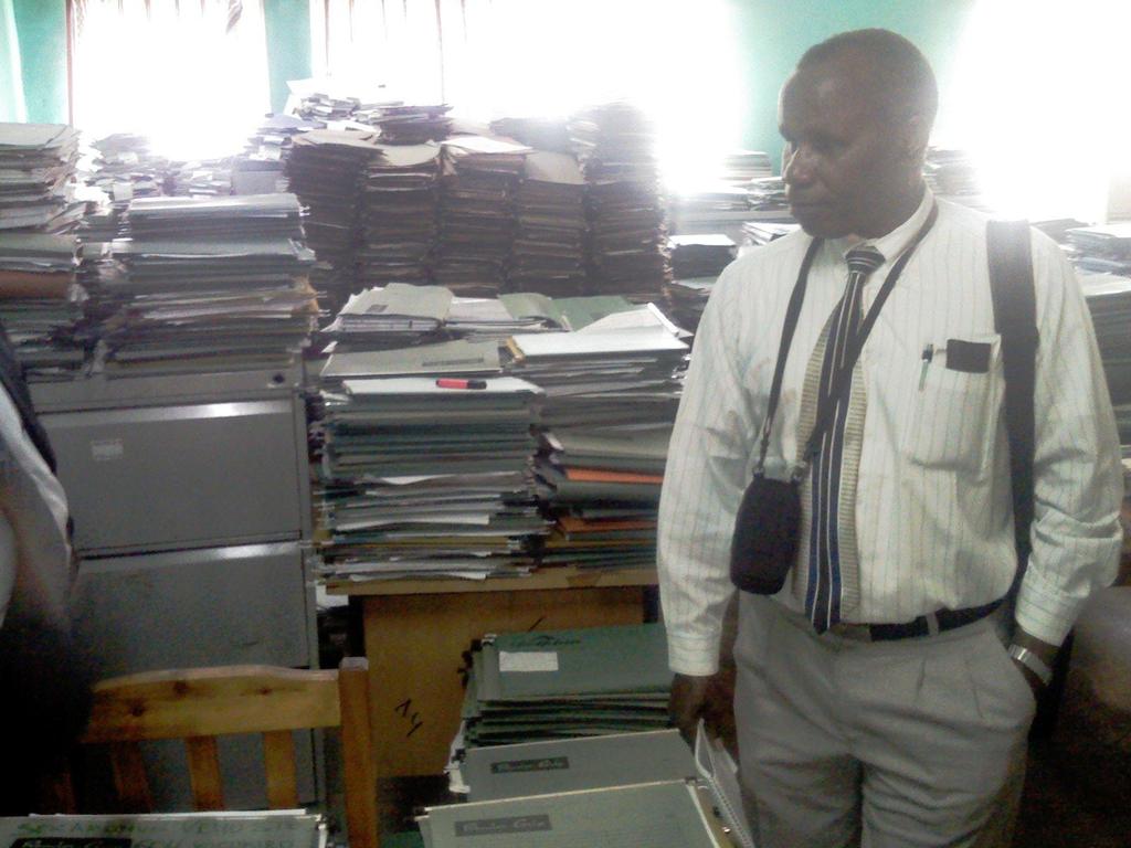
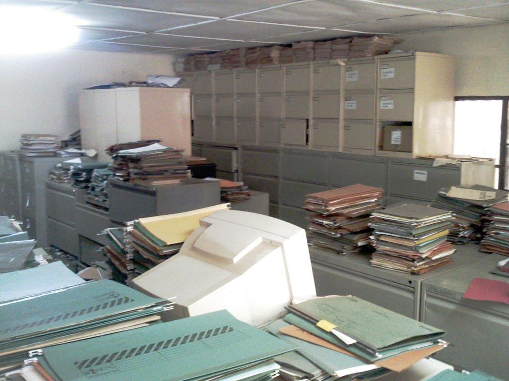
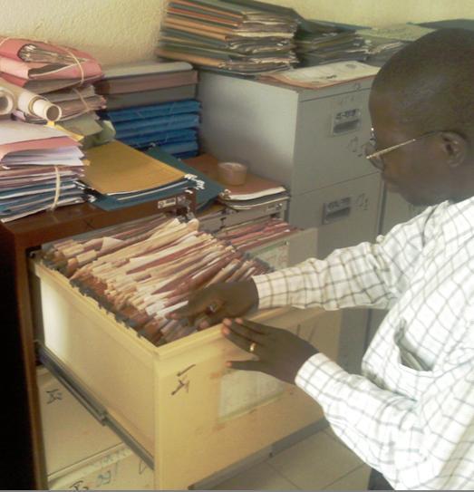
18 What to do with existing land files Scanning and make digital? Or: Reorganise the paper archive, improve and store well; develop an indexing system Start all over with land adjudication and registration, systematic approach, fit for purpose, the old archive can be as back up in cases of doubts, questions etc.
19
20
21
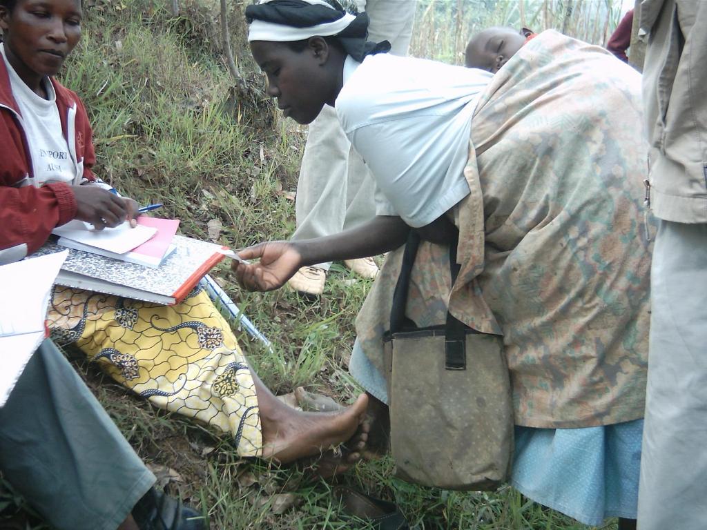
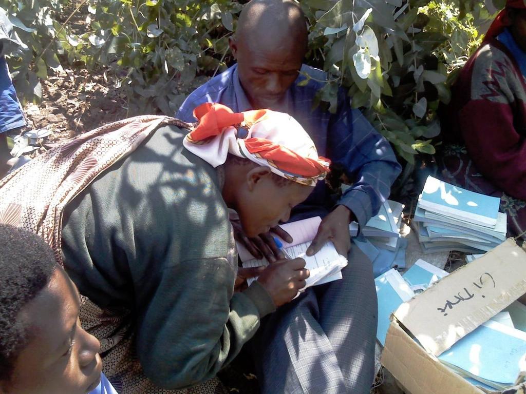
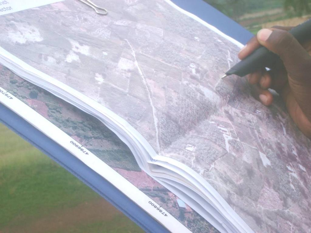
22 Example 5: Test digital pen Rwanda Test of Digital Pen A study in Rwanda by Didier Milindi Rugema (MSc Theses ITC) Conclusions: Digital pen method can improve efficiency Some related applications software have to be improved

23 Test digital pen Rwanda Efficient data acquisition methods needed This test focuses on spatial data acquisition

24 Test digital pen Rwanda
25
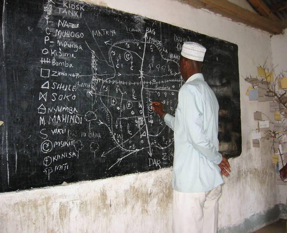
26 Example 6: Point Cadastre An example: Proposal / Brainstorm for Bissau
27
28
29
30

31 Foto
32
33 Point Cadastre!?!?
34 Photo Identifier Bairro 01 Name of Inspector Yussuf
35 Photo Identifier Bairro 01 Name of Inspector Yussuf
36 Photo Identifier Bairro 01 Name of Inspector Yussuf
37 Photo Identifier Bissau, Bairro 01 Name of Inspector Yussuf Identifaca Casa Bairro Nomo Numero Numero cao Numero Proprietar Processo Tailhao Da Casa io Ultimo Pagamen to
38 Office Open Photo in GIS Find House 1 Find Ficha House 1 Connect Ficha Co-ordinates
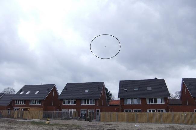
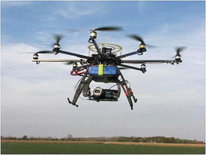
39 Photo Identifier Bairro 01 Name of Inspector Yussuf Objects under construction
40 Photo Identifier Bairro 01 Name of Inspector Yussuf Objects under construction No Tax Paid and not registered
41 Photo Identifier Bairro 01 Name of Inspector Yussuf Objects under construction No Tax Paid and not registered No Tax Paid but registered

42 Photo Identifier Name of of Inspector Photo Identifier Bairro 01 Yussuf Objects under construction Neighbor Inspector No Tax Paid and not registered No Tax Paid but registered Tax Paid
43 Multi Purpose Cadastre: Tax Registration Health Water Electricity Building Register
44 Final remarks / studies What is society waiting for: monumentation of parcels or titles to their plots

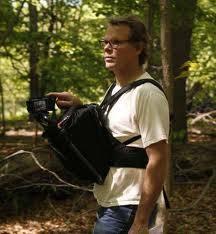
45 Field Survey - Tablet PC
46 Drones or Octocopters
47
48

49 Unconventional Approaches
, More Global information: Land Tool Network from the UN Habitat, FAO and")
50 Participation in international fora In order to promote its policy Kadaster also takes part in international forums, e.g., UNECE/WPLA (United Nations Thank you for your attention Economic Council for Europe / Working Party on Land Administration), More Global information: Land Tool Network from the UN Habitat, FAO and FIG (International Federation of Surveyors). co.meijer@kadaster.nl lemmen@itc.nl We are also responsible for OICRF, the International Office of Cadastre and Land Records. This centre is a permanent institution of the FIG. The library comprises more than 8000 digital documents about all aspects of land administration. Every day students, PhD candidates and professionals download documents.
Low Cost Cadastral Data Aquisition?
 Low Cost Cadastral Data Aquisition? Jacobus Meijer and Christiaan Lemmen (Netherlands): 21 May 2011 Abstract Spatial Cadastral Data (Mapping) Participatory Development Some low cost approaches in cadastral
The computerised land reallotment process in Turkey and the Netherlands in multi-purpose land consolidation projects
 The computerised land reallotment process in Turkey and the Netherlands in multi-purpose land consolidation projects FIG Conference, 15 April 2010, Sydney Louisa J. M. Jansen (Netherlands), Mustafa Karatas,
MASS REGISTRATION OF LAND PARCELS USING FIT-FOR-PURPOSE LAND ADMINISTRATION: PROCEDURES AND METHODS
 MASS REGISTRATION OF LAND PARCELS USING FIT-FOR-PURPOSE LAND ADMINISTRATION: PROCEDURES AND METHODS TAREK ZEIN Hansa Luftbild AG, Germany zein@hansaluftbild.de Paper prepared for presentation at the 2017
From LADM/STDM to a spatially enabled society: a vision for Harry UITERMARK, Peter VAN OOSTEROM, Jaap ZEVENBERGEN and Christiaan LEMMEN
 From LADM/STDM to a spatially enabled society: a vision for 2025 Harry UITERMARK, Peter VAN OOSTEROM, Jaap ZEVENBERGEN and Christiaan LEMMEN Introduction (1) Vision is a co-production Founding fathers
GLTN LAND TOOLS -SOME EXAMPLES-
 GLTN LAND TOOLS -SOME EXAMPLES- Dr. Jaap Zevenbergen University of Twente What are GLTN Land Tools? GLTN considers that a tool is a practical method to achieve a defined objective in a particular context.
Commission 7, Land Administration and IT. Paul van der Molen INTERNATIONAL INSTITUTE FOR GEO-INFORMATION SCIENCE AND EARTH OBSERVATION
 Commission 7, Land Administration and IT Paul van der Molen INTERNATIONAL INSTITUTE FOR GEO-INFORMATION SCIENCE AND EARTH OBSERVATION FIG Commission 7 on cadastre and land management Study Visits (e.g.
Commission 7 Cadastre and Land Administration. Work Plan
 Commission 7 Cadastre and Land Administration Work Plan 2011 2014 Appendix to item 17.7 1. Title Cadastre and Land Administration 2. Terms of Reference Commission 7 deals with land administration and land
The Requirements for Point Cadastres
 Robert ANTWI, Ghana; Rohan BENNETT, Walter DE VRIES, Chistiaan LEMMEN, Co Meijer; The Netherlands Key words: point cadastres; single point cadastre; land administration SUMMARY This paper reintroduces
UN-HABITAT s Mission and Vision. Sustainable urban development Adequate shelter for all
 GLTN contributes to the implementation of pro poor land policies to achieve secure land rights for all www.gltn.net GLTN Secretariat, facilitated by PO Box 30030, Nairobi 00100, Kenya Tel: +254 20 762
Implementation of Fit for Purpose Land Administration in Nepal, in a post disaster context.
 Implementation of Fit for Purpose Land Administration in Nepal, in a post disaster context. Paula Dijkstra, Raja Ram Chhatkuli, Danilo Antonio, Eva-Maria Unger, Chrit Lemmen Wondimagegm Tesfaye, Shristee
Low Cost Titling in Africa
 Low Cost Titling in Africa Land Tenure Regularisation in Rwanda Presentation to the World Bank Annual Land Conference, Washington DC April 26-27, 2010 National Land Centre, Ministry of Environment and
Curriculum Vitae for Fredrik Zetterquist
 Curriculum Vitae for Fredrik Zetterquist Date of birth: June 2, 1963 Nationality: Current position: Swedish CEO at Swedesurvey Key qualifications: Leadership As CEO for Swedesurvey (Sep 2012 ongoing) the
FIG-WB Forum on Land Administration
 FIG-WB Forum on Land Administration and Reform in Sub-Sahara Africa [Nigeria] [Peter O. Adeniyi] FIG WORKING WEEK, Abuja, NIGERIA 2013-6-10 MAY 2013 Statistic Country at a Glance Total population 162,470,737
First experiences with High Resolution Imagery Based Adjudication Approach for Social Tenure Domain Model in Ethiopia
 First experiences with High Resolution Imagery Based Adjudication Approach for Social Tenure Domain Christiaan LEMMEN, Jaap ZEVENBERGEN, Monica LENGOIBONI, The Netherlands, Klaus DEININGER, United States,
From LADM/STDM to a spatially enabled society: a vision for Harry UITERMARK, Peter VAN OOSTEROM, Jaap ZEVENBERGEN and Christiaan LEMMEN
 From LADM/STDM to a spatially enabled society: a vision for 2025 Harry UITERMARK, Peter VAN OOSTEROM, Jaap ZEVENBERGEN and Christiaan LEMMEN Introduction (1) Presentation is a coproduction Founding fathers
Systematic Land Regularization in Lesotho
 Systematic Land Regularization in Lesotho Jakob Riise Ian Corker Jan van Bennekom-Minnema Key words: Systematic Land Regularization First Registration Rights Adjudication General Boundary Survey Cadastre
Land Tools for Tenure Security for All
 Land Tools for Tenure Security for All PROF. JAAP ZEVENBERGEN UNIVERSITY OF TWENTE - ITC 1 ST JUNE 2017 HELSINKI, FINLAND GLOBAL LAND CHALLENGES 70 % Dealing with the affordability issue - how to modernize
Reporting Thailand Cadastral System in Cadastre 2014 Trends BY VUTTINAN UTESNAN. Rajamangala University of Technology Krungthep
 Reporting Thailand Cadastral System in Cadastre 2014 Trends BY VUTTINAN UTESNAN Rajamangala University of Technology Krungthep Faculty of Engineering, Bangkok, THAILAND Topics INTRODUCTION THAILAND CADASTRAL
A Quantitative Comparison of Completely Visible Cadastral Parcels Using Satellite Images: A Step towards Automation
 A Quantitative Comparison of Completely Visible Cadastral Parcels Using Satellite Images: A Step towards Automation Divyani KOHLI, Netherlands, Rohan BENNETT, Australia, Christiaan LEMMEN, Kwabena ASIAMA,
Land Administration Developments in Rwanda
 Land Administration Developments in Rwanda Eugène RURANGWA Expert Group Meeting on secure land tenure new legal frameworks and tools UN-Gigiri, Nairobi, 10-12 November, 2004 Contents Somme figures about
FIG-WB Forum on Land Administration and reform in Sub-Sahara Africa
 FIG-WB Forum on Land Administration and reform in Sub-Sahara Africa Chris Mnyanga Ministry of Lands UNITED REPUBLIC OF TANZANIA] FIG WORKING WEEK, Abuja, NIGERIA 2013-6-10 MAY 2013 Country at Glance UNITED
The LADM and the Continuum of Land Rights
 CheeHai TEO, Malaysia and Christiaan Lemmen, the Netherlands Key words: LADM, Continuum of Land Rights, Voluntary Guidelines, Spatial Enabled Societies SUMMARY The development of the Land Administration
COMMISSION 7 CADASTRE AND LAND MANAGEMENT WORK PLAN
 Appendix to item 34.7 FIG Congress in Washington, 19-26 April 2002 COMMISSION 7 CADASTRE AND LAND MANAGEMENT WORK PLAN 2002 2006 1. Title Cadastre and Land Management 2. Terms of Reference Commission 7
KHANALIBAYLI UNECE WPLA
 UNECE Working Party on Land Administration The role of the UNECE Working Party on Land Administration (WPLA) in the promotion and improvement of land administration and land management in the UNECE region
Working Group 3 Application of Innovative Technology
 COMMISSION 7 Working Group 7.3 Annual Meeting Seoul, 18-23 May 2007 Working Group 3 Application of Innovative Technology Dr. Daniel Steudler Swiss Federal Directorate of Cadastral Surveying Table of Content
THE NEED FOR APPROACHES AND TECHNOLOGY OF TOMORROW
 THE NEED FOR APPROACHES AND TECHNOLOGY OF TOMORROW KEES DE ZEEUW, CHRISTIAAN LEMMEN and BERNY KERSTEN Cadastre, Land Registry and Mapping Agency - Kadaster, The Netherlands Kees.dezeeuw@kadaster.nl Paper
BEYOND LAND TENURE REGULARISATION: ACHIEVING SUSTAINABILITY. RICHARD BALDWIN, CLIVE ENGLISH, GAVIN ADLINGTON DAI Europe Ltd
 BEYOND LAND TENURE REGULARISATION: ACHIEVING SUSTAINABILITY RICHARD BALDWIN, CLIVE ENGLISH, GAVIN ADLINGTON DAI Europe Ltd Richard_baldwin@dai.com Paper prepared for presentation at the 2016 WORLD BANK
Jack McKenna, Director of Business Development, Africa and the Caribbean
 Presented at the FIG Working Week 2016, May 2-6, 2016 in Christchurch, New Zealand Jack McKenna, Director of Business Development, Africa and the Caribbean FIG WORKING WEEK 2016 Fit for Purpose Parcel
LOW-COST LAND INFORMATION SYSTEM FOR SUSTAINABLE URBAN DEVELOPMENT
 Presented at the FIG Congress 2018, May 6-11, 2018 in Istanbul, Turkey LOW-COST LAND INFORMATION SYSTEM FOR SUSTAINABLE URBAN DEVELOPMENT Case Examples in Kenya and Zambia Presented by John Gitau Land
Land Tenure and Geospatial Data and Technology
 Land Tenure and Geospatial Data and Technology Ioana Bouvier E3/Land and Urban, USAID Senior Geospatial Analyst January 23, 2018 January 23, 2018 1 OUTLINE 1. Overview of geospatial data and technology
Cadastre A Vision on Future Cadastral Systems
 Cadastre 2014 - A Vision on Future Cadastral Systems Jürg Kaufmann - 1 - CONTENTS ABOUT FIG ENVIRONMENT FOR THE DEVELOPMENT OF CADASTRE 2014 DEVELOPMENT OF CADASTRE 2014 PRINCIPLES OF CADASTRE 2014 EFFECTS
A Geocoded Cadastral Fabric as a Precondition for a Sustainable Land Management System
 A Geocoded Fabric as a Precondition for a Sustainable Land Management System Gottfried KONECNY, Germany; J.P. LAUZON, Canada; Abdul Salam MOHAMMED, India Key words: SDI,, Parcel Boundaries, GPS-GNSS, Land
THE APPLICATION OF GIS AND LIS Solutions and Experiences in East Africa. Lenny Kivuti
 Using GIS and LIS for Planning Sustainable Development Bepic Group CHOGM, Malta 2005 THE APPLICATION OF GIS AND LIS Solutions and Experiences in East Africa Lenny Kivuti 21 November, 2005 Presented by
Implementing Innovative Land Tenure Tools In East-Africa: SWOT-Analysis Of Land Governance
 Presented at the FIG Working Week 2017, May 29 - June 2, 2017 in Helsinki, Finland Implementing Innovative Land Tenure Tools In East-Africa: SWOT-Analysis Of Land Governance Ine BUNTINX, Joep CROMPVOETS,
UN-GGIM Expert Group on Land Administration and Management Expert Group Meeting, Delft, The Netherlands 14 & 15 March, 2017
 UN-GGIM Expert Group on Land Administration and Management Expert Group Meeting, Delft, The Netherlands 14 & 15 March, 2017 BACKGROUND DOCUMENT The Delft Expert Group Meeting This two-day meeting of the
Innovations in Education at Faculty ITC and within Land Administration Programme
 Innovations in Education at Faculty ITC and within Land Administration Programme Prof. Jaap Zevenbergen, Vice-Dean Education at Faculty ITC, Prof. Land Administration dr. Dimo Todorovski, Course Coordinator
Land Markets and Land Rights in support of the Millennium Development Goals
 Land Markets and Land Rights in support of the Millennium Development Goals A Global Perspective Prof. Stig Enemark President Aalborg University, Denmark 3rd LAND ADMINISTRATION FORUM FOR THE ASIA AND
Systematic Urban Titling in Benin
 Systematic Urban Titling in Benin Bill Valletta, MCC Property Rights and Land Tenure Specialist Transformation of customary/contractual and administrative rights in urban land parcels into civil law proprietorship
Agenda. Clarissa Augustinus, UN-HABITAT and Christiaan Lemmen and Peter van Oosterom, The Netherlands 15. Billion people URBAN 60%
 Social Tenure Domain Model (STDM) Requirements from the perspective of Pro-Poor Land Management Clarissa Augustinus, Chief, Land and Tenure Section, UN-HABITAT Christiaan Lemmen, ITC/Kadaster, The Netherlands
The development of a GIS for an informal settlement. Benita NORDIN, Swedesurvey AB
 Benita NORDIN, Swedesurvey AB Key words: GIS, informal settlement, land tenure, adjudication SUMMARY The purpose of the paper is to try to show examples of the use of GIS as one of the tools for solving
Results of Central European Land Knowledge Center (CELK) Activities
 Activities") Results of Central European Land Knowledge Center (CELK) Activities András OSSKÓ, Hungary Key words :CELK Center, Property Rights and Land Market Development, Networking, direct knowledge transfer SUMMARY
Results of Central European Land Knowledge Center (CELK) Activities András OSSKÓ, Hungary Key words :CELK Center, Property Rights and Land Market Development, Networking, direct knowledge transfer SUMMARY
Developments in the Standardisation of the Core Cadastral Domain Model
 Developments in the Standardisation of the Core Cadastral Domain Model Christiaan Lemmen, Paul vander Molen Kadaster and ITC, The Netherlands Peter van Osterom, Jaap Zevenbergen and Wilko Quak Delft University,
Reforming the Land Sector in Jamaica
 Silburn CLARKE and Llewelyn ALLEN, Jamaica Key words: tenure, cadastre, land reform, adjudication, public awareness, land titling, GPS, parcel mapping, traversing, land legislation, tenure regularisation,
The Intelligent Cadastre
 The Intelligent Cadastre Rohan Bennett, Kwabena Asiama, and Jaap Zevenbergen FIG Commission 7/3 Workshop on Crowdsourcing of Land Information St Juliens, Malta 16-20 November 2015 What is intelligent?
NEW DEVELOPMENTS IN THE REAL PROPERTY REGISTER AND CADASTRE IN LITHUANIA
 NEW DEVELOPMENTS IN THE REAL PROPERTY REGISTER AND CADASTRE IN LITHUANIA Jaunius Grigas E-mail: jaunius.grigas@registrucentras.lt Verona, 2008 FUNCTIONS OF STATE ENTERPRISE CENTRE OF REGISTERS Registration
International funding projects in Republic Geodetic Authority
 International funding projects in Republic Geodetic Authority Serbia: Republic Geodetic Authority Workshop Exploring Funding Instruments for NMCA 7-8 November 2012 Republic Geodetic Authority Republic
CADASTRE 2014: New Challenges and Direction
 CADASTRE 2014: New Challenges and Direction Anna KRELLE and Abbas RAJABIFARD, Australia Key words: Cadastre, Cadastre 2014, Land Administration SUMMARY Land and land related activities form part of the
Mass Valuation and Sales Price Register in the Republic of Serbia
 REPUBLIC OF SERBIA REPUBLIC GEODETIC AUTHORITY Mass Valuation and Sales Price Register in the Republic of Serbia Department for Mass Valuation Head of Department: Marija Raskovic procena@rgz.gov.rs Soest,
LAND TENURE IN ASIA AND THE PACIFIC CHALLENGES, OPPORTUNITIES AND WAY FORWARD
 LAND TENURE IN ASIA AND THE PACIFIC CHALLENGES, OPPORTUNITIES AND WAY FORWARD Workshop on Land Administration and Management 20th United Nations Regional Cartographic Conference for Asia and the Pacific
LAND ADMINISTRATION DEVELOPMENTS IN RWANDA
 LAND ADMINISTRATION DEVELOPMENTS IN RWANDA, Rwanda Key words : Land tenure security, land registration, land rights, land commissions. SUMMARY : The new Rwandan land policy consider appropriate land administration
Fit-For-Purpose Land Administration, Standards and Interoperability
 Fit-For-Purpose Land Administration, Standards and Interoperability Christiaan Lemmen Kadaster International University of Twente/ITC UN GGIM Seminar Effective Land Administration Deqing China September,
LIS Development Project and Measures Proposed to Enhance Trust in the Land Administration System in Uganda
 Project for Design, Supply, Installation and Implementation of the Land Information System and Securing of Land Records (DeSILISoR) LIS Development Project and Measures Proposed to Enhance Trust in the
GLTN Tools and Approaches in Support of Land Policy Implementation in Africa
 GLTN Tools and Approaches in Support of Land Policy Implementation in Africa Jamal Browne (UN-Habitat), Jaap Zevenbergen (ITC), Danilo Antonio (UN-Habitat), Solomon Haile (UN-Habitat) Land Policy Development
Use of data in Ukraine for sustainable economic growth. Oleksandr Maliuk State Service of Ukraine for Geodesy, Cartography and Cadastre
 Use of data in Ukraine for sustainable economic growth Oleksandr Maliuk State Service of Ukraine for Geodesy, Cartography and Cadastre Kehl, 2017 Content of the presentation Ukraine & StateGeoCadastre:
Directorate of Survey and Mapping NAMIBIA. Cadastral Information System. Vehupisa Kasuko Tjatindi Surveyor Directorate of Survey and Mapping NAMIBIA
 Vehupisa Kasuko Tjatindi Directorate of Survey and Mapping NAMIBIA Tel: +64 61 965000 Directorate of Survey and Mapping NAMIBIA Cadastral Information System Introduction Over the past few decades cadastral
BOOSTING THE REGISTRATION OF LAND RIGHTS IN STEP WITH THE SUSTAINABLE DEVELOPMENT GOALS
 BOOSTING THE REGISTRATION OF LAND RIGHTS IN STEP WITH THE SUSTAINABLE DEVELOPMENT GOALS KEES DE ZEEUW Cadastre, Land Registry and Mapping Agency - Kadaster, The Netherlands Kees.dezeeuw@kadaster.nl CHRISTIAAN
Presented by: Stewart Information International, Inc. Jack McKenna
 Presented by: Stewart Information International, Inc. Jack McKenna Held at the: 2007 ESRI Survey & Engineering GIS Summit San Diego Convention Center San Diego, California June 16-19, 2007 Integrating
Responsible and Innovative Land Administration
 Responsible and Innovative Land Administration An Example from Ethiopia 3 RD DECEMBER 2018 Outline A few words about NIRAS Fit-for-purpose: A low-tech disruptive approach? The REILA Project in Ethiopia
Experiences with land reform and land consolidation in Moldova
 FIG Working Week Rome 7 May 2012 TS03G 6145 Morten Hartvigsen Head of Land Management Section Ph.D. Student at Aalborg University moha@orbicon.dk www.orbicon.dk 1 Land reform in Moldova (1/2): Most of
Scenic Nepal. Land Administration Systems. Outline of Presentation. Interests in land. Rights: Registration and security of tenure positions
 Scenic Nepal Land Administration Systems Managing Rights, Restrictions, and Responsibilities in Land Prof. Stig Enemark President Aalborg University, Denmark SURVEY DEPARTMENT KATHMANDU, NEPAL. 16 FEBRUARY
Interoperability in surveying
 Interoperability in surveying Ron Bloksma Kadaster Dutch Land Registry Thread in my career Law Organisation Processes Information Legal interoperability Organisational interoperability Semantic interoperability
Fit-For-Purpose what is it?
 FIG Commission 7 Annual Meeting 2016 Working Group 7.1 Fit-For-Purpose Land Administration Christiaan Lemmen October, 24th 2016 Coimbra, Portugal Fit-For-Purpose what is it? Fit-for-purpose: The systems
Creation Land Administration in Formal and Informal Environment. FIG Commission 7 Working Group 1
 Creation Land Administration in Formal and Informal Environment András OSSKÓ, Hungary Key words: land administration, informal land tenure, customary tenure, sustainable Development. SUMMARY FIG Commission
Ignition for Fit For Purpose Land Administration in Nepal
 Presented at the FIG Working Week 2017, May 29 - June 2, 2017 in Helsinki, Finland Ignition for Fit For Purpose Land Administration in Nepal Paula Dijkstra (Netherlands), David Mitchell, Rohan Bennett
Annual Meeting II/2016 FIG Commission 7 Cadastre & Land Management. Report
 Annual Meeting II/2016 FIG Commission 7 Cadastre & Land Management Report 1 Structure Chair G. Schennach (AT) V-Chair for communications, social media, web Hyunsook LEE (KR) WG 7.1 Fit-For-Purpose LA Ch.
Land Reform Development in Rwanda. Kagera TAMP Lessons learnt. Workshop - Entebbe, Nov.2005
 Land Reform Development in Rwanda Kagera TAMP Lessons learnt. Workshop - Entebbe, 23 30 Nov.2005 Some figures about Rwanda Area : 26,338 km 2 Population:8,128,553 million Physical density:321inhab/ km
The Multipurpose Hungarian Unified Land Registry System
 The Multipurpose Hungarian Unified Land Registry System András Osskó FIG Working Week Integrating Generation Stockholm, Sweden 14-19 June 2008 Republic of Hungary is located in Central Europe Neighbouring
RWANDA NATURAL RESOURCES AUTHORITY Department of Lands and Mapping
 RWANDA NATURAL RESOURCES AUTHORITY Department of Lands and Mapping National Land Use and Development Master Plan Presentation to National Forum on Sustainable Urbanisation in Support of EDPRS 2 Eng. Didier
IT Solutions in Supporting Rwanda Land Administration System
 Ease of Doing Business Initiative Conference 2016 Digitizing Government business Leveraging ICT to enhance the Business Environment IT Solutions in Supporting Rwanda Land Administration System Pothin MUVARA
The Fit- for-purpose Concept
 The Fit- for-purpose Concept Building Spatial Frameworks for Sustainable Land Governance in Sub-Sahara Africa Prof. Stig Enemark Honorary President Aalborg University, Denmark LAND POLICIES AND LAND GOVERNANCE,
Commission Chair
 Commission no. 8 Nominee Name Country Marije Louwsma Netherlands Contact Address PO Box 9046 7300 GH Apeldoorn The Netherlands E-mail address marije.louwsma@kadaster.nl Age 38 Degrees and educational background
Cadastral Information System for M.I. Wushishi Housing Estate.
 Cadastral Information System for M.I. Wushishi Housing Estate. Kemiki O. A 1 * Odumosu J.O 2 Ayoola A.B 1 Popoola N.I 1 1, Department of Estate Management and Valuation, Federal University of Technology,
GAUSSCAD A WEBGIS APPLICATION FOR COLLECTING CADASTRAL DATA
 M.M. Moise GaussCAD a WebGIS Application for Collecting Cadastral Data GAUSSCAD A WEBGIS APPLICATION FOR COLLECTING CADASTRAL DATA Mihai-Mircea MOISE, S.C. GAUSS S.R.L., mihai.moise@gauss.ro Abstract:
The Profession between Cadastre and Citizen
 The Profession between Cadastre and Citizen Gerda Schennach, Austria Chair of FIG Commission 7 1 A human right UN DECLARATION OF HUMAN RIGHTS Article 17 par (1) Everyone has the right to own property alone
Presented at the FIG Congress 2018, May 6-11, 2018 in Istanbul, Turkey
 Presented at the FIG Congress 2018, May 6-11, 2018 in Istanbul, Turkey 5 Bibliometric Analysis of Articles Presented Under Commission 7: A Case of the 25th Fig Congress in Malaysia in 2014 Zeynel Abidin
Good Land Governance for the 2030 Agenda
 Good Land Governance for the 2030 Agenda Addis Ababa, Ethiopia 20-22 April, 2014 Role of Geospatial Information in Good Land Policy and Governance Oumar Sylla UN-Habitat/GLTN oumar.sylla@unhabitat.org
NELGA GOOD PRACTICES. Training Workshop on Effective Land Administration in Africa
 Training Workshop on Effective Land Administration in Africa Training workshop on effective land administration in Africa A training workshop on effective land administration in Africa was held at United
Land Administration in Jordan
 Land Administration in Jordan Problems and Challenges Eng. Director of Registration Services Department of Lands & Survey q General information q Historical Background q Properties Initiation q Problems
LAND ADMINISTRATION SYSTEM IN BRUNEI DARUSSALAM
 LAND ADMINISTRATION SYSTEM IN BRUNEI DARUSSALAM Presenter: Maslina Abu Bakar Brunei Darussalam AVA-Brunei Chapter 1 Presentation Content: 1. Introduction. 2. Land Administration. 3. Relevant Laws on Land
AN OVERVIEW OF LAND TOOLS IN SUB- SAHARAN AFRICA: PAST, PRESENT AND FUTURE
 AN OVERVIEW OF LAND TOOLS IN SUB- SAHARAN AFRICA: PAST, PRESENT AND FUTURE BY CLARISSA AUGUSTINUS CHIEF, LAND AND TENURE SECTION UNHABITAT Nairobi, 11-11-2004 WHY UN-HABITAT HAS CO-SPONSORED THIS EGM UN-HABITAT
The agenda for a Group of Experts on Land Administration and Management within the United Nations
 Presented at the FIG Working Week 2016, May 2-6, 2016 in Christchurch, New Zealand The agenda for a Group of Experts on Land Administration and Management within the United Nations Kees de Zeeuw, Kadaster
IMPROVING GOVERNANCE OF TENURE IN UNECE REGION: FAO/WORLD BANK/UNECE/EU JRC PARTNERSHIP
 IMPROVING GOVERNANCE OF TENURE IN UNECE REGION: FAO/WORLD BANK/UNECE/EU JRC PARTNERSHIP RUMYANA TONCHOVSKA, GULNARA ROLL, KATHRINE KELM FAO of the UN, Rome, Italy, Rumyana.Tonchovska@fao.org UNECE, Geneva,
LAND ISSUES AND GEO-INFORMATION: RESPONDING POST DISASTER EARTHQUAKES IN NEPAL
 LAND ISSUES AND GEO-INFORMATION: RESPONDING POST DISASTER EARTHQUAKES IN NEPAL ARBIND MAN TULADHAR FACULTY OF GEO-INFORMATION SCIENCE AND EARTH OBSERVATION (ITC), UNIVERSITY OF TWENTE, THE NETHERLANDS,
EXPLORING OPTIONS FOR STANDARDISATION OF PROCESSES AND TRANSACTIONS IN LAND ADMINISTRATION
 EXPLORING OPTIONS FOR STANDARDISATION OF PROCESSES AND TRANSACTIONS IN LAND ADMINISTRATION CHRISTIAAN LEMMEN (1),(2), EVA-MARIA UNGER (2), PETER VAN OOSTEROM (3), MOHSEN KALANTARI (4) AND KEES DE ZEEUW
contents Government and Governance Governance and Space Governance Space and Land Development, land and space Securities,
 contents Governance and Space the Role of of Civil Registers and Registers of of Public and Private Land as as Conditions for for Development Johan de Meijere The Netherlands Mabel Alvarez de Lopez Argentina
REGISTRATION OF PROPERTIES IN STRATA
 REGISTRATION OF PROPERTIES IN STRATA REPORT ON THE WORKING SESSIONS INTRODUCTION A cadastre is usually, and in most countries, a parcel-based, and up-to-date land information system containing records
The Message FIG-WB Partnership on Land Governance in Support of the Global Agenda
 FIG-WB Partnership on Land Governance in Support of the Global Agenda Prof. Stig Enemark, Denmark President 2007-2010 Mr. Teo Chee Hai, Malaysia President Elect 2011-2014 WORLD BANK LAND GROUP, WASHINGTON,
EXPANDING AVAILABILITY OF BROADBAND ACCESS AND ADOPTION
 Single point information Ilija Kepevski Agency for Electronic Communications Regional Conference for Europe EXPANDING AVAILABILITY OF BROADBAND ACCESS AND ADOPTION 28-29 September 2015 - Budva, Montenegro
THE CONTINUUM OF LAND RIGHTS
 THE CONTINUUM OF LAND RIGHTS Clarissa Augustinus, GLTN/UN-Habitat FIG Working Week, Sophia, Bulgaria, 17-21 June 2015 THE CONTINUUM OF LAND RIGHTS APPROACH Recognising, Recording, Administering a variety
Strengthening Property Rights in Pursuit of Poverty Reduction: Commentary on the 2010 Lesotho Land Reform Project
 Strengthening Property Rights in Pursuit of Poverty Reduction: Commentary on the 2010 Lesotho Land Reform Project Resetselemang Clement Leduka Department of Geographical & Environmental Sciences National
Upgrading and Land Titling in Informal Settlements. Manica City
 Expert Group Meeting on secure land tenure: 'new legal frameworks and tools' November10-12 2004, UNGigiri in Nairobi, Kenya Upgrading and Land Titling in Informal Settlements Manica City MANICA PROVINCE,
Rohan Bennett (PhD) Jaap Zevenbergen (Prof.)
 Jaap Zevenbergen (Prof.)") Developing an integrated conceptual model to understand land governance continuum Berhanu K. Alemie (PhD) Rohan Bennett (PhD) Jaap Zevenbergen (Prof.) Presentation outline Background Research objective
Developing an integrated conceptual model to understand land governance continuum Berhanu K. Alemie (PhD) Rohan Bennett (PhD) Jaap Zevenbergen (Prof.) Presentation outline Background Research objective
Shared Objectives and Partnerships in land management and administration BURKINA FASO
 Shared Objectives and Partnerships in land management and administration BURKINA FASO Abdoulaye BELEM Institut Géographique du Burkina +226 25 32 48 23/24 www.igb.bf dg@igb.bf In collaboration with Paul
Fit-For-Purpose Land Administration: Guiding Principles FACILITATED BY:
 Fit-For-Purpose Land Administration: Guiding Principles 1. GLTN overview - GLTN BRIEFING AND PROGRAMME 2. Geospatial Data - Sustainable Development - 3. Fit-for-purpose Land Administration Guiding Principles
The Developing Role of the Surveyor in a Developing World
 The Developing Role of the Surveyor in a Developing World Paula DIJKSTRA 24-9-2018 FIG Seminar Cadastre in a digital world Nordic and Global Perspective Developing World requires reliable geospatial information
UN GGIM LAUNCHES A GROUP OF EXPERTS ON LAND ADMINISTRATION AND MANAGEMENT. KEES DE ZEEUW 1
 UN GGIM LAUNCHES A GROUP OF EXPERTS ON LAND ADMINISTRATION AND MANAGEMENT KEES DE ZEEUW 1 Kees.dezeeuw@kadaster.nl MAHASHE CHAKA 2 Mahashe.Chaka@laa.org.ls CECILLE BLAKE 3 Blake1@un.org 1 Kadaster - Cadastre,
Cadastral Development - Introduction
 Cadastral Development - Introduction Erik Stubkjær Department of Development and Planning, Aalborg University, DK A Theoretical Base for Cadastral Development KTH, Stockholm, 2003 Overview 1. 2. 3. 4.
The importance of changes in land surveyors education
 András OSSKÓ Key words: land administration, roles of land surveyors, extended education, lifelong learning SUMMARY It s a world wide experience, especially in developed countries that the interest in
How Big is Global Insecurity of Tenure?
 Presented at the FIG Working Week 2016, May 2-6, 2016 in Christchurch, New Zealand Know Edge Limited Location Information Innovation How Big is Global Insecurity of Tenure? Dr Robin McLaren Know Edge Ltd,
A CADASTRAL GEODATA BASE FOR LAND ADMINISTRATION USING ARCGIS CADASTRAL FABRIC MODEL A CASE STUDY OF UWANI ENUGU, ENUGU STATE, NIGERIA
 A CADASTRAL GEODATA BASE FOR LAND ADMINISTRATION USING ARCGIS CADASTRAL FABRIC MODEL A CASE STUDY OF UWANI ENUGU, ENUGU STATE, NIGERIA BY Ndukwu, Raphael. Ike Department of Geoinformatics & Surveying University