Meeting the Changing National Geospatial Information Needs. Palitha Udayakantha Surveyor General - Sri Lanka
|
|
|
- Junior McBride
- 6 years ago
- Views:
Transcription

1 Meeting the Changing National Geospatial Information Needs Palitha Udayakantha Surveyor General - Sri Lanka

2 Sri Lanka Location Latitude North Longitude East Area Km2 Population 20 Million
3 Survey Department Is the National Mapping and Surveying Agency Conventional tasks Statutory / Cadastral Surveys 1:50,000 and 1:10,000 mapping covering whole country Used to make our products and others are expected to use them Situation is changing and others are demanding We become National Geospatial Information Management Agency in new trend of diminishing boundaries between Surveying and Mapping
 Landuse Places Reserves Terrain (Contour, Spot Heights) Utility (Power")
4 Topo50 Layers Admin (DS Division) Buildings Grid Hydro (Streams, Tanks) Trans (Roads, Railroad) Landuse Places Reserves Terrain (Contour, Spot Heights) Utility (Power Line)
5
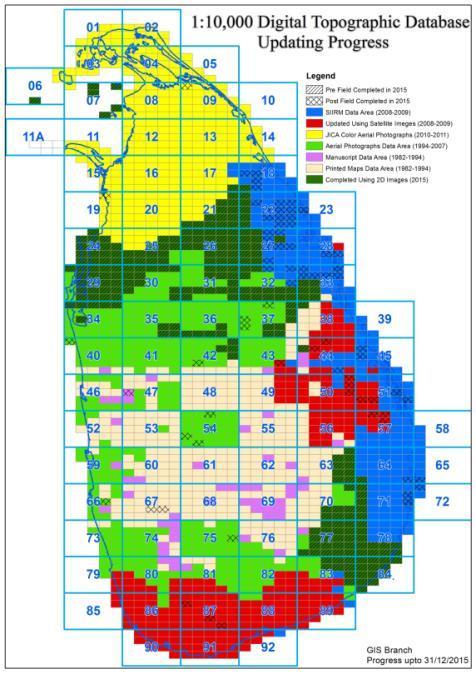
6 50k and 10k Mapping Completed Cadastral survey Program moving slowly Commenced in 2007 Bim Saviya Purely by ground methods 1.0 Mn land parcels completed up to 2015 out total 12 Mn.
7 Changes in Government Policy Government wants to accelerate land grants to people and make 1.0 Mn. free hold grants in two years. Land needs to be identified Need to identify potential lands for development purposes Completed in possible shortest time period Not possible to increase number of Surveyors
8 Need for a unified parcel map Need has been identified and methodologies revised in order to achieve this target. Fit for purpose approach taken and Combination of methods will be used. Different Ground surveys methods in combination with Images (Satellite /Aerial / Lidar ) depending on the need and availability. Data form all possible sources incorporated Hardcopy Maps. Completed in five (05) Years Public - Private Partnership is a key strategy
9 Addressing Changing Needs Need of data at a more detailed level / Especially for disaster management activities. Buildings layer Classification - Hospitals / Schools with further information Urban Development Authority is in the process of collecting building Need for more accurate elevations flood monitoring Rainfall data / River levels Updating data / New openings have to be looked into Making data available at time of need Single organization cannot do them all Co-operation
10 NSDI Sri Lanka We have realized that this is a joint activity where the participation of all stakeholders is required. Data producers, Value addition, users, IT infrastructure and technical support, Industry, Application development Data capture and Dissemination is also equally important
11 Present Status Formal Policy approval was received in September 2013 Agreed to pilot on Disaster Management and Environmental Management NSDI working group formed Virtual NSDI office established Road Map prepared / Development of Map Portal Procurement Process commenced. Survey Department also has developed a metadata site / Coordinated by Inter Ministerial Committee Strong Driving force is required
12 Are we ready to meet the demand Technological issues - Map Portal and application development Geodetic Reference Network - CORS or other referencing / Moving to World Geodetic Datum is being discussed Land Registries and Title registries will be connected to parcel map ownership, rights and restrictions Will ensure updating information on ownership and parcel changes Local Government Authorities will monitor fragmentation and development will ensure changes are updated
13 Working Group July 2015 Ministry of Lands / Survey Department Ministry of Disaster Management / Disaster Management Centre Information and Communication Technology Agency International Water management Institute Ministry of Environment / Central Environmental Authority
14 All Spatial Data available with Survey Department are published in Metadata site Data Standards / Formats are defined Policies related to each dataset is published Other data providers will have to brought in. Make them feel they are responsible partners of the activity
15 Multipurpose Parcel based land information System will be the ultimate solution Land Administration plus other activities Development Planning and monitoring Disaster Management Environmental Management Evidence based decision making Equity and good governance
16 Goodwill or Enforcement Right now organizations join the activity voluntarily. In time to come it may need to make it mandatory to all State agencies to join declare and share possible data sets.
17 Small Advertisement 37 th Asian conference on Remote Sensing will be held in Colombo from 17 th to 21 st October 2016 Hosted Jointly by Survey Department and Asian Association on Remote Sensing With the theme of Spatial Data Infrastructure for Sustainable Development Ideal forum to discuss related matters in detail Welcome to Colombo
18
19 Thank you
Role of Republic Geodetic Authority in the Serbian geo-sector
 Role of Republic Geodetic Authority in the Serbian geo-sector Republic Geodetic Authority, Serbia www.rgz.gov.rs EuroGeographics General Assembly 2014 Moldova, Chisinau, 28 th 30 th September 2014 The
National Spatial Data Infrastructure development in Republic of Macedonia
 National Spatial Data Infrastructure development in Republic of Macedonia Sonja Dimova, state advisor for geomatics AGENCY FOR REAL ESTATE CADASTRE September 6-th, 2017, Strasbourg AREC competence for
International funding projects in Republic Geodetic Authority
 International funding projects in Republic Geodetic Authority Serbia: Republic Geodetic Authority Workshop Exploring Funding Instruments for NMCA 7-8 November 2012 Republic Geodetic Authority Republic
Cadastral NSDI Reference Document
 Cadastral NSDI Reference Document Version 12 October 2012 FGDC Subcommittee for Cadastral Data Cadastral NSDI Reference Document Table of Contents 1. Purpose... 1 2. Business Applications... 1 3. Terminology
Marine Spatial Data Infrastructure (MSDI) & The Marine Cadastre Application. April 10, 2018
 & The Marine Cadastre Application. April 10, 2018") Marine Spatial Data Infrastructure (MSDI) & The Marine Cadastre Application April 10, 2018 A Collaborative Pilot Project Vision of CHS: A framework of geographic data, metadata, users and tools Intent
Marine Spatial Data Infrastructure (MSDI) & The Marine Cadastre Application April 10, 2018 A Collaborative Pilot Project Vision of CHS: A framework of geographic data, metadata, users and tools Intent
Challenges for the multi purpose cadastre
 Jens RIECKEN, Markus SEIFERT, Germany Key words: Multi purpose cadastre, 3d-cadastre, land use, SDI, solar cadastre SUMMARY Over the past 30 years, with the progress of information technologies the development
PROJECT INFORMATION DOCUMENT (PID) CONCEPT STAGE Report No.: AB3229 Project Name. Land Registry and Cadastre Modernization Project Region
 CONCEPT STAGE Report No.: AB3229 Project Name. Land Registry and Cadastre Modernization Project Region") PROJECT INFORMATION DOCUMENT (PID) CONCEPT STAGE Report No.: AB3229 Project Name Land Registry and Cadastre Modernization Project Region EUROPE AND CENTRAL ASIA Sector Central government administration
PROJECT INFORMATION DOCUMENT (PID) CONCEPT STAGE Report No.: AB3229 Project Name Land Registry and Cadastre Modernization Project Region EUROPE AND CENTRAL ASIA Sector Central government administration
GLOBAL GEOSPATIAL MANAGEMENT INFORMATION
 GLOBAL GEOSPATIAL MANAGEMENT INFORMATION SEOUL, KOREA 24 th to 26 th October 2011 COUNTRY REPORT - REPUBLIC OF BOTSWANA 1. INTRODUCTION 1.1. SOCIAL, ECONOMIC AND POLITICAL BACKGROUND Botswana attained
Status and Perspectives of the Geodesy, Cartography and Cadastre Authority Availability of Geographic Information in Slovakia.
 Status and Perspectives of the Geodesy, Cartography and Cadastre Authority Availability of Geographic Information in Slovakia Hedviga Májovská Geodesy, Cartography and Cadastre Authority of the Slovak
Use of data in Ukraine for sustainable economic growth. Oleksandr Maliuk State Service of Ukraine for Geodesy, Cartography and Cadastre
 Use of data in Ukraine for sustainable economic growth Oleksandr Maliuk State Service of Ukraine for Geodesy, Cartography and Cadastre Kehl, 2017 Content of the presentation Ukraine & StateGeoCadastre:
Improvement of Effectiveness Present Developments in Hungarian Land Administration
 Improvement of Effectiveness Present Developments in Hungarian Land Administration Gyula IVÁN and András OSSKÓ, Hungary Key words: Land Administration, Cadastre, Land Registry SUMMARY New Act on Surveying
FIG-WB Forum on Land Administration and reform in Sub-Sahara Africa
 FIG-WB Forum on Land Administration and reform in Sub-Sahara Africa Chris Mnyanga Ministry of Lands UNITED REPUBLIC OF TANZANIA] FIG WORKING WEEK, Abuja, NIGERIA 2013-6-10 MAY 2013 Country at Glance UNITED
THE XXV FIG INTERNATIONAL CONGRESS IN MALAYSIA Kuala Lumpur, Malaysia, June 2014 at Kuala Lumpur Convention Centre
 CALL FOR PAPERS TO THE XXV FIG INTERNATIONAL CONGRESS IN MALAYSIA Kuala Lumpur, Malaysia, 16 21 June 2014 at Kuala Lumpur Convention Centre Dear Friend and Colleague, It is our privilege and honour to
Demonstrate knowledge of, and extract, cadastral data from Landonline
 Page 1 of 5 Demonstrate knowledge of, and extract, cadastral data from Landonline Level 3 Credits 5 Purpose This unit standard is for people who are working in the surveying industry in jobs which involve
AREC responsibilities, data and registries and the way of their distribution
 Data as a basis of the digital society PCC, 13-15 March 2018, Sofia AREC responsibilities, data and registries and the way of their distribution Vlatko Dimovski Agency for Real Estate Cadastre (AREC) the
Key Registers in Finland and some views of Cadastre 2035
 Presented at the FIG Working Week 2016, May 2-6, 2016 in Christchurch, New Zealand Key Registers in Finland and some views of Cadastre 2035 FIG Working Week, Christchurch New Zealand May, the 3rd, 2016
The Governance of Land Use
 The Governance of Land Use Country fact sheet Sweden The planning system Levels of government and their responsibilities Sweden is a unitary country with 3 levels of government; the national level, 21
Presented by: Stewart Information International, Inc. Jack McKenna
 Presented by: Stewart Information International, Inc. Jack McKenna Held at the: 2007 ESRI Survey & Engineering GIS Summit San Diego Convention Center San Diego, California June 16-19, 2007 Integrating
FGDC SUBCOMMITTEE FOR CADASTRAL DATA. October 2004 Albuquerque, New Mexico Meeting
 FGDC SUBCOMMITTEE FOR CADASTRAL DATA October 2004 Albuquerque, New Mexico Meeting The National Spatial Data Infrastructure is the means to assemble geographic information that describes the arrangements
Implementation Status & Results Croatia Integrated Land Administration System Project (P122219)
") Public Disclosure Authorized Public Disclosure Authorized The World Bank Implementation Status & Results Croatia Integrated Land Administration System Project (P122219) Operation Name: Integrated Land
Public Disclosure Authorized Public Disclosure Authorized The World Bank Implementation Status & Results Croatia Integrated Land Administration System Project (P122219) Operation Name: Integrated Land
Keith Clifford Bell The World Bank -East Asia and the Pacific Region WASHINGTON D.C., USA
 Keith Clifford Bell The World Bank -East Asia and the Pacific Region WASHINGTON D.C., USA 4th Land Administration Forum for the Asia and Pacific Region Beyond Spatial Enablement October 5-7, 2011 Melbourne,
Aspect of preliminary activities in the function of supporting NSDI
 Sonja DIMOVA, Republic of Macedonia Key words: e-governance, geospatial data, NSDI, INSPIRE, metadata SUMMARY The successful establishment of the NSDI in the true sense of the word cannot be performed
Land Administration In Public Private Partnerships
 Land Administration In Public Private Partnerships Workshop Customers - Co-operation - Services Vienna, 12-13 September 2002 Peter Creuzer Content Land Administration - Tasks History Spatial Data Infrastructure
Shaping the Cadastral Infrastructure for a Digital Future
 DEPARTMENT OF LANDS PLANNING and the ENVIRONMENT Shaping the Cadastral Infrastructure for a Digital Future Craig Sandy Director Surveys Surveyor General Survey Branch NT Australia Digital Cadastral Databases
Land Administration Trends and Issues in Fiji
 14 th Meeting of the Permanent Committee on GIS Infrastructure for Asia and the Pacific 19-22 August 2008 Land Administration Trends and Issues in Fiji Mr. Kemueli Masikerei Assistant Director Mapping
Egyptian Nationwide Title Cadastre System
 Kholoud SAAD, Egypt Key words: Cadastre, Registration, Urban, Rural, National Cadastre, Automation, reengineering. SUMMARY With growing need for integrated information, Enterprise Solutions has become
Information contained
 Government Information (Public Access) Act 2009 (GIPA Act) LPI Information Guide 1. Introduction and contents of this guide The Land and Property Information s (LPI) Information Guide tells you in general
Procedures for the legalization and registration of buildings and building units Challenges and Problems Building cadastre in Slovenia
 Procedures for the legalization and registration of buildings and building units Challenges and Problems Building cadastre in Slovenia Edvard Mivšek M.Sc. Geodetic institut of Slovenija Pristina, 19 April
BULGARIAN CADASTRE A GUARANTEE FOR THE OWNERSHIP RIGHTS IN IMMOVABLE PROPERTIES
 4 TH INTERNATIONAL CONFERENCE RECENT PROBLEMS IN GEODESY AND RELATED FIELDS WITH INTERNATIONAL IMPORTANCE February 28 - March 2, 2007, Inter Expo Centre, Sofia, Bulgaria BULGARIAN CADASTRE A GUARANTEE
Flood Hazard Modelling
 Flood Hazard Modelling Identification Information Dataset Name: Rapid Flood Hazard Model, Detailed Flood Hazard Model Dataset Abstract: The flood hazard model identifies areas that may be subject to flooding
PREPARING SURVEY TENDER GIS DATABASE OUTCOMES
 PREPARING SURVEY TENDER SPECIFICATIONS FOR PROJECT GIS DATABASE OUTCOMES Presentation by Ian Harper GEODATA AUSTRALIA ESRI User Conference 2009 24 st July 2009 BACKGROUND GIS databases now provide a more
COUNTRY REPORT FOR THE FIJI ISLANDS
 COUNTRY REPORT FOR THE FIJI ISLANDS UNCE GGIM 2nd SESSION AUGUST 2012 NEW YORK Samuela Naicegucegu Assistant Director for Lands Mapping and Land Information Division Ministry of Lands and Mineral Resources
NSDI assessment for the Netherlands
 for the Netherlands Ruby Beltman, Geonovum May 24 2007 Presentation the Dutch public geo-information playing field Geonovum and the Dutch NSDI need for results The Dutch public geo-information playing
Participants of the Ministerial Meeting on Housing and Land Management on 8 October 2013 in Geneva
 Summary At its meeting on 2 April 2012, the Bureau of the Committee on Housing and Land Management of the United Nations Economic Commission for Europe agreed on the need for a Strategy for Sustainable
Functional system for cadastral plans
 , Republic of Macedonia Key words: Cadastre, Digital plans, Data, System SUMMARY The analysis shows that the real estate market in Republic of Macedonia grows daily. With the expansion of this market increases
Moving from a Successful to a Modern Cadastre in LAO PDR
 Moving from a Successful to a Modern Cadastre in LAO PDR Daniel CARTER (Australia) and Bounhom HEUANGSAVATH (Lao PDR) Key Words: cadastre; digital cadastre; land administration systems; South East Asia
Land Information System as new instrument for Land Administration: Case Examples. Mike Cheremshynskyi Consultant, Land Administration Expert
 Land Information System as new instrument for Land Administration: Case Examples Mike Cheremshynskyi Consultant, Land Administration Expert Background Growth of population and fast urbanization in many
8 th FIG Regional Conference Montevideo, Uruguay, November Call for Papers
 8 th FIG Regional Conference Montevideo, Uruguay, 26-29 November 2012 Dear Friend and Colleague, Call for Papers It is our privilege and honour to invite you to the 8 th FIG Regional Conference in Montevideo,
Trimble Land Solutions -Transforming the way land
 Sanjeev Trehan Regional Manager - SAARC MARCH 2016 Trimble Land Solutions -Transforming the way land tenure is secured and land assets are managed. Government Opportunity Challenge Implementation of secure
ParcelMap BC. Compiling a Parcel Fabric for the Province of British Columbia. WENDY AMY and ELLEN STYNER
 ParcelMap BC Compiling a Parcel Fabric for the Province of British Columbia WENDY AMY and ELLEN STYNER Who is MNC? Established in 1997, MNC is a geomatics engineering firm located in Calgary, Alberta.
Recent Developments in Use and Dissemination of Geospatial Data in Germany - Example Lower Saxony
 Recent Developments in Use and Dissemination of Geospatial Data in Germany - Example Lower Saxony Conference Permanent Committee on Cadastre Lithuanian Presidency Vilnius, 22 October 2013 Peter Creuzer
Country Report SWITZERLAND
 armasuisse Federal Office of Topography, swisstopo Country Report SWITZERLAND Dr. Daniel Steudler Swiss Annual Meeting 2013, FIG-Commission 7 22 October 2013, Yaoundé, Cameroon Basic Dimensions SWITZERLAND
Unified Land Administration for a Better Spatial Infrastructure
 Unified Land Administration for a Better Spatial Infrastructure Gyula IVÁN Institute of Geodesy, Cartography & Remote Sensing FÖMI (HUNGARY) Open Symposium 30th Korean Cadastral Seminar & FIG Commission
ParcelMap BC Compiling a Parcel Fabric for the Province of British Columbia. Presented by: Ellen Styner (General Manager) and Wendy Amy (GIS Manager)
 and Wendy Amy (GIS Manager)") ParcelMap BC Compiling a Parcel Fabric for the Province of British Columbia Presented by: Ellen Styner (General Manager) and Wendy Amy (GIS Manager) Who is MNC? MNC is a geomatics engineering firm with
ParcelMap BC Compiling a Parcel Fabric for the Province of British Columbia Presented by: Ellen Styner (General Manager) and Wendy Amy (GIS Manager) Who is MNC? MNC is a geomatics engineering firm with
Cadastral NSDI Reference Document July 2006
 Cadastral NSDI Reference Document July 2006 Purpose This document describes the Cadastral NSDI, its components and the public and private business processes that define the content. The Cadastral National
A CADASTRAL GEODATA BASE FOR LAND ADMINISTRATION USING ARCGIS CADASTRAL FABRIC MODEL A CASE STUDY OF UWANI ENUGU, ENUGU STATE, NIGERIA
 A CADASTRAL GEODATA BASE FOR LAND ADMINISTRATION USING ARCGIS CADASTRAL FABRIC MODEL A CASE STUDY OF UWANI ENUGU, ENUGU STATE, NIGERIA BY Ndukwu, Raphael. Ike Department of Geoinformatics & Surveying University
Importance of Spatial Data Infrastructure in the UNECE Region. Amie Figueiredo INSPIRE Conference 2016 Barcelona, 26 September 2016
 Importance of Spatial Data Infrastructure in the UNECE Region. Amie Figueiredo INSPIRE Conference 2016 Barcelona, 26 September 2016 United Nations Economic Commission for Europe 56 member States in Europe,
An Overview of the eplan Journey with a Focus on the Victorian eplan 2025 Roadmap Dr Hamed Olfat
 An Overview of the eplan Journey with a Focus on the n eplan 2025 Roadmap Dr Hamed Olfat eplan Coordinator Land Use Chairman of Technical Committee ICSM eplan Working Group Outline eplan Overview ICSM
Section I General Information
 General Information Table of Contents A. Introduction... I-2 1. Purpose... I-2 2. Scope... I-2 3. Maintenance... I-3 4. Units... I-3 B. Public Relations... I-3 1. General Public... I-3 2. Property Owners...
Croatian SDI: a Tool for Accelerated Development of the Geo-Conscious Society
 STATE GEODETIC ADMINISTRATION Croatian SDI: a Tool for Accelerated Development of the Geo-Conscious Society Prof.Dr.Sc. Željko Bačić, Mr.Sc. Ljerka Rašić FIG Working Week 2009 - Surveyors Key Role in Accelerated
The Survey Data Model Technology A practical survey solution to generate all levels of spatial and e-governance outcomes.
 Land Governance in a Rapidly Changing Environment Annual World Bank Conference on Land and Poverty April 24 & 25, 2012 The Survey Data Model Technology A practical survey solution to generate all levels
The Digital Cadastral Database and the Role of the Private Licensed Surveyors in Denmark
 IRISH INSTITUTE OF SURVEYORS, DUBLIN INSTITUTE OF TECHNOLOGY, 23 NOVEMBER 2005 PUBLISHED IN IIS NEWS, WINTHER 2006. The Digital Cadastral Database and the Role of the Private Licensed Surveyors in Denmark
Establishing Efficient Cadastral Surveying Plan in Accordance with Introducing World Geodetic Reference System in Korea
 Modern Environmental Science and Engineering (ISSN 2333-2581) December 2015, Volume 1, No. 6, pp. 299-303 Doi: 10.15341/mese(2333-2581)/06.01.2015/003 Academic Star Publishing Company, 2015 www.academicstar.us
Directorate of Survey and Mapping NAMIBIA. Cadastral Information System. Vehupisa Kasuko Tjatindi Surveyor Directorate of Survey and Mapping NAMIBIA
 Vehupisa Kasuko Tjatindi Directorate of Survey and Mapping NAMIBIA Tel: +64 61 965000 Directorate of Survey and Mapping NAMIBIA Cadastral Information System Introduction Over the past few decades cadastral
LIS a motivation for SDI initiative
 Eric Mwaikambo Ardhi University Dar es Salaam Tanzania Overview Status of LIS in Tanzania Relationship between SDI and LIS Spatial Standards LIS a motivation for SDI initiative Conclusion & Recommendations
CADASTRAL WORKS in TURKEY AND GDLRC (TKGM)
") CADASTRAL WORKS in TURKEY AND GDLRC (TKGM) NOVEMBER 2011 SOME NUMBERS ABOUT TURKEY Area :783.600 Km 2 Population : 747 millions (2008) Number of land parcels : 555 millions Villages and quarters : 52.437
CADASTRAL WORKS in TURKEY AND GDLRC (TKGM) NOVEMBER 2011 SOME NUMBERS ABOUT TURKEY Area :783.600 Km 2 Population : 747 millions (2008) Number of land parcels : 555 millions Villages and quarters : 52.437
Cadastral Parcels in the context of INSPIRE
 Cadastral Parcels in the context of INSPIRE Gyula IVÁN Institute of Geodesy, Cartography & Remote Sensing, HUNGARY Open Symposium on Environment and Land Administration Big Works for the Defence of Territory
The Cadastral Modelling Future and The Land Surveyors Role
 The Cadastral Modelling Future and The Land Surveyors Role Ian Harper Geodata Australia ESRI Survey Summit July 2013 The Land Surveyors Future Role From Custodians of the Cadastre to Custodians of the
A beautiful setting. The Evolving Role of Cadastral Systems in Support of Good Land Governance. Setting the scene
 The Evolving Role of Cadastral Systems in Support of Good Land Governance Prof. Stig Enemark President Aalborg University, Denmark THE DIGITAL CADASTRAL MAP FIG COMMISSION 7 OPEN SYMPOSIUM KARLOVY VARY,
Land Administration Developments in Rwanda
 Land Administration Developments in Rwanda Eugène RURANGWA Expert Group Meeting on secure land tenure new legal frameworks and tools UN-Gigiri, Nairobi, 10-12 November, 2004 Contents Somme figures about
Map Modernization Modernization Program
 FEMA Map Modernization Program Presented to Maryland Association of Floodplain and Stormwater Managers October 27, 2005 Map Modernization Program Autorun.exe 2 Map Modernization Program Outline Map Mod
INTEGRATED LAND ADMINISTRATION SYSTEM PROJECT PREPARATION (IBRD Advance no. P459-HR) TERMS OF REFERENCE
 TERMS OF REFERENCE") INTEGRATED LAND ADMINISTRATION SYSTEM PROJECT PREPARATION (IBRD Advance no. P459-HR) TERMS OF REFERENCE SERVICE PROVISION FOR THE SUPPORT TO THE NATIONAL SPATIAL DATA INFRASTRUCTURE (NSDI) DEVELOPMENT
INTEGRATED LAND ADMINISTRATION SYSTEM PROJECT PREPARATION (IBRD Advance no. P459-HR) TERMS OF REFERENCE SERVICE PROVISION FOR THE SUPPORT TO THE NATIONAL SPATIAL DATA INFRASTRUCTURE (NSDI) DEVELOPMENT
Surveying in Austria. Congress Maanmittauspäivät Seinäjoki, 20 th March 2014
 Surveying in Austria Congress Maanmittauspäivät Seinäjoki, 20 th March 2014 Topics Facts, figures Organisational issues of surveying Role of the BEV Products, services The Cadastre Surveying Education
Building Integrated Land Information Systems and Development of NSDI
 Stig JÖNSSON, Sweden Key words: Land administration, land information systems, property formation, spatial data infrastructure, Inspire, institutional cooperation SUMMARY Lantmäteriet the Swedish agency
The Development of the Austrian Cadastre from Documentation to an Integrated Planning and Decision Support System
 The Development of the Austrian Cadastre from Documentation to an Integrated Planning and Decision Support System WPLA - Working Party on Land Administration 15-17 October 2014, Vienna, Austria Wernher
TERMS OF REFERENCE FOR CONSULTANCY SERVICES TO PREPARE PROJECT DOCUMENT FOR CADASTRAL MAPPING IN THE GAMBIA
 Ministry of Lands and Regional Government United Nations Development Program UNDP April 2017 TERMS OF REFERENCE FOR CONSULTANCY SERVICES TO PREPARE PROJECT DOCUMENT FOR CADASTRAL MAPPING IN THE GAMBIA
Extending limits of space. Geodetski zavod Celje
 Extending limits of space Geodetski zavod Celje Let us introduce International company based in Slovenia with 55 years of experience providing consulting and technical assistance services to public sector
STATUS REPORT
 Working Group 3 Land Administration STATUS REPORT 2006-2009 2009 Prof Ian Williamson (Chair) Mr Ahmad Fauzi Nordin (Vice Chair) Assoc. Prof Abbas Rajabifard (Vice Chair) 18th UNRCC-AP Conference Bangkok
Presented at the FIG Working Week 2016, May 2-6, 2016 in Christchurch, New Zealand
 Presented at the FIG Working Week 2016, May 2-6, 2016 in Christchurch, New Zealand The IMPULS Project Is a Project About Cooperation, Coordination, Transparency and Data Sharing A SDI project in the Western
The Journey to 100% Electronic Survey. Land Information New Zealand. August 2009
 The Journey to 100% Electronic Survey and Title Lodgement Land Information New Zealand August 2009 Land Information New Zealand Established 1996 Titles, Survey, Geodetic, Electoral 12 locations 500 staff
Creation Land Administration in Formal and Informal Environment. FIG Commission 7 Working Group 1
 Creation Land Administration in Formal and Informal Environment András OSSKÓ, Hungary Key words: land administration, informal land tenure, customary tenure, sustainable Development. SUMMARY FIG Commission
THE REPUBLIC OF TURKEY MINISTRY OF PUBLIC WORKS GENERAL DIRECTORATE OF LAND REGISTRY AND CADASTRE (TKGM) UNECE WPLA WORKSHOP. October 2010.
 UNECE WPLA WORKSHOP. October 2010.") THE REPUBLIC OF TURKEY MINISTRY OF PUBLIC WORKS GENERAL DIRECTORATE OF LAND REGISTRY AND CADASTRE (TKGM) UNECE WPLA WORKSHOP " The role of spatial planning to improve security of tenure" October 2010 Antalya
THE REPUBLIC OF TURKEY MINISTRY OF PUBLIC WORKS GENERAL DIRECTORATE OF LAND REGISTRY AND CADASTRE (TKGM) UNECE WPLA WORKSHOP " The role of spatial planning to improve security of tenure" October 2010 Antalya
The Multipurpose Hungarian Unified Land Registry System
 The Multipurpose Hungarian Unified Land Registry System András Osskó FIG Working Week Integrating Generation Stockholm, Sweden 14-19 June 2008 Republic of Hungary is located in Central Europe Neighbouring
Land Administration And Spatial Data Infrastructures
 Land Administration And Spatial Data Infrastructures Ian WILLIAMSON, Donald GRANT and Abbas RAJABIFARD Centre for SDIs and Land Administration Department of Geomatics University of Melbourne, Australia
FGDC Cadastral Data Subcommittee. December 2008
 FGDC Cadastral Data Subcommittee Annotated Bibliography: Foundational Documents for Building a Cadastral National Prepared by David Stage and Nancy von Meyer for the FGDC Cadastral Data Subcommittee Annotated
The Boundary and the Effects of Cadastral Surveying in Cyprus
 The Boundary and the Effects of Cadastral Surveying in Cyprus Aristi Louca, Margarita Fani Surveyor Engineers, Cyprus Association of Rural and Surveying Engineers The History of Cyprus goes back 11000
KEY REGISTERS AS BASE OF THE DUTCH SDI
 CO-151 KEY REGISTERS AS BASE OF THE DUTCH SDI BAKKER N.J. Kadaster, APELDOORN, NETHERLANDS This paper reports on the realisation of the Key Registers in the Netherlands as the foundation of the Dutch National
Agenda Project Overview Project Objectives Registration Service Re-Engineering System Overview
 Agenda Project Overview Project Objectives Registration Service Re-Engineering System Overview Sydney, Australia, 11 16 April 2010 1 Project Overview Future Vision There is a vision within senior levels
Quality Improvement of the Real Estate Cadastre in Serbia
 , Serbia Key words: quality improvement, real estate information, quality assurance, Serbia SUMMARY The concept of cadastral modernization in the Republic of Serbia was defined in 1992, and it is being
California-Specific Professional Land Surveyor Examination Test Plan
 General Definition of California Professional Land Surveying Practices: The practice of land surveying in the State of California consists of determining, establishing, reporting and mapping the positions,
Land Administration and Spatial Enablement Victoria s Experience. Chris McRae, Executive Director Land Victoria
 Land Administration and Spatial Enablement Victoria s Experience Chris McRae, Executive Director Land Victoria 4 th UN Land Administration Forum, October 2011 Outline About Land Victoria Land Victoria
Cadastral services and virtual office in e-cadastre
 Cadastral services and virtual office in e-cadastre Priit Kuus Estonian Land Board October 26, 2016 Coimbra Scope of data Cadastral parcels (as of September 2016) 674 383 cadastral parcels, i.e. 97,7 %
Development of the New Cadastral Survey System in Tanzania
 Samwel S. KATAMBI, Tanzania Keywords: Cadastral Survey System, Cadastre, Land Administration, NSDI. SUMMARY In recent years the demand for cadastral survey informations in Tanzania has been increasing
Spatial Data Warehouse Ltd. Cadastral Mapping INITIATIVE 1: CADASTRAL MAPPING. Version Spatial Data Warehouse Ltd. & AltaLIS Ltd.
 Spatial Data Warehouse Ltd. Initiative 1: Cadastral Mapping INITIATIVE 1: CADASTRAL MAPPING 29 P3 The SDW/AltaLIS Model Background The Government of Alberta started a mapping program, the Municipal Integrated
Seventh Session of the United Nations Committee of Experts on Global Geospatial Information Management
 Report of the Forum P a g e 1 Seventh Session of the United Nations Committee of Experts on Global Geospatial Information Management Report of the Forum Secure Land Rights and Smart Cities - Making It
DATR towards e-land Administration in Hungary
 DATR towards e-land Administration in Hungary Gyula IVÁN-Gábor SZABÓ-Zoltán WENINGER-Piroska Zalaba Institute of Geodesy, Cartography and Remote Sensing, Budapest, HUNGARY XXIV. FIG Congress Facing the
Hungarian practice of servicing cadastral information Piroska Zalaba senior counselor
 Hungarian practice of servicing cadastral information Piroska Zalaba senior counselor Ministry of Agriculture and Rural Development Department of Land Administration and Geoinformation Cadastre, Public
The importance of changes in land surveyors education
 András OSSKÓ Key words: land administration, roles of land surveyors, extended education, lifelong learning SUMMARY It s a world wide experience, especially in developed countries that the interest in
Report and update from Working Group A on Core Data
 JOINT UN-GGIM: EUROPE ESS MEETING ON THE INTEGRATION OF STATISTICAL AND GEOSPATIAL INFORMATION LUXEMBOURG 31 MARCH 2017 Report and update from Working Group A on Core Data François Chirié, Dominique Laurent,
PANAFRICA GEOINFORMATION SERVICES PLC ETHIOPIA
 PANAFRICA GEOINFORMATION SERVICES PLC ETHIOPIA Tenets PanafricaGIS is a technology-enthusiast company operated by experienced professionals in the field of geo-information. We believe a sustained and inclusive
Agenda. Introduction to participants First Meeting UN-GGIM - GROUP OF EXPERTS ON LAND ADMINISTRATION AND MANAGEMENT UN-GE-LAM
 First Meeting UN-GGIM - GROUP OF EXPERTS ON LAND ADMINISTRATION AND MANAGEMENT Kees de Zeeuw, The Netherlands Chair Mahashe Chaka, Lesotho Co-Chair Brent Jones, ESRI (USA) -Rapporteur Agenda Opening Introduction
Jack McKenna, Director of Business Development, Africa and the Caribbean
 Presented at the FIG Working Week 2016, May 2-6, 2016 in Christchurch, New Zealand Jack McKenna, Director of Business Development, Africa and the Caribbean FIG WORKING WEEK 2016 Fit for Purpose Parcel
Topographic Signs Important Context of 3D Cadastre
 STATE GEODETIC ADMINISTRATION Gruška 20,10 000 Zagreb, Croatia Delft University of Technology Faculty of Architecture and the Built Environment Department OTB GIS Technology Section Topographic Signs Important
INSPIRE Thematic Working. Cadastral parcels. September 2008
 INSPIRE Thematic Working Cadastral parcels September 2008 The INSPIRE context The INSPIRE Directive Its aim is to build the INfrastructure for Spatial InfoRmation in Europe The INSPIRE Directive has been
Coastal Zone Management Land Administration Capacity Building
 Closing Address Prof. Stig Enemark President 6th FIG Regional Conference Coastal Areas and Land Administration - Building the Capacity San José, Costa Rica, 12 15 November 2007 Three Main Themes Coastal
ASSESSMENT OF STATE AGENCIES WITH RESPONSIBILITIES FOR LANDS AND OTHER REAL PROPERTIES
 ASSESSMENT OF STATE AGENCIES WITH RESPONSIBILITIES FOR LANDS AND OTHER REAL PROPERTIES LAND ADMINISTRATION DIVISION MINISTRY OF AGRICULTURE, LAND AND MARINE RESOURCES Prepared for LAND USE POLICY AND ADMINISTRATION
SCOPE OF PRESENTATION
 INTERNATIONAL SYMPOSIUM AND EXHIBITION ON GEOINFORMATION Global Trends: Geoinformation For The New Economy Studies Toward the Development of Implementation Plan Of Coordinated Cadastral System for Peninsular
Croatian NSDI - An example of AGISEE country web-page. Vlado Cetl and Miljenko Lapaine
 Croatian NSDI - An example of AGISEE country web-page Vlado Cetl and Miljenko Lapaine Introduction 2/18 Guidelines AGISSE Country Pages should provide an overview of the situation of SDIs in the countries
COUNTRY REPORT ON CADASTRE AND LAND REGISTRAION IN IRAN. By: Hamid Berenjkar, IRAN
 COUNTRY REPORT ON CADASTRE AND LAND REGISTRAION IN IRAN By: Hamid Berenjkar, IRAN Key words: Comprehensive Cadastre, Cadastre System, Cadastral Survey, Land Book, Iran ABSTRACT Land registration and cadastral
INDIAN INSTITUTE OF TECHNOLOGY ROORKEE. Presentation on REAL TIME CADASTRAL SURVEYING SOLUTION WITH A SPECIAL IMPHESIS TO MODERN GPS TECHNOLOGY.
 INDIAN INSTITUTE OF TECHNOLOGY ROORKEE Presentation on REAL TIME CADASTRAL SURVEYING SOLUTION WITH A SPECIAL IMPHESIS TO MODERN GPS TECHNOLOGY By: Prof. Kamal Jain, Dept. of Civil Engg. IIT-Roorkee AIM