RC ; Reclassification Patriot s Crossing Proffer Amendment (formerly Stafford Sports Center)
|
|
|
- Piers Doyle
- 5 years ago
- Views:
Transcription


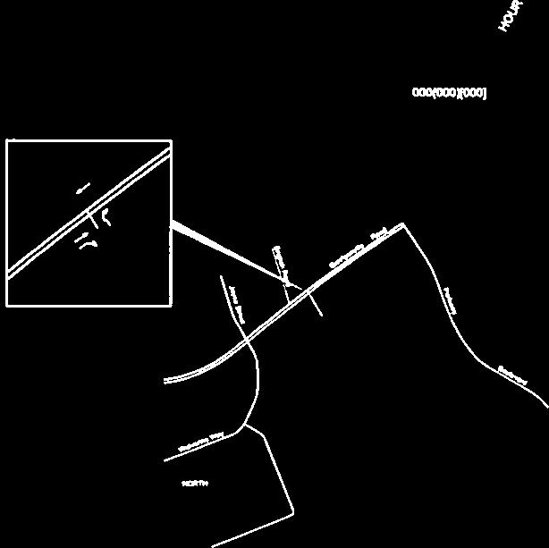
1 2 Board of Supervisors Robert Bob Thomas, Jr., Chairman Laura A. Sellers, Vice Chairman Meg Bohmke Jack R. Cavalier Wendy E. Maurer Paul V. Milde, III Gary F. Snellings June 8, 2016 Anthony J. Romanello, ICMA CM County Administrator MEMORANDUM TO: FROM: Stafford County Planning Commission J SUBJECT: RC ; Reclassification Patriot s Crossing Proffer Amendment (formerly Stafford Sports Center) ATTACHMENTS: 1. Location Map 2. Proposed Ordinance and Resolution 3. Proposed Proffers, dtd 5/17/16 5. Ordinance O12-18 and original Proffer Statement and Exhibit 6. Application and Related Materials 4. Generalized Development Plan, dtd 5/17/16 ISSUE: Consider the request to amend proffered conditions on Tax Map Parcel No , consisting of acres, zoned B-2, Urban Commercial. BACKGROUND: Location: Election District: Parcel Size: Applicant: South side of Garrisonville Road, approximately 220 feet west of Parkway Boulevard Garrisonville acres 799 Garrisonville, LLC 6308 Five Mile Centre Park, Suite 215 Fredericksburg, VA Courthouse Road, P. O. Box 339, Stafford, VA Phone: (540) Fax: (540)
2 Memorandum to: Stafford County Planning Commission June 8, 2016 Page 2 of 11 Agent: Property Owner: Current Use: Proposed Use: Sherman Patrick Jr. AICP Compton & Duling, L.C. Joyce Mountjoy Curry & Alton Latana Curry 1320 Tannery Circle Midlothian, VA Undeveloped Commercial complex with retail, office, and other commercial uses Application Date: December 18, 2015 (complete application May 17, 2016) Advertisement Dates: May 24, 2016 and May 31, 2016 Time Limit: September 7, 2016 Staff Project Manager: Comprehensive Plan: Michael Zuraf, AICP Commercial Corridor within Suburban Future Land Use Designations Abutting Properties: Location Zoning Use Comprehensive Plan North A-1, Agricultural, Residential, Commercial Corridor/ Suburban B-3, Office Undeveloped Agricultural/Rural South A-1, Agricultural County School Suburban (North Stafford HS) East B-2, Urban Commercial Real Estate Office, Commercial Corridor/ Suburban PD-1, Planned Development Residential West A-1, Agricultural County School Commercial Corridor/ Suburban (North Stafford HS)


3 Memorandum to: Stafford County Planning Commission June 8, 2016 Page 3 of 11 Zoning Districts Future Land Use Plan Utilities: Roads: Schools: Parks and Recreation: Proffer Valuation: Noise Impacts: Light Impacts: This site is to be served by public water and sewer. An existing 12 inch waterline is located along the site s frontage of Garrisonville Road. The waterline runs parallel with Garrisonville Road. An existing 10 inch gravity sewer line identified as the Shelton Shop Interceptor runs east-west across the northern end of the site and connects to a 16-inch force main line. This force main line runs along the property line on the east side in a north-south direction. The anticipated water and sewer demands are estimated at 47,970 GPD. Garrisonville Road in this location is a 4-lane divided facility with a posted speed limit of 45 miles per hour and estimated traffic volume of 32,000 vehicle trips per day according to Virginia Department of Transportation (VDOT) 2015 Daily Traffic Volume Estimates. There would be no impact to the County School system. There would be no impact on the County Park system. A proffer statement has been submitted with this application. No monetary proffers are included with this request. Staff notes the potential for noise impacts. The GDP identifies a potential car wash located adjacent to residential uses in Park Ridge. Operations associated with a car wash, including blowers and vacuums, may generate loud noises. Otherwise, the other uses identified on the site should have minimal noise impact. The proposed site lighting would be installed in compliance with Section of the Zoning Ordinance. Required landscape buffers from residential uses would help to minimize any light impacts.
.")
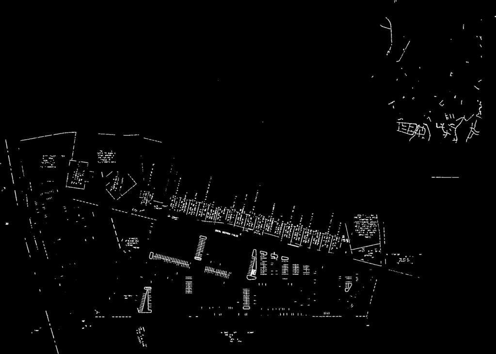
4 Memorandum to: Stafford County Planning Commission June 8, 2016 Page 4 of 11 Zoning History The property was rezoned from A-1, Agricultural to B-2, Urban Commercial in 2012 with proffers (see Attachment 5). The original development scheme and associated proffers were reflective of a commercial complex that included commercial retail uses in the front of the site along Garrisonville Road and a recreation enterprise on the remainder of the site with indoor swimming pool and athletic fields. No development had occurred on the property since the property was rezoned. In addition, the recent opening of the Jeff Rouse Swim and Sports Center at Embrey Mill Park likely has minimized the need for the swimming pool use on the site. Existing Conditions The site is primarily wooded, with rolling terrain with the house, built around the beginning of the 20 th century, located at the highest point. Two streams are located on the property. One of the streams is located at the northern end in the approximate location of the existing gravity sewer line. Originally identified as intermittent, a recent evaluation of the stream determined it to be perennial, requiring a 100- foot CRPA buffer. The other stream, determined to be intermittent, is located at the southern end of the property. Wetlands are located and identified on site (per page 2 of the Generalized Development Plan). These wetland areas are connected with the existing streams. The property has approximately 870 feet of frontage on Garrisonville Road. The property to the north on the north side of Garrisonville Road is a 38-acre property with one residence on it. North Stafford High School is located to the west and south with its tennis courts located near the property line. To the east, there is a real estate office building as well as townhomes and single-family detached units which are all associated with the Park Ridge subdivision. Park Ridge Elementary School is located at the southeast corner of this site. Aerial View

5 Memorandum to: Stafford County Planning Commission June 8, 2016 Page 5 of 11 COMMENTS: The proposal is to amend proffered conditions on the subject property to replace a planned recreational facility with other uses, and modify transportation and other site development requirements. The current proffers require the site be developed in accordance with the original Generalized Development Plan (GDP), which includes the recreational complex. The applicant is proposing to replace the recreational facility with several office buildings, as part of the overall commercial complex, requiring the proffers to be amended. The current proffers also require specific transportation improvements, including interparcel connections to properties on both the east and west of the site, and other off-site improvements. The applicant does not believe the inter-parcel connection requirements are feasible, and is proposing that requirement be deleted. Other amendments to coincide with the latest development proposal are summarized in this report. The applicant has submitted a new GDP that illustrates the potential development pattern, including the location of potential uses, access points and traffic circulation, and open spaces and buffers. The site would be accessed via a single entrance off of Garrisonville Road. The access would serve as a right-in, right-out entrance. In addition, a new feature under this proposal would add a break to the median for the installation of a westbound left-turn directional slip lane. Traffic exiting the site would not be able to turn left onto Garrisonville Road. The current proffers do not include this median break. Two inter-parcel easements are proposed to be granted to the parcels to the east and west, although the applicant is proffering to only construct the connection to the west to Wolverine Way should conditions be met. Also, a gated access to Kimberly Drive for emergency access is shown at the southern end of the property. Proposed GDP For reference, the following is the original GDP, which identifies the proposed development pattern with the recreational enterprise use.
 approval. A CUP application has not been submitted.")

6 Memorandum to: Stafford County Planning Commission June 8, 2016 Page 6 of 11 Original GDP Along the frontage is a commercial retail building. Two other uses identified on the GDP, a restaurant with drive-through and car wash facility, would require Conditional Use Permit (CUP) approval. A CUP application has not been submitted. Staff has expressed concern with the proximity of the car wash to existing residential uses in Park Ridge and potential noise impacts. A spine road runs through the middle of the site and crosses the CRPA. On the south of the CRPA, one non-retail commercial building and 5 office buildings are proposed. All of the office buildings would be 2-stories in height and include 39,574 square feet of floor area. A 50-foot wide transitional buffer would be provided adjacent to Park Ridge with an 8-foot fence, as required in the proffers. Staff notes that the CRPA is not clearly designated on the GDP and recommends that it be added. Although not proffered, the applicant provided these typical renderings of the style envisioned for the proposed office buildings.
7 Memorandum to: Stafford County Planning Commission June 8, 2016 Page 7 of 11 Proffers The proposed amendments to the existing proffers are summarized below. The proposed proffer document is included in Attachment 5: Reference a new generalized development plan (GDP), which the project shall be built in conformity with as to the general location of travelways, entrances, pedestrian access, and transportation improvements; all other improvements are illustrative; Clarify that the left turn lane into the site is a slotted directional left turn lane; Add that additional vehicular entrances shall be provided, if required; Add that previously required inter-parcel connection to Tax Map Parcel No. 20S-22-A shall be designed, but is not required to be constructed; Add that the connection to Wolverine Way shall be designed and constructed subject to approval of full access by the Stafford County School Board for use by commercial traffic from the property; Delete the requirement to extend the westbound turn-lane on Garrisonville Road at Parkway Boulevard; Delete the requirement to modify traffic signal timings at the Garrisonville Road intersections with Joyce Street/Wolverine Way and Parkway Boulevard; Modify the requirement to construct curb, gutter and sidewalk from the property s frontage to along the property s turn lane; Delete the requirement to construct improvements to the Wolverine Way intersection; Delete the requirement to modify the inter-parcel access at the Garrisonville Road/Parkway Boulevard intersection; Allow the previously required berm to be provided at the developer s discretion at the time of final site plan; Delete all building and commercial use area size limitations; Modify the hours of operation restrictions to allow refuse collection, deliveries by large trucks, and car wash use between the hours of 6 a.m. and 10:00 p.m.; Allow most of the previously prohibited uses outside of 200 feet from Garrisonville Road; Add additional prohibited uses which would have been otherwise permitted on B-2 zoned property; Delete the requirement to build a swimming pool and a series of standards to define usage of the pools by Stafford County Schools; Delete all phasing requirements which tied the amount and type of commercial uses to the construction of the indoor recreation facility and transportation improvements; Delete the requirement to build the recreation enterprise building in accordance with proffered renderings; Modify the following building height requirements: o Delete 55-foot tall building height requirement for a recreational enterprise and 36- foot tall building height restriction for other uses; o Add that buildings 1, 2, and 3 shall be no greater than 1 story tall; and o Add that buildings 4 through 9 and any buildings in the immediate area shall be no more than 3 stories in height, and any 3 story buildings shall be setback 75 feet from the residential uses in Park Ridge; Delete the requirement to install a defibrillator and NFPA-14 standpipe system within the recreational enterprise building; Modify the lighting requirement to meet County requirements;
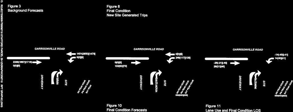
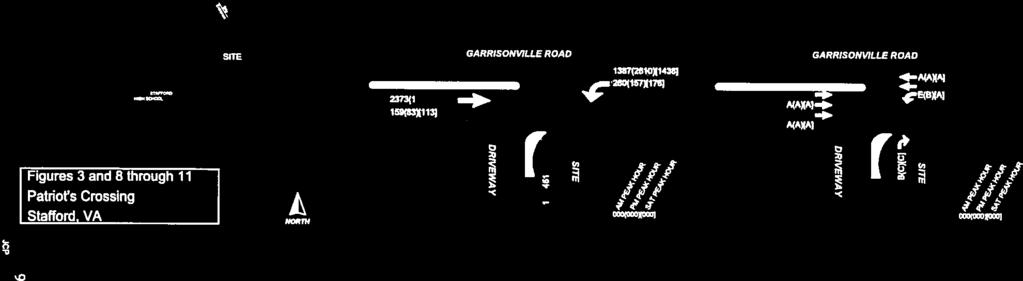
8 Memorandum to: Stafford County Planning Commission June 8, 2016 Page 8 of 11 EVALUATION: Delete the requirement to install a trail which would have connected the property with North Stafford High School and Park Ridge Elementary School; Delete the requirement to provide an architectural survey of the house on the property; Delete the requirement to enter into a shared parking agreement with Park Ridge Elementary School and North Stafford High School; Delete requirement to provide a 10 percent reduction in surface runoff on a portion of the site, and clarify that the stormwater management will comply with state and local requirements; and Delete the requirement to install signage at the neighborhood entrances in Park Ridge to notify motorists that the streets are private and restricted to local traffic. The following is an evaluation of the proffer amendments that may have the greatest impact. Generalized Development Plan (Proffer 1) The new GDP is proposed to be incorporated into the proffers, although with limitations. Only the Transportation requirements under Proffer 2 would apply. Therefore, other elements of the GDP, including the types and locations of uses shown on the GDP may change. The proffers prohibit many uses, but regardless a higher level of intensity may result. Transportation Access and Impact (Proffer 2) As noted, several proffers are proposed to be amended that would change the access to the site, deleting the requirement for inter-parcel access to signalized intersections at Parkway Boulevard to the east, and Wolverine Way to the west. The proffers will still require connection to Wolverine Way if approved by the School Board and no additional improvements are required to Wolverine Way. This does not guarantee that the connection will occur. Overall, this amendment, removing the recreation facility, reduces the traffic generated from the site. The following are the estimated peak hour trips. 223 AM peak hour trips (reduction from 338) 372 PM peak hour trips (reduction from 436) 349 Saturday peak hour trips (reduction from 532) Although the trips have greatly reduced, the new traffic pattern proposed warrants reevaluation of the traffic impacts. Initially, the applicant evaluated the traffic impacts at the site entrance. The evaluation determined that the slotted directional left turn would perform at a Level of Service of F in the AM peak hour. In addition, vehicle stacking of 208 feet would exceed the 200 feet of storage in the near-term but improve after future widening of Garrisonville Road. All other movements operate at acceptable levels of service (C or better) at both peak AM, PM, and Saturday hours. Staff questioned the impacts to the adjacent signalized intersections at Parkway Boulevard and Wolverine Way, asking if U-turn movements increase without the inter-parcel connections. The applicant is performing additional analysis of the impact on these intersections. The report has not been finalized. It is anticipated that staff will receive and be able to forward the report prior to the meeting. Staff also notes that the new slotted left turn break in the median will need a spacing exception from VDOT due to the proximity to the two adjacent signalized intersections. The applicant will need to prove
9 Memorandum to: Stafford County Planning Commission June 8, 2016 Page 9 of 11 that the intersection will function safely and not impact or be impacted by the existing intersections. Should the exception be denied, the access to the site will be limited to a right-in right-out entrance. Emergency Access (Proffer 2.a.(ii.)) The proffers required additional emergency access but includes language that does not guarantee that it will be required. Some of the language in the proffer is vague, with phasing of the emergency access based on square footage of building area included in an example within the proffer. Transitional Buffer (Proffer 3.(i) & (ii)) The proffers maintains the requirement to provide a 50-foot transitional buffer and deletes language that would of allowed for a 50% reduction with the inclusion of a fence. The applicant is building the fence without seeking a reduction in buffer width. The applicant is modifying the berm requirement to be optional and to be determined based on topography. Staff believes this is fair because in certain situations a berm may be ineffective due to the change in elevation. Prohibited Uses Proffer 4.(i) The applicant added several uses that are not identified as uses in the County s Zoning Ordinance, which may be difficult to enforce. The applicant was made aware of this concern, but wishes to retain these restrictions as an assurance to the adjacent residents in Park Ridge. Hours of Operation Hours of operation restrictions for all buildings are being deleted from the proffers, and in the amendments would now apply only to a car wash use and refuse collection except for deliveries by large trucks to the site. Consideration should be given as to the effect this may have on the adjacent residential uses. Fire and Rescue Protection (Proffer 8) Standpipe requirements for the recreation facility were deleted. Staff requested the requirement be retained for any buildings greater than 2 stories tall. Recreation Facility Related Proffers (Multiple Proffers) In addition to the proffers proposed to be deleted that directly related to the Recreation Facility, other indirectly related requirements are proposed to be deleted too, including a requirement to construct a pedestrian trail from the site to Park Ridge Elementary and North Stafford High School, and entering in shared parking agreements with these schools to allow overflow parking for large events. These requirements would no longer be related to the office park development. OTHER EVALUATION: Comprehensive Plan The Comprehensive Plan identifies the property within a recommended Commercial Corridor and within the Suburban Area land use designation. Commercial Corridors are intended to encourage commercial activities where there are adequate transportation facilities to accommodate proposed uses. Suburban Areas of the County are areas where suburban scale of development is most appropriate. Suburban scale of development is considered single-family detached dwelling units, typically on ¼ to ½ acre lots, which may include community amenities and are buffered from any adjacent commercial development. These areas are intended to serve as infill development in the proximity of the established communities in the
10 Memorandum to: Stafford County Planning Commission June 8, 2016 Page 10 of 11 northern and southern areas of the County and in close proximity to major existing or planned transportation networks. Development densities should not exceed three dwelling units per acre for residential development and a floor area ratio (FAR) of 0.4 for non-residential development. Staff believes the proposed amendments to the proffers maintain the site s consistency with the Comprehensive Plan recommendations and the draft Plan. EVALUATION CRITERIA: Section of the Zoning Ordinance lists twelve (12) criteria to be considered at each public hearing for reclassification. A summary of each criteria are as follows: 1. Compliance of the request with the stated requirements of the district or districts involved - The uses depicted on the GDP is in compliance with the stated requirements of the B-2 zoning district. Several uses will require future CUP approval. 2. The existing use and character of the property and the surrounding property - The property is currently undeveloped. The adjacent properties include a residential development to the east and High School to the west and south. Office uses and undeveloped land are adjacent along Garrisonville Road. 3. The suitability of the property for various uses - The conditions of the site make it suitable for a variety of uses. The site is generally level. The location of sensitive resources allow for the creation of large development pads with minimal impacts. 4. The trend of growth and development in the surrounding area - The area is a mix of residential and some commercial uses as well as County School facilities. The commercial uses are located within a commercial corridor designated in the County Comprehensive Plan. Garrisonville Road is identified as a commercial corridor from I-95 to the Garrisonville Road/Joyce Street/Wolverine Way intersection. 5. The current and future requirements of the county for land - Proffers already require the dedication of right-of-way, consistent with the County s Plans to widen Garrisonville Road to 6 lanes. 6. The transportation requirements of the project and the county, and the impact of the proposed land use on the county transportation network - The impact of the proposed transportation improvements and development are not fully known at this time. It is already known that the new left turn directional slip lane would result in a LOS F, which is inconsistent with Comprehensive Plan Policies that recommend new development maintain an LOS C or better. 7. Requirements for schools, parks, recreational lands and facilities, and other public services, potentially generated by the proposed classification - The proposal would not have any increased impact on schools or parks and recreational lands and facilities. The proffer amendments may increase the need for fire, rescue and emergency services.
11 Memorandum to: Stafford County Planning Commission June 8, 2016 Page 11 of The conservation of property values in the surrounding area - Staff believes that the project would not have a negative effect on any property values in the surrounding area should potential noise issues be addressed. 9. The preservation of natural resources and the impact of the proposed uses on the natural environment - The site is large enough to adequately accommodate development outside of the sensitive natural resources, including the CRPA stream and intermittent stream and wetlands at the southern end of the site. 10. The most appropriate use of land - The Land Use Plan recommends a Commercial Corridor within Suburban land use in this location. The use is consistent with the development trend in the area, and it could provide services to support area neighborhoods. 11. The timing of the development of utilities and public facilities and the overall public costs of the development - Public water and sewer utilities are located in the vicinity of the project and are adequate to serve this site. The cost of connecting to the existing utilities and transportation improvements will be borne by the applicant. 12. The consistency, or lack thereof, of the proposed rezoning with the Stafford County Comprehensive Plan as in effect at that time - The proposal is consistent with the Comprehensive Plan Land Use recommendations. SUMMARY OF POSITIVE AND NEGATIVE FEATURES: POSITIVE: 1. The proposal is in conformance with the Comprehensive Plan. 2. The proposal updates proffers to reflect current development potential. 3. Minimizes impacts on natural resources. NEGATIVE: 1. Negative and unknown impacts on the transportation network at this time. 2. Type and location of uses ultimately to be developed on the site are unknown. 3. Reduces fire protection measures previously proffered on the site. 4. Potential noise impacts on adjacent properties if car wash use is developed without mitigating measures. RECOMMENDATION: Staff cannot support approval at this time. Should the Commission desire to recommend approval, additional consideration should be given to the concerns noted by staff and following evaluation of the additional traffic impact analysis. Ordinance O15-32 reflects approval of the request with the proposed amended proffers. JAH:mz Attachments (6)

12 RC ; Reclassification PATRIOTS CROSSING PROFFER AMENDMENT Produced by the Stafford County Department of Planning and Zoning P.O. Box 339 Stafford, VA Attachment 1 Page 1 of 1 G A R F IEL D S T JOYC E ST JO DY C T DU N ROV IN LN ERIN DR RAIN TREE BLVD O W E N S T JOYC E ST PRINCESS ST KELLY WAY B V U E AV E KELLY WAY JOYCE ST JOYCE ST EN G LIS H R D G A R R ISO N V ILLE R D SO U T H A M P TO N C T M EADOWOOD D R M E A D O W O O D D R G A R R IS O N V ILLE R D G A R R IS O N V IL LE RD W EL LIN G TO N D R W EL LIN G TO N D R VA RO N E D R W EL LIN G TO N D R FU LTO N D R PA R K WAY JO P LIN C T BLV D å SCARSDA LE DR A.G. WRIGHT OA K L AW N R D OA K W O O D D R å å OAKLAWN RD OA K W O O D D R W O LV E R IN E W AY ROCK HILL E.S. _ GARRISONVILLE E.S. NORTH STAFFORD C O U R T R D HOUS E å å å NORTH STAFFORD KATE WALLER BARRETT E.S. PARK RIDGE E.S. å RODNEY E. THOMPSON Æc W EN D OV E R C T å å O N V ILLE R D G A R RISO N V PORTER MEMORIAL LIBRARY H.H. POOLE ILLE RD W R EN W AY C T å Smith Lake MONCURE E.S. å HAMPTON OAKS E.S SA X O N Y D R SA X O N Y D R VA RO N E D R K IM B ER LY D R FU LTO N D R K IM B ER LY D R JO P LIN C T KIMBERLY DR R EGE NC Y D R K IM B ER LY D R å F LE W E LL EN D R AYLOR CT K IM B ER LY D R PARK RIDGE E.S. A SH LEY C T Park Ridge Park Ridge W ES T PA R K D R Park FIDDLERS CT PA R K COVE DR Ridge CAN DLERIDGE CT W AT E R S COVE CT Æc W ES T PARK DR H E D G E A P P LE C T PA R K COVE DR JO NNYCAKE CT PORTER MEMORIAL LIBRARY ,050 Feet Produced: 5/17/2016 Data layers are compiled from various sources and are not to be construed or used as a "legal description." Data layers are believed to be accurate, but accuracy is not guaranteed. ±
13 Attachment 2 Page 1 of 3 O16-27 PROPOSED BOARD OF SUPERVISORS COUNTY OF STAFFORD STAFFORD, VIRGINIA ORDINANCE At a regular meeting of the Stafford County Board of Supervisors (the Board) held in the Board Chambers, George L. Gordon, Jr., Administration Center, Stafford, Virginia, on the day of, 2016: MEMBERS: VOTE: Robert Bob Thomas, Jr., Chairman Laura A. Sellers, Vice Chairman M. G. Meg Bohmke Jack R. Cavalier Wendy E. Maurer Paul V. Milde, III Gary F. Snellings On motion of, seconded by, which carried by a vote of, the following was adopted: AN ORDINANCE TO AMEND AND REORDAIN THE STAFFORD COUNTY ZONING ORDINANCE BY AMENDING THE PROFFERED CONDITIONS ON TAX MAP PARCEL NO ZONED B-2, URBAN COMMERCIAL ZONING DISTRICT, WITHIN THE GARRISONVILLE ELECTION DISTRICT WHEREAS, 799 Garrisonville, LLC, applicant, submitted application RC requesting an amendment to proffered conditions on Tax Map Parcel No , zoned B-2, Urban Commercial, within the Garrisonville Election District; and WHEREAS, the Board carefully considered the recommendations of the Planning Commission and staff, and the public testimony, if any, received at the public hearing; and WHEREAS, the Board determined that the requested zoning and proffer amendments are compatible with the surrounding land uses and zoning; and WHEREAS, the Board finds that public necessity, convenience, general welfare, and good zoning practice require adoption of an ordinance to amend proffered conditions on the subject property;
14 Attachment 2 Page 2 of 3 O16-27 Page 2 NOW, THEREFORE, BE IT ORDAINED by the Stafford County Board of Supervisors on this the day of, 2016, that the Stafford County Zoning Ordinance be and it hereby is amended and reordained by amending the proffered conditions on Tax Map Parcel No zoned B-2, Urban Commercial Zoning District, as specified in the final proffer statement entitled, Proffers, dated May 17, AJR:JAH:mz
15 Attachment 2 Page 3 of 3 R PROPOSED BOARD OF SUPERVISORS COUNTY OF STAFFORD STAFFORD, VIRGINIA RESOLUTION At a regular meeting of the Stafford County Board of Supervisors (the Board) held in the Board Chambers, George L. Gordon, Jr., Administration Center, Stafford, Virginia, on the day of, 2016: MEMBERS: VOTE: Robert Bob Thomas, Jr., Chairman Laura A. Sellers, Vice Chairman M. G. Meg Bohmke Jack R. Cavalier Wendy E. Maurer Paul V. Milde, III Gary F. Snellings On motion of, seconded by, which carried by a vote of, the following was adopted: A RESOLUTION TO DENY AN APPLICATION TO AMEND AND REORDAIN THE STAFFORD COUNTY ZONING ORDINANCE BY AMENDING THE PROFFERED CONDITIONS ON TAX MAP PARCEL NO ZONED B-2, URBAN COMMERCIAL ZONING DISTRICT, WITHIN THE GARRISONVILLE ELECTION DISTRICT WHEREAS, 799 Garrisonville, LLC, applicant, submitted application RC requesting an amendment to proffered conditions on Tax Map Parcel No , zoned B-2, Urban Commercial, within the Garrisonville Election District; and WHEREAS, the Board carefully considered the recommendations of the Planning Commission and staff, and the public testimony, if any, received at the public hearing; and WHEREAS, the Board determined that the requested zoning is incompatible with the surrounding land uses and zoning; WHEREAS, the Board has considered the criteria in Stafford County Code Sec and finds that the requested zoning and proffer amendment do not meet the standards of the Zoning Ordinance for a zoning and proffer amendment; NOW, THEREFORE, BE IT RESOLVED by the Stafford County Board of Supervisors on this the day of, 2016, that application RC be and it hereby is denied. AJR:JAH:mz
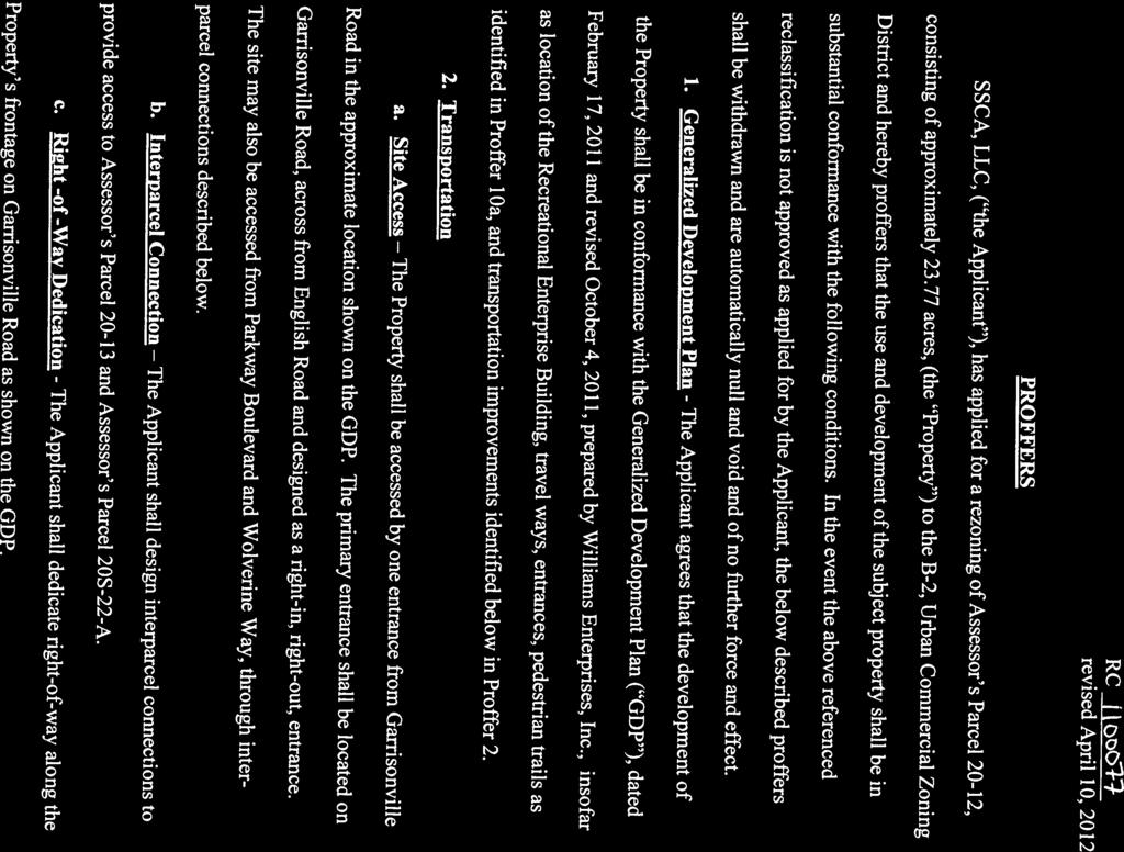
16 Attachment 3 Page 1 of 11 Assessor s Parcel RC SSCA, LLC Rrevised April 10December 18, AprilMay 17, 2016 PROFFERS SSCA.799 Garrisonville LLC, ("Owner/the Applicant"), has applied for a rezoning ofan amendment to the proffered conditions on Assessor's Parcel 20-12, consisting of approximately acres, (the "Property") to thewhich is zoned B-2,Urban Commercial Zoning District and hereby proffers that the use and development of the subject property shall be in substantial conformance with the following conditions. In the event the above referenced reclassification is not approved as applied for by the Applicant, the below described proffers shall be withdrawn and are automatically null and void and of no further force and effect. 1. Generalized Development Plan - The Applicant agrees that the development of the Property shall be in conformance with the Generalized Development Plan (''GDP").dated February 17, 2011 and revised October 4, 2011 January 18, 2015, revised March 24May 17, 2016, prepared by Williams Enterprises, Inc.,Fairbanks and Franklin, insofar as location of the Recreational Enterprise Building, travel ways, entrances, pedestrian trails as identified in Proffer 10a, and transportation improvements identified below in Proffer 2the general location of the travelways, entrances, pedestrian access, and transportation improvements identified in Proffer 2 all subject to applicable jurisdictional approval. All other improvements shown are illustrative only and are subject to modification. 2. Transportation a. Site Access. (i). The Property shall be accessed by an one entrance from Garrisonville Road in the approximate location shown on the GDP. The primary entrance shall be located on Garrisonville Road, across from English Road The right-of-way entrance shall be and designed as a right-in, right-out, entrance and shall have a slotted left turn directional median break. a. (ii). The property shall be accessed by additional vehicular entrances as may be required to meet emergency access or other code requirements applicable during final site plan review. For example, an emergency access may be required at Kimberly Drive before occupancy of 62,000 square feet of building area if buildings are constructed to NFPA-14, or before occupancy of 124,000 square feet of building area if buildings are constructed to NFPA-13.. The site may also be accessed from Parkway
17 Attachment 3 Page 2 of 11 Boulevard and Wolverine Way, through interparcel connections described below. b. Interparcel Connection (i) b.(ii) The Applicant shall design an interparcel connections to be available to provide access to Assessor's Parcel and Assessor's Parcel 20S-22-A, but shall not be required to construct the connections.. The Applicant shall design and construct an interparcel connection to Wolverine Way, subject to approval of full access and utilization of Wolverine Way by the Stafford County School Board, and, county and state approval of the existing Wolverine Way for use by commercial traffic from the subject property at the time of construction plan approval. c. Right -of -Way Dedication The Applicant shall dedicate right-of-way along the Property's frontage on Garrisonville Road as shown on the GDP. d. Right Turn Lanes Subject to Virginia Department of Transportation (VDOT) approval, the Applicant shall construct a separate right turn lane on Garrisonville Road to serve the main entrance, with a 100 foot long taper. e. Slotted Directional Left Turn Lane Subject to VDOT approval, the Applicant shall construct a west-bound left turn lane on Garrisonville Road along the median across the Property s frontage as shown on the GDP with a 100 foot long taper., and shall extend the westbound left turn lane on Garrisonville Road serving as the Parkway Boulevard access as shown on the GDP. f. Traffic Signal and Intersection Modification Subject to VDOT approval, the Applicant shall modify the traffic signal timings, adjust the northbound right turn lane phase to run protected only with an overlap, and modify the signal timing splits at the Garrisonville Road/Joyce Street/Wolverine Way intersection and the Garrisonville Road/Parkway Boulevard intersection. g.f. Frontage Improvements The Applicant shall construct curb, gutter, and sidewalk on the Property s frontage turn lane on Garrisonville Road except along the taper. h. Additional Transportation Improvements for Wolverine Way When the interparcel connection at Wolverine Way is constructed, and subject to VDOT approval, the Applicant shall (i) widen the northbound approach of the Garrisonville Road/Wolverine Way intersection to provide a left turn lane, a shared left-through-
18 Attachment 3 Page 3 of 11 right, and a separate right turn lane as shown on the GDP, (ii) widen the southbound lanes of Wolverine Way to provide a separate left turn lane at the proposed interparcel access, and (iii) extend the existing 210 foot westbound left turn lane at the Garrisonville Road/Wolverine Way intersection an additional 165 feet, resulting in a 375 foot long turn lane. Subject to VDOT approval, the interparcel access shall not be open for use by the public until such time that the indoor pool within the recreational enterprise is constructed and open to the public. i. Interparcel Access at Parkway Boulevard Subject to VDOT approval, the Applicant shall modify the interparcel access at the Garrisonville Road/Parkway Boulevard intersection to prevent left turning movements onto Parkway Boulevard. 3. Buffers a. Width The buffer between the Proffer subject development and the Park Ridge residential community shall be a minimum of 50 feet as depicted on the GDP. Theand inclusion of a fence or berm shall not be permitted if at the time of final site plan and at the developer s discretion, it is determined that additional measures will address topography considerations due to final site grading. result in a reduction in width as normally permitted in the DCSL. b. Fence The Applicant shall install an 8 board on board or opaque fence along the common property between the Property and the Park Ridge community as shown on the GDP. Subject to approval of a waiver from Section (e) of the DCSL by the Planning Director, the Applicant shall erect the fence in such a manner that the landscaping is located between the fence and the Park Ridge community. c. Landscaping A mix of evergreen and deciduous trees shall be employed in any screening areas, with a minimum of 40% evergreens. The Applicant shall preserve existing vegetation where practicable along the Property line that is abutting the Park Ridge community. 4. Maximum Size and Permitted Uses a. Maximum Size The Applicant agrees that there will be a maximum of 256,100 square feet of buildings constructed on the site. There shall be no more than 59,500 square feet of commercial uses constructed on the Property that are not part of the recreational enterprise use.
19 Attachment 3 Page 4 of 11 b. Hours of Operation The Hours of Operation of all uses on the site shall be limited to 5:00 a.m. 12 midnight daily, seven days per week, except that the Recreational Enterprise shall be permitted to host a maximum of two lock-ins per month, when special activities occur permitting overnight use. During a lockin, participants shall not be allowed to leave the building between 12 midnight and 5:00 a.m. c.a. Uses (i) Permitted Uses. All uses allowed in the B-2, Urban Commercial zoning district shall be permitted, except that the following uses shall not be constructed within 200 feet of Garrisonville Road: (1) Adult Businesses as defined by Stafford Zoning Ordinance Section 4-86; (12) Building material sale and storage yard and mulch sale, but this exclusion shall not be deemed to prohibit or otherwise restrict a home improvement or general retail store; (23) Car Wash; (34) Funeral Home; (4) Indoor Flea Market; (5) Auto Service; (6) Automobile Repair; (7) Boat Sales; (8) Marina; (9) Motor Vehicle Rental; (10) Motor Vehicle Sales; and (11) Outdoor Flea Market.; and (12) Motor Vehicle Fuel Sales. (ii) Required Prohibited Uses. The applicant agrees to prohibit the following uses throughout the Property: 1. Any operation primarily used as a storage warehouse operation; 2. Any operation primarily used for assembly, manufacturing, distilling, refining or smelting; 3. Any pawn shop; 4. AOutdoor sales or displays of merchandise associated with any secondhand store except shops dealing with antiques, collectables or historical items; 5. A Outdoor sales or displays of merchandise associated with any surplus store, including any store whose primary purpose is the of insurance salvage stock. No outdoor sales of any kind without Seller s approval; 6. Any civic or social lodge; 7. Any drug rehab center; 8. Any refuge center;
20 Attachment 3 Page 5 of Any abortion clinic or Planned Parenthood facility-(or Any clinic or other facility for the termination of pregnancies) 10. Any industrial warehouse; 11. Any fire sale, tent sale, disaster or liquidation sale, (except as permitted in connection with Tenant s bankruptcy); 12. Any central laundry; 13. Any commercial truck sales, leasing, display or repair. Any automobile, RV or other vehicle sales or repair facility, including tires, batteries or accessories; 14. Any mortuary, crematorium or funeral home; 15. Any massage parlor except licensed massage therapists; 16. Any adult (pornographic) book store, sex shop or any establishment selling or exhibiting pornographic materials or drug-related paraphernalia; 17. Any dumping or disposing of garbage; 18. Any incineration or reduction of garbage; 19. Any bar, unless part of a full-service restaurant or microbrewery; 20. Any parking deck; 21. Any abattoir; 22. Any body repair shop; 23. Any storage distribution of motor fuel; 24. And any boat sales or marina. 25. Recreational enterprises larger than 40,000 square feet. The Landlord reserves the right in its sole discretion to impose further use restrictions and Rules and Regulations in the future. (ii) A swimming pool shall be built within the recreational enterprise building, with a minimum length of 25 yard and designed to provide a minimum of 10 lanes.
21 Attachment 3 Page 6 of 11 d. Phasing The property shall be developed in two phases. 5. Architectural Design (i) Phase I. The first phase of development shall be limited to the construction of the indoor recreation use (the indoor athletic field and the swimming pool(s) and a maximum of 24,000 square feet of commercial uses. The maximum 24,000 square feet of commercial uses shall not include a day care center, and shall include one maximum 3,200 square foot fast food restaurant with drive through, one maximum 6,500 square foot sit down restaurant, and one maximum 14,5000 square foot pharmacy with drive through, or other office/retail uses that generate equivalent or lower traffic. Development of the drive through uses shall be contingent on issuance of a conditional use permit if required. (ii) Phase II. The second phase of development shall permit construction of the remainder of the commercial uses not built as part of Phase I. Phase II shall not be constructed until the planned upgrade of Garrisonville Road from four lanes to six lanes is completed along the Property s frontage, or until a revised traffic study is completed and submitted for VDOT and County review, which shows that construction of the additional uses will not degrade the adjacent roadways after mitigation. a. Recreation Enterprise Building The recreational enterprise building shall be constructed in accordance with the renderings entitled Building Material/Colors, prepared by PAE (Peter A. Edivan) dated February 8, b.a. All other buildings on the Property For all buildings other than the Recreational Enterprise building, Tthe principle exterior building material on the Property shall be brick, stone, glass, architecturally textured masonry, architectural pre-cast or job-cast concrete, stucco type material, or comparable material. No building having metal siding or non-textured cinder block as a principal exterior building material shall be constructed. A pitched roof or varied architectural detailing, such as varied cornices and roof-edge detailing, shall be used. Dominant colors shall generally be of low reflectance, subtle, and neutral or earth tone colors (e.g. such as beige, sage, forest greens, blues, grays, brown, terracotta, sand, cast stone, etc.) and shall not include high intensity black, bright white or fluorescent tones. Nothing herein shall be construed to prohibit a national and/or regional retail user of this building on the Property from reasonably employing general features of its prototype architectural design, provided the
22 Attachment 3 Page 7 of 11 building design and colors are consistent with this paragraph. 6. Building Height Buildings 1, 2 and 3, as identified in the GDP, and any buildings in the immediate area, shall be 1 story in height, excluding possible mezzanines. BThe bbuildings 4 through 9, as identified in the GDP, and any buildings in the immediate area, housing the Recreational Enterpriseoffice uses shall be no more than 55 feet tall3 stories in height. Buildings that are 3 stories in height shall be set back at least 75 feet from the abutting private residential lots in Park Ridge. Any other building located on the Property shall be no more than 36 feet tall. 7. Signage The color, design, and materials of all signs on the Property shall be coordinated with the architectural design of the building on the site. 8. Fire and Rescue Protection a. NFPA-14 Standpipe System: The Applicant shall install a NFPA-14 Standpipe System within the Recreational Enterprises building. b.a. NFPA-13 Automatic Sprinkler Systems: The Applicant shall install NFPA-13 Automatic Sprinkler Systems in all buildings that exceed two (2) stories in height. c. Defibrillator: The Applicant shall install a defibrillator within the recreational enterprises building, and maintain it in good working conditions at all times. d. b. Signal Pre-emption Equipment: The Applicant shall install signal preemption equipment at the traffic signals located at the intersections of Garrisonville Road/Wolverine Way and Garrisonville Road/Parkway Boulevard is used to provide access to the Property, subject to VDOT approval and in accordance with VDOT regulations. 9. Lighting The Applicant shall install lighting for the Property consistent with the County requirements within the parking area that is a minimum of 2 to 3 foot candles and is shall directed such lighting away from residential properties and Garrisonville Road. 10. Pedestrian Trails a. Trails. The Applicant shall construct eight foot wide pedestrian trails as shown on the GDP connecting the Property with North Stafford High School and Park Ridge Elementary. All trails shall be a minimum of 8 foot in width and constructed with a minimum of 3 inches of asphalt with a proper base course and
23 Attachment 3 Page 8 of 11 soil preparation. Trails shall have an area of 15 feet on each side that is cleared of trees and shrubs, but not grass. Entrances to all trails shall be equipped with a gate and/or pedestrian opening to prevent use by ATVs and other motorized vehicles. b.a. Lighting. All trails shall be lighted. The Applicant shall submit a lighting plan for the proposed trials as part of site plan approval. Any lighting infrastructure constructed on school property shall be maintained and become property of the Stafford County School Board. 11. Use of Indoor Swimming Pool by Stafford County Schools a. Use by Stafford County Swim Team Contingent on the execution of a written agreement with the Stafford County School Board agreeing to (1) the reduction of the perimeter buffer as shown on the GDP, (2) shared overflow parking for special events, and (3) construction and use of an interparcel access from the Property onto Wolverine Way as shown on the GDP, the Applicant agrees to allow the Stafford County High School swim team(s) to access to the 10 lane competition pool (minimum 25 yards in length) at no charge for a period of six years, to be renegotiated on a biennial basis thereafter. b. Access Access shall be defined as use by one or more Stafford County High School swim teams with a maximum of 10 lanes Monday- Friday between 3:00 p.m. 4:30 p.m. for regularly scheduled swimming practices when accompanied by School instructors during the competitive season. c.b. Competitive Season Defined The competitive swimming season shall be defined to be the months of November through March, or the corresponding schedule as determined by the VHSL (Virginia High School Swim League), and shall be deemed to end after all scheduled competitive swim meets are completed including District and Regional Competition, but shall not continue more than 5 months per school year. If one or more teams progress to State finals in any year, it shall be the responsibility of the Stafford County School Board to notify the Applicant in writing within 1 week of the end of scheduled competitive season of the number of pool lanes and maximum time needed for team practice for Statewide competitions. 12. Cultural Resources The Applicant shall provide an architectural survey of the old house on the premises within one year of approval of this rezoning. The survey shall contain a diagram of the floor plan, architectural descriptions, exterior and interior photographs, and the chain of title.
24 Attachment 3 Page 9 of CPTED (Crime Prevention Through Environmental Design) The Applicant shall install low lying landscaping in/near the location of the light fixtures in order not to block the light. 11. Limitations on Operating Hours a. Refuse collection, and deliveries. Refuse collection and deliveries by larges trucks shall be allowed between 6:00 AM and 10:00 PM. 13.b. Car Wash. The car wash, if any, hours of operation shall be limited to between 6:00 AM and 10:00 PM. 14. Shared Parking Subject to approval by the Stafford County School Board, the Applicant shall enter into a mutual agreement to share parking with Park Ridge Elementary School and North Stafford High School for events generating the need for overflow parking. At no time shall overflow parking on school sites be allowed for special events held on the Property that include the sale of beer, wine or other alcoholic beverages Stormwater Management The Applicant shall design and construct stormwater management for the Property in a manner that provides a 10% reduction in surface runoff (below the predevelopment rate) for the drainage swail located between the parcel identified as Assessor s Parcel Map 20S-22A and the parcels served by Southampton Court. complies with state and local requirements for managing the quality of stormwater run-off from the property. 16. Signage a. Southampton Court: The Applicant, at the request of the Gates Homeowner s Association (HOA), shall pay the reasonable cost of a sign at Southampton Court warning that there is no through access on Southampton Court, and is a private drive, or other such language as mutually agreed between the Gates HOA and the Applicant. b. Kimberly Drive and Wellington Drive: The Applicant, at the request of representatives of the Park Ridge community, shall pay a reasonable cost of one (1) sign each at Kimberly Drive and Wellington Drive warning that the streets are private and restricted to local traffic, or other such language as mutually agreed between the Gates HOA and the Applicant.
25 Attachment 3 Page 10 of 11 c. No U-Turn Sign: The Applicant, if authorized by VDOT, shall fund a sign at the intersection/interparcel access of Park Ridge Blvd. and the Property stating No U-Turn or other language as requested and approved by VDOT. [SIGNATURES ON FOLLOWING PAGES]
26 Attachment 3 Page 11 of 11 This Proffer Statement supersedes any proffer statement and proffers previously made or submitted in connection with this application and with this Property. Respectfully Submitted: 799 Garrisonville Road, LLC, a Virginia limited liability company By: Donn C. Hart STATE OF COUNTY OF, to wit: I, the undersigned, a Notary Public in and for the County and State aforesaid, do hereby certify that Donn C. Hart, whose name as Managing Member of Old Potomac Church, LLC, is signed to the foregoing Proffer Statement, has personally acknowledged the same before me in my aforesaid jurisdiction. GIVEN under my hand and seal this day of, My commission expires: My Registration No. is: Notary Public
27 SITE INFORMATION: Fairbanks & Franklin Civil Engineering Land Planning PATRIOTS CROSSING ROCK HILL MAGISTERIAL DISTRICT STAFFORD COUNTY, VIRGINIA GENERALIZED DEVELOPMENT PLAN 1005 Mahone Street Fredericksburg, VA (540) DATE : DESIGNED : DRAWN : CHECKED : JRF JAC JDF REVISIONS: DOCUMENT NO SHEET OF PATRIOTS CROSSING GENERALIZED DEVELOPMENT PLAN Attachment 4 Page 1 of 1

28 Attachment 5 Page 1 of 12


29 Attachment 5 Page 2 of 12

30 Attachment 5 Page 3 of 12

31 Attachment 5 Page 4 of 12

32 Attachment 5 Page 5 of 12

33 Attachment 5 Page 6 of 12

34 Attachment 5 Page 7 of 12

35 Attachment 5 Page 8 of 12

36 Attachment 5 Page 9 of 12

37 Attachment 5 Page 10 of 12

38 Attachment 5 Page 11 of 12


39 Attachment 5 Page 12 of 12


40 Page 1 of 47


41 Page 2 of 47


42 Page 3 of 47

43 Page 4 of 47


44 Page 5 of 47

45 Page 6 of 47

46 Page 7 of 47


47 Page 8 of 47

48 Page 9 of 47

49 Page 10 of 47


50 Page 11 of 47

51 Page 12 of 47

52 Page 13 of 47

53 Page 14 of 47

54 Page 15 of 47

55 Page 16 of 47


56 Page 17 of 47


57 Page 18 of 47


58 Page 19 of 47

59 Page 20 of 47

60 Page 21 of 47

61 Page 22 of 47

62 Page 23 of 47

63 Page 24 of 47


64 Page 25 of 47

65 Page 26 of 47

66 Page 27 of 47

67 Page 28 of 47

68 Page 29 of 47

69 Page 30 of 47

70 Page 31 of 47


71 Page 32 of 47


72 Page 33 of 47

73 Page 34 of 47


74 Page 35 of 47

75 Page 36 of 47


76 Page 37 of 47

77 Page 38 of 47

78 Page 39 of 47

79 Page 40 of 47
80 Page 41 of 47
81 Page 42 of 47
82 Page 43 of 47
83 Page 44 of 47


84 Page 45 of 47

85 Page 46 of 47
RC ; Reclassification The Garrison at Stafford Proffer Amendment (formerly Stafford Village Center)
") Board of Supervisors Robert Bob Thomas, Jr., Chairman Laura A. Sellers, Vice Chairman Meg Bohmke Jack R. Cavalier Wendy E. Maurer Paul V. Milde, III Gary F. Snellings Anthony J. Romanello, ICMA CM County
Board of Supervisors Robert Bob Thomas, Jr., Chairman Laura A. Sellers, Vice Chairman Meg Bohmke Jack R. Cavalier Wendy E. Maurer Paul V. Milde, III Gary F. Snellings Anthony J. Romanello, ICMA CM County
SUBJECT: CUP ; Conditional Use Permit - Telegraph Road Vehicle Sales / Storage
 2 Board of Supervisors Robert Bob Thomas, Jr., Chairman Laura A. Sellers, Vice Chairman Meg Bohmke Jack R. Cavalier Wendy E. Maurer Paul V. Milde, III Gary F. Snellings August 24, 2016 Anthony J. Romanello,
South side of Garrisonville Road east of its intersection with Wolverine Way and Joyce Street
 Board of Supervisors Meg Bohmke, Chairman Gary F. Snellings, Vice Chairman Jack R. Cavalier Thomas C. Coen L. Mark Dudenhefer Wendy E. Maurer Cindy C. Shelton 2 April 11, 2018 Thomas C. Foley County Administrator
North side of Garrisonville Road, approximately 275 feet east of Center Street
 2 Board of Supervisors Gary F. Snellings, Chairman Laura A. Sellers, Vice Chairman Meg Bohmke Jack R. Cavalier Paul V. Milde, III Cord A. Sterling Robert Bob Thomas, Jr. December 9, 2015 Anthony J. Romanello,
1101 Washington Avenue Fredericksburg, VA 22401
 1 Board of Supervisors Robert Bob Thomas, Jr., Chairman Laura A. Sellers, Vice Chairman Meg Bohmke Jack R. Cavalier Wendy E. Maurer Paul V. Milde, III Gary F. Snellings December 14, 2016 C. Douglas Barnes
CUP ; Conditional Use Permit - 5 Twelve Convenience Store Expansion
 Board of Supervisors Meg Bohmke, Chairman Gary F. Snellings, Vice Chairman Jack R. Cavalier Thomas C. Coen L. Mark Dudenhefer Wendy E. Maurer Cindy C. Shelton 2 March 28, 2018 Thomas C. Foley County Administrator
RC ; Reclassification - The Courtyards of Colonial Forge
 3 Board of Supervisors Robert Bob Thomas, Jr., Chairman Laura A. Sellers, Vice Chairman Meg Bohmke Jack R. Cavalier Wendy E. Maurer Paul V. Milde, III Gary F. Snellings November 9, 2016 C. Douglas Barnes
Amendments to the Subdivision and Zoning Ordinances Regarding Open Space Land in Cluster Subdivisions
 Board of Supervisors Gary F. Snellings, Chairman Laura A. Sellers, Vice Chairman Meg Bohmke Jack R. Cavalier Paul V. Milde, III Cord A. Sterling Robert Bob Thomas, Jr. 10 May 13, 2015 Anthony J. Romanello,
SUB ; Courthouse Manor, Preliminary Subdivision Plan
 5 Board of Supervisors Gary F. Snellings, Chairman Laura A. Sellers, Vice Chairman Meg Bohmke Jack R. Cavalier Paul V. Milde, III Cord A. Sterling Robert Bob Thomas, Jr. October 14, 2015 Anthony J. Romanello,
Amendment to the Zoning and Subdivision Ordinances; Consider Repeal Cluster Development Standards
 2 Board of Supervisors Meg Bohmke, Chairman Gary F. Snellings, Vice Chairman Jack R. Cavalier Thomas C. Coen L. Mark Dudenhefer Wendy E. Maurer Cindy C. Shelton February 28, 2018 Thomas C. Foley County
Habitat for Humanity is a non-profit organization that provides affordable housing for low income families.
 Attachment 1 R16-31 BACKGROUND REPORT On March 11, 2011, the Board authorized the conveyance of two parcels in Lake Arrowhead Subdivision (Tax Map Parcel Nos. 8B-G-18 and -19), to Greater Fredericksburg
Zoning Text Amendment to Allow Hotels and Public Parking Lots as By- Right Uses in the M-1 Zoning District
 5 Board of Supervisors Robert Bob Thomas, Jr., Chairman Laura A. Sellers, Vice Chairman Meg Bohmke Jack R. Cavalier Wendy E. Maurer Paul V. Milde, III Gary F. Snellings September 28, 2016 C. Douglas Barnes
Amendments to Transfer of Development Rights Program
 Board of Supervisors Jack R. Cavalier, Chairman Gary F. Snellings, Vice Chairman Meg Bohmke Paul V. Milde, III Laura A. Sellers Cord A. Sterling Robert Bob Thomas, Jr. Anthony J. Romanello, ICMA CM County
CUP95-02 & CUP990433; Conditional Use Permits FREDERICKSBURG PUBLIC AUTO AUCTION
 Attachment 1 R15-279 BACKGROUND REPORT The property in question consists of three parcels, Tax Map Parcel Nos. 45-78A, 53-5 and 53-5C (Property). The Board is asked to consider revoking a conditional use
COM ; Comprehensive Plan Amendment RC ; Reclassification CUP ; Conditional Use Permit Stafford Village Center
 Board of Supervisors Gary F. Snellings, Chairman Laura A. Sellers, Vice Chairman Meg Bohmke Jack R. Cavalier Paul V. Milde, III Cord A. Sterling Robert Bob Thomas, Jr. 7,8&9 June 10, 2015 Anthony J. Romanello,
2 November 9, 2011 Public Hearing APPLICANT: ASHVILLE PARK, L.L.C.
 2 November 9, 2011 Public Hearing APPLICANT: ASHVILLE PARK, L.L.C. PROPERTY OWNER: ATC REALTY SIXTEEN, INC. STAFF PLANNER: Faith Christie REQUEST: Modification of Conditional Change of Zoning approved
Attachment 1 R BACKGROUND REPORT
 BACKGROUND REPORT Attachment 1 R16-310 The Board is asked to consider authorizing the Interim County Administrator to execute deeds of conveyance for the acquisition of Tax Map Parcel Nos. 47-39, 47-39B,
RE: 6. GILL/GREEN COMPREHENSIVE PLAN AMENDMENT, REZONING AND PRELIMINARY PLAT
 commission memo DATE: Thursday - August 9, 2018 TO: Marion Planning & Zoning Commission FROM: David N. Hockett, AICP Principal Planner RE: 6. GILL/GREEN COMPREHENSIVE PLAN AMENDMENT, REZONING AND PRELIMINARY
Request Conditional Use Permits (Craft Brewery, Assembly Use & Open-Air Market) Staff Recommendation Approval. Staff Planner Robert Davis
 Staff Recommendation Approval. Staff Planner Robert Davis") Applicant Property Owner Weathersby Properties, LLC Public Hearing January 9, 2019 City Council Election District Bayside Agenda Item 4 Request Conditional Use Permits (Craft Brewery, Assembly Use & Open-Air
Applicant Property Owner Weathersby Properties, LLC Public Hearing January 9, 2019 City Council Election District Bayside Agenda Item 4 Request Conditional Use Permits (Craft Brewery, Assembly Use & Open-Air
Planning Department Oconee County, Georgia
 Planning Department Oconee County, Georgia STAFF REPORT REZONE CASE #: 6985 DATE: October 31, 2016 STAFF REPORT BY: Andrew C. Stern, Planner APPLICANT NAME: Williams & Associates, Land Planners PC PROPERTY
4 June 11, 2014 Public Hearing
 4 June 11, 2014 Public Hearing APPLICANT: FRANKLIN JOHNSTON MANAGEMENT DEVELOPMENT, L.L.C. PROPERTY OWNER: TRUSTEES OF FIRST LYNNHAVEN BAPTIST CHURCH STAFF PLANNER: Stephen J. White REQUEST: Change of
Intersection of Winding Creek Road and Embrey Mill Road. 200 Chatham Heights Road Fredericksburg, Virginia 22405
 November 12, 2014 MEMORANDUM TO: FROM: Stafford County Planning Commission J Board of Supervisors Jack R. Cavalier, Chairman Gary F. Snellings, Vice Chairman Meg Bohmke Paul V. Milde, III Laura A. Sellers
AAAA. Planning and Zoning Staff Report Lake Shore Land Holdings, LLC CU-PH Analysis
 AAAA Planning and Zoning Staff Report Lake Shore Land Holdings, LLC CU-PH2016-28 Hearing Date: April 21, 2016 Development Services Department Applicant: BRS Architects/Cindy Huebert Staff: Kyle McCormick,
C-26C-04 Three Chopt District. zoo;",.""",,,o,,,,","o"",,,, '0 Ref Feet
 Short Pump Plaza B-3C* ( A-1 & B-3' to B-3C' 5.05 Acres A-l* IB-2C* A-1* I A-1* N A Apri12004 ZONING AUTO DEALERSHIP / C-26C-04 Three Chopt District. zoo;",.""",,,o,,,,","o"",,,, '0 Ref. 740-761-8451 0
Rezoning Petition Final Staff Analysis May 21, 2018
 Rezoning Petition 2017-182 Final Staff Analysis May 21, 2018 REQUEST LOCATION Current Zoning: R-3 (single family) and no zoning (current NC State right-of-way) Proposed Zoning: B-2(CD) (general business,
Special Use Permit #SUP , Youssef Home Fitness Studio Occoquan Magisterial District
 COUNTY OF PRINCE WILLIAM 5 County Complex Court, Prince William, Virginia 22192-9201 PLANNING (703) 792-7615 FAX (703) 792-4401 OFFICE Internet www.pwcgov.org Christopher M. Price, AICP Acting Director
1 September 9, 2015 Public Hearing
 1 September 9, 2015 Public Hearing APPLICANT & PROPERTY OWNER: HOLLOMON- BROWN FUNERAL HOME, INC. STAFF PLANNER: Carolyn A.K. Smith REQUEST: Change of Zoning (R-5D Residential District to Conditional O-2
SUBDIVISION, PLANNED UNIT DEVELOPMENT, ZONING AMENDMENT, & SIDEWALK WAIVER STAFF REPORT Date: July 19, 2018
 SUBDIVISION, PLANNED UNIT DEVELOPMENT, ZONING AMENDMENT, & SIDEWALK WAIVER STAFF REPORT Date: July 19, 2018 NAME SUBDIVISION NAME LOCATION West Mobile Properties, LLC U.S. Machine Subdivision 556, 566,
North of the intersection of Courthouse Road and Dent Road, south of Hope Road and approximately 2,000 feet east of Jefferson Davis Highway
 1 Board of Supervisors Jack R. Cavalier, Chairman Gary F. Snellings, Vice Chairman Meg Bohmke Paul V. Milde, III Laura A. Sellers Cord A. Sterling Robert Bob Thomas, Jr. November 12, 2014 Anthony J. Romanello,
RC ; Reclassification - Falmouth Village Commercial
 Board of Supervisors Paul V. Milde, III, Chairman Meg Bohmke, Vice Chairman Jack R. Cavalier Wendy E. Maurer Gary F. Snellings Laura A. Sellers Robert Bob Thomas, Jr. Thomas C. Foley County Administrator
3 July 13, 2011 Public Hearing APPLICANT / PROPERTY OWNER: MARQUETTE & ASSOCIATES, L.L.C. /G.S. DEVELOPERS, L.L.C.
 3 July 13, 2011 Public Hearing APPLICANT / PROPERTY OWNER: MARQUETTE & ASSOCIATES, L.L.C. /G.S. DEVELOPERS, L.L.C. STAFF PLANNER: Faith Christie REQUEST: Conditional Change of Zoning (AG-2 Agricultural
Request Modification of Proffers Modification of Conditions (Bulk Storage Yard) Staff Recommendation Approval. Staff Planner Marchelle Coleman
 Staff Recommendation Approval. Staff Planner Marchelle Coleman") Applicant & Property Owner Public Hearing October 10, 2018 City Council Election District Princess Anne Agenda Item 6 Request Modification of Proffers Modification of Conditions (Bulk Storage Yard) Staff
Applicant & Property Owner Public Hearing October 10, 2018 City Council Election District Princess Anne Agenda Item 6 Request Modification of Proffers Modification of Conditions (Bulk Storage Yard) Staff
THE CITY OF RAYMORE, MISSOURI Single-Family Residential Zoning Districts
 THE CITY OF RAYMORE, MISSOURI Single-Family Residential Zoning Districts REGULATIONS COMMON TO ALL DISTRICTS: Uses permitted in each district include detached single-family dwellings, manufactured homes
Staff Report: Date: Applicant: Property Identification: Acreage of Request: Current Zoning of Requested Area: Requested Action: Attached:
 Staff Report: Completed by Jeff Palmer Director of Planning & Zoning Date: November 7, 2018, Updated November 20, 2018 Applicant: Greg Smith, Oberer Land Developer agent for Ronald Montgomery ET AL Property
PROPOSED BOARD OF SUPERVISORS COUNTY OF STAFFORD STAFFORD, VIRGINIA RESOLUTION
 Attachment 2 R16-348 PROPOSED BOARD OF SUPERVISORS COUNTY OF STAFFORD STAFFORD, VIRGINIA RESOLUTION At a regular meeting of the Stafford County Board of Supervisors (the Board) held in the Board Chambers,
3 NOVEMBER 9, 2011 Public Hearing APPLICANT:
 REQUEST: Conditional Change of Zoning (B-2 & I-1 to Conditional A-18) 3 NOVEMBER 9, 2011 Public Hearing APPLICANT: S.L. NUSBAUM REALTY COMPANY PROPERTY OWNER: USF PROPCO II, LLC STAFF PLANNER: Leslie Bonilla
Town of Cary, North Carolina Rezoning Staff Report 14-REZ-31 Cary Park PDD Amendment (Waterford II) Town Council Meeting January 15, 2015
 Town Council Meeting January 15, 2015") Town of Cary, North Carolina Rezoning Staff Report 14-REZ-31 Cary Park PDD Amendment (Waterford II) Town Council Meeting January 15, 2015 REQUEST To amend the Town of Cary Official Zoning Map by amending
Town of Cary, North Carolina Rezoning Staff Report 14-REZ-31 Cary Park PDD Amendment (Waterford II) Town Council Meeting January 15, 2015 REQUEST To amend the Town of Cary Official Zoning Map by amending
EXHIBIT D. Planned Unit Development Written Description April 13, 2016 Rouen Cove Phase II PUD
 1 EXHIBIT D Planned Unit Development Written Description April 13, 2016 Rouen Cove Phase II PUD Development # 8986.001 Developer: Curtis L. Hart Hart Resources LLC 8051 Tara Lane Jacksonville, Florida
Request Conditional Use Permits (Craft Brewery & Open-Air Market) Staff Recommendation Approval. Staff Planner Bill Landfair
 Staff Recommendation Approval. Staff Planner Bill Landfair") Applicant Property Owner Weathersby Properties, LLC Public Hearing March 13, 2019 (Deferred February 13, 2019) City Council Election District Bayside Agenda Item D2 Request Conditional Use Permits (Craft
Applicant Property Owner Weathersby Properties, LLC Public Hearing March 13, 2019 (Deferred February 13, 2019) City Council Election District Bayside Agenda Item D2 Request Conditional Use Permits (Craft
Conditional Use Permit case no. CU 14-06: Bristol Village Partners, LLC
 PLANNING AND ZONING COMMISSION STAFF REPORT August 7, 2014 Conditional Use Permit case no. CU 14-06: Bristol Village Partners, LLC CASE DESCRIPTION: LOCATION: LEGAL DESCRIPTION: EXISTING LAND USE: ZONING:
County of Loudoun. Department of Planning and Zoning MEMORANDUM
 County of Loudoun Department of Planning and Zoning MEMORANDUM DATE: November 10, 2015 TO: FROM: Joe Griffiths, Project Manager Land Use Review Kelly Williams, Planner III Community Planning SUBJECT: ZRTD
PALM BEACH COUNTY PLANNING, ZONING AND BUILDING DEPARTMENT ZONING DIVISION
 PALM BEACH COUNTY PLANNING, ZONING AND BUILDING DEPARTMENT ZONING DIVISION Application No.: CA-2012-00688 Control No.: 2011-00552 Applicant: Garry Bernardo Owners: Garry Bernardo Agent: Frogner Consulting,
ZRTD , Glenn Drive. M. Tyler Klein, AICP, Project Manager, Planning and Zoning John Merrithew, Acting Director, Planning and Zoning
 DEPARTMENT OF PLANNING Date of Hearing: AND ZONING STAFF REPORT # 4 BOARD OF SUPERVISORS PUBLIC HEARING SUBJECT: ELECTION DISTRICT: ZRTD-2014-0003, 22675 Glenn Drive Broad Run CRITICAL ACTION DATE: September
Glades County Staff Report and Recommendation Unified Staff Report for Small Scale Plan Amendment and Rezoning
 Glades County Staff Report and Recommendation Unified Staff Report for Small Scale Plan Amendment and Rezoning CASE NUMBERS: COMP17-02 and RZ17-02 DATE of STAFF REPORT: May 1, 2017 CASE TYPE: Application
MEMO. Planning and Inspections Department
 Planning and Inspections Department P. O. Box 70, 308 E Stadium Drive, Eden NC 27289-0070/Telephone 336-623-2110/Fax 336-623-4057 MEMO To: Honorable Mayor and City Council Thru: Brad Corcoran, City Manager
SPECIAL ZONING DISTRICTS
 SPECIAL ZONING DISTRICTS 5.01 5.99 RESERVED 5.100 PLANNED DEVELOPMENTS: Purpose: This district is intended to accommodate unified design of residential, commercial, office, professional services, retail
Section 1: US 19 Overlay District
 Section 1: US 19 Overlay District Section 1.1 Intent and Purpose The purpose of the US Highway 19 Overlay District is to manage access to land development along US Highway 19 in a manner that preserves
MINNETONKA PLANNING COMMISSION June 2, A conditional use permit for 2,328 square feet of accessory structures at 4915 Highland Road
 MINNETONKA PLANNING COMMISSION June 2, 2016 Brief Description A conditional use permit for 2,328 square feet of accessory structures at Recommendation Recommend the city council adopt the resolution approving
9 February 13, 2013 Public Hearing APPLICANT: VILLAGE BEND, LLC
 9 February 13, 2013 Public Hearing APPLICANT: VILLAGE BEND, LLC PROPERTY OWNER: VILLAGE BEND HOMEOWNERS ASSOCIATION, INC. STAFF PLANNER: Karen Prochilo REQUEST: Modification of Conditional Change of Zoning
Cover Letter with Narrative Statement
 Cover Letter with Narrative Statement March 31, 2017 rev July 27, 2017 RE: Rushton Pointe Residential Planned Unit Development Application for Public Hearing for RPUD Rezone PL2015 000 0306 Mr. Eric Johnson,
ADDRESS / DESCRIPTION: Northeast corner of Sandbridge Road and Atwoodtown Road ELECTION DISTRICT: PRINCESS ANNE
 10 & 11 March 14, 2012 Public Hearing APPLICANT: MARLYN DEVELOPMENT CORPORATION PROPERTY OWNER: CORAL DEVELOPMENT, LLC STAFF PLANNER: Faith Christie REQUEST: Modification of Conditional Change of Zoning
(a) Commercial uses on Laurel Avenue, abutting the TRO District to the
 Commercial uses on Laurel Avenue, abutting the TRO District to the") 32X Zoning Code 150.36 TRANSITIONAL RESIDENTIAL OVERLAY DISTRICT. (A) Intent and purpose. (1) It is the intent of the Transitional Residential Overlay District (hereinafter referred to as the "TRO District")
32X Zoning Code 150.36 TRANSITIONAL RESIDENTIAL OVERLAY DISTRICT. (A) Intent and purpose. (1) It is the intent of the Transitional Residential Overlay District (hereinafter referred to as the "TRO District")
19 June 9, 2010 Public Hearing APPLICANT AND PROPERTY OWNER: KEMP ENTERPRISES, INC.
 19 June 9, 2010 Public Hearing APPLICANT AND PROPERTY OWNER: KEMP ENTERPRISES, INC. STAFF PLANNER: Karen Prochilo REQUEST: Change of Zoning District Classification, Conditional A-24 Apartment District
ORDINANCE NO The Town Council of the Town of Yucca Valley does ordain as follows:
 ORDINANCE NO. 141 AN ORDINANCE OF THE TOWN COUNCIL OF THE TOWN OF YUCCA VALLEY, CALIFORNIA, AMENDING TITLE 8, DIVISION 12, CHAPTER 1 RELATING TO DEFINITIONS AND TITLE 8, DIVISION 8, CHAPTER 3, RELATING
COMMERCIAL ZONING DISTRICTS (Amended 11/13/14) Part I. C-1 Restricted Commercial District
 Part I. C-1 Restricted Commercial District") ARTICLE XI. COMMERCIAL ZONING DISTRICTS (Amended 11/13/14) Part I. C-1 Restricted Commercial District Section 152: Purpose This district is designed to accommodate commercial uses which act as a transition
ARTICLE XI. COMMERCIAL ZONING DISTRICTS (Amended 11/13/14) Part I. C-1 Restricted Commercial District Section 152: Purpose This district is designed to accommodate commercial uses which act as a transition
New Millennium Senior Living Communities, LLC
 Applicant Property Owners Baylake Limited Partnership, W. Heywood Fralin 2012 Revocable Trust, W. Heywood Fralin Irrevocable Children s Trust, & Karen Holly Waldron Trust Public Hearing August 9, 2017
ORDINANCE NO. 15,060
 ORDINANCE NO. 15,060 AN ORDINANCE to amend the Municipal Code of the City of Des Moines, Iowa, 2000, adopted by Ordinance No. 13,827, passed June 5, 2000, as heretofore amended, is hereby amended by adding
ORDINANCE NO. 208 BE IT ORDAINED BY THE CITY COUNCIL OF THE CITY OF UNIVERSITY HEIGHTS, JOHNSON COUNTY, IOWA:
 ORDINANCE NO. 208 AN ORDINANCE AMENDING ORDINANCE NO. 79 (ZONING) TO CREATE A COMMERCIAL HOTEL ZONE AND PERMIT DEVELOPMENT PURSUANT TO A COMMERCIAL HOTEL PUD BE IT ORDAINED BY THE CITY COUNCIL OF THE CITY
Request Conditional Rezoning (R-5D Residential Duplex District and I-1 Light Industrial District to Conditional A-36 Apartment District)
") Request Conditional Rezoning (R-5D Residential Duplex District and I-1 Light Industrial District to Conditional A-36 Apartment District) Staff Planner Ashby Moss Location 5833 Sandpit Road & Nearby Parcels
Request Conditional Rezoning (R-5D Residential Duplex District and I-1 Light Industrial District to Conditional A-36 Apartment District) Staff Planner Ashby Moss Location 5833 Sandpit Road & Nearby Parcels
Requests Conditional Use Permits (Craft Brewery & Open-Air Market) Staff Recommendations Approval of Craft Brewery Denial of Open-Air Market
 Staff Recommendations Approval of Craft Brewery Denial of Open-Air Market") Applicant Property Owner ACT Partners Public Hearing February 8, 2017 City Council Election District Lynnhaven Agenda Item 1 Requests Conditional Use Permits (Craft Brewery & Open-Air Market) Staff Recommendations
Applicant Property Owner ACT Partners Public Hearing February 8, 2017 City Council Election District Lynnhaven Agenda Item 1 Requests Conditional Use Permits (Craft Brewery & Open-Air Market) Staff Recommendations
Town of Cary, North Carolina Rezoning Staff Report 12-REZ-27 Morris Branch Town Council Public Hearing January 24, 2013
 Town of Cary, North Carolina Rezoning Staff Report 12-REZ-27 Morris Branch Town Council Public Hearing January 24, 2013 REQUEST To amend the Town of Cary Official Zoning Map to rezone approximately 9.0
RESOLUTION NO. B. The proposed amendment would not be detrimental to the public interest, health, safety, convenience, or welfare of the City; and
 RESOLUTION NO. RESOLUTION OF THE PLANNING COMMISSION OF THE CITY OF SANTA ROSA RECOMMENDING TO CITY COUNCIL REZONING TO MODIFY THE EXISTING POLICY STATEMENT AND ADOPT THE BAY VILLAGE HOMES DEVELOPMENT
Staff Report: Date: Applicant: Property Identification: Acreage of Request: Current Zoning of Requested Area: Requested Action: Attached:
 Staff Report: Completed by Jeff Palmer Director of Planning & Zoning Date: November 7, 2018 Applicant: Greg Smith, Oberer Land Developer agent for Ronald Montgomery ET AL Property Identification: Frontage
FOR SALE > MULTIFAMILY/COMMERCIAL REDEVELOPMENT OPPORTUNITY
 FOR SALE > MULTIFAMILY/COMMERCIAL REDEVELOPMENT OPPORTUNITY 2220 W. Cary Street RICHMOND, VA 23220 CURRENT PROPERTY ILLUSTRATION CONCEPTUAL ONLY (NOT PROPOSED) Property Information Zoning: R-63, Multifamily
ARTICLE 143. PD 143.
 ARTICLE 143. PD 143. SEC. 51P-143.101. LEGISLATIVE HISTORY. PD 143 was established by Ordinance No. 17685, passed by the Dallas City Council on February 2, 1983. Ordinance No. 17685 amended Ordinance No.
Dennis Bordeaux Inspections Manager NOTICE OF PUBLIC HEARING NEW HANOVER COUNTY PLANNING BOARD MARCH 7, 2013
 NEW HANOVER COUNTY PLANNING & INSPECTIONS DEPARTMENT 230 GOVERNMENT CENTER DRIVE, SUITE 110 WILMINGTON, NORTH CAROLINA 28403 TELEPHONE (910) 798-7165 FAX (910) 798-7053 Chris O Keefe, AICP Planning & Inspections
Rezoning Petition Pre-Hearing Staff Analysis April 15, 2019
 Rezoning Petition 2018-132 Pre-Hearing Staff Analysis April 15, 2019 REQUEST Current Zoning: R-3 (single family residential) Proposed Zoning: MUDD-O (mixed use development, optional) with five-year vested
1 November 13, 2013 Public Hearing APPLICANT & PROPERTY OWNER: HOME ASSOCIATES OF VIRGINIA, INC.
 1 November 13, 2013 Public Hearing APPLICANT & PROPERTY OWNER: HOME ASSOCIATES OF VIRGINIA, INC. STAFF PLANNER: Carolyn A.K. Smith REQUEST: Conditional Change of Zoning (AG-1 & AG-2 Agricultural Districts
9. REZONING NO Vicinity of the northwest corner of 143 rd Street and Metcalf Avenue
 9. REZONING NO. 2002-15 Vicinity of the northwest corner of 143 rd Street and Metcalf Avenue 1. APPLICANT: Andrew Schlagel is the applicant for this request. 2. REQUESTED ACTION: The applicant is requesting
Attachment 1. O17-17 Page 2
 Attachment 1 O17-17 Page 2 BACKGROUND REPORT LCT and JSC, LLC (Applicant) is requesting a zoning reclassification from the R-1, Suburban Residential Zoning District to the B-1, Convenience Commercial Zoning
the conditions contained in their respective Orders until January 1, 2025, at the discretion of the Director of Planning, Property and Development.
 Part 4: Use Regulations Temporary Uses and Structures Purpose the conditions contained in their respective Orders until January 1, 2025, at the discretion of the Director of Planning, Property and Development.
CHARTER TOWNSHIP OF CALEDONIA COUNTY OF KENT, MICHIGAN. at the Township and Village Hall, 8196 Broadmoor Avenue, Caledonia, Michigan on the
 First Reading CHARTER TOWNSHIP OF CALEDONIA COUNTY OF KENT, MICHIGAN At a regular meeting of the Township Board of the Charter Township of Caledonia, held at the Township and Village Hall, 8196 Broadmoor
Project: Address: MAJOR CERTIFICATE OF APPROPRIATENESS FOR THE BOARD OF ARCHITECTURAL REVIEW
 The BAR recommended approval of the major COA with the following 10 conditions at the special meeting on March 28, 2018. Project: Address: Case Number: Applicant: ATTACHMENT 9e Paul VI Redevelopment 10675
Town of Cary, North Carolina Site Plan Staff Report Centregreen Park at Weston (13-SP-067) Town Council Quasi-Judicial Hearing April 3, 2014
 Town Council Quasi-Judicial Hearing April 3, 2014") Town of Cary, North Carolina Site Plan Staff Report Centregreen Park at Weston (13-SP-067) Town Council Quasi-Judicial Hearing April 3, 2014 REQUEST Withers and Ravenel, on behalf of Highwoods Realty Limited
Town of Cary, North Carolina Site Plan Staff Report Centregreen Park at Weston (13-SP-067) Town Council Quasi-Judicial Hearing April 3, 2014 REQUEST Withers and Ravenel, on behalf of Highwoods Realty Limited
Request Conditional Use Permits (Craft Brewery & Open-Air Market) Staff Recommendation Approval. Staff Planner Robert Davis
 Staff Recommendation Approval. Staff Planner Robert Davis") Applicant Property Owner Oceana Crossings, LLC Public Hearing November 14, 2018 City Council Election District Beach Agenda Item 2 Request Conditional Use Permits (Craft Brewery & Open-Air Market) Staff
Applicant Property Owner Oceana Crossings, LLC Public Hearing November 14, 2018 City Council Election District Beach Agenda Item 2 Request Conditional Use Permits (Craft Brewery & Open-Air Market) Staff
R4 (SUBURBAN APARTMENT)
") Planning and Building Agency Planning Division 20 Civic Center Plaza P.O. Box 1988 (M-20) Santa Ana, CA 92702 (714) 647-5804 R4 (SUBURBAN APARTMENT) Sec. 41-290. Sec. 41-291. Sec. 41-292. Applicability
Planning and Building Agency Planning Division 20 Civic Center Plaza P.O. Box 1988 (M-20) Santa Ana, CA 92702 (714) 647-5804 R4 (SUBURBAN APARTMENT) Sec. 41-290. Sec. 41-291. Sec. 41-292. Applicability
ARTICLE 14 BUILDINGS, STRUCTURES, AND USES ACCESSORY TO SINGLE-FAMILY RESIDENTIAL DWELLINGS
 ARTICLE 14 BUILDINGS, STRUCTURES, AND USES ACCESSORY TO SINGLE-FAMILY RESIDENTIAL DWELLINGS Sec. 14.1. Sec. 14.2. Sec. 14.3. Sec. 14.4. Sec. 14.5. Sec. 14.6. Sec. 14.7. Sec. 14.8. Sec. 14.9. Sec. 14.10.
The requested rezoning would be consistent with the City of Wilmington Focus Area of Welcoming Neighborhoods and Public Spaces.
 ITEM PH3 OFFICE OF THE CITY MANAGER (910) 341-7810 FAX(910)341-5839 TDD (910)341-7873 1/6/2015 City Council City Hall Wilmington, North Carolina 28401 Dear Mayor and Councilmembers: Attached for your consideration
Hamilton County Regional Planning Commission
 Hamilton County Regional Planning Commission March 1, 2012 Colerain Township Staff Report Zone Map Amendment: Case No.: ZA2012-01 Joseph Toyota Prepared By: Amy Bancroft, Land Use Planner ACTION REQUESTED:
PLANNING COMMISSION PUBLIC HEARING STAFF REPORT ZRTD FAIRFAX MARBLE & GRANITE
 Date of Hearing: PLANNING COMMISSION PUBLIC HEARING STAFF REPORT SUBJECT: ELECTION DISTRICT: ZRTD-2016-0009 FAIRFAX MARBLE & GRANITE Broad Run CRITICAL ACTION DATE: September 27, 2017 STAFF CONTACTS: APPLICANT:
C-22-16(c), HOl H. NGAI AND LYNDA M. PUUNG-NGAI
, HOl H. NGAI AND LYNDA M. PUUNG-NGAI") Major C-22-16(c), HOl H. NGAI AND LYNDA M. PUUNG-NGAI cco Residential Rezoning Report Henry Magisterial District Board Meeting Date: March 22, 2017 Or%d1 c 4 IPG\ Of SIJ? Overview Current Zoning A-i, Agricultural
Major C-22-16(c), HOl H. NGAI AND LYNDA M. PUUNG-NGAI cco Residential Rezoning Report Henry Magisterial District Board Meeting Date: March 22, 2017 Or%d1 c 4 IPG\ Of SIJ? Overview Current Zoning A-i, Agricultural
MEMORANDUM. DATE: August 31, Honorable Mayor and City Councilmembers Patrick Klaers, City Administrator. Matthew Bachler, Associate Planner
 NEW BUSINESS 8B MEMORANDUM DATE: August 31, 2015 TO: FROM: Honorable Mayor and City Councilmembers Patrick Klaers, City Administrator Matthew Bachler, Associate Planner SUBJECT: Planning Case #15-016 Applicant:
STAFF REPORT. To: Planning Commission Meeting date: January 11, 2017 Item: UN Prepared by: Marc Jordan. Schoolhouse Development, LLC
 STAFF REPORT # 9 ) UN-05-17 AMERICAN LEADERSHIP ACADEMY SPECIAL USE PERMIT CHARTER SCHOOL PUBLIC HEARING To: Planning Commission Meeting date: January 11, 2017 Item: UN-05-17 Prepared by: Marc Jordan GENERAL
Appendix J - Planned Unit Development (PUD)
") Appendix J - Planned Unit Development (PUD) Intent and Purpose The purpose of the PUD is: 1. To provide development that is consistent with the Comprehensive Land Use Plan and promote the goals and objectives
Appendix J - Planned Unit Development (PUD) Intent and Purpose The purpose of the PUD is: 1. To provide development that is consistent with the Comprehensive Land Use Plan and promote the goals and objectives
Introduction. General Development Standards
 Introduction The development standards will set the zoning regulations for the East Park development. This section will illustrate lot standards, approximate open space locations and road standards. The
PLANNED UNIT DEVELOPMENT & SUBDIVISION STAFF REPORT Date: April 18, 2019
 PLANNED UNIT DEVELOPMENT & SUBDIVISION STAFF REPORT Date: April 18, 2019 DEVELOPMENT NAME SUBDIVISION NAME Springhill Village Subdivision Springhill Village Subdivision LOCATION 4350, 4354, 4356, 4358,
Request Conditional Rezoning (R-7.5 Residential to Conditional A-18 Apartment) Staff Recommendation Approval. Staff Planner Jimmy McNamara
 Staff Recommendation Approval. Staff Planner Jimmy McNamara") Applicants Property Owners Baker Villas, LLC; Ocean Rental Properties, LLC; James Edward Sollner; & Linda Susan Sollner Public Hearing November 8, 2017 City Council Election District Kempsville Agenda
Applicants Property Owners Baker Villas, LLC; Ocean Rental Properties, LLC; James Edward Sollner; & Linda Susan Sollner Public Hearing November 8, 2017 City Council Election District Kempsville Agenda
Title 17 MOBILE HOMES AND RECREATIONAL VEHICLES
 17.04 General Provisions Title 17 MOBILE HOMES AND RECREATIONAL VEHICLES 17.04.010 General provisions 17.04.020 Application 17.04.030 Interpretation 17.04.040 Mobile homes and recreational vehicles--location
b) Tangerine Corridor Overlay District 1) Tangerine Corridor District Regulations
 Tangerine Corridor Overlay District 1) Tangerine Corridor District Regulations") Attachment 1 Tangerine Road Corridor Overlay District Section 27.10.D.3.f.vi.b Initiation of Code Amendment September 2, 2014, Planning and Zoning Commission b) Tangerine Corridor Overlay District 1) Tangerine
Attachment 1 Tangerine Road Corridor Overlay District Section 27.10.D.3.f.vi.b Initiation of Code Amendment September 2, 2014, Planning and Zoning Commission b) Tangerine Corridor Overlay District 1) Tangerine
31, Township 29 South, Range 25 East, Polk County, Florida, as depicted by the Land Use Plan attached
 ORDINANCE NO. 2013-04 AN ORDINANCE AMENDING THE ZONING MAP OF THE CITY OF BARTOW, FLORIDA, REZONING APPROXIMATELY 2. 2 ACRES OF LAND OWNED BY BALA3I OF POLK COUNTY, LLC AND LOCATED IN SECTION 31, TOWNSHIP
ZONING AMENDMENT & SUBDIVISION STAFF REPORT Date: November 3, 2016
 ZONING AMENDMENT & SUBDIVISION STAFF REPORT Date: November 3, 2016 APPLICANT NAME SUBDIVISION NAME David Shumer 5955 Airport Subdivision CITY COUNCIL DISTRICT District 6 5955 Airport Boulevard, 754 Linlen
Existing Land Use and Zoning District Single-family development under construction, woods / Conditional R-10 Residential, AG-1 Agricultural
 Applicant Property Owners, & William Snowden and James Snowden Public Hearing September 12, 2018 City Council Election District Princess Anne Agenda Items 8 & 9 Request Conditional Rezoning (AG-1 Agricultural
Attachment 1 O Zoning Map. Zoning History
 Attachment 1 O17-10 BACKGROUND REPORT Quantico Village, LLC (Applicant) is requesting a reclassification from the B-1, Convenience Commercial and B-2, Urban Commercial Zoning Districts to the R-3, Urban
R(C) Rolling Hills Estates. Docket Item "E" CITY COUNCIL PACKAGE FOR FEBRUARY 16, 2016
 Rolling Hills Estates. Docket Item E CITY COUNCIL PACKAGE FOR FEBRUARY 16, 2016") Docket Item "E" R(C)-15-29 Rolling Hills Estates CITY COUNCIL PACKAGE FOR FEBRUARY 16, 2016 Page 1 2 Application Summary 3 11 Proffer Statement 12 16 Planning Commission Draft Minutes 17 21 Staff Reports:
Docket Item "E" R(C)-15-29 Rolling Hills Estates CITY COUNCIL PACKAGE FOR FEBRUARY 16, 2016 Page 1 2 Application Summary 3 11 Proffer Statement 12 16 Planning Commission Draft Minutes 17 21 Staff Reports:
Requests Conditional Rezoning (I-1 Light Industrial to Conditional A-36 Apartment) Staff Planner Kristine Gay
 Staff Planner Kristine Gay") Applicant Franklin Johnston Group Management & Development, L.L.C Property Owner ABP VA (Virginia Beach), L.L.C Public Hearing October 12, 2016 City Council Election District Bayside Agenda Item 11 Requests
Applicant Franklin Johnston Group Management & Development, L.L.C Property Owner ABP VA (Virginia Beach), L.L.C Public Hearing October 12, 2016 City Council Election District Bayside Agenda Item 11 Requests
EXHIBIT F RESOLUTION NO.
 RESOLUTION NO. A RESOLUTION OF THE PLANNING BOARD OF THE CITY OF BURBANK TO APPROVE PROJECT NO. 17-0001385 FOR A CONDITIONAL USE PERMIT AMENDMENT AND AMENDING PROJECT NUMBER 2005-112 APPROVED UNDER RESOLUTION
COUNTY OF ALBEMARLE PLANNING STAFF REPORT SUMMARY
 COUNTY OF ALBEMARLE PLANNING STAFF REPORT SUMMARY Project Name: ZMA 2011-00006, Albemarle Health and Rehab Center and SP 2011-00014, Albemarle Health and Rehab Center Planning Commission Public Hearing:
Rezoning Petition Pre-Hearing Staff Analysis December 4, 2018
 Rezoning Petition 2018-108 Pre-Hearing Staff Analysis December 4, 2018 REQUEST Current Zoning: I-1 (light industrial) Proposed Zoning: R-22MF(CD) (multi-family residential, conditional) LOCATION Approximately
PLANNING AND ZONING COMMISSION AGENDA MEMORANDUM
 City and County of Broomfield, Colorado PLANNING AND ZONING COMMISSION AGENDA MEMORANDUM To: Planning and Zoning Commission From: John Hilgers, Planning Director Anna Bertanzetti, Principal Planner Meeting
O-I (Office-Institutional) and AG-1(Agricultural)
 and AG-1(Agricultural)") PROPERTY INFORMATION ADDRESS 3503 and 3505 Bethany Bend DISTRICT, LAND LOTS 2/1 973 and 974 OVERLAY DISTRICT State Route 9 PETITION NUMBERS EXISTING ZONING O-I (Office-Institutional) and AG-1(Agricultural)
PROPERTY INFORMATION ADDRESS 3503 and 3505 Bethany Bend DISTRICT, LAND LOTS 2/1 973 and 974 OVERLAY DISTRICT State Route 9 PETITION NUMBERS EXISTING ZONING O-I (Office-Institutional) and AG-1(Agricultural)