SUB ; Courthouse Manor, Preliminary Subdivision Plan
|
|
|
- Alban Norton
- 5 years ago
- Views:
Transcription


1 5 Board of Supervisors Gary F. Snellings, Chairman Laura A. Sellers, Vice Chairman Meg Bohmke Jack R. Cavalier Paul V. Milde, III Cord A. Sterling Robert Bob Thomas, Jr. October 14, 2015 Anthony J. Romanello, ICMA CM County Administrator MEMORANDUM TO: FROM: Stafford County Planning Commission J SUBJECT: SUB ; Courthouse Manor, Preliminary Subdivision Plan ATTACHMENTS: 1. Location map 2. Copy of proposed preliminary subdivision plan 3. Application 4. Resolution R VDOT approval letter dtd 9/16/15 6. Historical Commission approval letter dtd 6/9/15 ISSUE: The Planning Commission is to consider an application for a preliminary subdivision plan for Courthouse Manor, prepared by Charles Fitzgerald, Jr., Bowman Consulting Group, Ltd. BACKGROUND: Applicant/Owner: Craig George 8401 Greensboro Dr., Suite 450 McLean, VA Date of Application: April 21, 2015 Time Limit: January 7, 2016 Tax Map Parcel Nos.: and Location: Size of Parcel: North side of Courthouse Road, west side of Dent Road, and south of Hope Road acres 1300 Courthouse Road, P. O. Box 339, Stafford, VA Phone: (540) Fax: (540)
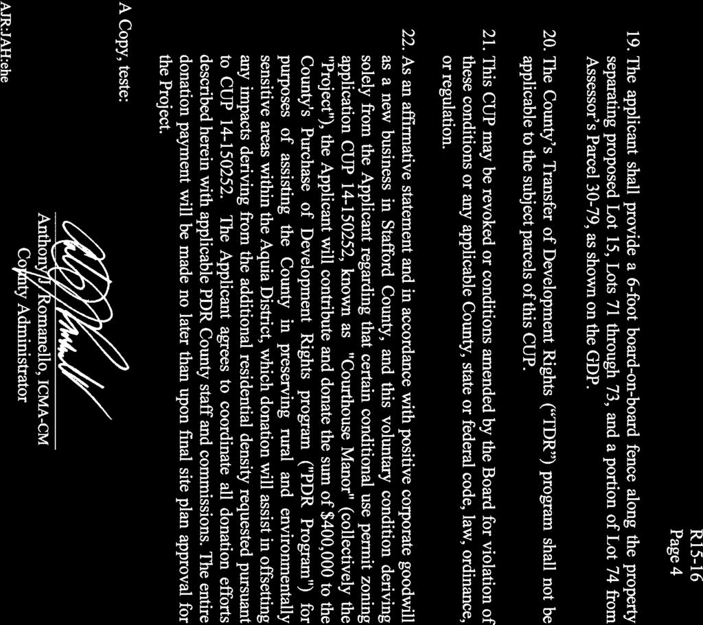
2 Memorandum to: Stafford County Planning Commission October 14, 2015 Page 2 of 5 Zoning: R-1, Suburban Residential (w/ conditions R15-16) Number of Lots: 75 Utilities: Staff Project Manager: Election District: Public Water and Sewer Andrea K Hornung, AICP Aquia COMMENTS: This preliminary subdivision plan proposes 75 single-family residential cluster lots on Tax Map Parcel Nos and , zoned R-1, Suburban Residential, as approved by the Conditional use permit dated March 17, 2015 for increased density not to exceed 2.25 dwelling units per acre. Proposed Courthouse Manor preliminary subdivision plan is acres with an approved density of 2.24 dwelling units per acre. It is located within the Courthouse Area Redevelopment (RDA) Plan, and the Courthouse Small Area Plan, designated areas of the Comprehensive Plan. The property is located within the Urban Services Area (USA), being served by public water and sewer utilities. There will be acres of passive recreational facilities in the form of open space including a tot lot. Stafford Elementary School is located to the west, a church located to the south, and single-family residential development located to the east and north. The proposed preliminary subdivision plan is surrounded by property zoned R-1, except A-1, Agricultural zoned property to the southeast. A conditional use permit, pursuant to Resolution R15-16 (Attachment 4), was approved March 17, 2015, with several conditions related to street buffers, transportation, easements, stormwater management, sidewalks, fire sprinklers, a sewer force main, fencing, and a Purchase of Development Rights (PDR) contribution. Condition 22 that states a PDR contribution of $400,000 shall be contributed to the program will be satisfied prior to construction plan approval. The Courthouse Manor preliminary subdivision plan was reviewed at the May 27, 2015 Technical Review Committee (TRC) meeting. The applicant and engineer were present, provided written comments, and discussed all issues regarding review of the plan with representatives from the Virginia Department of Transportation (VDOT) and various county agencies. The property is currently vacant with a majority of the site wooded. Approximately 32 acres of wooded area would be removed as a result of this proposal. A preliminary jurisdictional determination, made by the U.S. Army Corps of Engineers, concluded that there are no wetlands or streams located on the property. The Virginia Department of Historic Resources (DHR) identifies the northern area of the property as located within the land route taken by the Continental, French, and Crown forces during the Revolutionary War, to and from the siege of Yorktown, August 1781 to July There are two archaeological site records listed with DHR. The required Phase I Cultural Resource Study was completed which satisfies Condition 10 of the conditional use permit. The Stafford County Historical Commission (SCHC) approved the Phase I conducted by Circa-Cultural Resource Management, LLC in a

3 Memorandum to: Stafford County Planning Commission October 14, 2015 Page 3 of 5 letter dated June 9, 2015 (Attachment 6) and noted that no further testing is needed for these sites and development. The Phase I survey showed Site 1 as having vertical and horizontal archaeology integrity as well as cultural stratigraphy. If the site cannot be avoided, the SCHC recommends a Phase II archaeological investigation be completed for this site. While not required, the applicant indicated that a Phase II study will be complete on Site 1 (circa 1830 s house site) formerly located in the southwest port of the property near Courthouse Road and provided to the County at the submission of the construction plan. Current Zoning Map

4 Memorandum to: Stafford County Planning Commission October 14, 2015 Page 4 of 5 Aerial Location The plan reflects a 6-foot wide sidewalk that will be constructed by the applicant to connect the development to the existing sidewalk network at Stafford Elementary School through an open space area adjacent to Lot 1. This satisfies Condition 16 of the conditional use permit. A tot lot, depicted in the graphic with the red square on the following page, will also be provided in the same area. The School Division requested an additional pedestrian 15-foot wide access easement at the north end of the development, at Lot 15, near the baseball field which satisfies Condition 17 of the conditional use permit as shown in the graphic on the following page.
 is shown along the western property line with Stafford Elementary School.")

5 Memorandum to: Stafford County Planning Commission October 14, 2015 Page 5 of 5 Tot Lot School Access Easement A 17.5-foot modified transitional buffer (with a fence) is shown along the western property line with Stafford Elementary School. A 35-foot transitional buffer is required between the proposed development and the existing church property to the south. County Code permits the buffer width and the number of plant units to be reduced by 50% if a 6-foot tall privacy/opaque fence is located within the buffer yard. Board on board fences shown throughout the development satisfies Condition 19 of the conditional use permit. The preliminary subdivision plan shows a 20-foot wide buffer between the residential lot lines and the proposed northeast Courthouse Bypass Road right-of-way, consisting of a double row of evergreen trees, in accordance with Condition 2 of the conditional use permit, which states that buffering should be required along major arterial and collector roads to limit road noise in residential areas. Additionally, a screening-buffer, consisting of a double row of evergreens, would extend between the northern property boundary and Tax Map Parcel Nos and 30-79B to the north as well as between the proposed development and Tax Map Parcel No A.

6 Memorandum to: Stafford County Planning Commission October 14, 2015 Page 6 of 5 The screening between the future bypass road and Lot 43 is also shown as a 20-foot landscaping buffer. A variable width landscaping buffer is also shown adjacent to the R-1, residential lots west of the proposed Northeast Courthouse Bypass. The proposed Bypass is shown as a future 60-foot right-of-way. The construction timeline for the future bypass is uncertain and is not included in the Capital Improvement Plan (CIP) for the County or VDOT. The proposed development will have access with Dent Road and Courthouse Road via the proposed Bypass and separate entrances on Dent Road and Courthouse Road. Per VDOT s request, the proposed right-in/right-out on Courthouse Road will be designed to reduce the ability to make a left turn into the site. The proposal received approval for access to Dent Road, which currently has an unposted speed limit. The applicant conducted a Dent Road Speed Study (Study), dated June 10, 2014, which determined an appropriate speed limit of 30 mph. VDOT reviewed the study and found the analysis acceptable for purposes of sight distance for a proposed street connection. There is also an inter-parcel connection to Tax Map Parcel No identified between Lots 16 and 71 to the north. These access points are depicted in the schematic below as red squares. Points of Access The applicant is dedicating 30 feet of right-of-way along Hope Road, and 55 feet from the centerline on Courthouse Road, both of which are required by County Code Sec The applicant is also dedicating 25 feet from the centerline on Dent Road. This dedication satisfies Conditions 12, 13, and 14. The applicant is dedicating a 60-foot right-of-way along the eastern property line, together with the necessary construction easements (25 feet west and 15 feet east of the right-of-way), for the proposed northeast Courthouse Bypass Road (Bypass Road), as called for in the Comprehensive Plan. The Bypass Road is referenced directly and indirectly in several elements of the Comprehensive Plan, including the Courthouse Area Redevelopment Plan, the Courthouse UDA Small Area Plan, the Transportation Plan, and the Economic Development Strategic Plan. Conditions 4, 12, 13, and 14 are satisfied by showing these dedications and easements on the preliminary subdivision plan. The Courthouse Small Area Plan identifies the road as a two-lane collector facility. The applicant s engineer prepared an impact analysis for this segment of roadway which verified the current two-lane configuration with turn lanes could accommodate future local traffic in this area. VDOT provided comments stating that in order to function as a bypass, four lanes plus turn lanes would be the minimum required, with a large proportion of Route 1 through-traffic utilizing the roadway.
7 Memorandum to: Stafford County Planning Commission October 14, 2015 Page 7 of 5 The land designated as Open Space Parcel E appeared to constitute an improper spite strip according to VDOT. After further discussion, it was determined that the open space parcel may need to be acquired by the County as part of the right-of-way design, future planning, construction, and acceptance of the road. In accordance with Condition 3 of the conditional use permit, the applicant shall not clear the Open Space Parcel E except as reasonably required for implementing Condition 12. County regulations for Stormwater Management limit the amount of the peak discharge of stormwater runoff. Discharge of phosphorous for quantity and quality control from a developed property s water run-off shall be equal to or less than what was generated prior to any grading or development of the property. Water quantity and quality will be achieved utilizing a storm drainage system consisting of curb and yard inlets connected to an underground pipe network, collecting runoff and conveying it to an extended detention pond. Additional BMP will utilize infiltration basins to be treated and/or detained and released at acceptable rates. Condition 11 for stormwater management will be satisfied once the construction plan is approved. Conventional stormwater will be utilized in lieu of low impact development (LID) because LID is more suitable for large lot subdivisions where natural drainage divides and times of concentration are able to be approximated or maintained. Almost all of the impervious area will be captured by the ponds and BMP facilities. The rear of the homes, which are currently uncontrolled, will be directed to the streets and captured or over-compensated within the stormwater management facilities. Staff believes this plan is in compliance with all requirements of the Stafford County Code and the approved conditional use permit. Staff notes that Ordinance O15-20 which precludes the use of buffer areas to be used for required open space was adopted on August 18, The CUP was approved five months prior to the ordinance change. Two conditions of the permit require establishing buffers or open space to act as a buffer. Staff believes that the CUP approval and subsequent cluster concept plan approval would prevail as a vested right provided that the applicant continue to diligently pursue approval of the project. RECOMMENDATION: Staff recommends approval of the Courthouse Manor preliminary subdivision plan. JAH:akh Attachments (6)

8 SUB ; Preliminary Subdivision Plan COURTHOUSE MANOR Produced by the Stafford County Department of Planning and Zoning P.O. Box 339 Stafford, VA Attachment 1 Page 1 of 1 H O P E R D H O P E R D D R P ER S EV ER E H O P E R D H O P E R D S O M ER SET L N H O P E R D RO LE S L N H O PE RD LOVELACE LN M O U R N IN G D O V E D R STAFFO RD AVE LI TLE RO CKY RU N LN å STAFFORD E.S. Training 13 C O U R T H O U S E R D DENT RD RID G E D R å 1 AQUIA CREEK DENT RD A U S TIN 95 ñ v _ STAFFORD E.S. å C O U R STAFFORD T HOU SE R D å å H O P E R D Feet Produced: 9/22/2015 Data layers are compiled from various sources and are not to be construed or used as a "legal description." Data layers are believed to be accurate, but accuracy is not guaranteed. ±

9 Page 1 of 20

10 Page 2 of 20

11 Page 3 of 20

12 Page 4 of 20

13 Page 5 of 20

14 Page 6 of 20

15 Page 7 of 20
16 Page 8 of 20
17 Page 9 of 20
18 Page 10 of 20

19 Page 11 of 20
20 Page 12 of 20

21 Page 13 of 20

22 Page 14 of 20
23 Page 15 of 20

24 Page 16 of 20

25 Page 17 of 20

26 Page 18 of 20

27 Page 19 of 20

28 Page 20 of 20


29 Attachment 3 Page 1 of 1

30 Attachment 4 Page 1 of 4

31 Attachment 4 Page 2 of 4

32 Attachment 4 Page 3 of 4

33 Attachment 4 Page 4 of 4


34 Attachment 5 Page 1 of 1


35 Attachment 6 Page 1 of 2


36 Attachment 6 Page 2 of 2
North of the intersection of Courthouse Road and Dent Road, south of Hope Road and approximately 2,000 feet east of Jefferson Davis Highway
 1 Board of Supervisors Jack R. Cavalier, Chairman Gary F. Snellings, Vice Chairman Meg Bohmke Paul V. Milde, III Laura A. Sellers Cord A. Sterling Robert Bob Thomas, Jr. November 12, 2014 Anthony J. Romanello,
RC ; Reclassification The Garrison at Stafford Proffer Amendment (formerly Stafford Village Center)
") Board of Supervisors Robert Bob Thomas, Jr., Chairman Laura A. Sellers, Vice Chairman Meg Bohmke Jack R. Cavalier Wendy E. Maurer Paul V. Milde, III Gary F. Snellings Anthony J. Romanello, ICMA CM County
Board of Supervisors Robert Bob Thomas, Jr., Chairman Laura A. Sellers, Vice Chairman Meg Bohmke Jack R. Cavalier Wendy E. Maurer Paul V. Milde, III Gary F. Snellings Anthony J. Romanello, ICMA CM County
Amendments to the Subdivision and Zoning Ordinances Regarding Open Space Land in Cluster Subdivisions
 Board of Supervisors Gary F. Snellings, Chairman Laura A. Sellers, Vice Chairman Meg Bohmke Jack R. Cavalier Paul V. Milde, III Cord A. Sterling Robert Bob Thomas, Jr. 10 May 13, 2015 Anthony J. Romanello,
SUBJECT: CUP ; Conditional Use Permit - Telegraph Road Vehicle Sales / Storage
 2 Board of Supervisors Robert Bob Thomas, Jr., Chairman Laura A. Sellers, Vice Chairman Meg Bohmke Jack R. Cavalier Wendy E. Maurer Paul V. Milde, III Gary F. Snellings August 24, 2016 Anthony J. Romanello,
Habitat for Humanity is a non-profit organization that provides affordable housing for low income families.
 Attachment 1 R16-31 BACKGROUND REPORT On March 11, 2011, the Board authorized the conveyance of two parcels in Lake Arrowhead Subdivision (Tax Map Parcel Nos. 8B-G-18 and -19), to Greater Fredericksburg
Amendments to Transfer of Development Rights Program
 Board of Supervisors Jack R. Cavalier, Chairman Gary F. Snellings, Vice Chairman Meg Bohmke Paul V. Milde, III Laura A. Sellers Cord A. Sterling Robert Bob Thomas, Jr. Anthony J. Romanello, ICMA CM County
CUP ; Conditional Use Permit - 5 Twelve Convenience Store Expansion
 Board of Supervisors Meg Bohmke, Chairman Gary F. Snellings, Vice Chairman Jack R. Cavalier Thomas C. Coen L. Mark Dudenhefer Wendy E. Maurer Cindy C. Shelton 2 March 28, 2018 Thomas C. Foley County Administrator
1101 Washington Avenue Fredericksburg, VA 22401
 1 Board of Supervisors Robert Bob Thomas, Jr., Chairman Laura A. Sellers, Vice Chairman Meg Bohmke Jack R. Cavalier Wendy E. Maurer Paul V. Milde, III Gary F. Snellings December 14, 2016 C. Douglas Barnes
RC ; Reclassification - The Courtyards of Colonial Forge
 3 Board of Supervisors Robert Bob Thomas, Jr., Chairman Laura A. Sellers, Vice Chairman Meg Bohmke Jack R. Cavalier Wendy E. Maurer Paul V. Milde, III Gary F. Snellings November 9, 2016 C. Douglas Barnes
Amendment to the Zoning and Subdivision Ordinances; Consider Repeal Cluster Development Standards
 2 Board of Supervisors Meg Bohmke, Chairman Gary F. Snellings, Vice Chairman Jack R. Cavalier Thomas C. Coen L. Mark Dudenhefer Wendy E. Maurer Cindy C. Shelton February 28, 2018 Thomas C. Foley County
Attachment 1 R BACKGROUND REPORT
 BACKGROUND REPORT Attachment 1 R16-310 The Board is asked to consider authorizing the Interim County Administrator to execute deeds of conveyance for the acquisition of Tax Map Parcel Nos. 47-39, 47-39B,
North side of Garrisonville Road, approximately 275 feet east of Center Street
 2 Board of Supervisors Gary F. Snellings, Chairman Laura A. Sellers, Vice Chairman Meg Bohmke Jack R. Cavalier Paul V. Milde, III Cord A. Sterling Robert Bob Thomas, Jr. December 9, 2015 Anthony J. Romanello,
CUP95-02 & CUP990433; Conditional Use Permits FREDERICKSBURG PUBLIC AUTO AUCTION
 Attachment 1 R15-279 BACKGROUND REPORT The property in question consists of three parcels, Tax Map Parcel Nos. 45-78A, 53-5 and 53-5C (Property). The Board is asked to consider revoking a conditional use
Zoning Text Amendment to Allow Hotels and Public Parking Lots as By- Right Uses in the M-1 Zoning District
 5 Board of Supervisors Robert Bob Thomas, Jr., Chairman Laura A. Sellers, Vice Chairman Meg Bohmke Jack R. Cavalier Wendy E. Maurer Paul V. Milde, III Gary F. Snellings September 28, 2016 C. Douglas Barnes
WESTMINSTER PARK SUBDIVISION
 WESTMINSTER PARK SUBDIVISION Engineering Comments: FINAL PLAT COMMENTS (should be addressed prior to submitting the FINAL PLAT for review and/or signature by the City Engineer): A. Provide all of the required
PROPOSED BOARD OF SUPERVISORS COUNTY OF STAFFORD STAFFORD, VIRGINIA RESOLUTION
 Attachment 2 R16-348 PROPOSED BOARD OF SUPERVISORS COUNTY OF STAFFORD STAFFORD, VIRGINIA RESOLUTION At a regular meeting of the Stafford County Board of Supervisors (the Board) held in the Board Chambers,
DAUPHIN CREEK ESTATES SUBDIVISION
 # 12 SUB-000076-2017 DAUPHIN CREEK ESTATES SUBDIVISION Engineering Comments: FINAL PLAT COMMENTS (should be addressed prior to submitting the FINAL PLAT for review and/or signature by the City Engineer):
Parkland-Spanaway-Midland LUAC - Agenda
 1. 6:30 P.M. Parkland-Spanaway-Midland LUAC - Agenda Documents: 8 2 17 PSMAC Agenda.pdf 2. Parkland-Spanaway-Midland LUAC Initial Project Review Documents: Lincoln Court PP IPR PSMAC-RJ.pdf Department
Attachment 1 R Page 1
 Attachment 1 R15-101 Page 1 BACKGROUND REPORT The Board identified the completion of road improvements on Truslow Road (SR-652), between Berea Church Road (SR-654) and Plantation Drive (SR-1706), as a
16 February 9, 2011 Public Hearing APPLICANT: GEO I, L.L.C.
 16 February 9, 2011 Public Hearing APPLICANT: GEO I, L.L.C. PROPERTY OWNER: GEO I, L.L.C., DONALD K. PILAND, AND BOOTSIE LORAINE TERRY STAFF PLANNER: Faith Christie REQUEST: Conditional Change of Zoning
MAJOR SUBDIVISION PRELIMINARY PLAT CHECKLIST
 TOWNSHIP OF EGG HARBOR PLANNING BOARD/ZONING BOARD OF ADJUSTMENT 3515 BARGAINTOWN ROAD EGG HARBOR TOWNSHIP, NJ 08234 MAJOR SUBDIVISION PRELIMINARY PLAT CHECKLIST The following checklist is designed to
19 December 8, 2010 Public Hearing APPLICANT: GEO I, L.L.C.
 19 December 8, 2010 Public Hearing APPLICANT: PROPERTY OWNER:, DONALD K. PILAND, AND BOOTSIE LORAINE TERRY STAFF PLANNER: Faith Christie REQUEST: Conditional Change of Zoning (R-10 Residential to Conditional
Town of Cary, North Carolina Rezoning Staff Report 12-REZ-27 Morris Branch Town Council Public Hearing January 24, 2013
 Town of Cary, North Carolina Rezoning Staff Report 12-REZ-27 Morris Branch Town Council Public Hearing January 24, 2013 REQUEST To amend the Town of Cary Official Zoning Map to rezone approximately 9.0
RC ; Reclassification - Falmouth Village Commercial
 Board of Supervisors Paul V. Milde, III, Chairman Meg Bohmke, Vice Chairman Jack R. Cavalier Wendy E. Maurer Gary F. Snellings Laura A. Sellers Robert Bob Thomas, Jr. Thomas C. Foley County Administrator
Article 7: Residential Land Use and Development Requirements
 Article 7: Residential Land Use and Section 701: Statement of Intent (A) (B) (C) The intent of Article 7 is to develop certain land use and development requirements for the residential uses within Cumru
SPANISH FORT PLANNING COMMISSION PRELIMINARY SUBDIVISION PLAT APPLICATION. Number of Lots (Units) Address. Address.
 Address. Address.") Case No. SPANISH FORT PLANNING COMMISSION PRELIMINARY SUBDIVISION PLAT APPLICATION Name of Subdivision Tax Parcel Number(s) Subdivision Location Total Acreage Number of Lots (Units) Average Lot Size Current
Case No. SPANISH FORT PLANNING COMMISSION PRELIMINARY SUBDIVISION PLAT APPLICATION Name of Subdivision Tax Parcel Number(s) Subdivision Location Total Acreage Number of Lots (Units) Average Lot Size Current
ALPINE TOWNSHIP PLANNING COMMISSION REGULAR MEETING June 15, 2017
 Page 1 of 6 ALPINE TOWNSHIP PLANNING COMMISSION REGULAR MEETING 17-26 CALL TO ORDER / APPROVAL OF THE REGULAR MEETING MINUTES OF MAY 18, 2017 AND THE / PUBLIC COMMENT ON NON-AGENDA ITEMS The Alpine Township
LINCOLN COUNTY PLANNING & INSPECTIONS DEPARTMENT
 LINCOLN COUNTY PLANNING & INSPECTIONS DEPARTMENT 30 NORTH ACADEMY STREET, SUITE A, LINCOLNTON, NORTH CAROLINA 809 704-736-8440 OFFICE 704-736-8434 INSPECTION REQUEST LINE 704-73-900 FAX To: Board of Commissioners
WESTMINSTER PARK PLACE SUBDIVISION
 WESTMINSTER PARK PLACE SUBDIVISION Engineering Comments: FINAL PLAT COMMENTS (should be addressed prior to submitting the FINAL PLAT for review and/or signature by the City Engineer): A. Provide all of
REPORT TO THE SHELBY COUNTY PLANNING COMMISSION From the Department of Development Services Planning Services. February 4, 2019
 REPORT TO THE SHELBY COUNTY PLANNING COMMISSION From the Department of Development Services Planning Services February 4, 2019 Case No. Request for Rezoning Approval From E-1 to E-2 SD This is a request
2 April 9, 2014 Public Hearing
 2 April 9, 2014 Public Hearing APPLICANT (Street Closure): EBENEZER BAPTIST CHURCH APPLICANT & PROPERTY OWNER (Use Permit Modification): EBENEZER BAPTIST CHURCH STAFF PLANNER: Kevin Kemp REQUESTS: A. Street
FINAL SUBDIVISION AND LAND DEVELOPMENT PLAN CHECKLIST. Plan Name. Applicant's Name:
 TOWNSHIP OF UPPER ST. CLAIR FINAL SUBDIVISION AND LAND DEVELOPMENT PLAN CHECKLIST Date Filed Plan Name PLC Applicant's Name: Phone Filing Date for Final Application Final Plat 114.22. FINAL APPLICATION
Community Development Department
 Community Development Department SUBJECT: Reconsideration of Final Site Plan Review, Preliminary Subdivision, and Planned Development for Park Place Glenview at 1225 Waukegan Road MEETING DATE: March 28,
ZONING AMENDMENT & SUBDIVISION STAFF REPORT Date: November 3, 2016
 ZONING AMENDMENT & SUBDIVISION STAFF REPORT Date: November 3, 2016 APPLICANT NAME SUBDIVISION NAME David Shumer 5955 Airport Subdivision CITY COUNCIL DISTRICT District 6 5955 Airport Boulevard, 754 Linlen
LYON COUNTY COMMUNITY DEVELOPMENT DEPARTMENT
 LYON COUNTY COMMUNITY DEVELOPMENT DEPARTMENT B UILDING D EVELOPMENT E NGINEERING P LANNING 27 S. MAIN S TREET Y ERINGTON, NEVADA 89447 (775) 463-6591 F AX: (775) 463-5305 34 LAKES B OULEVARD D AYTON, NEVADA
Belmead Neighbourhood Structure Plan
 Belmead Neighbourhood Structure Plan Office Consolidation November 2005 Prepared by: Planning and Policy Services Branch Planning and Development Department City of Edmonton Bylaw 6619 was adopted by Council
City of Ferndale CITY COUNCIL STAFF REPORT
 SUBJECT: Final Plat Approval DATE: January 19, 2016 FROM: Haylie Miller, Assistant Planner PRESENTATION BY: Haylie Miller City of Ferndale CITY COUNCIL STAFF REPORT MEETING DATE: January 19, 2016 AGENDA
Town of Lisbon, Maine SUBDIVISION REVIEW APPLICATION
 Date Received: Fee Paid (amount): Applicant: Town of Lisbon, Maine SUBDIVISION REVIEW APPLICATION Subdivision Name/Title: This application must be received at the Town Office by close of business on the
Planning Commission Preliminary Plan LRC Subdivision Montville Township
 Planning Commission Preliminary Plan LRC Subdivision Montville Township Meeting: February 1, 2017 App. No.: 002-2017-PP Owner: Faith & Hope Land Dev. Co. Applicant: Montville Investors LLC Engineer: Weber
3 April 9, 2014 Public Hearing
 3 April 9, 2014 Public Hearing APPLICANT: PROPERTY OWNER: BIRCHWOOD ASSOCIATES, LLC STAFF PLANNER: Carolyn A.K. Smith REQUEST: Conditional Use Permit (assembly use) ADDRESS / DESCRIPTION: 329 Birchwood
CUP Amending C613
 CUP18-04 - Amending C613 CONDITIONAL USE PERMIT AMENDMENT REQUEST - FEMME OSAGE CREEK RD Permit No.: Applicant: Property Owner: Use Requested: Property Zoning: Area: Location: Council District: 2 Account
WRITTEN DECISION OF THE HAYDEN CITY COUNCIL REGARDING MAPLE GROVE PRELIMINARY SUBDIVISION APPLICATION (SUB-0013) HAYDEN SIGNATURE, LLC
 HAYDEN SIGNATURE, LLC") WRITTEN DECISION OF THE HAYDEN CITY COUNCIL REGARDING MAPLE GROVE PRELIMINARY SUBDIVISION APPLICATION (SUB-0013) HAYDEN SIGNATURE, LLC Application of Hayden Signature, LLC, an Idaho limited liability company,
WRITTEN DECISION OF THE HAYDEN CITY COUNCIL REGARDING MAPLE GROVE PRELIMINARY SUBDIVISION APPLICATION (SUB-0013) HAYDEN SIGNATURE, LLC Application of Hayden Signature, LLC, an Idaho limited liability company,
4. facilitate the construction of streets, utilities and public services in a more economical and efficient manner;
 PVPC MODEL BYLAW BY-RIGHT CLUSTER ZONING BYLAW Prepared by Pioneer Valley Planning Commission Revised: October 2001 1.00 Development 1.01 Development Allowed By Right Development in accordance with this
BETTA STOR-IT SUBDIVISION
 BETTA STOR-IT SUBDIVISION Engineering Comments: Must comply with all storm water and flood control ordinances. Any increase in impervious area in excess of 4,000 square feet will require detention. Any
SUBJECT: Application for Planned Unit Development and Rezoning 1725 Winnetka Road
 TO: FROM: CHAIRMAN BILL VASELOPULOS AND MEMBERS OF THE PLAN & ZONING COMMISSION STEVE GUTIERREZ DIRECTOR OF COMMUNITY DEVELOPMENT MEETING DATE: September 5, 2017 SUBJECT: Application for Planned Unit Development
City of Grande Prairie Development Services Department
 City of Grande Prairie Development Services Department COUNTRYSIDE SOUTH OUTLINE PLAN Prepared by: GPEC Consulting Ltd. #202, 10712-100th Street Grande Prairie, AB Council Resolution of August 20, 2001
PROJECT SCOPE OF WORK CITY OF TOWN AND COUNTRY STORMWATER PROGRAM
 PROJECT SCOPE OF WORK CITY OF TOWN AND COUNTRY STORMWATER PROGRAM Project ID Number: 2-2 Problem: The backyards at 962, 97, and 978 Delvin Drive are located in a low area of shallow ponding that takes
Town of Cary, North Carolina Rezoning Staff Report 14-REZ-31 Cary Park PDD Amendment (Waterford II) Town Council Meeting January 15, 2015
 Town Council Meeting January 15, 2015") Town of Cary, North Carolina Rezoning Staff Report 14-REZ-31 Cary Park PDD Amendment (Waterford II) Town Council Meeting January 15, 2015 REQUEST To amend the Town of Cary Official Zoning Map by amending
Town of Cary, North Carolina Rezoning Staff Report 14-REZ-31 Cary Park PDD Amendment (Waterford II) Town Council Meeting January 15, 2015 REQUEST To amend the Town of Cary Official Zoning Map by amending
THE CITY OF MOBILE, ALABAMA MOBILE Crry PLANNING COMMISSION
 THE CITY OF MOBILE, ALABAMA MOBILE Crry PLANNING COMMISSION LETTER OF DECISION MLK Avenue Redevelopment Corp. Attn: Michael Pierce P.O. Box 2204 Mobile, AL 36652 Re: Case #SUB2014-00040 (Subdivision) MLK
Staff Planner Carolyn A.K. Smith
 Applicant Property Owner, Pamela K. & Steven A. Gray Public Hearing April 13, 2016 City Council Election District Princess Anne Agenda Item 8 Request Modification of Proffers (Modification to the proffer
Requests Conditional Rezoning (I-1 Light Industrial to Conditional A-36 Apartment) Staff Planner Kristine Gay
 Staff Planner Kristine Gay") Applicant Franklin Johnston Group Management & Development, L.L.C Property Owner ABP VA (Virginia Beach), L.L.C Public Hearing October 12, 2016 City Council Election District Bayside Agenda Item 11 Requests
Applicant Franklin Johnston Group Management & Development, L.L.C Property Owner ABP VA (Virginia Beach), L.L.C Public Hearing October 12, 2016 City Council Election District Bayside Agenda Item 11 Requests
Town of Cary, North Carolina Rezoning Staff Report 14-REZ-24 Indian Wells Road Properties Town Council Meeting November 20, 2014
 Town of Cary, North Carolina Rezoning Staff Report 14-REZ-24 Indian Wells Road Properties Town Council Meeting November 20, 2014 REQUEST To amend the Town of Cary Official Zoning Map by revising a condition
York Neighbourhood Area Structure Plan
 York Neighbourhood Area Structure Plan Office Consolidation March 2006 Prepared by: Planning and Policy Services Branch Planning and Development Department City of Edmonton Bylaw 7064 was adopted by Council
PROVIDING FOR THE REZONING OF CERTAIN LAND FROM A-1 (SUBURBAN
 MANATEE COUNTY ZONING ORDINANCE PDR-01-12(Z)(P) - TOROBE CITRUS, INC./SUGAR MILL LAKES AN ORDINANCE OF THE COUNTY OF MANATEE, FLORIDA, AMENDING THE OFFICIAL ZONING ATLAS OF MANATEE COUNTY, ORDINANCE NO.
APPENDIX B. SUBMISSION REQUIREMENTS
 Master Major Site Minor Site Landscape Section B.1 Table of /Plat Requirements Proposed or approved name of development, project, subdivision, and/or phase. Location, including township, county, and state.
Planning & Zoning Commission
 Planning & Zoning Commission Planning & Development Department March 3, 2014 Final Plat Bay View Section 2, Phase I Request Applicant Owner Zoning Location Attachments Subdivision of approximately 12.04
Cobb County Community Development Agency Zoning Division 1150 Powder Springs St. Marietta, Georgia 30064
 Cobb County Community Development Agency Zoning Division 1150 Powder Springs St. Marietta, Georgia 30064 Case # Z-63 Public Hearing Dates: PC: 11-06-18 BOC: 11-20-18 SITE BACKGROUND Applicant: Loyd Development
COMMUNITY DEVELOPMENT. Staff Report. Site Plan Review. SP June 19, 2018
 COMMUNITY DEVELOPMENT 333 Broadalbin Street SW, PO Box 490, Albany, Oregon 97321-0144 BUILDING 541-917-7553 PLANNING 541-917-7550 Staff Report Site Plan Review SP-18-18 June 19, 2018 Summary On May 1,
610 LAND DIVISIONS AND PROPERTY LINE ADJUSTMENTS OUTSIDE A UGB
 ARTICLE VI: LAND DIVISIONS AND PROPERTY LINE ADJUSTMENTS VI-21 610 LAND DIVISIONS AND PROPERTY LINE ADJUSTMENTS OUTSIDE A UGB 610-1 Property Line Adjustments (Property Line Relocation) A property line
PLANNED UNIT DEVELOPMENT & SUBDIVISION STAFF REPORT Date: November 17, 2016
 PLANNED UNIT DEVELOPMENT & SUBDIVISION STAFF REPORT Date: November 17, 2016 DEVELOPMENT NAME SUBDIVISION NAME LOCATION Autonation Ford of Mobile Autonation Ford of Mobile Subdivision 901, 909, and 925
-MENDOCINO COUNTY PLANNING AND BUILDING SERVICES- DIVISION OF LAND REGULATIONS TITLE 17
 ARTICLE VI -- GENERAL REGULATIONS AND PROVISIONS Sec. 17-50. Sec. 17-51 General Plan. Sec. 17-52 Lot and Block Design and Configuration. Sec. 17-53 Lot Access. Sec. 17-54 Private Roads. Sec. 17-55 Water
NORMAN, OKLAHOMA OWNER: RCB BANK APPLICATION FOR 2025 PLAN CHANGE PLANNED UNIT DEVELOPMENT PRELIMINARY PLAT. 12 December 2011 Revised 5 January 2012
 THE VILLAGE AT OAKHURST ADDITION NORMAN, OKLAHOMA OWNER: RCB BANK APPLICATION FOR 2025 PLAN CHANGE PLANNED UNIT DEVELOPMENT PRELIMINARY PLAT 12 December 2011 Revised 5 January 2012 PREPARED BY: THE RIEGER
Open Space Model Ordinance
 Open Space Model Ordinance Section I. Background Open space development has numerous environmental and community benefits, including: 1) Reduces the impervious cover in a development. Impervious cover
Wampus Mills Subdivision, Tree Removal Permit and Steep Slope Permit Approvals [#14-103]
![Wampus Mills Subdivision, Tree Removal Permit and Steep Slope Permit Approvals [#14-103]](/thumbs/95/122755150.jpg "Wampus Mills Subdivision, Tree Removal Permit and Steep Slope Permit Approvals [#14-103]") TOWN OF NORTH CASTLE WESTCHESTER COUNTY 17 Bedford Road Armonk, New York 10504-1898 PLANNING DEPARTMENT Adam R. Kaufman, AICP Director of Planning Telephone: (914) 273-3542 Fax: (914) 273-3554 www.northcastleny.com
TOWN OF NORTH CASTLE WESTCHESTER COUNTY 17 Bedford Road Armonk, New York 10504-1898 PLANNING DEPARTMENT Adam R. Kaufman, AICP Director of Planning Telephone: (914) 273-3542 Fax: (914) 273-3554 www.northcastleny.com
Staff Report: Date: Applicant: Property Identification: Acreage of Request: Current Zoning of Requested Area: Requested Action: Attached:
 Staff Report: Completed by Jeff Palmer Director of Planning & Zoning Date: November 7, 2018, Updated November 20, 2018 Applicant: Greg Smith, Oberer Land Developer agent for Ronald Montgomery ET AL Property
SUBDIVISION, PLANNED UNIT DEVELOPMENT, ZONING AMENDMENT, & SIDEWALK WAIVER STAFF REPORT Date: July 19, 2018
 SUBDIVISION, PLANNED UNIT DEVELOPMENT, ZONING AMENDMENT, & SIDEWALK WAIVER STAFF REPORT Date: July 19, 2018 NAME SUBDIVISION NAME LOCATION West Mobile Properties, LLC U.S. Machine Subdivision 556, 566,
STONE HEDGE SUBDIVISION, UNIT 1, RESUBDIVISION OF LOT 40 & WEST COMMON AREA
 # 5 SUB-000498-2018 STONE HEDGE SUBDIVISION, UNIT 1, RESUBDIVISION OF LOT 40 & WEST COMMON AREA Engineering Comments: Must comply with the Mobile County Flood Damage Prevention Ordinance. Development shall
ARTICLE V PRELIMINARY PLAN SUBMISSION
 ARTICLE V PRELIMINARY PLAN SUBMISSION 501. Plan Requirements a. On or before the 25 th day of the month prior to a regularly scheduled meeting of the Planning Commission, the applicant shall submit two
Purpose of the Public Hearing
 Purpose of the Public Hearing To provide you with Information on the proposed sidewalk project(s) Opportunities to review plans and exhibits The ability to ask questions and get answers about each project
Cover Letter with Narrative Statement
 Cover Letter with Narrative Statement March 31, 2017 rev July 27, 2017 RE: Rushton Pointe Residential Planned Unit Development Application for Public Hearing for RPUD Rezone PL2015 000 0306 Mr. Eric Johnson,
Town of Cary, North Carolina Rezoning Staff Report 13-REZ-13 An Zou Property Town Council Meeting November 21, 2013
 Town of Cary, North Carolina Rezoning Staff Report 13-REZ-13 An Zou Property Town Council Meeting November 21, 2013 REQUEST To amend the Town of Cary Official Zoning Map by rezoning 0.63 acres located
ZONING AMENDMENT & SUBDIVISION STAFF REPORT Date: July 9, 2015
 ZONING AMENDMENT & SUBDIVISION STAFF REPORT Date: July 9, 2015 APPLICANT NAME 2513 Dauphin Street, Inc. SUBDIVISION NAME Audubon Place Extension No. 3, Resubdivision of Lots 1-5 LOCATION 2513 Dauphin Street
3 July 13, 2011 Public Hearing APPLICANT / PROPERTY OWNER: MARQUETTE & ASSOCIATES, L.L.C. /G.S. DEVELOPERS, L.L.C.
 3 July 13, 2011 Public Hearing APPLICANT / PROPERTY OWNER: MARQUETTE & ASSOCIATES, L.L.C. /G.S. DEVELOPERS, L.L.C. STAFF PLANNER: Faith Christie REQUEST: Conditional Change of Zoning (AG-2 Agricultural
PLANNING COMMISSION PUBLIC HEARING STAFF REPORT ZRTD FAIRFAX MARBLE & GRANITE
 Date of Hearing: PLANNING COMMISSION PUBLIC HEARING STAFF REPORT SUBJECT: ELECTION DISTRICT: ZRTD-2016-0009 FAIRFAX MARBLE & GRANITE Broad Run CRITICAL ACTION DATE: September 27, 2017 STAFF CONTACTS: APPLICANT:
STAFF REVIEW MARCH 13, Preliminary Consent - Major Subdivision. Showfield, LLC Davis, Bowen & Friedel, Inc. R-2, Residential Low Density
 STAFF REVIEW MARCH 13, 2019 Application Title Application Type Owner Engineer Showfield City Preliminary Consent - Major Subdivision Showfield, LLC Davis, Bowen & Friedel, Inc. Tax Map and Parcel 335-8.00-46.00
ARTICLE 23 CONDOMINIUM STANDARDS
 ARTICLE 23 CONDOMINIUM STANDARDS Section 23.01 Intent. The intent of this Article is to provide regulatory standards for condominiums and site condominiums similar to those required for projects developed
County of Loudoun. Department of Planning MEMORANDUM
 County of Loudoun Department of Planning MEMORANDUM DATE: September 3, 2013 TO: FROM: Marchant Schneider, Project Manager Land Use Review Marie Genovese, AICP, Planner III, Community Planning SUBJECT:
Watkinsville First Baptist Church Building and Parking Masterplan Norton Road & Simonton Bridge Road Oconee County Georgia
 Watkinsville First Baptist Church Building and Parking Masterplan Norton Road & Simonton Bridge Road Oconee County Georgia Special Use Approval A-1 CUP to A-1 with Special Use Approval Total Site Area
ANDOVER CODE. Checklist #5 Preliminary Site Plan Conditional Use
 ANDOVER CODE Checklist #5 Preliminary Site Plan Conditional Use Applicant: Block Lot File No. This checklist is for general reference only. Further information may be required by the reviewing authority.
East Rockhill Township PLANNING COMMISSION MINUTES. December 8, 2016
 East Rockhill Township PLANNING COMMISSION MINUTES December 8, 2016 The Regular Meeting of the was held at 7:00pm on December 8, 2016 following a work session held at 6:30pm at the Township meeting room
DRAFT FOR PUBLIC HEARING (rev. March, 2016)
") Chapter 200. ZONING Article VI. Conservation/Cluster Subdivisions 200-45. Intent and Purpose These provisions are intended to: A. Guide the future growth and development of the community consistent with
Chapter 200. ZONING Article VI. Conservation/Cluster Subdivisions 200-45. Intent and Purpose These provisions are intended to: A. Guide the future growth and development of the community consistent with
AGENDA STATEMENT NO BUSINESS OF THE PLANNING COMMISSION City of Victoria, Minnesota STAFF REPORT. Casco Ventures (Developer)
") AGENDA STATEMENT NO. 17-1 BUSINESS OF THE PLANNING COMMISSION City of Victoria, Minnesota STAFF REPORT TO: Planning Commission PREPARED BY: Erin Smith, Senior Planner RE: Waterford Landing Project Rezoning
AGENDA STATEMENT NO. 17-1 BUSINESS OF THE PLANNING COMMISSION City of Victoria, Minnesota STAFF REPORT TO: Planning Commission PREPARED BY: Erin Smith, Senior Planner RE: Waterford Landing Project Rezoning
Initial Subdivision Applications Shall Include the Following:
 Initial Subdivision Applications Shall Include the Following: 1) Subdivision Application Form: completely filled out (12 copies) 2) Plat: The Plat must adhere to the requirements set forth in the Town
COMMUNITY DEVELOPMENT DEPARTMENT 333 Broadalbin Street SW, P.O. Box 490 Albany, OR 97321
 COMMUNITY DEVELOPMENT DEPARTMENT 333 Broadalbin Street SW, P.O. Box 490 Albany, OR 97321 Ph: 541-917-7550 Fax: 541-917-7598 www.cityofalbany.net STAFF REPORT Application for Site Plan Review SP-07-18 and
EXHIBIT D. Planned Unit Development Written Description April 13, 2016 Rouen Cove Phase II PUD
 1 EXHIBIT D Planned Unit Development Written Description April 13, 2016 Rouen Cove Phase II PUD Development # 8986.001 Developer: Curtis L. Hart Hart Resources LLC 8051 Tara Lane Jacksonville, Florida
CITY OF PAPILLION PLANNING COMMISSION STAFF REPORT MAY 31, 2017 AGENDA SHADOW LAKE 2 FINAL PLAT FP
 I. GENERAL INFORMATION CITY OF PAPILLION PLANNING COMMISSION STAFF REPORT MAY 31, 2017 AGENDA SHADOW LAKE 2 FINAL PLAT FP-17-0006 A. APPLICANT: Shadow Lake 2, LLC 15950 West Dodge Road, Suite 300 Omaha,
FREQUENTLY USED PLANNING & ZONING TERMS
 City Of Mustang FREQUENTLY USED PLANNING & ZONING TERMS Abut: Having property lines, street lines, or zoning district lines in common. Accessory Structure: A structure of secondary importance or function
Final Plats for Major Residential and Commercial Subdivisions Checklist
 Project Name: : This form is a checklist of Zoning Ordinance requirements for major residential and commercial subdivision plats to assist the applicant in their submittal. It is not intended to be a comprehensive
Appendix J: Stormwater Utility Ordinance Guidance
 Appendix J: Stormwater Utility Ordinance Guidance 1. City of Marquette (MI) Stormwater Utility Ordinance 2. Guidance on Establishing Stormwater Utility Fees 169 City of Marquette (MI) Stormwater Utility
ARTICLE VI. SUBDIVISION STANDARDS, PUBLIC
 ARTICLE VI. SUBDIVISION STANDARDS, PUBLIC IMPROVEMENTS, AND DESIGN REQUIREMENTS ARTICLE VI. SUBDIVISION STANDARDS, PUBLIC IMPROVEMENTS, AND DESIGN REQUIREMENTS DIVISION 1. GENERAL PROVISIONS Sec. 21-6100.
BROADWAY THREE NOTCH ROAD SUBDIVISION
 # 3 SUB-000803-2018 BROADWAY THREE NOTCH ROAD SUBDIVISION Engineering Comments: FINAL PLAT COMMENTS (should be addressed prior to submitting the FINAL PLAT for review and/or signature by the City Engineer):
Subject: Ashville Park Cost Participation Term Sheet and Briefing
 OFFICE OF THE CITY MANAGER (757) 385-4242 April 27, 2018 MUNICIPAL CENTER BUILDING 1, ROOM 234 VVIRGINIA BEACH, VA 23456-9001 The Honorable Mayor William D. Sessoms, Jr. Members of City Council Subject:
UPPER ALLEN TOWNSHIP PLANNING COMMISSION REGULAR MEETING August 27, :00 P.M.
 UPPER ALLEN TOWNSHIP PLANNING COMMISSION REGULAR MEETING August 27, 2018 7:00 P.M. PC MEMBERS TOWNSHIP OFFICIALS - PRESENT R. Wayne Willey, Chairperson Jennifer Boyer, Comm. Dev. Director Philip Cerveny,
Project File #: SF Project Name: Jackson Ranch Filing No. 4 Parcel Nos.: , and
 COMMISSIONERS: DARRYL GLENN (PRESIDENT) MARK WALLER (PRESIDENT PRO TEMPORE) STAN VANDERWERF LONGINOS GONZALEZ PEGGY LITTLETON PLANNING AND COMMUNITY DEVELOPMENT DEPARTMENT CRAIG DOSSEY, EXECUTIVE DIRECTOR
ARTICLE 14 PLANNED UNIT DEVELOPMENT (PUD) DISTRICT
 DISTRICT") ARTICLE 14 PLANNED UNIT DEVELOPMENT (PUD) DISTRICT Section 14.01 Intent. It is the intent of this Article to allow the use of the planned unit development (PUD) process, as authorized by the Michigan Zoning
ARTICLE 14 PLANNED UNIT DEVELOPMENT (PUD) DISTRICT Section 14.01 Intent. It is the intent of this Article to allow the use of the planned unit development (PUD) process, as authorized by the Michigan Zoning
PLANNED UNIT DEVELOPMENT & SUBDIVISION STAFF REPORT August 18, 2016
 PLANNED UNIT DEVELOPMENT & SUBDIVISION STAFF REPORT August 18, 2016 DEVELOPMENT NAME SUBDIVISION NAME Mullinax Ford Subdivision Mullinax Ford Subdivision LOCATION CITY COUNCIL DISTRICT District 6 Southeast
SITE PLAN REVIEW PROCEDURES SECTION DEVELOPMENTS REQUIRING SITE PLAN APPROVAL
 SECTION 22.01 PURPOSE ARTICLE XXII PROCEDURES The purpose of this Article is to establish uniform requirements of procedure for all developments in the Township. Certain specific types of minor development
Affordable Housing Plan
 Affordable Housing Plan CORDOVA HILLS SPECIAL PLANNING AREA 1 Proposed Project Conwy LLC is the master developer ( Master Developer ) of that certain real property in the County of Sacramento ( County
Initial Project Review
 Pierce County Department of Planning and Land Services, 2401 South 35th Street, Tacoma, WA (253) 798-7037 Initial Project Review Major Amendment to Preliminary Plat: Hawks Ridge Division 1 Application
TOWNSHIP OF DOYLESTOWN APPLICATION FOR REVIEW OF SUBDIVISION OR LAND DEVELOPMENT PROPOSAL. Please PRINT; all information MUST be filled out completely
 TOWNSHIP OF DOYLESTOWN APPLICATION FOR REVIEW OF SUBDIVISION OR LAND DEVELOPMENT PROPOSAL Please PRINT; all information MUST be filled out completely Date: Name of Subdivision or Land Development: Location: