RC ; Reclassification - Falmouth Village Commercial
|
|
|
- Alice Cunningham
- 5 years ago
- Views:
Transcription

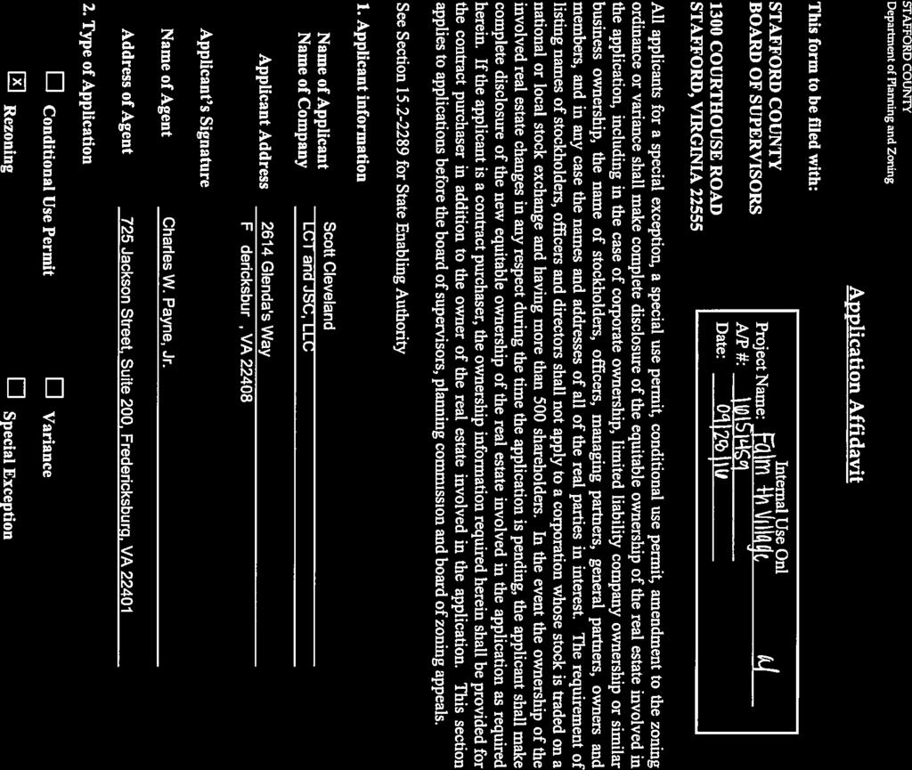
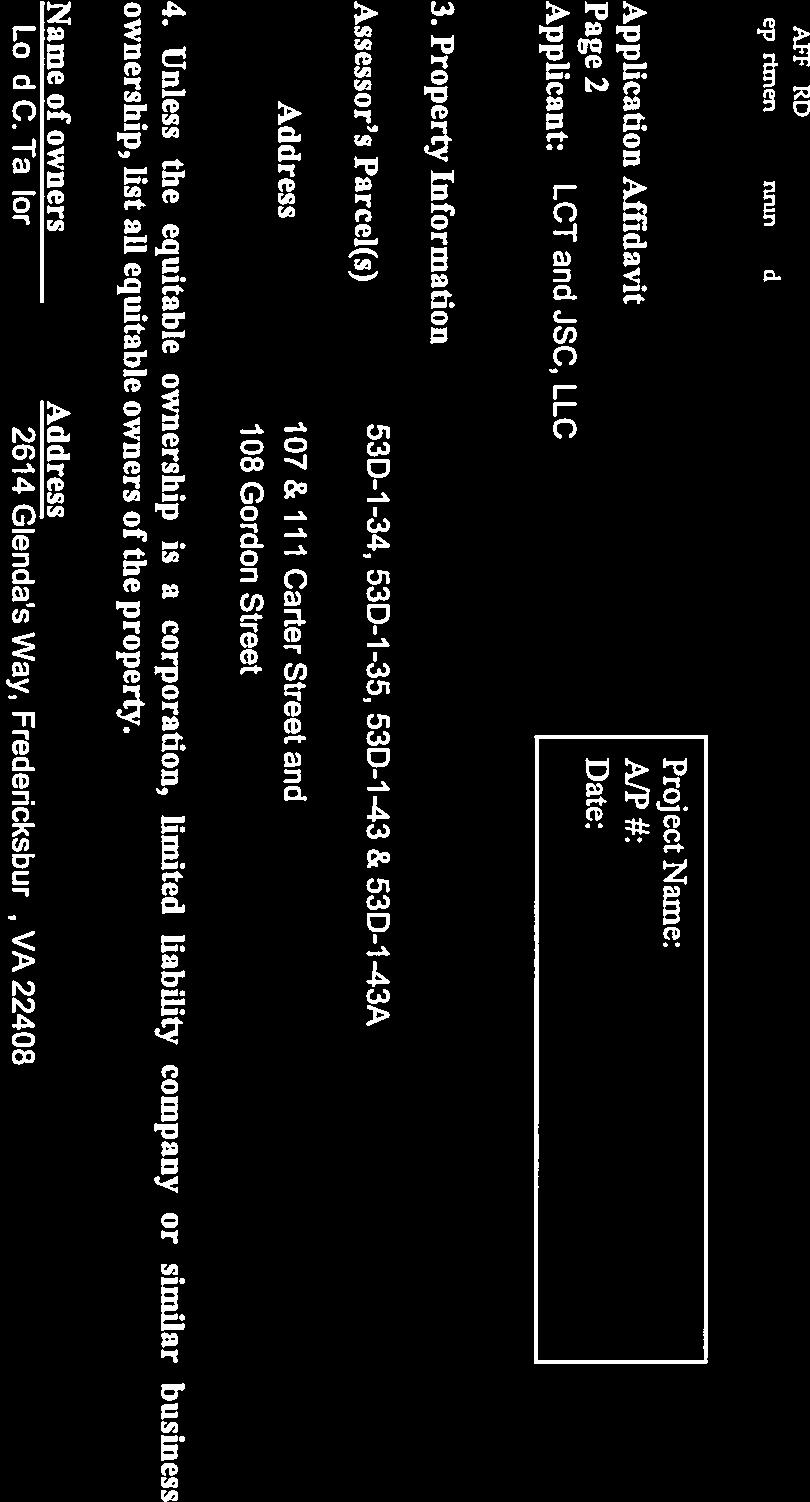
1 Board of Supervisors Paul V. Milde, III, Chairman Meg Bohmke, Vice Chairman Jack R. Cavalier Wendy E. Maurer Gary F. Snellings Laura A. Sellers Robert Bob Thomas, Jr. Thomas C. Foley County Administrator 1 March 8, 2017 MEMORANDUM TO: FROM: Stafford County Planning Commission J SUBJECT: RC ; Reclassification - Falmouth Village Commercial ATTACHMENTS: 1. Impact Statement 2. Proposed Ordinance and Resolution 3. Proposed Proffer Statement, dtd 2/2/17 2/8/17 5. Ordinance O Application and Related Materials 4. Generalized Development Plan, dtd Staff Project Manager: Kathy Baker ISSUE: The Planning Commission is to consider a request for a Reclassification from the R-1, Suburban Residential Zoning District to the B-1, Convenience Commercial Zoning District on Tax Map Parcel Nos. 53D-1-34, 53D-1-35, 53D-1-43 and 53D-1-43A. BACKGROUND: Location: Election District: Applicant: North side of Carter Street, east of Cambridge Street, and east side of Gordon Street, north of King Street George Washington Scott Cleveland LCT and JSC, LLC 2614 Glenda s Way Fredericksburg, VA Courthouse Road, P. O. Box 339, Stafford, VA Phone: (540) Fax: (540)


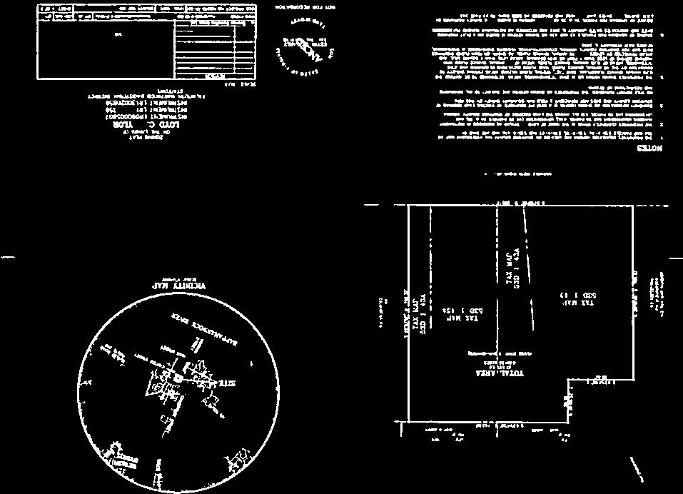
2 Memorandum to: Stafford County Planning Commission March 8, 2017 Page 2 of 11 Property Owner: Current Use: Proposed Use: Application Date: Loyd C. Taylor 2614 Glenda s Way Fredericksburg, VA Single-Family Residential and Vacant Historic Structures Office/Commercial September 7, 2016 (Submission) February 9, 2017 (Complete Application) Advertisement Dates: February 22, 2017 and March 1, 2017 Time Limit: June 16, 2017 Area: Comprehensive Plan: Zoning Classification: 1.15 acres Falmouth Village Planning Area (Future Land Use Map) R-1, Suburban Residential B-3 B-2 R-1 Future Land Use Map Zoning Map
3 Memorandum to: Stafford County Planning Commission March 8, 2017 Page 3 of 11 Abutting Properties: Parcels 34 and 35: Location Zoning Existing Use Comprehensive Plan North B-3, Office Office Falmouth Village Planning Area South R-1, Suburban Residential Park Falmouth Village Planning Area East R-1, Suburban Residential Single-family Residential Falmouth Village Planning Area West R-1, Suburban Residential B-2, Urban Commercial Single-family Residential Vacant Structure Falmouth Village Planning Area Parcels 43 and 43A: Location Zoning Existing Use Comprehensive Plan North N/A Right-of-way Falmouth Village Planning Area South R-1, Suburban Residential B-3, Office Single-family Residential Office Falmouth Village Planning Area East R-1, Suburban Residential Single-family Residential Falmouth Village Planning Area West R-1, Suburban Residential Single-family Residential Falmouth Village Planning Area Utilities: Transportation: Schools: Parks and Recreation: The property is located within the County s Urban Service Area and has access to public water and sewer. The anticipated demand for water is 1,615 gallons per day (gpd) vs. 480 gpd for the current permitted use. The anticipated demand for sewer is 2,057 gpd vs. 600 gpd for the current permitted use. The applicant will extend utility lines as needed to serve the development. Carter Street is a 2-lane undivided roadway with a speed limit of 25 miles per hour and an estimated traffic volume of 1,800 vehicle trips per day (VPD) according to Virginia Department of Transportation (VDOT) 2015 Daily Traffic Volume Estimates. Gordon Street is a 2-lane undivided roadway with a speed limit of 25 miles per hour and an estimated traffic volume of 1,500 vehicle trips per day (VPD). The subject parcels are currently zoned R-1, which permits up to two residential uses. This by-right use would generate 28 VPD during the week and 27 VDP on Saturday. The proposed development of office and commercial would yield 139 VPD during the week and 258 VPD on Saturday. The proposed development would have a slight decrease in student generation. The development would not generate the need for parkland.
 is requesting a zoning reclassification from the R-1, Suburban Residential Zoning District to the B-1, Convenience Commercial Zoning District, to allow for the")
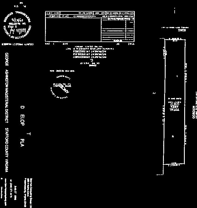
4 Memorandum to: Stafford County Planning Commission March 8, 2017 Page 4 of 11 Proffer Valuation: A proffer statement has been submitted with this application. No monetary proffers are proposed. COMMENTS: LCT and JSC, LLC (Applicant) is requesting a zoning reclassification from the R-1, Suburban Residential Zoning District to the B-1, Convenience Commercial Zoning District, to allow for the development of office and low intensity commercial use on 1.15 acres. The Carter Street parcels consist of approximately 0.86 acres, and the Gordon Street parcels consist of approximately 0.28 acres. Zoning History The properties were zoned R-1 in 1978, with the comprehensive rezoning of the county. Prior to that, Parcels 34 and 35 were zoned R-2, and parcels 43 and 43A were zoned B-2. The Falmouth Historic Resource (HR) Overlay District was established on Parcels 34, 35, and 43 in The purpose of the HR district is to protect against destruction of and encroachment upon historic resources. HR districts are areas containing buildings or places in which historic events have occurred or which have special public value because of notable architectural or other features relating to the cultural or artistic heritage of the county, the commonwealth, and the nation, of such significance as to warrant conservation and preservation. The HR district requires that any modification to existing structures, additional structures, or features such as signs will require approval by the Architectural Review Board (ARB). Section of the Zoning Ordinance specifies regulations for properties within historic districts. In general, the ARB shall apply certain criteria for its evaluation of any application, including guidelines adopted by the County, and the Secretary of Interior's "Standards for Rehabilitation," in determining the appropriateness of any application for approval. Existing Conditions The proposal consists for four parcels, located in the southeast quadrant of the Warrenton Road/Bulter Road/Cambridge Street intersection, which was recently upgraded to include turn lanes. Two of the parcels, Parcels 43 and 43A, are located on the north side of Carter Street and total approximately 0.86 acres. The other two parcels, Parcels 34 and 35, are located south of Carter Street, on the east side of Gordon Street, and total approximately 0.28 acres. Parcels 43 and 43A are generally flat, and contain existing structures. The structures include the historic Dunbar s Kitchen, which is a remaining dependency building dating to 1750, on Parcel 43; and a single-family residential dwelling, circa 1955, on Parcel 43A. Two garage/storage buildings are also located to the rear of Parcel 43A. Immediately to the north and west of these parcels is right-of-way owned by the Virginia Department of Transportation (VDOT), which is remnant from the intersection improvements. A portion of the right-of-way to the north is intended to be conveyed to the County in the future to advance
 1955 Rambler Parcel 43A (111 Carter St.")


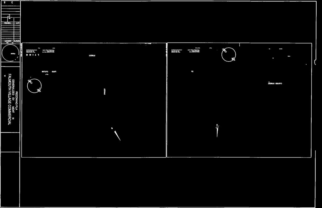
5 Memorandum to: Stafford County Planning Commission March 8, 2017 Page 5 of 11 the County s goals of open space and historic preservation, visitor access, and/or interpretation of the Falmouth Historic District. Historic Dunbar s Kitchen Parcel 43 (107 Carter St.) 1955 Rambler Parcel 43A (111 Carter St.) Parcels 34 and 35 are physically separated from the Carter Street parcels. Parcel 34 contains a cinderblock single-family residential dwelling, circa 1950, and a separate structure containing three attached garages. The structures lie very close to Gordon Street, and do not meet current building setbacks. Like many structures in Falmouth, the structures are legally non-conforming. Parcel 35 is undeveloped, but has a concrete pad used for parking. Gordon Street is steep, rising approximately 40 feet from King Street to Carter Street. Parcels 34 and 35 fall within a 100-year flood zone, as well as a Dam Break Inundation Zone associated with Lake Mooney located upstream on the Rappahannock River Residential Structure Parcel 34 (108 Gordon St.) View from Gordon Street, looking northeast Parcel 34 Generalized Development Plan (GDP) The GDP (Attachment 4) depicts the proposed design of the parcels to include a 2,422 square-foot restaurant (sit down), and 5,805 square feet of office use. Development is proposed to occur within the existing buildings on site.


6 Memorandum to: Stafford County Planning Commission March 8, 2017 Page 6 of 11 The following is proposed on the Carter Street parcels: Office use in the historic Dunbar s Kitchen Office use in the 1955 rambler Sit-down restaurant use in the existing garage/storage buildings Associated parking areas The following is proposed on the Gordon Street parcels: Office use in the 1950 dwelling Office use in the garage Parallel parking along Gordon Street The applicant is proposing to construct sidewalk along the Carter Street property frontage. In addition, sidewalk is proposed to connect from the Carter Street parcels to the Gordon Street parcels, and continue south to King Street. This would be contingent upon obtaining additional right-of-way or easements on off-site property at the corner of Carter Street and Gordon Street. There is limited area for sidewalk construction along Gordon Street due to its narrow width. In addition, the grade of Gordon Street is extreme in this location. Carter Street Parcels Gordon Street Parcels Generalized Development Plan
 process.")
7 Memorandum to: Stafford County Planning Commission March 8, 2017 Page 7 of 11 Environmental There is a Zone EA floodplain that covers Parcels 34 and 35. The Base Flood Elevation (BFE) is elevation 40. Any work within the Special Flood Hazard Area will be subject to the provisions of Sec of the County Code and the provisions of the FEMA Letter of Map Change (LOMC) process. The parcels are also designated with the Dam Break Inundation Zone (DBIZ) associated with Lake Mooney, located upriver from the parcels. Comprehensive Plan Policy discourages development of new buildings and structures within dam inundation zones. Conversion of the properties to commercial use may help minimize loss of life concerns during flood events. Commercial properties are generally occupied during a few hours a day compared to residential use which may have continuous habitation. Transportation A transportation impact analysis (TIA) was not required with this application. Based on the Institute of Transportation Engineers (ITE), it was estimated that the uses would generate up to 258 VPD at its highest use on Saturday, which is under the threshold requiring a TIA. The proposed development of office and commercial would yield 139 VPD during the week. The daily AM peak hour would generate up to 14 vehicles per hour (VPH), and the daily PM peak hour would generate 4 VPH. On Saturday, the peak hour would generate 13 VPH. No additional road upgrades are planned for Carter Street or Gordon Street. Commercial entrance improvements would require review by VDOT during the site plan review for the new development. Comprehensive Plan The Comprehensive Plan identifies this area as being within the Falmouth Village Planning Area, which includes an Economic Development Priority Focus Area. The Planning Area represents the location of the Falmouth Village Redevelopment Plan, which was adopted in As indicated in the Redevelopment Plan, the heart of Falmouth Village is generally defined as the crossroads of Warrenton Road and Cambridge Street. The redevelopment area is generally bounded by Truslow Road to the north, the Rappahannock River to the south, Colonial Avenue to the east, and Melcher Drive to the west. This redevelopment area generally consists of roughly 200 parcels within approximately 146 acres of land area. The Redevelopment Plan notes that historic Falmouth Village presents a unique opportunity to preserve, enhance and develop a cultural attraction in Stafford County. This village setting adjacent to the Rappahannock River is already recognized as a National Register Historic District and contains some of the most significant historic sites in Stafford County. As such, the Plan recommended the adoption of a form-base zoning district to facilitate redevelopment efforts. As an alternative, the Board endorsed the use of an overlay zone concept which would not affect the Falmouth Village Planning Area underlying zoning pattern but provide some flexibility of use and relief of development standards while maintaining the architectural integrity of the area.
8 Memorandum to: Stafford County Planning Commission March 8, 2017 Page 8 of 11 The Redevelopment area is currently developed with a mix of commercial uses intermixed with residential communities. Much needed access improvements were identified as vital to its potential to provide another center to foster economic opportunity that could add to Stafford County s strength. A Cultural Management Team was encouraged to outline an implementation plan to develop the Historic Port of Falmouth into a tourist attraction. The area was designated as an economic redevelopment site, and will be treated on par with other similar areas in the proposed redevelopment plans. The area is recommended for primarily Mixed Use future Land Use. More detailed land use concept plans may be considered for sections of the Planning Area on a case by case basis. Park land use is designated on the Historic Port of Falmouth Park and the Belmont Estate. The proposal is generally in compliance with the Comprehensive Plan. Goal 9 of the Comprehensive Plan is to promote Stafford County s heritage and maintain a sense of place by identifying, protecting, preserving, and interpreting Stafford County s historic and cultural resources. Policy states that development and redevelopment, including the construction of buildings, site improvements, or land clearing and grading, should be completed in such a way that protects and enhances, rather than harms, heritage resources and cultural landscapes. The proposal is consistent with these policies of the Comprehensive Plan. Proffer Summary The applicant submitted the following proposed proffers (Attachment 3): require the property to be generally developed in conformance with the generalized development plan (GDP); prohibit several commercial uses on the property which would otherwise be permitted; require construction of a sidewalk from Carter Street to King Street, using exposed aggregate material; limit impervious materials within parking areas; permit off-site parking if on-site parking is not feasible; require signs be posted describing the historical significance of the property; require a Phase I Cultural Resources Analysis prior to land disturbance, with a follow-up Phase II Analysis, if recommended; limit the height of any new buildings to two stories; require the architecture for any new construction be compatible with the architecture in the historic area; require consideration of the rehabilitation of existing buildings before demolition; and require any new construction, including additions, be subject to the Architectural Review Board s review and standards. Proposed FR, Falmouth Redevelopment Overlay District The Board of Supervisors (Board) is currently considering a zoning reclassification to apply the FR, Falmouth Redevelopment Area Overlay Zoning District to 81 parcels in the Falmouth area, including the subject parcels. Application of the FR Overlay District would not change the existing underlying zoning classifications of the parcels. The proposed FR District would provide suitable and sufficient opportunities for redevelopment by allowing more flexibility in new construction and the reuse of existing buildings, while maintaining the historic nature and cultural context of the Falmouth area of the County.
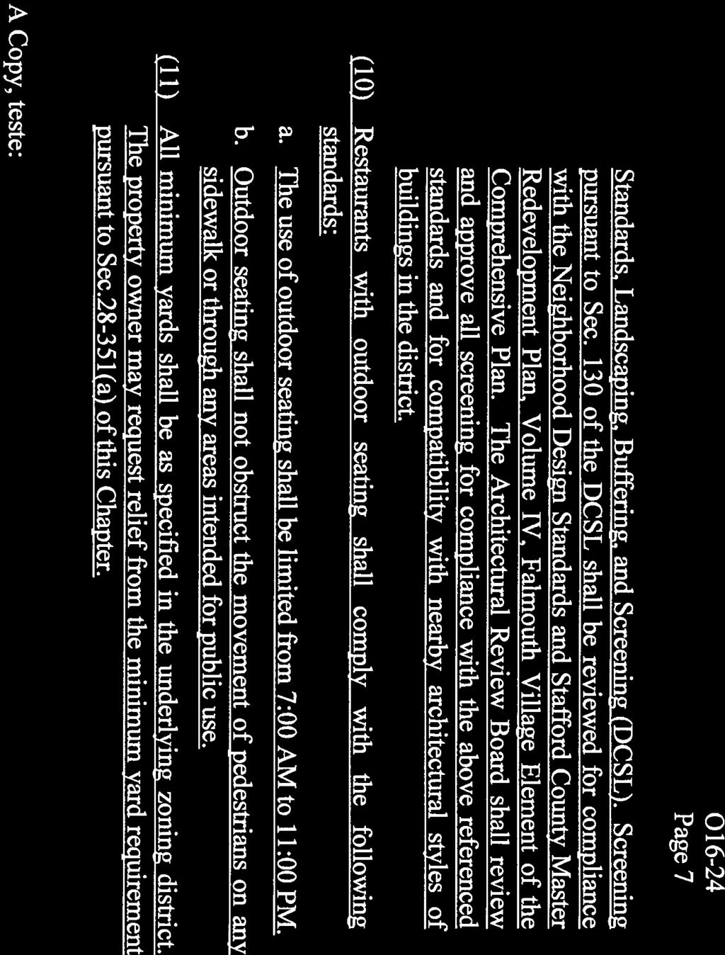
9 Memorandum to: Stafford County Planning Commission March 8, 2017 Page 9 of 11 Pursuant to Ordinance O16-24 (Attachment 5), which established the FR District in October, 2016, the FR Overlay District regulations would: allow for more by-right uses than the underlying zoning districts. Such uses include commercial apartment, bed and breakfast inn, community farmers market, home business, live/work unit, place of worship, and public art uses; restrict certain underlying zoning district uses that may not be compatible with the historic village vision of the Falmouth area by requiring a conditional use permit (CUP) or by not permitting the use at all; include the same requirements as in the underlying zoning districts for maximum floor area ratio, open space ratio, minimum yards, maximum height, and minimum lot width; however, relief could be granted from those requirements upon approval of a special exception by the Board of Zoning Appeals (BZA); allow new development to be exempt from the requirements for street and transitional buffers; include development standards that require accommodation of pedestrian circulation, outdoor storage of goods and display of merchandise, paved parking and driveways, underground utilities, orientation and screening of loading areas and service entrances, and screening requirements for dumpster and waste disposal areas; require that all new construction and building additions be in compliance with the Neighborhood Development Standards (NDS) and the Stafford County Master Redevelopment Plan, Volume IV, Falmouth Village Element of the Comprehensive Plan; require review and approval by the County s Architectural Review Board (ARB) for new construction and building additions, and methods of screening; require submittal of a landscaping and planting plan with the submission of a site plan for new development; establish standards for restaurants with outdoor seating by limiting the time period of use from 7:00 A.M. to 11:00 P.M., and specify that the use of outdoor seating shall not obstruct the movement of pedestrians; limit building heights to no more than 3 stories or 45 feet, and accessory building heights to no more than 25 feet; limit the length of individual multi-family buildings to 250 feet; and require minimum open space ratio shall be While the subject parcels are included in the FR zoning application, there is no guarantee that the FR zoning will apply. The Board of Supervisors will hold a public hearing on the FR district on March 21, In anticipation of this overlay, the applicant has included several proffers that would be in compliance with the FR district. This includes proffering out more intense uses, limiting the future heights of buildings, and requiring review by the ARB. ARB and Historical Commission Review Staff presented the proposed rezoning application to the ARB and Historical Commission for information and comment at their respective meetings in December, Both bodies provided general comments. The ARB commented that they are concerned with the potential for large buildings on site, and also concerned with large expanses of parking surrounding the historic buildings. In addition, the ARB commented about the potential loss of the town pattern related to historic Falmouth. The ARB generally commented about the concerns with traffic impacts on the historic district.
10 Memorandum to: Stafford County Planning Commission March 8, 2017 Page 10 of 11 The Historical Commission had similar comments, and also noted that large parking expanses could impact the historic buildings, particularly Dunbar s Kitchen. In addition, the Historical Commission is also concerned with the potential for any new, large buildings that could be constructed, as well as compatibility of any new construction with the historic district. Additional comments included the need for a Phase I archaeological investigation prior to any ground disturbance; the desire the consider reuse of buildings instead of demolition; the need for a historic structures report for any building that would be demolished, including first floor measured drawings, photographs, deed search and any other archival related material; and the height of any new buildings should not be any more than two stories. Staff notes that many of these concerns have been incorporated into the proffers. In addition, COA applications would be required to be submitted to the ARB prior to any exterior changes on existing buildings, or any new construction. EVALUATION CRITERIA: County Code Sec lists 12 criteria to be considered at each public hearing for reclassification. 1. Compliance of the request with the stated requirements of the district or districts involved - The request is in compliance with the stated requirements of the B-1 Zoning District. 2. The existing use and character of the property and the surrounding property - The Properties lie within a historic district, and contain historic structures. The structures are currently vacant. Land surrounding the site includes residential and office uses. 3. The suitability of the property for various uses - The current conditions, including small parcels and non-conforming setbacks, create limited opportunity for redevelopment, except for residential use. However, the proposal to reuse the existing structures facilitates the redevelopment commercially. 4. The trend of growth and development in the surrounding area - Due to the location within a high volume transportation corridor, a variety of commercial, office, and residential uses exist in the vicinity. The vision for the future of the area supports a mix of business and residential uses in this area. 5. The current and future requirements of the County for land - No County needs are identified on the site. Adjacent, vacant right-of-way could potentially support tourism-related infrastructure, including parking for the historic Falmouth district. 6. The transportation requirements of the project and the County, and the impact of the proposed land-use on the County s transportation network - The site has access to two existing 2-lane roads. This project would create a slight increase in traffic impacts from what is currently permitted byright. Recent transportation improvements have created a new traffic pattern in the Falmouth vicinity that help facilitate traffic movement. 7. Requirements for schools, parks, recreational lands and facilities, and other public services, potentially generated by the proposed classification - The proposal would decrease the impacts on parks, recreational lands, schools, and other public facilities.
11 Memorandum to: Stafford County Planning Commission March 8, 2017 Page 11 of The conservation of property values in the surrounding area - The proposed development should not have a negative effect on any property values in the surrounding area. Proffers would ensure architecturally compatible development with the historic district. Screening and buffers would minimize impacts to residential uses. 9. The preservation of natural resources and the impact of the proposed uses on the natural environment - A portion of the site contains sensitive natural resources including floodplain and dam break inundation zone. Reuse of the existing structures will help mitigate some of the impacts to the resources. 10. The most appropriate use of land - The Land Use Plan recommends this area for mixed residential and commercial use. The proposed uses are consistent with this Comprehensive Plan recommendation. 11. The timing of the development of utilities and public facilities, and the overall public costs of the development - The area is served by existing water and sewer utilities. The Applicant would install any required transportation and utility improvements for the project at their expense. 12. The consistency, or lack thereof, of the proposed rezoning with the Stafford County Comprehensive Plan as in effect at that time - The proposal is consistent with the Comprehensive Plan recommendations regarding the Falmouth Village Planning Area land-use recommendations, including Redevelopment Area Plan recommendations. SUMMARY OF POSITIVE AND NEGATIVE FEATURES: POSITIVE: 1. The proposal is consistent with the established mixed use development pattern in the vicinity. 2. The proposal is in compliance with the recommendations of the Comprehensive Plan. 3. The proposed reuse of existing historic structures is compatible with recommendations regarding the historic Falmouth district. NEGATIVE: 1. Potential increase in traffic impacts. RECOMMENDATION: Staff recommends approval of this application. JAH:kb Attachments (6)
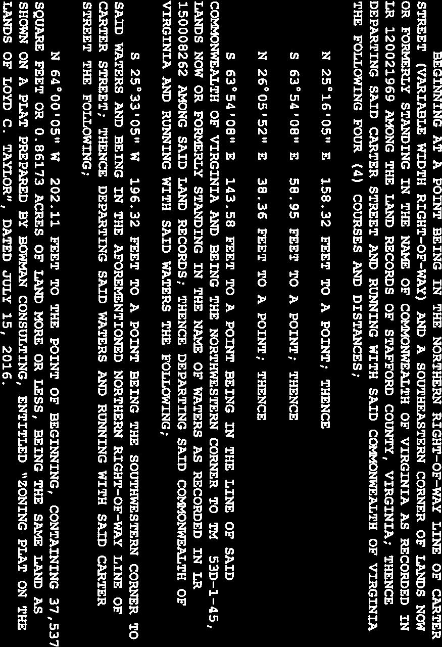
12 Attachment 1 Page 1 of 8 STAFFORD COUNTY, VIRGINIA ZONING RECLASSIFICATION APPLICATION IMPACT STATEMENT Applicant: Property: Owner: Project Name: LCT and JSC, LLC Tax Map Parcels 53D-1-34, 53D-1-35, 53D-1-43 and 53D-1-43A, known as 107 & 111 Carter Street and 108 Gordon Street, containing a total of acres (collectively all of the foregoing parcels known as the Property ) Loyd C. Taylor Falmouth Village Commercial Rezoning Request: From R-1 to B-1 Date: September 7, 2016, as revised December 28, 2016 File No.: RC Rezoning Application Request The Applicant hereby requests a rezoning of the following property from Suburban Residential (R-1) to Convenience Commercial (B-1) in accordance with the Stafford County, Virginia (the County ) zoning ordinance, including without limitation Article III, Section 28-35, Article X, Section , et seq., and Article XII Section , et seq.: Tax Parcels 53D-1-34, 53D-1-35 (collectively of record by Instrument No ), 53D-1-43 (of record by Instrument No ) and 53D-1-43A (of record by Instrument No ) (collectively, the Property ), consisting in the aggregate of approximately acres total, and generally located Southeast of the Intersection of Routes 1 and 17, on Carter Street and Gordon Street, within the George Washington Magisterial District, all as more particularly described on the generalized development plan entitled Generalized Development Plan Falmouth Village Commercial, dated July 2016, as last revised, and attached hereto as Exhibit A (the GDP ), which plan is incorporated as a material part of this application by this reference. 1 1 The GDP is a general overview of the proposed development and improvements to the Property in accordance with Article XIII, Section , et seq., of the County zoning ordinance. The Applicant reserves the right to make modifications or amendments to the GDP in order to address final site engineering, architectural, and design issues internal road placements and entry areas, RPA requirements, and to ensure compliance with applicable federal, state and county regulations, laws and ordinances. A final site plan for the Property will supersede the GDP. 1
13 Attachment 1 Page 2 of 8 Overview As noted above, the Property is currently zoned R-1. The Applicant proposes a change to the zoning of the Property from R-1 to B-1 to allow for office and other commercial uses authorized under the B-1 zoning district not otherwise proffered-out under the attached proffer statement. Section of the County s Zoning Ordinance states the following concerning the B-1 district: The purpose of the B-1 district is to provide areas for selected retail shopping and personal services to serve only the needs of the adjacent urban residential areas. Such areas are intended to be located only at strategic sites in relation to population centers and transportation networks. Portions of the Property are located at the southeastern corner of Jefferson Davis Highway (a/k/a US Rt. 1) and Butler Road, and the other portions of the Property are located at or near the intersection of River Road and Gordon Street (a/k/a Falmouth Bottom). The Applicant plans to utilize current structures on the Butler Road parcels, and has attracted a real estate office user for said parcels (at the intersection of Jefferson Davis Highway and Butler Road). 2 The Applicant is aggressively seeking other office and commercial users for the remainder of the Property. As described below, the Applicant s proposal conforms to the policies established by the County s Comprehensive Plan amended as of August 16, 2016 (the Comp Plan ). Adjacent properties will experience minimal impacts. Furthermore, the proposal will result in minimal impacts on public facilities and services as more particularly described herein. Comprehensive Plan Future Land Use Map The revised Future Land Use Map no longer designates the Property as a portion of the Suburban area, however, the Comp Plan suggests that Redevelopment Areas may coincide with Suburban areas, but does not provide further detail. The Comp Plan suggests a Mixed Use Future Land Use for the Property due to its location with the Historic Falmouth Village Planning Area. Though no specific restrictions are noted under the Historic Falmouth Village Planning Area as applied to the Mixed Use designation, the Central Stafford Business Planning Area provides for a Mixed Use designation for which development should be modeled using the principles of new urbanism with buildings three to four stories in height, or one or more commercial centers serving nearby residential uses; and stand-alone commercial areas with a mix of retail, office and industrial uses with town centers consisting of a mix of commercial and residential uses. Urban Service Area The Comp Plan includes the Property in the Urban Service Area. This designation attempts to funnel new development in the County to the land around I-95 and other major transportation corridors in order to take advantage of existing public utilities in the area. The Urban Service 2 Please note that note the applicant may require certain setback and buffer waivers/exceptions since the existing buildings may be located on or over applicable property lines. 2
14 Attachment 1 Page 3 of 8 Area supports any new development which is compatible with the Property s Future Land Use Map designation. The Property s location in the Urban Service Area supports the project s utilization of existing public utilities. The Applicants will extend water and sewer lines from nearby rights of way as necessary in order to serve the office buildings. Planning Area The Comp Plan includes the Property in the Planning Area of Historic Falmouth Village. Economic Development Priority Focus Area The Comp Plan designates the Property, as a part of the Planning Area of Historic Falmouth Village, as a Economic Development Priority Focus Area. Economic Development Priority Focus Areas, as well as Redevelopment Areas, emphasize where business development is encouraged, as identified in the Economic Development Strategic Plan. Redevelopment Area The Comp Plan designates the Property, as a part of the Planning Area of Historic Falmouth Village, as a Redevelopment Area. Redevelopment Areas, as well as Economic Development Priority Focus Areas, emphasize where business development is encouraged, as identified in the Economic Development Strategic Plan. Redevelopment Areas are selected areas within the Urban Service Area where the County desires to concentrate its efforts to change the existing development pattern. These areas are typically underutilized or underdeveloped. The primary focus is for economic revitalization through the development of mixed use developments. Commercial activities will be given special attention while limited residential uses are encouraged to keep the areas vibrant during non-working hours. Redevelopment Areas may be both suburban and/or urban in scale. The special area plans associated with Redevelopment Areas include specific recommendations regarding the form of development. In locations where the special area plans include more specific recommendations, those recommendations shall take precedence over the underlying land use designations, with the exception of Targeted Growth Areas. The area was recently designated as an economic redevelopment site, and will be treated on par with other similar areas in the proposed redevelopment plans. The Property is recommended primarily for Mixed Use Future Land Use. More detailed land use concept plans may be considered for sections of the Planning Area on a case by case basis. Transportation A portion of the Property is located north of the King Street and Gordon Street intersection and south of Carter Street. Another portion of the Property is located between Carter Street and Butler Street, and Cambridge Street and Carter Street. Cambridge Street is a minor arterial road, King Street and Butler Road are urban collector roads, and Gordon Street is a local road. The Comp Plan s Anticipated Transportation Needs Map designates this segment of Cambridge Street for future six lane upgrades and a section of Butler Road for future four lane upgrades 3
15 Attachment 1 Page 4 of 8 whereby certain improvements to this intersection have been completed and adequate right of way dedicated; thus these improvements and future expansion should not impact the proposed project. The Comp Plan s Road Improvement Projects in Approved Programs table lists the Cambridge Street two lane reconstruction improvements and the Falmouth intersection of Cambridge Street and Butler Road for intersection improvements, but does not specify the type of improvements, and provides for a replacement of the Jefferson Davis Highway bridge over the Rappahannock River. Impact Analysis 1. Current capacity of and anticipated demands on highways, utilities, storm drainage, schools and recreational facilities. A. Highways. Primary access to the site will be from Cambridge Street (Route 1) and Butler and Carter Streets. The project does not exceed any thresholds under of the Code of Virginia and the Virginia Traffic Impact Analysis Regulations (24 VAC ), which are commonly referred to as Chapter 527 requirements. We are not aware of any specific traffic volume capacity issues based on the classification by either the County or VDOT. VDOT has recently completed the project constructing improvements to the Route 1 and Butler Road intersection. B. Traffic Volumes are as follows: B-1: daily vehicle trips per day of (i) 139 VPD during the week and Saturday 258 VPD, (ii) A.M peak hour of 51 VPH and PM Peak hour of 20 VPH and (iii) Saturday peak of 50 vehicle trips. By Right Impacts: The Property is currently zoned R-1, which generally permits 2 single family detached units to the acre. The subject site would allow an ITE 210 Code for residential uses with daily vehicle trips per day of (i) 28 VPD during the week and Saturday 27 VPD, (ii) A.M peak hour of 14 VPH and PM Peak hour of 4 VPH and (iii) Saturday peak of 13 vehicle trips. B. Utilities. As noted above, the proposed rezoning is located within the County s Urban Service Area and has access to public water and sewer. The proposed project will have minimal impact on utility demands. There is existing sewer in Carter and Gordon Streets which flows down towards King Street. There is existing water in Butler, Carter, Cambridge, and Gordon Streets. These appear to have available capacity, or the reasonable ability to be upgraded by the developer to provide adequate capacity. The Applicant will extend utility lines to serve the development. Public Water: This project is located in the Falmouth Pressure Zone. There are existing water lines in the Butler, Carter, Cambridge, and Gordon Street rights-of-way. Onsite water lines will generally be 4
16 Attachment 1 Page 5 of 8 constructed along the proposed roads within the development creating loops and networks throughout the Property. The anticipated daily demand for water is as follows: 0.2 gpd per SF x 8227 SF = 1,645 GPD. Sewer: This project is located in the Claiborne Run sewer service area. Existing sewer lines are located in the Carter and Gordon Street rights-ofway. Onsite sewer lines will generally be constructed along the proposed roads within the development creating loops and networks throughout the Property. The anticipated daily demand for sewer is as follows: 0.25 GPD per SF x 8227 SF = 2,057 GPD. By-Right Impact: As previously noted, the current zoning of the Property is R-1. The public utility impacts for the Property as currently zoned are: 2 lots, 240 gpd/lot water = 480 gpd, 2 lots 300 gpd sewer = 600 gpd. C. Storm Drainage. It is anticipated that either underground storage/treatment methods will be utilized for SWM as necessary, or bioretention will be utilized if soil conditions are amenable. By Right Impact: By-right development of single-family lots would require some minor treatment measures along the lines of disconnected impervious rooftops or similar. D. Schools. The proposed rezoning will not impact schools, as B-1 zoning does not permit residential uses. By Right Impact: A by-right development with 2 detached single family homes is estimated to generate approximately 1.32 school aged children upon build-out. E. Recreational Facilities. The proposed rezoning will have no impact on public park and recreational facilities. By-Right Impact: By right use of the Property would have a minimal impact on public park and recreational facilities 2. Environmental Impact. Based on a review of available County GIS information and aerial photography, the Property is developed, and there are no streams or wetlands located onsite or within 100 feet of the Property. The closest stream resources are located approximately 500 feet to the south of the Property (Rappahannock River) and feet to the west (Falls Run). Likewise, a Critical Resource Protection Area (CRPA) is not mapped on the Property, and the County-mapped CRPA boundaries along the Rappahannock River and Falls Run are at least 300 feet away from the Property. Therefore, wetland delineation, Perennial Flow 5
17 Attachment 1 Page 6 of 8 Evaluation and CRPA Determination studies are not warranted for this Property, and Section 404/401 permits will not be required from the U.S. Army Corps of Engineers and Virginia Department of Environmental Quality for the proposed development of the Property. According to FEMA Flood Insurance Rate Map (FIRM) Nos E and E (Revised February 4, 2005), the southern portion of the Property (Parcels 53D-1-34 and 53D-1-35) is located within Zone AE, and the northern portion (Parcels 53D-1-43 and A) is located within Zone X (unshaded). The proposed development of the Property includes the construction of parking and sidewalks within the FEMA floodplain only; no modifications to the existing buildings or additional building structures are proposed. Based on a review of available information obtained from the U.S. Fish and Wildlife Service and the Virginia Department of Game and Inland Fisheries related to potential threatened and endangered species on the Property, and existing site conditions and surrounding land uses, no adverse impacts to Federal or State-listed threatened and endangered species or critical habitat are anticipated to result from the proposed development of the Property. By-Right Impact: By-right use of the Property would have the same minimal impact on environmental resources. 3. Impact on Adjacent Properties. The permitted uses in the R-1 district generally relate to relatively low density residential development. The Falmouth Village Redevelopment Area is intended to promote further growth in the form of mixed use developments. Other Planning Areas proposing mixed uses contemplate buildings three to four stories in height, or one or more commercial centers serving nearby residential uses; and stand-alone commercial areas with a mix of retail, office and industrial uses with town centers consisting of a mix of commercial and residential uses. A commercial, retail and office development aligns with these visions for the development of the Property and the surrounding area, allowing for such mixed uses within proximity of each other. Surrounding developments consist of comparable density and uses, including a mixture of R-1 and B-2 classifications. The property to the west is developed for real estate brokerage offices, most of the property to the north is vacant, and a portion of the eastern property line is adjacent to a multifamily residential development. 4. Historical Sites. The Property is located within the Falmouth Historic District (DHR ID ), which is listed on the National Register of Historic Places (NRHP) and the Virginia Landmarks Register (VRL). The Property includes the Dunbar Kitchen or House located at 107 Carter Street (DHR ID ) and the 6
18 Attachment 1 Page 7 of 8 House located at 111 Carter Street (DHR ID ), both of which are considered contributing resources to the Falmouth Historic District. The Property also included the House at 104 Gordon Street (DHR ID ), which has been demolished and is no longer a contributing resource to the Falmouth Historic District. The Property is also just located within the designated boundaries of the Chancellorsville Battlefield (DHR ID ) and the Battle of Fredericksburg I (DHR ID ). Accordingly, the two historic buildings on the Property shall remain, and no adverse impacts to historic resources are anticipated to result from the proposed development of the Property. 7
19 Attachment 1 Page 8 of 8 EXHIBIT A GDP See attached Generalized Development Plan Falmouth Village Commercial, prepared by Bowman Consulting, dated July 2016, as last revised
20 Attachment 2 Page 1 of 4 O17-17 PROPOSED BOARD OF SUPERVISORS COUNTY OF STAFFORD STAFFORD, VIRGINIA ORDINANCE At a regular meeting of the Stafford County Board of Supervisors (the Board) held in the Board Chambers, George L. Gordon, Jr., Government Center, Stafford, Virginia, on the day of, 2017: MEMBERS: VOTE: Paul V. Milde, III, Chairman Meg Bohmke, Vice Chairman Jack R. Cavalier Wendy E. Maurer Laura A. Sellers Gary F. Snellings Robert Bob Thomas, Jr On motion of, seconded by, which carried by a vote of, the following was adopted: AN ORDINANCE TO AMEND AND REORDAIN THE STAFFORD COUNTY ZONING ORDINANCE BY AMENDING THE ZONING DISTRICT MAP TO RECLASSIFY FROM THE R-1, SUBURBAN RESIDENTIAL ZONING DISTRICT TO THE B-1, CONVENIENCE COMMERCIAL ZONING DISTRICT, ON TAX MAP PARCEL NOS. 53D-1-34, 53D-1-35, 53D-1-43, AND 53D-1-43A, LOCATED WITHIN THE GEORGE WASHINGTON ELECTION DISTRICT WHEREAS, LCT and JSC, LLC (Applicant), submitted application RC , requesting a reclassification from the R-1, Suburban Residential Zoning District to the B-1, Convenience Commercial Zoning District, on Tax Map Parcel Nos. 53D-1-34, 53D-1-35, 53D-1-43, and 53D-1-43A, located within the George Washington Election District; and WHEREAS, the Board carefully considered the recommendations of the Planning Commission and staff, and the public testimony, if any, received at the public hearing; and WHEREAS, the Board finds that the requested zoning amendment is compatible with the surrounding land uses and meets the criteria for a rezoning in Stafford County Code Sec ; and
21 Attachment 2 Page 2 of 4 O17-17 Page 2 WHEREAS, the Board finds that public necessity, convenience, general welfare, and good zoning practice require adoption of this Ordinance to reclassify the subject property; NOW, THEREFORE, BE IT ORDAINED by the Stafford County Board of Supervisors on this the day of, 2017, that the Stafford County Zoning Ordinance be and it hereby is amended and reordained by amending the Zoning District Map to reclassify from the R-1, Suburban Residential Zoning District to the B-1, Convenience Commercial Zoning District, on Tax Map Parcel Nos. 53D-1-34, 53D-1-35, 53D-1-43, and 53D-1-43A, located within the George Washington Election District, with proffers entitled Voluntary Proffer Statement, dated February 2, TCF:JAH:kb
22 Attachment 2 Page 3 of 4 R17-86 PROPOSED BOARD OF SUPERVISORS COUNTY OF STAFFORD STAFFORD, VIRGINIA RESOLUTION At a regular meeting of the Stafford County Board of Supervisors (the Board) held in the Board Chambers, George L. Gordon, Jr., Government Center, Stafford, Virginia, on the day of, 2017: MEMBERS: VOTE: Paul V. Milde, III, Chairman Meg Bohmke, Vice Chairman Jack R. Cavalier Wendy E. Maurer Laura A. Sellers Gary F. Snellings Robert Bob Thomas, Jr On motion of, seconded by, which carried by a vote of, the following was adopted: A RESOLUTION TO DENY THE REQUEST TO AMEND AND REORDAIN THE STAFFORD COUNTY ZONING ORDINANCE BY AMENDING THE ZONING DISTRICT MAP TO RECLASSIFY FROM THE R-1, SUBURBAN RESIDENTIAL ZONING DISTRICT TO THE B-1, CONVENIENCE COMMERCIAL ZONING DISTRICT, ON TAX MAP PARCEL NOS. 53D-1-34, 53D-1-35, 53D-1-43, AND 53D-1-43A, LOCATED WITHIN THE GEORGE WASHINGTON ELECTION DISTRICT WHEREAS, LCT and JSC, LLC (Applicant), submitted application RC , requesting a reclassification from the R-1, Suburban Residential Zoning District to the B-1, Convenience Commercial Zoning District, on Tax Map Parcel Nos. 53D-1-34, 53D-1-35, 53D-1-43, and 53D-1-43A, located within the George Washington Election District; and WHEREAS, the Board carefully considered the recommendations of the Planning Commission and staff, and the public testimony, if any, received at the public hearing; and WHEREAS, the Board finds that the requested zoning amendment is incompatible with the surrounding land uses and does not meet the criteria for a rezoning in Stafford County Code Sec ;
23 Attachment 2 Page 4 of 4 R17-86 Page 2 NOW, THEREFORE, BE IT RESOLVED by the Stafford County Board of Supervisors on this the day of, 2017, that application RC be and it hereby is denied. TCF:JAH:kb
24 Attachment 3 Page 1 of 6 D R A F T For Discussion Purposes Only VOLUNTARY PROFFER STATEMENT Applicant: Property: Owner: Project Name: LCT and JSC, LLC Tax Map Parcels 53D-1-34, 53D-1-35, 53D-1-43 and 53D-1-43A, known as 107 & 111 Carter Street and 108 Gordon Street, containing a total of acres (collectively the Property ) Loyd C. Taylor Falmouth Village Commercial Rezoning Request: From R-1 to B-1 Date: February 2, 2017 File No.: RC General Requirements & Use. (a) The following proffers are being made pursuant to Sections and , et seq. of the Code of Virginia (1950), as amended, and Section , et seq. of the Stafford County Zoning Ordinance. The proffers provided herein are the only proffered conditions offered in this rezoning application, and any prior proffers in which the Property may be subject to or previously offered with the Applicant s application or otherwise previously proffered are hereby superseded by these proffers, and further said prior proffers are hereby void and of no further force and effect. In addition and notwithstanding the foregoing, the proffers provided hereunder are conditioned upon and become effective only in the event the Applicant s above referenced Application file number is approved (including through applicable appeal periods) by the Stafford County Board of Supervisors (the County ). (b) Subject to the terms hereunder, the Property will be generally developed in accordance with that certain generalized development plan entitled Generalized Development Plan Falmouth Village Commercial, dated July 2016, as last revised, and prepared by Bowman Consulting, which plan is attached hereto and marked as Exhibit A (the GDP ). 1
25 Attachment 3 Page 2 of 6 (c) For purposes of the final site plan (which will supersede the GDP after County approval), proposed parcel lines, parcel sizes, building envelopes and footprints, access points, building sizes, building locations, public road locations, private driveway, road and travel way locations, interparcel connectors, RPAs and wetland areas, utility locations, storm water management facilities, and dimensions of undeveloped areas shown on the GDP may be relocated and/or amended from time-to-time by the Applicant to address final development, engineering, and design requirements and/or compliance with federal or state agency regulations including, but not limited to, VDOT, DEQ, Army Corps of Engineers, etc., and compliance with the requirements of the County s development regulations and design standards manual. (d) These proffers shall run with the Property and be binding upon all owners and future assignees, successors, grantees, or lessees thereof. (e) The Applicant agrees that the following commercial uses shall not be permitted on the Property: (1) Automobile repair (2) Auto service (3) Car wash (4) Lumber/building/electric/plumbing supply (5) Machinery sales and service (6) Motor vehicle sales (7) Outdoor flea market (8) Plant and tree nursery/greenhouse (9) Recreational enterprise (10) Vehicle fuel sales (11) Warehouse, mini storage (12) Warehouse, storage (f) The Applicant agrees to construct a private sidewalk from Carter Street and extending south to King Street, all as generally shown on the GDP, subject to the Applicant being able to reasonably obtain necessary easements from the adjoining property owner(s). The Applicant further agrees to grant the County a public easement across the sidewalk after completion of the same. Notwithstanding anything to the contrary, the Applicant agrees to complete the sidewalk described hereunder prior to the issuance of a building permit to construct any new building on the Property. (g) The Applicant will use exposed aggregate concrete material for purposes of constructing the sidewalks along the Property, all as shown on the GDP. The Applicant will limit impervious areas within the parking areas, including the use of pea gravel or other similar materials for the said parking areas. (h) If the Applicant cannot obtain approval from VDOT for onsite parking on the Carter Street properties (Tax Map Nos. 53D-1-35 and 53D-1-34), the Applicant, in accordance with applicable County ordinances, may utilize offsite parking at the County river park property located to the south of the Property or utilize available parking spaces provided by adjacent property owners. 2
26 Attachment 3 Page 3 of 6 (i) The Applicant agrees to post historical signage on the Property for purposes of describing the historical significance of the Dunbar Kitchen. (j) Prior to any extensive land disturbance, the Applicant agrees to perform a Phase I Cultural Resources Analysis within the areas of the Property proposed to be disturbed, and to share such analysis with the County. If the said Phase I analysis recommends a Phase II analysis, the Applicant agrees to undertake the Phase II analysis and will report to the County the Applicant s findings. (k) In the event the Applicant constructs any new buildings on the Property, the Applicant agrees to the following: (1) the height of any new buildings will not be any more than two (2) stories; (2) architecture for any new construction will be compatible to the architecture in the applicable historical area; (3) will consider the rehabilitation of existing buildings, if structurally and economically feasible, before demolition; and (4) all new construction, including additions, is subject to ARB review and applicable ARB standards. [AUTHORIZED SIGNATURES TO FOLLOW] 3
27 Attachment 3 Page 4 of 6 APPLICANT ACKNOWLEDGMENT & CONSENT LCT and JSC, LLC, a Virginia limited liability company By: Name: Title: COMMONWEALTH OF VIRGINIA, CITY/COUNTY OF, to wit: The foregoing instrument was acknowledged before me this day of, 201, by, of LCT and JSC, LLC, a Virginia limited liability company, on behalf of the company. Notary Public My Commission expires: Notary Registration number: SEAL: 4
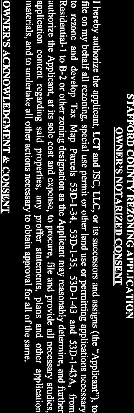
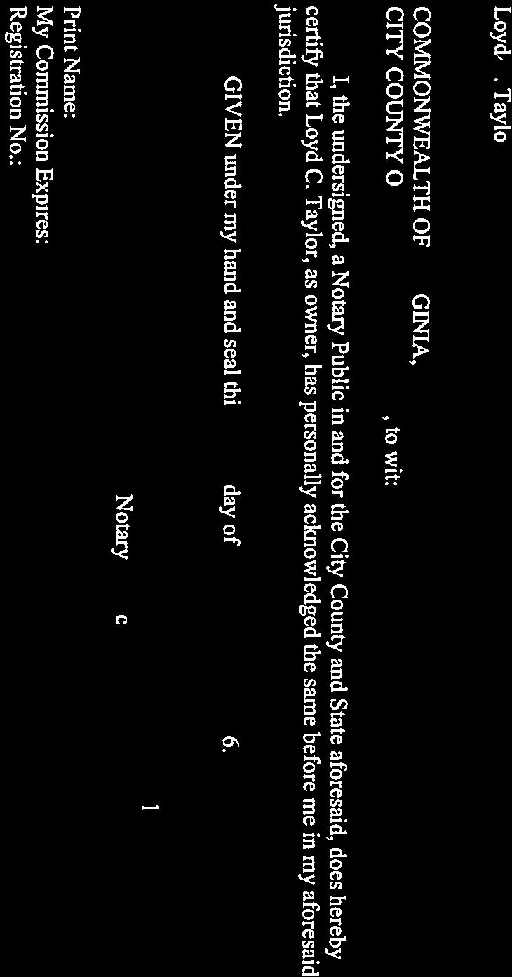
28 Attachment 3 Page 5 of 6 OWNER ACKNOWLEDGMENT & CONSENT Loyd C. Taylor COMMONWEALTH OF VIRGINIA, CITY/COUNTY OF, to wit: The foregoing instrument was acknowledged before me this day of, 201, by Loyd C. Taylor. Notary Public My Commission expires: Notary Registration number: SEAL: 5
29 Attachment 3 Page 6 of 6 EXHIBIT A Generalized Development Plan Generalized Development Plan Falmouth Village Commercial, dated July 2016, as last revised and prepared by Bowman Consulting
30 Attachment 4 Page 1 of 7

31 Attachment 4 Page 2 of 7
32 Attachment 4 Page 3 of 7
33 Attachment 4 Page 4 of 7
34 Attachment 4 Page 5 of 7
35 Attachment 4 Page 6 of 7
36 Attachment 4 Page 7 of 7
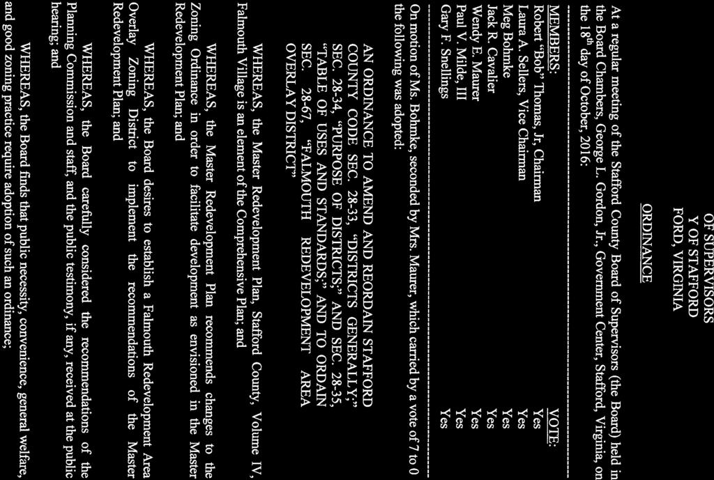

37 Attachment 5 Page 1 of 7

38 Attachment 5 Page 2 of 7

39 Attachment 5 Page 3 of 7


40 Attachment 5 Page 4 of 7

41 Attachment 5 Page 5 of 7

42 Attachment 5 Page 6 of 7


43 Attachment 5 Page 7 of 7

44 Attachment 6 Page 1 of 23

45 Attachment 6 Page 2 of 23


46 Attachment 6 Page 3 of 23

47 Attachment 6 Page 4 of 23


48 Attachment 6 Page 5 of 23

49 Attachment 6 Page 6 of 23

50 Attachment 6 Page 7 of 23

51 Attachment 6 Page 8 of 23
52 Attachment 6 Page 9 of 23

53 Attachment 6 Page 10 of 23

54 Attachment 6 Page 11 of 23

55 Attachment 6 Page 12 of 23


56 Attachment 6 Page 13 of 23


57 Attachment 6 Page 14 of 23

58 Attachment 6 Page 15 of 23

59 Attachment 6 Page 16 of 23

60 Attachment 6 Page 17 of 23


61 Attachment 6 Page 18 of 23


62 Attachment 6 Page 19 of 23

63 Attachment 6 Page 20 of 23


64 Attachment 6 Page 21 of 23

65 Attachment 6 Page 22 of 23


66 Attachment 6 Page 23 of 23
Attachment 1. O17-17 Page 2
 Attachment 1 O17-17 Page 2 BACKGROUND REPORT LCT and JSC, LLC (Applicant) is requesting a zoning reclassification from the R-1, Suburban Residential Zoning District to the B-1, Convenience Commercial Zoning
RC ; Reclassification The Garrison at Stafford Proffer Amendment (formerly Stafford Village Center)
") Board of Supervisors Robert Bob Thomas, Jr., Chairman Laura A. Sellers, Vice Chairman Meg Bohmke Jack R. Cavalier Wendy E. Maurer Paul V. Milde, III Gary F. Snellings Anthony J. Romanello, ICMA CM County
Board of Supervisors Robert Bob Thomas, Jr., Chairman Laura A. Sellers, Vice Chairman Meg Bohmke Jack R. Cavalier Wendy E. Maurer Paul V. Milde, III Gary F. Snellings Anthony J. Romanello, ICMA CM County
RC ; Reclassification - The Courtyards of Colonial Forge
 3 Board of Supervisors Robert Bob Thomas, Jr., Chairman Laura A. Sellers, Vice Chairman Meg Bohmke Jack R. Cavalier Wendy E. Maurer Paul V. Milde, III Gary F. Snellings November 9, 2016 C. Douglas Barnes
SUBJECT: CUP ; Conditional Use Permit - Telegraph Road Vehicle Sales / Storage
 2 Board of Supervisors Robert Bob Thomas, Jr., Chairman Laura A. Sellers, Vice Chairman Meg Bohmke Jack R. Cavalier Wendy E. Maurer Paul V. Milde, III Gary F. Snellings August 24, 2016 Anthony J. Romanello,
1101 Washington Avenue Fredericksburg, VA 22401
 1 Board of Supervisors Robert Bob Thomas, Jr., Chairman Laura A. Sellers, Vice Chairman Meg Bohmke Jack R. Cavalier Wendy E. Maurer Paul V. Milde, III Gary F. Snellings December 14, 2016 C. Douglas Barnes
CUP ; Conditional Use Permit - 5 Twelve Convenience Store Expansion
 Board of Supervisors Meg Bohmke, Chairman Gary F. Snellings, Vice Chairman Jack R. Cavalier Thomas C. Coen L. Mark Dudenhefer Wendy E. Maurer Cindy C. Shelton 2 March 28, 2018 Thomas C. Foley County Administrator
Amendment to the Zoning and Subdivision Ordinances; Consider Repeal Cluster Development Standards
 2 Board of Supervisors Meg Bohmke, Chairman Gary F. Snellings, Vice Chairman Jack R. Cavalier Thomas C. Coen L. Mark Dudenhefer Wendy E. Maurer Cindy C. Shelton February 28, 2018 Thomas C. Foley County
North side of Garrisonville Road, approximately 275 feet east of Center Street
 2 Board of Supervisors Gary F. Snellings, Chairman Laura A. Sellers, Vice Chairman Meg Bohmke Jack R. Cavalier Paul V. Milde, III Cord A. Sterling Robert Bob Thomas, Jr. December 9, 2015 Anthony J. Romanello,
Amendments to the Subdivision and Zoning Ordinances Regarding Open Space Land in Cluster Subdivisions
 Board of Supervisors Gary F. Snellings, Chairman Laura A. Sellers, Vice Chairman Meg Bohmke Jack R. Cavalier Paul V. Milde, III Cord A. Sterling Robert Bob Thomas, Jr. 10 May 13, 2015 Anthony J. Romanello,
Zoning Text Amendment to Allow Hotels and Public Parking Lots as By- Right Uses in the M-1 Zoning District
 5 Board of Supervisors Robert Bob Thomas, Jr., Chairman Laura A. Sellers, Vice Chairman Meg Bohmke Jack R. Cavalier Wendy E. Maurer Paul V. Milde, III Gary F. Snellings September 28, 2016 C. Douglas Barnes
PROPOSED BOARD OF SUPERVISORS COUNTY OF STAFFORD STAFFORD, VIRGINIA RESOLUTION
 Attachment 2 R16-348 PROPOSED BOARD OF SUPERVISORS COUNTY OF STAFFORD STAFFORD, VIRGINIA RESOLUTION At a regular meeting of the Stafford County Board of Supervisors (the Board) held in the Board Chambers,
SUB ; Courthouse Manor, Preliminary Subdivision Plan
 5 Board of Supervisors Gary F. Snellings, Chairman Laura A. Sellers, Vice Chairman Meg Bohmke Jack R. Cavalier Paul V. Milde, III Cord A. Sterling Robert Bob Thomas, Jr. October 14, 2015 Anthony J. Romanello,
Habitat for Humanity is a non-profit organization that provides affordable housing for low income families.
 Attachment 1 R16-31 BACKGROUND REPORT On March 11, 2011, the Board authorized the conveyance of two parcels in Lake Arrowhead Subdivision (Tax Map Parcel Nos. 8B-G-18 and -19), to Greater Fredericksburg
Amendments to Transfer of Development Rights Program
 Board of Supervisors Jack R. Cavalier, Chairman Gary F. Snellings, Vice Chairman Meg Bohmke Paul V. Milde, III Laura A. Sellers Cord A. Sterling Robert Bob Thomas, Jr. Anthony J. Romanello, ICMA CM County
North of the intersection of Courthouse Road and Dent Road, south of Hope Road and approximately 2,000 feet east of Jefferson Davis Highway
 1 Board of Supervisors Jack R. Cavalier, Chairman Gary F. Snellings, Vice Chairman Meg Bohmke Paul V. Milde, III Laura A. Sellers Cord A. Sterling Robert Bob Thomas, Jr. November 12, 2014 Anthony J. Romanello,
UPPER MOUNT BETHEL TOWNSHIP NORTHAMPTON COUNTY, PENNSYLVANIA
 UPPER MOUNT BETHEL TOWNSHIP NORTHAMPTON COUNTY, PENNSYLVANIA JOINDER DEED / LOT CONSOLIDATION TOWNSHIP REVIEW PROCESS When accepting proposed Joinder Deeds / Lot Consolidations, review the Joinder Deed
Staff Report: Date: Applicant: Property Identification: Acreage of Request: Current Zoning of Requested Area: Requested Action: Attached:
 Staff Report: Completed by Jeff Palmer Director of Planning & Zoning Date: November 7, 2018 Applicant: Greg Smith, Oberer Land Developer agent for Ronald Montgomery ET AL Property Identification: Frontage
PLANNING COMMISSION PUBLIC HEARING STAFF REPORT ZRTD FAIRFAX MARBLE & GRANITE
 Date of Hearing: PLANNING COMMISSION PUBLIC HEARING STAFF REPORT SUBJECT: ELECTION DISTRICT: ZRTD-2016-0009 FAIRFAX MARBLE & GRANITE Broad Run CRITICAL ACTION DATE: September 27, 2017 STAFF CONTACTS: APPLICANT:
ZRTD , Glenn Drive. M. Tyler Klein, AICP, Project Manager, Planning and Zoning John Merrithew, Acting Director, Planning and Zoning
 DEPARTMENT OF PLANNING Date of Hearing: AND ZONING STAFF REPORT # 4 BOARD OF SUPERVISORS PUBLIC HEARING SUBJECT: ELECTION DISTRICT: ZRTD-2014-0003, 22675 Glenn Drive Broad Run CRITICAL ACTION DATE: September
CITY OF CHARLOTTESVILLE DEPARTMENT OF NEIGHBORHOOD DEVELOPMENT SERVICES STAFF REPORT APPLICATION FOR A SPECIAL USE PERMIT
 CITY OF CHARLOTTESVILLE DEPARTMENT OF NEIGHBORHOOD DEVELOPMENT SERVICES STAFF REPORT APPLICATION FOR A SPECIAL USE PERMIT PLANNING COMMISSION AND CITY COUNCIL JOINT PUBLIC HEARING DATE OF HEARING: December
Community Development
 Land Use Petition RZ-16-002 Date of Staff Recommendation Preparation: April 15, 2016 (CEL) Date of Planning Commission Recommendation: May 3, 2016 PROJECT LOCATION: DISTRICT/SECTION/LANDLOT(S): ACREAGE
Glades County Staff Report and Recommendation Unified Staff Report for Small Scale Plan Amendment and Rezoning
 Glades County Staff Report and Recommendation Unified Staff Report for Small Scale Plan Amendment and Rezoning CASE NUMBERS: COMP17-02 and RZ17-02 DATE of STAFF REPORT: May 1, 2017 CASE TYPE: Application
Staff Report: Date: Applicant: Property Identification: Acreage of Request: Current Zoning of Requested Area: Requested Action: Attached:
 Staff Report: Completed by Jeff Palmer Director of Planning & Zoning Date: November 7, 2018, Updated November 20, 2018 Applicant: Greg Smith, Oberer Land Developer agent for Ronald Montgomery ET AL Property
Planning Department Oconee County, Georgia
 Planning Department Oconee County, Georgia STAFF REPORT REZONE CASE #: 6985 DATE: October 31, 2016 STAFF REPORT BY: Andrew C. Stern, Planner APPLICANT NAME: Williams & Associates, Land Planners PC PROPERTY
ZONING AMENDMENT, PLANNED UNIT DEVELOPMENT & SUBDIVISION STAFF REPORT Date: August 8, 2013
 ZONING AMENDMENT, PLANNED UNIT DEVELOPMENT & SUBDIVISION STAFF REPORT Date: August 8, 2013 NAME SUBDIVISION NAME PV-Magnolia, LLC Twelve Trees Subdivision LOCATION 2860, 2862 and 2866 Pleasant Valley Road
Staff Report. Planning Commission Public Hearing: October 17, 2007 Staff Recommendation: Denial
 COUNTY OF PRINCE WILLIAM 5 County Complex Court, Prince William, Virginia 22192-9201 PLANNING (703) 792-6830 Metro 631-1703, Ext. 6830 FAX (703) 792-4401 OFFICE Internet www.pwcgov.org Stephen K. Griffin,
Conditional Use Permit case no. CU 14-06: Bristol Village Partners, LLC
 PLANNING AND ZONING COMMISSION STAFF REPORT August 7, 2014 Conditional Use Permit case no. CU 14-06: Bristol Village Partners, LLC CASE DESCRIPTION: LOCATION: LEGAL DESCRIPTION: EXISTING LAND USE: ZONING:
Cobb County Community Development Agency Zoning Division 1150 Powder Springs St. Marietta, Georgia 30064
 Cobb County Community Development Agency Zoning Division 1150 Powder Springs St. Marietta, Georgia 30064 Case # Z-63 Public Hearing Dates: PC: 11-06-18 BOC: 11-20-18 SITE BACKGROUND Applicant: Loyd Development
Attachment 1 R BACKGROUND REPORT
 BACKGROUND REPORT Attachment 1 R16-310 The Board is asked to consider authorizing the Interim County Administrator to execute deeds of conveyance for the acquisition of Tax Map Parcel Nos. 47-39, 47-39B,
CUP95-02 & CUP990433; Conditional Use Permits FREDERICKSBURG PUBLIC AUTO AUCTION
 Attachment 1 R15-279 BACKGROUND REPORT The property in question consists of three parcels, Tax Map Parcel Nos. 45-78A, 53-5 and 53-5C (Property). The Board is asked to consider revoking a conditional use
Attachment 1 R Page 1
 Attachment 1 R15-101 Page 1 BACKGROUND REPORT The Board identified the completion of road improvements on Truslow Road (SR-652), between Berea Church Road (SR-654) and Plantation Drive (SR-1706), as a
STAFF REPORT. City of Ormond Beach Department of Planning. Exception for Outdoor Activity
 STAFF REPORT City of Ormond Beach Department of Planning DATE: March 7, 2019 SUBJECT: Lucky s Market, 101 East Granada Boulevard: Special Exception for Outdoor Activity APPLICANT: Wendy L. Petrillo-Rundle,
Town of Cary, North Carolina Rezoning Staff Report 14-REZ-31 Cary Park PDD Amendment (Waterford II) Town Council Meeting January 15, 2015
 Town Council Meeting January 15, 2015") Town of Cary, North Carolina Rezoning Staff Report 14-REZ-31 Cary Park PDD Amendment (Waterford II) Town Council Meeting January 15, 2015 REQUEST To amend the Town of Cary Official Zoning Map by amending
Town of Cary, North Carolina Rezoning Staff Report 14-REZ-31 Cary Park PDD Amendment (Waterford II) Town Council Meeting January 15, 2015 REQUEST To amend the Town of Cary Official Zoning Map by amending
PROFFER STATEMENT FAIRFAX MARBLE & GRANITE SUMMIT AT DULLES ZRTD
 PROFFER STATEMENT FAIRFAX MARBLE & GRANITE SUMMIT AT DULLES ZRTD 2016-0009 December 13, 2016 Dulles Summit LLC, the owner (hereinafter, the "Owner") of the parcel described as Loudoun County Tax Map Number
PC Staff Report 11/18/2013 Z Item No. 1-1
 Z-13-00401 Item No. 1-1 PLANNING COMMISSION REPORT Regular Agenda - Public Hearing Item PC Staff Report 11/18/2013 ITEM NO. 1: Z-13-00401 IG (General Industrial) District TO CS (Strip Commercial) District;
Cover Letter with Narrative Statement
 Cover Letter with Narrative Statement March 31, 2017 rev July 27, 2017 RE: Rushton Pointe Residential Planned Unit Development Application for Public Hearing for RPUD Rezone PL2015 000 0306 Mr. Eric Johnson,
GWINNETT COUNTY CSO CONSERVATION SUBDIVISION OVERLAY DISTRICT REQUIREMENTS
 GWINNETT COUNTY CSO CONSERVATION SUBDIVISION OVERLAY DISTRICT REQUIREMENTS Section 1316. CSO Conservation Subdivision Overlay District. 1. Purposes. The purposes of this overlay district are as follows:
Napa County Planning Commission Board Agenda Letter
 Agenda Date: 9/20/2017 Agenda Placement: 8C Napa County Planning Commission Board Agenda Letter TO: FROM: Napa County Planning Commission Charlene Gallina for David Morrison - Director Planning, Building
9. REZONING NO Vicinity of the northwest corner of 143 rd Street and Metcalf Avenue
 9. REZONING NO. 2002-15 Vicinity of the northwest corner of 143 rd Street and Metcalf Avenue 1. APPLICANT: Andrew Schlagel is the applicant for this request. 2. REQUESTED ACTION: The applicant is requesting
Town of Cary, North Carolina Rezoning Staff Report 14-REZ-20 Habitat for Humanity Evans Road Town Council Meeting October 16, 2014
 Town of Cary, North Carolina Rezoning Staff Report 14-REZ-20 Habitat for Humanity Evans Road Town Council Meeting October 16, 2014 REQUEST To amend the Town of Cary Official Zoning Map by rezoning 0.53
SUBJECT: Application for Planned Unit Development and Rezoning 1725 Winnetka Road
 TO: FROM: CHAIRMAN BILL VASELOPULOS AND MEMBERS OF THE PLAN & ZONING COMMISSION STEVE GUTIERREZ DIRECTOR OF COMMUNITY DEVELOPMENT MEETING DATE: September 5, 2017 SUBJECT: Application for Planned Unit Development
ZONING AMENDMENT & SUBDIVISION STAFF REPORT Date: November 3, 2016
 ZONING AMENDMENT & SUBDIVISION STAFF REPORT Date: November 3, 2016 APPLICANT NAME SUBDIVISION NAME David Shumer 5955 Airport Subdivision CITY COUNCIL DISTRICT District 6 5955 Airport Boulevard, 754 Linlen
A. Preserve natural resources as identified in the Comprehensive Plan.
 1370.08 Conservation Residential Overlay District. Subd. 1 Findings. The City finds that the lands and resources within the Conservation Residential Overlay District are a unique and valuable resource
PLANNED UNIT DEVELOPMENT & SUBDIVISION STAFF REPORT Date: April 18, 2019
 PLANNED UNIT DEVELOPMENT & SUBDIVISION STAFF REPORT Date: April 18, 2019 DEVELOPMENT NAME SUBDIVISION NAME Springhill Village Subdivision Springhill Village Subdivision LOCATION 4350, 4354, 4356, 4358,
Attachment 1 O Zoning Map. Zoning History
 Attachment 1 O17-10 BACKGROUND REPORT Quantico Village, LLC (Applicant) is requesting a reclassification from the B-1, Convenience Commercial and B-2, Urban Commercial Zoning Districts to the R-3, Urban
CONDITIONAL USE PERMIT APPLICATION FOR AN EXCAVATION/BORROW PIT INSTRUCTIONS
 City of Chesapeake Department of Planning Post Office Box 15225 Chesapeake, Virginia 23328-5225 (757) 382-6176 FAX (757) 382-6406 CONDITIONAL USE PERMIT APPLICATION FOR AN EXCAVATION/BORROW PIT INSTRUCTIONS
Town of Lisbon, Maine SUBDIVISION REVIEW APPLICATION
 Date Received: Fee Paid (amount): Applicant: Town of Lisbon, Maine SUBDIVISION REVIEW APPLICATION Subdivision Name/Title: This application must be received at the Town Office by close of business on the
TOWNSHIP OF UPPER MACUNGIE LEHIGH COUNTY, PENNSYLVANIA. ORDINANCE NO [To be considered for Adoption June 1, 2017]
![TOWNSHIP OF UPPER MACUNGIE LEHIGH COUNTY, PENNSYLVANIA. ORDINANCE NO [To be considered for Adoption June 1, 2017]](/thumbs/91/106428876.jpg "TOWNSHIP OF UPPER MACUNGIE LEHIGH COUNTY, PENNSYLVANIA. ORDINANCE NO [To be considered for Adoption June 1, 2017]") TOWNSHIP OF UPPER MACUNGIE LEHIGH COUNTY, PENNSYLVANIA ORDINANCE NO. 2017 05 [To be considered for Adoption June 1, 2017] AN ORDINANCE OF THE BOARD OF SUPERVISORS OF THE TOWNSHIP OF UPPER MACUNGIE, LEHIGH
TOWNSHIP OF UPPER MACUNGIE LEHIGH COUNTY, PENNSYLVANIA ORDINANCE NO. 2017 05 [To be considered for Adoption June 1, 2017] AN ORDINANCE OF THE BOARD OF SUPERVISORS OF THE TOWNSHIP OF UPPER MACUNGIE, LEHIGH
ARTICLE 15 - PLANNED UNIT DEVELOPMENT
 Section 15.1 - Intent. ARTICLE 15 - PLANNED UNIT DEVELOPMENT A PUD, or Planned Unit Development, is not a District per se, but rather a set of standards that may be applied to a development type. The Planned
SUBDIVISION, PLANNED UNIT DEVELOPMENT, ZONING AMENDMENT, & SIDEWALK WAIVER STAFF REPORT Date: July 19, 2018
 SUBDIVISION, PLANNED UNIT DEVELOPMENT, ZONING AMENDMENT, & SIDEWALK WAIVER STAFF REPORT Date: July 19, 2018 NAME SUBDIVISION NAME LOCATION West Mobile Properties, LLC U.S. Machine Subdivision 556, 566,
22 September 12, 2012 Public Hearing APPLICANT: JAPANESE AUTO MASTERS, INC.
 22 September 12, 2012 Public Hearing APPLICANT: JAPANESE AUTO MASTERS, INC. PROPERTY OWNER: JJJ PARTNERSHIP STAFF PLANNER: Karen Prochilo REQUEST: Modification of Conditional Change of Zoning approved
City of Placerville Planning Commission STAFF REPORT
 Placerville, a Unique Historical Past Forging into a Golden Future City of Placerville STAFF REPORT SUBJECT: Consideration of a request to operate the automobile brokerage business in the Highway Commercial
ARTICLE 23 CONDOMINIUM STANDARDS
 ARTICLE 23 CONDOMINIUM STANDARDS Section 23.01 Intent. The intent of this Article is to provide regulatory standards for condominiums and site condominiums similar to those required for projects developed
CITY OF CHARLOTTESVILLE DEPARTMENT OF NEIGHBORHOOD DEVELOPMENT SERVICES STAFF REPORT APPLICATION FOR A SPECIAL USE PERMIT
 CITY OF CHARLOTTESVILLE DEPARTMENT OF NEIGHBORHOOD DEVELOPMENT SERVICES STAFF REPORT APPLICATION FOR A SPECIAL USE PERMIT PLANNING COMMISSION AND CITY COUNCIL JOINT PUBLIC HEARING DATE OF HEARING: July
CITY OF NORTH LAS VEGAS MEMORANDUM
 CITY OF NORTH LAS VEGAS MEMORANDUM TO: FROM: SUBJECT: Planning Commission Community Development and Compliance Department # 28 ) AMP-03-15; Coleman Airpark II & III - Comprehensive Plan Amendment (Public
Comprehensive Plan Amendment #PLN , Reserve at Cannon Branch (Coles Magisterial District)
") COUNTY OF PRINCE WILLIAM 5 County Complex Court, Prince William, Virginia 22192-9201 PLANNING (703) 792-7615 FAX (703) 792-4758 OFFICE Internet www.pwcgov.org Christopher M. Price, AICP Director of Planning
COUNTY OF PRINCE WILLIAM 5 County Complex Court, Prince William, Virginia 22192-9201 PLANNING (703) 792-7615 FAX (703) 792-4758 OFFICE Internet www.pwcgov.org Christopher M. Price, AICP Director of Planning
ARTICLE FIVE FINAL DRAFT
 ARTICLE FIVE 021218 FINAL DRAFT Sec. 503.6 Open Space Preservation Option Open Space Preservation Option Open Space Preservation developments may be approved in the AR, R-1, R-2 and R-3 zoning districts,
Town of Cary, North Carolina Rezoning Staff Report. 956 W. Chatham Street. Town Council Meeting January 9, 2014
 Town of Cary, North Carolina Rezoning Staff Report 13-REZ-22 956 W. Chatham Street Town Council Meeting January 9, 2014 REQUEST To amend the Town of Cary Official Zoning Map by rezoning 0.85 acres located
PLANNED DEVELOPMENT DISTRICT STANDARDS. Cadence Site
 PLANNED DEVELOPMENT DISTRICT STANDARDS Cadence Site A Planned Development District 1. Statement of General Facts, Conditions and Objectives Property Size: Approximately 57.51 Acres York County Tax Map
M-43 CORRIDOR OVERLAY ZONE
 ARTICLE 26.00 M-43 CORRIDOR OVERLAY ZONE Section 26.01 Findings A primary function of the M-43 state highway is to move traffic through the Township and to points beyond. As the primary east-west arterial
19.12 CLUSTER RESIDENTIAL DISTRICT
 Chapter 19.12 CLUSTER RESIDENTIAL DISTRICT (Adopted 12/22/2003; Ordinance #0061970). Amended 7/3/17, Ordinance #079100. Section 19.12.010 - Declaration of Intent. The Cluster Residential District provides
Operating Standards Attachment to Development Application
 Planning & Development Services 2255 W Berry Ave. Littleton, CO 80120 Phone: 303-795-3748 Mon-Fri: 8am-5pm www.littletongov.org Operating Standards Attachment to Development Application 1 PLANNED DEVELOPMENT
APPLICANT NAME SUBDIVISION NAME DEVELOPMENT NAME LOCATION. CITY COUNCIL DISTRICT Council District 4 PRESENT ZONING PROPOSED ZONING
 SUBDIVISION, PLANNED UNIT DEVELOPMENT, PLANNING APPROVAL, ZONING AMENDMENT, & SIDEWALK WAIVER REQUEST STAFF REPORT Date: February 17, 2010 APPLICANT NAME SUBDIVISION NAME DEVELOPMENT NAME LOCATION David
Draft Model Access Management Overlay Ordinance
 Draft Model Access Management Overlay Ordinance This model was developed using the City of Hutchinson and the Trunk Highway 7 corridor. The basic provisions of this model may be adopted by any jurisdiction
Glades County Staff Report and Recommendation REZONING
 Glades County Staff Report and Recommendation REZONING CASE NUMBER: RZ15-01 DATE: October 2, 2015 CASE TYPE: Application for Rezoning REQUEST: J.J. Wiggins Memorial Trust is requesting a rezoning of 22.1±
Town of Cary, North Carolina Rezoning Staff Report 12-REZ-27 Morris Branch Town Council Public Hearing January 24, 2013
 Town of Cary, North Carolina Rezoning Staff Report 12-REZ-27 Morris Branch Town Council Public Hearing January 24, 2013 REQUEST To amend the Town of Cary Official Zoning Map to rezone approximately 9.0
HOUSING ELEMENT GOALS, OBJECTIVES, AND POLICIES
 HOUSING ELEMENT GOALS, OBJECTIVES, AND POLICIES GOAL 1: To promote the preservation and development of high-quality, balanced, and diverse housing options for persons of all income levels throughout the
Midwest City, Oklahoma Zoning Ordinance
 2010 Midwest City, Oklahoma Zoning Ordinance 9/2/2010 Table of Contents Section 1. General Provisions... 5 1.1. Citation... 5 1.2. Authority... 5 1.3. Purpose... 5 1.4. Nature and Application... 5 1.5.
ARTICLE 24 SITE PLAN REVIEW
 ARTICLE 24 SITE PLAN REVIEW 24.1 PURPOSE: The intent of these Ordinance provisions is to provide for consultation and cooperation between the land developer and the Township Planning Commission in order
PIN , Part 1, Plan SR-713 in Lot 2, Concession 5, Township of McKim (1096 Dublin Street, Sudbury)
") STAFF REPORT Applicant: Dalron Construction Limited Location: PIN 02124-0103, Part 1, Plan SR-713 in Lot 2, Concession 5, Township of McKim (1096 Dublin Street, Sudbury) Official Plan and Zoning By-law:
STAFF REPORT Applicant: Dalron Construction Limited Location: PIN 02124-0103, Part 1, Plan SR-713 in Lot 2, Concession 5, Township of McKim (1096 Dublin Street, Sudbury) Official Plan and Zoning By-law:
AAAA. Planning and Zoning Staff Report Lake Shore Land Holdings, LLC CU-PH Analysis
 AAAA Planning and Zoning Staff Report Lake Shore Land Holdings, LLC CU-PH2016-28 Hearing Date: April 21, 2016 Development Services Department Applicant: BRS Architects/Cindy Huebert Staff: Kyle McCormick,
3 NOVEMBER 9, 2011 Public Hearing APPLICANT:
 REQUEST: Conditional Change of Zoning (B-2 & I-1 to Conditional A-18) 3 NOVEMBER 9, 2011 Public Hearing APPLICANT: S.L. NUSBAUM REALTY COMPANY PROPERTY OWNER: USF PROPCO II, LLC STAFF PLANNER: Leslie Bonilla
Watkinsville First Baptist Church Building and Parking Masterplan Norton Road & Simonton Bridge Road Oconee County Georgia
 Watkinsville First Baptist Church Building and Parking Masterplan Norton Road & Simonton Bridge Road Oconee County Georgia Special Use Approval A-1 CUP to A-1 with Special Use Approval Total Site Area
Draft Zoning Changes for the 2nd Planning Board Public Hearing, January 22, 2018.
 Draft Zoning Changes for the 2nd Planning Board Public Hearing, January 22, 2018. No changes were made at the 1st Public Hearing. Proposed wording for the 1 st Public Hearing in red, eliminated text in
O-I (Office-Institutional) and AG-1(Agricultural)
 and AG-1(Agricultural)") PROPERTY INFORMATION ADDRESS 3503 and 3505 Bethany Bend DISTRICT, LAND LOTS 2/1 973 and 974 OVERLAY DISTRICT State Route 9 PETITION NUMBERS EXISTING ZONING O-I (Office-Institutional) and AG-1(Agricultural)
PROPERTY INFORMATION ADDRESS 3503 and 3505 Bethany Bend DISTRICT, LAND LOTS 2/1 973 and 974 OVERLAY DISTRICT State Route 9 PETITION NUMBERS EXISTING ZONING O-I (Office-Institutional) and AG-1(Agricultural)
HERON LANDING SUBDIVISION
 HERON LANDING SUBDIVISION Engineering Comments: Per FEMA guidelines, any development greater than 5 acres in size or subdivision 50 lots in size, requires a flood study. Width of drainage easement to be
Planning Department Oconee County, Georgia STAFF REPORT
 Planning Department Oconee County, Georgia STAFF REPORT REZONE CASE #: 7332 DATE: November 28, 2017 STAFF REPORT BY: Gabriel Quintas, Planner APPLICANT NAME: Smith Planning Group PROPERTY OWNER: John Hadden
AGENDA ITEM SUMMARY GLADES COUNTY BOARD OF COUNTY COMMISSIONERS
 AGENDA ITEM SUMMARY GLADES COUNTY BOARD OF COUNTY COMMISSIONERS SUBJECT: Case Number COMP17-02, RFYC, LLC This is a Legislative Hearing. DEPARTMENT REQUEST: The Community Development Department requests
COMMUNITY DEVELOPMENT. Staff Report. Site Plan Review. SP June 19, 2018
 COMMUNITY DEVELOPMENT 333 Broadalbin Street SW, PO Box 490, Albany, Oregon 97321-0144 BUILDING 541-917-7553 PLANNING 541-917-7550 Staff Report Site Plan Review SP-18-18 June 19, 2018 Summary On May 1,
Rapid City Planning Commission
 Rapid City Planning Commission Initial Planned Development Overlay Project Report March 9, 2017 Item #15 Applicant Request(s) Case # 17PD007 Initial Planned Development Overlay to allow a residential development
7 August 14, 2013 Public Hearing
 7 August 14, 2013 Public Hearing APPLICANT & OWNER: STAFF PLANNER: Stephen J. White REQUEST: Conditional Use Permit (motor vehicle sales) ADDRESS / DESCRIPTION: 4717 Hollis Road / 4740 Shore Drive GPIN:
County of Loudoun. Department of Planning MEMORANDUM
 County of Loudoun Department of Planning MEMORANDUM DATE: September 3, 2013 TO: FROM: Marchant Schneider, Project Manager Land Use Review Marie Genovese, AICP, Planner III, Community Planning SUBJECT:
Special Use Permit #SUP , Youssef Home Fitness Studio Occoquan Magisterial District
 COUNTY OF PRINCE WILLIAM 5 County Complex Court, Prince William, Virginia 22192-9201 PLANNING (703) 792-7615 FAX (703) 792-4401 OFFICE Internet www.pwcgov.org Christopher M. Price, AICP Acting Director
CHAPTER 6 CHESAPEAKE BAY PRESERVATION AREAS AND STREAM PROTECTION AREAS
 CHAPTER 6 CHESAPEAKE BAY PRESERVATION AREAS AND STREAM PROTECTION AREAS 6.1 INTRODUCTION Virginia s Chesapeake Bay Preservation Area (CBPA) Designation and Management Regulations (9VAC10-20 et seq.) require
SUBDIVISION, PLANNED UNIT DEVELOPMENT, PLANNING APPROVAL, ZONING AMENDMENT, & SIDEWALK WAIVER REQUEST STAFF REPORT Date: February 17, 2010
 SUBDIVISION, PLANNED UNIT DEVELOPMENT, PLANNING APPROVAL, ZONING AMENDMENT, & SIDEWALK WAIVER REQUEST STAFF REPORT Date: February 17, 2010 APPLICANT NAME SUBDIVISION NAME DEVELOPMENT NAME LOCATION David
STAFF REPORT. Permit Number: Lee. Kitsap County Board of Commissioners; Kitsap County Planning Commission
 STAFF REPORT Permit Number: 15 00689 Lee DATE: March 2, 2016 TO: FROM: Kitsap County Board of Commissioners; Kitsap County Planning Commission Katrina Knutson, AICP, Senior Planner, DCD and Jeff Arango,
PLANNING COMMISSION REPORT Regular Agenda -Public Hearing Item
 PDP-13-00518 Item No. 3B- 1 PLANNING COMMISSION REPORT Regular Agenda -Public Hearing Item PC Staff Report 2/24/14 ITEM NO. 3B PRELIMINARY DEVELOPMENT PLAN FOR HERE @ KANSAS; 1101 INDIANA ST (SLD) PDP-13-00518:
ARTICLE XXI GENERAL SITE DEVELOPMENT PLAN REQUIREMENTS
 1 2 3 4 5 6 7 8 9 10 11 12 13 14 15 16 17 18 19 20 21 22 23 24 25 ARTICLE XXI GENERAL SITE DEVELOPMENT PLAN REQUIREMENTS Section 21.1 Purpose and Intent... 2 Section 21.2 Administrative Site Plan Review
This is a conditional use permit request to establish a commercial wind energy conversion system.
 Public Works 600 Scott Boulevard South Hutchinson, Kansas 67505 620-694-2976 Road & Bridge Planning & Zoning Noxious Weed Utilities Date: March 28, 2019 To: From: Reno County Planning Commission Russ Ewy,
8.5.1 R1, Single Detached Residential District
 8.5.1 R1, Single Detached Residential District The purpose of this district is to provide for residential development in the form of single detached dwellings. Dwelling, Single Detached Home Business,
ALL ORDINANCES IN CONFLICT HEREWITH; PROVIDING FOR AN EFFECTIVE DATE.
 ORDINANCE 2013-07 AN ORDINANCE AMENDING THE CODE OF ORDINANCES OF THE TOWN OF LONGBOAT KEY, FLORIDA, BY AMENDING THE ZONING CODE, DIVISION 3, COMMERCIAL REVITALIZATION, CHAPTER 158.180, DISTRIBUTION OF
Rezone property from RR(T)D3, D1(T)D3, and RR(T)D15 to D3 and D15 along North Douglas Highway.
D3, D1(T)D3, and RR(T)D15 to D3 and D15 along North Douglas Highway.") DATE: TO: FROM: Planning Commission Chrissy McNally, Planner Community Development Department FILE NO.: AME2013 0016 PROPOSAL: Rezone property from RR(T)D3, D1(T)D3, and RR(T)D15 to D3 and D15 along North
DATE: TO: FROM: Planning Commission Chrissy McNally, Planner Community Development Department FILE NO.: AME2013 0016 PROPOSAL: Rezone property from RR(T)D3, D1(T)D3, and RR(T)D15 to D3 and D15 along North
DOUGLAS COUNTY ZONING RESOLUTION Section 4 LRR - Large Rural Residential District 3/10/99. -Section Contents-
 SECTION 4 LRR LARGE RURAL RESIDENTIAL DISTRICT -Section Contents- 401 Intent... 4-2 402 Principal Uses... 4-2 403 Accessory Uses... 4-3 404 Uses Permitted by Special Review... 4-4 405 Land Dedication...
Residential Project Convenience Facilities
 Standards for Specific Land Uses 35.42.220 E. Findings. The review authority shall approve a Land Use Permit in compliance with Subsection 35.82.110.E (Findings required for approval) or a Conditional
TOWN OF ORO VALLEY PLANNING & ZONING COMMISSION MEETING DATE: December 6, 2011
 PLANNING & ZONING COMMISSION MEETING DATE: December 6, 2011 TO: FROM: SUBJECT: PLANNING & ZONING COMMISSION Matt Michels, Senior Planner mmichels@orovalleyaz.gov; tel. 229-4822 Public Hearing: Rancho de
Medical Marijuana Special Exception Use Information
 Medical Marijuana Special Exception Use Information The Special Exception Use information below is a modified version of the Unified Development Code. It clarifies the current section 5:104 Special Exceptions
ZONING AMENDMENT & SUBDIVISION STAFF REPORT Date: July 3, 2014
 ZONING AMENDMENT & SUBDIVISION STAFF REPORT Date: July 3, 2014 APPLICANT NAME SUBDIVISION NAME LOCATION Georgia Crown Distributing Subdivision Georgia Crown Distributing Subdivision Southwest corner of
In order to permit maximum applicability of the PUD District, PUD-1 and PUD-2 Districts are hereby created.
 ARTICLE III. PUD ned Unit Development Overlay District 205-128. Purpose. The PUD ned Unit Development Overlay District is intended to provide flexibility in the design of planned projects; to encourage
PLANNED UNIT DEVELOPMENT (PUD)
") SECTION 38.01. ARTICLE 38 PLANNED UNIT DEVELOPMENT (PUD) Purpose The purpose of this Article is to implement the provisions of the Michigan Zoning Enabling Act, Public Act 110 of 2006, as amended, authorizing
SECTION 38.01. ARTICLE 38 PLANNED UNIT DEVELOPMENT (PUD) Purpose The purpose of this Article is to implement the provisions of the Michigan Zoning Enabling Act, Public Act 110 of 2006, as amended, authorizing
RE: 6. GILL/GREEN COMPREHENSIVE PLAN AMENDMENT, REZONING AND PRELIMINARY PLAT
 commission memo DATE: Thursday - August 9, 2018 TO: Marion Planning & Zoning Commission FROM: David N. Hockett, AICP Principal Planner RE: 6. GILL/GREEN COMPREHENSIVE PLAN AMENDMENT, REZONING AND PRELIMINARY