COM ; Comprehensive Plan Amendment RC ; Reclassification CUP ; Conditional Use Permit Stafford Village Center
|
|
|
- Sharlene Potter
- 6 years ago
- Views:
Transcription


1 Board of Supervisors Gary F. Snellings, Chairman Laura A. Sellers, Vice Chairman Meg Bohmke Jack R. Cavalier Paul V. Milde, III Cord A. Sterling Robert Bob Thomas, Jr. 7,8&9 June 10, 2015 Anthony J. Romanello, ICMA CM County Administrator MEMORANDUM TO: FROM: Stafford County Planning Commission J SUBJECT: COM ; Comprehensive Plan Amendment RC ; Reclassification CUP ; Conditional Use Permit Stafford Village Center The Stafford Village Center project includes the following three applications: (1) amendments to Chapter 3, The Land Use Plan, of the Comprehensive Plan document, dated December 14, 2010, last amended on February 24, The proposed amendments would expand the areas where townhomes and multi-family dwelling units are allowed in the Suburban Area land use designation; (2) a reclassification of Assessor's Parcel from the R-1, Suburban Residential Zoning District to the P- TND, Planned Traditional Neighborhood Development Zoning District, to allow for a mixed-use development, proposed to include up to 500,000 square feet of commercial floor area and 453 multifamily residential units; and (3) a Conditional Use Permit for vehicle fuel sales within the HC, Highway Corridor Overlay Zoning District and P-TND, Planned Traditional Neighborhood Development Zoning District on a portion of Assessor's Parcel A public hearing on the application was conducted on May 27, 2015 and deferred to this meeting. At the last meeting, the Commission deferred the request to obtain additional information on the following questions and requests. REQUESTS DIRECTED TO THE APPLICANT Modify Comprehensive Plan amendment to apply this type of development to infill situations. Attachment 1 includes a modified version of the Comprehensive Plan Amendment. The new version incorporates the suggestion that multi-family and townhouse residential units are recommended on infill properties. Standards that define infill properties are included as well. Staff is working with the applicant to develop a version of the amendment that fits into the construct of the Suburban land use designation in the Comprehensive Plan and intends on providing the Commission modified language in advance of the meeting. Staff is in the process of evaluating the effect of the amendments on buildout Courthouse Road, P. O. Box 339, Stafford, VA Phone: (540) Fax: (540)
2 Memorandum to: Stafford County Planning Commission June 10, 2015 Page 2 of 4 The Commission requested the Applicant consider the following proffer modifications. proffers are included in Attachment 2. Amended Provide cash contributions for multi-family units. Not Addressed. Include participation in the S.R. 610 transportation service tax district. Proffer XI addresses this request. Staff is reviewing this proffer which includes credit language. Provide fencing to the adjacent neighborhood. Proffer VIII addresses this request. The proffer lists fencing as one of the enhanced buffer methods but it is not a requirement. Provide a sidewalk extension to Highpoint Boulevard. Proffer II.F. addresses this issue. Provide notices to purchasers/residents regarding potential for training noise from Quantico. Proffer X. addresses this issue. Show willingness to connect to abutting roads if the subdivisions/homeowners request/agree in the future? Proffer II.G addresses this issue, allowing for potential connection to Pewter Lane, in Patriot s Landing subdivision. The proffer statement modifications also: Adjust development phasing; Limits the number of 2 and 3 bedroom units; and, Adds new transportation improvements. Modify Neighborhood Design Standards (NDS) to provide an improved gas station architectural design. The applicant has referenced a website address with an image of the canopy that will be incorporated into a modified NDS, to be provided in advance of the meeting. Consider options associated with the height of the building to mitigate the appearance of "towering" over neighbors (building height, elevation, or retention of "old growth trees"). Proffer III. has been modified to limit the height of buildings to 5 floors or 60 feet. If off-site improvements can't be made due to lack of condemnation, would applicant be willing to contribute to the County the value of the improvement in cash? This issue has not been addressed. Consider providing the connection to Highpoint earlier in phasing. This issue has not been addressed. Address issues raised in the staff reports. Attachment 3 includes a consolidated summary of the issues raised in the staff reports for the Comprehensive Plan Amendment, Zoning Reclassification, and Conditional Use Permit.
3 Memorandum to: Stafford County Planning Commission June 10, 2015 Page 3 of 4 Questioned how the proposed fueling station, in the proximity of wetlands, may impact water quality. Attachment 4 is a letter from Avi M. Sareen responding to the question. REQUESTS DIRECTED TO STAFF: Please provide the number of gas stations in the vicinity of this project. There are five (5) gas stations along Garrisonville Road, from Eustace Road to Mine Road. Please provide a copy of the School Board staff memo regarding their recommendation. Attachment 5 includes the correspondence from Mr. Horan to Planning Staff that addresses this request. Several questions for Fire and Rescue, including: Which Fire and Rescue stations cover this area?; What equipment is present?; Is the equipment adequate for this type of project (7 story apartments)?; and, Are there any concerns with the construction of 7 story buildings? Provided are comments from Fire and Rescue personnel in response to these questions: The closest fire station to the Stafford Village Center property is the Garrisonville Fire Station #14 (53 Shelton Shop Rd) which currently has staffing and equipment for one, four person, standard fire engine. The Garrisonville fire station is currently only a temporary housing arrangement and the permanent facility is planned for construction over the next few months and years. The proposed 7-story structures within the Stafford Village Center project, which are at a height not yet seen in Stafford, create a significant burden to current Fire and Rescue services in both the building construction considerations as well as the resources needed for appropriate emergency incident response. These large, higher density, mid-rise buildings can often extend to the maximum capacities of even the largest fire department ladder or pumping apparatus. Also, they are often not strictly regulated by building codes to limit the use of combustible materials or require enhanced fire protection features. For this reason and as part of the development review process, the Fire and Rescue Department has requested and the developer has agreed through proffer to construct any structure 5 or more stories in height in accordance with high-rise building construction standards. High-rise building construction requirements allow fire department operations to be conducted primarily from the interior of the building and ensures that the building infrastructure will provide added protection for occupants and first responders during emergency incidents. Some of these building enhancements include using more robust construction materials and enhanced fire protection systems such as multiple water supplies, emergency generators, fire pumps, etc. The Fire and Rescue Department feels that the addition of this proffer is a tremendous and substantial contribution by the developer to mitigate building size/construction concerns within the proposed 7-story structures. Nevertheless, the demand that these larger structures present on current Fire and Rescue operational resources cannot be understated. An actual fire or emergency incident in a mid-rise or high-rise structure demands an enormous number of apparatus and staffing which quickly exceeds the current daily capabilities of Stafford County s Fire and Rescue Services. For example, evidence of an actual incident in one of these structures would likely initiate an immediate second-alarm request which is a resource request that almost always requires a
4 Memorandum to: Stafford County Planning Commission June 10, 2015 Page 4 of 4 response of mostly out-of-county apparatus and staffing. Therefore to help mitigate the impact from the increased density that this project proposes, Fire and Rescue continues to recommend that the project comply with County cash proffer guideline recommendations. ADDITIONAL INFORMATION: The applicant has included the following additional materials: Attachment 6: Traffic Impact Assessment revisions. Attachment 7: Highpointe Blvd Connector Traffic Analysis Attachment 8: Regulating Plan illustration that includes a sketch attempting to meet the Vista Termination requirements. The applicant also noted they will be submitting revised GDP, Regulating Plan and Neighborhood Design Standards in advance of the meeting. Attachment 9 includes the following proposed ordinances and resolutions: Resolutions R and R (Comprehensive Plan Amendment); Ordinance O15-27 and Resolution R (Zoning Reclassification); and Resolutions R and R (Conditional Use Permit). The time limit for the Planning Commission to make a recommendation is July 26, 2015 for the Comprehensive Plan Amendment and August 25, 2015 for the Rezoning and CUP. JAH:mz Attachments (9)
5 Attachment 1 Page 1 of 6 Justification Comprehensive Plan Text Amendment Stafford Village Center Revised June 3, 2015 The Applicant proposes a Comprehensive Plan Text Amendment for the Suburban Designation. The Suburban designation calls for a combination of residential, retail, office and industrial uses, with strategies designed to allow for the design of a compatible, harmonious development. The combination of potential uses is a great opportunity to design mixed use communities that are environmentally sensitive and compatible with the existing pattern of development. The design of mixed use communities is severely restricted currently because the Suburban Designation only permits single family detached dwellings (unless the land is considered infill or has previously been approved for development of attached/multi-family units). The proposed amendment will permit townhouses and multi-family dwellings to be built in the Suburban designation when designed and constructed as part of a mixed use community. Proposed Text Amendment: The following text change is recommended to allow townhouses and multi-family dwelling units to be built within mixed use projects as infill development in areas designated Suburban in the Comprehensive Plan: Suburban Areas Suburban Areas of the County are areas where suburban scale of development is most appropriate. Suburban scale of development is considered single family detached dwelling units, typically on ¼ to ½ acre lots, which may include community amenities and are buffered from any adjacent commercial development. These areas are intended to serve as infill development in the proximity of the established communities in the northern and southern areas of the county and in close proximity to the County and in close proximity to major existing or planned transportation networks. Focus should be on the form of development and its relationship with existing communities. Such areas will be primarily residential activity centers, places of worship, parks and play areas, and retail and business activities. Development densities should not exceed three (3) dwelling units per acre for residential development and a floor area ratio (FAR) of 0.4 for non-residential development. New dwelling unit types should be limited to single family detached homes. Townhomes and apartments are permitted where land is already zoned for these types of dwelling units or when built as part of a mixed use project as infill development. Site lay-out and building design shall be oriented to compliment, be in scale with and minimize undesirable affects to existing neighborhoods and communities. Preservation of unique or sensitive environmental features should be incorporated into development design. Parking areas should be primarily off-street. Sidewalks and pedestrian trails should be located within neighborhoods and provide access between residential and non-residential uses. Commercial development should be oriented along arterial transportation corridors or at nodes where arterial and collector roads intersect. More detailed design parameters are provided regarding residential, commercial, mixed use, and industrial uses within the Suburban land use designations.
6 Attachment 1 Page 2 of 6 RESIDENTIAL The Plan recommends that new residential development in Suburban Areas should be limited to single family detached housing types. Single family detached units may be developed at a maximum density of three (3) units per acre. On land that has previously been rezoned or approved for a more urban form of residential development, single family attached units (townhomes) may be developed at a density of three and a half (3.5) to seven (7) units per acre and apartment/condominiums may be developed at a density of seven (7) to fifteen (15) units per acre. The goal of the Plan is to locate at least 80% of the future cumulative residential growth within the Urban Service Area, and outside of the Rural Area. The design and construction of mixed use developments is encouraged as infill development, in order to reduce impacts on the environment and infrastructure. The use of reduced perimeter buffers and clustering allow mixed use communities to utilize higher densities without impacting adjoining properties. The opportunity for residents to live, work, and play within the same development reduces impact on regional highways, reduces sprawl, and increases each citizen s satisfaction with their community. If the land has not been previously rezoned or developed, single family attached units (townhomes) and apartment/condominiums may be developed as infill development if: 1) It is located on land where 60 percent or more of the linear footage of the property perimeter physically abuts property that has been or is currently approved for the same type of dwelling unit (e.g. townhomes next to townhomes, and condominiums next to condominiums) or a higher density dwelling unit type (e.g. proposed townhomes next to existing or planned condominiums); 2) The density and design of the units would be compatible with the current pattern of development of adjacent parcels; and 3) The infill development appropriately mitigates visual impacts from existing or planned lower density dwelling unit types or other incompatible uses through buffering or site design. If the land has not been previously rezoned or developed, other than agricultural uses, or if the existing use(s) of the land will allow for additional by-right development as retail, office, single family detached units, single family attached units (townhomes) and apartment/condominiums, the land may be developed as a mixed use development. A mixed use development must contain both residential and commercial uses. The land proposed for a reclassification to P-TND shall be considered as permissible infill development if: 1) It is located on land where 60 percent or more of the linear footage of the property perimeter physically abuts property that has been or is currently approved for one or more uses: retail, office, industrial, single family detached, single family attached, and multi-family housing. 2) The infill development appropriately mitigates visual impacts from the perspective of existing or planned lower density dwelling unit types or other incompatible uses through buffering or site design.
7 Attachment 1 Page 3 of 6 1) A phasing plan is proffered for the development that demonstrates that a portion of the non-residential uses will be built before all residential dwellings are constructed. 2) The development is located on a major County transportation corridor such as Garrisonville Road, Jefferson Davis Highway, or Warrenton Road that is designated as a Highway Corridor Overlay District. 3) The development is rezoned to the P-TND Zoning District. 4) It is located within 2 miles of a planned or existing ramp accessing I-95; 5) The structures within the proposed mix use project are designed to be compatible with the location, design and massing of uses abutting the proposed mix use project, and differences in height may be mitigated by landscaping and buffering. 6) Townhouses shall not exceed four stories and multi-family dwellings shall not exceed six stories. Residential development should be designed and located with consideration given to the local road network. Single Family Detached housing developments generally have access to collector streets. Residential developments should be designed to provide adequate and safe traffic flow and emergency service access. Interconnecting local streets should be planned within residential subdivisions. Buffering should be required along major arterial and collector roads to limit road noise in residential areas. Residential development should be appropriately buffered and set back from commercial and industrial uses. In Planned Development districts, site specific evaluations can determine if buffers and setbacks can be reduced. Residential developments should be designed to provide an aesthetically pleasing community with open space areas and in proximity to public parks and schools. Infill lot development which makes use of existing public infrastructure should be encouraged. The use of innovative development techniques (clustering, zero lot lines and planned unit developments) are encouraged to allow for development with minimal impact on sensitive natural resources (steep slopes, poor soils, floodplains, and drainage ways). Developments are encouraged to preserve twenty-five (25) to fifty (50) percent of the site for a combination of natural and usable open space. Staffordshire: An approved residential project known as Staffordshire is identified in a Suburban Land Use area west of Abel Reservoir, separated from the larger Suburban areas. This project was approved with proffers that limited the site to a maximum of 336 dwelling units. It is the purpose of this Plan to maintain the existing limitation on the number of dwelling units. COMMERCIAL RETAIL AND OFFICE Development of commercial areas should be conducted in a manner to minimize noise, social, transportation, and visual impacts on established residential neighborhoods. The Plan identifies commercial corridors and nodes within Suburban and Urban Areas where commercial development has occurred or is envisioned. Residential development within commercial corridors or nodes should not be allowed unless developed as part of a mixed use project. It is
8 Attachment 1 Page 4 of 6 not intended for commercial development to be limited only to the commercial corridors and notes designated on the map. Commercial activities should be located where there are adequate transportation facilities to accommodate the use. Infill development and the reuse of vacant commercial sites is encouraged. Development along commercial corridors should incorporate limited points of road access or shared access points to limit the number of turning movements, thereby placing fewer restrictions on traffic flow and reducing the potential for vehicle conflicts. Development of less intensive service-oriented suburban commercial uses are encouraged near major residential developments along major collector roadways with secondary access to other collector streets. Commercial uses adjacent to residential uses should be designed such that the commercial use is integrated into and accessible to the community and designed so as to be unobtrusive to and compatible with the community. Provisions for shared parking to minimize impervious cover should be considered. Adequate parking for both residential and non-residential should be ensured. Development of commercial and office areas should include mitigation of potential environmental impacts through preservation of significant features and natural vegetation, as well as site design and layout to incorporate open spaces and green areas. The following design criteria should apply to commercial development along arterial and major collector roadways (including, but not limited to, Jefferson Davis Highway, Garrisonville Road, Warrenton Road, and Kings Highway) to minimize the potential for vehicle conflicts: Shared access for site entrances should be provided along the corridor highways; Building setbacks and design should be consistent to the greatest extent practical; Inter-parcel access between commercial uses should be provided; Adequate street buffers should be provided; Sidewalks should be provided along all street fronts; Adequate lighting should be provided. Fixtures within parking lots should be cutoff style. Street and sidewalk lighting should be designed to complement the nearby community character. Lighting should be directed away from abutting properties and the corridor highway; Monument signage should be of a coordinated color and design with principal structures with limitations on the height and size; The use of carnival style flags, banners, balloons, and other devices that may be seen as a distraction to vehicular travel should not be allowed. Vehicle sales are highway-oriented businesses and should be limited to major arterials, at or near major intersections. In the Suburban Area designation, new and used vehicle sales, including automobiles and boats, should be limited to the area along Jefferson Davis Highway near the intersection with Ramoth Church Road; and near the intersection with Garrisonville Road. The following design criteria should apply to neighborhood serving commercial development in Suburban Areas adjacent to existing or approved single family detached or attached
9 Attachment 1 Page 5 of 6 development. The design criteria are not intended to apply to mixed use developments, because densities may be higher with appropriate mitigation. Also, mixed use developments zoned P- TND are regulated by proffered neighborhood design standards. Structures should be low rise and situated such that they are integrated with the surrounding community; Maximum floor area ratio should not exceed 0.35 and open space ratio should be at least 0.4; Sidewalks should be provided along all street fronts; Adequate lighting should be provided. Fixtures should be cutoff style and not exceed twenty feet in height. Lighting should be directed away from abutting properties; All loading areas abutting residential uses should be screened with opaque fencing and natural vegetation. Where natural vegetation is insufficient, a variety of evergreen and deciduous landscaping may be substituted; Inter-parcel access between commercial uses should be provided; Pedestrian trails should be extended off-site to access secondary streets and other trail systems; Architectural design should be compatible with the neighborhood character and architectures. Massing, texture and materials should be similar to those predominantly used by nearby residences. Front facades should consist at least partly of brick or equally suitable materials. All facades immediately visible from any public street or nearby residence should have architectural treatment of brick, textured masonry or siding; Maximum building height should be 35 feet; All parking areas should be landscaped; Structures should be located in such a way as to maximize pedestrian accessibility. Recommended uses in Commercial nodes adjacent to residential development should be low to medium intensity. Any high intensity uses should require a conditional use permit to protect against negative impacts. The use of drive-thru windows should be limited. Single use sites should be discouraged. Recommended uses include the following: Bakery Bank and lending institution Barber/beauty shop Convenience center Dance studio Drug store Dry cleaner/laundry Florist Gift/antique shop Low intensity commercial retail Medical and dental clinics and Offices Medium intensity commercial retail
10 Attachment 1 Page 6 of 6 Place of Worship Professional Office Restaurant Retail food store Tailor Shop The Plan encourages the location of office uses in commercial nodes and corridors, and as a transition between more intense commercial uses and residential uses. Office developments should be located along or in close proximity to major collector or minor arterial roadways with secondary access to other collector streets. Office developments may be free-standing structures or office parks. The following design criteria apply to office development: Office development should be in scale with adjacent residential development. Where there is no existing residential development adjacent to office uses, the development of the structures should be in a manner to be in scale with the planned development pattern; Sidewalks should be provided along all street fronts and tie into existing pedestrian facilities; Adequate lighting should be provided for parking lots and on-site pedestrian walkways. Fixtures should not exceed twenty feet in height. Lighting should be directed away from residential properties; All loading areas and refuse disposal sites should be screened from view of any public street or residence; Mechanical or telecommunications equipment should be screened from view of any public street or residence; Architectural design should be compatible with the neighborhood character and architecture. Architectural treatment such as brick, stone, stucco, split face block, wood or glass should be encouraged, while materials such as unadorned cinder block, corrugated or sheet metal should be discouraged; Vegetated, pervious green space, should be incorporated into overall designs, as well as amenities including plazas or other gathering spaces for employees.
11 Attachment 2 Page 1 of 11 Assessor s Parcel April 27 June 3, 2015 Stafford Village Center Trustees of Ebenezer United Methodist Church, Applicant PROPOSED PROFFERS Trustees of Ebenezer United Methodist Church, ( the Applicant ), has applied for a rezoning of Assessor s Parcel (the Property ) to the P-TND Zoning District and hereby proffers that the use and development of the subject Property shall be in substantial conformance with the following conditions. In the event the above-referenced reclassification is not approved as applied for by the Applicant, the below-described Proffers shall be withdrawn and are automatically null and void and of no further force and effect. The conditions shall be deemed accepted by the Stafford County Board of Supervisors (the Board ) upon approval of the rezoning and the expiration of the 30-day period following the Board s approval, and confirmation that no litigation has been filed challenging the rezoning. Whenever the terms of the Proffers refer to the affirmative obligations of the Applicant to make improvements to the Property or the public roads, the term Applicant shall refer to the Owner(s) of the Property at the time of initial development of the Property, their successors and assigns. I. Type, Style, and Density of Development. A. Proffered Development. The Applicant shall develop this Property using transect zones T-1, T-5, T-6, and SD-C, and the density, primary road, civic uses, primary commercial frontage, and vista terminations shall be located and designed in substantial accord with the Regulating Plan ( RP ) dated April 24, 2015, prepared by Urban, Ltd., and the Generalized Development Plan ( GDP ) dated April 24, 2015, prepared by Urban, Ltd., except the Applicant shall have reasonable flexibility to modify the layout shown on the GDP changes in the GDP
12 Attachment 2 Page 2 of 11 shall be allowed for purposes of (including adjustments to the location, number, and footprint of buildings) as necessary to accommodate due to final engineering and development ordinance requirements provided such changes (1) are in general conformance with the approved GDP and proffers; (2) do not increase the overall permitted square footage or the permitted square footage of any specific category or use; (3) do not decrease the minimum amount of open space or peripheral setbacks required to be provided on the Property; (4) allow the construction of a roadway connection to Pewter Lane; or design considerations, and to (5) allow the construction of an additional entrance pursuant to Proffer II.C. B. Amount of Development. The Property shall be developed to include a mix of residential and non-residential uses (a combination of commercial retail and office uses). No more than 453 multi-family units and 500,000 square feet of non-residential uses (a combination of commercial retail and office uses) shall be developed on the Property. No occupancy permit for residential units on the Property shall be issued until building permits have been issued for, and construction begun on,has been completed on 1200,000 square feet of non-residential usesbuildings on the Property. No occupancy permit for more than 260 residential units on the Property shall be issued until building permits have been issued for, and construction begunhas been completed on, at least an additional 100,000 square feet (i.e. a total of 300,000 square feet) of non-residential usesbuildings on the Property. C. Number of Bedrooms. The Applicant shall construct no more than 227 two and three bedroom dwelling units on the Property and of those 227 dwelling units, only 45 dwelling units may be three bedroom units. 2
13 Attachment 2 Page 3 of 11 II. Transportation. A. Access. The Property shall be served by one full signalized entrance on Garrisonville Road, one full, non-signalized entrance on Highpointe Boulevard, and two right-in/right-out nonsignalized entrances on Garrisonville Road, as shown on the RP. B. Road Improvements. The Applicant shall construct the following transportation improvements to serve the Property: 1. Main Site Entrance on Garrisonville Road MSE/GR at its intersection with Travis Lane: (a) Turn Lanes. The Applicant shall construct one (1) east bound right-turn lane at the Property s entrance that will extend continuously to serve as one (1) eastbound right-turn lane into the eastern most entrance on Garrisonville Road, as described at Proffer II.B.3. below; two (2) westbound left-turn lanes into the Property s entrance; and one (1) westbound right-turn lane onto Travis Lane in accordance with County and VDOT standards.. Said improvements shall be constructed before the issuance of the first occupancy permit for the Property. (b) Traffic Signalization. The Applicant will install a traffic signal at the MSE/GR, when warranted by VDOT but not earlier than completion of the road improvements described in II.B.1 (a). Except as otherwise specified herein, such work will be completed in accordance with all VDOT and Stafford County design standards. 2. Western Right-in/Right-Out Entrance on Garrisonville Road. The Applicant shall construct one (1) eastbound right-in/right-out turn lane into the Property s entrance in accordance with County and VDOT standards. Said improvement shall be constructed no later than the issuance of the first occupancy permit for the Property. 3
14 Attachment 2 Page 4 of Eastern Right-in/Right-Out Entrance on Garrisonville Road. The Applicant shall construct one (1) eastbound continuous right-in turn lane extending from the main site entrance to the Property s eastern right-in/right-out entrance in accordance with County and VDOT standards. Said improvement shall be constructed no later than the issuance of the first occupancy permit for the Property. 4. Intersection of Garrisonville Road/Onville Road. Upon VDOT s request, the Applicant shall have the one-time obligation to optimize the signal phasings/timings for the existing traffic signal at the intersection of Garrisonville Road and Onville Road; provided however, the Applicant shall not be required to undertake such signal optimization until after the improvements identified for the MSE/GR at II.B.1 are completed. 5. Intersection of Garrisonville Road/Eustace Road. The Applicant shall construct one (1) dedicated eastbound right turn with 100 feet minimum storage on Garrisonville Road at the intersection of Eustace Road and Garrisonville Road, and modify the existing traffic signal in accordance with County and VDOT standards. Said improvement shall be constructed no later than such time as construction has been completed on 200,000 square feet of nonresidential buildings on the Property. The Applicant shall only be responsible for the construction of pavement, curb, gutter, stormwater drains, and striping, and will not be responsible to obtain right-of-way necessary for the lane and not be responsible for the cost to relocate any utility lines. If the Applicant elects to have such work done simultaneously with the County s Garrisonville Road widening project at such intersection, then the Applicant will only be responsible for the incremental increase in the cost attributable to the Applicant s obligations. 65. Intersection of Mine Road and Highpointe Boulevard. 4
15 Attachment 2 Page 5 of 11 (a) Northbound Left-Turn Lanes. The Applicant shall extend the existing leftturn lane on Mine Road, construct a second northbound left turn lane on Mine Road at the intersection of Mine Road and Highpointe Boulevard, extend the existing and the second northbound left turn lane to provide a minimum of 275 foot storage, and modify the existing traffic signal in accordance with County and VDOT standards on or before the issuance of the occupancy permit for more than 400,000 square feet of non-residential development on the Property, unless right-of-way cannot be obtained pursuant to Proffer II. C. below. (b) Connection to Highpointe Boulevard. The Applicant shall connect the road serving the rear of the Property to Highpointe Boulevard before the issuance of the occupancy permit for more than 400,000 square feet of non-residential development on the Property, unless right-of-way cannot be obtained pursuant to Proffer II. C. below. (c) Free-flowExtend Eastbound Right-Turn Lane Serving Mine Road/Highpointe Boulevard Intersection. The Applicant shall extend the existing eastbound right turn lane to a total of 350 foot storage, construct a free-flow eastbound right-turn lane, to be designed in accordance with County and VDOT standards, on or before the issuance of the occupancy permit for more than 400,000 square feet of non-residential development on the Property. A free-flow right-turn lane is defined as a right-turn movement that is not controlled by a signal and allows for traffic to merge onto a crossing roadway without stopping by use of an acceleration/merge lane, unless right-of-way cannot be obtained pursuant to Proffer II. C. below. (d) Install Signal Rephasing Improvements at Mine Road/Highpointe Boulevard Intersection. The Applicant shall rephase the traffic signal to PM + OV (Permitted and Overlap) Phasing for the signal s eastbound right turning movement from 5
16 Attachment 2 Page 6 of 11 Highpointe Boulevard to Mine Road on or before the issuance of the occupancy permit for more than 400,000 square feet of non-residential development on the Property. C. Right-of-Way. The Applicant shall diligently pursue the purchase of the necessary right-of-way and construction of the road improvements once a site plan is approved on the Property. Failure to complete any portion of the road improvements provided in Proffer II.B.6 will not delay the issuance of a certificate of occupancy for any use provided that the basis for such delay is the inability to obtain necessary right-of-way to construct such road improvement. The Applicant shall be responsible for the payment of the acquisition of each required right-ofway except for those portions of the right-of-ways that are dedicated to the County or to VDOT by the applicable landowner from whom the right-of-ways are acquired. Notwithstanding anything contained in these Proffers to the contrary, the Applicant shall not be required to make any of the road improvements set forth in Proffer II.B.5 6 to the extent that the necessary rightof-way is not obtained for such required road improvements by the second (2 nd ) anniversary of issuance of the occupancy permit for over 400,000 square feet of commercial uses on the Property. If the road improvements identified by Proffer II.B.6 cannot be made, the Applicant shall, contingent on approval of VDOT, construct an alternative entrance into the Property from either the eastern property line, or the western line through abutting parcels. D. Right-of-Way Dedication. The Applicant shall dedicate (a) right-of-way measured from the centerline of Garrisonville Road along the Property s frontage as shown on the GDP, or as required to construct the road improvements; and (b) such other dedications from the Property as are required to construct the road improvements. E. Transit Stop. The Applicant shall design and construct a location for a pull-off area sufficient to allow local bus service on the Property, with bench seating, if and when requested to 6
17 Attachment 2 Page 7 of 11 do so by Stafford County and or the operator of the regional bus service, provided that such request is made no later than the issuance of the occupancy permit for more than 400,000 square feet of non-residential uses. F. Construct Off-Site Sidewalk. The Applicant shall design and construct a sidewalk that extends from the area of the Property abutting Highpointe Boulevard to a point within the developed portion of the Property to connect to the sidewalk located on one side of Highpointe Boulevard, before the issuance of the occupancy permit for more than 400,000 square feet of non-residential development on the Property. The location and width of the sidewalk shall be determined by the Applicant. In addition, the Applicant shall design and construct an extension of such sidewalk that connects to the existing sidewalk on Highpointe Boulevard if the neighboring property owners, VDOT, or Stafford County provide the right of way necessary for such work at no cost to the applicant. Except as a one year building s warranty, the Applicant will not be required to maintain the off-site portion of the sidewalk after the Applicant completes the sidewalk in conformance with County approved plans. G. Interparcel Connection to Pewter Lane. Within 90 days after receipt of a written request from the authorized representative of the Patriot s Lane Subdivision, the Applicant shall commence to design a roadway connection to Pewter Lane, and it shall seek to obtain the necessary governmental approvals for the construction thereof. Notwithstanding the foregoing, construction of such roadway connection shall not be required to commence prior to completion of the construction of a building in the general location of Building B on the RP. III. Building Height. No building located on the Property shall exceed 75 feet5 floors or sixty feet in height, as measured from the slab of the first floor. 7
18 Attachment 2 Page 8 of 11 IV. Design Standards. In order to provide for a harmonious, compatible and appealing design of the overall development, the primary exterior material for all buildings (except for doors, windows, and ornamentation), streetscapes, signage, and landscaping shall be designed in accordance with the Neighborhood Design Standards dated April 27, V. Utilities. A. Public Utilities. The Property shall be served by public water and sewer. B. Water and Sewer Distribution Systems Studies. The Applicant shall fund and provide one (1) water and one (1) sewer distribution systems study of the water lines and sewer proposed for the project. The purpose of the studies is to identify the utility improvements needed to achieve domestic water service, fire flow and sewer goals based on the County s Water and Sewer Master Plan, including the size of the improvements and the date when the improvements must be constructed. C. Utility Improvements. The funding of construction of the utility improvements necessary to serve the Property shall be borne by the Applicant, provided that the Applicant shall be entitled to receive pro-rata credits and reimbursements for any utility improvement contained within the County s Master Water and Sewer Plan, or any improvement that is oversized or provides capacity that exceeds what is needed to serve the Property. VI. Environmental Protection. The Applicant shall utilize two-tiered erosion control fences during all construction and/or site preparation work near slopes equal to or greater than twenty- five percent (25%) that adjoin Critical Resource Protection Area VII. High-Rise Construction Standards. The Applicant shall design and construct all buildings that have more than five stories to the standards of high-rise structures provided in the Virginia Construction Code. 8
19 Attachment 2 Page 9 of 11 VIII. Supplemental Buffer on Eastern Property Line.: Where the development on the Property utilizes less than a 50 foot buffer along that portion of the eastern boundary line of the Property bordering the residential subdivision (not the commercial use), the Applicant shall install any one or more of fence(s), screening, berms, or landscaping within such buffer. Where the development on the Property utilizes a buffer of 50 feet or more along the same portion of the boundary line, the Applicant shall install any one or more of fence(s), screening, berms, or landscaping in the buffer areas where mature trees have been removed. IX. Use Standards. The following uses shall not be permitted on the Property: A. Any use which emits an obnoxious odor which can be smelled outside. B. An operation primarily used as a storage warehouse operation and any assembling, manufacturing, distilling, refining, smelting, agricultural or mining operation. C. Any mobile home park, trailer court, labor camp, junkyard, or stockyard; provided, however, this prohibition shall not be applicable to the temporary use of construction trailers during periods of construction, reconstruction or maintenance. D. Any dumping, disposing, incineration or reduction of garbage; provided however, this prohibition shall not be applicable to dumpsters and garbage compactors located near the rear of the buildings on the Property. E. Any fire sale or bankruptcy sale (unless pursuant to a court order). F. Any mortuary or funeral home. G. Any establishment selling or exhibiting pornographic materials or which sells illegal drug-related paraphernalia or which exhibits either live or by other means to any degree nude dancers. 9
20 Attachment 2 Page 10 of 11 X. Disclosure to Purchasers of Residential Units. The Applicant shall provide written notice to all buyers and lessors of residential units of the presence and resultant potential noise from the Quantico Military Base. XI. Garrisonville Road Special Service District. The Applicant shall agree that each parcel within the Property containing a commercial retail building shall be added and taxed in the Garrisonville Special Service District, at the time that the first occupancy permit is issued for non-residential development on the relevant parcel. The Applicant shall be entitled to an offset equal to all of the Applicant s payments made, or to be made, for proffered transportation improvements, and the cost savings derived as the County will no longer be required to construct the proposed stormwater pond, or condemn the land (or obtain the right of way) in connection with the Garrisonville Road widening project, against any one or all of the following, at Applicant s option: the special tax service district and the transportation impact fees; provided, however, no offset may be used with respect to a parcel that contains fully constructed residential units thereon. 10
21 Attachment 2 Page 11 of 11 Trustees of Ebenezer United Methodist Church COMMONWEALTH/STATE OF CITY/COUNTY OF, to-wit: I, the undersigned, a Notary Public in and for the County and State aforesaid, do hereby certify that, has signed the foregoing document, and has personally acknowledged the same before me in my aforesaid jurisdiction for the corporation. GIVEN under my hand and seal this day of, My Commission Expires: Notary The Pence Group, Inc. By: Robert Frank Pence, President COMMONWEALTH/STATE OF CITY/COUNTY OF, to-wit: I, the undersigned, a Notary Public in and for the County and State aforesaid, do hereby certify that Robert Frank Pence, in his capacity as President of The Pence Group, Inc. has signed the foregoing document, and has personally acknowledged the same before me in my aforesaid jurisdiction for the corporation. GIVEN under my hand and seal this day of, My Commission Expires: Notary 11
22 Attachment 3 Page 1 of 3 Summary of May 27, 2015 Staff Report Issues and Concerns Stafford Village Center Comprehensive Plan Amendment Staff recommended the following efforts occur prior to approval of an amendment: Analyze the impacts of the increase in density to the Suburban areas of the County, including buildout and location potential and consider potential density reductions in UDAs. Staff is evaluating this issue. Include additional guidelines for multi-family and townhome units within mixed use development to mitigate potential impacts to the surrounding area. See modified version of the Comprehensive Plan Amendment justification in Attachment 1. Evaluate the Plan text for internal consistency and to correspond with the separate Comprehensive Plan amendment request. Staff is working with the applicant to develop a version of the amendment that fits into the construct of the Suburban land use designation in the Comprehensive Plan and intends on providing the Commission modified language in advance of the meeting. Regulating Plan: The Regulating Plan should be amended to adequately provide a vista termination feature as required by Code. Attachment 8 includes a Regulating Plan illustration that includes a sketch attempting to meet the Vista Termination requirements. GDP: Several buildings are proposed to be up to 7 stories tall. The P-TND district regulations do not permit more than 6 stories. The GDP should be amended to reflect this requirement. The applicant has modified proffers to limit building height to 5 stories and intends to submit a revised GDP in advance of the meeting. Staff had suggested the applicant consider a site layout more reflective of the intent of a traditional neighborhood development. The applicant does not intend on modifying the Plan in response to this comment. Neighborhood Design Standards: Staff notes that the NDS includes an image of a vehicle fuel station canopy that may not be consistent with the intent of the County NDS Plan. A new image should be incorporated into the document. The applicant has referenced a website address with an image of the canopy that will be incorporated into a modified NDS, to be provided in advance of the meeting. Proffers: In the development phasing, there is no guarantee that any of the residential units will be built. This issue has not been addressed. Several of the off-site transportation improvements may not occur if right-of-way cannot be obtained. The applicant should consider providing the equivalent value in a monetary contribution if the off-site construction is not feasible. This issue has not been addressed.
23 Summary of Issues June 10, 2015 Page 2 of 3 Attachment 3 Page 2 of 3 The Applicant is not proffering any cash contributions for the multi-family units. This issue has not been addressed. Transportation Staff notes the following intersections that show a reduction in LOS due to the project with no mitigation: SR 610 / Eustace Rd: A LOS F condition would worsen with delays increasing in the AM and PM peak hours. During the Saturday Peak Hour, the LOS deteriorates from C to D. Site entrance at SR 610: Deteriorates from LOS B to D during Saturday peak hour. A revised Traffic Impact Statement has been submitted and revised proffers with additional transportation improvements. Staff was not able to evaluate the new information prior to completion of this memorandum. Staff believes the street connection of Highpointe Boulevard through to Garrisonville Road, designed as a more direct route through the middle of the site than what is proposed, could improve the overall circulation and provide some relief to Garrisonville and Mine Roads, closer to Interstate 95. The applicant has submitted a Traffic Analysis focused on the effect of the more direct connection of Highpointe Blvd. Staff recommends sidewalk access be added to the street connecting Highpointe Boulevard. This has been addressed in Proffer II.F. of the revised proffer statement. Noise Impacts Due to proximity to Marine Corps Base Quantico, staff suggests the Applicant consider proffering disclosure and building noise level reduction requirements for the residential uses. This has been addressed in Proffer X. of the revised proffer statement. Public Safety Requesting full Fire and Rescue cash proffers consistent with the County s proffer guidelines. This issue has not been addressed. Support the recommendation for a more direct connection of Highpointe Boulevard through the middle of the site to Garrisonville Road to improve fire and rescue service response times. The applicant does not intend on modifying the Plan in response to this comment. In addition, they have submitted a Traffic Analysis focused on the effect of the more direct connection of Highpointe Blvd. Environmental Issues Staff recommends the site design be modified to limit impacts to streams, associated wetlands, and RPA. This issue has not been addressed. Schools The School Division advocates and recommends the applicant provide full cash proffers in the amount that corresponds to the number of units proposed. This issue has not been addressed. Staff notes that the applicant has included a proffer to limit the number of 2 and 3 bedroom units which may have a corresponding decrease in school children.
24 Summary of Issues June 10, 2015 Page 3 of 3 Attachment 3 Page 3 of 3 Adjacent properties Staff notes that the proposed height of the buildings (up to 7 stories) and particularly in the southeast corner of the site do not fit in with the established pattern of single-family residences. The proposal may create negative visual impacts on the existing residents. Staff recommends the project be modified to avoid these impacts. Proffer III. has been modified to limit the height of buildings to 5 floors or 60 feet. Vehicle Fuel Sales Use The Plan identifies impacts to wetlands from the proposed travelways associated with the use. Staff has suggested the applicant relocate the facility to preserve the wetlands. The applicant has not modified the location of the fuel sales facility. The applicant did submit a letter in response to concerns about wetlands and water quality impacts.
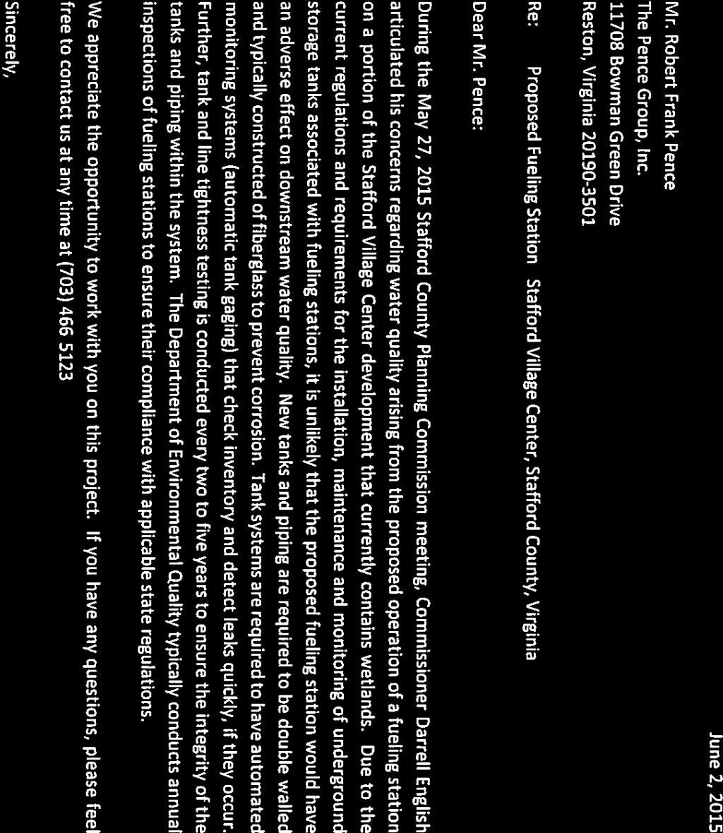

25 Attachment 4 Page 1 of 1

26 Attachment 5 Page 1 of 1
27 VETTRA Co. May 29, 2015 Attachment 6 Page 1 of 157 REVISED LOS and QUEUING ANALYSIS Stafford Village Center Executive Summary This revised analysis is in response to VDOT s May 7, 2015 comments on the Stafford Village Center TIA by VETTRA Company dated December 12, Methodology Year 2025 background and total condition analyses within this revised analysis use the same methodology as in the original TIA, but utilizing the VDOT-requested Synchro input factors from the TOA Tool Guidebook. Year 2025 Total condition analysis includes the same (as in TIA) traffic from the site, but with adjusted pass-by trips and operational diversions form the east site right-out/right-out entrance. AM or PM peak hour turn movement LOS s degraded (as result of added site traffic) to unacceptable LOS (E or F) have been mitigated and returned to background (or better) LOS using the recommended mitigation measures. Maximum (95%) SimTraffic Back-of-Queues have also been accommodated with the recommended mitigation measures to reasonable lengths with no spillbacks. Conclusion In summary, this traffic study shows that the mitigation measures proposed by the Applicant meet Stafford County's Comprehensive Plan goals. All of the impacted intersections will operate at (or better than) the LOS s at 2025 background traffic, as well as at 2025 total traffic (which includes traffic from this project). Given these conditions, the Applicant is not required to raise LOS to LOS "C". Instead, the Applicant meets the Comprehensive Plan goals by maintaining the LOS level of each intersection, as provided in the Comprehensive Plan's "Non-Degradation Policy". The Non-Degradation Policy requires Applicants to ensure that the transportation system affected by the application performs no worse after the project is developed than it would otherwise, and performance is measured by LOS. Results of this re-analysis show the following Yr mitigation measures necessary as a result of adding Stafford Village Center site traffic to the network: Intersection Recommended Site Mitigation Measures (to achieve Background LOS) #1) Rt.610/Eustace Rd. -- Provide dedicated EB Right turn lane with 100 ft. minimum storage -- modify signal #4) Mine Rd./Highpointe Blvd. -- Provide PM+OV phasing for EB Right and extend lane to 350 ft. storage -- Provide 2 nd NB Left turn lane and extend both lanes to 275 ft. storage -- modify signal #5) Rt.610/Travis/Main Site Entrance -- Provide additional lanes per GDP -- Provide new signal system Discussion LOS (Level Of Service) is defined as Grades A thru F (with A-D as acceptable ) based on delay (seconds) that the average driver experiences waiting for a green light. The purpose of a TIA (Traffic Impact Analysis) is to determine the various conditions of studied intersections and measure the impact of site traffic on those intersections as compared to background (without site traffic) conditions.
28 Page 2 of 157 Although the Levels Of Service of the intersections are not reduced, individual movements within the intersection may be impacted, although none are impacted during the PM peak hour. This situation is covered by the Comprehensive Plan's "Offsetting Impact Policy". The Stafford County Comprehensive Plan 4.6 Level of Service section (on pages 4-9 and 4-10) provides specific strategies for the evaluation of new developments when LOS "C" cannot be obtained, as is the case for this project. New developments are evaluated by the "non-degradation" and "offsetting impact" policies. The Non- Degradation Policy requires Applicants to ensure that the transportation system affected by the proposed development performs no worse after the project is developed than it would otherwise. Applicants are required to provide improvements or other guarantees to maintain certain performance levels. In some cases, the Comprehensive Plan recognizes that it may be impossible for a project to maintain certain performance levels, or for one individual Applicant to provide the transportation improvements which may be needed. In that case, the Offsetting Impact Policy requires applicants to contribute to transportation improvements. The contributions would be proportional to the traffic generated by the project, but would not be required to ensure that localized performance be maintained. In this application, the mitigation measures recommended above offset the impact for each intersection and are proportionate to the traffic generated by the project. It is our professional opinion that any mitigation for SAT peak hour is not reasonable since this peak traffic condition occurs only one day of the week and VDOT does not design road facilities to Saturday volumes. It is unreasonable to mitigate for Saturday peak hour conditions, because: 1) the peak hour conditions do not represent the average or median traffic conditions for the area; 2) mitigation involves improvements that are not due solely or primarily to the impact from the proposed development; and 3) the need for the proposed improvements is generated by unfunded infrastructure needs attributable to existing or approved development. Although we are not making any recommendations regarding Saturday (SAT) peak hour conditions, if Yr SAT peak hour conditions were to be mitigated, the following would then be required: Portion of Total Improve- Intersection Total Improvements (to achieve overall int. LOS=D) ment not Recommended NO ADDITIONAL IMPROVEMENTS REQUIRED History of Application As originally scoped in December 2014 and in response to VDOT comments dated May 7, 2015, intersection Levels Of Service (LOS), delays, and queuing analyses have been revised for Year 2025 (site buildout year) Background (without Stafford Village Center site traffic) and Total (with Stafford Village Center site traffic) conditions. This revised analysis is above and beyond that scoped within the official TIA Scoping Process. This re-analyses has been conducted at VDOT s request for certain changes: 1) technical factors (Synchro lost time, peak hour, heavy vehicle factors), 2) adjusted site pass-by trips, and 3) operational diversion of the east site right-in/right-out entrance on Rt.610. In addition to typical AM & PM peak hour analyses, we have also (as requested by VDOT) conducted Saturday (SAT) peak hour analyses. It is our professional opinion that any mitigation for SAT peak hour is not reasonable since this peak traffic condition occurs only one day of the week and VDOT does not typically design road facilities to Saturday volumes. The following tables present the detailed results of the Year 2025 (site buildout year) Background, Total (w/site traffic), and Total -- with mitigation LOS and Queuing analysis results. Attached are the Synchro and SimTraffic printouts for all three (3) future conditions and peak hours reflected in the tables. (For continuity, table numbers are the same as in the original TIA). 2
29 Page 3 of 157 TABLE 3 Year 2025 "Background" Intersection Level Of Service Summary AM PEAK HOUR PM PEAK HOUR Intersection Lane Group Intersection Lane Group Intersections (west to east) LOS/Delay Mvmt. LOS/Dly. LOS/Delay Mvmt. LOS/Dly. Signalized 1) Rt.610/Eustace Rd. C/30.2 EBL E/58.0 D/47.7 EBL E/60.2 EBTR C/29.6 EBTR D/44.6 WBL F/201.3 WBL F/259.6 WBTR A/1.1 NBLT E/58.0 WBTR B/10.8 NBLT E/59.8 NBR B/17.3 NBR A/9.9 SBLTR E/58.0 SBLTR E/59.4 2) Rt.610/Center St. A/3.5 EBL D/51.7 B/10.7 EBL D/39.8 EBTR A/1.5 EBTR A/3.8 WBL E/64.2 WBL F/87.0 WBT A/3.5 WBT A/4.9 WBR A/1.4 WBR A/0.0 NBLTR D/54.0 NBLTR A/1.6 SBL E/61.4 SBL F/121.7 SBTR C/30.8 SBTR C/34.1 3) Rt.610/Onville Rd. B/10.6 EBL E/72.5 C/27.5 EBL E/68.0 EBTR A/4.2 EBTR B/11.3 WBL D/54.6 WBL E/57.6 WBT A/9.4 WBT D/35.8 WBR A/2.6 WBR A/6.1 NBLT E/58.0 NBLT E/61.1 NBR A/0.2 NBR A/0.6 SBL D/53.4 SBL D/53.8 SBLT E/55.7 SBLT E/58.6 SBR A/0.8 SBR A/6.3 4) Mine Rd./Highpointe Blvd. C/22.8 EBL E/64.2 B/15.4 EBL E/66.9 EBT D/46.0 EBT D/49.5 EBR A/0.8 EBR A/1.1 WBL E/61.2 WBL E/62.9 WBTR C/20.7 WBTR C/21.3 NBL A/9.7 NBL A/8.4 NBTR B/19.7 NBTR B/12.5 SBL B/12.8 SBL A/5.2 SBTR B/10.8 SBTR B/12.5 Unsignalized (stop-control) 5) Rt.610/Travis La. -- EBL C/ EBL F/206.2 EBT A/0.0 EBT A/0.0 WBT A/0.0 WBT A/0.0 WBR A/0.0 WBR A/0.0 SBL F/109.2 SBL F/ SBR C/17.2 SBR F/74.5 3
30 TABLE 3 (cont.) Year 2025 "Background" Intersection Level Of Service Summary SAT PEAK HOUR Intersection Lane Group Intersections (west to east) LOS/Delay Mvmt. LOS/Dly. 1) Rt.610/Eustace Rd. C/24.3 EBL A/8.0 EBTR C/25.8 WBL D/49.8 WBTR B/13.4 NBLT E/70.5 NBR B/15.6 SBLTR D/52.5 2) Rt.610/Center St. A/2.1 EBL A/1.2 EBTR A/1.9 WBL A/1.9 WBT A/1.0 WBR A/0.1 NBLTR A/1.0 SBL D/53.7 A/0.3 SBTR 3) Rt.610/Onville Rd. B/13.2 EBL E/67.3 EBTR A/8.9 WBL D/53.4 WBT A/8.5 WBR A/0.1 NBLT D/51.1 NBR A/0.2 SBL D/49.7 SBLT D/54.2 A/2.7 SBR 4) Mine Rd./Highpointe Blvd. C/20.2 EBL D/42.7 EBT D/37.3 EBR A/0.5 WBL D/43.2 WBTR B/13.7 NBL B/10.2 NBTR C/22.1 SBL B/11.7 B/18.1 SBTR Unsignalized (stop-control) 5) Rt.610/Travis La. -- EBL E/36.6 EBT A/0.0 WBT WBR SBL SBR A/0.0 A/0.0 F/365.2 C/24.9 Legend: LOS = Level Of Service & Avg. Vehicular Delay (seconds) - for Overall Intersection LOS/Dly. = Level Of Service & Avg. Vehicular Delay (seconds) - for Lane Group Mvmt. = Movement (e.g., EBR = EastBound Right, NBT=NorthBound Thru) Attachment 6 Page 4 of 157 4
31 TABLE 4a Year 2025 "Total" Intersection Level Of Service Summary Attachment 6 Page 5 of 157 AM PEAK HOUR PM PEAK HOUR Intersection Lane Group Intersection Lane Group Intersections (west to east) LOS/Delay Mvmt. LOS/Dly. LOS/Delay Mvmt. LOS/Dly. Signalized 1) Rt.610/Eustace Rd. C/33.8 EBL E/68.0 E/62.5 EBL E/60.2 EBTR C/31.9 EBTR E/63.4 WBL F/191.1 WBL F/344.8 WBTR A/5.3 NBLT E/73.3 WBTR B/15.7 NBLT E/59.8 NBR C/33.8 NBR A/10.0 SBLTR E/68.0 SBLTR E/59.4 2) Rt.610/Center St. A/5.3 EBL E/55.0 B/15.2 EBL D/43.0 EBTR A/1.0 EBTR B/11.5 WBL E/58.7 WBL E/73.8 WBT A/8.7 WBT A/7.0 WBR A/4.6 WBR A/0.0 NBLTR E/64.0 NBLTR A/1.6 SBL E/78.0 SBL F/151.9 SBTR D/35.8 SBTR C/34.9 3) Rt.610/Onville Rd. B/10.9 EBL E/60.5 D/35.9 EBL F/110.2 EBTR A/2.7 EBTR B/11.0 WBL F/84.7 WBL E/60.7 WBT B/12.6 WBT D/52.9 WBR A/4.3 WBR A/8.1 NBLT E/68.0 NBLT E/61.1 NBR A/0.2 NBR A/0.6 SBL E/64.0 SBL D/53.8 SBLT E/67.3 SBLT E/58.6 SBR A/1.1 SBR A/8.0 4) Mine Rd./Highpointe Blvd. B/19.3 EBL D/41.6 E/55.8 EBL D/50.4 EBT C/34.7 EBT D/43.5 EBR A/9.1 EBR D/49.2 WBL D/42.8 WBL E/69.8 WBTR B/15.9 WBTR C/25.4 NBL B/12.3 NBL F/84.3 NBTR C/20.5 NBTR B/13.7 SBL B/11.4 SBL B/12.4 SBTR B/12.8 SBTR E/67.3 5) Rt.610/Travis La./Main Site Ent. B/11.2 EBL A/3.4 C/25.6 EBL C/25.0 (with Signal) EBT A/5.7 EBT D/41.7 EBR A/0.3 EBR B/13.1 WBL E/68.0 WBL D/41.6 WBT A/2.8 WBT A/7.3 WBR A/0.1 WBR A/0.1 NBL E/78.3 NBL E/58.1 NBTR C/22.0 NBTR C/21.0 SBL E/56.2 SBL D/40.6 SBTR C/28.8 SBTR C/28.9 5
32 Page 6 of 157 TABLE 4a (cont.) Year 2025 "Total" Intersection Level Of Service Summary AM PEAK HOUR PM PEAK HOUR Intersection Lane Group Intersection Lane Group Intersections LOS/Delay Mvmt. LOS/Dly. LOS/Delay Mvmt. LOS/Dly. Unsignalized (stop-control) 6) Rt.610/Site RI/RO West -- NBR E/ NBR F/56.4 (New Intersection) EBT A/0.0 EBT A/0.0 EBR A/0.0 EBR A/0.0 7) Rt.610/Site RI/RO East -- NBR E/ NBR F/54.4 (New Intersection) EBT A/0.0 EBT A/0.0 EBR A/0.0 EBR A/0.0 SAT PEAK HOUR Intersection Lane Group Intersections LOS/Delay Mvmt. LOS/Dly. Signalized 1) Rt.610/Eustace Rd. C/29.2 EBL A/7.0 EBTR C/31.5 WBL D/51.4 WBTR B/15.3 NBLT F/106.7 NBR C/28.9 SBLTR E/71.2 2) Rt.610/Center St. A/2.9 EBL A/0.8 EBTR A/1.5 WBL A/3.7 WBT A/2.6 WBR A/0.3 NBLTR A/1.3 SBL E/73.9 A/0.4 SBTR 3) Rt.610/Onville Rd. B/12.4 EBL E/63.5 EBTR A/9.0 WBL F/88.9 WBT A/5.8 WBR A/0.1 NBLT E/67.7 NBR A/0.4 SBL E/63.4 SBLT E/68.4 B/10.0 SBR 6
33 Page 7 of 157 TABLE 4a (cont.) Year 2025 "Total" Intersection Level Of Service Summary SAT PEAK HOUR Intersection Lane Group Intersections LOS/Delay Mvmt. LOS/Dly. Signalized (cont.) 4) Mine Rd./Highpointe Blvd. D/54.6 EBL E/57.0 EBT D/47.7 EBR D/37.1 WBL F/80.5 WBTR C/25.6 NBL F/105.4 NBTR B/15.2 SBL B/19.1 E/61.4 SBTR 5) Rt.610/Travis La./Main Site Ent. C/28.2 EBL A/3.2 (with Signal) EBT C/29.3 EBR A/0.7 WBL E/69.9 WBT A/6.7 WBR A/0.1 NBL E/63.7 NBTR D/35.4 SBL E/61.8 C/30.5 SBTR Unsignalized (stop-control) 6) Rt.610/Site RI/RO West -- NBR F/75.8 (New Intersection) EBT A/0.0 EBR A/0.0 7) Rt.610/Site RI/RO East -- NBR F/52.5 (New Intersection) EBT A/0.0 EBR A/0.0 Legend: LOS = Level Of Service & Avg. Vehicular Delay (seconds) - for Overall Intersection LOS/Dly. = Level Of Service & Avg. Vehicular Delay (seconds) - for Lane Group Mvmt. = Movement (e.g., EBR = EastBound Right, NBT=NorthBound Thru) 7
34 Page 8 of 157 TABLE 6 SimTraffic Intersection 95% Back-of-Queue Summary Yr _ Yr _ Yr Intersection Background Cond. Total Condition w/mitigation* (Road Apprch. Dir.) (Avail.) Mvmt. AM PM SAT AM PM SAT PM SAT Signalized 1) Rt.610/Eustace Rd. (Rt.610-EB) (inf. ) EBL (4 ) (23 ) (6 ) (5 ) (22 ) (6 ) (18 ) (5 ) (Rt.610-EB) (inf. ) EBT (328 ) (354 ) (419 ) (283 ) (360 ) (413 ) (345 ) (395 ) (Rt.610-EB) (inf. ) EBTR (282 ) (333 ) (294 ) (267 ) (345 ) (412 ) (75 ) (67 ) (Rt.610-WB) (250 ) WBL (294 ) (283 ) (252 ) (310 ) (276 ) (301 ) (286 ) (296 ) (Rt.610-WB) (inf. ) WBT (1313 ) (1370 ) (330 ) (1153 ) (1415 ) (438 ) (1365 ) (453 ) (Rt.610-WB) (inf. ) WBTR (664 ) (1374 ) (165 ) (608 ) (1443 ) (223 ) (1371 ) (283 ) (Eustace Rd.-NB) (inf. ) NBLT (230 ) (199 ) (323 ) (286 ) (202 ) (466 ) (199 ) (242 ) (Eustace Rd.-NB) (350 ) NBR (246 ) (159 ) (196 ) (298 ) (184 ) (423 ) (201 ) (248 ) (Stafford Pt. Ent.-SB) (inf. ) SBLTR (13 ) (92 ) (74 ) (11 ) (96 ) (79 ) (93 ) (74 ) 2) Rt.610/Center St. (Rt.610-EB) (120 ) EBL (51 ) (62 ) (34 ) (58 ) (55 ) (37 ) (58 ) (76 ) (Rt.610-EB) (inf. ) EBT (81 ) (89 ) (235 ) (55 ) (226 ) (352 ) (167 ) (1440 ) (Rt.610-EB) (inf. ) EBTR (115 ) (107 ) (230 ) (83 ) (185 ) (375 ) (191 ) (1440 ) (Rt.610-WB) (200 ) WBL (81 ) (266 ) (29 ) (26 ) (242 ) (45 ) (236 ) (27 ) (Rt.610-WB) (inf. ) WBT (251 ) (1216 ) (122 ) (225 ) (702 ) (250 ) (701 ) (243 ) (Rt.610-WB) (100 ) WBR (65 ) (213 ) (14 ) (69 ) (191 ) (40 ) (193 ) (43 ) (Center Pl. Ent.-NB) (inf. ) NBLTR (10 ) (78 ) (51 ) (8 ) (81 ) (56 ) (84 ) (63 ) (Center St.-SB) (75 ) SBL (88 ) (119 ) (76 ) (104 ) (120 ) (94 ) (113 ) (100 ) (Center St.-SB) (inf. ) SBTR (52 ) (583 ) (24 ) (86 ) (634 ) (67 ) (610 ) (69 ) 3) Rt.610/Onville Rd. (Rt.610-EB) (425 ) EBL (104 ) (116 ) (101 ) (115 ) (375 ) (126 ) (382 ) (119 ) (Rt.610-EB) (inf. ) EBT (123 ) (280 ) (259 ) (78 ) (257 ) (305 ) (270 ) (306 ) (Rt.610-EB) (inf. ) EBTR (126 ) (300 ) (279 ) (79 ) (218 ) (314 ) (235 ) (324 ) (Rt.610-WB) (300 ) WBL (63 ) (324 ) (50 ) (78 ) (352 ) (76 ) (378 ) (57 ) (Rt.610-WB) (inf. ) WBT (152 ) (887 ) (195 ) (258 ) (820 ) (449 ) (835 ) (258 ) (Rt.610-WB) (inf. ) WBR (153 ) (858 ) (5 ) (165 ) (807 ) (24 ) (822 ) (26 ) (Aquia Village Ent.-NB) (inf. ) NBLT (6 ) (89 ) (43 ) (3 ) (86 ) (50 ) (85 ) (42 ) (Aquia Village Ent.-NB) (inf. ) NBR (24 ) (57 ) (29 ) (26 ) (53 ) (34 ) (57 ) (34 ) (Onville Rd.-SB) (600 ) SBL (130 ) (221 ) (186 ) (143 ) (220 ) (198 ) (229 ) (206 ) (Onville Rd.-SB) (inf. ) SBLT (170 ) (250 ) (209 ) (177 ) (249 ) (215 ) (253 ) (225 ) (Onville Rd.-SB) (300 ) SBR (51 ) (164 ) (79 ) (51 ) (163 ) (134 ) (163 ) (112 ) 4) Mine Rd./Highpointe Blvd. (Highpointe Blvd.-EB) (280 ) EBL (206 ) (99 ) (178 ) (149 ) (207 ) (182 ) (248 ) (214 ) (Highpointe Blvd.-EB) (inf. ) EBT (27 ) (2 ) (119 ) (24 ) (182 ) (645 ) (296 ) (207 ) (Highpointe Blvd.-EB) (inf. ) EBR (46 ) (25 ) (50 ) (85 ) (465 ) (735 ) (346 ) (440 ) (N. Vine Pl.-WB) (160 ) WBL (64 ) (18 ) (51 ) (54 ) (55 ) (57 ) (63 ) (57 ) (N. Vine Pl.-WB) (inf. ) WBTR (104 ) (25 ) (86 ) (86 ) (160 ) (82 ) (215 ) (107 ) (Mine Rd.-NB) (300 ) NBL (36 ) (18 ) (127 ) (132 ) (390 ) (345 ) (268 ) (334 ) (Mine Rd.-NB) (inf. ) NBT (270 ) (74 ) (601 ) (241 ) (770 ) (1418 ) (605 ) (620 ) (Mine Rd.-NB) (inf. ) NBTR (268 ) (53 ) (586 ) (253 ) (658 ) (1365 ) (547 ) (573 ) (Mine Rd.-SB) (220 ) SBL (47 ) (33 ) (101 ) (45 ) (297 ) (312 ) (196 ) (210 ) (Mine Rd.-SB) (inf. ) SBT (40 ) (132 ) (227 ) (58 ) (1043 ) (924 ) (411 ) (376 ) (Mine Rd.-SB) (inf. ) SBTR (62 ) (150 ) (255 ) (73 ) (1058 ) (936 ) (422 ) (386 ) 8
35 Page 9 of 157 TABLE 6 (cont.) SimTraffic Intersection 95% Back-of-Queue Summary Yr _ Yr _ Yr Intersection Background Cond. Total Condition w/mitigation* (Road Apprch. Dir.) (Avail.) Mvmt. AM PM SAT AM PM SAT PM SAT Signalized (cont.) 5) Rt.610/Travis La./Main Site Ent. (Rt.610-EB) (300 ) EBL (43 ) (53 ) (33 ) (44 ) (99 ) (84 ) (124 ) (91 ) (Rt.610-EB) (inf. ) EBT (3 ) (0 ) (2 ) (159 ) (298 ) (288 ) (311 ) (285 ) (Rt.610-EB) (250 ) EBR (32 ) (270 ) (300 ) (264 ) (300 ) (Rt.610-WB) (250 ) WBL (30 ) (0 ) (0 ) (167 ) (352 ) (300 ) (349 ) (276 ) (Rt.610-WB) (inf. ) WBT (6 ) (1181 ) (0 ) (109 ) (325 ) (394 ) (317 ) (326 ) (Rt.610-WB) (125 ) WBR (8 ) (219 ) (5 ) (30 ) (215 ) (59 ) (216 ) (64 ) (Main Site Ent.-NB) (inf. ) NBL (164 ) (314 ) (312 ) (294 ) (407 ) (Main Site Ent.-NB) (inf. ) NBTR (112 ) (354 ) (453 ) (273 ) (499 ) (Travis La.-SB) (90 ) SBL (457 ) (138 ) (440 ) (98 ) (89 ) (93 ) (94 ) (87 ) (Travis La.-SB) (inf. ) SBTR (109 ) (576 ) (118 ) (60 ) (104 ) (81 ) (99 ) (70 ) Unsignalized (stop-control) 6) Rt.610/Site RI/RO West (Rt.610-EB) (inf. ) EBT (0 ) (185 ) (663 ) (209 ) (818 ) (Rt.610-EB) (250 ) EBR (0 ) (0 ) (246 ) (27 ) (361 ) (Rt.610-WB) (inf. ) WBT (0 ) (321 ) (38 ) (315 ) (10 ) (Site Entrance-NB) (inf. ) NBR (33 ) (81 ) (247 ) (91 ) (205 ) 7) Rt.610/Site RI/RO East (Rt.610-EB) (inf. ) EBT (0 ) (52 ) (45 ) (33 ) (59 ) (Rt.610-EB) (inf. ) EBR (0 ) (0 ) (0 ) (0 ) (0 ) (Rt.610-WB) (inf. ) WBT (0 ) (661 ) (521 ) (648 ) (128 ) (Site Entrance-NB) (inf. ) NBR (35 ) (62 ) (69 ) (59 ) (70 ) Legend: * = Recommended Site Mitigation Measures Avail. = Available lane stacking space (ft.) -- inf. = infinite xxx = 95% BOQ beyond available stacking space (spillback) (xxx ) = 95% BOQ as reported by SimTraffic (avg. of 10 one-hour runs) 9
36 Page 10 of 157 TABLE 7 Year 2025 "Total" Intersection Level Of Service Summary -- with Mitigation* -- AM PEAK HOUR PM PEAK HOUR Intersection Lane Group Intersection Lane Group Intersections (mitigation measure) LOS/Delay Mvmt. LOS/Dly. LOS/Delay Mvmt. LOS/Dly. Signalized 1) Rt.610/Eustace Rd. C/29.2 EBL E/68.0 D/53.1 EBL E/60.2 EBT C/27.9 EBT D/52.9 (dedicated EB Right turn lane) EBR A/6.5 EBR A/8.1 WBL F/164.2 WBL F/289.6 WBTR A/5.3 NBLT E/73.3 WBTR B/16.3 NBLT E/59.8 NBR C/31.1 NBR A/10.0 SBLTR E/68.0 SBLTR E/59.4 4) Mine Rd./Highpointe Blvd. C/22.0 EBL D/41.6 C/30.9 EBL E/66.9 EBT C/34.7 EBT D/49.5 (provide PM+OV phasing) EBR A/3.6 EBR C/1.1 WBL D/42.8 WBL D/62.9 WBTR B/15.9 WBTR B/21.3 (2 nd dedicated NB Left turn lane) NBL D/40.4 NBL D/8.4 NBTR C/20.5 NBTR A/12.5 SBL B/11.7 SBL B/5.2 SBTR B/13.7 SBTR C/12.5 5) Rt.610/Travis La./Main Site Ent. B/14.0 EBL A/8.2 C/27.9 EBL C/25.5 (with Signal) EBT B/11.1 EBT D/43.3 EBR A/0.9 EBR B/14.1 WBL E/55.7 WBL D/49.3 WBT A/4.9 WBT B/11.1 WBR A/0.1 WBR A/0.2 NBL E/69.2 NBL D/54.9 NBTR C/21.3 SAT PEAK HOUR Intersection Lane Group Intersections (mitigation measure) LOS/Delay Mvmt. LOS/Dly. Signalized 1) Rt.610/Eustace Rd. C/28.6 EBL A/9.0 EBT C/33.3 (dedicated EB Right turn lane) EBR A/2.3 WBL D/47.2 WBTR B/18.9 NBLT E/78.5 NBR B/17.7 SBLTR E/71.2 NBTR B/18.7 SBL E/56.2 SBL D/39.5 SBTR C/32.7 SBTR C/
37 Page 11 of 157 TABLE 7 (cont.) Year 2025 "Total" Intersection Level Of Service Summary -- with Mitigation* -- SAT PEAK HOUR Intersection Lane Group Intersections (mitigation measure) LOS/Delay Mvmt. LOS/Dly. Signalized (cont.) 4) Mine Rd./Highpointe Blvd. D/36.8 EBL D/54.7 EBT D/39.0 (provide PM+OV phasing) EBR D/44.0 WBL D/47.1 WBTR B/15.6 (2 nd dedicated NB Left turn lane) NBL D/40.2 NBTR B/13.6 SBL B/13.5 SBTR D/46.4 5) Rt.610/Travis La./Main Site Ent. C/34.5 EBL A/4.2 (with Signal) EBT D/51.1 EBR A/2.3 WBL D/54.8 WBT A/7.5 WBR A/0.1 NBL E/63.7 NBTR C/21.7 SBL E/57.7 SBTR C/30.5 Note: * = Recommended Site Mitigation Measures 11
38 Responses to Latest TIA Comments Attachment 6 Page 12 of 157 Following are our responses to the latest TIA comments dated May 7, TIA Comment #1 Page 6: The use of 54% pass by for general retail and 59% for the gas station are indicated. The average of the studies reported in the ITE Trip Generation Handbook is 33% for general retail and 42% for gas station. VETTRA needs to explain how the applicant arrived at the pass by rates used in the study. Response: The pass-by rates used in the TIA were as agreed in the final scoping package. However, as requested, these rates have been revised in the attached Revised LOS & Queuing Analysis dated May 29, TIA Comment #2 Page 16: Indicates no inter parcel connections are to be provided. Connections to the commercial property to the west and the retail plaza to the east should be considered. Response: These inter-parcel connections are being considered and investigated for feasibility. TIA Comment #3 Page 18: Indicates that 2025 signals will be uncoordinated. The analyses show the signals along Route 610 to be actuated coordinated, except the signal proposed at the site entrance/travis Lane intersection. The signal system along Route 610 must be analyzed as actuated coordinated for all signals. Response: As requested, the signals along Rt.610 have been revised to Actuated-Coordinated and are reflected in the attached Revised LOS & Queuing Analysis dated May 29, TIA Comment #4 Page 19: The figure title seems to be incorrect. Please address. Response: This has been corrected. Thank you for the note. TIA Comment #5 Pages 22 & 23: The table presents an overall LOS for the unsignalized Route 610/Travis Lane intersection. This is inappropriate and not standard engineering practice as it can be misleading. VETTRA should report only the LOS information for controlled or yield movements. This also occurs at other locations in the report. Response: The appropriate tables have been revised and are reflected in the attached Revised LOS & Queuing Analysis dated May 29, TIA Comment #6 Page 37: Table 5 and the conclusions regarding the presented information are misleading as follows: a. VETTRA reports that there is no impact to the intersection LOS for the Route 610/Eustace Road intersection simply because the lowest LOS reported is an F. However, in reviewing the actual reported delay, significant impact is observed as follows: i. AM Peak hour overall delay increase from 80.9 seconds to seconds (39% increase in delay). ii. PM Peak hour overall delay increase from seconds to seconds (48% increase in delay). Response: The LOS & Queuing analyses for this intersection have been revised per latest VDOT parameters and comments and now show AM peak hour overall delay increasing from 47.7 seconds (LOS=D) at 2025 background to 62.5 seconds (LOS=E) for total conditions. We recognize this impact and have recommended mitigation of a dedicated EB Right turn lane returning PM peak hour to the background LOS=D see the attached Revised LOS & Queuing Analysis dated May 29,
39 Page 13 of 157 b. The table shows acceptable LOS for Route 610 at Travis Lane/Site Driveway intersections. However, for the three time periods analyzed, the left turn movements into the site as well as the left turns out of the site are LOS E or F. This is not desirable for a new intersection. Response: Per the attached Revised LOS & Queuing Analysis dated May 29, 2015 the Rt.610/Main Entrance intersection (w/mitigation) no longer has any LOS=E or F movements in the PM peak hour. The exit lane (NB Right) at each Site Right-in/right-out entrance shows LOS=F but at far-reduced delays of only 44.2 to 55.7 seconds, which are quite manageable for such situations. c. The table shows overall LOS A for the proposed right turn driveways at Route 610. As noted previously, it is inappropriate to report overall LOS for unsignalized intersections, and in this case is especially misleading. Pages 33 & 34 show that the right turn out movements will experience delays of 58.7 seconds to 467 seconds. These delays are not acceptable or realistic as they would likely result in this traffic using the signalized exit instead of the right turn driveways. This needs to be considered in the reanalysis. Response: The appropriate tables have been revised and are reflected in the attached Revised LOS & Queuing Analysis dated May 29, As suggested, delays of the exit lanes (NB Rights) at each Site Right-in/right-out entrance may cause diversions to the main entrance. A nominal diversion (66%) of the east entrance right-out to the main entrance has been utilized and reflected attached Revised LOS & Queuing Analysis. TIA Comment #7 Page 38: Mitigation measures proposed are of concern as follows: a. Optimizing the signal timing at Route 610/Onville Road intersection may not be acceptable for progression along Route 610. VETTRA would need to provide full results (delay and queuing) for the corridor in order to assess the acceptability of changing signal timings. Response: Per the attached Revised LOS & Queuing Analysis dated May 29, 2015 this mitigation measure is longer necessary, thus no further response is required. b. Providing a free flow eastbound right turn lane on Highpointe Boulevard would require constructing a channelized right turn lane and a receiving/acceleration lane on Mine Road southbound as noted in the proffer statement. The analyst should revise the SYNCHRO model to show this improvement and run SimTraffic to determine the extent of acceleration/merge lane that will be required. Response: Per the attached Revised LOS & Queuing Analysis dated May 29, 2015 this mitigation measure is longer necessary, thus no further response is required. Other mitigation measures are recommended for this intersection. c. Page 39: Reported queuing results are problematic as follows: i. Please explain how the westbound through queue at Route 610/Center Street intersection decreases from 1,276 feet to 757 feet for the PM peak hour condition. Response: This is due to the WB link distance (from Center St. to Travis La.) being bifurcated by the West Site Entrance Right-in/Right-out for total condition analyses. Both background and total conditions show similar WB queues thru these two intersections due to spillback from the WB Left turn lane at Eustace Road. For comparison purposes, the total WB Thru queues at Center St. and West Site RI/RO can be added to match the background WB Thru queue at Center Street. 13
40 Page 14 of 157 ii. The westbound right PM peak hour queue at the Route 610/Center Street intersection increases to 206 feet for the PM peak hour, which is beyond the available/allowable queue space. This needs to be addressed. Response: Per the attached Revised LOS & Queuing Analysis dated May 29, 2015 this has been addressed. This movement now decreases from background 213 feet to 193 feet total w/mitigation. iii. The overall queuing conditions reported for the intersection of Mine Road/Highpointe Blvd. increase significantly and are not acceptable, even when the eastbound right is coded for free flow. Several movements are forecast to have queues over 1,000 feet. One movement is forecast to be up to 1,549 feet where the longest predevelopment queue was 196 feet. This 10 fold increase is attributed solely to the proposed site traffic. Queue increases for other movements are similar in magnitude. Response: Per the attached Revised LOS & Queuing Analysis dated May 29, 2015 this has been addressed. Maximum for all PM peak hour movements are now less than 605 feet -- all within available storage lengths. TIA Comment #8 The SimTraffic results show significant increases in denied entry vehicles. This is not acceptable as this means that these vehicles were unable to enter the traffic network and are not considered in the measures of effectiveness (i.e. queue lengths) that are reported. As a result, the network performance is overstated in the analysis and actual operations will likely be worse than measured in the TIA. Response: Per the attached Revised LOS & Queuing Analysis dated May 29, 2015 this has been addressed. All denied entry amounts are significantly reduced and within reasonable limits. attachment: Synchro printouts for Revised LOS and Queuing Analysis \svc\re-analysis_5_28_2015.doc 14
41 Page 15 of 157
42 Page 16 of 157
43 Page 17 of 157
44 Page 18 of 157
45 Page 19 of 157
46 Page 20 of 157
47 Page 21 of 157
48 Page 22 of 157
49 Page 23 of 157
50 Page 24 of 157
51 Page 25 of 157
52 Page 26 of 157
53 Page 27 of 157
54 Page 28 of 157
55 Page 29 of 157
56 Page 30 of 157
57 Page 31 of 157
58 Page 32 of 157
59 Page 33 of 157
60 Page 34 of 157
61 Page 35 of 157
62 Page 36 of 157
63 Page 37 of 157
64 Page 38 of 157
65 Page 39 of 157
66 Page 40 of 157
67 Page 41 of 157
68 Page 42 of 157
69 Page 43 of 157
70 Page 44 of 157
71 Page 45 of 157
72 Page 46 of 157
73 Page 47 of 157
74 Page 48 of 157
75 Page 49 of 157
76 Page 50 of 157
77 Page 51 of 157
78 Page 52 of 157
79 Page 53 of 157
80 Page 54 of 157
81 Page 55 of 157
82 Page 56 of 157
83 Page 57 of 157
84 Page 58 of 157
85 Page 59 of 157
86 Page 60 of 157
87 Page 61 of 157
88 Page 62 of 157
89 Page 63 of 157
90 Page 64 of 157
91 Page 65 of 157
92 Page 66 of 157
93 Page 67 of 157
94 Page 68 of 157
95 Page 69 of 157
96 Page 70 of 157
97 Page 71 of 157
98 Page 72 of 157
99 Page 73 of 157
100 Page 74 of 157
101 Page 75 of 157
102 Page 76 of 157
103 Page 77 of 157
104 Page 78 of 157
105 Page 79 of 157
106 Page 80 of 157
107 Page 81 of 157
108 Page 82 of 157
109 Page 83 of 157
110 Page 84 of 157
111 Page 85 of 157
112 Page 86 of 157
113 Page 87 of 157
114 Page 88 of 157
115 Page 89 of 157
116 Page 90 of 157
117 Page 91 of 157
118 Page 92 of 157
119 Page 93 of 157
120 Page 94 of 157
121 Page 95 of 157
122 Page 96 of 157
123 Page 97 of 157
124 Page 98 of 157
125 Page 99 of 157
126 Page 100 of 157
127 Page 101 of 157
128 Page 102 of 157
129 Page 103 of 157
130 Page 104 of 157
131 Page 105 of 157
132 Page 106 of 157
133 Page 107 of 157
134 Page 108 of 157
135 Page 109 of 157
136 Page 110 of 157
137 Page 111 of 157
138 Page 112 of 157
139 Page 113 of 157
140 Page 114 of 157
141 Page 115 of 157
142 Page 116 of 157
143 Page 117 of 157
144 Page 118 of 157
145 Page 119 of 157
146 Page 120 of 157
147 Page 121 of 157
148 Page 122 of 157
149 Page 123 of 157
150 Page 124 of 157
151 Page 125 of 157
152 Page 126 of 157
153 Page 127 of 157
154 Page 128 of 157
155 Page 129 of 157
156 Page 130 of 157
157 Page 131 of 157
158 Page 132 of 157
159 Page 133 of 157
160 Page 134 of 157
161 Page 135 of 157
162 Page 136 of 157
163 Page 137 of 157
164 Page 138 of 157
165 Page 139 of 157
166 Page 140 of 157
167 Page 141 of 157
168 Page 142 of 157
169 Page 143 of 157
170 Page 144 of 157
171 Page 145 of 157
172 Page 146 of 157
173 Page 147 of 157
174 Page 148 of 157
175 Page 149 of 157
176 Page 150 of 157
177 Page 151 of 157
178 Page 152 of 157
179 Page 153 of 157
180 Page 154 of 157
181 Page 155 of 157
182 Page 156 of 157
183 Page 157 of 157
184 Attachment 7 Page 1 of 5 Transportation Planning & Engineering Services Gunner Court Woodbridge, Virginia Tel: 703/ (Fax: please call ahead) vettra@aol.com May 29, 2015 The Pence Group, Inc. Attn: Mr. Michael W. Stoltz Bowman Green Drive Reston, Virginia via michaels@pencegroup.com RE: SUBJ: Stafford Village Center County of Stafford, Virginia Highpointe Blvd. Connector -- Traffic Analysis Dear Mr. Stoltz: As requested, I have examined the future Yr (buildout) PM peak hour traffic conditions for a scenario where Highpointe Boulevard would be a direct, private connector road through the middle of the Stafford Village Center site joining the Main Site Entrance opposite Travis Lane on Rt.610. This scenario would encourage some cut-thru traffic between Mine Road and Rt.610. In running the PM peak hour network model, it is suggested that a conservative 15% diversion of pertinent background traffic would utilize this direct connection. I have analyzed the impact of this diversion on the Rt.610/Main Site Entrance and Mine Rd./Highpointe Blvd. intersections. Results show the following impacts at these two (2) intersections as compared to total w/mitigation condition: Rt.610/Travis La./Main Site Entrance: The overall intersection remains LOS=C with delay increasing 2.8 seconds (no significant impact). However, the NorthBound (NB) approach degrades from LOS=D to LOS=F with delay increasing 42.2 (very significant impact). The NB Left movement degrades from DOS=D to LOS=F with delay increasing 73.7 seconds (very significant impact). Thus, there is significant impact at this intersection with this scenario. Mine Rd./N.Vine St./Highpointe Blvd.: The overall intersection remains LOS=C with delay increasing 3.0 seconds (no significant impact). The EastBound (EB) approach remains LOS=D with delay increasing 6.4 (no significant impact). However, the EB Left movement degrades from LOS=E to LOS=F with delay increasing 18.4 seconds (some impact) and the EB Right movement degrades from LOS=C to LOS=D with delay increasing 4.2 seconds (no significant impact). Thus, there is some measurable impact at this intersection with this scenario. Synchro printouts for the total w/mitigation (before) and with direct Highpointe Conn. are attached. Please feel free to call me if you have any questions. Sincerely, VETTRA Company Vernon E. Torney Vernon E. Torney, M.ASCE President/Owner cc: Mr. Geoff Pence The Pence Group, Inc. attachments: Synchro printouts -- (4 pages) \svc\highpointe_conn_1.doc
185 Attachment 7 Page 2 of 5
186 Attachment 7 Page 3 of 5
187 Attachment 7 Page 4 of 5
188 Attachment 7 Page 5 of 5
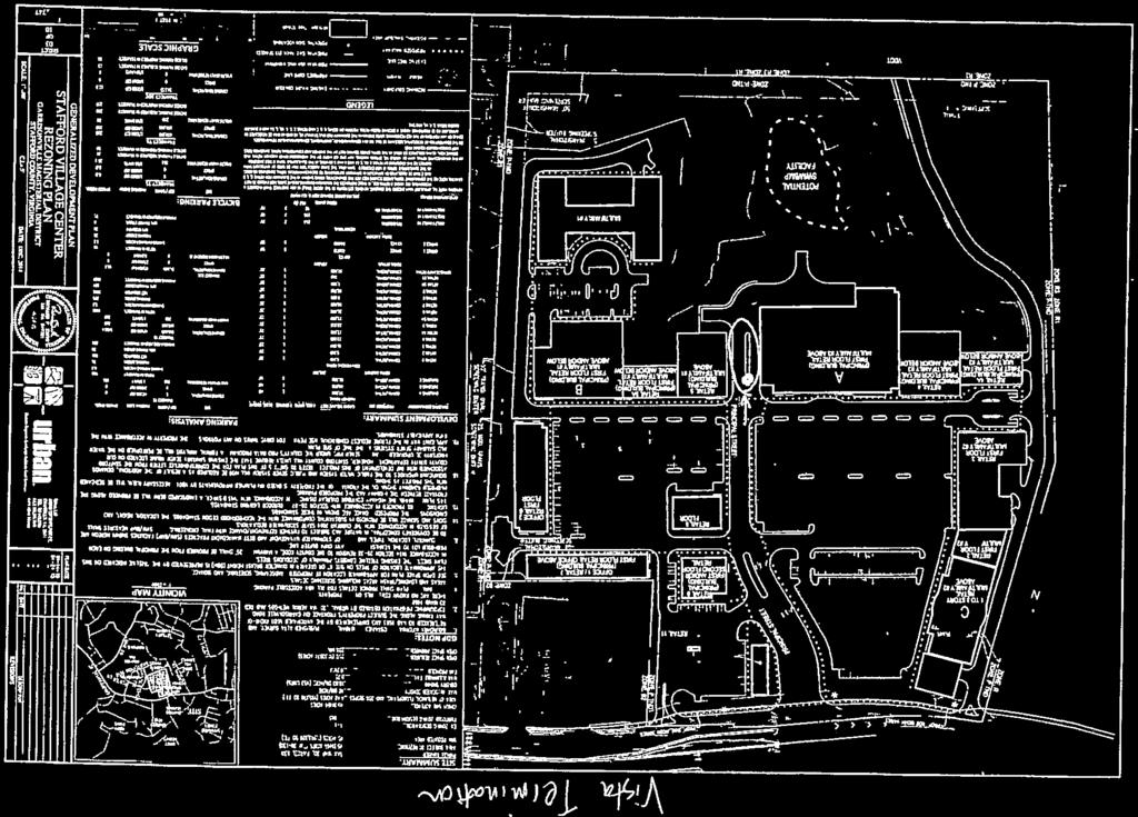

189 Attachment 8 Page 1 of 1
RC ; Reclassification The Garrison at Stafford Proffer Amendment (formerly Stafford Village Center)
") Board of Supervisors Robert Bob Thomas, Jr., Chairman Laura A. Sellers, Vice Chairman Meg Bohmke Jack R. Cavalier Wendy E. Maurer Paul V. Milde, III Gary F. Snellings Anthony J. Romanello, ICMA CM County
Board of Supervisors Robert Bob Thomas, Jr., Chairman Laura A. Sellers, Vice Chairman Meg Bohmke Jack R. Cavalier Wendy E. Maurer Paul V. Milde, III Gary F. Snellings Anthony J. Romanello, ICMA CM County
SUBJECT: CUP ; Conditional Use Permit - Telegraph Road Vehicle Sales / Storage
 2 Board of Supervisors Robert Bob Thomas, Jr., Chairman Laura A. Sellers, Vice Chairman Meg Bohmke Jack R. Cavalier Wendy E. Maurer Paul V. Milde, III Gary F. Snellings August 24, 2016 Anthony J. Romanello,
COM ; Comprehensive Plan Amendment RC ; Reclassification CUP ; Conditional Use Permit Stafford Village Center
 Board of Supervisors Gary F. Snellings, Chairman Laura A. Sellers, Vice Chairman Meg Bohmke Jack R. Cavalier Paul V. Milde, III Cord A. Sterling Robert Bob Thomas, Jr. Anthony J. Romanello, ICMA CM County
North side of Garrisonville Road, approximately 275 feet east of Center Street
 2 Board of Supervisors Gary F. Snellings, Chairman Laura A. Sellers, Vice Chairman Meg Bohmke Jack R. Cavalier Paul V. Milde, III Cord A. Sterling Robert Bob Thomas, Jr. December 9, 2015 Anthony J. Romanello,
Amendments to the Subdivision and Zoning Ordinances Regarding Open Space Land in Cluster Subdivisions
 Board of Supervisors Gary F. Snellings, Chairman Laura A. Sellers, Vice Chairman Meg Bohmke Jack R. Cavalier Paul V. Milde, III Cord A. Sterling Robert Bob Thomas, Jr. 10 May 13, 2015 Anthony J. Romanello,
CUP ; Conditional Use Permit - 5 Twelve Convenience Store Expansion
 Board of Supervisors Meg Bohmke, Chairman Gary F. Snellings, Vice Chairman Jack R. Cavalier Thomas C. Coen L. Mark Dudenhefer Wendy E. Maurer Cindy C. Shelton 2 March 28, 2018 Thomas C. Foley County Administrator
1101 Washington Avenue Fredericksburg, VA 22401
 1 Board of Supervisors Robert Bob Thomas, Jr., Chairman Laura A. Sellers, Vice Chairman Meg Bohmke Jack R. Cavalier Wendy E. Maurer Paul V. Milde, III Gary F. Snellings December 14, 2016 C. Douglas Barnes
PERMITTED USES: Within the MX-1 Mixed Use Neighborhood District the following uses are permitted:
 6.25 MX-1 - MIXED USE NEIGHBORHOOD 6.25.1 INTENT: The purpose of the MX-1 Mixed Use Neighborhood District is to accommodate the development of a wide-range of residential and compatible non-residential
Draft Model Access Management Overlay Ordinance
 Draft Model Access Management Overlay Ordinance This model was developed using the City of Hutchinson and the Trunk Highway 7 corridor. The basic provisions of this model may be adopted by any jurisdiction
Financial Impact Statement There are no immediate financial impacts associated with the adoption of this report.
 STAFF REPORT Planning and Development Department Subject: Application by RYC Property to rezone a portion of lands on John Murray Dr. and Megan Lynn Dr. from R2 to R3 and to enter into a Development Agreement
RC ; Reclassification - The Courtyards of Colonial Forge
 3 Board of Supervisors Robert Bob Thomas, Jr., Chairman Laura A. Sellers, Vice Chairman Meg Bohmke Jack R. Cavalier Wendy E. Maurer Paul V. Milde, III Gary F. Snellings November 9, 2016 C. Douglas Barnes
Amendments to Transfer of Development Rights Program
 Board of Supervisors Jack R. Cavalier, Chairman Gary F. Snellings, Vice Chairman Meg Bohmke Paul V. Milde, III Laura A. Sellers Cord A. Sterling Robert Bob Thomas, Jr. Anthony J. Romanello, ICMA CM County
SUB ; Courthouse Manor, Preliminary Subdivision Plan
 5 Board of Supervisors Gary F. Snellings, Chairman Laura A. Sellers, Vice Chairman Meg Bohmke Jack R. Cavalier Paul V. Milde, III Cord A. Sterling Robert Bob Thomas, Jr. October 14, 2015 Anthony J. Romanello,
4 June 11, 2014 Public Hearing
 4 June 11, 2014 Public Hearing APPLICANT: FRANKLIN JOHNSTON MANAGEMENT DEVELOPMENT, L.L.C. PROPERTY OWNER: TRUSTEES OF FIRST LYNNHAVEN BAPTIST CHURCH STAFF PLANNER: Stephen J. White REQUEST: Change of
Amendment to the Zoning and Subdivision Ordinances; Consider Repeal Cluster Development Standards
 2 Board of Supervisors Meg Bohmke, Chairman Gary F. Snellings, Vice Chairman Jack R. Cavalier Thomas C. Coen L. Mark Dudenhefer Wendy E. Maurer Cindy C. Shelton February 28, 2018 Thomas C. Foley County
REPORT OF THE PLANNING AND DEVELOPMENT DEPARTMENT FOR APPLICATION FOR REZONING ORDINANCE TO PLANNED UNIT DEVELOPMENT APRIL 21, 2016
 BEL REPORT OF THE PLANNING AND DEVELOPMENT DEPARTMENT FOR APPLICATION FOR REZONING ORDINANCE TO PLANNED UNIT DEVELOPMENT APRIL 21, 2016 The Planning and Development Department hereby forwards to the Planning
Be linked by an internal circulation system (i.e., walkways, streets, etc.) to other structures within the IPUD;
 to other structures within the IPUD;") 2. HALIFAX ACTIVITY CENTER A. DESCRIPTIONS OF FUTURE LAND USE DESIGNATIONS Each of the future land use designations specified by Phase I of the Halifax Activity Center Plan, and the relationship of these
2. HALIFAX ACTIVITY CENTER A. DESCRIPTIONS OF FUTURE LAND USE DESIGNATIONS Each of the future land use designations specified by Phase I of the Halifax Activity Center Plan, and the relationship of these
Implementation. Approved Master Plan and SMA for Henson Creek-South Potomac 103
 Implementation Approved Master Plan and SMA for Henson Creek-South Potomac 103 104 Approved Master Plan and SMA for Henson Creek-South Potomac Sectional Map Amendment The land use recommendations in the
REPORT OF THE PLANNING AND DEVELOPMENT DEPARTMENT FOR APPLICATION FOR REZONING ORDINANCE TO PLANNED UNIT DEVELOPMENT SEPTEMBER 22, 2016
 BEL REPORT OF THE PLANNING AND DEVELOPMENT DEPARTMENT FOR APPLICATION FOR REZONING ORDINANCE 2016-576 TO PLANNED UNIT DEVELOPMENT SEPTEMBER 22, 2016 The Planning and Development Department hereby forwards
The following regulations shall apply in the R-E District:
 "R-E" RESIDENTIAL ESTATE DISTRICT (8/06) The following regulations shall apply in the R-E District: 1. Uses Permitted: The following uses are permitted. A Zoning Certificate may be required as provided
Article 7: Residential Land Use and Development Requirements
 Article 7: Residential Land Use and Section 701: Statement of Intent (A) (B) (C) The intent of Article 7 is to develop certain land use and development requirements for the residential uses within Cumru
County of Loudoun. Department of Planning and Zoning MEMORANDUM
 County of Loudoun Department of Planning and Zoning MEMORANDUM DATE: November 10, 2015 TO: FROM: Joe Griffiths, Project Manager Land Use Review Kelly Williams, Planner III Community Planning SUBJECT: ZRTD
PLANNED UNIT DEVELOPMENT & SUBDIVISION STAFF REPORT Date: April 18, 2019
 PLANNED UNIT DEVELOPMENT & SUBDIVISION STAFF REPORT Date: April 18, 2019 DEVELOPMENT NAME SUBDIVISION NAME Springhill Village Subdivision Springhill Village Subdivision LOCATION 4350, 4354, 4356, 4358,
Midwest City, Oklahoma Zoning Ordinance
 2010 Midwest City, Oklahoma Zoning Ordinance 9/2/2010 Table of Contents Section 1. General Provisions... 5 1.1. Citation... 5 1.2. Authority... 5 1.3. Purpose... 5 1.4. Nature and Application... 5 1.5.
PUD Ordinance - Thornapple Manor #2 of 1998
 PUD Ordinance - Thornapple Manor #2 of 1998 CASCADE CHARTER TOWNSHIP Ordinance #2 of 1998 AN ORDINANCE TO AMEND THE CASCADE CHARTER TOWNSHIP ZONING ORDINANCE AND ZONING MAP TO ESTABLISH THORNAPPLE MANOR
3.1. OBJECTIVES FOR RESIDENTIAL LAND USE DESIGNATIONS GENERAL OBJECTIVES FOR ALL RESIDENTIAL DESIGNATIONS
 3. RESIDENTIAL LAND USE DESIGNATIONS INTRODUCTION The Residential land use designations provide for housing and other land uses that are integral to, and supportive of, a residential environment. Housing
2 November 9, 2011 Public Hearing APPLICANT: ASHVILLE PARK, L.L.C.
 2 November 9, 2011 Public Hearing APPLICANT: ASHVILLE PARK, L.L.C. PROPERTY OWNER: ATC REALTY SIXTEEN, INC. STAFF PLANNER: Faith Christie REQUEST: Modification of Conditional Change of Zoning approved
PUD Ordinance - Caravelle #2 of 2002
 PUD Ordinance - Caravelle #2 of 2002 CASCADE CHARTER TOWNSHIP Ordinance # 2 of 2002 AN ORDINANCE TO AMEND THE CASCADE CHARTER TOWNSHIP ZONING ORDINANCE AND ZONING MAP TO ESTABLISH THE Caravelle Village
Deerfield Township Community Development Department
 STAFF REVIEW Deerfield Township Community Development Department To: From: Hayfaa Wadih, AICP Lois McKnight, AICP Meeting Date: October 20, 2014 Continued from October 13, 2014 Re: Major PUD Modification
ARTICLE VII. NONCONFORMITIES. Section 700. Purpose.
 ARTICLE VII. NONCONFORMITIES. Section 700. Purpose. The purpose of this chapter is to regulate and limit the development and continued existence of legal uses, structures, lots, and signs established either
ARTICLE 23 CONDOMINIUM STANDARDS
 ARTICLE 23 CONDOMINIUM STANDARDS Section 23.01 Intent. The intent of this Article is to provide regulatory standards for condominiums and site condominiums similar to those required for projects developed
Special Use Permit #SUP , Youssef Home Fitness Studio Occoquan Magisterial District
 COUNTY OF PRINCE WILLIAM 5 County Complex Court, Prince William, Virginia 22192-9201 PLANNING (703) 792-7615 FAX (703) 792-4401 OFFICE Internet www.pwcgov.org Christopher M. Price, AICP Acting Director
City of Valdosta Land Development Regulations
 Chapter 206 Section 206-1 Base Zoning Districts Standards for Uses, Structures, and Property Development (B) (C) Principal Uses and Structures. Principal uses and structures permitted in each base zoning
North of the intersection of Courthouse Road and Dent Road, south of Hope Road and approximately 2,000 feet east of Jefferson Davis Highway
 1 Board of Supervisors Jack R. Cavalier, Chairman Gary F. Snellings, Vice Chairman Meg Bohmke Paul V. Milde, III Laura A. Sellers Cord A. Sterling Robert Bob Thomas, Jr. November 12, 2014 Anthony J. Romanello,
3 NOVEMBER 9, 2011 Public Hearing APPLICANT:
 REQUEST: Conditional Change of Zoning (B-2 & I-1 to Conditional A-18) 3 NOVEMBER 9, 2011 Public Hearing APPLICANT: S.L. NUSBAUM REALTY COMPANY PROPERTY OWNER: USF PROPCO II, LLC STAFF PLANNER: Leslie Bonilla
PLANNING COMMISSION REPORT Regular Agenda -Public Hearing Item
 PDP-13-00518 Item No. 3B- 1 PLANNING COMMISSION REPORT Regular Agenda -Public Hearing Item PC Staff Report 2/24/14 ITEM NO. 3B PRELIMINARY DEVELOPMENT PLAN FOR HERE @ KANSAS; 1101 INDIANA ST (SLD) PDP-13-00518:
Draft Zoning Changes for the 2nd Planning Board Public Hearing, January 22, 2018.
 Draft Zoning Changes for the 2nd Planning Board Public Hearing, January 22, 2018. No changes were made at the 1st Public Hearing. Proposed wording for the 1 st Public Hearing in red, eliminated text in
Conditional Use Permit case no. CU 14-06: Bristol Village Partners, LLC
 PLANNING AND ZONING COMMISSION STAFF REPORT August 7, 2014 Conditional Use Permit case no. CU 14-06: Bristol Village Partners, LLC CASE DESCRIPTION: LOCATION: LEGAL DESCRIPTION: EXISTING LAND USE: ZONING:
Washington County, Minnesota Ordinances
 Washington County, Minnesota Ordinances Ordinance No. 153 Text Amendment to the Washington County Development Code - Chapter One, Section 2 and Chapter Two, Part 1, Part 2, Part 3, of the Development Code
M-43 CORRIDOR OVERLAY ZONE
 ARTICLE 26.00 M-43 CORRIDOR OVERLAY ZONE Section 26.01 Findings A primary function of the M-43 state highway is to move traffic through the Township and to points beyond. As the primary east-west arterial
ARTICLE 24 SITE PLAN REVIEW
 ARTICLE 24 SITE PLAN REVIEW 24.1 PURPOSE: The intent of these Ordinance provisions is to provide for consultation and cooperation between the land developer and the Township Planning Commission in order
Indicates Council-recommended changes Introduced by: Mr. Tackett Date of introduction: June 14, 2016 SUBSTITUTE NO. 1 TO ORDINANCE NO.
 Indicates Council-recommended changes Introduced by: Mr. Tackett Date of introduction: June 14, 2016 SUBSTITUTE NO. 1 TO ORDINANCE NO. 16-067 TO AMEND NEW CASTLE COUNTY CODE CHAPTER 40 (ALSO KNOWN AS THE
Urban Design Brief Dundas Street. London Affordable Housing Foundation. November Zelinka Priamo Ltd.
 Urban Design Brief 1039-1047 Dundas Street London Affordable Housing Foundation November 2017 Zelinka Priamo Ltd. TABLE OF CONTENTS Page No. INTRODUCTION... 3 SECTION 1 LAND USE PLANNING CONTEXT... 3 1.1
Article 3. SUBURBAN (S-) NEIGHBORHOOD CONTEXT
 NEIGHBORHOOD CONTEXT") Article 3. SUBURBAN (S-) NEIGHBORHOOD CONTEXT this page left intentionally blank Contents ARTICLE 3. SUBURBAN (S-) NEIGHBORHOOD CONTEXT DIVISION 3.1 NEIGHBORHOOD CONTEXT DESCRIPTION...3.1-1 Section 3.1.1
Article 3. SUBURBAN (S-) NEIGHBORHOOD CONTEXT this page left intentionally blank Contents ARTICLE 3. SUBURBAN (S-) NEIGHBORHOOD CONTEXT DIVISION 3.1 NEIGHBORHOOD CONTEXT DESCRIPTION...3.1-1 Section 3.1.1
CHAPTER XVIII SITE PLAN REVIEW
 CHAPTER XVIII SITE PLAN REVIEW Section 18.1 Section 18.2 Description and Purpose. The purpose of this chapter is to provide standards and procedures under which applicants would submit, and the Township
9. REZONING NO Vicinity of the northwest corner of 143 rd Street and Metcalf Avenue
 9. REZONING NO. 2002-15 Vicinity of the northwest corner of 143 rd Street and Metcalf Avenue 1. APPLICANT: Andrew Schlagel is the applicant for this request. 2. REQUESTED ACTION: The applicant is requesting
SITE PLAN REVIEW PROCEDURES SECTION DEVELOPMENTS REQUIRING SITE PLAN APPROVAL
 SECTION 22.01 PURPOSE ARTICLE XXII PROCEDURES The purpose of this Article is to establish uniform requirements of procedure for all developments in the Township. Certain specific types of minor development
8.5.1 R1, Single Detached Residential District
 8.5.1 R1, Single Detached Residential District The purpose of this district is to provide for residential development in the form of single detached dwellings. Dwelling, Single Detached Home Business,
ARTICLE 3: Zone Districts
 ARTICLE 3: Zone Districts... 3-1 17.3.1: General...3-1 17.3.1.1: Purpose and Intent... 3-1 17.3.2: Districts and Maps...3-1 17.3.2.1: Applicability... 3-1 17.3.2.2: Creation of Districts... 3-1 17.3.2.3:
EXHIBIT D. Planned Unit Development Written Description April 13, 2016 Rouen Cove Phase II PUD
 1 EXHIBIT D Planned Unit Development Written Description April 13, 2016 Rouen Cove Phase II PUD Development # 8986.001 Developer: Curtis L. Hart Hart Resources LLC 8051 Tara Lane Jacksonville, Florida
Cover Letter with Narrative Statement
 Cover Letter with Narrative Statement March 31, 2017 rev July 27, 2017 RE: Rushton Pointe Residential Planned Unit Development Application for Public Hearing for RPUD Rezone PL2015 000 0306 Mr. Eric Johnson,
O-I (Office-Institutional) and AG-1(Agricultural)
 and AG-1(Agricultural)") PROPERTY INFORMATION ADDRESS 3503 and 3505 Bethany Bend DISTRICT, LAND LOTS 2/1 973 and 974 OVERLAY DISTRICT State Route 9 PETITION NUMBERS EXISTING ZONING O-I (Office-Institutional) and AG-1(Agricultural)
PROPERTY INFORMATION ADDRESS 3503 and 3505 Bethany Bend DISTRICT, LAND LOTS 2/1 973 and 974 OVERLAY DISTRICT State Route 9 PETITION NUMBERS EXISTING ZONING O-I (Office-Institutional) and AG-1(Agricultural)
ADDRESS / DESCRIPTION: Northeast corner of Sandbridge Road and Atwoodtown Road ELECTION DISTRICT: PRINCESS ANNE
 10 & 11 March 14, 2012 Public Hearing APPLICANT: MARLYN DEVELOPMENT CORPORATION PROPERTY OWNER: CORAL DEVELOPMENT, LLC STAFF PLANNER: Faith Christie REQUEST: Modification of Conditional Change of Zoning
Bylaw No , being "Official Community Plan Bylaw, 2016" Schedule "A" DRAFT
 Bylaw No. 2600-2016, being "Official Community Plan Bylaw, 2016" Schedule "A" Urban Structure + Growth Plan Urban Structure Land use and growth management are among the most powerful policy tools at the
SIMPLIFIED SITE PLAN
 SIMPLIFIED SITE PLAN WHAT IS A SIMPLIFIED SITE PLAN? A simplified site plan can be an engineered, or nonengineered plan, drawn to scale, showing uses and structures, either proposed or existing, for a
RE: 6. GILL/GREEN COMPREHENSIVE PLAN AMENDMENT, REZONING AND PRELIMINARY PLAT
 commission memo DATE: Thursday - August 9, 2018 TO: Marion Planning & Zoning Commission FROM: David N. Hockett, AICP Principal Planner RE: 6. GILL/GREEN COMPREHENSIVE PLAN AMENDMENT, REZONING AND PRELIMINARY
PLANNING & ZONING DEPARTMENT Town Hall Annex, 66 Prospect St., Ridgefield, CT Fax
 PLANNING & ZONING DEPARTMENT Town Hall Annex, 66 Prospect St., Ridgefield, CT 06877 203-431-2766 Fax 203-431-2737 ADOPTED AMENDMENT TO THE ZONING REGULATIONS NEW Section 5.6 Neighborhood Business Zone
Glades County Staff Report and Recommendation Unified Staff Report for Small Scale Plan Amendment and Rezoning
 Glades County Staff Report and Recommendation Unified Staff Report for Small Scale Plan Amendment and Rezoning CASE NUMBERS: COMP17-02 and RZ17-02 DATE of STAFF REPORT: May 1, 2017 CASE TYPE: Application
DEVELOPMENT DEPARTMENT STAFF REPORT DRESDEN HEIGHTS PHASE II DCI
 DEVELOPMENT DEPARTMENT Meeting Date: January 10, 2019 Item #: PZ2019-393 Project Name: Applicant and Owner: Proposed Development: Requests: STAFF REPORT DRESDEN HEIGHTS PHASE II DCI Dresden Heights Phase
Appendix A: Guide to Zoning Categories Prince George's County, Maryland
 Appendix A: Guide to Zoning Categories Prince George's County, Maryland RESIDENTIAL ZONES 1 Updated November 2010 R-O-S: Reserved Open Space - Provides for permanent maintenance of certain areas of land
SUBDIVISION DESIGN PRINCIPLES AND STANDARDS
 SECTION 15-200 SUBDIVISION DESIGN PRINCIPLES AND STANDARDS 15-201 STREET DESIGN PRINCIPLES 15-201.01 Streets shall generally conform to the collector and major street plan adopted by the Planning Commission
TOWNSHIP OF UPPER MACUNGIE LEHIGH COUNTY, PENNSYLVANIA. ORDINANCE NO [To be considered for Adoption June 1, 2017]
![TOWNSHIP OF UPPER MACUNGIE LEHIGH COUNTY, PENNSYLVANIA. ORDINANCE NO [To be considered for Adoption June 1, 2017]](/thumbs/91/106428876.jpg "TOWNSHIP OF UPPER MACUNGIE LEHIGH COUNTY, PENNSYLVANIA. ORDINANCE NO [To be considered for Adoption June 1, 2017]") TOWNSHIP OF UPPER MACUNGIE LEHIGH COUNTY, PENNSYLVANIA ORDINANCE NO. 2017 05 [To be considered for Adoption June 1, 2017] AN ORDINANCE OF THE BOARD OF SUPERVISORS OF THE TOWNSHIP OF UPPER MACUNGIE, LEHIGH
TOWNSHIP OF UPPER MACUNGIE LEHIGH COUNTY, PENNSYLVANIA ORDINANCE NO. 2017 05 [To be considered for Adoption June 1, 2017] AN ORDINANCE OF THE BOARD OF SUPERVISORS OF THE TOWNSHIP OF UPPER MACUNGIE, LEHIGH
Article Optional Method Requirements
 Article 59-6. Optional Method Requirements [DIV. 6.1. MPDU DEVELOPMENT IN RURAL RESIDENTIAL AND RESIDENTIAL ZONES Sec. 6.1.1. General Requirements... 6 2 Sec. 6.1.2. General Site and Building Type Mix...
MEADOWBROOK FLATS SPECIAL USE PERMIT APPLICATION
 MEADOWBROOK FLATS SPECIAL USE PERMIT APPLICATION March 26, 2013 Submitted by: Bluestone Land, L.L.C. William N. Park, Manager 1821 Avon St. Suite 200 Charlottesville VA 22902 434-979-2900 wpark@pinnacleconstructionva.com
Montreal Road District Secondary Plan [Amendment #127, October 9, 2013]
![Montreal Road District Secondary Plan [Amendment #127, October 9, 2013]](/thumbs/72/66783104.jpg "Montreal Road District Secondary Plan [Amendment #127, October 9, 2013]") [Amendment #127, October 9, 2013] 1.0 General The following policies are applicable to the Montreal Road District as set out in Schedule 1. 1.1 District Objectives The objective of this Plan is to guide
[Amendment #127, October 9, 2013] 1.0 General The following policies are applicable to the Montreal Road District as set out in Schedule 1. 1.1 District Objectives The objective of this Plan is to guide
A. Location. A MRD District may be permitted throughout the County provided it meets the standards established herein.
 752. Multi-Residential District (MRD) The Multi-Residential (MRD) District is intended to provide opportunities for rural, suburban and urban density mixed-residential developments consistent with the
COMMERCIAL ZONING DISTRICTS (Amended 11/13/14) Part I. C-1 Restricted Commercial District
 Part I. C-1 Restricted Commercial District") ARTICLE XI. COMMERCIAL ZONING DISTRICTS (Amended 11/13/14) Part I. C-1 Restricted Commercial District Section 152: Purpose This district is designed to accommodate commercial uses which act as a transition
ARTICLE XI. COMMERCIAL ZONING DISTRICTS (Amended 11/13/14) Part I. C-1 Restricted Commercial District Section 152: Purpose This district is designed to accommodate commercial uses which act as a transition
4.2 RESIDENTIAL ZONING DISTRICTS
 4.2 RESIDENTIAL ZONING DISTRICTS A. Purpose: To define regulations and standards for each residential zoning district in the City. The following sections identify uses, regulations, and performance standards
FINAL DRAFT 12/1/16, Rev. to 7/18/17
 FINAL DRAFT 12/1/16, Rev. to 7/18/17 (As Adopted 8/8/17 Effective 9/1/17) SHELTON PLANNING AND ZONING COMMISSION Proposed Amendments to Zoning Regulations I. Amend Section 23 PERMITTED USES by inserting
York Neighbourhood Area Structure Plan
 York Neighbourhood Area Structure Plan Office Consolidation March 2006 Prepared by: Planning and Policy Services Branch Planning and Development Department City of Edmonton Bylaw 7064 was adopted by Council
Appendix J - Planned Unit Development (PUD)
") Appendix J - Planned Unit Development (PUD) Intent and Purpose The purpose of the PUD is: 1. To provide development that is consistent with the Comprehensive Land Use Plan and promote the goals and objectives
Appendix J - Planned Unit Development (PUD) Intent and Purpose The purpose of the PUD is: 1. To provide development that is consistent with the Comprehensive Land Use Plan and promote the goals and objectives
ARTICLE 12 PLANNED UNIT DEVELOPMENT DISTRICTS (PUDS) Sec Intent CHARTER TOWNSHIP OF BRIGHTON ZONING ORDINANCE
 Sec Intent CHARTER TOWNSHIP OF BRIGHTON ZONING ORDINANCE") ARTICLE 12 PLANNED UNIT DEVELOPMENT DISTRICTS (PUDS) Sec. 12-01 Intent 1 2 (a) The intent of this Article is to permit the coordinated development on larger sites, protect significant natural features
ARTICLE 12 PLANNED UNIT DEVELOPMENT DISTRICTS (PUDS) Sec. 12-01 Intent 1 2 (a) The intent of this Article is to permit the coordinated development on larger sites, protect significant natural features
CHAPTER 14 PLANNED UNIT DEVELOPMENTS
 9-14-1 9-14-1 CHAPTER 14 PLANNED UNIT DEVELOPMENTS SECTION: 9-14-1: Purpose 9-14-2: Governing Provisions 9-14-3: Minimum Area 9-14-4: Uses Permitted 9-14-5: Common Open Space 9-14-6: Utility Requirements
PLANNED DEVELOPMENT DISTRICT STANDARDS. Cadence Site
 PLANNED DEVELOPMENT DISTRICT STANDARDS Cadence Site A Planned Development District 1. Statement of General Facts, Conditions and Objectives Property Size: Approximately 57.51 Acres York County Tax Map
PLANNED UNIT DEVELOPMENT (East), PLANNED UNIT DEVELOPMENT (West) STAFF REPORT Date: September 18, 2014
, PLANNED UNIT DEVELOPMENT (West) STAFF REPORT Date: September 18, 2014") PLANNED UNIT DEVELOPMENT (East), PLANNED UNIT DEVELOPMENT (West) STAFF REPORT Date: September 18, 2014 DEVELOPMENT NAME LOCATION McGowin Park, LLC PLANNED UNIT DEVELOPMENT (East) 1401 Satchel Paige Drive
PLANNED UNIT DEVELOPMENT (East), PLANNED UNIT DEVELOPMENT (West) STAFF REPORT Date: September 18, 2014 DEVELOPMENT NAME LOCATION McGowin Park, LLC PLANNED UNIT DEVELOPMENT (East) 1401 Satchel Paige Drive
SPECIAL ZONING DISTRICTS
 SPECIAL ZONING DISTRICTS 5.01 5.99 RESERVED 5.100 PLANNED DEVELOPMENTS: Purpose: This district is intended to accommodate unified design of residential, commercial, office, professional services, retail
City of Peachtree City. Annexation Review Process
 City of Peachtree City Annexation Review Process Page 1 Annexation Review Process Step One: Initial annexation information The following information is to be completed by the property owner and/ or their
PLANNED UNIT DEVELOPMENT (PUD)
") SECTION 38.01. ARTICLE 38 PLANNED UNIT DEVELOPMENT (PUD) Purpose The purpose of this Article is to implement the provisions of the Michigan Zoning Enabling Act, Public Act 110 of 2006, as amended, authorizing
SECTION 38.01. ARTICLE 38 PLANNED UNIT DEVELOPMENT (PUD) Purpose The purpose of this Article is to implement the provisions of the Michigan Zoning Enabling Act, Public Act 110 of 2006, as amended, authorizing
Multi-family dwellings (including assisted living facilities), Public buildings, facility or land; and,
, Public buildings, facility or land; and,") 607. General Residential District (GR) Intent. It is the intent of this section that the General Residential District be established for medium-to-high density residential purposes. These areas need to
607. General Residential District (GR) Intent. It is the intent of this section that the General Residential District be established for medium-to-high density residential purposes. These areas need to
1 September 9, 2015 Public Hearing
 1 September 9, 2015 Public Hearing APPLICANT & PROPERTY OWNER: HOLLOMON- BROWN FUNERAL HOME, INC. STAFF PLANNER: Carolyn A.K. Smith REQUEST: Change of Zoning (R-5D Residential District to Conditional O-2
Section 1: US 19 Overlay District
 Section 1: US 19 Overlay District Section 1.1 Intent and Purpose The purpose of the US Highway 19 Overlay District is to manage access to land development along US Highway 19 in a manner that preserves
ARTICLE VI. SUBDIVISION STANDARDS, PUBLIC
 ARTICLE VI. SUBDIVISION STANDARDS, PUBLIC IMPROVEMENTS, AND DESIGN REQUIREMENTS ARTICLE VI. SUBDIVISION STANDARDS, PUBLIC IMPROVEMENTS, AND DESIGN REQUIREMENTS DIVISION 1. GENERAL PROVISIONS Sec. 21-6100.
P. H. Robinson Consulting Urban Planning, Consulting and Project Management
 PLANNING RATIONALE REPORT FOR SITE PLAN AND DRAFT PLAN OF CONDOMINIUM APPLICATIONS 73-75 HARVEY STREET CITY OF OTTAWA PREPARED BY: P H ROBINSON CONSULTING AUGUST 2012 1 This report has been prepared on
CITY PLAN COMMISSION STAFF REPORT
 CITY PLAN COMMISSION STAFF REPORT SUBJECT: Request for a Change of Zoning and Preliminary Development Plan FROM: Mara Perry, Director of Planning & Development MEETING DATE: November 6, 2017 PETITION:
Hamilton County Regional Planning Commission
 Hamilton County Regional Planning Commission March 1, 2012 Colerain Township Staff Report Zone Map Amendment: Case No.: ZA2012-01 Joseph Toyota Prepared By: Amy Bancroft, Land Use Planner ACTION REQUESTED:
REPORT TO THE SHELBY COUNTY PLANNING COMMISSION From the Department of Development Services Planning Services. February 4, 2019
 REPORT TO THE SHELBY COUNTY PLANNING COMMISSION From the Department of Development Services Planning Services February 4, 2019 Case No. Request for Rezoning Approval From E-1 to E-2 SD This is a request
ZRTD , Glenn Drive. M. Tyler Klein, AICP, Project Manager, Planning and Zoning John Merrithew, Acting Director, Planning and Zoning
 DEPARTMENT OF PLANNING Date of Hearing: AND ZONING STAFF REPORT # 4 BOARD OF SUPERVISORS PUBLIC HEARING SUBJECT: ELECTION DISTRICT: ZRTD-2014-0003, 22675 Glenn Drive Broad Run CRITICAL ACTION DATE: September
THE AREA PLAN COMMISSION OF ST. JOSEPH COUNTY, IN AGENDA
 THE AREA PLAN COMMISSION OF ST. JOSEPH COUNTY, IN AGENDA Tuesday, June 20, 2017 Fourth-Floor Council Chambers 3:30 p.m. County-City Building, South Bend, IN PUBLIC HEARINGS: 1. Rezonings: A. A combined
Staff Report: Date: Applicant: Property Identification: Acreage of Request: Current Zoning of Requested Area: Requested Action: Attached:
 Staff Report: Completed by Jeff Palmer Director of Planning & Zoning Date: November 7, 2018, Updated November 20, 2018 Applicant: Greg Smith, Oberer Land Developer agent for Ronald Montgomery ET AL Property
PUD Ordinance - Cascade Lakes Plat #10 of 1995
 PUD Ordinance - Cascade Lakes Plat #10 of 1995 CASCADE CHARTER TOWNSHIP Ordinance #10 of 1995 AN ORDINANCE TO AMEND THE CASCADE CHARTER TOWNSHIP ZONING ORDINANCE AND ZONING MAP TO ESTABLISH THE CASCADE
Urban Design Brief. Italian Seniors Project 1090, 1092, 1096 Hamilton Road City of London
 Urban Design Brief Italian Seniors Project City of London October 1, 2017 TABLE OF CONTENTS Page No. INTRODUCTION... 2 1.0 LAND USE PLANNING CONCEPT... 2 1.1 Subject Lands... 2 1.2 Official Plan and Zoning
Composition of traditional residential corridors.
 Page 1 of 7 St. Petersburg, Florida, Code of Ordinances >> PART II - ST. PETERSBURG CITY CODE >> Chapter 16 - LAND DEVELOPMENT REGULATIONS >> SECTION 16.20.060. CORRIDOR RESIDENTIAL TRADITIONAL DISTRICTS
Town of Cary, North Carolina Site Plan Staff Report Centregreen Park at Weston (13-SP-067) Town Council Quasi-Judicial Hearing April 3, 2014
 Town Council Quasi-Judicial Hearing April 3, 2014") Town of Cary, North Carolina Site Plan Staff Report Centregreen Park at Weston (13-SP-067) Town Council Quasi-Judicial Hearing April 3, 2014 REQUEST Withers and Ravenel, on behalf of Highwoods Realty Limited
Town of Cary, North Carolina Site Plan Staff Report Centregreen Park at Weston (13-SP-067) Town Council Quasi-Judicial Hearing April 3, 2014 REQUEST Withers and Ravenel, on behalf of Highwoods Realty Limited
9 February 13, 2013 Public Hearing APPLICANT: VILLAGE BEND, LLC
 9 February 13, 2013 Public Hearing APPLICANT: VILLAGE BEND, LLC PROPERTY OWNER: VILLAGE BEND HOMEOWNERS ASSOCIATION, INC. STAFF PLANNER: Karen Prochilo REQUEST: Modification of Conditional Change of Zoning
1. APPLICANT: Polsinelli, Shalton & Welte is the applicant for this request.
 5. REVISED PRELIMINARY PLAN APPROVAL - THE RETREAT AT MAPLECREST - Vicinity of the northeast corner of 159 th Street and U.S. 69 Highway 1. APPLICANT: Polsinelli, Shalton & Welte is the applicant for this
Comprehensive Plan Amendment #PLN , Reserve at Cannon Branch (Coles Magisterial District)
") COUNTY OF PRINCE WILLIAM 5 County Complex Court, Prince William, Virginia 22192-9201 PLANNING (703) 792-7615 FAX (703) 792-4758 OFFICE Internet www.pwcgov.org Christopher M. Price, AICP Director of Planning
COUNTY OF PRINCE WILLIAM 5 County Complex Court, Prince William, Virginia 22192-9201 PLANNING (703) 792-7615 FAX (703) 792-4758 OFFICE Internet www.pwcgov.org Christopher M. Price, AICP Director of Planning
Section 7.22: Multifamily Assisted Housing in AA-30 Residential Zone (MAHZ) [Note: an additional line will be added to the Table in Article 3, 3.1.
 [Note: an additional line will be added to the Table in Article 3, 3.1.") Section 7.22: Multifamily Assisted Housing in AA-30 Residential Zone (MAHZ) [Note: an additional line will be added to the Table in Article 3, 3.1.1A] 7.22.1 Purpose The purpose of this Special Regulation
Section 7.22: Multifamily Assisted Housing in AA-30 Residential Zone (MAHZ) [Note: an additional line will be added to the Table in Article 3, 3.1.1A] 7.22.1 Purpose The purpose of this Special Regulation
PUD Ordinance - Caravelle Village #7 of 1995
 PUD Ordinance - Caravelle Village #7 of 1995 CASCADE CHARTER TOWNSHIP Ordinance #17 of 1995 AN ORDINANCE TO AMEND THE CASCADE CHARTER TOWNSHIP ZONING ORDINANE AND ZONING MAP TO ESTABLISH THE CARAVELLE
Planning Department Oconee County, Georgia
 Planning Department Oconee County, Georgia STAFF REPORT REZONE CASE #: 6985 DATE: October 31, 2016 STAFF REPORT BY: Andrew C. Stern, Planner APPLICANT NAME: Williams & Associates, Land Planners PC PROPERTY
Project: Address: MAJOR CERTIFICATE OF APPROPRIATENESS FOR THE BOARD OF ARCHITECTURAL REVIEW
 The BAR recommended approval of the major COA with the following 10 conditions at the special meeting on March 28, 2018. Project: Address: Case Number: Applicant: ATTACHMENT 9e Paul VI Redevelopment 10675