New Cadastral Mapping in the Czech Republic
|
|
|
- Brian Shepherd
- 5 years ago
- Views:
Transcription
1 New Cadastral Mapping in the Czech Republic Karel Štencel, Svatava Dokoupilová, Jan Kmínek Czech Office for Surveying, Mapping and Cadastre
2 Basic Data about the Czech Republic Area: km 2 Population: 10 mill. Administrative division: 14 regions 77 districts 6255 municipalities cadastral units Trentino, Page 2
 are in digital form at present. Trento, 22.5.2015 Page 3")
3 Current Map Basis Digital maps 1:1000 (42 %) Digitized maps z 1:2880 (44 %) Nondigitized maps (14 %) out of the total cadastral units (C.U.) are in digital form at present. Trento, Page 3
4 State of Art of the New Mapping ČÚZK focused at present on finalization of the digitalization of cadastral maps in the scale of 1:2880 project has been running since 2008 and its completion is planned in 2017 Number of newly mapped areas can be counted maximum in tens of C.U. yearly, in general only on a part of the C.U. - built-up areas after CLC (complex land consolidation) After 2017 the capacities will be used for the new mapping and so 200 C.U. will be updated yearly Number of renewed cadastral units After 2017 Trentino, Page 4


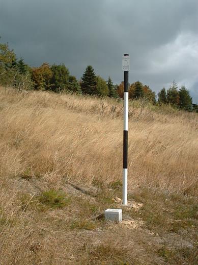
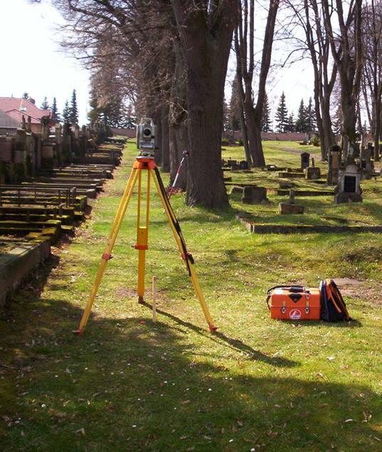
5 State of Art of the New Mapping New mapping combination of GNSS and terrestrial methods Firstly the built-up areas are mapped and so GNSS is being used solely for determination of survey points network Accuracy of the detailed points is below 5 cm The project of parallel surveying and investigation is not used at present it is not in such a state to be used in daily practice so far Trento, Page 5
6 Subjects of the New Mapping As for boundaries we investigate following : Plot boundary Buildings perimeters Boundaries of administration units The commission further investigates descriptive information: Information about the owner Nature and mode of land use Nature and mode of building use House (building) or registration number Local names (oikonyms) and semi-local ones (anoikonyms) Trento, Page 6
 Detailed survey Elaboration of the renewed cadaster documentation Displaying for public consultation Verification of the documentation Publication (coming into force) Trento, 22.5.")
7 New Mapping Processes Announcement to municipality and to owners Revision and completion of the geodetic point field Preparation of the documentation for investigation Adjudication of boundaries (field inspection) Detailed survey Elaboration of the renewed cadaster documentation Displaying for public consultation Verification of the documentation Publication (coming into force) Trento, Page 7


8 Trento, Page 8

9 Trento, Page 9

10 Adding Parcels without Boundary Investigation Trento, Page 10


11 Trento, Page 11

12 Trento, Page 12

13 Trento, Page 13


14 Trento, Page 14
15 Shortcomings of Current Mapping Many boundaries remained unchanged (overtaken from the existing graphic map) after the mapping process Unclear boundaries inside the ownership Real property boundaries used in the frame of the larger land complex Disputable boundaries Within cadastre administration the territory is being divided into small parcels making then problems during land consolidation (cooperation with urban planning organs is necessary) ČÚZK is striving to find solution Trento, Page 15

16 Trento, Page 16

17 Trento, Page 17

18 Trento, Page 18


19 Trento, Page 19
20 Shortcomings of Current Mapping Trend is to minimize the built-up area, because of tax reasons Separate parcel for the building courtyard is registered as the agriculture or other land Insufficient interest of the institutions responsible for urban planning ČÚZK efforts to improve this state according to real results of the present mapping => protests of owners Trento, Page 20

21 Trento, Page 21
22 Shortcomings of Current Mapping Many registered descriptions are out of date Data about heritage or nature protection, land type, land use etc. Legal rule based on reporting duty is ineffective Administrative sanctions are applicable only with difficulties low danger to society, high administrative demands Solving discrepancies during the renewal of the cadastral documantation complicates and prolonges the process Trento, Page 22
23 Nearest Future By the end of 2017 the cadastral maps will have been digitized only some single cadastral units remain for new mapping and complex land consolidation(clc) The deadline for digitization will be fulfilled with exception of some cadastral units undergoing or due to undergoing of CLC Cadastral maps based on digitization of 1:2280 maps cannot meet the demands of multipurpose land registration in the future, even though the technology chosen has been the most exacting it is necessary to improve their planimetry accuracy Capacities having been used for digitization will be used for works on quality maps improvement ( we suppose 800 employees) New mapping Revision (improvement support from the owners) Correction of local mistakes (closed areas f.i. with cottages, communications esp. railways etc.) Trento, Page 23
24 Nearest Future The speed of new mapping should be planned so, that within 30 years the cadatsral maps will be improved enough (taking into account also the CLC) Updating of technical description data should be solved via competence sharing také over the data from external information systems of responsible subjects Trento, Page 24

25 Research and Development New Technologies Use of mobile laserscanning proved practically Technical conditions and criteria were amended into the mapping rules For daily practice not economically feasible preferation of other modern methods Trento, Page 25


26 Research and Development New Technologies Pilot testing of photogrammetry using UAV (Unmanned Aerial Vehicle) is in operation Trento, Page 26
27 Conclusion Thank you for your attention. Questions??? Trento, Page 27
The (Legal) Reliability of the Cadastre from the Perspective of the Czech Republic. Mgr. Martina Hercegová Ing. Karel Štencel
 Reliability of the Cadastre from the Perspective of the Czech Republic. Mgr. Martina Hercegová Ing. Karel Štencel") The (Legal) Reliability of the Cadastre from the Perspective of the Czech Republic Mgr. Martina Hercegová Ing. Karel Štencel PCC - Conference Vienna 20. 21. 11. 2018 Basic information about the CR Area:
The (Legal) Reliability of the Cadastre from the Perspective of the Czech Republic Mgr. Martina Hercegová Ing. Karel Štencel PCC - Conference Vienna 20. 21. 11. 2018 Basic information about the CR Area:
The Multi-Purpose Information System of Real Estates in the Czech Republic. Vladimíra ŽUFANOVÁ, Czech Republic
 The Multi-Purpose Information System of Real Estates in the Czech Republic Vladimíra ŽUFANOVÁ, Czech Republic Key words: Cadastre; Land management SUMMARY The Cadastre of Real Estate and Land administration,
Tradition and Innovation in Czech Cadastre. Karel Večeře Martina Hercegová Jan Kmínek Czech Office for Surveying, Mapping and Cadastre
 Tradition and Innovation in Czech Cadastre Karel Večeře Martina Hercegová Jan Kmínek Czech Office for Surveying, Mapping and Cadastre Land Registration and Cadastre History 13 th cent. Land Tables - predecessor
Parcel Boundaries in the Czech Republic
 Parcel Boundaries in the Czech Republic CZECH REPUBLIC Jiri Rydval, Libor Tomandl Czech Office for Surveying, Mapping and Cadastre inhabitants - 10.3 million territory 78,865 km 2 2 Contents: 1. A parcel
Annual Report Of the Czech Office for Surveying, Mapping and Cadastre For 2016
 Annual Report Of the Czech Office for Surveying, Mapping and Cadastre For 2016 Prague, 2017 1 CONTENT Introduction 1. Surveying, Mapping and Cadastre Sector in the Czech Republic 2. Administration of the
WHAT IS NEW IN CADASTRE OF CZECH REPUBLIC. Libor Tomandl FIG Annual Meeting 2005, Madison
 WHAT IS NEW IN CADASTRE OF CZECH REPUBLIC Libor Tomandl FIG Annual Meeting 2005, Madison 1 Milestones of CzechCadastre 1993 -Establishment ofthe Czech Republic, -cadastral reform, Czech Cadastre of Real
Refinement of Cadastral Maps
 Acta Montanistica Slovaca Ročník 16(2011), číslo 4, 242-248 Refinement of Cadastral Maps Alena Berková 1 Making cadastral maps more precise The amended cadastral ordinance takes effect from 1.7. 2009.
Role of spatial planning in modern society
 Republic of Croatia State Geodetic Administration The Role of Cadastre in the Development of Regional and Local Planning Structure in Croatia Zdravko Cesarec and Željko Bačić 1 Role of spatial planning
Recent development in land consolidation in Macedonia and land valuation issues
 Recent development in land consolidation in Macedonia and land valuation issues EMERALD(2008-2009)-Encouraging Macedonia s Endeavours to Rural Land Development and STIMERALD(2010-2012) Origin of Emerald
Annual Report Of the Czech Office for Surveying, Mapping and Cadastre For 2017
 Annual Report Of the Czech Office for Surveying, Mapping and Cadastre For 2017 Prague, 2018 1 CONTENT Introduction 1. Surveying, Mapping and Cadastre Sector in the Czech Republic 2. Administration of the
Functional system for cadastral plans
 , Republic of Macedonia Key words: Cadastre, Digital plans, Data, System SUMMARY The analysis shows that the real estate market in Republic of Macedonia grows daily. With the expansion of this market increases
FUTURE VISION ON KOREAN CADASTRAL SURVEYING
 FUTURE VISION ON KOREAN CADASTRAL SURVEYING Myounwoo LEE, Vice President, Korea Cadastral Survey Corporation, Korea 1. INTRODUCTION Cadastral surveying, which contributes to secure the ownership of the
Technology-driven solutions for the innovation of land administration and management
 Technology-driven solutions for the innovation of land administration and management Technology and economic growth - Studies*find link between technology innovation and national economic prosperity especially,
Large scale maps from Regions point of view. RNDr. Ivo Skrášek Head of IT department Zlín Region
 Large scale maps from Regions point of view RNDr. Ivo Skrášek Head of IT department Zlín Region Table of Content 1.Short characteristic of Digital cadastral map and Digital technical map 2. Experience
COOPERATION BETWEEN PUBLIC AND PRIVATE SECTOR - PROJECT OF DIGITALIZATION OF THE CADASTRAL MAPS IN THE CZECH REPUBLIC
 COOPERATION BETWEEN PUBLIC AND PRIVATE SECTOR - PROJECT OF DIGITALIZATION OF THE CADASTRAL MAPS IN THE CZECH REPUBLIC Keywords: Cadastre of Real Estate, Czech Office for Surveying, Mapping and Cadastre
The Development Strategy for Cadastre and Land Register in Finland
 1 2 The Development Strategy for and Land in Finland Arvo Kokkonen Ministry of Agriculture and Forestry Facts and figures of Finland - land area 304 530 km² - water area 33 615 km² - total area 338 195
Designing for transparency and participation in the Hellenic Cadastral Project
 Designing for transparency and participation in the Hellenic Cadastral Project Dr. Dimitris Rokos Director of Planning and Investments, Hellenic National Cadastre and Mapping Agency S.A. Table of Contents
International Workshop Land Banking/Land Funds as an Instrument for Improved Land Management for CEEC and CIS March 2004 Tonder,, Denmark
 MINISTRY OF AGRICULTURE AND FORESTRY SOFIA, BULGARIA International Workshop Land Banking/Land Funds as an Instrument for Improved Land Management for CEEC and CIS 17-20 March 2004 Tonder,, Denmark BULGARIAN
REFORM OF LAND CADASTRE IN LITHUANIA
 REFORM OF LAND CADASTRE IN LITHUANIA Romualdas KASPERAVICIUS, Lithuania Key words: ABSTRACT Main aim for every Government is to create legal, financial and organisational circumstances for real property.
KURDISTAN REGIONAL GOVERNMENT
 KURDISTAN REGIONAL GOVERNMENT MINISTRY OF CONSTRUCTION AND HOUSING REGULATION NUMBER ONE OF 2012 regulations and requirements regarding social housing in the Kurdistan region of Iraq In this document regulations
LAND CADASTRE Today and Challanges for the future Damjan DOLER
 LAND CADASTRE Today and Challanges for the future Damjan DOLER Head of Real Estate Department Regional surveying office Celje Mariborska cesta 88, Celje, SLOVENIA 32nd Conference of Surveyin Authorities,
Establishing Efficient Cadastral Surveying Plan in Accordance with Introducing World Geodetic Reference System in Korea
 Modern Environmental Science and Engineering (ISSN 2333-2581) December 2015, Volume 1, No. 6, pp. 299-303 Doi: 10.15341/mese(2333-2581)/06.01.2015/003 Academic Star Publishing Company, 2015 www.academicstar.us
-the Swedish approach
 Bridging the capacity gap -the Swedish approach Kristin Land Lantmäteriet (The Swedish mapping, cadastral and land registration authority) FIG Commission 7, Bergen, Norway, 25 September 2018 Key players
Analytical Cadastre in Israel: Restoring Land Boundaries Based on Photogrammetric Tools
 Analytical Cadastre in Israel: Restoring Land Boundaries Based on Photogrammetric Tools Yohanan GAVISH and Prof. Yerach DOYTSHER, Israel Key words: analytical cadastre; photogrammetry; restoring land boundaries;
INSPIRE implementation as a link between egovernment and environmental purposes
 INSPIRE implementation as a link between egovernment and environmental purposes Jiří Poláček Czech Office for Surveying, Mapping and Cadastre (ČÚZK) What s to Come Role of ČÚZK branch in the INSPIRE implementation.
Topographic Signs Important Context of 3D Cadastre
 STATE GEODETIC ADMINISTRATION Gruška 20,10 000 Zagreb, Croatia Delft University of Technology Faculty of Architecture and the Built Environment Department OTB GIS Technology Section Topographic Signs Important
THINK BIG do little. Start an avalanche
 1 Recent activities on land consolidation in Serbia Stevan Marosan, Mladen Soskic University of Belgrade, Faculty of Civil Engineering Department for Geodesy and Geoinformatics Zoran Knezevic Ministry
The Challenge to Implement International Cadastral Models Case Finland 1
 The Challenge to Implement International Cadastral Models Case Finland 1 Tarja MYLLYMÄKI and Tarja PYKÄLÄ, Finland Key words: cadastre, modelling, LADM, INSPIRE SUMMARY Efforts are currently made to develop
Cadastral Development in Norway and Need for Improvements
 Cadastral Development in Norway and Need for Improvements Leiv Bjarte MJØS, Norway Key words: Cadastre, Cadastral Surveying, Cadastral Development, Land Register, Land Registration, Boundary Disputes SUMMARY
Functional concept and quality of cadastral services in Kosovo. Mr.sci.inxh. Murat Hoxha
 Functional concept and quality of cadastral services in Kosovo April 2018 Mr.sci.inxh. Murat Hoxha "It's not enough to work the best. You need to know what you're doing " Do It Right the First Time "The
Systematic Land Regularization in Lesotho
 Systematic Land Regularization in Lesotho Jakob Riise Ian Corker Jan van Bennekom-Minnema Key words: Systematic Land Regularization First Registration Rights Adjudication General Boundary Survey Cadastre
Territorial Planning System in Lithuania
 UN ECE - Working Party on Land Administration Athens, 28-31 March 2007 Territorial Planning System in Lithuania Jaunius Grigas Bronislovas Mikuta State Enterprise Centre of Registers Lithuania LEGISLATION
Quality Improvement of the Real Estate Cadastre in Serbia
 , Serbia Key words: quality improvement, real estate information, quality assurance, Serbia SUMMARY The concept of cadastral modernization in the Republic of Serbia was defined in 1992, and it is being
INSPIRE implementation as a link between egovernment and environmental purposes
 INSPIRE implementation as a link between egovernment and environmental purposes Jiří Poláček Czech Office for Surveying, Mapping and Cadastre (ČÚZK) Agenda Role of ČÚZK branch in the INSPIRE implementation.
Information System of Electronic Cadastre Registration of Lands in Azerbaijan
 The State Committee on Property Issues of the Republic of Azerbaijan Information System of Electronic Cadastre Registration of Lands in Azerbaijan Chıngız Tanırverdiyev-chief engineer Cadastre and Land
Experiences with land consolidation and land banking in Slovenia since 1991
 Experiences with land consolidation and land banking in Slovenia since 1991 Anka LISEC University of Ljubljana Faculty of Civil and Geodetic Engineering anka.lisec@fgg.uni-lj.si University of Ljubljana
Cadastre and Other Public Registers: Multipurpose Cadastre or Distributed Land Information System?
 Cadastre and Other Public Registers: Multipurpose Cadastre or Distributed Land Information System? Ivan PESL, Czech Republic Key words: Cadastre, Land Registry, Property, Taxes, Land Use, Territorial Planning,
Mass Valuation and Sales Price Register in the Republic of Serbia
 REPUBLIC OF SERBIA REPUBLIC GEODETIC AUTHORITY Mass Valuation and Sales Price Register in the Republic of Serbia Department for Mass Valuation Head of Department: Marija Raskovic procena@rgz.gov.rs Soest,
FIG Congress 2010 Facing the Challenges Building the Capacity Sydney, Australia, April
 Setting up the infrastructure for improving the development of Cadastre in Greece Dr. Dimitris ROKOS, Dr. Konstantinos KYRIAZIS and Dr. Panos LOLONIS KTIMATOLOGIO S.A. (Hellenic Cadastre) Source: wikipedia
Remarks on the land consolidation in the Czech Republic. Libor Cihal Central Land Office
 1 Remarks on the land consolidation in the Czech Republic Libor Cihal Central Land Office 1 Introduction The process of land consolidation is broadly effectuated in the Czech Republic. There is intensive
The Digital Cadastral Database and the Role of the Private Licensed Surveyors in Denmark
 IRISH INSTITUTE OF SURVEYORS, DUBLIN INSTITUTE OF TECHNOLOGY, 23 NOVEMBER 2005 PUBLISHED IN IIS NEWS, WINTHER 2006. The Digital Cadastral Database and the Role of the Private Licensed Surveyors in Denmark
DOING BUSINESS Frederic Meunier EDBI Conference, Nairobi
 DOING BUSINESS 2016 Frederic Meunier EDBI Conference, Nairobi May 3 rd, 2016 How has the Registering Property indicator changed over time? Efficiency of land administration systems has always been measured:
Land Administration System in Russian Federation
 Sergey VOLKOV, Russia Key words: land administration, market economy, land management, land resources. SUMMARY Principle source of economic and social development of Russian Federation in XXI century will
Development of 3D Cadastre in Hungary
 Development of 3D Cadastre in Hungary András OSSKÓ Gyula IVÁN CLGE General Assembly 22 March 2013, Budapest, HUNGARY Content Introduction Problems in development of 3D cadastre and registration Hungarian
Cadastral survey - the best way of cadastre modernization Nikola VUČIĆ & Damir ŠANTEK, Croatia
 Presented at the FIG Congress 2018, May 6-11, 2018 in Istanbul, Turkey Cadastral survey - the best way of cadastre modernization Nikola VUČIĆ & Damir ŠANTEK, Croatia LAND ADMINISTRATION IN CROATIA Two
Cadastre: definitions
 Introduction New vision towards a multipurpose cadastral system to support land management in Morocco Moha EL-AYACHI, El Hassane SEMLALI, Mohamed ETTARID, Driss TAHIRI, Institut Agronomique et Vétérinaire
DIRECTIVE # This Directive Supersedes Directive # and #92-003
 Division Of Property Valuation Docking State Office Building 915 SW Harrison St., Room 400N Topeka, KS 66612-1588 Nick Jordan, Secretary David N. Harper, Director phone: 785-296-2365 fax: 785-296-2320
Republic of Bulgaria
 Geodesy, Cartography and Cadastre Agency Republic of Bulgaria www.cadastre.bg 24. 01. 2018 г., гр. София The Cadastre Legislation in Bulgaria - historical reference 1908 г. The Cadastre Act The objective
New Developments in the Hellenic Cadastre
 New Developments in the Hellenic Cadastre Prof. M. Kavouras Vice-president Ktimatologio S.A. (Hellenic Cadastre) The Hellenic Cadastre Background The Hellenic National Cadastre Organizational and institutional
COMPUTERIZED SYSTEM SUPPORTING DEVELOPMENT OF LAND MARKET IN GEORGIA
 COMPUTERIZED SYSTEM SUPPORTING DEVELOPMENT OF LAND MARKET IN GEORGIA S. G. TSIRAMUA, I. S. MELASHVILI Land Registration Unit of Government of Georgian, World Bank and IFAD Agriculture Development Project.
From 2D representation of the buildings into cadastral maps towards 3D GIS applications and BIM a case study for Prishtina
 From 2D representation of the buildings into cadastral maps towards 3D GIS applications and BIM a case study for Prishtina This is a Peer Reviewed Paper Fisnik LOSHI, Kosovo Keywords: 3D cadastre, property
PREPARATION FOR LAND CONSOLIDATION IN LITHUANIA. Vilma Daugaliene National Land Service under the Ministry of Agriculture
 PREPARATION FOR LAND CONSOLIDATION IN LITHUANIA Vilma Daugaliene National Land Service under the Ministry of Agriculture Symposium on Modern Land Consolidation Volvic (Clermont-Ferrand), France, September
Aspect of preliminary activities in the function of supporting NSDI
 Sonja DIMOVA, Republic of Macedonia Key words: e-governance, geospatial data, NSDI, INSPIRE, metadata SUMMARY The successful establishment of the NSDI in the true sense of the word cannot be performed
THE DEVELOPMENT AND CHARACTERISTICS OF THE MODERN CADASTRAL EDUCATION IN KOREA
 THE DEVELOPMENT AND CHARACTERISTICS OF THE MODERN CADASTRAL EDUCATION IN KOREA Jongduck JI and Hwanzong YU, Korea Key words: cadastral education, cadastral course, curriculum, computerization. 1. INTRODUCTION
PCC Conference and Plenary Meeting "Data as a basis of the digital society March 2018, Sofia. Activity of the geodetic NGOs in Bulgaria
 PCC Conference and Plenary Meeting "Data as a basis of the digital society 13-15 March 2018, Sofia Activity of the geodetic NGOs in Bulgaria Union of Surveyors and Land Managers in Bulgaria Chamber of
Dimension Cadastre Stepping Beyond Limits
 Swiss Federal Directorate for Cadastral Surveying Dimension Cadastre Stepping Beyond Limits Dr. Daniel Steudler Background Think Tank active since 2012; aim is to identify the current trends in the geoinformation
THE CADASTRE AND RELATED PROBLEMS IN TURKEY Osman DEMİR and Mehmet ÇETE (TR)
") INTERNATIONAL SYMPOSIUM ON MODERN TECHNOLOGIES, EDUCATION AND PROFESSIONAL PRACTICE IN GEODESY AND RELATED FIELDS Sofia, 04-05 November 2004 THE CADASTRE AND RELATED PROBLEMS IN TURKEY Osman DEMİR and
INTERNATIONAL SYMPOSIUM ON MODERN TECHNOLOGIES, EDUCATION AND PROFESSIONAL PRACTICE IN GEODESY AND RELATED FIELDS Sofia, 04-05 November 2004 THE CADASTRE AND RELATED PROBLEMS IN TURKEY Osman DEMİR and
Alternatives for Economic Boundary Determination in the Establishment of a Cadastral System. Paper to the FIG Working Week 2012 Rome, May 9, 2012
 Alternatives for Economic Boundary Determination in the Establishment of a Cadastral System Paper to the FIG Working Week 2012 Rome, May 9, 2012 by Gottfried Konecny Emeritus Professor Leibniz University
LAND ADMINISTRATION IN LITHUANIA: CHALLENGES AND PERSPECTIVES
 UNECE WPLA Workshop Influence of Land Administration on People and Business, Cavtat, Croatia, October 2-3, 2008 LAND ADMINISTRATION IN LITHUANIA: CHALLENGES AND PERSPECTIVES Kestutis Sabaliauskas, Director
TERMS OF REFERENCE FOR CONSULTANCY SERVICES TO PREPARE PROJECT DOCUMENT FOR CADASTRAL MAPPING IN THE GAMBIA
 Ministry of Lands and Regional Government United Nations Development Program UNDP April 2017 TERMS OF REFERENCE FOR CONSULTANCY SERVICES TO PREPARE PROJECT DOCUMENT FOR CADASTRAL MAPPING IN THE GAMBIA
Developing a Modern Cadastre in Lao PDR
 Developing a Modern Cadastre in Lao PDR Bounhom Heuangsavath Deputy Director General, Department of Lands, Lao PDR 1 May 27 Project Contributors Lao PDR 16 provinces, 1municipality 6.2 million population
Clelia Rontoyanni, Public Sector Specialist
 Clelia Rontoyanni, Public Sector Specialist Issue Brief on Governance in the Protection of Property Rights Prepared based on research conducted by Mr. Tony Lamb, World Bank consultant Background paper
GAUSSCAD A WEBGIS APPLICATION FOR COLLECTING CADASTRAL DATA
 M.M. Moise GaussCAD a WebGIS Application for Collecting Cadastral Data GAUSSCAD A WEBGIS APPLICATION FOR COLLECTING CADASTRAL DATA Mihai-Mircea MOISE, S.C. GAUSS S.R.L., mihai.moise@gauss.ro Abstract:
Rural Land Markets in Central and Western Europe
 András OSSKÓ, Hungary and Jan K. B. SONNENBERG, The Netherlands Key words: Central European Countries (CECs), Western European Countries (WECs), Rural Land Market, Ownership Structure. ABSTRACT After the
Galician Land Bank 10 years of experience with land banking
 Galician Land Bank 10 years of experience with land banking 9 th LANDNET International Workshop Budapest, 4 th of October 2017 Miguel Ángel Pérez Dubois Director General of Rural Development and AGADER.
Surveying in Austria. Congress Maanmittauspäivät Seinäjoki, 20 th March 2014
 Surveying in Austria Congress Maanmittauspäivät Seinäjoki, 20 th March 2014 Topics Facts, figures Organisational issues of surveying Role of the BEV Products, services The Cadastre Surveying Education
Ⅱ-2. The Resurvey Project
 Presenter : JANG, Bong-Bae MLTM Ministry of land,transport and Maritime Affairs KIM, Soon-Tae KCSC Korea Cadastral Survey Corp., JANG, Bong-Bae Ⅰ. INTRODUCTION The Korean modern cadastral system was established
Procedures for the legalization and registration of buildings and building units Challenges and Problems Building cadastre in Slovenia
 Procedures for the legalization and registration of buildings and building units Challenges and Problems Building cadastre in Slovenia Edvard Mivšek M.Sc. Geodetic institut of Slovenija Pristina, 19 April
LADM in the Republic of Croatia making and testing country profile
 STATE GEODETIC ADMINISTRATION Gruška 20,10 000 Zagreb, Croatia LADM in the Republic of Croatia making and testing country profile Nikola Vučić Danko Markovinović Blaženka Mičević CONTENTS INTRODUCTION
Surveyors Qualifications
 Surveyors Qualifications Præludium Surveyors Qualifications Lars Jansson, Director Lantmäteriet Henning Elmstrøm, President DdL 1 Agenda 1. Introduction 2. Basic framework conditions for cadastral systems
Annual Meeting of FIG commission 7 (Cadastre and Land Management) Open Symposium on Environment and Land Administration
 Open Symposium on Environment and Land Administration") Annual Meeting of FIG commission 7 (Cadastre and Land Management) Open Symposium on Environment and Land Administration Systematic Land Titling in Cambodia is the component 3 of the Land Management and
Annual Meeting of FIG commission 7 (Cadastre and Land Management) Open Symposium on Environment and Land Administration Systematic Land Titling in Cambodia is the component 3 of the Land Management and
Cadastral Information System of Sofia
 Alexander LAZAROV and Hristo DECHEV, Bulgaria Key words: ABSTRACT A new Cadastre and Property Register Act (CPRA) was passed in April 2000, setting up rules for the maintenance of these two registers.
Reporting Thailand Cadastral System in Cadastre 2014 Trends BY VUTTINAN UTESNAN. Rajamangala University of Technology Krungthep
 Reporting Thailand Cadastral System in Cadastre 2014 Trends BY VUTTINAN UTESNAN Rajamangala University of Technology Krungthep Faculty of Engineering, Bangkok, THAILAND Topics INTRODUCTION THAILAND CADASTRAL
Serbia Should Have Online Cadastre for Property Like Other Countries in the Region
 Serbia Should Have Online Cadastre for Property Like Other Countries in the Region Tamara Borovcanin USAID Business Enabling Project The online real estate registry allows citizens to quickly and easily
Development of Market of Geodetic Services and Geodetic Companies in the Republic of Serbia
 FIG Working Week 2009 Development of Market of Geodetic Services and Geodetic Companies in the Republic of Serbia Zagorka GOSPAVIC, Branko BOZIC and Olivera VASOVIC The Faculty of Civil Engineering, Serbia
Czech Office for Surveying, Mapping and Cadastre. Annual Report
 Czech Office for Surveying, Mapping and Cadastre Annual Report 2011 Content Introduction 2 1. Surveying, Mapping and Cadastre Sector in the Czech Republic 4 2. Administration of the Cadastre of Real Estates
Lessons Learned from a Big Cadastral Project
 Lessons Learned from a Big Cadastral Project John BADEKAS, Greece Key words: Land administration, feasibility study, design phase SUMMARY It has been realized that the establishment of a new Land Administration
INSPIRE, GDPR and the Czech Real Estate Cadastre. Jiří Poláček Czech Office for Surveying, Mapping and Cadastre (ČÚZK)
") INSPIRE, GDPR and the Czech Real Estate Cadastre Jiří Poláček Czech Office for Surveying, Mapping and Cadastre (ČÚZK) Agenda GDPR principles Source data information systems and workflow GDPR and INSPIRE
INSPIRE, GDPR and the Czech Real Estate Cadastre Jiří Poláček Czech Office for Surveying, Mapping and Cadastre (ČÚZK) Agenda GDPR principles Source data information systems and workflow GDPR and INSPIRE
Slovenian Experiences
 Slovenian Experiences An example from a transition country Milan Brajnik, B.Sc.Geod., Assistant Director milan.brajnik@geod-is.si Geodetic Institute of Slovenia 1000 Ljubljana, Jamova cesta 2 The Identity
PROJECT INFORMATION DOCUMENT (PID) CONCEPT STAGE Report No.: AB3229 Project Name. Land Registry and Cadastre Modernization Project Region
 CONCEPT STAGE Report No.: AB3229 Project Name. Land Registry and Cadastre Modernization Project Region") PROJECT INFORMATION DOCUMENT (PID) CONCEPT STAGE Report No.: AB3229 Project Name Land Registry and Cadastre Modernization Project Region EUROPE AND CENTRAL ASIA Sector Central government administration
PROJECT INFORMATION DOCUMENT (PID) CONCEPT STAGE Report No.: AB3229 Project Name Land Registry and Cadastre Modernization Project Region EUROPE AND CENTRAL ASIA Sector Central government administration
Status and Perspectives of the Geodesy, Cartography and Cadastre Authority Availability of Geographic Information in Slovakia.
 Status and Perspectives of the Geodesy, Cartography and Cadastre Authority Availability of Geographic Information in Slovakia Hedviga Májovská Geodesy, Cartography and Cadastre Authority of the Slovak
Ordinance on Official Cadastral Surveying
 English is not an official language of the Swiss Confederation. This translation is provided for information purposes only and has no legal force. Ordinance on Official Cadastral Surveying 211.432.2 of
Developing a Performance Review Questionnaire for Hong Kong Cadastral Survey System
 Developing a Performance Review Questionnaire for Hong Kong Cadastral Survey System Haodong ZHANG and Conrad TANG, Hong Kong SAR, CHINA Key words: Fit-for-Purpose, Cadastral Surveying, Land Administration,
WHAT IS AN APPROPRIATE CADASTRAL SYSTEM IN AFRICA?
 WHAT IS AN APPROPRIATE CADASTRAL SYSTEM IN AFRICA? Tommy ÖSTERBERG, Sweden Key words: ABSTRACT The following discussion is based on my experiences from working with cadastral issues in some African countries
IMPLEMENTATION OF LEGAL DIGITAL CADASTRE IN ISRAEL
 IMPLEMENTATION OF LEGAL DIGITAL CADASTRE IN ISRAEL Dr. Gershon STEINBERG, Israel INTRODUCTION The Survey of Israel (SOI), Israel s national surveying and mapping agency, plans to implement full legal digital
Use of data in Ukraine for sustainable economic growth. Oleksandr Maliuk State Service of Ukraine for Geodesy, Cartography and Cadastre
 Use of data in Ukraine for sustainable economic growth Oleksandr Maliuk State Service of Ukraine for Geodesy, Cartography and Cadastre Kehl, 2017 Content of the presentation Ukraine & StateGeoCadastre:
Report and update from Working Group A on Core Data
 JOINT UN-GGIM: EUROPE ESS MEETING ON THE INTEGRATION OF STATISTICAL AND GEOSPATIAL INFORMATION LUXEMBOURG 31 MARCH 2017 Report and update from Working Group A on Core Data François Chirié, Dominique Laurent,
Use of Network RTK using VRS for a Cadastral survey on Islands
 , Republic of Korea Key words: Cadastral Survey, Island, Network RTK, VRS, Registration SUMMARY The Republic of Korea, a peninsula completely surrounded by oceans on three sides, has a lot of islands.
Germany on the way to a 4D-Cadastre
 Germany on the way to a 4D-Cadastre Dr. Jens Riecken (DVW Vicepresident), Ulrich Gruber, Dr. Markus Seifert (DVW WG Geoinformation) TS 9.1 4D Cadastre, Land Domain Models & Concepts 1 Content About my
APPLICATION TO REGISTER A SUBJECT PROPERTY BUSI 499 INCOME PROPERTY GUIDED CASE STUDY
 Please fill out this form, save it to your computer, then submit it via Turnitin.com (see Submit Written Assignments and Projects on your Course Resources webpage for details) APPLICATION TO REGISTER A
Annual Meeting 2006 SLOVENIA, BLED RASAS GOFMANAS JAUNIUS GRIGAS RIMANTAS RAMANAUSKAS KESTUTIS TRECIOKAS
 Annual Meeting 2006 SLOVENIA, BLED LAND ADMINISTRATION IN LITHUANIA RASAS GOFMANAS JAUNIUS GRIGAS RIMANTAS RAMANAUSKAS KESTUTIS TRECIOKAS ADMINISTRATIVE STRUCTURE OF LITHUANIA HISTORY OF LAND ADMINISTRATION
Amalia Velasco Carlos Alonso Luis Virgos Fernando Serrano
 Inspire services of the Spanish Directorate General for Cadastre and its use to resolve an old problem of coordination between Spanish Cadastre and Land Registry. Amalia Velasco Carlos Alonso Luis Virgos
Country report, HUNGARY
 Country report, HUNGARY Gyula IVÁN Institute of Geodesy, Cartography & Remote Sensing (FÖMI) HUNGARY FIG Commission 7 Annual Meeting 2009 12-16 October, 2009, Kuala Lumpur, Malaysia Institute of Geodesy,
The Verification of the Modernization of the Real Estate Cadastre in the Context of the Quality of Cadastral Data Case Study
 Environmental Engineering 10th International Conference eissn 2029-7092 / eisbn 978-609-476-044-0 Vilnius Gediminas Technical University Lithuania, 27 28 April 2017 Article ID: enviro.2017.218 http://enviro.vgtu.lt
The Influence of Single Criteria Based Valuation to The Land Evaluation in Land Consolidation Projects
 The Influence of Single Criteria Based Valuation to The Land Evaluation in Land Consolidation Projects Fatih ISCAN and Tayfun CAY Email: tcay@selcuk.edu.tr, fiscan@selcuk.edu.tr University of Selcuk, Faculty
Country Report SWITZERLAND
 armasuisse Federal Office of Topography, swisstopo Country Report SWITZERLAND Dr. Daniel Steudler Swiss Annual Meeting 2013, FIG-Commission 7 22 October 2013, Yaoundé, Cameroon Basic Dimensions SWITZERLAND
LAW ON CONCESSION. Article 1
 LAW ON CONCESSION I. BASIC PROVISIONS Article 1 This Law shall regulate the manner and the conditions under which public property of interest for the Republic of Macedonia, determined by Law, shall be
Design idea on planning skill training system of real estate development projects in colleges and universities
 Design idea on planning skill training system of real estate development projects in colleges and universities Kecheng Li, Yuhang Li & Jian Gou Chongqing Jianzhu College, Chongqing, China ABSTRACT:The
KCA ORGANIZATION GOVERNMENT OF KOSOVA MINSTRY OF PUBLIC SERVICES GOVERNMENT OF KOSOVA MINSTRY OF PUBLIC SERVICES
 Development of Cadastre and Land Management in Kosovo Prof. Dr. sc. Murat Meha, chief executive Hyzri Llabjani-Cadastral Expert * Hajzer Bublaku-Lawyer FIG Working Week 2004 in Athens, Greece, May 22-27,
The influence of local real estate management policy on community budgets
 Prof. Sabina ŹRÓBEK University of Warmia and Mazury in Olsztyn, Poland zrobek@uwm.edu.pl The influence of local real estate management policy on community budgets 1. Introduction The real estate management