D OWNER'S AGENT D PROPERTY OWNER 1111 CONTRACT PURCHASER
|
|
|
- Harvey Roderick Lee
- 5 years ago
- Views:
Transcription

1 Gwinnett County Planning Division Rezoning Application Last Updated I 2/20 I 5 REZONING APPLICATION AN APPLICATION TO AMEND THE OFFICIAL ZONING MAP OF GWINNETT COUNTY, GA. APPLICANT INFORMATION NAME: Smithton Homes LLC PROPERTY OWNER INFORMATION* NAME: Dewey J Bentley ~IAL ADDREss: 4763 Township Chase ADDRESS: 2841 Centerville Rosebud Rd CITY: Marietta CITY: Snellville state: Ga ZIP: STATE: GA ZIP: PHONE: PHONE: CONTACT PERSON: Bernie Smith PHONE: CONTACT'S bsmith@masterworksatlanta.com APPLICANT IS THE: D OWNER'S AGENT D PROPERTY OWNER 1111 CONTRACT PURCHASER PRESENT ZONING DISTRICTS(S): R 1 00 REQUESTED ZONING DISTRICT: QSC PARCEL NUMBER(S): R ACREAGE: '25;.7_&'... ADDREss of PROPERTY: 2841 Centerville Rosebud Rd PROPOSED DEVELOPMENT: Single Family Detached RESIDENTIAL DEVELOPMENT No. of Lots/Dwelling Units _2_8 Dwelling Unit Size (Sq. Ft.): _1_8_0_0 Gross Density: U/A Net Density: U/A NON-RESIDENTIAL DEVELOPMENT No. of Buildings/Lots: Total Building Sq. Ft. Density: PLEASE ATTACH A LETTER OF INTENT EXPLAINING WHAT IS PROPOSED 2 OCT i?zr ' D
2 Gwinnett County Planning Division Rezoning Application Last Updated I 2/20 I 5 REZONING APPLICATION AN APPLICATION TO AMEND THE OFFICIAL ZONING MAP OF GWINNETT COUNTY, GA. I APPLICANT INFORMATION NAME: Smithton Homes LLC I PROPERTY OWNER INFORMATION* NAME: Jerry W Bentley ADDREss: 4763 Township Chase ADDRESS: 2841 Centerville Rosebud Rd CITY: Marietta CITY: Snellville state: Ga ZIP: STATE: GA ZIP: PHONE: PHONE: CONTACT PERSON: Bernie Smith PHONE: CONTACT'S bsmith@masterworksatlanta.com APPLICANT IS THE: D OWNER'S AGENT D PROPERTY OWNER 1111 CONTRACT PURCHASER PRESENT ZONING DISTRICTS($): R 1 00 REQUESTED ZONING DISTRICT: QSC PARCEL NUMBER(S): R ACREAGE: 7.s. 7~ ADDREss of PROPERTY: 2841 Centerville Rosebud Rd PRoPosED DEVELOPMENT: Single Family Detached RESIDENTIAL DEVELOPMENT No. of Lots/Dwelling Units _2_8 Dwelling Unit Size (Sq. Ft.): _1_8_0_0 Gross Density: U/A Net Density: U/A NON-RESIDENTIAL DEVELOPMENT No. of Buildings/Lots: Total Building Sq. Ft. Density: PLEASE ATTACH A LETTER OF INTENT EXPLAINING WHAT IS PROPOSED 2 OC T ~ZR '
3 Gwinnett County Planning Division Rezoni ng Application Last Updated I 2/20 I 5 REZONING APPLICATION AN APPLI CATION TO AMEN D THE OFFICIAL ZONING MAP OF GWINNETT COUNTY, GA. I APPLICANT INFORMATION NAME: Smithton Homes LLC I PROPERTY OWNER INFORMATION* NAME: Jeffrey D Cooper ADDREss: 4763 Township Chase ADDREss: 4530 Haynes Circle CITY: Marietta CITY: Snellville state: Ga Z IP: STATE: GA Z IP: PHON E: PHON E: CONTACT PERSON: Bernie Smith PHON E: CONTACT'S bsmith@masterworksatlanta.com APPLICANT IS THE: D OWNER'S AGENT D PROPERTY OWNER 111 CONTRACT PURC HASER PRESENT ZONING DISTRICTS(S): R 1 00 REQUESTED ZONING DISTRICT: QSC PARCEL NUM BER(S): R ACREAGE: 2S,7<:f ADDREss of PROPERTY: 2841 Centerville Rosebud Rd PROPOSED DEVELOPMENT: Single Family Detached RESIDENTIAL DEVELOPMENT N o. of Lots/Dwelling Units _2_8 Dwelling Unit Size (Sq. Ft.): _1_8_0_0 N O N -RESIDENTIAL DEVELOPMENT N o. of Buildings/Lots: Total Building Sq. Ft. Gross Density: U/A Density: N et Density: U/A PLEASE ATTACH A LETTER OF INTENT EXPLAINING WHAT IS PROPOSED 2 OCT
4 Gwinnett County Planning Division Rezoning Application Last Updated I 2/20 I 5 REZONING APPLICATION AN APPLICATION TO AMEND THE OFFICIAL ZONING MAP OF GWINNETT COUNTY, GA. I APPLICANT INFORMATION NAME: Smithton Homes LLC II PROPERTY OWNER INFORMATION* I NAME: Karen Atha Cooper ADDREss: 4763 Township Chase ADDREss: 4530 Haynes Circle CITY: Marietta CITY: Snellville state: Ga ZIP: STATE: GA ZIP: PHONE: PHONE: CONTACT PERSON: Bernie Smith PHONE: CONTACT'S bsmith@masterworksatlanta.com APPLICANT IS THE: D OWNER'S AGENT D PROPERTY OWNER 1111 CONTRACT PURCHASER PRESENT ZONING DISTRICTS(S): R 1 00 REQUESTED ZONING DISTRICT: QSC PARCEL NUMBER(S): R ACREAGE: 26, 78" ADDREss of PROPERTY: 2841 Centerville Rosebud Rd PRoPosED DEVELOPMENT: Single Family Detached RESIDENTIAL DEVELOPMENT No. of Lots/Dwelling Units _2_8 Dwelling Unit Size (Sq. Ft.): _1_8_0_0 Gross Density: U/A Net Density: U/A NON-RESIDENTIAL DEVELOPMENT No. of Buildings/Lots: Total Building Sq. Ft. Density: PLEASE ATTACH A LETTER OF INTENT EXPLAINING WHAT IS PROPOSED 2 OCT Pl~nninn & OP.velooment RZR '
 and the Easterly Right of way of Haynes Circle (30' R/W), said point being the POINT OF BEGINNING; thence running along the westerly right of way of Haynes Circle and a curve to the left")
5 RZH ' OCT I LEGAL DESCRIPTION PI ming & Development Beginning at a Intersection of the Northerly Right of way of Centerville Rosebud Rtl. {W!W Varies) and the Easterly Right of way of Haynes Circle (30' R/W), said point being the POINT OF BEGINNING; thence running along the westerly right of way of Haynes Circle and a curve to the left along having a radius of feet for a distance of feet, (said curve being subtended by a chord of N.17 04'27"E., for a distance of feet) to a point; thence leaving said right of way and running S.84 48'05"E., for a distance of feet to a point; thence running N.23 28'47"E., for a distance of feet to a point; thence running N.84 43'05"E., for a distance of feet to a point; thence running N.30 46'04"W., for a distance of feet to a point located on the common Land Lot Line of Land Lots 300 and 301; thence running along the afore-mention Land Lot Line N.59 48'03"E., for a distance of feet to a point; thence running N.59 50'51"E., for a distance of feet to a point to a point located on the west bank of Haynes Creek; thence running along the bank of Haynes Creek in a southerly and southeasterly direction along the following courses '31"E., for a distance of feet to a point; thence running '28"W., for a distance of feet to a point; thence running S.03 55'17"E., for a distance of feet to a point; thence running '32"E., for a distance of feet to a point; thence running S.00 25'26"E., for a distance of feet to a point; thence running S.08 14'55"E., for a distance of feet to a point; thence running S.04 55'17"E., for a distance of feet to a point; thence running S.03 17'17"E., for a distance of feet to a point; thence running S.36 03'47"E., for a distance of 3.24 feet to a point; thence running S.05 50'49"E., for a distance of feet to a point; thence running S.10 26'12"E., for a distance of feet to a point; thence running '30"E., for a distance of feet to a point; thence running S.16 44'02"E., for a distance of feet to a point; thence running S.20 18'03"E., for a distance of feet to a point; thence running S.3?005'31"E., for a distance of feet to a point; thence running '1 O"E., for a distance of feet to a point; thence running S.80 09'09"E., for a distance of feet to a point; thence running N.75 02'53"E., for a distance of feet to a point; thence running N.86 04'17"E., for a distance of feet to a point; thence running N.80 11'34"E., for a distance of feet to a point; thence running S.89 49'01"E., for a distance of feet to a point; thence running S.74 42'46"E., for a distance of feet to a point; thence running S.68 02'05"E., for a distance of feet to a point; thence running S '31"E., for a distance of feet to a point; thence running S.75 27'32"E., for a distance of feet to a point; thence running S.74 36'26"E., for a distance of feet to a point; thence running S.43 45'53"E., for a distance of feet to a point; thence running S.03 03'23"E., for a distance of feet to a point; thence running S.07 42'37"E., for a distance of feet to a point; thence running S.72 18'39"W., for a distance of feet to a point; thence running N.1?045'52"W. for a distance of feet to a point; thence running S '06"W. for a distance of feet to a point; thence running S '08"W., for a distance of feet to a point; thence running S '14"W. for a distance of feet to a point; thence running S.7?050'20"W., for a distance of feet to a point; thence running S.17 42'28"E., for a distance of feet to a point located on the northerly right of way of Centerville Rosebud Road; thence running along the northerly right of way of Centerville Rosebud Road and a curve to the right having a radius of feet for a distance of feet, (said curve being subtended by a chord of S.78 00'29"W., for a distance of ) to a point; thence leaving said right of way and running N.18 47'31"W., for a distance of feet to a point; thence running S.77 53'25"W., for a distance of feet to a point; thence running S.18 47'39"E., for a distance of feet to a point located on the northerly right of way of Centerville Rosebud Road; thence running S.80 03'50"W., for a distance of feet to a point; thence continue along the northerly right of way of Centerville Rosebud Road and a curve to the right having a radius of feet for a distance of feet, (said curve being subtended by a chord of N.83 26'26"W., for a distance of ) to a point; thence continue running N.66 56'42"W., for a distance of feet to a point; thence continue running along the northerly right of way of Centerville Rosebud Road and a curve to the right having a radius of feet for a distance of feet, (said curve being subtended by a chord of N.66 33'06"W., for a distance of ) to a point; thence continue running along the northerly
6 right of way of Centerville Rosebud Road and a curve to the right having a radius of feet for a distance of feet, (said curve being subtended by a chord of N.65 00'01 "W., for a distance of ) to a point; thence running N.63 50'48"W., for a distance of feet to a point also being the POINT OF ENDING. END OF DESCRIPTION. 11ZR T/ 0 2 (" OCT
![Cf"NfRAl SIT! NOTFS PROPOS ]) USE: SINCJ. FAMILY Rf:SIOf:NTIAL CURRf:NT ZONING - R- 100 PROPOS ]) ZONING - OSC TOTAL ARf:A - 25.78 AC AREA "'THIN FLOOOPLAJN - 6.29 AC 25. 78 AC-.](/docs-images/81/84601388/images/7-0.jpg "),14 AC (501r FLOCO PIJIJN) 22.6.)5 JIC Nf:T Of:NSITY AII A - 22.6.)5 AC OSC ZQNINC R(QUIRfMfNT'S U/NINUU LOT Sl~ - 7,::,00 SF: MINI/JUM LOT WDTH - 60' ~)1 MAXIMUM BLOC. HEIGHT -.)5 FT MINIMUM D\"fii.")
7 Cf"NfRAl SIT! NOTFS PROPOS ]) USE: SINCJ. FAMILY Rf:SIOf:NTIAL CURRf:NT ZONING - R- 100 PROPOS ]) ZONING - OSC TOTAL ARf:A AC AREA "'THIN FLOOOPLAJN AC AC-.),14 AC (501r FLOCO PIJIJN) 22.6.)5 JIC Nf:T Of:NSITY AII A )5 AC OSC ZQNINC R(QUIRfMfNT'S U/NINUU LOT Sl~ - 7,::,00 SF: MINI/JUM LOT WDTH - 60' ~)1 MAXIMUM BLOC. HEIGHT -.)5 FT MINIMUM D"fii./NCS - 1,400 SF ALLOWABLE DENSITY UNITS PER ACR (56.59/57 UNITS) MINIIJUM OPf:N SPACE 251r PROPOS () SlTE R QlJfR 1.1 N rs TOTAL RESIDENTIAL UNIT'S PROPOS ]) - 28 PROPOS ]) NET DENSITY J7 UNITS PER ACRE MINIMUM LOT SIZE SF. A \ RACE LOT SIZE - 12,976 SF. TOTAL open SPACE )8 AC (59.6/r) OPf:N SPACE DETAILS: PRIMARY AC (27.91r) SECONDARY AC (.Ji. 7lr) OPEN SPAC DtSTURBANCf anua 1Cl) PRIMARY 0P01 SPACE - 10,000 SF (.Jir) SECONDARY OPOI SPACE - li,.joo (.JX) \, m."" u: -~ ~ - ~ ,.1...,. I I I 1 l l l I I 1 I I 1 I I 1 I I \ ~ \ I \ -J l I ~J ~ SMI THTON HOliES. LLC 476J TOWWSHIP CHASE MARIETTA, GEORGIA.)() HR. CONTACT: BERNIE SMITH ( 770) PROPfRTY Atxllj'fSS' 2641 CDIIUIIIU. IIOSEBIJ fionj S'lll/.<U C 0fi()A JlifJJ9 LOCATION MAP N. T.S. FLOOD INFORMAVON A PORTIO'I or 1HI$ PII()PfRTY IS LOC<I!D /J/11111 A FfJIA loll 'lfjii nooo lr1 ACIXIII!/INC 111 ff)ia IIAP 1Ji=/5.JF 4: IJI=141F. DAICII:!1-19-IG LOT'S 00 NOT f:ncroach INTO 100 Yf:AR FLOCO PUJN OR R 0UIR D STA Tf: STF/EJIJI BUFFERS R!mOfNC SF'TRACK 8(0UIR MD{TS FRONT - 24' REAR-.)()' SIDE - 7.:;' : ' I -N- j...,.,.,-..;;;:;.~ ll ~-..=-.~- / IIIA.1u:t:M... If r,,, :I -:.]E~ RECE\VEDBY RZR ' OCT REZONING PUN FOR: CENTERVILLE ROSEBUD ROAD LAND LOTS 298 & TH DISTRicr C11lNNE'l'l' COUNT't', CEORCIA C Surveying l!nd Land Pll!nnlng, Inc. 1 ~01 SJ/ll.OH ROAD, :;(J/TZ 1Z,O, JaNN&SAr, CA. :JOf.U PHON&: (770) 424-<J4:tJ TAX: (no) 4:4-::J!)!) GRAPHIC SCALE i i ( "' n:r:r ) 1 ldeh - 100' ft. i
 652-0044 LOCAnON MAP N.T.S. QSC Z0NtNC REQ<URfMfNTS' MINIMUM LOT SIZE - 7.")
8 CENWl Sllf NOTFS PROPOSED USC: SINCI.. FIWIL Y R SIDCNnAL CURRENT ZONINC - R-100 PROPOSED ZONINC - DSC TOTAL AREA AC AREA WITHIN FLOOOPUJN AC AC - J.l4 AC (SOX FLOOD PLAIN) AC NET DENSITY.<R J5 AC l=r::= fi'j!.";q::;:;- H ' ~ SMITHTON HOMES. LLC 4763 TOVrNSHIP CHASE MARIETTA, CEORCIA HR. CONTACT: 8(RNI SMITH (770) LOCAnON MAP N.T.S. QSC Z0NtNC REQ<URfMfNTS' MINIMUM LOT SIZE SF. MINIMUM LOT WIDTH - 60' MAXIMUM BLOC. H /CHT - 35 FT MINIMUM D~WNCS - 1,400 SF ALLOWABLE DeNSITY UNITS PCR ACRE (56.59/57 UNITS) MINIMUM OPCN SPACC 25% Rf1f1t(N(T ()(1'(} D/1. '-!"-!PC. 61 PRf'HllTr AlJ06ESS 2/UI an7crit:1 I10SCBW II().IJ) 9-EWlLE: C((SIQA JIXJJ9 PROPQS () Sill' RfOUIBflffNTS TOTAL R SI0 NnJIL UNITS PROPOSED - 28 PROPOSED NET DeNSITY UNITS P(R ACRE MINIMUM LOT SIZE - 7,500 SF. AVU?JICC LOT SIZE - 12,976 SF. TOTAL OPCN SPACE AC (59.6%} OPCN SPACC DETAILS: PRIMARY JIC (27.9%} SECONDARY AC (31.7%} flood lnformauon- A PORTI(}f( OF 7lfS PfiOIIOITr 1$ 0C.J!l) ,.. FfiiA roo ~W n()fx) lrji MXOIIDINC ro fdia iiij' IJIJXUI5JF ~ IJI.JXD747r, {)AJ!l): OffN $PAC( QISTURBANC( (SnuA!CQ; PRIMARY OPEN SPACE - 10,000 SF (J%) SECONDARY OPEN SPACE - II,JOO (Jft) 8utiDfNC <;fzfack RfDWRENQ{TS FRONT- 24' RCAR -JO' SID - 7.5' ~... :: 81=CEIVEO BY RZR ' CENTER~LLE EXIS17NC FEA1VRES SITE PLAT F!JR: ROSEBUD ROAD LAND LOTS 298 1< 3lll, 4TH DISTRICT GlflNNETI' COUNTY. GEORGIA _ C Surveying and Land Planning, Inc SHIL0/1 ROAD. SU"& t:to. KZNJIESAtl'. CA PHONE: (770) 4:4-()0Z~,AX: {770) 4:4-Z3!JD GRAPHIC SCALE i T ( Dl FEEl' ) 1 1Dob tt. i
9 Gwinnett County Planning Division Rezoning Application Last Updated 12/20 I 5 REZONING APPLICANT'S RESPONSE STANDARDS GOVERNING THE EXERCISE OF THE ZONING POWER PURSUANT TO REQUIREMENTS OF THE UNIFIED DEVELOPMENT ORDINANCE, THE BOARD OF COMMISSIONERS FINDS THAT THE FOLLOWING STANDARDS ARE RELEVANT IN BALANCING THE INTEREST IN PROMOTING THE PUBLIC HEALTH, SAFETY, MORALITY OR GENERAL WELFARE AGAINST THE RIGHT TO THE UNRESTRICTED USE OF PROPERTY AND SHALL GOVERN THE EXERCISE OF THE ZONING POWER. PLEASE RESPOND TO THE FOLLOWING STANDARDS IN THE SPACE PROVIDED OR USE AN ATTACHMENT AS NECESSARY: (A) WHETHER A PROPOSED REZONING WILL PERMIT A USE THAT IS SUITABLE IN VIEW OF THE USE AND DEVELOPMENT OF ADJACENT AND NEARBY PROPERTY: Yes the proposed Single Family Detached Community will be consistent with the nearby adjacent residential developments. (B) WHETHER A PROPOSED REZONING WILL ADVERSELY AFFECT THE EXISTING USE OR USABILITY OF ADJACENT OR NEARBY PROPERTY: No the proposed Single Family Detached home community will not affect the adjacent and nearby communities. (C) WHETHER THE PROPERTY TO BE AFFECTED BY A PROPOSED REZONING HAS REASONABLE ECONOMIC USE AS CURRENTLY ZONED: No as zoned the property would not have an economic use due to the all the challenges with this parcel this is the best use for it. (D) WHETHER THE PROPOSED REZONING WILL RESULT IN A USE WHICH WILL OR COULD CAUSE AN EXCESSIVE OR BURDENSOME USE OF EXISTING STREETS, TRANSPORTATION FACILITIES, UTILITIES, OR SCHOOLS: No the proposed use will not have an adverse affect on the existing infrastructure. (E) WHETHER THE PROPOSED REZONING IS IN CONFORMITY WITH THE POLICY AND INTENT OF THE LAND USE PLAN: Yes the OSC is intended for this type of property. (F) WHETHER THERE ARE OTHER EXISTING OR CHANGING CONDITIONS AFFECTING THE USE AND DEVELOPMENT OF THE PROPERTY WHICH GIVE SUPPORTING GROUNDS FOR EITHER APPROVAL OR DISAPPROVAL OF THE PROPOSED REZONING: See Letter of Intent OCT
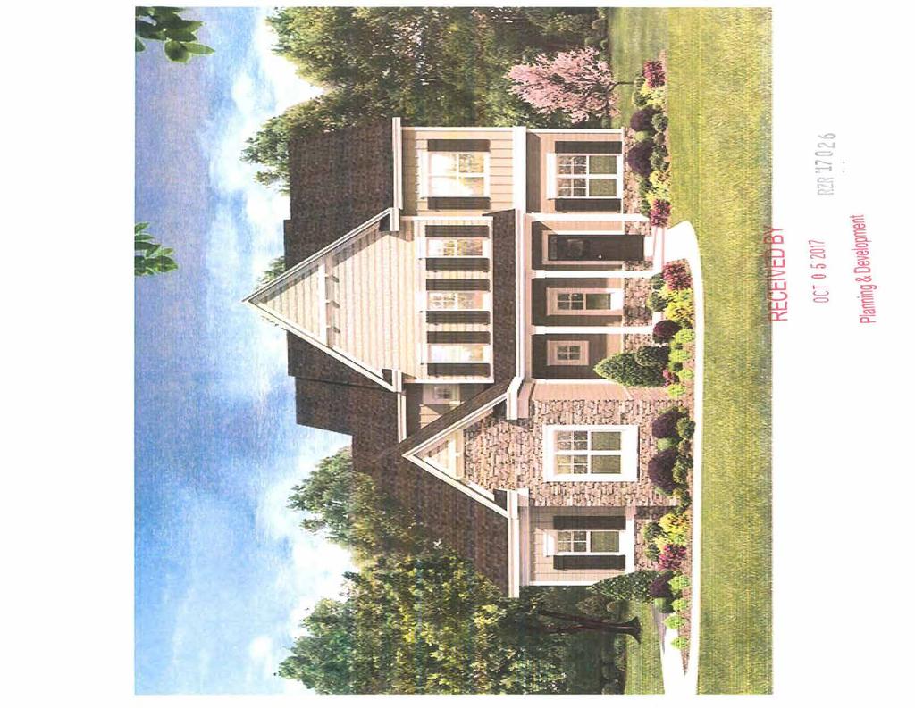
10 Smithton Homes LLC October 4, 2017 VIA HAND DELIVERY Gwinnett County Board of Commissioners c/o Jerry Oberholtzer Planning Manager 446 West Crogan Street Lawrenceville, Georgia RE: 2841 Centerville Rosebud Road Rezoning Application LEITER OF INTENT RZR ' _ RECE\VED BY OCT Dear Mr. Oberholtzer and Planning Department, Respectfully we submit this application to rezone approximately acres (see attached survey) from its current zoning of R100 to OSC to allow for 28 quality professional and family targeted single family detached homes. We feel that the proposed community is ideally located in an influential part of Gwinnett County. The purpose and intent is to preserve and protect natural and environmental resources with value added conservation space. We are proposing that twenty eight (28} residential homes at a net density of units per acre, well below the maximum density of 2.5 units per acre threshold allowed for OSC with over 31% open space. The homes will be a minimum of 1800 sq.ft. and will be built with quality materials with alternating architectural elevations. The proposed homes will include a two car garages covered entrances with facades of brick, stone, board and batten, and/or fiber cement or shake siding. Surrounding development and existing homes would not face major negative impacts as a result of the proposed development in part because of the substantial buffering required under the UDO in conjunction with extensive additional buffering preserved on the west side by the Applicant as conservation space. The proposed zoning and site plan is consistent with similarly developed, residential communities in the immediate area, many of which are zoned R100. As outlined in the 2030 lip ag e
11 Unified Plan and Future Development Map, the Subject Property and surrounding areas are designated as Rural Estate Areas, consistently found to be appropriate for OSC. Quality single family homes will help raise property values and support the schools and nearby commercial development. The Subject property contains a mixture of hardwoods and pines and Haynes Creek. The engineer laid this out to provide the community with 31.7% open space so that we could preserve and protect the natural environmental resources and provide the opportunity for walking trails so the neighborhood could enjoy the protected area. The proposed development was designed so that homes would be concentrated away from the creek limiting land disturbance across this area. The proposed development would enhance land, water, air and tree resources by minimizing the area of land disturbance and would significantly contribute to the protection of the surrounding creeks. We respectfully request your approval of this request for Rezoning from RlOO to OSC to permit this proposed residential community. Respectfully submitted, Bernie Smith, Smithton Homes LLC RECE\VED BY OCT P age
12 Gwinnett County Board of Commissioners c/o Jerry Oberholtzer Planning Manager 446 West Crogan Street Lawrenceville/ Georgia RE: 2841 Centerville Rosebud Rd Rezoning Application Certification that no Timber Harvesting Activity has taken place in the previous 24 months. There has been no Timber Harvesting Activity for at least 24 months prior to the submittal of this application. RZR,t RECE\VED BY OCT
13 Gwinnett County Planning Division Rezoning Application Last Updated 12/20 15 REZONING APPLICANT'S CERTIFICATION THE UNDERSIGNED BELOW IS AUTHORIZED TO MAKE THIS APPLICATION. THE UNDERSIGNED IS AWARE THAT NO APPLICATION OR REAPPLICATION AFFECTING THE SAME LAND SHALL BE ACTED UPON WITHIN 12 MONTHS FROM THE DATE OF LAST ACTION BY THE BOARD OF COMMISSIONERS UNLESS WAIVED BY THE BOARD OF COMMISSIONERS. IN NO CASE SHALL AN APPLICATION OR REAPPLICATION BE ACTED UPON IN LESS THAN SIX (6) MONTHS FROM THE DATE OF LAST ACTION BY THE BOARD OF COMMISSIONERS. Signature of Applicant 10/4/2017 Date Bernie Smith President Type or Print Name and Title OCT ZR'1702
14 Gwinnett County Planning Division Rezoning Application Last Updated REZONING PROPERTY OWNER'S CERTIFICATION THE UNDERSIGNED BELOW, OR AS ATTACHED, IS THE OWNER OF THE PROPERTY CONSIDERED IN THIS APPLICATION. THE UNDERSIGNED IS AWARE THAT NO APPLICATION OR REAPPLICATION AFFECTING THE SAME LAND SHALL BE ACTED UPON W ITHIN 12 MONTHS FROM THE DATE OF LAST ACTION BY THE BOARD OF COMMISSIONERS UNLESS WAIVED BY THE BOARD OF COMMISSIONERS. IN NO CASE SHALL AN APPLICATION OR REAPPLICATION BE ACTED UPON IN LESS THAN SIX (6) MONTHS FROM THE DATE OF LAST ACTION BY THE BOARD OF COMMISSIONERS. Type or Print Name and Title ) OCT lr
15 Gwinnett County Planning D ivision Rezoning Application Last Updated 12/20 I 5 REZONING PROPERTY OWNER'S CERTIFICATION THE UNDERSIGNED BELOW, OR AS ATTACHED. IS THE OWNER OF THE PROPERTY CONSIDERED IN THIS APPLICATION. THE UNDERSIGNED IS AWARE THAT NO APPLICATION OR REAPPLICATION AFFECTING THE SAME LAND SHALL BE ACTED UPON W ITHIN 12 MONTHS FROM THE DATE OF LAST ACTION BY THE BOARD OF COMMISSIONERS UNLESS WAIVED BY THE BOARD OF COMMISSIONERS. IN NO CASE SHALL AN APPLICATION OR REAPPLICATION BE ACTED UPON IN LESS THAN SIX (6) MONTHS FROM THE DATE OF LAST ACTION BY THE BOARD OF COMMISSIONERS. Date Type or Print Name and Title Signature of Notary Public Date OCT ~L '.] 2
16 Gwinnett County Planning Division Rezoning Application Last Updated REZONING PROPERTY OWNER'S CERTIFICATION THE UNDERSIGNED BELOW, OR AS ATTACHED, IS THE OWNER OF THE PROPERTY CONSIDERED IN THIS APPLICATION. THE UNDERSIGNED IS AWARE THAT NO APPLICATION OR REAPPLICATION AFFECTING THE SAME LAND SHALL BE ACTED UPON WITHIN 12 MONTHS FROM THE DATE OF LAST ACTION BY THE BOARD OF COMMISSIONERS UNLESS WAIVED BY THE BOARD OF COMMISSIONERS. IN NO CASE SHALL AN APPLICATION OR REAPPLICATION BE ACTED UPON IN LESS THAN SIX (6) MONTHS FROM THE DATE OF LAST ACTION BY THE BOARD OF COMMISSIONERS. 1-Zf o/1 Date Type or Print Name and Title [2 ' Signature of Notary Public Date ocr o RlR '
17 Gwinnett County Planning Division Rezoning Application Last Updated I S REZONING PROPERTY OWNER'S CERTIFICATION THE UNDERSIGNED BELOW, OR AS ATTACHED, IS THE OWNER OF THE PROPERTY CONSIDERED IN THIS APPLICATION. THE UNDERSIGNED IS AWARE THAT NO APPLICATION OR REAPPLICATION AFFECTING THE SAME LAND SHALL BE ACTED UPON WITHIN 12 MONTHS FROM THE DATE OF LAST ACTION BY THE BOARD OF COMMISSIONERS UNLESS WAIVED BY THE BOARD OF COMMISSIONERS. IN NO CASE SHALL AN APPLICATION OR REAPPLICATION BE ACTED UPON IN LESS THAN SIX (6) MONTHS FROM THE DATE OF LAST ACTION BY THE BOARD OF COMMISSIONERS. Date Type or Print Name and Tide Notary Seal ocr o s i.j~ ? 6
18 Gwinnett County Planning Division Rezoning Application Last Updated I 2/20 I 5 CONFLICT OF INTEREST CERTIFICATION FOR REZONING The undersigned below, making application for a Rezoning, has complied with the Official Code of Georgia Section A-I, et. seq, Conflict of Interest in Zoning Actions, and has submitted or attached the required information on the forms provided. SIGNATURE OF APPLICANT 1 0/4/2017 Bernie Smith President DATE TYPE OR PRINT NAME AND TITLE SIGNATURE OF APPLICANT'S ATTORNEY OR REPRESENTATIVE ~ DATE TYPE OR PRINT NAME AND TITLE,I ',, ' d.\ \:_ J IV/ I>-;~~,, :'\,. ', ~. ~~ $ VfT: ~ss ion i,t.: T ~ ~ ~. ~. ~ - s t..... ~1Ait~ \:\, ~:. ~ - ~~, AR,.~i=.~t~ CJS ~- \~~~ e.! ~a... G~ DISCLOSURE OF CAMPAIGN CONTRIBUTIONS.,,,,,o,,uN1'C,~,\\'-.. '"'"' Have you, within the two years immediately preceding the filing of this application, made campaign contributions aggregating $ or more to a member of the Board of Commissioners or a member of the Gwinnett County Planning Commission? 0 YEs [I] No Bernie Smith YOUR NAME If the answer is yes, please complete the following section: NAME AND OFFICAL POSITION OF GOVERNMENT OFFICIAL CONTRIBUTIONS (List all which aggregate to $250 or More) DATE CONTRIBUTION WAS MADE (Within last two years) Attach additional sheets if necessary to disclose or describe all contributions. OCT
19 Gwinnett County Planning Division Rezoning Application Last Updated 12/20 IS VERIFICATION OF CURRENT PAID PROPERTY TAXES FOR REZONING THE UNDERSIGNED BELOW IS AUTHORIZED TO MAKE THIS APPLICATION. THE UNDERSIGNED CERTIFI ES THAT ALL GWINNETT COUNTY PROPERTY TAXES BILLED TO DATE FOR THE PARCEL LISTED BELOW HAVE BEEN PAID IN FULL TO THE TAX COMMISSION ER OF GWINNETT COUNTY, GEORG IA. IN NO CASE SHALL AN APPLICATION OR REAPPLICATION FOR REZONING BE PROCESSED WITHOUT SUCH PROPERTY VERIFICATION. *Note: A SEPARATE VERIFICATION FORM MUST BE COMPLETED FOR EACH TAX PARCEL INCLUDED IN THE REZONING REQUEST. PARCEL I.D. NUMBER: (M ap Reference Number) & 301 R District Land Lot Parcel Signature of Applicant Bernie Smith President Type or Print Name and Title 10/4/2017 Date ***PLEASE TAKE THIS FORM TO THE TAX COMMISSIONERS OFFICE AT THE GWINNETT JUSTICE AND ADMINISTRATION CENTER, 75 LANGLEY DRIVE, FOR THEIR APPROVAL BELOW.*** TAX COMMISSIONERS USE ONLY (PAYMENT OF ALL PROPERTY TAXES BILLED TO DATE FOR THE ABOVE REFERENCED PARCEL HAVE BEEN VERIFIED AS PAID CURRENT AND CONFIRMED BY THE SIGNATURE BELOW) D&ot-~\-~ dt'\x.~j,' Lr~ ~ JOv \ qk NAME TITLE DATE 7 OCT hlr J17 2

20

21
22

23 LEFT ELEVATION REAR ELEVATION - --=-=-=-=-=-~=-=-=-=-=-=-=-=-=-=-=-=-=-=---_-_ t «)~-... ~,- '~' OCT RZR 1 17 u? 6.
 ~ w 0:: F=< _::::=;: OJ-... wen ~~ w 0:: mo... en 0:: ~ 0 0... J~ ~~ ~t E 0 u!:l Q)..0.::,(. c: ra 1 ECEIVEDBY I:E':\"\"3 ~ L I i>l~ 0 ~ s ~~~ ~ ~ e ED '?")
24 lrl...,l,.,tlteplou~t.d...,ean ~~~ ~~~O';~i;~ ~:: ;::~~-,! ostrctt,prartbth""'n:~ D<.nl1 a~tnorlred \ol 00'11>'!9b 1 f"ba..i~ REAR ELEVATION ~' , RIGHT ELEVATION ~~~;!~!;;~~!~~,~Lc;...o~ ~~r.;;:.l < (.!) ~ w 0:: F=< _::::=;: OJ-... wen ~~ w 0:: mo... en 0:: ~ J~ ~~ ~t E 0 u!:l Q)..0.::,(. c: ra 1 ECEIVEDBY I:E':""3 ~ L I i>l~ 0 ~ s ~~~ ~ ~ e ED '?~-~-o~er DETAIL CD ~~ -~RT ABLE DETAIL ~ < I- w Cl... n:: r o CD :.?.':.~ICE DETAIL CD S~~':~ICE DETAIL CD S~~':~ICE DETAIL Plbnning & Development!IK)TE. ATTIC VENnLA non PER LOCAL CODES AW ~~TSI w F!= RZ~ '17 0 ~i::,~~~=::r~~ ~~~!:/!,~w::,,z.:./0 ~~~:-::~ :~~.-;:F"&~:?~., g.~i:=;a-;~~~~. ELEVATION AlANCaETZASSOOATES..tr-c~NOUAei... HY R:)A ~ OWGES o::1: MClelA:AnONS MACE TO n.e;:e PL.AHS!I1'0Tl-BIS N~ ~ ~ ~ ~- ~ ~ < U-J - ~!11~~ ~;:;e; ~~l) ~E-~ ~a~~ Z :::~ L u a ~ ~ ~g I I~ ~~ ~<o (BY : ~ Ct ~ J (o.-.t&: :;:;;:: J l.l LJ
D OWNER'S AGENT D PROPERTY OWNER 1111 CONTRACT PURCHASER
 Gwinnett County Planning Division Rezoning Application Last Updated 12/2 IS REZONING APPLICATION AN APPLICATION TO AMEND THE OFFICIAL ZONING MAP OF GWINNETT COUNTY, GA. APPLICANT INFORMATION NAME: Brad
SPECIAL USE PERMIT APPLICATION AN APPLICATION TO AMEND THE OFFICIAL ZONING MAP OF GWINNETT COUNTY, GA. ADDRESS: 691 Paden Dr
 Last Updated 12/20 IS SPECIAL USE PERMIT APPLICATION AN APPLICATION TO AMEND THE OFFICIAL ZONING MAP OF GWINNETT COUNTY, GA. APPLICANT INFORMATION PROPERTY OWNER INFORMATION* NAME: Tim Landers NAME: Billy
 Gwinnett County Planning Division Rezoning Application Last Updated 12/2015 REZONING APPLICATION AN APPLICATION TO AMEND THE OFFICIAL ZONING MAP OF GWINNETT COUNTY, GA. APPLICANT INFORMATION NAME: 4RNJ2,
Planning & Development ~OWNER 'S AGENT D PROPERTY O WNER D CONTRACT PURCHASER RZM ' tf.. f u.,;o{)-!~,~ lv"'"'( '7 '7 0 ll.
-!~,~ lv''( '7 '7 0 ll.") Gwinnett County Plann ing D ivision Rezoning Application Last Updated 12/20 15 REZONING APPLICATION AN APPLICATION TO AMEND THE OFFICIAL ZONING MAP OF GWINNETT COUNTY, GA. I APPLICANT INFORMATION I PROPERTY
Gwinnett County Plann ing D ivision Rezoning Application Last Updated 12/20 15 REZONING APPLICATION AN APPLICATION TO AMEND THE OFFICIAL ZONING MAP OF GWINNETT COUNTY, GA. I APPLICANT INFORMATION I PROPERTY
SPECIAL USE PERMIT APPLICATION AN APPLICATION TO AMEND THE OFFICIAL ZONING MAP OF GWINNETT COUNTY, GA. NAME: Monarch River Exchange, LLC
 Last Updated 12/20 IS SPECIAL USE PERMIT APPLICATION AN APPLICATION TO AMEND THE OFFICIAL ZONING MAP OF GWINNETT COUNTY, GA. I APPLICANT INFORMATION NAME: Lawrenceville Rentals, Inc. I PROPERTY OWNER INFORMATION*
'.,,. '--. '. ADDRESS: CITY: e+ta""-blit..~ STATE: PHONE: 1-t04--lf SS-~ b '+
 Last Updated 12/2015 SPECIAL USE PERMIT APPLICATION AN APPLICATION TO AM END TH E OFFICIAL ZONING MAP OF GWINN ETT COUNTY, GA. '.,,.. APPLICANT. INFORMATION PROPERTY OWNER INFORMATION*. ' '--. '. NAME:
CHANGE IN CONDITIONS APPLICANT'S RESPONSE STANDARDS GOVERNING THE EXERCISE OF THE ZONING POWER
 Gwinnett County Planning Division Last Updated 12/20 IS CHANGE IN CONDITIONS APPLICANT'S RESPONSE STANDARDS GOVERNING THE EXERCISE OF THE ZONING POWER PURSUANT TO REQUIREMENTS OF THE UNIFIED DEVELOPMENT
SPECIAL USE PERMIT APPLICATION AN APPLICATION TO AMEND THE OFFICIAL ZONING MAP OF GWINNETT COUNTY, GA. - NAME: C, 6. S"Y\1+~
 Gwinnett County Planning Division Last Updated 12/20 IS SPECIAL USE PERMIT APPLICATION AN APPLICATION TO AMEND THE OFFICIAL ZONING MAP OF GWINNETT COUNTY, GA. NAME: f-frctiv'i A C ~o.. a. rr(cl ADDREss:
 REZONING APPLICATION AN APPLICATION TO AMEND THE OFFICIAL ZO NING MAP OF GWINNETT COUNTY, GA. APPLICANT INFORMATION NAME: Dung Nguyen ADDREss: 6035 Singleton Rd. CITY: Norcross. PROPERTY OWNER INFORMATION*
SPECIAL USE PERMIT APPLICATION AN APPLICATION TO AMEND THE OFFICIAL ZONING MAP OF GWINNETT COUNTY, GA. NAME: Mountain Park Plaza, LLC
 Last Updated 12/20 IS SPECIAL USE PERMIT APPLICATION AN APPLICATION TO AMEND THE OFFICIAL ZONING MAP OF GWINNETT COUNTY, GA. APPLICANT INFORMATION NAME: Ben Walker Jr. I Denise Wempe PROPERTY OWNER INFORMATION*
REZONING APPLICATION AN APPLICATION TO AMEND THE OFFICIAL ZONING MAP OF GWINNETT COUNTY, GEORGIA. NAME: MK Professional Services 1
 ATTACHMENT 5A PAGE 1 REVISED 07/91 REZONING APPLICATION AN APPLICATION TO AMEND THE OFFICIAL ZONING MAP OF GWINNETT COUNTY, GEORGIA I APPLICANT INFORMATION II OWNER INFORMATION NAME: Parkland Communities
BUFFER REDUCTION APPLICATION TO THE GWINNETT COUNTY BOARD OF COMMISSIONERS FOR A BUFFER REDUCTION OF MORE THAN 50 PERCENT
 Gwinnett County Planning Division Buffer Reduction Application Revision Date 12.2 15 BUFFER REDUCTION APPLICATION TO THE GWINNETT COUNTY BOARD OF COMMISSIONERS FOR A BUFFER REDUCTION OF MORE THAN 5 PERCENT
REZONING APPLICATION AN APPLICATION TO AMEND THE OFFICIAL ZONING MAP OF GWINNETT COUNTY, GA. CITY: Cumming
 Gwinnett County Planning Division Last Updated 12/20 IS REZONING APPLICATION AN APPLICATION TO AMEND THE OFFICIAL ZONING MAP OF GWINNETT COUNTY, GA. APPLICANT INFORMATION PROPERTY OWNER INFORMATION* NAME:
SPECIAL USE PERMIT APPLICATION AN APPLICATION TO AMEND THE OFFICIAL ZONING MAP OF GWINNETT COUNTY, GA. CITY: Mllr i e., rt~
 Gwinnett County Planning Division Special Use Permit Application Last Updated 12/20 15 SPECIAL USE PERMIT APPLICATION AN APPLICATION TO AMEND THE OFFICIAL ZONING MAP OF GWINNETT COUNTY, GA. APPLICANT INFORMATION
TOWN OF BRASELTON, GEORGIA STREAM BUFFER AND SETBACK VARIANCE APPLICATION
 TOWN OF BRASELTON, GEORGIA STREAM BUFFER AND SETBACK VARIANCE APPLICATION An applicant seeking a grant of variance from the stream buffer protection regulations found in Section 15.5 of the Town of Braselton
D OWNER'S AGENT 0 PROPERTY OWNER D CONTRACT PURCHASER
 Last Updated 12/20 I 5 REZONING APPLICATION AN APPLICATION TO AMEND THE OFFICIAL ZONING MAP OF GWINNETT COUNTY, GA. APPLICANT INFORMATION PROPERTY OWNER INFORMATION* NAME: Jose Sanchez NAME: Jose Sanchez
BARROW COUNTY, GEORGIA
 BARROW COUNTY, GEORGIA Application For Rezoning, Special Use, and Change in Conditions BARROW COUNTY DEPARTMENT OF PLANNING AND DEVELOPMENT 30 North Broad Street Winder, Georgia 30680 770-307-3034 APPLICATION
Application For Accessory Housing for Family Care
 Application For Accessory Housing for Family Care Thank you for your interest in. This packet includes the necessary documents for Accessory Housing for Family Care that require the Public Development
City of Covington ANNEXATION & REZONING APPLICATION
 PLEASE COMPLETE THE FOLLOWING: Date Received: Received By: This Annexation Application is made pursuant to the provisions of the Official Code of Georgia Annotated 36-36-6, Article 2, Annexation Pursuant
-~~Y~G'--'7<----'W.~"-""5-'--f_Lh,U='-...,tr,.LIV.,_,/"""''"""'~:: Home phone:
 ZONING I REZONING APPLICATION Application #2015- Heari Date: (PLEASE PRINT OR TYPE ALL INFORMATION) Applicant: Jic:..-=-~---=-..!
D OWNER'S AGENT D PROPERTY OWNER I XX I CONTRACT PURCHASER
 Last Updated 2/20 14 REZONING APPLICATION AN APPLI CATION TO AM END THE OFFI CIAL Z ONING MAP OF GWINNETT COUNTY, GA. APPLICANT INFORMATION Cypress Truck Lines, Inc. c/o Mahaffey Pickens NAME: Tucker,
SPECIAL USE PERMIT APPLICATION AN APPLICATION TO AMEND THE OFFICIAL ZONING MAP OF GWINNETT COUNTY, GA. NAME: Salaama Christopher.
 Gwinnett County Planning Division Special Use Permit Application Last Updated I 2/20 I 5 SPECIAL USE PERMIT APPLICATION AN APPLICATION TO AMEND THE OFFICIAL ZONING MAP OF GWINNETT COUNTY, GA. I APPLICANT
SPECIAL USE PERMIT APPLICATION AN APPLICATION TO AMEND THE OFFICIAL ZONING MAP OF GWINNETT COUNTY, GA. NAME: Ralph F. McGee.
 Gwinnett County Planning Division Special Use Permit Application Last Updated 220 14 SPECIAL USE PERMIT APPLICATION AN APPLICATION TO AMEND THE OFFICIAL ZONING MAP OF GWINNETT COUNTY, GA. APPLICANT INFORMATION
or
 Gwinnett County Planning Division Rezoning Application Last Updated 12/2015 REZONING APPLICATION AN APPLICATION TO AMEND THE OFFICIAL ZONING MAP OF GWINNETT COUNTY, GA. APPLICANT INFORMATION NAME: Old
STREAM BUFFER VARIANCE APPLICATION PACKET
 STREAM BUFFER VARIANCE APPLICATION PACKET This package contains all the forms and instructions necessary to apply for a stream buffer variance from the City of Chamblee s Unified Development Ordinance
APPLICATION FOR COMPREHENSIVE LAND USE PLAN AMENDMENT, ZONING AMENDEMENTS/CONDITIONAL USE AMENDMENTS
 APPLICATION FOR COMPREHENSIVE LAND USE PLAN AMENDMENT, ZONING AMENDEMENTS/CONDITIONAL USE AMENDMENTS TO BE COMPLETED BY THE DEPARTMENT OF PLANNING AND CITY SERVICES Received: Planning Commission Hearing
REQUEST FOR SPECIAL EXCEPTION FOR MANUFACTURED HOMES IN THE AR-1 & R-5 DISTRICT APPLICATION NO.
 REQUEST FOR SPECIAL EXCEPTION FOR MANUFACTURED HOMES IN THE AR-1 & R-5 DISTRICT APPLICATION NO. AGENT/DEVELOPER INFORMATION (If not owner) Name: Address: City: PROPERTY OWNER INFORMATION Name: Address:
REZONING APPLICATION AN APPLICATION TO AMEND THE OFFICIAL ZONING MAP OF GWINNETT COUNTY, GA. NAME: Annie C. Rawlins. ADDRESS: 5143 Meadowlake ln.
 Last Updated 12/20 S REZONNG APPLCATON AN APPLCATON TO AMEND THE OFFCAL ZONNG MAP OF GWNNETT COUNTY, GA. APPLCANT NFORMATON NAME: Montecito Development LLC ADDRESS: 2607 Vineville Ave, Ste 205 CTY: Macon
SPECIAL USE PERMIT APPLICATION AN APPLICATION TO AMEND THE OFFICIAL ZONING MAP OF GWINNETT COUNTY, GA. NAME: Ted Brockett/Rhonda Brockett
 Gwinnett County Planning Division Last Updated 12/20 I S SPECIAL USE PERMIT APPLICATION AN APPLICATION TO AMEND THE OFFICIAL ZONING MAP OF GWINNETT COUNTY, GA. APPLICANT INFORMATION NAME: St.Mary's Malankara
O-I (Office-Institutional) and AG-1(Agricultural)
 and AG-1(Agricultural)") PROPERTY INFORMATION ADDRESS 3503 and 3505 Bethany Bend DISTRICT, LAND LOTS 2/1 973 and 974 OVERLAY DISTRICT State Route 9 PETITION NUMBERS EXISTING ZONING O-I (Office-Institutional) and AG-1(Agricultural)
PROPERTY INFORMATION ADDRESS 3503 and 3505 Bethany Bend DISTRICT, LAND LOTS 2/1 973 and 974 OVERLAY DISTRICT State Route 9 PETITION NUMBERS EXISTING ZONING O-I (Office-Institutional) and AG-1(Agricultural)
(If proposed use is business or industry, enclose a detailed
 n 0 jl ARTICLE 10 Official Zoning Forms (in o e p 0: W t 10.1 APPLICATION FOR ZONING PERMIT Berlin Heights, Ohio Application No 1^ pi*) The undersigned applies for a zoning permit for the following use,
Final Subdivision Plat
 Final Subdivision Plat Application Packet Public Works Department New Development Division 175 East 200 North St. George, UT 84770 Office (435) 627-4120 Dear Applicant, This packet has been prepared to
Recommend approval of the Variances identified and Rezone to Residential Multi-Family (RM) District with following conditions:
 District with following conditions:") City of Sugar Hill Planning Staff Report RZ 17-001 DATE: June 20, 2017: Updated 7/10/17 TO: Mayor and City Council FROM: Tim Schick, Administrative Staff SUBJECT: Rezoning RZ 17-001 Rezoning with Variances
City of Sugar Hill Planning Staff Report RZ 17-001 DATE: June 20, 2017: Updated 7/10/17 TO: Mayor and City Council FROM: Tim Schick, Administrative Staff SUBJECT: Rezoning RZ 17-001 Rezoning with Variances
PRELIMINARY PLAT Checklist
 PRELIMINARY PLAT Checklist 3715 Bridgeport Way W University Place, WA 98466 PH: (253) 566-5656 FAX: (253) 460-2541 This is a checklist of materials required for a Preliminary Plat. This checklist is provided
Staff Report & Recommendation Rezoning Case RZ Date of Report: June 6, 2014 Report by: Doug Stacks
 Staff Report & Recommendation Rezoning Case RZ-2014-02 Date of Report: June 6, 2014 Report by: Doug Stacks Hearing Dates: Planning Commission June 26, 2014 Mayor and Council July 14, 2014 GENERAL INFORMATION
Lawrenceville. Duluth , Satellite Boulevard RZM CHANGE IN CONDITIONS APPLICATION
 Gwinnett County Planning Division Change in Conditions Application Last Updated 2/20 14 CHANGE IN CONDITIONS APPLICATION APPLICANT INFORMATION OWNER INFORMATION* NAME: Mahaffey Pickens Tucker, LLP NAME:
LINCOLN COUNTY PLANNING & INSPECTIONS DEPARTMENT
 LINCOLN COUNTY PLANNING & INSPECTIONS DEPARTMENT 302 NORTH ACADEMY STREET, SUITE A, LINCOLNTON, NORTH CAROLINA 28092 704-736-8440 OFFICE 704-736-8434 INSPECTION REQUEST LINE 704-732-9010 FAX To: Board
Special Use Permit Application & Process See Unified Development Code
 Special Use Permit Application & Process See Unified Development Code 18.40.100 Public Works Planning Division PO Box 768 100 E. Santa Fe Street Olathe, Kansas 66051 P: 913-971- 8750 F: 913-971-8960 www.olatheks.org
APPLICATION TO REZONE PROPERTY
 INFORMATION TO APPLICANTS APPLICATION TO REZONE PROPERTY The following items are necessary in order to process rezoning applications: 1.) One (1) copy of this application, completed in full, and a written
CITY OF NEWNAN, GEORGIA Planning & Zoning Department 25 LaGrange Street Newnan, Georgia Office (770) Fax (770)
 Fax (770)") CITY OF NEWNAN, GEORGIA Planning & Zoning Department 25 LaGrange Street Newnan, Georgia 30263 Office (770) 254-2354 Fax (770) 254-2361 APPLICATION TO AMEND ZONING MAP Note to Applicant: Please be sure
CITY OF NEWNAN, GEORGIA Planning & Zoning Department 25 LaGrange Street Newnan, Georgia 30263 Office (770) 254-2354 Fax (770) 254-2361 APPLICATION TO AMEND ZONING MAP Note to Applicant: Please be sure
ORDINANCE NO AN ORDINANCE To Be Entitled:
 3808 AN ORDINANCE To Be Entitled: AN ORDINANCE OF THE CITY COUNCIL OF THE CITY OF FORT MYERS, FLORIDA, REZONING FROM COMMERCIAL GENERAL TO PLANNED UNIT DEVELOPMENT AND APPROVING THE DEVELOPMENT PLAN FOR
Lincoln County Board of Commissioner s Agenda Item Cover Sheet
 Lincoln County Board of Commissioner s Agenda Item Cover Sheet Board Meeting Date: Agenda Item Type: Consent Agenda: Public Hearing: Regular Agenda: Presentation Time (est): Submitting Person: Phone Number/Ext:
Application for Conditional Use Permit CITY OF VALDOSTA PLANNING AND ZONING DIVISION
 Application for Conditional Use Permit CITY OF VALDOSTA PLANNING AND ZONING DIVISION This is an application for approval of a Conditional Use as listed in the Table of Uses of the Valdosta Land Development
CITY OF NEWNAN, GEORGIA
 CITY OF NEWNAN, GEORGIA Application Form For Special Exception July, 2000 Revised June, 2003 Application revised July, 2007 CITY OF NEWNAN, GEORGIA 25 LaGrange Street Newnan, Georgia 30263 770-254-2354
NEWTON COUNTY BOARD OF COMMISSIONERS REQUEST FOR REZONING
 NEWTON COUNTY BOARD OF COMMISSIONERS REQUEST FOR REZONING CASE NUMBER PROPOSED LAND USE MAP EXISTING LAND USE MAP PROPOSED ZONING EXISTING ZONING WATERSHED LOCATION OWNER PETITIONER REPRESENTATIVE N/A
LINCOLN COUNTY PLANNING & INSPECTIONS DEPARTMENT
 To: Board of Commissioners From: Randy Hawkins, Zoning Administrator Date: August 4, 2015 Re: Planning Board recommendations (08/03/15) UDO Proposed Amendments #2015-3 Lincoln County Planning and Inspections
19.12 CLUSTER RESIDENTIAL DISTRICT
 Chapter 19.12 CLUSTER RESIDENTIAL DISTRICT (Adopted 12/22/2003; Ordinance #0061970). Amended 7/3/17, Ordinance #079100. Section 19.12.010 - Declaration of Intent. The Cluster Residential District provides
Cobb County Community Development Agency Zoning Division 1150 Powder Springs St. Marietta, Georgia 30064
 Cobb County Community Development Agency Zoning Division 1150 Powder Springs St. Marietta, Georgia 30064 Case # Z-63 Public Hearing Dates: PC: 11-06-18 BOC: 11-20-18 SITE BACKGROUND Applicant: Loyd Development
SPECIAL USE PERMIT APPLICATION AN APPLICATION TO AMEND THE OFFICIAL ZONING MAP OF GWINNETT COUNTY, GA. CITY: Du luth
 Gwinn ett County Planning Division Last Updated 12/20 15 SPECIAL USE PERMIT APPLICATION AN APPLICATION TO AMEND THE OFFICIAL ZONING MAP OF GWINNETT COUNTY, GA. APPLICANT INFORMATION PROPERTY OWNER INFORMATION*
Department of Planning & Community Development
 Department of Planning & Community Development @ Jefferson Station 1526 E. Forrest Avenue Suite 100 East Point, GA 30344 404.270.7029 (Phone) 404.209.5148 (Fax) www.eastpointcity.org APPLICANT S CHECKLIST
LINCOLN COUNTY PLANNING & INSPECTIONS DEPARTMENT
 LINCOLN COUNTY PLANNING & INSPECTIONS DEPARTMENT 30 NORTH ACADEMY STREET, SUITE A, LINCOLNTON, NORTH CAROLINA 809 704-736-8440 OFFICE 704-736-8434 INSPECTION REQUEST LINE 704-73-900 FAX To: Board of Commissioners
STAFF REPORT FOR REZONE #R JANUARY 15, 2015 PAGE PC-1 CVH INVESTMENTS LLC 455 E. GOBBI ST UKIAH, CA 95482
 STAFF REPORT FOR REZONE #R 4-2014 JANUARY 15, 2015 PAGE PC-1 OWNERS: JACK L. COX TTEE ET AL PO BOX 1389 UKIAH, CA 95482 CVH INVESTMENTS LLC 455 E. GOBBI ST UKIAH, CA 95482 APPLICANT: SUBJECT: PROPOSAL:
REQUIREMENTS FOR COMPLETING APPLICATION FOR REZONING COBB COUNTY, GEORGIA
 REQUIREMENTS FOR COMPLETING APPLICATION FOR REZONING COBB COUNTY, GEORGIA Application must be submitted in person to the Zoning Division, located at 1150 Powder Springs Street, Suite 400, Marietta, Georgia
SPECIAL USE PERMIT APPLICATION AN APPLICATION TO AMEND THE OFFICIAL ZONING MAP OF GWINNETT COUNTY, GA. NAME: Joe Garguilo.
 Gwinnett County Planning Division Special Use Permit Application Last Updated 12/20 I S SPECIAL USE PERMIT APPLICATION AN APPLICATION TO AMEND THE OFFICIAL ZONING MAP OF GWINNETT COUNTY, GA. APPLICAN:f
RESOLUTION NO. ZR
 RESOLUTION NO. ZR-2015-004 RESOLUTION APPROVING ZONING APPLICATION SV/ZV/Z-2014-01624 (CONTROL NO. 2009-02465) TYPE II VARIANCE (CONCURRENT) APPLICATION OF MPC 3 LLC BY CPH, Inc, Baker & Hostetler LLP,
COUNTY OF ALBEMARLE APPLICATION FOR RURAL SUBDIVISION
 Page 1 APPLICATION FOR RURAL SUBDIVISION The term rural subdivision means a type of subdivision that is located in the rural areas which results in two or more lots for the purpose of transfer of ownership
TO: Glynn County Board of Commissioners. Eric Landon, Planner II. ZM2773 Peppertree Crossing Phase II
 COMMUNITY DEVELOPMENT DEPARTMENT Planning and Zoning Division 1725 Reynolds Street, Suite 200, Brunswick, GA 31520 Phone: 912-554-7428/Fax: 1-888-252-3726 TO: Glynn County Board of Commissioners MEMO FROM:
Planning Commission Staff Report Rezone Hearing Date: September 26, 2018
 Planning Commission Staff Report Rezone Hearing Date: September 26, 2018 ITEM 3 Gardner and Associates requests a Zone Change from Public Facilities (PF) to R1.6PD to facilitate a 33-lot subdivision, located
GeoPoint 213 Hobbs Street Tampa, Florida
 AIRPORT ROAD PINELAND P.R.D. SUBDIVISION - PHASES 2 & 3 DESCRIPTION: A parcel of land lying in Sections 13 and 24, Township 14 South, Range 31 East, Volusia County, Florida, and being more particularly
Form 11.A.9.17 INSTRUCTIONS FOR APPLICATION FOR PLAT WAIVER (Art. 11.A.8)
") Form 11.A.9.17 INSTRUCTIONS FOR APPLICATION FOR PLAT WAIVER (Art. 11.A.8) All questions in each part must be completed. When a question is not applicable to the property, enter "N/A" or other phrase indicating
Form 11.A.9.17 INSTRUCTIONS FOR APPLICATION FOR PLAT WAIVER (Art. 11.A.8) All questions in each part must be completed. When a question is not applicable to the property, enter "N/A" or other phrase indicating
SUBJECT PARCEL(S) Property Owner(s) TMS Number Approximate Acreage Carolina Park Development, LLC
 Property Owner(s) TMS Number Approximate Acreage Carolina Park Development, LLC") Staff Report Special Planning Commission Meeting November 19, 2014 For reference, the Zoning Code and Land Development Regulations are available online. AGENDA ITEM 5c. SKETCH PLAN APPROVAL REQUEST: Request
Staff Report Special Planning Commission Meeting November 19, 2014 For reference, the Zoning Code and Land Development Regulations are available online. AGENDA ITEM 5c. SKETCH PLAN APPROVAL REQUEST: Request
REPORT TO THE SHELBY COUNTY PLANNING COMMISSION From the Department of Development Services Planning Services. February 4, 2019
 REPORT TO THE SHELBY COUNTY PLANNING COMMISSION From the Department of Development Services Planning Services February 4, 2019 Case No. Request for Rezoning Approval From E-1 to E-2 SD This is a request
BOSSIER CITY PARISH METROPOLITAN PLANNING COMMISSION 620 Benton Rd. Bossier City, LA Phone: Fax: PRELIMINARY PLAT
 (OFFICE USE ONLY) Application Fee: Paid: Date: CASE # Project Information BOSSIER CITY PARISH METROPOLITAN PLANNING COMMISSION 620 Benton Rd. Bossier City, LA 71111 Phone: 318-741-8824 Fax: 318-741-8827
CHEROKEE COUNTY Application for Public Hearing Special Use Permit
 CHEROKEE COUNTY Application for Public Hearing Special Use Permit Pre-Application Meeting Date: Preliminary Review Meeting Date: Community Information and Input Meeting Date/Time: Applicant, or representative
PALM BEACH COUNTY PLANNING, ZONING AND BUILDING DEPARTMENT ZONING DIVISION
 PALM BEACH COUNTY PLANNING, ZONING AND BUILDING DEPARTMENT ZONING DIVISION Application No.: Z-2014-01627 Application Name: Dazco Center Control No.: 2003-00040 Applicant: 4730 Hypoluxo LLC Owners: 4730
Applications will be received on business days between 9:00 AM and 3:00 PM
 Special Use Permit Application Douglas County Board of Commissioners Douglas County, Georgia Applications will be received on business days between 9:00 AM and 3:00 PM Date of Application: Application
COMMERCIAL SITE DEVELOPMENT GUIDE FOR UNINCORPORATED ST. CHARLES COUNTY
 COMMERCIAL SITE DEVELOPMENT GUIDE FOR UNINCORPORATED ST. CHARLES COUNTY GENERAL INFORMATION: This brochure is to be used as a guide and is not intended to amend or supersede the corresponding County ordinances
GWINNETT COUNTY CSO CONSERVATION SUBDIVISION OVERLAY DISTRICT REQUIREMENTS
 GWINNETT COUNTY CSO CONSERVATION SUBDIVISION OVERLAY DISTRICT REQUIREMENTS Section 1316. CSO Conservation Subdivision Overlay District. 1. Purposes. The purposes of this overlay district are as follows:
ABBREVIATION LEGEND SITE INFORMATION:
 SITE INFORMATION: Current Zone: R-3 PUD, governed by Fox Hollow 2nd MDA Basis of Elevations: Northeast Corner of Section 13, T6S, R1W, S.L.B. & M Elevation: 4599.26 (Benchmark) ABBREVIATION LEGEND Owners:
UDO Advisory Committee Meeting #3 August 18, 2011
 UDO Advisory Committee Meeting #3 August 18, 2011 Today s s Agenda Welcome Recap of Meeting #2 Overview of Strategy Statement Overview of Zoning Districts What changes and what stays the same? Break Putting
PLANNING AND DEVELOPMENT DEPARTMENT STAFF REPORT SAVOY DRIVE AREA ZONING MAP AMENDMENT II
 PLANNING AND DEVELOPMENT DEPARTMENT STAFF REPORT Meeting Date: March 14, 2019 Item #: PZ2019-429 SAVOY DRIVE AREA ZONING MAP AMENDMENT II Project Name: Savoy Drive Area Zoning Map Amendment II Site Addresses:
Final Plats for Major Residential and Commercial Subdivisions Checklist
 Project Name: : This form is a checklist of Zoning Ordinance requirements for major residential and commercial subdivision plats to assist the applicant in their submittal. It is not intended to be a comprehensive
MINOR SUBDIVISION APPLICATION
 MINOR SUBDIVISION APPLICATION Complete with required information (write "n/a" if information is not applicable to proposal). Title of Plat Has any other plat been recorded for this site? ( ) Yes ( ) No
PLANNING COMMISSION REPORT Regular Agenda Public Hearing Item PRD TO RM15; ACRES; 2101 EXCHANGE CT (KES)
") PC Staff Report 7/22/15 Z-14-00515 Item No. 3-1 PLANNING COMMISSION REPORT Regular Agenda Public Hearing Item PC Staff Report 7/22/15 ITEM NO. 3 PRD TO RM15; 9.818 ACRES; 2101 EXCHANGE CT (KES) Z-14-00515:
PC Staff Report 7/22/15 Z-14-00515 Item No. 3-1 PLANNING COMMISSION REPORT Regular Agenda Public Hearing Item PC Staff Report 7/22/15 ITEM NO. 3 PRD TO RM15; 9.818 ACRES; 2101 EXCHANGE CT (KES) Z-14-00515:
COMPREHENSIVE PLAN FUTURE LAND USE MAP AMENDMENT APPLICATION
 COUNTY STAFF DATA ONLY Date Received: Project No. CPA-20 - GADSDEN COUNTY DEPARTMENT OF PLANNING & COMMUNITY DEVELOPMENT 1-B East Jefferson Street, Post Office Box 1799, Quincy, FL 32353-1799 PLANNING
Watertown City Council
 City of Watertown Watertown City Council 2/14/2017 Agenda Item: Riverpointe Subdivision 2 nd Replat Request for Action: Sketch Plan Department: Planning Request for Action Request: Paxmar, LLC (Applicant)
Note to the Owner, Applicant & Agent:
 Note to the Owner, Applicant & Agent: The Nye County Planning Department does not accept incomplete Zoning Review Applications. Please see highlighted requirements below PRIOR to submitting. The Zoning
APPROVAL FOR ACCELERATED PROCESSING DIRECT TO CITY COUNCIL
 COUNCIL FILE NO. //--/4tfo COUNCIL DISTRICT NO..1]. APPROVAL FOR ACCELERATED PROCESSING DIRECT TO CITY COUNCIL The attached Council File may be processed directly to Council pursuant to the procedure approved
Cover Letter with Narrative Statement
 Cover Letter with Narrative Statement March 31, 2017 rev July 27, 2017 RE: Rushton Pointe Residential Planned Unit Development Application for Public Hearing for RPUD Rezone PL2015 000 0306 Mr. Eric Johnson,
CONCEPT PLAN SUBMISSION REQUIREMENTS:
 STAFF STRONGLY RECOMMENDS A PRE-DEVELOPMENT MEETING BEFORE THE SUBMITTAL OF ANY APPLICATION FOR ZONING, REZONING, CONDITIONAL USE PERMIT (CUP), OR FOR A TEXT AMENDMENT TO A PROVISION(S) OF THE ZONING ORDINANCE.
3. No buildings or other permanent structures are allowed in Easement Area without Grantee's written consent.
 GRANT OF EASEMENT KNOW ALL PERSONS BY THESE PRESENTS that the CITY OF ANN ARBOR, a Michigan municipal corporation, whose address is 301 East Huron Street, P.O. Box 8647, Ann Arbor, Michigan 48104, as fee
Planning & Development 881 Senoia Road Tyrone GA, (770) Tax Map Number: Date. Date Annexation will become effective and official:
 Tax Map Number: Date. Date Annexation will become effective and official:") TOWN OF TYRONE Planning & Development 881 Senoia Road Tyrone GA, 30290 (770) 487-4038 Tax Map Number: Date Date Annexation will become effective and official: Address of subject property: Owner of Property:
TOWN OF TYRONE Planning & Development 881 Senoia Road Tyrone GA, 30290 (770) 487-4038 Tax Map Number: Date Date Annexation will become effective and official: Address of subject property: Owner of Property:
BUFFER REDUCTION APPLICATION
 BUFFER REDUCTION APPLICATION Gwinnett County Department of Planning & Development Planning Division 446 West Crogan Street, Suite 250 Lawrenceville, Georgia 30046 (678) 518-6000 ONLY COMPLETE APPLICATIONS
David L. Brown, Construction Services Manager
 Memorandum Date: 2/02/2013 Order Date: 2/27/2013 TO: DEPARTMENT: PRESENTED BY: AGENDA ITEM TITLE: Board of County s Public Works David L. Brown, Construction Services Manager In the Matter of Authorizing
Planning Staff Report
 MEETING DATE: February 27, 2018 TO: FROM: Planning Staff Report Planning Commission Tim Benetti, Community Development Director SUBJECT: Planning Case 2018-08 LOT LINE ADJUSTMENT & VARIANCE APPLICANT:
INDIAN RIVER COUNTY (Unincorporated County) CONCURRENCY DETERMINATION APPLICATION
 CONCURRENCY DETERMINATION APPLICATION") INDIAN RIVER COUNTY (Unincorporated County) CONCURRENCY DETERMINATION APPLICATION Note: Incomplete applications will be returned without further processing. Applications for initial or initial/final concurrency
INDIAN RIVER COUNTY (Unincorporated County) CONCURRENCY DETERMINATION APPLICATION Note: Incomplete applications will be returned without further processing. Applications for initial or initial/final concurrency
LINCOLN COUNTY PLANNING & INSPECTIONS DEPARTMENT
 LINCOLN COUNTY PLANNING & INSPECTIONS DEPARTMENT 302 NORTH ACADEMY STREET, SUITE A, LINCOLNTON, NORTH CAROLINA 28092 704-736-8440 OFFICE 704-736-8434 INSPECTION REQUEST LINE 704-732-9010 FAX To: Board
R e z o n i n g A p p l i c a t i o n S u b m i s s i o n R e q u i r e m e n t s
 H O R R Y C O U N T Y P L A N N I N G & Z O N I N G 1 3 0 1 2 N D A V E., S U I T E 1 D - 0 9 C O N W A Y, S. C. 2 9 5 2 6 P H O N E : 8 4 3. 9 1 5. 5 3 4 0 F A X : 8 4 3. 9 1 5. 6 3 4 1 R e z o n i n
BOARD OF COUNTY COMMISSIONERS SARPY COUNTY, NEBRASKA RESOLUTION TO APPROVE PARK LAND ACQUISITION FOR SID 297, SOUTHERN PINES
 2017-389 BOARD OF COUNTY COMMISSIONERS SARPY COUNTY, NEBRASKA RESOLUTION TO APPROVE PARK LAND ACQUISITION FOR SID 297, SOUTHERN PINES WHEREAS, Sanitary and Improvement District No. 297 of Sarpy County,
Township of Collier 2418 Hilltop Road Presto, PA 15142
 Township of Collier 2418 Hilltop Road Presto, PA 15142 Fees: Major: 2 checks $600 + $50 per lot & $1700 Escrow) APPLICATION FOR SUBDIVISION major FINAL only Plans must be folded Rolled plans will not be
Certified Survey Review Instructions
 DEARBORN COUNTY PLAN COMMISSION County Administration Building, 165 Mary St., Lawrenceburg, IN 47025 Phone (812) 537-8821 Fax (812) 532-2029 Website: www.dearborncounty.org/planning Certified Survey Review
1.94 acres. Gwinnett Prado, L.P. c/o Brogdon Consulting Duluth, GA Contact: Ted Sandler
 Land Use Petition RZ-15-006 Date of Staff Recommendation Preparation: April 21, 2015 Revised to Incorporate Planning Commission Recommendations: 5/6/15 PROJECT LOCATION: 10800 Block of State Bridge Road
APPLICATION FOR PUBLIC HEARING FOR:
 APPLICATION FOR PUBLIC HEARING FOR: AMENDMENT TO PUD (PUDA) PUD REZONE (PUDZ) PUD TO PUD REZONE (PUDZ-A) PETITION NO PROJECT NAME DATE PROCESSED To be completed by staff APPLICANT INFORMATION NAME OF APPLICANT(S)
GeoPoint 1403 E. 5th Avenue Tampa, Florida
 AIRPORT ROAD PINELAND P.R.D. SUBDIVISION - PHASE 1 DEDICATION: CERTIFICATE OF REVIEW BY SURVEYOR, CITY OF ORMOND BEACH DEDICATION: THIS IS TO CERTIFY THAT FORESTAR (USA) REAL ESTATE GROUP INC., A DELAWARE
COUNTY OF ALBEMARLE APPLICATION FOR FAMILY DIVISION. Family Division = $742 (Provide 5 copies of plat)
") Page 1 APPLICATION FOR FAMILY DIVISION Family Division = $742 (Provide 5 copies of plat) Tier 2 Groundwater Review = $355 (Required for all plats showing lots less than 21 acres) Tier 3 Groundwater Review
Page 1 APPLICATION FOR FAMILY DIVISION Family Division = $742 (Provide 5 copies of plat) Tier 2 Groundwater Review = $355 (Required for all plats showing lots less than 21 acres) Tier 3 Groundwater Review
MINOR SUBDIVISION FINAL PLAT APPLICATION Town of Apex, North Carolina
 MINOR SUBDIVISION FINAL PLAT APPLICATION Town of Apex, North Carolina This document is a public record under the North Carolina Public Records Act and may be published on the Town s website or disclosed
Lincoln County Board of Commissioner s Agenda Item Cover Sheet
 Lincoln County Board of Commissioner s Agenda Item Cover Sheet Board Meeting Date: Agenda Item Type: Consent Agenda: Public Hearing: Regular Agenda: Presentation Time (est): Submitting Person: Phone Number/Ext:
PLANNED UNIT DEVELOPMENT (PUD)
") SECTION 38.01. ARTICLE 38 PLANNED UNIT DEVELOPMENT (PUD) Purpose The purpose of this Article is to implement the provisions of the Michigan Zoning Enabling Act, Public Act 110 of 2006, as amended, authorizing
SECTION 38.01. ARTICLE 38 PLANNED UNIT DEVELOPMENT (PUD) Purpose The purpose of this Article is to implement the provisions of the Michigan Zoning Enabling Act, Public Act 110 of 2006, as amended, authorizing
NEIGHBORHOOD MEETING
 NEIGHBORHOOD MEETING Community Development Department 8101 Ralston Road Arvada, Colorado 80002 NEIGHBORHOOD MEETINGS The City of Arvada promotes citizen participation in the development review process.
M-- I NUTES GLYNN COUNTY PLANNING COMMISSION OCTOBER 5, :00 A.M. Wayne Stewart, Chairman Georgia DeSain Glenda Jones Jack Kite Richard Parker
 M-- NUTES GLYNN COUNTY PLANNNG COMMSSON OCTOBER 5, 1993 9:00 A.M. PRESENT: ABSENT: ALSO PRESENT: STAFF PRESENT: Wayne Stewart, Chairman Georgia DeSain Glenda Jones Jack Kite Richard Parker ra Moore Lee