Information compiled by: Crossett Economic Development Foundation 125 Main Street, Crossett, AR (870)
|
|
|
- Linette Lane
- 6 years ago
- Views:
Transcription
 364-8745 mike@cityofcrossett.net www.considercrossett.net")
1 Information compiled by: Crossett Economic Development Foundation 125 Main Street, Crossett, AR (870)

2 General Information Location of Crossett, Arkansas Page 1

3 General Information 40-Mile Radius of Crossett, Arkansas Page 2
4 General Information Site Name: Crossett Industrial Park Site Address: 120 Ashley 252 Crossett, AR Owner Contact Name: Executive Director: Crossett Economic Development Foundation 125 Main Street Crossett, AR (870) Mike Smith, CEcD Site is owned by the Crossett Economic Development Foundation. There is approximately 800 acres of land with similar characteristics adjacent to the site. The adjoining land has one owner, and the Foundation has purchased several tracts of land from the owner in the past. A Phase I Environmental Study has been completed on 130 acres of the park with no issues noted. Page 3
5 Site Characteristics Acreage: 40 acres with 800 available, adjacent acres under single ownership Dimensions: Northern boundary 1,250, Eastern boundary 1,850, Southern boundary, 1,500, & Western boundary, 950 Previous Use: Property has been used for timber land Fire Rating: Class 4 Distance to Fire Station: 1 Mile Distance to Nearest Interstate and 4-lane Highway: 26 miles; US 165 leads to I miles: Interstate 20 Road Frontage: Distance to Rail: Distance to nearest Commercial Airport: Distance to Nearest Port Facility: Distance from Retail Or Central Business District? Site Type: 2,450 of industrial park road frontage On site 55 miles, Monroe, Louisiana, or 110 miles, Little Rock, Arkansas 7 miles west of industrial park on the Ouachita River or 60 miles northeast of industrial park on the Mississippi River < 1 mile Industrial Park Page 4
6 Site Characteristics Date Purchased Total Acreage 8/26/ ( Site A) 2/22/ (Site B) 8/21/ (Site B) 6/25/ (Site B) Date Sold Total Acreage Total Acreage Owned 40+ Contiguous Acres 800 The ten acres sold was for a bio-diesel plant and six acres was to the resin plant. A new industrial road was built and new water and sewer lines extended to the site along with an industrial park sewer lift station upgrade. Page 5
7 Cost Estimates and Timing Cost per Acre: $20,000 Special Timing Considerations: Clearing & Grubbing: Grading Costs: Cut/Fill Costs: No special timing issues. The site has been cleared of standing timber and part of the site has been cleared and grubbed. $ 2,500 per acre $ 1,500 per acre $ 2,000 per acre* Utility Extension or Upgrade Costs: Water/Sewer $300,000* *Notes: The above cost estimates are for developing a 40 or more acre site and include a new sewer lift station. Depending upon the needs of the company the costs could be much lower. Page 6
8 Environmental Wetlands Screening: No wetland issues; See Appendix B-1 Floodplain Clearance: Industrial park is not in a floodplain; See Appendix B-2 Historical Survey: Endangered Species Survey: Clearance received from Arkansas Historic Preservation Program; See Appendix B-3 Clearance received from Arkansas Game and Fish Commission; See Appendix B-4 Environmental Phase 1: No issues noted; See Appendix B-5 Geo-Technical Report: See Appendix B-6 Page 7
9 Zoning and Permitting Restrictive Covenants: Yes, See Appendix C-1 Control Committee: Executive Committee, Crossett Economic Development Foundation Zoning: Light Industrial, See Appendix C-2 Local Permits: Commercial Building permit issued by City of Crossett to begin construction Occupancy permit issued by City of Crossett when construction complete Other State permits will be required depending upon type of project Page 8
10 Electric Utility: Name of Utility: Entergy Arkansas Contact Person(s): Joe Bailey Address: 425 West Capitol, 27 th Floor City, State, Zip: Little Rock, AR Phone: Fax: Service and Proximity to Site: Natural Gas Utility: Name of Utility: Centerpoint Energy Contact Person(s): Chancy Taylor Address: 2101 West 3 rd City, State, Zip: Pine Bluff, AR Phone: Fax: Service and Proximity to Site: Utilities 13.8 kv 3-phase service to site Secondary voltage of 120/208Y and 277/408Y 3-phase Transmission voltage: 115,000 City Primary voltage: 1,550,000 Service Voltage Available: Lines run along Western Boundary 4-inch line supplying 100, lbs/square inch On-site Water Utility: Name of Utility: Crossett Water Commission Contact Person(s): Anthony Adcock Address: 1100 Waterwell Road City, State, Zip: Crossett, AR Phone: Fax: Service and Proximity to Site: 10-inch water main with normal line pressure of 55 psi static; 58 psi residual 4,500,000 daily treatment, 1,850,000 daily usage. On site Page 9
11 Utilities Sewer: Name of Utility: Crossett Sewer Commission Contact Person(s): Jeff Harrison Address: 201 Main Street City, State, Zip: Crossett, AR Phone: Fax: Service and Proximity to Site: 6-inch forced main serves park 750,000 gallons per day of excess capacity Telecommunications: Name of Utility: Windstream Contact Person(s): Brad Smothers Address: 221 Highway 70 East City, State, Zip: Glenwood, AR Phone: Fax: Service and Proximity to Site: Cable: Name of Utility: Media 3 Phone: Digital central office equipment. Fiber optic distribution lines on all major routes around the city. Redundent fiber toll network. Dedicated internet access, eia, mpls; up to 1 gigabyte bandwidth, local services PRI and T1 s, DID lines. Can install all telephone and end-user equipment to the customer s specifications. On Site Page 10
12 Taxes Sales Tax Rate: City, 2.75% County, 1.75% State, 6.00% Property Tax Rates (Real Person) & Methods of Assessment: Real property appraised every 3-5 years (last appraisal 2008). Property assessed at 20% of real value. Millage in Crossett is for each $1000 in assessed valuation. Example: Appraised value: $ 2,000,000 Assessed value (20%) 400,000 Multiplied times millage Annual taxes: $ State Taxation Summary: See Appendix D for details Page 11
13 Appendix A


14 The Crossett Industrial Park, an Entergy certified Select Site, is ready for development. Currently under construction, the newest addition to the Crossett Industrial Park is AREZ, LLC, a resin plant that will bring approximately 120 jobs home from China. The plant plans to open March 2012.

15 There are millions of miles of rail in the United States, but very few with available, developable land nearby. -Mark Sweeney, McCallum, Sweeney Consulting. Another recent addition to the Industrial Park was Pinnacle Biofuels, Inc., the first biodiesel plant to open in Southeast Arkansas. They employ approximately 12 people and produce 10 million gallons of B-100 biodiesel per year.
16 Appendix B
17 Wetlands Clearance

18


19 Flood Plain Clearance Industrial Park
20 Historic Preservation Clearance
21 Endangered Species Clearance


22 ENGINEERING, COMPLIANCE & CONSTRUCTION, INC. PHASE I ENVIRONMENTAL SITE ASSESSMENT Crossett Industrial Park Crossett, Arkansas Ashley County ECCI PROJECT NO Prepared for: Crossett Economic Development Foundation 400 Main Street, Suite 107 Crossett, Arkansas (870) MARCH 10, NORTH MCKINLEY, SUITE 1180 LITTLE ROCK, ARKANSAS TELEPHONE: (501) FACSIMILE: (501)
23 PHASE I ENVIRONMENTAL SITE ASSESSMENT PREPARED FOR: Crossett Economic Development Foundation 400 Main Street, Suite 107 Crossett, Arkansas (870) FOR THE FOLLOWING PROPERTY: Crossett Industrial Park Crossett, Arkansas Ashley County MARCH 10, 2003 PREPARED BY: TRENA ADAIR ENVIRONMENTAL SCIENTIST REVIEWED BY: LESLIE DAVIS, REPA #1244 SENIOR PROJECT MANAGER PREPARED BY: ENGINEERING, COMPLIANCE, & CONSTRUCTION, INC. 415 NORTH MCKINLEY, SUITE 1180 LITTLE ROCK, ARKANSAS TELEPHONE: (501) FACSIMILE: (501) ECCI PROJECT NO
24 Table of Contents EXECUTIVE SUMMARY...I 1.0 INTRODUCTION Authorization and Purpose Scope of Work Site Reconnaissance Records Review Interviews Evaluation and Report Preparation Limitations and Exceptions Previous Environmental Studies PROPERTY DESCRIPTION AND HISTORICAL USE INFORMATION Location and Legal Description Property and Vicinity Characteristics Physical Setting Description of Property and Current Uses Past Uses of Property Aerial Photographs and Historical Topographic Maps Abstract Sanborn Fire Insurance Maps R. L. Polk City Directories Current and Past Uses of Adjoining Properties RECORDS REVIEW AND INTERVIEWS Environmental Database Information and Records Review Interviews Owner/Occupant Zoning Department Interview Health Department Interview SITE RECONNAISSANCE Onsite Conditions Hazardous Substances in Connection with Identified Uses Hazardous and/or Unidentified Substance Containers Storage Tanks Polychlorinated Biphenyls Solid Waste Adjoining Properties SUMMARY OF SIGNIFICANT FINDINGS Historical and Current Records Review Interviews Site Reconnaissance CONCLUSIONS...22
25 TABLE OF CONTENTS List of Figures: FIGURE NUMBER 2-1: SITE LOCATION MAP...7 FIGURE NUMBER 2-2: GENERAL SITE MAP... 8 List of Appendices: Appendix A: Appendix B: Resumes of Environmental Professionals Aerial Photographs and Historical Topographic Maps Appendix C: Site Photographs Appendix D: Environmental Database Report Appendix E: Appendix F: Abstract Previous Phase I Environmental Site Assessment
26 EXECUTIVE SUMMARY THIS EXECUTIVE SUMMARY DOES NOT FULLY SUMMARIZE OUR FINDINGS AND OPINIONS. ECCI URGES THE USER TO READ THE ENTIRE REPORT AND CONTACT US WITH ANY QUESTIONS OR CONCERNS RAISED. Engineering, Compliance, & Construction, Inc. (ECCI) has performed a Phase I Environmental Site Assessment (ESA) for the Crossett Economic Development Foundation. This Phase I ESA was performed in conformance with the scope and limitations of American Society for Testing and Materials (ASTM) Practice E , Environmental Site Assessments: Phase I Environmental Site Assessment, hereinafter referred to as the Standard. Any exceptions to, or deletions from, the Standard are discussed in the appropriate section of this report. This report will serve to summarize the work performed by ECCI professionals as part of this project. The property is located in a light industrial area in the eastern part of Crossett, Arkansas. The property consists of three (3) parcels of land on approximately 60.6 acres in the Crossett Industrial Park. The property is currently vacant, partially wooded and undeveloped and is described in more detail in this report. During the course of this project, ECCI performed a site reconnaissance, reviewed federal, state, and local records, and interviewed persons familiar with the property to ascertain historical use of the property and surrounding areas. This assessment did not reveal the presence of recognized environmental conditions on the subject property, and no additional assessment is recommended at this time. This assessment has revealed that there are no significant recognized environmental conditions that exist on properties within close proximity to the subject property. It is the opinion of the environmental professional who performed the assessment and prepared this report that the environmental risk associated with the subject property is low. This risk rating is based upon a scale of low, moderate, high and very high. Phase I Environmental Site Assessment i Vacant Property (Crossett, AR)
27 Revised: March 10, INTRODUCTION 1.1 Authorization and Purpose ECCI was authorized to perform a Phase I Environmental Site Assessment (ESA) on the vacant property situated in the eastern portion of Crossett, Arkansas in the Crossett Industrial Park by Mr. Mike Smith of Crossett Economic Development Foundation. The purpose of this assessment is to identify, to the extent feasible pursuant to the processes prescribed in the Standard, recognized environmental conditions in connection with the property. A recognized environmental condition is defined in the Standard as the presence or likely presence of any hazardous substances or petroleum products on a property under conditions that indicate an existing release, a past release, or material threat of a release of any hazardous substances or petroleum products into structures on the property or into the ground, groundwater, or surface water of the property. According to the Standard, the term includes hazardous substances or petroleum products even under conditions in compliance with laws. It is not intended to include de minimis conditions that generally do not present a material risk of harm to public health or the environment and that generally would not be the subject of an enforcement action if brought to the attention of appropriate governmental agencies. 1.2 Scope of Work The Standard identifies four (4) component parts of a Phase I ESA. The components are site reconnaissance, records review, interviews, and evaluation and report preparation. The scope of work developed for this project as defined by the four (4) components is as follows: Site Reconnaissance A site visit was performed on February 5, 2003 to visually and physically observe the property and any structures located on the property as required by the Standard. The property was vacant and undeveloped at the time of the inspection. The environmental professional noted information about the general site setting of the property (Section 2.4). Phase I Environmental Site Assessment 1 Vacant Property (Crossett, AR)
28 Revised: March 10, Records Review A review of reasonably ascertainable federal, state, and local records was performed to help identify recognized environmental conditions in connection with the property. Standard environmental record sources reviewed include: National Priorities List; CERCLIS List; RCRA Transportation, Storage, and Disposal Facilities; RCRA Generators List; Emergency Response Notification System List; State Remedial Action Site List; State Landfill List; and State Registered and Leaking Storage Tank Lists. ECCI also reviewed the current United States Geological Survey ( USGS ) 7.5 Minute Topographic Map (Crossett North, Arkansas 7.5 Minute Quadrangle). This is a standard source for information regarding the physical setting of the property. Historical use information was obtained by reviewing standard historical sources, which include aerial photographs, Sanborn Fire Insurance Maps, and the USGS 7.5 Minute Topographic map. Interviews with individuals involved in this transaction provided additional historical information regarding the property. An abstract of title for the property was provided by Mr. Mike Smith and is enclosed in Appendix E Interviews In order to obtain information about current and historical use of the property and to attempt to identify any recognized environmental conditions, ECCI interviewed the following people as part of this assessment: Owner/Operator Representative: Electric Utility: Health Dept. Mr. Mike Smith, Executive Director Crossett Economic Development Foundation (870) Mr. James Hal Beard, Senior Environmental Specialist (Entergy Corporation) (via facsimile) N/A Phase I Environmental Site Assessment 2 Vacant Property (Crossett, AR)
29 Revised: March 10, Evaluation and Report Preparation The final report for this project was prepared by an environmental professional, and reviewed for technical quality by an environmental professional experienced in performing Phase I ESAs. The report includes all documentation to support the analysis, opinions, and conclusions found herein. The documentation is of sufficient detail to reconstruct all research at a later date, if necessary, as required by the Standard. 1.3 Limitations and Exceptions The information presented and conclusions made in this report are based upon the limited site investigation and records review performed by ECCI. ECCI assumes that information provided by persons interviewed for this project is correct. The assessment is limited to visually observable environmental conditions present on the property at the time of the site inspection. No soil or groundwater testing was performed as part of this project. Specific assessment of the following potential environmental conditions is excluded from this project: potential radon gas hazards, asbestos containing-materials, lead-based paint, wetlands, and lead in drinking water. This report, and all work performed in conjunction with this report, is for exclusive use of the Crossett Economic Development Foundation and their agents or assigns. Other entities or individuals may only rely on this report with the express written consent of ECCI and Economic Development Foundation. 1.4 Previous Environmental Studies SpilTech Services, Inc conducted a Phase I ESA on the subject property in January 1993 for the Crossett Industrial Corporation. A copy of this ESA was provided to ECCI by Mr. Mike Smith (included in Appendix F). The previous ESA did not reveal recognized environmental concerns on the property or on the surrounding properties. Phase I Environmental Site Assessment 3 Vacant Property (Crossett, AR)
30 2.0 PROPERTY DESCRIPTION AND HISTORICAL USE INFORMATION Revised: March 10, Location and Legal Description The property, situated in Ashley County and in the eastern portion of Crossett, Arkansas, is located on the north side of E. Wellfield Road. The property is comprised of approximately 60.6 acres. Figure Number 2-1 is a site location map for the property. The legal description is provided as part of the Abstract located as Appendix E. 2.2 Property and Vicinity Characteristics The property is located in a primarily undeveloped industrial area in the eastern part of Crossett, Arkansas (Figure 2-2). The 60.6-acre irregular shaped subject property consists of undeveloped property, which has historically been utilized as forestland. No structures are present on the property. Industrial Park Road transects the property from north to south and a City of Crossett water supply tank is located along the central southern boundary of the property. The property as shown in Figure 2.2 is part of three parcels. Parcel A, comprised of approximately 3.2 acres, located directly north of the intersection of Jim Shoulders Road and E. Wellfield Road, is vacant undeveloped property that has been cleared of trees and underbrush. Parcel A is covered with grass and several small trees. Parcel B, comprised of approximately 9.9 acres, and located east of Parcel A shares the same physical properties as Parcel A. Industrial Park Road and the City of Crossett drinking water tank separate Parcel B from Parcel C. Parcel C is located on approximately 46.5 acres of undeveloped property that has recently been cleared of trees and underbrush. Tree stumps and tree clippings are clear evidence of recent clearing activities on Parcel C. All three parcels are relatively flat, with no apparent surface gradient. However, review of topographic maps, a very slight gradient to the south, southwest is present. Surrounding properties for all three parcels include the Arkansas, Louisiana and Mississippi Railroad, the KAGH Radio Station, and CBI Industries to the north; undeveloped forestland and Yale Camp to the east; undeveloped cleared land to the south across E. Wellfield Road (future home of Sports Complex); and undeveloped forestland and residential properties to the west. Figure Number 2-2 is a general site and vicinity plan of the property. Phase I Environmental Site Assessment 4 Vacant Property (Crossett, AR)
31 Revised: March 10, Physical Setting Review of the USGS 7.5 Minute Topographic Map indicates that the property is located at approximately 150 feet above sea level. The map shows that the topography in the vicinity of the property is relatively flat with a very slight gradient to the south, southwest. A copy of the topographic map is presented as the Site Location Map (Figure Number 2-1). The general geographic conditions in the area of the property include the following rock stratigraphic unit: Geologic Code: Era: System: Series: Category: Qp Cenozoic Quaternary Pleistocene Stratified Sequence The soil on the property was identified by reviewing the United States Department of Agriculture Soil Survey for Ashley County. The soils were identified as being in the Henry Association with a general surface texture of silt loam. The Hydrologic Group is Class D having a very slow infiltration rates. The soil drainage class is poor with a high water table, or shallow to an impervious layer. Soils may have a saturated zone with a layer of low hydraulic conductivity or seepage and a depth to water table less than one (1) foot. 2.4 Description of Property and Current Uses Ms. Trena Adair performed the site reconnaissance on February 5, The weather was cool and cloudy. Ms. Adair s resume is presented in Appendix A of this report. The property encompasses approximately 60.6 acres in the eastern part of Crossett, Arkansas along E. Wellfield Road approximately 1/4 mile south, southeast of Arkansas Highway 82. For ease of description, the property (as shown in Figure 2.2) is divided into three (3) parcels. Parcel A and B were both covered with grass with a few trees. Parcel C has recently been cleared of all trees and underbrush. All three Parcels are undeveloped and were utilized in the past as forestland. No buildings or structures are located on the property. Industrial Park Road transects Parcel B from C, and a drinking water tower (owned by the City of Crossett) is located along the southwestern corner boundary of Parcel C. The Arkansas, Louisiana and Mississippi Railroad is located along the north boundary of Parcel C. Photographs taken during the site inspection are presented in Appendix C. Phase I Environmental Site Assessment 5 Vacant Property (Crossett, AR)
32 Revised: March 10, Past Uses of Property Aerial Photographs and Historical Topographic Maps Three aerial photographs, dated 1976, 1986 and 1996, were available for review. Copies of the aerial photographs were received from the Arkansas Highway and Transportation Department and are included in Appendix B. Brief descriptions of the aerial photographs are presented in the table below. Year Description The 1976 aerial photograph illustrates the property as heavily wooded and undeveloped. No clearing of the property has been conducted at this time. The Arkansas, Louisiana and Mississippi Railroad is shown to the north and some clearing of trees where the KAGH Radio Station is currently located is shown. All adjacent properties are vacant and undeveloped. The 1986 aerial photograph shows significant clearing of trees previously located on the property. No structures are present on site. An unimproved road borders the eastern boundary that leads to a residential property further east of the property. The KAGH Radio Station building is shown to the north of Parcel A and B. The property to the south across E. Wellfield Road is forested and as cropland. Significant residential properties are shown to the southwest along Jim Shoulders Road. The property in the 1997 photograph shows Parcel A and B completed cleared of all trees. The majority of Parcel C is shown covered with trees. CBI Industries has not yet been constructed nor has the City of Crossett water tower tank. No buildings or structures are located on the property. Historical topographic maps were obtained for the years 1973 and Copies of the historical topographic maps were received from Environmental Data Resources, Inc. (EDR) in Southport, Connecticut and are included in Appendix B. A brief description of each historical topographic map is presented in following table. Year Minute Series 7.5 Minute Series 30 x 60 Minute Series Description The 1973 topographic map of the property shows no buildings or structures on the subject property. The subject property is shown as undeveloped and wooded, as well as the properties located to the east, north, and south. Residential and commercial development is shown approximately 1 mile west of the subject property. The Arkansas, Louisiana and Mississippi Railroad is shown along the northern boundary of Parcel C. Two structures are shown where the KAGH Radio Station is currently located. However, the 1976 aerial photograph does not illustrate any structures on site. It is unknown what structures were previously located on the KAGH Radio Station property. The 1986 topographic map shows little detail, but does illustrate that the subject property is undeveloped and wooded. Phase I Environmental Site Assessment 6 Vacant Property (Crossett, AR)

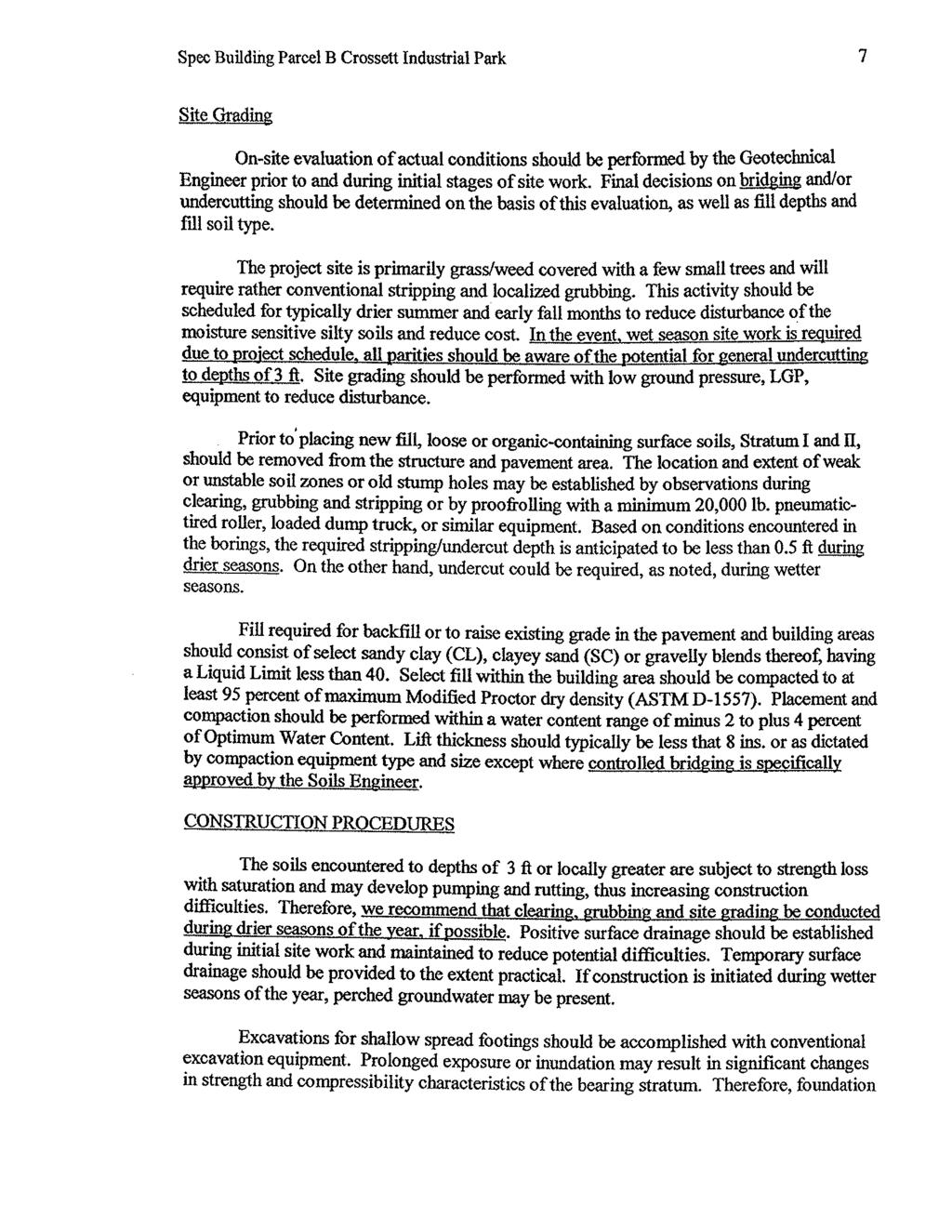
33 Revised: March 10, 2003 FIGURE NUMBER 2-1: SITE LOCATION MAP Site Crossett Industrial Park Vacant Property Crossett, Arkansas USGS 7.5 Minute Topographic Map Crossett North, AR Quadrangle North Phase I Environmental Site Assessment 7 Vacant Property (Crossett, AR)

34 Revised: March 10, 2003 FIGURE NUMBER 2-2: GENERAL SITE MAP Forestland KAGH Radio Station Yale Camp Forestland Vacant Property Pole Mounted Transformer Source: Crossett Economic Development Phase I Environmental Site Assessment Vacant Property (Crossett, AR) 8
35 Revised: March 10, Abstract An abstract was provided by Mr. Mike Smith of the Crossett Economic Development Foundation and was reviewed as part of this assessment. A copy of the abstracts for the property is included in Appendix E. The Crossett Economic Development Foundation currently owns the property. According to Mr. Mike Smith, Executive Director of the Crossett Economic Development Foundation, the 60.6-acre property has been purchased as part of several transactions and donations from land owners beginning in Review of the abstract found the majority of the acre property has been owned by the Crossett Lumber Company (since 1904), which was then sold to Georgia Pacific Corporation in Georgia Pacific sold portions of the property to The Plum Creek Timberlands L.P. Company, approximately 36 acres of Parcel C of the subject property, which was then sold to the Crossett Economic Development Foundation in October 2000 and June Historically, paper/lumber companies that have utilized the property as forest harvesting have owned the property. No environmental concerns were identified during the review of the property abstracts Sanborn Fire Insurance Maps Sanborn Fire Insurance Maps for the area were not available for the subject property. It is not unusual for undeveloped or rural areas to be outside the Sanborn Map area for any given city R. L. Polk City Directories Historical Polk City Directories were not reviewed for the subject and surrounding properties as no directories were available. 2.6 Current and Past Uses of Adjoining Properties The surrounding properties are agricultural, industrial, commercial and residential. CBI Industries is located at the north end of Industrial Park Road and north of Parcel A and B and west of Parcel C. The Arkansas, Louisiana and Mississippi Railroad is located along the north boundary of Parcel C. Undeveloped forestland is located to the north beyond the railroad. Yale Camp is located on the adjoining property on the northeast corner of Parcel C. Yale Camp is Phase I Environmental Site Assessment 9 Vacant Property (Crossett, AR)
36 Revised: March 10, 2003 currently utilized as a Girl Scout camp. Historically the camp was used by Yale University for research (forestland and timber research). The remaining properties to the east of Parcel C are undeveloped forestland. E. Wellfield Road borders the entire property to the south with undeveloped vacant land located to the south beyond E. Wellfield Road. Mr. Mike Smith indicated that a Sports Complex was planning to be built on this property. The KAGH Radio Station is located to the north of Parcel A. Residential properties are located to the west of E. Wellfield Road and Jim Shoulders Road. Historical topographic maps and aerial photographs confirm that surrounding properties to the south and west have been undeveloped. Phase I Environmental Site Assessment 10 Vacant Property (Crossett, AR)
37 Revised: March 10, RECORDS REVIEW AND INTERVIEWS 3.1 Environmental Database Information and Records Review ECCI obtains information regarding federal environmental databases from EDR in Southport, Connecticut. These databases contain site-specific information regarding a variety of potential environmental concerns including hazardous waste activities, the operation of aboveground and underground storage tanks, remediation investigations performed by the EPA, and other items. During this search, several databases are reviewed to identify sites which are in close proximity to the property and which may present a potential environmental risk to the property. The search information conforms to the record search requirements of the Standard. Based upon the EDR report, the subject property was not identified by the environmental records search as having recognized environmental conditions. The EDR report, dated February 4, 2003 is presented in Appendix D. The EDR report also included information on 42 "orphan" (unmapped) facilities that were not mapped due to poor, duplicate, or inadequate addresses. ECCI has made a reasonable effort to reconcile this information utilizing resources which ECCI currently has available. ECCI exercised its professional judgment in an attempt to evaluate whether or not the orphan sites are located within the approximate minimum search distances. ECCI did locate some orphan facilities within the appropriate search radii. The orphan facilities not identified were either: A) located beyond the approximate minimum search distances; B) not located in the anticipated upgradient direction; or C) ECCI could not determine its location. Therefore, the remaining orphan facilities were not identified as a potential environmental concern. The subject property was not identified in the environmental records review as having recognized environmental conditions. The following facilities were identified in the environmental records review as having environmental conditions within the appropriate search radii specified in the Standard: Crossett Road Mart 101 Fairview Road listed in the Underground Storage Tank (UST) database. Crossett Road Mart is located approximately 1/4 to 1/2 mile north, northwest of the subject property at a higher elevation. The facility is listed as having four (4) USTs. Phase I Environmental Site Assessment 11 Vacant Property (Crossett, AR)
38 Tank Installed Status Contents Details 1 01/01/1991 In Use Gasoline 10,000 gallon steel UST 2 01/01/1991 In Use Gasoline 10,000 gallon steel UST 3 01/01/1991 In Use Gasoline 10,000 gallon steel UST 4 01/01/1991 In Use Diesel 10,000 gallon steel UST Revised: March 10, 2003 This facility presents a low probability of impacting the subject property because the distance from the subject property, and no releases have been documented as occurring on the property. One Hour Martinizing 507 East 1 st Avenue listed in the Resource Conservation and Recovery Information System (RCRIS) database as a small quantity generator (SQG) of hazardous waste. The facility is located approximately 1/2 to 1 mile west of the subject property at a higher elevation. No violations or reports of releases were found regarding this site. This facility presents a low probability of impacting the subject property as facility is a SQG of hazardous waste and no releases have been documented. Minit Shop 405 East 1 st Avenue listed in the UST database. Minit Shop is located approximately 1/2 to 1 mile west of the subject property at a higher elevation. The facility is listed as having four (4) USTs. Tank Installed Status Contents Details 1 01/01/1984 In Use Gasoline 4,000 gallon fiberglass UST with release detection 2 01/01/1977 In Use Gasoline 6,000 gallon steel UST with release detection 3 01/01/1968 In Use Diesel 6,000 gallon steel UST with release detection 4 01/01/1968 In Use Gasoline 6,000 gallon steel UST with release detection This facility presents a low probability of impacting the subject property because the distance from the subject property, and no releases have been documented as occurring on the property. Hiway 82 Exxon Highway 82 and Beech Street UST database. Exxon is located approximately 1/2 to 1 mile west of the subject property at a higher elevation. The facility is listed as previously operating three (3) USTs. Phase I Environmental Site Assessment 12 Vacant Property (Crossett, AR)
39 Revised: March 10, 2003 Tank Installed Status Contents Details 1 01/01/1980 Removed 09/01/1988 Gasoline 4,000 gallon steel UST 2 01/01/1980 Removed 09/01/1988 Gasoline 6,000 gallon steel UST 3 01/01/1980 Removed 09/01/1988 Gasoline 6,000 gallon steel UST This facility presents a low probability of impacting the subject property because the distance from the subject property and no releases have been documented as occurring on the property. Eagle Tire, Inc. 403 Fairview listed in the Solid Waste Permit Holder Data Files as a solid waste facility/landfill site (SWF/LF). Eagle Tire, Inc. is located approximately one (1) mile northwest of the subject property. The Eagle Tire Company is permitted as a waste tire facility that stores outdoors no more than 3,000 loose waste tires or up to a maximum of 10,000 tires, which have been compacted or baled at any one time. No violations were noted in the database search. Due to the distance from the subject property, the facility presents a low probability of impacting the subject property. Crossett Public Schools 301 West Avenue located in the Leaking Underground Storage Tank (LUST) database. Crossett Public Schools is located approximately 3/4 miles southwest of the subject property at a lower elevation. A summary of the USTs on site are described in the following table: Tank Installed Status Contents Details 1 01/01/1959 Removed 07/16/1991 Gasoline 1,000 gallon steel UST 2 01/01/1979 Removed 07/17/1991 Gasoline 4,000 gallon steel UST 3 06/01/1990 In Use Gasoline 4,000 gallon fiberglass UST with release detection 4 06/01/1990 In Use Diesel 10,000 gallon fiberglass UST with release detection This facility has reported releases on several occasions. See the table below for details of each release reported. Phase I Environmental Site Assessment 13 Vacant Property (Crossett, AR)
40 Revised: March 10, 2003 Date Details of Release Reported 10/24/1997 The monthly reconciliation report indicated that a possible leak or release had occurred with the UST containing diesel. A tank and line tightness test was conducted that revealed no problems with the system. No further action was required. 02/15/1999 Statistical Inventory Reconciliation s (SIRs) for January and February 1999 indicated a problem. The investigation found a data error with no releases occurring. No further action was required. 01/11/2001 The daily stick check indicated water gain to the inventory of the diesel UST (approximately 100 gallons) indicating a potential water leak at the top of the tank. No additional information was found regarding this investigation. The facility presents a low probability of impacting the subject property because the distance from the subject property, and the tanks are down gradient of the subject property. E-Z Mart 344 Highways 133 and 52 located in the LUST database. E-Z Mart is located approximately 1 mile west of the subject property at a higher elevation. A summary of the USTs on site are described in the following table: Tank Installed Status Contents Details 1 01/01/1983 In Use Gasoline 6,063 gallon steel UST with release detection installed in December /01/1983 In Use Gasoline 6,063 gallon steel UST with release detection installed in December /01/1983 In Use Gasoline 4,030 gallon steel UST with release detection installed in December /01/1983 In Use Diesel 10,152 gallon steel UST with release detection installed in December This facility has reported releases on several occasions. See the table below for details of each release reported. Date Details of Release Reported 2/17/1997 SIR for January 1997 indicated a problem with the diesel UST. E-Z Mart was instructed to continue monitoring and report if SIR continued to indicated unusual operating conditions. No additional information was found for this SIR problem. Phase I Environmental Site Assessment 14 Vacant Property (Crossett, AR)
41 Revised: March 10, 2003 Date Details of Release Reported 10/20/1997 SIR for September 1997 indicated a problem with the gasoline UST. E-Z Mart was instructed to continue monitoring and reporting if SIR continued to indicated unusual operating conditions. No additional information was found for this release. 01/11/1999 E-Z Mart reported a release of approximately 75 gallons of diesel when a customer placed the nozzle down and turned the pump on, then leaving the parking lot. The Manager turned off the pump and put out booms and absorbent pads to contain the diesel release. No additional information was found for this release. 02/22/1999 SIRs indicated unusual operating conditions on the dates listed to the 03/15/1999 left. E-Z Mart was instructed to continue monitoring and reporting if 08/24/1999 SIR continued to indicated unusual operating conditions. No 08/27/1999 additional information was found for these reported unusual 09/21/1999 operating conditions. 11/29/ /27/ /05/ /03/ /25/2001 The line failed during a line tightness test resulting in taking the system out of operation and scheduling the lines for upgrading. The soils affected by the release where removed and no further action was 03/19/ /16/ /26/ /11/ /14/ /12/ /13/ /18/ /10/2003 required. SIRs indicated unusual operating conditions on the dates listed to the left. E-Z Mart was instructed to continue monitoring and reporting if SIR continued to indicated unusual operating conditions. No additional information was found for these reported unusual operating conditions. The facility presents a low probability of impacting the subject property because the distance from the subject property. 3.2 Interviews Owner/Occupant According to the owner s representative, Mr. Mike Smith, the acres has been obtained by the Crossett Economic Development Foundation through donations and purchases of several tracts of land. An abstract was provided by Mr. Smith and is enclosed as Appendix E. Mr. Smith indicated that the entire property and parts of the Phase I Environmental Site Assessment 15 Vacant Property (Crossett, AR)
42 Revised: March 10, 2003 surrounding properties were at one time owned by the Crossett Lumber Company (now Georgia Pacific) and by the Plum Lumber Company. A few tracts of land were obtained from private landowners. According to Mr. Smith, the property has always been utilized as forestland for tree harvesting for the Lumber Companies that owned the property. To the best of his knowledge, no industrial activities has occurred on the subject property Zoning Department Interview Mr. Mike Smith provided the zoning ordinances for the property to ECCI for review. The property is currently zoned light industrial Health Department Interview Not applicable. No on-site septic system is located on the property. Phase I Environmental Site Assessment 16 Vacant Property (Crossett, AR)
43 Revised: March 10, SITE RECONNAISSANCE 4.1 Onsite Conditions Hazardous Substances in Connection with Identified Uses The property is currently unoccupied. Therefore, no hazardous substances were identified in connection with the current use Hazardous and/or Unidentified Substance Containers The property was vacant at the time of the site inspection. No hazardous substances were identified on site. The table below summarizes the findings of the site reconnaissance conducted on February 5, Description Hazardous Substances/Petroleum Products Storage Tanks Odors Pools of Liquid Drums Unidentified Substance Containers PCBs Pits, Ponds, Lagoons Stained Soil or Pavement Stressed Vegetation Solid Waste Note: Numerous debris piles of trees limbs and underbrush was observed on Parcel C of the property. Waste Water Wells Septic Systems Observation Yes No No No No No No No No No No No Storage Tanks No storage tanks were observed onsite during the site inspection. Nor was there any evidence of underground storage tanks located onsite. It should be noted that a sewer lift station was observed on the adjacent property to the north of Parcel B on CBI Industries Polychlorinated Biphenyls Two (2) pole-mounted transformers (PMT) were observed on-site along the northern boundary of Parcel A and B, and one (1) PMT was observed along the western Yes No No No Phase I Environmental Site Assessment 17 Vacant Property (Crossett, AR)
44 boundary of Parcel C (near the water tower). The transformers appear in good Revised: March 10, 2003 condition. No leakage or soil stainage was observed around the transformer. Interviews with Mr. Hal Beard, Senior Environmental Specialist, of Entergy Corporation found that the PMTs are the property of Entergy. Mr. Beard indicated that the PMTs have not been tested for polychlorinated biphenyls (PCBs). However, in the event of a spill from these transformers, Entergy, Inc. would take the appropriate action for cleanup Solid Waste No solid waste was observed on the property during the site inspection, with the exception of numerous debris piles of tree limbs and underbrush from the results of clearing activities recently conducted onsite (Parcel C). No stainage or stressed vegetation was found in this area. 4.2 Adjoining Properties The site reconnaissance found that the surrounding properties as undeveloped, commercial and light industrial. CBI Industries and the KAGH Radio Station is located to the north, undeveloped properties are located to the south across E. Wellfield Road; forestland is located to the east with Yale Camp (Girl Scout Camp) located to the northeast; and the Arkansas Louisiana and Mississippi Railroad is located to the north of Parcel C. The properties to the immediate west across E. Wellfield Road are wooded with residential properties beyond the woods. The City of Crossett owns the drinking water tower located near the southwest corner of Parcel C. The KAGH Radio Station, CBI Industries or the City of Crossett (water tower) facilities were not identified during the records review as having addressed any current or past environmental issues with the regulatory agencies, and does not appear to be of environmental concern. No concerns were noted regarding any immediately adjoining properties to the north, east, west, or south. Phase I Environmental Site Assessment 18 Vacant Property (Crossett, AR)
45 Revised: March 10, SUMMARY OF SIGNIFICANT FINDINGS This section presents ECCI s professional opinion of the significance of the historical and current records review, interviews, and site reconnaissance. 6.1 Historical and Current Records Review Information regarding previous owners and the history of the subject property was sufficient for detailed evaluation of onsite recognized environmental conditions. Based upon this review, recognized environmental conditions were not identified on the property. The assessment revealed five (5) sites in the UST database within 1/2 to 1 mile of the subject property; one (1) site in the RCRIS SQG database within 1/2 to 1 mile of the subject property; one (1) site in the SWF/LF database within 1 miles of the subject property, and two (2) sites in the LUST within 3/4 to 1 mile of the subject property. The properties and data base listings identified as being of potential environmental concern are as follows: Crossett Road Mart Crossett Road Mart is located approximately 1/4 to 1/2 mile north, northwest of the subject property at a higher elevation. The facility is listed as having four (4) USTs. This facility presents a low probability of impacting the subject property because the distance from the subject property, and no releases have been documented as occurring on the property. One Hour Martinizing listed as a small quantity generator of hazardous waste. The facility is located approximately 1/2 to 1 mile west of the subject property at a higher elevation. No violations or reports of releases were found regarding this site. This facility presents a low probability of impacting the subject property as the facility is a SQG of hazardous waste, and no releases have been documented. Minit Shop Minit Shop is located approximately 1/2 to 1 mile west of the subject property at a higher elevation. The facility is listed as having four (4) USTs. This facility presents a low probability of impacting the subject property because the distance from the subject property, and no releases have been documented as occurring on the property. Phase I Environmental Site Assessment 19 Vacant Property (Crossett, AR)
46 Revised: March 10, 2003 Hiway 82 Exxon Exxon is located approximately 1/2 to 1 mile west of the subject property at a higher elevation. The facility is listed as previously operating three (3) USTs. This facility presents a low probability of impacting the subject property because the distance from the subject property and no releases have been documented as occurring on the property. Eagle Tire, Inc. Listed as a solid waste facility/landfill site, Eagle Tire, Inc. is located approximately one (1) mile northwest of the subject property. Eagle Tire is permitted as a waste tire facility that stores outdoors no more than 3,000 loose waste tires or up to a maximum of 10,000 tires, which have been compacted or baled at any one time. No violations were noted in the database search. Due to the distance from the subject property, the facility presents a low probability of impacting the subject property. Crossett Public Schools Crossett Public Schools is located approximately 3/4 mile southwest of the subject property at a lower elevation. Crossett Public Schools operate two USTs and are listed in the LUST database as having had past releases from the USTs. The facility presents a low probability of impacting the subject property because the distance from the subject property, and the tanks are down gradient of the subject property. E-Z Mart 344 E-Z Mart is located approximately 1 mile west of the subject property at a higher elevation as operating four (4) USTs. This facility is also located in the LUST database as having reported releases on several occasions. However, due to the distance from the subject property, the facility presents a low probability of impacting the subject property. 6.2 Interviews There were no indications of environmental concern on the subject property raised as a result of the site inspection and interviews with the current owner/occupant representative or other parties knowledgeable with the current or past uses of the property. Phase I Environmental Site Assessment 20 Vacant Property (Crossett, AR)
47 Revised: March 10, Site Reconnaissance The adjoining properties were observed to be undeveloped, commercial and light industrial. No indication of potential environmental concern for the adjoining properties was identified during the site reconnaissance. There was no indication of recognized environmental conditions on the subject property during the site reconnaissance. Phase I Environmental Site Assessment 21 Vacant Property (Crossett, AR)
48 Revised: March 10, CONCLUSIONS Engineering, Compliance, & Construction, Inc. (ECCI) has performed a Phase I ESA for Crossett Economic Development Foundation in Crossett, Arkansas. This Phase I Environmental Site Assessment has been performed in conformance with the scope and limitations of American Society for Testing and Materials (ASTM) Practice E , Environmental Site Assessments: Phase I Environmental Site Assessment, hereinafter referred to as the Standard. Any exceptions to, or deletions from, the Standard are discussed in the appropriate section of this report. This report will serve to summarize the work performed by ECCI professionals as part of this project. The property is located in a light industrial area in the eastern part of Crossett, Arkansas. The property consists of three (3) parcels of land on approximately 60.6 acres in the Crossett Industrial Park. The property, currently vacant, partially wooded and undeveloped, is described in Section 2 of this report. During the course of this project, ECCI performed a site reconnaissance, reviewed federal, state, and local records, and interviewed persons familiar with the property to ascertain historical use of the property and surrounding areas. This assessment did not reveal the presence of recognized environmental conditions on the subject property, and no additional assessment is recommended at this time. This assessment has revealed facilities within a 1/2 to 1 mile radius that listed in the environmental database search. However, detailed review of these facilities revealed there are no significant recognized environmental conditions that exist on properties within close proximity to the subject property. It is the opinion of the environmental professional who performed the assessment and prepared this report that the environmental risk associated with the subject property is low. This risk rating is based upon a scale of low, moderate, high and very high. Phase I Environmental Site Assessment 22 Vacant Property (Crossett, AR)
49
50
51
52
53
54
55
56
57
58
59
60
61
62
63
64
65
66
67 Appendix C
68 RESTRICTIVE COVENANTS for CROSSETT INDUSTRIAL PARK PURPOSE: To assure to the original and subsequent property owners within the park and near owners a clean atmosphere, free of pollution, attractive grounds and ready access by pedestrians and vehicles within and to the park without imposing unnecessary or unreasonable restrictive conditions upon use and occupancy of lots in the park. CONTROL COMMITTEE: The Control Committee will be made up of four (4) people selected from the Business and Industry Committee and the President of the Crossett Economic Development Foundation as elected by the Board of Directors of the Crossett Economic Development Foundation, and from time to time shall have the authority and power (1) to fix prices for and approve original purchasers; (2) recommend addition to, deletion of, or modifications of the restrictive covenant, and as per paragraph below, Change of Covenants and (3) to require compliance with covenants, including seeking injunctive relief in case of violations through arbitration or legal actions at the option of the committee. CHANGE OF COVENANTS: On recommendation of the Control Committee, with approval of 60% of the owners of all parcels in the park which have been sold by the Control Committee, given by written authority from property owners within (10) days of a proposed change, any of the covenants may be modified or deleted or new covenants may be added, such notice to be given to all owners in writing. For this purpose each owner of parcels (or a representative of parcels owned by more than one person or by an entity) shall only have one vote and notice to the owner or representative is sufficient. The Crossett Economic Development Foundation shall always be entitled to one vote. If there is a tie, the committee will make the final decision. EFFECT OF COVENANTS: These covenants are covenants running with the land, are equally applicable to each parcel or tract in the park, and may be enforced by the Control Committee, but if the committee will not act, then by any present parcel owner, by a proceeding instituted in a court of competent jurisdiction.
69 SPECIFIC COVENANTS: 1. No part of the park may be utilized in any manner that constitutes a nuisance or that results in contamination or pollution contrary to any applicable local, state or federal pollution control or environmental protective law, ruling or regulations. 2. Uses of parcel is restricted to light industrial manufacturing, warehousing, transporting and services, usually restricted to activity within minimum emission of smoke, gas, odors or noise and imparting minimum impact on adjoining and nearby property owners. USE OF PROPERTY: 3. The lands subject to these covenants shall not be used for residential purposes, nor for the retail sale of any merchandises or services, except that merchandise and those services which the committee may authorize, or furnished solely for benefit of employees of occupants. DISTANCE BETWEEN BUILDINGS: 4. No structures or buildings shall be located closer than 10 feet to any side building site line or rear property line, it being the intent that an open area of at least 30 feet shall exist between all adjacent but separately owned improvements, both at sides and rear; provided, however, that where a rear property line adjoins a dedicated alley, this provision regarding the rear property line shall not apply. SETBACK REQUIREMENTS: 5. No building, parking lot or other structure shall be erected, constructed or maintained within 35 feet of any street, and said restricted area shall be landscaped with lawn, trees or shrubs according to plans approved by the committee and shall be kept free of vehicle parking. The back of buildings served by rail shall be setback 17 feet from the railroad right-of-way. Provided, the committee may, at its election, permit automobile service station pumps to be maintained at any point not less than 20 feet from any street. USE OF LAND BETWEEN BUILDINGS: 6. No building or structure above ground shall encroach upon or into the setback area between building and said area is to be used either for open landscaping areas or for off street surfaced parking areas. In either event, said area shall be maintained in accordance with plans to be first approved by the committee. TYPES OF BUILDING MATERIALS: 7. All buildings or other structures erected on the property shall be of generally accepted permanent material approved by the committee. EXCAVATIONS: 8. No excavation shall be made on the said lands except excavations for the purpose of building on the same at the time commencement of such building or for the improvement of the grounds thereof and except excavations for the installation of
70 underground storage tanks for petroleum products. No soil, sand or gravel shall be removed from the said lands except as part of such excavations. CUTTING OF TREES: 9. No living tree shall be cut down or removed from the said lands other than those standing in an area to be excavated for the erection of a building thereon or within an area for parking as indicated in the site plans approved by the committee without the consent in writing to the committee or its successors. OPEN STORAGE OF MATERIALS: 10. No goods, equipment, supplies or other materials shall be stored in the open except on the rear two-thirds (2/3) of any lot, then only when such open storage is fenced with screening fence at least six (6) feet in height. All fencing for screening, security or other purposes shall be attractive in appearance and shall be of an all metal industrial type fence of galvanized or non-ferrous material, or other comparable material approved by the committee. MAINTENANCE OF PREMISES: 11. Each owner shall keep its premises, building, improvements, and appurtenances in a safe, clean neat, wholesome condition, and shall comply in all respects with all government health and public safety requirements; each owner will remove, at its own expense, any rubbish of any character which may accumulate on his property. SIGNBOARDS: 12. No billboards or advertising signs other than those identifying the name, business and products of the person or firm occupying the premises shall be permitted, except that a sign not to exceed ten (10) feet by twenty (20) feet in size offering the premises for sale or lease may be permitted. FENCING: 13. No fence, masonry wall, hedge or mass planting shall be permitted to extend beyond the building lines established herein except upon approval in writing by the committee. OIL TANKS: 14. No oil drilling, oil development operation, refining mining operations of any kind or quarry shall be permitted upon or in any of the building sites subject to these covenants nor shall oil wells, tanks, tunnels, mineral excavations or shafts related mining or oil drilling be permitted upon drilling any of the building sites covered by these covenants. Bulk storage of all liquids including gasoline or petroleum products on the outside of buildings shall be permitted only upon written consent of the committee in locations as approved by the committee in writing and subject to compliance with rules and regulations of any governmental agency or agencies having jurisdiction over such matters.
71 NUISANCES: 15. The said lands or any part thereof or any building or erection thereon or to be erected or placed thereon shall not be used for any purpose or in such a manner which shall be a nuisance to the occupants or owners of any neighboring lands or buildings or to the Industrial Park in general by reason of the emission from the said lands or any part thereof or the creation thereon of odors, gases, dust, smoke, noise, fumes, waste or otherwise. Determination of whether an industry or business is objectionable for any of the above reasons shall be at the sole discretion of the committee. Said land shall not be used for manufacture, storage, distribution or sale of any materials or products which shall increase the insurance rates of the adjoining property or for any purposes which constitute a nuisance in the generally accepted definition of that term, and any party claiming hereunder agree to use said property in compliance with all laws of the State of Arkansas and of the United States. LOADING DOCKS: 16. It is contemplated that maneuvering of trucks and trailers be confined, as far as possible, to the premises of each establishment. To that end it is herby provided that no loading dock extend beyond the 17 foot or the 10 foot setback building lines and no loading docks shall be located facing an arterial street unless ample space is provided for maneuvering vehicles on the premises. Adopted this 11 day of August, 2003 Attest: Judy Kirkley, Secretary Crossett Economic Development Foundation Edward L. Holt, President
72
73
74
75
76
77
78
79
80
81
82 Appendix D
83
84
85
86
87
88
89
90
91
92
93
94
95
96 Appendix E
97
98 Transportation Network Map

99 Utilities Map
100


101 Appendix F
Environmental Audit Standards
 Environmental Audit Standards Lender requires an acceptable Phase I Environmental Audit Report, directed to Lender and historical in nature, which is to be prepared in accordance with the standards set
ENVIRONMENTAL SITE ASSESSMENT (AAI COMPLIANT PHASE I)
") ENVIRONMENTAL SITE ASSESSMENT (AAI COMPLIANT PHASE I) IPP.MORELAND AVENUE ASSEMBLAGE 785-793 MORELAND AVENUE ATLANTA, GEORGIA, 30316 ONE GROUP PROJECT #A6092 JANUARY 28, 2008 PREPARED FOR: FAIRVIEW COMMERCIAL
ENVIRONMENTAL SITE ASSESSMENT (AAI COMPLIANT PHASE I) IPP.MORELAND AVENUE ASSEMBLAGE 785-793 MORELAND AVENUE ATLANTA, GEORGIA, 30316 ONE GROUP PROJECT #A6092 JANUARY 28, 2008 PREPARED FOR: FAIRVIEW COMMERCIAL
Phase I Environmental Site Assessment Update Memorandum Vacant Property 1585 Santa Clara Avenue Santa Ana, California 92507
 March 1, 2011 Mr. Vincent C. Fregoso, AICP City of Santa Ana 20 Civic Center Plaza Santa Ana, CA 92702 Re: Phase I Environmental Site Assessment Update Memorandum Vacant Property 1585 Santa Clara Avenue
PHASE I ENVIRONMENTAL SITE ASSESSMENT
 PHASE I ENVIRONMENTAL SITE ASSESSMENT ACME Gas 55 Garden Street Columbus, Ohio, 45123 Prepared for ACME Oil & Gas Ltd. Prepared by GAEA Environmental Services 87 Garden Street Whitby, Ontario L1N 9E7 November
PHASE I ENVIRONMENTAL ENGINEERING PHASE I REPORT 3264 PREPARED FOR: Mark Hopkins. Liberty Real Estate, LLC. 741 North State Road.
 PHASE I ENVIRONMENTAL ENGINEERING PHASE I REPORT 3264 PREPARED FOR: Mark Hopkins Liberty Real Estate, LLC 741 North State Road Salem, Utah 84653 May 25, 2012 SITE LOCATION Hawthorn Mobile Home Park 10682
PHASE I ENVIRONMENTAL SITE ASSESSMENT REPORT 3.3-ACRE ECKENRODE PROPERTY WARWICK TOWNSHIP, TUSCARAWAS COUNTY, OHIO. Prepared for: OHIOLAND, LLC
 PHASE I ENVIRONMENTAL SITE ASSESSMENT REPORT 3.3-ACRE ECKENRODE PROPERTY WARWICK TOWNSHIP, TUSCARAWAS COUNTY, OHIO Prepared for: OHIOLAND, LLC Prepared by: CIVIL & ENVIRONMENTAL CONSULTANTS, INC. COLUMBUS,
DRAFT - Subject to Change. Cathedral Building 212 North Ash Street Crookston, Minnesota. Prepared For. Project FA June 29, 2011
 DRAFT Phase I Environmental Site Assessment Cathedral Building 212 North Ash Street Crookston, Minnesota Prepared For Braun Intertec Corporation Ms. Kay Hegge Prairie Skyline Foundation 27048 310th Street
Proposed Laurel 2 Solar Facility Jessup Road at Vaughn & Diehl Roads Imperial County, California
 Phase I ESA Report Proposed Laurel 2 Solar Facility Jessup Road at Vaughn & Diehl Roads Imperial County, California Prepared for: 9FI 8ME, LLC 221 Sutter Street, 6 th Floor San Francisco, CA 9418 Prepared
Hazardous Materials in Project Development Additional Guidance
 Hazardous Materials in Project Development Additional Guidance Contents:...2 AASHTO Guidance...3 USDOT Brownfields Guidance...4 ASTM Standard Practices...6 Hazardous Materials in Project Development 1
1976 Fargo, ND City Directory - R.L. Polk & Co.
 1986 Fargo, ND City Directory - R.L. Polk & Co. 1981 Fargo, ND City Directory - R.L. Polk & Co. 1976 Fargo, ND City Directory - R.L. Polk & Co. 1971 Fargo, ND Directory - R.L. Polk & Co. 1971 Fargo, ND
Real Estate Gift Fact Sheet/Gift Proposal
 DONOR INFORMATION Donor Legal Name(s) and Advance ID Number(s): Real Estate Gift Fact Sheet/Gift Proposal Residential Address: Telephone (home): Telephone (business): Fax: E-mail address: GENERAL PROPERTY
ENVIRONMENTAL QUESTIONNAIRE AND DISCLOSURE STATEMENT
 ENVIRONMENTAL QUESTIONNAIRE AND DISCLOSURE STATEMENT The purpose of this questionnaire is to provide information about the past and present ownership and uses of the real property upon which lender will
PHASE I ENVIRONMENTAL SITE ASSESSMENT
 PHASE I ENVIRONMENTAL SITE ASSESSMENT ST. MALACHY PROPERTY, BROWNSBURG HENDRICKS COUNTY, INDIANA Terra Project No. 13-013 Environmental Audit Report Privileged Document PREPARED FOR: Town of Brownsburg
PHASE I ENVIRONMENTAL SITE ASSESSMENT 904, 911 & 1007 South 20 th Street OMAHA, DOUGLAS COUNTY, NEBRASKA
 PHASE I ENVIRONMENTAL SITE ASSESSMENT 904, 911 & 1007 South 20 th Street OMAHA, DOUGLAS COUNTY, NEBRASKA Prepared for: J & C Snelling Properties LLC Benesch Project No. 00120137.00 March 2013 Prepared
PHASE I ENVIRONMENTAL SITE ASSESSMENT 1724 VINTON STREET & 2702 SOUTH 18 TH STREET OMAHA, DOUGLAS COUNTY, NEBRASKA
 PHASE I ENVIRONMENTAL SITE ASSESSMENT 1724 VINTON STREET & 2702 SOUTH 18 TH STREET OMAHA, DOUGLAS COUNTY, NEBRASKA Prepared for: The Estate of George W. Murray & the Omaha Brownfields Coalition Benesch
Environmental Questionnaire
 SBA Loan Number: Environmental Questionnaire Applicant Name: of Site Visit: Name/Title of Person Doing Site Visit: Site Name or Business Name: Site Street Address: City, State, Postal Code: County: Site
PHASE I ENVIRONMENTAL SITE ASSESSMENT AGGREGATE PRODUCTION ASSOCIATES PARCEL 2623 CENTER STREET OMAHA, DOUGLAS COUNTY, NEBRASKA
 PHASE I ENVIRONMENTAL SITE ASSESSMENT AGGREGATE PRODUCTION ASSOCIATES PARCEL 2623 CENTER STREET OMAHA, DOUGLAS COUNTY, NEBRASKA Prepared for: Aggregate Production Associates, Inc. & the Omaha Brownfields
PHASE I ENVIRONMENTAL SITE ASSESSMENT
 PHASE I ENVIRONMENTAL SITE ASSESSMENT SARASOTA CENTER LOTS 141, 1571, 161, AND 515 SARASOTA CENTER BLVD ENGLEWOOD, FLORIDA 34224 SEPTEMBER 21, 212 NOVA PROJECT NO. E12 3583 Leaders in Environmental and
Phase I Environmental Site Assessments for Corridors
 Phase I Environmental Site Assessments for Corridors Prepared by: Kimberly Perkins and Jill Biesma 1 Environmental Advisors and Engineers 19211 W. 64 th Terrace, Shawnee, KS 66218 (913) 599-4326 Goal Of
Real Estate Environmental Questionnaire and Disclosure Statement
 Real Estate Environmental Questionnaire and Disclosure Statement The following pages comprise an Environmental Questionnaire and Disclosure Statement which must be completed by the loan applicant before
October 29, 2013 Florida Brownfields Association Conference, Orlando
 Site Inventories October 29, 2013 Florida Brownfields Association Conference, Orlando Andrew M. Lawn, M.S., P.G. Principal Hydrogeologist Holden Heights Areas HSW & Orange County Environmental Protection
DRAFT FINAL FINDING OF SUITABILITY TO TRANSFER (FOST) Little Patuxent River Parcel. October 16, 2013
 Little Patuxent River Parcel. October 16, 2013") DRAFT FINAL FINDING OF SUITABILITY TO TRANSFER (FOST) Little Patuxent River Parcel October 16, 2013 1. PURPOSE The purpose of this Finding of Suitability to Transfer (FOST) is to document the environmental
DRAFT FINAL FINDING OF SUITABILITY TO TRANSFER (FOST) Little Patuxent River Parcel October 16, 2013 1. PURPOSE The purpose of this Finding of Suitability to Transfer (FOST) is to document the environmental
A.3. ARTICLE 7 PLAN REQUIREMENTS FOR MINOR SUBDIVISION AND/OR LAND DEVELOPMENT
 700. 701.A.3. ARTICLE 7 PLAN REQUIREMENTS FOR MINOR SUBDIVISION AND/OR LAND DEVELOPMENT SECTION 700 PURPOSE The purpose of this Article is to set forth a streamlined set of Plan Requirements for minor
Mega SITE CLASSIFICATION STANDARDS & APPLICATION INSTRUCTIONS
 Mega SITE CLASSIFICATION STANDARDS & APPLICATION INSTRUCTIONS Application Checklist SUBMISSION Submit one hard copy in a three-ring binder. Submit one digital copy on a USB flash drive. Send the hard copy
BLACK RIVER FALLS INDUSTRIAL SITE
 WISCONSIN ECONOMIC DEVELOPMENT CORPORATION BLACK RIVER FALLS INDUSTRIAL SITE COMMUNITY OVERVIEW Black River Falls is located on the Black River in Jackson County, strategically located along I-94 between
PHASE I ENVIRONMENTAL SITE ASSESSMENT SOUTH OMAHA TERMINAL WAREHOUSE 4913 SOUTH 27 th STREET OMAHA, DOUGLAS COUNTY, NEBRASKA
 PHASE I ENVIRONMENTAL SITE ASSESSMENT SOUTH OMAHA TERMINAL WAREHOUSE 4913 SOUTH 27 th STREET OMAHA, DOUGLAS COUNTY, NEBRASKA Prepared for: South Omaha Terminal Warehouse & the Omaha Brownfields Coalition
DUE DILIGENCE. Presented at. Lydia Work, Senior Chemist Licensed Remediation Specialist Triad Engineering, Inc.
 DUE DILIGENCE Presented at Lydia Work, Senior Chemist Licensed Remediation Specialist Triad Engineering, Inc. due dil i gence appropriate carefulness: the degree of care that a prudent person would exercise,
The University of Texas System Systemwide Policy. Policy: UTS Title. Environmental Review for Acquisition of Real Property. 2.
 1. Title 2. Policy Environmental Review for Acquisition of Real Property Sec. 1 Sec. 2 Policy Statement. It is the policy of The University of Texas System to minimize its potential for exposure to claims
PHASE I ENVIRONMENTAL SITE ASSESSMENT Bluff City Boulevard Elgin, Illinois ETS Project No A. Prepared for:
 PHASE I ENVIRONMENTAL SITE ASSESSMENT 366-368 Bluff City Boulevard Elgin, Illinois 60123 ETS Project No. 09-0243A Prepared for: Ms. Sarah Kaminski Elgin State Bank 1001 South Randall Road Elgin, Illinois
Address Southeast Quadrant of U.S. Highway 41 and Sumter Boulevard City. North Port State. FL Zip Code County
 SUBJECT AERIAL LOCATION LAND AREA THREE-YEAR OWNERSHIP HISTORY OF SUBJECT Address Southeast Quadrant of U.S. Highway 41 and Sumter Boulevard City North Port State FL Zip Code 34287 County Sarasota Nearest
PHASE I ENVIRONMENTAL SITE ASSESSMENT AXLES AND GEARS TRUCK PARTS WAREHOUSE 4808 SOUTH 26 TH STREET OMAHA, DOUGLAS COUNTY, NEBRASKA
 PHASE I ENVIRONMENTAL SITE ASSESSMENT AXLES AND GEARS TRUCK PARTS WAREHOUSE 4808 SOUTH 26 TH STREET OMAHA, DOUGLAS COUNTY, NEBRASKA Prepared for: Axles and Gears, Inc. & the Omaha Brownfields Coalition
BOARD OF REGENTS BRIEFING PAPER. 1. Agenda Item Title: Acquisition of Real Property located at 182 E. 9th Street, Reno NV
 BOARD OF REGENTS BRIEFING PAPER 1. Agenda Item Title: Acquisition of Real Property located at 182 E. 9th Street, Reno NV Meeting Date: September 5 & 6, 2013 2. BACKGROUND & POLICY CONTEXT OF ISSUE: Location
Voluntary standard; accepted by USEPA to comply with AAI rule. 2. Regulatory/Developmental History
 This table summarizes some of the primary differences between the New Jersey Department of Environmental Protection (NJDEP) Preliminary Assessment Report (PAR), pursuant to the April 2013 NJDEP Site Remediation
Light Industrial CLASSIFICATION STANDARDS & APPLICATION INSTRUCTIONS
 CLASSIFICATION STANDARDS & APPLICATION INSTRUCTIONS Application Checklist SUBMISSION Submit one hard copy in a three-ring binder. Submit one digital copy on a USB flash drive. Send the hard copy application
Due Diligence & Environmental Compliance Issues for Tribal Energy Projects: Hazardous Waste
 Due Diligence & Environmental Compliance Issues for Tribal Energy Projects: Law Seminars International Seattle, WA October 23, 2007 Connie Sue Manos Martin Hazardous Waste Overview Environmental Due Diligence:
Easement Criteria Evaluation Project: Black Gum Mitigation Bank southern Upshur County, Texas
 Easement Criteria Evaluation Project: Black Gum Mitigation Bank southern Upshur County, Texas Project Address: on the Sabine River south of Hwy 80 in southern Upshur County, Texas (entrance located about
Phase I Environmental Site Assessment Phase I Environmental Site Assessment. Siena Lakes Site Naples, Collier County, Florida
 `` Phase I Environmental Site Assessment Phase I Environmental Site Assessment Siena Lakes Site Naples, Collier County, Florida Parcel ID Nos. 00235960009, 00236000007, 00235560001, 855 NW State 00235520009
CHAPTER 3 PRELIMINARY PLAT
 10-3-1 10-3-3 SECTION: CHAPTER 3 PRELIMINARY PLAT 10-3-1: Consultation 10-3-2: Filing 10-3-3: Requirements 10-3-4: Approval 10-3-5: Time Limitation 10-3-6: Grading Limitation 10-3-1: CONSULTATION: Each
SUBDIVISION APPLICATION CHECKLIST SKETCH PLAN PRELIMINARY PLAT FINAL PLAT
 RECEIVED STAMP SUBDIVISION APPLICATION CHECKLIST SKETCH PLAN PRELIMINARY PLAT FINAL PLAT A checklist of background information and submission requirements for processing of a sketch plan, preliminary plat
Limited Environmental Due Diligence: Transaction Screen. McCampbell Property San Patricio County
 Limited Environmental Due Diligence: Transaction Screen McCampbell Property San Patricio County 0 LAN_McCampbellProperties_Xstrategic_November,2017 LIMITED ENVIRONMENTAL DUE DILIGENCE Executive Summary
VACANT LAND DISCLOSURE REPORT DISCLAIMER
 WISCONSIN REALTORS ASSOCIATION 4801 Forest Run Road Madison, Wisconsin 53704 VACANT LAND DISCLOSURE REPORT Page 1 of 5 DISCLAIMER THIS DISCLOSURE REPORT CONCERNS THE REAL PROPERTY LOCATED AT IN Lot 10,
Central Pennsylvania Conservancy Project Selection Criteria Form
 Central Pennsylvania Conservancy Project Selection Criteria Form The following criteria guide the actions of the Central Pennsylvania Conservancy s Land Protection Committee and Board of Directors in selecting
SELLER DISCLOSURE STATEMENT UNIMPROVED PROPERTY
 Seller Disclosure Statement-Unimproved Page 1 of 6 SELLER: Gerald & Judith 1 Seller To be used in transfers of unimproved residential real property, including property zoned for residential use that is
Certified Site Program Application Bolivar Business Park
 Certified Site Program Application Bolivar Business Park Sabrina Drackert Economic Development Researcher Springfield Area Chamber of Commerce 202 S. John Q. Hammons Parkway Springfield, Missouri 65806
Seller Property Disclosure (Commercial)
") 14114035 0 true 0 AR 60024816 test tbd4 036012-800153-54774 Taleda Mckee JC TH Page 1 of 7 TO BE COMPLETED BY SELLER: (Please Print) Date: 08/28/ Seller(s): River City Flooring, Inc. Seller is is not occupying
14114035 0 true 0 AR 60024816 test tbd4 036012-800153-54774 Taleda Mckee JC TH Page 1 of 7 TO BE COMPLETED BY SELLER: (Please Print) Date: 08/28/ Seller(s): River City Flooring, Inc. Seller is is not occupying
Marion County Board of County Commissioners
 Marion County Board of County Commissioners Date: 6/4/217 P&Z: 9/25/217 BCC Transmittal: 1/17/217 BCC Adopt: TBD Amendment No: 217-L6 Type of Application Large-Scale Comp Plan Amendment Request: Change
ENVIRONMENTAL DUE DILIGENCE
 ENVIRONMENTAL DUE DILIGENCE Developing Solar on Landfills & Brownfields June 12-13, 2017 Chicago, Illinois Matthew E. Cohn Greensfelder Hemker & Gale, P.C. 200 West Madison Street Suite 3300 Chicago, Illinois
Diamond Falls Subdivision PROPOSED YELLOWSTONE COUNTY BOARD OF PLANNING FINDINGS OF FACT
 Diamond Falls Subdivision PROPOSED YELLOWSTONE COUNTY BOARD OF PLANNING FINDINGS OF FACT The City/County Planning Staff has prepared the Findings of Fact for the Diamond Falls Subdivision. These findings
Sierra Pines Mobile Home Park Located in Markleeville, California
 , Lake Tahoe, CA 96150 Markleeville, Ca. 96120 Sierra Pines Mobile Home Park Located in Markleeville, California Coldwell Banker is pleased to present the Sierra Pines Mobile Home Park in Markleeville,
CITY OF VAUGHAN POLICY AND PROCEDURES FOR DEALING WITH CONTAMINATED OR POTENTIALLY CONTAMINATED SITES
 CITY OF VAUGHAN POLICY AND PROCEDURES FOR DEALING WITH CONTAMINATED OR POTENTIALLY CONTAMINATED SITES MAY 2001 This Report should be read in conjunction with the City of Vaughan BACKGROUND REPORT ON POLICY
Standard Practice for Environmental Site Assessments: Phase I Environmental Site Assessment Process 1
 Designation: E1527 13 Standard Practice for Environmental Site Assessments: Phase I Environmental Site Assessment Process 1 This standard is issued under the fixed designation E1527; the number immediately
RENITA HURDSMAN BEAR RIVER STATE PARK LAND EXCHANGE PROPOSAL
 DETAILED ANALYSIS RENITA HURDSMAN BEAR RIVER STATE PARK LAND EXCHANGE PROPOSAL June 1, 2006 Prepared by the Office of State Lands and Investments Herschler Building, 3W 122 West 25 th Street Cheyenne,
TOWN OF BRISTOL. Ontario County, New York APPLICATION FOR LOT LINE ADJUSTMENT
 TOWN OF BRISTOL Ontario County, New York APPLICATION FOR LOT LINE ADJUSTMENT Lot Line Adjustment: The adjusting of common property line(s) or boundaries between adjacent lots, tracts, or parcels for the
REAL ESTATE GIFT QUESTIONNAIRE
 REAL ESTATE GIFT QUESTIONNAIRE First Donor Full Name Second Donor Full Name (if applicable) REAL ESTATE INFORMATION Type of property: Raw land of acres Single-family residence Apartment building Industrial
Environmental Due Diligence
 2017 NJ Land Conservation Rally Environmental Due Diligence Stephen Kehayes Michelle Slosberg Peter Sorge, LSRP 1. Introduction 2. Due Diligence Process 3. Potential Problems 4. Investigation 5. Regulatory
Direct Frontage on the Long Island Expressway!!
 Direct Frontage on the Long Island Expressway!! New Investment Opportunity - 100% Rented Single Tenant Asset Long Term Lease Offered for Sale for $7,500,000 New to market same Owner for 40+ years! Rented
KERN COUNTY COMMUNITY DEVELOPMENT BLOCK GRANT APPLICATION
 KERN COUNTY COMMUNITY DEVELOPMENT BLOCK GRANT APPLICATION To be considered for CDBG assistance, please submit this completed application with the required attachments. Applications which do not contain
-MENDOCINO COUNTY PLANNING AND BUILDING SERVICES- DIVISION OF LAND REGULATIONS TITLE 17
 ARTICLE VI -- GENERAL REGULATIONS AND PROVISIONS Sec. 17-50. Sec. 17-51 General Plan. Sec. 17-52 Lot and Block Design and Configuration. Sec. 17-53 Lot Access. Sec. 17-54 Private Roads. Sec. 17-55 Water
Spirit Lake North, LLC
 BONNER COUNTY PLANNING DEPARTMENT PLANNING AND ZONING COMMISSION STAFF REPORT FOR March 1, 2018 Project Name: Amendment & Zone Change: Spirit Lake North, LLC File Number,Type: AM 162-18/ZC365-18 Request:
TOWN OF PELHAM, NEW HAMPSHIRE
 TOWN OF PELHAM, NEW HAMPSHIRE BUILDOUT ANALYSIS Prepared for the PELHAM CONSERVATION COMMISSION with the assistance of the NASHUA REGIONAL PLANNING COMMISSION TABLE OF CONTENTS I. INTRODUCTION...1 II.
City of Prior Lake APPLICATION FOR PRELIMINARY PLAT
 City of Prior Lake APPLICATION FOR PRELIMINARY PLAT Requested Action Brief description of proposed project (Please describe the proposed amendment, project, or variance request. Attach additional sheets
City of Prior Lake APPLICATION FOR COMBINED PRELIMINARY AND FINAL PLAT
 Case File No. Property Identification No. City of Prior Lake APPLICATION FOR COMBINED PRELIMINARY AND FINAL PLAT Requested Action Brief description of proposed project (Please describe the proposed amendment,
Lane Code CHAPTER 10 CONTENTS
 Lane Code CHAPTER 10 CONTENTS AGRICULTURAL LAND DISTRICT (A-2) 10.107-05 Purpose. 10.107-10 Uses. 10.107-12 Review Process. 10.107-20 Land Division Requirements. 10.107-30 Land s. 10.107-40 Setback Requirements.
KERN COUNTY COMMUNITY DEVELOPMENT BLOCK GRANT APPLICATION
 KERN COUNTY COMMUNITY DEVELOPMENT BLOCK GRANT APPLICATION To be considered for CDBG assistance, please submit this completed application with the required attachments. Applications which do not contain
WEST BEND CORPORATE CENTER
 WISCONSIN ECONOMIC DEVELOPMENT CORPORATION WEST BEND CORPORATE CENTER COMMUNITY OVERVIEW The City of West Bend is located in Washington County, the heart of the Kettle Moraine in Southeastern Wisconsin.
BROWNFIELDS Connecticut All Grantee Meeting July Getting the most out of All Appropriate Inquiries (AAI)
") BROWNFIELDS Connecticut All Grantee Meeting July 11 2012 Getting the most out of All Appropriate Inquiries (AAI) 1 AAI in Perspective All Appropriate Inquiries often is a critical step in a continuum of
BROWNFIELDS Connecticut All Grantee Meeting July 11 2012 Getting the most out of All Appropriate Inquiries (AAI) 1 AAI in Perspective All Appropriate Inquiries often is a critical step in a continuum of
Committee of Adjustment The Planning Act - Section 53 Application for Consent
 The Planning Act - Section 53 Please Type or Print In Ink File No. 1. (a) Registered Owner(s): Mailing Address: City: Province: Postal Code: Telephone: Fax: Email: Owner's Solicitor (if any): Mailing Address:
Contents Lists of Figures and Tables xi About the Author xiii Foreword xv Acknowledgments xvi Part I Introduction
 CHAPTER # Contents Lists of Figures and Tables... xi About the Author... xiii Foreword...xv Acknowledgments...xvi Part I Introduction... 1 1 Overview of Land Valuation Assignments and Adjustment Procedures...
Due Diligence for Property Acquisitions
 Due Diligence for Property Acquisitions Presenters: Mary Guinee Principal, Due Diligence Services Ray Sinagra, AIA Sr. Project Manager, Property Condition Assessment Services April 28, 2009 Conference
Property Information Packet
 Property Information Packet 106.83 Acres East Lake Rd. Newton, KS 67114 AUCTION THURSDAY, SEPTEMBER 17 TH AT 2:00 P.M. Copyright 2015 McCurdy Auction, LLC 12041 E. 13th Street North Wichita, Kansas 67206
July 1, 2017 HAZARDOUS SITE INVENTORY Environmental Protection Division Georgia Department of Natural Resources
 July 1, 2017 HAZARDOUS SITE INVENTORY Environmental Protection Division Georgia Department of Natural Resources HSI INTRO -i- July 1, 2017 INTRODUCTION TO THE HAZARDOUS SITE INVENTORY The purpose of this
Conditional Use Permit / Standard Subdivision Application
 Conditional Use Permit / Standard Subdivision Application Name of Proposed Subdivision: Total Area (Acres) Is Proposed Subdivision to be built in phases? Number of Lots If yes, how many phases? Applicant/Owner
Investment Opportunity Rupley Site
 Investment Opportunity Rupley Site Site size 5.28 acres Location Northwest corner of exit 48 off of South Huntington Access I-5 freeway, street access directly from South Huntington (on truck route), BNSF
Property Condition Disclosure Statement
 New York State Department of State Division of Licensing Services P.O. Box 22001 Albany, NY 12201-2001 Customer Service: (518) 474-4429 www.dos.ny.gov Property Condition Disclosure Statement Name of Seller
CITY OF FORT COLLINS NATURAL AREAS AND CONSERVED LANDS EASEMENT POLICY
 CITY OF FORT COLLINS NATURAL AREAS AND CONSERVED LANDS EASEMENT POLICY Adopted January 3, 2012 PURPOSE: The purpose of the policy statement is to clarify the policies and procedures of the City of Fort
GWINNETT COUNTY CSO CONSERVATION SUBDIVISION OVERLAY DISTRICT REQUIREMENTS
 GWINNETT COUNTY CSO CONSERVATION SUBDIVISION OVERLAY DISTRICT REQUIREMENTS Section 1316. CSO Conservation Subdivision Overlay District. 1. Purposes. The purposes of this overlay district are as follows:
A Presentation to the. Wyoming Solid Waste and Recycling Association (WSWRA) 2016 Annual Conference Agenda
 2016 Annual Conference Agenda") A Presentation to the Wyoming Solid Waste and Recycling Association (WSWRA) 2016 Annual Conference Agenda So you want to build a landfill? Then you re gonna need some land The Bureau of Land Management
A Presentation to the Wyoming Solid Waste and Recycling Association (WSWRA) 2016 Annual Conference Agenda So you want to build a landfill? Then you re gonna need some land The Bureau of Land Management
Name of seller or sellers: Property address:
 TM OwnerMarketing.com Property Condition Disclosure Statement Name of seller or sellers: Property address: The Property Condition Disclosure Act requires the seller of residential real property to cause
Anthony Banfield, FRICS Banfield Real Estate Solutions Ltd
 Anthony Banfield, FRICS Banfield Real Estate Solutions Ltd } RICS Practice Statement GN13/2010 Contamination, the environment and sustainability What is it and why should we care? What does it cover? Implications
FOR OFFICE USE ONLY Date Submitted Received By Fees Paid $ Receipt No. Received By Application No. Application Complete Final Action Date
 COMMERCIAL, INDUSTRIAL, & MANUFACTURING SITE PLAN (CIM) APPLICATION Mariposa County Planning Department 5100 Bullion Street, P.O. Box 2039 Mariposa, CA 95338 Telephone (209) 966-5151 FAX (209) 742-5024
City of Prior Lake APPLICATION FOR REGISTERED LAND SURVEY
 Case File No. Property Identification No. City of Prior Lake APPLICATION FOR REGISTERED LAND SURVEY Requested Action Brief description of proposed project (Please describe the proposed amendment, project,
GIFT ACCEPTANCE POLICIES
 732 West Central Avenue Saint Paul, Minnesota 55104 GIFT ACCEPTANCE POLICIES, (hereinafter collectively referred to as the Church ), not-for-profit entity organized under the laws of the State of Minnesota
Chapter 6 Summary Control of Land Use: Control of Land Use
 When someone owns a parcel of real estate, he or she also has a set of legal rights that are attached to the ownership of that parcel. These rights, which have value and can be sold, are known as the bundle
Walton County Planning and Development Services
 Walton County Planning and Development Services 31 Coastal Centre Boulevard, Suite 100 47 N 6 th Street Santa Rosa Beach, Florida 32459 DeFuniak Springs, Florida 32433 Phone 850-267-1955 Phone 850-892-8157
LEAD COMPLIANCE ADDENDUM To Purchase and Sale Contract
 LEAD COMPLIANCE ADDENDUM To Purchase and Sale Contract Published by and for the exclusive use of the Greater Rochester Association of REALTORS, Inc., the Monroe County Bar Association, and those County
STEVENS POINT EAST PARK COMMERCE CENTER
 WISCONSIN ECONOMIC DEVELOPMENT CORPORATION STEVENS POINT EAST PARK COMMERCE CENTER COMMUNITY OVERVIEW Stevens Point is centrally located in Wisconsin on the Wisconsin River encompassing the intersection
The Ranches Sketch Plan
 The Ranches Sketch Plan APPLICATION: RURAL LAND USE PROCESS (AKA CLUSTER DEVELOPMENT) HEARING DATES: Planning Commission: 12 July 2017 at 6:30 pm Board of County Commissioners: TBD APPLICANT: REQUEST:
PURPOSE OF STUDY. physical and social environments, as well as our political and economic institutions. As a commodity,
 PURPOSE OF STUDY Housing is one of the most important elements in our lives and our communities. Providing shelter and links to neighborhoods and larger communities, housing plays an essential part in
FIGURE 29: RECOMMENDED COMPETITIVE LARGE LOT INDUSTRIAL INVENTORY TOTAL SHORT TERM Number of Sites Jurisdictions 3 2 1
 MEMORANDUM DATE: MARCH 12, 2013 TO: FROM: SUBJECT: CITY OF REDMOND 716 SW Evergreen Avenue Community Development Department Redmond, OR 97756 (541) 923-7721 Fax: (541) 548-0706 www.ci.redmond.or.us CITY
MINERAL COUNTY PLANNING STAFF FINDINGS OF FACT Proposed Elk Run at St. Regis. February 12, 2017
 MINERAL COUNTY PLANNING STAFF FINDINGS OF FACT Proposed The proposed is a five-lot subdivision and is located approximately one mile east of St. Regis on Old Highway 10 East. The property is located in
November 9, 2016 Ponderay Planning and Zoning Commission File AX Annexation Request Thomas L. Clark. Preliminary Survey of Subject Parcel
 Ponderay - City Planning Staff Report November 9, 2016 Ponderay Planning and Zoning Commission File AX16-013 Annexation Request Thomas L. Clark Subject Parcels Preliminary Survey of Subject Parcel Project
Volume Three Appendix 7. Scheme Plan and other subdivision requirements
 Volume Three Appendix 7 Appendix 7 Scheme Plan and other subdivision requirements Any application for subdivision consent must be accompanied by a Scheme Plan that contains the information set out in this
Burlington Unincorporated Community Plan
 Burlington Unincorporated Community Plan June 30, 2010 Meeting Page 1 of 24 Table of Contents (Page numbers to be inserted) I. Background a. Location and Community Description b. Planning of Unincorporated
JORDAO PROPERTY ± RIPARIAN IRRIGATED CROPLAND. $2,438,000 ($23,000/Acre)
") JORDAO PROPERTY ±106.00 RIPARIAN IRRIGATED CROPLAND Located at: 7505 Hogin Road Crows Landing, Stanislaus County, CA 95313 APN s 057-026-009 & 057-026-008 Offered for $2,438,000 ($23,000/Acre) Presented
JORDAO PROPERTY ±106.00 RIPARIAN IRRIGATED CROPLAND Located at: 7505 Hogin Road Crows Landing, Stanislaus County, CA 95313 APN s 057-026-009 & 057-026-008 Offered for $2,438,000 ($23,000/Acre) Presented
ENVIRONMENTAL DISCLOSURE FOR TRANSFER OF REAL PROPERTY (IC ) State Form (R / 1-07) Indiana Department of Environmental Management
 State Form (R / 1-07) Indiana Department of Environmental Management") ENVIRONMENTAL DISCLOSURE FOR TRANSFER OF REAL PROPERTY (IC 13-25-3-7.5) State Form 52653 (R / 1-07) Indiana Department of Environmental Management A WARNING TO THE PARTIES TO A TRANSFER OF PROPERTY: The
ENVIRONMENTAL DISCLOSURE FOR TRANSFER OF REAL PROPERTY (IC 13-25-3-7.5) State Form 52653 (R / 1-07) Indiana Department of Environmental Management A WARNING TO THE PARTIES TO A TRANSFER OF PROPERTY: The
3 Tracts Remaining 204 (+/-) Total Acres 3 Tracts Sold 200 (+/-) Total Acres
 Total Acres 3 Tracts Sold 200 (+/-) Total Acres") offered for sale CHESS AG RECREATIONAL PROPERTY An Agricultural and Recreational Investment Opportunity 404 (+/-) Total Acres Jefferson and Pulaski Counties, Arkansas 3 Tracts Remaining 204 (+/-) Total
offered for sale CHESS AG RECREATIONAL PROPERTY An Agricultural and Recreational Investment Opportunity 404 (+/-) Total Acres Jefferson and Pulaski Counties, Arkansas 3 Tracts Remaining 204 (+/-) Total
Seller s Mandatory Property Condition Disclosure Frequently Asked Questions Who fills out the form? Some exemptions to the rule are
 Seller s Mandatory Property Condition Disclosure Frequently Asked Questions Who fills out the form? All sellers of existing 1-4 family homes and town homes must complete and sign the Property Condition
Interstate I-10/County Road 255 Madison County, Florida 32341
 Love s Truck Stop Red Onion Truck Stop Interstate I-10/County Road 255 Madison County, Florida 32341 Property Features 57.73 Acres Zoning: Mixed Use Tax ID: 261S101316002004, 261S121316002000 & 261S101316002003
SHERMAN COLLEGE OF STRAIGHT CHIROPRACTIC REAL ESTATE GIFT ACCEPTANCE
 SHERMAN COLLEGE OF STRAIGHT CHIROPRACTIC REAL ESTATE GIFT ACCEPTANCE Sherman College welcomes offers of gifts of real estate but also recognizes that due care must be exercised before such gifts are accepted.
610 LAND DIVISIONS AND PROPERTY LINE ADJUSTMENTS OUTSIDE A UGB
 ARTICLE VI: LAND DIVISIONS AND PROPERTY LINE ADJUSTMENTS VI-21 610 LAND DIVISIONS AND PROPERTY LINE ADJUSTMENTS OUTSIDE A UGB 610-1 Property Line Adjustments (Property Line Relocation) A property line