PHASE I ENVIRONMENTAL SITE ASSESSMENT
|
|
|
- Derek Norman
- 5 years ago
- Views:
Transcription
1 PHASE I ENVIRONMENTAL SITE ASSESSMENT ST. MALACHY PROPERTY, BROWNSBURG HENDRICKS COUNTY, INDIANA Terra Project No Environmental Audit Report Privileged Document PREPARED FOR: Town of Brownsburg C / O Mr. Grant Kleinhenz 61 North Green Street Brownsburg, IN PREPARED BY: Terra Environmental Corporation 20 Seumin Street Brownsburg, IN May 15, 2013

2 May 15, 2013 Town of Brownsburg C / O Mr. Grant Kleinhenz 61 North Green Street Brownsburg, IN RE: Phase I Environmental Site Assessment St. Malachy Property, Brownsburg Hendricks County, Indiana Terra Project No Environmental Audit Report Privileged Document Dear Mr. Kleinhenz: Terra Environmental Corporation (Terra) has prepared a Phase I Environmental Site Assessment for the above referenced site as authorized by you. We appreciate the opportunity to provide you with these services. If you have any questions regarding this report or if we can be of further service, please contact the undersigned. Sincerely, Terra Environmental Corporation Jason C. Stephens Project Manager Rusty Wheat, LPG Principal Project Geologist Attachments 20 Seumin Street, Brownsburg, IN phone fax
3 Phase I Environmental Site Assessment St. Malachy Property, Brownsburg, Indiana Terra Project No TABLE OF CONTENTS ACRONYMS AND GLOSSARY EXECUTIVE SUMMARY 1.0 Introduction Purpose Scope of Services Records Review Site Reconnaissance Interviews Report Significant Assumptions limitations and Exceptions Special Terms and Conditions User Reliance Site Description Location and Legal Description Site and Vicinity General Characteristics Current Use of the Property Description of Structures, Roads and Other Improvements Site Description Site Structures Site Storage Tanks Underground Storage Tanks (USTs) Aboveground Storage Tanks (ASTs) Polychlorinated Biphenyls (PCBs) Asbestos Containing Materials (ACMs) Surface Water Wetlands and Flood Plains Hazardous and Solid Wastes Utilities Current Uses of Adjoining Property User Provided Information Title Records Environmental Liens or Activity and Use Limitations Specialized Knowledge Commonly Known or Reasonably Ascertainable Information Valuation Reduction for Environmental Issues Owner, Property Manager and Occupant Information Reason for performing Phase I Other Records Review Standard Environmental Record Sources Additional Environmental Record Sources Local health Department Local Fire Department Local Police Department Local County Records Terra Environmental Corporation Page i
4 Phase I Environmental Site Assessment St. Malachy Property, Brownsburg, Indiana Terra Project No Physical Setting Sources Historical Use Information on the Subject Site Historical Use Information on Adjoining and Surrounding Property Site Reconnaissance Methodology Limitations General Setting Exterior Observations Interior Observations Interviews Owner Site Manager Occupant Local Government Others Findings and Opinions Conclusions Deviations Additional Services References Signatures Qualifications of Environmental Professionals Statement of Qualifications Appendix Appendix A: Appendix B: Figure 1:... Site Vicinity/Topographic Map Figure 2:... Site Map Figure 3: Aerial Photo Figure 4: Aerial Photo Figure 5: Aerial Photo Figure 6: Aerial Photo Figure 7: Aerial Photo Figure 8: Aerial Photo Figure 9: Aerial Photo with parcels Figure 10:... Birdseye View Photo Figure 11:... Map of ECHO Sites Figure 12:... GIS Map Figure 13:... Wetlands Map Figure 14:... Floodplains Map Figure 15:... USDA Soils Map Photographic Documentation Terra Environmental Corporation Page ii
5 Phase I Environmental Site Assessment St. Malachy Property, Brownsburg, Indiana Terra Project No Appendix C: IDEM Brownfields Sites IDEM LUST Sites IDEM State Cleanup Sites US EPA ECHO Database US EPA RCRA Notifiers County and Local Information Sanborn Map Miscellaneous documentation Resumes Terra Environmental Corporation Page iii
6 Phase I Environmental Site Assessment St. Malachy Property, Brownsburg, Indiana Terra Project No ACRONYMS AND GLOSSARY Terra Environmental Corporation seeks to use terminology that is conventional in environmental remediation science, and understandable to the reader. Recognizing that many acronyms have become standard in the environmental field, we have listed several terms that will be used throughout this document for the sake of clarity and readability. ACMs AST ASTM CERCLA CERCLIS CFR CHMM CNTS COC(s) CWA De minimus DNR ECHO EPA ERNS ESA Floodplain Asbestos Containing Materials are toxic and carcinogenic materials used broadly in building and mechanical applications for many favorable qualities including thermalinsulation and tensile strength. Highly regulated in industrialized countries, though still in production. Above-ground Storage Tank Former American Society for Testing and Materials, now ASTM International, develops standards for workplace safety and scientific analysis. Comprehensive Environmental Response, Compensation, and Liability Act Comprehensive Environmental Response, Compensation, and Liability Information System Code of Federal Regulations A Certified Hazardous Materials Manager is one of a handful of licenses accepted by the State of Indiana to represent an Environmental Professional. CHMMs are trained to manage the cleanup of a variety of hazardous material scenarios. A Covenant Not To Sue is issued following the successfully completion of a VRP site cleanup. Contaminant(s) of Concern include environmental contaminants and toxic substances suspected to be on a property. A Certificate of Completion is rendered following the successful completion of a VRP site cleanup. The Clean Water Act was formalized in 1973 out of the Federal Water Pollution Control Act enacted in The CWA establishes the basic structure for regulating discharges of pollutants into the waters of the United States and regulating water quality standards for surface waters. De minimus conditions generally do not present a threat to human health or the environment and generally would not be subject to an enforcement action, and as such are excluded from the definition of a REC. The Indiana Department of Natural Resource manages natural resources in the state and with regard to Phase 1 ESAs maintains data associated with wells, wetlands and floodplains. The Enforcement and Compliance History Online tool is an online database and interactive map maintained by the US EPA to identify facilities handling hazardous materials and provide information to the public on their compliance and enforcement history. The Environmental Protection Agency is the federal regulatory entity for environmental issues. The Emergency Response Notification System is a federal resource managed by the US Coast Guard containing records of emergency and hazardous spill incidents. An Environmental Site Assessment is also known as a Phase 1 Site Assessment. Flat or nearly flat land adjacent to a stream or river that may experience flooding during periods of high discharge. Terra Environmental Corporation Page iv
7 Phase I Environmental Site Assessment St. Malachy Property, Brownsburg, Indiana Terra Project No GIS IDEM LPG LUST NFA NPL NRCS PCBs RCRA REC RPTL SCS USDA USGS UST VFC VRP Wetlands A Geographic Information System is an electronic mapping resource capable of applying spatial reference to various data that have geographic properties. The Indiana Department of Environmental Management regulates facilities and practices in Indiana that pose a threat or concern to the environment. IDEM has been granted regulatory authority over hazardous waste activities in Indiana by the EPA. Licensed Professional Geologist Leaking Underground Storage Tank No Further Action National Priority List sites have been determined by the EPA to represent a possible threat to public health or the environment. Natural Resource Conservation Service Poly-Chlorinated Biphenyls are toxic chemical compounds formerly used as an electrical insulator and cooling agent in oils, and commonly found in transformers and old fluorescent light ballasts. PCB production was banned in the US in The Resource Conservation and Recovery Act maintains a list of properties associated with the generation, treatment, transportation, storage, and/or disposal of hazardous waste. The designation of a particular facility as a RCRA site does not necessarily mean that the site represents an immediate environmental concern for adjacent landowners. A Recognized Environmental Condition indicates the presence or likely presence of any hazardous substances or petroleum products on a property under conditions that indicate an existing release, a past release, or a material threat of a release of any hazardous substances or petroleum products into structures on the property or into the ground, ground water or surface water of the property. The Indiana Responsible Property Transfer Law requires that the transferor (seller) of certain property notify the transferee (buyer) of past activities at the site. This must be done at least 30 days before the transfer and must be in the form set forth by the law. Property subject to the RPTL includes property that is subject to reporting under Section 12 of the Emergency Planning and Community Right-to-Know Act of 1986; property where one or more underground storage tanks, subject to notification requirements, are located, and property listed on the CERCLIS inventory list. Soil Conservation Service The United States Department of Agriculture is a federal regulatory agency governing natural resources and consumable products in the United States. United States Geological Survey Underground Storage Tank. Subtitle A to RCRA defines an UST as any tank that has at least 10% of its volume underground. However, the regulations apply only to USTs storing petroleum or certain hazardous chemicals. USTs not covered by these regulations include: farm and residential tanks containing 1,100 gallons or less of motor fuel; tanks containing heating oil to be used on site; storm water and wastewater tanks; flow through process tanks; tanks with 110 gallons or less capacity and emergency overflow tanks. The Virtual File Cabinet is a public online database maintained by IDEM of documents associated with environmental programs and compliance Voluntary Remediation Program Lands transitional between terrestrial and aquatic systems where the water table is usually at or near the surface or the land is covered by shallow water. Terra Environmental Corporation Page v
8 Phase I Environmental Site Assessment St. Malachy Property, Brownsburg, Indiana Terra Project No EXECUTIVE SUMMARY In accordance with ASTM Standard E , Terra has completed a Phase I Environmental Site Assessment of the property known as the St. Malachy Property, Brownsburg, Hendricks County, Indiana site. This assessment was performed to determine whether there are Recognized Environmental Conditions (RECs) associated with the site. Significant Observations Some of the pole mounted transformers and pad mounted transformer observed on or adjacent to the subject site were not marked as NON PCB transformers. The transformers are owned by Duke Energy and in the event of a release any cleanup activities would be the responsibility of Duke Energy. Some fluorescent light fixtures identified during the site visit may contain ballasts which contain PCBs depending upon their date of construction and installation. These should be handled, tested and/or disposed of carefully by trained personnel in the event that they are removed. Known ACMs exist in the school building. An asbestos management plan is currently in place for the ACMs. The new owner of the facility will need to continue to manage the ACMs until a point in time when the ACMs are removed from the site. Other Observations The aerial photographic review (1939 to 2011) of the site revealed that the area was developed by Sanborn Maps indicated that the area was under development by Hendricks County records indicate that development on the site began in The subject site was neither listed in the federal NPL, CERCLIS, RCRA and ECHO databases, nor the state LUST, Brownfields, spills, VRP and other state databases reviewed. The subject site was not identified as being within a floodplain nor was a wetland identified on the property. White Lick Creek flows adjacent to the site. No regulated ASTs or USTs were either observed or documented on the site. Neither the Subject Property nor any adjacent properties were listed in the IDEM s LUST, UST, VRP, Institutional Controls, Spills database and VFC, nor the US EPA s ECHO and RCRA facilities lists. Paints and cleaners being used and/or stored at the site should be disposed of properly in the event that they are no longer in use. Terra has performed this Phase I Environmental Site Assessment in general conformance with the scope and limitations of ASTM Practice E It is Terra s professional opinion that this study was appropriate for a Phase I Environmental Site Assessment and that no additional services are needed with regard to the Subject Property. Terra Environmental Corporation Page vi
9 PHASE I ENVIRONMENTAL SITE ASSESSMENT St. Malachy Property Brownsburg, Indiana Terra Project No Introduction Terra Environmental Corporation (Terra) was authorized by Mr. Grant Kleinhenz of the Town of Brownsburg to conduct a Phase I Environmental Site Assessment (ESA) of a property known as the St. Malachy Property site, Brownsburg, Hendricks County, Indiana. 1.1 Purpose The purpose of this Phase I ESA is to identify, to the extent possible subject to the processes noted in this document, Recognized Environmental Conditions (RECs) associated with the Subject Property as identified in ASTM E A recognized environmental condition indicates the presence or likely presence of any hazardous substances or petroleum products on a property under conditions that indicate an existing release, a past release, or a material threat of a release of any hazardous substances or petroleum products into structures on the property or into the ground, ground water or surface water of the property. The Subject Property for the purpose of this Phase I ESA is described as the St. Malachy Property site, Brownsburg, Hendricks County, Indiana. 1.2 Scope of Service The Phase I ESA was conducted in general compliance with ASTM Standard E A Phase I ESA has four basic components; records review, site reconnaissance, interviews and a report. These components are detailed as follows: Records Review The purpose of the records review is to obtain and review records that will help identify RECs in connection with the Subject Property. The sources of the records reviewed include those records that are publicly available to anyone requesting the information within a time frame of one (1) week from the date of inquiry and for which the information is practically reviewable. Terra Environmental Corporation Page 1
10 Phase I Environmental Site Assessment St. Malachy Property, Brownsburg, Indiana Terra Project No Federal Records: A review was performed of published regulatory federal records related to potential off-site sources of soil, groundwater and surface water contamination as well as documents related to on-site activities including, but not limited to: Environmental Record Source Search Distance (miles) National Priority List (NPL) 1.0 Comprehensive Environmental Response and Liability Information System (CERCLIS) 0.5 RCRA Corrective Action (CORRACTS) Facilities 1.0 RCRA Generators ERNS list Property & adjoining property Property State Records: A review of state regulatory records and publications for environmental activities related to the site and potential off-site sources of soil, groundwater and surface water contamination as well as documents related to on-site activities including, but not limited to: State Cleanup Environmental Record Source Search Distance (miles) Property State Landfills 0.5 State LUST 0.5 State UST Property & adjoining property State VRP 0.5 State Brownfields 0.5 State spills 0.5 Local Records: A review of local records related to historical ownership, usage, and site development through property ownership records, aerial photographs, assessor s maps, etc. was performed. Terra Environmental Corporation Page 2
11 Phase I Environmental Site Assessment St. Malachy Property, Brownsburg, Indiana Terra Project No Site Reconnaissance The site reconnaissance includes a visual inspection of the property to identify potential sources of soil, groundwater and surface water environmental conditions. Potential sources may include tanks, chemical storage, and disposal areas. In addition, a visual inspection (from property lines) and characterization of adjoining properties as potential off-site sources of soil, groundwater and surface water contamination was included Interviews Key people such as owners, state and local officials, site managers, tenants, etc. are targeted for interviewing. Local environmental authorities were interviewed to identify complaints, violations, citations, or inspections related to the site Report The report documents the process by which the information was obtained for the Phase I ESA as well as the sources of the information. The report includes general site information, results of record reviews and site reconnaissance, interviews, findings, opinions and conclusions regarding the Phase I ESA. 1.3 Significant Assumptions A significant portion of the information conveyed in this Phase I ESA was obtained from Federal and State databases. Access and retrieval of any federal, state, or local documents related to the scope of work is limited to the availability of records upon request from governmental agencies or commercial sources within the time frame allocated for this effort. Terra made every reasonable effort to obtain this information. Assumptions were made that the information contained in these databases was accurate and up to date as of the date of the inquiry. It was also assumed that all information obtained from interviews was truthful and accurate. 1.4 Limitations and Exceptions The Phase I ESA did not include a comprehensive review and evaluation of those off-site properties within the study area. Terra has concluded, however, whether or not these properties Terra Environmental Corporation Page 3
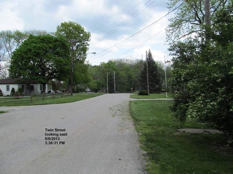
12 Phase I Environmental Site Assessment St. Malachy Property, Brownsburg, Indiana Terra Project No are potential sources of soil, groundwater and surface water contamination due to their locations and activities in reference to the Subject Property. In addition, the scope of services did not include the collection or analysis of any samples such as soil, water, air, or building materials from the Subject Property. 1.5 Special Terms and Conditions No special terms and conditions were a part of this Phase I ESA. 1.6 User Reliance Mr. Grant Kleinhenz, the Town of Brownsburg and their duly authorized representatives can rely on the information contained in this Phase I ESA. 2.1 Location and Legal Description 2.0 Site Description The site is located on the west side of State Road 267 (Green Street) approximately ¼ mile north of US Highway 136 (Main Street), and ¾ mile south of Interstate 74 in Brownsburg, Hendricks County, in the State of Indiana. White Lick Creek runs adjacent to the northwest property boundary. The site consists of several parcels listed under the addresses of 25 Twin Street, 326 North Green Street and 330 North Green Street and is identified as the St. Malachy Property site. The entire property totals +/- 7.7 acres in size. The site can be located using the U.S. Public Land Survey System in Section 11, Township 16 North, Range 1 East, Lincoln Township, Hendricks County, Indiana. The property is identified as parcel numbers , , , , , , , and Figure 1 locates the site on the USGS Brownsburg, Indiana Topographic Map. The legal description of the property is part of the northwest quarter of Section 11, Township 16 North, Range 1 East in Lincoln Township, Hendricks County, Indiana. A detailed legal description of the Subject Property is contained in Appendix C. Terra Environmental Corporation Page 4
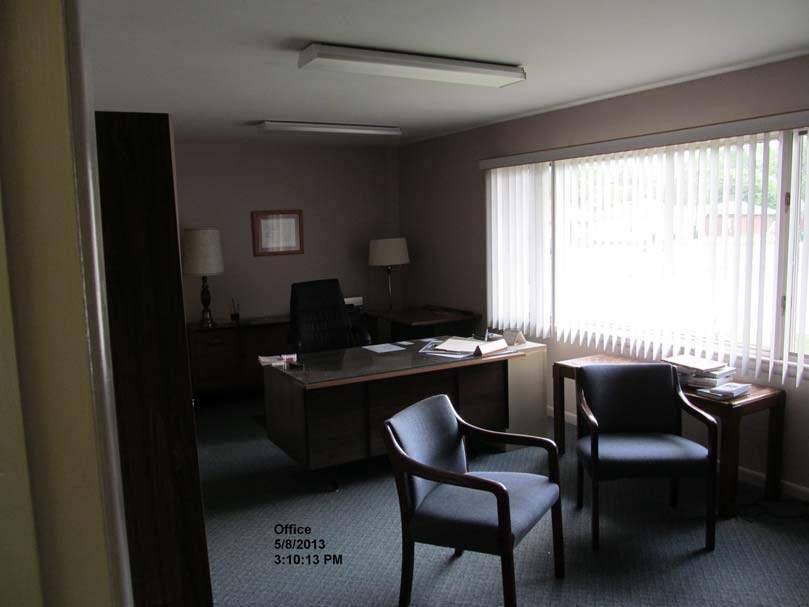
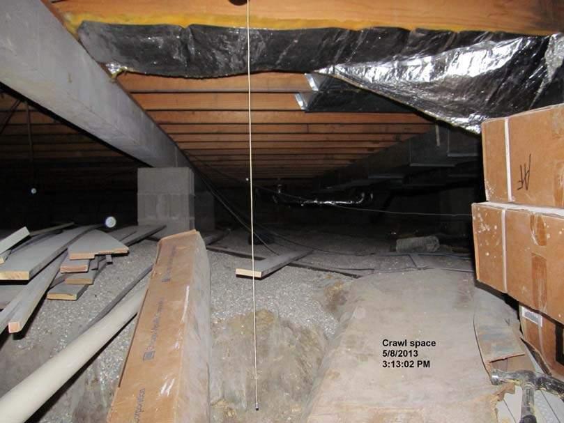
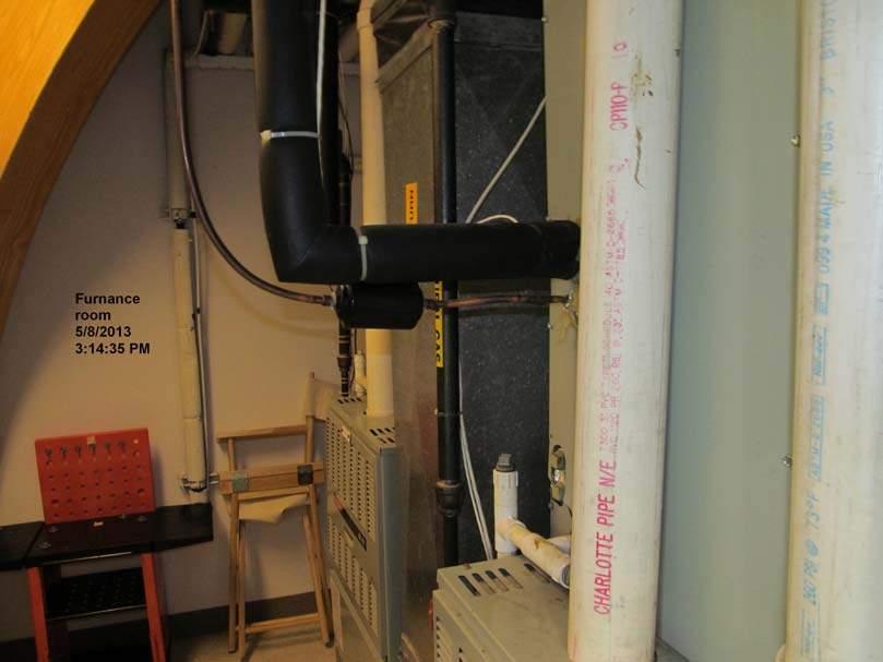
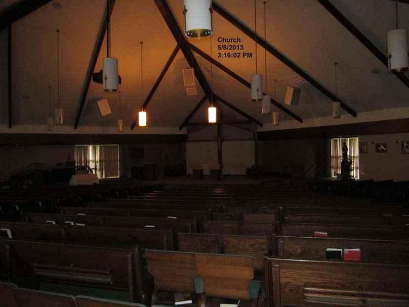
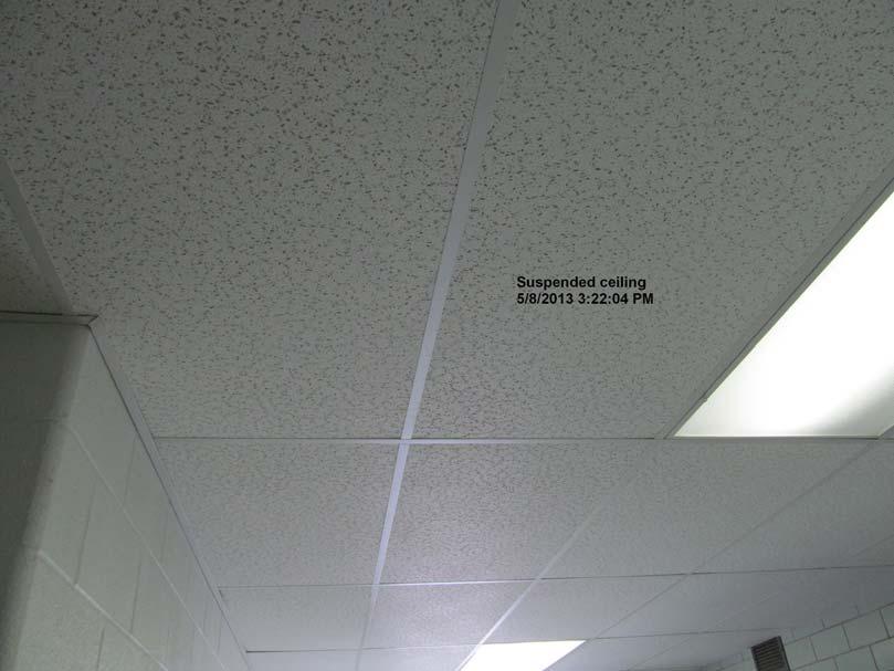
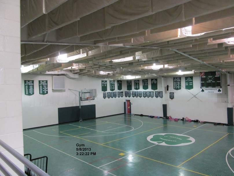
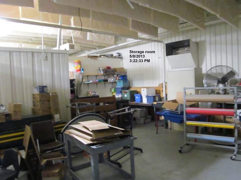
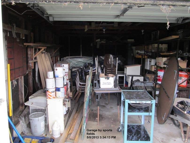
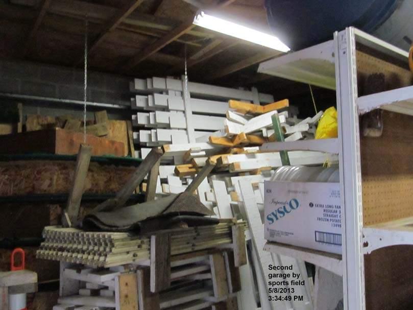
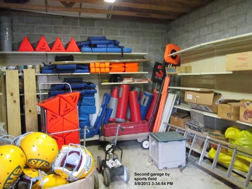
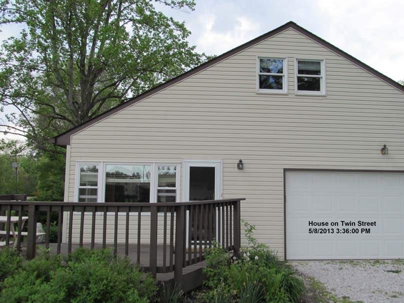
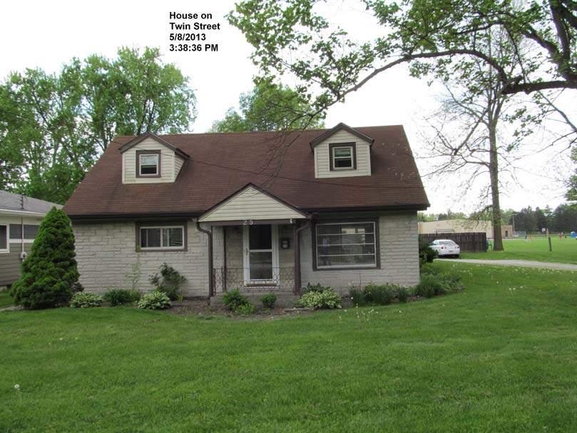
13 Phase I Environmental Site Assessment St. Malachy Property, Brownsburg, Indiana Terra Project No Site and Vicinity General Characteristics The site consists of nine (9) parcels. Six (6) buildings were located on the St. Malachy Property at the time of the site visit. The Subject Property is located in a commercial/residential zoned portion of the town of Brownsburg, Hendricks County, Indiana. The site is adjacent to White Lick Creek. 2.3 Current Use of the Property The property is currently occupied and is being utilized as a school, office, church, after school daycare and residence. The property also includes parking lots and a recreational (soccer/football) field. 2.4 Description of Structures, Roads and Other Improvements Site Description The Subject Property contained six (6) buildings which were being utilized as a school, office, church, after-school daycare, storage and residence. The surface of the site included the buildings, paved and gravel parking, recreation and playground areas, athletic field and yards Site Structures Six (6) buildings were present on the site at the time of the site inspection (see Figure 2). Building 1 was being used as a school and was built in Building 2 was being used as a church and office and was constructed in Buildings 3 and 4 were two garages used for storage and built in Building 5 was an occupied house built in 1955, and Building 6 was a storage shed built in Building 1 was constructed of brick, concrete block and metal siding and was approximately 35,802 square feet in total area. Building 2 was constructed of brick, mortar and metal and was approximately 12,898 square feet in area. Building 2 also contains a finished basement area and crawl space. Buildings 3 and 4 were constructed of concrete block, wood and steel and were approximately 672 and 360 square feet in area respectively. Building 5 was constructed of wood frame with vinyl siding and approximately 2,573 square feet in area. Building 6 was constructed of plywood with wood frame and was approximately 96 square feet in area. Fluorescent lighting fixtures were located throughout buildings 1, 2, 3 and 4 at the time of the site visit. Terra Environmental Corporation Page 5
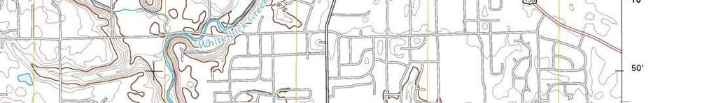
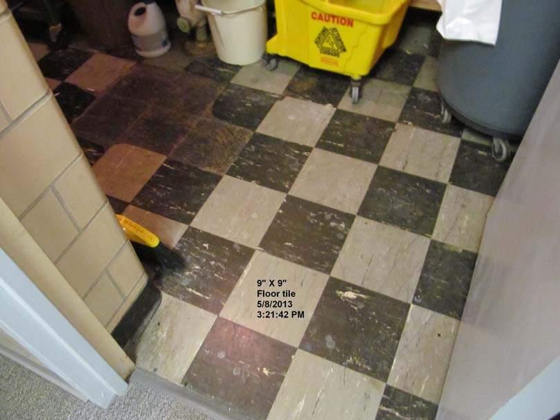
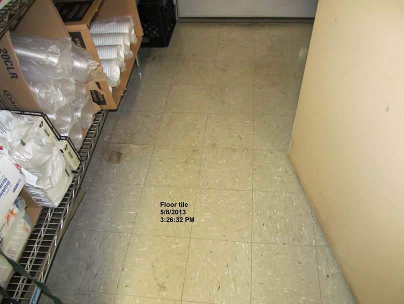
14 Phase I Environmental Site Assessment St. Malachy Property, Brownsburg, Indiana Terra Project No Site Storage Tanks Aboveground storage tanks (ASTs) and underground storage tanks (USTs) are of concern to past, present and future property owners, and are regulated under the Resource Conservation and Recovery Act (RCRA) Underground Storage Tanks (USTs) Vent lines, fill pipes or ancillary equipment generally representative of USTs, were not observed within the property limits at the time of the site investigation Aboveground Storage Tanks (ASTs) No ASTs were observed on the Subject Property at the time of the investigation Polychlorinated Biphenyl s (PCBs) Several pole mounted transformers and a pad mounted transformer were noted on the site or adjacent to the site. Some of the transformers were not marked with a blue dot to identify them as NON PCB units. The transformers are owned by Duke Energy. In addition, fluorescent light fixtures were observed in the school, office and garage buildings. Most of the fixtures were of recent construction. Recommendations regarding the observed transformer and fluorescent light fixtures are contained in Section 7 of this report Asbestos Containing Materials (ACMs) A visual asbestos survey of the site was conducted to identify materials that were suspected to contain asbestos. 9 x 9 floor tile and plaster were observed which are known to contain asbestos. According to Mr. John Poole an asbestos management plan is in place for the known asbestos materials located on the subject property Surface Waters According to the USGS topographic map, Brownsburg Quadrangle, the site is approximately 885 feet above mean sea level. The topography of the site is generally flat. Runoff from the site appears to flow to the north and west toward White Lick Creek. Terra Environmental Corporation Page 6
15 Phase I Environmental Site Assessment St. Malachy Property, Brownsburg, Indiana Terra Project No Wetlands and Floodplains Information found during the review of maps and aerial photographs indicates that White Lick Creek flows adjacent to the site. No wetlands were identified on the Subject Property during the visual inspection and review (see Figure 13). A review of floodplain information for the site indicated that the site is not located in a floodplain (see Figure 14) Hazardous and Solid Wastes At the time of the reconnaissance there was no evidence that hazardous materials were being utilized on site. Interviews also did not identify the use of hazardous materials on the site. Paints and household and commercial cleaners were present in storage rooms and paint was observed in a garage. A grease trap was also observed in the school kitchen at the time of the site visit. The subject site was not found in state or federal databases as a classified generator of hazardous waste. Solid waste removal is provided by Ray s Trash Service Utilities Utilities such as water, sewage, telephone and electricity were noted during the inspection in the vicinity of the site. Water and sewer services are provided to the site by the Town of Brownsburg. Electrical power is provided to the site by Duke Energy. Natural gas service is provided to the site by Vectren. 2.5 Current Uses of Adjoining Property A reconnaissance of the areas surrounding the site was conducted as a part of this investigation to locate facilities that may have an impact on the subject site. The immediately adjacent area surrounding the site consists primarily of residential and commercial properties. More specifically, the property is bound on the north by White Lick Creek and residential property, on the west by Arbuckle Acres Park, on the east by Green Street beyond which is residential property and commercial property (Bolt Dentistry), and on the south by ND Hair Designs/Dynamic Dance (see Figure 2 - Site Map). Terra Environmental Corporation Page 7
16 Phase I Environmental Site Assessment St. Malachy Property, Brownsburg, Indiana Terra Project No Title Records 3.0 User Provided Information Title information was not provided by the property owner for the Subject Property. Information regarding the ownership of the Subject Property was obtained from Hendricks County offices. 3.2 Environmental Liens or Activity and Use Limitations There are no environmental liens or encumbrances against the Subject Property. No use limitations have been enforced on the property according to the Subject Property owner. 3.3 Specialized Knowledge No information was provided by the Subject Property owner which would be considered specialized knowledge. 3.4 Commonly Known or Reasonably Ascertainable Information The property was previously utilized as residential and agricultural property. The property was developed for the current usage between 1955 and 1978 according to Hendricks County records. 3.5 Valuation Reduction for Environmental Issues No information was found to indicate that there is a potential valuation reduction of the property for environmental issues. 3.6 Owner, Property Manager and Occupant Information According to information obtained from the Hendricks County records on May 9, 2013, the current owner of the Subject Property is the Roman Catholic Archdiocese of Indianapolis Properties, Inc. The site is currently occupied and being utilized as a school, office, church, after school daycare and residence. Terra Environmental Corporation Page 8
17 Phase I Environmental Site Assessment St. Malachy Property, Brownsburg, Indiana Terra Project No Reason for Performing Phase I According to Grant Kleinhenz, the Environmental Site Assessment was being conducted with intent to purchase the property. 3.8 Other No other information was provided at the time of this ESA. 4.0 Records Review The purpose of a records review is to identify RECs in connection with the Subject Property and surrounding properties. 4.1 Standard Environmental Record Sources The database review included: NPL, CERCLIS, RCRA, Institutional Control/Engineering Control Registries, state registered USTs, state LUST incident reports, state superfund sites and other state and federal records. Appendix C contains the results of the database review. The Federal database review was conducted by Jason Stephens on May 10, The EPA s National Priority List (NPL) listings were investigated. Neither the site nor any facilities within a 1 mile radius were listed as a NPL facility. The EPA s Comprehensive Environmental Response, Compensation and Liability Information System (CERCLIS) records were researched for the subject site, as well as properties within a ½ mile radius. No facilities within a ½ mile radius, including the Subject Property, were found to be a listed CERCLA facility. The EPA s Resource Conservation and Recovery Act (RCRA) Notifiers list was reviewed. The site was not listed as a RCRA facility. According to the EPA s ECHO database, there are several ECHO sites in the vicinity of the site. However, neither the subject site nor any adjacent sites were found to be listed in the ECHO database. Terra Environmental Corporation Page 9
18 Phase I Environmental Site Assessment St. Malachy Property, Brownsburg, Indiana Terra Project No The Indiana Department of Environmental Management (IDEM) has been granted regulatory authority over hazardous waste activities in Indiana by the U.S. EPA, including those activities regulated under the RCRA. While the U.S. EPA continues to be responsible for the CERCLIS, any action initiated by the U.S. EPA in Indiana would be documented in the IDEM files and would be conducted with the knowledge of the IDEM personnel. Investigations by the Hendricks County Health Department relating to pollution control activities, excluding domestic sewage (septic systems) are referred to IDEM for action. However, IDEM will not provide verbal or written opinions regarding the compliance status of a facility or site. In lieu of this, Terra reviewed all appropriate IDEM databases for evidence regarding usage, storage, treatment and disposal of hazardous substances and the compliance status of any regulatory operations at the site or on surrounding property. Databases reviewed during this investigation include those maintained by IDEM s Office of Land Quality sections and the Indiana Finance Authority Brownfields initiative. The review of the state databases was conducted on May 10, 2013 by Jason Stephens. The IDEM registered UST database was reviewed regarding facilities that own or operate state registered USTs on the subject property or directly adjacent to the project site. The IDEM LUST (leaking underground storage tank) database was reviewed regarding facilities located within ½ mile radius of the project site or the project site itself. Neither the Subject Property nor any adjacent properties were listed on the UST or LUST databases. There are several LUST sites within ½ mile of the Subject Property. According to the IDEM spills database, there are no reports of spills on or adjacent to the site. The IDEM Brownfield database was investigated. One (1) facility (Brownsburg Family Dental) was identified within a ½ mile radius of the site. The Subject site was not listed in the database. The IDEM Voluntary Remediation Program (VRP) database was investigated. The subject site was not listed in the database. No VRP sites were found to be located within a ½ mile radius of the Subject Property. Two (2) State Cleanup Sites (Mr. J s and Dakin Dry Cleaners) were identified within 1 mile of the Subject Property. Terra Environmental Corporation Page 10
19 Phase I Environmental Site Assessment St. Malachy Property, Brownsburg, Indiana Terra Project No No Superfund sites are located within a 1 mile radius of the site. No facilities were found within a ½ mile of the site on the CERCLIS inventory list. There are several RCRA facilities located within ½ mile of the site. No RCRA facilities were found to be located immediately adjacent to the Subject Property. The IDEM virtual file cabinet (VFC) was also reviewed regarding the site and immediately adjacent properties. Neither the Subject Property nor any adjacent properties were listed in the IDEM VFC. All applicable findings in the IDEM and EPA databases are contained in Appendix C. In addition to the review of the state, local and federal databases, the Indiana Geological Survey GIS map was also utilized to locate potential hazardous sites in the vicinity. The state GIS map (Figure 12 in the Appendix) identified a Brownfield site, Industrial waste sites, LUST, UST and State Cleanup sites within ½ mile, and a VRP site within 1 mile of the Subject Property. The state GIS map indicates a UST site that appears to be adjacent to the Subject Property, however database listings confirm that the UST site is not adjacent. The State GIS map was also reviewed for locations of oil and gas well locations. No oil or gas wells were found to be located on the site. The DNR Water Well listings identified a well that may be on or adjacent to the Subject Property. No well was observed on the Subject Property and no well was identified on the site by the site representative. Sanborn Maps for Brownsburg were reviewed where possible. The 1909 Sanborn Map inset includes the south portion of the Subject Property. This map indicates primarily residential properties (depicted by D for dwelling ) on the property at that time. The 1909 Sanborn Map is included in Appendix C. Terra Environmental Corporation Page 11
20 Phase I Environmental Site Assessment St. Malachy Property, Brownsburg, Indiana Terra Project No Additional Environmental Record Sources Local Health Department The Hendricks County Health Department was contacted regarding this site. Ms. Dixie Doub of the Hendricks County Health Department conducted the records search and did not find any complaints for the subject site of an environmental nature, nor any well or septic system records Local Fire Department The local Fire Department was contacted regarding the site. According to Mr. Stephen Jones, Fire Marshal, the Brownsburg Fire Territory is not aware of any hazardous materials spills or contamination on the Subject Property. The report is included in Appendix C Local Police Department The Brownsburg Police Department was contacted regarding the site. No response was provided concerning spills or reported incidents on or adjacent to the Subject Property as of the date of this report Local County Records Records from the Hendricks County files were reviewed. According to these records, there are no environmental concerns associated with the site. 4.3 Physical Setting Source(s) The following resources were used to determine the physical setting of the Subject Property: Bedrock Geologic Map of Indiana, Gray et al, Brownsburg Quadrangle, Indiana, 7.5 Minute Series Topographic Map, U. S. Geologic Survey; Indiana Geological Survey, Geographic Information System; Map Showing Thickness of Unconsolidated Deposits, Gray, 1983; Physiography, Schneider, A. F., 1966; Soil Survey of Hendricks County, Indiana, USDA Soil Conservation Service. Web Soil Survey, U.S. Department of Agriculture, NRCS Terra Environmental Corporation Page 12
21 Phase I Environmental Site Assessment St. Malachy Property, Brownsburg, Indiana Terra Project No Historical Use Information on the Subject Property According to historical records obtained from the Hendricks County records services on August 13, 2012, the current owner of the St. Malachy Property is the Roman Catholic Archdiocese of Indianapolis Properties, Inc. The following information was obtained from Hendricks County records regarding the historical ownership of the Subject Property Owner s Name Date Deed Type Roman Catholic Archdiocese of Indianapolis, Inc 1/1/ Owner s Name Date Deed Roman Catholic Archdiocese of Indianapolis, Inc 1/1/ Owner s Name Date Deed Roman Catholic Archdiocese of Indianapolis, Inc 1/1/ Owner s Name Date Deed Roman Catholic Archdiocese of Indianapolis, Inc 1/1/ Owner s Name Date Deed Roman Catholic Archdiocese of Indianapolis, Inc 4/2/2001 Terra Environmental Corporation Page 13
22 Phase I Environmental Site Assessment St. Malachy Property, Brownsburg, Indiana Terra Project No Owner s Name Date Deed Roman Catholic Archdiocese of Indianapolis, Inc 1/1/ Owner s Name Date Deed Roman Catholic Archdiocese of Indianapolis, Inc 2/20/ Owner s Name Date Deed Roman Catholic Archdiocese of Indianapolis, Inc 2/20/ Owner s Name Date Deed Roman Catholic Archdiocese of Indianapolis, Inc 12/9/1996 It should be noted that the dates of 1/1/1995 and 1/1/1996 are likely generic and used in the Hendricks County records as a specific date was not available for the original deed. According to John Poole the site representative, the property has been used by St. Malachy since development, despite the dates on ownership records. According to John Poole the current occupant of the St. Malachy Property is Saint Malachy School. The property is also used by New Day Church. The following information was obtained from Hendricks County records regarding historical occupancy information for the Subject Property. Terra Environmental Corporation Page 14
23 Phase I Environmental Site Assessment St. Malachy Property, Brownsburg, Indiana Terra Project No Saint Malachy School Occupant s Name 1955-Current Date Saint Malachy Catholic Church New Day Church 2012-Current Aerial photographs were reviewed for the years of 1939, 1946, 1958, 1967, 1998, 2005 and Sanborn maps were also reviewed for the Town of Brownsburg, and the south portion of the Subject Property can be seen on the Sanborn map attached in Appendix C. According to a review of these aerial photographs obtained from the Indiana State GIS and Indiana State Historical Aerial Photo Index databases, the area in the vicinity of the property appears to be developed for residential purposes prior to According to Hendricks County records the site was developed between 1955 and A portion of the current church building was developed previous as residential property. The school building was developed on previously undeveloped agricultural land. 4.5 Historical Use Information on adjoining and surrounding Property According to a review of aerial photographs, the adjoining properties were utilized for agricultural and residential purposes in Historical aerial photographs indicate that adjacent commercial property (Bolt Dentistry) was developed prior to 1998, and Hendricks County records confirm that adjacent commercial property was developed as a residence in Other adjacent commercial property (ND Hair Designs/Dynamic Dance) was developed in 1903 as a church facility. It has also served as a fitness studio prior to its current use. A review of aerial photographs dated 1939, 1946, 1958, 1967, 1998, 2005, 2011 indicated that the usage of the area in the vicinity of the site has not changed significantly since Site Reconnaissance 5.1 Methodology The site visit was conducted by Michael Wirt, Terra Principal Project Manager on May 8, At the time of the site visit, it was partly cloudy with a temperature of approximately 76 F. The Terra Environmental Corporation Page 15
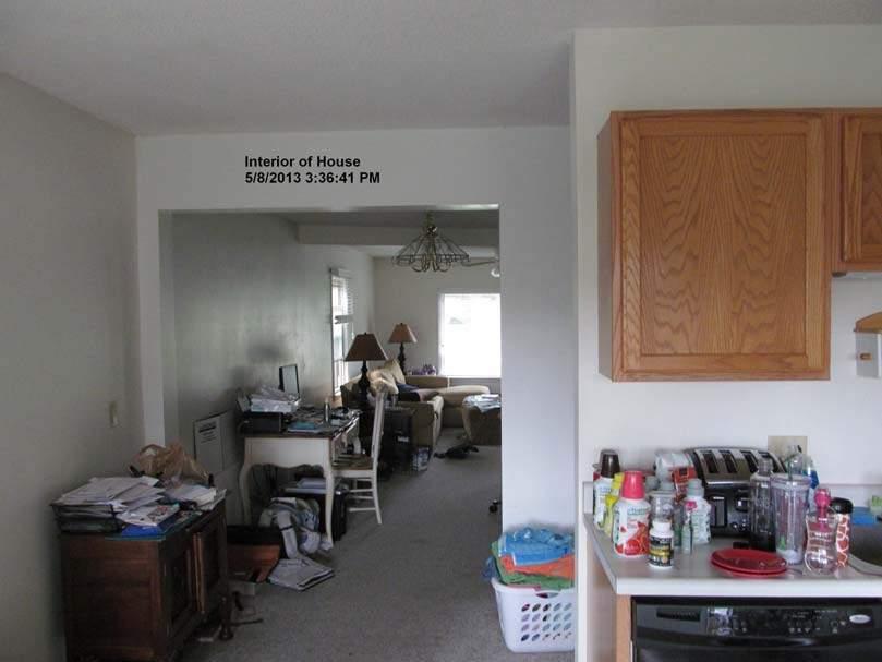
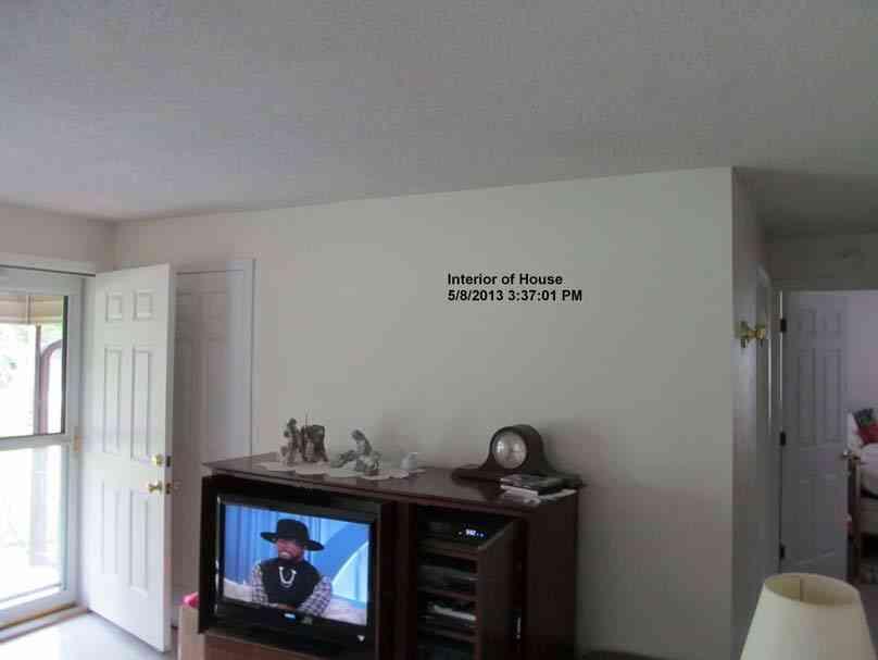
24 Phase I Environmental Site Assessment St. Malachy Property, Brownsburg, Indiana Terra Project No site visit consisted of a walking inspection of the property. Digital photographs of the site were taken during the site inspection (see Appendix B). 5.2 Limitations No limitations were encountered during the course of this investigation. 5.3 General Setting The site is located in the Tipton Till Plain Physiographic Unit of Indiana. This physiographic area is characterized by thick glacial deposits that obscure the underlying bedrock topography (Schneider 1966). Unconsolidated deposits are approximately 200 to 250 feet thick below the site (Gray, 1983). These unconsolidated sediments are mapped at the surface as till. The bedrock below the site is composed of Mississippian siltstone of the Borden Group (Gray et al. 1987). According to the USGS topographic map, the site is approximately 885 feet above mean sea level with a generally flat topography. The site is adjacent to White Lick Creek. Runoff from the site appears to flow to the north and west toward White Lick Creek. The soil in this area consists predominantly of Crosby silt loam with 0-3% slopes (See Figure 15, Soil Map) and also includes small amounts of Brookston silty clay loam, Hennepin loam with 25-50% slopes and Miami silt loam with 2-6% slopes (USDA SCS, Hendricks County, Indiana). The Crosby silt loam soils consist of deep, somewhat poorly drained, nearly level and gently sloping soils located on uplands with slow permeability and runoff. The Brookston silty clay loam consists of deep very poorly drained, nearly level soils in depressions on uplands; permeability is slow, runoff very slow and the water table seasonally high. The Hennepin loam soils consist of deep, well-drained, steep soils on uplands, especially on steep breaks between bottom lands and uplands. The Miami silt loam soils are deep, well-drained, and gently sloping on uplands. Permeability and runoff rates are medium (USDA SCS, Hendricks County, Indiana). 5.4 Exterior Observations The entire Subject Property was observed during the site reconnaissance. The site is located in a commercial/residential area of Hendricks County, Indiana. At the time of the site visit the Terra Environmental Corporation Page 16
25 Phase I Environmental Site Assessment St. Malachy Property, Brownsburg, Indiana Terra Project No Subject Property was occupied. Digital photographs were taken during the site reconnaissance and are contained in the appendix of this report. Six (6) buildings were present on the site at the time of the site inspection (see Figure 2). The building exteriors were described in Section Other exterior observations include several pole-mounted transformers and a pad mounted transformer on or adjacent to the site, a lift station adjacent to the 25 Twin Street property, and White Lick Creek running adjacent to the northwest perimeter of the property. Much of the surface surrounding the school and church buildings is composed of asphalt. A football/soccer field is located north of the school building. A crushed stone parking lot is located south of the church building. 5.5 Interior Observations There were six (6) buildings located on the property. The buildings were all in use at the time of the site visit. Building 1 was a two-story structure including school classrooms and offices, restrooms, kitchen, storage and gymnasium. The kitchen in Building 1 contained commercialgrade appliances and a grease-trap. 9 x 9 floor tile and plaster were observed which are known to contain asbestos. Building 1 also contained a boiler room. Building 2 was a onestory structure with offices, classrooms, kitchen, restrooms and church auditorium. Building 2 was set on a finished basement at the south end and a crawl space. Buildings 3-4 were used for storage of sporting equipment and other miscellaneous materials and equipment. Building 5 was a two-story house with bedrooms, kitchen, restrooms, living room and garage areas. Building 6 was a shed used for storage for the house. Facility lighting included fluorescent fixtures in Buildings 1-4 as well as suspended units in the auditorium and high-bay fixtures in the gymnasium. Interior construction of Buildings 1, 2 and 6 included drywall, wood, concrete and a variety of other building products. 6.1 Owner 6.0 Interviews Mr. John Poole, owner s representative of St. Malachy was interviewed. 6.2 Site Manager Mr. John Poole, was interviewed as the site manager. Terra Environmental Corporation Page 17
26 Phase I Environmental Site Assessment St. Malachy Property, Brownsburg, Indiana Terra Project No Occupant Mr. John Poole was interviewed as an occupant. 6.4 Local Government Ms. Dixie Doub of the Hendricks County Health Department was contacted during the course of this site assessment. Mr. Stephen Jones of the Brownsburg Fire Territory was contacted during the course of this assessment. The Brownsburg Police Department was also contacted during the course of this assessment. 6.5 Others No other interviews were conducted during the course of the study. 7.0 Findings and Opinions 1. The site was occupied at the time of the site visit. It is located in a commercial/residential zoned portion of Hendricks County, Indiana. 2. Several pole mounted transformers and a pad mounted transformer were located in the vicinity of the Subject Property. Some of the transformers were not marked with a blue dot which means that they may contain PCBs. The transformers are owned by Duke Energy. 3. Fluorescent light fixtures are in the buildings. Most of these fixtures were of recent construction according to Mr. Poole. Fixtures that have not been replaced recently may contain ballasts which contain PCBs. 1. It is Terra s opinion that no comment is necessary regarding site occupancy or the zoning of the site. 2. In the event of a release, Duke Energy would be responsible for any cleanup activities. Based on this information, it is Terra s opinion that no further action is necessary with regard to the transformers in the vicinity of the site. 3. Fluorescent light fixtures constructed prior to 1979 may contain ballasts which may contain small amounts of PCBs. For fixtures in older areas of the buildings which have not been updated, it is Terra s opinion that these units be tested and/or handled by trained personnel and disposed of properly in the event that they are removed. Terra Environmental Corporation Page 18
27 Phase I Environmental Site Assessment St. Malachy Property, Brownsburg, Indiana Terra Project No Several ACMs were observed on the Subject Property including floor tile and plaster. 5. The subject site was not listed in the federal databases reviewed which included NPL, CERCLIS, ECHO, ERNS and RCRA. The subject site was also not listed in the state databases reviewed which included UST, LUST, Brownfields, VRP and others. 6. The Subject Property is not identified as being located in a floodplain, nor does it contain a wetland according to Indiana State GIS map. 7. No NPL sites were noted within 1 mile of the Subject Property. 8. No spills were identified on the Subject Property or on immediately adjacent property. 9. No VRP sites are located within ½ mile of the Subject Property. 10. No LUST sites are located immediately adjacent to the Subject Property. 11. No sites containing USTs were identified immediately adjacent to the Subject Property. 4. According to the site manager there is an asbestos management plan in place for the facility. Based on this information, it is Terra s opinion that no further action is necessary at this time regarding ACMs at the Subject Property. However, the asbestos management plan will have to be maintained by the new owner. 5. It is Terra s opinion that no further action is necessary concerning federal and state database listings for the subject site. 6. It is Terra s opinion that no further action is necessary concerning floodplains or wetlands on the Subject Property. 7. It is Terra s opinion that no further action is necessary regarding NPL listings for properties in the vicinity of the Subject Property. 8. It is Terra s opinion that no further action is necessary regarding spill incident listings in the vicinity of the Subject Property. 9. It is Terra s opinion that no action is necessary regarding VRP sites in the vicinity of the Subject Property. 10. It is Terra s opinion that no action is necessary regarding LUST sites in the vicinity of the Subject Property. 11. It is Terra s opinion that no action is necessary regarding UST sites in the vicinity of the Subject Property. Terra Environmental Corporation Page 19
28 Phase I Environmental Site Assessment St. Malachy Property, Brownsburg, Indiana Terra Project No No RCRA sites are located immediately adjacent to the Subject Property and no non-compliant RCRA sites are located within ½ mile of the Subject Property. 13. No ECHO sites were identified immediately adjacent to the site and no non-compliant ECHO sites were located within ½ mile of the Subject Property. 14. No adjacent properties were listed in IDEM s VFC. 15. The Sanborn Map available for a portion of the Subject Property indicated that the site was previously developed as residential property. 16. Paints and commercial cleaners were being used and/or stored at the Subject Property. 17. A walking inspection of the site revealed no monitoring wells or suspected boring locations on the subject site. 18. None of the interviews conducted identified environmental concerns or conditions associated with the site. 12. It is Terra s opinion that no further action is necessary regarding RCRA facilities in the vicinity of the Subject Property. 13. It is Terra s opinion that no further action is necessary in relation to ECHO database listings in the vicinity of the Subject Property. 14. It is Terra s opinion that no further action is necessary in relation to VFC documentation for the Subject Property or for adjacent properties. 15. No potentially hazardous materials or industries were noted on or adjacent to the Subject Property on the Sanborn Map. Based upon this information it is Terra s opinion that no further action is necessary regarding information obtained from the Sanborn Maps. 16. In the event that paints and cleaners are no longer in use they should be disposed of properly. 17. It is Terra s opinion that no further action is necessary concerning monitoring wells or borings indicative of environmental monitoring. 18. It is Terra s opinion that none of the interviews conducted revealed evidence of RECs at the site. 8.0 Conclusions Terra has completed a Phase I Environmental Site Assessment of property known as the St. Malachy Property, Brownsburg, Hendricks County, Indiana. This assessment was performed to determine if the property has been environmentally impaired due to current or previous usage of the Subject Property or by activities on surrounding properties. Terra Environmental Corporation Page 20
29 Phase I Environmental Site Assessment St. Malachy Property, Brownsburg, Indiana Terra Project No We have performed a Phase I Environmental Site Assessment in conformance with the scope and limitations of ASTM Practice E of the St. Malachy Property, Brownsburg Hendricks County, Indiana, the Subject Property. Any exceptions to, or deletions from, this practice are described in Section 1.4 of this report. This assessment has not revealed evidence of a REC in connection with the property. Terra would recommend the proper disposal of paints, cleaners and any other solvents, et cetera that may be out of use, as well as the safe handling of any remaining old fluorescent light fixtures which may contain PCBs. Terra would also recommend adherence to the asbestos management plan that is in place. Under current circumstances these do not represent a REC. The Indiana Responsible Property Transfer Law (RPTL) requires that the transferor (seller) of certain property notify the transferee (buyer) of past activities at the site. This must be done at least 30 days before the transfer and must be in the form set forth by the law. Based on the information contained in this report, it is Terra s opinion that the subject site is not subject to the RPLT. 9.0 Deviations There were no deletions or deviations from the ASTM standard that need to be noted. It is Terra s opinion that no data gaps were identified during the performance of this ESA Additional Services No Additional services are recommended for the Subject Property based on the information obtained through visual observations, database searches and interviews conducted during the course of this investigation References The following references were relied upon in the preparation of this report: Brownsburg Quadrangle, Indiana, 7.5 Minute Series Topographic Map, U. S. Geologic Survey; E , Standard Practice for Environmental Site Assessments: Phase I Environmental Site Assessment Process; Hendricks County Recorder s Office, Hendricks County, Danville, Indiana; Terra Environmental Corporation Page 21
30 Phase I Environmental Site Assessment St. Malachy Property, Brownsburg, Indiana Terra Project No Soil Survey of Hendricks County, Indiana, U.S. Department of Agriculture; IDEM Land Data Sources Brownfields Hazardous Waste LUST Spills USTs VRP Other Data Sources Federal Data Sources Clean Water Act ECHO ERNS NPL RCRA Indiana Geological Survey Geographic Information System Sanborn maps 12.0 Signatures Mr. Jason C. Stephens, Project Manager and Mr. Rusty W. Wheat, Principal Project Geologist are the environmental professionals responsible for the contents of this report. Their signatures appear below. Jason C. Stephens Project Manager Rusty W. Wheat, L.P.G. Principal Project Geologist 13.0 Qualifications of Environmental Professionals We declare that, to the best of our professional knowledge and belief, we meet the definition of Environmental Professionals as defined in of 40 CFR 312 and Section 7.5 of ASTM E Resumes of these individuals are attached in the appendix of this report. Terra Environmental Corporation Page 22
31 Phase I Environmental Site Assessment St. Malachy Property, Brownsburg, Indiana Terra Project No Statement of Qualifications Our professional services have been performed, our findings obtained and our recommendations prepared in accordance with customary principles and practices in the fields of environmental science and engineering. This warranty is in lieu of all other warranties either expressed or implied. This company is not responsible for the independent conclusions, opinions or recommendations made by others based on the field exploration and information research presented in this report. In addition, this report is intended for the sole use of Mr. Grant Kleinhenz, the Town of Brownsburg and their duly authorized representatives and/or assignees, and any use or re-use of this document or the findings, conclusions, or recommendations presented herein is at the sole risk of said user. It should be noted that all environmental assessments are inherently limited in the sense that conclusions are drawn and recommendations developed from information obtained from limited research and site evaluation. Subsurface conditions were not field investigated as part of this study and may differ from the conditions implied by the observations. Additionally, the passage of time may result in a change in the environmental characteristics at this site and surrounding properties. It must be noted that no investigation can absolutely rule out the existence of any hazardous materials at the given site. This assessment has been based upon prior site history, information and observable conditions and activities. The information relied upon for this ESA was obtained from a variety of sources. Terra personnel did not independently verify the information relied upon for this ESA. Existing hazardous materials and contaminants can escape detection using these methods. The results of this study suggest that the site has not been environmentally impacted. If a higher level of confidence is required than that expressed in this report, additional investigation would, of course, be required. It is Terra s professional opinion that this study was appropriate for a Phase I Environmental Site Assessment and that no additional services are needed with regard to the Subject Property. Terra Environmental Corporation Page 23
32 Phase I Environmental Site Assessment St. Malachy Property, Brownsburg, Indiana Terra Project No APPENDIX Figure 1: Figure 2: Figure 3: Figure 4: Figure 5: Figure 6: Figure 7: Figure 8: Figure 9: Figure 10: Figure 11: Figure 12: Figure 13: Figure 14: Figure 15: Site Vicinity/Topographic Map Site Map 1939 Aerial Photo 1946 Aerial Photo 1958 Aerial Photo 1967 Aerial Photo 1998 Aerial Photo 2005 Aerial Photo 2011 Aerial Photo with Parcels Birdseye View Photo Map of ECHO Sites GIS Map Wetlands Map Floodplains Map USDA Soils Map Site Photographs IDEM Brownfield Sites IDEM LUST Sites IDEM State Cleanup Sites US EPA ECHO database US EPA RCRA Notifiers County and local records Sanborn Map Misc. documentation Resumes Terra Environmental Corporation Page 24
33 Phase I Environmental Site Assessment St. Malachy Property, Brownsburg, Indiana Terra Project No Appendix A: Figure 1: Figure 2: Figure 3: Figure 4: Figure 5: Figure 6: Figure 7: Figure 8: Figure 9: Figure 10: Figure 11: Figure 12: Figure 13: Figure 14: Figure 15: Site Vicinity/Topographic Map Site Map 1939 Aerial Photo 1946 Aerial Photo 1958 Aerial Photo 1967 Aerial Photo 1998 Aerial Photo 2005 Aerial Photo 2011 Aerial Photo with parcels Birdseye View Photo Map of ECHO Sites GIS Map Wetlands Map Floodplains Map USDA Soils Map Terra Environmental Corporation
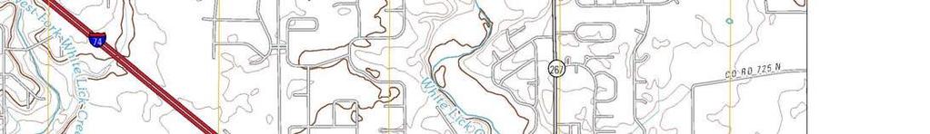
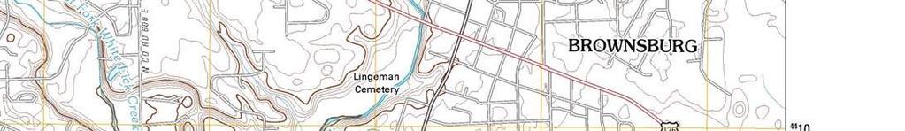


34 Site N Vicinity/Topographic Map St Malachy Property Brownsburg, Indiana Job No Figure 1


35 Twin Street 5 6 Residential 4 3 Site Residential Town of Brownsburg, Arbuckle Acres Park 1 2 Bolt Dentistry ND Hair Designs/ Dynamic Dance Franklin Street 1-6 Site Structures Pole-Mounted Transformer Pad-Mounted Transformer N Site Map St. Malachy Property Brownsburg, Indiana Job No Figure 2


36 Site N 1939 Aerial Photo St. Malachy Property Brownsburg, Indiana Job No Figure 3


37 Site N 1946 Aerial Photo St. Malachy Property Brownsburg, Indiana Job No Figure 4


38 Site N 1958 Aerial Photo St. Malachy Property Brownsburg, Indiana Job No Figure 5


39 Site N 1967 Aerial Photo St. Malachy Property Brownsburg, Indiana Job No Figure 6


40 Site N 1998 Aerial Photo St. Malachy Property Brownsburg, Indiana Job No Figure 7

41 Site N 2005 Aerial Photo St. Malachy Property Brownsburg, Indiana Job No Figure 8


42 Site N 2011 Aerial Photo with Parcels St. Malachy Property Brownsburg, Indiana Job No Figure 9

43 Birdseye View Photo St. Malachy Property Brownsburg, Indiana Job No Figure 10

44 Site ½ Mile Radius 1 Mile Radius N Map of ECHO Sites St. Malachy Property Brownsburg, Indiana Job No Figure 11


 1 Mile Radius ½ Mile Radius Observation Wells (USGS) Petroleum Fields")
 Lakes (NHD) State N GIS Map St.")
45 Brownfields Cleanup Sites Corrective Action Sites Institutional Controls Industrial Waste Sites Leaking UG Storage Tanks Old Landfills Open Dump Waste Sites Restricted Waste Sites Septage Waste Sites Solid Waste Landfills Superfund Sites Tire Waste Sites Underground Storage Tanks Voluntary Remediation Program Waste Transfer Stations Site Waste Treatment Storage Disposal Water Wells (IDNR) Water Wells (ilith) 1 Mile Radius ½ Mile Radius Observation Wells (USGS) Petroleum Fields Petroleum Wells Pipelines (IGS) Interstates (TIGER) Roads 2005 (INDOT - labeled) Rivers (NHD) Lakes (NHD) State N GIS Map St. Malachy Property Brownsburg, Indiana Job No Figure 12


46 Site Legend Surface Linear Water Wetlands Wetlands Interstate N Wetlands Map St. Malachy Property Brownsburg, Indiana Road Job No Figure 13


47 Site Floodplain Legend Floodplain Interstate Surface Water Road N Floodplains Map St. Malachy Property Brownsburg, Indiana Job No Figure 14
 sheet.")
48 Figure 15: Soil Map 39 51' 0'' 39 50' 48'' ' 55'' 86 23' 55'' ± Whitelick Creek HeF CrA Map Scale: 1:1,710 if printed on A size (8.5" x 11") sheet. Meters Feet HeF Bs MmB Twin St Green St Franklin Ave ' 44'' 86 23' 44'' ' 0'' 39 50' 48''
49 Custom Soil Resource Report MAP LEGEND MAP INFORMATION Area of Interest (AOI) Area of Interest (AOI) Soils Soil Map Units Special Point Features Blowout Borrow Pit Clay Spot Closed Depression Gravel Pit Gravelly Spot Landfill Lava Flow Marsh or swamp Mine or Quarry Miscellaneous Water Perennial Water Rock Outcrop Saline Spot Sandy Spot Severely Eroded Spot Sinkhole Slide or Slip Sodic Spot Spoil Area Stony Spot Very Stony Spot Wet Spot Other Special Line Features Gully Short Steep Slope Other Political Features Cities Water Features Streams and Canals Transportation Rails Interstate Highways US Routes Major Roads Local Roads Map Scale: 1:1,710 if printed on A size (8.5" 11") sheet. The soil surveys that comprise your AOI were mapped at 1:15,840. Warning: Soil Map may not be valid at this scale. Enlargement of maps beyond the scale of mapping can cause misunderstanding of the detail of mapping and accuracy of soil line placement. The maps do not show the small areas of contrasting soils that could have been shown at a more detailed scale. Please rely on the bar scale on each map sheet for accurate map measurements. Source of Map: Natural Resources Conservation Service Web Soil Survey URL: Coordinate System: UTM Zone 16N NAD83 This product is generated from the USDA-NRCS certified data as of the version date(s) listed below. Soil Survey Area: Hendricks County, Indiana Survey Area Data: Version 16, Sep 25, 2012 Date(s) aerial images were photographed: 7/14/2003 The orthophoto or other base map on which the soil lines were compiled and digitized probably differs from the background imagery displayed on these maps. As a result, some minor shifting of map unit boundaries may be evident.
50 Custom Soil Resource Report Map Unit Legend Hendricks County, Indiana (IN063) Map Unit Symbol Map Unit Name Acres in AOI Percent of AOI Bs Brookston silty clay loam % CrA Crosby silt loam, 0 to 3 percent slopes % HeF Hennepin loam, 25 to 50 percent slopes % MmB2 Miami silt loam, 2 to 6 percent slopes, eroded % Totals for Area of Interest % Map Unit Descriptions The map units delineated on the detailed soil maps in a soil survey represent the soils or miscellaneous areas in the survey area. The map unit descriptions, along with the maps, can be used to determine the composition and properties of a unit. A map unit delineation on a soil map represents an area dominated by one or more major kinds of soil or miscellaneous areas. A map unit is identified and named according to the taxonomic classification of the dominant soils. Within a taxonomic class there are precisely defined limits for the properties of the soils. On the landscape, however, the soils are natural phenomena, and they have the characteristic variability of all natural phenomena. Thus, the range of some observed properties may extend beyond the limits defined for a taxonomic class. Areas of soils of a single taxonomic class rarely, if ever, can be mapped without including areas of other taxonomic classes. Consequently, every map unit is made up of the soils or miscellaneous areas for which it is named and some minor components that belong to taxonomic classes other than those of the major soils. Most minor soils have properties similar to those of the dominant soil or soils in the map unit, and thus they do not affect use and management. These are called noncontrasting, or similar, components. They may or may not be mentioned in a particular map unit description. Other minor components, however, have properties and behavioral characteristics divergent enough to affect use or to require different management. These are called contrasting, or dissimilar, components. They generally are in small areas and could not be mapped separately because of the scale used. Some small areas of strongly contrasting soils or miscellaneous areas are identified by a special symbol on the maps. If included in the database for a given area, the contrasting minor components are identified in the map unit descriptions along with some characteristics of each. A few areas of minor components may not have been observed, and consequently they are not mentioned in the descriptions, especially where the pattern was so complex that it was impractical to make enough observations to identify all the soils and miscellaneous areas on the landscape. The presence of minor components in a map unit in no way diminishes the usefulness or accuracy of the data. The objective of mapping is not to delineate pure taxonomic classes but rather to separate the landscape into landforms or landform segments that have similar use and management requirements. The delineation of such segments 10
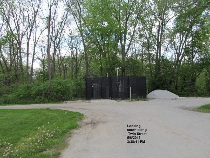
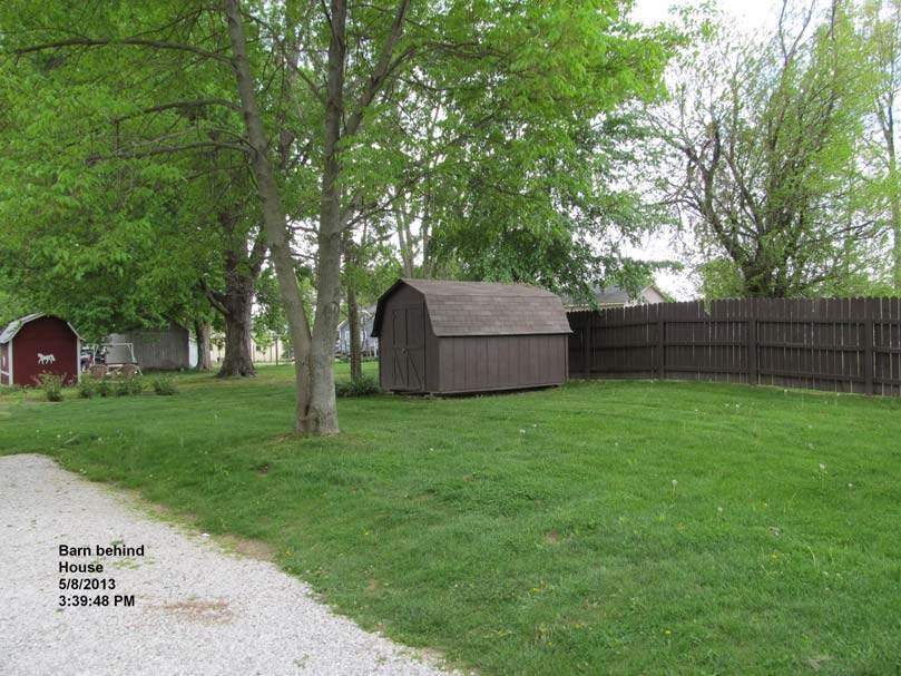
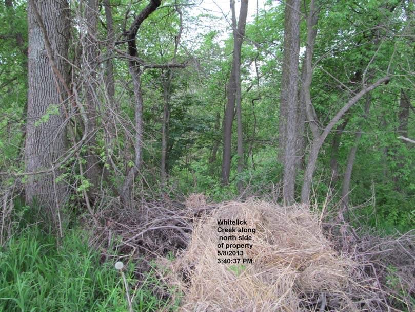
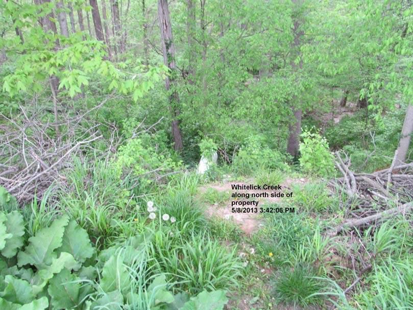
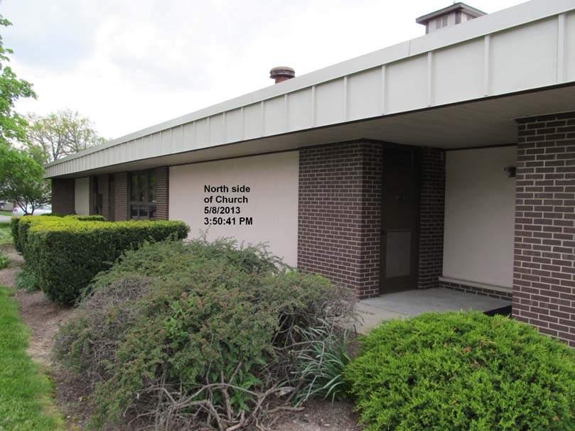
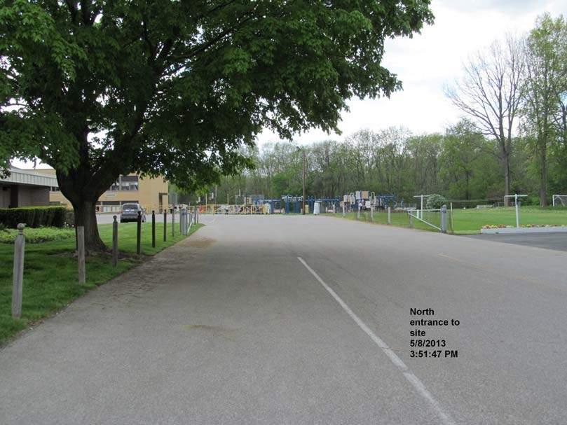
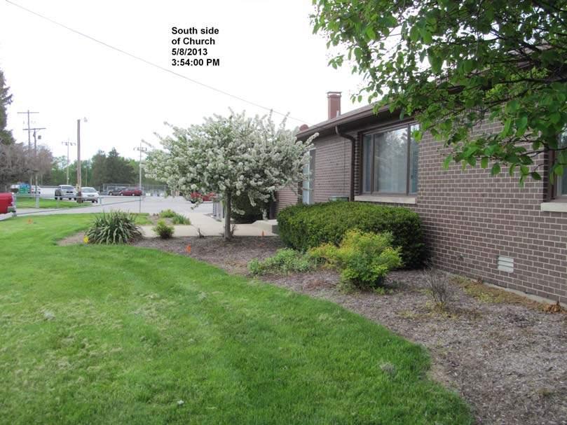
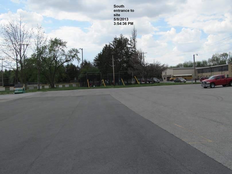
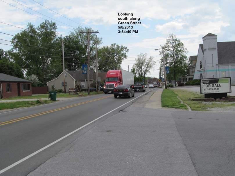
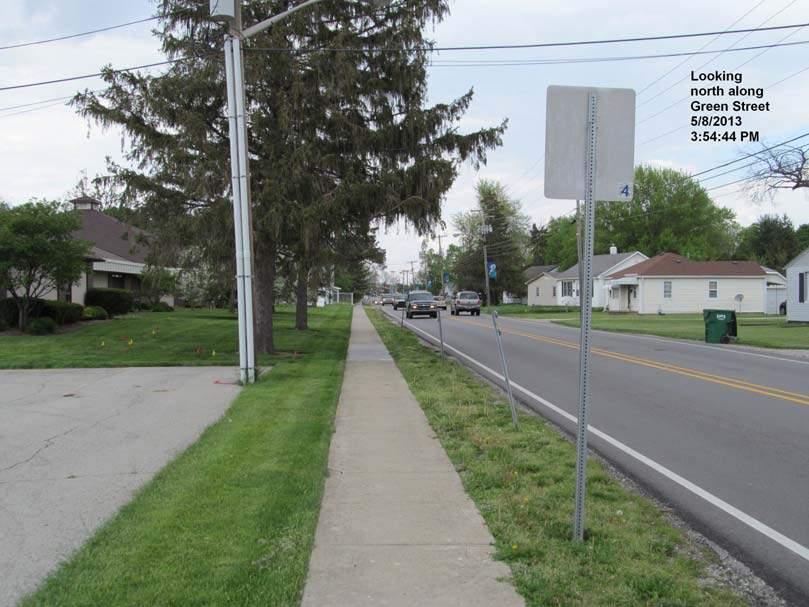
51 Phase I Environmental Site Assessment St. Malachy Property, Brownsburg, Indiana Terra Project No Appendix B: Photographic Documentation Terra Environmental Corporation


52

53

54


55


56

57
58
59

60

61


62


63

64
65
66 Phase I Environmental Site Assessment St. Malachy Property, Brownsburg, Indiana Terra Project No Appendix C: IDEM Brownfields Sites IDEM LUST Sites IDEM State Cleanup Sites US EPA ECHO Database US EPA RCRA Notifiers County and Local Information Sanborn Map Miscellaneous documentation Resumes Terra Environmental Corporation
67 IDEM Brownfields List St. Malachy Property Brownsburg, Indiana Terra Project No Brownfields within 1/2 Mile of St. Malachy Property, Brownsburg, Indiana Distance BFD Site # Name Address Type of Letter Date of Letter ERC Land Use Restriction(s), Contaminants of Concern, Affected Media Recordation Date for ERC and/or Closure Letter 1/2 Mile Brownsburg Family Dental 701 N Green St Commercial Property Comfort Letter 7/17/2006 No 7/17/2006 * It should be noted that data are copied directly from database listings for reference purposes and are not corrected for spelling, grammar or punctuation accuracy 05/10/2013
68 IDEM LUST Database St. Malachy Property Brownsburg, Indiana Terra Project No Leaking USTs within 1/2 Mile of St. Malachy Property, Brownsburg, Indiana DISTANCE 1/2 Mile UST FACILITY ID INCIDENT NUMBER NAME STREET ADDRESS PRIORITY DESC Brownsburg Fire Dept 51 E Main St Medium Soil NFA UST Branch Guidance Manual Brownsburg Fire Dept 51 E Main St Medium Groundwater NFA UST Branch Guidance Manual Brownsburg Marathon 304 E Main High Vapors Discontinued (active) Brownsburg Marathon 304 E Main High Methyl tertiary butyl ether Discontinued (active) Brownsburg Marathon 304 E Main High Groundwater Discontinued (active) Brownsburg Marathon 304 E Main Medium Soil Active Brownsburg Marathon 304 E Main Medium Methyl tertiary butyl ether Active Mowey Credit Trust 21 W Main St Medium Wellhead Protection Area Active Mowey Credit Trust 21 W Main St Medium Soil Active Mowey Credit Trust 21 W Main St Medium Groundwater Active Speedway # E Main St Medium Soil NFA Unconditional Closure Speedway # E Main St Medium Methyl tertiary butyl ether NFA Unconditional Closure Speedway # E Main St Medium Groundwater NFA Unconditional Closure Speedway # E Main St Low Soil Discontinued (active) Speedway # E Main St Low Methyl tertiary butyl ether Discontinued (active) Speedway # E Main St Low Groundwater Discontinued (active) Speedway # E Main St Low Soil Discontinued (active) Speedway # N Green St Medium Wellhead Protection Area Active Speedway # N Green St Medium Vapors Active Speedway # N Green St Medium Soil Active Speedway NO N Green St High Soil NFA Unconditional Closure Speedway NO N Green St High Methyl tertiary butyl ether NFA Unconditional Closure Speedway NO N Green St High Groundwater NFA Unconditional Closure Speedway NO N Green St High Free Product NFA Unconditional Closure Speedway NO N Green St High Drinking Water NFA Unconditional Closure Steve's Garage 303 E Main Low Soil NFA UST Branch Guidance Manual AFFECTED AREA DSC DESCRIPTION 05/10/2013
69 IDEM State Cleanup Sites Database St. Malachy Property Brownsburg, Indiana Terra Project No State Cleanup Sites within 1 Mile of St. Malachy Property, Brownsburg, Indiana DISTANCE PROGRAM SYSTEM ID PRIMARY NAME SUB PROGRAM TITLE DATE COLLECTED FEATURE INDENTIFICATION 1/2 Mile DAKIN DRY CLEANERS STATE CLEANUP SITE 6/5/2008 Access Point 1 Mile Mr. J's STATE CLEANUP SITE 2/28/2006 Access Point * It should be noted that data are copied directly from database listings for reference purposes and are not corrected for spelling, grammar or punctuation accuracy 05/10/2013
70 EPA ECHO Database St. Malachy Property Brownsburg, Indiana Terra Project No ECHO Sites within 1/2 Mile of St. Malachy Property, Brownsburg, Indiana Distance FRS_ID Facility_Name Facility_Street ProgramID# Inspections(5yrs) QtrsinNonCompliance(3yrs) #EffluentExceedances(3yrs) AllegedCurrentSignificantViolations InformalEnforcementActions/NOVs(5yrs) FormalEnforcementActions(5yrs) Penalties(5yrs) BURRUS ALIGNMENT & BRAKE SERVICE 731 N GREEN ST RCR:IND no BUTTON DESIGNS INC 110 E COLLEGE RCR:INR no CARLSON AND SONS OIL CO 35 N GRANT ST RCR:IND no 1/2 Mile CLARK OIL E MAIN ST RCR:INR no CVS PHARMACY W MAIN ST RCR:INR no DAKIN DRY CLEANERS 811 N GREEN ST RCR:IND no KROGER STORE # N GREEN ST RCR:INR no M AND M BODY SHOP 250 W MAIN ST RCR:IND no * It should be noted that data are copied directly from database listings for reference purposes and are not corrected for spelling, grammar or punctuation accuracy 05/10/2013
71 IDEM RCRA Notifiers List St. Malachy Property Brownsburg, Indiana Terra Project No RCRA Notifiers within 1/2 Mile of St. Malachy Property, Brownsburg, Indiana Distance RCRA ID Name Generator type Transporter TSD Location address Latitude Longitude INR BUTTON DESIGNS INC CESQG 110 E COLLEGE IND CARLSON AND SONS OIL CO CESQG 35 N GRANT ST INR CLARK STORE 1737 CESQG 304 E MAIN ST INR CVS PHARMACY 6555 SQG W MAIN ST IND DAKIN DRY CLEANERS CESQG 811 N GREEN ST /2 Mile INR KROGER STORE #115 CESQG 905 N GREEN ST IND M AND M BODY SHOP CESQG 250 W MAIN ST IND MEARS AUTOMOTIVE CESQG 673 N GREEN ST IND ROARK CF WELDING AND ENGINEERING 136 N GREEN ST IND SPEEDWAY E MAIN ST IND SPEEDWAY N GREEN INR SPEEDWAY N GREEN ST * It should be noted that data are copied directly from database listings for reference purposes and are not corrected for spelling, grammar or punctuation accuracy CESQG = Conditionally Exempt Small Quantity Generator SQG = Small Quantity Generator 05/10/2013
72 Hendricks County, IN Date Created: 5/9/2013 Summary Parcel ID Tax Bill ID Map Reference #. Property Address N/A Brief Legal Description Pt Nw e 1.92a (Note: Not to be used on legal documents) Class EXEMPT PROPERTY OWNED BY A RELIGIOUS ORG THAT IS GRANTED AN EXEMPTION Tax District Town Of Brownsburg Tax Rate Code 79 - Advertised Tax Rate Property Type 69 - Exempt Mortgage Co N/A Last Change Date Owner Roman Catholic Archdiocese Of Indianapolis PO Box 1410 Properties Inc Indianapolis, IN Taxing District County: Hendricks Township: LINCOLN TOWNSHIP State District 016 BROWNSBURG TOWN Local District: 014 School Corp: BROWNSBURG COMMUNITY Neighborhood: Town-Good-AC-14 Site Description Topography: Public Utilities: Street or Road: Area Quality Flat All Paved Static Parcel Acreage: 1.92 Land Land Type Soil ID Act Front. Eff. Depth Size Rate Adj. Rate Ext. Value Infl. % PRIMARY $157,500 $157,500 $302,400 0 $302,400 Value Transfers Date New Owner Doc ID Book/Page Sale Price 1/1/1995 ROMAN CATHOLIC ARCHDIOCESE OF $0.00 Valuation Assessment Year Reason GENERAL REVALUATION ANNUAL ADJUSTMENT ANNUAL ADJUSTMENT ANNUAL ADJUSTMENT ANNUAL ADJUSTMENT As Of Date 7/23/2012 6/17/2011 6/4/2010 9/22/2009 4/3/2009 Land $302,400 $302,400 $302,400 $302,400 $302,400 Land Res (1) $0 $0 $0 $0 $0
73 Land Non Res (2) $0 $0 $0 $0 $0 Land Non Res (3) $302,400 $302,400 $302,400 $302,400 $302,400 Improvement $0 $0 $0 $0 $0 Imp Res (1) $0 $0 $0 $0 $0 Imp Non Res (2) $0 $0 $0 $0 $0 Imp Non Res (3) $0 $0 $0 $0 $0 Total $302,400 $302,400 $302,400 $302,400 $302,400 Total Res (1) $0 $0 $0 $0 $0 Total Non Res (2) $0 $0 $0 $0 $0 Total Non Res (3) $302,400 $302,400 $302,400 $302,400 $302,400 Taxes Click here to view Hendricks County tax data No data available for the following modules: Residential Dwellings, Commercial Buildings, Improvements, Transfer History, Photos. Click here for help. Last Data Upload: 5/9/2013 2:28:59 AM
74 Hendricks County, IN Date Created: 5/9/2013 Summary Parcel ID Tax Bill ID Map Reference #. Property Address 326 N Green St Brownsburg, IN, Brief Legal Description Pt Nw e 2.6a (Note: Not to be used on legal documents) Class EXEMPT PROPERTY OWNED BY A RELIGIOUS ORG THAT IS GRANTED AN EXEMPTION Tax District Town Of Brownsburg Tax Rate Code 79 - Advertised Tax Rate Property Type 69 - Exempt Mortgage Co N/A Last Change Date Owner Roman Catholic Archdiocese Of Indianapolis PO Box 1410 Properties Inc Indianapolis, IN Taxing District County: Hendricks Township: LINCOLN TOWNSHIP State District 016 BROWNSBURG TOWN Local District: 014 School Corp: BROWNSBURG COMMUNITY Neighborhood: Town-Good-AC-14 Site Description Topography: Public Utilities: Street or Road: Area Quality Flat All Paved Static Parcel Acreage: 2.6 Land Land Type Soil ID Act Front. Eff. Depth Size Rate Adj. Rate Ext. Value Infl. % PRIMARY $157,500 $157,500 $409,500 0 $409,500 Value Commercial Buildings Description C/I Building 1 SB B 1 U Wall Type 2 2 Heating A/C Sprinkler Exterior Feature Area Canopy, Roof Extension 188 Use Area 11,906 23,896 Not in Use 0 0 Use General Office General Office Floor 2 1 Plumbing RES/CI # TF # TF Total
75 Improvements Descr PC Grade Year Built Eff Year Cond LCM Size Nbhd Factor Mrkt Factor C/I Building C A Paving, Asphalt1 100 C A Transfers Date New Owner Doc ID Book/Page Sale Price 1/1/1995 ROMAN CATHOLIC ARCHDIOCESE OF $0.00 Valuation Assessment Year Reason GENERAL REVALUATION ANNUAL ADJUSTMENT ANNUAL ADJUSTMENT ANNUAL ADJUSTMENT ANNUAL ADJUSTMENT As Of Date 7/23/2012 6/17/2011 6/4/2010 9/22/2009 4/3/2009 Land $409,500 $409,500 $409,500 $409,500 $409,500 Land Res (1) $0 $0 $0 $0 $0 Land Non Res (2) $0 $0 $0 $0 $0 Land Non Res (3) $409,500 $409,500 $409,500 $409,500 $409,500 Improvement $593,100 $740,400 $741,800 $865,900 $865,900 Imp Res (1) $0 $0 $0 $0 $0 Imp Non Res (2) $0 $0 $0 $0 $0 Imp Non Res (3) $593,100 $740,400 $741,800 $865,900 $865,900 Total $1,002,600 $1,149,900 $1,151,300 $1,275,400 $1,275,400 Total Res (1) $0 $0 $0 $0 $0 Total Non Res (2) $0 $0 $0 $0 $0 Total Non Res (3) $1,002,600 $1,149,900 $1,151,300 $1,275,400 $1,275,400 Taxes Click here to view Hendricks County tax data No data available for the following modules: Residential Dwellings, Transfer History, Photos. Click here for help. Last Data Upload: 5/9/2013 2:28:59 AM
76 Hendricks County, IN Date Created: 5/9/2013 Summary Parcel ID Tax Bill ID Map Reference #. Property Address 25 Twin St Brownsburg, IN, Brief Legal Description Lot 15 Hedge & Kibbey's Addition (Note: Not to be used on legal documents) Class EXEMPT PROPERTY OWNED BY A RELIGIOUS ORG THAT IS GRANTED AN EXEMPTION Tax District Town Of Brownsburg Tax Rate Code 79 - Advertised Tax Rate Property Type 69 - Exempt Mortgage Co N/A Last Change Date Owner Roman Catholic Archdiocese Of Indianapolis 1400 N Meridian St Properties Inc Indianapolis, IN Taxing District County: Hendricks Township: LINCOLN TOWNSHIP State District 016 BROWNSBURG TOWN Local District: 014 School Corp: BROWNSBURG COMMUNITY Neighborhood: HEDGE & KIBBEY'S ADD Site Description Topography: Public Utilities: Street or Road: Area Quality Static Parcel Acreage: 0.22 Land Land Type Soil ID Act Front. Eff. Depth Size Rate Adj. Rate Ext. Value Infl. % (F) FRONT LOT x188 $350 $382 $19,482 0 $19,480 Value Residential Dwellings Description Story Height 2 Style Finished Area 2573 # Fireplaces 0 Heat Type Air Cond 2573 SINGLE-FAMILY RESIDENCE Central Warm Air Accomodations Bedrooms: 4 Living Rooms: 0 Dining Rooms: 0 Family Rooms: 1 Finished Rooms: 8 Floor Constr Base Finish 1 Wood Frame Wood Frame A C Exterior Feature Area Wood Deck 132
77 # TF Full Baths 2 6 Half Baths 0 0 Kitchen Sinks 1 1 Water Heaters 1 1 Add Fixtures 0 0 Improvements Descr PC Grade Year Built Eff Year Cond LCM Size Nbhd Factor Mrkt Factor SINGLE-FAMILY RESIDENCE 100 C A UTILITY SHED 100 D A Transfers Date New Owner Doc ID Book/Page Sale Price 1/1/1996 ROMAN CATHOLIC ARCHDIOCESE $0.00 Valuation Assessment Year Reason GENERAL REVALUATION ANNUAL ADJUSTMENT ANNUAL ADJUSTMENT ANNUAL ADJUSTMENT ANNUAL ADJUSTMENT As Of Date 7/23/2012 6/17/2011 6/4/2010 9/22/2009 4/3/2009 Land $19,500 $19,500 $19,500 $19,500 $19,500 Land Res (1) $19,500 $19,500 $19,500 $19,500 $19,500 Land Non Res (2) $0 $0 $0 $0 $0 Land Non Res (3) $0 $0 $0 $0 $0 Improvement $90,600 $98,700 $91,100 $91,100 $91,100 Imp Res (1) $89,900 $97,600 $90,000 $90,000 $90,000 Imp Non Res (2) $0 $0 $0 $0 $0 Imp Non Res (3) $700 $1,100 $1,100 $1,100 $1,100 Total $110,100 $118,200 $110,600 $110,600 $110,600 Total Res (1) $109,400 $117,100 $109,500 $109,500 $109,500 Total Non Res (2) $0 $0 $0 $0 $0 Total Non Res (3) $700 $1,100 $1,100 $1,100 $1,100 Taxes Click here to view Hendricks County tax data No data available for the following modules: Commercial Buildings, Transfer History, Photos. Click here for help. Last Data Upload: 5/9/2013 2:28:59 AM
78 Hendricks County, IN Date Created: 5/9/2013 Summary Parcel ID Tax Bill ID Map Reference #. Property Address 326 N Green St Brownsburg, IN, Brief Legal Description Lots 16 & 17 Hedge & Kibbey Add (Note: Not to be used on legal documents) Class EXEMPT PROPERTY OWNED BY A RELIGIOUS ORG THAT IS GRANTED AN EXEMPTION Tax District Town Of Brownsburg Tax Rate Code 79 - Advertised Tax Rate Property Type 69 - Exempt Mortgage Co N/A Last Change Date Owner Roman Catholic Archdiocese Of Indianapolis PO Box 1410 Properties Inc Indianapolis, IN Taxing District County: Hendricks Township: LINCOLN TOWNSHIP State District 016 BROWNSBURG TOWN Local District: 014 School Corp: BROWNSBURG COMMUNITY Neighborhood: HEDGE & KIBBEY'S ADD Site Description Topography: Public Utilities: Street or Road: Area Quality Static Parcel Acreage: 0.4 Land Land Type Soil ID Act Front. Eff. Depth Size Rate Adj. Rate Ext. Value Infl. % (F) FRONT LOT x110 $350 $301 $15,050 0 $15,050 REAR LOT x110x257 $350 $49 $5,439 0 $5,440 Value Improvements Descr PC Grade Year Built Eff Year Cond LCM Size Nbhd Factor Mrkt Factor DETACHED GARAGE 100 C A Utility Shed 100 D A Utility Shed C A Transfers Date New Owner Doc ID Book/Page Sale Price 1/1/1995 ROMAN CATHOLIS ARCHDIOCESE OF $0.00
79 Valuation Assessment Year Reason GENERAL REVALUATION ANNUAL ADJUSTMENT ANNUAL ADJUSTMENT ANNUAL ADJUSTMENT ANNUAL ADJUSTMENT As Of Date 7/23/2012 6/17/2011 6/4/2010 9/22/2009 4/3/2009 Land $20,500 $20,500 $20,500 $20,500 $20,500 Land Res (1) $20,500 $20,500 $20,500 $20,500 $20,500 Land Non Res (2) $0 $0 $0 $0 $0 Land Non Res (3) $0 $0 $0 $0 $0 Improvement $15,800 $15,700 $13,300 $13,300 $13,300 Imp Res (1) $0 $0 $0 $0 $0 Imp Non Res (2) $0 $0 $0 $0 $0 Imp Non Res (3) $15,800 $15,700 $13,300 $13,300 $13,300 Total $36,300 $36,200 $33,800 $33,800 $33,800 Total Res (1) $20,500 $20,500 $20,500 $20,500 $20,500 Total Non Res (2) $0 $0 $0 $0 $0 Total Non Res (3) $15,800 $15,700 $13,300 $13,300 $13,300 Taxes Click here to view Hendricks County tax data No data available for the following modules: Residential Dwellings, Commercial Buildings, Transfer History, Photos. Click here for help. Last Data Upload: 5/9/2013 2:28:59 AM
80 Hendricks County, IN Date Created: 5/9/2013 Summary Parcel ID Tax Bill ID Map Reference #. Property Address 326 N Green St Brownsburg, IN, Brief Legal Description Lots &.20ac Vacat Thompson & Johnson Addition (Note: Not to be used on legal documents) Class CHURCH, CHAPEL, MOSQUE, SYNAGOGUE, TABERNACLE, OR TEMPLE THAT IS GRANTED AN EXEMPTION Tax District Town Of Brownsburg Tax Rate Code 79 - Advertised Tax Rate Property Type 69 - Exempt Mortgage Co N/A Last Change Date Owner Roman Catholic Archdiocese Of Indianapolis PO Box 1410 Properties Inc Indianapolis, IN Taxing District County: Hendricks Township: LINCOLN TOWNSHIP State District 016 BROWNSBURG TOWN Local District: 014 School Corp: BROWNSBURG COMMUNITY Neighborhood: Town-Good-AC-14 Site Description Topography: Public Utilities: Street or Road: Area Quality Flat All Paved Static Parcel Acreage: 1.79 Land Land Type Soil ID Act Front. Eff. Depth Size Rate Adj. Rate Ext. Value Infl. % PRIMARY $157,500 $157,500 $78,750 0 $78,750 UNDEVELOPED USABLE $157,500 $157,500 $202,907 0 $202,910 Value Commercial Buildings Description C/I Building 1 SB B 1 U Wall Type 2 Heating 8464 A/C 8464 Sprinkler Use Area 8,464 Not in Use 0 Use Theater Floor 1 Plumbing RES/CI # TF # TF
81 Total Description C/I Building 2 SB B 1 U Wall Type 2 2 Heating A/C Sprinkler Use Area 3,314 1,120 Not in Use 0 0 Use General Office General Office Floor 1 0 Plumbing RES/CI # TF # TF Total Improvements Descr PC Grade Year Built Eff Year Cond LCM Size Nbhd Factor Mrkt Factor C/I Building B A C/I Building C A Transfers Date New Owner Doc ID Book/Page Sale Price 4/2/2001 ROMAN CATHOLIC ARCHDIOCESE OF $0.00 Valuation Assessment Year Reason GENERAL REVALUATION ANNUAL ADJUSTMENT ANNUAL ADJUSTMENT ANNUAL ADJUSTMENT ANNUAL ADJUSTMENT As Of Date 7/23/2012 6/17/2011 6/4/2010 9/22/2009 4/3/2009 Land $281,700 $281,700 $281,700 $281,700 $281,700 Land Res (1) $0 $0 $0 $0 $0 Land Non Res (2) $0 $0 $0 $0 $0 Land Non Res (3) $281,700 $281,700 $281,700 $281,700 $281,700 Improvement $298,700 $364,700 $364,700 $426,700 $426,700 Imp Res (1) $0 $0 $0 $0 $0 Imp Non Res (2) $0 $0 $0 $0 $0 Imp Non Res (3) $298,700 $364,700 $364,700 $426,700 $426,700 Total $580,400 $646,400 $646,400 $708,400 $708,400 Total Res (1) $0 $0 $0 $0 $0 Total Non Res (2) $0 $0 $0 $0 $0 Total Non Res (3) $580,400 $646,400 $646,400 $708,400 $708,400 Taxes Click here to view Hendricks County tax data No data available for the following modules: Residential Dwellings, Transfer History, Photos. Click here for help. Last Data Upload: 5/9/2013 2:28:59 AM
82 Hendricks County, IN Date Created: 5/9/2013 Summary Parcel ID Tax Bill ID Map Reference # SEE LEGAL Property Address Twin St Danville, IN, Brief Legal Description Lot 1 Thompson & Johnson Add (Note: Not to be used on legal documents) Class CHURCH, CHAPEL, MOSQUE, SYNAGOGUE, TABERNACLE, OR TEMPLE THAT IS GRANTED AN EXEMPTION Tax District Town Of Brownsburg Tax Rate Code 79 - Advertised Tax Rate Property Type 82 - Residential Mortgage Co N/A Last Change Date Owner Roman Catholic Archdiocese Of Indianapolis PO Box 1410 Properties Inc Indianapolis, IN Taxing District County: Hendricks Township: LINCOLN TOWNSHIP State District 016 BROWNSBURG TOWN Local District: 014 School Corp: BROWNSBURG COMMUNITY Neighborhood: THOMPSON & JOHNSON'S ADD Site Description Topography: Public Utilities: Street or Road: Area Quality Static Parcel Acreage: 0.22 Land Land Type Soil ID Act Front. Eff. Depth Size Rate Adj. Rate Ext. Value Infl. % (F) FRONT LOT x190 $305 $299 $14, $10,470 Value Transfers Date New Owner Doc ID Book/Page Sale Price 1/1/1995 ROMAN CATHOLIC ARCHDIOCESE OF $0.00 Valuation Assessment Year Reason GENERAL REVALUATION ANNUAL ADJUSTMENT ANNUAL ADJUSTMENT ANNUAL ADJUSTMENT ANNUAL ADJUSTMENT As Of Date 7/23/2012 6/17/2011 6/4/2010 9/24/2009 4/5/2009 Land $10,500 $15,000 $15,000 $15,000 $15,000 Land Res (1) $0 $15,000 $15,000 $15,000 $15,000
83 Land Non Res (2) $0 $0 $0 $0 $0 Land Non Res (3) $10,500 $0 $0 $0 $0 Improvement $0 $0 $0 $38,400 $38,400 Imp Res (1) $0 $0 $0 $38,400 $38,400 Imp Non Res (2) $0 $0 $0 $0 $0 Imp Non Res (3) $0 $0 $0 $0 $0 Total $10,500 $15,000 $15,000 $53,400 $53,400 Total Res (1) $0 $15,000 $15,000 $53,400 $53,400 Total Non Res (2) $0 $0 $0 $0 $0 Total Non Res (3) $10,500 $0 $0 $0 $0 Taxes Click here to view Hendricks County tax data No data available for the following modules: Residential Dwellings, Commercial Buildings, Improvements, Transfer History, Photos. Click here for help. Last Data Upload: 5/9/2013 2:28:59 AM
84 Hendricks County, IN Date Created: 5/9/2013 Summary Parcel ID Tax Bill ID Map Reference # SEE LEGAL Property Address 306 N Green St Brownsburg, IN, Brief Legal Description Pt Ne Nw & Nw Nw e.2ac-c (Note: Not to be used on legal documents) Class RESIDENTIAL VACANT UNPLATTED LAND OF ACRES Tax District Town Of Brownsburg Tax Rate Code 79 - Advertised Tax Rate Property Type 82 - Residential Mortgage Co N/A Last Change Date Owner Roman Catholic Archdiocese Of Indianapolis PO Box 1410 Properties Inc Indianapolis, IN Taxing District County: Hendricks Township: LINCOLN TOWNSHIP State District 016 BROWNSBURG TOWN Local District: 014 School Corp: BROWNSBURG COMMUNITY Neighborhood: RES ACREAGE DEFAULT-BROWNSBURG Site Description Topography: Public Utilities: Street or Road: Area Quality Static Parcel Acreage: 0.2 Land Land Type Soil ID Act Front. Eff. Depth Size Rate Adj. Rate Ext. Value Infl. % 91rr $7,500 $7,500 $1,500 0 $1,500 Value Transfers Date New Owner Doc ID Book/Page Sale Price 2/20/2001 ROMAN CATHOLIC ARCHDIOCESE OF INDPLS $0.00 Valuation Assessment Year Reason GENERAL REVALUATION ANNUAL ADJUSTMENT ANNUAL ADJUSTMENT ANNUAL ADJUSTMENT ANNUAL ADJUSTMENT As Of Date 7/21/2012 6/17/2011 6/4/2010 9/24/2009 4/3/2009 Land $1,500 $1,500 $1,500 $1,500 $1,500 Land Res (1) $0 $0 $0 $0 $0
85 Land Non Res (2) $0 $0 $0 $0 $0 Land Non Res (3) $1,500 $1,500 $1,500 $1,500 $1,500 Improvement $0 $0 $0 $0 $0 Imp Res (1) $0 $0 $0 $0 $0 Imp Non Res (2) $0 $0 $0 $0 $0 Imp Non Res (3) $0 $0 $0 $0 $0 Total $1,500 $1,500 $1,500 $1,500 $1,500 Total Res (1) $0 $0 $0 $0 $0 Total Non Res (2) $0 $0 $0 $0 $0 Total Non Res (3) $1,500 $1,500 $1,500 $1,500 $1,500 Taxes Click here to view Hendricks County tax data No data available for the following modules: Residential Dwellings, Commercial Buildings, Improvements, Transfer History, Photos. Click here for help. Last Data Upload: 5/9/2013 2:28:59 AM

86 Hendricks County, IN Date Created: 5/9/2013 Summary Parcel ID Tax Bill ID Map Reference # SEE LEGAL Property Address 306 N Green St Brownsburg, IN, Brief Legal Description Pt Ne Nw & Nw Nw e.1ac-c (Note: Not to be used on legal documents) Class CHURCH, CHAPEL, MOSQUE, SYNAGOGUE, TABERNACLE, OR TEMPLE THAT IS GRANTED AN EXEMPTION Tax District Town Of Brownsburg Tax Rate Code 79 - Advertised Tax Rate Property Type 82 - Residential Mortgage Co N/A Last Change Date Click to Enlarge Owner Roman Catholic Archdiocese Of Indianapolis PO Box 1410 Properties Inc Indianapolis, IN Taxing District County: Hendricks Township: LINCOLN TOWNSHIP State District 016 BROWNSBURG TOWN Local District: 014 School Corp: BROWNSBURG COMMUNITY Neighborhood: RES ACREAGE DEFAULT-BROWNSBURG Site Description Topography: Public Utilities: Street or Road: Area Quality Static Parcel Acreage: 0.1 Land Land Type Soil ID Act Front. Eff. Depth Size Rate Adj. Rate Ext. Value Infl. % 9rr $38,900 $105,030 $10,503 0 $10,500 Value Transfers Date New Owner Doc ID Book/Page Sale Price 2/20/2001 ROMAN CATHOLIC ARCHDIOCESE IF INDPLS $0.00 Valuation Assessment Year Reason GENERAL REVALUATION CE/AUD CHARGE ANNUAL ADJUSTMENT ANNUAL ADJUSTMENT ANNUAL ADJUSTMENT As Of Date 7/23/2012 7/30/2012 6/17/2011 6/4/2010 9/24/2009 Land $10,500 $10,800 $10,800 $10,800 $10,800
87 Land Res (1) $0 $0 $10,800 $10,800 $10,800 Land Non Res (2) $0 $0 $0 $0 $0 Land Non Res (3) $10,500 $10,800 $0 $0 $0 Improvement $0 $0 $0 $88,600 $88,600 Imp Res (1) $0 $0 $0 $88,600 $88,600 Imp Non Res (2) $0 $0 $0 $0 $0 Imp Non Res (3) $0 $0 $0 $0 $0 Total $10,500 $10,800 $10,800 $99,400 $99,400 Total Res (1) $0 $0 $10,800 $99,400 $99,400 Total Non Res (2) $0 $0 $0 $0 $0 Total Non Res (3) $10,500 $10,800 $0 $0 $0 Taxes Click here to view Hendricks County tax data Photos No data available for the following modules: Residential Dwellings, Commercial Buildings, Improvements, Transfer History. Click here for help. Last Data Upload: 5/9/2013 2:28:59 AM
88
89 Hendricks County, IN Date Created: 5/9/2013 Summary Parcel ID Tax Bill ID Map Reference #. Property Address N/A Brief Legal Description Pt Nw1/ e.25ac (Note: Not to be used on legal documents) Class EXEMPT PROPERTY OWNED BY A RELIGIOUS ORG THAT IS GRANTED AN EXEMPTION Tax District Town Of Brownsburg Tax Rate Code 79 - Advertised Tax Rate Property Type 69 - Exempt Mortgage Co N/A Last Change Date Owner Roman Catholic Archdiocese Of Indianapolis PO Box 1410 Properties Inc Indianapolis, IN Taxing District County: Hendricks Township: LINCOLN TOWNSHIP State District 016 BROWNSBURG TOWN Local District: 014 School Corp: BROWNSBURG COMMUNITY Neighborhood: Town-Good-AC-14 Site Description Topography: Public Utilities: Street or Road: Area Quality Static Parcel Acreage: 0.25 Land Land Type Soil ID Act Front. Eff. Depth Size Rate Adj. Rate Ext. Value Infl. % 91rr $7,500 $7,500 $1,875 0 $1,880 Value Transfers Date New Owner Doc ID Book/Page Sale Price 12/9/1996 ROMAN CATHOLIC ARCHDIOCESE OF $0.00 Valuation Assessment Year Reason GENERAL REVALUATION ANNUAL ADJUSTMENT ANNUAL ADJUSTMENT ANNUAL ADJUSTMENT ANNUAL ADJUSTMENT As Of Date 7/23/2012 6/17/2011 6/4/2010 9/22/2009 4/3/2009 Land $1,900 $1,900 $1,900 $1,900 $1,900 Land Res (1) $0 $0 $0 $0 $0 Land Non Res (2) $0 $0 $0 $0 $0
90 Land Non Res (3) $1,900 $1,900 $1,900 $1,900 $1,900 Improvement $0 $0 $0 $0 $0 Imp Res (1) $0 $0 $0 $0 $0 Imp Non Res (2) $0 $0 $0 $0 $0 Imp Non Res (3) $0 $0 $0 $0 $0 Total $1,900 $1,900 $1,900 $1,900 $1,900 Total Res (1) $0 $0 $0 $0 $0 Total Non Res (2) $0 $0 $0 $0 $0 Total Non Res (3) $1,900 $1,900 $1,900 $1,900 $1,900 Taxes Click here to view Hendricks County tax data No data available for the following modules: Residential Dwellings, Commercial Buildings, Improvements, Transfer History, Photos. Click here for help. Last Data Upload: 5/9/2013 2:28:59 AM
91


92 Digitized from the Indiana University Map Collection by Historical Information Gatherers, Inc.

93 FOR SALE 326 North Green Street, Brownsburg, IN arbuckle acres ParK 267 north green Street School / church / land 7.49 acres Great location for business Master planned for mixed development Traffi c count (S.R. 267 from U.S. 136/Main St. to 56th St.): 18,230 (AADT) S.R. 267 frontage 1 mile from I-74 interchange 10 minutes from Indianapolis International Airport Parking ratio 7.6 / 1,000 SF For additional information, please visit: Raintown Pittsboro plewood anville Cartersburg ville Magnetic Springs 40 Tilden Avon Brownsburg Traders Point 74 Clermont Westwood Tremont Six Points Bridgeport Plainfield William Creek New 421 Augusta 65 Speedway For more information, contact: Kelly l. williams, ccim, leed ap Kelly.williams@cassidyturley.com 70 Maywood I ray Simons, alc ray.simons@cassidyturley.com One American Square, Suite 1300 Indianapolis, IN t f The information contained herein was obtained from sources we consider reliable. We cannot be responsible, however, for errors, omissions, prior sales, withdrawal from the market or change in price. Seller and broker make no representation as to the environmental condition of the property and recommend purchaser s independent investigation.

94 Church Floor Plan 38'-0" ± 18'-6" 68'-0" 18'-5 3/4" ± 92'-0" ± < > < > < > < > < > 90'-8" ± < > office Narthex Sanctuary office / Church Building 326 N. Green St., Brownsburg, IN Current use: Church office / Pre-K school CRAWL SPACE Office Main level: 3,304 SF Basement: 1,120 SF Basement Floor Plan MEETING ROOM CORRIDOR CRAWL SPACE Narthex (sanctuary entrance): 6,059 SF No load-bearing walls CORRIDOR Sanctuary: 8,375 SF Total SF: ±18,858 SF Fully air conditioned GYMNASIUM RR STORAGE STORAGE COPY ROOM STORAGE YOUTH MINISTER

95 CLASSROOM 60'-1" < > 60'-1" < > CLASSROOM CLASSROOM CLASSROOM CLASSROOM COMPUTER LAB CLASSROOM ART CLASSROOM STORAGE STORAGE CONFERENCE STORAGE School Floor Plan Lower Level LIBRARY OFFICE CORRIDOR CLASSROOM School Floor Plan Upper Level PRINCIPAL S OFFICE OFFICE OFFICE RR OFFICE CORRIDOR CLASSROOM STORAGE A/V ROOM JANITOR S CLOSET GIRLS CLASSROOM JANITOR S CLOSET STORAGE INFIRMARY COPY RR CLASSROOM BOYS KITCHEN ELEM. SCIENCE MECHANICAL BOYS BOYS GIRLS RESOURCE BOYS GIRLS PANTRY MUSIC MECHANICAL RR GIRLS STORAGE GYMNASIUM STORAGE UPPER GYMNASIUM LOUNGE CLASSROOM CLASSROOM CLASSROOM CLASSROOM CLASSROOM school Building 326 N. Green St., Brownsburg, IN ,244 SF Two levels 20 classrooms Administrative offices Library Gymnasium (handicap accessible) 8,464 SF Full kitchen Expansion ground Excellent mixed-use site
Environmental Audit Standards
 Environmental Audit Standards Lender requires an acceptable Phase I Environmental Audit Report, directed to Lender and historical in nature, which is to be prepared in accordance with the standards set
PHASE I ENVIRONMENTAL SITE ASSESSMENT
 PHASE I ENVIRONMENTAL SITE ASSESSMENT ACME Gas 55 Garden Street Columbus, Ohio, 45123 Prepared for ACME Oil & Gas Ltd. Prepared by GAEA Environmental Services 87 Garden Street Whitby, Ontario L1N 9E7 November
DRAFT - Subject to Change. Cathedral Building 212 North Ash Street Crookston, Minnesota. Prepared For. Project FA June 29, 2011
 DRAFT Phase I Environmental Site Assessment Cathedral Building 212 North Ash Street Crookston, Minnesota Prepared For Braun Intertec Corporation Ms. Kay Hegge Prairie Skyline Foundation 27048 310th Street
Hazardous Materials in Project Development Additional Guidance
 Hazardous Materials in Project Development Additional Guidance Contents:...2 AASHTO Guidance...3 USDOT Brownfields Guidance...4 ASTM Standard Practices...6 Hazardous Materials in Project Development 1
Due Diligence & Environmental Compliance Issues for Tribal Energy Projects: Hazardous Waste
 Due Diligence & Environmental Compliance Issues for Tribal Energy Projects: Law Seminars International Seattle, WA October 23, 2007 Connie Sue Manos Martin Hazardous Waste Overview Environmental Due Diligence:
PHASE I ENVIRONMENTAL ENGINEERING PHASE I REPORT 3264 PREPARED FOR: Mark Hopkins. Liberty Real Estate, LLC. 741 North State Road.
 PHASE I ENVIRONMENTAL ENGINEERING PHASE I REPORT 3264 PREPARED FOR: Mark Hopkins Liberty Real Estate, LLC 741 North State Road Salem, Utah 84653 May 25, 2012 SITE LOCATION Hawthorn Mobile Home Park 10682
ENVIRONMENTAL SITE ASSESSMENT (AAI COMPLIANT PHASE I)
") ENVIRONMENTAL SITE ASSESSMENT (AAI COMPLIANT PHASE I) IPP.MORELAND AVENUE ASSEMBLAGE 785-793 MORELAND AVENUE ATLANTA, GEORGIA, 30316 ONE GROUP PROJECT #A6092 JANUARY 28, 2008 PREPARED FOR: FAIRVIEW COMMERCIAL
ENVIRONMENTAL SITE ASSESSMENT (AAI COMPLIANT PHASE I) IPP.MORELAND AVENUE ASSEMBLAGE 785-793 MORELAND AVENUE ATLANTA, GEORGIA, 30316 ONE GROUP PROJECT #A6092 JANUARY 28, 2008 PREPARED FOR: FAIRVIEW COMMERCIAL
ENVIRONMENTAL DISCLOSURE FOR TRANSFER OF REAL PROPERTY (IC ) State Form (R / 1-07) Indiana Department of Environmental Management
 State Form (R / 1-07) Indiana Department of Environmental Management") ENVIRONMENTAL DISCLOSURE FOR TRANSFER OF REAL PROPERTY (IC 13-25-3-7.5) State Form 52653 (R / 1-07) Indiana Department of Environmental Management A WARNING TO THE PARTIES TO A TRANSFER OF PROPERTY: The
ENVIRONMENTAL DISCLOSURE FOR TRANSFER OF REAL PROPERTY (IC 13-25-3-7.5) State Form 52653 (R / 1-07) Indiana Department of Environmental Management A WARNING TO THE PARTIES TO A TRANSFER OF PROPERTY: The
Environmental Due Diligence
 2017 NJ Land Conservation Rally Environmental Due Diligence Stephen Kehayes Michelle Slosberg Peter Sorge, LSRP 1. Introduction 2. Due Diligence Process 3. Potential Problems 4. Investigation 5. Regulatory
TARGETED BROWNFIELD ASSESSMENT
 TARGETED BROWNFIELD ASSESSMENT For Oklahoma Army National Guard Former ASTM E 1527-05 Phase I Environmental Site Assessment All Appropriate Inquiry Prepared by: August 17, 2011 Prepared for: The University
Phase I Environmental Site Assessment Update Memorandum Vacant Property 1585 Santa Clara Avenue Santa Ana, California 92507
 March 1, 2011 Mr. Vincent C. Fregoso, AICP City of Santa Ana 20 Civic Center Plaza Santa Ana, CA 92702 Re: Phase I Environmental Site Assessment Update Memorandum Vacant Property 1585 Santa Clara Avenue
ENVIRONMENTAL QUESTIONNAIRE AND DISCLOSURE STATEMENT
 ENVIRONMENTAL QUESTIONNAIRE AND DISCLOSURE STATEMENT The purpose of this questionnaire is to provide information about the past and present ownership and uses of the real property upon which lender will
Proposed Laurel 2 Solar Facility Jessup Road at Vaughn & Diehl Roads Imperial County, California
 Phase I ESA Report Proposed Laurel 2 Solar Facility Jessup Road at Vaughn & Diehl Roads Imperial County, California Prepared for: 9FI 8ME, LLC 221 Sutter Street, 6 th Floor San Francisco, CA 9418 Prepared
Standard Practice for Environmental Site Assessments: Phase I Environmental Site Assessment Process 1
 Designation: E1527 13 Standard Practice for Environmental Site Assessments: Phase I Environmental Site Assessment Process 1 This standard is issued under the fixed designation E1527; the number immediately
PHASE I ENVIRONMENTAL SITE ASSESSMENT 1724 VINTON STREET & 2702 SOUTH 18 TH STREET OMAHA, DOUGLAS COUNTY, NEBRASKA
 PHASE I ENVIRONMENTAL SITE ASSESSMENT 1724 VINTON STREET & 2702 SOUTH 18 TH STREET OMAHA, DOUGLAS COUNTY, NEBRASKA Prepared for: The Estate of George W. Murray & the Omaha Brownfields Coalition Benesch
DUE DILIGENCE. Presented at. Lydia Work, Senior Chemist Licensed Remediation Specialist Triad Engineering, Inc.
 DUE DILIGENCE Presented at Lydia Work, Senior Chemist Licensed Remediation Specialist Triad Engineering, Inc. due dil i gence appropriate carefulness: the degree of care that a prudent person would exercise,
PHASE I ENVIRONMENTAL SITE ASSESSMENT REPORT 3.3-ACRE ECKENRODE PROPERTY WARWICK TOWNSHIP, TUSCARAWAS COUNTY, OHIO. Prepared for: OHIOLAND, LLC
 PHASE I ENVIRONMENTAL SITE ASSESSMENT REPORT 3.3-ACRE ECKENRODE PROPERTY WARWICK TOWNSHIP, TUSCARAWAS COUNTY, OHIO Prepared for: OHIOLAND, LLC Prepared by: CIVIL & ENVIRONMENTAL CONSULTANTS, INC. COLUMBUS,
1976 Fargo, ND City Directory - R.L. Polk & Co.
 1986 Fargo, ND City Directory - R.L. Polk & Co. 1981 Fargo, ND City Directory - R.L. Polk & Co. 1976 Fargo, ND City Directory - R.L. Polk & Co. 1971 Fargo, ND Directory - R.L. Polk & Co. 1971 Fargo, ND
In previous editions of Environment and the
 environment and the appraiser The EPA s Proposed All Appropriate Inquiries Rule and the Appraisal of Contaminated Properties by Thomas O. Jackson, PhD, MAI In previous editions of Environment and the Appraiser,
DRAFT FINAL FINDING OF SUITABILITY TO TRANSFER (FOST) Little Patuxent River Parcel. October 16, 2013
 Little Patuxent River Parcel. October 16, 2013") DRAFT FINAL FINDING OF SUITABILITY TO TRANSFER (FOST) Little Patuxent River Parcel October 16, 2013 1. PURPOSE The purpose of this Finding of Suitability to Transfer (FOST) is to document the environmental
DRAFT FINAL FINDING OF SUITABILITY TO TRANSFER (FOST) Little Patuxent River Parcel October 16, 2013 1. PURPOSE The purpose of this Finding of Suitability to Transfer (FOST) is to document the environmental
Voluntary standard; accepted by USEPA to comply with AAI rule. 2. Regulatory/Developmental History
 This table summarizes some of the primary differences between the New Jersey Department of Environmental Protection (NJDEP) Preliminary Assessment Report (PAR), pursuant to the April 2013 NJDEP Site Remediation
Phase I ESAs and the USEPA's All Appropriate Inquiry Final Rule
 Page 1 of 8 Phase I ESAs and the USEPA's All Appropriate Inquiry Final Rule An Electronic Newsletter of EEA's Environmental Consulting Activities Spring 2007 EEA, Inc. 55 Hilton Avenue, Garden City, New
Change is in the air with regard. feature
 em feature Amy L. Edwards is a partner in the law firm of Holland & Knight LLP, Washington, DC, where she co-chairs the firm s national environmental team. Sarah C. Smith is an associate at Holland & Knight.
Assessment. Guidance CLEANUP. Liability Release. Petroleum Brownfields Eligibility Letter Remediation Oversight. Project Endorsement
 BROWNFIELD PROGRAM Guidance FOR SITES CONTAMINATED BY OLD OIL AND GAS EXPLORATION AND PRODUCTION ACTIVITIES, PETROLEUM STORAGE TANKS, AND PIPELINES. Assessment Petroleum Brownfields Eligibility Letter
ENVIRONMENTAL DUE DILIGENCE
 ENVIRONMENTAL DUE DILIGENCE Developing Solar on Landfills & Brownfields June 12-13, 2017 Chicago, Illinois Matthew E. Cohn Greensfelder Hemker & Gale, P.C. 200 West Madison Street Suite 3300 Chicago, Illinois
FINDING OF SUITABILITY TO TRANSFER NAVAL RESERVE CENTER DULUTH, MINNESOTA
 FINDING OF SUITABILITY TO TRANSFER NAVAL RESERVE CENTER DULUTH, MINNESOTA Prepared by: Department of the Navy Base Realignment and Closure Program Management Office Northeast 4911 S. Broad Street Philadelphia,
Phase I Environmental Site Assessments for Corridors
 Phase I Environmental Site Assessments for Corridors Prepared by: Kimberly Perkins and Jill Biesma 1 Environmental Advisors and Engineers 19211 W. 64 th Terrace, Shawnee, KS 66218 (913) 599-4326 Goal Of
Ontario Ministry of the Environment and Climate Change - Record of Site Condition #
 Ontario Ministry of the Environment and Climate Change - Record of Site Condition # 218489 Record of Site Condition Under Part XV.1 of the Environment Protection Act Summary Record of Site Condition Number
Different Levels of Environmental Site Assessment and the Benefits to M&A Due Diligence
 Different Levels of Environmental Site Assessment and the Benefits to M&A Due Diligence A White Paper by Dennis Papa, PE, BCEE, Principal of dpstudio environmental consulting & design LLC November 2016
Real Estate Environmental Questionnaire and Disclosure Statement
 Real Estate Environmental Questionnaire and Disclosure Statement The following pages comprise an Environmental Questionnaire and Disclosure Statement which must be completed by the loan applicant before
Preparing for Negotiations: The Environmental Lawyer s Checklist In Oil and Gas Transactions
 Preparing for Negotiations: The Environmental Lawyer s Checklist In Oil and Gas Transactions Presented by Jim Morriss Thompson & Knight LLP james.morriss@tklaw.com The Process Drives the Checklist Confidentiality
Phase I Environmental Site Assessment Phase I Environmental Site Assessment. Siena Lakes Site Naples, Collier County, Florida
 `` Phase I Environmental Site Assessment Phase I Environmental Site Assessment Siena Lakes Site Naples, Collier County, Florida Parcel ID Nos. 00235960009, 00236000007, 00235560001, 855 NW State 00235520009
PHASE I ENVIRONMENTAL SITE ASSESSMENT AGGREGATE PRODUCTION ASSOCIATES PARCEL 2623 CENTER STREET OMAHA, DOUGLAS COUNTY, NEBRASKA
 PHASE I ENVIRONMENTAL SITE ASSESSMENT AGGREGATE PRODUCTION ASSOCIATES PARCEL 2623 CENTER STREET OMAHA, DOUGLAS COUNTY, NEBRASKA Prepared for: Aggregate Production Associates, Inc. & the Omaha Brownfields
BROWNFIELDS Connecticut All Grantee Meeting July Getting the most out of All Appropriate Inquiries (AAI)
") BROWNFIELDS Connecticut All Grantee Meeting July 11 2012 Getting the most out of All Appropriate Inquiries (AAI) 1 AAI in Perspective All Appropriate Inquiries often is a critical step in a continuum of
BROWNFIELDS Connecticut All Grantee Meeting July 11 2012 Getting the most out of All Appropriate Inquiries (AAI) 1 AAI in Perspective All Appropriate Inquiries often is a critical step in a continuum of
Environmental Questionnaire
 SBA Loan Number: Environmental Questionnaire Applicant Name: of Site Visit: Name/Title of Person Doing Site Visit: Site Name or Business Name: Site Street Address: City, State, Postal Code: County: Site
Environmental Management Chapter
 Environmental Management Chapter 335-5-1 ALABAMA DEPARTMENT OF ENVIRONMENTAL MANAGEMENT LAND DIVISIONS - UNIFORM ENVIRONMENTAL COVENANTS PROGRAM ADMINISTRATIVE CODE CHAPTER 335-5-1 GENERAL TABLE OF CONTENTS
Highlights of USEPA All Appropriate Inquiries (AAI) Final Rule and Revised ASTM Phase I Environmental Site Assessment
 Final Rule and Revised ASTM Phase I Environmental Site Assessment") chapter 9b Highlights of USEPA All Appropriate Inquiries (AAI) Final Rule and Revised ASTM Phase I Environmental Site Assessment Barry A. Cik, PE, CP, DEE, QEP, CHMM, REM Chief Engineer G.E.M. Testing
chapter 9b Highlights of USEPA All Appropriate Inquiries (AAI) Final Rule and Revised ASTM Phase I Environmental Site Assessment Barry A. Cik, PE, CP, DEE, QEP, CHMM, REM Chief Engineer G.E.M. Testing
JORDAO PROPERTY ± RIPARIAN IRRIGATED CROPLAND. $2,438,000 ($23,000/Acre)
") JORDAO PROPERTY ±106.00 RIPARIAN IRRIGATED CROPLAND Located at: 7505 Hogin Road Crows Landing, Stanislaus County, CA 95313 APN s 057-026-009 & 057-026-008 Offered for $2,438,000 ($23,000/Acre) Presented
JORDAO PROPERTY ±106.00 RIPARIAN IRRIGATED CROPLAND Located at: 7505 Hogin Road Crows Landing, Stanislaus County, CA 95313 APN s 057-026-009 & 057-026-008 Offered for $2,438,000 ($23,000/Acre) Presented
Technical Information Paper No
 Environmental Condition of Property (ECOP) Investigations Technical Information Paper No. 38-001-0312 PURPOSE. To provide information on ECOP investigations for Federal real property transactions and military
New Phase I Requirements for Real Estate Transactions: Implications of the New All Appropriate Inquiries Rule
 New Phase I Requirements for Real Estate Transactions: Implications of the New All Appropriate Inquiries Rule Helen Currie Foster Graves, Dougherty, Hearon & Moody, P.C. 1 State Bar of Texas 28 th Annual
PHASE I ENVIRONMENTAL SITE ASSESSMENT 904, 911 & 1007 South 20 th Street OMAHA, DOUGLAS COUNTY, NEBRASKA
 PHASE I ENVIRONMENTAL SITE ASSESSMENT 904, 911 & 1007 South 20 th Street OMAHA, DOUGLAS COUNTY, NEBRASKA Prepared for: J & C Snelling Properties LLC Benesch Project No. 00120137.00 March 2013 Prepared
EPA s All Appropriate Inquiry Rule: When is Enough, Enough?
 EPA s All Appropriate Inquiry Rule: When is Enough, Enough? JANE KIMBALL WARREN McCarter & English LLP, Hartford, CT In January 2002, CERCLA was amended to provide liability protection for certain landowners
ASTM Phase I Changes and AAI Webinar
 New Jersey Institute of Technology (NJIT) Technical Assistance to Brownfield Communities (TAB) ASTM Phase I Changes and AAI Webinar Elizabeth Limbrick Bob Blauvelt March 13, 2014 973-642-4165 (Hotline)
Minnesota Pollution Control Agency Voluntary Investigation and Cleanup
 Minnesota Pollution Control Agency Voluntary Investigation and Cleanup Summary of Applicable Laws 1.0 Introduction Guidance Document #3 Over the past few years, the Minnesota Superfund law, known as the
The University of Texas System Systemwide Policy. Policy: UTS Title. Environmental Review for Acquisition of Real Property. 2.
 1. Title 2. Policy Environmental Review for Acquisition of Real Property Sec. 1 Sec. 2 Policy Statement. It is the policy of The University of Texas System to minimize its potential for exposure to claims
PHASE I ENVIRONMENTAL SITE ASSESSMENT Bluff City Boulevard Elgin, Illinois ETS Project No A. Prepared for:
 PHASE I ENVIRONMENTAL SITE ASSESSMENT 366-368 Bluff City Boulevard Elgin, Illinois 60123 ETS Project No. 09-0243A Prepared for: Ms. Sarah Kaminski Elgin State Bank 1001 South Randall Road Elgin, Illinois
The Boeing Company On-Site Environment, Health and Safety Supplemental Provisions (SP4)
") THE CONTRACT WITH THE BOEING COMPANY is supplemented by the following additional clauses: 1.0 General. 1.1 In the event Seller or Seller s subcontractors or suppliers perform any On-Site Work, these additional
THE CONTRACT WITH THE BOEING COMPANY is supplemented by the following additional clauses: 1.0 General. 1.1 In the event Seller or Seller s subcontractors or suppliers perform any On-Site Work, these additional
BOARD OF REGENTS BRIEFING PAPER. 1. Agenda Item Title: Acquisition of Real Property located at 182 E. 9th Street, Reno NV
 BOARD OF REGENTS BRIEFING PAPER 1. Agenda Item Title: Acquisition of Real Property located at 182 E. 9th Street, Reno NV Meeting Date: September 5 & 6, 2013 2. BACKGROUND & POLICY CONTEXT OF ISSUE: Location
Certified Site Program Application Bolivar Business Park
 Certified Site Program Application Bolivar Business Park Sabrina Drackert Economic Development Researcher Springfield Area Chamber of Commerce 202 S. John Q. Hammons Parkway Springfield, Missouri 65806
Managing Environmental Risks
 Managing Environmental Risks Presented by: Jeff Civins Mary Mendoza November 4, 2014 Agenda Basic Principles Tools for managing environmental risks Environmental due diligence Contractual Extra-contractual
LEAD COMPLIANCE ADDENDUM To Purchase and Sale Contract
 LEAD COMPLIANCE ADDENDUM To Purchase and Sale Contract Published by and for the exclusive use of the Greater Rochester Association of REALTORS, Inc., the Monroe County Bar Association, and those County
PHASE I ENVIRONMENTAL SITE ASSESSMENT AXLES AND GEARS TRUCK PARTS WAREHOUSE 4808 SOUTH 26 TH STREET OMAHA, DOUGLAS COUNTY, NEBRASKA
 PHASE I ENVIRONMENTAL SITE ASSESSMENT AXLES AND GEARS TRUCK PARTS WAREHOUSE 4808 SOUTH 26 TH STREET OMAHA, DOUGLAS COUNTY, NEBRASKA Prepared for: Axles and Gears, Inc. & the Omaha Brownfields Coalition
October 29, 2013 Florida Brownfields Association Conference, Orlando
 Site Inventories October 29, 2013 Florida Brownfields Association Conference, Orlando Andrew M. Lawn, M.S., P.G. Principal Hydrogeologist Holden Heights Areas HSW & Orange County Environmental Protection
Real Estate Gift Fact Sheet/Gift Proposal
 DONOR INFORMATION Donor Legal Name(s) and Advance ID Number(s): Real Estate Gift Fact Sheet/Gift Proposal Residential Address: Telephone (home): Telephone (business): Fax: E-mail address: GENERAL PROPERTY
Limited Environmental Due Diligence: Transaction Screen. McCampbell Property San Patricio County
 Limited Environmental Due Diligence: Transaction Screen McCampbell Property San Patricio County 0 LAN_McCampbellProperties_Xstrategic_November,2017 LIMITED ENVIRONMENTAL DUE DILIGENCE Executive Summary
July 1, 2017 HAZARDOUS SITE INVENTORY Environmental Protection Division Georgia Department of Natural Resources
 July 1, 2017 HAZARDOUS SITE INVENTORY Environmental Protection Division Georgia Department of Natural Resources HSI INTRO -i- July 1, 2017 INTRODUCTION TO THE HAZARDOUS SITE INVENTORY The purpose of this
This edition of Environment and the Appraiser
 environment and the appraiser Innocent Landowner Programs and Their Effects on Environmental Risk and Property Value Impacts by Thomas O. Jackson, PhD, MAI, and Jennifer M. Pitts This edition of Environment
CITY OF VAUGHAN POLICY AND PROCEDURES FOR DEALING WITH CONTAMINATED OR POTENTIALLY CONTAMINATED SITES
 CITY OF VAUGHAN POLICY AND PROCEDURES FOR DEALING WITH CONTAMINATED OR POTENTIALLY CONTAMINATED SITES MAY 2001 This Report should be read in conjunction with the City of Vaughan BACKGROUND REPORT ON POLICY
Property Condition Disclosure Statement
 New York State Department of State Division of Licensing Services P.O. Box 22001 Albany, NY 12201-2001 Customer Service: (518) 474-4429 www.dos.ny.gov Property Condition Disclosure Statement Name of Seller
Purpose: Regulations:
 Administrative Procedures for the Designation and Refinement Of Chesapeake Bay Preservation Area Boundaries Guidance on the Chesapeake Bay Preservation Area Designation and Management Regulations September,
Information compiled by: Crossett Economic Development Foundation 125 Main Street, Crossett, AR (870)
") Information compiled by: Crossett Economic Development Foundation 125 Main Street, Crossett, AR 71635 (870) 364-8745 mike@cityofcrossett.net www.considercrossett.net General Information Location of Crossett,
Information compiled by: Crossett Economic Development Foundation 125 Main Street, Crossett, AR 71635 (870) 364-8745 mike@cityofcrossett.net www.considercrossett.net General Information Location of Crossett,
Credit Risk. 72 March 2013 The RMA Journal Copyright 2013 by RMA
 The Ch CR Credit Risk 72 March 2013 The RMA Journal Copyright 2013 by RMA ENVIRONMENTAL RISK MANAGEMENT anging Landscape of Phase I ESAs A discussion of some upcoming changes to ASTM E1527-05 and what
Name of seller or sellers: Property address:
 TM OwnerMarketing.com Property Condition Disclosure Statement Name of seller or sellers: Property address: The Property Condition Disclosure Act requires the seller of residential real property to cause
Certified Site Program Application Trogdon Industrial Park
 Certified Site Program Application Trogdon Industrial Park Sabrina Drackert Economic Development Researcher Springfield Area Chamber of Commerce 202 S. John Q. Hammons Parkway Springfield, Missouri 65806
Due Diligence April 10, 2018
 Due Diligence April 10, 2018 Elizabeth Limbrick, LSRP New Jersey Institute of Technology (NJIT) Technical Assistance to Brownfields Communities (TAB) Meade Anderson, CPG Virginia Department of Environmental
ENFORCEMENT POLICY INCLUDING INDUSTRIAL AND COMMERCIAL ACTIVITIES DISCHARGE MANAGEMENT
 ENFORCEMENT POLICY INCLUDING INDUSTRIAL AND COMMERCIAL ACTIVITIES DISCHARGE MANAGEMENT 1.0 Re: NPDES Permit Requirements Permit No. HI S000001 Under the requirements of the Oahu Municipal Separate Storm
CERCLA AMENDMENT CREATES NEW EXEMPTIONS AND DEFENSES
 By Jay A. Jaffe and Thomas F. Quinn CERCLA AMENDMENT CREATES NEW EXEMPTIONS AND DEFENSES PROTECTS AGAINST LIABILITY FOR CLEANUP COSTS, ENCOURAGES REDEVELOPMENT OF BROWNFIELDS The Small Business Liability
New Environmental Diligence Standards for All Appropriate Inquiries (AAI)
") New Environmental Diligence Standards for All Appropriate Inquiries (AAI) (a live interactive 90-Minute Teleconference Program) Peter Murphy 1050 Connecticut Ave., N.W. Washington, D.C. 20036 pmurphy@gibsondunn.com
New Environmental Diligence Standards for All Appropriate Inquiries (AAI) (a live interactive 90-Minute Teleconference Program) Peter Murphy 1050 Connecticut Ave., N.W. Washington, D.C. 20036 pmurphy@gibsondunn.com
Committee of Adjustment The Planning Act - Section 53 Application for Consent
 The Planning Act - Section 53 Please Type or Print In Ink File No. 1. (a) Registered Owner(s): Mailing Address: City: Province: Postal Code: Telephone: Fax: Email: Owner's Solicitor (if any): Mailing Address:
PHASE I ENVIRONMENTAL SITE ASSESSMENT
 PHASE I ENVIRONMENTAL SITE ASSESSMENT SARASOTA CENTER LOTS 141, 1571, 161, AND 515 SARASOTA CENTER BLVD ENGLEWOOD, FLORIDA 34224 SEPTEMBER 21, 212 NOVA PROJECT NO. E12 3583 Leaders in Environmental and
Seller s Mandatory Property Condition Disclosure Frequently Asked Questions Who fills out the form? Some exemptions to the rule are
 Seller s Mandatory Property Condition Disclosure Frequently Asked Questions Who fills out the form? All sellers of existing 1-4 family homes and town homes must complete and sign the Property Condition
Environmental. Due Diligence 9 Steps Companies Should Take to Effectively Manage. Environmental. Risks in Commercial Real Estate Deals
 ESIS Health, Safety, and Advisory Series Due Diligence 9 Steps Companies Should Take to Effectively Manage Risks in Commercial Real Estate Deals By Bill Felix, Due Diligence Practice Leader, ESIS Health,
DRAFT PROPERTY TRANSFER OR CLOSURE STATUTES
 DRAFT PROPERTY TRANSFER OR CLOSURE STATUTES Private parties usually invest resources prior to any transfer of industrial property in a process of due diligence, aimed at evaluating whether the parcel contains
Mitigating Risk Through Environmental Due Diligence in California Real Estate Deals
 Mitigating Risk Through Environmental Due Diligence in California Real Estate Deals Kevin C. Mayer Harmon L. (Monty) Cooper Crowell & Moring 1 Outline Why Environmental Due Diligence? I. Purpose II. Roles
PHASE I ENVIRONMENTAL SITE ASSESSMENT SOUTH OMAHA TERMINAL WAREHOUSE 4913 SOUTH 27 th STREET OMAHA, DOUGLAS COUNTY, NEBRASKA
 PHASE I ENVIRONMENTAL SITE ASSESSMENT SOUTH OMAHA TERMINAL WAREHOUSE 4913 SOUTH 27 th STREET OMAHA, DOUGLAS COUNTY, NEBRASKA Prepared for: South Omaha Terminal Warehouse & the Omaha Brownfields Coalition
Concho Wastewater Improvement District ( District ) Customer Rules and Regulations
 Customer Rules and Regulations") Concho Wastewater Improvement District ( District ) Customer Rules and Regulations Approved 5/27/17 1.0 Establishment of Service 1.1 To receive wastewater service from the District, a landowner must execute
Concho Wastewater Improvement District ( District ) Customer Rules and Regulations Approved 5/27/17 1.0 Establishment of Service 1.1 To receive wastewater service from the District, a landowner must execute
SOLAR MASSACHUSETTS RENEWABLE TARGET PROGRAM (225 CMR 20.00) GUIDELINE
 GUIDELINE") PURPOSE Commonwealth of Massachusetts Executive Office of Energy and Environmental Affairs DEPARTMENT OF ENERGY RESOURCES DEPARTMENT OF ENVIRONMENTAL PROTECTION SOLAR MASSACHUSETTS RENEWABLE TARGET PROGRAM
PURPOSE Commonwealth of Massachusetts Executive Office of Energy and Environmental Affairs DEPARTMENT OF ENERGY RESOURCES DEPARTMENT OF ENVIRONMENTAL PROTECTION SOLAR MASSACHUSETTS RENEWABLE TARGET PROGRAM
ALABAMA DEPARTMENT OF ENVIRONMENTAL MANAGEMENT LAND DIVISION - UNIFORM ENVIRONMENTAL COVENANTS PROGRAM DIVISION 335-5
 ALABAMA DEPARTMENT OF ENVIRONMENTAL MANAGEMENT LAND DIVISION - UNIFORM ENVIRONMENTAL COVENANTS PROGRAM DIVISION 335-5 1400 Coliseum Blvd. Montgomery, Alabama 36110 CITE AS ADEM Admin. Code r. 335-5-x-.xx
Seller Property Disclosure (Commercial)
") 14114035 0 true 0 AR 60024816 test tbd4 036012-800153-54774 Taleda Mckee JC TH Page 1 of 7 TO BE COMPLETED BY SELLER: (Please Print) Date: 08/28/ Seller(s): River City Flooring, Inc. Seller is is not occupying
14114035 0 true 0 AR 60024816 test tbd4 036012-800153-54774 Taleda Mckee JC TH Page 1 of 7 TO BE COMPLETED BY SELLER: (Please Print) Date: 08/28/ Seller(s): River City Flooring, Inc. Seller is is not occupying
Environmental Due Diligence and Risk Allocation
 Environmental Due Diligence and Risk Allocation Seth D. Jaffe, Esq. Foley Hoag LLP Boston, Massachusetts MCLE Environmental Basics September 18, 2008 Relevant To A Broad Array of Transactions Purchase/sale
STANDARD FORM Proposal to Purchase and Agreement for Transfer of Ownership of Distribution Systems Form No
 PROPOSAL TO PURCHASE AND AGREEMENT FOR TRANSFER OF OWNERSHIP OF DISTRIBUTION SYSTEMS This Proposal to Purchase ( Proposal ) and Agreement for Transfer of Ownership of Distribution Systems ( Agreement )
(b) The location of principal and accessory buildings on the lot and the relationship of each structure to the other.
 The location of principal and accessory buildings on the lot and the relationship of each structure to the other.") ARTICLE XIX SITE PLAN Sec. 20-1900 Site Plan Review Procedure - Intent The site plan review procedures are instituted to provide an opportunity for the Township Planning Commission to review the proposed
ARTICLE XIX SITE PLAN Sec. 20-1900 Site Plan Review Procedure - Intent The site plan review procedures are instituted to provide an opportunity for the Township Planning Commission to review the proposed
Due Diligence for Property Acquisitions
 Due Diligence for Property Acquisitions Presenters: Mary Guinee Principal, Due Diligence Services Ray Sinagra, AIA Sr. Project Manager, Property Condition Assessment Services April 28, 2009 Conference
BROWNFIELD CLEANUP PROGRAM (BCP) APPLICATION FORM
 APPLICATION FORM") BROWNFIELD CLEANUP PROGRAM (BCP) APPLICATION FORM PART A (note: application is separated into Parts A and B for DEC review purposes) Section I. Requestor Information - See Instructions for Further Guidance
BROWNFIELD CLEANUP PROGRAM (BCP) APPLICATION FORM PART A (note: application is separated into Parts A and B for DEC review purposes) Section I. Requestor Information - See Instructions for Further Guidance
Distributed as a courtesy by Page 1 of 6
 Distributed as a courtesy by Page 1 of 6 PROPERTY CONDITION DISCLOSURE STATEMENT PURSUANT TO NY REAL PROPERTY LAW ART. 14 462(2) NAME OF SELLER OR SELLERS: PROPERTY ADDRESS: THE PROPERTY CONDITION DISCLOSURE
MISSOURI HOUSING DEVELOPMENT COMMISSION ENVIRONMENTAL REVIEW GUIDELINES. MHDC Form 1400
 MISSOURI HOUSING DEVELOPMENT COMMISSION ENVIRONMENTAL REVIEW GUIDELINES MHDC Form 1400 Original Version 10.09.2009 Amended 06.23.2015 3435 Broadway Boulevard Kansas City, Missouri 64111 ENVIRONMENTAL REVIEW
MUNICIPALITY OF CHATHAM-KENT Application for Site Plan Approval
 MUNICIPALITY OF CHATHAM-KENT Application for Site Plan Approval File Number Assess Roll No. 3650-1. Name of Owner: Street Address (If numbered company please also indicate the name of principal(s)) Address:
Umatilla County Department of Land Use Planning
 Umatilla County Department of Land Use Planning 216 SE 4 th ST, Pendleton, OR 97801, (541) 278-6252 Property Line Adjustment, Type V Application & Information Packet PROCESSING THE APPLICATION The application
REAL ESTATE GIFT QUESTIONNAIRE
 REAL ESTATE GIFT QUESTIONNAIRE First Donor Full Name Second Donor Full Name (if applicable) REAL ESTATE INFORMATION Type of property: Raw land of acres Single-family residence Apartment building Industrial
THE REGULATIONS GOVERNING SOIL DISPLACEMENT AND DISPOSAL IN THE EAST HELENA SUPERFUND AREA IN LEWIS AND CLARK COUNTY, MONTANA.
 THE REGULATIONS GOVERNING SOIL DISPLACEMENT AND DISPOSAL IN THE EAST HELENA SUPERFUND AREA IN LEWIS AND CLARK COUNTY, MONTANA. 2013 Lewis & Clark City-County Health Department Lead Education and Abatement
A.3. ARTICLE 7 PLAN REQUIREMENTS FOR MINOR SUBDIVISION AND/OR LAND DEVELOPMENT
 700. 701.A.3. ARTICLE 7 PLAN REQUIREMENTS FOR MINOR SUBDIVISION AND/OR LAND DEVELOPMENT SECTION 700 PURPOSE The purpose of this Article is to set forth a streamlined set of Plan Requirements for minor
GENERAL INFORMATION AND NOTICE TO BUYERS AND SELLERS
 GENERAL INFORMATION AND NOTICE TO BUYERS AND SELLERS USE OF THIS FORM BY PERSONS WHO ARE NOT MEMBERS OF THE TEXAS ASSOCIATION OF REALTORS IS NOT AUTHORIZED. Texas Association of REALTORS, Inc. 2018 Be
Walton County Planning and Development Services
 Walton County Planning and Development Services 31 Coastal Centre Boulevard, Suite 100 47 N 6 th Street Santa Rosa Beach, Florida 32459 DeFuniak Springs, Florida 32433 Phone 850-267-1955 Phone 850-892-8157
MINNESOTA POLLUTION CONTROL AGENCY GENERAL PERMIT FOR DISPOSAL OF UNCOMTAMINATED CONCRETE
 MINNESOTA POLLUTION CONTROL AGENCY GENERAL PERMIT FOR DISPOSAL OF UNCOMTAMINATED CONCRETE ISSUANCE DATE: December 23, 2013 EXPIRATION DATE: December 23. 2018 This permit is a General Permit issued pursuant
Application for Draft Plan Approval of Subdivision or Condominium Updated: August 2017
 Application for Draft Plan Approval of Subdivision or Condominium Updated: August 2017 PRECONSULTATION Preconsultation with City Planning staff is required under By-law No. 2009-170. Preconsultation identifies
How Many Brownfields Does California Have? by Corynn Brodsky. Where are all the brownfields? This question is posed frequently by environmental
 How Many Brownfields Does California Have? by Corynn Brodsky Where are all the brownfields? This question is posed frequently by environmental regulators, city planners, and academics alike, as they attempt
ARTICLE 7: PLOT PLANS AND SITE PLAN REQUIREMENTS AND REVIEW
 ARTICLE 7: PLOT PLANS AND SITE PLAN REQUIREMENTS AND REVIEW Section 7.0 - Purpose The purpose of this article is to specify the documents and/or drawings required for a Site Plan Review or a Plot Plan
ES Tenant Relocation or Closeout
 ES-301-3.05 Tenant Relocation or Closeout Document Identification Number ES-301-3.05 Date: April 4, 2018 Document Owner: Craig Schillinger 1) Activity Description The closure of tenant activities at any
VACANT LAND DISCLOSURE REPORT DISCLAIMER
 WISCONSIN REALTORS ASSOCIATION 4801 Forest Run Road Madison, Wisconsin 53704 VACANT LAND DISCLOSURE REPORT Page 1 of 5 DISCLAIMER THIS DISCLOSURE REPORT CONCERNS THE REAL PROPERTY LOCATED AT IN Lot 10,