KUM & GO 300 SUBDIVISION
|
|
|
- Melvyn Kennedy
- 6 years ago
- Views:
Transcription

1
2
3 The Monument used to establish this line should be shown Why are there no Monuments shown as being found when another Plat submittal shows Monuments found at all four corners? See attached sheets The description of Monuments set is not adequate as per State Board ule 613 There should be a tie to the ends of these easements There is a discrepancy between this dimension and the egal Description in the Title Commitment The CAD file shows a curved segment in the centerline that is 25' long and is not shown here Why is the Access Easement shown on the other Plat Submittal not being shown on this Plat? See ec No The description of the Monuments used for the Basis of Bearings is not adequate as per State Board ule 68

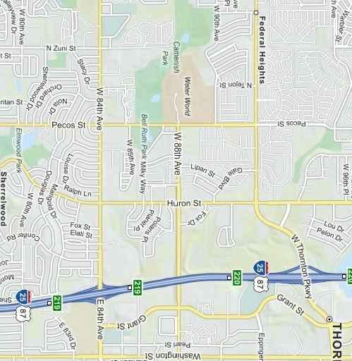
4 SITUATED IN THE SOUTHEAST QUATE OF SECTION 21, TOWNSHIP 2 SOUTH, ANGE 68 WEST OF THE SIXTH PINCIPA MEIDIAN, CITY OF THONTON, COUNTY OF ADAMS, STATE OF COOADO PUPOSE STATEMENT: EGA DESCIPTION SITE Pecos St W 88th Ave NET AND GOSS ACEAGE NUMBE OF TACTS NUMBE OF OTS TACT SIZE OT SIZE NUMBE OF BUIDABE OTS AND ASSOCIATED AND USE TYPE NET ACEAGE FO PUBIC STEETS AND USE TABE SUB -002 wwwolssonassociatescom TE FAX CITY OF THONTON APPOVAS: VICINITY MAP SCAE: 1" = 500' OWNESHIP CETIFICATE: SUVEYO'S CETIFICATE: INDEX: ATTONEY'S CETIFICATE: S P E DAFT POFESS COOADO IONA I NG AND SUVEYO ECODE'S CETIFICATE: KUM & GO, C COVE FINA PAT THONTON, COOADO project no: drawing no: HG _FPAT of 5
5 I NG SITUATED IN THE SOUTHEAST QUATE OF SECTION 21, TOWNSHIP 2 SOUTH, ANGE 68 WEST OF THE SIXTH PINCIPA MEIDIAN, CITY OF THONTON, COUNTY OF ADAMS, STATE OF COOADO GENEA NOTES: GENEA NOTES (CON'T): DETAI SUB -002 ADDITIONA OW PECOS STEET 1,328 SQUAE FEET or 0030 ACES, ± project no: drawing no: HG _FPAT of 5 THONTON, COOADO KUM & GO, C NOTES FINA PAT IONA AND POFESS DAFT SUVEYO COOADO S PE TE FAX wwwolssonassociatescom
6 (50' OW) SUB -002 SITUATED IN THE SOUTHEAST QUATE OF SECTION 21, TOWNSHIP 2 SOUTH, ANGE 68 WEST OF THE SIXTH PINCIPA MEIDIAN, CITY OF THONTON, COUNTY OF ADAMS, STATE OF COOADO wwwolssonassociatescom INE TABE UNPATTED SPECIA WAANTY DEED NOVEMBE 5, 1993 EC NO BOOK 4188, PAGE 371 TE FAX TACT "A" 136,961 SQUAE FEET or 3144 ACES, ± OT 2 SNOW CAP IDGE SUBDIVISION AMENDMENT NO 1 FIE 18, MAP 750 DAFT POFESS COOADO IONA S PE I NG AND SUVEYO ADDITIONA OW PECOS STEET 1,328 SQUAE FEET or 0030 ACES, ± PECOS STEET (OW VAIES) CUVE TABE EGEND UNPATTED HYAND HIS PAK & ECEATION DISTICT UNPATTED HYAND HIS PAK & ECEATION DISTICT OT 1 139,839 SQUAE FEET or 3210 ACES, ± TACT 1 PAKAND PACE SUBDIVISION FIING NO 5 OSAGE STEET WEST 88TH AVENUE (100' OW) TACT 3 PAKAND PACE SUBDIVISION FIING NO 3 SNOW CAP IDGE CONDOMINIUMS WAANTY DEED BOOK 6300, PAGE 242 KUM & GO, C BOUNDAY AND OT AYOUT project no: drawing no: FINA PAT THONTON, COOADO HG _FPAT of 5
7 I NG PECOS STEET (OW VAIES) SUB -002 SITUATED IN THE SOUTHEAST QUATE OF SECTION 21, TOWNSHIP 2 SOUTH, ANGE 68 WEST OF THE SIXTH PINCIPA MEIDIAN, CITY OF THONTON, COUNTY OF ADAMS, STATE OF COOADO UNPATTED SPECIA WAANTY DEED NOVEMBE 5, 1993 EC NO BOOK 4188, PAGE 371 EGEND OT 2 SNOW CAP IDGE SUBDIVISION AMENDMENT NO 1 FIE 18, MAP 750 TACT "A" 136,961 SQUAE FEET or 3144 ACES, ± DAFT project no: drawing no: HG _FPAT of 5 THONTON, COOADO KUM & GO, C TACT A EASEMENTS FINA PAT IONA AND POFESS SUVEYO COOADO S PE TE FAX wwwolssonassociatescom
8 I NG (100' OW) WEST 88TH AVENUE OT 1 139,839 SQUAE FEET or 3210 ACES, ± SNOW CAP IDGE CONDOMINIUMS WAANTY DEED BOOK 6300, PAGE 242 EGEND PECOS STEET (OW VAIES) SUB -002 SITUATED IN THE SOUTHEAST QUATE OF SECTION 21, TOWNSHIP 2 SOUTH, ANGE 68 WEST OF THE SIXTH PINCIPA MEIDIAN, CITY OF THONTON, COUNTY OF ADAMS, STATE OF COOADO project no: drawing no: HG _FPAT of 5 THONTON, COOADO KUM & GO, C OT 1 EASEMENTS FINA PAT IONA AND POFESS DAFT SUVEYO COOADO S PE TE FAX wwwolssonassociatescom
Planning Commission Staff Report
 Development Services Current Planning 410 E 5 th Street Loveland, CO 80537 (970) 962-2523 Fax (970) 962-2945 TDD (970) 962-2620 www.cityofloveland.org Planning Commission Staff eport February 27, 2017
MEMORANDUM. Chairperson Carter, Members of the Planning Commission, and Administrator Meyer
 MEMOANDUM DATE: February 11, 2019 TO: FOM: E: Chairperson Carter, Members of the Planning Commission, and Administrator Meyer Cynthia Smith Strack, Community Development Director Item 8.1 Vacation of Drainage
VICINITY MAP SCALE 1'' = 2000'
 CITY CREEK ANNEXATION TO THE CITY OF THORNTON LOCATED IN THE SOUTHWEST QUARTER OF SECTION 11 AND THE WEST HALF OF SECTION 14, TOWNSHIP 1 SOUTH, RANGE 68 WEST OF THE 6TH PRINCIPAL MERIDIAN, COUNTY OF ADAMS,
QUEBEC STREET EAST 130TH AVENUE ONEIDA STREET E. 130TH AVE. VALENTIA ST TAMARAC ST EAST 128TH AVENUE MOACO STREET BACHMAN DR. SITE QUINCE ST.
 SHEET OF CASE NO.: SUBA - PURPOSE STATEMENT: THIS PLAT IS INTENDED TO SUBDIVIDE. ACRES INTO SINGLE FAMILY LOTS, AND TRACTS FOR PARKS, OPEN SPACE, DRAINAGE AND DETENTION, DEDICATE RIGHT-OF-WAY AND GRANT
Ballard City Final Plat Check List
 Ballard City Final Plat Check List TO BE COMPLETED BY BOTH THE DEVELOPER AND THE CITY Design: Check: Check each of the following items for compliance with adopted City Standards, Titles, General Plans
A lot line or terminology adjustment will be reviewed concurrently with any other development review application(s) that are required.
 that are required.") RELATED FACTS TO KNOW: Adams County Recording Requirements, Annexation, Common Wall Subdivision, Development Plan (PUD Development Permit), Fees, Helpful Contact Information, Neighborhood Meeting, Park
RELATED FACTS TO KNOW: Adams County Recording Requirements, Annexation, Common Wall Subdivision, Development Plan (PUD Development Permit), Fees, Helpful Contact Information, Neighborhood Meeting, Park
RESOLUTION NO. PZ Series of 2018
 RESOLUTION NO. PZ 03-18 Series of 018 A RESOLUTION BY THE PLANNING AND ZONING OMMISSION OF THE TOWN OF DILLON, OLORADO, REOMMENDING THE APPROVAL OF A LEVEL IV DEVELOPMENT APPLIATION FOR A LASS S- SUBDIVISION
FINAL PLAT. Community Development Department 8101 Ralston Road Arvada, Colorado 80002
 FINAL PLAT Community Development Department 8101 Ralston Road Arvada, Colorado 80002 September 2015 FINAL SUBDIVISION PLAT Final Subdivision Plat Review Applications for a Final Plat shall be submitted
MINOR PLAT AMENDMENT APPLICATION CHECK APPLICABLE PERMIT ATTACHMENT:
 240 East Gammon Road Vineyard, Utah 84058 (801) 226-1929 MINOR PLAT AMMENDMENT APPLICATION Please Note: Attachment of request specific documents is required prior to processing your application. APPLICATION
Oakland County Michigan Register of Deeds Plat Engineering, GIS, & Remonumentation Dept. Ph: (248) Fax (248)
 Fax (248)") Oakland County Michigan Register of Deeds Plat Engineering, GIS, & Remonumentation Dept. Ph: (248)-858-1447 Fax (248)-858-7466 Requirements Needed for Final Plat Approval No. General Requirements. 1 Routing
Oakland County Michigan Register of Deeds Plat Engineering, GIS, & Remonumentation Dept. Ph: (248)-858-1447 Fax (248)-858-7466 Requirements Needed for Final Plat Approval No. General Requirements. 1 Routing
CITY OF STRONGSVILLE PLANNING COMMISSION APPLICATION. PARCEL SPLIT and/or ADJOINMENTS
 CITY OF STRONGSVILLE PLANNING COMMISSION APPLICATION PARCEL SPLIT and/or ADJOINMENTS Requires a Planning Commission application. After meeting with City Planner, George Smerigan (if necessary) regarding
Final Subdivision Plat
 Final Subdivision Plat Application Packet Public Works Department New Development Division 175 East 200 North St. George, UT 84770 Office (435) 627-4120 Dear Applicant, This packet has been prepared to
CHECK LIST FOR REVIEW OF SURVEY PLATS FOR COMPLIANCE WITH MISSOURI MINIMUM STANDARDS FOR PROPERTY BOUNDARY SURVEYS NAME OF SURVEYOR: DATE OF SURVEY:
 CHECK LIST FOR REVIEW OF SURVEY PLATS FOR COMPLIANCE WITH MISSOURI MINIMUM STANDARDS FOR PROPERTY BOUNDARY SURVEYS NAME OF SURVEYOR: DATE OF SURVEY: REVIEWED BY: DATE: DESCRIPTION OF SURVEY: GENERAL LAND
ABBREVIATION LEGEND SITE INFORMATION:
 SITE INFORMATION: Current Zone: R-3 PUD, governed by Fox Hollow 2nd MDA Basis of Elevations: Northeast Corner of Section 13, T6S, R1W, S.L.B. & M Elevation: 4599.26 (Benchmark) ABBREVIATION LEGEND Owners:
QUEBEC STREET EAST 130TH AVENUE ONEIDA STREET E. 130TH AVE. VALENTIA ST TAMARAC ST EAST 128TH AVENUE MONACO STREET BACHMAN DR. SITE QUINCE ST.
 SHEET OF CASE NO.: SUBA 0-0 PURPOSE STATEMENT: THIS PLAT IS INTENDED TO SUBDIVIDE. ACRES INTO 0 SINGLE FAMILY LOTS, AND TRACTS FOR PARKS, OPEN SPACE, DRAINAGE AND DETENTION, DEDICATE RIGHT-OF-WAY AND GRANT
Plats and subdivisions; mapping requirements. (a) Size Requirements. All land plats presented to the register of deeds for recording in the
 Size Requirements. All land plats presented to the register of deeds for recording in the") 47-30. Plats and subdivisions; mapping requirements. (a) Size Requirements. All land plats presented to the register of deeds for recording in the registry of a county in North Carolina after September
47-30. Plats and subdivisions; mapping requirements. (a) Size Requirements. All land plats presented to the register of deeds for recording in the registry of a county in North Carolina after September
MINOR SUBDIVISION PLAT
 MINOR SUBDIVISION PLAT Community Development Department 8101 Ralston Road Arvada, Colorado 80002 MINOR SUBDIVISION PLAT Subdivisions consisting of five (5) or fewer lots are eligible for the minor subdivision
MINOR SUBDIVISION PLAT
 MINOR SUBDIVISION PLAT Community Development Department 8101 Ralston Road Arvada, Colorado 80002 September 2015 MINOR SUBDIVISION PLAT Subdivisions consisting of five (5) or fewer lots are eligible for
BOUNDARY ADJUSTMENT APPLICATION
 BOUNDARY ADJUSTMENT APPLICATION COMMUNITY DEVELOPMENT DEPARTMENT / PLANNING DIVISION 8130 Allison Avenue, La Mesa, CA 91942 Phone: 619.667.1177 Fax: 619.667.1380 NOTE: The City of La Mesa emphasizes that
Gates County Planning and Zoning
 Gates County Planning and Zoning PO Box 411, 200 Court Street, Gatesville, NC 27938 phone: 252-357-2411 fax: 252-357-0073 Application for Technical Review Committee For Staff Use Only: Date: Application
BOSSIER CITY PARISH METROPOLITAN PLANNING COMMISSION 620 Benton Rd. Bossier City, LA Phone: Fax: PRELIMINARY PLAT
 (OFFICE USE ONLY) Application Fee: Paid: Date: CASE # Project Information BOSSIER CITY PARISH METROPOLITAN PLANNING COMMISSION 620 Benton Rd. Bossier City, LA 71111 Phone: 318-741-8824 Fax: 318-741-8827
A Final Plat will be reviewed concurrently with any other development review application(s) that is required.
 that is required.") RELATED FACTS TO KNOW: Adams County Recording Requirements, Annexation, Common Wall Subdivision, Development Plan (PUD Development Permit), Fees, Helpful Contact Information, Lot Line Adjustment, Neighborhood
RELATED FACTS TO KNOW: Adams County Recording Requirements, Annexation, Common Wall Subdivision, Development Plan (PUD Development Permit), Fees, Helpful Contact Information, Lot Line Adjustment, Neighborhood
Final Plat Approval of a Major Subdivision Application Packet
 Final Plat Approval of a Major Subdivision Application Packet 1. Application Packet. Be sure to complete and submit all the required materials that are a part of this Application Packet. Failure to do
LAND USE PERMIT APPLICATION
 LAND USE PERMIT APPLICATION Date Application No. TYPE OF PERMIT Subdivision Short Plat Conditional Use Binding Site Plan Final Plat Final Short Plat Variance Final Binding Site Plan Plat Amendment Short
C O M M U N I T Y D E VELOPMENT S E R VICES PLEASE CHECK ALL THAT APPLY
 LAND USE MASTER INVOICE C O M M U N I T Y D E VELOPMENT S E R VICES 435 MARTIN STREET, STE. 3000 BLAINE, WA 98230 PHONE: (360) 332-8311 FAX: (360) 543-9978 Total Fees $ FOR OFFICIAL USE ONLY I, the applicant/owner,
E. 140TH AVE. VICINITY MAP SCALE: 1"=600' LAND USE TABLE NET AREA 599,946 SQFT AC. GROSS AREA 741,420 SQFT AC.
 SHEET OF PURPOSE STATEMENT: THIS PLAT IS INTENDED TO SUBDIVIDE. ACRES INTO SINGLE FAMILY ATTACHED LOTS, TRACTS, DEDICATE AND GRANT EASEMENTS. LEGAL DESCRIPTION: THE UNDERSIGNED BEING THE OWNER(S) OF A
WESTON COUNTY FINAL PLAT APPLICATION
 WESTON COUNTY FINAL PLAT APPLICATION Property Owner: Mailing Address of owner: Telephone Number(s) of owner: Property Owner: Mailing Address of owner: Telephone Number(s) of owner: (If subdivider/applicant
SUBDIVISION AND LAND DEVELOPMENT. 185 Attachment 20
 185 Attachment 20 APPENDIX S Plat No. Date of Submission Twp. Fee $ Dauphin Co. Fee $ TOWNSHIP OF DERRY SUBDIVISION OR LAND DEVELOPMENT PLAN SUBMISSION APPLICATION This block for Twp. use only 1. Title
QUITCLAIM DEED CR 202 THE STATE OF TEXAS KNOW ALL MEN BY THESE PRESENTS: COUNTY OF WILLIAMSON
 QUITCLAIM DEED CR 202 THE STATE OF TEXAS KNOW ALL MEN BY THESE PRESENTS: COUNTY OF WILLIAMSON That WILLIAMSON COUNTY, TEXAS, hereinafter referred to as Grantor, whether one or more, for and in consideration
STANDARDIZED LEGAL DESCRIPTIONS AND EXHIBITS
 STANDARDIZED LEGAL DESCRIPTIONS AND EXHIBITS Public Works Department, Engineering Division June 14, 2004 UNIFIED GOVERNMENT STANDARDIZED LEGAL DESCRIPTIONS AND EXHIBITS For: Roads, Bridges, Short Span
STANDARDS FOR PLATS OF SURVEYS, LEGAL DESCRIPTIONS, RECORD PLANS AND CONDOMINIUM PLANS
 OFFICE OF THE MONTGOMERY COUNTY ENGINEER STANDARDS FOR PLATS OF SURVEYS, LEGAL DESCRIPTIONS, RECORD PLANS AND CONDOMINIUM PLANS INDEX Definitions Electronic Data Submittal Program Page i Page ii I. Adoption
Township of Collier 2418 Hilltop Road Presto, PA 15142
 Township of Collier 2418 Hilltop Road Presto, PA 15142 Fees: Major: 2 checks $600 + $50 per lot & $1700 Escrow) APPLICATION FOR SUBDIVISION major FINAL only Plans must be folded Rolled plans will not be
Application for Preliminary Plat Checklist
 Application for Preliminary Plat Checklist Note: No portion of an existing parcel may be sold or transferred to another party without first legally subdividing the property according to the City of Richmond
TITLE 13 SUBDIVISIONS
 TITLE 13 SUBDIVISIONS Chapter 1. General. 2. Subdivision Application Procedure. 3. Minor Subdivisions. 4. Standard Subdivisions. 5. Major Subdivisions. 6. Planned Unit Development Subdivisions. (Repealed)
Grand Forks Growth Fund, A Jobs Development Authority Staff Report
 Grand Forks Growth Fund, A Jobs Development Authority Staff Report Growth Fund Committee March 20, 2017 JDA March 20, 2017 Agenda Item: Business Park Infrastructure Submitted by: Ryan Brooks, Deputy City
Department of Development Services Engineering; Survey Plat Review Group SPRG
 Department of Development Services Engineering; Survey Plat Review Group SPRG CITY OF DALLAS LEGAL DESCRIPTION PREPARATION GUIDELINE AND CHECKLIST The following guideline and checklist are provided to
Preliminary Subdivision Application (Major) (Four (4) lots or more)
 (Four (4) lots or more)") Gunnison City Offices www.gunnisoncity.org 38 West Center Gunnison, Utah 84634 (435) 528 7969 Date of Application: Preliminary Subdivision Application (Major) (Four (4) lots or more) APPLICANT INFORMATION
Gunnison City Offices www.gunnisoncity.org 38 West Center Gunnison, Utah 84634 (435) 528 7969 Date of Application: Preliminary Subdivision Application (Major) (Four (4) lots or more) APPLICANT INFORMATION
ANALYSIS FOR ALLEY CLOSURE
 File D#:13 01045ac ANALYSS FOR ALLEY CLOSURE Request: Pursuant to Section 55-15 (c) of the Miami City Code, the Planning Department has reviewed the proposed public right-of-way vacation and closure to
OTTAWA COUNTY LEGAL DESCRIPTION REVIEW GUIDELINES
 OTTAWA COUNTY LEGAL DESCRIPTION REVIEW GUIDELINES APPROVED BY: RONALD P. LAJTI, JR., P.E., P.S. OTTAWA COUNTY ENGINEER APPROVED BY: LAWRENCE HARTLAUB OTTAWA COUNTY AUDITOR EFFECTIVE DATE: January 1, 2017
CFedS Outline Unit 1. Course 1: History, Records & Administrative Systems
 CFedS Outline Unit 1 Course 1: History, Records & Administrative Systems History of U.S. Surveying Historical Perspective Similarities in Surveying Seniority of Calls Lack of Standards A National Debt
Standards for All Instruments of Conveyance
 Standards for All Instruments of Conveyance Perry County, Ohio Effective Date: May 1, 1997 Effective Date of Revision: April 1, 2011 Page 2 of 12 Minimum Standards for all Instruments of Conveyance Perry
PRELIMINARY PLAT CHECK LIST
 PRELIMINARY PLAT CHECK LIST Name of Proposed Subdivision: The following items must be included with the initial submittal of a Preliminary Plat: Application, filled out completely Project Narrative Pre-application
Minor Subdivision Application
 FOR PLANNING USE ONLY Application # SD Application Fee $1,000.00 Receipt No. Filing Date Completeness Date Minor Subdivision Application A. PROJECT INFORMATION 1. Project Name: 2. Address of Subject Property:
Survey and Recording Requirements
 Article C: Sec. 14-1-40 Survey and Recording Requirements Survey Requirements. (a) (b) (c) Prior to the final approval of land divisions to which this Chapter applies, the owner of the land shall have
HARLINGEN IRRIGATION DISTRICT REQUIREMENTS FOR SUBDIVISION PLAT APPROVAL. 2) Copies of Warranty Deeds shall be provided to commence approval process.
 Copies of Warranty Deeds shall be provided to commence approval process.") HARLINGEN IRRIGATION DISTRICT REQUIREMENTS FOR SUBDIVISION PLAT APPROVAL 1) All taxes on property to be subdivided must be current. 2) Copies of Warranty Deeds shall be provided to commence approval process.
HARLINGEN IRRIGATION DISTRICT REQUIREMENTS FOR SUBDIVISION PLAT APPROVAL 1) All taxes on property to be subdivided must be current. 2) Copies of Warranty Deeds shall be provided to commence approval process.
DAUPHIN CREEK ESTATES SUBDIVISION
 # 12 SUB-000076-2017 DAUPHIN CREEK ESTATES SUBDIVISION Engineering Comments: FINAL PLAT COMMENTS (should be addressed prior to submitting the FINAL PLAT for review and/or signature by the City Engineer):
Group Break Out. What, if anything, sends up a red flag? What does the lotting along the North and South centerline suggest? What are your next steps?
 What is the NW ¼? What is the NW ¼? You are hired to survey your client s property in Section 8. His deed says NW ¼ Section 8, T. 40 S., R. 07 E. According to the county, it is Tax Lot 700. He gives you
MINOR SUBDIVISION APPLICATION
 Planning and Development 510 N. Baker St. Mount Dora, FL 32757 352-735-7112 Fax: 352-735-7191 plandev@cityofmountdora.com Date: Project Name: MINOR SUBDIVISION APPLICATION 1. Applicant s Name: 2. Property
Subdivisions. CITY OF OAK HARBOR Development Services Department
 CITY OF OAK HARBOR Development Services Department Subdivisions Finall Platt Applicatti ion Review Prrocess VII What is a Subdivision? A subdivision is the division of land into ten or more lots, tracts,
Final Plat Approval of a Minor Subdivision Application Packet
 Final Plat Approval of a Minor Subdivision Application Packet 1. Application Packet. Be sure to complete and submit all the required materials that are a part of this Application Packet. Failure to do
SUBDIVISION APPLICATION
 STAFF USE ONLY Date Submitted: Received by: Fee paid: Project # REQUIRED SUBMITTALS Application Fee: $600.00 (up to 5 lots) + $50.00 (per lot above 5) Publication Fee: $300.00 Mailing Fee: $6.00 per hearing
Delaware County Transfer Standards
 Delaware County Transfer Standards Delaware County Auditor David A. Yost Delaware County Engineer Chris Bauserman Adopted in 1997, Amended in 1999 Dave Yost County Auditor Chris Bauserman County Engineer
ST. TAMMANY PARISH PATRICIA P. BRISTER PARISH PRESIDENT
 TENTATIVE SUBDIVISION APPROVAL CHECK SHEET Revised October 5, 2018 The Developer shall submit a request for Tentative Plan Review to the Department of Planning & Development in the appropriate format.
CHAPTER 4 FINAL PLAT
 10-4-1 10-4-2 CHAPTER 4 FINAL PLAT SECTION: 10-4-1: Tentative Final Plat 10-4-2: Filing 10-4-3: Requirements 10-4-4: Amended Plats 10-4-5: Approval 10-4-6: Subdivision Agreement 10-4-1: TENTATIVE FINAL
SUBDIVISION APPLICATION INSTRUCTIONS
 SUBDIVISION APPLICATION INSTRUCTIONS APPLICATION FORM The application form must be fully completed, signed by the property owner and shall be properly notarized. AGENT AUTHORIZATION FORM If the applicant
WASTEWATER BACKFLOW RELEASE PROCEDURES
 WASTEWATER BACKFLOW RELEASE PROCEDURES PROCEDURE FOR OBTAINING A WASTEWATER RELEASE FOR PRIVATE DEVELOPMENT PROJECTS: PLEASE NOTE THAT THE WASTEWATER BACKFLOW RELEASE DOCUMENT MUST FOLLOW THE CITY S PROCEDURES.
SUBMITTAL REQUIREMENTS: The number indicates the number of copies for submittal (if applicable).
.") Office Use Only Preliminary Long Plat Long Subdivision Applicant Checklist PLANNING, COMMUNITY, & ECONOMIC DEVELOPMENT DEPARTMENT FINAL LONG PLAT LONG SUBDIVISION CHECKLIST Mailing Address: P.O. Box 547,
Office Use Only Preliminary Long Plat Long Subdivision Applicant Checklist PLANNING, COMMUNITY, & ECONOMIC DEVELOPMENT DEPARTMENT FINAL LONG PLAT LONG SUBDIVISION CHECKLIST Mailing Address: P.O. Box 547,
COUNTY OF ADAMS, STATE OF COLORADO E. 40TH AVE. TOWER RD. E. 38TH AVE. SALIDA ST. HIGH LINE CANAL PROJECT LOCATION E. 32ND PKWY.
 LEGAL DESCRIPTION:, GATEWAY EAST AT TOWER SUBDIVISION FILING NO. 1, SAID PARCEL CONTAIN 598,154 SQUARE FEET OR MORE OR LESS GENERAL NOTES: 1. NOTICE: ACCORDING TO COLORADO LAW YOU MUST COMMENCE ANY LEGAL
City of Lakewood Plat Specifications
 City of Lakewood Plat Specifications Revised 12/15/2015 Plat Checklist.1 Notes, Certifications and Acknowledgements..5 Electronic Submittal Information... 20 Sheet Layout.21 A Professional Land Surveyor,
CERTIFICATION OF THE APPROVAL OF WATER AND SEWERAGE SYSTEMS
 ARTICLE 9 FORMS AND CHECK LISTS 9.100 On preliminary layout & final subdivision plat CERTIFICATION OF THE APPROVAL OF WATER AND SEWERAGE SYSTEMS I hereby certify that the (...type: private or pubic...)
PETITION FOR VOLUNTARY ANNEXATION Town of Apex, North Carolina
 Town of Apex, North Carolina ANNEXATION PETITION SUBMISSION: Applications are due by 12:00 pm on the first business day of each month. See the Annexation Petition Schedule on the website for details. ANNEXATION
COUNCIL ACTION FORM VACATION AND CONVEYANCE OF APPLE PLACE AND PEACH LANE RIGHT-OF-WAY TO THE OLD ORCHARD/CREEKSIDE MOBILE HOME PARK
 ITEM # 21&22 DATE: 03-27-18 COUNCIL ACTION FORM SUBJECT: VACATION AND CONVEYANCE OF APPLE PLACE AND PEACH LANE RIGHT-OF-WAY TO THE OLD ORCHARD/CREEKSIDE MOBILE HOME PARK BACKGROUND: City of Ames staff
Standards of Practice for Surveying in the State of Alabama
 Standards of Practice for Surveying in the State of Alabama Effective January 1, 2017 RULE NO. 1.01 PURPOSE The purpose of these rules is to establish standards for the practice of surveying in the State
REQUIREMENTS FOR ALL INSTRUMENTS OF CONVEYANCE IN HARDIN COUNTY, OHIO
 REQUIREMENTS FOR ALL INSTRUMENTS OF CONVEYANCE IN HARDIN COUNTY, OHIO Effective Date: Michael L. Smith, P.E., P.S. Hardin County Engineer Michael T. Bacon Hardin County Auditor 1 I. GENERAL In compliance
Regular Agenda / Public Hearing for Board of Commissioners meeting January 7, 2015
 Rebecca W. Arnold, Commissioner Sara M. Baker, Commissioner Jim D. Hansen, Commissioner Kent Goldthorpe, Commissioner Paul Woods, Commissioner TO: FROM: ACHD Board of Commissioners & Bruce S. Wong, Director
R/W PREQUALIFICATION ODOT, 3/14/2018
 R/W PREQUALIFICATION ODOT, 3/14/2018 BRETT SHEARER, C.O. REAL ESTATE PROPOSED RIGHT OF WAY DESIGN 172 PROPOSED RIGHT OF WAY DESIGN PROPOSED RIGHT OF WAY DESIGN Section 3200 Types of Title 173 PROPOSED
Real Property Services Division 2016 SUBDIVISION PLAT CHECKLIST
 Real Property Services Division 2016 SUBDIVISION PLAT CHECKLIST Created primarily for the use of Surveyors, CAD operators, and technical support staff for the preparation of subdivision plats. INTRODUCTION:
The Filing Fee for a Minor Plat is $ PLUS $20.00 per lot created
 DEPARTMENT OF COMMUNITY DEVELOPMENT MINOR PLAT PROCEDURE The Filing Fee for a Minor Plat is $250.00 PLUS $20.00 per lot created Description: The purpose of a Minor Plat is to allow property to be platted
FINAL SUBDIVISION AND LAND DEVELOPMENT PLAN CHECKLIST. Plan Name. Applicant's Name:
 TOWNSHIP OF UPPER ST. CLAIR FINAL SUBDIVISION AND LAND DEVELOPMENT PLAN CHECKLIST Date Filed Plan Name PLC Applicant's Name: Phone Filing Date for Final Application Final Plat 114.22. FINAL APPLICATION
CHAPTER XIX ANNEXATION ARTICLE 1. ANNEXATION
 CHAPTER XIX ANNEXATION ARTICLE 1. ANNEXATION 19.0101 JABORSKY ADDITION: WHEREAS, The City of Belfield pursuant to Section 40-51.2-07 of the North Dakota Century Code has amended having passed a Resolution
2018 EASEMENT DEDICATION PACKET
 2018 EASEMENT DEDICATION PACKET (INCLUDES PARCELS OF LAND, EASEMENTS, AND RIGHTS-OF-WAY FOR PUBLIC USE) Information Packet There are various situations in which easements, rights-of-way, and parcels of
TRANSFER PROCEDURES FOR WASHINGTON COUNTY, OHIO
 TRANSFER PROCEDURES FOR WASHINGTON COUNTY, OHIO The following requirements are adopted and established in conjunction with the Washington County Engineer and the Washington County Auditor as prescribed
ELMORE COUNTY LAND USE & BUILDING DEPARTMENT 520 E 2 nd South Mountain Home, ID (208) Preliminary Plat Application
 Preliminary Plat Application") ELMORE COUNTY LAND USE & BUILDING DEPARTMENT 520 E 2 nd South Mountain Home, ID 83647 (208) 587-2142 www.elmorecounty.org Preliminary Plat Application We are unable to accept facsimile copies. (Subdivisions
ELMORE COUNTY LAND USE & BUILDING DEPARTMENT 520 E 2 nd South Mountain Home, ID 83647 (208) 587-2142 www.elmorecounty.org Preliminary Plat Application We are unable to accept facsimile copies. (Subdivisions
Submittal Requirements: Subdivision Plat (Final)
") s Planning and Zoning Submittal Requirements: Subdivision Plat (Final) 1. Application form, APO fees, and filing fee. Transportation Development Review Fee please contact Engineering at (970) 221-6605
s Planning and Zoning Submittal Requirements: Subdivision Plat (Final) 1. Application form, APO fees, and filing fee. Transportation Development Review Fee please contact Engineering at (970) 221-6605
I I 1 I I C LE VI I I I I I 1 I I
 C LE V ARTCLE V M NOR R ES 0 E NT A L S U BD V S ON 60. Definition "Minor Residential Subdivision" shall mean a Subdivision of five (5) lots or less for residential purposes not involving any new streets
CHAPTER FINAL AND PARCEL MAPS
 CHAPTER 19.48 FINAL AND PARCEL MAPS Section Page 19.48.010 General... IV-25 19.48.020 Phasing... IV-25 19.48.030 Survey Required... IV-26 19.49.040 Form... IV-26 19.48.050 Contents... IV-27 19.48.060 Preliminary
[SPACE ABOVE THIS LINE FOR RECORDING INFORMATION]
![[SPACE ABOVE THIS LINE FOR RECORDING INFORMATION]](/thumbs/74/69889180.jpg "[SPACE ABOVE THIS LINE FOR RECORDING INFORMATION]") INSTRUMENT#: 2010398579, BK: 20216 PG: 1321 PGS: 1321-1326 11/23/2010 at 04:03:44 PM, DEPUTY CLERK:LPERTUIS Pat Frank,Clerk of the Circuit Court Hillsborough County ~l=~ntff~e' ~ F ~ E [] (~ 0 ~)) Y Donald
INSTRUMENT#: 2010398579, BK: 20216 PG: 1321 PGS: 1321-1326 11/23/2010 at 04:03:44 PM, DEPUTY CLERK:LPERTUIS Pat Frank,Clerk of the Circuit Court Hillsborough County ~l=~ntff~e' ~ F ~ E [] (~ 0 ~)) Y Donald
APPLICATION PACKET LAND SPLIT OR COMBINATION REVIEW
 APPLICATION PACKET LAND SPLIT OR COMBINATION REVIEW COMMUNITY DEVELOPMENT DEPARTMENT CHARTER TOWNSHIP OF PLYMOUTH 9955 N. Haggerty Road Plymouth, MI 48170 Fees Revised 9.13.2017 APPLICATION PACKET LAND
DALLAS WATER UTILITIES WATER/WASTEWATER COVENANT
 DALLAS WATER UTILITIES WATER/WASTEWATER COVENANT Procedure for obtaining a water and wastewater covenant, water covenant, or wastewater covenant; Required for initial submittal: 1. One letter from the
City of Palmetto Florida
 Date Submitted: CIT A9LME o City of Palmetto Florida Final Plat Application PROJECT NAME: Final Plat Review Small Scale 1, 500 Plans consistent with a prior preliminary Under 10 acres) Site Plan approval
ADMINISTRATIVE HEARING STAFF REPORT Country Club Acres Second Amended Subdivision Amendment PLNSUB E Parkway Avenue December 12, 2013
 ADMINISTRATIVE HEARING STAFF REPORT Country Club Acres Second Amended Subdivision Amendment PLNSUB2013-00925 2167 E Parkway Avenue December 12, 2013 Planning Division Department of Community & Economic
APPLICATION PACKET ARC SIGN REVIEW. COMMUNITY DEVELOPMENT DEPARTMENT CHARTER TOWNSHIP OF PLYMOUTH 9955 N. Haggerty Road Plymouth, MI 48170
 APPLICATION PACKET ARC SIGN REVIEW COMMUNITY DEVELOPMENT DEPARTMENT CHARTER TOWNSHIP OF PLYMOUTH 9955 N. Haggerty Road Plymouth, MI 48170 Fees Revised 9.13.2017 APPLICATION PACKET ARC SIGN REVIEW Community
LISA ANDERSON-OGILVIE, AICP DEPUTY COMMUNITY DEVELOPMENT DIRECTOR AND PLANNING ADMINISTRATOR
 FOR MEETING OF: December 12, 2018 CASE NO.: VUL18-01 TO: FROM: HEARINGS OFFICER LISA ANDERSON-OGILVIE, AICP DEPUTY COMMUNITY DEVELOPMENT DIRECTOR AND PLANNING ADMINISTRATOR SUBJECT: VALIDATION OF UNIT
PLANNING COMMISSION STAFF REPORT
 PLANNING COMMISSION STAFF REPORT Alder-Robinson Subdivision Amending the Amended Plat of the Arcadia Heights Plat A Subdivision Case #PLNSUB2010-00044 2857 East 2100 South June 23, 2010 Applicant: Greg
FINAL MAP PLAN CHECK
 Engineering Division 201 North Broadway, Escondido, CA 92025 (760) 839-4651, FAX (760) 839-4597 FINAL MAP PLAN CHECK To: Date: Project: Address: Check No: Attn: VIA: The attached FINAL MAP has been reviewed
For Sale Acreage on Bagley and Bronson, Olmsted Township
 For Sale Parcel #2 264-16-001 Parcel #1 264-18-020 aka 264-18-001 Property Highlights ithin one mile from Ohio Turnpike (I-80) / I-480 Interchange, 8 Miles from leveland Hopkins and 5 mile from I-71 Great
APP. FEE: $ DATE & TIME LOCATION: 1/4 SECTION SECTION TOWNSHIP RANGE STREET ADDRESS AND GENERAL LOCATION OF PROPERTY CITY, STATE PHONE (DAY):
:") REVERSION TO ACREAGE PURSUANT TO N.R.S. 278.490 through 478.4965 Elko County Planning & Zoning 155 South 9th Street, Elko, NV 89801 (775) 738-6816 or 738-2266 APPLICATION MUST BE SUBMITTED WITH ALL REQUIRED
REVERSION TO ACREAGE PURSUANT TO N.R.S. 278.490 through 478.4965 Elko County Planning & Zoning 155 South 9th Street, Elko, NV 89801 (775) 738-6816 or 738-2266 APPLICATION MUST BE SUBMITTED WITH ALL REQUIRED
City of Fort Lupton Amended Plat Process
 City of Fort Lupton Amended Plat Process Purpose The Amended Plat process is an administrative process to amend a recorded Plat. An Amended Subdivision is an administrative revision to a recorded Subdivision
Change In The Name Of Owner (s) Of Land.
 Of Land.") Clermont County TRANSFER AND CONVEYANCE STANDARDS OF THE CLERMONT COUNTY AUDITOR AND THE CLERMONT COUNTY ENGINEER AS ADOPTED UNDER OHIO REVISED CODE SECTION 319.203, AS A RESULT OF TWO PUBLIC HEARINGS
Clermont County TRANSFER AND CONVEYANCE STANDARDS OF THE CLERMONT COUNTY AUDITOR AND THE CLERMONT COUNTY ENGINEER AS ADOPTED UNDER OHIO REVISED CODE SECTION 319.203, AS A RESULT OF TWO PUBLIC HEARINGS
KANKAKEE COUNTY PLANNING DEPARTMENT APPLICATION FOR FARMSTEAD EXEMPTION IN THE A1 DISTRICT
 KANKAKEE COUNTY PLANNING DEPARTMENT APPLICATION FOR FARMSTEAD EXEMPTION IN THE A1 DISTRICT Michael J. Van Mill, AICP Planning Director 189 East Court Street Kankakee, IL 60901 Telephone (815) 937-2940
STAFF REPORT KETCHUM CITY COUNCIL REGULAR MEETING OF MARCH 21, James R. Laski, applicant s attorney
 March 21, 2016 Planning and Zoning Commission City of Ketchum Ketchum, Idaho Commissioners: STAFF REPORT KETCHUM CITY COUNCIL REGULAR MEETING OF MARCH 21, 2016 PROJECT: 151 South Main Street Hotel and
CR_2017 Page 1 of 5. Corner Records
 CR_2017 Page 1 of 5 Corner Records Corner Record Check List Santa Barbara County Surveyor s Office (Examination in accordance with the PLS Act and Board Rule 464) Document No.: CR Agency Index: APN Review
COACHELLA VALLEY WATER DISTRICT STANDARDS FOR LEGAL DESCRIPTIONS AND PLATS
 COACHELLA VALLEY WATER DISTRICT STANDARDS FOR LEGAL DESCRIPTIONS AND PLATS The following is the procedure for processing legal descriptions and plats (exhibits) for grants of easements, grant deeds, quitclaim
c. Final plat (recommendation by the Planning Commission, approval by City Council)
") SPRINGVILLE CITY COMMUNITY DEVELOPMENT DEPARTMENT PLANNING DIVISION SUBDIVISION APPROVAL REVIEW PROCESS & CHEKLIST 110 SOUTH MAIN STREET SPRINGVILLE, UT 84663 OFFICE 801.491.7861 www.springville.org Before
SPRINGVILLE CITY COMMUNITY DEVELOPMENT DEPARTMENT PLANNING DIVISION SUBDIVISION APPROVAL REVIEW PROCESS & CHEKLIST 110 SOUTH MAIN STREET SPRINGVILLE, UT 84663 OFFICE 801.491.7861 www.springville.org Before
APPLICATION FOR MAJOR SUBDIVISION APPROVAL (FINAL PLAT)
") 209 S. Main Street Marysville, Ohio 43040 Phone: (937) 645-7350 Fax: (937) 645-7351 www.marysvilleohio.org APPLICATION FOR MAJOR SUBDIVISION APPROVAL (FINAL PLAT) *** IMPORTANT INFORMATION ~ Please read
209 S. Main Street Marysville, Ohio 43040 Phone: (937) 645-7350 Fax: (937) 645-7351 www.marysvilleohio.org APPLICATION FOR MAJOR SUBDIVISION APPROVAL (FINAL PLAT) *** IMPORTANT INFORMATION ~ Please read
Administrative Application Duplex Subdivisions
 Department of Community Development 75 South Frontage Road Vail, CO 81657 Tel: 970-479-2128 www.vailgov.com Development Review Coordinator Administrative Application Duplex Subdivisions General Information:
PLANNING AND DEVELOPMENT DEPARTMENT PRELIMINARY PLAT APPLICATION
 PLANNING AND DEVELOPMENT DEPARTMENT PRELIMINARY PLAT APPLICATION IT IS INCUMBENT UPON THE APPLICANT TO SUBMIT COMPLETE AND CORRECT INFORMATION. ANY MISLEADING, DECEPTIVE, INCOMPLETE OR INCORRECT INFORMATION
2017_10_MIKES_SWEETMAN_OE_PC.PDF
 1. OCTOBER PLANNING COMMISSION AGENDA Documents: OCTOBER 2017.PDF 1.I. MIKES/SWEETMAN OUTRIGHT EXEMPTIONS Documents: 2017_10_MIKES_SWEETMAN_OE_PC.PDF DEPARTMENT OF PLANNING AND ZONING 308 Byers Ave P.O.
Final Plat Mapping Requirements
 CURRENT PLANNING DIVISION 410 E. 5 th Street Loveland, CO 80537 970-962-2523 eplan-planning@cityofloveland.org cityofloveland.org/dc Final Plat Mapping Requirements All Final plats shall comply with the
APPLICATION PACKET ARC SIGN REVIEW. COMMUNITY DEVELOPMENT DEPARTMENT CHARTER TOWNSHIP OF PLYMOUTH 9955 N. Haggerty Road Plymouth, MI 48170
 APPLICATION PACKET ARC SIGN REVIEW COMMUNITY DEVELOPMENT DEPARTMENT CHARTER TOWNSHIP OF PLYMOUTH 9955 N. Haggerty Road Plymouth, MI 48170 Fees Revised 7/01/2012 APPLICATION PACKET ARC SIGN REVIEW Community