National Flood Insurance Program (NFIP) MT-1 Presentation. David Mummert, Michael Baker Jr., Inc.
|
|
|
- Suzanna Robbins
- 6 years ago
- Views:
Transcription


1 National Flood Insurance Program (NFIP) MT-1 Presentation David Mummert, Michael Baker Jr., Inc.
2 MT-1 Letters of Map Change (LOMCs)
3 LOMC Review By FEMA FEMA required to notify the applicant in writing within 60 days from the receipt date of all data Requesters able to check status of all LOMC requests by contacting the FEMA Map Assistance Center toll-free at 877-FEMA MAP ( )
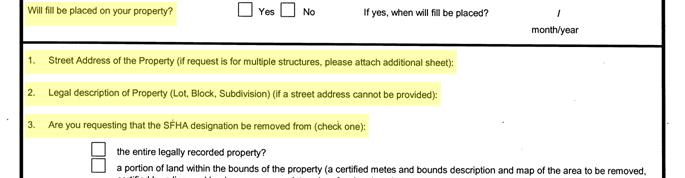
4 Data Requirements LOMA LOMR-F CLOMA CLOMR-F Property Information Form X X X X Recorded Deed/Plat X X Tax Map or Other Suitable Map X 1 X 1 X 1 X 1 Effective FIRM X X X X Elevation Certificate or Form X X X X Community Acknowledgment Form X 2 X X Metes and Bounds Map/Description X 3 X 3 X 3 Fee X X X 1 Not required if a plat has been submitted 2 Section B required if structure has been inadvertently included in the floodway 3 If portion of property is requested to be removed
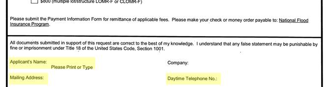
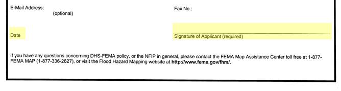
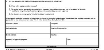
5 Property Information Form

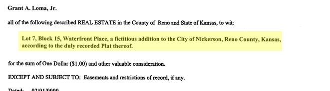
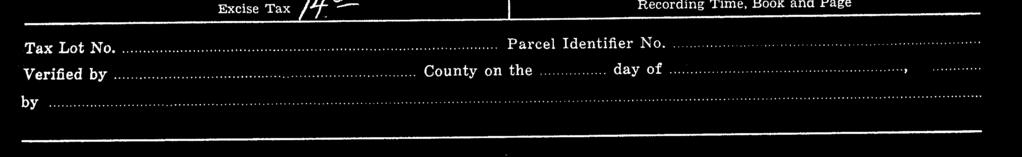
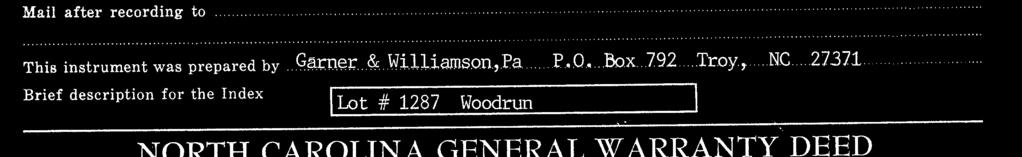
6 Recorded Deed

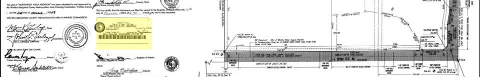
7 Recorded Plat

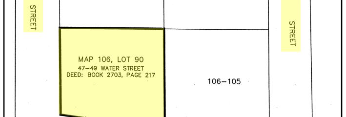
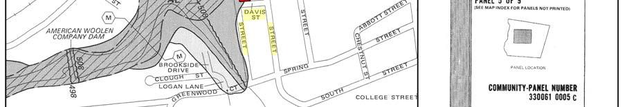
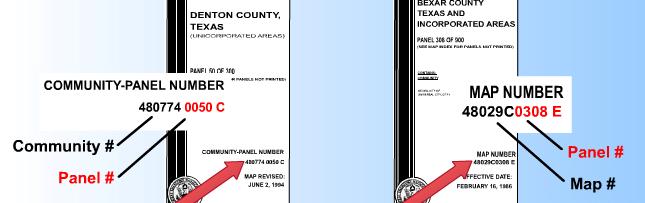
8 Effective FIRM/Tax Map
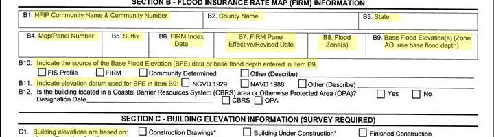
9 Elevation Form/Certificate
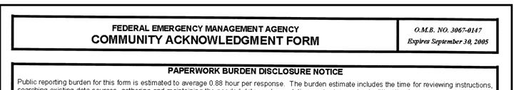
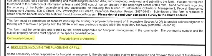
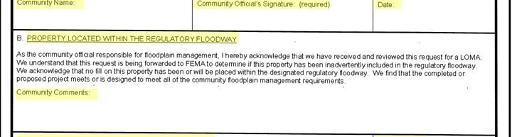
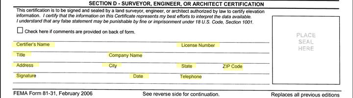
10 Community Acknowledgment Form
11 Fees Product or Service LOMA Review Fee Exempt CLOMA - Single structure $500 - Multiple l structure t $700 CLOMR-F - Single lot/structure $500 - Multiple lot/structure $800 LOMR-F - Single lot/structure $425 - LOMR-F following CLOMR-F $325 LOMR-F - Multiple lot/structure - LOMR-F following CLOMR-F $800 $700
12 Metes and Bounds Description Used to remove a portion of property from the SFHA when the entire property cannot be removed Must be tied into a point found on a legally recorded deed or plat Requestor to submit all recorded plats and deeds for properties located in the described area All portions of described area to be at or above the BFE Cannot contain any areas of water such as streams, lakes, or detention ponds
13 Metes and Bounds Description Can describe a portion of one lot, portions of multiple lots, or entire proposed lots that have not yet been recorded on a plat Should always have a beginning and end (closed description, no lines) Must be in the form of bearings and distances (i.e. thence N W, feet ) Cannot follow a contour without also containing bearings and distances (i.e. thence 200 feet along the 730 foot contour is unacceptable)
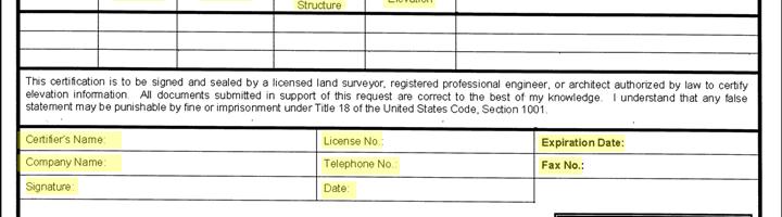
14 Metes and Bounds Description Must be signed and sealed by a licensed land surveyor or professional engineer Description to be sent to FEMA in Microsoft Word format Must contain spot elevations along the perimeter when a range of BFEs will be used
15 Metes and Bounds Map N
16 MT-1 Processing Issues
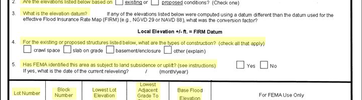
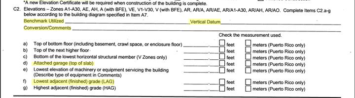
17 Common Issues Lowest Floor above BFE, Lowest Adjacent Grade below (no removal) No datum on the elevation certificate/form Proposed instead of existing conditions Deed or plat is not recorded. Deed is missing legal description of property. Tax map does not contain an intersection of streets that also appears on the FIRM (can t plot).
18 Common Issues The request is for a LOMA, but all previous properties in subdivision have been processed as LOMR-Fs. Major changes have been made to the flooding source; e.g., stream has been contained in culvert, channel grading, etc. (should be LOMR) The Lowest Adjacent Grade (LAG) is lower than the Lowest Lot Elevation (LLE). (not possible) Fill has been placed in the regulatory floodway. (potential violation)
19 eloma Determination Tool David Mummert, Michael Baker Jr., Inc.


20 eloma Determination Tool eloma is a MIP application designed to provide licensed land surveyors and professional engineers with a web-basedbased system to submit and print simple LOMA requests


21 eloma Determination Tool The eloma tool is designed to allow users to receive a determination from FEMA in minutes, and the user can print a copy almost instantly.
22 eloma Determination Tool Limited to: Requests for existing single residential Structures or Legally Recorded Parcels of Land not involving the placement of fill. Detail Studied Areas (AE, numbered A zones, AH) No Approximate A Zones, V, AO, or D zones No Floodways No multi-lot requests or portions of properties Audit procedures and automatic checks to ensure accuracy
23 Process He/She logs into eloma through the MIP and has option to: Create New Application Resume Previously Saved Application Surveyor or Engineer must set up an account through MIP using individual certification information


24 Data Requirements User will enter all applicable data: Requestor Information Community Information (CID Number, etc ) Map Panel Information Latitude and Longitude Coordinates Elevation Information (LAG or LLE) Legal Property Description BFE (calculated using FIS text/profile)
25 Determination eloma will make a comparison of the submitted BFE with the submitted Lowest Adjacent Grade (LAG) or Low Lot Elevation (LLE). Natural Ground LOMA ill th t ll i d eloma will ensure that all required information has been entered.
26 Audits Requestor MUST submit hard copy data to FEMA. FEMA will approve or reject determination through standard LOMA procedures
27 Audits If APPROVED, requestors will receive an notification that they can log-in and print determination. If REJECTED, LOMA will be completed by NSP and user will be audited again after his/her next submittal. After initial successful audit the user will be able to generate determinations online. However, he/she will still be subject to random audits.
28 Where are we now? eloma became available through the MIP on June 12, 2006 Currently there are over 300 eloma LPs registered in the MIP Possible Next Steps BFE Determinations Broader Application Expand use
29 QUESTIONS dt
30
MT 1, MT 2, Elevation Certificates & the Role of Surveyors
 MT 1, MT 2, Elevation Certificates & the Role of Surveyors Rocky Mountain Surveyors Summit March 3, 2016 Floods are acts of God, but flood losses are largely acts of man. - Dr. Gilbert White the father
Letter of Map Change Fundamentals
 Letter of Map Change Fundamentals FEMA Region III National Flood Insurance Program Essentials and Best Practices Jana Green, CFM, RAMPP Topics of Discussion Why Apply for a Letter of Map Change (LOMC)?
Federal Emergency Management Agency
 Page 1 of 3 Date: July 21, 2016 Case No.: 16-05-5203A LOMA COMMUNITY AND MAP PANEL INFORMATION COMMUNITY KEWAUNEE COUNTY, WISCONSIN (Unincorporated Areas) Federal Emergency Management Agency Washington,
National Flood Insurance Program
 National Flood Insurance Program Base Flood Elevations in Zone A Streams Surveyor Training Presented by Thomas F. Smith, PE, PLS January 22, 2018 1 FEMA Region III Mitigation Division Floodplain Management
Criteria for Appeals of Flood Insurance Rate Maps. November 30, 201 1
 Criteria for Appeals of Flood Insurance Rate Maps November 30, 201 1 This document outlines the criteria for appealing proposed changes in flood hazard information on Flood Insurance Rate Maps (FIRMS)
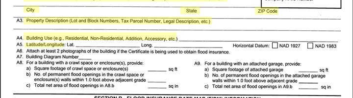
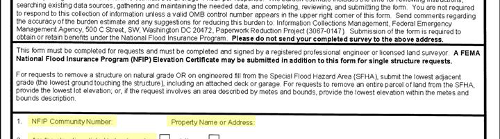
FEDERAL EMERGENCY MANAGEMENT AGENCY MITIGATION DIRECTORATE TECHNICAL SERVICES DIVISION AMENDMENTS AND REVISIONS TO
 FEDERAL EMERGENCY MANAGEMENT AGENCY MITIGATION DIRECTORATE TECHNICAL SERVICES DIVISION AMENDMENTS AND REVISIONS TO NATIONAL FLOOD INSURANCE PROGRAM MAPS Application/Certification Forms and Instructions
Map Modernization Modernization Program
 FEMA Map Modernization Program Presented to Maryland Association of Floodplain and Stormwater Managers October 27, 2005 Map Modernization Program Autorun.exe 2 Map Modernization Program Outline Map Mod
Letters of Map Amendment- Out as Shown
 Letters of Map Amendment- Out as Shown While digital Flood Insurance Rate Maps (DFIRM s) have made it easier to determine if a structure (or building site) is in the special flood hazard area (SFHA), many
HEC Software and FEMA Submittals
 HEC Software and FEMA Submittals EWRI Workshop HEC Users Conference Larry Voice Risk Analysis FEMA Region VI April 12, 2010 Overview Flood Hazard Analysis Overview of Map Changes Accepted Model List Guidance
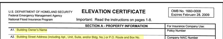
ELEVATION CERTIFICATE
 ELEVATION CERTIFICATE IMPORTANT: In these spaces, copy the corresponding information from Section A. FOR INSURANCE COMPANY USE Building Street Address (including Apt., Unit, Suite, and/or Bldg. No.) or
October 2011 Flood Insurance Manual
 FEMA NFIP C h a n g e s October 2011 Flood Insurance Manual 1 Significant Revisions The Changes Where to find the Change Building Occupancy Classification Updates Improvements and Betterments Coverage
Floodplain Development Land Use Review
 PUBLIC WORKS - COMMUNITY DEVELOPMENT 333 Broadalbin Street SW, PO Box 490, Albany, Oregon 97321-0144 BUILDING 541-917-7553 PLANNING 541-917-7550 Floodplain Development Land Use Review Application Information
1/23/2017. Floodplain Update For Surveyors. Floodplain Updates For Surveyors. Sample FEMA Map with SFHA
 Floodplain Updates For Surveyors Ceil Strauss MN State Floodplain Manager February 9, 2017 Floodplain Update For Surveyors Finding FEMA Maps & Data Map / Data Updates & Status Other useful resources Letters
Project Name: (Name as it appears in ESNAPS.) Spring Care Association
 Spring Care Association") Page 1 of 4 U.S. Department of Housing and Urban Development 451 Seventh Street, SW Washington, DC 20410 www.hud.gov espanol.hud.gov Environmental Review for Continuum of Care (CoC) Rental Assistance Project
Page 1 of 4 U.S. Department of Housing and Urban Development 451 Seventh Street, SW Washington, DC 20410 www.hud.gov espanol.hud.gov Environmental Review for Continuum of Care (CoC) Rental Assistance Project
Cibola County Floodplain Development Permit Application
 Cibola County Floodplain Development Permit Application Application # FP Use Permit Variance Appeal Permit Fee $25.00 Date SECTION I: GENERAL PROVISIONS (APPLICANT to read and sign) 1. No work of any kind
MAP INDEX CHECKLIST NOTES:
 REVIEWING YOUR PRELIMINARY DFIRM PANELS AND FIS REPORT A GUIDE FOR COMMUNITY OFFICIALS When a Georgia community is presented with new Digital Flood Insurance Rate Map (DFIRM) panels, the State of Georgia,
FLOOD DAMAGE PREVENTION ORDINANCE FOR THE TOWN OF FRANKLIN
 FLOOD DAMAGE PREVENTION ORDINANCE FOR THE TOWN OF FRANKLIN ARTICLE 1. SECTION A. STATUTORY AUTHORIZATION, FINDINGS OF FACT, PURPOSE AND OBJECTIVES. STATUTORY AUTHORIZATION. The Legislature of the State
CITY OF CAMBRIDGE FLOODPLAIN MANAGEMENT CHAPTER 7 (GRADING, EROSION AND SEDIMENT CONTROL)
") CITY OF CAMBRIDGE FLOODPLAIN MANAGEMENT CHAPTER 7 (GRADING, EROSION AND SEDIMENT CONTROL) City of Cambridge, MD Floodplain Management Ordinance (Tidal): May, 2011 1 City of Cambridge, Maryland Floodplain
CITY OF CAMBRIDGE FLOODPLAIN MANAGEMENT CHAPTER 7 (GRADING, EROSION AND SEDIMENT CONTROL) City of Cambridge, MD Floodplain Management Ordinance (Tidal): May, 2011 1 City of Cambridge, Maryland Floodplain
Mingo County, WV Community Coordination Preliminary Flood Insurance Study and Flood Insurance Rate Map. Thursday, September 25, 2014
 Mingo County, WV Community Coordination Preliminary Flood Insurance Study and Flood Insurance Rate Map Thursday, September 25, 2014 Overview Preliminary Materials Preliminary FIS Report Digital Flood Insurance
Oxford Floodplain Management Ordinance
 Table of Contents SECTION 1.0 GENERAL PROVISIONS...1 1.1 Findings...1 1.2 Statutory Authorization...1 1.3 Statement of Purpose...1 1.4 Areas to Which These Regulations Apply...2 1.5 Basis for Establishing
STATUTORY AUTHORIZATION
 TABLE OF CONTENTS SECTION NUMBER NAME STARTS AT PAGE 16.1 Statutory Authorization, Findings of Fact, 16-1 Purpose and Objectives 16.2 Definitions 16-3 16.3 General Provisions 16-13 16.4 Administration
Chapter 5. Floodplain Management. 5.0 Introduction. 5.1 Floodplain Management and Regulation
 5.0 Introduction This chapter summarizes the Town s rules and regulations regarding floodplain management and development. The requirements presented in this chapter should be used by the design engineer
City of Fort Lupton Amended Plat Process
 City of Fort Lupton Amended Plat Process Purpose The Amended Plat process is an administrative process to amend a recorded Plat. An Amended Subdivision is an administrative revision to a recorded Subdivision
ORDINANCE ARTICLE VI. RESOURCE PROTECTION STANDARDS
 ORDINANCE 2016-19 AN ORDINANCE OF THE CITY OF LAKE WALES, POLK COUNTY, FLORIDA AMENDING THE CITY OF LAKE WALES CODE OF ORDINANCES BY REPEALING CHAPTER 23 ZONING, LAND USE AND DEVELOPMENT REGULATIONS, ARTICLE
Date of Review: 11/6/2015 Reviewer: RCQ/LMC STATE
 FINAL Florida Review Checklist: NFIP & FBC & Revised Model Ordinance (January 15, 2013d) Ordinance Citation: Model FPM regulations and 5 th Edition FBC : All Zones Date of Review: 11/6/2015 Reviewer: RCQ/LMC
Chapter 5. Floodplain Management. 5.0 Introduction. 5.1 Douglas County Comprehensive Master Plan. 5.2 Floodplain Management and Regulation
 5.0 Introduction This chapter summarizes the County s rules and regulations regarding floodplain management and development. The requirements presented in this chapter should be used by the design engineer
2016 Fredericksburg Area Floodplain Management Workshop Tuesday, October 25, 2016
 2016 Fredericksburg Area Floodplain Management Workshop Tuesday, October 25, 2016 Charley Banks, CFM Department of Conservation And Recreation Division of Dam Safety & Floodplain Management Some Soapbox
COMMERCIAL SITE DEVELOPMENT GUIDE FOR UNINCORPORATED ST. CHARLES COUNTY
 COMMERCIAL SITE DEVELOPMENT GUIDE FOR UNINCORPORATED ST. CHARLES COUNTY GENERAL INFORMATION: This brochure is to be used as a guide and is not intended to amend or supersede the corresponding County ordinances
TOWN OF PINE LEVEL 2018 FLOOD DAMAGE PREVENTION ORDINANCE
 1 TOWN OF PINE LEVEL 2018 FLOOD DAMAGE PREVENTION ORDINANCE ARTICLE 1. SECTION A. STATUTORY AUTHORIZATION, FINDINGS OF FACT, PURPOSE AND OBJECTIVES. STATUTORY AUTHORIZATION. The Legislature of the State
FLOOD DAMAGE PREVENTION
 ARTICLE 30 FLOOD DAMAGE PREVENTION 30.01 General Provisions... 30-1 30.02 Administration... 30-2 30.03 Provisions for Flood Hazard Reduction... 30-7 30.01 General Provisions 30.01.01 Lands to Which This
DUPLIN COUNTY FLOOD DAMAGE PREVENTION ORDINANCE
 DUPLIN COUNTY FLOOD DAMAGE PREVENTION ORDINANCE Non-Coastal Regular Phase ARTICLE 1. SECTION A. STATUTORY AUTHORIZATION, FINDINGS OF FACT, PURPOSE AND OBJECTIVES. STATUTORY AUTHORIZATION. The Legislature
Final Report WI Flood Map Maintenance Project. Prepared For. The Wisconsin Department of Natural Resources Flood Map Maintenance Project
 Final Report WI Flood Map Maintenance Project Prepared For The Wisconsin Department of Natural Resources Flood Map Maintenance Project December 2007 TABLE OF CONTENTS INTRODUCTION 1 GIS DATA INVENTORY
An Ordinance of the City of Shady Cove, Oregon An Oregon Municipal Corporation
 An Ordinance of the City of Shady Cove, Oregon An Oregon Municipal Corporation ORDINANCE NO. 259 Establishing Regulations To Prevent Flood Damage Within The City Of Shady Cove, Oregon, Adopting Related
RD:VMT:NGA ORD. NO /3/09 ORDINANCE NO
 ORDINANCE NO. 28512 AN ORDINANCE OF THE CITY OF SAN JOSE AMENDING CHAPTER 17.08 OF TITLE 17 OF THE SAN JOSE MUNICIPAL CODE TO UPDATE THE CITY S SPECIAL FLOOD HAZARD REGULATIONS WHEREAS, the Council of
Zoning Permit Application Cover Page
 Zoning Permit Application Cover Page The City of Belmont performs an initial site inspection prior to issuance of a zoning permit for new construction. Upon receipt of a full and complete application submittal
ORD-3309 BE IT ORDAINED BY THE CITY COUNCIL OF THE CITY OF VIRGINIA BEACH, VIRGINIA:
 ORD-3309 1 2 3 4 5 6 7 8 9 10 11 12 13 14 15 16 17 18 19 20 21 22 23 24 25 26 27 28 29 30 31 32 33 34 35 36 37 38 39 40 41 42 43 44 45 AN ORDINANCE TO ADOPT APPENDIX K, (FLOODPLAIN ORDINANCE) OF THE CITY
Development Application Submittal Guidelines & Requirements
 Development Application Submittal Guidelines & Requirements Community Development Services Department The following items must be received no later than 3:00 M on the submittal deadline date (refer to
CITY OF AUSTELL DESIGN AND CONSTRUCTION STANDARDS LAND DEVELOPMENT ORDINANCES
 CITY OF AUSTELL DESIGN AND CONSTRUCTION STANDARDS LAND DEVELOPMENT ORDINANCES Land Development Ordinances Section 8 CITY OF AUSTELL DESIGN AND CONSTRUCTION STANDARDS LAND DEVELOPMENT ORDINANCES Article
CHAPTER 1108 Flood Damage Protection
 CHAPTER 1108 Flood Damage Protection 1108.01 General Provisions. 1108.02 Definitions. 1108.03 Administration. 1108.04 Use and development standards for flood hazard reduction. 1108.05 Appeals and variances.
NOTICE
 www.ketteringoh.org NOTICE This City of Kettering Code section is not the official version and is provided only for the convenience of the public. The only official version of the City of Kettering Code
Appendix A Reproducible Forms
 Appendix A Reproducible Forms Form LD-33 LD-34 LD-35 LD-40 LD-41 LD-42 LD-50 LD-51 LD-52 LD-53 Subject County Engineer Approval Form Storm Sewer Computation Sheet Ohio Drainage Design Criteria Form Gutter
6. Help maintain a stable tax base by providing for the sound use and development of flood hazard areas;
 CHAPTER 9 FLOODPLAIN MANAGEMENT SECTION 101 GENERAL 101.1 Title. These regulations shall be known as the Floodplain Management Ordinance of Yankeetown, hereinafter referred to as this ordinance. 101.2
MODEL FLOODPLAIN MANAGEMENT / FLOOD DAMAGE PREVENTION ORDINANCE
 MODEL FLOODPLAIN MANAGEMENT / FLOOD DAMAGE PREVENTION ORDINANCE Description: Floodplain management involves the designation of flood-prone areas and the managing of their uses. It is also aimed at minimizing
(Ord. No , 5(Exh. C), )
, )") Chapter 34 - FLOOD DAMAGE PREVENTION [1] Footnotes: --- (1) --- Editor's note The flood damage prevention ordinance, as set out herein by Ord. No. 20-09, 5(Exh. C), adopted Sept. 21, 2009, shall become
Chapter 34 - FLOOD DAMAGE PREVENTION [1] Footnotes: --- (1) --- Editor's note The flood damage prevention ordinance, as set out herein by Ord. No. 20-09, 5(Exh. C), adopted Sept. 21, 2009, shall become
Site Plan Application
 Site Plan Application City of St. Pete Beach Community Development Department 155 Corey Avenue St. Pete Beach, Florida 33706 (727) 367-2735 www.stpetebeach.org Case Number: PROPERTY OWNER: Name: Address:
SHORT PLAT Information
 Information This form provides information and an explanation of the procedures of a Short Plat. If you have any questions, contact the Planning and Development Services Department at (253) 566-5656. A
CHAPTER 1313 Flood Damage Prevention Statutory authorization Exemption from filing a Findings
 11 CHAPTER 1313 Flood Damage Prevention 1313.01 Statutory authorization. 1313.02 Findings of fact. 1313.03 Statement of purpose. 1313.04 Methods of reducing flood losses. 1313.05 Lands to which these regulations
DLCD ACKNOWLEDGMENT or DEADLINE TO APPEAL: Friday, April 22, 2011
 Department of Land Conservation and Development 635 Capitol Street, Suite 150 Salem, O R 9730 1-2540 (503) 373-0050 Fax (503) 378-5518 w w w. lc d. s tat e. or. us NOTICE OF ADOPTED AMENDMENT fita 04/11/2011
SPECIAL PURPOSE FLOOD DAMAGE REDUCTION RESOLUTION FOR PICKAWAY COUNTY, OHIO
 SPECIAL PURPOSE FLOOD DAMAGE REDUCTION RESOLUTION FOR PICKAWAY COUNTY, OHIO Effective December 7, 2012 Pickaway County Board of Commissioners Glenn D. Reeser Jay H. Wippel Ula Jean Metzler Terry L. Frazier,
FLOOD DAMAGE REDUCTION RESOLUTION GREENE COUNTY, OHIO
 FLOOD DAMAGE REDUCTION RESOLUTION GREENE COUNTY, OHIO SECTION 101.01: GENERAL PROVISIONS 101.01.1 Statutory Authorization This resolution is adopted pursuant to authorization contained in Sections 307.37
SECTION 10 STANDARD PLATS
 SECTION 10 - STANDARD PLATS Subdivision 1: Purpose Standard Plats allow the subdivision of land into lots smaller than the minimum metes and bounds size in the zoning district, and control road development
DIVISION 1. - GENERAL PROVISIONS
 Sec. 90-708. - Statutory authorization and purpose. Sec. 90-709. - Applicability. Sec. 90-710. - Compliance and liability. Sec. 90-711. - Records. Sec. 90-712. - Abrogation and greater restrictions. Sec.
Chapter 8 FLOOD PREVENTION AND PROTECTION
 Chapter 8 FLOOD PREVENTION AND PROTECTION ARTICLE I - GENERAL 8.1 Title. 8.2 Scope. 8.3 Intent. 8.4 Coordination with the Florida Building Code. 8.5 Warning. 8.6 Disclaimer of Liability. 8.7 through 8.10
Article 18 FLOOD DAMAGE PREVENTION ORDINANCE (amended November 13, 2018)
") Article 18 FLOOD DAMAGE PREVENTION ORDINANCE (amended November 13, 2018) ARTICLE 18.1. SECTION A. STATUTORY AUTHORIZATION, FINDINGS OF FACT, PURPOSE AND OBJECTIVES. STATUTORY AUTHORIZATION. The Legislature
Article 18 FLOOD DAMAGE PREVENTION ORDINANCE (amended November 13, 2018) ARTICLE 18.1. SECTION A. STATUTORY AUTHORIZATION, FINDINGS OF FACT, PURPOSE AND OBJECTIVES. STATUTORY AUTHORIZATION. The Legislature
Chatham County Flood Damage Prevention Ordinance
 CHATHAM COUNTY FLOOD DAMAGE PREVENTION ORDINANCE ARTICLE 1 STATUTORY AUTHORIZATION, FINDINGS OF FACT, PURPOSE AND OBJECTIVES SECTION A STATUTORY AUTHORIZATION The Legislature of the State of North Carolina
SUBDIVISION APPLICATION: RECOMBINATION PLAT or EXEMPT PLAT
 SUBDIVISION APPLICATION: RECOMBINATION PLAT or EXEMPT PLAT Pursuant to Article 7, Section 155.706 of the Unified Development Code, an owner of land within the jurisdiction of the Town (or a duly authorized
TUSCARAWAS COUNTY FLOOD DAMAGE REDUCTION REGULATIONS
 TUSCARAWAS COUNTY FLOOD DAMAGE REDUCTION REGULATIONS 2010 Approved for adoption by ODNR 5/11/07 Adopted by the Board of Tuscarawas County Commissioners Date: October 1, 2007 Resolution No: 736-2007 Revised
CITY OF SARALAND PRELIMINARY SUBDIVISION PLAT REVIEW
 PRELIMINARY SUBDIVISION PLAT REVIEW Application Number: Date Plat Submitted: Name of Subdivision: Name of Owner: Owner Address: (Street or P.O. Box) Telephone #: (City) (State) (Zip) E-mail: Name of Authorized
(Ord. No. 743, )
") CHAPTER 330. - FLOODPLAIN MANAGEMENT Section 330-1. - Purpose. (a) (b) (c) (d) It is hereby determined that the flood hazard areas of the City of Chamblee are subject to periodic inundation which may result
CHAPTER 330. - FLOODPLAIN MANAGEMENT Section 330-1. - Purpose. (a) (b) (c) (d) It is hereby determined that the flood hazard areas of the City of Chamblee are subject to periodic inundation which may result
Subdivision - Minor Plat Submittal
 Subdivision - Minor Plat Submittal This Checklist is intended to provide the information and data that is necessary to assess the merits of the project proposal. Please note that this Checklist is intended
THE FUNDAMENTALS OF MANUFACTURED LENDING
 THE FUNDAMENTALS OF MANUFACTURED LENDING Last Revised: 06/07/17 DISCLAIMER These materials are intended for AFR internal use and client training procedures only. This is neither legal advice nor a substitute
BOUNDARY LINE ADJUSTMENT/CERTIFICATE OF SURVEY DEFINITION AND INSTRUCTIONS
 BOUNDARY LINE ADJUSTMENT SURVEY (BLA) BOUNDARY LINE ADJUSTMENT/CERTIFICATE OF SURVEY DEFINITION AND INSTRUCTIONS DEFINITION: The adjustment of one (1) or more common boundaries between existing un-platted
City of Clever Planning & Zoning Department P.O. Box 52 Clever, MO QUALIFICATIONS FOR MINOR SUBDIVISIONS
 QUALIFICATIONS FOR MINOR SUBDIVISIONS All subdivision of land not otherwise classified as a major subdivision shall be classified as a minor subdivision and shall be subject to the procedures adopted by
What s New in FEMA Mapping?
 Discussion Topics What s New in FEMA Mapping? Eric Simmons September 6, 2018 FEMA Initiatives & Evolving Risk MAP FEMA s Flood Map Service Center National Flood Hazard Layer (NFHL) Draft NFHL and Changes
[Docket ID FEMA ; Internal Agency Docket No. FEMA-B-1406] AGENCY: Federal Emergency Management Agency, DHS.
![[Docket ID FEMA ; Internal Agency Docket No. FEMA-B-1406] AGENCY: Federal Emergency Management Agency, DHS.](/thumbs/95/124849871.jpg "[Docket ID FEMA ; Internal Agency Docket No. FEMA-B-1406] AGENCY: Federal Emergency Management Agency, DHS.") This document is scheduled to be published in the Federal Register on 04/22/2014 and available online at http://federalregister.gov/a/2014-09184, and on FDsys.gov 1 Billing Code 9110-12-P DEPARTMENT OF
This document is scheduled to be published in the Federal Register on 04/22/2014 and available online at http://federalregister.gov/a/2014-09184, and on FDsys.gov 1 Billing Code 9110-12-P DEPARTMENT OF
ALBEMARLE COUNTY CODE CHAPTER 18 ZONING SECTION 30 OVERLAY DISTRICTS
 CHAPTER 18 ZONING SECTION 30 OVERLAY DISTRICTS Sections: 30.1 OVERLAY DISTRICTS, GENERALLY 30.1.1 INTENT 30.1.2 APPLICATION 30.2 AIRPORT IMPACT AREA OVERLAY DISTRICT - AIA 30.2.1 INTENT 30.2.2 APPLICATION
Plat Reviews. Richard Powell, P.L.S.
 Plat Reviews Richard Powell, P.L.S. 177.011 Purpose and scope of part I. This part shall be deemed to establish consistent minimum requirements, and to create such additional powers in local governing
INFORMATION & PROCEDURES FOR CHANGE OF ZONING REQUESTS AND CONDITIONAL USE PERMITS
 INFORMATION & PROCEDURES FOR CHANGE OF ZONING REQUESTS AND CONDITIONAL USE PERMITS The applicant is strongly encouraged to attend a pre-application meeting for the project prior to submittal of a zoning
PLANNING BOARD CITY OF CONCORD, NH MINOR SUBDIVISION CHECKLIST
 PLANNING BOARD CITY OF CONCORD, NH MINOR SUBDIVISION CHECKLIST Summary This checklist is intended to assist applicants and design professionals in the preparation of minor subdivision applications for
LDC AMENDMENT FLOODPLAINS
 Staff Report to the Municipal Planning Board March 20, 2018 L D C 2 0 1 8-10000 I T E M # 4 LDC AMENDMENT FLOODPLAINS Applicant City of Orlando Project Planner Elisabeth Dang, AICP Description of the Request:
A. To prevent unwise development from increasing flood or drainage hazards to others.
 BOONE COUNTY FLOOD HAZARD AREA Ordinance No. 94 14 (September 19, 1994) Amended Ordinance No. 98 2 (April 6, 1998) Amended Ordinance No. 02 6 (June 3, 2002) SECTION 1 STATUTORY AUTHORIZATION The Indiana
ARTICLE 5 MINOR SUBDIVISION/LAND DEVELOPMENT
 ARTICLE 5 MINOR SUBDIVISION/LAND DEVELOPMENT SECTION 501 ONLY FINAL PLAN REQUIRED The classification of a proposed subdivision as a "Minor Subdivision" shall only require the submission, review and approval
APPLICATION PROCEDURE
 ANTRIM PLANNING BOARD P. O. Box 517 Antrim, New Hampshire 03440 Phone: 603-588-6785 FAX: 603-588-2969 APPLICATION FORM AND CHECKLIST FOR EARTH EXCAVATION AND RECLAMATION File # Date Received By APPLICATION
City of Forest Hill Minor Plat Application
 City of Forest Hill Minor Plat Application APPLICANT NAME: DATE: SUB-DIVISION NAME: LEGAL DESCRIPTION: ACRES: CURRENT ZONING: PROPOSED ZONING: BEING PLATTED AS: LOTS: BLOCKS: PHASES: OWNER OF RECORD: ADDRESS:
[Docket ID FEMA ; Internal Agency Docket No. FEMA-B-1518] AGENCY: Federal Emergency Management Agency, DHS.
![[Docket ID FEMA ; Internal Agency Docket No. FEMA-B-1518] AGENCY: Federal Emergency Management Agency, DHS.](/thumbs/87/97204602.jpg "[Docket ID FEMA ; Internal Agency Docket No. FEMA-B-1518] AGENCY: Federal Emergency Management Agency, DHS.") This document is scheduled to be published in the Federal Register on 06/08/ and available online at http://federalregister.gov/a/-13857, and on FDsys.gov 1 9110-12-P DEPARTMENT OF HOMELAND SECURITY Federal
This document is scheduled to be published in the Federal Register on 06/08/ and available online at http://federalregister.gov/a/-13857, and on FDsys.gov 1 9110-12-P DEPARTMENT OF HOMELAND SECURITY Federal
MASON COUNTY FLOODPLAIN ORDINANCE
 MASON COUNTY FLOODPLAIN ORDINANCE September 2013 AUTHORITY AND PURPOSE: AN ORDINANCE ESTABLISHING A FLOODPLAIN AREA AND REQUIRING ALL CONTRACTORS, PERSONS, PARTNERSHIPS, BUSINESSES, AND CORPORATIONS TO
WAYNE COUNTY, WV FLOODPLAIN ORDINANCE
 WAYNE COUNTY, WV FLOODPLAIN ORDINANCE AUTHORITY AND PURPOSE: AN ORDINANCE ESTABLISHING A FLOODPLAIN AREA AND REQUIRING ALL CONTRACTORS, PERSONS, PARTNERSHIPS, BUSINESSES, AND CORPORATIONS TO OBTAIN A PERMIT
Caldwell County. Flood Damage Prevention Ordinance
 Caldwell County Flood Damage Prevention Ordinance Adopted June 15, 2009 Effective July 7, 2009 Caldwell County Flood Ordinance 2 FLOOD DAMAGE PREVENTION ORDINANCE FOR CALDWELL COUNTY ARTICLE 1. STATUTORY
Residential Major Subdivision Review Checklist
 Residential Major Subdivision Review Checklist Plan Submittal Requirements: 2 full sets of stamped plans Electric submittal - all plans contained in a single PDF 3 full sets if commercial kitchen or dining
HARRISON COUNTY FLOOD DAMAGE PREVENTION ORDINANCE
 HARRISON COUNTY FLOOD DAMAGE PREVENTION ORDINANCE Harrison County Board Of Supervisors December 21, 2017 FLOOD DAMAGE PREVENTION TABLE OF CONTENTS ARTICLE 1. STATUTORY AUTHORIZATION, FINDINGS OF FACT,
LEE COUNTY ORDINANCE NO
 LEE COUNTY ORDINANCE NO. 15-09 AN ORDINANCE AMENDING LEE COUNTY LAND DEVELOPMENT CODE CHAPTERS 6 AND 10 AND CERTAIN SECTIONS OF THE FLORIDA BUILDING CODE TO AUTHORIZE THE BOARD OF ADJUSTMENTS AND APPEALS
APPLICATION PROCEDURE
 ANTRIM PLANNING BOARD P. O. Box 517 Antrim, New Hampshire 03440 Phone: 603-588-6785 FAX: 603-588-2969 APPLICATION FORM AND CHECKLIST FOR MINOR OR MAJOR SITE PLAN REVIEW File Date Received By APPLICATION
Adopted by the Vance County Board of Commissioners April 2, Amended April 8, 2013.
 Ordinance: #29 VANCE COUNTY ORDINANCE #29 ------------------------------------------------------------------------------------------------------------------------------ FLOOD DAMAGE PREVENTION ORDINANCE
MASTER SUBDIVISION FINAL PLAT APPLICATION Town of Apex, North Carolina
 MASTER SUBDIVISION FINAL PLAT APPLICATION Town of Apex, North Carolina This document is a public record under the North Carolina Public Records Act and may be published to the Town s website or disclosed
CHAPTER 152: FLOODPLAIN REGULATIONS. General Provisions. Flood Damage Prevention; Generally
 CHAPTER 152: FLOODPLAIN REGULATIONS Section 152.001 Short title 152.002 Effective date General Provisions Flood Damage Prevention; Generally 152.015 152.016 152.017 152.018 152.019 152.020 152.021 152.022
FLOOD DAMAGE PREVENTION ORDINANCE. Non-Coastal Regular Phase
 FLOOD DAMAGE PREVENTION ORDINANCE Non-Coastal Regular Phase ARTICLE 1. SECTION A. STATUTORY AUTHORIZATION, FINDINGS OF FACT, PURPOSE AND OBJECTIVES. STATUTORY AUTHORIZATION. Municipal: The Legislature
CHATHAM COUNTY FLOOD DAMAGE PREVENTION ORDINANCE ARTICLE 1 STATUTORY AUTHORIZATION, FINDINGS OF FACT, PURPOSE AND OBJECTIVES
 CHATHAM COUNTY FLOOD DAMAGE PREVENTION ORDINANCE ARTICLE 1 STATUTORY AUTHORIZATION, FINDINGS OF FACT, PURPOSE AND OBJECTIVES SECTION A STATUTORY AUTHORIZATION The Legislature of the State of North Carolina
INVITATION FOR PROPOSALS SALE OF REAL PROPERTY INSTRUCTIONS, TERMS AND CONDITIONS
 INVITATION FOR PROPOSALS SALE OF REAL PROPERTY INSTRUCTIONS, TERMS AND CONDITIONS The City Council of the City of Covington invites members of the general public to submit sealed bid proposals to purchase
[Docket ID FEMA ; Internal Agency Docket No. FEMA-B-1756] AGENCY: Federal Emergency Management Agency, DHS.
![[Docket ID FEMA ; Internal Agency Docket No. FEMA-B-1756] AGENCY: Federal Emergency Management Agency, DHS.](/thumbs/89/97520517.jpg "[Docket ID FEMA ; Internal Agency Docket No. FEMA-B-1756] AGENCY: Federal Emergency Management Agency, DHS.") This document is scheduled to be published in the Federal Register on 10/26/2017 and available online at https://federalregister.gov/d/2017-23230, and on FDsys.gov 1 Billing Code 9110-12-P DEPARTMENT OF
This document is scheduled to be published in the Federal Register on 10/26/2017 and available online at https://federalregister.gov/d/2017-23230, and on FDsys.gov 1 Billing Code 9110-12-P DEPARTMENT OF
ORDINANCE NO SECTION 1. RECITALS. The foregoing whereas clauses are incorporated herein by reference and made a part hereof.
 ORDINANCE NO. 13-10 AN ORDINANCE BY THE TREASURE ISLAND CITY COMMISSION AMENDING THE TREASURE ISLAND CODE OF ORDINANCES TO REPEAL CHAPTER 66, FLOOD CONTROL TO ADOPT A NEW CHAPTER 66, FLOODPLAIN MANAGEMENT
Chapter FLOOD DAMAGE PREVENTION
 Lake Elsinore Municipal Code Chapter 15.64 FLOOD DAMAGE PREVENTION Page 1 of 29 Sections: 15.64.100 Statutory authorization. 15.64.110 Findings of fact. 15.64.120 Statement of purpose. 15.64.130 Methods
PLATTING AND DEVELOPMENT INFORMATION PACKET
 City of North Richland Hills, Texas PLATTING AND DEVELOPMENT INFORMATION PACKET CONTENTS Description Page No. Introduction 1 Staff Members Names and Phone Numbers 4 Platting Process 5 Platting Application
CITY OF DECATUR, TEXAS
 Final Plat or Amending Plat / Replat Checklist A submittal of a complete application will facilitate a timely review. Failure of the applicant to provide required information or obtain a waiver from the
Overview of Federal and State Floodplain Management Programs
 Overview of Federal and State Floodplain Management Programs Peter DeMeo, PE Supervising Environmental Engineer New Jersey Department of Environmental Protection Division of Land Use Regulation October
[Docket ID FEMA ; Internal Agency Docket No. FEMA-B-1809] AGENCY: Federal Emergency Management Agency, DHS.
![[Docket ID FEMA ; Internal Agency Docket No. FEMA-B-1809] AGENCY: Federal Emergency Management Agency, DHS.](/thumbs/96/128473675.jpg "[Docket ID FEMA ; Internal Agency Docket No. FEMA-B-1809] AGENCY: Federal Emergency Management Agency, DHS.") This document is scheduled to be published in the Federal Register on 03/09/2018 and available online at https://federalregister.gov/d/2018-04780, and on FDsys.gov 1 Billing Code 9110-12-P DEPARTMENT OF
This document is scheduled to be published in the Federal Register on 03/09/2018 and available online at https://federalregister.gov/d/2018-04780, and on FDsys.gov 1 Billing Code 9110-12-P DEPARTMENT OF
SUBDIVISION APPLICATION
 SUBDIVISION APPLICATION Community Planning and Economic Development Development Services Division 250 South 4 th Street, Room 300 Minneapolis MN 55415-1316 612-673-3000 This application packet is used
TOWN OF WILMINGTON FLOOD AND FLUVIAL EROSION HAZARD REGULATIONS
 Draft Wilmington Flood Hazard Regulation February 2019 TOWN OF WILMINGTON FLOOD AND FLUVIAL EROSION HAZARD REGULATIONS Contents 600. Statutory Authorization and Effect... 1 601. Statement of Purpose...
PRELIMINARY PLAT Checklist
 PRELIMINARY PLAT Checklist 3715 Bridgeport Way W University Place, WA 98466 PH: (253) 566-5656 FAX: (253) 460-2541 This is a checklist of materials required for a Preliminary Plat. This checklist is provided
City of Ferndale Floodplain Management Ordinance Page 1 of 18 ORDINANCE 08-02
 City of Ferndale Floodplain Management Ordinance 08-02 Page 1 of 18 ORDINANCE 08-02 AN ORDINANCE OF THE CITY COUNCIL OF THE CITY OF FERNDALE ESTABLISHING THE MINIMUM REQUIREMENTS OF THE NATIONAL FLOOD
Minor Subdivision Application
 FOR PLANNING USE ONLY Application # SD Application Fee $1,000.00 Receipt No. Filing Date Completeness Date Minor Subdivision Application A. PROJECT INFORMATION 1. Project Name: 2. Address of Subject Property: