SC Dams and Reservoirs Safety
|
|
|
- Tamsyn Jenkins
- 6 years ago
- Views:
Transcription
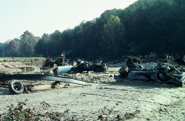
1 SC Dams and Reservoirs Safety Inspection of Embankment Dams John A. Poole, P.E. SCDHEC
2 Topics Covered History of the Dam Safety Program: Time line of the program and important events Inspections Performed by the Department
3 History of the Dam Safety Program
4 Toccoa Falls Question: How could such a beautiful natural treasure turn deadly? Answer:????

5 Toccoa Falls Question: How could such a beautiful natural treasure turn deadly? Answer: Kelly Barns Dam

6 Kelly Barns Dam 40-ft height 20-ft top width 400-ft length 4.6 sq.mile DA that is heavily wooded

7 Disaster Strikes on November 1977 Note tree root penetration through dam embankment pipe, old low dam, silt layers

8 Impacts Down Stream Toccoa Falls College campus area located in flood plain Breach occurred at night and caught many by surprise Approximately 40 people died by drowning or being crushed by debris

9 Down Stream Damage Many students lived in mobile homes and light weight trailers surrounding the campus Note the vehicle, they were not warned in time to escape
10

11

12
13 Creation of the Dams Inventory After the disaster at Toccoa Falls, then president, Jimmy Carter issued a proclamation for the ACOE to perform a one time inspection of all high hazard dams. The South Carolina Land Resource Commission (SCLRC) was tasked to generate an inventory of high hazard dams for the ACOE to inspect.
14 ACOE Findings Almost all of the dams inspected in SC were classified as unsafe due to their conditions. The state was then responsible for follow up work to ensure the conditions of the dams were improved to a safe level.
15 Dam Safety Program Findings In addition to the dams identified by the ACOE, the Dam Safety Program identified an overwhelming number of very small dams that were in unsafe conditions. In 1980, the act was amended to exclude all very small (less than 25 feet high and impounded less than 50 acre feet) dams from regulation unless they are a direct threat to life by their failure.
16 Working Towards Safety The dam safety program began working with individual dam owners to get their unsafe dams corrected Detailed studies and more careful inspections removed a number of dams in the Corp's reports from the unsafe list Legal action had to be initiated against a number of dam owners
17 Routine Inspection Program In 1984, the Dam Safety Program started a routine re-inspection program for all high hazard and significant hazard dams Low hazard dams would not be inspected, but would be checked for reclassification
18 Routine Inspection Program Current Inspection and classification schedule: 2-yrs for High Hazard Inspections 3-yrs for Significant Hazard Inspections 5-yrs for Low Hazard Classifications

19 Computers In 1985, the first desktop Personal Computer was acquired for the purpose of keeping the inventory of regulated dams. This inventory is still maintained by DHEC.

20 Disaster Strikes SC Klaus and Marco, entered the state simultaneously in early October, 1990 Storms stalled over the state and dumped unprecedented quantities of rainfall 17 regulated dams failed

21 Storm Path Increases Danger

22 General Assembly Restructures State Government In 1994, many of the small independent agencies were abolished, and their functions were transferred to larger agencies SCLRC duties were absorbed by DHEC

23 Inspections Performed by Regional Staff
24 Central Office Functions Issuing permits for: New dams Altering existing dams Modifying Control Structures of dams Repairing extensive damage to dams Removing dams Enforcement actions
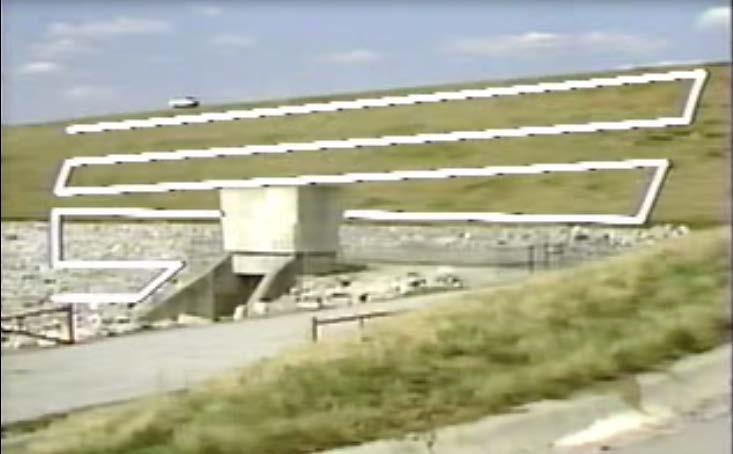
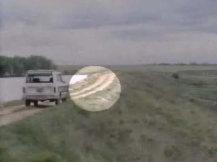
25 Permit Application Form
26 SC DAMS AND RESERVOIRS SAFETY ACT SC LAW
27 What is the Purpose of the Act? It is the purpose of this article to provide for the certification and inspection of certain dams in South Carolina in the interest of public health, safety, and welfare in order to reduce the risk of failure of the dams, prevent injuries to persons and damage to property, and confer upon the department the regulatory authority to accomplish the purposes. Protect citizens health, safety, and welfare by creating a regulatory program to reduce the risk from failure of dams
28 What Authority is granted to DHEC Power to promulgate regulations Require permits (Section ) Conduct inspections (Section ) Take enforcement actions (Section )
29 Permits are required for the following: New Dam Construction or Existing Dam Alteration Repair Removal
30 "Alteration" means any change to a dam or reservoir which affects the physical parameters and safety of the dam or reservoir which may include but is not limited to changing the height of a dam, increasing the normal pool or principal spillway elevation or changing the elevation or physical dimensions of an emergency spillway. "Repairs" means any work done on a dam which may affect the safety of the dam. This includes but is not limited to work requiring excavation into the embankment fill or foundation of a dam or work requiring removal or replacement of major structural components of a dam. "Removal" means the destruction or breaching of a dam or reservoir to the extent that no water or fluid can be impounded by the dam or reservoir
31 Other stakeholders to consider Neighboring property owners Local city or county governments Other state agencies Other DHEC regulatory programs Federal regulatory agencies Consultant Engineers
32 Inspections The Department s regional staff are responsible for most inspections performed by the agency (DHEC) on regulated dams. The types of inspections performed are: Preliminary/Routine Inspections Classification Inspections Construction Inspections (BOW Staff)
33 Preliminary Inspections These are visual but technical inspections that may involve an evaluation of the dams ability to adequately and safely pass large storm events. A more thorough evaluation or detailed inspection may be required due to findings from these inspections. In addition to scheduled inspections, these are also performed on a as needed basis.
34

35

36

37

38
39
40
41

42
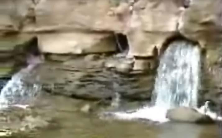
43 Seepage
44
45
46
47

48
49
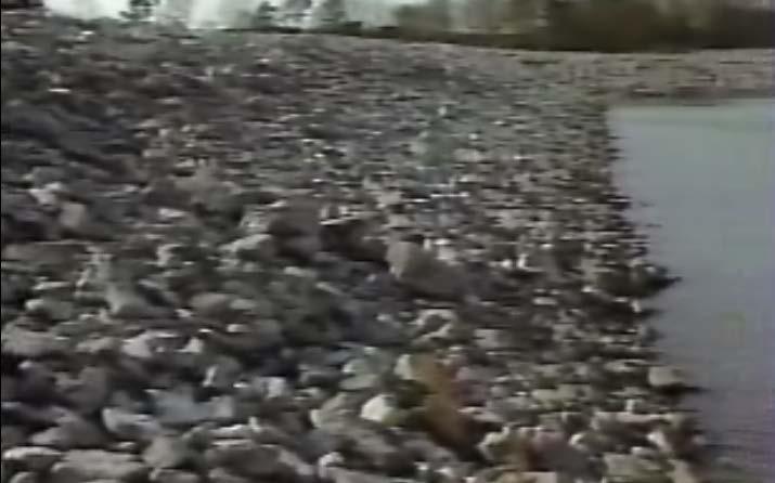
50
51

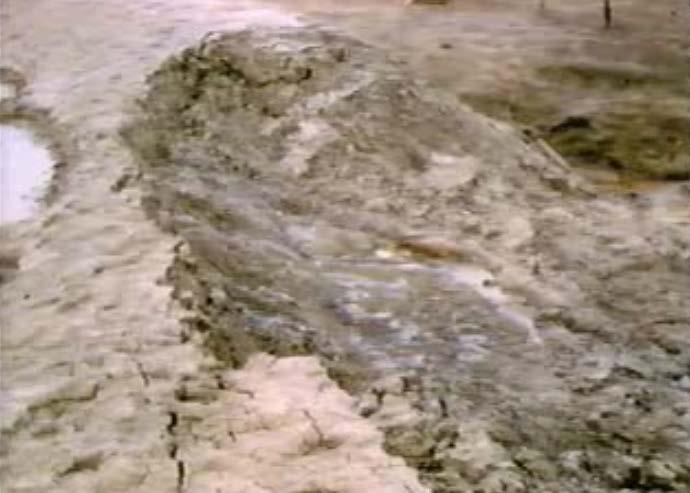
52

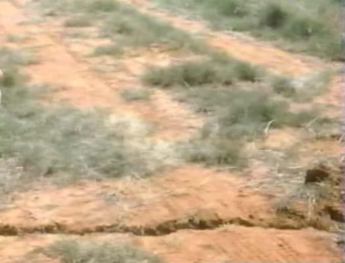
53

54

55
56
57 Slope Protection
58

59 Beaching

60 Scarp
61 Vegetative Growth

62

63 Trees and Shrubs
64 Cracking Commonly observed cracking on dams: Desiccation Transverse Longitudinal

65 Desiccation Cracks
66 Transverse Cracks

67 Longitudinal Cracks
68 Slides

69
70
71 Depressions and Sinkholes
72

73

74
75 Debris

76
77 Burrowing Animals

78

79
80 Surface Erosion

81

82

83
84 Importance of Maintenance
85 Classification Inspections These are not performed to determine the dams condition, instead they are used to determine the dam hazard classification. Performed by evaluating properties at risk below the dam.
86 Hazard Creep
87 Construction inspections This are performed at various mile stones during permitted work. They help assure compliance with permitted plans. A final construction inspection must be performed before a certificate of operation or completion can be issued.
88 Failure Mode Analysis This involves a brainstorming to determine the possibles ways a new or existing dam may fail. Often involves detailed evaluations of the dam site and plans. Most typical failure types involve: piping, overtopping, and sliding.
89 Piping Failure
90 Over Topping Failure
91 Slide Failure
92 Questions? John Poole, P.E., State Dam Safety Engineer SC DHEC Bureau of Water Dams and Reservoirs Safety Program 2600 Bull St. Columbia, SC Phone: (803)
REQUEST FOR PROPOSALS
 REQUEST FOR PROPOSALS DAM BREAK INUNDATION ZONE STUDY AND MAPPING Town of Woodstock, VA The Town of Woodstock, Virginia is requesting proposals from engineering firms to perform Dam Break Inundation Studies
Special Use Permit - Planned Unit Development Checklist. Property Address:
 Special Use Permit - Planned Unit Development Checklist Special Use Permit Number. Parcel Code/s #28-11- - - Property Address: Applicant: ARTICLE VIII Ordinance Reference - Section 8.1.2 Permit Procedures:
Attached is a Clinton Township Zoning Permit Application and requirements for issuance of a permit.
 To Whom It May Concern: Attached is a Clinton Township Zoning Permit Application and requirements for issuance of a permit. The fee for the permit application is $75.00, which shall be made payable to
LOWER LAKE GIRARD DAM THE BREACHING OF AN AMBURSEN DAM GIRARD, OHIO. by Brian H. Greene
 LOWER LAKE GIRARD DAM THE BREACHING OF AN AMBURSEN DAM GIRARD, OHIO by Brian H. Greene PRESENTATION OUTLINE PROJECT FEATURES GEOLOGIC SETTING PROJECT HISTORY PRIOR AMBURSEN DAM FAILURES & SUCCESSES DAM
Minnesota Department of Natural Resources 500 Lafayette Road Saint Pau I, Minnesota Office of the Commissioner
 February 5, 2014 14-0216 Minnesota Department of Natural Resources 500 Lafayette Road Saint Pau I, Minnesota 55155-4037 Office of the Commissioner 651-259--5555.~'" DEPARTMENT OF NATURAL RESOURCES JoAnne
BLUESTONE DAM AN OVERVIEW NATIONAL INVENTORY OF DAMS ID: WV08902
 1 BLUESTONE DAM AN OVERVIEW NATIONAL INVENTORY OF DAMS ID: WV08902 237 237 237 217 217 217 200 200 200 0 0 0 163 163 163 131 132 122 Updated 10 October 2017 255 255 255 239 65 53 80 119 27 252 174.59 110
City of Columbia ENgiNEEriNg regulations Part 6: ProCEDurEs For the subdivision of land table of CoNtENts Paragraph Description Page No.
 City of Columbia Engineering Regulations PART 6: PROCEDURES FOR THE SUBDIVISION OF LAND Table of Contents Paragraph Description Page No. 6.1 General 6-1 6.2 Sketch Plan Review 6-1 6.3 Preliminary Plat
CITY OF SARALAND FINAL SUBDIVISION PLAT REVIEW
 CITY OF SARALAND FINAL SUBDIVISION PLAT REVIEW Application Number: Date Plat Submitted: Name of Subdivision: Name of Owner: Owner Address: (Street or P.O. Box) Telephone #: (City) (State) (Zip) E-mail:
WATAB TOWNSHIP, BENTON COUNTY, STATE OF MINNESOTA. ORDINANCE #4 (Amended November 2014) AN ORDINANCE REGULATING TOWN ROAD RIGHTS-OF-WAY
 AN ORDINANCE REGULATING TOWN ROAD RIGHTS-OF-WAY") WATAB TOWNSHIP, BENTON COUNTY, STATE OF MINNESOTA ORDINANCE #4 (Amended November 2014) AN ORDINANCE REGULATING TOWN ROAD RIGHTS-OF-WAY The Board of Supervisors of Watab Township, Benton County, hereby
WATAB TOWNSHIP, BENTON COUNTY, STATE OF MINNESOTA ORDINANCE #4 (Amended November 2014) AN ORDINANCE REGULATING TOWN ROAD RIGHTS-OF-WAY The Board of Supervisors of Watab Township, Benton County, hereby
Appendix E: Hydrologic & Hydraulic Report. Proposed Bridge Replacement SR 1008, Section 02B (Henry Road) Over Bushkill Creek
 Over Bushkill Creek") Hydrologic & Hydraulic Report Proposed Bridge Replacement SR 1008, Section 02B (Henry Road) Over Bushkill Creek Appendix E: Existing Conditions Hydraulic Analysis 425 Bushkill Creek Henry Woods WS 500-yr
Hydrologic & Hydraulic Report Proposed Bridge Replacement SR 1008, Section 02B (Henry Road) Over Bushkill Creek Appendix E: Existing Conditions Hydraulic Analysis 425 Bushkill Creek Henry Woods WS 500-yr
Clarksville, TN APPENDIX C STORM WATER AND BMP MAINTENANCE AGREEMENTS AND INSPECTIONS FORMS
 Clarksville, TN APPENDIX C STORM WATER AND BMP MAINTENANCE AGREEMENTS AND INSPECTIONS FORMS STORM WATER MAINTENANCE AGREEMENT Grading Permit No.: Tax Map and Parcel No.: Project Name: THIS AGREEMENT, made
BACKGROUND There are 23 flood control structures in the Upper Brushy Creek Water Control and Improvement District (District). See attached map.
. See attached map.") BACKGROUND There are 23 flood control structures in the Upper Brushy Creek Water Control and Improvement District (District). See attached map. The U.S Department of Agriculture - Natural Resources Conservation
BACKGROUND There are 23 flood control structures in the Upper Brushy Creek Water Control and Improvement District (District). See attached map. The U.S Department of Agriculture - Natural Resources Conservation
JEFFERSON COUNTY, ALABAMA
 JEFFERSON COUNTY, ALABAMA Major Development Checklist, Notes and Information A Major Development is any proposed new structure or addition to an existing structure which will cause a change in the topography
Public Notice. Notice No Closing Date: August 16, 2018
 Public Notice U.S. Army Corps of Engineers Pittsburgh District In Reply Refer to Notice No. below US Army Corps of Engineers, Pittsburgh District 1000 Liberty Avenue Pittsburgh, PA 15222-4186 Application
DEPARTMENT OF PLANNING SERVICES 1555 N 17 th Ave Greeley CO Phone (970) Fax (970)
 Fax (970)") DEPARTMENT OF PLANNING SERVICES 1555 N 17 th Ave Greeley CO 80631 Phone (970) 400-6100 Fax (970) 304-6498 SITE SPECIFIC DEVELOPMENT PLAN USE BY SPECIAL REVIEW PROCEDURAL GUIDE SOLID WASTE DISPOSAL SITES
DEPARTMENT OF PLANNING SERVICES 1555 N 17 th Ave Greeley CO 80631 Phone (970) 400-6100 Fax (970) 304-6498 SITE SPECIFIC DEVELOPMENT PLAN USE BY SPECIAL REVIEW PROCEDURAL GUIDE SOLID WASTE DISPOSAL SITES
Emergency Watershed Program Sandy Recovery Activities and Flood Plain Easement Program
 Emergency Watershed Program Sandy Recovery Activities and Flood Plain Easement Program Greg Westfall, Resource Conservationist USDA-Natural Resources Conservation Service (NRCS) Set up by Congress to respond
ARTICLE 15 - PLANNED UNIT DEVELOPMENT
 Section 15.1 - Intent. ARTICLE 15 - PLANNED UNIT DEVELOPMENT A PUD, or Planned Unit Development, is not a District per se, but rather a set of standards that may be applied to a development type. The Planned
FLOOD HAZARD AREA LAND USE MANAGEMENT
 FLOOD HAZARD AREA LAND USE MANAGEMENT Introduction Guidance For Selection of Qualified Professionals and Preparation of Flood Hazard Assessment Reports This document is intended to provide guidance for
TOWNSHIP OF MENDHAM Ord. No
 ORDINANCE SUPPLEMENTING THE LAND USE ORDINANCE OF THE TOWNSHIP OF MENDHAM BY A NEW CHAPTER XXIVA ESTABLISHING THE REQUIREMENT OF AN ENVIRONMENTAL PERMIT AND AMENDING AND SUPPLEMENTING SAID ORDINANCE WITH
February 29, To: Sarah Absher Senior Planner Tillamook County Department of Community Development
 February 29, 2016 To: Sarah Absher Senior Planner Tillamook County Department of Community Development From: Richard Hook Chair, Neskowin Citizen Advisory Committee Subject: Application 851-15-000265-PLNG:
SANILAC COUNTY ROAD COMMISSION ROAD POLICIES. A. Drainage, Base and Grade Construction (NON BITUMINOUS)
") I. LOCAL ROADS SANILAC COUNTY ROAD COMMISSION A. Drainage, Base and Grade Construction (NON BITUMINOUS) 1. Cost Sharing: Sanilac County Road Commission Share 17% Township Share 83% 2. A Notice of Construction
I. LOCAL ROADS SANILAC COUNTY ROAD COMMISSION A. Drainage, Base and Grade Construction (NON BITUMINOUS) 1. Cost Sharing: Sanilac County Road Commission Share 17% Township Share 83% 2. A Notice of Construction
Maintenance Agreement
 STATE OF GEORGIA COUNTY OF GWINNETT Maintenance Agreement WHEREAS, the Property Owner recognizes that the wet or extended detention facility or facilities (hereinafter referred to as "the facility" or
Managing and Funding Local Government Stormwater Enterprises: Fee Options and Calculation Procedures. S. Wayne Miles, PE, DEE
 Managing and Funding Local Government Stormwater Enterprises: Fee Options and Calculation Procedures S. Wayne Miles, PE, DEE Course sponsored by the UNC School of Government Environmental Finance Center
CONDITIONAL USE PERMIT Application Packet
 CONDITIONAL USE PERMIT Application Packet Community Development Department 1020 East Pioneer Road, Draper, UT 84020 (801) 576-6539 Fax (801) 576-6526 Dear Applicant, This application packet has been developed
Fraser River Escarpment Policy
 Fraser River Escarpment Policy Building Permit Requirements Page 1 of 2 This summary has been prepared by Inspections Services to assist property owners/builders in understanding the policies relating
REGIONAL DISTRICT OF NANAIMO BYLAW NO. 1469
 REGIONAL DISTRICT OF NANAIMO BYLAW NO. 1469 A BYLAW TO ESTABLISH FLOODPLAINS, CONSTRUCTION LEVELS IN FLOODPLAINS, AND SETBACKS FOR LANDFILL AND STRUCTURES IN FLOODPLAINS WHEREAS Section 910 of the Local
SEQRA (For Land Surveyors) Purpose of this Presentation
 Purpose of this Presentation") SEQRA (For Land Surveyors) Purpose of this Presentation Understand the basics and legal requirements of SEQRA Recognize the role that Land Surveyors play in the SEQRA Identify the problems posed by SEQRA
SEQRA (For Land Surveyors) Purpose of this Presentation Understand the basics and legal requirements of SEQRA Recognize the role that Land Surveyors play in the SEQRA Identify the problems posed by SEQRA
STATE OF SOUTH CAROLINA ) ) ESCROW AND OPERATION AGREEMENT COUNTY OF GREENWOOD ) This agreement made and entered this day of, 200, by and between
 ) ESCROW AND OPERATION AGREEMENT COUNTY OF GREENWOOD ) This agreement made and entered this day of, 200, by and between") STATE OF SOUTH CAROLINA ) ) ESCROW AND OPERATION AGREEMENT COUNTY OF GREENWOOD ) This agreement made and entered this day of, 200, by and between Terrapin Pointe Property Owners Association, Inc., hereinafter
STATE OF SOUTH CAROLINA ) ) ESCROW AND OPERATION AGREEMENT COUNTY OF GREENWOOD ) This agreement made and entered this day of, 200, by and between Terrapin Pointe Property Owners Association, Inc., hereinafter
BLUESTONE DAM DAM SAFETY ASSURANCE MEGA-PROJECT NATIONAL INVENTORY OF DAMS ID: WV08902
 1 BLUESTONE DAM DAM SAFETY ASSURANCE MEGA-PROJECT NATIONAL INVENTORY OF DAMS ID: WV08902 237 237 237 217 217 217 200 200 200 0 0 0 163 163 163 131 132 122 Updated 10 October 2017 255 255 255 239 65 53
Electric Transmission Right-of-Way Usage Policy
 Electric Transmission Right-of-Way Usage Policy For over 50 years, VELCO has managed the safe, reliable and economical delivery of electric energy through Vermont s high voltage transmission system. Maintaining
RESIDENTIAL PROPERTY DISCLOSURE FORM
 STATE OF OHIO DEPARTMENT OF COMMERCE 2013 RESIDENTIAL PROPERTY DISCLOSURE FORM Purpose of Disclosure Form: This is a statement of certain conditions and information concerning the property actually known
Does the Building Code Apply to Mobile Homes?
 Does the Building Code Apply to Mobile Homes? 2nd Edition 516.621.2900 info@jsheld.com jsheld.com Overview Mobile home, Manufactured Building, Manufactured Home, Premanufactured Home, Single-Wide, Double-Wide,
San Juan County Waterfront Parcels
 San Juan County Waterfront Parcels If you own a waterfront parcel in the County, or hope to purchase one, I have detailed below some items to take into consideration. Historically, waterfront parcels were
Chesapeake Bay Preservation Area (CBPA) Map Update. Presentation to the County Board July 15, 2017
 Map Update. Presentation to the County Board July 15, 2017") Chesapeake Bay Preservation Area (CBPA) Map Update Presentation to the County Board July 15, 2017 Chesapeake Bay Program Comprehensive Plan Chesapeake Bay Preservation Ordinance (1992) (Chapter 61, Arlington
Chesapeake Bay Preservation Area (CBPA) Map Update Presentation to the County Board July 15, 2017 Chesapeake Bay Program Comprehensive Plan Chesapeake Bay Preservation Ordinance (1992) (Chapter 61, Arlington
SUBCHAPTER 02C - SECONDARY ROADS SECTION SECTION SECONDARY ROADS
 SUBCHAPTER 02C - SECONDARY ROADS SECTION SECTION.0100 - SECONDARY ROADS Note: The Department of Transportation publishes a volume entitled "Minimum Design and Construction Criteria for Subdivision Streets"
CITY OF SARALAND PRELIMINARY SUBDIVISION PLAT REVIEW
 PRELIMINARY SUBDIVISION PLAT REVIEW Application Number: Date Plat Submitted: Name of Subdivision: Name of Owner: Owner Address: (Street or P.O. Box) Telephone #: (City) (State) (Zip) E-mail: Name of Authorized
MULTI-FAMILY DWELLING UNIT SUBDIVISION ORDINANCE TOWN OF SIDNEY, MAINE
 MULTI-FAMILY DWELLING UNIT SUBDIVISION ORDINANCE TOWN OF SIDNEY, MAINE I. GENERAL A. Title B. Purpose C. Administration D. Scope II. DEFINITIONS A. Building Height B. Dwelling Unit C. Family D. Multi-Unit
Lakes Robinson and Cunningham. Date:
 Lakes Robinson and Cunningham Date: Welcome to Lakes Robinson and Cunningham. Please do not hesitate to call on us at (864) 895-3645 at any time. We want to assist you in any way we can, or answer questions
FINAL PLAT APPLICATION
 FINAL PLAT APPLICATION (Page 1 of 3) LEGAL OWNER(s): NAME: STREET ADDRESS OWNER(s): CITY, STATE, ZIP CODE: PHONE NUMBER: BILLING ADDRESS: NAME OF ENGINEER/SURVEYOR: Engineer/Surveyor Address, Phone: PROPERTY
SPRING BROOK TOWNSHIP 966 STATE ROUTE 307 SPRING BROOK TOWNSHIP, PA PHONE (570) FAX (570)
 FAX (570)") PERMIT # - D SPRING BROOK TOWNSHIP 966 STATE ROUTE 307 SPRING BROOK TOWNSHIP, PA 18444 PHONE (570) 842-7028 FAX (570) 842-0633 Date: PART I APPLICATION DRIVEWAY INSTALLATION APPLICATION AND PERMIT Name:
PERMIT # - D SPRING BROOK TOWNSHIP 966 STATE ROUTE 307 SPRING BROOK TOWNSHIP, PA 18444 PHONE (570) 842-7028 FAX (570) 842-0633 Date: PART I APPLICATION DRIVEWAY INSTALLATION APPLICATION AND PERMIT Name:
A Mining Operating Permit is used to:
 CHAPTER 400. SECTION 404. PERMIT TYPES AND APPLICATIONS OPERATING PERMITS 404.3. Mining Operating Permits A. Intent and Purpose The intent and purpose of this section is to protect the public health, safety,
CHAPTER 24 F FLOOD ZONE OVERLAY DISTRICT
 CHAPTER 24 OVERLAY DISTRICT SECTION 24.01 PURPOSE It is the intent of this district to apply special regulation to the use of land in those areas subject to periodic inundation. Such regulation is deemed
10.a. Staff Report. Date: July 12, City Council. Valerie J. Barone, City Manager
 10.a Staff Report Date: July 12, 2016 To: From: Prepared by: City Council Valerie J. Barone, City Manager Justin Ezell, Director of Public Works Justin.Ezell@cityofconcord.org (925) 671-3231 Subject: Considering
Implementing the DCR Dam Break Inundation Zone Regulations with Local Government
 Implementing the DCR Dam Break Inundation Zone Regulations with Local Government By Zhengang (Michael) Wang, Ph.D., P.E., CFM Regional Dam Safety Engineer (Region 1) 98 Alexandria Pike, Suite 33Warrenton,
Presentation By. Chris Poujol. Jeffery Rodriguez. James Rigley
 Means of Egress Presentation By Chris Poujol Jeffery Rodriguez James Rigley Table of Contents I. Means of Egress Definition II. History III. NYC Building Code IV. General Requirements IX. Exit Signs X.
Open Space Taxation Act
 Open Space Taxation Act WASHINGTON STATE DEPARTMENT OF REVENUE JUNE 2007 The information and instructions in this brochure are to be used when applying for assessment on the basis of current use under
SUBDIVISION, PLANNED UNIT DEVELOPMENT, & PLANNING APPROVAL STAFF REPORT Date: February 1, 2007
 SUBDIVISION, PLANNED UNIT DEVELOPMENT, & PLANNING APPROVAL STAFF REPORT Date: February 1, 2007 DEVELOPMENT NAME SUBDIVISION NAME Pala Verde Mobile Home Park Subdivision Pala Verde Mobile Home Park Subdivision
LAND USE PERMIT APPLICATION INSTRUCTION SHEET
 LAND USE PERMIT APPLICATION INSTRUCTION SHEET The Land Use Permit application must be carefully completed according to the following instructions. Please complete in ink or type. The appropriate fee must
Chapter Sidewalk Construction and Improvement Standards
 Chapter 19.22 Sidewalk Construction and Improvement Standards 19.22.010 Intent and policy. 19.22.020 Construction of this chapter, statement of purpose, fundamental principle. 19.22.030 Simultaneous construction
DRY POND OPERATION & MAINTENANCE AGREEMENT
 Return after recording to: Lindley Paynter Town of Apex P.O. Box 250 Apex, NC 27502 DRY POND OPERATION & MAINTENANCE AGREEMENT This Operation and Maintenance Agreement ( Agreement ) is established this
STORMWATER MANAGEMENT ORDINANCE
 STORMWATER MANAGEMENT ORDINANCE AN AMENDED ORDINANCE REGULATING THE RATE AND VELOCITY OF STORMWATER DISCHARGE FROM PROPOSED DEVELOPMENTS WITHIN THE CITY OF MADISON AND REQUIREMENTS FOR STORMWATER RETENTION
TRANSFERABLE DEVELOPMENT RIGHTS PROCESS GUIDE
 TRANSFERABLE DEVELOPMENT RIGHTS PROCESS GUIDE Clear Creek County Planning Department P.O. Box 2000 Georgetown, Colorado 80444 (303) 679-2436 - phone (303) 569-1103 - fax 1 PURPOSE: A Transfer of Development
Urban Planning and Land Use
 Urban Planning and Land Use 701 North 7 th Street, Room 423 Phone: (913) 573-5750 Kansas City, Kansas 66101 Fax: (913) 573-5796 Email: planninginfo@wycokck.org www.wycokck.org/planning To: From: City Planning
Special Land Use. SLU Application & Review Standards
 review and approval is needed for certain uses of property that have the potential to impact adjacent properties and the neighborhood. The application and review procedure is intended to ensure that the
CITY OF GROVER BEACH COMMUNITY DEVELOPMENT DEPARTMENT Tentative Map Checklist
 CITY OF GROVER BEACH COMMUNITY DEVELOPMENT DEPARTMENT Tentative Map Checklist The following list includes all of the items you must submit for a complete application. Some specific types of information
Disclosure of Information on Lead-Based Paint and/or Lead-Based Paint Hazards
 Disclosure of Information on Lead-Based Paint and/or Lead-Based Paint Hazards Lead Warning Statement Every purchaser of any interest in residential real property on which a residential dwelling was built
City of Russellville Department of Public Works
 City of Russellville Department of Public Works Subdivision and Large Scale Review Process Thank you for your interest in developing the City of Russellville. The Planning Department is committed to processing
PROJECT SCOPE OF WORK CITY OF TOWN AND COUNTRY STORMWATER PROGRAM
 PROJECT SCOPE OF WORK CITY OF TOWN AND COUNTRY STORMWATER PROGRAM Project ID Number: 2-2 Problem: The backyards at 962, 97, and 978 Delvin Drive are located in a low area of shallow ponding that takes
PRELIMINARY PLAT Application Packet
 PRELIMINARY PLAT Application Packet Community Development Department 1020 East Pioneer Road, Draper, UT 84020 (801) 576-6539 Fax (801) 576-6526 Dear Applicant, This application packet has been developed
STORMWATER MANAGEMENT FACILITIES AND PRACTICES COVENANT
 STORMWATER MANAGEMENT FACILITIES AND PRACTICES COVENANT City of Roswell, GA Community Development Department (770) 641-3780 THIS INSTRUMENT, made and entered into this day of, 20, by and between (Insert
CITY OF FAYETTEVILLE, ARKANSAS FINAL PLAT FOR STAFF USE ONLY FINAL PLAT FEE: $ $ Date Application Submitted: Date Accepted as Complete:
 CITY OF FAYETTEVILLE, ARKANSAS FINAL PLAT FOR STAFF USE ONLY FINAL PLAT FEE: $200.00-$800.00 Date Application Submitted: Date Accepted as Complete: Project Number: Public Hearing S-T-R: PP#: Zone: Please
DAM SAFETY RISK MANAGEMENT WORKSHOP DAM SAFETY INSPECTION SYSTEM
 DAM SAFETY RISK MANAGEMENT WORKSHOP DAM SAFETY INSPECTION SYSTEM 1. ROLES AND RESPONSIBILITIES OF DAM OWNER 2. ROLES AND RESPONSIBILITIES OF THE NSW OFFICE OF WATER (NOW) DAM SAFETY UNIT 3. DAM INSPECTION
CHARTER TOWNSHIP OF FENTON SEWER SYSTEM FINANCIAL OVERVIEW MARCH, 2018
 CHARTER TOWNSHIP OF FENTON SEWER SYSTEM FINANCIAL OVERVIEW MARCH, 2018 Fenton Township continues to receive inquiries regarding the relatively high sewer use fees that Township residents have been paying
ARTICLE 900 PLAT AND PLAN REQUIREMENTS
 ARTICLE 900 PLAT AND PLAN REQUIREMENTS SEC. 900.1 ITEMS TO BE SHOWN ON PLAT OR PLAN General (1) Property lines of all property owners adjacent to the exterior boundaries of the project shall be located
OPEN SPACE TIMBER PROGRAM OKANOGAN COUNTY CODE, CHAPTER 14.09
 OPEN SPACE TIMBER PROGRAM OKANOGAN COUNTY CODE, CHAPTER 14.09 14.09.010 - Short Title 14.09.020 - Purpose 14.09.030 - Administration 14.09.040 - Compliance with Regulations 14.09.050 - Scope 14.09.060
Request to Advertise: Chesapeake Bay Preservation Area (CBPA) Map Update. June 20, 2017
 Map Update. June 20, 2017") Request to Advertise: Chesapeake Bay Preservation Area (CBPA) Map Update June 20, 2017 Outline Context Past County Board actions Why update the CBPA Map? What and Why - Resource Protection Areas Property
Request to Advertise: Chesapeake Bay Preservation Area (CBPA) Map Update June 20, 2017 Outline Context Past County Board actions Why update the CBPA Map? What and Why - Resource Protection Areas Property
Accountability and Custody for Government Property and Contract Property
 OUSD(AT&L) Acquisition Resources & Analysis (ARA) Property and Equipment Policy Accountability and Custody for Government Property and Contract Property Accountability for Government Property Objective:
Construction & Earthwork Request Form (CERF)
") ShoreLand Traditions Construction & Earthwork Request Form (CERF) SECTION 1 SECTION 2 SECTION 3 Definitions and Points to Remember Requirements and Process Site Sketch Requirements and Sample If you have
ShoreLand Traditions Construction & Earthwork Request Form (CERF) SECTION 1 SECTION 2 SECTION 3 Definitions and Points to Remember Requirements and Process Site Sketch Requirements and Sample If you have
KENT COUNTY STORMWATER MAINTENANCE DISTRICT
 KENT COUNTY STORMWATER MAINTENANCE DISTRICT 2015 VUSP Stormwater Symposium Villanova, Pennsylvania David Athey, PE, CPSWQ, CMS4S AECOM (previously with Duffield Associates) Sarah Keifer, AICP Kent County,
Creation of the Lake Holiday Sanitary District;
 Creation of the Lake Holiday Sanitary District; Frederick County Comes to the Aid of a Property Owner s Association Prepared by Kris C. Tierney Assistant County Administrator Frederick County, Virginia
MAJOR SUBDIVISION PRELIMINARY PLAT CHECKLIST
 TOWNSHIP OF EGG HARBOR PLANNING BOARD/ZONING BOARD OF ADJUSTMENT 3515 BARGAINTOWN ROAD EGG HARBOR TOWNSHIP, NJ 08234 MAJOR SUBDIVISION PRELIMINARY PLAT CHECKLIST The following checklist is designed to
Choice Continuing Education Guide. Online Anytime. 1 Day in Class. Mix and Match. It s All About. We Know Real Estate. Let Us Teach You.
 2018 Continuing Education Guide Chip Browne, Owner Real estate professionals rely on us to provide quality education. No gimmicks or so-called free lunches here, just the exact thing you ve come to expect
SECTION 10: FLOOD HAZARD EVALUATION 10-1
 10) SECTION 10: FLOOD HAZARD EVALUATION A. General. Land subject to being flooded by a Flood of 100-Year Frequency as defined by Title 76, Chapter 5, MCA, or land subject to flooding pursuant to these
GOVERNMENT CODE SECTION GOVERNMENT CODE SECTION 65302
 GOVERNMENT CODE SECTION 65300 65300. Each planning agency shall prepare and the legislative body of each county and city shall adopt a comprehensive, long-term general plan for the physical development
ZONING AMENDMENT, PLANNED UNIT DEVELOPMENT & SUBDIVISION STAFF REPORT Date: August 8, 2013
 ZONING AMENDMENT, PLANNED UNIT DEVELOPMENT & SUBDIVISION STAFF REPORT Date: August 8, 2013 NAME SUBDIVISION NAME PV-Magnolia, LLC Twelve Trees Subdivision LOCATION 2860, 2862 and 2866 Pleasant Valley Road
BROCHURE # 37 OPEN SPACE
 BROCHURE # 37 OPEN SPACE The information and instructions in this publication are to be used when applying for assessment on the basis of current use under the open space laws, chapter 84.34 RCW and chapter
Shoreline Use Permits
 The primary objective of the Corps of Engineers in the management of the Table Rock Lake shoreline is to insure the general public full recreational enjoyment and fish and wildlife benefits on public lands
Community Services Department BOUNDARY LINE ADJUSTMENT APPLICATION
 Community Services Department Planning and Building BOUNDARY LINE ADJUSTMENT APPLICATION Community Services Department Planning and Building 1001 E. Ninth St., Bldg. A Reno, NV 89520 Telephone: 775.328.6100
TOWNSHIP OF EGG HARBOR ZONING BOARD ADJUSTMENT CHECK LIST
 TOWNSHIP OF EGG HARBOR ZONING BOARD ADJUSTMENT CHECK LIST Schedule A - General Requirements 1. Where the application involves only a variance one (1) original and nineteen (19) copies of the appropriate
WOODFIELD PARK Parking Study
 WOODFIELD PARK Parking Study Prepared for: Aliso Viejo Community Association 95 Argonaut, Suite 190 Aliso Viejo, CA 92656 Attn: Ms. Marilyn Smith Prepared by: DMc Engineering Civil Surveying Planning Construction
VI. SAFETY ELEMENT I. INTRODUCTION A. PURPOSE B. AUTHORITY. 1. Safety
 AB 162 and SB 1241 Amendment to the Safety Element New sections are underlined, deleted sections are shown as strikethrough and the denotes text remaining in place. VI. SAFETY ELEMENT I. INTRODUCTION A.
APPLICATION SUBMITTAL REQUIREMENTS FOR Tentative Parcel or Subdivision Maps
 CITY OF EL CERRITO Community Development Department Planning and Building Division 10890 San Pablo Avenue, El Cerrito, CA 94530 (510) 215-4330 FA (510) 233-5401 planning@ci.el-cerrito.ca.us APPLICATION
Flood Hazard Area Control Act Rules
 An Overview of New Jersey s Flood Hazard Area Control Act Rules State of New Jersey Department of Environmental Protection Chingwah Liang Why Regulate NJ s Floodplains? 1. New Jersey endures enormous
PALM BEACH COUNTY PLANNING, ZONING AND BUILDING DEPARTMENT ZONING DIVISION
 PALM BEACH COUNTY PLANNING, ZONING AND BUILDING DEPARTMENT ZONING DIVISION ADMINISTRATIVE VARIANCE TYPE I B - STAFF PUBLIC MEETING STAFF REPORT 6/19/2008 AGENDA ITEM CODE SECTION REQUIRED PROPOSED VARIANCE
Code of Ordinances, Town of Chincoteague, VA Abstracted March CHAPTER 2.
 Code of Ordinances, Town of Chincoteague, VA Abstracted March 2016 http://www.chincoteague-va.gov/pdf/town-code2010.pdf CHAPTER 2. POWERS OF TOWN Sec. 1. Generally. 15. To acquire, establish, enter, open,
Appendix F - Earth Materials Extraction, Processing and Site Reclamation
 Appendix F - Earth Materials Extraction, Processing and Site Reclamation Intent It is the purpose of this Article to establish regulations and standards for surface mining operations and to provide for
HOW TO APPLY FOR A USE PERMIT
 HOW TO APPLY FOR A USE PERMIT MENDOCINO COUNTY PLANNING AND BUILDING SERVICES What is the purpose of a use permit? Throughout the County, people use their properties in many different ways. They build
FINAL PLAT SUBMITTAL CHECKLIST
 FINAL PLAT SUBMITTAL CHECKLIST The submission requirements for a Final Plat Review are found beginning in Section 24-4-40 of the Weld County Code. The Weld County Code is available on line at www.co.weld.co.us
Instructions to the Applicant
 CONDITIONAL USE PERMIT APPLICATION Lake of the Woods County Land and Water Planning Office 206 8 th Avenue Southeast, Suite #290 Baudette MN 56623-2867 www.co.lake-of-the-woods.mn.us Phone: (218) 634-1945
CHAPTER 15: ENVIRONMENTAL REVIEW
 CHAPTER 15: ENVIRONMENTAL REVIEW CHAPTER PURPOSE & CONTENTS This chapter provides grantees with general information on environmental review. The chapter will provide an overview of the applicable regulations,
This Ordinance is adopted under the authority and provisions of the General Statutes of North Carolina, Article 6, Chapter 153A 121.
 Section 74, Regulations Governing Manufactured Home Parks 1. Purpose The purpose of these regulations to be known and cited as the Madison County Manufactured Home Park Ordinance is to regulate and guide
The purpose of this Chapter is to establish rules, regulations, standards and procedures for approval of subdivisions of land to promote and ensure:
 CHAPTER 7 SUBDIVISION SECTION 7.1 PURPOSE The purpose of this Chapter is to establish rules, regulations, standards and procedures for approval of subdivisions of land to promote and ensure: A. Conformity
STATE OF MICHIGAN COUNTY OF BERRIEN ORONOKO CHARTER TOWNSHIP PRIVATE ROAD ORDINANCE ORDINANCE NO. 65
 STATE OF MICHIGAN COUNTY OF BERRIEN ORONOKO CHARTER TOWNSHIP PRIVATE ROAD ORDINANCE ORDINANCE NO. 65 AN ORDINANCE TO REQUIRE THAT ALL LOTS OR PARCELS OF LAND WHICH DO NOT ABUT PUBLIC STREETS ABUT A PRIVATE
***** Subchapter A. GENERAL PROVISIONS ***** PERMIT APPLICATIONS
 105.11. Permit requirements. 105.12. Waiver of permit requirements. Title 25 Environmental Protection Part I. Department of Environmental Protection Subpart C. Protection of Natural Resources Article I.
SOUTH CAROLINA ELECTRIC & GAS COMPANY COLUMBIA, SOUTH CAROLINA
 SOUTH CAROLINA ELECTRIC & GAS COMPANY COLUMBIA, SOUTH CAROLINA SALUDA HYDROELECTRIC PROJECT FERC NO. 516 LAKE MURRAY SHORELINE MANAGEMENT HANDBOOK AND PERMITTING GUIDELINES DRAFT South Carolina Electric
SECTION 1 RESIDENTIAL USE
 Whispering Pines Condominium Association (WPCA) Summary of Declaration of Covenants Summary of Eight Amendments Liber 1308, October 17, 1988 Liber 1367, September 29, 1989 (1 st Amendment) Liber 1493,
5.0 Permit Applications
 5.0 Permit Applications A primary objective of the Toronto and Region Conservation Authority () is to prevent the loss of life and property due to flooding and erosion. Accordingly, administers a natural
CHAPTER 9 ANIMAL WASTE STORAGE
 CHAPTER 9 ANIMAL WASTE STORAGE 9.01 Authority 9.02 Title 9.03 Findings and Declaration of Policy 9.04 Purpose 9.05 Interpretation 9.06 Severability Clause 9.07 Applicability 9.08 Effective Date 9.09 Definitions
Town of Falmouth s Four Step Design Process for Subdivisions in the Resource Conservation Zoning Overlay District
 Town of Falmouth s Four Step Design Process for Subdivisions in the Resource Conservation Zoning Overlay District All subdivisions shall be designed in accordance with the following four-step process.
Charter Township of Garfield Grand Traverse County
 Charter Township of Garfield Grand Traverse County 3848 VETERANS DRIVE TRAVERSE CITY, MICHIGAN 49684 PH: (231) 941-1620 FAX: (231) 941-1588 GUIDE FOR THE SUBMISSION OF AN APPLICATION FOR SITE PLAN REVIEW