Emergency Watershed Program Sandy Recovery Activities and Flood Plain Easement Program
|
|
|
- Ami Wells
- 6 years ago
- Views:
Transcription
1 Emergency Watershed Program Sandy Recovery Activities and Flood Plain Easement Program Greg Westfall, Resource Conservationist USDA-Natural Resources Conservation Service (NRCS)
2 Set up by Congress to respond to emergencies created by natural disasters to relieve imminent hazards to life and property caused by floods, fires, windstorms, and other natural occurrences. Must be sponsored by a political subdivision of the State, such as a city, county, general improvement district, or conservation district The USDA Natural Resources Conservation Service (NRCS) is responsible for administering the program.
3 NRCS typically bears up to 75 percent of the construction cost of emergency measures, for Hurricane Sandy the funding level was increased to 90 percent for consistency with FEMA 25 percent must come from local sources and can be in the form of cash or in-kind services A limited reimbursement, typically7.5% of the eligible construction cost, is provided when the local sponsor provides design and contracting services.
4 Must reduce threats to life and property Must be economically and environmentally defensible and sound from an engineering standpoint. All work must represent the least expensive alternative EWP funds cannot be used to reimburse for work begun before an assistance agreement is signed.
5 Eligibility Process Receive requests for assistance Complete a Damage Survey Report to determine eligibility Request funds Sign agreements that include time limits on performing the work. Funding comes as a result of natural disaster events when Congress makes a special appropriation. Recently, this has been limited to Presidential disaster declarations and not all of these have received funding.
6 Public and private landowners are eligible for assistance but must be represented by a project sponsor Project sponsor must be a public agency of state, county, or city government, or a special district.
7 Provide land rights to do repair work and securing the necessary permits Sponsors are also responsible for furnishing the local cost share and for accomplishing the installation of work. Responsible for operation and maintenance of the work.
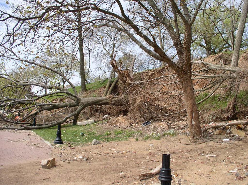
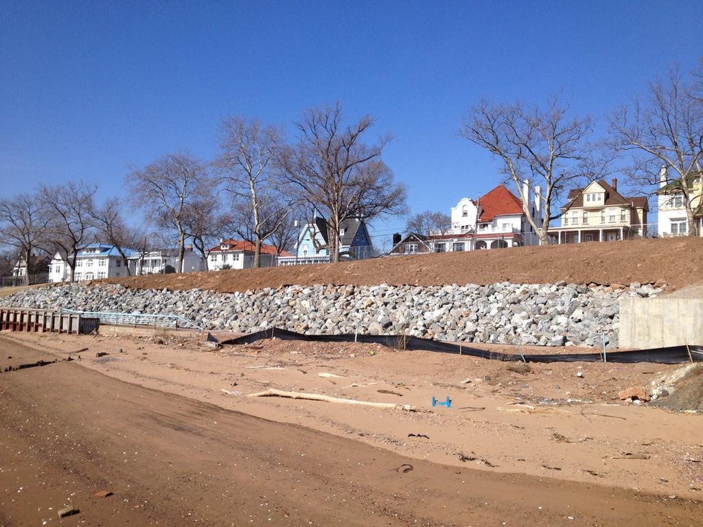
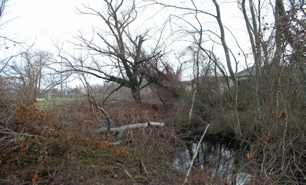
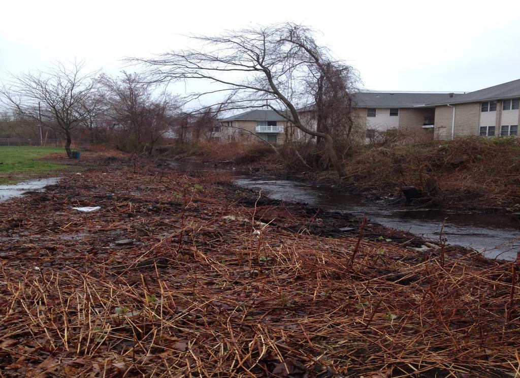
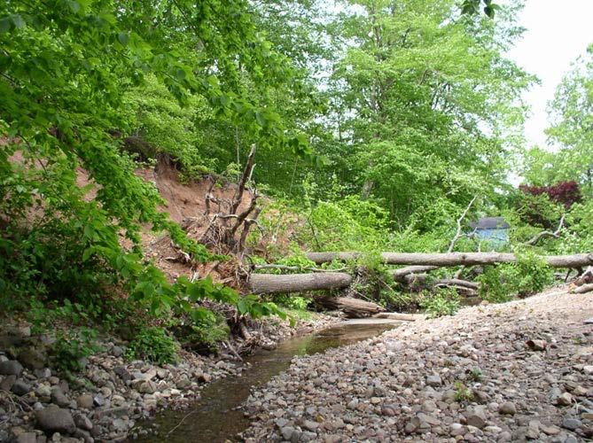
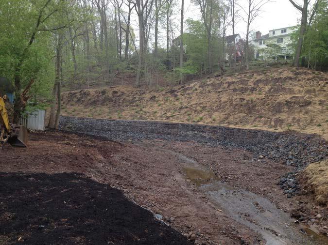
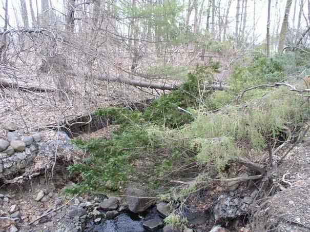
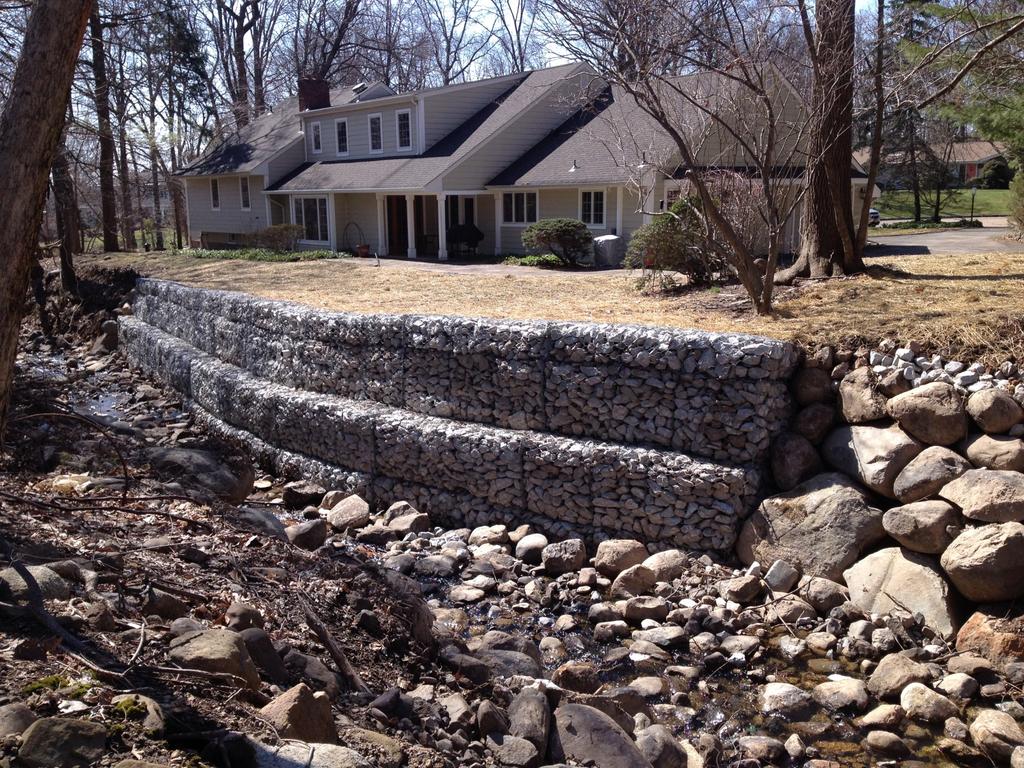
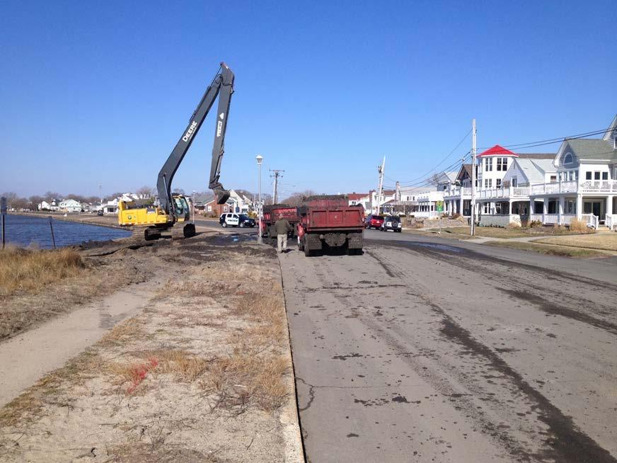
8 EWP work can include: - Removing debris from stream channels, road culverts, and bridges - Reshaping and protecting eroded banks - Correcting damaged drainage facilities - Repairing levees and structures - Reseeding damaged areas - Sediment removal from basins - EWP does not normally reimburse for sediment removal from reservoirs and that Sandy was a unique situation due to the surge. - Purchasing floodplain easements
9

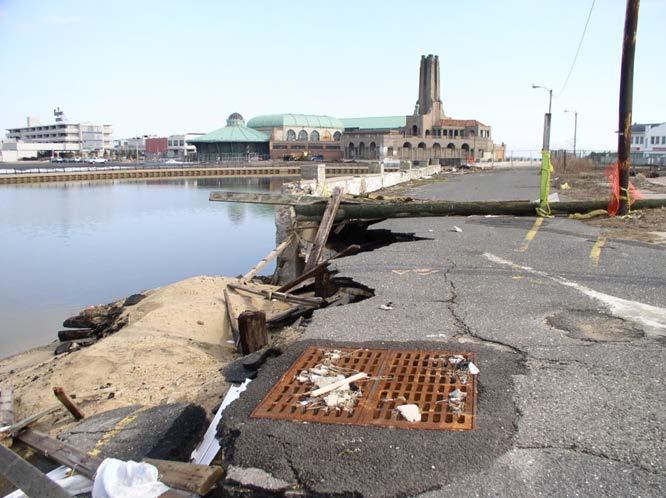
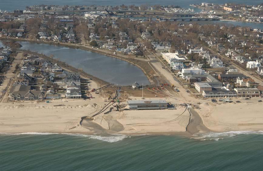
10 Perth Amboy City - After
11
12

13
14
15
16
17
18
19
20
21
22
23
24
25
26 18 agreements providing approximately $5.5 million in recovery assistance to communities in Bergen, Union, Middlesex, Monmouth and Ocean counties with the majority of the work in coastal Monmouth County Recovery work includes sediment, tree and flood debris removal from over 13 miles of streams and waterways
27 Sediment and flood debris will be removed from four coastal basins severely impacted by the storm surge. Removal of sediment from basins or reservoirs is not a typical activity in EWP, however, the storm surge was a unique event that washed beach sands into the basins affecting their flood control and drainage function Total value of property protected is estimated at over $400 million which includes both public and private lands All work will be completed by the end of the calendar year.

28
29 Background Section 382 of the Federal Agriculture Improvement and Reform Act of 1996 (Public Law ) amended the Emergency Watershed Protection Program (EWP), which was established under the Agricultural Credit Act of 1978, to provide for the purchase of floodplain easements as an emergency response to natural disasters or other circumstances. Since 1996, the USDA Natural Resources Conservation Service (NRCS) has purchased permanent floodplain easements on 1,418 properties, totaling 184,254 acres located in 36 states.
30 Purpose of Flood Plain Easements Floodplain easements restore, protect, maintain and enhance the functions of floodplains while conserving their natural values such as fish and wildlife habitat, water quality, flood water retention and ground water recharge. Structures, including buildings, within the floodplain easement must be demolished and removed, or relocated outside the 100-year floodplain or dam breach inundation area.

31 Duke Farm, Hillsborough Twp, Somerset County
32 Up to $124.8 million has been designated for landowners in 12 states with property damaged by Hurricane Sandy through this program administered by USDA, Natural Resources Conservation Service (NRCS).
33 Eligibility Requirements Property damage must have been sustained from Hurricane Sandy. Owners of properties zoned residential must secure a public sponsor who will assume ownership of the property. Property must be outside of the FEMA Coastal Flood Zones (Zones V, VE, or V1-30). These areas are currently not eligible for this program.
34 Required Documents Privately-Owned Property Documentation of flood damage and proof that damage was a result of Hurricane Sandy. Acceptable evidence includes insurance claims, newspaper or other publication clippings, or any other documentation that links the flood damage directly to Hurricane Sandy. Proof of ownership a copy of the ownership vesting deed *NRCS Form AD-1153 (Application for Long-Term Contracted Assistance through the EWP-FPE Program) Confirmation that public sponsor is interested in assuming ownership and stewardship of property.
35 Required Documents Entity-Owned Property A list of the individuals who comprise the entity, including the percent of ownership for each individual. Documents that show the entity to be legal and valid in the State where the application was submitted. Data Universal Number System (DUNS) number; more information is available at Registration with the System for Awards Management (SAM); more information is available at Legal documentation of signature authority
36 Land Eligibility Criteria Damage to land and buildings by Sandy Land not necessarily eligible because it floods, must be a value change due to the taking of an easement Residential or farmland uses changing to floodplain use only does constitute a value change that would be eligible If the area is currently undevelopable marshland due to State and federal wetland and floodplain restrictions, there will be no value change in the future and the land would not be eligible The program is not intended to merely enhance floodplain areas, so we wouldn t just enhance a poor marsh to a good marsh
37 Landowner Disclosure Worksheet Land owned 7 years or more Landowner have legal access to the parcel Landowner have clear title to property Legal ditches or tile drain easements present Other easements (eg. Gas lines, transportation) present Known cultural resource sites within the proposed easement area

38 BayPoint, Lawrence Township, Cumberland County
39 Criteria Used for Ranking Parcels for Funding Frequency of damage from flooding (using FEMA National Flood Insurance Program Flood Claims Database) Proximity of parcel to other protected land (in the same watershed) Offered easement parcel (s) is either individually or part of a group Restoration cost

40 Application part of a larger acquisition through non- Federal government programs such as NJDEP Blue Acres Parcel contains majority (>50 percent) in the A, AE, AO, or AH zone as mapped by FEMA Type of land protected Restored habitat for species of conservation interest (using NJDEP Landscape Project data)

41 Garrison Property, Downe Twp. Cumberland County
42 Hazardous Materials Check Dumps or Landfills, especially with drums/containers Other debris: household or farm waste Fills (possible cover for dumps) Unusual chemical odors Above/below ground storage tanks Buildings: Chemical storage, equipment repair solvents Structures: Evidence of asbestos Vegetation different from surrounding area for no apparent reason, e.g. stressed or dead, bare ground"sterile" or modified water bodies
43 Hazardous Materials Check (Continued) Oil seeps, stained ground, discolored stream bank Unnatural characteristics of water: oil slicks, unusual color, etc.. Spray operation base: air strip, equipment parking area chemical staging, storage, and mixing areas Machinery repair areas Pipelines, power lines, gas lines Oiled or formerly oiled roads Mounted transformers - evidence of leakage Any mining activity or mining residue: past, present, or future
44 Preliminary Restoration Plan Contents Conservation Practices such as and including: - Obstruction Removal (Removal and disposal of buildings, structures and other works of improvement - Conservation Cover establishing and maintaining permanent vegetative cover - Tree/Shrub Site Preparation treatment of areas to improve site conditions for establishing trees and/or shrubs

45
46
NRCS Floodplain Easement Program Sheffield Brook Floodplain Restoration. Lesley R. Sweeney, PE USDA Natural Resources Conservation Service
 NRCS Floodplain Easement Program Sheffield Brook Floodplain Restoration Lesley R. Sweeney, PE USDA Natural Resources Conservation Service Natural Resources Conservation Service (NRCS) A Voluntary Federal
Flood Mitigation in the NYC West-of-Hudson Watershed A guide to Programs, Agencies and Funding Sources for Municipalities and Property Owners
 Flood Mitigation in the NYC West-of-Hudson Watershed A guide to Programs, Agencies and Funding Sources for Municipalities and Property Owners In recent years, multiple flood events in the New York City
***** Subchapter A. GENERAL PROVISIONS ***** PERMIT APPLICATIONS
 105.11. Permit requirements. 105.12. Waiver of permit requirements. Title 25 Environmental Protection Part I. Department of Environmental Protection Subpart C. Protection of Natural Resources Article I.
Real Estate Gift Fact Sheet/Gift Proposal
 DONOR INFORMATION Donor Legal Name(s) and Advance ID Number(s): Real Estate Gift Fact Sheet/Gift Proposal Residential Address: Telephone (home): Telephone (business): Fax: E-mail address: GENERAL PROPERTY
CHAPTER 12. BE IT ENACTED by the Senate and General Assembly of the State of New Jersey:
 CHAPTER 12 AN ACT concerning the constitutional dedication of corporation business tax revenues for certain environmental purposes, supplementing Title 13 of the Revised Statutes, and amending P.L.1999,
The GIS Behind Dakota County s FARMLAND AND NATURAL AREAS PROGRAM
 The GIS Behind Dakota County s FARMLAND AND NATURAL AREAS PROGRAM The Farmland and Natural Areas Program is a voluntary program in which Dakota County and other partners work with willing landowners to
CITY OF FORT COLLINS NATURAL AREAS AND CONSERVED LANDS EASEMENT POLICY
 CITY OF FORT COLLINS NATURAL AREAS AND CONSERVED LANDS EASEMENT POLICY Adopted January 3, 2012 PURPOSE: The purpose of the policy statement is to clarify the policies and procedures of the City of Fort
Central Pennsylvania Conservancy Project Selection Criteria Form
 Central Pennsylvania Conservancy Project Selection Criteria Form The following criteria guide the actions of the Central Pennsylvania Conservancy s Land Protection Committee and Board of Directors in selecting
[First Reprint] SENATE, No STATE OF NEW JERSEY. 218th LEGISLATURE INTRODUCED SEPTEMBER 17, 2018
![[First Reprint] SENATE, No STATE OF NEW JERSEY. 218th LEGISLATURE INTRODUCED SEPTEMBER 17, 2018](/thumbs/95/123516904.jpg "[First Reprint] SENATE, No STATE OF NEW JERSEY. 218th LEGISLATURE INTRODUCED SEPTEMBER 17, 2018") [First Reprint] SENATE, No. 0 STATE OF NEW JERSEY th LEGISLATURE INTRODUCED SEPTEMBER, 0 Sponsored by: Senator BOB SMITH District (Middlesex and Somerset) Senator CHRISTOPHER "KIP" BATEMAN District (Hunterdon,
[First Reprint] SENATE, No. 0 STATE OF NEW JERSEY th LEGISLATURE INTRODUCED SEPTEMBER, 0 Sponsored by: Senator BOB SMITH District (Middlesex and Somerset) Senator CHRISTOPHER "KIP" BATEMAN District (Hunterdon,
Georgia Conservation Tax Credit Program Frequently Asked Questions
 Georgia Conservation Tax Credit Program Frequently Asked Questions What are the minimum requirements for eligibility under the Georgia Conservation Tax Credit Program (GCTCP)? Individual and corporate
(b) The location of principal and accessory buildings on the lot and the relationship of each structure to the other.
 The location of principal and accessory buildings on the lot and the relationship of each structure to the other.") ARTICLE XIX SITE PLAN Sec. 20-1900 Site Plan Review Procedure - Intent The site plan review procedures are instituted to provide an opportunity for the Township Planning Commission to review the proposed
ARTICLE XIX SITE PLAN Sec. 20-1900 Site Plan Review Procedure - Intent The site plan review procedures are instituted to provide an opportunity for the Township Planning Commission to review the proposed
Diamond Falls Subdivision PROPOSED YELLOWSTONE COUNTY BOARD OF PLANNING FINDINGS OF FACT
 Diamond Falls Subdivision PROPOSED YELLOWSTONE COUNTY BOARD OF PLANNING FINDINGS OF FACT The City/County Planning Staff has prepared the Findings of Fact for the Diamond Falls Subdivision. These findings
Application for Validation Order
 Ministry of Municipal Affairs and Housing Application for Validation Order Under Section 57 of the Planning Act Note to applicants: This application form is to be used where the Minister of Municipal Affairs
Flood Hazard Area Control Act Rules
 An Overview of New Jersey s Flood Hazard Area Control Act Rules State of New Jersey Department of Environmental Protection Chingwah Liang Why Regulate NJ s Floodplains? 1. New Jersey endures enormous
APPLICATION PROCESSING
 MAJOR SUBDIVISION 1810 E. HAZELTON AVENUE, STOCKTON CA 95205 BUSINESS PHONE: (209) 468-3121 BUSINESS HOURS: 8:00 A.M. TO 5:00 P.M..(Monday through Friday) APPLICATION PROCESSING STEPS STEP 1 STEP 2 CHECK
Appendix A Orleans County Local Law Assessment
 Appendix A Orleans County Local Law Assessment Appendix A 0 Albion, Town Does the municipality have: Comprehensive/ Master Local Law Assessment es o Reference: Comments: Town of Albion, Village of Albion,
Texas Parks and Wildlife Foundation Buffer Lands Program Program Description and Application
 Texas Parks and Wildlife Foundation Texas Parks and Wildlife Foundation s mission is to provide private support to Texas Parks and Wildlife Department to manage and conserve the natural and cultural resources
Chapter 5. Floodplain Management. 5.0 Introduction. 5.1 Floodplain Management and Regulation
 5.0 Introduction This chapter summarizes the Town s rules and regulations regarding floodplain management and development. The requirements presented in this chapter should be used by the design engineer
Real Estate Environmental Questionnaire and Disclosure Statement
 Real Estate Environmental Questionnaire and Disclosure Statement The following pages comprise an Environmental Questionnaire and Disclosure Statement which must be completed by the loan applicant before
DEPARTMENT OF THE ARMY OFFICE OF THE CHIEF OF ENGINEERS WASHINGTON, D.C
 DEPARTMENT OF THE ARMY OFFICE OF THE CHIEF OF ENGINEERS WASHINGTON, D.C. 20314-1000 REPLY TO ATTENTION OF: CECW-PM (10-1-7a) THE SECRETARY OF THE ARMY 1. I submit for transmission to Congress my report
Environmental Audit Standards
 Environmental Audit Standards Lender requires an acceptable Phase I Environmental Audit Report, directed to Lender and historical in nature, which is to be prepared in accordance with the standards set
Conservation Fund Grant Program Guidelines and Application Materials
 Conservation Fund Grant Program Guidelines and Application Materials Applications are accepted throughout the year! Eligible Applicants: Local Units of Government, Non-Profit Organizations & Community
APPENDIX B COMPLIANCE WITH THE GOVERNMENT CODE
 APPENDIX B COMPLIANCE WITH THE GOVERNMENT CODE A. GENERAL PLAN AMENDMENT PROCEDURE In general, local governments may not amend any of the mandatory elements of the General Plan (e.g. Land Use, Open Space,
Sample Baseline Documentation Report (BDR) Annotated Template for Environmentally Important Land
 Annotated Template for Environmentally Important Land") Sample Baseline Documentation Report (BDR) Annotated Template for Environmentally Important Land The baseline documentation report (BDR) provides a snap shot of the biophysical condition of a property
Sample Baseline Documentation Report (BDR) Annotated Template for Environmentally Important Land The baseline documentation report (BDR) provides a snap shot of the biophysical condition of a property
Committee of Adjustment Information for Applications for Consent (Severance)
") Committee of Adjustment Information for Applications for Consent (Severance) The City of Quinte West Committee of Adjustment is appointed by Council and is a quasi-judicial body delegated the authority
Committee of Adjustment Information for Applications for Consent (Severance) The City of Quinte West Committee of Adjustment is appointed by Council and is a quasi-judicial body delegated the authority
Town of Lisbon, Maine SUBDIVISION REVIEW APPLICATION
 Date Received: Fee Paid (amount): Applicant: Town of Lisbon, Maine SUBDIVISION REVIEW APPLICATION Subdivision Name/Title: This application must be received at the Town Office by close of business on the
Environmental Due Diligence
 2017 NJ Land Conservation Rally Environmental Due Diligence Stephen Kehayes Michelle Slosberg Peter Sorge, LSRP 1. Introduction 2. Due Diligence Process 3. Potential Problems 4. Investigation 5. Regulatory
CONDITIONAL USE PEMIT
 WALLOWA COUNTY PLANNING DEPARTMENT Wallowa County Courthouse Permit Number 101 S. River St., Room B-1 Date Filed Enterprise, OR 97828 Total Fee 541-426-4543 ext 170 plansec@co.wallowa.or.us Check Number
APPLICATION PROCESSING STEPS STEP 1 CHECK WITH STAFF
 APPLICATION PROCESSING STEPS STEP 1 CHECK WITH STAFF - Development Services Staff will explain the requirements and procedures to you. However, before filing an application with the Community Development
River Rock Estates Sketch Plan, a proposed major subdivision in S24, T35N R2W NMPM on County Rd 119 (PLN18-336)
") MEMORANDUM Archuleta County Development Services Planning Department 1122 HWY 84 P. O. Box 1507 Pagosa Springs, Colorado 81147 970-264-1390 Fax 970-264-3338 TO: Archuleta County Planning Commission FROM:
MEMORANDUM Archuleta County Development Services Planning Department 1122 HWY 84 P. O. Box 1507 Pagosa Springs, Colorado 81147 970-264-1390 Fax 970-264-3338 TO: Archuleta County Planning Commission FROM:
Federal Mandates and Willing Sellers: Real Estate Acquisition for the Missouri River Recovery Program
 Federal Mandates and Willing Sellers: Real Estate Acquisition for the Missouri River Recovery Program Brad Thompson, Chief, Civil Works Branch U.S. Corps of Engineers, Omaha District US Army Corps of Engineers
Passaic County Open Space, Farmland, & Historic Preservation Trust Fund
 ATTACHMENT CHECKLIST This checklist is enclosed to ensure that you submit a complete application. Before submitting your application, be sure to run through the following checklist: Completed Application
ASSEMBLY, No STATE OF NEW JERSEY. 213th LEGISLATURE INTRODUCED JUNE 23, 2008
 ASSEMBLY, No. 0 STATE OF NEW JERSEY th LEGISLATURE INTRODUCED JUNE, 00 Sponsored by: Assemblyman JOHN F. MCKEON District (Essex) Assemblyman UPENDRA J. CHIVUKULA District (Middlesex and Somerset) Assemblyman
BACKGROUND There are 23 flood control structures in the Upper Brushy Creek Water Control and Improvement District (District). See attached map.
. See attached map.") BACKGROUND There are 23 flood control structures in the Upper Brushy Creek Water Control and Improvement District (District). See attached map. The U.S Department of Agriculture - Natural Resources Conservation
BACKGROUND There are 23 flood control structures in the Upper Brushy Creek Water Control and Improvement District (District). See attached map. The U.S Department of Agriculture - Natural Resources Conservation
APRIL 30, ILL. ADM. CODE 2580 CH. I, SEC. 2580
 TITLE 17: CONSERVATION CHAPTER I: DEPARTMENT OF NATURAL RESOURCES SUBCHAPTER f: ADMINISTRATIVE SERVICES PART 2580 CONSERVATION STEWARDSHIP PROGRAM Section 2580.10 Definitions 2580.20 Eligibility 2580.30
THIS DECLARATION OF RESTRICTIVE COVENANTS is made this day of, 20, by ("Covenantor"). RECITALS
. RECITALS") Model for Use with Permits Without Mitigation Plans STATE OF COUNTY OF DECLARATION OF RESTRICTIVE COVENANTS THIS DECLARATION OF RESTRICTIVE COVENANTS is made this day of, 20, by ("Covenantor"). RECITALS
Model for Use with Permits Without Mitigation Plans STATE OF COUNTY OF DECLARATION OF RESTRICTIVE COVENANTS THIS DECLARATION OF RESTRICTIVE COVENANTS is made this day of, 20, by ("Covenantor"). RECITALS
Warren County, New Jersey
 679 Washington Street w P.O. Box 768 Hackettstown, New Jersey 07840 (908) 850-1216 m Fax (908) 850-1334 MASER SOSINSKI & ASSOCIATES, F?A. Township of Washington Warren County, New Jersey PROTECTED OPEN
WASCO COUNTY PRELIMINARY SUBDIVISION APPLICATION
 WASCO COUNTY PRELIMINARY SUBDIVISION APPLICATION DETAILED SPECIFIC WRITTEN REQUEST File Number: SDV- Number of Proposed Lots & their Dimensions: PRELIMINARY SUBDIVISION PLAN REQUIREMENTS The approval of
Frequently Asked Questions for: Drainage, Watershed and Water Quality Property Owners Near Creeks Developers and Engineers and Definitions of Terms
 FREQUENTLY ASKED QUESTIONS Draft DEFINITIONS OF TERMS Last Revised July 2, 2008 Introduction: The following questions have been organized in the categories below. We have attempted to group the questions
Conservation Easement Stewardship
 Conservation Easements are effective tools to preserve significant natural, historical or cultural resources. Conservation Easement Stewardship Level of Service Standards March 2013 The mission of the
Overview of Land Preservation Tools. Ted Feitshans Department of Agricultural & Resource Economics North Carolina State University ARE 309
 Overview of Land Preservation Tools Ted Feitshans Department of Agricultural & Resource Economics North Carolina State University ARE 309 1 Types of Land Farm land Forest land Open space Historic 2 Right-to-Farm
PUBLIC HEARING FM 2499 Section 4
 PUBLIC HEARIG FM 2499 Section 4 From FM 47 to FM 2181 October 4, 2 University of orth Texas Coliseum 6 orth Texas Boulevard Denton, Texas Tonight s Agenda Purpose of Tonight s Hearing Welcome & Introduction
DECLARATION OF RESTRICTIVE COVENANTS
 DECLARATION OF RESTRICTIVE COVENANTS The Declarant,, is the fee simple owner of the certain real property located in County, Kansas, as described on Exhibit A, which is attached hereto and incorporated
until amended, superseded, or rescinded.
 U.S. Department of Housing and Urban Development Community Planning and Development Special Attention of: Notice: CPD-13-05 All Regional Administrators All CPD Division Directors Issued: July 30, 2013
Subdivision - Application
 Planning and Development Services, 2001 Sherwood Drive, Sherwood Park, AB T8A 3W7 Phone 780-464-8080 Fax 780-464-8109 Email: Landuse&policyplanning@strathcona.ca (Page 1 of 5) This form is to be completed
STORMWATER BEST MANAGEMENT PRACTICES OPERATION, MAINTENANCE, AND INSPECTION PLAN AND AGREEMENT
 STORMWATER BEST MANAGEMENT PRACTICES OPERATION, MAINTENANCE, AND INSPECTION PLAN AND AGREEMENT THIS AGREEMENT, made and entered into this day of, 20, by and between Township, Chester County, Pennsylvania,
NOTICE OF LAND USE DECISION BY THE COOS COUNTY PLANNING DIRECTOR
 NOTICE OF LAND USE DECISION BY THE COOS COUNTY PLANNING DIRECTOR Coos County Planning 225 N. Adams St. Coquille, OR 97423 http://www.co.coos.or.us/ Phone: 541-396-7770 Fax: 541-396-1022 This notice is
Chapter 5. Floodplain Management. 5.0 Introduction. 5.1 Douglas County Comprehensive Master Plan. 5.2 Floodplain Management and Regulation
 5.0 Introduction This chapter summarizes the County s rules and regulations regarding floodplain management and development. The requirements presented in this chapter should be used by the design engineer
The Guadalupe Blanco River Trust and the Guadalupe-Blanco River Authority: Creating and Then Working with a Non-Profit Conservation Partner
 The Guadalupe Blanco River Trust and the Guadalupe-Blanco River Authority: Creating and Then Working with a Non-Profit Conservation Partner Todd Votteler, Guadalupe-Blanco River Authority South Central
SUBDIVISION APPLICATION
 PLANNING AND DEVELOPMENT SERVICES 38106 Rge Rd 275, Red Deer County, AB T4S-2L9 Phone: (403) 350-2170 Fax: (403) 346-9840 For Office Use Only File # Roll # Fee Submitted Date Deemed Complete Reference
Creek Rehabilitation Plan for Apple Valley Questions and Answers from the Pre-Bid Meeting and Site Visit 06/23/2016
 Questions and Answers from the Pre-Bid Meeting and Site Visit 06/23/2016 Q: What are the threatened and endangered species concerns in the area? A: This is potential habitat for Prebles Meadow Jumping
(Chapter Flood Damage Prevention)
") Chapter 13.10 Flood Damage Prevention Section: 13.10.010 Purpose and Policy 13.10.020 Definitions 13.10.030 Applicability and Areas of Special Flood Hazard 13.10.040 Administration 13.10.050 Provisions
Chapter 13.10 Flood Damage Prevention Section: 13.10.010 Purpose and Policy 13.10.020 Definitions 13.10.030 Applicability and Areas of Special Flood Hazard 13.10.040 Administration 13.10.050 Provisions
APPLICATION FOR SITE PLAN CONTROL
 APPLICATION FOR SITE PLAN CONTROL Information and material to be provided under Section 41 of the Planning Act Township of Lanark Highlands PO Box 340, 75 George Street Lanark, ON K0G 1K0 T: 613.259.2398
Brief Summary of Drainage Law. November 2011
 Brief Summary of Drainage Law November 2011 This document is general information distributed by the State of South Dakota. Nothing in this document should be considered legal advice as to any specific
Attached is a Clinton Township Zoning Permit Application and requirements for issuance of a permit.
 To Whom It May Concern: Attached is a Clinton Township Zoning Permit Application and requirements for issuance of a permit. The fee for the permit application is $75.00, which shall be made payable to
CONDITIONAL USE PERMIT Application Packet
 CONDITIONAL USE PERMIT Application Packet Community Development Department 1020 East Pioneer Road, Draper, UT 84020 (801) 576-6539 Fax (801) 576-6526 Dear Applicant, This application packet has been developed
5.0 Permit Applications
 5.0 Permit Applications A primary objective of the Toronto and Region Conservation Authority () is to prevent the loss of life and property due to flooding and erosion. Accordingly, administers a natural
Appendix A Reproducible Forms
 Appendix A Reproducible Forms Form LD-33 LD-34 LD-35 LD-40 LD-41 LD-42 LD-50 LD-51 LD-52 LD-53 Subject County Engineer Approval Form Storm Sewer Computation Sheet Ohio Drainage Design Criteria Form Gutter
REAL ESTATE GIFT QUESTIONNAIRE
 REAL ESTATE GIFT QUESTIONNAIRE First Donor Full Name Second Donor Full Name (if applicable) REAL ESTATE INFORMATION Type of property: Raw land of acres Single-family residence Apartment building Industrial
TOWNSHIP OF DOYLESTOWN APPLICATION FOR REVIEW OF SUBDIVISION OR LAND DEVELOPMENT PROPOSAL. Please PRINT; all information MUST be filled out completely
 TOWNSHIP OF DOYLESTOWN APPLICATION FOR REVIEW OF SUBDIVISION OR LAND DEVELOPMENT PROPOSAL Please PRINT; all information MUST be filled out completely Date: Name of Subdivision or Land Development: Location:
SAULT STE. MARIE NORTH PLANNING BOARD APPLICATION FOR A CONSENT TO CREATE NEW LOTS
 SAULT STE. MARIE NORTH PLANNING BOARD APPLICATION FOR A CONSENT TO CREATE NEW LOTS APPLICATION GUIDE Q & A These tips are intended as a guide to help you decide if your proposed lot might qualify for a
SUBDIVISION APPLICATION CHECKLIST SKETCH PLAN PRELIMINARY PLAT FINAL PLAT
 RECEIVED STAMP SUBDIVISION APPLICATION CHECKLIST SKETCH PLAN PRELIMINARY PLAT FINAL PLAT A checklist of background information and submission requirements for processing of a sketch plan, preliminary plat
Clarksville, TN APPENDIX C STORM WATER AND BMP MAINTENANCE AGREEMENTS AND INSPECTIONS FORMS
 Clarksville, TN APPENDIX C STORM WATER AND BMP MAINTENANCE AGREEMENTS AND INSPECTIONS FORMS STORM WATER MAINTENANCE AGREEMENT Grading Permit No.: Tax Map and Parcel No.: Project Name: THIS AGREEMENT, made
Part 72. Sec. 1. This ordinance shall be known and may be cited as the Clyde Township Wetlands Ordinance.
 Part 72 72.000 WETLANDS ORDINANCE Ord. No. 1 Adopted: June 12, 1991 Amended: April 13, 1994 72.001 SHORT TITLE. 72.002 PURPOSE. 72.003 DEFINITIONS. CLYDE TOWNSHIP ORDAINS: Sec. 1. This ordinance shall
Tiered Environmental Review Format (2017)
") Tiered Environmental Review Format (2017) This tiered review format [per 24CFR 58.15] is designed to be used for activities that are categorically excluded [per 24CFR 58.35(a)] subject to the laws and
Tiered Environmental Review Format (2017) This tiered review format [per 24CFR 58.15] is designed to be used for activities that are categorically excluded [per 24CFR 58.35(a)] subject to the laws and
FEE The staff will let you know the current cost of filing an application. Make checks payable to the San Joaquin County Treasurer.
 VARIANCE 1810 E. HAZELTON AVENUE, STOCKTON CA 95205 BUSINESS PHONE: (209) 468-3121 Business Hours: 8:00 a.m. to 5:00 p.m. (Monday through Friday) STEP 1 STEP 2 APPLICATION PROCESSING STEPS CHECK WITH STAFF
The Drainage Control Regulations
 1 The Drainage Control Regulations Repealed by Saskatchewan Regulations 89/2015 (effective October 16, 2015) Formerly Chapter D-33.1 Reg 1 (effective August 18, 1981) as amended by Saskatchewan Regulations
Minnesota Board of Water and Soil Resources Wetland Conservation Act 2017 Annual Reporting Form
 Minnesota Board of Water and Soil Resources Wetland Conservation Act 2017 Annual Reporting Form Use the tab key to navigate between fields. Local Government Unit (LGU): Becker SWCD Organization Type: SWCD
Chapter 136. SOIL EROSION
 1 of 8 12/19/2011 4:17 PM Township of Andover, NJ Monday, December 19, 2011 Chapter 136. SOIL EROSION [HISTORY: Adopted by the Township Committee of the Township of Andover by Ord. No. 77-11 (Ch. XVII
APPENDIX H REAL ESTATE REQUIREMENTS
 Malden River Ecosystem Restoration Detailed Project Report APPENDIX H REAL ESTATE REQUIREMENTS April 2007 Malden River Ecosystem Restoration Real Estate Report 1. PURPOSE: The Detailed Project Report
Floodplain Management: New York State Role
 Floodplain Management: New York State Role Establish development/building standards State building code Model local law for flood damage prevention Provide technical assistance to local communities/agencies
ENVIRONMENTAL REVIEW ENVIRONMENTAL COMPLIANCE PROCESS FOR HUD GRANTEES
 ENVIRONMENTAL REVIEW ENVIRONMENTAL COMPLIANCE PROCESS FOR HUD GRANTEES National Environmental Policy Act of 1969 Signed into law, January 1, 1970 Nixon named Man of the Year in 1972, environmental policy
WRP COMPATIBLE USE PERMITS
 WRP COMPATIBLE USE PERMITS By statute, WRP easements are acquired to protect, restore, and enhance the functions of wetland ecosystems for migratory birds and wetland dependent wildlife Reservations in
LAND USE APPLICATION
 Lincoln County Department of Planning & Development 210 SW 2nd Street, Newport, OR 97365 Phone (541) 265-4192 Fax (541) 265-6945 LAND USE APPLICATION TO BE COMPLETED BY STAFF Conditional Use Non-Conforming
2015 WETLAND CONSERVATION ACT STATUTE CHANGES
 2015 WETLAND CONSERVATION ACT STATUTE CHANGES Summary of Key Statute Changes and Related Legislation with Explanations This summary includes excerpts from Laws of MN 2015, Chapter 4, Article 4. It includes
COMMUNITY PRESERVATION ACT Town of Hatfield OPEN SPACE PROJECT GUIDELINES
 COMMUNITY PRESERVATION ACT Town of Hatfield OPEN SPACE PROJECT GUIDELINES CPA Open Space Projects: The Act requires that a participating community shall spend, or set aside for later spending, not less
ELK RAPIDS TOWNSHIP ANTRIM COUNTY, MICHIGAN ORDINANCE NO
 ELK RAPIDS TOWNSHIP ANTRIM COUNTY, MICHIGAN ORDINANCE NO. 3-2011 AN ORDINANCE TO REPLACE THE SUBDIVISION CONTROL ORDINANCE WITH A NEW SUBDIVISION DEVELOPMENT ORDINANCE, IN ACCORD WITH THE LAND DIVISION
Special Use Permit - Planned Unit Development Checklist. Property Address:
 Special Use Permit - Planned Unit Development Checklist Special Use Permit Number. Parcel Code/s #28-11- - - Property Address: Applicant: ARTICLE VIII Ordinance Reference - Section 8.1.2 Permit Procedures:
MINUTE ORDER. BONNER COUNTY PLANNING and ZONING COMMISSION PUBLIC HEARING MINUTES APRIL 7, 2016
 MINUTE ORDER BONNER COUNTY PLANNING and ZONING COMMISSION PUBLIC HEARING MINUTES APRIL 7, 2016 CALL TO ORDER: Acting Chair Hall called the Bonner County Planning and Zoning Commission hearing to order
NOTICE DATE: August 19, Joint Public Notice. U.S. Army Corps of Engineers and State of Arkansas
 US Army Corps of Engineers Memphis District Public Notice FILE NUMBER: MVM-2013-182 (RCW) NOTICE DATE: August 19, 2013 Attn: Postmaster, Please Post Until EXPIRATION DATE: September 18, 2013 Joint Public
Local and Federal Funding for Mainland Beach Restoration Projects
 Local and Federal Funding for Mainland Beach Restoration Projects Presented by: Andrew Wycklendt (CB&I) Hawaii Shore and Beach Preservation Association 2014 Beach Restoration Workshop November 24, 2014
SUBCHAPTER 02C - SECONDARY ROADS SECTION SECTION SECONDARY ROADS
 SUBCHAPTER 02C - SECONDARY ROADS SECTION SECTION.0100 - SECONDARY ROADS Note: The Department of Transportation publishes a volume entitled "Minimum Design and Construction Criteria for Subdivision Streets"
U.S. DEPARTMENT OF HOUSING AND URBAN DEVELOPMENT WASHINGTON, DC
 MENT0,, 9`1 = * _ * 11111111 DEN1'9 OFFICE OF COMMUNITY PLANNING AND DEVELOPMENT U.S. DEPARTMENT OF HOUSING AND URBAN DEVELOPMENT WASHINGTON, DC 20410-7000 Special Attention of: Notice: CPD-15-07 All Regional
Land Use. Existing Land Use
 8 Land Use 8.1 Land Use Chapter Purpose and Contents This element includes a brief summary of existing land use conditions and trends followed by a series of goals, objectives, and recommendations to guide
COUNTY OF HURON APPLICATION FOR CONSENT Under Section 53 of the Planning Act 8.3.1
 NOTE TO THE APPLICANT / AGENT / OWNER COUNTY OF HURON APPLICATION FOR CONSENT Under Section 53 of the Planning Act 8.3.1 This application is to be used if the County of Huron is the consent granting authority.
Walton County Planning and Development Services
 Walton County Planning and Development Services 31 Coastal Centre Boulevard, Suite 100 47 N 6 th Street Santa Rosa Beach, Florida 32459 DeFuniak Springs, Florida 32433 Phone 850-267-1955 Phone 850-892-8157
SECTION 10: FLOOD HAZARD EVALUATION 10-1
 10) SECTION 10: FLOOD HAZARD EVALUATION A. General. Land subject to being flooded by a Flood of 100-Year Frequency as defined by Title 76, Chapter 5, MCA, or land subject to flooding pursuant to these
SELLER DISCLOSURE STATEMENT UNIMPROVED PROPERTY
 Seller Disclosure Statement-Unimproved Page 1 of 6 SELLER: Gerald & Judith 1 Seller To be used in transfers of unimproved residential real property, including property zoned for residential use that is
Zoning Permit Application Cover Page
 Zoning Permit Application Cover Page The City of Belmont performs an initial site inspection prior to issuance of a zoning permit for new construction. Upon receipt of a full and complete application submittal
SUBDIVISION Application Information
 Application Information COMPLETE THE ATTACHED APPLICATION FORM by printing clearly or filling out all of the required fields electronically. The application must be signed by the registered owner(s) of
GIFT ACCEPTANCE POLICIES
 732 West Central Avenue Saint Paul, Minnesota 55104 GIFT ACCEPTANCE POLICIES, (hereinafter collectively referred to as the Church ), not-for-profit entity organized under the laws of the State of Minnesota
SEWAGE FACILITIES PLANNING MODULE
 COMMONWEALTH OF PENNSYLVANIA DEPARTMENT OF ENVIRONMENTAL PROTECTION BUREAU OF WATER STANDARDS AND FACILITY REGULATION SEWAGE FACILITIES PLANNING MODULE Component 2. Individual and Community Onlot Disposal
Using Easements to Conserve Biodiversity. Jeff Lerner Defenders of Wildlife
 Using Easements to Conserve Biodiversity Jeff Lerner Defenders of Wildlife jlerner@defenders.org Northeast LTA June 10, 2006 Defenders of Wildlife Mission: to protect native wild animals and plants in
Step 1 Pre-Application
 Step 1 Pre-pplication This form is to be completed by DRC Members for Pre-pp Meeting. DRC members will note the information required for Step 2 - Formal pplication. pplicant/gent should provide information
Stormwater Ordinance Appendix APPENDIX K EXAMPLE TAR-PAM CONVERSATION EASEMENT
 APPENDIX K EXAMPLE TAR-PAM CONVERSATION EASEMENT Tax Parcel ID # NORTH CAROLINA FRANKLIN COUNTY CONSERVATION EASEMENT Franklin County, North Carolina THIS CONSERVATION EASEMENT (this "Conservation Easement")
MODEL DEED RESTRICTION FOR THE PENNSYLVANIA STATE PROGRAMMATIC GENERAL PERMIT-3 (PASPGP-3) DECLARATION OF RESTRICTIVE COVENANTS FOR CONSERVATION
 DECLARATION OF RESTRICTIVE COVENANTS FOR CONSERVATION") MODEL DEED RESTRICTION FOR THE PENNSYLVANIA STATE PROGRAMMATIC GENERAL PERMIT-3 (PASPGP-3) DECLARATION OF RESTRICTIVE COVENANTS FOR CONSERVATION THIS DECLARATION OF RESTRICTIVE COVENANTS FOR CONSERVATION
MODEL DEED RESTRICTION FOR THE PENNSYLVANIA STATE PROGRAMMATIC GENERAL PERMIT-3 (PASPGP-3) DECLARATION OF RESTRICTIVE COVENANTS FOR CONSERVATION THIS DECLARATION OF RESTRICTIVE COVENANTS FOR CONSERVATION
CHAPTER 5 FLOOD DAMAGE PREVENTION. Statutory Authorization, Findings of Fact, Purpose, Methods, and Definitions
 CHAPTER 5 FLOOD DAMAGE PREVENTION Article A. Section 5.1 Section 5.2 Section 5.3 Section 5.4 Section 5.5 Article B. Statutory Authorization, Findings of Fact, Purpose, Methods, and Definitions Statutory
CHAPTER 3 REGULATIONS INSIDE THE COASTAL ZONE
 CHAPTER 3 REGULATIONS INSIDE THE COASTAL ZONE Organization. Chapter 3 contains the regulations which apply exclusively within the California Coastal Zone in Humboldt County and is organized as follows:
MINOR BOUNDARY LINE ADJUSTMENT PROCESS GUIDE
 MINOR BOUNDARY LINE ADJUSTMENT PROCESS GUIDE Clear Creek County Planning Department P.O. Box 2000 Georgetown, Colorado 80444 (303) 679-2436 phone (303) 569-1103 fax 1 PURPOSE To establish criteria and
PARTNERSHIP AGREEMENT
 Agreement #_ WORKING GRASSLAND PARTNERSHIP AGREEMENT This agreement (with attachments) made this day of, 20, by and between Name (Husband/Wife) and Address, herein after referred to as (whether one or