Flood Hazard Area Control Act Rules
|
|
|
- Mervyn Mark Harvey
- 6 years ago
- Views:
Transcription
1 An Overview of New Jersey s Flood Hazard Area Control Act Rules State of New Jersey Department of Environmental Protection Chingwah Liang
2
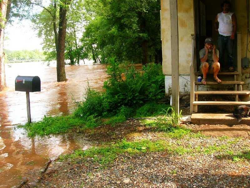
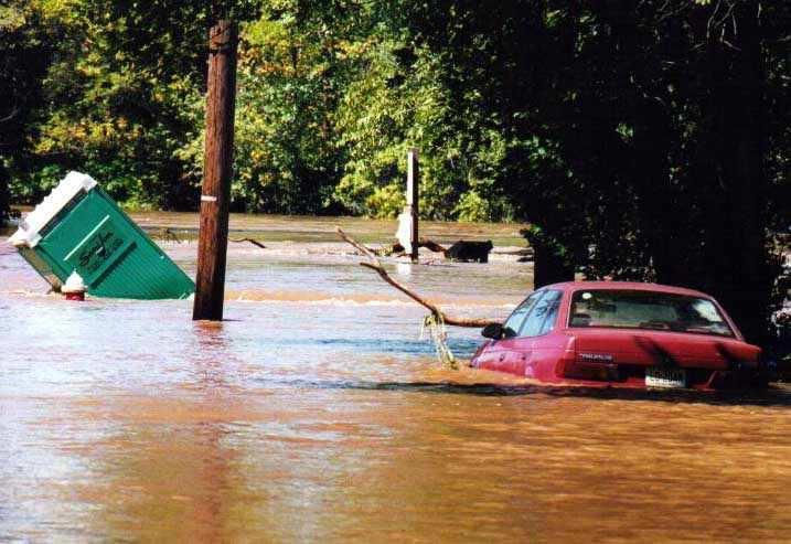
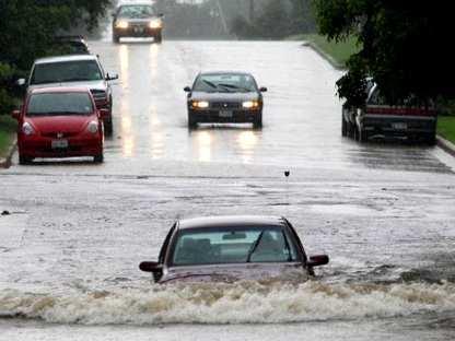
3 Why Regulate NJ s Floodplains? 1. New Jersey endures enormous & chronic flooding problems due to its geography, location, and high level of existing development 2. Unwise development increases flooding 3. Greater flooding leads to greater flood damage Loss of life and property Strain on emergency services Huge economic losses
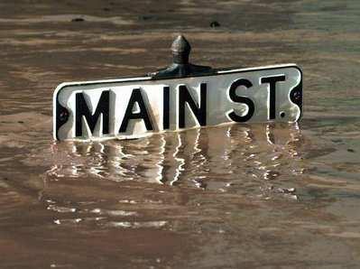
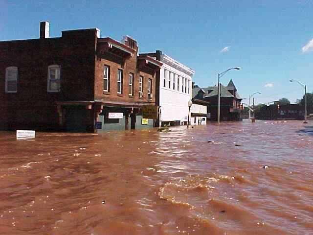
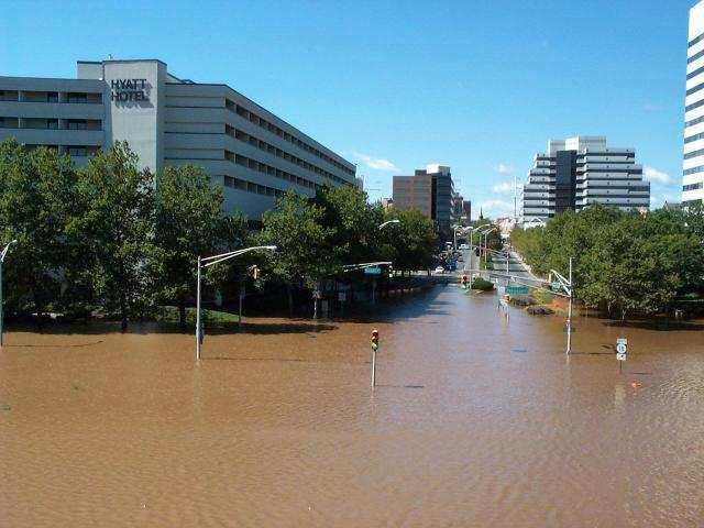
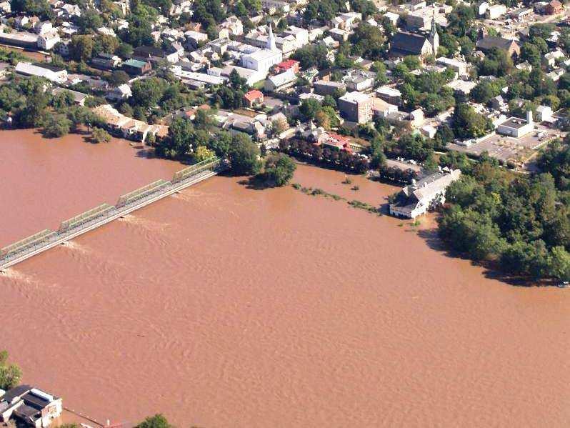
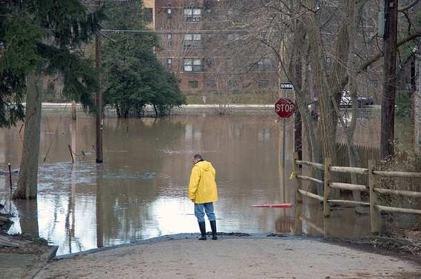
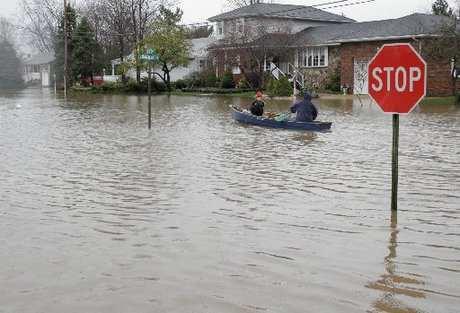
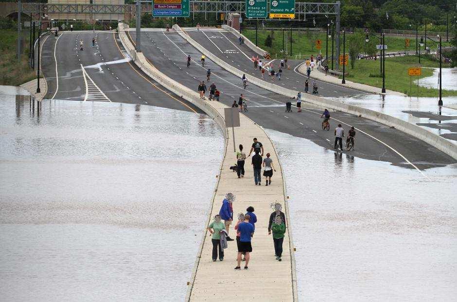
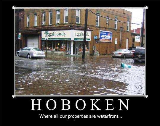
4 Flooding in New Jersey Our location along the eastern seaboard guarantees periodic storms and flooding New Jersey contains thousands of miles of waterways, all of which will eventually flood It has been estimated that 35% of New Jersey lies in a flood hazard area

5 New Jersey s original settlements were along navigable waterways As a result, many of the State s population centers are within flood hazard areas today
6 Tougher Rules Over Time 1929: NJ begins regulating stream encroachments 1962: Mapping of 100-year floodplains begins 1975: Floodway rules adopted 1977: 0% net-fill enacted in Central Passaic Basin 1980: Flood Hazard Area Control Act adopted 1984: 20% net-fill enacted outside CPB 1995: Stream buffers of 25 and 50 ft adopted
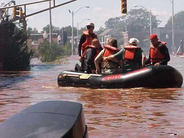
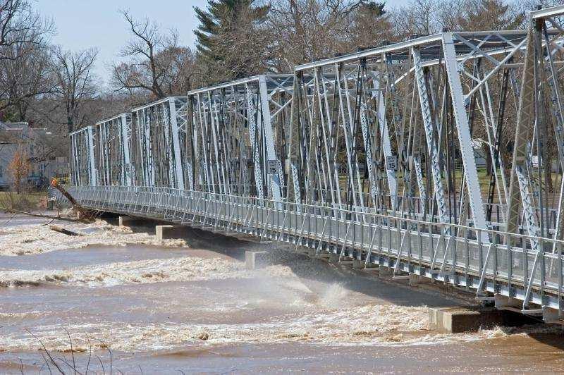
7 But Flood Damages Increase Between 1994 and 2003: NJ residents filed more than 19,000 flood insurance claims NJ residents received nearly 1/4 billion dollars in flood insurance payments Between 1996 and 2006: Nine Major Disaster Declarations by FEMA in NJ related to flooding
8 Flooding is New Jersey s #1 Natural Hazard FEMA, August 4, 2004
9
10
11
12

13
14
15
16
17
18
19 Extreme Financial Implications In 2005, Katrina and other hurricanes created $18.75 billion in debt in the U.S. Treasury Nationally: 5.6 million policies with an insured exposure of $1.2 trillion NJ policies: 228,347 (< 3% of population) NJ insurance value: $50,700,407,700 NJ losses (1/78-7/10): 89,359 (39% of policies) NJ payments (1/78-7/10): $957,649,135


20
21 National Implications Despite billions of dollars spent to reduce flood risk, statistics show that flood losses are increasing Flood damages and associated costs continue to increase, despite minimum federal standards Other factors like demographic shifts toward the nation's coasts and catastrophic events like Hurricane Katrina suggest that this pattern is likely to continue
22 Implications for New Jersey Most densely populated state + Chronic flooding issues + 35% of state lies in a flood hazard area + Enormous development pressure + Development increases flooding = Unsustainable Condition
23 Sustainable Development Development that meets the needs of the present without compromising the ability of future generations to meet their own needs. (The Brundtland Commission of the United Nations, March 20, 1987)
24 Creation of Current Rules April 18, 2005: Acting Governor Codey forms Flood Mitigation Task Force August 22, 2006: Governor Corzine releases final task force report: Recommends sweeping changes to New Jersey s policies regarding development in flood hazard areas and riparian corridors November 5, 2007: New Flood Hazard Area Control Act rules enacted
25 Theme No Adverse Impact: Ensuring that the action of one property owner does not adversely impact the rights of other property owners, as measured by increased flood peaks, flood stage, flood velocity, and erosion and sedimentation Association of State Floodplain Managers, NAI White Paper, April 29, 2004
26 Goals Ensure flooding does not increase Preserve flood storage Prevent obstructions to flow Protect public safety Construct new buildings and roads above the flood hazard area elevation Provide healthy riparian corridors Preserve vegetation & channel integrity Protect habitat and water quality
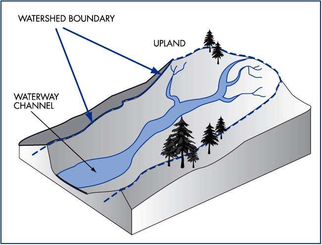
27
28 Jurisdiction Step 1: Determine if you are along a regulated water Step 2: Determine if you are within a regulated area along this water Step 3: Determine if you are proposing a regulated activity
29 Jurisdiction Step 1: Determine if you are along a regulated water Step 2: Determine if you are within a regulated area along this water Step 3: Determine if you are proposing a regulated activity
30 Step 1: Regulated Waters All surface waters in New Jersey are regulated except: 1. Manmade canals: N.J.A.C. 7:13-2.2(a)1 2. Coastal wetlands: N.J.A.C. 7:13-2.2(a)2 3. Waters that drain less than 50 acres in three particular cases described at N.J.A.C. 7:13-2.2(a)3
31 Step 1: Regulated Waters A surface water is not regulated if it drains less than 50 acres and meets one or more of the following: 1. The water has no discernible channel - such as a freshwater wetlands swale OR SEE N.J.A.C. 7:13-2.2(a)3i
32 Step 1: Regulated Waters 2. The water is confined within a lawfully existing, manmade conveyance structure or drainage feature, such as a pipe, culvert, ditch, channel or basin (not including any water that historically possessed a naturally-occurring, discernible channel, which has been piped, culverted, ditched or similarly modified) OR SEE N.J.A.C. 7:13-2.2(a)3ii
33 Step 1: Regulated Waters 3. The water is not connected to a regulated water by a channel or pipe, such as an isolated pond or depression that has no outlet Important: If a water drains less than 50 acres, but doesn t meet at least one of these three criteria, then it is regulated SEE N.J.A.C. 7:13-2.2(a)3iii
34 What is a Drainage Area? Drainage area means a geographic area within which water, sediments and dissolved materials drain to a particular receiving waterbody or to a particular point along a receiving waterbody So, all the land around a waterbody that slopes toward it is part of its drainage area Also called watershed SEE N.J.A.C. 7:13-1.2
35
36 Jurisdiction Step 1: Determine if you are along a regulated water Step 2: Determine if you are within a regulated area along this water Step 3: Determine if you are proposing a regulated activity
37 Jurisdiction Step 1: Determine if you are along a regulated water Step 2: Determine if you are within a regulated area along this water Step 3: Determine if you are proposing a regulated activity
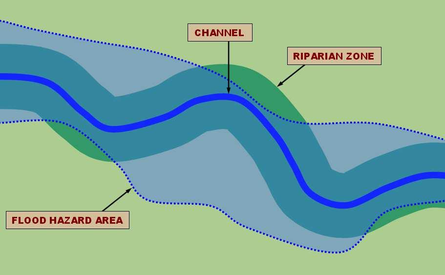
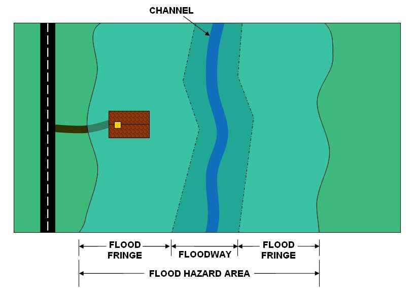
38 Step 2: Regulated Areas Along all regulated waters there are two distinct and overlapping areas of jurisdiction: 1. The flood hazard area 2. The riparian zone SEE N.J.A.C. 7:13-2.3(a)
39
40
41
42
43 Flood Hazard Area A flood hazard area exists along every regulated water that has a drainage area of 50 acres or more If a water drains less than 50 acres, it has no flood hazard area The flood hazard area is the land along a regulated water that is inundated by the flood hazard area design flood SEE N.J.A.C. 7:13-2.3(a)1

44 Flood Hazard Area
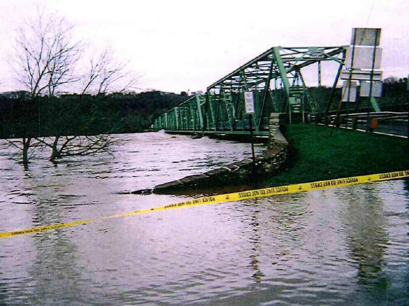
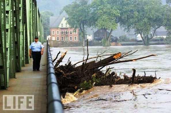
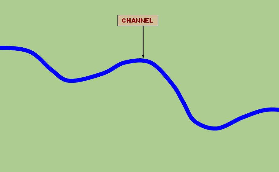
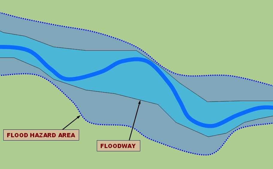
45 Flood Hazard Area Approximately 35% of New Jersey lies in a flood hazard area
46 Flood Hazard Area The flood hazard area is comprised of the floodway and flood fringe

47 Flood Hazard Area The flood hazard area is determined by the flood hazard area design flood
48
49 Flood Hazard Area Design Flood In tidal areas: equal to 100-yr (1%) flood In fluvial areas: equal to 100-yr (1%) flood plus a factor of safety Different factors of safety are added depending on the mapping resources available
50 What is a 100-Year Flood? More accurately described as a 1% flood Within a given year, this flood has a 1% probability of occurring But it could happen multiple times in a year, or not for 300 years More details concerning the determination of the 100yr Flood will be presented by the next speaker
51 Flood Hazard Area The flood hazard area is comprised of the floodway and flood fringe
52 Floodway Conveys the majority of floodwaters Structures & other materials can obstruct flow and increase flooding Calculated using a 0.2-ft rise in the 100- year flood elevation

53 Floodway

54 Floodway 100yr Water Surface Elevation
55 Floodway
56
57
58 Flood Fringe The portion of the flood hazard area outside the floodway Waters are less deep and move slower than in floodway Structures, fill and other material can displace flood storage volume and increase flooding
59
60 Jurisdiction Step 1: Determine if you are along a regulated water Step 2: Determine if you are within a regulated area along this water Step 3: Determine if you are proposing a regulated activity
61 Jurisdiction Step 1: Determine if you are along a regulated water Step 2: Determine if you are within a regulated area along this water Step 3: Determine if you are proposing a regulated activity
62 Regulated Activities 1. The alteration of topography through excavation, grading and/or placement of fill 2. The clearing, cutting and/or removal of vegetation in a riparian zone 3. The creation of impervious surface 4. The storage of unsecured material 5. The construction, reconstruction and/or enlargement of a structure 6. The conversion of a building into a private residence or a public building SEE N.J.A.C. 7:13-2.4
63
64 Permit Requirement Before undertaking a regulated activity in a regulated area, you must first obtain one of the following: A permit-by-rule (N.J.A.C. 7:13-7) A general permit (N.J.A.C. 7:13-8) More details concerning the PBR and GP will be presented by the next speaker. An individual permit (N.J.A.C. 7:13-9,10 & 11) An emergency permit (N.J.A.C. 7:13-12) A coastal permit (N.J.A.C. 7:7 and 7:7E) SEE N.J.A.C. 7:13-2.1(b)
65 Applicability Determination N.J.A.C. 7: Free application to verify whether a permit is needed for a particular activity You supply basic project info such as site plan, location map, photos, etc. DEP writes you a letter in a few weeks Never required it s there to help you Sometimes municipalities want to see one
66 Applicability Determination N.J.A.C. 7: Sometimes the exact limits of the flood hazard area and riparian zone must be known before NJDEP can determine whether an activity requires a permit In such cases, applicants may need to obtain a verification first before NJDEP can issue an applicability determination
67 Verification N.J.A.C. 7: Application to verify the extent of a flood hazard area and riparian zone on a given site Similar to a freshwater wetlands letter of interpretation Separate from a permit application (but can be obtained with a permit or prior to a permit)
68 Verification N.J.A.C. 7: In most cases, a verification is needed before NJDEP can issue an individual permit (except as noted at 7:13-9.6) Needed if net-fill calculations are necessary Needed if floodway location must be known Needed for proper floor or road elevations Metes and bounds description of flood hazard area and floodway is needed
69 APD vs. Verification? N.J.A.C. 7: An applicability determination tells you whether or not a project is regulated The activity therefore needs to be clearly: Outside any regulated areas or Exempt from regulation or Permitted-by-rule A verification tells you where the flood hazard area and riparian zone is located
70 Exempt Activities An activity is exempt from the Flood Hazard Area Control Act rules if: It is located outside any flood hazard area and riparian zone OR It is not listed as a regulated activity in N.J.A.C. 7:13-2.4
71 Regulated Activities N.J.A.C. 7: The alteration of topography through excavation, grading and/or placement of fill; 2. The clearing, cutting and/or removal of vegetation in a riparian zone; 3. The creation of impervious surface; 4. The storage of unsecured material; 5. The construction, reconstruction and/or enlargement of a structure; and 6. The conversion of a building into a private residence or a public building.
72 Example 1 You re building a new office building: It s 400 feet away from the nearest stream Therefore it must be outside any possible riparian zone It s located on the top of a hill, 30 feet above the nearest stream Therefore it must be outside any possible flood hazard area Activity is exempt Get an APD (which requires site plan with topography)
73 Example 2 You re building a new house: It s 75 feet away from the nearest stream Therefore it may be inside a riparian zone It s located 7 feet above the nearest stream, and there is no flood mapping Therefore it may be inside a flood hazard area Therefore, unknown if activity is exempt Get a verification (which requires site plan w/topography) If activity is outside RZ and FHA, no permit needed
74 Example 3 You re renovating an existing house, in which the cost of the renovation is more than 50% of the value of the existing house: It s 50 feet away from the nearest stream Therefore it may be inside a riparian zone It s located 5 feet above the nearest stream, and there is no flood mapping Therefore it may be inside a flood hazard area Therefore, unknown if activity is exempt Get a verification (which requires site plan w/topography) If activity is outside RZ and FHA, no permit needed
75
76 Coastal Permits Coastal rules now cross-reference the FHA rules, so that all coastal permits need to meet all FHA standards In other words: All Waterfront Development and CAFRA permits are subject to the same flood hazard area and riparian zone standards as a flood hazard area approval
77 Coastal Permits Since the standards are the same, getting a coastal permit satisfies all FHA permitting requirements You will not need a FHA permit if you get a waterfront development or CAFRA permit
78
79 Other Approvals N.J.A.C. 7:13-12, 13 and 14 Emergency permit (N.J.A.C. 7:13-12) Revision to a verification, general permit, individual permit or a State adopted flood study (N.J.A.C. 7:13-13) Transfer of an approval to another owner (N.J.A.C. 7:13-14)
80 Final Thoughts N.J.A.C. 7: Sub 15 Application requirements Sub 16 Public notice Sub 17 Fees Sub 18 Adjudicatory hearings Sub 19 Enforcement
81
82 Questions?
BASICS OF FLOODPLAIN MANAGEMENT & PLANNING IN NEW JERSEY
 BASICS OF FLOODPLAIN MANAGEMENT & PLANNING IN NEW JERSEY STATE OF NEW JERSEY DEPARTMENT OF ENVIRONMENTAL PROTECTION VINCENT J. MAZZEI, JR., PE November 12, 2008 Flood Hazard Areas What is a 100-year flood?
Overview of Federal and State Floodplain Management Programs
 Overview of Federal and State Floodplain Management Programs Peter DeMeo, PE Supervising Environmental Engineer New Jersey Department of Environmental Protection Division of Land Use Regulation October
Regulatory Fee Schedule
 Regulatory Schedule STATE OF NEW JERSEY DEPARTMENT OF ENVIRONMENTAL PROTECTION DIVISION OF LAND USE REGULATION Website: www.state.nj.gov/dep/landuse Revised September 2017 All permit fees shall be paid
Chapter 5. Floodplain Management. 5.0 Introduction. 5.1 Floodplain Management and Regulation
 5.0 Introduction This chapter summarizes the Town s rules and regulations regarding floodplain management and development. The requirements presented in this chapter should be used by the design engineer
Frequently Asked Questions for: Drainage, Watershed and Water Quality Property Owners Near Creeks Developers and Engineers and Definitions of Terms
 FREQUENTLY ASKED QUESTIONS Draft DEFINITIONS OF TERMS Last Revised July 2, 2008 Introduction: The following questions have been organized in the categories below. We have attempted to group the questions
Chapter 5. Floodplain Management. 5.0 Introduction. 5.1 Douglas County Comprehensive Master Plan. 5.2 Floodplain Management and Regulation
 5.0 Introduction This chapter summarizes the County s rules and regulations regarding floodplain management and development. The requirements presented in this chapter should be used by the design engineer
***** Subchapter A. GENERAL PROVISIONS ***** PERMIT APPLICATIONS
 105.11. Permit requirements. 105.12. Waiver of permit requirements. Title 25 Environmental Protection Part I. Department of Environmental Protection Subpart C. Protection of Natural Resources Article I.
A. Maintenance. All legally established, nonconforming structures can be maintained (e.g., painting and repairs);
;") Chapter 24.50 NONCONFORMING USES, STRUCTURES AND LOTS Sections: 24.50.010 Nonconforming uses, structures, and lots Purpose. 24.50.020 Nonconforming uses, structures, and lots Alteration or expansion of
Chapter 24.50 NONCONFORMING USES, STRUCTURES AND LOTS Sections: 24.50.010 Nonconforming uses, structures, and lots Purpose. 24.50.020 Nonconforming uses, structures, and lots Alteration or expansion of
FLOODWAY DEVELOPMENT REGULATION
 Floodway Development Regulation Task Force Discussion Paper FLOODWAY DEVELOPMENT REGULATION Dated: August 20, 2014 Table of Contents 1. Introduction... 3 2. General Background... 3 3. List of Task Force
ANDOVER CODE. Checklist #5 Preliminary Site Plan Conditional Use
 ANDOVER CODE Checklist #5 Preliminary Site Plan Conditional Use Applicant: Block Lot File No. This checklist is for general reference only. Further information may be required by the reviewing authority.
Floodplain Development Land Use Review
 PUBLIC WORKS - COMMUNITY DEVELOPMENT 333 Broadalbin Street SW, PO Box 490, Albany, Oregon 97321-0144 BUILDING 541-917-7553 PLANNING 541-917-7550 Floodplain Development Land Use Review Application Information
BRISTOL CONSERVATION COMMISSION INLAND WETLANDS AGENCY FORM IW-1 (Application for a Wetlands Permit)
") APPLICATION NO. BRISTOL CONSERVATION COMMISSION INLAND WETLANDS AGENCY FORM IW-1 (Application for a Wetlands Permit) DATE FILED: APPROVED: DENIED: 1. APPLICANT: Name: Signature: Address: City: State: Zip
APPLICATION NO. BRISTOL CONSERVATION COMMISSION INLAND WETLANDS AGENCY FORM IW-1 (Application for a Wetlands Permit) DATE FILED: APPROVED: DENIED: 1. APPLICANT: Name: Signature: Address: City: State: Zip
Appendix A Reproducible Forms
 Appendix A Reproducible Forms Form LD-33 LD-34 LD-35 LD-40 LD-41 LD-42 LD-50 LD-51 LD-52 LD-53 Subject County Engineer Approval Form Storm Sewer Computation Sheet Ohio Drainage Design Criteria Form Gutter
Appendix A: Submittal Checklists
 Appendix A: Submittal Checklists A.1 Preliminary Plat Checklist A.2 Final Plat Checklist 11 Appendix A.1 DESIGN CHECKLIST FOR PRELIMINARY PLATS AND DEVELOPMENTS Development Name: Location: Date: Reviewed
TOWNSHIP OF EGG HARBOR ZONING BOARD ADJUSTMENT CHECK LIST
 TOWNSHIP OF EGG HARBOR ZONING BOARD ADJUSTMENT CHECK LIST Schedule A - General Requirements 1. Where the application involves only a variance one (1) original and nineteen (19) copies of the appropriate
State: Zip: Daytime Phone: Ext.: Cell Phone: State: Zip: Daytime Phone: Ext.: Cell Phone: Zip: Municipality: County:
 State of New Jersey Department of Environmental Protection Division of Land Use Regulation Application Form (LURP-2) 501 E. State Street Mail Code 501-02A P.O. Box 420 Trenton, NJ 08625-0420 www.nj.gov/dep/landuse
Purpose: Regulations:
 Administrative Procedures for the Designation and Refinement Of Chesapeake Bay Preservation Area Boundaries Guidance on the Chesapeake Bay Preservation Area Designation and Management Regulations September,
BACKGROUND There are 23 flood control structures in the Upper Brushy Creek Water Control and Improvement District (District). See attached map.
. See attached map.") BACKGROUND There are 23 flood control structures in the Upper Brushy Creek Water Control and Improvement District (District). See attached map. The U.S Department of Agriculture - Natural Resources Conservation
BACKGROUND There are 23 flood control structures in the Upper Brushy Creek Water Control and Improvement District (District). See attached map. The U.S Department of Agriculture - Natural Resources Conservation
CHAPTER 17 SURFACE DRAINAGE MANAGEMENT
 CHAPTER 17 SURFACE DRAINAGE MANAGEMENT TABLE OF CONTENTS 17.01 INTENT...1 17.02 DRAINS...1 17.03 MODIFICAITON OF DRAINS, PERMIT REQUIRED...3 17.04 DRAIN OBSTRUCTIONS AND UNAUTHORIZED STRUCTURES AND MODIFICATIONS
VILLAGE OF ASHVILLE DEPARTMENT OF PUBLIC UTILITIES DIVISION OF STORMWATER MANAGEMENT STORMWATER MANAGEMENT PROGRAM STORMWATER CREDIT MANUAL
 VILLAGE OF ASHVILLE DEPARTMENT OF PUBLIC UTILITIES DIVISION OF STORMWATER MANAGEMENT STORMWATER MANAGEMENT PROGRAM STORMWATER CREDIT MANUAL SECTION I. OVERVIEW AND GENERAL INSTRUCTIONS INTRODUCTION A stormwater
Zoning Permit Application Cover Page
 Zoning Permit Application Cover Page The City of Belmont performs an initial site inspection prior to issuance of a zoning permit for new construction. Upon receipt of a full and complete application submittal
Emergency Watershed Program Sandy Recovery Activities and Flood Plain Easement Program
 Emergency Watershed Program Sandy Recovery Activities and Flood Plain Easement Program Greg Westfall, Resource Conservationist USDA-Natural Resources Conservation Service (NRCS) Set up by Congress to respond
Chesapeake Bay Preservation Area (CBPA) Map Update. Presentation to the County Board July 15, 2017
 Map Update. Presentation to the County Board July 15, 2017") Chesapeake Bay Preservation Area (CBPA) Map Update Presentation to the County Board July 15, 2017 Chesapeake Bay Program Comprehensive Plan Chesapeake Bay Preservation Ordinance (1992) (Chapter 61, Arlington
Chesapeake Bay Preservation Area (CBPA) Map Update Presentation to the County Board July 15, 2017 Chesapeake Bay Program Comprehensive Plan Chesapeake Bay Preservation Ordinance (1992) (Chapter 61, Arlington
The Corporation of the Township of Springwater. By-Law
 The Corporation of the Township of Springwater By-Law 2007 053 Being a by-law to prohibit or regulate the removal, placing or dumping of fill or the alteration of the grade of land. (Cut and Fill Regulation
APPLICATION FOR SUBDIVISION APPROVAL OF A SKETCH PLAN with checklist
 Prior to filing any application for SUBDIVISION approval, the applicant shall request in writing that the zoning administrator schedule a pre-submission conference. APPLICATION TO THE PLANNING BOARD TOWN
Town of Middleborough Conservation Commission 2014 Policy
 Approved February 20, 2014 Town of Middleborough Conservation Commission 2014 Policy The Wetland Protection Act under M.G.L. c. 131, sec. 40 and regulations 310 CMR 10.02(1)(a-f) & 310 CMR 10.02 (2)(a)
GRANT OF CONSERVATION RESTRICTION (Wetland Mitigation/Riparian Zone Mitigation) WITNESSETH:
 WITNESSETH:") NJDEP File No.: Prepared by: GRANT OF CONSERVATION RESTRICTION (Wetland Mitigation/Riparian Zone Mitigation) THIS GRANT OF CONSERVATION RESTRICTION is made this day of 20, by, its heirs, successors and
NJDEP File No.: Prepared by: GRANT OF CONSERVATION RESTRICTION (Wetland Mitigation/Riparian Zone Mitigation) THIS GRANT OF CONSERVATION RESTRICTION is made this day of 20, by, its heirs, successors and
CHAPTER 13 WINCHESTER WETLANDS BYLAW
 CHAPTER 13 WINCHESTER WETLANDS BYLAW Section 1. PURPOSE The purpose of this by-law is to protect the wetlands, related water resources, and adjoining land areas in the town by prior review and control
(Chapter Flood Damage Prevention)
") Chapter 13.10 Flood Damage Prevention Section: 13.10.010 Purpose and Policy 13.10.020 Definitions 13.10.030 Applicability and Areas of Special Flood Hazard 13.10.040 Administration 13.10.050 Provisions
Chapter 13.10 Flood Damage Prevention Section: 13.10.010 Purpose and Policy 13.10.020 Definitions 13.10.030 Applicability and Areas of Special Flood Hazard 13.10.040 Administration 13.10.050 Provisions
Township of Little Egg Harbor Planning Board 665 Radio Road Little Egg Harbor, New Jersey Phone: ext. 221 Fax:
 BLOCK(S) LOT(S) Township of Little Egg Harbor Planning Board 665 Radio Road Little Egg Harbor, New Jersey 08087 Phone: 609-296-7241 ext. 221 Fax: 609-294-3040 Development Application Amended Development
ARTICLE 6 PRELIMINARY PLAT
 ARTICLE 6 PRELIMINARY PLAT SECTION: 30-06-01: Preliminary Plat 30-06-02: Information Required for Preliminary Plat 30-06-03: Determination of Requirement for Environmental Review Documents 30-06-04: Additional
ST. TAMMANY PARISH PATRICIA P. BRISTER PARISH PRESIDENT
 revised Completed Permit Application REQUIREMENTS FOR RESIDENTIAL PLAN REVIEW Swimming Pools Assessment # / Parcel #(10 digit number from Assessor s Office 985-809-8180 www.stpao.org) Legal Description
ARTICLE I. IN GENERAL
 Adopted by City Council on December 7, 2009 AN ORDINANCE TO AMEND AND REORDAIN CHAPTER 10 (WATER PROTECTION) OF THE CODE OF THE CITY OF CHARLOTTESVILLE, 1990, AS AMENDED, BY DELETING SECTIONS 10-51 AND
Drainage Maintenance Policy
 Drainage Maintenance Policy The purpose of this Drainage Maintenance Policy is to clarify how the City of McKinney may address various drainage and stormwater related concerns of residents. BACKGROUND
SUBDIVISION APPLICATION CHECKLIST SKETCH PLAN PRELIMINARY PLAT FINAL PLAT
 RECEIVED STAMP SUBDIVISION APPLICATION CHECKLIST SKETCH PLAN PRELIMINARY PLAT FINAL PLAT A checklist of background information and submission requirements for processing of a sketch plan, preliminary plat
FRESHWATER WETLANDS PROTECTION IN NEW JERSEY Tools for Municipal Action
 FRESHWATER WETLANDS PROTECTION IN NEW JERSEY Tools for Municipal Action The Freshwater Wetlands Protection Act INTENT OF FRESHWATER WETLANDS LAW The New Jersey legislature passed the Freshwater Wetlands
PLANNING BOARD CITY OF CONCORD, NH MINOR SUBDIVISION CHECKLIST
 PLANNING BOARD CITY OF CONCORD, NH MINOR SUBDIVISION CHECKLIST Summary This checklist is intended to assist applicants and design professionals in the preparation of minor subdivision applications for
Appendix A Orleans County Local Law Assessment
 Appendix A Orleans County Local Law Assessment Appendix A 0 Albion, Town Does the municipality have: Comprehensive/ Master Local Law Assessment es o Reference: Comments: Town of Albion, Village of Albion,
Open Space Model Ordinance
 Open Space Model Ordinance Section I. Background Open space development has numerous environmental and community benefits, including: 1) Reduces the impervious cover in a development. Impervious cover
FREQUENTLY USED PLANNING & ZONING TERMS
 City Of Mustang FREQUENTLY USED PLANNING & ZONING TERMS Abut: Having property lines, street lines, or zoning district lines in common. Accessory Structure: A structure of secondary importance or function
PROJECT SCOPE OF WORK CITY OF TOWN AND COUNTRY STORMWATER PROGRAM
 PROJECT SCOPE OF WORK CITY OF TOWN AND COUNTRY STORMWATER PROGRAM Project ID Number: 2-2 Problem: The backyards at 962, 97, and 978 Delvin Drive are located in a low area of shallow ponding that takes
Article 5. Environmentally Sensitive Areas
 Article 5. Environmentally Sensitive Areas This Article establishes standards and regulations governing environmental constraints. These regulations are intended to encourage preservation of lands designated
City of Prior Lake APPLICATION FOR COMBINED PRELIMINARY AND FINAL PLAT
 Case File No. Property Identification No. City of Prior Lake APPLICATION FOR COMBINED PRELIMINARY AND FINAL PLAT Requested Action Brief description of proposed project (Please describe the proposed amendment,
ARTICLE FIVE FINAL DRAFT
 ARTICLE FIVE 021218 FINAL DRAFT Sec. 503.6 Open Space Preservation Option Open Space Preservation Option Open Space Preservation developments may be approved in the AR, R-1, R-2 and R-3 zoning districts,
REQUEST FOR PROPOSAL FOR ENGINEERING DESIGN SERVICES. Channel Reconstruction at Short Hills Garden Apartments Site Millburn, New Jersey
 REQUEST FOR PROPOSAL FOR ENGINEERING DESIGN SERVICES Channel Reconstruction at Short Hills Garden Apartments Site Millburn, New Jersey Diane Thall-Eglow, Mayor Issue Date: March 21, 2019 Jackie Benjamin
TOWNSHIP OF MENDHAM Ord. No
 ORDINANCE SUPPLEMENTING THE LAND USE ORDINANCE OF THE TOWNSHIP OF MENDHAM BY A NEW CHAPTER XXIVA ESTABLISHING THE REQUIREMENT OF AN ENVIRONMENTAL PERMIT AND AMENDING AND SUPPLEMENTING SAID ORDINANCE WITH
COMMUNITY DEVELOPMENT DEPARTMENT 333 Broadalbin Street SW, P.O. Box 490 Albany, OR 97321
 COMMUNITY DEVELOPMENT DEPARTMENT 333 Broadalbin Street SW, P.O. Box 490 Albany, OR 97321 Ph: 541-917-7550 Fax: 541-917-7598 www.cityofalbany.net STAFF REPORT Application for Site Plan Review SP-07-18 and
MAJOR SUBDIVISION PRELIMINARY PLAT CHECKLIST
 TOWNSHIP OF EGG HARBOR PLANNING BOARD/ZONING BOARD OF ADJUSTMENT 3515 BARGAINTOWN ROAD EGG HARBOR TOWNSHIP, NJ 08234 MAJOR SUBDIVISION PRELIMINARY PLAT CHECKLIST The following checklist is designed to
E L M E R B O R O U G H L A N D U S E B O A R D APPLICATION COVER SHEET (to be completed for all applications and appeals)
") E L M E R B O R O U G H L A N D U S E B O A R D APPLICATION COVER SHEET (to be completed for all applications and appeals) 1. Name(s): 2. Address: 3. Telephone Number(s): 4. E-mail: 5. Owner Name(s) (if
E L M E R B O R O U G H L A N D U S E B O A R D APPLICATION COVER SHEET (to be completed for all applications and appeals) 1. Name(s): 2. Address: 3. Telephone Number(s): 4. E-mail: 5. Owner Name(s) (if
PRELIMINARY PLAT Application Packet
 PRELIMINARY PLAT Application Packet Community Development Department 1020 East Pioneer Road, Draper, UT 84020 (801) 576-6539 Fax (801) 576-6526 Dear Applicant, This application packet has been developed
Larimer County Planning Dept. Procedural Guide for 1041 PERMITS
 - Larimer County Planning Dept. Procedural Guide for 1041 PERMITS PLEASE NOTE: A PRE-APPLICATION CONFERENCE IS REQUIRED PRIOR TO SUBMITTING THIS APPLICATION. PURPOSE: State Statutes allow local governments
CHAPTER 6 CHESAPEAKE BAY PRESERVATION AREAS AND STREAM PROTECTION AREAS
 CHAPTER 6 CHESAPEAKE BAY PRESERVATION AREAS AND STREAM PROTECTION AREAS 6.1 INTRODUCTION Virginia s Chesapeake Bay Preservation Area (CBPA) Designation and Management Regulations (9VAC10-20 et seq.) require
Article III. Erosion and Sedimentation Control
 Article III. Erosion and Sedimentation Control Section 9.6 Erosion and Sedimentation Control Plan Requirements Section 9.6.1 Plan Submission A plan shall be prepared for all land-disturbing activities
CHAPTER 3 PRELIMINARY PLAT
 10-3-1 10-3-3 SECTION: CHAPTER 3 PRELIMINARY PLAT 10-3-1: Consultation 10-3-2: Filing 10-3-3: Requirements 10-3-4: Approval 10-3-5: Time Limitation 10-3-6: Grading Limitation 10-3-1: CONSULTATION: Each
Schedule A to By-Law No Non-assumed Road Assumption Policy. For. The Corporation of the Township of Tudor and Cashel
 Schedule A to By-Law No. 2012-17 Non-assumed Road Assumption Policy For The Corporation of the Township of Tudor and Cashel For the purposes of this policy the following words shall have the respective
Land Use Application
 Land Use Application Check all permits you are applying for in the boxes provided. Submit this application form, the applicable materials listed in the corresponding permit application packet(s) and application
ORDINANCE NO WHEREAS, the Town of Jupiter ( Town ) has adopted a Comprehensive Plan
 has adopted a Comprehensive Plan") 0 0 ORDINANCE NO. -0 AN ORDINANCE OF THE TOWN COUNCIL OF THE TOWN OF JUPITER, FLORIDA, AMENDING CHAPTER OF THE TOWN CODE TO AMEND SECTION -, ENTITLED INTENT TO ADD PERMITTING LANDGUAGE; TO AMEND SECTION
0 0 ORDINANCE NO. -0 AN ORDINANCE OF THE TOWN COUNCIL OF THE TOWN OF JUPITER, FLORIDA, AMENDING CHAPTER OF THE TOWN CODE TO AMEND SECTION -, ENTITLED INTENT TO ADD PERMITTING LANDGUAGE; TO AMEND SECTION
City of Prior Lake APPLICATION FOR REGISTERED LAND SURVEY
 Case File No. Property Identification No. City of Prior Lake APPLICATION FOR REGISTERED LAND SURVEY Requested Action Brief description of proposed project (Please describe the proposed amendment, project,
Condominium Unit Requirements.
 ARTICLE 19 CONDOMINIUM REGULATIONS Section 19.01 Purpose. The purpose of this Article is to regulate projects that divide real property under a contractual arrangement known as a condominium. New and conversion
ARTICLE 7 UTILITIES AND EASEMENTS
 7.1 PLACEMENT OF UTILITIES ARTICLE 7 UTILITIES AND EASEMENTS 7.1.1 All authorized public underground utilities shall be located within the right-of-way of a public street or within an easement designated
COMMUNITY DEVELOPMENT DEPARTMENT 333 Broadalbin Street SW, P.O. Box 490 Albany, OR 97321
 COMMUNITY DEVELOPMENT DEPARTMENT 333 Broadalbin Street SW, P.O. Box 490 Albany, OR 97321 STAFF REPORT Application for Site Plan Review (SP-02-18) Residential Accessory Building Ph: 541-917-7550 Fax: 541-917-7598
PONDS. A. Definitions.
 A. Definitions. PONDS For purposes of this section, the following terms shall have the following meanings: 1. Application means all documents, forms and other information that the Department may require
State, County, or Municipal Agency or instrumentality thereof, applying for authorization
 Application for Project Authorization Under the New Jersey Register of Historic Places Act NJ Department of Environmental Protection Natural & Historic Resources Historic Preservation Office Date September
BRIDGETON SUBDIVISION APPLICATION CHECKLIST
 APPLICATION NAME AND # CHECKLIST COMPLETED BY: DATE: Signature and printed name BRIDGETON SUBDIVISION APPLICATION CHECKLIST TO SUBDIVISION APPLICANTS: The attached checklist is to assist you in the submission
Final Plats for Major Residential and Commercial Subdivisions Checklist
 Project Name: : This form is a checklist of Zoning Ordinance requirements for major residential and commercial subdivision plats to assist the applicant in their submittal. It is not intended to be a comprehensive
Prepared by and to be returned to Linn County Planning & Development nd Street S.W., Cedar Rapids, Iowa (319)
") Prepared by and to be returned to Linn County Planning & Development 935 2 nd Street S.W., Cedar Rapids, Iowa 52404-2161 (319) 892-5130 LINN COUNTY, IOWA ZONING BOARD OF ADJUSTMENT IN THE MATTER OF THE
Prepared by and to be returned to Linn County Planning & Development 935 2 nd Street S.W., Cedar Rapids, Iowa 52404-2161 (319) 892-5130 LINN COUNTY, IOWA ZONING BOARD OF ADJUSTMENT IN THE MATTER OF THE
COMMERCIAL SITE DEVELOPMENT GUIDE FOR UNINCORPORATED ST. CHARLES COUNTY
 COMMERCIAL SITE DEVELOPMENT GUIDE FOR UNINCORPORATED ST. CHARLES COUNTY GENERAL INFORMATION: This brochure is to be used as a guide and is not intended to amend or supersede the corresponding County ordinances
SECTION 4: PRELIMINARY PLAT
 SECTION 4: PRELIMINARY PLAT After the completion of the sketch plan process, if submitted, the owner or developer shall file with the City an application for preliminary plat. The preliminary plat stage
REGIONAL DISTRICT OF NANAIMO BYLAW NO. 1469
 REGIONAL DISTRICT OF NANAIMO BYLAW NO. 1469 A BYLAW TO ESTABLISH FLOODPLAINS, CONSTRUCTION LEVELS IN FLOODPLAINS, AND SETBACKS FOR LANDFILL AND STRUCTURES IN FLOODPLAINS WHEREAS Section 910 of the Local
géãç Éy VtÇtÇwt zât 5440 Routes 5 & 20 West Canandaigua, NY Phone: (585) / Fax: (585)
 / Fax: (585)") géãç Éy VtÇtÇwt zât 5440 Routes 5 & 20 West Canandaigua, NY 14424 Phone: (585) 394-1120 / Fax: (585) 394-9476 NOTICE TO ALL PLANNING BOARD APPLICANTS FOR PRELIMINARY SUBDIVISION PHASED PROJECTS The applicant
géãç Éy VtÇtÇwt zât 5440 Routes 5 & 20 West Canandaigua, NY 14424 Phone: (585) 394-1120 / Fax: (585) 394-9476 NOTICE TO ALL PLANNING BOARD APPLICANTS FOR PRELIMINARY SUBDIVISION PHASED PROJECTS The applicant
CHARLES CITY COUNTY SITE PLAN ORDINANCE. This Ordinance shall be known as the Charles City County Site Plan Ordinance.
 CHARLES CITY COUNTY SITE PLAN ORDINANCE Section 1. Title This Ordinance shall be known as the Charles City County Site Plan Ordinance. Section 2. Authority. This Ordinance is enacted pursuant to the authority
Request to Advertise: Chesapeake Bay Preservation Area (CBPA) Map Update. June 20, 2017
 Map Update. June 20, 2017") Request to Advertise: Chesapeake Bay Preservation Area (CBPA) Map Update June 20, 2017 Outline Context Past County Board actions Why update the CBPA Map? What and Why - Resource Protection Areas Property
Request to Advertise: Chesapeake Bay Preservation Area (CBPA) Map Update June 20, 2017 Outline Context Past County Board actions Why update the CBPA Map? What and Why - Resource Protection Areas Property
ARTICLE 13 CONDOMINIUM REGULATIONS
 ARTICLE 13 CONDOMINIUM REGULATIONS Section 13.01 Purpose. The purpose of this Article is to regulate projects that divide real property under a contractual arrangement known as a condominium. New and conversion
Gisborne District Council
 12.0 SUBDIVISION... 1 12.1 INTRODUCTION... 1 12.2 ISSUE... 1 12.3 OBJECTIVE (SUBDIVISION)... 1 12.4 POLICIES (SUBDIVISION)... 2 12.5 METHODS OF IMPLEMENTATION... 4 12.5.1 REGULATION... 4 12.6 RULES FOR
APPLICATION PROCEDURE
 ANTRIM PLANNING BOARD P. O. Box 517 Antrim, New Hampshire 03440 Phone: 603-588-6785 FAX: 603-588-2969 APPLICATION FORM AND CHECKLIST FOR EARTH EXCAVATION AND RECLAMATION File # Date Received By APPLICATION
ALREADY SUBMITTED FOR HIGHLANDS COUNCIL PRE
 Highlands Preservation Area Approval Application Checklist Items Block 15901 Lot 1, West Milford See Highlands Council Review at: http://www.highlands.state.nj.us/njhighlands/projectreview/ **For advisory
ARTICLE 16. FLOODPLAIN MANAGEMENT, EROSION AND SEDIMENT CONTROL, AND STORMWATER MANAGEMENT
 ARTICLE 16. FLOODPLAIN MANAGEMENT, EROSION AND SEDIMENT CONTROL, AND STORMWATER MANAGEMENT Title 1. DEFINITIONS AND GENERAL PROVISIONS 2. FLOODPLAIN MANAGEMENT 3. EROSION AND SEDIMENT CONTROL 4. STORMWATER
CITY OF CAMBRIDGE FLOODPLAIN MANAGEMENT CHAPTER 7 (GRADING, EROSION AND SEDIMENT CONTROL)
") CITY OF CAMBRIDGE FLOODPLAIN MANAGEMENT CHAPTER 7 (GRADING, EROSION AND SEDIMENT CONTROL) City of Cambridge, MD Floodplain Management Ordinance (Tidal): May, 2011 1 City of Cambridge, Maryland Floodplain
CITY OF CAMBRIDGE FLOODPLAIN MANAGEMENT CHAPTER 7 (GRADING, EROSION AND SEDIMENT CONTROL) City of Cambridge, MD Floodplain Management Ordinance (Tidal): May, 2011 1 City of Cambridge, Maryland Floodplain
VILLAGE OF WILMETTE Grading and Tree Protection Notice Forms
 VILLAGE OF WILMETTE Grading and Tree Protection Notice Forms Work that requires a grading permit and work that increases the footprint of a structure require grading notice and tree protection notice,
NOTICE OF LAND USE DECISION BY THE COOS COUNTY PLANNING DIRECTOR
 NOTICE OF LAND USE DECISION BY THE COOS COUNTY PLANNING DIRECTOR Coos County Planning 225 N. Adams St. Coquille, OR 97423 http://www.co.coos.or.us/ Phone: 541-396-7770 Fax: 541-396-1022 This notice is
VI. SAFETY ELEMENT I. INTRODUCTION A. PURPOSE B. AUTHORITY. 1. Safety
 AB 162 and SB 1241 Amendment to the Safety Element New sections are underlined, deleted sections are shown as strikethrough and the denotes text remaining in place. VI. SAFETY ELEMENT I. INTRODUCTION A.
YCCD EROSION & SEDIMENT POLLUTION CONTROL (E&SPC) PROGRAM SERVICES FEE SCHEDULE, RULES, & GUIDELINES
 PROGRAM SERVICES FEE SCHEDULE, RULES, & GUIDELINES") YCCD EROSION & SEDIMENT POLLUTION CONTROL (E&SPC) PROGRAM SERVICES FEE SCHEDULE, RULES, & GUIDELINES Adopted by the YCCD Board of Directors on December 14, 2018 Effective January 1, 2019. I. Authority
YCCD EROSION & SEDIMENT POLLUTION CONTROL (E&SPC) PROGRAM SERVICES FEE SCHEDULE, RULES, & GUIDELINES Adopted by the YCCD Board of Directors on December 14, 2018 Effective January 1, 2019. I. Authority
SECTION A-1500 UNIFIED DEVELOPMENT ORDINANCE SECTION A-1600
 SECTION A-1500 UNIFIED DEVELOPMENT ORDINANCE SECTION A-1600 SECTION A-1600. s. A. General. All proposed plats submitted for approval under the provisions of the UDO shall allocate sufficient easement areas
PLANNING BOARD APPLICATION FORM TOWNSHIP OF BETHLEHEM 405 MINE ROAD ASBURY, NEW JERSEY Date of Application: Township Application Number:
 Township of Bethlehem Page 1 of 8 PLANNING BOARD APPLICATION FORM TOWNSHIP OF BETHLEHEM 405 MINE ROAD ASBURY, NEW JERSEY 08802 Date of Application: Township Application Number: Jurisdiction: Planning Board
City of Prior Lake APPLICATION FOR PRELIMINARY PLAT
 City of Prior Lake APPLICATION FOR PRELIMINARY PLAT Requested Action Brief description of proposed project (Please describe the proposed amendment, project, or variance request. Attach additional sheets
City of Chilliwack. Bylaw No. 4519
 City of Chilliwack Bylaw No. 4519 A bylaw to designate land as Floodplain and make provisions in relation to flood control, flood hazard management and development of land that is subject to flooding or
Wood County Shoreland Zoning Ordinance For Wisconsin s Shoreland Protection Program
 Wood County Shoreland Zoning Ordinance For Wisconsin s Shoreland Protection Program October 1, 2014 Revised January 12, 2015 Revised September 16, 2015 (2015 Wisconsin Act 55) Revised March 2, 2016 (2015
MINNESOTA POLLUTION CONTROL AGENCY GENERAL PERMIT FOR DISPOSAL OF UNCOMTAMINATED CONCRETE
 MINNESOTA POLLUTION CONTROL AGENCY GENERAL PERMIT FOR DISPOSAL OF UNCOMTAMINATED CONCRETE ISSUANCE DATE: December 23, 2013 EXPIRATION DATE: December 23. 2018 This permit is a General Permit issued pursuant
Community Development
 Land Use Petition RZ-16-002 Date of Staff Recommendation Preparation: April 15, 2016 (CEL) Date of Planning Commission Recommendation: May 3, 2016 PROJECT LOCATION: DISTRICT/SECTION/LANDLOT(S): ACREAGE
2016 Fredericksburg Area Floodplain Management Workshop Tuesday, October 25, 2016
 2016 Fredericksburg Area Floodplain Management Workshop Tuesday, October 25, 2016 Charley Banks, CFM Department of Conservation And Recreation Division of Dam Safety & Floodplain Management Some Soapbox
Door County Shoreland Zoning. Door County Land Use Services Department June 26, 2018
 Door County Shoreland Zoning Door County Land Use Services Department June 26, 2018 Wisconsin ShorelandZoning: Background June 12, 1968: State-mandated date for counties to begin administering shoreland
By-Law of The Corporation of the City of Oshawa
 By-Law 85-2006 of The Corporation of the City of Oshawa being a by-law to control the dumping of fill, removal of topsoil and alteration of grades. WHEREAS s. 142 of the Municipal Act, 2001, S.O. 2001,
SECTION 10: FLOOD HAZARD EVALUATION 10-1
 10) SECTION 10: FLOOD HAZARD EVALUATION A. General. Land subject to being flooded by a Flood of 100-Year Frequency as defined by Title 76, Chapter 5, MCA, or land subject to flooding pursuant to these
ORDINANCE NO TOWNSHIP OF EAST WINDSOR COUNTY OF MERCER
 ORDINANCE NO. 2016-07 TOWNSHIP OF EAST WINDSOR COUNTY OF MERCER AN ORDINANCE REPEALING SECTION 22-4: FLOOD DAMAGE PREVENTION CODE, OF THE REVISED GENERAL ORDINANCES OF THE TOWNSHIP OF EAST WINDSOR AND
Local units of government control the use of private
 9 Land Use REEB 24.085 Chapter Overview Land use issues are one of the hottest topics in the area of real estate. This chapter outlines the basics of land use regulation. Important Terminology conditional
HEC Software and FEMA Submittals
 HEC Software and FEMA Submittals EWRI Workshop HEC Users Conference Larry Voice Risk Analysis FEMA Region VI April 12, 2010 Overview Flood Hazard Analysis Overview of Map Changes Accepted Model List Guidance
201 General Provisions
 201 General Provisions 201.01 Title 201.09 Amendments 201.02 Purpose and Intent 201.10 Public Purpose 201.03 Authority 201.11 Variances and Appeals 201.04 Jurisdiction 201.12 Nonconformances 201.05 Enactment
Oxford Floodplain Management Ordinance
 Table of Contents SECTION 1.0 GENERAL PROVISIONS...1 1.1 Findings...1 1.2 Statutory Authorization...1 1.3 Statement of Purpose...1 1.4 Areas to Which These Regulations Apply...2 1.5 Basis for Establishing
Article XII. General Provisions and Regulations
 and Regulations The regulations contained in this chapter are intended to clarify, supplement or modify the regulations set forth elsewhere in this ordinance. 157.182. USE OF LAND OR STRUCTURES A. Conformity
ORDINANCE NO WHEREAS, the County Council desires to amend the current Code of
 1 1 1 1 1 1 0 1 0 1 ORDINANCE NO. 00- AN ORDINANCE OF THE COUNTY COUNCIL OF VOLUSIA COUNTY, FLORIDA, AMENDING THE CODE OF ORDINANCES OF THE COUNTY OF VOLUSIA, CHAPTER, TITLED UTILITIES, ARTICLE IV, STORMWATER