SUB / Diamante Subdivision / Northside Management
|
|
|
- Myra Chase
- 6 years ago
- Views:
Transcription

 zone.")
1 SU / Diamante Subdivision / Northside Management Summary: Subdivision application for a Preliminary Plat consisting of 20 buildable lots and 3 common lots. Prepared y: Todd Tucker, Senior Planner Recommendation: Approval with conditions Reason for the Decision: All lots within the subdivision conform to the existing R-1A (Single Family Residential 2.1 DU/Acre) zone. With the recommended conditions of approval, the Preliminary Plat is in conformance with the oise City Comprehensive Plan and Development Code. 1 of 48

2 2 of 48

3 3 of 48
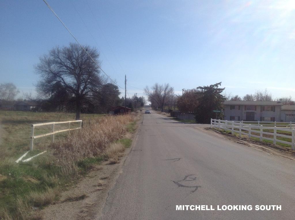
4 N W E S DEVELOPMENT FEATURES ACREAGE TOTAL PARCEL ACRES TOTAL LOTS - 23 UILDALE LOTS - 20 COMMON/LANDSCAPE LOTS - 3 (1 EXISTING HOME 19 NEW) ZONING EXISTING - RSW PROPOSED - R-1A SEWAGE DISPOSAL OISE CITY SEWER WATER SUPPLY UNITED WATER IDAHO CITY OISE CITY SCHOOL DISTRICT OISE 1 FIRE DISTRICT TYPICAL STREET SECTION OISE Scale: NOT TO SCALE IRRIGATION DISTRICT NEW YORK IRRIGATION DISTRICT OISE PROJECTS OARD OF CONTROL OWNER/DEVELOPER IO N A L E N G GIS T ER E ED R PLANNER/OWNERS REPRESENTATIVE SCOTT NORIYUKI NORTHSIDE MANAGEMENT 6810 FAIRHILL PL OISE, ID T HA C 11. R S 10. SS EE 9. SURVEYOR PATRICK SCHEFFLER PLS IDAHO SURVEY GROUP PC 1450 E. WATERTOWER MERIDIAN, ID IN 8. CHAD S. KINKELA, P.E. CK ENGINEERING 860 HEADWATERS DR. EAGLE, ID O 5. ENGINEER H AT E O F IDA A FE 2. ALL LOT LINES COMMON TO A PULIC RIGHT OF WAY HAVE A 10' PULIC UTILITY AND OISE CITY STREET LIGHT EASEMENT. A 10' PULIC UTILITY IRRIGATION AND DRAINAGE EASEMENT IS LOCATED ADJACENT TO THE EXTERIOR OUNDARY. ALL SIDE YARD LOT LINES HAVE A 5' DRAINAGE & IRRIGATION EASEMENT ON EACH SIDE OF THE LOT LINE. SEWER SERVICES SHALL E PROVIDED TO EACH LOT Y A MAIN LINE EXTENSION OF EXISTING OISE CITY SEWER LINES LOCATED IN MITCHELL STREET AS SHOWN. UNITED WATER IDAHO MAIN LINES ARE LOCATED ON THE NORTH SIDE OF VICTORY ROAD. WATER SERVICES TO EACH LOT AND FIRE PROTECTION SHALL E PROVIDED Y AN EXTENSION OF THE UNITED WATER IDAHO LINES. STORM DRAIN WATER FROM PARKING AND UILDINGS WILL E ROUTED TO SAND AND GREASE TRAPS AND SEEPAGE EDS WITHIN THE ACHD RIGHT OF WAY AS SHOWN ON THE PPLAT DRAWING. THIS SUDIVISION IS SUJECT TO COMPLIANCE WITH IDAHO CODE SECTION CONCERNING IRRIGATION WATER. PRESSURIZED IRRIGATION WATER WILL E PROVIDED TO THIS SUDIVISION.FROM EXISTING SHARES AND THE CONSTRUCTION OF AN IRRIGATION PUMP STATION MEETING OISE CITY AND NEW YORK IRRIGATION DISTRICT REQUIREMENTS. LOTS 1 AND 6, LOCK 1 AND LOT 1, LOCK 2 ARE COMMON LOTS TO E OWNED AND MAINTAINED Y THE DIAMANTE SUDIVISION PROPERTY OWNER'S ASSOCIATION. SETACKS SHALL E DETERMINED AT THE TIME OF UILDING PERMIT APPLICATION ASED ON THE ZONING REGULATIONS IN EFFECT FOR THE LO ZONE. THE EXISTING HOME ON LOT 5, LOCK 1 IS TO REMAIN, ALL OTHER STRUCTURES ON THE SITE ARE TO E REMOVED PRIOR TO CONSTRUCTION AND PLATTING. DIRECT LOT ACCESS TO S. MITCHELL STREET AND W. VICTORY ROAD IS PROHIITED. PRO NOTES: 1. -COREY ARTON HOMES, INC PO OX 369 MERIDIAN, ID MICHAEL D HAGOOD 9701 W VICTORY RD OISE, ID D S. K IN K E L C1.0 4 of 48
 ZONING CHAD S. KINKELA, P.E. CK ENGINEERING 860 HEADWATERS DR.")
5 OWNER/DEVELOPER -COREY ARTON HOMES, INC PO OX 369 MERIDIAN, ID MICHAEL D HAGOOD 9701 W VICTORY RD OISE, ID ENGINEER DEVELOPMENT FEATURES ACREAGE TOTAL PARCEL ACRES TOTAL LOTS - 23 UILDALE LOTS - 20 COMMON/LANDSCAPE LOTS - 3 (1 EXISTING HOME 19 NEW) ZONING CHAD S. KINKELA, P.E. CK ENGINEERING 860 HEADWATERS DR. EAGLE, ID EXISTING - RSW PROPOSED - R-1A SURVEYOR OISE CITY SEWER PATRICK SCHEFFLER PLS IDAHO SURVEY GROUP PC 1450 E. WATERTOWER MERIDIAN, ID SEWAGE DISPOSAL WATER SUPPLY UNITED WATER IDAHO CITY OISE CITY PLANNER/OWNERS REPRESENTATIVE SCOTT NORIYUKI NORTHSIDE MANAGEMENT 6810 FAIRHILL PL OISE, ID SCHOOL DISTRICT OISE FIRE DISTRICT OISE IRRIGATION DISTRICT NEW YORK IRRIGATION DISTRICT OISE PROJECTS OARD OF CONTROL 5 of 48 * ROADWAY LANDSCAPE UFFERS: WEST VICTORY ROAD - 30' SOUTH MITCHELL ST. - 20' * ROADWAY UFFER REQUIRED TREES: WEST VICTORY ROAD ' 1 10 TREES REQUIRED AT 40 ' 11 TREES PROPOSED SOUTH MITCHELL ST ' 1 23 TREES REQUIRED AT 40 ' 30 TREES PROPOSED
6 6 of 48
7 7 of 48
8 8 of 48
9 9 of 48
10 10 of 48
11 11 of 48

12 October 30th, 2015 Honorable Mayor & City Council c/o: Todd Tucker City of oise 150 N. Capital lvd oise, ID RE: Diamante Subdivision Letter of Intent Dear Mayor & Council, As representative for Corey arton Homes, Inc. please accept this application for Preliminary Plat of the proposed Diamante Subdivision development located at 3050 S. Mitchell St. in oise, ID. This application includes a request to develop & construct nineteen (19) new single-family lots & retain one (1) existing singlefamily lot on acres. This letter is included with the required Preliminary Plat Applications, together with filing fees & various exhibits. The enclosed application has been submitted in accordance of the requirements of the oise City Unified Development Code and are in compliance with the UDC. Careful consideration of the oise lueprint/comprehensive Land Use Plan has been contemplated & incorporated into the design & application. We are NOT requesting a rezone or waivers. This proposal is submitted 100% in conformance of the oise Development Code, oise Comprehensive Land Use Plan, and most importantly, the Southwest Planning Area Overlay. This allows for approval of the project within the existing R-1A zoning designation. Careful consideration of lot size transition has been incorporated into the design. Further, we have designed within conformance of ACHD's policies & those requirements of the local Irrigation Dist., Fire Dept. & United Water. 12 of 48
13 Neighborhood meetings and outreach were extensive through our prior application to include four (4) noticed meetings, one of which included representatives of the Southwest Ada County Alliance as well as several property owners well beyond the minimum 300' radius notification area. We have taken into consideration all thoughts conveyed at these meetings & made changes to better help the transition as well as traffic concerns. This application & development provides for quality residential uses that complement the existing & adjacent residential uses. We look forward to working with you & your staff and request approval of this application Sincerely, Scott Noriyuki Northside Management 13 of 48


14 14 of 48
15 Planning Division Project Report File Number Applicant Property Address SU Northside Management 3050 S. Mitchell Street Public Meeting Date January 11, 2016 Heard by Planning and Zoning Commission Analyst Checked by Todd Tucker, Senior Planner Cody Riddle, Planning Manager Table of Contents 1. Project Data and Facts 2 2. Land Use 2 3. Development Code 3 4. Comprehensive Plan 3 5. Transportation and Public Services 3 6. Analysis / Findings 4 7. Recommended Conditions of Approval 6 Exhibits Agency Comments 15 of 48
16 SU / Diamante Subdivision / Preliminary Plat oise City Planning & Zoning Commission / January 11, 2016 Page 2 of Project Data and Facts Project Data Applicant/Status Architect/Representative Location of Property Size of Property Existing Zoning Comprehensive Plan Designation Planning Area Neighborhood Association/Contact Procedure Northside Managemement / Developer Scott Noriyuki 3050 S. Mitchell Street Acres R-1A (Single Family Residential 2.1 DU/Acre) Large Lot / Rural Southwest Southwest Ada Co. Alliance / etty ermensolo The Planning and Zoning Commission will make a recommendation to City Council. Current Land Use & Site Characteristics The property is currently improved with two single-family residences on two separate parcels near the corner of Mitchell and Victory. The majority of the site is undeveloped vacant ground. The property is relatively flat and abuts three public streets. Description of Applicant s Request The applicant is requesting to subdivide approximately acres with a 20 lot singlefamily residential subdivision. 2. Land Use Description and Character of Surrounding Area The property is bordered on the north and west by public streets with single-family homes located on the other side of the streets. The property located directly to the south and east is improved with detached single-family homes. The properties located to the west, south, and east are located within Ada County and are generally one and two acre lots. Adjacent Land Uses and Zoning Single-Family Residential Homes / R-1 (Single Family Residential 4.8 DU/Acre) North: & R-1C (Single Family Residential 8 DU/Acre South: Single-Family Residential Homes / R1 (Ada County) East: Single-Family Residential Homes / RSW & R1 (Ada County) West: Single-Family Residential Homes / R1 (Ada County) History of Previous Actions CAR Annexation into oise City Limits with R-1A zoning. SU Preliminary Plat with 37 buildable lots and 5 common lots. (Denied) 16 of 48
17 SU / Diamante Subdivision / Preliminary Plat oise City Planning & Zoning Commission / January 11, 2016 Page 3 of Development Code Section Description Specific Procedures (Subdivision Plat) Residential Districts Subdivision Standards 4. Comprehensive Plan CHAPTER Chapter 2: Citywide Policies Chapter 3: Community Structure and Design Chapter 4: Planning Area Policies (Southwest Planning Area) PRINCIPLES, GOALS, & POLICIES Policy CC 2.1 (a) Policy CC 2.1 (b) Principle GDP-N.1(a) Principle GDP-N.5(a) Principle GDP-AIA.2(c) SW-CCN 1.10 SW-C 1.2 SW-C Transportation and Public Services Correspondence from commenting agencies confirms the project will not place an undue burden on the transportation system or other public facilities in the vicinity. The Ada County Highway District (ACHD) submitted their comments in a staff approval report received issued on November 12, They raised no concerns with any of the proposed street or sidewalk improvements. They note that the section of Victory Road that abuts the project exceeds the acceptable level of service for a three lane minor arterial. However, they also note the proposal is consistent with the Comprehensive Plan and the intersections east and west of the site are signalized and function at an acceptable level of service. In addition, they indicated the road network in the vicinity is capable of supporting the 180 additional vehicle trips per day anticipated with the proposed development. Roadway Frontage Functional PM Peak Hour PM Peak Existing Plus Classification Traffic Count Hour Level of Project Victory 412 Minor Arterial 1,122 F F Mitchell 895 Collector 83 etter than D etter than D urnett South of Victory 190 Local 5 N/A N/A urnett West of Maple Grove N/A Local 7 N/A N/A * Acceptable level of service for a three-lane minor arterial is D (720 VPH) * Acceptable level of service for a three-lane minor arterial is E (920 VPH) 17 of 48

18 SU / Diamante Subdivision / Preliminary Plat oise City Planning & Zoning Commission / January 11, 2016 Page 4 of 10 The comments provided by the oise Public Works Department on November 20, 2015 address connection to central sanitary sewer, on-site grading and drainage, pressure irrigation, street lights and solid waste. No concerns were expressed in the Public Works comments. However, they did note that the two 50 watt class lights along Mitchell may require davit poles in order to clear the overhead power lines above. The oise School District provided comments on November 17, 2015 indicating the schools currently assigned to the proposed project were Amity and Maple Grove Elementary Schools, West Junior High, and orah High School. There were no comments regarding the traffic impact or safe routes to school. Comments received from other public agencies raised no concerns with the project and included only standard requirements and conditions of approval. 6. Analysis/Findings The R-1A zone requires a minimum lot size of 20,000 square feet and an average lot width of 100 feet. All lots within the subdivision comply with these standards. In addition, the density of the R-1A zone is 2.1 dwelling units per acre. The density of the proposed subdivision is 1.6 dwelling units per acre. 18 of 48

19 SU / Diamante Subdivision / Preliminary Plat oise City Planning & Zoning Commission / January 11, 2016 Page 5 of 10 A common driveway will provide vehicular access to three lots located in the northwest corner of the subdivision. Lot 5, lock 1 has an existing house that takes access from Victory Road. That access will be closed and the new access will be provided from the common drive extending north from the culde-sac. The other two lots taking access from the common driveway are Lots 7 and 8, lock 1. They will be new lots created with this subdivision. As shown on the preliminary plat, Lot 7, lock 1 does not have the street frontage required by Table of the Development Code. As such, the final plat must be drawn to show that Lot 7, lock 1 has a minimum of five feet of street frontage as required by Section C(5) of the Development Code. All lots abutting the common driveway must take access from the common driveway and not the public right-of-way. A perpetual ingress/egress easement must be placed on the Final Plat. In addition, an agreement for maintenance of the driveway must be recorded prior to issuance of any uilding Permits for lots abutting the common driveway. The Development Code requires that parking be setback a minimum of 20 feet from the edge of a common driveway. The street network of this subdivision complies with numerous policies of the Comprehensive Plan. Policy CC2.1(a) calls for the development of a street network that interconnects and distributes vehicle, bicycle, and pedestrian traffic to multiple streets. Policy CC2.1(b) promotes a connected system of roadways to alleviate congestion, reduce travel distances, and increase circulation options. Principle GDP-N.1(a) also calls for a continuous network of sidewalks, bicycle, and pedestrian paths, and roadways to connect different areas of neighborhoods. This subdivision is providing a street connection to W. urnett Drive which abuts the development on the east. This street connection is supported and encouraged by all three of the previously noted Comprehensive Plan Policies and Principles. ecause the properties located to the south, east, and northeast are currently developed with residential homes there is not an opportunity to provide stub streets in these locations. In addition, the location of the development in such close proximity to the intersection of Victory Road and Mitchell Street removes the opportunity to provide additional street connections to these roads. 19 of 48
20 SU / Diamante Subdivision / Preliminary Plat oise City Planning & Zoning Commission / January 11, 2016 Page 6 of 10 In addition to the previously noted Comprehensive Plan policies, there are several policies in the Southwest Planning Area section found in Chapter 4 of the Comprehensive Plan that address connectivity. Policy SW-C 1.2 states that particular attention should be paid to new development to ensure compatibility with existing development including street system interconnections. Also, Policy SW-C2.2 states that re-subdivisions of existing large lots will provide new street connections as needed to improve connectivity throughout the Southwest. The proposed subdivision does a good job of connecting the existing development to the east along urnett Drive to Mitchell Street. Victory Road as it abuts the subject property is currently improved with a seven foot wide attached sidewalk. There is currently no sidewalk along Mitchell Street or urnett Drive as they abut the site. The applicant is proposing to improve Mitchell Street and all internal streets with five foot wide detached sidewalks. urnett Drive is proposed to be improved with a five foot wide attached sidewalks due to the narrowness of the right-of-way. The sidewalk network is consistent with Principle GDP-N.5(a) which encourages the incorporation of detached sidewalks with tree-lawn and street trees to encourage residents to walk, rather than drive to nearby activity centers and other destinations. The subject property is located within the Airport Influence Area A as identified in the Comprehensive Plan. Policy SW-CCN 1.10 of the Comprehensive Plan requires all development within the Airport Influence Area to comply with noise standards for development as outlined in Chapter 3 of this Comprehensive Plan. Principle GDP-AIA.2(a) states that all new residential development and new schools in Airport Influence Area A, which are affected by average sound levels in the DNL and/or aircraft traffic patterns below 1,000 feet, are required to provide a sound level reduction of 25 d. A recommended condition of approval requires a note be placed on the face of the Final Plat addressing these requirements. 7. Recommended Conditions of Approval Special Conditions and Plat Notes 1. South Mitchell Street as it abuts the subject property shall be improved with a minimum 5 foot wide detached sidewalk. In addition, all streets internal to the subdivision shall also be improved with minimum five foot wide detached sidewalks. 2. A minimum 20 foot wide landscaping buffer shall be provided along S. Mitchell Street and a minimum 30 foot wide landscaping buffer shall be provided along W. Victory Road as required by Section A of the oise Development Code. 3. The final plat shall be drawn to show Lot 7, lock 1 has a minimum of five feet of street frontage. 4. A note shall be placed on the face of the Final Plat stating, "The development of this property shall be in compliance with the oise City Development Code." 20 of 48
21 SU / Diamante Subdivision / Preliminary Plat oise City Planning & Zoning Commission / January 11, 2016 Page 7 of A note on the face of the Final Plat shall designate that any common lots shall be owned and maintained by the Diamante Subdivision Homeowner s Association. These lots cannot be developed for residential purposes in the future. The common lots shall be designated by lot and block. 6. The Final Plat shall include delineations that describe the boundaries of the perpetual ingress/egress common driveway easement for Lots 5, 7 and 8, lock 1. A. Street address numbering shall be in accordance with.c.c D. Evidence shall be provided showing the address numbers posted on the structures on Lots 5, 7 and 8 will be visible from the street.. A note on the face of the Final Plat shall state: Vehicular access to Lots 5, 7, and 8 shall be provided from a common driveway and not from the street. C. A plat note shall set forth the legal description of the driveway(s) and conveys to those lot owners taking access from the driveway(s) and easement(s), the perpetual right of ingress and egress over the described driveway(s), and provides that such perpetual easement(s) shall run with the land. D. A restrictive covenant or other similar deed restriction(s) acceptable to the oise City Attorney shall be recorded at the time of recording the plat which provides for the perpetual requirement for the maintenance of the driveway(s) and cross easement, and that said restrictions shall run with the land, and that said easement and restriction(s) shall be reviewed and approved by the oise City Attorney. 7. A note shall be placed on the face of the Final Plat which states: This subdivision is located within the Airport Influence Area A, which is affected by average sound levels in the DNL, and/or aircraft traffic patterns below 1,000 feet. All new residential development is subject to an avigation easement and required to meet the sound attenuation standards of a minimum noise level reduction (NLR) of 25 d. General Conditions 8. The name, Diamante Subdivision, is reserved and shall not be changed unless there is a change in ownership, at which time, the new owner(s) shall submit their new name to the Ada County Engineer for review and reservation. Should a change in name occur, applicant shall submit, in writing, from the Ada County Engineer, the new name to the Department of Planning and Development Services and re-approval by the Council of the "revised" Final Plat shall be required. Developer and/or owner shall submit all items including fees, as required by the Planning and Development Services Department, prior to scheduling the "revised" Final Plat for hearing. 21 of 48
22 SU / Diamante Subdivision / Preliminary Plat oise City Planning & Zoning Commission / January 11, 2016 Page 8 of No building permit for the construction of any new structure shall be accepted until the Final Plat has been recorded pursuant to the requirements of the.c.c If a Non-uilding Agreement is approved by oise City Fire Department, no building permits shall be submitted until a Satisfaction of Non-uilding Agreement is recorded. 10. Developer shall provide utility easements as required by the public utility providing service (.C.C ). 11. Prior to submitting the mylar of the Final Plat for the City Engineer s signature, all the conditions of approval must be satisfied. Approvals must be provided on agency letterhead. 12. The Mylar shall include the following endorsements or certifications: signatures of owners or dedicators and acknowledgment, certificate of the surveyor, certificate of the Ada County Surveyor, certificate of the Central District Health Department, certificate of the oise City Engineer, certificate of the oise City Clerk, signature of the Commissioners of the Ada County Highway District and the Ada County Treasurer (I.C. Title 50-17). The signatures of the owners or dedicator, certificate of the surveyor, certificate of the Central District Health Department and acceptance of the Commissioners of the Ada County Highway District must be executed prior to submittal of the Mylar for the City Engineer s signature. 13. Covenants, homeowners association by-laws or other similar deed restrictions which provide for the use, control and maintenance of all common areas, private streets, shared access and shared parking, and which shall be consistent with the Fair Housing Act of 1968, as amended from time to time, shall be reviewed and approved by the oise City Attorney. After recordation of the final plat and CC&R s, no building permit shall be accepted until a copy of the recorded CC&R s has been submitted to the oise City Attorney. 14. The developer shall make arrangements to comply with all requirements of the oise City Fire Department and verify in one of the following ways: A. A letter from the oise City Fire Department stating that all conditions for water, access, and/or other requirements have been satisfied, OR. A Non-uild Agreement has been executed and recorded with a note on the face of the Final Plat identifying the instrument number. NOTE: No Parking signs and curb painting shall be required on streets having a width less than 36-feet, back of curb to back of curb. Contact the oise City Fire Department for sign placement and spacing. Developer may either construct prior to final platting or post bond in the amount of 110% of the estimated costs with the oise City Planning and Development Services Department. 22 of 48
23 SU / Diamante Subdivision / Preliminary Plat oise City Planning & Zoning Commission / January 11, 2016 Page 9 of Correct street names as approved by the Ada County Street Name Committee shall be placed on the plat (.C.C M). 16. A letter of acceptance for water service from the utility providing same is required (.C.C ). 17. A letter from the appropriate school district is required stating, "The Developer has made arrangements to comply with all requirements of the School District." 18. Developer shall provide a letter from the United States Postal Service stating, "The Developer and/or Owner has received approval for location of mailboxes by the United States Postal Service." Contact: Dan Frasier, Postmaster 770 S. 13th St. oise, ID Phone No. (208) FAX No. (208) Prior to submitting the Final Plat for recording, the following endorsements or certifications must be executed: Signatures of owners or dedicators, Certificate of the Surveyor, Certificate of the Ada County Surveyor, Certificate of the Central District Health Department, Certificate of the oise City Engineer, Certificate of the oise City Clerk, signatures of the Commissioners of the Ada County Highway District and the Ada County Treasurer (I.C. Title 50-17). 20. Prior to the City Engineer's Certification of the Final Plat and/or prior to earth disturbing activities, an Erosion and Sediment Control (ESC) permit must be obtained. An ESC plan conforming to the requirements.c.c. 8-17, is to be submitted to the Erosion Control Program Manager for review and approval. No grading or earth disturbing activities may start until an approved ESC permit has been issued. 21. An individual who has attended the oise City Responsible Person (RP) certification class, or has obtained Interim Certification for the RP shall be identified for this project. A permit will not issue until such time as the name and certification number of the RP has been provided to oise City. This information can be faxed to or ed to ejenkins@cityofboise.org. 22. Developer shall comply with.c.c which specifies the limitation on time for filing and obtaining certification. Certification by the oise City Engineer shall be made within two years from date of approval of the Final Plat by the oise City Council. 23 of 48
24 SU / Diamante Subdivision / Preliminary Plat oise City Planning & Zoning Commission / January 11, 2016 Page 10 of 10 A. The developer may submit a request for a time extension, including the appropriate fee, to the oise City Planning and Development Services Department for processing. oise City Council may grant time extensions for a period not to exceed one year provided the request is filed, in writing, at least twenty working days prior to the expiration of the first two year period, or expiration date established thereafter.. If a time extension is granted, the oise City Council reserves the right to modify and/or add condition(s) to the original preliminary or Final Plat to conform with adopted policies and/or ordinance changes. C. The Final Plat shall be recorded with the Ada County Recorder within one year from the date of the oise City Engineer s signature. If the Final Plat is not recorded within the one-year time frame it shall be deemed null and void. Agency Requirements 23. The applicant shall comply with the requirements of the Ada County Highway District as per their staff report dated November 12, The applicant shall comply with the requirements of the oise City Public Works Department (CPW) for grading & drainage, pressure irrigation, sewer, street lights, and solid waste per Department comments dated November 20, Please contact CPW at All items required by CPW shall be included on the plans/specifications that are submitted for a uilding Permit. 25. The applicant shall comply with all requirements of the adopted International Fire Code. For additional information, contact Romeo Gervais at The applicant shall comply with the requirements of the oise Airport memo dated November 4, The applicant shall comply with the requirements of the Central District Health Department memo date stamped received November 20, The applicant shall comply with all requirements of the oise School District dated November 17, The applicant shall comply with the requirements of the oise Project oard of Control memo date stamped received November 26, of 48


25 Development Services Department Project/File: Diamante Subdivision/SU The applicant is requesting preliminary plat approval for Diamante Subdivision. The proposal consists of 19 new single family lots along with the reconfiguration of one existing single family lot on acres. The site is located on the southeast corner of the Victory Road and Mitchell Street intersection. Lead Agency: City of oise Site address: 9701 W. Victory Rd. Staff Approval: November 12, 2015 Applicant: Scott Noriyuki Northside Management 6810 N. Fairhill Pl. oise, ID Representative: Same as Above Staff Contact: Mindy Wallace Phone: A. Findings of Fact 1. Description of Application: The applicant is requesting preliminary plat approval, for Diamante Subdivision. The proposal consists of 19 new single family lots along with the reconfiguration of one existing single family lot on acres. The site is located on the southeast corner of the Victory Road and Mitchell Street intersection. The proposal is consistent with the City of oise s comprehensive plan Description of Adjacent Surrounding Area: Direction Land Use North Carolina Place Subdivision South urnett Harvey Acreages Subdivision East urnett Harvey Acreages Subdivision West Residential District Zoning R-1 R-1 R-1 RSW & R-1 Site History: ACHD previously reviewed this site as Diamante Subdivision, consisting of 36 new single family residential lots, on March 26, As part of the prior action on the site ACHD required a road trust deposit for speed bumps on urnett Drive. ACHD is not recommending a road trust deposit for speed bumps on urnett Drive as part of this application. This is new application with a 52% reduction in the number of building lots and the site has access to both Mitchell Street and urnett Drive; distributing the traffic between both roadways with an indirect connection. 25 of 48
26 If ACHD receives requests for traffic calming on urnett Drive after the site is built out, then ACHD will perform a traffic investigation in accordance with ACHD Policy and the traffic calming criteria established by the ACHD Commission. 4. Adjacent Development: The following developments are pending or underway in the vicinity of the site: Silver Pine Subdivision, a 227-lot residential subdivision located south of the site at the northwest corner of Maple Grove and Amity was approved in 2006 and is in various stages of development. 5. Transit: Transit services are located within three-quarters of a mile from this site at the intersection of Victory Road and Victory View Circle, Route New Center Lane Miles: This development is estimated to add 0.25 center line miles of public streets. 7. Impact Fees: There will be an impact fee that is assessed and due prior to issuance of any building permits. The assessed impact fee will be based on the impact fee ordinance that is in effect at that time. 8. Capital Improvements Plan (CIP)/ Integrated Five Year Work Plan (IFYWP): The intersection of Maple Grove Road and Victory Road is scheduled in the Five Year Work Plan to be widened to 7-lanes on all approaches, and reconstructed in Victory Road is listed in the Capital Improvements Plan to be widened to 5-lanes from Five Mile Road to Maple Grove Road between 2017 and The intersection of Victory Road and Five Mile Road is listed in the Capital Improvements Plan to be widened to 7-lanes on the north leg, 7-lanes on the south, 7-lanes east, and 7- lanes on the west leg, and signalized between 2017and Traffic Findings for Consideration 1. Trip Generation: This development is estimated to generate 180 additional vehicle trips per day; 19 additional vehicle trips per hour in the PM peak hour, based on the Institute of Transportation Engineers Trip Generation Manual, 9 th edition. 2. Condition of Area Roadways Traffic Count is based on Vehicles per hour (VPH) Roadway Frontage Functional Classification PM Peak Hour Traffic Count PM Peak Hour Level of Service Existing Plus Project Victory Road 412-feet Minor Arterial 1,122 F F Mitchell Street 895-feet Collector 83 urnett Drive south of Victory etter than D etter than D 190 Local 5 N/A N/A urnett Drive west of Maple Grove N/A Local 7 N/A N/A * Acceptable level of service for a three-lane minor arterial is D (720 VPH) * Acceptable level of service for a three-lane minor arterial is E (920 VPH) 26 of 48
27 * Acceptable level of service for a two-lane collector is D (425 VPH). 27 of 48
28 3. Average Daily Traffic Count (VDT) Average daily traffic counts are based on ACHD s most current traffic counts. The average daily traffic count for Victory Road west of Maple Grove Road was 16,497 on April 24, The average daily traffic count for Mitchell Street south of Victory was 1,444 on March 3, The average daily traffic count for urnett Drive south of Victory was 73 on March 3, The average daily traffic count for urnett Drive west of Maple Grove was 93 on March 3, Victory Road/Mitchell Street Intersection: The Victory Road/Mitchell Road intersection does not currently meet a signal warrant due to the low traffic volumes on Mitchell Street. ACHD will continue to monitor traffic in the area, and as parcels along and in the vicinity of Mitchell Street redevelop a signal warrant may be met. C. Findings for Consideration 1. Area Roadway Level of Service As noted above Victory Road exceeds the acceptable level of service (LOS) D for 3 lane minor arterial roadways. However, both the Five Mile/Victory and Maple Grove/Victory intersections are signalized and function at acceptable level of service standards (LOS C). Victory Road is listed in the CIP as with an existing 2 lane deficiency, and is planned for widening to 5-lanes in the future, as noted above. Typically, when a roadway or intersection is at or above an acceptable level of service staff recommends that improvements be constructed to mitigate the additional traffic to be generated by the development, or that the developer wait until ACHD makes improvements, as scheduled in the CIP or FYWP. In this case improvements would include widening Victory Road to 5 lanes from Five Mile Road to Maple Grove. However, given the size of the development (19 lots), and the costs associated with widening Victory Road ($3,000,000) it would be infeasible for the applicant to construct the improvements. There is a center turn lane on Victory Road from Maple Grove to Five Mile, including at Mitchell Street, which is the main access to the site. ecause the applicant s proposal is consistent with oise City s Comprehensive Plan, the intersections east and west of the site are signalized and function at an acceptable level of service, and the widening of Victory Road is scheduled in the CIP, staff recommends a waiver of District Policy Level of Service Standards. This allows the project to move forward with the understanding that Victory Road will be widened in the future, as adopted in the CIP. 2. Victory Road a. Existing Conditions: Victory Road is improved with 3-travel lanes, vertical curb, gutter, and 7-foot wide attached sidewalks abutting the site. There is 65 to 75-feet of right-of-way for (25- feet from centerline). There is an existing driveway from the site onto Victory Road located approximately 350-feet east of Mitchel Street (measured centerline to centerline). b. Policy: Arterial Roadway Policy: District Policy states that the developer is responsible for improving all street frontages adjacent to the site regardless of whether or not access is taken to all of the adjacent streets. Master Street Map and Typology Policy: District Policy states that the design of improvements for arterials shall be in accordance with District standards, including the Master 28 of 48
29 Street Map and Livable Streets Design Guide. The developer or engineer should contact the District before starting any design. Street Section and Right-of-Way Width Policy: District Policies & state that the standard 5-lane street section shall be 72-feet (back-of-curb to back-of-curb) within 96-feet of right-of-way. This width typically accommodates two travel lanes in each direction, a continuous center left-turn lane, and bike lanes on a minor arterial and a safety shoulder on a principal arterial. Street Section and Right-of Way Width Policy: District Policy & states that the standard 3-lane street section shall be 46-feet (back-of-curb to back-of-curb) within 70 feet of right-of-way. This width typically accommodates a single travel lane in each direction, a continuous center left-turn lane, and bike lanes. Right-of-Way Dedication: District Policy states that The District will provide compensation for additional right-of-way dedicated beyond the existing right-of-way along arterials listed as impact fee eligible in the adopted Capital Improvements Plan using available impact fee revenue in the Impact Fee Service Area. No compensation will be provided for right-of-way on an arterial that is not listed as impact fee eligible in the Capital Improvements Plan. The District may acquire additional right-of-way beyond the site-related needs to preserve a corridor for future capacity improvements, as provided in Section Sidewalk Policy: District Policy requires a concrete sidewalks at least 5-feet wide to be constructed on both sides of all arterial streets. A parkway strip at least 6-feet wide between the back-of-curb and street edge of the sidewalk is required to provide increased safety and protection of pedestrians. Consult the District s planter width policy if trees are to be placed within the parkway strip. Sidewalks constructed next to the back-of-curb shall be a minimum of 7-feet wide. Detached sidewalks are encouraged and should be parallel to the adjacent roadway. Meandering sidewalks are discouraged. A permanent right-of-way easement shall be provided if public sidewalks are placed outside of the dedicated right-of-way. The easement shall encompass the entire area between the rightof-way line and 2-feet behind the back edge of the sidewalk. Sidewalks shall either be located wholly within the public right-of-way or wholly within an easement. Minor Improvements Policy: District Policy states that minor improvements to existing streets adjacent to a proposed development may be required. These improvements are to correct deficiencies or replace deteriorated facilities. Included are sidewalk construction or replacement; curb and gutter construction or replacement; replacement of unused driveways with curb, gutter and sidewalk; installation or reconstruction of pedestrian ramps; pavement repairs; signs; traffic control devices; and other similar items. ACHD Master Street Map: ACHD Policy Section requires the Master Street Map (MSM) guide the right-of-way acquisition, arterial street requirements, and specific roadway features required through development. This segment of Victory Road is designated in the MSM as a Residential Arterial with 5-lanes and on-street bike lanes, a 72-foot street section within 96-feet of right-of-way. c. Applicant Proposal: The applicant is proposing to close an existing driveway onto Victory Road from the site with vertical curb, gutter, and 7-foot attached concrete sidewalks to match the improvements on either side. d. Staff Comments/Recommendations: The applicant s proposal meets District policy and should be approved, as proposed. 29 of 48
30 Consistent with the CIP and MSM the applicant should be required to dedicate additional right-of-way to total 48-feet from the centerline of Victory Road abutting the site. The applicant should be required to replace any broken or deteriorated ADA facilities, curb, gutter, and sidewalk abutting site the consistent with ACHD s Minor Improvement Policy. 3. Mitchell Street a. Existing Conditions: Mitchell Street is improved with 2-travel lanes, (24 to 26-feet of pavement) and no curb, gutter or sidewalk abutting the site. There is 50 to 55-feet of right-ofway for Mitchel Street (25-feet from centerline). There is an existing loop driveway onto Mitchell Street. The driveways are located approximately 140 and 260-feet south of Victory Road. Mitchell Street south of Victory Road has an average speed of 25 MPH, based on a speed analysis conducted by ACHD the week of March 5, b. Policy: Collector Street Policy: District policy states that the developer is responsible for improving all collector frontages adjacent to the site or internal to the development as required below, regardless of whether access is taken to all of the adjacent streets. Master Street Map and Typologies Policy: District policy states that if the collector street is designated with a typology on the Master Street Map, that typology shall be considered for the required street improvements. If there is no typology listed in the Master Street Map, then standard street sections shall serve as the default. Sidewalk Policy: District policy requires a concrete sidewalks at least 5-feet wide to be constructed on both sides of all collector streets. A parkway strip at least 6-feet wide between the back-of-curb and street edge of the sidewalk is required to provide increased safety and protection of pedestrians. Consult the District s planter width policy if trees are to be placed within the parkway strip. Sidewalks constructed next to the back-of-curb shall be a minimum of 7-feet wide. Detached sidewalks are encouraged and should be parallel to the adjacent roadway. Meandering sidewalks are discouraged. A permanent right-of-way easement shall be provided if public sidewalks are placed outside of the dedicated right-of-way. The easement shall encompass the entire area between the rightof-way line and 2-feet behind the back edge of the sidewalk. Sidewalks shall either be located wholly within the public right-of-way or wholly within an easement. ACHD Master Street Map: ACHD Policy Section requires the Master Street Map (MSM) guide the right-of-way acquisition, collector street requirements, and specific roadway features required through development. This segment of Mitchell Street is designated in the MSM as a Residential Collector with 2-lanes and on-street bike lanes, a 36-foot street section within 50-feet of right-of-way. c. Applicant Proposal: The applicant has proposed to construct Mitchell Street as half of a 36- foot street section with vertical curb, gutter, an 8 foot wide planter strip and 5-foot wide detached concrete sidewalks abutting the site. The applicant is proposing to close the 2 existing driveways on Mitchell Street. d. Staff Comments/Recommendations: The applicant s proposal meets District policy and should be approved, as proposed. This street section allows for bike lanes, but no on-street parking, so the applicant should install NO PARKING signs on Mitchell Street abutting the site. 30 of 48
31 4. urnett Drive a. Existing Conditions: urnett Drive is improved from Maple Grove Road to the site with 2- travel lanes, (21-feet of pavement), no curb, gutter or sidewalk abutting the site. From the site north to Victory Road, urnett Drive is improved with 19-feet of pavement and no curb, gutter, or sidewalk. There is 40-feet of right-of-way for urnett Drive (20-feet from centerline). urnett Drive south of Victory Road has an average speed of 17 MPH, based on a speed analysis conducted by ACHD the week of February 24, b. Policy: Local Roadway Policy: District Policy states that the developer is responsible for improving all local street frontages adjacent to the site regardless of whether or not access is taken to all of the adjacent streets. Street Section and Right-of-Way Policy: District Policy states that right-of-way widths for all local streets shall generally not be less than 50-feet wide and that the standard street section shall be 36-feet (back-of-curb to back-of-curb). The District will consider the utilization of a street width less than 36-feet with written fire department approval. Standard Urban Local Street 36-foot to 33-foot Street Section and Right-of-way Policy: District Policy states that the standard street section shall be 36-feet (back-of-curb to back-of-curb) for developments with any buildable lot that is less than 1 acre in size. This street section shall include curb, gutter, and minimum 5-foot concrete sidewalks on both sides and shall typically be within 50-feet of right-of-way. The District will also consider the utilization of a street width less than 36-feet with written fire department approval. Most often this width is a 33-foot street section (back-of-curb to backof-curb) for developments with any buildable lot that is less than 1 acre in size. Off-Site Streets Policy: District Policy states that if the proposed development is not served by a public street with at least 24-feet of pavement then the developer shall pave the street or widen the existing pavement to provide 24-feet of pavement with 3-foot gravel shoulders from the site to a public street specified by the District. Sidewalk Policy: District Policy states that five-foot wide concrete sidewalk is required on both sides of all local street, except those in rural developments with net densities of one dwelling unit per 1.0 acre or less, or in hillside conditions where there is no direct lot frontage, in which case a sidewalk shall be constructed along one side of the street. Some local jurisdictions may require wider sidewalks. The sidewalk may be placed next to the back-of-curb. Where feasible, a parkway strip at least 8-feet wide between the back-of-curb and the street edge of the sidewalk is recommended to provide increased safety and protection of pedestrians and to allow for the planting of trees in accordance with the District s Tree Planting Policy. If no trees are to be planted in the parkway strip, the applicant may submit a request to the District, with justification, to reduce the width of the parkway strip. Detached sidewalks are encouraged and should be parallel to the adjacent roadway. Meandering sidewalks are discouraged. A permanent right-of-way easement shall be provided if public sidewalks are placed outside of the dedicated right-of-way. The easement shall encompass the entire area between the rightof-way line and 2-feet behind the back edge of the sidewalk. Sidewalks shall either be located wholly within the public right-of-way or wholly within an easement. Half Street Policy: District Policy required improvements shall consist of pavement widening to one-half the required width, including curb, gutter and concrete sidewalk (minimum 5-feet), plus 12-feet of additional pavement widening beyond the centerline established for the street to provide an adequate roadway surface, with the pavement 31 of 48

32 crowned at the ultimate centerline. A 3-foot wide gravel shoulder and a borrow ditch sized to accommodate the roadway storm runoff shall be constructed on the unimproved side. c. Applicant s Proposal: The applicant is proposing to construct urnett Street as one half of a 36-foot street section with vertical curb, gutter, and 5-foot attached concrete sidewalks abutting the site. d. Staff Comments/Recommendations: The applicant s proposal meets District policy and should be approved, as proposed. The applicant should be required to dedicate an additional 5-feet of right-of-way total 25-feet from centerline to ensure the proposed improvements fit within the right-of-way on urnett Drive. Consistent with ACHD s Off-Site Street policy, the applicant should be required to widen the existing pavement on urnett Drive to provide 24-feet of pavement with 3-foot gravel shoulders on the west side only, from the site s north property line to Victory Road. Due to existing landscaping and berms it will not be possible to provide any pavement widening or shoulders on the east side of this segment of urnett Drive. Curb, gutter, and sidewalk = Pavement widening = 32 of 48
33 5. Internal Local Streets a. Existing Conditions: There are no internal local streets within the site. b. Policy: Local Roadway Policy: District Policy states that the developer is responsible for improving all local street frontages adjacent to the site regardless of whether or not access is taken to all of the adjacent streets. Street Section and Right-of-Way Policy: District Policy states that right-of-way widths for all local streets shall generally not be less than 50-feet wide and that the standard street section shall be 36-feet (back-of-curb to back-of-curb). The District will consider the utilization of a street width less than 36-feet with written fire department approval. Standard Urban Local Street 36-foot to 33-foot Street Section and Right-of-way Policy: District Policy states that the standard street section shall be 36-feet (back-of-curb to back-of-curb) for developments with any buildable lot that is less than 1 acre in size. This street section shall include curb, gutter, and minimum 5-foot concrete sidewalks on both sides and shall typically be within 50-feet of right-of-way. The District will also consider the utilization of a street width less than 36-feet with written fire department approval. Most often this width is a 33-foot street section (back-of-curb to backof-curb) for developments with any buildable lot that is less than 1 acre in size. Sidewalk Policy: District Policy states that five-foot wide concrete sidewalk is required on both sides of all local street, except those in rural developments with net densities of one dwelling unit per 1.0 acre or less, or in hillside conditions where there is no direct lot frontage, in which case a sidewalk shall be constructed along one side of the street. Some local jurisdictions may require wider sidewalks. The sidewalk may be placed next to the back-of-curb. Where feasible, a parkway strip at least 8-feet wide between the back-of-curb and the street edge of the sidewalk is recommended to provide increased safety and protection of pedestrians and to allow for the planting of trees in accordance with the District s Tree Planting Policy. If no trees are to be planted in the parkway strip, the applicant may submit a request to the District, with justification, to reduce the width of the parkway strip. Detached sidewalks are encouraged and should be parallel to the adjacent roadway. Meandering sidewalks are discouraged. A permanent right-of-way easement shall be provided if public sidewalks are placed outside of the dedicated right-of-way. The easement shall encompass the entire area between the rightof-way line and 2-feet behind the back edge of the sidewalk. Sidewalks shall either be located wholly within the public right-of-way or wholly within an easement. Cul-de-sac Streets Policy: District policy requires cul-de-sacs to be constructed to provide a minimum turning radius of 45-feet; in rural areas or for temporary cul-de-sacs the emergency service providers may require a greater radius. Landscape and parking islands may be constructed in turnarounds if a minimum 29-foot street section is constructed around the island. The pavement width shall be sufficient to allow the turning around of a standard AASHTO SU design vehicle without backing. The developer shall provide written approval from the appropriate fire department for this design element. The District will consider alternatives to the standard cul-de-sac turnaround on a case-by-case basis. This will be based on turning area, drainage, maintenance considerations and the written approval of the agency providing emergency fire service for the area where the development is located. 33 of 48
34 c. Applicant s Proposal: The applicant is proposing to construct all of the internal streets as 33-foot street sections with rolled curb and gutter within 35-feet of right-of-way. An 8-foot wide planter strip and 5-foot wide detached concrete sidewalks are proposed to be located within an easement outside of the dedicated right-of-way. The applicant has proposed to construct two cul-de-sac turnarounds within the site. d. Staff Comments/Recommendations: The applicant s proposal meets District policy and should be approved, as proposed. The cul-de-sac should be constructed to provide a minimum turning radius of 45-feet. The applicant has mentioned the possibility of constructing a bulb-out at existing urnett Drive. Staff is supportive of a bulb-out in this location. If constructed the bulb-out should provide a minimum 24-feet of pavement and will require written fire department approval for use of a reduced street section. *For illustrative purposes only. 6. Roadway Offsets a. Existing Conditions: There are no roadways within the site. b. Policy: Local Offset Policy: District policy , requires local roadways to align or offset a minimum of 330-feet from a collector roadway (measured centerline to centerline). District policy , requires local roadways to align or provide a minimum offset of 125feet from any other street (measured centerline to centerline). c. Applicant s Proposal: The applicant is proposing to construct one roadway onto Mitchell Street located approximately 180-feet north of Roan Meadows (measured centerline to centerline). d. Staff Comments/Recommendations: The applicant s proposal does not meet District policy which requires local roadway intersection collector roadways to align or offset by 330-feet. However, staff recommends a modification of policy to allow the roadway to be located, as proposed. 34 of 48
35 Staff s recommendation is due to the fact that Mitchell Street is a very low volume collector roadway with 83 trips in the pm peak hour and there at two access points proposed to serve the site: one located off of urnett Drive and one off of Mitchell Street, this will allow for distribution of the site traffic onto both roadways. The proposed street location meets required offsets from Victory Road, an arterial. All of the internal roadways intersection locations meet or exceed District policy. 7. Tree Planters Tree Planter Policy: Tree Planter Policy: The District s Tree Planter Policy prohibits all trees in planters less than 8-feet in width without the installation of root barriers. Class II trees may be allowed in planters with a minimum width of 8-feet, and Class I and Class III trees may be allowed in planters with a minimum width of 10-feet. 8. Landscaping Landscaping Policy: A license agreement is required for all landscaping proposed within ACHD right-of-way or easement areas. Trees shall be located no closer than 10-feet from all public storm drain facilities. Landscaping should be designed to eliminate site obstructions in the vision triangle at intersections. District Policy requires a 40-foot vision triangle and a 3-foot height restriction on all landscaping located at an uncontrolled intersection and a 50-foot offset from stop signs. Landscape plans are required with the submittal of civil plans and must meet all District requirements prior to signature of the final plat and/or approval of the civil plans. 9. Other Access Victory Road is classified as a minor arterial roadway, Mitchell Street is classified as a collector roadway. Other than the access specifically approved with this application, direct lot access is prohibited to these roadways and should be noted on the final plat. D. Site Specific Conditions of Approval 1. Dedicate additional right-of-way to total 48-feet from the centerline of Victory Road abutting the site. The right-of-way purchase and sale agreement and deed must be completed and signed by the applicant prior to scheduling the final plat for signature by the ACHD Commission or prior to issuance of a building permit (or other required permits), whichever occurs first. Allow up to 30 business days to process the right-of-way dedication after receipt of all requested material. The District will purchase the right-of-way which is in addition to existing right-of-way from available Corridor Preservation Funds. 2. Close the existing driveway on Victory Road located 350-feet east of Mitchell Street with vertical curb, gutter, and 7-foot wide attached concrete sidewalk to match the improvements on either side, as proposed. 3. Replace any broken or deteriorated ADA facilities, curb, gutter, and sidewalk on Victory Road abutting site the consistent with ACHD s Minor Improvement Policy. 4. Construct Mitchell Street as half of a 36-foot street section vertical curb, gutter, an 8-foot wide planter strip and 5-foot wide detached concrete sidewalks abutting the site. Install NO PARKING signs on Mitchell Street abutting the site. 5. Close the existing loop driveway onto Mitchell Street from the site with the construction of street improvements as noted in site specific condition of approval 4 above. 6. Construct urnett Street as one half of a 36-foot street section with vertical curb, gutter, and 5-foot attached concrete sidewalks abutting the site. 7. Dedicate an additional 5-feet of right-of-way total 25-feet from centerline of urnett Drive abutting the site to ensure the required street improvements fit within the right-of-way. 8. Widen the existing pavement on urnett Drive to provide 24-feet of pavement with 3-foot gravel 35 of 48
36 shoulders (on the west side only) from the north property line of the site to Victory Road. 9. Construct all of the internal streets as 33-foot street sections with rolled curb, and gutter within 35-feet of right-of-way. Construct 8-foot planter strips and 5-foot wide detached concrete sidewalks within a permanent right-of-way easement on all internal streets, as proposed. 10. Construct two cul-de-sac turnaround with a minimum turning radius of 45-feet, as proposed. 11. If desired construct a bulb-out from the site at existing urnett Drive. If constructed, the bulb-out should provide a minimum 24-feet of pavement) and will require written Fire Department approval for use of a reduced street section. 12. Construct one roadway onto Mitchell Street located approximately 180-feet north of Roan Meadows, as proposed. 13. Direct lot access is prohibited to Victory Road and Mitchell Street, and shall be noted on the final plat. 15. Payment of impacts fees are due prior to issuance of a building permit. 16. Comply with all Standard Conditions of Approval. E. Standard Conditions of Approval 1. All irrigation facilities shall be relocated outside of the ACHD right-of-way. 2. Private Utilities including sewer or water systems are prohibited from being located within the ACHD right-of-way. 3. In accordance with District policy, , the applicant may be required to update any existing non-compliant pedestrian improvements abutting the site to meet current Americans with Disabilities Act (ADA) requirements. The applicant s engineer should provide documentation of ADA compliance to District Development Review staff for review. 4. Replace any existing damaged curb, gutter and sidewalk and any that may be damaged during the construction of the proposed development. Contact Construction Services at (with file number) for details. 5. A license agreement and compliance with the District s Tree Planter policy is required for all landscaping proposed within ACHD right-of-way or easement areas. 6. All utility relocation costs associated with improving street frontages abutting the site shall be borne by the developer. 7. It is the responsibility of the applicant to verify all existing utilities within the right-of-way. The applicant at no cost to ACHD shall repair existing utilities damaged by the applicant. The applicant shall be required to call DIGLINE ( ) at least two full business days prior to breaking ground within ACHD right-of-way. The applicant shall contact ACHD Traffic Operations in the event any ACHD conduits (spare or filled) are compromised during any phase of construction. 8. Utility street cuts in pavement less than five years old are not allowed unless approved in writing by the District. Contact the District s Utility Coordinator at (with file numbers) for details. 9. All design and construction shall be in accordance with the ACHD Policy Manual, ISPWC Standards and approved supplements, Construction Services procedures and all applicable ACHD Standards unless specifically waived herein. An engineer registered in the State of Idaho shall prepare and certify all improvement plans. 10. Construction, use and property development shall be in conformance with all applicable requirements of ACHD prior to District approval for occupancy. 11. No change in the terms and conditions of this approval shall be valid unless they are in 36 of 48
37 writing and signed by the applicant or the applicant s authorized representative and an authorized representative of ACHD. The burden shall be upon the applicant to obtain written confirmation of any change from ACHD. 12. If the site plan or use should change in the future, ACHD Planning Review will review the site plan and may require additional improvements to the transportation system at that time. Any change in the planned use of the property which is the subject of this application, shall require the applicant to comply with ACHD Policy and Standard Conditions of Approval in place at that time unless a waiver/variance of the requirements or other legal relief is granted by the ACHD Commission. F. Conclusions of Law 1. The proposed site plan is approved, if all of the Site Specific and Standard Conditions of Approval are satisfied. 2. ACHD requirements are intended to assure that the proposed use/development will not place an undue burden on the existing vehicular transportation system within the vicinity impacted by the proposed development. G. Attachments 1. Vicinity Map 2. Site Plan 3. Utility Coordinating Council 4. Development Process Checklist 5. Request for Reconsideration Guidelines 37 of 48
38 Table of Contents Standard Grading and Drainage Conditions Standard Irrigation Conditions Standard Sewer Conditions Standard Street Light Conditions Standard Hillside Conditions Misc. Engineering Conditions Misc. Solid Waste Conditions PW SUDIVISION COMMENTS REV 5/01/14 Date Due: 11/13/16 Transmittal Date: 11/04/15 Tentative Hearing Date: TD Subject: Diamante Subdivision Plat: Preliminary Engineer/Surveyor/Planner: Scott Noriyuki / Northside Mgt. Phone: 208/ When finished with comments, please type initials below. To: Initials Public Works Jason Taylor Drainage, Hillside, JCT Misc. Engineering Public Works Mike Hedge Municipal Lighting MDH Public Works Mike Sheppard Sewer MS Public Works Mike Sheppard Pressure Irrigation MS Public Works Peter McCullough Solid Waste PJM.C.C , Specific Procedures; Subdivision Plat of the oise City Subdivision Ordinance provides that if no written recommendation from any agency listed herein is received within five (5) days after such notification, the approval of the Final Plat by such agency will be considered granted. If you would like access to better resolution drawings (i.e., site and landscape drawings) please refer to: by using the case number of 48
39 1. STANDARD GRADING & DRAINAGE CONDITIONS REV 5/1/14 a. Subdivision drainage shall be in accordance to.c.c The developer shall submit a letter from the appropriate drainage entity approving the drainage system or accepting the drainage there from. A copy of the construction drawing(s) depicting all site drainage improvements shall be submitted with the letter. 1. Developer may either construct improvement prior to final platting or post bond in the amount of 110% of the estimated construction costs. Estimated construction costs shall be provided by the developer's engineer. 2. For drainage facilities located outside of the public right-of-way, the developer shall dedicate a storm drainage easement. Said easement shall be labeled as either an Ada County Highway District storm drainage easement or a homeowners association storm drainage easement, depending on what entity will assume responsibility for the operation and maintenance of the storm drainage system. 3. If the homeowners association is to be responsible for the operation and maintenance of the storm drainage facilities, the covenants, homeowners association by-laws or other similar deed restrictions shall be reviewed and approved by the oise City Attorney. b. If fills greater than one foot in depth are to be placed in subdivision lots inside of building envelopes, as defined by the applicable subdivision building setbacks, the Developer shall obtain a grading permit from the oise City uilding Department (Commercial Rough Grading Permit). Grading permit must be acquired prior to the start of construction or final plat signature by the oise City Engineer, whichever comes first. 2. STANDARD IRRIGATION CONDITIONS REV 5/1/14 a. Comply with.c.c concerning pressure irrigation requirements prior to signing of the final plat by the oise City Engineer. 1. The owner, person, firm or corporation filing the subdivision plat shall provide a pressurized irrigation system. The system must conform to the minimum design standards and specifications of oise City, or of the entity that will operate and maintain the system, if that entity has published standards; or 2. The owner, person, firm or corporation filing the subdivision plat shall provide written documentation that a valid waiver of the requirement to provide a pressure irrigation system and that Idaho Code (1)(a) regarding transfer of water rights, has been complied with. b. Prior to either commencing construction or signing of the final plat by the oise City Engineer, developer shall: 2 39 of 48
40 1. Submit for approval by the Department of Public Works, construction plans and specifications for the pressurized system, stamped by a registered engineer. 2. Provide written assurance that provisions have been made for ownership, operation, and maintenance of the system. 3. Delineate all necessary irrigation easements on the final plat (.C.C ). c. Developer shall provide for an independent inspection of the installation of irrigation facilities and written certification by the design or project engineer that the system was installed according to the approved plans. In addition, the Department of Public Works must be present for the system pressure test and participate in a final inspection. d. Developer may construct prior to final platting or bond in the amount of 110% of the estimated construction costs based on the approved plans. e. Fees: Developer and/or owner shall pay the current inspection and plan review fees applicable to the proposed subdivision prior to signing of the final plat by the oise City Engineer (.C.C ). 3. STANDARD SEWER CONDITIONS REV 5/1/14 City Subdivision Conditions a. Wetline sewers are required (.C.C , Required Improvements; Sanitary Sewer). 1. Developer and/or owner shall contact the Department of Public Works regarding the financing and details of extending the sewers to the subject property. Developer and/or owner shall enter into a sewer reimbursement agreement with the City of oise. 2. Plans shall be submitted to and approved by the oise City Department of Public Works prior to commencing with construction. Developer and/or owner may either construct improvements prior to final platting or execute a performance agreement and provide surety in the amount of 110% of the estimated costs. The developer and/or owner shall coordinate with the Department of Public Works for construction inspection prior to and during construction. Unless otherwise approved by the Public Works Department, all sewer construction shall be completed and accepted within 90 days of plat recordation, or within 30 days of issuance of the first building permit within the subdivision, whichever comes first. NOTE: All bonding shall conform to oise City Code 1-19, Surety onds. 3. Developer and/or owner shall pay the current sewer inspection fees for the proposed subdivision prior to signing of the final plat by the oise City Engineer. 4. Developer and/or owner shall be responsible for repairs of any failures that occur within one (1) year of the project acceptance by the appropriate sewer entity (oise City Code F, Subdivision Standards; Required Improvements). b. Developer and/or owner shall delineate all necessary oise City sanitary sewer easements on the final plat prior to signing of the final plat by the oise City Engineer (oise City Code A, Subdivision Design Standards; Easements). c. Unless previously paid, developer and/or owner shall pay a sewer assessment along N Mitchell St and W Victory Rd. and/or as may be approved by the oise City Public Works 3 40 of 48
41 Commission prior to signing of the final plat by the oise City Engineer. Contact the Department of Public Works for specific costs. d. Unless previously paid, developer and/or owner shall pay a connection fee and physically connect to sewer the existing building on Lot(s) 5, lock 1 prior to signing of the final plat by the oise City Engineer or post bond/agreement for 110% of the cost to connect. NOTE: All bonding shall conform to.c.c , Required Improvements; Filing of Plans and onding Surety, which specifies that the improvements to be made shall be done in a time period not to exceed one year from the date of approval of the final plat. 4. STANDARD STREET LIGHT CONDITIONS REV 5/1/14 City Subdivision Conditions a. Developer shall delineate on the face of the final plat a oise City street light easement, acceptable to the oise City Department of Public Works, for the purpose of installing and maintaining city-owned street light fixtures, conduit, and wiring lying outside the dedicated public right-of-way (.C.C ). b. Developer shall be required to install, at their expense, street lights in accordance with oise City Public Works specifications and standards at locations designated by the Public Works Department (.C.C ). Plans shall be reviewed and approved by the oise City Public Works Department prior to commencement of construction or bonding. c. Fees: Developer shall pay the current street light inspection and plan review fees on the proposed subdivision (.C.C ). d. Developer shall not connect, or allow any subcontractor to connect any irrigation timers, decorative lighting, entrance lighting, outlets or other electrical devices to any street lighting circuits. Any and all irrigation timers, decorative lighting, entrance lighting, outlets or other electrical devices shall be connected directly to Idaho Power at an Idaho Power approved location. e. The street lights shall be installed and accepted by the oise City Public Works Department at the following locations. Unless otherwise noted, street lights shall be installed at a 25-foot minimum mounting height, 50 watt class LED fixture (see Attachment A, oise Standard Revisions for a list of approved fixtures) 1. Light Locations: NEC of lot 6 block 1, 30 foot minimum mounting height, 90 watt class LED fixture (see Attachment A oise Standard Revisions for a list of approved fixtures) on a 6 foot mast arm. NWC of lot 6 block 1, 30 foot minimum mounting height, 90 watt class LED fixture (see Attachment A oise Standard Revisions for a list of approved fixtures) on a 6 foot mast arm. 325 feet south of the NWC of lot 6, block1 along S Mitchell St. NWC of lot 1, block 2 SEC of lot 1, block 1 SEC of lot 11, block 1 NEC of lot 5, block 2 NEC of lot 9, block of 48
42 SEC of lot 4, block 1 f. If approval for bonding is granted by the oise City Public Works Department, developer may bond in the amount of 110% of the estimated street light costs. Street lights shall be installed within 90 days of the issuance of the first building permit in the development, if building permits are obtained prior to completion of street light improvements. g. As per Idaho Power requirements the lights along S. Mitchell St., W. Victory Rd., and S. urnett Dr. must be installed on a metered service. Meter service cabinet location to be in the right of way or in a developer designated City Street Light Easement and shall meet the requirements of the Idaho Standards for Public Works Construction, Standard Drawings SD or SD-1126, and SD-1127, and the oise City Standard Revisions for ISPWC Division 1102 Street Lights. See Attachment A, oise Standard Revisions for a list of approved metered service cabinets. h. Developer, engineer, or electrical contractor shall submit a street light plan using the oise City Street Light Design Check List to public works for approval. Once approved three copies are required. Special Conditions: The two 50 watt class lights along S Mitchell may require davit poles in order to clear the overhead power lines above. 5. STANDARD HILLSIDE CONDITIONS N/A REV5/1/14 6. MISC. ENGINEERING CONDITIONS N/A REV 5/1/14 Private Street Conditions N/A 5 42 of 48
43 7. MISC. SOLID WASTE CONDITIONS al & Multi-Family Subdivisions Requirements for Residential Subdivisions REV 3/11/11 The following requirements for trash and/or recycling service apply to any residential subdivision or development in the City of oise. Solid Waste collection vehicles utilize mechanical arms to collect 48 to 95 gallon plastic wheeled carts which require certain space and access specifications. If the following conditions can not be met, commercial service or separate collection locations may be required. a. General Requirements i) All streets must be designed so that collection vehicles are not forced to back up at any time. (Hammerhead drives may be permitted only with prior approval from Public Works, ) ii) All developments utilizing residential service, including, condominiums, town homes, and patio homes, must provide a minimum of 9 feet of curb space per dwelling unit for the carts to be placed at the curb for collection. iii) Cul-de-sacs must have an unobstructed 70 minimum diameter. iv) Alleyways and service drives designated for solid waste collection shall be a minimum of 16 (curb to curb) with no parking permitted. v) Trees, street lights, wiring and other overhead obstacles shall not impede trash or recycling collection and will be maintained to provide an 18 high clearance above the cart collection location(s). vi) Designated parking areas shall not impede curbside solid waste collection, including parking in cul-de-sacs. vii) Developers of gated subdivisions shall provide the solid waste hauler with access to the subdivision. ack to top Finaled/Sent: 11/20/15 kcy 6 43 of 48


44 44 of 48

45 Independent School District of oise City #1 oundaries, Transportation, and Traffic Safety 8169 W Victory Rd - oise, ID (208) Fax (208) RESPONSE TO PLANNING & DEVELOPMENT SERVICES DATE: November 17, 2015 TO: FROM: RE: PDSTransmittals@cityofboise.org Lanette Daw, Supervisor Traffic Safety and Transportation SU Diamante Subdivision At the present time, the Developer and/or Owner have made arrangements to comply with all requirements of the oise School District. The schools currently assigned to the proposed project area are: Elementary School: Amity & Maple Grove Junior High School: West High School: orah Comments Regarding Traffic Impact: None Comments Regarding Safe Routes to School Impact: None If you have any further questions, please feel free to contact this office. 45 of 48


46 46 of 48

47 47 of 48


48 48 of 48
Time Extension Staff Report
 Time Extension Staff Report Subdivision Name Lunara Subdivision File Number SUB07-00019 Approval Time Extension for Lead Agency Boise City Certification Signature of Boise City Engineer Annexation Date
Committed to Service
 Committed to Service Paul Woods, President Rebecca W. Arnold, Vice President Sara M. Baker, Commissioner Jim D. Hansen, Commissioner Kent Goldthorpe, Commissioner August 25, 2017 Development Services TO:
Executive Summary: This is a preliminary plat to construct 8 residential lots and 2 commons lots with a private road on 3.87-acres in Meridian, Idaho.
 Development Services Department DATE: July 7, 2015 TO: FROM: SUBJECT: ACHD Board of Commissioners Stacey Yarrington, Planner III Kentucky Villas/ MPP15-0012/ PP15-009 Executive Summary: This is a preliminary
SUB /CAR /PUD
 Development Services Department Project/File: Lead Agency: Site address: Balntyre Court Subdivision/BPP16-0036/ SUB16-00066/CAR16-00035/PUD16-00040 This is a rezone, planned unit development, and subdivision
Time Extension Staff Report
 Time Extension Staff Report Subdivision Name Therrin Subdivision File Number SUB06-00020 Approval Time Extension for Lead Agency Boise City Certification Signature of Boise City Engineer Annexation Date
3. The preliminary plats were approved on March 27, 2014 and August 14, 2014.
 Jim D. Hansen, President Sara M. Baker, Vice President Rebecca W. Arnold, Commissioner Kent Goldthorpe, Commissioner Paul Woods, Commissioner February 12, 2015 Development Services Department To: From:
May 21, ACHD Board of Commissioners Stacey Yarrington, Planner II DRH /DRH
 Development Services Department May 21, 2013 TO: FROM: SUBJECT: ACHD Board of Commissioners Stacey Yarrington, Planner II DRH13-00106/DRH13-00108 Executive Summary: This is a design review application
If you have any questions, please feel free to contact me at (208)
") Sara M. Baker, President John S. Franden, Vice President Rebecca W. Arnold, Commissioner Mitchell A. Jaurena, Commissioner Jim Hansen, Commissioner Date: March 21, 2013 To: Subject: Hornet Construction
Sara M. Baker, President John S. Franden, Vice President Rebecca W. Arnold, Commissioner Mitchell A. Jaurena, Commissioner Jim Hansen, Commissioner Date: March 21, 2013 To: Subject: Hornet Construction
Committed to Service
 Committed to Service Kent Goldthorpe, President Paul Woods, Vice President Rebecca W. Arnold, Commissioner Sara M. Baker, Commissioner Jim D. Hansen, Commissioner July 18, 2016 Development Services TO:
Date: March 16, Jake Centers ERD, LLC P.O. Box 1610 Eagle, ID Elevation Ridge Subdivision (SUB & PUD ) Street Address
 Street Address") Rebecca W. Arnold, President Sara M. Baker, Vice President John S. Franden, Commissioner Carol A. McKee, Commissioner David L. Case, Commissioner Date: March 16, 2012 To: Jake Centers ERD, LLC P.O. Box
Rebecca W. Arnold, President Sara M. Baker, Vice President John S. Franden, Commissioner Carol A. McKee, Commissioner David L. Case, Commissioner Date: March 16, 2012 To: Jake Centers ERD, LLC P.O. Box
#1 (CAR /SUB )
") Development Services Department Project/File: Lead Agency: Site address: Fork South #1 (CAR14-00009/SUB14-00024) The applicant is requesting annexation, rezone and preliminary plat approvals for a 52-lot
Development Services Department Project/File: Lead Agency: Site address: Fork South #1 (CAR14-00009/SUB14-00024) The applicant is requesting annexation, rezone and preliminary plat approvals for a 52-lot
Subdivision Staff Report
 Subdivision Staff Report Subdivision Name Coldstream File Number SUB06-00040 Subdivision Approval Preliminary Plat Lead Agency Boise City Annexation Date December 9, 1974 Comp. Plan Complies Public Hearing
Subdivision Staff Report
 Subdivision Staff Report Subdivision Name Madera Creek File Number SUB06-00068 Subdivision Approval Final Plat Lead Agency Boise City Annexation Date December 9, 1974 Comp. Plan Complies Public Hearing
CAR Judith Balkins
 CAR14-00015 Judith Balkins Summary The applicant requests annexation of approximately 16.3 acres located at 6012 and 6050 N. Pierce Park Lane with R-1B (Single Family Residential) zoning. Prepared By David
BOI / DRH Albertsons grocery market and fueling center & pad sites
 Paul Woods, President Rebecca W. Arnold, Vice President Sara M. Baker, Commissioner Jim D. Hansen, Commissioner Kent Goldthorpe, Commissioner March 28, 2017 To: Mark Palmer Albertsons Companies 250 E.
Committed to Service
 Committed to Service Sara M. Baker, President Rebecca W. Arnold, Vice President Jim D. Hansen, Commissioner Kent Goldthorpe, Commissioner Paul Woods, Commissioner January 16, 2018 Development Services
Let me know if I need to bring you any other documentation for this withdrawl. Thanks!
 >>> david benoit 11/27/2007 10:00 AM >>> Dave, I am set to be heard on the Cranston Corner Subdivision on December 4th in front of City council. I have sold this property and am requesting
Subdivision Staff Report
 Subdivision Staff Report Subdivision Name Honeymoon Cove Subdivision File Number SUB08-00005 Approval Preliminary/ Final Plat Lead Agency Boise City Annexation Date December 30, 2004 Comp. Plan Complies
Date: August 29, Dave Scaggs (sent via ) Summit Development Inc th Ave. Rd. #384 Nampa, ID 83686
 Summit Development Inc th Ave. Rd. #384 Nampa, ID 83686") Sara M. Baker, President John S. Franden, Vice President Rebecca W. Arnold, Commissioner Mitchell A. Jaurena, Commissioner Jim Hansen, Commissioner Date: August 29, 2013 To: Dave Scaggs (sent via email)
Sara M. Baker, President John S. Franden, Vice President Rebecca W. Arnold, Commissioner Mitchell A. Jaurena, Commissioner Jim Hansen, Commissioner Date: August 29, 2013 To: Dave Scaggs (sent via email)
SECTION 7000 LAND DEVELOPMENT REQUIREMENTS
 SECTION 7000 LAND DEVELOPMENT REQUIREMENTS 7000 LAND DEVELOPMENT REQUIREMENTS... 1 7001 LEGISLATIVE AUTHORITY... 1 7001.1 LAND DEVELOPMENT... 1 7001.1.1 Title 40, Idaho Code... 1 7001.1.2 Idaho Code 40-1415
Subdivision Staff Report
 Subdivision Staff Report Subdivision Name Toli Park Subdivision File Number SUB07-00035 Approval Preliminary Plat Lead Agency Boise City Annexation Date December 30, 1987 Comp. Plan Complies Public Hearing
Section Preliminary Plat Checklist and Application Forms
 Section 201 - Preliminary Plat Checklist and Application Forms PRELIMINARY SUBDIVISION PLAT REVIEW PROCESS CHART PRELIMINARY SUBDIVISION PLAT APPLICATION PRELIMINARY PLAT REVIEW CHECKLIST CITY OF NAMPA
Committed to Service
 Development Services Department Committed to Service June 23, 2015 TO: FROM: SUBJECT: ACHD Board of Commissioners Mindy Wallace, AICP Planner III Linder Apartments - EAG15-0005/ CPA-01-15/A-01-15/RZ-04-15
Subdivision Staff Report
 Subdivision Staff Report Subdivision Name Sunnyridge Subdivision File Number SUB07-00007 Approval Preliminary Plat Lead Agency Ada County Annexation Date NA Comp. Plan Complies (With Conditions of Approval)
Location: The subject property is located at the northeast corner of S. Holden Lane and E. Boise Avenue.
 Subdivision Staff Report Subdivision Name Tianna Park File Number SUB11-00008 Approval Preliminary Plat Lead Agency Boise City Annexation Date December 19, 1977 Comp. Plan Complies Public Meeting Date
M-43 CORRIDOR OVERLAY ZONE
 ARTICLE 26.00 M-43 CORRIDOR OVERLAY ZONE Section 26.01 Findings A primary function of the M-43 state highway is to move traffic through the Township and to points beyond. As the primary east-west arterial
Subdivision Staff Report
 Subdivision Staff Report Name: Madronawood Subdivision Date: January 26, 2005 File: SUB05-00005 Meeting: February 1, 2005 Approval: Preliminary To: City Council Lead Agency: Ada County (04-31-S) From:
Subdivision Staff Report
 Subdivision Staff Report Subdivision Name Birmingham Place File Number SUB06-00051 Subdivision Approval Preliminary/Final Plat Lead Agency Boise City Annexation Date December 3, 1962 Comp. Plan Complies
Subdivision Staff Report
 Subdivision Staff Report Name: Brownstone Subdivision Date: May 12, 2004 File: SUB04-00041 Meeting: May 18, 2004 Approval: Preliminary To: City Council Lead Agency: Ada County (04-10-S) From: Richard Beck
DAUPHIN CREEK ESTATES SUBDIVISION
 # 12 SUB-000076-2017 DAUPHIN CREEK ESTATES SUBDIVISION Engineering Comments: FINAL PLAT COMMENTS (should be addressed prior to submitting the FINAL PLAT for review and/or signature by the City Engineer):
Right-of-Way & Development Services Planning Review Division Committed to Service This application is approved at the staff level on February 1, 2006.
 Right-of-Way & Development Services Planning Review Division Committed to Service This application is approved at the staff level on February 1, 2006. Tech Review for this item was held with the applicant
WESTMINSTER PARK SUBDIVISION
 WESTMINSTER PARK SUBDIVISION Engineering Comments: FINAL PLAT COMMENTS (should be addressed prior to submitting the FINAL PLAT for review and/or signature by the City Engineer): A. Provide all of the required
PLANNED UNIT DEVELOPMENT & SUBDIVISION STAFF REPORT August 18, 2016
 PLANNED UNIT DEVELOPMENT & SUBDIVISION STAFF REPORT August 18, 2016 DEVELOPMENT NAME SUBDIVISION NAME Mullinax Ford Subdivision Mullinax Ford Subdivision LOCATION CITY COUNCIL DISTRICT District 6 Southeast
Amended Subdivision Staff Report
 Amended Subdivision Staff Report Subdivision Name Silverpine Subdivision File Number SUB06-00052 No.2 Approval Preliminary Plat Lead Agency Ada County Annexation Date NA Comp. Plan Complies (With Conditions
a. provide for the continuation of collector streets and thoroughfare streets between adjacent subdivisions;
 Section 7.07. Intent The requirements of this Section are intended to provide for the orderly growth of the Town of Holly Springs and its extra-territorial jurisdiction by establishing guidelines for:
Subdivision Staff Report
 Subdivision Staff Report Subdivision Name Greenfield Park File Number SUB06-00110 Subdivision Approval Preliminary/Final Plat Lead Agency Boise City Annexation Date December 9, 1974 Comp. Plan Complies
ARTICLE 24 PRIVATE ROAD, SHARED PRIVATE DRIVEWAY AND ACCESS EASEMENT STANDARDS
 ARTICLE 24 PRIVATE ROAD, SHARED PRIVATE DRIVEWAY AND ACCESS EASEMENT STANDARDS SECTION 24.00 INTENT AND PURPOSE The standards of this Article provide for the design, construction and maintenance of private
ZONING AMENDMENT, PLANNED UNIT DEVELOPMENT & SUBDIVISION STAFF REPORT Date: August 8, 2013
 ZONING AMENDMENT, PLANNED UNIT DEVELOPMENT & SUBDIVISION STAFF REPORT Date: August 8, 2013 NAME SUBDIVISION NAME PV-Magnolia, LLC Twelve Trees Subdivision LOCATION 2860, 2862 and 2866 Pleasant Valley Road
Committed to Service
 Committed to Service Sara M. Baker, President Rebecca W. Arnold, Vice President Jim D. Hansen, Commissioner Kent Goldthorpe, Commissioner Paul Woods, Commissioner February 28, 2018 Development Services
WRITTEN DECISION OF THE HAYDEN CITY COUNCIL REGARDING MAPLE GROVE PRELIMINARY SUBDIVISION APPLICATION (SUB-0013) HAYDEN SIGNATURE, LLC
 HAYDEN SIGNATURE, LLC") WRITTEN DECISION OF THE HAYDEN CITY COUNCIL REGARDING MAPLE GROVE PRELIMINARY SUBDIVISION APPLICATION (SUB-0013) HAYDEN SIGNATURE, LLC Application of Hayden Signature, LLC, an Idaho limited liability company,
WRITTEN DECISION OF THE HAYDEN CITY COUNCIL REGARDING MAPLE GROVE PRELIMINARY SUBDIVISION APPLICATION (SUB-0013) HAYDEN SIGNATURE, LLC Application of Hayden Signature, LLC, an Idaho limited liability company,
SUBDIVISION, PLANNED UNIT DEVELOPMENT, ZONING AMENDMENT, & SIDEWALK WAIVER STAFF REPORT Date: July 19, 2018
 SUBDIVISION, PLANNED UNIT DEVELOPMENT, ZONING AMENDMENT, & SIDEWALK WAIVER STAFF REPORT Date: July 19, 2018 NAME SUBDIVISION NAME LOCATION West Mobile Properties, LLC U.S. Machine Subdivision 556, 566,
PLANNED UNIT DEVELOPMENT & SUBDIVISION STAFF REPORT Date: July 20, 2017
 PLANNED UNIT DEVELOPMENT & SUBDIVISION STAFF REPORT Date: July 20, 2017 DEVELOPMENT NAME SUBDIVISION NAME LOCATION Rangeline Crossing III Subdivision Rangeline Crossing III Subdivision 5289 Halls Mill
SUBDIVISION DESIGN PRINCIPLES AND STANDARDS
 SECTION 15-200 SUBDIVISION DESIGN PRINCIPLES AND STANDARDS 15-201 STREET DESIGN PRINCIPLES 15-201.01 Streets shall generally conform to the collector and major street plan adopted by the Planning Commission
ZONING AMENDMENT & SUBDIVISION STAFF REPORT Date: November 3, 2016
 ZONING AMENDMENT & SUBDIVISION STAFF REPORT Date: November 3, 2016 APPLICANT NAME SUBDIVISION NAME David Shumer 5955 Airport Subdivision CITY COUNCIL DISTRICT District 6 5955 Airport Boulevard, 754 Linlen
Draft Model Access Management Overlay Ordinance
 Draft Model Access Management Overlay Ordinance This model was developed using the City of Hutchinson and the Trunk Highway 7 corridor. The basic provisions of this model may be adopted by any jurisdiction
ZONING AMENDMENT & SUBDIVISION STAFF REPORT Date: July 9, 2015
 ZONING AMENDMENT & SUBDIVISION STAFF REPORT Date: July 9, 2015 APPLICANT NAME 2513 Dauphin Street, Inc. SUBDIVISION NAME Audubon Place Extension No. 3, Resubdivision of Lots 1-5 LOCATION 2513 Dauphin Street
SUBDIVISION, PLANNING APPROVAL, & REZONING STAFF REPORT Date: June 4, 2015
 SUBDIVISION, PLANNING APPROVAL, & REZONING STAFF REPORT Date: June 4, 2015 APPLICANT NAME SUBDIVISION NAME DEVELOPMENT NAME LOCATION Board of Water & Sewer Commissioners of the City of Mobile MAWSS MLK
Hal Simmons Planning Director Boise City Planning and Development Services. CAR / 1689 South Entertainment Avenue
 MEMORANDUM MEMO TO: FROM: Mayor and Boise City Council Hal Simmons Planning Director Boise City Planning and Development Services DATE: November 15, 2008 RE: CAR08-00019 / 1689 South Entertainment Avenue
RE: CAR / 4280 N.
 MEMORANDUM TO: FROM: Mayor and Boise City Council Hal Simmons - Planning Director Boise City Planning and Development Services DATE: April 29, 2009 RE: CAR09-00006 / 4280 N. Eagle Road The following application
Section 1: US 19 Overlay District
 Section 1: US 19 Overlay District Section 1.1 Intent and Purpose The purpose of the US Highway 19 Overlay District is to manage access to land development along US Highway 19 in a manner that preserves
PLANNED UNIT DEVELOPMENT & SUBDIVISION STAFF REPORT Date: April 18, 2019
 PLANNED UNIT DEVELOPMENT & SUBDIVISION STAFF REPORT Date: April 18, 2019 DEVELOPMENT NAME SUBDIVISION NAME Springhill Village Subdivision Springhill Village Subdivision LOCATION 4350, 4354, 4356, 4358,
Subdivision Staff Report
 Subdivision Staff Report Subdivision Name Cayenne Corner File Number SUB06-00060 Subdivision Approval Final Plat Lead Agency Boise City Annexation Date January 1, 1987 Comp. Plan Complies Public Hearing
STAFF REPORT Administrative Subdivision Hearing West 150 South Street, Parcel # , and
 Petition Number: 490-06-24 STAFF REPORT Administrative Subdivision Hearing Project Name: Project Location: Project Type: Applicant: Planning Staff: Haight Industrial Subdivision 5550 West 150 South Street,
Appendix A. Definitions
 Definitions 1. Terms Defined. Words contained in this are those having a special meaning relative to the purposes of this Ordinance. Words not listed in this section shall be defined by reference to: (1)
HERON LANDING SUBDIVISION
 HERON LANDING SUBDIVISION Engineering Comments: Per FEMA guidelines, any development greater than 5 acres in size or subdivision 50 lots in size, requires a flood study. Width of drainage easement to be
BYRON TOWNSHIP ZONING APPLICATION
 BYRON TOWNSHIP ZONING APPLICATION Phone: (616) 878-9104 * Fax: (616) 878-3980 * Website: www.byrontownship.org This application will not be accepted if incomplete. APPLICATION FOR & REQUIRED COPIES Private
Chapter Plat Design (LMC)
") Chapter 18.14 Plat Design (LMC) Sections: 18.14.010 Lot width 18.14.020 Right-of-way requirements 18.14.030 Pipe stem lots 18.14.040 Division resulting in minimum lot sizes 18.14.050 Flood prone and bad
Chapter 18.14 Plat Design (LMC) Sections: 18.14.010 Lot width 18.14.020 Right-of-way requirements 18.14.030 Pipe stem lots 18.14.040 Division resulting in minimum lot sizes 18.14.050 Flood prone and bad
ARTICLE IV: DEVELOPMENT STANDARDS
 ARTICLE IV: DEVELOPMENT STANDARDS IV-53 409 PRIVATE STREETS A private street means any way that provides ingress to, or egress from, property by means of vehicles or other means, or that provides travel
STAFF REPORT Hollywood Lakes Country Club and Resort 111-MP-88
 Page 1 of 20 STAFF REPORT Hollywood Lakes Country Club and Resort 111-MP-88 A request to amend a platted non-vehicular access line has been filed with the Planning and Development Management Division.
CHAPTER 91. SUBDIVISIONS, PARTITIONS, and PROPERTY LINE ADJUSTMENTS (Short Title; Definitions)
") CHAPTER 91 SUBDIVISIONS, PARTITIONS, and PROPERTY LINE ADJUSTMENTS (Short Title; Definitions) 91.110. Short Title 91.120. Purpose 91.150 Definitions 91.200 Procedures for Subdivisions and Partitions 91.210
CHAPTER 91 SUBDIVISIONS, PARTITIONS, and PROPERTY LINE ADJUSTMENTS (Short Title; Definitions) 91.110. Short Title 91.120. Purpose 91.150 Definitions 91.200 Procedures for Subdivisions and Partitions 91.210
WESTMINSTER PARK PLACE SUBDIVISION
 WESTMINSTER PARK PLACE SUBDIVISION Engineering Comments: FINAL PLAT COMMENTS (should be addressed prior to submitting the FINAL PLAT for review and/or signature by the City Engineer): A. Provide all of
-MENDOCINO COUNTY PLANNING AND BUILDING SERVICES- DIVISION OF LAND REGULATIONS TITLE 17
 ARTICLE VI -- GENERAL REGULATIONS AND PROVISIONS Sec. 17-50. Sec. 17-51 General Plan. Sec. 17-52 Lot and Block Design and Configuration. Sec. 17-53 Lot Access. Sec. 17-54 Private Roads. Sec. 17-55 Water
AAAA. Planning and Zoning Staff Report Zoning Text Amendment, ZOA-PH Request
 AAAA Hearing Date: September 3, 2015 Planning and Zoning Staff Report Zoning Text Amendment, ZOA-PH2015-23 Development Services Department Applicant: Request Staff: Christian Samples, 455-5958 csamples@canyonco.org
PRELIMINARY PLATS. The following documents are provided as required by the City of Conroe for use in the above titled platting submittals:
 Public Works Engineering Division CITY OF CONROE PRELIMINARY PLATS The following documents are provided as required by the City of Conroe for use in the above titled platting submittals: Submittal Questionnaire
A. Appropriate agency responsible for transportation review for the subject property.
 7.8.10 Procedure Any person desiring to create a minor subdivision shall submit to the Commission for approval an application on forms provided by the Division, and a record plat in conformance with the
PLANNED UNIT DEVELOPMENT & SUBDIVISION STAFF REPORT Date: November 17, 2016
 PLANNED UNIT DEVELOPMENT & SUBDIVISION STAFF REPORT Date: November 17, 2016 DEVELOPMENT NAME SUBDIVISION NAME LOCATION Autonation Ford of Mobile Autonation Ford of Mobile Subdivision 901, 909, and 925
SECTION 874 SITE PLAN REVIEW
 SECTION 874 SITE PLAN REVIEW When a site plan review is required by this Division or Chapters 17.72 or 17.30 of the Fresno County Ordinance Code, the following procedure shall apply: A. SITE PLAN The purpose
c) Stub streets shall be required as follows:
 Stub streets shall be required as follows:") Sec. 7.2.1 / Streets 7.2 DESIGN STANDARDS 7.2.1 Streets A) Interconnectivity 1) Conformity with Apex Transportation Plan. The subdivision s street system shall conform to the Apex Transportation Plan.
Sec. 7.2.1 / Streets 7.2 DESIGN STANDARDS 7.2.1 Streets A) Interconnectivity 1) Conformity with Apex Transportation Plan. The subdivision s street system shall conform to the Apex Transportation Plan.
VERGENNES TOWNSHIP, KENT COUNTY, MICHIGAN ORDINANCE AMENDMENT Ordinance Adopted May 17, 2004
 VERGENNES TOWNSHIP, KENT COUNTY, MICHIGAN ORDINANCE AMENDMENT Ordinance 2004-8 Adopted May 17, 2004 Private Road Ordinance Amendments An ordinance to amend portions of Section 202.000 Private Roads. The
BEFORE THE HEARING EXAMINER FOR THURSTON COUNTY
 COUNTY COMMISSIONERS Cathy Wolfe District One Diane Oberquell District Two Robert N. Macleod District Three HEARING EXAMINER BEFORE THE HEARING EXAMINER FOR THURSTON COUNTY In the Matter of the Application
PLANNED UNIT DEVELOPMENT & ZONING AMENDMENT STAFF REPORT Date: December 21, 2017
 # 14 PUD-000324-2017 & ZON-000326-2017 PLANNED UNIT DEVELOPMENT & ZONING AMENDMENT STAFF REPORT Date: December 21, 2017 APPLICANT NAME DEVELOPMENT NAME LOCATION Dewberry/Preble-Rish Longleaf Gates Subdivision,
ZONING AMENDMENT, SUBDIVISION & SIDEWALK WAIVER REQUEST STAFF REPORT Date: November 16, 2006
 ZONING AMENDMENT, SUBDIVISION & SIDEWALK WAIVER REQUEST STAFF REPORT Date: November 16, 2006 NAME SUBDIVISION NAME Terhaar & Cronley Investment Partnership P & E Subdivision LOCATION 4210 and 4218 Halls
MTC ALABAMA SUBDIVISION
 # 2 SUB-000370-2017 MTC ALABAMA SUBDIVISION Engineering Comments: FINAL PLAT COMMENTS (should be addressed prior to submitting the FINAL PLAT for review and/or signature by the City Engineer): A. Provide
ARTICLE VI. SUBDIVISION STANDARDS, PUBLIC
 ARTICLE VI. SUBDIVISION STANDARDS, PUBLIC IMPROVEMENTS, AND DESIGN REQUIREMENTS ARTICLE VI. SUBDIVISION STANDARDS, PUBLIC IMPROVEMENTS, AND DESIGN REQUIREMENTS DIVISION 1. GENERAL PROVISIONS Sec. 21-6100.
SOS / Waiver of Subdivision Standards / John Cashin
 SOS15-00012 / Waiver of Subdivision Standards / John Cashin Summary John Cashin requests a Waiver of Subdivision Standards in the Boise Development Code that requires construction of new sidewalk for approval
2. The provision of adequate water and sewer to accommodate the subdivision prior to vertical construction;
 AGENDA ITEM # DATE: October 4, 2010 COAC NUMBER: 10-4510 CITY OF GOODYEAR CITY COUNCIL ACTION FORM SUBJECT: Final Plat for PebbleCreek Phase II Unit 42 Phase 2. STAFF PRESENTER: Steve Careccia, Planner
TOWN OF LEWISTON PLANNING BOARD APPLICATION
 TOWN OF LEWISTON PLANNING BOARD APPLICATION DESCRIPTION OF PROPOSED REQUEST: Name of Property Owner: Phone #: Name of Applicant:Phone #: Address or Location of Proposal:_SBL# Size of Parcel or Structure:Existing
Subdivision Staff Report
 Subdivision Staff Report Subdivision Name Athletic Subdivision File Number SUB08-00023 Approval Preliminary/ Final Plat Lead Agency Boise City Annexation Date July 30, 1984 Comp. Plan Complies Public Hearing
ARTICLE 23 CONDOMINIUM STANDARDS
 ARTICLE 23 CONDOMINIUM STANDARDS Section 23.01 Intent. The intent of this Article is to provide regulatory standards for condominiums and site condominiums similar to those required for projects developed
Operating Standards Attachment to Development Application
 Planning & Development Services 2255 W Berry Ave. Littleton, CO 80120 Phone: 303-795-3748 Mon-Fri: 8am-5pm www.littletongov.org Operating Standards Attachment to Development Application 1 PLANNED DEVELOPMENT
Cover Letter with Narrative Statement
 Cover Letter with Narrative Statement March 31, 2017 rev July 27, 2017 RE: Rushton Pointe Residential Planned Unit Development Application for Public Hearing for RPUD Rezone PL2015 000 0306 Mr. Eric Johnson,
APPLICANT NAME SUBDIVISION NAME DEVELOPMENT NAME LOCATION. CITY COUNCIL DISTRICT Council District 4 PRESENT ZONING PROPOSED ZONING
 SUBDIVISION, PLANNED UNIT DEVELOPMENT, PLANNING APPROVAL, ZONING AMENDMENT, & SIDEWALK WAIVER REQUEST STAFF REPORT Date: February 17, 2010 APPLICANT NAME SUBDIVISION NAME DEVELOPMENT NAME LOCATION David
610 LAND DIVISIONS AND PROPERTY LINE ADJUSTMENTS OUTSIDE A UGB
 ARTICLE VI: LAND DIVISIONS AND PROPERTY LINE ADJUSTMENTS VI-21 610 LAND DIVISIONS AND PROPERTY LINE ADJUSTMENTS OUTSIDE A UGB 610-1 Property Line Adjustments (Property Line Relocation) A property line
Committed to Service. License Agreement Application Form
 Committed to Service License Agreement Application Form PLEASE NOTE: Effective February 16, 2010 - License Agreements within the downtown Boise area for public structures, objects and uses on ACHD sidewalks
CITY OF EAU CLAIRE, WISCONSIN. SPECIAL ASSESSMENT POLICY (Dated: November 8, 2016)
") CITY OF EAU CLAIRE, WISCONSIN SPECIAL ASSESSMENT POLICY (Dated: November 8, 2016) (Adopted by reference by Ordinance No. 7207 adopted November 8, 2016) PURPOSE The purpose of this Policy is to assure fair
CITY OF EAU CLAIRE, WISCONSIN SPECIAL ASSESSMENT POLICY (Dated: November 8, 2016) (Adopted by reference by Ordinance No. 7207 adopted November 8, 2016) PURPOSE The purpose of this Policy is to assure fair
Initial Project Review
 Pierce County Department of Planning and Land Services, 2401 South 35th Street, Tacoma, WA (253) 798-7037 Initial Project Review Major Amendment to Preliminary Plat: Hawks Ridge Division 1 Application
I. Requirements for All Applications. C D W
 108-16.1. Application checklists. Checklist for Required Submissions to the Planning Board or Zoning Board of Adjustment of Monroe Township All required submissions are to be made to the Administrative
Rapid City Planning Commission
 Rapid City Planning Commission Initial Planned Development Overlay Project Report March 9, 2017 Item #15 Applicant Request(s) Case # 17PD007 Initial Planned Development Overlay to allow a residential development
Community Development Department 333 Broadalbin Street SW, P.O. Box 490 Albany, OR 97321
 SUMMARY Community Development Department 333 Broadalbin Street SW, P.O. Box 490 Albany, OR 97321 STAFF REPORT Application for Tentative Partition Plat Review Planning File PA-06-17 Phone: 541-917-7550
The following application has been scheduled for hearing by the Boise City Council on February 15, 2011:
 MEMORANDUM TO: FROM: Mayor and City Council David Abo, AICP Chief Subdivision Review Analyst Boise City Planning and Development Services DATE: February 8, 2011 The following application has been scheduled
JEFFERSON COUNTY, ALABAMA
 JEFFERSON COUNTY, ALABAMA Major Development Checklist, Notes and Information A Major Development is any proposed new structure or addition to an existing structure which will cause a change in the topography
ZONING AMENDMENT & SUBDIVISION STAFF REPORT Date: March 1, 2018
 #13 SUB-000406-2018 & ZON-000407-2018 ZONING AMENDMENT & SUBDIVISION STAFF REPORT Date: March 1, 2018 NAME SUBDIVISION NAME LOCATION Creekside @ Kooiman Dairy Creekside @ Kooiman Dairy Subdivision (South
Organized with a "core" curriculum (the first five modules) and "electives" (the remaining modules in the program.
 and electives (the remaining modules in the program.") Introduction Sponsored by The North Carolina Chapter - American Planning Association These materials are the result of an effort by volunteer members of the North Carolina Chapter of the American Planning
Introduction Sponsored by The North Carolina Chapter - American Planning Association These materials are the result of an effort by volunteer members of the North Carolina Chapter of the American Planning
ARTICLE PRIVATE ROADS, ACCESS MANAGEMENT, BIKEPATHS, AND SIDEWALKS
 ARTICLE 16 PRIVATE ROADS, ACCESS MANAGEMENT, BIKEPATHS, AND SIDEWALKS Sec. 16-01 Intent It is the intent of this Article to: 2 (a) Provide for access to private property in a manner that protects public
Cobb County Community Development Agency Zoning Division 1150 Powder Springs St. Marietta, Georgia 30064
 Cobb County Community Development Agency Zoning Division 1150 Powder Springs St. Marietta, Georgia 30064 Case # Z-63 Public Hearing Dates: PC: 11-06-18 BOC: 11-20-18 SITE BACKGROUND Applicant: Loyd Development
ARTICLE V: PUBLIC FACILITIES AND SERVICES V PUBLIC FACILITY AND SERVICE REQUIREMENTS
 ARTICLE V: PUBLIC FACILITIES AND SERVICES V 1 501 PUBLIC FACILITY AND SERVICE REQUIREMENTS 501 1 Intent and Purpose The intent of this Section is to identify those public facilities and services that are
LAND USE APPLICATION
 LAND USE APPLICATION File Name: File No(s).: Receipt No.: Receipt Date: Received By: Amount.: $ Instructions for Applicants Please read and follow all instructions on your application carefully. If you
BEFORE THE HEARING EXAMINER FOR THURSTON COUNTY
 COUNTY COMMISSIONERS Cathy Wolfe District One Diane Oberquell District Two Robert N. Macleod District Three HEARING EXAMINER BEFORE THE HEARING EXAMINER FOR THURSTON COUNTY In the Matter of the Application
DIVISION 2 - CONSTRUCTION PLAN AND MISCELLANEOUS REQUIREMENTS
 DIVISION 2 - CONSTRUCTION PLAN AND MISCELLANEOUS REQUIREMENTS 2.1 Required Plan Sheets 2.2 Drawing Requirements 2.3 Graphic Standards 2.4 Easements 2.5 Utility Locations 2.6 Private Facility Locations
Planning Department Oconee County, Georgia
 Planning Department Oconee County, Georgia STAFF REPORT REZONE CASE #: 6985 DATE: October 31, 2016 STAFF REPORT BY: Andrew C. Stern, Planner APPLICANT NAME: Williams & Associates, Land Planners PC PROPERTY