AAAA. Planning and Zoning Staff Report Zoning Text Amendment, ZOA-PH Request
|
|
|
- Nicholas Freeman
- 6 years ago
- Views:
Transcription
1 AAAA Hearing Date: September 3, 2015 Planning and Zoning Staff Report Zoning Text Amendment, ZOA-PH Development Services Department Applicant: Request Staff: Christian Samples, Comprehensive Plan: 2020 CC Comprehensive Plan Notification: July 30, 2015 Agency August 20, 2015 Public Service Announcement August 20, 2015 Legal Exhibits: 1. FCO s 2. Draft Ordinance 3. Agency Notification 4. Legal Notice 5. Public Service Announcement 6. City of Greenleaf Waiver of JEPA Notification Requirements 7. Nampa Highway District Comments 8. Canyon Highway District Comments 9. Idaho Transportation Department Comments 10. Ten Davis Recreation District Comments 11. Wilder School District Comments 12. Idaho Department of Environmental Quality Comments is requesting the Planning and Zoning Commission review a proposed ordinance as shown in Exhibit 2. The changes are minor in nature and designed to clarify the definition of structure height, correct a drafting error from a previous ordinance, and clarify the role of the Planning and Zoning Commission in subdivision decisions. Staff review is found in the comments on the side of each page.the ordinance is summarized as follows: AN ORDINANCE AMENDING CANYON COUNTY CODE, CHAPTER 7, SECTION TO MODIFY THE DEFINITION OF RIGHT-OF-WAY AND ROAD, AMENDING SECTION TO UPDATE THE REFERENCE TO ROAD IMPROVEMENTS AND MINOR WORDING CHANGES, AMENDING SECTION TO UPDATE THE REFERENCE TO ROAD IMPROVEMENTS AND CORRECT PUNCTUATION, AMENDING SECTION PRIVATE ROAD AND DRIVEWAY REQUIREMENTS TO UPDATE THE STANDARDS FOR A MAINTENANCE AGREEMENT AND PROVIDE DESIGN AND CONSTRUCTION STANDARDS FOR DRIVEWAYS SERVING TWO PROPERTIES AND PRIVATE ROADS, AMENDING SECTION TO UPDATE THE REFERENCE TO PUBLIC STREETS AND PRIVATE ROADS, AMENDING SECTIONS , AND TO UPDATE THE REFERENCE TO PUBLIC STREETS AND CLARIFY THE DESCRIPTION OF SETBACK MEASUREMENTS, AND AMENDING SECTION TO PROVIDE STANDARDS FOR PRIVATE ROAD AND PUBLIC STREET IMPROVEMENTS WHEN PLATTING. BE IT ORDAINED BY THE BOARD OF COMMISSIONERS OF CANYON COUNTY, IDAHO, THAT CANYON COUNTY CODE, CHAPTER 7, BE AMENDED AS FOLLOWS:
2 ORDINANCE NO. 15- AN ORDINANCE AMENDING CANYON COUNTY CODE, CHAPTER 7, SECTION TO MODIFY THE DEFINITION OF RIGHT-OF-WAY AND ROAD, AMENDING SECTION TO UPDATE THE REFERENCE TO ROAD IMPROVEMENTS AND MINOR WORDING CHANGES, AMENDING SECTION TO UPDATE THE REFERENCE TO ROAD IMPROVEMENTS AND CORRECT PUNCTUATION, AMENDING SECTION PRIVATE ROAD AND DRIVEWAY REQUIREMENTS TO UPDATE THE STANDARDS FOR A MAINTENANCE AGREEMENT AND PROVIDE DESIGN AND CONSTRUCTION STANDARDS FOR DRIVEWAYS SERVING TWO PROPERTIES AND PRIVATE ROADS, AMENDING SECTION TO UPDATE THE REFERENCE TO PUBLIC STREETS AND PRIVATE ROADS, AMENDING SECTIONS , AND TO UPDATE THE REFERENCE TO PUBLIC STREETS AND CLARIFY THE DESCRIPTION OF SETBACK MEASUREMENTS, AND AMENDING SECTION TO PROVIDE STANDARDS FOR PRIVATE ROAD AND PUBLIC STREET IMPROVEMENTS WHEN PLATTING. BE IT ORDAINED BY THE BOARD OF COMMISSIONERS OF CANYON COUNTY, IDAHO, THAT CANYON COUNTY CODE, CHAPTER 7, BE AMENDED AS FOLLOWS: : DEFINITIONS ENUMERATED: DRIVEWAY: Vehicular access to one or two (2) inhabited buildings. PRIVATE ROAD: A road serving more than two (2) permanent dwellings or inhabited buildings, which is privately maintained, and not accepted for maintenance by the local highway district having jurisdiction. PUBLIC RIGHT OF WAY: Any land dedicated to the public and under the jurisdiction of a public highway agency. A public right of way can be open or closed to public travel and, where the public highway agency the highway district has no obligation to construct or maintain said right of way for vehicular traffic. ROADPUBLIC STREET: All roads, streets, alleys, or bridges open to public use and maintained by a highway district. ROAD LOT: A private road that provides access to more than two (2) lots within a subdivision : ZONING AMENDMENT CRITERIA: Commented [CS1]: Adding the term public, as right of ways are usually associated with a highway district. Language added that clarifies that a public right of way can be open or closed to travel and is not required to be maintained by the highway district. Commented [CS2]: The term road was changed to public street to match the existing definition and differentiate between a public street and a private road. Definition also changed at the request of Canyon Highway District to reflect the difference between an open maintained street and an unopened public right of way. (1) The commission shall review the particular facts and circumstances of each proposed zoning amendment and make a recommendation regarding the same to the board. The presiding party shall make its review in terms of the following standards and shall find adequate evidence regarding the following criteria when evaluating the proposed zoning district boundary amendment: A. Is the proposed zone change generally consistent with the comprehensive plan; B. When considering the surrounding land uses, is the proposed zone change more appropriate than the current zoning designation; 1
3 C. Is the proposed conditional rezone compatible with surrounding land uses; D. Will the proposed use negatively affect the character of the area? What measures will be implemented to mitigate impacts? E. Will adequate facilities and services including sewer, water, drainage, irrigation and utilities be provided to accommodate the proposed use; F. Does legal access to the subject property for the development exist or will it exist at the time of development; G. Does the proposed development require road public street improvements in order to provide adequate access to and from the subject property to minimize undue interference with existing or future traffic patterns created by the proposed development? What measures have been taken to mitigate road improvements or traffic impacts; and Commented [CS3]: The term road is changed to public street to match the new definition. The words in order to added for grammatical purposes. H. Will the proposed zone change amendment impact essential public services and facilities, such as schools, police, fire and emergency medical services? What measures will be implemented to mitigate impacts? : CONDITIONAL REZONE (6) Conditional Rezone Approval: A. Standards Of Evaluation: The presiding party shall review the particular facts and circumstances of the proposed conditional rezone. The presiding party shall apply the following standards when evaluating the proposed conditional rezone: 1. Is the proposed conditional rezone generally consistent with the comprehensive plan; 2. When considering the surrounding land uses, is the proposed conditional rezone more appropriate than the current zoning designation; 3. Is the proposed conditional rezone compatible with surrounding land uses; 4. Will the proposed use negatively affect the character of the area? What measures will be implemented to mitigate impacts? 5. Will adequate facilities and services including sewer, water, drainage, irrigation and utilities be provided to accommodate proposed use; 6. Does the proposed development require road public street improvements in order to provide adequate access to and from the subject property to minimize undue interference with existing or future traffic patterns.? What measures have been taken to mitigate traffic impacts?; Commented [CS4]: The term road is changed to public street to match the new definition. 7. Does legal access to the subject property for the development exist or will it exist at time of development; and 2
4 8. Will the proposed conditional rezone amendment impact essential public services and facilities, such as schools, police, fire and emergency medical services? What measures will be implemented to mitigate impacts? : PRIVATE ROAD AND DRIVEWAY REQUIREMENTS: (1) Frontage, Easement, Or Road Lot Required: For the purpose of providing adequate access for equipment, emergency vehicles and other services to inhabited buildings, each parcel must demonstrate access by one of the following prior to the issuance of a certificate of zoning compliance: A. Frontage: A minimum property frontage of sixty feet (60') is required along the right of way of a public road for the purpose of ingress/egress. The frontage width requirement may be reduced to a width not less than fifty feet (50') in accordance with subsection (1)(D). as determined by the director, upon consideration of the following criteria: 1. Will the proposed frontage reduction provide adequate access; 2. Do physical characteristics of the site require a reduction in the frontage width; and 3. Would approval of the request cause injury, damage or a safety hazard? B. Driveway or Private Road Application, Easement and Maintenance Agreement: 1. Applications for driveways serving two properties and all private roads shall be filed with DSD. 2. Driveways serving two properties and all private roads shall be located within Aa recorded permanent, perpetual easement, having a minimum width of sixty feet (60'), is required from the right of way of a publicly maintained road street to the property for the purpose of ingress/egress. The easement width requirement may be reduced to a width not less than twenty eight feet (28') in accordance with subsection (1)(D)., as determined by the director, upon consideration of the following criteria: Commented [CS5]: Consolidated and moved to section (1)(D), as this language was repeated throughout the section. Commented [CS6]: Section expanded to include Driveway or Private Road Application and Maintenance Agreement. Commented [CS7]: Driveways serving two properties and all private roads would have an application to initiate their review. Commented [CS8]: Clarified to include driveways serving two properties and all private roads. Commented [CS9]: The term street added to match defined terms. A. Will the proposed easement reduction provide adequate access; B. Do physical characteristics of the site require a reduction in the easement width; and C. Would approval of the request cause injury, damage or a safety hazard? 3. Driveways serving two properties and all private roads shall have a recorded road users maintenance agreement that describes the responsible party(ies) for construction and maintenance, including repairs, and necessary improvements to accommodate additional accesses in the future. Failure to maintain a previously approved driveway or private road shall be a violation of this article subject to the enforcement procedures in section of this article. 4. All properties taking access to a private road shall be in compliance with the addressing standards in Chapter 6, Article 5. 3 Commented [CS10]: Consolidated and moved to section (1)(D), as this language was repeated throughout the section. Commented [CS11]: This section clarifies what is required in a road users maintenance agreement. Commented [CS12]: This section requires compliance with the addressing standards of the ordinance.
5 5. The director shall approve the location for driveways serving two residences and all private roads. C. Private Road on Subdivision Plat Lot: A private road shall be shown as a separate, non-buildable lot in accordance with the requirements of of this chapter. A minimum road lot width of sixty feet (60') is required. The road lot width requirement may be reduced to a width not less than fifty feet (50'), as determined by the director, upon consideration of the following criteria: Commented [CS13]: This language specifies the director approves the location of driveways serving two residences and all private roads. 1. Will the proposed road lot reduction provide adequate access; 2. Do physical characteristics of the site require a reduction in the road lot width; and 3. Would approval of the request cause injury, damage or a safety hazard? D. Width Reduction: The width of a parcel s road frontage, easement or private road may be reduced by the director if the reduction demonstrates all of the following: Commented [CS14]: Standards moved to of the code to reflect subdivision improvements. 1. Will the proposed reduction provide adequate access; 2. Do physical characteristics of the site require a width reduction; and 3. Would approval of the request cause injury, damage, or a safety hazard? Commented [CS15]: The new width reduction section is intended to consolidate repetitive language into a single code section. (2) Fire District Road Requirements: If the most distant portion of an inhabited building is located farther than one hundred fifty feet (150') from a public or approved private road, the driveway or private road shall have an approved turnaround from the local fire district having jurisdiction. The construction of driveways or private roads longer that 150 from the public street right-of-way line to the most distant portion of an inhabited building must be approved in writing from the applicable fire district. (3) Driveway And Private Road Requirements: A. Driveway and Private Road Design and Construction Standards: Commented [CS16]: This language is intended to require driveways or private roads longer than 150 to meet fire district requirements rather than a measurement from the most distant portion of a structure. Commented [CS17]: Staff has consolidated existing driveway and private road standards into a table for the convenience of the public. Presently, this language is located throughout the section. Staff has also proposed to increase the number of new accesses triggering private road requirements to 5 (presently, the 3 rd access triggers the requirements). 4
6 1. Driveways and Private Roads shall be built to the following standards: New Private Roads built after 1/19/05 and existing private roads that adds new accesses such that the road has 5 or more residences Existing private roads built before 1/19/05 that add residences, but platting is not required Existing driveways built before 1/19/05 that add residences New driveways built after 1/19/05 Subbase or Ballast Base Course Plant mix pavement (ISPWC class III mix) 9 inches of minus 6 inch uncrushed aggregate (pit run) N/A N/A 9 inches of minus 6 inch uncrushed aggregate (pit run) for driveways longer than 150 feet in length; otherwise N/A 6 inches of ¾ inch crushed aggregate (gravel) 6 inch thick ¾ minus gravel base and leveling course, graded and compacted 6 inch thick ¾ minus gravel base and leveling course, graded and compacted 6 inch thick ¾ minus gravel base and leveling course, graded and compacted 2.5 inches thick for local roads serving 40 or less single family residences and 3 inches for all other uses N/A N/A N/A Surface Width 24 feet for local roads serving 40 or less single family residences and 26 feet for collector roads 20 foot wide all weather driving surface 12 foot wide all weather driving surface 12 foot wide all weather driving surface 1. Shall be constructed or improved according to the following minimum standards: Commented [CS18]: Deleted and moved into table (A) Six inch (6") thick three-fourths inch ( 3 / 4") minus gravel base and leveling course; (B) Graded and compacted; and (C) Twelve foot (12') wide all weather driving surface. 2. A driveway serving two (2) permanent residences shall have a recorded perpetual easement for access to both residences and a permanent and recorded road user's maintenance agreement. 5
7 2. The construction of driveways longer that 150 from the public street right-of-way line to the most distant portion of an inhabited building must be approved in writing from the applicable fire district. B. Private Road Design and Construction Standards: 1. A private road must have a recorded, permanent, perpetual easement and permanent Road Users Association or maintenance agreement. 12. Any new private road constructed after January 19, 2005, or existing private road that adds additional residencesshall be constructed according to the following minimum standards and shall be inspected and certified by engineer: Subbase or ballast Base course Plant mix pavement (ISPWC class III mix) Pavement width 9 inches of minus 6 inch uncrushed aggregate (pit run) 6 inches of 3 / 4 inch crushed aggregate (gravel) 2.5 inches thick for local roads serving 40 or less single-family residences and 3 inches for all other uses 24 feet for local roads serving 40 or less single-family residences and 26 feet for collector roads 32. Any existing private road or driveway constructed before January 19, 2005, that adds additional residences, but does not require platting, shall be improved according to the following minimum standards: Base course Surface width 6 inch thick 3 / 4 minus gravel base and leveling course, graded and compacted 20 foot wide all weather driving 2. Any private road shall be named and a sign conforming to the applicable highway district standards shall be erected and maintained at the property owners' expense. The road must have a road name approved by the director. The naming of roads shall comply with chapter 6, article 5 of this code. Verification of installation of road signs shall be provided to DSD. CB. Inspection And Certification: A driveway or private road must be constructed prior to final inspection of an inhabited building. The construction of driveways longer than 150 from a public street right-of-way to the most distant portion of an inhabited building and Pprivate roads construction mustshall be inspected and certified by the applicant's engineer prior to obtaining a certificate of occupancy. Commented [CS19]: Language added to require engineer certification of driveways longer than 150. DC. Bridges: Bridges shall be inspected and certified by an engineer of the developer's choice, to have been constructed in compliance with all applicable federal, state, and local laws. DE. Cul-De-Sacs: Cul-de-sacs shall have a fifty foot (50') radius for a driving surface and a seventy foot (70') radius for right of way or easement. 6
8 : PUBLIC STREET RIGHT OF WAY WIDTHS: Public street right of way widths shall be determined and approved by the governing highway district or agency. Commented [CS20]: Terminology modified to align with terms in : SETBACKS; MINIMUM PARCEL OR LOT SIZE; HEIGHT REGULATIONS: 1. Front Yard: Unless the provisions of (1)A.4 apply, Ffront setbacks shall be measured from the greatest of either the front property line, public street right of way line, or private road easement line of any minor arterial or collector or local or private street. Long established setbacks are permissible: (A) When the alignment of existing buildings is matched on two (2) or more parcels, with at least one contiguous parcel; and (B) When not a corner parcel; and Commented [CS21]: Language added to prioritize setbacks from principal arterial and major collectors. Commented [CS22]: Terminology modified to align with terms in Commented [CS23]: Repetitive language deleted, as referral to section (1)(A)(4) covers this. (C) When in a platted subdivision. 2. Rear Yard: Rear setbacks shall apply except that long established existing setbacks are permissible: (A) When the alignment of existing buildings is matched on two (2) or more parcels, with at least one contiguous parcel; and (B) When in a platted subdivision. 3. Corner Parcel: Front yard setback requirements are applicable on both street sidesfrom property lines along a public street and/or private road of a corner parcel with no exceptions made for long established setbacks. Commented [CS24]: Language modified to incorporate terms in Principal Arterial And Major Collector Preservation: (A) No building or structure shall be erected nearer than fifty feet (50') from the centerline of any major collector shown on the functional classification map unless the highway district having jurisdiction waives such setback. (B) No building or structure shall be erected nearer than seventy feet (70') from the centerline of any principal arterial shown on the functional classification map unless the highway district having jurisdiction waives such setback. 5. Front And Corner Yard: Front and corner setbacks shall be measured from the greatest of either the property line, public street right of way line, or private road easement line of any local or private street. B. Commercial And Industrial Zones: 1. Parcel Adjacent To Parcel In Unlike Zone: Setbacks on all lot lines adjacent to a parcel of any other zoning classification shall be determined by the sum of the setbacks where the zones abut, divided by two (2), when not located on section or quarter section line. Commented [CS25]: Terminology modified to align with terms in Commented [CS26]: Repetitive language deleted, section terminology changes already cover what is subject to the setbacks. 7
9 2. Parcel Adjacent On All Boundaries To Other Parcels In Like Zone: If a parcel is adjacent on all boundaries to other parcels within the same zoning classification, then there are no side or rear setback requirements. Notwithstanding the foregoing, no building or structure shall be erected nearer than twenty feet (20') from the front property line, and any public street right of way line, or private road easement line of any street, except that long established setbacks are permissible: (A) When the alignment of existing buildings is matched on two (2) or more parcels, with at least one contiguous parcel; and (B) When not a corner parcel; and (C) When in a platted subdivision : LAND USE REGULATIONS (MATRIX): for establishment : LAND USE REGULATIONS (MATRIX): ZONING AND LAND USE MATRIX Zoning Classification Private Roads and Driveways Serving Two Properties A R-R R-1 R-2 C-1 C-2 M-1 M-2 D D D D D D Commented [CS27]: Private Roads and Driveways Serving Two Properties added as a use on the matrix : JURISDICTION: These regulations shall apply to the subdividing of all land within the unincorporated parts of the county and shall include the following: (1) The subdivision of land into more than four (4) lots, parcels or tracts since September 6, 1979, for transfer of ownership or development. (2) Any change to a recorded plat. (3) The following are exceptions to the subdivision requirements of this article: A. A parcel, resulting from the subdivision of land, that is used exclusively for agricultural purposes (on which there is no permanent dwelling) and is described on the deed, whether including or excluding a public right of way, and consists of one-fourth ( 1 / 4) of one-fourth ( 1 / 4) of a section of land or forty (40) or more acres. 8
10 B. An allocation of land in the settlement of an estate or a court decree for the distribution of property thereunder with the limitation that the land may not be divided into more than four (4) parcels with a minimum size per parcel to be five (5) acres. C. The unwilling sale of land as a result of legal condemnation as defined and allowed in the Idaho Code and when the dedication of a right of way for public purposes is initiated by a public body. D. Simple changes to a recorded plat in accordance with section of this article. E. A lot or parcel created for the exclusive use of a public or private school, other political subdivisions, or public or private utility facilities. F. Land that is divided into fewer than five (5) parcels from the original parcel and all of the following have been provided to DSD: 1. An approved irrigation plan, if applicable; 2. Proof that any required conditions of county approvals are met; 3. A record of survey, with metes and bounds descriptions of all lots, that shows access from each parcel lot to a publicly maintained road either from frontage on the publicly maintained road or by instrument number of a recorded ingress/egress easement complies with the requirements of of this article, and that includes all required utility easements; 4. Proof that the land does not contain slopes greater than fifteen percent (15%); and Commented [CS28]: This has been changed to reflect the standards of the section. 5. Written approval of a site plan from the fire, highway and health districts having jurisdiction : SIMPLE CHANGES TO RECORDED PLAT: This chapter establishes the procedure and requirements for making simple changes to a recorded plat when not involving a vacation or dedication of a public roadstreet right of way or private road easement : MINOR REPLATS AND AMENDMENTS: Commented [CS29]: Terms changed to reflect terms in code This section establishes the procedure and requirements for making minor modifications to a previously recorded subdivision plat or portion of a plat, when the modification cannot be accomplished as a simple change to a recorded plat in accordance with section of this article. A minor correction on a final plat or an amendment that does not create a new lot or alter the character or purpose of a subdivision, may be made by application to the director who shall determine the validity of the requested correction and record, at the applicant's expense, any approved change. A new mylar and signature page reflecting the correction or amendment shall be required. Minor modifications include insignificant changes in wording, corrections, adjustments between platted and unplatted parcels, consolidations and lot line adjustments for up to five (5) lots where easements not utilized are adjusted with the lot line. Substantial changes to a recorded plat must comply with the requirements of section of this article, and may not be accomplished through the provisions of this section. Substantial changes include those that would affect the location of public streets or private roads, septic systems, building envelopes, no build 9 Commented [CS30]: Terms changed to reflect terms in code
11 envelopes, easements or utilities that are currently utilized; adjustments that would create additional lots; adjustments that would affect more than five (5) lots; or significant changes in plat language that might affect a property owner's use of their land, or of commonly held land or easements : REQUIRED IMPROVEMENTS: (1) Road Improvements: A. Private roads: 1. Private roads must be a numbered lot and constructed in accordance with section of this chapter. 2. A minimum private road lot width of sixty feet (60') is required. This requirement may be reduced to a width not less than fifty feet (50'), in accordance with subsection (1)(D). 3. Curbs and gutters, if required by the Board, may be either rolled or vertical style and must be a minimum width of two feet (2'). Sidewalks must be a minimum width of four feet (4'). Both curb and gutter shall be constructed using three-fourths inch ( 3 / 4") aggregate in the concrete mix. B. Public Streets: (1) Public streets, including curbs, gutters and sidewalks, shall be constructed in accordance with the requirements of the applicable highway district or, if within an area of city impact, the requirements adopted by in Chapter 9 of the Code. (2) Subdivision Improvements: The commission or hearing examiner may recommend and the board may require improvements in the subdivision, for example curbs, gutters, sidewalks, streetlights, ribbon curbing, swales, and stormwater retention and disposal. Commented [CS31]: Term added to reflect code terminology Commented [CS32]: Standards moved from Waiver requirements now in (1)(D). Commented [CS33]: Existing standards relocated from (4). Language added allowing the Board to waive this requirement. Commented [CS34]: Standard added to reflect requirements of Area of City Impact Agreements (3) Road Names: Road name signs and traffic control signs shall be installed by the developer in appropriate locations such as where roads and streets intersect and are approved by the local highway district having jurisdiction. (4) Curb, Gutters And Sidewalk Improvements (If Required): Curbs and gutters may be either rolled or vertical style. They must be a minimum width of two feet (2'). Sidewalks must be a minimum width of four feet (4'). Both curb and gutter shall be constructed using three-fourths inch ( 3 / 4") aggregate in the concrete mix. (54) Other Improvements: All other improvements required as conditions of approval shall be completed. Commented [CS35]: Deleted and moved to (A)(3) 10
12 ADOPTED this day of, 20. Board of Commissioners By: Steven J. Rule, Commissioner By: Craig L. Hanson, Commissioner By: Tom Dale, Commissioner ATTEST: Chris Yamamoto, Clerk PUBLISHED: O:\PLANNING\Ordinances\2015\DraftZOARoadStds.doc 11
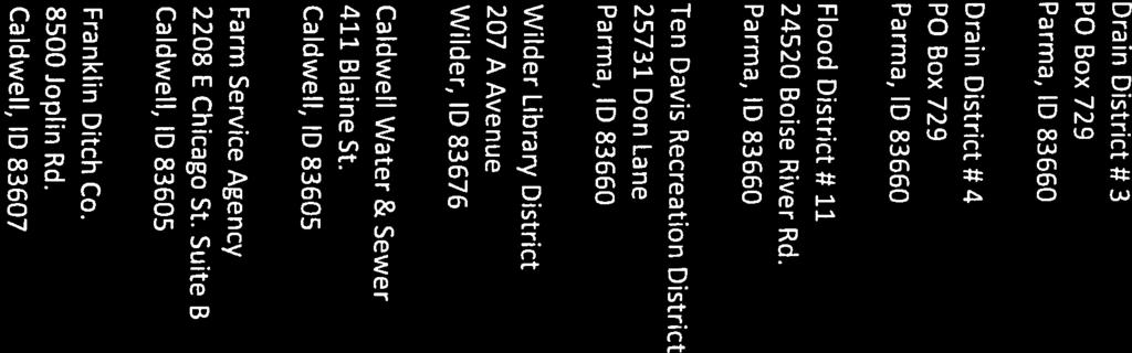
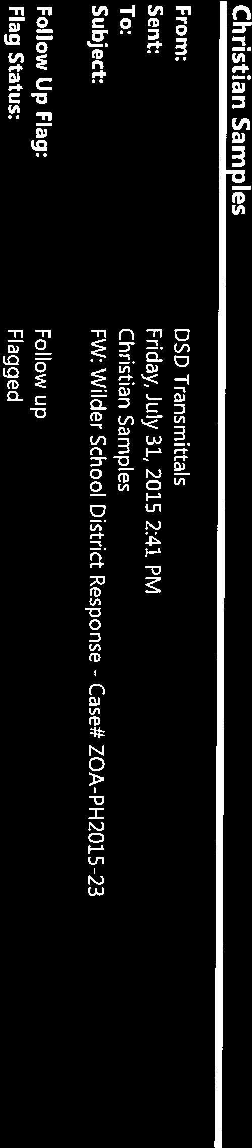
13 Comments Public Comments: Comments from the public were not received. Agency Comments: Agency Comments were received from the Nampa Highway District (exhibit 7), the Canyon Highway District (exhibit 8), the Idaho Transportation Department (exhibit 9), the Ten Davis Recreation District (exhibit 10), the Wilder School District (exhibit 11), and the Idaho Department of Environmental Quality (exhibit 12). Recommendation Staff recommends the Planning and Zoning Commission, upon review of proposed ZOA-PH Zoning Ordinance Text Amendments, and in consideration of testimony provided at the public hearing, recommend that the Board of County Commissioners approve the proposed zoning ordinance amendment.
14 Planning and Zoning Commission Amendment of Zoning Ordinance Development Services Department September 3, 2015 Findings of Fact, Conclusions of Law, and Order Amendment of the Zoning Ordinance Findings of Fact and Conclusion of Law 1. The public hearing shall be conducted in accordance with CCZO Articles 5 and 6, and Idaho Code and The request is not subject to the regulatory taking analysis provided for by section There is no evidence that would demonstrate that the requested amendments are contrary to the Comprehensive Plan or would result in demonstrable adverse impacts upon the delivery of services by any political subdivision providing public services, including school districts, within the planning jurisdiction. 4. In accordance with Code (4)(A), the Commission shall consider the Comprehensive Plan and other evidence gathered through the public hearing process. Order Based upon the Findings of Fact, Conclusions of Law contained herein, the Planning and Zoning Commission recommends approval of case ZOA-PH to the Board of County Commissioners. APPROVED this day of, PLANNING AND ZONING COMMISSION CANYON COUNTY, IDAHO David Scheurer, Chairman State of Idaho ) SS County of ) On this day of, in the year 2015, before me Stephanie Hailey, a notary public, personally appeared David Scheurer, personally known to me to be the person whose name is subscribed to the within instrument, and acknowledged to me that he(she) executed the same. Notary: ZOA-PH My Commission Expires: Exhibit 1: FCOs Page 1 of 1
15 ORDINANCE NO. 15- AN ORDINANCE AMENDING CANYON COUNTY CODE, CHAPTER 7, SECTION TO MODIFY THE DEFINITION OF RIGHT-OF-WAY AND ROAD, AMENDING SECTION TO UPDATE THE REFERENCE TO ROAD IMPROVEMENTS AND MINOR WORDING CHANGES, AMENDING SECTION TO UPDATE THE REFERENCE TO ROAD IMPROVEMENTS AND CORRECT PUNCTUATION, AMENDING SECTION PRIVATE ROAD AND DRIVEWAY REQUIREMENTS TO UPDATE THE STANDARDS FOR A MAINTENANCE AGREEMENT AND PROVIDE DESIGN AND CONSTRUCTION STANDARDS FOR DRIVEWAYS SERVING TWO PROPERTIES AND PRIVATE ROADS, AMENDING SECTION TO UPDATE THE REFERENCE TO PUBLIC STREETS AND PRIVATE ROADS, AMENDING SECTIONS , AND TO UPDATE THE REFERENCE TO PUBLIC STREETS AND CLARIFY THE DESCRIPTION OF SETBACK MEASUREMENTS, AND AMENDING SECTION TO PROVIDE STANDARDS FOR PRIVATE ROAD AND PUBLIC STREET IMPROVEMENTS WHEN PLATTING. BE IT ORDAINED BY THE BOARD OF COMMISSIONERS OF CANYON COUNTY, IDAHO, THAT CANYON COUNTY CODE, CHAPTER 7, BE AMENDED AS FOLLOWS: : DEFINITIONS ENUMERATED: DRIVEWAY: Vehicular access to one or two (2) inhabited buildings. PRIVATE ROAD: A road serving more than two (2) permanent dwellings or inhabited buildings, which is privately maintained, and not accepted for maintenance by the local highway district having jurisdiction. PUBLIC RIGHT OF WAY: Any land dedicated to the public and under the jurisdiction of a public highway agency. A public right of way can be open or closed to public travel and, where the public highway agency the highway district has no obligation to construct or maintain said right of way for vehicular traffic. ROADPUBLIC STREET: All roads, streets, alleys, or bridges open to public use and maintained by a highway district. ROAD LOT: A private road that provides access to more than two (2) lots within a subdivision : ZONING AMENDMENT CRITERIA: (1) The commission shall review the particular facts and circumstances of each proposed zoning amendment and make a recommendation regarding the same to the board. The presiding party shall make its review in terms of the following standards and shall find adequate evidence regarding the following criteria when evaluating the proposed zoning district boundary amendment: A. Is the proposed zone change generally consistent with the comprehensive plan; B. When considering the surrounding land uses, is the proposed zone change more appropriate than the current zoning designation; 1 ZOA-PH Exhibit 2: Draft Ordinance Page 1 of 11
16 C. Is the proposed conditional rezone compatible with surrounding land uses; D. Will the proposed use negatively affect the character of the area? What measures will be implemented to mitigate impacts? E. Will adequate facilities and services including sewer, water, drainage, irrigation and utilities be provided to accommodate the proposed use; F. Does legal access to the subject property for the development exist or will it exist at the time of development; G. Does the proposed development require road public street improvements in order to provide adequate access to and from the subject property to minimize undue interference with existing or future traffic patterns created by the proposed development? What measures have been taken to mitigate road improvements or traffic impacts; and H. Will the proposed zone change amendment impact essential public services and facilities, such as schools, police, fire and emergency medical services? What measures will be implemented to mitigate impacts? : CONDITIONAL REZONE (6) Conditional Rezone Approval: A. Standards Of Evaluation: The presiding party shall review the particular facts and circumstances of the proposed conditional rezone. The presiding party shall apply the following standards when evaluating the proposed conditional rezone: 1. Is the proposed conditional rezone generally consistent with the comprehensive plan; 2. When considering the surrounding land uses, is the proposed conditional rezone more appropriate than the current zoning designation; 3. Is the proposed conditional rezone compatible with surrounding land uses; 4. Will the proposed use negatively affect the character of the area? What measures will be implemented to mitigate impacts? 5. Will adequate facilities and services including sewer, water, drainage, irrigation and utilities be provided to accommodate proposed use; 6. Does the proposed development require road public street improvements in order to provide adequate access to and from the subject property to minimize undue interference with existing or future traffic patterns.? What measures have been taken to mitigate traffic impacts?; 7. Does legal access to the subject property for the development exist or will it exist at time of development; and 2 ZOA-PH Exhibit 2: Draft Ordinance Page 2 of 11
17 8. Will the proposed conditional rezone amendment impact essential public services and facilities, such as schools, police, fire and emergency medical services? What measures will be implemented to mitigate impacts? : PRIVATE ROAD AND DRIVEWAY REQUIREMENTS: (1) Frontage, Easement, Or Road Lot Required: For the purpose of providing adequate access for equipment, emergency vehicles and other services to inhabited buildings, each parcel must demonstrate access by one of the following prior to the issuance of a certificate of zoning compliance: A. Frontage: A minimum property frontage of sixty feet (60') is required along the right of way of a public road for the purpose of ingress/egress. The frontage width requirement may be reduced to a width not less than fifty feet (50') in accordance with subsection (1)(D). as determined by the director, upon consideration of the following criteria: 1. Will the proposed frontage reduction provide adequate access; 2. Do physical characteristics of the site require a reduction in the frontage width; and 3. Would approval of the request cause injury, damage or a safety hazard? B. Driveway or Private Road Application, Easement and Maintenance Agreement: 1. Applications for driveways serving two properties and all private roads shall be filed with DSD. 2. Driveways serving two properties and all private roads shall be located within Aa recorded permanent, perpetual easement, having a minimum width of sixty feet (60'), is required from the right of way of a publicly maintained road street to the property for the purpose of ingress/egress. The easement width requirement may be reduced to a width not less than twenty eight feet (28') in accordance with subsection (1)(D)., as determined by the director, upon consideration of the following criteria: A. Will the proposed easement reduction provide adequate access; B. Do physical characteristics of the site require a reduction in the easement width; and C. Would approval of the request cause injury, damage or a safety hazard? 3. Driveways serving two properties and all private roads shall have a recorded road users maintenance agreement that describes the responsible party(ies) for construction and maintenance, including repairs, and necessary improvements to accommodate additional accesses in the future. Failure to maintain a previously approved driveway or private road shall be a violation of this article subject to the enforcement procedures in section of this article. 4. All properties taking access to a private road shall be in compliance with the addressing standards in Chapter 6, Article 5. 3 ZOA-PH Exhibit 2: Draft Ordinance Page 3 of 11
18 5. The director shall approve the location for driveways serving two residences and all private roads. C. Private Road on Subdivision Plat Lot: A private road shall be shown as a separate, non-buildable lot in accordance with the requirements of of this chapter. A minimum road lot width of sixty feet (60') is required. The road lot width requirement may be reduced to a width not less than fifty feet (50'), as determined by the director, upon consideration of the following criteria: 1. Will the proposed road lot reduction provide adequate access; 2. Do physical characteristics of the site require a reduction in the road lot width; and 3. Would approval of the request cause injury, damage or a safety hazard? D. Width Reduction: The width of a parcel s road frontage, easement or private road may be reduced by the director if the reduction demonstrates all of the following: 1. Will the proposed reduction provide adequate access; 2. Do physical characteristics of the site require a width reduction; and 3. Would approval of the request cause injury, damage, or a safety hazard? (2) Fire District Road Requirements: If the most distant portion of an inhabited building is located farther than one hundred fifty feet (150') from a public or approved private road, the driveway or private road shall have an approved turnaround from the local fire district having jurisdiction. The construction of driveways or private roads longer that 150 from the public street right-of-way line to the most distant portion of an inhabited building must be approved in writing from the applicable fire district. (3) Driveway And Private Road Requirements: A. Driveway and Private Road Design and Construction Standards: 4 ZOA-PH Exhibit 2: Draft Ordinance Page 4 of 11
19 1. Driveways and Private Roads shall be built to the following standards: New Private Roads built after 1/19/05 and existing private roads that adds new accesses such that the road has 5 or more residences Existing private roads built before 1/19/05 that add residences, but platting is not required Existing driveways built before 1/19/05 that add residences New driveways built after 1/19/05 Subbase or Ballast Base Course Plant mix pavement (ISPWC class III mix) 9 inches of minus 6 inch uncrushed aggregate (pit run) N/A N/A 9 inches of minus 6 inch uncrushed aggregate (pit run) for driveways longer than 150 feet in length; otherwise N/A 6 inches of ¾ inch crushed aggregate (gravel) 6 inch thick ¾ minus gravel base and leveling course, graded and compacted 6 inch thick ¾ minus gravel base and leveling course, graded and compacted 6 inch thick ¾ minus gravel base and leveling course, graded and compacted 2.5 inches thick for local roads serving 40 or less single family residences and 3 inches for all other uses N/A N/A N/A Surface Width 24 feet for local roads serving 40 or less single family residences and 26 feet for collector roads 20 foot wide all weather driving surface 12 foot wide all weather driving surface 12 foot wide all weather driving surface 1. Shall be constructed or improved according to the following minimum standards: (A) Six inch (6") thick three-fourths inch ( 3 / 4") minus gravel base and leveling course; (B) Graded and compacted; and (C) Twelve foot (12') wide all weather driving surface. 2. A driveway serving two (2) permanent residences shall have a recorded perpetual easement for access to both residences and a permanent and recorded road user's maintenance agreement. 5 ZOA-PH Exhibit 2: Draft Ordinance Page 5 of 11
20 2. The construction of driveways longer that 150 from the public street right-of-way line to the most distant portion of an inhabited building must be approved in writing from the applicable fire district. B. Private Road Design and Construction Standards: 1. A private road must have a recorded, permanent, perpetual easement and permanent Road Users Association or maintenance agreement. 12. Any new private road constructed after January 19, 2005, or existing private road that adds additional residencesshall be constructed according to the following minimum standards and shall be inspected and certified by engineer: Subbase or ballast Base course Plant mix pavement (ISPWC class III mix) Pavement width 9 inches of minus 6 inch uncrushed aggregate (pit run) 6 inches of 3 / 4 inch crushed aggregate (gravel) 2.5 inches thick for local roads serving 40 or less single-family residences and 3 inches for all other uses 24 feet for local roads serving 40 or less single-family residences and 26 feet for collector roads 32. Any existing private road or driveway constructed before January 19, 2005, that adds additional residences, but does not require platting, shall be improved according to the following minimum standards: Base course Surface width 6 inch thick 3 / 4 minus gravel base and leveling course, graded and compacted 20 foot wide all weather driving 2. Any private road shall be named and a sign conforming to the applicable highway district standards shall be erected and maintained at the property owners' expense. The road must have a road name approved by the director. The naming of roads shall comply with chapter 6, article 5 of this code. Verification of installation of road signs shall be provided to DSD. CB. Inspection And Certification: A driveway or private road must be constructed prior to final inspection of an inhabited building. The construction of driveways longer than 150 from a public street right-of-way to the most distant portion of an inhabited building and Pprivate roads construction mustshall be inspected and certified by the applicant's engineer prior to obtaining a certificate of occupancy. DC. Bridges: Bridges shall be inspected and certified by an engineer of the developer's choice, to have been constructed in compliance with all applicable federal, state, and local laws. DE. Cul-De-Sacs: Cul-de-sacs shall have a fifty foot (50') radius for a driving surface and a seventy foot (70') radius for right of way or easement. 6 ZOA-PH Exhibit 2: Draft Ordinance Page 6 of 11
21 : PUBLIC STREET RIGHT OF WAY WIDTHS: Public street right of way widths shall be determined and approved by the governing highway district or agency : SETBACKS; MINIMUM PARCEL OR LOT SIZE; HEIGHT REGULATIONS: 1. Front Yard: Unless the provisions of (1)A.4 apply, Ffront setbacks shall be measured from the greatest of either the front property line, public street right of way line, or private road easement line of any minor arterial or collector or local or private street. Long established setbacks are permissible: (A) When the alignment of existing buildings is matched on two (2) or more parcels, with at least one contiguous parcel; and (B) When not a corner parcel; and (C) When in a platted subdivision. 2. Rear Yard: Rear setbacks shall apply except that long established existing setbacks are permissible: (A) When the alignment of existing buildings is matched on two (2) or more parcels, with at least one contiguous parcel; and (B) When in a platted subdivision. 3. Corner Parcel: Front yard setback requirements are applicable on both street sidesfrom property lines along a public street and/or private road of a corner parcel with no exceptions made for long established setbacks. 4. Principal Arterial And Major Collector Preservation: (A) No building or structure shall be erected nearer than fifty feet (50') from the centerline of any major collector shown on the functional classification map unless the highway district having jurisdiction waives such setback. (B) No building or structure shall be erected nearer than seventy feet (70') from the centerline of any principal arterial shown on the functional classification map unless the highway district having jurisdiction waives such setback. 5. Front And Corner Yard: Front and corner setbacks shall be measured from the greatest of either the property line, public street right of way line, or private road easement line of any local or private street. B. Commercial And Industrial Zones: 1. Parcel Adjacent To Parcel In Unlike Zone: Setbacks on all lot lines adjacent to a parcel of any other zoning classification shall be determined by the sum of the setbacks where the zones abut, divided by two (2), when not located on section or quarter section line. 7 ZOA-PH Exhibit 2: Draft Ordinance Page 7 of 11
22 2. Parcel Adjacent On All Boundaries To Other Parcels In Like Zone: If a parcel is adjacent on all boundaries to other parcels within the same zoning classification, then there are no side or rear setback requirements. Notwithstanding the foregoing, no building or structure shall be erected nearer than twenty feet (20') from the front property line, and any public street right of way line, or private road easement line of any street, except that long established setbacks are permissible: (A) When the alignment of existing buildings is matched on two (2) or more parcels, with at least one contiguous parcel; and (B) When not a corner parcel; and (C) When in a platted subdivision : LAND USE REGULATIONS (MATRIX): for establishment : LAND USE REGULATIONS (MATRIX): ZONING AND LAND USE MATRIX Zoning Classification Private Roads and Driveways Serving Two Properties A R-R R-1 R-2 C-1 C-2 M-1 M-2 D D D D D D : JURISDICTION: These regulations shall apply to the subdividing of all land within the unincorporated parts of the county and shall include the following: (1) The subdivision of land into more than four (4) lots, parcels or tracts since September 6, 1979, for transfer of ownership or development. (2) Any change to a recorded plat. (3) The following are exceptions to the subdivision requirements of this article: A. A parcel, resulting from the subdivision of land, that is used exclusively for agricultural purposes (on which there is no permanent dwelling) and is described on the deed, whether including or excluding a public right of way, and consists of one-fourth ( 1 / 4) of one-fourth ( 1 / 4) of a section of land or forty (40) or more acres. 8 ZOA-PH Exhibit 2: Draft Ordinance Page 8 of 11
23 B. An allocation of land in the settlement of an estate or a court decree for the distribution of property thereunder with the limitation that the land may not be divided into more than four (4) parcels with a minimum size per parcel to be five (5) acres. C. The unwilling sale of land as a result of legal condemnation as defined and allowed in the Idaho Code and when the dedication of a right of way for public purposes is initiated by a public body. D. Simple changes to a recorded plat in accordance with section of this article. E. A lot or parcel created for the exclusive use of a public or private school, other political subdivisions, or public or private utility facilities. F. Land that is divided into fewer than five (5) parcels from the original parcel and all of the following have been provided to DSD: 1. An approved irrigation plan, if applicable; 2. Proof that any required conditions of county approvals are met; 3. A record of survey, with metes and bounds descriptions of all lots, that shows access from each parcel lot to a publicly maintained road either from frontage on the publicly maintained road or by instrument number of a recorded ingress/egress easement complies with the requirements of of this article, and that includes all required utility easements; 4. Proof that the land does not contain slopes greater than fifteen percent (15%); and 5. Written approval of a site plan from the fire, highway and health districts having jurisdiction : SIMPLE CHANGES TO RECORDED PLAT: This chapter establishes the procedure and requirements for making simple changes to a recorded plat when not involving a vacation or dedication of a public roadstreet right of way or private road easement : MINOR REPLATS AND AMENDMENTS: This section establishes the procedure and requirements for making minor modifications to a previously recorded subdivision plat or portion of a plat, when the modification cannot be accomplished as a simple change to a recorded plat in accordance with section of this article. A minor correction on a final plat or an amendment that does not create a new lot or alter the character or purpose of a subdivision, may be made by application to the director who shall determine the validity of the requested correction and record, at the applicant's expense, any approved change. A new mylar and signature page reflecting the correction or amendment shall be required. Minor modifications include insignificant changes in wording, corrections, adjustments between platted and unplatted parcels, consolidations and lot line adjustments for up to five (5) lots where easements not utilized are adjusted with the lot line. Substantial changes to a recorded plat must comply with the requirements of section of this article, and may not be accomplished through the provisions of this section. Substantial changes include those that would affect the location of public streets or private roads, septic systems, building envelopes, no build 9 ZOA-PH Exhibit 2: Draft Ordinance Page 9 of 11
24 envelopes, easements or utilities that are currently utilized; adjustments that would create additional lots; adjustments that would affect more than five (5) lots; or significant changes in plat language that might affect a property owner's use of their land, or of commonly held land or easements : REQUIRED IMPROVEMENTS: (1) Road Improvements: A. Private roads: 1. Private roads must be a numbered lot and constructed in accordance with section of this chapter. 2. A minimum private road lot width of sixty feet (60') is required. This requirement may be reduced to a width not less than fifty feet (50'), in accordance with subsection (1)(D). 3. Curbs and gutters, if required by the Board, may be either rolled or vertical style and must be a minimum width of two feet (2'). Sidewalks must be a minimum width of four feet (4'). Both curb and gutter shall be constructed using three-fourths inch ( 3 / 4") aggregate in the concrete mix. B. Public Streets: (1) Public streets, including curbs, gutters and sidewalks, shall be constructed in accordance with the requirements of the applicable highway district or, if within an area of city impact, the requirements adopted by in Chapter 9 of the Code. (2) Subdivision Improvements: The commission or hearing examiner may recommend and the board may require improvements in the subdivision, for example curbs, gutters, sidewalks, streetlights, ribbon curbing, swales, and stormwater retention and disposal. (3) Road Names: Road name signs and traffic control signs shall be installed by the developer in appropriate locations such as where roads and streets intersect and are approved by the local highway district having jurisdiction. (4) Curb, Gutters And Sidewalk Improvements (If Required): Curbs and gutters may be either rolled or vertical style. They must be a minimum width of two feet (2'). Sidewalks must be a minimum width of four feet (4'). Both curb and gutter shall be constructed using three-fourths inch ( 3 / 4") aggregate in the concrete mix. (54) Other Improvements: All other improvements required as conditions of approval shall be completed. 10 ZOA-PH Exhibit 2: Draft Ordinance Page 10 of 11
25 ADOPTED this day of, 20. Board of Commissioners By: Steven J. Rule, Commissioner By: Craig L. Hanson, Commissioner By: Tom Dale, Commissioner ATTEST: Chris Yamamoto, Clerk PUBLISHED: O:\PLANNING\Ordinances\2015\DraftZOARoadStds.doc 11 ZOA-PH Exhibit 2: Draft Ordinance Page 11 of 11


26 ZOA-PH Exhibit 3: Agency Notification Page 1 of 4
27 ZOA-PH Exhibit 3: Agency Notification Page 2 of 4
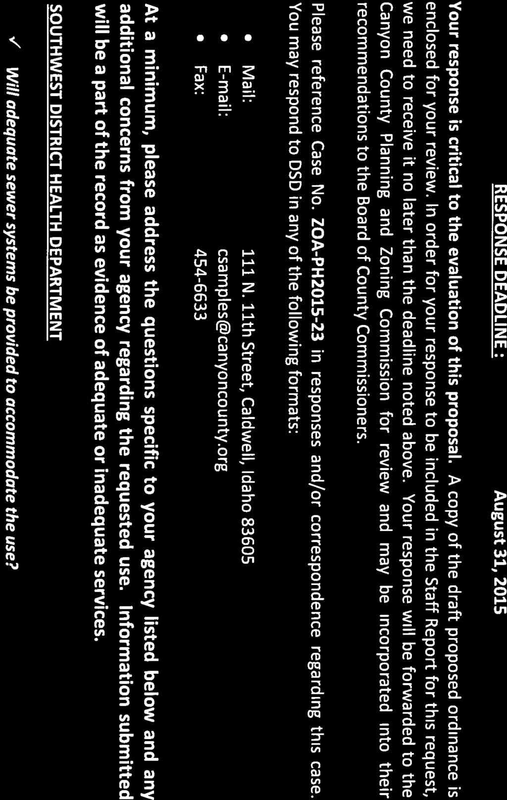
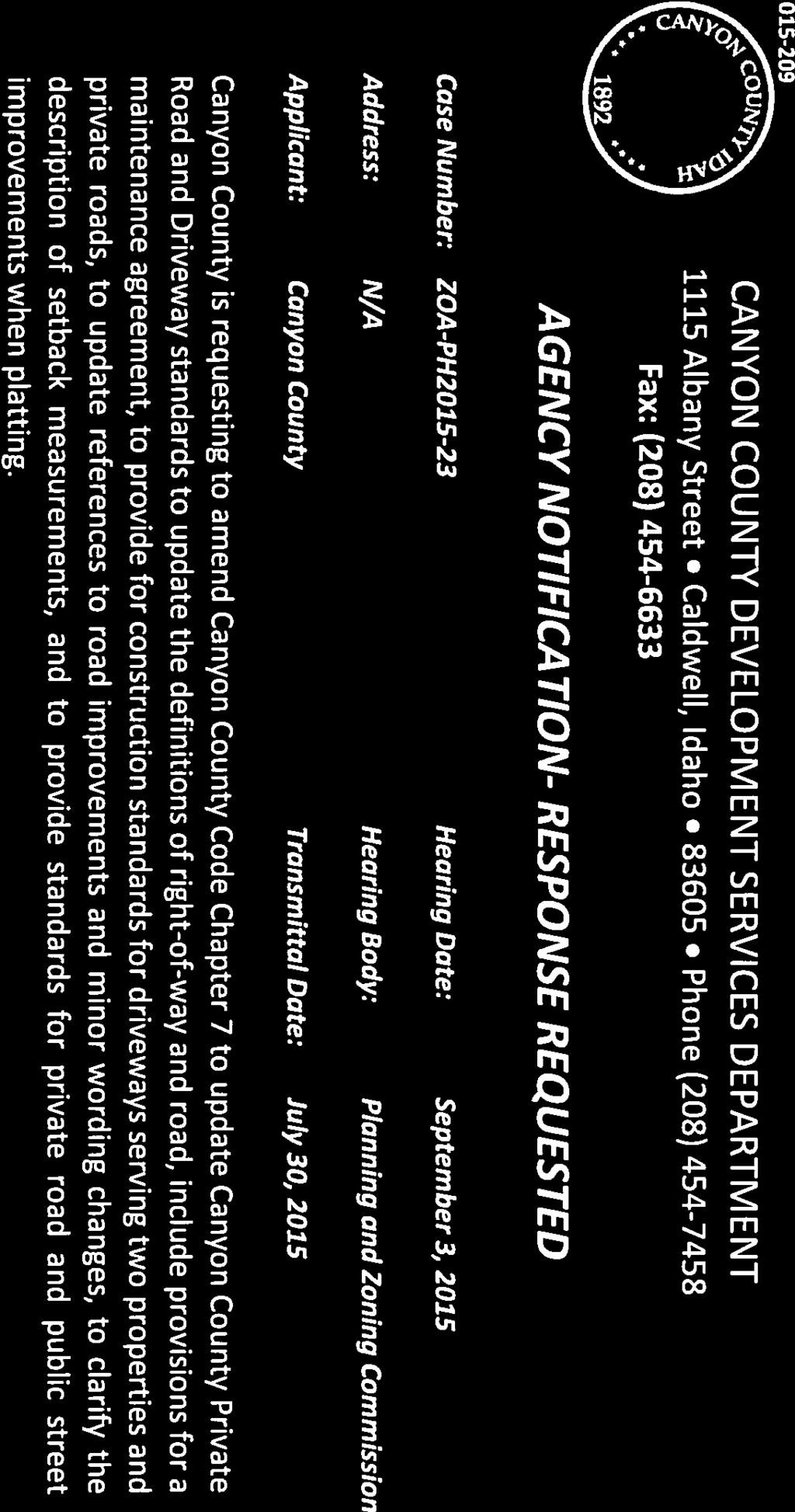

28 ZOA-PH Exhibit 3: Agency Notification Page 3 of 4


29 ZOA-PH Exhibit 3: Agency Notification Page 4 of 4


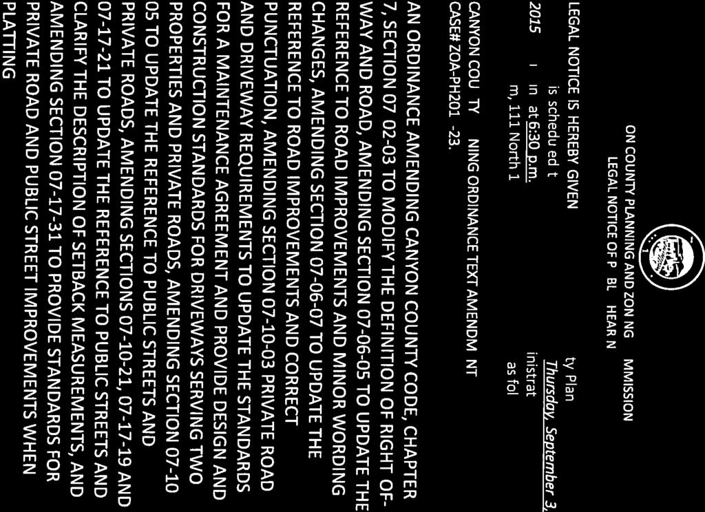
30 ZOA-PH Exhibit 4: Legal Notice Page 1 of 2


31 ZOA-PH Exhibit 4: Legal Notice Page 2 of 2

32 ZOA-PH Exhibit 5: Public Service Announcement Page 1 of 1
33 ZOA-PH Exhibit 6: City of Greenleaf JEPA Waiver Page 1 of 1


34 ZOA-PH Exhibit 7: Nampa Highway District Comments Page 1 of 1


35 ZOA-PH Exhibit 8: Canyon Highway District Comments Page 1 of 2

36 ZOA-PH Exhibit 8: Canyon Highway District Comments Page 2 of 2


37 ZOA-PH Exhibit 9: ITD Comments Page 1 of 1

38 ZOA-PH Exhibit 10: Ten Davis Recreation District Comments Page 1 of 1

39 ZOA-PH Exhibit 11: Wilder School District Comments Page 1 of 1

40 STATE OF IDAHO DEPARTMENT OF ENVIRONMENTAL QUALITY BOISE REGIONAL OFFICE 1445 North Orchard Street Boise, ID (208) DEQ Response to Request for Environmental Comment Date: 08/27/2015 Agency Requesting Comments: Development Services Department Date Request Received: 07/30/2015 Applicant/Description: County Code Chapter 7 Amendments Private Road and Driveway Standards Thank you for the opportunity to respond to your request for comment. While DEQ does not review projects on a project-specific basis, we attempt to provide the best review of the information provided. DEQ encourages agencies to review and utilize the Idaho Environmental Guide to assist in addressing project-specific conditions that may apply. This guide can be found at The following information does not cover every aspect of this project; however, we have the following general comments to use as appropriate: 1. Air Quality Please review IDAPA for all rules on Air Quality, especially those regarding fugitive dust ( ), trade waste burning ( ), and odor control plans ( ). For questions, contact David Luft, Air Quality Manager, at IDAPA requires an owner or operator of a facility to obtain an air quality permit to construct prior to the commencement of construction or modification of any facility that will be a source of air pollution in quantities above established levels. DEQ asks that cities and counties require a proposed facility to contact DEQ for an applicability determination on their proposal to ensure they remain in compliance with the rules. For questions, contact the DEQ Air Quality Permitting Hotline at Wastewater and Recycled Water DEQ recommends verifying that there is adequate sewer to serve this project prior to approval. Please contact the sewer provider for a capacity statement, declining balance report, and willingness to serve this project. IDAPA and IDAPA are the sections of Idaho rules regarding wastewater and recycled water. Please review these rules to determine whether this or future projects will require DEQ approval. IDAPA is the section of Idaho rules regarding subsurface disposal of wastewater. Please review this rule to determine whether this or future projects will require permitting by the district health department. ZOA-PH Exhibit 12: IDEQ Comments Page 1 of 4
AAAA. Planning and Zoning Staff Report Lake Shore Land Holdings, LLC CU-PH Analysis
 AAAA Planning and Zoning Staff Report Lake Shore Land Holdings, LLC CU-PH2016-28 Hearing Date: April 21, 2016 Development Services Department Applicant: BRS Architects/Cindy Huebert Staff: Kyle McCormick,
Ricker - PH / Planning and Zoning Commission Staff Report
 / Planning and Zoning Commission Staff Report Ricker - PH2018-20 Hearing Date: April 19, 2018 Development Services Department Applicant: Don Ricker Staff: Dan Lister, Planner II dlister@canyonco.org Tax
Planning and Zoning Staff Report Pestcom Pest Management LLC CU-PH
 AAAA Planning and Zoning Staff Report Pestcom Pest Management LLC CU-PH2016-49 Hearing Date: October 6, 2016 Development Services Department Applicant: Charles F. Cooley Sr. Pestcom Pest Management LLC
Bethel Romanian Church - Rezone, RZ
 / Planning and Zoning Staff Report Bethel Romanian Church - Rezone, RZ2018-0023 Hearing Date: November 15, 2018 Development Services Department Owners: Bethel Romanian Church, Corp. Applicant: Viorel Botos
ARTICLE IV: DEVELOPMENT STANDARDS
 ARTICLE IV: DEVELOPMENT STANDARDS IV-53 409 PRIVATE STREETS A private street means any way that provides ingress to, or egress from, property by means of vehicles or other means, or that provides travel
/ Planning and Zoning Commission Staff Report Jay Walker- All Terra Consulting - RZ
 / Planning and Zoning Commission Staff Report Jay Walker- All Terra Consulting - Hearing Date: January 17, 2019 Development Services Department Applicant: Jay Walker All Terra Consulting Staff: Jennifer
Tracie & Dennis Jones Rezone, RZ
 / Planning and Zoning Staff Report Tracie & Dennis Jones Rezone, RZ2018-0014 Applicant: Tracie & Dennis Jones Staff: Deb Root, 454-7340 droot@canyonco.org Tax ID: R37886012 Current Zone: A (Agricultural)
Mike & Sherry Dudley Rezone, RZ
 / Planning and Zoning Staff Report Mike & Sherry Dudley Rezone, RZ2019-0005 Hearing Date: April 18, 2019 Development Services Department Applicant: Mike & Sherry Dudley Staff: Deb Root, 454-7340 droot@canyonco.org
SUBDIVISION DESIGN PRINCIPLES AND STANDARDS
 SECTION 15-200 SUBDIVISION DESIGN PRINCIPLES AND STANDARDS 15-201 STREET DESIGN PRINCIPLES 15-201.01 Streets shall generally conform to the collector and major street plan adopted by the Planning Commission
ARTICLE 24 PRIVATE ROAD, SHARED PRIVATE DRIVEWAY AND ACCESS EASEMENT STANDARDS
 ARTICLE 24 PRIVATE ROAD, SHARED PRIVATE DRIVEWAY AND ACCESS EASEMENT STANDARDS SECTION 24.00 INTENT AND PURPOSE The standards of this Article provide for the design, construction and maintenance of private
ORDINANCE NO. 41. PRIVATE ROAD ORDINANCE As Amended Through April 10, 2008
 ORDINANCE NO. 41 PRIVATE ROAD ORDINANCE As Amended Through April 10, 2008 An Ordinance to protect the health, safety, and general welfare of the inhabitants of Port Sheldon Township. The Township of Port
VERGENNES TOWNSHIP, KENT COUNTY, MICHIGAN ORDINANCE AMENDMENT Ordinance Adopted May 17, 2004
 VERGENNES TOWNSHIP, KENT COUNTY, MICHIGAN ORDINANCE AMENDMENT Ordinance 2004-8 Adopted May 17, 2004 Private Road Ordinance Amendments An ordinance to amend portions of Section 202.000 Private Roads. The
Planning and Zoning Commission Staff Report Shannan & Latrica Mays -Conditional Use Permit - CU
 Planning and Zoning Commission Staff Report Shannan & Latrica Mays -Conditional Use Permit - Hearing Date: January 17, 2019 Development Services Department Applicant: Shannan & Latrica Mays Staff: Jennifer
KASSON TOWNSHIP PRIVATE ACCESS ROAD ORDINANCE ORDINANCE NO (EFFECTIVE: MAY 12, 2007)
") KASSON TOWNSHIP PRIVATE ACCESS ROAD ORDINANCE ORDINANCE NO. 2007-01 (EFFECTIVE: MAY 12, 2007) An ordinance providing for the standards and specifications incident to the development of Private Motor Vehicle
KASSON TOWNSHIP PRIVATE ACCESS ROAD ORDINANCE ORDINANCE NO. 2007-01 (EFFECTIVE: MAY 12, 2007) An ordinance providing for the standards and specifications incident to the development of Private Motor Vehicle
Radford Ridges Subdivision, SD-PH
 / Planning and Zoning Staff Report Radford Ridges Subdivision, SD-PH2017-22 Hearing Date: August 3, 2017 Development Services Department Applicant: James Radford Representative: TJ Wellard Skinner Land
Planning and Zoning Staff Report Vallivue School District - PH
 Hearing Date: April 19, 2018 Planning and Zoning Staff Report - PH2018-16 Development Services Department Applicant: Nate Bondelid Owner: Staff: Dan Lister, Planner II (208) 455-5959 dlister@canyonco.org
610 LAND DIVISIONS AND PROPERTY LINE ADJUSTMENTS OUTSIDE A UGB
 ARTICLE VI: LAND DIVISIONS AND PROPERTY LINE ADJUSTMENTS VI-21 610 LAND DIVISIONS AND PROPERTY LINE ADJUSTMENTS OUTSIDE A UGB 610-1 Property Line Adjustments (Property Line Relocation) A property line
UNION COUNTY 5/17/01 Technical Design Standards Revised: 12/10/07 APPENDIX B Common Access Drive (CAD) Regulations
 Regulations") UNION COUNTY 5/17/01 Technical Design Standards Revised: 12/10/07 APPENDIX B Common Access Drive (CAD) Regulations Definition. A Common Access Drive (CAD) is a privately constructed, privately owned and
UNION COUNTY 5/17/01 Technical Design Standards Revised: 12/10/07 APPENDIX B Common Access Drive (CAD) Regulations Definition. A Common Access Drive (CAD) is a privately constructed, privately owned and
a. provide for the continuation of collector streets and thoroughfare streets between adjacent subdivisions;
 Section 7.07. Intent The requirements of this Section are intended to provide for the orderly growth of the Town of Holly Springs and its extra-territorial jurisdiction by establishing guidelines for:
Chapter Plat Design (LMC)
") Chapter 18.14 Plat Design (LMC) Sections: 18.14.010 Lot width 18.14.020 Right-of-way requirements 18.14.030 Pipe stem lots 18.14.040 Division resulting in minimum lot sizes 18.14.050 Flood prone and bad
Chapter 18.14 Plat Design (LMC) Sections: 18.14.010 Lot width 18.14.020 Right-of-way requirements 18.14.030 Pipe stem lots 18.14.040 Division resulting in minimum lot sizes 18.14.050 Flood prone and bad
FINAL PLAT. Community Development Department 8101 Ralston Road Arvada, Colorado 80002
 FINAL PLAT Community Development Department 8101 Ralston Road Arvada, Colorado 80002 September 2015 FINAL SUBDIVISION PLAT Final Subdivision Plat Review Applications for a Final Plat shall be submitted
CHAPTER 91. SUBDIVISIONS, PARTITIONS, and PROPERTY LINE ADJUSTMENTS (Short Title; Definitions)
") CHAPTER 91 SUBDIVISIONS, PARTITIONS, and PROPERTY LINE ADJUSTMENTS (Short Title; Definitions) 91.110. Short Title 91.120. Purpose 91.150 Definitions 91.200 Procedures for Subdivisions and Partitions 91.210
CHAPTER 91 SUBDIVISIONS, PARTITIONS, and PROPERTY LINE ADJUSTMENTS (Short Title; Definitions) 91.110. Short Title 91.120. Purpose 91.150 Definitions 91.200 Procedures for Subdivisions and Partitions 91.210
BEAR CREEK TOWNSHIP EMMET COUNTY, MICHIGAN. PRIVATE ROAD ORDINANCE Ordinance No. 11A-99. (to replace prior Private Road Ordinance No.
 BEAR CREEK TOWNSHIP EMMET COUNTY, MICHIGAN PRIVATE ROAD ORDINANCE Ordinance No. 11A-99 (to replace prior Private Road Ordinance No. 11-99) An Ordinance to protect the health, safety, and general welfare
Planning and Zoning Staff Report JT Ventures, LLC Staging Area, CU-PH
 Planning and Zoning Staff Report JT Ventures, LLC Staging Area, CU-PH2016-60 Hearing Date: December 15, 2016 Development Services Department Applicant: JT Ventures, LLC Jason Stewart and Tony Brown Staff:
13-2 SUBDIVISION PLANS AND PLATS REQUIRED EXCEPTIONS Subdivision Plats Required To be Recorded
 ARTICLE XIII SUBDIVISIONS 13-1 INTENT AND PURPOSE 13-1-1 Intent: It is the intent of the County Commission through the adoption of this Article to more fully avail itself of the power granted under 17-27-601
MINOR SUBDIVISION PLAT
 MINOR SUBDIVISION PLAT Community Development Department 8101 Ralston Road Arvada, Colorado 80002 September 2015 MINOR SUBDIVISION PLAT Subdivisions consisting of five (5) or fewer lots are eligible for
SECTION 7000 LAND DEVELOPMENT REQUIREMENTS
 SECTION 7000 LAND DEVELOPMENT REQUIREMENTS 7000 LAND DEVELOPMENT REQUIREMENTS... 1 7001 LEGISLATIVE AUTHORITY... 1 7001.1 LAND DEVELOPMENT... 1 7001.1.1 Title 40, Idaho Code... 1 7001.1.2 Idaho Code 40-1415
THE COUNTY BOARD OF SUPERVISORS OF THE COUNTY OF DOUGLAS DOES ORDAIN AS FOLLOWS:
 8.1 SUBDIVISION CONTROL ORDINANCE THE COUNTY BOARD OF SUPERVISORS OF THE COUNTY OF DOUGLAS DOES ORDAIN AS FOLLOWS: SECTION I. GENERAL INTERPRETATION This ordinance shall not repeal, impair or modify private
MINOR SUBDIVISION PLAT
 MINOR SUBDIVISION PLAT Community Development Department 8101 Ralston Road Arvada, Colorado 80002 MINOR SUBDIVISION PLAT Subdivisions consisting of five (5) or fewer lots are eligible for the minor subdivision
ARTICLE 15 - PLANNED UNIT DEVELOPMENT
 Section 15.1 - Intent. ARTICLE 15 - PLANNED UNIT DEVELOPMENT A PUD, or Planned Unit Development, is not a District per se, but rather a set of standards that may be applied to a development type. The Planned
ARTICLE 15. RULES, REGULATIONS AND DEFINITIONS
 ARTICLE 15. RULES, REGULATIONS AND DEFINITIONS Section 1. Interpretation and Construction: The following rules and regulations regarding interpretation and construction of the Ulysses-Grant County, Kansas,
Planning and Zoning Staff Report Meholchick Juniper Ranch, CU
 Applicant: Stan and Jeanie Meholchick Juniper Ranch Staff: Deb Root droot@canyonco.org Tax ID, Acres: R34083 (10.09 acres) Current Zone: A (Agriculture) Current Use: Rural Residential home site Impact
The purpose of this Chapter is to establish rules, regulations, standards and procedures for approval of subdivisions of land to promote and ensure:
 CHAPTER 7 SUBDIVISION SECTION 7.1 PURPOSE The purpose of this Chapter is to establish rules, regulations, standards and procedures for approval of subdivisions of land to promote and ensure: A. Conformity
Planning and Zoning Staff Report Maverick Towers Van Wassenhove, PH
 Planning and Zoning Staff Report Maverick Towers Van Wassenhove, PH2018-17 Hearing Date: April 19, 2018 Development Services Department Applicant: Maverick Towers - Nadine Bostwick Owner: Paul Van Wassenhove
An Ordinance to provide regulations for private roads and driveways.
 30.0400 PRIVATE ROADS AND DRIVEWAYS TOWNSHIP OF GRAND HAVEN, MICHIGAN ord no. 262 eff. Apr. 27, 1997 An Ordinance to provide regulations for private roads and driveways. 30.0401 Sec. 1 TITLE This Ordinance
Section Preliminary Plat Checklist and Application Forms
 Section 201 - Preliminary Plat Checklist and Application Forms PRELIMINARY SUBDIVISION PLAT REVIEW PROCESS CHART PRELIMINARY SUBDIVISION PLAT APPLICATION PRELIMINARY PLAT REVIEW CHECKLIST CITY OF NAMPA
Final Plat Mapping Requirements
 CURRENT PLANNING DIVISION 410 E. 5 th Street Loveland, CO 80537 970-962-2523 eplan-planning@cityofloveland.org cityofloveland.org/dc Final Plat Mapping Requirements All Final plats shall comply with the
CITY OF EAU CLAIRE, WISCONSIN. SPECIAL ASSESSMENT POLICY (Dated: November 8, 2016)
") CITY OF EAU CLAIRE, WISCONSIN SPECIAL ASSESSMENT POLICY (Dated: November 8, 2016) (Adopted by reference by Ordinance No. 7207 adopted November 8, 2016) PURPOSE The purpose of this Policy is to assure fair
CITY OF EAU CLAIRE, WISCONSIN SPECIAL ASSESSMENT POLICY (Dated: November 8, 2016) (Adopted by reference by Ordinance No. 7207 adopted November 8, 2016) PURPOSE The purpose of this Policy is to assure fair
This Ordinance is adopted under the authority and provisions of the General Statutes of North Carolina, Article 6, Chapter 153A 121.
 Section 74, Regulations Governing Manufactured Home Parks 1. Purpose The purpose of these regulations to be known and cited as the Madison County Manufactured Home Park Ordinance is to regulate and guide
CHAPTER 14: DRIVEWAYS, TOWN HIGHWAYS, AND PRIVATE ROADS
 CHAPTER 14: DRIVEWAYS, TOWN HIGHWAYS, AND PRIVATE ROADS TABLE OF CONTENTS CHAPTER 14: PRIVATE DRIVEWAYS, TOWN HIGHWAYS AND PRIVATE ROADS 14-1 14.0100 AUTHORITY... 14-1 14.0200 TITLE... 14-1 14.0300 REGULATION
Box Elder County Land Use Management & Development Code Article 3: Zoning Districts
 Chapter 3-6 Mobile Homes, Mobile Home Subdivisions, & Recreational Vehicle Parks Box Elder Zoning Ordinance as Adopted October 2007 Sections. 3-6-010. Purpose and Intent. 3-6-020. Conditional Use Permit
SECTION 10.7 R-PUD (RESIDENTIAL PLANNED UNIT DEVELOPMENT) ZONE
 ZONE") Article X Zones 10-20 SECTION 10.7 R-PUD (RESIDENTIAL PLANNED UNIT DEVELOPMENT) ZONE A. PURPOSE AND INTENT: The R-PUD Residential PUD Zone is intended to provide alternative, voluntary zoning procedures
Article X Zones 10-20 SECTION 10.7 R-PUD (RESIDENTIAL PLANNED UNIT DEVELOPMENT) ZONE A. PURPOSE AND INTENT: The R-PUD Residential PUD Zone is intended to provide alternative, voluntary zoning procedures
-MENDOCINO COUNTY PLANNING AND BUILDING SERVICES- DIVISION OF LAND REGULATIONS TITLE 17
 ARTICLE VI -- GENERAL REGULATIONS AND PROVISIONS Sec. 17-50. Sec. 17-51 General Plan. Sec. 17-52 Lot and Block Design and Configuration. Sec. 17-53 Lot Access. Sec. 17-54 Private Roads. Sec. 17-55 Water
Chapter 21 MOBILE HOME PARK REGULATIONS.
 Chapter 21 MOBILE HOME PARK REGULATIONS. Sec. 21.1 SCOPE. For the preservation of the interests of various types of residential developments which should be permitted in every community and for the protection
May 21, ACHD Board of Commissioners Stacey Yarrington, Planner II DRH /DRH
 Development Services Department May 21, 2013 TO: FROM: SUBJECT: ACHD Board of Commissioners Stacey Yarrington, Planner II DRH13-00106/DRH13-00108 Executive Summary: This is a design review application
ORDINANCE NO. Be it ordained by the City Council of the City of Abilene, Texas:
 ORDINANCE NO. An ordinance repealing Chapter 23, Subpart B of the Code of the City of Abilene, Texas, entitled Mobile Homes and Vacation Travel Trailers; stating the authority; setting forth the scope
Date: March 16, Jake Centers ERD, LLC P.O. Box 1610 Eagle, ID Elevation Ridge Subdivision (SUB & PUD ) Street Address
 Street Address") Rebecca W. Arnold, President Sara M. Baker, Vice President John S. Franden, Commissioner Carol A. McKee, Commissioner David L. Case, Commissioner Date: March 16, 2012 To: Jake Centers ERD, LLC P.O. Box
Rebecca W. Arnold, President Sara M. Baker, Vice President John S. Franden, Commissioner Carol A. McKee, Commissioner David L. Case, Commissioner Date: March 16, 2012 To: Jake Centers ERD, LLC P.O. Box
Chapter 405 SUBDIVISION OF LAND
 Chapter 405 SUBDIVISION OF LAND Cross References As to city zoning and planning commission generally, 400.280 400.290; as to buildings generally, ch. 500; as to mobile homes and mobile home parks generally,
CITY OF HOBBS ORDINANCE NO..
 CITY OF HOBBS ORDINANCE NO.. AN ORDINANCE TO AMEND TITLE 16 OF THE HOBBS MUNICIPAL CODE IN ITS ENTIRETY. BE IT ORDAINED BY THE GOVERNING BODY OF THE CITY OF HOBBS, NEW MEXICO, that the following Chapter
Time Extension Staff Report
 Time Extension Staff Report Subdivision Name Therrin Subdivision File Number SUB06-00020 Approval Time Extension for Lead Agency Boise City Certification Signature of Boise City Engineer Annexation Date
WASCO COUNTY PRELIMINARY SUBDIVISION APPLICATION
 WASCO COUNTY PRELIMINARY SUBDIVISION APPLICATION DETAILED SPECIFIC WRITTEN REQUEST File Number: SDV- Number of Proposed Lots & their Dimensions: PRELIMINARY SUBDIVISION PLAN REQUIREMENTS The approval of
4. No subdivision shall contain a lot that is less than the minimum dimensions set out in the applicable zoning district regulations.
 Article 8 Subdivisions Part 1 Major and Minor Subdivisions Section 161: Purpose The intent of these regulations is to protect the public health, safety and welfare by providing for the orderly growth and
** If your lot does not meet the requirements above, please read Sec below
 Sec. 13-1-60 Zoning District Dimensional Requirements. For the Zoning Dept To Issue a Land Use Permit The Following Dimensions are Required. Minimum Side and Rear Yards s Lakes Classification Minimum Class
City of Leavenworth DEPARTMENT OF DEVELOPMENT SERVICES MAJOR SUBDIVISION APPLICATION 1
 Proposed Name of Subdivision: City of Leavenworth DEPARTMENT OF DEVELOPMENT SERVICES MAJOR SUBDIVISION APPLICATION 1 FOR PRELIMINARY SUBDIVISION APPROVAL This application must be filled out legibly, in
THE UNINCORPORATED AREA OF CLARKE COUNTY, IOWA TABLE OF CONTENTS
 ORDINANCE #11 THE UNINCORPORATED AREA OF CLARKE COUNTY, IOWA TABLE OF CONTENTS ARTICLE I:-------------------------------------------------------------------------GENERAL PROVISIONS ARTICLE II:--------------------------------------------------------------------------------------DEFINITIONS
Ferry County Ordinance #89-04 BINDING SITE PLAN ORDINANCE
 Ferry County Ordinance #89-04 BINDING SITE PLAN ORDINANCE AN ORDINANCE providing for an alternate method of subdividing property for the purpose of allowing tracts of land having more than one residence
MINOR SUBDIVISION INFORMATION
 A. POINTS OF CONTACT: MINOR SUBDIVISION INFORMATION Surveyor: Address: Phone #: Fax # E-Mail Address: Representative (If different from applicant): Address: Phone #: Fax # E-Mail Address: B. GENERAL INFORMATION:
Chapter 510 STREETS, SIDEWALKS AND OTHER PUBLIC PLACES
 Chapter 510 STREETS, SIDEWALKS AND OTHER PUBLIC PLACES ARTICLE I Streets, Sidewalks, Alleys and Driveways Regulations and Specifications Section 510.010. Conveyance of Land. [Ord. No. 224 1(60.010), 6-8-1998]
MINOR PLAT. The following documents are provided as required by the City of Conroe for use in the above titled platting submittals:
 Public Works - Engineering Division CITY OF CONROE MINOR PLAT The following documents are provided as required by the City of Conroe for use in the above titled platting submittals: Submittal Questionnaire
ORDINANCE ECO AN ORDINANCE REPEALING AND REPLACING THE CITY CODE OF EPHRAIM CITY, UTAH, TITLE 11, ENTITLED SUBDIVISION REGULATIONS.
 ORDINANCE ECO 15-03 AN ORDINANCE REPEALING AND REPLACING THE CITY CODE OF EPHRAIM CITY, UTAH, TITLE 11, ENTITLED SUBDIVISION REGULATIONS. WHEREAS: Ephraim City has determined a need to revise and replace
Time Extension Staff Report
 Time Extension Staff Report Subdivision Name Lunara Subdivision File Number SUB07-00019 Approval Time Extension for Lead Agency Boise City Certification Signature of Boise City Engineer Annexation Date
Section 7.22: Multifamily Assisted Housing in AA-30 Residential Zone (MAHZ) [Note: an additional line will be added to the Table in Article 3, 3.1.
 [Note: an additional line will be added to the Table in Article 3, 3.1.") Section 7.22: Multifamily Assisted Housing in AA-30 Residential Zone (MAHZ) [Note: an additional line will be added to the Table in Article 3, 3.1.1A] 7.22.1 Purpose The purpose of this Special Regulation
Section 7.22: Multifamily Assisted Housing in AA-30 Residential Zone (MAHZ) [Note: an additional line will be added to the Table in Article 3, 3.1.1A] 7.22.1 Purpose The purpose of this Special Regulation
SUBDIVISION REGULATIONS
 CHAPTER 41 SUBDIVISION REGULATIONS 41.01 Short Title 41.17 Presentation to Commission or Board of Supervisors 41.02 Purpose 41.18 Subdivision Classified 41.03 Application 41.19 Plats Required 41.04 Recording
ARTICLE V: PUBLIC FACILITIES AND SERVICES V PUBLIC FACILITY AND SERVICE REQUIREMENTS
 ARTICLE V: PUBLIC FACILITIES AND SERVICES V 1 501 PUBLIC FACILITY AND SERVICE REQUIREMENTS 501 1 Intent and Purpose The intent of this Section is to identify those public facilities and services that are
MINOR SUBDIVISION PLAT CHECKLIST
 MINOR SUBDIVISION PLAT CHECKLIST Project Name: Tax ID #: Project Number: Date: _ Reviewed By: Telephone: NOTES: All lots on septic systems must comply with the Fulton County Health Department requirements
RP-2, RP-3, RP-4, AND RP-5 PLANNED RESIDENTIAL DISTRICTS
 6.10 - RP-2, RP-3, RP-4, AND RP-5 PLANNED RESIDENTIAL DISTRICTS 6.10.1 GENERAL DESCRIPTION: 6.10.1.1 The regulations established in this Section are intended to provide optional methods of land development
Chapter 100 Planned Unit Development in Corvallis Urban Fringe
 100.100 Scope and Purpose. Chapter 100 Planned Unit Development in Corvallis Urban Fringe (1) All applications for land divisions in the Urban Residential (UR) and Flood Plain Agriculture (FPA) zones within
VERGENNES TOWNSHIP, KENT COUNTY, MICHIGAN PRIVATE ROAD ORDINANCE AMENDMENT. Adopted: Ordinance #
 VERGENNES TOWNSHIP, KENT COUNTY, MICHIGAN PRIVATE ROAD ORDINANCE AMENDMENT Adopted: 8-17-09 Ordinance # 2009-1 An ordinance to amend certain portions of the Private Road Ordinance No. 90-2 202.000. The
A. Appropriate agency responsible for transportation review for the subject property.
 7.8.10 Procedure Any person desiring to create a minor subdivision shall submit to the Commission for approval an application on forms provided by the Division, and a record plat in conformance with the
ARTICLE 23 CONDOMINIUM STANDARDS
 ARTICLE 23 CONDOMINIUM STANDARDS Section 23.01 Intent. The intent of this Article is to provide regulatory standards for condominiums and site condominiums similar to those required for projects developed
CHAPTER 620. [History: Repealed and Recreated by Ord ]
![CHAPTER 620. [History: Repealed and Recreated by Ord ]](/thumbs/86/93221426.jpg "CHAPTER 620. [History: Repealed and Recreated by Ord ]") CHAPTER 620 REGULATING INSTALLATION AND MAINTENANCE OF SIDEWALKS AND DRIVEWAY OPENINGS ONTO PUBLIC STREETS AND STANDARDIZING SPECIFICATIONS FOR CONCRETE SIDEWALKS, DRIVEWAY OPENINGS AND CURB AND GUTTER
CHAPTER 620 REGULATING INSTALLATION AND MAINTENANCE OF SIDEWALKS AND DRIVEWAY OPENINGS ONTO PUBLIC STREETS AND STANDARDIZING SPECIFICATIONS FOR CONCRETE SIDEWALKS, DRIVEWAY OPENINGS AND CURB AND GUTTER
Guide to Replats. Step 1. Step 2. Step 3. Step 4. Step 5. Step 6. Step 7. Step 8. Step 9. Step 10
 Guide to Replats Introduction Douglas County is committed to providing open, transparent application processes to the public. This Guide is provided to assist anyone interested in the procedures and expectations
EXTRA TERRITORIAL ZONING AUTHORITY CASE ANALYSIS
 DOÑA ANA COUNTY CASE # V09-007 COMMUNITY PLANNING AND ECONOMIC DEVELOPMENT DEPARTMENT Building Planning GIS 845 North Motel Boulevard Las Cruces, New Mexico 88007 (575) 647-7350 Fax: (575) 525-6131 Toll
Planning and Zoning Staff Report for Serenity Hill Ranch - PH
 Hearing Date: March 1, 2018 Planning and Zoning Staff Report for Serenity Hill Ranch - Development Services Department Applicant: Serenity Hill Ranch Staff: Jennifer Almeida, 455-5957 jalmeida@canyonco.org
SUBMITTAL REQUIREMENTS
 PRELIMINARY PLAT APPLICATION ***A PRE-APPLICATION MEETING WITH CITY STAFF IS REQUIRED FOR THIS APPLICATION*** DATE STAMP FOR CITY USE ONLY PROJECT NAME (if any): TO BE FILLED OUT BY APPLICANT PROJECT STREET
Township of Little Egg Harbor Planning Board 665 Radio Road Little Egg Harbor, New Jersey Phone: ext. 221 Fax:
 BLOCK(S) LOT(S) Township of Little Egg Harbor Planning Board 665 Radio Road Little Egg Harbor, New Jersey 08087 Phone: 609-296-7241 ext. 221 Fax: 609-294-3040 Development Application Amended Development
TOWN OF NORTHWOOD, NEW HAMPSHIRE
 TOWN OF NORTHWOOD, NEW HAMPSHIRE OFFICE OF THE PLANNING BOARD 818 First New Hampshire Turnpike, Northwood NH 03261 (603)942-5586 Extension 205 Facsimile: (603)942-9107 Major Subdivision Application Form
WESTMINSTER PARK SUBDIVISION
 WESTMINSTER PARK SUBDIVISION Engineering Comments: FINAL PLAT COMMENTS (should be addressed prior to submitting the FINAL PLAT for review and/or signature by the City Engineer): A. Provide all of the required
SUBDIVISION REGULATIONS. 1. SHORT TITLE. This chapter shall be known and may be cited as "The City of Graf, Iowa, Subdivision Control Ordinance.
 GENERAL PROVISIONS SUBDIVISION REGULATIONS 1. SHORT TITLE. This chapter shall be known and may be cited as "The City of Graf, Iowa, Subdivision Control Ordinance." 2. PURPOSE. The purpose of this Ordinance
AN ORDINANCE AMENDING THE CODE OF ORDINANCES OF THE TOWN OF TRYON. Chapter 156 Subdivision Ordinance
 AN ORDINANCE AMENDING THE CODE OF ORDINANCES OF THE TOWN OF TRYON Chapter 156 Subdivision Ordinance Chapter 156: Subdivision Regulations ARTICLE I GENERAL PROVISIONS Section 1.1 Title This Ordinance shall
CHAPTER 3 PRELIMINARY PLAT
 10-3-1 10-3-3 SECTION: CHAPTER 3 PRELIMINARY PLAT 10-3-1: Consultation 10-3-2: Filing 10-3-3: Requirements 10-3-4: Approval 10-3-5: Time Limitation 10-3-6: Grading Limitation 10-3-1: CONSULTATION: Each
ARTICLE 24 SITE PLAN REVIEW
 ARTICLE 24 SITE PLAN REVIEW 24.1 PURPOSE: The intent of these Ordinance provisions is to provide for consultation and cooperation between the land developer and the Township Planning Commission in order
PROCEDURE. Chapter 12: Subdivision Regulations
 SECTION 14-600 ADMINISTRATIVE REPLAT PROCEDURE 14-601 INTENT These procedures are to provide an abbreviated process for Replat applications that demonstrate compliance with the criteria contained herein.
CHAPTER SHORT SUBDIVISIONS
 CITY OF MOSES LAKE MUNICIPAL CODE CHAPTER 17.09 SHORT SUBDIVISIONS Sections: 17.09.010 Purpose 17.09.020 Scope 17.09.030 Preliminary Short Subdivision Conditions and Requirements 17.09.040 Referral to
ARTICLE 3 DEFINITIONS
 Sections: 3-1 Rules of Construction 3-2 Definitions ARTICLE 3 DEFINITIONS SECTION 3-1 RULES OF CONSTRUCTION 3-101. a. The language set forth in these regulations shall be interpreted in accordance with
APPLICANT NAME SUBDIVISION NAME DEVELOPMENT NAME LOCATION. CITY COUNCIL DISTRICT Council District 4 PRESENT ZONING PROPOSED ZONING
 SUBDIVISION, PLANNED UNIT DEVELOPMENT, PLANNING APPROVAL, ZONING AMENDMENT, & SIDEWALK WAIVER REQUEST STAFF REPORT Date: February 17, 2010 APPLICANT NAME SUBDIVISION NAME DEVELOPMENT NAME LOCATION David
Subdivision, Development Plan and PUD Design Standards Porter County Unified Development Ordinance
 Chapter Subdivision, Development Plan and PUD Design Standards Porter County Unified Development Ordinance 20 Bradley E. Johnson, AICP website www.groundrulesinc.com Design Standards Section Name Page
FINAL PLAT APPLICATION
 FINAL PLAT APPLICATION (Page 1 of 3) LEGAL OWNER(s): NAME: STREET ADDRESS OWNER(s): CITY, STATE, ZIP CODE: PHONE NUMBER: BILLING ADDRESS: NAME OF ENGINEER/SURVEYOR: Engineer/Surveyor Address, Phone: PROPERTY
Chapter 3. Mobile Home Park Regulations Section 1. Intent and Application
 Chapter 3 Mobile Home Park Regulations Section 1. Intent and Application A. Statement of Authority and Intent 1. These mobile home park regulations are adopted under authority of the police power of the
APPLICATION FOR LOT SPLIT
 APPLICATION FOR LOT SPLIT ELIGIBILITY Section 12.09.01 of the Land Development Code provides for review and approval of lot split, which shall include any of the following: 1. The division of a single
SUB /CAR /PUD
 Development Services Department Project/File: Lead Agency: Site address: Balntyre Court Subdivision/BPP16-0036/ SUB16-00066/CAR16-00035/PUD16-00040 This is a rezone, planned unit development, and subdivision
SUBDIVISION APPLICATION
 SUBDIVISION APPLICATION Preliminary Plat Minor Plat Final Plat Amended Plat Applicant Name: Owner (if different from applicant) Name: Company: Company: Address: Address: City, State, Zip City, State, Zip
Guide to Combined Preliminary and Final Plats
 Guide to Combined Preliminary and Final Plats Introduction The Douglas County is committed to providing open, transparent application processes to the public. This Guide is provided to assist anyone interested
CHAPTER 2 GENERAL PROVISIONS
 CHAPTER 2 GENERAL PROVISIONS 200 ZONING DISTRICTS ESTABLISHED 201 SUPPLEMENTAL DISTRICTS ESTABLISHED 202 OFFICIAL ZONING MAP ESTABLISHED 203 DISTRICT BOUNDARY DESCRIPTION and INTERPRETATION 204 LIMITATION
Special Use Permit - Planned Unit Development Checklist. Property Address:
 Special Use Permit - Planned Unit Development Checklist Special Use Permit Number. Parcel Code/s #28-11- - - Property Address: Applicant: ARTICLE VIII Ordinance Reference - Section 8.1.2 Permit Procedures:
ORDINANCE NO AN ORDINANCE OF THE CITY OF SOUTH SALT LAKE CITY COUNCIL AMENDING CHAPTER SUBDIVISION AND DEVELOPMENT STANDARDS
 ORDINANCE NO. 2018- AN ORDINANCE OF THE CITY OF SOUTH SALT LAKE CITY COUNCIL AMENDING CHAPTER 15.12 -- SUBDIVISION AND DEVELOPMENT STANDARDS WHEREAS, the City Council is authorized by state law to enact
Subdivision Staff Report
 Subdivision Staff Report Subdivision Name Coldstream File Number SUB06-00040 Subdivision Approval Preliminary Plat Lead Agency Boise City Annexation Date December 9, 1974 Comp. Plan Complies Public Hearing
SUBDIVISION REGULATIONS
 SUBDIVISION REGULATIONS KANAWHA COUNTY, WEST VIRGINIA KANAWHA COUNTY SUBDIVISION REGULATIONS TABLE OF CONTENTS PARAGRAPH PAGE SECTION I. AUTHORITY Purpose 101 2 Grant of Power 102 2 Effective Date 103
Subdivision - Minor Plat Submittal
 Subdivision - Minor Plat Submittal This Checklist is intended to provide the information and data that is necessary to assess the merits of the project proposal. Please note that this Checklist is intended
Guide to Preliminary Plans
 Guide to Preliminary Plans Introduction The Douglas County is committed to providing open, transparent application processes to the public. This Guide is provided to assist anyone interested in the procedures