Pender Farms Land Clearing Debris Operation Plan
|
|
|
- Thomasine Debra Short
- 5 years ago
- Views:
Transcription

1 Ronald W. Rogers, PE PO Box Panama City Beach, FL Pender Farms Land Clearing Debris Operation Plan Prepared for Coastal Parasail, Inc. PO Box Panama City Beach, FL November 14, 2018
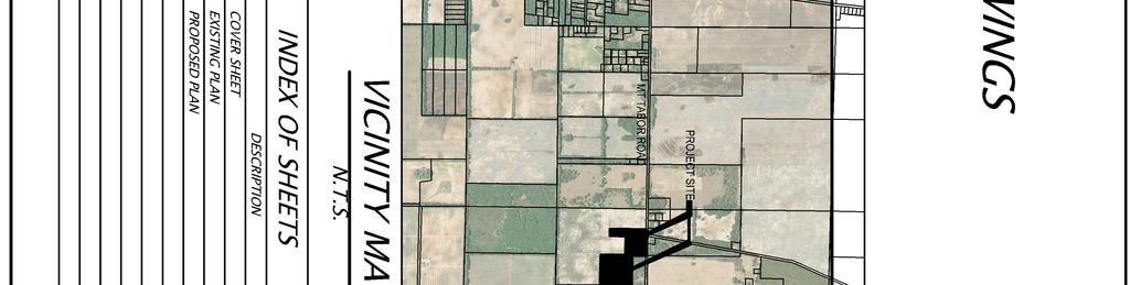
2 Table of Contents Pender Farms LCD Operation Plan... 3 Location Map... 6 Flood Zones... 7 Soil Survey... 8 Property Deeds... 9 Property Appraiser Cards Corporate Information Site/Closure Plan Geotechnical Report Survey... 14
3 Pender Farms LCD Operation Plan This operation plan includes a description of operations that will ensure Pender Farms Land Clearing Debris (LCD) is operated within the requirements of Rule , F.A.C. The facility will accept yard debris and land clearing debris for disposal. The site includes two parcels owned by Adris Pender along Mt. Tabor Road in Jackson County Florida. The adjacent acre parcel was previoulsy qualified to use the General Permit for a Yard Trash Facility (DEP File Number SO; DEP ID No ). This report includes reference to parcel to correct the previously listed acreage. Parcel Acres Jackson County Parcel ID No. 16-5N Current Land Use Cropland C - Section/Township/Range 16-5N-9 Parcel Acres Jackson County Parel ID No. 16-5N Current Land Use Cropland C - Section/Township/Range 16-5N-9 This site is an existing borrow pit and based on the attached NRCS Soil Survey has a water table depth of greater than 6-feet. In my professional opinion and based attached geotechnical report attached, the soil has the capacity to support the proposed fill material and there is no karst in the area. A liner and permanent leachate collection system is not required to meet the requirements of prohibition (2)(c), F.A.C. Yard trash debris includes vegetative matter resulting from landscaping maintenance or land clearing operations such as tree and shrub trimmings, grass clippings, palm fronds, trees and tree stumps, and associated rocks and soils. LCD includes rocks, soils, tree remains, trees, and other vegetative matter that normally results from land clearing or land development operations for a land clearing or construction project. The material will be placed on the existing ground and compacted using a bull dozier or other similar heavy equipment. Two feet of clean soil will be placed to cover the compacted material. Internal and external slopes will not exceed 3 foot horizontal to 1 foot vertical during operations. The owner will take reasonable precautions to control objectionable odors and prevent any adverse environmental conditions to the surrounding environment. Yard trash and/or LCD may be processed on site in accordance with Rule , F.A.C.
4 Operating records will be maintained at 137 Legend Lakes Circle, Panama City Beach, FL The records will be made available to FDEP personnel upon request. A trained spotter will be on duty at the working facility during all disposal operations. Any material other than yard debris or LCD will be removed and placed in appropriate containers for disposal at a permitted facility. Putrescible wastes inadvertently accepted by the facility will be placed in portable trash bins ad removed from the site within 48-hours. Other unauthorized wastes will be placed in roll off containers and removed from the site within 30-days. Any hazardous waste received by the facility shall be managed in accordance with the provisions of Chapter , F.A.C. The site will be fenced and gated to restrict unauthorized access. The gate will remain locked when operations are not underway. Stormwater will be managed in accordance with Chapter F.A.C. Berms, swales, silt fence, and other BMP s will be installed to prevent sediment from leaving the site. Spotters will be trained using approved TREEO training classes ( Spotters will attend an 8-hour initial spotter training which covers the duties of spotters at landfills including: health and safety, types of landfills, regulations and management of prohibited waste. To remain trained spotter must attend a 4 hour spotter refresher course within 3-years of initial training and every 3-years thereafter. Training certifications will be placed in operational records and made available to FDEP inspectors upon request. Once the facility has been filled to capacity, it will be closed in accordance with Rule (8), F.A.C., with 24-inches of clean soil. The expected life of the facility is 10-years. The slopes will be matched to existing grades to eliminate any ponding, promote drainage, and minimize erosion as shown on the site/closure plan. The upper 6-inches of the cover soil will be capable of supporting vegetation. The FDEP will be notified within 30-days, after the site is closed and stabilized with appropriate vegetative cover Ron Rogers, PE Gulf Environmental Engineering, LLC. P.O. Box Box Cert of Authorization Licensed Business No #29933 Ronald W. Rogers P.E. #72067
5
6 Location Map
7 Jackson County Property Appraiser Parcel: 16-5N Acres: 15.8 Name: PENDER ADRIS Land Value 0 Site: POPLAR SPRINGS RD Building Value 0 Sale: 100 on Reason=U Qual=Y Misc Value 0 Mail: P O BOX PANAMA CITY, FL Just Value 15,800 Assessed Value 3,725 Exempt Value 0 Taxable Value 3,725 The Jackson County Property Appraiser's Office makes every effort to produce the most accurate information possible. No warranties, expressed or implied, are provided for the data herein, its use or interpretation. The assessment information is from the last certified taxroll. All data is subject to change before the next certified taxroll. PLEASE NOTE THAT THE PROPERTY APPRAISER MAPS ARE FOR ASSESSMENT PURPOSES ONLY NEITHER JACKSON COUNTY NOR ITS EMPLOYEES ASSUME RESPONSIBILITY FOR ERRORS OR OMISSIONS ---THIS IS NOT A SURVEY--- Date printed: 10/25/18 : 05:36:03
8 Jackson County Property Appraiser Parcel: 16-5N Acres: 10 Name: PENDER ADRIS Land Value 25,000 Site: 5445 MT TABOR RD Building Value 0 Sale: 100 on Reason=U Qual=Y Misc Value 0 Mail: P O BOX PANAMA CITY, FL Just Value 25,000 Assessed Value 25,000 Exempt Value 0 Taxable Value 25,000 The Jackson County Property Appraiser's Office makes every effort to produce the most accurate information possible. No warranties, expressed or implied, are provided for the data herein, its use or interpretation. The assessment information is from the last certified taxroll. All data is subject to change before the next certified taxroll. PLEASE NOTE THAT THE PROPERTY APPRAISER MAPS ARE FOR ASSESSMENT PURPOSES ONLY NEITHER JACKSON COUNTY NOR ITS EMPLOYEES ASSUME RESPONSIBILITY FOR ERRORS OR OMISSIONS ---THIS IS NOT A SURVEY--- Date printed: 10/25/18 : 05:35:34
9 Flood Zones
 Zone A, V, A99 With BFE or Depth Zone AE, AO, AH, VE, AR Regulatory Floodway OTHER AREAS OF FLOOD HAZARD 0.")

10 National Flood Hazard Layer FIRMette 30 50'28.97"N Legend SEE FIS REPORT FOR DETAILED LEGEND AND INDEX MAP FOR FIRM PANEL LAYOUT 85 8'47.62"W SPECIAL FLOOD HAZARD AREAS Without Base Flood Elevation (BFE) Zone A, V, A99 With BFE or Depth Zone AE, AO, AH, VE, AR Regulatory Floodway OTHER AREAS OF FLOOD HAZARD 0.2% Annual Chance Flood Hazard, Areas of 1% annual chance flood with average depth less than one foot or with drainage areas of less than one square mile Zone X Future Conditions 1% Annual Chance Flood Hazard Zone X Area with Reduced Flood Risk due to Levee. See Notes. Zone X Area with Flood Risk due to Levee Zone D OTHER AREAS GENERAL STRUCTURES NO SCREEN Area of Minimal Flood Hazard Zone X Effective LOMRs Area of Undetermined Flood Hazard Zone D Channel, Culvert, or Storm Sewer Levee, Dike, or Floodwall OTHER FEATURES MAP PANELS B Cross Sections with 1% Annual Chance 17.5 Water Surface Elevation Coastal Transect Base Flood Elevation Line (BFE) Limit of Study Jurisdiction Boundary Coastal Transect Baseline Profile Baseline Hydrographic Feature Digital Data Available No Digital Data Available Unmapped Ü The pin displayed on the map is an approximate point selected by the user and does not represent an authoritative property location. Feet ,000 1,500 2,000 USGS The National Map: Orthoimagery. Data refreshed October :6, '58.08"N 85 8'10.16"W This map complies with FEMA's standards for the use of digital flood maps if it is not void as described below. The basemap shown complies with FEMA's basemap accuracy standards The flood hazard information is derived directly from the authoritative NFHL web services provided by FEMA. This map was exported on 10/25/2018 at 5:51:54 AM and does not reflect changes or amendments subsequent to this date and time. The NFHL and effective information may change or become superseded by new data over time. This map image is void if the one or more of the following map elements do not appear: basemap imagery, flood zone labels, legend, scale bar, map creation date, community identifiers, FIRM panel number, and FIRM effective date. Map images for unmapped and unmodernized areas cannot be used for regulatory purposes.
11 Soil Survey

12 85 8' 45'' W Depth to Water Table Jackson County, Florida (Parcels 2,3,4) 85 8' 9'' W ' 34'' N 30 50' 34'' N 30 49' 53'' N Soil Map may not be valid at this scale ' 53'' N ' 45'' W N Map Scale: 1:6,200 if printed on A portrait (8.5" x 11") sheet. Meters Feet Map projection: Web Mercator Corner coordinates: WGS84 Edge tics: UTM Zone 16N WGS ' 9'' W Natural Resources Conservation Service Web Soil Survey National Cooperative Soil Survey 10/25/2018 Page 1 of 3
13 Depth to Water Table Jackson County, Florida (Parcels 2,3,4) MAP LEGEND MAP INFORMATION Area of Interest (AOI) Area of Interest (AOI) Soils Soil Rating Polygons > 200 Not rated or not available Soil Rating Lines > 200 Not rated or not available Soil Rating Points > 200 Not rated or not available Water Features Streams and Canals Transportation Rails Interstate Highways US Routes Major Roads Local Roads Background Aerial Photography The soil surveys that comprise your AOI were mapped at 1:20,000. Warning: Soil Map may not be valid at this scale. Enlargement of maps beyond the scale of mapping can cause misunderstanding of the detail of mapping and accuracy of soil line placement. The maps do not show the small areas of contrasting soils that could have been shown at a more detailed scale. Please rely on the bar scale on each map sheet for map measurements. Source of Map: Natural Resources Conservation Service Web Soil Survey URL: Coordinate System: Web Mercator (EPSG:3857) Maps from the Web Soil Survey are based on the Web Mercator projection, which preserves direction and shape but distorts distance and area. A projection that preserves area, such as the Albers equal-area conic projection, should be used if more accurate calculations of distance or area are required. This product is generated from the USDA-NRCS certified data as of the version date(s) listed below. Soil Survey Area: Jackson County, Florida Survey Area Data: Version 17, Sep 6, 2018 Soil map units are labeled (as space allows) for map scales 1:50,000 or larger. Date(s) aerial images were photographed: 28, 2017 Mar 13, 2014 Nov The orthophoto or other base map on which the soil lines were compiled and digitized probably differs from the background imagery displayed on these maps. As a result, some minor shifting of map unit boundaries may be evident. Natural Resources Conservation Service Web Soil Survey National Cooperative Soil Survey 10/25/2018 Page 2 of 3
14 Depth to Water Table Jackson County, Florida Parcels 2,3,4 Depth to Water Table Map unit symbol Map unit name Rating (centimeters) Acres in AOI Percent of AOI 10 Chipola loamy sand, 0 to 5 percent slopes 38 Lakeland sand, 0 to 5 percent slopes > % > % 50 Pits > % 59 Troup sand, 0 to 5 percent slopes 60 Troup sand, 5 to 8 percent slopes > % > % Totals for Area of Interest % Description "Water table" refers to a saturated zone in the soil. It occurs during specified months. Estimates of the upper limit are based mainly on observations of the water table at selected sites and on evidence of a saturated zone, namely grayish colors (redoximorphic features) in the soil. A saturated zone that lasts for less than a month is not considered a water table. This attribute is actually recorded as three separate values in the database. A low value and a high value indicate the range of this attribute for the soil component. A "representative" value indicates the expected value of this attribute for the component. For this soil property, only the representative value is used. Rating Options Units of Measure: centimeters Aggregation Method: Dominant Component Component Percent Cutoff: None Specified Tie-break Rule: Lower Interpret Nulls as Zero: No Beginning Month: January Ending Month: December Natural Resources Conservation Service Web Soil Survey National Cooperative Soil Survey 10/25/2018 Page 3 of 3
15
16
17 Property Deeds
18
19
20 Property Appraiser Cards

21 Jackson County Property Appraiser Parcel: 16-5N Acres: 15.8 Name: PENDER ADRIS Land Value 0 Site: POPLAR SPRINGS RD Building Value 0 Sale: 100 on Reason=U Qual=Y Misc Value 0 Mail: P O BOX PANAMA CITY, FL Just Value 15,800 Assessed Value 3,725 Exempt Value 0 Taxable Value 3,725 The Jackson County Property Appraiser's Office makes every effort to produce the most accurate information possible. No warranties, expressed or implied, are provided for the data herein, its use or interpretation. The assessment information is from the last certified taxroll. All data is subject to change before the next certified taxroll. PLEASE NOTE THAT THE PROPERTY APPRAISER MAPS ARE FOR ASSESSMENT PURPOSES ONLY NEITHER JACKSON COUNTY NOR ITS EMPLOYEES ASSUME RESPONSIBILITY FOR ERRORS OR OMISSIONS ---THIS IS NOT A SURVEY--- Date printed: 10/25/18 : 05:36:03
22 Jackson County Property Appraiser Parcel: 16-5N Acres: 10 Name: PENDER ADRIS Land Value 25,000 Site: 5445 MT TABOR RD Building Value 0 Sale: 100 on Reason=U Qual=Y Misc Value 0 Mail: P O BOX PANAMA CITY, FL Just Value 25,000 Assessed Value 25,000 Exempt Value 0 Taxable Value 25,000 The Jackson County Property Appraiser's Office makes every effort to produce the most accurate information possible. No warranties, expressed or implied, are provided for the data herein, its use or interpretation. The assessment information is from the last certified taxroll. All data is subject to change before the next certified taxroll. PLEASE NOTE THAT THE PROPERTY APPRAISER MAPS ARE FOR ASSESSMENT PURPOSES ONLY NEITHER JACKSON COUNTY NOR ITS EMPLOYEES ASSUME RESPONSIBILITY FOR ERRORS OR OMISSIONS ---THIS IS NOT A SURVEY--- Date printed: 10/25/18 : 05:35:34
23 Corporate Information

24 10/25/2018 Detail by Entity Name Florida Department of State DIVISION OF CORPORATIONS Department of State / Division of Corporations / Search Records / Detail By Document Number / Detail by Entity Name Florida Profit Corporation COASTAL PARASAIL, INC. Filing Information Document Number FEI/EIN Number Date Filed State Status Last Event Event Date Filed K /22/1988 FL ACTIVE REINSTATEMENT 12/11/1989 Principal Address 5711 NORTH LAGOON DRIVE PANAMA CITY BEACH, FL Changed: 04/24/2009 Mailing Address P.O. BOX PANAMA CITY BEACH, FL Changed: 04/24/2009 Registered Agent Name & Address PENDER, ADRIS 5711 NORTH LAGOON DR PANAMA CITY BEACH, FL Name Changed: 04/24/2009 Address Changed: 04/24/2009 Officer/Director Detail Name & Address Title PVST PENDER, ADRIS P.O. BOX PANAMA CITY BEACH, FL /2
25 10/25/2018 Detail by Entity Name Annual Reports Report Year Filed Date /30/ /23/ /12/2018 Document Images 04/12/ ANNUAL REPORT View image in PDF format 04/23/ ANNUAL REPORT View image in PDF format 04/30/ ANNUAL REPORT View image in PDF format 04/12/ ANNUAL REPORT View image in PDF format 04/22/ ANNUAL REPORT View image in PDF format 04/23/ ANNUAL REPORT View image in PDF format 04/25/ ANNUAL REPORT View image in PDF format 04/21/ ANNUAL REPORT View image in PDF format 04/20/ ANNUAL REPORT View image in PDF format 04/24/ ANNUAL REPORT View image in PDF format 02/17/ ANNUAL REPORT View image in PDF format 04/24/ ANNUAL REPORT View image in PDF format 01/23/ ANNUAL REPORT View image in PDF format 05/02/ ANNUAL REPORT View image in PDF format 05/03/ ANNUAL REPORT View image in PDF format 05/05/ ANNUAL REPORT View image in PDF format 04/18/ ANNUAL REPORT View image in PDF format 05/11/ ANNUAL REPORT View image in PDF format 06/23/ ANNUAL REPORT View image in PDF format 04/24/ ANNUAL REPORT View image in PDF format 04/21/ ANNUAL REPORT View image in PDF format 06/21/ ANNUAL REPORT View image in PDF format 04/26/ ANNUAL REPORT View image in PDF format Florida Department of State, Division of Corporations 2/2
26 Site/Closure Plan

27


28


29
30 Geotechnical Report

31 November 5, 2018 Mr. Ron Rogers, P.E. Gulf Environmental Engineering, LLC. P.O. Box Panama City, Florida SUBJECT: Yard Debris Pit Jackson County Geotechnical Services Jackson County, Florida MEI Project No. M Dear Mr. Rogers: This letter forwards the results of our site visit to the subject property located south of Mt. Tabor Road, just west of Poplar Springs Road in Jackson County, Florida. The purpose of the site visit was to verify a minimum 3-foot separation between the bottom of the proposed yard debris pit and Karst sensitive areas. On November 4, 2018, the undersigned traveled to the subject property and performed a total of Four (4) 8 feet deep to 10 feet deep hand auger borings on the proposed Parcel #3 and Parcel #4 which are to be used as a yard debris pit. It is our understanding that the proposed fill height of the land clearing debris will be 20 feet above the existing ground elevations and will have a slope of 3 horizontal to 1 vertical. The Four (4) hand auger borings were taken near the lowest observable grades for each parcel. The LAT/LONG coordinate of each borings is presented below in Table #1. Boring Number LAT/LONG Coordinates HA-1 (Parcel #4) N W HA-2 (Parcel #4) HA-3 (Parcel #3) HA-4 (Parcel #3) N W N W N W Based on the results of the hand auger borings, no karst sensitive material was encountered within the depth of the test borings. In addition to verifying the minimum 3-foot separation, we also determined the estimated seasonal high groundwater level were not observed within the depth of the four (4) hand auger borings.

32 Yard Debris Pit Jackson County Geotechnical Services Page 2 of 2 We hope this letter provides sufficient information for the present. comments, please feel free to call. If you have any questions or Sincerely, MAGNUM ENGINEERING. INC. JAMES T. VICKERS, P.E. Sr. Geotechnical Engineer Florida Registration # 56813

33 D D DISPOSAL AREA = 121 ACRES 0' 150' 300' 600' SITE AREA = 133 ACRES SCALE: 1" = 300' C C B B NOTES: 1. NO WATER BODIES ARE LOCATED ON OR WITHIN 50 FEET OF DISPOSAL AREA. 2. NO WETLANDS ARE LOCATED ON OR WITHIN 50 FEET OF DISPOSAL AREA. 3. NO POTABLE WATER WELLS ON OR WITHIN 100 FEET OF THE SITE. LEGEND EXISTING CONTOURS PROPERTY PARCEL DISPOSAL AREA SHEET NO. Gulf Environmental Engineering, LLC P.O. Bpx Panama City, FL (850) Cert. of Authorization No. Licensed Business # SCALE: 1" = 200' YARD DEBRIS PIT DRAWN BY APPROVED BY EXISTING VS PROPOSED CONTOURS - PARCEL #2, #3 & #4 6 OF 9 GCR RWR MT TABOR ROAD JACKSON COUNTY, FLORIDA
34 Magnum Engineering, Inc Pierson Drive Lynn Haven, FL BORING NUMBER HA-1 PAGE 1 OF 1 CLIENT DATE STARTED 11/4/18 COMPLETED 11/4/18 DRILLING CONTRACTOR DRILLING METHOD LOGGED BY NOTES DEPTH (ft) 0.0 GRAPHIC LOG Gulf Environmental Engineering, LLC PROJECT NUMBER J. Vickers M Hand Auger Boring CHECKED BY Gray/Tan Clayey Fine SAND (SC) J. Vickers MATERIAL DESCRIPTION PROJECT NAME PROJECT LOCATION GROUND ELEVATION GROUND WATER LEVELS: ESTIMATED SEASONAL HIGH GWT --- AFTER DRILLING --- HOLE SIZE 3 DEPTH TO GROUNDWATER AT TIME OF DRILLING --- SAMPLE TYPE NUMBER Yard Debris Pit Jackson County RECOVERY % (RQD) Jackson County, Florida BLOW COUNTS (N VALUE) POCKET PEN. (tsf) DRY UNIT WT. (pcf) MOISTURE CONTENT (%) ATTERBERG LIMITS LIQUID LIMIT PLASTIC LIMIT PLASTICITY INDEX FINES CONTENT (%) 2.5 Tan Slightly Clayey FIne SAND (SP-SC) Tan/ Light Tan Slightly Silty Fine SAND (SP-SM) GEOTECH BH COLUMNS YARD DEBRIS PIT JACKSON COUNTY.GPJ GINT STD US LAB.GDT 11/5/ Boring Termination Depth at 10.0 feet. AU
35 Magnum Engineering, Inc Pierson Drive Lynn Haven, FL BORING NUMBER HA-2 PAGE 1 OF 1 CLIENT DATE STARTED 11/4/18 COMPLETED 11/4/18 DRILLING CONTRACTOR DRILLING METHOD LOGGED BY NOTES DEPTH (ft) 0.0 GRAPHIC LOG Gulf Environmental Engineering, LLC PROJECT NUMBER J. Vickers M Hand Auger Boring CHECKED BY J. Vickers MATERIAL DESCRIPTION Tan/Gray Slightly Clayey Fine SAND (SP-SC) PROJECT NAME PROJECT LOCATION GROUND ELEVATION GROUND WATER LEVELS: ESTIMATED SEASONAL HIGH GWT --- AFTER DRILLING --- HOLE SIZE 3 DEPTH TO GROUNDWATER AT TIME OF DRILLING --- SAMPLE TYPE NUMBER Yard Debris Pit Jackson County RECOVERY % (RQD) Jackson County, Florida BLOW COUNTS (N VALUE) POCKET PEN. (tsf) DRY UNIT WT. (pcf) MOISTURE CONTENT (%) ATTERBERG LIMITS LIQUID LIMIT PLASTIC LIMIT PLASTICITY INDEX FINES CONTENT (%) Tan/Light Tan Slightly Silty Fine SAND (SP-SM) 2.5 GEOTECH BH COLUMNS YARD DEBRIS PIT JACKSON COUNTY.GPJ GINT STD US LAB.GDT 11/5/ Light Gray/Tan Silty Fine SAND (SM) Reddish-Orange and Gray Silty CLAY (CL) Boring Termination Depth at 9.0 feet. AU
36 Magnum Engineering, Inc Pierson Drive Lynn Haven, FL BORING NUMBER HA-3 PAGE 1 OF 1 CLIENT DATE STARTED 11/4/18 COMPLETED 11/4/18 DRILLING CONTRACTOR DRILLING METHOD LOGGED BY NOTES DEPTH (ft) 0.0 GRAPHIC LOG Gulf Environmental Engineering, LLC PROJECT NUMBER J. Vickers M Hand Auger Boring CHECKED BY Gray/Brown Silty Fine SAND (SM) J. Vickers MATERIAL DESCRIPTION PROJECT NAME PROJECT LOCATION GROUND ELEVATION GROUND WATER LEVELS: ESTIMATED SEASONAL HIGH GWT --- AFTER DRILLING --- HOLE SIZE 3 DEPTH TO GROUNDWATER AT TIME OF DRILLING --- SAMPLE TYPE NUMBER Yard Debris Pit Jackson County RECOVERY % (RQD) Jackson County, Florida BLOW COUNTS (N VALUE) POCKET PEN. (tsf) DRY UNIT WT. (pcf) MOISTURE CONTENT (%) ATTERBERG LIMITS LIQUID LIMIT PLASTIC LIMIT PLASTICITY INDEX FINES CONTENT (%) Gray Slighty Silty Fine SAND (SP-SM) 2.5 GEOTECH BH COLUMNS YARD DEBRIS PIT JACKSON COUNTY.GPJ GINT STD US LAB.GDT 11/5/ Gray/Light Gray Slightly Silty Fine SAND (SP-SM) Boring Termination Depth at 10.0 feet. AU
 0.")
37 Magnum Engineering, Inc Pierson Drive Lynn Haven, FL BORING NUMBER HA-4 PAGE 1 OF 1 CLIENT DATE STARTED 11/4/18 COMPLETED 11/4/18 DRILLING CONTRACTOR DRILLING METHOD LOGGED BY NOTES DEPTH (ft) 0.0 GRAPHIC LOG Gulf Environmental Engineering, LLC PROJECT NUMBER J. Vickers M Hand Auger Boring CHECKED BY Tan/Gray Silty Clayey Fine SAND (SC-SM) J. Vickers MATERIAL DESCRIPTION PROJECT NAME PROJECT LOCATION GROUND ELEVATION GROUND WATER LEVELS: ESTIMATED SEASONAL HIGH GWT --- AFTER DRILLING --- HOLE SIZE 3 DEPTH TO GROUNDWATER AT TIME OF DRILLING --- SAMPLE TYPE NUMBER Yard Debris Pit Jackson County RECOVERY % (RQD) Jackson County, Florida BLOW COUNTS (N VALUE) POCKET PEN. (tsf) DRY UNIT WT. (pcf) MOISTURE CONTENT (%) ATTERBERG LIMITS LIQUID LIMIT PLASTIC LIMIT PLASTICITY INDEX FINES CONTENT (%) Tan Slightly Silty Fine SAND with Trace of CLAY (SP-SM) Gray Silty Clayey Fine SAND (SC-SM) 2.5 GEOTECH BH COLUMNS YARD DEBRIS PIT JACKSON COUNTY.GPJ GINT STD US LAB.GDT 11/5/ Boring Termination Depth at 8.0 feet. AU
38 Survey
39
Project Name: (Name as it appears in ESNAPS.) Spring Care Association
 Spring Care Association") Page 1 of 4 U.S. Department of Housing and Urban Development 451 Seventh Street, SW Washington, DC 20410 www.hud.gov espanol.hud.gov Environmental Review for Continuum of Care (CoC) Rental Assistance Project
Page 1 of 4 U.S. Department of Housing and Urban Development 451 Seventh Street, SW Washington, DC 20410 www.hud.gov espanol.hud.gov Environmental Review for Continuum of Care (CoC) Rental Assistance Project
Property Information Packet
 Property Information Packet Multi-Parcel Auction, Cheney, KS Sedgwick County Tuesday, December 4 th @ 7 PM Tract 1 35+/- Acres & Tract 2 24+/- Acres Auction Location: Farm Bureau Building, Cheney, KS Table
Hickory Ridge Residence & Farm An residential, agricultural, and recreational investment opportunity.
 offered for sale Hickory Ridge Residence & Farm An residential, agricultural, and recreational investment opportunity. 2,620 (+/-) square foot dwelling situated on 65 (+/-) acres of farmland Hickory Ridge,
JAIL SITE ASSESSMENT PICKETT COUNTY, TENNESSEE. For MARCH 2016
 JAIL SITE ASSESSMENT For PICKETT COUNTY, TENNESSEE MARCH 2016 JAMES C. HAILEY & COMPANY Consulting Engineers 7518 Highway 70 South Suite 100 Nashville, Tennessee 37221 (615) 883-4933 JAIL SITE ASSESSMENT
Florida Department of Environmental Protection Bob Martinez Center 2600 Blair Stone Road Tallahassee, Florida
 Print Formatted Florida Department of Environmental Protection Bob Martinez Center 26 Blair Stone Road Tallahassee, Florida 32399-24 Rick Scott Governor Jennifer Carroll Lt. Governor Herschel T. Vinyard
COMMERCIAL/ INDUSTRIAL PERMIT APPLICATION
 APPLICANT INFORMATION: COMMERCIAL/ INDUSTRIAL Permit No: Requested: Receipt No: Council District/At Large: Zoning District: Parcel No: Lot, Sq., Subdivision: Historic Dist. / Landmark: Yes / No Hearing
Florida Department of Environmental Protection
 Florida Department of Environmental Protection Bob Martinez Center 2600 Blair Stone Road Tallahassee, Florida 32399-2400 Rick Scott Governor Herschel T. Vinyard Jr. Secretary July 25, 2013 Robert Rogers
A.3. ARTICLE 7 PLAN REQUIREMENTS FOR MINOR SUBDIVISION AND/OR LAND DEVELOPMENT
 700. 701.A.3. ARTICLE 7 PLAN REQUIREMENTS FOR MINOR SUBDIVISION AND/OR LAND DEVELOPMENT SECTION 700 PURPOSE The purpose of this Article is to set forth a streamlined set of Plan Requirements for minor
Florida Department of Environmental Protection
 Florida Department of Environmental Protection Bob Martinez Center 2600 Blair Stone Road Tallahassee, Florida 32399-2400 Charlie Crist Governor Jeff Kottkamp Lt. Governor Michael W. Sole Secretary May
JORDAO PROPERTY ± RIPARIAN IRRIGATED CROPLAND. $2,438,000 ($23,000/Acre)
") JORDAO PROPERTY ±106.00 RIPARIAN IRRIGATED CROPLAND Located at: 7505 Hogin Road Crows Landing, Stanislaus County, CA 95313 APN s 057-026-009 & 057-026-008 Offered for $2,438,000 ($23,000/Acre) Presented
JORDAO PROPERTY ±106.00 RIPARIAN IRRIGATED CROPLAND Located at: 7505 Hogin Road Crows Landing, Stanislaus County, CA 95313 APN s 057-026-009 & 057-026-008 Offered for $2,438,000 ($23,000/Acre) Presented
COMMERCIAL SITE DEVELOPMENT GUIDE FOR UNINCORPORATED ST. CHARLES COUNTY
 COMMERCIAL SITE DEVELOPMENT GUIDE FOR UNINCORPORATED ST. CHARLES COUNTY GENERAL INFORMATION: This brochure is to be used as a guide and is not intended to amend or supersede the corresponding County ordinances
A Minor Land Excavation Operating Permit is used to:
 CHAPTER 400. SECTION 404. PERMIT TYPES AND APPLICATIONS OPERATING PERMITS 404.1. Minor Land Excavation A. Intent and Purpose The intent and purpose of this section is to protect the public health, safety,
ARTICLE 5 MINOR SUBDIVISION/LAND DEVELOPMENT
 ARTICLE 5 MINOR SUBDIVISION/LAND DEVELOPMENT SECTION 501 ONLY FINAL PLAN REQUIRED The classification of a proposed subdivision as a "Minor Subdivision" shall only require the submission, review and approval
Criteria for Appeals of Flood Insurance Rate Maps. November 30, 201 1
 Criteria for Appeals of Flood Insurance Rate Maps November 30, 201 1 This document outlines the criteria for appealing proposed changes in flood hazard information on Flood Insurance Rate Maps (FIRMS)
E L M E R B O R O U G H L A N D U S E B O A R D APPLICATION COVER SHEET (to be completed for all applications and appeals)
") E L M E R B O R O U G H L A N D U S E B O A R D APPLICATION COVER SHEET (to be completed for all applications and appeals) 1. Name(s): 2. Address: 3. Telephone Number(s): 4. E-mail: 5. Owner Name(s) (if
E L M E R B O R O U G H L A N D U S E B O A R D APPLICATION COVER SHEET (to be completed for all applications and appeals) 1. Name(s): 2. Address: 3. Telephone Number(s): 4. E-mail: 5. Owner Name(s) (if
Letter of Map Change Fundamentals
 Letter of Map Change Fundamentals FEMA Region III National Flood Insurance Program Essentials and Best Practices Jana Green, CFM, RAMPP Topics of Discussion Why Apply for a Letter of Map Change (LOMC)?
CHAPTER 3 PRELIMINARY PLAT
 10-3-1 10-3-3 SECTION: CHAPTER 3 PRELIMINARY PLAT 10-3-1: Consultation 10-3-2: Filing 10-3-3: Requirements 10-3-4: Approval 10-3-5: Time Limitation 10-3-6: Grading Limitation 10-3-1: CONSULTATION: Each
ST. TAMMANY PARISH PATRICIA P. BRISTER PARISH PRESIDENT
 revised Completed Permit Application REQUIREMENTS FOR RESIDENTIAL PLAN REVIEW Swimming Pools Assessment # / Parcel #(10 digit number from Assessor s Office 985-809-8180 www.stpao.org) Legal Description
PRELIMINARY PLAT CHECK LIST
 PRELIMINARY PLAT CHECK LIST Name of Proposed Subdivision: The following items must be included with the initial submittal of a Preliminary Plat: Application, filled out completely Project Narrative Pre-application
Floodplain Development Land Use Review
 PUBLIC WORKS - COMMUNITY DEVELOPMENT 333 Broadalbin Street SW, PO Box 490, Albany, Oregon 97321-0144 BUILDING 541-917-7553 PLANNING 541-917-7550 Floodplain Development Land Use Review Application Information
Date of Review: 11/6/2015 Reviewer: RCQ/LMC STATE
 FINAL Florida Review Checklist: NFIP & FBC & Revised Model Ordinance (January 15, 2013d) Ordinance Citation: Model FPM regulations and 5 th Edition FBC : All Zones Date of Review: 11/6/2015 Reviewer: RCQ/LMC
6. Name, address, & daytime telephone # of developer (if different from applicant): 7. Address of subject property:
: 7. Address of subject property:") ELMORE COUNTY LAND USE & BUILDING DEPARTMENT 520 E 2 nd South Mountain Home, ID 83647 (208) 587-2142 www.elmorecounty.org APPLICATION FOR CONFINED ANIMAL FEEDING OPERATION (CAFO) SITING PERMIT Fee $500.00
ELMORE COUNTY LAND USE & BUILDING DEPARTMENT 520 E 2 nd South Mountain Home, ID 83647 (208) 587-2142 www.elmorecounty.org APPLICATION FOR CONFINED ANIMAL FEEDING OPERATION (CAFO) SITING PERMIT Fee $500.00
CITY OF SARALAND PRELIMINARY SUBDIVISION PLAT REVIEW
 PRELIMINARY SUBDIVISION PLAT REVIEW Application Number: Date Plat Submitted: Name of Subdivision: Name of Owner: Owner Address: (Street or P.O. Box) Telephone #: (City) (State) (Zip) E-mail: Name of Authorized
Chapter 5. Floodplain Management. 5.0 Introduction. 5.1 Floodplain Management and Regulation
 5.0 Introduction This chapter summarizes the Town s rules and regulations regarding floodplain management and development. The requirements presented in this chapter should be used by the design engineer
±86 ACRES OF LAND EL CENTRO ROAD & SAN JUAN SACRAMENTO, CA CONTACT US FOR SALE. SITE
 SACRAMENTO, CA 95834 SITE CONTACT US RANDY GRIMSMAN Senior Vice President Lic. 00857338 +1 916 446 8745 randall.grimsman@cbre.com www.cbre.com/randall.grimsman CBRE, Inc. 500 Capitol Mall, Suite 2400 Sacramento,
Florida Department of Environmental Protection
 Florida Department of Environmental Protection Bob Martinez Center 2600 Blair Stone Road Tallahassee, Florida 32399-2400 Rick Scott Governor Carlos Lopez-Cantera Lt. Governor Jonathan P. Steverson Secretary
SKETCH OF BOUNDARY SURVEY ALTA / ACSM LAND TITLE SURVEY
 SKETCH OF BOUNDARY SURVEY ALTA / ACSM LAND TITLE SURVEY SURVEYOR'S NOTES: All distances as shown hereon are based on the US Survey foot. Subject property lies inside the UBD (Urban Development Boundary),
Address Southeast Quadrant of U.S. Highway 41 and Sumter Boulevard City. North Port State. FL Zip Code County
 SUBJECT AERIAL LOCATION LAND AREA THREE-YEAR OWNERSHIP HISTORY OF SUBJECT Address Southeast Quadrant of U.S. Highway 41 and Sumter Boulevard City North Port State FL Zip Code 34287 County Sarasota Nearest
CITY OF OCOEE LAND DEVELOPMENT CODE SUFFICIENCY TABLE WITH NOTES
 CITY OF OCOEE LAND DEVELOPMENT CODE SUFFICIENCY TABLE WITH NOTES The Sufficiency Table is a checklist to help identify the types of information and documentation needed for various types of projects. The
APPLICATION PROCEDURE
 ANTRIM PLANNING BOARD P. O. Box 517 Antrim, New Hampshire 03440 Phone: 603-588-6785 FAX: 603-588-2969 APPLICATION FORM AND CHECKLIST FOR MINOR OR MAJOR SITE PLAN REVIEW File Date Received By APPLICATION
BACKGROUND There are 23 flood control structures in the Upper Brushy Creek Water Control and Improvement District (District). See attached map.
. See attached map.") BACKGROUND There are 23 flood control structures in the Upper Brushy Creek Water Control and Improvement District (District). See attached map. The U.S Department of Agriculture - Natural Resources Conservation
BACKGROUND There are 23 flood control structures in the Upper Brushy Creek Water Control and Improvement District (District). See attached map. The U.S Department of Agriculture - Natural Resources Conservation
MAP INDEX CHECKLIST NOTES:
 REVIEWING YOUR PRELIMINARY DFIRM PANELS AND FIS REPORT A GUIDE FOR COMMUNITY OFFICIALS When a Georgia community is presented with new Digital Flood Insurance Rate Map (DFIRM) panels, the State of Georgia,
FINAL PLAT CHECKLIST
 FINAL PLAT CHECKLIST Project Name: Tax ID #: Project Number: Date: _ Reviewed By: Telephone: Please address all items marked with an "X" Please return redline comments with corrected plan, original mylar,
City of Prior Lake APPLICATION FOR COMBINED PRELIMINARY AND FINAL PLAT
 Case File No. Property Identification No. City of Prior Lake APPLICATION FOR COMBINED PRELIMINARY AND FINAL PLAT Requested Action Brief description of proposed project (Please describe the proposed amendment,
2412 E. 26TH ST E 26th St, Minneapolis, MN 55406
 SALE PRICE: $425,000 LOT SIZE:.17 Acres BUILDING SIZE: +/-2,400 SF DRIVE-IN DOORS 1 CEILING HEIGHT: 14' YEAR BUILT: 1970 ZONING: I2 Medium Industrial District PROPERTY OVERVIEW Small shop, flexible office
City of Prior Lake APPLICATION FOR REGISTERED LAND SURVEY
 Case File No. Property Identification No. City of Prior Lake APPLICATION FOR REGISTERED LAND SURVEY Requested Action Brief description of proposed project (Please describe the proposed amendment, project,
SECTION 4: PRELIMINARY PLAT
 SECTION 4: PRELIMINARY PLAT After the completion of the sketch plan process, if submitted, the owner or developer shall file with the City an application for preliminary plat. The preliminary plat stage
Flood Hazard Development Permit Application & Permit Forms. For Communities with Coastal Velocity Zones [60.3(e)] CONTENTS
![Flood Hazard Development Permit Application & Permit Forms. For Communities with Coastal Velocity Zones [60.3(e)] CONTENTS](/thumbs/76/74346075.jpg "Flood Hazard Development Permit Application & Permit Forms. For Communities with Coastal Velocity Zones [60.3(e)] CONTENTS") Flood Hazard Development Permit Application & Permit Forms For Communities with Coastal Velocity Zones [60.3(e)] CONTENTS 1. Decision Tree 2. Flood Hazard Development Permit Application 3. Flood Hazard
Flood Hazard Development Permit Application & Permit Forms For Communities with Coastal Velocity Zones [60.3(e)] CONTENTS 1. Decision Tree 2. Flood Hazard Development Permit Application 3. Flood Hazard
SECTION 10: FLOOD HAZARD EVALUATION 10-1
 10) SECTION 10: FLOOD HAZARD EVALUATION A. General. Land subject to being flooded by a Flood of 100-Year Frequency as defined by Title 76, Chapter 5, MCA, or land subject to flooding pursuant to these
1018 Thomasville Road, Suite 200A Tallahassee, FL talcor.com
 452+/- Acres Jefferson County, Fl Bill Bippus +1 850 321-0579 bbippus@ The and surrounding acreage has always been a part of Lyndhurst Plantation. The land that became Lyndhurst and the subsequent was
Emergency Watershed Program Sandy Recovery Activities and Flood Plain Easement Program
 Emergency Watershed Program Sandy Recovery Activities and Flood Plain Easement Program Greg Westfall, Resource Conservationist USDA-Natural Resources Conservation Service (NRCS) Set up by Congress to respond
Chapter 5. Floodplain Management. 5.0 Introduction. 5.1 Douglas County Comprehensive Master Plan. 5.2 Floodplain Management and Regulation
 5.0 Introduction This chapter summarizes the County s rules and regulations regarding floodplain management and development. The requirements presented in this chapter should be used by the design engineer
Timothy L. Woods, Broker. Contact our Ag Services team today!
 Farmland For Sale 73.760 +/- acres Section 13, T35N, R1E, LaSalle County, Illinois 4 miles SE of Mendota (approximate coordinates N 4009Rd @ N 3973 rd Rd) Contact our Ag Services team today! 309-664-8934
ARTICLE 4 MAJOR SUBDIVISION/LAND DEVELOPMENT PLAN REQUIREMENTS
 ARTICLE 4 MAJOR SUBDIVISION/LAND DEVELOPMENT PLAN REQUIREMENTS SECTION 401 LAND SKETCH PLANS FOR MAJOR SUBDIVISIONS AND DEVELOPMENTS 401.1 Sketch Plan Information The following process and procedures shall
Waseca County Planning and Zoning Office
 Waseca County Planning and Zoning Office 300 North State Street Waseca, Minnesota 56093 Phone: 507-835-0650 Fax: 507-837-5310 Form no. PZ 081009 Web Site: www.co.waseca.mn.us FEES: 1) CUP FEE- $400.00
REGULAR FINAL PLAT SUBDIVISION APPLICATION
 REGULAR FINAL PLAT SUBDIVISION APPLICATION Name of Subdivision (Subdivision Name must be approved by at 856-6216) ( )Cluster Subdivision ( )Lot-by-Lot Subdivision ( )Open Space Subdivision Name of Subdivision
Receiving Water Body:
 62-330 ENVIRONMENTAL RESOURCE PERMIT INDIVIDUAL - TECHNICAL STAFF REPORT 23-Nov-2016 APPLICATION #: IND-005-9658-2 Applicant: Agent: Charles Commander CCSH, LLC 2708 Highway 77 Lynn Haven, FL 32444 850-819-5850
MAJOR SUBDIVISION PRELIMINARY PLAT CHECKLIST
 TOWNSHIP OF EGG HARBOR PLANNING BOARD/ZONING BOARD OF ADJUSTMENT 3515 BARGAINTOWN ROAD EGG HARBOR TOWNSHIP, NJ 08234 MAJOR SUBDIVISION PRELIMINARY PLAT CHECKLIST The following checklist is designed to
FOR SALE 2, /- Gross Acre Cattle Ranch in Tulare County
 FOR SALE 2,252.70 +/- Gross Acre Cattle Ranch in Tulare County Morgan Houchin 3430 Unicorn Road Bakersfield, CA 93308 Neither the Seller, nor makes any representations or warranties, either expressed or
Plans shall be drawn at a readable scale, signed, and sealed by a Florida Registered Engineer. The application package shall include:
 CHAPTER 400. SECTION 403. PERMIT TYPES AND APPLICATIONS SITE DEVELOPMENT 403.3. Preliminary Site Plans (PSP) A. Intent and Purpose PSPs are used to identify existing site conditions and demonstrate general
BRIDGETON SUBDIVISION APPLICATION CHECKLIST
 APPLICATION NAME AND # CHECKLIST COMPLETED BY: DATE: Signature and printed name BRIDGETON SUBDIVISION APPLICATION CHECKLIST TO SUBDIVISION APPLICANTS: The attached checklist is to assist you in the submission
City Of Attleboro Conservation Commission
 City Of Attleboro Conservation Commission GOVERNMENT CENTER, 77 PARK STREET ATTLEBORO, MASSACHUSETTS 02703 (508) 223 2222 FAX 222 3046 GENERAL INSTRUCTIONS AND CHECKLIST FOR COMPLETING STORMWATER MANAGEMENT
(Chapter Flood Damage Prevention)
") Chapter 13.10 Flood Damage Prevention Section: 13.10.010 Purpose and Policy 13.10.020 Definitions 13.10.030 Applicability and Areas of Special Flood Hazard 13.10.040 Administration 13.10.050 Provisions
Chapter 13.10 Flood Damage Prevention Section: 13.10.010 Purpose and Policy 13.10.020 Definitions 13.10.030 Applicability and Areas of Special Flood Hazard 13.10.040 Administration 13.10.050 Provisions
Interim Use Permit Application
 BENTON COUNTY DEPARTMENT OF DEVELOPMENT 531 DEWEY STREET, PO BOX 129 FOLEY, MN 56329-0129 PHONE: (320) 968-5065 FAX: (320) 968-5351 Interim Use Permit Application Application Fee: $400 ($754 if it is an
SOIL DEPOSIT BYLAW
 SOIL DEPOSIT BYLAW 5506-2015 THE FOLLOWING DOCUMENT HAS BEEN REPRODUCED FOR CONVENIENCE ONLY and is a consolidation of "District of Mission Soil Deposit with the following amending bylaws: Bylaw Number
City of Midland Application for Site Plan Review
 City of Midland Application for Site Plan Review Submission Date: Property Owner: Mailing Address: Phone number: ( ) Cell phone: ( ) Email address: Fax: ( ) Owner s Signature: Applicant Name (if not owner):
National Flood Insurance Program (NFIP) MT-1 Presentation. David Mummert, Michael Baker Jr., Inc.
 MT-1 Presentation. David Mummert, Michael Baker Jr., Inc.") National Flood Insurance Program (NFIP) MT-1 Presentation David Mummert, Michael Baker Jr., Inc. MT-1 Letters of Map Change (LOMCs) LOMC Review By FEMA FEMA required to notify the applicant in writing
National Flood Insurance Program (NFIP) MT-1 Presentation David Mummert, Michael Baker Jr., Inc. MT-1 Letters of Map Change (LOMCs) LOMC Review By FEMA FEMA required to notify the applicant in writing
City of Prior Lake APPLICATION FOR PRELIMINARY PLAT
 City of Prior Lake APPLICATION FOR PRELIMINARY PLAT Requested Action Brief description of proposed project (Please describe the proposed amendment, project, or variance request. Attach additional sheets
Farmland Sales Specialists
 Farmland Sales Specialists Setting the trend for how Real Estate is sold in the Midwest. www.barnesrealty.com 18156 Hwy 59 Mound City, MO 64470 (660) 442-3177 1711 Oregon Hiawatha, KS 66434 (785) 742-4580
Initial Subdivision Applications Shall Include the Following:
 Initial Subdivision Applications Shall Include the Following: 1) Subdivision Application Form: completely filled out (12 copies) 2) Plat: The Plat must adhere to the requirements set forth in the Town
Purpose: Regulations:
 Administrative Procedures for the Designation and Refinement Of Chesapeake Bay Preservation Area Boundaries Guidance on the Chesapeake Bay Preservation Area Designation and Management Regulations September,
APPENDIX B. SUBMISSION REQUIREMENTS
 Master Major Site Minor Site Landscape Section B.1 Table of /Plat Requirements Proposed or approved name of development, project, subdivision, and/or phase. Location, including township, county, and state.
DIVISION 2 - CONSTRUCTION PLAN AND MISCELLANEOUS REQUIREMENTS
 DIVISION 2 - CONSTRUCTION PLAN AND MISCELLANEOUS REQUIREMENTS 2.1 Required Plan Sheets 2.2 Drawing Requirements 2.3 Graphic Standards 2.4 Easements 2.5 Utility Locations 2.6 Private Facility Locations
CITY OF SARALAND FINAL SUBDIVISION PLAT REVIEW
 CITY OF SARALAND FINAL SUBDIVISION PLAT REVIEW Application Number: Date Plat Submitted: Name of Subdivision: Name of Owner: Owner Address: (Street or P.O. Box) Telephone #: (City) (State) (Zip) E-mail:
Town of Middleborough Conservation Commission 2014 Policy
 Approved February 20, 2014 Town of Middleborough Conservation Commission 2014 Policy The Wetland Protection Act under M.G.L. c. 131, sec. 40 and regulations 310 CMR 10.02(1)(a-f) & 310 CMR 10.02 (2)(a)
FLORIDA DEPARTMENT OF ENVIRONMENTAL PROTECTION
 FLORIDA DEPARTMENT OF ENVIRONMENTAL PROTECTION NOTICE OF INTENT TO USE S. 403.9327, F.S., GENERAL PERMIT FOR MANGROVE TRIMMING OR APPLICATION FOR S. 403.9328, F.S., INDIVIDUAL PERMIT TO TRIM OR ALTER MANGROVES
PLYMOUTH PLANNING BOARD APPLICATION FOR A MINOR SUBDIVISION OR MAJOR SUBDIVISION
 CASE # PLYMOUTH PLANNING BOARD APPLICATION FOR A MINOR SUBDIVISION OR MAJOR SUBDIVISION The undersigned Applicant hereby submits to the Plymouth Planning Board a completed application for a proposed minor
ORDINANCE NO (1123)
") ORDINANCE NO. 2013-08 (1123) ORDINANCE OF THE BOROUGH OF LAVALLLETTE, COUNTY OF OCEAN, STATE OF NEW JERSEY, AMENDING AND SUPPLEMENTING CHAPTER 31, ENTITLED FLOOD HAZARD AREAS, OF THE REVISED GENERAL ORDINANCES
ORDINANCE NO. 2013-08 (1123) ORDINANCE OF THE BOROUGH OF LAVALLLETTE, COUNTY OF OCEAN, STATE OF NEW JERSEY, AMENDING AND SUPPLEMENTING CHAPTER 31, ENTITLED FLOOD HAZARD AREAS, OF THE REVISED GENERAL ORDINANCES
CONSTRUCTION PLANS for HALCYON A RESIDENTIAL SUBDIVISION 6100 MIDNIGHT PASS ROAD, SARASOTA, FL 34242
 CONSTRUCTION PLANS for HALCYON A RESIDENTIAL SUBDIVISION 6100 MIDNIGHT PASS ROAD, SARASOTA, FL 34242 SECTION 18, TOWNSHIP 37 SOUTH, RANGE 18 EAST SARASOTA COUNTY, FLORIDA PID: 0030001 A DEVELOPMENT BY
PROPERTY INFORMATION PACKET
 PROPERTY INFORMATION PACKET THE DETAILS #21 404 E Mulvane St & 206 N. Central Ave Mulvane, KS 67110 AUCTION: Thursday, December 17 @ 6:00 PM 12041 E. 13th St. N., Wichita, KS, 67206 316.683.0612 800.544.4489
Florida Department of Environmental Protection
 Florida Department of Environmental Protection Bob Martinez Center 2600 Blair Stone Road Tallahassee, Florida 32399-2400 Rick Scott Governor Carlos Lopez-Cantera Lt. Governor Noah Valenstein Secretary
ANDOVER CODE. Checklist #5 Preliminary Site Plan Conditional Use
 ANDOVER CODE Checklist #5 Preliminary Site Plan Conditional Use Applicant: Block Lot File No. This checklist is for general reference only. Further information may be required by the reviewing authority.
SUBDIVISION APPLICATION CHECKLIST SKETCH PLAN PRELIMINARY PLAT FINAL PLAT
 RECEIVED STAMP SUBDIVISION APPLICATION CHECKLIST SKETCH PLAN PRELIMINARY PLAT FINAL PLAT A checklist of background information and submission requirements for processing of a sketch plan, preliminary plat
Zoning Permit Application Cover Page
 Zoning Permit Application Cover Page The City of Belmont performs an initial site inspection prior to issuance of a zoning permit for new construction. Upon receipt of a full and complete application submittal
PLANNING BOARD CITY OF CONCORD, NH MINOR SUBDIVISION CHECKLIST
 PLANNING BOARD CITY OF CONCORD, NH MINOR SUBDIVISION CHECKLIST Summary This checklist is intended to assist applicants and design professionals in the preparation of minor subdivision applications for
Hamilton County Court 2 Duplexes (4 units) on Plumwood Rd. Court Ordered Absolute Auction Saturday June 10, :00am
 on Plumwood Rd. Court Ordered Absolute Auction Saturday June 10, :00am") WHO WHAT Hamilton County Court 2 Duplexes (4 units) on Plumwood Rd. 3407 & 3409 3411 & 3413 Plumwood Rd., Chattanooga, TN WHY WHEN Court Ordered Absolute Auction Saturday June 10, 2017 11:00am WHERE Auction
WHO WHAT Hamilton County Court 2 Duplexes (4 units) on Plumwood Rd. 3407 & 3409 3411 & 3413 Plumwood Rd., Chattanooga, TN WHY WHEN Court Ordered Absolute Auction Saturday June 10, 2017 11:00am WHERE Auction
APPLICATION SUBMITTAL REQUIREMENTS FOR Tentative Parcel or Subdivision Maps
 CITY OF EL CERRITO Community Development Department Planning and Building Division 10890 San Pablo Avenue, El Cerrito, CA 94530 (510) 215-4330 FA (510) 233-5401 planning@ci.el-cerrito.ca.us APPLICATION
PROPERTY INFORMATION PACKET
 PROPERTY INFORMATION PACKET THE DETAILS #39 2900 E. Evans St Wichita, KS 67216 AUCTION: Thursday, December 17 @ 6:00 PM 12041 E. 13th St. N., Wichita, KS, 67206 316.683.0612 800.544.4489 www.mccurdyauction.com
Tentative Map Application Review Procedures
 FOR REFERENCE ONLY This page is not part of the application. Tentative Map Application Review Procedures The tentative map process in Churchill County is designed to provide a mechanism in order to divide
ARTICLE 7 UTILITIES AND EASEMENTS
 7.1 PLACEMENT OF UTILITIES ARTICLE 7 UTILITIES AND EASEMENTS 7.1.1 All authorized public underground utilities shall be located within the right-of-way of a public street or within an easement designated
Attached is a Clinton Township Zoning Permit Application and requirements for issuance of a permit.
 To Whom It May Concern: Attached is a Clinton Township Zoning Permit Application and requirements for issuance of a permit. The fee for the permit application is $75.00, which shall be made payable to
National Flood Insurance Program
 National Flood Insurance Program Base Flood Elevations in Zone A Streams Surveyor Training Presented by Thomas F. Smith, PE, PLS January 22, 2018 1 FEMA Region III Mitigation Division Floodplain Management
BAY COUNTY BUILDERS SERVICES DIVISION RESIDENTIAL. MANUFACTURER/MOBILE HOME PLAN REVIEW SUBMITTAL FORM (For HUD approved structures only)
") Form B24 BAY COUNTY BUILDERS SERVICES DIVISION RESIDENTIAL MANUFACTURER/MOBILE HOME PLAN REVIEW SUBMITTAL FORM (For HUD approved structures only) AVOID PROCESSING DELAYS Please provide all applicable items
Form B24 BAY COUNTY BUILDERS SERVICES DIVISION RESIDENTIAL MANUFACTURER/MOBILE HOME PLAN REVIEW SUBMITTAL FORM (For HUD approved structures only) AVOID PROCESSING DELAYS Please provide all applicable items
CHECKLIST FOR DEVELOPMENT REVIEW
 CHECKLIST FOR DEVELOPMENT REVIEW Petitions and related documents and plans for land development or other proposals regulated by Title 16 of the Municipal Code (Development Ordinance) and Title 17 of the
HIGH-RISE BUILDING INVENTORY FORMS (B.I.F.) PRODUCTION AND APPROVAL
 PRODUCTION AND APPROVAL") HIGH-RISE BUILDING INVENTORY FORMS (B.I.F.) PRODUCTION AND APPROVAL Only a person authorized by the Los Angeles Fire Department shall approve High-rise Building Inventory Forms. All individuals authorized
HIGH-RISE BUILDING INVENTORY FORMS (B.I.F.) PRODUCTION AND APPROVAL Only a person authorized by the Los Angeles Fire Department shall approve High-rise Building Inventory Forms. All individuals authorized
PROJECT SCOPE OF WORK CITY OF TOWN AND COUNTRY STORMWATER PROGRAM
 PROJECT SCOPE OF WORK CITY OF TOWN AND COUNTRY STORMWATER PROGRAM Project ID Number: 2-2 Problem: The backyards at 962, 97, and 978 Delvin Drive are located in a low area of shallow ponding that takes
SPANISH FORT PLANNING COMMISSION PRELIMINARY SUBDIVISION PLAT APPLICATION. Number of Lots (Units) Address. Address.
 Address. Address.") Case No. SPANISH FORT PLANNING COMMISSION PRELIMINARY SUBDIVISION PLAT APPLICATION Name of Subdivision Tax Parcel Number(s) Subdivision Location Total Acreage Number of Lots (Units) Average Lot Size Current
Case No. SPANISH FORT PLANNING COMMISSION PRELIMINARY SUBDIVISION PLAT APPLICATION Name of Subdivision Tax Parcel Number(s) Subdivision Location Total Acreage Number of Lots (Units) Average Lot Size Current
{{t:t;r:n;o:"signer 2";l:"Date";}}
 Application/File # Date Application Rec'd: Oct 13 2017 Fee Collected $ (for office use only) CONDITIONAL USE APPLICATION MOTLEY MN Site Address (E-911#): 164 MORRISON STREET WEST 410095000 Lake/River Name:
Interstate I-10/County Road 255 Madison County, Florida 32341
 Love s Truck Stop Red Onion Truck Stop Interstate I-10/County Road 255 Madison County, Florida 32341 Property Features 57.73 Acres Zoning: Mixed Use Tax ID: 261S101316002004, 261S121316002000 & 261S101316002003
SEPTIC PERMIT APPLICATION
 JOHNSON COUNTY PUBLIC WORKS 2 North Mill Street/Suite 305, Cleburne, TX 76033 development@johnsoncountytx.org (817) 556-6380 SEPTIC PERMIT APPLICATION Conventional or Alternative Septic Permit Requirements
The Ranches Sketch Plan
 The Ranches Sketch Plan APPLICATION: RURAL LAND USE PROCESS (AKA CLUSTER DEVELOPMENT) HEARING DATES: Planning Commission: 12 July 2017 at 6:30 pm Board of County Commissioners: TBD APPLICANT: REQUEST:
A. ARTICLE 16 - STEEP SLOPE CONSERVATION DISTRICT
 1600. 1601.A. ARTICLE 16 - STEEP SLOPE CONSERVATION DISTRICT SECTION 1600 PURPOSE The purpose of this Article is to expand upon the Community Development Objectives associated with environmental protection
COLLIER COUNTY Growth Management Department
 COLLIER COUNTY Growth Management Department March 24, 2016 Tim Hancock, AICP Stntec Consulting Services Inc. 3200 Bailey Lane, Suite 200 Naples, FL 34105 EMAIL - Tim.Hancock@stantec.com RE: Planned Unit
MASTER SUBDIVISION FINAL PLAT APPLICATION Town of Apex, North Carolina
 MASTER SUBDIVISION FINAL PLAT APPLICATION Town of Apex, North Carolina This document is a public record under the North Carolina Public Records Act and may be published to the Town s website or disclosed
MINOR SUBDIVISION FINAL PLAT APPLICATION Town of Apex, North Carolina
 MINOR SUBDIVISION FINAL PLAT APPLICATION Town of Apex, North Carolina This document is a public record under the North Carolina Public Records Act and may be published on the Town s website or disclosed
City of Tarpon Springs, Florida STAFF REPORT
 City of Tarpon Springs, Florida STAFF REPORT July 17, 2018 TO: FROM: PLANNING AND ZONING BOARD MAYOR AND BOARD OF COMMISSIONERS PLANNING AND ZONING DEPARTMENT HEARING DATES: JULY 16, 2018 (PLANNING & ZONING
Instructions to the Applicant
 CONDITIONAL USE PERMIT APPLICATION Lake of the Woods County Land and Water Planning Office 206 8 th Avenue Southeast, Suite #290 Baudette MN 56623-2867 www.co.lake-of-the-woods.mn.us Phone: (218) 634-1945
Boise County Planning & Zoning Department P.O Box 1300 Idaho City, Idaho Phone (208) Fax (208)
 Fax (208)") Boise County Planning & Zoning Department P.O Box 1300 Idaho City, Idaho 83631 Phone (208) 392-2293 Fax (208) 392-2259 Land Development Application Subdivision Ordinance #2006-2 Proposed Subdivision Name:
Boise County Planning & Zoning Department P.O Box 1300 Idaho City, Idaho 83631 Phone (208) 392-2293 Fax (208) 392-2259 Land Development Application Subdivision Ordinance #2006-2 Proposed Subdivision Name:
Walton County Planning and Development Services
 Walton County Planning and Development Services 31 Coastal Centre Boulevard, Suite 100 47 N 6 th Street Santa Rosa Beach, Florida 32459 DeFuniak Springs, Florida 32433 Phone 850-267-1955 Phone 850-892-8157
Appendix F - Earth Materials Extraction, Processing and Site Reclamation
 Appendix F - Earth Materials Extraction, Processing and Site Reclamation Intent It is the purpose of this Article to establish regulations and standards for surface mining operations and to provide for