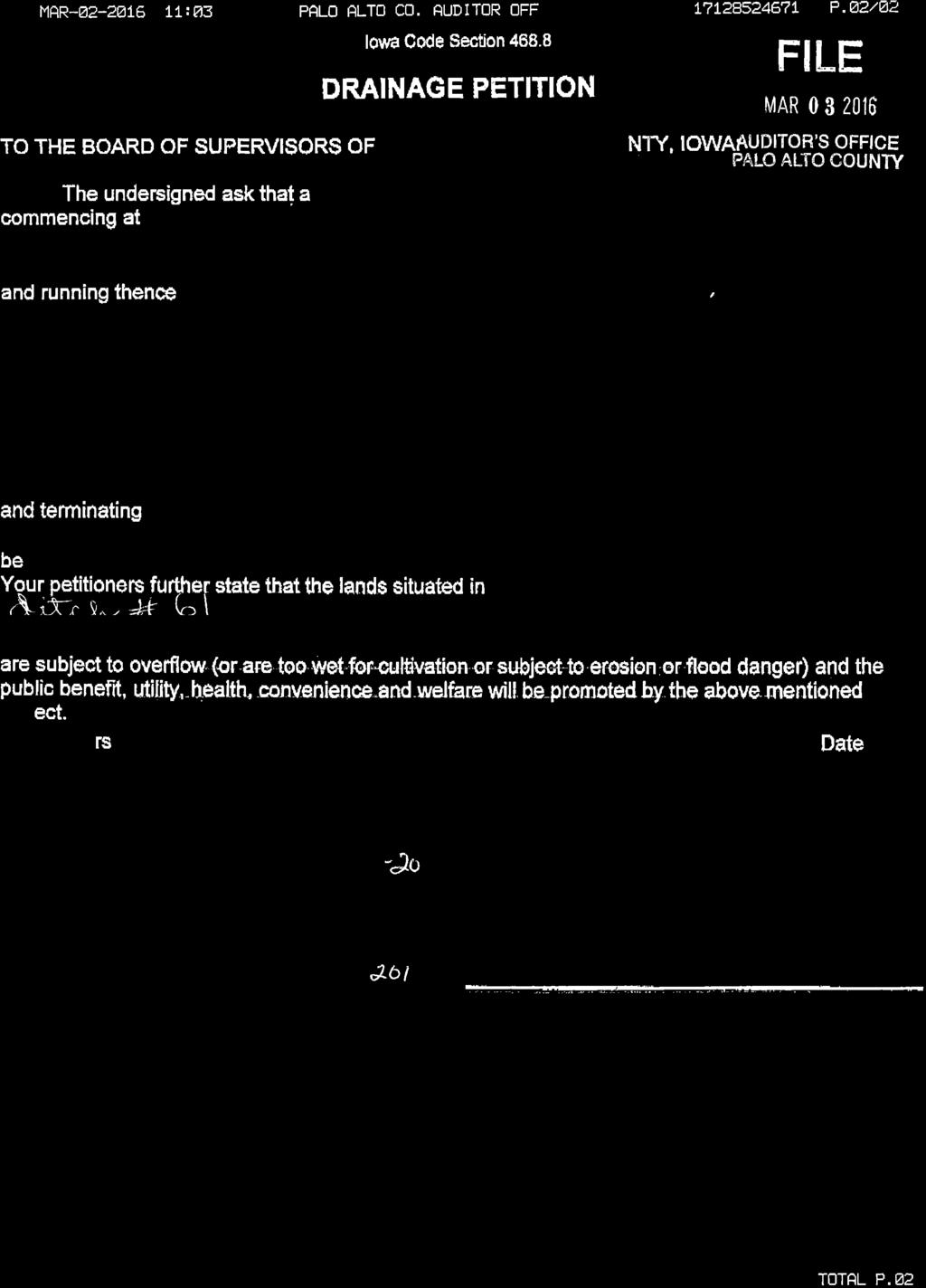
Proposed Lower Main Open Ditch Improvements Drainage District No. 61 Palo Alto County, Iowa 2017 P
|
|
|
- Sydney Young
- 5 years ago
- Views:
Transcription
1 Engineer s Report for Proposed Lower Main Open Ditch Improvements Drainage District No. 61 Palo Alto County, Iowa 2017 P Submitted by: Bolton & Menk, Inc th St SW Plaza Spencer, IA P:
2 Certification Engineer s Report for Proposed Main Open Ditch Improvements Drainage District No. 61 Palo Alto County, Iowa P I hereby certify that this plan, specification, or report was prepared by me or under my direct supervision, and that I am a duly Licensed Professional Engineer under the laws of the State of Iowa. My renewal date is December 31, By: Jonathan P. Rosengren, P.E. License No Date: March 16, 2017 DD 61 Open Ditch Improvements Palo Alto County, Iowa ǀ P Certification
3 Table of Contents I. Introduction... 1 Scope of Work... 1 Location... 1 History... 1 II. Investigation... 1 Ditch Crossings... 3 Utilities... 3 District Right of Way... 3 III. Farm Program Compliance... 3 Farm Program Wetland Conservation Rules... 3 Buffer Strips & CRP Disturbances... 5 IV. Other Regulatory Requirements... 6 State of Iowa Flood Plain Permit... 6 Clean Water Act Compliance... 6 V. Proposed Work Foot Base Improvement Foot Base Improvement... 9 VI. Conceptual Alternatives Downstream Channel Improvements Potential Stream Channel Mitigation Potential Wetland Mitigation VII. Assessment Schedule Review VIII. Discussions & Recommendations Tables Existing Open Ditch Design... 2 Existing Flow Depth, Low Ground Elevations and Impacted Acres... 2 Downstream Restrictions Foot Base Improvement... 7 Engineer s Opinion of Probable Costs Recommended Improvement Foot Base Improvement... 9 Appendix Appendix A: Petition and Wetland Determination Map Appendix B: Conceptual Alternative Maps Proposed Plans DD 61 Open Ditch Improvements Palo Alto County, Iowa ǀ P Table of Contents
4 I. Introduction Scope of Work In January of 2016, a report was filed for Drainage District No. 61. That report addressed the need for repairs to the Main Open Ditch including cleanout of the upper 4,000 feet of the ditch and FEMA repairs throughout district. The report also presented a conceptual improvement plan for the open ditch which would reduce the sedimentation of the upper end of the ditch and the excessive overflow throughout the south end of the district. The recommended repairs were approved at hearing in the March of 2016, and shortly thereafter, a petition was filed by a landowner in the district requesting further investigation of improvements to the south end of the district to reduce flooding in Sections 12 and 13 of West Bend Township. This investigation has been limited to the channel in Sections 12 and 13, laying north of 475 th St and south of 460 th St. The petitioner requested that construction of levees not be included in this report. Location Drainage District No. 61 Main Open Ditch is an improvement to a portion of Prairie Creek and a small tributary to that creek. The district facilities include approximately 6 miles of open ditch and several miles of tile. The watershed of Drainage District No. 61 covers approximately 35,500 acres in Fairfield, Fern Valley and West Bend Townships. Only 14,804 acres are currently assessed for benefits derived from the district facilities, approximately 42% of the contributing watershed. These assessed lands are located in Sections of Fairfield Township (T-96-N, R-31-W); Sections, 3-10, 14-18, and of Fern Valley Township (T-95-N, R-31-W); and Sections 1-4 and 9-12 in West Bend Township (T-94-N, R-31-W). The lands currently listed for benefit are listed on the current assessment schedule on file in the Auditor s Office. History A history of Drainage District No. 61 through the filing of the 2016 report on repairs is included in the Engineer s Report dated January 19, Below are listed items which have occurred since the date of that report Hearing on Repairs, Annexation and Reclassification. All approved Amendment No. 1 to the Engineer s Report filed Bid Letting, Contract Awarded to Reutzel Excavating of Burt, IA Petition filed to improve DD 61 Main Open Ditch south of 460 th St II. Investigation Survey of the entire open ditch was made in the fall of 2015 for the initial report filed in That survey has been used for this report, with the focus being the lower open ditch from station at 460 th St south to the beginning of the district at 0+00 and an additional 1,800 of privately improved Prairie Creek to 475 th St. The existing open ditch design cross sections and grades are shown below. Introduction DD 61 Open Ditch Improvements Palo Alto County, Iowa ǀ P Page 1
5 Existing Open Ditch Design Stations Cross Section Grade 0+00 to foot Base 0.03% to foot Base 0.03% to foot Base 0.03% to foot Base 0.03% to foot Base 0.05% to foot Base 0.05% The survey shows that the open ditch bottom is consistently well below the design elevation, ranging from 1.5 to 2.0 feet, as was discussed in the previous report. Several reasons for this include a known over excavation error by the contractor in 1991, uncontrolled longstick repairs which may have dug further below grade and possibly degradation during the passage of very large flows in the undersized channel cross section. The existing channel was modeled using the existing channel design and the existing channel elevations. A design flow was selected as recommended by the Iowa Drainage Guide using the contributing watershed area and a two-year 48-hour (Q 2-48 ) rainfall event. The design flow calculated from the Iowa Drainage Guide for the lower end of the DD 61 watershed is 740 cfs. According to the design standard, this flow should be carried by the channel one foot below the surrounding low ground. Using these criteria, approximately 180 acres of land are unprotected from flooding during the design storm. The table below shows the low ground elevation and the design flow elevation of the existing channel at several locations throughout Sections 12 and 13. Existing Flow Depth, Low Ground Elevations and Impacted Acres Station Low Ground Elev Q 2-48 Surface Elev. * Q 2-48 Impact Area acres acres acres acres acres acres acres * assumes water flow depth is normal This data shows the existing channel is greatly undersized and leaves large portions of the south end of the district prone to flooding. As part of the investigation, review of the bridge at 475 th St and the downstream channel was made to account for their impact on the performance of the DD 61 ditch. The table below shows the water surface elevation for the design flow at several restrictive locations downstream of 475 th St. Please note that the bridge is currently 1,800 feet downstream of the end of the district ditch. Investigation DD 61 Open Ditch Improvements Palo Alto County, Iowa ǀ P Page 2
6 Downstream Restrictions Distance Downstream of 475 th St Design Flow Water Elevation Hydraulic Grade 0 ft 740 cfs ft 740 cfs % (3.4 ft/mile) 1,600 ft 740 cfs % (0.9 ft/mile) 2,850 ft 802 cfs % (3.9 ft/mile) The table above indicates that the channel south of 275 th St acts as a restriction to approximately ½ mile south of the road. Modeling of the bridge shows that if the downstream channel were relieved, the water elevation at the road would drop significantly. Ditch Crossings There are four private crossings on the DD 61 Main Open Ditch between 460 th St and 475 th St. Two crossings are private bridges located at stations and both on the Daubindiek property. These bridges do not impede the current function of the ditch. If the ditch is widened, these bridges would not be long enough to reach across the channel. The third crossing is a low water vented ford crossing located at station on the Daubindiek property. The top elevation of the crossing is and includes twin 30 CMP culvert vents with an invert elevation of Analysis of the design shows very minimal impact upon the existing design flow elevation. If the ditch is improved, a similar design could be used to provide access across the channel for the landowner. The existing culverts would need to be lowered, but a top elevation similar to what currently exists at this location would be acceptable. The final crossing is an unvented ford crossing at station on the Frieder property. None of the four private crossings on the DD 61 Main Open Ditch appear to be a restriction. If similar crossings are added at each of these locations by the property owner, there would be little impact on the function of the channel. Utilities Overhead power lines and other utility lines likely parallel or cross the ditch at various locations; extra care will need to be taken when working under or near these utility lines. The contractor will be responsible to determine and notify utility companies and to cooperate in locating, marking and protecting their facilities. District Right-of-Way Additional right-of-way was purchased during the 1991 repairs and improvements project. The right-of-way was bought to a consistent 50 foot width on either side of the open ditch for the entire length. If improvements are elected, the acquisition of additional rights-of-way will be necessary to accommodate the additional width of the channel. III. Farm Program Compliance Farm Program Wetland Conservation Rules The farm program wetland conservation rules are regulated by the USDA Farm Service Agency. The USDA Natural Resources Conservation Service provides technical assistance. This technical assistance includes policing for program violations and making certified wetland determinations. We have made requests of landowners near the open ditch in Farm Program Compliance DD 61 Open Ditch Improvements Palo Alto County, Iowa ǀ P Page 3
7 Drainage District No. 61 to secure certified wetland determinations from the USDA/NRCS and to provide them to the district. Only landowners or their authorized agents may request the determinations. Some have not yet provided this information. In recent years, the USDA has adopted several new interpretations of the farm program wetland conservation rules which are applicable here. For any improvements constructed by a drainage district, the NRCS will make a rebuttable assumption that every farmed wetland in the drainage district will be converted. (This assumption can be appealed by the impacted landowners, but not by the drainage district.) Mitigation of converted farmed wetland must compensate for all lost wetland functions and must also be made at a minimum acre for acre basis. A plan for the mitigation of all converted farmed wetland in the drainage district must be approved by the NRCS prior to the beginning of the construction of the improvements. After all opportunities for appeals are exhausted, the farmed wetland not covered by that mitigation plan would be found converted and the landowner and tenant would be in technical violation of the farm program. Penalties can be avoided when a drainage district causes the conversion but only at the price of abandoning farming of the converted farmed wetlands or ceasing to participate in the farm program. The planned mitigation must be in place and functioning no later than the completion of the project which converts the farmed wetlands. If a landowner does not request a certified wetland determination and he happens to end up with a converted farmed wetland, he will find himself in technical violation of the farm program rules and be subject to a USDA claim for the forfeiture and possibly refund of farm program payments when the work commences. The Board of Supervisors may approve and authorize construction of the proposed improvements without accruing risk to the district from farm program wetland conservation rules violations. Obviously, the board will want to know the wetlands status of all landowners and to help to keep them all in farm program compliance, but the board cannot allow the failure of an individual landowner to share wetland information to influence the very important decisions it is charged to make for all of the benefitted landowners. However, by the rules, the program penalties will fall solely to the owners of the converted farmed wetlands for which compensatory mitigation is not secured. It is fully up to the landowner to cooperate with the district toward keeping himself/herself in farm program compliance. 1. Converted Wetland Mitigation Alternatives Since 1987, the USDA has assumed jurisdiction over the conversion (or improved drainage of) what has become commonly termed farmed wetland. It being the rebuttable assumption of the current USDA policies that all farmed wetlands will be converted and that acre-for-acre mitigation will be necessary to put the converted farmed wetlands back into production, the decision process is actually made a little easier although mitigation is made more costly. Mitigation options include the purchase of wetland credits in a mitigation bank. Mitigation banks are not common and their credits are not cheap. There are no agricultural mitigation banks serving this area with available credits. New sites for mitigation are currently being sought by the Iowa Agriculture Mitigation Bank, Inc. and it is possible that an eligible bank may be established nearby within the next few years. Another alternative is for the district to self-mitigate, wherein a mitigation plan to use a suitable site inside or outside the district on which to create wetlands for mitigation of impacted wetlands is developed for review and approval by the NRCS. Farm Program Compliance DD 61 Open Ditch Improvements Palo Alto County, Iowa ǀ P Page 4
8 A third alternative is to have the district pay the owner of a converted farmed wetland a portion of the cost for mitigation. The landowner may then either purchase mitigation on his own or let the land lay idle until mitigation is acquired. Farm program rules clearly provide that when a farmed wetland is converted by a drainage district the conversion act is attributed to the owner of the farmed wetland. However, the farm program rules also clearly provide that the owner of the converted farmed wetland may remain eligible for farm program benefits by opting to not farm the converted farmed wetland. If for some reason mitigation is delayed, this can be a temporary solution for the farmed wetland owners in a drainage district. It is also an option for those who choose not to report certified farmed wetland determinations to the drainage district. 2. Farmed Wetlands in Benefitted Area As of the date of this report we have received no certified determinations of wetlands in the impacted watershed area. All landowners are encouraged to provide their certified wetland determinations even if they have no farmed wetlands mapped. A map showing the impacted watershed and the determinations currently held by the district is included in Appendix A of this report. For estimating purposes a farmed wetland area of 0.5% of the impacted watershed area with no provided determinations (11.2 acres) plus the acres of farmed wetland reported in the areas covered by the provided determinations (0 acres) will be used. Using an assumed mitigation cost of $15,000 per acre, the estimated cost to the affected landowners for mitigation is $168,000. These acres and cost estimate could vary substantially as more or fewer acres could be reported. Buffer Strips & CRP Disturbances We note that there are several buffer strips in place along the open ditch where improvements are proposed. There are some manageable drawbacks that must be addressed by the owners of impacted buffer strips and CRP tracts. The destruction of buffer strip or CRP vegetation by construction activities places the landowner in violation of Farm Program conservation rules. The relatively severe penalties can include loss of the CRP contract or forfeiture of back CRP payments and penalties. To avoid these, landowners must request a waiver from the USDA Farm Service Agency County Committee. The county committee will grant waivers for ditch maintenance if seeding restoration, in compliance with NRCS requirements, is done. If the project is authorized, all farm program buffer strip and CRP owners in the path of construction must independently seek the FSA County Committee waivers. This process should be initiated immediately if the project is authorized. The CRP rules include not disturbing it during the primary nesting season of May 15 to August 1. However there is a drainage district ditch maintenance exception which we assume would be applicable. This would need to be confirmed. The widened ditch will also take out some CRP. USDA rules allow for CRP to be removed without penalty under threat of condemnation or we assume the buffer could be widened to offset the loss without penalty. Farm Program Compliance DD 61 Open Ditch Improvements Palo Alto County, Iowa ǀ P Page 5
9 IV. Other Regulatory Requirements State of Iowa Flood Plain Permit The state of Iowa regulates floodplain activities in rural areas for streams that have watersheds greater than ten square miles. The DD 61 open ditch is subject to floodplain regulatory jurisdiction. State administrative rules exempt drainage ditch repairs from the permit requirements but improvements and the placement of the spoil beside the ditch and in the floodplain will require IDNR review. We do not anticipate any problem in securing the needed permissions as the top elevations of the deposited spoil will not be controlled and low areas will be left in the spoil bank to limit levee functions. This permit will be applied for with the same application used for the CWA 404 discussed below. Clean Water Act Compliance Dredging and filling of waters of the United States (WOTUS) is regulated under Section 404 of the Clean Water Act. The US Army Corps has been charged with regulating impacts under CWA 404 and a permit will be required in order to complete the work proposed in this report. As part of the permitting process, the USACE will require delineation of all wetlands near the open ditch in order to determine impacts to those wetlands resulting from the project. The wetland determinations completed by the NRCS are acceptable for CWA 404 permitting. However, it is often difficult to get all areas along the ditch delineated to supply with the permit application. This is sometimes due to landowners not supplying their determinations, but also because the NRCS will not delineate wetlands on what they consider non-farmland or non-inventory (NI). For this reason, it will likely be necessary to have some wetlands delineated by a trained Wetland Specialist to complete the permit applications. We expect this permitting process to take time and will add to the overall project cost. However, we believe it is feasible to obtain all necessary permits for this project. There will likely be some manageable requirements placed on the project by the permitting process, including 2:1 side slopes on the new ditch and native grass seeding inside the channel rather than the more common brome grass. V. Proposed Work Using the same design criteria as discussed in the previous section, several improvement cross sections were modeled and analyzed. These improvement options used the improvement grade labeled on the attached plan sheets. This improvement grade is deeper than the conceptual grade shown in the January 2016 Engineer s Report. Please note that both options shown below will be subject to US Army Corps of Engineers review and permitting requirements. 50 Foot Base Improvement The first improvement section reviewed was widening the base to 50 feet with 2:1 side slopes carried from 475 th St to 460 th St. A portion of this work would be downstream of the district boundary and will be completed under the authority granted the district by Iowa Code Section (1). This improvement would provide significant relief to the lower end of the district. This improvement was analyzed using the same restricted outlet resulting from 475th St and the downstream creek. The results of this analysis are shown below. Other Regulatory Requirements DD 61 Open Ditch Improvements Palo Alto County, Iowa ǀ P Page 6
10 50 Foot Base Improvement Station Low Ground Elev Q 2-48 Surface Elev. Q 2-48 Impact Area / * 7 acres / 4 acres** / * 7 acres / 2.5 acres** / * 5 acres / 3 acres** / * 2 acres acres acres acres acres acres *Indicates area impacted by backwater from the 475th St Bridge. If the bridge is replaced, the surface elevation would be lowered and relieve additional lands from flooding. **Indicates the acres impacted if the out of channel downstream obstructions were removed The Engineer s Opinion of Probable Cost is shown in below. Engineer s Opinion of Probable Costs Recommended Improvement Unit Item Description Units Quantity Price Total 1 Excavation - Open Ditch CY 105,035 $2.75 $288,846 2 Spoil Bank Leveling STA 91.5 $575 $52,613 3 Bank Seeding STA 91.5 $230 $21,045 4 Topsoil Strip, Stockpile & Respread CY 20,000 $5 $100,000 5 Tile Extension, 12 Dia. CMP LF 160 $26 $4,160 6 Tile Extension, 15 Dia. CMP LF 40 $30 $1,200 7 Tile Extension, 18 Dia. CMP LF 20 $40 $800 8 Tile Extension, 24 Dia. CMP LF 60 $45 $2,700 9 Surface Drain, 15 Dia CMP LF 120 $29 $3, Surface Drain, 18 Dia CMP LF 180 $32 $5, Surface Drain, 24 Dia CMP LF 60 $38 $2, Surface Drain, 30 Dia CMP LF 180 $45 $8, Class D Riprap TN 500 $40 $20, Mobilization LS 1 $27,000 $27,000 Estimated Construction Total $538,000 Plus Construction Contingency $30,000 Total Estimated Assessable Construction Cost $568,000 Proposed Work DD 61 Open Ditch Improvements Palo Alto County, Iowa ǀ P Page 7
11 Construction Related Damages Right-of-Way Acquisition (15.95 Acres) $64,000 Work Area Rental (57.3 Acres) $16,000 Other Damages $60,000 Basic Engineering Services Survey, Study & Report. Meetings & Hearing $25,000 Construction Plans, Specifications & Bid Letting $20,000 Construction Engineering Services $20,000 Permitting and Third Party Wetland Determinations $15,000 Legal Services, Publications, Mailings, Etc. $12,000 Finance, Interest & Contingency $50,000 Total Estimated Assessable Project Cost $850,000 Estimated Average Cost Per Benefited Acre (35,464 ac) $24 Estimated Average Cost Per Acre Per Year (10 years) $3 Estimated Average Cost Per Acre Per Year (20 years) $2 The estimated total project cost for the recommended fifty-feet base improvement is about $850,000 or $24/watershed acre. This option would reduce the flooding impacts on 155 acres which are not protected by the existing undersized channel. It should be noted that the largest benefits will be realized by the lands between 460 th St and 475 th St. Thus a relatively larger portion of the assessments for this project will fall on those lands lying south of 460 th St. It should also be noted that some landowners may end up with converted farmed wetland which will need to be individually addressed. The landowner may leave the converted area sit idle and retain farm program eligibility. He may also acquire mitigation and resume farming. This cost is not included in the project cost estimate. 1. Additional Rights-of-Way If the open ditch is improved to a 50 foot base, additional rights-of-way should be acquired within which to maintain the channel. The table below summarizes the additional right-of-way recommended for each affected parcel. Sec-Twp-Rng Right of Way Tabulation 50 Bottom Width Existing Recommended Legal Right-of-Way Right-of-Way Description (100 feet) (140 feet) Right-of-Way to be Acquired NE OF RR, NE NE TR SE NE SE NE EXC TR Proposed Work DD 61 Open Ditch Improvements Palo Alto County, Iowa ǀ P Page 8
12 SW SW SE SW PT SW NW NW SW TR SW1/4 NW1/ PT SW NW NW NW AC TR IN SE NW PT NE NW PT. SE NW PT SE NW PT. NE NW Totals Foot Base Improvement A second option considered is widening the base to 40 feet with 2:1 side slopes from 475 th St to 460 th St. A portion of this work would also be downstream of the district boundary and would be completed under the authority granted the district by Iowa Code Section (1). This improvement was analyzed using the same restricted outlet resulting from 475th St and the downstream creek. The results of this analysis are shown below. 40 Foot Base Improvement Station Low Ground Elev Q 2-48 Surface Elev. Q 2-48 Impact Area / * 7 acres acres acres acres acres acres acres acres acres *Indicates area impacted by backwater from the 475th St Bridge. If the bridge is replaced, the surface elevation would be lowered and relieve additional lands from flooding. All work for this option remains the same except for a decrease of 27% in excavation. The estimated total project cost for the alternate 40 base improvement is $771,000 or $22/acre. This option would protect 119 acres which are not protected by the existing channel. Proposed Work DD 61 Open Ditch Improvements Palo Alto County, Iowa ǀ P Page 9
13 VI. Conceptual Alternatives There are several additional items which could bring benefit to the district, either by increased drainage relief or by generating cost offsetting revenues for the district. Preliminary maps for each alternative is included in Appendix B of this report. Any combination of the alternatives below could be added to either of the open ditch improvements described above. Downstream Channel Improvements As discussed in the investigation section of this report, the channel south of 475 th St is a restriction to any improvement in DD 61. It is our understanding that an investigation is currently being made for improvements in this area. If that separate project does not proceed, DD 61 would have the option under Iowa Code Section (1) to go downstream to relieve its outlet. A high overflow channel would be adequate to relieve the limitations that remain after the larger outlet channel is constructed by DD 61. Any improvements to the downstream channel would need approval from the US Army Corps of Engineers through the issuance of a Clean Water Act Sec 404 permit. Creating a high overflow channel would be the more readily permittable alternative than to enlarge and realigning or straightening the entire channel. Potential Stream Channel Mitigation The design criteria for two-stage channel design is evolving. Especially if the permit requirements for this or the downstream work requires stream channel mitigation the district could consider modifying the channel to provide a form of 2-stage channel. One conceptual two-stage design would add about 10% to the excavation quantity. There may also develop a market for stream channel mitigation credits. Potential Wetland Mitigation The lower end of DD 61 has a long history of flooding due to the shallow depth of the ditch. Improvements which would provide relief to the entire district within the current district ditch are difficult to accomplish. Because of this fact, our proposal will benefit some areas only marginally, while other areas in the district will be greatly benefited. It is feasible for the district to acquire some of the larger low lying areas not protected by either the recommended or alternative ditch improvements and create between 20 and 30 acres of wetland for mitigation credits. These acres could either be used by the district to offset wetland impacts which may result from this project, or sell the credits to landowners or other drainage districts in need of wetland mitigation. The Iowa Agricultural Mitigation Bank, Inc. would be a potential manager for the undertaking. Assuming an after-development market value of $12,000-18,000 per wetland acre, these wetlands could potentially generate $300,000 or more in revenue. No estimate of the cost to acquire the land or create the wetlands is included with this report. This work would have the ability to offset some of the cost of the improvements for all landowners in the district. This work would be separate from the recommended ditch improvements discussed above. If the owners of the potential wetland locations are interested and this project proceeds it would be worth a consideration for the district. Conceptual Alternatives DD 61 Open Ditch Improvements Palo Alto County, Iowa ǀ P Page 10
14 VII. Assessment Schedule Review The existing assessment schedule was reviewed in the January 2016 Engineer s Report. That report recommended annexation and classification of approximately 20,000 acres north of the district. Those recommendations were approved at the March 1, 2016 hearing. The annexation report will be completed once a decision on this proposed improvement is made. Though the proposed improvements extend south of DD 61, we do not recommend annexation of additional lands as those lands which would be included would receive little benefit from any improvement north of 475 th St recommended in this report. The majority of the benefit from the proposed work will fall in the southern half of the open ditch. We therefore recommend a one-time use schedule for spreading the costs of this proposed work which will pull a large portion of the cost to the south half of the district. The Board directed classification of newly annexed lands for the previous report. Because of this direction, the majority of the necessary information is already available for the creation of a pre-classifcation schedule. This pre-class will allow landowners to have a close estimate of their actual costs for the proposed improvements. If any conceptual work items described in this report are constructed which generate revenue for the district, those revenues should be refunded to the district using this same schedule used to spread the costs of the improvements. Following assessment of these improvements, the maintenance schedule setup for the entire Main Open Ditch should be used for all future maintenance. VIII. Discussions & Recommendations This report confirms the Drainage District No. 61 Main Open Ditch is in need of improvement to provide the long-time standard for drainage capacity for farmland as is recommended in the Iowa Drainage Guide. The work described in this report can accomplish the relief of the lower end of the district. Improvement Recommended. We recommend improvement of the open ditch to the existing surveyed bottom elevation shown on the attached plans with a cross section of a 50 foot base with 2:1 side slopes from 1,800 feet downstream of Station 0+00 at 475 th St, north to Station at 460 th St. The Engineer s Opinion of Probable Cost for this improvement of Drainage District No. 61 as proposed is $850,000. We find that the proposed improvement project will be practicable, feasible and beneficial to the public. Installment Payments. Iowa drainage district law provides that large improvements assessments may be spread over not less than ten nor more than twenty annual installments at the discretion of the Board of Supervisors. Typically the board would spread assessments of the magnitude contemplated in this report over ten years. If we assume that the board will allow ten annual installments at 5% interest, improvement costs for lands now in the district and within the impacted watersheds would be about $3 per acre per year for the DD 61 watershed. The anticipated higher assessments at the south end of the district might warrant use of the full twenty years. It is proposed that the costs of this work be spread upon the benefited lands using a one-time use assessment schedule. The existing schedule would be used for future maintenance. If there is sufficient interest the landowners and board may want to authorize a preclassification of benefits which will provide a close estimate of the assessments for all parcels. It is recommended that the Board of Supervisors of Palo Alto County, acting as trustees for Drainage District No. 61 take appropriate action, with legal guidance, to accomplish the following: Tentatively approve this engineer s report. Conduct a public hearing on the proposed improvements and discuss the conceptual Assessment Schedule Review DD 61 Open Ditch Improvements Palo Alto County, Iowa ǀ P Page 11
15 alternative work items. Adopt the proposed improvement plan, modified as deemed appropriate to satisfy the needs of the district. Direct the engineer to apply for and acquire the permits and regulatory approvals necessary to complete the project as approved by the Board of Supervisors Direct the engineer to prepare the necessary plans and specifications and to proceed toward a bid letting. Respectfully submitted, Bolton & Menk, Inc. Jonathan P. Rosengren, P.E. Discussions & Recommendations DD 61 Open Ditch Improvements Palo Alto County, Iowa ǀ P Page 12
16 Appendix A: Petition and Wetland Determination Map

17
18 Open Ditch Improvement Drainage District No. 61, Palo Alto, County Wetland Determination Status Map December, 2016 ( 34 ( 35 Information Hatched area indicates area of improvement in approximately 2010 for Branch J. Wetland determinations should already have been requested and delivered. ( 36 ( 3 ( 2 ( 1 END INVESTIGATION Branch J Improvement Benefited Area Map Document: H:\PAIA\P \GIS\DD 61 Improvments.mxd Date Saved: 12/7/2016 9:10:22 AM ( 10 Legend ( 15!I DD 61 Open Ditch Wetland Determination Boundary Wetland Request Sent Wetland Determination Recieved 0 2,000 Feet Source: ( 11 ( 14 ( 12 ( 13 BEGIN INESTIGATION Source: Esri, DigitalGlobe, GeoEye, Earthstar Geographics, CNES/Airbus DS, USDA, USGS, AEX, Getmapping, Aerogrid, IGN, IGP, swisstopo, and the GIS User Community
19 Appendix B: Conceptual Alternative Maps

20 Open Ditch Improvement Drainage District No. 61, Palo Alto, County Conceptual High Overflow Channel Map December, 2016 Information The alignment shown for the conceptual ditch is approximate only and would be adjusted to better fit the topography if any work is pursued. ( 13 END HIGH OVERFLOW CHANNEL Map Document: H:\PAIA\P \GIS\DD 61 Improvments.mxd Date Saved: 12/7/ :12:59 AM Legend!I High Overflow Channel Improvement Alignment Feet Source: EXISTING UNDERSIZED HIGH OVERFLOW CHANNEL BEGIN HIGH OVERFLOW CHANNEL Source: Esri, DigitalGlobe, GeoEye, Earthstar Geographics, CNES/Airbus DS, USDA, USGS, AEX, Getmapping, Aerogrid, IGN, IGP, swisstopo, and the GIS User Community


21 Open Ditch Improvement Drainage District No. 61, Palo Alto, County Conceptual Wetland Location Map December, 2016 Frieden, Lester L & Esther L NW SW Frieden, Lester L & Esther L NE SW Frieden, Lester L & Esther L NE SW Information The acres shown are potential acres of wetland possible at each site. Actual acres created would change if this conceptual alternative is pursued. Daubendiek Trust, W H SE SW acres Daubendiek Trust, W H SW SW Daubendiek Trust, W H SE SW acres Map Document: H:\PAIA\P \GIS\DD 61 Improvments.mxd Date Saved: 12/7/ :12:59 AM Legend Jurgens, Inc NW NW !I Improvement Alignment Potential Wetland Existing District Watershed Parcels Feet Source: Jurgens, Inc SW NW Zaugg, Martin PT. NE NW Zaugg, Doris, Farms, Inc PT NE NW acres Source: Zaugg, Esri, Martin DigitalGlobe, GeoEye, Earthstar Zaugg, Geographics, Doris, Farms, CNES/Airbus Inc DS, USDA, PT SE USGS, NW AEX, Getmapping, Aerogrid, IGN, PT. IGP, SE swisstopo, NW and the GIS User Community
22 Proposed Plans
TRUSTEE RESPONSIBILITIES ARCHITECTURE + ENGINEERING + ENVIRONMENTAL + PLANNING
 TRUSTEE RESPONSIBILITIES ARCHITECTURE + ENGINEERING + ENVIRONMENTAL + PLANNING CHAPTER 468 OF THE CODE OF IOWA Drainage Districts are governed under this chapter of the Code of Iowa. PETITION Triggers
AGENDA ITEM # CITY OF FERNLEY PLANNING COMMISSION AGENDA REPORT. Planning Commission. Melinda Bauer, Assistant Planner
 CITY OF FERNLEY PLANNING COMMISSION AGENDA REPORT AGENDA ITEM # TO: REPORT BY: REVIEWED BY: Planning Commission Melinda Bauer, Assistant Planner Tim Thompson, AICP Planning Director tthompson@cityoffernley.org
City of Seward, NE Tuesday, April 19, 2016 Regular Session
 , NE Tuesday, April 19, 2016 Regular Session Item G7 CONSIDERATION OF NOTICE OF LETTER OF INTENT FOR SW WELL #3 - Tim Richtig Administrative Report: This Notice of Intent will allow the City to keep the
Marion County Board of County Commissioners
 Marion County Board of County Commissioners Date: 4/26/26 P&Z: 4/25/26 BCC: 5/17/26 Item Number 160509Z Type of Application Request to rezone the property from the Rural Commercial (RC-1) District to the
Marion County Board of County Commissioners
 Marion County Board of County Commissioners Date: 10/29/25 P&Z: 10/26/25 BCC: 11/17/25 Item Number 151106SU Type of Application Special Use Permit Request Special Use Permit Modification to: 1. Add a secondary
AMENDED AGENDA BLUFFDALE CITY BOARD OF ADJUSTMENT. January 24, 2017
 AMENDED AGENDA BLUFFDALE CITY BOARD OF ADJUSTMENT January 24, 2017 Notice is hereby given that the Bluffdale City Board of Adjustment will hold a public meeting Tuesday, January 24, 2017, at the Bluffdale
Chapter 100 Planned Unit Development in Corvallis Urban Fringe
 100.100 Scope and Purpose. Chapter 100 Planned Unit Development in Corvallis Urban Fringe (1) All applications for land divisions in the Urban Residential (UR) and Flood Plain Agriculture (FPA) zones within
BWSR MN Public Drainage Manual Broad Users Outreach Workshop John Kolb, Attorney Lead Writer Chapter 4. MPDM Chapter 4: Viewing and Appraising
 BWSR MN Public Drainage Manual Broad Users Outreach Workshop John Kolb, Attorney Lead Writer Chapter 4 MPDM Chapter 4: Viewing and Appraising Chapter 4 Subcommittee Members 2 Sherry Enzler, MN DNR Bob
Marion County Board of County Commissioners
 Marion County Board of County Commissioners Date: 12/2/2015 P&Z: 11/30/2015 BCC: 12/16/2015 Item Number 151210SU Type of Application Special Use Permit Request To establish a Clay Electric Co-Operative
Article III. Erosion and Sedimentation Control
 Article III. Erosion and Sedimentation Control Section 9.6 Erosion and Sedimentation Control Plan Requirements Section 9.6.1 Plan Submission A plan shall be prepared for all land-disturbing activities
RULES AND REGULATIONS FOR ADMINISTRATION OF AREA DRAINAGE PLANS
 RIVERSIDE COUNTY RULES AND REGULATIONS FOR ADMINISTRATION OF AREA DRAINAGE PLANS ADOPTED JUNE 10, 1980 BY RESOLUTION NO. 80-244 AMENDMENTS RESOLUTION NO. May 26, 1981 81-148 Nov. 9, 1982 82-320 July 3,
VI. SAFETY ELEMENT I. INTRODUCTION A. PURPOSE B. AUTHORITY. 1. Safety
 AB 162 and SB 1241 Amendment to the Safety Element New sections are underlined, deleted sections are shown as strikethrough and the denotes text remaining in place. VI. SAFETY ELEMENT I. INTRODUCTION A.
***** Subchapter A. GENERAL PROVISIONS ***** PERMIT APPLICATIONS
 105.11. Permit requirements. 105.12. Waiver of permit requirements. Title 25 Environmental Protection Part I. Department of Environmental Protection Subpart C. Protection of Natural Resources Article I.
MILLE LACS COUNTY DRAINAGE AUTHORITY DRAINAGE POLICY
 CONTENTS MILLE LACS COUNTY DRAINAGE AUTHORITY DRAINAGE POLICY 1. DEFINITIONS... 2 2. GENERAL INFORMATION... 2 3. INSPECTIONS... 3 4. MEETINGS... 3 5. RECORDS RETENTION... 3 6. ADDITIONAL DRAINAGE... 3
Marion County Board of County Commissioners
 Marion County Board of County Commissioners Date: 12/2/25 P&Z: 11/30/25 BCC: 12/16/25 Amendment No: (20)151209Z Type of Application Rezoning Request P-MH (Mobile Home Park) to B-2 (Community Business)
Brief Summary of Drainage Law. November 2011
 Brief Summary of Drainage Law November 2011 This document is general information distributed by the State of South Dakota. Nothing in this document should be considered legal advice as to any specific
Chapter 5. Floodplain Management. 5.0 Introduction. 5.1 Floodplain Management and Regulation
 5.0 Introduction This chapter summarizes the Town s rules and regulations regarding floodplain management and development. The requirements presented in this chapter should be used by the design engineer
2015 ROUTT COUNTY BOARD OF EQUALIZATION Hearing Date: July 28 th, 2015
 205 ROUTT COUNTY BOARD OF EQUALIZATION Hearing Date: July 28 th, 205 Account#: R87255, R872553, R872556, R872559 PIN#: 28900003, 28900005, 28900008, 289000 Owner of Record: ADAMO FAMILY PARTNERSHIP, FAIR
Chapter 5. Floodplain Management. 5.0 Introduction. 5.1 Douglas County Comprehensive Master Plan. 5.2 Floodplain Management and Regulation
 5.0 Introduction This chapter summarizes the County s rules and regulations regarding floodplain management and development. The requirements presented in this chapter should be used by the design engineer
DRAINAGE CLASSIFICATION & RECLASSIFICATION
 DRAINAGE CLASSIFICATION & RECLASSIFICATION December 9, 2016 ARCHITECTURE + ENGINEERING + ENVIRONMENTAL + PLANNING PRESENTATION OUTLINE What is Classification & Reclassification? When and Why Reclassification?
Marion County Board of County Commissioners
 Marion County Board of County Commissioners Date: 10/27/2015 P&Z: 10/26/2015 BCC: 11/17/2015 Item Number 151104SU Type of Application Special Use Permit Request Parking of a Commercial Truck in the A-1
Appendix G. Non-Federal Letters of Support and Draft Real Estate Plan
 Appendix G Non-Federal Letters of Support and Draft Real Estate Plan REAL ESTATE PLAN UPPER DELAWARE RIVER WATERSHED FEASABILITY STUDY LIVINGSTON MANOR, NEW YORK 1. GENERAL 2. REAL ESTATE REQUIREMENTS
Purpose: Regulations:
 Administrative Procedures for the Designation and Refinement Of Chesapeake Bay Preservation Area Boundaries Guidance on the Chesapeake Bay Preservation Area Designation and Management Regulations September,
The planning commission has made a recommendation that the city council initiate amendments to the Hermiston zoning code to address housing needs.
 Staff Report For the Meeting of April 24, 2017 MAYOR AND MEMBERS OF THE CITY COUNCIL Agenda Item # NO. 2017 SUBJECT: Planning Commission Housing Recommendation Subject The planning commission has made
BRISTOL CONSERVATION COMMISSION INLAND WETLANDS AGENCY FORM IW-1 (Application for a Wetlands Permit)
") APPLICATION NO. BRISTOL CONSERVATION COMMISSION INLAND WETLANDS AGENCY FORM IW-1 (Application for a Wetlands Permit) DATE FILED: APPROVED: DENIED: 1. APPLICANT: Name: Signature: Address: City: State: Zip
APPLICATION NO. BRISTOL CONSERVATION COMMISSION INLAND WETLANDS AGENCY FORM IW-1 (Application for a Wetlands Permit) DATE FILED: APPROVED: DENIED: 1. APPLICANT: Name: Signature: Address: City: State: Zip
FOR SALE. The bid procedure has ended. The sales price is $152, THE FOLLOWING PROPERTY IS BEING OFFERED FOR SALE BY THE STATE OF NORTH CAROLINA
 FOR SALE The bid procedure has ended. The sales price is $152,000.00 THE FOLLOWING PROPERTY IS BEING OFFERED FOR SALE BY THE STATE OF NORTH CAROLINA Blanch Correctional Institution Location: 2061 High
Appendix B Real Estate Plan
 Appendix B Real Estate Plan B-1 REAL ESTATE PLAN Prepared for U.S. Army Corps of Engineers Southwestern Division Little Rock District As of May 1, 2013 Prepared by Ronald Bridges Real Estate Division ANY
AGENDA ITEM SUMMARY. Planning and Community Development
 AGENDA ITEM SUMMARY District Impacted 1 = Haberstroh 2 = Woolard 3 = Boyd 4 = Cisneros 5 = Bergmann All ITEM NO: AGENDA DATE: NOVEMBER 3, 2014 DESCRIPTION: Untable and Consider a request for a variance
CHAPTER 17 SURFACE DRAINAGE MANAGEMENT
 CHAPTER 17 SURFACE DRAINAGE MANAGEMENT TABLE OF CONTENTS 17.01 INTENT...1 17.02 DRAINS...1 17.03 MODIFICAITON OF DRAINS, PERMIT REQUIRED...3 17.04 DRAIN OBSTRUCTIONS AND UNAUTHORIZED STRUCTURES AND MODIFICATIONS
Attached is a Clinton Township Zoning Permit Application and requirements for issuance of a permit.
 To Whom It May Concern: Attached is a Clinton Township Zoning Permit Application and requirements for issuance of a permit. The fee for the permit application is $75.00, which shall be made payable to
Project Name: (Name as it appears in ESNAPS.) Spring Care Association
 Spring Care Association") Page 1 of 4 U.S. Department of Housing and Urban Development 451 Seventh Street, SW Washington, DC 20410 www.hud.gov espanol.hud.gov Environmental Review for Continuum of Care (CoC) Rental Assistance Project
Page 1 of 4 U.S. Department of Housing and Urban Development 451 Seventh Street, SW Washington, DC 20410 www.hud.gov espanol.hud.gov Environmental Review for Continuum of Care (CoC) Rental Assistance Project
Buffer and Soil Loss Statutes, as amended in 2017 by Laws of Minnesota 2017, Chapter 93 (S.F. 844)
") Buffer and Soil Loss Statutes, as amended in 2017 by Laws of Minnesota 2017, Chapter 93 (S.F. 844) May 30, 2017 103B.101 BOARD OF WATER AND SOIL RESOURCES Subd. 12. Authority to issue penalty orders. (a)
Buffer and Soil Loss Statutes, as amended in 2017 by Laws of Minnesota 2017, Chapter 93 (S.F. 844) May 30, 2017 103B.101 BOARD OF WATER AND SOIL RESOURCES Subd. 12. Authority to issue penalty orders. (a)
engineering planning environmental construction
 engineering planning environmental construction 1648 Third Avenue SE Rochester, MN 55904 Tel: 507-289-3919 Fax: 507-289-7333 June 3, 2015 Mr. John Harford Rochester / Olmsted Planning Department 2122 Campus
Marion County Board of County Commissioners
 Marion County Board of County Commissioners Date: 12/2/2015 P&Z: 11/30/2015 BCC: 12/16/2015 Amendment No: 2015-S05 Type of Application Small Scale FLUMS Amendment Request Rural Land to Rural Activity Center
Draft Continuing Authorities Program Section 1135 Detailed Project Report and Integrated Environmental Assessment
 Appendix G Real Estate Shorty s Island / Meander Reach Ecosystem Restoration Kootenai River, Idaho Draft Continuing Authorities Program Section 1135 Detailed Project Report and Integrated Environmental
Prepared by and to be returned to Linn County Planning & Development nd Street S.W., Cedar Rapids, Iowa (319)
") Prepared by and to be returned to Linn County Planning & Development 935 2 nd Street S.W., Cedar Rapids, Iowa 52404-2161 (319) 892-5130 LINN COUNTY, IOWA ZONING BOARD OF ADJUSTMENT IN THE MATTER OF THE
Prepared by and to be returned to Linn County Planning & Development 935 2 nd Street S.W., Cedar Rapids, Iowa 52404-2161 (319) 892-5130 LINN COUNTY, IOWA ZONING BOARD OF ADJUSTMENT IN THE MATTER OF THE
June 1, 2017 BOARD MATTER H - 1 FINAL CONSIDERATION OF STATE TRUST LAND EXCHANGE
 June 1, 2017 BOARD MATTER H - 1 ACTION: AUTHORITY: FINAL CONSIDERATION OF STATE TRUST LAND EXCHANGE W.S. 36-1-107, 36-1-110, and 36-1-111; Board of Land Commissioners Rules and Regulations, Chapter 26,
SECTION 10: FLOOD HAZARD EVALUATION 10-1
 10) SECTION 10: FLOOD HAZARD EVALUATION A. General. Land subject to being flooded by a Flood of 100-Year Frequency as defined by Title 76, Chapter 5, MCA, or land subject to flooding pursuant to these
Administrative Penalty Order (APO) Plan for Buffer Law Implementation
 Plan for Buffer Law Implementation") Administrative Penalty Order (APO) Plan for Buffer Law Implementation June 28, 2017 This document was adopted by the Board of Water and Soil Resources (BWSR) pursuant to Minn. Stat. 103B.101, subd. 12(a)
Administrative Penalty Order (APO) Plan for Buffer Law Implementation June 28, 2017 This document was adopted by the Board of Water and Soil Resources (BWSR) pursuant to Minn. Stat. 103B.101, subd. 12(a)
VILLAGE OF MONTGOMERY
 VILLAGE OF MONTGOMERY Plan Commission Meeting Agenda March 3, 2016 7:00 P.M. Village Hall Board Room 200 N. River Street, Montgomery, IL 60538 I. Call to Order II. III. Pledge of Allegiance Roll Call IV.
VILLAGE OF ASHVILLE DEPARTMENT OF PUBLIC UTILITIES DIVISION OF STORMWATER MANAGEMENT STORMWATER MANAGEMENT PROGRAM STORMWATER CREDIT MANUAL
 VILLAGE OF ASHVILLE DEPARTMENT OF PUBLIC UTILITIES DIVISION OF STORMWATER MANAGEMENT STORMWATER MANAGEMENT PROGRAM STORMWATER CREDIT MANUAL SECTION I. OVERVIEW AND GENERAL INSTRUCTIONS INTRODUCTION A stormwater
PARK COUNTY PLANNING COMMISSION PLANNING DEPARTMENT STAFF REPORT
 PARK COUNTY PLANNING COMMISSION PLANNING DEPARTMENT STAFF REPORT Planning Commission Hearing Date: July 14, 2015 To: Planning Commissioners Date: July 8, 2015 Prepared by: Subject: Request: Jill Falchi,
Steamboat Ski Area Zone Change
 ACTIVITY #: PL-15-1041 Steamboat Ski Area Zone Change HEARING DATES: Planning Commission: 11/19/15 at 6:00 pm Board of County Commissioners 12/7/15 at 1:30 pm pre-hearings: Board of County Commissioners:
Hampton Township School District WORK SESSION Monday, June 06, :00 p.m. Dr. Harold Sarver Library. FACILITIES AGENDA, Ms.
 Hampton Township School District WORK SESSION Monday, June 06, 2016 7:00 p.m. Dr. Harold Sarver Library FACILITIES AGENDA, Ms. Balason, Chair TO: Mrs. Hennessey, Mrs. Lamagna, Mrs. Litwiler, Mrs. Lueers,
PONDS. A. Definitions.
 A. Definitions. PONDS For purposes of this section, the following terms shall have the following meanings: 1. Application means all documents, forms and other information that the Department may require
Appendix A Reproducible Forms
 Appendix A Reproducible Forms Form LD-33 LD-34 LD-35 LD-40 LD-41 LD-42 LD-50 LD-51 LD-52 LD-53 Subject County Engineer Approval Form Storm Sewer Computation Sheet Ohio Drainage Design Criteria Form Gutter
CHAPTER 3 PRELIMINARY PLAT
 10-3-1 10-3-3 SECTION: CHAPTER 3 PRELIMINARY PLAT 10-3-1: Consultation 10-3-2: Filing 10-3-3: Requirements 10-3-4: Approval 10-3-5: Time Limitation 10-3-6: Grading Limitation 10-3-1: CONSULTATION: Each
ELK RAPIDS TOWNSHIP ANTRIM COUNTY, MICHIGAN ORDINANCE NO
 ELK RAPIDS TOWNSHIP ANTRIM COUNTY, MICHIGAN ORDINANCE NO. 3-2011 AN ORDINANCE TO REPLACE THE SUBDIVISION CONTROL ORDINANCE WITH A NEW SUBDIVISION DEVELOPMENT ORDINANCE, IN ACCORD WITH THE LAND DIVISION
ARLINGTON COUNTY, VIRGINIA. County Board Agenda Item Meeting of June 17, 2017
 ARLINGTON COUNTY, VIRGINIA County Board Agenda Item Meeting of June 17, 2017 DATE: June 9, 2017 SUBJECT: Request to authorize advertisement of public hearings by the Planning Commission and County Board
NOTICE DATE: August 19, Joint Public Notice. U.S. Army Corps of Engineers and State of Arkansas
 US Army Corps of Engineers Memphis District Public Notice FILE NUMBER: MVM-2013-182 (RCW) NOTICE DATE: August 19, 2013 Attn: Postmaster, Please Post Until EXPIRATION DATE: September 18, 2013 Joint Public
BOARD OF ZONING APPEALS CASE SUMMARY FOR VARIANCE REQUEST. 325 Veterans Road
 BOARD OF ZONING APPEALS CASE SUMMARY FOR VARIANCE REQUEST 325 Veterans Road April 11, 2017 at 10:00 A.M. City Council Chambers, 1737 Main Street, 3 rd Floor Columbia, South Carolina Case Number: 2017-0031-V
Emergency Watershed Program Sandy Recovery Activities and Flood Plain Easement Program
 Emergency Watershed Program Sandy Recovery Activities and Flood Plain Easement Program Greg Westfall, Resource Conservationist USDA-Natural Resources Conservation Service (NRCS) Set up by Congress to respond
THE CORPORATION OF THE TOWNSHIP OF NORTH FRONTENAC BY-LAW #123-13
 THE CORPORATION OF THE TOWNSHIP OF NORTH FRONTENAC BY-LAW #123-13 Being a By-law to Adopt an Assumption of Unmaintained Municipal Roads and Private Lanes Policy and Minimum Road Construction Standards
JANUARY 2016 MAMARONECK & SHELDRAKE RIVERS NEW YORK FLOOD RISK MANAGEMENT GENERAL REEVALUATION REPORT FOR THE VILLAGE OF MAMARONECK APPENDIX E
 U.S. Army Corps of Engineers New York District MAMARONECK & SHELDRAKE RIVERS NEW YORK FLOOD RISK MANAGEMENT GENERAL REEVALUATION REPORT FOR THE VILLAGE OF MAMARONECK JANUARY 2016 APPENDIX E REAL ESTATE
ZONING AMENDMENT & SUBDIVISION STAFF REPORT Date: November 3, 2016
 ZONING AMENDMENT & SUBDIVISION STAFF REPORT Date: November 3, 2016 APPLICANT NAME SUBDIVISION NAME David Shumer 5955 Airport Subdivision CITY COUNCIL DISTRICT District 6 5955 Airport Boulevard, 754 Linlen
APPLICATION PROCEDURE
 ANTRIM PLANNING BOARD P. O. Box 517 Antrim, New Hampshire 03440 Phone: 603-588-6785 FAX: 603-588-2969 APPLICATION FORM AND CHECKLIST FOR MINOR OR MAJOR SITE PLAN REVIEW File Date Received By APPLICATION
PLANNED UNIT DEVELOPMENT (PUD) AREA PLAN/REZONING REVIEW PROCEDURE
 AREA PLAN/REZONING REVIEW PROCEDURE") PLANNED UNIT DEVELOPMENT (PUD) AREA PLAN/REZONING REVIEW PROCEDURE Professional inquiries will be made to our Township Planning Consultant, Township Engineer, and Township Attorney to get their opinions
PLANNED UNIT DEVELOPMENT (PUD) AREA PLAN/REZONING REVIEW PROCEDURE Professional inquiries will be made to our Township Planning Consultant, Township Engineer, and Township Attorney to get their opinions
20 Acres Lumpkin Farmland
 20 Acres Lumpkin 20.25 +/- Acres ($2,444/acre) Stewart County, GA $49,500 Address: 7000 Green Grove Road Lumpkin, GA 31815 Location: From the corner of US HWY 27 and Green Grove Rd, go west for three miles
AMENDED AGENDA BLUFFDALE CITY BOARD OF ADJUSTMENT. October 4, 2016
 AMENDED AGENDA BLUFFDALE CITY BOARD OF ADJUSTMENT October 4, 2016 Notice is hereby given that the Bluffdale City Board of Adjustment will hold a public meeting Tuesday, October 4, 2016, at the Bluffdale
City Of Attleboro Conservation Commission
 City Of Attleboro Conservation Commission GOVERNMENT CENTER, 77 PARK STREET ATTLEBORO, MASSACHUSETTS 02703 (508) 223 2222 FAX 222 3046 GENERAL INSTRUCTIONS AND CHECKLIST FOR COMPLETING STORMWATER MANAGEMENT
Federal Mandates and Willing Sellers: Real Estate Acquisition for the Missouri River Recovery Program
 Federal Mandates and Willing Sellers: Real Estate Acquisition for the Missouri River Recovery Program Brad Thompson, Chief, Civil Works Branch U.S. Corps of Engineers, Omaha District US Army Corps of Engineers
SALE John Cannon, CCIM
 E Ansley St LOCATION Between Moursund Blvd and Pleasanton Rd; between East Ansley St and Ashley Rd in south San Antonio LAND SIZE & FRONTAGE : 2.194 AC / 95,570.64 SQ FT 685 FT of frontage on Moursund
$229, /- Acres. Craven County, NC. Aaron Sutton Office: Cell: Fax:
 farmland@with development potential 22 +/- Acres Craven County, NC $229,000 National Land Realty 3906-A Arendell Street Morehead City, NC 28557 www.nationalland.com Aaron Sutton Office: 855.384.5263 Cell:
$395, /- Acres. Sevier County, TN. Thomas Krajewski Office: Cell: Fax:
 smoky@mountain property 31 +/- Acres Sevier County, TN $395,000 National Land Realty 10101 Sherrill Blvd Knoxville, TN 37932 www.nationalland.com Thomas Krajewski Office: 855.384.5263 Cell: 865.679.3873
Flood Hazard Area Control Act Rules
 An Overview of New Jersey s Flood Hazard Area Control Act Rules State of New Jersey Department of Environmental Protection Chingwah Liang Why Regulate NJ s Floodplains? 1. New Jersey endures enormous
REPORT TO THE SHASTA COUNTY PLANNING COMMISSION
 REPORT TO THE SHASTA COUNTY PLANNING COMMISSION PROJECT IDENTIFICATION: REGULAR AGENDA GENERAL PLAN AMENDMENT GPA18-0003 AND ZONE AMENDMENT ZA18-0004 AREA 3 - SOUTHWEST PALO CEDRO: GILBERT DRIVE CONTINUED
ARTICLE 15 - PLANNED UNIT DEVELOPMENT
 Section 15.1 - Intent. ARTICLE 15 - PLANNED UNIT DEVELOPMENT A PUD, or Planned Unit Development, is not a District per se, but rather a set of standards that may be applied to a development type. The Planned
Conservation Design Subdivisions
 Conservation Design Subdivisions An excerpt from the Rules and Regulations Governing Division of Land in Sheridan County, Wyoming, November 5, 2010 Sheridan County Public Works Department 224 S. Main Street
Surabaya River Improvement Project (II-1)
") Indonesia 1. Project Profile and Japan s ODA Loan (1) Background Surabaya River Improvement Project (II1) Report Date: June 2 Field Survey: February 2 When this project was planned in 199, the city of
Indonesia 1. Project Profile and Japan s ODA Loan (1) Background Surabaya River Improvement Project (II1) Report Date: June 2 Field Survey: February 2 When this project was planned in 199, the city of
CHAPTER 30 BUILDING CODE
 CHAPTER 30 BUILDING CODE 30.01 SOUTHEASTERN WISCONSIN CODE ADOPTED Pursuant to the authority of Section 66.035 of the Wisconsin Statutes, the Southeastern Wisconsin Uniform Building Code in the form prepared
Creek Rehabilitation Plan for Apple Valley Questions and Answers from the Pre-Bid Meeting and Site Visit 06/23/2016
 Questions and Answers from the Pre-Bid Meeting and Site Visit 06/23/2016 Q: What are the threatened and endangered species concerns in the area? A: This is potential habitat for Prebles Meadow Jumping
APPENDIX 1 THRESHOLD CRITERIA. To be considered for financing resources, Applications must meet the Threshold requirements described below.
 APPENDIX 1 THRESHOLD CRITERIA To be considered for financing resources, Applications must meet the Threshold requirements described below. 1. Project Feasibility, Viability Analysis and Conformance Rent
LAKE OF THE WOODS COUNTY WETLAND CONSERVATION ORDINANCE OF 2002
 Ordinance # LAKE OF THE WOODS COUNTY WETLAND CONSERVATION ORDINANCE OF 2002 ARTICLE 1 TITLE AND PURPOSE Section 1.1. Title This Ordinance shall be known, cited and referred to as the Lake of the Woods
Chapter 136. SOIL EROSION
 1 of 8 12/19/2011 4:17 PM Township of Andover, NJ Monday, December 19, 2011 Chapter 136. SOIL EROSION [HISTORY: Adopted by the Township Committee of the Township of Andover by Ord. No. 77-11 (Ch. XVII
Part 72. Sec. 1. This ordinance shall be known and may be cited as the Clyde Township Wetlands Ordinance.
 Part 72 72.000 WETLANDS ORDINANCE Ord. No. 1 Adopted: June 12, 1991 Amended: April 13, 1994 72.001 SHORT TITLE. 72.002 PURPOSE. 72.003 DEFINITIONS. CLYDE TOWNSHIP ORDAINS: Sec. 1. This ordinance shall
River Rock Estates Sketch Plan, a proposed major subdivision in S24, T35N R2W NMPM on County Rd 119 (PLN18-336)
") MEMORANDUM Archuleta County Development Services Planning Department 1122 HWY 84 P. O. Box 1507 Pagosa Springs, Colorado 81147 970-264-1390 Fax 970-264-3338 TO: Archuleta County Planning Commission FROM:
MEMORANDUM Archuleta County Development Services Planning Department 1122 HWY 84 P. O. Box 1507 Pagosa Springs, Colorado 81147 970-264-1390 Fax 970-264-3338 TO: Archuleta County Planning Commission FROM:
RESPONSIBILITY AND PROCEDURE FOR IMPROVEMENT AND MAINTENANCE OF DRAINS, DITCHES AND WATERCOURSES
 RESPONSIBILITY AND PROCEDURE FOR IMPROVEMENT AND MAINTENANCE OF DRAINS, DITCHES AND WATERCOURSES FORWARD The Offices of the County Engineer and County Commissioners of Greene County are inundated yearly
REQUEST TO SUBMIT OFFERS FOR THE LEASING OF SCHOOL BOARD PREMISES 30+/- ACRES- WEST AREA VACANT AGRICULTURAL PARCEL
 SCHOOL BOARD OF PALM BEACH COUNTY REQUEST TO SUBMIT OFFERS FOR THE LEASING OF SCHOOL BOARD PREMISES 30+/- ACRES- WEST AREA VACANT AGRICULTURAL PARCEL RELEASE DATE: November 16, 2018 INTRODUCTION 1. This
BECKER COUNTY HIGHWAY DEPARTMENT 200 EAST STATE STREET DETROIT LAKES, MN 56051
 BECKER COUNTY HIGHWAY DEPARTMENT 200 EAST STATE STREET DETROIT LAKES, MN 5605 Re: Application for Access Approach Permit Enclosed, as requested, is an Application for Access Approach Permit form, which
$99, /- Acres. Sevier County, TN. Thomas Krajewski Office: Cell: Fax:
 large@smoky mountain@cabin lot 16.6 +/- Acres Sevier County, TN $99,000 National Land Realty 10101 Sherrill Blvd Knoxville, TN 37932 www.nationalland.com Thomas Krajewski Office: 855.384.5263 Cell: 865.679.3873
Appendix B Draft Real Estate Plan
 Appendix B Draft Real Estate Plan B-1 REAL ESTATE PLAN Prepared for U.S. Army Corps of Engineers Southwestern Division Little Rock District As of December 3, 2012 Prepared by Ronald Bridges Real Estate
UPPER MOUNT BETHEL TOWNSHIP, NORTHAMPTON COUNTY, PA MINOR SUBDIVISION FINAL PLAN CHECKLIST* YES** NO
 UPPER MOUNT BETHEL TOWNSHIP, NORTHAMPTON COUNTY, PA MINOR SUBDIVISION FINAL PLAN CHECKLIST* YES** NO GENERAL SUBMISSION ITEMS Does the submission include: 1. Seven (7) copies of completed Application Form?
O-I (Office-Institutional) and AG-1(Agricultural)
 and AG-1(Agricultural)") PROPERTY INFORMATION ADDRESS 3503 and 3505 Bethany Bend DISTRICT, LAND LOTS 2/1 973 and 974 OVERLAY DISTRICT State Route 9 PETITION NUMBERS EXISTING ZONING O-I (Office-Institutional) and AG-1(Agricultural)
PROPERTY INFORMATION ADDRESS 3503 and 3505 Bethany Bend DISTRICT, LAND LOTS 2/1 973 and 974 OVERLAY DISTRICT State Route 9 PETITION NUMBERS EXISTING ZONING O-I (Office-Institutional) and AG-1(Agricultural)
GENERAL INDEX DRAINAGE AND LEVEE DISTRICTS. Iowa Drainage Law Manual. Iowa Code Annotated General Index
 APPENDIX B: IOWA CODE ANNOTATED GENERAL INDEX Reprinted from West s Iowa Code Annotated with permission. Copyright 2004 West, a Thomson business. For further information about West s Iowa Code Annotated
Staff Report Annexation
 Staff Report Annexation Case #: Z 2017 07 00040 Attachments: Staff Report, Survey, Photos, Annexa on Pe on form, Reg. of Voters Le er, Assessor Le er, Applica on, Zoning Map, Council District Map Zoning
Land Use Application
 Land Use Application Check all permits you are applying for in the boxes provided. Submit this application form, the applicable materials listed in the corresponding permit application packet(s) and application
SUBDIVISION, PLANNING APPROVAL, & REZONING STAFF REPORT Date: June 4, 2015
 SUBDIVISION, PLANNING APPROVAL, & REZONING STAFF REPORT Date: June 4, 2015 APPLICANT NAME SUBDIVISION NAME DEVELOPMENT NAME LOCATION Board of Water & Sewer Commissioners of the City of Mobile MAWSS MLK
Planning Commission Regular Meeting Monday, August 8, 2016 at 6:00 PM
 City of DuPont 1700 Civic Dr. DuPont, WA 98327 Planning Commission Regular Meeting Monday, August 8, 2016 at 6:00 PM Aaron VanAlstine (Chair, Position 5) Beth Elliott (Position 1) Jenifer Brown (Position
APPLICATION PROCEDURE
 ANTRIM PLANNING BOARD P. O. Box 517 Antrim, New Hampshire 03440 Phone: 603-588-6785 FAX: 603-588-2969 APPLICATION FORM AND CHECKLIST FOR EARTH EXCAVATION AND RECLAMATION File # Date Received By APPLICATION
The Drainage Control Regulations
 1 The Drainage Control Regulations Repealed by Saskatchewan Regulations 89/2015 (effective October 16, 2015) Formerly Chapter D-33.1 Reg 1 (effective August 18, 1981) as amended by Saskatchewan Regulations
DRAINAGE EASEMENT & MAINTENANCE AGREEMENT
 DRAINAGE EASEMENT & MAINTENANCE AGREEMENT THIS DRAINAGE EASEMENT & MAINTENANCE AGREEMENT (this Easement ) is granted this day of, 20, by, [husband and wife/trustee, etc.], whose address is (the Grantor
Marion County Planning & Zoning Commission
 Marion County Planning & Zoning Commission Date: /3/24 P&Z: 9/29/24 BCC: /21/24 Item Number 1409Z Type of Application Rezoning Request From: R-3, Multiple Family Residential To: B-4, Regional Business
Marion County Board of County Commissioners
 Marion County Board of County Commissioners Date: 10/4/26 P&Z: 9/26/26 BCC: 10/18/26 Item Number 161005SU Type of Application Special Use Permit Request Special Use Permit to allow a crematory as an accessory
BEAR CREEK TOWNSHIP EMMET COUNTY, MICHIGAN. PRIVATE ROAD ORDINANCE Ordinance No. 11A-99. (to replace prior Private Road Ordinance No.
 BEAR CREEK TOWNSHIP EMMET COUNTY, MICHIGAN PRIVATE ROAD ORDINANCE Ordinance No. 11A-99 (to replace prior Private Road Ordinance No. 11-99) An Ordinance to protect the health, safety, and general welfare
Townships and the County Engineer
 Townships and the County Engineer Dean C. Ringle, P.E., P.S. Executive Director County Engineers Association of Ohio New Trustees Role of & Working with the County Engineer The county engineer is responsible
NOTICE OF TIMBERLAND SALE HOWARD & POLK COUNTIES BID. County Line 160 Totaling approximately 160 acres, more or less
 NOTICE OF TIMBERLAND SALE HOWARD & POLK COUNTIES BID County Line 160 Totaling approximately 160 acres, more or less BIDS DUE: Thursday, May 18 th, 2017, 2:00 PM Davis DuBose Knight Forestry & Real Estate
Chapter Five Drainage 2017 final Law.docx 1
 Chapter Five Drainage Law One of the realities of living in Iowa is our abundant rainfall making it possible for us to farm and produce crops. But anyone who owns land knows that too much (or too little)
géãç Éy VtÇtÇwt zât 5440 Routes 5 & 20 West Canandaigua, NY Phone: (585) / Fax: (585)
 / Fax: (585)") géãç Éy VtÇtÇwt zât 5440 Routes 5 & 20 West Canandaigua, NY 14424 Phone: (585) 394-1120 / Fax: (585) 394-9476 NOTICE TO ALL PLANNING BOARD APPLICANTS FOR PRELIMINARY SUBDIVISION PHASED PROJECTS The applicant
géãç Éy VtÇtÇwt zât 5440 Routes 5 & 20 West Canandaigua, NY 14424 Phone: (585) 394-1120 / Fax: (585) 394-9476 NOTICE TO ALL PLANNING BOARD APPLICANTS FOR PRELIMINARY SUBDIVISION PHASED PROJECTS The applicant
Construction & Earthwork Request Form (CERF)
") ShoreLand Traditions Construction & Earthwork Request Form (CERF) SECTION 1 SECTION 2 SECTION 3 Definitions and Points to Remember Requirements and Process Site Sketch Requirements and Sample If you have
ShoreLand Traditions Construction & Earthwork Request Form (CERF) SECTION 1 SECTION 2 SECTION 3 Definitions and Points to Remember Requirements and Process Site Sketch Requirements and Sample If you have
Conceptual Scheme SE W4
 December 2012 1. PURPOSE 1.1. The purpose of a Conceptual Scheme (CS) is as follows: a) To provide a framework for the subsequent subdivision and/or development of land within the Country Residential Policy