SECOND AMENDMENT TO LOCAL DEVELOPMENT AGREEMENT [Amazon] WITNESSETH:
|
|
|
- Madeleine Greer
- 5 years ago
- Views:
Transcription
![SECOND AMENDMENT TO LOCAL DEVELOPMENT AGREEMENT [Amazon] This SECOND AMENDMENT TO LOCAL DEVELOPMENT AGREEMENT ("Second Amendment") is made and entered into this 6 1 h day of April, 2017, by and](/docs-images/89/99824086/images/1-1.jpg "between MANATEE COUNTY, a political subdivision of the State of Florida, whose address is 1112 Manatee Avenue West, Bradenton, Florida 34205, (the \"County\") and NORTH MANATEE INVESTMENT, LLC, a")
.")
, which LDA")
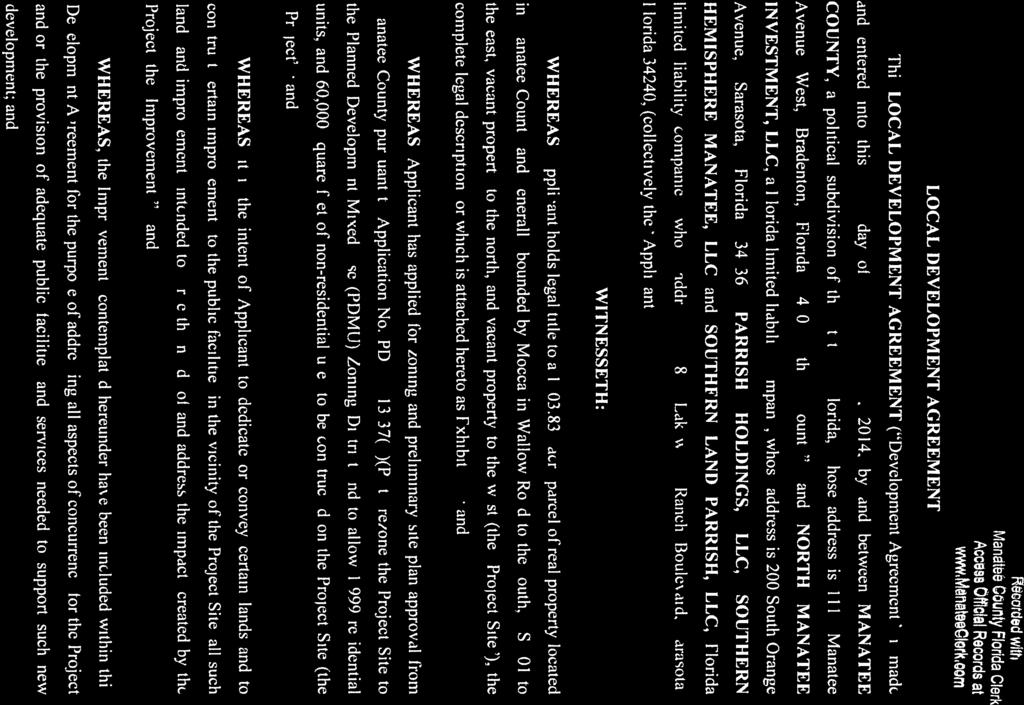
1 SECOND AMENDMENT TO LOCAL DEVELOPMENT AGREEMENT [Amazon] This SECOND AMENDMENT TO LOCAL DEVELOPMENT AGREEMENT ("Second Amendment") is made and entered into this 6 1 h day of April, 2017, by and between MANATEE COUNTY, a political subdivision of the State of Florida, whose address is 1112 Manatee Avenue West, Bradenton, Florida 34205, (the "County") and NORTH MANATEE INVESTMENT, LLC, a Florida limited liability company, whose address is 200 South Orange Avenue, Sarasota, Florida 34236, and PARRISH HOLDINGS, LLC, individually and as successor by merger of SOUTHERN HEMISPHERE MANATEE, LLC and SOUTHERN LAND PARRISH, LLC, Florida limited liability companies, whose address is 5800 Lakewood Ranch Boulevard, Sarasota, Florida (collectively the "Applicant"). WITNESSETH: WHEREAS, County and Applicant are parties to that certain Local Development Agreement, dated November 18, 2014, as recorded in OR Book 2545, Page 4410, of the Public Records of Manatee County, Florida, as amended by First Amendment To Local Development Agreement, dated December 1, 2016, as recorded in OR Book 2650, Page 1279, of said records (collectively the "LDA"), which LDA concerns a 1, ±acre parcel of real property located in Manatee County and generally bounded by Moccasin Wallow Road to the south, US 301 to the east, vacant property to the north, and vacant property to the west, the complete legal description for which is attached hereto as Exhibit "A" (the "Project Site"); and WHEREAS, the parties desire to amend the LDA to extend the date for submittal of a Final Site Plan, and clarify that impact fee credits are available for certain payments required by the LDA for wastewater transmission line capacity, all as more fully set forth herein; NOW, THEREFORE, in consideration of the mutual promises and covenants contained herein, and other good and valuable consideration, the parties hereby agree as follows : 1. Recitals True and Correct. The recitals set forth above are true and correct and are incorporated herein by reference. 2. Final Site Plan Submittal. Paragraph 8 of the LDA is amended and restated in its entirety to read as follows: "8. CLOS. At the time of first Final Site Plan (FSP) approval which shall be obtained prior to December 31, 2017, the County shall issue a CLOS for transportation, recreation/open space, potable water, sanitary sewer, solid waste, and storm water, for one thousand nine hundred and ninety nine (1999) residential dwelling units and sixty thousand (60,000) square feet of nonresidential improvements. A CLOS for public school facilities, if required, may be issued separately, subject to Applicant satisfying the requirements of the Comprehensive

 shall record this Second Amendment in the Public Records of Manatee")

 The recordation of a fully executed original of this Second Amendment in the")
2 3. Impact fee Credits. The payments made for the Line Capacity Fee described in the LDA as the PFSM Payment shall be eligible for impact fee credits pursuant to the County's impact fee ordinance, as amended form time to time. 4. Recording of this Second Amendment. The Clerk of the Circuit Court of Manatee County, as Clerk to the Board of County Commissioners (the "Clerk") shall record this Second Amendment in the Public Records of Manatee County, Florida, no later than fourteen ( 14) days after the execution by all parties. Applicant shall bear the expense of recording this Second Amendment. 5. Conflict. In the event of any conflict between the terms, provisions and conditions of this Second Amendment and the LDA, the terms, provisions and conditions of this Second Amendment shall control. 6. Effective Date. This Second Amendment shall become effective immediately upon the occurrence of all the following: (A) The recordation of a fully executed original of this Second Amendment in the public records of Manatee County, Florida, as provided in Paragraph 4 hereof; and (B) The expiration of any and all appeal periods for any challenge to the approval of this Second Amendment. 7. No Other Amendment. All other provisions of the LDA shall be unaffected by this Second Amendment, and shall remain in full force and effect. ANA TEE COUNTY, FLORIDA y: Board of aunt Commissioners ATTEST: Clerk of the Circuit Court By: By: Date: Aprt_'_l_6_,_20_1_7 Page 2 of 8


3 North Manatee Investment, LLC a limited liabilit By: Title: Manager Date: o4. 0'3- \ ---=t' STATE OF FLORIDA COUNTY OF MANATEE The foregoing instrument was acknowledged before me this ~ day of A'Pf2--1. L.., 2017, by James R. Schier, as Manager of North Manatee Investment, LLC, a Florida limited liability company, on behalf of the company. He is personally known to me or who has produced as identification ana "'did not take an oath. N~e ~fflorida Page 3 of8


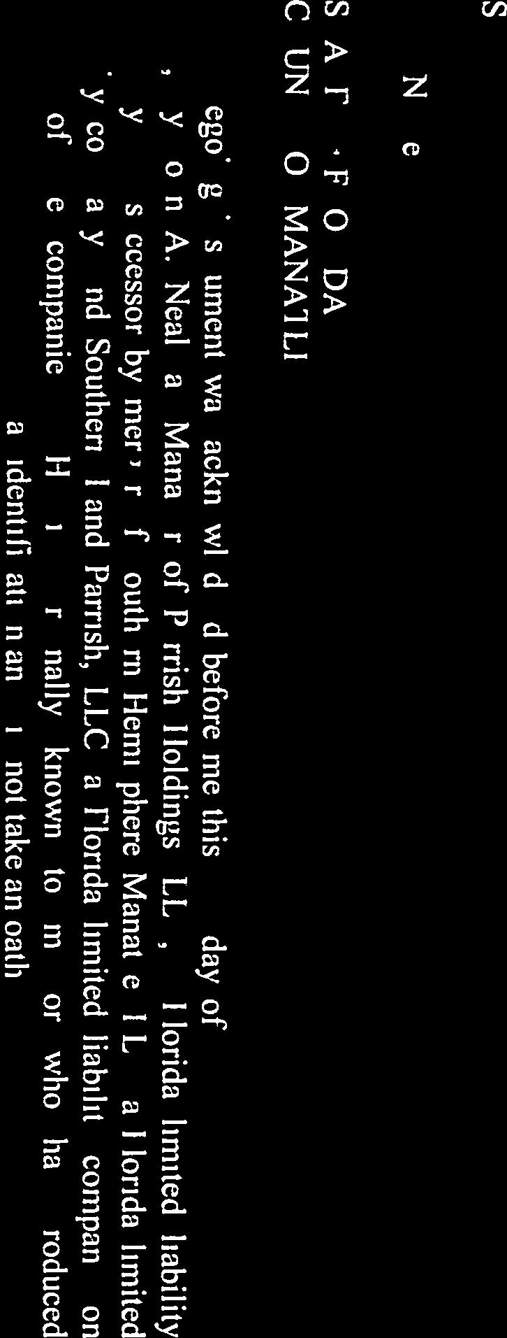
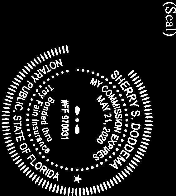
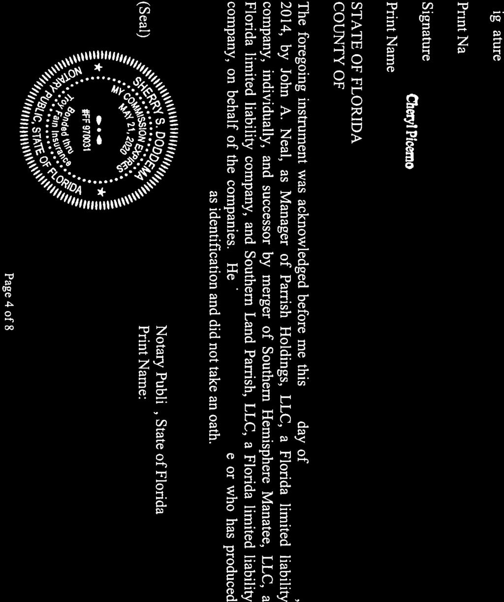
4 Parrish Holdings, LLC a limited liability company, individually and as successor by merger of Southern Hemisphere Manatee, LLC a limited liability company Southern Land Parrish, LLC, a limited ility co _,.../"" /' Name: Title: Date: WITNESSES: s~~ Print N ame5tz.uc-e Z ~tljaa-l=j STATE OF FLORIDA COUNTY OF MANATEE The foregoing instrument was acknowledged before me this 4 day of APP'l- 2017, by John A. Neal, as Manager of Parrish Holdings, LLC, a Florida limited liability company, individually, and successor by merger of Southern Hemisphere Manatee, LLC, a Florida limited liability company, and Southern Land Parrish, LLC, a Florida limited liability company, on behalf of the companies. He is personally known to me or who has produced as identification and did not take an oath Nota "lie, State of Florida (Seal) Print Name: ~~e>\t--t ~ ~ +-\-. Page 4 of8
 A PARCEL OF LAND LYING IN SECTIONS 17 AND 18, TOWNSHIP 33 SOUTH, RANGE 19 EAST, MANATEE COUNTY, FLORIDA, BEING MORE PARTICULARLY DESCRIBED AS FOLLOWS: BEGINNING AT THE SOUTHWEST CORNER OF SECTION")

5 EXHIBIT A A. PARCEL A1 AND A2 (NORTH) LEGAL DESCRIPTION: (PREPARED BY KING ENGINEERING ASSOCIATES, INC.) A PARCEL OF LAND LYING IN SECTIONS 17 AND 18, TOWNSHIP 33 SOUTH, RANGE 19 EAST, MANATEE COUNTY, FLORIDA, BEING MORE PARTICULARLY DESCRIBED AS FOLLOWS: BEGINNING AT THE SOUTHWEST CORNER OF SECTION 18, TOWNSHIP 33 SOUTH, RANGE 19 EAST, MANATEE COUNTY FLORIDA; THENCE NORTH 00 08'15" EAST, ALONG THE WEST LINE OF SAID SECTION 18, A DISTANCE OF FEET TO THE POINT OF INTERSECTION WITH THE NORTH LINE OF A GAS LINE EASEMENT AS RECORDED IN OFFICIAL RECORDS BOOK 1681, PAGE 225 OF THE PUBLIC RECORDS OF MANATEE COUNTY, FLORIDA; TH ENCE ALONG SAID NORTH LINE THE FOLLOWING THREE (3) COURSES: (1) NORTH 89 39'04" EAST, A DISTANCE OF 2.97 FEET; (2) SOUTH 89 30'19" EAST, A DISTANCE OF 2, FEET; (3) SOUTH 89 32'06" EAST, A DISTANCE OF FEET; THENCE SOUTH '43" WEST, A DISTANCE OF FEET TO THE POINT OF INTERSECTION WITH THE NORTH LINE OF A GAS LINE EASEMENT AS RECORDED IN OFFICIAL RECORDS BOOK 1681, PAGE 230 OF THE PUBLIC RECORDS OF MANATEE COUNTY, FLORIDA; THENCE ALONG SAID NORTH LINE THE FOLLOWING FOUR (4) COURSES: (1) SOUTH 89 39'17" EAST, A DISTANCE OF 1, FEET; (2) SOUTH 89 10'24" EAST, A DISTANCE OF FEET; (3) SOUTH 89 53'47" EAST, A DISTANCE OF 1, FEET; (4) SOUTH 89 38'03" EAST, A DISTANCE OF FEET TO THE POINT OF INTERSECTION WITH THE NORTH LINE OF A FLORIDA POWER & LIGHT COMPANY EASEMENT AS RECORDED IN OFFICIAL RECORDS BOOK 650, PAGE 592 AND OFFICIAL RECORDS BOOK 669, PAGE 745, BOTH OF THE PUBLIC RECORDS OF MANATEE COUNTY, FLORIDA; THENCE ALONG SAID NORTH LINE THE FOLLOWING TWO (2) COURSES: (1) NORTH 89 17'06" EAST, A DISTANCE OF 1, FEET; (2) NORTH 89 51'05" EAST, A DISTANCE OF FEET TO THE POINT OF INTERSECTION WITH THE WEST LINE OF THAT CERTAIN PARCEL OF LAND AS DESCRIBED IN OFFICIAL RECORDS BOOK 1767, PAGE 4886 OF THE PUBLIC RECORDS OF MANATEE COUNTY, FLORIDA; THENCE ALONG THE WEST, SOUTH AND EAST LINES OF SAID CERTAIN PARCEL AS DESCRIBED IN OFFICIAL RECORDS BOOK 1767, PAGE 4886 THE FOLLOWING THREE (3) COURSES: (1) SOUTH 00 16'21" WEST, A DISTANCE OF FEET; (2) SOUTH 89 43'39" EAST, A DISTANCE OF FEET; (3) NORTH 00 16'21" EAST, A DISTANCE OF FEET TO THE POINT OF INTERSECTION WITH SAID NORTH LINE OF A FLORIDA POWER & LIGHT COMPANY EASEMENT; THENCE NORTH 89 52'24" EAST, ALONG SAID NORTH LINE, A DISTANCE OF FEET TO THE POINT OF INTERSECTION WITH THE NORTHWEST RIGHT-OF-WAY OF STATE ROAD 43 (US 301) ACCORDING TO FLORIDA DEPARTMENT OF TRANSPORTATION RIGHT-OF- Page 5 of 8
 SOUTH 36 04'54\" WEST, A DISTANCE OF 345.")
 SOUTH 89 17'06\" WEST, A DISTANCE OF 2,668.")
6 WAY MAP, SECTION ; THENCE ALONG SAID NORTHWEST RIGHT-OF WAY OF STATE ROAD 43 (US 301) THE FOLLOWING TWO (2) COURSES: (1) SOUTH 36 06'04" WEST, A DISTANCE OF FEET; (2) SOUTH 36 04'54" WEST, A DISTANCE OF FEET TO THE POINT OF INTERSECTION WITH THE SOUTH LINE OF SECTION 17, TOWNSHIP 33 SOUTH, RANGE 19 EAST; THENCE ALONG SAID SOUTH LINE OF SECTION 17 THE FOLLOWING TWO (2) COURSES: (1) SOUTH 89 51'05" WEST, A DISTANCE OF FEET TO THE SOUTH 1/4 CORNER OF SAID SECTION 17; (2) SOUTH 89 17'06" WEST, A DISTANCE OF 2, FEET TO THE SOUTHEAST CORNER OF SAID SECTION 18; THENCE NORTH 89 08'38" WEST, ALONG THE SOUTH LINE OF SAID SECTION 18, A DISTANCE OF 5, FEET TO THE POINT OF BEGINNING. CONTAINING ACRES. B. PARCEL A1 AND A2 (SOUTH) LEGAL DESCRIPTION: (PREPARED BY KING ENGINEERING ASSOCIATES, INC.) A PARCEL OF LAND LYING IN SECTIONS 19 AND 20, TOWNSHIP 33 SOUTH, RANGE 19 EAST, MANATEE COUNTY, FLORIDA, BEING MORE PARTICULARLY DESCRIBED AS FOLLOWS: BEGINNING AT THE NORTHWEST CORNER OF SECTION 19, TOWNSHIP 33 SOUTH, RANGE 19 EAST, MANATEE COUNTY FLORIDA; THENCE SOUTH 89 08'38" EAST, ALONG THE NORTH LINE OF SAID SECTION 19, A DISTANCE OF 5, FEET TO THE NORTHEAST CORNER OF SAID SECTION 19; THENCE ALONG THE NORTH LINE OF SECTION 20, TOWNSHIP 33 SOUTH, RANGE 19 EAST THE FOLLOWING TWO (2) COURSES: (1) NORTH 89 17'06" EAST, A DISTANCE OF 2, FEET TO THE NORTH 1/4 CORNER OF SAID SECTION 20; (2) NORTH 89 51'05" EAST, A DISTANCE OF FEET TO THE POINT OF INTERSECTION WITH THE NORTHWEST RIGHT-OF-WAY OF STATE ROAD 43 (US 301) ACCORDING TO FLORIDA DEPARTMENT OF TRANSPORTATION RIGHT-OF WAY MAP, SECTION ; THENCE ALONG SAID NORTHWEST RIGHT-OF WAY OF STATE ROAD 43 (US 301) THE FOLLOWING TWO (2) COURSES: (1) SOUTH 36 04'54" WEST, A DISTANCE OF FEET TO THE POINT ON A NON TANGENT CURVE TO THE LEFT; (2) SOUTHERLY FEET ALONG THE ARC OF SAID CURVE, HAVING A RADIUS OF 1, FEET, A CENTRAL ANGLE OF 28 09'21", AND A CHORD BEARING AND DISTANCE OF SOUTH 22 01'42" WEST FEET; THENCE NORTH 89 26'34" WEST, A DISTANCE OF 1, FEET; THENCE SOUTH 00 06'08" EAST, A DISTANCE OF 1, FEET TO THE POINT OF INTERSECTION WITH THE NORTH RIGHT-OF-WAY OF MOCCASIN WALLOW ROAD ACCORDING TO ROAD PLAT BOOK 4, PAGE 153 OF THE PUBLIC RECORDS OF MANATEE COUNTY, FLORIDA; THENCE ALONG SAID NORTH RIGHT-OF-WAY THE FOLLOWING FIVE (5) COURSES: (1) NORTH 88 54'18" WEST, A DISTANCE OF 1, FEET; (2) NORTH 89 08'58" WEST, A DISTANCE OF 2, FEET; (3) NORTH 89 07'49" WEST, A DISTANCE OF FEET; (4) Page 6 of 8

 A PARCEL OF LAND LYING IN SECTIONS 16, 17 AND 18, TOWNSHIP 33 SOUTH, RANGE 19 EAST, MANATEE COUNTY, FLORIDA, BEING MORE PARTICULARLY DESCRIBED AS FOLLOWS: COMMENCING AT THE SOUTHWEST CORNER OF")
7 NORTH 89 07'50" WEST, A DISTANCE OF 2, FEET; (5) NORTH 88 01'42" WEST, A DISTANCE OF FEET TO THE POINT OF INTERSECTION WITH THE WEST LINE OF SAID SECTION 19; THENCE NORTH 00 08'36" EAST, ALONG SAID WEST LINE OF SECTION 19, A DISTANCE OF 2, FEET TO THE POINT OF BEGINNING. CONTAINING ACRES. C. PARCEL A3 AND A4 LEGAL DESCRIPTION: (PREPARED BY KING ENGINEERING ASSOCIATES, INC.) A PARCEL OF LAND LYING IN SECTIONS 16, 17 AND 18, TOWNSHIP 33 SOUTH, RANGE 19 EAST, MANATEE COUNTY, FLORIDA, BEING MORE PARTICULARLY DESCRIBED AS FOLLOWS: COMMENCING AT THE SOUTHWEST CORNER OF SECTION 18, TOWNSHIP 33 SOUTH, RANGE 19 EAST, MANATEE COUNTY FLORIDA; THENCE NORTH 00 08'15" EAST, ALONG THE WEST LINE OF SAID SECTION 18, A DISTANCE OF FEET TO THE POINT OF INTERSECTION WITH THE NORTH LINE OF A GAS LINE EASEMENT AS RECORDED IN OFFICIAL RECORDS BOOK 1681, PAGE 225 OF THE PUBLIC RECORDS OF MANATEE COUNTY, FLORIDA, SAME BEING THE POINT OF BEGINNING; THENCE CONTINUE ALONG SAID WEST LINE, NORTH 00 08'15" EAST A DISTANCE OF 1, FEET; THENCE SOUTH 8JC03'06" EAST, A DISTANCE OF 3, FEET; THENCE NORTH 00 49'44" EAST, A DISTANCE OF FEET; THENCE SOUTH 89 49'04" EAST, A DISTANCE OF 2, FEET; THENCE NORTH 00 35'38" EAST, A DISTANCE OF 2, FEET; THENCE SOUTH 89 43'15" EAST, A DISTANCE OF FEET; THENCE SOUTH 00 11'16" WEST, A DISTANCE OF FEET; THENCE SOUTH 68 30'43" EAST, A DISTANCE OF 1, FEET; THENCE NORTH 2JC47'24" EAST, A DISTANCE OF 1, FEET; THENCE SOUTH 89 59'54" EAST, A DISTANCE OF 4, FEET TO THE POINT OF INTERSECTION WITH THE NORTHWEST RIGHT-OF-WAY OF STATE ROAD 43 (US 301) ACCORDING TO FLORIDA DEPARTMENT OF TRANSPORTATION RIGHT-OF-WAY MAP, SECTION ; THENCE SOUTH 36 06'04" WEST, ALONG SAID NORTHWEST RIGHT-OF-WAY, A DISTANCE OF 4, FEET TO THE POINT OF INTERSECTION WITH A NORTHERLY LINE OF THAT CERTAIN PARCEL OF LAND AS DESCRIBED IN OFFICIAL RECORDS BOOK 2207, PAGE 6256 OF THE PUBLIC RECORDS OF MANATEE COUNTY, FLORIDA; THENCE ALONG NORTHERLY AND WESTERLY LINES OF SAID CERTAIN PARCEL OF LAND AS DESCRIBED IN OFFICIAL RECORDS BOOK 2207, PAGE 6256 THE FOLLOWING ELEVEN (11) COURSES: (1) NORTH 08 36'03" WEST, A DISTANCE OF FEET; (2) NORTH 20 23'31" WEST, A DISTANCE OF FEET; (3) NORTH 46 10'58" WEST, A DISTANCE OF FEET; (4) NORTH 75 36'36" WEST, A DISTANCE OF FEET; (5) NORTH 54 56'49" WEST, A DISTANCE OF FEET; (6) SOUTH 88 03'46" WEST, A DISTANCE OF FEET; (7) NORTH 82 06'14" WEST, A DISTANCE OF FEET; (8) NORTH 69 38'08" WEST, A DISTANCE OF FEET; (9) NORTH 73 32'48" WEST, A DISTANCE OF Page 7 of 8

8 FEET; (10) SOUTH 36 06'04" WEST, A DISTANCE OF FEET; (11) SOUTH 00 02'24" WEST, A DISTANCE OF FEET TO THE POINT OF INTERSECTION WITH THE NORTH LINE OF A FLORIDA POWER & LIGHT COMPANY EASEMENT AS RECORDED IN OFFICIAL RECORDS BOOK 650, PAGE 592 AND OFFICIAL RECORDS BOOK 669, PAGE 745, BOTH OF THE PUBLIC RECORDS OF MANATEE COUNTY, FLORIDA; THENCE SOUTH 89 52'24" WEST, ALONG SAID NORTH LINE, A DISTANCE OF FEET TO THE POINT OF INTERSECTION WITH THE EAST LINE OF THAT CERTAIN PARCEL OF LAND AS DESCRIBED IN OFFICIAL RECORDS BOOK 1767, PAGE 4886 OF THE PUBLIC RECORDS OF MANATEE COUNTY, FLORIDA; THENCE ALONG THE EAST, NORTH AND WEST LINES OF SAID CERTAIN PARCEL AS DESCRIBED IN OFFICIAL RECORDS BOOK 1767, PAGE 4886 THE FOLLOWING THREE (3) COURSES: (1) NORTH 00 16'21" EAST, A DISTANCE OF FEET; (2) NORTH 89 43'39" WEST, A DISTANCE OF FEET; (3) SOUTH 00 16'21" WEST, A DISTANCE OF FEET TO THE POINT OF INTERSECTION WITH SAID NORTH LINE OF A FLORIDA POWER & LIGHT COMPANY EASEMENT; THENCE ALONG SAID NORTH LINE THE FOLLOWING TWO (2) COURSES: (1) SOUTH '05" WEST, A DISTANCE OF FEET; (2) SOUTH 89 17'06" WEST, A DISTANCE OF 1, FEET TO THE POINT OF INTERSECTION WITH THE NORTH LINE OF A GAS LINE EASEMENT AS RECORDED IN OFFICIAL RECORDS BOOK 1681, PAGE 230 OF THE PUBLIC RECORDS OF MANATEE COUNTY, FLORIDA; THENCE ALONG SAID NORTH LINE THE FOLLOWING FOUR (4) COURSES: (1) NORTH 89 38'03" WEST, A DISTANCE OF FEET; (2) NORTH 89 53'47" WEST, A DISTANCE OF 1, FEET; (3) NORTH 89 10'24" WEST, A DISTANCE OF FEET; (4) NORTH 89 39'17" WEST, A DISTANCE OF 1, FEET; THENCE NORTH '43" EAST, A DISTANCE OF FEET TO THE POINT OF INTERSECTION WITH SAID NORTH LINE OF A GAS LINE EASEMENT AS RECORDED IN OFFICIAL RECORDS BOOK 1681, PAGE 225 OF THE PUBLIC RECORDS OF MANATEE COUNTY, FLORIDA; THENCE ALONG SAID NORTH LINE THE FOLLOWING THREE (3) COURSES: (1) NORTH 89 32'06" WEST, A DISTANCE OF FEET; (2) NORTH 89 30'19" WEST, A DISTANCE OF 2, FEET; (3) SOUTH 89 39'04" WEST, A DISTANCE OF 2.97 FEET TO THE POINT OF BEGINNING. CONTAINING ACRES. Page 8 of8


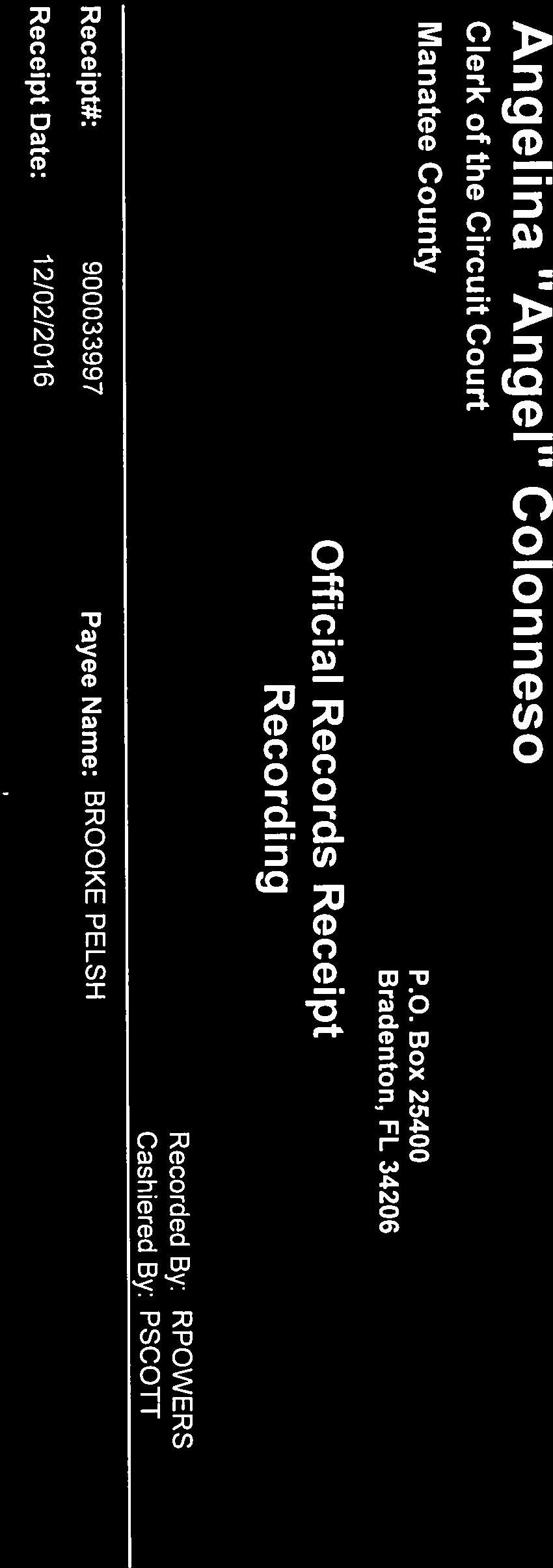
9 Angelina "Angel" Colonneso Clerk of the Circuit Court Manatee County Official Records Receipt Recording P.O. Box Bradenton, FL Username: hhooey Receipt#: Payee Name: BOARD RECORDS Changed By: cwelke Receipt Date: 04/07/2017 Instrument: BK2668/PG3450 AGREEMENT RECORDING FEE $5/$ PRMTF $1/$ PRMTF FACC $ PRMTF CLERK $ PRMTF BCC $ INDEXING NAMES $33.00 $4.50 $0.80 $15.20 $16.00 $1.00 Instrument Total: $70.50 Receipt Total: Amount Tendered: Overage: $70.50 $70.50 $0.00 MFC $ Amount Paid: Receipt 4/7/2017 3:43:02PM Page 1 of 1
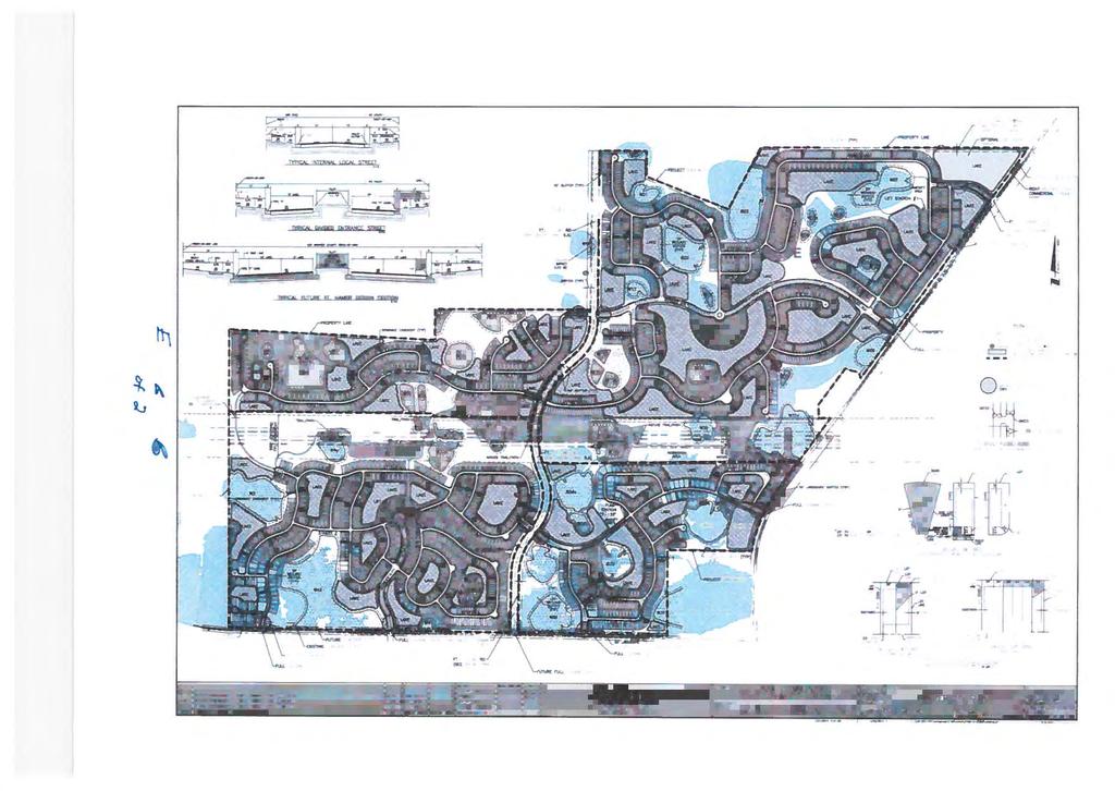
10 Manatee County Government Administrative Building First Floor, Chambers April 6, 2017 April 6, Land Use Meeting Agenda Item #8 Subject LDA-13-02(R2) - Local Development Agreement for North Manatee Investment, LLC, and Parrish Holdings, LLC / The Villages of Amazon South - DTS Briefings None Contact and/or Presenter Information Presenter: Clarke Davis, Transportation Planning Division Manager x7272 Contact: Bobbi Roy, Planning Coordinator, x6878 Action Requested RECOMMENDED MOTION: Based upon the evidence presented, comments made at the Public Hearing, and finding the request to be CONSISTENT with the Manatee County Comprehensive Plan and the Manatee County Land Development Code, I move to APPROVE LDA-13-02(R2) for The Villages of Amazon South, as recommended by staff. (Commissioner Trace) Enabling/Regulating Authority Manatee County Comprehensive Plan Manatee County Land Development Code Section (5), Florida Statutes Sections , Florida Statutes Background Discussion The Villages of Amazon South is approximately 1, acres located at US 301 North, Parrish, in the northwest quadrant of the Moccasin Wallow Road and US 301 intersection. The Villages of Amazon South site was rezoned to Planned Development Mixed Use (PDMU) on September 4, 2014 (PDMU-13-37[Z][P]) with the approval of a Preliminary Site Plan (PSP) for 1,999 residential units and 40,000 square feet of commercial and 20,000 square feet of office space. The County Commission executed a related Local Development Agreement (LDA-13-02) in November 2016 that included provisions related to wastewater connections, offsite traffic impact mitigation, construction of a
11 portion of Ft Hamer Rd and a Certificate of Level of Service Compliance (CLOS) extension. A first amendment to the LDA was executed in December 2016 to amend wastewater provisions. Proposed Amendment One provision of the agreement requires the developer to obtain first Final Site Plan approval by December 31, 2016, in order to remain eligible for CLOS extension options under the terms of the agreement. To date, the County has not approved the first Final Site Plan. The proposed, second amendment is the developer s request to amend the Local Development Agreement for The Villages of Amazon South to extend this milestone date for the first Final Site Plan from December 31, 2016, to December 31, Staff recommends approval. Manatee County Government Administrative Building First Floor, Chambers April 6, 2017 The first of two required public hearings was held on April 4, Action is requested at this hearing. County Attorney Review Other (Requires explanation in field below) Explanation of Other William Clague, Assistant County Attorney, reviewed a related request for legal services (RLS ) and responded by on March 7, The response is attached for reference. The agreement presented for County Commission consideration incorporates the recommended changes provided by the County Attorney's Office. Reviewing Attorney Clague Instructions to Board Records Applicant, John Neal, will contact Board Records regarding the recording of the Local Development Agreement. Please forward a copy of the recorded document to bobbi.roy@mymanatee.org. Cost and Funds Source Account Number and Name N/A Amount and Frequency of Recurring Costs N/A Attachment: Proposed Amendment Villages of Amazon South LDA-13-02(R2).pdf Attachment: Newspaper Advertising - Villages of Amazon South LDA-13-02(R2).pdf Attachment: Villages of Amazon South LDA CAO Review (RLS ).pdf Attachment: Villages of Amazon South LDA recorded.pdf Attachment: Villages of Amazon South LDA-13-02(R) recorded.pdf
12 Attachment: Maps Villages of Amazon South LDA-13-02(R2).pdf Attachment: Sarasota Herald Tribune Line and BCC.pdf Manatee County Government Administrative Building First Floor, Chambers April 6, 2017
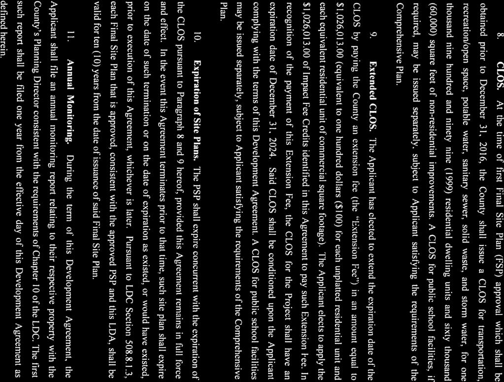
13 SECOND AMENDMENT TO LOCAL DEVELOPMENT AGREEMENT [Amazon] This SECOND AMENDMENT TO LOCAL DEVELOPMENT AGREEMENT ( Second Amendment ) is made and entered into this day of, 2017, by and between MANATEE COUNTY, a political subdivision of the State of Florida, whose address is 1112 Manatee Avenue West, Bradenton, Florida 34205, (the County ) and NORTH MANATEE INVESTMENT, LLC, a Florida limited liability company, whose address is 200 South Orange Avenue, Sarasota, Florida 34236, and PARRISH HOLDINGS, LLC, individually and as successor by merger of SOUTHERN HEMISPHERE MANATEE, LLC and SOUTHERN LAND PARRISH, LLC, Florida limited liability companies, whose address is 5800 Lakewood Ranch Boulevard, Sarasota, Florida (collectively the Applicant ). WITNESSETH: WHEREAS, County and Applicant are parties to that certain Local Development Agreement, dated November 18, 2014, as recorded in OR Book 2545, Page 4410, of the Public Records of Manatee County, Florida, as amended by First Amendment To Local Development Agreement, dated December 1, 2016, as recorded in OR Book 2650, Page 1279, of said records (collectively the LDA ), which LDA concerns a 1, ± acre parcel of real property located in Manatee County and generally bounded by Moccasin Wallow Road to the south, US 301 to the east, vacant property to the north, and vacant property to the west, the complete legal description for which is attached hereto as Exhibit A (the Project Site ); and WHEREAS, the parties desire to amend the LDA to extend the date for submittal of a Final Site Plan, and clarify that impact fee credits are available for certain payments required by the LDA for wastewater transmission line capacity, all as more fully set forth herein; NOW, THEREFORE, in consideration of the mutual promises and covenants contained herein, and other good and valuable consideration, the parties hereby agree as follows: 1. Recitals True and Correct. The recitals set forth above are true and correct and are incorporated herein by reference. 2. Final Site Plan Submittal. Paragraph 8 of the LDA is amended and restated in its entirety to read as follows: 8. CLOS. At the time of first Final Site Plan (FSP) approval which shall be obtained prior to December 31, 2017, the County shall issue a CLOS for transportation, recreation/open space, potable water, sanitary sewer, solid waste, and storm water, for one thousand nine hundred and ninety nine (1999) residential dwelling units and sixty thousand (60,000) square feet of nonresidential improvements. A CLOS for public school facilities, if required, may be issued separately, subject to Applicant satisfying the requirements of the Comprehensive Plan.
14 3. Impact fee Credits. The payments made for the Line Capacity Fee described in the LDA as the PFSM Payment shall be eligible for impact fee credits pursuant to the County s impact fee ordinance, as amended form time to time. 4. Recording of this Second Amendment. The Clerk of the Circuit Court of Manatee County, as Clerk to the Board of County Commissioners (the Clerk ) shall record this Second Amendment in the Public Records of Manatee County, Florida, no later than fourteen (14) days after the execution by all parties. Applicant shall bear the expense of recording this Second Amendment. 5. Conflict. In the event of any conflict between the terms, provisions and conditions of this Second Amendment and the LDA, the terms, provisions and conditions of this Second Amendment shall control. 6. Effective Date. This Second Amendment shall become effective immediately upon the occurrence of all the following: (A) The recordation of a fully executed original of this Second Amendment in the public records of Manatee County, Florida, as provided in Paragraph 4 hereof; and (B) The expiration of any and all appeal periods for any challenge to the approval of this Second Amendment. 7. No Other Amendment. All other provisions of the LDA shall be unaffected by this Second Amendment, and shall remain in full force and effect. WHEREFORE, the parties hereto have executed this Second Amendment as of the date set forth above. MANATEE COUNTY, FLORIDA By: Board of County Commissioners ATTEST: ANGELINA COLNNESO, Clerk of the Circuit Court and Comptroller By: Deputy Clerk By: Chairperson Date: Page 2 of 8
15 North Manatee Investment, LLC a limited liability company By: Name: James R. Schier WITNESSES: Title: Manager Signature Print Name Date: Signature Print Name STATE OF FLORIDA COUNTY OF MANATEE The foregoing instrument was acknowledged before me this day of, 2017, by James R. Schier, as Manager of North Manatee Investment, LLC, a Florida limited liability company, on behalf of the company. He is personally known to me or who has produced as identification and did not take an oath. (Seal) Notary Public, State of Florida Print Name: Page 3 of 8
16 Parrish Holdings, LLC a limited liability company, individually and as successor by merger of Southern Hemisphere Manatee, LLC a limited liability company Southern Land Parrish, LLC, a limited liability company By: Name: John A. Neal Title: Manager Date: WITNESSES: Signature Print Name Signature Print Name STATE OF FLORIDA COUNTY OF MANATEE The foregoing instrument was acknowledged before me this day of, 2017, by John A. Neal, as Manager of Parrish Holdings, LLC, a Florida limited liability company, individually, and successor by merger of Southern Hemisphere Manatee, LLC, a Florida limited liability company, and Southern Land Parrish, LLC, a Florida limited liability company, on behalf of the companies. He is personally known to me or who has produced as identification and did not take an oath. (Seal) Notary Public, State of Florida Print Name: Page 4 of 8
17 EXHIBIT A A. PARCEL A1 AND A2 (NORTH) LEGAL DESCRIPTION: (PREPARED BY KING ENGINEERING ASSOCIATES, INC.) A PARCEL OF LAND LYING IN SECTIONS 17 AND 18, TOWNSHIP 33 SOUTH, RANGE 19 EAST, MANATEE COUNTY, FLORIDA, BEING MORE PARTICULARLY DESCRIBED AS FOLLOWS: BEGINNING AT THE SOUTHWEST CORNER OF SECTION 18, TOWNSHIP 33 SOUTH, RANGE 19 EAST, MANATEE COUNTY FLORIDA; THENCE NORTH 00 08'15" EAST, ALONG THE WEST LINE OF SAID SECTION 18, A DISTANCE OF FEET TO THE POINT OF INTERSECTION WITH THE NORTH LINE OF A GAS LINE EASEMENT AS RECORDED IN OFFICIAL RECORDS BOOK 1681, PAGE 225 OF THE PUBLIC RECORDS OF MANATEE COUNTY, FLORIDA; THENCE ALONG SAID NORTH LINE THE FOLLOWING THREE (3) COURSES: (1) NORTH 89 39'04" EAST, A DISTANCE OF 2.97 FEET; (2) SOUTH 89 30'19" EAST, A DISTANCE OF 2, FEET; (3) SOUTH 89 32'06" EAST, A DISTANCE OF FEET; THENCE SOUTH 00 51'43" WEST, A DISTANCE OF FEET TO THE POINT OF INTERSECTION WITH THE NORTH LINE OF A GAS LINE EASEMENT AS RECORDED IN OFFICIAL RECORDS BOOK 1681, PAGE 230 OF THE PUBLIC RECORDS OF MANATEE COUNTY, FLORIDA; THENCE ALONG SAID NORTH LINE THE FOLLOWING FOUR (4) COURSES: (1) SOUTH 89 39'17" EAST, A DISTANCE OF 1, FEET; (2) SOUTH 89 10'24" EAST, A DISTANCE OF FEET; (3) SOUTH 89 53'47" EAST, A DISTANCE OF 1, FEET; (4) SOUTH 89 38'03" EAST, A DISTANCE OF FEET TO THE POINT OF INTERSECTION WITH THE NORTH LINE OF A FLORIDA POWER & LIGHT COMPANY EASEMENT AS RECORDED IN OFFICIAL RECORDS BOOK 650, PAGE 592 AND OFFICIAL RECORDS BOOK 669, PAGE 745, BOTH OF THE PUBLIC RECORDS OF MANATEE COUNTY, FLORIDA; THENCE ALONG SAID NORTH LINE THE FOLLOWING TWO (2) COURSES: (1) NORTH 89 17'06" EAST, A DISTANCE OF 1, FEET; (2) NORTH 89 51'05" EAST, A DISTANCE OF FEET TO THE POINT OF INTERSECTION WITH THE WEST LINE OF THAT CERTAIN PARCEL OF LAND AS DESCRIBED IN OFFICIAL RECORDS BOOK 1767, PAGE 4886 OF THE PUBLIC RECORDS OF MANATEE COUNTY, FLORIDA; THENCE ALONG THE WEST, SOUTH AND EAST LINES OF SAID CERTAIN PARCEL AS DESCRIBED IN OFFICIAL RECORDS BOOK 1767, PAGE 4886 THE FOLLOWING THREE (3) COURSES: (1) SOUTH 00 16'21" WEST, A DISTANCE OF FEET; (2) SOUTH 89 43'39" EAST, A DISTANCE OF FEET; (3) NORTH 00 16'21" EAST, A DISTANCE OF FEET TO THE POINT OF INTERSECTION WITH SAID NORTH LINE OF A FLORIDA POWER & LIGHT COMPANY EASEMENT; THENCE NORTH 89 52'24" EAST, ALONG SAID NORTH LINE, A DISTANCE OF FEET TO THE POINT OF INTERSECTION WITH THE NORTHWEST RIGHT-OF-WAY OF STATE ROAD 43 (US 301) ACCORDING TO FLORIDA DEPARTMENT OF TRANSPORTATION RIGHT-OF- Page 5 of 8
18 WAY MAP, SECTION ; THENCE ALONG SAID NORTHWEST RIGHT-OF- WAY OF STATE ROAD 43 (US 301) THE FOLLOWING TWO (2) COURSES: (1) SOUTH 36 06'04" WEST, A DISTANCE OF FEET; (2) SOUTH 36 04'54" WEST, A DISTANCE OF FEET TO THE POINT OF INTERSECTION WITH THE SOUTH LINE OF SECTION 17, TOWNSHIP 33 SOUTH, RANGE 19 EAST; THENCE ALONG SAID SOUTH LINE OF SECTION 17 THE FOLLOWING TWO (2) COURSES: (1) SOUTH 89 51'05" WEST, A DISTANCE OF FEET TO THE SOUTH 1/4 CORNER OF SAID SECTION 17; (2) SOUTH 89 17'06" WEST, A DISTANCE OF 2, FEET TO THE SOUTHEAST CORNER OF SAID SECTION 18; THENCE NORTH 89 08'38" WEST, ALONG THE SOUTH LINE OF SAID SECTION 18, A DISTANCE OF 5, FEET TO THE POINT OF BEGINNING. CONTAINING ACRES. B. PARCEL A1 AND A2 (SOUTH) LEGAL DESCRIPTION: (PREPARED BY KING ENGINEERING ASSOCIATES, INC.) A PARCEL OF LAND LYING IN SECTIONS 19 AND 20, TOWNSHIP 33 SOUTH, RANGE 19 EAST, MANATEE COUNTY, FLORIDA, BEING MORE PARTICULARLY DESCRIBED AS FOLLOWS: BEGINNING AT THE NORTHWEST CORNER OF SECTION 19, TOWNSHIP 33 SOUTH, RANGE 19 EAST, MANATEE COUNTY FLORIDA; THENCE SOUTH 89 08'38" EAST, ALONG THE NORTH LINE OF SAID SECTION 19, A DISTANCE OF 5, FEET TO THE NORTHEAST CORNER OF SAID SECTION 19; THENCE ALONG THE NORTH LINE OF SECTION 20, TOWNSHIP 33 SOUTH, RANGE 19 EAST THE FOLLOWING TWO (2) COURSES: (1) NORTH 89 17'06" EAST, A DISTANCE OF 2, FEET TO THE NORTH 1/4 CORNER OF SAID SECTION 20; (2) NORTH 89 51'05" EAST, A DISTANCE OF FEET TO THE POINT OF INTERSECTION WITH THE NORTHWEST RIGHT-OF-WAY OF STATE ROAD 43 (US 301) ACCORDING TO FLORIDA DEPARTMENT OF TRANSPORTATION RIGHT-OF- WAY MAP, SECTION ; THENCE ALONG SAID NORTHWEST RIGHT-OF- WAY OF STATE ROAD 43 (US 301) THE FOLLOWING TWO (2) COURSES: (1) SOUTH 36 04'54" WEST, A DISTANCE OF FEET TO THE POINT ON A NON- TANGENT CURVE TO THE LEFT; (2) SOUTHERLY FEET ALONG THE ARC OF SAID CURVE, HAVING A RADIUS OF 1, FEET, A CENTRAL ANGLE OF 28 09'21", AND A CHORD BEARING AND DISTANCE OF SOUTH 22 01'42" WEST FEET; THENCE NORTH 89 26'34" WEST, A DISTANCE OF 1, FEET; THENCE SOUTH 00 06'08" EAST, A DISTANCE OF 1, FEET TO THE POINT OF INTERSECTION WITH THE NORTH RIGHT-OF-WAY OF MOCCASIN WALLOW ROAD ACCORDING TO ROAD PLAT BOOK 4, PAGE 153 OF THE PUBLIC RECORDS OF MANATEE COUNTY, FLORIDA; THENCE ALONG SAID NORTH RIGHT-OF-WAY THE FOLLOWING FIVE (5) COURSES: (1) NORTH 88 54'18" WEST, A DISTANCE OF 1, FEET; (2) NORTH 89 08'58" WEST, A DISTANCE OF 2, FEET; (3) NORTH 89 07'49" WEST, A DISTANCE OF FEET; (4) Page 6 of 8
19 NORTH 89 07'50" WEST, A DISTANCE OF 2, FEET; (5) NORTH 88 01'42" WEST, A DISTANCE OF FEET TO THE POINT OF INTERSECTION WITH THE WEST LINE OF SAID SECTION 19; THENCE NORTH 00 08'36" EAST, ALONG SAID WEST LINE OF SECTION 19, A DISTANCE OF 2, FEET TO THE POINT OF BEGINNING. CONTAINING ACRES. C. PARCEL A3 AND A4 LEGAL DESCRIPTION: (PREPARED BY KING ENGINEERING ASSOCIATES, INC.) A PARCEL OF LAND LYING IN SECTIONS 16, 17 AND 18, TOWNSHIP 33 SOUTH, RANGE 19 EAST, MANATEE COUNTY, FLORIDA, BEING MORE PARTICULARLY DESCRIBED AS FOLLOWS: COMMENCING AT THE SOUTHWEST CORNER OF SECTION 18, TOWNSHIP 33 SOUTH, RANGE 19 EAST, MANATEE COUNTY FLORIDA; THENCE NORTH 00 08'15" EAST, ALONG THE WEST LINE OF SAID SECTION 18, A DISTANCE OF FEET TO THE POINT OF INTERSECTION WITH THE NORTH LINE OF A GAS LINE EASEMENT AS RECORDED IN OFFICIAL RECORDS BOOK 1681, PAGE 225 OF THE PUBLIC RECORDS OF MANATEE COUNTY, FLORIDA, SAME BEING THE POINT OF BEGINNING; THENCE CONTINUE ALONG SAID WEST LINE, NORTH 00 08'15" EAST A DISTANCE OF 1, FEET; THENCE SOUTH 87 03'06" EAST, A DISTANCE OF 3, FEET; THENCE NORTH 00 49'44" EAST, A DISTANCE OF FEET; THENCE SOUTH 89 49'04" EAST, A DISTANCE OF 2, FEET; THENCE NORTH 00 35'38" EAST, A DISTANCE OF 2, FEET; THENCE SOUTH 89 43'15" EAST, A DISTANCE OF FEET; THENCE SOUTH 00 11'16" WEST, A DISTANCE OF FEET; THENCE SOUTH 68 30'43" EAST, A DISTANCE OF 1, FEET; THENCE NORTH 27 47'24" EAST, A DISTANCE OF 1, FEET; THENCE SOUTH 89 59'54" EAST, A DISTANCE OF 4, FEET TO THE POINT OF INTERSECTION WITH THE NORTHWEST RIGHT-OF-WAY OF STATE ROAD 43 (US 301) ACCORDING TO FLORIDA DEPARTMENT OF TRANSPORTATION RIGHT-OF-WAY MAP, SECTION ; THENCE SOUTH 36 06'04" WEST, ALONG SAID NORTHWEST RIGHT-OF-WAY, A DISTANCE OF 4, FEET TO THE POINT OF INTERSECTION WITH A NORTHERLY LINE OF THAT CERTAIN PARCEL OF LAND AS DESCRIBED IN OFFICIAL RECORDS BOOK 2207, PAGE 6256 OF THE PUBLIC RECORDS OF MANATEE COUNTY, FLORIDA; THENCE ALONG NORTHERLY AND WESTERLY LINES OF SAID CERTAIN PARCEL OF LAND AS DESCRIBED IN OFFICIAL RECORDS BOOK 2207, PAGE 6256 THE FOLLOWING ELEVEN (11) COURSES: (1) NORTH 08 36'03" WEST, A DISTANCE OF FEET; (2) NORTH 20 23'31" WEST, A DISTANCE OF FEET; (3) NORTH 46 10'58" WEST, A DISTANCE OF FEET; (4) NORTH 75 36'36" WEST, A DISTANCE OF FEET; (5) NORTH 54 56'49" WEST, A DISTANCE OF FEET; (6) SOUTH 88 03'46" WEST, A DISTANCE OF FEET; (7) NORTH 82 06'14" WEST, A DISTANCE OF FEET; (8) NORTH 69 38'08" WEST, A DISTANCE OF FEET; (9) NORTH 73 32'48" WEST, A DISTANCE OF Page 7 of 8
20 FEET; (10) SOUTH 36 06'04" WEST, A DISTANCE OF FEET; (11) SOUTH 00 02'24" WEST, A DISTANCE OF FEET TO THE POINT OF INTERSECTION WITH THE NORTH LINE OF A FLORIDA POWER & LIGHT COMPANY EASEMENT AS RECORDED IN OFFICIAL RECORDS BOOK 650, PAGE 592 AND OFFICIAL RECORDS BOOK 669, PAGE 745, BOTH OF THE PUBLIC RECORDS OF MANATEE COUNTY, FLORIDA; THENCE SOUTH 89 52'24" WEST, ALONG SAID NORTH LINE, A DISTANCE OF FEET TO THE POINT OF INTERSECTION WITH THE EAST LINE OF THAT CERTAIN PARCEL OF LAND AS DESCRIBED IN OFFICIAL RECORDS BOOK 1767, PAGE 4886 OF THE PUBLIC RECORDS OF MANATEE COUNTY, FLORIDA; THENCE ALONG THE EAST, NORTH AND WEST LINES OF SAID CERTAIN PARCEL AS DESCRIBED IN OFFICIAL RECORDS BOOK 1767, PAGE 4886 THE FOLLOWING THREE (3) COURSES: (1) NORTH 00 16'21" EAST, A DISTANCE OF FEET; (2) NORTH 89 43'39" WEST, A DISTANCE OF FEET; (3) SOUTH 00 16'21" WEST, A DISTANCE OF FEET TO THE POINT OF INTERSECTION WITH SAID NORTH LINE OF A FLORIDA POWER & LIGHT COMPANY EASEMENT; THENCE ALONG SAID NORTH LINE THE FOLLOWING TWO (2) COURSES: (1) SOUTH 89 51'05" WEST, A DISTANCE OF FEET; (2) SOUTH 89 17'06" WEST, A DISTANCE OF 1, FEET TO THE POINT OF INTERSECTION WITH THE NORTH LINE OF A GAS LINE EASEMENT AS RECORDED IN OFFICIAL RECORDS BOOK 1681, PAGE 230 OF THE PUBLIC RECORDS OF MANATEE COUNTY, FLORIDA; THENCE ALONG SAID NORTH LINE THE FOLLOWING FOUR (4) COURSES: (1) NORTH 89 38'03" WEST, A DISTANCE OF FEET; (2) NORTH 89 53'47" WEST, A DISTANCE OF 1, FEET; (3) NORTH 89 10'24" WEST, A DISTANCE OF FEET; (4) NORTH 89 39'17" WEST, A DISTANCE OF 1, FEET; THENCE NORTH 00 51'43" EAST, A DISTANCE OF FEET TO THE POINT OF INTERSECTION WITH SAID NORTH LINE OF A GAS LINE EASEMENT AS RECORDED IN OFFICIAL RECORDS BOOK 1681, PAGE 225 OF THE PUBLIC RECORDS OF MANATEE COUNTY, FLORIDA; THENCE ALONG SAID NORTH LINE THE FOLLOWING THREE (3) COURSES: (1) NORTH 89 32'06" WEST, A DISTANCE OF FEET; (2) NORTH 89 30'19" WEST, A DISTANCE OF 2, FEET; (3) SOUTH 89 39'04" WEST, A DISTANCE OF 2.97 FEET TO THE POINT OF BEGINNING. CONTAINING ACRES. Page 8 of 8
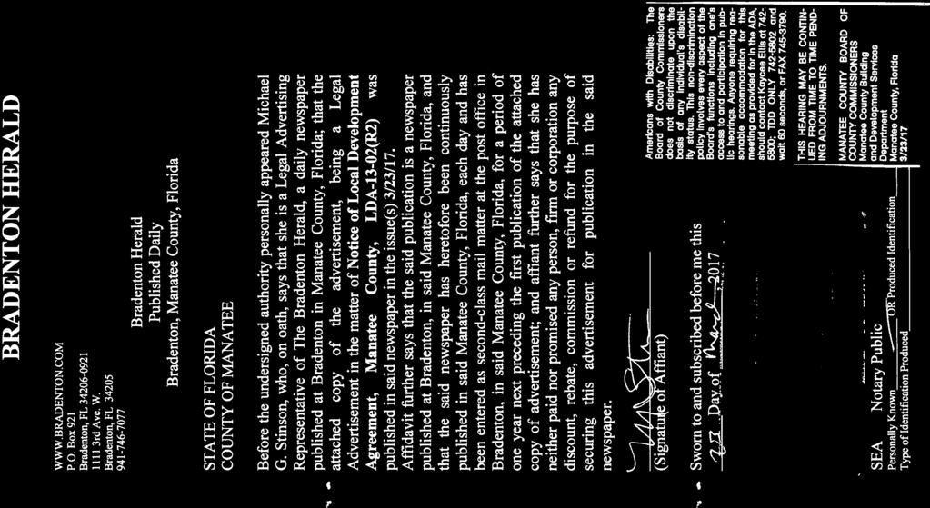
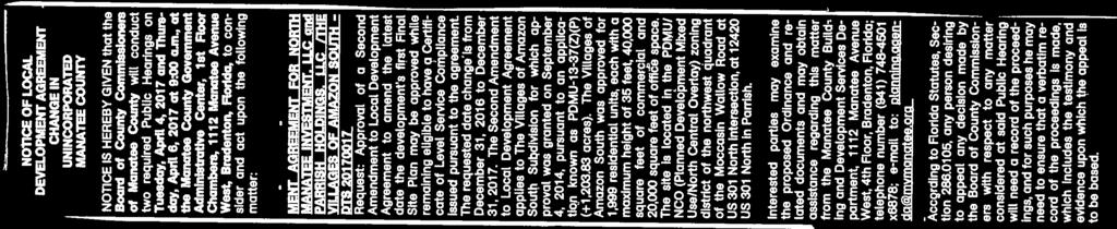
21 Sarasota Herald-Tribune March 23, 2017 Miscellaneous Notices NOTICE OF LOCAL DEVELOPMENT AGREEMENT CHANGE IN UNINCORPORATED MANATEE COUNTY NOTICE IS HEREBY GIVEN that the Board of County Commissioners of Manatee County will conduct two required Public Hearings on Tuesday, April 4, 2017 and Thursday, April 6, 2017 at 9:00 a.m., at the Manatee County Government Administrative Center, 1st Floor Chambers, 1112 Manatee Avenue West, Bradenton, Florida, to consider and act upon the following matter: LDA-13-02(R2) - LOCAL DEVELOPMENT AGREEMENT FOR NORTH MANATEE INVESTMENT, LLC and PARRISH HOLDINGS, LLC /THE VILLAGES OF AMAZON SOUTH - DTS Request: Approval of a Second Amendment to Local Development Agreement to amend the latest date the development's first Final Site Plan may be approved while remaining eligible to have a Certificate of Level Service Compliance issued pursuant to the agreement. The requested date change is from December 31, 2016 to December 31, The Second Amendment to Local Development Agreement applies to The Villages of Amazon South Subdivision for which approval was granted on September 4, 2014, pursuant to an application known as PDMU-13-37(Z)(P) (+1, acres). The Villages of Amazon South was approved for 1,999 residential units, each with a maximum height of 35 feet, 40,000 square feet of commercial and 20,000 square feet of office space. The site is located in the PDMU/NCO (Planned Development Mixed Use/North Central Overlay) zoning district of the northwest quadrant of the Moccasin Wallow Road at US 301 North intersection, at US 301 North in Parrish. Interested parties may examine the proposed Ordinance and related documents and may obtain assistance regarding this matter from the Manatee County Building and Development Services Department, 1112 Manatee Avenue West, 4th Floor, Bradenton, Florida; telephone number (941) x6878; to: planning.agenda@mymanatee.org According to Florida Statutes, Section , any person desiring to appeal any decision made by the Board of County Commissioners with respect to any matter considered at said Public Hearing will need a record of the proceedings, and for such purposes he may need to ensure that a verbatim record of the proceedings is made, which includes the testimony and evidence upon which the appeal is to be based.
22 Americans with Disabilities: The Board of County Commissioners does not discriminate upon the basis of any individual's disability status. This nondiscrimination policy involves every aspect of the Board's functions including one's access to and participation in public hearings. Anyone requiring reasonable accommodation for this meeting as provided for in the ADA, should contact Kaycee Ellis at ; TDD ONLY and wait 60 seconds, or FAX THIS HEARING MAY BE CONTINUED FROM TIME TO TIME PENDING ADJOURNMENTS. MANATEE COUNTY BOARD OF COUNTY COMMISSIONERS Manatee County Building and Development Services Department Manatee County, Florida Date of pub: March 23, 2017
23 Bradenton Herald March 23, 2017 Miscellaneous Notices NOTICE OF LOCAL DEVELOPMENT AGREEMENT CHANGE IN UNINCORPORATED MANATEE COUNTY NOTICE IS HEREBY GIVEN that the Board of County Commissioners of Manatee County will conduct two required Public Hearings on Tuesday, April 4, 2017 and Thursday, April 6, 2017 at 9:00 a.m., at the Manatee County Government Administrative Center, 1st Floor Chambers, 1112 Manatee Avenue West, Bradenton, Florida, to consider and act upon the following matter: LDA-13-02(R2) - LOCAL DEVELOPMENT AGREEMENT FOR NORTH MANATEE INVESTMENT, LLC and PARRISH HOLDINGS, LLC /THE VILLAGES OF AMAZON SOUTH - DTS Request: Approval of a Second Amendment to Local Development Agreement to amend the latest date the development's first Final Site Plan may be approved while remaining eligible to have a Certificate of Level Service Compliance issued pursuant to the agreement. The requested date change is from December 31, 2016 to December 31, The Second Amendment to Local Development Agreement applies to The Villages of Amazon South Subdivision for which approval was granted on September 4, 2014, pursuant to an application known as PDMU-13-37(Z)(P) (+1, acres). The Villages of Amazon South was approved for 1,999 residential units, each with a maximum height of 35 feet, 40,000 square feet of commercial and 20,000 square feet of office space. The site is located in the PDMU/NCO (Planned Development Mixed Use/North Central Overlay) zoning district of the northwest quadrant of the Moccasin Wallow Road at US 301 North intersection, at US 301 North in Parrish. Interested parties may examine the proposed Ordinance and related documents and may obtain assistance regarding this matter from the Manatee County Building and Development Services Department, 1112 Manatee Avenue West, 4th Floor, Bradenton, Florida; telephone number (941) x6878; to: planning.agenda@mymanatee.org According to Florida Statutes, Section , any person desiring to appeal
24 any decision made by the Board of County Commissioners with respect to any matter considered at said Public Hearing will need a record of the proceedings, and for such purposes he may need to ensure that a verbatim record of the proceedings is made, which includes the testimony and evidence upon which the appeal is to be based. Americans with Disabilities: The Board of County Commissioners does not discriminate upon the basis of any individual's disability status. This nondiscrimination policy involves every aspect of the Board's functions including one's access to and participation in public hearings. Anyone requiring reasonable accommodation for this meeting as provided for in the ADA, should contact Kaycee Ellis at ; TDD ONLY and wait 60 seconds, or FAX THIS HEARING MAY BE CONTINUED FROM TIME TO TIME PENDING ADJOURNMENTS. MANATEE COUNTY BOARD OF COUNTY COMMISSIONERS Manatee County Building and Development Services Department Manatee County, Florida 3/23/17
25 Clarke Davis From: Sent: To: Cc: Subject: Attachments: William Clague Tuesday, March 07, :00 PM Lisa Barrett Mitchell Palmer; Sarah Schenk; Anne Morris; Dan Schlandt; John Barnott; Sia Mollanazar; Clarke Davis; Bobbi Roy; Juliet Shepard Villages of Amazon 2nd Amendment to LDA; RLS nd Amd to LDA-Amazon dtd pdf Lisa: Pursuant to the above Request for Legal Services, you have asked this office to review the above referenced 2 nd Amendment to the existing LDA for the Villages of Amazon Project. The amendment utilizes a form approved by this office in previous transactions. Attached are marked pages reflecting my comments, which are intended to provide clarity and consistency. Subject to the inclusion of my suggested changes, I have no objection from a legal standpoint to the amendment being scheduled for consideration by the Board. I express no opinion as to the business judgment of entering into the amendment. This concludes my response to the RLS. Please let me know if you have any questions or concerns. Bill Clague Assistant County Attorney Manatee County, Florida ph fx william.clague@mymanatee.org 1
26
27

28

29


30

31

32

33

34

35

36

37

38

39

40

41

42
43

44

45

46

47


48


49


50


51

52
53

54

55


56
57
58

59

60


61


62
63 EXHIBIT A A. PARCEL A1 AND A2 (NORTH) LEGAL DESCRIPTION: (PREPARED BY KING ENGINEERING ASSOCIATES, INC.) A PARCEL OF LAND LYING IN SECTIONS 17 AND 18, TOWNSHIP 33 SOUTH, RANGE 19 EAST, MANATEE COUNTY, FLORIDA, BEING MORE PARTICULARLY DESCRIBED AS FOLLOWS: BEGINNING AT THE SOUTHWEST CORNER OF SECTION 18, TOWNSHIP 33 SOUTH, RANGE 19 EAST, MANATEE COUNTY FLORIDA; THENCE NORTH 00 08'15" EAST, ALONG THE WEST LINE OF SAID SECTION 18, A DISTANCE OF FEET TO THE POINT OF INTERSECTION WITH THE NORTH LINE OF A GAS LINE EASEMENT AS RECORDED IN OFFICIAL RECORDS BOOK 1681, PAGE 225 OF THE PUBLIC RECORDS OF MANATEE COUNTY, FLORIDA; THENCE ALONG SAID NORTH LINE THE FOLLOWING THREE (3) COURSES: (1) NORTH 89 39'04" EAST, A DISTANCE OF 2.97 FEET; (2) SOUTH 89 30'19" EAST, A DISTANCE OF 2, FEET; (3) SOUTH 89 32'06" EAST, A DISTANCE OF FEET; THENCE SOUTH 00 51'43" WEST, A DISTANCE OF FEET TO THE POINT OF INTERSECTION WITH THE NORTH LINE OF A GAS LINE EASEMENT AS RECORDED IN OFFICIAL RECORDS BOOK 1681, PAGE 230 OF THE PUBLIC RECORDS OF MANATEE COUNTY, FLORIDA; THENCE ALONG SAID NORTH LINE THE FOLLOWING FOUR (4) COURSES: (1) SOUTH 89 39'17" EAST, A DISTANCE OF 1, FEET; (2) SOUTH 89 10'24" EAST, A DISTANCE OF FEET; (3) SOUTH 89 53'47" EAST, A DISTANCE OF 1, FEET; (4) SOUTH 89 38'03" EAST, A DISTANCE OF FEET TO THE POINT OF INTERSECTION WITH THE NORTH LINE OF A FLORIDA POWER & LIGHT COMPANY EASEMENT AS RECORDED IN OFFICIAL RECORDS BOOK 650, PAGE 592 AND OFFICIAL RECORDS BOOK 669, PAGE 745, BOTH OF THE PUBLIC RECORDS OF MANATEE COUNTY, FLORIDA; THENCE ALONG SAID NORTH LINE THE FOLLOWING TWO (2) COURSES: (1) NORTH 89 17'06" EAST, A DISTANCE OF 1, FEET; (2) NORTH 89 51'05" EAST, A DISTANCE OF FEET TO THE POINT OF INTERSECTION WITH THE WEST LINE OF THAT CERTAIN PARCEL OF LAND AS DESCRIBED IN OFFICIAL RECORDS BOOK 1767, PAGE 4886 OF THE PUBLIC RECORDS OF MANATEE COUNTY, FLORIDA; THENCE ALONG THE WEST, SOUTH AND EAST LINES OF SAID CERTAIN PARCEL AS DESCRIBED IN OFFICIAL RECORDS BOOK 1767, PAGE 4886 THE FOLLOWING THREE (3) COURSES: (1) SOUTH 00 16'21" WEST, A DISTANCE OF FEET; (2) SOUTH 89 43'39" EAST, A DISTANCE OF FEET; (3) NORTH 00 16'21" EAST, A DISTANCE OF FEET TO THE POINT OF INTERSECTION WITH SAID NORTH LINE OF A FLORIDA POWER & LIGHT COMPANY EASEMENT; THENCE NORTH 89 52'24" EAST, ALONG SAID NORTH LINE, A DISTANCE OF FEET TO THE POINT OF INTERSECTION WITH THE NORTHWEST RIGHT-OF-WAY OF STATE ROAD 43 (US 301) ACCORDING TO FLORIDA DEPARTMENT OF TRANSPORTATION RIGHT-OF- Page 5 of 8
64 WAY MAP, SECTION ; THENCE ALONG SAID NORTHWEST RIGHT-OF- WAY OF STATE ROAD 43 (US 301) THE FOLLOWING TWO (2) COURSES: (1) SOUTH 36 06'04" WEST, A DISTANCE OF FEET; (2) SOUTH 36 04'54" WEST, A DISTANCE OF FEET TO THE POINT OF INTERSECTION WITH THE SOUTH LINE OF SECTION 17, TOWNSHIP 33 SOUTH, RANGE 19 EAST; THENCE ALONG SAID SOUTH LINE OF SECTION 17 THE FOLLOWING TWO (2) COURSES: (1) SOUTH 89 51'05" WEST, A DISTANCE OF FEET TO THE SOUTH 1/4 CORNER OF SAID SECTION 17; (2) SOUTH 89 17'06" WEST, A DISTANCE OF 2, FEET TO THE SOUTHEAST CORNER OF SAID SECTION 18; THENCE NORTH 89 08'38" WEST, ALONG THE SOUTH LINE OF SAID SECTION 18, A DISTANCE OF 5, FEET TO THE POINT OF BEGINNING. CONTAINING ACRES. B. PARCEL A1 AND A2 (SOUTH) LEGAL DESCRIPTION: (PREPARED BY KING ENGINEERING ASSOCIATES, INC.) A PARCEL OF LAND LYING IN SECTIONS 19 AND 20, TOWNSHIP 33 SOUTH, RANGE 19 EAST, MANATEE COUNTY, FLORIDA, BEING MORE PARTICULARLY DESCRIBED AS FOLLOWS: BEGINNING AT THE NORTHWEST CORNER OF SECTION 19, TOWNSHIP 33 SOUTH, RANGE 19 EAST, MANATEE COUNTY FLORIDA; THENCE SOUTH 89 08'38" EAST, ALONG THE NORTH LINE OF SAID SECTION 19, A DISTANCE OF 5, FEET TO THE NORTHEAST CORNER OF SAID SECTION 19; THENCE ALONG THE NORTH LINE OF SECTION 20, TOWNSHIP 33 SOUTH, RANGE 19 EAST THE FOLLOWING TWO (2) COURSES: (1) NORTH 89 17'06" EAST, A DISTANCE OF 2, FEET TO THE NORTH 1/4 CORNER OF SAID SECTION 20; (2) NORTH 89 51'05" EAST, A DISTANCE OF FEET TO THE POINT OF INTERSECTION WITH THE NORTHWEST RIGHT-OF-WAY OF STATE ROAD 43 (US 301) ACCORDING TO FLORIDA DEPARTMENT OF TRANSPORTATION RIGHT-OF- WAY MAP, SECTION ; THENCE ALONG SAID NORTHWEST RIGHT-OF- WAY OF STATE ROAD 43 (US 301) THE FOLLOWING TWO (2) COURSES: (1) SOUTH 36 04'54" WEST, A DISTANCE OF FEET TO THE POINT ON A NON- TANGENT CURVE TO THE LEFT; (2) SOUTHERLY FEET ALONG THE ARC OF SAID CURVE, HAVING A RADIUS OF 1, FEET, A CENTRAL ANGLE OF 28 09'21", AND A CHORD BEARING AND DISTANCE OF SOUTH 22 01'42" WEST FEET; THENCE NORTH 89 26'34" WEST, A DISTANCE OF 1, FEET; THENCE SOUTH 00 06'08" EAST, A DISTANCE OF 1, FEET TO THE POINT OF INTERSECTION WITH THE NORTH RIGHT-OF-WAY OF MOCCASIN WALLOW ROAD ACCORDING TO ROAD PLAT BOOK 4, PAGE 153 OF THE PUBLIC RECORDS OF MANATEE COUNTY, FLORIDA; THENCE ALONG SAID NORTH RIGHT-OF-WAY THE FOLLOWING FIVE (5) COURSES: (1) NORTH 88 54'18" WEST, A DISTANCE OF 1, FEET; (2) NORTH 89 08'58" WEST, A DISTANCE OF 2, FEET; (3) NORTH 89 07'49" WEST, A DISTANCE OF FEET; (4) Page 6 of 8
65 NORTH 89 07'50" WEST, A DISTANCE OF 2, FEET; (5) NORTH 88 01'42" WEST, A DISTANCE OF FEET TO THE POINT OF INTERSECTION WITH THE WEST LINE OF SAID SECTION 19; THENCE NORTH 00 08'36" EAST, ALONG SAID WEST LINE OF SECTION 19, A DISTANCE OF 2, FEET TO THE POINT OF BEGINNING. CONTAINING ACRES. C. PARCEL A3 AND A4 LEGAL DESCRIPTION: (PREPARED BY KING ENGINEERING ASSOCIATES, INC.) A PARCEL OF LAND LYING IN SECTIONS 16, 17 AND 18, TOWNSHIP 33 SOUTH, RANGE 19 EAST, MANATEE COUNTY, FLORIDA, BEING MORE PARTICULARLY DESCRIBED AS FOLLOWS: COMMENCING AT THE SOUTHWEST CORNER OF SECTION 18, TOWNSHIP 33 SOUTH, RANGE 19 EAST, MANATEE COUNTY FLORIDA; THENCE NORTH 00 08'15" EAST, ALONG THE WEST LINE OF SAID SECTION 18, A DISTANCE OF FEET TO THE POINT OF INTERSECTION WITH THE NORTH LINE OF A GAS LINE EASEMENT AS RECORDED IN OFFICIAL RECORDS BOOK 1681, PAGE 225 OF THE PUBLIC RECORDS OF MANATEE COUNTY, FLORIDA, SAME BEING THE POINT OF BEGINNING; THENCE CONTINUE ALONG SAID WEST LINE, NORTH 00 08'15" EAST A DISTANCE OF 1, FEET; THENCE SOUTH 87 03'06" EAST, A DISTANCE OF 3, FEET; THENCE NORTH 00 49'44" EAST, A DISTANCE OF FEET; THENCE SOUTH 89 49'04" EAST, A DISTANCE OF 2, FEET; THENCE NORTH 00 35'38" EAST, A DISTANCE OF 2, FEET; THENCE SOUTH 89 43'15" EAST, A DISTANCE OF FEET; THENCE SOUTH 00 11'16" WEST, A DISTANCE OF FEET; THENCE SOUTH 68 30'43" EAST, A DISTANCE OF 1, FEET; THENCE NORTH 27 47'24" EAST, A DISTANCE OF 1, FEET; THENCE SOUTH 89 59'54" EAST, A DISTANCE OF 4, FEET TO THE POINT OF INTERSECTION WITH THE NORTHWEST RIGHT-OF-WAY OF STATE ROAD 43 (US 301) ACCORDING TO FLORIDA DEPARTMENT OF TRANSPORTATION RIGHT-OF-WAY MAP, SECTION ; THENCE SOUTH 36 06'04" WEST, ALONG SAID NORTHWEST RIGHT-OF-WAY, A DISTANCE OF 4, FEET TO THE POINT OF INTERSECTION WITH A NORTHERLY LINE OF THAT CERTAIN PARCEL OF LAND AS DESCRIBED IN OFFICIAL RECORDS BOOK 2207, PAGE 6256 OF THE PUBLIC RECORDS OF MANATEE COUNTY, FLORIDA; THENCE ALONG NORTHERLY AND WESTERLY LINES OF SAID CERTAIN PARCEL OF LAND AS DESCRIBED IN OFFICIAL RECORDS BOOK 2207, PAGE 6256 THE FOLLOWING ELEVEN (11) COURSES: (1) NORTH 08 36'03" WEST, A DISTANCE OF FEET; (2) NORTH 20 23'31" WEST, A DISTANCE OF FEET; (3) NORTH 46 10'58" WEST, A DISTANCE OF FEET; (4) NORTH 75 36'36" WEST, A DISTANCE OF FEET; (5) NORTH 54 56'49" WEST, A DISTANCE OF FEET; (6) SOUTH 88 03'46" WEST, A DISTANCE OF FEET; (7) NORTH 82 06'14" WEST, A DISTANCE OF FEET; (8) NORTH 69 38'08" WEST, A DISTANCE OF FEET; (9) NORTH 73 32'48" WEST, A DISTANCE OF Page 7 of 8
66 FEET; (10) SOUTH 36 06'04" WEST, A DISTANCE OF FEET; (11) SOUTH 00 02'24" WEST, A DISTANCE OF FEET TO THE POINT OF INTERSECTION WITH THE NORTH LINE OF A FLORIDA POWER & LIGHT COMPANY EASEMENT AS RECORDED IN OFFICIAL RECORDS BOOK 650, PAGE 592 AND OFFICIAL RECORDS BOOK 669, PAGE 745, BOTH OF THE PUBLIC RECORDS OF MANATEE COUNTY, FLORIDA; THENCE SOUTH 89 52'24" WEST, ALONG SAID NORTH LINE, A DISTANCE OF FEET TO THE POINT OF INTERSECTION WITH THE EAST LINE OF THAT CERTAIN PARCEL OF LAND AS DESCRIBED IN OFFICIAL RECORDS BOOK 1767, PAGE 4886 OF THE PUBLIC RECORDS OF MANATEE COUNTY, FLORIDA; THENCE ALONG THE EAST, NORTH AND WEST LINES OF SAID CERTAIN PARCEL AS DESCRIBED IN OFFICIAL RECORDS BOOK 1767, PAGE 4886 THE FOLLOWING THREE (3) COURSES: (1) NORTH 00 16'21" EAST, A DISTANCE OF FEET; (2) NORTH 89 43'39" WEST, A DISTANCE OF FEET; (3) SOUTH 00 16'21" WEST, A DISTANCE OF FEET TO THE POINT OF INTERSECTION WITH SAID NORTH LINE OF A FLORIDA POWER & LIGHT COMPANY EASEMENT; THENCE ALONG SAID NORTH LINE THE FOLLOWING TWO (2) COURSES: (1) SOUTH 89 51'05" WEST, A DISTANCE OF FEET; (2) SOUTH 89 17'06" WEST, A DISTANCE OF 1, FEET TO THE POINT OF INTERSECTION WITH THE NORTH LINE OF A GAS LINE EASEMENT AS RECORDED IN OFFICIAL RECORDS BOOK 1681, PAGE 230 OF THE PUBLIC RECORDS OF MANATEE COUNTY, FLORIDA; THENCE ALONG SAID NORTH LINE THE FOLLOWING FOUR (4) COURSES: (1) NORTH 89 38'03" WEST, A DISTANCE OF FEET; (2) NORTH 89 53'47" WEST, A DISTANCE OF 1, FEET; (3) NORTH 89 10'24" WEST, A DISTANCE OF FEET; (4) NORTH 89 39'17" WEST, A DISTANCE OF 1, FEET; THENCE NORTH 00 51'43" EAST, A DISTANCE OF FEET TO THE POINT OF INTERSECTION WITH SAID NORTH LINE OF A GAS LINE EASEMENT AS RECORDED IN OFFICIAL RECORDS BOOK 1681, PAGE 225 OF THE PUBLIC RECORDS OF MANATEE COUNTY, FLORIDA; THENCE ALONG SAID NORTH LINE THE FOLLOWING THREE (3) COURSES: (1) NORTH 89 32'06" WEST, A DISTANCE OF FEET; (2) NORTH 89 30'19" WEST, A DISTANCE OF 2, FEET; (3) SOUTH 89 39'04" WEST, A DISTANCE OF 2.97 FEET TO THE POINT OF BEGINNING. CONTAINING ACRES. Page 8 of 8

67


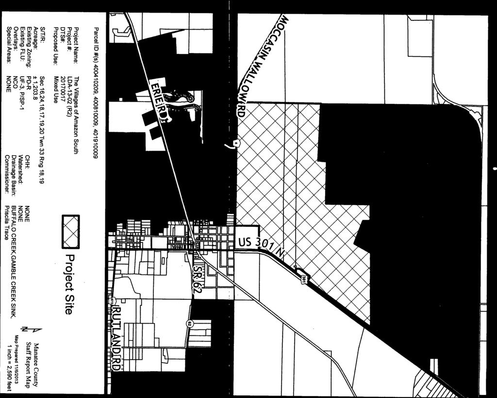
 20170017 Mixed Use S/T/R: Acreage: Existing Zoning: Existing FLU: Overlays: Special Areas:")

68 FUTURE LAND USE ROR UF-3 SAWGRASS GATEWAY EAGLE POINTE LOCAL DEVELOPMENT EAGLE POINTE PH 1 SUBPH A+B UF-3 MU UF-3 PARRISH CENTRE VILLAGES OF AMAZON SOUTH P/SP-1 MOCCASIN WALLO W P/SP N MU CONE RANCH RD US PARRISH LAKES MU PARRISH LAKES HARRISON RANCH PH 1a & 1b SUMMER WOODS - PROPERTY ADDITION / LDA MU SUMMER WOODS TRAMMELL COPPERSTONE (FKA VALENCIA GROVES) ERIE RD McGUIRE MORGANS GLEN MANATEE COUNTY TRANSPORTATION MAINTENANCE FACILITY P/SP-1 DENALI ACRES SUBDIVISION RES-6 COUTTS SUBDIVISION ST. FRANCIS CABRINI JONES OFFICE RETAIL LESLIE WELLS REALTY OFFICE EDGAR PRICE CENTER STEWART COMM. 1ST MANATEE BANK FKA PARRISH BANK SR 62 NALANDA ESTATES / KHILNANI PARRISH NALANDA ESTATES UF-3 PARRISH PLANTATION P/SP-1 RUTLAND RD Parcel ID #(s) , , Project Name: Project #: DTS#: Proposed Use: The Villages of Amazon South LDA (R2) Mixed Use S/T/R: Acreage: Existing Zoning: Existing FLU: Overlays: Special Areas: Sec 16,24,18,17,19,20 Twn 33 Rng 18,19 ± 1,203.8 PD-MU CHH: UF-3, P/SP-1 Watershed: NCO Drainage Basin: NONE Commissioner: NONE NONE BUFFALO CREEK,GAMBLE CREEK SINK, Priscila Whisenant Trace ¹ Manatee County Staff Report Map Map Prepared 11/ inch = 2,590 feet

 PD-R PD-R PD-R MORGANS GLEN McGUIRE PD-MU MANATEE COUNTY TRANSPORTATION MAINTENANCE FACILITY DENALI ACRES SUBDIVISION")

 20170017 Mixed Use North Central Overlay S/T/R: Acreage: Existing Zoning: Existing")

69 ZONING PD-R PD-MU PD-MU SAWGRASS GATEWAY PD-MU EAGLE POINTE LOCAL DEVELOPMENT EAGLE POINTE PH 1 SUBPH A+B A A PD-R PARRISH CENTRE PD-MU PD-R MOCCASIN WALLO W VILLAGES OF AMAZON SOUTH 301 N CONE RANCH PD-MU PD-R PARRISH LAKES PARRISH LAKES PD-MU HARRISON RANCH PH PD-MU 1a & 1b SUMMER WOODS A TRAMMELL PD-R RD ERIE RD A-1 SUMMER WOODS - PROPERTY ADDITION / LDA COPPERSTONE (FKA VALENCIA GROVES) PD-R PD-R PD-R MORGANS GLEN McGUIRE PD-MU MANATEE COUNTY TRANSPORTATION MAINTENANCE FACILITY DENALI ACRES SUBDIVISION PD-MU A-1 VIL ST. FRANCIS CABRINI US VIL VIL JONES OFFICE RETAIL PD-C LESLIE WELLS REALTY OFFICE STEWART COMM. VIL VIL 1ST MANATEE BANK FKA PARRISH BANK SR 62 EDGAR PRICE CENTER NC-M NALANDA ESTATES PD-R PD-MU PARRISH PLANTATION A-1 RUTLAND PD-R RD A A A-1 PD-R A-1 A-1 Parcel ID #(s) , , Project Name: Project #: DTS#: Proposed Use: The Villages of Amazon South LDA (R2) Mixed Use North Central Overlay S/T/R: Acreage: Existing Zoning: Existing FLU: Overlays: Special Areas: Sec 16,24,18,17,19,20 Twn 33 Rng 18,19 ± 1,203.8 PD-MU CHH: UF-3, P/SP-1 Watershed: NCO Drainage Basin: NONE Commissioner: NONE NONE BUFFALO CREEK,GAMBLE CREEK SINK, Priscila Whisenant Trace ¹ Manatee County Staff Report Map Map Prepared 11/ inch = 2,590 feet


 20170017 Mixed Use S/T/R: Acreage: Existing Zoning: Existing FLU:")

70 AERIAL SAWGRASS GATEWAY EAGLE POINTE LOCAL DEVELOPMENT EAGLE POINTE PH 1 SUBPH A+B PARRISH CENTRE VILLAGES OF AMAZON SOUTH MOCCASIN WALLO W 301 N CONE RANCH RD US PARRISH LAKES PARRISH LAKES HARRISON RANCH PH 1a & 1b SUMMER WOODS - PROPERTY ADDITION / LDA TRAMMELL SUMMER WOODS COPPERSTONE (FKA VALENCIA GROVES) ERIE RD McGUIRE MORGANS GLEN MANATEE COUNTY TRANSPORTATION MAINTENANCE FACILITY DENALI ACRES SUBDIVISION COUTTS SUBDIVISION ST. FRANCIS CABRINI JONES OFFICE RETAIL LESLIE WELLS REALTY OFFICE EDGAR PRICE CENTER STEWART COMM. 1ST MANATEE BANK FKA PARRISH BANK SR 62 NALANDA ESTATES / KHILNANI PARRISH NALANDA ESTATES PARRISH PLANTATION RUTLAND RD Parcel ID #(s) , , Project Name: Project #: DTS#: Proposed Use: The Villages of Amazon South LDA (R2) Mixed Use S/T/R: Acreage: Existing Zoning: Existing FLU: Overlays: Special Areas: Sec 16,24,18,17,19,20 Twn 33 Rng 18,19 ± 1,203.8 PD-MU CHH: UF-3, P/SP-1 Watershed: NCO Drainage Basin: NONE Commissioner: NONE NONE BUFFALO CREEK,GAMBLE CREEK SINK, Priscila Whisenant Trace ¹ Manatee County Staff Report Map Map Prepared 11/ inch = 2,590 feet

 400410309, 400810059, 401910059 Project")
 20170017 Mixed Use S/T/R: Acreage: Existing Zoning:")


71 AERIAL VILLAGES OF AMAZON SOUTH PARRISH CENTRE 301 N O W RD US CONE RANCH SUMMER WOODS - PROPERTY ADDITION / LDA SUMMER WOODS COPPERSTONE (FKA VALENCIA GROVES) McGUIRE MORGANS GLEN JONES OFFICE RETAIL PARRISH PLANTATION SR 62 Parcel ID #(s) , , Project Name: Project #: DTS#: Proposed Use: The Villages of Amazon South LDA (R2) Mixed Use S/T/R: Acreage: Existing Zoning: Existing FLU: Overlays: Special Areas: Sec 16,24,18,17,19,20 Twn 33 Rng 18,19 ± 1,203.8 PD-MU CHH: UF-3, P/SP-1 Watershed: NCO Drainage Basin: NONE Commissioner: NONE NONE BUFFALO CREEK,GAMBLE CREEK SINK, Priscila Whisenant Trace ¹ Manatee County Staff Report Map Map Prepared 11/ inch = 1,631 feet
72


73
74


75


76
77

78
79


80


81
ORDINANCE NO provides that historic preservation ad valorem tax exemptions may be granted only by ordinance of the county; and
 ORDINANCE NO. 16-30 AN ORDINANCE OF MANATEE COUNTY, FLORIDA, REGARDING HISTORIC PRESERVATION AD VALOREM TAX EXEMPTIONS; CREATING ARTICLE XVII OF CHAPTER 2-29 OF THE MANATEE COUNTY CODE; DEFINING CERTAIN
LANDSCAPE AND MAINTENANCE EASEMENT. THIS LANDSCAPE AND MAINTENANCE EASEMENT, (hereinafter Easement )
") Prepared by and return to: Parcel ID # LANDSCAPE AND MAINTENANCE EASEMENT THIS LANDSCAPE AND MAINTENANCE EASEMENT, (hereinafter Easement ) is made and entered into this day of, 2009, by and between THIRD
Prepared by and return to: Parcel ID # LANDSCAPE AND MAINTENANCE EASEMENT THIS LANDSCAPE AND MAINTENANCE EASEMENT, (hereinafter Easement ) is made and entered into this day of, 2009, by and between THIRD
BILL NO (Emergency Measure) ORDINANCE NO. 5072
 ORDINANCE NO. 5072") BILL NO. 5210 (Emergency Measure) ORDINANCE NO. 5072 AN ORDINANCE AUTHORIZING THE MAYOR TO EXECUTE WITH MICHELSON-HADLEY HEIGHTS DEVELOPMENT, LLC, A CONTRACT AND QUIT CLAIM DEED CONVEYING CERTAIN PROPERTIES
BILL NO. 5210 (Emergency Measure) ORDINANCE NO. 5072 AN ORDINANCE AUTHORIZING THE MAYOR TO EXECUTE WITH MICHELSON-HADLEY HEIGHTS DEVELOPMENT, LLC, A CONTRACT AND QUIT CLAIM DEED CONVEYING CERTAIN PROPERTIES
RESOLUTION R EAST COUNTY MIDDLE SCHOOL SCHOOL SITE PLAN SSP DTS
 RESOLUTION R-18-003 EAST COUNTY MIDDLE SCHOOL SCHOOL SITE PLAN SSP-17-02 DTS20170502 A RESOLUTION OF THE BOARD OF COUNTY COMMISSIONERS OF MANATEE COUNTY, FLORIDA, REGARDING LAND DEVELOPMENT; ALLOWING FOR
Manatee County Government Administrative Building First Floor, Chambers August 3, :00 am
 Manatee County Government Administrative Building First Floor, Chambers August 3, 2017-9:00 am August 3, 2017 - Land Use Meeting Agenda Item #16 Subject Resolution 17-089 (Related to AP-17-01) - SA-17-01
Sketch & Legal Description of Mitigation Bank and Ingress/Egress Access Easements
 Appendix H: Sketch & Legal Description of Mitigation Bank and Ingress/Egress Access Easements Tippen Bay Wetland Mitigation Bank DeSoto County, Florida Prepared by: September, 2017 Original file
COUNCIL AGENDA MEMO ITEM NO. III - #1
 COUNCIL AGENDA MEMO ITEM NO. III - #1 FROM: Anton Jelinek, Director of Utilities MEETING: October 24, 2017 SUBJECT: PRESENTER: Permanent Utility and Right-of-Way Easement Anton Jelinek Discussion: At the
ORDINANCE NO AN ORDINANCE To Be Entitled:
 3808 AN ORDINANCE To Be Entitled: AN ORDINANCE OF THE CITY COUNCIL OF THE CITY OF FORT MYERS, FLORIDA, REZONING FROM COMMERCIAL GENERAL TO PLANNED UNIT DEVELOPMENT AND APPROVING THE DEVELOPMENT PLAN FOR
CITY OF OCALA CITY COUNCIL REPORT Council Meeting Date: 06/06/17
 CITY OF OCALA CITY COUNCIL REPORT Council Meeting Date: 06/06/17 Subject: Large Scale Land Use Map Amendment Submitted By: David Boston Department: Growth Management STAFF RECOMMENDATION (Motion Ready):
PUBLIC NOTICE SALE OF COUNTY OWNED SURPLUS REAL PROPERTY
 PUBLIC NOTICE SALE OF COUNTY OWNED SURPLUS REAL PROPERTY Notice is hereby given that the Pasco County Board of County Commissioners will receive sealed bids to purchase the following surplus County-owned
[SPACE ABOVE THIS LINE FOR RECORDING INFORMATION]
![[SPACE ABOVE THIS LINE FOR RECORDING INFORMATION]](/thumbs/74/69889180.jpg "[SPACE ABOVE THIS LINE FOR RECORDING INFORMATION]") INSTRUMENT#: 2010398579, BK: 20216 PG: 1321 PGS: 1321-1326 11/23/2010 at 04:03:44 PM, DEPUTY CLERK:LPERTUIS Pat Frank,Clerk of the Circuit Court Hillsborough County ~l=~ntff~e' ~ F ~ E [] (~ 0 ~)) Y Donald
INSTRUMENT#: 2010398579, BK: 20216 PG: 1321 PGS: 1321-1326 11/23/2010 at 04:03:44 PM, DEPUTY CLERK:LPERTUIS Pat Frank,Clerk of the Circuit Court Hillsborough County ~l=~ntff~e' ~ F ~ E [] (~ 0 ~)) Y Donald
CONSENT ACTION BY THE BOARD OF DIRECTORS OF VENETO IN MIRAMAR CONDOMINIUM ASSOCIATION, INC.
 CONSENT ACTION BY THE BOARD OF DIRECTORS OF VENETO IN MIRAMAR CONDOMINIUM ASSOCIATION, INC. The undersigned, being all of the members of the Board of Directors of Veneto in Miramar Condominium Association,
WATERFORD LANDING COMMUNITY DEVELOPMENT DISTRICT REGULAR MEETING AGENDA
 WATERFORD LANDING COMMUNITY DEVELOPMENT DISTRICT REGULAR MEETING AGENDA January 31, 2019 Waterford Landing Community Development District OFFICE OF THE DISTRICT MANAGER 2300 Glades Road, Suite 410W Boca
City Council Information Form
 City Council Information Form DATE: 08/13/2014 ASSIGNED STAFF: Robert McKay DEPARTMENT: Planning&Development TYPE OF FORM: Ordinances Form No.: 4490 APPROVALS: None ISSUE/REQUEST: AN ORDINANCE VACATING
TEMPORARY CONSTRUCTION EASEMENT JEA SEWER SYSTEM CUSTOMER OWNED, OPERATED AND MAINTAINED
 Return to: JEA Real Estate Services Attention: Jordan Pope 21 West Church Street (CC-6) Jacksonville, Florida 32202 TEMPORARY CONSTRUCTION EASEMENT JEA SEWER SYSTEM CUSTOMER OWNED, OPERATED AND MAINTAINED
Regular Agenda / Public Hearing for Board of Commissioners meeting September 24, 2014
 John S. Franden, President Mitchell A. Jaurena, Vice President Rebecca W. Arnold, Commissioner Sara M. Baker, Commissioner Jim D. Hansen, Commissioner TO: FROM: ACHD Board of Commissioners & Bruce S. Wong,
AGENDA UPDATE ECONOMIC DEVELOPMENT & FINANCE STANDING COMMITTEE MEETING MONDAY, AUGUST 10, 2015 III. COMMITTEE AGENDA
 AGENDA UPDATE ECONOMIC DEVELOPMENT & FINANCE STANDING COMMITTEE MEETING MONDAY, AUGUST 10, 2015 III. COMMITTEE AGENDA REVISED ITEM NO. 4 150217.ORDINANCE: VACATION VILLAGE AREAS 1 AND 2A Synopsis: A revised
CITY OF PORT ST LUCIE
 CITY OF PORT ST LUCIE COUNCIL AGENDA MEMORANDUM 7W Agenda Item #: Meeting Date: 4/24/17 TO: Mayor and City uncil VIA: Russ Blackburn, y Manager FROM: O. Reginald Osenton, City Attorney P'(- Agenda Item:
ATTACHMENT B GRANT DEED. This deed is in satisfaction of the Eminent Domain Action Case No. GRANT DEED
 GRANT DEED RECORDING REQUESTED BY AND WHEN RECORDED MAIL TO: County of Orange County Executive Office CEO Real Estate 333 W. Santa Ana Blvd. Bldg. 10 Santa Ana, California 92701 AND MAIL TAX STATEMENTS
NEW MARKET BYPASS MEMORANDUM OF UNDERSTANDING
 NEW MARKET BYPASS MEMORANDUM OF UNDERSTANDING THIS MEMORANDUM OF UNDERSTANDING ( MOU ), is made this day of, 2014, by and between the BOARD OF COUNTY COMMISSIONERS OF FREDERICK COUNTY, MARYLAND, a body
RIGHT OF WAY AND COMMON DRIVEWAY AGREEMENT SUN8 PDC, LLC, c/o DISTRIBUTED SUN, LLC SUBDIVISION DRYDEN, NEW YORK
 RIGHT OF WAY AND COMMON DRIVEWAY AGREEMENT SUN8 PDC, LLC, c/o DISTRIBUTED SUN, LLC SUBDIVISION DRYDEN, NEW YORK THIS RIGHT OF WAY AGREEMENT ( Agreement ) is made this day of, 2017 by SCOTT PINNEY, an individual
UNOPPOSED ORDER GRANTING RECEIVER'S MOTION TO APPROVE THE SALE OF REAL PROPERTY OWNED BY MAMC EMERALD CAY, LLC
 IN THE CIRCUIT COURT OF THE ELEVENTH JUDICIAL CIRCUIT IN AND FOR MIAMI-DADE COUNTY, FLORIDA STATE OF FLORIDA, OFFICE OF FINANCIAL REGULATION, Plaintiff, v. BERMAN MORTGAGE CORPORATION, a Florida corporation,
Add on item to regular section of agenda: FDOT Draft Tentative Work Program
 MEMORANDUM To: Robin Meyer, AICP, Planning Section Manager From: Bobbi Roy, Planning Coordinator Date: December 3, 2014 Subject: Agenda Update for the December 4, 2014 Board of County Commissioners Land
Instructions and Application Procedures Plan Amendments
 Glades County Instructions and Application Procedures Plan Amendments Small Scale Plan Amendments are changes to the Future Land Use Map designation of properties 10 acres or less in size, or, in some
MEMORANDUM. Mayor and City Council. Warren Hutmacher, City Manager. Date: February 11, 2013
 MEMORANDUM To: From: Mayor and City Council Warren Hutmacher, City Manager Date: February 11, 2013 Subject: Approval of an Intergovernmental agreement by and between the City of Dunwoody and DeKalb County
Regular Agenda / Public Hearing for Board of Commissioners meeting January 7, 2015
 Rebecca W. Arnold, Commissioner Sara M. Baker, Commissioner Jim D. Hansen, Commissioner Kent Goldthorpe, Commissioner Paul Woods, Commissioner TO: FROM: ACHD Board of Commissioners & Bruce S. Wong, Director
AGREEMENT RECITALS: Draft 3/26/2015
 AGREEMENT This Agreement is entered into this day of April, 2015, by and between the SCHOOL BOARD OF BREVARD COUNTY, FLORIDA (the "School Board") and THE CITY OF MELBOURNE, a Florida municipal corporation
Manatee County Government Administrative Center Commission Chambers, First Floor 9:00 a.m. - January 24, 2017
 Manatee County Government Administrative Center Commission Chambers, First Floor 9:00 a.m. - January 24, 2017 January 24, 2017 - Regular Meeting Agenda Item #15 Subject Permanent Right-Of-Way Easement
TEMPORARY ACCESS/UTILITY EASEMENT AGREEMENT
 Prepared by: RETURN: R. Brian Shutt, Esq. City Attorney's Office 200 N.W. 1st Avenue Delray Beach, Florida 33444 TEMPORARY ACCESS/UTILITY EASEMENT AGREEMENT THIS TEMPORARY ACCESS/UTILITY EASEMENT AGREEMENT
;:ft{n Siegel, City Manager
 5/17/2016 03 City of San Juan Capistrano Agenda Report TO: FROM: Honorable Mayor and Members of the City Council ;:ft{n Siegel, City Manager SUBMITTED BY: Steve May, Public Works and Utilities Director
ORDINANCE WHEREAS, the Planning and Zoning Board of the City of Belleview has been designated as the Local Planning Agency; and
 Page 1 of 9 ORDINANCE 2019-03 AN ORDINANCE OF THE CITY OF BELLEVIEW, FLORIDA RELATING TO AN AMENDMENT OF 8.87 +/- ACRES OF LAND TO THE CITY OF BELLEVIEW COMPREHENSIVE PLAN; AMENDING THE FUTURE LAND USE
The City Council of the City of Sulphur, Louisiana, met in special session at its
 July 12, 2018 The City Council of the City of Sulphur, Louisiana, met in special session at its regular meeting place in the Council Chambers, Sulphur, Louisiana, on July 12, 2018 at 5:00 p.m., after full
MEETING AGENDA PLANNING AND ZONING COMMISSION
 CALL MEETING TO ORDER: CLERK TO CALL ROLL: READING OF MINUTES: April 23, 2018 MEETING AGENDA PLANNING AND ZONING COMMISSION Monday, May 14, 2018 5:30 P.M. (EST) or As Soon Thereafter As Possible 450 North
Walton County Planning and Development Services
 Walton County Planning and Development Services 31 Coastal Centre Boulevard, Suite 100 47 N 6 th Street Santa Rosa Beach, Florida 32459 DeFuniak Springs, Florida 32433 Phone 850-267-1955 Phone 850-892-8157
EASEMENT AGREEMENT. WHEREAS, Hall Brothers owns certain real property located in Weber County, Utah ( Hall Brothers Property );
;") When Recorded Return to: Parcel No. EASEMENT AGREEMENT THIS EASEMENT AGREEMENT ( Agreement ) is entered into this day of, 2016 by and between VALLEY DREAMS PROPERTIES, LLC, a Utah limited liability company
When Recorded Return to: Parcel No. EASEMENT AGREEMENT THIS EASEMENT AGREEMENT ( Agreement ) is entered into this day of, 2016 by and between VALLEY DREAMS PROPERTIES, LLC, a Utah limited liability company
TEMPORARY CONSTRUCTION EASEMENT
 TEMPORARY CONSTRUCTION EASEMENT This Temporary Construction Easement Agreement (hereafter, the Agreement ) is entered into by and between the Flagler County Board of County Commissioners, a political subdivision
AVENIR COMMUNITY DEVELOPMENT DISTRICT CITY OF PALM BEACH GARDENS REGULAR BOARD MEETING JANUARY 24, :00 P.M.
 AVENIR COMMUNITY DEVELOPMENT DISTRICT CITY OF PALM BEACH GARDENS REGULAR BOARD MEETING JANUARY 24, 2019 12:00 P.M. Special District Services, Inc. The Oaks Center 2501A Burns Road Palm Beach Gardens, FL
AS SET FORTH ON EXHIBIT A ATTACHED HERETO AND INCORPORATED HEREIN.
 25-20-24-0246-00A-00000 Plantation at Leesburg Riverwalk Village This instrument prepared by: Sanford A. Minkoff, County Attorney P.O. Box 7800, Tavares, FL 32778 Return to: Lake County Public Works Dept.-
EASEMENT DEED. 2) Thence N 60º12 36 W through said Parcel 1 a distance of Two Hundred Ninety- Five and 97/100 (295.97) feet to a point;
 Thence N 60º12 36 W through said Parcel 1 a distance of Two Hundred Ninety- Five and 97/100 (295.97) feet to a point;") EASEMENT DEED TALL TREES CONSTRUCTION CORP., a Maine corporation having a mailing address of 30 Preservation Drive, Falmouth, Maine 04105 (the "Grantor") for consideration paid, grants to the TOWN OF FALMOUTH,
EASEMENT DEED TALL TREES CONSTRUCTION CORP., a Maine corporation having a mailing address of 30 Preservation Drive, Falmouth, Maine 04105 (the "Grantor") for consideration paid, grants to the TOWN OF FALMOUTH,
BOARD OF COUNTY COMMISSIONERS AGENDA ITEM SUMMARY
 4E1 BOARD OF COUNTY COMMISSIONERS AGENDA ITEM SUMMARY PLACEMENT: CONSENT PRESET: TITLE: EXECUTION AND ADOPTION OF A UTILITY EASEMENT AGREEMENT BY AND BETWEEN MARTIN COUNTY AND OBP WEST, LLC AND TO ADOPT
DECLARATION OF RESTRICTIVE COVENANTS (AFFORDABLE HOUSING)
") Return recorded copy to: Development and Environmental Regulation Division 115 S. Andrews Avenue, A240 Fort Lauderdale, FL 33301 Document prepared by: DECLARATION OF RESTRICTIVE COVENANTS (AFFORDABLE HOUSING)
Return recorded copy to: Development and Environmental Regulation Division 115 S. Andrews Avenue, A240 Fort Lauderdale, FL 33301 Document prepared by: DECLARATION OF RESTRICTIVE COVENANTS (AFFORDABLE HOUSING)
MEMORANDUM. Michael Smith, Director of Public Works. Discussion of Temporary Aerial Easement for KDC
 MEMORANDUM To: From: Mayor and City Council Michael Smith, Director of Public Works Date: August 11, 2014 Subject: Discussion of Temporary Aerial Easement for KDC ITEM DESCRIPTION Discussion of an aerial
CITY OF WINTER SPRINGS
 CITY OF WINTER SPRINGS COMMUNITY DEVELOPMENT DEPARTMENT 1126 STATE ROAD 434 WINTER SPRINGS, FL 32708 407-327-5967 FAX:407-327-6695 APPLICATION FOR COMPREHENSIVE PLAN AMENDMENT APPLICANT: MAILING ADDRESS:
DRAINAGE AND UTILITY EASEMENT. That Bruce Conrad, a single adult, hereinafter referred to as Grantor for good and
 DRAINAGE AND UTILITY EASEMENT KNOW ALL PERSONS BY THESE PRESENTS: That Bruce Conrad, a single adult, hereinafter referred to as Grantor for good and valuable consideration, the receipt and sufficiency
Regular Agenda / Public Hearing for Board of Commissioners meeting May 4, 2016
 Kent Goldthorpe, President Paul Woods, Vice President Rebecca W. Arnold, Commissioner Sara M. Baker, Commissioner Jim D. Hansen, Commissioner TO: FROM: ACHD Board of Commissioners & Bruce S. Wong, Director
NON-EXCLUSIVE ROADWAY AND UTILITY EASEMENT DEED AND AGREEMENT
 RETURN TO: STOGSDILL LAW OFFICE, P.C. 505 West Main, Suite 313 Lewistown, Montana 59457 (406) 538-2623 NON-EXCLUSIVE ROADWAY AND UTILITY EASEMENT DEED AND AGREEMENT THIS EASEMENT DEED AND AGREEMENT is
There is no fiscal impact associated with this Individual Development Approval.
 CRP-06-01 R2/13-97500005 Citibank Temporary Drive-Through 700-998 South Federal Highway The Via Mizner property is approximately 6.8 acres in area and is situated on the north side of Camino Real, east
Ownership and Encumbrance Report
 Ownership and Encumbrance Report First American Issuing Office: First American Title Insurance Company 2233 Lee Road, Suites 110B Winter Park, FL 32789 Customer Reference Number: First American File Number:
AGENDA ITEM SUMMARY GLADES COUNTY BOARD OF COUNTY COMMISSIONERS
 AGENDA ITEM SUMMARY GLADES COUNTY BOARD OF COUNTY COMMISSIONERS SUBJECT: Quit Claim Deed of Mineral Rights to GCDC DEPT/DEPT REQUEST: County Attorney BACKGROUND/DETAIL OF REPORT: GCDC is in the process
COUNCIL ACTION FORM Meeting Date: September 13, 2012 Staff Contact: John Sullivan, Public Works Director
 COUNCIL ACTION FORM Meeting Date: September 13, 2012 Staff Contact: John Sullivan, Public Works Director Agenda Item: Consider vacation of a Landscape Easement granted to the City of Westwood for the construction
APPLICATION PROCEDURES FOR A MAJOR SUBDIVISION PRELIMINARY PLAT
 APPLICATION PROCEDURES FOR A DEFINITION: The subdivision of a tract of land into at least three (3) residential, commercial, or industrial parcels, including the remainder of the original parcel, fronting
ORDINANCE NO. CID-3087
 ORDINANCE NO. CID-3087 AN ORDINANCE MAKING FINDINGS AS TO THE NATURE AND ADVISABILITY OF CREATING A COMMUNITY IMPROVEMENT DISTRICT AT THE NORTHEAST CORNER OF 91 ST STREET AND METCALF AVENUE; CREATING SAID
ORDINANCE NO
 DRAFT NO. 16-52 ORDINANCE NO. 2016 48 AN ORDINANCE AUTHORIZING THE CITY MANAGER, OR HIS DESIGNEE, TO ENTER INTO AN AGREEMENT BETWEEN THE CITY OF KENT AND GARY PHILLIP BERARDINELLI TO SELL 0.2833 ACRES
BY BOARD OF COUNTY COMMISSIONERS
 BY BOARD OF COUNTY COMMISSIONERS ORDINANCE NO. AN ORDINANCE CREATING THE PLANTATION PALMS MUNICIPAL SERVICE BENEFIT UNIT; PROVIDING FOR BOUNDARIES; PROVIDING FOR LEVY OF NON AD-VALOREM SPECIAL ASSESSMENTS;
INTERLOCAL AGREEMENT BETWEEN COLLIER COUNTY AND CITY OF NAPLES SANDPIPER STREET SOUTH OF MARLIN DRIVE
 INTERLOCAL AGREEMENT BETWEEN COLLIER COUNTY AND CITY OF NAPLES SANDPIPER STREET SOUTH OF MARLIN DRIVE This INTERLOCAL AGREEMENT is entered into this day of, 201, by and between Collier County, a political
WHEREAS, the Petition was filed by PATRICK AND KIMBERLY SHULER for the vacation of plat on property described herein; and
 VP 15-0003 RESOLUTION 2-16 A RESOLUTION PROVIDING FOR THE VACATION OF PLAT FOR A PUBLIC UTILITY AND DRAINAGE EASEMENT UNDERLYING A PREVIOUSLY VACATED RIGHT-OF-WAY BEING A PART OF SW 28 PLACE ADJACENT TO
DECLARATION OF RESTRICTIVE COVENANTS (AGE RESTRICTED)
") Return recorded copy to: Development and Environmental Regulation Division 115 S. Andrews Avenue, A240 Fort Lauderdale, FL 33301 Document prepared by: DECLARATION OF RESTRICTIVE COVENANTS (AGE RESTRICTED)
Return recorded copy to: Development and Environmental Regulation Division 115 S. Andrews Avenue, A240 Fort Lauderdale, FL 33301 Document prepared by: DECLARATION OF RESTRICTIVE COVENANTS (AGE RESTRICTED)
CITY OF PAPILLION MAYOR AND CITY COUNCIL REPORT MAY 16, 2018 AGENDA
 CITY OF PAPILLION MAYOR AND CITY COUNCIL REPORT MAY 16, 2018 AGENDA Subject: Type: Submitted By: A request to vacate the Final Plat for Prairie Queen First Subdivision, a subdivision legally described
ENCROACHMENT AGREEMENT
 THIS INSTRUMENT PREPARED BY: Roy K. Payne, Esq. Chief Assistant City Attorney City of Orlando 400 S. Orange Avenue Orlando, Florida 32801 (407) 246-3495 ENCROACHMENT AGREEMENT THIS ENCROACHMENT AGREEMENT,
ORDINANCE NO
 ORDINANCE NO. 3140-19 AN ORDINANCE OF THE CITY OF WINTER PARK, FLORIDA, AUTHORIZING THE LEASE OF CITY-OWNED PROPERTY LOCATED AT 2525 CADY WAY PURSUANT TO THE TOWER LEASE WITH OPTION AS AMENDED BY THE FIRST
CITY OF PORT ST LUCIE
 CITY OF PORT ST LUCIE COUNCIL AGENDA MEMORANDUM Agenda Item #: 11B Meeting Date: 5/22/17 TO: Mayor and City 1Council 2 VIA: Russ Blackburrit, ity Manager Patricia Roeblirg, P.E., Assistant City Manager
approval of the Release and Satisfaction of Property Donation Requirements (Burnt Store Road
 RESOLUTION 38-16 A RESOLUTION OF THE CITY OF CAPE CORAL ACCEPTING A QUIT CLAIM DEED FROM ZREV FARM, LLC, FOR A 2.07 ACRE PARCEL LYING WITHIN SECTION 20, TOWNSHIP 43 SOUTH, RANGE 23 EAST; APPROVING AND
ARLINGTON COUNTY, VIRGINIA
 ARLINGTON COUNTY, VIRGINIA County Board Agenda Item Meeting of January 26, 2013 DATE: January 8, 2013 SUBJECT: Amend and Restate the Deed of Easement and Declaration of Restrictive Covenants for to permit
1 S Central Ave, PO Box 2286 Umatilla, FL (352) Fax# (352)
 Fax# (352)") Applications go through the following steps: Technical Review Committee CITY OF UMATILLA TIMETABLE FOR PLANNING & ZONING APPLICATIONS Applications can take anywhere from 60 to 90 days for approval, depending
Applications go through the following steps: Technical Review Committee CITY OF UMATILLA TIMETABLE FOR PLANNING & ZONING APPLICATIONS Applications can take anywhere from 60 to 90 days for approval, depending
AMENDMENT TO POWER PURCHASE AGREEMENT
 AMENDMENT TO POWER PURCHASE AGREEMENT This Amendment Power Purchase and Agreement ( Amendment ) is entered into as of, 2012, by and between, (hereinafter RMW ) a Nevada limited liability company, and The
OFFICIAL SUMMARY OF AN ORDINANCE TO CONVEY CERTAIN RAMSEY COUNTY PARK AND OPEN SPACE LANDS TO THE CITY OF MAPLEWOOD.
 OFFICIAL SUMMARY OF AN ORDINANCE TO CONVEY CERTAIN RAMSEY COUNTY PARK AND OPEN SPACE LANDS TO THE CITY OF MAPLEWOOD. This ordinance authorizes the conveyance of park and open space land owned by Ramsey
PUBLIC NOTICE SALE OF COUNTY OWNED SURPLUS REAL PROPERTY
 PUBLIC NOTICE SALE OF COUNTY OWNED SURPLUS REAL PROPERTY Notice is hereby given that the Pasco County Board of County Commissioners will receive sealed bids to purchase the following surplus County-owned
INTERGOVERNMENTAL AGREEMENT
 INTERGOVERNMENTAL AGREEMENT This Intergovernmental Agreement (this Agreement) is made and entered into as of December 1, 2010, by and between the VILLAGE OF BIG ROCK, an Illinois municipal corporation
Environmental and Engineering Services EASEMENT INFORMATION AND EXAMPLE DOCUMENTS
 Environmental and Engineering Services Reddy Chitepu, P.E., Director EASEMENT INFORMATION AND EXAMPLE DOCUMENTS Please refer to the information below when compiling easement documents for submittal to
AVENIR COMMUNITY DEVELOPMENT DISTRICT CITY OF PALM BEACH GARDENS SPECIAL BOARD MEETING JANUARY 11, :00 A.M.
 AVENIR COMMUNITY DEVELOPMENT DISTRICT CITY OF PALM BEACH GARDENS SPECIAL BOARD MEETING JANUARY 11, 2018 11:00 A.M. Special District Services, Inc. The Oaks Center 2501A Burns Road Palm Beach Gardens, FL
AMENDMENT TO QUITCLAIM DEED AND GRANT OF EASEMENT RECITALS
 RECORDED REQUESTED BY AND WHEN RECORDED MAIL TO: Clerk of the Board of Supervisors County of San Luis Obispo 1055 Monterey Street San Luis Obispo, CA 93408 APN 076-213-009 AND 076-215-012 SPACE ABOVE THIS
Utility Easement from Suncoast Community Health Centers Inc Release of Easement
 0 YLANi AGENDA REPORT 5T FLORID DATE 10 24 11 TO FROM SUBJECT City Commission Gregory Horwedel City Manager Utility Easement from Suncoast Community Health Centers Inc Release of Easement RECOMMENDATION
LAND USE RESTRICTION AGREEMENT FOR: ELLENTON LANDINGS
 LAND USE RESTRICTION AGREEMENT FOR: ELLENTON LANDINGS THIS LAND USE RESTRICTION Agreement (hereinafter Agreement ) is made and entered into by and between the County of Manatee, a political subdivision
PROPERTY EXCHANGE & CONVEYANCE AGREEMENT RECITALS
 PROPERTY EXCHANGE & CONVEYANCE AGREEMENT This Property Exchange and Conveyance Agreement ( Agreement ) is entered into as of the date of execution by and between Laramie Church of Christ, Inc., a Wyoming
DEVELOPMENT AGREEMENT RIVER EDGE COLORADO PLANNED UNIT DEVELOPMENT
 DEVELOPMENT AGREEMENT RIVER EDGE COLORADO PLANNED UNIT DEVELOPMENT THIS AGREEMENT, is made and entered into between the BOARD OF COUNTY COMMISSIONERS OF THE COUNTY OF GARFIELD, a body politic and corporate
MINOR PLAT FILING APPLICATION
 FILING APPLICATION Date of PC Meeting: Date of BCC Meeting: Fee Paid: 1. APPLICANT: DAYTIME PHONE: MAILING ADDRESS: LANDOWNER: DAYTIME PHONE: MAILING ADDRESS: AUTHORIZED AGENT: MAILING ADDRESS: RELATIONSHIP
ARLINGTON COUNTY, VIRGINIA. County Board Agenda Item Meeting of December 10, 2016
 ARLINGTON COUNTY, VIRGINIA County Board Agenda Item Meeting of December 10, 2016 DATE: November 29, 2016 SUBJECT: Deed of Dedication for Public Street and Utilities Purposes on Property Owned by the Estate
RECITALS. Page 1 of 9
 INTERLOCAL AGREEMENT BETWEEN THE COUNTY OF VOLUSIA AND THE CITY OF DEBARY FOR REIMBURSEMENT OF UTILITY CONSTRUCTION AND A UTILITY SERVICE AGREEMENT FOR POTABLE WATER THIS AGREEMENT is entered into by and
FIFTH AMENDMENT TO LEASE OF REAL PROPERTY BETWEEN CITY OF HOLLYWOOD AND BROWARD COUNTY
 Page 1 of 5 FIFTH AMENDMENT TO LEASE OF REAL PROPERTY BETWEEN CITY OF HOLLYWOOD AND BROWARD COUNTY This Fifth Amendment to the Lease of Real Property ( Fifth Amendment ) between the City of Hollywood,
City Commission Agenda Cover Memorandum
 City Commission Agenda Cover Memorandum Originating Department: Planning & Zoning (PZ) Meeting Type: Regular Agenda Date: 03/14/2016 Advertised: Required?: Yes No ACM#: 20760 Subject: Resolution No. 86-16
CONTRACT FOR SALE AND PURCHASE
 CONTRACT FOR SALE AND PURCHASE THIS Contract for Sale and Purchase ( Contract ) is made this day of, 20, by and between the Southwest Florida Water Management District, a public corporation of the State
PROVIDING FOR THE REZONING OF CERTAIN LAND FROM A-1 (SUBURBAN
 MANATEE COUNTY ZONING ORDINANCE PDR-01-12(Z)(P) - TOROBE CITRUS, INC./SUGAR MILL LAKES AN ORDINANCE OF THE COUNTY OF MANATEE, FLORIDA, AMENDING THE OFFICIAL ZONING ATLAS OF MANATEE COUNTY, ORDINANCE NO.
Exhibit A: REAL ESTATE TRANSFER AGREEMENT
 Exhibit A: REAL ESTATE TRANSFER AGREEMENT This agreement is made between the City of Urbana, Illinois, a municipal corporation of the State of Illinois (the Seller ), and Homestead Corporation of Champaign-Urbana,
NO PROTEST AGREEMENT AND COVENANT RUNNING WITH THE LAND. Parcel #(s): R: T: S: Q: Q: Project Name:
: R: T: S: Q: Q: Project Name:") RETURN TO: COVENANT RUNNING WITH THE LAND Parcel #(s): R: T: S: Q: Q: Project Name: THIS COVENANT RUNNING WITH THE LAND is made and entered into this day of, 20, by, between, and among, herein known as
RETURN TO: COVENANT RUNNING WITH THE LAND Parcel #(s): R: T: S: Q: Q: Project Name: THIS COVENANT RUNNING WITH THE LAND is made and entered into this day of, 20, by, between, and among, herein known as
ABBREVIATION LEGEND SITE INFORMATION:
 SITE INFORMATION: Current Zone: R-3 PUD, governed by Fox Hollow 2nd MDA Basis of Elevations: Northeast Corner of Section 13, T6S, R1W, S.L.B. & M Elevation: 4599.26 (Benchmark) ABBREVIATION LEGEND Owners:
APPLICATION TO REGISTER NOTICE OF AN AGREEMENT THE LAND TITLES ACT SECTION 74
 26 th May 1981 Campeau - City of Kanata 40% Open Space Agreement APPLICATION TO REGISTER NOTICE OF AN AGREEMENT THE LAND TITLES ACT SECTION 74 TO: THE LAND REGISTRAR FOR THE LAND TITLES DIVISION OF OTTAWA-CARLETON
REVIEWED BY: Administrator Counsel Program Mgr.: Tiffany Schaufler Board Committee Engineer Other
 Minnehaha Creek Watershed District REQUEST FOR BOARD ACTION MEETING DATE: May 11, 2017 TITLE: Authorization to Grant a Temporary Easement to the City of Minnetrista RESOLUTION NUMBER: 17-034 PREPARED BY:
DECLARATION OF UNITY OF CONTROL
 PREPARED BY AND RETURN TO: Scott Backman, Esq. Dunay, Miske! and Backman, LLP 14 SE 4th Street, Suite 36 Boca Raton, FL 33432 DECLARATION OF UNITY OF CONTROL THIS DECLARATION of Unity of Control ("Declaration")
CHAPTER XIX ANNEXATION ARTICLE 1. ANNEXATION
 CHAPTER XIX ANNEXATION ARTICLE 1. ANNEXATION 19.0101 JABORSKY ADDITION: WHEREAS, The City of Belfield pursuant to Section 40-51.2-07 of the North Dakota Century Code has amended having passed a Resolution
STREET VACATION PETITION INSTRUCTIONS
 STREET VACATION PETITION INSTRUCTIONS VACATION OF STREET OR PORTION THEREOF SARASOTA COUNTY ORDINANCE 88-130 SECTION 336.09 AND 336.10 FLORIDA STATUTES 1. COMPLETE PETITION The Petition document must be
RESOLUTION NO. RD:EEH:LCP
 RESOLUTION NO. A RESOLUTION OF THE COUNCIL OF THE CITY OF SAN JOSE CONDITIONALLY VACATING A PORTION OF MERIDIAN AVENUE, SOUTH OF FRUITDALE AVENUE, AND RESERVING A PUBLIC SERVICE EASEMENT OVER THE VACATED
ORDINANCE NO. Z REZONING NO
 ORDINANCE NO. Z- 3960 REZONING NO. 2018-00014 AN ORDINANCE RELATING TO ZONING: AMENDING CERTAIN ZONING REGULATIONS SHOWN ON SHEET NO. 15 OF THE ZONING DISTRICT MAP INCORPORATED BY REFERENCE BY OVERLAND
COVENANT AGREEMENT BETWEEN THE CITY OF RAPID CITY AND GWH PROPERTIES, LLC TO PERMIT CERTAIN ENCROACHMENTS IN PEDESTRIAN AND UTILITY EASEMENT
 PREPARED BY: City Attorney s Office 300 Sixth Street Rapid City, SD 57702 (605) 394-4140 COVENANT AGREEMENT BETWEEN THE CITY OF RAPID CITY AND GWH PROPERTIES, LLC TO PERMIT CERTAIN ENCROACHMENTS IN PEDESTRIAN
COUNTY OF CHISAGO, STATE OF MINNESOTA
 OFFICE OF COUNTY AUDITOR-TREASURER COUNTY OF CHISAGO, STATE OF MINNESOTA NOTICE OF EXPIRATION OF REDEMPTION To all persons interested in the lands hereinafter described: You are hereby notified that the
1. Location Map 2. Two (2) Original First Amendments to Development Agreements - DA No
 Original First Amendments to Development Agreements - DA No") PALM BEACH COUNTY BOARD OF COUNTY COMMISSIONERS AGENDA ITEM SUMMARY Agenda Item # 3K-3 Meeting Date: December 6, 2011 Consent [X] Public Hearing [] Regular [] Submitted Submitted For: Water Utilities Department
PALM BEACH COUNTY BOARD OF COUNTY COMMISSIONERS AGENDA ITEM SUMMARY Agenda Item # 3K-3 Meeting Date: December 6, 2011 Consent [X] Public Hearing [] Regular [] Submitted Submitted For: Water Utilities Department
ORDINANCE NO
 DRAFT NO. 09-90 ORDINANCE NO. 2009-81 AN ORDINANCE ACCEPTING FOR DEDICATION PURPOSES, A SANITARY SEWER EASEMENT FROM THE STATE OF OHIO FOR THE GREEK VILLAGE ON KENT STATE UNIVERSITY PROPERTY AND DECLARING
AGENDA COLLETON COUNTY COUNCIL REGULAR MEETING TUESDAY, FEBRUARY 5, :00 P.M. COUNTY COUNCIL CHAMBERS, OLD JAIL BUILDING
 AGENDA COLLETON COUNTY COUNCIL REGULAR MEETING TUESDAY, FEBRUARY 5, 2013 6:00 P.M. COUNTY COUNCIL CHAMBERS, OLD JAIL BUILDING 1. Call to Order 2. Invocation 3. Present Colors and Lead Pledge of Allegiance-
ettjt. RE/Jto sn?m"" DATE & H01JA7
 ., 525459 No. _'l'fn::ii!:lii=nr--- AT THE AeaUEst 6F: ettjt. RE/Jto sn?m"" DATE & H01JA7 THIS DEVELOPMENT AGREEMENT for the Indian Hills 6th Addition subdivision between Thompson Development, L.L. C.,
NON-EXCLUSIVE EASEMENT AGREEMENT
 Prepared by: Catherine D. Reischmann, Esq. 111 N. Orange Ave., Ste. 2000 Orlando, FL 32801 Return to: City Clerk City of Palm Coast 160 Cypress Point Parkway, Ste. B-106 Palm Coast, FL 32164 NON-EXCLUSIVE
FIFTH AMENDMENT OF DECLARATION OF DEED RESTRICTIONS AND DEDICATIONS FOR PINEHURST ESTATES (A Clatsop County, Oregon Subdivision)
") After Recording Return To: W. Louis Larson 990 Astor Street Astoria, OR 97103 FIFTH AMENDMENT OF DECLARATION OF DEED RESTRICTIONS AND DEDICATIONS FOR PINEHURST ESTATES (A Clatsop County, Oregon Subdivision)
After Recording Return To: W. Louis Larson 990 Astor Street Astoria, OR 97103 FIFTH AMENDMENT OF DECLARATION OF DEED RESTRICTIONS AND DEDICATIONS FOR PINEHURST ESTATES (A Clatsop County, Oregon Subdivision)