COMMERCIAL LAND ASSESSMENT MUNICIPALITY OF ANCHORAGE, ALASKA
|
|
|
- Randall Reed
- 5 years ago
- Views:
Transcription
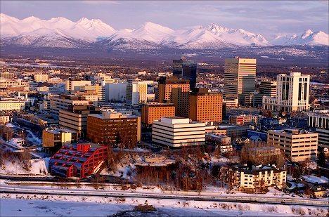
1 COMMERCIAL LAND ASSESSMENT MUNICIPALITY OF ANCHORAGE, ALASKA JANUARY 2012
2
3 ACKNOWLEDGEMENTS PROJECT ADVISORY COMMITTEE Pita Benz, Cook Inlet Tribal Council Dave Deans, Focus Company Carl Kuhn, CCIM, Jack White Commercial Real Estate Steven MacSwain, MAI, MacSwain Associates Dave Pfeifer, CIRI Land Development Company Tim Potter, DOWL HKM Chris Stephens, CCIM, Bond, Stephens & Johnson CONSULTING STAFF Johnson Reid LLC Jerry Johnson, Principal Bill Reid, Principal Agnew::Beck Chris Beck, Principal Shanna Zuspan, Associate Planner Blue Skies Solutions, LLC Mike Knapp With assistance from Stuart Bond, Principal, Bond Stephens & Johnson MUNICIPALITY OF ANCHORAGE COMMERCIAL LAND ASSESSMENT
4
5 TABLE OF CONTENTS I. Introduction... 1 II. Executive Summary... 3 III. Economic Trends Shaping the Future Anchorage Economy Introduction National Economic Trends State Economic Trends Local Trends and Market Conditions IV. Anchorage Growth Scenario Forecasts Introduction Review of Published Employment Forecasts Past Economic Growth & Problems of Data Inconsistency Employment Growth Rate Projections Moderate Expansion Future Employment Levels Significant Data Variation MOA Employment Growth Scenario Forecasts Employment Forecasts, Planning & Risk of Determinism V. Twenty Year Commercial Land Demand Introduction Municipality of Anchorage Study Area Defined Summary of Commercial Land Demand Findings MOA Commercial Land Demand by Use Type Qualitative Site Requirements by Designation & Use Commercial Site Demand VI. Commercial Land Supply & Demand Reconciliation Introduction Current Commercial Development Inventory Commercial Land Supply Reconciliation of Commercial Land Supply & Demand Land Supply Capacity Summary VII. Development & Redevelopment Economics Issues Introduction Overview of Development Process Development Pro Forma: Anchorage Examples VIII. Policy Implications and Recommendations Overview of General Findings Implications Policy Issues Recommendations IX. Technical Appendix MUNICIPALITY OF ANCHORAGE COMMERCIAL LAND ASSESSMENT PAGE i
6 MUNICIPALITY OF ANCHORAGE COMMERCIAL LAND ASSESSMENT PAGE ii
7 I. Introduction The Municipality of Anchorage ( MOA ) has retained Johnson Reid, LLC, along with Agnew::Beck and Blue Skies Solutions, to document twenty year need and development issues for commercially zoned land within the municipality, defined as the Anchorage Bowl area and Eagle River/Chugiak. The MOA specifically seeks to understand the following: National, State, and Local Trends shaping economic and population growth within the study area over the next twenty years. A range of MOA Growth Scenarios to provide Low, Medium (Baseline), and High Growth context to potential job creation, population growth, and resulting demand for various commercial uses and land needs over the twenty year period. A current Inventory of Commercial Uses within the MOA to understand current development patterns and submarket characteristics. A definition and inventory of current Buildable Commercial Land Supply within the broad study area, as well as within six distinct, local submarkets: Downtown & Vicinity; Dimond Blvd. & Vicinity; Midtown & Vicinity; Northeast; South Anchorage; and Eagle River/Chugiak. Documentation of potential Twenty Year Demand for Commercial Uses & Land by primary commercial uses (Retail, Office/Institutional, and Lodging/Hospitality) for the broad study area, as well as within the stated six local submarkets. A Reconciliation of Identified Commercial Land Supply & Demand over the twenty year period for the MOA study area as well as each submarket, including discussion of land capacity, suitability, constraints, and opportunities for new development and redevelopment within each geography. A Discussion of Redevelopment Economics as it pertains to land need findings including (re)development financial issues, entitlement issues, and the various potential tools the public sector may explore to facilitate market driven redevelopment activity. Policy Implications and Recommendations to the Municipality for next steps resulting from this and other recent planning efforts. This report is intended as comprehensive summary of research and analysis of the above commercial land issues for the Municipality of Anchorage. MUNICIPALITY OF ANCHORAGE COMMERCIAL LAND ASSESSMENT PAGE 1
8 (This page intentionally left blank.) MUNICIPALITY OF ANCHORAGE COMMERCIAL LAND ASSESSMENT PAGE 2
9 II. Executive Summary The following is a summary of the key findings from the Anchorage Commercial Land Opportunities Analysis study process. Details discussion may be reviewed in the study section referenced for each finding. Over the long term, and despite continued uncertainty in international economic conditions, Alaska's economic growth is expected expand at a pace similar to the nation. According to the U.S. Bureau of Labor Statistics, by 2018 the state economy is expected to grow by 10.5%, compared to 10.1% nationally. Mirroring the national trend, a significant share of projected growth is expected in the Health Care industry. This is largely driven by demographic factors and the active expansion of Alaska s major health care providers. Further, Construction is likely to rebound in Alaska and add nearly 2,000 jobs through The general consensus is for more protracted growth in Service and Trade oriented industries, more in line with demographic growth. Federal Government and Military will continue to play a significant role as well. (SECTION III) A comprehensive review of the most recent economic forecasts for the Municipality of Anchorage indicates significantly varied growth expectations as well as surprisingly varied measurement of actual employment levels within the Municipality. Based on the review, this study considers three growth scenarios for the Municipality of Anchorage: Medium/Baseline Growth (1.0% Annual Job Growth), High Growth (1.5% Annual Job Growth), and Low Growth (0.5% Annual Job Growth). All estimates of need for commercial land in Anchorage during the planning period follow from these forecasted expansion rates. (SECTION IV) Over the next twenty years, new demand for commercial land within the Municipality is expected to range from 319 to 954 gross buildable acres, contingent upon realized growth patterns in the Municipality of Anchorage (Figure A). The Medium Growth Scenario, or baseline forecast, indicates that Anchorage can expect commercial land demand on the order of 634 acres through These projections reflect gross developable land, defined as demand for building and impervious surface space requirements ( net land demand) plus public facilities, which includes roads, right of ways, parks and other public needs necessary to serve projected land development. (SECTION V) FIGURE A MOA COMMERCIAL LAND DEMAND SUMMARY BY USE TYPE, Gross Land Demand (Acres) Use Category Medium Low High Office/Institutional Retail Household Spending Visitor Spending Lodging Total The commercial land opportunities analysis divided the Municipality into six major geographic submarkets for analysis, which are outlined in the following maps: MUNICIPALITY OF ANCHORAGE COMMERCIAL LAND ASSESSMENT PAGE 3

10 MUNICIPALITY OF ANCHORAGE COMMERCIAL LAND ASSESSMENT PAGE 4
11 MUNICIPALITY OF ANCHORAGE COMMERCIAL LAND ASSESSMENT PAGE 5
12 Nearly fifty million square feet of developed commercial space is estimated for the Greater Anchorage study area (Figure B). Of that, 80% comprises traditional, largely private commercial development forms including retail, lodging, office, and medical uses. Public institutional uses comprise the remaining 20% of built space in the MOA. (SECTION VI) FIGURE B MOA CURRENT BUILT INVENTORY OF COMMERCIAL SPACE: BUILDING SQUARE FEET Misc. Public Geography Retail Office Commercial Lodging Medical Subtotal Institutional Total Downtown & Vicinity 2,345,654 5,276,961 1,293,967 2,871, ,701 11,905,275 1,265,116 13,170,391 Dimond & Vicinity 3,812,856 1,044,210 1,185,134 99,854 81,415 6,223,469 1,652,499 7,875,968 Midtown & Vicinity 4,301,345 6,510,186 1,027,973 1,859, ,439 13,924,844 1,165,063 15,089,907 Northeast 2,529,170 1,315, , ,598 1,863,051 6,393,540 2,719,225 9,112,765 South Anchorage 331, , ,427 9,216 6, ,791 1,154,188 1,758,979 Eagle River Chugiak 989, , ,941 31,143 19,612 1,685,370 1,243,260 2,928,630 Municipality 14,310,734 14,516,663 4,561,949 5,035,704 2,312,239 40,737,289 9,199,351 49,936,640 1/ From Table A 1 of the Agnew:Beck Commercial Land Inventory Final Results technical memorandum. SOURCE: CAMA data from the Municipality of An chorage, Agnew::Beck, and Johnson Reid, LLC Midtown Anchorage is presently the single largest submarket for commercial development inventory at just over fifteen million square feet of space (Figure B). Downtown Anchorage follows somewhat, at roughly 13.2 million square feet of built space. Midtown is presently the single largest market for both retail and office space inventory, eclipsing Downtown as the largest office commercial business district in the region. Downtown, alternatively, is the leading location for lodging development at roughly 2.9 million square feet of space. (SECTION VI) Three different estimates of commercial development suitable land were produced to reflect different definitions of buildable inventory, based on ease or difficulty for a site to physically or economically accommodate new development. Level 1 Supply, defined as sites with zoning that allows commercial development, of at least one acre in size, and with no existing improvements associated with other parcels, is utilized in this study as the baseline definition of buildable land for commercial purposes. Level 1 Supply most closely reflects development site inventory comprising lower obstacle Greenfield development opportunity in Anchorage. Under this definition, the Municipality presently has a total of acres (Figure C) of suitable acreage for commercial development. (SECTION VI) FIGURE C MOA CURRENT INVENTORY OF LAND SUITABLE FOR COMMERCIAL USE: GROSS ACRES (LEVEL 1) Business Zoning Districts Other Commercial Allowed Zones Industrial Zones Allowing Commercial Total Level 1 Supply B 1 1/ B 2 2/ B 3 B 4 Subtotal R O MC MI PC/PLI Subtotal I 1 I 2 Subtotal Supply Downtown & Vicinity Dimond & Vicinity Midtown & Vicinity Northeast South Anchorage Eagle River Chugiak Municipality / Comprises zoning codes B 1A and B 1B. 2/ Comprises zoning codes B 2A, B 2B, and B 2C. SOURCE: CAMA data from the Municipality of Anchorage, Agnew::Beck, and Johnson Reid, LLC If parcels smaller than one acre, have no existing improvements, and zoned allowing commercial development are added to the inventory (Level 2 Supply), the MOA is estimated to have roughly 1,075.3 acres of commercial land for future commercial development within the six primary Anchorage submarkets. By adding parcels less than one acre in size, the supply inventory grows by acres. (SECTION VI) If parcels with some level of improvement, greatly limited to parking, storage, or other such usage, are added to the supply inventory (Level 3 Supply), the MOA is estimated to have nearly 1,660 acres of commercial land for future commercial development within the six primary Anchorage MUNICIPALITY OF ANCHORAGE COMMERCIAL LAND ASSESSMENT PAGE 6
13 submarkets. By adding parcels with low intensity existing improvements such as parking, the supply inventory grows by acres from Level 1 Supply. (SECTION VI) Perhaps most significantly, under all definitions of buildable land supply for commercial uses, land zoned primarily for industrial uses comprises the majority of inventory in Anchorage. 58% of all suitable land under the baseline/level 1 Supply definition is primarily designated for industrial uses, largely with I 1 Light Industrial zoning (Figure D). Under the other definitions of land supply, industrially zoned land still accounts for 51% to 57% of suitable acreage for commercial uses. (SECTION VI) FIGURE D MOA LEVEL 1 SUPPLY SUMMARY BY ZONING & SUBMARKET Eagle River Chugiak Northeast Dimond & Vicinity Downtown & Vicinity Midtown & Vicinity South Anchorage Industrial Zones Business Zones Other Zones Level 1 Supply Acreage Demand and supply estimates for land suitable for commercial development were compared and reconciled for need adequacy over the twenty year planning period and for each of the three economic growth scenarios. In terms of overall gross acreage, only the High Growth scenario (1.5% annual job growth) ensures widespread inadequacy of existing commercial land supply within the MOA. Midtown, Dimond, and Downtown all face supply constraint with higher city economic growth, in relative descending order of land undersupply. (SECTION VI) No matter the growth scenario modeled, Midtown & Vicinity faces the potential for undersupply of gross commercial land acreage under current zoning during the twenty year period, ranging from 39 acres to 198 acres of undersupply. (SECTION VI) When demand and supply are considered in terms of typical site size need for the various development forms instead of simply gross, aggregate acreage, the MOA has an undersupply of the most commonly needed sites, typically between one acre and five acres, under both the baseline Medium Growth and the High Growth scenarios. Under both scenarios, Midtown has a sizeable undersupply of such sites. (SECTION VI) Dimond, Midtown, and South Anchorage exhibit an undersupply of commercial land between 5 acres and 10 acres (Figure E) no matter the growth scenario, though certainly more pronounced with faster economic growth. (SECTION VI) MUNICIPALITY OF ANCHORAGE COMMERCIAL LAND ASSESSMENT PAGE 7
14 FIGURE E MOA COMMERCIAL LANDS DEMAND & LEVEL 1 SUPPLY RECONCILIATION: COMMERCIAL SITE NEED BY SUITABLE SIZE Demand by Site Size (Acres) Supply by Site Size (Acres) 1/ Over/(Under) Capacity by Site Size Other Supply Capacity Medium Growth Acres 5 10 Acres Acres <1 Acre 50+ Acres Downtown & Vicinity (71.3) (13.4) Dimond & Vicinity (7.0) Midtown & Vicinity (80.0) (27.4) (9.4) Northeast (30.9) South Anchorage (2.6) (2.7) (1.0) Eagle River Chugiak Municipality (154.8) Demand by Site Size (Acres) Supply by Site Size (Acres) 1/ Over/(Under) Capacity by Site Size Other Supply Capacity High Growth Acres 5 10 Acres Acres <1 Acre 50+ Acres Downtown & Vicinity (41.9) (33.0) (7.0) Dimond & Vicinity (78.7) 47.9 (25.4) Midtown & Vicinity (93.5) (29.9) (74.4) Northeast (64.8) (12.0) South Anchorage (7.7) (0.8) (3.8) Eagle River Chugiak Municipality (261.9) (17.3) Demand by Site Size (Acres) Supply by Site Size (Acres) 1/ Over/(Under) Capacity by Site Size Other Supply Capacity Low Growth Acres 5 10 Acres Acres <1 Acre 50+ Acres Downtown & Vicinity (6.1) (8.4) Dimond & Vicinity Midtown & Vicinity (5.7) (7.7) (25.6) Northeast South Anchorage (0.2) (1.3) Eagle River Chugiak Municipality / Excludes 52.0 acres of "Not Classified" land inventory due to unavailable geographic submarket designation. SOURCE: CAMA data from the Municipality of Anchorage and Johnson Reid, LLC MUNICIPALITY OF ANCHORAGE COMMERCIAL LAND ASSESSMENT PAGE 8
15 Under the High Growth scenario, most submarkets in the MOA exhibit shortage of larger commercial sites, typically ranging between 10 acres and 50 acres. Midtown and South Anchorage exhibit undersupply no matter the scenario. However, some larger site capacity exists that may be able to meet smaller site demand due to subdivision, phased development, or other possibilities. Larger site shortage as a general rule is harder to mitigate due to the time and expense of assembling smaller sites for an aggregated larger site. (SECTION VI) In general, adequacy of the estimated MOA commercial land supply rests in some degree upon capacity that includes industrial land. Under the baseline Medium Growth scenario, commercial land capacity created by industrial land is important for all but the Midtown & Vicinity market, largely due to its relative lack of industrial land. The Dimond & Vicinity submarket is the most dependent upon land zoned for industrial use allowing commercial. Inclusion of industrial land in Dimond submarket capacity mitigates anticipated undersupply of commercial land in all three growth scenarios, but does not fully prevent undersupply if Anchorage grows faster than baseline. In the Medium and Low Growth scenarios, land zoned I 1 Light Industrial alone greatly fills capacity need that is not met by Business Zoning or Other Zones Allowing Commercial. (SECTION VI) Site issues, market issues, and policy issues frequently combine to limit higher density development in areas such as Midtown over the short and medium term as demonstrated in other metro areas in the U.S. Site issues include environmental constraints, infrastructure constraints, and site size constraints. Market issues include most prominently the issue of financial feasibility. High land values and high rental or lease rates to support these values are needed to make high density development and the structured parking that it requires financially feasible. Other market issues include the difficulties of redevelopment, and competition between commercial centers. (SECTION VII) Zoning is frequently ahead of the market. In other words, zoning frequently will require minimum densities that may not yet be achievable from a market and financial perspective. However, the fact that zoning is ahead of the market is not a condemnation of previous planning. Planning is looking ahead to encourage the study area to be something it is not quite ready to be. Getting lower than planned densities should be expected. Where the public and private sectors can conflict, however, is when the public sector requires, either directly or indirectly, minimum density that the private sector cannot profitably build. In that case, development slows in the short and medium run as land is held. (SECTION VII) The implications of a shortage of commercial land, which is shown to be possible for Midtown under most circumstances, and for Anchorage as a whole under higher economic growth, is fundamentally different from the impacts associated with a shortage of industrial demand. This is particularly true of retail commercial capacity. A lack of appropriate industrial land may limit the region s capture of employers, and potentially basic industries that have a disproportionate impact on regional income. A shortage of retail commercial sites can lead to an inability of the market to provide the full prospective range of retail services and/or retailers that an area can support, but it may not impact the level of overall retail sales in the region. In other words, while a neighborhood may be able to support three grocery stores, if only two are accommodated the level of grocery sales is likely to remain constant, with the existing stores recording relatively high sales levels. An inability to accommodate demand in the most market responsive areas tends to result in a diversion of demand as opposed to a loss of activity. (SECTION VIII) Given technical and policy implications identified during the study process, the following table provides an overview of the categories of Municipality policy actions that may be considered, along with a description of likely impacts and/or effectiveness of such actions observed in other urban areas. (SECTION VIII) MUNICIPALITY OF ANCHORAGE COMMERCIAL LAND ASSESSMENT PAGE 9
16 Potential Actions Continue existing zoning Limit commercial to I 1 designations Prohibit commercial development in industrial designations Development exactions Intervene in markets to increase marginal density Rezone properties to allow commercial uses Description/Implications Under the existing zoning, we would anticipate ongoing development of industrially zoned properties to commercial uses, particularly in areas with an identified need. Significant capacity shortages would continue only in the Midtown area. Prohibiting commercial development on I 2 properties would preserve an increased level of industrial land, while also providing for a considerable level of commercial capacity. This would be expected to result in shortages of commercial capacity in the Dimond and Downtown areas, as well as providing for some level of market disruption. This course of action would provide for the greatest protection of industrial capacity, but with a significant impact on the ability to provide for the Municipality s commercial needs. Shortages of commercial opportunities would be expected to result in a reduction in the number and convenience of retail opportunities, higher land prices and effective rent levels for tenants and higher prices for residents. Industrial properties would likely see a net loss in value if they had viable commercial development potential. Internalize to a greater extent the marginal costs of development through the use of mechanisms such as system development charges, impact fees and offsite requirements. This would be expected to encourage more efficient development patterns. Marginal shifts in charges would be expected to directly impact underlying land values. These are most effective if phased in over time, allowing the market to internalize the costs into development pro formas. While this can be done through mandates (such as minimum allowable densities), interventions that have proven successful tend to require public investment in high cost infrastructure such as structured parking. This is costly but has proven effective. This action would be done in conjunction with limiting the ability to develop commercial uses on industrial properties. The Municipality could increase the supply of commercial property while better controlling the pattern of commercial uses than under a policy of allowing commercial uses on industrial zoned properties. This would have significant market impacts. Recent studies also indicate that the Municipality is faced with a shortage of industrial as well as residential capacity. The ability of these three major land use types to deal with scarcity varies significantly. Residential land uses have a great deal of flexibility in terms of development forms and associated land requirements. This is also true for office commercial space, which has a greater ability to increase density through multiple floors than either retail commercial or industrial space. (SECTION VIII) For retail commercial space, only a single level of retail is typically viable, with the exception of specialized cases such as enclosed regional malls and multi level retailers. As a result, there is limited ability for retail commercial space to increase the intensity of development in terms of a higher level of gross leasable area per acre developed. Retail does adapt to shortages through an increase in sales per square foot, as retailers perform better due to a less competitive market. This comes at the cost of less retail choice, potentially higher pricing and greater transportation costs for residents and businesses. (SECTION VIII) MUNICIPALITY OF ANCHORAGE COMMERCIAL LAND ASSESSMENT PAGE 10
17 The Municipality s current zoning code to a large extent does not reflect intentional planning to organize allowable uses. While the region can meet its commercial land needs in aggregate through the utilization of land designated for industrial uses as commercial development, these types of dual use zones are not commonly seen, particularly with this wide of a range of allowed uses. To the extent that commercial uses are viable on a property, we would expect to see the property develop for commercial uses. The market mechanisms in this case would be expected to begin to organize uses based on a market determination of highest and best use. Properties with strong commercial attributes such as visibility, access and proximity to markets will develop as commercial, while less valuable properties will remain for industrial uses. (SECTION VIII) While previous work has indicated a shortage of industrial land, it is our opinion that a significant amount of industrial activity within the Anchorage Bowl is likely to relocate over time to lower cost locations in the Matanuska Susitna Valley. We would expect this to mitigate some of the potential industrial shortage issues raised in the previous report. (SECTION VIII) The following actions are specifically recommended to address the Municipality s commercial land needs: Commercial Entitlements Intervene in Markets Encourage Redevelopment Refine Industrial Land Needs Land Uses Compatibility Study Reconsidering some commercial use allowance, specifically within entitlement for I 1 zoning may be a starting point for mitigating or avoiding commercial and industrial use designation conflicts in the future. However, zoning designation and market suitability are frequently at odds, thus assessment of market suitable criteria are encouraged. The Municipality should look for ways to intervene in the markets to change the marginal form of development to reduce land requirements. This can be a costly process, and interventions should be carefully considered using a cost/benefit evaluation methodology. Potential tools could include urban renewal districts, but this is not the only viable option. Based on this study as well as other recent work, redevelopment is expected to account for a greater share of overall activity within the Anchorage Bowl. The economics of redevelopment are complex and the logistics are challenging for developers. Nonetheless, a greater pace of investment in redevelopment is seen as a strong positive for the Municipality. In some cases, intervention by the Municipality can significantly improve the likelihood and/or quality of redevelopment activity. A refinement of the recent industrial land need findings study is recommended, including more moderate growth scenarios consistent with more recent, published projections of the Anchorage economy. Further, a refinement is recommended to more specifically address the character, infrastructure, and locational needs of likely future industry growth seeking lowercost heavy industrial sites. A compatibility study, based on recent and refined land needs findings, would allow the Municipality to consider specific geographies and zoning where land value economics have placed pricing pressure on conversion of land to more intense commercial MUNICIPALITY OF ANCHORAGE COMMERCIAL LAND ASSESSMENT PAGE 11
18 uses and would provide criteria by which to establish prioritization for commercial uses based on better planning suitability. South Anchorage Retail Node Assess Infrastructure Economies Regular, Periodic Reassessment Consolidated GIS System A South Anchorage commercial node planning effort, informed by more recent land use needs findings and development criteria, would further enable the Municipality to mitigate and/or outright avoid significant public service costs associated with South Anchorage residents relying greatly up on the Dimond Boulevard corridor and other centers, and reduce or minimize conflicts between commercial value pressure and industrial lands protection. The scope and scale of necessary, future infrastructure needs to serve development needs as recently documented should be studied and estimated in terms of locations, timeframe, and resources required. Particular effort is encouraged in examining any potential economies of scale and/or returns on investment for infrastructure serving clustered commercial (re)development compared to more dispersed, higher density development. Regular, five year period review of land needs and supply is encouraged as land constraint increasingly and disproportionately affects different uses and submarkets of the Anchorage Bowl. The Municipality should pursue a consolidated geographic information system (GIS) framework between different departments to provide a central, standardized database for future planning efforts and community development efforts. MUNICIPALITY OF ANCHORAGE COMMERCIAL LAND ASSESSMENT PAGE 12
19 III. Economic Trends Shaping the Future Anchorage Economy INTRODUCTION The goal of this economic analysis is to discern historical economic patterns and conditions affecting future economic growth and land need in Anchorage. This process effectively provides a foundation of economic information highlighting the framework in which the State and Local economies function. In the analysis that follows, particularly with respect to national trends, it is understood that the region, state, and nation as a whole are currently navigating economic conditions not seen in generations. Ultimately, current economic conditions make it difficult to produce highly timely national trend analysis. Johnson Reid, therefore, heavily utilizes the economic forecast "of record" by federal and state governments, including the non partisan Congressional Budget Office, and the Alaska Department of Labor and Workforce Development. NATIONAL ECONOMIC TRENDS Short Term Outlook Gross Domestic Product Over the previous four quarters, economic growth has improved modestly, posting five consecutive quarters of real GDP growth. However, revisions to preliminary estimates have been downward, and uncertainty hovers over the economic landscape. Following inventory and stimulus driven growth of 5.0% and 3.7% in 4Q09 and 1Q10, respectively; the second quarter brought a more measured 1.7% rate of growth followed by a rebound to 2.5% in the most recent period. In the third quarter the National Bureau of Economic Research (NBER), the official entity for classifying the timing of business cycle fluctuations, placed the official end of the recession as June As a result, any further economic deterioration would be considered a new recession as opposed to a "double dip". However, initial concerns of a second round of economic deterioration are beginning to wane. In the near term, heightened uncertainty remains in the national and global economy. The consensus remains that, relative to previous cyclical recoveries, anticipated economic growth is likely to be more protracted. This is in contrast to previous deep recessions, where a robust recovery is more common. The following factors are expected to contribute to positive, but measured economic growth in the near term 1. The Nature of the Crisis: Recoveries from recession spurred by financial crisis tend to be slower, as consumers rebuild their wealth and financial institutions restore their capital base. Monetary Policy: The Federal Reserve's primary tool for economic influence, the Federal Funds Rate, is already near 0%, leaving the process of quantitative easing (a process of increasing the money supply) as its principal tool under current conditions. The Fed has less experience with this policy action, and the extent and timing of its impacts are uncertain. In the third quarter the Federal Reserve announced a second of quantitative easing in the vicinity of $600 billion. Fiscal Policy: While federal stimulus spending associated with the American Recovery and Reinvestment Act (ARRA) may have helped moderate the severity of the recession in 2009, its effects are beginning to fade. More importantly, under current law, tax cuts implemented in 2001 and Congressional Budget Office. "The Budget and Economic Outlook" January MUNICIPALITY OF ANCHORAGE COMMERCIAL LAND ASSESSMENT PAGE 13
20 are set to expire in The CBO anticipates that if they are not extended, higher marginal tax rates will reduce disposable personal income by $250 billion in By the end of 2010, economic growth is expected to reach a 2.8% annualized rate of growth, followed by a more measured 2.1% in A more robust period of growth is expected to commence in 2012 with 4.1% annual GDP growth. 6% FIGURE 1: REAL GROSS DOMESTIC PRODUCT (WITH NEAR TERM FORECAST), UNITED STATES Percentage Change from Previous Period 4% 2% 0% 2% 4% 6% 8% Forecast Actual 1Q07 2Q07 3Q07 4Q07 1Q08 2Q08 3Q08 4Q08 1Q09 2Q09 3Q09 4Q09 1Q10 2Q10 3Q SOURCE: Bureau of Economic Analysis (BEA) Employment Since the beginning of the recession, payroll employment has fallen by greater than 7 million jobs, reflecting both the loss of employment and a drop in the labor force. A signature element of the current recession has been both the depth and duration of employment losses from the peak period of the economic cycle as determined by the National Bureau of Economic Research. The recent recession is expected to be the deepest and most lengthy period of sustained unemployment since the Great Depression. MUNICIPALITY OF ANCHORAGE COMMERCIAL LAND ASSESSMENT PAGE 14
21 148, , ,000 FIGURE 2: NATIONAL EMPLOYED LEVEL AND UNEMPLOYMENT TREND, UNITED STATES Employed Level Unemployment Rate 12% 10% Jobs (In 000's) 142, , , ,000 8% 6% 4% Unemployment Rate 134, ,000 2% 130,000 0% Jan 00 Jun 00 Nov 00 Apr 01 Sep 01 Feb 02 Jul 02 Dec 02 May 03 Oct 03 Mar 04 Aug 04 Jan 05 Jun 05 Nov 05 Apr 06 Sep 06 Feb 07 Jul 07 Dec 07 May 08 Oct 08 Mar 09 Aug 09 Jan 10 Jun 10 Nov 10 SOURCE: Bureau of Labor Statistics (BLS) At current, unemployment remains at a seasonally adjusted rate of 9.8%. The national unemployment rate has come down from its peak of 10.1% in October 2009, but has retreated in recent quarters as more individuals reenter the labor force; an effect that ironically, is considered a positive trend in light of a sustained employment level. In the near term, the unemployment rate is expected to remain high, and lag the broader economic recovery as there is significant slack in the economy. As the jobs situation begins to recover more broadly, workers who have quit pursuing employment will continue to reenter the labor force, delaying unemployment recovery. 6,000 FIGURE 3: YEAR OVER YEAR CHANGE IN EMPLOYED LEVEL, UNITED STATES 4,000 2,000 Jobs (In 000's) 0 2,000 4,000 6,000 8,000 Jan 07 Mar 07 May 07 Jul 07 Sep 07 Nov 07 Jan 08 Mar 08 May 08 Jul 08 Sep 08 Nov 08 Jan 09 Mar 09 May 09 Jul 09 Sep 09 Nov 09 Jan 10 Mar 10 May 10 Jul 10 Sep 10 Nov 10 SOURCE: Bureau of Labor Statistics (BLS) and JOHNSON REID Much of the pessimism in the economy is related to the jobs situation, with the national employment level still more than 5% below its 2007 peak. However, year over year job losses began to moderate in 2010, with MUNICIPALITY OF ANCHORAGE COMMERCIAL LAND ASSESSMENT PAGE 15
22 nonfarm employment gains positive Year to date (+555,000 jobs). Through November, the economy had posted three consecutive quarters of positive year over year growth, a vague indicator that we may be turning the corner. Nevertheless, the severity of the recent recession created a larger than typical influx of permanently lost positions. This would suggest that employment gains in the recovery will necessitate new job creation, which has thus far been limited by uncertainty, availability of credit, and modest demand for goods and services. Consumer Spending While consumer expenditures have exhibited a clear reversal in trend, spending remains roughly at pre recession levels and consumer sentiment remains low. In the near term, spending by households is likely to remain constrained by slow income growth, lost wealth, and limited credit availability. Moving beyond 2011, the outcome of the expiration or extension of the 2001 and 2003 tax cuts will impact spending patterns significantly. However, early political indications are that an extension of the existing tax structure is on the horizon. Chain Weighted Dollars (In Billions) FIGURE 4: REAL PERSONAL CONSUMPTION EXPENDITURES, UNITED STATES $9, % $9, % 0.4% $9, % $9, % $9, % $9, % 0.6% $9, % $9, % $9, % 2Q07 4Q07 2Q08 4Q08 2Q09 4Q09 2Q10 Percent Change from Previous Period SOURCE: Bureau of Economic Analysis (BEA) Other Factors Affecting Economic Conditions Housing: In the summer of 2010, housing starts fell by roughly 4.8% relative to the same period in The current inventory of vacant housing units has allowed housing starts to fall well below the rate necessary for replacement and population growth. An estimated inventory of 2.6 million excess vacant units will limit housing's contribution to economic recovery until at least Business Investment: Among the brightest spots of the economy in Real investment in equipment and software increased 16% during the third quarter. With significant slack remaining, the CBO forecasts this segment to be a principal driver of the near term recovery. Inventory Investment: Inventories replenishment was a major contributor to GDP growth in the first three quarters of It is expected remain positive, but more muted over the next six to eight quarters before expanding rapidly in Federal Debt held by the public as a percentage of total output reached has reached its highest level since World War II. Under current policies this condition is expected to exacerbate further. Persistent deficits can have severe economic consequences, including the crowding out of private investment; higher marginal tax rates, limited effective use of fiscal policy, and increased risk of a fiscal crisis. Long Term Outlook During the first half of the next growth cycle, GDP is forecasted to grow hastily enough to close the considerable gap between existing and potential GDP. Beyond the near term, the United States economy is expected to return to a typical growth cycle and grow at roughly the same pace as potential output, averaging 2.3% annual growth between 2015 and While growth patterns are expected to return to normal, economic growth in the coming decade is likely to be more measured relative to historical averages. Factors moderating long term economic growth include: MUNICIPALITY OF ANCHORAGE COMMERCIAL LAND ASSESSMENT PAGE 16
23 Demographic factors are expected to create a reduction in the potential labor force, and hence potential hours worked which account for three fourths of the economy. Federal Debt displacing business investment and thus growth in capital services. Total factor productivity growth is forecasted to average 1.3% annual growth, slightly above its average rate of growth since the productivity slow down of the 1970's but below the 60 year average. Annual Percent Change FIGURE 5: LONG TERM FORECAST OF REAL GROSS DOMESTIC PRODUCT, UNITED STATES 6% 5% 4% 3% 2% 1% 0% 1% 2% 3% 4% 0.4% 2.4% 2.8% 2.1% 3.4% 4.7% 4.2% 2.7% 2.5% 2.4% 2.3% 2.2% 2.2% Forecast Actual SOURCE: U.S. Congressional Budget Office (CBO) FIGURE 6: TEN YEAR EMPLOYMENT FORECAST BY INDUSTRY SECTOR, UNITED STATES Government Other Services Leisure & Hospitality Education & Health Professional & Business Financial Activities Information T.W.U. Retail Trade Wholesale Trade Manufacturing Construction Mining & Logging 1, , , ,108 SOURCE: Bureau of Labor Statistics (BLS) and JOHNSON REID 4,938 3,830 2, ,500 5,000 7,500 Employment Change (In 000's) Inflation, as measured by the PCE price index will average 2.0% annual growth during the latter half of the coming decade. The Federal Reserve will continue to use its monetary influence to control inflation risk in the next cycle. The Fed is expected to maintain the rate of PCE near the top of its target range. Long term unemployment is expected to average 5% during the latter half of the decade, roughly equivalent to the natural rate of unemployment. Over the next ten years, the U.S economy is expected to add over 14 million employment positions according to the Bureau of Labor Statistics (BLS). The national economy is forecasted to continue its exhibited trend toward more service oriented industries. A staggering 62% of new employment is expected to be concentrated in only two industries, Education & Health Services, and Professional & Business Services. Over the forecast term, only the Manufacturing and Mining & Logging industries are expected to contact in size. Additional Factors Affecting Long Term Economic Growth Moving Forward Financial Markets: The financial situation of many banks remains delicate, however, the risk of further deterioration is moderating. Ease and cost of credit likely to be more limited moving forward, but far improved from current conditions. MUNICIPALITY OF ANCHORAGE COMMERCIAL LAND ASSESSMENT PAGE 17
24 Monetary Policy: The Federal Reserve is likely to continue aggressive monetary support for the economic recovery until the risk of higher inflation outweighs the risk economic deterioration. The recent economic crisis saw the Fed take a larger and more nontraditional role in its monetary influence, namely the purchase of large amounts of mortgage backed securities on the open market. This has created a more complicated view of Fed influence and monetary policy actions. With nearly twice its prerecession asset holding, the Fed can now withdraw monetary influence by either raising its target Federal Funds Rate or reducing its asset holding. However, the recent lag in the recovery process has led to signals indicating the Fed is more concerned with deflationary pressure, announcing a second round of quantitative easing over to commence over the next four to six quarters. Fiscal Policy: The fiscal impacts of the ARRA have already begun to wane and are expected to turn negative by Moving forward, tax increases slated for 2011 are expected to depress GDP growth on the margin, and mounting federal deficits could limits the government's fiscal effectiveness in the longterm. More importantly, Congress' decision on the expiration of the 2001 and 2003 tax cuts will influence economic conditions severely. Investment: Inventory levels are begging to equalize, and firms are more likely to increase production to more closely match sales. However, the spread between housing vacancies and housing starts remains high, and rebound in housing investment is unlikely until later in the cycle. Investment in durable equipment and software is expected to lead the recovery. Consumer Spending: Growth is expected to remain protracted through Persistently high unemployment will limit income growth and dampen consumer spending growth even further. MUNICIPALITY OF ANCHORAGE COMMERCIAL LAND ASSESSMENT PAGE 18
25 FIGURE 7: TRENDS IN NATIONAL ECONOMIC PERFORMANCE Real U.S. Personal Consuption Expenditures U.S. Federal Deficit as a % of Gross Domestic Product Chain Weighted Dollars (In Billions) $9,400 $9,350 $9,300 $9,250 $9,200 $9,150 $9,100 $9,050 $9,000 2Q07 4Q07 2Q08 4Q08 2Q09 4Q09 2Q10 0.8% 0.6% 0.4% 0.2% 0.0% 0.2% 0.4% 0.6% 0.8% 1.0% 1.2% Percent Change from Previous Period Federal Deficit as a % of GDP 12% 10% 8% 6% 4% 2% 0% 2% 4% SOURCE: Bureau of Economic Analysis (BEA) SOURCE: United States Treasury $150 Quarterly Change in Private Inventories $160 Crude Oil Price Chain Weighted Dollars (In Billions) $100 $50 $0 $50 $100 $150 $200 Dollars per Barrel $140 $120 $100 $80 $60 $40 $20 $0 SOURCE: Bureau of Economic Analysis (BEA) SOURCE: NYSE Annual Change in the CPI U 16% 14% 12% 10% 8% 6% 4% 2% 0% U.S. Long Term Inflation Forecast Forecast Actual Units (In 000's) U.S. Housing Starts 2% ,000 2,500 2,000 1,500 1, SOURCE: Bureau of Labor Statistics and Congressional Budget Office SOURCE: U.S. Census Bureau MUNICIPALITY OF ANCHORAGE COMMERCIAL LAND ASSESSMENT PAGE 19
26 STATE ECONOMIC TRENDS Over the previous 20 years, the Alaska economy has been characterized by stabilized, but lackluster employment growth. Alaska by nature exhibits less employment volatility, with a greater reliance on the impacts of federal influence and a concentration in more capital intensive industries such as oil and mineral extraction. While a stabilized economy is certainly one to be envied, Alaska's condition is one simultaneously characterized by stagnation. A 2010 report produced by IHS Global Insight found that real per capita Gross State Product (GSP) has fallen 23% since FIGURE 8: RELATIVE EMPLOYED LEVEL, UNITED STATES AND STATE OF ALASKA U.S. Employment (In Millions) United States Alaska Alaska Employment (In Millions) SOURCE: Bureau of Labor Statistics, Current Employment Statistics (CES) FIGURE 9: SOURCES OF JOB CREATION IN ALASKA For the better part of the last 20 years, Alaska's economy has been dominated by the broad based development of publically owned natural and capital resources. Most notably, key economic sectors include seafood harvesting/processing, timber and wood products, resource mining, and obviously, oil and gas extraction and exploration. According to the University of Alaska Anchorage Institute of Social and Economic Research (ISER) two out of every three jobs is supported by either the petroleum sector or the Federal Government. Other, 34% Federal Government, 35% Petroleum Sector, 31% 2 IHS Global Insight, Alaska Forward: Phase 1: February 2010 MUNICIPALITY OF ANCHORAGE COMMERCIAL LAND ASSESSMENT PAGE 20
27 Industry Analysis The "Great Recession" brought to an end Alaska's streak of 20 consecutive years of positive job creation. Alaska's nonfarm employment peaked in 2008 before falling slightly in Through the first ten months of 2010, employment levels had surpassed their 2008 peak in summation, though some industries remain lagged. What follows is a brief summary of Alaska's key industry sectors, underlying trends, and where they appear to be in the cycle. Oil & Gas Extraction Recovery Measure Value Signal Sector Employment (2009): 3,606 Share of Total Economy (2009): 1% Estimated 2010 Growth: 3.1% Realized 2010 Growth*: 6.9% Employment Relative to Peak**: 166 Contracting Mining and Mining Support Activities Recovery Measure Value Signal Sector Employment (2009): 11,335 Share of Total Economy (2009): 4% Estimated 2010 Growth: 1.9% Realized 2010 Growth*: 3.4% Employment Relative to Peak**: 86 Stable Construction Recovery Measure Value Signal Sector Employment (2009): 16,251 Share of Total Economy (2009): 5% Estimated 2010 Growth: 1.7% Realized 2010 Growth*: 0.3% Employment Relative to Peak**: 1,808 Stabilizing Seafood Production Recovery Measure Value Signal Sector Employment (2009): 9,147 Share of Total Economy (2009): 3% Estimated 2010 Growth: 0.0% Realized 2010 Growth*: 7.0% Employment Relative to Peak**: 409 Stabilizing *Through November 2010 **Compared to pre recession peak Following a ramp up of employment from spurred by record prices, industry employment declined sizably in 2010, more than double its forecasted contraction. However, oil prices approached $90 per barrel in the most recent quarter, potentially putting upward pressure on production. Similar to Oil and Gas, significant increases in mineral prices drove non oil mining growth in the middle of the decade. However, Alaska's mining industry contracted only slightly in 2009, and employment in 2010 is expected to come in above its 2008 peak. While Construction has been a significant drag on the national economy throughout the recession, its impacts in Alaska have been less severe. Employment is still more than 10% below its peak level; however, the sector is a smaller part of the Alaska economy, and Alaska's housing boom was much smaller. In 2010 the sector beat expectations, likely the result of stimulus spending. While the data here only represents Seafood Processing, the industry is a much larger component of economy. In 2009 harvest value was $1.2 billion, employing over 54,000 workers at some point in the season. Processing has the larger impact on Anchorage, which beat 2010 expectations significantly. Statewide the processing industry only declined by 1.3% in 2009, and is now above peak. MUNICIPALITY OF ANCHORAGE COMMERCIAL LAND ASSESSMENT PAGE 21
28 Retail Trade Recovery Measure Value Signal Sector Employment (2009): 35,599 Share of Total Economy (2009): 11% Estimated 2010 Growth: 1.1% Realized 2010 Growth*: 1.6% Employment Relative to Peak**: 59 Flat Transportation, Warehousing, & Utilities Recovery Measure Value Signal Sector Employment (2009): 21,417 Share of Total Economy (2009): 7% Estimated 2010 Growth: 1.4% Realized 2010 Growth*: 2.8% Employment Relative to Peak**: 1,243 Contracting During the 1990's the Retail Trade sector saw accelerated growth as the industry "caught up" to broader economic expansion and more services became available. However, since 2000 the industry has shown maturity and is more likely to grow commensurate with population in the foreseeable future. The T.W.U sector is among the most vulnerable to broader national and global conditions. With a soft economy, less cargo is being moved. In 2010 realized growth has been nearly double projected losses. The sector's recovery is likely to improve in Professional & Business Services Recovery Measure Value Signal Sector Employment (2009): 26,256 Share of Total Economy (2009): 8% Estimated 2010 Growth: 1.1% Realized 2010 Growth*: 5.9% Employment Relative to Peak**: 1,509 Contracting Professional & Business is a secondary industry typically supported foundation industries. Weakness in Construction and Oil & Gas exploration contributed to severe contraction in The industry is not likely to recover until stabilization of foundation industries. Health Care Recovery Measure Value Signal Sector Employment (2009): 37,051 Share of Total Economy (2009): 12% Estimated 2010 Growth: 1.8% Realized 2010 Growth*: 4.0% Employment Relative to Peak**: 3,057 Positive Tourism Recovery Measure Value Signal Sector Employment (2009): 31,139 Share of Total Economy (2009): 10% Estimated 2010 Growth: 2.5% Realized 2010 Growth*: 1.7% Employment Relative to Peak**: 517 Flat Federal Government Recovery Measure Value Signal Sector Employment (2009): 17,065 Share of Total Economy (2009): 5% Estimated 2010 Growth: 3.6% Realized 2010 Growth*: 2.9% Employment Relative to Peak**: 662 Stable Health Care has been a bright spot in the economy, beating growth expectations significantly in The sector never contracted in 2009 and has grown by 35% since Although Leisure & Hospitality employment held steady in 2010, the more narrowly defined tourism industry has not fared as well. Several large cruise ships have moved out of the Alaska market, and visitor volume was expected to be off 15% in The on going availability of federal spending in Alaska remains an underlying concern. However, stimulus spending is likely to delay any concerns in the near term. This section does not address military impacts, principally on limited data availability. MUNICIPALITY OF ANCHORAGE COMMERCIAL LAND ASSESSMENT PAGE 22

29 Economic Recovery Prospects Despite positive signs coming out of several of Alaska's major industry sectors, and a positive employment condition, the general economic consensus for Alaska is not unanimously rosy. The Federal Reserve Bank of Philadelphia produces coincident indices for every state on a monthly basis. The model combines four statelevel indicators to summarize current economic conditions in a single statistic. The four state level variables in each coincident index are nonfarm payroll employment, average hours worked in manufacturing, the unemployment rate, and wage and salary disbursements deflated by the consumer price index (U.S. city average). The trend for each state s index is set to the trend of its gross domestic product (GDP), so long term growth in the state s index matches long term growth in its GDP. FIGURE 10: COINCIDENT INDEX OF ECONOMIC INDICATORS, STATE OF ALASKA RECENT 3 MONTH CHANGE (Through October 2010) FIVE YEAR SERIES TREND Index Value (1992=100) SOURCE: Federal Reserve Bank of Philedelphia For the most recent release (Oct. 2010), which tracks the most recent three month change, Alaska ranked last in the country with 1.38% deterioration in its index value, having fallen sharply since early In light of relatively moderate employment changes, this finding lends some caution. Long Term Growth Prospects, Impacts, and Risk Over the long term, Alaska's economic growth is expected expand at a pace similar to the national level. According to the U.S. Bureau of Labor Statistics, by 2018 the state economy is expected to grow by 10.5%, compared to 10.1% nationally. Mirroring the national trend, a significant share of projected growth is expected in the Health Care industry. This is largely driven by demographic factors and the active expansion of Alaska s major health care providers. Further, Construction is likely to rebound in Alaska and add nearly 2,000 jobs through The general consensus is for more protracted growth in Service and Trade oriented industries, more in line with demographic growth. Federal Government and Military will continue to play a significant role as well. While the estimates in Figure 11 attempt to shed light on the long term growth prospects for Alaska, longterm economic forecasts are difficult to accurately assess, as the changing dynamic of a young economy yields broad uncertainty. A great deal of research is currently going into understanding Alaska's growth prospects, and many social, political, and economic variables are poised to have large impacts on realized growth. Here, we underscore a range of factors that the recent body of empirical literature has implied critical to Alaska's growth prospects moving forward. MUNICIPALITY OF ANCHORAGE COMMERCIAL LAND ASSESSMENT PAGE 23
30 FIGURE 11: TEN YEAR FORECAST OF EMPLOYMENT BY INDUSTRY SECTOR, STATE OF ALASKA Government Other Services Leisure & Hospitality Education & Health Professional & Business Financial Activities Information T.W.U. Retail Trade Wholesale Trade Manufacturing Construction Natural Resources 0 2,000 4,000 6,000 8,000 10,000 12,000 14,000 Jobs SOURCE: Alaska Department of Labor and Workforce Development Natural Gas Pipeline: If built, the Alaska Natural Gas Pipeline will significantly add to Alaska's realized employment, notably in Construction and Professional & Technical Services. Economic Development: A central theme of IHS Global Insight's 2010 "Alaska Forward" analysis was a more organized and central economic development strategy. This process highlights nurturing opportunities for diversification, and identified several emerging or "seed" clusters with high growth opportunities, including: Cold Climate Technology Cold Climate Housing Alternative Energy Light Aircraft Operations & Maintenance Remote Communications Technology Naturally Grown/Grazed Food Products Rocket Launch Technology Specialized Super Computing Specialty Solvents Marine and Arctic Biology & Sciences Aerospace Technology/Operations Commodity Prices: With such a broad impact on the state economy, the direction of oil, gas, and mineral prices are central to not only economic growth but the state's fiscal position. While prices are currently well above historic norms, serious long term forecasts range from $40 to $120 a barrel. This uncertainty is paramount. Federal Presence: Federal spending has long been a significant contributor to the Alaska economy, the extent to which this continues will be impacted by political as well as fundamental economic concerns. Military: National defense appears to be an increasing rather than decreasing concern. Federal spending for military is not likely to wane in coming years. Seafood Markets & Competition: While emerging Asian markets and concerns over tainted fish are likely to continue to bolster demand, competition from farm fish production is accelerating rapidly. MUNICIPALITY OF ANCHORAGE COMMERCIAL LAND ASSESSMENT PAGE 24
31 Changes in Economic Inputs: Developments in Alaska's workforce, physical infrastructure, and access to capital will directly influence economic competitiveness and diversification. Global Markets: As an export state, resource rich Alaska needs to better capitalize on proximity to emerging markets, and encourage better export performance. Labor Productivity: Alaska has historically lagged the nation in labor productivity. Progress training and capital investment will improve its economic competitiveness. LOCAL TRENDS AND MARKET CONDITIONS In many ways, the direction of the local economy is tied to, or at least influenced by conditions at the national level. As an export driven economy, a significant share of Anchorage's traded sector commerce is through the lower 48. Additionally, the employment situation nationally impacts Anchorage's labor force, which tends to grow counter cyclically with national employment. Although 20 years of systematic growth suggest Anchorage has shed its "boom to bust" dynamic of the 70's and 80's, the local economy does not simply follow a national trend. The Anchorage economy is young and unique, with a broad range of local, global, market, natural, and political factors influencing local commercial dynamics. The following is an evaluation of economic and demographic conditions locally and an outlook of growth prospects horizon. Through this, a framework is constructed in which commercial markets operate, lending a more informed understanding of the path of commercial space and land demand moving forward. Employment The Municipality of Anchorage has fared relatively well during the recession, losing less than 1% of its overall employment in 2009, compared to a 4.3% decline nationally. Year over year losses were concentrated in 2009, with flat growth in the first part of 2010 giving way to gains in the third quarter. In 2010 growth has been propped up by stimulus spending and larger oil revenue surpluses, in addition to stronger than expected growth in health care. The stimulus impact reflects a short term phenomenon. 5,000 4,000 3,000 2,000 FIGURE 12: YEAR OVER YEAR EMPLOYMENT CHANGE, ANCHORAGE MSA 1, ,000 2,000 Jan 07 Mar 07 May 07 Jul 07 Jobs Sep 07 Nov 07 Jan 08 Mar 08 May 08 Jul 08 Sep 08 Nov 08 Jan 09 Mar 09 May 09 Jul 09 Sep 09 Nov 09 Jan 10 Mar 10 May 10 Jul 10 Sep 10 SOURCE: Alaska Department of Labor and Workforce Development MUNICIPALITY OF ANCHORAGE COMMERCIAL LAND ASSESSMENT PAGE 25
32 Industry Performance The expectation of an annual net gain in total employment in 2010 can be misleading; however, and should not be construed as a broad based signal of strength. In , Health Care expanded by over 600 jobs locally, nearly triple expectations put forth by the Anchorage Economic Development Corporation (AEDC) to start the year. When coupled with expansion in federal and state government, the net result looks positive. However, a look at industry performance in 2010 shows an economy still struggling across most sectors. FIGURE 13: YEAR OVER YEAR CHANGE IN INDUSTRY EMPLOYMENT, ANCHORAGE MSA Education & Health Government Other Services Mining & Logging Financial Activities Manufacturing Professional & Business Retail Trade Leisure & Hospitality Information Wholesale Trade Construction T.W.U ,020 SOURCE: Alaska Department of Labor and Workforce Development ,000 1,200 Jobs Oil & Gas employment held relatively steady, losing only 60 jobs, or a 2.2% contraction over the 12 month period. Growth was protracted on limited exploration and in part, the suspension of arctic exploration as a result of the Deepwater Horizon disaster in the Gulf of Mexico. However, accelerating oil prices are expected to encourage growth in the sector in the near term. (Note that Oil and Gas is included under Mining and Logging in the preceding chart.) Leisure & Hospitality was down less than 1% for the year in what can only be considered a victory given visitor volume declines exhibited in 2009 for the year. Retail Trade employment was down only slightly on positive population growth; however, Wholesale Trade had a terrible year, with a 4.8% contraction the worst among major sectors of the economy. Recent tax changes in the Municipality may have a substantive impact on retail patterns. Air Transportation employment was off roughly 2.7% through October 2010 despite positive air freight and passenger signals. (Note that Air Transportation is included under Transportation and Warehousing (TWU) in the preceding chart.) Construction employment fell significantly in 2010 with a loss of 330 jobs or 3.2%, despite support from stimulus and capital improvements. Job losses were consistent with expectations. 3 Industry job growth in this section compares Jan-Oct of 2010 to the same period the previous year. MUNICIPALITY OF ANCHORAGE COMMERCIAL LAND ASSESSMENT PAGE 26
33 Demographic Factors During the 2000's, Anchorage exhibited a stable rate of population growth, averaging 1.1% annual growth between 2000 and Anchorage's typical population growth pattern is one characterized by positive natural increase off setting net migration loss. However, Anchorage s population growth was strong in 2009 and likely in 2010, nearly twice the decade average. This was largely the result of the City s relatively strong economic position, making it an attractive market for job seekers. This was a complete reversal of trend with respect to migration. The demographic base in Anchorage is particularly young relative to the national population. For example, in Anchorage, roughly 18% of the population is over the age of 55, compared to 23% at the national level. This discrepancy has real commercial impacts on the local economy, ranging from the demand for particular goods and services, to health care, housing, and the inflow of non local dollars in the form of Social Security payments. FIGURE 14: RECENT POPULATION TREND, ANCHORAGE MSA RELATIVE POPULATION DISTRIBUTION POPULATION GROWTH TREND 25% 20% Anchorage United States 300, ,000 Population Distribution 15% 10% Population 280, , ,000 5% 250,000 0% < Age Cohort 240,000 *Estimate SOURCE: Alaska Department of Labor and Workforce Development, U.S. Census Bureau Despite its relatively younger demographic base, Anchorage faces workforce challenges as a result of its population profile as well. The City of Anchorage is broadly believed to suffer from what is commonly referred to as a "brain drain" condition. This situation exists when a region's young and educated workers leave the region for higher wages and better opportunities elsewhere. This condition is echoed in what has been found to be a weak entrepreneurial culture in Anchorage (Global Insight 2010). This is also reflected in a shortage of services, including health service providers such as physicians. Near Term Outlook Over the near term, employment conditions are likely to continue a stabilization process, with modest but positive growth expected over the next months. The Heath Care and Government sectors are expected to continue to drive growth in the near term with modest stabilization occurring in most other sectors. Overall, the AEDC expects 1% average annual growth through MUNICIPALITY OF ANCHORAGE COMMERCIAL LAND ASSESSMENT PAGE 27

34 With economic weakness looming across the nation, Anchorage will likely see several more years of above average population growth before converging on historical averages. Near term expectations are for 1.5% annual growth in 2011 followed by 1.2% growth in Long Term Growth Prospects Over the long term, Anchorage's economic growth will continue to be influenced by conditions in its current foundation industries. Over the next decade, the timing and construction of the Alaska Natural Gas Pipeline will play as big a role as any, with impacts already being realized in Professional & Business Service employment during pre construction planning. Despite a current trend of falling production, it would seem that Anchorage is poised for another ramp up in oil and gas related activity, as markets are becoming increasingly constrained, emerging markets are increasing demand, and prices are likely to remain elevated for some time. At the state level, long term forecasts 4 produced by the University of Alaska Anchorage suggest falling production, but increasing revenues through 2020, around the time when early estimates of Outer Continental Shelf (OCS) production may begin to come online. Anchorage's tourism industry saw significant gains in the 2000's prior to the "Great Recession". Despite an associated contraction, growth prospects for the tourism industry are strong on the basis of demographic factors. Finally, shipping and logistics employment is seen as an area for potential future growth. Anchorage is well positioned relative to emerging economies, and is closer to Asia than any other major North American city. Ted Stevens Anchorage International Airport is the busiest air cargo terminal in the United States and the outlook remains for better diversification and access to European markets via the Northwest Passage. FIGURE 15: LONG TERM POPULATION & EMPLOYMENT FORECAST, ANCHORAGE MSA 4 Goldsmith, Scott. "Economic and Demographic Projections for Alaska and Greater Anchorage" University of Alaska Anchorage, December MUNICIPALITY OF ANCHORAGE COMMERCIAL LAND ASSESSMENT PAGE 28
35 All told, long term population growth is expected to remain concentrated in the state's urban centers. Growth in the Anchorage MSA is likely to average 1.6% annually over the next 20 years, nearly double the rate of the broader State of Alaska. Similarly, wage and salary employment is expected to average 1.4% annual growth over the same interval. Growth will be accelerated, averaging 2.0% annual growth between 2014 and 2024 on a strengthening global economic cycle, and a positive economic development climate relating to pipeline construction. Commercial Market Conditions While Section VI provides much greater detail of the commercial real estate landscape in Anchorage, the scope of this section serves a precursor to that analysis, with more pointed emphasis on establishing demand/need scenarios than inventorying supply conditions. Summary of the Commercial Landscape The Anchorage commercial real estate market has historically been difficult to comprehensively track. Difficulties stem from of two factors. First, Alaska has no sales tax, which precludes the ability to track commercial retail depth directly. Secondly, because Anchorage is a relatively small market, large national brokers who typically track supply conditions in major markets have little presence in Anchorage. What we can tell is that Anchorage's commercial market is showing signs of maturity. For decades Anchorage lacked many commercial services, with residents having to satisfy some commercial needs elsewhere. During the 1990's Anchorage's commercial market entered a "catch up" phase, expanding in haste throughout the decade. However, growth retracted markedly in the 2000's, with retail employment in Anchorage growing at a measured pace over the last five to seven years; despite the entrance to the market of major retailers such as Target, Lowe's, Best Buy, and Kohl's. Between 2002 and 2010, retail employment increased by a mere 0.4% average annual rate. While lackluster employment over this interval is in part the result of the recent recession, pre recession average annual growth was only 0.9%. Other factors are at work here. Commercial retail is highly competitive. And while new major retailers are often well publicized and tout new job creation, often times in the long run new retail cannibalizes older formats that fail to adjust to new market conditions. A second contributing factor to lackluster retail growth in Anchorage is the maturing of the Mat Su market. Historically, Mat Su residents spent most of their retail dollars in Anchorage. However, greater retail opportunities are allowing those residents to spend a greater share of retail dollars in their local market. Over the long run, commercialization will continue to occur in Anchorage's urban setting, commensurate with population growth. Commercial Market Trends Figure 16: Retail Trade Employment, Anchorage, Alaska 30,000 28,000 26,000 24,000 22,000 20,000 18,000 16,000 14,000 12,000 10,000 SOURCE: Alaska Department of Labor and Workforce Development Transaction Velocity: A common measure of commercial activity is the velocity of major transaction activity in the market. Through the third quarter of 2010, the Anchorage market has recorded 50 transactions of Jobs Jan 03 Aug 03 Mar 04 Oct 04 May 05 Dec 05 Jul 06 Feb 07 Sep 07 Apr 08 Nov 08 Jun 09 Jan 10 Aug 10 MUNICIPALITY OF ANCHORAGE COMMERCIAL LAND ASSESSMENT PAGE 29
36 more than $1 million. This metric remains well below pre recession levels, roughly 40% lower than the same period in 2009 and only 33% of realized activity during the 2007 peak. Development Activity: Exhibiting a similar trend, commercial development activity has all but halted in 2010, with $117 million in permit valuation through the third quarter. This level of activity is again down 42% from the previous year and 61% from Commercial Lease Rates: Lease rates for commercial real estate in the marked are currently relatively stable, averaging $2.85 per square foot (psf) full service for new Class A office space and $1.72 psf triple net for commercial retail space. Leasable Space Available: In the current market, sources indicate at least 487,000 square feet of leasable commercial retail space available among tracked properties. With a survey of 1.8 million square feet across 80 properties, this represents only a cross section of the Anchorage market. However, the trend is clearly indicating increasing vacancy in the market over the previous months. Figure 17: Summary of Commercial Market Conditions Major Transaction Velocity 60 $120 Commercial Permit Activity 50 $100 Transactions $80 $60 $40 10 $20 0 $0 1Q07 2Q07 3Q07 4Q07 1Q08 2Q08 3Q08 4Q08 1Q09 2Q09 3Q09 4Q09 1Q10 2Q10 3Q10 1Q07 2Q07 3Q07 4Q07 1Q08 2Q08 3Q08 Permit Values (In Millions) 4Q08 1Q09 2Q09 3Q09 4Q09 1Q10 2Q10 3Q10 SOURCE: Fidelity Title of Alaska SOURCE: Municipality of Anchorage Quoted Commercial Lease Rates 600,000 Available Commercial Retail Space Class A Office 500,000 Class B Office Class C Office Leasable Retail Space 400, , ,000 Retail 100,000 $ $1.00 $2.00 $3.00 $4.00 Monthly Lease Rate (psf) 1/ 0 1/ Office Lease Rate are Full Service, Retail Lease Rates are NNN. SOURCE: Bond, Stephens, & Johnson SOURCE: Bond, Stephens, & Johnson MUNICIPALITY OF ANCHORAGE COMMERCIAL LAND ASSESSMENT PAGE 30
37 IV. Anchorage Growth Scenario Forecasts INTRODUCTION This section outlines a forecast of employment within the Municipality of Anchorage ( MOA ), including the Eagle River and Chugiak communities. Industry growth, particularly core traded sector growth, is usually cited by economists as the foundation for broader economic and population growth within a defined region. To determine potential demand for commercial space and land development within the MOA, it is first necessary to estimate industry employment level potential given understanding of recent trends as documented in the previous section. This Task of the section is organized into the following sections: i. Introduction ii. Review of Published Employment Forecasts iii. MOA Employment Growth Scenario Forecasts All forecasts estimated in this document were generated for the twenty year planning period 2010 through As will be discussed in more detail in the following section, in varying degrees we utilized employment and population forecasts from the following published sources: University of Alaska Anchorage Institute for Social & Economic Research; Anchorage Economic Development Corporation; Alaska Department of Labor & Workforce Development; Anchorage 2020: Anchorage Bowl Comprehensive Plan; and Anchorage Bowl Commercial and Industrial Land Use Study (1996). REVIEW OF PUBLISHED EMPLOYMENT FORECASTS Facing significant infrastructure projects and the potential for sizeable growth within the Municipality of Anchorage, two recent economic studies of the Anchorage Bowl region are utilized for this study. These are: Economic and Demographic Projections for Alaska and Greater Anchorage, by Scott Goldsmith, Ph.D. of the Institute of Social and Economic Research, University of Alaska Anchorage: The December 2009 study is a detailed, econometric population and economic forecast for Alaska, the Municipality of Anchorage, and the Mat Su Borough. The study is intended to inform the environmental impact statement (EIS) for the Seward Highway to Glenn Highway Connection project planned by the Alaska Department of Transportation and Facilities. Although the study has not yet officially informed MOA policy, it is the most technically sophisticated and comprehensive study of the Anchorage area economy in five years. Furthermore, the UAA ISER has in the past been a primary source of economic forecasting for planning purposes, including Anchorage 2020: Anchorage Bowl Comprehensive Plan Anchorage Industrial Land Use Study commissioned by the Anchorage Economic Development Corporation provides 25 year economic and industrial land use forecasts for the greater Anchorage area. The study has in part informed MOA policy on industrial lands. A detailed review of the specifics and merits of each study is beyond the scope of this analysis. We would refer the reader to each for greater details of methodology, findings, and recommended policy implications. MUNICIPALITY OF ANCHORAGE COMMERCIAL LAND ASSESSMENT PAGE 31
38 However, given the detail of each and their timeliness for this effort, a 20 year economic and commercial land needs study, we utilize economic forecasts from both studies as the foundation for MOA economic forecasts later discussed in this report. Figure 1 provides a comprehensive comparison of MOA employment growth rate forecasts from both studies. Data indicate annual, average rates of employment growth for the time periods reported. For context, Figure 18 also provides historical employment growth rates and past employment growth forecasts for the MOA economy from: Anchorage 2020: Anchorage Bowl Comprehensive Plan; Anchorage Bowl Commercial and Industrial Land Use Study (1996); Alaska Department of Labor & Workforce Development estimates of non agricultural industry employment growth (Current Employment Survey and Quarterly Census of Employment & Wages); and U.S. Bureau of Labor Statistics total, non agricultural employment growth (various years). FIGURE 18: MOA ECONOMIC STUDIES COMPARISON, ANNUAL EMPLOYMENT GROWTH ( ) Projected Annual Employment Municipality of Anchorage Actual Employment Growth Rate Growth Rate Employment Report & Measure US Bureau of Labor Statistics Total Nonfarm 2.2% 1.5% 1.8% Alaska Dept. of Labor NonAg Wage & Salary 1.9% 2.4% 1.5% Alaska Dept. of Labor Quarterly Census Emp & Wages 2.7% 1996 Anchorage Bowl Land Use Study Anchorage 2020 Anchorage Bowl Comprehensive Plan 1.4% ISER 2009 "Base Case" Wage & Salary 1.5% 0.9% 0.9% 0.9% ISER 2009 "High Case" Wage & Salary 1.4% 1.6% 1.5% 1.5% ISER 2009 "Low Case" Wage & Salary 1.5% 0.3% 0.4% 0.4% AEDC Industrial Lands Base Scenario Non Military 1.9% 1.3% 1.3% 1.3% AEDC Industrial Lands High Growth Non Military 1.9% 1.8% 1.8% 1.8% Averages 2.0% 1.8% 1.7% 1.2% 1.2% 1.2% High 2.2% 2.7% 1.8% 1.8% 1.8% 1.8% Low 1.9% 1.4% 1.5% 0.3% 0.4% 0.4% SOURCE: U.S. Bureau of Labor Statistics, Alaska Department of Labor & Workforce Development, Municipality of Anchorage, University of Alaska Anchorage Institute for Social and Economic Research, and Anchorage Economic Development Corporation. PAST ECONOMIC GROWTH & PROBLEMS OF DATA INCONSISTENCY According to past studies and current data repositories such as the Alaska Department of Labor & Workforce Development, the Anchorage area economy grew by an average of 1.7% annually between 1990 and As the previous analysis in this report indicates, boom/bust cycles have realized significant job growth and losses during the period. In both reporting of historical employment growth within the Municipality of Anchorage and in projections of future growth, however, there is surprising variation in growth rate calculations from the various sources. We draw the following conclusions after review of past and current studies of Anchorage area employment growth. Different measures of employment have been used in different studies. In addition to geographic inconsistencies, various studies utilize different employment measures for reporting and forecasting. Past studies have predominantly used non agricultural ( nonfarm ) industry level MUNICIPALITY OF ANCHORAGE COMMERCIAL LAND ASSESSMENT PAGE 32
39 employment data, which reports wage and payroll jobs, full or part time, within a specific geography regardless of place of residence. However, there are two different data sets, Current Employment Survey data and Quarterly Census of Employment and Wages data, that convey nonfarm employment levels with slightly different methodology that render inconsistencies. Alternatively, higher employment estimates for various years likely use some form of workforce, employment, and unemployment data that includes self employed or non payroll jobs as well as wage and payroll jobs. Conversion from the Standard Industrial Classification System (SIC) to the North American Industrial Classification System (NAICS) in 2000 has rendered some trend comparisons inconsistent. This may be most problematic for comparing projections found in Anchorage 2020 and the 1996 Land Use Study to current projections. Transfer of some Tribal administration employment to the Government employment category in the past five years renders some inconsistency particularly for Anchorage and Alaska data. The shift does not change total employment levels reported, but industry specific employment levels and growth rates before and after the modification are not easily compared. Data sets with higher employment levels sometimes include Federal Military employment. The inclusion reflects actual economic activity in the Anchorage area, but not all data sets include military numbers, thus creating inconsistencies. Furthermore, from a municipal land use planning perspective, military employment traditionally focused at Elmendorf AFB and Ft. Richardson is reasonable to exclude for analytical purposes. Later in this section, we make specific recommendations for measuring and forecasting employment in the Anchorage area that address the above issues. We also provide scenario growth forecasts following those recommendations. EMPLOYMENT GROWTH RATE PROJECTIONS MODERATE EXPANSION A review of the studies clearly indicates that the Anchorage area economy is anticipated to see a more moderate rate of growth over the next twenty years compared to the previous twenty. Expected employment growth averages 1.2% annually compared to the 1.7% average annual rate between 1990 and Studies consider different growth scenarios, however, to provide a range of planning outcomes. High annual growth reaching 1.8% annually. The AEDC industrial land study high growth scenario models a 1.8% annual growth rate through 2030 for planning purposes. The analysis finds that the Healthcare & Education Services sector has the potential to lead the regional economy with 2.7% annual growth, followed by the Utilities sector at 2.0% growth. Annual growth as low as 0.3% annually. The 2009 Highway to Highway economic study by the ISER found that annual employment growth in Anchorage could be as low as 0.3% given the significant, worldwide recession and continued uncertainties for recovery, including demand for petroleum products. The study does not document industry specific growth rates for the Anchorage area. Anchorage 2020 growth rate still viable. The City s comprehensive plan includes an economic forecast that anticipates Anchorage s employment will grow by an average of 1.4% annually to The rate of growth is highly consistent with the range of growth anticipated in current studies. MUNICIPALITY OF ANCHORAGE COMMERCIAL LAND ASSESSMENT PAGE 33
40 FUTURE EMPLOYMENT LEVELS SIGNIFICANT DATA VARIATION Although employment growth rates have some measure of consistency between studies given different scenarios, actual employment levels in the MOA vary considerably and inconsistency issues already expressed come to the fore. Figure 19 provides a similar summary of past and future estimated employment levels in the MOA from 1990 to FIGURE 19: MOA ECONOMIC STUDIES COMPARISON, ANNUAL EMPLOYMENT LEVELS ( ) Municipality of Anchorage Actual Employment Level Projected Annual Employment Level Employment Report & Measure US Bureau of Labor Statistics Total Nonfarm 118, , ,600 Alaska Dept. of Labor NonAg Wage & Salary 111, , ,000 Alaska Dept. of Labor Quarterly Census Emp & Wages 130, , Anchorage Bowl Land Use Study 155, , ,000 Anchorage 2020 Anchorage Bowl Comprehensive Plan 137, ,600 ISER 2009 "Base Case" Wage & Salary 130, , , , ,100 ISER 2009 "High Case" Wage & Salary 130, , , , ,300 ISER 2009 "Low Case" Wage & Salary 130, , , , ,100 AEDC Industrial Lands Base Scenario Non Military 142, , , , ,793 AEDC Industrial Lands High Growth Non Military 142, , , , ,046 Averages 134, , , , , ,668 High 155, , , , , ,046 Low 111, , , , , ,100 SOURCE: U.S. Bureau of Labor Statistics, Alaska Department of Labor & Workforce Development, Municipality of Anchorage, University of Alaska Anchorage Institute for Social and Economic Research, and Anchorage Economic Development Corporation. Casual review of the above published employment levels, past and future, indicate wide variation in the number of jobs understood to be located within the Anchorage area. Depending upon the study and definitions of Anchorage and employment, there has been a variation of roughly 40,000 jobs documented in Anchorage at different time points. Data sources and reports are usually not clear if military employment and/or Mat Su Borough employment are included, though to some degree both factors likely explain discrepancies. Most problematically, the variation in Anchorage employment levels gets considerably more pronounced in long term forecasts. High and low job projections differ by 60,000 in 2010 estimates, growing to over 120,000 jobs by 2030 depending upon study and growth scenario modeled. We conclude the following based on a more detailed comparison of the projections: The 2009 Industrial Land Study projections vary most significantly from other forecasts. The study, which uses private economic data from the firm Woods & Poole, uniformly reports the highest levels of past, current and future employment levels in Anchorage. Review of the study does not make clear reasons for the discrepancy, though it does indicate that the Mat Su Borough is not included as part of its study area. By 2030, the Industrial Land Study high growth scenario reports over 280,000 jobs in the MOA, roughly 80,000 or 40% higher than the ISER high growth scenario estimate. Employment levels anticipated by Anchorage 2020 are somewhat low compared to what has been realized. Projected growth rates in the Comprehensive Plan continue to be valid, but actual levels of employment moving forward are somewhat low. Still, anticipated job levels are within the lower part of the range forecasted by the ISER. The 2009 ISER study data and forecasts are most consistent with Anchorage employment data of record produced by the State of Alaska and the U.S. Bureau of Labor Statistics. MUNICIPALITY OF ANCHORAGE COMMERCIAL LAND ASSESSMENT PAGE 34
41 MOA EMPLOYMENT GROWTH SCENARIO FORECASTS Given the above review, we make the following recommendations for forecasting employment growth within the Municipality of Anchorage, the ultimate driver of commercial land need over the twenty year planning period. The 2009 ISER Highway to Highway Study should serve as the foundation of the MOA twentyyear employment forecast. The study is most consistent with current employment levels documented for the MOA, it is the most sophisticated employment forecast available, and its forecast scenarios are designed for consistency with detailed, statewide economic forecasts. Because Anchorage will continue to serve as the commercial center for the entire state, this last point should not be underemphasized. The non farm, industry employment data series Current Employment Series (CES) as reported by the State of Alaska Department of Labor and Workforce Development should be utilized. The data set is standardized, consistent with the ISER study, and readily available for on going use by the MOA as planning efforts evolve. Furthermore, wage and salary employment reported by CES is overwhelmingly the driver of commercial development, space and land need in an economy. The data series excludes self employed and at home workers, though these types of employment drive a small fraction of commercial development need. The forecast geography should be the Municipality of Anchorage, including all townships, but excluding the Mat Su Borough. The CES data set reports jobs within the MOA, regardless of where the employee lives. This is an important distinction, as this definition will in part capture the important economic effects of Mat Su commuters employed within the MOA. Alternatively, a forecast including jobs within the Mat Su Borough would not serve to inform specific land needs by firms located within or preferring to locate in the MOA. Finally, at time of forecast conversion to land need estimates, geographies not officially part of this study Girdwood for instance can be extracted from the forecast for analytical purposes while the MOA has updated, municipality wide employment forecasts for other use. Given these recommendations, we have forecast MOA industry payroll and wage employment through 2030 for three competing growth scenarios. Medium Growth Scenario 1.0% Average Annual Growth An annual, average employment growth rate of 1.0% for the Municipality is recommended for the medium or base case for this study. The rate slightly exceeds the ISER base case rate of 0.9% annual, average growth. We find a slightly higher rate is generally appropriate for capacity planning purposes, as there are generally greater negative consequences for growth outstripping capacity than falling short of planned capacity. Accordingly, Figure 20 provides the detailed, MOA industry forecast under the medium growth scenario. The MOA can be expected to add 33,000 payroll and wage jobs between 2010 and We anticipate the Municipality economy to see the most rapid expansion in office and institutional utilizing industries, led by Education & Health Services (11,000 jobs or 2.1% annual growth), followed by Professional & Business Services (4,500 jobs) and non military Government employment (4,100 jobs). By 2030, Government is anticipated to still be the largest sector in the Anchorage economy, though rapid growth in Education & Health Care will place that sector at a close second. MUNICIPALITY OF ANCHORAGE COMMERCIAL LAND ASSESSMENT PAGE 35
42 FIGURE 20: MOA MEDIUM GROWTH SCENARIO EMPLOYMENT FORECAST, Medium Growth Scenario Non Agriculture Wage & Salary Employment Annual Employment Sector '10 '30 Growth Construction 8,600 8,900 9,300 9,700 10,100 1, % Manufacturing 1,800 1,900 2,000 2,100 2, % Wholesale Trade 4,700 4,800 5,000 5,200 5, % Retail Trade 17,300 18,000 18,700 19,400 20,200 2, % Transportation, Warehousing & Utilities 11,200 11,600 12,100 12,600 13,100 1, % Information 4,100 4,200 4,300 4,400 4, % Financial Activities 8,900 9,200 9,500 9,800 10,100 1, % Professional & Business Services 18,800 19,800 20,900 22,100 23,300 4, % Education & Health Services 21,400 23,700 26,300 29,200 32,400 11, % Leisure & Hospitality 15,700 16,400 17,200 18,000 18,900 3, % Other Services 5,800 6,100 6,400 6,700 7,000 1, % Government 31,300 32,300 33,300 34,300 35,400 4, % Total 149, , , , ,600 33, % SOURCE: Johnson Reid, LLC For a range of growth potential in the municipality, a High Growth scenario and a Low Growth scenario were modeled. Figure 4 provides detailed industry employment forecasts under both scenarios. High Growth Scenario 1.5% Average Annual Growth A 1.5% high rate of economic growth is recommended to model the reasonable upper bound for growth potential in Anchorage. Such a rate would be consistent with the high growth case modeled by the ISER in 2009 at 1.5% to 1.6% annual job growth through The MOA economy is estimated to add 52,700 jobs over the twenty year period, or 19,700 more than under the medium growth scenario. Office and Institutional space utilizing growth is again expected to be greatest. Education & Health Services is still estimated to lead growth at 18,400 jobs added, or 3.1% annual average growth. Professional & Business Services (7,200 jobs) and Government (6,400 jobs) sectors follow. Under this scenario, the Government sector is finally eclipsed as the largest industry, specifically by Education & Health Services. FIGURE 21: MOA HIGH & LOW GROWTH SCENARIO EMPLOYMENT FORECASTS, High Growth Scenario Non Agriculture Wage & Salary Employment Annual Employment Sector '10 '30 Growth Construction 8,600 9,100 9,600 10,200 10,800 2, % Manufacturing 1,800 1,900 2,000 2,100 2, % Wholesale Trade 4,700 4,900 5,100 5,300 5, % Retail Trade 17,400 18,400 19,500 20,700 21,900 4, % Transportation, Warehousing & Utilities 11,200 11,900 12,600 13,300 14,100 2, % Information 4,100 4,300 4,500 4,700 4, % Financial Activities 8,900 9,300 9,800 10,300 10,800 1, % Professional & Business Services 18,900 20,500 22,200 24,100 26,100 7, % Education & Health Services 21,700 25,300 29,500 34,400 40,100 18, % Leisure & Hospitality 15,800 16,900 18,100 19,400 20,800 5, % Other Services 5,800 6,300 6,800 7,300 7,900 2, % Government 31,400 32,900 34,500 36,100 37,800 6, % Total 150, , , , ,000 52, % MUNICIPALITY OF ANCHORAGE COMMERCIAL LAND ASSESSMENT PAGE 36
43 Low Growth Scenario Non Agriculture Wage & Salary Employment Annual Employment Sector '10 '30 Growth Construction 8,500 8,700 8,900 9,100 9, % Manufacturing 1,800 1,800 1,800 1,800 1, % Wholesale Trade 4,700 4,800 4,900 5,000 5, % Retail Trade 17,300 17,600 17,900 18,300 18,700 1, % Transportation, Warehousing & Utilities 11,100 11,300 11,500 11,700 11, % Information 4,100 4,200 4,300 4,400 4, % Financial Activities 8,800 8,900 9,000 9,100 9, % Professional & Business Services 18,700 19,200 19,700 20,200 20,800 2, % Education & Health Services 21,200 22,300 23,500 24,800 26,100 4, % Leisure & Hospitality 15,700 16,100 16,500 16,900 17,300 1, % Other Services 5,700 5,800 5,900 6,100 6, % Government 31,200 31,700 32,200 32,700 33,200 2, % Total 148, , , , ,300 15, % SOURCE: Johnson Reid, LLC Low Growth Scenario 0.5% Average Annual Growth A 0.5% low rate of economic growth is recommended to model the likely lower bound for Anchorage employment growth. This would be slightly higher than the 0.3% to 0.4% annual growth rate in the 2009 ISER forecast low growth scenario. Under the recommended low growth scenario, the MOA economy adds only 15,500 payroll and wage jobs by Only one sector, Healthcare and Education Services, manages to exceed 1.0% annual job growth for a twenty year total of 4,900 new jobs. The public sector continues to be the single largest employer in Anchorage under this scenario. EMPLOYMENT FORECASTS, PLANNING & RISK OF DETERMINISM As is appropriate, employment forecasts are increasingly the basis for empirical land use planning practice nationwide. Specifics of economic growth moving forward should indeed shape policy for accommodating realized economic development. However, we would also caution that detailed economic forecasts should strongly inform thoughtful land use planning, but not strictly determine land use need. Specifically, forecasts are generally trended continuation of previously observed growth. In other words, industry activity that has happened is generally the safest indicator of what will happen in the future. This is only true if a region continues its structural economic qualities moving forward, notably infrastructure, policy, and land availability. In the context of this study effort, it is important to note that to the extent that appropriate land availability does not exist moving into the future, growth forecasts above will not be realized as comparable land availability and infrastructure will not support trend continuation. Likewise, if previous development constraints are removed or mitigated, industry growth can and will outpace previous trends due the new economics of that sector s growth. Accordingly, we would recommend economic forecasts here to be viewed as achievable assuming future land availability, infrastructure provision, and policy decisions are at least as successful as recorded over the previous twenty years. MUNICIPALITY OF ANCHORAGE COMMERCIAL LAND ASSESSMENT PAGE 37
44 (This page intentionally left blank.) MUNICIPALITY OF ANCHORAGE COMMERCIAL LAND ASSESSMENT PAGE 38
45 V. Twenty Year Commercial Land Demand INTRODUCTION This section summarizes the projected demand for commercial land associated with the population and employment projections through 2030 summarized in the previous section. Results are followed by a description of the methodology employed by Johnson Reid to project commercial space demand, and subsequently, commercial land. Determining the Municipality s required commercial site types involves qualitative and quantitative analysis. The qualitative analysis describes the site characteristics expected to be demanded for development during the planning period. There are three components to the quantitative analysis. The first component involves projections of employment based on local area industry trends and a realistic range of low, medium, and high growth prospects worth considering for long term planning purposes. These employment projections have been summarized in the previous section. The second component involves projections of potential retail spending that may occur in the Municipality over the planning period. This is more directly a function of household growth in the study area and their spending patterns, as well as growth prospects for the retail and services industries serving visitors to Anchorage from outside of the Municipality area, either from elsewhere in Alaska or outside of the state. The third component combines employment projections and retail spending projections with the qualitative component of the Site Requirements analysis to project the commercial land need and the demanded numbers of sites. MUNICIPALITY OF ANCHORAGE COMMERCIAL LAND ASSESSMENT PAGE 39
46 MUNICIPALITY OF ANCHORAGE STUDY AREA DEFINED The commercial land opportunities analysis divided the Municipality into six major geographic submarkets for analysis, which are outlined in the following two maps: MUNICIPALITY OF ANCHORAGE COMMERCIAL LAND ASSESSMENT PAGE 40

47 MUNICIPALITY OF ANCHORAGE COMMERCIAL LAND ASSESSMENT PAGE 41
48 SUMMARY OF COMMERCIAL LAND DEMAND FINDINGS The results summarized in Figure 22 highlight projections of gross new demand within the Municipality of Anchorage for commercial land between 2010 and The summary is based on detailed findings of each commercial use category, as well as by distinct geographic submarkets throughout the Municipality. A discussion of demand for each use, as well as a description of land demand for each submarket, follows in this section. Detailed findings by use type and growth scenario are included in the technical appendix. FIGURE 22: MOA COMMERCIAL LAND DEMAND SUMMARY BY USE TYPE, Gross Land Demand (Acres) Use Category Medium Low High Office/Institutional Retail Household Spending Visitor Spending Lodging Total Over the next twenty years, new demand for commercial land is expected to range from 319 to 954 gross buildable acres, contingent upon realized growth patterns in the Municipality of Anchorage. The Medium Growth Scenario, or baseline forecast, indicates that Anchorage can expect commercial land demand on the order of 634 acres through These projections reflect gross developable land, defined as demand for building and impervious surface space requirements ( net land demand) plus public facilities, which includes roads, right of ways, parks and other public needs necessary to serve projected land development. MOA COMMERCIAL LAND DEMAND BY USE TYPE This section provides a slightly more detailed discussion of commercial land demand findings summarized above. Specifically, treatment of 20 year commercial land demand by use category is provided for each of the following: Office/Institutional, Retail Commercial, & Lodging. Office/Institutional Land Demand Office/Institutional land need is generally defined as buildable acreage that will be required for growth in Anchorage area industries that are best described as the services sectors. This includes traditional office space utilizing sectors, as well as public and institutional (medical, education, etc.) services providers. Demand forecasts for the MOA are provided for the five general office/institutional development forms that MUNICIPALITY OF ANCHORAGE COMMERCIAL LAND ASSESSMENT PAGE 42
49 have materialized in Anchorage and as such can be reasonably expected in the future in each of the six distinct geographic submarkets within the Municipality study area. The five general office/institutional development forms assumed for this analysis, based on observation of development in Anchorage and typical patterns in similarly sized economic regions, are described as follows: Commercial: Office and services uses that are frequently found in predominantly retail commercial settings such as banking, real estate, etc. The form is best described as single story structure with higher surface parking requirements consistent with surrounding retail form. Business Park: Single story office and services space found in predominantly office and light industrial park settings. Similar development parameters to Commercial, though with slightly lower surface parking requirements befitting far less retail orientation. Low Rise: Single story to three story commercial structures typically surface parked or in some instances, parking under a building podium structure. Mid Rise: Four story to seven story commercial structures frequently surfaced parked with nearby off site parking, but sometimes with own structured parking. High Rise: Structures over seven stories in height, either served by structured parking on site or offsite. Figure 23 provides a summary of demand for commercial office/institutional land findings for each of the above general form types, as well as the six distinct economic submarkets within the Municipality. Detailed quantitative findings are found in the Appendix. FIGURE 23: MOA OFFICE/INSTITUTIONAL LAND DEMAND BY FORM & SUBMARKET, Commercial Land Need by Office/Institutional Form (Gross Acres) Medium Growth Commercial Business Park Low Rise Mid Rise High Rise All Office Downtown & Vicinity Dimond & Vicinity Midtown & Vicinity Northeast South Anchorage Eagle River Chugiak Municipality Commercial Land Need by Office/Institutional Form (Gross Acres) High Growth Commercial Business Park Low Rise Mid Rise High Rise All Office Downtown & Vicinity Dimond & Vicinity Midtown & Vicinity Northeast South Anchorage Eagle River Chugiak Municipality Commercial Land Need by Office/Institutional Form (Gross Acres) Low Growth Commercial Business Park Low Rise Mid Rise High Rise All Office Downtown & Vicinity Dimond & Vicinity Midtown & Vicinity Northeast South Anchorage Eagle River Chugiak Municipality Anchorage industry and employment growth scenarios translated into need for developed space and buildable acreage indicate a twenty year demand ranging from 92 acres to as high as 266 acres depending MUNICIPALITY OF ANCHORAGE COMMERCIAL LAND ASSESSMENT PAGE 43
50 upon realized growth. Baseline office/institutional land demand for planning purposes is estimated at 186 acres over the twenty year planning period. Lower density forms of office/institutional development can be expected to continue to be important to the Anchorage economy over the next twenty years. Based on observed development patterns and local industry sectors, just under half of all future office and institutional land demand will tend to reflect a more Commercial orientation with higher parking requirements. Demand is estimated to range from roughly 45 acres to as high as 129 acres under the High Growth Scenario. Among pure office/institutional forms, results indicate that Low Rise development not exceeding three stories will continue to represent the majority of such demand, ranging from 15 acres to as high as 43 acres under the High Growth Scenario. Mid Rise development, generally four stories to seven stories in height, is estimated to fall just short of half of Low Rise demand. High Rise development demand is anticipated at no more than four acres over the planning period given anticipated industry growth trends even under the High Growth Scenario. Moving forward to 2030, Midtown can be expected to attract the single largest share of MOA office/institutional land demand, but barely. Gross land demand in Midtown is estimated to range from 26 acres to as high as 74 acres under the High Growth Scenario. Downtown Anchorage is expected to draw demand for all forms in only slightly lower magnitude. Midtown s central location for the entire Municipality and its more robust combination of office and commercial retail uses than Downtown will give Midtown an edge for drawing office and institutional use demand during the planning period. The Dimond Boulevard & Vicinity submarket will continue to draw office and institutional development demand due to its concentration of retail commercial development, or retail gravity. Retail Commercial Land Demand Retail Commercial land need is generally defined as buildable acreage that will be required for traditional retail shopping and services including dining and entertainment. As the commercial hub for Alaska, Anchorage serves as the primary retail and services destination Statewide as well as for Alaska s sizeable flow of tourism. Demand forecasts for the MOA are provided for the five general commercial retail development forms that have materialized in Anchorage and as such can be reasonably expected in the future in each of the six distinct geographic submarkets within the Municipality study area. The five general commercial retail development forms assumed for this analysis, based on observation of development in Anchorage and typical patterns in modern retail development nationwide, are described as follows: Convenience: Frequently smaller stand alone or strip center retail with higher automobile dependence and high surface parking requirements. Sites strongly require easy right turn in/out access and high visibility from the road. Neighborhood: The smallest retail center development type, this form is typically represented by several retail and services business/tenants in attached, single story retail structure with or without stand alone retail pads. Centers frequently are anchored by grocery, smaller general merchandise, or similar retail types. Surface parking required. Community: Larger retail centers anchored by grocery, general merchandise, sporting goods, or other larger retailers in developments that will typically draw from an entire submarket/region of a city. Surface parking required. Regional: Retail centers of size and scale that draw from multiple parts of a city/economic region. Typically anchored by several larger retailers, with inline multi tenant retail and stand alone retail pads such as restaurants. Such centers formerly included multi story construction, but retail MUNICIPALITY OF ANCHORAGE COMMERCIAL LAND ASSESSMENT PAGE 44
51 economics driven by distribution and on site inventory need render larger box development far more common. Surface parking required in the majority of instances, but larger projects can accommodate parking with podium/smaller structures. Superregional: Centers that draw from entire economic area and beyond due to development size and mix of retailers including smaller, niche brands that cannot be supported by a smaller geographic area and population. Several large anchors including department stores, furnishings, clothing stores, and large entertainment venues. Multiple smaller tenants, usually attached in a common center or mall structure, or a larger Power Center structure with multiple boxes, restaurants, and entertainment. Surface parking is most common, though in higher density urban areas, structured parking is common though frequently off site. Figure 24 provides a summary of twenty year, Retail Commercial land demand findings for the Municipality of Anchorage. Results are expressed for each of the five common retail center forms, as well as for each of the six submarkets within the Municipality study area. In general, the Municipality can expect Retail Commercial land demand to comprise the majority of all twenty year commercial land demand. Gross acres of demand are estimated to range from as low as 201 acres to as high as 584 acres under the High Growth Scenario. The baseline Medium Growth Scenario indicates demand for 409 acres of Retail Commercial land throughout the MOA. The Neighborhood Center retail type is expected to drive the largest share of future retail land demand in Anchorage, estimated to range between 91 acres and 263 acres over the study period. Though hosting several different retail and services establishments, the commercial form depends upon smaller geographic areas and is therefore the most common among the true center types. Their lower density form and typically high parking requirements also explain share of land demand in addition to frequency alone. The Community Center type, with a larger retail anchor and serving an entire submarket, is estimated to comprise the secondlargest share of demand ranging from 50 acres to 146 acres through FIGURE 24: MOA RETAIL COMMERCIAL LAND DEMAND BY FORM & SUBMARKET, Commercial Land Demand by Retail Form (Gross Acres) Medium Growth Convenience Neighborhood Community Regional Superregional All Retail Downtown & Vicinity Dimond & Vicinity Midtown & Vicinity Northeast South Anchorage Eagle River Chugiak Municipality Commercial Land Demand by Retail Form (Gross Acres) High Growth Convenience Neighborhood Community Regional Superregional All Retail Downtown & Vicinity Dimond & Vicinity Midtown & Vicinity Northeast South Anchorage Eagle River Chugiak Municipality Commercial Land Demand by Retail Form (Gross Acres) Low Growth Convenience Neighborhood Community Regional Superregional All Retail Downtown & Vicinity Dimond & Vicinity Midtown & Vicinity Northeast South Anchorage Eagle River Chugiak Municipality MUNICIPALITY OF ANCHORAGE COMMERCIAL LAND ASSESSMENT PAGE 45
52 Unlike future office/institutional demand, retail projections indicate that Dimond Boulevard & Vicinity will attract the single largest share of retail commercial land demand through Demand for Dimond & Vicinity is estimated to range between 73 acres and 213 acres under the High Growth Scenario. The baseline planning estimate is 149 acres of gross retail commercial land demand. The submarket s substantial retail gravity and advantageous proximity to the majority of the residential areas constructed over the last thirty years, as well as future residential capacity, indicate long term advantages for the market. Conversely, the South Anchorage submarket, though comprising sizeable residential population, has not established retail gravity momentum and modeling indicates South Anchorage residents will continue to find Dimond & Vicinity a preferable retail location for many shopping and services needs. Midtown, again due to its central location within the entire MOA as well as its mix of existing retail and office/institutional employment, is expected to draw the second largest share of future retail commercial land demand. The submarket is estimate to draw anywhere from 46 acres to 134 acres of retail commercial demand. Hospitality Land Demand The final broad category of commercial land demand in Anchorage is hospitality, or lodging. Anchorage s status as the hub of transportation in the state and its role as the general commercial center for the state indicate continued demand for lodging in support of these activities and investments. Further, natural resources and government sector travel, among others, indicate significant importance for industry travel lodging needs. Demand forecasts for the MOA are provided for the three general lodging development forms most common in Anchorage and best indicate future likely lodging development forms. The three general lodging development forms assumed for this analysis, based development in Anchorage as documented by municipality lodging tax data, and typical patterns in the lodging industry, are described as follows: Upper Scale: Full service hotel establishments typically in mid rise or high rise form catering to business and higher end tourism travel. Highly amenitized urban locations or proximity to key business districts or headquarters are most common. Parking is typically structured, commonly offsite. Mid Market: Low rise (up to three stories) or mid rise developments typically catering to business travel. Frequently full service, but less compared to Upper Scale lodging. Locations most commonly convenient to airports and other transportation, as well as a preference for business district proximity. Projects are usually surface parked. Economy: Low rise (up to three stories) and surface parked developments with the fewest guest services among lodging types. Like retail, development locations are far more dependent upon highway/arterial access and visibility due to brand and price based competition. Figure 25 provides a summary of twenty year, Hospitality land demand findings for the Municipality of Anchorage. Results are expressed for each of the three common lodging forms, as well as for each of the six submarkets within the Municipality study area. As a more specialized land use compared to retail and office/institutional, hospitality comprises the lowest share of overall commercial land demand, ranging from a low of 27 acres to a high of 104 acres depending upon realized economic growth. Unsurprisingly, Downtown Anchorage and Midtown are estimated to see the vast majority of demand for land for new lodging development given established clusters of commercial and business district development in both submarkets. Downtown can anticipate from as low as eight acres to as high as 33 acres of demand under MUNICIPALITY OF ANCHORAGE COMMERCIAL LAND ASSESSMENT PAGE 46
53 the High Growth Scenario. Midtown is close behind, with likely market demand ranging from as low as eight acres to as high as 30 acres if high range of economic growth is achieved. Notably, Dimond & Vicinity is a nottoo distant third in terms of demand share over the 20 year period, reflecting its likely continued diversification of commercial services. Overall, Anchorage can expect to see the largest share of future lodging development within the Mid Range category given its more versatile market appeal, and more versatile construction low to mid rise in a modular format. FIGURE 25: MOA HOSPITALITY LAND DEMAND BY FORM & SUBMARKET, Hospitality Land Demand (Gross Acres) Medium Growth Upper Scale Mid Market Economy All Lodging Downtown & Vicinity Dimond & Vicinity Midtown & Vicinity Northeast South Anchorage Eagle River Chugiak Municipality Hospitality Land Demand (Gross Acres) High Growth Upper Scale Mid Market Economy All Lodging Downtown & Vicinity Dimond & Vicinity Midtown & Vicinity Northeast South Anchorage Eagle River Chugiak Municipality Hospitality Land Demand (Gross Acres) Low Growth Upper Scale Mid Market Economy All Lodging Downtown & Vicinity Dimond & Vicinity Midtown & Vicinity Northeast South Anchorage Eagle River Chugiak Municipality QUALITATIVE SITE REQUIREMENTS BY DESIGNATION & USE The demand for commercial land can be translated into aggregate land needs, but it is important to recognize that land is not a fungible asset. In other words, five two acre sites spread throughout a district are not equivalent to a contiguous ten acre site. In order to assess the adequacy of the Municipality s commercial land supply, it is important that demand is segmented into assumed development forms and their related site and locational needs. The qualitative component of the site requirements analysis identifies factors such as site sizes (acreage), loading, parking, storage, public facilities, utilities, ownership patterns, surrounding development patterns, MUNICIPALITY OF ANCHORAGE COMMERCIAL LAND ASSESSMENT PAGE 47
54 proximity to labor, proximity to customers, access to transportation infrastructure, and other site amenities unique to the specific industry. The subsequent development matrix tables identify site improvement orientation requirements according to three major commercial land use categories: Office, Commercial Retail/Services and Institutional uses. In summary, sites need to be matched to projected demand based on the following broad criteria: Classification Size Location Configuration Access Visibility Infrastructure Demand will be characterized based on classifications, which are then associated with specific locational requirements. The scale of development is important not only to large format tenants, but to tenants that rely upon an agglomeration of uses to increase their draw. Locations are often specific to markets (sources of demand), and alternative locations are not viable substitutes. It is important to recognize the configuration needs of commercial uses, which may be unable to fully utilize poorly configured properties. Accessibility is important regardless of the scale of commercial use, but requirements are typically not negotiable, particularly for national retail tenants. Exposure as well as access is important, particularly for retail and lodging uses. The ability of the local infrastructure to accommodate the anticipated development forms at a cost level low enough to be borne by the development or publicly financed. MUNICIPALITY OF ANCHORAGE COMMERCIAL LAND ASSESSMENT PAGE 48
55 Target Industries FIGURE 26: MOA PROTOTYPICAL OFFICE DEVELOPMENT PATTERN TYPES Transportation; Access to Labor and Customers Public Facilities/ Utilities Site Sizes and Development Pattern Discussion Required Site Size Building Coverage FAR Large Office Users ( Employees.; 60k 500+k sq. ft. built space) Main Branch/Head quarters Offices for Banking, Security and Commodity, Real Estate, and Insurance Carriers, Healthcare, Communications, Transportation Services, Back Office Processing Transportation system that provides access to labor is essential and may require convenient connections to major arterial roadways and Highways. Convenient airport access is almost always important. Location must be central to customers as well. Water, sewer, and storm drainage must be adequate. Site must be able to be served by modern telecommunications. Multiple energy suppliers may be a consideration. Business/Office Park Usually two to three story buildings. Users are clustered within a larger park of 50 to 400 hundred acres. Large users may also prefer a campus sites and may land bank for potential future expansion. Under performing Commercial Sites Usually adaptive reuse of an under performing commercial site arrayed within a larger commercial node of 20 to 500 acres. 3.5 to 15 acres 25%.50 to.75 2 to 20 acres 30%.60 to 1.50 Medium Office Users ( employees; 12k 70k sq. ft.) Community Branches for Banking, Security and Commodity, Real Estate, and Insurance Carriers, and Community Healthcare. Professional Business Services, Legal Services, Communications, Transportation Services Transportation system that provides access to labor is important and will require convenient connections to at least a minor collector and may require convenient connections to major arterial roadways and State Highways. High visibility access to customers is essential for the consumer oriented users. Airport access is important. Water, sewer, and storm drainage must be adequate. Site must be able to be served by modern telecommunications. Downtown Medium users tend to utilize one or two floors of an existing building. Downtown can be cost prohibitive for uses that require ground floor customer visibility. Business/Office Park Occupy buildings individually or with a group of tenants. Users often seek sites near campus development patterns with which they interact. Sites are typically within a larger park of 30 to 100 acres. Commercial Centers These are the preferred development patterns for consumer oriented medium sized office users such as branch banks and real estate offices. Sites are typically within a larger community commercial node of 10 to 200 acres. n/a 100%.75 to to 3 acres 25%.30 to to 3 acres 30%.60 to 1.50 Small (1 40 employees; 400 to 13k square feet) Sole proprietor or small partnership of professional service offices for Banking, Security & Commodity, Real Estate, Insurance Agents and Brokers, Business Services and Legal Services Access to customer base very important to consumer oriented users such as insurance agents/brokers and real estate agents/brokers. Transportation system that provides access to labor is important, but these users may have to compromise convenient access to labor as a cost saving measure. These office users can be served by all functional street classifications Airport access is important. Water, sewer, and storm drainage must be adequate. Site should have, but may not always, require modern telecommunications. Downtown These small user companies absorb the smaller spaces downtown that are too small or have limitations for larger users. Site sizes downtown are predetermined by existing development patterns and to a lesser extent by redevelopment. Business/Office Park These small user companies absorb the smaller spaces in larger projects that are too small or have limitations for larger users or occupy expansion areas for medium and large users. Sites are typically within a larger park of 30 to 100 acres. Commercial Centers These small user companies absorb the smaller spaces in larger projects that are too small or have limitations for larger users or occupy expansion areas for medium and large users. These sites are most important to consumer oriented users such as insurance agents. n/a n/a n/a 0.5 to 3 acres 25%.50 to to 3 acres 30%.60 to 1.50 MUNICIPALITY OF ANCHORAGE COMMERCIAL LAND ASSESSMENT PAGE 49
56 Target Industries FIGURE 27: MOA PROTOTYPICAL RETAIL/SERVICES COMMERCIAL DEVELOPMENT PATTERN TYPES Transportation; Access to Labor and Customers Public Facilities/ Utilities Development Pattern Discussion Required Site Size Building Coverage FAR Large Retail Users (500k 1,500+k sq. ft.) Retail Trade (Regional and Super Regional Retail) Transportation system that provides convenient connections and very high visibility from major arterial and proximate highway access is essential. Projects are typically enclosed. Water, sewer and storm drainage must be adequate. Site must be able to be served by modern telecom. This type of center offers extensive variety in comparison goods, such as general merchandise, apparel, furniture and home furnishings. Centers typically include several anchors, such as full line department stores. 45 to 140 acres 25%.25 to.30 suburban Large Retail Users (100k 500+k sq. ft./; and outdoor storage) Retail Trade (Super Community/Community Retail) Transportation system that provides convenient connections and very high visibility from major arterial roadways and highways is essential. Pedestrian connections between buildings can be important as well. Water, sewer and storm drainage must be adequate. Site must be able to be served by modern telecom. Large Format Retail These are large auto oriented stores that house a collection of goods within a single store. A recent trend has seen smaller vendors co locate within the larger store (Such as a McDonalds within a Wal Mart). Large format retailers tend to seek sites that are clustered with other large format retailers in regional commercial centers that are 55 to 350+ acres. Category includes power centers, lifestyle centers and Outlet centers. 9 to 46 acres 25% in suburban contexts.25 to.30 suburban Large Retail Users (60,000k 250+k sq. ft./; and outdoor storage) Retail Trade (Super Community/Community Retail) Transportation system that provides convenient connections and very high visibility from major arterials. Water, sewer and storm drainage must be adequate. Site must be able to be served by modern telecom. Stand Alone Large Format Retail Large format retailers, such as Home Depot/Lowe s/costco that do not rely upon an agglomeration of retailers to expand their draw. While retailers in this format tend to serve community and regional retail needs, they may also have product mixes that compete with neighborhood shopping center tenants. 5 to 23 acres 25% in suburban contexts.25 to.30 suburban.10 to 2.0 in limited urban contexts Medium Retail Users (12k 65k sq. ft./; and/or 3 to15 acres of outdoor inventory) Retail Trade (Neighborhood Retail) Transportation system that provides convenient connections and very high visibility from major arterial roadways and state highways is essential. Pedestrian connections between buildings can be important as well. Water, sewer, and storm drainage must be adequate. Site must be able to be served by modern telecom. Neighborhood Shopping Centers Typically use leasable area of 30,000 to 100,000. Centers are typically anchored by grocers. These centers serve localized populations, and typically locate near population concentrations. As they serve specific localized needs, their location is geographically specific to the identified demand. 4 to 12 acres 30%.25 to.30 FIGURE 28: MOA PROTOTYPICAL RETAIL/SERVICES COMMERCIAL DEVELOPMENT PATTERN TYPES (CONT D) MUNICIPALITY OF ANCHORAGE COMMERCIAL LAND ASSESSMENT PAGE 50
57 Target Industries Transportation; Access to Labor and Customers Public Facilities/ Utilities Development Pattern Discussion Required Site Size Building Coverage FAR Convenience Center Retail Trade (Convenience Retail Center) High visibility from arterial roadways, as well as accessibility. This type of retail is typically associated with either a source of demand (neighborhood or employment concentration) or a travel corridor. Water, sewer, and storm drainage must be adequate. Convenience Shopping Centers Typically use leasable area of less than 30,000. Anchors are typically personal/convenience service such as a minimarket. 2.5 acres or less 30%.25 to.30 Small Retail and Commercial Services (200 to 15k square feet) Retail Trade (Downtown and Specialty) Transportation system that provides convenient connections and visibility from higher order roadways and state highways is important and essential for some users. Convenient public transportation may be a consideration, especially for a downtown site. Pedestrian traffic on public sidewalks is very important to Downtown Sites. Water, sewer, and storm drainage must be adequate. Site must be able to be served by modern telecom. Downtown Small retailers tend to seek ground floor downtown sites. Users tend to be specialty retail, restaurants, bars and similar uses. Site sizes are dictated by existing development patterns or as a result of a large user or speculative development project. Free Standing Shopping Center Pads These uses are typically service commercial uses such as restaurants, bars and convenience retail such as convenience marts and fuel stations. Sites are very highest visibility within larger projects. Users are co located within larger projects such as large format retailers and community shopping centers. Attached Boutique/Specialty These retail sites are co located within larger buildings that house anchor users in larger projects such as medium to large format retailers and community shopping centers. Neighborhood Commercial These are small stand alone users that usually locate along higher order transportation facilities and sometimes cluster with a few other similar sized users. These users tend to be neighborhood service and convenience retail uses such as coffee shops and neighborhood markets. Sites are usually within a smaller cluster that is up to three acres. n/a 100%.75 to to 2 acres 30%.25 to to 1 acre 30%.25 to to 1 acre 30%.40 to.75 MUNICIPALITY OF ANCHORAGE COMMERCIAL LAND ASSESSMENT PAGE 51
58 Type Target Industries FIGURE 29: MOA PROTOTYPICAL INSTITUTIONAL DEVELOPMENT PATTERN TYPES Transportation; Access to Labor and Customers Public Facilities/ Utilities Development Pattern Discussion Required Site Size Intellectual/Academic Intellectual and Academic Campuses support the development of intellectual labor capital. Over time, the organic process that is intellectual development tends to intertwine with and support the target industry opportunities in the communities where they exist. The transportation needs for each campus depends on the type of campus and purpose of the campus. In general, intellectual campuses should have reasonably convenient highway connections and have direct connections to two or more arterials. These uses are often served by public transit and can have high alternative transportation use if facilities are well planned. Good air transportation is essential for some. Water, sewer, and storm drainage must be adequate; some of these uses can consume large quantities of water and produce large quantities of sewage requiring special facilities plans. Site must be able to be served by modern telecomm and demands on telecomm facilities can be immense. Multiple energy suppliers can be important as can the ability purchase wholesale energy can be essential for some. Major University/National Laboratory These campuses serve statewide, national and international populations. University campuses usually have on site dormitories. A wide variety of accessory commercial uses is often necessary to serve the campus population. These uses need excellent connections to regional transportation systems and need convenient air service for passengers and freight. Post Grad Technology These can be private and/or public and usually involve research and development. These campuses serve statewide, national and international populations. These users need excellent connections to regional transportation systems and need convenient air service for passengers and freight. Small College/Community College These campuses serve regional populations primarily. These may or may not have on site dormitories. These campuses are sometimes arrayed like a large office user when they are located in a downtown area. 50 to 1,000 or more acres 20 to 200 or more acres 20 to 40 acres Medical Healthcare Transportation system that provides reasonably convenient connections to state highways is important. Heliport access is important for many and essential for some. Convenient access to well trained and qualified workforce is essential Water, sewer, and storm drainage must be adequate; Site must be able to be served by modern telecomm and demands on telecomm facilities can be immense. Multiple energy suppliers can be important. Regional Hospital These campuses serve regional populations. Regional hospitals can cause large scale clustering effects with high degrees of interaction with office users (doctor s offices, surgery centers, clinics, etc) on surrounding lands. Regional hospital sites typically result in clustered office areas around or near its perimeter. 10 to 30 or more acres Religious Military N/A Use Dependent Use Dependent These campus uses are not local places of worship. These are regional and national headquarters, seminaries, and similar uses. The nature and configuration of these uses vary by its purpose, but land use demands can be significant. N/A Use Dependent Use Dependent These are federally owned and operated, so they are exempt from Oregon Land Use Laws. However, they can have far reaching implications for land use planning and a City may need to revise its land use plan significantly if a new military institution or installation use is established. 15 or more acres Varies Continuing Care Retirement Communities These uses need reasonably convenient access to the regional transportation system and air services. Access to labor is important. Water, sewer, and storm drainage must be adequate; Site must be able to be served by modern telecomm. These uses serve local, statewide and national populations. CCRC s are large retirement destinations. These uses have extensive residential components, but also require on site healthcare, recreation facilities, and many accessory commercial uses. Varies Correctional N/A These uses are often not well served by transportation systems by intention. Water, sewer, and storm drainage must be adequate; Site must be able to be served by modern telecomm These users serve regional, statewide or national populations. These may be super sited. Large correctional institutions can have far reaching implications for land use planning and a City may need to revise its land use plan significantly if a new correctional institution or installation use is established. Varies MUNICIPALITY OF ANCHORAGE COMMERCIAL LAND ASSESSMENT PAGE 52
59 COMMERCIAL SITE DEMAND The next step in establishing the Municipality s commercial land need is to arrive at the number of sites expected to be demanded according to the previously described development pattern types during the planning horizon. The first three steps developed included: 1. Growth Scenario Forecasts 2. Population & Industry Driven Aggregate Land Demand by Type 3. Site Requirement Site Types Descriptions Thus, the final step in the process of estimating the demanded number of sites by type combines the information in steps 2 and 3 to project the number of commercial sites by type. The following figure provides a summary of typical development forms and gross site needs based on the previous development matrix, itself informed by observed development patterns in the Anchorage area, as well as industry standards as reported by the construction cost data firm RS Means, the Urban Land Institute, and the International Council of Shopping Centers. FIGURE 30: MOA PROTOTYPICAL DEVELOPMENT FORM SITE NEEDS Office/Institutional Prototypes Commercial Business Park Low Rise Mid Rise High Rise Typical Development (SF) 10,000 40,000 20, , ,000 Floor Area Ratio Net Site Size (SF) 40, ,286 26,667 50,000 62,500 Net to Gross Conversion 1/ Typical Site Size (SF) 52, ,000 35,000 65,000 81,000 Typical Site Size (Acres) Retail Commercial Prototypes Convenience Neighborhood Community Regional Superregional Typical Development 10,000 40, , , ,000 Floor Area Ratio Net Site Size (SF) 40, , ,000 1,200,000 2,400,000 Net to Gross Conversion 1/ Typical Site Size (SF) 52, , ,000 1,560,000 3,120,000 Typical Site Size (Acres) Hospitality Prototypes Upper Scale Mid Market Economy Typical Development 200,000 80,000 60,000 Floor Area Ratio Net Site Size (SF) 200, , ,000 Net to Gross Conversion 1/ Typical Site Size (SF) 260, , ,000 Typical Site Size (Acres) / Assumes 30% of a development site will be required for roads, landscaping, and other requirements not including building structure and parking. MUNICIPALITY OF ANCHORAGE COMMERCIAL LAND ASSESSMENT PAGE 53
60 Typical development form site need assumptions are meant to be representative of common, individual forms. Average or typical site needs are assumed to illustrate the adequacy of the current land inventory in Anchorage for meeting the need of more common sources of demand foreseen over the planning period. Site requirements are not, however, meant to be proscriptive of the wider array of potential development types realized by broad use category. Wide variation in potential development proposals can and will occur based on the unique needs of individual businesses, experience of individual developers, and the unique qualities or constraints of specific sites of development interest. Given typical development site qualities detailed above, as well as previously documented scenario forecasts for gross commercial acreage within the Anchorage study area, Figure 31 provides a translation of gross acreage demand into demand for typical development sites through FIGURE 31: MOA TWENTY YEAR TYPICAL COMMERCIAL SITE DEMAND BY SUBMARKET Medium Growth <5 Acre s 5 10 Acres Acres All Sites Downtown & Vicinity Dimond & Vicinity Midtown & Vicinity Northeast South Anchorage Eagle River Chugiak Municipality High Growth <5 Acres 5 10 Acres Acres All Sites Downtown & Vicinity Dimond & Vicinity Midtown & Vicinity Northeast South Anchorage Eagle River Chugiak Municipality Low Growth <5 Acre s 5 10 Acres Acres All Sites Downtown & Vicinity Dimond & Vicinity Midtown & Vicinity Northeast South Anchorage Eagle River Chugiak Municipality Analysis suggests that Anchorage will see demand for commercial sites ranging between a low of 133 different, new developments to a high of nearly 390 new individual development sites though the year The vast majority are estimated to require less than five acres individually, with the site size adequate for all typical lodging forms, many office forms, and smaller retail forms. MUNICIPALITY OF ANCHORAGE COMMERCIAL LAND ASSESSMENT PAGE 54
61 Again, results of the site demand analysis are meant to be indicative off likely demand qualities of individual developers or businesses over the planning period based on common, observed patterns. The above results should not preclude the consideration that concepts and proposals will occur during the planning period that will vary from the above results and sometimes considerably. As the presence of national chains continues to grow in Anchorage, common development patterns elsewhere may continue to drive different site needs over time. For instance, in the Lower 48 it is common for various freestanding box retailers to prefer locating next to one another for shopping traffic synergy, competitive reasons, or share demographics/market base. The mix of retailers at Tikhatnu Commons is a recent example of such retailer preferences. As another example, should employment growth accelerate and more closely match the High Growth scenario, office/business park site demand has the potential to be larger individually, as business park development would be planned for multiple buildings rather than individual structures under more modest employment growth potential. A policy question resulting from the ability of development forms to vary, sometimes considerably, from averages would be to the extent to which the Municipality plans for larger commercial sites for mixes of uses or master planned centers not unlike Tikhatnu Commons rather than individual building developments. MUNICIPALITY OF ANCHORAGE COMMERCIAL LAND ASSESSMENT PAGE 55
62 (This page intentionally left blank.) MUNICIPALITY OF ANCHORAGE COMMERCIAL LAND ASSESSMENT PAGE 56
63 VI. Commercial Land Supply & Demand Reconciliation INTRODUCTION A key requirement of the study process was a detailed accounting of Anchorage s current commercial development inventory and land supply conditions. Agnew::Beck, with technical assistance from Blue Skies Solutions, specifically estimated the current built commercial inventory as well as buildable land supply within the Anchorage study area utilizing the Municipality of Anchorage Computer Assisted Mass Appraisal (CAMA) data system, the primary database of property and assessed values for municipal taxation purposes. Given land supply findings from the study process, a reconciliation of estimated supply with estimated demand for commercial land in the Anchorage study area was conducted and is summarized in this section of the report. The adequacy or inadequacy of current land supply within the study area, individual submarkets within Anchorage, and implications for future development potential are all discussed accordingly. CURRENT COMMERCIAL DEVELOPMENT INVENTORY This section of the study provides a discussion of the current commercial space inventory and buildable lands inventory that resulted from the above process. In addition to the following summaries of inventory and land supply, a technical memorandum authored by Agnew::Beck is found in the technical appendix. The memorandum provides very detailed treatment of supply analysis purpose, methodology, and detailed findings. FIGURE 32 MOA CURRENT INVENTORY OF COMMERCIAL SPACE: BUILDING SQUARE FEET Misc. Public Geography Retail Office Commercial Lodging Medical Subtotal Institutional Total Downtown & Vicinity 2,345,654 5,276,961 1,293,967 2,871, ,701 11,905,275 1,265,116 13,170,391 Dimond & Vicinity 3,812,856 1,044,210 1,185,134 99,854 81,415 6,223,469 1,652,499 7,875,968 Midtown & Vicinity 4,301,345 6,510,186 1,027,973 1,859, ,439 13,924,844 1,165,063 15,089,907 Northeast 2,529,170 1,315, , ,598 1,863,051 6,393,540 2,719,225 9,112,765 South Anchorage 331, , ,427 9,216 6, ,791 1,154,188 1,758,979 Eagle River Chugiak 989, , ,941 31,143 19,612 1,685,370 1,243,260 2,928,630 Municipality 14,310,734 14,516,663 4,561,949 5,035,704 2,312,239 40,737,289 9,199,351 49,936,640 1/ From Table A 1 of the Agnew:Beck Commercial Land Inventory Final Results technical memorandum. SOURCE: CAMA data from the Municipality of An chorage, Agnew::Beck, and Johnson Reid, LLC Nearly fifty million square feet of developed commercial space is estimated for the Greater Anchorage study area. Of that, 80% comprises traditional, largely private commercial development forms including retail, lodging, office, and medical uses. Public institutional uses comprise the remaining 20% of built space in the MOA. Midtown Anchorage is presently the single largest submarket for commercial development inventory at just over fifteen million square feet of space. Downtown Anchorage follows somewhat, at roughly 13.2 million square feet of built space. In terms of commercial use types, the Midtown area is presently the single largest market for both retail and office space inventory, eclipsing Downtown as the largest office commercial business district in the region. Downtown, alternatively, is the leading location for lodging development at roughly 2.9 million square feet of space. MUNICIPALITY OF ANCHORAGE COMMERCIAL LAND ASSESSMENT PAGE 57
64 Northeast Anchorage leads the study area in terms of institutional private and public uses, primarily comprising medical and public/institutional development. Northeast single handedly represents over 80% of regional medical space development and roughly 30% of all public/institutional space in the MOA. COMMERCIAL LAND SUPPLY Introduction A detailed account of land supply both physically suitable and zoned to allow commercial development was undertaken for the MOA study area. For the purposes of better understanding potential capacity for commercial development, buildable supply was estimated under three different definitions for policy consideration purposes. Each are described as follows: Level 1 Supply: Land zoned for commercial development with no existing improvements or uses associated with other parcels (parking, storage, etc.), and in parcels of at least one acre in size. Level 2 Supply: Land zoned for commercial development with no existing improvements or uses associated with other parcels, and in parcels of any size. Level 3 Supply: Level 2 Supply plus land zoned for commercial development with uses associated with other parcels, including parking, yard storage, or other such low intensity improvements. Level 3 includes parcels of any size. For the purposes of this study, Level 1 Supply is utilized as the baseline supply definition for commercial land inventory discussion and reconciliation of supply and demand later in this study. In effect, Level 1 Supply most closely represents true vacant or Greenfield land with no likely redevelopment requirement and of adequate size to accommodate at least typical, smaller users without need for site assembly. Estimated Supply Capacity Figure 33 provides a detailed summary of estimated, current inventory of buildable commercial land within the MOA study area. Land supply is provided by zoning code that presently allows commercial development, and is also detailed for each of the six designated submarkets. Level 1 Supply (baseline) is detailed, as is level 2 and Level 3 Supply for comparison purposes. Level 1 Supply The MOA is presently estimated to have roughly 889 acres 5 of buildable commercial land suitable for future commercial development within the six primary Anchorage submarkets. Business Zoning Districts: Zoning districts outright allowing commercial development comprise roughly 21% of estimated, buildable supply. Other Zones Allowing Commercial: Zoning districts such as Residential Office, marine related or dependent development zones, and public commercial zones comprise 20% of estimated, buildable supply. Industrial Zones Allowing Commercial: The two industrial zones that allow different commercial development, I 1 and I 2, comprise roughly 58% of total MOA commercial land supply. 5 An additional 52.0 acres are also suitable for development for a total of acres, but geographic designation was not possible given limitations of the property database and resulting supply estimation methodology. MUNICIPALITY OF ANCHORAGE COMMERCIAL LAND ASSESSMENT PAGE 58
65 FIGURE 33 MOA COMMERCIAL LANDS INVENTORY: LEVELS 1 3 SUPPLY OF SUITABLE LAND ZONED FOR COMMERCIAL USE Industrial Zones Allowing Business Zoning Districts Other Commercial Allowed Zones Commercial Total Level 1 Supply B 1 1/ B 2 2/ B 3 B 4 Subtotal R O MC MI PC/PLI Subtotal I 1 I 2 Subtotal Supply Downtown & Vicinity Dimond & Vicinity Midtown & Vicinity Northeast South Anchorage Eagle River Chugiak Municipality Industrial Zones Allowing Business Zoning Districts Other Commercial Allowed Zones Commercial Total Level 2 Supply B 1 1/ B 2 2/ B 3 B 4 Subtotal R O MC MI PC/PLI Subtotal I 1 I 2 Subtotal Supply Downtown & Vicinity Dimond & Vicinity Midtown & Vicinity Northeast South Anchorage Eagle River Chugiak Municipality ,075.3 Industrial Zones Allowing Business Zoning Districts Other Commercial Allowed Zones Commercial Total Level 3 Supply B 1 1/ B 2 2/ B 3 B 4 Subtotal R O MC MI PC/PLI Subtotal I 1 I 2 Subtotal Supply Downtown & Vicinity Dimond & Vicinity Midtown & Vicinity Northeast South Anchorage Eagle River Chugiak Municipality , / Comprises zoning codes B 1A and B 1B. 2/ Comprises zoning codes B 2A, B 2B, and B 2C. SOURCE: CAMA data from the Municipality of Anchorage, Agnew::Beck, and Johnson Reid, LLC Note: Figures may not sum due to rounding. MUNICIPALITY OF ANCHORAGE COMMERCIAL LAND ASSESSMENT PAGE 59
66 Presently, Eagle River/Chugiak represents the single largest portion of the MOA buildable commercial land supply at roughly 240 acres. Following closely are Northeast (237 acres) and the Dimond & Vicinity submarket at total acres. Figure 34 provides a graphical summary of land inventory by submarket and zoning. As demonstrated, the great majority of commercial land inventory is presently zoned for primary industrial use, largely light industrial (I 1 zone). FIGURE 34: LEVEL 1 SUPPLY SUMMARY BY ZONING & SUBMARKET Eagle River Chugiak Northeast Dimond & Vicinity Downtown & Vicinity Midtown & Vicinity South Anchorage Industrial Zones Business Zones Other Zones Level 1 Supply Acreage Level 2 Supply If parcels smaller than one acre and zoned allowing commercial development are added to the inventory, the MOA is estimated to have roughly 1,075.3 acres 6 of commercial land for future commercial development within the six primary Anchorage submarkets. By adding parcels less than one acre in size, the supply inventory grows by acres. Adding parcels under one acre in size does not significantly change the distribution of available land by zoning according to the results Business Zoning Districts: Zoning districts outright allowing commercial development comprise roughly 26.6% of estimated, buildable supply. Other Zones Allowing Commercial: Zoning districts that allow some measure of commercial development though not primary use comprise 18% of estimated, buildable supply. 6 An additional 54.9 acres under this definition of supply are also suitable for development for a total of 1,130.5 acres, but geographic designation was not possible given limitations of the property database and resulting supply estimation methodology. MUNICIPALITY OF ANCHORAGE COMMERCIAL LAND ASSESSMENT PAGE 60
67 Industrial Zones Allowing Commercial: The two industrial zones that allow different commercial development, I 1 and I 2, comprise roughly 55% of total MOA commercial land supply. Level 3 Supply If parcels with some level of improvement, greatly limited to parking, storage, or other such usage, are added to the supply inventory, the MOA is estimated to have nearly 1,660 acres 7 of commercial land for future commercial development within the six primary Anchorage submarkets. By adding parcels with low intensity existing improvements such as parking, the supply inventory grows by acres. Adding parcels under one acre in size does not significantly change the distribution of available land by zoning according to the results Business Zoning Districts: Comprise roughly 28% of estimated, buildable supply. Other Zones Allowing Commercial: Comprises 15% of estimated, buildable supply. Industrial Zones Allowing Commercial: Comprise roughly 57% of total MOA commercial land supply, the vast majority of that under the I 1 Light Industrial zoning designation. RECONCILIATION OF COMMERCIAL LAND SUPPLY & DEMAND Given documentation of existing commercial land inventory within the Anchorage study area, it is possible to reconcile the various commercial land demand scenarios with Anchorage s current capacity for future development. With a reconciliation, the following issues can begin to be addressed: The adequacy of total land inventory in Anchorage to meet total, region wide demand; The adequacy of supply to meet likely, specific site requirements demanded; The ability of individual submarket capacity to meet future submarket demand; and The potential implications of zoning code changes associated with the Title 21 rewrite for commercial development capacity. Supply & Demand for Gross Commercial Acreage Figure 35 provides a detailed comparison of scenario demand for gross commercial land acreage and Level 1 supply for each of the broad commercial use types by Anchorage submarkets and the MOA as a whole. Direct comparison of land supply and demand by scenario yields the following: Medium (Baseline) Growth Scenario Assuming the economy grows by an average of 1% per year annually, analysis suggests that under current zoning the MOA as a whole has sufficient land capacity for the next twenty years of commercial development. A total of acres within the designated submarkets generally meet the need for roughly 634 acres of combined commercial land demand through However, some submarkets within the MOA are better prepared to meet future demand than others. Most notably, Midtown & Vicinity is estimated to currently have insufficient capacity for future growth potential by roughly 117 acres. Much less significantly, South Anchorage is estimated to fall short by roughly six acres. 7 An additional 69.7 acres under this definition of supply are also suitable for development for a total of 1,729.4 acres, but similarly do not have geographic designation for reasons of data limitations. MUNICIPALITY OF ANCHORAGE COMMERCIAL LAND ASSESSMENT PAGE 61
68 FIGURE 35 MOA COMMERCIAL LANDS DEMAND & LEVEL 1 SUPPLY RECONCILIATION: GROSS COMMERCIAL LAND ACREAGE Office/ Demand Existing Over/(Under) Medium Growth Retail Lodging Institutional All Commercial Supply 1/ Capacity Downtown & Vicinity Dimond & Vicinity Midtown & Vicinity (116.9) Northeast South Anchorage (6.3) Eagle River Chugiak Municipality Office/ Demand Existing Over/(Under) High Growth Retail Lodging Institutional All Commercial Supply 1/ Capacity Downtown & Vicinity (28.1) Dimond & Vicinity (56.1) Midtown & Vicinity (198.0) Northeast South Anchorage (12.2) Eagle River Chugiak Municipality (64.6) Office/ Demand Existing Over/(Under) Low Growth Retail Lodging Institutional All Commercial Supply 1/ Capacity Downtown & Vicinity Dimond & Vicinity Midtown & Vicinity (39.1) Northeast South Anchorage Eagle River Chugiak Municipality / From Table A 5 of the Agnew:Beck Commercial Land Inventory Final Results technical memorandum. Excludes 52.0 acres of "Not Classified" available land due to unavailable geographic submarket designation. SOURCE: CAMA data from the Municipality of Anchorage and Johnson Reid, LLC MUNICIPALITY OF ANCHORAGE COMMERCIAL LAND ASSESSMENT PAGE 62
69 Given the broader adequacy of land inventory, findings suggest that development preferring to locate in Midtown will need to seek other market locations with adequate capacity. Realistically, however, the Eagle River/Chugiak submarket has limited commercial development gravity, distance from the Anchorage Bowl, and insufficient existing population in place to be a competitive location for significant spillover development capture from Anchorage. Accordingly, the 180 acres of commercial supply in Eagle River/Chugiak represents a somewhat misleading capacity estimate for the region as a whole. Less Eagle River/Chugiak, the MOA has a net supply capacity of only 74 acres through High Growth Scenario Assuming Anchorage grows by an average, annual rate of 1.5%, findings indicate that the MOA does not have sufficient gross commercial acreage capacity to satisfy twenty year development demand. Under this scenario, Anchorage has a net deficit of commercial land estimated at roughly 65 acres. Again, for reasons cited in the Medium Growth scenario discussion, if Eagle River/Chugiak extra capacity is excluded from broader capacity estimates, Anchorage commercial supply falls short by as much as 216 acres. Under the High Growth scenario, Midtown & Vicinity is estimated to have insufficient commercial land supply on the order of 198 acres. The gross acreage deficit in South Anchorage doubles to more than 12 acres, and both the Downtown & Vicinity and Dimond & Vicinity submarkets experience insufficient supply capacity as well. Low Growth Scenario If the Anchorage economy grows by 0.5%, or half as fast as under the Medium Growth scenario, findings indicate the MOA presently has sufficient gross commercial to meet all commercial demand through Although Midtown is still anticipated to see a capacity shortfall of roughly 39 acres, both the Dimond & Vicinity and Downtown & Vicinity submarkets, the other two primary markets with sizeable commercial gravity, will have sufficient capacity to absorb development that would prefer Midtown but seek other locations. Supply & Demand for Suitable Commercial Sites In general, Level 1 commercial land supply in terms of gross acreage appears to be sufficient to meet future demand under the baseline Medium Growth Scenario and certainly if Anchorage experiences slower growth. In either scenario, Midtown will see greater demand for land than it can supply under the Level 1 supply definition, but in both scenarios capacity exists to absorb the spillover assuming intensification via redevelopment does not occur and alternative locations for the development are feasible. If Anchorage grows faster, it was found that the MOA has insufficient total acreage under the Level 1 supply definition. However, as discussed earlier, commercial development takes specific forms with typical site requirements. In other words, land is not fungible: two five acre sites do not equal a single ten acre site. Accordingly, a reconciliation of commercial development demand and supply by site quality was conducted to better inform the ability of existing capacity to serve the more specific needs of development forms. Figure 36 provides a detailed comparison of scenario demand for typical commercial sites and Level 1 supply for each of the broad commercial use types by Anchorage submarkets and the MOA as a whole. Medium (Baseline) Growth Scenario Under the baseline growth scenario, results indicate that existing supply capacity is insufficient for development typically seeking a site between one acre and five acres in sizes. Demand is estimated at roughly 477 acres for such smaller sites, while supply is estimated at 322 acres in one acre to five acre sites. All submarkets but Eagle River/Chugiak are estimated to fall short in capacity for smaller sites. MUNICIPALITY OF ANCHORAGE COMMERCIAL LAND ASSESSMENT PAGE 63
70 FIGURE 36 MOA COMMERCIAL LANDS DEMAND & LEVEL 1 SUPPLY RECONCILIATION: COMMERCIAL SITE NEED BY SUITABLE SIZE Demand by Site Size (Acres) Supply by Site Size (Acres) 1/ Over/(Under) Capacity by Site Size Other Supply Capacity Medium Growth Acres 5 10 Acres Acres <1 Acre 50+ Acres Downtown & Vicinity (71.3) (13.4) Dimond & Vicinity (7.0) Midtown & Vicinity (80.0) (27.4) (9.4) Northeast (30.9) South Anchorage (2.6) (2.7) (1.0) Eagle River Chugiak Municipality (154.8) Demand by Site Size (Acres) Supply by Site Size (Acres) 1/ Over/(Under) Capacity by Site Size Other Supply Capacity High Growth Acres 5 10 Acres Acres <1 Acre 50+ Acres Downtown & Vicinity (41.9) (33.0) (7.0) Dimond & Vicinity (78.7) 47.9 (25.4) Midtown & Vicinity (93.5) (29.9) (74.4) Northeast (64.8) (12.0) South Anchorage (7.7) (0.8) (3.8) Eagle River Chugiak Municipality (261.9) (17.3) Demand by Site Size (Acres) Supply by Site Size (Acres) 1/ Over/(Under) Capacity by Site Size Other Supply Capacity Low Growth Acres 5 10 Acres Acres <1 Acre 50+ Acres Downtown & Vicinity (6.1) (8.4) Dimond & Vicinity Midtown & Vicinity (5.7) (7.7) (25.6) Northeast South Anchorage (0.2) (1.3) Eagle River Chugiak Municipality / Excludes 52.0 acres of "Not Classified" land inventory due to unavailable geographic submarket designation. SOURCE: CAMA data from the Municipality of Anchorage and Johnson Reid, LLC MUNICIPALITY OF ANCHORAGE COMMERCIAL LAND ASSESSMENT PAGE 64
71 For development seeking sites between five acres and ten acres in size typically, Downtown (13.4 acres), Midtown (27.4 acres), and South Anchorage (2.7 acres) currently fall short in estimated capacity. Overall, the MOA has sufficient capacity for sites between five and ten acres in size, however Dimond & Vicinity, Northeast Anchorage, and Eagle River/Chugiak would need to be considered acceptable alternative locations for users. For different retail, lodging, and lower intensity office forms, Dimond Boulevard s existing commercial gravity would be compelling. Employment concentrations in Northeast Anchorage may also land acceptability for site alternatives, though Eagle River/Chugiak is a much lower probability alternative from a market standpoint. For larger sites between ten acres and fifty acres in size, the region has sufficient estimated capacity although largely due to significant inventory in Eagle River/Chugiak. It should be noted that demand for larger sites in each submarket individually do not exceed the minimum ten acre threshold for the category. The estimate reflects the amount of acreage demand within the context of a ten acre to fifty acre site that would occur in each submarket with other, accompanying development. With the exception of the Dimond Blvd. estimate of 14.9 acres, larger site demand estimates in the other submarkets may be accommodated alone as mediumsized sites (five acres to ten acres) within that submarket or another, or aggregate as combined demand for a larger site somewhere if available within the MOA. Despite the estimates of lacking capacity for certain site sizes, the final column in Figure 34 indicates some potential capacity for site size need, namely from sites over fifty acres in size. As a general rule, it is far easier for a larger site to be subdivided to meet demand for smaller sites than it is to negotiate and purchase several smaller sites to assemble a suitable larger one. Accordingly, under the Medium Growth scenario, Downtown may have large site suitability to meet the need for smaller sites assuming ability to meet the needs of smaller users via subdivision, phased development, or other appropriate means. High Growth Scenario Under the High Growth scenario, Level 1 supply of commercial land is insufficient for most locations and categories of site size need. A region wide undersupply of roughly 260 acres in small sites and a region wide undersupply of 17.3 acres for larger sites are estimated for the planning period. Excluding Eagle River/Chugiak from the large site balance estimate, the region wide large site shortage is estimated at almost 123 acres. Alternatively, demand for sites between five acres and ten acres in size have sufficient region wide capacity due to sizeable inventory in Northeast Anchorage. To the extent that the Northeast submarket is an acceptable alternative for various commercial forms, five acre to ten acre site need will be less of a planning concern over the twenty year period. Low Growth Scenario Under the Low Growth scenario, only Midtown is estimated to have a clear site undersupply through 2030 with some undersupply likely in South Anchorage barring the possibility of site assembly. Demand for Commercial Land & Supply by Zoning Designation Commercial land supply and demand so far have been considered in terms of gross acreage and site suitability. However, under current zoning, existing supply capacity comes in the form of a number of zoning designations. With the zoning code modifications as planned for Title 21, significant changes to commercial uses, particularly in industrial zones, are anticipated. To better understand the implications of current supply capacity moving forward, this subsection provides a discussion of commercial land demand reconciled with supply by current zoning. Figure 37 provides a comparison of Level 1 supply by zoning with gross acreage commercial demand by submarket. MUNICIPALITY OF ANCHORAGE COMMERCIAL LAND ASSESSMENT PAGE 65
72 FIGURE 37 MOA COMMERCIAL LANDS DEMAND & LEVEL 1 SUPPLY RECONCILIATION: GROSS ACREAGE BY CURRENT MUNICIPAL ZONING Other Commercial Allowed Demand Business Zoning Districts Zones Industrial Zones Allowing Commercial Total Net Medium Growth All Commercial Subtotal Net Capacity Subtotal Net Capacity I 1 I 2 Subtotal Capacity Downtown & Vicinity (99.9) 30.0 (69.9) Dimond & Vicinity (163.3) 8.0 (155.3) Midtown & Vicinity (126.0) 0.0 (126.0) (116.9) Northeast (46.3) South Anchorage (7.6) 0.0 (7.6) (6.3) Eagle River Chugiak (1.7) Municipality (444.8) (262.5) Other Commercial Allowed Demand Business Zoning Districts Zones Industrial Zones Allowing Commercial Total Net High Growth All Commercial Subtotal Net Capacity Subtotal Net Capacity I 1 I 2 Subtotal Capacity Downtown & Vicinity (158.6) 30.0 (128.6) (28.1) Dimond & Vicinity (256.6) 8.0 (248.6) (56.1) Midtown & Vicinity (207.1) 0.0 (207.1) (198.0) Northeast (97.2) South Anchorage (13.5) 0.0 (13.5) (12.2) Eagle River Chugiak (31.3) 19.1 (12.2) Municipality (764.3) (582.0) (64.6) Other Commercial Allowed Demand Business Zoning Districts Zones Industrial Zones Allowing Commercial Total Net Low Growth All Commercial Subtotal Net Capacity Subtotal Net Capacity I 1 I 2 Subtotal Capacity Downtown & Vicinity (50.8) 30.0 (20.8) Dimond & Vicinity (65.2) 8.0 (57.2) Midtown & Vicinity (48.2) 0.0 (48.2) (39.1) Northeast South Anchorage (1.0) 0.0 (1.0) Eagle River Chugiak Municipality (129.7) SOURCE: CAMA data from the Municipality of Anchorage, Agnew::Beck, and Johnson Reid, LLC MUNICIPALITY OF ANCHORAGE COMMERCIAL LAND ASSESSMENT PAGE 66
73 Medium (Baseline) Growth Scenario Business Zoning Under the baseline growth scenario, it is clear that supply capacity currently entitled with Business Zoning will fall far short of projected commercial development demand. The region wide undersupply by Business Zoning land alone is estimated at 445 acres. In other words, supply capacity of sites greater than one acre in size and with Business Zoning barely meets 30% of twenty year land demand. All submarkets in the MOA are inadequately supplied by Business Zoning land capacity, with under supply most acute in the Dimond & Vicinity submarket (163.3 acres) and the Midtown & Vicinity submarket (126.0 acres). Alternatively, Business Zoning supply capacity alone more closely meets twenty year demand in both South Anchorage and Eagle River/Chugiak. Other Zoning (Non Industrial) Allowing Commercial Adding other non industrial zones that allow commercial development, assuming all available supply in those zones are built out primarily as commercial use, eliminates up to 182 acres or 41% of the difference between commercial land demand and land entitled with Business Zoning. The caveat to the ability of these zoning designations to satisfy commercial demand is of course their more specialized uses. The Other Zoning category includes marine related and marine dependent employment uses (MC/MI) as well as more strictly public/institutional uses (PC/PLI). Accordingly, only a fraction of land with these zoning designations should be considered adequate for meeting commercial land demand. Industrial Zoning Allowing Commercial Under existing zoning, I 1 (Light Industrial) and I 2 (Heavy Industrial) allow varying concentrations and types of commercial uses. Under the Title 21 rewrite, commercial uses would be strictly limited. Accordingly, it is important to understand the implication of such changes with best current estimates of available land supply and demand over the planning period. Analysis in Figure 37 indicates that the sufficiency of commercial land supply under current zoning is significantly dependent upon the land zoned for industrial use. Land with I 1 and I 2 zoning comprise acres of buildable commercial supply region wide, which more than reconciles the roughly 263 acres of commercial land under supply if capacity is defined as limited to Business Zoning and Other Zoning Allowing Commercial zoning designations. In terms of gross, region wide capacity, land zoned I 1 Light Industrial alone is sufficient total supply compared the net land deficit with the other zoning categories. With I 1 and I 2 land allowing commercial development, Midtown and South Anchorage are still estimated to individually be undersupplied over the planning period. Both submarkets have minimal quantities of land with industrial zoning. Alternatively, results indicate that the sufficiency of commercial land supply in the Dimond & Vicinity and the Downtown & Vicinity submarkets strongly depend on land zoned primarily for industrial uses. High Growth Scenario Business Zoning Under the High Growth scenario, the difference between commercial land demand throughout the MOA and Level 1 supply strictly with Business Zoning is significantly larger. Land entitled with Business Zoning designation undersupplies the market on the order of 764 acres over the twenty year period. All submarkets in the MOA have a more acute undersupply by Business Zoning land capacity, with undersupply again most pronounced in the Dimond & Vicinity submarket (257 acres) and the Midtown & Vicinity submarket (207 acres). MUNICIPALITY OF ANCHORAGE COMMERCIAL LAND ASSESSMENT PAGE 67
74 Other Zoning (Non Industrial) Allowing Commercial Adding other non industrial zones that allow commercial development, assuming all available supply in those zones are built out primarily as commercial use, eliminates only 24% of the difference between commercial land demand and land entitled with Business Zoning. Again, it is important to note the caveat to the ability of these zoning designations to satisfy commercial demand is of course their more specialized uses. Only a fraction of land with these zoning designations, including more strictly designated, future public uses and marine related or dependent uses, should be considered adequate for meeting commercial land demand. Industrial Zoning Allowing Commercial Under the High Growth scenario, the inclusion of I 1 and I 2 zone supply generally does not guarantee adequate capacity for potential development demand over the twenty year period acres of land zoned for industrial use with commercial use allowed does not bridge the 582 acre undersupply of commercial and if capacity is defined as limited to the other zoning designations discussed. With higher growth, industrial land allowing commercial use does greatly contribute to the adequacy of supply capacity in both the Northeast and Eagle River/Chugiak submarkets. Alternatively, Midtown undersupply with high growth of 198 acres sees no significant difference from including industrial land that allows commercial uses. The Dimond & Vicinity submarket is perhaps the most dependent upon industrialzoned land, with 77% of anticipated commercial land undersupply by the other commercial designations being made up by industrially zoned land capacity. Low Growth Scenario Business Zoning With slower growth in the Anchorage economy, Business Zoning land meets roughly 60% of twenty year commercial land demand throughout the MOA. Though still roughly 130 acres of undersupply, demand in the Northeast and Eagle River/Chugiak submarkets is estimated to be met solely with Business Zoning land over the duration. Other Zoning (Non Industrial) Allowing Commercial Assuming land with Other Zoning that allows commercial development can fully accommodate commercial uses, the MOA as a whole has sufficient commercial land capacity largely due to 111 acres of PC/PLI zoned land in Northeast. Alternatively, the key commercial submarkets of Downtown, Dimond, and Midtown do not see significant additional capacity from the other non industrial zoning designations that allow commercial development. Undersupply of land occurs under the Low Growth scenario for each of these submarkets. Industrial Zoning Allowing Commercial With slower growth in the economy, the inclusion of industrial land allowing commercial uses ensures adequate commercial land supply in all submarkets but Midtown & Vicinity, largely due solely to that submarket s relative lack of industrial land of any kind. Under this scenario, it is interesting to point out that the I 1 zone supply, excluding I 2 Heavy Industrial, almost solely ensures adequate capacity for commercial development in the submarkets. LAND SUPPLY CAPACITY SUMMARY Given all of the above quantitative analysis and findings, we re summarize the main findings as follows: The Municipality of Anchorage presently has a buildable, commercial land supply of 889 acres divided into six distinct submarkets. A total of 941 acres of buildable land are estimated, though 52.0 acres have not been geographically designated due to data limitations. MUNICIPALITY OF ANCHORAGE COMMERCIAL LAND ASSESSMENT PAGE 68
75 Of the 889 acres, only 21% comprises Business Zoning designation that allows commercial uses outright, another 21% comprises miscellaneous, non industrial zoning that have more targeted commercial uses allowed (marine related, public institutional), and a full 58% comprises land zoned for industrial uses but allowing commercial use. No matter the growth scenario modeled, Midtown & Vicinity faces the potential for undersupply of gross commercial land acreage under current zoning during the twenty year period, ranging from 39 acres to 198 acres of undersupply. In terms of overall gross acreage, only the High Growth scenario ensures widespread inadequacy of existing commercial land supply within the MOA. Midtown, Dimond, and Downtown all face supply constraint with higher city economic growth, in relative descending order of land undersupply. When demand and supply are considered in terms of typical site size need for the various development forms, the MOA has an undersupply of sites ranging between one acre and five acres under both the baseline Medium Growth and the High Growth scenarios. Under both scenarios, Midtown has a sizeable undersupply of such sites. Dimond, Midtown, and South Anchorage exhibit an undersupply of commercial land between 5 acres and 10 acres no matter the growth scenario, though certainly more pronounced with faster economic growth. Under the High Growth scenario, most submarkets in the MOA exhibit shortage of larger commercial sites, typically ranging between 10 acres and 50 acres. Midtown and South Anchorage exhibit undersupply no matter the scenario. Some larger site capacity exists that may be able to meet smaller site demand due to subdivision, phased development, or other possibilities. Larger site shortage as a general rule is harder to mitigate due to the time and expense of assembling smaller sites for an aggregated larger site. In general, adequacy of the estimated MOA commercial land supply rests in some degree upon capacity that includes industrial land. Under the baseline Medium Growth scenario, commercial land capacity created by industrial land is important for all but the Midtown & Vicinity market, largely due to its relative lack of industrial land. The Dimond & Vicinity submarket is the most dependent upon land zoned for industrial use allowing commercial. Inclusion of industrial land in Dimond submarket capacity mitigates anticipated undersupply of commercial land in all three growth scenarios and does not fully prevent undersupply if Anchorage grows faster than baseline. In the Medium and Low Growth scenarios, land zoned I 1 Light Industrial alone greatly fills capacity need that is not met by Business Zoning or Other Zones Allowing Commercial. MUNICIPALITY OF ANCHORAGE COMMERCIAL LAND ASSESSMENT PAGE 69
76 (This page intentionally left blank.) MUNICIPALITY OF ANCHORAGE COMMERCIAL LAND ASSESSMENT PAGE 70
77 VII. Development & Redevelopment Economics Issues INTRODUCTION Analysis of future commercial development growth in Anchorage and existing, estimated supply of buildable commercial land yield several results, including the finding that the Midtown Area, under nearly every economic scenario, definition of buildable land supply, and site quality need definition indicated long term undersupply of commercial land. Because Midtown & Vicinity presently enjoys the largest inventory of commercial development and resulting commercial gravity within the MOA, preservation and strengthening of the district should be a continued economic development and planning priority for the Municipality. In the face of acute vacant, Greenfield land shortage under most growth scenarios and development assumptions, redevelopment in varying degrees will be increasingly important for sustaining growth in that submarket and others. No matter the public economic development or planning priority for redevelopment in general or Midtown specifically, redevelopment activity will be driven by the real estate development market. This section outlines issues related to predicting development/redevelopment activity. OVERVIEW OF DEVELOPMENT PROCESS The private sector development process is a largely rational and, therefore, largely predictable response to market and regulatory conditions. Developers serve as the primary drivers of the development process, typically initiating land development. The developer makes a living through managing risk, evaluating the probable financial return on a project in light of assumed risk. Developers cannot be expected to initiate a development in which the risk to return ratio is not compelling. Both lenders and equity contributors will also evaluate any development opportunity proposed by a developer using similar criteria. The market is the customer or end user in the development process, and will largely dictate to the developer what is marketable and what will be paid for the end product (either through purchase price or lease rate). Governmental agencies typically define the legal and bureaucratic process under which entitlements are granted (or purchased), and can influence the marketplace by incentives or restrictions. Development typically occurs when the development of an allowed use yields an adequate return to attract a developer and equity source. The final development form will typically represent what is viewed as the highest and best use of the property from a development perspective, which reflects the development type and timing yielding the greatest risk adjusted return to the developer. The assessment of these risks and returns typically requires substantial analysis by the developer, equity source and lenders. Financial Feasibility Private sector development activity reflects the management of perceived risks and returns. Anticipated return rates are typically generated using pro forma financial analyses, which forecast costs and revenues associated with specific developments. Developers use a broad range of approaches in preparing their financial analyses, with a number of financial return measures commonly used to evaluate the viability of projects. Financial feasibility represents the most reliable predictor of developer activity, but is by no means a perfect one. As a result, financial viability is the principal focus of analysis, which includes the use of prototypical pro MUNICIPALITY OF ANCHORAGE COMMERCIAL LAND ASSESSMENT PAGE 71
78 forma analysis applied to specific examples to show why certain densities and land uses do and do not work under a range of market conditions. The following sections describe the most commonly cited situations in which financial feasibility determines both use as well as development form. Parking The cost of structured parking is the most significant limitation cited by development interests and public agencies in the Lower 48 with respect to achieving higher densities. The cost of this type of parking substantially exceeds what can be justified on a financial basis by any associated revenue gain in most locations. Development in the Anchorage area has primarily utilized surface parking, with a few exceptions. Land values, particularly in suburban locations, are typically well below what would be necessary for structured parking to represent the highest and best use of a site. As a result, surface parking generally represents the most cost effective way to provide parking, assuming the site allows for a surface parking solution. In the Lower 48, there have been some recent advances in providing lower cost structured parking options, which have made this type of parking more competitive with surface parking. Conversely, sustained increases in the cost of steel and concrete have increased the cost of structured parking vis à vis surface alternatives. While surface parking remains the lowest cost option in most locations, the reduced cost of structured parking increases the viability of developments requiring higher densities. This analysis is quite general, and does not factor in a number of important elements, such as the following: There are some specialized situations in which structured parking would be considered viable in non business core locations. Structured parking lots can offer covered and secured spaces, as well as direct entry to buildings. These characteristics often can yield a premium in achievable lease rates, allowing for partial cost recovery. In mixed use developments including residential components, secure, direct access parking can yield a substantial premium. Parking is viewed as a necessary asset to lease space, and developers will pay what is necessary to provide adequate parking, in order to support an existing or proposed development. The allocation of costs to parking is difficult, as the garage often contains structural improvements necessary for the remainder of the project. The allocation of land costs between parking and other improvements can also vary. In the case of Anchorage, however, subterranean structured parking can be difficult geo physically, forcing wrap around structures, larger building footprints, and larger site need as a result. From a revenue perspective, the degree to which a developer can recapture the cost of parking through direct parking charges is limited in many locations. Office space outside of central business districts does not typically charge directly for parking, although the number of required parking spaces is often included in lease negotiations. Construction Types Higher density development typically requires changes in construction types, which usually yield higher costs per unit. In the case of office and residential development, wood frame construction represents the lowest cost per square foot for new space. Construction costs per square foot tend to increase as densities increase, with higher costs associated with shifts to concrete and steel construction. In general, the increase MUNICIPALITY OF ANCHORAGE COMMERCIAL LAND ASSESSMENT PAGE 72
79 in either sales price or achievable lease rates associated with alternative construction type is insufficient to offset the higher costs. The key benefit from a financial perspective of changing densities through construction type is a higher yield, in terms of leasable square footage or units, associated with a particular land parcel. As a result, higher underlying land values can change the financial equation to favor higher density development forms. Return on Risk Urban and redevelopment projects are perceived to have a greater level of risk, necessitating a higher level of return for some developers. Particular problems cited included difficulty in construction (staging, conflict with existing uses) and relatively high soft costs associated with complex projects with limited scale. In addition, developers frequently cite interaction with jurisdictional planning efforts as sometimes representing an additional layer of entitlement risk and bureaucracy. There are developers willing to accept lower initial rates of return for urban projects, on the anticipation that barriers to entry in these areas will allow for better long term returns. The primary impact of a relatively high perceived level of risk is the resulting impact on acceptable rate of return. Increasing the return threshold can dramatically impact development activity. Risk is also a particular concern when dealing with redevelopment, where construction cost estimates and timing are less predictable. Redevelopment is discussed in more detail later in this chapter. Scale The scale of most infill and redevelopment opportunities can be limited depending on the unique qualities of each potential site, while the complexity is substantially higher. This increases soft costs relative to the overall level of investment, decreasing yield. Soft costs include the following basic categories: Architectural and Engineering Developer Fee Construction Interest Legal Market Analysis Bank Fees/Appraisal Permits & Fees Pre Development Costs Community Outreach Timing While the contention that the ability of the area to support higher densities is limited is typically correct, it should be noted that these limitations reflect current market conditions. Over a longer planning horizon, shifts in usage patterns and land values may substantively alter the development environment. If achievable rent levels increase substantively within the MOA, many of the higher density development forms would become more viable. In other words, the high density product may in fact be in demand today by consumers, but today s rent levels do not support higher density products. There have been some efforts to allow for current development that does not preclude development at higher densities at a later time. This is an important consideration, as development under current market conditions frequently does not yield targeted densities but can limit redevelopment opportunities. Shadow platting is an approach being used by some jurisdictions. This process requires developers to design their developments to achieve targeted densities over time, while still allowing for a viable project under current market conditions. MUNICIPALITY OF ANCHORAGE COMMERCIAL LAND ASSESSMENT PAGE 73
80 Redevelopment A large proportion of the land in Midtown, Dimond, and certainly Downtown has been developed, and a key source for additional capacity in the area is therefore the redevelopment of existing properties. But while current uses may not represent what would be considered the highest and best use of a site from a public policy perspective, redevelopment is often not viable from a market perspective. Redevelopment requires several definable conditions to be viable, which are outlined in this section. A ratio of improvement to land value is typically used to identify parcels with development or redevelopment potential. This ratio attempts to identify parcels in which the value of the improvement is relatively low relative to the value of the land. The following are some limitations of this type of analysis: Not all of the vacant parcels are being actively marketed, and a property owner s decision to sell is not always predictable and can be based on personal as well as economic factors. The data used to quantify the value of improvements is derived from Municipality Assessor records and is not always reliable. A large number of the properties identified as redevelopable have a significant economic value in their current configuration, which is likely to be greater than the value of the land for redevelopment. Under these conditions, it would not be reasonable to assume redevelopment of the property from market forces. One of the key variables to track in determining the viability of redevelopment is residual land value, or the value of land under alternative development programs. The following are conditions under which redevelopment is likely. The land value for the proposed development is greater than the sum of the land value and improvements under the current use; The return associated with improving a property yields rent premiums capable of amortizing the associated costs; or Depreciation of the improvements on a property has reached a point to which the improvement has no effective value. The factors impacting the viability and/or probability of redevelopment in a specific area are numerous, making it difficult to generate a reliable delineation of sites for redevelopment. Key factors include: Owner disposition. This factor includes a broad range of variables, including the property owner s level of capitalization, investment objectives, risk sensitivity, availability and terms of credit, perception of return, etc. Current lease structure. The property s current lease structure and term may either preclude major improvements or reduce the potential for realizing a return on enhancements or improvements. An example of this is often found in retail leases, which have relatively long terms with extension options. Leaseholder disposition. The leaseholder s disposition is also a contributing factor to improvements, as the leaseholder s willingness to bear the burden of increased rents associated with improvements is critical. In addition to the current leaseholder, the general market for space and the disposition of potential lessees is also an important factor impacting the viability of improving a property. Regulatory environment The ability to successfully complete an improvement also relies upon the local regulatory environment, including building and zoning code applications. One of the most prevalent errors made in encouraging more intensive development in an area is to require densities and development forms that are not viable. This precludes any unsubsidized development in the area. To the extent that development does not occur, densities and land values will not increase to the threshold MUNICIPALITY OF ANCHORAGE COMMERCIAL LAND ASSESSMENT PAGE 74
81 necessary to trigger the desired development forms. As outlined in the financial portion of this chapter, the desired higher density development requires an increase in achievable rent levels and land values to be viable. Urban development forms represent an organic and iterative development process, in which development activity increases densities and demand, triggering redevelopment and higher densities over time. There are two primary regulatory risks that have the potential to work against achieving the desired development pattern: Regulatory mandates on density and form which require development types that are not currently viable without subsidy; and Regulatory restrictions that force a development to configure in a manner that precludes redevelopment at higher densities when viable. The first of these risks is likely to leave the area undeveloped and bypassed as an area in which development activity is concentrated. As a result, land values and activity levels will not move towards the levels required to achieve the desired development forms. The second risk would lock in lower density development forms, even if market conditions justify higher density development later in the planning horizon. Competitive Issues The financial section of this chapter identifies substantive changes in achievable rental rates as a key factor necessary to increase achievable densities within a submarket, most notable Midtown and Downtown. Achievable rent levels for real estate products are driven primarily by basic supply and demand factors. A significant impediment to the area realizing substantive changes in rent levels is competition from other areas, often neighboring suburban business districts. Another competition related problem for the Urban Centers is the loss of traditional office space demand to industrially zoned land. Office development tends to be an outright allowed use in most industrial zoning designations, and returns a substantially higher land value. As a result, business parks that can support office space development have largely converted to office parks, offering a substantial amount of Class A office space. Summary The following are the key findings of our analysis in this section. Site issues, market issues, and policy issues frequently combine to limit higher density development in areas such as Midtown over the short and medium term. Site issues include environmental constraints, infrastructure constraints, and site size constraints. Market issues include most prominently the issue of financial feasibility. High land values and high rental or lease rates to support these values are needed to make high density development and the structured parking that it requires financially feasible. Other market issues include the difficulties of redevelopment, and competition between centers. Achievable lease rates or sale prices are good indicators of when density becomes profitable. Zoning is frequently ahead of the market. The fact that zoning is ahead of the market is not a condemnation of previous planning. Planning is looking ahead to encourage the study area to be something it is not quite ready to be. Getting lower than planned densities should be expected. Where the public and private sectors can conflict, however, is when the public sector requires, either directly or indirectly, minimum density that the private sector cannot profitably build. In that case, development slows in the short and medium run as land is held. MUNICIPALITY OF ANCHORAGE COMMERCIAL LAND ASSESSMENT PAGE 75
82 DEVELOPMENT PRO FORMA: ANCHORAGE EXAMPLES Given typical redevelopment issues cited above, as well as broader commercial land supply and demand findings documented in this study, it is ultimately the financial feasibility of individual (re)development projects that determine realized development activity. In other words, though the broader Anchorage market has been found to have significant commercial land demand moving forward and increasingly supplyconstrained conditions, the unique qualities of individual sites ultimately determine development realization because of or despite broader economics that would generally favor redevelopment and higher use intensity. To illustrate the unique development feasibility issues of specific areas in Anchorage and (re)development circumstances, a series of development prototype case studies were formulated to illustrate opportunities and/or challenges unique to those forms and Anchorage locations. We chose three development site prototypes with issues that are indicative of the potential use, the submarket location, and competing assumptions about land and cost conditions. Case study sites are hypothetical and are not specific, real parcels in the Anchorage area. However, the site prototypes are generally based on prevailing assessed values, zoning, and existing improvement characteristics, if any, according to the Municipality of Anchorage Property Appraisal Division database for these submarket areas. The case studies are: Midtown Site: 300,000 square foot parcel that would require purchase and assembly of at least four parcels, some with existing, low density structure improvements. Redevelopment of the site would include 100,000 square feet of various retail and restaurant/service space. Ship Creek Site: A three acre, almost 131,000 square foot parcel in the Ship Creek area that is being planned for various retail commercial redevelopment particularly targeting tourism. Almost 46,000 square feet of multi tenant retail space is assumed. Two prototypes are modeled for the Ship Creek Site, first assuming fee simple ownership of the property and second assuming long term leasehold of the property. South C Street Site: A hypothetical 10 acre Greenfield site in the South C Street area to be developed as general industrial space, including warehouse storage, and other typical uses. To illustrate the economics of retail land demand pressure on properties that are zoned industrial but attractive as retail locations, two prototypes for South C Street are modeled. First, the general industrial space is modeled assuming typical general industrial zoned land pricing and then assuming typical land pricing in the area for properties with B 3 zoning, or more intensive commercial retail use. The above product types are based on professional opinion regarding prevailing development patterns and highest probability, most suitable uses given broader study findings and planning issues identified. Estimates of construction costs were based on RS Means median cost data, with various adjustments for Anchoragespecific cost factors. The numbers assumed by developers may vary, depending upon variations in design and finish quality. Financial assumptions were made with respect to generally common terms. The analysis assumes a 7.5% capitalization rate and a minimum 2% risk spread over the cap rate for a minimum threshold return rate of 9.5%. The yield that an individual developer or investor may be willing to accept can vary significantly, and these measures should be viewed merely as guidelines. Pro Forma Findings Results of financial analysis of the different case study sites and prototypes are found in Figure 38. Each is discussed separately below. MUNICIPALITY OF ANCHORAGE COMMERCIAL LAND ASSESSMENT PAGE 76
83 FIGURE 38: SUMMARY OF CASE STUDY PRO FORMA FINDINGS Midtown Site Ship Creek Site South C Site Tourism Tourism I 2 Land Price B 3 Land Price Shopping Center Retail Retail General General Retail Fee Simple Land Lease Industrial Industrial Program Site Size (SF) 300, , , , ,600 FAR Building Square Feet 100,000 45,738 45,738 65,340 65,340 Efficiency 100% 90% 90% 100% 100% Gross Leasable Area 100,000 42,000 42,000 65,340 65,340 Parking Ratio/000 SF Parking Spaces Viability/Gap Analysis Achievable Pricing/SF/NNN $30.00 $16.00 $16.00 $11.00 $11.00 Parking Charges/Space $0 $0 $0 $0 $0 Cost/Construct/SF $ $ $ $ $ Acquisition Cost/SF $68.00 $21.00 $2.00 $4.00 $16.00 Develop/Construct w/o prkg. $25,300,000 $7,363,818 $6,494,796 $8,592,210 $9,376,290 Total Parking Costs $0 $0 $0 $0 $0 Capitalization Rate 7.50% 7.50% 7.50% 8.50% 8.50% Risk Spread 2.00% 2.00% 2.00% 2.00% 2.00% Threshold Yield 9.50% 9.50% 9.50% 10.50% 10.50% Vacancy/Collection Loss 10.00% 10.00% 10.00% 10.00% 10.00% Reserve and Replacement 3.00% 3.00% 3.00% 0.00% 0.00% Land Lease (Annual) $0 $0 $78,400 $0 $0 Annual NOI $2,619,000 $586,656 $508,256 $646,866 $646,866 Viability Gap $0 ($1,188,492) ($1,144,733) ($2,431,581) ($3,215,661) Residual Property Value $9,068,421 ($227,994) ($1,053,257) ($2,170,221) ($2,170,221) RPV/SF $30.23 ($1.74) ($8.06) ($4.98) ($4.98) SOURCE: Johnson Reid 1. Midtown Site Basic pro forma analysis of the 300,000 square foot commercial redevelopment site prototype in Midtown indicates that assumed redevelopment faces financial challenges. An estimated residual land value of $9.1 million indicates that for a minimum threshold yield of 9.5% for the development, the development can support land values of up to $30 per square foot under these assumptions. In this prototype, the primary obstacle to feasibility is the significant cost of acquisition of properties, particularly those with existing improvements. The prototype is illustrative of the challenge of assembling parcels to create a site suitable for commercial retail development of larger size and higher density in a builtout location. In many instances, parcels necessary for assembly will indeed have existing improvements of varying quality and existing value. In this instance, an older but still somewhat viable existing improvement on one parcel makes acquisition cost for the entire property quite expensive and subsequently reducing viability. As the land supply inventory indicates, however, there remains some site and parcel inventory in Midtown with no or minimal existing improvements, for instance underutilized surface parking lots, storage, etc. In these instances, existing improvements would translate into considerably lower acquisition cost for MUNICIPALITY OF ANCHORAGE COMMERCIAL LAND ASSESSMENT PAGE 77
84 redevelopment, and thus higher probability of financial feasibility. It naturally follows that such properties with minimal existing improvement value should first be considered low hanging fruit for higher priority redevelopment potential. 2. Ship Creek Site: Fee Simple Ownership According to financial analysis results summarized for Prototype 2, the multi tenant retail project in the Ship Creek area targeting tourism commerce, development as assumed faces financial difficulty. An estimated residual land value of ($227,994) indicates that income generated by the Ship Creek prototype under standard development assumptions fails to justify the cost of the development. In this case, however, three factors are at play regarding feasibility of the retail development as specified. First, Ship Creek and its designation as an area catering to tourism and recreation will create specific market challenges. The seasonal nature of tourism, and resulting high summer traffic/low winter traffic patronization, typically has a dampening effect on the achievable lease rate at such a development as well as presenting challenges to year round or long term leasing during weak, off season commercial activity. Second, the location of the Ship Creek area also presents challenges to maximum achievable lease rates for retail tenants. With significant industrial development in the vicinity, the area is somewhat isolated from households and typical household shopping patterns, and thus is significantly less convenient for nontourism shopping to support retailers in the off season and high season as well. Finally, under the assumption of fee simple ownership, acquisition cost of a typical site and its existing improvements also adds significant cost to development. Even with higher lease rates suggestive of a more convenient retail location, acquisition of a site and its improvements would be challenging for site redevelopment. 3. Ship Creek Site: Long Term Land Lease As a sizeable portion of the Ship Creek area is only available for long term leasehold, the third prototype was structured to compare identical development assumptions with the first Ship Creek prototype, only here, the cost of land is an annual lease payment equal to 10% of the current, appraised value of the property. As the results indicate, long term leasehold fails to significantly improve the financial measures of the prototype as assumed. Development costs are significantly lower due to the absence of site acquisition, but the addition of a $78,400 annual lease payment, based on typical property values reported by the Municipality Assessment Division, still challenges the project. Put differently, no matter the approach to the land, the site s location and its likely development format present challenges to sustained, higher potential lease rates and income for such a project. To the extent that the lease rate or its structure were set in a manner that would reduce cost, as a matter of economic development strategy, such development could see enhancement in potential feasibility. 4. South C Street Site: I 2 Land Price The fourth prototype, a fairly straightforward general industrial development on ten green field acres typical of the South C Street area, is estimated to not be financial feasible under the assumptions of the analysis. Given a typical industrial land value of roughly $4 per square foot according to the Municipality Assessment Division, and achievable market lease rates for such a development, a negative residual land value of almost $5.00 per square foot indicates that the land has negligible value for industrial development. In other words, the property does not offer a viable industrial development scenario. This is largely attributable to the relatively high assumed cost of construction, which is associated with peat concentrations and other site development challenges prevalent in the area. The example illustrates the importance of industrial development costs to be significantly lower than other uses. As a percent of business cost, industrial sector labor costs and equipment costs are typically quite MUNICIPALITY OF ANCHORAGE COMMERCIAL LAND ASSESSMENT PAGE 78
85 significant. Accordingly, business/facility space cost frequently must and will need to be low for business profitability, as well as low cost due to minimal finish/construction type need, frequently tilt up concrete, basic metal structures, and significant yard storage area. 5. South C Street Site: B 3 Land Price However, as this study has documented and as realized development illustrates, commercial development will frequently seek land and locations that might otherwise be intended for industrial uses. To indicate the specific economic pressure that fuels the conflicting use issue, the fifth prototype models land value for the South C Street general industrial development assuming potential B 3 land pricing based on prevailing assessment data for the Dimond area. As the acquisition cost line item indicates, commercial land pricing is significantly greater than industrial land value. This stands to reason, as a premium is paid by retailers for optimal shopping sites that have required traffic counts, visibility, right in/right out access, proximity to residential areas, nearby commercial development concentration, and adequate transportation capacity among other factors. This contrasts with industrial sites, which generally can locate on any number of physically suitable sites that have adequate transportation access for freight/operations purposes. Results for the fifth prototype reflects the ability of commercial development to outbid industrial uses. At prevailing land prices for more intensive commercial uses in the submarket, the general industrial development as assumed falls short of feasibility as indicated by the negative residual land value from project development. The industrial lease rate achievable at the site does not justify higher land costs with competition from more intensive commercial uses for sites. As the site has little value from an industrial perspective, the viability of industrial development of the site is even more significant. Clearly the contrast illustrates the importance of maintaining industrial land in adequate quantity for industrial uses and preventing or minimizing commercial pricing pressure when concentrated retail uses are permitted. However, it is also worth considering that the use conflict issue occurs in situations where the industrial land also happens to meet the minimum/necessary site requirements of the commercial development type. In other words, demand for such industrial sites indicates the market at work, signaling that economic and population factors have changed since the time of industrial entitlement designation for the industrial parcels. Accordingly, prevailing economic realities for both uses would likely benefit in these instances both from industrial land protection for industrial business need, and from consideration of whether fundamental shifts in the urbanized area and the economy might require some rethinking of how the area will develop. MUNICIPALITY OF ANCHORAGE COMMERCIAL LAND ASSESSMENT PAGE 79
86 (This page intentionally left blank.) MUNICIPALITY OF ANCHORAGE COMMERCIAL LAND ASSESSMENT PAGE 80
87 VIII. Policy Implications and Recommendations OVERVIEW OF GENERAL FINDINGS The preceding analysis demonstrates that the Municipality of Anchorage has a significant shortage of commercial capacity when site size and current zoning is rightly considered. Undersupply is most pronounced in the Midtown Area. Under the high growth scenario, all areas with the exception of Northeast and Eagle River Chugiak have inadequate commercial capacity in aggregate. This assumes that a substantial component of capacity is available in industrial zoned properties that allow commercial development, the I 1 and I 2 designations. Under Title 21, much of this potential capacity could be lost for commercial uses. As noted previously, 58% of the region s commercial capacity is accounted for by land zoned for industrial uses. This is most significant in the Dimond & Vicinity market, in which industrial zones represents 82% of existing commercial capacity. It is important to understand that matching aggregate capacity to aggregate demand will over estimate the effective capacity unless the profile of demand is equivalent to the profile of capacity. As an example, an area may have a projected demand and capacity profile as follows: Site Size Demand Profile Capacity Profile Differential Range/Acres Sites Acreage Sites Acreage Sites Acreage (1) (5.0) (1) (75.0) Total In the preceding example, the capacity in terms of acreage is adequate to accommodate projected demand, but the composition of that capacity is inconsistent with the demand forecast. In this case, the area in question would lack a large site consistent with a regional retail requirement of over 20 acres, while a surplus of sites in the 11 to 20 acre size range. While larger sites can be subdivided to meet the need for smaller sites, converting smaller sites to serve large site demand is limited unless they are contiguous and in consistent ownership. Our analysis indicates a considerable under supply of sites sized 1 to 5 acres, as well as a shortage of sites in the 5 to 10 acre range in the Dimond, Midtown and South Anchorage subareas. The Midtown and South Anchorage subareas also have an indicated undersupply of larger sites, limiting the ability of these sites to meet the smaller site demands. In addition, not all sites that theoretically have commercial capacity are truly viable commercial sites. In addition to scale, site requirements for commercial use are quite specific, and include proximity to markets, access and visibility. While our analysis shows a general shortage of a range of sites, these estimates assume that all identified sites are also viable commercial sites. This is unlikely to be the case. IMPLICATIONS The implications of a shortage of commercial land is fundamentally different from the impacts associated with a shortage of industrial demand. This is particularly true of retail commercial capacity. A lack of appropriate industrial land may limit the region s capture of employers, and potentially basic industries that have a disproportionate impact on regional income. A shortage of retail commercial sites can lead to an inability of the market to provide the full prospective range of retail services and/or retailers that an area can support, but it may not impact the level of overall retail sales in the region. In other words, while a MUNICIPALITY OF ANCHORAGE COMMERCIAL LAND ASSESSMENT PAGE 81
88 neighborhood may be able to support three grocery stores, if only two are accommodated the level of grocery sales is likely to remain constant, with the existing stores recording relatively high sales levels. An inability to accommodate demand in the most market responsive areas tends to result in a diversion of demand as opposed to a loss of activity. What is lost in these instances is the utility to local residents and businesses of increased consumer choice, and potentially better pricing attributable to a greater level of effective competition. A less constrained retail environment would be expected to result in better retail opportunities and in locations more proximate to sources of demand. This would be expected to generally reduce Vehicle Miles Travelled (VMTs). In addition, in a relatively isolated community such as the Municipality, the lower level of available commercial services may lead to a significant increase in the leakage of sales activity outside of the region. POLICY ISSUES The policy issues facing the Municipality of Anchorage can be generally summarized as how to assure that an appropriate range of retail services can be accommodated. The Municipality also has a limited land base, and needs to balance the needs for commercial space with competing use types, particularly industrial. The following is a brief summary of key issues: A Shortage of Commercial Sites Commercial Uses on Industrial Land Inefficient Development Patterns The analysis shows a shortage of commercial sites, both in aggregate as well as in terms of appropriate size and location. The need for additional land is most pronounced in the Midtown and South Anchorage areas, while the Dimond area s theoretical capacity is highly reliant upon commercial development in industrial zoned properties. In addition, the calculated capacity relies upon other zoning designations to meet commercial needs, particularly in the Northeast. These zoning categories often have very specific limitations, such as marine dependent employment uses, and are therefore limited in their ability to meet commercial needs. As noted throughout this report, much of the commercial capacity identified in this report is on land zoned for industrial uses that also allow commercial development. If a property has locational and physical attributes consistent with commercial needs, the land has significantly higher value in commercial uses. While this is not a problem for commercial supply, it does impact the area s viable industrial supply. As outlined in the pro forma examples, much of the Municipality s industrial land does not actually provide for feasible industrial development, as costs to improve the property exceed the ability of industrial uses to pay. Conversion of these lands to commercial uses that can support higher land values may address commercial needs without any real impact on industrial capacity. The use of industrial zoned property to meet commercial needs can lead to an inefficient focus of commercial activity. Clustered commercial development allows for more efficient infrastructure utilization, providing for cross shopping as well as efficient movements onto the arterial and regional transportation infrastructure. Commercial development has significantly different impacts on infrastructure systems than industrial development. By MUNICIPALITY OF ANCHORAGE COMMERCIAL LAND ASSESSMENT PAGE 82
89 allowing a wide range of prospective use types on land designated for industrial, infrastructure planning is made more difficult. Redevelopment Capacity The Municipality has a significant inventory of property that could be viewed as ripe for redevelopment, with retail configurations inconsistent with the current tenant needs criteria. This reflects a common issue in urbanized areas, but one that is somewhat more pronounced in the Municipality due to a relatively large percentage of retailers locally owned as opposed to national chains. A key issue is the degree to which these developed commercial properties can be expected to redevelop, and if so, is there additional capacity that can be realized from this redevelopment. Our experience is that while redevelopment does occur on a regular basis in commercial properties, the resulting configuration is often less intensive, yielding no significant increase in capacity. This may not be the case in areas with very high demand levels relative to available supply, such as Midtown. In these instances, a marginal change in development form may be a valid assumption. Arguments can be made that by limiting opportunities for new development, newer development can be expected to take more intensive development forms as land values rise. Market Disruption/Uncertainty The ongoing Title 21 rewrite would substantively change the development rules within the Municipality. As with any change in a regulatory system, there will be expected impacts on the marginal valuation of properties. In addition, there will be market uncertainty with respect to the final form of the new land use regulations. The preceding policy issues can be broken down further with respect to prospective courses of action, as well as their anticipated general impacts. Potential Actions Continue existing zoning Limit commercial to I 1 designations Description/Implications Under the existing zoning, we would anticipate ongoing development of industrially zoned properties to commercial uses, particularly in areas with an identified need. Significant capacity shortages would continue only in the Midtown area. Prohibiting commercial development on I 2 properties would preserve an increased level of industrial land, while also providing for a considerable level of commercial capacity. This would be expected to result in shortages of commercial capacity in the Dimond and Downtown areas, as well as providing for some level of market disruption. MUNICIPALITY OF ANCHORAGE COMMERCIAL LAND ASSESSMENT PAGE 83
90 Potential Actions Prohibit commercial development in industrial designations Development exactions Intervene in markets to increase marginal density Rezone properties to allow commercial uses Description/Implications This course of action would provide for the greatest protection of industrial capacity, but with a significant impact on the ability to provide for the Municipality s commercial needs. Shortages of commercial opportunities would be expected to result in a reduction in the number and convenience of retail opportunities, higher land prices and effective rent levels for tenants and higher prices for residents. Industrial properties would likely see a net loss in value if they had viable commercial development potential. Internalize to a greater extent the marginal costs of development through the use of mechanisms such as system development charges, impact fees and offsite requirements. This would be expected to encourage more efficient development patterns. Marginal shifts in charges would be expected to directly impact underlying land values. These are most effective if phased in over time, allowing the market to internalize the costs into development pro formas. While this can be done through mandates (such as minimum allowable densities), interventions that have proven successful tend to require public investment in high cost infrastructure such as structured parking. This is costly but has proven effective. This action would be done in conjunction with limiting the ability to develop commercial uses on industrial properties. The Municipality could increase the supply of commercial property while better controlling the pattern of commercial uses than under a policy of allowing commercial uses on industrial zoned properties. This would have significant market impacts. RECOMMENDATIONS Our analysis indicates that the Municipality of Anchorage has an insufficient inventory of land available for retail commercial development to meet its needs over the next twenty years. This reflects current development patterns, in which the form of marginal development is consistent with current patterns. As noted in the conclusions section, the net impact of this is not clear cut for retail commercial demand. Recent studies also indicate that the Municipality is faced with a shortage of industrial as well as residential capacity. The ability of these three major land use types to deal with scarcity varies significantly. Residential land uses have a great deal of flexibility in terms of development forms and associated land requirements. This is also true for office commercial space, which has a greater ability to increase density through multiple floors than either retail commercial or industrial space. For retail commercial space, only a single level of retail is typically viable, with the exception of specialized cases such as enclosed regional malls and multi level retailers. As a result, there is limited ability for retail commercial space to increase the intensity of development in terms of a higher level of gross leasable area per acre developed. Retail does adapt to shortages through an increase in sales per square foot, as retailers perform better due to a less competitive market. This comes at the cost of less retail choice, potentially higher pricing and greater transportation costs for residents and businesses. The Municipality s current zoning code to a large extent does not reflect intentional planning to organize allowable uses. While the region can meet its commercial land needs in aggregate through utilization of land MUNICIPALITY OF ANCHORAGE COMMERCIAL LAND ASSESSMENT PAGE 84
91 designated for industrial uses as commercial development, these types of dual use zones are not commonly seen, particularly with this wide of a range of allowed uses. To the extent that commercial uses are viable on a property, we would expect to see the property develop for commercial uses. The market mechanisms in this case would be expected to begin to organize uses based on a market determination of highest and best use. Properties with strong commercial attributes such as visibility, access and proximity to markets will develop as commercial, while less valuable properties will remain for industrial uses. While previous work has indicated a shortage of industrial land, it is our opinion that a significant amount of industrial activity within the Anchorage Bowl is likely to relocate over time to lower cost locations in the Matanuska Susitna Valley. We would expect this to mitigate some of the potential industrial shortage issues raised in the previous report. We would recommend the following actions to address the Municipality s commercial inventory needs: Commercial Entitlements Intervene in Markets Encourage Redevelopment Refine Industrial Land Needs Precluding retail commercial development within the I 1 and I 2 zoning designations would create a significant shortage in commercial capacity. Reconsidering some commercial use allowance, specifically within entitlement for I 1 zoning may be a starting point for mitigating or avoiding commercial and industrial use designation conflicts in the future. However, zoning designation and market suitability are frequently at odds, thus assessment of market suitable criteria are encouraged. The conversion of industrial lands to commercial designations that can support higher land values may address commercial needs without any real impact on industrial capacity, as many areas with high site development costs are not viable for industrial development. The Municipality should look for ways to intervene in the markets to change the marginal form of development to reduce land requirements. This can be a costly process, and interventions should be carefully considered using a cost/benefit evaluation methodology. Potential tools could include urban renewal districts, but this is not the only viable option. Based on this study as well as other recent work, redevelopment is expected to account for a greater share of overall activity within the Anchorage Bowl. The economics of redevelopment are complex and the logistics are challenging for developers. Nonetheless, a greater pace of investment in redevelopment is seen as a strong positive for the Municipality. In some cases, intervention by the Municipality can significantly improve the likelihood and/or quality of redevelopment activity. A primary finding of this study was the land value disparity between commercial uses and industrial uses, and the ability of the former to outbid the latter, placing increasing economic pressure on industrial land to convert to more intense commercial uses. It was also found that economic forecasts for the Muncipality in the 2009 Industrial Land Needs Assessment were aggressive. Accordingly, it follows that industrial uses and resulting land needs expressed in that document will likely overstate future industrial land demand in the Anchorage area. A refinement of the study and its findings is recommended, MUNICIPALITY OF ANCHORAGE COMMERCIAL LAND ASSESSMENT PAGE 85
92 including more moderate growth scenarios consistent with more recent, published projections of the Anchorage economy. Further, a refinement is recommended to more specifically address the character, infrastructure, and locational needs of likely future industry growth seeking lower cost heavy industrial compared to typically higher cost light industrial uses which usually allow office and commercial uses onsite. Land Uses Compatibility Study South Anchorage Retail Node Assess Infrastructure Economies Regular, Periodic Reassessment With findings from this commercial lands assessment, refined understanding of the specific dynamics of industrial land needs, and recent planning work on residential land needs in Anchorage, a compatibility study would allow the Municipality to consider specific geographies and zoning where land value economics have placed pricing pressure on conversion of land to more intense commercial uses. Protection of industrial lands deemed vital to future economic success, so deemed with a refined understanding of industry specific locational needs, can better be established to minimize conflicts with commercial use demand and/or residential use demand. Likewise, as this study established, land realizing pressure to convert to commercial uses is usually symptomatic of rational behavior by retailers for locations meeting commercial site criteria, including proximity to residential areas, commuter/high volume passenger traffic, and nearby commercial center or corridor development. Compatibility assessment would, therefore, provide criteria by which to establish prioritization for commercial uses based on better planning suitability. Although a sizeable portion of Anchorage s residential inventory is in South Anchorage, the large geographic submarket is greatly served by retail commercial development along the Dimond Boulevard corridor and elsewhere. One result is significant vehicle miles travelled by South Anchorage residents, and related infrastructure and public service costs. A second result is increasing incidence of nearby industrial land conversion to commercial uses to do the proximity of those lands and their market suitability for such development. A South Anchorage commercial node planning effort, informed by more recent land use needs findings and development criteria, would further enable the Municipality to mitigate and/or outright avoid the above mentioned public service costs and conflicts between commercial value pressure and industrial lands protection. As commercial intensification continues in Midtown and Downtown, findings from this study and other recent planning efforts should be utilized to better understand the scope and scale of necessary, future infrastructure needs. Particular effort is encouraged in examining any potential economies of scale and/or returns on investment for infrastructure serving clustered commercial (re)development compared to more dispersed, higher density development. As this and other planning efforts indicate, the Municipality of Anchorage is approaching full build out of vacant lands and will increasingly be land constrained in particular submarkets, with redevelopment effort intensification. Regular, five year period review MUNICIPALITY OF ANCHORAGE COMMERCIAL LAND ASSESSMENT PAGE 86
93 of land needs and supply is encouraged as land constraint increasingly and disproportionately affects different uses and submarkets of the Anchorage Bowl. Consolidated GIS System Unlike most other metro areas in the United States that increasingly pursue land use and transportation planning on a regional, multicounty basis, the Municipality of Anchorage is unique in its singular regional scope and role. Like those other metro areas, however, it is recommended that the Municipality continue to pursue a consolidated geographic information system (GIS) framework between different departments to provide a central, standardized database for future planning efforts. As with other regions, long term costs of inadequate information, errors, and redundant systems can be avoided with such a system. The framework can also be a source of standardized information for other future planning efforts not presently possible or economically feasible. MUNICIPALITY OF ANCHORAGE COMMERCIAL LAND ASSESSMENT PAGE 87
94 (This page intentionally left blank.) MUNICIPALITY OF ANCHORAGE COMMERCIAL LAND ASSESSMENT PAGE 88
95 IX. TECHNICAL APPENDIX DETAILED EXHIBITS ECONOMIC TRENDS & FORECAST SCENARIOS OFFICE/INSTITUTIONAL SPACE & LAND DEMAND PROJECTIONS RETAIL COMMERCIAL SPACE & LAND DEMAND PROJECTIONS LODGING/HOSPITALITY SPACE & LAND DEMAND PROJECTIONS AGNEW::BECK TECHNICAL MEMORANDUM (Page 123) COMMERCIAL LAND INVENTORY FINAL RESULTS LEVEL 1 INVENTORY MAPS MUNICIPALITY OF ANCHORAGE COMMERCIAL LAND ASSESSMENT PAGE 89
96 (This page intentionally left blank.) MUNICIPALITY OF ANCHORAGE COMMERCIAL LAND ASSESSMENT PAGE 90
97 SUMMARY OF PERTINENT ECONOMIC STUDIES AND FORECASTS MUNICIPALITY OF ANCHORAGE Projected Annual Employment Municipality of Anchorage Actual Employment Growth Rate Growth Rate Employment Report & Measure US Bureau of Labor Statistics Total Nonfarm 2.2% 1.5% 1.8% Alaska Dept. of Labor NonAg Wage & Salary 1.9% 2.4% 1.5% Alaska Dept. of Labor Quarterly Census Emp & Wages 2.7% 1996 Anchorage Bowl Land Use Study Anchorage 2020 Anchorage Bowl Comprehensive Plan 1.4% ISER 2009 "Base Case" Wage & Salary 1.5% 0.9% 0.9% 0.9% ISER 2009 "High Case" Wage & Salary 1.4% 1.6% 1.5% 1.5% ISER 2009 "Low Case" Wage & Salary 1.5% 0.3% 0.4% 0.4% AEDC Industrial Lands Base Scenario Non Military 1.9% 1.3% 1.3% 1.3% AEDC Industrial Lands High Growth Non Military 1.9% 1.8% 1.8% 1.8% Averages 2.0% 1.8% 1.7% 1.2% 1.2% 1.2% High 2.2% 2.7% 1.8% 1.8% 1.8% 1.8% Low 1.9% 1.4% 1.5% 0.3% 0.4% 0.4% Municipality of Anchorage Actual Employment Level Projected Annual Employment Level Employment Report & Measure US Bureau of Labor Statistics Total Nonfarm 118, , ,600 Alaska Dept. of Labor NonAg Wage & Salary 111, , ,000 Alaska Dept. of Labor Quarterly Census Emp & Wages 130, , Anchorage Bowl Land Use Study 155, , ,000 Anchorage 2020 Anchorage Bowl Comprehensive Plan 137, ,600 ISER 2009 "Base Case" Wage & Salary 130, , , , ,100 ISER 2009 "High Case" Wage & Salary 130, , , , ,300 ISER 2009 "Low Case" Wage & Salary 130, , , , ,100 AEDC Industrial Lands Base Scenario Non Military 142, , , , ,793 AEDC Industrial Lands High Growth Non Military 142, , , , ,046 Averages 134, , , , , ,668 High 155, , , , , ,046 Low 111, , , , , ,100 MUNICIPALITY OF ANCHORAGE COMMERCIAL LAND ASSESSMENT PAGE 91
98 PROJECTIONS OF WAGE & SALARY EMPLOYMENT BY INDUSTRY SECTOR MUNICIPALITY OF ANCHORAGE Medium Growth Scenario Non Agriculture Wage & Salary Employment Annual Employment Sector '10 '30 Growth Construction 8,600 8,900 9,300 9,700 10,100 1, % Manufacturing 1,800 1,900 2,000 2,100 2, % Wholesale Trade 4,700 4,800 5,000 5,200 5, % Retail Trade 17,300 18,000 18,700 19,400 20,200 2, % Transportation, Warehousing & Utilities 11,200 11,600 12,100 12,600 13,100 1, % Information 4,100 4,200 4,300 4,400 4, % Financial Activities 8,900 9,200 9,500 9,800 10,100 1, % Professional & Business Services 18,800 19,800 20,900 22,100 23,300 4, % Education & Health Services 21,400 23,700 26,300 29,200 32,400 11, % Leisure & Hospitality 15,700 16,400 17,200 18,000 18,900 3, % Other Services 5,800 6,100 6,400 6,700 7,000 1, % Government 31,300 32,300 33,300 34,300 35,400 4, % Total 149, , , , ,600 33, % High Growth Scenario Non Agriculture Wage & Salary Employment Annual Employment Sector '10 '30 Growth Construction 8,600 9,100 9,600 10,200 10,800 2, % Manufacturing 1,800 1,900 2,000 2,100 2, % Wholesale Trade 4,700 4,900 5,100 5,300 5, % Retail Trade 17,400 18,400 19,500 20,700 21,900 4, % Transportation, Warehousing & Utilities 11,200 11,900 12,600 13,300 14,100 2, % Information 4,100 4,300 4,500 4,700 4, % Financial Activities 8,900 9,300 9,800 10,300 10,800 1, % Professional & Business Services 18,900 20,500 22,200 24,100 26,100 7, % Education & Health Services 21,700 25,300 29,500 34,400 40,100 18, % Leisure & Hospitality 15,800 16,900 18,100 19,400 20,800 5, % Other Services 5,800 6,300 6,800 7,300 7,900 2, % Government 31,400 32,900 34,500 36,100 37,800 6, % Total 150, , , , ,000 52, % Low Growth Scenario Non Agriculture Wage & Salary Employment Annual Employment Sector '10 '30 Growth Construction 8,500 8,700 8,900 9,100 9, % Manufacturing 1,800 1,800 1,800 1,800 1, % Wholesale Trade 4,700 4,800 4,900 5,000 5, % Retail Trade 17,300 17,600 17,900 18,300 18,700 1, % Transportation, Warehousing & Utilities 11,100 11,300 11,500 11,700 11, % Information 4,100 4,200 4,300 4,400 4, % Financial Activities 8,800 8,900 9,000 9,100 9, % Professional & Business Services 18,700 19,200 19,700 20,200 20,800 2, % Education & Health Services 21,200 22,300 23,500 24,800 26,100 4, % Leisure & Hospitality 15,700 16,100 16,500 16,900 17,300 1, % Other Services 5,700 5,800 5,900 6,100 6, % Government 31,200 31,700 32,200 32,700 33,200 2, % Total 148, , , , ,300 15, % MUNICIPALITY OF ANCHORAGE COMMERCIAL LAND ASSESSMENT PAGE 92
99 PROJECTIONS OF OFFICE SPACE UTILIZING EMPLOYMENT BY INDUSTRY SECTOR MUNICIPALITY OF ANCHORAGE Medium Growth Scenario Wage & Salary Employment 1/ Office Office/Institutional Employment Employment Sector '10 '30 Share 2/ '10 '30 Construction 8,600 9,300 10,100 1,500 2% Manufacturing 1,800 2,000 2, % Wholesale Trade 4,700 5,000 5, % Retail Trade 17,300 18,700 20,200 2,900 5% , Transportation, Warehousing & Utilities 11,200 12,100 13,100 1,900 30% 3,360 3,630 3, Information 4,100 4,300 4, % 3,690 3,870 4, Financial Activities 8,900 9,500 10,100 1,200 90% 8,010 8,550 9,090 1,080 Professional & Business Services 18,800 20,900 23,300 4,500 90% 16,920 18,810 20,970 4,050 Education & Health Services 21,400 26,300 32,400 11,000 40% 8,560 10,520 12,960 4,400 Leisure & Hospitality 15,700 17,200 18,900 3,200 25% 3,930 4,300 4, Other Services 5,800 6,400 7,000 1,200 40% 2,320 2,560 2, Government 31,300 33,300 35,400 4,100 85% 26,610 28,310 30,090 3,480 Total 149, , ,600 33,000 50% 74,770 82,030 90,210 15,440 High Growth Scenario Wage & Salary Employment 1/ Office Office/Institutional Employment Employment Sector '10 '30 Share 2/ '10 '30 Construction 8,600 9,600 10,800 2,200 2% Manufacturing 1,800 2,000 2, % Wholesale Trade 4,700 5,100 5, % Retail Trade 17,400 19,500 21,900 4,500 5% , Transportation, Warehousing & Utilities 11,200 12,600 14,100 2,900 30% 3,360 3,780 4, Information 4,100 4,500 4, % 3,690 4,050 4, Financial Activities 8,900 9,800 10,800 1,900 90% 8,010 8,820 9,720 1,710 Professional & Business Services 18,900 22,200 26,100 7,200 90% 17,010 19,980 23,490 6,480 Education & Health Services 21,700 29,500 40,100 18,400 40% 8,680 11,800 16,040 7,360 Leisure & Hospitality 15,800 18,100 20,800 5,000 25% 3,950 4,530 5,200 1,250 Other Services 5,800 6,800 7,900 2,100 40% 2,320 2,720 3, Government 31,400 34,500 37,800 6,400 85% 26,690 29,330 32,130 5,440 Total 150, , ,000 52,700 50% 75,080 86, ,090 25,010 Low Growth Scenario Wage & Salary Employment 1/ Office Office/Institutional Employment Employment Sector '10 '30 Share 2/ '10 '30 Construction 8,500 8,900 9, % Manufacturing 1,800 1,800 1, % Wholesale Trade 4,700 4,900 5, % Retail Trade 17,300 17,900 18,700 1,400 5% Transportation, Warehousing & Utilities 11,100 11,500 11, % 3,330 3,450 3, Information 4,100 4,300 4, % 3,690 3,870 4, Financial Activities 8,800 9,000 9, % 7,920 8,100 8, Professional & Business Services 18,700 19,700 20,800 2,100 90% 16,830 17,730 18,720 1,890 Education & Health Services 21,200 23,500 26,100 4,900 40% 8,480 9,400 10,440 1,960 Leisure & Hospitality 15,700 16,500 17,300 1,600 25% 3,930 4,130 4, Other Services 5,700 5,900 6, % 2,280 2,360 2, Government 31,200 32,200 33,200 2,000 85% 26,520 27,370 28,220 1,700 Total 148, , ,300 15,500 50% 74,350 77,830 81,700 7,350 1/ From Exhibit / Share of industry employment that utilizes office space. From the Urban Land Institute converted to NAICS by Johnson Reid, LLC. * Estimate MUNICIPALITY OF ANCHORAGE COMMERCIAL LAND ASSESSMENT PAGE 93
100 DEMAND PROJECTIONS FOR COMMERCIAL OFFICE SPACE BY INDUSTRY SECTOR MUNICIPALITY OF ANCHORAGE Medium Growth Scenario Office/Institutional Jobs 1/ Avg. Space Projected Office/Institutional Space Need 3/ Employment Sector '10 30 Per Job 2/ '10 30 Construction ,400 74,900 81,300 12,900 Manufacturing ,200 40,300 44,300 8,100 Wholesale Trade , , ,700 14,100 Retail Trade , , , ,600 60,400 Transportation, Warehousing & Utilities 3,330 3,630 3, ,340,700 1,461,400 1,582, ,500 Information 3,690 3,870 4, ,485,600 1,558,100 1,630, ,900 Financial Activities 7,920 8,550 9,090 1, ,188,600 3,442,200 3,659, ,000 Professional & Business Services 16,740 18,810 20,970 4, ,739,500 7,572,900 8,442,500 1,703,000 Education & Health Services 8,400 10,520 12,960 4, ,381,800 4,235,400 5,217,700 1,835,900 Leisure & Hospitality 3,900 4,300 4, ,570,100 1,731,200 1,902, ,200 Other Services 2,280 2,560 2, ,900 1,030,700 1,127, ,400 Government 26,435 28,305 30,090 3, ,642,700 11,395,600 12,114,200 1,471,500 Total 74,050 82,016 90,207 16, ,812,300 33,019,800 36,317,200 6,504,900 High Growth Scenario Office/Institutional Jobs 1/ Avg. Space Projected Office/Institutional Space Need 3/ Employment Sector '10 30 Per Job 2/ '10 30 Construction ,400 76,500 88,600 20,200 Manufacturing ,200 40,300 44,300 8,100 Wholesale Trade , , ,700 16,100 Retail Trade , , , ,900 92,600 Transportation, Warehousing & Utilities 3,360 3,780 4, ,352,700 1,521,800 1,703, ,300 Information 3,690 4,050 4, ,485,600 1,630,500 1,775, ,900 Financial Activities 8,010 8,820 9,720 1, ,224,800 3,550,900 3,913, ,500 Professional & Business Services 17,010 19,980 23,490 6, ,848,200 8,043,900 9,457,100 2,608,900 Education & Health Services 8,680 11,800 16,040 7, ,494,600 4,750,700 6,457,700 2,963,100 Leisure & Hospitality 3,950 4,530 5,200 1, ,590,300 1,823,800 2,093, ,200 Other Services 2,320 2,720 3, ,000 1,095,100 1,272, ,200 Government 26,690 29,330 32,130 5, ,745,400 11,808,300 12,935,500 2,190,100 Total 75,080 86, ,090 25, ,227,100 34,841,000 40,296,300 10,069,200 Slow Growth Scenario Office/Institutional Jobs 1/ Avg. Space Projected Office/Institutional Space Need 3/ Employment Sector '10 30 Per Job 2/ '10 30 Construction ,400 72,500 76,500 8,100 Manufacturing ,200 36,200 36,200 0 Wholesale Trade , , ,700 8,100 Retail Trade , , ,400 28,100 Transportation, Warehousing & Utilities 3,330 3,450 3, ,340,700 1,389,000 1,437,300 96,600 Information 3,690 3,870 4, ,485,600 1,558,100 1,630, ,900 Financial Activities 7,920 8,100 8, ,188,600 3,261,100 3,369, ,200 Professional & Business Services 16,830 17,730 18,720 1, ,775,800 7,138,100 7,536, ,900 Education & Health Services 8,480 9,400 10,440 1, ,414,000 3,784,400 4,203, ,100 Leisure & Hospitality 3,930 4,130 4, ,582,200 1,662,700 1,743, ,100 Other Services 2,280 2,360 2, , ,100 1,014,600 96,700 Government 26,520 27,370 28,220 1, ,677,000 11,019,200 11,361, ,400 Total 74,350 77,830 81,700 7, ,933,300 31,334,400 32,892,500 2,959,200 1/ From Exhibit / Average office employment density by industry sector based on Urban Land Institute guidelines. 3/ Assumes a market clearing 10% office space vacancy rate. *Estimate MUNICIPALITY OF ANCHORAGE COMMERCIAL LAND ASSESSMENT PAGE 94
101 PROJECTIONS OF OFFICE/INSTITUTIONAL SPACE & LAND DEMAND DOWNTOWN & VICINITY SUBMARKET Medium Growth Scenario Category '10 '30 Total Office/Institutional Space (000s SF) Demand 17, , , , , ,749.6 Downtown & Vicinity Avg. Capture Factor 27.5% 27.5% 27.5% 27.5% 27.5% 27.5% Downtown & Vicinity Office Space Demand 4, , , , , ,031.4 Medium Growth Scenario 20 Year Office/Institutional Space & Land Demand by Type 20 Year Commercial Office Need Calculation Commercial Business Park Low Rise Mid Rise High Rise Totals Typical Office Configuration Distribution 1/ 20% 15% 20% 25% 20% 100% 20 Year Office Space (000s SF) Demand by Type ,031.4 Structure Floor Area Ratio (FAR) Net Square feet (000s) of Office Land Demand ,696.9 Gross Acres of Office Land Demand by Type 2/ Typical Acreage per Site by Office Type 1/ Number of Typical Office Sites Demanded '10 ' / Based on observed development patterns in Anchorage as well as the prototypical development matrix documented in the report. 2/ Assumes 70% efficiency, or 30% of land area dedicated to public facilities. High Growth Scenario Category '10 '30 Total Office/Institutional Space (000s SF) Demand 17, , , , , ,349.7 Downtown & Vicinity Avg. Capture Factor 27.5% 27.5% 27.5% 27.5% 27.5% 27.5% Downtown & Vicinity Office Space Demand 4, , , , , ,471.5 High Growth Scenario 20 Year Office/Institutional Space & Land Demand by Type 20 Year Commercial Office Need Calculation Commercial Business Park Low Rise Mid Rise High Rise Totals Typical Office Configuration Distribution 1/ 20% 15% 20% 25% 20% 100% 20 Year Office Space (000s SF) Demand by Type ,471.5 Structure Floor Area Ratio (FAR) Net Square feet (000s) of Office Land Demand 1, ,421.0 Gross Acres of Office Land Demand by Type 2/ Typical Acreage per Site by Office Type 1/ Number of Typical Office Sites Demanded '10 ' / Based on observed development patterns in Anchorage as well as the prototypical development matrix documented in the report. 2/ Assumes 70% efficiency, or 30% of land area dedicated to public facilities. Low Growth Scenario Category '10 '30 Total Office/Institutional Space (000s SF) Demand 17, , , , , ,842.5 Downtown & Vicinity Avg. Capture Factor 27.5% 27.5% 27.5% 27.5% 27.5% 27.5% Downtown & Vicinity Office Space Demand 4, , , , , Low Growth Scenario 20 Year Office/Institutional Space & Land Demand by Type 20 Year Commercial Office Need Calculation Commercial Business Park Low Rise Mid Rise High Rise Totals Typical Office Configuration Distribution 1/ 20% 15% 20% 25% 20% 100% 20 Year Office Space (000s SF) Demand by Type Structure Floor Area Ratio (FAR) Net Square feet (000s) of Office Land Demand Gross Acres of Office Land Demand by Type 2/ Typical Acreage per Site by Office Type 1/ Number of Typical Office Sites Demanded '10 ' / Based on observed development patterns in Anchorage as well as the prototypical development matrix documented in the report. 2/ Assumes 70% efficiency, or 30% of land area dedicated to public facilities. MUNICIPALITY OF ANCHORAGE COMMERCIAL LAND ASSESSMENT PAGE 95
102 PROJECTIONS OF OFFICE/INSTITUTIONAL LAND DEMAND GROSS ACREAGE BY IMPROVEMENT TYPE & SUBMARKET Commercial Land Need by Office/Institutional Form (Gross Acres) Medium Growth Commercial Business Park Low Rise Mid Rise High Rise All Office Downtown & Vicinity Dimond & Vicinity Midtown & Vicinity Northeast South Anchorage Eagle River Chugiak Municipality Commercial Land Need by Office/Institutional Form (Gross Acres) High Growth Commercial Business Park Low Rise Mid Rise High Rise All Office Downtown & Vicinity Dimond & Vicinity Midtown & Vicinity Northeast South Anchorage Eagle River Chugiak Municipality Commercial Land Need by Office/Institutional Form (Gross Acres) Low Growth Commercial Business Park Low Rise Mid Rise High Rise All Office Downtown & Vicinity Dimond & Vicinity Midtown & Vicinity Northeast South Anchorage Eagle River Chugiak Municipality MUNICIPALITY OF ANCHORAGE COMMERCIAL LAND ASSESSMENT PAGE 96
103 PROJECTIONS OF OFFICE/INSTITUTIONAL SITE DEMAND NUMBER OF SITES DEMANDED BY IMPROVEMENT TYPE & SUBMARKET <5 Acres <5 Acres <5 Acres 5 10 Acres <5 Acres Medium Growth Commercial Business Park Low Rise Mid Rise High Rise All Office Downtown & Vicinity Dimond & Vicinity Midtown & Vicinity Northeast South Anchorage Eagle River Chugiak Municipality <5 Acres <5 Acres <5 Acres 5 10 Acres <5 Acres High Growth Commercial Business Park Low Rise Mid Rise High Rise All Office Downtown & Vicinity Dimond & Vicinity Midtown & Vicinity Northeast South Anchorage Eagle River Chugiak Municipality <5 Acres <5 Acres <5 Acres 5 10 Acres <5 Acres Low Growth Commercial Business Park Low Rise Mid Rise High Rise All Office Downtown & Vicinity Dimond & Vicinity Midtown & Vicinity Northeast South Anchorage Eagle River Chugiak Municipality MUNICIPALITY OF ANCHORAGE COMMERCIAL LAND ASSESSMENT PAGE 97
104 PROJECTIONS OF OFFICE/INSTITUTIONAL SPACE & LAND DEMAND DOWNTOWN & VICINITY SUBMARKET Medium Growth Scenario Category '10 '30 Total Office/Institutional Space (000s SF) Demand 17, , , , , ,749.6 Downtown & Vicinity Avg. Capture Factor 27.5% 27.5% 27.5% 27.5% 27.5% 27.5% Downtown & Vicinity Office Space Demand 4, , , , , ,031.4 Medium Growth Scenario 20 Year Office/Institutional Space & Land Demand by Type 20 Year Commercial Office Need Calculation Commercial Business Park Low Rise Mid Rise High Rise Totals Typical Office Configuration Distribution 1/ 20% 15% 20% 25% 20% 100% 20 Year Office Space (000s SF) Demand by Type ,031.4 Structure Floor Area Ratio (FAR) Net Square feet (000s) of Office Land Demand ,696.9 Gross Acres of Office Land Demand by Type 2/ Typical Acreage per Site by Office Type 1/ Number of Typical Office Sites Demanded '10 ' / Based on observed development patterns in Anchorage as well as the prototypical development matrix documented in the report. 2/ Assumes 70% efficiency, or 30% of land area dedicated to public facilities. High Growth Scenario Category '10 '30 Total Office/Institutional Space (000s SF) Demand 17, , , , , ,349.7 Downtown & Vicinity Avg. Capture Factor 27.5% 27.5% 27.5% 27.5% 27.5% 27.5% Downtown & Vicinity Office Space Demand 4, , , , , ,471.5 High Growth Scenario 20 Year Office/Institutional Space & Land Demand by Type 20 Year Commercial Office Need Calculation Commercial Business Park Low Rise Mid Rise High Rise Totals Typical Office Configuration Distribution 1/ 20% 15% 20% 25% 20% 100% 20 Year Office Space (000s SF) Demand by Type ,471.5 Structure Floor Area Ratio (FAR) Net Square feet (000s) of Office Land Demand 1, ,421.0 Gross Acres of Office Land Demand by Type 2/ Typical Acreage per Site by Office Type 1/ Number of Typical Office Sites Demanded '10 ' / Based on observed development patterns in Anchorage as well as the prototypical development matrix documented in the report. 2/ Assumes 70% efficiency, or 30% of land area dedicated to public facilities. Low Growth Scenario Category '10 '30 Total Office/Institutional Space (000s SF) Demand 17, , , , , ,842.5 Downtown & Vicinity Avg. Capture Factor 27.5% 27.5% 27.5% 27.5% 27.5% 27.5% Downtown & Vicinity Office Space Demand 4, , , , , Low Growth Scenario 20 Year Office/Institutional Space & Land Demand by Type 20 Year Commercial Office Need Calculation Commercial Business Park Low Rise Mid Rise High Rise Totals Typical Office Configuration Distribution 1/ 20% 15% 20% 25% 20% 100% 20 Year Office Space (000s SF) Demand by Type Structure Floor Area Ratio (FAR) Net Square feet (000s) of Office Land Demand Gross Acres of Office Land Demand by Type 2/ Typical Acreage per Site by Office Type 1/ Number of Typical Office Sites Demanded '10 ' / Based on observed development patterns in Anchorage as well as the prototypical development matrix documented in the report. 2/ Assumes 70% efficiency, or 30% of land area dedicated to public facilities. MUNICIPALITY OF ANCHORAGE COMMERCIAL LAND ASSESSMENT PAGE 98
105 PROJECTIONS OF OFFICE/INSTITUTIONAL SPACE & LAND DEMAND DIMOND & VICINITY SUBMARKET Medium Growth Scenario Category '10 '30 Total Office/Institutional Space (000s SF) Demand 17, , , , , ,749.6 Dimond & Vicinity Avg. Capture Factor 21.3% 21.3% 21.3% 21.3% 21.3% 21.3% Dimond & Vicinity Office Space Demand 3, , , , , Medium Growth Scenario 20 Year Office/Institutional Space & Land Demand by Type 20 Year Commercial Office Need Calculation Commercial Business Park Low Rise Mid Rise High Rise Totals Typical Office Configuration Distribution 1/ 20% 15% 20% 25% 20% 100% 20 Year Office Space (000s SF) Demand by Type Structure Floor Area Ratio (FAR) Net Square feet (000s) of Office Land Demand ,314.2 Gross Acres of Office Land Demand by Type 2/ Typical Acreage per Site by Office Type 1/ Number of Typical Office Sites Demanded '10 ' / Based on observed development patterns in Anchorage as well as the prototypical development matrix documented in the report. 2/ Assumes 70% efficiency, or 30% of land area dedicated to public facilities. High Growth Scenario Category '10 '30 Total Office/Institutional Space (000s SF) Demand 17, , , , , ,349.7 Dimond & Vicinity Avg. Capture Factor 21.3% 21.3% 21.3% 21.3% 21.3% 21.3% Dimond & Vicinity Office Space Demand 3, , , , , ,139.7 High Growth Scenario 20 Year Office/Institutional Space & Land Demand by Type 20 Year Commercial Office Need Calculation Commercial Business Park Low Rise Mid Rise High Rise Totals Typical Office Configuration Distribution 1/ 20% 15% 20% 25% 20% 100% 20 Year Office Space (000s SF) Demand by Type ,139.7 Structure Floor Area Ratio (FAR) Net Square feet (000s) of Office Land Demand ,875.0 Gross Acres of Office Land Demand by Type 2/ Typical Acreage per Site by Office Type 1/ Number of Typical Office Sites Demanded '10 ' / Based on observed development patterns in Anchorage as well as the prototypical development matrix documented in the report. 2/ Assumes 70% efficiency, or 30% of land area dedicated to public facilities. Low Growth Scenario Category '10 '30 Total Office/Institutional Space (000s SF) Demand 17, , , , , ,842.5 Dimond & Vicinity Avg. Capture Factor 21.3% 21.3% 21.3% 21.3% 21.3% 21.3% Dimond & Vicinity Office Space Demand 3, , , , , Low Growth Scenario 20 Year Office/Institutional Space & Land Demand by Type 20 Year Commercial Office Need Calculation Commercial Business Park Low Rise Mid Rise High Rise Totals Typical Office Configuration Distribution 1/ 20% 15% 20% 25% 20% 100% 20 Year Office Space (000s SF) Demand by Type Structure Floor Area Ratio (FAR) Net Square feet (000s) of Office Land Demand Gross Acres of Office Land Demand by Type 2/ Typical Acreage per Site by Office Type 1/ Number of Typical Office Sites Demanded '10 ' / Based on observed development patterns in Anchorage as well as the prototypical development matrix documented in the report. 2/ Assumes 70% efficiency, or 30% of land area dedicated to public facilities. MUNICIPALITY OF ANCHORAGE COMMERCIAL LAND ASSESSMENT PAGE 99
106 PROJECTIONS OF OFFICE/INSTITUTIONAL SPACE & LAND DEMAND MIDTOWN & VICINITY SUBMARKET Medium Growth Scenario Category '10 '30 Total Office/Institutional Space (000s SF) Demand 17, , , , , ,749.6 Midtown & Vicinity Avg. Capture Factor 28.3% 28.3% 28.3% 28.3% 28.3% 28.3% Midtown & Vicinity Office Space Demand 5, , , , , ,062.7 Medium Growth Scenario 20 Year Office/Institutional Space & Land Demand by Type 20 Year Commercial Office Need Calculation Commercial Business Park Low Rise Mid Rise High Rise Totals Typical Office Configuration Distribution 1/ 20% 15% 20% 25% 20% 100% 20 Year Office Space (000s SF) Demand by Type ,062.7 Structure Floor Area Ratio (FAR) Net Square feet (000s) of Office Land Demand ,748.4 Gross Acres of Office Land Demand by Type 2/ Typical Acreage per Site by Office Type 1/ Number of Typical Office Sites Demanded '10 ' / Based on observed development patterns in Anchorage as well as the prototypical development matrix documented in the report. 2/ Assumes 70% efficiency, or 30% of land area dedicated to public facilities. High Growth Scenario Category '10 '30 Total Office/Institutional Space (000s SF) Demand 17, , , , , ,349.7 Midtown & Vicinity Avg. Capture Factor 28.3% 28.3% 28.3% 28.3% 28.3% 28.3% Midtown & Vicinity Office Space Demand 5, , , , , ,516.2 High Growth Scenario 20 Year Office/Institutional Space & Land Demand by Type 20 Year Commercial Office Need Calculation Commercial Business Park Low Rise Mid Rise High Rise Totals Typical Office Configuration Distribution 1/ 20% 15% 20% 25% 20% 100% 20 Year Office Space (000s SF) Demand by Type ,516.2 Structure Floor Area Ratio (FAR) Net Square feet (000s) of Office Land Demand 1, ,494.5 Gross Acres of Office Land Demand by Type 2/ Typical Acreage per Site by Office Type 1/ Number of Typical Office Sites Demanded '10 ' / Based on observed development patterns in Anchorage as well as the prototypical development matrix documented in the report. 2/ Assumes 70% efficiency, or 30% of land area dedicated to public facilities. Low Growth Scenario Category '10 '30 Total Office/Institutional Space (000s SF) Demand 17, , , , , ,842.5 Midtown & Vicinity Avg. Capture Factor 28.3% 28.3% 28.3% 28.3% 28.3% 28.3% Midtown & Vicinity Office Space Demand 5, , , , , Low Growth Scenario 20 Year Office/Institutional Space & Land Demand by Type 20 Year Commercial Office Need Calculation Commercial Business Park Low Rise Mid Rise High Rise Totals Typical Office Configuration Distribution 1/ 20% 15% 20% 25% 20% 100% 20 Year Office Space (000s SF) Demand by Type Structure Floor Area Ratio (FAR) Net Square feet (000s) of Office Land Demand Gross Acres of Office Land Demand by Type 2/ Typical Acreage per Site by Office Type 1/ Number of Typical Office Sites Demanded '10 ' / Based on observed development patterns in Anchorage as well as the prototypical development matrix documented in the report. 2/ Assumes 70% efficiency, or 30% of land area dedicated to public facilities. MUNICIPALITY OF ANCHORAGE COMMERCIAL LAND ASSESSMENT PAGE 100
107 PROJECTIONS OF OFFICE/INSTITUTIONAL SPACE & LAND DEMAND NORTHEAST SUBMARKET Medium Growth Scenario Category '10 '30 Total Office/Institutional Space (000s SF) Demand 17, , , , , ,749.6 Northeast Avg. Capture Factor 13.7% 13.7% 13.7% 13.7% 13.7% 13.7% Northeast Office Space Demand 2, , , , , Medium Growth Scenario 20 Year Office/Institutional Space & Land Demand by Type 20 Year Commercial Office Need Calculation Commercial Business Park Low Rise Mid Rise High Rise Totals Typical Office Configuration Distribution 1/ 20% 15% 20% 25% 20% 100% 20 Year Office Space (000s SF) Demand by Type Structure Floor Area Ratio (FAR) Net Square feet (000s) of Office Land Demand Gross Acres of Office Land Demand by Type 2/ Typical Acreage per Site by Office Type 1/ Number of Typical Office Sites Demanded '10 ' / Based on observed development patterns in Anchorage as well as the prototypical development matrix documented in the report. 2/ Assumes 70% efficiency, or 30% of land area dedicated to public facilities. High Growth Scenario Category '10 '30 Total Office/Institutional Space (000s SF) Demand 17, , , , , ,349.7 Northeast Avg. Capture Factor 13.7% 13.7% 13.7% 13.7% 13.7% 13.7% Northeast Office Space Demand 2, , , , , High Growth Scenario 20 Year Office/Institutional Space & Land Demand by Type 20 Year Commercial Office Need Calculation Commercial Business Park Low Rise Mid Rise High Rise Totals Typical Office Configuration Distribution 1/ 20% 15% 20% 25% 20% 100% 20 Year Office Space (000s SF) Demand by Type Structure Floor Area Ratio (FAR) Net Square feet (000s) of Office Land Demand ,203.5 Gross Acres of Office Land Demand by Type 2/ Typical Acreage per Site by Office Type 1/ Number of Typical Office Sites Demanded '10 ' / Based on observed development patterns in Anchorage as well as the prototypical development matrix documented in the report. 2/ Assumes 70% efficiency, or 30% of land area dedicated to public facilities. Low Growth Scenario Category '10 '30 Total Office/Institutional Space (000s SF) Demand 17, , , , , ,842.5 Northeast Avg. Capture Factor 13.7% 13.7% 13.7% 13.7% 13.7% 13.7% Northeast Office Space Demand 2, , , , , Low Growth Scenario 20 Year Office/Institutional Space & Land Demand by Type 20 Year Commercial Office Need Calculation Commercial Business Park Low Rise Mid Rise High Rise Totals Typical Office Configuration Distribution 1/ 20% 15% 20% 25% 20% 100% 20 Year Office Space (000s SF) Demand by Type Structure Floor Area Ratio (FAR) Net Square feet (000s) of Office Land Demand Gross Acres of Office Land Demand by Type 2/ Typical Acreage per Site by Office Type 1/ Number of Typical Office Sites Demanded '10 ' / Based on observed development patterns in Anchorage as well as the prototypical development matrix documented in the report. 2/ Assumes 70% efficiency, or 30% of land area dedicated to public facilities. MUNICIPALITY OF ANCHORAGE COMMERCIAL LAND ASSESSMENT PAGE 101
108 PROJECTIONS OF OFFICE/INSTITUTIONAL SPACE & LAND DEMAND SOUTH ANCHORAGE SUBMARKET Medium Growth Scenario Category '10 '30 Total Office/Institutional Space (000s SF) Demand 17, , , , , ,749.6 South Anchorage Avg. Capture Factor 1.5% 1.5% 1.5% 1.5% 1.5% 1.5% South Anchorage Office Space Demand Medium Growth Scenario 20 Year Office/Institutional Space & Land Demand by Type 20 Year Commercial Office Need Calculation Commercial Business Park Low Rise Mid Rise High Rise Totals Typical Office Configuration Distribution 1/ 20% 15% 20% 25% 20% 100% 20 Year Office Space (000s SF) Demand by Type Structure Floor Area Ratio (FAR) Net Square feet (000s) of Office Land Demand Gross Acres of Office Land Demand by Type 2/ Typical Acreage per Site by Office Type 1/ Number of Typical Office Sites Demanded '10 ' / Based on observed development patterns in Anchorage as well as the prototypical development matrix documented in the report. 2/ Assumes 70% efficiency, or 30% of land area dedicated to public facilities. High Growth Scenario Category '10 '30 Total Office/Institutional Space (000s SF) Demand 17, , , , , ,349.7 South Anchorage Avg. Capture Factor 1.5% 1.5% 1.5% 1.5% 1.5% 1.5% South Anchorage Office Space Demand High Growth Scenario 20 Year Office/Institutional Space & Land Demand by Type 20 Year Commercial Office Need Calculation Commercial Business Park Low Rise Mid Rise High Rise Totals Typical Office Configuration Distribution 1/ 20% 15% 20% 25% 20% 100% 20 Year Office Space (000s SF) Demand by Type Structure Floor Area Ratio (FAR) Net Square feet (000s) of Office Land Demand Gross Acres of Office Land Demand by Type 2/ Typical Acreage per Site by Office Type 1/ Number of Typical Office Sites Demanded '10 ' / Based on observed development patterns in Anchorage as well as the prototypical development matrix documented in the report. 2/ Assumes 70% efficiency, or 30% of land area dedicated to public facilities. Low Growth Scenario Category '10 '30 Total Office/Institutional Space (000s SF) Demand 17, , , , , ,842.5 South Anchorage Avg. Capture Factor 1.5% 1.5% 1.5% 1.5% 1.5% 1.5% South Anchorage Office Space Demand Low Growth Scenario 20 Year Office/Institutional Space & Land Demand by Type 20 Year Commercial Office Need Calculation Commercial Business Park Low Rise Mid Rise High Rise Totals Typical Office Configuration Distribution 1/ 20% 15% 20% 25% 20% 100% 20 Year Office Space (000s SF) Demand by Type Structure Floor Area Ratio (FAR) Net Square feet (000s) of Office Land Demand Gross Acres of Office Land Demand by Type 2/ Typical Acreage per Site by Office Type 1/ Number of Typical Office Sites Demanded '10 ' / Based on observed development patterns in Anchorage as well as the prototypical development matrix documented in the report. 2/ Assumes 70% efficiency, or 30% of land area dedicated to public facilities. MUNICIPALITY OF ANCHORAGE COMMERCIAL LAND ASSESSMENT PAGE 102
109 PROJECTIONS OF OFFICE/INSTITUTIONAL SPACE & LAND DEMAND EAGLE RIVER CHUGIAK SUBMARKET Medium Growth Scenario Category '10 '30 Total Office/Institutional Space (000s SF) Demand 17, , , , , ,749.6 Eagle River Chugiak Avg. Capture Factor 8.8% 8.8% 8.8% 8.8% 8.8% 8.8% Eagle River Chugiak Office Space Demand 1, , , , , Medium Growth Scenario 20 Year Office/Institutional Space & Land Demand by Type 20 Year Commercial Office Need Calculation Commercial Business Park Low Rise Mid Rise High Rise Totals Typical Office Configuration Distribution 1/ 20% 15% 20% 25% 20% 100% 20 Year Office Space (000s SF) Demand by Type Structure Floor Area Ratio (FAR) Net Square feet (000s) of Office Land Demand Gross Acres of Office Land Demand by Type 2/ Typical Acreage per Site by Office Type 1/ Number of Typical Office Sites Demanded '10 ' / Based on observed development patterns in Anchorage as well as the prototypical development matrix documented in the report. 2/ Assumes 70% efficiency, or 30% of land area dedicated to public facilities. High Growth Scenario Category '10 '30 Total Office/Institutional Space (000s SF) Demand 17, , , , , ,349.7 Eagle River Chugiak Avg. Capture Factor 8.8% 8.8% 8.8% 8.8% 8.8% 8.8% Eagle River Chugiak Office Space Demand 1, , , , , High Growth Scenario 20 Year Office/Institutional Space & Land Demand by Type 20 Year Commercial Office Need Calculation Commercial Business Park Low Rise Mid Rise High Rise Totals Typical Office Configuration Distribution 1/ 20% 15% 20% 25% 20% 100% 20 Year Office Space (000s SF) Demand by Type Structure Floor Area Ratio (FAR) Net Square feet (000s) of Office Land Demand Gross Acres of Office Land Demand by Type 2/ Typical Acreage per Site by Office Type 1/ Number of Typical Office Sites Demanded '10 ' / Based on observed development patterns in Anchorage as well as the prototypical development matrix documented in the report. 2/ Assumes 70% efficiency, or 30% of land area dedicated to public facilities. Low Growth Scenario Category '10 '30 Total Office/Institutional Space (000s SF) Demand 17, , , , , ,842.5 Eagle River Chugiak Avg. Capture Factor 8.8% 8.8% 8.8% 8.8% 8.8% 8.8% Eagle River Chugiak Office Space Demand 1, , , , , Low Growth Scenario 20 Year Office/Institutional Space & Land Demand by Type 20 Year Commercial Office Need Calculation Commercial Business Park Low Rise Mid Rise High Rise Totals Typical Office Configuration Distribution 1/ 20% 15% 20% 25% 20% 100% 20 Year Office Space (000s SF) Demand by Type Structure Floor Area Ratio (FAR) Net Square feet (000s) of Office Land Demand Gross Acres of Office Land Demand by Type 2/ Typical Acreage per Site by Office Type 1/ Number of Typical Office Sites Demanded '10 ' / Based on observed development patterns in Anchorage as well as the prototypical development matrix documented in the report. 2/ Assumes 70% efficiency, or 30% of land area dedicated to public facilities. MUNICIPALITY OF ANCHORAGE COMMERCIAL LAND ASSESSMENT PAGE 103
110 PROJECTIONS OF HOUSEHOLD & VISITOR COMMERCIAL SPENDING MUNICIPALITY OF ANCHORAGE Medium Growth Scenario Per Household Household & Visitor Retail Spending in Millions NAICS Category Expenditures 1/ '10 ' Motor Vehicles and Parts Dealers $8,543 $932.9 $942.3 $1,030.3 $1,095.2 $1,131.1 $ Furniture and Home Furnishings Stores $1,235 $134.8 $136.2 $148.9 $158.3 $163.5 $ Electronics and Appliance Stores $1,074 $117.3 $118.4 $129.5 $137.7 $142.2 $ Building Materials and Garden Equipment $4,177 $456.1 $460.7 $503.7 $535.4 $553.0 $ Food and Beverage Stores $4,871 $532.0 $537.3 $587.5 $624.5 $645.0 $ Health and Personal Care Stores $836 $91.3 $92.2 $100.8 $107.2 $110.7 $ Clothing and Clothing Accessories Stores $2,120 $231.5 $233.8 $255.7 $271.8 $280.7 $ Sporting Goods, Hobby, Book and Music Stores $2,049 $223.8 $226.0 $247.1 $262.7 $271.3 $ General Merchandise Stores $12,219 $1,334.3 $1,347.7 $1,473.6 $1,566.5 $1,617.8 $ Miscellaneous Store Retailers $1,588 $173.5 $175.2 $191.6 $203.6 $210.3 $ Foodservices and Drinking Places $6,944 $758.3 $765.9 $837.4 $890.2 $919.4 $161.1 Totals/Weighted Averages $45,656 $4,985.6 $5,035.8 $5,506.1 $5,853.1 $6,044.8 $1,059.2 High Growth Scenario Per Household Household & Visitor Retail Spending in Millions NAICS Category Expenditures 1/ '10 ' Motor Vehicles and Parts Dealers $8,543 $932.9 $973.0 $1,079.8 $1,167.8 $1,215.7 $ Furniture and Home Furnishings Stores $1,235 $134.8 $140.6 $156.1 $168.8 $175.7 $ Electronics and Appliance Stores $1,074 $117.3 $122.3 $135.7 $146.8 $152.8 $ Building Materials and Garden Equipment $4,177 $456.1 $475.7 $527.9 $570.9 $594.3 $ Food and Beverage Stores $4,871 $532.0 $554.8 $615.7 $665.9 $693.2 $ Health and Personal Care Stores $836 $91.3 $95.2 $105.7 $114.3 $119.0 $ Clothing and Clothing Accessories Stores $2,120 $231.5 $241.5 $268.0 $289.8 $301.7 $ Sporting Goods, Hobby, Book and Music Stores $2,049 $223.8 $233.4 $259.0 $280.1 $291.6 $ General Merchandise Stores $12,219 $1,334.3 $1,391.7 $1,544.5 $1,670.3 $1,738.8 $ Miscellaneous Store Retailers $1,588 $173.5 $180.9 $200.8 $217.1 $226.0 $ Foodservices and Drinking Places $6,944 $758.3 $790.9 $877.7 $949.2 $988.1 $229.8 Totals/Weighted Averages $45,656 $4,985.6 $5,200.2 $5,770.9 $6,241.2 $6,496.8 $1,511.2 Low Growth Scenario Per Household Household & Visitor Retail Spending in Millions NAICS Category Expenditures 1/ '10 ' Motor Vehicles and Parts Dealers $8,543 $932.9 $920.1 $1,011.5 $1,014.9 $1,030.3 $ Furniture and Home Furnishings Stores $1,235 $134.8 $133.0 $146.2 $146.7 $148.9 $ Electronics and Appliance Stores $1,074 $117.3 $115.6 $127.1 $127.6 $129.5 $ Building Materials and Garden Equipment $4,177 $456.1 $449.8 $494.5 $496.2 $503.7 $ Food and Beverage Stores $4,871 $532.0 $524.6 $576.8 $578.7 $587.5 $ Health and Personal Care Stores $836 $91.3 $90.0 $99.0 $99.3 $100.8 $ Clothing and Clothing Accessories Stores $2,120 $231.5 $228.3 $251.0 $251.9 $255.7 $ Sporting Goods, Hobby, Book and Music Stores $2,049 $223.8 $220.7 $242.6 $243.4 $247.1 $ General Merchandise Stores $12,219 $1,334.3 $1,316.0 $1,446.7 $1,451.6 $1,473.6 $ Miscellaneous Store Retailers $1,588 $173.5 $171.1 $188.1 $188.7 $191.6 $ Foodservices and Drinking Places $6,944 $758.3 $747.9 $822.2 $824.9 $837.4 $79.2 Totals/Weighted Averages $45,656 $4,985.6 $4,917.1 $5,405.7 $5,423.9 $5,506.1 $ / Claritas, Inc. average retail sales figures for Anchorage Borough. MUNICIPALITY OF ANCHORAGE COMMERCIAL LAND ASSESSMENT PAGE 104
111 PROJECTIONS OF MUNICIPALITY OF ANCHORAGE VISITOR AND RESIDENT SUPPORTED RETAIL SPACE DEMAND, Medium Growth Scenario Household & Visitor Retail Spending (millions) 1/ Sales Support Spending Supported Retail Demand (000s of SF) 3/ NAICS Category '10 '30 Factor 2/ '10 ' Automotive Parts, Accessories and Tire Stores $932.9 $942.3 $1,030.3 $1,095.2 $1,131.1 $198.2 $257 3, , , , , Furniture and Home Furnishings Stores $134.8 $136.2 $148.9 $158.3 $163.5 $28.6 $ Electronics and Appliance Stores $117.3 $118.4 $129.5 $137.7 $142.2 $24.9 $ Building Materials and Garden Equipment $456.1 $460.7 $503.7 $535.4 $553.0 $96.9 $237 2, , , , , Food and Beverage Stores $532.0 $537.3 $587.5 $624.5 $645.0 $113.0 $577 1, , , , , Health and Personal Care Stores $91.3 $92.2 $100.8 $107.2 $110.7 $19.4 $ Clothing and Clothing Accessories Stores $231.5 $233.8 $255.7 $271.8 $280.7 $49.2 $ Sporting Goods, Hobby, Book and Music Stores $223.8 $226.0 $247.1 $262.7 $271.3 $47.5 $ General Merchandise Stores $1,334.3 $1,347.7 $1,473.6 $1,566.5 $1,617.8 $283.5 $257 5, , , , , , Miscellaneous Store Retailers $173.5 $175.2 $191.6 $203.6 $210.3 $36.9 $ Foodservices and Drinking Places $758.3 $765.9 $837.4 $890.2 $919.4 $161.1 $436 1, , , , , Totals/Weighted Averages $4,985.6 $5,035.8 $5,506.1 $5,853.1 $6,044.8 $1, , , , , , ,749.6 High Growth Scenario Household & Visitor Retail Spending (millions) 1/ Sales Support Spending Supported Retail Demand (000s of SF) 3/ NAICS Category '10 '30 Factor 2/ '10 ' Automotive Parts, Accessories and Tire Stores $932.9 $973.0 $1,079.8 $1,167.8 $1,215.7 $282.8 $257 3, , , , , , Furniture and Home Furnishings Stores $134.8 $140.6 $156.1 $168.8 $175.7 $40.9 $ Electronics and Appliance Stores $117.3 $122.3 $135.7 $146.8 $152.8 $35.5 $ Building Materials and Garden Equipment $456.1 $475.7 $527.9 $570.9 $594.3 $138.2 $237 2, , , , , Food and Beverage Stores $532.0 $554.8 $615.7 $665.9 $693.2 $161.2 $577 1, , , , , Health and Personal Care Stores $91.3 $95.2 $105.7 $114.3 $119.0 $27.7 $ Clothing and Clothing Accessories Stores $231.5 $241.5 $268.0 $289.8 $301.7 $70.2 $ Sporting Goods, Hobby, Book and Music Stores $223.8 $233.4 $259.0 $280.1 $291.6 $67.8 $ General Merchandise Stores $1,334.3 $1,391.7 $1,544.5 $1,670.3 $1,738.8 $404.4 $257 5, , , , , , Miscellaneous Store Retailers $173.5 $180.9 $200.8 $217.1 $226.0 $52.6 $ Foodservices and Drinking Places $758.3 $790.9 $877.7 $949.2 $988.1 $229.8 $436 1, , , , , Totals/Weighted Averages $4,985.6 $5,200.2 $5,770.9 $6,241.2 $6,496.8 $1, , , , , , ,349.7 Low Growth Scenario Household & Visitor Retail Spending (millions) 1/ Sales Support Spending Supported Retail Demand (000s of SF) 3/ NAICS Category '10 '30 Factor 2/ '10 ' Automotive Parts, Accessories and Tire Stores $932.9 $920.1 $1,011.5 $1,014.9 $1,030.3 $97.4 $257 3, , , , , Furniture and Home Furnishings Stores $134.8 $133.0 $146.2 $146.7 $148.9 $14.1 $ Electronics and Appliance Stores $117.3 $115.6 $127.1 $127.6 $129.5 $12.2 $ Building Materials and Garden Equipment $456.1 $449.8 $494.5 $496.2 $503.7 $47.6 $237 2, , , , , Food and Beverage Stores $532.0 $524.6 $576.8 $578.7 $587.5 $55.5 $577 1, , , , , Health and Personal Care Stores $91.3 $90.0 $99.0 $99.3 $100.8 $9.5 $ Clothing and Clothing Accessories Stores $231.5 $228.3 $251.0 $251.9 $255.7 $24.2 $ Sporting Goods, Hobby, Book and Music Stores $223.8 $220.7 $242.6 $243.4 $247.1 $23.4 $ General Merchandise Stores $1,334.3 $1,316.0 $1,446.7 $1,451.6 $1,473.6 $139.3 $257 5, , , , , Miscellaneous Store Retailers $173.5 $171.1 $188.1 $188.7 $191.6 $18.1 $ Foodservices and Drinking Places $758.3 $747.9 $822.2 $824.9 $837.4 $79.2 $436 1, , , , , Totals/Weighted Averages $4,985.6 $4,917.1 $5,405.7 $5,423.9 $5,506.1 $ , , , , , , / From Exhibit 2/ Based on national averages derived from "Dollars & Cents of Shopping Centers," Urban Land Institute, 2007 adjusted to current dollars, observed retail sales in the MOA, and estimated commercial retail space inventory. 3/ Assumes a market clearing retail space vacancy rate of 10%. * Estimate MUNICIPALITY OF ANCHORAGE COMMERCIAL LAND ASSESSMENT PAGE 105
112 PROJECTIONS OF MUNICIPALITY OF ANCHORAGE VISITOR AND RESIDENT SUPPORTED GROSS RETAIL LAND DEMAND, Commercial Land Demand by Retail Form (Gross Acres) Medium Growth Convenience Neighborhood Community Regional Superre gional All Retail Downtown & Vicinity Dimond & Vicinity Midtown & Vicinity Northeast South Anchorage Eagle River Chugiak Municipality Commercial Land Demand by Retail Form (Gross Acres) High Growth Convenience Neighborhood Community Regional Superre gional All Retail Downtown & Vicinity Dimond & Vicinity Midtown & Vicinity Northeast South Anchorage Eagle River Chugiak Municipality Commercial Land Demand by Retail Form (Gross Acres) Low Growth Convenience Neighborhood Community Regional Superre gional All Retail Downtown & Vicinity Dimond & Vicinity Midtown & Vicinity Northeast South Anchorage Eagle River Chugiak Municipality MUNICIPALITY OF ANCHORAGE COMMERCIAL LAND ASSESSMENT PAGE 106
113 PROJECTIONS OF MUNICIPALITY OF ANCHORAGE VISITOR AND RESIDENT SUPPORTED GROSS RETAIL SITES DEMAND, <2 Acres 2 5 Acres 5 15 Acres Acres 25+ Acres Medium Growth Convenience Neighborhood Community Regional Superre gional All Retail Downtown & Vicinity Dimond & Vicinity Midtown & Vicinity Northeast South Anchorage Eagle River Chugiak Municipality <2 Acres 2 5 Acres 5 15 Acres Acres 25+ Acres High Growth Convenience Neighborhood Community Regional Superre gional All Retail Downtown & Vicinity Dimond & Vicinity Midtown & Vicinity Northeast South Anchorage Eagle River Chugiak Municipality <2 Acres 2 5 Acres 5 15 Acres Acres 25+ Acres Low Growth Convenience Neighborhood Community Regional Superre gional All Retail Downtown & Vicinity Dimond & Vicinity Midtown & Vicinity Northeast South Anchorage Eagle River Chugiak Municipality MUNICIPALITY OF ANCHORAGE COMMERCIAL LAND ASSESSMENT PAGE 107
114 PROJECTIONS OF COMMERCIAL RETAIL SPACE & LAND DEMAND DOWNTOWN & VICINITY SUBMARKET Medium Growth Scenario Category '10 '30 Total Municipality Retail Sales $4,985.6 $5,035.8 $5,506.1 $5,853.1 $6,044.8 $1,059.2 Spending Supported Retail Space (000s SF) Demand 17, , , , , ,749.6 Downtown & Vicinity Avg. Capture Factor 17.1% 17.1% 17.1% 17.1% 17.1% 17.1% Downtown & Vicinity Retail Space Demand 3, , , , , Medium Growth Scenario 20 Year Retail Commercial Space & Land Demand by Type 20 Year Commercial Retail Need Calculation Convenience Neighborhood Community Regional Superregional Totals Typical Retail Configuration Distribution 1/ 20% 45% 25% 8% 2% 100% 20 Year Retail Space (000s SF) Demand by Type Structure Floor Area Ratio (FAR) Net Square feet (000s) of Retail Land Demand ,282.7 Gross Acres of Retail Land Demand by Type 2/ Typical Acreage per Site by Retail Type 1/ Number of Typical Retail Sites Demanded '10 ' / International Council of Shopping Centers Western US average shopping center statistics. 2/ Assumes 70% efficiency, or 30% of land area dedicated to public facilities. High Growth Scenario Category '10 '30 Total Municipality Retail Sales $4,985.6 $5,200.2 $5,770.9 $6,241.2 $6,496.8 $1,511.2 Spending Supported Retail Space (000s SF) Demand 17, , , , , ,349.7 Downtown & Vicinity Avg. Capture Factor 17.1% 17.1% 17.1% 17.1% 17.1% 17.1% Downtown & Vicinity Retail Space Demand 3, , , , , High Growth Scenario 20 Year Retail Commercial Space & Land Demand by Type 20 Year Commercial Retail Need Calculation Convenience Neighborhood Community Regional Superregional Totals Typical Retail Configuration Distribution 1/ 20% 45% 25% 8% 2% 100% 20 Year Retail Space (000s SF) Demand by Type Structure Floor Area Ratio (FAR) Net Square feet (000s) of Retail Land Demand ,830.1 Gross Acres of Retail Land Demand by Type 2/ Typical Acreage per Site by Retail Type 1/ Number of Typical Retail Sites Demanded '10 ' / International Council of Shopping Centers Western US average shopping center statistics. 2/ Assumes 70% efficiency, or 30% of land area dedicated to public facilities. Low Growth Scenario Category '10 '30 Total Municipality Retail Sales $4,985.6 $4,917.1 $5,405.7 $5,423.9 $5,506.1 $520.5 Spending Supported Retail Space (000s SF) Demand 17, , , , , ,842.5 Downtown & Vicinity Avg. Capture Factor 17.1% 17.1% 17.1% 17.1% 17.1% 17.1% Downtown & Vicinity Retail Space Demand 3, , , , , Low Growth Scenario 20 Year Retail Commercial Space & Land Demand by Type 20 Year Commercial Retail Need Calculation Convenience Neighborhood Community Regional Superregional Totals Typical Retail Configuration Distribution 1/ 20% 45% 25% 8% 2% 100% 20 Year Retail Space (000s SF) Demand by Type Structure Floor Area Ratio (FAR) Net Square feet (000s) of Retail Land Demand Gross Acres of Retail Land Demand by Type 2/ Typical Acreage per Site by Retail Type 1/ Number of Typical Retail Sites Demanded '10 ' / International Council of Shopping Centers Western US average shopping center statistics. 2/ Assumes 70% efficiency, or 30% of land area dedicated to public facilities. MUNICIPALITY OF ANCHORAGE COMMERCIAL LAND ASSESSMENT PAGE 108
115 PROJECTIONS OF COMMERCIAL RETAIL SPACE DEMAND DIMOND & VICINITY SUBMARKET Medium Growth Scenario Category '10 '30 Total Municipality Retail Sales $4,985.6 $5,035.8 $5,506.1 $5,853.1 $6,044.8 $1,059.2 Spending Supported Retail Space (000s SF) Demand 17, , , , , ,749.6 Dimond & Vicinity Avg. Capture Factor 33.3% 33.3% 33.3% 33.3% 33.3% 33.3% Dimond & Vicinity Retail Space Demand 5, , , , , ,247.6 Medium Growth Scenario 20 Year Retail Commercial Space & Land Demand by Type 20 Year Commercial Retail Need Calculation Convenience Neighborhood Community Regional Superregional Totals Typical Retail Configuration Distribution 1/ 20% 45% 25% 8% 2% 100% 20 Year Retail Space (000s SF) Demand by Type ,247.6 Structure Floor Area Ratio (FAR) Net Square feet (000s) of Retail Land Demand , , ,990.3 Gross Acres of Retail Land Demand by Type 2/ Typical Acreage per Site by Retail Type 1/ Number of Typical Retail Sites Demanded '10 ' / International Council of Shopping Centers Western US average shopping center statistics. 2/ Assumes 70% efficiency, or 30% of land area dedicated to public facilities. High Growth Scenario Category '10 '30 Total Municipality Retail Sales $4,985.6 $5,200.2 $5,770.9 $6,241.2 $6,496.8 $1,511.2 Spending Supported Retail Space (000s SF) Demand 17, , , , , ,349.7 Dimond & Vicinity Avg. Capture Factor 33.3% 33.3% 33.3% 33.3% 33.3% 33.3% Dimond & Vicinity Retail Space Demand 5, , , , , ,780.0 High Growth Scenario 20 Year Retail Commercial Space & Land Demand by Type 20 Year Commercial Retail Need Calculation Convenience Neighborhood Community Regional Superregional Totals Typical Retail Configuration Distribution 1/ 20% 45% 25% 8% 2% 100% 20 Year Retail Space (000s SF) Demand by Type ,780.0 Structure Floor Area Ratio (FAR) Net Square feet (000s) of Retail Land Demand 1, , , ,119.8 Gross Acres of Retail Land Demand by Type 2/ Typical Acreage per Site by Retail Type 1/ Number of Typical Retail Sites Demanded '10 ' / International Council of Shopping Centers Western US average shopping center statistics. 2/ Assumes 70% efficiency, or 30% of land area dedicated to public facilities. Low Growth Scenario Category '10 '30 Total Municipality Retail Sales $4,985.6 $4,917.1 $5,405.7 $5,423.9 $5,506.1 $520.5 Spending Supported Retail Space (000s SF) Demand 17, , , , , ,842.5 Dimond & Vicinity Avg. Capture Factor 33.3% 33.3% 33.3% 33.3% 33.3% 33.3% Dimond & Vicinity Retail Space Demand 5, , , , , Low Growth Scenario 20 Year Retail Commercial Space & Land Demand by Type 20 Year Commercial Retail Need Calculation Convenience Neighborhood Community Regional Superregional Totals Typical Retail Configuration Distribution 1/ 20% 45% 25% 8% 2% 100% 20 Year Retail Space (000s SF) Demand by Type Structure Floor Area Ratio (FAR) Net Square feet (000s) of Retail Land Demand , ,452.1 Gross Acres of Retail Land Demand by Type 2/ Typical Acreage per Site by Retail Type 1/ Number of Typical Retail Sites Demanded '10 ' / International Council of Shopping Centers Western US average shopping center statistics. 2/ Assumes 70% efficiency, or 30% of land area dedicated to public facilities. MUNICIPALITY OF ANCHORAGE COMMERCIAL LAND ASSESSMENT PAGE 109
116 PROJECTIONS OF COMMERCIAL RETAIL SPACE DEMAND MIDTOWN & VICINITY SUBMARKET Medium Growth Scenario Category '10 '30 Total Municipality Retail Sales $4,985.6 $5,035.8 $5,506.1 $5,853.1 $6,044.8 $1,059.2 Spending Supported Retail Space (000s SF) Demand 17, , , , , ,749.6 Midtown & Vicinity Avg. Capture Factor 21.0% 21.0% 21.0% 21.0% 21.0% 21.0% Midtown & Vicinity Retail Space Demand 3, , , , , Medium Growth Scenario 20 Year Retail Commercial Space & Land Demand by Type 20 Year Commercial Retail Need Calculation Convenience Neighborhood Community Regional Superregional Totals Typical Retail Configuration Distribution 1/ 20% 45% 25% 8% 2% 100% 20 Year Retail Space (000s SF) Demand by Type Structure Floor Area Ratio (FAR) Net Square feet (000s) of Retail Land Demand , ,145.1 Gross Acres of Retail Land Demand by Type 2/ Typical Acreage per Site by Retail Type 1/ Number of Typical Retail Sites Demanded '10 ' / International Council of Shopping Centers Western US average shopping center statistics. 2/ Assumes 70% efficiency, or 30% of land area dedicated to public facilities. High Growth Scenario Category '10 '30 Total Municipality Retail Sales $4,985.6 $5,200.2 $5,770.9 $6,241.2 $6,496.8 $1,511.2 Spending Supported Retail Space (000s SF) Demand 17, , , , , ,349.7 Midtown & Vicinity Avg. Capture Factor 21.0% 21.0% 21.0% 21.0% 21.0% 21.0% Midtown & Vicinity Retail Space Demand 3, , , , , ,121.8 High Growth Scenario 20 Year Retail Commercial Space & Land Demand by Type 20 Year Commercial Retail Need Calculation Convenience Neighborhood Community Regional Superregional Totals Typical Retail Configuration Distribution 1/ 20% 45% 25% 8% 2% 100% 20 Year Retail Space (000s SF) Demand by Type ,121.8 Structure Floor Area Ratio (FAR) Net Square feet (000s) of Retail Land Demand , , ,487.1 Gross Acres of Retail Land Demand by Type 2/ Typical Acreage per Site by Retail Type 1/ Number of Typical Retail Sites Demanded '10 ' / International Council of Shopping Centers Western US average shopping center statistics. 2/ Assumes 70% efficiency, or 30% of land area dedicated to public facilities. Low Growth Scenario Category '10 '30 Total Municipality Retail Sales $4,985.6 $4,917.1 $5,405.7 $5,423.9 $5,506.1 $520.5 Spending Supported Retail Space (000s SF) Demand 17, , , , , ,842.5 Midtown & Vicinity Avg. Capture Factor 21.0% 21.0% 21.0% 21.0% 21.0% 21.0% Midtown & Vicinity Retail Space Demand 3, , , , , Low Growth Scenario 20 Year Retail Commercial Space & Land Demand by Type 20 Year Commercial Retail Need Calculation Convenience Neighborhood Community Regional Superregional Totals Typical Retail Configuration Distribution 1/ 20% 45% 25% 8% 2% 100% 20 Year Retail Space (000s SF) Demand by Type Structure Floor Area Ratio (FAR) Net Square feet (000s) of Retail Land Demand ,545.4 Gross Acres of Retail Land Demand by Type 2/ Typical Acreage per Site by Retail Type 1/ Number of Typical Retail Sites Demanded '10 ' / International Council of Shopping Centers Western US average shopping center statistics. 2/ Assumes 70% efficiency, or 30% of land area dedicated to public facilities. MUNICIPALITY OF ANCHORAGE COMMERCIAL LAND ASSESSMENT PAGE 110
117 PROJECTIONS OF COMMERCIAL RETAIL SPACE DEMAND NORTHEAST SUBMARKET Medium Growth Scenario Category '10 '30 Total Municipality Retail Sales $4,985.6 $5,035.8 $5,506.1 $5,853.1 $6,044.8 $1,059.2 Spending Supported Retail Space (000s SF) Demand 17, , , , , ,749.6 Northeast Avg. Capture Factor 17.6% 17.6% 17.6% 17.6% 17.6% 17.6% Northeast Retail Space Demand 3, , , , , Medium Growth Scenario 20 Year Retail Commercial Space & Land Demand by Type 20 Year Commercial Retail Need Calculation Convenience Neighborhood Community Regional Superregional Totals Typical Retail Configuration Distribution 1/ 20% 45% 25% 8% 2% 100% 20 Year Retail Space (000s SF) Demand by Type Structure Floor Area Ratio (FAR) Net Square feet (000s) of Retail Land Demand , ,634.6 Gross Acres of Retail Land Demand by Type 2/ Typical Acreage per Site by Retail Type 1/ Number of Typical Retail Sites Demanded '10 ' / International Council of Shopping Centers Western US average shopping center statistics. 2/ Assumes 70% efficiency, or 30% of land area dedicated to public facilities. High Growth Scenario Category '10 '30 Total Municipality Retail Sales $4,985.6 $5,200.2 $5,770.9 $6,241.2 $6,496.8 $1,511.2 Spending Supported Retail Space (000s SF) Demand 17, , , , , ,349.7 Northeast Avg. Capture Factor 17.6% 17.6% 17.6% 17.6% 17.6% 17.6% Northeast Retail Space Demand 3, , , , , High Growth Scenario 20 Year Retail Commercial Space & Land Demand by Type 20 Year Commercial Retail Need Calculation Convenience Neighborhood Community Regional Superregional Totals Typical Retail Configuration Distribution 1/ 20% 45% 25% 8% 2% 100% 20 Year Retail Space (000s SF) Demand by Type Structure Floor Area Ratio (FAR) Net Square feet (000s) of Retail Land Demand , ,758.8 Gross Acres of Retail Land Demand by Type 2/ Typical Acreage per Site by Retail Type 1/ Number of Typical Retail Sites Demanded '10 ' / International Council of Shopping Centers Western US average shopping center statistics. 2/ Assumes 70% efficiency, or 30% of land area dedicated to public facilities. Low Growth Scenario Category '10 '30 Total Municipality Retail Sales $4,985.6 $4,917.1 $5,405.7 $5,423.9 $5,506.1 $520.5 Spending Supported Retail Space (000s SF) Demand 17, , , , , ,842.5 Northeast Avg. Capture Factor 17.6% 17.6% 17.6% 17.6% 17.6% 17.6% Northeast Retail Space Demand 3, , , , , Low Growth Scenario 20 Year Retail Commercial Space & Land Demand by Type 20 Year Commercial Retail Need Calculation Convenience Neighborhood Community Regional Superregional Totals Typical Retail Configuration Distribution 1/ 20% 45% 25% 8% 2% 100% 20 Year Retail Space (000s SF) Demand by Type Structure Floor Area Ratio (FAR) Net Square feet (000s) of Retail Land Demand ,294.6 Gross Acres of Retail Land Demand by Type 2/ Typical Acreage per Site by Retail Type 1/ Number of Typical Retail Sites Demanded '10 ' / International Council of Shopping Centers Western US average shopping center statistics. 2/ Assumes 70% efficiency, or 30% of land area dedicated to public facilities. MUNICIPALITY OF ANCHORAGE COMMERCIAL LAND ASSESSMENT PAGE 111
118 PROJECTIONS OF COMMERCIAL RETAIL SPACE DEMAND SOUTH ANCHORAGE SUBMARKET Medium Growth Scenario Category '10 '30 Total Municipality Retail Sales $4,985.6 $5,035.8 $5,506.1 $5,853.1 $6,044.8 $1,059.2 Spending Supported Retail Space (000s SF) Demand 17, , , , , ,749.6 South Anchorage Avg. Capture Factor 2.3% 2.3% 2.3% 2.3% 2.3% 2.3% South Anchorage Retail Space Demand Medium Growth Scenario 20 Year Retail Commercial Space & Land Demand by Type 20 Year Commercial Retail Need Calculation Convenience Neighborhood Community Regional Superregional Totals Typical Retail Configuration Distribution 1/ 20% 45% 25% 8% 2% 100% 20 Year Retail Space (000s SF) Demand by Type Structure Floor Area Ratio (FAR) Net Square feet (000s) of Retail Land Demand Gross Acres of Retail Land Demand by Type 2/ Typical Acreage per Site by Retail Type 1/ Number of Typical Retail Sites Demanded '10 ' / International Council of Shopping Centers Western US average shopping center statistics. 2/ Assumes 70% efficiency, or 30% of land area dedicated to public facilities. High Growth Scenario Category '10 '30 Total Municipality Retail Sales $4,985.6 $5,200.2 $5,770.9 $6,241.2 $6,496.8 $1,511.2 Spending Supported Retail Space (000s SF) Demand 17, , , , , ,349.7 South Anchorage Avg. Capture Factor 2.3% 2.3% 2.3% 2.3% 2.3% 2.3% South Anchorage Retail Space Demand High Growth Scenario 20 Year Retail Commercial Space & Land Demand by Type 20 Year Commercial Retail Need Calculation Convenience Neighborhood Community Regional Superregional Totals Typical Retail Configuration Distribution 1/ 20% 45% 25% 8% 2% 100% 20 Year Retail Space (000s SF) Demand by Type Structure Floor Area Ratio (FAR) Net Square feet (000s) of Retail Land Demand Gross Acres of Retail Land Demand by Type 2/ Typical Acreage per Site by Retail Type 1/ Number of Typical Retail Sites Demanded '10 ' / International Council of Shopping Centers Western US average shopping center statistics. 2/ Assumes 70% efficiency, or 30% of land area dedicated to public facilities. Low Growth Scenario Category '10 '30 Total Municipality Retail Sales $4,985.6 $4,917.1 $5,405.7 $5,423.9 $5,506.1 $520.5 Spending Supported Retail Space (000s SF) Demand 17, , , , , ,842.5 South Anchorage Avg. Capture Factor 2.3% 2.3% 2.3% 2.3% 2.3% 2.3% South Anchorage Retail Space Demand Low Growth Scenario 20 Year Retail Commercial Space & Land Demand by Type 20 Year Commercial Retail Need Calculation Convenience Neighborhood Community Regional Superregional Totals Typical Retail Configuration Distribution 1/ 20% 45% 25% 8% 2% 100% 20 Year Retail Space (000s SF) Demand by Type Structure Floor Area Ratio (FAR) Net Square feet (000s) of Retail Land Demand Gross Acres of Retail Land Demand by Type 2/ Typical Acreage per Site by Retail Type 1/ Number of Typical Retail Sites Demanded '10 ' / International Council of Shopping Centers Western US average shopping center statistics. 2/ Assumes 70% efficiency, or 30% of land area dedicated to public facilities. MUNICIPALITY OF ANCHORAGE COMMERCIAL LAND ASSESSMENT PAGE 112
119 PROJECTIONS OF COMMERCIAL RETAIL SPACE DEMAND EAGLE RIVER CHUGIAK SUBMARKET Medium Growth Scenario Category '10 '30 Total Municipality Retail Sales $4,985.6 $5,035.8 $5,506.1 $5,853.1 $6,044.8 $1,059.2 Spending Supported Retail Space (000s SF) Demand 17, , , , , ,749.6 Eagle River Chugiak Avg. Capture Factor 8.8% 8.8% 8.8% 8.8% 8.8% 8.8% Eagle River Chugiak Retail Space Demand 1, , , , , Medium Growth Scenario 20 Year Retail Commercial Space & Land Demand by Type 20 Year Commercial Retail Need Calculation Convenience Neighborhood Community Regional Superregional Totals Typical Retail Configuration Distribution 1/ 20% 45% 25% 8% 2% 100% 20 Year Retail Space (000s SF) Demand by Type Structure Floor Area Ratio (FAR) Net Square feet (000s) of Retail Land Demand ,325.3 Gross Acres of Retail Land Demand by Type 2/ Typical Acreage per Site by Retail Type 1/ Number of Typical Retail Sites Demanded '10 ' / International Council of Shopping Centers Western US average shopping center statistics. 2/ Assumes 70% efficiency, or 30% of land area dedicated to public facilities. High Growth Scenario Category '10 '30 Total Municipality Retail Sales $4,985.6 $5,200.2 $5,770.9 $6,241.2 $6,496.8 $1,511.2 Spending Supported Retail Space (000s SF) Demand 17, , , , , ,349.7 Eagle River Chugiak Avg. Capture Factor 8.8% 8.8% 8.8% 8.8% 8.8% 8.8% Eagle River Chugiak Retail Space Demand 1, , , , , High Growth Scenario 20 Year Retail Commercial Space & Land Demand by Type 20 Year Commercial Retail Need Calculation Convenience Neighborhood Community Regional Superregional Totals Typical Retail Configuration Distribution 1/ 20% 45% 25% 8% 2% 100% 20 Year Retail Space (000s SF) Demand by Type Structure Floor Area Ratio (FAR) Net Square feet (000s) of Retail Land Demand ,890.8 Gross Acres of Retail Land Demand by Type 2/ Typical Acreage per Site by Retail Type 1/ Number of Typical Retail Sites Demanded '10 ' / International Council of Shopping Centers Western US average shopping center statistics. 2/ Assumes 70% efficiency, or 30% of land area dedicated to public facilities. Low Growth Scenario Category '10 '30 Total Municipality Retail Sales $4,985.6 $4,917.1 $5,405.7 $5,423.9 $5,506.1 $520.5 Spending Supported Retail Space (000s SF) Demand 17, , , , , ,842.5 Eagle River Chugiak Avg. Capture Factor 8.8% 8.8% 8.8% 8.8% 8.8% 8.8% Eagle River Chugiak Retail Space Demand 1, , , , , Low Growth Scenario 20 Year Retail Commercial Space & Land Demand by Type 20 Year Commercial Retail Need Calculation Convenience Neighborhood Community Regional Superregional Totals Typical Retail Configuration Distribution 1/ 20% 45% 25% 8% 2% 100% 20 Year Retail Space (000s SF) Demand by Type Structure Floor Area Ratio (FAR) Net Square feet (000s) of Retail Land Demand Gross Acres of Retail Land Demand by Type 2/ Typical Acreage per Site by Retail Type 1/ Number of Typical Retail Sites Demanded '10 ' / International Council of Shopping Centers Western US average shopping center statistics. 2/ Assumes 70% efficiency, or 30% of land area dedicated to public facilities. MUNICIPALITY OF ANCHORAGE COMMERCIAL LAND ASSESSMENT PAGE 113
120 PROJECTIONS OF MUNICIPALITY OF ANCHORAGE VISITOR SUPPORTED GROSS ACREAGE OF LODGING DEVELOPMENT DEMAND Hospitality Land Demand (Gross Acres) Medium Growth Upper Scale Mid Market Economy All Lodging Downtown & Vicinity Dimond & Vicinity Midtown & Vicinity Northeast South Anchorage Eagle River Chugiak Municipality Hospitality Land Demand (Gross Acres) High Growth Upper Scale Mid Market Economy All Lodging Downtown & Vicinity Dimond & Vicinity Midtown & Vicinity Northeast South Anchorage Eagle River Chugiak Municipality Hospitality Land Demand (Gross Acres) Low Growth Upper Scale Mid Market Economy All Lodging Downtown & Vicinity Dimond & Vicinity Midtown & Vicinity Northeast South Anchorage Eagle River Chugiak Municipality MUNICIPALITY OF ANCHORAGE COMMERCIAL LAND ASSESSMENT PAGE 114
121 PROJECTIONS OF MUNICIPALITY OF ANCHORAGE VISITOR SUPPORTED LODGING DEVELOPMENT SITE DEMAND Up to 5 Acres Up to 5 Acres Up to 5 Acres Medium Growth Upper Scale Mid Market Economy All Lodging Downtown & Vicinity Dimond & Vicinity Midtown & Vicinity Northeast South Anchorage Eagle River Chugiak Municipality High Growth Upper Scale Mid Market Economy All Lodging Downtown & Vicinity Dimond & Vicinity Midtown & Vicinity Northeast South Anchorage Eagle River Chugiak Municipality Low Growth Upper Scale Mid Market Economy All Lodging Downtown & Vicinity Dimond & Vicinity Midtown & Vicinity Northeast South Anchorage Eagle River Chugiak Municipality MUNICIPALITY OF ANCHORAGE COMMERCIAL LAND ASSESSMENT PAGE 115
122 PROJECTIONS OF LODGING SPACE & LAND DEMAND MUNICIPALITY OF ANCHORAGE Medium Growth Scenario Category '10 '30 Lodging Rooms (Summer Season Capacity) 8,585 8,873 9,185 9,300 9,718 1,133 Gross Space per Sq. Ft Built Lodging Space (000s of Sq. Ft.) 5, , , , , Medium Growth Scenario 20 Year Lodging Built Space & Land Demand by Type 20 Year Commercial Lodging Need Calculation Upper Scale Mid Market Economy Totals Typical Lodging Configuration Distribution 1/ 31% 47% 23% 100% 20 Year Lodging Space (000s SF) Demand by Type Structure Floor Area Ratio (FAR) Net Square feet (000s) of Lodging Land Demand ,324.9 Gross Acres of Lodging Land Demand by Type 2/ Typical Acreage per Site by Lodging Type 1/ Number of Typical Lodging Sites Demanded '10 ' / Based on observed development patterns in Anchorage and industry averages as reported by the Urban Land Institute. 2/ Assumes 70% efficiency, or 30% of land area dedicated to public facilities. High Growth Scenario Category '10 '30 Lodging Rooms (Summer Season Capacity) 8,585 9,146 9,800 10,680 11,628 3,043 Gross Space per Sq. Ft Built Lodging Space (000s of Sq. Ft.) 5, , , , , ,784.9 High Growth Scenario 20 Year Lodging Built Space & Land Demand by Type 20 Year Commercial Lodging Need Calculation Upper Scale Mid Market Economy Totals Typical Lodging Configuration Distribution 1/ 31% 47% 23% 100% 20 Year Lodging Space (000s SF) Demand by Type ,784.9 Structure Floor Area Ratio (FAR) Net Square feet (000s) of Lodging Land Demand , , ,558.3 Gross Acres of Lodging Land Demand by Type 2/ Typical Acreage per Site by Lodging Type 1/ Number of Typical Lodging Sites Demanded '10 ' / Based on observed development patterns in Anchorage and industry averages as reported by the Urban Land Institute. 2/ Assumes 70% efficiency, or 30% of land area dedicated to public facilities. Low Growth Scenario Category '10 '30 Lodging Rooms (Summer Season Capacity) 8,585 8,709 8,928 9,146 9, Gross Space per Sq. Ft Built Lodging Space (000s of Sq. Ft.) 5, , , , , Low Growth Scenario 20 Year Lodging Built Space & Land Demand by Type 20 Year Commercial Lodging Need Calculation Upper Scale Mid Market Economy Totals Typical Lodging Configuration Distribution 1/ 31% 47% 23% 100% 20 Year Lodging Space (000s SF) Demand by Type Structure Floor Area Ratio (FAR) Net Square feet (000s) of Lodging Land Demand Gross Acres of Lodging Land Demand by Type 2/ Typical Acreage per Site by Lodging Type 1/ Number of Typical Lodging Sites Demanded '10 ' / Based on observed development patterns in Anchorage and industry averages as reported by the Urban Land Institute. 2/ Assumes 70% efficiency, or 30% of land area dedicated to public facilities. MUNICIPALITY OF ANCHORAGE COMMERCIAL LAND ASSESSMENT PAGE 116
123 PROJECTIONS OF LODGING SPACE & LAND DEMAND DOWNTOWN & VICINITY SUBMARKET Medium Growth Scenario Category '10 '30 Built Lodging Space (000s of Sq. Ft.) 5, , , , , Downtown & Vicinity Avg. Capture Factor 36.9% 36.9% 36.9% 36.9% 36.9% 36.9% Downtown & Vicinity Lodging Space Demand 1, , , , , Medium Growth Scenario 20 Year Lodging Built Space & Land Demand by Type 20 Year Commercial Lodging Need Calculation Upper Scale Mid Market Economy Totals Typical Lodging Configuration Distribution 1/ 47% 31% 22% 100% 20 Year Lodging Space (000s SF) Demand by Type Structure Floor Area Ratio (FAR) Net Square feet (000s) of Lodging Land Demand Gross Acres of Lodging Land Demand by Type 2/ Typical Acreage per Site by Lodging Type 1/ Number of Typical Lodging Sites Demanded '10 ' / Based on observed development patterns in Anchorage and industry averages as reported by the Urban Land Institute. 2/ Assumes 70% efficiency, or 30% of land area dedicated to public facilities. High Growth Scenario Category '10 '30 Built Lodging Space (000s of Sq. Ft.) 5, , , , , ,784.9 Downtown & Vicinity Avg. Capture Factor 36.9% 36.9% 36.9% 36.9% 36.9% 36.9% Downtown & Vicinity Lodging Space Demand 1, , , , , High Growth Scenario 20 Year Lodging Built Space & Land Demand by Type 20 Year Commercial Lodging Need Calculation Upper Scale Mid Market Economy Totals Typical Lodging Configuration Distribution 1/ 47% 31% 22% 100% 20 Year Lodging Space (000s SF) Demand by Type Structure Floor Area Ratio (FAR) Net Square feet (000s) of Lodging Land Demand ,105.2 Gross Acres of Lodging Land Demand by Type 2/ Typical Acreage per Site by Lodging Type 1/ Number of Typical Lodging Sites Demanded '10 ' / Based on observed development patterns in Anchorage and industry averages as reported by the Urban Land Institute. 2/ Assumes 70% efficiency, or 30% of land area dedicated to public facilities. Low Growth Scenario Category '10 '30 Built Lodging Space (000s of Sq. Ft.) 5, , , , , Downtown & Vicinity Avg. Capture Factor 36.9% 36.9% 36.9% 36.9% 36.9% 36.9% Downtown & Vicinity Lodging Space Demand 1, , , , , Low Growth Scenario 20 Year Lodging Built Space & Land Demand by Type 20 Year Commercial Lodging Need Calculation Upper Scale Mid Market Economy Totals Typical Lodging Configuration Distribution 1/ 47% 31% 22% 100% 20 Year Lodging Space (000s SF) Demand by Type Structure Floor Area Ratio (FAR) Net Square feet (000s) of Lodging Land Demand Gross Acres of Lodging Land Demand by Type 2/ Typical Acreage per Site by Lodging Type 1/ Number of Typical Lodging Sites Demanded '10 ' / Based on observed development patterns in Anchorage and industry averages as reported by the Urban Land Institute. 2/ Assumes 70% efficiency, or 30% of land area dedicated to public facilities. MUNICIPALITY OF ANCHORAGE COMMERCIAL LAND ASSESSMENT PAGE 117
124 PROJECTIONS OF LODGING SPACE & LAND DEMAND DIMOND & VICINITY SUBMARKET Medium Growth Scenario Category '10 '30 Built Lodging Space (000s of Sq. Ft.) 5, , , , , Dimond & Vicinity Avg. Capture Factor 20.9% 20.9% 20.9% 20.9% 20.9% 20.9% Dimond & Vicinity Lodging Space Demand 1, , , , , Medium Growth Scenario 20 Year Lodging Built Space & Land Demand by Type 20 Year Commercial Lodging Need Calculation Upper Scale Mid Market Economy Totals Typical Lodging Configuration Distribution 1/ 31% 47% 22% 100% 20 Year Lodging Space (000s SF) Demand by Type Structure Floor Area Ratio (FAR) Net Square feet (000s) of Lodging Land Demand Gross Acres of Lodging Land Demand by Type 2/ Typical Acreage per Site by Lodging Type 1/ Number of Typical Lodging Sites Demanded '10 ' / Based on observed development patterns in Anchorage and industry averages as reported by the Urban Land Institute. 2/ Assumes 70% efficiency, or 30% of land area dedicated to public facilities. High Growth Scenario Category '10 '30 Built Lodging Space (000s of Sq. Ft.) 5, , , , , ,784.9 Dimond & Vicinity Avg. Capture Factor 20.9% 20.9% 20.9% 20.9% 20.9% 20.9% Dimond & Vicinity Lodging Space Demand 1, , , , , High Growth Scenario 20 Year Lodging Built Space & Land Demand by Type 20 Year Commercial Lodging Need Calculation Upper Scale Mid Market Economy Totals Typical Lodging Configuration Distribution 1/ 31% 47% 22% 100% 20 Year Lodging Space (000s SF) Demand by Type Structure Floor Area Ratio (FAR) Net Square feet (000s) of Lodging Land Demand Gross Acres of Lodging Land Demand by Type 2/ Typical Acreage per Site by Lodging Type 1/ Number of Typical Lodging Sites Demanded '10 ' / Based on observed development patterns in Anchorage and industry averages as reported by the Urban Land Institute. 2/ Assumes 70% efficiency, or 30% of land area dedicated to public facilities. Low Growth Scenario Category '10 '30 Built Lodging Space (000s of Sq. Ft.) 5, , , , , Dimond & Vicinity Avg. Capture Factor 20.9% 20.9% 20.9% 20.9% 20.9% 20.9% Dimond & Vicinity Lodging Space Demand 1, , , , , Low Growth Scenario 20 Year Lodging Built Space & Land Demand by Type 20 Year Commercial Lodging Need Calculation Upper Scale Mid Market Economy Totals Typical Lodging Configuration Distribution 1/ 31% 47% 22% 100% 20 Year Lodging Space (000s SF) Demand by Type Structure Floor Area Ratio (FAR) Net Square feet (000s) of Lodging Land Demand Gross Acres of Lodging Land Demand by Type 2/ Typical Acreage per Site by Lodging Type 1/ Number of Typical Lodging Sites Demanded '10 ' / Based on observed development patterns in Anchorage and industry averages as reported by the Urban Land Institute. 2/ Assumes 70% efficiency, or 30% of land area dedicated to public facilities. MUNICIPALITY OF ANCHORAGE COMMERCIAL LAND ASSESSMENT PAGE 118
125 PROJECTIONS OF LODGING SPACE & LAND DEMAND MIDTOWN & VICINITY SUBMARKET Medium Growth Scenario Category '10 '30 Built Lodging Space (000s of Sq. Ft.) 5, , , , , Midtown & Vicinity Avg. Capture Factor 28.3% 28.3% 28.3% 28.3% 28.3% 28.3% Midtown & Vicinity Lodging Space Demand 1, , , , , Medium Growth Scenario 20 Year Lodging Built Space & Land Demand by Type 20 Year Commercial Lodging Need Calculation Upper Scale Mid Market Economy Totals Typical Lodging Configuration Distribution 1/ 31% 47% 22% 100% 20 Year Lodging Space (000s SF) Demand by Type Structure Floor Area Ratio (FAR) Net Square feet (000s) of Lodging Land Demand Gross Acres of Lodging Land Demand by Type 2/ Typical Acreage per Site by Lodging Type 1/ Number of Typical Lodging Sites Demanded '10 ' / Based on observed development patterns in Anchorage and industry averages as reported by the Urban Land Institute. 2/ Assumes 70% efficiency, or 30% of land area dedicated to public facilities. High Growth Scenario Category '10 '30 Built Lodging Space (000s of Sq. Ft.) 5, , , , , ,784.9 Midtown & Vicinity Avg. Capture Factor 28.3% 28.3% 28.3% 28.3% 28.3% 28.3% Midtown & Vicinity Lodging Space Demand 1, , , , , High Growth Scenario 20 Year Lodging Built Space & Land Demand by Type 20 Year Commercial Lodging Need Calculation Upper Scale Mid Market Economy Totals Typical Lodging Configuration Distribution 1/ 31% 47% 22% 100% 20 Year Lodging Space (000s SF) Demand by Type Structure Floor Area Ratio (FAR) Net Square feet (000s) of Lodging Land Demand ,003.3 Gross Acres of Lodging Land Demand by Type 2/ Typical Acreage per Site by Lodging Type 1/ Number of Typical Lodging Sites Demanded '10 ' / Based on observed development patterns in Anchorage and industry averages as reported by the Urban Land Institute. 2/ Assumes 70% efficiency, or 30% of land area dedicated to public facilities. Low Growth Scenario Category '10 '30 Built Lodging Space (000s of Sq. Ft.) 5, , , , , Midtown & Vicinity Avg. Capture Factor 28.3% 28.3% 28.3% 28.3% 28.3% 28.3% Midtown & Vicinity Lodging Space Demand 1, , , , , Low Growth Scenario 20 Year Lodging Built Space & Land Demand by Type 20 Year Commercial Lodging Need Calculation Upper Scale Mid Market Economy Totals Typical Lodging Configuration Distribution 1/ 31% 47% 22% 100% 20 Year Lodging Space (000s SF) Demand by Type Structure Floor Area Ratio (FAR) Net Square feet (000s) of Lodging Land Demand Gross Acres of Lodging Land Demand by Type 2/ Typical Acreage per Site by Lodging Type 1/ Number of Typical Lodging Sites Demanded '10 ' / Based on observed development patterns in Anchorage and industry averages as reported by the Urban Land Institute. 2/ Assumes 70% efficiency, or 30% of land area dedicated to public facilities. MUNICIPALITY OF ANCHORAGE COMMERCIAL LAND ASSESSMENT PAGE 119
126 PROJECTIONS OF LODGING SPACE & LAND DEMAND NORTHEAST SUBMARKET Medium Growth Scenario Category '10 '30 Built Lodging Space (000s of Sq. Ft.) 5, , , , , Northeast Avg. Capture Factor 10.1% 10.1% 10.1% 10.1% 10.1% 10.1% Northeast Lodging Space Demand Medium Growth Scenario 20 Year Lodging Built Space & Land Demand by Type 20 Year Commercial Lodging Need Calculation Upper Scale Mid Market Economy Totals Typical Lodging Configuration Distribution 1/ 31% 47% 22% 100% 20 Year Lodging Space (000s SF) Demand by Type Structure Floor Area Ratio (FAR) Net Square feet (000s) of Lodging Land Demand Gross Acres of Lodging Land Demand by Type 2/ Typical Acreage per Site by Lodging Type 1/ Number of Typical Lodging Sites Demanded '10 ' / Based on observed development patterns in Anchorage and industry averages as reported by the Urban Land Institute. 2/ Assumes 70% efficiency, or 30% of land area dedicated to public facilities. High Growth Scenario Category '10 '30 Built Lodging Space (000s of Sq. Ft.) 5, , , , , ,784.9 Northeast Avg. Capture Factor 10.1% 10.1% 10.1% 10.1% 10.1% 10.1% Northeast Lodging Space Demand High Growth Scenario 20 Year Lodging Built Space & Land Demand by Type 20 Year Commercial Lodging Need Calculation Upper Scale Mid Market Economy Totals Typical Lodging Configuration Distribution 1/ 31% 47% 22% 100% 20 Year Lodging Space (000s SF) Demand by Type Structure Floor Area Ratio (FAR) Net Square feet (000s) of Lodging Land Demand Gross Acres of Lodging Land Demand by Type 2/ Typical Acreage per Site by Lodging Type 1/ Number of Typical Lodging Sites Demanded '10 ' / Based on observed development patterns in Anchorage and industry averages as reported by the Urban Land Institute. 2/ Assumes 70% efficiency, or 30% of land area dedicated to public facilities. Low Growth Scenario Category '10 '30 Built Lodging Space (000s of Sq. Ft.) 5, , , , , Northeast Avg. Capture Factor 10.1% 10.1% 10.1% 10.1% 10.1% 10.1% Northeast Lodging Space Demand Low Growth Scenario 20 Year Lodging Built Space & Land Demand by Type 20 Year Commercial Lodging Need Calculation Upper Scale Mid Market Economy Totals Typical Lodging Configuration Distribution 1/ 31% 47% 22% 100% 20 Year Lodging Space (000s SF) Demand by Type Structure Floor Area Ratio (FAR) Net Square feet (000s) of Lodging Land Demand Gross Acres of Lodging Land Demand by Type 2/ Typical Acreage per Site by Lodging Type 1/ Number of Typical Lodging Sites Demanded '10 ' / Based on observed development patterns in Anchorage and industry averages as reported by the Urban Land Institute. 2/ Assumes 70% efficiency, or 30% of land area dedicated to public facilities. MUNICIPALITY OF ANCHORAGE COMMERCIAL LAND ASSESSMENT PAGE 120
127 PROJECTIONS OF LODGING SPACE & LAND DEMAND SOUTH ANCHORAGE SUBMARKET Medium Growth Scenario Category '10 '30 Built Lodging Space (000s of Sq. Ft.) 5, , , , , South Anchorage Avg. Capture Factor 0.8% 0.8% 0.8% 0.8% 0.8% 0.8% South Anchorage Lodging Space Demand Medium Growth Scenario 20 Year Lodging Built Space & Land Demand by Type 20 Year Commercial Lodging Need Calculation Upper Scale Mid Market Economy Totals Typical Lodging Configuration Distribution 1/ 31% 47% 22% 100% 20 Year Lodging Space (000s SF) Demand by Type Structure Floor Area Ratio (FAR) Net Square feet (000s) of Lodging Land Demand Gross Acres of Lodging Land Demand by Type 2/ Typical Acreage per Site by Lodging Type 1/ Number of Typical Lodging Sites Demanded '10 ' / Based on observed development patterns in Anchorage and industry averages as reported by the Urban Land Institute. 2/ Assumes 70% efficiency, or 30% of land area dedicated to public facilities. High Growth Scenario Category '10 '30 Built Lodging Space (000s of Sq. Ft.) 5, , , , , ,784.9 South Anchorage Avg. Capture Factor 0.8% 0.8% 0.8% 0.8% 0.8% 0.8% South Anchorage Lodging Space Demand High Growth Scenario 20 Year Lodging Built Space & Land Demand by Type 20 Year Commercial Lodging Need Calculation Upper Scale Mid Market Economy Totals Typical Lodging Configuration Distribution 1/ 31% 47% 22% 100% 20 Year Lodging Space (000s SF) Demand by Type Structure Floor Area Ratio (FAR) Net Square feet (000s) of Lodging Land Demand Gross Acres of Lodging Land Demand by Type 2/ Typical Acreage per Site by Lodging Type 1/ Number of Typical Lodging Sites Demanded '10 ' / Based on observed development patterns in Anchorage and industry averages as reported by the Urban Land Institute. 2/ Assumes 70% efficiency, or 30% of land area dedicated to public facilities. Low Growth Scenario Category '10 '30 Built Lodging Space (000s of Sq. Ft.) 5, , , , , South Anchorage Avg. Capture Factor 0.8% 0.8% 0.8% 0.8% 0.8% 0.8% South Anchorage Lodging Space Demand Low Growth Scenario 20 Year Lodging Built Space & Land Demand by Type 20 Year Commercial Lodging Need Calculation Upper Scale Mid Market Economy Totals Typical Lodging Configuration Distribution 1/ 31% 47% 22% 100% 20 Year Lodging Space (000s SF) Demand by Type Structure Floor Area Ratio (FAR) Net Square feet (000s) of Lodging Land Demand Gross Acres of Lodging Land Demand by Type 2/ Typical Acreage per Site by Lodging Type 1/ Number of Typical Lodging Sites Demanded '10 ' / Based on observed development patterns in Anchorage and industry averages as reported by the Urban Land Institute. 2/ Assumes 70% efficiency, or 30% of land area dedicated to public facilities. MUNICIPALITY OF ANCHORAGE COMMERCIAL LAND ASSESSMENT PAGE 121
128 PROJECTIONS OF LODGING SPACE & LAND DEMAND EAGLE RIVER CHUGIAK SUBMARKET Medium Growth Scenario Category '10 '30 Built Lodging Space (000s of Sq. Ft.) 5, , , , , Eagle River Chugiak Avg. Capture Factor 8.7% 8.7% 8.7% 8.7% 8.7% 8.7% Eagle River Chugiak Lodging Space Demand Medium Growth Scenario 20 Year Lodging Built Space & Land Demand by Type 20 Year Commercial Lodging Need Calculation Upper Scale Mid Market Economy Totals Typical Lodging Configuration Distribution 1/ 31% 47% 22% 100% 20 Year Lodging Space (000s SF) Demand by Type Structure Floor Area Ratio (FAR) Net Square feet (000s) of Lodging Land Demand Gross Acres of Lodging Land Demand by Type 2/ Typical Acreage per Site by Lodging Type 1/ Number of Typical Lodging Sites Demanded '10 ' / Based on observed development patterns in Anchorage and industry averages as reported by the Urban Land Institute. 2/ Assumes 70% efficiency, or 30% of land area dedicated to public facilities. High Growth Scenario Category '10 '30 Built Lodging Space (000s of Sq. Ft.) 5, , , , , ,784.9 Eagle River Chugiak Avg. Capture Factor 8.7% 8.7% 8.7% 8.7% 8.7% 8.7% Eagle River Chugiak Lodging Space Demand High Growth Scenario 20 Year Lodging Built Space & Land Demand by Type 20 Year Commercial Lodging Need Calculation Upper Scale Mid Market Economy Totals Typical Lodging Configuration Distribution 1/ 31% 47% 22% 100% 20 Year Lodging Space (000s SF) Demand by Type Structure Floor Area Ratio (FAR) Net Square feet (000s) of Lodging Land Demand Gross Acres of Lodging Land Demand by Type 2/ Typical Acreage per Site by Lodging Type 1/ Number of Typical Lodging Sites Demanded '10 ' / Based on observed development patterns in Anchorage and industry averages as reported by the Urban Land Institute. 2/ Assumes 70% efficiency, or 30% of land area dedicated to public facilities. Low Growth Scenario Category '10 '30 Built Lodging Space (000s of Sq. Ft.) 5, , , , , Eagle River Chugiak Avg. Capture Factor 8.7% 8.7% 8.7% 8.7% 8.7% 8.7% Eagle River Chugiak Lodging Space Demand Low Growth Scenario 20 Year Lodging Built Space & Land Demand by Type 20 Year Commercial Lodging Need Calculation Upper Scale Mid Market Economy Totals Typical Lodging Configuration Distribution 1/ 31% 47% 22% 100% 20 Year Lodging Space (000s SF) Demand by Type Structure Floor Area Ratio (FAR) Net Square feet (000s) of Lodging Land Demand Gross Acres of Lodging Land Demand by Type 2/ Typical Acreage per Site by Lodging Type 1/ Number of Typical Lodging Sites Demanded '10 ' / Based on observed development patterns in Anchorage and industry averages as reported by the Urban Land Institute. 2/ Assumes 70% efficiency, or 30% of land area dedicated to public facilities. MUNICIPALITY OF ANCHORAGE COMMERCIAL LAND ASSESSMENT PAGE 122
129 Agnew::Beck Technical Memorandum Commercial Land Inventory Final Results Level 1 Inventory Maps MUNICIPALITY OF ANCHORAGE COMMERCIAL LAND ASSESSMENT PAGE 123
130 (This page intentionally left blank.) MUNICIPALITY OF ANCHORAGE COMMERCIAL LAND ASSESSMENT PAGE 124
.")
131 technical memo to: Dave Tremont + MOA Commercial Lands Inventory Project Advisory Committee (PAC) +Johnson Reid from: Chris Beck + Shanna Zuspan date: 8/4/2011 re: Commercial Land Inventory Final Results This memo summarizes the results of the commercial land supply analysis for the Anchorage Bowl plus the Eagle River / Chugiak area (the study area). The following describes the purpose of the analysis, the key findings, and the methodology. Purpose of the Analysis The purpose of the supply analysis is to: 1) Determine the existing supply of commercial development in the study area. 2) Estimate the vacant land supply available for commercial development within the study area in the future. Key Findings There is close to 50 million square feet of existing commercial space within the study area. There is 49.9 million square feet of commercial development in the study area including public and institutional (PLI) uses. Excluding PLI, there is 40.7 million square feet of commercial space, spread between six categories as shown below. Table A-1 in the appendix shows the amount of commercial space within the six sub-areas in the study area. Table 1. Summary of Existing Commercial Space within Study Area Type of Commercial Development Building Sqft % of Total Note (see Table A-9 for details) Retail 14.3 million 29% Includes restaurants/ bars/fast food, shopping centers / malls, convenience food markets, department stores, single and multi occupancy retail stores and strip malls, and supermarkets, Office 14.5 million 29% Includes banks, single story, and high-rise office buildings. Misc. Commercial 4.6 million 9% Includes smaller miscellaneous commercial including truck stops, service stations, social/fraternal halls, indoor recreation, radio/tv studios, mixed use, health spas, funeral homes, florists, day care centers, car wash, movie theaters, bowling alleys, auto dealers. Lodging 5.0 million 10% Includes hotels and motels Medical 2.3 million 5% Includes hospitals and medical offices. Public / Institutional 9.2 million 18% Includes churches, schools, fire stations, police stations and some public buildings. Most public office buildings are included in the office category. Total 49.9 million 100% MUNICIPALITY OF ANCHORAGE COMMERCIAL LAND ASSESSMENT PAGE 125
132 There is capacity for between 8.5 and 15.2 million square feet of new commercial space within the study area (or 941 to 1,729 acres of vacant land zoned for commercial development). The range is based on calculating the supply under three different scenarios. The scenarios vary based on land that is the easiest to develop to land that is more difficult to develop (requires parcel assembly and/or redevelopment). These supply scenarios are described below and shown in Table A-2. There is more detail about the methodology used to calculate the supply scenarios later in this memorandum. 1) Level 1 Supply (941 acres to yield 7.4 million square feet). Includes vacant land zoned for commercial buildings, considered physically suitable for development, not associated with other parcels (such as surface parking for an adjacent business), and greater than one acre. This is the easiest land to develop. The commercial lands study and the demand forecast uses the Level 1 supply as the basis for comparison. 2) Level 2 Supply (1,130 acres to yield 10.1 million square feet). Includes all the land in Level 1 but also includes parcels under one acre in size. This includes the easiest land to develop plus land that will likely require some site assembly to create larger parcels. 3) Level 3 Supply (1,729 acres to yield 15.2 million square feet). Includes all the land in Level 1 and 2 but also includes land associated with other parcels. This includes the easiest land to develop and smaller parcels requiring site assembly. It also includes parcels that currently have no structures but are associated with other properties, primarily for surface parking and outdoor storage. Because there are no structures on the parcels, depending on their location, they may be good candidates for redevelopment. Industrially zoned land (I-1 and I-2) make up between 50 and 60 percent of the available land capacity for new commercial development under all three supply scenarios (see Table 2). Because the current Title 21 allows commercial development in the I-1 and I-2 zoning districts, these districts were included as part of the supply. However, it is unlikely that all I-1 and I-2 land will develop as commercial product. This means that the projected supply of land probably overestimates the available capacity because the market will likely dictate the use of some portion of the I-1 and I-2 zones for industrial development. For illustrative purposes only, the available capacity for commercial development on nonindustrial land was calculated using the Level 1 supply. If industrial zoned land is excluded, the available capacity drops from 8.5 million square feet of development space to 4.7 million. Redevelopment will be necessary to meet projected demand. The supply analysis indicates that redevelopment is necessary in order to establish adequate parcels to meet future commercial demand. Many retail users require parcels to be at least 5-acres in size and many require as much as 50 acres. There is approximately 600 acres configured on parcels larger than 5 acres. Not all of this acreage is in the most desirable retail locations and many of it is in industrial areas. In order to properly meet future market demand, properties will likely need to be assembled and redeveloped around key retail nodes and destinations. This is further highlighted and discussed in the commercial lands study. MUNICIPALITY OF ANCHORAGE COMMERCIAL LAND ASSESSMENT PAGE 126
133 General Methodology + Data Limitations This supply inventory was prepared using data from the MOA s Computer Assisted Mass Appraisal (CAMA) system, as well as land use data from the Planning Department. The CAMA is the database system that tracks information the MOA uses to assess properties in the MOA for taxation purposes. It includes information on the land use of each parcel, including whether the parcel is vacant or has a structure on it, and the acreage of each parcel. This information is necessary to estimate the existing amount of commercial development and the vacant land available for commercial development in the future. An extract from the CAMA database was provided to the consulting team in August of This extract was further refined by the MOA s database programmer (Dan Quinn) and Mike Knapp from Blue Sky Solutions (see memo attached). Next, Agnew::Beck analyzed the information from CAMA and developed the attached set of tables. CAMA data has certain inherent limitations given its use in the appraisal process. 1) CAMA does not track public properties accurately. Because the database is used for taxation purposes, publicly owned buildings (no property taxes) are not updated with regularity and accuracy. 2) When the MOA taxes the leasehold interest only, the land use data is less reliable. The CAMA code reverts to the Leasehold Master value and other data sources are necessary to determine the actual land use of the parcel. In the future, the MOA may want to consider modifying the CAMA system to provide more options for tracking land use changes over time. Alternatively, they may want to consider regular updates to the planning land use data, which can help track land use changes. Step 1 Land Use Coding This step involved coding all commercial properties in the study area as either vacant or one of six commercial categories, as shown in Table 1. The land use coding process comprised the bulk of the work to develop the supply estimate. The process to do this was iterative and three versions were produced based on input from the MOA. The actual steps taken to conduct the land use coding are listed below. 1) Supply Summary : Version 1 - Based on the August 2010 output of CAMA commercial properties, a translation table was prepared that organized the 121 different CAMA land use codes into 6 commercial categories, one vacant land use category, and a not applicable category (for those land uses there were residential or industrial and not included in the study). A set of maps were prepared to reflect this initial land use coding process. 2) Review by the MOA and consulting team In December 2010, the MOA staff and the consulting team reviewed the maps to determine how accurate the first draft of the land use coding, which was largely based on the CAMA data. This review indicated some systemic problems in the CAMA data, particularly related to public properties (as described above). MOA staff requested that the land use database maintained by the Planning Department be integrated into the land use coding to improve accuracy. Note: The planning land use data is not updated as frequently and regularly as CAMA, so the MOA and consultant team began the process using the CAMA data as the primary source for land use information. 3) Supply Summary: Version 2 - In April 2011, the consultant team released a revised set of tables and maps reflecting updates to the land use coding based on the integration of the planning land use data into the model. Using the steps below, the revisions resulted in either confirming or changing 2,500 of the 9,548 records in the database. a. All vacant parcels with inconsistent land use information between CAMA and planning were vacant (i.e. CAMA data said the parcel was vacant but planning did not; or vice versa). Aerials, owner name, structure type, and other database values were used to confirm the actual land MUNICIPALITY OF ANCHORAGE COMMERCIAL LAND ASSESSMENT PAGE 127
134 use of the property. When CAMA indicated a vacant property and planning indicated a use, the planning data typically overrode the CAMA data because often times CAMA incorrectly codes parcels as vacant when they are actually public buildings. b. The database was adjusted to reflect the actual PLI and PC zoned land that MOA staff thought should be included in the vacant land analysis. In some cases, PLI and PC land was removed, and in other cases, the database was appended with PLI and PC zoned land that had not originally been part of the CAMA database (the CAMA output was all commercial properties; some PLI and PC properties reside in the CAMA residential database) c. Leasehold master properties were populated with land use information using the planning land use data. d. Associated codes were used to further refine the land use data in CAMA. Associated codes are included in the land use planning database and refer to properties that, while having no structure on them, are associated with another adjacent or nearby property (see more on this process later in this memorandum). 4) Review by real estate and brokerage community and PAC. The summary tables from the April 2011 version of the land use coding were reviewed by Stuart Bond & Associates, as well as several appraisers, and the Project Advisory Committee. The total amount of space identified as part of the existing inventory and the total amount of vacant acreage appeared reasonable to the members of the real estate and brokerage community. 5) Review by MOA staff. MOA staff conducted a second round of review by examining the maps and summary tables related to the April 2011 version. Notes were provided for specific properties and approximately 274 records were further modified in the database. 6) Supply Summary: Version 3 The third and final version of the supply summary and land use coding is included in this memorandum. It incorporates all the revisions as described above. Step 2 Generate Existing Commercial Inventory Based on the land use coding revisions described in Step 1, an estimate of the existing commercial inventory was prepared, as shown in Table 1 and Table A-1. The existing inventory was organized into six commercial districts: Downtown + Vicinity, Dimond Blvd. + Vicinity, Midtown + Vicinity, Northeast, South Anchorage, and Eagle River. These districts are an aggregation of community council districts. Community council districts were chosen because they are included in the CAMA database making aggregation more efficient. However, the consultant team recommended the continued use of this level of geography because the commercial districts were developed based on local knowledge of how commercial corridors and activity are clustered in the study area. Step 3 Generate Vacant Land Supply To generate the vacant land supply the following steps were followed. 1) Physical suitability The acreage for each vacant parcel was reduced by the amount of land physically unsuitable for development. Physical suitability was calculated using the MOA GIS layers on suitability, which integrated data on wetlands, slope constraints, and steep slopes. The following rules, as provided by the MOA, were applied. a. Code 1 suitable all acreage in this category was assumed suitable for development b. Code 2 marginally suitable 2/3 of the land in this category was assumed suitable for development c. Code unsuitable all acreage in this category was assumed unsuitable for development. d. No suitability code if there was no suitability code, the acreage was assumed suitable for development. MUNICIPALITY OF ANCHORAGE COMMERCIAL LAND ASSESSMENT PAGE 128
135 All of the vacant land supply scenarios exclude land that is unsuitable for development. Table 3 shows the results of the suitability analysis. 2) Associated code As described previously, the planning land use data was used to code all parcels with the appropriate associate code as described below. The Level 1 (scenario used in this study) and Level 2 supply estimates exclude all parcels with associated codes from the available supply of land for commercial development. The Level 3 supply scenario includes land with associated codes as part of the available capacity for development. a. Code 1 Structure on a separate lot that crosses lot lines Sometimes a structure crosses a lot lines because a lot line adjustment was not required prior to construction. CAMA records the structure on one parcel but codes the other parcel as vacant. However, portions of all the parcels are constrained for development because the land is partially used to accommodate the structure. b. Code 2 Land use for surface parking Some parcels have an associated code 2, which means that they are being used for surface parking to accommodate nearby or adjacent properties. CAMA often coded these properties as vacant but they are used to support existing development. CAMA parcels indicating surface parking are also included in this grouping. It is possible that some of the properties with an associate code 2, if located in the right place, may redevelop into new commercial projects, if the new development can accommodate all the required parking. c. Code 3 Land is used for another use (outdoor storage) Sometimes a parcel is used as outdoor storage to accommodate an adjacent or nearby user. CAMA codes this parcel as vacant but the planning land use data indicates it is committed. This supply analysis records the parcel as having an associated use. Table 4 shows the results of the associated code analysis. 3) Parcel Size Each parcel was coded as one of five size categories (less than 1 acre, 1 to 5 acres, 5 to 10 acres, greater than 50 acres). The acreage suitable for development, as opposed to gross acreage, was used to determine which size category the parcel fell into. Parcels less than one acre in size are more difficult to develop and would likely require redevelopment to proceed. In the Level 1 supply scenario (assumed in this study), parcels under one acre in size are excluded from the available capacity. Table 5 shows the results of filtering by parcel size. Step 4 Generate Buildout Capacity A projection of the available buildout capacity, expressed in building square feet, was calculated for each of the supply scenarios. This was done by the following calculation: Vacant acres zoned for commercial * 43,560 (sqft in an acre) * Efficiency factor * FAR = projected buildout capacity 1) Vacant acres zoned for commercial - All vacant acreage suitable for development in the B-1A, B-1B, B-2A, B-2C, B-3, B-4, I-1, I-2, MC, MI, R-O, and PLI zones were included. Depending on the supply scenario, parcels under one acre and parcels with associated codes are included. For the Level 1 supply, assumed in this study, all parcels with associated codes and less than one acre in size are excluded from the available supply. Tables 6-8 show the acreage by zoning code category for each of the supply scenarios. 2) Efficiency factor - An efficiency factor of 70 percent was used to reduce the vacant acreage in order to account for internal circulation, parking, landscaping, and site inefficiencies. 3) Floor area ratios (FAR) - Table A-11 shows the assumed FARs, which are labeled as achievable densities. These densities are market driven and reflect the type of product that is typically developed in a specific zoning district. Also shown in Table A-11 is maximum densities allowed under the current MUNICIPALITY OF ANCHORAGE COMMERCIAL LAND ASSESSMENT PAGE 129
136 zoning code. As is typical in many communities, the maximum densities are much higher than what the market typically builds. Table 9 shows the buildout capacity for each supply scenario as well as the maximum buildout capacity if all developers built to the maximum density as allowed under Title 21. MUNICIPALITY OF ANCHORAGE COMMERCIAL LAND ASSESSMENT PAGE 130
137 Table A-1 Commercial Lands Inventory - Municipality of Anchorage Existing Inventory - Building Square Feet EXISTING INVENTORY BUILDING SQFT Item Retail Office Misc. Commercial Lodging Medical Subtotal Non-Public-Inst. Public Institutional TOTAL Anchorage Bowl Downtown + Vicinity 2,345,654 5,276,961 1,293,967 2,871, ,701 11,905,275 1,265,116 13,170,391 Dimond Blvd. + Vicinity 3,812,856 1,044,210 1,185,134 99,854 81,415 6,223,469 1,652,499 7,875,968 Midtown + Vicinity 4,301,345 6,510,186 1,027,973 1,859, ,439 13,924,844 1,165,063 15,089,907 Northeast 2,529,170 1,315, , ,598 1,863,051 6,393,540 2,719,225 9,112,765 South Anchorage 331, , ,427 9,216 6, ,791 1,154,188 1,758,979 Subtotal Anchorage Bowl 13,320,904 14,270,819 4,163,008 5,004,561 2,292,627 39,051,919 7,956,091 13,868,511 Eagle River + Chugiak 989, , ,941 31,143 19,612 1,685,370 1,243,260 2,928,630 TOTAL STUDY AREA 14,310,734 14,516,663 4,561,949 5,035,704 2,312,239 40,737,289 9,199,351 49,936,640 MUNICIPALITY OF ANCHORAGE COMMERCIAL LAND ASSESSMENT PAGE 131 Source: CAMA data from MOA
138 Table A-2 Commercial Lands Inventory - Municipality of Anchorage Summary of Vacant Capacity for Commercial Development % of From Industrial Zones Vacant Acres (less) (less) Acres Used [1] Zoned for Acres Acres (less) (less) to Estimate Estimated I-1 Commercial Physically Associated with Parcels Under Industrially Buildout Buildout and Item Development Unsuitable Other Users 1 Acre in Size Zoned Land Capacity Capacity I-2 I-1 I-2 acres acres acres acres acres acres building sqft Level 1 Supply - Easiest to Develop 2,022.6 (293.2) (598.9) (189.1) ,537,608 56% 32% 24% Assumed in study Most readily available land Very little redevelopment required Acres assumed as supply in Study Level 1a Supply - Easiest to Develop (NO INDUSTRIAL LAND) 2,022.6 (293.2) (598.9) (189.1) (521.1) ,680,217 0% 0% 0% For illustrative purposes only Most readily available land Very little redevelopment required Level 2 Supply - Some Redevelopment Required 2,022.6 (293.2) (598.9) - - 1, ,149,858 54% 32% 21% Smaller parcels may need to be assembled Level 3 Supply - Requires Substantial Redevelopment 2,022.6 (293.2) , ,230,327 56% 34% 22% Smaller parcels may need to be assembled Requires the redevelopment of land currently used for surface parking, outdoor storage + uses associated with other parcels [1] In all scenarios (except 1a), the buildout analysis assumes that 100 percent of industrial zones buildout as commercial. This is not likely to happen given demand for industrial uses. MUNICIPALITY OF ANCHORAGE COMMERCIAL LAND ASSESSMENT PAGE 132
139 Table A-3 Commercial Lands Inventory - Municipality of Anchorage Vacant Land Zoned for Commercial Development - Filtered by Physical Suitability [1] VACANT LAND ZONED FOR COMM. DEVELOP. SORTED BY PHYSICAL SUITABILITY Total Physical Suitability Code Per MOA Mapping Exercise Vacant Land Unsuitable Suitable Code 2 Zoned for Code 1 Code No Suitability for for Marginally Total Commercial Suitable Unsuitable Code Development Development Suitable Development Item a b c d e f=a+b+c+d+e g=d+(1/3*c) h=b+(2/3*c)+e Anchorage Bowl acres acres acres acres Downtown + Vicinity Dimond Blvd. + Vicinity Midtown + Vicinity Northeast South Anchorage Subtotal Anchorage Bowl 1, , , ,375.1 Eagle River + Chugiak Not Classified TOTAL STUDY AREA 2, , , ,729.4 [1] Vacant land zoned as one of the following categories are included: B-1A, B-1B, B-2A, B-2B, B-2C, B-3, B-4, I-1, I-2, MC, MI, R-O, PLI MUNICIPALITY OF ANCHORAGE COMMERCIAL LAND ASSESSMENT PAGE 133 Source: CAMA data from MOA
140 Table A-4 Commercial Lands Inventory - Municipality of Anchorage Vacant Land Zoned for Commercial Development - Filtered by Physical Suitability + Associated Use [1] VACANT LAND ZONED FOR COMM. DEVELOP. SUITABLE FOR DEVELOPMENT SORTED BY ASSOCIATED USES Total Vacant Acres Suitable for Development Vacant Land Suitable for Development Sorted by MOA Associated Code Code 3 Code 1 Code 2 Lot is Used for Structure on a Land Used For Another Use Total Separate Lot Surface Parking (Storage) Associated Crosses Lot Lines [2] with Separate Lot Suitable for Development + NO Associated Uses Item a = See Table 3 b c d e=b+c+d f=a-e Anchorage Bowl acres acres acres Downtown + Vicinity Dimond Blvd. + Vicinity Midtown + Vicinity Northeast South Anchorage Subtotal Anchorage Bowl 1, Eagle River + Chugiak Not Classified TOTAL STUDY AREA 1, ,130.5 [1] Vacant land zoned as one of the following categories are included: B-1A, B-1B, B-2A, B-2B, B-2C, B-3, B-4, I-1, I-2, MC, MI, R-O, PLI [2] Includes land identified as surface parking by CAMA, as well as a Code 2 in planning land use codes. MUNICIPALITY OF ANCHORAGE COMMERCIAL LAND ASSESSMENT PAGE 134 Source: CAMA data from MOA
141 VACANT LAND ZONED FOR COMM. DEVELOP. SUITABLE FOR DEVELOPMENT NO ASSOCIATED USES Table A-5 SORTED BY PARCEL SIZE Commercial Lands Inventory - Municipality of Anchorage Vacant Land Zoned for Commercial Development - Filtered by Physical Suitability + Associated Use + Sorted by Parcel Size [1] Sorted by Parcel Size Parcels Greater Less than Greater than Total 1 to 5 Acres 5 to 10 Acres 10 to 50 Acres than 2 Acres Acre 50 Acres Item a b c d e f=a+b+c+d g=c+d+e Anchorage Bowl acres [2] acres [2] acres [2] Downtown + Vicinity Dimond Blvd. + Vicinity Midtown + Vicinity Northeast South Anchorage Subtotal Anchorage Bowl Eagle River + Chugiak Not Classified TOTAL STUDY AREA , % of Total 17% 31% 19% 24% 9% 100% 83% [1] Vacant land zoned as one of the following categories are included: B-1A, B-1B, B-2A, B-2B, B-2C, B-3, B-4, I-1, I-2, MC, MI, R-O, PLI [2] Acreage includes only land suitable for development; does not reflect the entire parcel size. Acres assumed as supply in Study MUNICIPALITY OF ANCHORAGE COMMERCIAL LAND ASSESSMENT PAGE 135 Source: CAMA data from MOA
 LEVEL 1 SUPPLY VACANT LAND (LARGER THAN 1 ACRE) ZONED FOR COMMERCIAL DEVELOP.")
142 Table A-6 Commercial Lands Inventory - Municipality of Anchorage Vacant Land Zoned for Commercial Development - Filtered by Physical Suitability + Associated Use + Sorted by Zoning Code (Only Parcels 2 Acres and Larger) LEVEL 1 SUPPLY VACANT LAND (LARGER THAN 1 ACRE) ZONED FOR COMMERCIAL DEVELOP. SUITABLE FOR DEVELOPMENT NO ASSOCIATED USES SORTED BY ZONING CODE Industrial that TOTAL Business Zoning Districts Other Zones that Allow Commercial Allows Commercial (parcels 1 (parcels 1 acre or larger) (parcels 1 acre or larger) (parcels 1 acre or larger) acre or Item B-1A B-1B B-2A B-2B B-2C B-3 B-4 Subtotal I-1 I-2 Subtotal R-O MC MI PC/PLI larger) acres [1] acres [1] acres [1] acres [1] Anchorage Bowl Downtown + Vicinity Dimond Blvd. + Vicinity Midtown + Vicinity Northeast South Anchorage Subtotal Anchorage Bowl Eagle River Not Assigned Total Study Area % of total 0% 1% 0% 0% 0% 24% 0% 25% 31% 24% 55% 3% 1% 0% 16% 100% [] [1] Acreage includes only land suitable for development; does not reflect the entire parcel size. Acres assumed as supply in Study MUNICIPALITY OF ANCHORAGE COMMERCIAL LAND ASSESSMENT PAGE 136 Source: CAMA data from MOA
143 LEVEL 2 SUPPLY VACANT LAND ZONED FOR COMMERCIAL DEVELOP. SUITABLE FOR DEVELOPMENT NO ASSOCIATED USES Table A-7 Commercial Lands Inventory - Municipality of Anchorage Vacant Land Zoned for Commercial Development - Filtered by Physical Suitability + Associated Use + Sorted by Zoning Code SORTED BY ZONING CODE ALL PARCEL SIZES Business Zoning Districts Industrial that Allows Commercial Other Zones that Allow Commercial TOTAL Item B-1A B-1B B-2A B-2B B-2C B-3 B-4 Subtotal I-1 I-2 Subtotal R-O MC MI PC/PLI acres acres acres acres Anchorage Bowl Downtown + Vicinity Dimond Blvd. + Vicinity Midtown + Vicinity Northeast South Anchorage Subtotal Anchorage Bowl Eagle River Not Assigned Total Study Area ,130.5 % of total 0% 1% 0% 0% 0% 28% 0% 30% 32% 21% 53% 3% 1% 0% 13% 100% MUNICIPALITY OF ANCHORAGE COMMERCIAL LAND ASSESSMENT PAGE 137 Source: CAMA data from MOA
144 Table A-8 Commercial Lands Inventory - Municipality of Anchorage Vacant Land Zoned for Commercial Development - Filtered by Physical Suitability + Sorted by Zoning Code (Includes all Parcels Regardless of Size or Associated Use) LEVEL 3 SUPPLY VACANT LAND ZONED FOR COMMERCIAL DEVELOP. SUITABLE FOR DEVELOPMENT INCLUDES LAND WITH AN ASSOCIATED CODE SORTED BY ZONING CODE ALL PARCEL SIZES Business Zoning Districts Industrial that Allows Commercial Other Zones that Allow Commercial TOTAL Item B-1A B-1B B-2A B-2B B-2C B-3 B-4 Subtotal I-1 I-2 Subtotal R-O MC MI PC/PLI acres acres acres acres Anchorage Bowl Downtown + Vicinity Dimond Blvd. + Vicinity Midtown + Vicinity Northeast South Anchorage Subtotal Anchorage Bowl ,375.1 Eagle River Not Assigned Total Study Area ,729.4 % of total 1% 0% 0% 1% 1% 28% 0% 31% 33% 21% 55% 4% 1% 0% 9% 100% MUNICIPALITY OF ANCHORAGE COMMERCIAL LAND ASSESSMENT PAGE 138 Source: CAMA data from MOA
145 Table A-9 Commercial Lands Inventory - Municipality of Anchorage Buildout Capacity: Maximum Density + Achievable Density VACANT LAND ZONED FOR COMMERCIAL DEVELOP. SUITABLE FOR DEVELOPMENT Business Zoning Districts Industrial that Allows Commercial Other Zones that Allow Commercial Item B-1A B-1B B-2A B-2B B-2C B-3 B-4 Subtotal I-1 I-2 Subtotal R-O MC MI PLI/PC TOTAL Max Density Using Level 1 Supply (Based on Allowed Density in Title 21) Vacant Acres Used to Estimate Buildout Efficiency factor (roads, circulation, landscaping) 70% 70% 70% 70% 70% 70% 70% N/A 70% 70% N/A 70% 70% 70% 70% N/A FAR (MAX) N/A N/A N/A Anchorage Bowl Downtown + Vicinity , ,295 2,230,304 6,957,258 9,187,562-3,842, ,009 13,591,867 Dimond Blvd. + Vicinity 132, , ,955,770-2,529,439 9,345,018 8,259,788 17,604, , ,744,290 Midtown + Vicinity ,856,731-2,856, , , ,692,947 Northeast ,627,872-5,627,872 4,637,929-4,637,929 1,083, ,045,216 14,394,926 South Anchorage , , , , ,184 Subtotal Anchorage Bowl 132, , ,062,789-11,636,459 17,166,530 15,217,046-1,693,953 3,842,001-3,484,225 53,040,214 Eagle River ,262,314-5,262,314 9,480,789 5,461,049 14,941, ,204,151 Not Assigned , ,719 Max Density - Total Study Area 132, , ,325,103-16,898,772 26,647,319 20,678,095 47,325,414 1,693,953 3,842,001-9,544,898 73,769,084 Level 1 Supply: Physically Constrained; Constrained by Associated Uses; Only Includes Parcels with 1 Acre or More of Developable Land Vacant Acres Used to Estimate Buildout Efficiency factor (roads, circulation, landscaping) 70% 70% 70% 70% 70% 70% 70% N/A 70% 70% N/A 70% 70% 70% 70% N/A FAR (Achievable Density) N/A N/A N/A Anchorage Bowl Downtown + Vicinity 39, ,275-50, , , , , ,726 1,288,909 Dimond Blvd. + Vicinity - 52, , , , ,979 1,760,481 85, ,061,391 Midtown + Vicinity , ,061 83,622-83, ,683 Northeast , , , , , ,184,251 2,268,780 South Anchorage ,594-41,594 11,706-11, ,300 Subtotal Anchorage Bowl 39,741 52, ,899-1,014,164 1,716,653 1,521,705 3,238, , ,411-1,354,976 5,994,062 Eagle River , , , ,105 1,494, ,057 2,136,767 Not Assigned , ,269 33,843-33,843 16, ,778 Level 1 Supply - Total Study Area 39,741 52, ,716,695-1,808,959 2,698,574 2,067,809 4,766, , ,411-1,962,265 8,537,608 Level 2 Suppy: Physically Constrained; Constrained by Associated Uses; All Parcel Sizes Vacant Acres Used to Estimate Buildout Efficiency factor (roads, circulation, landscaping) 70% 70% 70% 70% 70% 70% 70% N/A 70% 70% N/A 70% 70% 70% 70% N/A FAR (Achievable Density) N/A N/A N/A Anchorage Bowl Downtown + Vicinity 1,313-4,550 2,425 18, , , , , ,257 9, , ,151 1,465,171 Dimond Blvd. + Vicinity 39,741 59, , ,588 1,420, ,653 2,337,583 98, ,874,618 Midtown + Vicinity 2, , , , ,067 39, ,844 Northeast 2, , , , , , ,196,573 2,407,891 South Anchorage ,122-85,122 16,458-16, ,580 Subtotal Anchorage Bowl 45,741 59,210 4,550 2,425 18,294 1,417,464-1,547,684 2,297,296 1,626,882 3,924, , ,411-1,391,724 7,341,104 Eagle River , , , ,105 1,511,621 7, ,057 2,379,443 Not Assigned , ,513 33,843-33,843 16, ,311 Level 2 Supply - Total Study Area 45,741 59,210 4,550 2,425 18,294 2,452,383-2,582,603 3,296,654 2,172,987 5,469, , ,411-2,097,614 10,149,858 MUNICIPALITY OF ANCHORAGE COMMERCIAL LAND ASSESSMENT PAGE 139 Source: CAMA data from MOA
146 Table A-9 Commercial Lands Inventory - Municipality of Anchorage Buildout Capacity: Maximum Density + Achievable Density VACANT LAND ZONED FOR COMMERCIAL DEVELOP. SUITABLE FOR DEVELOPMENT Business Zoning Districts Industrial that Allows Commercial Other Zones that Allow Commercial Item B-1A B-1B B-2A B-2B B-2C B-3 B-4 Subtotal I-1 I-2 Subtotal R-O MC MI PLI/PC TOTAL Level 3 Supply: -- Physically Constrained Only Vacant Acres Used to Estimate Buildout ,729.4 Efficiency factor (roads, circulation, landscaping) 70% 70% 70% 70% 70% 70% 70% N/A 70% 70% N/A 70% 70% 70% 70% N/A FAR (Achievable Density) N/A N/A N/A Anchorage Bowl Downtown + Vicinity 2, , , , , , , ,567 1,340,571 11, , ,289 2,686,890 Dimond Blvd. + Vicinity 55,386 59, , ,864 2,865,638 1,992,043 4,857, , ,681,915 Midtown + Vicinity 9, , , , ,275 77, ,256,492 Northeast 20, , , , , , ,196,573 2,987,146 South Anchorage ,616-87,616 46,659-46, ,275 Subtotal Anchorage Bowl 88,775 59, , , ,373 2,469,488-3,235,434 4,275,001 2,828,610 7,103, , ,411-1,505,862 12,746,719 Eagle River Not Assigned , , , ,105 1,511,621 12, ,057 2,483,609 Level 3 Supply- Total Study Area 88,775 59, , , ,373 3,225,115-3,991,061 5,240,517 3,374,715 8,615, , ,411-2,624,035 15,230,327 Level 1a Supply: Physically Constrained; Constrained by Associated Uses; Only Includes Parcels with 1 Acre or More of Developable Land - NO INDUSTRIAL LAND Vacant Acres Used to Estimate Buildout Efficiency factor (roads, circulation, landscaping) 70% 70% 70% 70% 70% 70% 70% N/A 70% 70% N/A 70% 70% 70% 70% N/A FAR (Achievable Density) N/A N/A N/A Anchorage Bowl Downtown + Vicinity 1,313-4,550 2,425 18, , , , , , ,914 Dimond Blvd. + Vicinity 39,741 59, , , , ,035 Midtown + Vicinity 2, , , , ,777 Northeast 2, , , , ,196,573 1,921,078 South Anchorage ,122-85, ,122 Subtotal Anchorage Bowl 45,741 59,210 4,550 2,425 18,294 1,417,464-1,547, , ,411-1,391,724 3,416,927 Eagle River , , , , ,822 Not Assigned , , , ,468 Level 1a Supply - Total Study Area 45,741 59,210 4,550 2,425 18,294 2,452,383-2,582, , ,411-2,097,614 4,680,217 MUNICIPALITY OF ANCHORAGE COMMERCIAL LAND ASSESSMENT PAGE 140 Source: CAMA data from MOA
147 Table A-10 Translation Table (CAMA Code to General Land Use Code) CAMA Land Use Code AMUSEMENT PARK APARTMENT VAC/LAND APARTMENTS ASPHALT PLANT AUTO DEALER FULL SVRC AUTO SERVICE GARAGE BANK BAR/LOUNGE BLANK BLD ON APT LAND BOARDING/ROOMING HOUSE BOWLING ALLEY CAR WASH AUTOMATIC CAR WASH MANUAL CEMENT MANUFACTURING CEMETERY CINEMA/THEATER CLUB HOUSE COLD STORAGE FACILITY COLLEGE AND UNIV COMM. SHOPPING CTR CONDO/HOA COMMON AREA CONDOMINIUM CONDOMINIUM MASTER CONVIENCE FOOD MKT CORRECTIONAL CULTURAL FACILITY DAY CARE CENTER DEPARTMENT STORE DISCOUNT DEPT STORE DISTRIBUTION WAREHOUSE DUPLEX FAST FOOD FOOD STAND FUNERAL HOME GREENHOUSE/FLORIST HANGAR HEALTH SPA HIGH RISE APARTMENT HOSPITAL HOTEL/MOTEL HIGH RISE HOTEL/MOTEL LOW RISE Supply Side General Land Use Code Not Applicable Not Applicable Not Applicable Not Applicable Misc. Commercial Misc. Commercial Office Retail Not Applicable Not Applicable Not Applicable Misc. Commercial Misc. Commercial Misc. Commercial Not Applicable Not Applicable Misc. Commercial Misc. Commercial Not Applicable Public / Institutional Retail Not Applicable Not Applicable Not Applicable Retail Not Applicable Public / Institutional Misc. Commercial Retail Retail Not Applicable Not Applicable Retail Retail Misc. Commercial Misc. Commercial Not Applicable Misc. Commercial Not Applicable Medical Lodging Lodging Notes MUNICIPALITY OF ANCHORAGE COMMERCIAL LAND ASSESSMENT PAGE 141
148 Table A-10 Translation Table (CAMA Code to General Land Use Code) Supply Side General CAMA Land Use Code Land Use Code Notes LEASEHOLD MASTER Not Applicable LG VAC TRCTS UKN POTEN Vacant LIBRARY Public / Institutional LUMBER STORAGE Not Applicable MANUFACTURING/PROCESSING Not Applicable MEDICAL OFFICE Medical MINI WAREHOUSE Not Applicable MIXED RES/COMM Misc. Commercial MIXED/COMMER/RESIDENT Misc. Commercial MOBILE HOME LOT Not Applicable MOBILE HOME PARK Not Applicable MOTION PICTURE THEATER Misc. Commercial NBHD SHOPPING CENTER Retail NIGHT CLUB/DINNER Retail NURSING HOME Not Applicable OFFICE BLDG HIGH RISE Office OFFICE BLDG LOW RISE 1-4 Office OFFICE CONDOMINIUM Office OFFICE WAREHOUSE Not Applicable OTHER IMPROVEMENTS Not Applicable PARK Not Applicable Not in CAMA; in planning land use PARKING GARAGE/DECK Not Applicable PARKING LOTS, MISC Vacant Included but shown as constrained (part of associated code 2) PARKING LOTS, MISC DT Not Applicable Not in CAMA (included based on MOA direction) PLASTIC PRODUCTS MFG Not Applicable POLICE OR FIRE STATION Public / Institutional PUBLIC BUILDING Office Not in CAMA; in planning land use PUBLIC INSTITUTIONAL DT Public / Institutional RADIO/TV STUDIO Misc. Commercial RADIO/TV TRANSMITTER Not Applicable RAIL/BUS/AIR TERMINAL Not Applicable RECREATION/HEALTH Misc. Commercial RECTORY Misc. Commercial REGIONAL SHOPPING MALL Retail RELIGIOUS Public / Institutional RES 4 PLEX OR MORE Not Applicable RES STRUCT ON COMM Not Applicable RESEARCH & DEVELOPEMENT Office RESTAURANT Retail MUNICIPALITY OF ANCHORAGE COMMERCIAL LAND ASSESSMENT PAGE 142
149 Table A-10 Translation Table (CAMA Code to General Land Use Code) Supply Side General CAMA Land Use Code Land Use Code Notes RETAIL - MULTI OCC Retail RETAIL - SINGLE OCCU Retail RETAIL COMDOMINIUM Retail Not in CAMA; in planning land use ROW Not Applicable SAVINGS INSTITUTION Office SCHOOL Public / Institutional SENIOR HOUSING PROJECT Not Applicable SERVICE STATION W/O BAYS Misc. Commercial SERVICE STATION/BAYS Misc. Commercial SINGLE FAMILY Not Applicable SKATING RINK Not Applicable SOCIAL/FRATERNAL HALL Misc. Commercial STRIP SHOPPING CTR Retail SUPERMARKET Retail TELEPHONE EQUIP BLDG Not Applicable TELEPHONE SRV GARAGE Not Applicable TENNIS CLUB - INDOOR Misc. Commercial Not in CAMA; in planning land use TRANSPORTATION Not Applicable TRIPLEX Not Applicable TRUCK STOP Misc. Commercial TRUCK TERMINAL Misc. Commercial UCIOA MASTER Not Applicable UTILITY VACANT LAND Not Applicable VACANT EXEMPT LAND Vacant VACANT INDUSTRIAL Vacant VACANT LAND Vacant Not in CAMA (included based on MOA direction) VACANT LAND PLI NO USE Not Applicable Not in CAMA (included based on MOA direction) VACANT LAND PC NO USE Not Applicable VETERINARY CLINIC Misc. Commercial WAREHOUSE Not Applicable WAREHOUSE PREFAB Not Applicable " " Blank MUNICIPALITY OF ANCHORAGE COMMERCIAL LAND ASSESSMENT PAGE 143
150 Table A-11 Municipality of Anchorage - Commercial Lands Inventory Zoning and Buildout Assumptions (Maximum and Achievable Densites) Maximum Densities Based on Current Title 21 Lot Requirements Setbacks Height Limitations Maximum Density (Calculated) Achievable Density Zoning District R-O District Name Residential-Office District Allowable Uses Mix of low- to medium-density residential with certain Min. Min. Lot Lot Size Width Max Coverag e Front Side Rear Height See Note Stories [4] Footprint B/O in Bld Sqft Max FAR FAR [3] Note If side yard is preserved, it must be at least 5 ft. wide. Hotels, motels, motor lodges (14ksqft min), boarding houses, lodging houses, private clubs + lodges, specified business, personal and professional services. 6, [2] 3 5,000 [1] 15, museums, childcare centers, hospitals, small business professional B-1A B-1B Local and Neighborhood Business District Community Business District Convenience business serving neighborhood needs. Small, compact areas. 6, ,000 6, One DU is permitted as an accessory use in same building as principal use. If property abuts residential 0.30 district minimum side yard is 20 feet and minimum rear yard is 25 ft.. Consumer businesses serving surrounding community. Small compact sites or near intersection of collector streets, arterial or greater capacity. 8, ,600 16, If property abuts residential district minimum side yard is 20 feet and minimum rear yard is 25 ft.. Central Business District, B-2A Core Central Business District, Concentrated area of retail, financial and public institutional facilities and ensure development of compatible pedestrian-oriented uses on ground floor 6, ,000 54, Side yard requirements are 5 ft plus 1 ft for each 5 ft of building height above 35 ft. Bonus points permit 1.50 additional height. The bulk regulations of H, 160.H, or 170.H apply above 3 stories. Side yard requirements are B-2B Intermediate Commercial surrounding central business district 6, ,000 30, ft plus 1 ft for each 5 ft of building height above 35 ft. Bonus points permit additional height. Central Business District, Commercial at the periphery of the central business The bulk regulations of H, 160.H, or 170.H apply above 3 stories. Bonus points permit B-2C Periphery district 6, ,000 18, additional height. General commercial uses exposed to heavy auto traffic. See B-3 General Business District Most commercial in ANC is B-3 6, Note 3 6,000 18, If property abuts residential district, minimum side yard is 10 ft. and minimum rear is 15 ft. B-4 Rural Business District Serve rural residents 10, See 3 10,000 30, Marine Commercial Water-dependent and water related commercial with MC District public access to waterfront and Ship Creek. 6, ,000 54, If a yard is provided, it must be 5 ft wide. Minimum yard adjacent to the bulkhead is 40 ft. MI Marine Industrial District Mix of marine commercial and light industrial manufacturing, processing, storage, wholesale and distribution operations that are water-dependent/related 6, Light Industrial Primarily for urban and suburban light manufacturing but I-1 District also permits limited commercial uses 6, Heavy manufacturing. Also permitted are uses generally I-2 Heavy Industrial District permitted in commercial districts. 6, Public and quasi-public institutional uses. (not PLIp, which PLI Public Lands + Instiutions is parks) 15, [1] Footprint reduced by estimated setback on a square lot (using the square root of the min. parcel size). [2] Restricted by airport height regulations - 35 ft or as specified, whichever is higher [3] Based on market demand for product type allowed in each zoning category [4] Assumes 10 foot stories; rounded down. See Note [2] 3 6,000 18, See Note If side yard is provided must be 5 feet wide. If the property adjoins a residential district, minimum side [2] 3 6,000 18, yard requirement is equal to that of the adjoining district, same for rear yard. See If side yard is provided must be 5 feet wide. If the property adjoins a residential district, minimum side Note 3 6,000 18, yard requirement is equal to that of the adjoining district, same for rear yard. See Note [2] 3 4,500 13, MUNICIPALITY OF ANCHORAGE COMMERCIAL LAND ASSESSMENT PAGE 144 Prepared by Agnew::Beck + Johnson Reid 8/2/2011
151 Summary of Database Work Performed for MOA Commercial Lands Study Michael Knapp, Blue Skies Solutions LLC 1. In August 2010 we received a collection of database tables from the MOA MuniView system from Bradley Porter. The following MuniView tables were merged using the Parcel_Key field in each table: a. MV_Both (100,125 records) b. MV_Residential (76,057 records) c. MV_Commercial (8,975 records) The resulting table contained all data from all 3 tables, whose unique id was a combination of the parcel key and card number of each record. This work was completed in Microsoft Access. The owner name, address, and zoning codes were imported in to this table from the MV_Parcels table. 2. We received 3 GIS datasets from Lisa Ameen, MOA GIS Technician. These datasets were: a. MOA Parcels ( GDBO_Parcels ) b. Land Use, Anchorage Bowl only ( AnchorageLandUse ) c. Zoning ( Zoning ) The goal was to add GIS land use and zoning information to the table created in Item 1 to use as a reference. The land use dataset represented land use at the parcel level for each 000 appendage parcel, which means that, since multiple GIS parcels could potentially have the same parcel number, we needed to combine the GIS attributes so that each parcel number had only 1 record in the resulting table. To do this, the land use GIS dataset attribute table was imported into Microsoft Access where land uses from multiple parcels with the same parcel key were combined into a single row. The resulting table was combined with the table created in Item 1. In ArcGIS, the zoning GIS dataset was clipped to the parcels GIS dataset. In the resulting dataset, all polygons with an area less than 200 square feet were deleted; most of these were sliver polygons resulting from the fact that the GIS parcels and GIS zoning boundaries are not fully coincident. In the resulting dataset, multiple GIS parcels could have the same parcel number (as with the land use), so again the GIS attributes needed to be combined so that each parcel number had only 1 record in the resulting table. To do this, the combined parcel/zoning GIS dataset attribute table was imported into Microsoft Access where zoning codes from multiple parcels with the same parcel key were combined into a single row. The resulting table was combined with the table created in Item 1. MUNICIPALITY OF ANCHORAGE COMMERCIAL LAND ASSESSMENT PAGE 145
152 In addition, a field was added to the table from Item 1 that indicated the location of the parcel (Anchorage, Eagle River, etc.). GIS land use and zoning information was not transferred to parcel key appendages > 000 (leases or condominiums), but the GIS zoning code was used as the primary zoning code. 3. The resulting table was used in conjunction with 2 tables provided by Dan Quinn. The first of these tables summarized building area and value for all 000 appendage records and provided a Map Key field that may allow us to connect to the parcels GIS layer. The second table summarized building area and value for all lease (non 000 appendage) records and provided a Map Key field to allow us to connect to the parcels GIS layer. 4. Subsets were created from these 3 tables to select records from Anchorage, Eagle River, and Chugiak where the MVB_CLASS_CD_CN field = Commercial, and also for Residential parcels with a land use (not from GIS) field ( MVB_LD_USE_CD_CN ) containing VACANT. MUNICIPALITY OF ANCHORAGE COMMERCIAL LAND ASSESSMENT PAGE 146

153 MUNICIPALITY OF ANCHORAGE COMMERCIAL LAND ASSESSMENT PAGE 147

154 MUNICIPALITY OF ANCHORAGE COMMERCIAL LAND ASSESSMENT PAGE 148

155 MUNICIPALITY OF ANCHORAGE COMMERCIAL LAND ASSESSMENT PAGE 149
156 MUNICIPALITY OF ANCHORAGE COMMERCIAL LAND ASSESSMENT PAGE 150
157 MUNICIPALITY OF ANCHORAGE COMMERCIAL LAND ASSESSMENT PAGE 151

158 MUNICIPALITY OF ANCHORAGE COMMERCIAL LAND ASSESSMENT PAGE 152

159 MUNICIPALITY OF ANCHORAGE COMMERCIAL LAND ASSESSMENT PAGE 153
Nothing Draws a Crowd Like a Crowd: The Outlook for Home Sales
 APRIL 2018 Nothing Draws a Crowd Like a Crowd: The Outlook for Home Sales The U.S. economy posted strong growth with fourth quarter 2017 Real Gross Domestic Product (real GDP) growth revised upwards to
Economic Highlights. Payroll Employment Growth by State 1. Durable Goods 2. The Conference Board Consumer Confidence Index 3
 August 26, 2009 Economic Highlights Southeastern Employment Payroll Employment Growth by State 1 Manufacturing Durable Goods 2 Consumer Spending The Conference Board Consumer Confidence Index 3 Real Estate
1.2 Forecasting Growth
 Relationship to Zoning and Other Implementation Actions The Anchorage 2040 Land Use Plan, along with other elements of the Comprehensive Plan, provides policy direction for future land use decisions, such
ECONOMIC CURRENTS. Vol. 5 Issue 2 SOUTH FLORIDA ECONOMIC QUARTERLY. Key Findings, 2 nd Quarter, 2015
 ECONOMIC CURRENTS THE Introduction SOUTH FLORIDA ECONOMIC QUARTERLY Economic Currents provides an overview of the South Florida regional economy. The report presents current employment, economic and real
ECONOMIC CURRENTS. Vol. 3, Issue 1. THE SOUTH FLORIDA ECONOMIC QUARTERLY Introduction
 ECONOMIC CURRENTS THE SOUTH FLORIDA ECONOMIC QUARTERLY Introduction Economic Currents provides an overview of the South Florida regional economy. The report contains current employment, economic and real
Housing Market Update
 Housing Market Update March 2017 New Hampshire s Housing Market and Challenges Market Overview Dean J. Christon Executive Director, New Hampshire Housing Finance Authority New Hampshire s current housing
Housing Price Forecasts. Illinois and Chicago PMSA, October 2014
 Housing Price Forecasts Illinois and Chicago PMSA, October 2014 Presented To Illinois Association of Realtors From R E A L Regional Economics Applications Laboratory, Institute of Government and Public
MARKET STRATEGY VIEWPOINT U.S. Housing Decelerating
 Jan-01 Oct-01 Jul-02 Apr-03 Jan-0 Oct-0 Jul-05 Apr-0 Jan-07 Oct-07 Jul-08 Apr-09 Jan-10 Oct-10 Jul-11 Apr-12 Jan-13 Oct-13 Jul-1 Apr-15 Jan-1 Oct-1 Jul-17 Apr-18 U.S. Housing Decelerating August 27, 2018
Housing Price Forecasts. Illinois and Chicago PMSA, December 2015
 Housing Price Forecasts Illinois and Chicago PMSA, December 2015 Presented To Illinois Association of Realtors From R E A L Regional Economics Applications Laboratory, Institute of Government and Public
INLAND EMPIRE REGIONAL INTELLIGENCE REPORT. School of Business. April 2018
 INLAND EMPIRE REGIONAL INTELLIGENCE REPORT April 2018 Key economic indicators suggest that the Inland Empire s economy will continue to expand throughout the rest of 2018, building upon its recent growth.
Housing Price Forecasts. Illinois and Chicago PMSA, January 2018
 Housing Price Forecasts Illinois and Chicago PMSA, January 2018 Presented To Illinois Realtors From R E A L Regional Economics Applications Laboratory, Institute of Government and Public Affairs University
Housing Price Forecasts. Illinois and Chicago PMSA, May 2018
 Housing Price Forecasts Illinois and Chicago PMSA, May 2018 Presented To Illinois Realtors From R E A L Regional Economics Applications Laboratory, Institute of Government and Public Affairs University
DETACHED MULTI-UNIT APPROVALS
 HIA New Home Sales DETACHED MULTI-UNIT APPROVALS SALES MULTI-UNIT DETACHED A monthly update on the sales of new homes September 214 MULTI-UNIT SALES REACH New Cyclical Peak The HIA New Home Sales Report
Rapid recovery from the Great Recession, buoyed
 Game of Homes The Supply-Demand Struggle Laila Assanie, Sarah Greer, and Luis B. Torres October 4, 2016 Publication 2143 Rapid recovery from the Great Recession, buoyed by the shale oil boom, has fueled
INLAND EMPIRE REGIONAL INTELLIGENCE REPORT
 INLAND EMPIRE REGIONAL INTELLIGENCE REPORT June 2016 EMPLOYMENT After a slow start to 2016, the Inland Empire s labor market returned to form, in recent job figures. Seasonally adjusted nonfarm employment
ECONOMIC CURRENTS. Vol. 3, Issue 3 SOUTH FLORIDA ECONOMIC QUARTERLY. Introduction
 ECONOMIC CURRENTS THE Introduction SOUTH FLORIDA ECONOMIC QUARTERLY Economic Currents provides an overview of the South Florida regional economy. The report presents current employment, economic and real
820 First Street, NE, Suite 510, Washington, DC Tel: Fax:
 820 First Street, NE, Suite 510, Washington, DC 20002 Tel: 202-408-1080 Fax: 202-408-1056 center@cbpp.org www.cbpp.org March 16, 2004 HUD S RELIANCE ON RENT TRENDS FOR HIGH-END APARTMENTS TO CRITICIZE
Housing Bulletin Monthly Report
 January 21 1 Housing Bulletin Monthly Report Most new homes built in second half of 29 25, 2, 15, 1, 5, Dec 7 Jan 8 Feb 8 mar 8 apr 8 Alberta s 29 housing starts increased 72.8 per cent over 28, suggesting
Housing Price Forecasts. Illinois and Chicago PMSA, April 2018
 Housing Price Forecasts Illinois and Chicago PMSA, April 2018 Presented To Illinois Realtors From R E A L Regional Economics Applications Laboratory, Institute of Government and Public Affairs University
1 June FNB House Price Index - Real and Nominal Growth MAY FNB HOUSE PRICE INDEX FINDINGS
 1 June 2016 MARKET ANALYTICS AND SCENARIO FORECASTING UNIT JOHN LOOS: HOUSEHOLD AND PROPERTY SECTOR STRATEGIST 087-328 0151 john.loos@fnb.co.za THEO SWANEPOEL: PROPERTY MARKET ANALYST 087-328 0157 tswanepoel@fnb.co.za
OFFICE MARKET ANALYSIS:
 OFFICE MARKET ANALYSIS: DAVID WEST RMLS Fellow Certificate of Real Estate Development Student Masters of Urban and Regional Planning Candidate While the Portland office market continues the slow recovery
UDIA WA PROPERTY MARKET STATISTICS
 UDIA WA PROPERTY MARKET STATISTICS OCTOBER 217 1 IN THIS ISSUE KEY TRENDS INDUSTRY UPDATE 3 4 ECONOMY RESIDENTIAL LAND DEVELOPMENT RESIDENTIAL PROPERTY SETTLEMENTS RESIDENTIAL PROPERTY MARKET RESIDENTIAL
Linkages Between Chinese and Indian Economies and American Real Estate Markets
 Linkages Between Chinese and Indian Economies and American Real Estate Markets Like everything else, the real estate market is affected by global forces. ANTHONY DOWNS IN THE 2004 presidential campaign,
Housing Price Forecasts. Illinois and Chicago PMSA, March 2016
 Housing Price Forecasts Illinois and Chicago PMSA, March 2016 Presented To Illinois Association of Realtors From R E A L Regional Economics Applications Laboratory, Institute of Government and Public Affairs
Housing Price Forecasts. Illinois and Chicago PMSA, June 2012
 Housing Price Forecasts Illinois and Chicago PMSA, June 2012 Presented To Illinois Association of REALTORS From R E A L Regional Economics Applications Laboratory, Institute of Government and Public Affairs
14 September 2015 MARKET ANALYTICS AND SCENARIO FORECASTING UNIT. JOHN LOOS: HOUSEHOLD AND PROPERTY SECTOR STRATEGIST
 14 September 2015 MARKET ANALYTICS AND SCENARIO FORECASTING UNIT JOHN LOOS: HOUSEHOLD AND PROPERTY SECTOR STRATEGIST 087-328 0151 john.loos@fnb.co.za THEO SWANEPOEL: PROPERTY MARKET ANALYST 087-328 0157
ECONOMIC CURRENTS. Vol. 4, Issue 3. THE Introduction SOUTH FLORIDA ECONOMIC QUARTERLY
 ECONOMIC CURRENTS THE Introduction SOUTH FLORIDA ECONOMIC QUARTERLY Vol. 4, Issue 3 Economic Currents provides an overview of the South Florida regional economy. The report presents current employment,
Economic Forecast of the Construction Sector
 Economic Forecast of the Construction Sector March 2018 Economic Forecast of the Construction Sector Page 2/8 Introduction This economic forecast of the construction sector focuses on 2018 and 2019. The
ANALYSIS OF THE CENTRAL VIRGINIA AREA HOUSING MARKET 1st quarter 2013 By Lisa A. Sturtevant, PhD George Mason University Center for Regional Analysis
 ANALYSIS OF THE CENTRAL VIRGINIA AREA HOUSING MARKET 1st quarter By Lisa A. Sturtevant, PhD George Mason University Center for Regional Analysis Economic Overview Key economic factors in the first quarter
REAL ESTATE MARKET OVERVIEW 1 st Half of 2015
 REAL ESTATE MARKET OVERVIEW 1 st Half of 2015 With Comparisons to the 2 nd Half of 2014 September 4, 2015 Prepared for: First Bank of Wyoming Prepared by: Ken Markert, AICP MMI Planning 2319 Davidson Ave.
NATIONAL ASSOCIATION of REALTORS RESEARCH DIVISION. Prepared for Florida REALTORS
 NATIONAL ASSOCIATION of REALTORS RESEARCH DIVISION Prepared for Florida REALTORS NATIONAL ASSOCIATION OF REALTORS RESEARCH DIVISION Page 1 Page 3 Page 4 Page 6 Page 7 Page 8 Page 9 Page 10 Page 11 Page
2013 San Diego Economic Outlook. 29 th Annual Economic Roundtable Marney Cox Chief Economist San Diego Association of Governments January 25, 2013
 213 San Diego Economic Outlook 29 th Annual Economic Roundtable Marney Cox Chief Economist San Diego Association of Governments January 25, 213 US The Problem Slow Economic Growth Gross Domestic Product
Housing Price Forecasts. Illinois and Chicago PMSA, July 2016
 Housing Price Forecasts Illinois and Chicago PMSA, July 2016 Presented To Illinois Association of Realtors From R E A L Regional Economics Applications Laboratory, Institute of Government and Public Affairs
Property. Mashreq. Economic Overview. Wealth Gauge.
 Economic Overview United Arab Emirates has continued to benefit from surging confidence, safeheaven status, rising population and stable world class real estate market opportunities. The macroeconomic
Quarterly Housing Market Update
 Quarterly Housing Market Update An Overview New Hampshire s current housing market performance, as well as its overall economy, is slowly improving, with positives such as increasing employment and rising
Real gross domestic product California vs. United States
 Real gross domestic product California vs. United States Percent change, year ago 6 4 U.S. California 2 0-2 -4-6 2001 2002 2003 2004 2005 2006 2007 2008 2009 2010 2011 Source: Bureau of Economic Analysis.
KEY TOWER SALE highlights start of 2017
 KEY TOWER SALE highlights start of 2017 Demand for office space in the Greater Cleveland office market remained strong as 2016 wound down and transitioned into the first quarter of 2017. After netting
REAL ESTATE AND THE ECONOMIC OUTLOOK THROUGH 2013:
 1 1 REAL ESTATE AND THE ECONOMIC OUTLOOK THROUGH 2013: Coping With A Different Kind Of Housing Recovery A Presentation To The Commercial Real Estate Education Summit Monrovia, California July 13, 2012
16 April 2018 KEY POINTS
 16 April 2018 MARKET ANALYTICS AND SCENARIO FORECASTING UNIT JOHN LOOS: HOUSEHOLD AND PROPERTY SECTOR STRATEGIST FNB HOME LOANS 087-328 0151 john.loos@fnb.co.za THULANI LUVUNO: STATISTICIAN 087-730 2254
Addressing the Impact of Housing for Virginia s Economy
 Addressing the Impact of Housing for Virginia s Economy A REPORT FOR VIRGINIA S HOUSING POLICY ADVISORY COUNCIL NOVEMBER 2017 Appendix Report 2: Housing the Commonwealth's Future Workforce 2014-2024 Jeannette
TEXAS HOUSING INSIGHT
 TEXAS HOUSING INSIGHT JAMES P. GAINES CHIEF ECONOMIST WESLEY MILLER RESEARCH ASSOCIATE PAIGE WOODSON RESEARCH INTERN LUIS B. TORRES RESEARCH ECONOMIST 2 1 2 0 ANNUAL SUMMARY TECHNICAL REPORT Annual Summary...
Housing Price Forecasts. Illinois and Chicago PMSA, March 2018
 Housing Price Forecasts Illinois and Chicago PMSA, March 2018 Presented To Illinois Realtors From R E A L Regional Economics Applications Laboratory, Institute of Government and Public Affairs University
1 February FNB House Price Index - Real and Nominal Growth
 1 February 2017 MARKET ANALYTICS AND SCENARIO FORECASTING UNIT JOHN LOOS: HOUSEHOLD AND PROPERTY SECTOR STRATEGIST 087-328 0151 john.loos@fnb.co.za THEO SWANEPOEL: PROPERTY MARKET ANALYST 087-328 0157
HOUSING MARKET OUTLOOK
 HOUSING MARKET INFORMATION HOUSING MARKET OUTLOOK Ottawa 1 C A N A D A M O R T G A G E A N D H O U S I N G C O R P O R A T I O N Date Released: Fall 2017 Figure 1 10,000 8,000 6,000 4,000 2,000 0 Ottawa
Housing Markets: Balancing Risks and Rewards
 Housing Markets: Balancing Risks and Rewards October 14, 2015 Hites Ahir and Prakash Loungani International Monetary Fund Presentation to the International Housing Association VIEWS EXPRESSED ARE THOSE
Cycle Monitor Real Estate Market Cycles Third Quarter 2017 Analysis
 Cycle Monitor Real Estate Market Cycles Third Quarter 2017 Analysis Real Estate Physical Market Cycle Analysis of Five Property Types in 54 Metropolitan Statistical Areas (MSAs). Income-producing real
Housing Price Forecasts. Illinois and Chicago PMSA, April 2013
 Housing Price Forecasts Illinois and Chicago PMSA, April 2013 Presented To Illinois Association of Realtors From R E A L Regional Economics Applications Laboratory, Institute of Government and Public Affairs
CONTENTS. Executive Summary 1. Southern Nevada Economic Situation 2 Household Sector 5 Tourism & Hospitality Industry
 CONTENTS Executive Summary 1 Southern Nevada Economic Situation 2 Household Sector 5 Tourism & Hospitality Industry Residential Trends 7 Existing Home Sales 11 Property Management Market 12 Foreclosure
Property. Mashreq. Economic Overview. Wealth Gauge. Exceptional. Individual.
 Exceptional. Individual. Volume 14 October Economic Overview United Arab Emirates has continued to benefit its safe-heaven status. The economic recovery has been strong which is well supported by tourism,
Houston Summer Retail. Office. July 2016 Commercial Markets. Independent Valuations for a Variable World Page 1. Summary Q1 Statistics
 July 2016 Commercial Markets In This Issue Commercial Markets Retail Office Industrial Multifamily Housing Trends Single Family Housing Lot Supply & New Home Data % 10% 8% 6% 4% 2% 0% Retail 2007 Q1 2008
Released: June Commentary 2. The Numbers That Drive Real Estate 3. Recent Government Action 9. Topics for Home Buyers, Sellers, and Owners 11
 Released: June 2011 Commentary 2 The Numbers That Drive Real Estate 3 Recent Government Action 9 Topics for Home Buyers, Sellers, and Owners 11 Brought to you by: KW Research Commentary The U.S. housing
SELF-STORAGE REPORT VIEWPOINT 2017 / COMMERCIAL REAL ESTATE TRENDS. By: Steven J. Johnson, MAI, Senior Managing Director, IRR-Metro LA. irr.
 SELF-STORAGE REPORT VIEWPOINT 2017 / COMMERCIAL REAL ESTATE TRENDS By: Steven J. Johnson, MAI, Senior Managing Director, IRR-Metro LA The Self Storage Story The self-storage sector has been enjoying solid
FY General Revenue Forecast Presentation
 FY 2015-2019 General Revenue Forecast Presentation Steven A. Solomon Director of Finance February 18, 2014 Overview Current Economic Outlook National State Local FY 2014 2nd Quarter Revenue Update Five
HOULIHAN LAWRENCE COMMERCIAL GROUP
 HOULIHAN LAWRENCE COMMERCIAL GROUP TH QUARTER EXECUTIVE SUMMARY FOURTH QUARTER Dear Clients, With behind us and the new year in full swing, we can now reflect, summarize and gain insight from the past
Housing for the Region s Future
 Housing for the Region s Future Executive Summary North Texas is growing, by millions over the next 40 years. Where will they live? What will tomorrow s neighborhoods look like? How will they function
Estimating National Levels of Home Improvement and Repair Spending by Rental Property Owners
 Joint Center for Housing Studies Harvard University Estimating National Levels of Home Improvement and Repair Spending by Rental Property Owners Abbe Will October 2010 N10-2 2010 by Abbe Will. All rights
Inner Perth Residential Market Report
 Inner Perth Residential Market Report MARCH QUARTER 2014 Inner Perth Residential Market Market Highlights While Western Australia will experience slowed short term growth as the state transitions from
METROPOLITAN COUNCIL S FORECASTS METHODOLOGY JUNE 14, 2017
 METROPOLITAN COUNCIL S FORECASTS METHODOLOGY JUNE 14, 2017 Metropolitan Council s Forecasts Methodology Long-range forecasts at Metropolitan Council are updated at least once per decade. Population, households
Non-Profit Co-operative Housing: Working to Safeguard Canada s Affordable Housing Stock for Present and Future Generations
 Co-operative Housing Federation of Canada s submission to the 2009 Pre-Budget Consultations Non-Profit Co-operative Housing: Working to Safeguard Canada s Affordable Housing Stock for Present and Future
MULTIFAMILY 2012 MULTI-FAMILY HAMPTON ROADS MARKET REVIEW. Author. Data Analysis. Financial Support. Disclosure. Charles Dalton.
 HAMPTON ROADS MARKET REVIEW MULTIFAMILY Author Data Analysis Financial Support Disclosure Charles Dalton Real Data The E. V. Williams Center for Real Estate and Economic Development (CREED) functions and
Ontario Rental Market Study:
 Ontario Rental Market Study: Renovation Investment and the Role of Vacancy Decontrol October 2017 Prepared for the Federation of Rental-housing Providers of Ontario by URBANATION Inc. Page 1 of 11 TABLE
COMMERCIAL PROPERTY PRICES REMAIN IN SLOWDOWN PATTERN AS MARKET REACTS TO INVESTOR PULLBACK
 CCRSI RELEASE MARCH 2016 (With data through February 2016) COMMERCIAL PROPERTY PRICES REMAIN IN SLOWDOWN PATTERN AS MARKET REACTS TO INVESTOR PULLBACK DESPITE DECLINE IN PROPERTY PRICING, LEASING ACTIVITY
5 RENTAL AFFORDABILITY
 5 RENTAL AFFORDABILITY While affordability has improved somewhat, the share of renter households with cost burdens remains well above levels in 21. Although picking up since 211, renter incomes still lag
Chapter 5: Testing the Vision. Where is residential growth most likely to occur in the District? Chapter 5: Testing the Vision
 Chapter 5: Testing the Vision The East Anchorage Vision, and the subsequent strategies and actions set forth by the Plan are not merely conceptual. They are based on critical analyses that considered how
DETACHED MULTI-UNIT APPROVALS
 HIA New Home Sales DETACHED MULTI-UNIT APPROVALS SALES MULTI-UNIT DETACHED A monthly update on the sales of new homes December 217 TAX BURDEN TAKES TOLL ON New Home Sales during 217 Sales still post modest
Economy. Denmark Market Report Q Weak economic growth. Annual real GDP growth
 Denmark Market Report Q 1 Economy Weak economic growth In 13, the economic growth in Denmark ended with a modest growth of. % after a weak fourth quarter with a decrease in the activity. So Denmark is
2011 SECOND QUARTER RESIDENTIAL REAL ESTATE SALES REPORT Westchester and Putnam Counties, New York
 Westchester Putnam Association of REALTORS, Inc. Empire Access Multiple Listing Service, Inc. 60 South Broadway, White Plains, NY 10601 914.681.0833 Fax: 914.681.6044 www.wpar.com Putnam Office: 155 Main
Multifamily Supply: Too Much or Not Enough
 Multifamily Supply: Too Much or Not Enough A BERKSHIRE RESEARCH VIEWPOINT October 2016 1 Multifamily Supply: Too Much or Not Enough A BERKSHIRE RESEARCH VIEWPOINT October 2016 SUMMARY With an expected
CALIFORNIA ECONOMIC & MARKET OUTLOOK. October 29,2014 Contra Costa Association of REALTORS Leslie Appleton Young, Chief Economist
 2014 2015 CALIFORNIA ECONOMIC & MARKET OUTLOOK October 29,2014 Contra Costa Association of REALTORS Leslie Appleton Young, Chief Economist OVERVIEW Economic Outlook California Housing Market Outlook Housing
Housing Market Cycles
 MEGA AGENT Market Update Gary Keller and Jay Papasan 2 The U.S. Housing Market Keller Williams Realty, Inc. Housing Market Cycles 4 The U.S. Housing Market Housing Market Cycles 5 The U.S. Housing Market
Economic and Housing Market Outlook ( ) October 31, Contra Costa AOR
 October 31, Contra Costa AOR") Economic and Housing Market Outlook (2012 2013) Contra Costa AOR October 31, 2012 Oscar Wei Senior Research Analyst California Association of REALTORS Overview US and California Economies California Housing
Economic and Housing Market Outlook (2012 2013) Contra Costa AOR October 31, 2012 Oscar Wei Senior Research Analyst California Association of REALTORS Overview US and California Economies California Housing
REAL ESTATE MARKET REVIEW
 MULTIFAMILY 2014 HAMPTON ROADS REAL ESTATE MARKET REVIEW Author Charles Dalton Data Analysis Real Data Financial Support The E.V. Williams Center for Real Estate and Economic Development (CREED) functions
MARKET OUTLOOK FOR SAN MATEO
 MARKET OUTLOOK FOR SAN MATEO Jonathan Smoke Chief Economist August 2, 2016 NATIONAL TRENDS 2 JOB CREATION REBOUNDED IN JUNE 229,000 jobs created by month in 2015; 172,000 average this year Employment and
CITI HABITATS. Manhattan Residential Sales Market Report
 Manhattan Residential Sales Market Report Contents 4/7 12/17 3 8 9 10 Market Wide 4 Sales / Days on Market 5 / Months of Supply 6 7 Market Share Resale Co-ops Resale Condos New Developments 11 Luxury Neighborhoods
Has The Office Market Reached A Peak? Vacancy. Rental Rate. Net Absorption. Construction. *Projected $3.65 $3.50 $3.35 $3.20 $3.05 $2.90 $2.
 Research & Forecast Report OAKLAND METROPOLITAN AREA OFFICE Q1 Has The Office Market Reached A Peak? > > Vacancy remained low at 5. > > Net Absorption was positive 8,399 in the first quarter > > Gross
Gromer Ave Wasco, CA. Property is adjacent to approved Wasco Shopping Center and Wal-Mart PRICE: $5,200,000. Intersection of Magnolia & Gromer
 Gromer Ave Property is adjacent to approved Wasco Shopping Center and Wal-Mart PRICE: $5,200,000 LOCATION SIZE: ZONING: City of Wasco Intersection of Magnolia & Gromer 77.27 Acres AG / R1 APN#: 487-010-11
PROPERTY BAROMETER Residential Property Affordability Review The recently improving Housing Affordability trend stalled in the 1 st quarter of 2017
 21 June 2017 MARKET ANALYTICS AND SCENARIO FORECASTING UNIT JOHN LOOS: HOUSEHOLD AND PROPERTY SECTOR STRATEGIST FNB HOME LOANS 087-328 0151 john.loos@fnb.co.za LIZE ERASMUS: STATISTICIAN 087-335 6664 lize.erasmus@@fnb.co.za
HOUSING AFFORDABILITY
 HOUSING AFFORDABILITY (RENTAL) 2016 A study for the Perth metropolitan area Research and analysis conducted by: In association with industry experts: And supported by: Contents 1. Introduction...3 2. Executive
Filburn Ave Wasco, CA
 Great Opportunity For Investors and Developers PRICE: $5,330,000 LOCATION SIZE: ZONING: South Wasco City, corner of Palm & Filburn 75.77 Acres AG / R1 APN#: 490-020-04 UTILITIES: Water & Sewer - City of
The Corcoran Report 3Q17 MANHATTAN
 The Corcoran Report 3Q17 MANHATTAN Contents Third Quarter 2017 4/7 12/23 3 Overview 8 9 10 Market Wide 11 Luxury 24 4 Sales / Days on Market 5 Inventory / Months of Supply 6 7 Market Share Resale Co-ops
CBRE Houston ViewPoint
 CBRE Houston ViewPoint DOWNTOWN HOUSTON: THE NEW GATEWAY MARKET? by Sara R. Rutledge Director, Research and Analysis INTRODUCTION Investor interest from both domestic and foreign sources has revived in
Austin-Round Rock Area Local Market Report, Fourth Quarter 2017
 -Round Rock Area Local Market Report, Fourth Quarter 2017 Today's Market $350,000 Median Price (Red Line) and One-year Price Growth 12% $300,000 $250,000 10% 8% 6% $200,000 4% $150,000 2% $100,000 $50,000
Housing Bulletin Monthly Report
 February 21 1 Housing Bulletin Monthly Report Housing Starts 25, 2, 15, 1, 5, Alberta Housing Starts up 5 per cent from 29 From February 29 to 21, preliminary housing starts increased 82.7 per cent across
Housing Price Forecasts. Illinois and Chicago PMSA, March 2017
 Housing Price Forecasts Illinois and Chicago PMSA, March 2017 Presented To Illinois Realtors From R E A L Regional Economics Applications Laboratory, Institute of Government and Public Affairs University
METROPOLITAN COUNCIL S FORECASTS METHODOLOGY
 METROPOLITAN COUNCIL S FORECASTS METHODOLOGY FEBRUARY 28, 2014 Metropolitan Council s Forecasts Methodology Long-range forecasts at Metropolitan Council are updated at least once per decade. Population,
ECONOMIC AND MONETARY DEVELOPMENTS
 Box EURO AREA HOUSE PRICES AND THE RENT COMPONENT OF THE HICP In the euro area, as in many other economies, expenditures on buying a house or flat are not incorporated directly into consumer price indices,
REGIONAL. Rental Housing in San Joaquin County
 Lodi 12 EBERHARDT SCHOOL OF BUSINESS Business Forecasting Center in partnership with San Joaquin Council of Governments 99 26 5 205 Tracy 4 Lathrop Stockton 120 Manteca Ripon Escalon REGIONAL analyst april
Housing Market Outlook Trois-Rivières CMA
 H o u s i n g M a r k e t I n f o r m a t i o n Housing Market Outlook C a n a d a M o r t g a g e a n d H o u s i n g C o r p o r a t i o n Date Released: Fall 2011 Activity to remain strong in 2011 and
Housing Price Forecasts. Illinois and Chicago PMSA, January 2019
 Housing Price Forecasts Illinois and Chicago PMSA, January 2019 Presented To Illinois Realtors From R E A L Regional Economics Applications Laboratory, Institute of Government and Public Affairs University
The Profile for Residential Building Approvals by Type and Geography
 The Profile for Residential Building Approvals by Type and Geography Key Points: ABS Building Approvals for Australia peaked back in October 2015. As we have frequently highlighted, approvals have subsequently
Housing Bulletin Monthly Report
 October 21 1 Housing Bulletin Monthly Report Housing Starts show Slight improvement in September CANADA Housing Starts 2, 15, 1, 5, Sep 8 Oct 8 Nov 8 Dec 8 Preliminary Housing Starts in Alberta and Canada
2014 Plan of Conservation and Development
 The Town of Hebron Section 1 2014 Plan of Conservation and Development Community Profile Introduction (Final: 8/29/13) The Community Profile section of the Plan of Conservation and Development is intended
Profile of International Home Buyers in Florida
 Profile of International Home Buyers in Florida Research Division National Association of REALTORS 2009 Prepared for the Florida Association of REALTORS 2009 National Association of REALTORS Profile of
UDIA WA DEVELOPMENT JUNE 2018
 UDIA WA DEVELOPMENT JUNE 218 UDIA (WA) The UDIA provides market research and in-depth analysis of the urban development industry and property market. To download this report and other UDIA research visit
An Introduction to RPX INTRODUCTION
 An Introduction to RPX INTRODUCTION Radar Logic is a real estate information company based in New York. We convert public residential closing data into information about the state and prospects for the
Performance of the Private Rental Market in Northern Ireland
 Summary Research Report July - December Performance of the Private Rental Market in Northern Ireland Research Report July - December 1 Northern Ireland Rental Index: Issue No. 8 Disclaimer This report
HOUSING MARKET OUTLOOK Calgary CMA
 H o u s i n g M a r k e t I n f o r m a t i o n HOUSING MARKET OUTLOOK Calgary CMA C a n a d a M o r t g a g e a n d H o u s i n g C o r p o r a t i o n Date Released: Fall 2011 NEW HOME MARKET Total housing
ON THE HAZARDS OF INFERRING HOUSING PRICE TRENDS USING MEAN/MEDIAN PRICES
 ON THE HAZARDS OF INFERRING HOUSING PRICE TRENDS USING MEAN/MEDIAN PRICES Chee W. Chow, Charles W. Lamden School of Accountancy, San Diego State University, 5500 Campanile Drive, San Diego, CA 92182, chow@mail.sdsu.edu
Housing Indicators in Tennessee
 Housing Indicators in l l l By Joe Speer, Megan Morgeson, Bettie Teasley and Ceagus Clark Introduction Looking at general housing-related indicators across the state of, substantial variation emerges but
Property. Mashreq. Economic Overview. Wealth Gauge
 Wealth Gauge Volume 23 November 2015 Economic Overview In spite of the dip in Global Oil prices the GDP for 2015 grew at 3.5. The UAE economic growth is expected to slow down and grow at 2.9 in 2016 driven