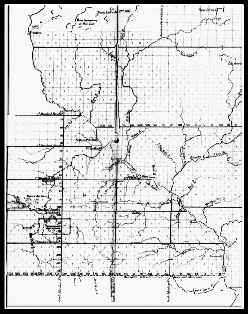
Rectangular Land Surveys in Territorial Minnesota
|
|
|
- Stewart Paul
- 5 years ago
- Views:
Transcription
1
2 Rectangular Land Surveys in Territorial Minnesota
3 My lineage as a Surveyor
4 My lineage as a Surveyor


5 My lineage as a Surveyor


6 The rectangular public land survey net is one of the most visible yet least understood cultural landscape feature in the United States
7 It is the grid not the eagle or the stars and stripes, which is our true national emblem. The history of the public land surveys a record of the American frontier spirit blended with the concept of government for the people. The security of title emanating under this system greatly contributed to the rapid settlement of the public lands."
8 How did the public land survey lines spread? What geographies can be constructed?
9 I have developed Intellectual Schizophrenia
10 I have developed Intellectual Schizophrenia

11 I have developed Intellectual Schizophrenia

12 I have developed Intellectual Schizophrenia
13 Talk will demonstrate this Schizophrenia To connect the various spatial scales that have occupied my attention Provide an overview of the public land surveys in Minnesota Give the surveys in Minnesota an appropriate context
14 1848
15
16 1857
17 My Perspective Detail necessary to describe and explain the public land surveying process to my primary audience land surveyors of Minnesota of limited geographical applicability
18 My Perspective Detail necessary to describe and explain the public land surveying process to my primary audience land surveyors of Minnesota of limited geographical applicability Generalizations to provide an overview of the surveying effort throughout the United States to non-surveyors many of whom take the surveying efforts for granted many of whom are only interested in the outcomes of the surveys some of which is useful to the surveyor

19 A Text Three amateur baseball umpires were discussing their philosophy The lawyer said, I call em as they are" The geographer said, "I call em as I see em" The surveyor said, "They ain t nothing till I call em
20 Uncomfortable Truths The surveys spread across the lands owned by the United States expediently Some characteristics of the surveys makes no geographical sense today
21 Uncomfortable Truths The surveys spread across the lands owned by the United States expediently Some characteristics of the surveys makes no geographical sense today Concatenating geographies of the public land surveys in the United States
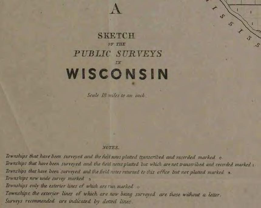
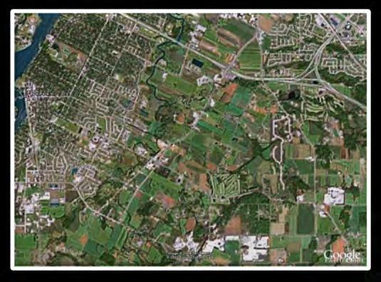
22 Uncomfortable Truths The surveys spread across the lands owned by the United States expediently Some characteristics of the surveys makes no geographical sense today Concatenating geographies of the public land surveys in the United States United States Surveying District Local
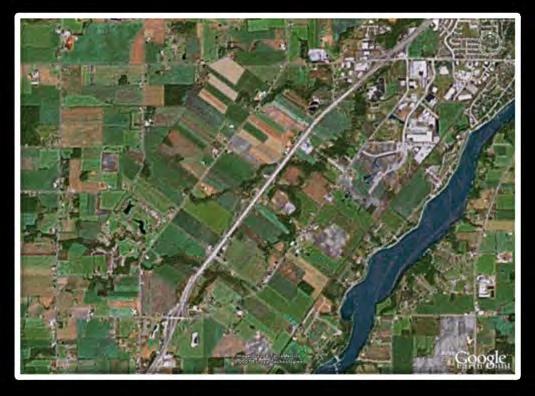
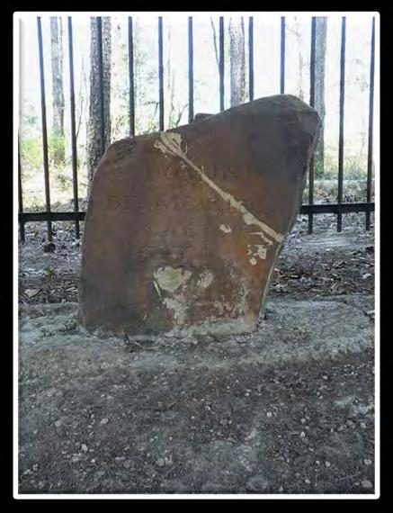
23 How did Walker carry out his surveys? Detail


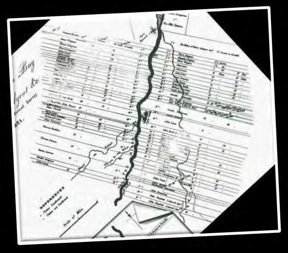
24 Detail How did Walker carry out his surveys? Area surveyed
25 1857 Detail
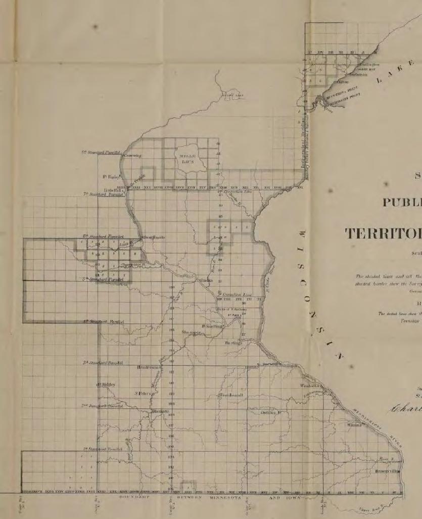
26 1857 Detail
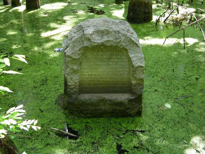
27

28 Generalizations Historical Geography of the Rectangular Land Surveys How the survey lines spread across the United States?


29 Gaps in the Net

30 Green Bay

31 Private Land Claims
32

33 Generalizations Historical Geography of the Rectangular Land Surveys How the survey lines spread across Minnesota?
34 The modern relevance of the rectangular survey lines and points (corner monuments) stems from their historical relevance
35 Continuing Relevance of the Points and Lines Land Act of February 11, 1805 (2 Stat. 313) All the corners marked in the surveys, returned by the surveyor-general shall be established as the proper corners, of the sections, or subdivisions of sections, which they were intended to designate. The boundary lines, actually run and marked in the surveys returned by the surveyorgeneral shall be established as the proper boundary lines of the sections, or subdivisions, for which they were intended.

36 The Rectangular Land Surveys were key to the privatization of the lands over which the United States acquired jurisdiction
37 Federal Policy The policy rested on two features A. The creation and development of a land system in which the federal government created land parcels, and created landowners, and conveyed titles to individuals, corporations, and states
38 Federal Policy The policy rested on two features A. The creation and development of a land system in which the federal government created land parcels, and created landowners, and conveyed titles to individuals, corporations, and states B. The evolution and spread of a legal system a legislature, executive and judiciary creating jurisdictions providing the guarantees for landownership to exist
39 Land System Legal System Native American Land Cessions Northwest Territory Public Land Surveys Michigan Territory Public Land Conveyances Wisconsin Territory Landowners 1848 Minnesota Territory 1849 Landowners in Minnesota
40 What drew people from the eastern states and from around the world was the desire for the soil magically transformed from wilderness to property by the act of measurement and mapping


41 Land the First and Last Frontier Religious freedom is my immediate goal, but my long-range plan is to into real estate


42 What drew people from the eastern states and from around the world was the desire for the soil magically transformed from wilderness to property by the act of measurement and mapping The fact that the grid could subdivide a continent into minute, graph-paper squares might appear to be simply a triumph of the mathematician s art, but the ease with which it made land available to anyone who went west in search of it had an almost incalculable influence on the development of the American psyche and the American economy
43 Two Basic Ordinances The Land Ordinance, 1785 Established two general principles Lands north and west of the River Ohio ceded by Native Americana would be subdivided in an orderly manner The United States would convey title to these lands to individuals and corporations Thomas Jefferson (Library of Congress)
44 Two Basic Ordinances The Northwest Ordinance, 1787 Jurisdiction over individuals and title to lands in the Northwest Territory would be vested in a national government Provided individuals who settled in the Territory with a government, hence some guarantee of their rights Territorial evolution of the United States (Wikipedia) Established how the Northwest Territory would be divided into sovereign states
45 The Rectangular Land Surveys (in Minnesota) Established legal descriptions, creating places from space established boundaries of a parcel of land to be privatized Lines spaced every mile Monuments spaced every ½ mile Lines protracted between ¼ section corners

46 The Rectangular Land Surveys Established legal descriptions, creating places from space established the location of a parcel of land to be privatized
47 Transformed "formless wilderness into a remarkable national geometry of squares and rectangles The Rectangular Land Surveys

48 The Rectangular Land Surveys Transformed "formless wilderness into a remarkable national geometry of squares and rectangles Imposed a particular spatial frame of reference on virtually all human activities in the United States it formed part of a democratizing effort (Linklater, Measuring America)
49 The Rectangular Land Surveys Provided the first large scale maps of the United States 1:126,720 a graphical representation of what the deputies did

50 The Rectangular Land Surveys Provided the first large scale maps of the United States 1:126,720 a graphical representation of what the deputies did an advertisement for the parcels depicted
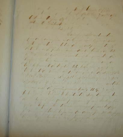
 SUMMARY of objects and data")
51 The Rectangular Land Surveys Provided A written inventory of those surface features thought important to prospective landowners Objects and data to be embraced by your field notes. You are to enter in their proper places in the field notes of your survey, a particular description and the exact location of the following objects (1846 instructions) SUMMARY of objects and data required to be noted: (1851 instructions)
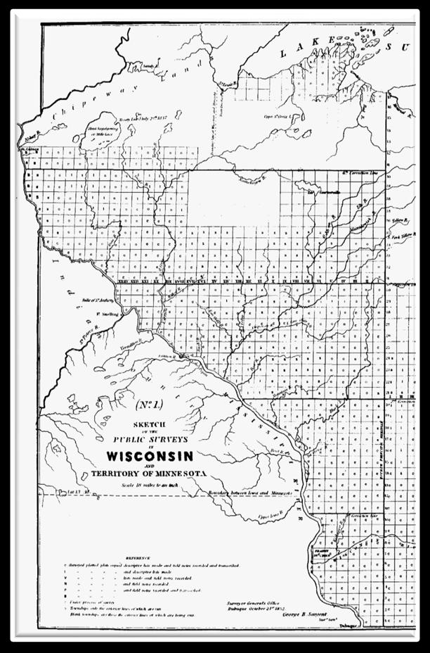
52 A Relative Locational System Throughout the United States; Each initial point intersection of a Principal Meridian and its Baseline somewhat arbitrary

53 A Relative Locational System Throughout the United States; Each initial point intersection of a Principal Meridian and its Baseline somewhat arbitrary

54
55 A Relative Locational System In each township; Each half-mile line segment begins and ends at a corner monument
56 A Relative Locational System In each township; Each half-mile line segment begins and ends at a corner monument Each corner monument quarter section, section, or township is a certain distance in a certain direction from another point
57 A Relative Locational System In each township; Each half-mile line segment begins and ends at a corner monument Each corner monument quarter section, section, or township is a certain distance in a certain direction from another point P.S. It s really a regular metes and bounds system
58 The segments of all rectangular survey lines,. ran from an established point in a certain direction for a certain distance. The ending point of a line segment was a previously established corner point, an existing boundary line, or a water course. Any segment of a line was therefore relative to other segments of that, and other, lines. The notes for a particular line segment must be placed in context, a point I have raised several times in previous articles, most explicitly in the two articles describing the rectangular surveys lines in Carver County. (Opening the Office of Surveyor General of Minnesota: Part 3 16)
59 The sequence in which the line segments were run and the corners established by individual deputies, each operating under instructions contained in their contracts, is a neglected feature of the historical geography of the rectangular land surveys in Minnesota. Anyone interested in the lines and corners in an area, or even a particular line segment or corner, should be aware of the sequence in which the lines were run and the corners monumented. (The Public Land Survey Lines in Carver County; Township Exteriors 19)
60 A National Context

61 The public land surveys were carried out in separate localities
62 A Spatial Framework Two characteristics allowed the surveys to be carried in widely separated localities but ensured the lines would form a national geometric net 1. A technical element a locational system, independent of the other details of the rectangular net that provided basic surveying and locational control established when necessary
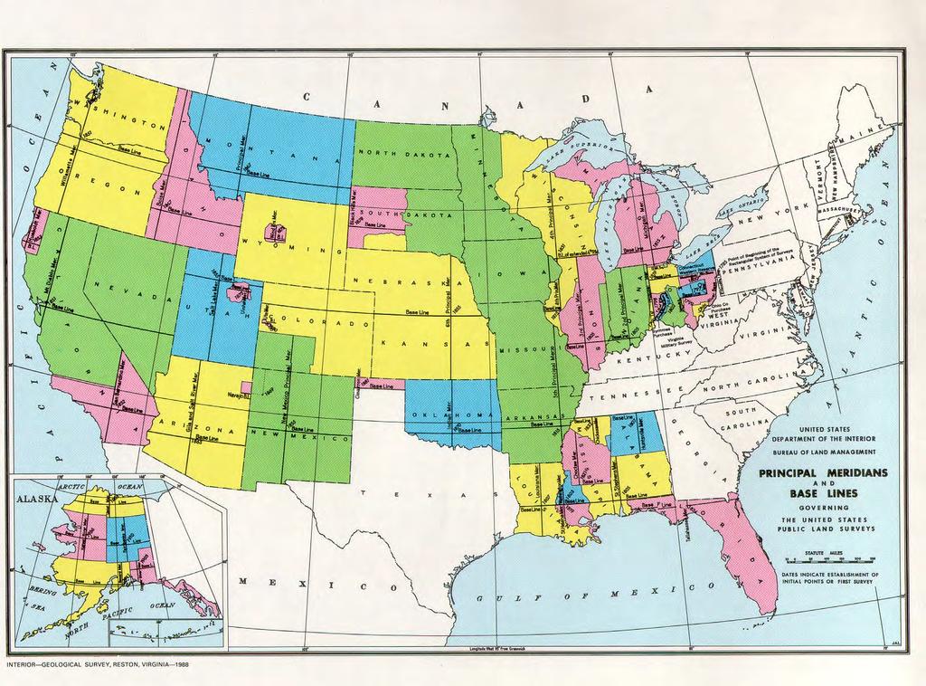
63

64 Characteristics of all Principal Meridians and Baselines The Principal Meridian and its associated Baseline were independent of each other Where did the lines start and finish? What direction was each run? When was each run? How was each run? Where did they intersect? What area did they control? Where did the lines using particular P.M. and B.L. close? Why there and not somewhere else?
, westward migration along certain routes, and the cession of Indian")
65 "the distribution of principal meridians and baselines in the United States reflects no system but is the result of historical and geographical forces, such as settlement before the survey(s), westward migration along certain routes, and the cession of Indian lands

66 Principal Meridians and Baselines
67 A Spatial Framework 2. An administrative system comprising statutorily defined surveying districts and Presidentially appointed surveyors general established when necessary Considerable independence from each other Annual appropriations from Congress Funds apportioned by the Commissioner of the General Land Office to each surveyor general, along with annual instructions

68 Atlantic Surveys A Spatial Framework

69 Pacific Surveys A Spatial Framework
 Surveyor General of Arkansas (1832-1859) Surveyor General of Wisconsin and Iowa (1838-1866) Surveyor General of Minnesota")
70 A Spatial Framework North Atlantic Surveyor General of the Northwest ( ) Surveyor General of Illinois and Missouri ( ) Surveyor General of Arkansas ( ) Surveyor General of Wisconsin and Iowa ( ) Surveyor General of Minnesota ( )
71 North Atlantic Surveys Related administratively through the Office Surveyor General of the Northwest 1796 Ohio Indiana Michigan 1816 Illinois and Missouri 1832 Arkansas 1838 Wisconsin & Iowa 1857 Minnesota
 Surveyor General of Florida (1824-1908) Surveyor General of Louisiana")
72 A Spatial Framework South Atlantic Surveyor of the Lands South of the State of Tennessee ( ) Surveyor General of Alabama ( ) Surveyor General of Florida ( ) Surveyor General of Louisiana ( )
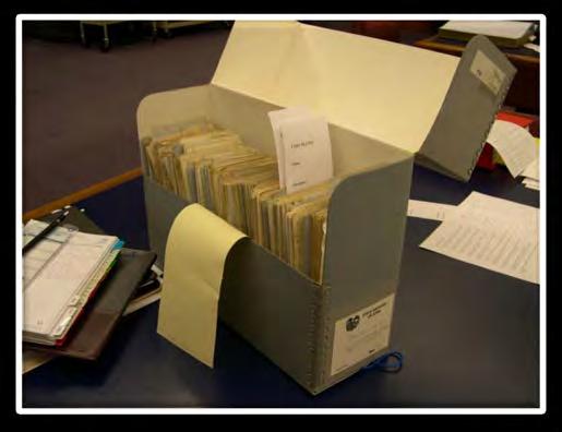
73 A Temporal Framework Period A. Surveys under the administration of the Secretary of the Treasury Early efforts under the provisions of the Land Ordinance Surveyor General and contracted deputies
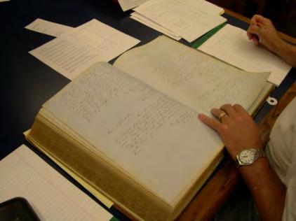
74 A Temporal Framework Period A. Surveys under the administration of the Secretary of the Treasury Early efforts under the provisions of the Land Ordinance Surveyor General and contracted deputies Period B. Surveys under the administration of the General Land Office Autonomous surveyors general separate instructions General Land Office exerting more control General Land Office issued instructions
75 Minnesota
76 Surveys in the Minnesota Territory A General Land Office exerting more control - surveys under the administration of the Surveyor General of Wisconsin & Iowa Surveys in western Wisconsin Territory 1846 instructions Surveys in Minnesota East
77 Surveys in the Minnesota Territory A General Land Office exerting more control - surveys under the administration of the Surveyor General of Wisconsin & Iowa Surveys in western Wisconsin Territory 1846 instructions Surveys in Minnesota East B General Land Office issued instructions Surveys in Minnesota East and Minnesota West Surveys under the administration of the Surveyor General of Minnesota
78 Surveys in the Minnesota Territory A General Land Office exerting more control - surveys under the administration of the Surveyor General of Wisconsin & Iowa Surveys in western Wisconsin Territory 1846 instructions Surveys in Minnesota East B General Land Office issued instructions Surveys in Minnesota East and Minnesota West Surveys under the administration of the Surveyor General of Minnesota????? 1851 Instructions issued by the Surveyor General of Wisconsin & Iowa (White, A History of the Rectangular Survey System p.385

79 Minnesota shows characteristics of both Atlantic and Pacific surveys
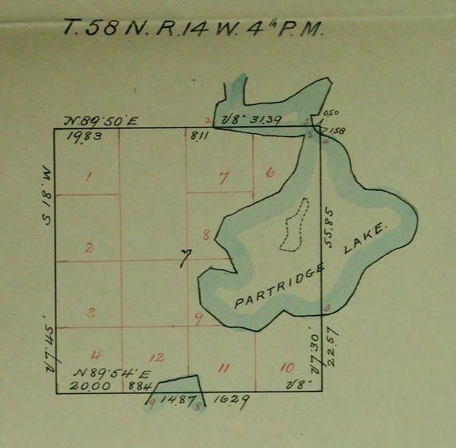
80

81


82 Hidden Gems
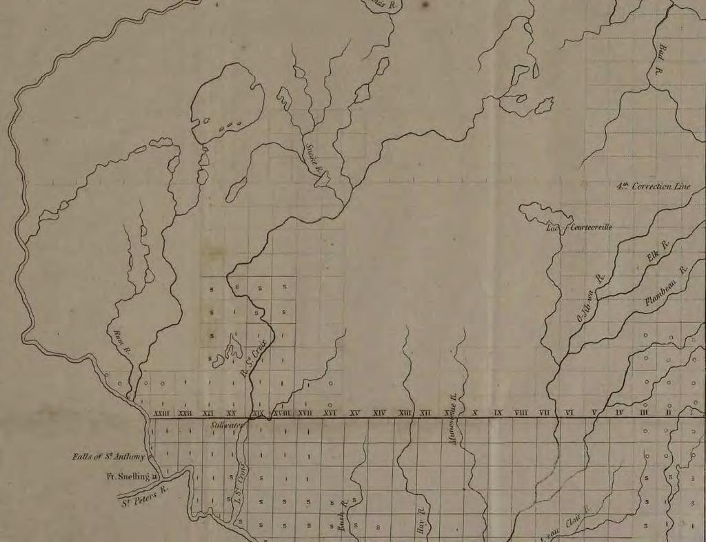
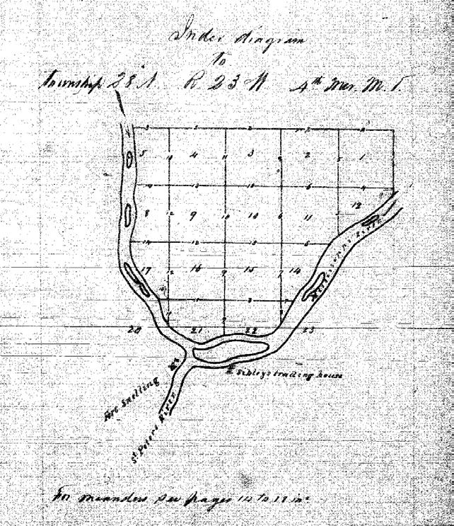
83 The Paper Trail Correspondence between the stakeholders - includes annual reports, instructions, and circulars
84 The Paper Trail The surveys were carried out by a cadre of deputy surveyors under contract with the Surveyor General Individual applied for a contract Awarded contract made required oath, bond etc. given instructions Contract, oath, and bond sent to Commissioner GLO Correspondence between Surveyor General and Commissioner Correspondence between Surveyor General and deputy Field notes and diagrams received by Surveyor General x2 or x3 Field notes of townships transcribed and Township Plats compiled Township plat and Township descriptive lists sent to land office Township plats, Township field notes, and request for payment sent to Commissioner Treasury Department transmitted payment
85 Field Notebooks Described what the deputy surveyor did and what he saw Raw data from which the plats were drawn and descriptive lists made Answers question How did the deputy carry out his work? As the deputy carried out his work he made an inventory of the surface, describing the features that were thought to be relevant to prospective landowners
86 Still a Lot to be Learned about Notebooks Contents & Indexing


87 Exterior Line Notebooks Wiltse Marsh

88 Exterior Line Notebooks

89 Exterior Line Notebooks
90 US Surveyor General Land Survey Field Notes - contains Field Notes of Survey Examiners


91 Township Exteriors diagram given to subdividing deputy?
92 Subdivision Field Notebooks

93 Problematic?

94 Townships bordering the St. Croix
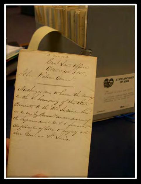
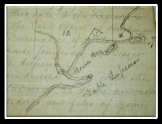
95 Well?
96 Surveys survey lines run across area Ceded in 1837 between the St. Croix and Mississippi rivers Using 4 th Principal Meridian Under instructions issued in 1846 Extension of the surveys that spread across Wisconsin

97 3 rd Correction Line - initiated a new geography Henry A Wiltse contract May 28, 1847
98 James M. Marsh contract dated May 28, 1847 Turns out some township exteriors run in a complex manner
 http://c.ymcdn.com/sites/www.mnsurveyor.com/resource/resmgr /imported/thursday_dahl.")
99 4 th Correction Line Theodore Conkey contract July 28, 1848 Dahl John R United States General Land Office Historical Surveying Instructions and their Influence on Surveys of the 3rd and 4th Correction Lines, 4th Principal Meridian, Minnesota MS (St Cloud State University 2006) /imported/thursday_dahl.pdf
100 Township Exteriors East of the Mississippi Henry A. Wiltse 1847 James M. Marsh 1847

101 Townships Subdivided by Isaac N. Higbee East of the Mississippi

102 Subdivisions 1846 instructions The first mile, both of the south and east boundaries of each township you are to subdivide, is to be carefully traced and measured, before you enter upon the subdivision thereof. This will enable you to observe any change that may have taken place in the magnetic variation, as it existed at the running of the township lines, and will also enable you to compare your chaining with that upon the township lines
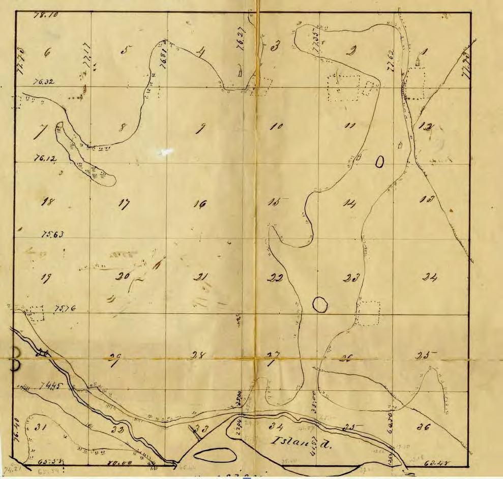
103 Special Instructions issued by the Surveyor General to Isaac Higbee contract September 3, 1847 Several township of the district of subdivisions assigned to you under contract of this date, are rendered fractional by the Mississippi river. In subdividing these townships, you are to regard the main channel of the said river as the boundary of your district upon the South and West, consequently you are to meander all islands in the said river within the said district, which are valuable either for their soil or timber You are to measure the left bank of so much of the Mississippi river as adjoins the district aforesaid. In executing this portion of your work you will please, as often as once in each of the said fractional townships ascertain by triangulation or otherwise the width of the said river and enter the same in its proper place in your meander notes
104 BLM Original

105 Meanders Contractual details Certification, including date!!
106 May 19, 1848, the Surveyor General wrote, In compliance with part of your communication of the 6 th Inst., requiring me to indicate the connections of the public surveys with the Military reservation at Fort Snelling, I beg leave to transmit, for your examination, the enclosed diagram. The sketch of the said Reservation accompanying instructions from your office, dated 29 th July, 1839, was not the result of a survey, and gives neither course nor distance (?Map of May 6, 1839) Therefore.I have ventured to propose a boundary made to conform to regular subdivisional lines. The boundary follows very nearly upon the track of the one originally proposed, and comprises, as nearly as can be ascertained, an equal amount of land. Its upper point of intersection with the Mississippi river is precisely the same, and its lower point of intersection with the river, the same within five chains
107 On June 30 the Commissioner responded to his actions, stating, Yours of the 19 th inst. has also been received enclosing a diagram of that portion of the Military Reservation at Fort Snelling which is situated in Wisconsin. In the absence of marks or monuments in the field, showing the boundaries of this Reservation, the course pursued by you in tracing it along the boundaries of legal subdivisions was perfectly proper. You will please forward a copy of the diagram to the Register
108 On June 30 the Commissioner responded to his actions, stating, Yours of the 19 th inst. has also been received enclosing a diagram of that portion of the Military Reservation at Fort Snelling which is situated in Wisconsin. In the absence of marks or monuments in the field, showing the boundaries of this Reservation, the course pursued by you in tracing it along the boundaries of legal subdivisions was perfectly proper. You will please forward a copy of the diagram to the Register
109 The duplicate plat was altered after being certified BLM Duplicate
110
111 1852
112 survey lines run across area variously ceded under instructions issued in 1851, reissued in 1855 and periodically after East of Mississippi & 3 rd Guide Meridian using 4 th Principal Meridian West of Mississippi & 3 rd Guide Meridian using 5 th Principal Meridian extension of surveys that spread across Iowa

113 1853 Commissioner John Wilson to SG Warner Lewis May 16 th 1853 Commissioner John Wilson to SG Warner Lewis June 16 th 1853 SG Warner Lewis to Deputy Elisha Norris July 28 th 1853
114
115 1855

116 In Eastern Minnesota deputy surveyors were awarded contracts to run Correction lines Township exteriors Township subdivisions In Western Minnesota deputy surveyors were awarded contracts to run Guide meridians & Standard parallels Township exteriors Township subdivisions

117 William Burt contract May 21, 1856 Independent Meridian, 5 th and 6 th correction lines, and subdivisions
118 1857 Opening of Office of Surveyor General of Minnesota Surveyor General Charles L. Emerson Closing office of Surveyor General of the Northwest in Detroit Transferring completed records of surveys in Michigan to Michigan officers Transferring incomplete records of surveys in Michigan to St. Paul Coordinating opening office in St Paul with Surveyor General of Wisconsin and Iowa Transferring completed records of surveys in the Minnesota Territory from Dubuque to St Paul Contracting with deputies to carry out surveying duties
119
120 White p.126 He actually replaced Chapman on April 12,1857, and closed the Detroit office on May 11. He opened the Minnesota office in St. Paul on May 23, 1857 and he transferred most of the Michigan records to the State at that time. After bringing all arrears up to snuff, he completed transfer of the Michigan records in May He received the Minnesota survey records from Lewis in Dubuque and continued the Minnesota surveys without any particular trouble
121 Secretary of State Land survey summary sheets. Land survey plats. Land survey field notes. U.S. Surveyor General of Minnesota Plats of township boundaries. Land survey plats: Worksheets. Land survey field notes. Letters received and sent. Contracts for surveys.
The Public Land Surveys in Minneapolis and St Paul. A Surveying Potboiler
 The Public Land Surveys in Minneapolis and St Paul A Surveying Potboiler A Surveying Potboiler (Imagine seductive soap opera music) Land ceded in three different treaties Land surveyed under two sets of
The Public Land Survey Records for Minnesota It s a square world. Déjà vu - Again
 The Public Land Survey Records for Minnesota It s a square world Déjà vu - Again Presentations 2007 MSPS. The Past as Prolog: Public Land Survey Records for Minnesota Mn/DOT. A Partial Inventory of the
U.S. Public Land Survey - Special Instructions A Case Study
 U.S. Public Land Survey - Special Instructions A Case Study by: John E. Freemyer, LS "One of the most important duties to be performed by the surveyor general is to provide the deputy surveyor with Special
WHEN DANIEL BOONE led pioneers across the
 Understanding Land Measurement and Legal Descriptions WHEN DANIEL BOONE led pioneers across the Appalachian Mountains in the 1700s, it was an accepted practice for them to establish property boundaries
CHAPTER 8 - LAND DESCRIPTIONS
 CHAPTER 8 - LAND DESCRIPTIONS Notes: While the location of land is commonly referred to by street number and city, it is necessary to use the legal description in the preparation of those instruments relating
THE THREE MILE METHOD OF SURVEYING IN THE UTE MERIDIAN. Mesa County, Colorado
 THE THREE MILE METHOD OF SURVEYING IN THE UTE MERIDIAN Mesa County, Colorado Mesa County, located at the confluence of the Grand (Colorado) and Gunnison Rivers on the Western Slope, is a very unique area
WYANDOT COUNTY BASIC STANDARDS FOR THE APPROVAL OF REAL ESTATE DEED TRANSFERS & LAND CONTRACT AGREEMENTS
 GENERAL In compliance with Section 315.251 of the Ohio Revised Code, the County Auditor and the County Engineer have adopted these written standards governing the conveyance of real property in Wyandot
REQUIREMENTS FOR ALL INSTRUMENTS OF CONVEYANCE IN HARDIN COUNTY, OHIO
 REQUIREMENTS FOR ALL INSTRUMENTS OF CONVEYANCE IN HARDIN COUNTY, OHIO Effective Date: Michael L. Smith, P.E., P.S. Hardin County Engineer Michael T. Bacon Hardin County Auditor 1 I. GENERAL In compliance
P.F. WOOD, APPELLANT, V. C. MANDRILLA, RESPONDENT. SAC. NO SUPREME COURT
 Supreme Court of California,Department Two. 167 Cal. 607 {Cal. 1914) WOOD V. MANDRILLA P.F. WOOD, APPELLANT, V. C. MANDRILLA, RESPONDENT. SAC. NO. 2089. SUPREME COURT OF CALIFORNIA,DEPARTMENT TWO. APRIL
GENESEE VALLEY LAND SURVEYORS ASSOCIATION MINIMUM STANDARDS FOR A MAP OF A SURVEY. Effective Date: February 15, 2017
 GENESEE VALLEY LAND SURVEYORS ASSOCIATION MINIMUM STANDARDS FOR A MAP OF A SURVEY Effective Date: February 15, 2017 1. The Land Surveyor shall perform due diligence in their research, maintain proper documentation
STANDARDS GOVERNING CONVEYANCES OF REAL PROPERTY
 STANDARDS GOVERNING CONVEYANCES OF REAL PROPERTY Hancock County, Ohio Charity A. Rauschenberg, Hancock County Auditor Steven C. Wilson, Hancock County Engineer Revised: March 1, 2007 TRANSFER AND CONVEYANCE
BUREAU OF LAND MANAGEMENT. Fractional Sections. With John Farnsworth and Belle Craig C A D A S T R A L S U R V E Y
 BUREAU OF LAND MANAGEMENT Fractional Sections With John Farnsworth and Belle Craig 2009 C A D A S T R A L S U R V E Y Fractional Sections There are two types of fractional sections referenced in the 1973
CFedS Outline Unit 1. Course 1: History, Records & Administrative Systems
 CFedS Outline Unit 1 Course 1: History, Records & Administrative Systems History of U.S. Surveying Historical Perspective Similarities in Surveying Seniority of Calls Lack of Standards A National Debt
Subdivision of Fractional Sections ISPLS 2017
 Subdivision of Fractional Sections ISPLS 2017 Dennis J. Mouland, PLS Instructor Witness Tree Consulting, Inc., 2011, All Rights Reserved Course Objectives Understand the definition of a fractional section
Business Creation Index
 Business Creation Index December 2016 National Association of REALTORS Research Department Introduction The new Business Creation Index (BCI) was created to monitor local economic conditions from the perspective
TRANSFER PROCEDURES FOR WASHINGTON COUNTY, OHIO
 TRANSFER PROCEDURES FOR WASHINGTON COUNTY, OHIO The following requirements are adopted and established in conjunction with the Washington County Engineer and the Washington County Auditor as prescribed
Your Guide to. Real Estate. Customs by State
 Your Guide to Real Estate Customs by First American Title National Commercial Services Real Estate Customs by Title Insurance Rates Form of Conveyance Encumbrance Forms Attorney or Commitment Deed Transfer
Circuit Court, D. Nebraska. March 1, 1889.
 EAST OMAHA LAND CO. V. JEFFRIES. Circuit Court, D. Nebraska. March 1, 1889. 1. BOUNDARIES ACCRETIONS CONVEYANCE. Rev. St. U. S. 2396, provides that the boundaries and contents of the several sections,
Methods of Legal Description Metes and Bounds The Rectangular Survey System Recorded Plat Method Describing Elevation
 9 Legal Descriptions Methods of Legal Description Metes and Bounds The Rectangular Survey System Recorded Plat Method Describing Elevation METHODS OF LEGAL DESCRIPTION There are many common ways of describing
Standards of Practice for Surveying in the State of Alabama
 Standards of Practice for Surveying in the State of Alabama Effective January 1, 2017 RULE NO. 1.01 PURPOSE The purpose of these rules is to establish standards for the practice of surveying in the State
NORTH CAROLINA PROPERTY MAPPERS ASSOCIATION SECTION 6 PUBLIC LANDS
 NORTH CAROLINA PROPERTY MAPPERS ASSOCIATION SECTION 6 PUBLIC LANDS 6-1 6.1 Introduction Following our independence from England, the Congress in 1783 of the newly formed United States of America was faced
BOUNDARY SURVEYS RE-SURVEYS
 BOUNDARY SURVEYS RE-SURVEYS One of the difficult tasks for a surveyor is the re-surveying of lands, the re-location of the boundary lines between privately-owned lands or the re-location of the boundary
Map Filing Law. 46: Effective date This act shall take effect January first, one thousand nine hundred and fiftyfour.
 46:23-9.8. Effective date This act shall take effect January first, one thousand nine hundred and fiftyfour. L.1953, c. 358, p. 1941, s. 8. 46:23-9.9. Short title This act shall be known and may be cited
Survey and Recording Requirements
 Article C: Sec. 14-1-40 Survey and Recording Requirements Survey Requirements. (a) (b) (c) Prior to the final approval of land divisions to which this Chapter applies, the owner of the land shall have
Methods of Legal Description. Deeds and Land Descriptions. Government Survey (PLSS)
") Deeds and Land Descriptions Methods of Legal Description Government survey (PLSS): boundaries identified relative to rectangular national grid as established by 1785 Act of Congress Metes and bounds: boundaries
Deeds and Land Descriptions Methods of Legal Description Government survey (PLSS): boundaries identified relative to rectangular national grid as established by 1785 Act of Congress Metes and bounds: boundaries
Preparing Property descriptions D A V I D T. BUTCHER, PLS
 Preparing Property descriptions D A V I D T. BUTCHER, PLS Who can prepare property descriptions? 327.272. Practice as professional land surveyor defined. 1. A professional land surveyor shall include any
Paper for presentation at the 2005 AAEA annual meeting Providence, RI July 24-27, 2005
 NEXT YEAR ON THE U.S. FARMLAND MARKET: AN INFORMATIONAL APPROACH Charles B. Moss, Ashok K. Mishra, And Kenneth Erickson Paper for presentation at the 2005 AAEA annual meeting Providence, RI July 24-27,
Cadastral PLSS Stewardship December 2010 Updated December 2013
 Cadastral PLSS Stewardship December 2010 Updated December 2013 Compiled by Bob Ader, Ben Knott, and Nancy von Meyer for the FGDC Cadastral Subcommittee Table of Contents 1. Overview... 2 2. Underlying
ALI-ABA Course of Study Commercial Lending and Banking Law January 29-31, 2009 Scottsdale, Arizona
 263 ALI-ABA Course of Study Commercial Lending and Banking Law--2009 January 29-31, 2009 Scottsdale, Arizona Legal and Regulatory Issues in the Creation, Perfection, and Enforcement of Security Interests
RESTORATION OF LOST OR OBLITERATED CORNERS & SUBDIVISION OF SECTIONS a guide for surveyors
 DISCLAIMER The following is a retyped electronic version of "RESTORATION OF LOST OR OBLITERATED CORNERS AND SUBDIVISION SECTIONS", a supplement to the Manual of Surveying Instructions, designed to be word
What is Proper Tax Policy for Smokeless Tobacco Products?
 September 22, 2006 What is Proper Tax Policy for Smokeless Tobacco Products? by Gerald Prante Fiscal Fact No. 65 While there exist a large literature and extensive policy discussion on the issue of cigarette
THE COUNTY BOARD OF SUPERVISORS OF THE COUNTY OF DOUGLAS DOES ORDAIN AS FOLLOWS:
 8.1 SUBDIVISION CONTROL ORDINANCE THE COUNTY BOARD OF SUPERVISORS OF THE COUNTY OF DOUGLAS DOES ORDAIN AS FOLLOWS: SECTION I. GENERAL INTERPRETATION This ordinance shall not repeal, impair or modify private
Certified Federal Surveyor Program Standards of Practice Handbook (Modified February 19, 2013 and November 18, 2014) "Trained to Make a Difference"
 Trained to Make a Difference") Certified Federal Surveyor Program Standards of Practice Handbook (Modified February 19, 2013 and November 18, 2014) "Trained to Make a Difference" Introduction This handbook is designed to document the
Certified Federal Surveyor Program Standards of Practice Handbook (Modified February 19, 2013 and November 18, 2014) "Trained to Make a Difference" Introduction This handbook is designed to document the
To provide for the review of the final engineering plans, the subdivision improvement agreement, public dedications, and other legal agreements.
 ARTICLE 5 FINAL PLAT 501 Intent DOUGLAS COUNTY SUBDIVISION RESOLUTION To provide for the review of the final engineering plans, the subdivision improvement agreement, public dedications, and other legal
1. A system used in real estate to define the physical features and boundaries of a piece of property.
 METES AND BOUNDS The system of metes and bounds is one used in real estate to describe land or real property based on the physical features of its geography, as well as directions and distances. These
Certified Federal Surveyor Program Assignment #3, Feedback
 Certified Federal Surveyor Program Assignment #3, Feedback Now that you have completed Assignment #3, take a few minutes to review the comments below. We have tried to identify items of special importance,
CHAPTER 7 - LAND DESCRIPTIONS
 An * in the left margin indicates a change in the statute, rule or text since the last publication of the manual. CHAPTER 7 - LAND DESCRIPTIONS While the location of land is commonly referred to by street
PLATS: OLD AND NEW. Minnesota Recorder s Summer Conference June 14, 2007 Lisa M. Hanni, PLS
 PLATS: OLD AND NEW Minnesota Recorder s Summer Conference June 14, 2007 Lisa M. Hanni, PLS Minnesota s Original Public Land Survey Plats (Government Land Office Plats) Used with permission from the Mn
TOWNSHIP OF LANARK HIGHLANDS POLICY FOR THE STOPPING UP, CLOSURE AND SALE OF ROADS POLICY STATEMENT
 TOWNSHIP OF LANARK HIGHLANDS POLICY FOR THE STOPPING UP, CLOSURE AND SALE OF ROADS Approval Date: POLICY STATEMENT The Municipal Act provides that the Council of a municipality may pass by-laws for stopping
 Page 1 of 6 Office of the Professions Land Surveying Practice Guidelines - February 2000 The State Board for Engineering and Land Surveying issued the first draft of its proposed Land Surveying Practice
Requirements for All Instruments of Conveyance in Logan County, Ohio
 Requirements for All Instruments of Conveyance in Logan County, Ohio Effective Date: April 11, 1997 It is the intent of these requirements to provide a standard method of checking legal descriptions for
Standards for All Instruments of Conveyance
 Standards for All Instruments of Conveyance Perry County, Ohio Effective Date: May 1, 1997 Effective Date of Revision: April 1, 2011 Page 2 of 12 Minimum Standards for all Instruments of Conveyance Perry
Your Guide to Real Estate Customs by State
 Your Guide to Real Estate Customs by State First American Title Real Estate Customs by State Yes No State Title Insurance Rates Form of Conveyance State Encumbrance Forms Attorney State or Deed Transfer
Cadastral Framework Standards
 Cadastral Framework Standards The goal of the Data Standards and Recommendations Committee is to provide recommendations and guidelines to Indiana GIS user communities to facilitate the collection, maintenance
MULTIFAMILY TAX SUBSIDY PROJECT INCOME LIMITS
 MULTIFAMILY TAX SUBSIDY PROJECT INCOME LIMITS This chart is provided as a guide only for the following programs: Low Income Housing Tax Credit (LIHTC) Hula Mae Multi-Family Bonds (HMMF) Rental Housing
SYSTEMS OF PROPERTY DESCRIPTION
 SYSTEMS OF PROPERTY DESCRIPTION Interpretation of Common Real Property Descriptions INTRODUCTION Land surveying includes 1. Surveying operations involved in original surveys to locate and monument the
Rule 21 STANDARDS OF PRACTICE FOR SURVEYING
 Rule 21 STANDARDS OF PRACTICE FOR SURVEYING 21.1 Whenever a survey is performed, it shall comply with Section 73-13-71 (4) and Section 73-13- 73 and the Standards of Practice for Surveying in Mississippi
HENRY COUNTY CONVEYANCE STANDARDS AND LAND TRANSFER POLICY
 HENRY COUNTY CONVEYANCE STANDARDS AND LAND TRANSFER POLICY REVISED DECEMBER 2013 Approved By: Kevin Garringer - County Auditor Timothy J. Schumm, P.E., P.S. - County Engineer Land Transfer Policy Committee:
(10) The Board has the powers and duties of an arbitrator under sections 29(3) and 43 of the Arbitration Act.
 The Board has the powers and duties of an arbitrator under sections 29(3) and 43 of the Arbitration Act.") Surveys Act [Fall 2014 STATUTE LAW] Under section 9 survey error investigation of the Surveys Act. The Minister may appoint a Board consisting of three (3) members. a. List two (2) of the three (3) members.
Surveys Act [Fall 2014 STATUTE LAW] Under section 9 survey error investigation of the Surveys Act. The Minister may appoint a Board consisting of three (3) members. a. List two (2) of the three (3) members.
Department of Development Services Engineering; Survey Plat Review Group SPRG
 Department of Development Services Engineering; Survey Plat Review Group SPRG CITY OF DALLAS LEGAL DESCRIPTION PREPARATION GUIDELINE AND CHECKLIST The following guideline and checklist are provided to
SUBDIVISION REGULATIONS OF THE CITY OF DERBY, KANSAS
 SUBDIVISION REGULATIONS OF THE CITY OF DERBY, KANSAS ARTICLE 1. TITLE, PURPOSE, AUTHORITY, JURISDICTION, APPLICABILITY AND EXEMPTIONS 100 TITLE. These regulations shall be known and may be cited as the
August 12, Thank you for your correspondence of May 29, BACKGROUND
 Counties: Planning and Zoning: Subdivision Regulations: Fees: County may not prevent recording of all land conveyance documents that do not comply with county land use controls and fee requirements. Minn.
Cadastral Template 2003
 PCGIAP-Working Group 3 "Cadastre" FIG-Commission 7 "Cadastre and Land Management" Cadastral Template 2003 The establishment of a cadastral template is one of the objectives of Working Group 3 "Cadastre"
PARCEL MAP CHECKLIST
 PARCEL MAP NO. Note: [ ] 1 is Gov. Code, [ ] 2 is BP Code, [ ] 3 is S.M.Co. Ord. PARCEL MAP CHECKLIST COUNTY OF SAN MATEO (Rev. 04/10) INITIAL SUBMISSION - PARCEL MAP Conditional Approval Letter and Approved
Early Land Transactions = Cool Documents
 Early Land Transactions = Cool Documents REGISTER OF DEEDS CREATED IN 1837 BY STATE CONSTITUTION Thousands of property disputes were tied up in the courts of New England Land Ordinance of 1785 1785 Jefferson
Principles of Real Estate Chapter 2-Nature and Description of Real Estate
 Principles of Real Estate Chapter 2-Nature and Description of Real Estate This chapter will offer an outline of the different ways in which land and personal property are distinguished, the various water
OTTAWA COUNTY LEGAL DESCRIPTION REVIEW GUIDELINES
 OTTAWA COUNTY LEGAL DESCRIPTION REVIEW GUIDELINES APPROVED BY: RONALD P. LAJTI, JR., P.E., P.S. OTTAWA COUNTY ENGINEER APPROVED BY: LAWRENCE HARTLAUB OTTAWA COUNTY AUDITOR EFFECTIVE DATE: January 1, 2017
An Overview of the County Recorder. Terry Hansen Yuba County Clerk/Recorder
 An Overview of the County Recorder Terry Hansen Yuba County Clerk/Recorder In the Beginning The act of recording dates back as far 4000 B.C. In the beginning, records were transcribed on clay tablets.
ARTICLE SINGLE FAMILY SITE CONDOMINIUM DEVELOPMENT STANDARDS
 ARTICLE 28.00 SINGLE FAMILY SITE CONDOMINIUM DEVELOPMENT STANDARDS Section 28.01 PURPOSE The purpose of this Article is to recognize that conventional single family developments, traditionally developed
Adding Ancient Roads to the General Highway Map Understanding How Act 178 of 2006 and Parts of V.S.A. Title 19 Work An Ancient Road Practicum
 Adding Ancient Roads to the General Highway Map Understanding How Act 178 of 2006 and Parts of V.S.A. Title 19 Work An Ancient Road Practicum 1) Act 178 Overview and History Act 178 of 2006 added the requirement
The legal descriptions used in Georgia (the metes and bounds, and plat map also known as the lot and block system) appear in Chapter 27.
 appear in Chapter 27.") Chapter 28 Legal Descriptions in the Sales Transaction INTRODUCTION The legal descriptions used in Georgia (the metes and bounds, and plat map also known as the lot and block system) appear in Chapter
Chapter 28 Legal Descriptions in the Sales Transaction INTRODUCTION The legal descriptions used in Georgia (the metes and bounds, and plat map also known as the lot and block system) appear in Chapter
Delaware County Transfer Standards
 Delaware County Transfer Standards Delaware County Auditor David A. Yost Delaware County Engineer Chris Bauserman Adopted in 1997, Amended in 1999 Dave Yost County Auditor Chris Bauserman County Engineer
Center of Section. Computed or Monumented Position. Review and Commentary
 Center of Section Computed or Monumented Position Review and Commentary Center of Section Center of section defined by law for more than 200 years Computed position vs monumented position Examine the state
RULES OF THE GEORGIA STATE BOARD OF REGISTRATION FOR PROFESSIONAL ENGINEERS AND LAND SURVEYORS CHAPTER APPLICATIONS TABLE OF CONTENTS
 RULES OF THE GEORGIA STATE BOARD OF REGISTRATION FOR PROFESSIONAL ENGINEERS AND LAND SURVEYORS CHAPTER 180-7 APPLICATIONS TABLE OF CONTENTS 180-7-.07 Maps and Plats. All maps, plats and similar documents
Guide to Combined Preliminary and Final Plats
 Guide to Combined Preliminary and Final Plats Introduction The Douglas County is committed to providing open, transparent application processes to the public. This Guide is provided to assist anyone interested
Hello Plat Review, I have a question.
 Hello Plat Review, I have a question. January 24, 2018 2018 Surveyors' Institute 1 When do I have to do a subdivision plat? January 24, 2018 2018 Surveyors' Institute 2 236.02 (12) Definitions. Requires
Oakland County Michigan Register of Deeds Plat Engineering, GIS, & Remonumentation Dept. Ph: (248) Fax (248)
 Fax (248)") Oakland County Michigan Register of Deeds Plat Engineering, GIS, & Remonumentation Dept. Ph: (248)-858-1447 Fax (248)-858-7466 Requirements Needed for Final Plat Approval No. General Requirements. 1 Routing
Oakland County Michigan Register of Deeds Plat Engineering, GIS, & Remonumentation Dept. Ph: (248)-858-1447 Fax (248)-858-7466 Requirements Needed for Final Plat Approval No. General Requirements. 1 Routing
Instructions for Maps to Accompany Proof of Appropriation and Beneficial Use of Ground Water
 Instructions for Maps to Accompany Proof of Appropriation and Beneficial Use of Ground Water Part II of the Proof of Appropriation (Form U.W. 8) All maps to accompany proof of appropriation and beneficial
Application for Preliminary Plat Checklist
 Application for Preliminary Plat Checklist Note: No portion of an existing parcel may be sold or transferred to another party without first legally subdividing the property according to the City of Richmond
Cadastral Data Content Standard - Rights and Interests
 Background Concepts Rights and Interests - Regulations and Restrictions In the Cadastral Data Content Standard Version 2 - June 30, 2014 A review of the content and background Nancy von Meyer Rights and
Printable Lesson Materials
 Printable Lesson Materials Print these materials as a study guide These printable materials allow you to study away from your computer, which many students find beneficial. These materials consist of two
ADMINISTRATOR: A person appointed by a probate court to settle the affairs of a deceased person who had no will. See "personal representative".
 COMMON TERMS ACCESS: The right to enter and leave a tract of land to or from a public right of way, often necessitating the right to cross lands privately owned by others. ACKNOWLEDGMENT: The act by which
ALEXANDRIA TOWNSHIP METES & BOUNDS SUBDIVISION APPLICATION. Name of Applicant Phone. Property Address (E911#) Mailing Address Local Phone
 Mailing Address Local Phone") Application # Date Application Rec d / / (for office use only) Fee Collected $ ALEXANDRIA TOWNSHIP METES & BOUNDS SUBDIVISION APPLICATION Name of Applicant Phone Property Address (E911#) Mailing Address
Application # Date Application Rec d / / (for office use only) Fee Collected $ ALEXANDRIA TOWNSHIP METES & BOUNDS SUBDIVISION APPLICATION Name of Applicant Phone Property Address (E911#) Mailing Address
Principles of Real Estate Chapter 16-Title Summary. Overview. Objectives. At the end of this chapter, the student will be able to:
 Principles of Real Estate Chapter 16-Title Summary This chapter will detail the recording and notice processes, explain the importance of title insurance, and explain the processes used to record title.
MAP CHECKLIST (Rev 02/13)
") Note: [ ] 1 is Gov. Code, [ ] 2 is BP Code, [ ] 3 is S.M.Co. Ord. MAP CHECKLIST (Rev 02/13) COUNTY OF SAN MATEO TRACT NO. INITIAL SUBMISSION Final Map Conditional Approval Letter and Approved Tentative
Note: [ ] 1 is Gov. Code, [ ] 2 is BP Code, [ ] 3 is S.M.Co. Ord. MAP CHECKLIST (Rev 02/13) COUNTY OF SAN MATEO TRACT NO. INITIAL SUBMISSION Final Map Conditional Approval Letter and Approved Tentative
DATE: September 10, 2013 RE: Seawall Review - Park Shore - Preliminary Legal and Title Review Report
 TO: FROM: CC: Hon. John F. Sorey III, Mayor & Naples City Council Stephen E. Thompson & Robert D. Pritt A. William Moss, City Manager DATE: September 10, 2013 RE: Seawall Review - Park Shore - Preliminary
FINAL PLAT. Community Development Department 8101 Ralston Road Arvada, Colorado 80002
 FINAL PLAT Community Development Department 8101 Ralston Road Arvada, Colorado 80002 September 2015 FINAL SUBDIVISION PLAT Final Subdivision Plat Review Applications for a Final Plat shall be submitted
Concerns about Methodology
 1979 NDSPLS ADMINISTRATIVE OFFICE PO Box 7370 Bismarck, ND 58507 Phone: 701-223-3184 E-mail: info@ndspls.org Website: www.ndspls.org North Dakota Industrial Commission Department of Mineral Resources Lynn
Change In The Name Of Owner (s) Of Land.
 Of Land.") Clermont County TRANSFER AND CONVEYANCE STANDARDS OF THE CLERMONT COUNTY AUDITOR AND THE CLERMONT COUNTY ENGINEER AS ADOPTED UNDER OHIO REVISED CODE SECTION 319.203, AS A RESULT OF TWO PUBLIC HEARINGS
Clermont County TRANSFER AND CONVEYANCE STANDARDS OF THE CLERMONT COUNTY AUDITOR AND THE CLERMONT COUNTY ENGINEER AS ADOPTED UNDER OHIO REVISED CODE SECTION 319.203, AS A RESULT OF TWO PUBLIC HEARINGS
MINOR SUBDIVISION PLAT
 MINOR SUBDIVISION PLAT Community Development Department 8101 Ralston Road Arvada, Colorado 80002 MINOR SUBDIVISION PLAT Subdivisions consisting of five (5) or fewer lots are eligible for the minor subdivision
Transfer and Conveyance Standards of the Athens County Auditor and the Athens County Engineer. Table of Contents
 Transfer and Conveyance Standards of the Athens County Auditor and the Athens County Engineer Table of Contents Adoption of Standards Governing Conveyances of Real Property in Athens County, Ohio... 3
State Housing Trust Fund Revenues 2017
 Center for Community Change Project www.housingtrustfundproject.org State Revenues 2017 State Revenue Sources Notes Alabama No revenue Arizona State Unclaimed Property Fund; net revenue from AHFA s single
Applicant: Address: Fee Owner: Address: Property Location (Address and Complete (long) Legal Description: Detailed Reason for Request:
 Legal Description: Detailed Reason for Request:") Date Received: Received By: Permit #: LAND USE APPLICATION Comprehensive Plan Zoning District Amend Zoning Text Amend Variance*(see below) Zoning Appeal Conditional Use Permit (C.U.P.) Flood Plain C.U.P.
Date Received: Received By: Permit #: LAND USE APPLICATION Comprehensive Plan Zoning District Amend Zoning Text Amend Variance*(see below) Zoning Appeal Conditional Use Permit (C.U.P.) Flood Plain C.U.P.
MINOR SUBDIVISION PLAT
 MINOR SUBDIVISION PLAT Community Development Department 8101 Ralston Road Arvada, Colorado 80002 September 2015 MINOR SUBDIVISION PLAT Subdivisions consisting of five (5) or fewer lots are eligible for
APPLICATION FOR MAJOR SUBDIVISION APPROVAL (FINAL PLAT)
") 209 S. Main Street Marysville, Ohio 43040 Phone: (937) 645-7350 Fax: (937) 645-7351 www.marysvilleohio.org APPLICATION FOR MAJOR SUBDIVISION APPROVAL (FINAL PLAT) *** IMPORTANT INFORMATION ~ Please read
209 S. Main Street Marysville, Ohio 43040 Phone: (937) 645-7350 Fax: (937) 645-7351 www.marysvilleohio.org APPLICATION FOR MAJOR SUBDIVISION APPROVAL (FINAL PLAT) *** IMPORTANT INFORMATION ~ Please read
SUBDIVISION APPLICATION CHECKLIST SKETCH PLAN PRELIMINARY PLAT FINAL PLAT
 RECEIVED STAMP SUBDIVISION APPLICATION CHECKLIST SKETCH PLAN PRELIMINARY PLAT FINAL PLAT A checklist of background information and submission requirements for processing of a sketch plan, preliminary plat
PROCEDURE. Chapter 12: Subdivision Regulations
 SECTION 14-600 ADMINISTRATIVE REPLAT PROCEDURE 14-601 INTENT These procedures are to provide an abbreviated process for Replat applications that demonstrate compliance with the criteria contained herein.
Development Approvals Process (Development Permits)
") Development Approvals Process (Development Permits) 4.1 Introduction Once land has been re-designated (or re-zoned) through the Land Use Redesignation process, subdivided, and serviced it is possible to
Development Approvals Process (Development Permits) 4.1 Introduction Once land has been re-designated (or re-zoned) through the Land Use Redesignation process, subdivided, and serviced it is possible to
How to Read Survey Maps
 How to Read Survey Maps Understanding and use of survey and township maps in genealogy (Thanks to the Special Collections and University Archives, Wichita State University Libraries for providing the deck
ABSTRACT Land Administration System in Lithuania
 ABSTRACT Land Administration System in Lithuania 1. General introduction to the Lithuanian Land Administration System and State Enterprise Centre of Registers ( shortly SECR) Lithuania has established
Louisiana Vehicle Certificate of Title Act
 Louisiana Law Review Volume 11 Number 4 May 1951 Louisiana Vehicle Certificate of Title Act Theodore C. Strickland Repository Citation Theodore C. Strickland, Louisiana Vehicle Certificate of Title Act,
STANDARDS GOVERNING CONVEYANCES OF REAL PROPERTY IN DARKE COUNTY, OHIO
 STANDARDS GOVERNING CONVEYANCES OF REAL PROPERTY IN DARKE COUNTY, OHIO As directed by Section 319.203 of the Ohio Revised Code which states The County Auditor and the County Engineer shall adopt standards
APPLICATION FOR LOT SPLIT
 APPLICATION FOR LOT SPLIT ELIGIBILITY Section 12.09.01 of the Land Development Code provides for review and approval of lot split, which shall include any of the following: 1. The division of a single
Auditor's Office Tuscarawas County
 Auditor's Office Tuscarawas County MATT JUDY, Auditor Telephone 125 E. High Avenue (330) 365-3220 New Philadelphia, Ohio 44663 Fax: (330) 365-3397 TO: FROM: Title Companies, Surveyors, Attorneys & Financial
Ownership and maintenance of lines on private land
 Electricity Commission RMAG: 17 January 20088 Ownership and maintenance of lines on private land Prepared by: Ron Beatty Senior Adviser Retail Discussion and approval Electricity Commission Board meeting:
G137 Township/Range Lab Thursday, October 8, 1998 Township Range Lab GEOGRAPHY 137 FALL 97
 Township Range Lab GEOGRAPHY 137 FALL 97 If you would like to "run through" an interactive Township/Range Activity, before working through this Lab, then CLICK HERE A world-wide geographical grid of parallels
2017_10_MIKES_SWEETMAN_OE_PC.PDF
 1. OCTOBER PLANNING COMMISSION AGENDA Documents: OCTOBER 2017.PDF 1.I. MIKES/SWEETMAN OUTRIGHT EXEMPTIONS Documents: 2017_10_MIKES_SWEETMAN_OE_PC.PDF DEPARTMENT OF PLANNING AND ZONING 308 Byers Ave P.O.
City of Fort Lupton Amended Plat Process
 City of Fort Lupton Amended Plat Process Purpose The Amended Plat process is an administrative process to amend a recorded Plat. An Amended Subdivision is an administrative revision to a recorded Subdivision
CHARTER TOWNSHIP OF LYON APPLICATION FOR LAND DIVISION (LOT SPLIT)
") File #: Date Submitted: CHARTER TOWNSHIP OF LYON APPLICATION FOR LAND DIVISION (LOT SPLIT) NOTICE TO APPLICANT: Applications for land divisions (also called lot splits ) are reviewed in accordance with
File #: Date Submitted: CHARTER TOWNSHIP OF LYON APPLICATION FOR LAND DIVISION (LOT SPLIT) NOTICE TO APPLICANT: Applications for land divisions (also called lot splits ) are reviewed in accordance with
Attached is a Clinton Township Zoning Permit Application and requirements for issuance of a permit.
 To Whom It May Concern: Attached is a Clinton Township Zoning Permit Application and requirements for issuance of a permit. The fee for the permit application is $75.00, which shall be made payable to