STANDARDS GOVERNING CONVEYANCES OF REAL PROPERTY
|
|
|
- Steven French
- 6 years ago
- Views:
Transcription

1 STANDARDS GOVERNING CONVEYANCES OF REAL PROPERTY Hancock County, Ohio Charity A. Rauschenberg, Hancock County Auditor Steven C. Wilson, Hancock County Engineer Revised: March 1, 2007
2
3 TRANSFER AND CONVEYANCE STANDARDS OF THE HANCOCK COUNTY AUDITOR AND THE HANCOCK COUNTY ENGINEER AS ADOPTED UNDER OHIO REVISED CODE SECTION INTRODUCTION... 2 DEFINITIONS... 3 PROCESS AND PROCEDURES... 3 I. STANDARDS FOR ALL RECORDED LOTS... 4 II. STANDARDS FOR EXISTING LEGAL DESCRIPTIONS... 5 III. REQUIREMENTS FOR NEW SURVEYS/SPLITS/MINOR SUBDIVISIONS... 7 IV. MAJOR SUBDIVISIONS V. REQUIREMENTS FOR DIGITAL SUBMITTAL STANDARDS OF DXF (DIGITAL EXCHANGE FORMAT) FILES FOR MAJOR SUBDIVISION PLATS (5+ LOTS) VI. CONDOMINIUMS VII. PROCESS FOR ANNEXATIONS VIII. APPROVAL PROCESS FOR LAND CONTRACTS IX. ROAD, STREET, AND ALLEY VACATIONS EXHIBIT A... 13
4 EFFECTIVE March 1, 2007 INTRODUCTION The County Auditor and County Engineer desire to provide a service for the public to aid in the proper and orderly conveyance of real property, to correct any errors that are evident with property descriptions and plats, and to insure that property is accurately described for tax purposes. It is understood that all situations cannot be covered by these standards and when those situations arise they will be handled as special cases interpreted by the County Engineer. The following sections of the Ohio Revised Code authorize the County Auditor and County Engineer to jointly develop real estate conveyances for their County. Section of the Ohio Revised Code states, If a deed conveying title to real property is presented to the County Auditor for transfer, and the deed contains a legal description for land that is a cut-up or split of the grantor's one or more existing parcels of land as shown in the county auditor's records, or if the legal description of the land conveyed in the deed is different from the legal description shown in the prior deed to the grantor, a boundary survey plat in conformity with the new description shall be submitted with the deed. The survey plat and description shall satisfy the minimum standards for boundary surveys promulgated by the board of registration for professional engineers and surveyors pursuant to Chapter of the Revised Code. If, in the opinion of the county engineer, the survey plat and description satisfy those standards, the county auditor shall accept the deed for transfer and a copy of the survey plat shall be filed in the county engineer's survey file for public inspection. Section of the Ohio Revised Code states, The County Auditor and the County Engineer of each County by written agreement, shall adopt standards governing conveyances for real property in the County. The County Auditor and County Engineer may modify those standards from time to time as they consider necessary or desirable. The standards shall be adopted or modified only after the County Auditor and County Engineer have held two public hearings, not less than ten days apart, concerning adoption or modification of the standards. The Standards shall be available for public inspection during normal business hours at the office of the County Auditor and County Engineer. This section also states, Before the County Auditor transfers any conveyance of real property presented to the Auditor under section of the Revised Code, the County Auditor shall review the conveyance to determine whether it complies with the standards adopted under this section. The County Auditor shall not transfer any conveyance that does not comply with those standards. 2
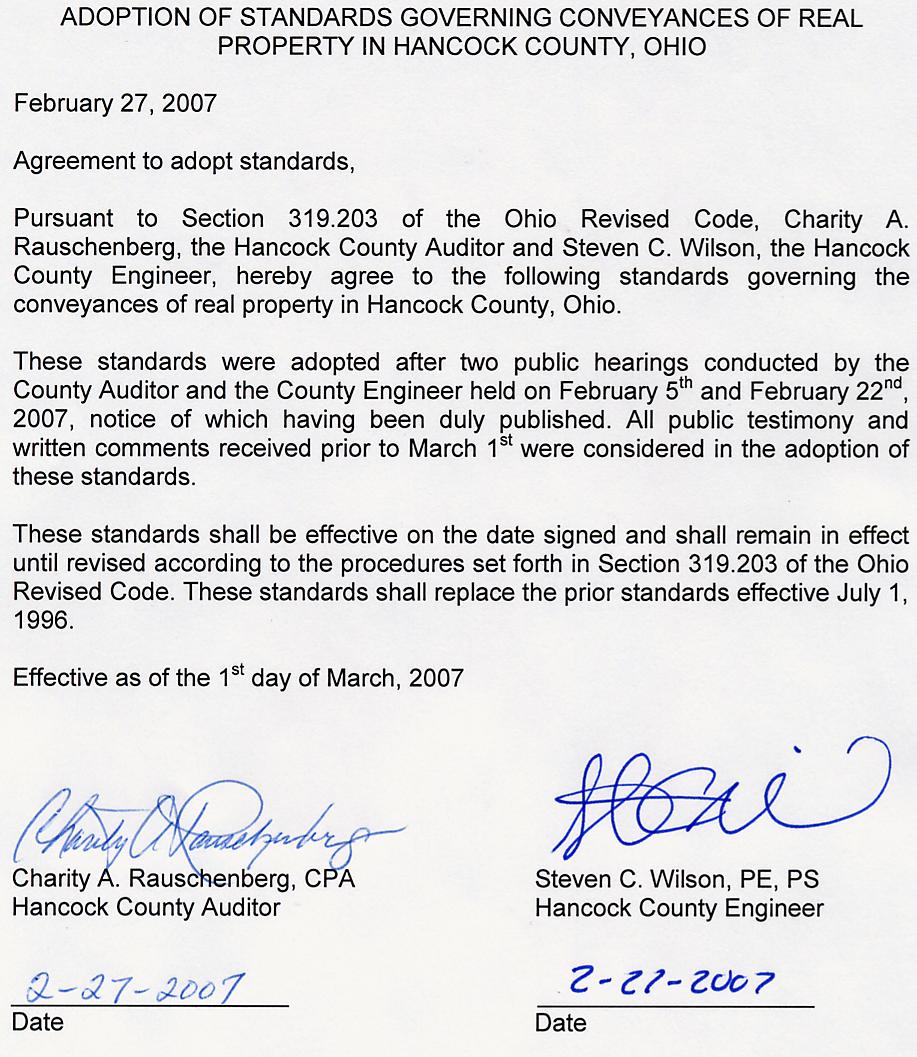
5 The following schedule describes the process for the creation, approval and publication of these standards. January 23, 2006 February 6, 2006 January 10, 2007 January 18, 2007 January 25, 2007 February 5, 2007 February 22, 2007 March 1, 2007 First Draft reviewed by Auditor, Engineer, and staff Second Draft reviewed by Auditor, Engineer, Assistant Prosecutor, and staff Third Draft reviewed by Auditor, Engineer, Assistant Prosecutor and staff Notice of First Public Hearing scheduled for February 5, 2007 Notice of Second Public Hearing scheduled for February 22, 2007 First Public Hearing Second Public Hearing Adoption of Standards DEFINITIONS County - The word "County" shall mean Hancock County, Ohio. County Auditor - The use of "County Auditor" shall refer to the Hancock County Auditor, deputies or authorized representatives located in the Real Estate department of the Hancock County Auditor in the Hancock County Courthouse, 300 S MAIN ST, FINDLAY, OH County Engineer - The use of "County Engineer" shall refer to the Hancock County Engineer, deputies or authorized representatives located in the Real Estate department of the Hancock County Auditor in the Hancock County Courthouse, 300 S MAIN ST, FINDLAY, OH Instruments - Shall refer to any legal recorded document conveying all or part interest in real estate. PROCESS AND PROCEDURES 1. All authors of conveyance instruments are encouraged to have property descriptions pre-approved by the County Engineer 2-3 working days prior to transfer. This will avoid delays and allow time for any corrections that are necessary. Land contract descriptions should also be checked to avoid costly mistakes and other obvious errors in property descriptions. 2. Deeds based upon surveys will not be approved until survey has been approved by the County Engineer. Lot splits not based on a survey shall be reviewed by the County Engineer prior to transfer to verify 3
6 intent of transfer. Mortgage Location Surveys will not be accepted as property surveys in a property conveyance transaction. 3. It is the responsibility of the deed preparer to provide parcel numbers and acreage, if applicable, for existing parcels on all instruments of conveyance. 4. Instruments of conveyance are required to state Township or Corporation, County of Hancock, State of Ohio. Metes and bounds descriptions must also state Township (i.e. T1N) and Range (i.e. R 10E), quarter section(s), Section. 5. Instruments of conveyance are required to have a 1 margin on the left-hand side of each page for the County Auditor s stamps. Also, a 1 ½ margin is required at the top of the first page and at the bottom of the last page for the County Recorder s stamps. 6. Submitted instruments of conveyance involving the creation of a new split, legal description, or minor subdivision must meet the following formatting requirements: a. Read word for word as recited in the pre-approved legal description b. Each call shall be stated in a separate paragraph 7. It is the opinion of the Ohio State Board of Registration for Professional Engineers and Surveyors that registered professional surveyors are the only persons qualified and authorized by law, except as set out in ORC , to prepare descriptions for land in this state. When a person, other than a registered professional surveyor, prepares, changes, alters, modifies, or amends a land description, that person is practicing surveying in violation of ORC Corrective deeds shall state nature of correction. 10. All correspondence shall be directed to deputies or authorized representatives of the Hancock County Auditor - Real Estate Division in the Hancock County Courthouse, 300 S. Main Street, Findlay, Ohio I. STANDARDS FOR ALL RECORDED LOTS 1. A legible copy of the prior deed is required with transfers involving a split of a recorded lot. Instruments involving the transfer of an entire lot(s) do not require a copy of the prior deed. 4
7 2. All Instruments conveying a recorded lot in a municipal or recorded subdivided area must designate the lot number(s) and the subdivision name. 3. Any out-lot or portion of recorded lot must have an accurate description to establish a tax structure of the portion being conveyed, so as to enable the County Auditor to determine the residue or balance remaining, based on the current Tax Maps and Parcel Numbers. 4. Any area being conveyed in what is commonly known as an "Unrecorded Plat" must have a metes and bounds description. 5. Vacated lots shall be surveyed using a monumented point of beginning and shall be metes and bounds descriptions since vacated property boundaries do not exist. However, a vacated subdivision name and lot number can be used as a point of reference in a legal description in addition to the metes and bounds description. II. STANDARDS FOR EXISTING LEGAL DESCRIPTIONS 1. A legible copy of the prior deed is required with transfers involving existing legal descriptions. 2. Legal descriptions presented for conveyance shall be compared to the prior deed and checked by the County Engineer to verify and identify to the County Auditor the tax parcel(s) to be conveyed. The correction of typographic errors, omissions or other mistakes not substantive in nature is permitted in order to match the prior deed. Corrections should be initialed. All references to terms currently not in use, such as former road names or railroads, must reflect current names or ownership. 3. Any existing legal description or platted lot which has been incorporated into a municipality or other political subdivision by means of annexation must be changed to reflect its new corporate location within the situate of the subject instrument of conveyance. Detachments shall be corrected as well to reflect the current political location. 4. A survey is not required for instruments conveying - entire quarter section, half of a quarter section, quarter of a quarter section, or any quarter or half fraction thereof as determined by the County Engineer. If any of the above is created by a split, then the split would require a new survey. 5
8 5. Existing descriptions that do not meet requirements for transfer may transfer if no money is involved and if they meet one of the requirements listed below: a. When property is being transferred from the owner(s) to themselves b. When property is being transferred from the owner(s) to an immediate family member c. When the trustee(s) of a given trust relinquishes rights to a new trustee(s) of the same trust d. When the property is being transferred from the owner(s) name into a family trust e. When property is being transferred from a family into a member s name of that trust f. When the name of a trust is being changed but the trustee(s) remain the same g. When a person(s) inherits property by survivorship h. Life Estates i. Corrective Deeds j. Transfers by Court order such as Certificates of Transfer, Executor or Fiduciary, Divorce Decree Sheriff s Deeds, Auditor s Deeds or Judicial Orders lacking an acceptable legal description may also transfer. At the time of transfer the legal instrument shall be stamped New Survey Required Next Non-Exempt Transfer. 6. When there is an exception(s) to a tract or parcel the exception(s) shall comply with the following requirements: a. More than three exceptions per parcel or tract will be considered unacceptable for transfer, however, the County Engineer retains the right to request a survey on any number of exceptions if the intent of the transfer is not clearly understood. Exceptions must meet STANDARDS FOR EXISTING LEGAL DESCRIPTIONS. b. Exceptions must be identified in a separate paragraph and referenced to one parcel number on the deed. c. After the exceptions to a tract or parcel are fully described, an acreage must accompany the instrument of conveyance. 7. Acre changes to a tax parcel may only be performed with a recorded deed. 8. Units of measure in metes and bounds descriptions can be either US Survey Feet, rods and chains, or metric units, which shall be acceptable if feet and inches are also shown. 6
9 III. REQUIREMENTS FOR NEW SURVEYS/SPLITS/MINOR SUBDIVISIONS 1. All new metes and bounds descriptions, not previously recorded, shall meet minimum standards as established in Chapter of the ADMINISTRATIVE CODE. Except as herein identified. Surveys shall be presented for pre-transfer approval a minimum of 2 working days in advance. 2. Whenever a new metes and bounds description encompasses any of the following situations, a breakdown of the total area must be recited to create an accurate tax structure. a. Two or more taxing districts b. Two or more sections / quarter sections c. Two or more platted subdivisions d. Both platted and unplatted lands In each situation the acreage in the existing road right of way for each portion must be recited as well. 3. Hancock Regional Planning Commission or the applicable City Planning Commission approval is required for the following cases: a. Splits less than acres or splits leaving the remainder with less than acres b. Any split of a platted subdivision lot c. Any split with less than 60 frontage or any split leaving the remainder with less than 60 frontage d. Flag Lots with less than acres in the flag e. Any split located in an incorporated city or village 4. Descriptions other than metes and bounds may be acceptable if they accurately describe tract. (i.e., being 10 feet off the west side of Lot No. 1000, etc.) This provision only applies to portions of rectangular lots in a platted subdivision which span an entire side of a lot. 5. Legal Description for new survey approval shall adhere to the following requirements: a. The legal description must be submitted on a separate one-sided 8 ½ x 11 sheet of paper. Legal descriptions on the plat of survey will not be accepted for approval. b. Each call must be stated in a separate paragraph. c. Distances following a common bearing cannot be broken into separate calls. d. Calculated acreage must be rounded to 3 decimal places. For example, acres would be rounded up to acres, while acres would be rounded down to acres. 7
10 e. The surveyor's printed name, Ohio registration number, signature, and seal must appear on the same sheet of paper as the legal description. f. Distances shall be rounded to two decimal places. g. Bearings and distances shall be typed numerically. (i.e. N E, a distance of ) h. No survey will be accepted without an attached and completed APPLICATION FOR SURVEY APPROVAL form. This form can be picked up in person at the Auditor s Office or faxed upon request. i. No faxed or ed legal descriptions / survey plats will be accepted. j. Signed originals can be dropped off in person at the County Courthouse, Auditor s Office, Room 21 or mailed to: HANCOCK COUNTY AUDITOR S OFFICE 300 S MAIN ST RM 21 FINDLAY OH The following requirements set forth in the Ohio Administrative Code must also be met: k. In all new descriptions and plats of survey, the lengths and directions of the lines shall be specified so that the mathematical error in closure of the property boundary does not exceed 0.02 feet in latitudes and 0.02 feet in departure. l. Sufficient caption so that the property can be adequately identified. m. A relationship between the property in question and clearly defined control station(s). n. The basis of the bearings. o. A citation to the public record of the appropriate prior deed(s). p. A description of the boundary monument used as the initial point of the description. q. A series of calls for successive lines bounding the parcel, each of which specifies: I. The intent in regards to adjoiners or other existing features. II. The direction of the line relative to the direction of the basis of bearing. III. The length of the line. IV. A description of the boundary monument (or reference monument) and whether found or set to identify the end of the particular line. V. All curved lines shall indicate the radius, central angle, curve length, chord bearing, chord length and direction of the curve. r. A statement shall appear indicating that either: the description was made in accordance with a recent survey and the date thereof, or 8
11 the description was made based on a previous survey, of a certain date, and date of description, or the description was not based on a survey. 6. Survey Plat shall include: a. The attached plat shall be submitted on 8 1/2 x 11 or 11 x17 paper. Plats submitted on 18 x 24 or 24 x 36 paper will be acceptable if the survey dimensions warrant a larger paper size. b. No overlapping legal descriptions shall be placed on the same survey plat. If this situation arises, please submit as separate drawings. c. In situations where more than one description having the same acreage is placed on the same survey plat, each corresponding description and plat shall be labeled Parcel A,B,C For these situations, The County Auditor will not accept a deed for transfer without the corresponding label placed above the legal description. d. All distances and bearings on the plat must match the distance and bearing from the legal description. e. Must be legible and of a professional quality. f. Flag Lots must show acreage in the pole and in the flag. g. Area within the road right of way, rounded to 3 decimal places. h. To assist the Auditor in maintaining an accurate tax base, all new surveys must show location(s) and dimensions of any taxable structure when practicable. The following requirements set forth in the Ohio Administrative Code must also be met: i. A title such that the general location of the survey can be identified. The title shall include, but not be limited to: state, county, civil township or municipality, and original land subdivision description. j. A north arrow with a clear statement as to the basis of the reference direction used. k. The control station(s) or line cited in the description and the relationship of the property to this control must be referenced to an established monumented point of beginning such as, but not limited to: centerline intersection of streets or highways record, section or quarter section corners, Virginia military survey corners or lines, or platted lot corners. The type of monuments set or found at the control stations shall be noted. l. A notation at each corner of the property stating that the boundary monument specified in the deed description was found, or that a boundary monument was set, or a legend of the symbols used to identify monumentation. In addition, there shall be a statement describing the material and size of every monument found or set. m. A general notation describing the evidence of occupation that may be found along every boundary line or occupation line. 9
12 n. The length and direction of each line as specified in the description of the property or as determined in the actual survey if this differs from what is stated in the deed description by more than the tolerance specified in paragraph (B) of rule of the Administrative Code. The length and direction shall be stated as follows: I. Bearings expressed in degrees, minutes and seconds and distances expressed in feet and decimal parts thereof on each course. If a metric equivalent distance is stated, it shall be stated to the third decimal place. II. All curved lines shall indicate the radius, central angle, curve length, chord bearing and chord distance. III. Each course shall show other common lines such as centerline of roads, rivers, streams, section lines, quarter section lines, half section lines or other pertinent common lines of record. o. A citation of pertinent documents and sources of data used as a basis for carrying out the work. The citation shall include, but not be limited to: current deeds as of the date of the survey, prior deeds or other documents of record, and available deeds of record for adjoining parcels along each boundary line of the survey. If the adjoining parcel is a recorded subdivision, only the subdivision name, recording information and lot numbers need to be shown. p. The written and graphical scale of the drawing. q. The date of the survey. r. The surveyor's printed name and Ohio registration number, signature and seal (in a form which may clearly reproduce on any copies which may be made of the original drawing). s. The area contained within the perimeter of the surveyed parcel. t. All references to roads or railroads contiguous to the surveyed parcel shall use current names or names of record and applicable right of way widths, if available. u. References to rivers or streams shall use current names of record, if available. 7. When approved, the legal description will be stamped Acreage/Closure Checked - Hancock County Engineer. Faxed copies will then be sent to the surveyor. If denied, the surveyor will be notified by fax or telephone. 8. All instruments containing new metes and bounds descriptions, which meet all of the aforementioned requirements will be stamped Description Checked - Hancock County Engineer and the proper notations will be made on the instrument of conveyance, verifying a correct tax structure to the County Auditor. 10
13 IV. MAJOR SUBDIVISIONS 1. Obtain necessary approval and signatures from the appropriate government entities prior to delivery to the County Auditor. 2. A legal description of the perimeter is required and must be included on the plat in order to be approved. 3. Appropriate signatures must be signed and contain name, title, and organization (if applicable) legibly printed beneath. 4. The subdivision plat shall be submitted on 18 x28 mylar. 5. Two sets of the plat are required upon delivery to the County Auditor. 6. Plats involving County acceptances must include the following text: COUNTY ACCEPTANCE We, the undersigned Commissioners in and for the County of Hancock, State of Ohio, do hereby approve and accept the above plat and all roads, rights-of-way, and easements thereon, excepting. As a general rule, the blank will be filled in with the word none. 7. Changes to the legal description of a plat can only be modified by a professional surveyor. V. REQUIREMENTS FOR DIGITAL SUBMITTAL STANDARDS OF DXF (Digital Exchange Format) FILES FOR MAJOR SUBDIVISION PLATS (5+ lots) 1. The County Auditor reserves the right to delay transfer of the plat pending delivery of the DXF file. 2. Upon delivery of the mylar plat to the Auditor s Office, the associated engineering/surveying firm will be notified by phone or to arrange delivery of the DXF file. 3. Requirements for DXF file: a. 1:1 scale oriented properly. (North is up, not rotated) b. All parcel and ROW lines shall be moved to a unique single layer. c. All lot dimension text shall be merged into a unique single layer. d. Lot Number text shall be merged into a unique single layer. e. Curve distances shall be labeled with the corresponding text or referenced to a curve table. 4. The DXF file should not contain the following features: 11
14 a. Duplicate lines, Overlapping lines b. Dangling nodes, Overshoots c. Blocks, Cell features, Complex shapes, Complex strings d. Exploded text, Leaders, Arrows e. Foot symbol on dimensions (i.e ) f. Lines or text not pertaining to the plat dimensions (i.e. utility easements, centerline distances, bearings). VI. CONDOMINIUMS 1. A legal description of the perimeter is required and must be included with the plat in order to be approved. 2. Appropriate signatures must be signed and contain name, title, and organization (if applicable) legibly printed beneath. 3. The original and a copy of the Declaration and Amendments must be submitted on 18 x28 mylar for each condominium association. 4. A plat and a copy is required for each transfer of real property to the condominium association, submitted on 18 x28 mylar. 5. Changes to the legal description of a plat can only be modified by a professional surveyor. VII. PROCESS FOR ANNEXATIONS Only annexations submitted in the form of plats and descriptions will be accepted by the County Engineer for checking and filing. 1. All descriptions and plats shall conform to either: a. STANDARDS FOR EXISTING LEGAL DESCRIPTIONS b. REQUIREMENTS FOR NEW SURVEYS/SPLITS/MINOR SUBDIVISIONS 2. Individual acting as agent for the petitioners should obtain the petition for annexation together with an affidavit (signed by the agent) from the County Commissioners and involved property owners. 3. Plat(s), descriptions and petition should be presented to the proper agencies for review. These agencies include but not necessarily limited to: County Engineer, Board of Health, Township Trustees, Township Zoning Board, Regional Planning Commission, County Commissioners, and City or Village Officials. 12
15 VIII. APPROVAL PROCESS FOR LAND CONTRACTS All land contracts shall be checked for conformance to current regulations which may be applicable upon final transfer. While the County Engineer cannot prevent the recording of these instruments, we encourage they be checked to alert the parties involved of any potential problem which may prevent an acceptable transfer at a future date. IX. ROAD, STREET, AND ALLEY VACATIONS In order for the County Engineer to properly serve the needs of the County Auditor's Office concerning the keeping of an accurate tax base, the County Engineer must be informed by means of a recorded legal instrument of any road, street, or alley vacation by the responsible government agency. While a survey is not required, the following two conditions must be met: EXHIBIT A 1. The ordinance must list affected subdivision(s) and lot number(s) if platted, or if unplatted, the Auditor s parcel number(s). 2. A plat, prepared and certified by a licensed surveyor or engineer, must be submitted in accordance with ORC Ohio Administrative Code
WYANDOT COUNTY BASIC STANDARDS FOR THE APPROVAL OF REAL ESTATE DEED TRANSFERS & LAND CONTRACT AGREEMENTS
 GENERAL In compliance with Section 315.251 of the Ohio Revised Code, the County Auditor and the County Engineer have adopted these written standards governing the conveyance of real property in Wyandot
REQUIREMENTS FOR ALL INSTRUMENTS OF CONVEYANCE IN HARDIN COUNTY, OHIO
 REQUIREMENTS FOR ALL INSTRUMENTS OF CONVEYANCE IN HARDIN COUNTY, OHIO Effective Date: Michael L. Smith, P.E., P.S. Hardin County Engineer Michael T. Bacon Hardin County Auditor 1 I. GENERAL In compliance
Requirements for All Instruments of Conveyance in Logan County, Ohio
 Requirements for All Instruments of Conveyance in Logan County, Ohio Effective Date: April 11, 1997 It is the intent of these requirements to provide a standard method of checking legal descriptions for
Minimum Requirements. In Carroll County, Ohio
 Minimum Requirements For Instruments of Conveyance In Carroll County, Ohio Revision History: Original Effective Date: June 1, 2000 Revision Effective Date: October 2, 2017 Foreword Section 319.203 of the
OTTAWA COUNTY LEGAL DESCRIPTION REVIEW GUIDELINES
 OTTAWA COUNTY LEGAL DESCRIPTION REVIEW GUIDELINES APPROVED BY: RONALD P. LAJTI, JR., P.E., P.S. OTTAWA COUNTY ENGINEER APPROVED BY: LAWRENCE HARTLAUB OTTAWA COUNTY AUDITOR EFFECTIVE DATE: January 1, 2017
Auditor's Office Tuscarawas County
 Auditor's Office Tuscarawas County MATT JUDY, Auditor Telephone 125 E. High Avenue (330) 365-3220 New Philadelphia, Ohio 44663 Fax: (330) 365-3397 TO: FROM: Title Companies, Surveyors, Attorneys & Financial
APPROVAL REQUIREMENTS
 APPROVAL REQUIREMENTS FOR INSTRUMENTS OF CONVEYANCE IN ERIE COUNTY, OHIO DRAFT Requirements for all instruments of Conveyance in Erie County, revised and effective, 2014. An Erie County policy governing
REQUIREMENTS FOR ALL INSTRUMENTS OF CONVEYANCE IN GREENE COUNTY
 REQUIREMENTS FOR ALL INSTRUMENTS OF CONVEYANCE IN GREENE COUNTY A Greene County policy governing procedures and requirements for acceptance of documents for instruments of conveyance is hereby established.
GENERAL. All authors of conveyance instruments are encouraged to contact the County Auditor s Office well in advance of transfer.
 GENERAL In accordance with Section 319.203 of the Ohio Revised Code, the Geauga County Auditor and the Geauga County Engineer, by agreement, hereby establish the following standards governing the conveyance
TRANSFER AND CONVEYANCE STANDARDS OF THE PICKAWAY COUNTY AUDITOR AND THE PICKAWAY COUNTY ENGINEER
 TRANSFER AND CONVEYANCE STANDARDS OF THE PICKAWAY COUNTY AUDITOR AND THE PICKAWAY COUNTY ENGINEER Melissa A. Betz, Auditor Robert E. Parker, P.E., P.S., Engineer AS ADOPTED UNDER OHIO REVISED CODE SECTION
Conveyance Standards. Boundary Survey Requirements. Adams County, Ohio
 Conveyance Standards And Boundary Survey Requirements Adams County, Ohio OFFICE OF THE ADAMS COUNTY AUDITOR DAVID GIFFORD 110 WEST MAIN STREET WEST UNION, OH 45693 OFFICE OF THE ADAMS COUNTY ENGINEER DAVID
Lake County, Ohio USA
 Lake County, Ohio USA Christoper A. Galloway Lake County Auditor TRANSFER AND CONVEYANCE STANDARDS OF THE LAKE COUNTY AUDITOR AND THE LAKE COUNTY ENGINEER ADOPTED PURSUANT TO OHIO REVISED CODE SECTION
Standards for All Instruments of Conveyance
 Standards for All Instruments of Conveyance Perry County, Ohio Effective Date: May 1, 1997 Effective Date of Revision: April 1, 2011 Page 2 of 12 Minimum Standards for all Instruments of Conveyance Perry
TRANSFER PROCEDURES FOR WASHINGTON COUNTY, OHIO
 TRANSFER PROCEDURES FOR WASHINGTON COUNTY, OHIO The following requirements are adopted and established in conjunction with the Washington County Engineer and the Washington County Auditor as prescribed
Requirements For All Instruments of Conveyance In Monroe County, Ohio. Transfer and Conveyance Standards of the Monroe County Auditor & Engineer
 Requirements For All Instruments of Conveyance In Monroe County, Ohio Transfer and Conveyance Standards of the Monroe County Auditor & Engineer Effective November 8, 2013 1 TRANSFER PROCEDURES FOR MONROE
DUSTY RHODES HAMILTON COUNTY AUDITOR WILLIAM W. BRAYSHAW HAMILTON COUNTY ENGINEER
 DUSTY RHODES HAMILTON COUNTY AUDITOR www.hamiltoncountyauditor.org WILLIAM W. BRAYSHAW HAMILTON COUNTY ENGINEER www.hamilton-co.org/engineer As Adopted Under Ohio Revised Code Section 319.203 Effective
STANDARDS GOVERNING CONVEYANCES OF REAL PROPERTY IN DARKE COUNTY, OHIO
 STANDARDS GOVERNING CONVEYANCES OF REAL PROPERTY IN DARKE COUNTY, OHIO As directed by Section 319.203 of the Ohio Revised Code which states The County Auditor and the County Engineer shall adopt standards
Delaware County Transfer Standards
 Delaware County Transfer Standards Delaware County Auditor David A. Yost Delaware County Engineer Chris Bauserman Adopted in 1997, Amended in 1999 Dave Yost County Auditor Chris Bauserman County Engineer
STANDARDS GOVERNING CONVEYANCES OF REAL PROPERTY IN SENECA COUNTY OHIO
 STANDARDS GOVERNING CONVEYANCES OF REAL PROPERTY IN SENECA COUNTY OHIO EFFECTIVE July 8, 1996 Seneca County Auditor FIRST HEARING June 14, 1996 SECOND HEARING June 26, 1996 Seneca County Engineer TABLE
Change In The Name Of Owner (s) Of Land.
 Of Land.") Clermont County TRANSFER AND CONVEYANCE STANDARDS OF THE CLERMONT COUNTY AUDITOR AND THE CLERMONT COUNTY ENGINEER AS ADOPTED UNDER OHIO REVISED CODE SECTION 319.203, AS A RESULT OF TWO PUBLIC HEARINGS
Clermont County TRANSFER AND CONVEYANCE STANDARDS OF THE CLERMONT COUNTY AUDITOR AND THE CLERMONT COUNTY ENGINEER AS ADOPTED UNDER OHIO REVISED CODE SECTION 319.203, AS A RESULT OF TWO PUBLIC HEARINGS
(5) Multiple Transfer Fees collectively paid with one check will not be accepted.
 Multiple Transfer Fees collectively paid with one check will not be accepted.") TRANSFER AND CONVEYANCE STANDARDS OF THE FRANKLIN COUNTY AUDITOR AND THE FRANKLIN COUNTY ENGINEER AS ADOPTED UNDER OHIO REVISED CODE SECTION 319.203 EFFECTIVE JULY 1, 1996 AMENDED JULY 14, 1997 AMENDED
TRANSFER AND CONVEYANCE STANDARDS OF THE FRANKLIN COUNTY AUDITOR AND THE FRANKLIN COUNTY ENGINEER AS ADOPTED UNDER OHIO REVISED CODE SECTION 319.203 EFFECTIVE JULY 1, 1996 AMENDED JULY 14, 1997 AMENDED
Notice of Public Hearings (effective July 14, 2003) Transfer and Conveyance Standards New Information on Proposed Transfer and Conveyance Standards
 Transfer and Conveyance Standards New Information on Proposed Transfer and Conveyance Standards") Notice of Public Hearings (effective July 14, 2003) Transfer and Conveyance Standards New Information on Proposed Transfer and Conveyance Standards In accordance with Ohio Revised Code 319.203, Crawford
Notice of Public Hearings (effective July 14, 2003) Transfer and Conveyance Standards New Information on Proposed Transfer and Conveyance Standards In accordance with Ohio Revised Code 319.203, Crawford
Transfer and Conveyance Standards of the Athens County Auditor and the Athens County Engineer. Table of Contents
 Transfer and Conveyance Standards of the Athens County Auditor and the Athens County Engineer Table of Contents Adoption of Standards Governing Conveyances of Real Property in Athens County, Ohio... 3
Enforcement of Minimum Survey Standards
 Presented By: F. Anthony Rettke, P.S., Tax Map Supervisor, Franklin County John Greenhalge, Executive Director, State Board of Registration n the Ohio Revised Code, Section 315.251: If a deed conveying
HENRY COUNTY CONVEYANCE STANDARDS AND LAND TRANSFER POLICY
 HENRY COUNTY CONVEYANCE STANDARDS AND LAND TRANSFER POLICY REVISED DECEMBER 2013 Approved By: Kevin Garringer - County Auditor Timothy J. Schumm, P.E., P.S. - County Engineer Land Transfer Policy Committee:
LAND CONVEYANCE STANDARDS AND REQUIREMENTS FOR APPROVALS OF DEED DESCRIPTIONS, SURVEYS AND PLATS IN MEDINA COUNTY, OHIO
 LAND CONVEYANCE STANDARDS AND REQUIREMENTS FOR APPROVALS OF DEED DESCRIPTIONS, SURVEYS AND PLATS IN MEDINA COUNTY, OHIO PREPARED BY THE OFFICE OF THE MEDINA COUNTY AUDITOR AND THE OFFICE OF THE MEDINA
Easements, Establishments, Abandonments and Vacations
 Easements, Establishments, Abandonments and Vacations Highway Easements: Where there is a right to construct and maintain a highway facility SH - Standard Highway easement LA - Limited Access Easement
Easements, Establishments, Abandonments and Vacations
 Easements, Establishments, Abandonments and Vacations A highway easement conveys, in perpetuity, the right to construct and maintain a highway facility on the land of the fee holder. (Property owner) The
ADOPTION OF REVISIONS TO STANDARDS GOVERNING CONVEYANCES IN ASHTABULA COUNTY
 PREAMBLE The intent of this revision of current rules is to perpetuate the desire for good conveyances and to modify, add, clarify or eliminate certain rules. The rules following have been restructured
City of Fort Lupton Amended Plat Process
 City of Fort Lupton Amended Plat Process Purpose The Amended Plat process is an administrative process to amend a recorded Plat. An Amended Subdivision is an administrative revision to a recorded Subdivision
DAWSON COUNTY MINOR PLAT REVIEW CHECKLIST $50.00 FEE PER PLAT REVIEW, $5.00 FEE FOR SCAN & CD FOR RECORDING
 DAWSON COUNTY MINOR PLAT REVIEW CHECKLIST $50.00 FEE PER PLAT REVIEW, $5.00 FEE FOR SCAN & CD FOR RECORDING NAME ON PLAT: CONTACT/PHONE #: NAMED STREET/ADDRESS: LAND LOT: DISTRICT: SECTION: ZONING: SETBACKS:
OHIO ADMINISTRATIVE CODE CHAPTER Minimum Standards for Boundary Surveys in the State of Ohio
 OHIO ADMINISTRATIVE CODE CHAPTER 4733-37 Minimum Standards for Boundary Surveys in the State of Ohio Note: Chapter 4733-37 of the Administrative Code was filed pursuant to Chapter 119 of the Revised Code.
Survey and Recording Requirements
 Article C: Sec. 14-1-40 Survey and Recording Requirements Survey Requirements. (a) (b) (c) Prior to the final approval of land divisions to which this Chapter applies, the owner of the land shall have
Plats and subdivisions; mapping requirements. (a) Size Requirements. All land plats presented to the register of deeds for recording in the
 Size Requirements. All land plats presented to the register of deeds for recording in the") 47-30. Plats and subdivisions; mapping requirements. (a) Size Requirements. All land plats presented to the register of deeds for recording in the registry of a county in North Carolina after September
47-30. Plats and subdivisions; mapping requirements. (a) Size Requirements. All land plats presented to the register of deeds for recording in the registry of a county in North Carolina after September
Department of Development Services Engineering; Survey Plat Review Group SPRG
 Department of Development Services Engineering; Survey Plat Review Group SPRG CITY OF DALLAS LEGAL DESCRIPTION PREPARATION GUIDELINE AND CHECKLIST The following guideline and checklist are provided to
STANDARDS FOR PLATS OF SURVEYS, LEGAL DESCRIPTIONS, RECORD PLANS AND CONDOMINIUM PLANS
 OFFICE OF THE MONTGOMERY COUNTY ENGINEER STANDARDS FOR PLATS OF SURVEYS, LEGAL DESCRIPTIONS, RECORD PLANS AND CONDOMINIUM PLANS INDEX Definitions Electronic Data Submittal Program Page i Page ii I. Adoption
Oakland County Michigan Register of Deeds Plat Engineering, GIS, & Remonumentation Dept. Ph: (248) Fax (248)
 Fax (248)") Oakland County Michigan Register of Deeds Plat Engineering, GIS, & Remonumentation Dept. Ph: (248)-858-1447 Fax (248)-858-7466 Requirements Needed for Final Plat Approval No. General Requirements. 1 Routing
Oakland County Michigan Register of Deeds Plat Engineering, GIS, & Remonumentation Dept. Ph: (248)-858-1447 Fax (248)-858-7466 Requirements Needed for Final Plat Approval No. General Requirements. 1 Routing
Submittal Requirements: Subdivision Plat (Final)
") s Planning and Zoning Submittal Requirements: Subdivision Plat (Final) 1. Application form, APO fees, and filing fee. Transportation Development Review Fee please contact Engineering at (970) 221-6605
s Planning and Zoning Submittal Requirements: Subdivision Plat (Final) 1. Application form, APO fees, and filing fee. Transportation Development Review Fee please contact Engineering at (970) 221-6605
INSTRUCTIONS FINAL PLAT APPROVAL APPLICATION
 INSTRUCTIONS FINAL PLAT APPROVAL APPLICATION 1. The applicant/agent shall fill out the attached application. The attached application form must be completely filled in before it can be filed. Portions
Group Sewer Only** 80 Ft Frontage* 20,000 Sq. Ft. (.46 acre) Minimum** 120 Ft Frontage* 20,000 Sq. Ft. (.46acre) Minimum** 150 Ft Frontage*
 Minimum** 120 Ft Frontage* 20,000 Sq. Ft. (.46acre) Minimum** 150 Ft Frontage*") Residential Lots Minimum Chart The minimum lot size of any minor subdivision where there is no public sewers shall be as shown below or as required by township zoning and/or the Tuscarawas General Health
Residential Lots Minimum Chart The minimum lot size of any minor subdivision where there is no public sewers shall be as shown below or as required by township zoning and/or the Tuscarawas General Health
Final Plat Mapping Requirements
 CURRENT PLANNING DIVISION 410 E. 5 th Street Loveland, CO 80537 970-962-2523 eplan-planning@cityofloveland.org cityofloveland.org/dc Final Plat Mapping Requirements All Final plats shall comply with the
FINAL PLAT. Community Development Department 8101 Ralston Road Arvada, Colorado 80002
 FINAL PLAT Community Development Department 8101 Ralston Road Arvada, Colorado 80002 September 2015 FINAL SUBDIVISION PLAT Final Subdivision Plat Review Applications for a Final Plat shall be submitted
APP. FEE: $ DATE & TIME LOCATION: 1/4 SECTION SECTION TOWNSHIP RANGE STREET ADDRESS AND GENERAL LOCATION OF PROPERTY CITY, STATE PHONE (DAY):
:") REVERSION TO ACREAGE PURSUANT TO N.R.S. 278.490 through 478.4965 Elko County Planning & Zoning 155 South 9th Street, Elko, NV 89801 (775) 738-6816 or 738-2266 APPLICATION MUST BE SUBMITTED WITH ALL REQUIRED
REVERSION TO ACREAGE PURSUANT TO N.R.S. 278.490 through 478.4965 Elko County Planning & Zoning 155 South 9th Street, Elko, NV 89801 (775) 738-6816 or 738-2266 APPLICATION MUST BE SUBMITTED WITH ALL REQUIRED
MINOR SUBDIVISION PLAT
 MINOR SUBDIVISION PLAT Community Development Department 8101 Ralston Road Arvada, Colorado 80002 MINOR SUBDIVISION PLAT Subdivisions consisting of five (5) or fewer lots are eligible for the minor subdivision
ARTICLE III GENERAL PROCEDURES, MINOR PLANS AND FEE SCHEDULES
 ARTICLE III GENERAL PROCEDURES, MINOR PLANS AND FEE SCHEDULES 301. Prior to Submission a. Copies of this Ordinance shall be available on request, at cost, for the use of any person who desires information
MINOR SUBDIVISION PLAT
 MINOR SUBDIVISION PLAT Community Development Department 8101 Ralston Road Arvada, Colorado 80002 September 2015 MINOR SUBDIVISION PLAT Subdivisions consisting of five (5) or fewer lots are eligible for
DALLAS WATER UTILITIES WATER/WASTEWATER COVENANT
 DALLAS WATER UTILITIES WATER/WASTEWATER COVENANT Procedure for obtaining a water and wastewater covenant, water covenant, or wastewater covenant; Required for initial submittal: 1. One letter from the
RULES OF THE GEORGIA STATE BOARD OF REGISTRATION FOR PROFESSIONAL ENGINEERS AND LAND SURVEYORS CHAPTER APPLICATIONS TABLE OF CONTENTS
 RULES OF THE GEORGIA STATE BOARD OF REGISTRATION FOR PROFESSIONAL ENGINEERS AND LAND SURVEYORS CHAPTER 180-7 APPLICATIONS TABLE OF CONTENTS 180-7-.07 Maps and Plats. All maps, plats and similar documents
CHAPTER FINAL AND PARCEL MAPS
 CHAPTER 19.48 FINAL AND PARCEL MAPS Section Page 19.48.010 General... IV-25 19.48.020 Phasing... IV-25 19.48.030 Survey Required... IV-26 19.49.040 Form... IV-26 19.48.050 Contents... IV-27 19.48.060 Preliminary
The Filing Fee for a Minor Plat is $ PLUS $20.00 per lot created
 DEPARTMENT OF COMMUNITY DEVELOPMENT MINOR PLAT PROCEDURE The Filing Fee for a Minor Plat is $250.00 PLUS $20.00 per lot created Description: The purpose of a Minor Plat is to allow property to be platted
Division of Land Application
 FOR PLANNING USE ONLY Application # DIV Application Fee Receipt No. Filing Date Completeness Date Division of Land Application A. PROJECT INFORMATION 1. Project Name: 2. Address of Subject Property: 3.
Ballard City Final Plat Check List
 Ballard City Final Plat Check List TO BE COMPLETED BY BOTH THE DEVELOPER AND THE CITY Design: Check: Check each of the following items for compliance with adopted City Standards, Titles, General Plans
2018 EASEMENT DEDICATION PACKET
 2018 EASEMENT DEDICATION PACKET (INCLUDES PARCELS OF LAND, EASEMENTS, AND RIGHTS-OF-WAY FOR PUBLIC USE) Information Packet There are various situations in which easements, rights-of-way, and parcels of
PLANNING AND DEVELOPMENT DEPARTMENT PRELIMINARY PLAT APPLICATION
 PLANNING AND DEVELOPMENT DEPARTMENT PRELIMINARY PLAT APPLICATION IT IS INCUMBENT UPON THE APPLICANT TO SUBMIT COMPLETE AND CORRECT INFORMATION. ANY MISLEADING, DECEPTIVE, INCOMPLETE OR INCORRECT INFORMATION
Map Filing Law. 46: Effective date This act shall take effect January first, one thousand nine hundred and fiftyfour.
 46:23-9.8. Effective date This act shall take effect January first, one thousand nine hundred and fiftyfour. L.1953, c. 358, p. 1941, s. 8. 46:23-9.9. Short title This act shall be known and may be cited
FINAL PLAT GUIDE TO SUBDIVIDING PROPERTY. Background
 FINAL PLAT GUIDE TO SUBDIVIDING PROPERTY Background A final plat is the second step in the process of subdividing land into separate parcels for future sale or lease. Once a preliminary plat has been approved
REQUIREMENTS For Subdivision Plats, Administrative Subdivision Plats, Deposit Surveys and Deeds December 2016
 REQUIREMENTS For Subdivision Plats, Administrative Subdivision Plats, Deposit Surveys and Deeds December 2016 General Requirements - All plats shall have the information necessary to delineate and reestablish
CITY OF BEVERLY HILLS Department of Public Works and Transportation Civil Engineering Division FINAL MAP SUBMITTAL PROCESS Transmitted
 CITY OF BEVERLY HILLS Department of Public Works and Transportation Civil Engineering Division FINAL MAP SUBMITTAL PROCESS Transmitted From To* Planning Department Civil Engineering Division RKA Consulting
Certified Survey Review Instructions
 DEARBORN COUNTY PLAN COMMISSION County Administration Building, 165 Mary St., Lawrenceburg, IN 47025 Phone (812) 537-8821 Fax (812) 532-2029 Website: www.dearborncounty.org/planning Certified Survey Review
APPENDIX C: FINAL PLAT REVIEW CHECKLIST
 FINAL PLAT REVIEW CHECKLIST The Office of Permitting Services processes final record plats though the City agencies for review and approval and ultimate recording of the final plat at the Orange County
WASTEWATER BACKFLOW RELEASE PROCEDURES
 WASTEWATER BACKFLOW RELEASE PROCEDURES PROCEDURE FOR OBTAINING A WASTEWATER RELEASE FOR PRIVATE DEVELOPMENT PROJECTS: PLEASE NOTE THAT THE WASTEWATER BACKFLOW RELEASE DOCUMENT MUST FOLLOW THE CITY S PROCEDURES.
SECTION SITE SURVEYS
 PART 1 - GENERAL 1.1 DESCRIPTION SECTION 02 21 00 SPEC WRITER NOTES: 1. Use this section only for NCA projects. 2. Delete between //---// if not applicable to project. Also delete any other item or paragraph
To provide for the review of the final engineering plans, the subdivision improvement agreement, public dedications, and other legal agreements.
 ARTICLE 5 FINAL PLAT 501 Intent DOUGLAS COUNTY SUBDIVISION RESOLUTION To provide for the review of the final engineering plans, the subdivision improvement agreement, public dedications, and other legal
FINAL PLAT APPLICATION
 FINAL PLAT APPLICATION (Page 1 of 3) LEGAL OWNER(s): NAME: STREET ADDRESS OWNER(s): CITY, STATE, ZIP CODE: PHONE NUMBER: BILLING ADDRESS: NAME OF ENGINEER/SURVEYOR: Engineer/Surveyor Address, Phone: PROPERTY
Final Subdivision Plat
 Final Subdivision Plat Application Packet Public Works Department New Development Division 175 East 200 North St. George, UT 84770 Office (435) 627-4120 Dear Applicant, This packet has been prepared to
TITLE 13 SUBDIVISIONS
 TITLE 13 SUBDIVISIONS Chapter 1. General. 2. Subdivision Application Procedure. 3. Minor Subdivisions. 4. Standard Subdivisions. 5. Major Subdivisions. 6. Planned Unit Development Subdivisions. (Repealed)
Preliminary Plat/Final Plat Application
 Melissa Municipal Center 3411 Barker Avenue Melissa, Texas 75454 Phone: (972) 838-2036 Applicant: Date: Address: Phone: Contact: Fax: E-mail: Propose Addition Name: Acres: Existing Zoning: Propose Zoning:
Administrative Application Duplex Subdivisions
 Department of Community Development 75 South Frontage Road Vail, CO 81657 Tel: 970-479-2128 www.vailgov.com Development Review Coordinator Administrative Application Duplex Subdivisions General Information:
Request for Action form is also defined as an application to be considered by the Planning Commission.
 CITY OF NORTH RIDGEVILLE INSTRUCTIONS FOR FILING REQUEST FOR ACTION APPLICATIONS WITH THE PLANNING COMMISSION (Please read the full instruction as it will help in providing a full complete application)
APPENDIX C: PLAT SPECIFICATIONS AND CERTIFICATES
 APPENDIX C: PLAT SPECIFICATIONS AND CERTIFICATES A. Drawing. All plats for recording must be submitted on photographically reproducible and dimensionally stable polyester sheets such as Mylar, Cronar or
LAND USE PERMIT APPLICATION
 LAND USE PERMIT APPLICATION Date Application No. TYPE OF PERMIT Subdivision Short Plat Conditional Use Binding Site Plan Final Plat Final Short Plat Variance Final Binding Site Plan Plat Amendment Short
APPLICATION FOR MAJOR SUBDIVISION APPROVAL (FINAL PLAT)
") 209 S. Main Street Marysville, Ohio 43040 Phone: (937) 645-7350 Fax: (937) 645-7351 www.marysvilleohio.org APPLICATION FOR MAJOR SUBDIVISION APPROVAL (FINAL PLAT) *** IMPORTANT INFORMATION ~ Please read
209 S. Main Street Marysville, Ohio 43040 Phone: (937) 645-7350 Fax: (937) 645-7351 www.marysvilleohio.org APPLICATION FOR MAJOR SUBDIVISION APPROVAL (FINAL PLAT) *** IMPORTANT INFORMATION ~ Please read
7. EASEMENTS Label Established Lines Affecting Tract and/or Mentioned in its Legal Description:
 7. EASEMENTS 7.010 General All sewers shall be constructed in easements with working room. Existing easements without working room may only be used if revised to include working room. All public sewers,
SUBMITTAL REQUIREMENTS: The number indicates the number of copies for submittal (if applicable).
.") Office Use Only Preliminary Long Plat Long Subdivision Applicant Checklist PLANNING, COMMUNITY, & ECONOMIC DEVELOPMENT DEPARTMENT FINAL LONG PLAT LONG SUBDIVISION CHECKLIST Mailing Address: P.O. Box 547,
Office Use Only Preliminary Long Plat Long Subdivision Applicant Checklist PLANNING, COMMUNITY, & ECONOMIC DEVELOPMENT DEPARTMENT FINAL LONG PLAT LONG SUBDIVISION CHECKLIST Mailing Address: P.O. Box 547,
SUBMITTAL REQUIREMENTS: The number indicates the number of copies for submittal (if applicable).
.") Office Use Only Preliminary Long Plat Long Subdivision Applicant Checklist PLANNING, COMMUNITY, & ECONOMIC DEVELOPMENT DEPARTMENT PRELIMINARY LONG PLAT LONG SUBDIVISION CHECKLIST Mailing Address: P.O.
Office Use Only Preliminary Long Plat Long Subdivision Applicant Checklist PLANNING, COMMUNITY, & ECONOMIC DEVELOPMENT DEPARTMENT PRELIMINARY LONG PLAT LONG SUBDIVISION CHECKLIST Mailing Address: P.O.
A. Appropriate agency responsible for transportation review for the subject property.
 7.8.10 Procedure Any person desiring to create a minor subdivision shall submit to the Commission for approval an application on forms provided by the Division, and a record plat in conformance with the
SUBDIVISION APPLICATION
 SUBDIVISION APPLICATION City of Horn Lake Planning Department 3101 Goodman Road, W Horn Lake, MS 38637 662-342-3559 Fax: 662-342-3485 Applications due the 1st working day of the month. Submit application
MAJOR RESIDENTIAL AND NONRESIDENTIAL SUBDIVISIONS
 MAJOR RESIDENTIAL AND NONRESIDENTIAL SUBDIVISIONS Final Plats The applicant shall schedule a Pre-Application meeting with Planning Staff at least seven (7) working days prior to submittal of the application.
PROCEDURE. Chapter 12: Subdivision Regulations
 SECTION 14-600 ADMINISTRATIVE REPLAT PROCEDURE 14-601 INTENT These procedures are to provide an abbreviated process for Replat applications that demonstrate compliance with the criteria contained herein.
R/W PREQUALIFICATION ODOT, 3/14/2018 PROPERTY MAP SHEET
 R/W PREQUALIFICATION ODOT, 3/14/2018 3A Title Block 3B Sheet Heading 3C Station Limit Flags 3D Revision Block 3E Ownership Name and Number 3F Centerline Stationing 3G Proposed R/W and Pavement 3H Structures
COUNTY OF ALBEMARLE APPLICATION FOR FAMILY DIVISION. Family Division = $742 (Provide 5 copies of plat)
") Page 1 APPLICATION FOR FAMILY DIVISION Family Division = $742 (Provide 5 copies of plat) Tier 2 Groundwater Review = $355 (Required for all plats showing lots less than 21 acres) Tier 3 Groundwater Review
Page 1 APPLICATION FOR FAMILY DIVISION Family Division = $742 (Provide 5 copies of plat) Tier 2 Groundwater Review = $355 (Required for all plats showing lots less than 21 acres) Tier 3 Groundwater Review
MINNESOTA ASSOCIATION OF COUNTYSURVEYORS MANUAL OF MINIMUM GUIDELINES FOR THE PREPARATION OF COUNTY HIGHWAY RIGHT-OF-WAY PLATS
 MINNESOTA ASSOCIATION OF COUNTYSURVEYORS MANUAL OF MINIMUM GUIDELINES FOR THE PREPARATION OF COUNTY HIGHWAY RIGHT-OF-WAY PLATS MARCH,1994 j RECOMMENDED BY: MINNESOTA ASSOCIATION OF COUNTY SURVEYORS MINNESOTA
PLANNING COMMISSION SUBDIVISION PLAT APPLICATION
 PLANNING COMMISSION SUBDIVISION PLAT APPLICATION Economic Development Department 3468 North Fulton Avenue Hapeville, Georgia 30354 Phone - 404.669.8269 Fax 404.669.3302 Rev. 09/23/16 1 The following information
City of Lakewood Plat Specifications
 City of Lakewood Plat Specifications Revised 12/15/2015 Plat Checklist.1 Notes, Certifications and Acknowledgements..5 Electronic Submittal Information... 20 Sheet Layout.21 A Professional Land Surveyor,
Plan Presentation Guide SECTION 60. Chapter 3 RIGHT-OF-WAY SECTION PRESENTATION
 Chapter 3 RIGHT-OF-WAY SECTION PRESENTATION Right of Way plans are necessary for the acquisition of the required right of way and easements for projects. Proper representation of the right of way and easements
The Hennepin County platting process and common platting problems
 The platting process and common platting problems Tim Eklund Deputy County Surveyor Disclaimer This is a presentation on platting in Your county may be different. Just because we allow something don t
CITY OF LEE S SUMMIT MINOR PLAT PROCESS. Purpose of Minor Plats
 MINOR PLAT PROCESS Purpose of Minor Plats The City of Lee s Summit requires that all property be platted before a building permit is issued. Platting involves the subdivision of land into lots or tracts.
SUBDIVISION APPLICATION
 STAFF USE ONLY Date Submitted: Received by: Fee paid: Project # REQUIRED SUBMITTALS Application Fee: $600.00 (up to 5 lots) + $50.00 (per lot above 5) Publication Fee: $300.00 Mailing Fee: $6.00 per hearing
WESTON COUNTY FINAL PLAT APPLICATION
 WESTON COUNTY FINAL PLAT APPLICATION Property Owner: Mailing Address of owner: Telephone Number(s) of owner: Property Owner: Mailing Address of owner: Telephone Number(s) of owner: (If subdivider/applicant
MINOR PLAT FILING APPLICATION
 FILING APPLICATION Date of PC Meeting: Date of BCC Meeting: Fee Paid: 1. APPLICANT: DAYTIME PHONE: MAILING ADDRESS: LANDOWNER: DAYTIME PHONE: MAILING ADDRESS: AUTHORIZED AGENT: MAILING ADDRESS: RELATIONSHIP
MINOR SUBDIVISION PLAT CHECKLIST
 MINOR SUBDIVISION PLAT CHECKLIST Project Name: Tax ID #: Project Number: Date: _ Reviewed By: Telephone: NOTES: All lots on septic systems must comply with the Fulton County Health Department requirements
PLYMOUTH PLANNING BOARD APPLICATION FOR A MINOR SUBDIVISION OR MAJOR SUBDIVISION
 CASE # PLYMOUTH PLANNING BOARD APPLICATION FOR A MINOR SUBDIVISION OR MAJOR SUBDIVISION The undersigned Applicant hereby submits to the Plymouth Planning Board a completed application for a proposed minor
New Jersey Administrative Code Title 13, Chapter 40 State Board of Professional Engineers and Land Surveyors
 New Jersey Administrative Code Title 13, Chapter 40 State Board of Professional Engineers and Land Surveyors SUBCHAPTER 1. TITLE BLOCKS AND SEALS FOR PROFESSIONAL ENGINEERS AND LAND SURVEYORS 13:40-1.1
SUBDIVISION APPLICATION INSTRUCTIONS
 SUBDIVISION APPLICATION INSTRUCTIONS APPLICATION FORM The application form must be fully completed, signed by the property owner and shall be properly notarized. AGENT AUTHORIZATION FORM If the applicant
SUBDIVISION APPLICATION
 SUBDIVISION APPLICATION Preliminary Plat Minor Plat Final Plat Amended Plat Applicant Name: Owner (if different from applicant) Name: Company: Company: Address: Address: City, State, Zip City, State, Zip
APPLICATION FOR FINAL PLAT APPROVAL
 APPLICATION FOR FINAL PLAT APPROVAL Section 1. General. The undersigned Applicant (Applicant is synonymous with owner) makes this Application for Final Plat Approval in accordance with Chapter 21, Port
COUNTY OF ALBEMARLE APPLICATION FOR RURAL SUBDIVISION
 Page 1 APPLICATION FOR RURAL SUBDIVISION The term rural subdivision means a type of subdivision that is located in the rural areas which results in two or more lots for the purpose of transfer of ownership
Minor Subdivision Application
 FOR PLANNING USE ONLY Application # SD Application Fee $1,000.00 Receipt No. Filing Date Completeness Date Minor Subdivision Application A. PROJECT INFORMATION 1. Project Name: 2. Address of Subject Property:
MAP CHECKLIST (Rev 02/13)
") Note: [ ] 1 is Gov. Code, [ ] 2 is BP Code, [ ] 3 is S.M.Co. Ord. MAP CHECKLIST (Rev 02/13) COUNTY OF SAN MATEO TRACT NO. INITIAL SUBMISSION Final Map Conditional Approval Letter and Approved Tentative
Note: [ ] 1 is Gov. Code, [ ] 2 is BP Code, [ ] 3 is S.M.Co. Ord. MAP CHECKLIST (Rev 02/13) COUNTY OF SAN MATEO TRACT NO. INITIAL SUBMISSION Final Map Conditional Approval Letter and Approved Tentative
Standards of Practice for Surveying in the State of Alabama
 Standards of Practice for Surveying in the State of Alabama Effective January 1, 2017 RULE NO. 1.01 PURPOSE The purpose of these rules is to establish standards for the practice of surveying in the State