The Public Land Survey Records for Minnesota It s a square world. Déjà vu - Again
|
|
|
- Alyson Turner
- 6 years ago
- Views:
Transcription

1 The Public Land Survey Records for Minnesota It s a square world Déjà vu - Again Presentations 2007 MSPS. The Past as Prolog: Public Land Survey Records for Minnesota Mn/DOT. A Partial Inventory of the General Land Office Surveying Records for Minnesota An Inventory of the Public Land Surveys Records for Minnesota; The Special Instructions (211 pp.) 1

2 The Public Land Surveys in Minnesota Well-known Generally how the surveys were carried out Specifically how each corner was established how each half mile segment of line was run 2
3 The Public Land Surveys in Minnesota Poorly Understood why the surveys spread the way they did Original Intent To map the spread of surveys in Minnesota completed duh! To describe their historical significance Impact on the land surface when they occurred Impact on the social organization when they occurred To describe their modern significance Dominant organizer of space in a large part of the United States 3


4 Land the First and Last Frontier The Public Land Surveys transformed "formless wilderness into a remarkable national geometry of squares and rectangles" 4
5 Spatial Organization at Various Scales 5

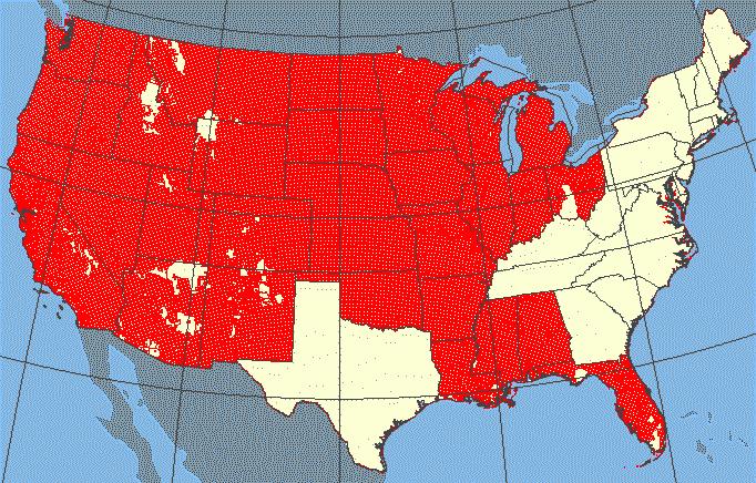
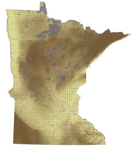
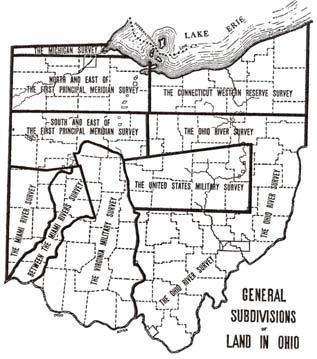
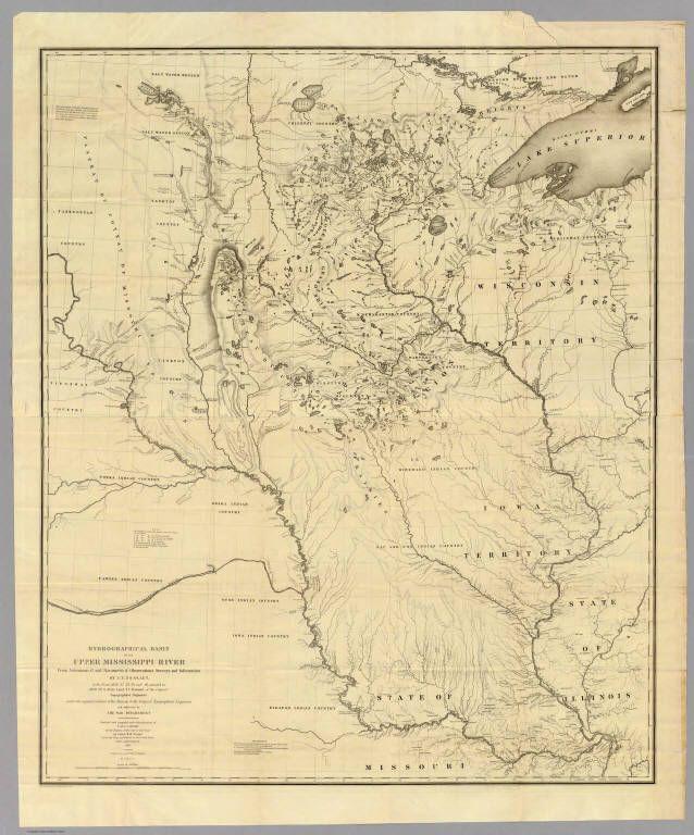
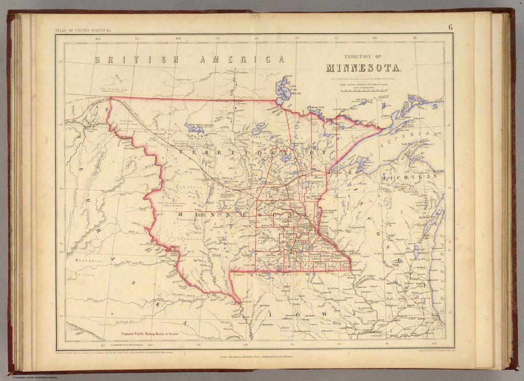
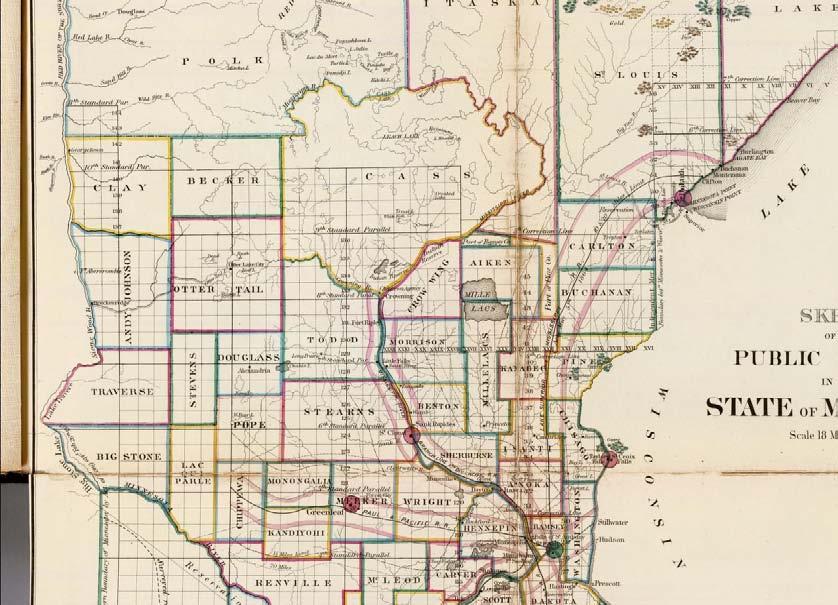
6 The Extent of the Rectangular Surveys 6
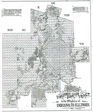


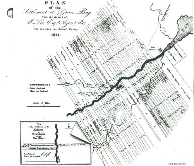
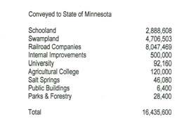
7 Sidetracked Mapping how they Spread Elsewhere Green Bay 7


8 I got sidetracked "The objective of all dedicated employees is to thoroughly analyze all situations, anticipate all problems prior to their occurrence, have answers for these problems, and move swiftly to solve these problems when called upon. However, when you are up to your ass in alligators, it is difficult to remember that your initial objective was to drain the swamp." 8

9 I got bogged down in details, details, details Details of the surveying process Details of the administration Added to my original intent To provide a context for the modern surveyors following in the footsteps of the deputies I ve grown old looking at the context 9
10 But enough of my problems! Public Land Survey Characteristics A. Purpose providing a "legal description" of the land the federal government would privatize B. Mapping as the land surface was subdivided an inventory was made of the surface, describing the features that were thought to be relevant to prospective landowners, and maps were made C. Operationally the surveys were carried out by a cadre of deputy surveyors under contract with the federal government 10


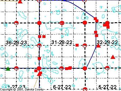
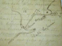
11 A Legal Description Boundaries comprising lines and points provided a definition of the boundaries of a parcel of land, and an unambiguous location of that parcel Consists of a written description that refers to a plat Townships, Sections, Quarter Sections, and Quarter-Quarter Sections 11


12 Principal Meridians and Baselines A Modern Legal Description! The N feet of the S feet of the W 735 of the W 50 acres of the S1/2 SW1/4 Section 31 Township 28 N Range 22W Beginning at the SW corner of Section 31 T 28 N R 22 W Thence N along W line of section ft Thence N E ft Thence S 0 3 E ft Thence S W ft to Point of Beginning (SW corner of Section 31) PLS description a variant of metes and bounds? (The scholar in me talking!) 12

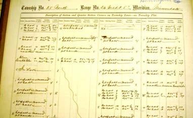
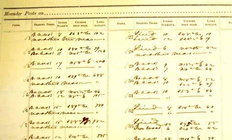
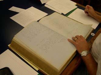
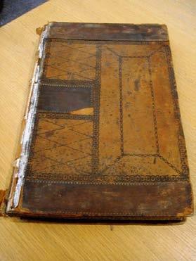
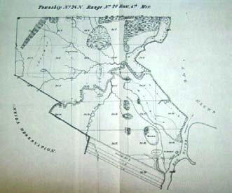
13 My Odyssey Alienation of Minnesota s Land Surface 13


14 Public Land Ownership 14

15 The Underlying Historical Processes - Federal Policy A. Creating private landowners Congress signed treaties with Native American groups in which the aboriginal title of the groups was extinguished giving the United States "fee title" to land The ceded lands were surveyed, divided up into conveniently sized parcels, with described boundaries and a unique location 3. Title conveyed to individuals, corporations, and even states B. Creating governments defining and protecting the legal rights of those landowners 15

16 The Northwest Territory 16

17 Movement of Individuals 17


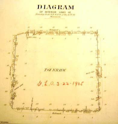
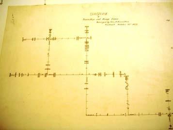
18 Records Evidence of the points and lines B. Evidence of the surveying process and administration Monuments and Reference Points what was 18


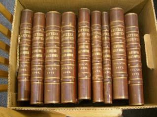
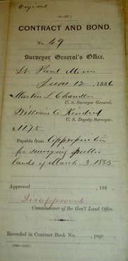
19 A Purported Witness Tree! what is Monuments what is 19


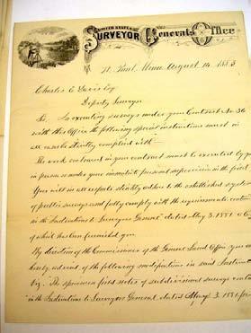
20 Evidence of the surveying process and administration Field Notebooks from which the plats were drawn and descriptive lists made Township Plats drawn at a scale of two inches per mile Descriptive Lists Correspondence including annual reports, instructions, and circulars Iowa State Archives Des Moines 20


21 Minnesota State Archives. St. Paul Minnesota State Archives 21


22 Minnesota Historical Society National Archives Washington D.C. Where s Waldo? 22

23 Field Notebooks Still a Lot to be Learned about Notebooks 23

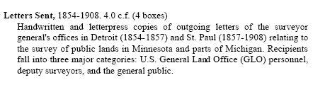
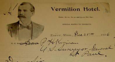
24 Township Plats The quality of those who look at the evidence matters; Some men come by the name of genius in the same way as an insect comes by the name of centipede - not because it has a hundred feet, but because most people can't count above fourteen The Register's Plat 24
25 Descriptive Lists Township Exterior Diagrams 25
26 The Paper Trail The Paper Trail no ! A Individual applied for an appointment to the Surveyor General Awarded contract, required oath, bond etc and given instructions Surveyor General sent contract, oath, and bond to Commissioner GLO B. Additional correspondence between Surveyor General and Commissioner Additional correspondence between Surveyor General and deputy Surveyor General received field notes and diagrams Transcribed notes and compiled plats and descriptive lists D Sent plats and descriptive lists to land office Sent plats, field notes, and request for payment to Commissioner GLO 26

27 Correspondence Oaths, Contracts, Bonds Instructions General Instructions of the Surveyor General that morphed into the Manual Instructions of the Commissioner of the General Land Office Special instructions of the Surveyor General Circulars 27
28 General Instructions 1846 Instructions from Surveyor General George W. Jones 1850 Surveying Manual for Oregon [1850 Instructions from Surveyor General Caleb H. Booth] 1852 Surveyor General George B. Sargent directed to use the Oregon Manual 1853 Surveyor General Warner Lewis directed to use the Oregon Manual 1855 Manual 1862 Manual made part of every contract Manual republished (1871) 1881, 1890, 1894, 1902 Instructions - Act May 3, 1862 A. The printed Manual of Instructions relating to the public surveys bearing date February twenty-second, eighteen hundred and fifty-five B. The instructions of the Commissioner of the General Land Office C. The special instructions of the surveyor general when not in conflict with the printed Manual or with the Commissioner s instructions shall be taken and deemed apart of every contract for surveying the public lands of the United States 28

29 Instructions regarding the first surveys west of the Mississippi Commissioner John Wilson to SG Warner Lewis May 16 th 1853 SG Warner Lewis to Deputy Elisha Norris July 28 th


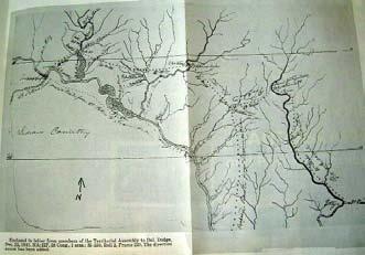
30 Circulars see White April 8,1847 Form of letters April 17,1879 Prohibiting filing triplicate plats before duplicate plats approved you will not, after the receipt of this order, file the duplicate plats in the local land offices until the duplicates have been examined in this office and approved, and you officially notified to that effect November 1,1879 How to divide a Section March 13,1883 Restoration of Lost and Obliterated corners Letters Received - Iowa 30


31 Letters Received Minnesota 31

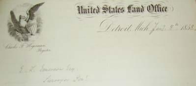
32 Letters Sent Iowa Special Instructions St. Paul 32

 surveys")
33 Letters Sent St. Paul So how did I do - mapping the spread of (completed) surveys across Minnesota? 33


34 The surveys did not spread across the United States Spread throughout the United States Ripples from pebbles thrown into a pond 34

35 Surveys spread throughout the United States because of 1. A technical characteristic; principal meridians and baselines 2. The administration of the surveys 35
36 36
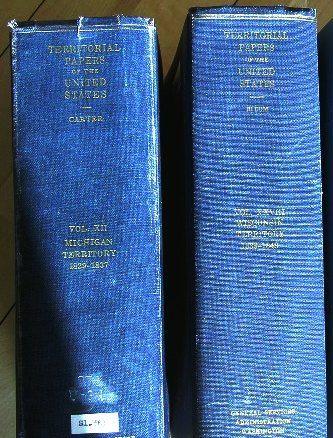
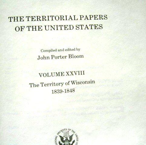
37 Principal Meridians and Baselines Administration Structure Surveying Districts Surveyors General Contracted Deputies General Land Office Congressional Funding 37

38 Surveying District Surveyors General Independent 38

39 Administration of the Surveys Office Work Remarkable How Little We Know Minnesota surveying district established Charles L Emerson (Surveyor General) directed to close down the office in Detroit Transfer Michigan surveying records to state of Michigan Opened office in St Paul and responsible for questions about Michigan surveys Acquired the field books and plats of surveys already completed from Surveyor General of Wisconsin and Iowa 1908 Surveying district closed Records transferred to State 39


40 The Original Surveyor General s Office Contracted Deputy Surveyors 40

41 Surveyor General s 1848 Report Microfilm the bane of historical research 41


42 Field Notes The Commissioner s Instructions 42
, 1849-1858 (National Archives microfilm publications ; Microcopy No.")

43 They may have motors and be capable of creating digital images but they are still a pain in the ass Territorial Records M499. The territorial papers of the United States: The Territory of Minnesota (a microfilm supplement), (National Archives microfilm publications ; Microcopy No. 1050) 11 microfilm reels Records relating to all government functions in Minnesota Territory, selected from files, dockets, and record books of federal agencies that had jurisdiction over various aspects of territorial administration The records are from the U.S. Congress, Supreme Court, Court of Claims, Census Bureau, Post Office Department, Justice Department, State Department, and Interior Department 43

44 Published Records Annual Reports of the Commissioner of the General Land Office First appeared in 1817 Until 1848 these reports were published as part of the Annual Reports, Secretary of the Treasury After then they appeared as part of the Annual Reports, Secretary of the Interior Several also appeared as a separate bureau edition 44
45 Territorial Papers 45
46 Territorial Papers 46

47 47
48 Conclusions? I could not have mapped the spread of the surveys without understanding the details of the surveying process and their administration The sidetracks were, in fact, important for fulfilling my original intent 48
Rectangular Land Surveys in Territorial Minnesota
 Rectangular Land Surveys in Territorial Minnesota 1847-1858 My lineage as a Surveyor My lineage as a Surveyor My lineage as a Surveyor The rectangular public land survey net is one of the most visible
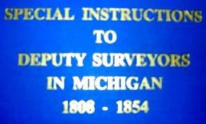
U.S. Public Land Survey - Special Instructions A Case Study
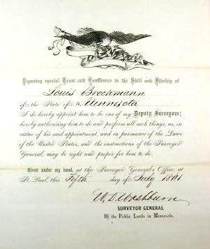
 U.S. Public Land Survey - Special Instructions A Case Study by: John E. Freemyer, LS "One of the most important duties to be performed by the surveyor general is to provide the deputy surveyor with Special
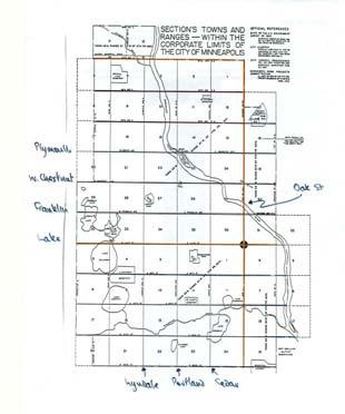
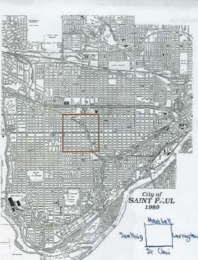
The Public Land Surveys in Minneapolis and St Paul. A Surveying Potboiler
 The Public Land Surveys in Minneapolis and St Paul A Surveying Potboiler A Surveying Potboiler (Imagine seductive soap opera music) Land ceded in three different treaties Land surveyed under two sets of
THE THREE MILE METHOD OF SURVEYING IN THE UTE MERIDIAN. Mesa County, Colorado
 THE THREE MILE METHOD OF SURVEYING IN THE UTE MERIDIAN Mesa County, Colorado Mesa County, located at the confluence of the Grand (Colorado) and Gunnison Rivers on the Western Slope, is a very unique area
SYSTEMS OF PROPERTY DESCRIPTION
 SYSTEMS OF PROPERTY DESCRIPTION Interpretation of Common Real Property Descriptions INTRODUCTION Land surveying includes 1. Surveying operations involved in original surveys to locate and monument the
PLATS: OLD AND NEW. Minnesota Recorder s Summer Conference June 14, 2007 Lisa M. Hanni, PLS
 PLATS: OLD AND NEW Minnesota Recorder s Summer Conference June 14, 2007 Lisa M. Hanni, PLS Minnesota s Original Public Land Survey Plats (Government Land Office Plats) Used with permission from the Mn
Certified Federal Surveyor Program Standards of Practice Handbook (Modified February 19, 2013 and November 18, 2014) "Trained to Make a Difference"
 Trained to Make a Difference") Certified Federal Surveyor Program Standards of Practice Handbook (Modified February 19, 2013 and November 18, 2014) "Trained to Make a Difference" Introduction This handbook is designed to document the
Certified Federal Surveyor Program Standards of Practice Handbook (Modified February 19, 2013 and November 18, 2014) "Trained to Make a Difference" Introduction This handbook is designed to document the
NORTH CAROLINA PROPERTY MAPPERS ASSOCIATION SECTION 6 PUBLIC LANDS
 NORTH CAROLINA PROPERTY MAPPERS ASSOCIATION SECTION 6 PUBLIC LANDS 6-1 6.1 Introduction Following our independence from England, the Congress in 1783 of the newly formed United States of America was faced
MnDOT Contract No Exhibit B. Scope of Work. Scope of Work
 MnDOT Contract No. 1032993 Contract General Description The purpose of this contract is to provide the State with the survey accurate re-establishment of designated Public Land Survey section boundaries
CFedS Outline Unit 1. Course 1: History, Records & Administrative Systems
 CFedS Outline Unit 1 Course 1: History, Records & Administrative Systems History of U.S. Surveying Historical Perspective Similarities in Surveying Seniority of Calls Lack of Standards A National Debt
MINOR LAND DIVISIONS APPLICATION
 APACHE COUNTY Planning and Zoning Department P.O. Box 238 St. Johns, AZ 85936 Phone: (928) 337-7527 Fax: (928) 337-7633 MINOR LAND DIVISIONS APPLICATION APPLICANT Name Mailing Address Contact Person Phone
The Hennepin County platting process and common platting problems
 The platting process and common platting problems Tim Eklund Deputy County Surveyor Disclaimer This is a presentation on platting in Your county may be different. Just because we allow something don t
Certified Federal Surveyor Program Assignment #6, Feedback
 Certified Federal Surveyor Program Assignment #6, Feedback Now that you have completed Assignment #6, take a few minutes to review the comments below. We have tried to identify items of special importance,
ALEXANDRIA TOWNSHIP METES & BOUNDS SUBDIVISION APPLICATION. Name of Applicant Phone. Property Address (E911#) Mailing Address Local Phone
 Mailing Address Local Phone") Application # Date Application Rec d / / (for office use only) Fee Collected $ ALEXANDRIA TOWNSHIP METES & BOUNDS SUBDIVISION APPLICATION Name of Applicant Phone Property Address (E911#) Mailing Address
Application # Date Application Rec d / / (for office use only) Fee Collected $ ALEXANDRIA TOWNSHIP METES & BOUNDS SUBDIVISION APPLICATION Name of Applicant Phone Property Address (E911#) Mailing Address
WYANDOT COUNTY BASIC STANDARDS FOR THE APPROVAL OF REAL ESTATE DEED TRANSFERS & LAND CONTRACT AGREEMENTS
 GENERAL In compliance with Section 315.251 of the Ohio Revised Code, the County Auditor and the County Engineer have adopted these written standards governing the conveyance of real property in Wyandot
Preparing Property descriptions D A V I D T. BUTCHER, PLS
 Preparing Property descriptions D A V I D T. BUTCHER, PLS Who can prepare property descriptions? 327.272. Practice as professional land surveyor defined. 1. A professional land surveyor shall include any
LAND INFORMATION SYSTEMS PLSS ORDINANCE. Ordinance No Public Land Survey System (PLSS) Remonumentation
 Remonumentation") Page 1 of 6 PLSS ORDINANCE Ordinance No. 287-1996 Public Land Survey System (PLSS) Remonumentation Ordinance No. 287-1996 TO: HON. CHAIRMAN AND MEMBERS OF THE OCONTO COUNTY BOARD OF SUPERVISORS RE: PUBLIC
Page 1 of 6 PLSS ORDINANCE Ordinance No. 287-1996 Public Land Survey System (PLSS) Remonumentation Ordinance No. 287-1996 TO: HON. CHAIRMAN AND MEMBERS OF THE OCONTO COUNTY BOARD OF SUPERVISORS RE: PUBLIC
Early Land Transactions = Cool Documents
 Early Land Transactions = Cool Documents REGISTER OF DEEDS CREATED IN 1837 BY STATE CONSTITUTION Thousands of property disputes were tied up in the courts of New England Land Ordinance of 1785 1785 Jefferson
CHAPTER 8 - LAND DESCRIPTIONS
 CHAPTER 8 - LAND DESCRIPTIONS Notes: While the location of land is commonly referred to by street number and city, it is necessary to use the legal description in the preparation of those instruments relating
RESTORATION OF LOST OR OBLITERATED CORNERS & SUBDIVISION OF SECTIONS a guide for surveyors
 DISCLAIMER The following is a retyped electronic version of "RESTORATION OF LOST OR OBLITERATED CORNERS AND SUBDIVISION SECTIONS", a supplement to the Manual of Surveying Instructions, designed to be word
Collateral Evidence Analysis
 Wisconsin Society of Land Surveyors 2019 Surveyors Institute Wisconsin Dells, Wisconsin January 24, 2019 Collateral Evidence Analysis Stanley French Chief Cadastral Surveyor for Idaho (retired) Land Boundary
Subdivision of Fractional Sections ISPLS 2017
 Subdivision of Fractional Sections ISPLS 2017 Dennis J. Mouland, PLS Instructor Witness Tree Consulting, Inc., 2011, All Rights Reserved Course Objectives Understand the definition of a fractional section
To provide for the review of the final engineering plans, the subdivision improvement agreement, public dedications, and other legal agreements.
 ARTICLE 5 FINAL PLAT 501 Intent DOUGLAS COUNTY SUBDIVISION RESOLUTION To provide for the review of the final engineering plans, the subdivision improvement agreement, public dedications, and other legal
Rule 21 STANDARDS OF PRACTICE FOR SURVEYING
 Rule 21 STANDARDS OF PRACTICE FOR SURVEYING 21.1 Whenever a survey is performed, it shall comply with Section 73-13-71 (4) and Section 73-13- 73 and the Standards of Practice for Surveying in Mississippi
Part 901 Chapter 19: REINSTATEMENT OF LICENSURE OR CERTIFICATION AFTER REVOCATION
 Rule 18.12 - Any person aggrieved by the action of the Board as a result of disciplinary proceedings conducted hereunder may appeal therefrom as provided for in Section 73-13-37(10) Mississippi Code Annotated
NOTICE OF ADOPTED CHANGE TO A COMPREHENSIVE PLAN OR LAND USE REGULATION
 NOTICE OF ADOPTED CHANGE TO A COMPREHENSIVE PLAN OR LAND USE REGULATION Date: Jurisdiction: Local file no.: DLCD file no.: May 17, 2016 City of Lebanon 16-02-09 002-16 The Department of Land Conservation
B. The proposed parcel(s) of land shall be in compliance with the current zoning requirements.
 of land shall be in compliance with the current zoning requirements.") SECTION 14-900 SUBDIVISION EXEMPTION 14-901 INTENT To establish criteria and a review process whereby the Board of County Commissioners may grant Exemptions from the definition of the terms subdivision
SECTION 14-900 SUBDIVISION EXEMPTION 14-901 INTENT To establish criteria and a review process whereby the Board of County Commissioners may grant Exemptions from the definition of the terms subdivision
FINAL PLAT GUIDE TO SUBDIVIDING PROPERTY. Background
 FINAL PLAT GUIDE TO SUBDIVIDING PROPERTY Background A final plat is the second step in the process of subdividing land into separate parcels for future sale or lease. Once a preliminary plat has been approved
Map Filing Law. 46: Effective date This act shall take effect January first, one thousand nine hundred and fiftyfour.
 46:23-9.8. Effective date This act shall take effect January first, one thousand nine hundred and fiftyfour. L.1953, c. 358, p. 1941, s. 8. 46:23-9.9. Short title This act shall be known and may be cited
BUREAU OF LAND MANAGEMENT. Fractional Sections. With John Farnsworth and Belle Craig C A D A S T R A L S U R V E Y
 BUREAU OF LAND MANAGEMENT Fractional Sections With John Farnsworth and Belle Craig 2009 C A D A S T R A L S U R V E Y Fractional Sections There are two types of fractional sections referenced in the 1973
OFFICIAL SUMMARY OF AN ORDINANCE TO CONVEY CERTAIN RAMSEY COUNTY PARK AND OPEN SPACE LANDS TO THE CITY OF MAPLEWOOD.
 OFFICIAL SUMMARY OF AN ORDINANCE TO CONVEY CERTAIN RAMSEY COUNTY PARK AND OPEN SPACE LANDS TO THE CITY OF MAPLEWOOD. This ordinance authorizes the conveyance of park and open space land owned by Ramsey
MINOR PLAT FILING APPLICATION
 FILING APPLICATION Date of PC Meeting: Date of BCC Meeting: Fee Paid: 1. APPLICANT: DAYTIME PHONE: MAILING ADDRESS: LANDOWNER: DAYTIME PHONE: MAILING ADDRESS: AUTHORIZED AGENT: MAILING ADDRESS: RELATIONSHIP
BOUNDARY SURVEYS RE-SURVEYS
 BOUNDARY SURVEYS RE-SURVEYS One of the difficult tasks for a surveyor is the re-surveying of lands, the re-location of the boundary lines between privately-owned lands or the re-location of the boundary
IC Chapter 12. County Surveyor
 IC 36-2-12 Chapter 12. County Surveyor IC 36-2-12-1 Application of chapter Sec. 1. This chapter applies to all counties. IC 36-2-12-2 Residence; term of office Sec. 2. (a) The county surveyor must reside
1. A system used in real estate to define the physical features and boundaries of a piece of property.
 METES AND BOUNDS The system of metes and bounds is one used in real estate to describe land or real property based on the physical features of its geography, as well as directions and distances. These
CHAPTER SHORT SUBDIVISIONS
 CITY OF MOSES LAKE MUNICIPAL CODE CHAPTER 17.09 SHORT SUBDIVISIONS Sections: 17.09.010 Purpose 17.09.020 Scope 17.09.030 Preliminary Short Subdivision Conditions and Requirements 17.09.040 Referral to
I. Requirements for All Applications. C D W
 108-16.1. Application checklists. Checklist for Required Submissions to the Planning Board or Zoning Board of Adjustment of Monroe Township All required submissions are to be made to the Administrative
Center of Section. Computed or Monumented Position. Review and Commentary
 Center of Section Computed or Monumented Position Review and Commentary Center of Section Center of section defined by law for more than 200 years Computed position vs monumented position Examine the state
Grade: Curative Items: Non Curative Items:
 Order Details Title Company Information Property Address:31 Ann Street, Pottsville, PA 17901 Assigned Coordinator Details Escrow Officer: Email: closings@bntc.com Title Officer: Email: curative@bntc.com
ORDINANCE NO. 14 ST. JOSEPH COUNTY ADDRESS ORDINANCE DATE 1997 AMENDED NOVEMBER 15, 2005
 ORDINANCE NO. 14 ST. JOSEPH COUNTY ADDRESS ORDINANCE DATE 1997 AMENDED NOVEMBER 15, 2005 WHEREAS, the people of St. Joseph County have voted to establish an enhanced 9-1-1 Central Dispatch System; and
CLINTON COUNTY ADDRESS ORDINANCE
 CLINTON COUNTY ADDRESS ORDINANCE APRIL 28, 1992 ORDINANCE Clinton County Address Ordinance April 28, 1992 WHEREAS, the people of the County of Clinton have voted to establish an enhanced 9-1-1 Central
Group Break Out. What, if anything, sends up a red flag? What does the lotting along the North and South centerline suggest? What are your next steps?
 What is the NW ¼? What is the NW ¼? You are hired to survey your client s property in Section 8. His deed says NW ¼ Section 8, T. 40 S., R. 07 E. According to the county, it is Tax Lot 700. He gives you
STANDARDS GOVERNING CONVEYANCES OF REAL PROPERTY IN DARKE COUNTY, OHIO
 STANDARDS GOVERNING CONVEYANCES OF REAL PROPERTY IN DARKE COUNTY, OHIO As directed by Section 319.203 of the Ohio Revised Code which states The County Auditor and the County Engineer shall adopt standards
Oakland County Michigan Register of Deeds Plat Engineering, GIS, & Remonumentation Dept. Ph: (248) Fax (248)
 Fax (248)") Oakland County Michigan Register of Deeds Plat Engineering, GIS, & Remonumentation Dept. Ph: (248)-858-1447 Fax (248)-858-7466 Requirements Needed for Final Plat Approval No. General Requirements. 1 Routing
Oakland County Michigan Register of Deeds Plat Engineering, GIS, & Remonumentation Dept. Ph: (248)-858-1447 Fax (248)-858-7466 Requirements Needed for Final Plat Approval No. General Requirements. 1 Routing
TOWNSHIP OF BORDENTOWN LAND DEVELOPMENT APPLICATION CHECKLIST. General Requirements for all Applications
 TOWNSHIP OF BORDENTOWN LAND DEVELOPMENT APPLICATION CHECKLIST This CHECKLIST has been adopted in accordance with Section 25:807 of the Land Development Ordinance of the Township of Bordentown and will
Cadastral and Right of Way Data Sharing
 Cadastral and Right of Way Data Sharing May 2010 TRS 1006 This Transportation Research Synthesis (TRS) provides summaries of recent research and implementation efforts on a topic of current interest. Online
APPENDIX A DETAILED DESCRIPTION OF THE LANDS SEPARATED FROM LEDUC COUNTY AND ANNEXED TO THE TOWN OF BEAUMONT
 APPENDIX A DETAILED DESCRIPTION OF THE LANDS SEPARATED FROM LEDUC COUNTY AND ANNEXED TO THE TOWN OF BEAUMONT ALL THAT PORTION OF SECTION ONE (1), TOWNSHIP FIFTY-ONE (51), RANGE TWENTY- FOUR (24) WEST OF
ARTICLE SINGLE FAMILY SITE CONDOMINIUM DEVELOPMENT STANDARDS
 ARTICLE 28.00 SINGLE FAMILY SITE CONDOMINIUM DEVELOPMENT STANDARDS Section 28.01 PURPOSE The purpose of this Article is to recognize that conventional single family developments, traditionally developed
CR_2017 Page 1 of 5. Corner Records
 CR_2017 Page 1 of 5 Corner Records Corner Record Check List Santa Barbara County Surveyor s Office (Examination in accordance with the PLS Act and Board Rule 464) Document No.: CR Agency Index: APN Review
PUBLIC TRANSPORTATION VEHICLE LEASING
 Approved: Effective: June 22, 2000 Office: Transit Topic No.: 725-030-001-e Thomas F. Barry, Jr., P.E. Secretary PURPOSE: PUBLIC TRANSPORTATION VEHICLE LEASING To establish the requirements for the lease
REQUIREMENTS FOR ALL INSTRUMENTS OF CONVEYANCE IN HARDIN COUNTY, OHIO
 REQUIREMENTS FOR ALL INSTRUMENTS OF CONVEYANCE IN HARDIN COUNTY, OHIO Effective Date: Michael L. Smith, P.E., P.S. Hardin County Engineer Michael T. Bacon Hardin County Auditor 1 I. GENERAL In compliance
Office of the Zoning Administrator and Planner. Saugatuck Township Planning and Zoning Applicants. Notice of Information for PC and ZBA Applicants
 From: To: Subject: Office of the Zoning Administrator and Planner Saugatuck Township Planning and Zoning Applicants Notice of Information for PC and ZBA Applicants Land developers, engineers, surveyors,
STANDARDS GOVERNING CONVEYANCES OF REAL PROPERTY
 STANDARDS GOVERNING CONVEYANCES OF REAL PROPERTY Hancock County, Ohio Charity A. Rauschenberg, Hancock County Auditor Steven C. Wilson, Hancock County Engineer Revised: March 1, 2007 TRANSFER AND CONVEYANCE
ARTICLE III GENERAL PROCEDURES, MINOR PLANS AND FEE SCHEDULES
 ARTICLE III GENERAL PROCEDURES, MINOR PLANS AND FEE SCHEDULES 301. Prior to Submission a. Copies of this Ordinance shall be available on request, at cost, for the use of any person who desires information
Finding and Prioritizing Boundary Evidence
 Finding and Prioritizing Boundary Evidence THREE PHASES OF A RETRACEMENT SURVEY Collect and Analyze the Record Evidence Perform a Field Survey to Search for Evidence Referenced in the Record and Signs
CHAPTER 7 - LAND DESCRIPTIONS
 An * in the left margin indicates a change in the statute, rule or text since the last publication of the manual. CHAPTER 7 - LAND DESCRIPTIONS While the location of land is commonly referred to by street
610 LAND DIVISIONS AND PROPERTY LINE ADJUSTMENTS OUTSIDE A UGB
 ARTICLE VI: LAND DIVISIONS AND PROPERTY LINE ADJUSTMENTS VI-21 610 LAND DIVISIONS AND PROPERTY LINE ADJUSTMENTS OUTSIDE A UGB 610-1 Property Line Adjustments (Property Line Relocation) A property line
City of Fort Lupton Amended Plat Process
 City of Fort Lupton Amended Plat Process Purpose The Amended Plat process is an administrative process to amend a recorded Plat. An Amended Subdivision is an administrative revision to a recorded Subdivision
Survey and Recording Requirements
 Article C: Sec. 14-1-40 Survey and Recording Requirements Survey Requirements. (a) (b) (c) Prior to the final approval of land divisions to which this Chapter applies, the owner of the land shall have
Instructions for Maps to Accompany Proof of Appropriation and Beneficial Use of Ground Water
 Instructions for Maps to Accompany Proof of Appropriation and Beneficial Use of Ground Water Part II of the Proof of Appropriation (Form U.W. 8) All maps to accompany proof of appropriation and beneficial
Township of Little Egg Harbor Planning Board 665 Radio Road Little Egg Harbor, New Jersey Phone: ext. 221 Fax:
 BLOCK(S) LOT(S) Township of Little Egg Harbor Planning Board 665 Radio Road Little Egg Harbor, New Jersey 08087 Phone: 609-296-7241 ext. 221 Fax: 609-294-3040 Development Application Amended Development
ARTICLE 8C SITE CONDOMINIUM DEVELOPMENT ORDINANCE
 ARTICLE 8C SITE CONDOMINIUM DEVELOPMENT ORDINANCE SECTION 8C.01 PURPOSE It is the purpose of this Ordinance to insure that plans for development within Oceola Township proposed under the provisions of
The Sale or Lease of Certain Lands Act
 1 SALE OR LEASE OF CERTAIN LANDS S-2 The Sale or Lease of Certain Lands Act being Chapter S-2 of The Revised Statutes of Saskatchewan, 1978 (effective February 26, 1979) as amended by the Statutes of Saskatchewan,
SUBDIVISION APPLICATION
 SUBDIVISION APPLICATION Preliminary Plat Minor Plat Final Plat Amended Plat Applicant Name: Owner (if different from applicant) Name: Company: Company: Address: Address: City, State, Zip City, State, Zip
APPLICATION for MINOR SUBDIVISION REVIEW for CONCEPT and FINAL PLAT within COALVILLE CITY. Project Name: Project Address or Area: Name of Owner:
 APPLICATION for MINOR SUBDIVISION REVIEW for CONCEPT and FINAL PLAT within COALVILLE CITY For Office Use Only: Application #: Application Date: PC Approval Date: CC Approval Date: Community Development
SECTION 10 STANDARD PLATS
 SECTION 10 - STANDARD PLATS Subdivision 1: Purpose Standard Plats allow the subdivision of land into lots smaller than the minimum metes and bounds size in the zoning district, and control road development
PARTITIONING OF PROPERTY WITHIN TILLAMOOK COUNTY
 PARTITIONING OF PROPERTY WITHIN TILLAMOOK COUNTY ALLOW AT LEAST 10 TO 30 DAYS FOR THE REVIEW PROCESS TO BE COMPLETED (1) PROPERTY OWNER --Proposes to create not more than 3 parcels within a calendar year
Fee-to-Trust: What To Expect in the Current Administration
 Fee-to-Trust: What To Expect in the Current Administration Tribal Summit Group September Summit Meeting September 20, 2017 Outline History of Fee to Trust Colonial and early US Indian Removal Act Indian
Planning Commission Planned Unit Development Master Development Plan Application
 Planning Commission Planned Unit Development Master Development Plan Application Refer to Meeting and Submittal Dates Calendar for Application Deadlines Note: A pre-application conference is required at
TITLE XVII: LOCAL LEGISLATION FOR WENDELL, MN
 TITLE XVII: LOCAL LEGISLATION FOR WENDELL, MN Chapter 170. GENERAL PROVISIONS (Reserved) 171. ADMINISTRATION 172. MUNICIPAL UTILITIES 173. TRAFFIC CODE (Reserved) 174. GENERAL REGULATIONS (Reserved) 175.
PROCEDURE. Chapter 12: Subdivision Regulations
 SECTION 14-600 ADMINISTRATIVE REPLAT PROCEDURE 14-601 INTENT These procedures are to provide an abbreviated process for Replat applications that demonstrate compliance with the criteria contained herein.
Application for Preliminary Plat Checklist
 Application for Preliminary Plat Checklist Note: No portion of an existing parcel may be sold or transferred to another party without first legally subdividing the property according to the City of Richmond
AMENDED DECLARATION OF COVENANTS FOR COUNTRY CREEK SUBDIVISION
 AMENDED DECLARATION OF COVENANTS FOR COUNTRY CREEK SUBDIVISION THIS AMENDED DECLARATION OF COVENANTS, made this 17th day of February, 2004, by Frontier Land Company, an Indiana corporation (hereinafter
Commission. Agenda Item R-14
 Agenda Item R-14 Commission Ordinance #17-392 Authorizing the Settlement and Closing of the Property Commonly Known as Salt Creek Marsh Thorndale Avenue for Forest Preserve District Purposes by the Forest
Legal Descriptions INTRODUCTION: WARNING: Writing Legal Descriptions NYSAPLS Conf January Scott Reeser, P.L.S. NYSAPLS 2018 Conference
 Legal Descriptions Scott Reeser, P.L.S. NYSAPLS 2018 Conference INTRODUCTION: Over 25 years experience in the surveying profession Graduate of Penn State survey program Licensed in Pennsylvania, New York,
INSTRUCTIONS FINAL PLAT APPROVAL APPLICATION
 INSTRUCTIONS FINAL PLAT APPROVAL APPLICATION 1. The applicant/agent shall fill out the attached application. The attached application form must be completely filled in before it can be filed. Portions
G137 Township/Range Lab Thursday, October 8, 1998 Township Range Lab GEOGRAPHY 137 FALL 97
 Township Range Lab GEOGRAPHY 137 FALL 97 If you would like to "run through" an interactive Township/Range Activity, before working through this Lab, then CLICK HERE A world-wide geographical grid of parallels
Electronic Land Title Plan and Plan Application Requirements
 Electronic Land Title Plan and Plan Application Requirements Craig D. Johnston, Director of Land Titles Date Version 2.0 Copyright 2018, Land Title and Survey Authority of British Columbia All rights reserved
Methods of Legal Description. Deeds and Land Descriptions. Government Survey (PLSS)
") Deeds and Land Descriptions Methods of Legal Description Government survey (PLSS): boundaries identified relative to rectangular national grid as established by 1785 Act of Congress Metes and bounds: boundaries
Deeds and Land Descriptions Methods of Legal Description Government survey (PLSS): boundaries identified relative to rectangular national grid as established by 1785 Act of Congress Metes and bounds: boundaries
IC Chapter 7. Real Property Transactions
 IC 8-23-7 Chapter 7. Real Property Transactions IC 8-23-7-0.1 Application of certain amendments to chapter Sec. 0.1. The amendments made to section 19 of this chapter by P.L.133-2007 apply only to public
NON-EXCLUSIVE ROADWAY AND UTILITY EASEMENT DEED AND AGREEMENT
 RETURN TO: STOGSDILL LAW OFFICE, P.C. 505 West Main, Suite 313 Lewistown, Montana 59457 (406) 538-2623 NON-EXCLUSIVE ROADWAY AND UTILITY EASEMENT DEED AND AGREEMENT THIS EASEMENT DEED AND AGREEMENT is
BRIDGETON SUBDIVISION APPLICATION CHECKLIST
 APPLICATION NAME AND # CHECKLIST COMPLETED BY: DATE: Signature and printed name BRIDGETON SUBDIVISION APPLICATION CHECKLIST TO SUBDIVISION APPLICANTS: The attached checklist is to assist you in the submission
(10) The Board has the powers and duties of an arbitrator under sections 29(3) and 43 of the Arbitration Act.
 The Board has the powers and duties of an arbitrator under sections 29(3) and 43 of the Arbitration Act.") Surveys Act [Fall 2014 STATUTE LAW] Under section 9 survey error investigation of the Surveys Act. The Minister may appoint a Board consisting of three (3) members. a. List two (2) of the three (3) members.
Surveys Act [Fall 2014 STATUTE LAW] Under section 9 survey error investigation of the Surveys Act. The Minister may appoint a Board consisting of three (3) members. a. List two (2) of the three (3) members.
COUNTY SUBDIVISION. Attachments: (1) Staff Analysis (2) Subdivision Maps (3) Related Documents including the Disclosure Statement
 Staff Analysis (2) Subdivision Maps (3) Related Documents including the Disclosure Statement") COUNTY SUBDIVISION DOÑA ANA COUNTY PLANNING AND ZONING COMMISSION Doña Ana County Government Center 845 N. Motel Blvd. Las Cruces, New Mexico 88007 Office: (575) 647-7250 MEETING DATE: August 25, 2011
COUNTY SUBDIVISION DOÑA ANA COUNTY PLANNING AND ZONING COMMISSION Doña Ana County Government Center 845 N. Motel Blvd. Las Cruces, New Mexico 88007 Office: (575) 647-7250 MEETING DATE: August 25, 2011
TRANSFER PROCEDURES FOR WASHINGTON COUNTY, OHIO
 TRANSFER PROCEDURES FOR WASHINGTON COUNTY, OHIO The following requirements are adopted and established in conjunction with the Washington County Engineer and the Washington County Auditor as prescribed
LAWS OF MALAYSIA. Act A1290 STRATA TITLES (AMENDMENT) ACT 2007
 ACT 2007") LAWS OF MALAYSIA Act A1290 STRATA TITLES (AMENDMENT) ACT 2007 Date of Royal Assent... 12 February 2007 Date of publication in the Gazette......... 15 February 2007 LAWS OF MALAYSIA Act A1290 STRATA TITLES
LAWS OF MALAYSIA Act A1290 STRATA TITLES (AMENDMENT) ACT 2007 Date of Royal Assent... 12 February 2007 Date of publication in the Gazette......... 15 February 2007 LAWS OF MALAYSIA Act A1290 STRATA TITLES
CITY OF LEE S SUMMIT MINOR PLAT PROCESS. Purpose of Minor Plats
 MINOR PLAT PROCESS Purpose of Minor Plats The City of Lee s Summit requires that all property be platted before a building permit is issued. Platting involves the subdivision of land into lots or tracts.
Circuit Court, D. Nebraska. March 1, 1889.
 EAST OMAHA LAND CO. V. JEFFRIES. Circuit Court, D. Nebraska. March 1, 1889. 1. BOUNDARIES ACCRETIONS CONVEYANCE. Rev. St. U. S. 2396, provides that the boundaries and contents of the several sections,
Certified Federal Surveyor Program Assignment #3, Feedback
 Certified Federal Surveyor Program Assignment #3, Feedback Now that you have completed Assignment #3, take a few minutes to review the comments below. We have tried to identify items of special importance,
SUBDIVISION APPLICATION INSTRUCTIONS
 SUBDIVISION APPLICATION INSTRUCTIONS APPLICATION FORM The application form must be fully completed, signed by the property owner and shall be properly notarized. AGENT AUTHORIZATION FORM If the applicant
CHARTER TOWNSHIP OF LYON APPLICATION FOR LAND DIVISION (LOT SPLIT)
") File #: Date Submitted: CHARTER TOWNSHIP OF LYON APPLICATION FOR LAND DIVISION (LOT SPLIT) NOTICE TO APPLICANT: Applications for land divisions (also called lot splits ) are reviewed in accordance with
File #: Date Submitted: CHARTER TOWNSHIP OF LYON APPLICATION FOR LAND DIVISION (LOT SPLIT) NOTICE TO APPLICANT: Applications for land divisions (also called lot splits ) are reviewed in accordance with
This process takes place over a day period. If any of the notices or publications are missed due to any reason, the process must be restarted.
 ZONING CHANGE FORM REZONING SCHEDULE This process takes place over a 60-90 day period. If any of the notices or publications are missed due to any reason, the process must be restarted. Applicant submits
City of Midland Application for Site Plan Review
 City of Midland Application for Site Plan Review Submission Date: Property Owner: Mailing Address: Phone number: ( ) Cell phone: ( ) Email address: Fax: ( ) Owner s Signature: Applicant Name (if not owner):
District Formation Instructions ORS Chapter 198. Instructions for Filing an Application by Individuals
 District Formation Instructions ORS Chapter 198 The formation process for most types of special districts is covered in Oregon Revised Statute (ORS) Chapter 198 Special Districts Generally. Some types
CITY OF PAPILLION MAYOR AND CITY COUNCIL REPORT APRIL 3, 2018 AGENDA. Subject: Type: Submitted By: Resolution #R
 CITY OF PAPILLION MAYOR AND CITY COUNCIL REPORT APRIL 3, 2018 AGENDA Subject: Type: Submitted By: A request for a Final Plat for the property legally described as Tax Lot 3 located in the NE 1/4 of the
CHAPTER 4 FINAL PLAT
 10-4-1 10-4-2 CHAPTER 4 FINAL PLAT SECTION: 10-4-1: Tentative Final Plat 10-4-2: Filing 10-4-3: Requirements 10-4-4: Amended Plats 10-4-5: Approval 10-4-6: Subdivision Agreement 10-4-1: TENTATIVE FINAL
BUILD-OUT ANALYSIS GRANTHAM, NEW HAMPSHIRE
 BUILD-OUT ANALYSIS GRANTHAM, NEW HAMPSHIRE A Determination of the Maximum Amount of Future Residential Development Possible Under Current Land Use Regulations Prepared for the Town of Grantham by Upper
EXAMPLE OF A MINING CLAIM MAP
 STAKE YOUR CLAIM! EXAMPLE OF A MINING CLAIM MAP Stake Your Claim Page 1 July 9, 2003 Classroom Activitiy: Stake Your Claim Purpose: The activity will familiarize students with the requirements that a geologist
A Final Plat will be reviewed concurrently with any other development review application(s) that is required.
 that is required.") RELATED FACTS TO KNOW: Adams County Recording Requirements, Annexation, Common Wall Subdivision, Development Plan (PUD Development Permit), Fees, Helpful Contact Information, Lot Line Adjustment, Neighborhood
RELATED FACTS TO KNOW: Adams County Recording Requirements, Annexation, Common Wall Subdivision, Development Plan (PUD Development Permit), Fees, Helpful Contact Information, Lot Line Adjustment, Neighborhood
E WASHINGTON COUNTY OREGON. Andy Back, Planning and Development Services Manager
 Exhibit A E WASHINGTON COUNTY OREGON August 8, 2016 To: From: Subject: Board of Commissioners Andy Back, Planning and Development Services Manager MINOR BOUNDARY CHANGE CASEFILE NOS. 16-029 LRP/BC - ANNEXATION