CITY OF ST. CLOUD PLANNING COMMISSION AGENDA th STREET; BUILDING A, 3 rd FLOOR, CITY COUNCIL CHAMBERS TUESDAY, OCTOBER 17, 2017, 6:00 PM
|
|
|
- Tracey Parker
- 5 years ago
- Views:
Transcription
1 CITY OF ST. CLOUD PLANNING COMMISSION AGENDA th STREET; BUILDING A, 3 rd FLOOR, CITY COUNCIL CHAMBERS TUESDAY, OCTOBER 17, 2017, 6:00 PM OPENING BUSINESS: Pledge of Allegiance Roll Call Approval of Minutes Planning Commission Meeting, September 19, 2017 ACTION ITEMS: A. Ordinance No Madison Grove Stevens Plantation Corporate Campus PUD Amendment, Major DRC Case # Applicant: Location: Request: Parametric Design & Development, LLC and Stevens Plantation Improvement Project Dependent Special District North of Nolte Road, West of Tybee Road, and East of Pine Chase Circle Applicant is requesting consideration of a PUD Amendment to add Multifamily Residential as a Permitted Use in the approved PUD/Corporate Campus, and to allow a maximum height of 75 feet in the PUD/Corporate Campus subject to approval by the City Manager or designee and the Fire Marshal. B. Ordinance No Seville Comprehensive Plan Future Land Use Map Amendment (Large Scale) DRC Case # Applicant: Location: Request: Nolte Land I, LLC East of Canoe Creek Road, South of 17 th Street, West of S. Indiana Avenue, North of Nolte Road Applicant is requesting consideration of a Future Land Use designation of Commercial for /- acres. C. Ordinance No Lillian Lee Estates Annexation DRC Case # Applicant: Location: Request: Tommy & LJ Holdings, LLC South side of Lillian Lee Road, 600 feet east of Narcoossee Road Applicant is requesting annexation of approximately acres into the City.
2 D. Ordinance No Lillian Lee Estates Comprehensive Plan Future Land Use Map Amendment (Large Scale) DRC Case # Applicant: Location: Request: Tommy & LJ Holdings, LLC South side of Lillian Lee Road, 600 feet east of Narcoossee Road Applicant is requesting consideration of a Future Land Use designation of Medium Density Residential for /- acres. E. Ordinance No Lillian Lee Estates PUD Zoning and Preliminary/Final Master Plan DRC Case # Applicant: Location: Request: Tommy & LJ Holdings, LLC South side of Lillian Lee Road, 600 feet east of Narcoossee Road Applicant is requesting consideration of a zoning designation of Planned Unit Development for /- acres and approval of a Preliminary/Final Master Plan. F. Ordinance No Comprehensive Plan Amendment - Fire Element Comprehensive Plan Text Amendment DRC Case # Applicant: Location: Request: City of St. Cloud City-wide Applicant is requesting consideration of a text amendment to the Comprehensive Plan to update the Ten-Year Water Supply Facilities Work Plan by amending the Goals, Objectives and Policies of the Infrastructure, Capital Improvements and Intergovernmental Coordination Elements. OTHER BUSINESS: A. Envision St. Cloud s Citywide Vision Plan Presentation B. Authority and General Procedure Workshop If a person decides to appeal any decision made by the Committee/Board, with respect to any matter considered at such hearing/meeting, such person will need a record of the proceedings and, for this purpose, such person may need to ensure that a verbatim record of the proceedings is made, which record includes the testimony and evidence upon which the appeal is to be based, and which record is not provided by the City of St. Cloud (FS ). In accordance with the Americans with Disabilities Act, persons needing assistance to participate in any of these proceedings should contact the Secretary/Clerk of the Committee/Board listed, prior to the meeting (FS286.26). Michelle Acosta, Planning Commission Secretary; th Street; St. Cloud, FL 34769; (407) or macosta@stcloud.org
3 CITY OF ST. CLOUD PLANNING COMMISSION MINUTES th STREET; BUILDING A, 3 rd FLOOR, CITY COUNCIL CHAMBERS TUESDAY, SEPTEMBER 19, 2017, 6:00 PM OPENING BUSINESS: Pledge of Allegiance Roll Call Peter Vitelli, Chair (present) Rosa Holloway, Vice Chair (present) Mario Galvan, (present) Dr. Jeff Rivera (present) Brandon Whaley (present) John Goldsborough, Alternate (present) Staff Representatives André Anderson, Acting Planning & Zoning Director Shuo Liu, Planner I Trevor Bedford, Planner I Michelle Acosta, Planning & Zoning Tech Jack Morgeson, City Attorney Approval of Minutes Planning Commission Meeting, August 22, 2017 Dr. Rivera provided a motion to approve the minutes for August 22, Mr. Galvan provided the second to the motion. The vote was 5-0 with all members voting aye. ACTION ITEMS: A. Resolution No R St. Cloud Towing & Collision Inc Conditional Use DRC Case # Applicant: Location: Request: William Gonzalez th Street Applicant is requesting consideration of a Conditional Use to allow the use of Automobile: Body Work and Painting in the Business Commercial Zoning District. Michelle Acosta, Planning & Zoning Tech, presented the case, reviewed the current Future Land Use and Zoning, and noted the applicant is requesting to add Body Work and Painting uses to his existing Towing business. Ms. Acosta noted the requested use is consistent with trends of development in the neighborhood, will not have adverse impacts on traffic patterns or intensity, and the DRC recommends approval. Applicant William Gonzalez, 1921 Fawn Meadow Circle, was available to respond to questions. 1
4 Mr. Galvan made a motion to recommend approval of Resolution R based on recommendations from staff and the applicant s response to the six factual matters. Ms. Holloway provided a second to the motion. The vote was 5-0 with all members voting aye. B. Resolution No R 1207 Minnesota Avenue Conditional Use DRC Case # Applicant: Location: Request: Nelson Cruz and Earl L. Fatkin II 1207 Minnesota Avenue Applicant is requesting consideration of a Conditional Use for a Residential use in the HB Highway Business Zoning District. Shuo Liu, Planner I, presented the case, reviewed the current Future Land Use and Zoning, and noted there is an existing garage on the site. Ms. Liu noted the request is consistent with the general pattern of the neighborhood, will not have adverse impacts on existing traffic patterns or intensity, and the DRC recommends approval. Applicant Earl Fatkin, 2663 Sherry Circle, Kissimmee, was available to respond to questions. Ms. Holloway noted there are a lot of homes in that block but she hasn t seen anyone wanting to build there in a long time. Mr. Fatkin noted they purchased the lot to build a home and were not aware of the commercial land use as it is about a 60 foot lot. Mr. Vitelli asked when it was originally residential and when did it switch. Ms. Liu noted before 2014, the property was vacant but was not able to find out when the garage was put there. Mr. Vitelli asked if this is approved, will it comply with the setbacks. Ms. Liu noted setbacks for residential as provided in the staff report. Mr. Vitelli asked about garage setbacks. Ms. Liu noted accessory structures have different setbacks. Ms. Holloway asked if the City had changed the lot widths. Ms. Liu noted that the existing lots that are already smaller in the City are legally nonconforming lots and if the applicant can meet the setbacks, no variance would be required. Ms. Holloway provided a history of lot widths in the grid. Ms. Liu noted a lot cannot be subdivided to less than the 62 ½ feet that is now required, but they can build on the existing lot. Mr. Galvan made a motion to recommend approval of Resolution R based on findings of staff and the applicant s response to the six factual matters. Ms. Holloway provided a second to the motion. The vote was 5-0 with all members voting aye. C. Ordinance No Nonconforming Uses and Structures LDC Amendment DRC Case # Applicant: Location: City of St. Cloud City-wide 2
5 Request: The applicant is requesting consideration of an amendment to the Land Development Code, Article III, Division 20, Section 18 Nonconforming Uses and Structures, in order to allow certain expansions of such structures and to be consistent with other sections of the LDC. Trevor Bedford, Planner I, presented the case, noted the proposed update will revise and clarify the nonconforming structure standards and will ensure consistency with other sections of the LDC, and noted other improvements. Staff and DRC have reviewed the request and recommend approval. Mr. Galvan made a motion to recommend approval of Ordinance Ms. Holloway provided a second to the motion. The vote was 5-0 with all members voting aye. NEW BUSINESS: Mr. Vitelli asked about the request for a joint meeting with City Council or for a workshop with the Planning Commission only regarding the LDC and procedures. Mr. Morgeson asked which is preferred. Mr. Vitelli asked for a workshop with Planning Commission only and requested information is presented on the Sunshine Law, voting, procedures, etc. Discussion followed about possible meeting dates. Ms. Holloway suggested can meet after the regularly scheduled Planning Commission meeting in October and members agreed. Mr. Galvan asked Planning Commission members to questions to be discussed at the workshop to Ms. Miville. ADJOURNMENT: 6:24 pm Respectfully submitted: Peter E. Vitelli, Chair Date Sandy Miville, Planning Commission Secretary Date 3

6 Planning Commission Staff Report Meeting Date: October 17, 2017 DRC Case # Ordinance No Type of Application PUD Amendment, Major Case Name Madison Grove Stevens Plantation Corporate Campus Applicant Madison Grove, LLC, Stevens Plantation Improvement Project Dependent Special District Agent Stacy Banach, Christopher Mills Address West of Budinger Avenue, north of Nolte Road and east of Pine Chase Circle Parcel ID # See attached Total Land Area acres +/- Project Planner Christopher Mills Figure 1 Location Map REQUEST The applicant is requesting consideration of a PUD amendment to allow for multifamily residential, assisted living facility, pharmacy and gymnastic / health spa facility uses, and an increase in the maximum height allowed to 75 feet within the PUD / Corporate Campus of the Stevens Plantation PUD as shown on Figure 1 above. BACKGROUND The subject property is within the current City Limits and is located west of Budinger Avenue, north of Nolte Road and east of Pine Chase Circle. The current Future Land Use designation is Low Density Residential, and the current Zoning district is PUD, Planned Unit Development. The original PUD was approved on November 13 th, 2003 (Ord. No ). The PUD / Corporate Campus portion of the Stevens Plantation PUD was subsequently modified by Ordinance , which amended setback, buffer and wall regulations. The applicant originally proposed a PUD amendment to allow multifamily residential use within the PUD / Corporate Campus portion of the Stevens Plantation PUD. After further review by staff of the development standards set forth in Ordinance , an informational comment noting the Page 1 of 3
7 maximum height limit of 35, with an increase up to 55 feet subject to approval of the City Manager or designee and the Fire Marshal, was presented to the applicant. Based on this, the applicant requested that the maximum height limit be raised to 75 feet subject to approval of the City Manager or designee and the Fire Marshal. The P Professional Zoning District allows uses similar to those allowed in the PUD / Corporate Campus as either permitted or conditional uses. There is a P Professional Zoning District directly adjacent to the north of the subject property. This zoning district does not have a height limit. Residential uses are permitted within the Professional Zoning District as conditional uses. DRC/STAFF REVIEW The Development Review Committee reviewed the request for the PUD amendment and revision to Final Master Plan on or before September 28, 2017 with no objections. Additional informational comments were provided: Planning Department- 1. Ordinance amended the previously approved design standards for the Corporate Campus set forth in Ordinance However, the original building height standard, as described in Section 6.D.5 of the original ordinance, was not addressed in the amendment. This standard allows the principal structure to have a maximum height of 35 feet, with an increase up to 55 feet subject to approval of the City Manager or designee and Fire Marshal. 2. DRC Resubmittal Fee (after the initial submittal and a submittal for sign-off) is 50% of the original fee. 3. If project requires public hearings before Planning Commission and/or City Council, plans must be resubmitted and approved three weeks in advance of the scheduled meeting. School District of Osceola County- The school district submitted a capacity report stating: The request to add multi-family use to the existing Planned Unit Development (PUD) would not impact Public Schools at this review stage. It is the School District s understanding that in the future, the applicant will be submitting the supporting documentation for an age restricted (55+) apartment community (Housing for Older Persons) HOPA. If the applicant does not apply for a HOPA, the School District reserves the right to assess the school impacts based upon the approved student generation rates at the time of submission. DRC/Staff recommends APPROVAL of the proposed PUD amendment. Madison Grove Stevens Plantation Corporate Campus Case No Page 2 of 3
8 PLANNING COMMISSION REQUIRED ACTION Per Section B.2 of the Land Development Code, The planning commission shall review land use petitions and submit its recommendations to the city council based on the 16 required findings identified in Section C.2.a. of the Land Development Code. ATTACHMENTS Ordinance No Parcel List 16 Required Findings Madison Grove Stevens Plantation Corporate Campus Case No Page 3 of 3
9 RETURN TO: CITY OF ST. CLOUD DEPT. OF PLANNING AND ZONING TH STREET ST. CLOUD, FL ORDINANCE NO AN ORDINANCE OF THE CITY COUNCIL OF THE CITY OF ST. CLOUD, FLORIDA, AMENDING CERTAIN USE AND HEIGHT REGULATIONS FOR THE PUD/ CORPORATE CAMPUS ESTABLISHED IN ORDINANCE (AS AMENDED), AN ORDINANCE WHICH ASSIGNED A ZONING DESIGNATION OF PLANNED UNIT DEVELOPMENT (PUD) TO STEVENS PLANTATION LOCATED WEST OF CANOE CREEK ROAD AND NORTH OF CANOE CREEK LAKES, IN SECTION 10 & 15, TOWNSHIP 26 SOUTH, RANGE 30 EAST AS RECORDED IN PLAT BOOK 16, PAGE 34-41, OF THE PUBLIC RECORDS OF OSCEOLA COUNTY, FLORIDA; PROVIDING FOR FILING OF THE PLANNING BOARD RECOMMENDATION AND PROOF OF PUBLICATION, SEVERABILITY, CONFLICTS AND EFFECTIVE DATE. WHEREAS, on November 13, 2003, the City Council lawfully adopted Ordinance , an ordinance which rezoned the subject property to Planned Unit Development (PUD) and assigned zoning regulations for the subject property; and, WHEREAS, on December 12, 2002, the City Council lawfully adopted Ordinance , an ordinance which amended Ordinance amending setback, buffer and wall regulations for the PUD / Corporate Campus portion of the subject property; and, WHEREAS, the City Council has received the Planning Commission s recommendation after its review of the proposed rezoning at its meeting of October 17, 2017, and said Board has recommended approval of the amendment; and, WHEREAS, the City Council has held a Public Hearing on this matter after directing the City Clerk to provide public notice thereof and such public notice has been provided, as required by law; and, WHEREAS, it is in the best interest of the City of St. Cloud and the citizens thereof that the proposed amendment be approved. NOW, THEREFORE, BE IT ORDAINED by the City Council of the City of St. Cloud, Florida, as follows: SECTION 1: The Planned Unit Development amendment is applicable to the PUD / Corporate Campus section of the Stevens Plantation PUD. Ordinance No Madison Grove Stevens Plantation Corporate Campus DRC Case #
10 SECTION 2: Section 6.D of the Stevens Plantation PUD is hereby amended as presented below. Strike-through represents deletion and underline represents addition. 1. Permitted Uses Multifamily residential Assisted living facility Pharmacy Gymnastic / health spa facility 5. Development Standards 15 Maximum Height of Principal Structure: 35 feet Maximum height may increase up to 75 feet subject to approval by the City Manager or designee and Fire Marshal. Additional conditions may be imposed with height increase. SECTION 5: Upon adoption of this ordinance, the Planning Board recommendation and "Proof of Publication" of the required Public Hearing notice shall be filed in the City Manager's Office. SECTION 6: If any section or portion of a section of this ordinance proves to be invalid, unlawful or unconstitutional, it shall not be held to impair the validity, force or effect of any other section or part of this ordinance. SECTION 7: That all ordinances or parts of ordinances in conflict herewith be and the same are hereby revoked. SECTION 8: This ordinance shall not be codified as part of the St. Cloud City Code, but nevertheless the effective date of this ordinance shall be the date of its adoption by the City Council of the City of St. Cloud, Florida, First Reading on the day of 2017 Passed and adopted this day of 2017 Nathan Blackwell, Mayor Ordinance No Madison Grove Stevens Plantation Corporate Campus DRC Case #
11 ATTEST: Linda P. Jaworski, City Clerk LEGAL IN FORM AND VALID IF ADOPTED: debeaubien, Simmons, Knight, Mantzaris & Neal By: Daniel F. Mantzaris, City Attorney Pursuant to Section (3) (f), this instrument exempt from Chapter 695, F.S.: Prepared by and return to a Public Official: City Manager, City of St. Cloud; th Street; St. Cloud, Florida Ordinance No Madison Grove Stevens Plantation Corporate Campus DRC Case #
12 Attachment Complete list of Parcels for Case TRAC0010, TRAC0020, TRAC00B0, TRAC00C0, TRAC00D0, TRAC00N0, TRAC00O0, TRAC00P0, TRAC0AA0, TRAC0BB0, , , D0, E0, F0, A0, B0, C0, A10, A COMM, , , , , , , , ,
13 LAND DEVELOPMENT CODE C.2.A REQUIREMENTS OF THE PLANNING COMMISSION REPORT TO THE CITY COUNCIL The report and recommendation to the City Council shall show the Planning Commission has studied and considered, where applicable, whether or not: 1. The proposed change is contrary to the established land use pattern. The proposed PUD amendment does not present a change that is contrary to the established land use pattern. 2. The proposed change would create an isolated district unrelated to adjacent and nearby districts. The proposed changes will not create an isolated district. 3. The proposed change would materially alter the population density pattern and thereby increase or overtax the load on public facilities such as schools, utilities, streets, etc. The proposed changes will not materially alter the current population density pattern. 4. Existing district boundaries are illogically drawn in relation to existing conditions on the property proposed for change. The existing district boundaries are not illogically drawn in relation to existing conditions on the property proposed for a change. 5. The proposed change would be contrary to the land use plan and would have an adverse effect on the comprehensive plan. The proposed changes will not be contrary to the land use plan and will not have an adverse effect on the comprehensive plan. 6. Changed or changing conditions make the passage of the proposed amendment necessary. Yes. 7. The proposed change will adversely influence living conditions in the neighborhood. The proposed changes will not adversely affect living conditions in the adjacent neighborhoood. 8. The proposed change will create or excessively increase traffic congestion or otherwise affect public safety. The proposed changes are not proposed to increase traffic congestion. 9. The proposed change will create a drainage problem. The proposed changes will not create a drainage problem. 10. The proposed change will seriously reduce light or air to adjacent areas. The proposed changes will not reduce light or air to adjacent areas. 11. The proposed change will adversely affect property values in the adjacent area. The proposed changes will not adversely affect property values in the adjacent area. 12. The proposed change will be a deterrent to the improvement or development of adjacent property in accordance with existing regulations. The proposed changes will not be a deterrent to improvement or development of adjacent properties. 13. The proposed change will constitute a grant of special privilege to an individual owner as contrasted with the public welfare. The proposed changes will not constitute a grant of special privilege to an individual owner as contrasted with the public welfare. 1
14 14. There are substantial reasons why a reasonable use of property cannot be accomplished under existing zoning. The proposed amendment provides for a use that is complimentary to those allowed within the existing PUD. 15. Whether the change suggested is out of scale with the needs of the neighborhood or the city. The proposed changes are not out of scale with the needs of the neighborhood. 16. It is impossible to find other adequate sites in the city for the proposed use in districts already zoned for such use. Yes, the proposed changes will allow the property to provide residential site development. Other sites may become available in the future, but at this time, the subject site is the available site. 2
 Case Name Seville Owner Nolte Land I, LLC Applicant David (Joel) Adams Nolte Land I, LLC Agent Don Hughey Askey Hughey, Inc.")
15 Planning Commission Staff Report October 17, 2017 DRC Case # Ordinance No Type of Application Future Land Use Map Amendment (Large Scale) Case Name Seville Owner Nolte Land I, LLC Applicant David (Joel) Adams Nolte Land I, LLC Agent Don Hughey Askey Hughey, Inc. Parcel ID # Total Land Area +/ acres Project Planner Leigh Anne Wachter, AICP Figure 1 - Location Map REQUEST The applicant requests approval of a Large-Scale Comprehensive Plan Amendment to change the Future Land Use Map on approximately 20.7 acres of land from Low Density Residential to Commercial, as shown on Figure 1 above. BACKGROUND The subject property is generally located east of Canoe Creek Road, south of 17 th Street, west of S. Indiana Avenue and north of Nolte Road. The property comprises of 20.7 acres within the Joint Planning Area and has a Future Land Use Map designation of Low Density Residential and zoning designation of Planned Unit Development. Currently the property is vacant. The applicant is requesting approval to amend the Future Land Use Map designation from Low Density Residential to Commercial consistent with the Future Land Use Element of the St. Cloud Comprehensive Plan. PUBLIC NOTICE Notice of Public Hearing was mailed to property owners within 300 feet of the subject property and was advertised as required by State Statutes. No oral or written comments have been received from the public at the time of this report s distribution. Additional public comment may be available at the public hearing. Page 1 of 4
 Agriculture & Conservation (County) R-1A, R-1B Single Family (City) Low Density Residential (City) Low Density Residential (County) Low Density Residential")
16 The following table summarizes adjacent future land use designations, zoning districts and existing uses: Direction Zoning Future Land Use Existing Land Use North East South West Agriculture (City) Agriculture & Conservation, R-2 (County) Agriculture & Conservation (County) R-1A, R-1B Single Family (City) Low Density Residential (City) Low Density Residential (County) Low Density Residential (County) Low Density Residential (City) Vacant (City) Single Family (County) Single Family, Vacant (County) Single Family (City) CONSISTENCY WITH THE ST. CLOUD COMPREHENSIVE PLAN In preparing the recommendation, staff reviewed the proposed Future Land Use Map amendment for consistency with the Goals, Objectives and Policies of the City of St. Cloud 2020 Comprehensive Plan. The subject property is currently within the St. Cloud City limits and has a Future Land Use Map designation of Low Density Residential. The applicant is requesting a Future Land Use designation of Commercial consistent with the vision of Nolte Road as an employment corridor as proposed within the City of St. Cloud Envision citywide Master Plan. It is important that this Future Land Use Amendment be consistent with the Comprehensive Plan and compatible with adjacent development. Figure 2 below depicts the current Future Land Use designations within the city and the county. Figure 2 - St. Cloud Future Land Use Map Ordinance No Page 2 of 4 Seville FLU Map Amendment Case No
17 The proposed amendment is consistent with Future Land Use Element Chapter 1.C.3.b of the Comprehensive Plan. Commercial Land Use Needs: New Commercial land uses should be encouraged along major corridors and neighborhood intersections that provide access for both vehicles and pedestrians. Strip commercial development should be avoided. IMPACTS TO FACILITIES Anticipated impacts to water, sewer, transportation, solid waste, drainage, recreational facilities and public schools are addressed in the sections that follow. Additionally, available capacity will be further reviewed with subsequent development applications for the site, which require technical review and must meet all Land Development Code requirements, including standards for the provision of public facilities and services. Future development applications will be reviewed to address improvements to the property, including access, parking, drainage and utilities. 1. Potable Water and Sanitary Sewer Demand Analysis: Water and sewer service are available with extensions. Connection to the sanitary sewer system may require upgrading of the existing lift station. This will be determined at the time construction plans are submitted. The subject property will be required to connect to potable water and sanitary sewer once developed. 2. Solid Waste Analysis: The subject property can be served by the current collection system. The City of St. Cloud operates the Transfer Station located in St. Cloud at Peghorn Park. This allows the City to maintain its current Level of Service Standards for solid waste. 3. Stormwater Management Analysis: The City s Public Services Department currently uses adopted and accepted standards for management of stormwater. Protection of natural drainage systems through preservation and buffering have been incorporated into the City s Land Development Code (LDC) for consistent application throughout the City s jurisdiction. Regarding the subject property, no stormwater management system has been approved by South Florida Water Management District, Osceola County or the City of St. Cloud. The applicant/developer shall provide the storm water management system at the time of the property development that meet/exceed City s storm water management, South Florida Water Management District, and (if applicable) the Florida Department of Transportation criteria, whichever is more stringent. 4. Transportation Facilities Analysis: The City of St. Cloud will continue to coordinate with the Florida Department of Transportation (FDOT) and Osceola County to determine any adverse impacts to the Strategic Intermodal System (SIS) facilities and any potential future development. Subdividing can occur in accordance with the LDC, however, any future proposed development may require a transportation impact analysis. 5. Parks and Recreational Facilities Analysis: The proposed land use amendment will not negatively impact the City s existing park and recreation land. 6. School Capacity Analysis: No impacts to schools Ordinance No Page 3 of 4 Seville FLU Map Amendment Case No
18 DRC/STAFF RECOMMENDATION The Development Review Committee reviewed this request for a Future Land Use designation of Commercial on or before September 28, 2017, with no objections. The following informational comments were provided: Police Department: 1. This project will impact the Police Department by increasing the calls for service. I encourage a security video system be installed in the businesses. The parking lot should be laid out to allow for easy access for Emergency vehicles. Lines Division: 1. A 10 foot (10 ) wide utility easement will be required on all property lines or tracts abutting a right of way. 2. A minimum 15 foot (15 ) wide utility easement is required centered over the water main, fire hydrants and up to the water meters. 3. A minimum 20 foot (20 ) wide utility easement is required centered over the sanitary sewer main and service laterals up to the clean-outs. 4. All necessary paperwork for dedication to the City of required Utility Easements must be received prior to release of water meters for the property. Required documentation for all Utility Easements includes at a minimum suitable easement document, legal description and sketch of the easement, and a Certificate of Title for the parent parcel dated no more than 15 days prior to receipt of the easement paperwork. 5. This site will be requiring to conduct a AMI propagation study for AMI metering. The city uses Neptune Meters and you can contact Abe Rigsby at arigsby@neptunetg.com. DRC recommends APPROVAL of and to TRANSMIT the request of Commercial Future Land Use Map Amendment for Ordinance No to the Development and Services Division of the Florida Department of Economic Opportunity. PLANNING COMMISSION REQUESTED ACTION Per Section B.2 of the Land Development Code, the Planning Commission shall review annexation, land use, and zoning petitions and submit its recommendations to the City Council based on the 16 required findings identified in Section C.2.a of the Land Development Code. ATTACHMENTS Ordinance No Required Findings School Capacity Report Ordinance No Page 4 of 4 Seville FLU Map Amendment Case No
19 RETURN TO: CITY OF ST. CLOUD DEPT. OF PLANNING & ZONING TH STREET ST. CLOUD, FL ORDINANCE NO AN ORDINANCE OF THE CITY COUNCIL OF THE CITY OF ST. CLOUD, FLORIDA, ASSIGNING A FUTURE LAND USE DESIGNATION OF COMMERCIAL TO APPROXIMATELY 20.7 ACRES IDENTIFIED AS SEVILLE, LOCATED EAST OF CANOE CREEK ROAD, SOUTH OF 17TH STREET, WEST OF S. INDIANA AVENUE AND NORTH OF NOLTE ROAD; PROVIDING FOR AMENDING THE OFFICIAL FUTURE LAND USE MAP OF THE COMPREHENSIVE PLAN, FILING OF THE PLANNING COMMISSION RECOMMENDATION AND PROOF OF PUBLICATION, APPLICABILITY AND EFFECT, SEVERABILITY, COPIES ON FILE AND EFFECTIVE DATE. WHEREAS, Chapter , Florida Statutes, and Article VII, of the Charter Laws of the City of St. Cloud, allows the City Council of the City of St. Cloud to prepare and enforce a Comprehensive Plan, and under such authority only lawful procedures and requirements have been met; and, WHEREAS, the City adopted the Comprehensive Plan pursuant to Chapter 163, Florida Statutes, by Ordinance , on September 26, 2002; and, WHEREAS, pursuant to Chapter , Florida Statutes, the City Council of the City of St. Cloud has determined it necessary and desirable to adopt the amended version of the City of St. Cloud, Florida, Comprehensive Plan; and, WHEREAS, this Ordinance is enacted under the authority of Chapter through , Florida Statutes, and Chapter 166, Florida Statutes, as amended, reserving to the City Council of the City of St. Cloud all permitted discretionary authority; and, WHEREAS, the City Council has received the recommendation of Planning Commission dated October 17, 2017 and, WHEREAS, the City did transmit its analysis of the proposed amendment to the agencies as required by State Statute, and any other interested parties; and, WHEREAS, the State Land Planning Agency and required reviewing agencies did review the proposed amendment as outlined in Chapter 163, Florida Statutes; and, WHEREAS, the City Council has held two (2) public hearings and has produced advertisement and notice on this matter consistent with the requirements of Chapter , Florida Statutes, and, Ordinance No Seville Future Land Use Map Amendment Page 1 of 6 DRC Case #
20 WHEREAS, the City staff has prepared a staff report and will rely on the data as findings of fact to support the map change. NOW THEREFORE BE IT ORDAINED BY THE CITY COUNCIL OF THE CITY OF ST. CLOUD, FLORIDA, as follows: SECTION 1: All information above is true and correct. SECTION 2: The City of St. Cloud, Florida, Comprehensive Plan is amended in the following respects to the property, identified under Comprehensive Plan Amendment , as shown on Exhibit A, and described as follows: LOT 44, SEMINOLE LAND AND INVESTMENT CO.'S SUBDIVISION OF SECTION 14, TOWNSHIP 26 SOUTH, RANGE 30 EAST, ACCORDING TO THE PLAT THEREOF AS RECORDED IN PLAT BOOK B, PAGE 5, OF THE PUBLIC RECORDS OF OSCEOLA COUNTY, FLORIDA. PARCEL 2: LOTS 36 AND 37, SEMINOLE LAND AND INVESTMENT CO.'S SUBDIVISION OF SECTION 14, TOWNSHIP 26 SOUTH, RANGE 30 EAST, ACCORDING TO THE PLAT THEREOF AS RECORDED IN PLAT BOOK B, PAGE 5, OF THE PUBLIC RECORDS OF OSCEOLA COUNTY, FLORIDA. PARCEL 3: THAT PART OF LOT 38, LYING EAST OF WPA DITCH, SEMINOLE LAND AND INVESTMENT CO.'S SUBDIVISION OF SECTION 14, TOWNSHIP 26 SOUTH, RANGE 30 EAST, ACCORDING TO THE PLAT THEREOF AS RECORDED IN PLAT BOOK B, PAGE 5, OF THE PUBLIC RECORDS OF OSCEOLA COUNTY, FLORIDA. PARCEL 4: LOTS 11, 22 AND 27, LYING EAST OF C/L OF CANAL, SEMINOLE LAND AND INVESTMENT CO.'S SUBDIVISION OF SECTION 14, TOWNSHIP 26 SOUTH, RANGE 30 EAST, ACCORDING TO THE PLAT THEREOF AS RECORDED IN PLAT BOOK B, PAGE 5, OF THE PUBLIC RECORDS OF OSCEOLA COUNTY, FLORIDA. PARCEL 5: THAT PORTION OF LOT 53, LYING NORTH OF NOLTE ROAD, SEMINOLE LAND AND INVESTMENT CO.'S SUBDIVISION OF SECTION 14, TOWNSHIP 26 SOUTH, RANGE 30 EAST, ACCORDING TO THE PLAT THEREOF AS RECORDED IN PLAT BOOK B, PAGE 5, OF THE PUBLIC RECORDS OF OSCEOLA COUNTY, FLORIDA. LESS AND EXCEPT PARCEL 106 IN AMENDED ORDER OF TAKING RECORDED IN OFFICIAL RECORDS BOOK 3953, PAGE 1381, DESCRIBED AS FOLLOWS: Ordinance No Seville Future Land Use Map Amendment Page 2 of 6 DRC Case #
21 A PARCEL OF LAND, BEING A PORTION OF LOT 53 AND LOT 44, SEMINOLE LAND & INVESTMENT COMPANY'S SUBDIVISION OF SECTION , ACCORDING TO THE PLAT THEREOF, AS RECORDED IN PLAT BOOK B, PAGE 5 OF THE PUBLIC RECORDS OF OSCEOLA COUNTY, FLORIDA, BEING MORE PARTICULARLY DESCRIBED AS FOLLOWS: COMMENCE AT THE SOUTHEAST CORNER OF LOT 53, SEMINOLE LAND & INVESTMENT COMPANY'S SUBDIVISION OF SECTION , ACCORDING TO THE PLAT THEREOF, AS RECORDED IN PLAT BOOK B, PAGE 5 OF THE PUBLIC RECORDS OF OSCEOLA COUNTY, FLORIDA, SAID POINT BEING ON THE WEST RIGHT OF WAY LINE OF A 35 FOOT PLATTED RIGHT OF WAY PER SAID PLAT; THENCE NORTH 00 18'27" WEST ALONG THE EAST LINE OF SAID LOT 53 AND ALONG SAID WEST RIGHT OF WAY LINE, A DISTANCE OF FEET TO THE POINT OF BEGINNING; THENCE CONTINUE NORTH 00 18'27" WEST ALONG SAID EAST LINE AND ALONG SAID WEST RIGHT OF WAY LINE, A DISTANCE OF FEET TO A POINT ON A NON-TANGENT CURVE, CONCAVE TO THE SOUTH, HAVING A RADIUS OF FEET AND A CENTRAL ANGLE OF 12 39'04"; THENCE DEPARTING SAID EAST LINE AND SAID WEST RIGHT OF WAY LINE, RUN NORTHWESTERLY ALONG THE ARC OF SAID CURVE, A DISTANCE OF FEET (CHORD BEARING = NORTH 74 34'34" WEST, CHORD DISTANCE = FEET) TO THE END OF SAID CURVE; THENCE NORTH 09 26'53" EAST, A DISTANCE OF FEET TO A POINT ON THE NORTH LINE OF SAID LOT 53 AND THE SOUTH LINE OF LOT 44 OF SAID PLAT; THENCE CONTINUE NORTH 09 26'53" EAST, A DISTANCE OF 7.09 FEET; THENCE NORTH 89 50'11" WEST, A DISTANCE OF FEET TO A POINT ON THE WEST LINE OF SAID LOT 44; THENCE SOUTH 00 17'22" EAST ALONG SAID WEST LINE A DISTANCE OF 7.00 FEET TO THE SOUTHWEST CORNER OF SAID LOT 44 AND THE NORTHWEST CORNER OF SAID LOT 53; THENCE SOUTH 00 17'22" EAST ALONG THE WEST LINE OF SAID LOT 53, A DISTANCE OF FEET TO THE SOUTHWEST CORNER OF SAID LOT 53; THENCE SOUTH 90 00'00" EAST ALONG THE SOUTH LINE OF SAID LOT 53, A DISTANCE OF FEET; THENCE NORTH 53 08'22" EAST, A DISTANCE OF' FEET; THENCE NORTH 79 15'33" EAST A DISTANCE OF FEET; THENCE NORTH 66 30'55" EAST, A DISTANCE OF FEET TO A POINT ON A NON-TANGENT CURVE, CONCAVE TO THE SOUTH, HAVING A RADIUS OF FEET AND A CENTRAL ANGLE OF 21 18'43"; THENCE RUN SOUTHEASTERLY ALONG THE ARC OF SAID CURVE, A DISTANCE OF FEET (CHORD BEARING = SOUTH 74 49'44" EAST, CHORD DISTANCE = FEET) TO THE END OF SAID CURVE AND THE POINT OF BEGINNING. ALL TOGETHER CONTAINING 20.7 ACRES, MORE OR LESS. A. The City of St. Cloud Future Land Use Map, 2020, is amended to show the property as "Commercial ; B. Any and all additional maps of the Comprehensive Plan are amended to show the property; C. All Goals, Objectives, Policies, and other planning provisions applicable to properties as shown and set forth in the City of St. Cloud, Florida, Comprehensive Plan apply to the property. Ordinance No Seville Future Land Use Map Amendment Page 3 of 6 DRC Case #
22 SECTION 3: The City Manager or his/her designee is authorized and directed to promptly enter changes on the Official Future Land Use Map. SECTION 4: The City Clerk, after consultation with the City Attorney, is authorized to correct scrivener s errors found by filing a corrected copy of this ordinance in the official records of the City. SECTION 5: Upon adoption of this ordinance, the Planning Commission recommendation and "Proof of Publication" of the required Public Hearing notices shall be filed in the Department of Planning and Zoning. SECTION 6: The applicability and effect of the City of St. Cloud, Florida, Comprehensive Plan shall be as provided by Chapter through , Florida Statutes, and this Ordinance, reserving to the City Council of the City of St. Cloud all permitted discretionary authority. SECTION 7: If any section or portion of a section of this ordinance proves to be invalid, unlawful or unconstitutional, it shall not be held to impair the validity, force or effect of any other section or part of this ordinance. SECTION 8: A. A certified copy of the enacting ordinance and any amendments shall be filed with the Clerk of the Circuit Court. B. A certified copy of the enacting ordinance, as well as certified copies of the City of St. Cloud, Florida, Comprehensive Plan and any amendments, shall be on file and made available to the public in the office of the City Clerk of the City of St. Cloud, Florida. C. To make the City of St. Cloud, Florida, Comprehensive Plan available to the public, a certified copy of the enacting ordinance, as well as certified copies of the City of St. Cloud, Florida, Comprehensive Plan and any amendments, shall be located in the Department of Planning and Zoning of the City of St. Cloud. The Department of Planning and Zoning shall also make copies available to the public for a reasonable publication charge. SECTION 9: This ordinance has been published and shall take effect as provided by law. First Reading and Transmittal Public Hearing on the 26 th day of October, 2017 Final Public Hearing on the 14 th day of December, 2017 Ordinance No Seville Future Land Use Map Amendment Page 4 of 6 DRC Case #
23 Nathan Blackwell, Mayor ATTEST: Linda P. Jaworski, City Clerk LEGAL IN FORM AND VALID IF ADOPTED: debeaubien, Simmons, Knight, Mantzaris & Neal By: Daniel F. Mantzaris, City Attorney Pursuant to Section (3) (f), this instrument exempt from Chapter 695, F.S.: Prepared by and return to a Public Official: City Manager, City of St. Cloud; th Street; St. Cloud, Florida Ordinance No Seville Future Land Use Map Amendment Page 5 of 6 DRC Case #
24 EXHIBIT A Ordinance No Seville Future Land Use Map Amendment Page 6 of 6 DRC Case #
25 Rezoning Requirements Per LDC C.2.a Seville Future Land Use Amendment (1) The proposed change is contrary to the established land use pattern; Response: The proposed change is not contrary to the established land use pattern, in that the parcels of land are situated along Nolte Road, an area the City has and/or is encouraging commercial development. (2) The proposed change would create an isolated district unrelated to adjacent and nearby districts; Response: The proposed change would not propose an isolated district unrelated to adjacent and nearby districts, due to the City s desire for the Nolte Road corridor to include commercial development. (3) The proposed change would materially alter the population density pattern and thereby increase or overtax the load on public facilities such as schools, utilities, streets, etc.; Response: The proposed change would not materially alter the population density pattern, not increase or overtax public facilities, as the immediate area public facilities have been constructed. In fact, development along the immediate Nolte Road corridor may benefit from development, as this area currently is deficient in wastewater facilities, which potentially could be a required component of development. The change to Commercial would not create a load or overtax the public facilities. (4) Existing district boundaries are illogically drawn in relation to existing conditions on the property proposed for change; Response: The property was annexed, by the City, with a Low Density Residential Future Land Use (FLU) to match the property approvals, at the time. The current potential developer does not wish to utilize the property for the current Low Density Residential FLU. (5) The proposed change would be contrary to the land use plan and would have an adverse effect on the comprehensive plan; Response: The proposed change would not be contrary to the land use plan, however it would allow for a more desired use of the properties and assist in overall concept of commercial development within the area. 1 of 3
26 (6) Changed or changing conditions make the passage of the proposed amendment necessary; Response: The current approved conditions of the properties do not allow feasible development under the current Low Density Residential FLU. Additionally, the passage of the proposed amendment would allow for the commercial development concept for the area to commence. (7) The proposed change will adversely influence living conditions in the neighborhood; Response: The proposed change will not adversely influence living conditions in the neighborhood as the Commercial future land use should not influence living conditions, given the City s desired development for the immediate Nolte Road area. (8) The proposed change will create or excessively increase traffic congestion or otherwise affect public safety; Response: The proposed change will not create or excessively increase traffic congestion or otherwise affect public safety, as any proposed uses within the proposed Commercial future land use will take into consideration traffic counts. Furthermore, future developments will be submitted to and reviewed by City staff. (9) The proposed change will create a drainage problem; Response: The proposed change will not create a drainage problem, as with any proposed development, the future development design will require applicable stormwater management system(s), per the South Florida Water Management District and the City of St. Cloud. (10) The proposed change will seriously reduce light or air to adjacent areas; Response: The proposed change will not affect light or air to adjacent areas. (11) The proposed change will adversely affect property values in the adjacent area; Response: The proposed change should not adversely affect property values, as this is a future land use amendment only, at this time. Approval of the proposed change coincides with the City s desire for future development within the immediate area. (12) The proposed change will be a deterrent to the improvement or development of adjacent property in accordance with existing regulations; Response: This proposed change should not be a deterrent to the improvement or development of adjacent property as this area has been deemed for commercial development by the City, consistent with the requested change. 2 of 3
27 (13) The proposed change will constitute a grant of special privilege to an individual owner as contrasted with the public welfare; Response: The proposed change will not grant special privilege to an individual owner, as this change will, in fact, afford the developer a more feasible use of the properties and possibly encourage future commercial development in the area. (14) There are substantial reasons why a reasonable use of property cannot be accomplished under existing zoning; Response: The current FLU of Low Density Residential, in conjunction with the required infrastructure, does not allow for a feasible single family development. This change will allow for a more reasonable use of the property with a Commercial future land use and will be consistent with the City s desire for the Nolte Road corridor area development. (15) Whether the change suggested is out of scale with the needs of the neighborhood or the city; Response: The change requested should not be out of scale with the needs of the neighborhood or the City, as the uses within Commercial future land use will most likely benefit the local area. (16) It is impossible to find other adequate sites in the city for the proposed use in districts already zoned for such use. Response: Although it may not be impossible to find other properties, these properties are currently owned by the developer, desiring commercial development. The desired commercial development within this area appears to be a shared concept of the City. Commercial development would create a more reasonable use of the properties and would likely encourage like development for the area. 3 of 3


28 THE SCHOOL DISTRICT OF OSCEOLA COUNTY, FLORIDA PLANNING SERVICES DEPARTMENT SCHOOL CAPACITY REPORT SDOC # 2015/ DRC#: Current FLU: LDR Requested FLU: Commercial PROJECT NAME: Seville Current Zoning: PUD PROJECT LOCATION: North of Nolte Road, East of Canoe Creek Road and Requested Zoning: N/A West of Indiana Avenue COMMENTS DUE DATE: September 19, 2017 PID#: ; ; ; ; and a portion of No Impact on Public Schools Page 1 of 1 September 6, 2017 Q:\FACD\PLANNING SERVICES\Growth Management\Development Review\City of St. Cloud\School Capacity Reports\Seville fka Jowers Property\ , Seville - FLU amendment-ldr to Commercial.docx (Rev )

29 Planning Commission Staff Report October 17, 2017 DRC Case # Ordinance No Type of Application Annexation Case Name Lillian Lee Estates Owner Gary B. Killette & Michael J. MacDonald Applicant Tommy & LJ Holdings, LLC Agent Ray Stangle II, PE Jordan Brothers Construction, LLC Parcel ID # Total Land Area +/ acres Project Planner Leigh Anne Wachter, AICP Figure 1 Jurisdiction Map REQUEST The applicant is requesting annexation of approximately acres of land, including any and all adjacent rights-of-way, into the City of St. Cloud as shown on Figure 1 above. BACKGROUND The subject property is generally located east of S. Narcoossee Road, south of Lillian Lee Road, west of Puffin Road and north of E. Irlo Bronson Memorial Highway. The property comprises of acres within the Joint Planning Area and has a Future Land Use Map designation of Low Density Residential (County) and zoning designation of Low Density Residential (County). Currently the property is being utilized as a grove. The applicant is requesting annexation into the City of St. Cloud. Concurrently, the applicant is requesting a Large-Scale Future Land Use Map Amendment to the Comprehensive Plan, as well as a Zoning Map Amendment. PUBLIC NOTICE Notice of Public Hearing was mailed to property owners within 300 feet of the subject property and was advertised as required by State Statutes. No oral or written comments have been received from the public at the time of this report s distribution. Additional public comment may be available at the public hearing. Page 1 of 3
30 FINDINGS Prior to approval of the proposed voluntary annexation, Florida Statutes Section requires the City to make the following findings: A. The subject property must be contiguous to the municipality and reasonably compact. The proposed annexation borders the current City Jurisdiction limits to the west and south. In addition, the subject property is located within the Joint Planning Area Boundary as provided in the executed Joint Planning Area Interlocal Agreement between Osceola County and the City of St. Cloud, dated March 17, The proposed annexation meets the requirements of Florida Statutes Section , and therefore is eligible for annexation into the City. B. The petition must bear the signatures of all owners of the subject property to be annexed. This is a voluntary annexation and the City of St. Cloud has documentation that the owner of the subject property has agreed to the voluntary annexation of Parcels and into the City s Jurisdiction limits. Review of 16 Required Findings of Section C.2.A of the Land Use Code: 1. The proposed annexation along with the request of a Future Land Use Map designation of Medium Density Residential and Planned Unit Development Zoning district of will not have an adverse influence on living conditions in the neighborhood or create any isolated district. It would establish a continuation of the existing pattern of development to the west, with a similar density and a consistent development pattern. 2. The applicant has submitted a document which includes responses to the 16 required findings which is attached. DRC/STAFF RECOMMENDATION The Development Review Committee reviewed this request for Annexation on or before September 28, 2017, with no objections. The following informational comments were provided: Police Department This project will impact the Police Department by increasing the calls for service. Adequate parking needs to be addressed by either allowing for parking on one side of street, designated parking for guests, or additional offsite parking to allow for safe passage of Emergency Vehicles in the subdivision. Lines Division 1. A 10 foot (10 ) wide utility easement will be required on all property lines or tracts abutting a right of way. 2. A minimum 15 foot (15 ) wide utility easement is required centered over the water main, fire hydrants and up to the water meters. 3. A minimum 20 foot (20 ) wide utility easement is required centered over the sanitary sewer main and service laterals up to the clean-outs. 4. All necessary paperwork for dedication to the City of required Utility Easements must be received prior to release of water meters for the property. Required documentation for all Utility Easements includes at a minimum suitable easement document, legal description and sketch of the easement, Ordinance No Page 2 of 3 Lillian Lee Estates DRC Case #
31 and a Certificate of Title for the parent parcel dated no more than 15 days prior to receipt of the easement paperwork. School District of Osceola County The School Capacity Report is a three-year outlook for all developments that have been previously approved to date. Narcoossee Elementary School is approaching capacity and is currently utilizing five (5) relocatables onsite to accommodate its existing enrollment. Narcoossee Middle - A new middle school is planned to open in the 2019/2020 school year and may provide relief to Narcoossee Middle. Harmony High School is approaching capacity. A new high school is planned to open in the 2018/2019 school year and will provide relief to Harmony High. Narcoossee Elementary School, Narcoossee Middle School and Harmony High School are projected NOT to have capacity to serve the potential students generated through school year 2019/2020. DRC recommends APPROVAL of the request for Annexation for Ordinance No PLANNING COMMISSION REQUESTED ACTION Per Section B.2 of the Land Development Code, the Planning Commission shall review annexation, land use, and zoning petitions and submit its recommendations to the City Council based on the 16 required findings identified in Section C.2.a of the Land Development Code. ATTACHMENTS Ordinance No Required Findings School Capacity Report Ordinance No Page 3 of 3 Lillian Lee Estates DRC Case #
32 RETURN TO: CITY OF ST. CLOUD DEPT OF PLANNING AND ZONING TH STREET ST. CLOUD, FL ORDINANCE NO AN ORDINANCE OF THE CITY COUNCIL OF THE CITY OF ST. CLOUD, FLORIDA, TO ANNEX INTO THE CITY OF ST. CLOUD APPROXIMATELY ACRES IDENTIFIED AS LILLIAN LEE ESTATES, LOCATED EAST OF S. NARCOOSSEE ROAD, SOUTH OF LILLIAN LEE ROAD, WEST OF PUFFIN ROAD AND NORTH OF E. IRLO BRONSON MEMORIAL HIGHWAY; IN ACCORDANCE WITH THE VOLUNTARY ANNEXATION PROVISIONS OF CHAPTER , FLORIDA STATUTES. WHEREAS, the owner of the property described below, being Gary B. Killette and Michael J. MacDonald, have petitioned the City Council of the City of St. Cloud, Florida, pursuant to Chapter , Florida Statutes, requesting annexation into the City of St. Cloud, Florida in a petition signed and dated August 21, 2017; and, WHEREAS, the City Manager of the City of St. Cloud, Florida, has certified by review of the Certificate of Title dated August 10, 2017, that the owner of the property has signed the Petition for Annexation; and, WHEREAS, the City Council has received the recommendation of Planning Commission dated October 17, 2017; and, WHEREAS, the property is reasonably compact and contiguous to the corporate areas of the City of St. Cloud, Florida and annexation will not result in the creation of any enclave; and, WHEREAS, the City of St. Cloud, Florida, has provided or will provide municipal services to the property, and has found it in the best interest of the City to accept the petition for annexation. NOW, THEREFORE, BE IT ORDAINED by the City Council of the City of St. Cloud, Florida, as follows: SECTION 1: That the following property, as shown on Exhibit A, is annexed into the City of St. Cloud, Florida, pursuant to Chapter , Florida Statutes: PARCEL I SOUTH 1/3 OF WEST 1/2 OF LOT 70, THE SEMINOLE LAND & INVESTMENT CO.'S (INCORPORATED) SUBDIVISION OF SECTION 5, TOWNSHIP 26 SOUTH, RANGE 31 EAST, ACCORDING TO THE OFFICIAL PLAT THEREOF, AS RECORDED IN PLAT BOOK B, PAGE 22, OF THE PUBLIC RECORDS OF OSCEOLA COUNTY, FLORIDA. PARCEL II Ordinance No Lillian Lee Estates Annexation Page 1 of 4 DRC Case #
33 LOTS 91, 86, 75 AND THE EAST 1/2 OF LOT 59 LYING SOUTH OF ROADWAY AND THE EAST 1/2 OF LOT 70, THE SEMINOLE LAND & INVESTMENT CO.'S (INCORPORATED) SUBDIVISION OF SECTION 5, TOWNSHIP 26 SOUTH, RANGE 31 EAST, ACCORDING TO THE OFFICIAL PLAT THEREOF, AS RECORDED IN PLAT BOOK B, PAGE 22, OF THE PUBLIC RECORDS OF OSCEOLA COUNTY, FLORIDA. CONTAINING ACRES, MORE OR LESS. INCLUDING THE FULL WIDTH OF ANY AND ALL ADJACENT RIGHTS-OF-WAY. SECTION 2: That occupants and owners of the property shall be entitled and subject to all the rights, privileges, immunities, and responsibilities of occupants and owners of property in the City of St. Cloud, Florida, as provided in Chapter 171, Florida Statutes. SECTION 3: If any section or portion of a section of this ordinance proves to be invalid, unlawful or unconstitutional, it shall not be held to impair the validity, force or effect of any other section or part of this ordinance. SECTION 4: The City Clerk, after consultation with the City Attorney, is authorized to correct scrivener s errors found by filing a corrected copy of this ordinance in the official records of the City. SECTION 5: Effective Date. This ordinance has been published and shall take effect as provided by law. First Reading on the 26 th day of October, 2017 Second Reading on the 14 th day of December, 2017 Ordinance No Lillian Lee Estates Annexation Page 2 of 4 DRC Case #
34 ATTEST: Nathan Blackwell, Mayor Linda P. Jaworski, City Clerk LEGAL IN FORM AND VALID IF ADOPTED: debeaubien, Simmons, Knight, Mantzaris & Neal By: Daniel F. Mantzaris, City Attorney Pursuant to Section (3) (f), this instrument exempt from Chapter 695, F.S.: Prepared by a Public Official: City Manager, City of St. Cloud, St. Cloud, Florida Ordinance No Lillian Lee Estates Annexation Page 3 of 4 DRC Case #
35 EXHIBIT A Ordinance No Lillian Lee Estates Annexation Page 4 of 4 DRC Case #
36
37
38 THE SCHOOL DISTRICT OF OSCEOLA COUNTY, FLORIDA PLANNING SERVICES DEPARTMENT SCHOOL CAPACITY REPORT - THREE YEAR OUTLOOK Date: 8/28/17 Current FLU: LDR-County SDOC #: 2017/ Requested FLU: MDR-SC Jurisdiction: City of St. Cloud Current Zoning: LDR-County DRC #: Requested Zoning: PUD-RES-SC Project Name: Lillian Lee Estates - Annexation PID: Project Location: Lillian Lee Road Comments Due Date: 9/6/17 AC: If proposed project increases utilization of schools above adopted level of service, applicant will obtain a Letter of Agreement outlining an accommodation plan for the students generated by this project, consistent with the provisions of Sections of the Interlocal Agreement for the Planning and Coordination of Public Schools throughout Osceola County (as required by Section , F.S.[2012]). "The County/Cities and the applicant must collaborate with the School Board to identify available means that might be used to achieve sufficient capacity to accommodate the development, which may include, but not be limited to developer contributions, project phasing, or developer provided facility improvements." If you should have any questions please feel free to contact the Osceola School District Planning Services Department at Total Proposed Units by Type SF/TH 74 MF/Condo 0 MH 0 Single Family/Townhome Multi-Family/Condo Mobile-Home STR 0 HOP 0 AWH 0 Short Term Rental Housing for Older Persons Affordable-Workforce Housing Estimated Number of New Students Generated by Proposed Development Elem. (K-5) 13 Middle (6-8) 7 High (9-12) 11 Student Generation Calculations Example Calculation: 100 (SF Units) x (Elem. Rate) = 18 (Students) Unit Types Total Units SF/TH/STR MF/Condo MH Total Student Generations Rates Students Elem. (K-5) Middle (6-8) High (9-12) Comments Level of Service (LOS) School Boundaries Permanent 3 YR. Projected Student Current Level Projected COFTE Impacted COFTE Capacity of Service COFTE w/ Impact Impact NCES 912 1,010 90% 925 1, % NCMS 1,205 1,427 84% 1,274 1, % HRHS 2,167 2,334 93% 2,214 3, % Narcoossee Elementary School is approaching capacity and is currently utilizing five (5) relocatables onsite to accommodate its existing enrollment. Narcoossee Middle - A new middle school is planned to open in the 2019/2020 school year and may provide relief to Narcoossee Middle. Projected LOS w/ Harmony High School is approaching capacity. A new high school is planned to open in the 2018/2019 school year and will provide relief to Harmony High. Narcoossee Elementary School, Narcoossee Middle School and Harmony High School are projected NOT to have capacity to serve the potential students generated through school year 2019/2020. Original: Planning Services Department Scanned Copy: Source Jurisdiction An Equal Opportunity Agency Pg. 1 of 1 FC (07/27/16)

39 Planning Commission Staff Report October 17, 2017 DRC Case # Ordinance No Type of Application Future Land Use Map Amendment (Large Scale) Case Name Lillian Lee Estates Owner Gary B. Killette & Michael J. MacDonald Applicant Tommy & LJ Holdings, LLC Agent Jordan Brothers Construction, LLC Parcel ID # Total Land Area +/ acres Project Planner Leigh Anne Wachter, AICP Figure 1 Location Map REQUEST The applicant requests approval of a Large-Scale Comprehensive Plan Amendment to change the Future Land Use Map on approximately acres of land from Low Density Residential (County) to Medium Density Residential (City), as shown on Figure 1 above. BACKGROUND The subject property is generally located east of S. Narcoossee Road, south of Lillian Lee Road, west of Puffin Road and north of E. Irlo Bronson Memorial Highway. The property comprises of acres within the Joint Planning Area and has a Future Land Use Map designation of Low Density Residential (County) and zoning designation of Low Density Residential (County). Currently the property is being utilized as a grove. The applicant is requesting approval to amend the Future Land Use Map designation from Low Density Residential to Medium Density Residential consistent with the Future Land Use Element of the St. Cloud Comprehensive Plan. Concurrently, the applicant is requesting annexation into the City of St. Cloud, as well as a zoning map amendment. PUBLIC NOTICE Notice of Public Hearing was mailed to property owners within 300 feet of the subject property and was advertised as required by State Statutes. No oral or written comments have been received from the public at the time of this report s distribution. Additional public comment may be available at the public hearing. Page 1 of 5
40 The following table summarizes adjacent future land use designations, zoning districts and existing uses: Direction Zoning Future Land Use Existing Land Use North East South West Agriculture & Conservation (County) Agriculture & Conservation (County) Highway Business (City) Single Family (City) Low Density Residential (County) Low Density Residential (County) Commercial (City) Low Density Residential (City) Vacant (County) Single Family & Vacant (County) Timber - Vacant (City) Single Family (City) CONSISTENCY WITH THE ST. CLOUD COMPREHENSIVE PLAN In preparing the recommendation, staff reviewed the proposed Future Land Use Map amendment for consistency with the Goals, Objectives and Policies of the City of St. Cloud 2020 Comprehensive Plan. The subject property is adjacent to St. Cloud city limits to the south and west. The applicant proposes to change the Future Land Use Map designation from Low Density Residential (County) to Medium Density Residential (City). The following policies are offered in support of this request illustrating consistency with the Comprehensive Plan. Policy 2.1.9: The City may set gross density of dwellings per acre between 4.1 and 10 units per acre during the assignment of Medium Density Residential Land Use to allow a greater variety of housing types and innovative design. The applicant is proposing to develop a total of 74 residential dwelling units, approximately 4.3 dwelling units per acre, consistent with Future Land Use Element Policy It is important that this Future Land Use Amendment be consistent with the Comprehensive Plan and compatible with surrounding neighborhood. The proposed density of 4.3 is compatible with adjacent residential uses. The existing residential community Ashton Park to the west of the subject property has a density of approximately 3.4 dwelling units per acre. The applicant is proposing a zoning designation of Planned Unit Development PUD concurrently with this Future Land Use Map Amendment in order to provide for creative design. Ordinance No Page 2 of 5 Lillian Lee Estates DRC Case #

41 Figure 2 below depicts the current Future Land Use designations within the city and the county. Figure 2 St. Cloud Future Land Use Map The proposed amendment is consistent with Future Land Use Element Chapter 1.C.3.a of the Comprehensive Plan. Residential Land Use - The densities and intensities of use for each existing residential land use category have been detailed earlier within this section. In order to analyze future residential land use needs, an assessment of future residential dwelling units was performed. The assessment included assigning existing vacant or agricultural lands to residential land uses by type, and assigning a density factor to those land uses. For the Low Density Residential, thirty percent (30%) of land area was determined to be needed for roadways and stormwater retention, netting 2.8 dwelling units per acre. Medium and High density residential were analyzed at 4 and 16 dwelling units per acre, respectively, based on historical trends. IMPACTS TO FACILITIES Anticipated impacts to water, sewer, transportation, solid waste, drainage, recreational facilities and public schools are addressed in the sections that follow. Additionally, available capacity will be further reviewed with subsequent development applications for the site, which require technical review and must meet all Land Development Code requirements, including standards for the provision of public facilities and services. Future development applications will be reviewed to address improvements to the property, including access, parking, drainage and utilities. 1. Potable Water and Sanitary Sewer Demand Analysis: Water and sewer service are available with extensions. Connection to the sanitary sewer system Ordinance No Page 3 of 5 Lillian Lee Estates DRC Case #
42 may require upgrading of the existing lift station. This will be determined at the time construction plans are submitted. The subject property will be required to connect to potable water and sanitary sewer once developed. 2. Solid Waste Analysis: The subject property can be served by the current collection system. The City of St. Cloud operates the Transfer Station located in St. Cloud at Peghorn Park. This allows the City to maintain its current Level of Service Standards for solid waste. 3. Stormwater Management Analysis: The City s Public Services Department currently uses adopted and accepted standards for management of stormwater. Protection of natural drainage systems through preservation and buffering have been incorporated into the City s Land Development Code (LDC) for consistent application throughout the City s jurisdiction. 4. Transportation Facilities Analysis: The City of St. Cloud will continue to coordinate with the Florida Department of Transportation (FDOT) and Osceola County to determine any adverse impacts to the Strategic Intermodal System (SIS) facilities and any potential future development. Subdividing can occur in accordance with the LDC, however, any future proposed development may require a transportation impact analysis. 5. Parks and Recreational Facilities Analysis: The proposed land use amendment will not negatively impact the City s existing park and recreation land. 6. School Capacity Analysis: The School Capacity Report is a three-year outlook for all developments that have been previously approved to date. Narcoossee Elementary School is approaching capacity and is currently utilizing five (5) relocatables onsite to accommodate its existing enrollment. Narcoossee Middle - A new middle school is planned to open in the 2019/2020 school year and may provide relief to Narcoossee Middle. Harmony High School is approaching capacity. A new high school is planned to open in the 2018/2019 school year and will provide relief to Harmony High. Narcoossee Elementary School, Narcoossee Middle School and Harmony High School are projected NOT to have capacity to serve the potential students generated through school year 2019/2020. FINDINGS Review of 16 Required Findings of Section C.2.A of the Land Use Code: 1. The proposed Future Land Use Map Amendment along with the proposed annexation and zoning map amendment will not have adverse influence on living conditions on the neighborhood or create any isolated district. It would establish a continuation of the existing pattern of development to the west, with similar density and a consistent development pattern. Ordinance No Page 4 of 5 Lillian Lee Estates DRC Case #
43 2. The Applicant has submitted a document which includes responses to the 16 Required Findings which is attached. DRC/STAFF RECOMMENDATION The Development Review Committee reviewed this request for a Future Land Use designation of Medium Density Residential on or before September 14, 2017, with no objections. The following informational comments were provided: Police Department: 1. This project will impact the Police Department by increasing the calls for service. Adequate parking needs to be addressed by either allowing for parking on one side of street, designated parking for guests, or additional offsite parking to allow for safe passage of Emergency Vehicles in the subdivision. School District of Osceola County: 1. See attached School Capacity Report DRC recommends APPROVAL of and to TRANSMIT the request of Low Density Residential Future Land Use Map Amendment for Ordinance No to the Development and Services Division of the Florida Department of Economic Opportunity. PLANNING COMMISSION REQUIRED ACTION Per Section B.2 of the Land Development Code, the Planning Commission shall review annexation, land use, and zoning petitions and submit its recommendations to the City Council based on the 16 required findings identified in Section C.2.a of the Land Development Code. ATTACHMENTS Ordinance No Required Findings School Capacity Report Ordinance No Page 5 of 5 Lillian Lee Estates DRC Case #
44 RETURN TO: CITY OF ST. CLOUD DEPT. OF PLANNING & ZONING TH STREET ST. CLOUD, FL ORDINANCE NO AN ORDINANCE OF THE CITY COUNCIL OF THE CITY OF ST. CLOUD, FLORIDA, ASSIGNING A FUTURE LAND USE DESIGNATION OF MEDIUM DENSITY RESIDENTIAL TO APPROXIMATELY ACRES IDENTIFIED AS LILLIAN LEE ESTATES, LOCATED EAST OF S. NARCOOSSEE ROAD, SOUTH OF LILLIAN LEE ROAD, WEST OF PUFFIN ROAD AND NORTH OF E. IRLO BRONSON MEMORIAL HIGHWAY; PROVIDING FOR AMENDING THE OFFICIAL FUTURE LAND USE MAP OF THE COMPREHENSIVE PLAN, FILING OF THE PLANNING COMMISSION RECOMMENDATION AND PROOF OF PUBLICATION, APPLICABILITY AND EFFECT, SEVERABILITY, COPIES ON FILE AND EFFECTIVE DATE. WHEREAS, Chapter , Florida Statutes, and Article VII, of the Charter Laws of the City of St. Cloud, allows the City Council of the City of St. Cloud to prepare and enforce a Comprehensive Plan, and under such authority only lawful procedures and requirements have been met; and, WHEREAS, the City adopted the Comprehensive Plan pursuant to Chapter 163, Florida Statutes, by Ordinance , on September 26, 2002; and, WHEREAS, pursuant to Chapter , Florida Statutes, the City Council of the City of St. Cloud has determined it necessary and desirable to adopt the amended version of the City of St. Cloud, Florida, Comprehensive Plan; and, WHEREAS, this Ordinance is enacted under the authority of Chapter through , Florida Statutes, and Chapter 166, Florida Statutes, as amended, reserving to the City Council of the City of St. Cloud all permitted discretionary authority; and, WHEREAS, the City Council has received the recommendation of Planning Commission dated October 17, 2017 and, WHEREAS, the City did transmit its analysis of the proposed amendment to the agencies as required by State Statute, and any other interested parties; and, WHEREAS, the State Land Planning Agency and required reviewing agencies did review the proposed amendment as outlined in Chapter 163, Florida Statutes; and, WHEREAS, the City Council has held two (2) public hearings and has produced advertisement and notice on this matter consistent with the requirements of Chapter , Florida Statutes, and, Ordinance No Lillian Lee Estates Future Land Use Map Amendment Page 1 of 5 DRC Case #
45 WHEREAS, the City staff has prepared a staff report and will rely on the data as findings of fact to support the map change. NOW THEREFORE BE IT ORDAINED BY THE CITY COUNCIL OF THE CITY OF ST. CLOUD, FLORIDA, as follows: SECTION 1: All information above is true and correct. SECTION 2: The City of St. Cloud, Florida, Comprehensive Plan is amended in the following respects to the property, identified under Comprehensive Plan Amendment , as shown on Exhibit A, and described as follows: PARCEL I SOUTH 1/3 OF WEST 1/2 OF LOT 70, THE SEMINOLE LAND & INVESTMENT CO.'S (INCORPORATED) SUBDIVISION OF SECTION 5, TOWNSHIP 26 SOUTH, RANGE 31 EAST, ACCORDING TO THE OFFICIAL PLAT THEREOF, AS RECORDED IN PLAT BOOK B, PAGE 22, OF THE PUBLIC RECORDS OF OSCEOLA COUNTY, FLORIDA. PARCEL II LOTS 91, 86, 75 AND THE EAST 1/2 OF LOT 59 LYING SOUTH OF ROADWAY AND THE EAST 1/2 OF LOT 70, THE SEMINOLE LAND & INVESTMENT CO.'S (INCORPORATED) SUBDIVISION OF SECTION 5, TOWNSHIP 26 SOUTH, RANGE 31 EAST, ACCORDING TO THE OFFICIAL PLAT THEREOF, AS RECORDED IN PLAT BOOK B, PAGE 22, OF THE PUBLIC RECORDS OF OSCEOLA COUNTY, FLORIDA. TOGETHER WITH: A 17.5 FOOT PLATTED RIGHT OF WAY PER THE PLAT OF THE SEMINOLE LAND AND INVESTMENT COMPANY'S (INCORPORATED) SUBDIVISION OF SECTION 5, TOWNSHIP 26 SOUTH, RANGE 31 EAST, ACCORDING TO THE OFFICIAL PLAT THEREOF AS RECORDED IN PLAT BOOK B, PAGE 22, OF THE PUBLIC RECORDS OF OSCEOLA COUNTY, FLORIDA. BEING MORE PARTICULARLY DESCRIBED AS FOLLOWS: BOUNDED ON THE NORTH BY THE NORTH LINE OF THE SOUTH 1/3 OF THE WEST 1/2 OF LOT 70, THE SEMINOLE LAND AND INVESTMENT COMPANY'S (INCORPORATED) SUBDIVISION OF SECTION 5, TOWNSHIP 26 SOUTH, RANGE 31 EAST, ACCORDING TO THE OFFICIAL PLAT THEREOF AS RECORDED IN PLAT BOOK B, PAGE 22, OF THE PUBLIC RECORDS OF OSCEOLA COUNTY, FLORIDA; BOUNDED ON THE SOUTH BY THE SOUTHEAST 1/4 OF THE SOUTHWEST 1/4 OF SECTION 5, TOWNSHIP 26 SOUTH, RANGE 31 EAST, OSCEOLA COUNTY, FLORIDA; BOUNDED BY THE WEST BY ASHTON PARK, ACCORDING TO THE OFFICIAL PLAT Ordinance No Lillian Lee Estates Future Land Use Map Amendment Page 2 of 5 DRC Case #
46 THEREOF AS RECORDED IN PLAT BOOK 13, PAGES , OF THE PUBLIC RECORDS OF OSCEOLA COUNTY, FLORIDA; BOUNDED ON THE EAST BY LOTS, 59, 70, 75, 86, AND 91, THE SEMINOLE LAND AND INVESTMENT COMPANY'S (INCORPORATED) SUBDIVISION OF SECTION 5, TOWNSHIP 26 SOUTH, RANGE 31 EAST, ACCORDING TO THE OFFICIAL PLAT THEREOF AS RECORDED IN PLAT BOOK B, PAGE 22, OF THE PUBLIC RECORDS OF OSCEOLA COUNTY, FLORIDA. ALL TOGETHER CONTAINING ACRES, MORE OR LESS. A. The City of St. Cloud Future Land Use Map, 2020, is amended to show the property as "Medium Density Residential ; B. Any and all additional maps of the Comprehensive Plan are amended to show the property; C. All Goals, Objectives, Policies, and other planning provisions applicable to properties as shown and set forth in the City of St. Cloud, Florida, Comprehensive Plan apply to the property. SECTION 3: The City Manager or his/her designee is authorized and directed to promptly enter changes on the Official Future Land Use Map. SECTION 4: The City Clerk, after consultation with the City Attorney, is authorized to correct scrivener s errors found by filing a corrected copy of this ordinance in the official records of the City. SECTION 5: Upon adoption of this ordinance, the Planning Commission recommendation and "Proof of Publication" of the required Public Hearing notices shall be filed in the Department of Planning and Zoning. SECTION 6: The applicability and effect of the City of St. Cloud, Florida, Comprehensive Plan shall be as provided by Chapter through , Florida Statutes, and this Ordinance, reserving to the City Council of the City of St. Cloud all permitted discretionary authority. SECTION 7: If any section or portion of a section of this ordinance proves to be invalid, unlawful or unconstitutional, it shall not be held to impair the validity, force or effect of any other section or part of this ordinance. SECTION 8: A. A certified copy of the enacting ordinance and any amendments shall be filed with the Clerk of the Circuit Court. Ordinance No Lillian Lee Estates Future Land Use Map Amendment Page 3 of 5 DRC Case #
47 B. A certified copy of the enacting ordinance, as well as certified copies of the City of St. Cloud, Florida, Comprehensive Plan and any amendments, shall be on file and made available to the public in the office of the City Clerk of the City of St. Cloud, Florida. C. To make the City of St. Cloud, Florida, Comprehensive Plan available to the public, a certified copy of the enacting ordinance, as well as certified copies of the City of St. Cloud, Florida, Comprehensive Plan and any amendments, shall be located in the Department of Planning and Zoning of the City of St. Cloud. The Department of Planning and Zoning shall also make copies available to the public for a reasonable publication charge. SECTION 9: This ordinance has been published and shall take effect as provided by law. First Reading and Transmittal Public Hearing on the 26 th day of October, 2017 Final Public Hearing on the 14 th day of December, 2017 Nathan Blackwell, Mayor ATTEST: Linda P. Jaworski, City Clerk LEGAL IN FORM AND VALID IF ADOPTED: debeaubien, Simmons, Knight, Mantzaris & Neal By: Daniel F. Mantzaris, City Attorney Pursuant to Section (3) (f), this instrument exempt from Chapter 695, F.S.: Prepared by and return to a Public Official: City Manager, City of St. Cloud; th Street; St. Cloud, Florida Ordinance No Lillian Lee Estates Future Land Use Map Amendment Page 4 of 5 DRC Case #
48 EXHIBIT A Ordinance No Lillian Lee Estates Future Land Use Map Amendment Page 5 of 5 DRC Case #
49
50
51 THE SCHOOL DISTRICT OF OSCEOLA COUNTY, FLORIDA PLANNING SERVICES DEPARTMENT SCHOOL CAPACITY REPORT - THREE YEAR OUTLOOK Date: 8/28/17 Current FLU: LDR-County SDOC #: 2017/ Requested FLU: MDR-SC Jurisdiction: City of St. Cloud Current Zoning: LDR-County DRC #: Requested Zoning: PUD-RES-SC Project Name: Lillian Lee Estates - Future Land Use PID: Project Location: Lillian Lee Road Comments Due Date: 9/6/17 AC: If proposed project increases utilization of schools above adopted level of service, applicant will obtain a Letter of Agreement outlining an accommodation plan for the students generated by this project, consistent with the provisions of Sections of the Interlocal Agreement for the Planning and Coordination of Public Schools throughout Osceola County (as required by Section , F.S.[2012]). "The County/Cities and the applicant must collaborate with the School Board to identify available means that might be used to achieve sufficient capacity to accommodate the development, which may include, but not be limited to developer contributions, project phasing, or developer provided facility improvements." If you should have any questions please feel free to contact the Osceola School District Planning Services Department at Total Proposed Units by Type SF/TH 74 MF/Condo 0 MH 0 Single Family/Townhome Multi-Family/Condo Mobile-Home STR 0 HOP 0 AWH 0 Short Term Rental Housing for Older Persons Affordable-Workforce Housing Estimated Number of New Students Generated by Proposed Development Elem. (K-5) 13 Middle (6-8) 7 High (9-12) 11 Student Generation Calculations Example Calculation: 100 (SF Units) x (Elem. Rate) = 18 (Students) Unit Types Total Units SF/TH/STR MF/Condo MH Total Student Generations Rates Students Elem. (K-5) Middle (6-8) High (9-12) Comments Level of Service (LOS) School Boundaries Permanent 3 YR. Projected Student Current Level Projected COFTE Impacted COFTE Capacity of Service COFTE w/ Impact Impact NCES 912 1,010 90% 925 1, % NCMS 1,205 1,427 84% 1,274 1, % HRHS 2,167 2,334 93% 2,214 3, % Narcoossee Elementary School is approaching capacity and is currently utilizing five (5) relocatables onsite to accommodate its existing enrollment. Narcoossee Middle - A new middle school is planned to open in the 2019/2020 school year and may provide relief to Narcoossee Middle. Projected LOS w/ Harmony High School is approaching capacity. A new high school is planned to open in the 2018/2019 school year and will provide relief to Harmony High. Narcoossee Elementary School, Narcoossee Middle School and Harmony High School are projected NOT to have capacity to serve the potential students generated through school year 2019/2020. Original: Planning Services Department Scanned Copy: Source Jurisdiction An Equal Opportunity Agency Pg. 1 of 1 FC (07/27/16)
52 Planning Commission Staff Report October 17, 2017 DRC Case # Ordinance No Type of Application Rezoning Case Name Lillian Lee Estates Owner Gary B. Killette & Michael J. MacDonald Applicant Tommy & LJ Holdings, LLC Agent Ray Stangle II, PE Jordan Brothers Construction, LLC Parcel ID # Total Land Area +/ acres Project Planner Leigh Anne Wachter, AICP REQUEST Figure 1 Location Map The applicant is requesting consideration of a zoning district of PUD Planned Unit Development for approximately acres of land. The property is shown on Figure 1 above. BACKGROUND The subject property is generally located east of S. Narcoossee Road, south of Lillian Lee Road, west of Puffin Road and north of E. Irlo Bronson Memorial Highway. The property comprises of acres within the Joint Planning Area and has a Future Land Use Map designation of Low Density Residential (County) and zoning designation of Low Density Residential (County). Currently the property is being utilized as a grove. The applicant is requesting approval to amend the Future Land Use designation from Low Density Residential to Medium Density Residential consistent with the Future Land Use Element of the St. Cloud Comprehensive Plan. Concurrently, the applicant is requesting annexation into the City of St. Cloud, as well as a Large-Scale Future Land Use Map Amendment to the Comprehensive Plan. PUBLIC NOTICE Notice of Public Hearing was mailed to property owners within 300 feet of the subject property and was advertised as required by State Statutes. No oral or written comments have been received from the public at the time of this report s distribution. Additional public comment may be available at the public hearing. Page 1 of 3

53 Figure 2 below depicts the current Zoning districts within the city and the county. Figure 2 - Zoning Map FINDINGS Review of 16 Required Findings of Section C.2.A of the Land Use Code: 1. The proposed Zoning Map Amendment along with the request for annexation and proposed Future Land Use Map designation of Medium Density Residential will not have an adverse influence on living conditions in the neighborhood or create any isolated district. It would establish a continuation of the existing pattern of development to the west, with a similar density and a consistent development pattern. 2. The applicant has submitted a document which includes responses to the 16 required findings which is attached. DRC/STAFF RECOMMENDATION The Development Review Committee reviewed the application on or before September 14, 2017 with no objections. The following informational comments were provided: Police Department: 1. This project will impact the Police Department by increasing the calls for service. Adequate parking needs to be addressed by either allowing for parking on one side of street, designated parking for guests, or additional offsite parking to allow for safe passage of Emergency Vehicles in the Ordinance No Page 2 of 3 Lillian Lee Estates DRC Case #
54 subdivision. Fire Department: 1. Hydrants spaced a max of 500 feet apart. School District of Osceola County: The School Capacity Report is a three-year outlook for all developments that have been previously approved to date. Narcoossee Elementary School is approaching capacity and is currently utilizing five (5) relocatables onsite to accommodate its existing enrollment. Narcoossee Middle - A new middle school is planned to open in the 2019/2020 school year and may provide relief to Narcoossee Middle. Harmony High School is approaching capacity. A new high school is planned to open in the 2018/2019 school year and will provide relief to Harmony High. Narcoossee Elementary School, Narcoossee Middle School and Harmony High School are projected NOT to have capacity to serve the potential students generated through school year 2019/2020. Osceola County 911 Addressing: 1. Submit street name for review/approval to Denise.Wilson@osceola.org. DRC recommends APPROVAL of the request of Planned Unit Development PUD zoning district for Ordinance No PLANNING COMMISSION REQUIRED ACTION Per Section B.2 of the Land Development Code, the Planning Commission shall review annexation, land use, and zoning petitions and provide recommendations to the City Council based on the 16 required findings identified in Section C.2.a of the Land Development Code. Attachments Ordinance No Required Findings School Capacity Report Ordinance No Page 3 of 3 Lillian Lee Estates DRC Case #
55 RETURN TO: CITY OF ST. CLOUD DEPT. OF PLANNING AND ZONING TH STREET ST. CLOUD, FL ORDINANCE NO AN ORDINANCE OF THE CITY COUNCIL OF THE CITY OF ST. CLOUD, FLORIDA, ASSIGNING A ZONING DISTRICT OF PUD PLANNED UNIT DEVELOPMENT, COMPATIBLE WITH A MEDIUM DENSITY RESIDENTIAL FUTURE LAND USE DESIGNATION CHANGE, ADOPTED BY ORDINANCE NO , FOR APPROXIMATELY ACRES IDENTIFIED AS LILLIAN LEE ESTATES, LOCATED EAST OF S. NARCOOSSEE ROAD, SOUTH OF LILLIAN LEE ROAD, WEST OF PUFFIN ROAD AND NORTH OF E. IRLO BRONSON MEMORIAL HIGHWAY; PROVIDING FOR ENTERING THE DESIGNATION ON THE OFFICIAL ZONING MAP, PROVIDING FOR APPROVAL OF THE PRELIMINARY AND FINAL MASTER PLAN, FILING OF THE PLANNING COMMISSION RECOMMENDATION AND PROOF OF PUBLICATION, SEVERABILITY, CONFLICTS AND EFFECTIVE DATE. WHEREAS, zoning districts are required to be consistent with Comprehensive Plan of the City of St. Cloud; and, WHEREAS, the City Council of the City of St. Cloud Ordinance No has amended the Future Land Use Map of the Comprehensive Plan designating the property as "Medium Density Residential ; and WHEREAS, the proposed zoning is consistent with the Medium Density Residential designation; and, WHEREAS, the property described below is less than five percent (5%) of the total land area of the City of St. Cloud; and, WHEREAS, the City Council has received the recommendation of the Planning Commission dated October 17, 2017; and, WHEREAS, the City Council has held a Public Hearing on this matter after public notice has been provided, as required by law; and, WHEREAS, it is in the best interest of the City of St. Cloud and its citizens that the proposed rezoning be approved. Ordinance No Page 1 of 11 Lillian Lee Estates DRC Case #
56 SECTION 1: That Ordinance No. 87-HH of the City of St. Cloud, Florida, passed and adopted October 1, 1987, and any amendments to the ordinance, being the Land Development Code of the City of St. Cloud, Florida, is hereby amended to include and designate on the Official Zoning Map a PUD Planned Unit Development zoning district classification for the following property, and as shown on Exhibit A and as described below: LEGAL DESCRIPTION PARCEL I SOUTH 1/3 OF WEST 1/2 OF LOT 70, THE SEMINOLE LAND & INVESTMENT CO.'S (INCORPORATED) SUBDIVISION OF SECTION 5, TOWNSHIP 26 SOUTH, RANGE 31 EAST, ACCORDING TO THE OFFICIAL PLAT THEREOF, AS RECORDED IN PLAT BOOK B, PAGE 22, OF THE PUBLIC RECORDS OF OSCEOLA COUNTY, FLORIDA. PARCEL II LOTS 91, 86, 75 AND THE EAST 1/2 OF LOT 59 LYING SOUTH OF ROADWAY AND THE EAST 1/2 OF LOT 70, THE SEMINOLE LAND & INVESTMENT CO.'S (INCORPORATED) SUBDIVISION OF SECTION 5, TOWNSHIP 26 SOUTH, RANGE 31 EAST, ACCORDING TO THE OFFICIAL PLAT THEREOF, AS RECORDED IN PLAT BOOK B, PAGE 22, OF THE PUBLIC RECORDS OF OSCEOLA COUNTY, FLORIDA. TOGETHER WITH: A 17.5 FOOT PLATTED RIGHT OF WAY PER THE PLAT OF THE SEMINOLE LAND AND INVESTMENT COMPANY'S (INCORPORATED) SUBDIVISION OF SECTION 5, TOWNSHIP 26 SOUTH, RANGE 31 EAST, ACCORDING TO THE OFFICIAL PLAT THEREOF AS RECORDED IN PLAT BOOK B, PAGE 22, OF THE PUBLIC RECORDS OF OSCEOLA COUNTY, FLORIDA. BEING MORE PARTICULARLY DESCRIBED AS FOLLOWS: BOUNDED ON THE NORTH BY THE NORTH LINE OF THE SOUTH 1/3 OF THE WEST 1/2 OF LOT 70, THE SEMINOLE LAND AND INVESTMENT COMPANY'S (INCORPORATED) SUBDIVISION OF SECTION 5, TOWNSHIP 26 SOUTH, RANGE 31 EAST, ACCORDING TO THE OFFICIAL PLAT THEREOF AS RECORDED IN PLAT BOOK B, PAGE 22, OF THE PUBLIC RECORDS OF OSCEOLA COUNTY, FLORIDA; BOUNDED ON THE SOUTH BY THE SOUTHEAST 1/4 OF THE SOUTHWEST 1/4 OF SECTION 5, TOWNSHIP 26 SOUTH, RANGE 31 EAST, OSCEOLA COUNTY, FLORIDA; BOUNDED BY THE WEST BY ASHTON PARK, ACCORDING TO THE OFFICIAL PLAT THEREOF AS RECORDED IN PLAT BOOK 13, PAGES , OF THE PUBLIC RECORDS OF OSCEOLA COUNTY, FLORIDA; BOUNDED ON THE EAST BY LOTS, 59, 70, 75, 86, AND 91, THE SEMINOLE LAND AND INVESTMENT COMPANY'S (INCORPORATED) SUBDIVISION OF SECTION 5, TOWNSHIP 26 SOUTH, RANGE 31 EAST, ACCORDING TO THE OFFICIAL PLAT THEREOF AS RECORDED IN PLAT BOOK B, PAGE 22, OF THE PUBLIC RECORDS OF OSCEOLA COUNTY, FLORIDA. Ordinance No Page 2 of 11 Lillian Lee Estates DRC Case #
57 ALL TOGETHER CONTAINING ACRES, MORE OR LESS. SECTION 2: Those presentments and plans submitted pursuant to Section 3.11 of the City of Saint Cloud Land Development Code and assigned DRC Case No are hereby incorporated within as part of the approval of the rezoning to PUD and Preliminary Master Plan/Final Master Plan include the location of parcels and tracts located within the PUD Preliminary Master Plan/Final Master Plan identified in Exhibit B attached hereto. SECTION 3: For the purpose of regulating the development of the property within the PUD, the following shall be used to regulate zoning, land use: 1. Permitted Uses: Accessory structures customarily associated with the permitted use as regulated by Section of the City of St. Cloud Land Development Code. Home occupations in compliance with the City of St. Cloud Land Development Code. Community recreation areas (private only) when approved as part of a PUD Preliminary/Final Master Plan, Preliminary Subdivision Plan, and/or Site Development Plan. Pre-construction sales offices subject to Site Development Plan approval and architectural review by the Development Review Committee and removed at the same time as the first certificate of occupancy. Model sales center office or use of the first units receiving a certificate of occupancy. If a separate sales center office is constructed it shall be subject to the requirements of the City of St. Cloud Land Development Code. Construction office trailers shall be subject to the requirements of the Land Development Code and be American s with Disabilities Act accessible, including paved walkways and parking space that are dust free. The remaining non-ada parking and drive isles shall be comprised of mulch or stone. 2. Prohibited Uses: Billboards Communication towers including telecommunication monopoles, excluding structures for the City s wireless infrastructure. Conversion of residential garages to living space or any Ordinance No Page 3 of 11 Lillian Lee Estates DRC Case #
58 other use not related to the primary storage of vehicles. Conversion of covered front porches to enclosed porches. Residential recovery centers. 3. Maximum Gross Density and Maximum Net Density: Short-term rentals as defined by the City of St. Cloud Land Development Code. No parking on streets or alleys, except in off-roadway parking spaces approved as part of the Preliminary/Final Master Plan, Preliminary Subdivision Plan or Site Development Plan. In compliance with the Medium Density Residential land use designation as contained in the City of St. Cloud s Comprehensive Plan, the maximum gross density based on a cap of 36 dwelling units, the maximum gross density is 4.32 units/acre and the maximum net density is 4.36 units/acre as outlined in Policy of the Future Land Use Element of the Comprehensive Plan. 4. Single Family Residential Development Standards: Any zoning regulations not specifically in this Ordinance shall be in compliance with the applicable section of the City of St. Cloud Land Development Code. Typical lot layouts for the PUD are contained in the Preliminary/Final Master Plan. DEVELOPMENT STANDARDS Minimum Lot Width Minimum Lot Width for Corner Lot Minimum Lot Depth Minimum Lot Area Minimum Lot Area for Corner Lot Minimum Lot Frontage on Public Street Minimum Lot Width at Building Line Minimum Air Conditioned Floor Area of SFR Maximum Building Height of Principal Structure Maximum Height of Pool Enclosure Maximum Height of Accessory Structure 50 feet 57.5 feet 110 feet 5,500 square feet 6,191 square feet 35 feet 50 feet 1,750 square feet 35 feet 35 feet 15 feet Maximum Lot Coverage (excluding pool and pool enclosure) 60% Minimum Front Yard Set-back for A/C portion of SFR Minimum Front Yard Set-back for Front Porch Minimum Front Yard Set-back for garage portion of SFR 15 feet 15 feet 25 feet Ordinance No Page 4 of 11 Lillian Lee Estates DRC Case #
59 Minimum Side Yard Set-back for SFR Minimum Side Yard Set-back for accessory structures Minimum Street Side Yard Set-back for SFR Minimum Street Side Yard Set-back for accessory structures Minimum Rear Yard Set-back for SFR Minimum Rear Yard Set-back for accessory structures Notes: 5 feet 5 feet 12.5 feet 12.5 feet 15 feet 5 feet Accessory structures are not permitted in front yard. Setbacks for accessory structures not specifically listed shall be in accordance with the City of St. Cloud Land Development Code. Square foot area of the single family residence (SFR) is for air-conditioned floor space, exclusive of enclosed porches and garages. 5. Parking Requirements: Single family detached homes require four and one-half (4.5) parking spaces per residence. These spaces may be placed at a recreation area or in parallel parking spaces along internal public streets not in front of single family residences. No parking shall be allowed on the public streets within the subdivision except in parking spaces designed in accordance with the City of St. Cloud Land Development Code as shown on the approved Preliminary/Final Master Plan, Preliminary Subdivision Plan and/or Site Development Plan. 6. Air Conditioning Condensers: All air conditioning condenser units shall either be placed to the rear or side of the single family residence. If placed on the side, the air conditioning condensers shall be staggered so they do not oppose each other by at least 10 feet. If placed in the rear yard, they shall not be located within 5 feet of the side yard property line. 7. Integrated Master Storm Water Management System: All development shall be consistent with the South Florida Water Management District and City of St. Cloud Land Development Code requirements, and shall not impose any additional runoff onto, nor impede runoff from adjacent properties. 8. Roadway Access: The development shall be accessed primarily from Lillian Lee Road in accordance with the Preliminary/Final Master Plan. Auxiliary lanes for the project entrance on Lillian Lee Road will be provided if required by the Osceola County Land Development Code and permitted with Osceola County. Additional right-of-way for Lillian Lee Road shall be dedicated to the public on the final plat and as shown on the Preliminary/Final Master Plan. Secondary access will be provided to the adjacent property to the east as shown on the Preliminary/Final Master Plan. Ordinance No Page 5 of 11 Lillian Lee Estates DRC Case #
60 9. Buffering and Landscaping: Landscaping of individual lots shall meet or exceed the City of St. Cloud s Land Development Code, and shall be consistent with Florida Friendly Landscaping Principles for Landscape and Irrigation Design. Native trees (not including Citrus Trees) that are existing prior to development that are removed for construction will be replaced within the project at a rate of two (2) new trees to one (1) existing tree removed (not including citrus trees). A six-foot tall PVC wall shall be constructed along the new r/w line of Lillian Lee Road to serve as the buffer. A six-foot tall PVC wall shall be constructed along the south, east and west property boundaries to serve as the buffer to adjacent lands. As shown on the PUD Preliminary/Final Master Plan, many of the existing Ashton Park residential lots currently have a 6 wood fence along their rear property boundary. The PUD requires that a 6 PVC wall be constructed along all exterior property boundaries to ensure there continues to be a physical buffer adjacent to both existing residential uses to the west, existing agricultural uses to the north-west and east and the planned commercial development to the south. It should be noted the proposed open space located on the south side of the development may be reduced to allow for an increase in the stormwater management area. If the width of the open space is reduced during final engineering, the proposed 6 PVC wall will remain as the physical buffer to the adjacent commercially zoned property. In addition to the street trees shown on the PUD Preliminary/Final Master Plan, each lot shall be required to plant 2 trees in the front yards to be installed commensurate with the construction of each home. All landscaping and irrigation designs shall incorporate the principles of Florida Friendly Landscaping. 10. Recreation: As provided on the PUD Preliminary/Final Master Plan, there will be a common recreation area for the proposed 74 lots. The recreation amenities will include: a pool and pool deck sized for the subdivision s population in accordance with the Florida Building Code, a covered pool cabana with tables and chairs, restrooms, a mail kiosk, and parking area with one handicap accessible parking space, all located on Tract A. Tract B will contain a dog park for use by the residents and their four-legged friends. In addition to the above, lot sizes and building set-backs have been established to allow for individual pools and decks to be constructed on the lots as may be desired by homeowners. 11. Maintenance of Common Infrastructure: Maintenance of the sidewalks to adjacent properties, recreation facilities, parks, open spaces, walls, perimeter landscaping and street trees shall be provided by a Homeowner s Association established by the developer and operated by the property owners within the development. A copy of the draft Articles of Incorporation and Declaration of Covenants, Conditions and restrictions are provided to the City under separate cover. Ordinance No Page 6 of 11 Lillian Lee Estates DRC Case #
61 12. Additional Restrictions: All residential structures constructed, reconstructed, repaired or otherwise maintained shall contain at least 1,750 s.f. of air-conditioned floor area. Each single family residence shall maintain four (4) parking spaces per residence within each lot (2 in garage and 2 in driveway). Facades. Architectural elevations and facades of homes shall vary from adjacent homes. Owners shall not modify the elevation or façade of the home without the necessary building permits from the City of St. Cloud, nor the approval of the architectural review board of the Homeowner s Association. Air conditioner pads will be installed and maintained with a minimum 10-foot stagger as measured along the side lot line to provide for drainage and accessibility. As an option air conditioner pads may be placed and maintained in the rear yard outside of any required easements and not within 5 feet of a side or rear yard property line. 13. Housing Types, Price Ranges & Staging: The proposed housing will consist of a minimum 3 bedroom, 2 bath home with a 2 car garage and 1,750 s.f. minimum air conditioned living space. Exterior materials will consist of stucco finish, concrete type siding or stone/brick facades. Homes shall be 1 and 2 stories in height and will have hip or gable type room systems with standard asphalt shingles. It is anticipated the homes will be priced from $260, to $330,000.00, without options or pools and final pricing will be based on market conditions at the time of the construction of the home. All underground drainage and utility infrastructure, roadways, signage and striping, and sidewalks abutting common areas shall be initially constructed and approved prior to the construction of any homes. The recreational facilities shall be completed and receive the certificate of occupancy prior to the issuance of the 20th single family home building permit. 14. Project Phasing: The subdivision infrastructure shall be completed in a single phase. 15. Stormwater Management Plan: Stormwater management for the Project will be provided in the proposed wet detention pond located within Tract C and shall comply with the City of St. Cloud Land Development Code and the South Florida Water Management District regulations. In addition, the stormwater management plan shall provide for the continuation of off-site drainage either through or around the project in accordance with state and local regulations. The stormwater management pond and common drainage facilities shall be maintained by the Homeowner s Association. 16. Utilities: Potable water, reclaimed water and sewer service for the Project will be provided by the City of St. Cloud. Electrical Power and street lights shall be provided by Orlando Utilities Commission, cable TV service shall be provided by Bright House Networks, phone/data is available from multiple private companies and gas is not proposed for this Ordinance No Page 7 of 11 Lillian Lee Estates DRC Case #
62 subdivision. An access easement shall be provided on the final plat to allow access to the lots through the private streets. 17. Transportation: As required by the submittal of the off-site roadway and sidewalk improvements to Lillian Lee Road, the developer will prepare a Traffic Impact Study with the Site Development Plan application to Osceola County. As shown on the PUD Preliminary/Final Master Plan, there is currently 46.5 of available right-of-way on Lillian Lee Road adjacent to the Ashton Park Subdivision. Continuing east, the available right-of-way narrows to 24.5 in front of parcel The developer is then proposing to dedicate additional right-of-way along the property s frontage to again establish the 46.5 of right-of-way, consistent with that available rightof-way adjacent to Ashton Park. The developer will construct a 2 lane undivided roadway with curb and gutter drainage and a 4 bicycle lane adjacent to Ashton Park and the proposed subdivision. Within the narrow available right-of-way, the sidewalk and bicycle lane will not be constructed due to the limited available right-of-way. The developer has discussed the existing maintained right-of-way of Lillian Lee Road with representatives from Osceola County and will be submitting a Developer s Agreement for the Board of County Commissioner s review and approval. The Developer s Agreement will discuss both the permanent improvements, as well as the interim improvements to Lillian Lee Road. The agreement will include provisions for an escrow of funds necessary to complete the curb, bicycle lane and sidewalks adjacent to parcel , located just west of the subject property. The developer is also proposing to construct a temporary concrete sidewalk at top of the berm of the adjacent stormwater management pond of Ashton Park. This developer s agreement will ensure the proposed transportation improvements necessary to provide safe and efficient vehicular traffic to this proposed subdivision and will allow for the future widening of Lillian Lee Road when parcel is developed. Also, the existing sidewalk within the pond tract will be removed when there is a direct pedestrian connection from this project to Narcoossee Road. 18. Solid Waste: Solid waste services will be provided by the City of St. Cloud. An access easement shall be provided on the final plat to allow access to the lots through the private streets. 19. Any zoning regulations not specifically addressed in this Ordinance shall be in compliance with the applicable section of the Land Development Code. SECTION 4: The City Manager or his/her designee is authorized and directed to promptly enter such change on the Official Zoning Map. SECTION 5: Upon adoption of this ordinance, the Planning Board recommendation and "Proof of Publication" of the required Public Hearing notice shall be filed in the City Manager's Office. Ordinance No Page 8 of 11 Lillian Lee Estates DRC Case #
63 SECTION 6: If any section or portion of a section of this ordinance proves to be invalid, unlawful or unconstitutional, it shall not be held to impair the validity, force or effect of any other section or part of this ordinance. SECTION 7: The City Clerk, after consultation with the City Attorney, is authorized to correct scrivener s errors found by filing a corrected copy of this ordinance in the official records of the City. SECTION 8: That all ordinances or parts of ordinances in conflict herewith be and the same are hereby revoked. SECTION 9: This ordinance shall not be codified as part of the St. Cloud City Code, but nevertheless the effective date of this zoning ordinance shall be the date the City of St. Cloud Comprehensive Plan Amendment, identified by ( ) and applicable to the property described herein, as adopted by Ordinance No on December 14, 2017, is found to become effective pursuant to Section (3)(c), Florida Statutes, or said amendment is effective and subject to sanctions by adoption of a resolution at a public meeting after public notice pursuant to Section (2)(b), Florida Statutes. First Reading on the 26 th day of October, 2017 Second Reading and Final Passage on the 14 th day of December, 2017 ATTEST: Linda P. Jaworski, City Clerk Nathan Blackwell, Mayor LEGAL IN FORM AND VALID IF ADOPTED: debeaubien, Simmons, Knight, Mantzaris & Neal BY: Daniel F. Matzaris, City Attorney Pursuant to Section (3) (f), this instrument exempt from Chapter 695, F.S.: Prepared by and return to a Public Official: City Manager, City of St. Cloud; th Street; St. Cloud, Florida Ordinance No Page 9 of 11 Lillian Lee Estates DRC Case #
64 EXHIBIT A Ordinance No Page 10 of 11 Lillian Lee Estates DRC Case #

65 EXHIBIT B Ordinance No Page 11 of 11 Lillian Lee Estates DRC Case #

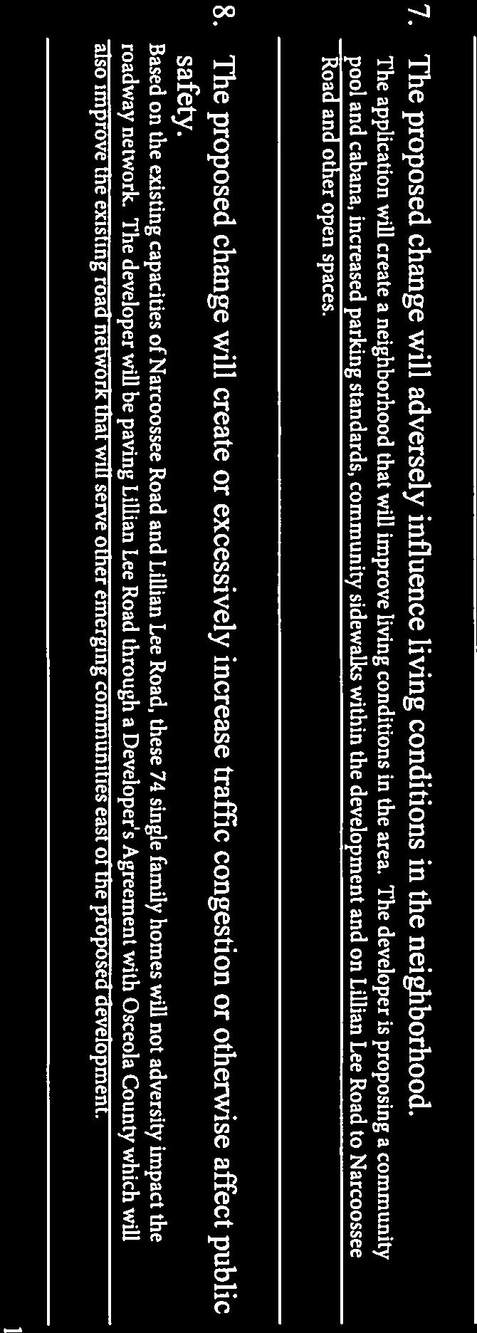
66
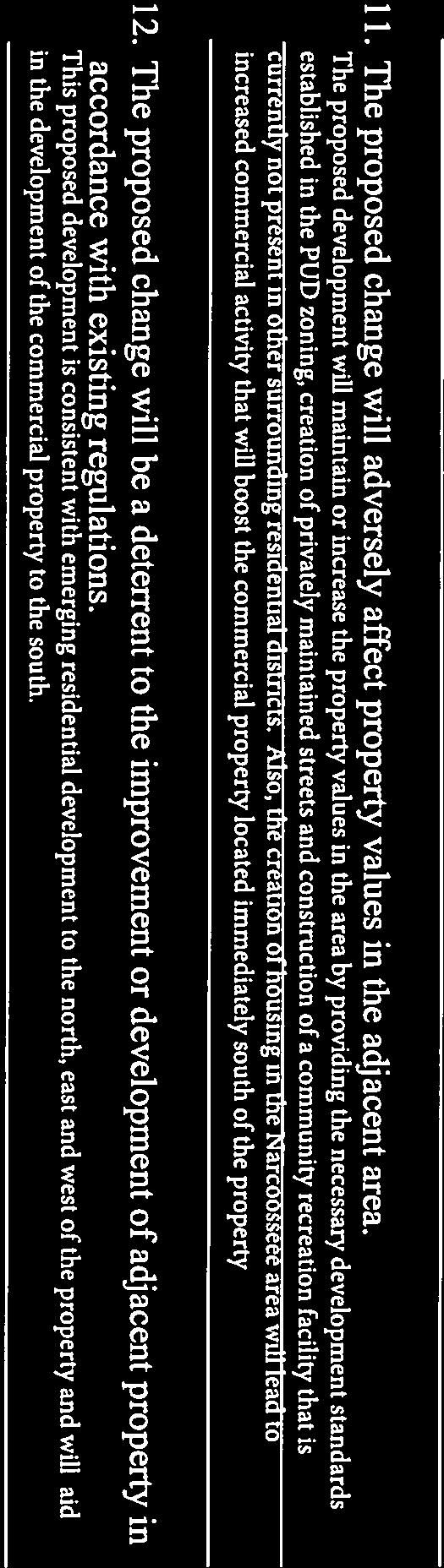
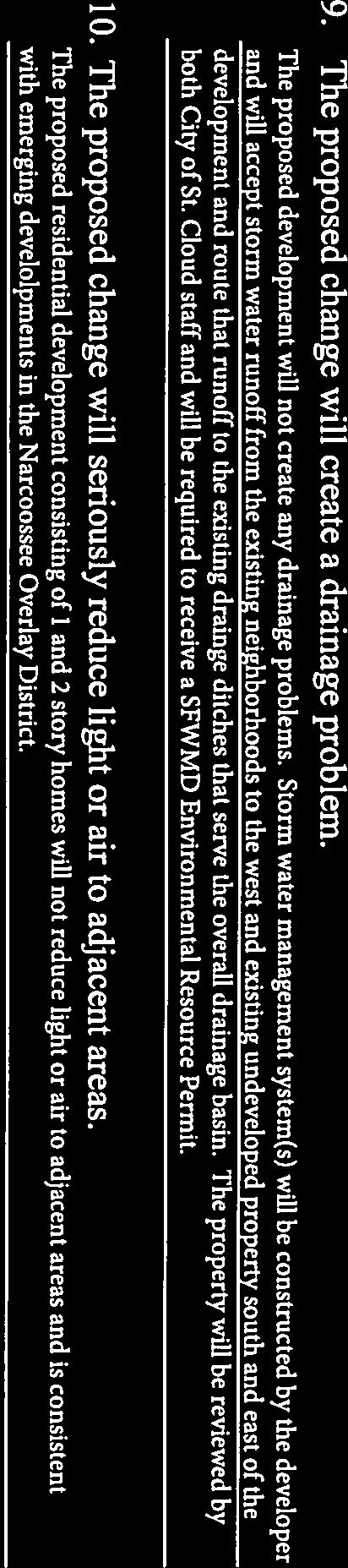
67
68 THE SCHOOL DISTRICT OF OSCEOLA COUNTY, FLORIDA PLANNING SERVICES DEPARTMENT SCHOOL CAPACITY REPORT - THREE YEAR OUTLOOK Date: 8/28/17 Current FLU: LDR-County SDOC #: 2017/ Requested FLU: MDR-SC Jurisdiction: City of St. Cloud Current Zoning: LDR-County DRC #: Requested Zoning: PUD-RES-SC Project Name: Lillian Lee Estates - Zoning PID: Project Location: Lillian Lee Road Comments Due Date: 9/6/17 AC: If proposed project increases utilization of schools above adopted level of service, applicant will obtain a Letter of Agreement outlining an accommodation plan for the students generated by this project, consistent with the provisions of Sections of the Interlocal Agreement for the Planning and Coordination of Public Schools throughout Osceola County (as required by Section , F.S.[2012]). "The County/Cities and the applicant must collaborate with the School Board to identify available means that might be used to achieve sufficient capacity to accommodate the development, which may include, but not be limited to developer contributions, project phasing, or developer provided facility improvements." If you should have any questions please feel free to contact the Osceola School District Planning Services Department at Total Proposed Units by Type SF/TH 74 MF/Condo 0 MH 0 Single Family/Townhome Multi-Family/Condo Mobile-Home STR 0 HOP 0 AWH 0 Short Term Rental Housing for Older Persons Affordable-Workforce Housing Estimated Number of New Students Generated by Proposed Development Elem. (K-5) 13 Middle (6-8) 7 High (9-12) 11 Student Generation Calculations Example Calculation: 100 (SF Units) x (Elem. Rate) = 18 (Students) Unit Types Total Units SF/TH/STR MF/Condo MH Total Student Generations Rates Students Elem. (K-5) Middle (6-8) High (9-12) Comments Level of Service (LOS) School Boundaries Permanent 3 YR. Projected Student Current Level Projected COFTE Impacted COFTE Capacity of Service COFTE w/ Impact Impact NCES 912 1,010 90% 925 1, % NCMS 1,205 1,427 84% 1,274 1, % HRHS 2,167 2,334 93% 2,214 3, % Narcoossee Elementary School is approaching capacity and is currently utilizing five (5) relocatables onsite to accommodate its existing enrollment. Narcoossee Middle - A new middle school is planned to open in the 2019/2020 school year and may provide relief to Narcoossee Middle. Projected LOS w/ Harmony High School is approaching capacity. A new high school is planned to open in the 2018/2019 school year and will provide relief to Harmony High. Narcoossee Elementary School, Narcoossee Middle School and Harmony High School are projected NOT to have capacity to serve the potential students generated through school year 2019/2020. Original: Planning Services Department Scanned Copy: Source Jurisdiction An Equal Opportunity Agency Pg. 1 of 1 FC (07/27/16)
69 Planning Commission Staff Report October 17, 2017 REQUEST The applicant is requests approval to transmit a Large-Scale Text Amendment to the Comprehensive Plan that would establish a Fire Rescue Element, to the Community Planning, Development and Services Division of the Florida Department of Economic Opportunity. DRC Case # Ordinance No Type of Application Comprehensive Plan Text Amendment (Large Scale) Case Name Fire Rescue Element Applicant City of St. Cloud Planning & Zoning Department Project Planner Leigh Anne Wachter, AICP PUBLIC NOTICE Notice of public hearing is published in the Osceola News Gazette prior to the public hearing. As of the date of this report, no public comments have been received. Additional oral and written comments may be presented at the public hearing. BACKGROUND The City of St. Cloud Fire Rescue Department is proposing to adopt a Fire Rescue Element within the City of St. Cloud Comprehensive Plan to provide quality assurance standards and resource evaluation measures for emergency resources and systems that serve the needs of the current and future community. As the demand for varied and complex emergency service grows, and greater emphasis is placed on prevention and public education, the need for more comprehensive regulations, standards and related enforcement efforts becomes apparent. The inclusion of a Fire Rescue Element in the City s Comprehensive Plan is one effort to address these needs. This Element documents the emergency and non-emergency functions of the City of St. Cloud Fire Rescue and examines efforts to match service demands with future growth. It recognizes the needs to maintain focus on essential services and to ensure these needs are managed in the most effective and cost-efficient way possible. In accordance with Section , Florida Statutes, the proposed Fire Rescue Element is an optional element to the Comprehensive Plan. The proposed amendment is consistent with the Comprehensive Plan. Technical analysis is provided in the sections below. Justification/Technical Analysis 1. The proposed amendment is consistent with Florida Statutes (F.S). The proposed Large-Scale Comprehensive Plan Amendment application follows the requirements for comprehensive plan amendments as specified in Section 163, Florida Statutes (F.S.). This large-scale text amendment is being transmitted to Community Planning, Development and Services Division of the Florida Department of Economic Opportunity for interagency review consistent with the procedures established in Chapter 163 (Part II), F.S. The proposed Element is consistent with Section Page 1 of 2
70 , Florida Statutes as an optional element to the Comprehensive Plan. 2. The proposed amendment is consistent with the Comprehensive Plan. Analysis included review of the amendment for consistency with the City of St. Cloud Comprehensive Plan. The following policy from the Future Land Use Element has been identified to support the proposed amendment. Goal 3: To provide adequate and proficient municipal services for all proposed developments in a timely and efficient manner. DRC/STAFF RECOMMENDATION The Development Review Committee reviewed this request on or before September 28, 2017 with no objections. Staff is requesting that the Planning Commission make a recommendation of approval and to transmit the Fire Rescue Element and Ordinance to the Community Planning, Development and Services Division of the Florida Department of Economic Opportunity for review, to implement the Fire Rescue Element into the Comprehensive Plan, consistent with Chapter 163, F.S. DRC recommends APPROVAL of and to TRANSMIT the request of the proposed Large-Scale Text Amendment to the City of St. Cloud Comprehensive Plan for Ordinance No to the Community Planning, Development and Services Division of the Florida Department of Economic Opportunity. ATTACHMENTS Ordinance No Supporting Documentation Ordinance No Page 2 of 2 Fire Rescue Element DRC Case #
71 RETURN TO: CITY OF ST. CLOUD DEPT. OF PLANNING & ZONING TH STREET ST. CLOUD, FL ORDINANCE NO AN ORDINANCE OF THE CITY COUNCIL OF THE CITY OF ST. CLOUD, FLORIDA, AMENDING THE COMPREHENSIVE PLAN TO INCLUDE A FIRE RESCUE ELEMENT; PROVIDING FOR APPLICABILITY AND EFFECT, SEVERABILITY, CONFLICTS, DISTRIBUTION AND COPIES ON FILE, AUTHORIZATION FOR TRANSMITTAL TO THE DEPARTMENT OF ECONOMIC OPPORTUNITY, AND AN EFFECTIVE DATE. WHEREAS, Chapter 166, Florida Statutes, and Article VII, of the Charter Laws of the City of St. Cloud, empowers the City Council of the City of St. Cloud to prepare and enforce comprehensive plans for the development of the City, and under such authority only lawful procedures and requirements have been followed and met, prerequisite to the action of this ordinance; and, WHEREAS, the City adopted a Comprehensive Plan pursuant to Chapter 163, Florida Statutes, by Ordinance , on September 26, 2002; and, WHEREAS, in exercise of its authority to amend adopted Comprehensive Plans pursuant to Chapter , Florida Statutes, the City Council of the City of St. Cloud has determined it necessary and desirable to adopt the Fire Rescue Element of the City of St. Cloud, Florida, Comprehensive Plan to provide quality assurance standards and resource evaluation measures for emergency resources and systems that serve the needs of the current and future community; and, WHEREAS, this Ordinance is enacted to carry out the purpose and intent of, and exercise the authority set out in the Local Government Comprehensive Planning and Land Development Regulation Act, Sections through , Florida Statutes, and Chapter 166, Florida Statutes, as amended, confirming as those portions of the Act mandated to be accomplished by the City of St. Cloud but reserving to the City Council of the City of St. Cloud all discretionary authority permitted there under; and, WHEREAS, the City Council has received the Planning Board's recommendation to adopt the Comprehensive Plan amendment after the Board met October 17, 2017; and, WHEREAS, the City did transmit as required by State Statute its analysis of the proposed amendments to the Comprehensive Plan to the Community Planning, Development and Services Division of the Florida Department of Economic Opportunity, the East Central Florida Regional Planning Commission, Osceola County, the Florida Department of Transportation, the South Florida Water Management District, the Osceola County School Board, and any other interested party; and Ordinance No Fire Rescue Element LS Page 1 of 9 DRC Case #
72 WHEREAS, the Community Planning, Development and Services Division of the Florida Department of Economic Opportunity did respond with formal review for consistency as outlined in Chapter 163, Florida Statutes, and Rule 9J-5, Florida Administrative Code. WHEREAS, the City Council has held at least one (1) public hearing on this matter consistent with the requirements of Section (1)(c) 2.a., Florida Statutes, with said hearing being held on a week day at least 5 days after being advertised, and said advertisement being consistent with the requirements of Section (3)(c) 2.b., Florida Statutes, and notice consistent with the requirements of Section (3)(c) 1., Florida Statutes. WHEREAS, the required courtesy information as required in (8)(b), F.S. was available for interested citizens, no one has completed the form to date. WHEREAS, the City staff has prepared a staff report and will rely on the data within said report as findings of fact to support the adoption of the Fire Rescue Comprehensive Plan amendment. NOW THEREFORE BE IT ORDAINED BY THE CITY COUNCIL OF THE CITY OF ST. CLOUD, FLORIDA, as follows: SECTION 1: The recitals set forth above are true and correct. SECTION 2: Upon approval of the first reading of this Ordinance, staff is authorized to transmit this amendment to the Community Planning, Development and Services Division of the Florida Department of Economic Opportunity the East Central Florida Regional Planning Commission, Osceola County, the Florida Department of Transportation, the South Florida Water Management District, the Osceola County School Board, and any other interested party for comment. SECTION 3: The City of St. Cloud, Florida, Comprehensive Plan is hereby amended in the following respects to include the Fire Rescue Element: Ordinance No Fire Rescue Element LS Page 2 of 9 DRC Case #
73 FIRE RESCUE ELEMENT GOALS, OBJECTIVES, POLICIES GOAL FR1 SYSTEM EVALUATION - EMERGENCY RESPONSE To provide effective fire rescue emergency services within a comprehensive program that is responsive to the needs of residents, visitors and those in communities which we assist. OBJ FR1.1 POLICIES Resource Evaluation - Emergency Response St. Cloud Fire Rescue (SCFR) shall maintain quality assurance standards and resource evaluation measures for its emergency resources and systems that serve the needs of the community. FR1.1.1 St. Cloud Fire Rescue shall ensure that the City is served by trained emergency personnel and shall periodically evaluate personnel and program performance in serving the needs of the community in line with strategic planning and customer service goals. FR1.1.2 St. Cloud Fire Rescue shall periodically review and update station location, staffing needs and equipment deployment plans to ensure efficiency and effectiveness of resources. It shall evaluate resource and deployment strategies based on: Periodic review of travel times Quarterly trend analysis and station response patterns Periodic evaluation of alarm activity to assess staffing and equipment allocations Quarterly review of data as part of the annual budgetary process Review of potential growth of alarm activity Review and tracking of citizen complaints OBJ FR1.2 POLICIES Service Standard - Fire Rescue Emergency Response St. Cloud Fire Rescue shall maintain service standards set by the department and deemed to be necessary for effective emergency response. FR1.2.1 St. Cloud Fire Rescue Fire Rescue shall maintain an initial emergency fire rescue response capability within the City s boundary area with a response time of five (5) minutes or less for 75% of calls. FR1.2.2 The determination of where to construct new Fire Rescue facilities will be based on, but not limited to, the following: Adherence to established response time standards (5 minutes 75% of calls) Minimal city response overlap to ensure workload equalization Minimal response overlaps between county and various city stations Ordinance No Fire Rescue Element LS Page 3 of 9 DRC Case #
74 Consideration of current and future impact(s) of Joint Planning Agreements (JPA) Consideration of city annexation and general growth patterns Availability of suitable land/property in area Projected alarm activity (number of alarms) generated in a geographic area FR1.2.3 The determination of when to construct new fire rescue facilities will be based on, but not limited to, all or any combination of the following: When a major development is in construction phase and a fire station is planned When the population of the station s response area produces 2 daily alarms on average When stations in adjoining response areas show escalation of alarms and travel time When more than 25% of calls for a specific area exceed the eight-minute response time When annexation of the area appears unlikely. FR1.2.4 St. Cloud Fire Rescue shall provide an initial emergency response to Basic and Advanced Life Support medical calls in the city boundary area. OBJ FR1.3 Interlocal and Mutual Aid Agreements St. Cloud Fire Rescue shall develop and maintain service agreements to ensure orderly interaction with neighboring agencies and jurisdictions when assistance is required. POLICIES FR1.3.1 St. Cloud Fire Rescue shall coordinate with adjacent counties and municipalities to create or maintain inter-local agreements for reciprocating service with fire rescue agencies and departments to provide a reduction/avoidance of overlapping service areas, a fire response agreement and a compatible communications system. FR1.3.2 In the absence of inter-local agreements, St. Cloud Fire Rescue shall periodically review the issue with neighboring jurisdictions, and, if necessary, take steps to establish or revise fee structures for services that may be provided to or received from jurisdictions or agencies that do not maintain agreements with the City. OBJ FR1.4 Emergency Communications St. Cloud Fire Rescue (dispatch duties are delegated to the St. Cloud Police Department) shall maintain standards for emergency dispatch in accordance with appropriate national, state, city and departmental requirements. Ordinance No Fire Rescue Element LS Page 4 of 9 DRC Case #
75 POLICIES FR1.4.1 St. Cloud Police Communications shall maintain communication equipment and lines determined to be adequate to ensure efficient handling of incoming emergency calls for assistance. FR1.4.2 St. Cloud Police Communications shall ensure that the city is served 24 hours a day, seven days a week, by emergency dispatch personnel trained and certified in emergency medical dispatch, including the ability to provide life-saving medical instruction by telephone prior to rescue unit arrival. FR1.4.3 St. Cloud Fire Rescue/St Cloud Police Communications shall answer 100 percent of incoming emergency and nonemergency calls within the third ring. If calls cannot be answered by the third ring additional staff will be called to meet that standard by the on-duty Communications Supervisor. FR1.4.4 St. Cloud Police Communications shall maintain a minimum of four Public Safety Telecommunicators on duty at all times. One Public Safety Telecommunicator shall handle police radio and teletype, the second shall handle telephone calls and walk-in complaints, the third shall handle fire department radio and the fourth is the supervisor on duty and shall assist where needed. When five (5) Public Safety Telecommunicators are on duty, the teletype channel will be opened. FR1.4.5 St. Cloud Communications shall maintain the National Fire Protection Association s (NFPA) requirements (NFPA 1221 [ ]) for: One additional operator, or sufficient number of personnel in the operations room, to transmit alarms to responding units within 60 seconds of completed receipt, and, One Supervisor in the Communications Center on each shift. FR1.4.6 St. Cloud Communications shall maintain one Fire Dispatch position which is rotated every 4 hours with the operators scheduled on duty for that shift who is certified by the International Academy of Emergency Dispatch as Emergency Fire/Medical Dispatcher. The departmental standard shall be for one tactical radio operator for each Fire Division District to coordinate emergency response and assistance of all stations and units assigned to that District. GOAL FR2 SYSTEM EVALUATION - NON-EMERGENCY SERVICES To provide non-emergency review and enforcement services through programs aimed at ensuring that the community complies with fire safety requirements and prevention efforts. Ordinance No Fire Rescue Element LS Page 5 of 9 DRC Case #
76 OBJ FR2.1 POLICIES Resource Evaluation - Non-Emergency Services St. Cloud Fire Rescue shall maintain quality assurance standards and resource evaluation measures for its non-emergency resources and systems that serve the needs of the community. FR2.1.1 St. Cloud Fire Rescue shall periodically evaluate personnel and programs that provide non-emergency services to meet community needs in line with strategic planning and customer service goals. It shall evaluate these resources and programs based on: Monthly monitoring of performance measures Customer surveys Benchmarking Quarterly review of data Review and tracking of citizen complaints OBJ FR2.2 POLICIES Service Standard - Non-emergency Services St. Cloud Fire Rescue shall maintain standards set by the Department and deemed to be necessary for effective non-emergency functions. FR2.2.1 St. Cloud Fire Rescue shall ensure that The Office of The Fire Marshal conducts a mandatory inspection annually or more frequently, as required, of day care centers, assisted living facilities, group homes for the developmentally disabled, residential treatment facilities, hospitals, nursing homes and educational institutions. FR2.2.2 St. Cloud Fire Rescue shall ensure that The Office of The Fire Marshal conducts annual inspections as follows: Priority 1 Occupancies - annually, or according to departmental standards. (Properties with potential for high loss of life and/or property value including lumber yards, assembly occupancies with an occupant load greater than 1,000, shopping centers, apartment buildings of wood frame construction, flammable liquid and LP gas bulk storage facilities, hospitals, schools and high-rise buildings). Priority II, III, IV Occupancies - Inspections or Pre-incident planning of properties by engine companies and Fire Inspectors according to standards set by the Department. FR2.2.3 St. Cloud Fire Rescue shall ensure that submittals for fire plan reviews are completed in a timely manner. FR2.2.4 St. Cloud Fire Rescue shall implement and maintain all federal, state and departmental standards and plans intended to mitigate the impact of wildfire disasters in St. Cloud. Ordinance No Fire Rescue Element LS Page 6 of 9 DRC Case #
77 FR2.2.5 St. Cloud Fire Rescue shall provide in-service training, and take steps to maintain the staffing and efficiency levels needed to provide assistance to citizens affected by fire rescue related non-emergency situations. FR2.2.6 St. Cloud Fire Rescue shall maintain a departmental vehicle/apparatus replacement plan that includes a criteria-based method of replacement to ensure that only safe and dependable emergency response vehicles are kept in service. GOAL FR3 PUBLIC EDUCATION AND AWARENESS To promote fire and life safety awareness in the community consistent with the Community Risk Reduction program. OBJ FR3.1 POLICIES Public Education Safety Issues St. Cloud Fire Rescue shall maintain and promote fire and safety education and awareness programs within the community. FR3.1.1 St. Cloud Fire Rescue shall develop and promote appropriate and timely fire safety related programs through schools, public facilities and other means aimed at reaching the City s school age and at-risk adult population. OBJ FR3.2 Public Education and Assistance - Basic Safety Issues St. Cloud Fire Rescue shall maintain and promote basic safety awareness programs within the community. POLICIES FR3.2.1 St. Cloud Fire Rescue shall develop and promote basic safety-related programs through schools, public facilities and other means aimed at reaching the City s school age and adult population and specific at-risk groups. FR3.2.2 St. Cloud Fire Rescue shall foster alliances and joint efforts with community agencies and groups that share the same vision of a safe and healthy community. GOAL FR4 DISASTER PREPAREDNESS AND COORDINATION To provide comprehensive emergency management, preparedness and mitigation services to City residents, visitors and those in other communities which we assist. OBJ FR4.1 Emergency Management St. Cloud Police Department Office of Emergency Management in coordination with SCFR shall maintain all mandatory federal, state and departmental emergency management service standards and plans intended to prepare for, respond to, recover from, and mitigate against the impacts of disasters that could adversely affect the health, safety and/or general welfare of the citizens of and visitors to the City of St. Cloud. Ordinance No Fire Rescue Element LS Page 7 of 9 DRC Case #
78 POLICIES FR4.1.1 Through ongoing training, the Office of Emergency Management shall take steps to reduce the vulnerability of people and communities of this City to damage, injury, and loss of life and property resulting from natural, technological or manmade emergencies, catastrophes, or hostile military or paramilitary action. FR4.1.2 The Office of Emergency Management shall prepare for prompt and efficient response and recovery to protect lives and property affected by emergencies. FR4.1.3 The Office of Emergency Management shall respond to emergencies using all systems, plans and resources necessary to preserve the health, safety and welfare of the citizens of and visitors of the City of St. Cloud. FR4.1.4 The Office of Emergency Management shall coordinate recovery from emergencies by providing for the rapid and orderly start of restoration and rehabilitation of persons and property affected by emergencies. FR4.1.5 The Office of Emergency Management shall provide an emergency management system embodying all aspects of pre-emergency preparedness and post-emergency response, recovery and mitigation. FR4.1.6 The Office of Emergency Management shall take steps to minimize damage to property, material shortages, and service system disruptions that would have an adverse impact on the residents, the economy, and the well-being of the City. FR4.1.7 The Office of Emergency Management shall manage emergency operations within the City by coordinating the use of resources available from municipal governments, private industry, civic and volunteer organizations, and State and Federal agencies. Ordinance No Fire Rescue Element LS Page 8 of 9 DRC Case #
79 SECTION 8: EFFECTIVE DATE The Comprehensive Plan Amendment is not effective until the State Land Planning Agency issues a final order determining the adopted amendment to be in compliance in accordance with s (9), or until the Administration Commission issues a final order determining the adopted amendment to be in compliance in accordance with s (10) Transmittal Hearing on the 26 th day of October, 2017 Adoption Hearing on the 14 th day of December, 2017 Nathan Blackwell, Mayor ATTEST: Linda P. Jaworski, City Clerk LEGAL IN FORM AND VALID IF ADOPTED: debeaubien, Knight, Simmons, Mantzaris & Neal By: Daniel F. Mantzaris, City Attorney Pursuant to Section (3) (f), this instrument exempt from Chapter 695, F.S.: Prepared by and return to a Public Official: City Manager, City of St. Cloud; th Street; St. Cloud, Florida Ordinance No Fire Rescue Element LS Page 9 of 9 DRC Case #
80 FIRE RESCUE ELEMENT DATA AND ANALYSIS I. INTRODUCTION The purpose of the Fire Rescue Element is to focus on services provided by St. Cloud Fire Rescue (SCFR) and to facilitate long-range planning for adequate fire protection and prevention, public education, emergency medical response and rescue services. These activities contribute to the quality of life for those who live, work in or visit St. Cloud and the surrounding areas. As the city has grown, SCFR has continued to work hard to ensure infrastructure needs are adequate to meet demands for existing and future services. The population of the city has generally grown at a faster pace than that of local municipalities or other areas of the State. In fact, Osceola County is one of the fastest growing counties in the United States. Changes have occurred in the concentration of growth, as development has spread throughout the city to areas once sparsely populated. Growth has prompted a renewed focus on the issue of urban sprawl, efforts to contain it, and actions needed to respond to it. In the past, the city has relied on residential growth to balance budgets and improve city services. Recently, there has been a vigorous effort to emphasize the expansion of mixed use, commercial, industrial properties and executive style housing. Concurrent with population growth, the City experienced steady economic growth since 2010 marked by an unemployment rate that has generally been around 4%. With the exception of the time surrounding the economic downturn in 2008, this growth has been supported by strong service, retail, tourism and government sectors. SCFR has been affected throughout this sustained growth phase within the county and the city. As institutions, schools, regional shopping centers, recreation areas and the road networks have been established or expanded residents have moved into areas previously considered remote. As a result, the demand for traditional fire, rescue and EMS services has been increasing over the past three years by 27 %. This growth pattern is expected to continue. High impact disaster events, including natural, man-made, and terrorist acts now require more attention and higher priority planning. SCFR has kept pace with the challenges brought about by advances in industrial and transportation technologies. The agency has taken advantage of improvements in technology and medical advances in order to offer good quality, faster and more efficient service. As the demand for varied and complex emergency services grows, and greater emphasis is placed on prevention and public education, the need for more comprehensive regulations, standards and related enforcement efforts becomes apparent. These changes also emphasize the need for alternative revenue streams. The inclusion of a Fire Rescue element in the City s Comprehensive Plan is one effort to address these needs. St. Cloud Fire Rescue also recognizes the service standards and requirements of various professional and regulatory agencies including the Insurance Services Office (ISO), the National Fire Protection Association (NFPA), State EMS regulations and best practices. Fire Rescue Element Data & Analysis FR-1 City of St. Cloud Comprehensive Plan DRC Case #
81 This element documents the emergency and non-emergency functions of SCFR and examines efforts to match service demands with growth. It recognizes the need to maintain focus on essential services and to ensure these are managed in the most cost-efficient, effective way possible. This document sets out the recommended standards, goals and objectives deemed to be necessary for the effective and efficient operation of the St. Cloud Fire Rescue Department. It must be recognized, however, that in isolated cases, there may be deviations or standards may be waived due to significant operational, financial, policy or other considerations. II. EXISTING PROGRAMS AND CONDITIONS A. SERVICES SCFR provides a variety of services to ensure the safety of individuals and property in case of fires, pre-hospital medical emergencies, water accidents, hazardous material incidents, natural and manmade disasters and other types of dangers. In addition to emergency service, SCFR also conducts building safety inspections, reviews planned construction activities, provides public education and outreach, and administers other safety and preventative programs. The City of St. Cloud s Police Department-Office of Emergency Management (OEM) is the central coordinating authority for disaster management activities in the city. The Department also provides service to citizens and visitors of nearby jurisdictions through contractual service agreements, mutual aid and first response arrangements. Fire Rescue Emergency Response Structural firefighting, rescue, patient extrication Hazardous material incidents Technical Rescue (water, vehicle/machine extrication, confined space) Wildland and urban interface fires Natural and man-caused disasters Emergency Medical Services (EMS) Basic and Advanced Life Support Response and transport Response to Mass Casualty Incidents (MCI) Response to pandemic, biological, and other emergencies Office of the Fire Marshal - Inspection and Prevention Plan reviews of new construction, interior alterations, fire protection systems, tents, trade shows, pyrotechnics, retail sales, and burn permits. Code compliance with national, state and city codes, city standards and laws. Life safety inspections of existing facilities New construction inspections, ensuring safe and timely occupancy of new structures Nuisance False Alarm Tent, burn, pyrotechnic, special event permitting State Mandated Licensing Inspections Fire Rescue Element Data & Analysis FR-2 City of St. Cloud Comprehensive Plan DRC Case #
82 Disaster and Emergency Management (Delegated to St. Cloud PD Emergency Management in 2013) Centralized Disaster/Emergency Strategic Planning Disaster preparedness, mitigation, operations and recovery management Communications Receipt and processing of 911 emergency medical and fire rescue calls Pre-arrival life-saving medical instructions to citizens prior to rescue unit arrival Dispatch and tracking of all SCFR first response units Community Relations and Public Education Programs Safety Presentations, Visits, Displays, Events and Station Tours Smoke Detector Program (provide and install) Fire Extinguisher use training and evacuation drills Diversion and Intervention Programs for juvenile firesetters Public Information program for the citizens and the media B. STATION AND EQUIPMENT DISTRIBUTION Stations and Equipment - At start of 2017, there are three stations strategically located throughout the city. Equipment in service included: (1) Quint/Tower- Advanced Life Support (ALS)- Engine with aerial capabilities (1) Engine- ALS capable pumper (1) Squad- ALS pumper with specialized rescue and scene support equipment (4) Rescue Ambulances- ALS transport capable (2) Reserve Pumpers (2) Reserve Rescue Ambulances (1) Rescue Boat (1) Command unit (1) Type 6 Brush Fire Unit Interlocal Agreements and/or Mutual Aid - SCFR has various arrangements for assistance with neighboring jurisdictions. Most agreements fall within two categories: Mutual Aid - an understanding that assistance can be requested by a neighboring jurisdiction for a specific incident and Automatic Aid - a standing agreement that specifies conditions under which units of neighboring jurisdictions will be automatically dispatched across shared borders in response to emergencies. SCFR has Mutual Aid agreements and/or first Automatic Aid arrangements with the City of Kissimmee and Osceola County and Orange County. New Station Location Planning - SCFR has engaged in long-range station planning for some time. One of the more difficult station location problems to resolve has been the site of some stations inherited by the City. As a result, it has been difficult for some stations to now attain Fire Rescue Element Data & Analysis FR-3 City of St. Cloud Comprehensive Plan DRC Case #
83 optimal efficiency in terms of serving a broader area beyond their district. This factor presents a challenge, given response time requirements and the inherent cost of relocating and rebuilding facilities. The acceleration of growth in the city and Osceola County has added to the problem. Efforts to deal with station planning and location issues have included station relocations and new stations. These measures to ensure adequate and efficient Fire Rescue service continue. However, due to the extremes in rural and urbanized settlement patterns throughout the City, there are marked differences in the demands placed on SCFR resources from one area of the City to another. The following criteria are considered optimal when planning and selecting fire station locations: 1. Location at or within approximately 5 road miles from an existing station, except in rural and remote areas, or where an automatic aid agreement is not possible. 2. Location will help achieve the SCFR designated response time for that area. 3. Demand in the proposed service area exceeds agency requirements for availability, reliability and concentration. 4. City response overlap, if any, will be minimal and maintain a distributed workload. 5. County and municipal station response overlaps will be minimal. 6. Impact (current and future) of Joint Planning Agreements (JPA) will be considered. 7. City annexation and growth will be considered to avoid future station relocation. 8. Time/Distance/Travel studies to stay consistent with response time goals. SCFR has adopted several strategies which provide guidance on where to construct fire station facilities, when to initiate service at new locations, and when to decommission and close a fire rescue facility. In addition, SCFR has a formal process for new fire station construction and is proposing certain standards. Station /Facility Design Fire Rescue bases Station/Facility Design on the following: Space efficient and safety focused Masonry structure, standing seam metal roof, apparatus bay doors and window systems all designed to withstand Class 3 Hurricanes with a size of approximately 9,000 sq. feet to 13,000 sq. feet depending on apparatus and staffing needs. Basic station design is three or four bays to house one engine, one rescue, and support or reserve apparatus. The larger four-bay design is available to house multiple units, e.g. engines, rescues and aerial towers or other specialty units along with the support or reserve apparatus. Space allocations for the reserve apparatus at various stations instead of one central point allow crews to return to service faster from swapping into the reserve unit. It also protects and disperses the reserve apparatus in the event of a natural disaster thus reducing the potential of having our entire fleet damaged at once. High durability, porcelain floors, stainless steel kitchens and other low-maintenance surfaces Fitness center, computerized learning stations and alarm notification via radio signals that trigger exhaust fans, low-level lighting and cook stove shut down High-efficiency vehicle exhaust removal system and separate EMS decontamination area Airlock environmental design or separation to separate potentially hazardous areas from living areas Fire Rescue Element Data & Analysis FR-4 City of St. Cloud Comprehensive Plan DRC Case #
84 Living modules with common dormitory, day room, separate dining/kitchen areas Self-contained restrooms with shower, toilet, and lavatory Self-contained site with full standby emergency power C. VEHICLE REPLACEMENT Decisions concerning the replacement of SCFR vehicles are subject to the guidelines of the department's Vehicle Replacement Plan (which applies to all vehicles) Proposals to replace or purchase vehicles in this weight class, such as cars and vans, must be discussed and approved by the City Manager. In developing its in-house Vehicle Replacement Plan, SCFR followed the city s Vehicle Requisition guidelines and based replacement on a scheme recommended by the American Public Works Association, mileage, replacement cost and age of the unit. In this way, the department was able to introduce additional factors specific to fire rescue vehicles. The SCFR Vehicle Replacement Plan groups vehicles into two categories: Heavy Equipment and Transport Units (Emergency Medical Services units). Within these two categories, vehicles are listed by type of vehicle in sub-groups that include: non-emergency car/small van emergency response car/van all rescue vehicles pumpers aerial trucks tankers (future) specialty vehicles rescue boats (mileage not tracked) various other specialty vehicles e.g. trailers Wild-Land Urban Interface (WUI) trucks SCFR Vehicle Replacement Plan has specific criteria that must be met before a vehicle will be replaced. It requires that under normal circumstances, two of these three criteria be met: Mileage - Mileage must have reached the maximum mileage designated for that category of vehicle (100,000; 125,000; Age - The age of the vehicle must be at or past the age designated for that category of vehicle or equipment (6, 8, 10, 15 years) Replacement Cost - Repairs (labor and parts) to the vehicle must total 80 % of that vehicle/equipment s replacement cost over the life of the unit. The Plan requires that appropriate records be kept on all vehicles. The Department uses a database to track the required data for each unit. Information is regularly updated to include the following: unit year, make, model mileage (total and average per year) Fire Rescue Element Data & Analysis FR-5 City of St. Cloud Comprehensive Plan DRC Case #
85 replacement cost Fire Rescue Department Vehicle Maintenance Replacement Criteria Vehicle/Unit Maximum % of Age Miles Replacement Cost * Cars, Vans, Small Units 100, Years 80% Rescue Trucks (Ambulances) - Standard 100,000 6 Years 80% Rescue Trucks (Ambulances) - Mid-Sized** 150,000 6 Years 80% Pumpers (Engine Companies) 125,000 8 Years 80 % Aerial Trucks/Quint 125,000 8 Years 80% Tankers 100,000 10Years 80% Specialty Vehicles 125, Years 80% Woods Trucks (WUI) 100, Years 80% *When maintenance costs over the life of the unit reach 80% of the cost to replace the unit. **Most rescues used are mid-sized. Replacement is permitted when a vehicle meets any two of the three criteria (mileage, age, replacement cost) listed. D. EMERGENCY RESPONSE St. Cloud Fire Rescue defines response time as the amount of time that elapses from the activation of the emergency notification system (the 911 call) to when an emergency service unit arrives at the scene. Response time does not include the time taken to detect an emergency and activate the 911 system. Since these times are outside the control of a fire rescue department, they are hard to detect and improve and do not reflect the agency's efficiency or effectiveness. The components of emergency response time (the delivery of emergency services) are call processing, crew turnout, and travel time. Call processing, sometimes referred to as the dispatch time, is the process of answering the 911 call and processing the emergency incident to the point in time when an emergency unit is dispatched. Turnout is the interval of time from the sounding of the alarm in the station or vehicle, through crew activation which includes donning protective gear, boarding the emergency unit and actual departure for the scene. Travel time is the time interval from the start of travel to the scene to arrival of the first unit. Call Processing Turnout Time Travel Time Total NFPA 1221 NFPA 1710 NFPA 1710/SCFR 1:00 Minute 1:00 Minute- EMS 1:20-Fire 4:00 Minutes 5:00 Minutes 6:00 Minutes 7:20 Minutes Fractal Performance 90% 90% / 75% 90% / 75% There are several nationally recommended parameters for the delivery of emergency services. These recommendations take into account the need to rapidly reach a patient suffering from cardiac arrest to prevent brain damage and the need to reach the scene of a fire in time to rescue trapped victims and stop further property damage. The American Medical Association (AMA) recommends that Advanced Life Support should reach a patient in eight minutes or less. The National Fire Protection Association (NFPA) recommends that the first arriving fire suppression unit reach the scene of an emergency in six minutes or less (total response time). Fire Rescue Element Data & Analysis FR-6 City of St. Cloud Comprehensive Plan DRC Case #
86 After a thorough review of factors that impact response time, SCFR has proposed that the City service area be divided into an Urban Service Area and an Emerging Urban Service Area and that each area be assigned response time performance measures that are consistent with station placement, water supply, call distribution and other factors that impact overall emergency response. Urban Response Area: This service area is served by a primary fire station within five miles or less, and by a secondary fire station that is within five miles of the primary fire station. This service area is served by a commercial water distribution system. These areas also experience a higher demand for emergency service with more than 100 calls per square mile per year. Emerging Urban Response Area: This service area is defined as those locations within the city which are do not meet the threshold for Urban Service. These locations are less urban in nature, may be served by a single fire station, with greater distances to a secondary fire station and which may or may not be served by a commercial water distribution system. These areas also have a significantly lower emergency call volume (less than 100 calls per square mile per year). SCFR has a targeted response time of 7:20 for 75% of all calls in the Urban Response Area and a reflex time of 9:30 (nine minutes and thirty seconds) for 75% of all calls in the Rural Response Area. Water Supply is also an essential element in emergency response to fire incidents and SCFR must depend on water utility operators to properly install, maintain and test their water distribution system. Water supply is also a function of public fire hydrants, private fire hydrants, dry (or drafting hydrants) and the agency's ability to draft water from an open source (i.e.: lake, swimming pool, canal, etc.). SCFR will conduct ongoing analysis of such factors as station location, equipment and personnel configuration and other factors that affect response times. The Agency will continue to focus on realignment of existing stations, which has been instrumental in improving response times in growth areas and reducing service overlaps without undue effects on operating budgets. E. STAFFING As of October 1, 2017, the Fire Rescue Department has 74 authorized personnel positions in all divisions: Fire Rescue Element Data & Analysis FR-7 City of St. Cloud Comprehensive Plan DRC Case #
87 Total Personnel Firefighter Total 68 Support Staff 6 Department Total 74 Certified Firefighting Positions: Fire Chief 1 Deputy Fire Chief 1 Division Chief 1 Battalion Chief 5 Lieutenant 9 Engineer 9 Firefighter/EMT-PM 42 Total 68 The majority of all agency personnel are assigned to the Fire Operations Division. Emergency service is managed by an on-duty Battalion Chief. Optimum personnel staffing patterns are also set for each type of emergency response unit: Engine 4 personnel (minimum staffing will be 3) Ladder/Truck 4 personnel (minimum staffing will be 3) Squad 4 personnel (minimum staffing will be 3) Rescue/Ambulance 2 personnel Operations Field Supervisor 1 Battalion Chief F. TRAINING The purpose of the Training Division is to develop, implement, coordinate, facilitate, deliver, monitor and evaluate in-service training and education for St. Cloud Fire Rescue. These activities are competency-based and are designed to promote professional development, increase skill levels and ensure safety awareness and measures so that personnel can effectively and safely deliver fire rescue and related support services for the community. The Training Division seeks to accomplish its objectives by methods that include: Strategic planning to include addressing career development and external mandates Ensure that all training programs are in compliance with local, state and federal guidelines and current department standard operating procedures Facilitate the analysis, development, delivery, and evaluation of training Provide access to both local, state, and federal training opportunities Research and develop appropriate training materials to enable training to be conducted at all levels. No single entity administers a broadly based, comprehensive set of mandatory training requirements for the fire and rescue service at either the national or state level. Various federal, national, state and local agencies and some private entities require or recommend training and education in specific areas for fire and rescue service. These agencies include: Fire Rescue Element Data & Analysis FR-8 City of St. Cloud Comprehensive Plan DRC Case #
88 City of St. Cloud and St. Cloud Fire Rescue Florida Department of Health, Division of Emergency Medical Services Florida Department of Insurance, Division of the State Fire Marshal, Bureau of Fire Standards and Training Federal Emergency Management Agency, National Fire Academy and Emergency Management Institute United States Department of Justice United States Interagency Wildfire Coordinating Group Insurance Services Office International Fire Service Training Association National Fire Protection Association Training and education programs mandated by the State of Florida include: Biannual recertification for Emergency Medical Technician and Paramedic Triennial recertification for Fire Inspector Fire Fighter and Fire Officer training Hazardous Waste/Materials Operations and Emergency Response training Self Contained Breathing Apparatus, Respiratory Protection training, and Personal Alert Safety System There are a number of priority training requirements based on SCFR specific operations. These are included in several National Fire Protection Standards (NFPA) and Federal Regulations. While some of these training requirements are not mandated, they are accepted national "community standard" benchmarks. Among operations with priority training requirements are: Emergency Medical Services Structural firefighting Human Relations Hazardous Materials / Technical Rescue Fire Fighter Safety and Survival Incident Command System Fire Officer training Response to Acts of Terrorism Fire Apparatus Driver/Operator Technical Rescue G. COMMUNITY RISK REDUCTION The Life Safety and Public Education function is designed to assist the citizens and the media in understanding and accessing services provided by SCFR. It develops implements, coordinates, monitors and facilitates educational programs to promote fire and life safety awareness in the community. Community relations and public education activities are provided in the following areas: school fire safety programs, media relations, fire and life safety programs, injury prevention, CPR, and interaction with community-based organizations to enhance the public s Fire Rescue Element Data & Analysis FR-9 City of St. Cloud Comprehensive Plan DRC Case #
89 knowledge of fire and life safety concepts. Also included are diversion and intervention programs for children involved in fire setting activity. H. FIRE/POLICE COMMUNICATIONS The Fire Communications Division operates four separate program areas which provide support to the Fire Rescue Department and the citizens of St. Cloud. The following areas are included: Emergency Dispatch The Fire/POLICE Communications Center provides twenty-four hour coverage of the 911 system and receives emergency and non-emergency calls from the public. In 2007, the Center processed more than 100,000 requests for response, including fire and emergency medical events. All personnel are trained to provide pre-arrival emergency medical care which instructs citizens in life-saving procedures to assist patients prior to arrival of the rescue team. Telecommunications This unit provides overall administrative support for the technology that supports the Fire Communications Center to include the E-911 System, the Computer Aided Dispatch (CAD) system, Records Management System (RMS) to support the National Fire Incident Records (NFIRS) system, Mobile Data Terminals (MDT) and Automatic Vehicle Location (AVL) systems. The Communications unit is comprised of Five Communications Supervisors, twenty-one fulltime Communications Operators and six part-time Communications Operators who are overseen by the Support Services Manager. Communications has six non-emergency phone lines and three emergency phone lines. Operators monitor multiple radio channels for police, fire, medical, public works and other law enforcement and fire agencies in the area. They also have direct contact by radio with the emergency rooms of all area hospitals. St Cloud Communications shall answer 100 percent of incoming emergency and nonemergency calls within the third ring. If calls cannot be answered within third ring additional staff will be called to meet that standard by the on-duty Communications Supervisor. Upon receipt of a call for service, the Operator gathers information about the call, logs the call in the computer system, evaluates the needs for the citizen and dispatches the proper personnel. Information gathered is used to document the location of calls, types of calls handled, who responds to the scene. This can also be used later for investigations, surveys or documentation needed for reports. Operators maintain contact with field personnel at all times and provide additional support personnel as needed. As the units are en route to a call they provide Pre- Arrival Instructions to the caller. All personnel are certified and trained as Emergency Medical Dispatcher and Emergency Fire Dispatcher with the International Academies of Emergency Dispatch. They are able to provide Pre-Arrival instructions to the citizens in life-saving procedures to assist patients prior to the Fire Rescue Element Data & Analysis FR-10 City of St. Cloud Comprehensive Plan DRC Case #
90 arrival of the rescue team on medical calls. They are able to provide Pre-Arrival Instructions to callers to vacate for any building due to structure fire or conditions harmful prior to Firefighters arriving on scene. I. FIRE MARSHAL DIVISION The Fire Marshal Division (FMD) tasks include: Fire Inspection and Permitting of Buildings Fire Watches/Event Standbys Plans Review for Fire Codes New Construction Testing and Inspection Fire Protection System Testing and Inspection False Alarm Mitigation Assistance to the State Fire Marshal with Fire Investigations (Cause and Origin) Community Risk Reduction Program (sprinkler demonstrations) Priority I Properties - These are occupancies and properties that are mandated to have specific inspections on an annual. The purpose of a Priority 1 designation is to identify properties where a fire could result in substantial loss of life and/or high dollar losses. These properties are targeted for inspection annually, semi-annually, or according to standards set by SCFR. Examples are: Plan Reviews & Inspections of New Construction, Interior Alterations, Fire Protection Systems: Public Schools Charter Schools Public School Alternative Educational Facilities Community Colleges Private Schools State of Florida Licensed Assisted Living Facilities Correctional Facilities Hospitals State of Florida Licensed Nursing Homes State of Florida Licensed Day Care Centers Residential Child Care Facilities Adult Family Care Homes Unlicensed (Exempt) Day Care Centers Residential Board and Care Facilities State of Florida Licensed Drug Treatment Centers State of Florida Licensed Crisis Centers State of Florida Licensed Facilities for the Developmentally Disabled Complaint Inspections Owner Requested Inspections Fire Rescue Element Data & Analysis FR-11 City of St. Cloud Comprehensive Plan DRC Case #
91 Tent Permit Inspections Pyrotechnic Permit Inspections Priority II Properties Similar to Priority I properties, these properties also have a serious potential for loss of life or high dollar loss in the event of a fire. However, losses would not be of the same magnitude as in the case of Priority I properties. These properties are inspected by the Office of the Fire Marshal periodically and according to standards set by SCFR. Examples are: Target Hazards as Identified by Fire Analysis Use Permits (Change of Occupancy) Apartment Buildings Hotels with more than 100 guest rooms Assembly occupancies with an occupant load greater than 1,000 High-Rise Buildings (Greater than 75 ft high to the highest occupied level) Priority III Properties These properties are inspected by the Office of the Fire Marshal periodically and according to standards set by SCFR. Examples are: Assembly Occupancies with an occupant load greater than 300 but less than 1,000 Hotels with more than 50 guest rooms and less than 100 guest rooms Hazardous occupancies Flammable Liquid and LP Gas Bulk Plans and/or Storage Facilities Priority IV Properties Inspections of Priority IV occupancies are inspected by the Office of the Fire Marshal periodically and according to standards set by SCFR. Examples include: Hotels with less than 50 guest rooms Shopping Centers/Malls greater than 100,000 sq. ft (Not tenant spaces) Mercantile Occupancies greater than 100,000 sq. ft. Business Occupancies greater than 100,000 sq. ft. Storage Occupancies greater than 100,000 sq. ft. Factory/Industrial Occupancies greater than 100,000 sq. ft. Priority V Properties Inspections of Priority V occupancies are inspected by the Office of the Fire Marshal periodically and according to standards set by SCFR. Examples are: Shopping Centers/Malls less than 100,000 sq. ft (Not tenant spaces) Mercantile Occupancies greater than 5,000 sq. ft. but less than 100,000 sq. ft. Business Occupancies greater than 5,000 sq. ft. but less than 100,000 sq. ft. Storage Occupancies greater than 5,000 sq. ft. but less than 100,000 sq. ft. Factory/Industrial Occupancies less than 100,000 sq. ft. Priority VI Properties Inspections of Priority VI occupancies are inspected by the Office of the Fire Marshal periodically and according to standards set by SCFR. Examples are: Fire Rescue Element Data & Analysis FR-12 City of St. Cloud Comprehensive Plan DRC Case #
92 Mercantile Occupancies less than 5,000 sq. ft. Business Occupancies less than 5,000 sq. ft. Storage Occupancies less than 5,000 sq. ft. Normally Unoccupied Buildings (i.e. Cellular Phone Sites, TV or Radio Transmitter Buildings, Telephone Relay Buildings, etc) Toll Booths, Guard Shacks, Construction Trailers Vacant Tenant Spaces in Multi-Tenant Buildings Pool Pump Houses not using gaseous chlorine Buildings used exclusively for restrooms and/or showers. (Typically found in campgrounds or parks) Complaint Investigations are also the responsibility of the Fire Marshal. The Bureau investigates complaints of code violations received from the general public within two business days or sooner. False Fire Alarm Tracking enables the Bureau to record false alarms and notify those occupants or owners that have faulty or nuisance alarms. They are required to have their systems evaluated, tested and inspected by their fire alarm servicing agency. The objective is to reduce false alarms each year. L. QUALITY ASSURANCE As a large department providing a variety of emergency and other services to the public, SCFR must be vigilant about the quality of its service as well as the satisfaction of the customer receiving that service. SCFR has implemented a quality assurance/improvement program. The delivery of emergency medical services (EMS) represents the largest percentage of service provided to the community and is one area that is monitored extensively. This monitoring process includes a review of the Standard of Care as set forth in Florida Statute and the Osceola County Emergency Medical Services System practice parameters. It assesses individual performance standards, skills and EMS report documentation. Further, the quality assurance program includes quarterly performance measurement assessments within each division and the compilation of relevant statistical data that facilitates the tracking and monitoring of factors such as response times and call volume. This data is compared to standards set forth in the Accreditation Standard of Response Coverage documents and standards set by National Fire Protection Association (NFPA). This information is used to improve efficiency in the delivery of services, as well as being useful for short term, medium-term and long-term planning. Fire Rescue Element Data & Analysis FR-13 City of St. Cloud Comprehensive Plan DRC Case #


93 Attorneys and Counselors at Law Post Office Box North Magnolia Avenue Orlando, Florida (407) Telefax (407) Writer s dmantzaris@dsklawgroup.com djmorgeson@dsklawgroup.com M E M O R A N D U M TO : Board of Adjustment and Planning & Zoning Commission Members FROM : Daniel F. Mantzaris and D. John Jack Morgeson, Jr. DATE : March 6, 2017 RE : Authority and General Procedure Workshop As legal counsel to the City of St. Cloud and specifically to the City s Board of Adjustment and Planning & Zoning Commission, we recognize and appreciate your commitment to the City as volunteer board members. To assist you with your service, the following is provided to address some of the more important issues which may arise during your service on your respective board. Please note that this memorandum is only intended to act as a guide, and is not an exhaustive analysis of any or all of the issues the Board may need to address. As City Attorney, we are available to address any of these issues in greater detail should you deem it necessary. A. QUASI-JUDICIAL/BURDEN OF PROOF/CONDUCT OF HEARING: 1. The Board of Adjustment (BOA) and Planning & Zoning Commission (P&Z) operate as quasi-judicial bodies as their decisions are based on findings of fact based on information presented at the public hearing. In other words, all matters must be decided based on evidence presented. Although formal rules of evidence as would be used in a court of law do not apply, the BOA and P&Z are required to afford fundamental fairness to all that come before it. This we suggest means a fair opportunity to be heard on the relevant issues and the opportunity to present credible and appropriate evidence. The decision on the type of evidence to be considered belongs to the BOA or the P&Z, however, in making a determination, the decision should be based on substantial competent evidence or information. DE BEAUBIEN, SIMMONS, KNIGHT, MANTZARIS & NEAL, LLP
Pledge of Allegiance Roll Call Approval of Minutes Planning Commission Meeting, February 21, 2017
 CITY OF ST. CLOUD PLANNING COMMISSION AGENDA 1300 9 th STREET; BUILDING A, 3 rd FLOOR, CITY COUNCIL CHAMBERS TUESDAY, MARCH 21, 2017, 6:00 PM OPENING BUSINESS: Pledge of Allegiance Roll Call Approval of
CITY OF ST. CLOUD PLANNING COMMISSION AGENDA th STREET; BUILDING A, 3 rd FLOOR, CITY COUNCIL CHAMBERS TUESDAY, DECEMBER 19, 2017, 6:00 PM
 CITY OF ST. CLOUD PLANNING COMMISSION AGENDA 1300 9 th STREET; BUILDING A, 3 rd FLOOR, CITY COUNCIL CHAMBERS TUESDAY, DECEMBER 19, 2017, 6:00 PM OPENING BUSINESS: Pledge of Allegiance Roll Call Approval
AGENDA ITEM SUMMARY GLADES COUNTY BOARD OF COUNTY COMMISSIONERS
 AGENDA ITEM SUMMARY GLADES COUNTY BOARD OF COUNTY COMMISSIONERS SUBJECT: Case Number COMP17-02, RFYC, LLC This is a Legislative Hearing. DEPARTMENT REQUEST: The Community Development Department requests
CITY OF ST. CLOUD DEVELOPMENT REVIEW COMMITTEE AGENDA th STREET, BUILDING A, 2 nd FLOOR THURSDAY, DECEMBER 28, 2017, 2:00 PM
 CITY OF ST. CLOUD DEVELOPMENT REVIEW COMMITTEE AGENDA 1300 9 th STREET, BUILDING A, 2 nd FLOOR THURSDAY, DECEMBER 28, 2017, 2:00 PM NEW BUSINESS: 1. Case #17-60.17 Tohoqua South of Neptune Road, west of
CITY OF OCALA CITY COUNCIL REPORT Council Meeting Date: 06/06/17
 CITY OF OCALA CITY COUNCIL REPORT Council Meeting Date: 06/06/17 Subject: Large Scale Land Use Map Amendment Submitted By: David Boston Department: Growth Management STAFF RECOMMENDATION (Motion Ready):
Mayor Leon Skip Beeler and Members of the City Commission. Anthony Caravella, AICP, Director of Development Services
 CITY COMMISSION BRIEFING & Planning Board Report For Meeting Scheduled for November 4, 2010 Thousand Island Conservation Area Rezoning Ordinance 1519 FINAL ACTION TO: FROM: THRU: RE: Mayor Leon Skip Beeler
Glades County Staff Report and Recommendation Unified Staff Report for Small Scale Plan Amendment and Rezoning
 Glades County Staff Report and Recommendation Unified Staff Report for Small Scale Plan Amendment and Rezoning CASE NUMBERS: COMP17-02 and RZ17-02 DATE of STAFF REPORT: May 1, 2017 CASE TYPE: Application
AGENDA ITEM SUMMARY GLADES COUNTY BOARD OF COUNTY COMMISSIONERS
 AGENDA ITEM SUMMARY GLADES COUNTY BOARD OF COUNTY COMMISSIONERS SUBJECT: Case Number COMP17-01, Legend Moto LLC This is a Legislative Hearing. DEPARTMENT REQUEST: The Community Development Department requests
ORDINANCE NO:
 ORDINANCE NO: 2016-05 AN ORDINANCE OF THE CITY OF DAYTONA BEACH SHORES, VOLUSIA COUNTY FLORIDA, RELATING TO COMPREHENSIVE PLANNING; AMENDING THE CITY OF DAYTONA BEACH SHORES COMPREHENSIVE PLAN, AMENDING
CITY OF BELLEVIEW PLANNING & ZONING BOARD AGENDA
 CITY OF BELLEVIEW PLANNING & ZONING BOARD AGENDA BELLEVIEW CITY HALL COMMISSION ROOM 5:30 PM IF A PERSON SHOULD DESIRE TO APPEAL ANY DECISION MADE BY THE BOARD, A VERBATIM RECORD OF THE PROCEEDINGS WHICH
Page # 1 of 2 Posted: March 4, 2016
 For More Information, Contact: Kathy Rathel Customer Service Technician City of Winter Garden 300 West Plant Street Winter Garden, FL 34787 407.656.4111 ext. 5149 krathel@cwgdn.com PLANNING & ZONING BOARD
ACTION FORM BRYAN CITY COUNCIL
 ACTION FORM BRYAN CITY COUNCIL DATE OF COUNCIL MEETING: July 8, 2014 DATE SUBMITTED: June 17, 2014 DEPARTMENT OF ORIGIN: Development Services SUBMITTED BY: Maggie Dalton MEETING TYPE: CLASSIFICATION: ORDINANCE:
LOCATION MAP: AERIAL PHOTOGRAPH, 2015:
 LOCATION MAP: AERIAL PHOTOGRAPH, 2015: ORDINANCE NO. AN ORDINANCE OF THE CITY OF BRYAN, TEXAS, AMENDING CHAPTER 130, ZONING, OF THE CITY OF BRYAN CODE OF ORDINANCES, BY CHANGING THE ZONING CLASSIFICATION
CITY OF PALM BEACH GARDENS CITY COUNCIL Agenda Cover Memorandum Meeting Date: November 1, 2018 Ordinance 24, 2018 / *Ordinance 25, 2018
 CITY OF PALM BEACH GARDENS CITY COUNCIL Agenda Cover Memorandum Meeting Date: November 1, 2018 Subject/Agenda Item: 11940 U.S. Highway One Small-Scale Comprehensive Plan Future Land Use Map Amendment and
CITY OF BELLEVIEW REGULAR COMMISSION MEETING AGENDA
 CITY OF BELLEVIEW REGULAR COMMISSION MEETING AGENDA BELLEVIEW CITY HALL Commission Room Mayor CHRISTINE K. DOBKOWSKI Seat 1 MICHAEL J. GOLDMAN Seat 2 GARY W. ERNST 1/15/2019 Seat 3 RONALD T. LIVSEY 6:00
MINUTES OF THE TOWN OF LADY LAKE REGULAR PLANNING AND ZONING BOARD MEETING LADY LAKE, FLORIDA. May 8, :30 p.m.
 MINUTES OF THE TOWN OF LADY LAKE REGULAR PLANNING AND ZONING BOARD MEETING LADY LAKE, FLORIDA May 8, 2017 5:30 p.m. The Planning and Zoning Board Meeting was held in the Town Hall Commission Chambers at
Glades County Staff Report and Recommendation REZONING
 Glades County Staff Report and Recommendation REZONING CASE NUMBER: RZ15-01 DATE: October 2, 2015 CASE TYPE: Application for Rezoning REQUEST: J.J. Wiggins Memorial Trust is requesting a rezoning of 22.1±
AGENDA ITEM. Two Separate Public Hearings relating to the Eighth Avenue S./Orange Place Enclave Annexation
 DATE PREPARED: May 20, 2015 AGENDA ITEM PREPARED BY: Marisa M. Barmby, AICP, Senior Planner Central Florida Regional Planning Council AGENDA DATE: June 1, 2015 and June 8, 2015 REQUESTED ACTION: Two Separate
Item 10C 1 of 69
 MEETING DATE: August 17, 2016 PREPARED BY: Diane S. Langager, Principal Planner ACTING DEPT. DIRECTOR: Manjeet Ranu, AICP DEPARTMENT: Planning & Building CITY MANAGER: Karen P. Brust SUBJECT: Public Hearing
ORDINANCE WHEREAS, the Planning and Zoning Board of the City of Belleview has been designated as the Local Planning Agency; and
 Page 1 of 9 ORDINANCE 2019-03 AN ORDINANCE OF THE CITY OF BELLEVIEW, FLORIDA RELATING TO AN AMENDMENT OF 8.87 +/- ACRES OF LAND TO THE CITY OF BELLEVIEW COMPREHENSIVE PLAN; AMENDING THE FUTURE LAND USE
City Council Agenda Item #13_ Meeting of March 6, 2017
 City Council Agenda Item #13_ Meeting of March 6, 2017 Description Recommendation Resolution vacating a sump easement and drainage and utility easements located at 1555 Linner Road. Hold the public hearing
CITY OF ST. CLOUD DEVELOPMENT REVIEW COMMITTEE AGENDA th STREET, BUILDING A, 2 nd FLOOR THURSDAY, DECEMBER 14, 2017, 2:00 PM
 CITY OF ST. CLOUD DEVELOPMENT REVIEW COMMITTEE AGENDA 1300 9 th STREET, BUILDING A, 2 nd FLOOR THURSDAY, DECEMBER 14, 2017, 2:00 PM NEW BUSINESS: 1. Case #17-40.09 Muslim Center of Saint Cloud 3720 5 th
ORDINANCE NO
 ORDINANCE NO. 2006-06 AN ORDINANCE OF THE TOWN OF SOUTHWEST RANCHES, FLORIDA, AMENDING THE CODE OF ORDINANCES OF THE TOWN OF SOUTHWEST RANCHES, CHAPTER 39, UNIFIED LAND DEVELOPMENT CODE, SECTION 010-030,
4. PUBLIC HEARINGS a. Public hearing on revisions to Accessory Dwelling Unit Standards in the Land Development Code LEGISLATIVE
 1. CALL TO ORDER AGENDA ELLENSBURG CITY PLANNING COMMISSION City Council Chambers City Hall, 501 N. Anderson St. Ellensburg, WA 98926 Thursday September 27, 2018 5:45 P.M. 2. APPROVAL OF THE AGENDA 3.
ELK RAPIDS TOWNSHIP ANTRIM COUNTY, MICHIGAN ORDINANCE NO
 ELK RAPIDS TOWNSHIP ANTRIM COUNTY, MICHIGAN ORDINANCE NO. 3-2011 AN ORDINANCE TO REPLACE THE SUBDIVISION CONTROL ORDINANCE WITH A NEW SUBDIVISION DEVELOPMENT ORDINANCE, IN ACCORD WITH THE LAND DIVISION
PUD, HPUD, OSC Rezoning & Conceptual Plan Application (Planned Unit Development, Haggerty Road Planned Unit Development, Open Space Community)
") Township Use Only RZ #: Date: Hearing Date: Fee Paid: PUD, HPUD, OSC Rezoning & Conceptual Plan Application (Planned Unit Development, Haggerty Road Planned Unit Development, Open Space Community) Project
Township Use Only RZ #: Date: Hearing Date: Fee Paid: PUD, HPUD, OSC Rezoning & Conceptual Plan Application (Planned Unit Development, Haggerty Road Planned Unit Development, Open Space Community) Project
COMPREHENSIVE PLAN FUTURE LAND USE MAP AMENDMENT APPLICATION
 COUNTY STAFF DATA ONLY Date Received: Project No. CPA-20 - GADSDEN COUNTY DEPARTMENT OF PLANNING & COMMUNITY DEVELOPMENT 1-B East Jefferson Street, Post Office Box 1799, Quincy, FL 32353-1799 PLANNING
EXHIBIT A. City of Corpus Christi Annexation Guidelines
 City of Corpus Christi Annexation Guidelines Purpose: The purpose of this document is to describe the City of Corpus Christi s Annexation Guidelines. The Annexation Guidelines provide the guidance and
City of Flagler Beach Planning and Architectural Review Board Tuesday, November 5, 2013 at 5:30 p.m. City Hall Commission Chambers Agenda
 1. Call the meeting to order. 2. Call the roll. 3. Pledge of Allegiance. City of Flagler Beach Planning and Architectural Review Board Tuesday, November 5, 2013 at 5:30 p.m. City Hall Commission Chambers
ORDINANCE NO. NOW, THEREFORE, BE IT ORDAINED BY THE CITY COUNCIL OF THE CITY OF BRYAN, TEXAS:
 LOCATION MAPS: ORDINANCE NO. AN ORDINANCE OF THE CITY OF BRYAN, TEXAS, AMENDING CHAPTER 130, ZONING, OF THE CITY OF BRYAN CODE OF ORDINANCES, BY CHANGING THE ZONING CLASSIFICATION FROM AGRICULTURAL - OPEN
ORANGE BLOSSOM GARDENS PLANNED UNIT DEVELOPMENT PREPARED BY: COASTAL ENGINEERING CONSULTANTS, INC.
 ORANGE BLOSSOM GARDENS A PLANNED UNIT DEVELOPMENT PREPARED BY: COASTAL ENGINEERING CONSULTANTS, INC. REVISED OCTOBER 19, 1992 BY THE COLLIER COUNTY LONG RANGE PLANNING DEPARTMENT REVISED DECEMBER, 2008
ORDINANCE WHEREAS, this title is intended to implement and be consistent with the county comprehensive plan; and
 ORDINANCE 2005-015 AN ORDINANCE OF THE BOARD OF COUNTY COMMISSIONERS OF INDIAN RIVER COUNTY, FLORIDA, ADOPTING TITLE X, IMPACT FEES, AND AMENDING CODE SECTION 953, FAIR SHARE ROADWAY IMPROVEMENTS, OF THE
(*The September meeting is changed from September 5, 2016 to September 12, 2016 due to the Holiday.)
") For More Information, Contact: Kathy Rathel Customer Service Technician City of Winter Garden 300 West Plant Street Winter Garden, FL 34787 407.656.4111 ext. 5149 krathel@cwgdn.com PLANNING & ZONING BOARD
For More Information, Contact: Kathy Rathel Customer Service Technician City of Winter Garden 300 West Plant Street Winter Garden, FL 34787 407.656.4111 ext. 5149 krathel@cwgdn.com PLANNING & ZONING BOARD
Chair Mark Seifert Presiding. 1. Roll Call. 2. Approval of Agenda. 3. Recognition by Planning Commission of Interested Citizens.
 If Commissioners have any comments, concerns or questions, they should contact the staff Project Manager prior to the scheduled meeting date. Also, if you are for any reason unable to attend the meeting,
Nassau County Single Land Split Application
 NASSAU COUNTY DEPARTMENT OF PLANNING AND ECONOMIC OPPORTUNITY FLORIDA Nassau County Single Land Split Application Taco E. Pope, AICP, Director 96161 Nassau Place Yulee, Florida 32097 (904) 530-6300 APPLICATION
to St. Louis County by deed recorded in Book 7954, Page 235 in the St. Louis County, Missouri
 Recommendation of Planning Commission BILL NO. 4032 ORDINANCE NO. 2015-3971 AN ORDINANCE ENACTING A CONDITIONAL USE PERMIT FOR AN ELECTRICAL SUBSTATION AT 11520 DORSETT ROAD Petition of Ameren Missouri)
City Commission Agenda Cover Memorandum
 City Commission Agenda Cover Memorandum Originating Department: Planning & Zoning (PZ) Meeting Type: Regular Agenda Date: 10/24/2016 Advertised: Required?: Yes No Date: 10/17/2016 Paper: PB Post ACM#:
There is no fiscal impact associated with this Individual Development Approval.
 CRP-06-01 R2/13-97500005 Citibank Temporary Drive-Through 700-998 South Federal Highway The Via Mizner property is approximately 6.8 acres in area and is situated on the north side of Camino Real, east
SECOND AMENDMENT TO LOCAL DEVELOPMENT AGREEMENT [Amazon] WITNESSETH:
![SECOND AMENDMENT TO LOCAL DEVELOPMENT AGREEMENT [Amazon] WITNESSETH:](/thumbs/89/99824086.jpg "SECOND AMENDMENT TO LOCAL DEVELOPMENT AGREEMENT [Amazon] WITNESSETH:") SECOND AMENDMENT TO LOCAL DEVELOPMENT AGREEMENT [Amazon] This SECOND AMENDMENT TO LOCAL DEVELOPMENT AGREEMENT ("Second Amendment") is made and entered into this 6 1 h day of April, 2017, by and between
SECOND AMENDMENT TO LOCAL DEVELOPMENT AGREEMENT [Amazon] This SECOND AMENDMENT TO LOCAL DEVELOPMENT AGREEMENT ("Second Amendment") is made and entered into this 6 1 h day of April, 2017, by and between
BY THE CITY COMMISSION ORDINANCE NO.:
 BY THE CITY COMMISSION ORDINANCE NO.: 2005-0868 AN ORDINANCE BY THE CITY COMMISSION OF THE CITY OF DADE CITY, FLORIDA CREATING A DEVELOPMENT REVIEW PROCEDURES ORDINANCE; PROVIDING FOR INTENT, PURPOSE,
Dennis & Donna Blanchard, Agent. Dennis & Donna Blanchard/Disbrow Builders, Inc.
 Nassau County Growth Management Department 96161 Nassau Place Yulee, FL 32097 (904) 491-7328 (904) 491-3611 FAX Date of Hearing: March 3, 2015 Public Hearing Number: R15-001 BOARD MEMBERS Thomas Ford (Chairman)
CITY OF COCOA BEACH DEPARTMENT OF DEVELOPMENT SERVICES PLANNING BOARD BRIEFING Meeting Date: April 3, 2017 Agenda Item: C.1
 REQUEST: Comprehensive Plan Amendment and Rezoning request to change the Future Land Use from High Density Residential & Professional to General Commercial and change the Zoning designation from RM-2 Multifamily-
AVENIR COMMUNITY DEVELOPMENT DISTRICT CITY OF PALM BEACH GARDENS SPECIAL BOARD MEETING JANUARY 11, :00 A.M.
 AVENIR COMMUNITY DEVELOPMENT DISTRICT CITY OF PALM BEACH GARDENS SPECIAL BOARD MEETING JANUARY 11, 2018 11:00 A.M. Special District Services, Inc. The Oaks Center 2501A Burns Road Palm Beach Gardens, FL
MIDWAY CITY Municipal Code
 MIDWAY CITY Municipal Code TITLE 9 ANNEXATION CHAPTER 9.01 PURPOSE CHAPTER 9.02 GENERAL REQUIREMENTS CHAPTER 9.03 PROPERTY OWNER INITIATION OF ANNEXATION CHAPTER 9.04 PROCEDURES FOR CONSIDERATION OF PETITION
ORDINANCE WHEREAS, the adoption of this Ordinance shall not be construed as an admission that the aforesaid claim has merit or is correct; and
 ORDINANCE 12-24 AN ORDINANCE OF THE CITY OF WINTER GARDEN, FLORIDA, REPEALING ORDINANCE 12-02 AND REPLACING IT WITH THE AMENDMENTS TO ARTICLE V OF CHAPTER 118 OF THE WINTER GARDEN CODE OF ORDINANCES CONTAINED
PUD Ordinance - Cascade Lakes Plat #10 of 1995
 PUD Ordinance - Cascade Lakes Plat #10 of 1995 CASCADE CHARTER TOWNSHIP Ordinance #10 of 1995 AN ORDINANCE TO AMEND THE CASCADE CHARTER TOWNSHIP ZONING ORDINANCE AND ZONING MAP TO ESTABLISH THE CASCADE
Marion County Board of County Commissioners
 Marion County Board of County Commissioners Date: 12/29/2015 P&Z: 12/28/2015 BCC: 1/12/2016 Item Number 160113Z Type of Application Rezoning Request From: A-1 (General Agriculture) To: PUD (Planned Unit
TO ADDRESS THE PRESERVATION OF PROPERTY FORMERLY ZONED HOLDING IN
 ORDINANCE NO. 1108 AN ORDINANCE OF THE CITY OF OKEECHOBEE FLORIDA, PROVIDING FOR AMENDMENT TO PART II-CODE OF ORDINANCES, SUBPART B- LAND DEVELOPMENT REGULATIONS, CHAPTER 66-GENERAL PROVISIONS, BY ADDING
City of Piedmont COUNCIL AGENDA REPORT
 City of Piedmont COUNCIL AGENDA REPORT DATE: May 15, 2017 TO: FROM: SUBJECT: Mayor and Council Paul Benoit, City Administrator Consideration of the 2 nd Reading of Ordinance 731 N.S. - Amending Division
RESOLUTION NO. R
 RESOLUTION NO. R-2009-0485 RESOLUTION APPROVING ZONING APPLICATION Z-2008-01745 (CONTROL NO. 2003-00062) OFFICIAL ZONING MAP AMENDMENT (REZONING) WITH A CONDITIONAL OVERLAY ZONE (COZ) APPLICATION OF Habitat
RESOLUTION NO. R
 RESOLUTION NO. R-2012-0778 RESOLUTION APPROVING ZONING APPLICATION ZV/DOA-2011-02350 (CONTROL NO. 1984-00139) a Development Order Amendment APPLICATION OF SPBC Federation Housing Inc BY Land Design South,
BY BOARD OF COUNTY COMMISSIONERS
 BY BOARD OF COUNTY COMMISSIONERS ORDINANCE NO. AN ORDINANCE CREATING THE PLANTATION PALMS MUNICIPAL SERVICE BENEFIT UNIT; PROVIDING FOR BOUNDARIES; PROVIDING FOR LEVY OF NON AD-VALOREM SPECIAL ASSESSMENTS;
AGENDA PLANNING COMMISSION Tuesday, April 18, :00 PM City Council Chambers 125 East Avenue B, Hutchinson, Kansas
 AGENDA PLANNING COMMISSION Tuesday, April 18, 2017 5:00 PM City Council Chambers 125 East Avenue B, Hutchinson, Kansas 1. ROLL CALL Macklin Woleslagel Bisbee (Chair) Hamilton Peirce Vacant Carr Hornbeck
1 st Hearing: 2 nd Hearing: Publication Dates: Notices Mailed: Rezone, Special Exception and Variance APPLICANT INFORMATION PROPERTY INFORMATION
 City of Okeechobee General Services Department 55 S.E. 3 rd Avenue, Room 101 Okeechobee, Florida 34974-2903 Phone: (863) 763-3372, ext. 218 Fax: (863) 763-1686 1 Name of property owner(s): 2 Owner mailing
TOWN OF CUTLER BAY 4. PUBLIC HEARING: MOTION RECOMMENDING ADOPTION OF THE FOLLOWING ORDINANCE:
 TOWN OF CUTLER BAY Mayor Paul S. Vrooman Vice-Mayor Edward P. MacDougall Councilmember Timothy J. Meerbott Councilmember Ernest N. Sochin Councilmember Peggy R. Bell Town Manager Steve Alexander Town Attorney
Plans shall be drawn at a readable scale, signed, and sealed by a Florida Registered Engineer. The application package shall include:
 CHAPTER 400. SECTION 403. PERMIT TYPES AND APPLICATIONS SITE DEVELOPMENT 403.3. Preliminary Site Plans (PSP) A. Intent and Purpose PSPs are used to identify existing site conditions and demonstrate general
Page # 1 of 1 Posted: April 2, 2015
 For More Information, Contact: Kathy Rathel Customer Service Technician City of Winter Garden 300 West Plant Street Winter Garden, FL 34787 407.656.4111 ext. 5149 krathel@cwgdn.com PLANNING & ZONING BOARD
Opening Ceremonies 1. Welcome/Introductions Sharla Bynum 2. Serious Moment of Reflection/Pledge of Allegiance Portia Mila
 South Salt Lake City Council REGULAR MEETING AGENDA Public notice is hereby given that the South Salt Lake City Council will hold a Regular Meeting on Wednesday, August 22, 2018 in the City Council Chambers,
KNOXVILLE/KNOX COUNTY METROPOLITAN PLANNING COMMISSION PLAN AMENDMENT/REZONING REPORT
 KNOXVILLE/KNOX COUNTY METROPOLITAN PLANNING COMMISSION PLAN AMENDMENT/REZONING REPORT FILE #: 4-G-12-RZ 4-C-12-SP AGENDA ITEM #: 27 AGENDA DATE: 5/10/2012 POSTPONEMENT(S): 4/12/12 APPLICANT: OWNER(S):
CITY OF TARPON SPRINGS Staff Report May 16, 2017
 CITY OF TARPON SPRINGS Staff Report May 16, 2017 TO: FROM: HEARING DATES: SUBJECT: MAYOR & BOARD OF COMMISSIONERS PLANNING & ZONING DEPARTMENT MAY 15, 2017 (PLANNING & ZONING BOARD) JUNE 6, 2017 (BOC 1
PLANNING AND ZONING MEETING AGENDA TOWN OF LADY LAKE, FLORIDA
 PLANNING AND ZONING MEETING AGENDA TOWN OF LADY LAKE, FLORIDA DATE AND TIME PLACE Monday, March, 0 at :0 p.m. Town Hall Commission Chambers, 0 Fennell Blvd., Lady Lake All interested persons are cordially
CITY OF WACONIA RESOLUTION
 CITY OF WACONIA RESOLUTION 2014-212 TOWNSHIP OF LAKETOWN RESOLUTION~~- \0 JOINT RESOLUTION STIPULATING TO THE AMENDMENT OF ORDERLY ANNEXATION AGREEMENT NO. 76-47 AND TO THE ORDERLY ANNEXATION OF THE RYLAND
PLANNING BOARD FEBURARY 11, 2019
 MINUTES 7:30 PM PRESENT: T. Ciacciarelli ABSENT: C. Ely D. Haywood L. Frank S. McNicol M. Mathieu L. Riggio L. Voronin M. Syrnick K. Kocsis, Alt #2 S. Harris, Alt #1 D. Pierce, Attorney CALL TO ORDER The
City of Fayetteville, Arkansas Page 1 of 3
 City of Fayetteville, Arkansas 113 West Mountain Street Fayetteville, AR 72701 (479) 575-8323 Legislation Text File #: 2018-0144, Version: 1 ADM 18-6094 (AMEND UDC 164.19/ACCESSORY DWELLING UNITS): AN
City File ZM th Street North St. Petersburg, FL Central Avenue, Suite 1600 St. Petersburg, FL 33701
 Staff Report to the St. Petersburg Community Planning & Preservation Commission Prepared by the Planning & Development Services Department, Urban Planning and Historic Preservation Division For Public
ORDINANCE NO
 ORDINANCE NO. 2015-040 AN ORDINANCE OF SARASOTA COUNTY, FLORIDA; RELATING TO THE SARASOTA COUNTY COMPREHENSIVE PLAN, AS ADOPTED BY SECTION 94-61 OF THE SARASOTA COUNTY CODE; AMENDING FLU POLICY 3.1.7 OF
St. Mary s County Comprehensive Zoning Ordinance Article 1. GENERAL PROVISIONS
 0 0 0 0 ARTICLE. GENERAL PROVISIONS CHAPTER 0 TITLE, PURPOSE AND ORGANIZATION Sections: 0. Title. 0. Authority. 0. Purpose. 0. Organization of the Zoning Ordinance. 0. Official Zoning Map. 0. Applicability.
THE AREA PLAN COMMISSION OF ST. JOSEPH COUNTY, IN AGENDA
 THE AREA PLAN COMMISSION OF ST. JOSEPH COUNTY, IN AGENDA Tuesday, June 20, 2017 Fourth-Floor Council Chambers 3:30 p.m. County-City Building, South Bend, IN PUBLIC HEARINGS: 1. Rezonings: A. A combined
DATE: May 16, Honorable Mayor City Council Members. Laura Holey, Planner
 DATE: May 16, 2015 TO: FROM: Honorable Mayor City Council Members Laura Holey, Planner AGENDA ITEM: 11 C. Vacation of Easement 821 Corporate Drive REQUIRED ACTION: The City Council is asked to conduct
City of Shenandoah Development Package
 Upon completion return application to Development@shenandoahtx.us City of Shenandoah Development Package Documentation includes the following: Fee Schedule Platting Development Check List & Outline Development
CITY OF BONITA SPRINGS ZONING ORDINANCE NO A ZONING ORDINANCE OF THE CITY OF BONITA SPRINGS, FLORIDA;
 PARKLANDS; AMENDING CONDITION FOUR AND ADDING A DEVIATION; AMENDING ZONING ORDINANCE NO. 03-03, PALMIRA RPD/CPD F/K/A A ZONING ORDINANCE OF THE CITY OF BONITA SPRINGS, FLORIDA; u:\city Attorney\Zoning
RESOLUTION NO. R
 RESOLUTION NO. R-2016-1832 RESOLUTION APPROVING ZONING APPLICATION ZV/DOAlR-2016-00660 (CONTROL NO. 1998-00089) a Requested Use APPLICATION OF 2860 Ranch House Road LLC, Scotts Gas LLC, Ranch House Prop
Guide to Replats. Step 1. Step 2. Step 3. Step 4. Step 5. Step 6. Step 7. Step 8. Step 9. Step 10
 Guide to Replats Introduction Douglas County is committed to providing open, transparent application processes to the public. This Guide is provided to assist anyone interested in the procedures and expectations
A Final Plat will be reviewed concurrently with any other development review application(s) that is required.
 that is required.") RELATED FACTS TO KNOW: Adams County Recording Requirements, Annexation, Common Wall Subdivision, Development Plan (PUD Development Permit), Fees, Helpful Contact Information, Lot Line Adjustment, Neighborhood
RELATED FACTS TO KNOW: Adams County Recording Requirements, Annexation, Common Wall Subdivision, Development Plan (PUD Development Permit), Fees, Helpful Contact Information, Lot Line Adjustment, Neighborhood
42-Acre Parcel Rezoning and Master Plan Amendment. Danny Cagle and Patrick Stanley 6301 Duckweed Rd. Lake Worth, FL 33449
 STAFF REPORT CITY OF PARKLAND DEVELOPMENT SERVICES DEPARTMENT Date Prepared: May 2, 2014 I. Petition Description Petition No.: Project Name: Owners: RZ14-001; MPA14-002 42-Acre Parcel Rezoning and Master
Planning Department Oconee County, Georgia
 Planning Department Oconee County, Georgia STAFF REPORT REZONE CASE #: 6985 DATE: October 31, 2016 STAFF REPORT BY: Andrew C. Stern, Planner APPLICANT NAME: Williams & Associates, Land Planners PC PROPERTY
EDGERTON CITY HALL PLANNING COMMISSION MEETING REGULAR SESSION March 12, 2019
 EDGERTON CITY HALL PLANNING COMMISSION MEETING REGULAR SESSION The met in regular session with Chair John Daley calling the meeting to order at 7:00 p.m. All present participated in the Pledge of Allegiance.
INDIAN RIVER COUNTY, FLORIDA. The Honorable Members of the Planning and Zoning Commission DEPARTMENT HEAD CONCURRENCE
 Public Hearing Legislative INDIAN RIVER COUNTY, FLORIDA M E M O R A N D U M TO: The Honorable Members of the Planning and Zoning Commission DEPARTMENT HEAD CONCURRENCE Robert M. Keating, AICP; Community
AGENDA COLLETON COUNTY COUNCIL REGULAR MEETING TUESDAY, FEBRUARY 5, :00 P.M. COUNTY COUNCIL CHAMBERS, OLD JAIL BUILDING
 AGENDA COLLETON COUNTY COUNCIL REGULAR MEETING TUESDAY, FEBRUARY 5, 2013 6:00 P.M. COUNTY COUNCIL CHAMBERS, OLD JAIL BUILDING 1. Call to Order 2. Invocation 3. Present Colors and Lead Pledge of Allegiance-
RESOLUTION NO. ZR-200S-007
 RESOLUTION NO. ZR-200S-007 RESOLUTION APPROVING ZONING APPLICATION ZV-2007-1799 CONTROL NO. 1975-068 TYPE II VARIANCE (STAND ALONE) APPLICATION OF KARIM DEVELOPMENT LLC BY MILLER LAND PLANNING CONSULTANTS,
Amendment to the Zoning and Subdivision Ordinances; Consider Repeal Cluster Development Standards
 2 Board of Supervisors Meg Bohmke, Chairman Gary F. Snellings, Vice Chairman Jack R. Cavalier Thomas C. Coen L. Mark Dudenhefer Wendy E. Maurer Cindy C. Shelton February 28, 2018 Thomas C. Foley County
The City Council of the City of Sulphur, Louisiana, met in special session at its
 July 12, 2018 The City Council of the City of Sulphur, Louisiana, met in special session at its regular meeting place in the Council Chambers, Sulphur, Louisiana, on July 12, 2018 at 5:00 p.m., after full
Request. Recommendation. Recommended Motion. Planning Division Department of Community and Economic Development
 PLANNING COMMISSION STAFF REPORT Legislative Item 900 South 900 East Rezone Zoning Map Amendment PLNPCM2010-00360 700 East 900 East, 700 South 900 South December 12, 2012 Applicant: City Council Luke Garrott
COUNCIL AGENDA MEMO ITEM NO. III - #1
 COUNCIL AGENDA MEMO ITEM NO. III - #1 FROM: Anton Jelinek, Director of Utilities MEETING: October 24, 2017 SUBJECT: PRESENTER: Permanent Utility and Right-of-Way Easement Anton Jelinek Discussion: At the
AGENDA LOCAL PLANNING AGENCY MEETING VILLAGE HALL COUNCIL CHAMBERS 226 CYPRESS LANE NOVEMBER 9, :30 PM. COUNCIL Mayor Bev Smith ADMINISTRATION
 AGENDA LOCAL PLANNING AGENCY MEETING VILLAGE HALL COUNCIL CHAMBERS 226 CYPRESS LANE NOVEMBER 9, 2017 6:30 PM COUNCIL Mayor Bev Smith Vice Mayor Patti Waller Mayor Pro Tem Liz Shields Council Member Joni
Chapter 100 Planned Unit Development in Corvallis Urban Fringe
 100.100 Scope and Purpose. Chapter 100 Planned Unit Development in Corvallis Urban Fringe (1) All applications for land divisions in the Urban Residential (UR) and Flood Plain Agriculture (FPA) zones within
ORDINANCE NOW THEREFORE, BE IT ENACTED BY THE CITY COMMISSION OF THE CITY OF WINTER GARDEN, FLORIDA, AS FOLLOWS:
 ORDINANCE 12-02 AN ORDINANCE OF THE CITY OF WINTER GARDEN, FLORIDA, AMENDING ARTICLE V OF CHAPTER 118 OF THE WINTER GARDEN CODE OF ORDINANCES ENTITLED PLANNED UNIT DEVELOPMENTS CREATING URBAN VILLAGE PLANNED
STAFF REPORT FOR ANNEXATION AND ZONING. CASE NAME: Taylor Annexation and Zoning PC DATE: August 7, 2013
 STAFF REPORT FOR ANNEATION AND ZONING ANNEATION CASE NO: A-13-001 ZONING CASE NO: RZ-13-002 REPORT DATE: July 30, 2013 CASE NAME: Taylor Annexation and Zoning PC DATE: August 7, 2013 ADDRESS OF PROPOSAL:
CITY COUNCIL AGENDA ITEM
 Meeting Date: November 14, 2017 Agenda Item #: lo!) CITY COUNCIL AGENDA ITEM Contact Name: Contact Number: Joseph Ruiz (386)775-5415 Consent Agenda Council Approval Discussion & Action Ordinance First
NOW, THEREFORE, BE IT ORDAINED BY THE CITY COUNCIL OF THE CITY OF BRYAN, TEXAS:
 LOCATION MAP: ORDINANCE NO. AN ORDINANCE OF THE CITY OF BRYAN, TEXAS, AMENDING CHAPTER 130, ZONING, OF THE CITY OF BRYAN CODE OF ORDINANCES, BY CHANGING THE ZONING CLASSIFICATION FROM RESIDENTIAL DISTRICT
PLANNED UNIT DEVELOPMENT (PUD) AREA PLAN/REZONING REVIEW PROCEDURE
 AREA PLAN/REZONING REVIEW PROCEDURE") PLANNED UNIT DEVELOPMENT (PUD) AREA PLAN/REZONING REVIEW PROCEDURE Professional inquiries will be made to our Township Planning Consultant, Township Engineer, and Township Attorney to get their opinions
PLANNED UNIT DEVELOPMENT (PUD) AREA PLAN/REZONING REVIEW PROCEDURE Professional inquiries will be made to our Township Planning Consultant, Township Engineer, and Township Attorney to get their opinions
ST. CLOUD CITY COUNCIL REGULAR MEETING June 28, 2018 City Hall Council Chambers 1300 Ninth Street 6:30 PM (or Immediately following the DSD) Agenda
 Agenda") ST. CLOUD CITY COUNCIL REGULAR MEETING June 28, 2018 City Hall Council Chambers 1300 Ninth Street 6:30 PM (or Immediately following the DSD) Agenda Welcome to our Council meeting. In the interest of time
ST. CLOUD CITY COUNCIL REGULAR MEETING June 28, 2018 City Hall Council Chambers 1300 Ninth Street 6:30 PM (or Immediately following the DSD) Agenda Welcome to our Council meeting. In the interest of time
i? Subiect: DATE: April 21,2009,., AGENDA ITEM NO. Consent Agenda [7 Regular Agenda Public Hearing Countv Administrator's Siqnature
 DATE: April 21,2009,., AGENDA ITEM NO. Consent Agenda [7 Regular Agenda Public Hearing A Countv Administrator's Siqnature i? Subiect: Zoning Case No. (Q) ZILU-2-3-09 (Pinellas County Planning Director)
COUNCIL COMMUNICATION
 Meeting Date: October 24, 2017 COUNCIL COMMUNICATION Agenda Item: Agenda Location: Public Hearings Work Plan # Legal Review: X 1 st Reading 2 nd Reading Subject: A public hearing regarding Zoning and a
2/16/2016. City Council City Hall Wilmington, North Carolina Dear Mayor and Councilmembers:
 ITEM O1 2/16/2016 OFFICE OF THE CITY MANAGER (910) 341-7810 FAX(910)341-5839 TDD (910)341-7873 City Council City Hall Wilmington, North Carolina 28401 Dear Mayor and Councilmembers: Attached for your consideration
CHAPTER XIX ANNEXATION ARTICLE 1. ANNEXATION
 CHAPTER XIX ANNEXATION ARTICLE 1. ANNEXATION 19.0101 JABORSKY ADDITION: WHEREAS, The City of Belfield pursuant to Section 40-51.2-07 of the North Dakota Century Code has amended having passed a Resolution
RESOLUTION NO. RESOLUTION APPROVING ZONING PETITION 84-71, Special Exception. WHEREAS, the Board of County Commissioners, as the governing
 /. ;C- C, i RESOLUTION NO. R-@+-l2?8 RESOLUTION APPROVING ZONING PETITION 84-71, Special Exception WHEREAS, the Board of County Commissioners, as the governing body, pursuant to the authority vested in
Agenda Information Sheet
 Page 90 Agenda Information Sheet December 13, 2018 Agenda Item Z-18-10 - Conduct a public hearing and consider approval of an ordinance rezoning a 33.4 tract of land out of the H. Teal Survey Abstract
Section Preliminary Plat Checklist and Application Forms
 Section 201 - Preliminary Plat Checklist and Application Forms PRELIMINARY SUBDIVISION PLAT REVIEW PROCESS CHART PRELIMINARY SUBDIVISION PLAT APPLICATION PRELIMINARY PLAT REVIEW CHECKLIST CITY OF NAMPA
City of Altamonte Springs Developer s Guide
 Section 6 SUBDIVISION PLAN & PLAT REVIEW PROCESS This section contains information, applications, and checklists related to the subdivision development plan and plat review process in Altamonte Springs.