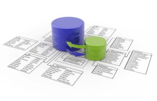
Integration of the Cadastral and Registry Information System
|
|
|
- Francine French
- 6 years ago
- Views:
Transcription
1 Meeting Building a national geospatial information system: driving forces and success stories.. Integration of the Cadastral and Registry Information System February 4,
2 Introduction 2


3 Law of the National Statistical and Geographical Information System Article 3. The National Statistical and Geographical Information System (SNIEG) aims to supply society and the State with quality, relevant, truthful and opportune information, in order to contribute national development 3


4 National Subsystems of SNIEG Parts of the System in charge of producing, integrating and disseminating information by specific topics Demographic and Social Economic Geographical and Environmental Government, Public Security and Application of Justice 4
5 SNIGMA components Geographic Datasets Environment Indicators Geographical names Cadastre, Topographic, Natural Resources and Climate Data Land, Island and Submarine Relief Coastal, International, State and Municipal Limits Geodetic Reference Frame Environment Atmosphere Water Soil Biodiversity Hazardous Waste Solid Waste 5


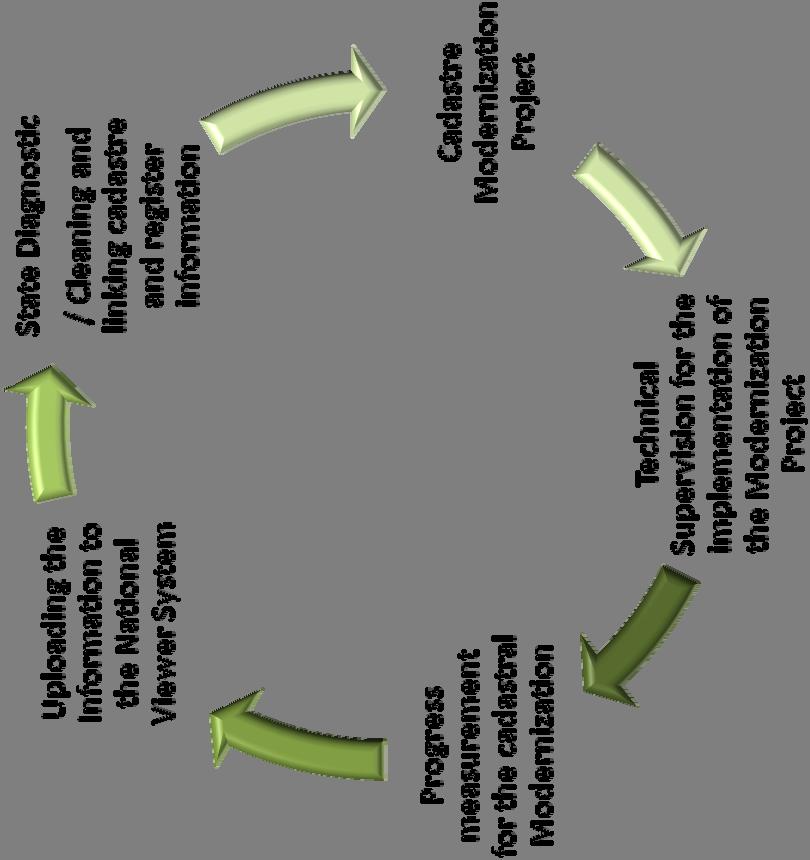
6 Process to integrate the Cadastral and Registry Information System Results Graphical cadastral query Whose? Where? Measures? Features? Coordination Integration of information Cadastral and Registry Information System Standards Technology Data Collection 6
7 Coordination 7


8 Mexican Coordination within the SNIEG 32 Cadastral State Offices 32 Public Property Registry Offices 8
9 Regulation 9

10 ARTICLE 62. The Institute will promote the adoption of methods and technical standards in gathering data to be registered, in coordination with the authorities that manage directories of individuals or corporations, cadastre, public property and commerce registry, lists, inventories and other administrative registries to gather information. ARTICLE 93. The inscription on the National Geographic Information Registry regarding municipal and state cadastres, will consider both cartography and data bases of urban and rural lands within their territories. In the case cartography and data bases described in the previous paragraph don t exist, data available in lists, sketches and cadastral cards will be registered. 10
11 38% 2% 38% 2% SUPERFICIE TOTAL: 196 MILLONES DE HAS. LAND USE AND PROPERTY DISTRIBUTION IN MEXICO TOTAL AREA: 196 MILLION HECTARES 4% 3% Distribución de la Propiedad en México. Superficie Total Mhas. 4% 3% 53% 53% 17% 17% 13% 13% 1% 1% Uso de Suelo Total Mha. 17% 17% 17% 17% Propiedad Social Property: Social: Mha Mha. Propiedad Social: Mha. Propiedad Private Rural Privada Property: Rural: 73.1 Mha Mha. Colonias Agricultural Agrícolas and Ranching y Ganaderas: Colonies: 3.8 Mha. 3.8 Mha Colonias Agrícolas y Ganaderas: 3.8 Mha. National Properties: 7.2 Mha Terrenos Nacionales: 7.2 Mha. Ter Otros Others renos (Zonas Nacionales: (Federal Federales, Lands, 7.2 Zonas Urban Mha. Urbanas, areas, Cuerpos de Agua, etc.): 5.8 Mha. water bodies, etc): 5.8 Mha Otros (Zonas Federales, Zonas Urbanas, Fuente: Source: Información 1998 Cuerpos Historical con base de Cadastre en Agua, Catastro etc.): Histórico 5.8de % 35% Bosques: 34.5 Mha. Forest: 34.5 Mha Selvas: Jungle: Mha. Mha Selvas: 32.6 Mha. Matorral Shrubland y Vegetación and other Diversa: vegetation: 69 Mha. 69 Mha Matorral y Vegetación Diversa: 69 Mha. Agricultural: Mha. Mha Agricultura 32.6 Mha. Pastizales: Pastureland: Mha. Mha Asentamientos Human settlements Humanos (Urban: (Urbano: and y Rural: Mha.) Mha) Pastizales: 25.1 Mha. Asentamientos Humanos (Urbano: 1.1 y Rural 0 Fuente: Source: INEGI. INEGI. Conjunto Land Use Nacional and del Vegetation Uso del Suelo Information, y Vegetación. version Serie IV, IV 2010

12 SOCIAL PROPERTY DISTRIBUTION (EJIDOS AND COMMUNITIES) 12
13 Incorporated parcels into the Cadastral and Registry Information System INFORMATION NATIONAL AGRARIAN, COMMUNAL PROPERTY 29,427 Agrarian Conglomerates with: 5.8 Million of Parcels 3 Million of urban parcels 69 thousand common lands Program with Secretary of Agriculture 3.3 Million parcels Program with Secretary of Social Development 25.8 Million parcels Program with Bank Public works BANOBRAS 2.5 Million parcels TOTAL Million parcels 13


14 Technical standards Generation, Gathering and Integration of Cadastral and Register Data for Statistical and Geographic purposes Promotes harmonization and uniformity of cadastral and register data. Cadastral code Cadastral information Electronic folio Land code Entitlement code Registry information RAN Cadastres PPR RAN 14


15 Technical standards Location Accuracy Standards Sets the values of accuracy to be applied to geographic location processes Outside the precision range established by the standard Imprecise Survey Method Within the range of accuracy established by the standard Reliable Method of Survey 15


16 Technical standards National Geodetic System Defines the unique geographical reference framework to be used in the country Allows the overlay of any geographic dataset to properly: Integrate Compare Analyze Unique Geodetic Reference Framework 16


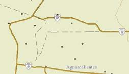
17 Technical standards Geographic Addresses Set the rules for describing an address geographically Complete gathering TYPE OF ROAD: STREET ROAD NAME: ISABEL LA CATÓLICA OUTSIDE NUMBER: Not available (SN) TYPE OF HUMAN SETTLEMENT: Neighbourhood HUMAN SETTLEMENT NAME: CAMPESTRE POSTAL CODE: CITY OR TOWN NAME : AGUASCALIENTES MUNICIPALITY NAME: AGUASCALIENTES STATE NAME: AGUASCALIENTES BETWEEN ROADS: FRONTERA AND AGUSTÍN DE ITURBIDE BACK ROADS: NONE Church 17


18 WHEN? Date Technical standards Development of Geographical Metadata Establishes a layout to standardize the documentation of statistical data and geographic products WHO? Author WHERE? Location HOW? Quality Geospatial Database WHY? Objective WHAT? Product 18
19 Data Collection 19
20 PROGRAMME TO UPDATE INFORMATION AND RECORDS OF CADASTRE AND PUBLIC PROPERTY REGISTRY 20


21 Objectives : Modernization program of public records and cadastral property * 4th Mexican Government Report
22 INEGI activities 22


23 State Cadastre Diagnostics Recollect, analyze, evaluate and document the main findings 23


24 Cadastre modernization programs Linking cadastre and registry information 27.9 million 18.0 million 45.9 million of processed records 24


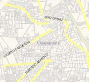
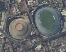
25 Cadastre modernization programns Private property parcels information Cadastral parcels: 22.9 Million Public Registry parcels: 12.2 Million Linked records: 4.6 Million BANOBRAS SEDESOL Private property rustic parcels Alphanumeric records 9 million of cadastral accounts Cartography 6.2 million of parcels (597,114 on rural areas) Linked 25
26 Technology 26


27 Implemented technologies Based on Mapa Digital de México V5.0 platform Free software solid components Communication standards 27


. http://gaia.")
28 Digital Map of Mexico Online system created for query and analysis of geographic and statistical information generated by INEGI. 158 vector information layers More than 66 million geographical objects (approx. 74 GB) 4 raster layers (more than 1 terabyte). 28


29 Shared Information for Territorial Management More than 150 layers of vector information Private property cadastre Unidades del Estado Raster Information INEGI Catastros y Registros Públicos Social property cadastre Statistical Information georeferenced 29


30 Distributed service archtecture Connectivity National Agrarian Registry RAN System server Maps Data Maps Data STATE National Statistical and Geographical Information System Mexican States 30
31 Queries to the System 31

32 Parcels in Cuernavaca, urban area, state Morelos 32


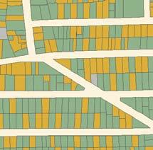
33 Query result of an urban parcel 33
34 General results 34

35 DISTRIBUTION OF METROPOLITAN AREAS AND CITIES The 384 cities that comprehends the National Urban System are defined as the set of cities whose population is over 15 thousand inhabitants. Based on that information, 72.5% of the population inhabits in these cities and the remaining 27.5% lives in localities whose population is less than 15 thousand inhabitants, which are considered semi urban and rural. Source: CONAPO, SEDESOL, SEGOB National Urban System Catalog based on the 2010 Housing and Population Census and the 2010 Geostatistical Framework V The metropolitan areas definition was taken from the Interinstitutional Group SEDESOL, CONAPO and INEGI
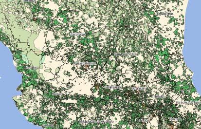
36 Measuring General results are obtained for each state through the application of 150 parameters and their proper weighing. Then a summary for each component and its reference value is generated. The evaluated components are: Legal Framework. Cadastral Processes. Information and Communication Technologies. Cadastre link with Public Property Register (RPP). Cadastral Function Professionalization. Service Efficiency. 36

37 Programme benefits 37
38 Cadastre and Register Information System 38
39 Expectations Sustain coordination with Units of State to integrate information of both areas, urban and rural, through the SNIEG and to characterize the national territory. Consolidate the Cadastral and Registry Information System in order to have an updated inventory of urban and rural private property. Define terms and specifications so that after uploading the cadastre and register information online, full access is immediately granted for all levels in the SNIEG. 39
40 Because we provide information for everybody Meeting Mexico! 40
41 EXAMPLE 2: PROGRAMME TO UPDATE INFORMATION AND RECORDS OF SOCIAL PROPERTY, NATIONAL AGRARIAN REGISTRY 41
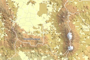
42 Distribution of communal property Communal property surface per state Oaxaca Nayarit Guerrero Nuevo León Tamaulipas Sonora 75% 35% MÉXICO 51% surface out of the national territory Source: Registro Agrario Nacional 42


43 National Agrarian Registry Information integrated by the system Communal property parcels 29,427 Agrarian Conglomerate 5.8 Million Parcels 3 Million Urban parcels 69 thousand Common land 43

44 Information about communal property in Morelos state 44

45 Query result of a parcel in communal property 45
Use of data in Ukraine for sustainable economic growth. Oleksandr Maliuk State Service of Ukraine for Geodesy, Cartography and Cadastre
 Use of data in Ukraine for sustainable economic growth Oleksandr Maliuk State Service of Ukraine for Geodesy, Cartography and Cadastre Kehl, 2017 Content of the presentation Ukraine & StateGeoCadastre:
The Boundary and the Effects of Cadastral Surveying in Cyprus
 The Boundary and the Effects of Cadastral Surveying in Cyprus Aristi Louca, Margarita Fani Surveyor Engineers, Cyprus Association of Rural and Surveying Engineers The History of Cyprus goes back 11000
Functional system for cadastral plans
 , Republic of Macedonia Key words: Cadastre, Digital plans, Data, System SUMMARY The analysis shows that the real estate market in Republic of Macedonia grows daily. With the expansion of this market increases
International Workshop Land Banking/Land Funds as an Instrument for Improved Land Management for CEEC and CIS March 2004 Tonder,, Denmark
 MINISTRY OF AGRICULTURE AND FORESTRY SOFIA, BULGARIA International Workshop Land Banking/Land Funds as an Instrument for Improved Land Management for CEEC and CIS 17-20 March 2004 Tonder,, Denmark BULGARIAN
LIS a motivation for SDI initiative
 Eric Mwaikambo Ardhi University Dar es Salaam Tanzania Overview Status of LIS in Tanzania Relationship between SDI and LIS Spatial Standards LIS a motivation for SDI initiative Conclusion & Recommendations
Making Conservation Public in Mexico: creating a National Public
 Making Conservation Public in Mexico: creating a National Public Lands Trust from scratch Paulo Quadri Barba PhD Candidate Environmental Studies Department UC Santa Cruz Outline What is this about? Brief
National Spatial Data Infrastructure development in Republic of Macedonia
 National Spatial Data Infrastructure development in Republic of Macedonia Sonja Dimova, state advisor for geomatics AGENCY FOR REAL ESTATE CADASTRE September 6-th, 2017, Strasbourg AREC competence for
Cloud GIS Real Estate Management, Appraisal and Development Service USING ESRIs ARCGIS SERVER
 Cloud GIS Real Estate Management, Appraisal and Development Service USING ESRIs ARCGIS SERVER INFODIM: Was founded on 1992 and is internationally certified as a GIS company from D&B Dun & Bradstreet Global
AREC responsibilities, data and registries and the way of their distribution
 Data as a basis of the digital society PCC, 13-15 March 2018, Sofia AREC responsibilities, data and registries and the way of their distribution Vlatko Dimovski Agency for Real Estate Cadastre (AREC) the
Republic of Bulgaria
 Geodesy, Cartography and Cadastre Agency Republic of Bulgaria www.cadastre.bg 24. 01. 2018 г., гр. София The Cadastre Legislation in Bulgaria - historical reference 1908 г. The Cadastre Act The objective
Recent Developments in Use and Dissemination of Geospatial Data in Germany - Example Lower Saxony
 Recent Developments in Use and Dissemination of Geospatial Data in Germany - Example Lower Saxony Conference Permanent Committee on Cadastre Lithuanian Presidency Vilnius, 22 October 2013 Peter Creuzer
Cadastre: definitions
 Introduction New vision towards a multipurpose cadastral system to support land management in Morocco Moha EL-AYACHI, El Hassane SEMLALI, Mohamed ETTARID, Driss TAHIRI, Institut Agronomique et Vétérinaire
Role of Republic Geodetic Authority in the Serbian geo-sector
 Role of Republic Geodetic Authority in the Serbian geo-sector Republic Geodetic Authority, Serbia www.rgz.gov.rs EuroGeographics General Assembly 2014 Moldova, Chisinau, 28 th 30 th September 2014 The
SECTOR PUBLIC CADASTRES AND REGISTERS MARKET PARTICIPANTS
 E-SERVICES TO CITIZENS, GOVERNMENT AND BUSINESSES. LITHUANIA EXPERIENCE Arvydas Bagdonavičius State Enterprise Centre of Registers Arvydas.Bagdonavicius@registrucentras.lt REGISTERS AND IS MANAGED BY THE
Croatian SDI: a Tool for Accelerated Development of the Geo-Conscious Society
 STATE GEODETIC ADMINISTRATION Croatian SDI: a Tool for Accelerated Development of the Geo-Conscious Society Prof.Dr.Sc. Željko Bačić, Mr.Sc. Ljerka Rašić FIG Working Week 2009 - Surveyors Key Role in Accelerated
BULGARIAN CADASTRE A GUARANTEE FOR THE OWNERSHIP RIGHTS IN IMMOVABLE PROPERTIES
 4 TH INTERNATIONAL CONFERENCE RECENT PROBLEMS IN GEODESY AND RELATED FIELDS WITH INTERNATIONAL IMPORTANCE February 28 - March 2, 2007, Inter Expo Centre, Sofia, Bulgaria BULGARIAN CADASTRE A GUARANTEE
The principal tasks or competencies of the General Directorate of Cadastre are:
 4th Quality Conference 1/7 1) Title of the case. Spanish e Cadastre ( Virtual Office of Cadastre, or OVC). An open space for sustainable quality in cadastral data, working with land management administrations.
Reliability of the Italian cadastral system data quality and improvement prospects
 Reliability of the Italian cadastral system data quality and improvement prospects Eng. Franco MAGGIO (Central Director for Cadastral, Cartographic and Land Registration Services) Eng. Arturo ANGELINI
URBAN DEVELOPMENT AND HOUSING POLICY
 1 URBAN DEVELOPMENT AND HOUSING POLICY 2013-2018 2 Agenda I. Federal Urban Development and Housing Policy II. Importance of the housing sector for the Federal Government III. Political stability and governance
The Contribution of Forest Owners Associations for the Forest Cadastre Implementation. João Gaspar Ana Navarro Ferreira PORTUGAL
 The Contribution of Forest Owners Associations for the Forest Cadastre Implementation João Gaspar Ana Navarro Ferreira PORTUGAL Motivation Lack of forestry cadastre; Unify all FOAs databases with common
Unified Land Administration for a Better Spatial Infrastructure
 Unified Land Administration for a Better Spatial Infrastructure Gyula IVÁN Institute of Geodesy, Cartography & Remote Sensing FÖMI (HUNGARY) Open Symposium 30th Korean Cadastral Seminar & FIG Commission
The Role of the Swedish Land Information System
 The Role of the Swedish Land Information System In the Business Society Tommy Österberg Swedesurvey 1 SWEDEN 9 million inhabitants 450 000 sq. km 21 Counties 291 Municipalities 4.6 million properties in
Parcel Boundaries in the Czech Republic
 Parcel Boundaries in the Czech Republic CZECH REPUBLIC Jiri Rydval, Libor Tomandl Czech Office for Surveying, Mapping and Cadastre inhabitants - 10.3 million territory 78,865 km 2 2 Contents: 1. A parcel
Role of spatial planning in modern society
 Republic of Croatia State Geodetic Administration The Role of Cadastre in the Development of Regional and Local Planning Structure in Croatia Zdravko Cesarec and Željko Bačić 1 Role of spatial planning
Amalia Velasco Carlos Alonso Luis Virgos Fernando Serrano
 Inspire services of the Spanish Directorate General for Cadastre and its use to resolve an old problem of coordination between Spanish Cadastre and Land Registry. Amalia Velasco Carlos Alonso Luis Virgos
Smart Infrastructure Benefits and Key Players from a Global Perspective
 Smart Infrastructure Benefits and Key Players from a Global Perspective Spatial@gov 2010 October 5-7 Canberra Jude Wallace and Abbas Rajabifard Centre for Spatial Data Infrastructures and Land Administration
Cadastral Information System of Sofia
 Alexander LAZAROV and Hristo DECHEV, Bulgaria Key words: ABSTRACT A new Cadastre and Property Register Act (CPRA) was passed in April 2000, setting up rules for the maintenance of these two registers.
Aspect of preliminary activities in the function of supporting NSDI
 Sonja DIMOVA, Republic of Macedonia Key words: e-governance, geospatial data, NSDI, INSPIRE, metadata SUMMARY The successful establishment of the NSDI in the true sense of the word cannot be performed
PROJECT INFORMATION DOCUMENT (PID) APPRAISAL STAGE Report No.: PIDA Project Name. Region Country Sector(s) Theme(s)
 APPRAISAL STAGE Report No.: PIDA Project Name. Region Country Sector(s) Theme(s)") Public Disclosure Authorized Public Disclosure Authorized Public Disclosure Authorized Public Disclosure Authorized Project Name Region Country Sector(s) Theme(s) Lending Instrument Project ID Borrower(s)
Public Disclosure Authorized Public Disclosure Authorized Public Disclosure Authorized Public Disclosure Authorized Project Name Region Country Sector(s) Theme(s) Lending Instrument Project ID Borrower(s)
Department of Lands and Survey
 Cadastral System in Jordan Department of Lands and Survey Eng. Nedal Al-Sagarat/ Director General Eng. Mouen Sayegh/ IT Manager November, 2011 General Information Historical Background Main Duties Organizational
Test and Implementation of DATR System in Hungary
 Test and Implementation of DATR System in Hungary, Hungary Key words: unified land registry, cadastral map, Hungary SUMMARY During the last years there has been an important development in the Hungarian
ABSTRACT Land Administration System in Lithuania
 ABSTRACT Land Administration System in Lithuania 1. General introduction to the Lithuanian Land Administration System and State Enterprise Centre of Registers ( shortly SECR) Lithuania has established
- the future tool to success
 From chaos to order... GIS in Land Consolidation - the future tool to success Experiences from Forest Land Consolidation in Sweden FAO Workshop in Santiago de Compostela 2009 Mats Backman Land Consolidation
Object Oriented Unified Real Estate Registry for a Good Spatial Data Management
 Object Oriented Unified Real Estate Registry for a Good Spatial Data Management Gyula IVÁN Gábor SZABÓ Zoltán WENINGER Institute of Geodesy, Cartography and Remote Sensing (FÖMI), Hungary Workshop on e-governance,
Country report, HUNGARY
 Country report, HUNGARY Gyula IVÁN Institute of Geodesy, Cartography & Remote Sensing (FÖMI) HUNGARY FIG Commission 7 Annual Meeting 2009 12-16 October, 2009, Kuala Lumpur, Malaysia Institute of Geodesy,
LAND REGISTRATION SYSTEM OF THE REPUBLIC OF CROATIA
 "On the last day of the Creation God desired to crown His work, and thus created Kornati Islands out of tears, stars and breath." (George Bernard Shaw) LAND REGISTRATION SYSTEM OF THE REPUBLIC OF CROATIA
THE USE OF THE SPANISH CADASTRE FOR THE CONTROL AND MONITORING OF EU-CAP SUBSIDIES
 WPLA WORKSHOP Budapest THE USE OF THE SPANISH CADASTRE FOR THE CONTROL AND MONITORING OF EU-CAP SUBSIDIES INTRODUCTION The distribution of EU Agricultural Policy (CAP) subsidies has recently undergone
GLOBAL GEOSPATIAL MANAGEMENT INFORMATION
 GLOBAL GEOSPATIAL MANAGEMENT INFORMATION SEOUL, KOREA 24 th to 26 th October 2011 COUNTRY REPORT - REPUBLIC OF BOTSWANA 1. INTRODUCTION 1.1. SOCIAL, ECONOMIC AND POLITICAL BACKGROUND Botswana attained
Topographic Signs Important Context of 3D Cadastre
 STATE GEODETIC ADMINISTRATION Gruška 20,10 000 Zagreb, Croatia Delft University of Technology Faculty of Architecture and the Built Environment Department OTB GIS Technology Section Topographic Signs Important
Addressing Land Sector Opportunities with Geospatial Information in Nepal
 The 20th UNRCC-AP and the 4th UN-GGIM-AP 5-10 October 2015 Jeju Island, Republic of Korea Addressing Land Sector Opportunities with Geospatial Information in Nepal Krishna Raj BC Executive Director Land
Ownership Data in Cadastral Information System of Sofia (CIS Sofia) from the Available Cadastral Map
 from the Available Cadastral Map") Ownership Data in Cadastral Information System of Sofia (CIS Sofia) from the Available Cadastral Map Key words: ABSTRACT Lydmila LAZAROVA, Bulgaria CIS Sofia is created and maintained by GIS Sofia ltd,
Ownership Data in Cadastral Information System of Sofia (CIS Sofia) from the Available Cadastral Map Key words: ABSTRACT Lydmila LAZAROVA, Bulgaria CIS Sofia is created and maintained by GIS Sofia ltd,
Quality Improvement to Cadastral Information in Sweden
 Gunnar BLIXT, Sweden Key words: digital cadastre, quality, cadastral index map, real property register. SUMMARY Lantmäteriet is a governmental agency which gives support for creating an efficient and sustainable
Land Tenure and Geospatial Data and Technology
 Land Tenure and Geospatial Data and Technology Ioana Bouvier E3/Land and Urban, USAID Senior Geospatial Analyst January 23, 2018 January 23, 2018 1 OUTLINE 1. Overview of geospatial data and technology
Development of Cadastral Survey and Land Ownership Registration System in Mongolia
 Development of Cadastral Survey and Land Ownership Registration System in Mongolia M.Saandar,, Ph. D Vice President, the Mongolian Association of Surveying and Mapping, ( As National Member of FIG ) MonMap
EVOLUTION TOWARDS THE DIGITAL LAND OFFICES
 EVOLUTION TOWARDS THE DIGITAL LAND OFFICES Szabolcs MIHÁLY, Piroska ZALABA Budapest, Hungary 1. INTRODUCTION 2. CURRENT STATUS OF THE UNIFORM LAND REGISTRATION 2.1. Management Features of the Hungarian
The cadastre of buildings' energy performance - The Case Study of the Regione Lombardia
 The cadastre of buildings' energy performance - The Case Study of the Regione Lombardia Massimiliano ROMAGNOLI, Italy Key words: Energy, Environment, Law, Building. SUMMARY As part of a series of national
New Developments in the Hellenic Cadastre
 New Developments in the Hellenic Cadastre Prof. M. Kavouras Vice-president Ktimatologio S.A. (Hellenic Cadastre) The Hellenic Cadastre Background The Hellenic National Cadastre Organizational and institutional
IT-SUPPORTED STATE-LAND MANAGEMENT IN A TRANSITIONAL ENVIRONMENT
 IT-SUPPORTED STATE-LAND MANAGEMENT IN A TRANSITIONAL ENVIRONMENT - Examples from Eastern Germany and Mongolia - TOPICS 1 S LAND INFORMATION SYSTEM History and main components IT-strategy and development
LAND INFORMATION SOURCES IN LATIN AMERICA: VOL. 1: INTRODUCTION AND MEXICO AND CARIBBEAN COUNTRIES
 LAND INFORMATION SOURCES IN LATIN AMERICA: VOL. 1: INTRODUCTION AND MEXICO AND CARIBBEAN COUNTRIES By Denise Stanley, Steven E. Hendrix, Steve Leisz, And other contributions as listed --"'---1IfIiI' ill
Report and update from Working Group A on Core Data
 JOINT UN-GGIM: EUROPE ESS MEETING ON THE INTEGRATION OF STATISTICAL AND GEOSPATIAL INFORMATION LUXEMBOURG 31 MARCH 2017 Report and update from Working Group A on Core Data François Chirié, Dominique Laurent,
Improvement of Effectiveness Present Developments in Hungarian Land Administration
 Improvement of Effectiveness Present Developments in Hungarian Land Administration Gyula IVÁN and András OSSKÓ, Hungary Key words: Land Administration, Cadastre, Land Registry SUMMARY New Act on Surveying
A NOMINAL ASSET VALUE-BASED APPROACH FOR LAND READJUSTMENT AND ITS IMPLEMENTATION USING GEOGRAPHICAL INFORMATION SYSTEMS
 A NOMINAL ASSET VALUE-BASED APPROACH FOR LAND READJUSTMENT AND ITS IMPLEMENTATION USING GEOGRAPHICAL INFORMATION SYSTEMS by Tahsin YOMRALIOGLU B.Sc., M.Sc. A thesis submitted for the Degree of Doctor of
GAUSSCAD A WEBGIS APPLICATION FOR COLLECTING CADASTRAL DATA
 M.M. Moise GaussCAD a WebGIS Application for Collecting Cadastral Data GAUSSCAD A WEBGIS APPLICATION FOR COLLECTING CADASTRAL DATA Mihai-Mircea MOISE, S.C. GAUSS S.R.L., mihai.moise@gauss.ro Abstract:
Land Consolidation in Sweden and Land
 From chaos to order... Land Consolidation in Sweden and Land Reform in Romaniasimilarities and discrepancies a comparison Mats Backman June 16 th 2008 Personal presentation Land Consolidation work in Sweden
Property Based Land Information Systems of Turkey
 Property Based Land Information Systems of Turkey Mehmet Fatih DİRİ, Bilgehan ÖZSOY, Ünsal ERGÜN, Turkey Key words: Cadaster, Land Registry, GIS, Property, TURKEY SUMMARY The property, addition to the
QUESTIONNAIRE. 1. Authorizing statute(s) citation West Virginia Code and 11-1C-4(d)
 citation West Virginia Code and 11-1C-4(d)") QUESTIONNAIRE (Please include a copy of this form with each filing of your rule: Notice of Public Hearing or Comment Period; Proposed Rule, and if needed, Emergency and Modified Rule.) DATE: 6/8/15 TO:
QUESTIONNAIRE (Please include a copy of this form with each filing of your rule: Notice of Public Hearing or Comment Period; Proposed Rule, and if needed, Emergency and Modified Rule.) DATE: 6/8/15 TO:
Surveying in Austria. Congress Maanmittauspäivät Seinäjoki, 20 th March 2014
 Surveying in Austria Congress Maanmittauspäivät Seinäjoki, 20 th March 2014 Topics Facts, figures Organisational issues of surveying Role of the BEV Products, services The Cadastre Surveying Education
PROPOSAL FOR THE URBAN REAL ESTATE PROPERTY TAX MANAGEMENT DIAGNOSIS IN BRAZIL
 PROPOSAL FOR THE URBAN REAL ESTATE PROPERTY TAX MANAGEMENT DIAGNOSIS IN BRAZIL Marcos A. PELEGRINA and Lia BASTOS Maio de 2009 Geog. Marcos A.. Pelegrina, M.Engº 1 Geog. Marcos A.. Pelegrina, M.Engº 2
Ordinance on Official Cadastral Surveying
 English is not an official language of the Swiss Confederation. This translation is provided for information purposes only and has no legal force. Ordinance on Official Cadastral Surveying 211.432.2 of
The Verification of the Modernization of the Real Estate Cadastre in the Context of the Quality of Cadastral Data Case Study
 Environmental Engineering 10th International Conference eissn 2029-7092 / eisbn 978-609-476-044-0 Vilnius Gediminas Technical University Lithuania, 27 28 April 2017 Article ID: enviro.2017.218 http://enviro.vgtu.lt
PROJECT INFORMATION DOCUMENT (PID) CONCEPT STAGE Report No.: AB3229 Project Name. Land Registry and Cadastre Modernization Project Region
 CONCEPT STAGE Report No.: AB3229 Project Name. Land Registry and Cadastre Modernization Project Region") PROJECT INFORMATION DOCUMENT (PID) CONCEPT STAGE Report No.: AB3229 Project Name Land Registry and Cadastre Modernization Project Region EUROPE AND CENTRAL ASIA Sector Central government administration
PROJECT INFORMATION DOCUMENT (PID) CONCEPT STAGE Report No.: AB3229 Project Name Land Registry and Cadastre Modernization Project Region EUROPE AND CENTRAL ASIA Sector Central government administration
Cadastral Template 2003
 PCGIAP-Working Group 3 "Cadastre" FIG-Commission 7 "Cadastre and Land Management" Cadastral Template 2003 The establishment of a cadastral template is one of the objectives of Working Group 3 "Cadastre"
Surveyor General s Report
 Surveyor General s Report Susan F. MacGregor O.L.S. Surveyor General Mapping and Information Resources Branch Ministry of Natural Resources and Forestry Queen s Printer for Ontario, 2017 The Ministry of
COUNTRY REPORT ON CADASTRE AND LAND REGISTRAION IN IRAN. By: Hamid Berenjkar, IRAN
 COUNTRY REPORT ON CADASTRE AND LAND REGISTRAION IN IRAN By: Hamid Berenjkar, IRAN Key words: Comprehensive Cadastre, Cadastre System, Cadastral Survey, Land Book, Iran ABSTRACT Land registration and cadastral
Cadastral Parcels in the context of INSPIRE
 Cadastral Parcels in the context of INSPIRE Gyula IVÁN Institute of Geodesy, Cartography & Remote Sensing, HUNGARY Open Symposium on Environment and Land Administration Big Works for the Defence of Territory
INSPIRE implementation as a link between egovernment and environmental purposes
 INSPIRE implementation as a link between egovernment and environmental purposes Jiří Poláček Czech Office for Surveying, Mapping and Cadastre (ČÚZK) Agenda Role of ČÚZK branch in the INSPIRE implementation.
International funding projects in Republic Geodetic Authority
 International funding projects in Republic Geodetic Authority Serbia: Republic Geodetic Authority Workshop Exploring Funding Instruments for NMCA 7-8 November 2012 Republic Geodetic Authority Republic
DEVELOPMENT OF A STUDY OF IMPLEMENTATION OF THE CADASTRE OF BUILDINGS IN THE REPUBLIC OF CROATIA
 REPUBLIC OF CROATIA Ministry of Construction and Physical Planning State Geodetic Administration Gruška 20, 10000 ZAGREB, CROATIA Phone: +385-1-6165-404 Fax: +385-1-6165-484 Terms of Reference DEVELOPMENT
MARATHON COUNTY LAND INFORMATION OFFICE
 MARATHON COUNTY, WISCONSIN 2010-2014 MARATHON COUNTY LAND INFORMATION OFFICE TABLE OF CONTENTS I. EXECUTIVE S A Contact Information 2 B Participants in the Planning Process 2 C.Plan Summary 2 II. LAND
Cadastral services and virtual office in e-cadastre
 Cadastral services and virtual office in e-cadastre Priit Kuus Estonian Land Board October 26, 2016 Coimbra Scope of data Cadastral parcels (as of September 2016) 674 383 cadastral parcels, i.e. 97,7 %
Object Oriented Unified Real Estate Registry for a Good Spatial Data Management
 Object Oriented Unified Real Estate Registry for a Good Spatial Data Management Gyula IVÁN Gábor SZABÓ Zoltán WENINGER, Hungary Key words: Cadastre, Land Administration, GIS SUMMARY The IT developments
DATR towards e-land Administration in Hungary
 DATR towards e-land Administration in Hungary Gyula IVÁN-Gábor SZABÓ-Zoltán WENINGER-Piroska Zalaba Institute of Geodesy, Cartography and Remote Sensing, Budapest, HUNGARY XXIV. FIG Congress Facing the
Expansion of Land Information Services in Hungarian Land Administration
 Expansion of Land Information Services in Hungarian Land Administration Gyula IVÁN, Gábor SZABÓ and Zoltán WENINGER, Hungary Key words: Land registry, Cadastral system, GIS, LIS, WEB based services SUMMARY
Who we are? MIS GIS. Cadastral Data Management System in Turkey. View from MIS. View from GIS. Dr. Emin Bank MIS? GIS? IT?
 Cadastral Data Management System in Turkey Dr. Emin Bank ebank@islem.com.tr Who we are?? View from? Or? View from Nowadays and are getting closer fastly 1 Viewing from is changing Viewing from is changing
8 th FIG Regional Conference Montevideo, Uruguay, November Call for Papers
 8 th FIG Regional Conference Montevideo, Uruguay, 26-29 November 2012 Dear Friend and Colleague, Call for Papers It is our privilege and honour to invite you to the 8 th FIG Regional Conference in Montevideo,
Theme II. Customers and Services NEW PROJECTS OF THE AGENZIA DEL TERRITORIO. Marco SELLERIE
 UNITED NATIONS ECONOMIC COMMISSION FOR EUROPE COMMITTEE ON HUMAN SETTLEMENTS WORKING PARTY ON LAND ADMINISTRATION Workshop "Customer - Co-operation - Services" Vienna, Austria 12-13 September 2002 Theme
e-land Administration in Hungary
 e-land Administration in Hungary Piroska Zalaba senior counsellor, project manager Ministry of Agriculture and Rural Development Department of Lands and Mapping FIG SEMINAR Innsbruck, 2-4 June 2004 Land
Cadastre and Land Registration in Europe
 Annex A: Questionnaire 2007 for Information Resource Cadastre and Land Registration in Europe Introduction This questionnaire is based on the EuroGeographics vision document 'Cadastre and Land Registration
BACHELOR'S DEGREE IN GEOINFORMATION AND GEOMATICS ENGINEERING (Syllabus 2016). (Teaching unit Compulsory) 6 Teaching languages: Catalan, Spanish
. (Teaching unit Compulsory) 6 Teaching languages: Catalan, Spanish") Coordinating unit: Teaching unit: Academic year: Degree: ECTS credits: 2017 310 - EPSEB - Barcelona School of Building Construction 732 - OE - Department of Management 751 - DECA - Department of Civil
Coordinating unit: Teaching unit: Academic year: Degree: ECTS credits: 2017 310 - EPSEB - Barcelona School of Building Construction 732 - OE - Department of Management 751 - DECA - Department of Civil
NOTICE OF REGISTRATION. Re: Request for Inspection PANAMA: Land Administration Project (Loan No PAN)
") INTERNATIONAL BANK FOR RECONSTRUCTION AND DEVELOPMENT INTERNATIONAL DEVELOPMENT ASSOCIATION INTERNATIONAL BANK FOR RECONSTRUCTION AND DEVELOPMENT 1818 H Street, NW Phone: (202) 458-5200 INTERNATIONAL DEVELOPMENT
INTERNATIONAL BANK FOR RECONSTRUCTION AND DEVELOPMENT INTERNATIONAL DEVELOPMENT ASSOCIATION INTERNATIONAL BANK FOR RECONSTRUCTION AND DEVELOPMENT 1818 H Street, NW Phone: (202) 458-5200 INTERNATIONAL DEVELOPMENT
Status and Perspectives of the Geodesy, Cartography and Cadastre Authority Availability of Geographic Information in Slovakia.
 Status and Perspectives of the Geodesy, Cartography and Cadastre Authority Availability of Geographic Information in Slovakia Hedviga Májovská Geodesy, Cartography and Cadastre Authority of the Slovak
Modern Real Estate Cadastre as Part of Geodata Infrastructure in Korea and Germany
 0pen Symposium 30th Korean Cadastral Seminar & Commission 7 Annual Meeting 2007 Good practice in Cadastre and Land registry Modern Real Estate Cadastre as Part of Geodata Infrastructure in Korea and Germany
Demonstrate knowledge of, and extract, cadastral data from Landonline
 Page 1 of 5 Demonstrate knowledge of, and extract, cadastral data from Landonline Level 3 Credits 5 Purpose This unit standard is for people who are working in the surveying industry in jobs which involve
The Digital Cadastral Database and the Role of the Private Licensed Surveyors in Denmark
 IRISH INSTITUTE OF SURVEYORS, DUBLIN INSTITUTE OF TECHNOLOGY, 23 NOVEMBER 2005 PUBLISHED IN IIS NEWS, WINTHER 2006. The Digital Cadastral Database and the Role of the Private Licensed Surveyors in Denmark
Integrated Land Information Services in Hungarian Land Administration
 , Hungary Key words: key words, theme, etc. SUMMARY The Unified Hungarian Land Registry, in which cadastral mapping and land registry belong to the same organization (Land Office Network), has been operating
Quality Improvement of the Real Estate Cadastre in Serbia
 , Serbia Key words: quality improvement, real estate information, quality assurance, Serbia SUMMARY The concept of cadastral modernization in the Republic of Serbia was defined in 1992, and it is being
The Danish Digital Cadastral Map A Tool for Land Management
 The Danish Digital Cadastral Map A Tool for Land Management Søren CHRISTENSEN, Denmark Key words: Digital cadastre, restrictions pertaining to public law, land management. ABSTRACT The establishments of
What s Next for Commercial Real Estate Leveraging Technology and Local Analytics to Grow Your Commercial Real Estate Business
 What s Next for Commercial Real Estate Leveraging Technology and Local Analytics to Grow Your Commercial Real Estate Business - A PUBLICATION OF GROWTH MAPS- TABLE OF CONTENTS Intro 1 2 What Does Local
Intangible Assets Web Site Costs
 SIC Interpretation 32 Intangible Assets Web Site Costs In March 2002 the International Accounting Standards Board issued SIC-32 Intangible Assets Web Site Costs, which had originally been developed by
Copernicus Land Monitoring Service (Pan- European and Local) in the Netherlands
 in the Netherlands") Copernicus Land Monitoring Service (Pan- European and Local) in the Netherlands Wageningen Environmental Research (WENR) activiteiten 13 Juni 2018, Gerard Hazeu Introduction Personal note and some terminology
Copernicus Land Monitoring Service (Pan- European and Local) in the Netherlands Wageningen Environmental Research (WENR) activiteiten 13 Juni 2018, Gerard Hazeu Introduction Personal note and some terminology
LAND CADASTRE AND BUILDING CADASTRE IN SLOVENIA: CURRENT SITUATION AND POTENTIAL OF 3D DATA
 3D Cadastres Organizational and Governmental Aspects LAND CADASTRE AND BUILDING CADASTRE IN SLOVENIA: CURRENT SITUATION AND POTENTIAL OF 3D DATA EMA POGORELČNIK AND MARINA KOROŠEC Surveying and Mapping
CONTACT LOCATIONS OF THE PUBLIC-PRIVATE RELATIONSHIP IN THE GEODETIC AND CADASTRE FILDS
 ISSN: 1857-9000, EISSN: 1857-9019 CONTACT LOCATIONS OF THE PUBLIC-PRIVATE RELATIONSHIP IN THE GEODETIC AND CADASTRE FILDS Ljubisha KITANOVSKI 1 UDC: 347.235:349.418]:[334.7:528.44(497.7) ABSTRACT Geodetic
Advances in Modern Land Administration Cadastre 2014 in the Year 2006
 Advances in Modern Land Administration Cadastre 2014 in the Year 2006 Winfried HAWERK, Germany Key words: E-Land Administration, IT renewal strategies SUMMARY FIG Commission 7 Working Group 7.3 deals with
LAND REFORM IN MALAWI
 LAND REFORM IN MALAWI Presented at the Annual Meeting for FIG Commission 7 In Pretoria, South Africa, Held From 4 th 8 th November, 2002 by Daniel O. C. Gondwe 1.0 BACKGROUND Malawi is a landlocked country
Cadastre, innovation and tradition in taxation and real estate market
 Cadastre, innovation and tradition in taxation and real estate market relations and interactions in managing information on properties and owners elopmen Piermassimo Pavese Central Directorate for Cadastre,
LAND CADASTRE Today and Challanges for the future Damjan DOLER
 LAND CADASTRE Today and Challanges for the future Damjan DOLER Head of Real Estate Department Regional surveying office Celje Mariborska cesta 88, Celje, SLOVENIA 32nd Conference of Surveyin Authorities,
INSPIRE implementation as a link between egovernment and environmental purposes
 INSPIRE implementation as a link between egovernment and environmental purposes Jiří Poláček Czech Office for Surveying, Mapping and Cadastre (ČÚZK) What s to Come Role of ČÚZK branch in the INSPIRE implementation.
Integration of Public Service Procedures and Use of Cadastral Data
 Integration of Public Service Procedures and Use of Cadastral Data Signe Rudzite Head of Cadastre and Register Department The State Land Service Vilnius, 21.10.2013 Content General information Current
Support to Implementation of Multipurpose Cadastral Information system in Vietnam
 Support to Implementation of Multipurpose Cadastral Information system in Vietnam Lennart JOHANSSON and Per SÖRBOM, Sweden Key words: Land Registration, Land Information, Land Administration, SWOT analyse,
78th OREGON LEGISLATIVE ASSEMBLY Regular Session. Enrolled. Senate Bill 297
 78th OREGON LEGISLATIVE ASSEMBLY--2015 Regular Session Enrolled Senate Bill 297 Printed pursuant to Senate Interim Rule 213.28 by order of the President of the Senate in conformance with presession filing