Smart Infrastructure Benefits and Key Players from a Global Perspective
|
|
|
- Pamela Randall
- 5 years ago
- Views:
Transcription
1 Smart Infrastructure Benefits and Key Players from a Global Perspective Spatial@gov 2010 October 5-7 Canberra Jude Wallace and Abbas Rajabifard Centre for Spatial Data Infrastructures and Land Administration
2 What we re going to cover Research program Centre for SDI and Land Administration Geospatial research Spatial enablement of land information Who is doing it? How?
3 The Centre for SDIs and Land Administration An overview
4 Research Program Establishes world class scholars in SDI and land administration Collaborates in research projects with State and Federal governments in Australia, the private sector and leading overseas universities International organisations: FIG, UN, GSDI, Secures national competitive grants through the development of team-based research Secures State, Federal and international research grants building on well-established collaboration Disseminates research findings through academic publications, seminars and conferences Research Program Centre for SDIs and LA Training Program Visiting Program
5 Research Focus Sustainable Development Spatial Enablement Sustainable Development Land Administration Spatial Data Infrastructure Land Administration Spatial Data Infrastructure
6 Research Focus Spatial metadata automation National Land Information Infrastructure Survey Accurate Cadastre Spatial Enablement Managing coastal rights, restrictions and responsibilities Land Administration Spatial Data Infrastructure Spatial enabling urban planning Sustainable cities Land information in 3D RRRs in land and resources Spatial Data Infrastructure Concepts Integrated Land Administration systems National and Local Spatial Data Infrastructure Land Administration systems and Benchmarking Marine Cadastre Marine Spatial Data Infrastructure Data integration in SDI ICT enabled Land Administration systems Property RRRS Spatial Metadata for SDI SDI for local urban planning Spatial enabling societies Spatial enabling Health Information

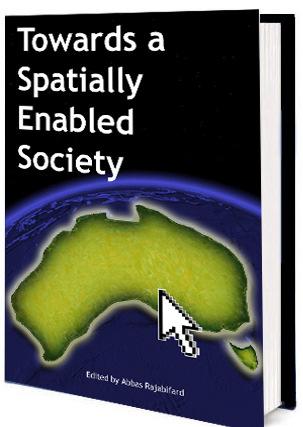
7 Books
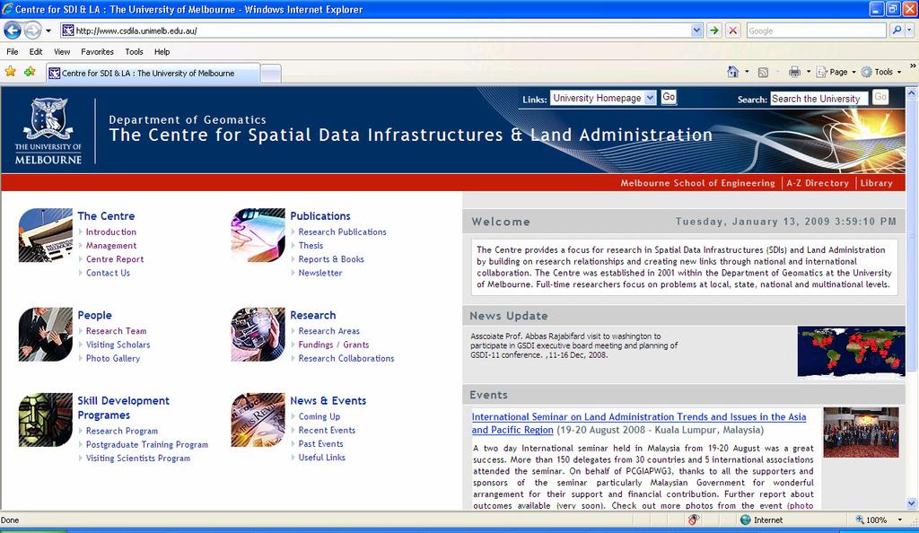
8 Website
 project ARC Linkage Project Dec 2009")
9 National infrastructure for management of land information (NIMLI) project ARC Linkage Project Dec Dec 2012
10 NIMLI project partners Department of Sustainability and Environment
11 NIMLI project aim: To use an engineering approach to design a new infrastructure for integrating disparate, state based land information and administration processes to meet national needs
12 NIMLI project plan Communications Plan Identify National Drivers Review Innovations Publications Plan Design National Prototype Conduct State Case Studies Identify Limitations And Refine National Prototype Test National Prototype Refine and Document National Prototype Strategies for Re-engineering LA for SD

13 Australian model: information to aid public policy, citizens and business
14 Spatial enablement Parcel versus Object Query Query Parcel ID Location Parcel Parcel Property RRR Property RRR Property RRR Property RRR Property RRR Property RRR Property RRR Property RRR See Cadastre 2014, Bennett and others 2008, and Kalantari and others 2008


15 A number of initiatives are already evident SCoLA PCCR there are more participants CSDI Project

16 States and territories are also active New South Wales Land and Property Management Authority Victoria Land Victoria, Department of Sustainability and Environment Western Australia Landgate Australian Capital Territory Planning and Land Authority Land Titles, Office of Regulatory Services, Department of Justice and Community Safety Northern Territory Northern Territory Lands Group, Department of Planning and Infrastructure Queensland Department of Environment and Resource Management South Australia Land Services Group, Department of Transport, Energy and Infrastructure Tasmania Property, Titles and Maps Group, Department of Primary Industries, Parks, Water and Environment
 Urban Development Institute of Australia Australian Institute of Conveyances Australian Institute of Quantity Surveyors Royal Institute of")

17 and other peak national bodies Australian Property Institute Property Council of Australia Real Estate Institute of Victoria Australian Property Law Group (Law Council of Australia) Urban Development Institute of Australia Australian Institute of Conveyances Australian Institute of Quantity Surveyors Royal Institute of Chartered Surveyors Oceania Australian College of Community Association Lawyers Facility Management Association of Australia Master Builders Association National Community Titles Association Shopping Centre Council of Australia Spatial Industries Business Association Urban Development Institute of Australia National Native Title Tribunal


18 Things are also happening globally Examples: Other federations of states.. Europe - INSPIRE Canada Malaysia..and international best practice The Netherlands Denmark
 New banking regulations: national mortgage")
19 USA business model driven National Land Parcel Data: A vision for the future (NRC, 2007) New banking regulations: national mortgage layer
20 Land information for spatial enablement USA - Potential opportunities for common data, services and applications on national scale Geospatial Platform Report page 38 Cadastral information to play a key role in spatial enablement Address data compare GNAF in Australia, through PSMA

21 Building new approaches is difficult federal geographic data committee Geospatial platform report page 56
22 What is really driving a national approach?

23 Better national statistics
24 Enabling shared governance between the states and the feds Tapestry of international treaties, protocols, covenants, agreements, arrangements at global, regional and bilateral levels Increasingly depend on accurate, timely, spatially organised information e.g. The Kyoto Protocol produced the Australian National Registry of Emissions Units


25 There are plenty of other examples across the federal government Enabling counter-terrorism Allocating drought relief Controlling plagues and pests Conserving the environment
26 Enabling National Property Markets Unbundling traditional ownership creates new markets Water interests Carbon interests Biota interests Solar energy interests Thermal energy interests Good markets need good administrative infrastructure Registries (for tenure and valuation) Cadastre or spatial identification Things are already happening The Market for Retail Leases in Australia (Productivity Commission, 2008)

27 Who is responsible for organizing responses to climate change? Potential changes to climate will not respect jurisdictional boundaries Climate dynamics impact land use, value and development and consequently affect the ownership and trade of land. A national approach is potentially required: Climate Change Risks to Australia s Coasts (DCC, 2009) Managing our coastal zone in a changing climate (SCCCWEA, 2009) Planned ETS Climate Change Responses Climate zones in Australia Source: d.com


28 Plenty of others Infrastructure for Australian capital cities COAG 2009 Food Security Plan Foreign Investment Review Board Major disasters and emergency management Address Management ANZLIC and NAMF


29 A national approach for RRRs organization A national standard or platform for representing RRRs is cheaper than multiple versions
30 A national approach for managing the 4th RRR - Risks Increasingly in Australia there are risks to property that are of national significance A single platform is the best way to deliver this information Asbestos Climate change Flooding Planning scheme Rights, restrictions, and responsibilities Toxic soil Bushfire
31 Other example benefits for states RRRs Classification Framework ANZLIC-SColA with NSW/WA in 2009 eplan Model and Implementation ICSM-eLWG in 2009 Harmonized Data Model V.2 ICSM in 2008 Business Case Framework for Improved DCDB Accuracy ICSM-PCCR in 2003 CadLite and G-NAF PSMA, early 2000s and ongoing Electronic Development Assessment eda in 2009 Spatial Infrastructure/Marketplace CRC-SI 2 in 2010
32 Realizing savings and business opportunities for the private sector
 Reforming our constitution: A roundtable discussion (SCLCA, 2008)")
33 Realizing the Seamless Economy A COAG initiative 27 priority areas econveyancing is one of these (NECDL) Development assessment is another priority area Information about land underpins many of the other 27 activity areas Also see: Harmonization of legal systems within Australia and between Australia and New Zealand (SCLCA, 2006) Reforming our constitution: A roundtable discussion (SCLCA, 2008) Seamless economy initiative is attracting interest from other OECD countries

34 Cutting complexities out of the land development process PSMA are planning to build a national land-use dataset The Development Assessment Forum (DAF) attempts to define national development assessment standards and tools The federal level is increasingly interested in large scale built environment data related to planning and development in major cities See COAG Communique 2009
35 Improvements for individuals and communities Is anyone out there?
36 Clarification of risk management of buildings Owners corporation building insurance Builders warranty insurance Owners corporation public liability insurance Landlord fittings insurance Problem case: Workman s cable on unit balcony, visiting mother carrying toddler trips and toddler falls over balcony. Different on common stairs? OH&S cover Tenants contents cover Landlord public liability
37 Question: Is there a silver bullet solution?
38 8. International Compatibility 7. Implementation and Maintenance Model 6. Technical Infrastructure 1. Shared Vision NIMLI Design Elements 5. Information Requirements and Data Model 2. Common Language or Ontology 4. Business Case(s) 3.Governance Framework

39 Google NIMLI


40 Questions? Copyright The University of Melbourne 2008
Chapter 3: A Framework for a National Land Information Infrastructure
 Chapter 3: A Framework for a National Land Information Infrastructure Brian Marwick Overview As a federated county, Australia s land administration systems are state and territory based. These systems,
Rights Responsibilities Restrictions (RRRs)
") 37 th Australasian Conference of Registrars of Title 26-29 October 2010, Perth WA Rights Responsibilities Restrictions (RRRs) Any factor which affects the use of public or private land below, or on, or
37 th Australasian Conference of Registrars of Title 26-29 October 2010, Perth WA Rights Responsibilities Restrictions (RRRs) Any factor which affects the use of public or private land below, or on, or
Lessons for federated countries that have state land registries the Australian experience
 Lessons for federated countries that have state land registries the Australian experience Ian Williamson Centre for SDI and Land Administration Department Infrastructure Engineering University of Melbourne
A National Vision for Australian Land Registries
 Rohan BENNETT, Abbas RAJABIFARD, Ian WILLIAMSON, Jude WALLACE, Brian MARWICK, Australia Key words: Land Administration, Key Registers, Australia, Land Registration SUMMARY We in Australia run the risk,
LESSONS FOR FEDERAL COUNTRIES THAT HAVE STATE LAND REGISTRIES - THE AUSTRALIAN EXPERIENCE
 LESSONS FOR FEDERAL COUNTRIES THAT HAVE STATE LAND REGISTRIES - THE AUSTRALIAN EXPERIENCE 1 Ian Williamson, 1 Rohan Bennett, 1 Abbas Rajabifard, 1 Jude Wallace 1 Department of Infrastructure Engineering,
Cadastral Futures building a new vision for the nature and role of cadastres. XXIV FIG International Congress Sydney, April 11-15
 Cadastral Futures building a new vision for the nature and role of cadastres XXIV FIG International Congress Sydney, April 11-15 Rohan Bennett, Abbas Rajabifard, Mohsen Kalantari, Jude Wallace, Ian Williamson
Chapter 9: 3D Visualisation as a Tool to Facilitate Managing Land and Properties
 Chapter 9: 3D Visualisation as a Tool to Facilitate Managing Land and Properties Davood Shojaei Overview The rapid population growth and decrease of natural resources have concerned decision makers about
Centre for SDIs and Land Administration Department of Geomatics Spatial systems to support sustainable development
 Centre for SDIs and Land Administration Department of Geomatics MODERN CADASTER and LAND ADMINISTRATION تهران-مرداد 1386 2014 ..... 2 ماه Centre for SDIs and Land Administration Department of Geomatics
Land and Property Information in 3D
 Abbas RAJABIFARD, Mohsen KALANTARI and Ian WILLIAMSON, AUSTRALIA Key words: 3D Cadastre; Legislation; Land Administration, Land Development; Property SUMMARY People increasingly live in high density urban,
The Cadastral Template 2.0, From Design to Implementation
 Abbas RAJABIFARD (Australia), Daniel Steudler (Switzerland), Ali AIEN, and Mohsen KALANTARI, Australia Key words: Cadastral Template 2.0, Cadastral Template Project, Land Administration, PCGIAP SUMMARY
A Collaborative Framework to Support a National Land Information Infrastructure in Australia
 A Collaborative Framework to Support a National Land Information Infrastructure in Australia by Brian Marwick March 2013 A thesis submitted to the University of Melbourne in total fulfilment of the degree
CADASTRE 2014: New Challenges and Direction
 CADASTRE 2014: New Challenges and Direction Anna KRELLE and Abbas RAJABIFARD, Australia Key words: Cadastre, Cadastre 2014, Land Administration SUMMARY Land and land related activities form part of the
THE 2030 AGENDA, CITIES AND URBAN GOVERNANCE A CENTRAL ROLE FOR LAND AND GEOSPATIAL INFORMATION
 THE 2030 AGENDA, CITIES AND URBAN GOVERNANCE A CENTRAL ROLE FOR LAND AND GEOSPATIAL INFORMATION Abbas Rajabifard Immediate Past President and Executive Board Member, GSDI Association Director, Centre for
Seventh Session of the United Nations Committee of Experts on Global Geospatial Information Management
 Report of the Forum P a g e 1 Seventh Session of the United Nations Committee of Experts on Global Geospatial Information Management Report of the Forum Secure Land Rights and Smart Cities - Making It
A TOOLBOX FOR MAPPING AND MANAGING NEW INTERESTS OVER LAND
 A TOOLBOX FOR MAPPING AND MANAGING NEW INTERESTS OVER LAND R. Bennett, J. Wallace and I. P. Williamson Department of Geomatics, The University of Melbourne, Victoria 3010 Australia ABSTRACT The drive for
Greetings from Denmark. Property Rights, Restrictions and Responsibilities - A Global Land Management Perspective. Wonderful Copenhagen
 Property Rights, Restrictions and Responsibilities - A Global Land Management Perspective Greetings from Denmark 43,000 sq km Prof. Stig Enemark President Aalborg University, Denmark Aalborg Copenhagen
Overview of PCGIAP-WG3 and Spatially Enabled Government
 Working Group 3 3 rd Land Administration Forum Overview of and Spatially Enabled Government Abbas Rajabifard Vice Chair, Established in 2000 based on a Resolution from the 15th UNRCC-AP in Malaysia. With
NEW ROLES OF LAND ADMINISTRATION SYSTEMS
 NEW ROLES OF LAND ADMINISTRATION SYSTEMS Centre for SDIs and Land Administration Department of Geomatics The University of Melbourne Email: ianpw@unimelb.edu.au SUMMARY This paper sketches the key issues
Re-engineering engineering the cadastre to support e-governmente
 Centre for SDIs and Land Administration Department of Geomatics Re-engineering engineering the cadastre to support e-governmente Ian Williamson UN sponsored Third Land Administration Forum, Tehran, 2009
Information contained
 Government Information (Public Access) Act 2009 (GIPA Act) LPI Information Guide 1. Introduction and contents of this guide The Land and Property Information s (LPI) Information Guide tells you in general
Click to edit Master title style
 Click to edit Master title style Modern Cadastre and Land Administration Session 5a. The toolbox approach Jude Wallace 2007 Click to edit Overview Master title style Objectives To understand the circumstances
Land Administration And Spatial Data Infrastructures
 Land Administration And Spatial Data Infrastructures Ian WILLIAMSON, Donald GRANT and Abbas RAJABIFARD Centre for SDIs and Land Administration Department of Geomatics University of Melbourne, Australia
Land Administration and Spatial Enablement Victoria s Experience. Chris McRae, Executive Director Land Victoria
 Land Administration and Spatial Enablement Victoria s Experience Chris McRae, Executive Director Land Victoria 4 th UN Land Administration Forum, October 2011 Outline About Land Victoria Land Victoria
A beautiful setting. The Evolving Role of Cadastral Systems in Support of Good Land Governance. Setting the scene
 The Evolving Role of Cadastral Systems in Support of Good Land Governance Prof. Stig Enemark President Aalborg University, Denmark THE DIGITAL CADASTRAL MAP FIG COMMISSION 7 OPEN SYMPOSIUM KARLOVY VARY,
Commission 7 Cadastre and Land Administration. Work Plan
 Commission 7 Cadastre and Land Administration Work Plan 2011 2014 Appendix to item 17.7 1. Title Cadastre and Land Administration 2. Terms of Reference Commission 7 deals with land administration and land
STATUS REPORT
 Working Group 3 Land Administration STATUS REPORT 2006-2009 2009 Prof Ian Williamson (Chair) Mr Ahmad Fauzi Nordin (Vice Chair) Assoc. Prof Abbas Rajabifard (Vice Chair) 18th UNRCC-AP Conference Bangkok
Ian WILLIAMSON, Jude WALLACE, and Abbas RAJABIFARD
 Ian WILLIAMSON, Jude WALLACE, and Abbas RAJABIFARD Centre for SDIs and Land Administration Department of Geomatics, The University of Melbourne, Victoria 3010, AUSTRALIA http://www.geom.unimelb.edu.au/research/sdi_research
Digitalisation of the Real Property Rights Towards Spatially enabled E-Government
 Digitalisation of the Real Property Rights Towards Spatially enabled E-Government Lise Schroeder, Bent Hulegaard Jensen, Esben Munk Soerensen & Line Hvingel Istanbul, Turkey 25 june 201 Overview Introduction
AAA Land Information: Accurate, Assured and Authoritative
 Ian WILLIAMSON, Abbas RAJABIFARD, Mohsen KALANTARI and Jude WALLACE, Australia Key words: Land information, VGI, Cadastre, Authoritative data, Accuracy, Assurance SUMMARY Online spatial data 1 are being
3D DIGITAL CADASTRE JOURNEY IN VICTORIA, AUSTRALIA
 3D DIGITAL CADASTRE JOURNEY IN VICTORIA, AUSTRALIA D. Shojaei a, *, H. Olfat a, M. Briffa a, A. Rajabifard b a Land Use Victoria, Department of Environment, Land, Water & Planning, Level 18, 570 Bourke
Opportunities for Surveyors in Modern Land Markets
 Opportunities for Surveyors in Modern Land Markets Ian WILLIAMSON, Australia Key words: Land administration, land market, cadastre SUMMARY A large component of the activities of the land surveyor, land
Marine Spatial Data Infrastructure (MSDI) & The Marine Cadastre Application. April 10, 2018
 & The Marine Cadastre Application. April 10, 2018") Marine Spatial Data Infrastructure (MSDI) & The Marine Cadastre Application April 10, 2018 A Collaborative Pilot Project Vision of CHS: A framework of geographic data, metadata, users and tools Intent
Marine Spatial Data Infrastructure (MSDI) & The Marine Cadastre Application April 10, 2018 A Collaborative Pilot Project Vision of CHS: A framework of geographic data, metadata, users and tools Intent
Working Group 3 Application of Innovative Technology
 COMMISSION 7 Working Group 7.3 Annual Meeting Seoul, 18-23 May 2007 Working Group 3 Application of Innovative Technology Dr. Daniel Steudler Swiss Federal Directorate of Cadastral Surveying Table of Content
A New Vision on Cadastral Data Model
 Mohsen KALANTARI, Abbas RAJABIFARD, Jude WALLACE and Ian P. WILLIAMSON, Australia Key words: Land administration, cadastre, land parcel, legal property object, interoperability SUMMARY Land administration
Scenic Nepal. Land Administration Systems. Outline of Presentation. Interests in land. Rights: Registration and security of tenure positions
 Scenic Nepal Land Administration Systems Managing Rights, Restrictions, and Responsibilities in Land Prof. Stig Enemark President Aalborg University, Denmark SURVEY DEPARTMENT KATHMANDU, NEPAL. 16 FEBRUARY
Global Challenges for Land Administration and Sustainable Development
 Summary Global Challenges for Land Administration and Sustainable Development Ian Williamson Professor of Surveying and Land Information Head, Department of Geomatics Director, Centre for Spatial Data
THINKING OUTSIDE THE TRIANGLE TAKING ADVANTAGE OF MODERN LAND MARKETS. Ian Williamson
 THINKING OUTSIDE THE TRIANGLE TAKING ADVANTAGE OF MODERN LAND MARKETS Ian Williamson Professor of Surveying and Land Information Head, Department of Geomatics Director, Centre for Spatial Data Infrastructures
TOWARDS E-LAND ADMINISTRATION - ELECTRONIC PLANS OF SUBDIVISIONS IN VICTORIA
 TOWARDS E-LAND ADMINISTRATION - ELECTRONIC PLANS OF SUBDIVISIONS IN VICTORIA Mohsen Kalantari 1, Chris Lester 2, David R Boyle 3, Neil Coupar 4 1 eplan Coordinator 2 SPEAR Manager 3 Deputy Surveyor General
Domain.com.au House Price Report December Quarter 2015
 Domain.com.au House Price Report December Quarter 2015 Dr Andrew Wilson Senior Economist for Domain.com.au Key findings Record drop in Sydney median house prices over the December quarter Melbourne and
Moving Towards a Fully Operational 3D Digital Cadastre: Victoria, Australia
 Moving Towards a Fully Operational 3D Digital Cadastre: Victoria, Australia Davood Shojaei, Hamed Olfat, Mohsen Kalantari, Mark Briffa, Abbas Rajabifard The University of Melbourne www.mcg.org.au Limitations
Cadastral Template 2003
 PCGIAP-Working Group 3 "Cadastre" FIG-Commission 7 "Cadastre and Land Management" Cadastral Template 2003 The establishment of a cadastral template is one of the objectives of Working Group 3 "Cadastre"
THE FUTURE ROLE OF THE CADASTRE
 SUMMARY THE FUTURE ROLE OF THE CADASTRE Ian Williamson Professor of Surveying and Land Information Head, Department of Geomatics Director, Centre for Spatial Data Infrastructures and Land Administration
Chapter 2: Setting the Scene for NIMLI
 Chapter 2: Setting the Scene for NIMLI Jude Wallace Introduction Australia s land information is a national asset, but it is neither well known nor used as widely as it should be. Information about land
Nations need national land administration infrastructures
 Nations need national land administration infrastructures Rohan BENNETT, The Netherlands; Abbas RAJABIFARD, Ian WILLIAMSON, Jude WALLACE, Australia Key words: land administration, infrastructure, national
Expert Group Meeting 9-11 November 2005 Geomatics The University of Melbourne Centre for Spatial Data Infrastructures and Land Administration
 Incorporating Sustainable Development Objectives into ICT Enabled Land Administration Systems Australia s International Science Linkages Program Expert Group Meeting 9-11 November 2005 Geomatics The University
Supporting Capacity Development for Sustainable Land Administration Infrastructures
 THE EIGHTH UNITED NATIONS REGIONAL CARTOGRAPHIC CONFERENCE FOR THE AMARICAS (UNRCCA) 27 June 1 July 2005, United Nations Headquarters, New York Supporting Capacity Development for Sustainable Land Administration
Importance of Spatial Data Infrastructure in the UNECE Region. Amie Figueiredo INSPIRE Conference 2016 Barcelona, 26 September 2016
 Importance of Spatial Data Infrastructure in the UNECE Region. Amie Figueiredo INSPIRE Conference 2016 Barcelona, 26 September 2016 United Nations Economic Commission for Europe 56 member States in Europe,
Spatially Enabled Society Role of the Cadastre
 armasuisse Bundesamt für Landestopografie swisstopo Swiss Federal Directorate for Cadastral Surveying Spatially Enabled Society Role of the Cadastre XXIV FIG International Congress 2010 FIG-Task Force
Presented at the FIG Working Week 2016, May 2-6, 2016 in Christchurch, New Zealand
 Presented at the FIG Working Week 2016, May 2-6, 2016 in Christchurch, New Zealand The IMPULS Project Is a Project About Cooperation, Coordination, Transparency and Data Sharing A SDI project in the Western
Advanced Principles of 3D Cadastral Data Modelling. 2 nd International Workshop on 3D Cadastres 16 th 18 th November 2011
 Advanced Principles of 3D Cadastral Data Modelling 2 nd International Workshop on 3D Cadastres 16 th 18 th November 2011 Agenda Introduction to the project Drivers for land and property information in
Presented at the FIG Congress 2018, May 6-11, 2018 in Istanbul, Turkey
 Presented at the FIG Congress 2018, May 6-11, 2018 in Istanbul, Turkey 5 Bibliometric Analysis of Articles Presented Under Commission 7: A Case of the 25th Fig Congress in Malaysia in 2014 Zeynel Abidin
From Measurement to Management
 From Measurement to Management The changing role of the land surveyors Prof. Stig Enemark Aalborg University, Denmark LAND MANAGEMENT AND HUMAN RIGHTS INTERNATIONAL SEMINAR, HØGSKOLEN I BERGEN, 8 9 SEPTEMBER
The Bathurst Declaration on Land Administration for Sustainable Development
 United Nations and International Federation of Surveyors The Bathurst Declaration on Land Administration for Sustainable Development The Story The cumulative evolution of society s land administration
Quarterly Review The Australian Residential Property Market and Economy
 Quarterly Review The Australian Residential Property Released January 2018 Contents Introduction 3 Housing Market 4 Mortgage Lending 11 Housing Supply 17 Demographic Overview 20 Household Finances 22 National
New Technology for Cadastral Systems. Brent Jones, PE, PLS
 New Technology for Cadastral Systems Brent Jones, PE, PLS Benefits of Good Land Administration Key to addressing global challenges.. Secure Tenure Equitable Land and Property Taxation Support for Government
Land Markets and Land Rights in support of the Millennium Development Goals
 Land Markets and Land Rights in support of the Millennium Development Goals A Global Perspective Prof. Stig Enemark President Aalborg University, Denmark 3rd LAND ADMINISTRATION FORUM FOR THE ASIA AND
Sustainable land information for sustainable development
 Sustainable land information for sustainable development Clare Hadley Ordnance Survey Commonwealth Peoples Forum, Malta, November 2005 This Presentation Why is land information necessary for sustainable
Amie Figueiredo WPLA Secretariat Wednesday, 16 October 2014 Vienna, Raiffeisen Forum
 WPLA cooperation with related international organisations and interregional cooperation Amie Figueiredo WPLA Secretariat Wednesday, 16 October 2014 Vienna, Raiffeisen Forum International cooperation International
3D DIGITAL CADASTRE JOURNEY IN VICTORIA, AUSTRALIA. Dr Davood Shojaei, Land Use Victoria
 3D DIGITAL CADASTRE JOURNEY IN VICTORIA, AUSTRALIA Dr Davood Shojaei, Land Use Victoria Cadastral System in Victoria Land Use Victoria More than 3.5 million land parcels Population: more than 6.2 million
Understanding the Land Management Paradigm
 FIG COM 7 SYMPOSIUM ON INNOVATIVE TECHNOLOGIES FOR LANDADMINISTRATION 19 25 June 2005, Madison, Wisconsin, USA. Understanding the Land Management Paradigm Prof. Stig Enemark Vice-President of FIG Department
International funding projects in Republic Geodetic Authority
 International funding projects in Republic Geodetic Authority Serbia: Republic Geodetic Authority Workshop Exploring Funding Instruments for NMCA 7-8 November 2012 Republic Geodetic Authority Republic
The Current Status and Ongoing Investigations of 2D and 3D Digital Cadastre (eplan) in Victoria, Australia
 in Victoria, Australia") The Current Status and Ongoing Investigations of 2D and 3D Digital Cadastre (eplan) in Victoria, Hamed Olfat Electronic Subdivisions Unit, Land Use Victoria, DELWP, Victoria, hamed.olfat@delwp.vic. gov.au
The Current Status and Ongoing Investigations of 2D and 3D Digital Cadastre (eplan) in Victoria, Hamed Olfat Electronic Subdivisions Unit, Land Use Victoria, DELWP, Victoria, hamed.olfat@delwp.vic. gov.au
Participants of the Ministerial Meeting on Housing and Land Management on 8 October 2013 in Geneva
 Summary At its meeting on 2 April 2012, the Bureau of the Committee on Housing and Land Management of the United Nations Economic Commission for Europe agreed on the need for a Strategy for Sustainable
Rental report. December Quarter Dr Andrew Wilson Senior Economist for the Domain Group
 Rental report December Quarter 2014 Dr Andrew Wilson Senior Economist for the Domain Group Key findings Rents remain at or near record levels in most capitals rents surge to peak levels despite record
A Geocoded Cadastral Fabric as a Precondition for a Sustainable Land Management System
 A Geocoded Fabric as a Precondition for a Sustainable Land Management System Gottfried KONECNY, Germany; J.P. LAUZON, Canada; Abdul Salam MOHAMMED, India Key words: SDI,, Parcel Boundaries, GPS-GNSS, Land
DIGITAL CADASTRAL DATABASES : THE AUSTRALIAN EXPERIENCE
 Proceedings of AGI 97 Conference, Birmingham, UK DIGITAL CADASTRAL DATABASES : THE AUSTRALIAN EXPERIENCE Wolfgang Effenberg Division of information Technology La Trobe University Email: w.effenberg@bendigo.latrobe.edu.au
Agenda. Introduction to participants First Meeting UN-GGIM - GROUP OF EXPERTS ON LAND ADMINISTRATION AND MANAGEMENT UN-GE-LAM
 First Meeting UN-GGIM - GROUP OF EXPERTS ON LAND ADMINISTRATION AND MANAGEMENT Kees de Zeeuw, The Netherlands Chair Mahashe Chaka, Lesotho Co-Chair Brent Jones, ESRI (USA) -Rapporteur Agenda Opening Introduction
Challenges for the multi purpose cadastre
 Jens RIECKEN, Markus SEIFERT, Germany Key words: Multi purpose cadastre, 3d-cadastre, land use, SDI, solar cadastre SUMMARY Over the past 30 years, with the progress of information technologies the development
The RRR Toolbox: a Conceptual Model for Improving Spatial Data Management in SDIs
 The RRR Toolbox: a Conceptual Model for Improving Spatial Data Management in SDIs Rohan Bennett and Abbas Rajabifard Department of Geomatics, The University of Melbourne, Australia {rohanb, abbas.r}@unimelb.edu.au
National Spatial Data Infrastructure development in Republic of Macedonia
 National Spatial Data Infrastructure development in Republic of Macedonia Sonja Dimova, state advisor for geomatics AGENCY FOR REAL ESTATE CADASTRE September 6-th, 2017, Strasbourg AREC competence for
City deals and affordable housing
 DEPARTMENT OF THE PRIME MINISTER AND CABINET City deals and affordable housing Cities Division 1 Powerful forces at work in housing International housing market = $13 trillion Rising populations Rising
Introduction. Reshaping the management of property rights, restrictions and responsibilities. Property ownership is well managed
 Shaping the the Change, XXIII XXIII FIG FIG Congress, Munich, Germany, October 8-13, 8-13, 2006 2006 TS TS 49 49 Social Social Land Land Tenure and and Land Land Administration Reshaping the management
MANAGING RIGHTS, RESTRICTIONS AND RESPONSIBILITIES AFFECTING LAND
 MANAGING RIGHTS, RESTRICTIONS AND RESPONSIBILITIES AFFECTING LAND R.M.Bennett A, J. Wallace A, I.P. Williamson A A Centre for SDI and Land Administration, Department of Geomatics, The University of Melbourne
KHANALIBAYLI UNECE WPLA
 UNECE Working Party on Land Administration The role of the UNECE Working Party on Land Administration (WPLA) in the promotion and improvement of land administration and land management in the UNECE region
UNECE Working Party on Land Administration. Report on the Activities Carried Out by the UNECE WPLA Since the Committee's 72nd Session
 UNECE Working Party on Land Administration Report on the Activities Carried Out by the UNECE WPLA Since the Committee's 72nd Session Damir Pahic, dipl.ing. UNECE WPLA Chair 73rd Session 25th September
Shaping the Cadastral Infrastructure for a Digital Future
 DEPARTMENT OF LANDS PLANNING and the ENVIRONMENT Shaping the Cadastral Infrastructure for a Digital Future Craig Sandy Director Surveys Surveyor General Survey Branch NT Australia Digital Cadastral Databases
The New Technology of a Survey Data Model and Cadastral Fabric as the Foundation for a Future Land Administration System.
 The New Technology of a Survey Data Model and Cadastral Fabric as the Foundation for a Future Land Ian HARPER, Australia Key words: cadastral modelling, survey data model, Survey Accuracy, Cadastre 2014
Spatial Enablement and the Response to Climate Change and the Millennium Development Goals
 Spatial Enablement and the Response to Climate Change and the Millennium Development Goals Prof. Stig Enemark President Aalborg University, Denmark 18th UNITED NATIONS REGIONAL CARTOGRAPHIS CONFERENCE
State of the Market Report
 State of the Market Report Dr Andrew Wilson Senior Economist for the Domain Group Sydney About us Domain Group Domain Group, a Fairfax Media real estate business, is a leading supplier of multi-platform
Facing the global agenda Outline of presentation
 The global surveying profession Global Trends towards a Spatially Enabled Society Prof. Stig Enemark President Aalborg University, Denmark AREAL OG EJENDOM 2009 - NORGES JORDSKIFTEKANDIDATFORENING VESTBY
Securing Land Rights for Broadband Land Acquisition for Utilities in Sweden
 Securing Land Rights for Broadband Land Acquisition for Utilities in Sweden Marija JURIC and Kristin LAND, Sweden Key words: broadband, land acquisition, cadastral procedure, Sweden SUMMARY The European
Key Registers in Finland and some views of Cadastre 2035
 Presented at the FIG Working Week 2016, May 2-6, 2016 in Christchurch, New Zealand Key Registers in Finland and some views of Cadastre 2035 FIG Working Week, Christchurch New Zealand May, the 3rd, 2016
Modern Land Administration; Technical Characteristics
 Mohsen KALANTARI, Abbas RJABIFARD and Rohan BENNET, Australia Key words: Cadastre, Future, Modern, Land administration SUMMARY The way land is used is driven by the interplay of social, economic, and environmental
Land and the New Urban Agenda EGM June 2016
 EGM June 2016 Filiep Decorte Deputy Director New York Liaison Office UN-Habitat 2 August 2016 ROLE OF LAND IN URBAN DEVELOPMENT The New Urban Agenda is about people People need a place to live. Place means
THE XXV FIG INTERNATIONAL CONGRESS IN MALAYSIA Kuala Lumpur, Malaysia, June 2014 at Kuala Lumpur Convention Centre
 CALL FOR PAPERS TO THE XXV FIG INTERNATIONAL CONGRESS IN MALAYSIA Kuala Lumpur, Malaysia, 16 21 June 2014 at Kuala Lumpur Convention Centre Dear Friend and Colleague, It is our privilege and honour to
Understanding the relationship between spatial information, property markets and macroeconomic policy
 Proceedings of the SURVEYING & SPATIAL SCIENCES BIENNIAL CONFERENCE 2011 21-25 November 2011, Wellington, New Zealand Understanding the relationship between spatial information, property markets and macroeconomic
HIA Industry Recommendation - Private Certification
 to the Western Australian Government - Department Commerce on the HIA Industry Recommendation - Private Certification 27 August 2013 1 Introduction... 1 2 Private Certification... 1 2.1 Current State...
Domain Rental Report June Quarter 2015
 Domain Rental Report June Quarter 2015 Dr Andrew Wilson Senior Economist for the Domain Group Key findings Rents remain at or near record levels in most Australian capital cities house rents surge 1.9
Incorporating Sustainable Development Objectives into ICT Enabled Land Administration Systems - Case Study Switzerland
 EXPERT GROUP MEETING ON INCORPORATING SUSTAINABLE DEVELOPMENT OBJECTIVES INTO ICT ENABLED LAND ADMINISTRATION SYSTEMS 9-11 November 2005, Centre for Spatial Data Infrastructures and Land Administration
Building a European Spatial Data Infrastructure: The Role of EuroGeographics
 Building a European Spatial Data Infrastructure: The Role of EuroGeographics Richard Kirwan President of EuroGeographics 1st Congress on Cadastre in the EU 1 Presentation overview EuroGeographics - the
COORDINATED CADASTRES - A KEY TO BUILDING FUTURE GIS
 Proceedings of the Regional Conference on Managing Geographic Information Systems for Success, Melbourne, 3-4 July, pp.60-69 (1996). COORDINATED CADASTRES - A KEY TO BUILDING FUTURE GIS Ian P.Williamson
The Development of a Cadastral Template
 Daniel Steudler, Ian P. Williamson, and Abbas Rajabifard Department of Geomatics, The University of Melbourne, Australia Abstract While many country reports have been compiled in the area of land administration
Domain House Price Report March Quarter 2016
 Domain House Price Report March Quarter 2016 Dr Andrew Wilson Chief Economist for Domain Key findings Sydney median house price drops below $1 million House and unit prices are down in Sydney, Brisbane,
Domain Rental Report September Quarter 2016
 Domain Rental Report September Quarter 2016 Dr Andrew Wilson Chief Economist for Domain.com.au Key findings House rents in Sydney, Melbourne, Brisbane, Adelaide and Darwin all remain steady Canberra is
Applying a Land Management Profile in Surveying Education
 Applying a Land Management Profile in Surveying Education Stig ENEMARK and Daniel GALLAND, Denmark Key words: Land Management, Land Administration, Surveying Education, Problem-based Learning. SUMMARY
Building Modern Land Administration Systems in Developed Economies
 Building Modern Land Administration Systems in Developed Economies S Enemark I Williamson J Wallace S Enemark Department of Development and Planning Aalborg University Denmark enemark@land.auc.dk I Williamson
LAUNCH OF CADASTRAL TEMPLATE 2.0
 LAUNCH OF CADASTRAL TEMPLATE 2.0 Dr. Daniel Steudler Scientific Associate, swisstopo Prof. Abbas Rajabifard Director Centre for SDIs and Land Administration, Melbourne University FIG-Commission 7, Annual
PROJECT INFORMATION DOCUMENT (PID) APPRAISAL STAGE Report No.: PIDA Project Name. Region Country Sector(s) Theme(s)
 APPRAISAL STAGE Report No.: PIDA Project Name. Region Country Sector(s) Theme(s)") Public Disclosure Authorized Public Disclosure Authorized Public Disclosure Authorized Public Disclosure Authorized Project Name Region Country Sector(s) Theme(s) Lending Instrument Project ID Borrower(s)
Public Disclosure Authorized Public Disclosure Authorized Public Disclosure Authorized Public Disclosure Authorized Project Name Region Country Sector(s) Theme(s) Lending Instrument Project ID Borrower(s)
The Digital Cadastral Database and the Role of the Private Licensed Surveyors in Denmark
 IRISH INSTITUTE OF SURVEYORS, DUBLIN INSTITUTE OF TECHNOLOGY, 23 NOVEMBER 2005 PUBLISHED IN IIS NEWS, WINTHER 2006. The Digital Cadastral Database and the Role of the Private Licensed Surveyors in Denmark
Modelling Real Estate Business for Governance and Learning
 Modelling Real Estate Business for Governance and Learning Erik Stubkjær Aalborg University, Denmark FIG Workshop on e-governance, Knowledge Management and e-learning April 27-29 2006, Budapest, Hungary