Auction Pack Index. Peel House, Parracombe, Barnstaple, Devon, EX31 4QG
|
|
|
- Clement Bradford
- 6 years ago
- Views:
Transcription
1 Auction Pack Index Peel House, Parracombe, Barnstaple, Devon, EX31 4QG 1. Auction Contract 2. Model Transfer 3. Official Copy (Register) DN Official Copy (Title Plan) DN Environmental Search 6. Drainage and Water Search 7. Chancel Check Search 8. DS1 9. Conveyance dated 25 July Conveyance dated 14 October Guarantee 12. Local Search
2 AUCTION CONTRACT SALE OF 1-3 Peel House Parracombe Barnstaple Devon EX31 4QG PARTICULARS OF SALE The Property to be sold comprises freehold land situate at and known as 1-3 Peel House Parracombe Barnstaple Devon EX31 4QG SPECIAL CONDITIONS OF SALE 1 Definitions and interpretation In these Conditions unless there is something in the subject matter or context inconsistent therewith expressions defined in the General Conditions have the same meaning in these Conditions and: 1.1 the Auctioneer means Webbers of Boutport Street, Barnstaple, Devon, EX31 1SA 1.2 the Buyer means the person who submits the highest bid accepted by the Auctioneer 1.3 the Buyer s Solicitors means the solicitors instructed to act for the Buyer on the purchase of the Property 1.4 the Contract Rate means 4% per annum above the base rate from time to time of Lloyds Bank Plc 1.5 the Documents means the Title Entries and any documents referred to therein, the Model Transfer and any other documents made available for inspection by the Buyer before the date of this Agreement 1.6 the General Conditions means the Auctioneer s General Conditions of Sale (if any) and the Auctioneer s Memorandum Conduct of Sale (if any) attached to the Particulars 1.7 Memorandum of Sale means a memorandum in the form annexed to these Conditions 1.8 Model Transfer means the draft transfer provided in the auction pack prepared by the Seller s Solicitors 1.9 the Particulars means the particulars of sale produced by the Auctioneer 1.10 the Property means 1-3 Peel House Parracombe Barnstaple Devon EX31 4QG as more particularly described in the Model Transfer the Purchase Price means the amount of the successful bid 1.12 The Seller means North Devon Homes Limited of Westacott Road, Barnstaple, Devon, EX32 8TA 1.13 the Seller s Solicitors means Tozers Solicitors Broadwalk House Southernhay West Exeter Devon EX1 1UA Tel: ; Fax: ; DX 8322 EXETER Ref. SBB/N
3 1.14 the Standard Conditions means the Standard Conditions of Sale (Fifth Edition) 1.15 the Title Entries means official title entries and filed plan of title number DN dated 04 May 2017 at 15:30:24 and copies of any documents contained or referred to therein 1.16 references to a Working Day are references to any day from Monday to Friday (inclusive) which is not Christmas Day Good Friday or a statutory bank holiday 1.17 where the context so admits the expressions the Buyer includes the personal representatives of the Buyer and the Buyer shall include any successors in title of the Buyer 1.18 words importing one gender shall be construed as importing any other gender 1.19 words importing the singular shall be construed as importing the plural and vice versa 1.20 words importing persons shall be construed as importing a corporate body and/or a partnership and vice versa 1.21 where any party comprises more than one person the obligations and liabilities of that party under these Conditions shall be joint and several obligations and liabilities of those persons 1.22 the clause headings do not form part of these Conditions and shall not be taken into account in its construction or interpretation 1.23 any reference to a clause or a paragraph or a schedule is to one in these Conditions so numbered 2 Standard Conditions 2.1 Standard Conditions This Contract incorporates the Standard Conditions and the General Conditions in so far as they are not inconsistent with the Standard Conditions Terms used or defined in this Contract have the same meaning when used in the Standard Conditions. 2.2 The following is substituted for Condition (c) - those the Seller does not and could not reasonably be expected to know about. 2.3 If either party fails to complete on the date agreed and the other party s Solicitors serve a completion notice under Condition 6.8, in addition to the balance of the purchase price and any other sums payable under this Contract (including interest and compensation), the party in default will pay the sum of 150 plus VAT towards the other party s legal costs incurred as a result of late completion. 2.4 The following Standard Conditions shall not apply: ; 3.1.3; and 4.6.5; 2.5 If there is any conflict between the General Conditions, the Standard Conditions and these Special Conditions the Special Conditions shall prevail.
4 3. Completion 3.1 Completion of the sale and purchase and payment of the balance of the Purchase Price shall take place at the offices of the Seller s Solicitors or where they may direct on 18 August Title guarantee The Seller sells with full title guarantee save that :- 4.1 The covenant implied by section 2 of the Law of Property (Miscellaneous Provisions) Act 1994 ( the Act ) shall be varied by the replacement of the words at his own cost by the words at the Buyer s cost 4.2 For the purposes of Section 6(2)(a) of the Act, anything registered or capable of registration in the Local Land Charges Register and any requirement, notice, proposal or request (whether or not subject to compensation) made by or on behalf of any local, public or other authority is to be considered within the actual knowledge of the Buyer. 5 Possession The Property is sold with vacant possession on completion. 6 Title 6.1 The Property is registered at the Land Registry and comprises part of Title number DN The transfer of the Property to the Buyer shall be in the form of the Model Transfer 7 Incumbrances 7.1 The Property is sold subject to and (where appropriate) with the benefit of the matters contained or referred to in the Documents 7.2 Copies of the Documents having been available for inspection during normal office hours at the offices of the Seller s Solicitors for a period of at least 4 working days prior to the date of the auction the Buyer (whether or not he has inspected the same) shall be deemed to purchase with full notice and knowledge of the matters referred to therein in all respects and shall not raise any requisitions or make any objection in relation to such matters and such notice shall not be affected by any partial incomplete or inaccurate statement as to the contents of them in the Particulars or these Conditions 8 Other matters concerning the Property The Property is sold subject to (and where appropriate with the benefit of) the following matters: 8.1 all local land charges whether registered or not before the date of the auction and all matters capable of registration as local land charges whether or not actually so registered
5 8.2 all notices served and orders demands proposals or requirements made by any local public or other competent authority whether before or after the date of the auction 8.3 all actual or proposed charges notices orders restrictions agreements conditions contraventions or other matters arising under the enactments relating to town and country planning and environmental law 8.4 all easements quasi-easements rights exceptions or other similar matters (without liability on the Seller to define the same) whether or not apparent on inspection or disclosed in the Particulars or in any of the documents referred to in these Conditions 8.5 all other such easements quasi-easements rights exceptions or other similar matters and covenants (if any) as would have been revealed in any of the missing title deeds but the Seller declares that save as set out in this clause he is not aware of any such matters 8.6 all wayleaves (if any) affecting the Property 9 Disclaimer The Buyer admits that: 9.1 he has inspected the Property and purchases it with full knowledge of its actual state and condition and shall take the Property as it stands 9.2 he agrees to purchase the Property solely as a result of his own inspection and on the basis of the terms of these Conditions and not in reliance upon any representation or warranty either written or oral or implied made by or on behalf of the Seller (save for any representation or warranty contained in written replies given by the Seller s Solicitors to any preliminary enquiries raised by the Buyer or the Buyer s Solicitors) 9.3 the Particulars, these Conditions and the Memorandum of Sale together comprise the entire Agreement between the parties 9.4 the written replies to standard preliminary enquiries given by the Seller s Solicitors (if any) are made to the best of the Seller s knowledge and belief but without their having any detailed personal knowledge of the Property and without any guarantee or warranty on the part of the Seller or the Seller s Solicitors as to the matters contained in those replies 10 Auction Conditions and Incorporation of General Conditions of Sale 10.1 The Buyer shall at the close of the sale sign a memorandum in the form annexed to these Conditions. In the event of his failure to do so, the Auctioneer may sign on his behalf The Buyer shall at the close of the sale pay a deposit of 10% of the Purchase Price to the Seller s Solicitors as stakeholder for the Seller The deposit may be paid by such method as the Auctioneer shall in his discretion accept (other than cash) and the Buyer shall produce such evidence as the Auctioneer may reasonably require of his identity and credit worthiness and that his instrument of payment will be honoured. The Auctioneer reserves the right to hold the Memorandum of Sale signed by them, on behalf of the Seller, until the Buyer s cheque for the deposit has been cleared.
6 10.4 If the instrument of payment of the deposit is not honoured on first presentation the Seller shall have the option: of rescinding the sale or of affirming the sale and if the Seller affirms the sale either the Seller may determine the contract and forfeit the deposit which shall remain due to the Seller and in addition the Buyer will remain liable on his instrument of payment or the Seller may seek specific performance of the sale 10.5 Each purchaser shall be deemed to be personally liable on making an accepted bid even though he purports to act as agent for a principal so that both are jointly and severally liable under the contract All statements made in the Particulars or otherwise save for any statements made in writing by the Seller s solicitors relating to the Property are made without responsibility on the part of the Auctioneer or the Seller. No such statement may be relied upon as a statement or representation of fact. An intending purchaser must satisfy himself by inspection or otherwise as to the correctness of any such statement and neither the Seller nor the Auctioneer nor any person in their employment has any authority to make or give any representation or warranty whatever in relation to the Property Every person on the Auctioneer s premises before, during or after the sale shall be deemed to be there at his own risk and with notice of the condition of the premises and their contents. Such person shall have no claim against the Auctioneer in respect of any injury sustained or any accident which may occur from any cause whatsoever.
7 MEMORANDUM The Property: 1-3 Peel House Parracombe Barnstaple Devon EX31 4QG. The Seller: - North Devon Homes Limited of Westacott Road, Barnstaple, Devon EX32 8TA I/We. Buyer(s) of acknowledge that I/We have today purchased the Property at the price mentioned below and have paid the deposit mentioned below to the Seller s Solicitors I/We agree to pay the balance of the purchase money and to complete the purchase in accordance with the Special Conditions Dated: Purchase Price Less 10% deposit Balance As agents for the Seller the Auctioneer confirms the sale and acknowledges receipt of the Deposit. Name address and reference of the Buyer s Solicitors: Signed by or on behalf of the Buyer:.. Signed on behalf of the Seller:.

8 Any parts of the form that are not typed should be completed in black ink and in block capitals. If you need more room than is provided for in a panel, and your software allows, you can expand any panel in the form. Alternatively use continuation sheet CS and attach it to this form. Leave blank if not yet registered. 1 Title number(s) of the property: DN Insert address including postcode (if any) 2 Property: or other description of the property, for example 'land adjoining 2 Acacia 1-3 Peel House, Parracombe, Barnstaple, Devon, EX31 4QG Avenue'. Remember to date this deed with the day 3 Date: of completion, but not before it has been signed and witnessed. Give full name(s) of all the persons 4 Transferor: transferring the property. North Devon Homes Limited Complete as appropriate where the transferor is a company. For UK incorporated companies/llps Registered number of company or limited liability partnership including any prefix: For overseas companies (a) Territory of incorporation: (b) Registered number in the United Kingdom including any prefix: Give full name(s) of all the persons to be 5 Transferee for entry in the register: shown as registered proprietors. Complete as appropriate where the transferee is a company. Also, for an overseas company, unless an arrangement with HM Land Registry exists, lodge either a certificate in Form 7 in Schedule 3 to the Land Registration Rules 2003 or a certified copy of the constitution in English or Welsh, or other evidence permitted by rule 183 of the Land Registration Rules For UK incorporated companies/llps Registered number of company or limited liability partnership including any prefix: For overseas companies (a) Territory of incorporation: (b) Registered number in the United Kingdom including any prefix: Each transferee may give up to three 6 Transferee's intended address(es) for service for entry in the addresses for service, one of which must be a postal address whether or not in the register: UK (including the postcode, if any). The others can be any combination of a postal address, a UK DX box number or an electronic address. 7 The transferor transfers the property to the transferee Crown copyright (ref: LR/SC.3) 04/17 Laserform International 4/17
9 Place 'X' in the appropriate box. State the 8 Consideration currency unit if other than sterling. If none of the boxes apply, insert an appropriate The transferor has received from the transferee for the memorandum in panel 11. property the following sum (in words and figures): The transfer is not for money or anything that has a monetary value Insert other receipt as appropriate: Place 'X' in any box that applies. 9 The transferor transfers with Add any modifications. X full title guarantee limited title guarantee The covenant implied by section 2 of the Law of Property (Miscellaneous Provisions) Act 1994 ("the Act") shall be varied by the replacement of the words "at his own cost" by the words "at the Buyer's cost" Where the transferee is more than one person, place 'X' in the appropriate box. For the purposes of Section 6(2)(a) of the Act, anything registered or capable of registration in the Local Land Chrges Register and any requirement, notice, proposal or request (whether or not subject to compensation) made by or on behalf of any local, public, or other authority is to be considered within the actual knowledge of the Buyer. 10 Declaration of trust. The transferee is more than one person and they are to hold the property on trust for themselves as joint tenants they are to hold the property on trust for themselves as tenants in common in equal shares Complete as necessary. The registrar will enter a Form A restriction in the register unless: - an X is placed: - in the first box, or - in the third box and the details of the trust or of the trust instrument show that the transferees are to hold the property on trust for themselves alone as joint tenants, or - it is clear from completion of a form JO lodged with this application that the transferees are to hold the property on trust for themselves alone as joint tenants. they are to hold the property on trust: Please refer to Joint property ownership and practice guide 24: private trusts of land for further guidance. These are both available on the GOV.UK website. Insert here any required or permitted 11 Additional provisions statement, certificate or application and The Transferee covenants, by way of indemnity only, on the any agreed covenants, declarations and so on. Transferee's behalf and on behalf of the Transferee's sucessors in title, to observe and perform the charges, incumbrances, covenants and restrictions contained or referred to in the property and charges registers of DN in so far as they are subsisting and capable of taking effect and keep the Transferor indemnified against all proceedings, costs, claims and expenses arising from any failure to do so. 2
10 The transferor must execute this transfer as a deed using the space opposite. If there is more than one transferor, all must execute. Forms of execution are given in Schedule 9 to the Land Registration Rules If the transfer contains transferee s covenants or declarations or contains an application by the transferee (such as for a restriction), it must also be executed by the transferee. 12 Execution Executed as a deed by affixing the common seal of NORTH DEVON HOMES LIMITED in the presence of: Authorised Signatory Common seal of company Authorised Signatory If there is more than one transferee and panel 10 has been completed, each transferee must also execute this transfer to comply with the requirements in section 53(1)(b) of the Law of Property Act 1925 relating to the declaration of a trust of land. Please refer to Joint property ownership and practice guide 24: private trusts of land for further guidance. Remember to date this deed in panel 3. Signed as a deed by in the presence of: Signature Signature of witness... Name (in BLOCK CAPITALS)... Address... WARNING If you dishonestly enter information or make a statement that you know is, or might be, untrue or misleading, and intend by doing so to make a gain for yourself or another person, or to cause loss or the risk of loss to another person, you may commit the offence of fraud under section 1 of the Fraud Act 2006, the maximum penalty for which is 10 years' imprisonment or an unlimited fine, or both. Failure to complete this form with proper care may result in a loss of protection under the Land Registration Act 2002 if, as a result, a mistake is made in the register. Under section 66 of the Land Registration Act 2002 most documents (including this form) kept by the registrar relating to an application to the registrar or referred to in the register are open to public inspection and copying. If you believe a document contains prejudicial information, you may apply for that part of the document to be made exempt using Form EX1, under rule 136 of the Land Registration Rules
11 The electronic official copy of the register follows this message. Please note that this is the only official copy we will issue. We will not issue a paper official copy.


12 Title number DN Edition date This official copy shows the entries on the register of title on 04 MAY 2017 at 15:30:24. This date must be quoted as the "search from date" in any official search application based on this copy. The date at the beginning of an entry is the date on which the entry was made in the register. Issued on 04 May Under s.67 of the Land Registration Act 2002, this copy is admissible in evidence to the same extent as the original. This title is dealt with by HM Land Registry, Plymouth Office. A: Property Register This register describes the land and estate comprised in the title. DEVON : NORTH DEVON 1 ( ) The Freehold land shown edged with red on the plan of the above Title filed at the Registry and being 1-3 Peel Houses, Parracombe, Barnstaple (EX31 4QG). B: Proprietorship Register This register specifies the class of title and identifies the owner. It contains any entries that affect the right of disposal. Title absolute 1 ( ) PROPRIETOR: NORTH DEVON HOMES LIMITED (Co. Regn. No ) of Westacott Road, Barnstaple, Devon EX32 8TA. 2 ( ) RESTRICTION: Except under an order of the registrar no disposition by the proprietor of the land is to be registered and none shall take effect unless made with the consent of the Housing Corporation when such consent is required under the provisions of section 9 of the Housing Act ( ) RESTRICTION: Except under an order of the registrar no disposition by the proprietor of the land or in exercise of the power of sale or leasing in any registered charge (except an exempt disposal as defined by section 81(8) of the Housing Act 1988) is to be registered without the consent of the Secretary of State to that disposition under the provisions of section 133 of that Act. 4 ( ) RESTRICTION: Except under an order of the registrar no disposition (except a transfer) of a qualifying dwellinghouse (except to a qualifying person or persons) is to be registered without the consent of the Secretary of State given under section 171D(2) of the Housing Act 1985 as it applies by virtue of the Housing (Preservation of Right to Buy) Regulations ( ) The Transfer to the proprietor contains a covenant to observe and perform the restrictions stipulations and other provisions referred to on the register (in so far as the same affect the property and are capable of being enforced or of giving rise to any liability on 1 of 4
13 Title number DN B: Proprietorship Register continued the part of the transferor) and for indemnity in respect thereof. 6 ( ) RESTRICTION: No disposition of the registered estate by the proprietor of the registered estate or by the proprietor of any registered charge is to be registered without a written consent signed by the proprietor for the time being of the Charge dated 5 August 2008 in favour of Prudential Trustee Company Limited referred to in the Charges Register or, if appropriate, signed on such proprietor's behalf by it's secretary or conveyancer or other authorised signatory. 7 ( ) RESTRICTION: No disposition by the proprietor of the registered estate to which section or section 124 of the Charities Act 2011 applies is to be registered unless the instrument contains a certificate complying with section 122(3) or section 125(2) of that Act as appropriate. C: Charges Register This register contains any charges and other matters that affect the land. 1 ( ) Numbers 1, 2 and 3 Peel House are the subject of a preserved right to buy in favour of qualifying persons within the meaning of Part V of the Housing Act 1985 as it applies by virtue of regulations under section 171C of that Act. 2 ( ) A Transfer of the land in this title and other land dated 21 February 2000 made between (1) North Devon District Council and (2) North Devon Homes Limited contains the following covenants:- "Covenants by the Transferee The Transferee for itself and its successors in title HEREBY COVENANTS with the Transferor and its successors in title as follows: upon any sale of any part of the Property to a tenant of that part pursuant to the preserved right to buy as set out in Sections 171A to 171H Housing Act 1985 or to any voluntary right to buy scheme similar to such preserved right to buy which may be operated by the Transferee or pursuant to the right to acquire scheme as set out in Section 16 of the Housing Act 1996 to obtain from that tenant to the intent and so as to bind that part of the Property into whosoever hands the same may come a covenant to observe and perform the covenants restrictions and stipulations set out in Schedule E PROVIDED THAT IT IS HEREBY AGREED AND DECLARED that the Transferee and other persons deriving title under it including (inter alia) any mortgagee chargee or receiver of the Transferee or persons deriving title through any of them (other than any such tenant acquiring part of the Property in exercise of a right to buy) shall not be bound by any of the said covenants restrictions or stipulations Disposals by the Transferee The Transferee HEREBY FURTHER COVENANTS with the Transferor not to dispose of the Property or any part thereof except with the consent of the Secretary of State (or of any person succeeding the Secretary of State as being empowered to give such consent) for so long as the Secretary of State (or such other person as aforesaid) has the jurisdiction and the power to do so PROVIDED THAT no such consent shall be required if the disposal is an exempt disposal as defined in Section 81(8) of the Housing Act 1988 or any similar successor legislation Mortgagees It is HEREBY AGREED AND DECLARED that: save as provided in clause 7.1 the covenants on the part of the 2 of 4
14 Title number DN C: Charges Register continued Transferee contained in clause are given pursuant to Section 33 of the Local Government (Miscellaneous Provisions) Act 1982 SCHEDULE E Standard restrictions imposed by the Transferor in the transfers of RTB properties which are to be imposed on future transfers of the Property pursuant to clause 3.2 NOTE 1: For the avoidance of doubt the expressions "The Property", "Transferor" and "Transferee" do not have the meaning assigned by clause 1 and are shown in... brackets to allow for the insertion of alternative terms according to definitions used in any subsequent sale referred to in clause To forever after maintain and keep in good repair and condition a substantial boundary fence hedge or wall incorporating a gate where required for access purposes authorised by the (transferor) along the entire length of those boundaries identified by the mark "T" on the plan of (the property) 2. To pay a fair proportion of the expense of cleansing repairing maintaining or renewing any sewer drain pipe cable or any other service media road or footpath the use of which is common to (the property) and any other property 3. Not to use the dwellinghouse erected on (the property) or any part thereof for any other purpose than that of a private dwellinghouse and not to do or suffer on (the property) or any part thereof anything which shall be a nuisance to the (transferor) or its successors in title or the person or persons for the time being owning or occupying any adjoining property in the neighbourhood of (the property) 4. Not to cut or maim the roof or any roof timbers of (the property) or allow it or them to fall into decay 5. Not to allow any rainwater goods sewers or drains constructed on or upon (the property) and serving (the property) or any adjoining property to fall into disrepair or become blocked 6. Not to display or allow to be displayed any advertisement board or hoarding on (the property) or any part thereof PROVIDED THAT any sign indicating that (the property) is for sale shall not be deemed to be a breach of this covenant 7. Not without the written consent of the (transferor) to erect any additional buildings upon (the property) (other than one small shed and/or one small greenhouse) nor alter the external appearance of the existing dwellinghouse including the existing boundary walls hedges or fences thereof 8. Not to park within the front garden of (the property) any motor car or caravan or use the same for any purpose other than as lawns flower beds and footpaths 9. Not to grow or allow to grow within the front garden of (the property) any trees or shrubs which exceed ( ) feet in height 10. Not to erect or construct within the front garden of (the property) any walls or fences which exceed ( ) feet in height 11. Not to keep or allow to be kept on (the property) any fowls pigs or pigeons or any other non-domestic animal 12. To keep in good repair and working order (including replacement where necessary) all drains sewers pipes cables or any other service media (other than any apparatus or cables used for the relay of television or radio signals) and any road or footpath on or under (the property) the use of which is common to (the property) and any other property." NOTE 2: The "Transferee" means North Devon Homes Limited which expression where the context so admits shall include successors in 3 of 4
15 Title number DN C: Charges Register continued title. The "Transferor" means North Devon District Council which expression where the context so admits shall include successors in title. The "Property" referred to comprises the land in this title and other land transferred by the said Transfer throughout the district of North Devon. 3 ( ) REGISTERED CHARGE dated 5 August 2008 affecting also other titles. NOTE: Charge reference DN ( ) Proprietor: PRUDENTIAL TRUSTEE COMPANY LIMITED (Co. Regn. No ) of Laurence Pountney Hill, London EC4R 0HH. 5 ( ) The proprietor of the Charge dated 5 August 2008 referred to above is under an obligation to make further advances. These advances will have priority to the extent afforded by section 49(3) Land Registration Act End of register 4 of 4
16 These are the notes referred to on the following official copy The electronic official copy of the title plan follows this message. Please note that this is the only official copy we will issue. We will not issue a paper official copy. This official copy was delivered electronically and when printed will not be to scale. You can obtain a paper official copy by ordering one from Land Registry. This official copy is issued on 04 May 2017 shows the state of this title plan on 04 May 2017 at 15:30:24. It is admissible in evidence to the same extent as the original (s.67 Land Registration Act 2002). This title plan shows the general position, not the exact line, of the boundaries. It may be subject to distortions in scale. Measurements scaled from this plan may not match measurements between the same points on the ground. This title is dealt with by the HM Land Registry, Plymouth Office. Crown copyright. Produced by Land Registry. Reproduction in whole or in part is prohibited without the prior written permission of Ordnance Survey. Licence Number
17 This official copy is incomplete without the preceding notes page.


18 RESIDENTIAL HOMEBUYERS Search Report Date Groundsure Reference Address FPLY-GS PEEL HOUSES, PARRACOMBE BARNSTAPLE, EX31 4QG Grid Reference Your Reference MLB/N PROFESSIONAL OPINION Contaminated Land River, coastal and surface water flooding PASSED Groundsure considers there is not a High Potential Risk* that the site will be identified as Contaminated Land**. No further action is required in relation to Contaminated Land. NEGLIGIBLE The property or an area within 25m has been assessed to be at Negligible risk of flooding. The JBA Insurability Index is Green for this property. Please see the Overview and Guidance section for further information. *"High Potential Risk" is the level of risk which results in 1% of reports being In Need of Further Assessment. ** within the meaning set out in Part 2A of the Environmental Protection Act 1990 Natural Ground Subsidence Energy IDENTIFIED The property or an area within 25m has been assessed to have a Moderate-High potential for natural ground subsidence. Please see Section 5.9 for further information. IDENTIFIED The property has been identified to lie within 5km of one or more energy features. Please see section 7 for further information. No significant issues identified Issues have been identified. Further investigation is recommended. Some issues have been identified which a prudent purchaser may wish to investigate further.
19 Other Considerations Potential Infilled Land Groundsure have not identified any past activities that can cause structural problems on or in proximity to the property. Coal Mining The study site does not lie in an area which may be affected by coal mining. BGS Non-Coal Mining The British Geological Survey (BGS) have identified that non-coal mining risks are possible - though highly unlikely - at the property. Please refer to Section 6.2 for further guidance. Development Constraints The property has been identified to lie within or in close proximity to one or more designated areas which may restrict development at the site. Please refer to Section 4 of this report. for further information. Groundwater flooding The site or an area in close proximity is considered to have the potential for groundwater flooding to occur at the surface. Please refer to the Detailed Findings and Section 5.8 for further guidance. Radon The study site is located in an area where some properties are Radon Affected. Please refer to the Detailed Findings and Section 5.10 and 5.11 for further guidance. HS2 and Crossrail 1 The property does not lie within 5km of the proposed High Speed 2 (HS2) train route or within 500m of the proposed Crossrail 1 train route. No further recommendations are necessary. Please note that this assessment takes account of both the original Phase 2b proposed route and the amended route proposed in As the Phase 2b route is still under consultation, Groundsure are providing information on both options until the final route is formally confirmed. Practitioners should take account of this uncertainty when advising clients. Please note that no physical inspection of the property has been carried out in the preparation of this report.if you need any further assistance, please do not hesitate to contact our helpline on quoting reference: FPLY-GS If you need any further assistance, please do not hesitate to contact our helpline on quoting reference: FPLY-GS
20 Environmental Overview and Guidance Recommendations - Flood Groundsure consider that the area within 25m of the centre of the property has a Negligible risk of flooding. Please note this rating is calculated using a weighted assessment of fluvial, coastal and pluvial risk and historic flood events only. Recommendations A Very Low risk of tidal/fluvial flooding and a Negligible risk of surface water (pluvial) flooding have been identified within 25m of the centre of the property. Please refer to the individual flood assessment sections below for further specific guidance. Alternatively flood resistance measures may assist in reducing the flood risk to the property. Please be aware that this is an automated assessment based upon the highest flood risk found within 25m of the centre of the property. Therefore a purchaser may wish to check the maps provided within this report to confirm whether the flood risk area lies on or in close proximity to the property. If you would like Groundsure to manually assess the property a 35 + VAT fee may be applicable. Please note this manual assessment does not include a site visit. JBA Overall Insurability Index Guidance The property has been rated as Green within JBA's Insurability Index. Green indicates a level of flood hazard such that (subject to terms, applicant's status and individual insurers' approach to risk, exclusions to the Flood Re scheme and any other factors which may be relevant), insurance covering flood risk may be obtainable relatively easily as part of a standard household insurance contract. This rating is calculated by JBA and is based entirely on JBA's modelled river, coastal and pluvial flood risk data. This data is used by a large number of top insurance companies in order to assess flood risk, though individual insurers may also have recourse to further information not used in this assessment such as claim history, and is indicative rather than definitive. On the 4th April 2016 the Flood Re scheme was implemented. The scheme is designed to provide affordable household insurance for residential properties within the UK, which are perceived to have a high flood risk. Insurance companies are able to cede residential properties they consider to have a flood risk into the Flood Re scheme. Annual premiums and excesses are then capped depending on the council tax band for individual properties. There are some exclusions to the Flood Re scheme and these include; commercial properties (including buy to let), new homes built after 1st January 2009 and blocks of flats with three or more units. Flood Re is designed to run for 25 years, to allow time for the Government, local authorities, insurers and communities to become better prepared for flooding. After this period, the market is expected to return to risk reflective pricing, and properties with flood risks that have not been mitigated may face significantly increased premiums and/or difficulty in obtaining cover. The JBA Insurability Index is categorised on a fivefold scale and also includes a statement of the possibility of insurance companies ceding the property into the Flood Re scheme (subject to terms, applicant s status and individual insurers approach to risk, historical flooding events at the property, exclusions to the Flood Re scheme and any other factors which may be relevant),- Green indicates a level of flood hazard such that insurance covering flood risk may be obtainable relatively easily as part of a standard household insurance contract. Very low possibility of insurance companies ceding the property into the Flood Re scheme unless the property has flooded in the past. Amber indicates a level of flood hazard such that insurance covering flood risk may be available but may be subject to increased premiums and non-standard and/or additional terms. Low possibility of insurance companies ceding the property into the Flood Re scheme unless the property has flooded in the past. Red indicates a level of flood hazard such that standard priced insurance covering flood risk may be more difficult to obtain. Low to moderate possibility of insurance companies ceding the property into the Flood Re scheme unless the property has flooded in the past. Black 1 indicates a level of flood hazard such that standard priced insurance covering flood risk may be significantly more difficult to obtain. Moderate to high possibility of insurance companies ceding the property into the Flood Re scheme, especially if the property has flooded in the past. Black 2 indicates a level of flood hazard such that standard priced insurance covering flood risk may be extremely difficult to obtain. High possibility of insurance companies ceding the property into the Flood Re scheme, especially if the property has flooded in the past. 3 If you need any further assistance, please do not hesitate to contact our helpline on quoting reference: FPLY-GS
21 Please note that due to the methodology employed to produce the dataset, JBA insurability ratings are only suitable for individual residential properties and as such any rating given for commercial property should be considered invalid. As this index is indicative we recommend a number of insurers are contacted in order to obtain a comparative quote. Risk of Flooding from Rivers and the Sea (RoFRaS) As the site lies within or in close proximity to an area with a Very Low risk rating in the RoFRaS database no further recommendations are required. Guidance The Environment Agency/Natural Resources Wales RoFRaS database provides an indication of river and coastal flood risk at a national level on a 50m grid with the flood rating at the centre of the grid calculated and given above. The data considers the likelihood of flood defences overtopping or breaching by considering their location type condition and standard of protection. A number of major insurance companies refer to this information within their risk model although they may also utilise additional information such as claims histories which may further influence their decision. Where a High risk of flooding is identified there is a much higher likelihood of increased insurance premiums or the flood risk part of the insurance premium being ceded to Flood Re. Property owners of sites within Low and Medium risk areas are still considered to be at risk of flooding and insurance premiums may be increased as a result. Owners of properties within Low, Medium and High risk areas are advised to sign up to the Environment Agency/Natural Resources Wales's Flood Warning scheme on or at Please see Section 5.1 for further details. Additionally a prudent purchaser may wish to consider reducing the impact of flooding at the property by installing flood protection measures at the site if risks have been identified. Such measures may help reduce the effects of flooding at the property if flood defences are absent or are breached and may assist in obtaining insurance for the site. Further information on flood protection measures can be obtained by contacting Groundsure. Surface Water Flooding The study site or an area within 25m of the centre of the study site has been assessed to be at a Negligible risk of surface water (pluvial) flooding. This indicates that this area would be expected to be affected by surface water flooding in a 1 in 1000 year rainfall event to a depth of less than 0.1m. Guidance Surface Water (pluvial) flooding is defined as flooding caused by rainfall-generated overland flow before the runoff enters a watercourse or sewer. In such events, sewerage and drainage systems and surface watercourses may be entirely overwhelmed. Surface Water (pluvial) flooding will usually be a result of extreme rainfall events though may also occur when lesser amounts of rain falls on land which has low permeability and/or is already saturated, frozen or developed. In such cases overland flow and 'ponding' in topographical depressions may occur. This data is provided by JBA Risk Management. Please see Section 5.7 for further details. Historic Flood Events The site is not recorded to have been subject to historic flooding. However the absence of data does not provide a definitive conclusion that the site has never flooded, only that the Environment Agency/Natural Resources Wales hold no record of any flooding at the site. Guidance Over 23,500 separate events are recorded within the Environment Agency/Natural Resources Wales's national database on historic flood events. This data is used to understand where flooding has occurred in the past and provides details as available. Absence of a historic flood event for an area does not mean that the area has never flooded but only that the national Environment Agency/Natural Resources Wales do not currently have records of flooding within the area. Local Environment Agency/Natural Resources Wales offices and Local Authorities may have records of smaller-scale flooding and homeowners are also advised to check their TA6 Property Information form for any records of flooding. A record of a flood footprint in previous years does not mean that an area will flood again and this information does not take account of flood management schemes and improved flood defences. Please see Section 5.6 for further details. 4 If you need any further assistance, please do not hesitate to contact our helpline on quoting reference: FPLY-GS
22 Areas Benefiting from Flood Defences The property does not lie in or within 25m of an area the Environment Agency/Natural Resources Wales consider to benefit from flood defences. Property-level defences and some older schemes may not be included in the Environment Agency/Natural Resources Wales database of areas considered to benefit from flood defences. Guidance These are areas that may benefit from the presence of major defences during a 1% fluvial (river) or 0.5% tidal flood event. These areas would flood if the defence were not present but may not flood because the defence is present. Proposed Flood Defences The property does not lie in or within 25m of an area the Environment Agency/Natural Resources Wales consider to benefit from proposed flood defences. Guidance Flood defences seek to reduce the risk of flooding and to safeguard life, protect property, sustain economic activity and the natural environment. Flood defences are designed to protect against flood events of a particular magnitude expressed as risk in any one year. Flooding from Groundwater There is potential for groundwater flooding to occur at the surface of the study site. Where potential for groundwater flooding to occur at surface is indicated this means that given the geological conditions in the area groundwater flooding hazard should be considered in all land-use planning decisions. It is recommended that other relevant information e.g. records of previous incidence of groundwater flooding, rainfall property type and land drainage information be investigated in order to establish relative but not absolute risk of groundwater flooding. Guidance The BGS Susceptibility to Groundwater Flooding hazard dataset identifies areas where geological conditions could enable groundwater flooding to occur and where groundwater may come close to the ground surface. The BGS Susceptibility to Groundwater Flooding hazard dataset identifies areas where geological conditions could enable groundwater flooding to occur and where groundwater may come close to the ground surface. The susceptibility data is suitable for use for regional or national planning purposes where the groundwater flooding information will be used along with a range of other relevant information to inform land-use planning decisions. It might also be used in conjunction with a large number of other factors e.g. records of previous incidence of groundwater flooding rainfall property type and land drainage information to establish relative but not absolute risk of groundwater flooding at a resolution of greater than a few hundred metres. The susceptibility data should not be used on its own to make planning decisions at any scale and in particular should not be used to inform planning decisions at the site scale. The susceptibility data cannot be used on its own to indicate risk of groundwater flooding. Flood Storage Areas The property does not lie in or within 25m of a Flood Storage Area. Guidance Flood Storage Areas are considered part of the functional flood plain and are areas where water has to flow or be stored in times of flood. 5 If you need any further assistance, please do not hesitate to contact our helpline on quoting reference: FPLY-GS
23 Flood Risk Framework The Flood Risk Assessment section is based on datasets covering a variety of different flooding types. No inspection of the property or of the surrounding area has been undertaken by Groundsure or the data providers. The modelling of flood hazards is extremely complex and in creating a national dataset certain assumptions have been made and all such datasets will have limitations. These datasets should be used to give an indication of relative flood risk rather than a definitive answer. Local actions and minor variations such as blocked drains or streams etc. can greatly alter the effect of flooding. A low or negligible modelled flood risk does not guarantee that flooding will not occur. Nor will a high risk mean that flooding definitely will occur. Groundsure's overall flood risk assessment takes account of the cumulative risk as assessed within the Environment Agency/Natural Resources Wales's RoFRaS database in addition to surface water (pluvial) flooding and historic flood events. 6 If you need any further assistance, please do not hesitate to contact our helpline on quoting reference: FPLY-GS
24 Contents Other Considerations 2 Environmental Overview and Guidance 3 Overview of Findings 8 Aerial Photograph 10 Notes on Professional Assessments Past Land Use Landfill and Waste Sites Industrial Sites and Processes Designated Environmentally Sensitive Sites Natural Hazards and Additional Factors Mining Energy Additional Information Guide to our Professional Assessment 37 Contact Details 39 Search Code 41 Standard Terms and Conditions 43 7 If you need any further assistance, please do not hesitate to contact our helpline on quoting reference: FPLY-GS
25 Overview of Findings Factor Assessment Subsection Potentially Contaminative Historical Land Uses 1:10,000 & 1:10,560 scale Historical Data Passed 1.1 Potentially Infilled Land (1:10,000 & 1:10,560 scale survey) Identified 1.2 Additional Information 1:2,500 scale Historical Data Historical Tanks Passed 1.3 Historical Energy Features Passed 1.4 Historical Petrol Stations Passed 1.5 Historical Garage / Vehicle Repair Passed 1.6 Historical Military / Ordnance Sites Passed 1.7 Landfill and Waste Sites Landfill Sites Passed 2.1 Landfills from Local Authority and Historical Mapping Records Passed 2.2 Waste Treatment, Transfer or Disposal Sites Passed 2.3 Environment Agency/Natural Resources Wales Licensed Waste Sites Passed 2.4 Industrial Sites and Processes Potentially Contaminative Industrial Sites Passed 3.1 Petrol & Fuel Sites Passed 3.2 Historic IPC Authorisations Passed 3.3 Part A(1) Authorised Processes Passed 3.4 Part A(2) and Part B Authorised Processes and Enforcements Passed 3.5 Red List Discharge Consents Passed 3.6 Water Industry Referrals Passed 3.7 List 1 Dangerous Substances Passed 3.8 List 2 Dangerous Substances Passed 3.9 Dangerous or Hazardous Sites Passed 3.10 Sites Determined as Contaminated Land under Part 2A EPA 1990 Passed 3.11 Environment Agency/Natural Resources Wales Recorded Pollution Incidents Passed 3.12 Hazardous Substance Consents and Enforcements Passed 3.13 Environmental Setting Sites of Special Scientific Interest (SSSI) Yes 4.1 Ramsar Sites No 4.2 National Nature Reserves (NNR) No 4.3 Special Areas of Conservation (SAC) No 4.4 Special Protection Areas (SPA) No 4.5 Local Nature Reserves (LNR) No 4.6 World Heritage Sites No 4.7 Areas of Outstanding Natural Beauty (AONB) No 4.8 National Parks (NP) Yes 4.9 Green Belt No 4.10 Designated Ancient Woodland No If you need any further assistance, please do not hesitate to contact our helpline on quoting reference: FPLY-GS
26 Factor Assessment Subsection Natural Hazards & Additional Factors What is the maximum Risk of Flooding from Rivers and the Sea (RoFRaS) Very Low 5.1 Flood Rating within 25m of the centre of the property? Are there any Areas Benefiting from Flood Defences within 250m? No 5.2 Are there any flood defences within 250m of the study site? Yes 5.3 Are there any Proposed Flood Defences within 250m of the study site? No 5.4 Are there any Areas Used for Flood Storage within 250m? No 5.5 Has the site or an area within 25m been subject to past flooding as recorded No 5.6 by the Environment Agency/Natural Resources Wales? What is the maximum Surface Water flood risk identified within 25m of the Negligible 5.7 centre of the property? What is the maximum susceptibility to Groundwater Flooding in proximity Potential at surface 5.8 to the study site? Natural Ground Subsidence Moderate - High 5.9 Radon The property is in a Radon 5.10 Affected Area, as between 1 and 3% of properties are above the Action Level Radon Protective Measures No radon protective 5.11 measures are necessary Mining Coal Mining No 6.1 BGS Non-Coal Mining Highly Unlikely 6.2 Mining Cavities Yes 6.3 Natural Cavities No 6.4 Historical Mining No 6.5 Historical Underground Workings No 6.6 Energy Existing oil, gas, shale gas or coalbed methane wells No 7.1 Proposed oil, gas, shale gas or coalbed methane wells No 7.2 Existing wind farms No 7.3 Proposed wind power projects No 7.4 Existing solar farms No 7.5 Proposed solar farms Yes 7.6 Existing power stations No 7.7 Existing Nuclear Establishments No 7.8 Proposed Energy and other large Infrastructure Projects No 7.9 Additional Information Ofcom Sitefinder Mobile Phone Mast Records No 8.1 Mobile Phone Mast Planning Records No 8.2 Overhead Electricity Transmission Lines and Pylons No If you need any further assistance, please do not hesitate to contact our helpline on quoting reference: FPLY-GS

27 Aerial Photograph NW N NE W E SW S SE Aerial photography supplied by Getmapping PLC. Copyright Getmapping PLC All Rights Reserved. Site Address: 1 PEEL HOUSES, PARRACOMBE BARNSTAPLE, EX31 4QG Grid Reference: Date of aerial image capture: If you need any further assistance, please do not hesitate to contact our helpline on quoting reference: FPLY-GS
28 Notes on Professional Assessments Professional Assessment of Contaminated Land Please note that this assessment takes account of the following data: historical land use, landfill and waste transfer/treatment or disposal sites, scrap yards, current industrial uses (as defined by PointX data), Part A(1), A(2) and B Processes, COMAH and NIHHS sites, Dangerous Substances releases, RAS consents, Discharge and Red List Discharge consents, EPA 1990 sites, Pollution Incidents and Hazardous Substance Consents and Enforcements. This information is listed in this report. The Professional Assessment of Contaminated Land does not include assessment of the risk presented by natural hazards such as radon, subsidence or flooding or for past or present coal mining activity. No physical inspection of the property has been carried out. Our risk assessments assume that the Site will be used for residential accommodation. The report is not suitable for non-domestic properties or for identifying risks for developments at the planning stage in accordance with National Planning Policy Framework (NPPF). Professional Assessment of Flood Risk Please note this assessment is based entirely on information provided by the Environment Agency/Natural Resources Wales (river/coastal flooding) and JBA Risk Management (pluvial/surface water flooding). JBA Insurability Please note that this assessment is produced by JBA Risk Management and is based entirely on their own modelled data for river flooding, coastal flooding and surface water flooding. As JBA have modelled this data in-house, there may be times when JBA's assessment of river and coastal flood risk will differ from that modelled by the Environment Agency/Natural Resources Wales. If you require further explanation of the insurability data, please contact Groundsure. Introduction to Detailed Findings All mapped features within this report are given an identification number. This number identifies the feature on the maps which precede the following data sections. All distances provided are in metres and directions are given as compass headings. Section Historical maps are a widely recognised source of information for investigating site history. Nevertheless, analysis of mapping at 1:10,560 and 1:10,000 scale will not always provide a complete site history. If you are concerned about the former uses of a site, we would advise additional analysis of planning records and/or more detailed historical mapping. Please note that the number of records identified relates to areas subject to potentially contaminative former activities and these do not necessarily correspond to the number of sites found within these areas. Section Systematic analysis of historical maps can highlight areas which, over time, have the potential to have been infilled with various materials. Such areas can relate to such features as ditches, ponds, clay pits, brickfields and quarries. Areas of infill do not always refer to landfill sites, although they may sometimes indicate the presence of such sites. Such areas are normally infilled with inert materials, although in some cases contaminative materials may have been used. Sections 1.3 to 1.6 Selected highly contaminative land uses have been extracted from 1,2,500 and 1,1,250 scale historical mapping. This database covers the majority of the UK from the first available map, but where areas of the UK are not covered it is indicated in the report as No Data Available. This indicates that no assessment of the risk from these features is included in the report. In this instance if you are still concerned about the former uses of a site, we would advise additional analysis of planning records and/or more detailed historical mapping. Section 1.7 Certain military installations were not noted on historic mapping for security reasons. Whilst not all military land is necessarily of concern, Groundsure has researched and digitised a number of Ordnance Factories and other military industrial features (e.g. Ordnance Depots, Munitions Testing Grounds) which may be of contaminative concern. This research was drawn from a number of different sources, and should not be regarded as a definitive or exhaustive database of potentially contaminative military installations. The boundaries of sites within this database have been estimated from the best evidence available to Groundsure at the time of compilation. Section 2- This information is gathered from a wide range of sources including the Environment Agency/Natural Resources Wales (Agency) and the British Geological Survey (BGS). Data supplied by Environment Agency/Natural Resources Wales refers to waste management licences required by anyone involved in waste disposal under the Environmental Protection Act A survey by the BGS undertaken in 1972/3 provides data on some older landfill sites, which were not subject to this legislation. Section 3.1 The answer to this question is based on searches of current industrial data provided by PointX 11 If you need any further assistance, please do not hesitate to contact our helpline on quoting reference: FPLY-GS
29 Section 3.2 The answer to this question is based on searches of current and recent petrol stations provided by Catalist. Sections 3.3, 3.4, and 3.14 This information is supplied by the Environment Agency/Natural Resources Wales. Section 3.5, 3.13 and 3.15 This information is supplied by Local Authorities. Section 3.12 This information is supplied by the Health and Safety Executive. Section 5.1 The answer to this question is based upon a 50m search radius from the centre of the search location. This information is supplied by the Environment Agency/Natural Resources Wales. Sections 5.2 to 5.6 The answers to these questions are based upon a 250m search radius from the centre of the earch location. This information is supplied by the Environment Agency/Natural Resources Wales. Sections The answer to this question is based upon a 50m search radius from the centre of the search location. Section 6.1 The answer to this question is based upon information found within 50m of the search centre. Sections 6.2 and 6.4 These databases provide an indication of non-coal mining and natural ground cavities. They are used to provide an indication that activities that have the potential to cause ground instability issues are present in the general vicinity of the property. However the accuracy of the data is not sufficient to confirm if the property will be directly affected. Sections 6.5 and Systematic analysis of historical maps can highlight areas where either mining or underground workings have occurred in the past. The information is taken from features presented on historical maps which do not indicate the distance or direction which underground or mining workings extend beneath the surface. e.g features such as mine shafts only indicate the entrance to a mine, and by inference indicate the potential for underground features to extend outward from this point. Some features within this database may also relate to non-mining underground activities e.g.air shafts for underground railways. Section 8.1 and Section Provides information on records of Ofcom-registered mobile phone masts and mobile mast planning records up to 250m. Section 8.3 Please be aware that the findings contained within the overhead power transmission lines section is based upon information found within Ordnance Survey OpenData. 12 If you need any further assistance, please do not hesitate to contact our helpline on quoting reference: FPLY-GS
30 1. Past Land Use 1.1 Potentially Contaminative Uses The systematic analysis of data extracted from standard 1:10,560 and 1:10,000 scale historical maps provides the following information. Are there any potentially contaminative past land uses within 250m of the search centre? Risk Assessment Guidance: These findings are not of concern. No further action is recommended. Yes Passed Distance (m) Direction Use Date 47 SW Corn Mill SW Corn Mill SW Smithy SW Smithy SW Smithy SW Smithy NE Unspecified Ground Workings N Unspecified Pit Potentially Infilled Land The systematic analysis of data extracted from standard 1:10,560 and 1:10,000 scale historical maps provides the following information. Are there areas of potentially infilled land within 250m of the search centre? Yes Guidance: These findings are not of concern. No further action is recommended. The following Historical Surface Ground Working Features derived from the Historical Mapping information is provided by Groundsure: Distance (m) Direction Use Date 163 NE Unspecified Ground Workings N Unspecified Pit Additional Information Historical Tank Database The systematic analysis of data extracted from High Detailed 1:1,250 and 1:2,500 scale historical maps provides the following information. Are there any historical tanks within 100m of the search centre? Risk Assessment Guidance: Database searched and no data found. No further action is recommended. No Passed 13 If you need any further assistance, please do not hesitate to contact our helpline on quoting reference: FPLY-GS
31 1.4 Additional Information Historical Energy Features Database The systematic analysis of data extracted from High Detailed 1:1,250 and 1:2,500 scale historical maps provides the following information. Are there any historical energy features within 100m of the search centre? Risk Assessment No Passed Guidance: Database searched and no data found. No further action is recommended. 1.5 Additional Information Historical Petrol Station Database The systematic analysis of data extracted from High Detailed 1:1,250 and 1:2,500 scale historical maps provides the following information. Are there any historical petrol stations within 100m of the search centre? Risk Assessment No Passed Guidance: Database searched and no data found. No further action is recommended. 1.6 Additional Information Historical Garage and Motor Vehicle Repair Database The systematic analysis of data extracted from High Detailed 1:1,250 and 1:2,500 scale historical maps provides the following information. Are there any historical garage and motor vehicle repair sites within 100m of the search centre? Risk Assessment Guidance: Database searched and no data found. No further action is recommended. 1.7 Historical Military/Ordnance Sites Analysis of historic military records has identified the following information. Are there any historical military industrial sites known to Groundsure within 100m of the search centre? Risk Assessment Guidance: Database searched and no data found. No further action is recommended. No Passed No Passed 14 If you need any further assistance, please do not hesitate to contact our helpline on quoting reference: FPLY-GS
32 2. Landfill and Waste Sites Landfill and Waste Sites Map NW N NE W E SW S SE Landfill and Waste Sites Map Crown copyright and database rights Ordnance Survey licence If you need any further assistance, please do not hesitate to contact our helpline on quoting reference: FPLY-GS
33 2.1 Landfill Sites Are there any operational or non-operational landfill sites within 500m of the search centre? Risk Assessment No Passed Guidance: Groundsure has searched this database and no data was found. No further action is recommended Environment Agency/Natural Resources Wales Active Landfill Sites Database searched and no data found Environment Agency/Natural Resources Wales Historic Landfill Sites Database searched and no data found British Geological Survey / DoE Landfill Site Survey Database searched and no data found. 2.2 Records of Landfills in Local Authority and Historical Mapping Records Are there any additional Landfills in Local Authority and Historical Mapping records within 500m of the search centre? Risk Assessment Guidance: Groundsure has searched this database and no data was found. No further action is recommended. 2.3 Waste Sites No Passed Are there any operational or non-operational waste treatment, transfer or disposal sites within 500m of the search centre? Risk Assessment No Passed Guidance: Groundsure has searched this database and no data was found. No further action is recommended. 2.4 Environment Agency/Natural Resources Wales Licensed Waste Sites Are there any Environment Agency/Natural Resources Wales Licensed Waste Sites within 500m of the search centre? Risk Assessment Guidance: Groundsure has searched this database and no data was found. No further action is recommended. No Passed 16 If you need any further assistance, please do not hesitate to contact our helpline on quoting reference: FPLY-GS
34 3. Industrial Sites and Processes Industrial Sites and Processes Map NW N NE W E SW S SE Industrial Sites and Processes Map Crown copyright and database rights Ordnance Survey licence If you need any further assistance, please do not hesitate to contact our helpline on quoting reference: FPLY-GS
35 3.1 Potentially Contaminative Industrial Sites Are there any potentially contaminative industrial sites within 250m of the search centre? Risk Assessment Guidance: Groundsure has searched this database and no data was found. No further action is recommended. 3.2 Petrol and Fuel Sites Are there any petrol and fuel sites within 250m of the search centre? Risk Assessment Guidance: Groundsure has searched this database and no data was found. No further action is recommended. 3.3 Historic IPC Authorisations Records of historic IPC Authorisations within 500m of the study site: Risk Assessment Guidance:Groundsure has searched this database and no data was found. No further action is recommended. 3.4 Part A(1) Authorised Processes No Passed No Passed No Passed Records of Part A(1) and IPPC Authorised Activities within 500m of the study site: Risk Assessment No Passed Guidance: Groundsure has searched this database and no data was found. No further action is recommended. 3.5 Part A(2) and Part B Authorised Processes and Enforcements Are there any Part A(2) and Part B Authorised Processes and Enforcements within 250m of the search centre? Risk Assessment Guidance: Groundsure has searched this database and no data was found. No further action is recommended. 3.6 Red List Discharge Consents Are there any Red List Discharge Consents within 250m of the search centre? Risk Assessment Guidance: Groundsure has searched this database and no data was found. No further action is recommended. 3.7 Water Industry Referrals Are there any Water Industry Referrals within 250m of the search centre? Risk Assessment Guidance: Groundsure has searched this database and no data was found. No further action is recommended. 3.8 List 1 Dangerous Substances Are there any List 1 dangerous substance inventory sites within 500m of the search centre? Risk Assessment Guidance: Groundsure has searched this database and no data was found. No further action is recommended. No Passed No Passed No Passed No Passed 18 If you need any further assistance, please do not hesitate to contact our helpline on quoting reference: FPLY-GS
36 3.9 List 2 Dangerous Substances Are there any List 2 dangerous substance inventory sites within 500m of the search centre? Risk Assessment Guidance: Groundsure has searched this database and no data was found. No further action is recommended Dangerous or Hazardous Sites No Passed Are there any COMAH & NIHHS sites within 500m of the search centre? Risk Assessment No Passed Guidance: Groundsure has searched this database and no data was found. No further action is recommended Sites Determined as Contaminated Land under Part 2A EPA 1990 Does the Local Authority hold information under Section 78R of the Environmental Protection Act 1990 for any sites within 250m of the search centre? Risk Assessment No Passed Guidance: Groundsure has searched this database and no data was found. No further action is recommended Environment Agency/Natural Resources Wales Recorded Pollution Incidents Are there any Environment Agency/Natural Resources Wales recorded pollution incidents within 250m of the search centre? Risk Assessment Guidance: Groundsure has searched this database and no data was found. No further action is recommended Hazardous Substance Consents and Enforcements Are there any Hazardous Substance Consents or Enforcement within 500m of the search centre? Risk Assessment Guidance: Groundsure has searched this database and no data was found. No further action is recommended. No Passed No Passed 19 If you need any further assistance, please do not hesitate to contact our helpline on quoting reference: FPLY-GS

37 4. Designated Environmentally Sensitive Sites Designated Environmentally Sensitive Sites Map NW N NE W E SW S SE Designated Environmentally Sensitive Sites Map Crown copyright and database rights Ordnance Survey licence If you need any further assistance, please do not hesitate to contact our helpline on quoting reference: FPLY-GS
38 Designated Environmentally Sensitive Sites Presence of Designated Environmentally Sensitive Sites within 2000m of the study site? Yes 4.1 Sites of Special Scientific Interest (SSSI) Records of Sites of Special Scientific Interest (SSSI) within 2000m of the study site: 1 The following Sites of Special Scientific Interest (SSSI) records are provided by Natural England/Natural Resources Wales: ID Distance (m) Direction SSSI Name Data Source NW West Exmoor Coast and Woods Natural England 4.2 Ramsar sites Records of Ramsar sites within 2000m of the study site: 0 Database searched and no data found. 4.3 National Nature Reserves Records of National Nature Reserves (NNR) within 2000m of the study site: 0 Database searched and no data found. 4.4 Special Areas of Conservations (SAC) Records of Special Areas of Conservation (SAC) within 2000m of the study site: 0 Database searched and no data found. 4.5 Special Protection Areas (SPA) Records of Special Protection Areas (SPA) within 2000m of the study site: 0 Database searched and no data found. 4.6 Local Nature Reserves (LNR) Records of Local Nature Reserves (LNR) within 2000m of the study site: 0 Database searched and no data found. 4.7 World Heritage Sites Records of World Heritage Sites within 2000m of the study site: 0 Database searched and no data found. 4.8 Areas of Outstanding Natural Beauty Records of Areas of Outstanding Natural Beauty (AONB)/National Scenic Areas within 2000m of the study site: Database searched and no data found. 4.9 National Parks Records of National Parks within 2000m of the study site: If you need any further assistance, please do not hesitate to contact our helpline on quoting reference: FPLY-GS
39 The following National Parks (NP) records are provided by Natural England/Natural Resources Wales: ID Distance (m) Direction National Park Name Data Source 1 0 on site Exmoor Natural England 4.10 Green Belt Records of Green Belt land within 2000m of the study site: 0 Database searched and no data found Designated Ancient Woodland Records of Ancient Woodland within 2000m of the study site: 0 Database searched and no data found. 22 If you need any further assistance, please do not hesitate to contact our helpline on quoting reference: FPLY-GS


40 5. Natural Hazards and Additional Factors Environment Agency/Natural Resources Wales River and Coastal Flood Map NW N NE W E SW S SE Environment Agency/Natural Resources Wales River and Coastal Flood Map Crown copyright and database rights Ordnance Survey licence If you need any further assistance, please do not hesitate to contact our helpline on quoting reference: FPLY-GS

41 Environment Agency/Natural Resources Wales Recorded Historic Flood Events Map NW N NE W E SW S SE Environment Agency/Natural Resources Wales Recorded Historic Flood Events Map Crown copyright and database rights Ordnance Survey licence If you need any further assistance, please do not hesitate to contact our helpline on quoting reference: FPLY-GS

42 JBA Surface Water (Pluvial) Flood Map NW N NE W E SW S SE JBA Surface Water (Pluvial) Flood Map Crown copyright and database rights Ordnance Survey licence If you need any further assistance, please do not hesitate to contact our helpline on quoting reference: FPLY-GS
43 5.1 Risk of Flooding from Rivers and the Sea (RoFRaS) What is the risk of flooding at the centre of the study site? Very Low What is the highest risk of flooding within 25m of the centre of the study site? Very Low The Environment Agency/Natural Resources Wales RoFRaS database provides an indication of river and coastal flood risk at a national level on a 50m grid as used by many of the insurance companies. RoFRaS data is based on a 50m grid system, with the flood rating at the centre of the grid calculated and given below. The data considers the probability that the flood defences will overtop or breach, and the distance from the river or the sea. RoFRaS data for the study site indicates the property has a Very Low (less than 1 in 1000) chance of flooding in any given year. 5.2 Areas Benefiting from Flood Defences Are there any areas benefiting from Flood Defences within 250m of the study site? Guidance: These are areas that may benefit from the presence of major defences during a 1% river (fluvial) or 0.5% coastal flood event. These areas would flood if the defence were not present, but may not flood because the defence is present. Details of flood defences and any areas benefiting from these defences can be seen on the Risk of Flooding from Rivers and the Sea Map. 5.3 Flood Defences Are there any flood defences within 250m of the study site? Guidance: This search consists only of flood defences present in the dataset provided by the Environment Agency/Natural Resources Wales. 5.4 Proposed Flood Defences Are there any Proposed Flood Defences within 250m of the study site? Guidance: This search consists only of proposed flood defences present in the dataset provided by the Environment Agency/Natural Resources Wales. Please note that proposed flood defence schemes will not influence the current RoFRaS ratings for the site until they have been constructed. 5.5 Areas Used for Flood Storage Are there any areas used for Flood Storage within 250m of the study site? Database searched and no data found Flood Storage Areas are considered part of the functional floodplain, and are areas where water has to flow or be stored in times of flood. Technical Guidance to the National Planning Policy Framework states that only water-compatible development and essential infrastructure should be permitted within flood storage areas, and existing development within this area should be relocated to an area with a lower risk of flooding. Any relevant data is represented on the Risk of Flooding from Rivers and the Sea Map. No Yes No No 26 If you need any further assistance, please do not hesitate to contact our helpline on quoting reference: FPLY-GS
44 Notes on RoFRaS data RoFRaS is an assessment of flood risk for England and Wales produced using local data and expertise. It shows the chance of flooding from rivers or the sea presented in categories taking account of flood defences and the condition those defences are in. The RoFRaS model uses local water level and flood defence data to model flood risk. It has divided England and Wales into 50m X 50m impact cells. Each cell has been assigned a flood risk likelihood from the categories below: Less than 1 in 1000 (0.1%) chance in any given year: Very Low Less than 1 in 100 (1%) but greater than or equal to 1 in 1000 (0.1%) chance in any given year: Low Less than 1 in 30 (3.3%) but greater than or equal to 1 in 100 (1%) chance in any given year: Medium Greater than or equal to 1 in 30 (3.3%) chance in any given year: High Notes on Existing Flood Defences Flood defences seek to reduce the risk of flooding and to safeguard life, protect property, sustain economic activity and the natural environment. Flood defences are designed to protect against flood events of a particular magnitude, expressed as risk in any one year. Notes on Proposed Flood Defences 'Number of Households to Benefit' illustrates the number of households that move from 'very significant' or 'significant' to 'moderate' or 'low' probability of flood risk bands if the proposed flood scheme is to be implemented This information is taken from the Environment Agency/Natural Resources Wales's database of Areas to Benefit from New and Reconditioned Flood Defences under the Medium Term Plan (MTP). The dataset contains funding allocation for the first financial year (from April). Funding for the following four financial years is not guaranteed, being only indicative, and will be reviewed annually. Projects within the Medium Term Plan qualify for inclusion in this dataset if: the investment leads to a change in the current standard of protection (change projects); the investment is a replacement or refurbishment in order to sustain the current standard of protection (sustain projects); the project has an initial construction budget of 100,000 or more; and the project is included within the first five years of the MTP. The data includes all the Environment Agency/Natural Resources Wales's projects over 100K that will change or sustain the standards of flood defence in England and Wales over the next 5 years. It also includes the equivalent schemes for all Local Authority and Internal Drainage Boards. The number of households and areas of land contributing to DEFRA's Outcome Measures (OM) are also attributed i.e. could benefit from major work on flood defences. These data also contain Intermittence Flood Maintenance Programmes that show the annual maintenance programme of work scheduled to be carried out by the Environment Agency/Natural Resources Wales, Local Authority or Internal Drainage Board on flood defences. Data details routine maintenance as well as intermittent work that has been funded for the coming year. The data contains a start and end coordinate defining the relevant river section where work is planned. Information Warning Please note that the maps show the areas where investment is being made to reduce the flood and coastal erosion risk and are not detailed enough to account for individual addresses. Individual properties may not always face the same risk of flooding as the areas that surround them. Also, note that funding figures are indicative and any use or interpretation should account for future updates where annual values may change. Every possible care is taken to ensure that the maps reflect all the data possessed by the Environment Agency/Natural Resources Wales and that they have applied their expert knowledge to create conclusions that are as reliable as possible. The Environment Agency/Natural Resources Wales consider that they have created the maps as well as they can and so should not be liable if the maps by their nature are not as accurate as might be desired or are misused or misunderstood, despite their warnings. For this reason, they are not able to promise that the maps will always be accurate or completely up to date. This site includes mapping data licensed from Ordnance Survey used for setting the Environment Agency/Natural Resources Wales's data in its geographical context. Ordnance Survey retains the copyright of this material and it can not be used for any other purpose. 27 If you need any further assistance, please do not hesitate to contact our helpline on quoting reference: FPLY-GS
45 Flood Storage Areas Flood Storage Areas may also act as flood defences. A flood storage area may also be referred to as a balancing reservoir, storage basin or balancing pond. Its purpose is to attenuate an incoming flood peak to a flow level that can be accepted by the downstream channel. It may also delay the timing of a flood peak so that its volume is discharged over a longer time interval. A flood storage area may take the form of a wet or dry reservoir. A wet reservoir is a water storage facility in which storage can be effected by allowing water levels to rise during flood times. A dry reservoir is typically adjacent to a river and comprises an enclosed area that accepts water only at peak times. These areas are also referred to as Zone 3b or 'the functional floodplain' and has a 5% or greater chance of flooding in any given year, or is designed to flood in the event of an extreme (0.1%) flood or another probability which may be agreed between the Local Planning Authority and the Environment Agency/Natural Resources Wales, including water conveyance routes. Development within Flood Storage Areas is severely restricted. 5.6 Historic Flooding Events Has the site or any area within 250m of the site been subject to historic flooding as recorded by the Environment Agency/Natural Resources Wales? This database shows the individual footprint of every flood event recorded in the Environment Agency/Natural Resources Wales s national database on historic flood events. Please note this doesn t include records held by individual local offices. This data is used to understand where larger-scale flooding has occurred in the past and provides details as available. Absence of a historic flood event for an area does not mean that the area has never flooded, but only that it doesn t appear in the Environment Agency/Natural Resources Wales national dataset. Equally, a record of a flood footprint in previous years does not mean that an area will flood again, and this information does not take account of flood management schemes and improved flood defences. Historic flooding events: Database searched and no data found. 5.7 JBA Surface (Pluvial) Water Flooding What is the risk of pluvial flooding at the centre of the study site? What is the highest risk of pluvial flooding within 25m of the centre of the study site? Negligible Negligible Guidance: The site or an area in close proximity has been assessed to be at Negligible risk of surface water (pluvial) flooding. This indicates that this area would be expected to be affected by surface water flooding in a 1 in 1000 year rainfall event to a depth of less than 0.1m. Notes on Surface water (Pluvial) Flooding data: JBA Risk Management surface water flood map identifies areas likely to flood following extreme rainfall events, i.e. land naturally vulnerable to surface water or pluvial flooding. This data set was produced by simulating 1 in 75 year, 1 in 200 year and 1 in 1000 year rainfall events. Modern urban drainage systems are typically built to cope with rainfall events between 1 in 20 and 1 in 30 years, though older ones may even flood in a 1 in 5 year rainstorm event. The model provides the maximum depth of flooding in each 5m cell of topographical mapping coverage. The maps include 7 bands indicating areas of increasing natural vulnerability to surface water flooding. These are: Less than 0.1m in a 1 in 1000 year rainfall event: Negligible Greater than 0.1m in a 1 in 1000 year rainfall event: Low Between 0.1m and 0.3m in a 1 in 200 year rainfall event: Low to Moderate Between 0.3m and 1m in a 1 in 200 year rainfall event: Moderate Greater than 1m in a 1 in 200 year rainfall event: Moderate to High Between 0.1m and 0.3m in a 1 in 75 year rainfall event: High Between 0.3m to 1m in a 1 in 75 year rainfall event: Significant Greater than 1m in a 1 in 75 year rainfall event: Highly Significant 5.8 Groundwater Flooding Susceptibility No What is the susceptibility to Groundwater Flooding in the search area based on the underlying geological conditions? Does this relate to Clearwater Flooding or Superficial Deposits Flooding? Potential for groundwater flooding at surface Superficial Deposits Flooding 28 If you need any further assistance, please do not hesitate to contact our helpline on quoting reference: FPLY-GS
46 Guidance: Where potential for groundwater flooding to occur at surface is indicated, this means that given the geological conditions in the area groundwater flooding hazard should be considered in all land-use planning decisions. It is recommended that other relevant information e.g. records of previous incidence of groundwater flooding, rainfall, property type, and land drainage information be investigated in order to establish relative, but not absolute, risk of groundwater flooding. Groundwater flooding is defined as the emergence of groundwater at the ground surface or the rising of groundwater into man-made ground under conditions where the normal range of groundwater levels is exceeded. The BGS Susceptibility to Groundwater Flooding hazard dataset identifies areas where geological conditions could enable groundwater flooding to occur and where groundwater may come close to the ground surface. The susceptibility data is suitable for use for regional or national planning purposes where the groundwater flooding information will be used along with a range of other relevant information to inform land-use planning decisions. It might also be used in conjunction with a large number of other factors, e.g. records of previous incidence of groundwater flooding, rainfall, property type, and land drainage information, to establish relative, but not absolute, risk of groundwater flooding at a resolution of greater than a few hundred metres. The susceptibility data should not be used on its own to make planning decisions at any scale, and, in particular, should not be used to inform planning decisions at the site scale. The susceptibility data cannot be used on its own to indicate risk of groundwater flooding. Notes on Groundwater Flooding The BGS Susceptibility to Groundwater Flooding hazard dataset identifies areas where geological conditions could enable groundwater flooding to occur and where groundwater may come close to the ground surface. Groundwater flooding is assessed on a fourfold scale: The area is not considered to be prone to groundwater flooding based on rock type. There is limited potential for groundwater flooding to occur and further relevant information should be considered to determine this assessment. There is potential for groundwater flooding of property situated below the surface such as basements and other below surface infrastructure. Further relevant information should be considered to determine whether groundwater flooding has previously occurred. There is potential for groundwater flooding to occur at the surface and groundwater flooding hazard should be considered in all land use planning decisions. Other relevant information should be considered to establish the risk of groundwater flooding to property. 5.9 Natural Ground Subsidence What is the potential for natural ground subsidence* within the search area? Moderate - High Guidance: The natural ground subsidence rating is obtained through the evaluation of six natural ground stability hazard datasets, which are supplied by the British Geological Survey (BGS). These datasets indicate the hazard posed by the occurrence of: Swell-Shrink Clay, Landslide, Compressible Ground, Collapsible Ground, Dissolution of Soluble Rocks and Running Sand. Many factors may contribute to ground subsidence problems. For instance, significant problems can arise in conurbations underlain by clay rich bedrock, such as over clay strata in the South East of England, or South Wales. Whilst surveyors are normally aware of local problem areas, data provided by the BGS can highlight areas where a significant potential for natural ground subsidence exists and which may need particular consideration. Where moderate - high potential is indicated, this means that there is the potential for natural ground movement to occur that may be of concern. Such ground movement could cause damage to domestic or other properties. However, properties designed, constructed and maintained in compliance with modern building regulations should be unaffected by most minor subsidence. Therefore, if thinking of buying a property in the area, you should seek professional advice from a professional property surveyor and also look at the property yourself in more detail to look for any signs of existing damage. If you already own a property in the area, and you think natural ground movement may have damaged it, you should contact your insurance company for advice. You should also take professional advice before changing the ground in any way, for example, by planting or removing trees, changing drainage or carrying out building work. *The term Subsidence refers to ground movement that could cause damage to foundations in domestic or other properties Radon Affected Areas 29 If you need any further assistance, please do not hesitate to contact our helpline on quoting reference: FPLY-GS
47 Is the property in a radon Affected Area as defined by Public Health England (PHE) and if so what percentage of homes are above the Action Level? The property is in a Radon Affected Area, as between 1 and 3% of properties are above the Action Level Guidance: Public Health England (PHE) recommends a radon 'Action Level' of 200 becquerels per cubic metre for the annual average of the radon gas concentration in a home. Where 1% or more of homes are estimated to exceed the Action Level (i.e. are in an Intermediate or Higher probability radon area) the area should be regarded as a radon Affected Area. This report informs you whether the property is in a radon Affected Area and the percentage of homes that are estimated to be at or above the radon Action Level. This does not necessarily mean there is a radon problem in the property; the only way to find out whether it is above or below the Action Level is to carry out a radon measurement in an existing property. PHE advises that radon gas should be measured in all properties within radon Affected Areas and that homes with radon levels above the Action Level (200 Bq m-3) should be remediated, and when achievable to below the Target Level of 100 Bq m-3. Householders with levels between the Target Level and Action Level should seriously consider reducing their radon level, especially if they are at greater risk, such as if they are current or ex smokers. Whether or not a home is in fact above or below the Action Level or Target Level can only be established by having the building tested. PHE provides a radon testing service which can be accessed at The information in this report provides an answer to one of the standard legal enquiries on house purchase in England and Wales, known as CON29 Standard Enquiry of Local Authority (part 1); 3.13 Radon Gas: Location of the Property in a Radon Affected Area. If you are buying a currently occupied property in a Radon Affected Area, you should ask the present owner whether radon levels have been measured in the property. If they have, ask whether the results were above the Radon Action Level and if so, whether remedial measures were installed, radon levels were re-tested, and the results of re-testing confirmed the effectiveness of the measures. Further information on radon is available from PHE or Radon Protective Measures Is the property in an area where radon protection measures are required for new properties or extensions to existing ones as described in publication BR211 by the Building Research Establishment? No radon protective measures are necessary Combined Radon Guidance: Radon is a colourless, odourless radioactive gas which is present in all areas of the United Kingdom, usually at levels that pose a negligible risk to homebuyers. However, in some areas levels of radon are much higher than in others, and in these cases it can pose a health risk. The data supplied by the Public Health England (PHE) and the British Geological Survey (BGS) is not able to determine exact Radon levels, as this information can only be obtained through site-specific, in-situ testing. As 1-3% of properties in the area may be radon affected PHE recommend carrying out a site-specific radon assessment. This costs including VAT and the results are confidential to the client. Please contact PHE ( ) for further information and advice. Notes on Radon RISKS OF RADON Radon is a radioactive gas which occurs naturally. It has no taste, smell or colour. Special devices are needed to measure it. Radon comes out of the ground. Outdoors, it is diluted to very low levels. However, in some cases the radon level indoors can build up to high concentrations. In such cases, it does pose a serious risk to health. ACTION LEVEL FOR RADON Public Health England (PHE) recommends that radon levels should be reduced in homes where the average is more than 200 becquerels per cubic metre of air (Bq m-3). This recommendation has been endorsed by the Government. This Action Level refers to the annual average concentration in a home, so radon measurements are carried out with two detectors (in a bedroom and living room) over three months, to average out short-term fluctuations. RADON AFFECTED AREAS PHE defines radon Affected Areas as those with a 1% probability or more of a home having radon above the Action Level. PHE recommends that people in Affected Areas should test their homes for radon. 30 If you need any further assistance, please do not hesitate to contact our helpline on quoting reference: FPLY-GS
48 HOW TO REDUCE RADON LEVELS PHE advises that radon gas should be measured in all properties within radon Affected Areas and that homes with radon levels above the Action Level (200 Bq m-3) should be remediated, preferably to below the Target Level of 100 Bq m-3. Householders with levels between the Target Level and Action Level should seriously consider reducing their radon level, especially if they are at greater risk, such as if they are current or ex smokers. Indoor radon levels can usually be substantially reduced at a cost comparable to many home improvements, such as replacing carpets. Details of methods of reducing radon levels are given on the Building Research Establishment Website. 31 If you need any further assistance, please do not hesitate to contact our helpline on quoting reference: FPLY-GS
49 6. Mining 6.1 Coal Authority Coal Mining Records Is the property within an area which may be affected by past, present or proposed underground coal mining? Guidance: None required. 6.2 BGS Non-Coal Mining Hazards What is the potential for undermining as a result of underground mineral extraction, excluding coal and minerals extracted as a consequence of coal mining? No Highly Unlikely The following non-coal mining information is provided by the BGS: Distance (m) Direction Name Commodity Assessment of likelihood 0 on site Not available Vein Mineral Localised small scale underground mining may have occurred. Potential for difficult ground conditions are unlikely or localised and are at a level where they need not be considered Guidance: The study site lies in an area where hazards because of underground mine workings may occur but are highly unlikely. The rock types present in these areas are such that small mineral veins may be present on which it is possible that small scale mining has been undertaken and/or it is possible that limited underground extraction of other materials may have occurred. All such occurrences are likely to be of minor localised extent and infrequent. It should be noted, however, that there is always the possibility of the existence of other sub-surface excavations, such as wells, cess pits, follies, air raid shelters/bunkers and other military structures etc. that could affect surface ground stability but which are outside the scope of this dataset. The mining hazard data (not including coal) layer draws together a diverse range of material derived from geology, which constrains distribution, supplemented by literature searches for historic locations and expert knowledge to assemble, interpret, and organise this information. Mining of coal is specifically excluded from this data set and information on Coal Mining areas can be found in the Coal Authority Coal Mining Records section above. The data provides an assessment of the likelihood that past underground mining may have occurred in the area. It does not consider the depth of the extraction nor whether any remediation has previously been undertaken. Where extraction of such minerals has taken place in workings close to the surface (meaning to approximately 50m depth) the workings can pose a subsidence risk because they sometimes cause surface collapse. Old mine shafts and other mine openings in such areas can also lead to unexpected surface collapse. The data provided by the British Geological Survey (BGS) are rated on a five point scale ranging from Rare, through Highly unlikely, Unlikely and Likely to Highly Likely that indicate how likely it is that past underground mining activities may have occurred. 6.3 Mining Cavities Is the site located in an area of mining cavities? Yes Guidance: The following Mining Cavities information is provided by Peter Brett Associates. There are records within 250m of the site. Areas that are associated with mining cavities may cause ground stability problems such as subsidence, surface collapses, mass movement and landslides etc, depending on the style of mining used. Unless suitable information is available confirming that suitable ground engineering techniques have been used at the site, it would be prudent to contact the Local Authority Planning department to confirm that suitable design measures were implemented at the site during construction. The following Natural Cavities information provided by Peter Brett Association: 32 If you need any further assistance, please do not hesitate to contact our helpline on quoting reference: FPLY-GS
50 Distance (m) Direction Address Superficial Deposits Bedrock Deposits Type of Mining Distance (m) Direction Address Superficial Deposits Bedrock Deposits Type of Mining 180 W 'Parracombe Mine', Valley Head Deposits Wild Pear Slates, - Parracombe, Devon Hangman Grits 6.4 Natural Cavities Is the site located in an area of natural cavities? No Guidance: This risk rating is obtained from the natural cavities dataset, which is supplied and digitally combined by Peter Brett Associates. There are no records within 250m of the site. 6.5 Historical Mining Features from Detailed Mapping The systematic analysis of data extracted from standard 1:10,560 and 1:10,000 scale historical maps provides the following information. Are there any Mining features within 500m of the centre of the study site? No Guidance: No further action required. 6.6 Historical Underground Workings Features from Detailed Mapping The systematic analysis of data extracted from standard 1:10,560 and 1:10,000 scale historical maps provides the following information. Are there any Historical Underground Working Features within 500m of the centre of the study site? No Guidance: No further action required. 33 If you need any further assistance, please do not hesitate to contact our helpline on quoting reference: FPLY-GS
51 7. Energy 7.1 Existing oil, gas, shale gas or coalbed methane wells Count of records of existing oil, gas, shale gas or coalbed methane wells within 5km of the property 0 Guidance: No records of oil, gas, shale gas or coalbed methane wells have been identified within 5km of the property. The dataset is taken from the Oil and Gas Authority (OGA) register of onshore wells and is updated monthly. No further action is recommended in regard to this aspect of the report. 7.2 Proposed oil, gas, shale gas or coalbed methane wells Count of Proposed oil, gas, shale gas or coalbed methane wells within 5km of the property 0 Guidance: No records of planning applications relating to oil, gas, shale gas or coalbed methane wells have been identified within 5km of the property. The dataset is unique to Groundsure and is derived from local authority planning records. The data is updated weekly. No further action is recommended in regard to this aspect of the report. 7.3 Existing wind farms Count of existing wind farms 0 Guidance: No records of wind projects registered with the UK Wind Energy Database (UKWED) have been identified within 5km of the property. The dataset is taken from Renewables UK and is provided for information only, with no guarantee given as to its completeness or accuracy. Renewables UK are excluded from any liability for any such inaccuracies or errors. Groundsure would advise further independent research of any sites of interest to determine exact locations and details of projects. No further action is recommended in regard to this aspect of the report. 7.4 Proposed wind power projects Count of proposed wind power projects within 5km of the property 0 Guidance: No records of planning applications relating to wind turbine developments (with two turbines or more) have been identified within 5km of the property. This dataset is unique to Groundsure and is derived from local authority planning records, updated quarterly. No further action is recommended in regard to this aspect of the report. 7.5 Existing solar farms Count of existing solar farms 0 Guidance: No records of operational solar farms or those under development have been identified within 5km of the property. The dataset is taken from the Department of Energy and Climate Change (DECC) and is updated on a monthly basis. No further action is recommended in regard to this aspect of the report. 7.6 Proposed solar farms Count of proposed solar farms within 5km of the property 2 Guidance: This dataset identifies one or more planning application relating to solar farm developments within 5km of the property. The dataset is unique to Groundsure and is derived from local authority planning records. The data is updated weekly. Further details of the project(s) identified can be found in a full Groundsure Energy report. 7.7 Existing power stations Count of existing power stations within 5km of the property 0 Guidance: No existing power stations have been identified within 5km of the property. These datasets show power generating establishments with a generation capacity of 1MW or greater. The data is derived from records within the Digest of United Kingdom Energy Statistics (DUKES). No further action is recommended in regard to this aspect of the report. 7.8 Existing Nuclear Establishments Count of existing nuclear establishments within 5km of the property 0 34 If you need any further assistance, please do not hesitate to contact our helpline on quoting reference: FPLY-GS
52 Guidance: No nuclear establishments have been identified within 5km of the property. This dataset shows nuclear establishments and is derived from records within the Health and Safety Executive, the Nuclear Decommissioning Authority, the National Infrastructure Planning Programme and the Nuclear Advanced Manufacturing Centre. No further action is recommended in regard to this aspect of the report. 7.9 Proposed Energy and other large Infrastructure Projects Count of proposed Energy and other large Infrastructure Projects within 5km of the property 0 Guidance: No major infrastructure projects have been identified within 5km of the property. This dataset is derived from information provided by the Planning Inspectorate and shows major national infrastructure projects only. No further action is recommended in regard to this aspect of the report. 35 If you need any further assistance, please do not hesitate to contact our helpline on quoting reference: FPLY-GS
53 8. Additional Information 8.1 Ofcom Sitefinder Mobile Phone Mast Records Have any mobile phone transmitters registered with Ofcom been identified within 250m of the study site? Database searched and no data found This database is taken from Ofcom's Sitefinder database, the Government's database of mobile phone base stations. The last update to this database was applied in May 2012, although some operators ceased providing updates some years before then. Neither Ofcom nor Groundsure can accept any liability for any inaccuracies or omissions in the data provided within Sitefinder. The most recent update is based on the following datasets received at the specified times by Ofcom: O2 (May 2012), Network Rail (April 2012), Hutchison (February 2012), Vodafone (October 2011), Airwave (February 2010), Orange (February 2010) and T-Mobile (August 2005). Sites added since these dates will not appear in the database. 8.2 Mobile Phone Mast Planning Records Have any planning records relating to telecommunication masts been identified within 250m of the study site? Database searched and no data found This database is taken from Glenigan's collection of planning records dating back to 2006 and relates to sites which have applied for planning permission involving mobile phone masts. The database is normally updated quarterly. 8.3 Pylons and Electricity Transmission Lines No No Have any overhead transmission lines been identified within 500m of the study site? Database searched and no data found Guidance: None required. No 36 If you need any further assistance, please do not hesitate to contact our helpline on quoting reference: FPLY-GS
54 9. Guide to our Professional Assessment Introduction This report is designed for residential conveyancers and their clients and satisfies standard environmental due diligence enquiries, recommended by the Law Society. This information is not always covered by Standard Con 29 Enquiries made to Local Authorities. Purpose of this Assessment As part of this report Groundsure provide a professional assessment of the risks posed by key environmental information which could lead to the property being designated as Contaminated Land as defined under Part 2A of the Environmental Protection Act This assessment is based on the following data: 1 Historical land use (compiled from 1:10,000 1:10,560 maps) 2 Additional Information Historical land use (compiled from 1:1,250 1:2,500 maps) for selected areas. 3 Landfill and waste transfer/treatment or disposal sites (including scrap yards) 4 Current industrial uses (as defined by PointX data) 5 Catalist Petrol Station 6 Part A(1), Part A(2) and Part B Authorisations 7 Control of Major Accident Hazards Sites (COMAH) and Notification of Installations Handling Hazardous Substances (NIHHS) 8 Dangerous Substances Inventory Releases (DSI) 9 Radioactive Substance Authorisations (RAS) 10 Discharge and Red List Discharge Consent 11 Sites Determined as Contaminated Land under Part 2A EPA Environment Agency/Natural Resources Wales Recorded Pollution Incidents 13 Historic Military / Ordnance Sites 14 Planning Hazardous Substance Consents From this information Groundsure provide a statement regarding the likely designation of the property under Part 2A of EPA 1990 and the level of risk associated with the property is either Passed or In Need of Further Assessment. If the site is In Need of Further Assessment it does not necessarily mean that the site is unsuitable for purchase, but only that further assessment of the risk associated with the site is required. When a site is In Need of Further Assessment then the practitioner may, if required, discuss the case with one of the Groundsure consultants. Where a site is In Need of Further Assessment Groundsure will, on request, attempt to arrange appropriate environmental insurance. Method Statement In assessing specific site risk, Groundsure follows principles used extensively throughout the environmental consultancy sector. Our system looks at the potential for specific industries to have generated residual contamination and for this contamination to remain at a site, or to have migrated to neighbouring sites. Sites are scored based on this system and if a site scores highly it indicates a high level of risk. Limitations of the Study This screening process reviews historical mapping and a range of current databases. The historical land use database reviewed for this study does NOT include 1:2,500 or 1:1,250 scale maps except for Groundsure's additional information database of selected features namely tanks, energy features, petrol filling stations and garages. This additional information database covers the majority of the UK, but not all. Where no assessment has been made No Data Available is presented in the report. Where 1:2,500 or 1:1,250 scale maps are utilised all relevant and available map epochs to Groundsure are used. Additionally, this review does NOT include specific enquiries to the Local Authority who may hold additional information and it does NOT include a site visit/inspection. Your attention is drawn to the Terms and Conditions of Groundsure Limited under which this service is provided. Remediation This report is covered by Groundsure's remediation contribution. For the purpose of this condition, Claimant shall mean one of: (a) the Beneficiary, (b) the purchaser of the site from the Beneficiary or (c) the funder of (a) or (b) as applicable. This condition shall apply solely to Groundsure Homebuyers, Homescreen, Enviroplus, Enviro Full Flood & Planning, Enviro All-in-one and Home Environmental reports with Passed rather than In Need of Further Assessment statuses. 37 If you need any further assistance, please do not hesitate to contact our helpline on quoting reference: FPLY-GS
55 Groundsure may, at its sole discretion without any admission of liability, make a contribution to the Claimant towards the costs of any clean up works required to be carried out under a notice served on a Claimant in respect of a site under Part II (A) Environmental Protection Act 1990 ( Remediation Notice ) on the terms of this condition ( Clean up Award ). The Clean up Award: (a) is only available once in respect of a site and to one Claimant only; (b) shall only apply where the site is a single residential dwelling house or a single residential flat within a block of flats. For the avoidance of doubt, a Clean up Award will not be considered in respect of commercial property or to any site being developed or redeveloped whether for residential purposes or otherwise; and (c) shall only apply to contamination or a pollution occurring as at or prior to the date of Groundsure Homebuyers. The Clean up Award will not be paid in respect of any of the following, including without limitation: (a) asbestos; (b) radioactive contamination arising directly or indirectly from or in connection with ionising radiations or contamination by radioactivity from any nuclear waste or fuel; from the combustion of nuclear fuel or the radioactive toxic explosive or other hazardous properties of any explosive nuclear assembly or nuclear component thereof; (c) naturally occurring materials or their removal except where such materials are present in excess of their natural concentration; (d) any condition caused by acts of war or an act of terrorism;(e) any condition which is known or ought reasonably to have been known to the Claimant prior to the purchase of Groundsure Homebuyers; (f) non-compliance by the Claimant or any other person with respect to the site with any statute, regulation, byelaws complaint, or notice from any regulatory authority; (g) any property belonging to or in the custody or control of the Claimant which does not form a fixed part of the site or the structure; (h)any losses incurred following a material change in use of, alteration or development of the site; or (i) financial loss in respect of loss of rental, profit, revenue, savings, business or any consequential, indirect or economic loss, damages or expenses, including the cost of temporary accommodation or business interruption. In the event the Claimant wishes to apply for a Clean up Award, it shall notify Groundsure in writing within 3 months of the date of the Remediation Notice. The Claimant shall comply with all reasonable requirements of Groundsure with regard to the commission and conduct of the clean up works to be carried out under the Remediation Notice. In the event that the Claimant breaches this provision including, without limitation, failing to obtain Groundsure s prior written consent in respect of estimates for such works Groundsure shall not be required to pay a Clean up Award. Groundsure shall only pay a Clean up Award where a Remediation Notice is served within 36 months of the date of Groundsure Homebuyers. The maximum sum of any Clean up Award shall be 60,000 and shall be paid subject to the Claimant having paid to Groundsure an excess in respect of its claim of 5,000. Groundsure reserves the right at any time to withdraw the offer of payment of a Clean up Award.The Claimant shall take all reasonable steps to appeal such Remediation Notice and mitigate any costs incurred in connection with the remediation works required under the terms of any Remediation Notice. Groundsure reserves the right to withhold or reduce the amount of its Clean up Award in the event of a breach of this condition or an appeal is still active. The Claimant shall take all reasonable steps to appeal such Remediation Notice and mitigate any costs incurred in connection with the remediation works required under the terms of any Remediation Notice. Groundsure reserves the right to withhold or reduce the amount of its Clean up Award in the event of a breach of this condition or an appeal is still active. 38 If you need any further assistance, please do not hesitate to contact our helpline on quoting reference: FPLY-GS
56 Contact Details The Property Search Group Environment Agency Tel: National Customer Contact Centre, PO Box 544 Rotherham, S60 1BY Web: JBA Risk Management South Barn,Broughton Hall,Skipton,BD23 3AE Local Authority North Devon Council. Address: Civic Centre, North Walk, Barnstaple, Devon, EX31 1EA. Web: Tel: British Geological Survey Enquiries Kingsley Dunham Centre,Keyworth,Nottingham Tel: Fax: The Coal Authority Property Search Services 200 Lichfield Lane, Berry Hill,Mansfield, Nottinghamshire, NG18 4RG,DX MANSFIELD 5 groundstability@coal.gov.uk Phone: Web: Public Health England Public information access office, Public Health England,Wellington House, Waterloo Road, London, SE1 8UG enquiries@phe.gov.uk Main switchboard: If you need any further assistance, please do not hesitate to contact our helpline on quoting reference: FPLY-GS
57 Ordnance Survey Adanac Drive, Southampton,SO16 0AS Tel: Getmapping PLC Virginia Villas, High Street, Hartley Witney,Hampshire RG27 8NW Tel: CoPSO The Old Rectory,Church Lane,Thornby,Northants NN6 8SN Tel: This report is produced by Groundsure Ltd, whose correspondence address is Groundsure Ltd, Sovereign House, Church Street, Brighton, BN1 1UJ (Tel: , ). Groundsure's registered address is Groundsure Ltd, c/o Ascential Group Limited, The Prow, 1 Wilder Walk, London W1B 5AP. United Kingdom Registration Number: VAT Number Acknowledgements: PointX Database Right/Copyright, Thomson Directories Limited Copyright Link Interchange Network Limited Database Right/Copyright and Ordnance Survey Crown Copyright and/or Database Right. All Rights Reserved. Licence Number [ ]. This report has been prepared in accordance with the Groundsure Ltd standard Terms and Conditions of business for work of this nature. 40 If you need any further assistance, please do not hesitate to contact our helpline on quoting reference: FPLY-GS
58 Search Code IMPORTANT CONSUMER PROTECTION INFORMATION This search has been produced by Groundsure Ltd, Sovereign House, Church Street, Brighton, BN1 1UJ. Tel: which is registered with the Property Codes Compliance Board (PCCB) as a subscriber to the Search Code. The PCCB independently monitors how registered search firms maintain compliance with the Code. The Search Code: provides protection for homebuyers, sellers, estate agents, conveyancers and mortgage lenders who rely on the information included in property search reports undertaken by subscribers on residential and commercial property within the United Kingdom sets out minimum standards which firms compiling and selling search reports have to meet promotes the best practice and quality standards within the industry for the benefit of consumers and property professionals enables consumers and property professionals to have confidence in firms which subscribe to the code, their products and services. By giving you this information, the search firm is confirming that they keep to the principles of the Code. This provides important protection for you. The Code s core principles Firms which subscribe to the Search Code will: display the Search Code logo prominently on their search reports act with integrity and carry out work with due skill, care and diligence at all times maintain adequate and appropriate insurance to protect consumers conduct business in an honest, fair and professional manner handle complaints speedily and fairly ensure that products and services comply with industry registration rules and standards and relevant laws monitor their compliance with the Code 41 If you need any further assistance, please do not hesitate to contact our helpline on quoting reference: FPLY-GS
59 COMPLAINTS If you have a query or complaint about your search, you should raise it directly with the search firm, and if appropriate ask for any complaint to be considered under their formal internal complaints procedure. If you remain dissatisfied with the firm s final response, after your complaint has been formally considered, or if the firm has exceeded the response timescales, you may refer your complaint for consideration under The Property Ombudsman scheme (TPOs). The Ombudsman can award compensation of up to 5,000 to you if they find that you have suffered actual loss as a result of your search provider failing to keep to the Code. Please note that all queries or complaints regarding your search should be directed to your search provider in the first instance, not to TPOs or to the PCCB. TPOs Contact Details: The Property Ombudsman scheme Milford House Milford Street Salisbury Wiltshire SP1 2BP Tel: Fax: admin@tpos.co.uk You can get more information about the PCCB from PLEASE ASK YOUR SEARCH PROVIDER IF YOU WOULD LIKE A COPY OF THE SEARCH CODE COMPLAINTS PROCEDURE If you want to make a complaint, we will: Acknowledge it within 5 working days of receipt. Normally deal with it fully and provide a final response, in writing, within 20 working days of receipt. Keep you informed by letter, telephone or , as you prefer, if we need more time. Provide a final response, in writing, at the latest within 40 working days of receipt. Liaise, at your request, with anyone acting formally on your behalf. Complaints should be sent to: Operations Director, Groundsure Ltd, Sovereign House, Church Street, Brighton, BN1 1UJ. Tel: info@groundsure.com If you are not satisfied with our final response, or if we exceed the response timescales, you may refer the complaint to The Property Ombudsman scheme (TPOs): Tel: , admin@tpos.co.uk. We will co-operate fully with the Ombudsman during an investigation and comply with their final decision. 42 If you need any further assistance, please do not hesitate to contact our helpline on quoting reference: FPLY-GS
60 Standard Terms and Conditions Groundsure's Terms and Conditions can be viewed online at this link:
61 PROPERTY SEARCH GROUP (PLYMOUTH) DX MUTLEY PLAIN PLYMOUTH CON29DW RESIDENTIAL DRAINAGE & WATER SEARCH Search Location: 1 PEEL HOUSES, PARRACOMBE, BARNSTAPLE EX31 4QG National grid reference: , Report Reference: GIS/SS/1PE/ /4 Date Search Produced: 23 May 2017 Your Reference: MLB/N Date Request Received: 22 May 2017 Prepared For: PROPERTY SEARCH GROUP (PLYMOUTH) DX MUTLEY PLAIN PLYMOUTH Intended Recipient: M Gill SOURCEFORSEARCHES.CO.UK
62 INTRODUCTION Dear Sirs, RE: 1 PEEL HOUSES, PARRACOMBE, BARNSTAPLE EX31 4QG - MLB/N Please find enclosed the results of your Drainage and Water Search request for the above site dated 22 May South West Water Limited has made all reasonable efforts to ensure the accuracy of this information, but provides it subject to the following conditions: Service pipes and drainage connections may not be shown Our liability for any inaccuracies or omissions in the information is limited and your attention is drawn to the terms and conditions attached to this search and those on the CON29DW order form No reference is made in the information to any interest or right of the Company on any land, this is not to be taken as conclusive evidence that no such interest or right exists These reservations are in addition to any statutory regulations which may apply. Please refer to notes at the end of this search report for further information and advice on sewers and water mains and for the full terms and conditions under which this report is supplied. The person who prepared this report, identified below, has not knowingly had any personal or business relationship with any individual involved in the sale of the property. Records searched in order to compile this report, including the public sewer and water maps, customer account information and any other statutory registers, together with records on build-over consents and sewer adoption agreements, are all held by the relevant water and/or drainage company identified in this report. Where relevant, mapping extracts supplied by Ordnance Survey are reproduced by permission of the Controller of HMSO, Crown Copyright South West Water Ltd. Licence no For more information on the searches & services offered by Source for Searches please visit sourceforsearches.co.uk Thank you for your enquiry. If we can be of any further assistance please do not hesitate to contact us by ing contactus@sourceforsearches.co.uk Yours faithfully, Souvik Sarkar sourceforsearches.co.uk The Law Society GIS/SS/1PE/ /4 Page 1 of 21
63 ORDER SUMMARY Section 1 - Maps 1.1 Where relevant, please include a copy of an extract from the public sewer map 1.2 Where relevant, please include a copy of an extract from the map of waterworks Map Included Map Included Section 2 - Drainage 2.1 Does foul water from the property drain to a public sewer? 2.2 Does surface water from the property drain to a public sewer? 2.3 Is a surface water drainage charge payable? 2.4 Does the public sewer map indicate any public sewer, disposal main or lateral drain within the boundary of the property? Does the public sewer map indicate any public pumping station or any other ancillary apparatus within the boundaries of the property? 2.5 Does the public sewer map indicate any sewer within meters (100 feet) of any buildings within the property? Does the public sewer map indicate any public pumping station or any other ancillary apparatus within 50 metres of any buildings within the property? 2.6 Are any sewers or lateral drains serving or which are proposed to serve the property the subject of an existing adoption agreement or an application for such an agreement? 2.7 Has the sewerage undertaker approved or been consulted about any plans to erect a building or extension on the property over or in the vicinity of a public sewer, disposal main or drain? 2.8 Is any building which forms part of the property at risk of internal sewer flooding due to overloaded public sewers? 2.9 Please state the distance from the property to the nearest sewage treatment works YES YES YES NO NO YES NO NO NO NO 389m to the West Section 3 - Water 3.1 Is the property connected to the mains water supply? 3.2 Are there any water mains, resource mains or discharge pipes within the boundaries of the property? 3.3 Is any water main or service pipe serving, or which is proposed to serve the property the subject of an existing adoption agreement or application for such an agreement? 3.4 Is the property at risk of receiving low water pressure of flow? 3.5 What is the classification of the water supply for the property? 3.6 Please include details of the location of any water meter serving the property. YES NO NO NO See Details See Details Section 4 - Charging Who is responsible for providing the sewerage services for the property? South West Water Who is responsible for providing the water services for the property? South West Water 4.2 Who bills the property for sewerage services? 4.3 Who bills the property for water services? 4.4 What is the current basis of charging sewerage and/or water services at the property? South West Water South West Water Measured 4.5 Will the basis for charging for sewerage and/or water services at the property change as a consequence of a change in occupation? No Change GIS/SS/1PE/ /4 Page 2 of 21
64 Reproduced from the Ordnance Survey map by South West Water Ltd by permission of Ordnance Survey on behalf of the Controller of Her Majesty's Stationary Office. (c) Crown Copyright South West Water Ltd licence number DRAINAGE PLAN Pimbur y Tranquilit y Hilside Bungalow C / 150 / U C / 150 / U 7 Par k View Laurel Cot t age C / 150 / U m C / 150 / U Fer nleigh Parracombe Laurel House Woodcote C / 150 / U Cottage Hills View Rennaissance House BODLEY CROSS The Ter r ace C / 150 / U Eco Exmoor 2 1 Par adise Vila m Solar Panels Par r acom be Br idge House Bridge C / 150 / VC Rock Cot t age U / 0,0 / U The Nook Jasmine Dunbarcott Mort House 195.2m London House Kingsley House The Mil House Heddon Cottage Sunny Corner Southview TCB Old Post Office Rockleigh PO C / 150 / U Dale View Cot t age PARRACOMBE 201.9m C / 150 / U LANE Peel House Chr ist Church C / 150 / U Mil House The C / 150 / U PH C / 150 / U C / 150 / VC 193.1m 195.4m Elkscombe C / 150 / U Wesleyan House For ge Cot t age Shippon 100 m LOCATION : 1 PEEL HOUSES, PARRACOMBE, BARNSTAPLE EX31 4QG Grid Ref : m East, m North THE POSITION & DEPTH OF APPARATUS AND OTHER INFORMATION INDICATED ON THIS MAP IS PROVIDED AS A GENERAL GUIDE ONLY AND NO ASSURANCE OR WARRANTY AS TO ITS CORRECTNESS OR ACCURACY IS GIVEN OR SHOULD BE INFERRED. EXACT POSITIONS & DEPTHS SHOULD BE OBTAINED BY EXCAVATION TRIAL HOLES AND THE MAP MUST NOT BE RELIED ON IN THE EVENT OF EXCAVATION OR OTHER WORKS UNDERTAKEN OR PLANNED IN THE VICINITY OF THE COMPANY'S APPARATUS. PLEASE NOTE THAT NOT ALL MAINS, SERVICE PIPES AND OTHER APPARATUS OF THE COMPANY IN THE AREA OF THE PLAN ARE SHOWN. THIS MAP MAY ONLY BE RELIED ON BY THOSE PERSONS, COMPANIES OR BODIES SHOWN AS THE INTENDED RECIPIENT OF THE REPORT AND MUST NOT BE RELIED UPON BY ANYBODY ELSE (INCLUDING ANY SUCCESSOR IN TITLE OR EVENTUAL PURCHASER OF ALL OR ANY PART OF THE PROPERTY). IF THE INTENDED RECIPIENT OF THIS REPORT INTENDS TO USE THE INFORMATION CONTAINED WITHIN THE REPORT AND THIS MAP FOR ANY PURPOSE OTHER THAN AS A GENERAL GUIDE TO THE LOCATION AND CONNECTION OF EXISTING SERVICES, HE/IT SHOULD CONTACT US BEFORE INCURRING ANY COST OR UNDERTAKING ANY WORK AND WE WILL USE REASONABLE ENDEAVOURS TO PROVIDE FURTHER OR UPDATED INFORMATION. GIS/SS/1PE/ /4 Page 3 of 21
65 DRAINAGE KEY Sewers are generally classified by what they convey, as well as whether they are public or private pipes. Line style denotes function, and colour defines status (public or private). Foul Sewer (public colouring) A sewer designed to convey waste water from domestic and industrial sources to a treatment works. Surface Water Sewer (public colouring) A sewer used to convey surface water (e.g. rain water from roofs, yards and car parks). Combined Sewer (public colouring) Both surface water and foul sewage flow in the same pipe. Rising Main / Pumping Main (public colouring) A pipe carrying pumped flow under pressure from a low point to a high point on the sewerage network. Line style and colour and direction of arrow indicate sewer purpose and direction of flow within a pipe. Private Sewer Colouring Any sewer that is not owned or maintained by South West Water. Details are not held by the Company, and as such, private sewers are rarely shown. Unverified Sewer Colouring (unverified refers to ownership) An existing sewer of unknown status (ie: it is not known whether the sewer is publicly or privately maintained). Other Sewer Types: Abandoned Sewer A disused sewer. Usually these are filled with a cement mixture to avoid subsidence if the abandoned pipe is built over. Pumping Station Treatment Works Sewer pipe shape, size and material abbreviations. Common shapes: C Circular R Rectangular T Trapezoidal B Barrel US U-Shaped E Egg Shaped U Unknown OV Oval The numbers used in the plan refer to the pipe diameter, and are expressed in millimetres. Common Materials: VC Vitrified Clay SG Clay PCO Pre-Cast Concrete CO Concrete (in situ) AC Asbestos Cement BK Brick PF Pitch Fibre GIS/SS/1PE/ /4 Page 4 of 21
66 3 / 4 i n C U Reproduced from the Ordnance Survey map by South West Water Ltd by permission of Ordnance Survey on behalf of the Controller of Her Majesty's Stationary Office. (c) Crown Copyright South West Water Ltd licence number WATER PLAN M Pimbur y Tranquilit y Hilside Bungalow 3 i n S I 7 Par k View Laurel Cot t age C 3 i n S I m Fer nleigh Parracombe Laurel House Woodcote Cottage Hills View Rennaissance House 3 i n S I BODLEY CROSS The Ter r ace 2 1 Par adise Vila Eco Exmoor 3 i n S I m Solar Panels Par r acom be Br idge House Bridge Rock Cot t age The Nook Jasmine Dunbarcott Mort House 3 / 4 i n C U 195.2m London House Kingsley House The Mil House 3 i n S I Heddon Cottage Sunny Corner Southview TCB Old Post Office Rockleigh C PO C Dale View Cot t age PARRACOMBE 201.9m LANE Peel House Chr ist Church 3 i n S I Mil House The PH 3 i n S I C 193.1m 195.4m Elkscombe Wesleyan House For ge Cot t age Shippon 100 m m m D I CHL 8 0 m m D I Location : 1 PEEL HOUSES, PARRACOMBE, BARNSTAPLE EX31 4QG Grid Ref : m East, m North THE POSITION & DEPTH OF APPARATUS AND OTHER INFORMATION INDICATED ON THIS MAP IS PROVIDED AS A GENERAL GUIDE ONLY AND NO ASSURANCE OR WARRANTY AS TO ITS CORRECTNESS OR ACCURACY IS GIVEN OR SHOULD BE INFERRED. EXACT POSITIONS & DEPTHS SHOULD BE OBTAINED BY EXCAVATION TRIAL HOLES AND THE MAP MUST NOT BE RELIED ON IN THE EVENT OF EXCAVATION OR OTHER WORKS UNDERTAKEN OR PLANNED IN THE VICINITY OF THE COMPANY'S APPARATUS. PLEASE NOTE THAT NOT ALL MAINS, SERVICE PIPES AND OTHER APPARATUS OF THE COMPANY IN THE AREA OF THE PLAN ARE SHOWN. THIS MAP MAY ONLY BE RELIED ON BY THOSE PERSONS, COMPANIES OR BODIES SHOWN AS THE INTENDED RECIPIENT OF THE REPORT AND MUST NOT BE RELIED UPON BY ANYBODY ELSE (INCLUDING ANY SUCCESSOR IN TITLE OR EVENTUAL PURCHASER OF ALL OR ANY PART OF THE PROPERTY). IF THE INTENDED RECIPIENT OF THIS REPORT INTENDS TO USE THE INFORMATION CONTAINED WITHIN THE REPORT AND THIS MAP FOR ANY PURPOSE OTHER THAN AS A GENERAL GUIDE TO THE LOCATION AND CONNECTION OF EXISTING SERVICES, HE/IT SHOULD CONTACT US BEFORE INCURRING ANY COST OR UNDERTAKING ANY WORK AND WE WILL USE REASONABLE ENDEAVOURS TO PROVIDE FURTHER OR UPDATED INFORMATION. GIS/SS/1PE/ /4 Page 5 of 21
67 WATER KEY Common Water Main Types: Trunk Main Carries water from a source of supply to a treatment plant or reservoir, or from one reservoir to another. May also transfer water in bulk to smaller water mains used to supply individual customers. Distribution Main Carries water to customers. With few exceptions, domestic connections are only made to distribution mains. Untreated Water Main Carries untreated (raw) water to a treatment plant. Company Owned Service Pipe Supply pipe between a water main and street boundary. Private Service Pipe Service pipe not owned or maintained by the Company. Such pipes may be rarely shown on mapping as they are not the responsibility of the Company. Water Mains (Abandoned) Such pipes remain in the possession of the company. Water Main size and material Pipe material is shown as an abbreviation. The most common materials used are: AC Asbestos Cement CI Cast Iron DI Ductile Iron SI Spun Iron ST Steel HDPE High Density Polyethylene UPVC Plastic MDPE Med. Density Polyethylene Apparatus and Fittings: Various types of apparatus can be found on water mains to control flow, pressure etc. These may or may not be shown on the accompanying plan. W ashout Hatchbox Customer Meter Air Valve (Single) C Relief Valve Hydrant Pum p s Air Valve (Double) Stop tap Non Return Valve / Reflux Washout / Hydrant Sluice Valve (Open) Open End Sluice Valve (CC) Sluice Valve (Closed) Pressure Reducing Valve Pressure Sustaining Valve End Cap Mains Meter M GIS/SS/1PE/ /4 Page 6 of 21
68 SECTION 1 - MAPS 1.1 Where relevant, please include a copy of an extract from the public sewer map. A copy of an extract from the public sewer map is included, showing the public sewers, disposal mains and lateral drains in the vicinity of the property. See notes a,b,c 1.2 Where relevant, please include a copy of an extract from the map of waterworks. A copy of an extract of the map of waterworks is included, showing water mains, resource mains or discharge pipes in the vicinity of the property. See notes d,p,q GIS/SS/1PE/ /4 Page 7 of 21
69 SECTION 2 - DRAINAGE 2.1 Does foul water from the property drain to a public sewer? Records indicate that foul water from the property does drain to a public sewer. See notes d,e,f 2.2 Does surface water from the property drain to a public sewer? Records indicate that surface water from the property does drain to a public sewer. If the property was constructed after 6th April 2015 the Surface Water drainage may be served by a Sustainable Drainage System. Further information may be available from the Developer. See notes d,e,g 2.3 Is a surface water drainage charge payable? Records confirm that a surface water drainage charge is payable for the property as a standing charge ( 18.60), plus a proportion (currently x 95%) of the total water useage in cubic metres for the property for each financial year. The total charge is a combination of the standing charge and a proportion of the metered supply to the property. 2.4 Does the public sewer map indicate any public sewer, disposal main or lateral drain within the boundaries of the property? The public sewer map indicates that there are no public sewers, disposal mains or lateral drains within the boundaries of the property. It is recommended that investigations are made into the drainage arrangements of the property as the owner may be liable for repairs to the drainage system. See notes k,l,b,hh Does the public sewer map indicate any public pumping station or any other ancillary apparatus within the boundaries of the property? The public sewer map included indicates that there is no public pumping station or other ancillary apparatus within the boundaries of the property. 2.5 Does the public sewer map indicate any public sewer within metres (100 feet) of any buildings within the property? The public sewer map included indicates that there is a public sewer within metres (100 feet) of a building within the property. See Notes - c,m,n GIS/SS/1PE/ /4 Page 8 of 21
70 SECTION 2 - DRAINAGE Does the public sewer map indicate any public pumping station or any other ancillary apparatus within 50 metres of any buildings within the property? The public sewer map included indicates that there is no public pumping station or other ancillary apparatus within 50 metres of any buildings within the property. 2.6 Are any sewers or lateral drains serving or which are proposed to serve the property the subject of an existing adoption agreement or an application for such an agreement? The property is part of an established development and is not subject to an adoption agreement. See notes b,h,i,j 2.7 Has the sewerage undertaker approved or been consulted about any plans to erect a building or extension on the property over or in the vicinity of a public sewer, disposal main or drain? There are no records in relation to any approval or consultation about plans to erect a building or extension on the property over or in the vicinity of a public sewer, disposal main or drain. However, the sewerage undertaker might not be aware of a building or extension on the property over or in the vicinity of a public sewer, disposal main or drain. See glossary 2.8 Is the building which is or forms part of the property at risk of flooding due to overloaded public sewers? The property is not recorded as being at risk of internal flooding due to overloaded public sewers. From the 1st October 2011 private sewers, disposal mains and lateral drains were transferred into public ownership It is therefore possible that a property may be at risk of internal flooding due to an overloaded public sewer which the sewerage undertaker is not aware of. For further information it is recommended that enquiries are made of the vendor. See notes dd,ee,ff,gg,ii 2.9 Please state the distance from the property to the nearest boundary of the nearest sewage treatment works. The nearest sewage treatment works is 389m to the West of the property. The name of the nearest sewage treatment works is PARRACOMBE. This facility is owned and operated by South West Water Ltd. See note aa GIS/SS/1PE/ /4 Page 9 of 21
71 SECTION 3 - WATER 3.1 Is the property connected to mains water supply? Records indicate that the property is connected to the mains water supply. 3.2 Are there any water mains, resource mains or discharge pipes within the boundaries of the property? The map of waterworks does not indicate any water mains, resource mains or discharge pipes within the boundaries of the property. See notes k,r 3.3 Is any water main or service pipe serving, or which is proposed to serve the property the subject of an existing adoption agreement or application for such an agreement? Records confirm that water mains or service pipes serving the property are not the subject of an existing adoption agreement or an application for such an agreement. See notes d,q,u 3.4 Is the property at risk of receiving low water pressure or flow? Records confirm that the property is not recorded on a register kept by the water undertaker as being at risk of receiving low water pressure or flow. See note y 3.5 What is the classification of the water supply for the property? Water hardness across the South West ranges from soft to moderately hard. There are no areas classified as hard. Appendix I shows the classification for the region which your property is in. See note z 3.6 Please include details of the location of any water meter serving the property. Records indicate that the property is served by a water meter, which is located - not within the dwelling house which is or forms part of the property, and in particular, is located in the road. See note w GIS/SS/1PE/ /4 Page 10 of 21
72 SECTION 4 - CHARGING Who is responsible for providing the sewerage services for the property? South West Water Ltd, Peninsula House, Rydon Lane, Exeter, EX2 7HR, is the sewerage undertaker for the area Who is responsible for providing the water services for the property? South West Water Ltd, Peninsula House, Rydon Lane, Exeter, EX2 7HR, is the water undertaker for the area Who bills the property for sewerage services? The property is billed for sewerage services by: South West Water Ltd, Peninsula House, Rydon Lane, Exeter, EX2 7HR Notification of the change of occupancy on completion of sale should be made to the address above Who bills the property for water services? The property is billed for water services by South West Water Ltd, Peninsula House, Rydon Lane, Exeter, EX2 7HR Notification of the change of occupancy on completion of sale should be made to the address above What is the current basis for charging for sewerage and/or water services at the property? The charges are based on actual volumes of water measured through a water meter ("metered supply"). See notes s,t 4.5. Will the basis for charging for sewerage and water services at the property change as a consequence of a change in occupation? There will be no change in the current charging arrangements as a consequence of a change of occupation. See note t GIS/SS/1PE/ /4 Page 11 of 21

73 APPENDIX I - WATER QUALITY REPORT The map below shows the hardness of water across the South West Water region. GIS/SS/1PE/ /4 Page 12 of 21
74 NOTES - TO ACCOMPANY THE QUESTIONS The information in the following pages is provided in addition to the responses already provided and to answer any general questions you may have about the content of this report. Notes to accompany the drainage and water questions a. The Company is not generally responsible for rivers, watercourses, ponds, culverts or highway drains. If any of these are shown on the copy extract they are shown for information only. b. The section 104 sewer record is not an as-constructed record. It is recommended that these details are checked with the developer. c. Assets other than public sewers may be shown on the copy extract, for information only. d. The Company is not responsible for private supply pipes connecting the property to the public water main and does not hold details of these. These may pass through land outside of the control of the seller, the buyer may wish to investigate whether separate rights or easements are needed for their inspection, repair or renewal. e. An extract from the public sewer map is enclosed. This will show all known public sewers in the vicinity of the property and you should be able to estimate the likely length and route of any private drains and/or sewers connecting the property to the public sewerage system. f. If foul water does not drain to the public sewerage system the property may have private facilities in the form of a cesspit, septic tank or other type of treatment plant. g. In some cases, company records do not distinguish between foul and surface water connections to the public sewerage system. If on inspection the buyer finds that the property is not connected for surface water drainage the property may be eligible for a rebate of the surface water drainage charge. Details can be obtained from the Company. h. Where the property is part of a very recent or ongoing development and the sewers are not the subject of an adoption application, intended recipients should consult with the developer to ascertain the extent of private drains and sewers for which they will hold maintenance and renewal liabilities. i. Final adoption is subject to the developer complying with the terms of the adoption agreement under S104 of the Water Industry Act j. Where the property is part of an established development it would not normally be subject to an adoption agreement under S104 of the Water Industry Act k. The boundary of the property has been determined by reference to the Ordnance Survey record. l. The presence of a public sewer running within the boundary of the property may restrict further development. The Company has a statutory right of access to carry out works on its assets, subject to notice. This may result in employees of the Company or its contractors needing to enter the property to carry out work. m. The presence of a public sewer within 100 feet (approx. 30 metres) of the building(s) within the property can result in the local authority requiring a property to be connected to a public sewer. n. The measure is estimated from the centre of the property or land shown on the Ordnance Survey record. o. Assets other than vested water mains may be shown on the copy extract, for information purposes only. p. The Company is not responsible for the drains and sewers which connect the property to the public sewerage system, and does not hold details of these. The current property owner will normally have sole responsibility for the private drains serving the property and may have shared responsibility with other users if the property is served by a private sewer. These may pass through land outside of the control of the seller, the intended recipient may wish to investigate whether separate rights or easements are needed for their inspection, repair or renewal. q. If an extract of the public water main record is enclosed, this will show known public water mains in the vicinity of the property. It should be possible to estimate the likely length and route of any private water supply pipe connecting the property to the public water network r. The presence of a vested water main within the boundary of the property may restrict further development within it. The Company has a statutory right of access to carry out works on its assets, subject to notice. This may result in employees of the Company or its contractors needing to enter the property to carry out work. s. Metered charges will apply where a buyer makes a change of use of the property or where the buyer uses water for:- i. Watering the garden other than by hand, ii. Automatically replenishing a pond or swimming pool >10,000 litres iii. A bath with capacity >230 litres iv. A reverse osmosis unit. t. Water and Sewerage companies full charges are set out in their charges schemes which are available from the company free of charge upon request. u. Where a property is part of a very recent or ongoing development and the water mains are not the subject of an adoption application, intended recipients should consult with the developer to ascertain the extent of private water pipes for which they may become responsible. GIS/SS/1PE/ /4 Page 13 of 21
75 NOTES - TO ACCOMPANY THE QUESTIONS v. The Water Industry Act, 1991 section 150, the Water Resale Order 2001 provides protection for people who buy their water or sewerage services from a person or company instead of directly from a Water or Sewerage Undertaker. Details of this are available from the Office of Water Services (OFWAT): w. Information on the location of water meters is indicative only. Customers without water meters who may wish to consider this method of charging should contact South West Water Metering Services Team. x. A sewer is overloaded when the flow from a storm is unable to pass through it due to a permanent problem (e.g.: flat gradient or small diameter). Flooding as a result of temporary problems such as blockages, siltation, collapses and equipment or operational failures are excluded. At Risk properties are those that the sewerage Undertaker is required to include in the Regulatory Register which is reported annually to the Director General of Water Services. Properties may be at risk of flooding but not included in the register where flooding incidents have not been reported to the Sewerage Undertaker. It should be noted that flooding can occur from private sewers and drains which are not the responsibility of the Sewerage Undertaker. This report excludes flooding from private sewers and drains and the sewerage Undertaker makes no comment upon this matter. y. Low Water Pressure means water pressure below the regulatory level which is the minimum pressure when demand on the system is not abnormal. The Water Undertakers are required to include in the Regulatory register, that is reported annually to the Director General of Water Services (OFWAT), properties receiving pressure below the reference level, provided that allowable exclusions do not apply (for example: temporary one-off events which cause temporary loss of pressure). The reference level of service is a flow of 9 litres per minute at a pressure of 10 metres head. This is measured on the customers side of the main stop tap / meter. Properties supplied in common with other properties through a single service pipe should have their reference levels as BS6700, or similar information held in the Institute of Plumbing handbook. z. Water Undertakers have a duty to provide wholesome water that meets the standards of the Water Supply (Water Quality) Regulations Water quality is normally tested at the tap used for domestic consumption (normally in the kitchen), however the householder is responsible for any deterioration in quality that is a result of the domestic network and plumbing arrangements within the property that results in the standards not being met. Data collected by the Water Undertaker is subject to external review by the Drinking Water Inspectorate (DWI) and by local and health authorities. If you require any further advice regarding failures in water quality standards, please see Q.12 for contact details. Authorised departures are not permitted if the extent of the departure from the standard is likely to constitute a potential danger to human health. aa. The nearest sewage treatment works will not always be the sewage works serving the catchment within which the property is situated, i.e. the property may not necessarily drain to this works. It should be noted that there may be a private sewage treatment works closer to the property than the public one identified here. The Sewerage Undertaker is unable to comment on the efficiency or odour problems which may arise from such private treatment works. bb. Buildings or extensions erected over a sewer in contravention of building controls may have to be removed or altered. From the 1st October 2011 private sewers, disposal mains and lateral drains were transferred into public ownership and the sewerage undertaker may not have been approved or consulted about any plans to erect a building or extension on the property over or in the vicinity of these. cc. From the 1st October 2011 there may be additional lateral drains and/or public sewers which are not recorded on the public sewer map but are also within metres (100 feet) of a building within the property. dd. A sewer is "overloaded" when the flow from a storm is unable to pass through it due to a permanent problem (e.g. flat gradient, small diameter). Flooding as a result of temporary problems such as blockages, siltation, collapses and equipment or operational failures are excluded. ee. "Internal flooding" from public sewers is defined as flooding which enters a building or passes below a suspended floor. For reporting purposes buildings are restricted to those normally occupied and used for residential, public, commercial, business or industrial purposes. ff. At Risk properties are those that the Sewerage Undertaker is required to include in the Regulatory Register that is reported annually to the Director General of Water services. These are defined as properties that have suffered or are likely to suffer internal flooding from public foul, combined or surface water sewers due to overloading of the sewerage system more frequently than the relevant reference period (either once or twice in ten years) as determined by the Sewerage Undertaker's reporting procedure. Flooding as a result of storm events proven to be exceptional and beyond the reference period of one in ten years are not included on the At Risk register. Properties may be at risk of flooding but not included on the Register where flooding incidents have not been reported to the Sewerage Undertaker. gg. It should be noted that flooding can occur from private sewers and drains which are not the responsibility of the Sewerage Undertaker. GIS/SS/1PE/ /4 Page 14 of 21
76 NOTES - TO ACCOMPANY THE QUESTIONS hh. If the property was constructed after 1st July 2011 any sewers and/or lateral drain within the boundary of the property are the responsibility of the householder. ii. For reporting purposes buildings are restricted to those normally occupied and used for residential, public, commercial, business or industrial purposes. GIS/SS/1PE/ /4 Page 15 of 21
77 COMMON DRAINAGE & SUPPLY TERMS Adoption of sewers Transfers to the sewerage undertaker the ownership of sewers and the legal obligation for meeting the cost of their maintenance and improvement to meet increasingly stringent environmental standards. Sewerage Undertaker Is a limited company succeeding the former water authority and appointed by the Secretary of State to carry out the duties as signed to it by statute. These include the provision, maintenance and improvement of a system of sewers and sewage treatment works. Building Over Agreement / Consent No building is permitted over public sewers or water mains without a special agreement such as a building-over agreement. Any such building might cause damage and would restrict of interfere with the undertakers rights of access for inspection, repair, maintenance or renewal of their asset. In some circumstances, agreement may be allowed by the issue of consent rather than by formal agreement. Cesspool / Cesspit A sealed tank having no out let, used for the storage of sewerage. The Cesspool must be emptied regularly and running costs can be substantial. Combined Sewer A sewer carrying both foul water as well as surface water. Conveyancing 29 Form, Or Con29 A standard form of conveyancing enquiry, normally addressed to the local authority, published by the Solicitors Law Stationery Society Limited. The Conveyancing 29 form asks standard questions on such issues as Planning, Development, Highways, Smoke Control Orders, etc. It also asks about drainage. Since 1989, the sewerage undertakers have been responsible for maintaining the records of public sewers. Official Local Authority searches (CON29R/LLC) are available from Source for Searches. Easements In the context of this document, an easement is a legal restriction on the activities which land owners can undertake on or above an asset such as a trunk water main. In particular, tree planting and building are generally prohibited. Easement s have been used when extra powers are deemed to be required by the water undertaker to protect the asset. Foul Sewer A sewer used to transport mainly foul sewerage to a treatment works. It may also contain some surface water from rainfall, when it might be termed a combined sewer. Lateral Drains Pre-1936 Sewers The Public Health Act of 1936 set out a range of responsibilities for the operation and maintenance of sewerage system but the Act recognised that little was known about the existing sewer network. Some had been maintained by private individuals and others by local authorities. Some of the costs had been re-charged to the owners, and the location of all these early sewers had not been surveyed and was unknown. The Act acknowledged the different status of these early sewers and made different provisions in respect of them. Private Drain A sewer in private owner ship draining only one property. If there is no cesspool or private treatment works, the drain usually connects with a private or public sewer. GIS/SS/1PE/ /4 Page 16 of 21
78 COMMON DRAINAGE & SUPPLY TERMS Private Sewage Treatment Plant Generally a small treatment works (which could be a septic tank) owned and operated by a community, hotel or household. Treatment plant s should conform to the same operational and environmental standards applied to sewage works operated by the water company. Accordingly, the running costs for small plants can be substantial and as environmental standards are raised there may be a need for additional capital investment. Private Water Supplies Where a property has no connection to the water mains, a suitable private spring or surface water source may be used. This may require extensive treatment to make the supplies safe and will be subject to examination and control by the local environmental health officer. Approval under the Building Act 1984 for new building work for domestic properties will not be granted unless adequate water supplies and drainage facilities are available. Public Sewer A sewer vested in and maintained by the sewerage undertaker. Members of the public generally have the statutory right to connect into and use the public sewer on offering payment of sewerage charges. Rising Mains / Pumping Mains These are pipes carrying untreated sewage pumped under pressure. There is no right of connection into them. Section 102 Declaration A sewerage under taker may make, or may be asked to make, a declaration that sewer or sewerage disposal works already in existence will be adopted and maintained at public expense from a particular date. Section 104 Agreement An agreement made between an housing developer and the sewerage under taker under Sect ion 104 of the Water Industry Act 1991, for the adoption of sewers the developer intends to build to serve the new houses. A bond to guarantee proper performance often supports the agreement by the developer of his obligations under the agreement. Such sewers are often required to be constructed to a particular standard before adoption can take place. Septic Tank A settlement chamber, which provides treatment to sewage and drainage waters. Overflow from the tank goes to a soak-away or drainage field or occasionally to a sewer. Septic tanks are un-powered. Properties operating them are responsible for the operation, maintenance and occasional emptying of the chamber. Septic tanks function excellently in well drained land. It is becoming less acceptable to operate a septic tank in low- lying land, particularly near rivers and streams. Any pollution problems precipitated by poorly performing septic tanks may mean they need to be decommissioned, and connections to the public sewer network need to be undertaken. Sludge Main A pressurised pipe carrying treated or partially treated sewerage sludge. Soak-away or drainage field Buried pipes or aggregates that allow treated effluents or surface waters to disperse. They are owned and maintained by the property owner. Surface water sewer A sewer used only for the transport of uncontaminated surface water or rainwater in an area where separate sewerage systems have been provided. This may discharge safely to a local watercourse or may combine with the foul sewerage system (to form a combined sewer) for treatment with the foul flows. Water service company A provider of sewerage and possibly water services in an area. GIS/SS/1PE/ /4 Page 17 of 21
79 REQUIREMENTS Requirements to be met by persons carrying out works near to water mains and sewers. 1. The precise position of water mains and sewers must be ascertained by hand digging trial holes after first contacting South West Water, who will give such information as is available regarding the general location of the mains and sewer in the area. No liability is accepted for the accuracy of any information given as to the position or existence of water mains and sewers. In particular, service pipes and drainage connection are not generally shown on mains records, but their presence should be anticipated and precautions taken to avoid damage. 2. Notices of intent must be given to South West Water before any works are carried out in the vicinity, except in cases of emergency when our Operations Centre should be contacted as soon as possible. 3. Unless prior written approval has been obtained, mechanical excavation may not be permitted around, or within, 3 meters of the water main or sewer. Excavation may be necessary by hand. 4. Concrete haunches or surrounds to sewers must not be disturbed without prior written consent from South West Water. 5. Before backfilling, the mains and sewers will be inspected and any flaws or damage to the pipe or wrapping, if found, will be repaired by South West Water. All such flaws or damage must be immediately reported to the Company as soon as they are discovered. The carrying out of such repairs by South West Water shall not affect the question of liability, should any damage found to have resulted from the acts of those undertaking the works, their contractors, servants or agents. 6. Approved backfill will be used immediately around or over the ma ins and sewers to a minimum cover of 300mm and the remainder of the backfill shall be to the appropriate Highways Authority Specification for the Reinstatement of Openings in Highways. 7. Both the existing main or sewer and the new works shall be suitably supported to prevent future settlement and any subsequent damage to equipment. 8. Ground adjacent to concrete thrust blocks supporting the main(s) and sewer(s) must not be disturbed. 9. Adequate support must be given to all water mains and sewers where these are likely to be undermined, and to all trenches in the vicinity of these, during the process of the works. 10. No apparatus shall be laid on or over any land within 300mm measured horizontally from any part of a water main or sewer or other apparatus belonging to the Company. Provided always that this cause shall not prevent any pipe, cable or conducting medium being laid at an angle of between 45 and 90 degrees across the line of the Company s apparatus, with a vertical clearance in excess of 300mm. In exceptional circumstances this clause may be varied or deleted with the prior written consent from South West Water. 11. South West Water must be consulted before any work representing an increased risk to the integrity of the mains or sewers (e.g., piling, using explosives, thrust boring, pipe bursting etc.) is carried out. 12. Facilities for inspecting all work carried out shall be given to South West Water with adequate notice. GIS/SS/1PE/ /4 Page 18 of 21
80 DEVELOPMENT & TREE PLANTING Development and Tree Planting adjacent to pipelines: Guidance for landowners In accordance with the provisions of Clause 26 of South West Water s Code of Practice, you are advised that in order to maintain adequate future access to the pipeline and to avoid interference with it, it is necessary to ensure that the following guidelines are observed: 1. Buildings And Permanent Structures Clear working strip: A clear working strip along the pipe is required between buildings and permanent structures and this must be:- Pipes up to 150mm diameter Pipes mm diameter Pipes 601mm diameter and over 6.0 metres 7.0 metres 9.0 metres If a building or permanent structure is planned within these limits please contact our Development Planning team as Build Over consent may be required. Development Planning devplan@southwestwater.co.uk. Proximity of buildings: No buildings or permanent structures should be placed within 2 metres of pipes below 300mm in diameter or within 3.5 metres of pipes of 300mm or over in diameter (distances measured from the centre of the pipe), and in addition, buildings and permanent structures must be constructed so as to ensure that no additional loads are transmitted to the pipe. (N.B: Pipe sizes refer to the internal diameter / bore of the pipe). 2. Trees And Shrubs Roots can damage pipelines over time and extensive root systems will limit access to the pipeline in breach of the Company s right to access for repair or replacement. As a rule of thumb, the root spread of a tree is approximately the same as its eventual canopy spread. To help you avoid damage or interference to the pipeline, the Company suggests the following guidelines: No large or forest trees should be planted with 7 metres of the pipeline (examples include Oak, Ash, Beech, Douglas Fir, Sitka Spruce etc.) Medium to small sized trees should always be planted in such a way as to ensure that the eventual root spread reaches no closer than 1 metre of the pipeline, in practice, if trees are planted a distance of 5 metres away from the pipeline, this should be sufficient. Bushes and shrubs should never be planted closer than 2 metres from the pipeline. Closer than 2 metres either side of the pipeline may be planted with hedge plants and ground cover only. The measurements and distances set out are for guidance only and there will always be exception, for example: Poplars and Willows, which have a particularly invasive root system. If you are unsure of any individual case, then specialist advice should always be sought prior to planting. The guidelines set out above are based on the Company s standard access requirements for its apparatus. If, for engineering reasons, the distances set out need to be varied at particular locations, you will be advised of this before compensation for works is finalised. If you need to know the precise underground location of a new water main / sewer after its installation, please contact any of the Company s local offices, and Company staff will be pleased to mark out the position of the pipeline within your land. If the Company finds any infringement of its legal rights of access, or any damage being caused to the pipeline, the Company reserves the right to take appropriate action to ensure that there is no interference with its statutory apparatus. IN THE EVENT OF A LEAK OR PIPE COLLAPSE PLEASE CONTACT SOUTH WEST WATER IMMEDIATELY ON (24 HOURS) GIS/SS/1PE/ /4 Page 19 of 21
81 TERMS & CONDITIONS Definitions: Client means the person, company or body who is the intended recipient of the Report with actual or potential interest in the Property. Company means South West Water Limited, who produces the Report. Customer means the person, company, firm or other legal entity placing the Order, either on their own behalf as Client or as an agent for a Client. Order means any request completed by the Customer requesting the Report. Property means the address or location supplied by the Customer in the Order. Purchaser means the actual or potential purchaser of the Property including their mortgage lender. Report means the drainage and/or water report prepared by the Company in respect of the Property. 1. Agreement 1.1 The Company agrees to supply the Report to the Customer and/or the Client subject to these terms. The scope and limitations of the Report are described in paragraph 2. Where the Customer is acting as agent for the Client, the Customer warrants that it has the authority to accept these terms on behalf of the Client and to bind the Client. The Customer shall be responsible for bringing these terms to the attention of the Client. 1.2 The Customer, the Client and the Purchaser agree that the placing of an Order for a Report and the subsequent provision of a copy of the Report to the Purchaser indicates acceptance of these terms. 2. The Report 2.1 The Report is for use only with respect to either residential or commercial properties as specified on the Report, depending on which Report package has been purchased from the Company. If the Client, Customer or Purchaser wish to obtain information about a different category of property purchased, an additional Report should be ordered from the Company to cover this additional category. The Company is not liable if a Client, Customer or Purchaser has ordered the wrong category of Report for the Property requirements. 2.2 Whilst the Company will use reasonable care and skill in producing the Report, it is provided to the Customer, the Client and the Purchaser on the basis that they acknowledge and agree to the following: The Report relates to information held by the Company on its asset register about connection to the Company s own water and drainage supply. Where the Property is not connected to the Company s services (for example a private water supply), or where the Property is connected to services, pipes or drains other than those within the ownership or control of the Company, the information provided in the Report may not be accurate or complete as the Company might not hold this information on their records as this is outside of the Company s control. The Purchaser should make further enquiries of the vendor of the Property as to the location and connection of services, pipes and drains which are not within the responsibility of the Company. The Company accepts no liability for inaccurate or incomplete information in these circumstances Information contained in the Report details only the location and connection of existing drainage and/or water to the Property at the date stated in the Report. The information contained within the Report can change on a regular basis so the Company cannot be responsible to the Customer, the Client and the Purchaser for any change in the information contained in the Report after the date on which the Report was produced and sent to the Client The Report does not give details about the actual state or condition of the Property or the existing drainage and/or water service and should not be used or taken to indicate or exclude actual suitability or unsuitability of the Property for any particular purpose, or relied upon for determining saleability or value, or used as a substitute for any physical investigation or inspection. Further advice and information from appropriate experts and professionals should always be obtained The information contained in the Report is dependent upon the accuracy of the address and location plan supplied by the Customer or Client in the Order The Report provides information as to the location and connection status of existing services provided by the Company and should not be relied upon for any other purpose The Report may contain opinions or general advice to the Customer, the Client and the Purchaser. The Company cannot ensure that any such opinions or general advice are accurate, complete or valid and accepts no liability for reliance on any such opinion, advice or general statement given The position and depth of apparatus shown on any maps attached to the Report are approximate and are furnished as a general guide only and no warranty as to its correctness is given or implied. The exact position and depths should be obtained by excavation trial holes and the maps must not be relied on in the event of excavation or other works made in the vicinity of the Company s apparatus The Client, Purchaser and/or Customer must notify the Company as soon as practicable if it becomes aware of any defect or inaccuracy arising from the Report. 3. Liability 3.1 The Company shall not be liable to the Client or the Purchaser for any failure, defect or non-performance of its obligations arising from any failure or defect of any machine, processing system or transmission link or anything beyond the Company s reasonable control or the acts or omissions of any third party for whom the Company are not responsible. 3.2 Where the Customer sells this Report to a Client (other than in the case of a bona-fide legal adviser recharging the cost of the Report as a disbursement) the Company shall not in any circumstances (whether for breach of contract, negligence or any other tort, under statute or statutory duty or otherwise at all) owe any duty of care or be liable for any contractual obligation nor be liable for any loss or damage whatsoever and the Customer shall indemnify the Company in respect of any claim by the Client. 3.3 Where a Report is requested for an address falling within a geographical area where two different companies separately provide Water and Sewerage services, then it shall be deemed that liability for the information given by either company will remain with that company in respect of the accuracy of the information supplied. A company supplying information which has been provided to it by another company for the purposes outlined in this agreement will therefore not be liable in any way for the accuracy of the information and will supply that information as agent for the company from which the information was obtained. 3.4 The Report is produced for use in relation to individual residential property transactions and should not be used for non residential properties or for any mixed purpose property with more than 50% usage for carrying on an economic activity, trade or business. 3.5 The Company s entire liability (except to the extent provided by Clause 3.6) in respect to all causes of action arising by reason of or in connection with the Report (whether for breach of contract, negligence or any other tort, under statute or statutory duty or otherwise at all) shall be limited to 5, Nothing in these terms shall exclude the Company s liability for death or personal injury arising from its negligence. 4. Copyright and Confidentiality 4.1 The Customer, the Client and the Purchaser acknowledge that the Report is confidential and intended for the personal use of the Client and the Purchaser. 4.2 The copyright and any other intellectual property rights shall remain the property of the Company. No intellectual or other property rights are transferred or licensed to the Customer, the Client or the Purchaser except to the extent expressly provided. 4.3 The Customer or Client is entitled to make copies of the Report but may only copy Ordnance Survey mapping or data contained in or attached to the Report if they have an appropriate licence from the originating source of that mapping or data. 4.4 The Customer, the Client and the Purchaser agree (in respect of both the original and any copies made) to respect and not to alter any trademark, copyright notice or other intellectual property marking which appears on the Report or attached maps or plans. 4.5 The enquiries contained in the Report are protected by copyright owned by the Law Society of 113 Chancery Lane, London WC2A 1PL and must not be used for any purpose outside the context of the Report. 4.6 The maps contained or attached to the Report are protected by Crown Copyright and must not be used for any purpose outside the context of the Report. 4.7 The Customer, the Client and the Purchaser agree to indemnify the Company against any losses, costs, claims and damage suffered by the Company as a result of any breach by either of them of the terms of paragraphs 4.1 to 4.6 inclusive. 5. Payment 5.1 Unless otherwise stated all prices are inclusive of VAT. The Customer shall pay for the price of the Report specified by the Company without any set off, deduction or counterclaim. 5.2 Unless the Customer or Client has an account with the Company for the payment of Reports, the Company must receive payments for the Report in advance in full before the Report is produced. For Customers with accounts, payment terms will be as agreed with the Company. 5.3 The Company reserves the right to increase the fees or change the fee structure on reasonable notice at any time. 6. Data Protection 6.1 The Company will process any personal data provided to it during the course of the commissioning and production of the Report in accordance with the Data Protection Act Any information provided to the Company may be used for the purposes of debt collection recovery. Personal data may also be disclosed to other companies within the Company s Group and their subcontractors in connection with these purposes, but the personal information will not be processed for any other purpose or disclosed to third parties without the data subject s express permission. The Company may utilise any information collected in order to administer, develop and improve the business and services provided to its customers. 7. General 7.1 If any provisions of these terms is or becomes invalid or unenforceable, that term or terms will be taken to be removed from the rest of these terms to the extent that it is invalid or unenforceable. No other provision of these terms shall be affected. 7.2 These terms are governed by English Law and all parties submit to the exclusive jurisdiction of the English Courts. 7.3 Nothing in these terms shall restrict the Customer s, the Client s or the Purchaser s statutory rights of access to the information contained in the Report. 7.4 These terms may be enforced by the Customer, the Client and the Purchaser. Version date: September 2013 GIS/SS/1PE/ /4 Page 20 of 21
82 COMPLAINTS PROCEDURE The Law Society recommends a CON29DW Residential Drainage and Water enquiry on all occasions where a property is being sold. With their unique knowledge of the water industry, the regional water companies of England & Wales are best placed to identify any risks relating to the location and ownership of public water mains and sewers before property purchases are completed. We do accept that on occasions, customers may not be happy and seek clarification or confirmation that our records are correct. For such instances, the Drainage & Water Searches Network has developed a unified approach in dealing with customer enquiries and complaints, offering customers a set of minimum standards that would apply. These are listed below. Complaints Procedure If any of our customers have a query or issue regarding either the provision or the content of a Source for Searches Drainage and Water search, they should contact the Source for Searches team in the first instance, contact details are on the rear of this search report. If you do raise a complaint you can expect the following as a minimum standard from Source for Searches: 1. We will listen to your complaint and do our best to resolve it immediately. 2. If we cannot resolve it at the time, we will record the details of your complaint and we will investigate and contact you within ten working days in writing. 3. Depending on the scale of the investigation required, we will keep you informed of the progress and update you with the new timescales, if necessary. 4. If we do not contact you within 10 working days of your initial complaint, you are entitled to compensation. 5. If you want us to liaise with a third party on your behalf, just let us know. 6. If we cannot resolve your complaint or have failed to comply with the complaints procedure we can ask an independent body to mediate. If we consider the complaint to be justified, you can expect the following from Source for Searches: 1. We will refund you the search fee. We will also provide you with a revised search and undertake action within our control to put things right in line with the product terms and conditions. You will be informed of any action required. 2. If your search takes us longer than ten working days to complete and we have not communicated the reasons for the delay, you will receive the search free of charge. 3. Once you have our response, if you are still unhappy, please let us know and we can escalate your complaint. 4. While we aim to resolve your complaint first time, in the event that we are unable to resolve the issue to your satisfaction, ultimately you can contact an independent body. GIS/SS/1PE/ /4 Page 21 of 21


83 CONTACT US Telephone: Post: Source for Searches Peninsula House Rydon Lane Exeter EX2 7HR LinkedIn: Source for Searches DX: Source for Searches DX Exeter 10 Web: Contact South West Water: Accounts helpline: Services helpline: Registered in England No: SOURCEFORSEARCHES.CO.UK

84 Certificate Certificate Details Certificate Number Issue Date 22/05/2017 Client Ref Address MLB/N PEEL HOUSES, PARRACOMBE, BARNSTAPLE, EX31 4QG We hereby certify that, based upon historical parish and tithe district boundaries, third party data and the relevant documentation found at The National Archives, the property is within a tithe district or Parish that has no record of risk of chancel repair liability. No-one involved in the production of this report has any relationship with any party involved in the sale of the property. The service is only available for properties in England and Wales. The data used to identify potential risk is derived from an academic study of historical parish boundaries and the relevant documentation pertaining to potential chancel repair liability held at the National Archive. No record of risk means: a) no record of risk is held by The National Archives within the relevant Inland Revenue Indices for the subject parish; b) the property is within a parish with evidence of risk but the property is situated within a tithe district that has no risk per the records described above; c) the record held by the National Archive details that the total liability is held by the Church Commissioners, Cathedrals and/or educational establishments. When purchasing land from any of these parties please enquire with them directly regarding this liability. It should be noted that this service searches against the identified address point of the subject building and not the delineated boundary of the property, in order to establish the location in respect of the relevant historical boundary. ChancelCheck is provided with the benefit of a Search Insurance policy offering cover up to a market value of 2m where pre-existing matter adversely affects the result of the ChancelCheck provided on the property. Terms and Conditions This Certificate is prepared by CLS Property Insight Limited ( CLS ) and is subject to the following Terms and Conditions: Private Clients Business Clients Visit: Visit: Copyright CLS Property Insight 2016 Visit: info@clspropertyinsight.co.uk Call: Fax:
85 ChancelCheck Guidance Note Chancel Repair Liability Background Chancel repair liability is a medieval anomaly whereby the Church of England and Wales was granted powers to charge those owning rectorial land for the upkeep of the chancel of some Parish Churches. Chancel repair liability affects millions of acres in England and Wales and is still deemed a usual and necessary search by conveyancers. Chancel repair liability can still be attached to land regardless of whether or not the liability is noted against the title, making the prospective risk unquantifiable. The Church continues to actively register their interest, to protect their right to charge for chancel repair liability in perpetuity. ChancelCheck Identifies the Problem ChancelCheck Certificate Report ChancelCheck is an online, low cost ( 20 + VAT) screening report designed to inform the Homebuyer of any potential chancel repair liability. It is in accordance with the Conveyancing and CML Handbooks. If the area of land selected falls within a parish that does not have the ability to claim for chancel repair liability, the search will be returned as a Certificate. If the area of land selected falls within a parish that has the ability to claim for chancel repair liability, a potential liability will be returned and the search will come back as a Report. Where an issue has been identified, ChancelSure is available to cover the potential risk. ChancelSure Offers a Solution NB. ChancelCheck does not publish the relevant parish name to deter contacting the Church. Doing so will put the Church on notice of a potential liability and may lead to negating insurance cover. ChancelSure ChancelSure is the market leading chancel repair indemnity product, providing comprehensive protection and security for the homeowner where a potential chancel liability has been identified. ChancelSure offers a cost effective solution, protecting the owner/occupier, mortgagee, lessees and successors if required. ChancelSure policies have been specifically designed to work in conjunction with ChancelCheck and are fully compliant with both lender and Law Society requirements. ChancelSure insurance is part of the ConveySure suite of legal indemnity insurance products, which are available from CLS and other authorised resellers. ChancelSure premiums start at including IPT, a schedule of online premiums is provided overleaf. Insurer Details Expert Underwriters Period of Cover Bespoke Policies Samples The highest and most consistently-rated security, AA-, available through ERGO Versicherung AG, UK Branch. The policies are underwritten by ERGO Versicherung AG, UK Branch and fully compliant with the requirements of Part II of the CML Handbook. Cover is offered for 25, 35 years or in perpetuity. ChancelSure policies offer full value indemnity insurance against claims and legal costs of up to 3m. All ChancelSure policies include diminution of value cover. Bespoke policies are available for larger areas, higher limits of indemnity, when there is prior knowledge of a risk, a Unilateral Notice registered or a caution lodged against the title. express@clsrs.co.uk for any enquiries. To download a sample policy, please visit Visit: info@clspropertyinsight.co.uk Call: Fax:
86 ChancelSure Insurance Policy Premiums ChancelSure is the market leading chancel repair indemnity product, providing comprehensive protection and security for the homeowner where a potential chancel liability has been identified. CLS Risk Solutions Ltd underwrites ChancelSure policies on behalf of ERGO Versicherung AG, UK Branch and therefore offers the highest and most consistently-rated security available in the UK Title Indemnity market (AA- rated since 2005/6 per Standard & Poor s). The figures quoted below are our standard policy premiums (including IPT) which will apply to most properties. However, as chancel repair liability is a fluctuating risk, these figures may alter for some properties. In addition, we periodically review our underwriting data and may carry out further assessment before confirming the availability of cover. For a draft policy, please visit our website or contact our Underwriting Team at express@clsrs.co.uk. ChancelSure offers diminution in value and a 200% escalator clause as standard, with 25 year, 35 year and in perpetuity terms available. For lender compliant insurance policies (no cover notes with invoices payable by BACS or cheque within 14 days) log onto Residential Property (25 Years) Limit of Indemnity Residential Non Successor < 5 acres Residential Successor < 5 acres Residential Non Successor 5 10 acres Residential Successor 5 10 acres 100, , , ,000, ,500, ,000, ,500, ,000, Residential Property (35 Years) Limit of Indemnity Residential Successor < 5 acres Residential Successor 5-10 acres Residential Property (In Perpetuity) Residential Successor < 5 acres Residential Successor 5-10 acres 100, , , ,000, ,500, ,000, ,500, ,000, Bespoke Policies Bespoke policies are available for larger areas, higher limits of indemnity, when there is prior knowledge of a risk, a Unilateral Notice registered or a caution lodged against the title. Please contact our underwriting team by express@clsrs.co.uk. Visit: info@clspropertyinsight.co.uk Call: Fax:

87 ChancelSure Insurance Policy Premiums Commercial Property (25 Years) Limit of Indemnity Commercial Non Successor < 3 acres Commercial Non Successor 3-5 acres Commercial Non Successor 5-10 acres 250, , , ,000, ,500, , , ,000,000 1, , , ,500,000 1, , , ,000,000 1, , , Commercial Property (25 Years) Limit of Indemnity Commercial Successor < 3 acres Commercial Successor 3-5 acres Commercial Successor 5 10 acres 250, , , ,000, , , ,500, , , ,000,000 1, , , ,500,000 1, , , ,000,000 1, , , Bespoke Policies Bespoke policies are available for larger areas, higher limits of indemnity, when there is prior knowledge of a risk, a Unilateral Notice registered or a caution lodged against the title. Please contact our underwriting team by express@clsrs.co.uk. Visit: info@clspropertyinsight.co.uk Call: Fax:
 CLS Property Insight Limited is registered with the Property Codes Compliance Board (PCCB) as a subscriber to the Search Code.")

88 PCCB Guidance Note IMPORTANT CONSUMER PROTECTION INFORMATION This search has been produced by CLS Property Insight Limited (CLS); Suite 5, 40 Churchill Square, Kings Hill, West Malling, Kent, ME19 4YU (Call: , CLS Property Insight Limited is registered with the Property Codes Compliance Board (PCCB) as a subscriber to the Search Code. The PCCB independently monitors how registered firms maintain compliance with the Code. The Search Code provides protection for homebuyers, sellers, estate agents, conveyancers, and mortgage lenders, who rely on the information included in property search reports undertaken by subscribers on residential and commercial property within the United Kingdom. sets out minimum standards which firms compiling and selling search reports have to meet. promotes the best practice and quality standards within the industry for the benefit of consumers and property professionals. enables consumers and property professionals to have confidence in firms which subscribe to the code, their products and services. By giving you this information, the search firm is confirming that they keep to the principles of the Code. This provides important protection for you. Core Principles Complaints Search providers which subscribe to the Code will: display the Code logo prominently on their search reports act with integrity and carry out work with due skill, care and diligence at all times maintain adequate and appropriate insurance to protect consumers conduct business in an honest, fair and professional manner handle complaints speedily and fairly ensure that products and services comply with industry registration rules and standards monitor their compliance with the Code If you have a query or complaint about your search, you should raise it directly with the search firm, and if appropriate ask for any complaint to be considered under their formal internal complaints procedure. If you remain dissatisfied with the firm s final response, after your complaint has been formally considered, or if the firm has exceeded the response timescales, you may refer your complaint for consideration under The Property Ombudsman scheme (TPOs). The Ombudsman can award compensation of up to 5,000 to you if he finds that you have suffered actual loss as a result of your search provider failing to keep to the Code. Please note that all queries or complaints regarding your search should be directed to your search provider in the first instance, not to TPOs or to the PCCB. TPO s Contact Details: CLS Complaint Resolution Procedure The Property Ombudsman scheme; Milford House, Milford Street Salisbury, Wiltshire, SP1 2BP. (Call: , Fax: , admin@tpos.co.uk, Website: You can also get more information about the PCCB from PLEASE ASK YOUR SEARCH PROVIDER IF YOU WOULD LIKE A COPY OF THE FULL SEARCH CODE If you have a complaint regarding our services or products, please send the details to: CLS Property Insight Limited, Suite 5, 40 Churchill Square, Kings Hill, West Malling, Kent, ME19 4YU (Call: , Fax: , complaints@clspropertyinsight.co.uk). Your complaint will be acknowledged within 5 working days of receipt and you should receive a written response within 20 working days. Where this is not possible, we will inform you of the reasons why and give an indication of when you should expect a response. If you have not received a response within 40 working days of original receipt of the complaint or you are not happy with the response given you may take one of the following actions: If your complaint is in relation to our search products you may refer your complaint to: The Property Ombudsman scheme; Milford House, Milford Street Salisbury, Wiltshire, SP1 2BP. (Call: , Fax: , admin@tpos.co.uk, Website: If your complaint is in relation to our insurance products you may refer your complaint to: Financial Ombudsman Service; Exchange Tower, Harbour Exchange Square, London, E14 9SR. (Call: , Fax: , complaint.info@financial-ombudsman.org.uk). For details of the additional protection and benefits provided by commissioning a code compliant search product from an IPSA registered member please visit Visit: info@clspropertyinsight.co.uk Call: Fax:
89
90
91
92
93
94
95


96 6 September 2016 North Devon Homes Westacott Road BARNSTAPLE Devon EX32 8TA GB Peter Cox Ltd 209 Century Buildings Summers Road Brunswick Business Park Liverpool L3 4BL t f w e headoffice@petercox.com Dear Sir/Madam We have pleasure in enclosing our official Guarantee Certificate(s) covering remedial treatment work recently undertaken on your instructions. You are advised to ensure that this documentation is filed away safely together with the Survey Report and all drawings. Please note that any claim under the Guarantee will be subject to an initial re-inspection fee which will be refunded once the claim has been validated. In the event of the property being sold, the name of the new owner should be notified to us using the assignment application form enclosed. Should you have any other queries, please contact your local branch or the customer services department at this office. Yours sincerely K. Gilby Managing Director Peter Cox Ltd. Registered in England no at Riverbank, Meadows Business Park, Blackwater, Camberley, Surrey GU17 9AB.


97 T I M B E R T R E A T M E N T S E R V I C E Guarantee This document should be kept in a safe place with the Survey Report Contract Number CON72229 (To be quoted in any communication) Client North Devon Homes Westacott Road BARNSTAPLE Devon EX32 8TA GB Property Address 2 Peel Houses Parracombe BARNSTAPLE Devon EX31 4QG GB Date of Survey 11/03/16 Month of Completion April Peter Cox Ltd issues this Guarantee subject to payment of its account in full and in accordance with the contract terms and conditions. Peter Cox Ltd guarantees to the Client for 20 years from the end of the month of completion that upon being notified as soon as reasonably possible of the continuation or recurrence of an infestation by woodworm in any timbers treated or attack by wood-rotting fungi in any replacement timbers treated under the contract against those insects or fungi specified in the survey report, it will, provided the Client has kept the Property well repaired and maintained, upon production of this Guarantee, the survey report (including any drawings) and specification and the pre-payment of a re-inspection fee (which shall be refunded should treatment under the terms of the Guarantee be required) inspect those timbers and carry out such further treatment as may be necessary to eradicate that infestation by those insects in those timbers and/or to eradicate that attack by those fungi in those timbers in accordance with its original terms and conditions. 3. This Guarantee shall not apply, however, to an attack originating from an adjoining property. 4. In the event of any transfer of ownership of the property covered by this Guarantee Peter Cox Ltd will recognise the successor in title as the person entitled to the benefit of this Guarantee for its remaining term subject to their application for re-assignment and the payment by them of the company s then current transfer administration fee within 90 days of the transfer of ownership. 5. Peter Cox Ltd undertakes to deal with any claim under its Guarantee promptly and fairly; this Guarantee is in addition to the Common Law and Statutory Rights of the client which shall remain unaffected. Dated 06/09/16 For and on behalf of Peter Cox Ltd Peter Cox Limited Registered in England No at: Riverbank, Meadows Business Park, Blackwater, Camberley, Surrey GU17 9AB Tel Fax /15
98
99
100
101
102
103
104
105
106

107
108
109

110
111
112
113
114
115
116
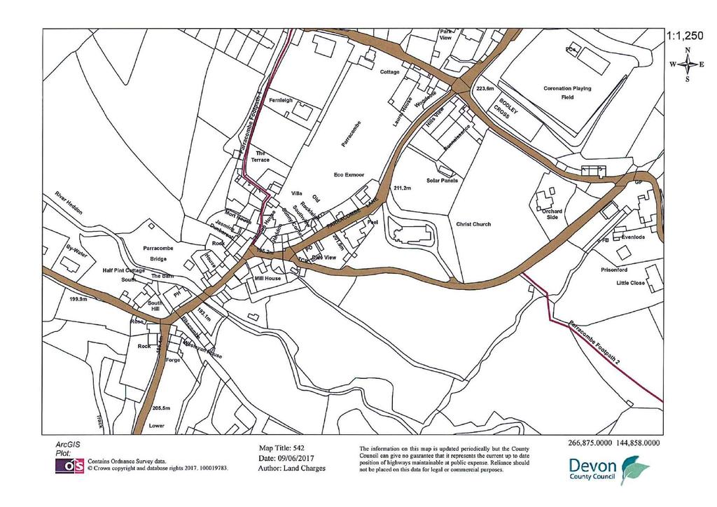
117
Section 4: Transfer A: Overage
 Section 4: Transfer A: Overage If you need more room than is provided for in a panel, and your software allows, you can expand any panel in the form. Alternatively use continuation sheet CS and attach
Disclaimer. N: v1
 Disclaimer This is not a legally-binding document and is not for execution. It is intended purely to provide an overview of the kind of terms that might be included in any eventual final document and to
 8. Title 8, 1 Title to the Property Is registered at the Land Registry with absolute freehold title under the Registered Title. 8.2 The Buyer will be deemed to purchase with full knowledge of the Property
TT The property is identified. 4 Date: 5 Transferor: AMJ Beach Limited
 If you need more room than is provided for in a panel, and your software allows, you can expand any panel in the form. Alternatively use continuation sheet CS and attach it to this form. Leave blank if
Auction Legal Pack Relating To 43 Grantley Street, Grantham, Lincolnshire NG31 6BW
 Auction Legal Pack Relating To 43 Grantley Street, Grantham, Lincolnshire NG31 6BW Dated 01/02/18 AUCTION CONDITIONS (Based on the Common Auction Conditions which are reproduced with the consent of the
There is no application or official search pending against this title. This register describes the land and estate comprised in the title.
 THIS IS A PRINT OF THE VIEW OF THE REGISTER OBTAINED FROM HM LAND REGISTRY SHOWING THE ENTRIES SUBSISTING IN THE REGISTER ON 9 MAY 2018 AT 12:13:57. BUT PLEASE NOTE THAT THIS REGISTER VIEW IS NOT ADMISSIBLE
Title Number : MX This title is dealt with by Land Registry, Wales Office.
 Title Number : MX104990 This title is dealt with by Land Registry, Wales Office. The following extract contains information taken from the register of the above title number. A full copy of the register
FOR SALE BY AUCTION ON AT THE JOLLY FARMER, MARKET STREET NEWTON ABBOT, TQ12 2RB
 On the instructions of Mrs Julia Barbara Roberton TEIGNMOUTH, SOUTH DEVON A FISHERMANS HUT AND WORKSHOP MEASURING 28 FEET X 15 FEET SITUATE BETWEEN THE CAR PARK AND THE BEACH HUTS AT BACK BEACH IN THIS
THIS AGREEMENT is made the 2015 BETWEEN
 THIS AGREEMENT is made the 2015 BETWEEN (1) the Seller whose name and address is set out in the Schedule hereto ("the Seller") and (2) the person or persons whose name or names and address or addresses
Full postcode of property (if any): SW11 2SN. Title number( s) of the property: TGL The application affects
: SW11 2SN. Title number( s) of the property: TGL The application affects") Land Registry Arplicatiori to change the register AP1 If you need more room than is provided for in a panel, and your software allows, you can expand any panel in the form. Alternatively use continuation
Land Registry Arplicatiori to change the register AP1 If you need more room than is provided for in a panel, and your software allows, you can expand any panel in the form. Alternatively use continuation
LETTER TO COMPANY - DRAFT CITY OF LONDON LAW SOCIETY LAND LAW COMMITTEE CERTIFICATE OF TITLE (7 TH EDITION 2016 UPDATE)
") LETTER TO COMPANY - DRAFT CITY OF LONDON LAW SOCIETY LAND LAW COMMITTEE CERTIFICATE OF TITLE (7 TH EDITION 2016 UPDATE) This is the first of two letters which may be sent by the solicitors giving the Certificate
LETTER TO COMPANY - DRAFT CITY OF LONDON LAW SOCIETY LAND LAW COMMITTEE CERTIFICATE OF TITLE (7 TH EDITION 2016 UPDATE) This is the first of two letters which may be sent by the solicitors giving the Certificate
Please note that this is the only official copy we will issue. We will not issue a paper official copy.
 The electronic official copy of the register follows this message. Please note that this is the only official copy we will issue. We will not issue a paper official copy. Edition date 17.02.2015 This official
Title Number : NGL This title is dealt with by Land Registry Swansea Office.
 Title Number : NGL484798 This title is dealt with by Land Registry Swansea Office. The following extract contains information taken from the register of the above title number. A full copy of the register
Deed of Agreement for Lease [in relation to Connection Contract Contestable ASP/1 Connection]
![Deed of Agreement for Lease [in relation to Connection Contract Contestable ASP/1 Connection]](/thumbs/80/81815463.jpg "Deed of Agreement for Lease [in relation to Connection Contract Contestable ASP/1 Connection]") Deed of Agreement for Lease [in relation to Connection Contract Contestable ASP/1 Connection] Instructions for completion We recommend you obtain legal advice before signing this document. Complete Items
Deed of Agreement for Lease [in relation to Connection Contract Contestable ASP/1 Connection] Instructions for completion We recommend you obtain legal advice before signing this document. Complete Items
LEVEL 6 UNIT 17 CONVEYANCING SUGGESTED ANSWERS - JANUARY 2013
 Note to Candidates and Tutors: LEVEL 6 UNIT 17 CONVEYANCING SUGGESTED ANSWERS - JANUARY 2013 The purpose of the suggested answers is to provide students and tutors with guidance as to the key points students
THE CITY OF LONDON LAW SOCIETY LAND LAW COMMITTEE CERTIFICATE OF TITLE (Seventh Edition 2016 Update) WRAPPER FOR REPORT ON TITLE AND NOTES TO USERS
 WRAPPER FOR REPORT ON TITLE AND NOTES TO USERS") THE CITY OF LONDON LAW SOCIETY LAND LAW COMMITTEE CERTIFICATE OF TITLE (Seventh Edition 2016 Update) WRAPPER FOR REPORT ON TITLE AND NOTES TO USERS NOTES TO USERS These notes to users are issued with the
THE CITY OF LONDON LAW SOCIETY LAND LAW COMMITTEE CERTIFICATE OF TITLE (Seventh Edition 2016 Update) WRAPPER FOR REPORT ON TITLE AND NOTES TO USERS NOTES TO USERS These notes to users are issued with the
Please note that this is the only official copy we will issue. We will not issue a paper official copy.
 The electronic official copy of the register follows this message. Please note that this is the only official copy we will issue. We will not issue a paper official copy. Edition date 07.11.2017 This official
Deed of Agreement for Easement [in relation to Connection Contract Contestable ASP/1 Connection]
![Deed of Agreement for Easement [in relation to Connection Contract Contestable ASP/1 Connection]](/thumbs/78/78529918.jpg "Deed of Agreement for Easement [in relation to Connection Contract Contestable ASP/1 Connection]") Deed of Agreement for Easement [in relation to Connection Contract Contestable ASP/1 Connection] Instructions for completion We recommend you obtain legal advice before signing this document. Complete
Deed of Agreement for Easement [in relation to Connection Contract Contestable ASP/1 Connection] Instructions for completion We recommend you obtain legal advice before signing this document. Complete
THE CHARTERED INSTITUTE OF LEGAL EXECUTIVES UNIT 19 RESIDENTIAL AND COMMERCIAL LEASEHOLD CONVEYANCING *
 16 January 2018 Level 3 RESIDENTIAL AND COMMERCIAL LEASEHOLD CONVEYANCING Subject Code L3-19 THE CHARTERED INSTITUTE OF LEGAL EXECUTIVES UNIT 19 RESIDENTIAL AND COMMERCIAL LEASEHOLD CONVEYANCING * Time
Pre-sale information Pack for: 66 HOLLY ROAD NORTHAMPTON NN1 4QP
 Pre-sale information Pack for: 66 HOLLY ROAD NORTHAMPTON NN1 4QP Contents Introduction NN37493 - OC1 - Register NN37493 - OC1 - Title Plan Special Conditions Introduction to this pre-sale information pack
This register describes the land and estate comprised in the title.
 Title number SH12122 Edition date 06.07.2017 This official copy shows the entries on the register of title on 09 Aug 2017 at 11:20:07. This date must be quoted as the "search from date" in any official
of registered title(s)
") Transfer of part of registered title(s) HM Land Registry TP1 (if you need more room than is provided for in ~ panel use continuation sheet CS and staple to this form,) 1. Stamp Duty Place "X" in the box
Transfer of part of registered title(s) HM Land Registry TP1 (if you need more room than is provided for in ~ panel use continuation sheet CS and staple to this form,) 1. Stamp Duty Place "X" in the box
Contract of Sale of Real Estate
 Contract of Sale of Real Estate Vendor: Anthony Paul Smith and Lauren Ashlea Hollioake Property: 117 Canadian Lakes Boulevard, Canadian CONTRACT OF SALE OF REAL ESTATE Part 1 of the standard form of contract
Conditions of Purchase of Seized Vehicles by Auction
 Conditions of Purchase of Seized Vehicles by Auction 1. DEFINITIONS 1.1 The definitions in this clause apply to these Conditions: Authorised Treatment Facility shall mean the holder of an Authorised Treatment
: 25 Manor Place and Manor Place Depot, Penrose Street, London
 Title Number : TGL404029 This title is dealt with by Land Registry, Telford Office. The following extract contains information taken from the register of the above title number. A full copy of the register
MEMORANDUM OF AGREEMENT
 MEMORANDUM OF AGREEMENT Incorporating the Common Auction Conditions Third Edition August 2009 Date: : Seller : Mrs Valerie Gale of 15 Great House Meadows, Llantwit Major, CF61 1SU Buyer : Property Freehold/Leasehold
- 1 - Property Address:
 1 March 2012 version Property Address: CONTRACT OF SALE OF REAL ESTATE PARTICULARS OF SALE Part 1 of the standard form of contract prescribed by the Estate Agents (Contracts) Regulations 2008 The vendor
between. and. Lots 1 and 2 Land at Lamonby Penrith Cumbria. Cartmell Shepherd Bishop Yards Penrith Cumbria CA11 7XS
 DATED 2015 ------------ CONTRACT FOR THE SALE OF FREEHOLD LAND WITH VACANT POSSESSION between STEPHEN WILLIAM DONALD & MARGARET DONALD (1) and WILLIAM DONALD & NORA MARY DONALD and [ ] (2) at Lots 1 and
Address of Property : 2 to 7, 12, 14 to 18, 28 to 33, 38 to 43, 91, 92, 93, 94, 95 and 96 Barnum Court, Swindon
 Title Number : WT186500 This title is dealt with by Land Registry, Weymouth Office. The following extract contains information taken from the register of the above title number. A full copy of the register
: 3-5 Shorncliffe Road, Folkestone (CT20 2SH)
") Title Number : K831848 This title is dealt with by Land Registry, Nottingham Office. The following extract contains information taken from the register of the above title number. A full copy of the register
Title Number : K831848 This title is dealt with by Land Registry, Nottingham Office. The following extract contains information taken from the register of the above title number. A full copy of the register
Notice to Bidders. walkersingleton.co.uk
 Notice to Bidders 1 The Auctioneer will offer the lots in the order shown in the catalogue, although we reserve the right to amend the Order of Sale. 1 The Addendum provides details of amendments to the
[Insert name of Grant Holder] -to- BIG LOTTERY FUND LEGAL CHARGE. -of- [Insert Property Address]
![[Insert name of Grant Holder] -to- BIG LOTTERY FUND LEGAL CHARGE. -of- [Insert Property Address]](/thumbs/85/92276245.jpg "[Insert name of Grant Holder] -to- BIG LOTTERY FUND LEGAL CHARGE. -of- [Insert Property Address]") DATED 20XX [Insert name of Grant Holder] -to- BIG LOTTERY FUND LEGAL CHARGE -of- [Insert Property Address] Big Lottery Fund 1 Plough Place London EC4A 1DE Legal Charge LEGAL CHARGE dated 20XX BETWEEN (1)
DATED 20XX [Insert name of Grant Holder] -to- BIG LOTTERY FUND LEGAL CHARGE -of- [Insert Property Address] Big Lottery Fund 1 Plough Place London EC4A 1DE Legal Charge LEGAL CHARGE dated 20XX BETWEEN (1)
PASS. Professional opinion. Environmental search results 35, PHAROS STREET, FLEETWOOD, LANCASHIRE, FY7 6AY. Contaminated Land
 Professional opinion PASS Groundsure has not identified significant risks likely to restrict any reasonable mortgage application for the property. Homescreen also complies with Law Society practice notes
Pre-sale information Pack for: Flat 3 The Sycamores, 27 Mill Road Marlow SL71QB
 Pre-sale information Pack for: Flat 3 The Sycamores, 27 Mill Road Marlow SL71QB Contents Introduction BM131355 - OC1 - Register BM131355 - OC1 - Title Plan Anti-Money Laundering Results Introduction to
(H-96) Gold Coast City Marina, Waterway Drive COOMERA QLD 4209
 Gold Coast City Marina, Waterway Drive COOMERA QLD 4209") AUTHORITY TO SELL Reference Schedule A. Date: / / 20 B. Brokerage Details;- Broker Name: Licence No: ABN: File No: Phone: Fax: Email: Address: Postal Address: DTM Boat Sales Mob: 0401 066 610 laurie@dtmboatsales.com.au
AUTHORITY TO SELL Reference Schedule A. Date: / / 20 B. Brokerage Details;- Broker Name: Licence No: ABN: File No: Phone: Fax: Email: Address: Postal Address: DTM Boat Sales Mob: 0401 066 610 laurie@dtmboatsales.com.au
General Assignment Of Leases And Rents
 Page 1 of 8 General Assignment Of Leases And Rents This Agreement made as of the day of, 2, between: (the Assignor ) of the first part, and Canadian Imperial Bank of Commerce (the Assignee ) of the second
Insert name (s): (the Tenant) and (the Guarantor) undertake and warrant to the State that they will comply with the following terms and conditions:
: (the Tenant) and (the Guarantor) undertake and warrant to the State that they will comply with the following terms and conditions:") Deed Poll To: Melbourne Market Authority and the State of Victoria ('State') Insert name (s): (the Tenant) and (the Guarantor) undertake and warrant to the State that they will comply with the following
Deed Poll To: Melbourne Market Authority and the State of Victoria ('State') Insert name (s): (the Tenant) and (the Guarantor) undertake and warrant to the State that they will comply with the following
Title Reference [Title Reference] In this Easement unless the context or subject matter require otherwise:
![Title Reference [Title Reference] In this Easement unless the context or subject matter require otherwise:](/thumbs/78/77296984.jpg "Title Reference [Title Reference] In this Easement unless the context or subject matter require otherwise:") Land Title Act 1994, Land Act 1994 and Water Act 2000 Page 2 of 7 1. DEFINITIONS AND INTERPRETATION 1.1 Definitions In this Easement unless the context or subject matter require otherwise: Easement Land
Land Title Act 1994, Land Act 1994 and Water Act 2000 Page 2 of 7 1. DEFINITIONS AND INTERPRETATION 1.1 Definitions In this Easement unless the context or subject matter require otherwise: Easement Land
: land and buildings lying to the east of West Avenue, Salfords
 Title Number : SY660501 This title is dealt with by HM Land Registry, Durham Office. The following extract contains information taken from the register of the above title number. A full copy of the register
INSTRUCTIONS TO SOLICITORS
 INSTRUCTIONS TO SOLICITORS (NORTHERN IRELAND) PLATFORM Platform P.O. Box 3462 Cheadle Road Leek ST13 9BG Telephone: 0345 070 1999 DX 16351 (Leek) We should like you to act on our behalf in relation to
Information contained
 Strata Schemes Legislation Amendment Act 2001 What is the reason for the Act? The Act is designed to remove a number of technical anomalies and restrictions which frustrate and hinder the creation and
POWER OF ATTORNEY. UNITED OVERSEAS BANK (MALAYSIA) BHD. (Company No K) LEG-066 PA(Contractor) (02/16)
 BHD. (Company No K) LEG-066 PA(Contractor) (02/16)") POWER OF ATTORNEY TO UNITED OVERSEAS BANK (MALAYSIA) BHD. (Company No. 271809 K) BY LEG-066 1 POWER OF ATTORNEY A POWER OF ATTORNEY given on the day and year stated in Section 1 of the First Schedule by
POWER OF ATTORNEY TO UNITED OVERSEAS BANK (MALAYSIA) BHD. (Company No. 271809 K) BY LEG-066 1 POWER OF ATTORNEY A POWER OF ATTORNEY given on the day and year stated in Section 1 of the First Schedule by
Dated the day of 201
 Dated the day of 201 DEED OF GRANT OF RIGHTS OF WAY AND EASEMENTS WTMM/AFK/12331474 THIS DEED is made the day of Two thousand and [*] BETWEEN (1 [ ] [of / whose registered office is situate at [ ]] (in
Relating to purchase of: APARTMENTS 58, 60, 63 and 64. Vista Tower. St George s Way. Stevenage SG1 1HG. Prepared for: THE DIRECTORS OF
 Relating to purchase of: APARTMENTS 58, 60, 63 and 64 Vista Tower St George s Way Stevenage SG1 1HG Prepared for: THE DIRECTORS OF PPNL SPV B37-1 Limited [Redacted for identity of parties and insured risks
THE LAW SOCIETY OF IRELAND PARTICULARS AND CONDITIONS OF SALE OF APT 3, KILCRONA, REVAGH ROAD, SALTHILL, GALWAY
 THE LAW SOCIETY OF IRELAND PARTICULARS AND CONDITIONS OF SALE OF APT 3, KILCRONA, REVAGH ROAD, SALTHILL, GALWAY SALE BY PUBLIC AUCTION on Friday 17 th April 2015 at 3.00pm in The Harbour Hotel, The Docks,
Title Number : LN This title is dealt with by Land Registry, Telford Office.
 Title Number : LN32323 This title is dealt with by Land Registry, Telford Office. The following extract contains information taken from the register of the above title number. A full copy of the register
MEMORANDUM OF ENCUMBRANCE
 MEMORANDUM OF ENCUMBRANCE It is a requirement that a Memorandum of Encumbrance (as per the sample attached) be registered on the titles of the affected properties. The Memorandum of Encumbrance is to include
CONDITIONS OF SALE 2017 EDITION
 WARNING: IT IS RECOMMENDED THAT THE WITHIN SHOULD NOT BE COMPLETED WITHOUT PRIOR LEGAL ADVICE CONDITIONS OF SALE 2017 EDITION PARTICULARS and CONDITIONS OF SALE of *SALE BY PRIVATE TREATY *SALE BY AUCTION
Property Information Form
 Property Information Form Full Names of the Seller Address of Property Seller s Solicitor Name of firm Address E-mail Reference ABOUT THIS FORM This form is completed by the seller to provide detailed
Title Number : CB5341. This title is dealt with by Peterborough District Land Registry.
 Title Number : CB5341 This title is dealt with by Peterborough District Land Registry. The following extract contains information taken from the register of the above title number. A full copy of the register
Contract of Sale of Real Estate
 Contract of Sale of Real Estate Vendor: Chloe Melinda Biggin(formerly Pollard) Property: 275 Humffray Street North, Ballarat CONTRACT OF SALE OF REAL ESTATE Part 1 of the standard form of contract prescribed
(b) a purpose directly related to such dealing provided that the purpose is not contrary to any Law; or
 a purpose directly related to such dealing provided that the purpose is not contrary to any Law; or") Land Titles Terms & Conditions Definitions Authorised Purposes means: (a) dealings with interests in land authorised by Law; or (b) a purpose directly related to such dealing provided that the purpose
Land Titles Terms & Conditions Definitions Authorised Purposes means: (a) dealings with interests in land authorised by Law; or (b) a purpose directly related to such dealing provided that the purpose
Please note that this is the only official copy we will issue. We will not issue a paper official copy.
 The electronic official copy of the register follows this message. Please note that this is the only official copy we will issue. We will not issue a paper official copy. Title number TGL201095 Edition
Please note that this is the only official copy we will issue. We will not issue a paper official copy.
 The electronic official copy of the register follows this message. Please note that this is the only official copy we will issue. We will not issue a paper official copy. Edition date 22.08.2006 This official
AGREEMENT FOR THE SALE AND PURCHASE OF TELEPHONE KIOSK(S) TO PRIVATE LANDOWNERS OR REGISTERED CHARITIES / COMMUNITY INTEREST COMPANIES
 TO PRIVATE LANDOWNERS OR REGISTERED CHARITIES / COMMUNITY INTEREST COMPANIES") AGREEMENT FOR THE SALE AND PURCHASE OF TELEPHONE KIOSK(S) TO PRIVATE LANDOWNERS OR REGISTERED CHARITIES / COMMUNITY INTEREST COMPANIES This agreement is made this day of 20 Background The Buyer wishes
AGREEMENT FOR THE SALE AND PURCHASE OF TELEPHONE KIOSK(S) TO PRIVATE LANDOWNERS OR REGISTERED CHARITIES / COMMUNITY INTEREST COMPANIES This agreement is made this day of 20 Background The Buyer wishes
MEMORANDUM OF ENCUMBRANCE
 Form M2 MEMORANDUM OF ENCUMBRANCE CERTIFICATE(S) OF TITLE BEING ENCUMBERED The whole of the land comprised in Certificate of Title Register Book Volume Folio ESTATE AND INTEREST Estate in Fee Simple ENCUMBRANCES
REGISTER OF LOCAL LAND CHARGES OFFICIAL CERTIFICATE OF SEARCH
 REGISTER OF LOCAL LAND CHARGES OFFICIAL CERTIFICATE OF SEARCH Search Reference: NLIS Reference: Solicitors Reference: Date: 1718_02354 MDJ/GEN218 06-v-2017 Applicant: Lloyd Jones & Co DX 100802 WESTCLIFF
Build Over Easement Guidelines
 Build Over Easement Guidelines Document Owner Creation Date 13/04/2015 Revision Date 20/04/2015 Manager Engineering Services Engineering Services Please check Council s Intranet to ensure this is the latest
Title Number : MX This title is dealt with by Land Registry, Wales Office.
 Title Number : MX297751 This title is dealt with by Land Registry, Wales Office. The following extract contains information taken from the register of the above title number. A full copy of the register
RESIDENTIAL TENANCIES ACT 1997 PART 4A AGREEMENT. Revised August 2014 BETWEEN: The Park Owner described in Item 1 of the Schedule AND
 RESIDENTIAL TENANCIES ACT 1997 PART 4A AGREEMENT Revised August 2014 BETWEEN: The Park Owner described in Item 1 of the Schedule AND The Site Tenant described in Item 2 of the Schedule IN RESPECT OF The
DUBLIN SOLICITORS CPD 26 TH March 2015 THE LAND AND CONVEYANCING LAW REFROM ACT 2009 IMPACT FOR CONVEYANCING PRACTITIONERS
 DUBLIN SOLICITORS CPD 26 TH March 2015 THE LAND AND CONVEYANCING LAW REFROM ACT 2009 IMPACT FOR CONVEYANCING PRACTITIONERS Codification and Simplification were the key aims behind the Act. The Act removed
AGREEMENT FOR THE SALE AND PURCHASE OF TELEPHONE KIOSK(S) TO A LOCAL AUTHORITY IN NORTHERN IRELAND
 TO A LOCAL AUTHORITY IN NORTHERN IRELAND") AGREEMENT FOR THE SALE AND PURCHASE OF TELEPHONE KIOSK(S) TO A LOCAL AUTHORITY IN NORTHERN IRELAND This agreement is made this day of 20 Background The Buyer wishes to buy the Goods from the Seller and
AGREEMENT FOR THE SALE AND PURCHASE OF TELEPHONE KIOSK(S) TO A LOCAL AUTHORITY IN NORTHERN IRELAND This agreement is made this day of 20 Background The Buyer wishes to buy the Goods from the Seller and
Buying or Selling a Property Legal Terms Explained For St. James s Place Clients
 Buying or Selling a Property Legal Terms Explained For St. James s Place Clients Bankruptcy Search - a search to check whether a buyer has been declared bankrupt. Boundaries - usually marked by fencing,
Pre-Sale Information Pack For: 49 Cyprus Road Heysham Morecambe LA3 2QS
 Pre-Sale Information Pack For: 49 Cyprus Road Heysham Morecambe LA3 2QS Contents Introduction Land Registry Official Copy of Title Register Land Registry Official Copy of Title Plan Anti-Money Laundering
EMPLOYEE RESIDENTIAL LEASE AGREEMENT by and between THE TEXAS A&M UNIVERSITY SYSTEM and
 EMPLOYEE RESIDENTIAL LEASE AGREEMENT by and between THE TEXAS A&M UNIVERSITY SYSTEM and (Not to Exceed 2 years) This Employee Residential Lease Agreement ( Lease ) is entered into by and between THE BOARD
CONTRACT OF SALE OF REAL ESTATE 1
 CONTRACT OF SALE OF REAL ESTATE * Part 1 of the form of contract published by the Law Institute of Victoria Limited and The Real Estate Institute of Victoria Ltd 1980. Property address:... The vendor agrees
: land on the south side of Longville Road, London
 Title Number : TGL118639 This title is dealt with by Land Registry, Telford Office. The following extract contains information taken from the register of the above title number. A full copy of the register
Effective October 1, 2014
 REAL ESTATE DEVELOPMENT MARKETING ACT POLICY STATEMENT 8 DISCLOSURE STATEMENT REQUIREMENTS FOR DEVELOPMENT PROPERTY CONSISTING OF FIVE OR MORE TIME SHARE INTERESTS Effective October 1, 2014 1. Interpretation
Ring-fencing Transfer Scheme
 IN THE HIGH COURT OF JUSTICE CLAIM NO: FS-2017-000004 BUSINESS AND PROPERTY COURTS OF ENGLAND AND WALES BUSINESS LIST (ChD) Financial Services and Regulatory LLOYDS BANK PLC - and - BANK OF SCOTLAND PLC
Equipment Lease Agreement Template
 Equipment Lease Agreement Template LESSOR; LESSEE; (insert name and address) (insert name and address) DATE: 1. LEASE: The lessor hereby agrees to lease to Lessee and the Lessee hereby agrees to take on
DEED OF SUBLEASE SAMPLE
 DEED OF SUBLEASE GENERAL address of the premises: DATE: SUBLESSOR: SUBLESSEE: GUARANTOR: THE SUBLESSOR leases to the Sublessee and the Sublessee takes on lease the Premises and the Car Parks (if any) described
ADDENDUM A TO CONTRACT OF PURCHASE AND SALE
 ADDENDUM A TO CONTRACT OF PURCHASE AND SALE The following terms replace, modify, and where applicable override the terms of the attached contract of purchase and sale, and any modifications, amendments,
Title Number : SGL This title is dealt with by Land Registry, Telford Office.
 Title Number : SGL396985 This title is dealt with by Land Registry, Telford Office. The following extract contains information taken from the register of the above title number. A full copy of the register
Law Society Property Information Form (3rd edition)
") Law Society Property Information Form (3rd edition) Address of the property Postcode Full names of the seller Seller s solicitor Name of solicitor s firm Address Email Reference number About this form
Law Society Property Information Form (3rd edition) Address of the property Postcode Full names of the seller Seller s solicitor Name of solicitor s firm Address Email Reference number About this form
MURRAY IRRIGATION WATER EXCHANGE: TERMS AND CONDITIONS
 5 Approval: General Manager Version: 5 Date of Approval: 30 MURRAY IRRIGATION WATER EXCHANGE: TERMS AND CONDITIONS 1. General Rules 1.1 Water Exchange is a service operated by Murray Irrigation to facilitate
LEASE. between. [insert name of landlord] and SP DISTRIBUTION PLC. SUBJECTS: [insert address/description]
![LEASE. between. [insert name of landlord] and SP DISTRIBUTION PLC. SUBJECTS: [insert address/description]](/thumbs/87/95102373.jpg "LEASE. between. [insert name of landlord] and SP DISTRIBUTION PLC. SUBJECTS: [insert address/description]") LEASE between [insert name of landlord] and SP DISTRIBUTION PLC SUBJECTS: [insert address/description] LEASE between [insert name of landlord], incorporated under the Companies Acts with Registered Number
LEASE between [insert name of landlord] and SP DISTRIBUTION PLC SUBJECTS: [insert address/description] LEASE between [insert name of landlord], incorporated under the Companies Acts with Registered Number
REGISTER OF LOCAL LAND CHARGES OFFICIAL CERTIFICATE OF SEARCH
 REGISTER OF LOCAL LAND CHARGES OFFICIAL CERTIFICATE OF SEARCH Search Reference: NLIS Reference: Solicitors Reference: Date: 1718_03381 CKB.JAG.EHLERS 07-Mar-2018 Applicant: Chennells 100804 Westcliff on
C O N T R A C T Incorporating the Standard Commercial Property Conditions (1st Edition) P A R T I C U L A R S
 P A R T I C U L A R S") C O N T R A C T Incorporating the Standard Commercial Property Conditions (1st Edition) Attachments Model TR1 ("Model TR1") Statutory Declaration ("Model Declaration") T H E P A R T I C U L A R S Contract
C O N T R A C T Incorporating the Standard Commercial Property Conditions (1st Edition) Attachments Model TR1 ("Model TR1") Statutory Declaration ("Model Declaration") T H E P A R T I C U L A R S Contract
: Cleves, Manor Drive, Sutton Coldfield (B73 6ER)
") Title Number : WM85819 This title is dealt with by Land Registry, Coventry Office. The following extract contains information taken from the register of the above title number. A full copy of the register
Title Number : WM85819 This title is dealt with by Land Registry, Coventry Office. The following extract contains information taken from the register of the above title number. A full copy of the register
WARNING: It is recommended that the within should not be completed without prior legal advice. LAW SOCIETY OF IRELAND CONDITIONS OF SALE 2017 EDITION
 WARNING: It is recommended that the within should not be completed without prior legal advice. LAW SOCIETY OF IRELAND CONDITIONS OF SALE 2017 EDITION PARTICULARS and CONDITIONS OF SALE of property at Leggatinty,
Informal/conditional Auction Terms and Conditions
 Informal/conditional Auction Terms and Conditions These conditions govern the conduct of conditional or informal auctions operated by Paul Fosh Auctions Limited (Company or Auctioneer or us/we/our). All
WREXHAM COUNTY BOROUGH COUNCIL SEARCH FEE RECEIPT
 WREXHAM COUNTY BOROUGH COUNCIL SEARCH FEE RECEIPT RE: LAND CHARGES SEARCH LC/1617/01795 14 HAVARD WAY WREXHAM LL13 9LR This acknowledges receipt of payment for the sum of 85 received on 24/02/2017 being
: Land and buildings lying to the south east of E R F Way, Middlewich
 Title Number : CH558740 This title is dealt with by HM Land Registry, Birkenhead Office. The following extract contains information taken from the register of the above title number. A full copy of the
ANNEXURE A. Referred to in the Contract For Sale of Land by Offer and Acceptance. made between as Buyer
 Drover s Retreat Stage 1 R5 Special Residential Lots - Pre-sales 2011 Page 1 of 8 ANNEXURE A Referred to in the Contract For Sale of Land by Offer and Acceptance made between as Buyer and Ardross Estates
CONSENT TO ASSIGNMENT OF LEASE
 CONSENT TO ASSIGNMENT OF LEASE TO: AND TO: AND TO: AND TO: * ("Assignor" * ("Assignee" * ("Indemnifier" * ("Landlord" DATE: * WHEREAS A. By a lease dated the ** day of **, ** (the "Lease", the Landlord
BETWEEN. (Company No. ) (as the Assignor) AND. UNITED OVERSEAS BANK (MALAYSIA) BHD (Company No K) (as the Bank)
 (as the Assignor) AND. UNITED OVERSEAS BANK (MALAYSIA) BHD (Company No K) (as the Bank)") BETWEEN (Company No. (as the Assignor AND UNITED OVERSEAS BANK (MALAYSIA BHD (Company No. 271809 K (as the Bank ********************************************************************* DEED OF ASSIGNMENT
BETWEEN (Company No. (as the Assignor AND UNITED OVERSEAS BANK (MALAYSIA BHD (Company No. 271809 K (as the Bank ********************************************************************* DEED OF ASSIGNMENT
Please note that this is the only official copy we will issue. We will not issue a paper official copy.
 The electronic official copy of the register follows this message. Please note that this is the only official copy we will issue. We will not issue a paper official copy. Edition date 16.05.2017 This official
COMMERCIAL TENANCY AGREEMENT
 COMMERCIAL TENANCY AGREEMENT (F I R S T E D I T I O N) revised Copyright Member Office Printed by Realw orks Live PARTIES Landlord: Tenant: Date: THIS AGREEMENT COMPRISES THE REFERENCE SCHEDULE AND COMMERCIAL
LETTING & MANAGMENT TERMS AND CONDITIONS
 LETTING & MANAGMENT TERMS AND CONDITIONS Thank you for instructing Blackstones Residential to act on your behalf in marketing your property for rental. Our terms and conditions are detailed in the following
ARTICLES OF ROUP. Lot No.[ ], 90 Camperdown Road, Dundee, DD3 8RU
![ARTICLES OF ROUP. Lot No.[ ], 90 Camperdown Road, Dundee, DD3 8RU](/thumbs/94/118784179.jpg "ARTICLES OF ROUP. Lot No.[ ], 90 Camperdown Road, Dundee, DD3 8RU") ARTICLES OF ROUP of Lot No.[ ], 90 Camperdown Road, Dundee, DD3 8RU The Property referred to in these Articles of Roup comprises the following Lot namely:- ALL and WHOLE the premises known as 90 Camperdown
ARTICLES OF ROUP of Lot No.[ ], 90 Camperdown Road, Dundee, DD3 8RU The Property referred to in these Articles of Roup comprises the following Lot namely:- ALL and WHOLE the premises known as 90 Camperdown
DEED OF SUBLEASE SAMPLE
 DEED OF SUBLEASE GENERAL address of the premises: DATE: SUBLANDLORD: SUBTENANT: GUARANTOR: THE SUBLANDLORD subleases to the Subtenant and the Subtenant takes on sublease the premises and the car parks
THE VINEYARD COUNTRY ESTATE HOME OWNERS' ASSOCIATION CONSTITUTION
 THE VINEYARD COUNTRY ESTATE HOME OWNERS' ASSOCIATION CONSTITUTION An Association established in terms of sec 29 of the Land Use Planning Ordinance, 1985 [No 15 of 1985] Page 1 1. ESTABLISHMENT IN TERMS
Application for a sewer requisition and/or the diversion of an existing sewer
 SWW Reference No: WR Application for a sewer requisition and/or the diversion of an existing sewer This form can be used to apply for a new sewer requisition, under section 98-101, and/or a new sewer diversion,
ST CHRISTOPHER AND NEVIS CHAPTER CONDOMINIUM ACT
 Laws of Saint Christopher Condominium Act Cap 10.03 1 ST CHRISTOPHER AND NEVIS CHAPTER 10.03 CONDOMINIUM ACT and Subsidiary Legislation Revised Edition showing the law as at 31 December 2009 This is a
Page 1 of 5. Name of Firm:
 Name of Firm: 1. The Requirement for Terms of Engagement: Terms of Engagement are mandatory according to the RICS Valuation Professional Standards (Global) July 2017 and the International Valuation Standards
2012 No LAND REGISTRATION, ENGLAND AND WALES. The Land Registration Fee Order 2012
 STATUTORY INSTRUMENTS 2012 No. 1969 LAND REGISTRATION, ENGLAND AND WALES The Land Registration Fee Order 2012 Made - - - - 24th July 2012 Laid before Parliament 27th July 2012 Coming into force - - 22nd
Online Property Auction Terms & Conditions
 TERMS & Auctions Online Property Auction Terms & Conditions - Common Auction Conditions - Amendments to Common Auction Conditions - Extra Auction Conduct Conditions COMMON AUCTION Introduction The Common
Effective October 1, 2014
 REAL ESTATE DEVELOPMENT MARKETING ACT POLICY STATEMENT 9 DISCLOSURE STATEMENT REQUIREMENTS FOR DEVELOPMENT PROPERTY CONSISTING OF FIVE OR MORE LEASEHOLD UNITS IN A RESIDENTIAL LEASEHOLD COMPLEX Effective
Effective October 1, 2014
 REAL ESTATE DEVELOPMENT MARKETING ACT POLICY STATEMENT 2 DISCLOSURE STATEMENT REQUIREMENTS FOR DEVELOPMENT PROPERTY CONSISTING OF FIVE OR MORE BARE LAND STRATA LOTS Effective October 1, 2014 1. Interpretation
AGREEMENT FOR THE SALE AND PURCHASE OF TELEPHONE KIOSK(S) TO A LOCAL AUTHORITY IN ENGLAND OR WALES.
 TO A LOCAL AUTHORITY IN ENGLAND OR WALES.") AGREEMENT FOR THE SALE AND PURCHASE OF TELEPHONE KIOSK(S) TO A LOCAL AUTHORITY IN ENGLAND OR WALES. This agreement is made this [ ] day of [ ] 20[ ] Background The Buyer wishes to buy the Goods from the
AGREEMENT FOR THE SALE AND PURCHASE OF TELEPHONE KIOSK(S) TO A LOCAL AUTHORITY IN ENGLAND OR WALES. This agreement is made this [ ] day of [ ] 20[ ] Background The Buyer wishes to buy the Goods from the